
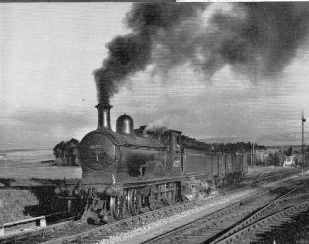
The featured image for this article is the last of the Great North of Scotland 4-4-0s was No.62277 ‘Gordon Highlander’, nick named ‘The Soldier’. Before being retired for preservation and resorted to its original green livery, No.62277 spent its remaining days in regular service working the goods between Keith and Elgin, and over the Speyside branch, © W.J.V.Anderson. [48]
The January issue of The Railway Magazine usually focussed on Scotland. The January 1959 edition was no exception. [1] Included in the Magazine were articles by:
- H.A. Vallance about The Strathspey Line.
- J.W. Grant about Scottish 0-4-4 Tank Engines.
- G.H. Robin about The Lanarkshire & Dunbartonshire Railway.
- M.D. Grenville about Scottish Railways in 1859.
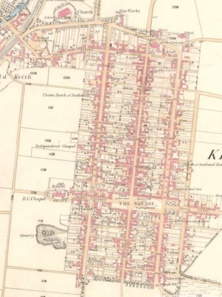
This article picks up on the article by H.A. Vallance, and begins a journey along the Strathspey line which ran down the valley of the River Spey from Keith towards Abernethy. Initially the line ran Southwest along Strathisla before crossing the watershed to Strathspey.
At much the same time (November 1860) as the Highland Railway promoted its scheme from Forrest to Grantown-on-Spey and on across the Grampians by the Druimuachdar Pass into Strathtay, the Great North of Scotland Railway subscribed £100,000 to a nominally independent scheme was promoted by the Keith & Dufftown Railway. In addition to its subscription, the Great North of Scotland Railway undertook to work the railway.
Vallance tells us that from Dufftown, “the Strathspey Railway was to run north-westwards for nearly four miles to Craigellachie, and thence in a south-westerly direction, through Strathspey, for some 28 miles to Abernethy. Connection with the Inverness & Perth Junction Railway (IPJR) was to be provided by a short branch south of Grantown. The railway was authorised on 17th May 1861 (five days before the IPJR), and the construction of the main line went ahead with all possible speed, but the works on the branch at Grantown were not undertaken.” [1: p4]
The railway between Dufftown and Abernethy opened on 1st July 1863. Two months later, on 9th September, the last section of the IPJR was opened. The lack of a physical link between the two lines meant that the Strathspey line suffered financially. Vallance says that powers for the link were obtained on 5th July 1865, “when the Strathspey Company was authorised to extend its railway from Abernethy to a junction with the line to Perth some two miles north of Boat of Garten. Earlier in the year, the IPJR and its associated companies had been amalgamated, and in June had assumed the title of the Highland Railway.” [1: p5]
The Strathspey trains were extended from Abernethy to Boat of Garten on 1st August 1866, but a dispute with the Highland Railway soon arose with the Highland Railway over costs associated with the junction signal box meant a temporary closure of the link until the dispute could be settled. The link reopened 1st June 1868 on the basis that a separate track would provided for the Strathspey, from the original junction as far as the Station at Boat of Gareth where a physical connection would occur.
The Strathspey line also formed a junction at Craigellachie with the Morayshire Railway which gave a cess Loosiemouth via Elgin. The short connection between the Morayshire Railway and the Strathspey line was opened on 1st July 1863. Vallance notes that once the working agreement with the Great North came into force, “the Morayshire Railway virtually lost its separate identity. The Great North thus secured complete control of a route from Keith to Elgin, but many years were to elapse before through trains between Aberdeen and Inverness ran via Craigellachie.” [1: p5]
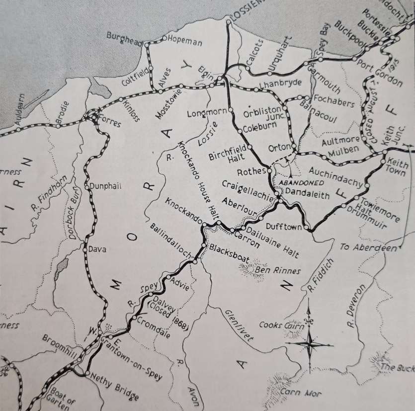
On 30th July 1866, “the Great North obtained powers to absorb the Keith & Dufftown and the Strathspey Railways, and the fusion became effective two days later. At the same time, the Morayshire Company was authorised to amalgamate with the Great North as soon as mutually acceptable terms had been agreed; but so involved were its finances that it was not possible to reach an agreement until 1880.” [1: p5]
Keith to Dufftown
This length of the line has become the preservation line, the Keith and Dufftown Railway. Their website is on this link. [41]
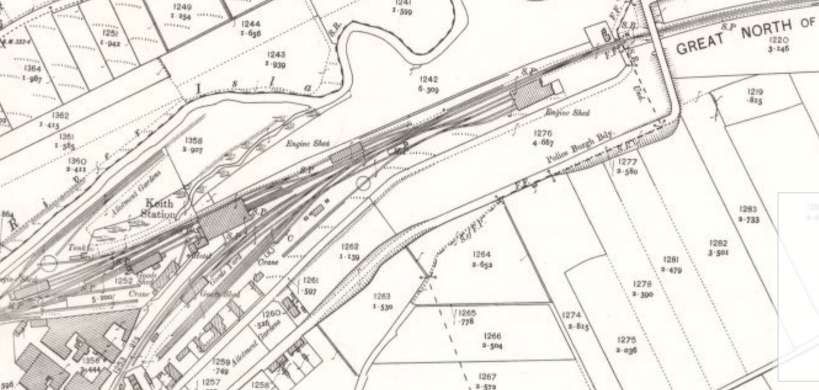
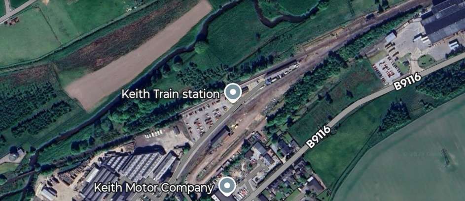
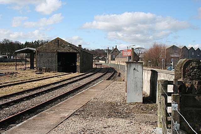
In the 21st century, “only a single platform remains in full-time use at Keith Railway Station, though the Dufftown branch platform (numbered 1) is available if required for turning back trains from the Aberdeen direction. … The bays have been filled in, having been abandoned and tracks lifted in the early 1970s after the closure of the Moray Coast Line (for which the station was a terminus). A signal box (which retains the name Keith Junction) remains at the eastern end to control a passing loop on the single track main line beyond the station, the now little-used goods yard (formerly used by trains accessing the nearby Chivas Regal whisky plant) and the stub of the Dufftown branch.” [6]
Further information about Keith Railway Station can be found here. [7]
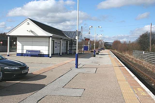
Vallance describes a journey along the line in 1959. Starting from Keith Station (Junction), “the Craigellachie line ascends Strath Isla for some eight miles, past the single-platform station of Keith Town, Auchindachy, and Drummuir.” [1: p5]
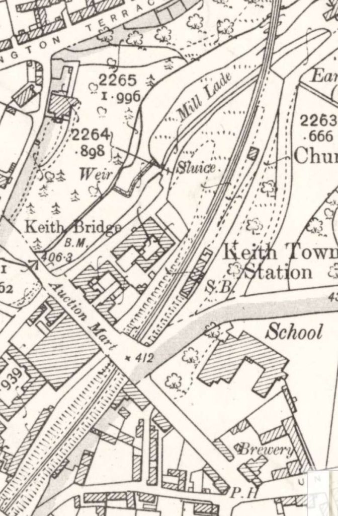
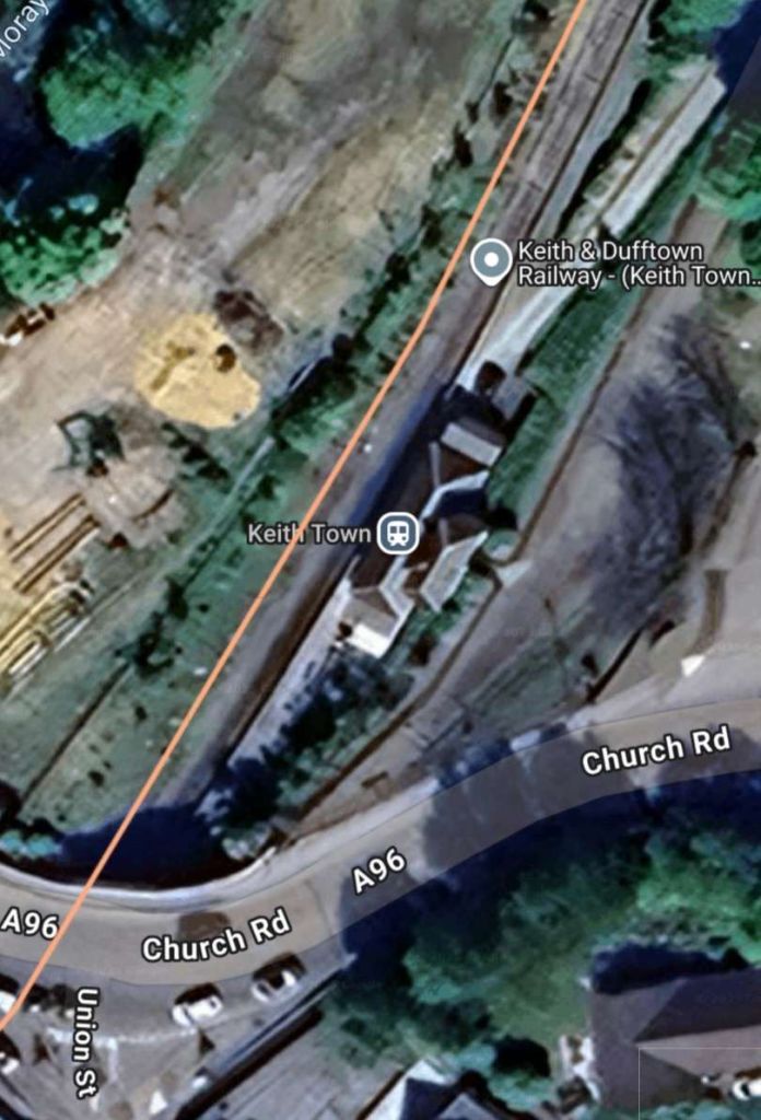
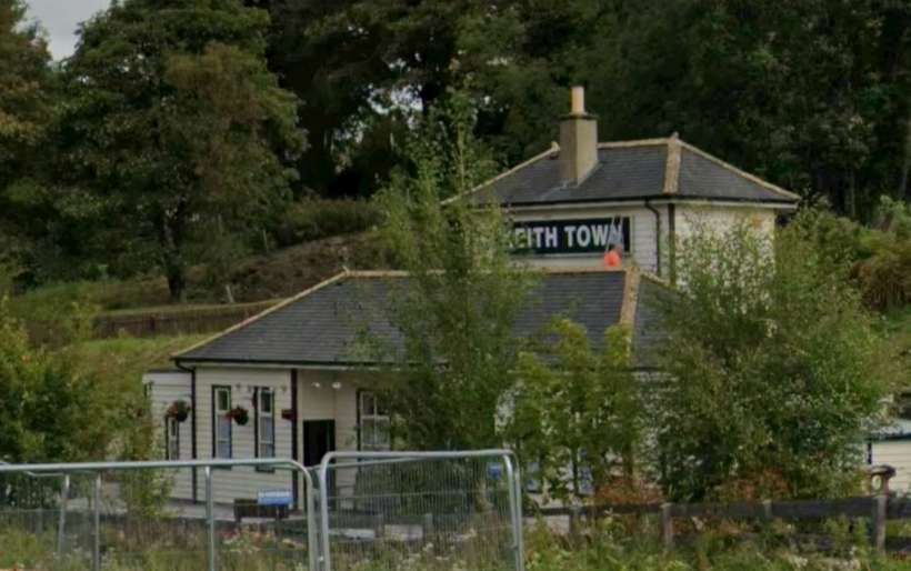
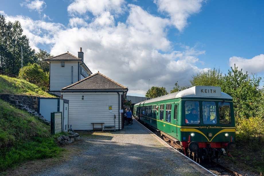
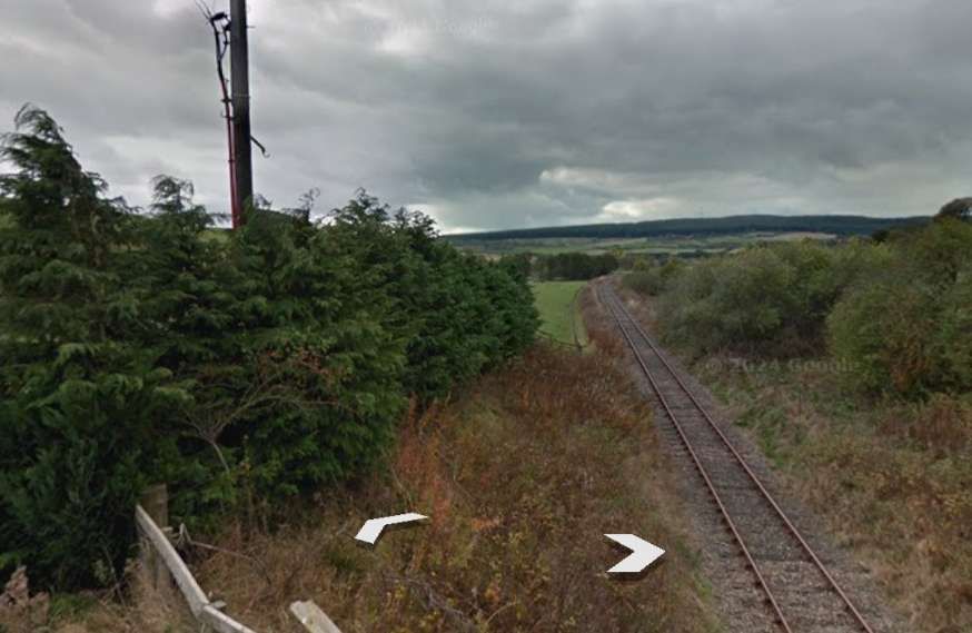
The line continues from Keith Town Station, Southwest towards Auchindachy.
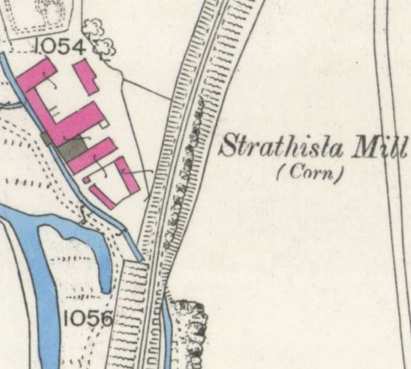
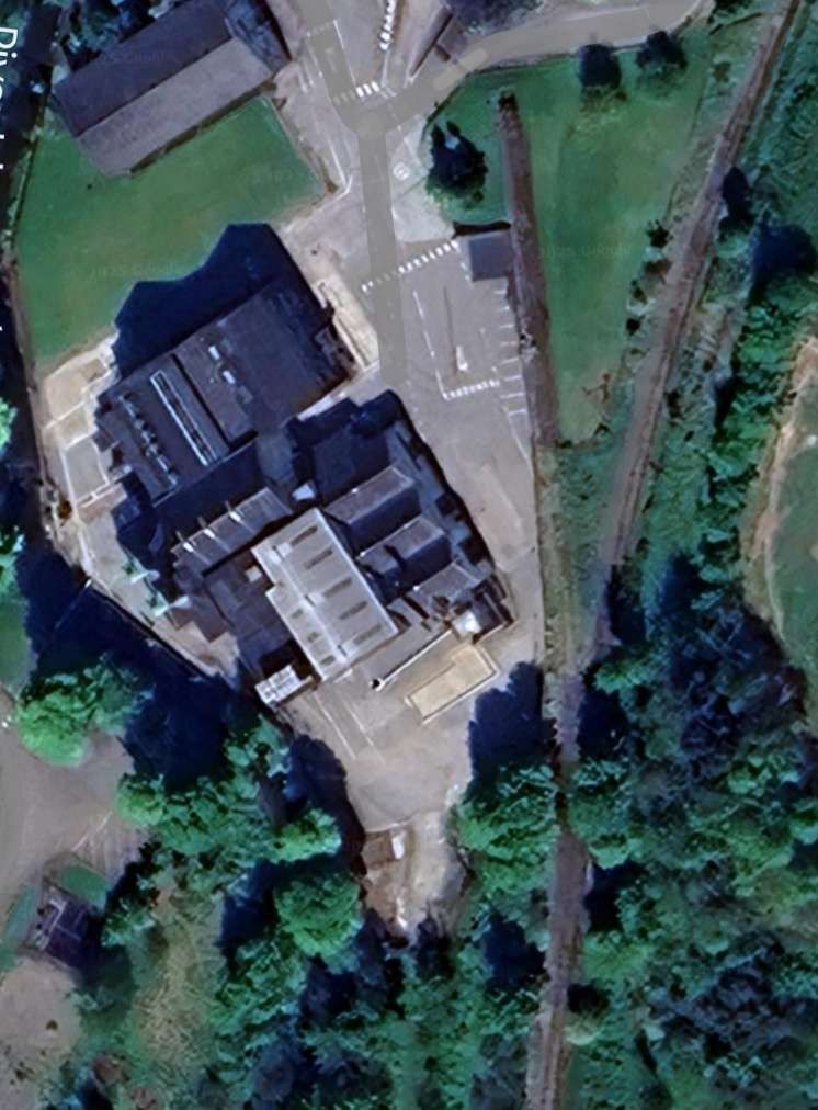
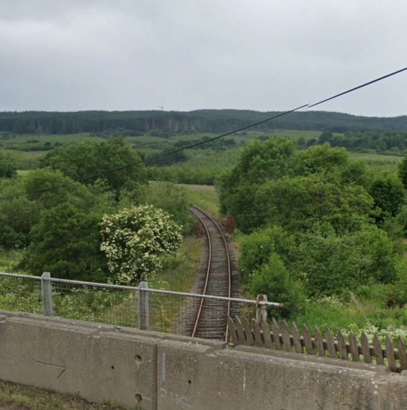
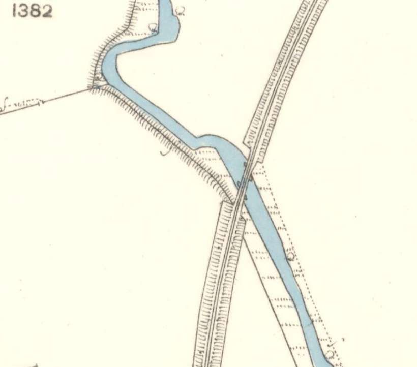
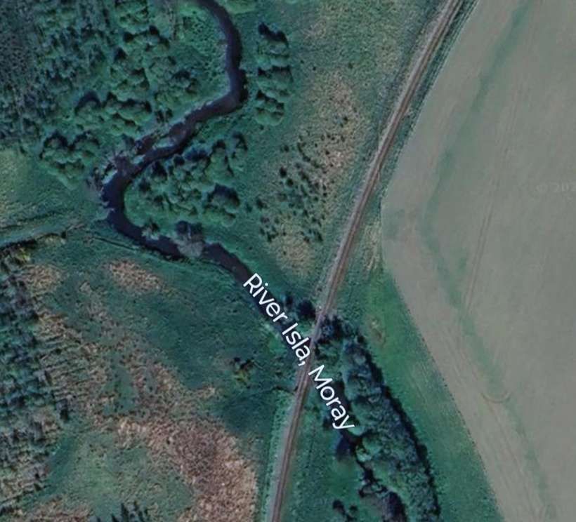
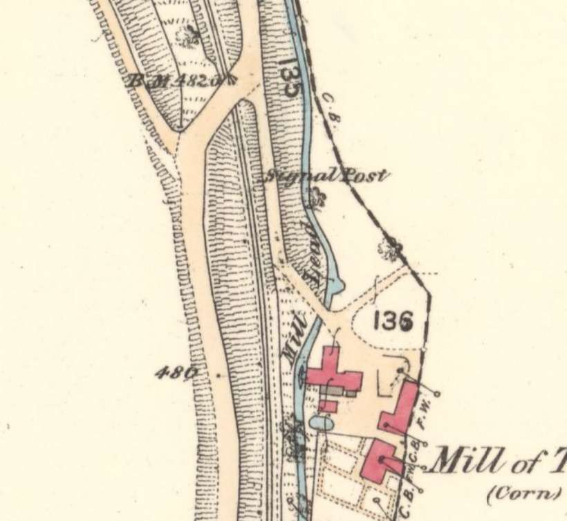
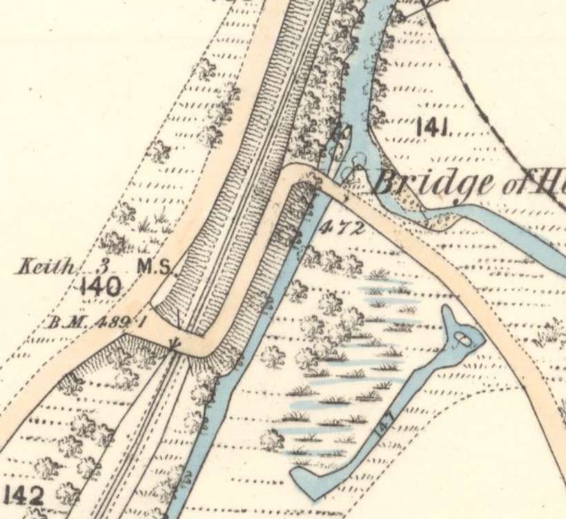
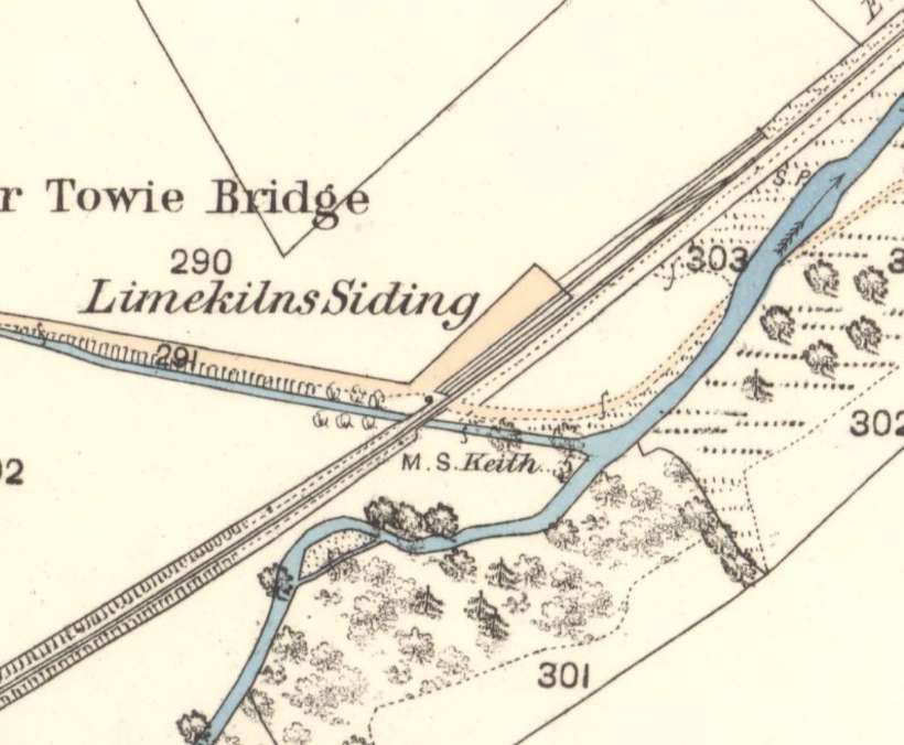
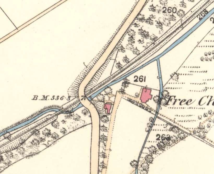
Strathisla Mill sat on the banks of the Isla.
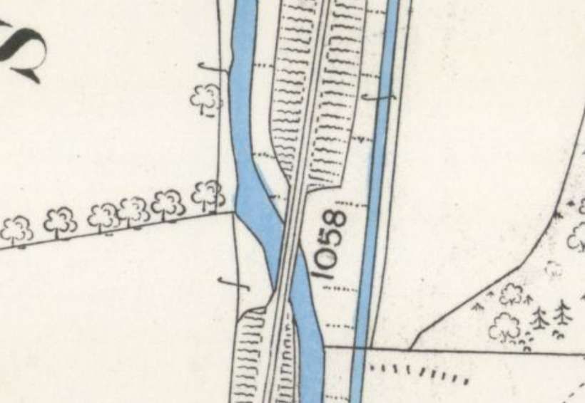
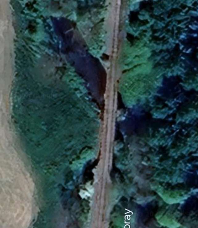
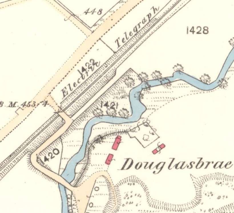
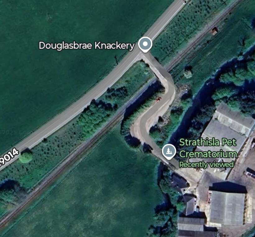
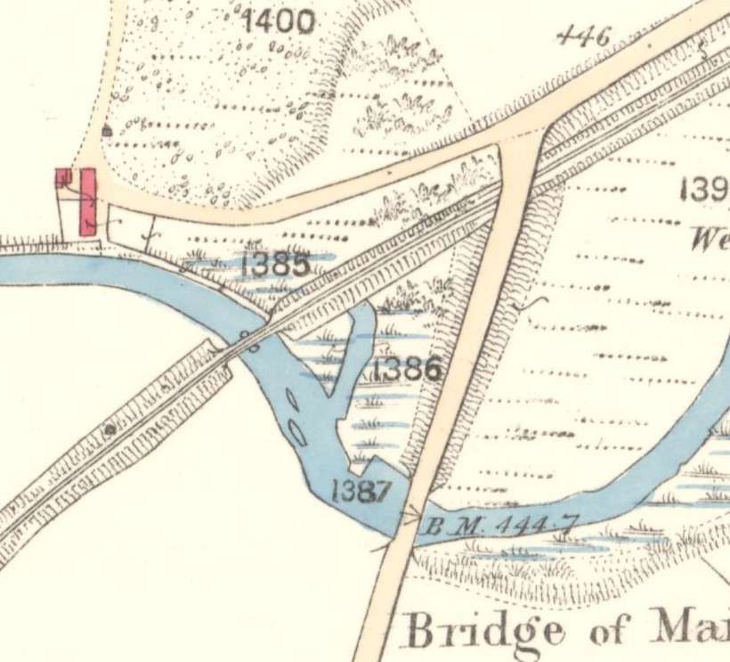
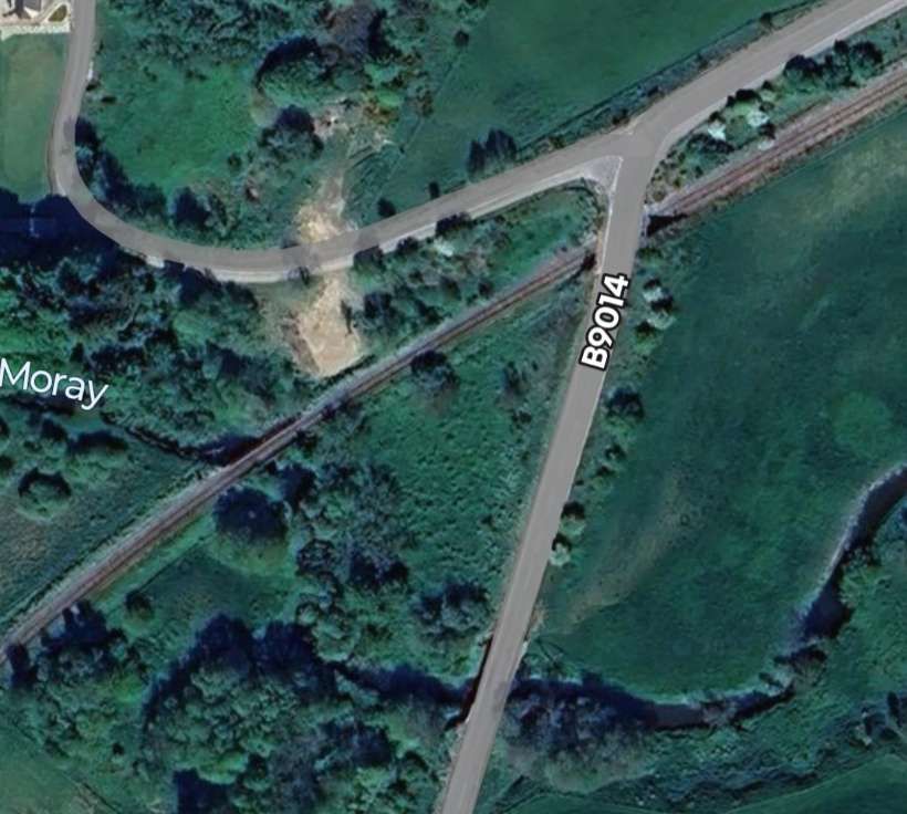
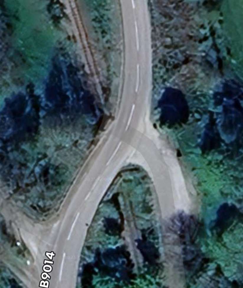
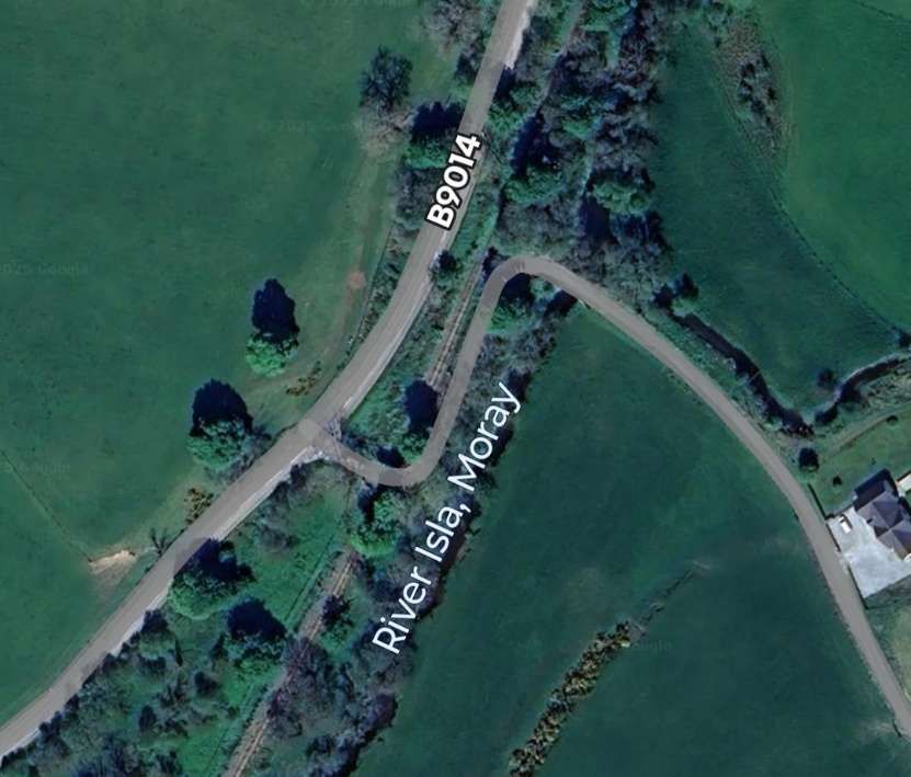
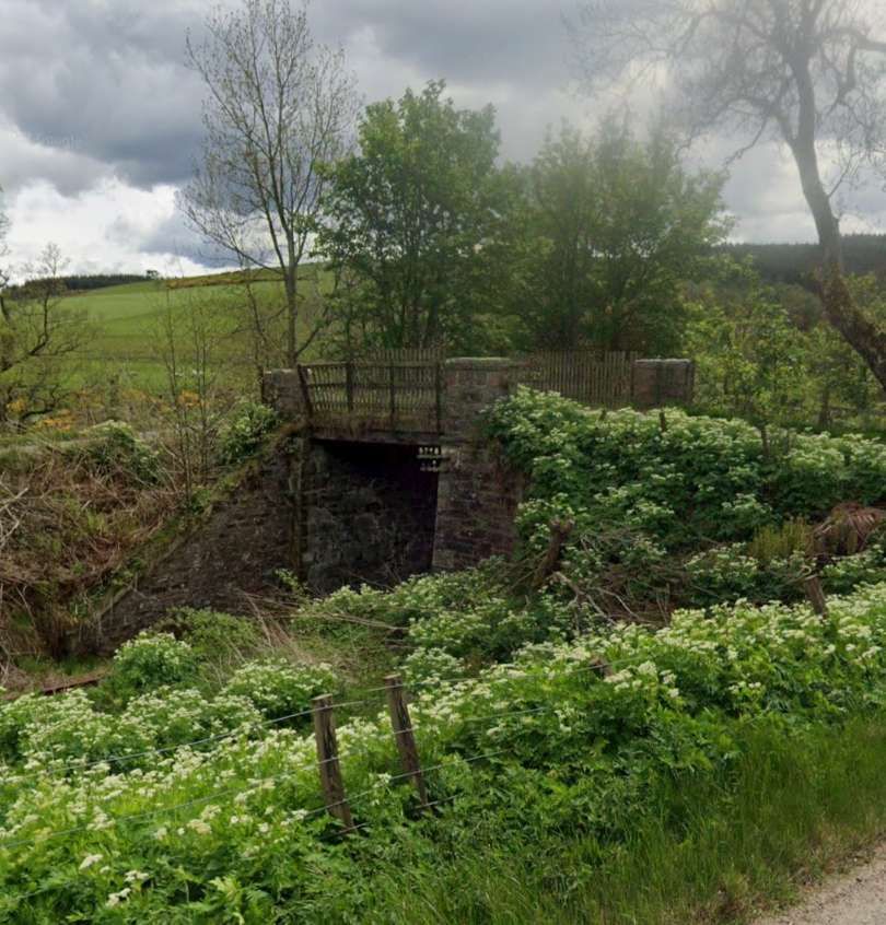
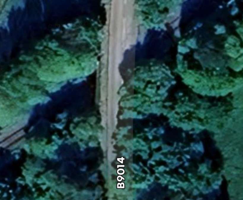
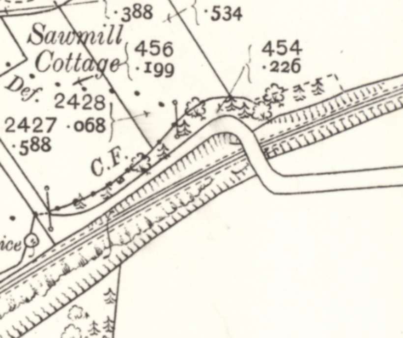
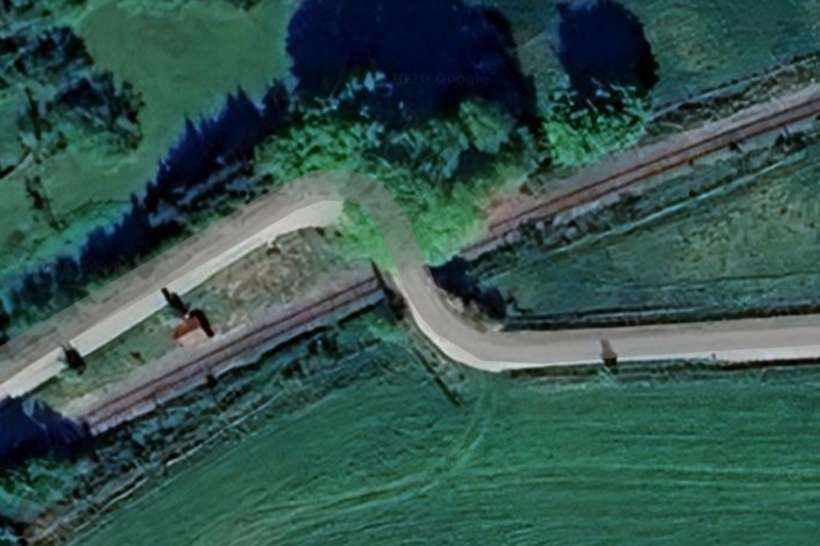
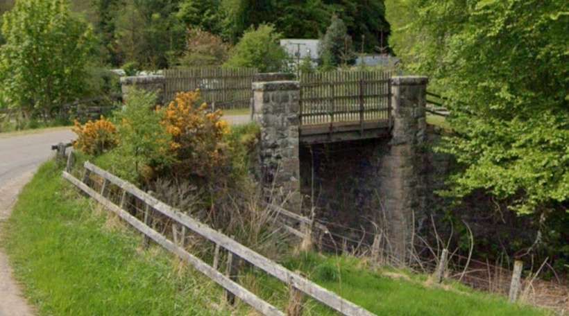
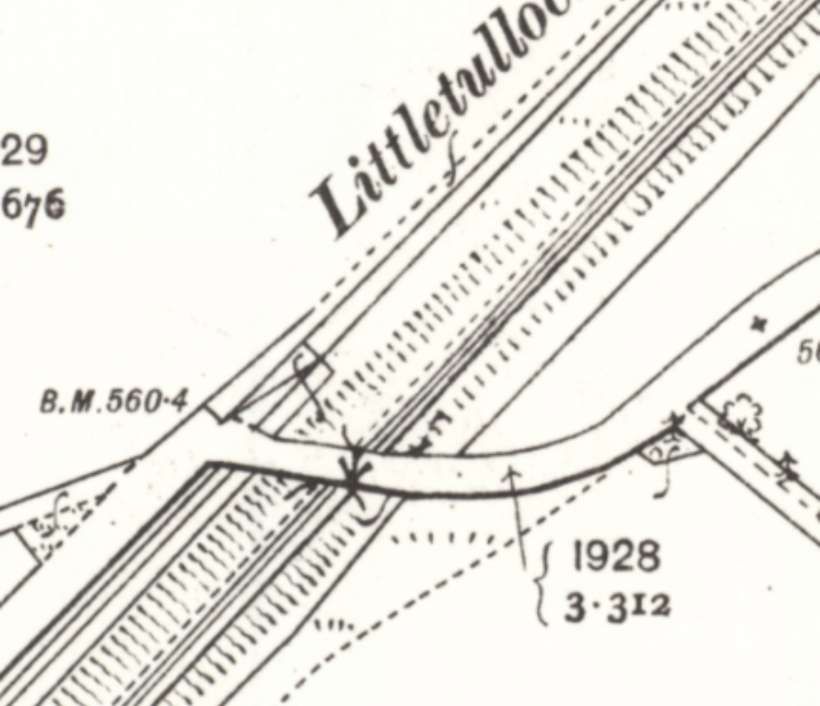
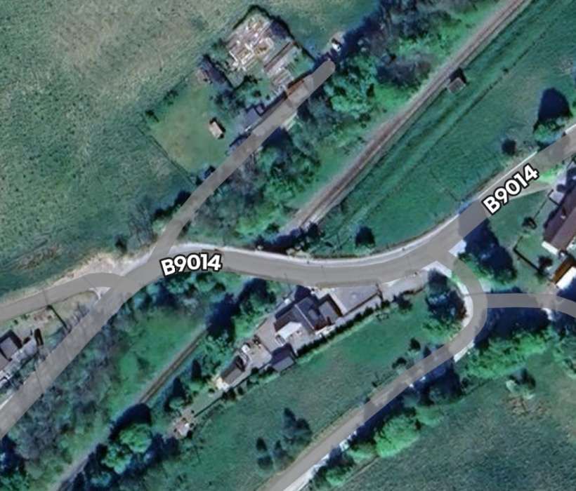
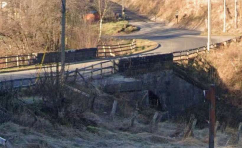
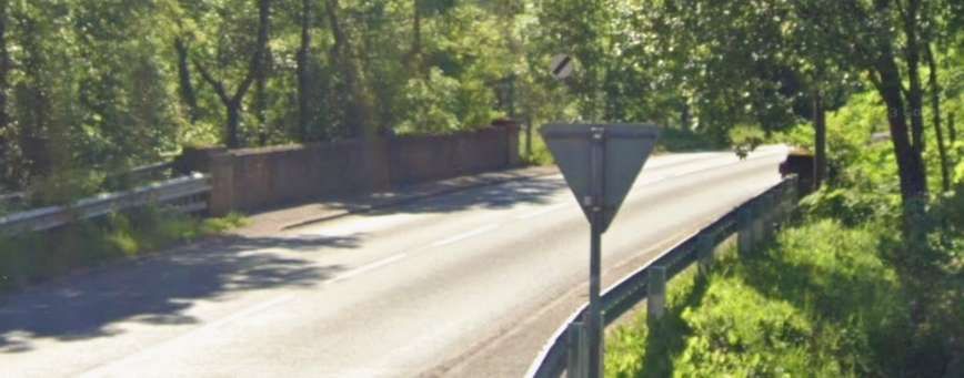
Further Southwest another overbridge links the Douglasbrae Lime Kilns to the road network. The main road here is now the B9014.
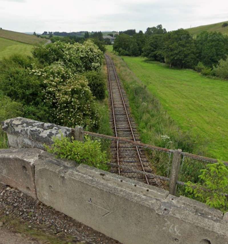
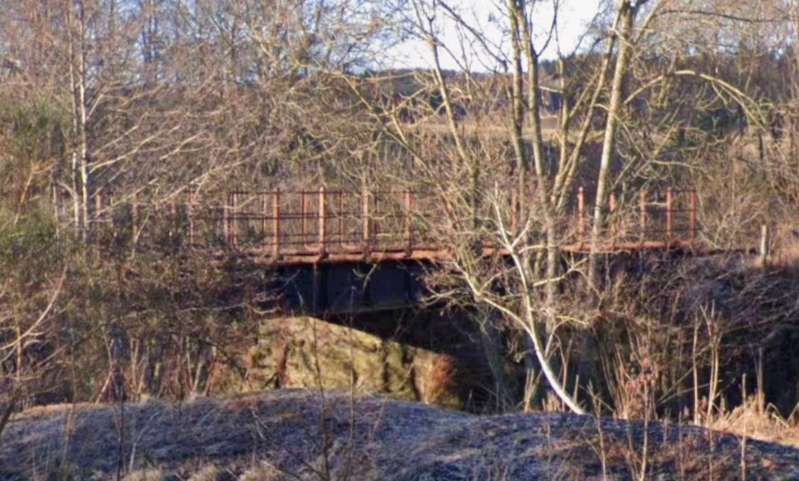
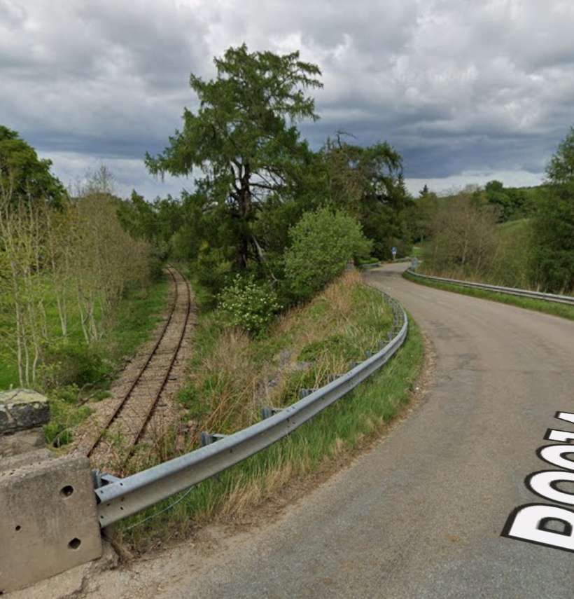
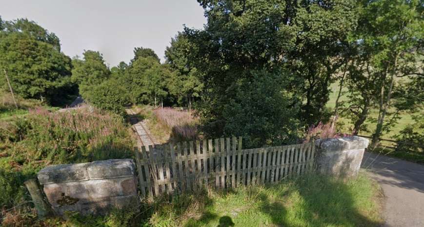
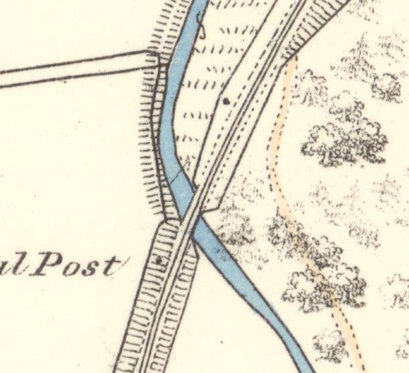
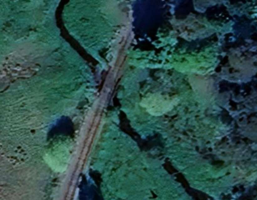
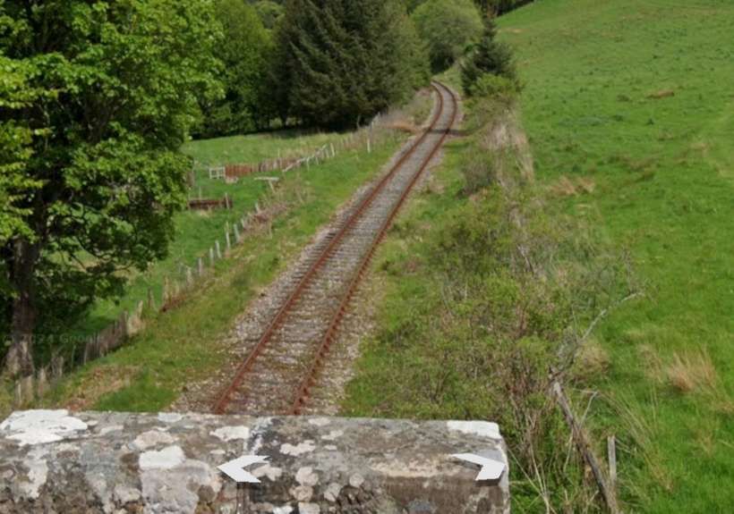
The line continues Southwest towards Bridge of Maisley.

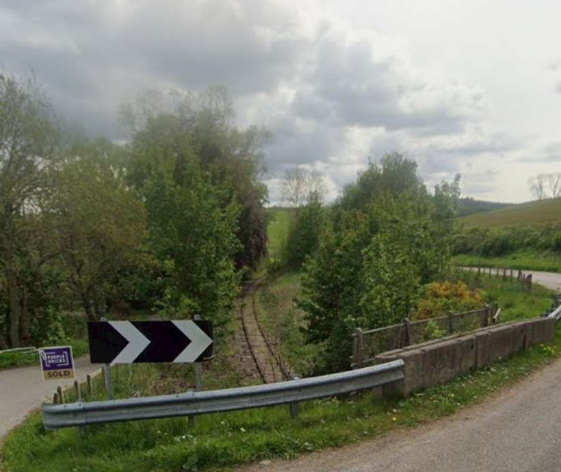
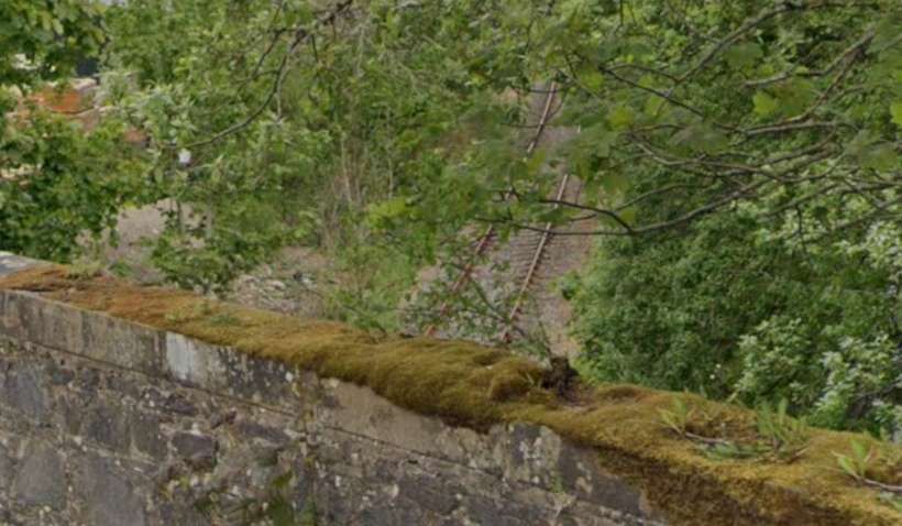
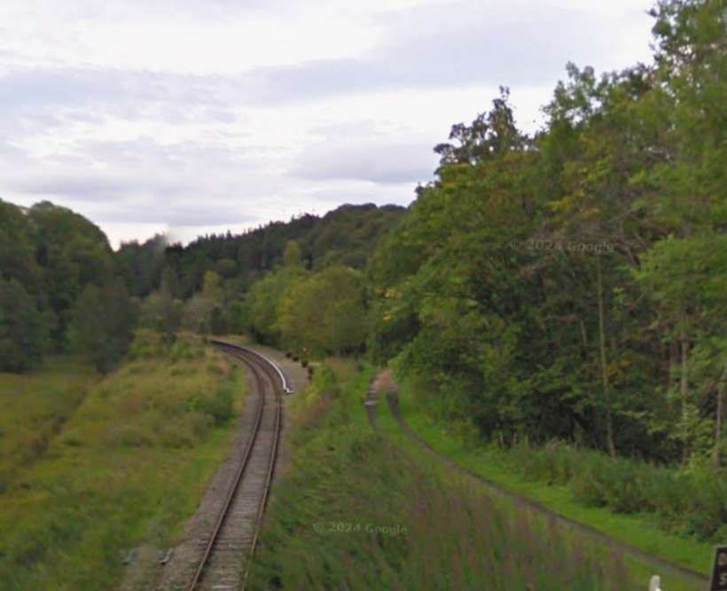
A short distance to the South, the line approaches Auchindachy Station.
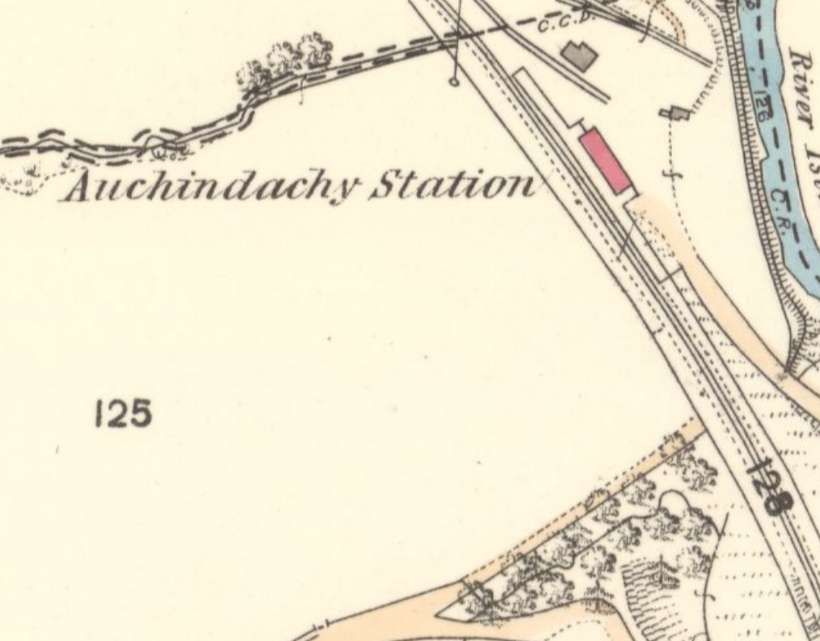
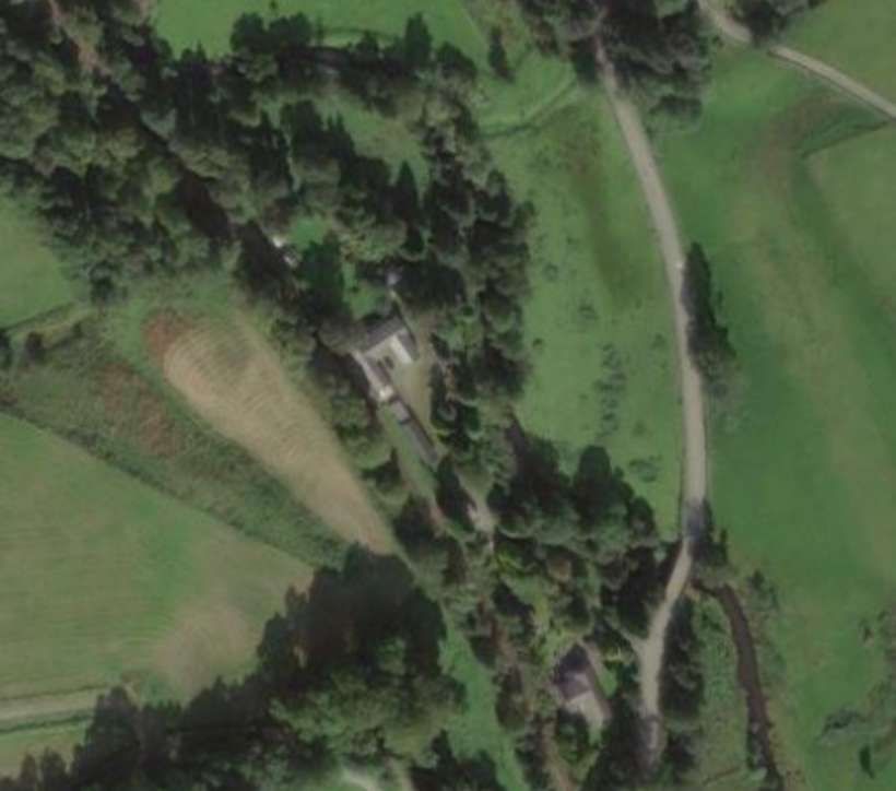
Auchindachy Railway Station had two platforms set on a gentle curve. Photographs of the station can be found here. [17]
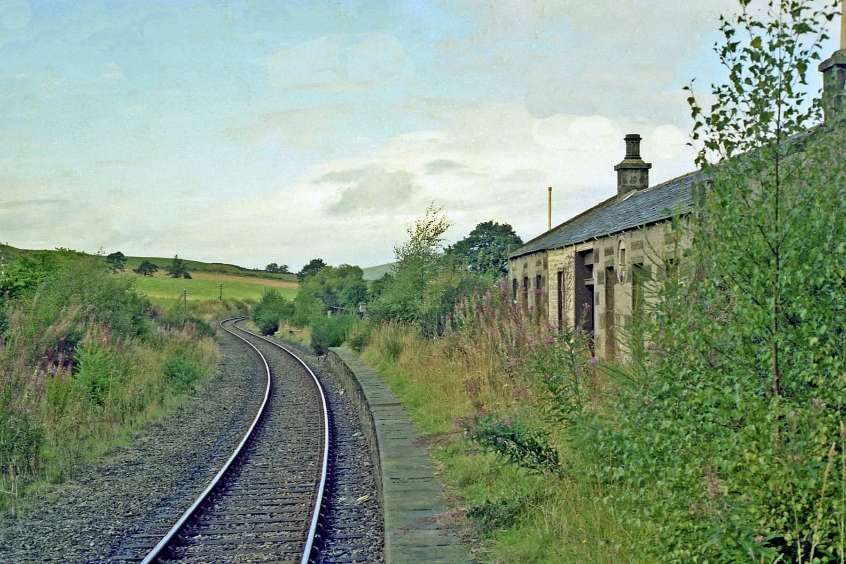
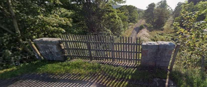
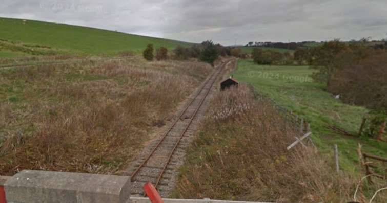
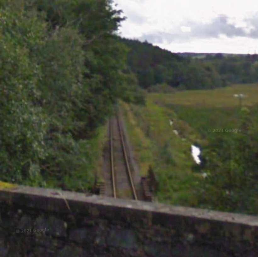
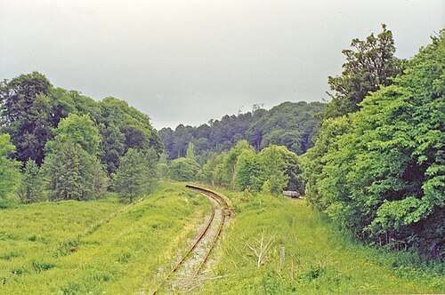
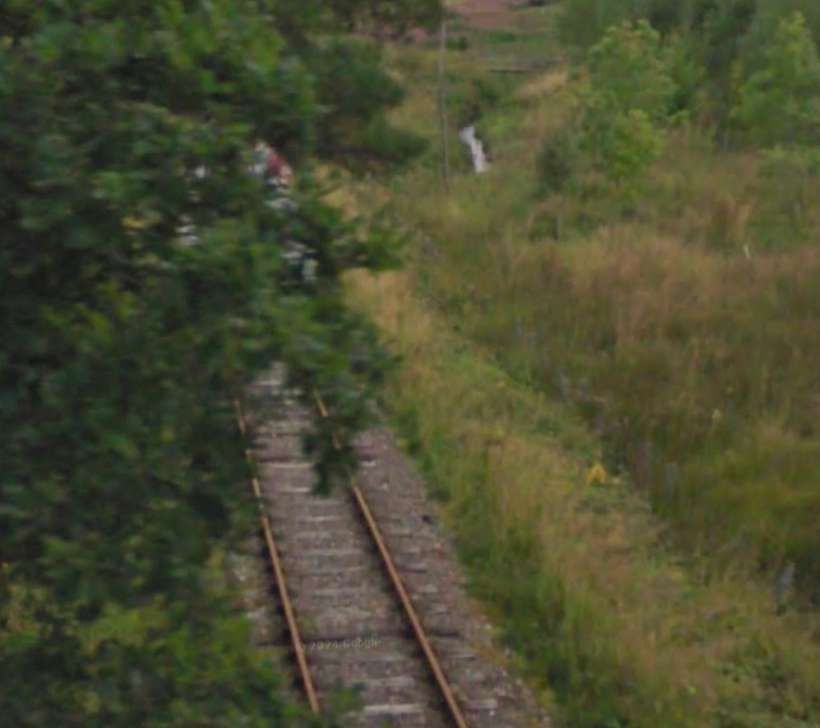
Turning to look to the Southwest. In 2022, the view along the line was completely obscure by tree growth. The photograph below was taken earlier in the 21st century.
In short shift trains heading South entered Drummuir Railway Station. …
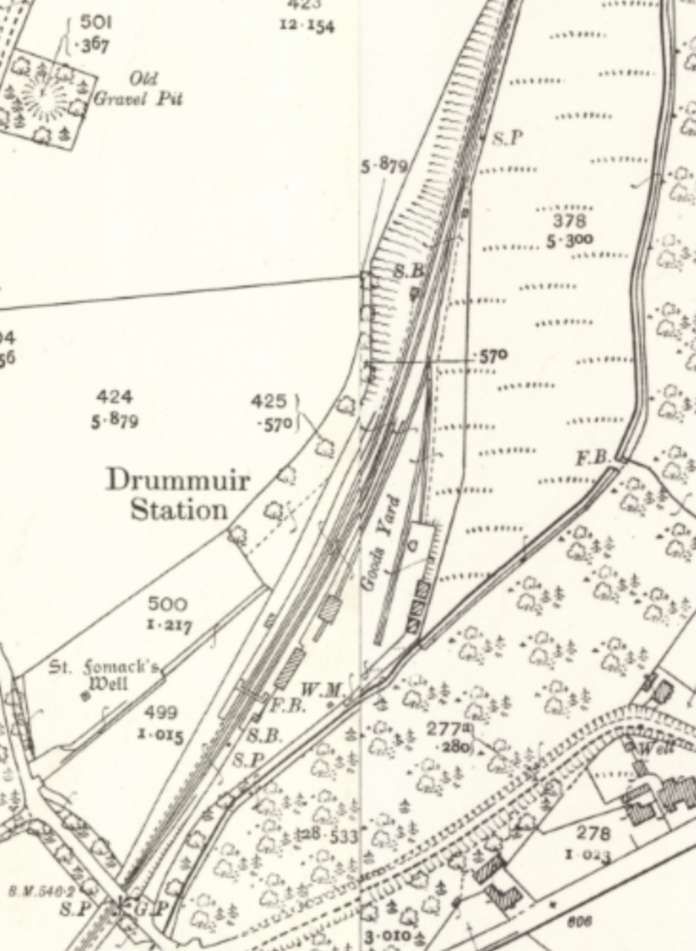
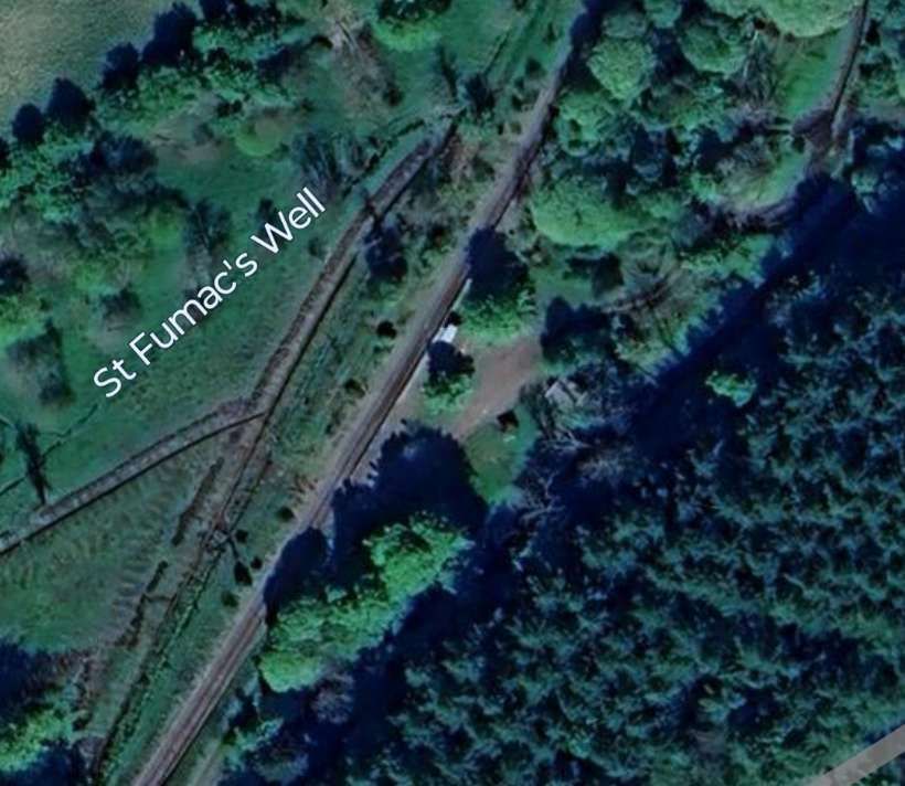
Drummuir station was first opened in 1862 by the Keith and Dufftown Railway. The station was closed to passengers by British Railways in May 1968, but the line remained open for freight and special excursions for some time. It was reopened as a preserved station in 2003 by the Keith and Dufftown Railway Association.
Further pictures of Drummuir Railway Station can be found here. [26]


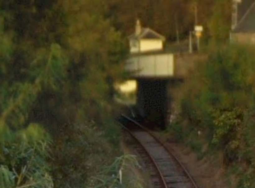
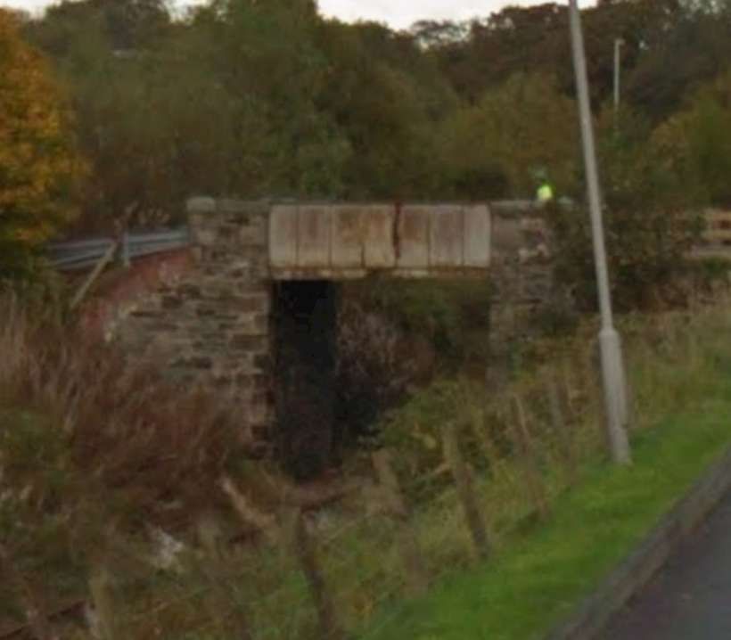
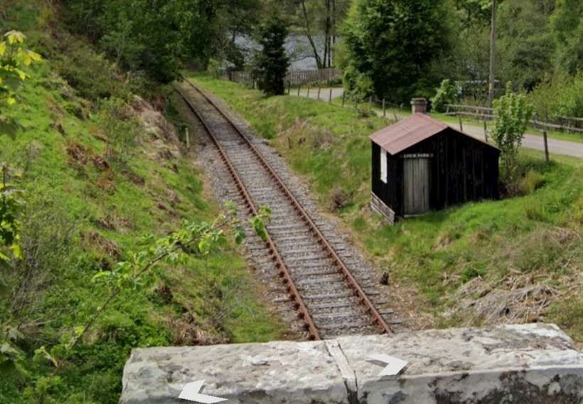
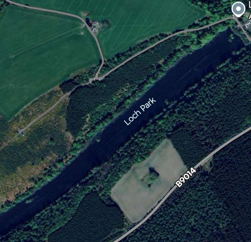
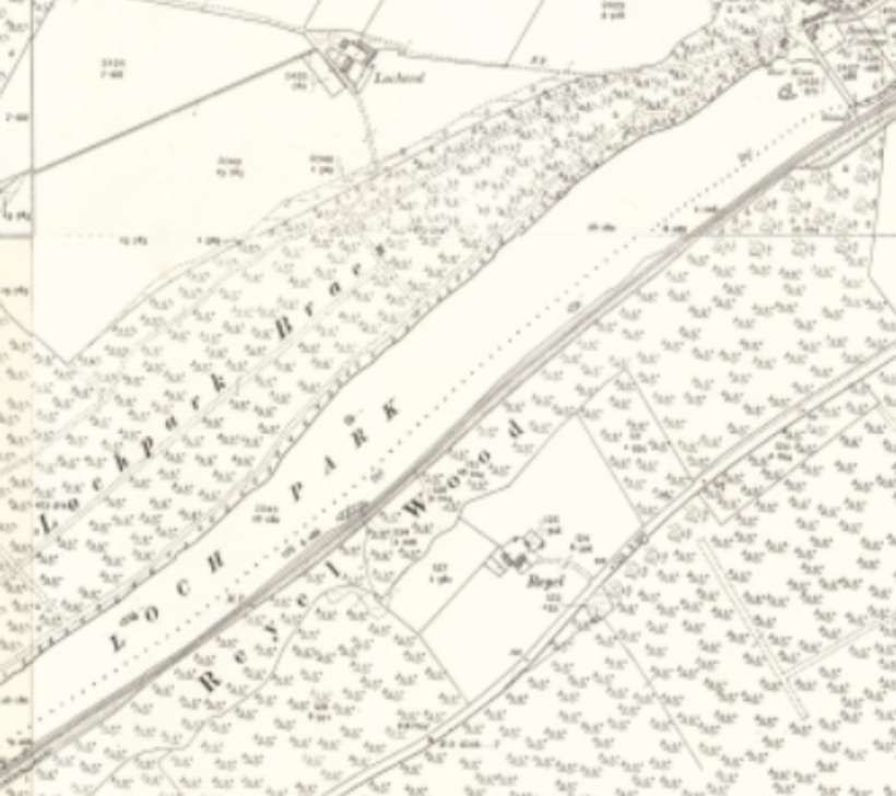
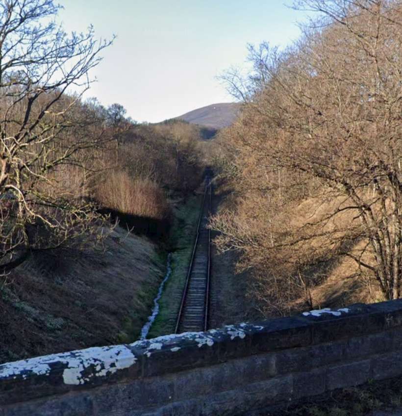
“About a mile beyond Drummuir is Loch Park, a narrow sheet of water lying in a wooded gorge. The railway skirts its southern shore on a narrow ledge at the foot of the precipitous hillside.” [1: p5]
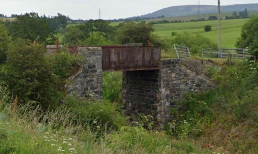
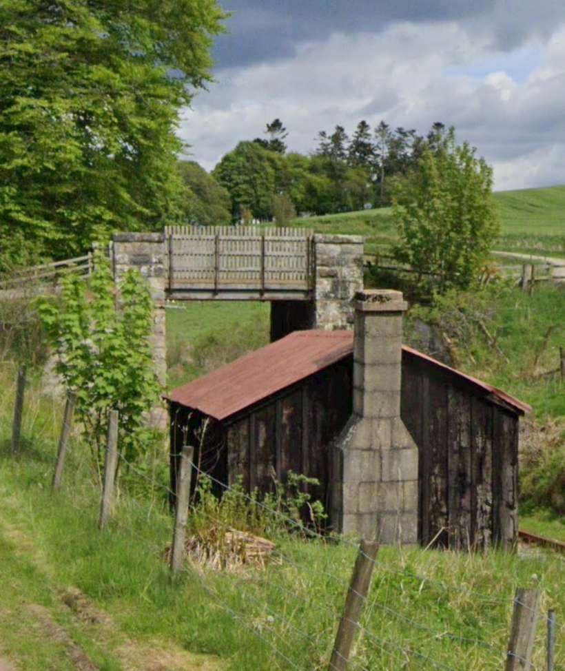
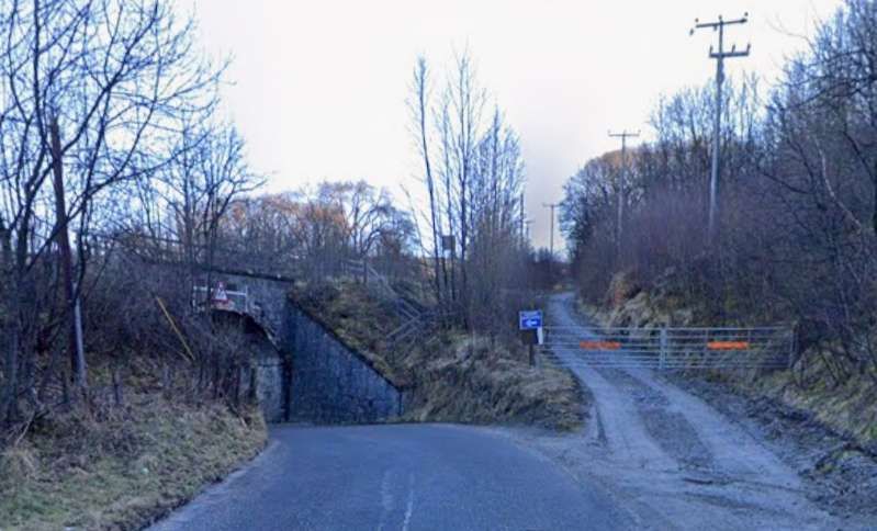
Just before passing the dam at the East end of the Loch the line passes under the road which runs across the West end of Loch Park.
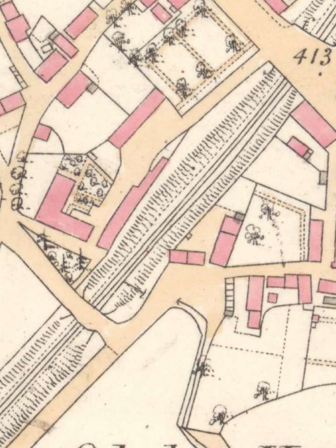
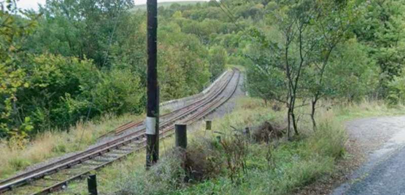
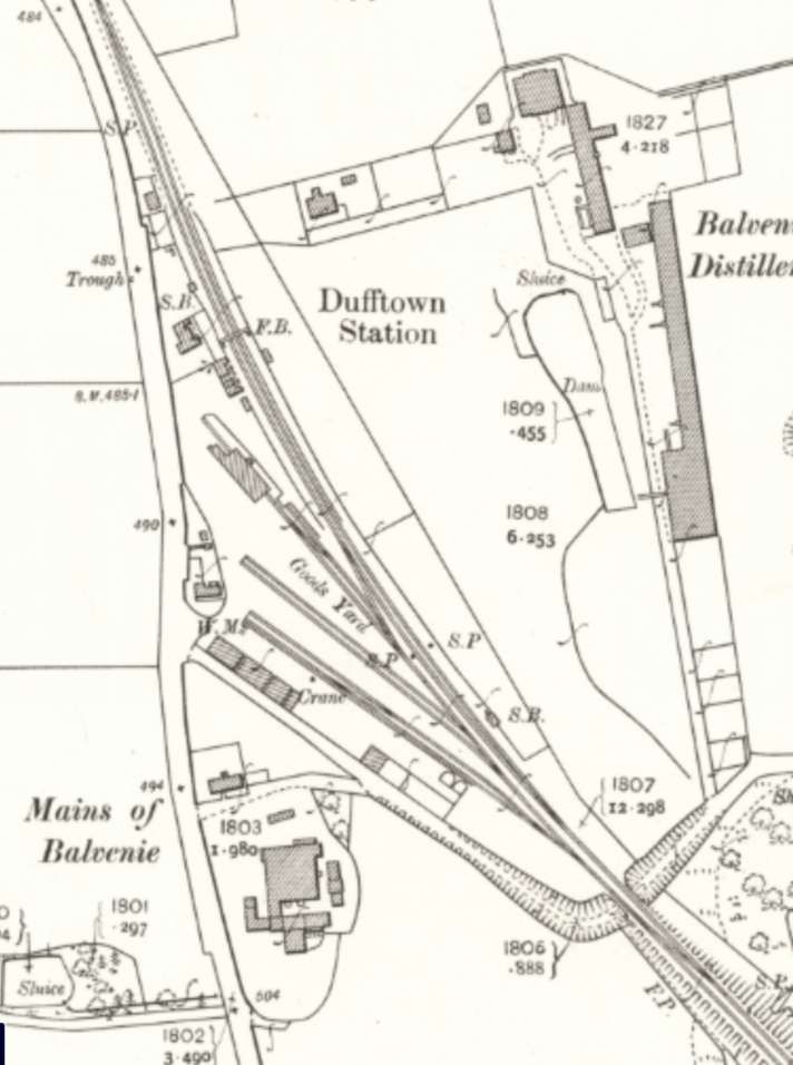
“From the summit at the western end of Loch Park, the line descends at 1 in 60 into the valley of the River Fiddich, which is crossed on a masonry bridge shortly before Dufftown is reached. ” [1: p5]
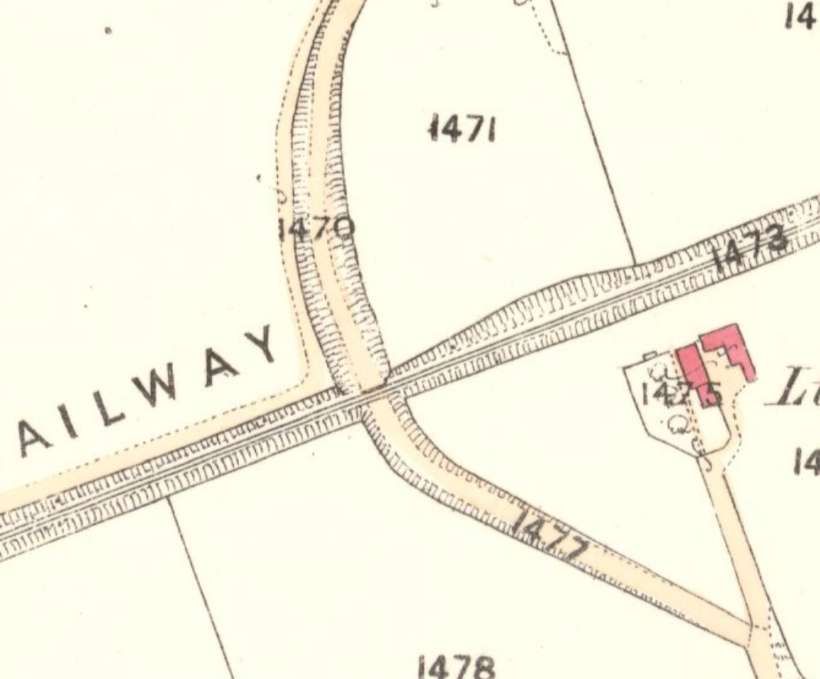
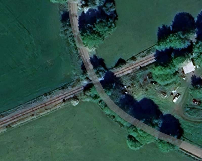
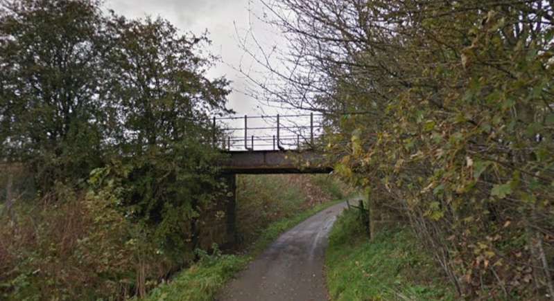
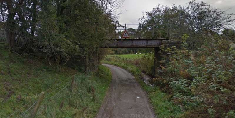
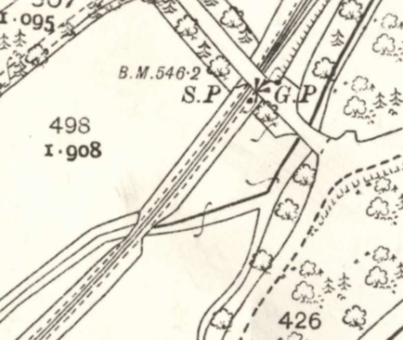
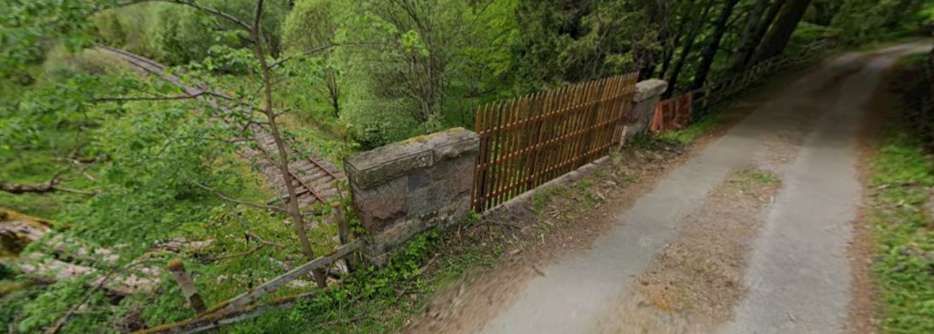
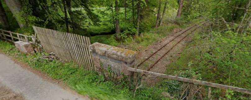
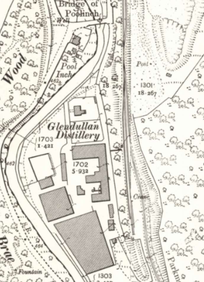
The next structure to the Southwest appears on the map extract below. …..
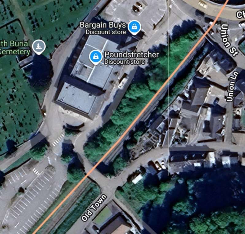
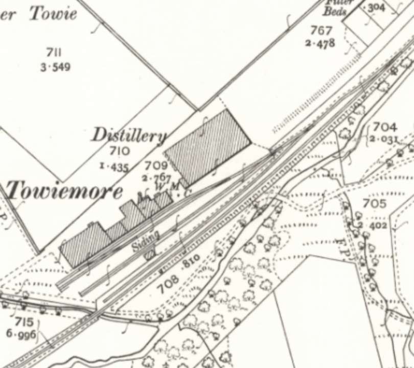
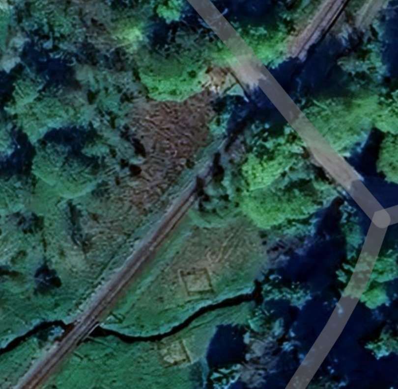
The next map extract shows the junction close to the Parkmore Distillery, where a branch serving Parkmore Lime Works and Glendullan and Mortlach distilleries left the main line. …
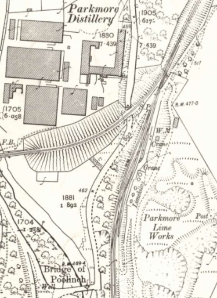
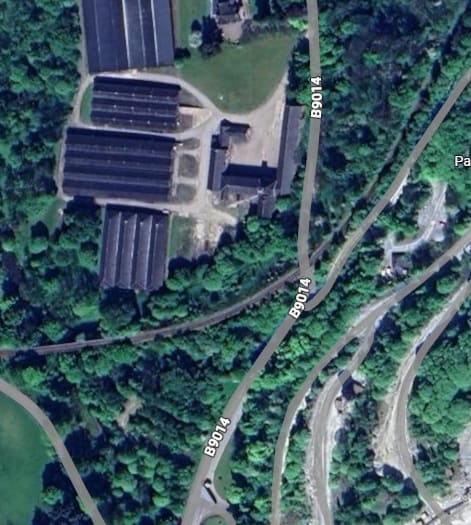

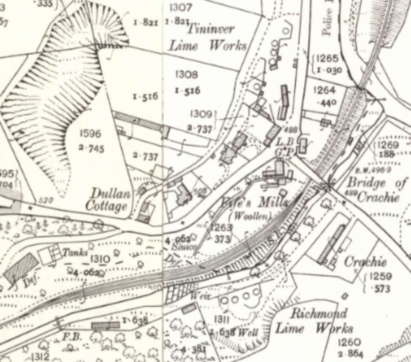
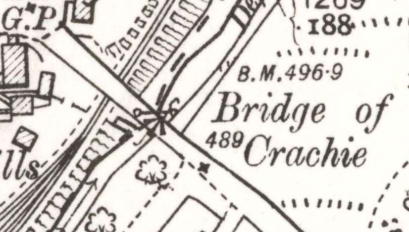
The branch only ran a short distance beyond the Bridge of Crachie to serve Mortlach Distillery

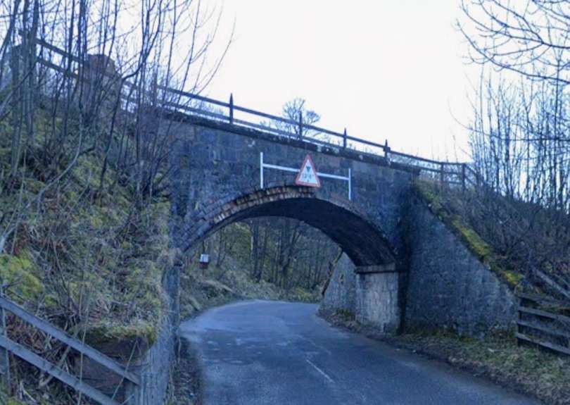
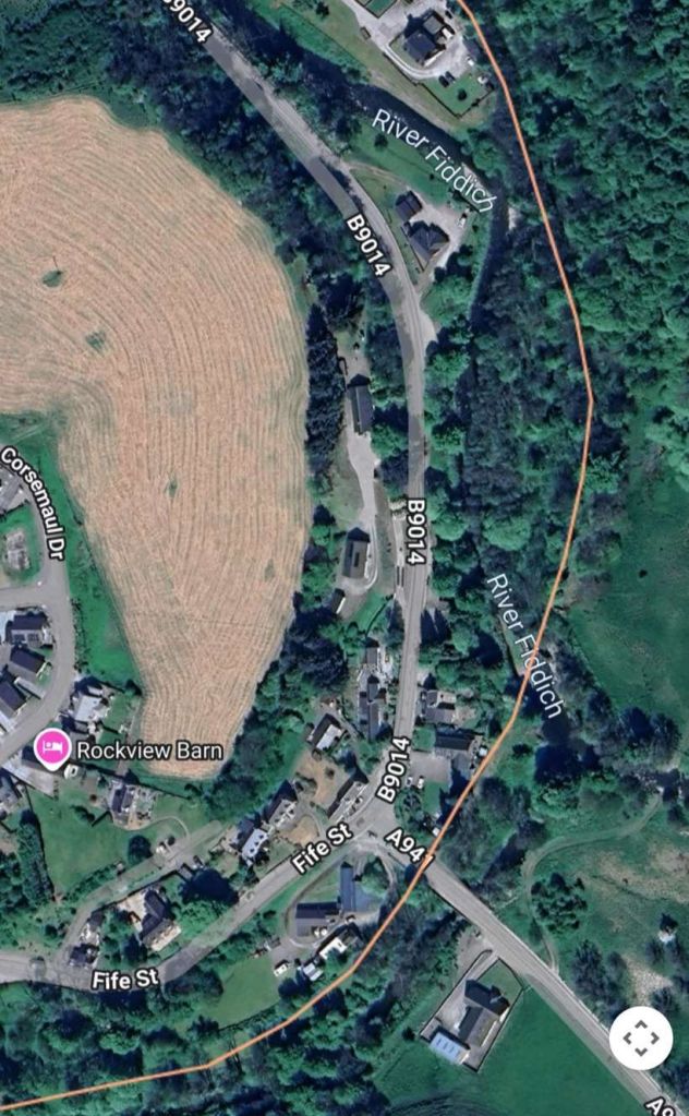
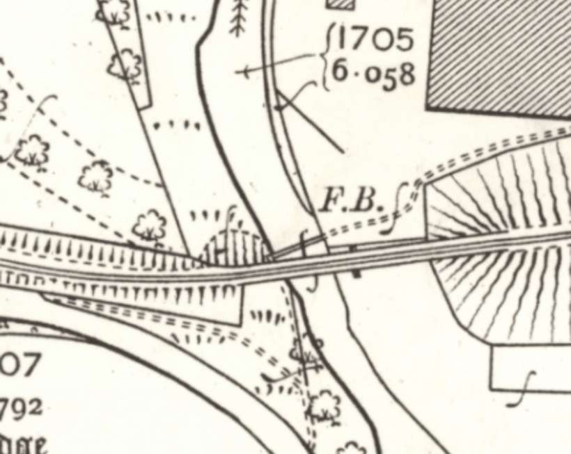
Returning to the main line we see it bridging the River Fiddich. …
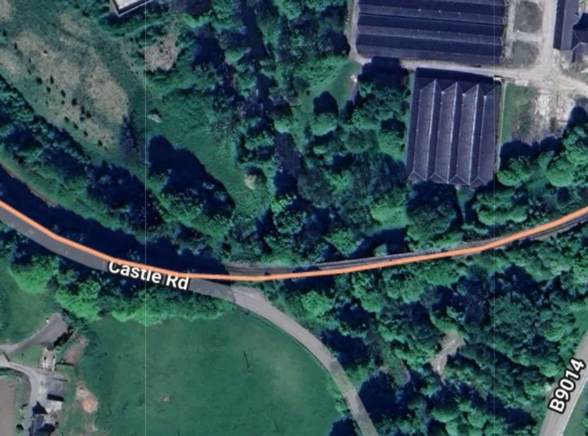
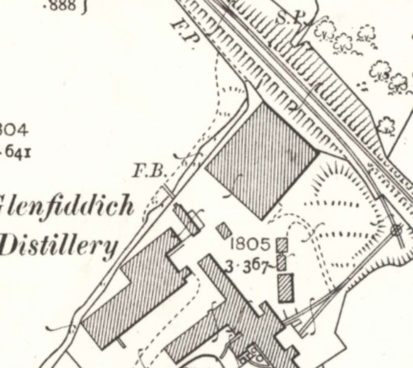
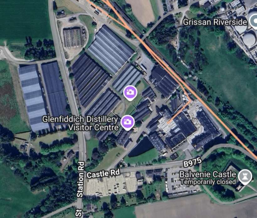
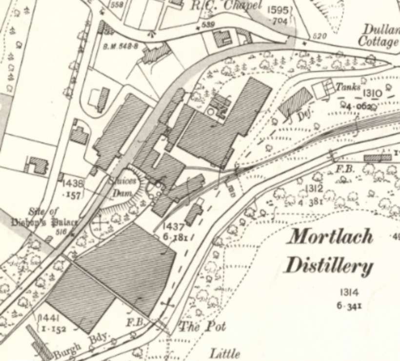
A remarkable number of distillery buildings survive in the 21st century in the immediate vicinity of Dufftown. The most famous of these is the Glenfiddich Distillery which continues to produce a significant volume of Whisky. [37]
Parkmore Distillery buildings are no longer used for producing Whisky. They were operational from 1894 but mostly silent from 1931, closing officially in 1988; its well-preserved buildings are now used by Edrington Group for whisky warehousing, with its rare existing whisky valued by collectors and its grounds sometimes hosting whisky experiences. [38]
Glendullan Distillery is a significant but often behind-the-scenes producer of single malt Scotch whisky, primarily for Diageo’s blends like Johnnie Walker, though it also contributes to The Singleton range. Founded in 1897, it operates a larger, modern facility built next to the original, which now serves as storage and workshops after its closure in 1985. [39]
And Mortlach also remains active. It was founded in 1823 and is now owned by Diageo. Its Whisky is a key component in several Johnnie Walker bottlings,and Diageo also markets four Mortlach single malts. [40]
Balvenie Distillery, owned by William Grant & Sons Ltd., sits to the Northeast of the Glenfiddich Distillery on the East side of Dufftown Station. Grant left his employment at Mortlach Distillery to set up his own company in 1886 when the foundations of the new distillery were laid. The distillery remains active. “David Stewart MBE, Balvenie’s Malt Master, is one of the industry’s most experienced experts and began working with William Grant & Sons in 1962. He was the first to create the process that would later be known as wood finishing, whereby whiskies are matured in one type of cask, such as ex-Bourbon barrels, then transferred into a second cask type (such as ex Sherry, Port or Rum), resulting in a greater depth and complexity of the final flavour of the whisky. He received his MBE from Queen Elizabeth II on the 5th of July, 2016, for his services to the Scotch Whisky Industry.” [42]
Kininvie Distillery is a Speyside single malt Scotch whisky distillery in Dufftown, owned by William Grant & Sons, built in 1990 primarily to supply their popular blends like Grant’s and Monkey Shoulder, though it now releases its own single malts, often using shared facilities (mash/fermentation) with its sister distillery, The Balvenie. [43]
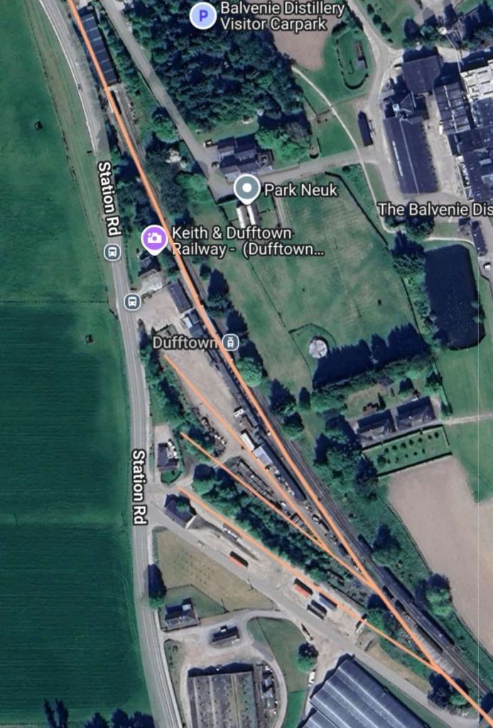
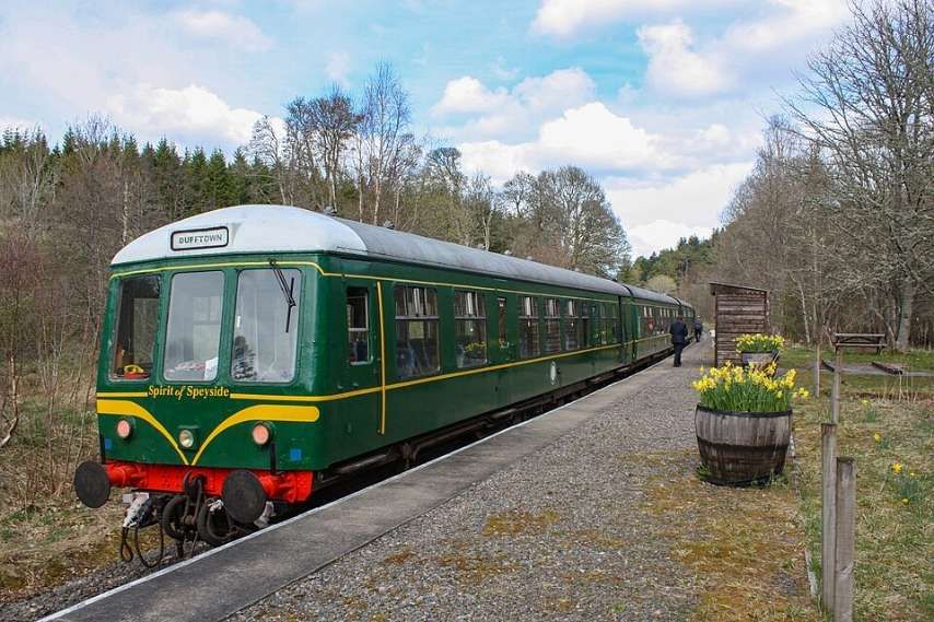
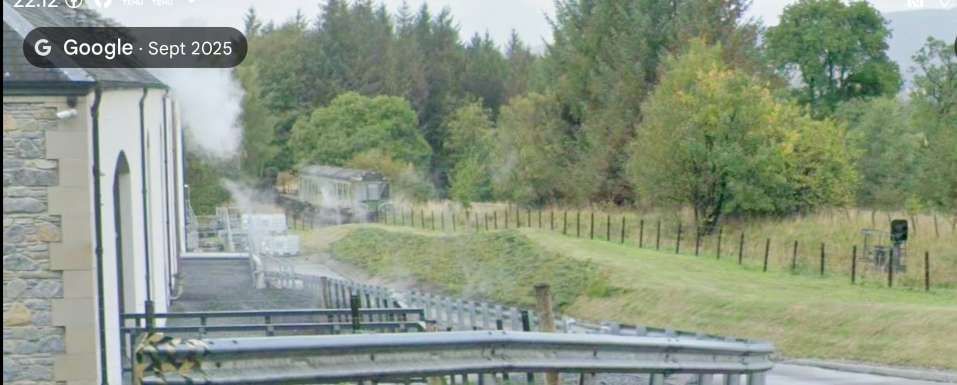
Dufftown Railway Station “first opened on 21st February 1862 by the Keith and Dufftown Railway. There was a goods yard to the southwest, which is used for stock storage nowadays. The station closed on 6th May 1968 to passengers. The line for westbound trains was lifted shortly after. Goods traffic ceased around 1991. In 2003, the Keith and Dufftown Association reopened the station and the line as a preserved railway and set up their headquarters at the station.” [44]
Some images of Dufftown Station can be found here [45] and here. [47]
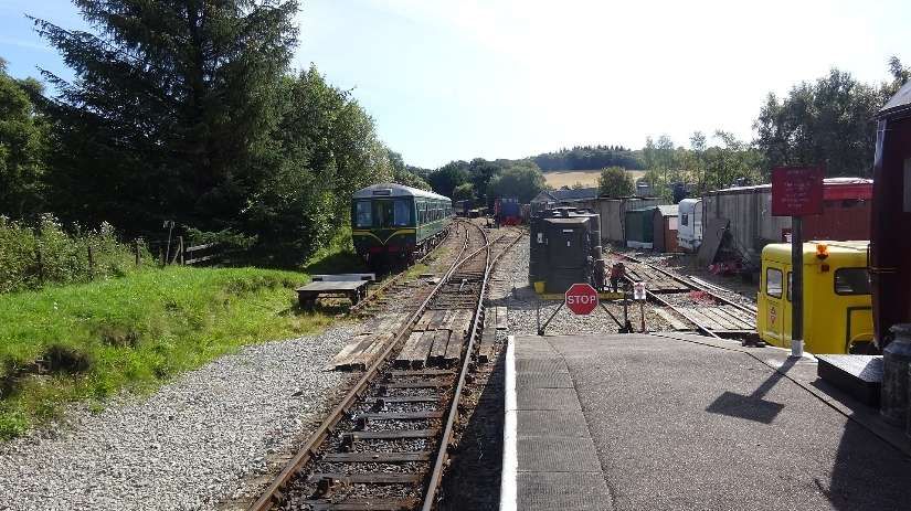
We complete this leg of the journey standing on the platform of the preservation railway at Dufftown Railway Station. The next leg of the journey will take us over the watershed into Strathspey.
References
- The Railway Magazine Volume 105 No. 693, Tothill Press, London, January 1959.
- H.A. Vallance; The Strathspey Line; in The Railway Magazine Volume 105 No. 693, Tothill Press, London, January 1959, p3-9.
- https://maps.nls.uk/view/82870398, accessed on 1st January 2026.
- https://www.geograph.org.uk/photo/768496, accessed on 1st January 2026.
- https://www.geograph.org.uk/photo/768488, accessed on 1st January 2026.
- https://en.wikipedia.org/wiki/Keith_railway_station, accessed on 1st January 2026.
- http://gnsra.org.uk/keith%20junction%20station.htm, accessed on 1st January 2026.
- https://maps.nls.uk/view/82870410, accessed on 1st January 2026.
- https://www.railmaponline.com/UKIEMap.php, accessed on 1st January 2026.
- https://www.geograph.org.uk/photo/8138394, accessed on 1st January 2026.
- https://maps.nls.uk/view/75067059, accessed on 9th January 2026.
- https://maps.nls.uk/view/74478209, accessed on 9th January 2026.
- https://maps.nls.uk/view/75067071, accessed on 9th January 2026
- https://en.wikipedia.org/wiki/Earl_of_Seafield, accessed on 10th January 2026.
- https://maps.nls.uk/view/75066297, accessed on 10th January 2026.
- https://maps.nls.uk/geo/explore/#zoom=17.0&lat=57.51478&lon=-2.99243&layers=168&b=ESRIWorld&o=0, accessed on 10th January 2026.
- http://gnsra.org.uk/auchindachy%20station.htm, accessed on 13th January 2026.
- https://www.facebook.com/share/p/14RsbKRXphH, accessed on 13th January 2021.
- https://www.geograph.org.uk/photo/3242712, accessed on 13th January 2026.
- https://maps.nls.uk/view/75066285, accessed on 13th January 2026.
- https://maps.nls.uk/geo/explore/#zoom=16.9&lat=57.49776&lon=-3.01043&layers=168&b=ESRIWorld&o=100, accessed on 9th January 2026.
- https://www.l-h-s.co.uk, accessed on 13th January 2026.
- https://maps.nls.uk/geo/explore/#zoom=16.6&lat=57.48534&lon=-3.03882&layers=168&b=ESRIWorld&o=100, accessed on 13th January 2026.
- https://www.geograph.org.uk/photo/3421048, accessed on 13th January 2026.
- https://www.geograph.org.uk/photo/8019306, accessed on 13th January 2026.
- http://gnsra.org.uk/drummuir%20station.htm, accessed on 13th January 2026.
- https://maps.nls.uk/view/75066291, accessed on 13th January 2026.
- https://maps.nls.uk/geo/explore/#zoom=15.4&lat=57.47659&lon=-3.07211&layers=168&b=ESRIWorld&o=100, accessed on 14th January 2026.
- https://maps.nls.uk/geo/explore/#zoom=16.8&lat=57.46006&lon=-3.11040&layers=168&b=ESRIWorld&o=100, accessed on 14th January 2026.
- https://maps.nls.uk/geo/explore/#zoom=15.0&lat=57.45459&lon=-3.12168&layers=168&b=ESRIWorld&o=100, accessed on 14th January 2026.
- https://maps.nls.uk/geo/explore/#zoom=16.0&lat=57.45140&lon=-3.12073&layers=168&b=ESRIWorld&o=100, accessed on 14th January 2026.
- https://maps.nls.uk/geo/explore/#zoom=17.0&lat=57.44511&lon=-3.11855&layers=168&b=ESRIWorld&o=100, accessed on 14th January 2026.
- https://maps.nls.uk/geo/explore/#zoom=17.0&lat=57.44304&lon=-3.12240&layers=168&b=ESRIWorld&o=100, accessed on 14th January 2026.
- https://maps.nls.uk/geo/explore/#zoom=17.0&lat=57.45404&lon=-3.12257&layers=168&b=ESRIWorld&o=100, accessed on 14th January 2026.
- https://maps.nls.uk/geo/explore/#zoom=17.0&lat=57.45498&lon=-3.12743&layers=168&b=ESRIWorld&o=100, accessed on 14th January 2026.
- https://maps.nls.uk/geo/explore/#zoom=17.0&lat=57.45825&lon=-3.13089&layers=168&b=ESRIWorld&o=100, accessed on 14th January 2026.
- https://www.glenfiddich.com/en-gb, accessed on 14th January 2026.
- https://en.wikipedia.org/wiki/Parkmore_distillery, accessed on 14th January 2026.
- https://en.wikipedia.org/wiki/Glendullan_distillery, accessed on 14th January 2026.
- https://en.wikipedia.org/wiki/Mortlach_distillery, accessed on 14th January 2026.
- https://keith-dufftown-railway.co.uk, accessed on 15th January 2026.
- https://en.wikipedia.org/wiki/Balvenie_distillery, accessed on 15th January 2026.
- https://en.wikipedia.org/wiki/Kininvie_distillery, accessed on 15th January 2026.
- https://en.wikipedia.org/wiki/Dufftown_railway_station, accessed on 15th January 2026.
- http://gnsra.org.uk/dufftown%20station.htm, accessed on 15th January 2026.
- https://commons.wikimedia.org/wiki/File:Dufftown_railway_station_and_sidings._View_towards_Keith.jpg, accessed on 15th January 2026.
- http://theatreorgans.com/hammond/keng/kenhtml/KeithTownToDufftownSep2008/Keith%20&%20Dufftown%20Railway%20Sept%202008%20Page%204.htm, accessed on 15th January 2026.
- https://chasewaterstuff.wordpress.com/tag/great-north-of-scotland-railway, accessed on 16th January 2026.

Pingback: The Strathspey Line – Part 2 – Dufftown to Ballindalloch | Roger Farnworth
Pingback: The Railway Magazine – January 1959 Volume 105 No. 693 | Roger Farnworth