
The Genova–Casella railway is a 24.3 km narrow gauge railway that connects Genoa to Casella, a village in the mountains inland from the city. [1] The stations on the line are shown in the graphic immediately below:
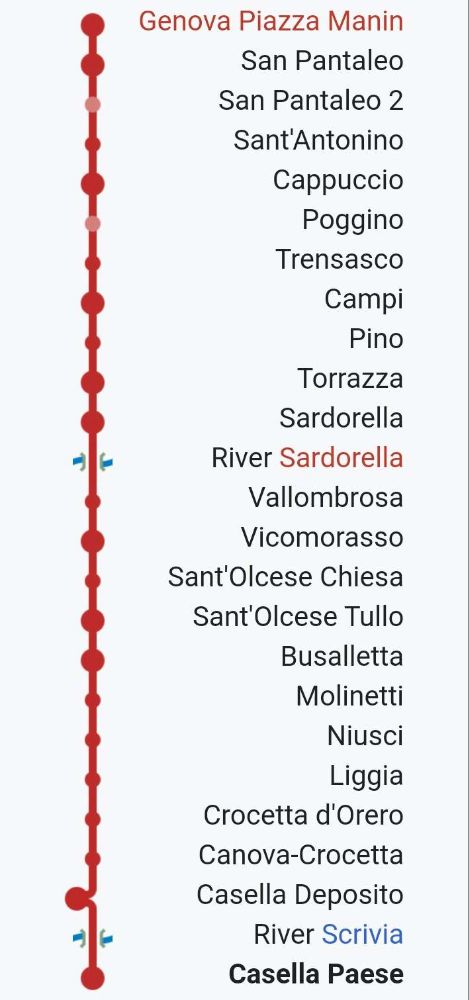
This article covers the history of the line and a journey along the southern half of the railway (Genoa to Sardorella). The second article covers the northern half of the railway and its rolling stock. That second article can be found here. [16]
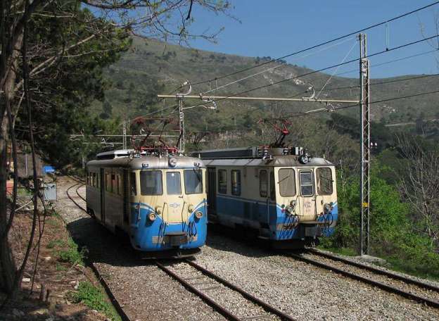
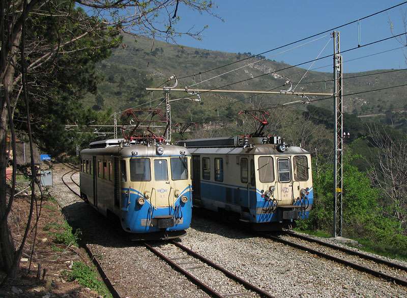
When it is operating, “the line operates nine trains per day and it is used for both commuting and tourist purposes; it crosses three valleys and was opened in 1929. While it is owned by Liguria Region, it has been operated since 2010 by AMT Genova.” [1]
“At the end of the nineteenth century, a direct railway link between Genoa and Emilia Romagna was proposed, as an alternative to the Turin–Genoa railway. The railway had to start from the Port of Genoa and cross the Ligurian mountains to reach Piacenza railway station and Borgotaro. It was intended to be a fast, long-distance line primarily for goods.” [1]
“As a result, SAFEL (Società Anonima Ferrovie Elettrici Liguri) considered the construction of a local passenger line, complementary to the Genoa-Piacenza freight line. Its purpose was to connect the city centre to all the small municipalities and holiday resorts of the Ligurian hinterland … The first section of this network was the Genoa-Casella line.” [1]
“The original project was planned with a bifurcation to provide a branch towards Busalla and a line to Torriglia, which in a second phase would be extended to Piacenza.” [1]
These were just the first proposals from SAFEL. It considered a wide range of other schemes intended to follow on from their successful completion. A start was made when, in 1908, “SAFEL applied to the Ministry for a concession for the construction of the Genoa-Casella line. This concession was obtained on 17th June 1915. Like most of the local railways of the time, the line was almost entirely single-track and had a tortuous alignment (in order to follow the topography of the Ligurian mountains). Electrification was part of the original plans and the 950 mm track gauge was chosen to minimise infrastructure costs in accord with a directive from the Council of Public Works which recommended the adoption of an ‘Italian metric gauge’ (950 mm) for railways unlike the true metric gauge (1000 mm) adopted for tramways.” [1]
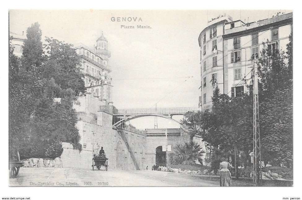
“To allow the construction of a connection at Manin with the Genoa tram network , the operating company presented a variation to the project, approved by the Higher Council of Public Works, which sanctioned the adoption of the 1000 mm gauge. This connection, however, although reported in the first design tables, was never built.” [12 – translated from Italian]
“The coming of the First World War imposed a long postponement to the construction of the railway line. It was not until 28th February 1921 that the final agreement between the Government and SAFEL was signed, which gave the permitted a start to construction work.” [1 – translated/adapted from Itailan]
“On 26th June 1921 the first stone was laid. The construction of tunnels, bridges, and station buildings was entrusted to the ‘Consorzio Cooperative Liguri di Produzione e Lavoro tra Combattenti’, which gave work to thousands of former soldiers and workers who remained unemployed after the first world war. The construction was entirely financed with private funds.” [1]
“On 26th June 1921 the first stone was laid. The construction of tunnels, bridges, and station buildings was entrusted to the ‘Consorzio Cooperative Liguri di Produzione e Lavoro tra Combattenti’, which gave work to thousands of former soldiers and workers who remained unemployed after the first world war. The construction was entirely financed with private funds.” [1]
Construction work proved to be complex. The section from Genoa to Trensasco required steep gradients. To facilitate construction, “a 1.2 km-long cable car was installed in order to transport building materials from the Bisagno River valley. The cable car system lifted materials over a height of 450 m. Electric excavators and crushers (modern machinery at the time) were also adopted to produce the necessary sand and cement on site.” [1]
“In 1924 the S.E.N. (Società Elettrica Nazionale), a subsidiary of the Ernesto Breda industries, was awarded a contract for the laying of track, the construction of the overhead line, the construction of electrical substations, and for the supply of rolling stock.” [1]
“Meanwhile, resources were expended on pursuing a succession of extension projects, some of which were very unlikely. This resulted in ongoing financial instability and a slowing of the construction work already on site.” [1]
“The first tracks were laid in 1926 starting from Vicomorasso, with the help of a Mallet-type steam locomotive purchased by the Ferrovie dell’Appenno Centrale, but operations were interrupted due to lack of funds.” [1]
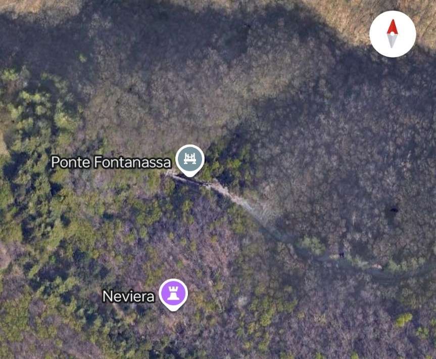
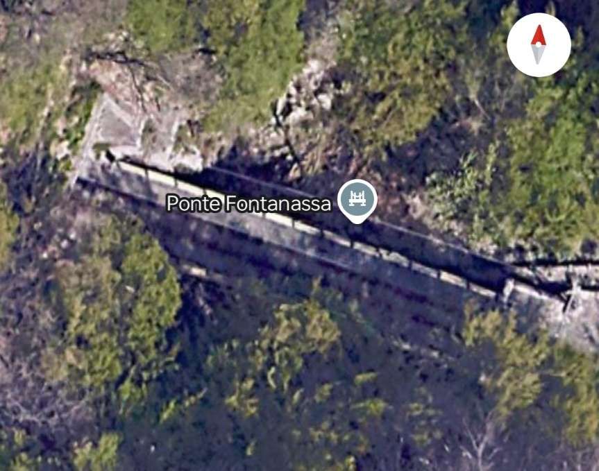
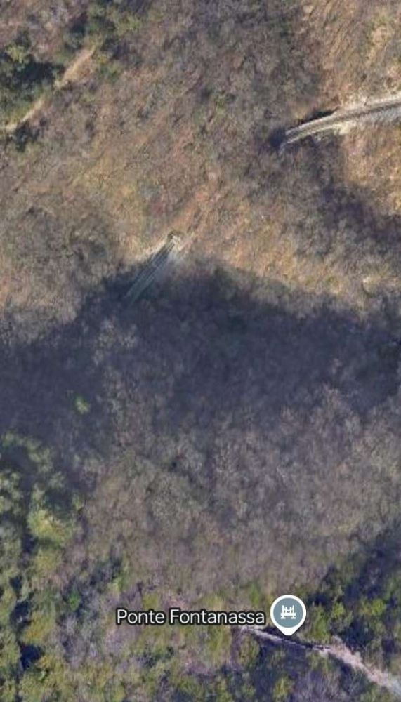
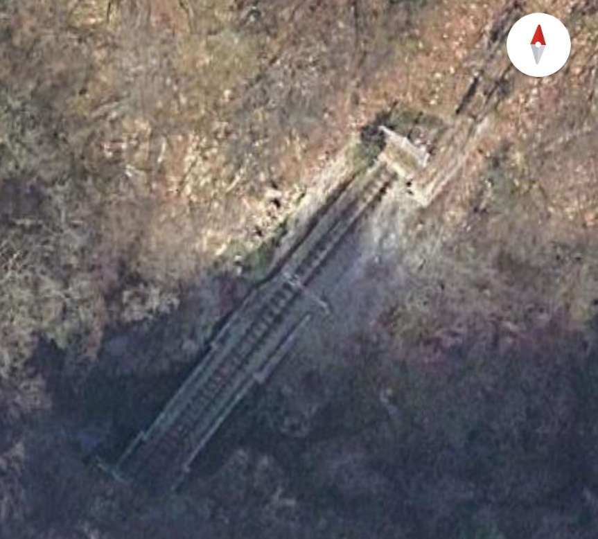
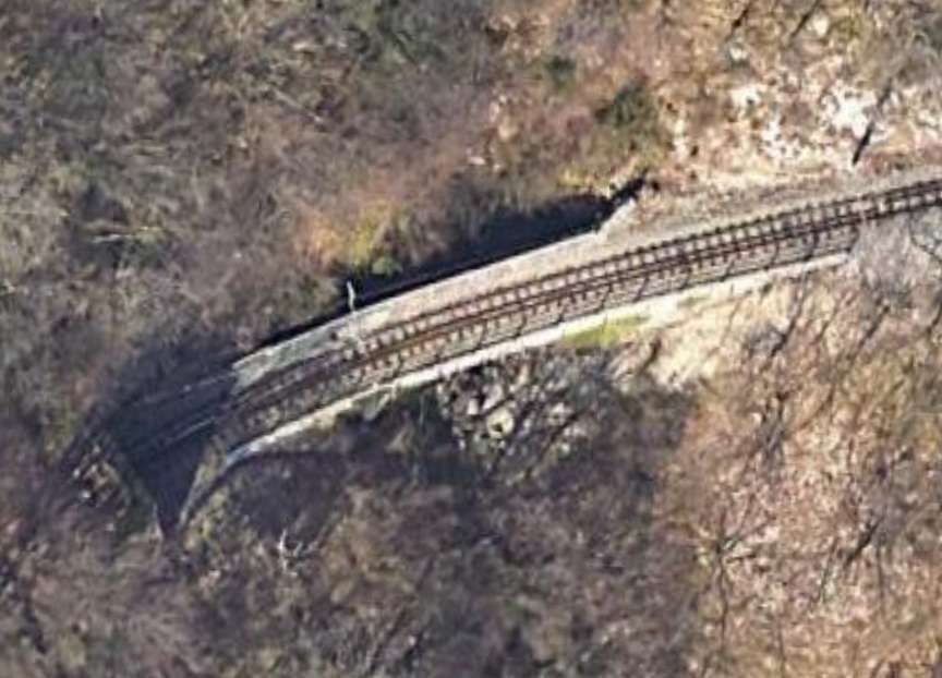
“Work resumed in 1927 thanks to a grant from the Municipality of Genoa and the National Bank. The Breda company was asked to complete the remaining civil engineering work in addition to the electrification of the line and the laying of the track (the bridge between the two Fontanassa tunnels, the Cicala and Puin viaducts).” [1]
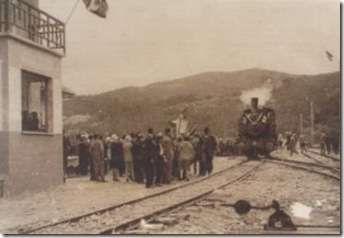
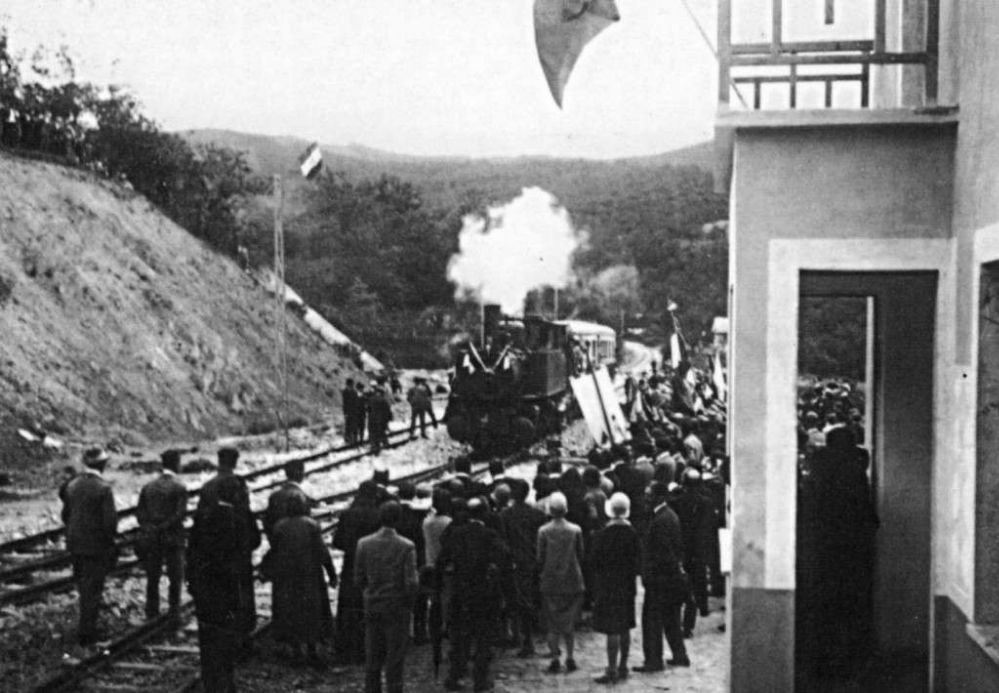
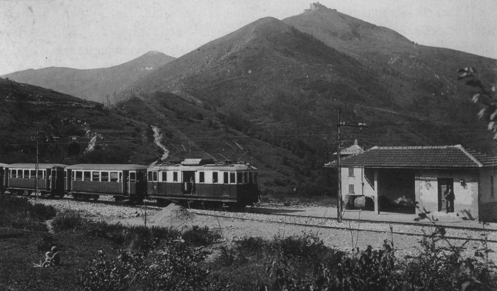
“On 7th June 1928, the steam locomotive used in the construction of the line made an inspection trip to Casella pulling a passenger car with the Podestà of Genoa, Sant’Olcese, Serra Riccò and Casella on board. It was welcomed by the citizens in celebration along the way. Only on 2nd October 1928 was the first electric train – reserved for two hundred members of the Italian Electrotechnical Association which in those days held its annual congress in Genoa – able to travel the entire line.” [1]
“On 1st September 1929 the official inauguration took place. … Due to the lack of external funding, the ambitious projects planned for a Ligurian railway network were never fulfilled – Casella became the terminus.”[1][2]
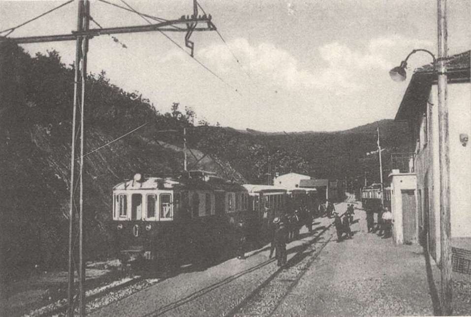
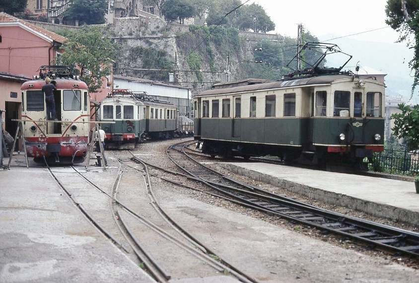
The electric supply was originally 2400V DC. “The first electric locomotives were supplied by Breda, numbered 1 to 3. They were 360 horsepower Bo-Bo locomotives with an innovative Breda-Somarini energy recovery system, unique in Italy. In addition to the motive power, 4 third-class carriages (Nos. 50-53); 3 mixed first-third class carriages (Nos. 20-22) and 16 freight wagons of various types were delivered in 1926, well before the railway opened.” [1]
In 1930, “the Vittorio Veneto bridge over the River Scrivia [was constructed], but the railway was not immediately extended along the route.” [1][3]
“In 1933, even though the railway was operating at full capacity with a high numbers of passengers and freight, SAFEL was on the verge of bankruptcy. … The company had invested heavily in the extension projects without [paying] off outstanding debts with Breda and banca Nazionale del Lavoro, which had financed much of the construction of the line. … In 1934 SAFEL was declared bankrupt after a court trial, and the management of the railway was acquired by the Lazzi bus companies.” [1]
“On 23rd August 1937, two of the locomotives were destroyed in an accident near Vicomorasso. … Three [replacement A1-1A locos] were purchased, … built by MAN in 1913 for the Montebelluna – Asolo and Montebelluna – Valdobbiadene tramways [which] closed in 1931. … The machines entered service in 1939, … after conversion of the original power supply system from 975 V DC to 2400 V DC.” [1]
“During the Second World War the railway experienced its period of maximum use, since numerous families were evacuated to the area to the North of Genoa and the train operated both for passengers and for freight. … At the end of the conflict, both the infrastructure and the rolling stock were seriously damaged by intensive use and poor maintenance, so much so that use of the line was suspended and in 1949 it was placed under Government Commissioner Management.” [4: p16 – translated/adapted from Itailan]
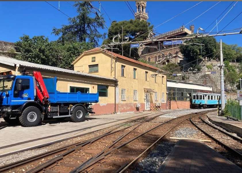
“In 1953 the line was extended from the Casella depot to the town. … Since 1975, the railway has undergone complete … renovation, with the replacement of the rails, the electrical substation and the functional restructuring of the depots.” [4: p16 – translated/adapted from Itailan]
In 1956, a locomotive (No. 28) with a power of 355 kW with a maximum speed of 50 km/h was acquired from the Sangritana Railway; in 1960 another unit (No. 29) and spare parts were acquired. “The locomotives were part of a contract of fourteen four-axle locomotives built in 1924 with electrical equipment and bogies supplied by TIBB and case made by Carminati & Toselli. Originally narrow-gauge at 950 mm, they were converted to [metre-gauge].” [1]
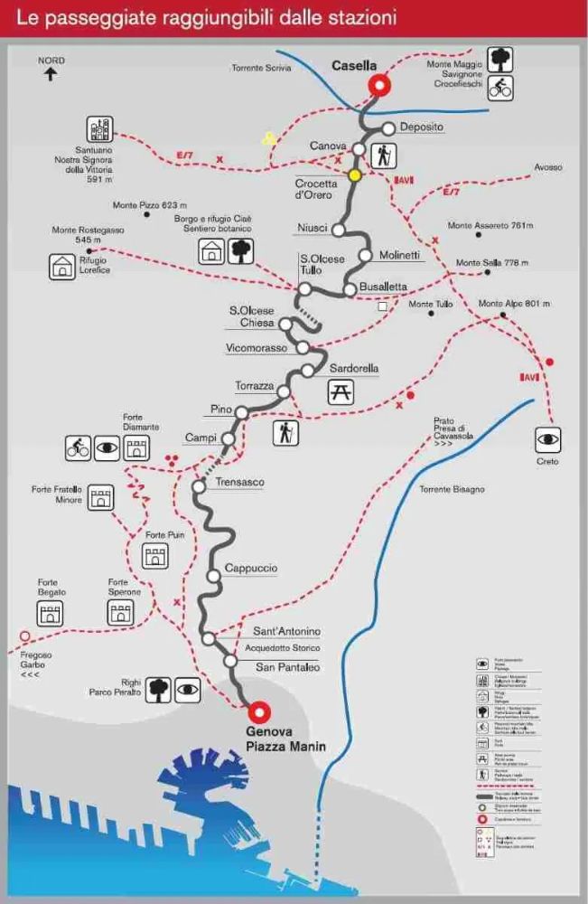
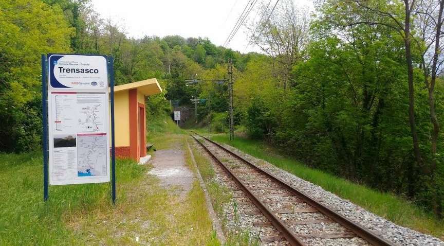
“The ‘Casella train’ remains one of the few secondary Italian railways still in use because not only does it serve a route for which there is no alternative road network, but it also is a tourist attraction (the route intersects numerous hiking trails, including those to the Forts of Genoa and a stretch of the Alta Via dei Monti Liguri) and has low operating costs.” [4: p16 – translated/adapted from Itailan]
In the four-year period 1997-2000, the line was entrusted to the Italian State Railways to achieve a technical-economic recovery, and from 1 January 2001 it became the property of the Liguria Region.][4: p16 – translated/adapted from Itailan]
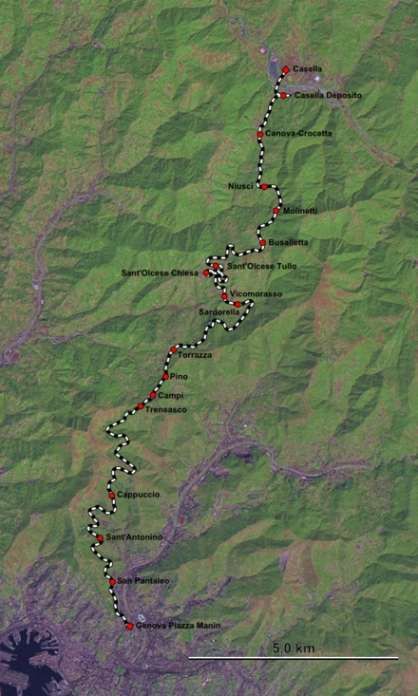
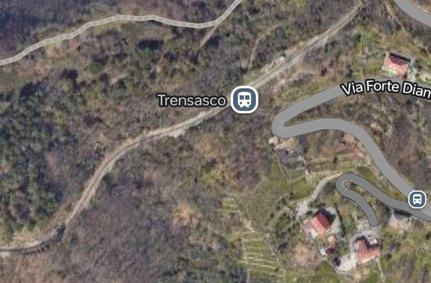
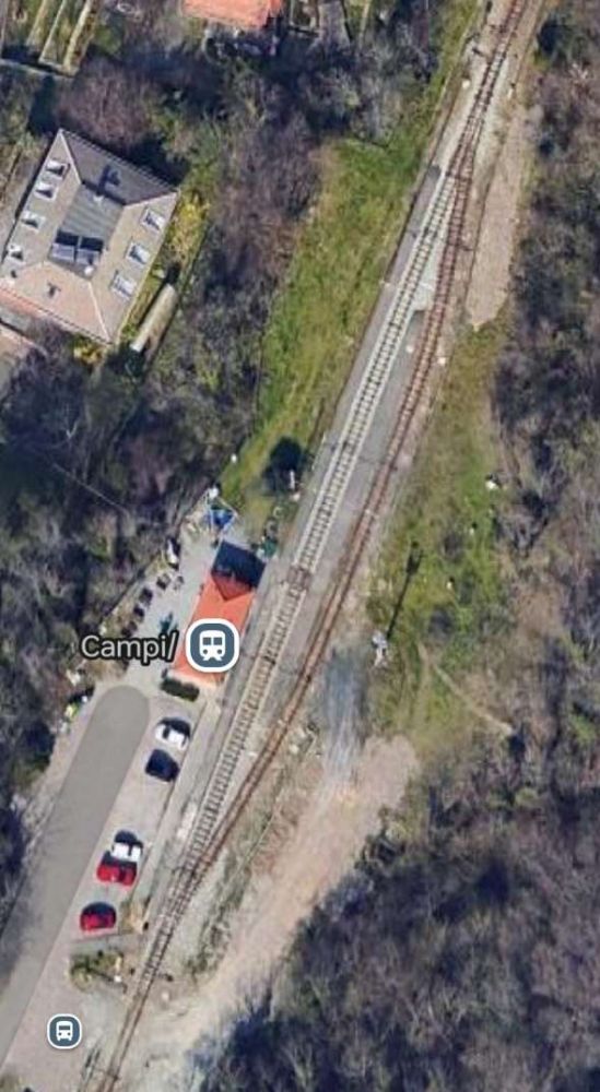
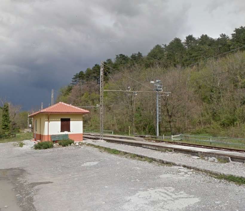
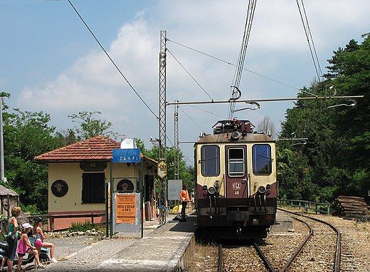
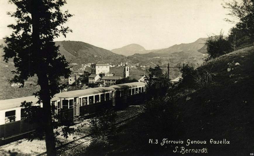
“Starting from the terminus at Manin, the route winds its way out of the city: running along a stretch of the Val Bisagno, it serves the localities of S. Pantaleo, Cappuccio, Campi, Pino Soprano, Torrazza, before passing through the Trensasco tunnel into Val Polcevera and reaching the terminus at Casella, in Valle Scrivia.” [4: p16 – translated/adapted from Itailan]
The Route
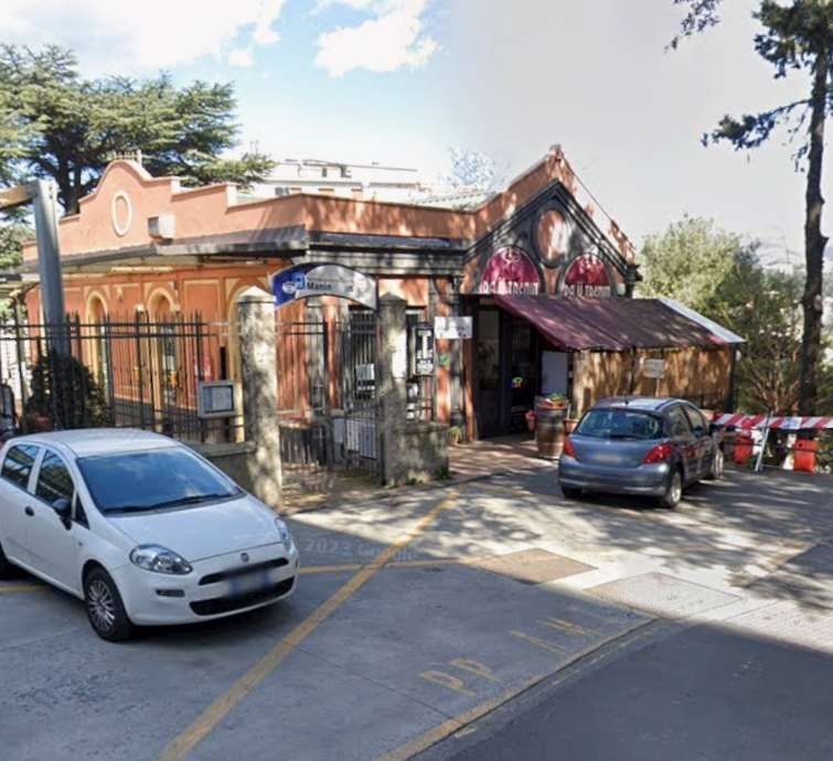
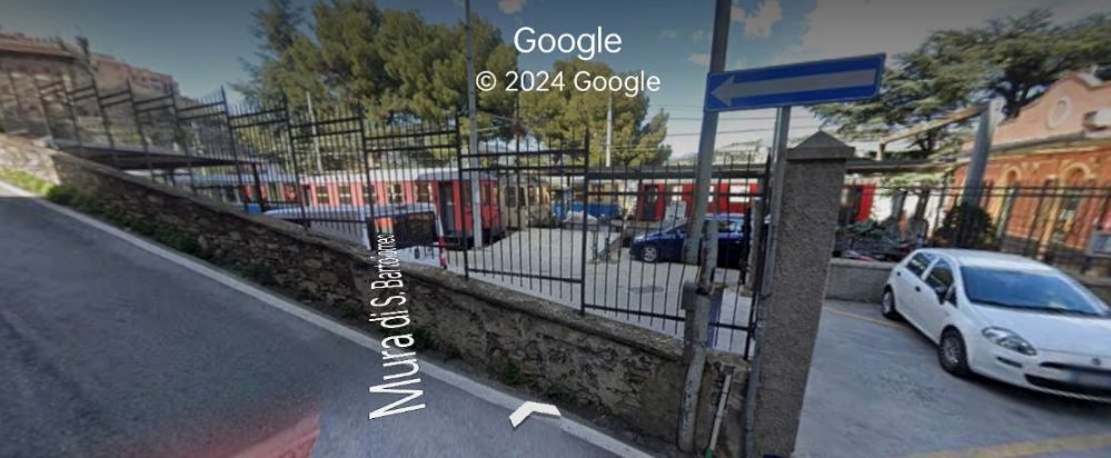
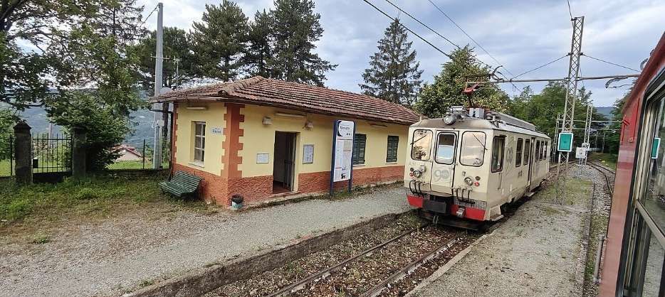
The terminus in Genoa is the Genova Manin railway station, located above the Piazza Manin and can be reached via a flight of steps or by bus No. 64.
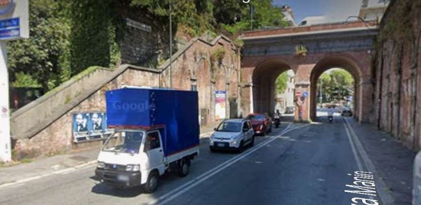
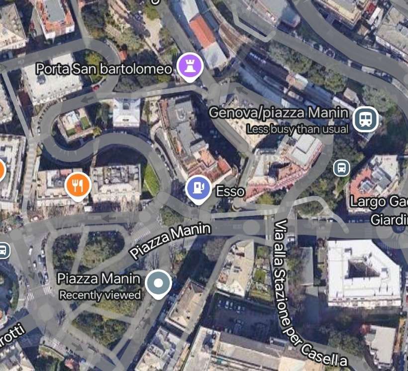
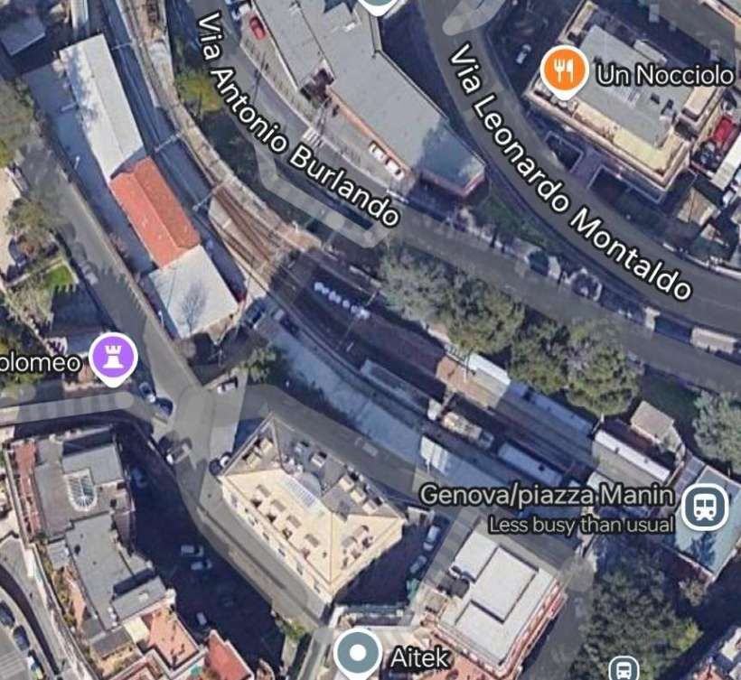
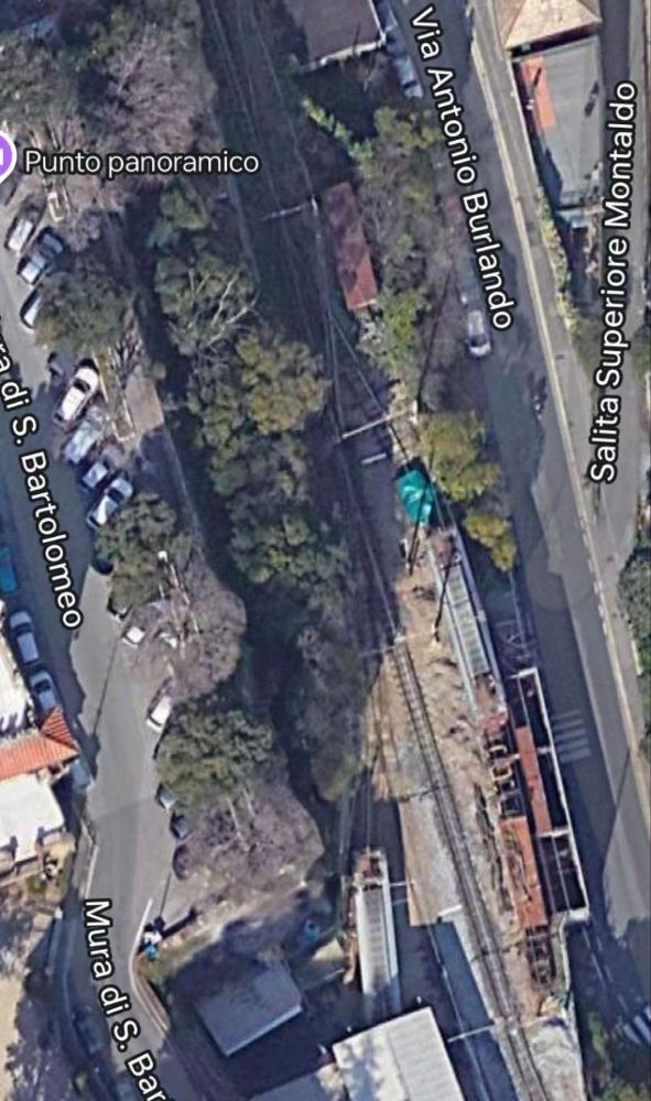
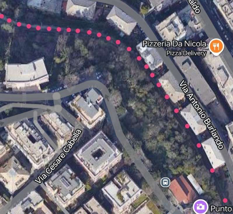
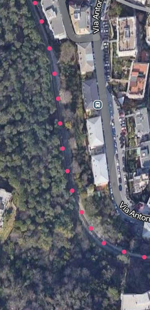
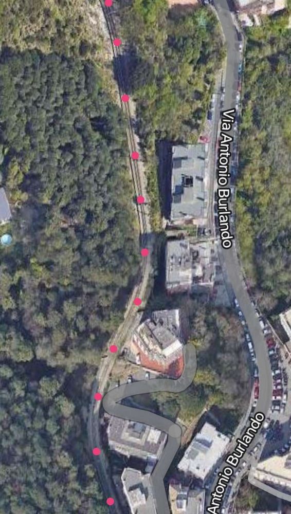
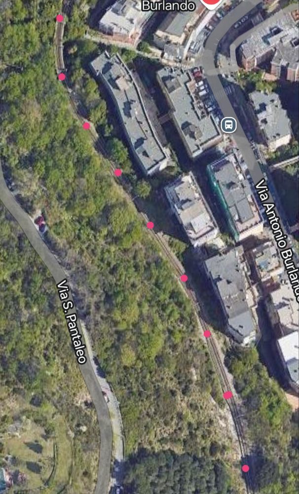
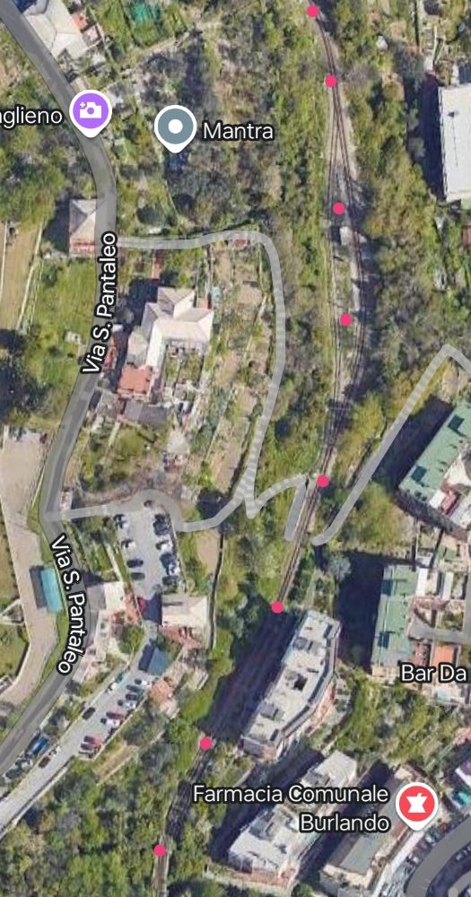
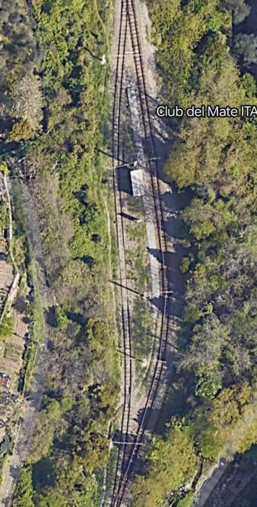
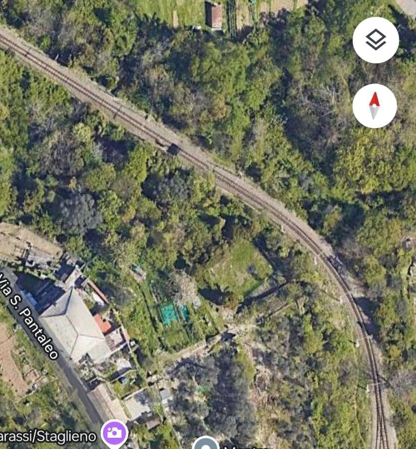
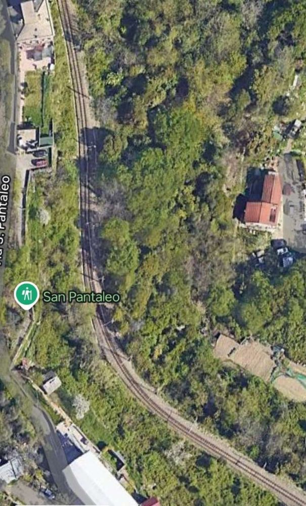
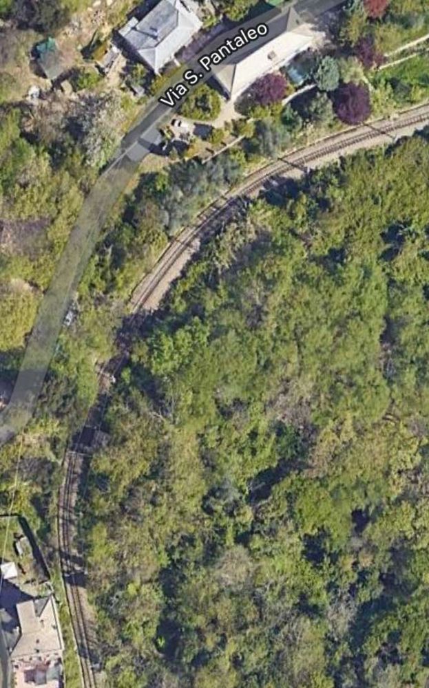
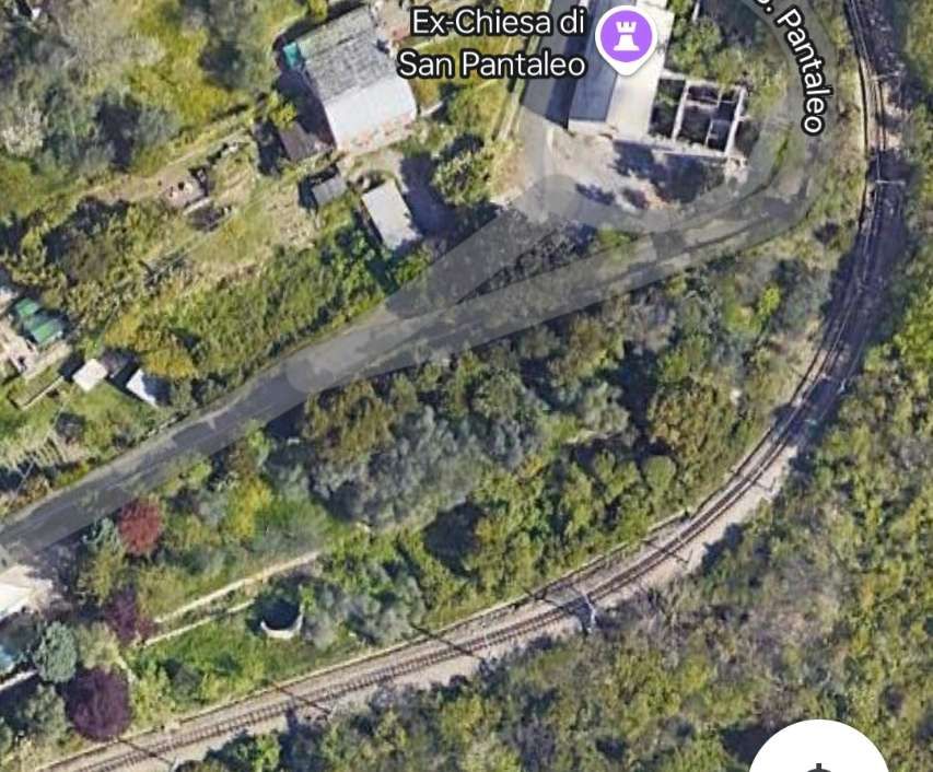
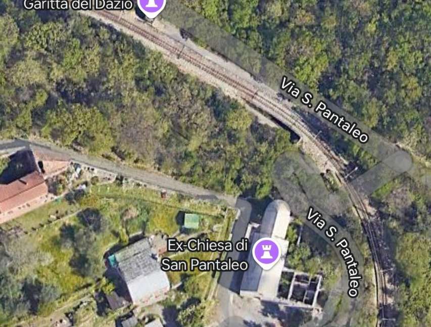
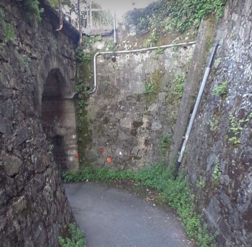
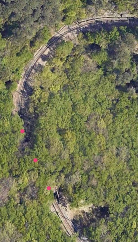
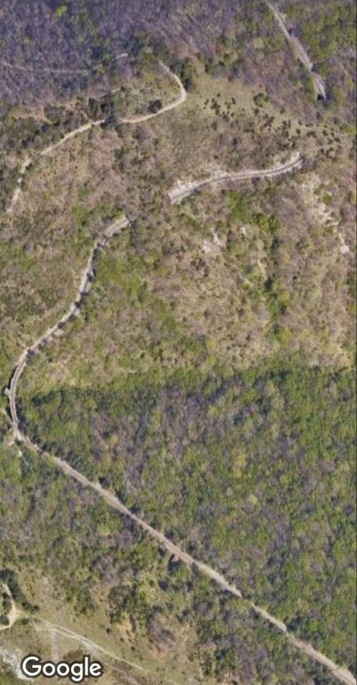
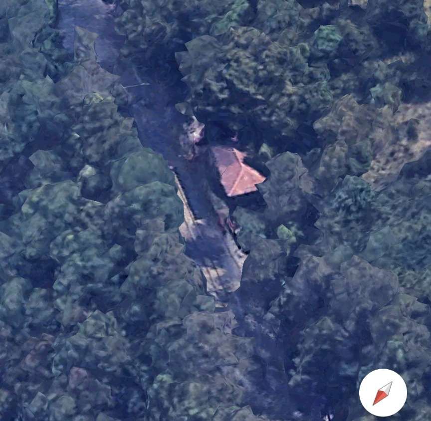
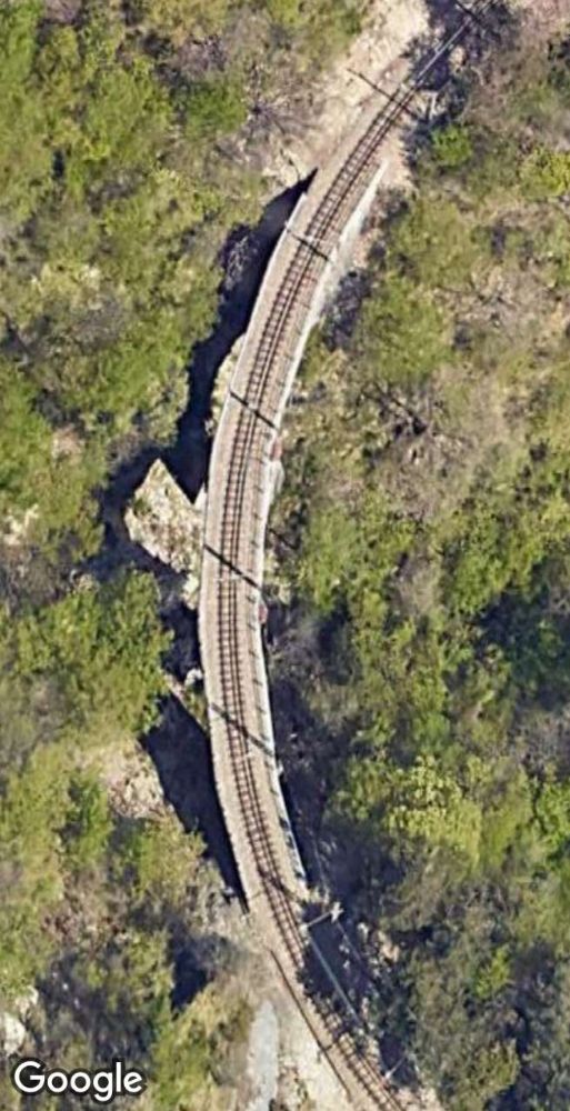
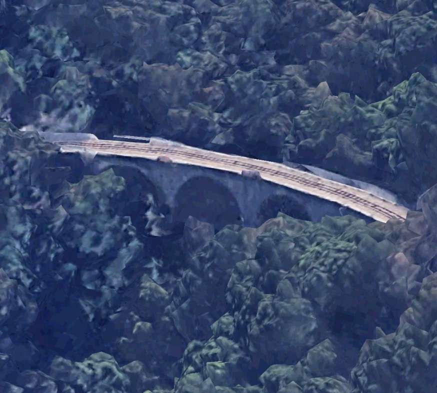
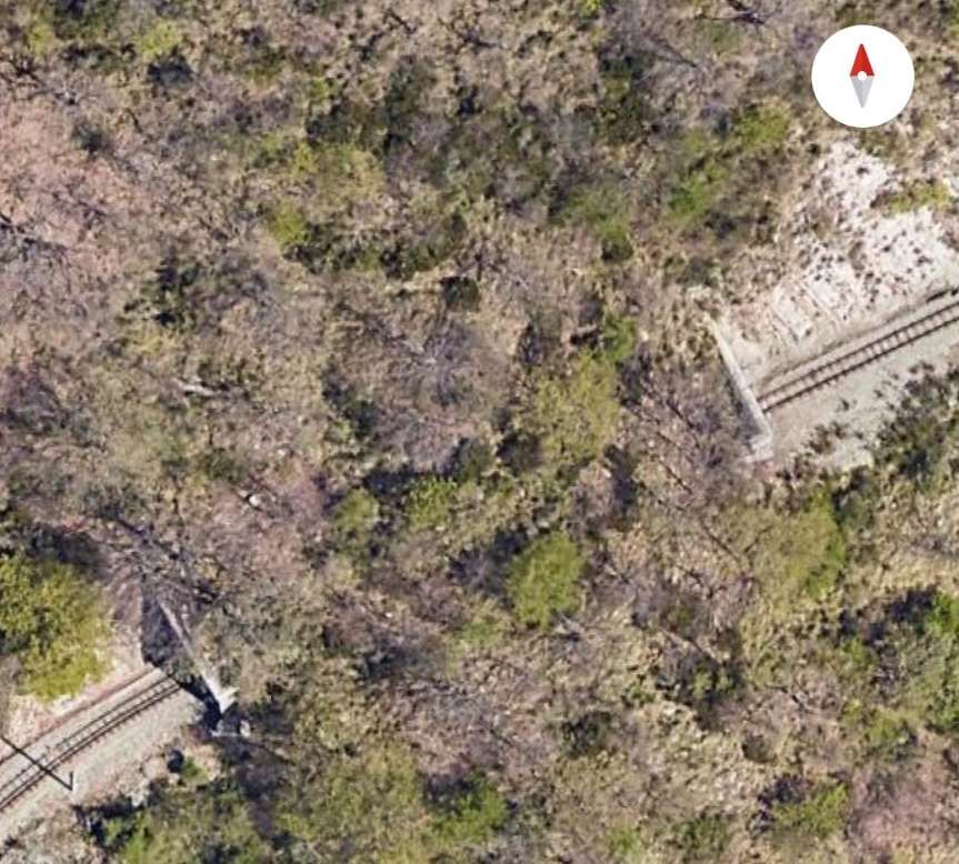
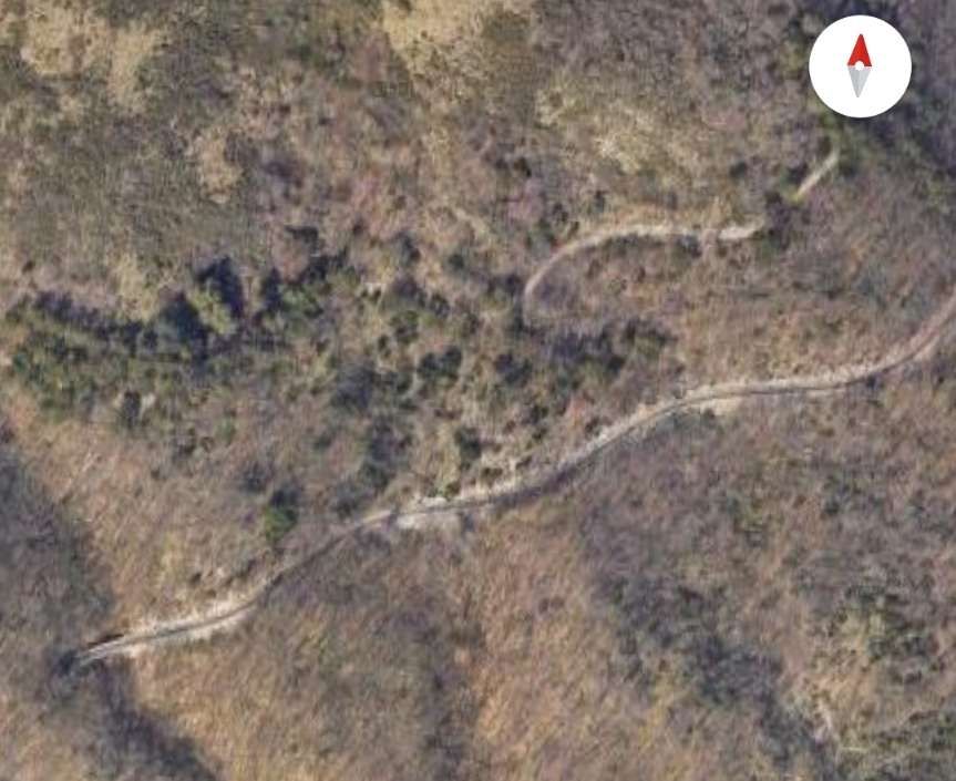
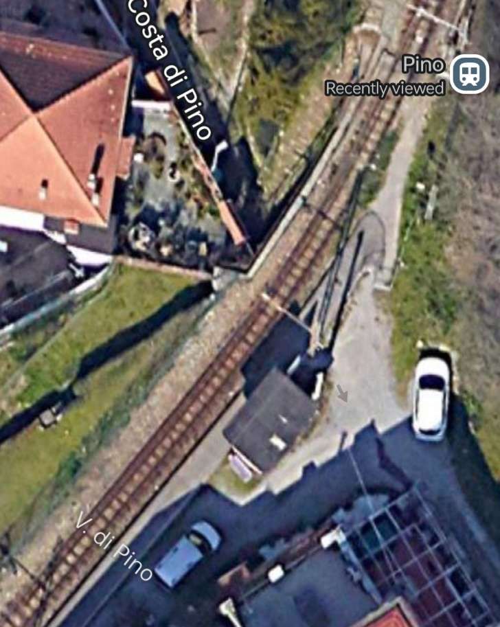
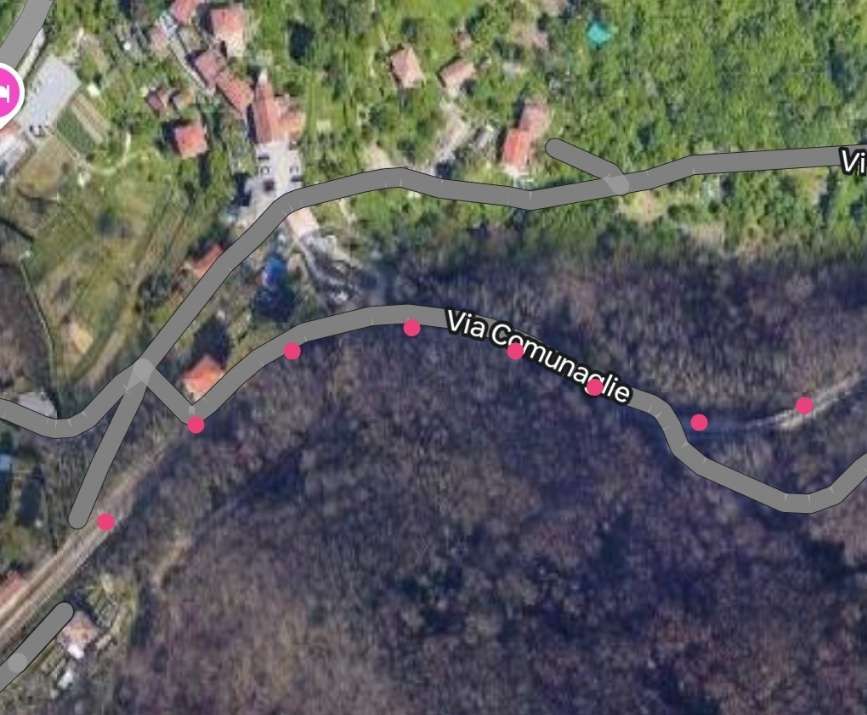
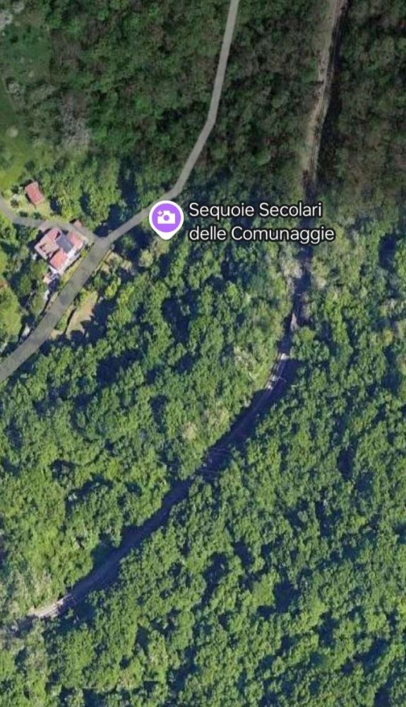
In subsequent satellite images, red dots will only be used where the route of the railway is less clear than it might be. The next 5 satellite images take us as far as the Ex-Chiesa San Pantaleo where the Via San Pantaleo passes under the railway.
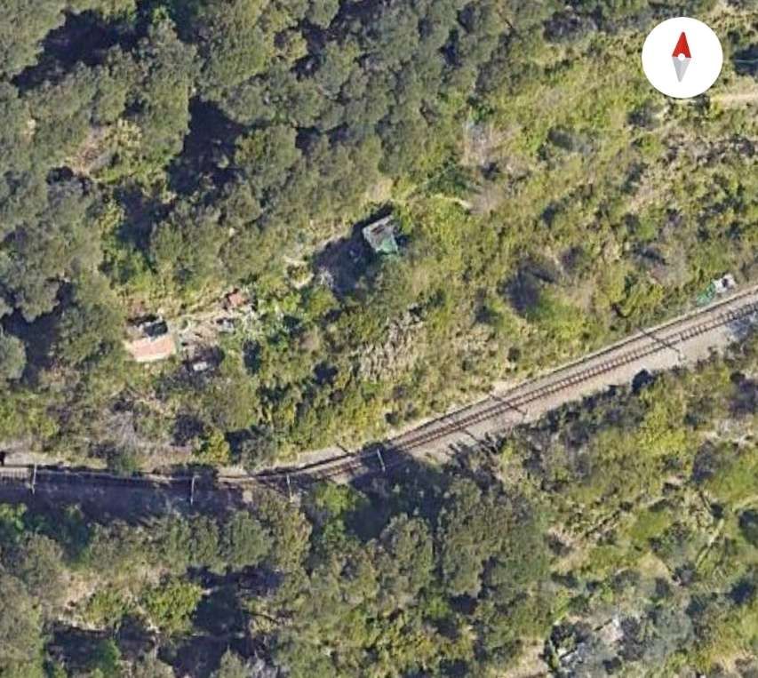
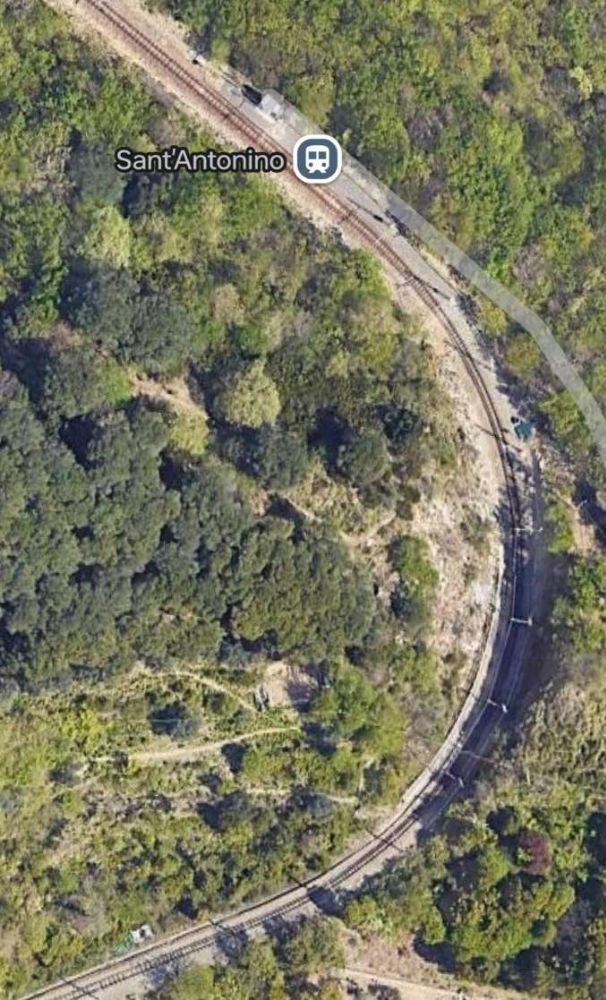
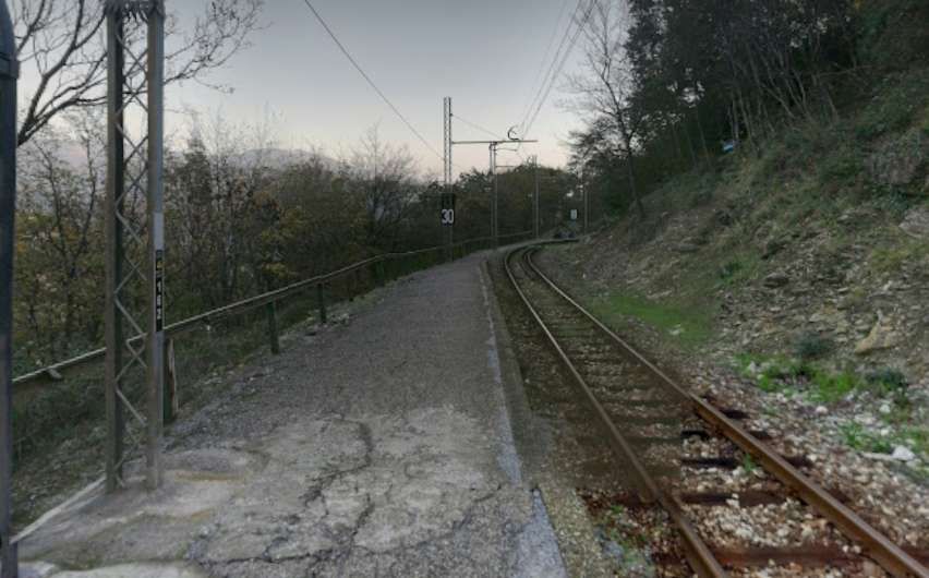
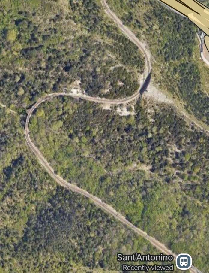
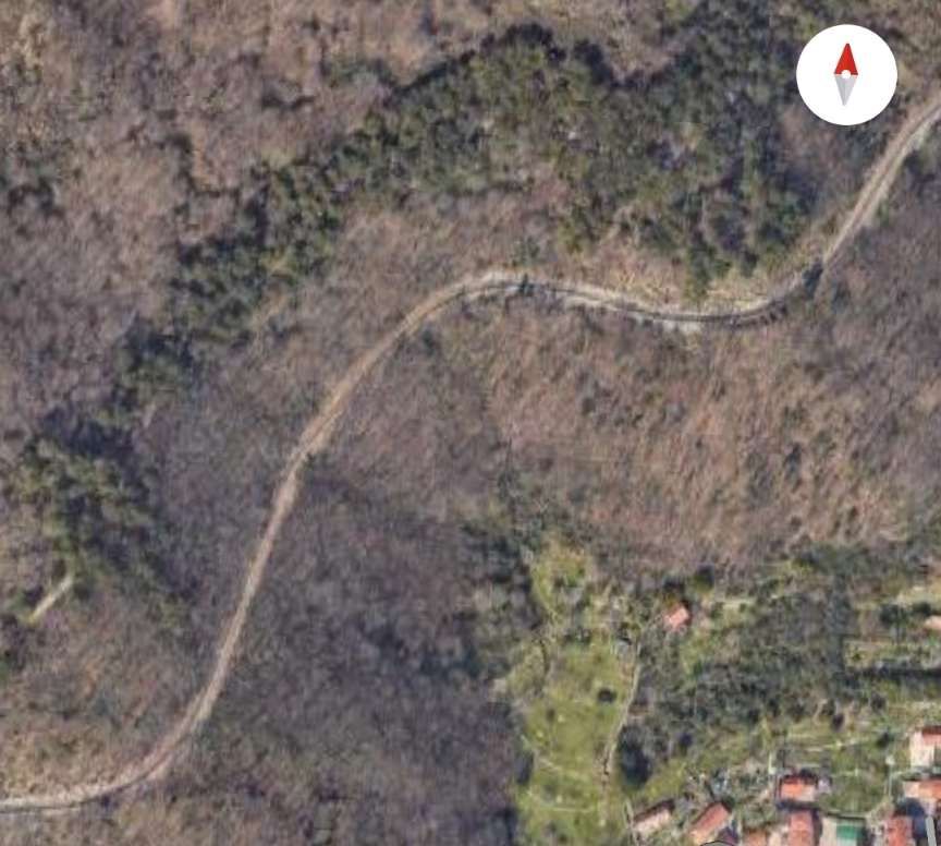
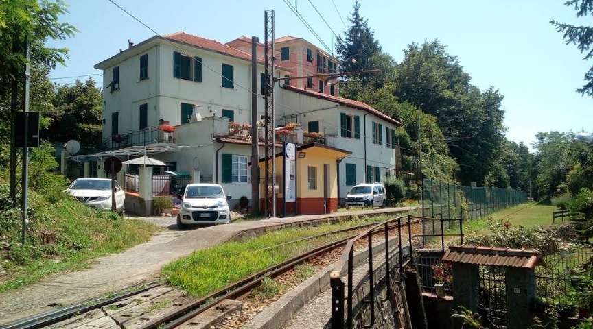
The next sequence of 7 satellite images takes us to the San Antonino Halt.
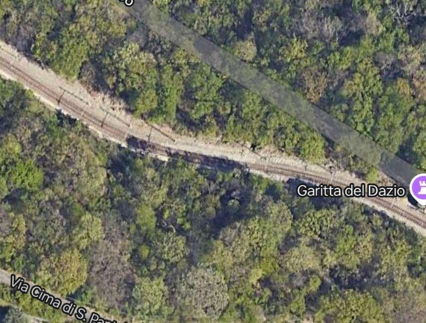

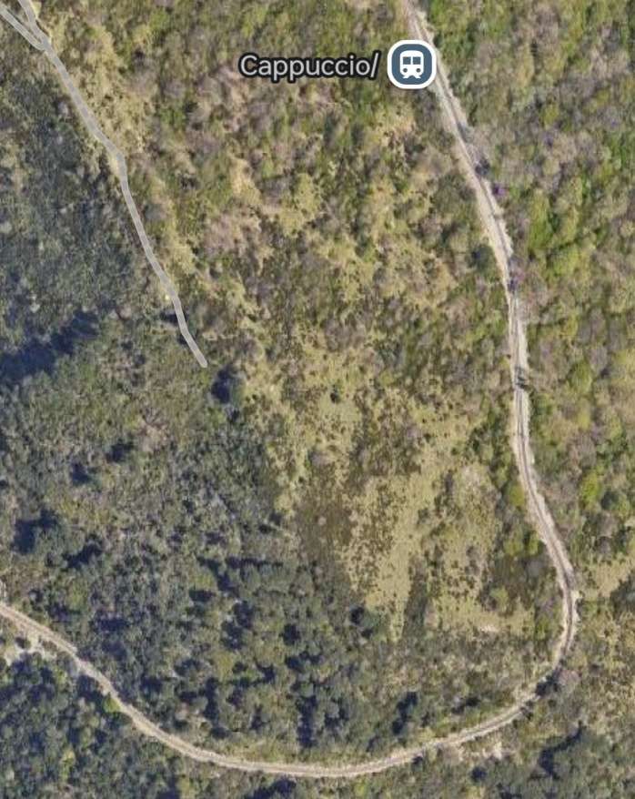
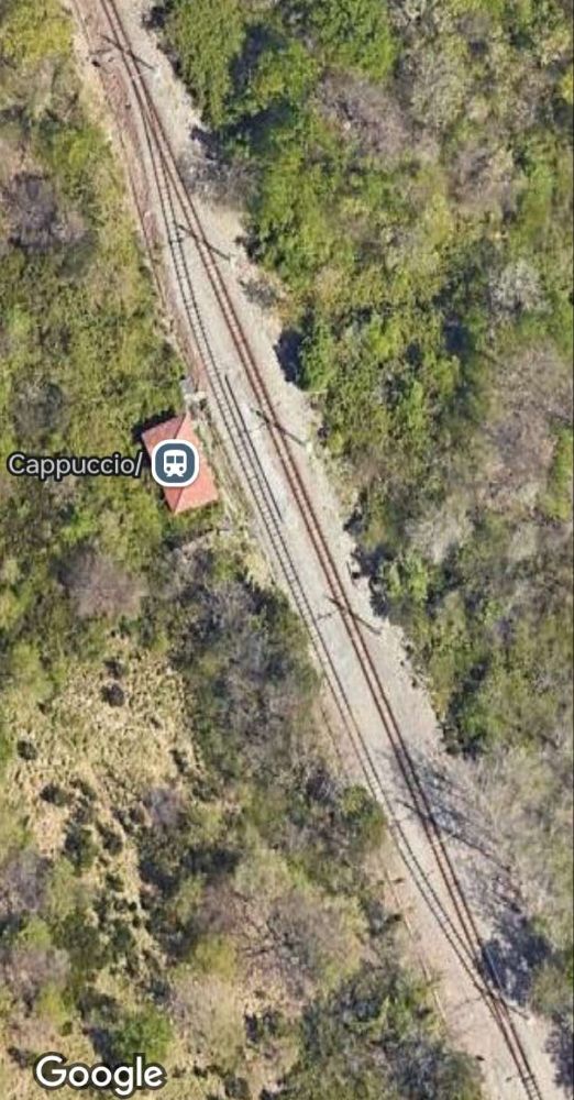
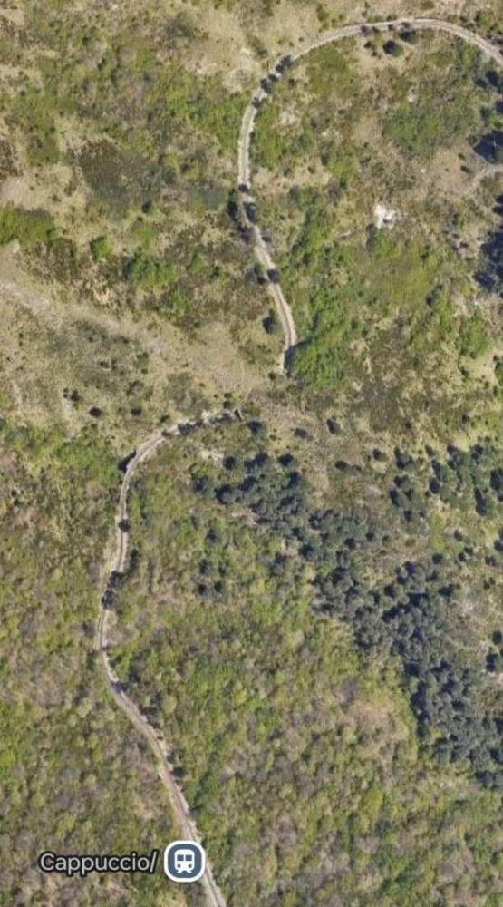
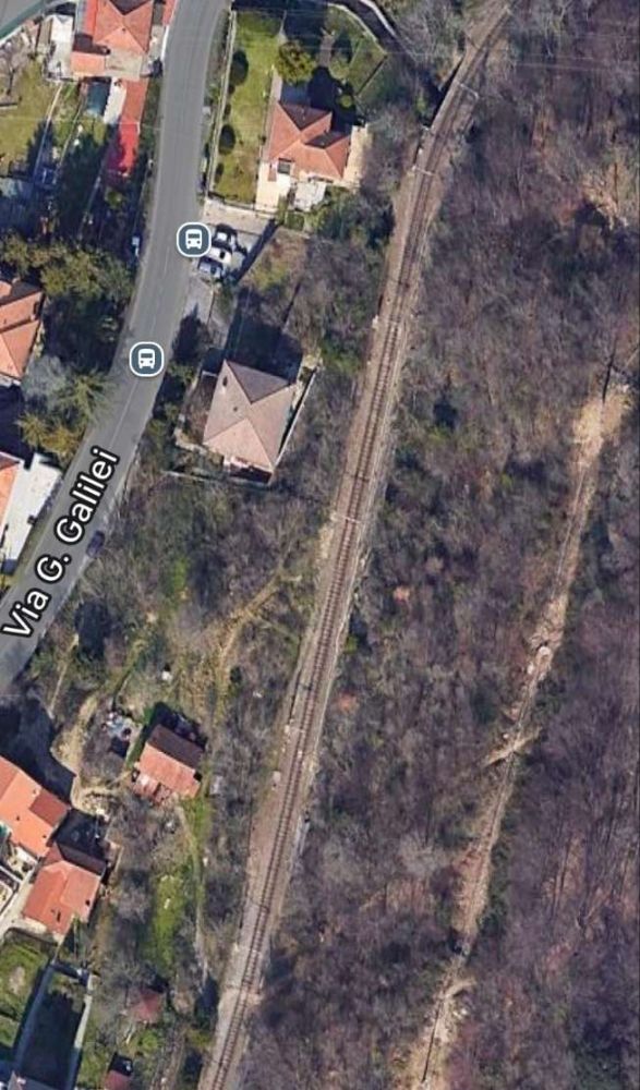
Three wider satellite views take the line as far as the Cappuccio Halt.
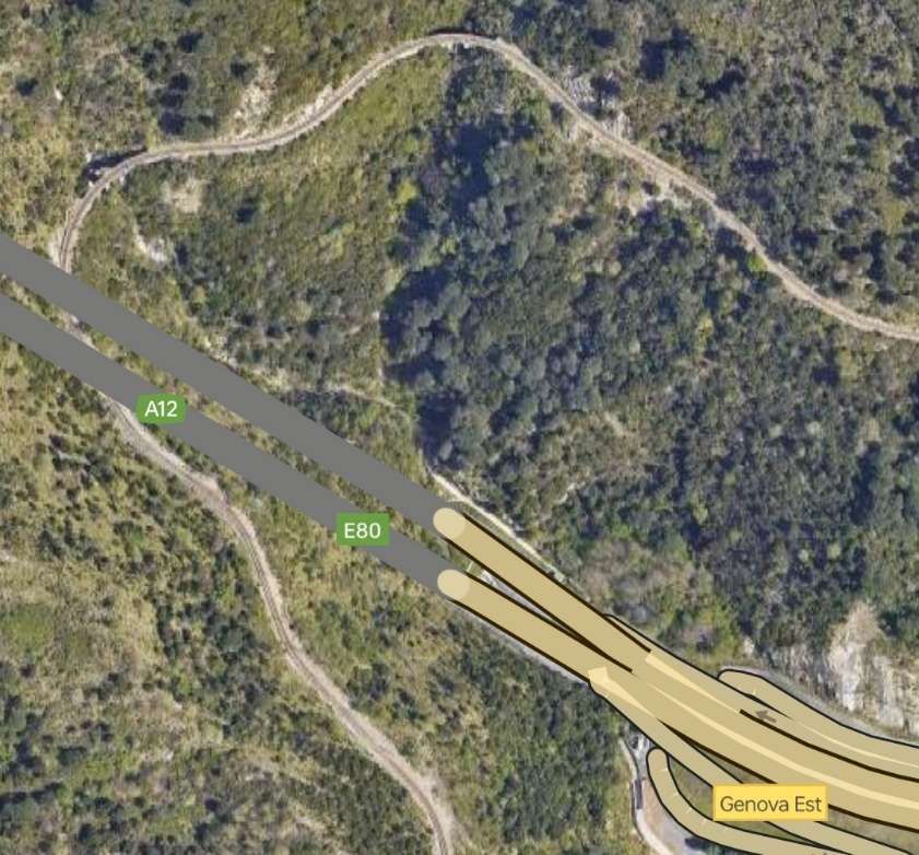
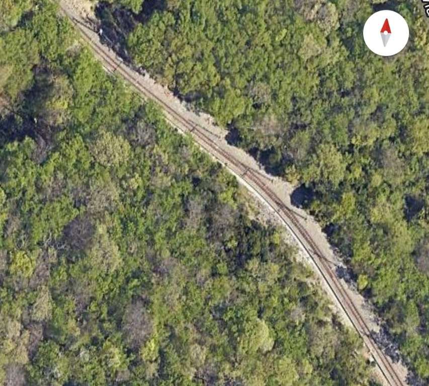
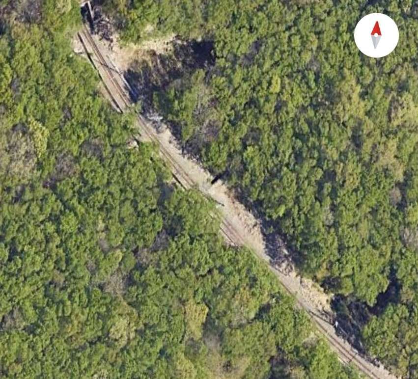
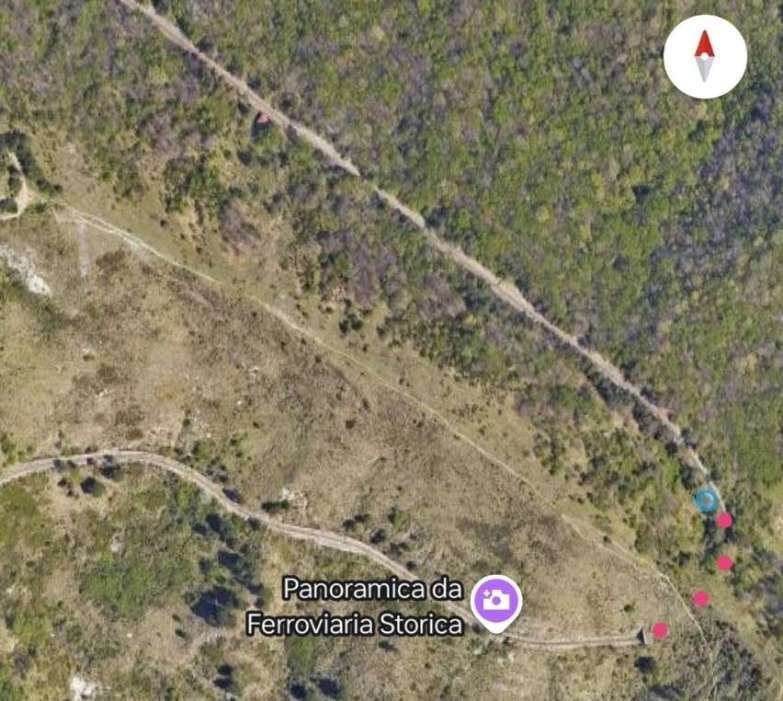
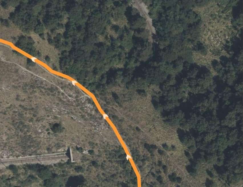
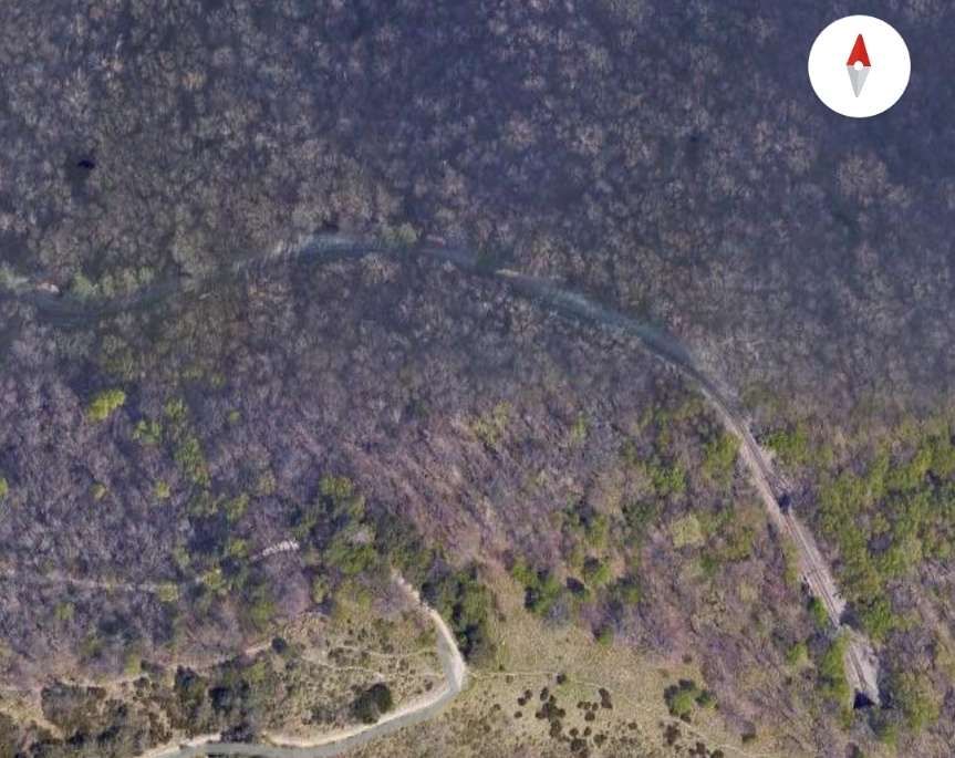
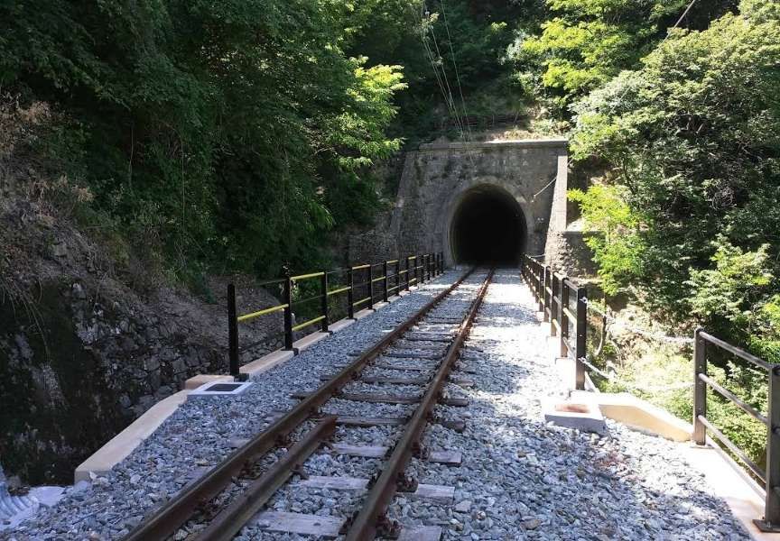
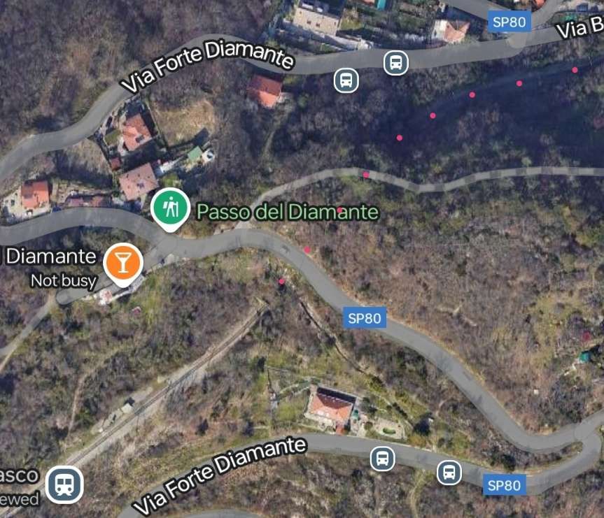
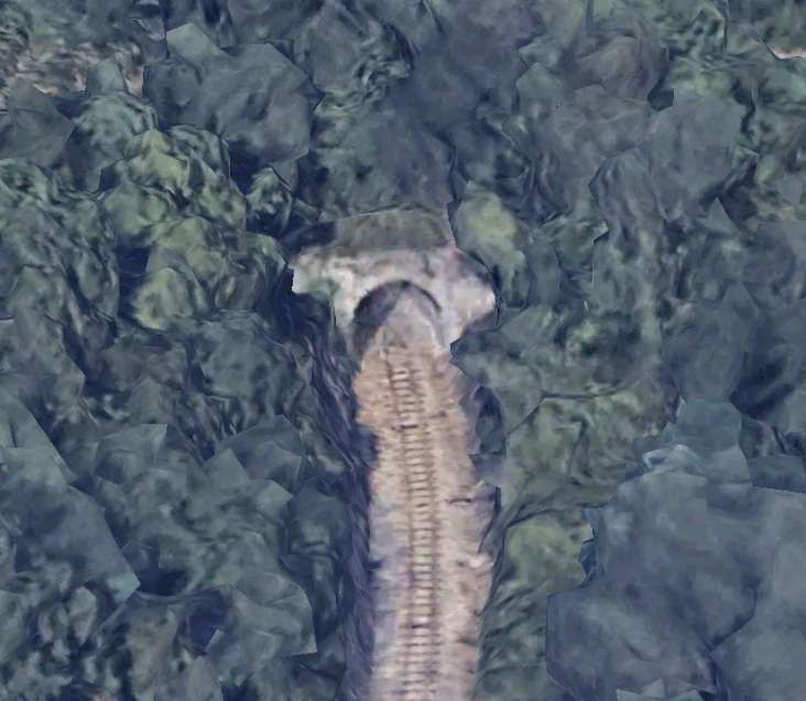
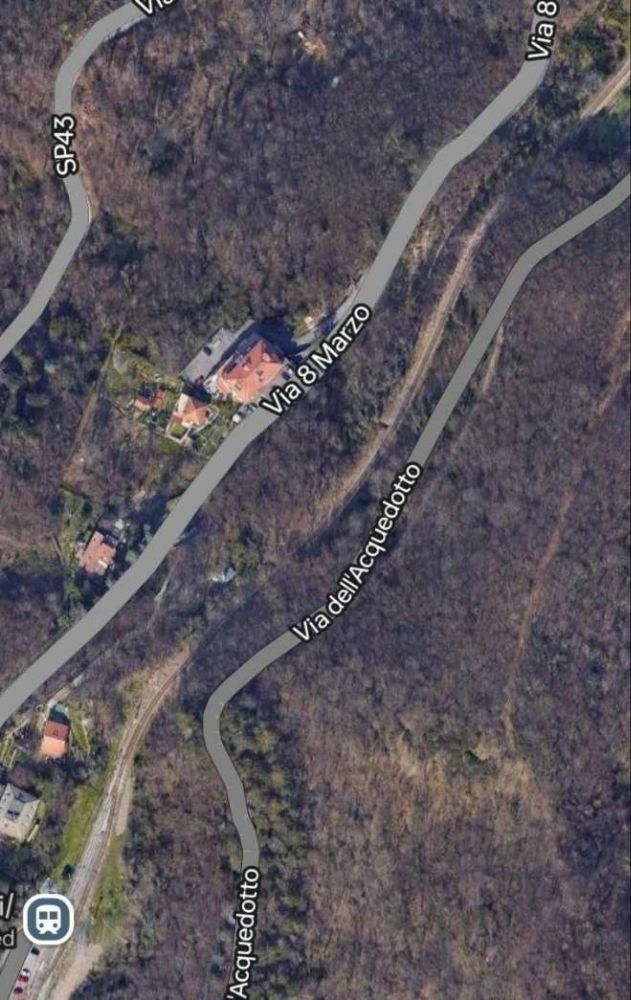
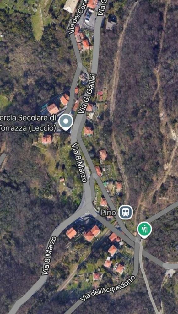
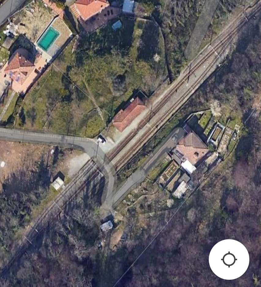
The next two satellite images take the line on from Cappuccio Halt to one of the line’s tunnels.
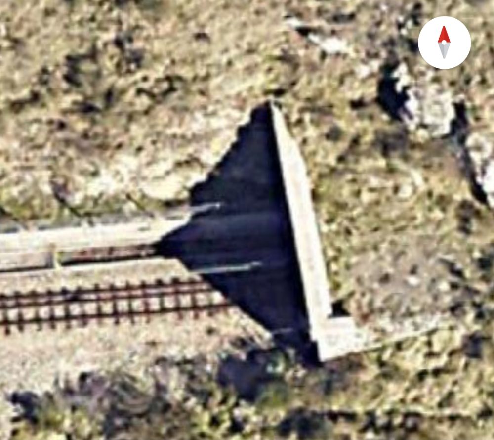
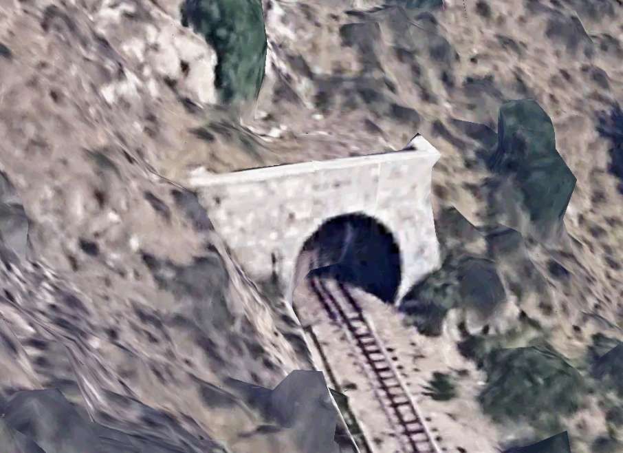
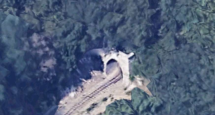
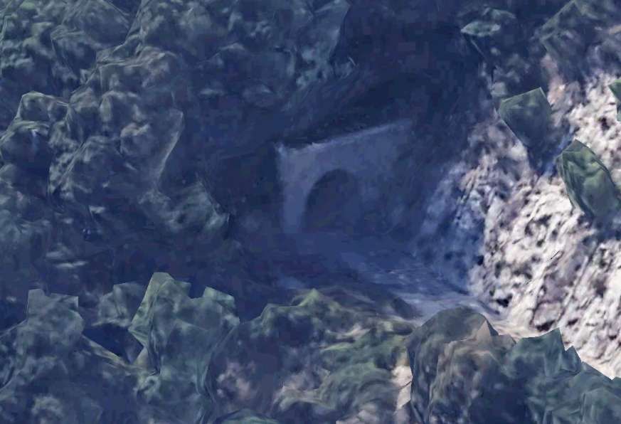

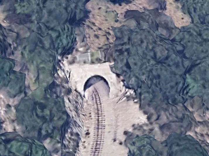
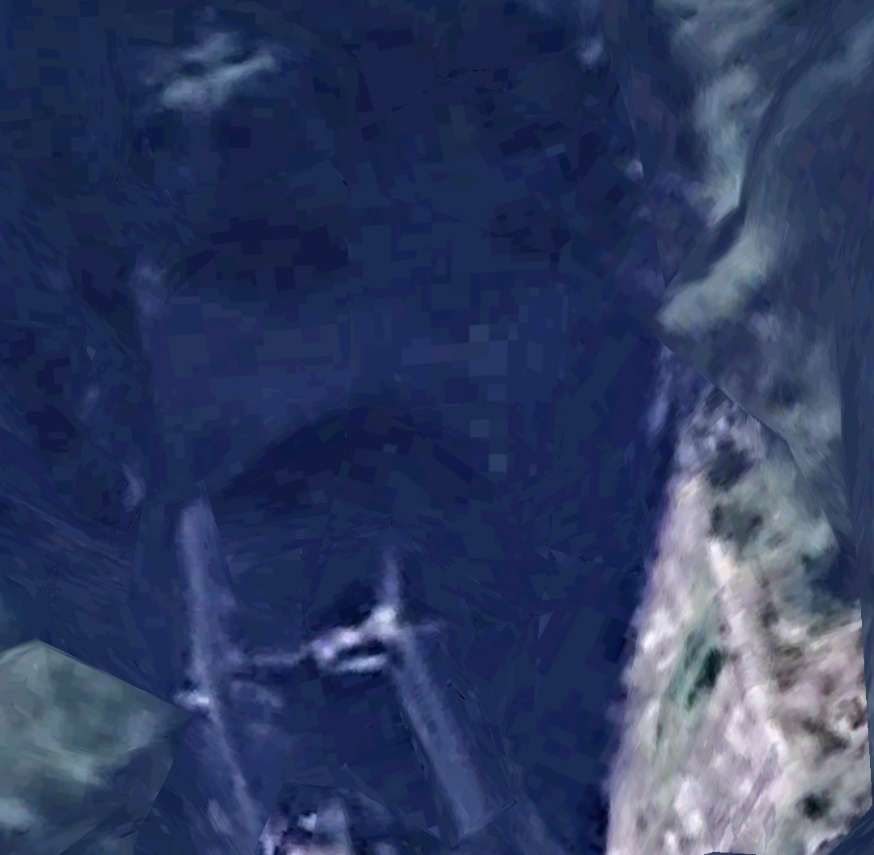
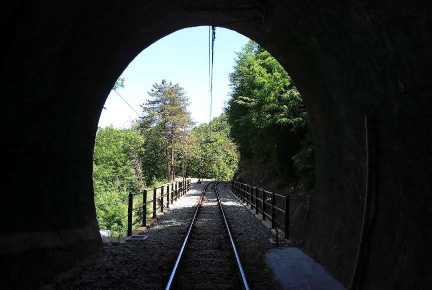
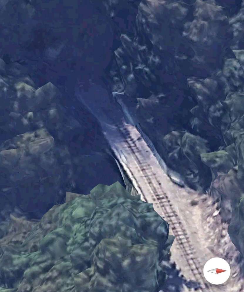
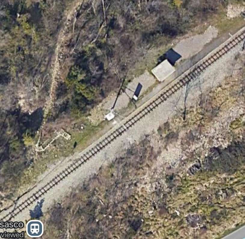

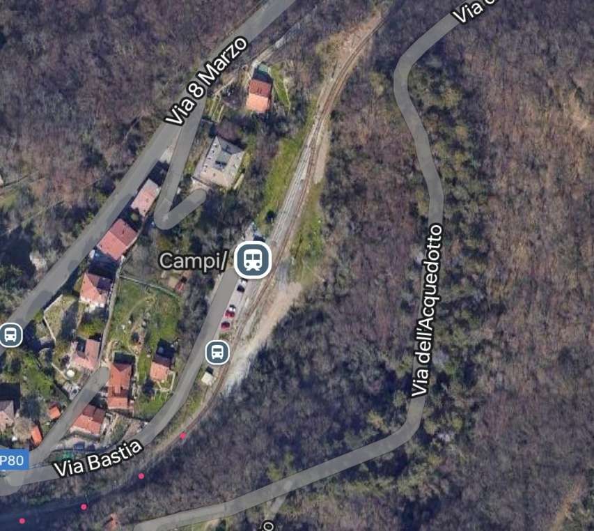
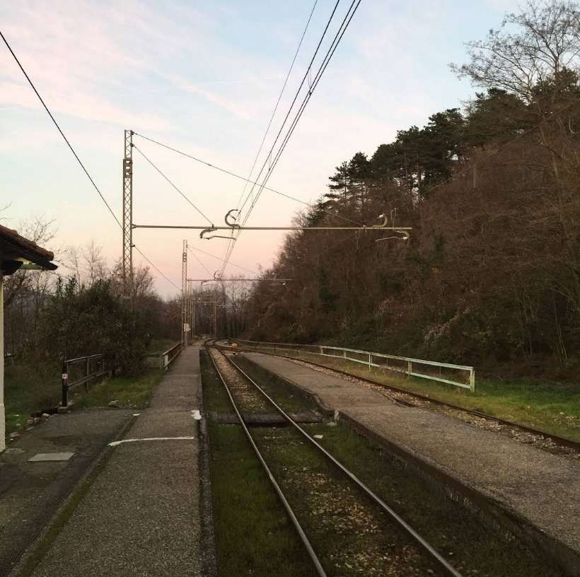

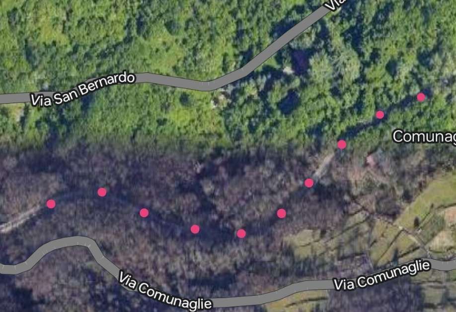
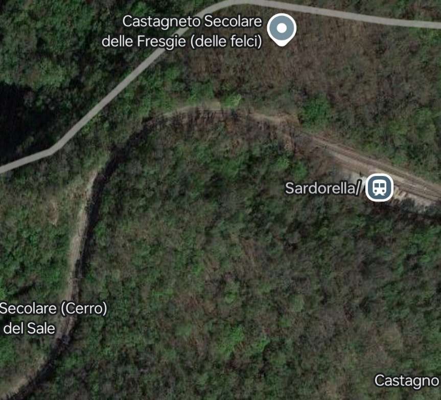
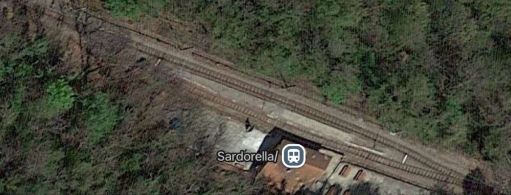
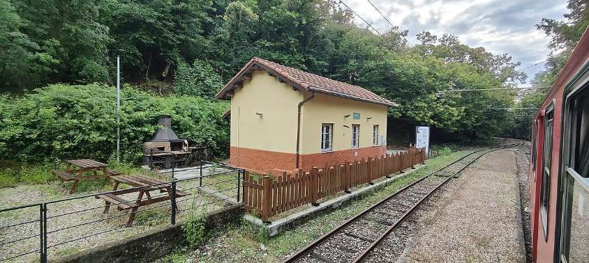
This first part of the journey finishes here at Sardorella.
References
- https://en.m.wikipedia.org/wiki/Genova%E2%80%93Casella_railway, accessed on 11th November 2024.
- Il trenino di Casella: terapia su rotaia contro noia e stress; in ilGiornale.it (in Italian), https://www.ilgiornale.it/news/trenino-casella-terapia-su-rotaia-contro-noia-e-stress.html 28th November 2007; accessed on 11th November 2024.
- Ferrovia Genova Casella: https://www.ferroviagenovacasella.it/geca, accessed on 11th November 2024.
- http://www.uwrbancenter.comune.genova.it/sites/default/files/quaderno_arch_2011_03_21.pdf, accessed on 16th November 2024.
- https://www.bimbeinviaggio.com/en/italy/liguria-en/genoa/genoa-casella-train-route-timetable, accessed on 19th November 2024.
- https://www.delcampe.net/fr/collections/cartes-postales/italie/genova-genoa/16458-00-italie-genova-piazza-manin-469897224.html, accessed on 19th November 2024.
- https://it.m.wikipedia.org/wiki/Stazione_di_Genova_Piazza_Manin, accessed on 19th November 2024.
- https://www.stagniweb.it/foto6.asp?File=fgc21&Inizio=29&Righe=10&InizioI=1&RigheI=100&Col=5, accessed on 21st November 2024.
- https://it.m.wikipedia.org/wiki/Stazione_di_Campi, accessed on 21st November 2024.
- https://commons.m.wikimedia.org/wiki/File:A5_A10_cappuccio.jpg, accessed on 11th November 2024.
- https://www.ferroviagenovacasella.it/geca/storia, accessed on 19th November 2024.
- https://it.wikiloc.com/percorsi-escursionismo/salita-preli-preli-passo-gandino-sella-del-diamante-forte-diamante-camporsella-chiesa-del-brasile-b-62000826, accessed on 20th November 2024.
- https://it.m.wikipedia.org/wiki/Stazione_di_Torrazza#/media/File:Locomotiva_A11_(1998)_a_Torrazza.jpg, accessed on 20th November 2024.
- https://it.m.wikipedia.org/wiki/Stazione_di_Sardorella#/media/File%3AStaz.Sardorella.jpg, accessed on 21st November 2024.
- https://www.stagniweb.it/foto6.asp?File=fgc19&Inizio=11&Righe=10&InizioI=1&RigheI=100&Col=5, accessed on 21st November 2024.
- https://rogerfarnworth.com/2024/11/25/genoa-casella-narrow-gauge-railway-part-2-sardorella-to-casella/

_a_Torrazza.jpg)
A delightfully well prepared piece, as ever, Roger.
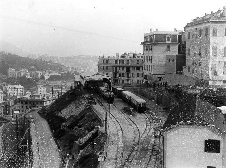
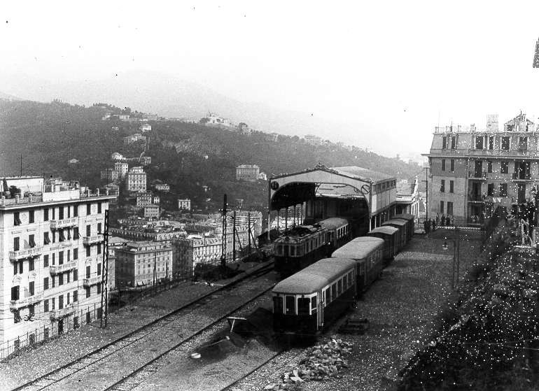
However, with reference to the two frames from 1928, of the steam, construction loco: Both photos were undoubtedly taken by the same photographer, within minutes of each other, from almost the same point of view. He has simply stepped from trackside to between the two running roads, as some of the crowd have wandered across the tracks.
The train, itself, is shown in precisely the same position, but one of the frames has been flipped. i.e., it is a mirror image. This can be ascertained by the building, with its flag, and the orientation of the crossover pointworks. It is up to yourself to decide which is the ‘true’ image, and which is the reversed one.
Stuart Yearsley.
Thank you Stuart. I have added a note about this.
Pingback: Genoa – Casella Narrow Gauge Railway Part 2 – Sardorella to Casella | Roger Farnworth