
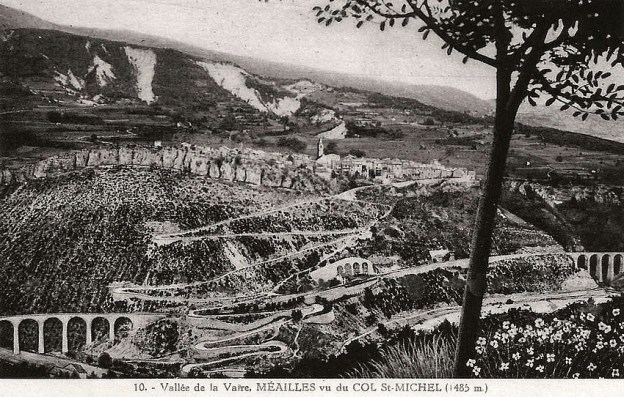
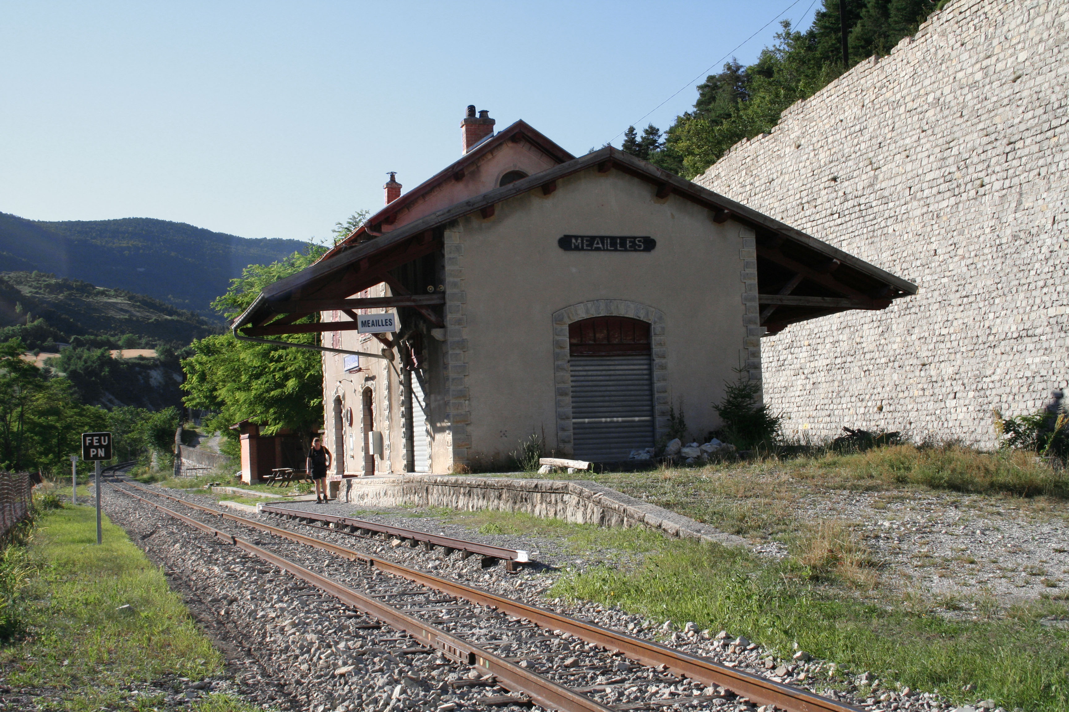
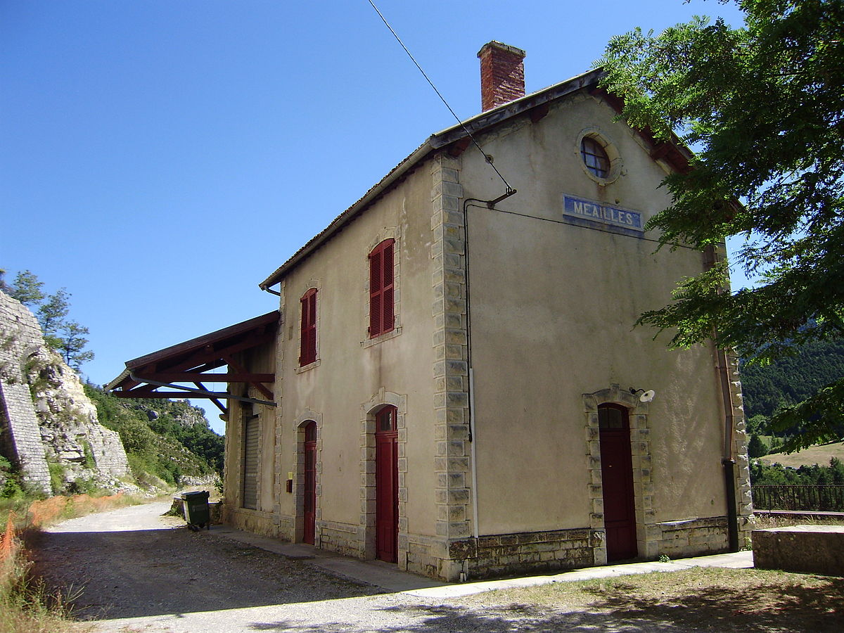
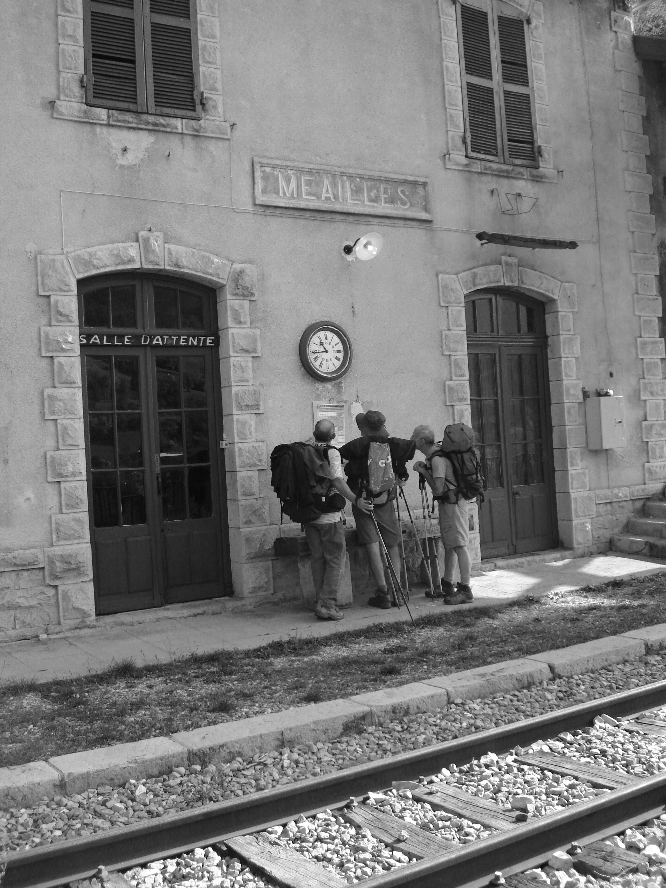
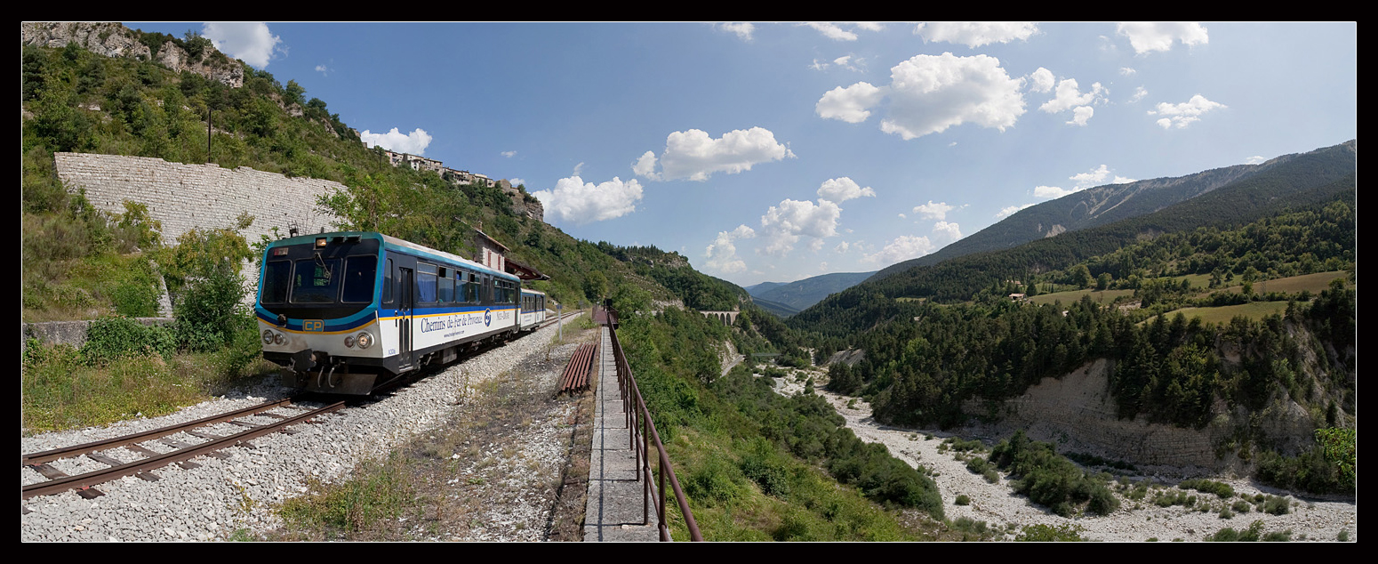
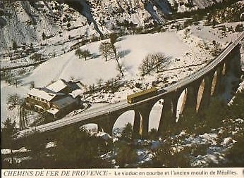
Meailles is the starting point for the next stage in our journey. The featured image is an excellent black and white panorama of the village, station, viaducts and railway line. This next image shows the station and the Viaduc de Moana sitting below the village. [1]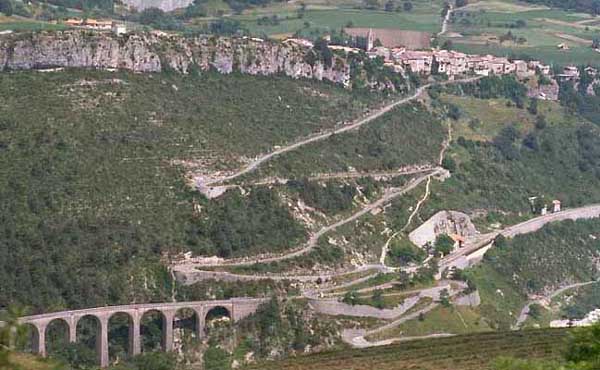 We return to the station at Meailles ready to catch the next train. A final look round the station is followed by checking the timetable and then joining the next train as it leaves the station! The pictures below are all to be found on the relevant page of https://mapio.net, [4] except for one which is an image from Wikipedia. [5]
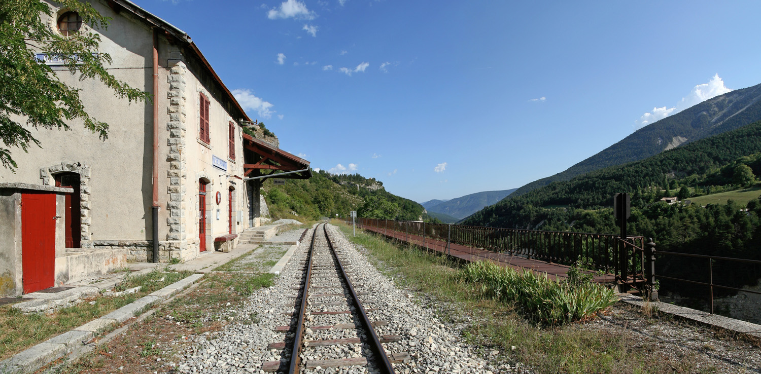
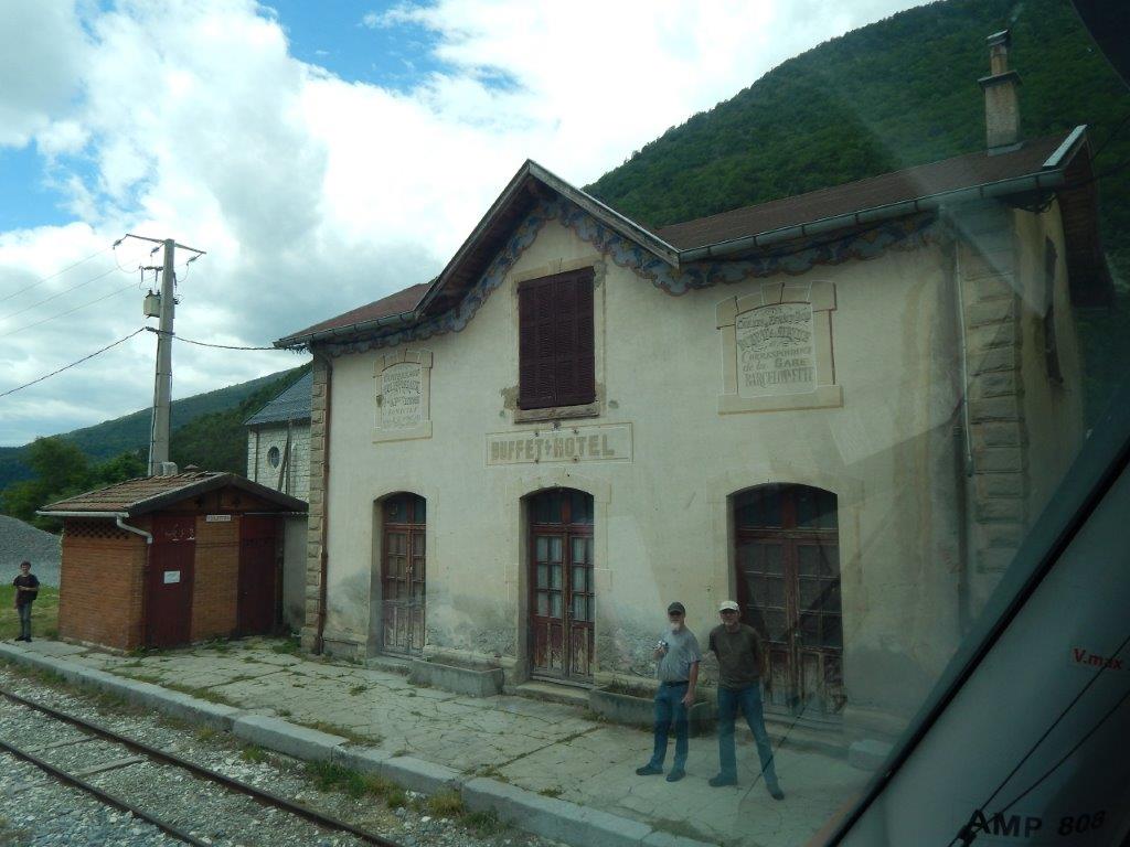
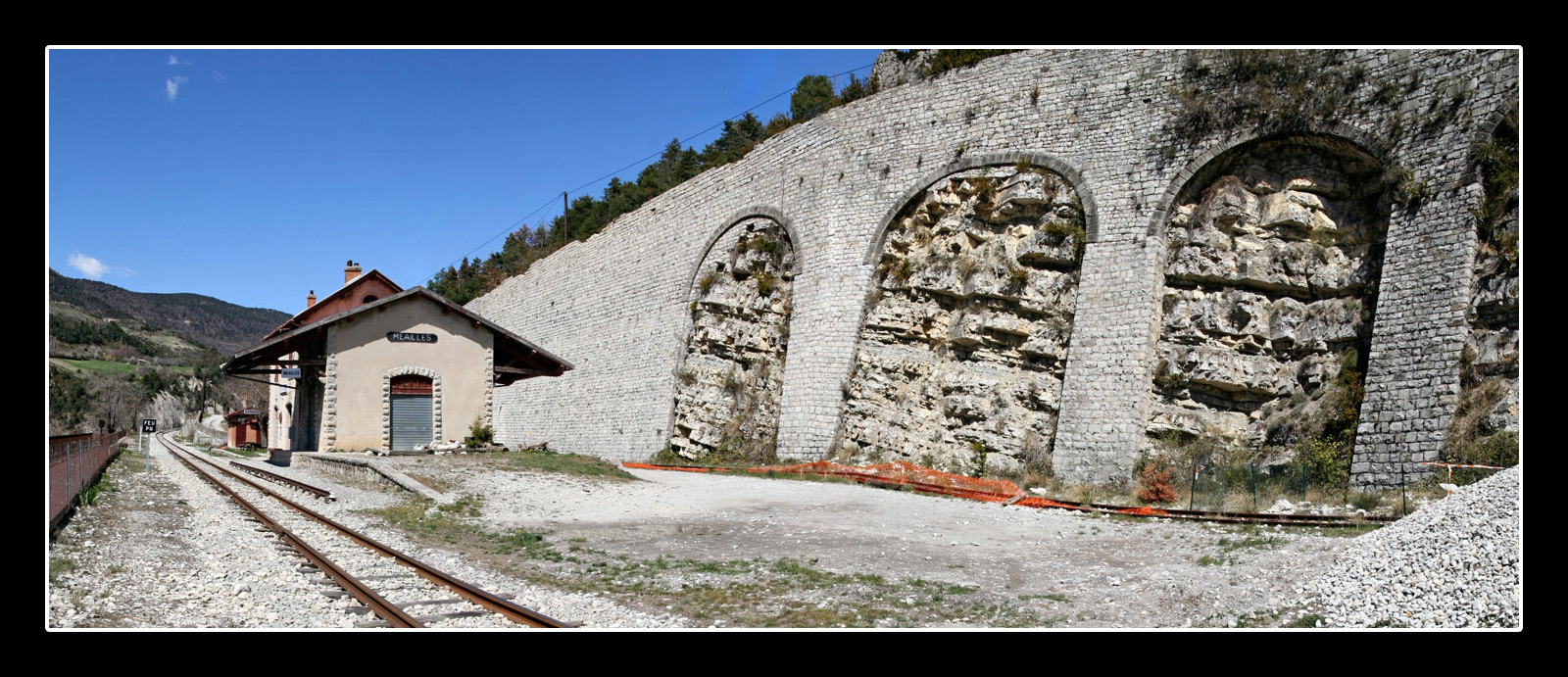
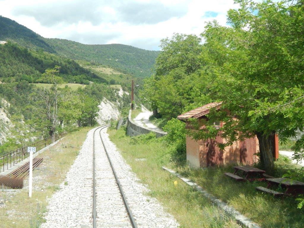 Driver’s eye view leaving Meailles Station. [9]
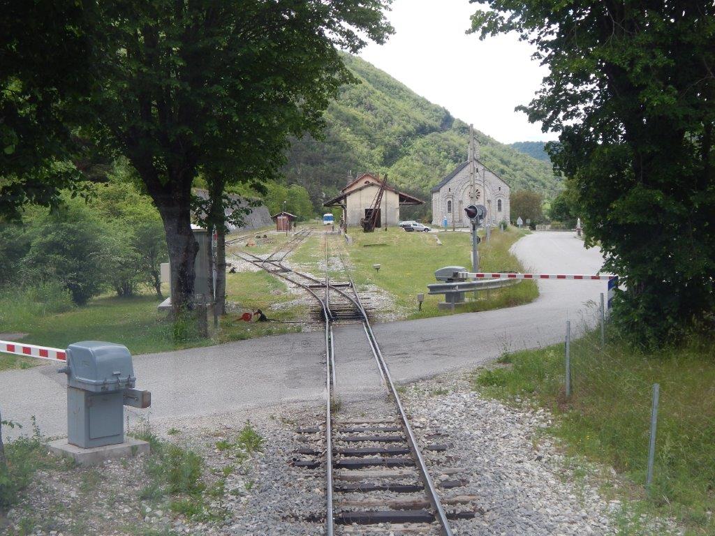
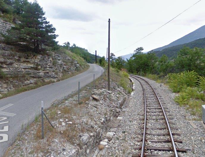 Looking back towards the station from the level-crossing on the road up the valley side to Meailles village.
The next few images show the Viaduc de Moana which our train crosses almost immediately after leaving the station at Meailles.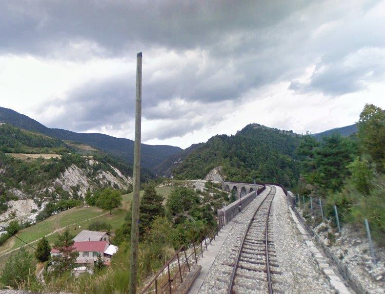 First from the level-crossing in the image above.
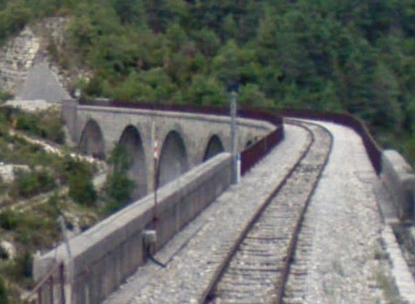 Then a driver’s eye view of the viaduct.
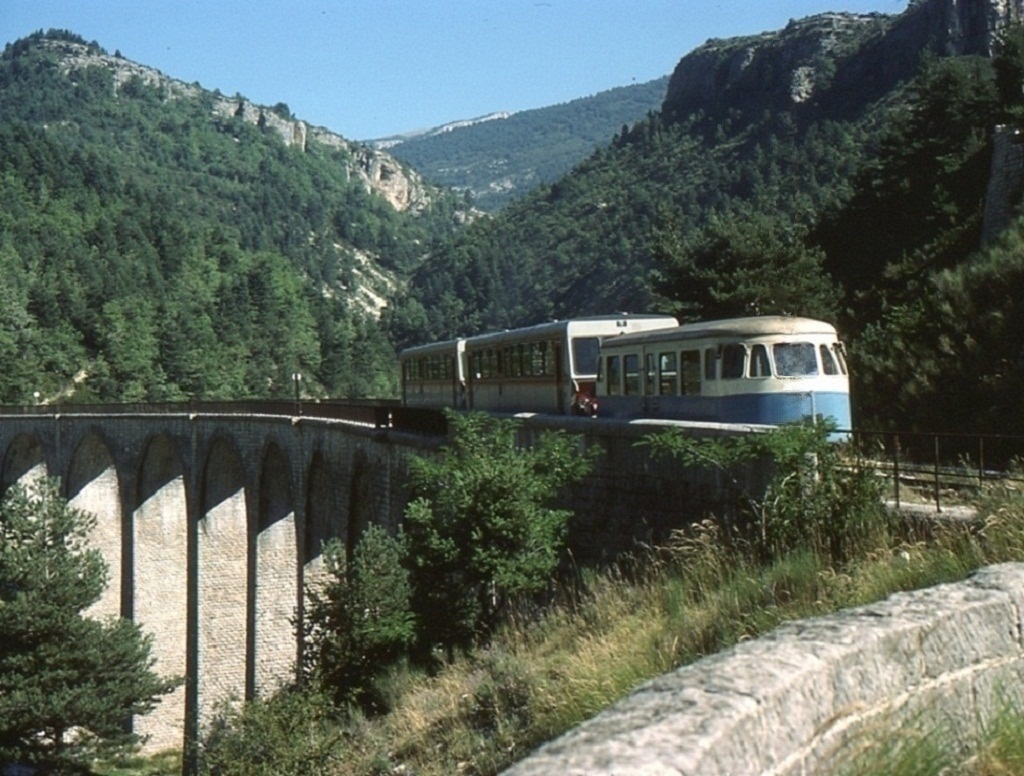 A railcar heading onto the Viaduc du Moana, (c) Mouliric. [2]
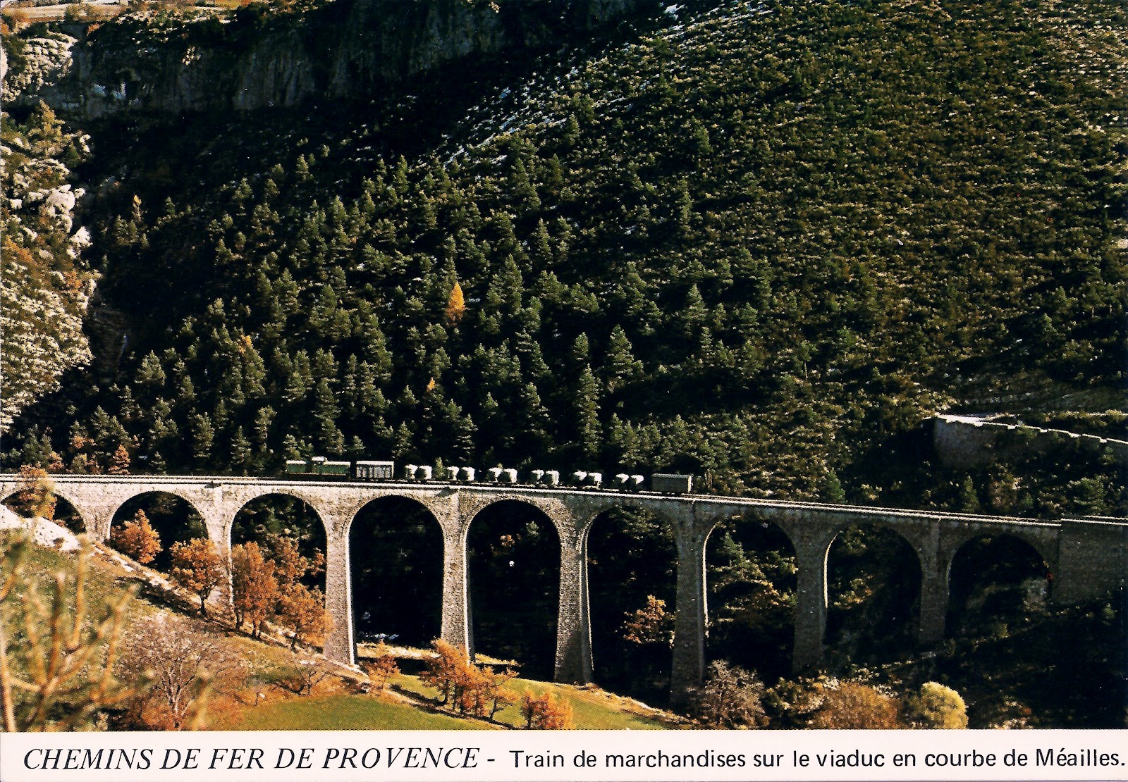 Freight train on the viaduct. [6]
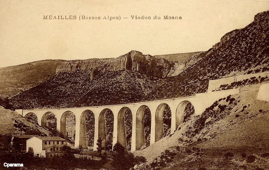
 The two images immediately above are sourced from the CPArama website
 . [3]
. [3]
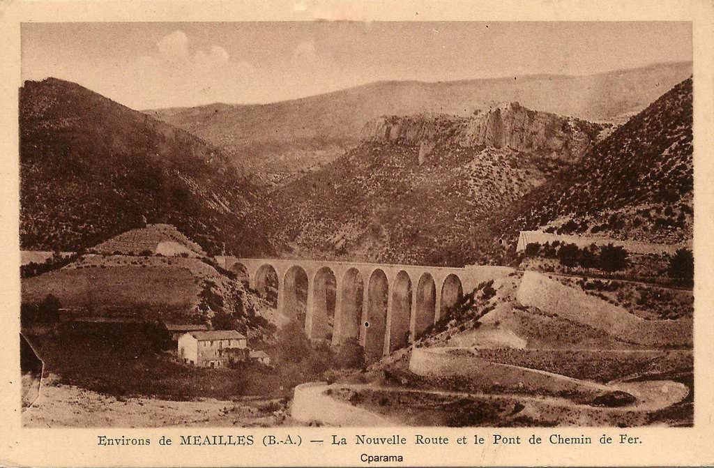
This image is taken from above the viaduct on the hillside close to the village of Meailles.
The image below is taken from the far side of the valley of La Vaire.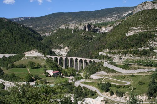 The Viaduc du Moana crosses the Ravin du Maouna which can be seen heading away to the northeast behind the viaduct.
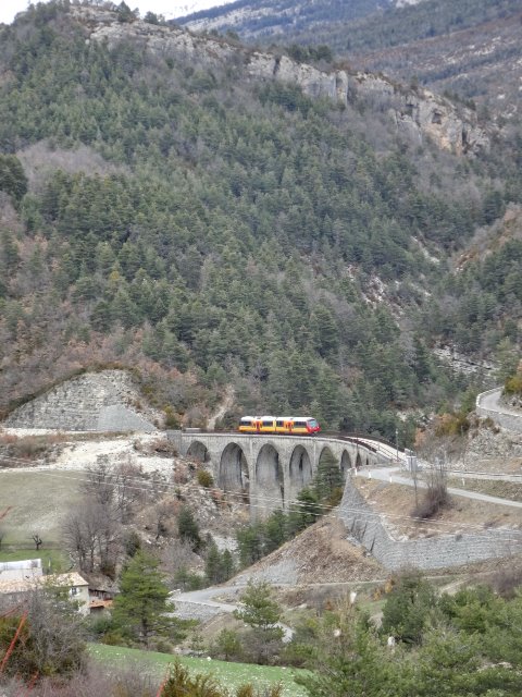 Modern train on the Viaduc du Moana, (c) La bête de Calvi [8]
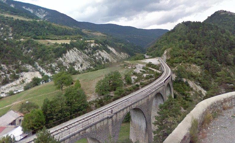 The view ahead up the valley of La Vaire (above) taken from the road up the valley side to Meailles.
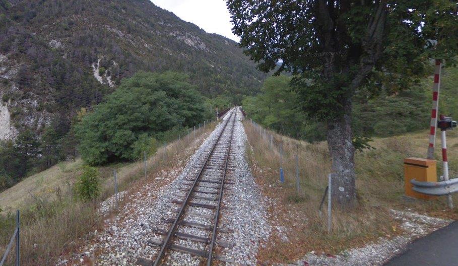
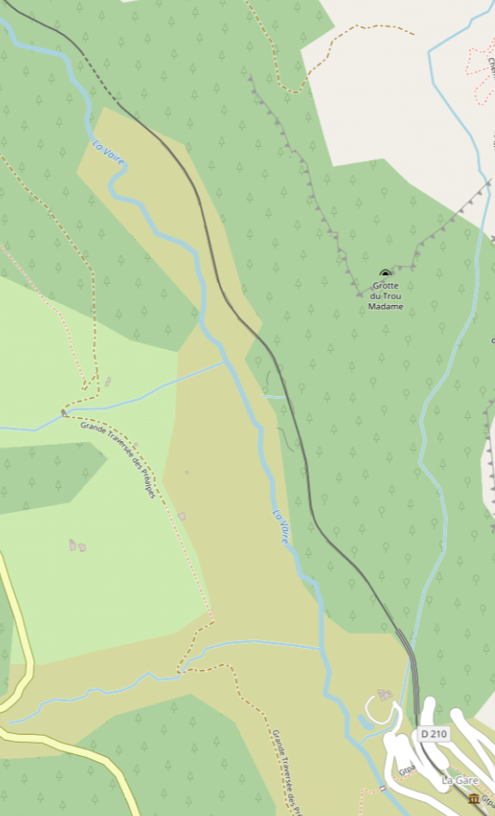 The railway heads north-northwest up the valley of La Vaire. The next major structure is a tunnel – the Tunnel de Méailles. The tunnel is 104 metres in length and is shown by the red, blue and green dots on the map below. At this point the railway line ius now 995 metres above sea-level. [7]
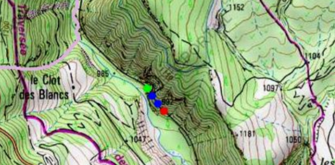
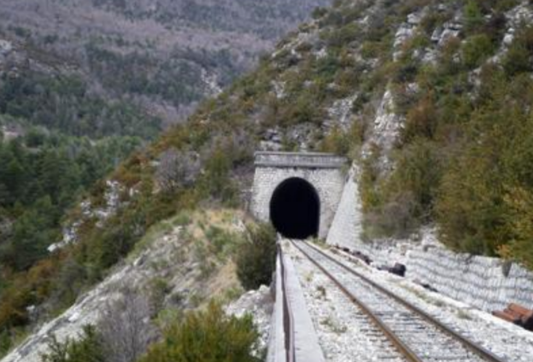 The south portal of the Tunnel de Méailles. [7]
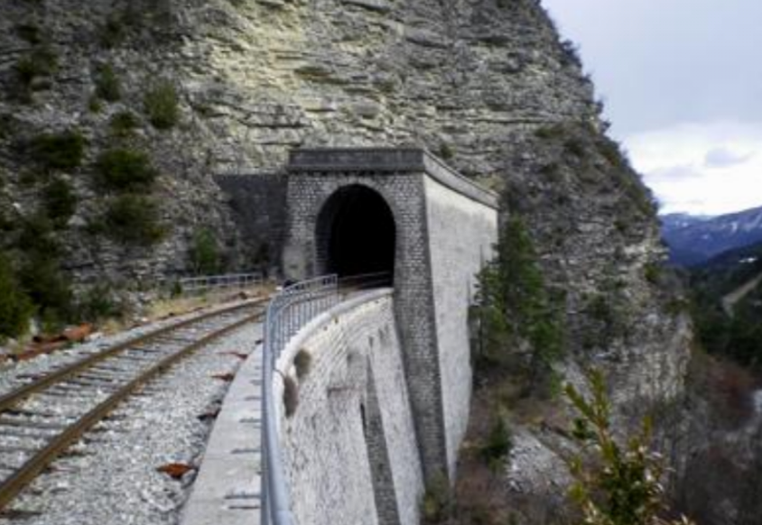
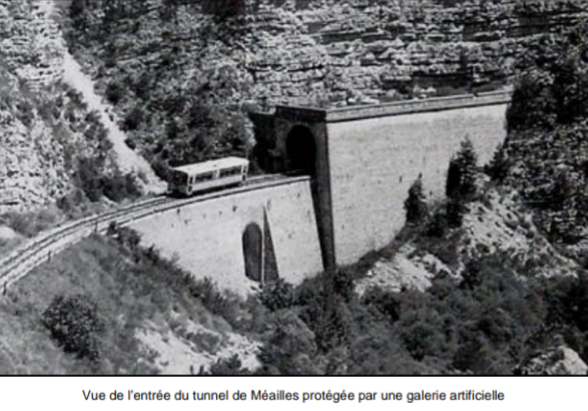 The two images above show the north portal of the tunnel which includes a short ‘gallery’ beyond what would have been the tunnel entrance and then a significant retaining wall and bridge. [7]
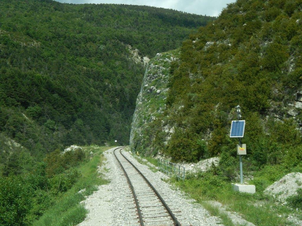 For a couple of kilometres the railway continues along the east bank of La Vaire. [9]
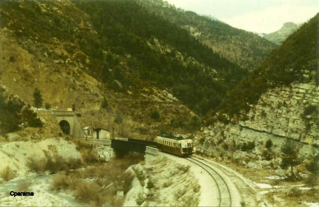 Peyresq Halt is preceded by the bridge over La Vaire and followed by the tunnel portal. A Renault Autorail heads away from the Halt towards Nice. [24]
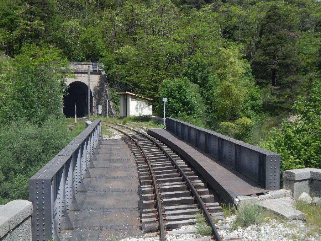 It crosses La Vaire on a short girder bridge, passes through Peyresq Halt and then enters the Tunnel de la Colle Saint Michel [9]
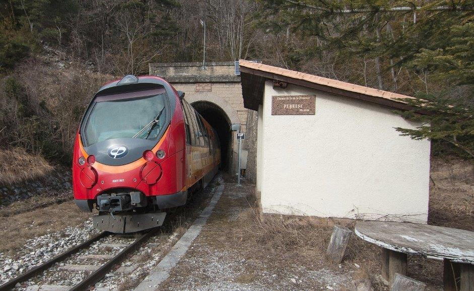 Modern transport at Peyresq Halt. [10]
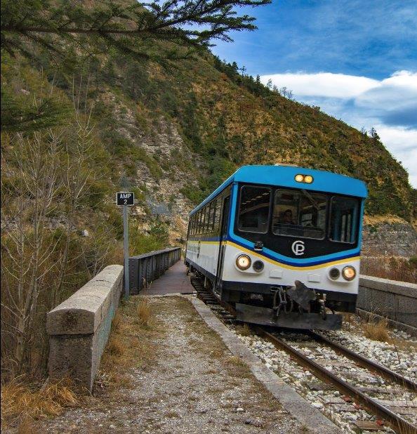 Looking back down the line, we see slightly older transport approaching Peyresq from Meailles. [11]
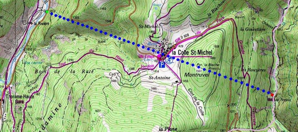 The Tunnel de la Colle Saint Michel is at an altitude of more than 1000 metres above sea-level. It is 3.46km in length – the longest tunnel on the line. The tunnel is completely straight except close to its eastern portal where it has a slight curve which matches the line to the east of the tunnel. There are two interesting and original features in the tunnel which are both in the north wall. [12]
Inside a tunnel, a few metres from the eastern portal it can be seen that the eastern portal needed to be widened. The old alignment of the tunnel wall is still visible as a pedestal. The widening facilitated alignment sights for drivers. About 1100 m from the western portal, a side chamber 8 m deep and 4 m wide exists, which was a stable for horses during the construction of the work and was also used for turning the carts used to transport rubble from the tunnel construction.
In addition, this tunnel was subject to strong draughts which, in winter, froze water infiltrating into the tunnel. This caused the formation of ice stalactites which risked significant damage to trains. To prevent this the west portal was given an overhead door in 1969. The eastern portal is visible in images above the western portal is shown below. [12]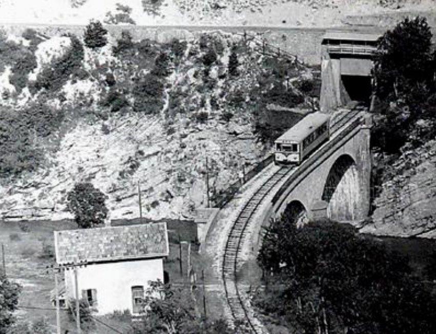 As trains leave the western portal of the Tunnel de la Colle Saint Michel they cross a short viaduct over the River Verdon and crosses a track on the west side of the river. There is an old crossing keeper’s cottage adjacent to the line. [12]
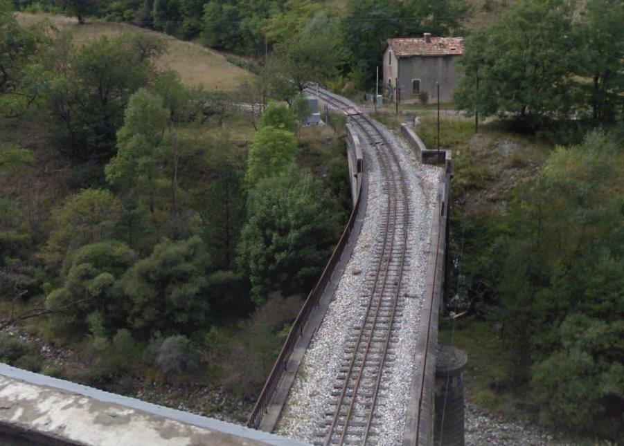 A view towards Digne taken from above the western portal of the Tunnel de la Colle Saint Michel.
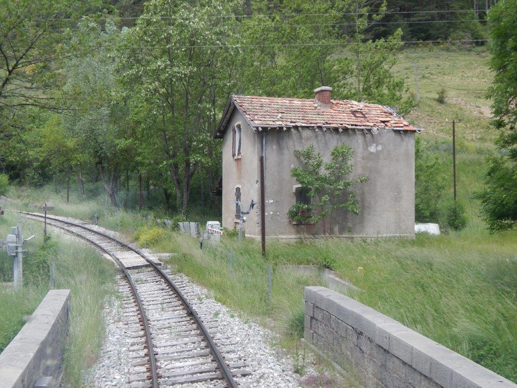 The crossing keeper’s cottage. [9]
Leaving the Tunnel de la Colle Saint Michel, the line turns sharply to the southwest and follows the western bank of the River Verdon to a point not far north of the Station at Thorame-Haute where it spans the river once again and enters the railway station on the eastern bank of the river.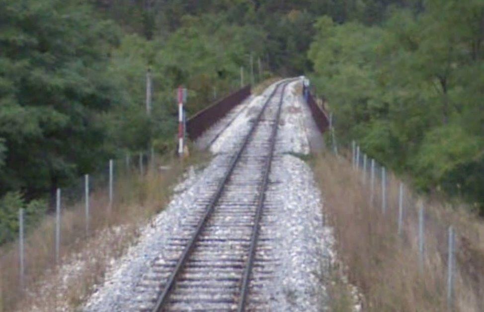
 [9]
[9] 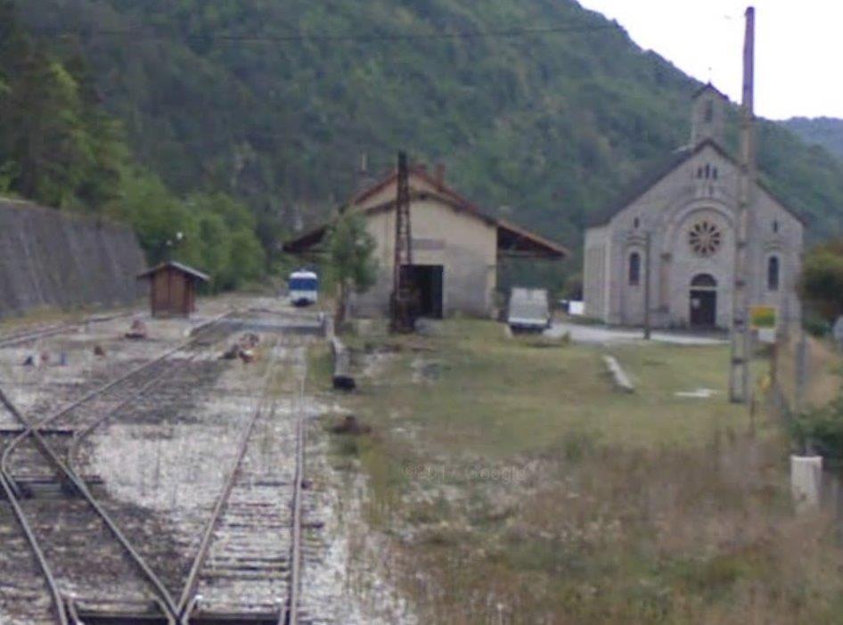
 [9]
[9] [9]
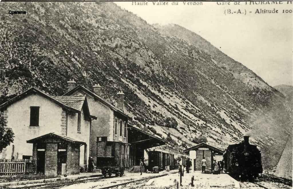
[9]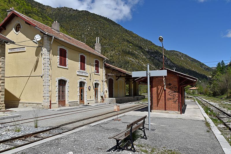 [13]
[13]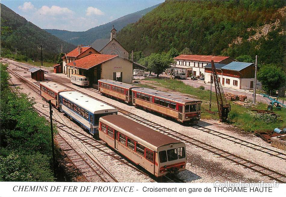 [14]
[14]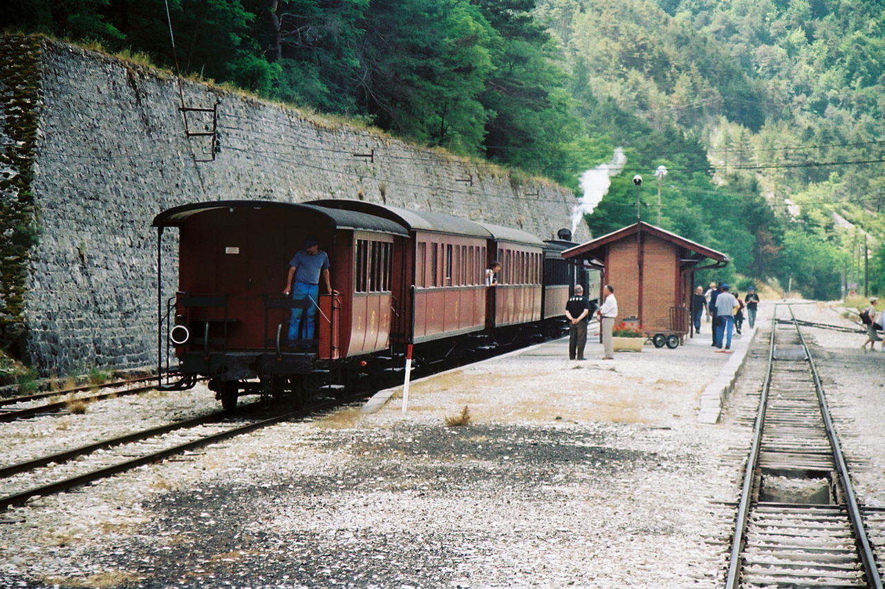 Steam at Thorame Haute Station. [15]
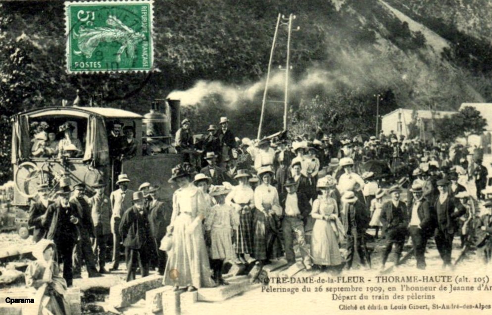 A festival at Thorame-Haute.
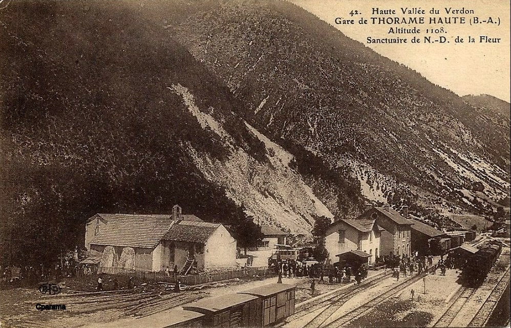
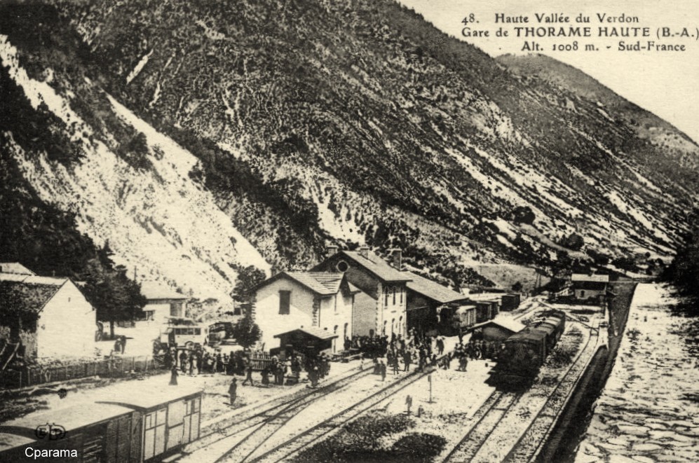 Another view of the station on an old postcard, the following photos all come from the same source, one of CPArama’s webpages. [16]
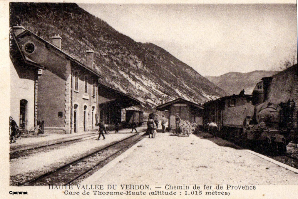
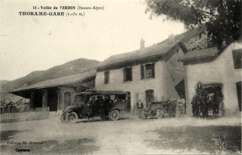
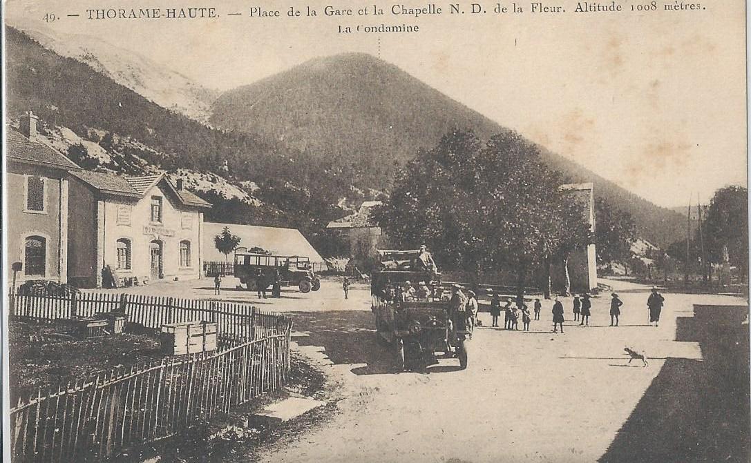 La Place de la Gare, Thorame-Haute. [17]
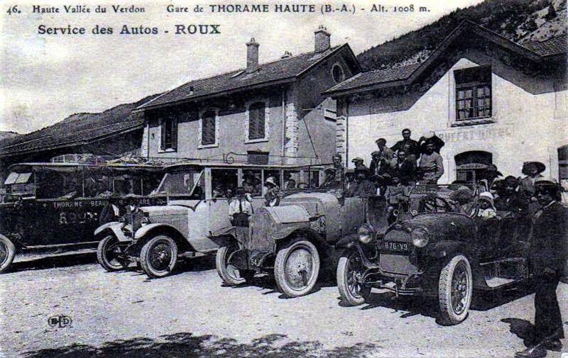 La Place de la Gare. [18]
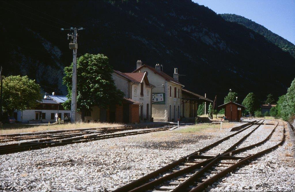 The station in bright sunlight. [20]
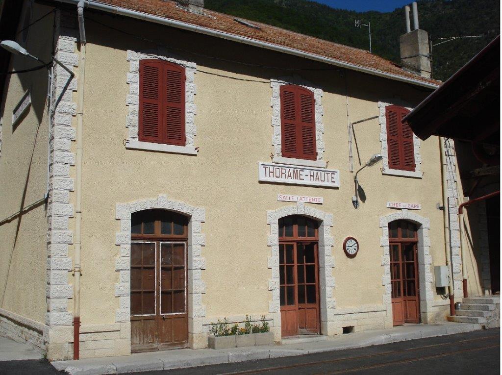 A recent photograph of the main station building. [21]
It is interesting that the village which gives its name to this station is almost 8km away. The line enters the valley of the Verdon well south of the village and heads away south.
The station is about 95 kilometres from Nice at an altitude of over 1000 metres above sea-level. The station was opened in 1911 and a separate buffet building was included on the site next to the main building. [19] The railway line between Meailles and Thorame-Haute was on the last stretch of the line from Nice to Digne to be built. The length involved was that between Saint-André-de-Méouilles and Puget-Théniers.
Work began in January 1900 on the final 27km of the line. The tunnel boring took a number of years to complete. Steady progress was made on the tunnel. The project had a significant setback when, in April 1909 part of the land mass above the proposed location of the station at Thorame-Haute collapsed onto the site of the station engulfing the part built buildings and platforms. Stabilisation of the mountain required the construction of a 114 metre long, 3.3 metre high retaining wall. The wall was 1.5 metres thick and reinforced by 7 buttresses. [22]
The station was opened to travellers on 3rd July 1911 [23] with the inauguration of the full line taking place on 6th August 1911. The station at Thorame-Haute quickly became a significant tourist destination providing access to some high quality hotels in the upper reaches of the Verdon valley. A wealthy clientele travelled from the Côte d’Azur to access such hotels as the Alp’hôtel de Beauvezer, and the Fontgaillarde in Thorame-Haute.
It is at Thorame-Haute that this leg of our journey is completed.
References
- http://www.gecp.asso.fr/meailles.html, accessed on 5th August 2018.
- https://commons.wikimedia.org/wiki/File:Train_Nice-Digne_sur_le_viaduc_de_la_Maouna.jpg, accessed on 5th August 2018.
- https://www.cparama.com/forum/meailles-t25403.html, accessed on 9th August 2018.
- https://mapio.net, accessed on 9th August 2018.
- https://fr.wikipedia.org/wiki/Gare_de_M%C3%A9ailles, accessed on 9th August 2018.
- https://writerquake.blogspot.com/2012/09/old-postcard-wednesday-freight-train-on.html, accessed on 9th August 2018.
- http://www.tunnels-ferroviaires.org/tu04/04115.1.pdf, accessed on 9th August 2018.
- http://www.passion-metrique.net/forums/viewtopic.php?f=2&t=4143&hilit=provence&start=2775, accessed on 10th August 2018.
- http://www.rd-rail.fr/1-PHOTOS/PH43/index-ph43.html, accessed on 1st August 2018.
- https://www.google.co.uk/maps/place/Peyresq/@44.042084,6.612933,3a,75y,90t/data=!3m8!1e2!3m6!1sAF1QipNFeGoAhEI7HVF0vLop7jT4jL6tfsbg5Zy7yg1S!2e10!3e12!6shttps:%2F%2Flh5.googleusercontent.com%2Fp%2FAF1QipNFeGoAhEI7HVF0vLop7jT4jL6tfsbg5Zy7yg1S%3Dw203-h130-k-no!7i4296!8i2760!4m5!3m4!1s0x12cc6f997b176e59:0xb48d78a0c1ca0c6c!8m2!3d44.0420841!4d6.6129327, accessed on 10th August 2018.
- https://www.google.co.uk/maps/place/Peyresq/@44.042084,6.612933,3a,75y,90t/data=!3m8!1e2!3m6!1sAF1QipM3SJhROxBfPav9XWKGwn1vNf2CGkvFGnLlyoBG!2e10!3e12!6shttps:%2F%2Flh5.googleusercontent.com%2Fp%2FAF1QipM3SJhROxBfPav9XWKGwn1vNf2CGkvFGnLlyoBG%3Dw392-h605-k-no!7i3194!8i4937!4m5!3m4!1s0x12cc6f997b176e59:0xb48d78a0c1ca0c6c!8m2!3d44.0420841!4d6.6129327, accessed on 10th August 2018.
- http://www.tunnels-ferroviaires.org/tu04/04219.1.pdf, accessed on 9th August 2018.
- https://commons.wikimedia.org/wiki/File:Gare-de-Thorame-Haute-DSC_0331.jpg, accessed on 10th August 2018.
- https://collection-jfm.fr/p/cpsm-france-04-croisement-en-gare-de-thorame-haute-train-19518, accesed on 10th August 2018.
- http://www.wikiwand.com/fr/Gare_de_Thorame-Haute, acessed on 10th August 2018.
- http://www.cparama.com/forum/thorame-haute-t28161.html, accessed on 10th August 2018.
- http://cartepostale-ancienne.fr/index.php?route=product/product&product_id=2301141, accessed on 10th August 2018.
- https://twitter.com/lecartographe/status/948099693837471744, accessed on 10th August 2018.
- https://thorame-haute.fr/articles.php?lng=fr&pg=65, accessed on 10th August 2018.
- https://mapio.net/a/60593332/?lang=eu, accessed on 10th August 2018.
- https://tourisme.trainprovence.com/thorame-haute-train-station, accessed on 10th August 2018.
- https://fr.m.wikipedia.org/wiki/Gare_de_Thorame-Haute, accessed on 10 the August 2018.
- https://books.google.fr/books?ei=7Q8gVazPIsbxUvTagKgN&hl=fr&id=HJxMAAAAYAAJ&dq=”Allons-Argens”%2C”chemin+de+fer”%2C1911&focus=searchwithinvolume&q=”Allons-Argens”, accessed on 10th August 2018.
- https://www.cparama.com/forum/saint-michel-peyresq-cne-thorame-haute-t24275.html, accessed on 1st August 2018.
