
Chemins de Fer de l’Hérault
The first line we are looking at is that starting in Saint-Chinian and running to Beziers
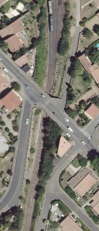
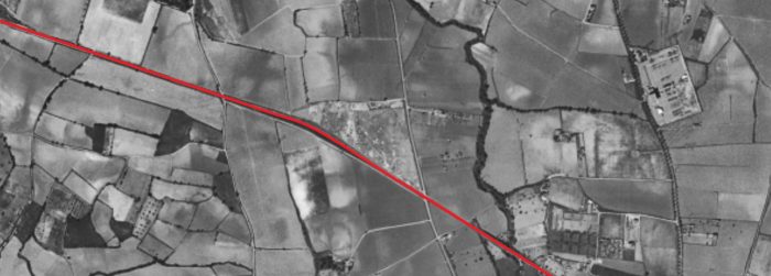
Saint-Chinian – Beziers Line – Part 2 – Cazouls-les-Beziers to Beziers (including the line to Colombiers)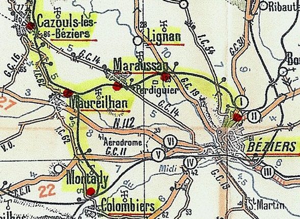 This map shows our area of interest. The secondary lines are highlighted in yellow. [9]
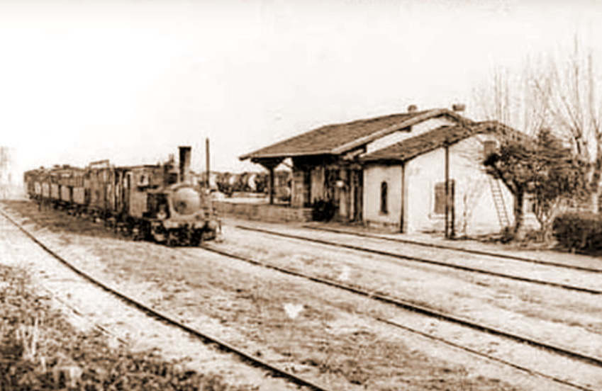
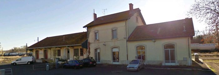
We start the next length of the journey at Cazouls-les Beziers. First some photographs and then some discussion of recent events in the Commune and about the railway line.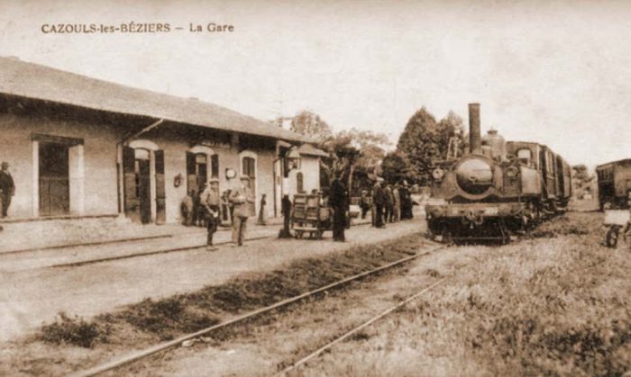 The station at Cazouls-les-Beziers. [1]
 The station at Cazouls-les-Beziers. [1]
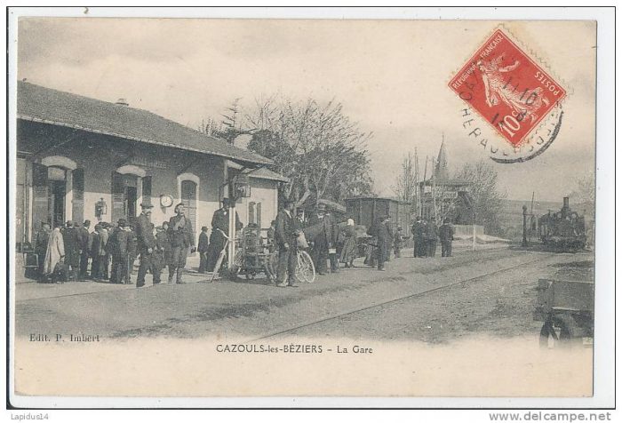 Another similar view of the station at Cazouls-les-Beziers. [2]
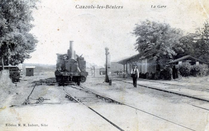 Another view of the station at Cazouls-les-Beziers, this picture was taken from the North. [2]
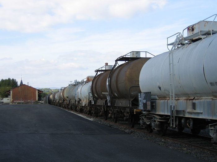 Tank wagons awaiting repair at Cazouls Station in 2007. The picture was taken by Serge Panabière. [4]
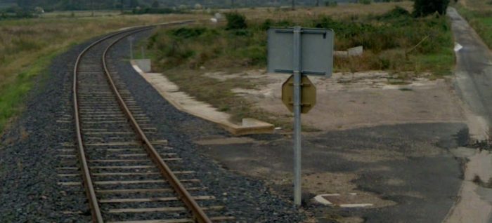
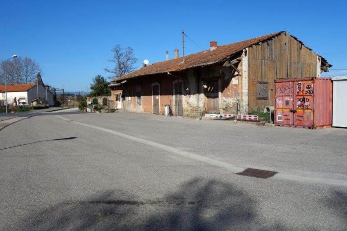 The road access to the station at Cazouls-les-Beziers in 2016. [1]
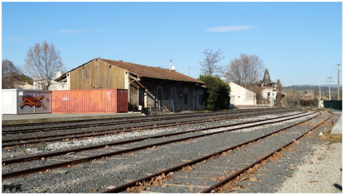 The station building immediately after closure of the line in January 2017. [2]
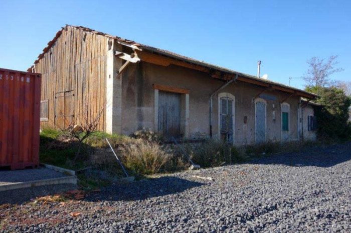 The station at Cazouls-les-Beziers in 2018 with tracks already removed in front of the building. [1]
Until 2016, the railway to Cazouls was a modern branch-line which had been well-maintained by Hérault Transport and was operated in partnership with RDT 13. [5]
In its session of 14th November 2016, the departmental council of the Herault decided to remove 3.5 km of railway between Maureilhan and Cazouls-les-Beziers. This was the only railway line for which it was responsible and the only remaining length of the old departmental railways, The decision came into effect on 1st January 2017. It seems that the only real reason for this was that had the line not been closed it would have had to be handed over to the new ‘Occitanie’ region. The legal framework included for the transfer to the new regions on 1st January 2017, of all departmental railway infrastructure and operations.
The department of Herault created a greenway between Cazouls-lès-Béziers and Maureilhan as an extension of that planned from Saint-Chinian to Cazouls-les-Beziers. The department set aside 3 million euros for the greenway and ultimately plans to continue that greenway beyond Maureilhan to the Mediterranean coast. The track was removed during the Summer of 2017 with the intention of commissioning the greenway by the end of 2017.
It seems unbelievable that this line had only been refurbished in the period 2007-2009. It was provided with two dedicated locomotives with a specific livery and the inscription “Hérault railways”: the BB 1201 ( 83,2 kW / 1,200 hp) and the No. 302 diesel engine (220.8 kW / 300 hp). The station of Cazouls-lès-Béziers, was provided with 5 loops and one siding at that time.
Since the end of 2015 the Owens-Illinois Manufacturing (formerly BSN Glasspack) glassworks in Béziers shipped bottles by full train twice a month from Maureilhan station, which has five loops and 4 sidings. Another trackhad been planned to serve the industrial area of Béziers West, where the glassworks is located.
The remaining length of the branchline will survive as the region of l’Occitanie, which inherited the 6.7 km from Colombiers to Maureilhan, with effect from 1 February 2017 was due in 2017 to designate a new railway operator. That region also manages the railways of the ports of Sète and Port-la-Nouvelle. [6]
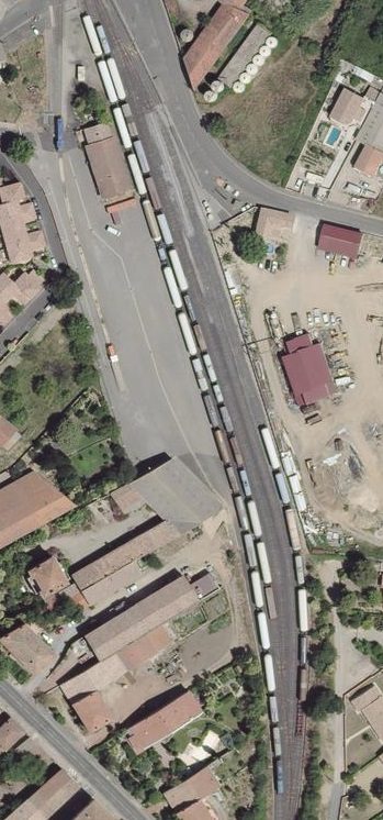
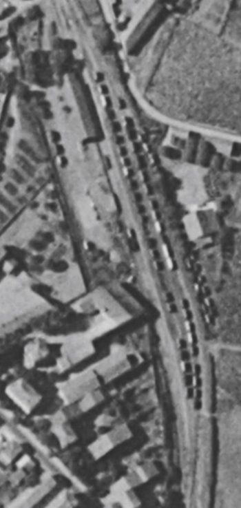
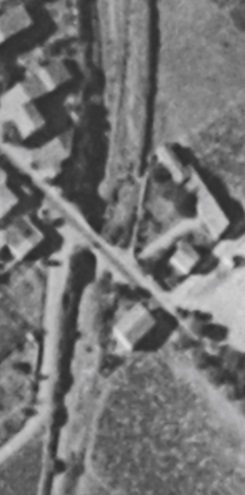
The station is shown from above in two adjacent aerial images. Both are taken from the IGN site ‘Remonter-les-Temps’. [7] They show the station are in the early 1960s and again in 2015.
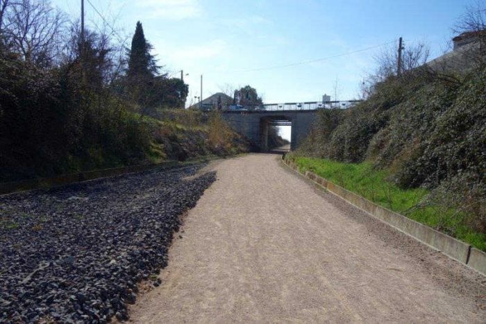
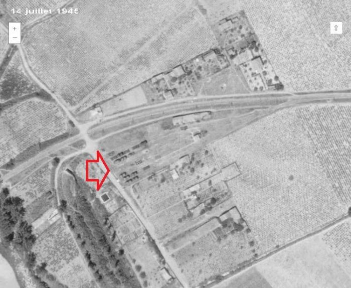
Leaving Cazouls Station the railway returned to a single track layout as it passed under a road bridge which carries Avenue Jean Jaurès. The location is shown below in 2016 and then again in 2018. [5]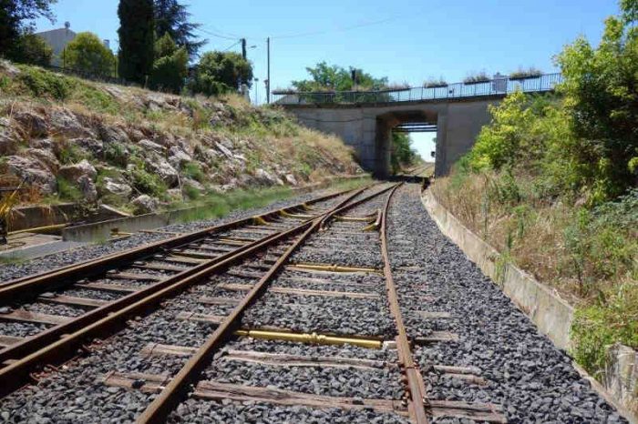
 The two adjacent images show the bridge carrying the Avenue Jean Jaures over the railway. They are taken from the air in 1961 and 2015. [7]
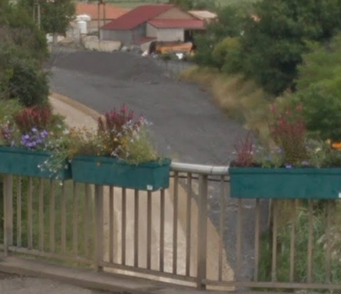
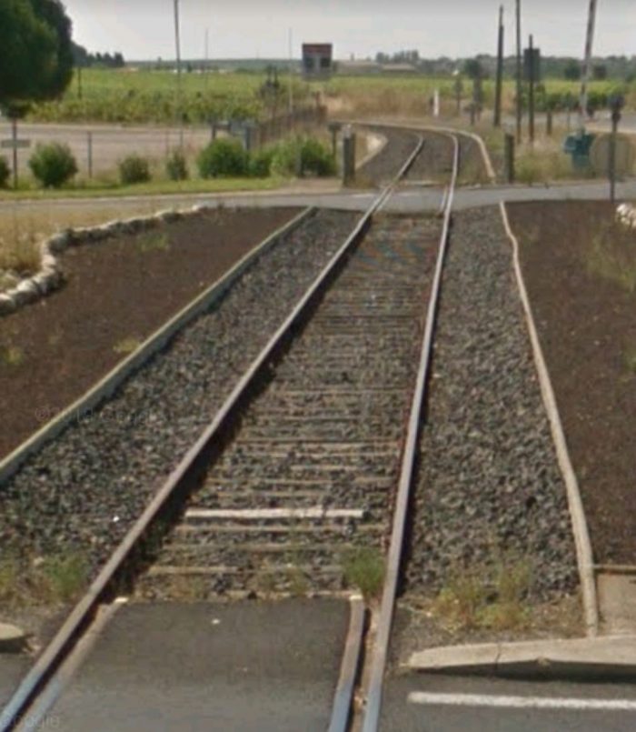
The next image, below, is taken from the Avenue Jean Jaures looking over the bridge parapet back into the station area in 2018. It has been sourced from Google Streetview. The railway ballast is still in evidence. The new greenway runs on the left side of the cutting.
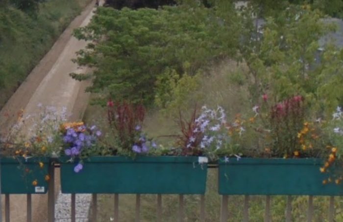 This Google Streetview image looks South from Avenue Jean Jaures and shows the new greenway following what was the route of the railway.
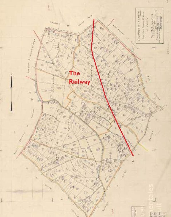

 The 1950s land plan above has had the route of the railway added.[8]
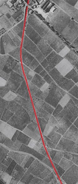
The adjacent aerial images show the line in the 1960s. [7]
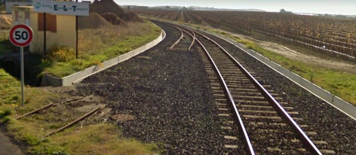
From the bottom of the first image/top of the second image, the line runs alongside the modern D162 which does not feature on the 1961 aerial photographs.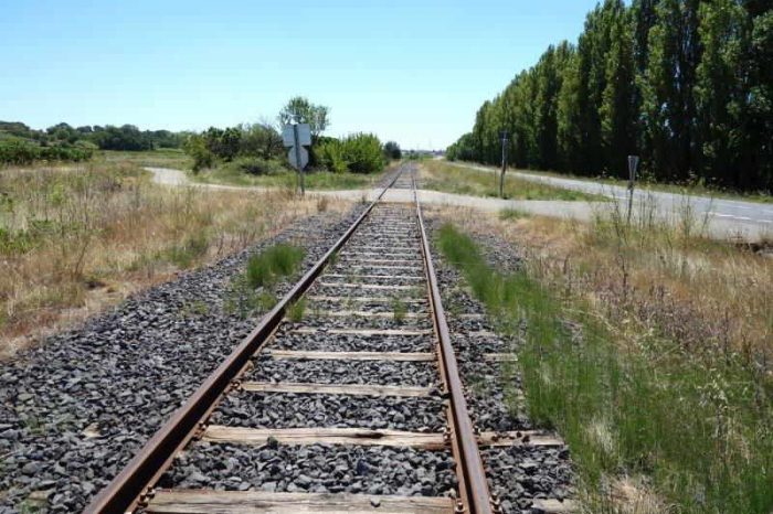 The D162 is on the right of this photograph. [5].
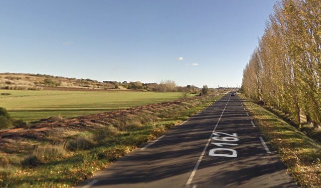 Google Streetview photo of the railway and the D162 in 2010.
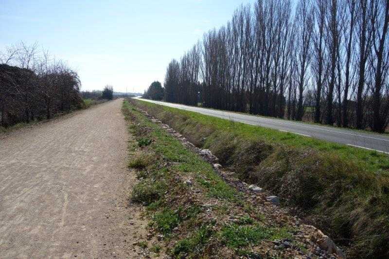 Approximately the same location on 2018. [5]
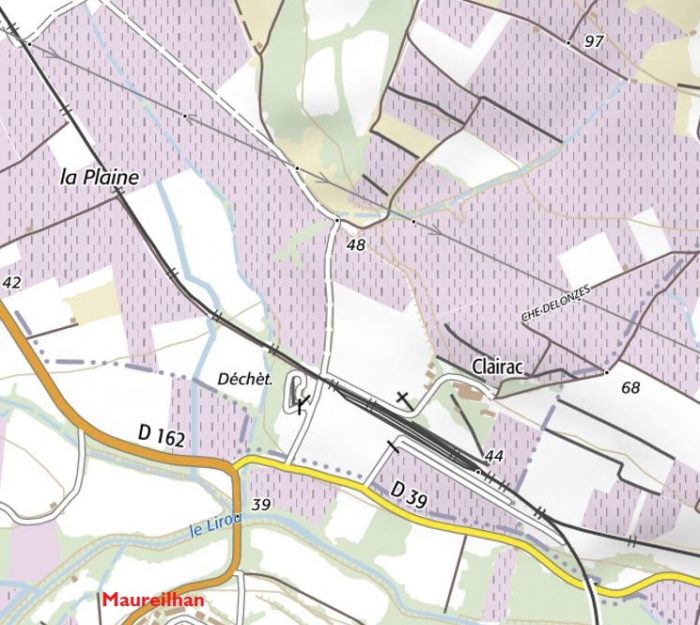 The station at Maureilhan in 2016. [7]
 The station at Maureilhan in 1963. [7]
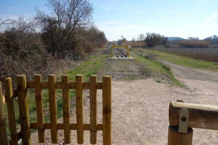 Less than a kilometre or so before reaching the next station at Maureilhan the greenway diverts from the track-bed of the railway and buffer-stops herald the active part of the railway. [5]
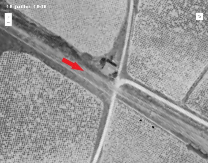 Approaching Maureilhan Station the line crossed the road to the hamlet of Clairac at a gated crossing. The crossing-keeper’s cottage is visible in this aerial photograph from 1948. [5]
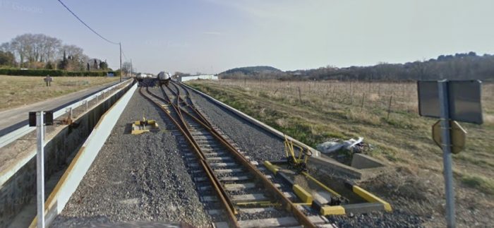 Looking Southeast along the line we can see the condition of the location of the station in 2009. This is a Googel Streetview image.
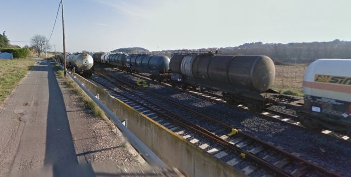 The location of the old station was in use in 2009 for storage of a variety of tank wagons.
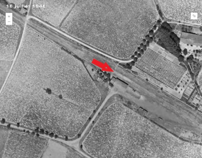
 The station site in 1948. The buildings have been demolished but the access road from the D162 remains with gates to allow access to the storage facility which was the station. [5]
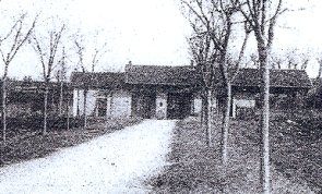
The adjacent image shows the station from that access road. [9]
 Maureilhan Station is shown above, early in the 20th Century. [5]
Maureilhan to Colombiers
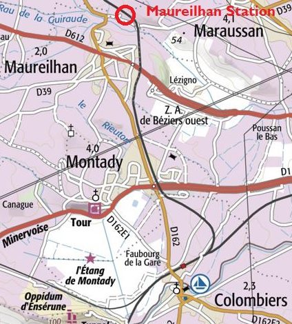
The line South from Maureilhan to Colombiers remains open as a standard-gauge branch-line. The route is shown on the adjacent map. [10]
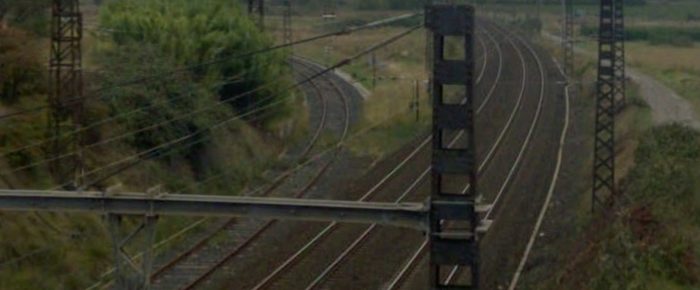
Immediately after leaving Maureilhan Station the line crosses the valley of Rau de la Guiraude on a curved viaduct which is shown from above in the next image, an aerial view from 2015.[10]
The Viaduct appears quite graceful with open spandrel walls. The first image below is taken from the D39 and is a Google Streetview image. The second comes from Wikipedia Commons. [11]
Beyond the viaduct the line followed a series of different lanes and roads, as can be seen in the Google Streetview pictures which follow.
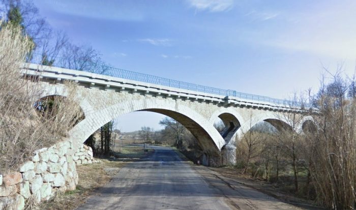
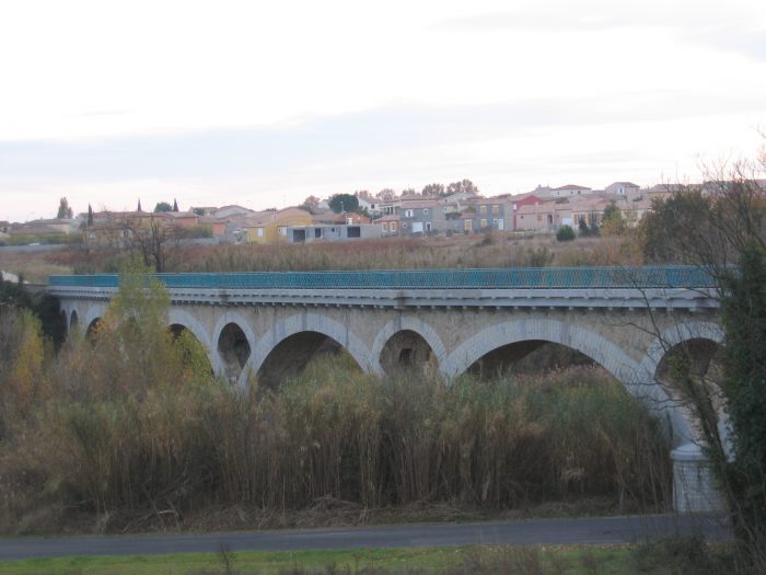 The Viaduct over Rau de la Guiraude near Maureilhan. [11]
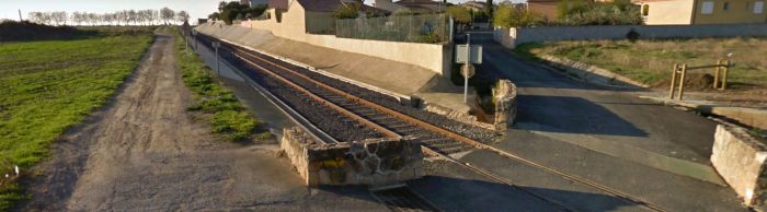 Looking South from the Chemin de Feynes.
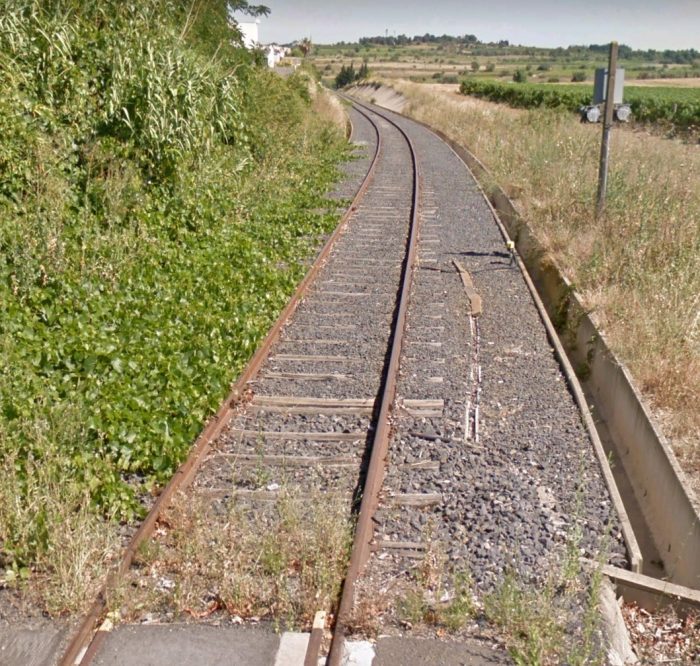 Looking back to the North from the D612.
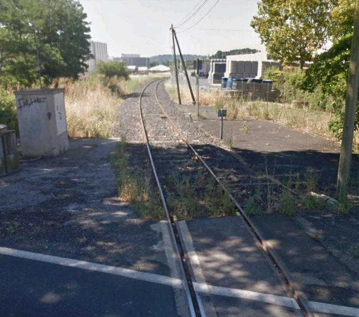 Looking South from the D612.
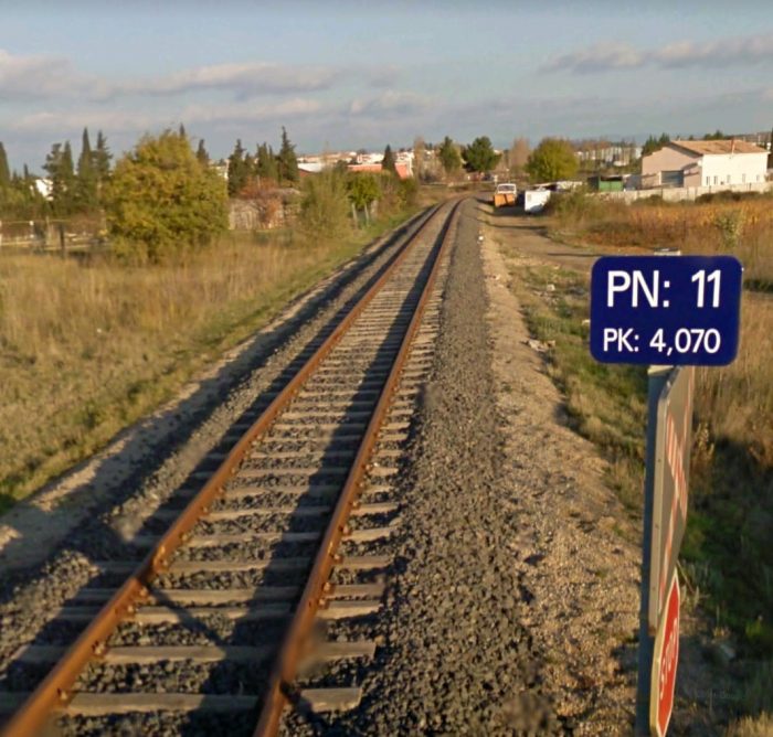 Looking back to the North from alongside the D162.
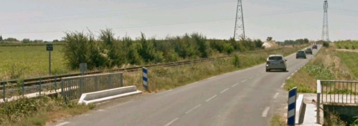 Looking South along the D162.
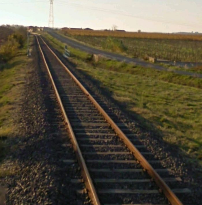 Further South along the line.
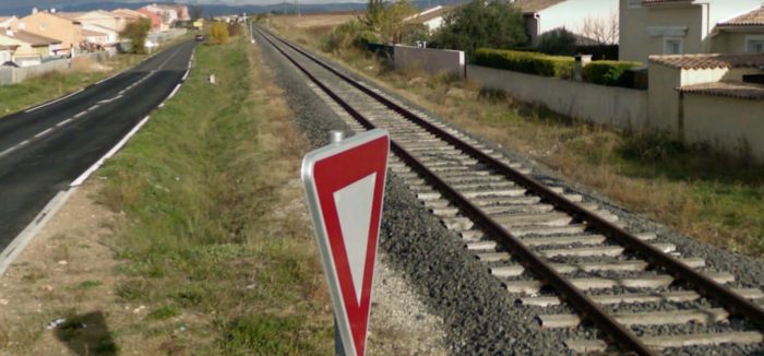 Looking back to the North from Rue des Primevères.
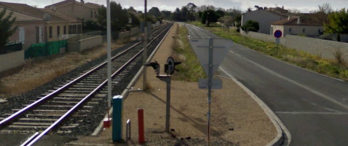 View South from the Rue des Primevères junction with the D162.
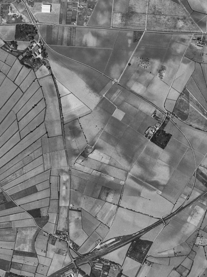 1963 aerial view of the remainder of the line to Colombiers Station. [7]
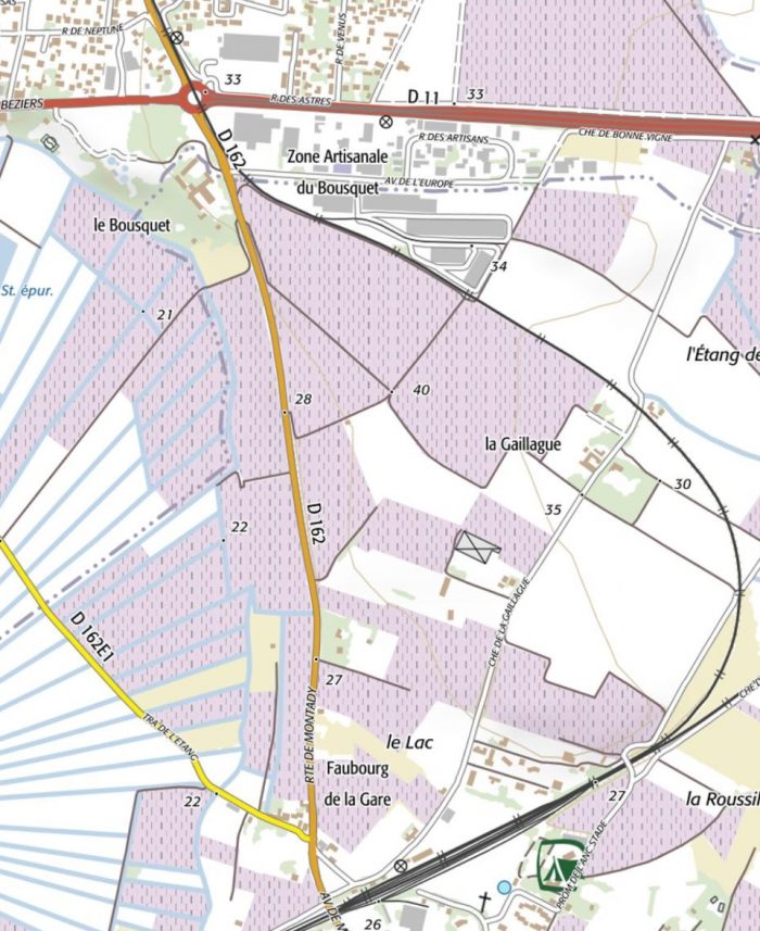 Modern IGN map of the same length of the line. [7]
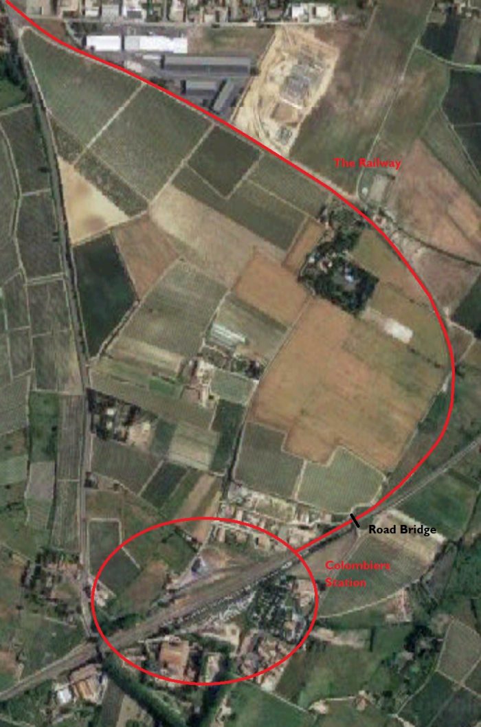 Modern, annotated, aerial photograph of the remainder of the line and Colombiers Station. [7]
These next few photographs from Google Streetview illustrate the route of the line.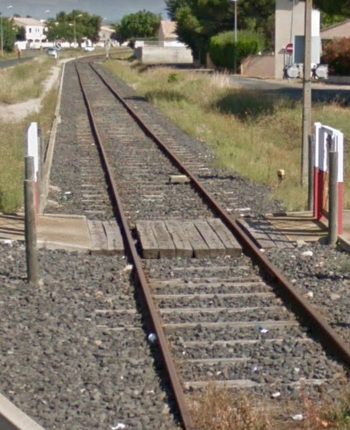
 Looking back along the branch from the road bridge over the Midi Mainline.
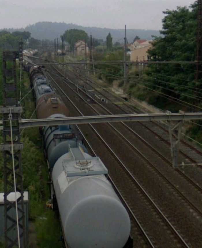 Colombiers station from the road bridge.
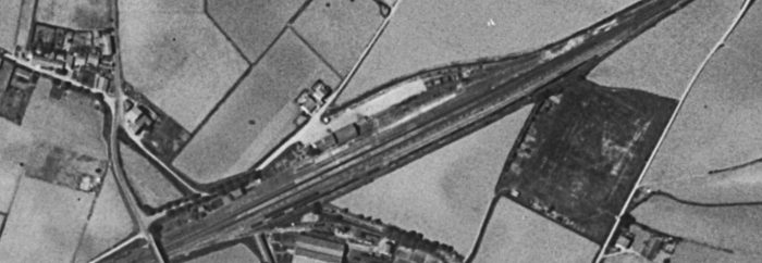 The station in 1963. [7]
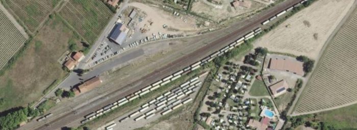 The station in 2015. [7]
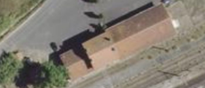
 The two images immediately above show the Colombiers Station building. Both images are Google images.
Maureilhan to Beziers
We return to Maureilhan and begin the ongoing journey to Beziers via Maraussan.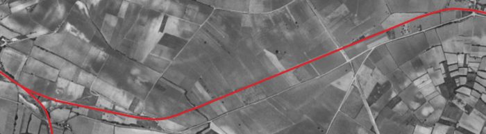
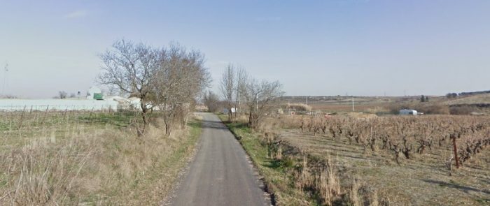 Leaving Maureilhan in January 2009 along what was the line of the old railway.
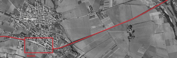
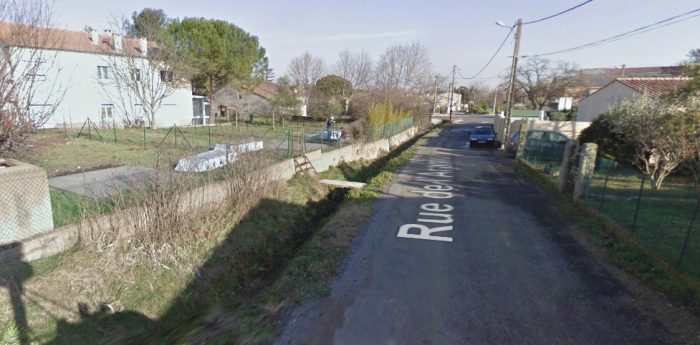 Rue de l’Aramon in the early 21st Century approaching what was the location of Maraussan Station.
 Looking East along Avenue Jean Jaurès in Maraussan in 2016 towards the Wine Co-operative building and what was the railway station.
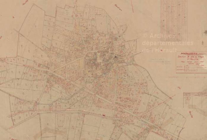 The route of the railway can be picked out in the bottom half of this 1947 land-plan. The scan detail is a little on the poor side but the line is just visible in red, first passing the Co-operative building and entering the station which is marked by a red rectangle. [12]
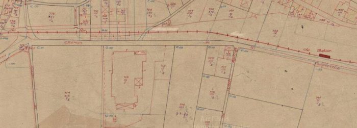 This closer image shows the large Co-op building on the left-of-centre with the railway just above it. There was a short siding which served the Co-op and that can be picked out on this image. The red rectangle is roughly at the centre of the station site. [12]
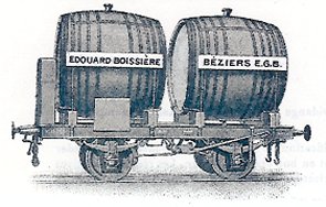 Maraussan Wine Co-operative is shown above in the early 20th Century. Note the Wine wagons in the foreground. [13]
The adjacent sketch shows a very similar wagon to those in the photo above. [14]
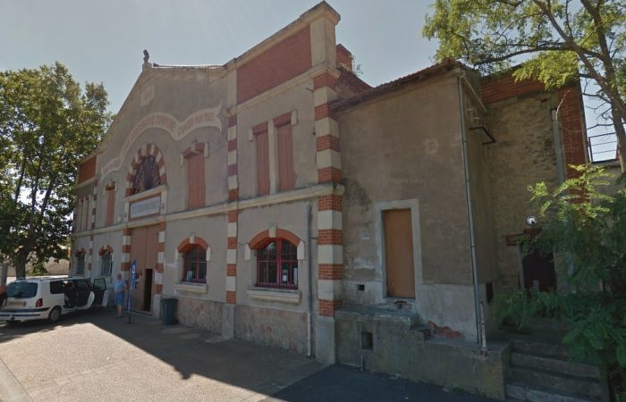 The Co-operative Building in July 2016.
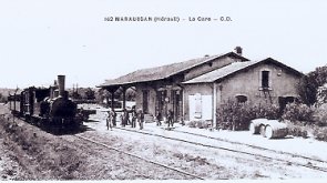
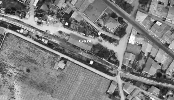 The station in May 1964. [13]
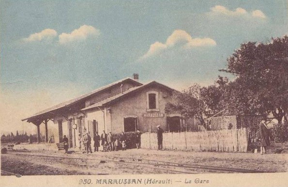
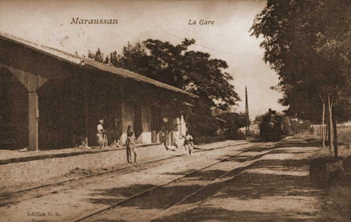
 The Station Building looking West. [15]
A similar but wider view of the station building is shown on the adjacent postcard image. This time including a short train from the West. [16]
 The Station Building looking East. [15]
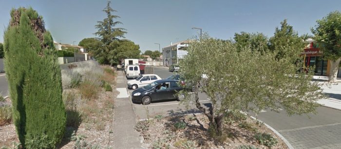 Looking back to the West through the station site in 2016.
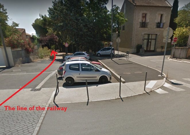 Looking along the route of the line to the East, from the same location.
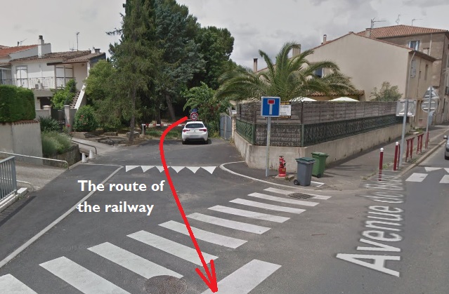 Looking back along the line of the old railway towards the last picture.
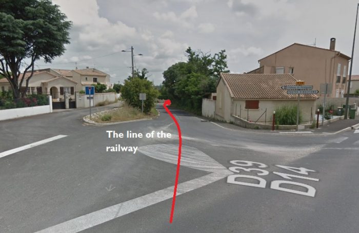 Looking ahead along the line towards Beziers.
The line continued across open country from Maraussan along the line of what is now the D39.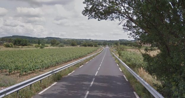
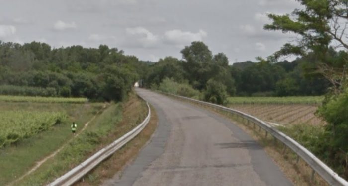
 Among the trees above, it is just possible to pick out the end of the Truss Girder Bridge which spans the River Orb close to the next station for Lignan.
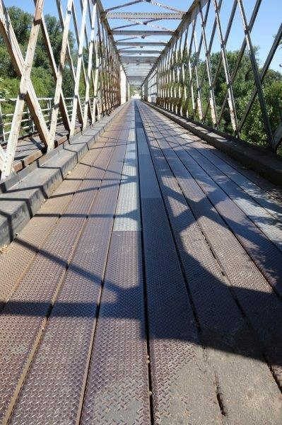
This is a significant simply supported truss structure which retains an early metal deck despite the fact that the bridge is used in the 21st century as a road bridge. It is known as ‘Pont de Tabarka’. It caries a 30kph speed limit but there is no vehicle wight limit sign on the approach to the structure.
The size of vehicles is limited by the top members of the truss and the bracing but surprisingly maximum weight is not specified. It is a graceful structure. [15]
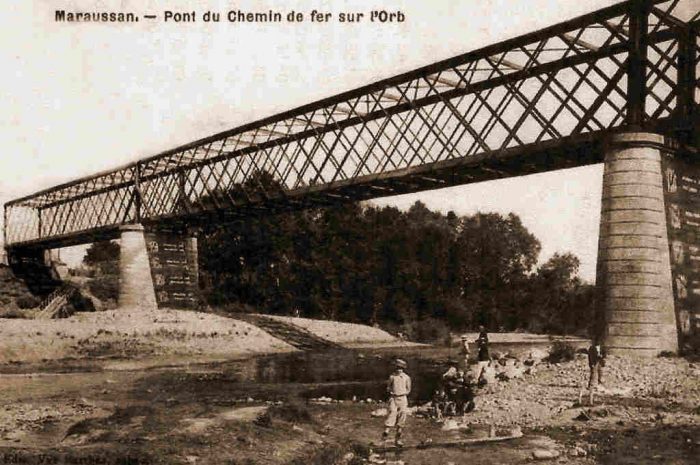
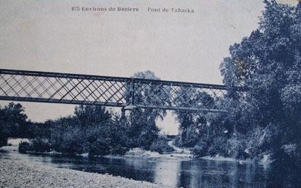
The adjacent image is an earlier one from the opposite bank of the River Orb. [18]
The following images show the bridge from a variety of angles.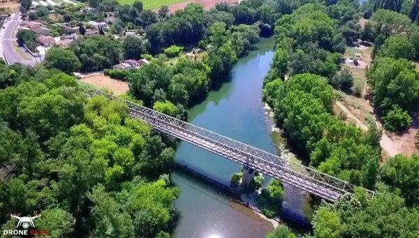 This photograph was taken by Franck Davi with professional equipment, drone and camera, shows us the Tabarka Bridge from above. [19]
 The Tabarka Bridge from the banks of l’Orb River. The picture was taken by Serge Panabière in December 2007 [20]
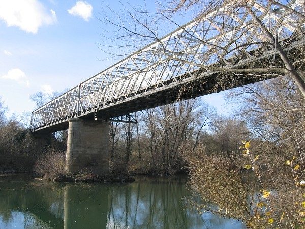 This picture was taken at a very similar location to the first monochrome postcard image of the bridge above. [21]
Immediately beyond the bridge after a slight curve trains entered the station area which served the village of Lignan. The land-plan below shows the bridge on the left and the curve round into the station. [17]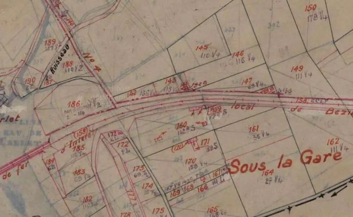
 This aerial image from 1945 shows the same location. Buildings can easily be made out and sidings are marked by the red arrow. [17]
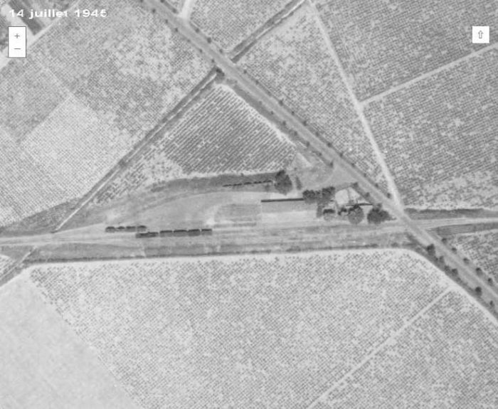 However, just a very short distance further along the line the trains encountered the building shown on this aerial view from 1945 and shown in the picture below. [17]
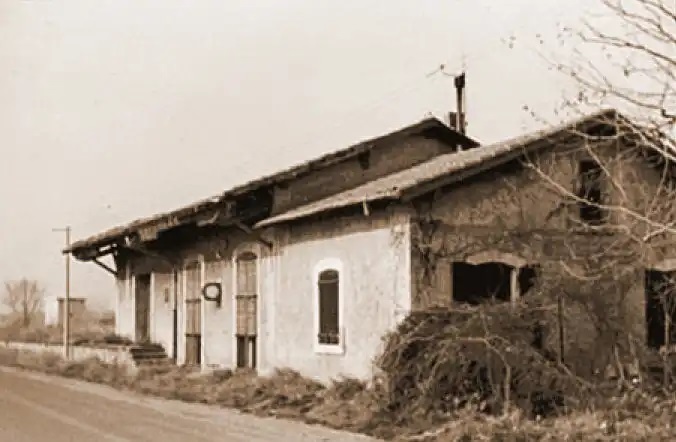 Lignan Passenger Station Building. [17]
Beyond Lignan Station trains began a gradual loop around the north side of Beziers before entering the Railway Station. 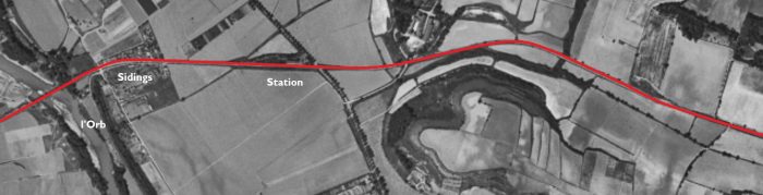

The present D612 (which is the northern ring-road for Beziers) sits over the old track-bed in the first instance. The old railway route then follows the modern Avenue Prefet Claude Erignac and then the Avenue Henri Pech into Beziers and what was the old station site.
What was open fields in the early 1960s is now suburban development. The tree-lined road on the adjacent aerial image is the Ancienne Route de Bedarieux. The station in Beziers was on the North side of the city in between what is now the Avenue Georges Clemenceau and the Avenue Jean Moulin.
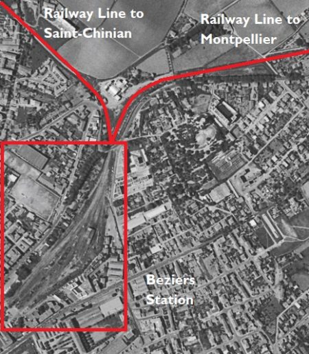 Two lines approached the station – the route we have been following from Saint-Chinian and a completely separate route from the East which ultimately provided a connection to Montpellier.
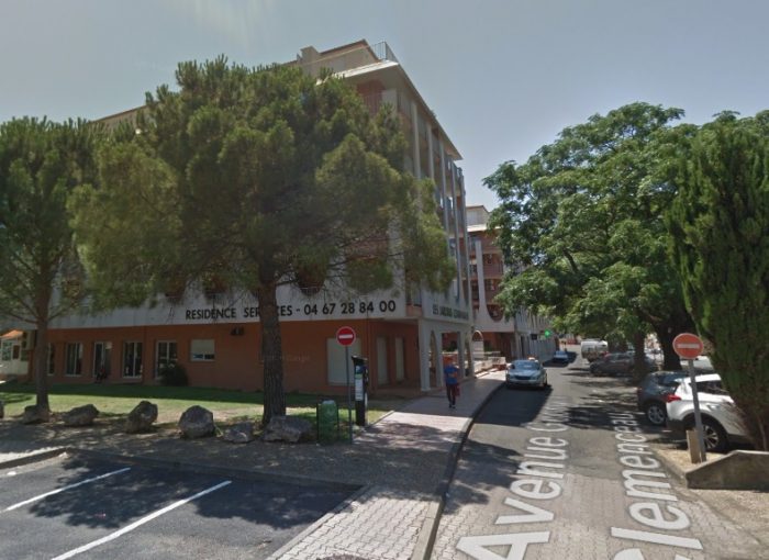
Once the secondary lines were closed the site of the station was redeveloped as a mixture of parkland, a school and blocks of apartments. There is no evidence of the existence of the station on the site. One picture below shows the site in 2018 on Google Streetview. The parallel maps below are sourced from the IGN website [10]
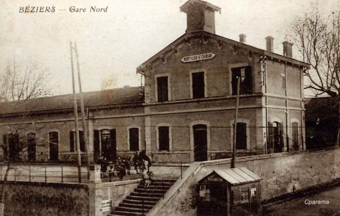
We finish this post with a variety of images/pictures of the station (Beziers Nord) and the city in times past. First, some aerial images showing the lines at Beziers in July 1945.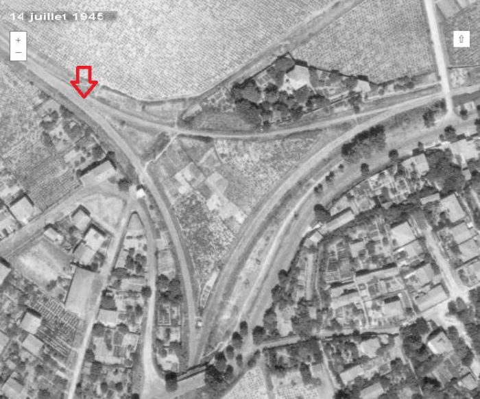 This photo shws the avoiding line which allowed trains to pass from East to West or West to east without entering Beziers Nord. [17]
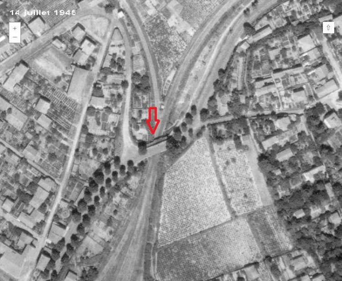 The bridge over the station approach. [17]
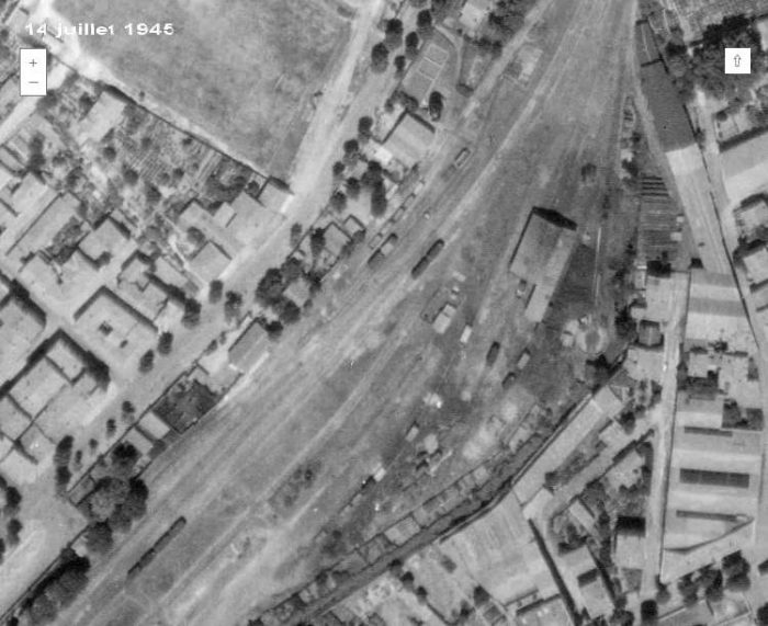 The goods shed. [17]
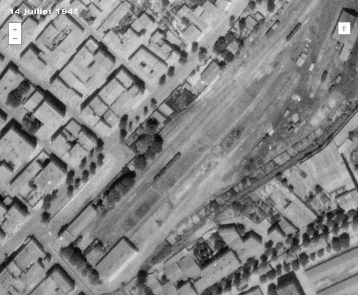 The terminus buildings. The passenger facilities are on the bottom left of the picture. [17]
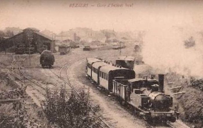 This image shows a train leaving Beziers Nord for Saint-Chinian. The building on the left is the goods shed. [17]
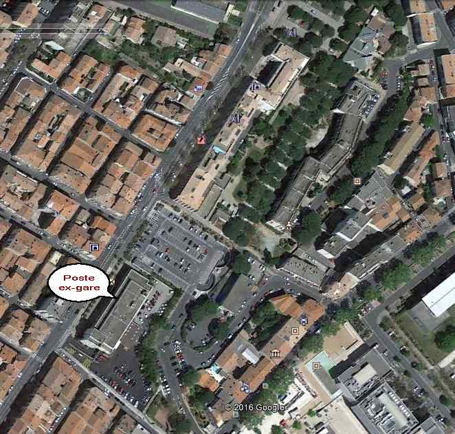 The modern post-office sits exactly in the same location as the old passenger facilities. This Google Earth satellite image shows the station site in 2016. [17] The image below shows the passenger building. The view is taken from the North along Avenue Pezenas, what is now Avenue George Clemenceau. Trams provided the final length of the journey into Beziers City Centre. [22]
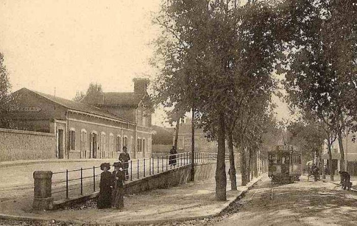
 This picture was taken from a location beyond the tram in the fist picture of the station. [22]
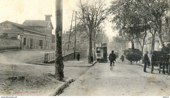 A later image of the railway station and a tram on Avenue Pezenas. [23]
The status of the railway station was clearly that associated with a secondary line. It becomes even more evident if the station buildings are compared with those of the Gare du Midi, the city’s primary mainline station.
The approach the the Gare du Midi Station concourse down the Avenue Gambetta was steep but the site of the station was extensive and the goods facilities were significant. Avenue Gambetta leading down to the Gare du Midi [22]
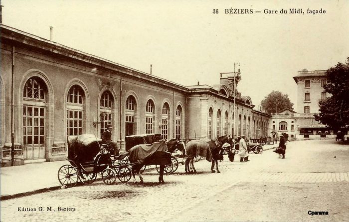 The station facade. [22]
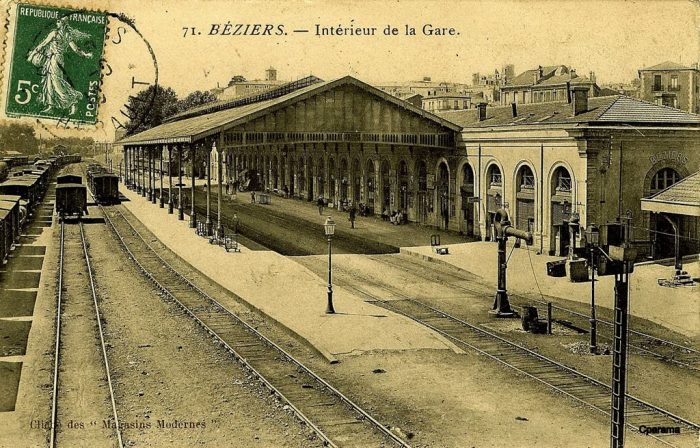
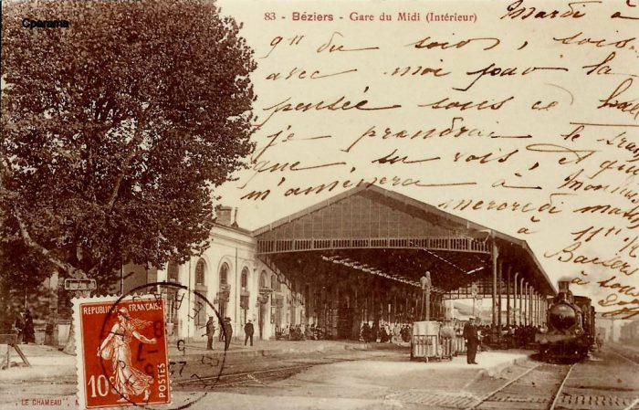
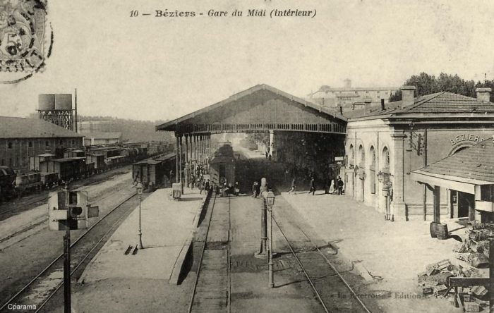
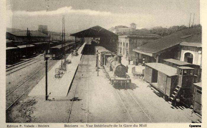
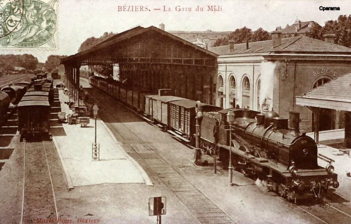
 A series of views of the interior of the Gare du Midi in Beziers. [22]
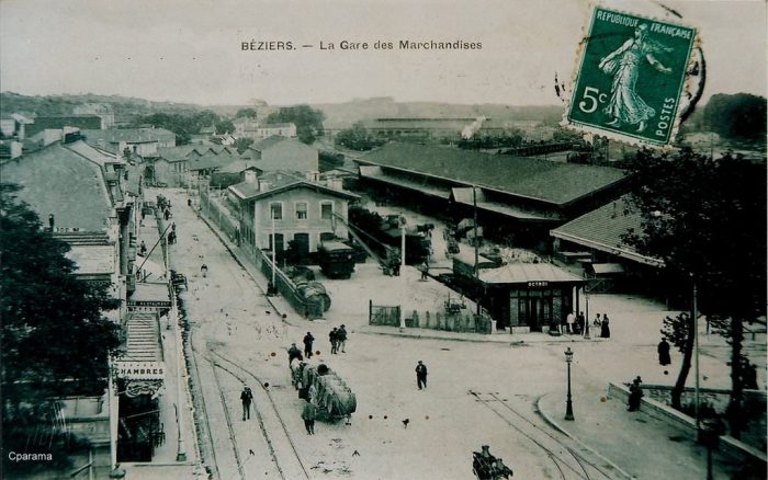
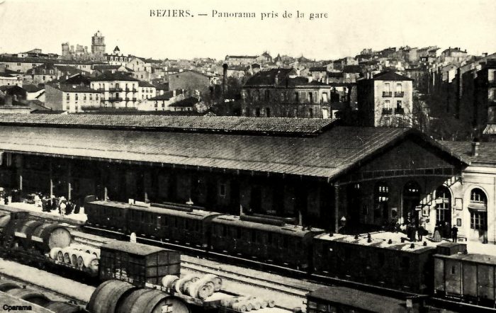
 Two views of the goods yard at the Gare du Midi. [22]
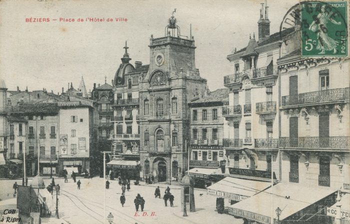
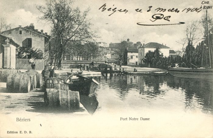
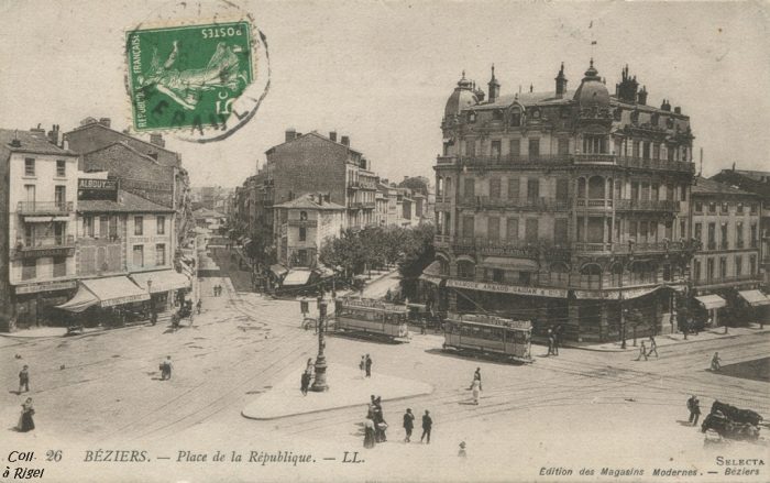
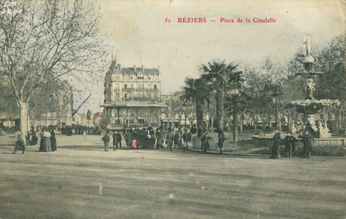
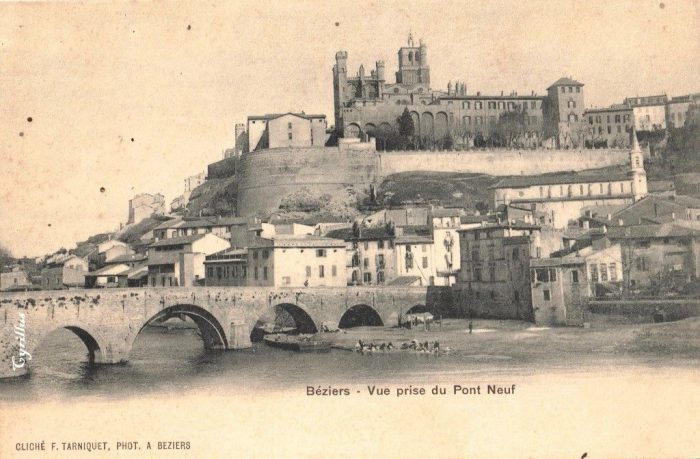
And finally, …. some views in old postcards of the City of Beziers. [22]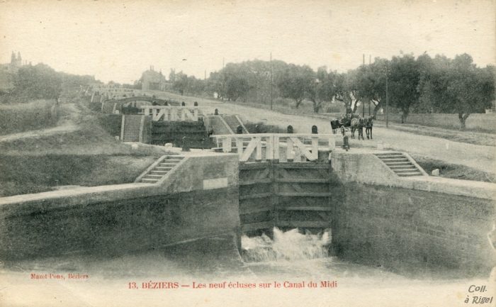
References
- http://passes-montagnes.fr/htlm1/vf_saint-chinian_beziers-06.html, accessed on 18th March 2019.
- http://www.trainsdumidi.com/t9376-pk-0948-gare-de-cazouls-les-beziers-34, accessed on 18th March 2019.
- http://www.cazoulslesbeziers.com/12-culture-et-tourisme, accessed on 18th March 2019.
- https://fr.wikipedia.org/wiki/Fichier:Chemins_de_fer_de_l%27H%C3%A9rault_-_Gare_de_Cazouls_c%C3%B4t%C3%A9_voies.jpg, accessed on 18th March 2019.
- http://passes-montagnes.fr/htlm1/vf_saint-chinian_beziers-06.html, accessed on 17th March 2019.
- https://www.railpassion.fr/infrastructure/fin-chemins-de-fer-de-lherault, accessed on 18th March 2019.
- https://remonterletemps.ign.fr, accessed on 18th March 2019.
- http://archives-pierresvives.herault.fr/ark:/37279/vta55925bc2c5469/dao/0#id:1958869877?gallery=true&brightness=100.00&contrast=100.00¢er=6153.856,-4714.822&zoom=6&rotation=4.712, accessed on 18th March 2019.
- http://cahiers.de.minerve.pagesperso-orange.fr/HTML/cdf_bezierssaintchinian.html, accessed on 18th March 2019.
- https://remonterletemps.ign.fr, accessed on 19th March 2019.
- https://commons.m.wikimedia.org/wiki/File:Chemins_de_fer_de_l%27Hérault_-_Maureilhan_et_viaduc.jpg, accessed on 19th March 2019.
- http://archives-pierresvives.herault.fr/ark:/37279/vta558b79102845f/dao/0#id:665356471?gallery=true&brightness=100.00&contrast=100.00¢er=6460.000,-4488.000&zoom=6&rotation=0.000, accessed on 20th March 2019.
- http://passes-montagnes.fr/htlm1/vf_saint-chinian_beziers-07.html, accessed on 20th March 2019.
- http://adicab.over-blog.com/article-45469237.html, accessed on 20th March 2019.
- https://www.cparama.com/forum/maraussan-t29903.html, accessed on 20th March 2019.
- http://cahiers.de.minerve.pagesperso-orange.fr/HTML/cdf_bezierssaintchinian.html, accessed on 20th March 2019.
- http://passes-montagnes.fr/htlm1/vf_saint-chinian_beziers-08.html, accessed on 20th March 2019.
- http://www.todocoleccion.net, accessed on 20th March 2019.
- http://www.centerblog.net/journal-intime/15183-6572077-le-pont-de-tabarka-, accessed on 20th March 2019.
- https://commons.wikimedia.org/wiki/File:Chemins_de_fer_de_l%27H%C3%A9rault_-_Maraussan_pont_de_Tabarka.jpg, accessed on 20th March 2019.
- http://fracademic.com/dic.nsf/frwiki/1355689, accessed on 20th March 2019.
- https://www.cparama.com/forum/beziers-t304.html, accessed on 20th March 2019.
- https://www.delcampe.net/fr/collections/cartes-postales/france/beziers/34-beziers-gare-du-nord-et-avenue-de-pezenas-charrettes-tram-704159491.html, accessed on 20th March 2019.

Pingback: Railways of Herault – Route B – Beziers to Pezenas Line | Roger Farnworth