

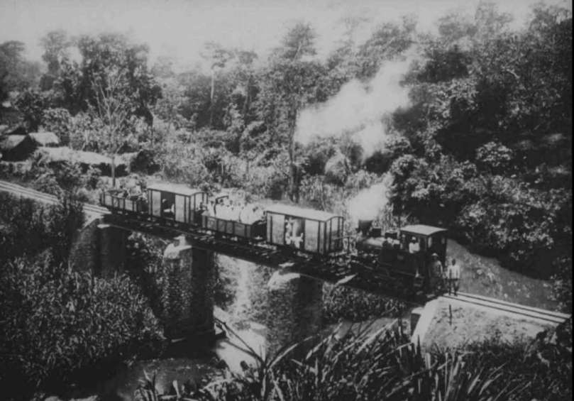
The featured image for this article shows a train on the Kihuhui Bridge on the Sigi Railway in Tanganyika. [3]
Tanganyika (now part of Tanzania) possessed a dense network of industrial narrow-gauge railways, primarily developed during the German colonial era (German East Africa) in the late 19th and early 20th centuries to support plantation agriculture and forestry. While the main lines (Central Line and Usambara Railway) were built to 1,000 mm (metre) gauge, industrial, plantation, and forestry lines often used 600 mm (1 ft 11 5⁄8 in) or 750 mm (2 ft 5 1⁄2 in) gauge. [1]
Following World War I, the British administration deemed many of the 600 mm “light railways” to be economically inefficient compared to the, at the time, more efficient 1,000 mm metre-gauge lines, leading to a shift away from developing these smaller lines. [1]
Early Industrial Narrow Gauge lines included:
1. The Sigi Railway
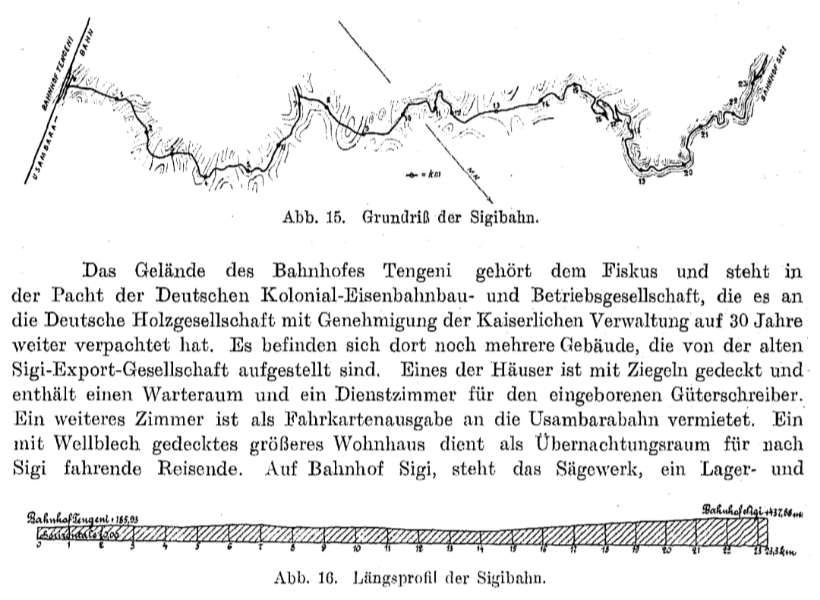
The Sigi Railway (Sigi-Bahn) was a 23.5 km long, 750 mm gauge line opened in 1911 to transport timber from forests in the Usambara Mountains to the Tanga or Usambara Railway. It featured significant engineering challenges, including four switchbacks to handle steep terrain. [2]
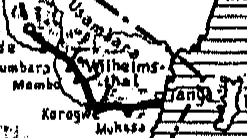
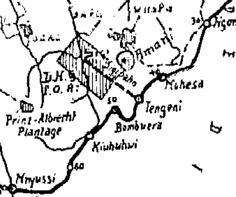
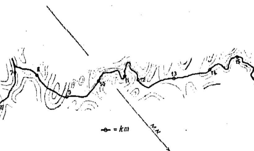
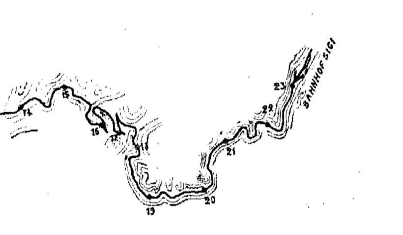
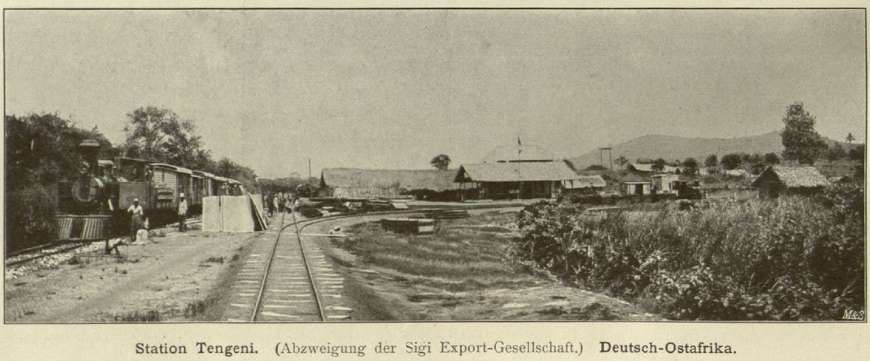
The line ran from Tengeni station (185.9 m above sea level) near Muhesa (now Muheza), located on the Usambara railway, to Sigi (438 m above sea level) in the heavily forested eastern Usambara Mountains, which, until the railway’s construction, were rugged and difficult terrain. The area could only be reached by caravans via forest and mountain trails. This severely limited the transport of goods and merchandise. [3]
A travel group at Tengeni railway station in the Usambara Mountains, with trains of the Sigi Railway and the Usambara Railway in the background. [3]
The Sigi Railway Management Concession of 29th April 1910, was a necessary precondition to the exploitation of the forestry concession held by the Deutsche-Holz-Gesellschaft fuer Ostafrika. The 23.5 km. railway’s operation was bound to the sawmills that provided the bulk of the traffic. [2]
Work began in 1904. The Sigi Export Company, during its ownership, constructed 17.6 km of track. Due to financial difficulties, work had to be interrupted repeatedly. After the German Timber Company for East Africa took over the logging rights to 12,000 hectares, the sawmill, and the railway, it completed the latter. The railway went into full operation on 1st September 1910. [3][4: p96]
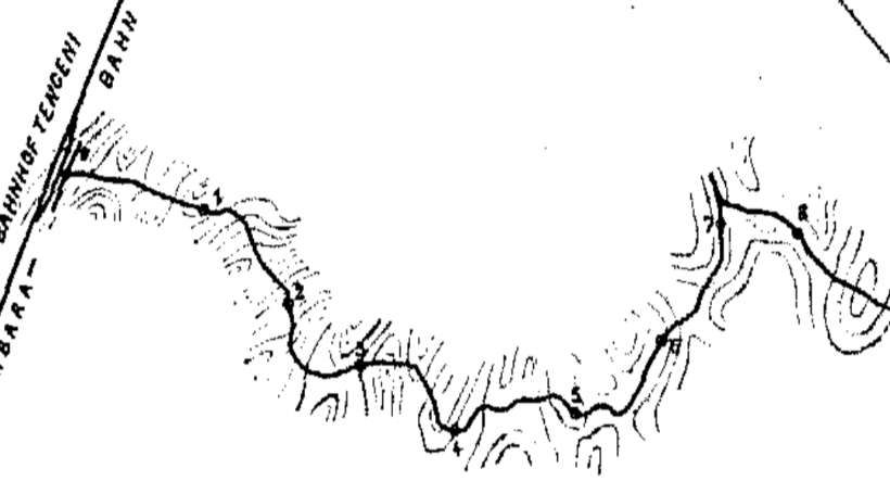
The line had gradients of up to 40%, minimum radii of 40 m, and, as already noted, four switchbacks. It climbed 252 metres to the Sigi terminus. [4: p96] The switchbacks enabled a relatively uniform gradient to be achieved. The section of track near Sigi was particularly interesting. Here, the railway described almost complete circles to wind its way up the mountain slopes and featured three of its four switchbacks in a length of less than one kilometre. Where possible, engineering structures were avoided. Nevertheless, numerous smaller bridges had to be built over mountain streams, blasting operations carried out, and dams constructed, particularly along the upper section. The construction of a large steel girder bridge over the Kihuhui River gorge was unavoidable; this bridge had two masonry piers between its abutments. [3]
Between Tengeni and Fanussi, rails weighing only 10 kg/m and measuring 7 metres in length were used. The lower section of the line was ballasted only where absolutely necessary for structural or operational reasons, such as on the curves. In contrast, the upper section was fully ballasted and fitted with rails weighing 15 kg/m. Ballasting the entire line was planned but was not completed before the First World War. The rails rested on iron sleepers with shims. The sleeper design on the lower section was chosen to allow for the replacement of the existing rails with the new, heavier rail profile. The flat fishplates used in the first construction phase were reinforced by the addition of angle fishplates. [3]
The line originated at Tengeni station, 44km from Tanga on the Usambara Railway. The Tengeni station grounds belonged to the state and were leased to the German Colonial Railway Construction and Operating Company. With government approval, this company subleased the land for 30 years, first to the Sigi Export Company Ltd. and later to the German Timber Company for East Africa. The site included several buildings constructed by the Sigi Export Company, the railway’s administration building, a warehouse and goods shed, the engine shed, a carriage shed, and a water tower for supplying locomotives. There were also three houses for European employees, one of whom was a locomotive driver. The sawmill was located directly next to the station. The station building had a tiled roof. It contained a waiting room, an office for the local freight clerk, and a room rented by the Usambara Railway as a ticket office . A larger residential building with a corrugated iron roof served as overnight accommodation for travelers.
Apart from the two termini, there were no train stations or stops. Trains would stop on the open track if necessary. The entire route was equipped with a telephone line for train safety. [3]
In the German era, the operation of the Sigi-bahn was the responsibility of the German Colonial Railway Construction and Operating Company (DKEBBG), which had also been operating the Usambara Railway since 1905. The DKEBBG was a subsidiary of Lenz & Co. in Berlin, which built and operated numerous narrow-gauge railways of various track gauges throughout the German Empire. [5]
The choice of a narrower gauge compared to the Usambara Railway meant that all goods had to be transshipped at the connecting station of Tengeni for onward transport. [4: p96] In addition to freight traffic, there was also public passenger traffic, as roads were scarce in the area around Sigi and Amani. Thus, from the beginning, the terminus at Sigi also served the Imperial Biological-Agricultural Institute in Amani. [4: p96]
Given the route, the average travel speed was only about 10 km/h, so a train needed 2 hours and 20 minutes for the entire journey. Trains were usually mixed passenger/goods services , with connections in Tengeni to and from trains on the Usambara Railway. Pure freight trains were also used when needed. The scheduled trains also carried mail and parcels to and from Sigi. Due to their more pleasant climate compared to the lowlands and coastal region, the Usambara Mountains were a popular destination for Europeans living in the colony. Their abundance of game also made them a popular destination for hunters. Therefore, the DKEBBG even offered special trains for tour groups from Tanga to Tengeni with a connection to Sigi. The DKEBBG advertised the journeys on the Sigi Railway:
“A special trip to Tengeni for the purpose of touring the Sigi Railway and visiting the Agricultural Institute in Amani would cost 100 Rp. On the Sigi Railway, scheduled trains should be used at the regular fares. (One way 3.50 Rp.). … A trip on the Sigi Railway, with its magnificent views of wild gorges, lush valleys, and dense primeval forests, is one of the most beautiful excursions in German East Africa.” [6]
In passenger transport there was a so-called “European class” (1st class, fare 15 Heller per tariff kilometre = 3.50 Rupees/total distance) and a so-called “native class” (3rd class, fare 2.5 Heller per tariff kilometer = 0.60 Rupees/total distance). With the full commissioning of the line, great expectations were placed on its role in opening up the entire East Usambara region. [7]
The sawmill at the top of the Sigibahn was located directly on the Sigi River, by whose water power it operated. The Sigi River was dammed by a 36 m long dam. The water was channelled via a 150 m long water channel to a water wheel with a double ratio, which drove the various sawing machines. Bringing the wood from the storage area to the saws is done by a trolley. [7: p16]
The up and downs of the Sigi railway after World War I were due to differing opinions with regard to the economics of the line. Operational experience in the 1920s ultimately served to convince the Government of Tanganyika that there could be no place in the Territory’s pattern of communications for the operations of light railways. [2]
Locomotives in Older Literature
According to the few available sources, the Sigi Railway had two wood-fired tank locomotives of different power levels at its disposal for operating the line . The existence of at least one six-coupled locomotive is confirmed by the photograph of a train on the Kihuhui Bridge which is included in this article. [3]
Details regarding the locomotives vary depending on the source.
The locomotives were reportedly built by Orenstein & Koppel in 1904. [5: p6][8: p26] According to another source, the locomotives were built in 1910. [9] The more powerful of the two locomotives had an output of 50 hp, weighed 10.7 ton, had a driving wheel diameter of 580 mm, and a wheelbase of only 1,400 mm. The less powerful locomotive was said to have produced only 40 hp, with otherwise similar dimensions. The 40 hp locomotive could only haul a load of 13–14 t on the inclines. This meant that it was not even capable of pulling the regular, relatively light trains on the line alone, without the assistance of the second locomotive. [3]
According to a third source, the locomotive fleet consisted of one 45 hp and one 60 hp triple-coupled tender locomotive. [3][7: p15]
Locomotives in More Recent Evidence
The more powerful of the two locomotives, however, was clearly a Mallet locomotive of the B’Bn4vt type. A photograph in the collection of the colonial image archive of the University of Frankfurt/Main confirms the error in older literature. The locomotive pictured, with its Kobel chimney and the tender box for timber “attached” to the cab, is unequivocally a Mallet locomotive and not a six-coupled locomotive with a rigid chassis. The photograph is captioned ‘Train of the Sigibahn’. [3]
Between 1902 and 1912, the Orenstein & Koppel company built a large number of Mallets for plantation and narrow-gauge railways worldwide. At least visually, the Sigibahn locomotive is very similar to locomotive number 13 of the Frankfurt Feldbahn Museum (Orenstein & Koppel , B’Bn4vt, 1909/3902, 30 hp, 600 mm gauge, ex. locomotive 4 of the Gending/Java sugar factory, 600 mm gauge) and to the locomotive of the Statfold Barn Railway /England (Orenstein & Koppel, B’Bn4vt, 1905/1473, 60 hp, 762 mm gauge, ex. locomotive 5 of the Pakis Baru/Java sugar factory, 750 mm gauge). [3]
A Mallet locomotive was better suited to the railway’s needs than a six-coupled engine, as it could be fitted with a significantly larger boiler and four cylinders instead of two for increased power. The articulated design of the running gear resulted in good running characteristics, even on the tight curves of the track. [3]
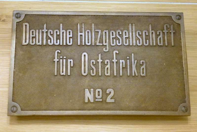
Questions regarding the Sigibahn locomotives remain unanswered. However, it is established that the locomotives bore the operating numbers No. 1 and No. 2. The original bronze number plate of locomotive No. 2, bearing the inscription “Deutsche Holzgesellschaft für Ostafrika No. 2” (German Timber Company for East Africa No. 2) , has been preserved, is part of the collection of the German Historical Museum in Berlin, and is displayed there in the permanent exhibition. [3]
Passenger Coaches and Goods Wagons
The rolling stock was modest. It consisted of only two-axle, semi-open passenger cars [5: p6-7] , two covered and two open two-axle goods wagons, six four-axle stake wagons for timber transport, two firewood wagons, and three track maintenance cars. When there was a large influx of passengers, they were occasionally transported in the two-axle open and covered freight cars. [3]
Despite the steep gradients, all the Sigi-bahn carriages were equipped only with hand brakes. This necessitated the presence of brakemen on the trains . The manufacturers of the carriages and wagons are not known. [3]
And Finally ….
In searching for more information about the Sigi-bahn I have discovered a forum link to a walk along the length of the Sigi-bahn which can be found here. [11]
.
2. Sisal Plantation Railways
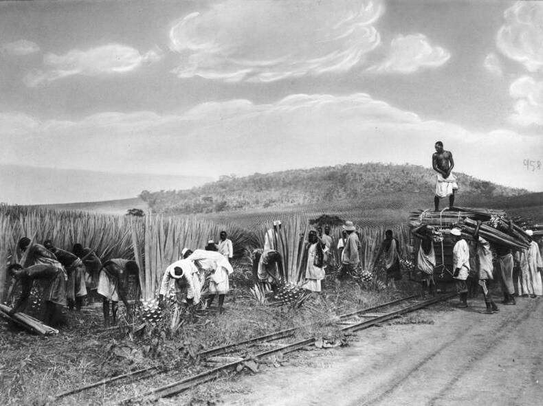
Numerous privately owned, 600 mm gauge light railways operated throughout the coastal and Tanga regions, linking sisal estates to factories and main-line stations.
Sisal plantation railways were a crucial component of the German colonial agricultural economy in the late 19th and early 20th centuries. These networks, often referred to as ‘light railways’, were used to transport harvested sisal leaves from the fields to processing factories and eventually to the Tanga port for export.
Sisal cultivation and associated small-gauge rail systems were introduced in the 1890s, with a significant boost in the very early 20th century. The plantation lines typically branched off from the main Usambara Railway.
The Tanga sisal plantations contributed to over 60% of the country’s GDP at their peak. The history of these railways is deeply linked to the development of the Tanga port and the early industrialization of the region.
An illustration of one of these lines in use in the 1960s can be seen here. [12]
“Sisal production in the country peaked in 1964 with around 250,000 tonnes in production from regions from all over the country such as Tanga, Morogoro, Arusha, Mwanza and Shinyanga. In 1967 following the Arusha Declaration most of the sisal estates were nationalized by the government. This began the downfall of the sisal industry as bureaucracy, over-centralization and lack of experience caused the production to fall rapidly. Furthermore, with the increasing popularity of Synthetic Nylon fibers, drove the world price for sisal down resulting in the foreclosure of many sisal factories. By the end of Ujamaa and President Nyerere’s rule, sisal production had fallen from 235,000 tonnes in 1964 to 32,000 in 1985, less than 15% of the country’s peak.” [14]
Remnants of the 600mm-gauge lines appear in different places in the sisal fields of Tanzania. Two examples can be found on these links – here [13] and here. [15]
.
3. Later Industrial Lines
Later Industrial Narrow Gauge Lines included:
A. The Southern Province Railway
The Southern Province Railway was a short-lived, metre-gauge railway constructed by the Overseas Food Corporation to support the “Groundnut Scheme.” It ran for 212 km from the port of Mtwara to Nachingwea, and including various branch lines was a network of about 275 km of railway, all told. It was abandoned in 1963.
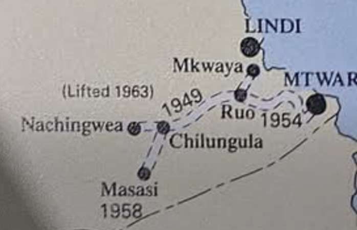
When the British Government “decided to press on with the Groundnuts Scheme in the Southern Province, the railways were faced with the problem of transport to and from the areas of cultivation which were then only vaguely defined. As soon as more was known about the approximate location of the areas to be cultivated around Nachingwea, and the estimated tonnages to be moved between there and the coast, the railways undertook a study of the best way of meeting the requirements at the lowest transport cost. There were three possible sites for port works – Lindi creek, Mikindani and the Mtwara creek which forms part of the port of Mikindani. Reasonably reliable information was available about the route along the Lukuledi valley between the areas to be cultivated and Lindi creek, but very little was known of the topography and soil conditions over about so miles at the coastal end of the most likely route to Mikindani and Mtwara. No sort of survey was practicable at the time, as all routes were impassable due to the rains. Such information as was available indicated that this section would not be easy to build. The limitations of Lindi as a port were fully recognised, but the Administration of the Railways recommended the use of Lindi in the early years of the scheme, leaving the route to Mikindani and Mtwara and the possible sites for port works to be surveyed later when more precise information would be available regarding costs and tonnages to be carried. However, the Ministry of Food decided to send out im-mediately its own mission to consider the site of the port works. The mission, which arrived in the February of 1947, consisted solely of specialists in port operation and construction. They recommended that the port works be in Mtwara creek on the grounds that it offered the best harbour facilities. Little or no account was taken of the extra cost of railway construction, the possible difficulties of the route and the extra time which would be needed for construction. The Ministry of Food, which was solely responsible for financing the new port and railways, accepted the advice of the mission.” [22: p268-269]
“The Railways’ Administration had meantime accepted responsibility for the survey and construction of the railway on behalf of the Managing Agents. In view of the importance attached to the Groundnuts Scheme, the Administration decided that the quickest way of providing a route of adequate capacity from the sea was to proceed from Mkwaya at the head of Lindi creek through Ruo – 20 kilometres from Mkwaya – to Nachingwea. The survey began in May, and the first contracts for earthworks were placed before the end of the year. The survey of the line from Mtwara to Ruo was entrusted to Messrs. Paulings, who were later awarded the contract for the construction. The Mkwaya-Ruo-Nachingwea route was opened to traffic on 25th October 1949. Due to physical difficulties, work on the Mtwara-Ruo section proceeded slowly, and due to financial difficulties Messrs. Paulings were released from the contract in the September of 1950. The Mtwara-Ruo section was finally opened on 17th January 1954.” [22: p269]
“In addition to the needs of the Groundnuts Scheme, the railways were also concerned with the provision of transport for minerals. In 1947, a siding, about nine miles long, was built from the Mwanza branch to serve the Mwadui mine of Williamson’s Diamonds Limited. The Company met the cost of bridging and earthworks. … In the Mpanda district of the Western Province, a large lead-silver-copper-gold ore body was found, and Uruwira Minerals Ltd. undertook the development of a lead mine. It was decided, in 1946, to investigate the possibility of a branch line from Kaliua on the Central line to Mpanda. After a preliminary survey it was decided to build the line, about 131 miles long. By the end of 1947, 70 miles of the location survey had been completed, and contracts for the earthworks of the first 40 miles had been placed with three local contractors. This line was opened to traffic in the August of 1950.” [22: p269]
“In 1947, the goods stock on the Central and Tanga lines was in a normal state of repair and overhauls were up to schedule. Like all other railways, the Tanganyika Railways suffered at the time from a shortage of tyres, springs, couplers and brake spares, but the percentage of wagons withdrawn from service due to this shortage was not abnormal. As soon as a preliminary estimate of the tonnage to be moved in connection with the Groundnuts Scheme was available, it was clear that the factor restricting the Railways’ capacity would be the supply of wagons. Orders were placed immediately in the United Kingdom but, in spite of the priorities obtained, deliveries could not be expected for two to three years. A world-wide search was made for metre-gauge stock to meet the demand during the intervening period – and to some extent as part of the permanent equipment. As a result wagons belonging to the War Office were found at Shaiba, near Basra, and at El Shatt, near Suez. A technical officer was sent to select suitable wagons, and those chosen were shipped as soon as possible. Because of exposure to the weather and pilfering they needed a fair amount of rehabilitation. By concentrating the resources of the Dar es Salaam workshops on the shipments as they arrived, the wagons were quickly put into service. In all, 430 four-wheeled wagons were obtained from Shaiba and El Shatt towards the end of 1947 and early in 1948. Later the purchase of these wagons was criticised as an unnecessarily expensive and unsatisfactory way of meeting a very urgent need. An effective answer is that 414 of the wagons were still giving good service in 1957.” [22: p269-270]
“Moreover, these wagons arrived in Dar es Salaam at a most opportune moment. They enabled the ordinary traffic offered, the extraordinary traffic of the Groundnuts Scheme and construction materials to be carried during the very difficult time until the new wagons on order arrived in 1949 and 1950. The strain imposed on the capacity of the port and the Central line was exacerbated by the fact that the import of materials and equipment for the Groundnuts Scheme far exceeded the original estimates.” [22: p270]
As it turned out, the Southern Province Railway was an overambitious scheme. Construction took place between 1948 and 1954 to facilitate the export of groundnuts under the British Overseas Food Corporation’s ambitious post-World War II agricultural initiative. The scheme was intended to produce up to 600,000 tons of peanuts annually on cleared bushland to address food shortages and generate revenue, the project exemplified colonial-era top-down development but collapsed amid unsuitable clay-heavy soils, erratic rainfall, mechanical breakdowns, and overestimation of yields, resulting in total losses of £36 million by 1951. Despite the scheme’s abandonment, the single-track railway—built with 60-lb rails on untreated wooden sleepers—was completed and opened for limited traffic in January 1954, initially subsidized through joint guarantees by the Overseas Food Corporation and the Tanganyika government against predictable operating deficits. Its brief operation underscored the perils of ignoring local ecological realities in favour of imported heavy machinery and rapid mechanized clearing, leaving behind underutilized infrastructure that highlighted systemic flaws in mid-20th century imperial planning rather than delivering sustained economic benefits. [16]
The failure of the Groundnut Scheme should probably have resulted in a decision to abandon the construction of the railway, but the thinking at the time was that the line would promote significant growth in southern Tanganyika. After completion of the line and its branches it was placed under the same management as all the other metre-gauge lines in East Africa, with the East African Railways (EAR). [16]
Rather than being designed with longevity in mind. The network, focused on freight haulage with minimal passenger elements. It spanned key agricultural zones but was engineered for temporary use (for instance, using untreated timber for sleepers rather than steel), reflecting the scheme’s optimistic projections for short-term financial gain, rather than long-term viability! [16]
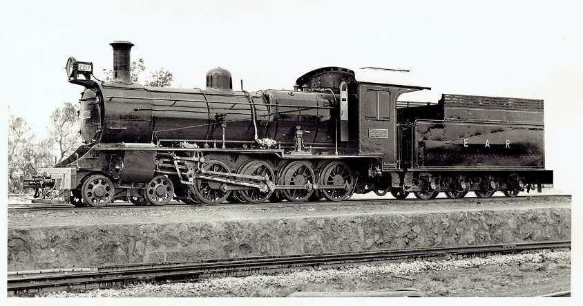
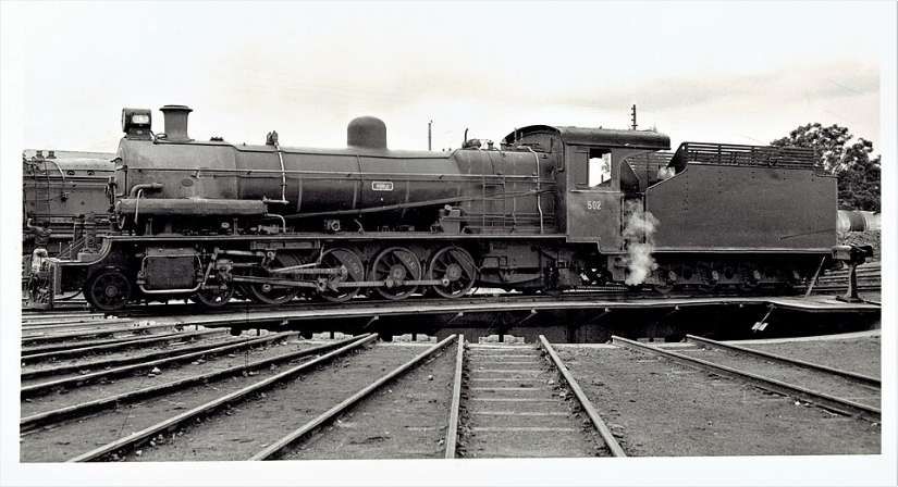
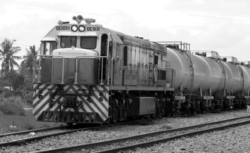
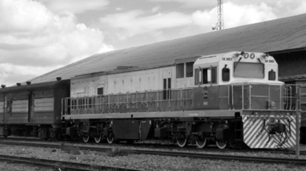
Initially the railway was steam-powered (series RV/21and NZ/22) but under EAR diesel-power was introduced (series 80 and 81).
It is at least possible that the prior existence of the Lindi tramway which at one time extended from Lindi to Masasi (in the latter year of WW1 and in the aftermath of the conflict) influenced, even if only subconsciously, the choice of this route and the inland areas it served for the groundnut project it was intended to serve. More information about this earlier trolley line which was powered by Ford tractors can be found elsewhere in this series of articles about the railways of Tanganyika/Tanzania.
The Route of the Southern Province Railway
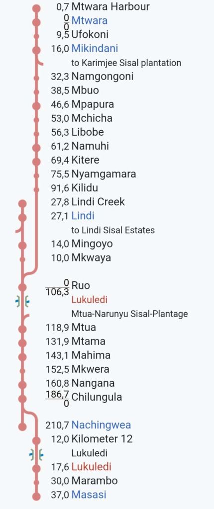
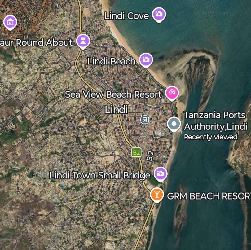
This schematic route plan is provided by Wikipedia. It shows the main line from Mtwara Harbour to Nachingwea and notes two link lines to the Sisal Plantations at Muta-Narunyu and Karimjee. Two branch lines, one to Masasi, the other to Lindi Creek are also shown. The second of which also provided a link to Lindi Sisal Plantation. [17]
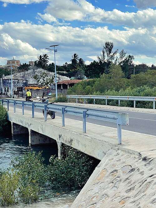
Two bridges over the River Lukuledi are also shown.
Mtwara Port was deepened by the British in 1948-1954. It was functional but underutilized for many years due to poor transport infrastructure. However, in 2010-2011 the increased activity in oil and natural gas exploration caused a surge in activity. It has recently seen major upgrades. The port has a special economic zone attached to it and In December 2015 Alistair Freeports Limited injected $700,000 to upgrade the Export processing zone around the port area. [18]
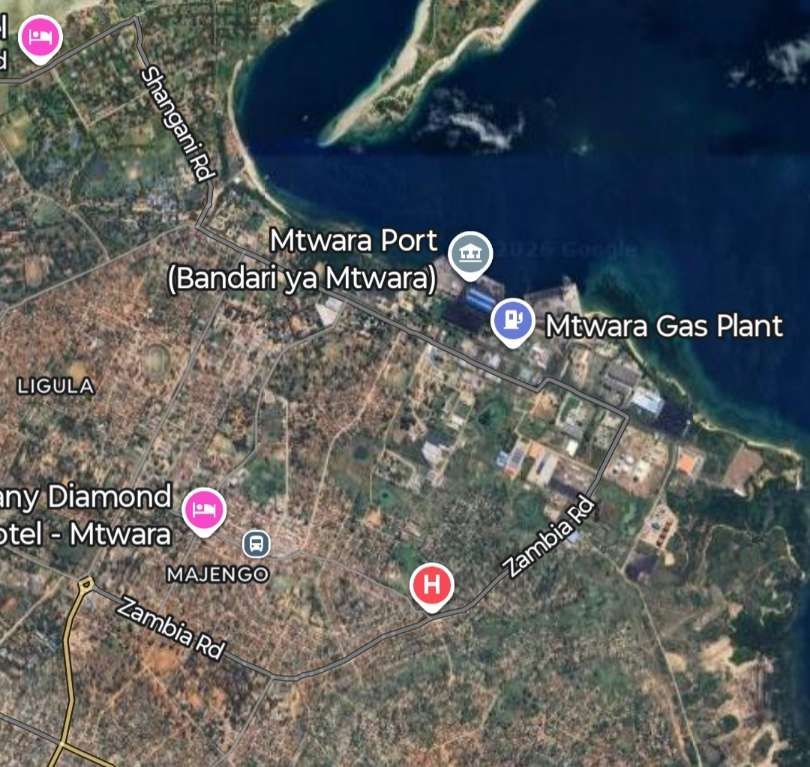
As we noted earlier, the Port at Mtwara was built towards the end of the construction period as an extension to the original length of line which ran to a port at Lindi. The extension to Mtwara came off the line to Lindi about 27 km from Lindi and ran for about 106 km serving Mikindani and Mtwara.
There is little that I have been able to find online which can be used to confirm the route of the railway. Some assumptions on the alignment of the railway can be made, whether they are warranted or not I cannot tell.
Should further information come to light the remaining paragraphs and images about this line will need to be revised. I can see two possibilities for the route of the old line:
1. The first possibility depends on an assumption that the railway will have been built with an access road alongside it. That access road is likely to have survived and become part of the lasting road network of the Southern Province of Tanzania.
Determining, conclusively, the route of the line would have been helped by the availability of Google Streetview images in the Southern Province of Tanzania. However Google Streetview imagery in Tanzania is primarily focused on key tourist locations and specific, curated, or partnered locations rather than comprehensive nationwide road mapping. Major coverage areas include Gombe National Park, parts of Zanzibar, and the Ngorongoro Crater rim.
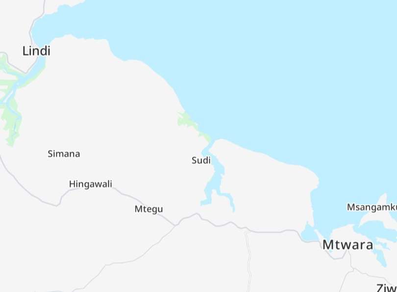
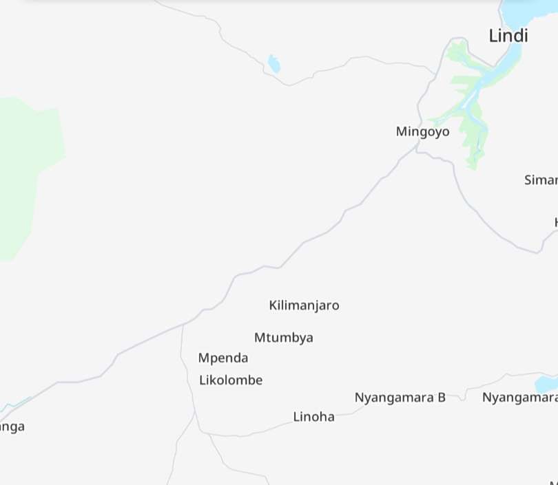
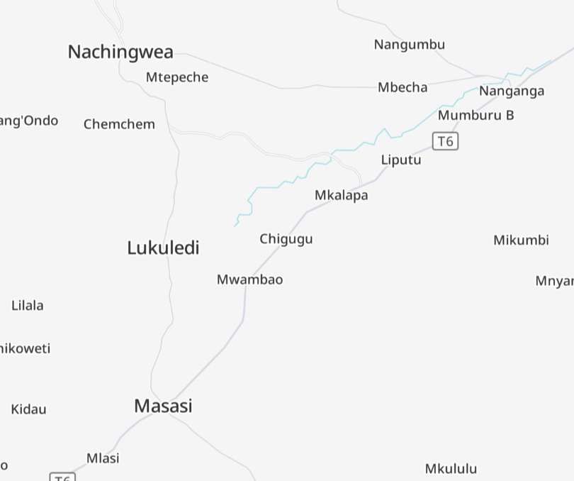
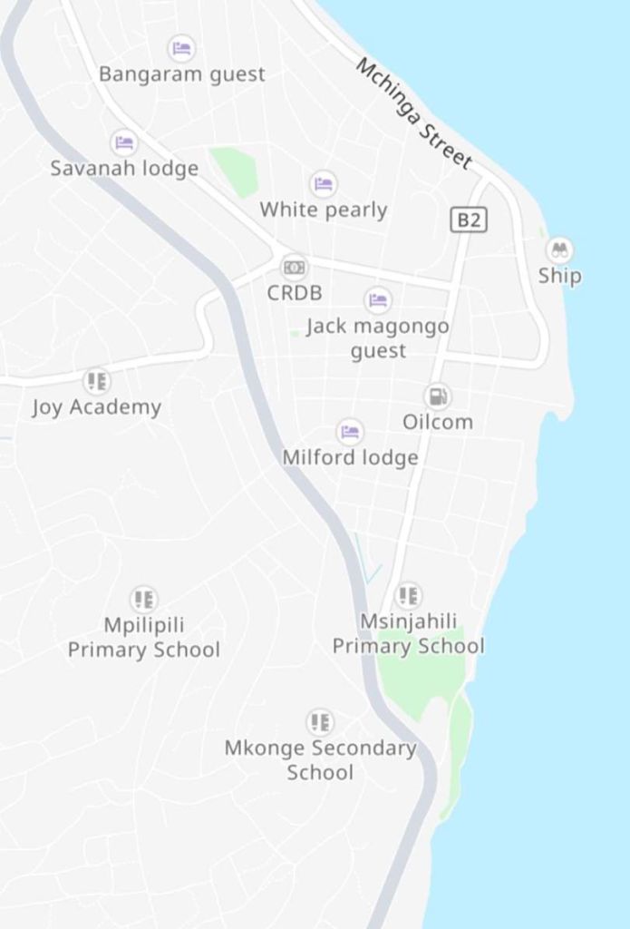
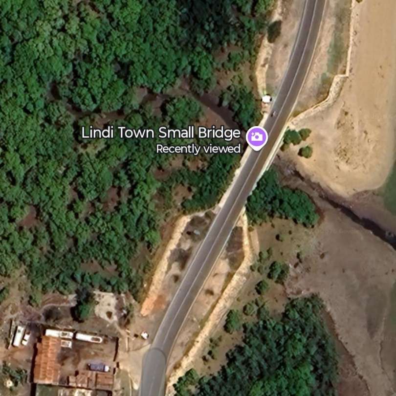
The next three images show a possible route of the line between Mtwara and Nachingwea the grey lines are roads T6 running West from Mtwara, the T7 in the East serving Lindi, the T6 from Mingoyo to Nangana and the Nachingwea Road, West of Nangana.
In the West there was a branch line serving Lukuledi and Masasi, the route of which is much less clear.
My presumptions about the possible route of the line are called into question by the schematic route plan above which places the junction between the line serving Lindi at a place called Ruo. We will come back to this below.
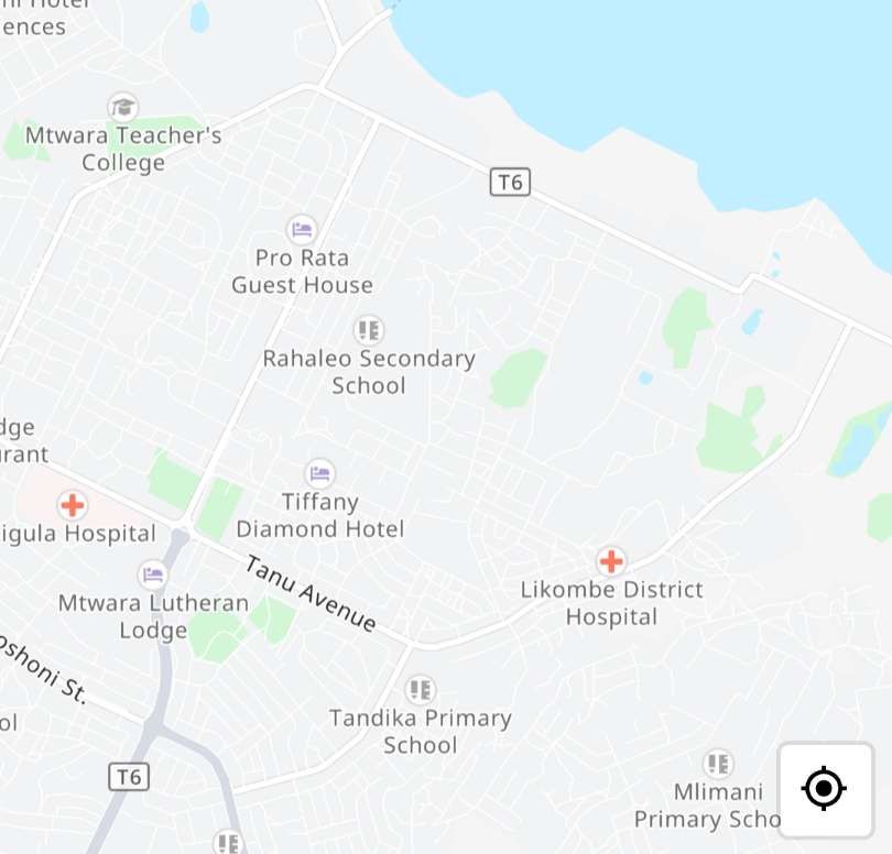
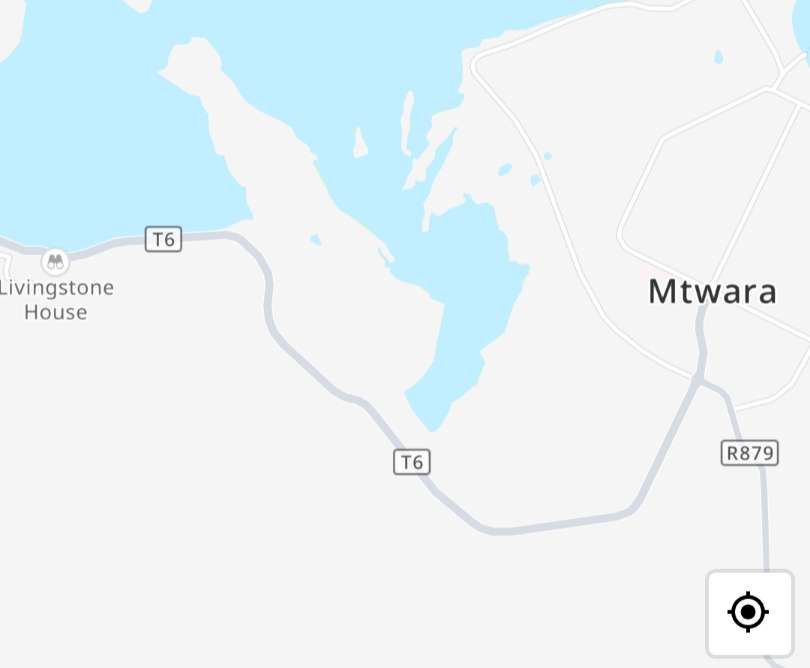
In the East, close to Mtwara Port the alignment of the railway is very difficult to determine as it has probably been built over.
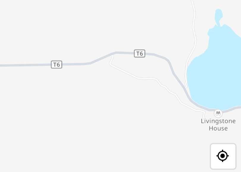
Assuming that my assumptions are correct, at Mingoyo the line from Mtwara appears to have met the line to/from Lindi. It appears that trains to Lindi would have progressed without reversing. Trains to Nachingwea would have required the locomotive to run-round its train.
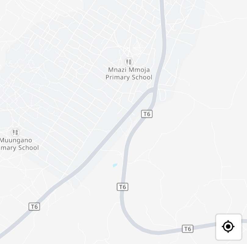
The remainder of the route West to Nachingwea would follow the line suggested, along the T6 and the Nachingwea Road.
2. Given the complications associated with a junction at Mingoyo and the fact that the Wikipedia schematic route diagram indicates that the junction between the Lindi line and the Mtwara line was 14 km further South at Ruo, it is possible that the line from Lindi followed the T7 to Mingoyo and the the T6 to Mkwaya. However, following this route takes the line in the wrong direction to access a junction at Ruo which is some distance away to the Southwest. No bridge is shown over the Lukuledi river on the Lindi branch on the schematic route plan above. However, neither is a bridge shown on the line to/from Mtwara.
If, Ruo was the location of the junction at least one bridge over the Lukuledi would have been necessary, most probably on the line from Lindi.
As is painfully obvious from the paragraphs above, without significantly more information we can only speculate on the actual route of the old line.
.
B. Port of Bujumbura Railway: While operating within the neighbouring territory of Burundi, a 600 mm gauge industrial railway ran from 1947 to 1982 within the port area, servicing Lake Tanganyika traffic. Its operator was Office Congolais des Chemins des fer des Grands Lacs (CFL). [26] At the time of its construction, Bujumbura was known as Usumbura. [27]
.
References
- https://en.wikipedia.org/wiki/History_of_rail_transport_in_Tanzania, accessed on 24th February 2026.
- https://www.africabib.org/rec.php?RID=187591229, accessed on 24th February 2026.
- https://de.wikipedia.org/wiki/Sigibahn, accessed on 24th February 2026.
- Franz Baltzer; The Colonial Railways with Special Consideration of Africa; Berlin 1916. Reprint, Leipzig 2008.
- Helmut Schroeter; The Railways of the Former German Protectorates of Africa and Their Vehicles = The Vehicles of the German Railways, Volume 7; Frankfurt 1961.
- German Colonial Railway Construction and Operating Company (ed.): German East Africa – from the coast to Kilimanjaro with the Usambara Railway; Heinicke, Berlin, 1914.
- Hans Wettich; The development of Usambara under the influence of the East African Northern Railway and its private branch lines, with special consideration of the Mkumbara-Neu-Hornow cable car; Simion, Berlin 1911. Reprint from: Proceedings of the Association for the Promotion of Industry 90 (1911), Issue 6; via https://publikationen.ub.uni-frankfurt.de/frontdoor/index/index/docId/11924, accessed on 24th February 2026.
- Helmut Schroeter and Roel Ramaer; The railways in the former German protectorates then and now; Krefeld, 1993.
- Roel Ramaer; Gari la Moshi – Steam Locomotives of the East African Railways; Malmo 2009.
- https://postimg.cc/dDHY1F8g, accessed on 24th February 2026.
- https://bimmelbahn-forum.de/forum/index.php?thread/22289-die-sigibahn-auf-den-spuren-einer-privaten-schmalspurbahn-in-ostafrika, accessed on 24th February 2026.
- https://www.gettyimages.com.au/detail/news-photo/sisal-leaves-are-taken-by-rail-for-processing-on-a-news-photo/88556860, accessed on 24th February 2026.
- https://www.alamy.com/stock-photo-tanzania-tanga-usambara-mountains-sisal-farming-and-industry-dd-ruhinda-103739156.html, accessed on 24th February 2026.
- https://en.wikipedia.org/wiki/Sisal_production_in_Tanzania, accessed on 24th February 2026.
- https://www.alamy.com/stock-photo-tanzania-tanga-usambara-mountains-sisal-farming-and-industry-dd-ruhinda-103738452.html, accessed on 24th February 2026.
- https://grokipedia.com/page/southern_province_railway, accessed on 24th February 2026.
- https://en.wikipedia.org/wiki/Southern_Province_Railway, accessed on 24th February 2026.
- https://en.wikipedia.org/wiki/Mtwara_Port, accessed on 25th February 2026.
- https://unitedrepublicoftanzania.com/economy-of-tanzania/infrastructure-in-tanzania/railway-in-tanzania/mtwaras-forgotten-rails-a-glimpse-into-tanzanias-industrial-past, accessed on 25th February 2026.
- https://en.wikipedia.org/wiki/TR_NZ_class, accessed on 25th February 2026.
- https://en.wikipedia.org/wiki/TR_RV_class, accessed on 25th February 2026.
- M.F. Hill; Permanent Way – Volume II – The Story of Tanganyika Railways; East African Railways and Habours, Nairobi, Kenya; Watson & Viney, Aylesbury & Slough, 1957, p268-272.
- https://www.facebook.com/share/p/1DyhZvKm8J, accessed on 26th February 2026.
- https://kartaview.orghttps://kartaview.org, accessed on 4th March 2026.
- https://upload.wikimedia.org/wikipedia/commons/thumb/1/11/Little_Lindi_Town_Bridge.jpg/500px-Little_Lindi_Town_Bridge.jpg, accessed on 4th March 2026.
- https://en.wikipedia.org/wiki/History_of_rail_transport_in_Burundi, accessed on 4th March 2026.
- https://www.sinfin.net/railways/world/burundi.html, accessed on 4th March 2026.
