
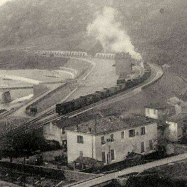
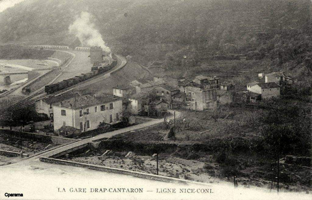
The featured image above is a rather grainy image of steam at Drap-Cantaron Railway Station.
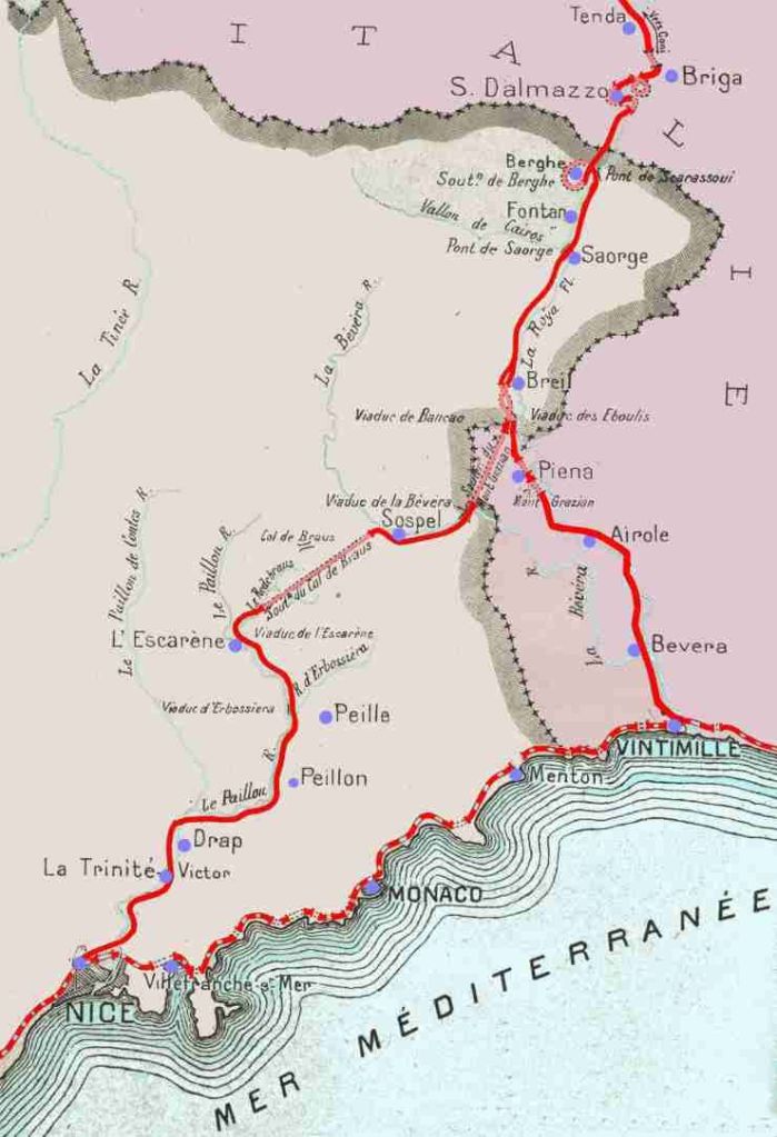
In the first six articles about the line from Cuneo to the sea we covered the length of the line from Cuneo to Breil-sur-Roya and then to Ventimiglia. These articles can be found here, [9] here [10] here, [11] here, [12] here, [13] and here [14]
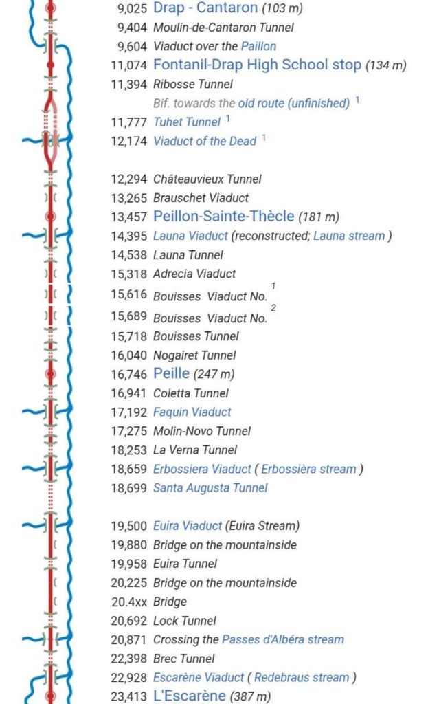
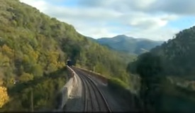
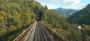
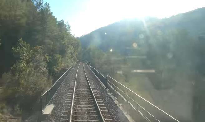
Woven into the text below are a series of stills from a video of the train journey from Breil-sur-Roya to Nice. The video can be seen here. [4]
This article begins the journey from L’Escarene.
Initially, the line heads Southeast but then gradually turns to the the Southwest through Peille, Peillon and Drap before running into Nice.
The map below shows the two routes which headed from Nice and Ventimiglia North to Cuneo, as they existed prior to the alteration of the border between France and Italy after the Second World War.
From l’Escarene to Drap-Cantaron
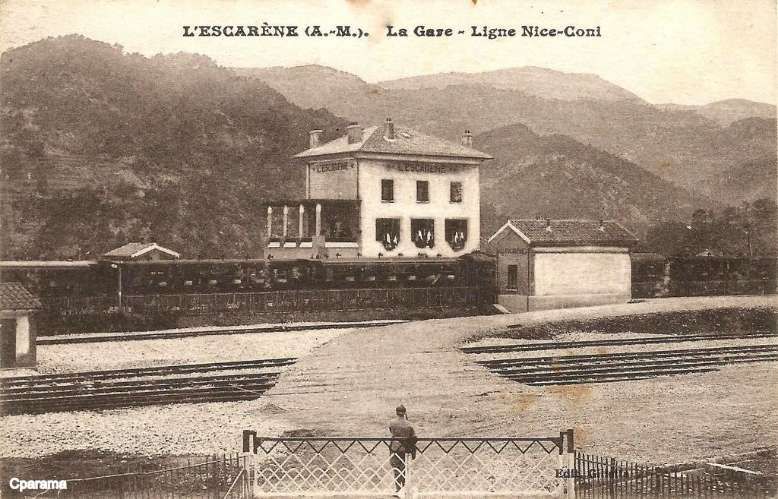
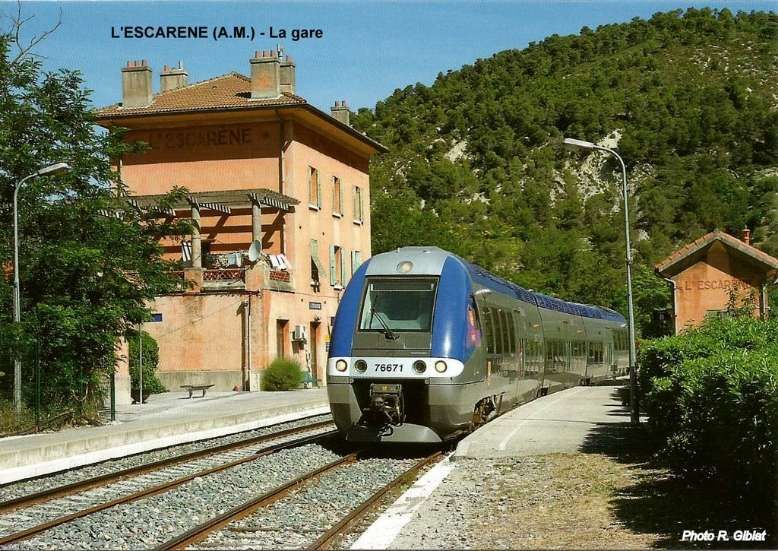
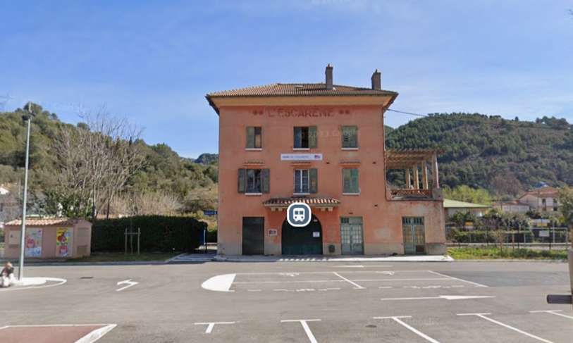
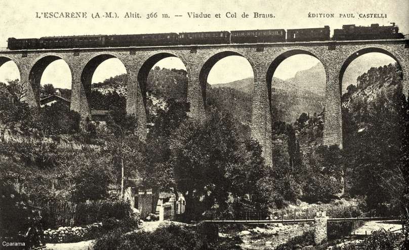
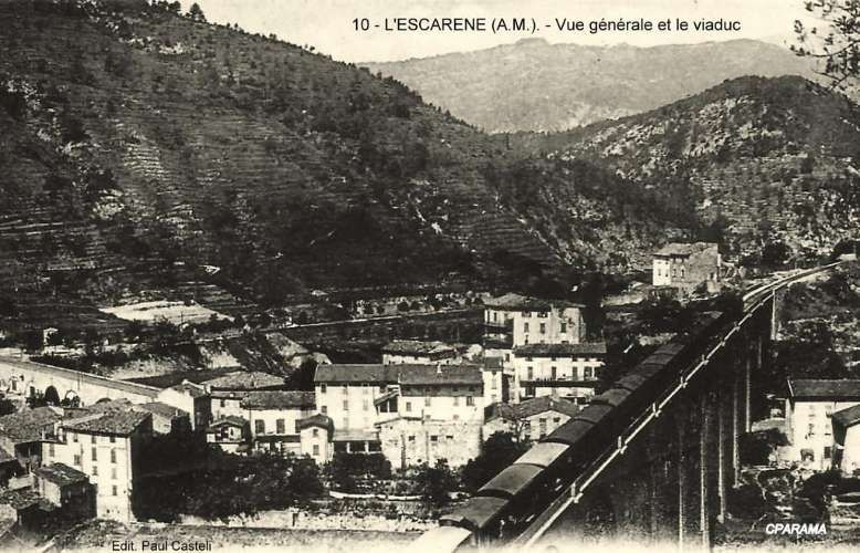
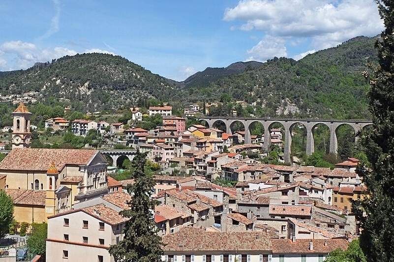
L’Escarene sits at the head of a long climb from Nice, it was one of the historic staging posts on the old royal road from Nice to Turin. Like Sospel Station, that of l’Escarene has substantial facilities which would allow the reception of military convoys in the event of conflict with neighbouring Italy. [1: p92]
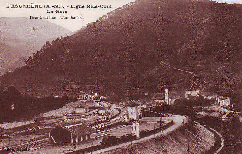
It is only a very short distance to the abutment of the viaduct that carries the line through l’Escarene.
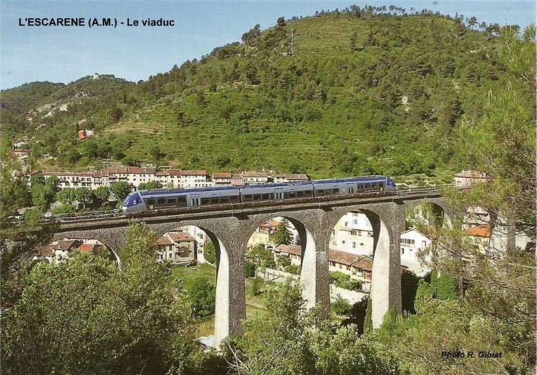
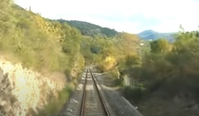
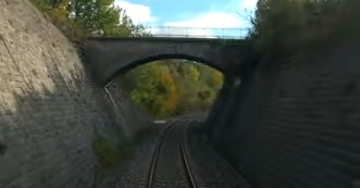
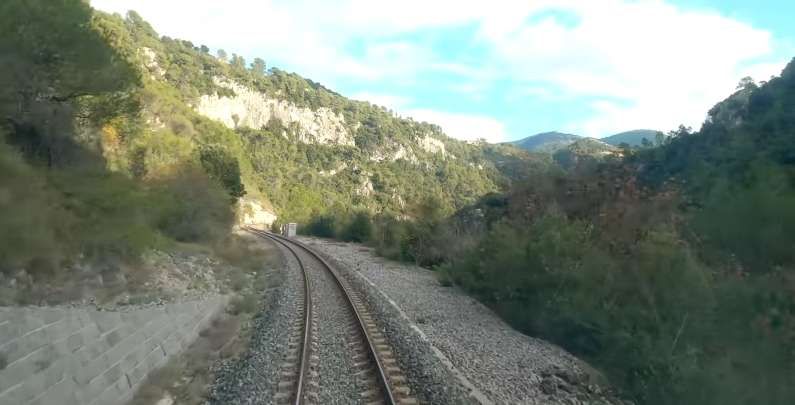
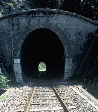
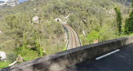
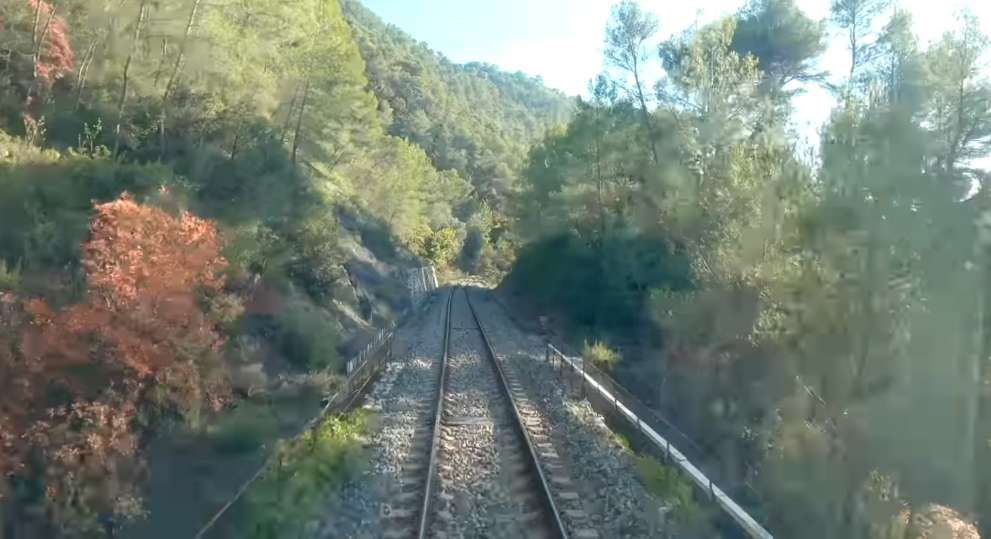
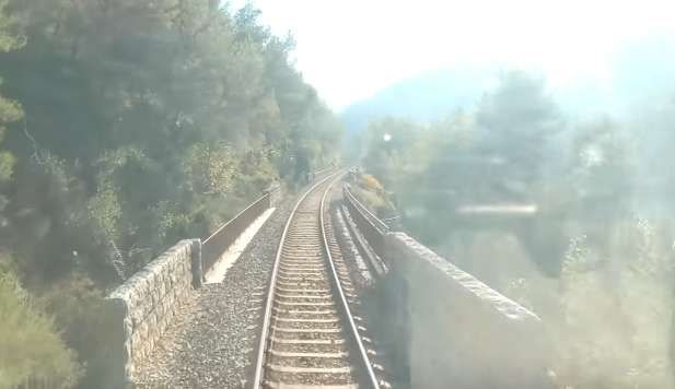
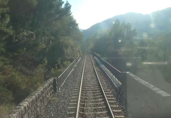
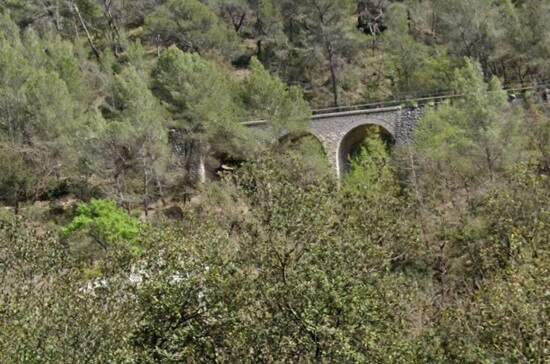
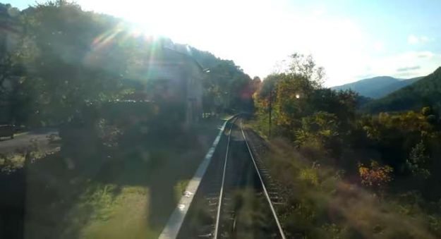
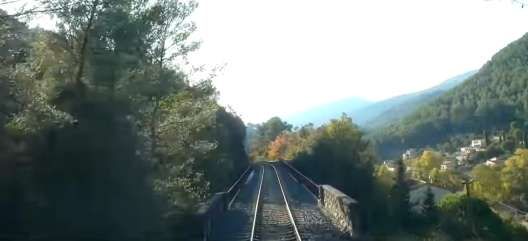
Setting off from l’Escarene Railway station, this is the first view of the l’Escarene Viaduct from the cab of a Nice-bound train. The viaduct over the Redebraus has eleven 15 metre arches. [4]

Part way across the viaduct the camera in the cab of the Nice-bound service picks up the metal parapet rails of the viaduct and the short tunnel ahead. [4]
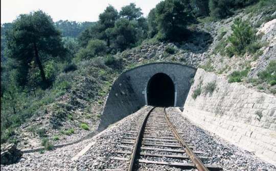
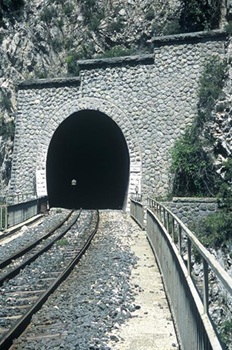
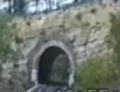
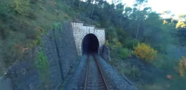
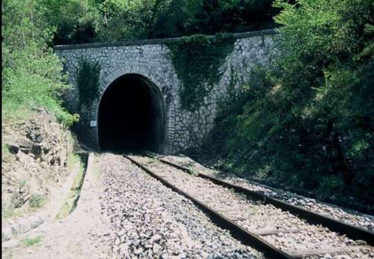
The tunnel at the Southeast end of l’Escarene Viaduct is the Tunnel de Brec (382 metres in length. [19]
The Northwest portal of Brec Tunnel seen from alongside the line. [19]

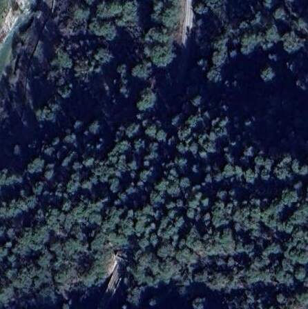
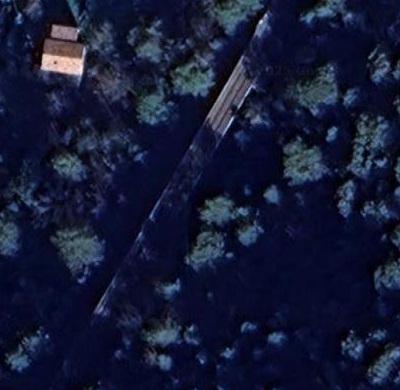
The same crossing on Google’s satellite imagery. [Google Maps, August 2025]
The view Southeast from the mouth of Brec Tunnel. [4]
Turning through 180, provides us this view of the Southeast portal of Brec Tunnel. [19]
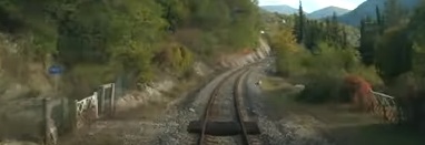
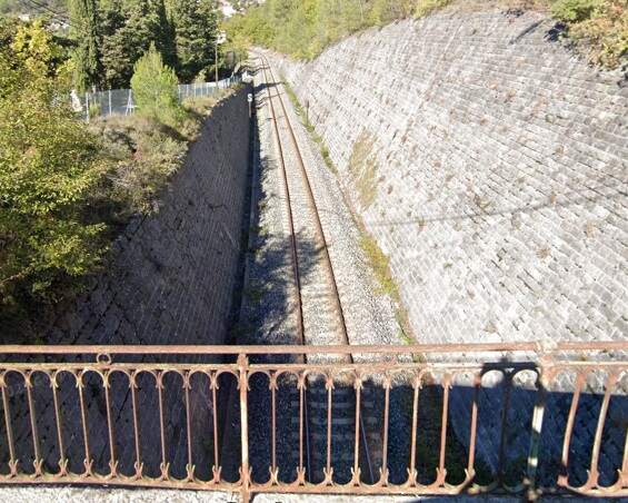
A gated crossing over the line a little further to the Southeast. [4]
The view of the same bridge from the cab of the Nice-bound train. [4]
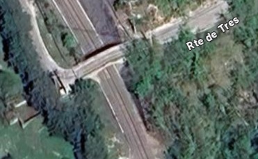
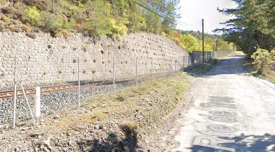
The bridge carry Rte de Tres over the line. [Google Maps, August 2025]
Looking Northwest along the line from the bridge carrying Rte de Tres over the line. [Google Streetview, November 2022]
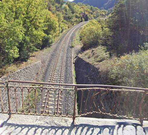
The view Southeast from the same bridge. [Google Streetview, November 2022]
The next overbridge carries Rte de l’Eira over the line. [4]
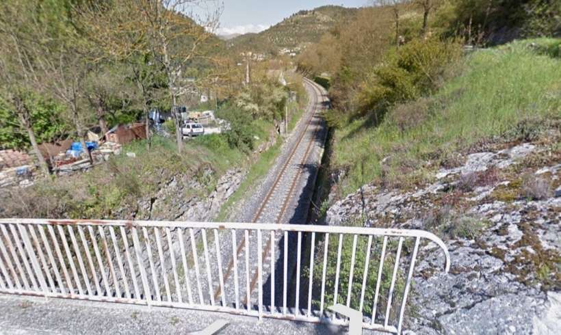
Looking North from the bridge carrying Rte de l’Eira over the line. [Google Streetview, April 2013]
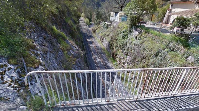
Looking South from the same bridge. [Google Streetview, April 2013]
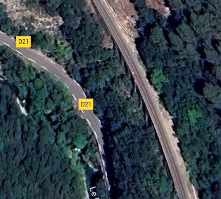
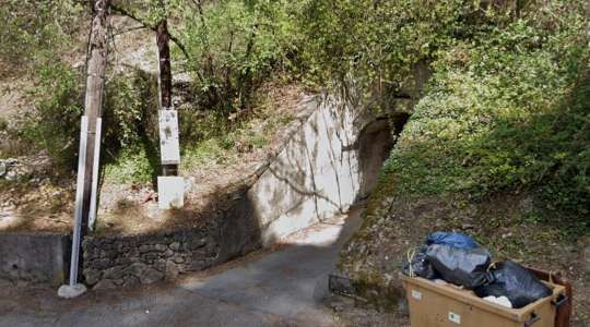
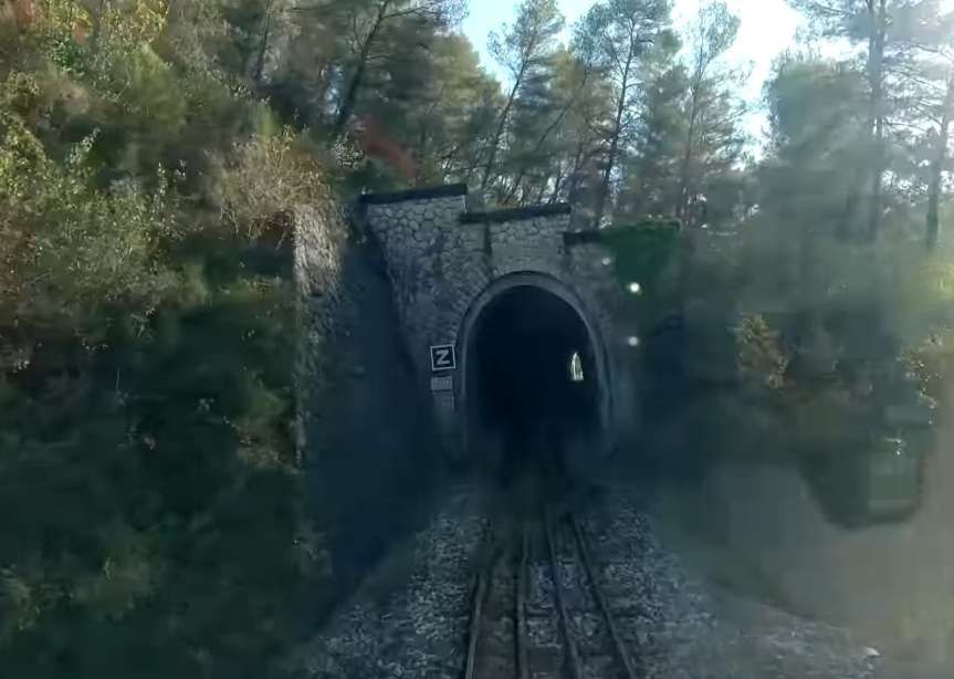
Southeast, the line enters Tunnel de Ecluse (136 metres in length). Just before this, there is a footpath access under the embankment. [34]
The underbridge mentioned above, seen from the D21. [Google Streetview, March 2023]
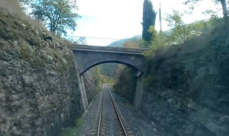
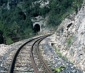
The Northwest portal of Tunnel de Ecluse, seen from the cab of a Nice-bound train. [4]
The same tunnel mouth, seen from the lineside. [34]
The view from the cab of the Nice-bound train at the Southeast portal of Tunnel de Ecluse. [4]
Turning to face Westnorthwest, this is the Southeast portal of the Tunnel de Ecluse. [34]
The next feature on the line is a short tunnel – Tunnel d’Euira (63 metres in length). [32]
Tunnel d’Euira is on the right side of this satellite image. [Google Maps, September 2025]
The North portal of Tunnel d’Euira. [32]
The South portal of Tunnel d’Euira and the galleried retaining structure which carries the line from a point very close to the tunnel portal. [32]
From many an angle, you would be forgiven for thinking that the railway crosses a viaduct. It appears, however, that the structure is a galleried retaining structure which creates a platform for the railway to run on while limiting the wight of the structure on the rock face beneath. [Google Maps, September 2025]
This view of the location from a little further ‘South, shows that the trackbed abuts the rockface on the East side of the line. [32]
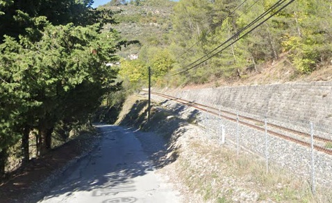
The railway continues on a ‘berm’ built out from the East face of the Paillon valley and high above the D21, until it reaches the Ruisseau d’Euira.

This small extract from Google’s satellite imagery shows Le Paillon, the D21 and the railway in parallel. The railway bridge over the Ruisseau d’Euira is on the right of this image. [Google Maps, September 2025]
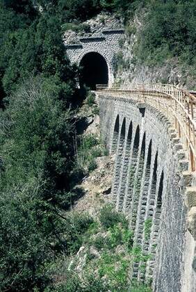
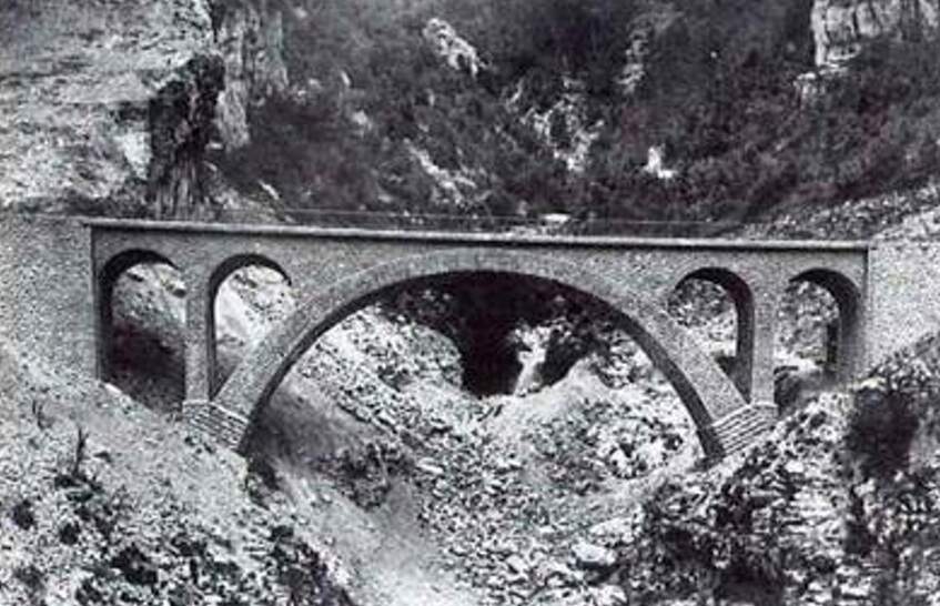
The Viaduc d’Euira crosses the valley of the Ruisseau d’Euira. The viaduct has one 30 m arch and two 5 m arches. [31]

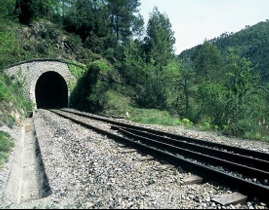
The Tunnel de Santa Augusta (754 metres in length) runs under the Ste-Augusta Chapelle. [30]
The South portal of the Tunnel de Santa Augusta. As can be seen the tunnel runs straight between the two portals, allowing the light from the North portal to be seen from outside the South portal. This photograph was taken alongside the track crossing the Viaduc d’Erbossièra. [30]
The Viaduc d’Erbossièra (205 metres in length). [29]
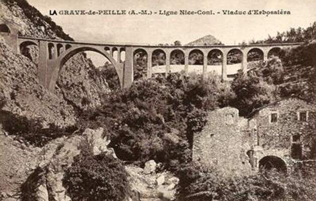
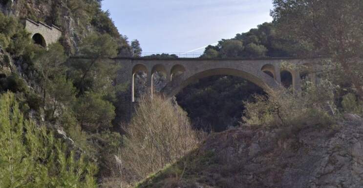
More pictures of this structure, including some early photographs taken during construction can be found here. [29]
A short distance further South the line enters Tunnel de la Verna (197 metres in length). [28]
The North Portal seen from the cab of a Nice-bound service. The sun is low in the sky and the tunnel mouth is in deep shade. [4]
The view from the same train, looking South from the South portal of Tunnel de la Verna. [4]
Turning round to face North, this is the South portal of Tunnel de la Verna. [28]
About a further kilometre to the South the line enters Tunnel de’Ecluse.
Tunnel de l’Ecluse (78 metres in length, sits just to the North of Viaduc de Faquin. [21]
The North portal of Tunnel de l’Ecluse. [21]
The South portal of Tunnel de l’Ecluse and the Viaduc de Faquin. [21]
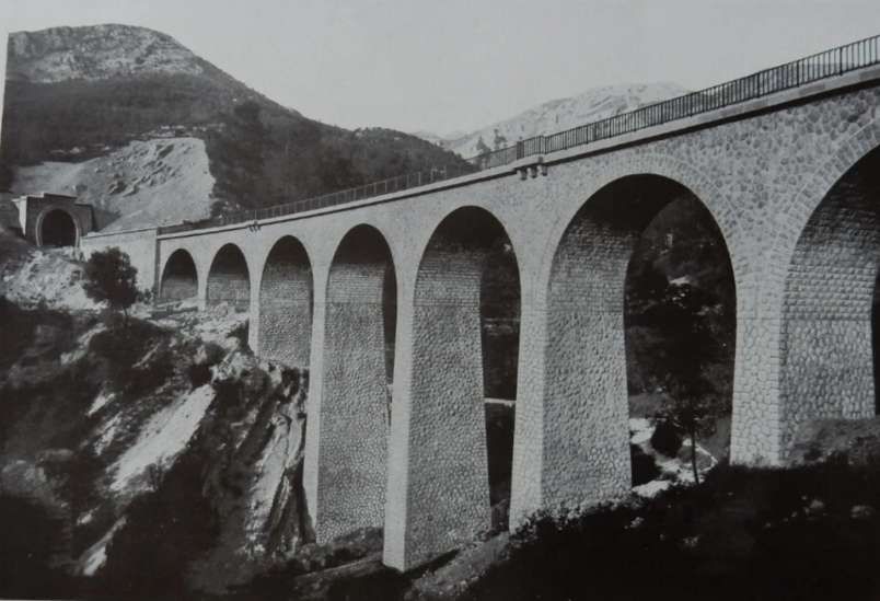
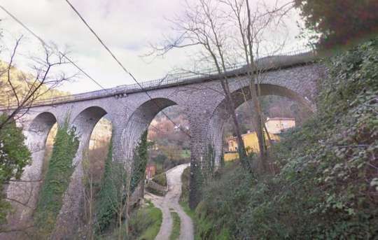
Viaduc de Faquin. [22]
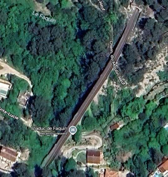
Viaduct de Faquin as seen on Google’s satellite imagery (seven 11-metre arches). [Google Maps, September 2025]
Viaduct de Faquin seen from the West on Chemin de Sainte Lucie in the valley floor. [Google Streetview, January 2011]
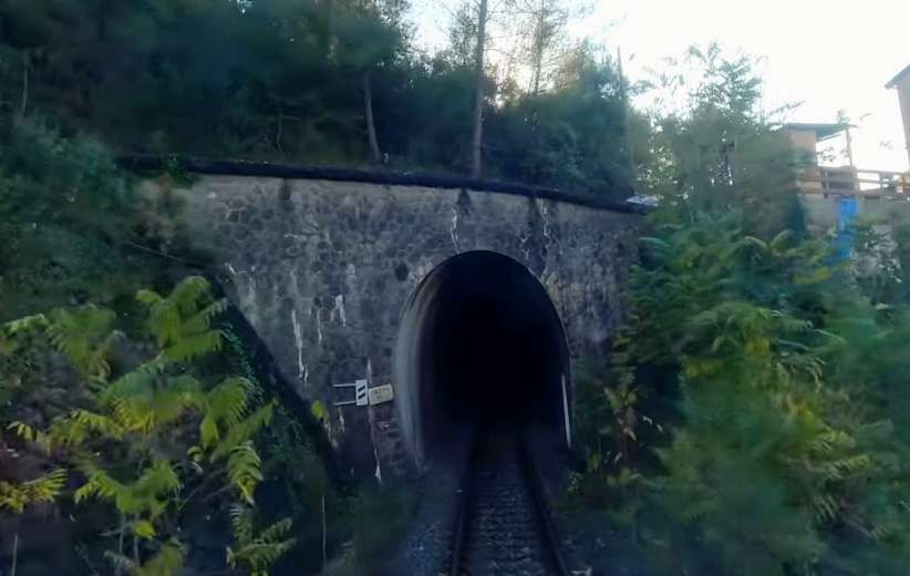
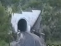
The northern mouth of Tunnel de Coletta, seen from a Nice-bound train. [4]
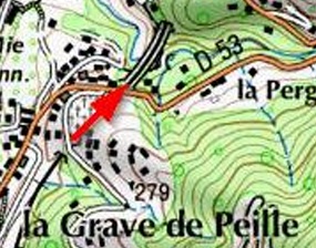
Viaduct de Faquin, seen from the D53 which crossed the line above the tunnel mouth to the South of the viaduct (Tunnel de Coletta). [Google Streetview, April 2023]
Tunnel de Coletta. [23]
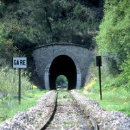
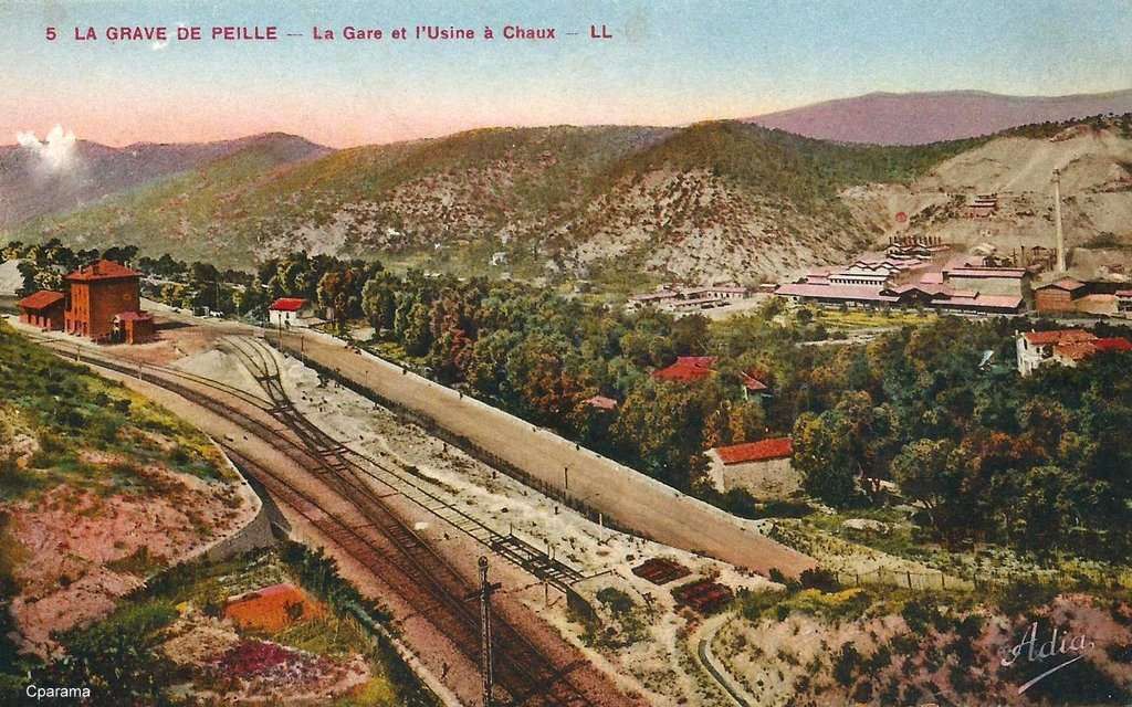
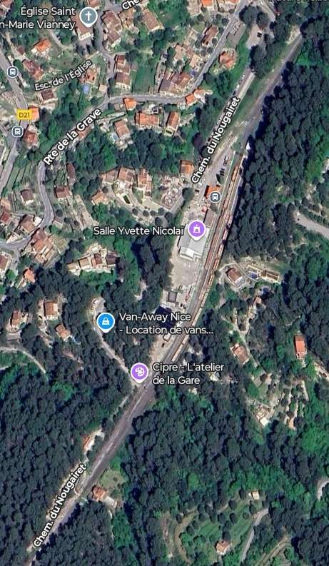
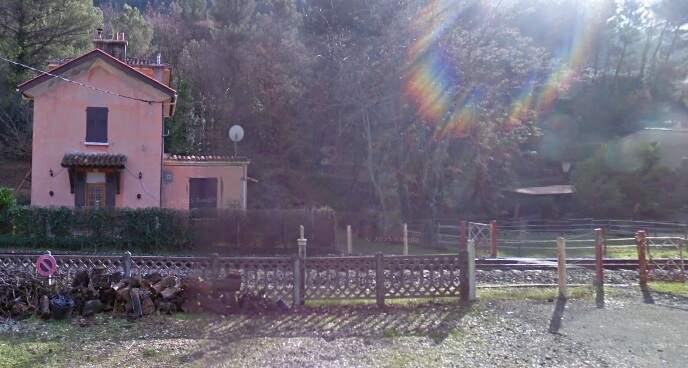
Immediately to the South of Tunnel de Coletta the railway enters Peille Railway Station in Grave de Peille.
The approach to Grave Railway Station, seen from the cab of a Southbound service at the mouth of Tunnel de Coletta. [4]
The southern portal of Tunnel de Coletta, seen from the end of the platform at Peille Railway Station (Grave de Peille), © Eugenio Merzagora and carried on the Structure website. [24]
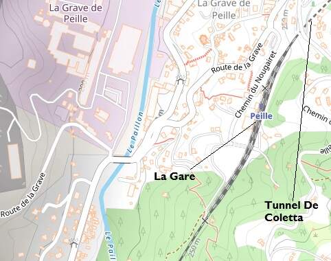
Peille Railway Station is located 6 km from the village of the same name, and serves the La Grave district, where the Vicat company operated a quarry and cement factory from 1924. A branch of the TNL tramway network reached this point from Pont-de-Peille. [1: p92]
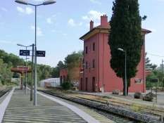
The view from the carriage door of a Nice-bound train of Peille Railway Station (La Gare de Peille), © Eugenio Merzagora (2019) and shared on the Structurae Website. [28]
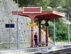
The island platform shelter, La Gare de Peille, seen from the Northwest, © Eugenio Merzagora (2019) and shared on the Structurae Website. [28]
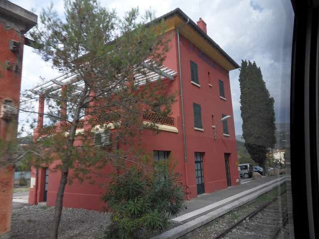
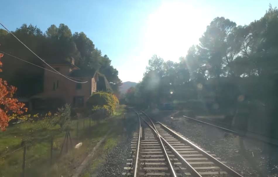
At the South end of the Station site the line becomes single track once again adjacent to a house built originally for railway staff. [4]
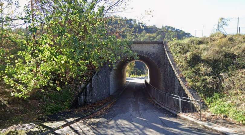
Further South the line passes through Tunnel de Nogairet (32 metres in length). [Google Maps, September 2025]
The North portal of Nogairet Tunnel, seen from the cab of a Nice-bound service. [4]
The view South from the cab of the Nice-bound train at the South portal of Nogairet Tunnel.
Turning through 180°, this is the South portal of the Tunnel de Nogairet as seen from the cab a Breil-sur-Roya-bound train in 1995. [37]
And then a short distance further South trains pass through Tunnel de Bouisses.
Tunnel de Bouisses as it appears on Google’s satellite imagery, (107 metres in length). [Google Maps, September 2025]
The North portal of Tunnel de Bouisses, seen from the cab of a Nice-bound train. [4]
Low sun shines on the cab of the same Nice-bound service as it leaves Tunnel de Bouisses and is about to cross the first of two viaducts with the name ‘Bouisses’ (Viaduc de Bouisses No. 2). [4]
Turning through 180°, this low definition view shows the South portal of Tunnel de Bouisses as seen from the cab of a Breil-sur-Roya-bound train in 1995 which is just about to cross Viaduc de Bouisses No. 2. [37]
Viaduc de Bouisses No. 2 (three 6-metre arches), as it appears on Google’s satellite imagery. [Google Maps, September 2025]
A very short distance South-southwest the line crosses Viaduc de Bouisses No. 1. …

Viaduc de Bouisses No. 1 (six 6-metre arches).[Google Maps, September 2025]
In the light of the low sun this is the view South-southwest across Viaduc de Bouisses No. 1 from the cab of the Nice-bound service. [4]
A little further to the South, after running along a trackbed supported by retaining walls trains travelling towards Nice cross the Viaduct de Adrecia, seen here from the cab of the Nice-bound service. [4]
Viaduc de Adrecia (three 6-metre arches). [Google Maps, September 2025]
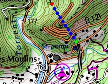
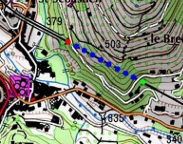
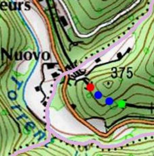
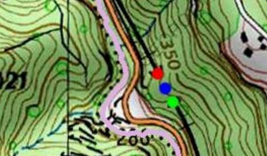
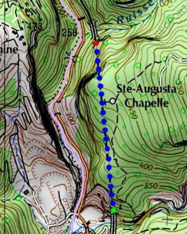
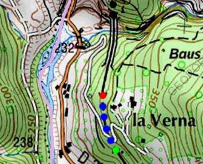
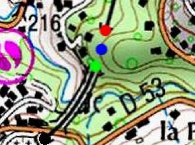
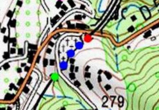
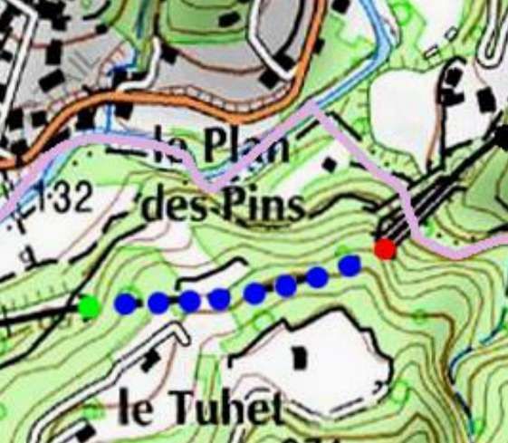
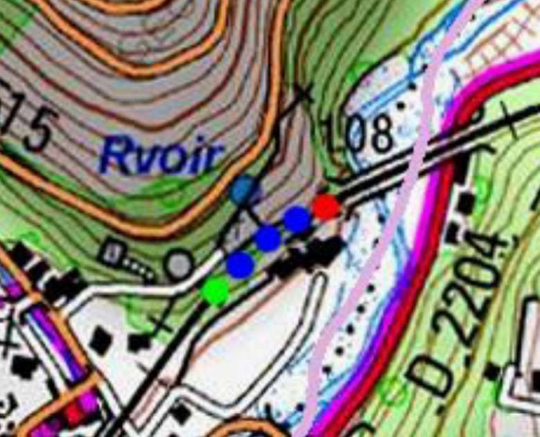
The line has curved round to the Southeast before it enters Tunnel de Launa, shown here by the red, blue and green dots. Viaduc de Launa sits immediately to the Southeast of the tunnel. [38]
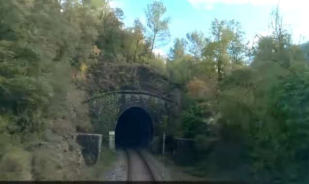
The Northwest portal of Tunnel de Launa (309 metres in length). [4]
This slightly overexposed image shows the view from the cab of the Nice-bound service as it leaves the Tunnel de Launa. The Viaduc de Launa is just beyond the railway house on the left of the image. [4]
The Southeast portal of Tunnel de Launa with a railway house on the right of the image. The viaduct is immediately behind the camera. Note also the level crossing close to the tunnel mouth. [38]
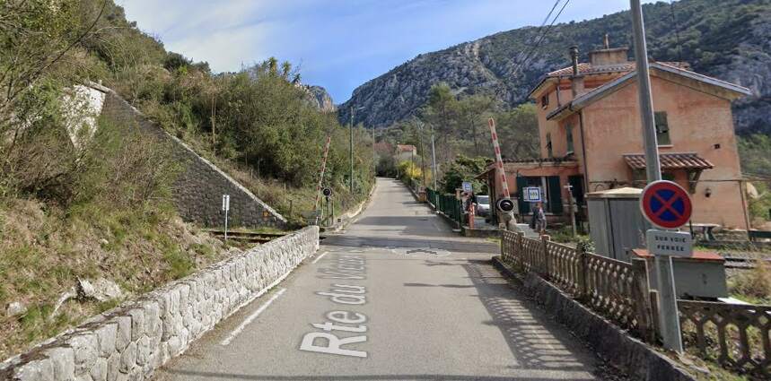
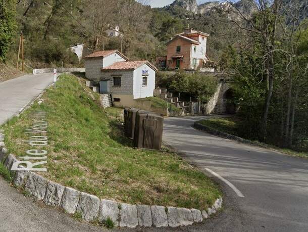
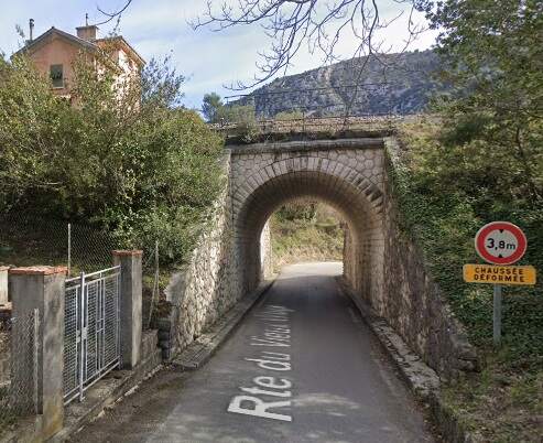
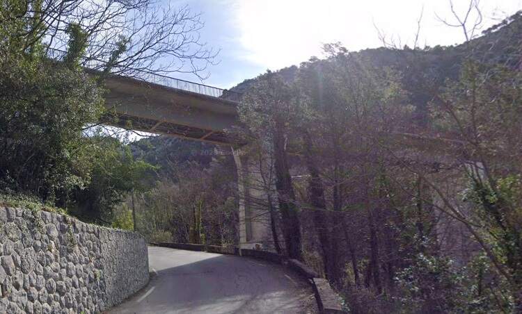
The bridge carrying the railway over Rte du Vieux Village (D121). [Google Streetview, March 2023]
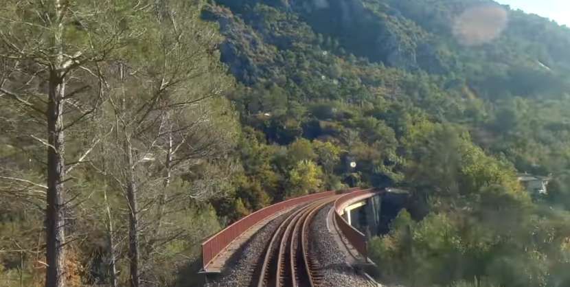
Viaduc de Launa (100 metres in length – six 12-metre arches over the Galimbert stream) seen from the cab of the Nice-bound train running through the level-crossing. The viaduct was rebuilt during 1992 and 1993 as the first viaduct suffered settlement due to ground movement. [4]
Both this and the next image of the pedestrian crossing at Chemin de Laghet – a couple of hundred metres further along the line toward Nice – are of poor quality because of bright and low sunlight. [4]
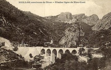
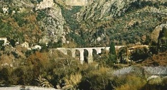
Looking directly into the sun, this is the view from the cab of a Nice-bound service coming to a halt at Peillon-Sainte-Thècle Railway Station. [4]
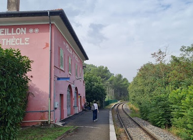
A better view of Peillon-Sainte-Thècle Railway Station as seen from the East along the platform, © Yann Cochois (September 2023). [Google Maps, September 2025]
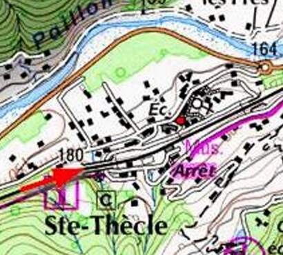
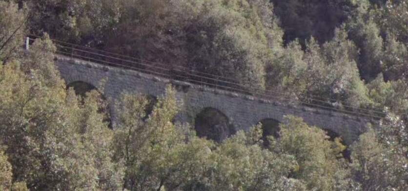
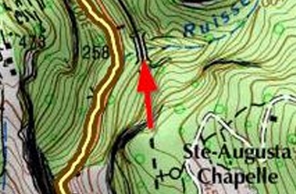
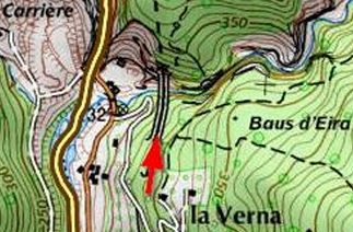
Pont du Brauschet sits just to the West of Peillon-Sainte-Thècle Railway Station and is marked on this map with a red arrow. It is 70 metres long and is a 5-arch viaduct.
Pont de Brauschet, seen from the cab of a train heading for Nice. [4]
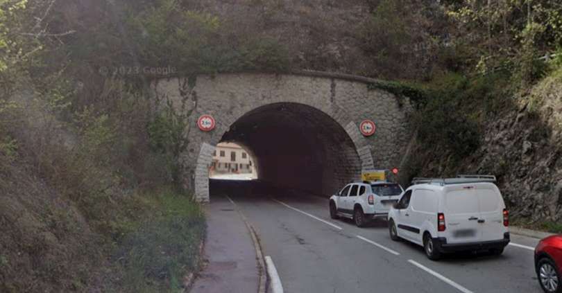
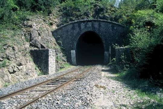
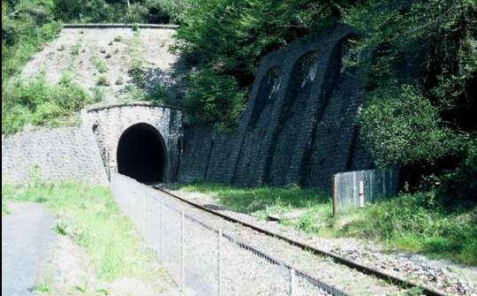
The next structure along the line is Tunnel de Châteauvieux (219 metres in length). This in the East portal of the tunnel. [4]
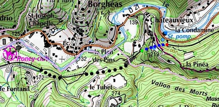
This is the West portal of Tunnel de Châteauvieux, seen from alongside the line between the tunnel and Viaduc des Mortes. [40]
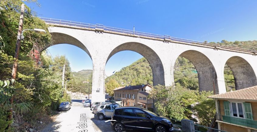
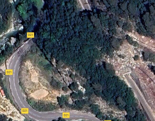
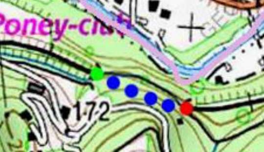
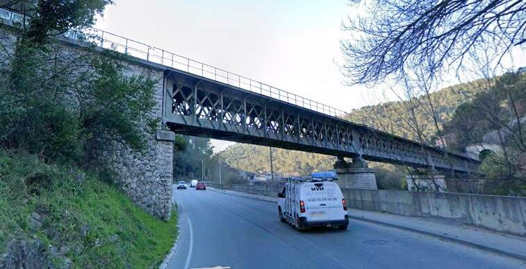
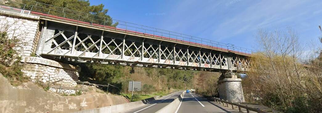
Just to the West of the Tunnel de Châteauvieux there are 2 viaducts next to each other (Viaducs des Mortes) of which only one is in service; the southern one which gives access to the Tuhet tunnel. The viaduct to the north (which has seven arches) leads to an unfinished tunnel. An accident occurred during the drilling of the original tunnel in 1925. The accident, which caused the death of 3 workers, resulted in the need to drill a new tunnel and, as a result, the construction of another viaduct in 1927 (with five 11 metre arches). The viaducts are named, Viaducs des Mortes, not because of the accident but because the viaducts bridge a footpath which was used to take deceased inhabitants of Borghéas to the cemetery of the neighbouring village of Drap.
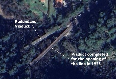
The two viaducts mentioned above. [Google Maps, September 2025]
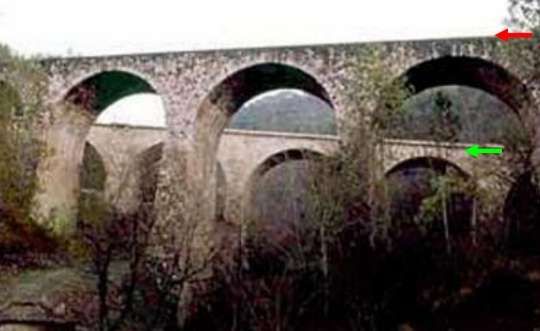
The two viaducts, seen from the North. The green arrow indicates the operational viaduct, the red arrow, the redundant viaduct. [48]
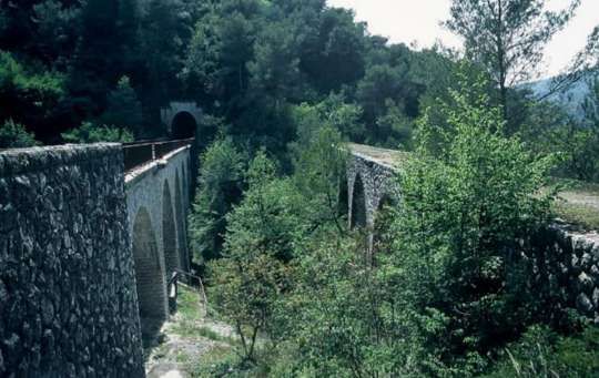
A view of both of the two viaducts and the Tunnel de Tuhet beyond. [46]
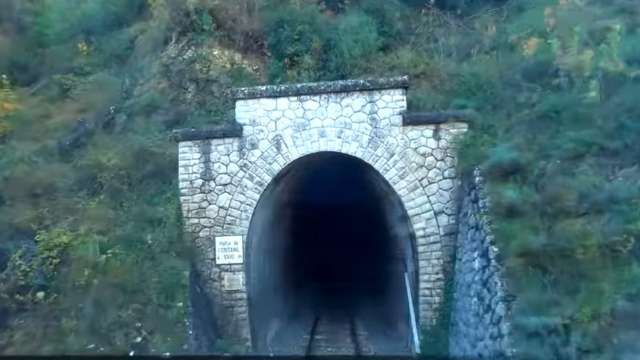
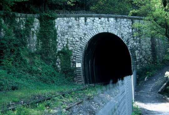
The East portal of Tunnel de Tuhet, seen from the cab of a Nice-bound service on the Viaduc des Mortes. [4]
The Tunnel de Tuhet (346 metres long). [46]
The West portal of the Tunnel de Tuhet. [46]
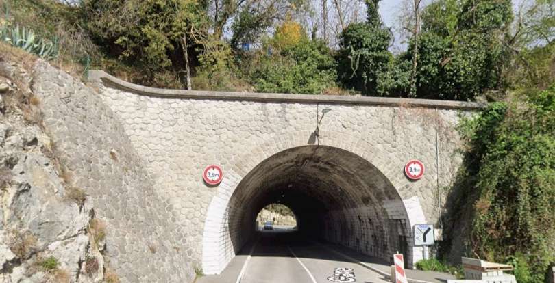
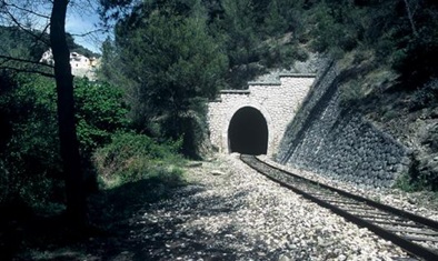
The East portal of Tunnel de la Ribosse. [47]
Tunnel de la Ribosse. [47]
The West portal of Tunnel de la Ribosse. [47]
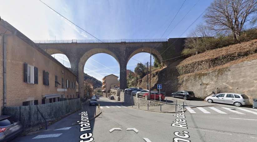
A short distance further West, the line passes through Fontanil-Drap High School Halt.
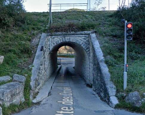
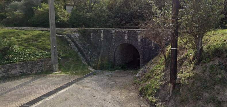
At the West end of the station/halt, the Route des Croves passes under the line. The low arch bridge seen from the South. [Google Streetview, March 2025]
The same structure seen from the North side of the line. [Google Streetview, March 2025]
The South side of the same structure. [Google Streetview, March 2025]
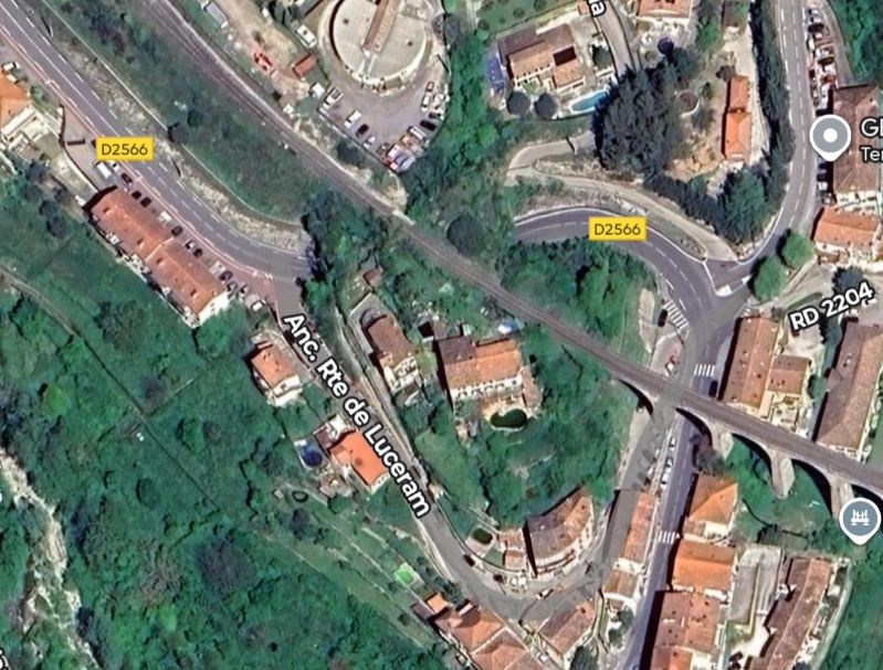
A short distance further West the line crosses the D2204, the River Paillon and the D2204B. …
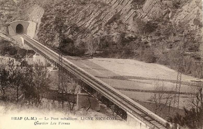
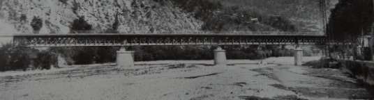
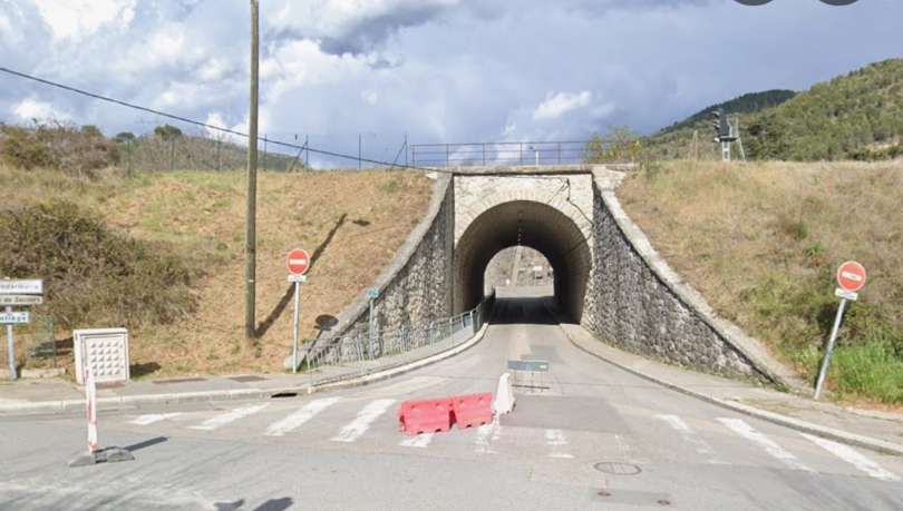
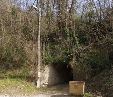
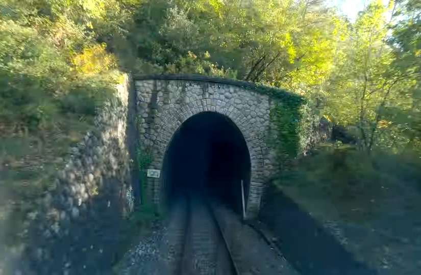
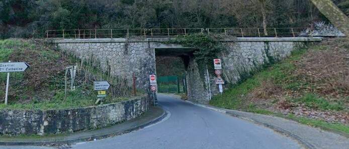
Once across the river and adjacent roads the line enters Tunnel de Moulin-de-Cantaron.
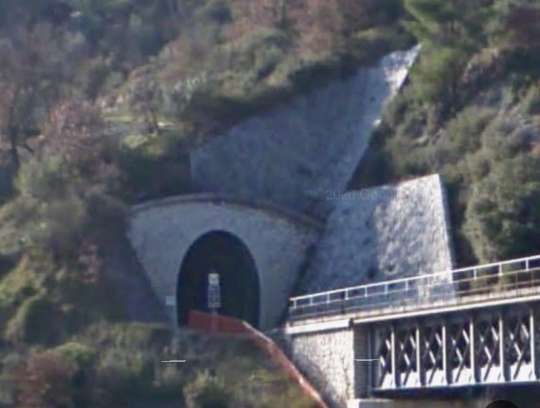
The East portal of Tunnel de Moulin-de-Cantaron. [Google Streetview,
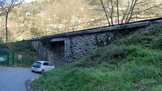
Tunnel de Moulin-de-Cantaron. [26]
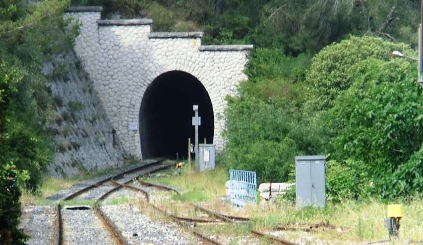
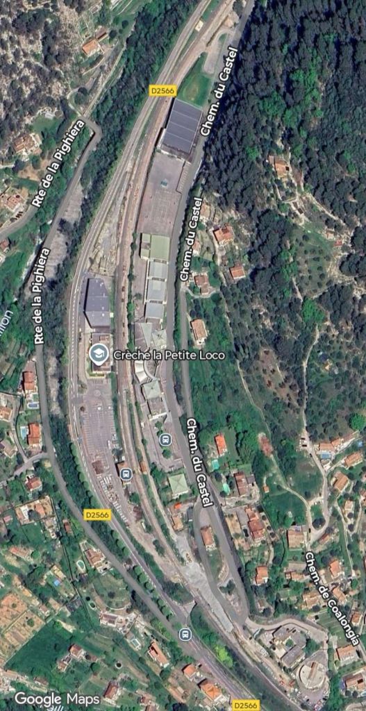
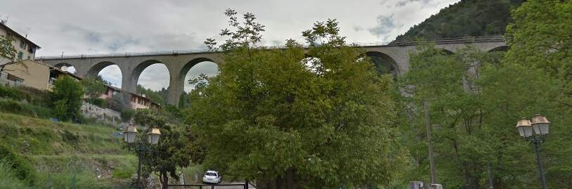
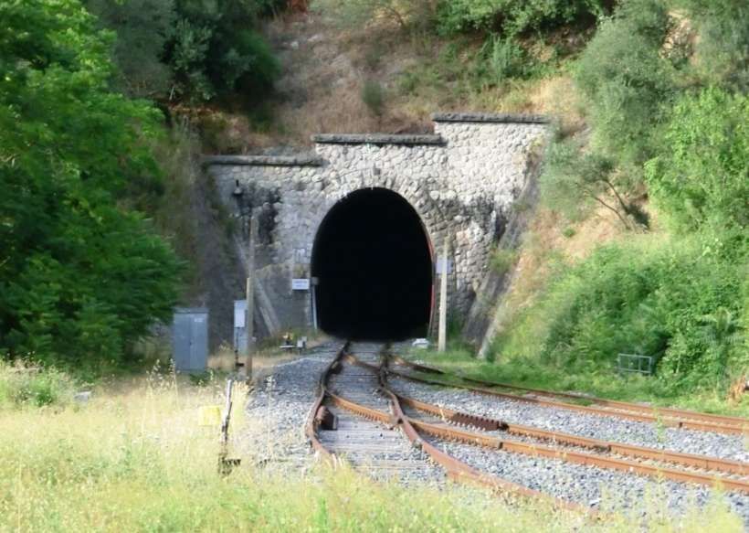
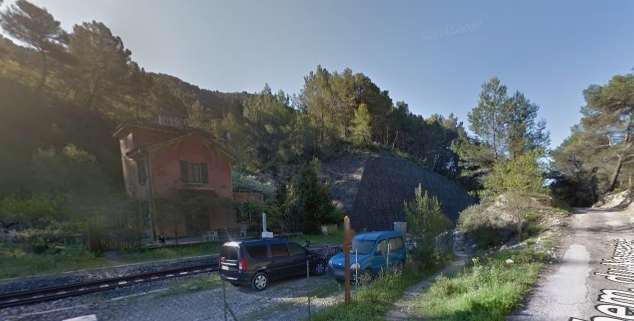
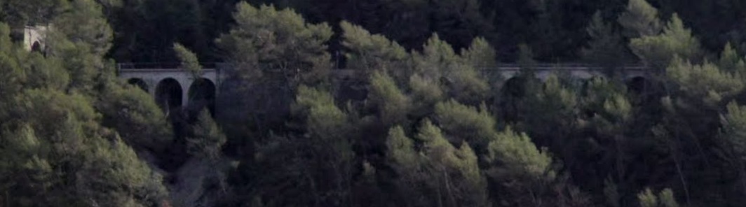
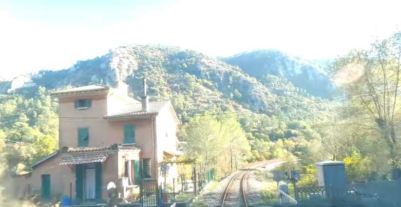
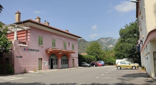
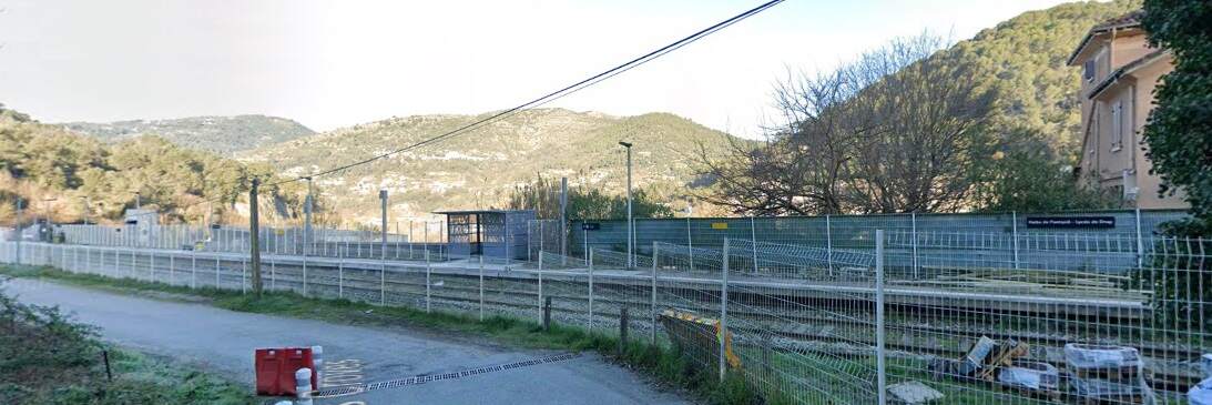
The Southwest portal of the Tunnel de Moulin-de-Cantaron, seen from the end of the platform at Drap-Cantaron Railway Station, © Eugenio Merzagora and shared on the Structure website. [51]
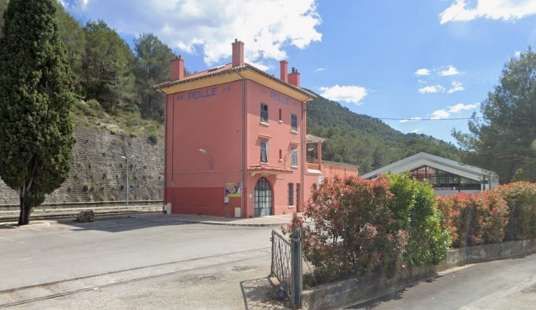
This length of our journey finishes here at Drap-Cantaron Railway Station.
References
- Jose Banaudo, Michel Braun and Gerard de Santos; Les Trains du Col de Tende Volume 1: 1858-1928; FACS Patrimoine Ferroviaire, Les Editions du Cabri, 2018.
- Jose Banaudo, Michel Braun and Gerard de Santos; Les Trains du Col de Tende Volume 2: 1929-1974; FACS Patrimoine Ferroviaire, Les Editions du Cabri, 2018.
- Jose Banaudo, Michel Braun and Gerard de Santos; Les Trains du Col de Tende Volume 3: 1975-1986; FACS Patrimoine Ferroviaire, Les Editions du Cabri, 2018.
- https://youtu.be/rLXAEz-n4mM?si=RLQC31jynGeM_lQR, accessed on 26th August 2025. Permission to use these still images from the YouTube video has been sought.
- https://m.facebook.com/groups/ciccoli/permalink/1711973335715195, accessed on 15th December 2023.
- https://m.facebook.com/groups/ciccoli/permalink/2989582914620891, accessed on 15th December 2023.
- https://www.cparama.com/forum/viewtopic.php?f=11&t=14570, accessed on 21st December 2023.
- https://www.openstreetmap.org/#map=12/43.8804/7.4395&layers=P, accessed on 26th August 2025.
- https://rogerfarnworth.com/2025/07/22/the-railway-from-nice-to-tende-and-cuneo-part-1.
- https://rogerfarnworth.com/2025/07/26/the-railway-from-nice-to-tende-and-cuneo-part-2.
- https://rogerfarnworth.com/2025/08/06/the-railway-from-nice-to-tende-and-cuneo-part-3-vievola-to-st-dalmas-de-tende
- https://rogerfarnworth.com/2025/08/16/the-railway-between-nice-tende-and-cuneo-part-4-st-dalmas-de-tende-to-breil-sur-roya
- https://rogerfarnworth.com/2025/08/25/the-railway-between-nice-tende-and-cuneo-part-5-breil-sur-roya-to-ventimiglia
- https://www.facebook.com/photo/?fbid=10212672518585538&set=a.10212672512625389, accessed on 30th August 2025.
- Franco Collidà, Max Gallo & Aldo A. Mola; CUNEO-NIZZA History of a Railway; Cassa di Risparmio di Cuneo, Cuneo (CN), July 1982.
- https://cartorum.fr/carte-postale/204912/lescarene-lescarene-la-gare-et-le-viaduc-ligne-nice-coni, accessed on 30th August 2025.
- https://www.cparama.com/forum/viewtopic.php?f=11&t=3321#google_vignette, accessed on 30th August 2025
- https://commons.wikimedia.org/wiki/File:Vue_du_village_de_L%E2%80%99Escar%C3%A8ne_depuis_la_maison_de_retraite.jpg, accessed on 31st August 2025.
- https://www.inventaires-ferroviaires.fr/tu06/06057.1.pdf, accessed on 31st August 2025.
- https://ebay.us/m/yOgnpShttps://ebay.us/m/yOgnpS, accessed on 15th September 2025
- https://www.tunnels-ferroviaires.org/fiches/tu06/06091.2.pdf, accessed on 31st August 2025.
- https://www.inventaires-ferroviaires.fr/mx06/06091.02F.pdf, accessed on 11th September 2025.
- https://www.inventaires-ferroviaires.fr/tu06/06091.1.pdf, accessed on 10th September 2025.
- https://structurae.net/en/structures/coletta-tunnel, accessed on 15th September 2025.
- https://fr.m.wikipedia.org/wiki/Sch%C3%A9ma_de_la_ligne_de_Nice_%C3%A0_Breil-sur-Roya, accessed on 15th September 2025
- https://www.openstreetmap.org/#map=16/43.79305/7.37742&layers=P, accessed on 16th September 2025.
- https://www.inventaires-ferroviaires.fr/tu06/06031.1.pdf, accessed on 10th September 2025.
- https://structurae.net/fr/ouvrages/gare-de-peille, accessed on 16th September 2025.
- https://www.inventaires-ferroviaires.fr/tu06/06091.3.pdf, accessed on 10th September 2025.
- https://www.inventaires-ferroviaires.fr/mx06/06091.02M.pdf, accessed on 11th September 2025.
- https://www.inventaires-ferroviaires.fr/tu06/06091.4.pdf, accessed on 10th September 2025.
- https://www.inventaires-ferroviaires.fr/mx06/06091.02N.pdf, accessed on 11th September 2025.
- https://www.inventaires-ferroviaires.fr/tu06/06091.5.pdf, accessed on 10th September 2025.
- https://fr.wikipedia.org/wiki/Gare_de_Peille, accessed on 16th September 2025.
- https://www.inventaires-ferroviaires.fr/tu06/06091.6.pdf, accessed on 10th September 2025.
- https://rail-ussellois.fr/carte-postale-train/carte-postale-n-1196-le-rail-ussellois, accessed on 16th September 2025.
- https://www.youtube.com/watch?v=f5-omGzckp0, accessed on 16th September 2025. Permission to use these still images from the YouTube video has been sought.
- https://www.inventaires-ferroviaires.fr/tu06/06092.2.pdf, accessed on 17th September 2025.
- https://www.inventaires-ferroviaires.fr/kc06/06092.03J.pdf, accessed on 17th September 2025.
- https://www.inventaires-ferroviaires.fr/tu06/06092.1.pdf, accessed on 17th September 2025.
- Franco Collida, Max Gallo & Aldo A. Mola; CUNEO-NIZZA History of a Railway; Cassa di Risparmio di Cuneo, Cuneo (CN), July 1982.
- Franco Collidà; 1845-1979: the Cuneo-Nice line year by year; in Rassegna – Quarterly magazine of the Cassa di Risparmio di Cuneo; No. 7, September 1979, pp. 12-18.
- Stefano Garzaro & Nico Molino; THE TENDA RAILWAY From Cuneo to Nice, the last great Alpine crossing; Editrice di Storia dei Trasporti, Colleferro (RM), EST, July 1982.
- SNCF Region de Marseille; Line: Coni – Breil sur Roya – Vintimille. Reconstruction et équipement de la section de ligne située en territoire Français; Imprimerie St-Victor, Marseille (F), 1980.
- https://www.archeo-alpi-maritimi.com/viaducduvallon.php, accessed on 18th September 2025.
- https://www.inventaires-ferroviaires.fr/tu06/06054.2.pdf, accessed on 18th September 2025.
- https://www.inventaires-ferroviaires.fr/tu06/06054.1.pdf, accessed on 18th September 2025.
- https://www.inventaires-ferroviaires.fr/mx06/06054.01Z.pdf, accessed on 18th September 2025.
- https://www.facebook.com/share/p/14KVdcevha1, accessed on 19th September 2025.
- https://www.facebook.com/share/p/1Jr5MoEinB, accessed on 19th September 2025.
- https://structurae.net/en/structures/moulin-de-cantaron-tunnel, accessed on 19th September 2025.
- https://i.ebayimg.com/images/g/cV8AAOSwPONjDPCD/s-l1600.webp, accessed on 28th September 2025.
