This is the second article in a series about the Border Counties Railway. The first can be found here. [3]
An online acquaintance pointed me to a film made in the mid-1980s, ‘Slow Train to Riccarton’ which records something of the lives of people associated with this railway line:
The film shows different lengths of the line and records a number of people speaking about their life on and around the line.
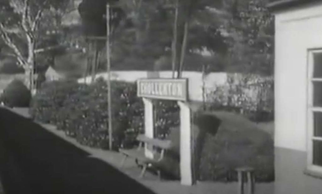
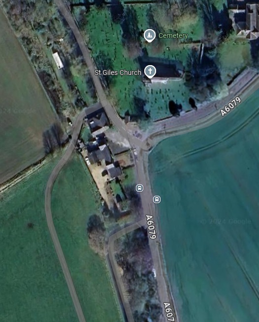
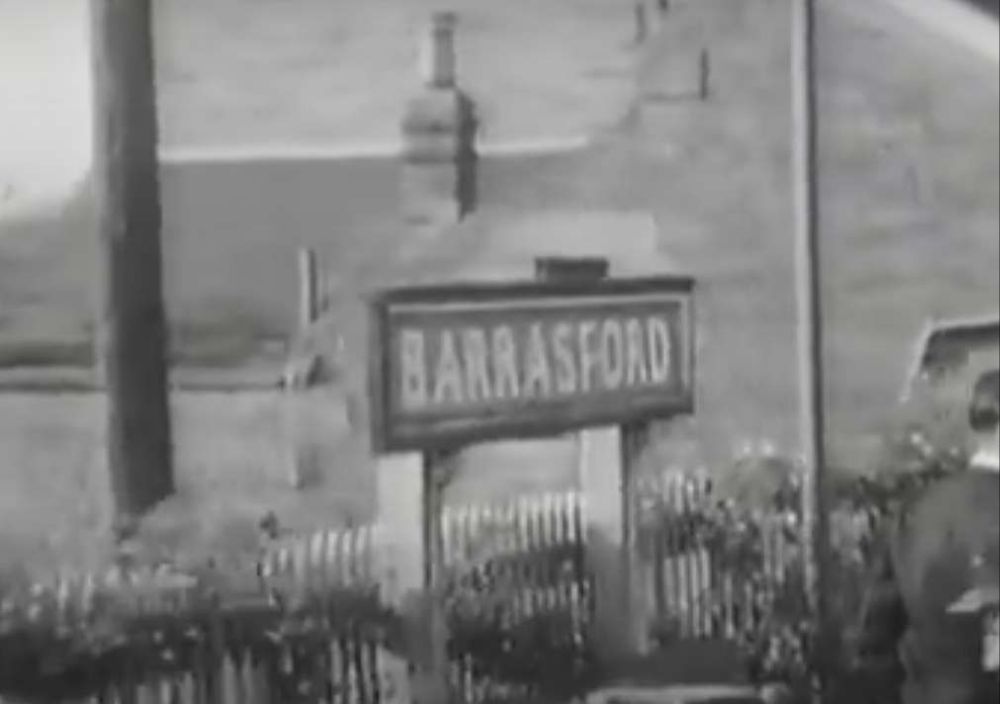
This first image is a still from the film which denotes where we are starting this next length of the journey along the line. A few more ‘stills’ will help to locate us as we travel along the line.
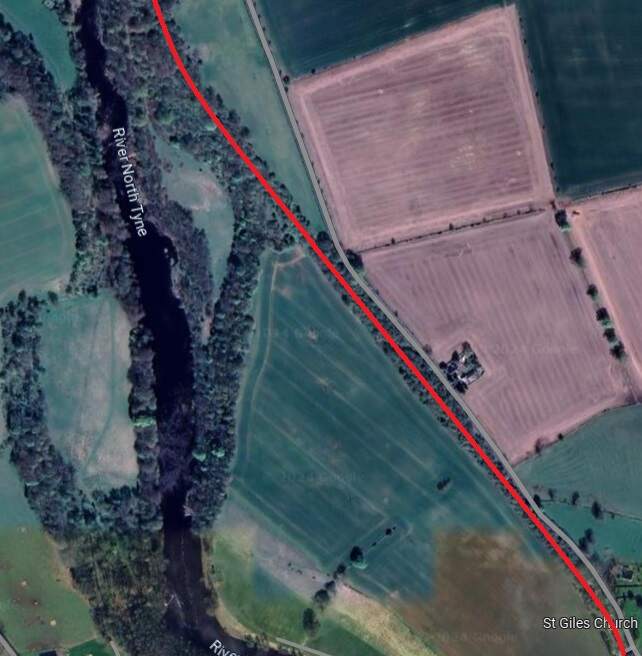
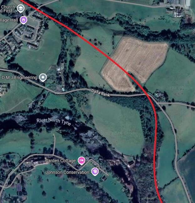
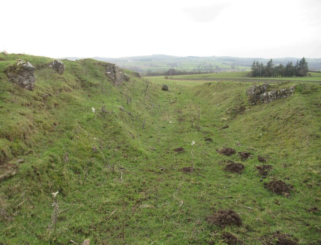
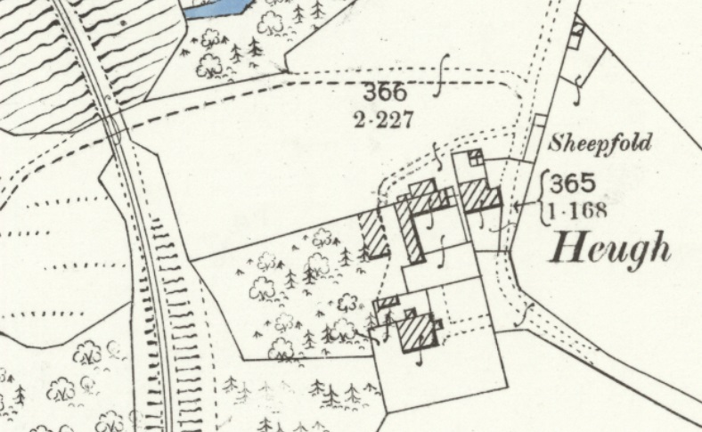
The line travelled on, Northwest from Chollerton, much of the time in deep cutting as far as Dallabank Wood, by which time it was running on a northerly course. Soon after the wood, the line turned towards the Northwest, passed under the local road (Dalla Bank), crossed a short but high embankment under which Barrasford Burn was culverted, and entered Barrasford Railway Station.
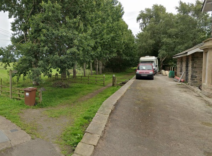
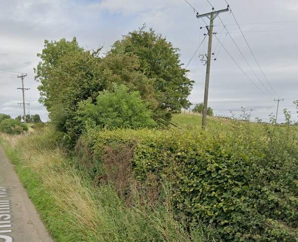
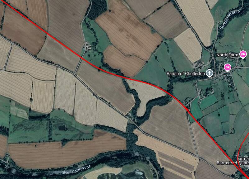
The red line shows the route of the old railway immdiately to the North of Chollerton Railway Station. [Google Maps, October 2024]The cutting South of Dalla Bank, Facing towards Chollerton in 2013, (c) Mike Quinn and licensed for reuse under a Creative Commons Licence (CC BY-SA 2.0). [15]The line continued on as marked by the red line under Dalla Bank and on to Barrasford Station which was located at the top left of this extract from Google’s satellite imagery. [Google Maps, October 2024]The view along the old railway line North-northwest from Dalla Bank. [Google Streetview, August 2023]Barrasford Railway Station name-board. [2]
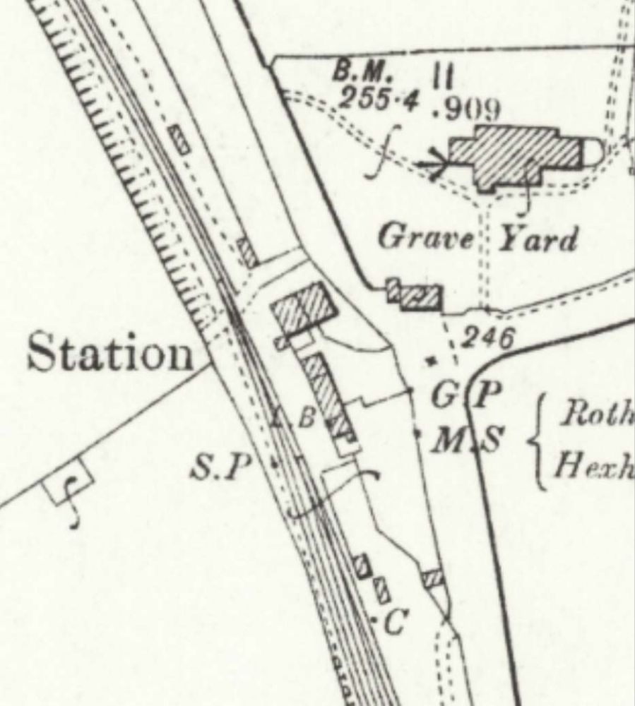
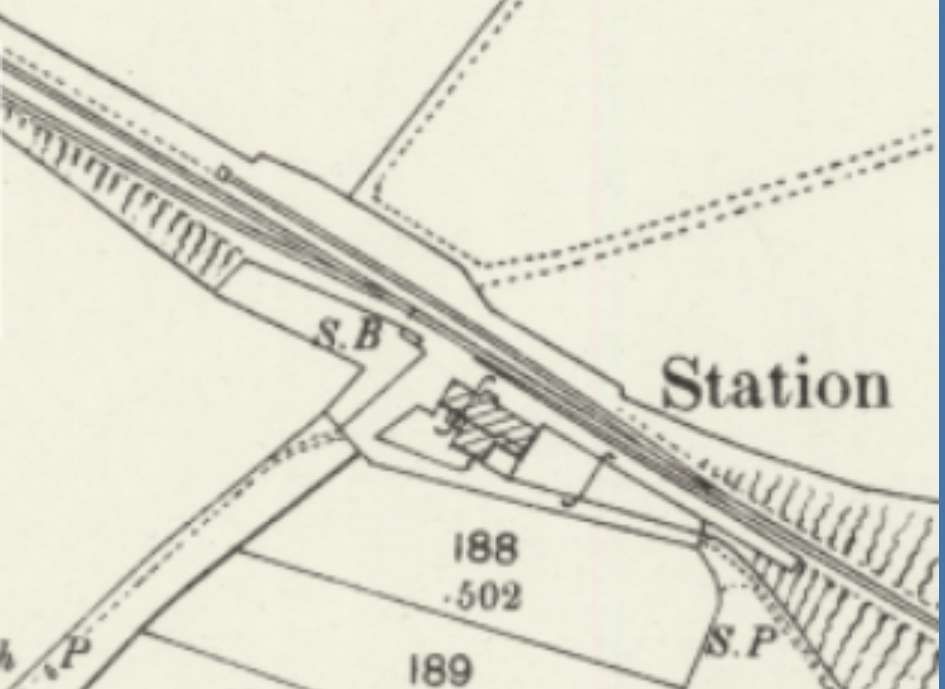
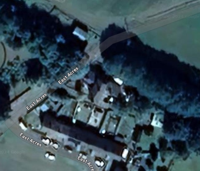
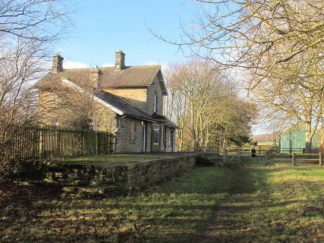
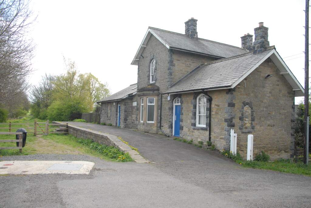
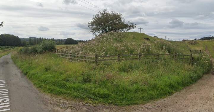
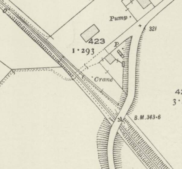
Barrasford Railway Station opened on 1st December 1859 by the North British Railway. The station was situated on a lane to Catheugh, around “200 yards northeast of the centre of Barrasford village. A siding adjoined the line opposite the platform and there was a further loop to the northwest. Both of these were controlled by a signal box, which was at the northwest end of the platform. The station was host to a camping coach from 1936 to 1939.” [4]
“Barrasford station was closed to passengers on 15th October 1956 but remained open for goods traffic until 1st September 1958, although it was downgraded towards an unstaffed public siding.” [4]
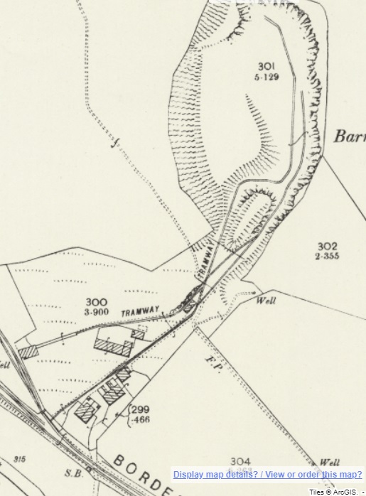
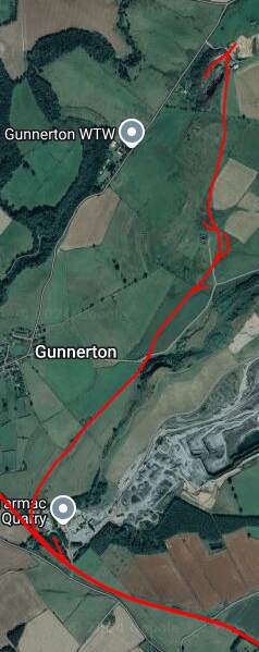
A short distance Northwest of Barrasford Railway Station, was Barrasford Quarry which was provided with its own siding.
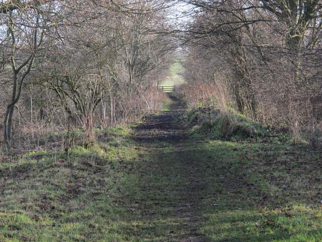
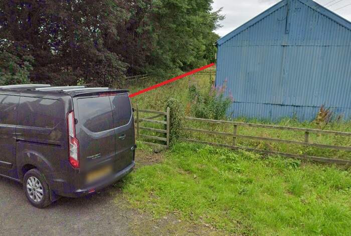
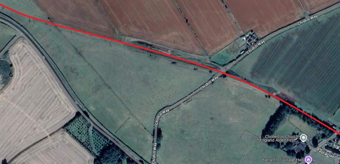
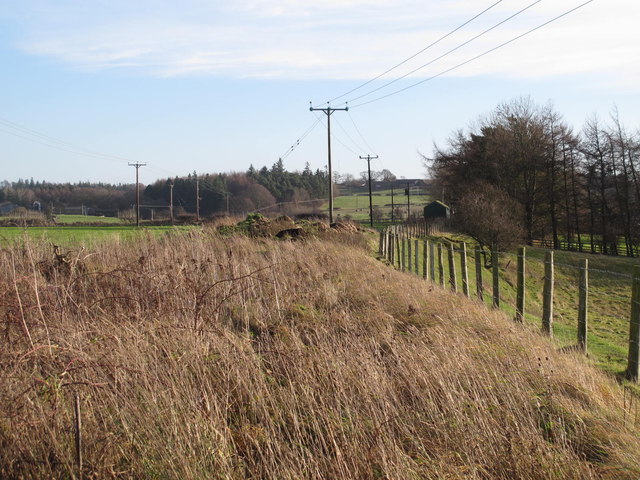
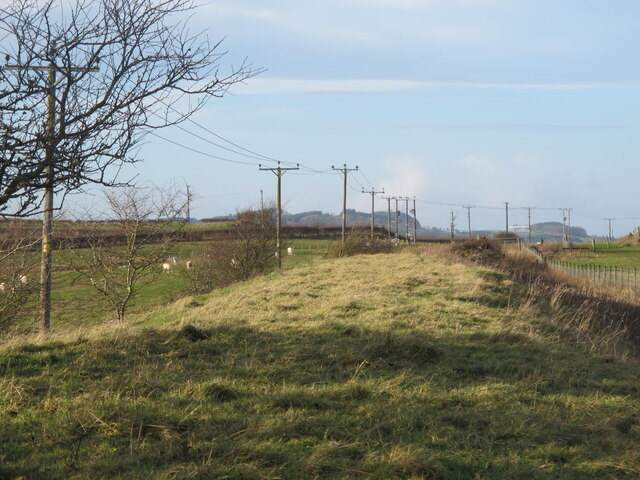
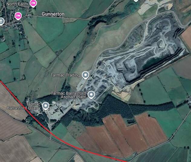
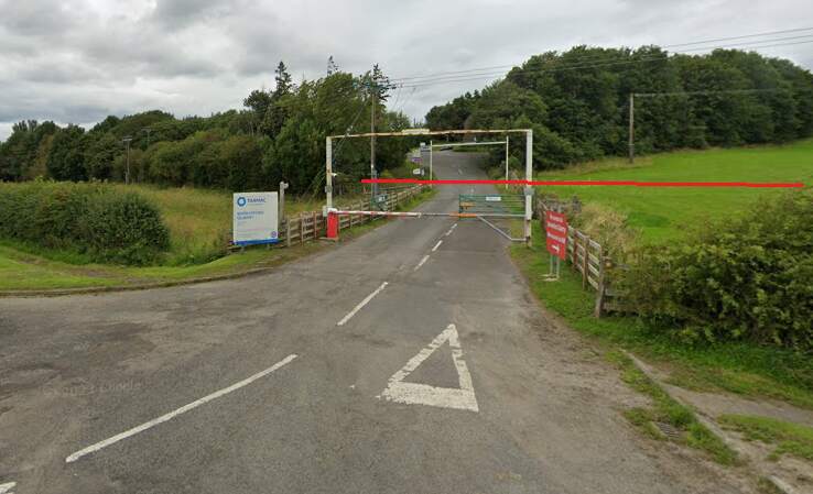
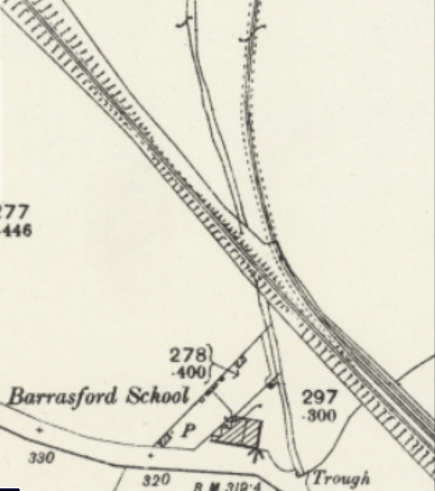
The line Northwest of Barrasford Railway Station. [Google Maps, October 2024]The track bed of the old railway a little to the Northwest of Barrasford Railway Station, looking back along the line towards the station in December 2013, (c) Mike Quinn and licensed for reuse under a Creative Commons Licence (CC BY-SA 2.0). [12]Looking back towards Barrasford Station from Chishill Way. The line was carried at high level over the road. Only the embankments remain. [Google Streetview, August 2023]A wintertime view along the old railway to the West from the East side of Chishill Way, in December 2013, (c) Mike Quinn and licensed for reuse under a Creative Commons Licence (CC BY-SA 2.0). [13]Looking West from Chishill Way. The railway embankment is to the right of the trees. [Google Streetview, August 2023]The track bed further West from Chswell Way, in December 2013, (c) Mike Quinn and licensed for reuse under a Creative Commons Licence (CC BY-SA 2.0). [14]Barrasford Quarry Sidings and Tramway. [7]Tarmac’s quarry at Barrasford is a much larger affair in the 21st century. [Google Maps, October 2024]The entrance to Barrasford Quarry. The red line indicates the approximate route of the old railway which is treelined to the West of the quarry road and through open fields to the East of the quarry road. The siding was on the North side of the line. [Google Streetview, August 2023]Just to the Northwest of Barrasford Quarry Siding was a branch line to Camp Hill, Gunnerton Quarry.This branhc was about 2 miles in length and is recorded on some maps as an old Waggonway. [8]The same location in the 21st century with the old railways superimposed. [Google Maps, October 2024]
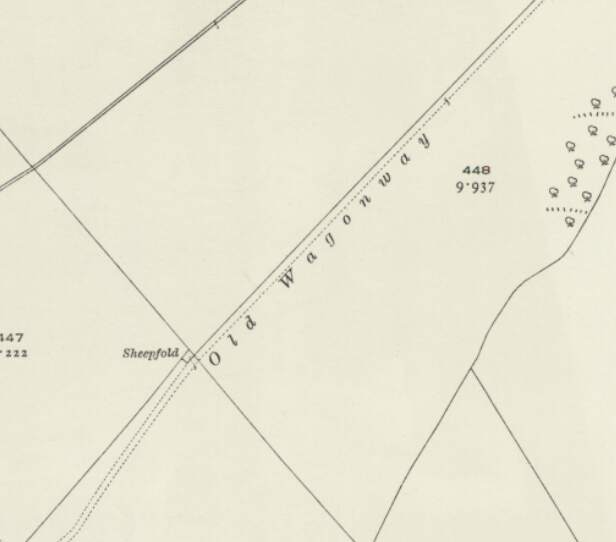
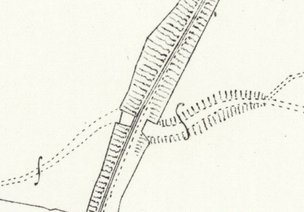
The Camp Hill Branch as shown on satellite imagery from Railmaponline.com. The branch was a short industrial line serving a relatively small quarry to the North of Barrasford Quarry. It appears to have been disused by 1920 as one of the local OS Map sheets across which the line travels shows the line lifted by that time and referred to as an ‘Old Waggonway”. The line is present on map sheets surveyed in 1895.
A short section of the Camp Hill Branch Line as shown on the 1920 25″ Ordnance Survey which was published in 1922. [18]
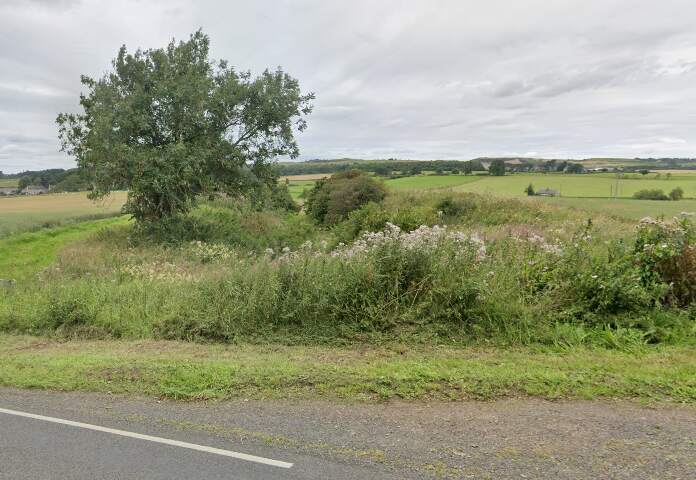
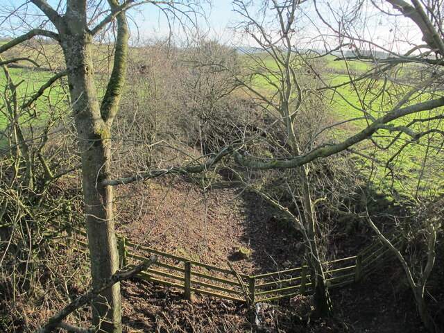
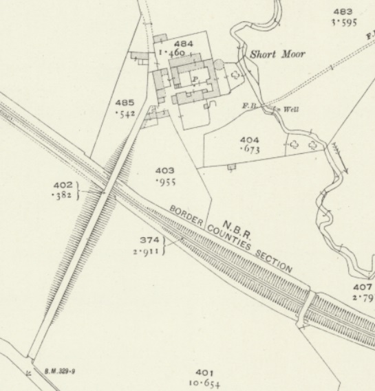
A little further to the Northwest, the access road to Short Moor crossed the old railway. Just before that lane there was another stone bridge which gave access between fields either side of the line.
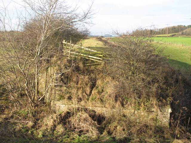
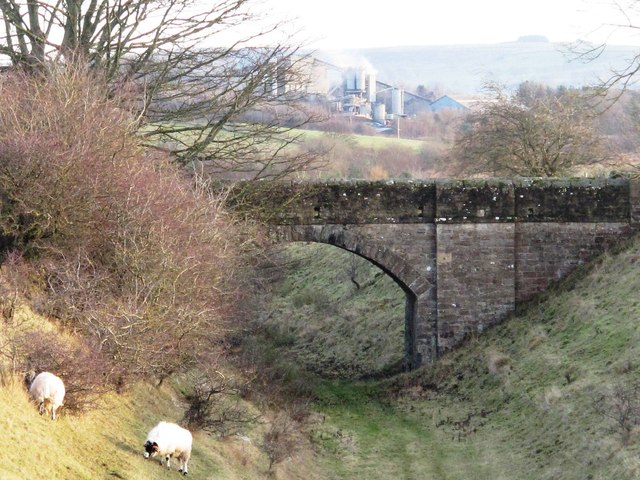
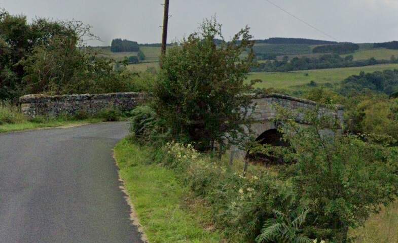
Stone bridge Southwest of the Short Moor access road in December 2013, (c) Mike Quinn and licensed for reuse under a Creative Commons Licence (CC BY-SA 2.0). [28]Two bridges crossed the line close to Short Moor. [29]
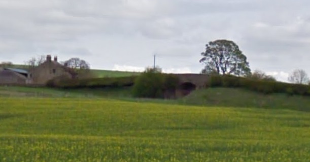
A distant view from the Southwest of the bridge carrying the access road to South Moor which is on the left of this image. The stone-arched bridge is just to the right of centre. [Google Streetview, April 2011]
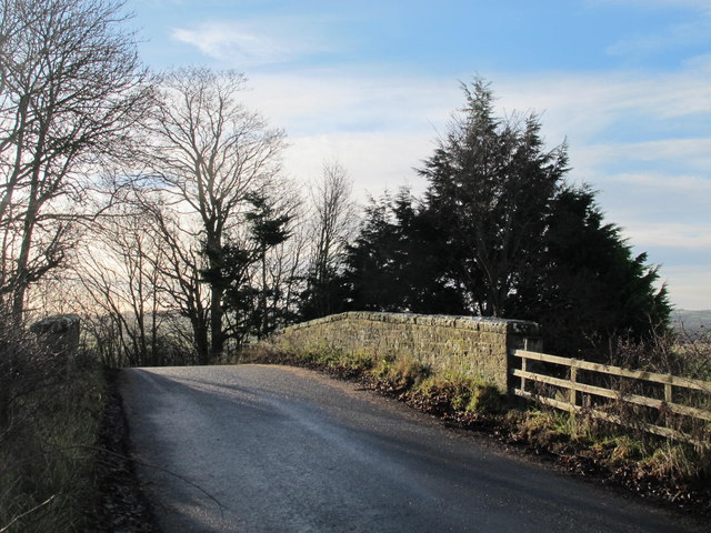
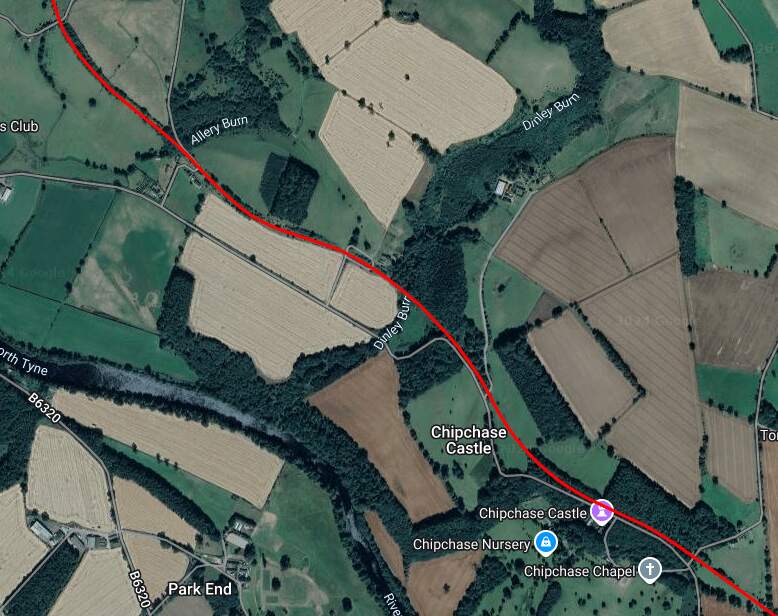
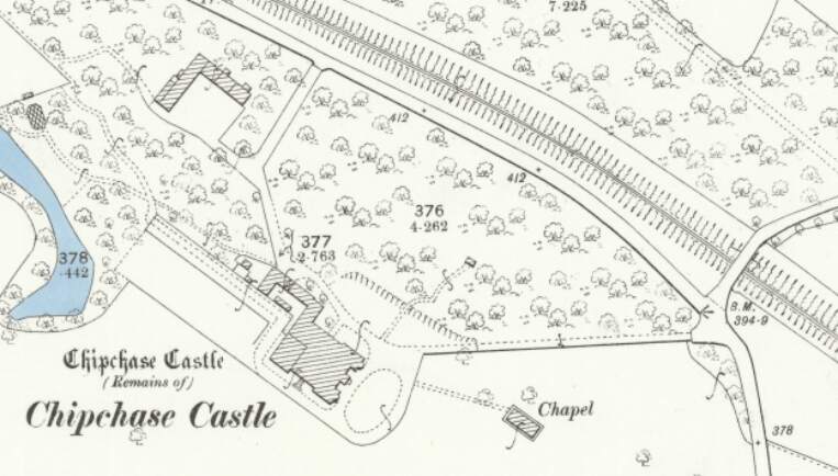
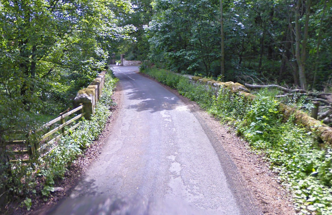
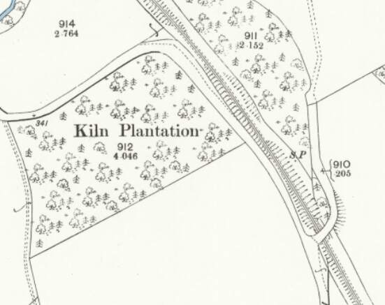
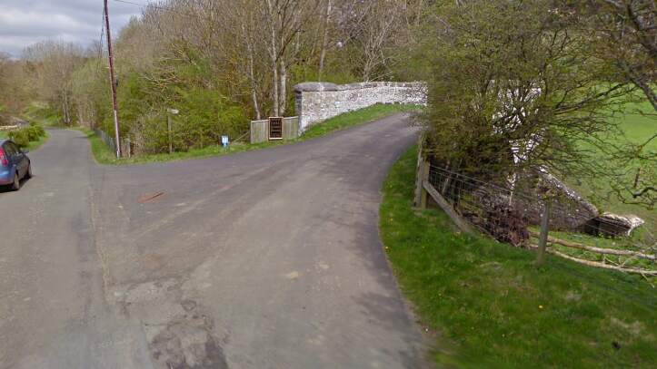
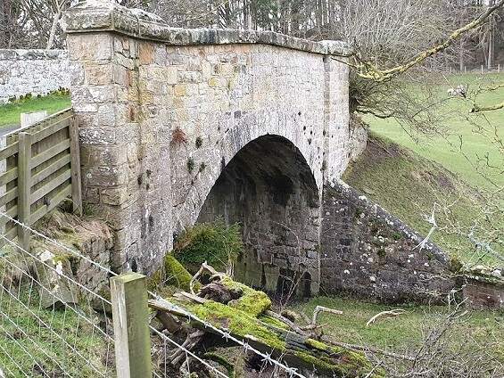
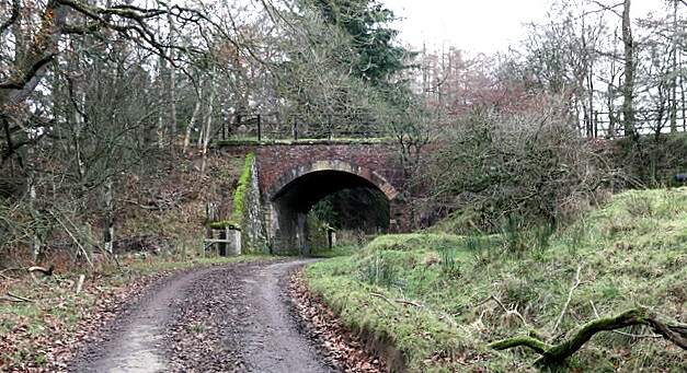
Further to the Northwest, the line as shown on the railmaponline.com satellite imagery. {17}The line ran on to the Northwest and this is the next significant point on the old railway. Close to Chipchase Castle the line was bridged by a minor road. [20]The view across the old railway bridge from the Northeast. [Google Streetview, June 2009]This next roadoverbridge carries an access road over the Border Counties Railway close to Kiln Plantation shortly before the highway turns away from the railway to the West along the North side of the plantation. [21]The view from the South of the road bridge in the map extract above. [Google Streetview, April 2011]The same structure in a photograph taken by Paul Hill and shared by him on the Border Counties Railway Facebook Group on 17th August 2020. [23]
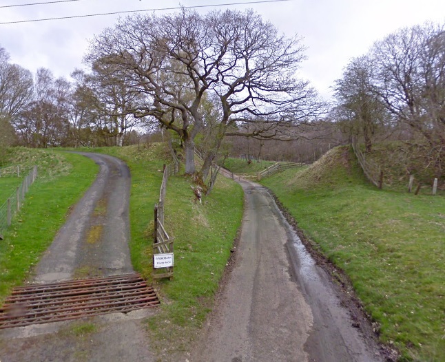
A short distance to the Northwest another access road runs off the highway and crosses the Border Counties Railway.
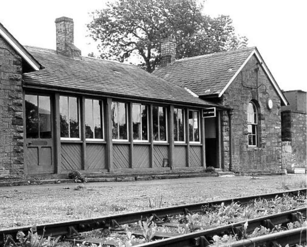
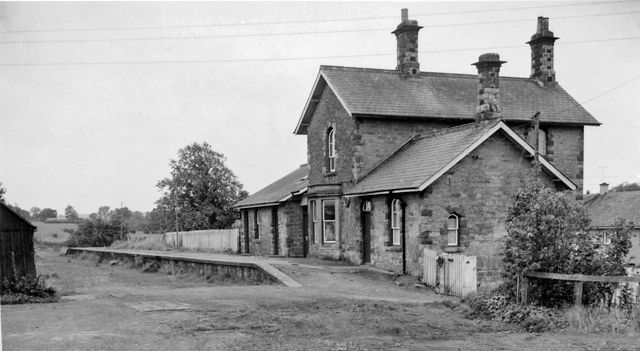
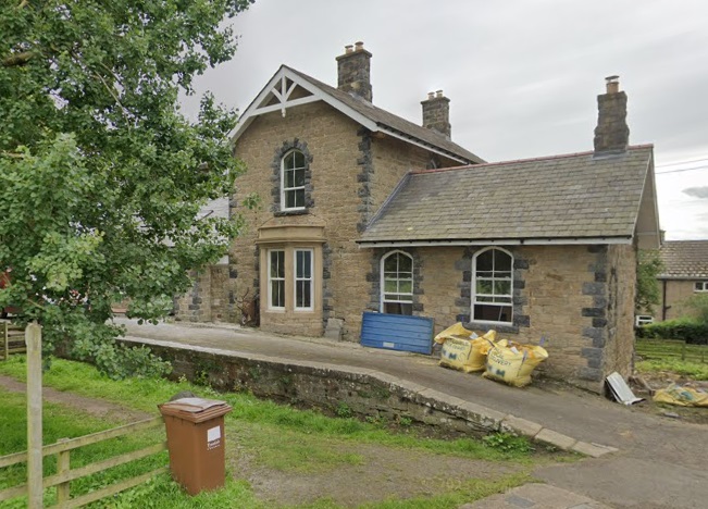
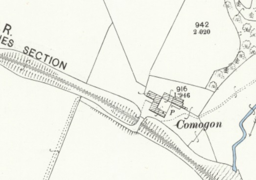
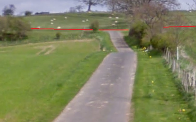
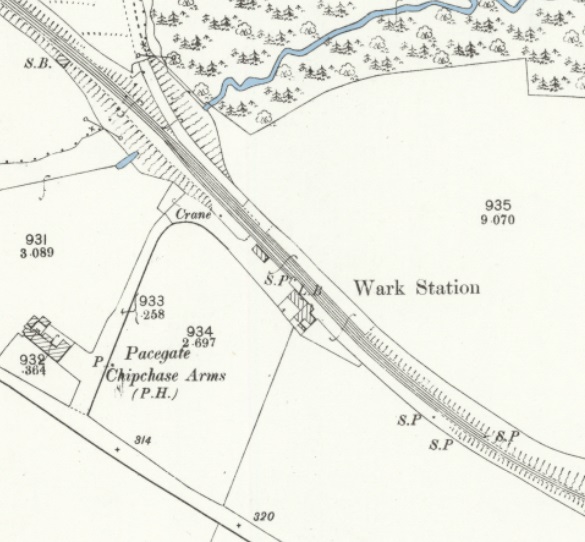
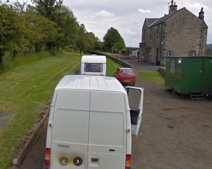
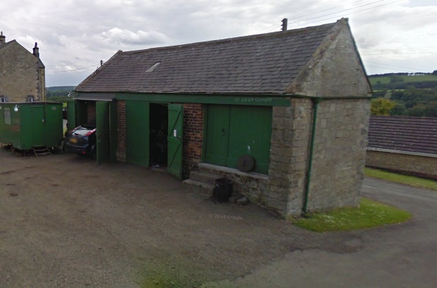
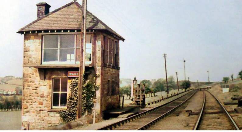
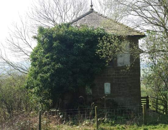
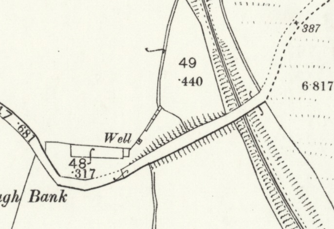
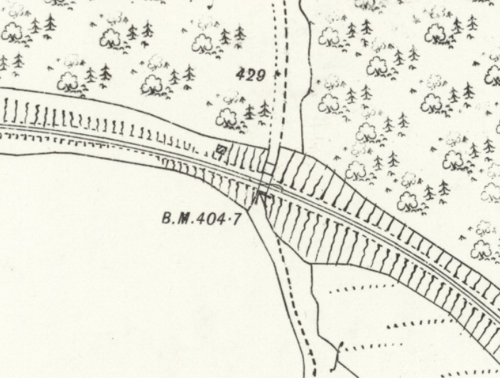
This map estract shows the lane leading to Comogon in 1920, which was carried over the old railway by means of a private access bridge. [24]The access road is private and this is the closest view of the old line at this location that is possible. The red lines show its route which was in a slight cutting to the right of the access road and a slight embankment to the left of the road. [Google Streetview, April 2011]Wark Railway Station as shown on the 25″ Ordnance Survey of 1895. [25]The view Southeast along the Border Counties Railway through Wark Railway Station. [Google Streetview, June 2009]The Goods Shed at Wark Railway Station. [Google Streetview, June 2009]Wark Signal Box when still in use. It sat just Northwest of the station platforms. This image was shared by Ian Farnfield on the Border Counties Railway Facebook Group on 6th April 2022. The provenance of this image is not known. [26]Wark Signal Box in the 21st century. This image was taken by Ian Farnfield and shared by him on the Border Counties Railway Facebook Group on 6th April 2022. [26]
A short distance Northwest from Wark Railway Station the Border Counties Railway passed under another minor road.
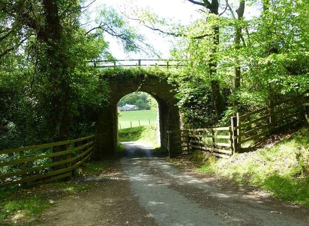
This next extract from the 1895 25″ Ordnance Survey shows that bridge mentioned above crossing the old railway. [27]The bridge mentioned above. [Google Streetview, July 2023]
From this point, the line turns to a more northerly direction as this next extract from the railmaponline.com satellite imagery shows. An accommodation track and Blind Burn next passed under the line of the railway. The image below shows the location.
The view Northeast along Piper Gate towards what was a bridge carrying the Border Counties Railway over the Burn and road. [Google Streetview, Aril 2011]
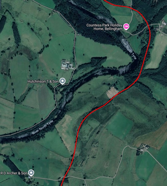
Northwest of Piper Gate a private access road follows the track bed to a private dwelling. Further North another access track passed underneath the line (shown in the first map extract below)
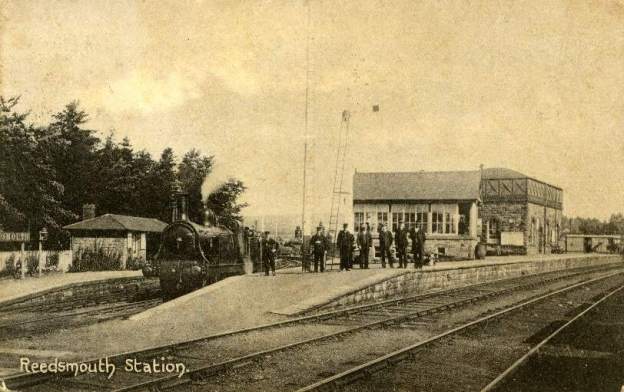
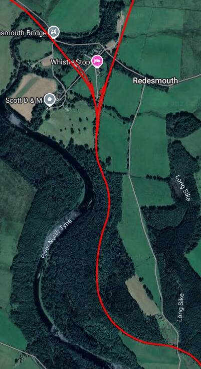
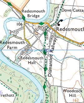
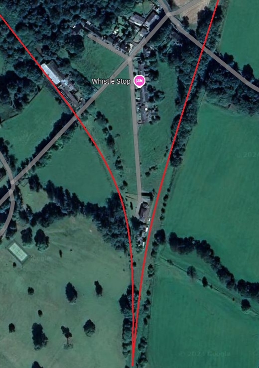
Continuing North from Countess Park alongside the River North Tyne, the Border Counties Railway reaches Redesmouth Railway Station which was a junction station.
Redesmouth as shown on the OS Explorer Map Sheet. The dismantled railways can easily be seen. The Border Counties Railway bears Northwest from the Station and crosses the River North Tyne.
The two images immediately above focus on the railway infrastructure at Redesmouth which spreads over quite a large site surrounding the hamlet of Redesmouth. [Google Maps, October, 2024] [36]