
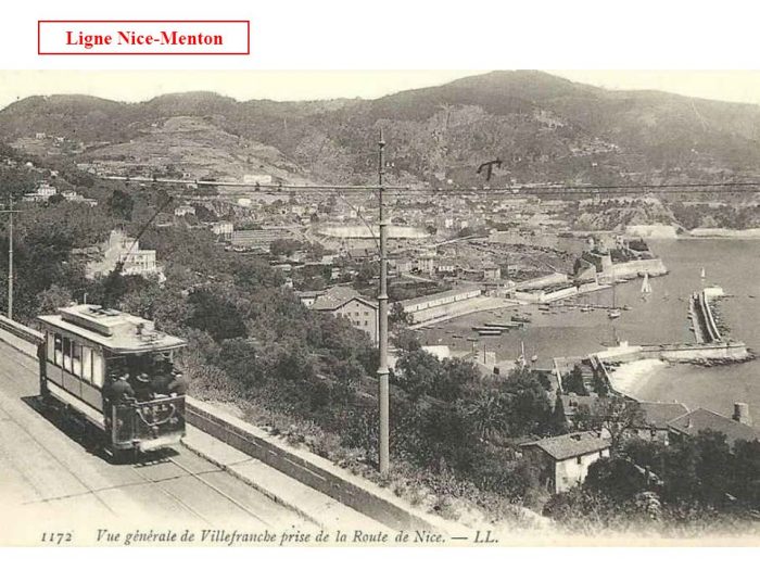
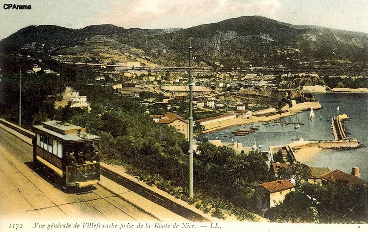
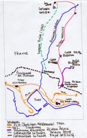
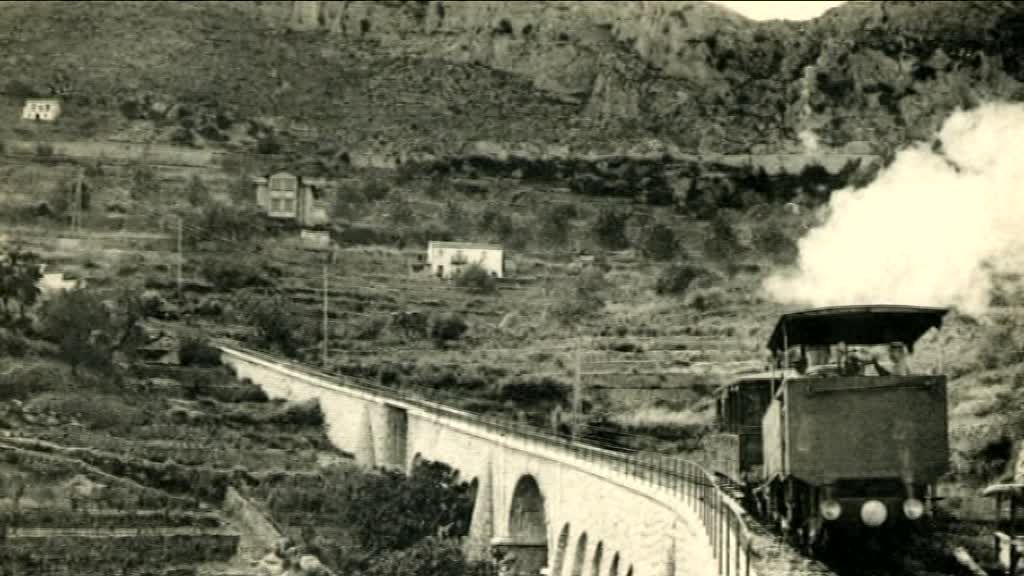
This post covers the line from the Port of Monaco and Monte-Carlo to its terminus in Menton. A short article about this length of tramway was included in the French-language ‘Tram Magazine‘ of 1980 [7], and it is covered by José Banaudo in his book ‘Nice au fil du Tram, Volume 2‘ [1]
Earlier articles in this series can be found by following these links:
Nice to Antibes:
La Ligne du Littoral et ses Antennes, First Generation Electric Tramways – Nice-Cap d’Antibes (Chemins de Fer de Provence/Alpes-Maritimes No. 90) …
Nice to Monaco:
La Ligne du Littoral et ses Antennes, First Generation Electric Tramways – Nice-Monte Carlo (Chemins de Fer de Provence/Alpes-Maritimes No. 91) …
Branch-lines between Nice and Monaco:
Nice to Monte-Carlo Branch Lines – La Ligne du Littoral et ses Antennes, First Generation Electric Tramways – (Chemins de Fer de Provence/Alpes-Maritimes No. 92) …
Other articles about railways and tramways in and around Nice can be found here:
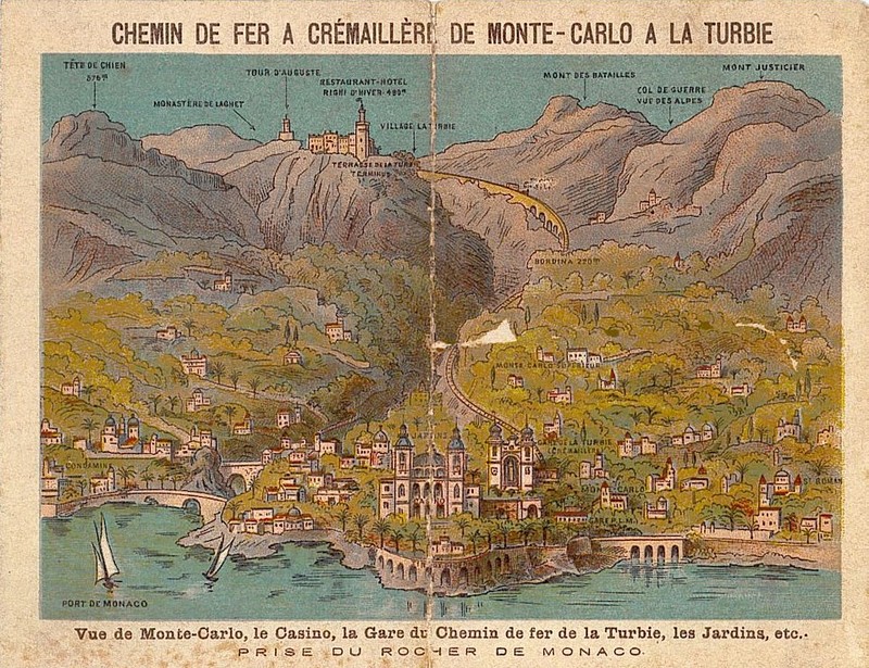
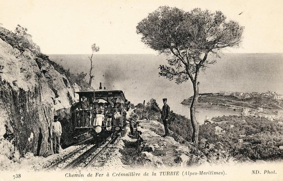
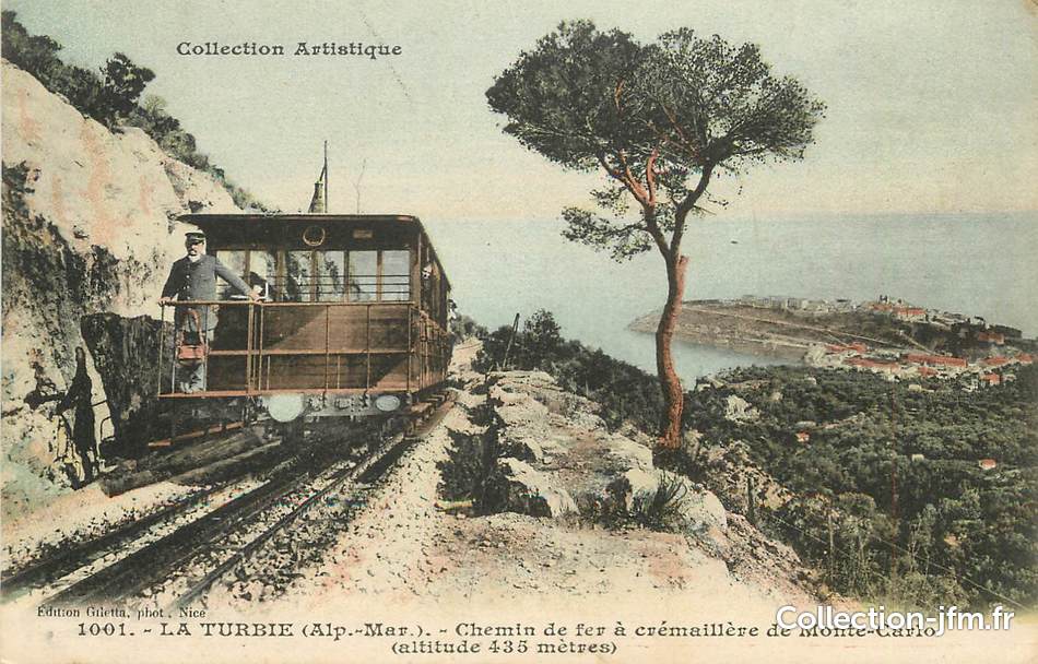
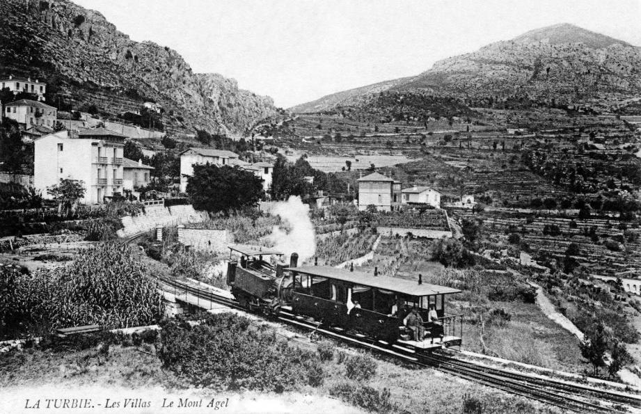
A project for a steam tramway linking the principality of Monaco to Menton via the Basse Corniche dates back to 1892 but seems that it may have encountered opposition from the various communes along the route. It is possible that this opposition centred on the use of steam as the power-source chosen. [7]
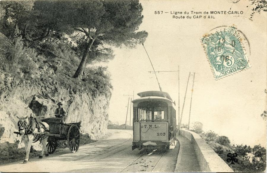
However, the Monaco Tribune suggests that it was clear that the capacity of steam engines to pull adequate loads on the gradients needed to serve the principality was always in doubt. The Triune comments: “At the start of the 1890s, there was a project for a Nice-Menton tramway line which would run through Monte Carlo. Following the example of French towns that were opening up tramway networks, horse-drawn at first, then with mechanical traction and finally electric-powered, the Principality eventually accepted the necessity of a line crossing Monaco, from Le Rocher to Saint-Roman, passing through Monte-Carlo and serving the Casino. The Principality’s topography was an issue: horse-drawn and steam trams were not an option. Electric trams had to be developed.” [6]
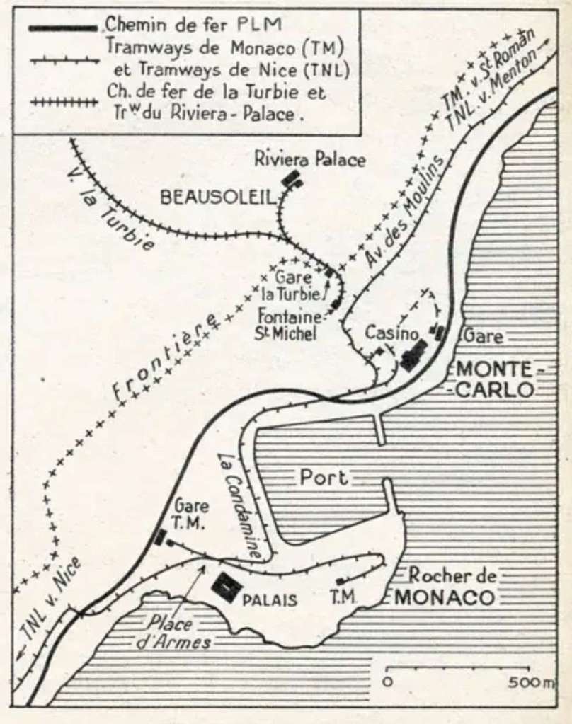
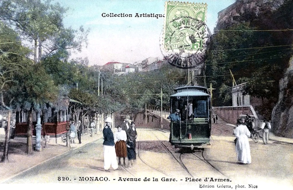
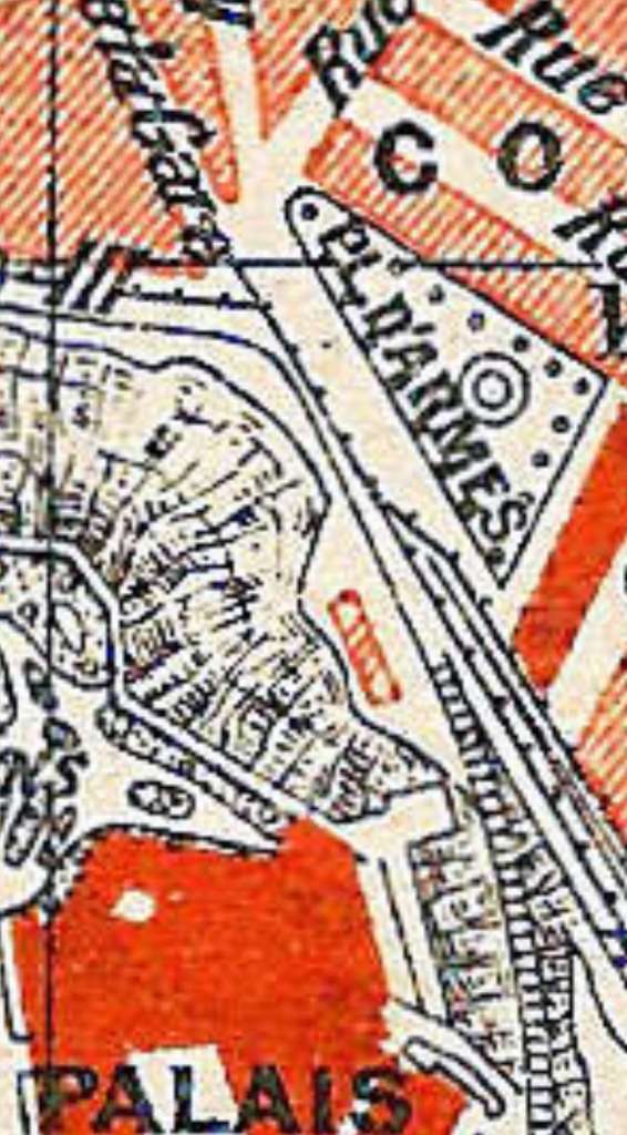
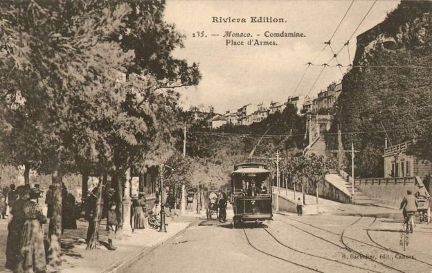
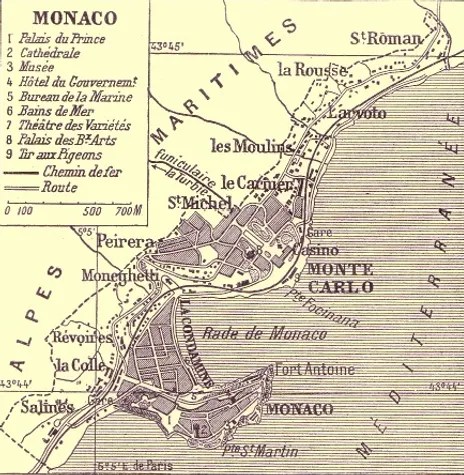
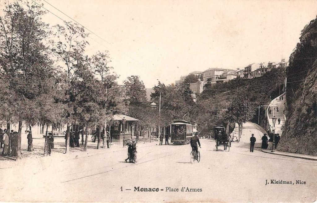
The Monaco tramways had three lines:
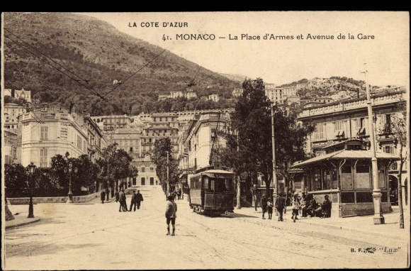
- Place d’Armes – Saint Roman, opened on 14 May 1898.
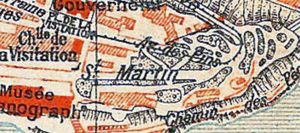
- Gare de Monaco – Place du Gouvernement, opened on 11 March 1899.
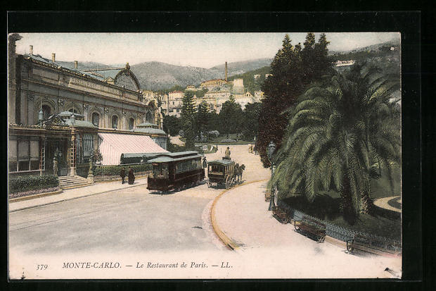
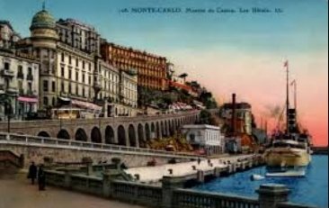
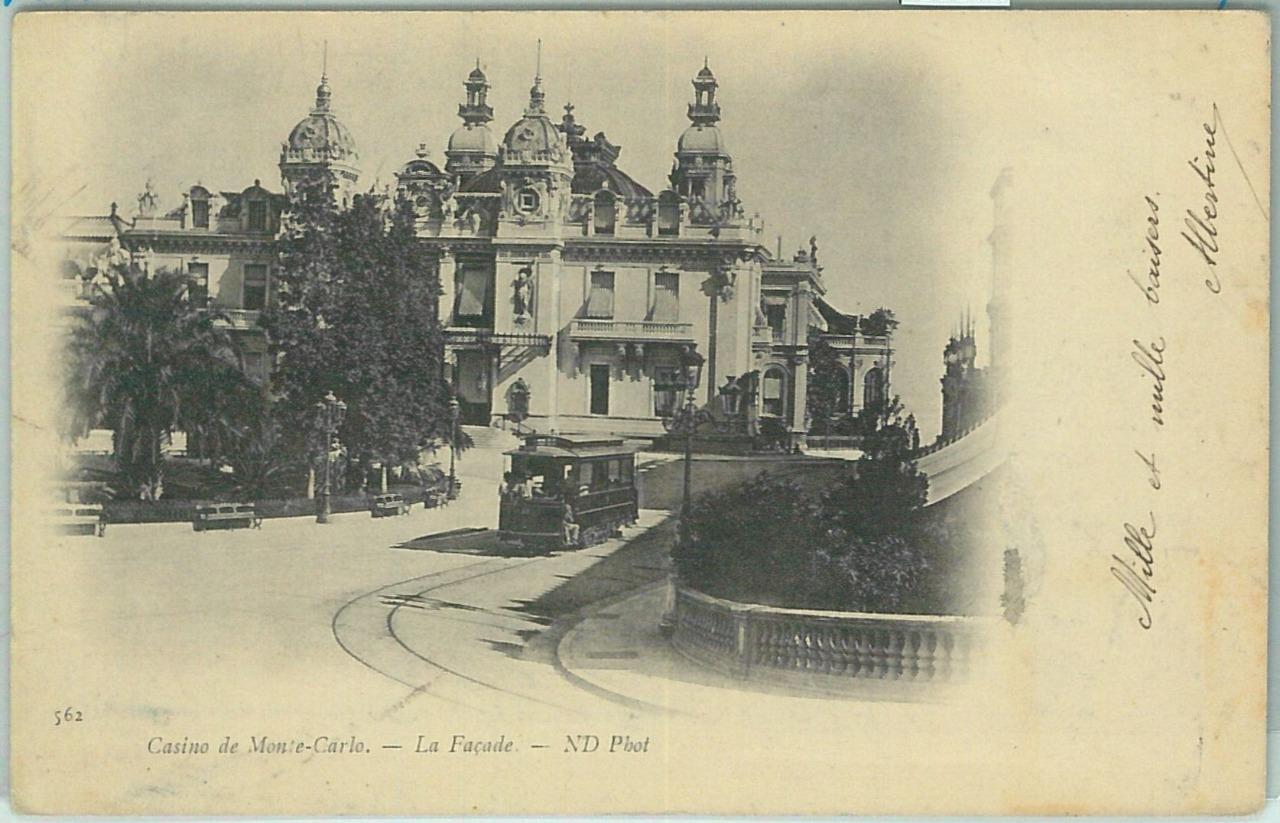
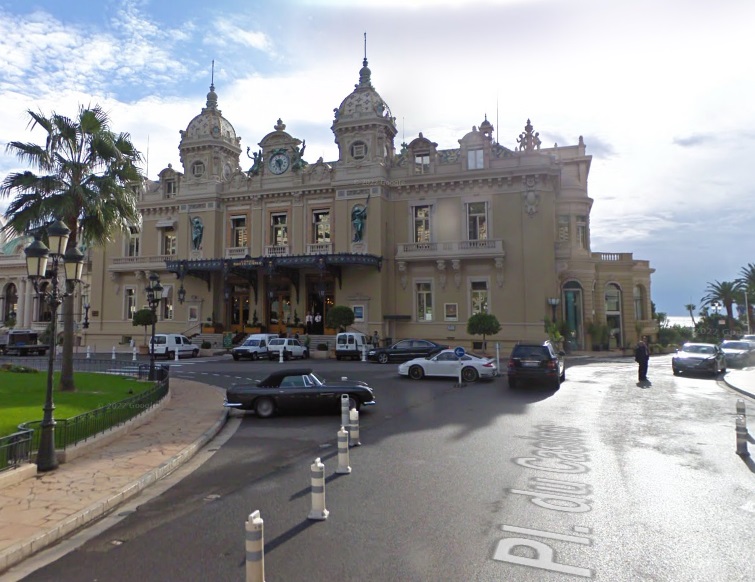
- Casino – Gare de Monte-Carlo, opened on 3 May 1900. [8]
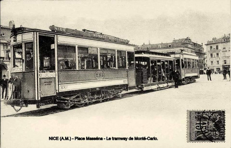
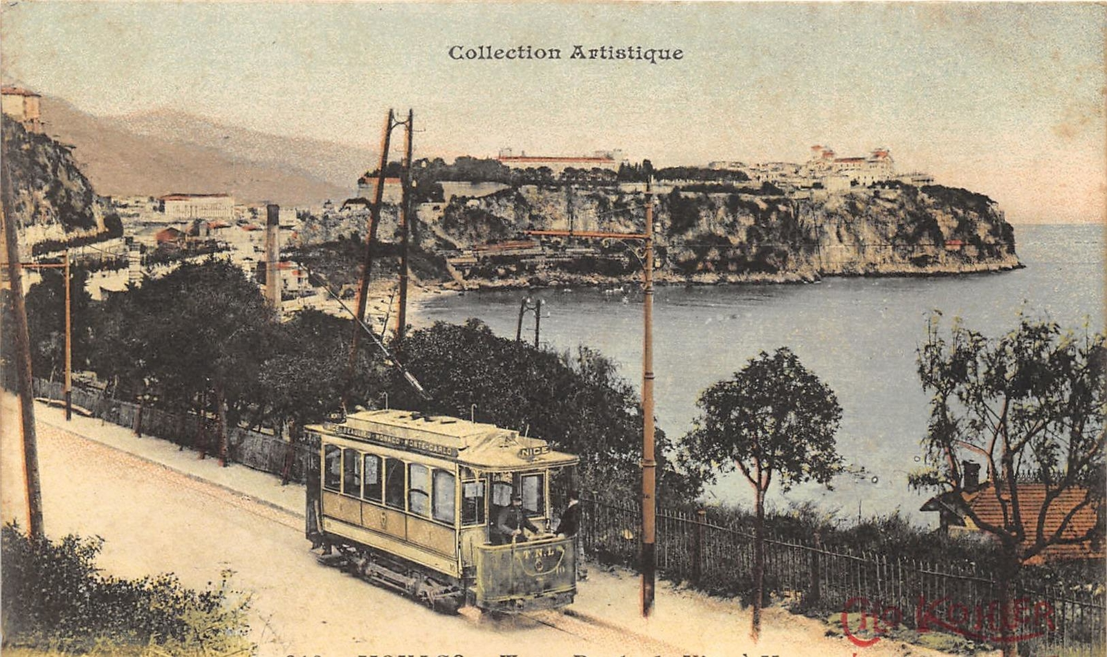
In 1897, the TNL (Tramways de Nice et du Littoral) obtained the concession for a metre-gauge coastal line between Cagnes, Nice, Monaco and Menton.
The main difficulty encountered in establishing this route was crossing the principality of Monaco, where in 1898 a local company opened an urban tramway powered by underground electric cables. [7]
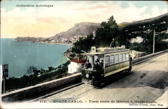
While waiting for the establishment of an agreement to allow the passage of their trams through the principality, the TNL transported part of their fleet of by rail to Menton and opened a section of tramway from Garavan to Cap-Martin on 20th December 1902. One year later, this isolated section was linked to the rest of the network with the commissioning of the complete section from Monaco to Menton on 28th December 1903. [7]
In 1910, the TNL bought out the Monaco Tramways concession but continued to operate a split operation with connections in the principality between the Nice and Menton lines. During the Great War, the TNL’s tramway experienced heavy passenger and goods traffic, with the PLM line being reserved primarily for strategic transport. [7]
After the war, the Monaco to Menton line was designated Ligne No. 43 in the TNL’s new operating plan. But very quickly, road competition and the narrowness of the Basse Corniche roadway made sharing the road with lorries, vans and cars almost impossible. [7]
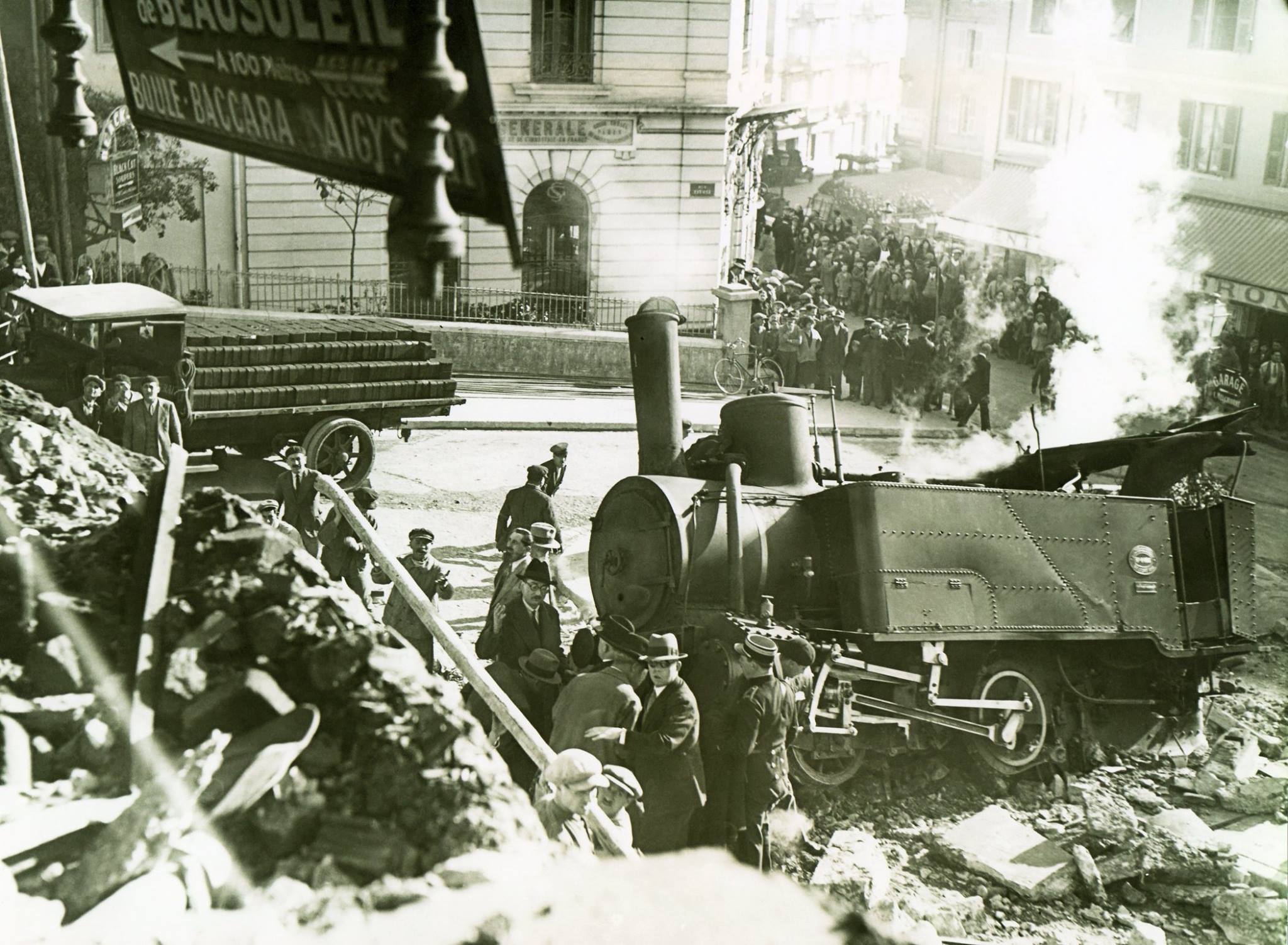
On 26th January 1931, the Nice to Monaco line was closed, followed a few months later by the departmental connection Menton (Villa Caserta) – Sospel. As during its first years of operation, the Menton tramway found itself isolated from the rest of the network and continued for a few months with reduced service to Monaco Garavan and Menton Villa Caserta, with the equipment based at the small Carnolès depot. This reprieve was only short-lived, because these lines were in turn closed in January 1932. [7]
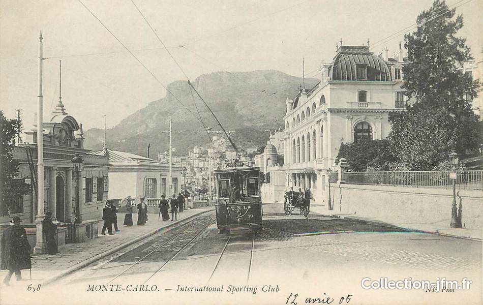
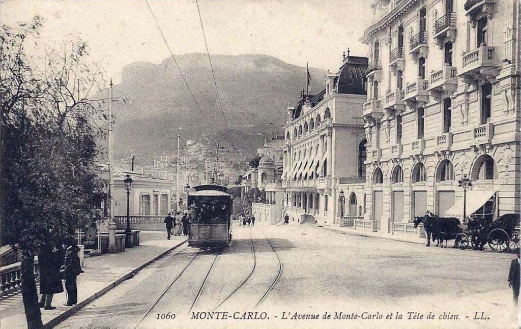

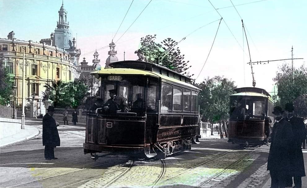
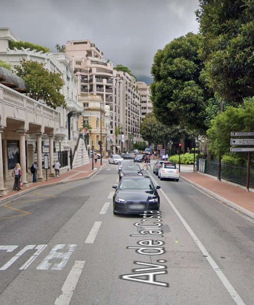
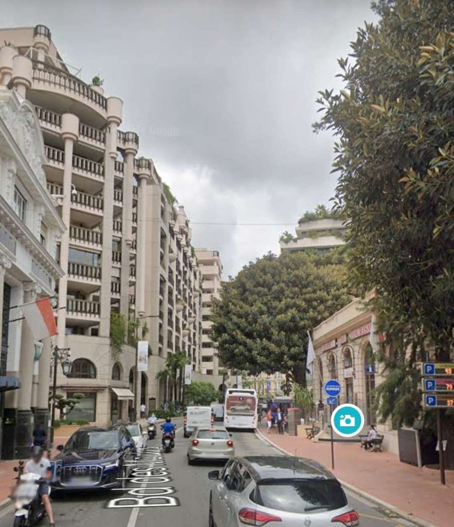
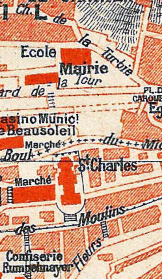
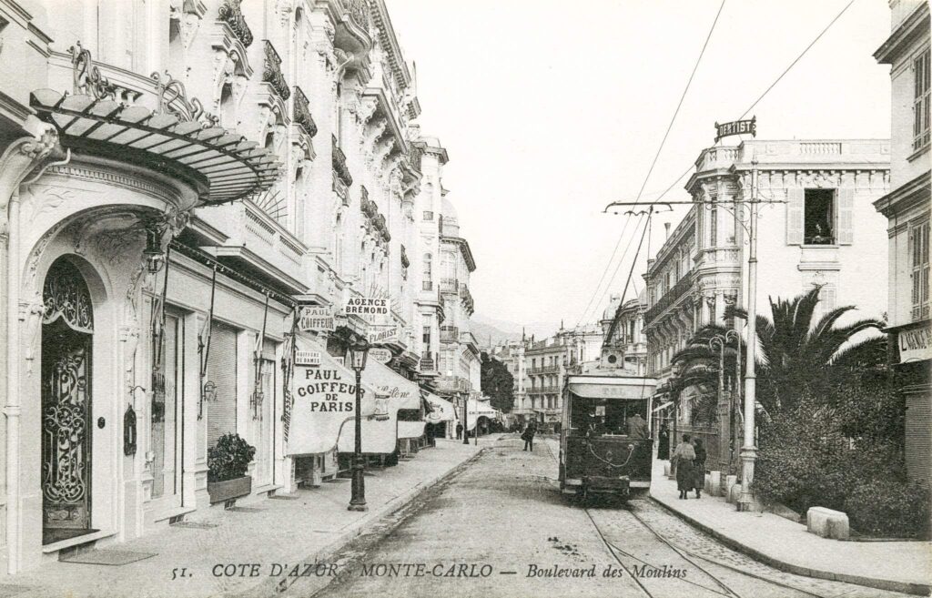
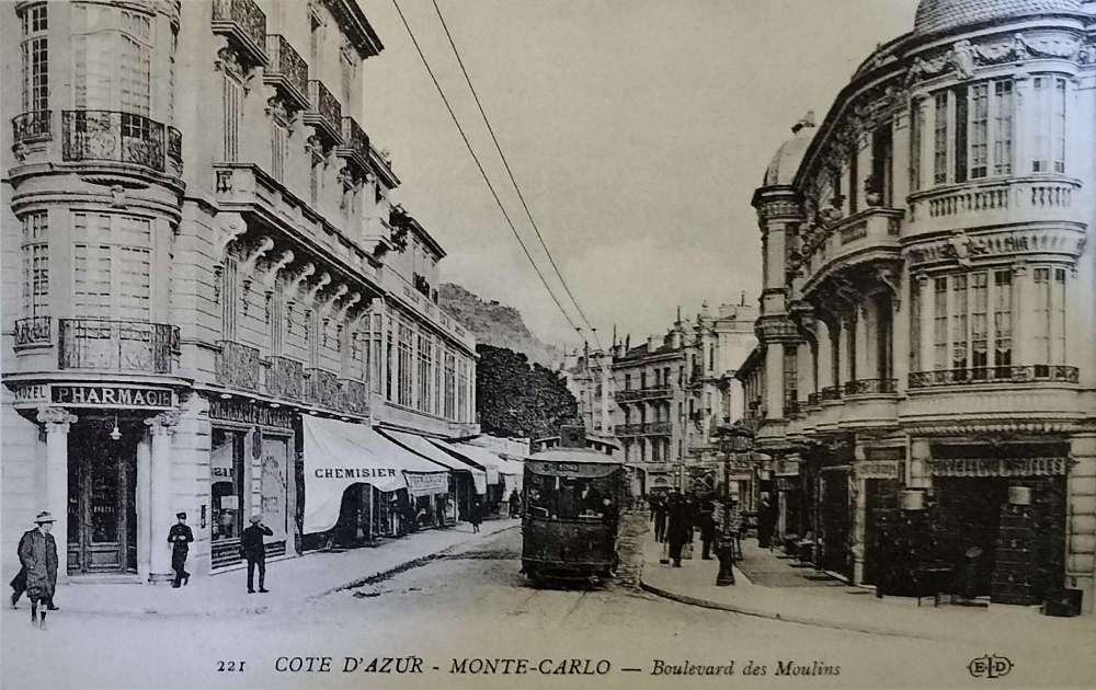
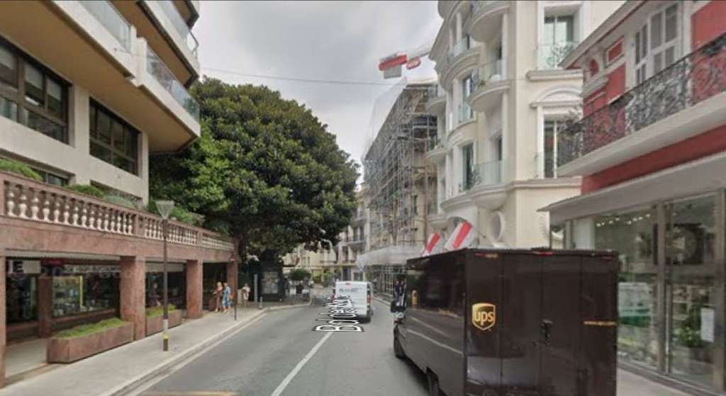
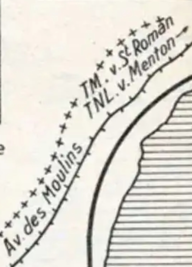
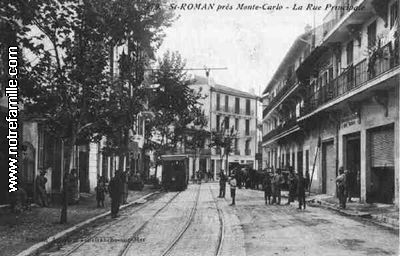
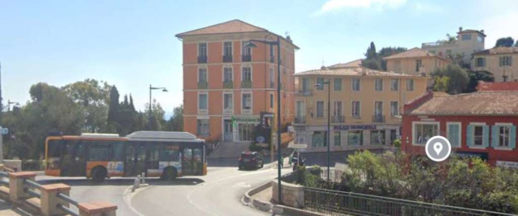
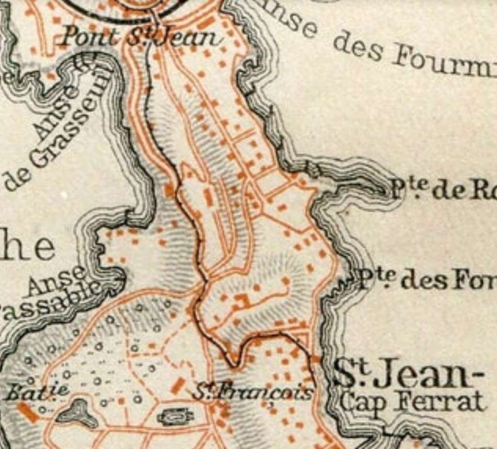
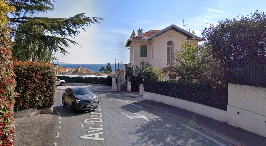
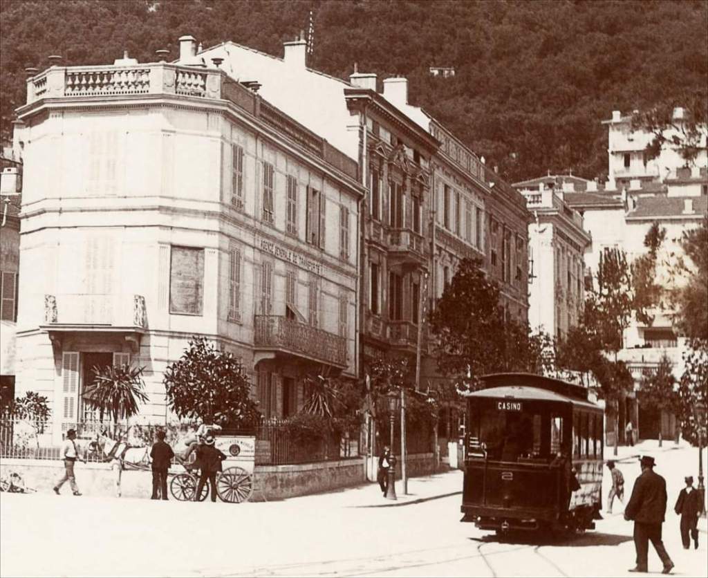
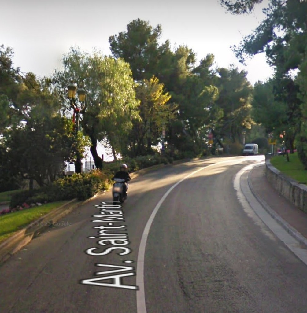
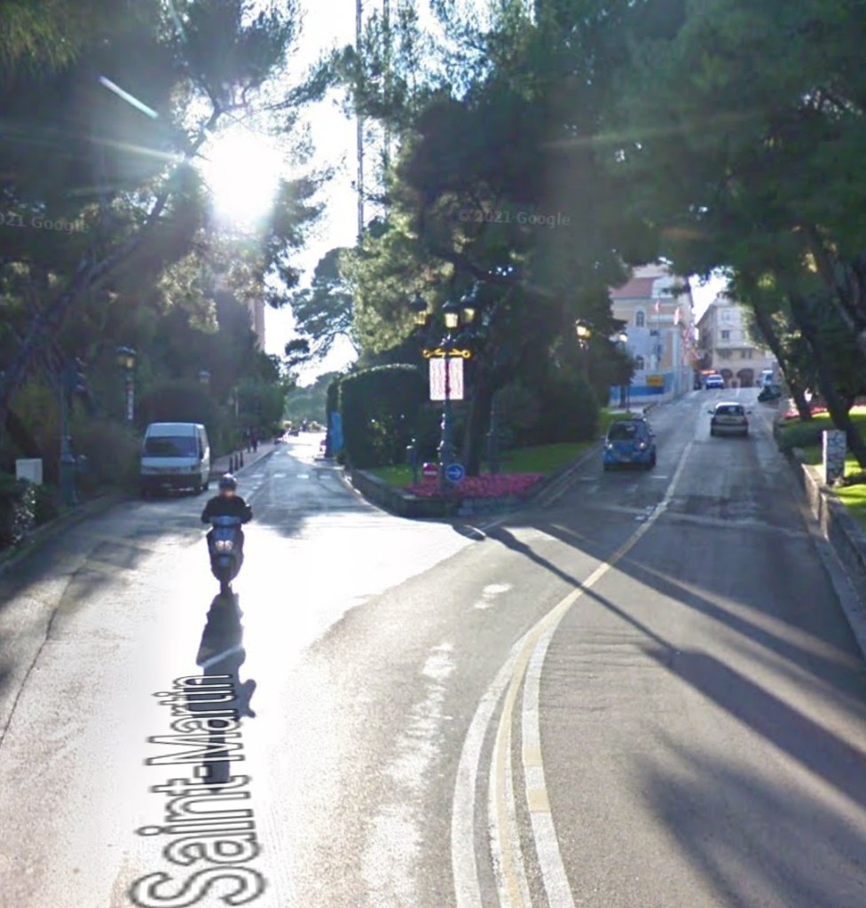
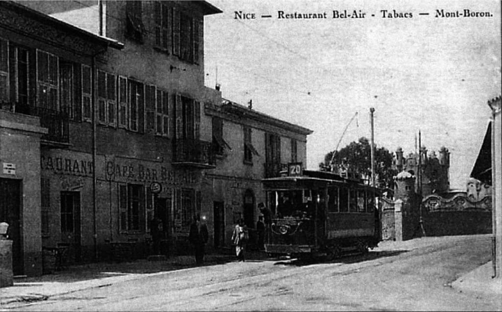
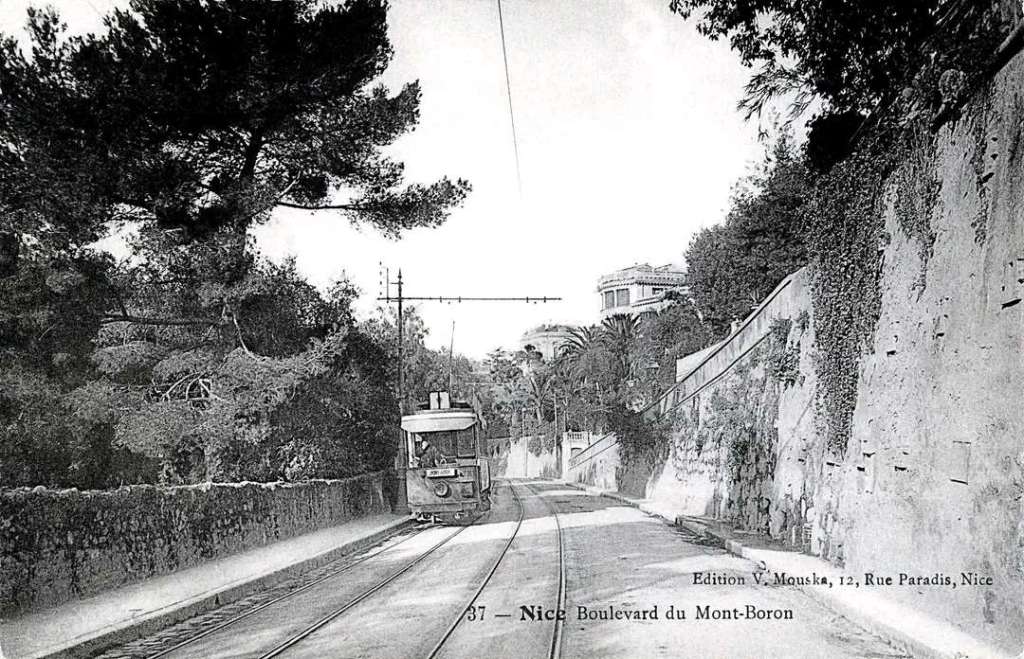
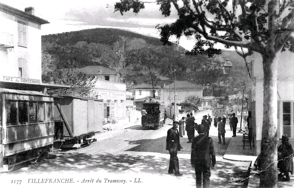
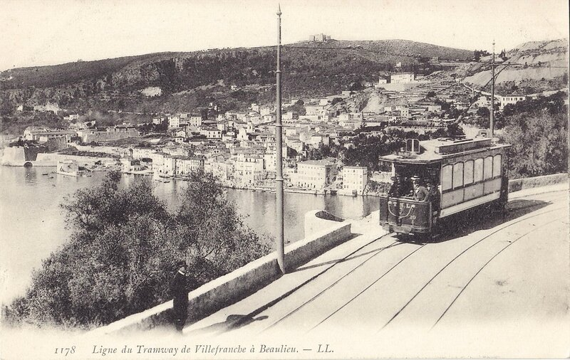
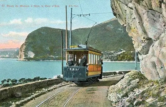
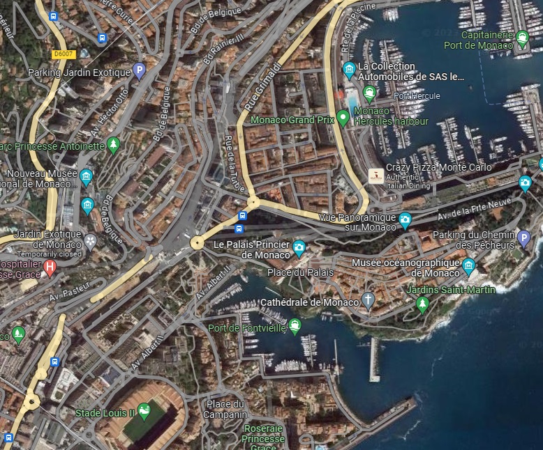
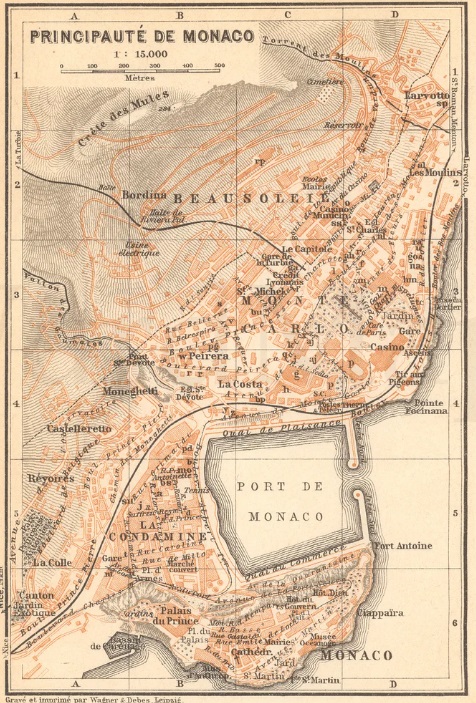
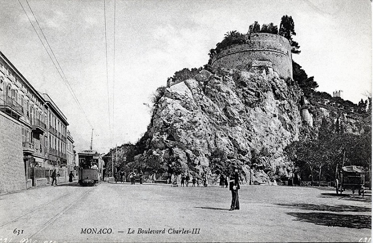
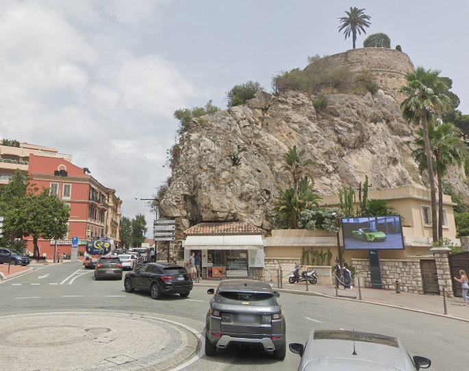
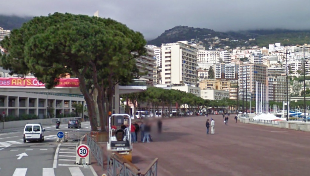
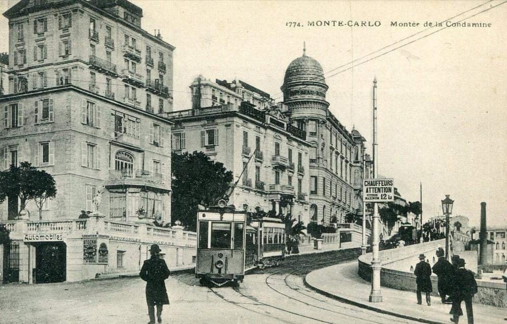
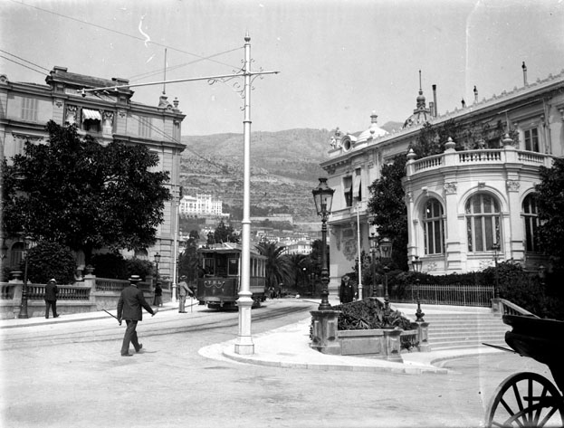
Boulevard des Moulins led directly onto Boulevard d’Italie. Banaudo tells us that “the line became single track in the Boulevard d’Italie, where two sidings allowed the cars of the coastal line to pass those providing the urban service. The latter’s terminus was established in the St. Roman district where the three-track TM depot-workshop was also located, just before the border between the principality of Monaco and the French commune of Roquebrune.” [1: p56]
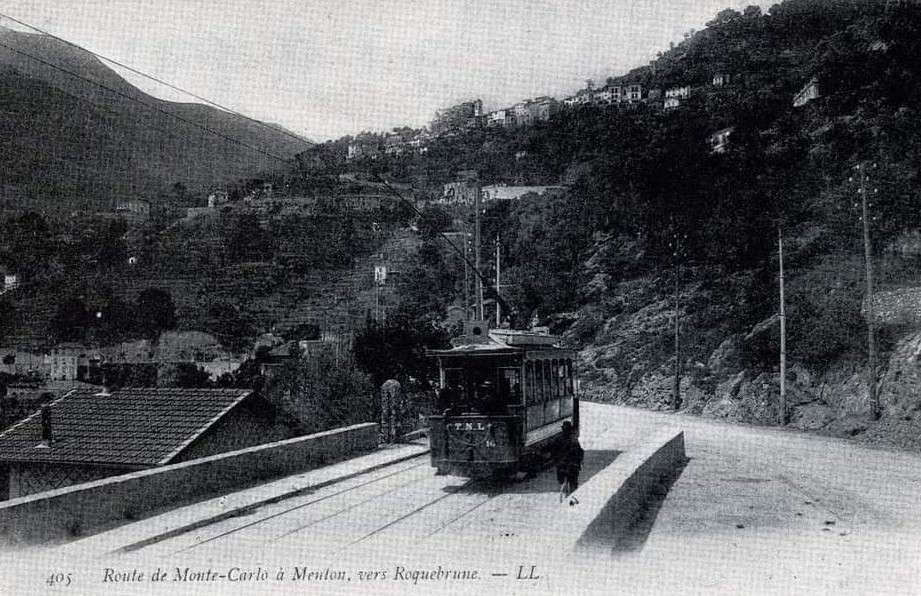
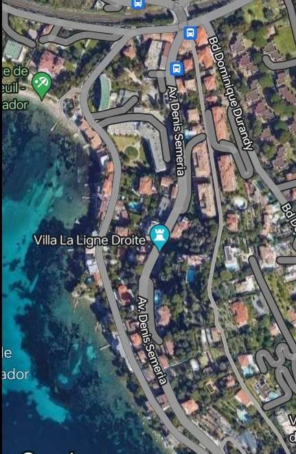
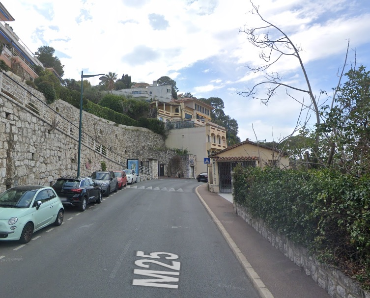
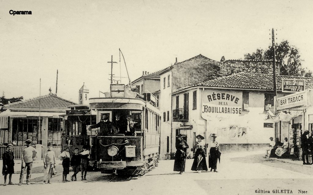
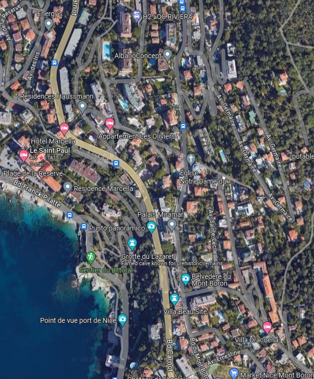
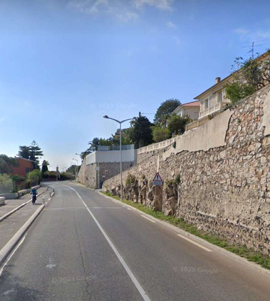
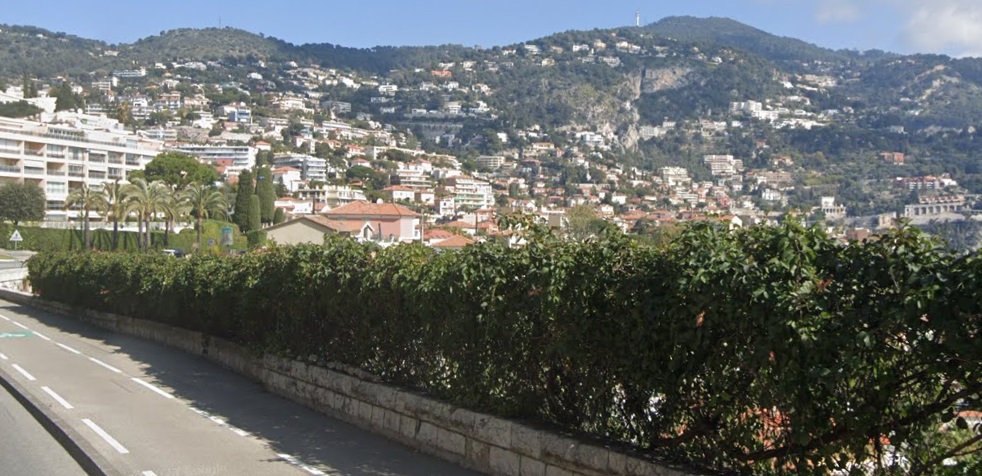
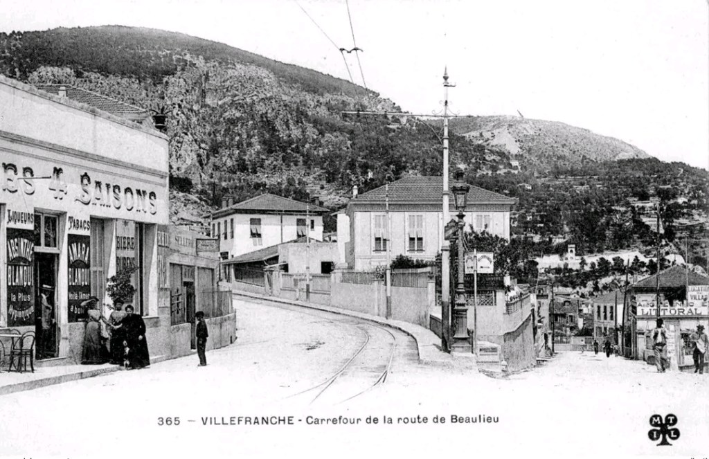
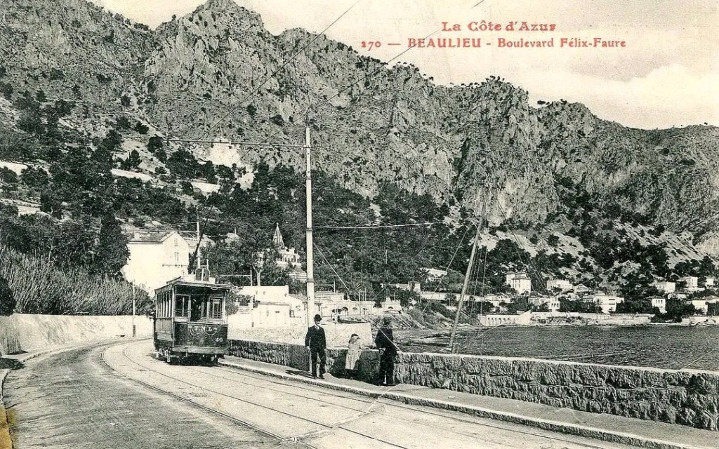
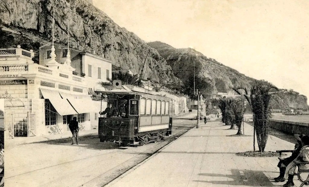
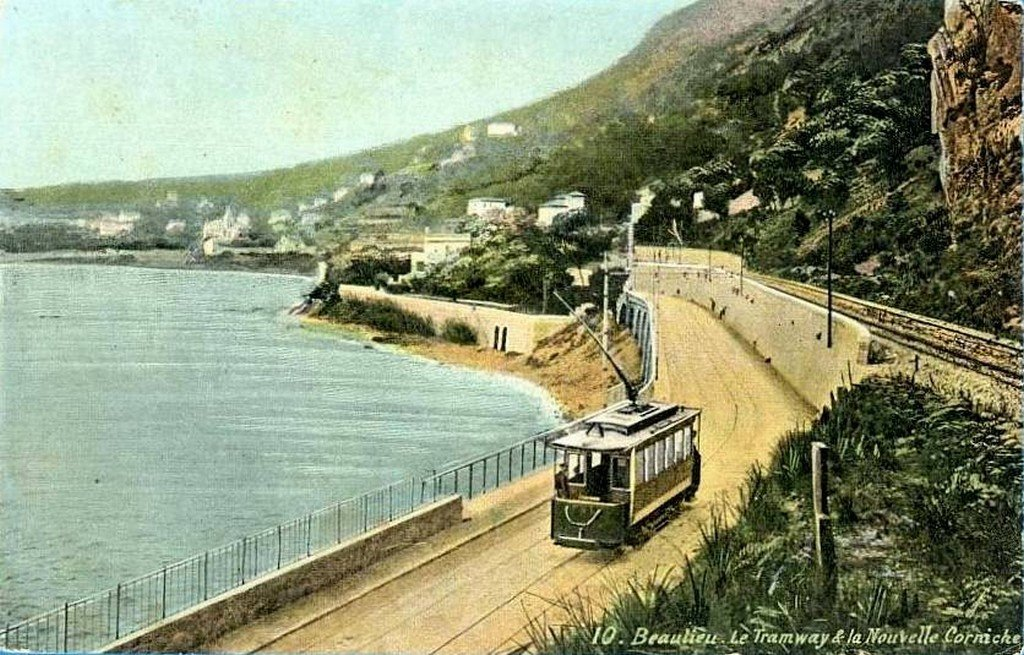
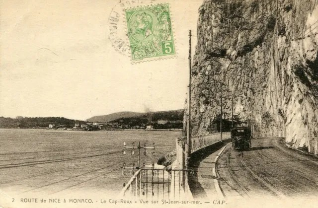
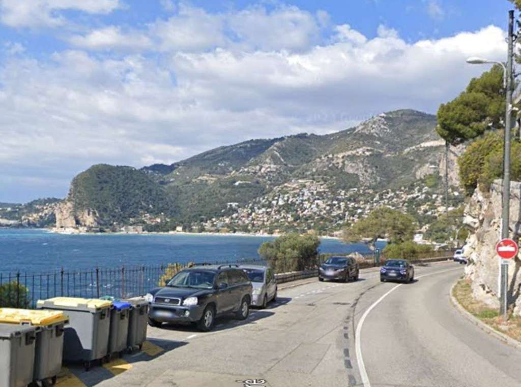
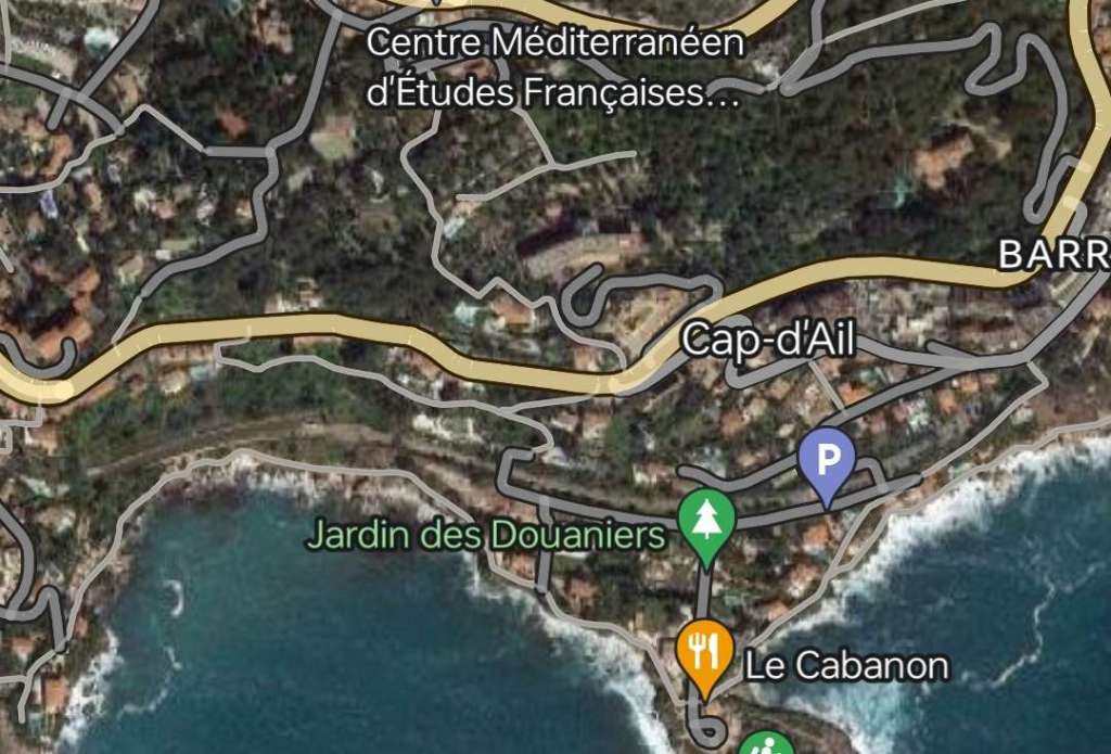
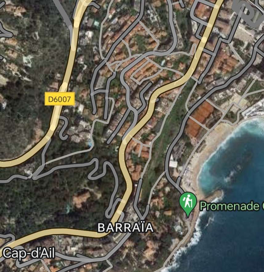
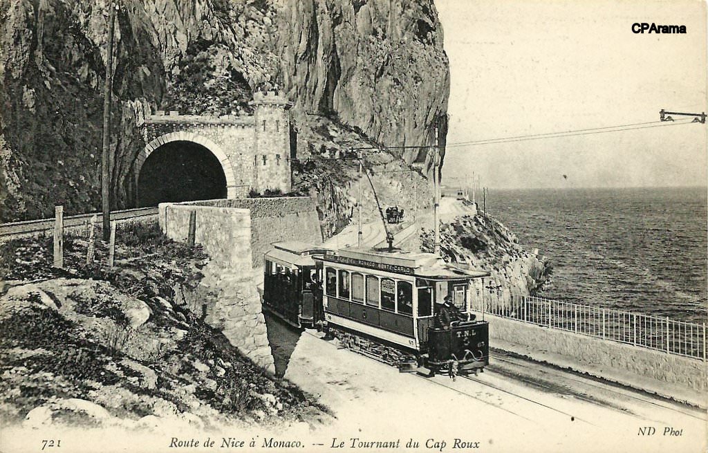
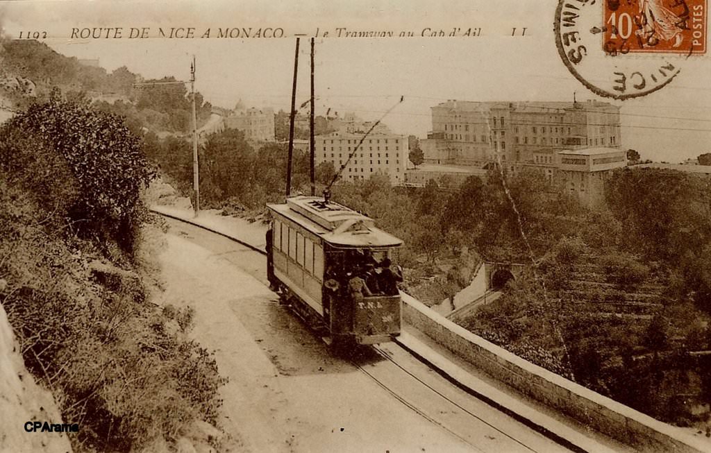
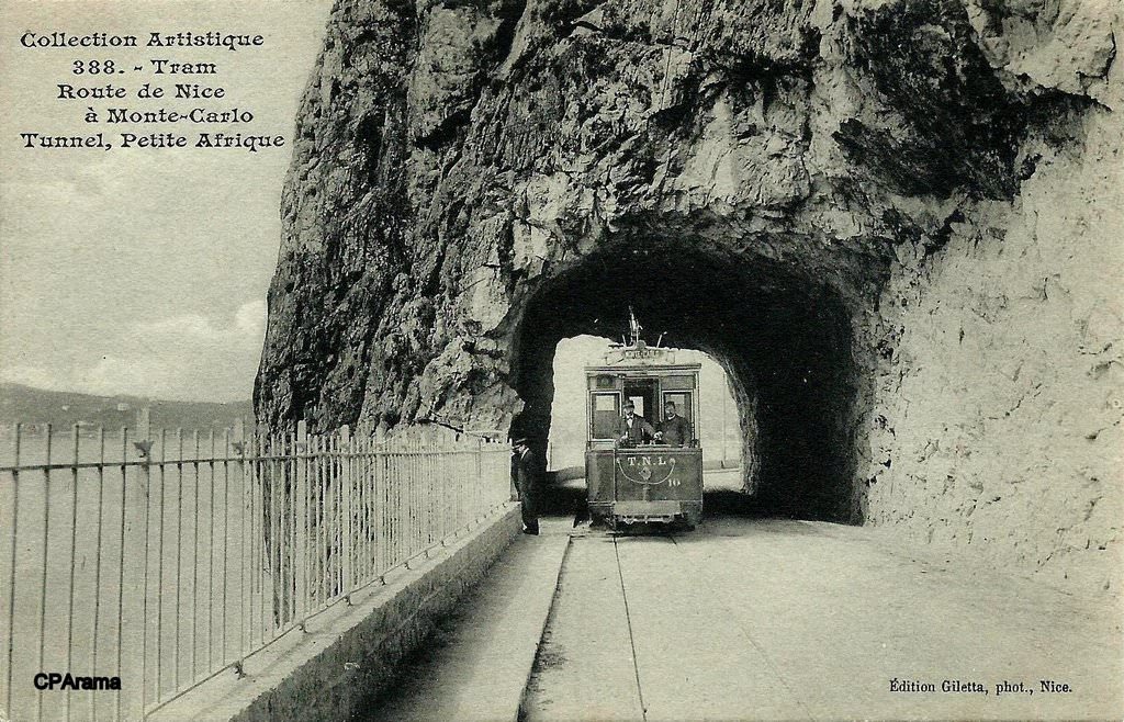
After leaving the principality, Banaudo tells us that the road and the tramway ran through picturesque even grandiose scenery as they run through “Cabbé cove, bounded to the east by the tip of Cape Martin. Since leaving the principality, five passing loops and sections of double track of varying lengths followed one another on this route where the Basse, Moyenne and Grande Corniche come together below the picturesque medieval village of Roquebrune.” [1: p56]

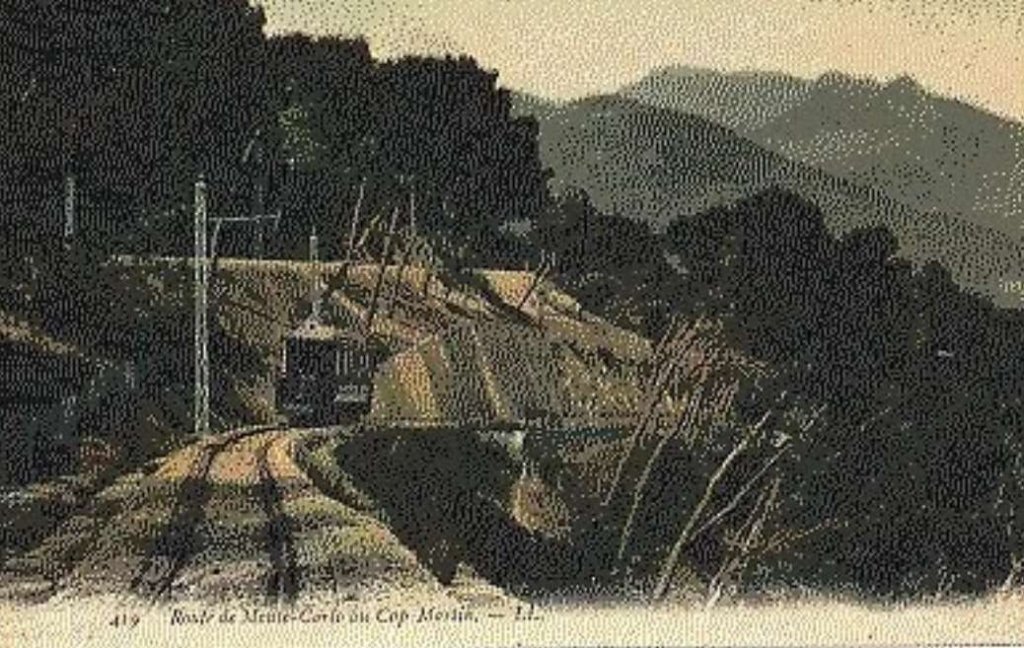
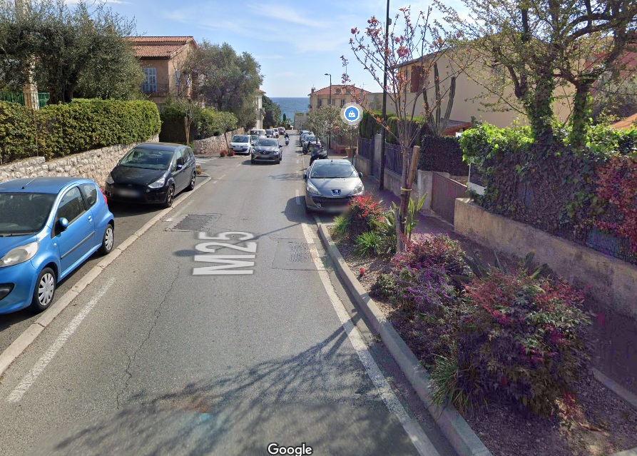
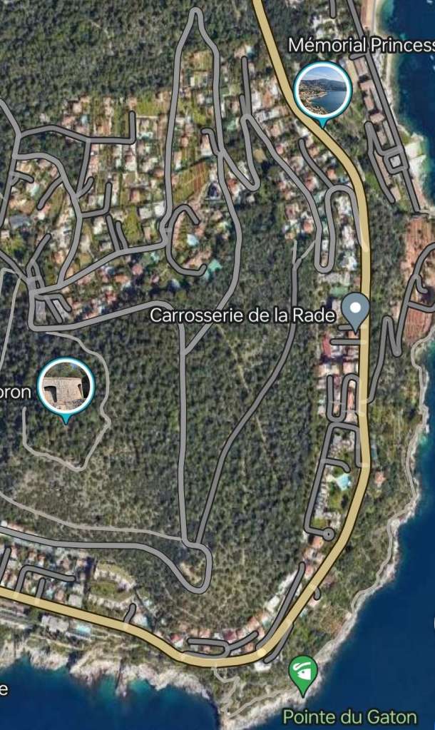
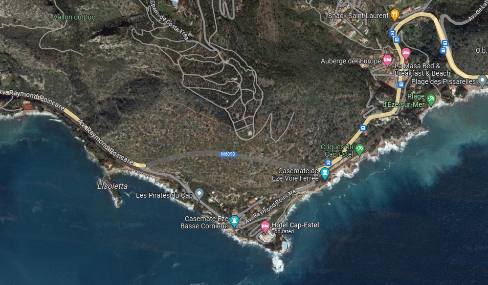
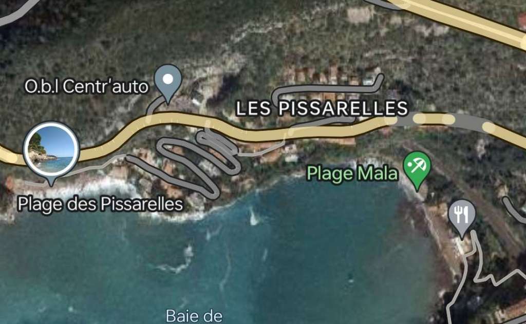
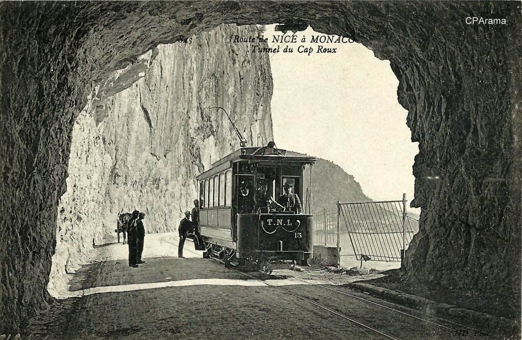
Shortly after the location where the Basse, Moyenne and Grand Corniches meet, the “national road 7 describes a series of tight turns on a steep slope to cut across the base of Cap-Martin. In order to follow a more favorable route, the tramway penetrated quite far into the pine forest of the cape for approximately 1600 m on an independent platform. Here it served housing estates, vast properties and villas, some of which were not yet connected to motorable roads.” [1: p57]
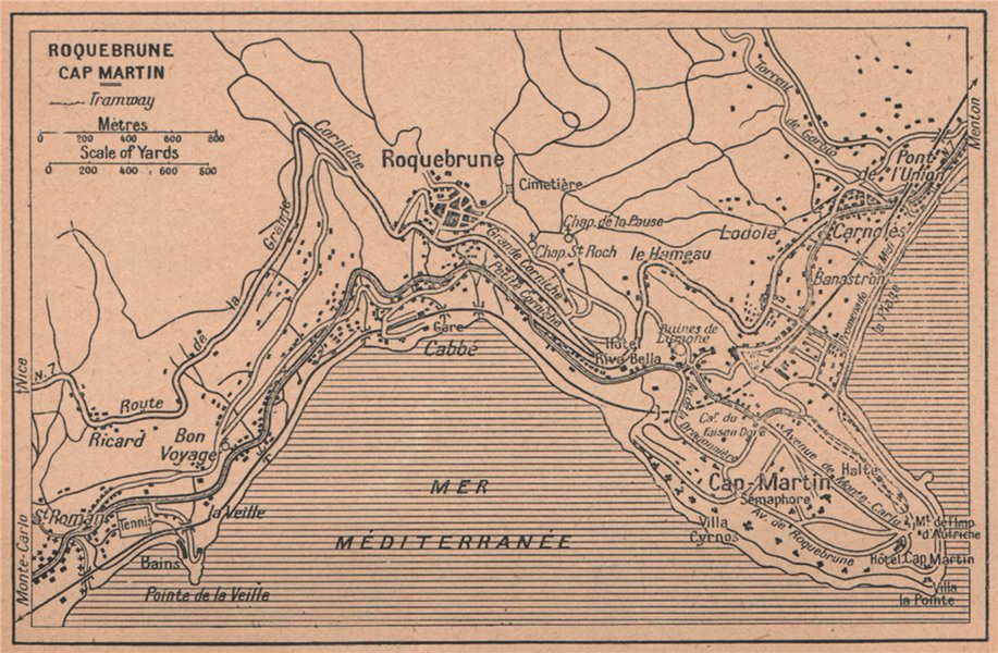
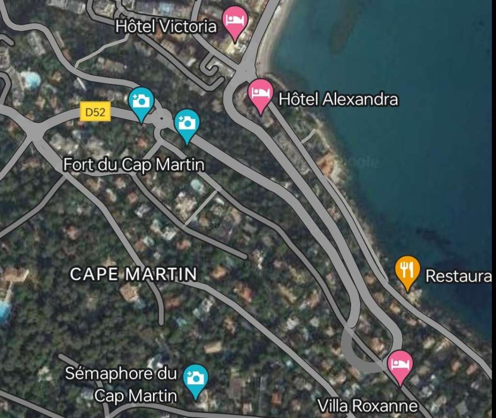
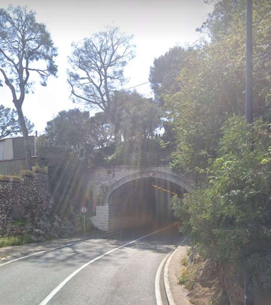
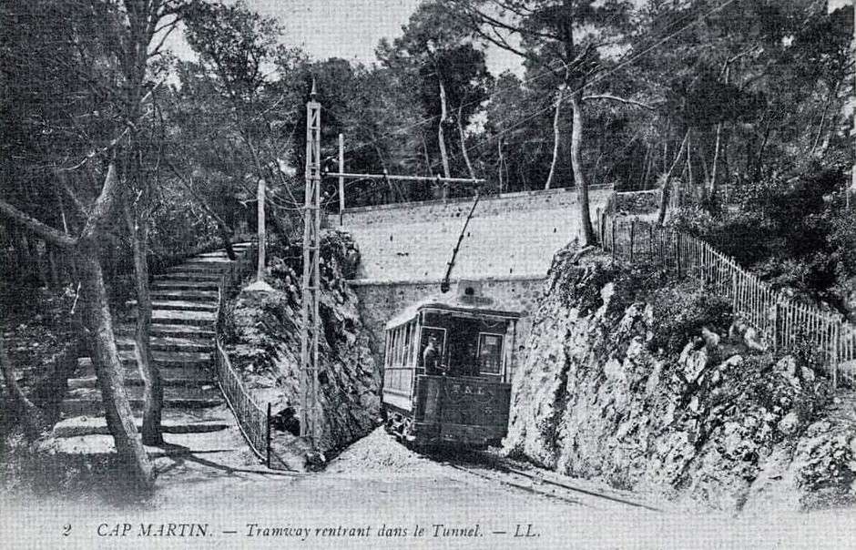
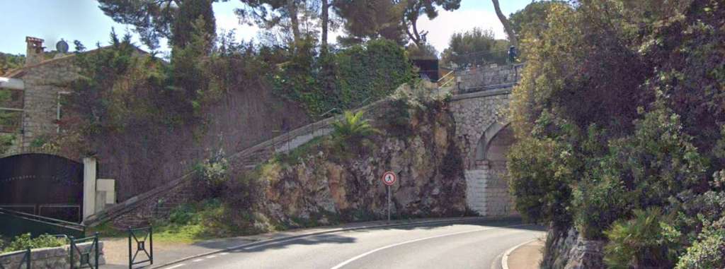
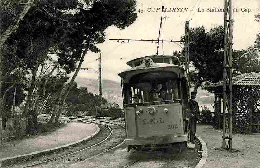
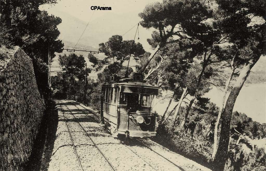
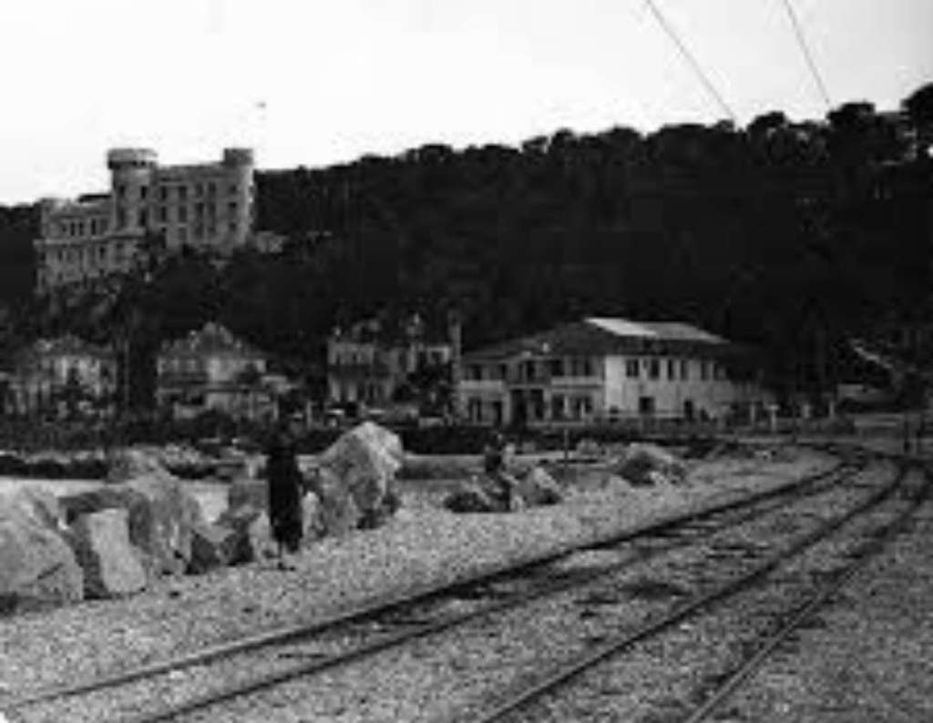
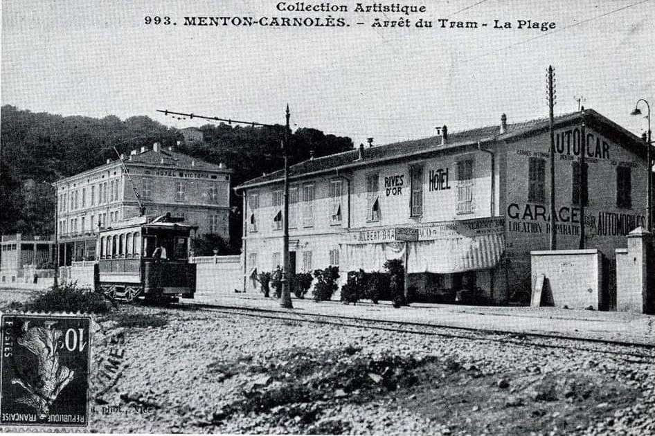
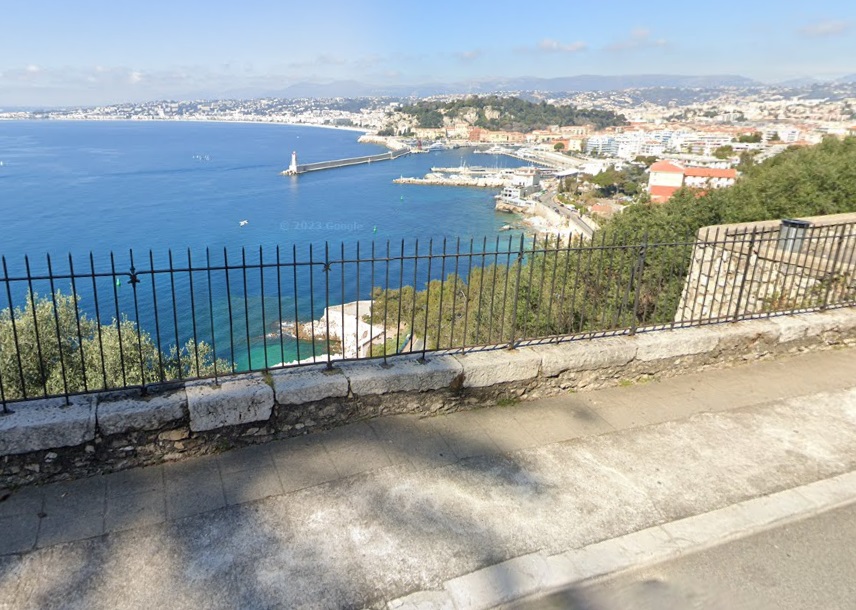
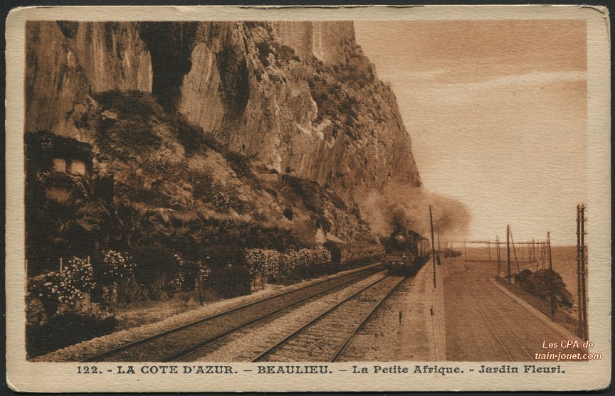
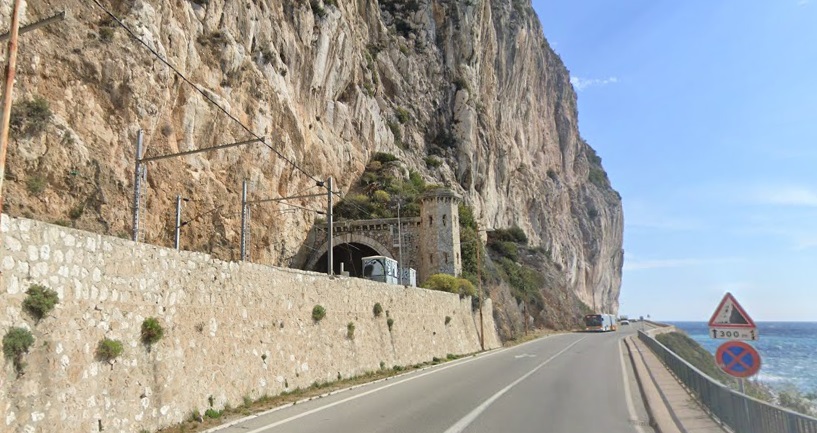
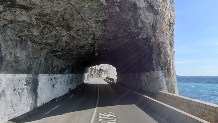
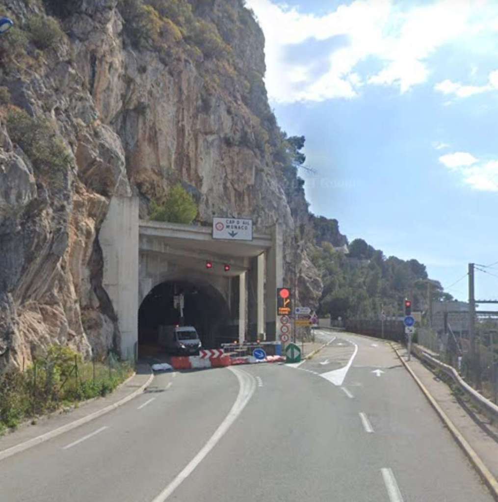
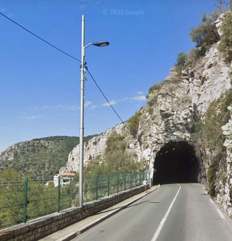
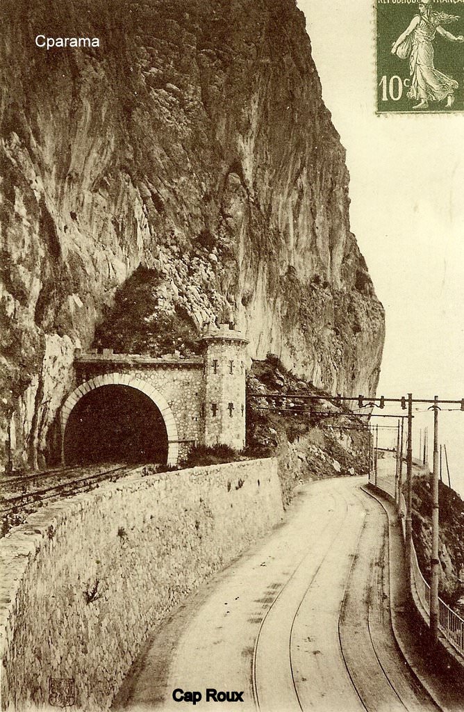
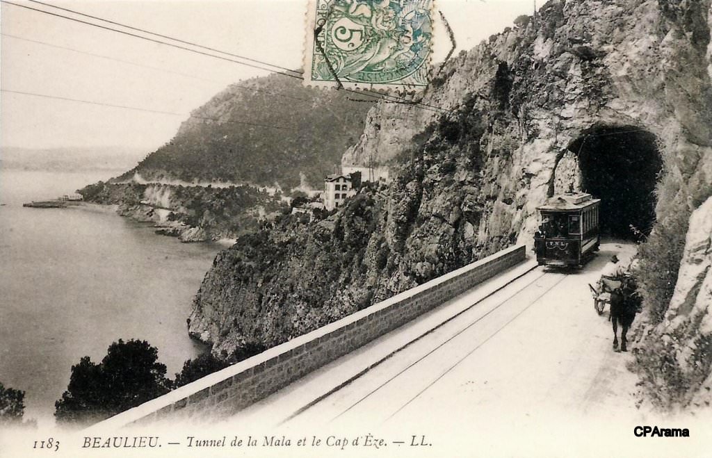
Banaudo continues to describe the route followed by the tramway. He says that the old tramway ran out onto the Cap-Martin peninsula where it “described a long hairpin loop at the bottom of which was a 108 m tunnel, in a curve with a radius of 35 m and a slope of 70 mm/m. From the Cap-Martin stop, located at the exit of the tunnel, the single track was subsequently doubled to facilitate crossings in this hilly sector. The descent on the eastern slope of the cape then offered a vast panorama of the town of Menton and the Ligurian Riviera. Since entering [Cap-Martin], the line had lost around sixty metres in altitude when it reached the seashore at the Victoria Hotel, not far from which the Cap-Martin depot was located.” [1: p57]
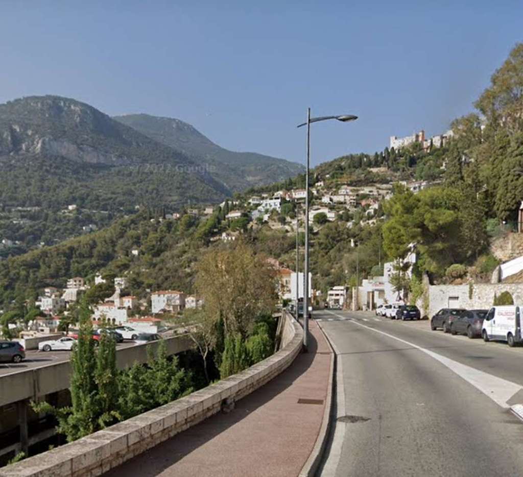
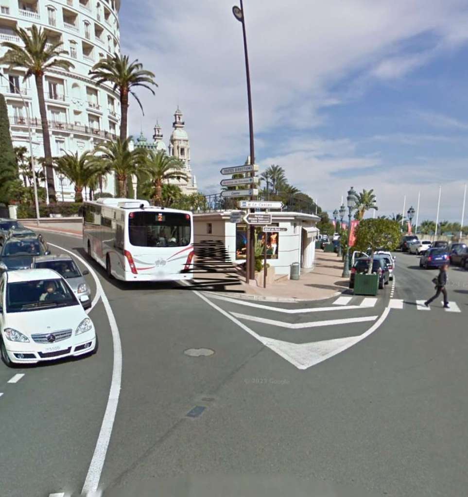
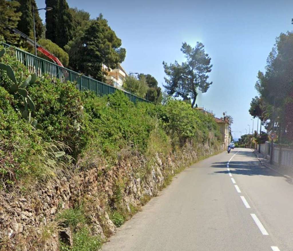
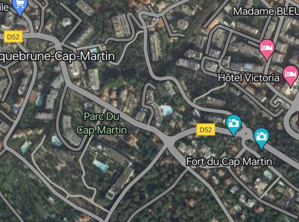
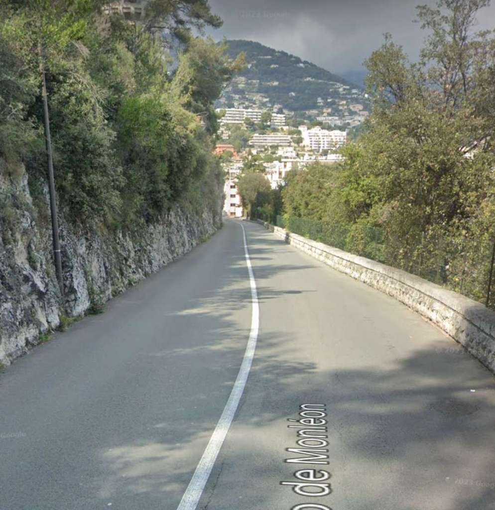
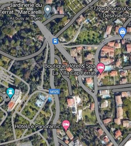
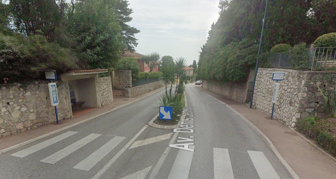
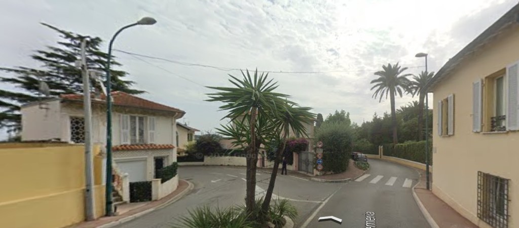
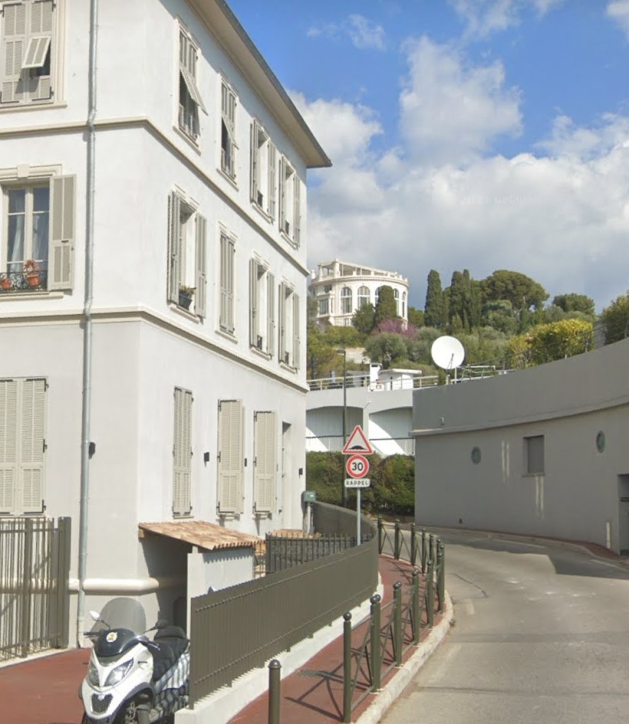
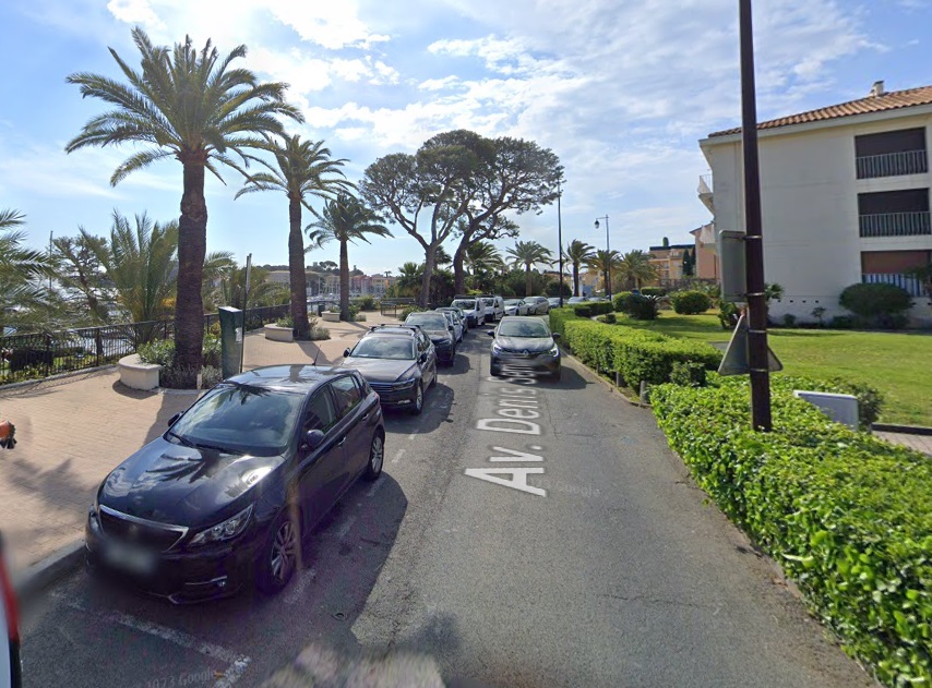
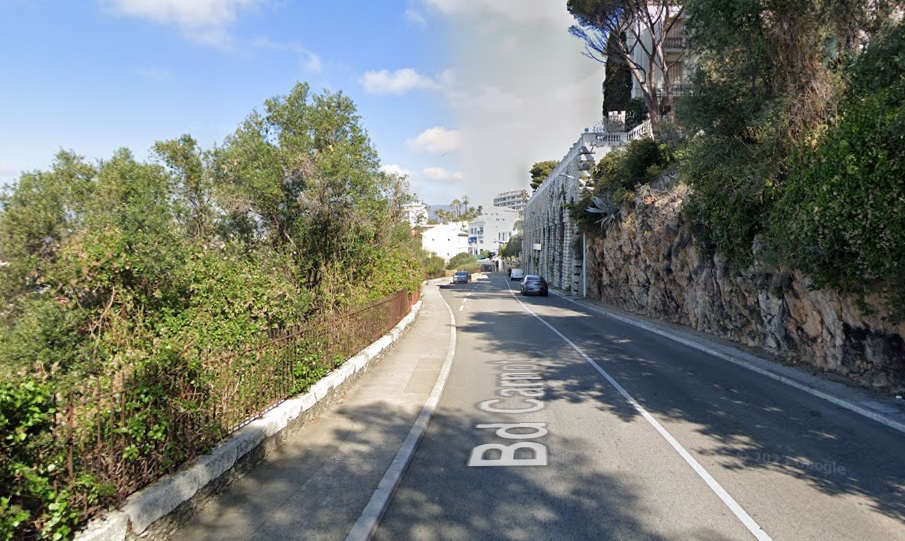
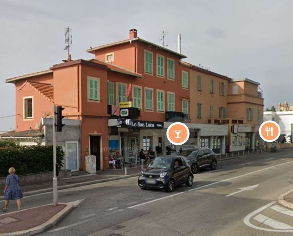
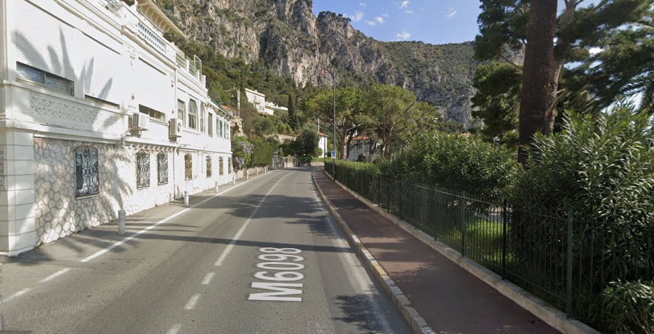
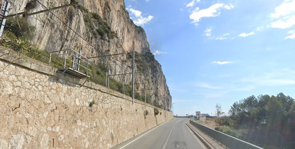
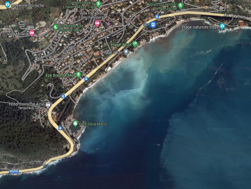
Today, Avenue Paul Doumer (D52) follows the route of the old tramway fairly faithfully as it heads out onto Cap-Martin. Avenue Paul Doumer gives way to Avenue Sylvio de Monleon which follows the old tramway to and through the location of the tramway tunnel which has been supplanted by a road tunnel on the same alignment.
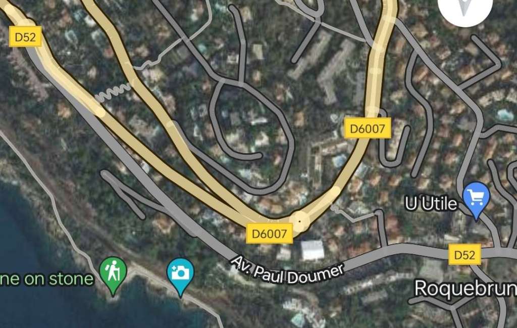
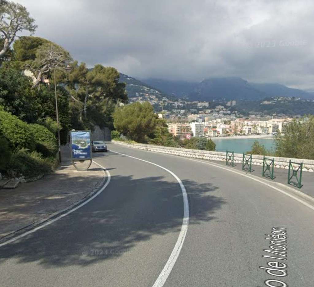
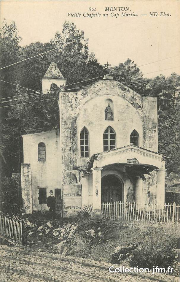
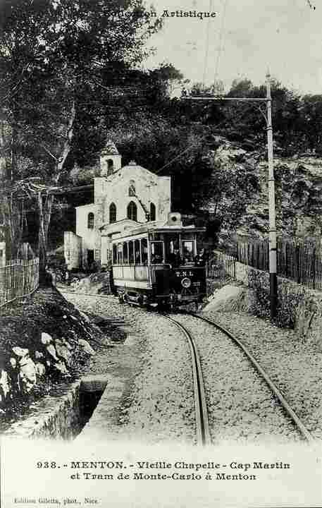
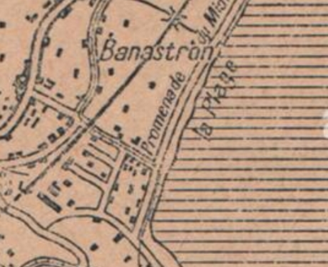
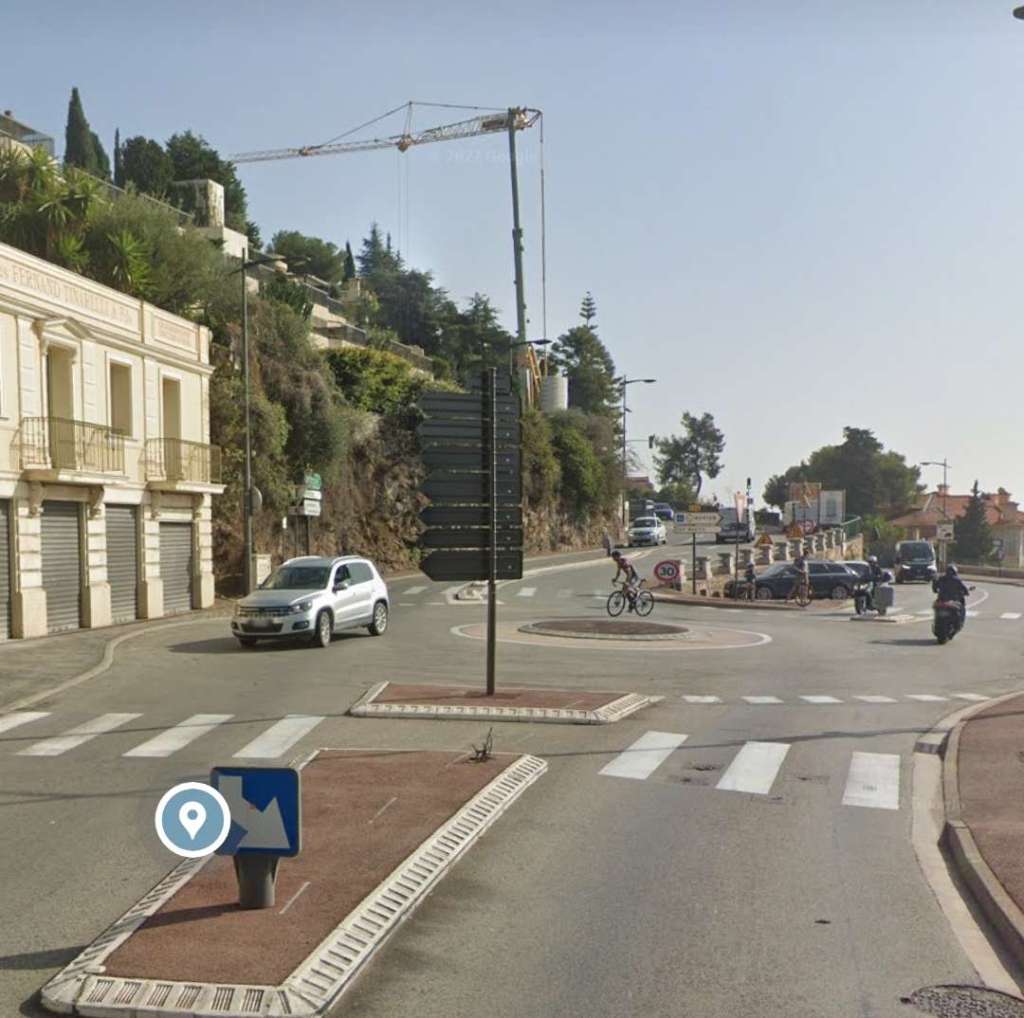
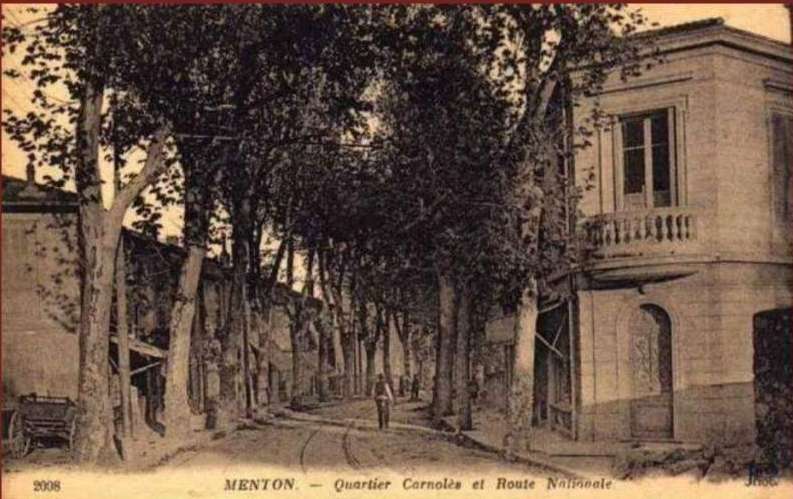
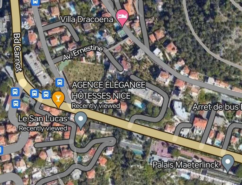
After running past the Chapelle du Cap-Martin trams ran alongside the beach for a short distance. The route they took has since become the Promenade du Midi. They turned inland at what is now Avenue Francois de Monleon and ran under the PLM mainline before turning to the right along Avenue Julia, a road which appears to no longer exist, and following the curve of that road as far as its junction with what is now the D6007. The length before that junction was along what is now Avenue du Marechal Foch.
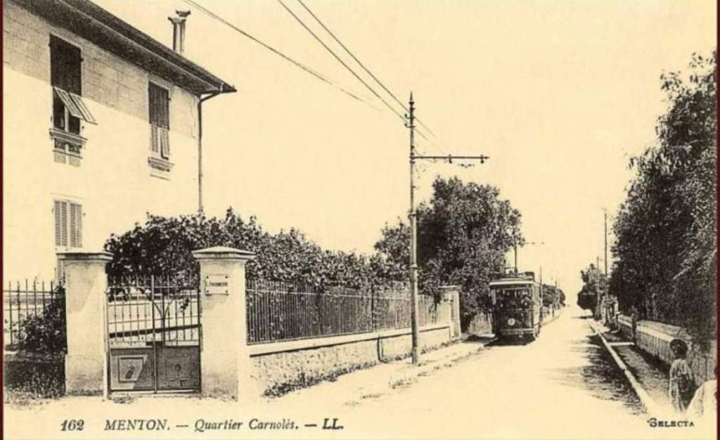
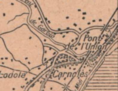
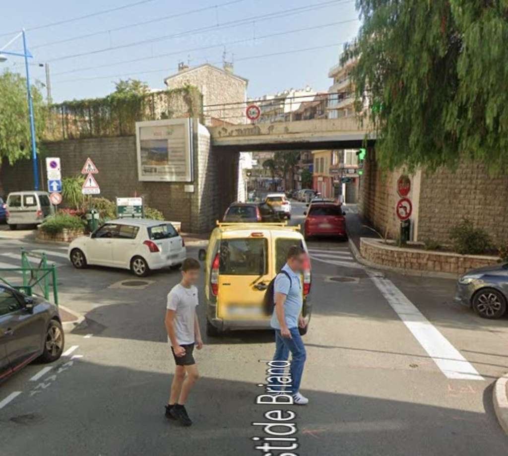
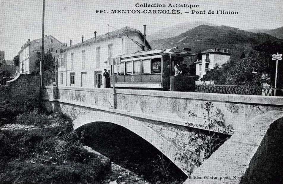
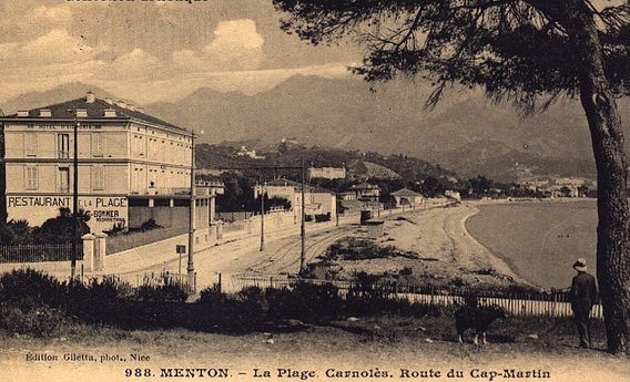
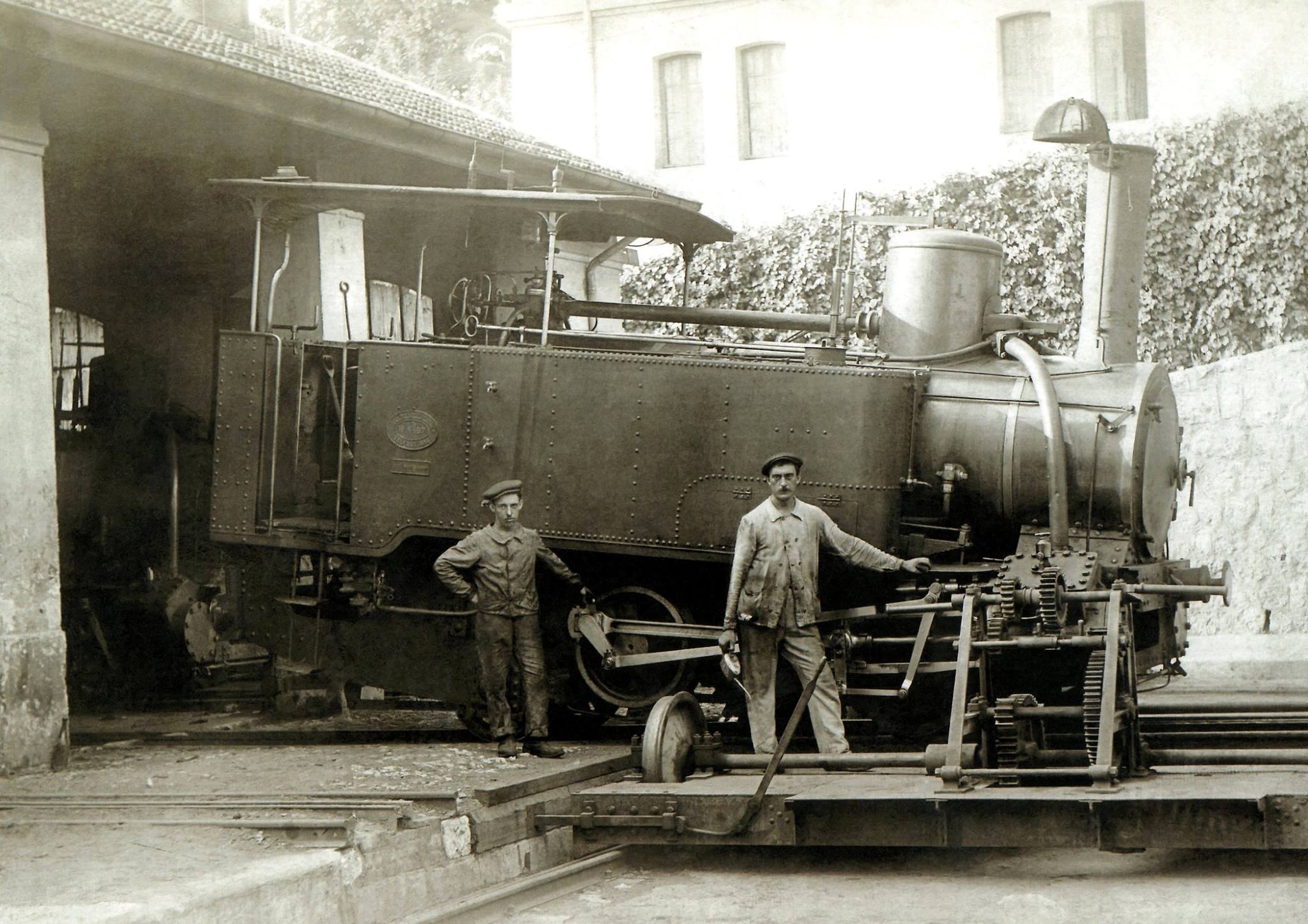
The TNL had a depot at Carnolès-plage from 1902 to 1932. [20] Banaudo notes that the tramway passed twice under the PLM Nice to Ventimiglia line. After “the second underbridge, the Union bridge over the Gorbio valley demarcated the territories of the communes of Roquebrune and Menton.” [1: p57]
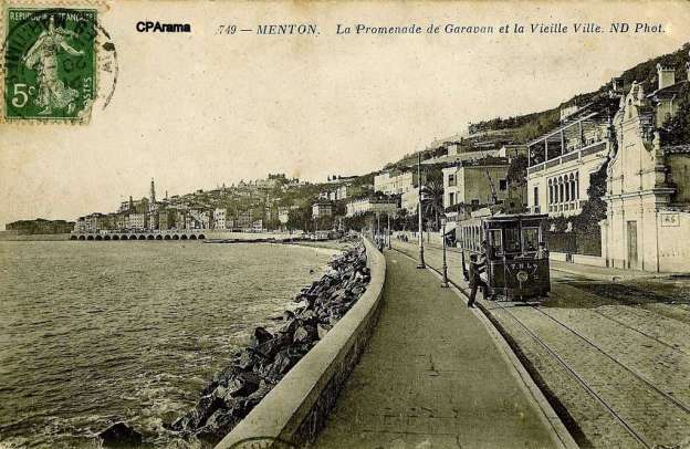
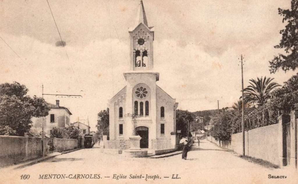
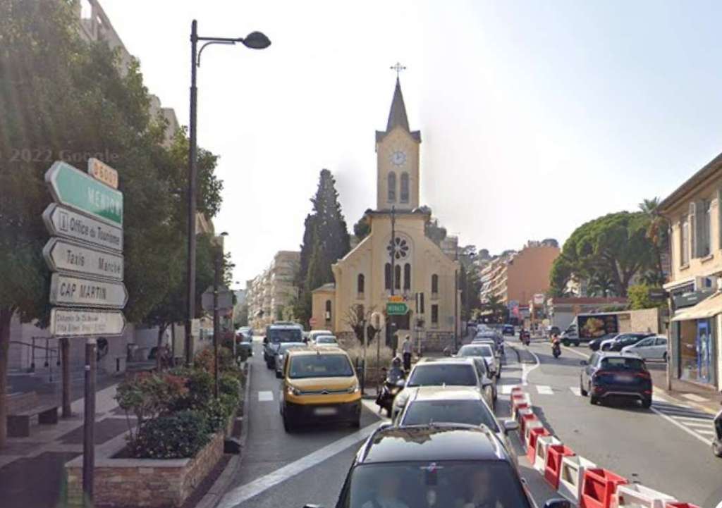
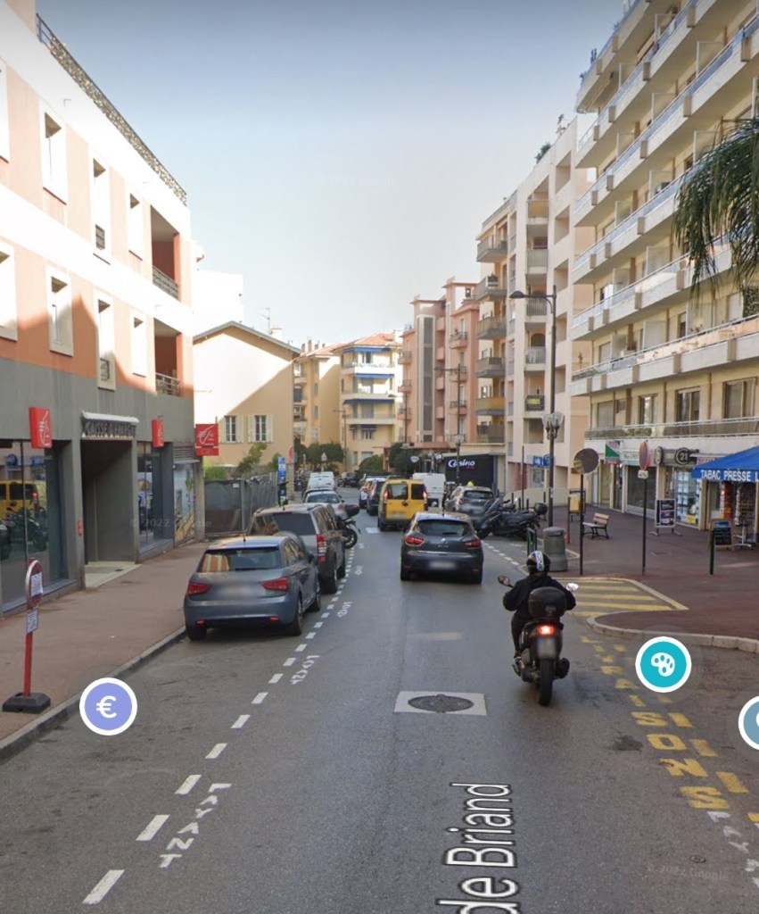
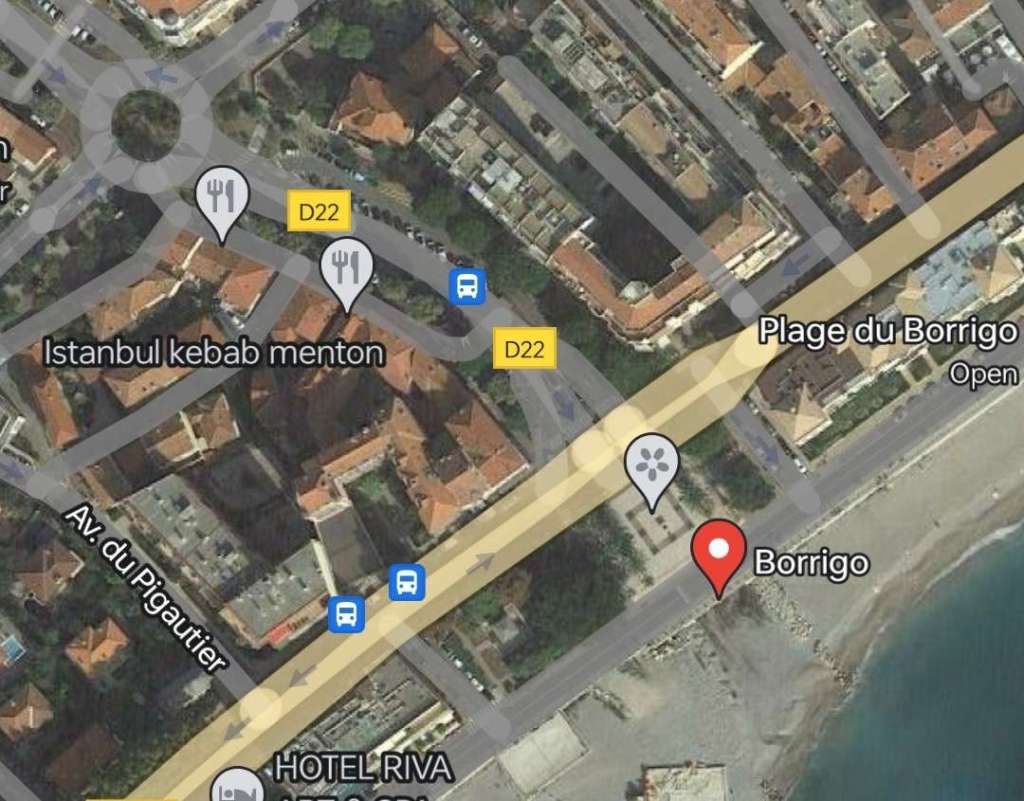
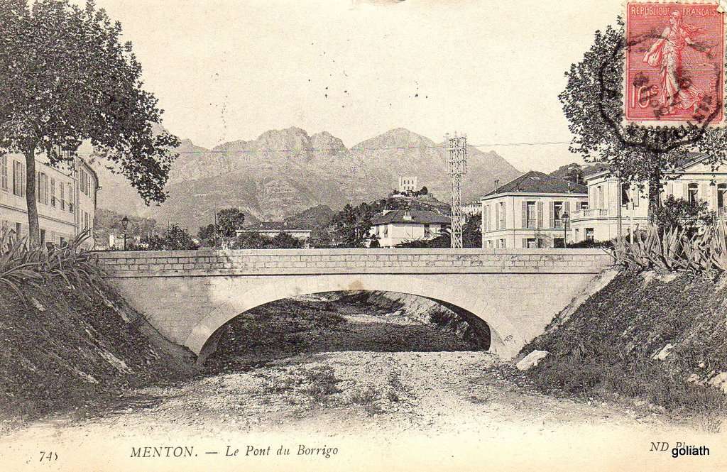
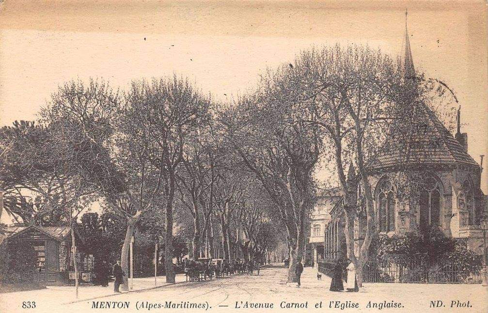
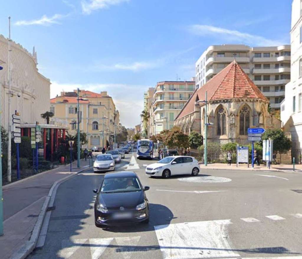
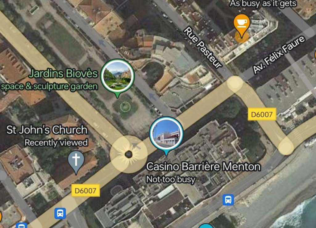
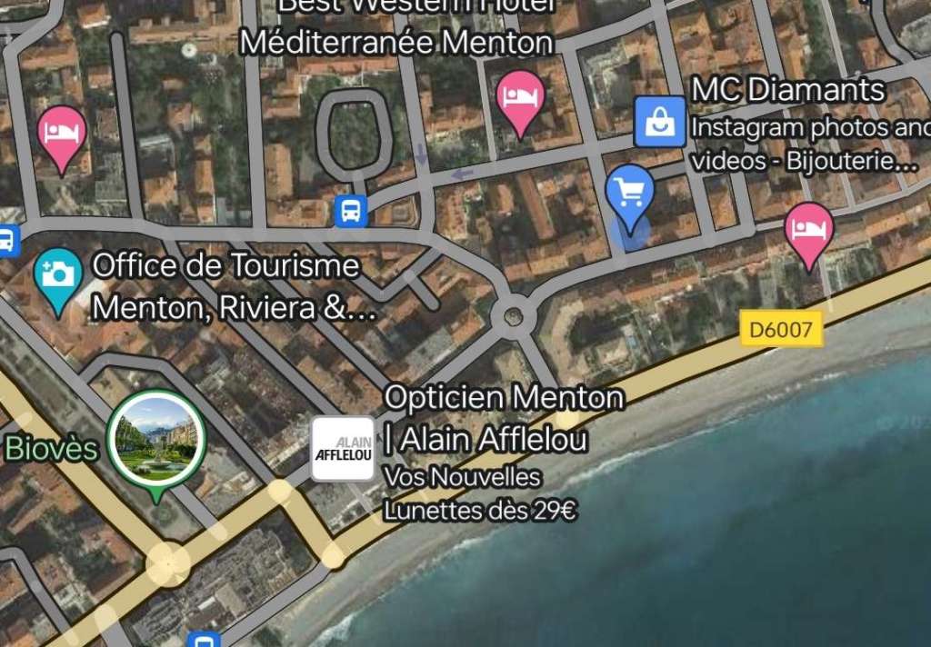
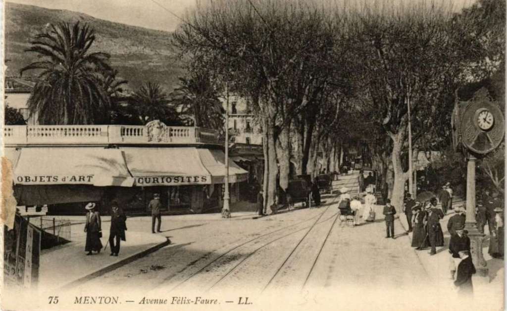
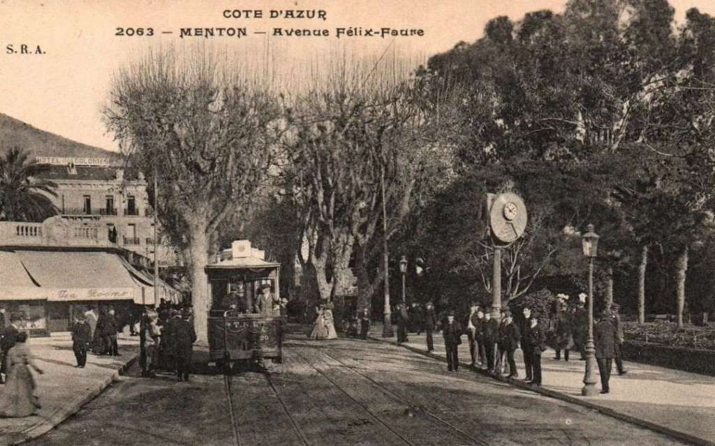
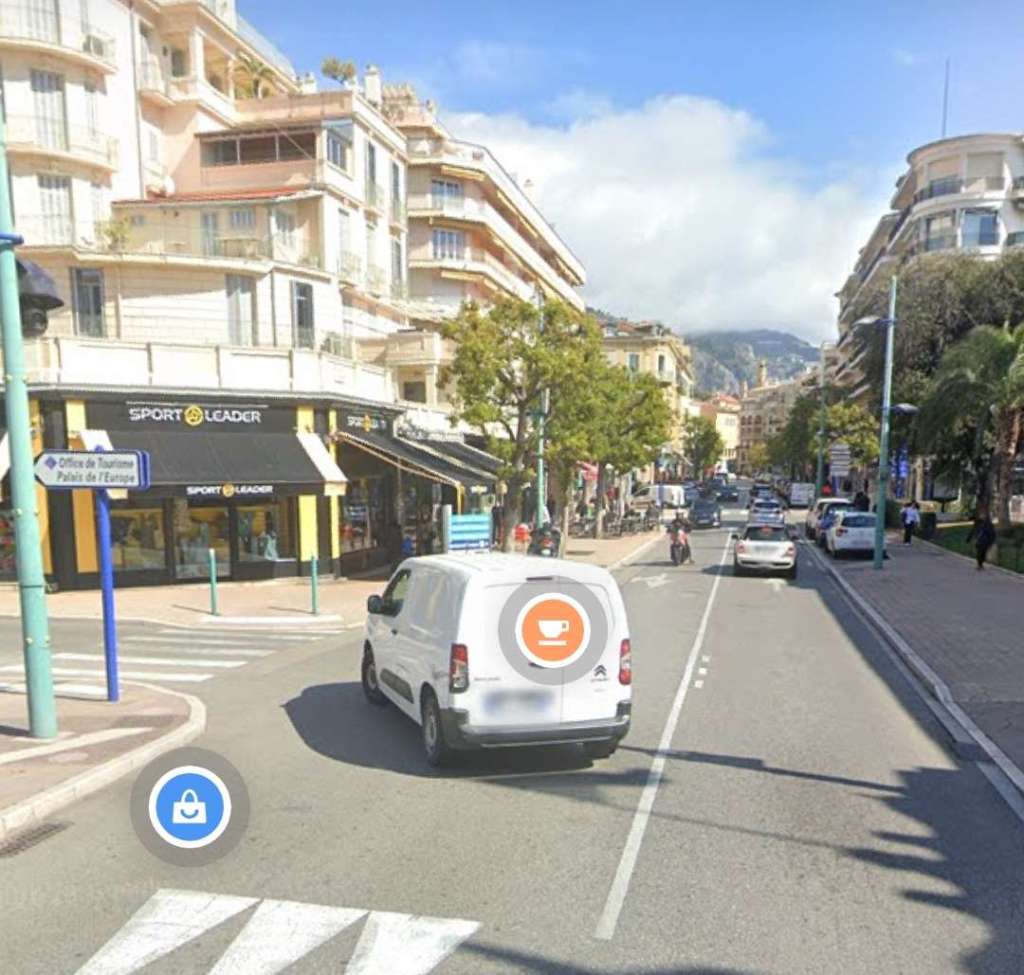
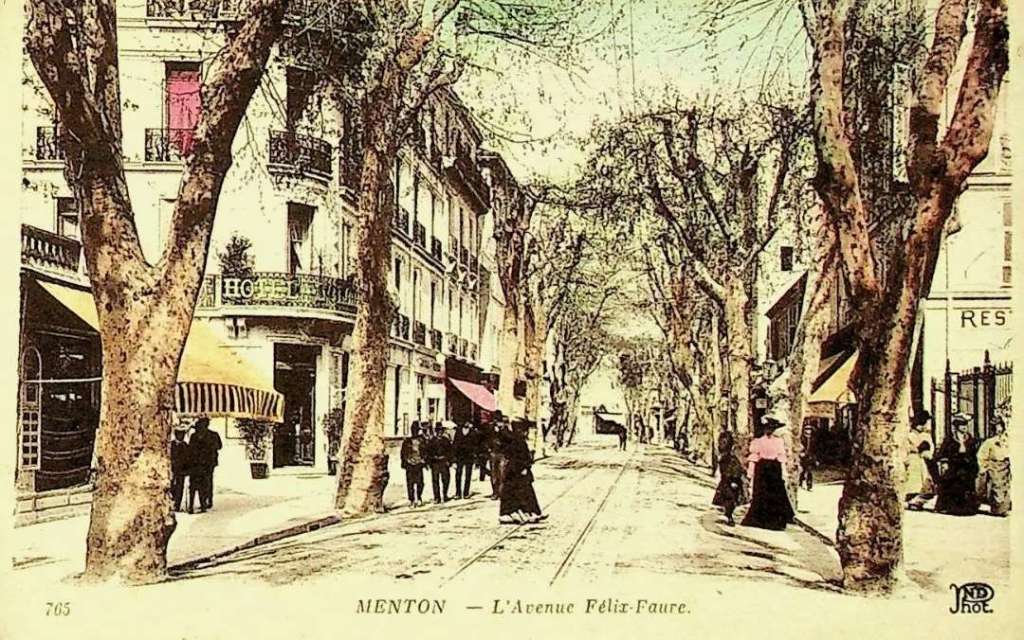
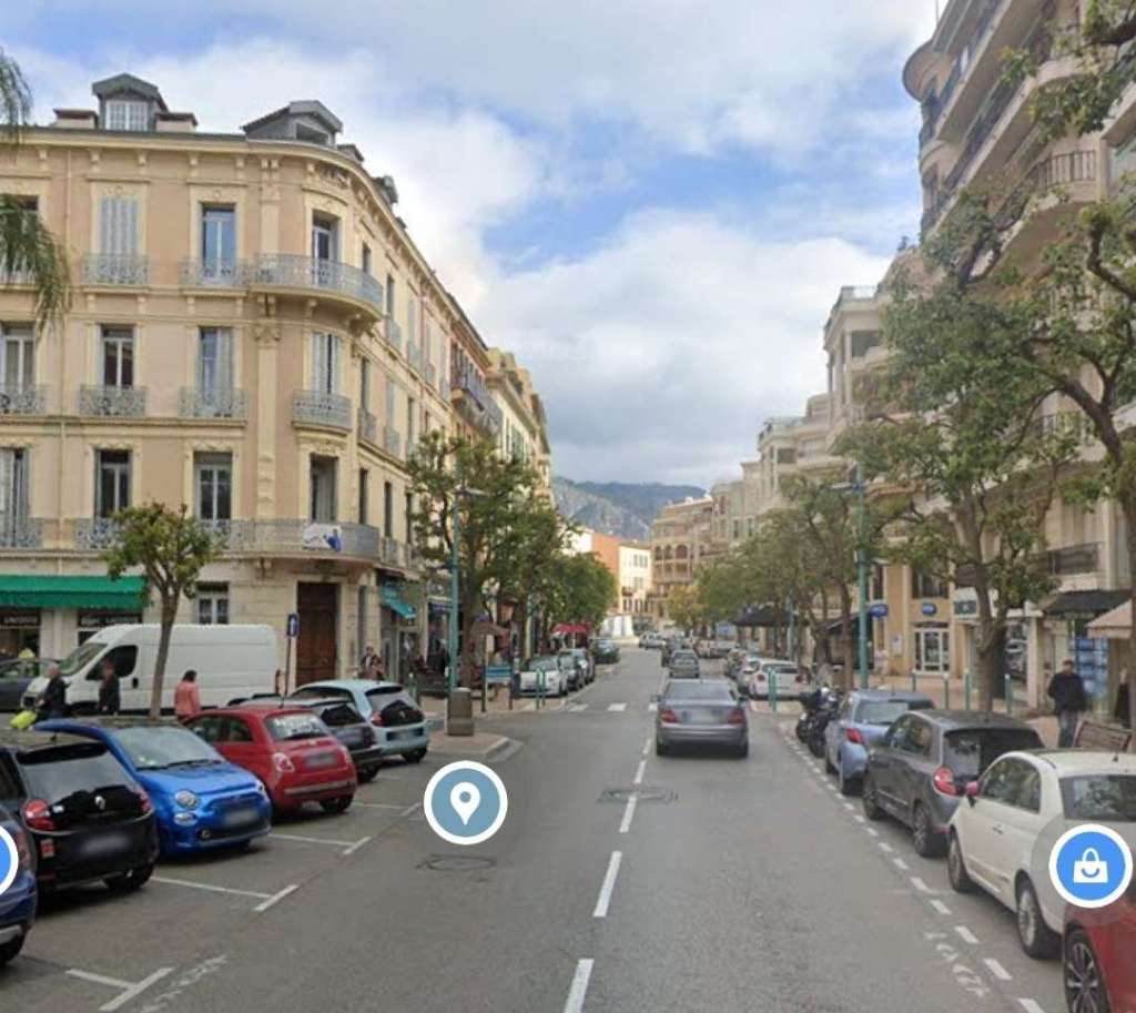
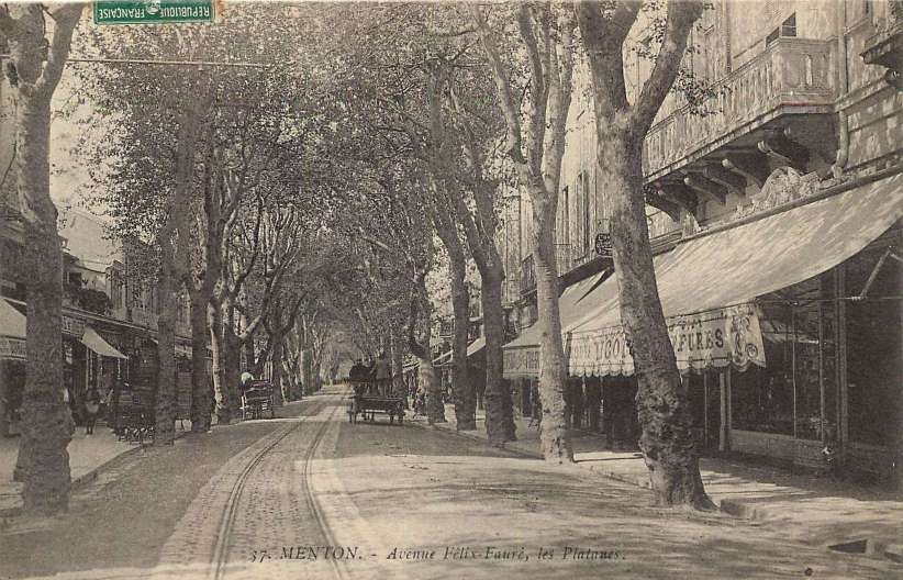
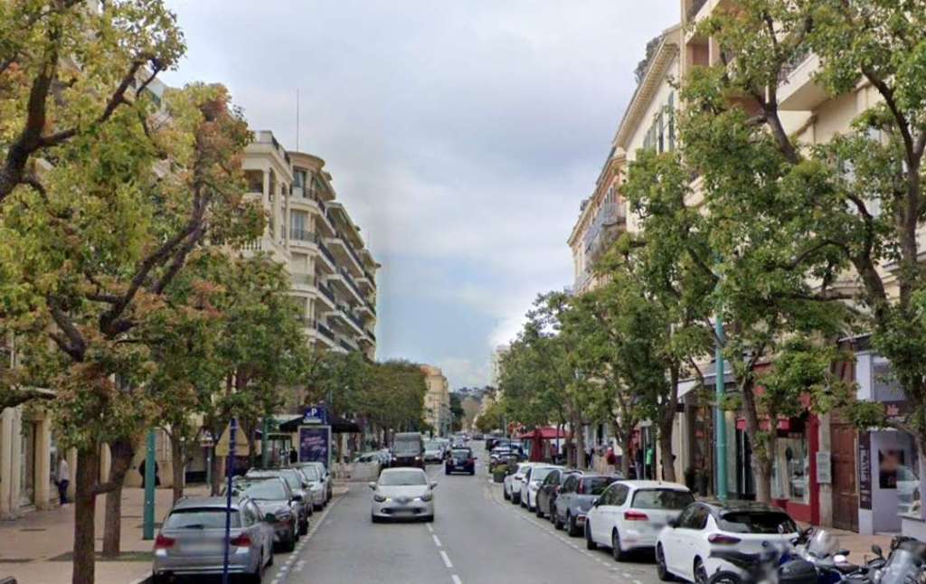
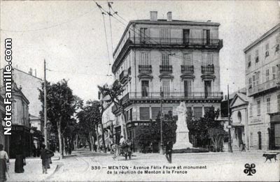
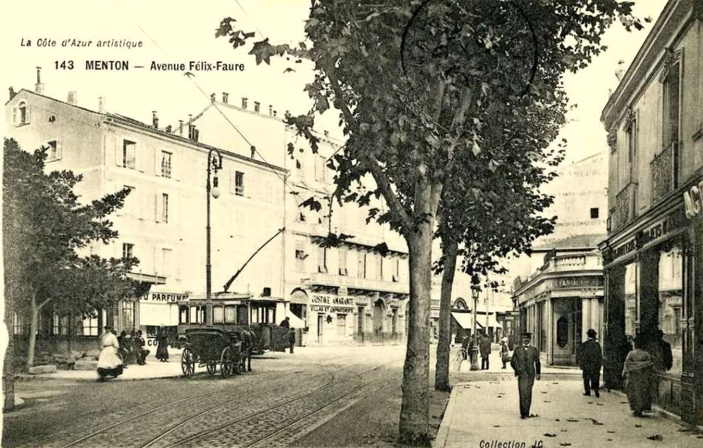
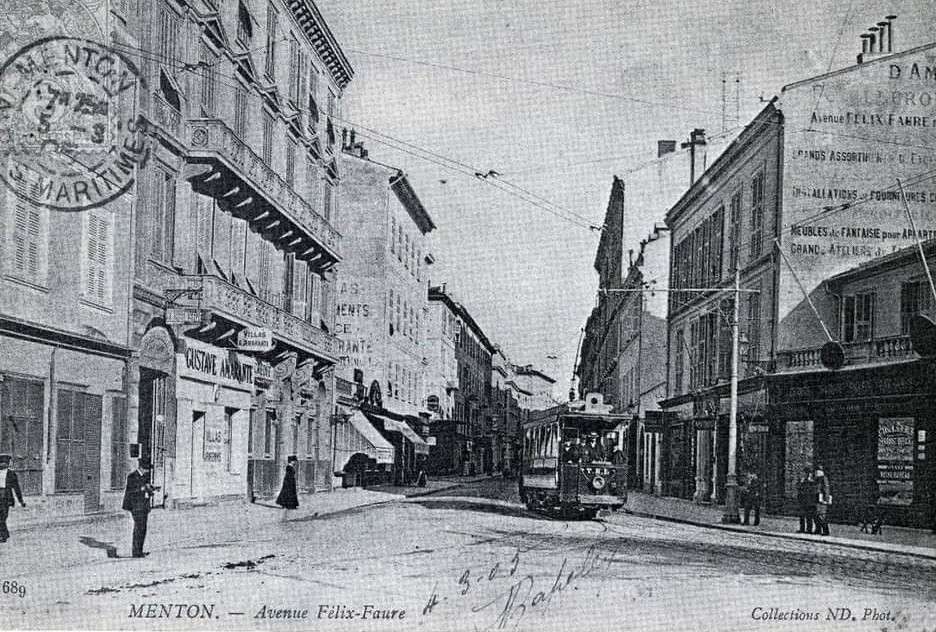
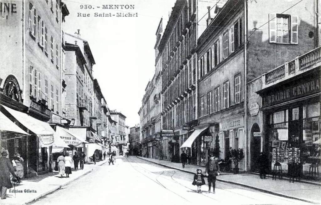
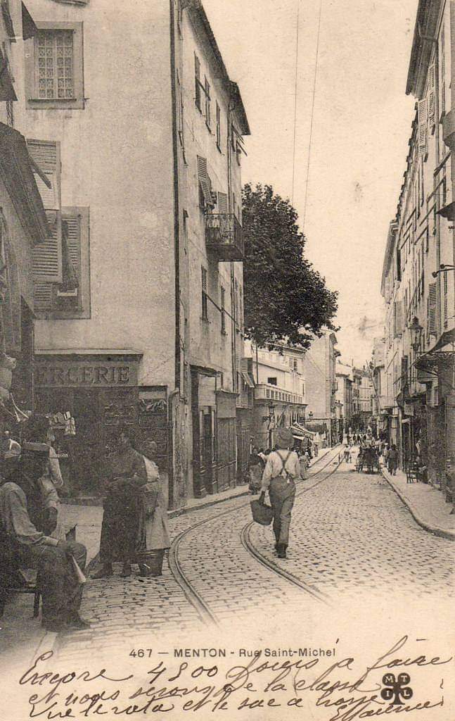
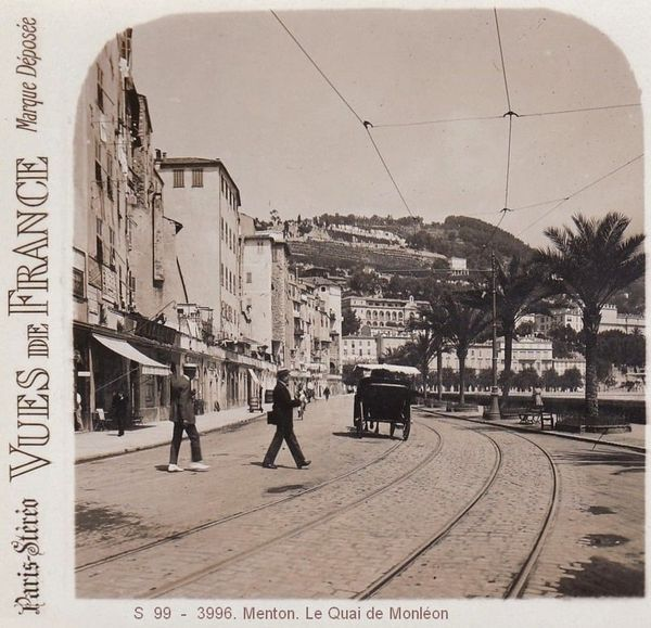
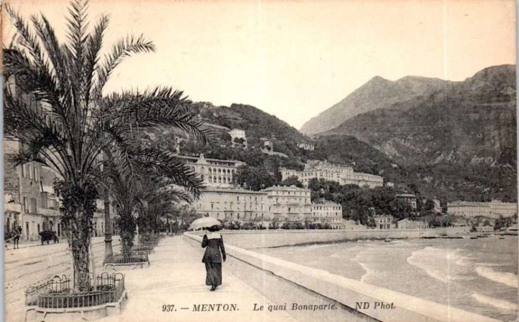
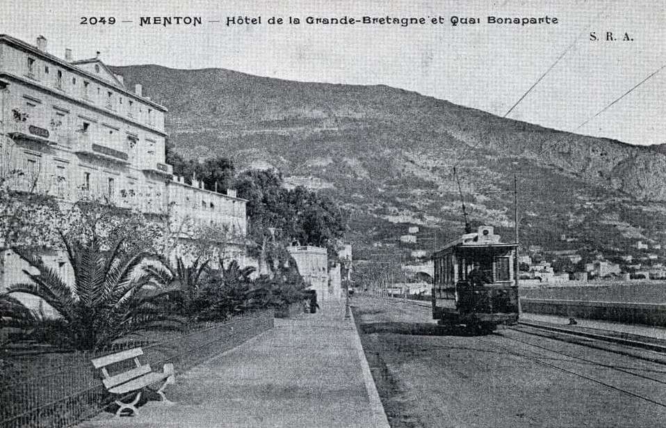
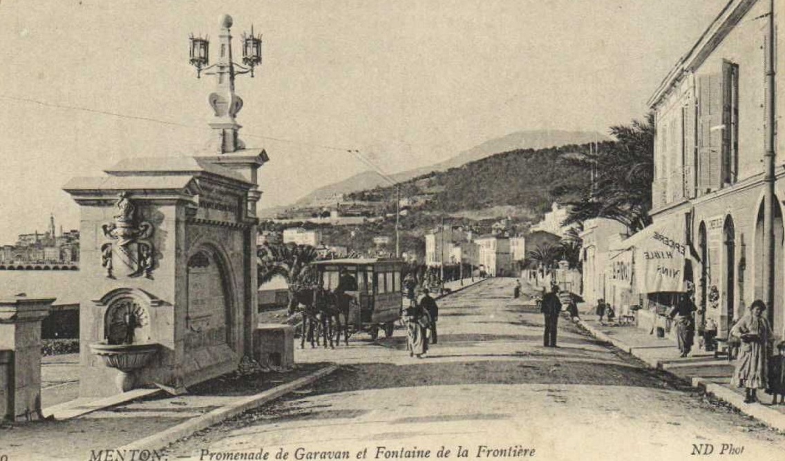
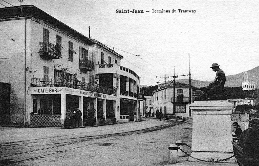
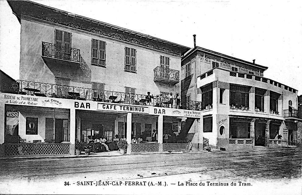
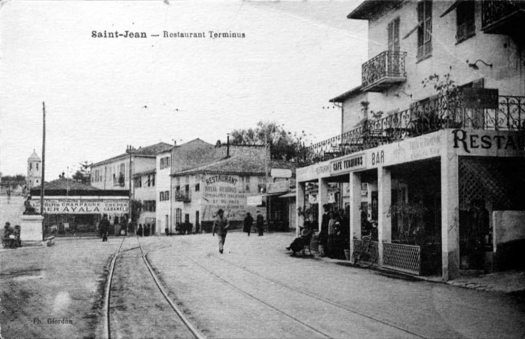
Banaudo keeps his comments on the remainder of the old tramway route succinct. On entering the commune if Menton, he says, “the tram followed the Avenue de la Madone (today Général De Gaulle), the Borrigo Bridge, the Avenue Carnot, the Biovès garden which covers the Careï torrent then the Avenue Felix Faure. Place St. Roch, where the Sospel line branched off, marked the entry into the old town of Menton. Here, the single track made its way through the very narrow Rue St. Michel then entered the port where it followed the Quai Bonaparte. The tramway entered Garavan beach then ended its course near the Hanbury fountain, a few hundred metres from the Italian border at that time.” [1: p57]
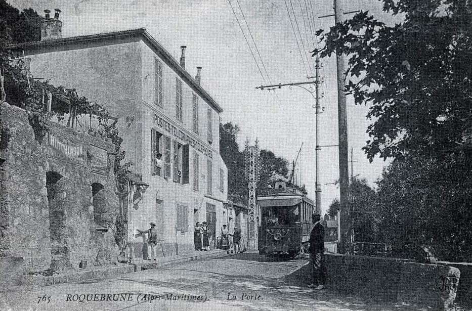
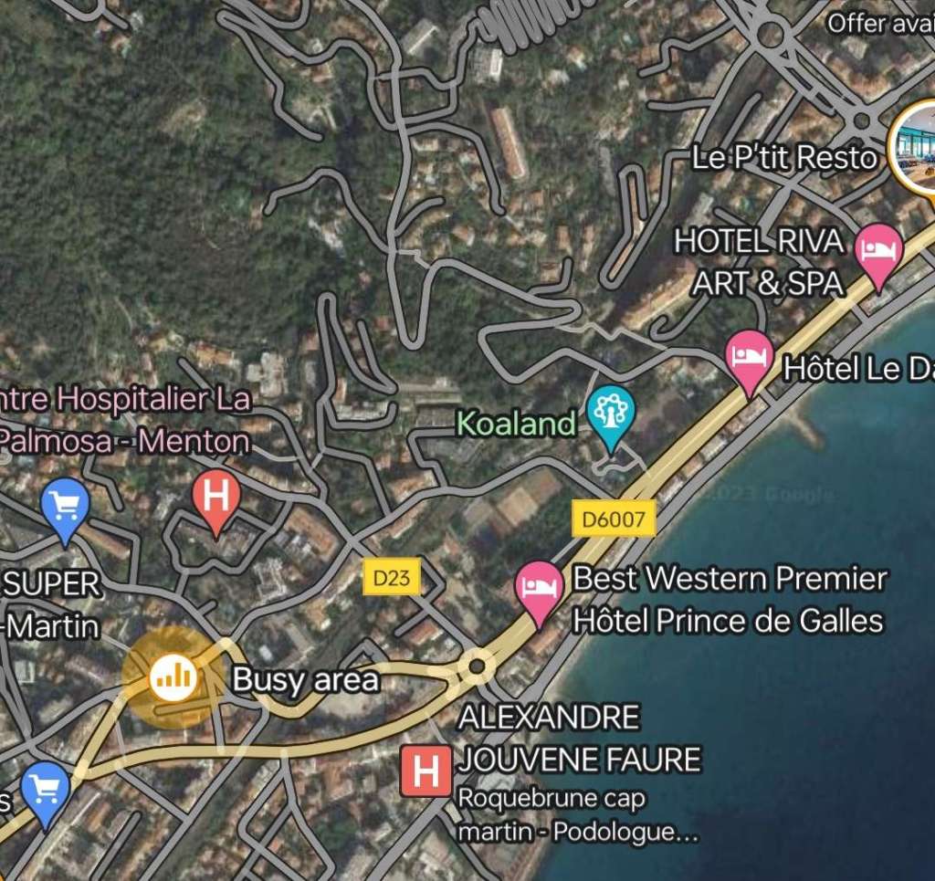
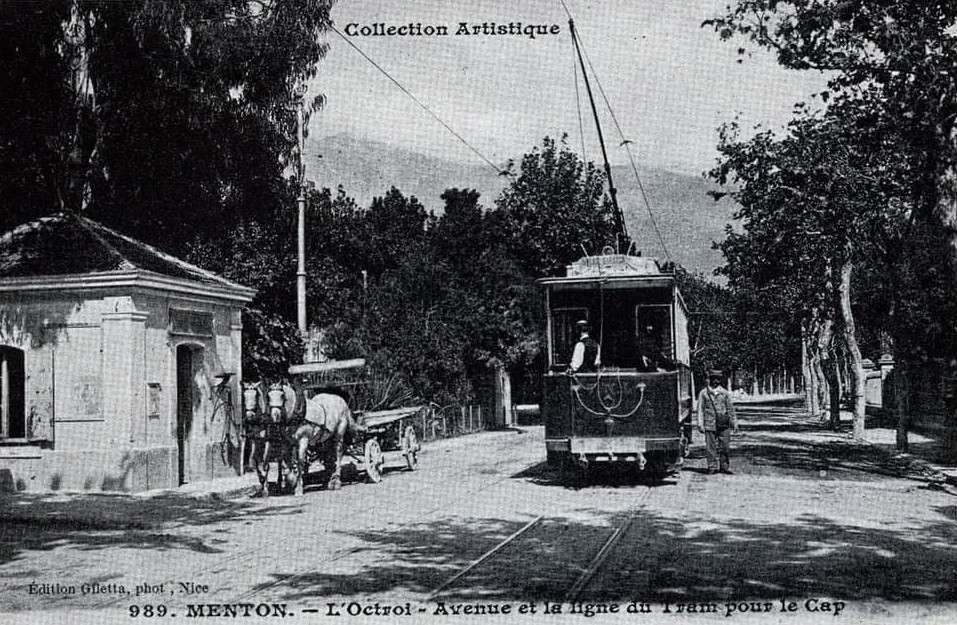
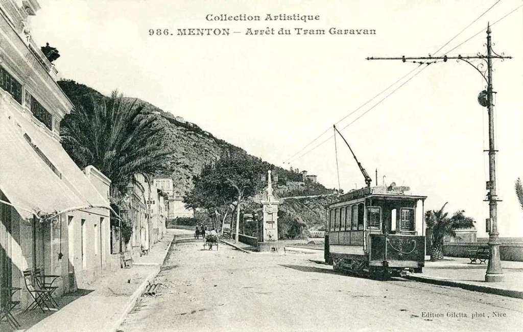
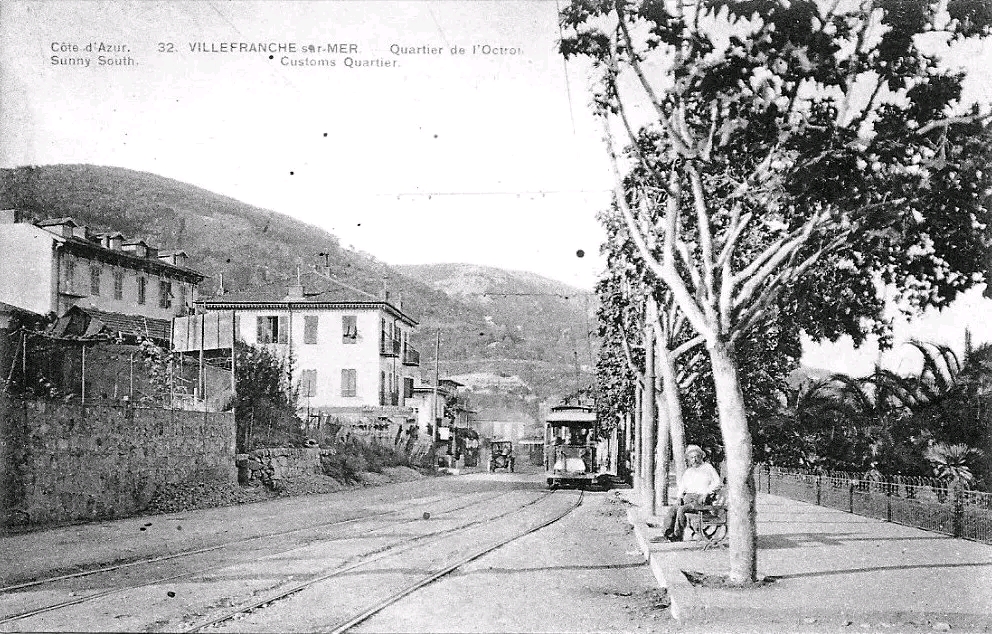
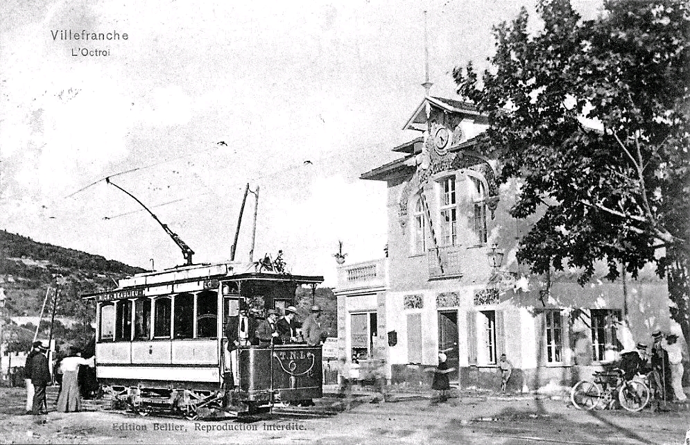
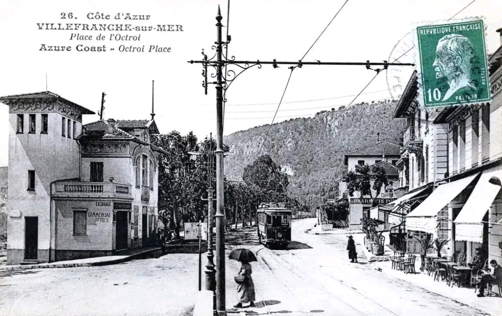
We will try to unpack Banaudo’s description with images that show the route through Menton. Trams entered Menton on the RN7 (now D6007). Until the mid-20th century people were expected to leave the tram at the boundary between Roquebrune Cap-Martin and Menton to declare the goods they were carrying. The Octroi, shown below, was the ‘custom point’.
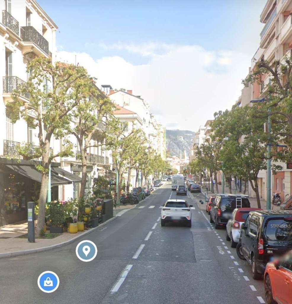
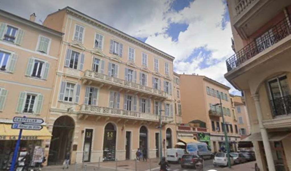
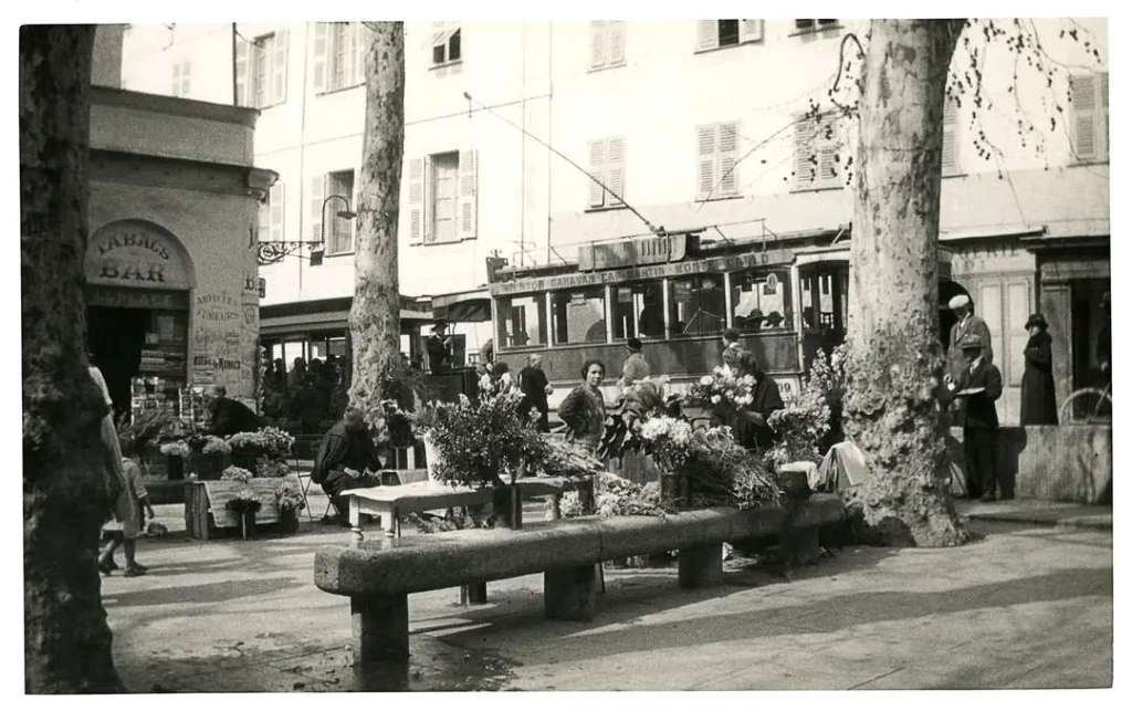
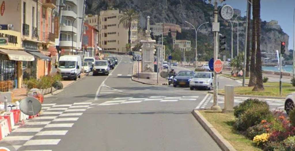
Trams continued along Avenue Carnot past l’Eglise Anglais and onto Avenue Felix Faure.
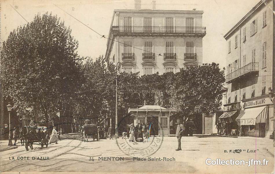
Rue Partouneaux on the North side of Place St. Roch was followed by trams for Sospel which set off from or terminated at the mouth of Rue St. Michel at Place St. Roch. This route is covered elsewhere in this series about trams in and around Nice:
Three articles written at different times, in chronological order are as below:
Sospel to Menton Tramway
The Sospel to Menton Tramway Revisited (Chemins de Fer de Provence 51)
The Menton to Sospel Tramway Revisited Again! (Chemins de Fer de Provence 61)
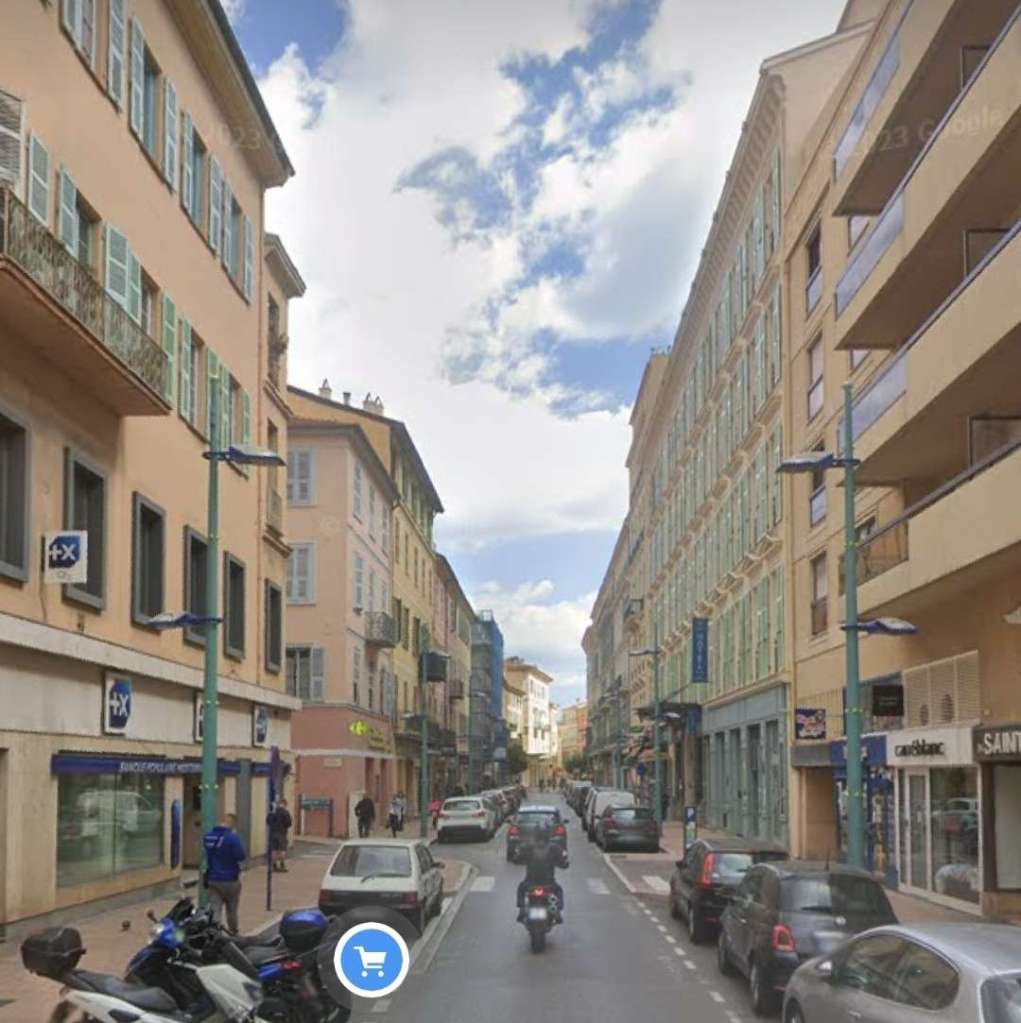
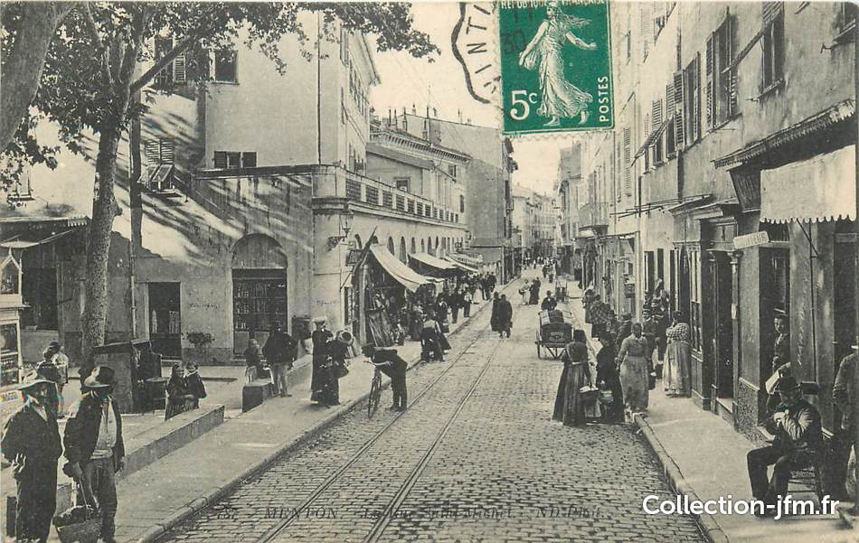
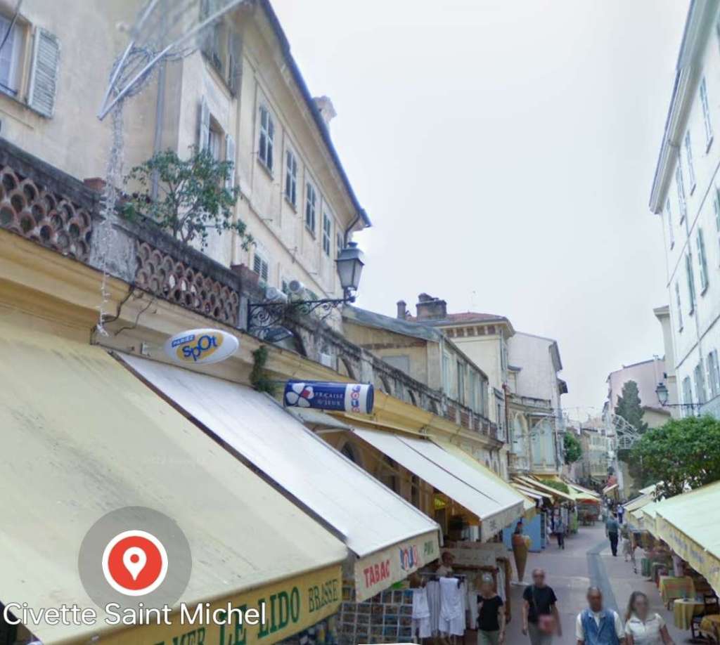
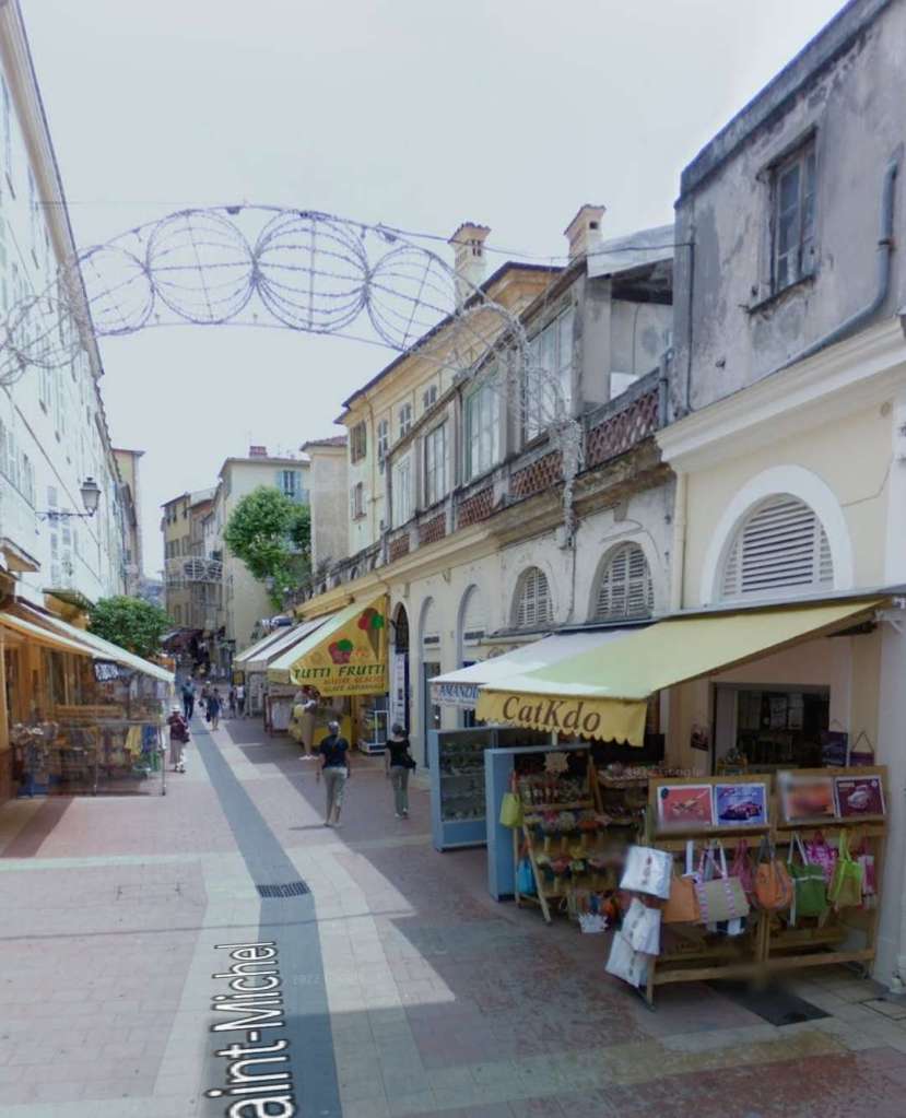
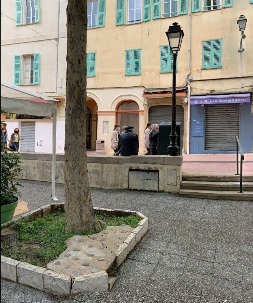
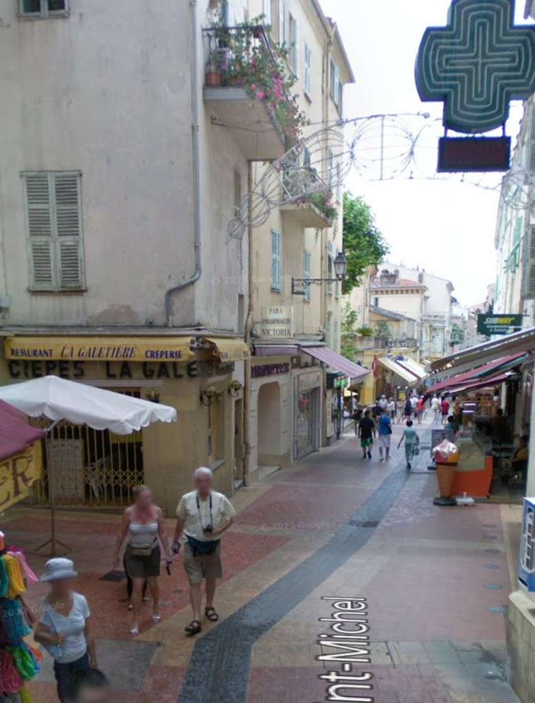
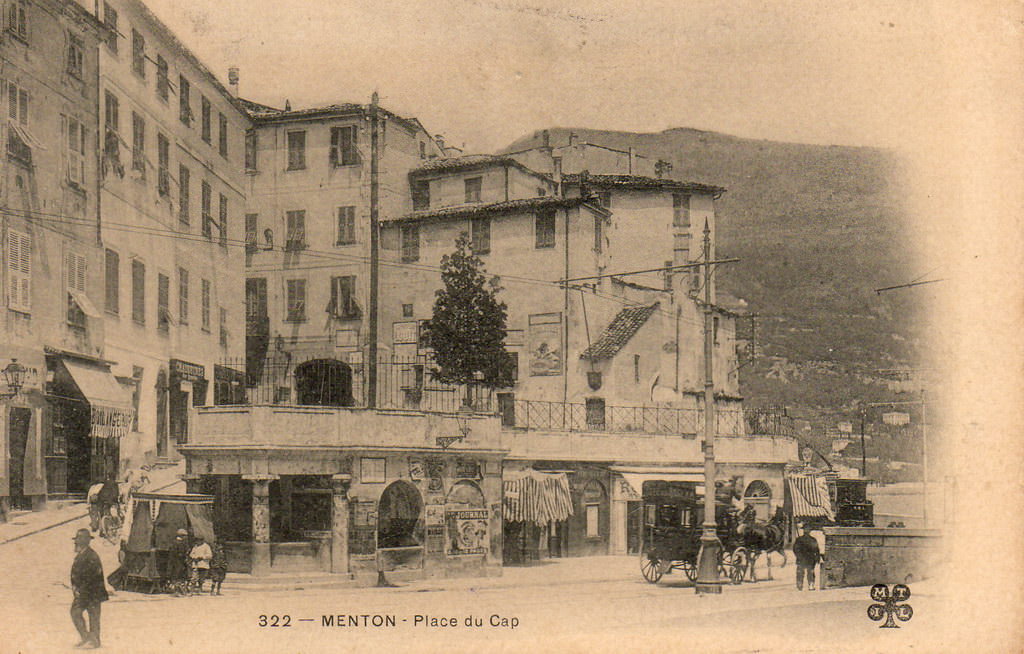
Trams left the East end of Rue St. Michel and crossed Place du Cap before running out onto Quai Bonaparte.
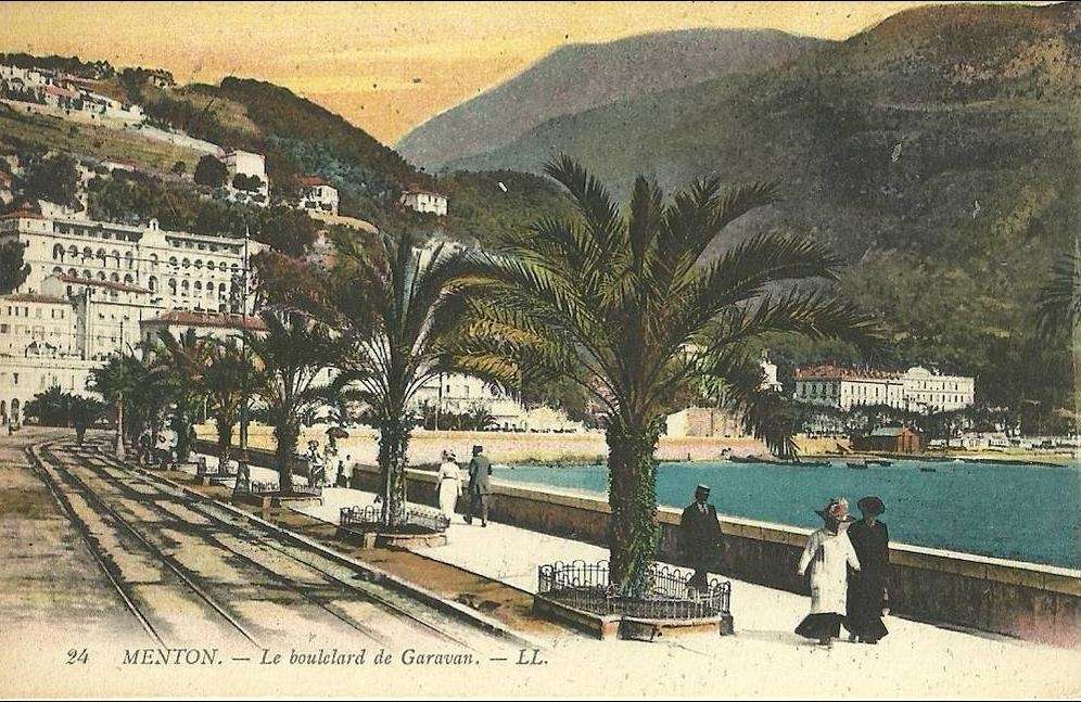

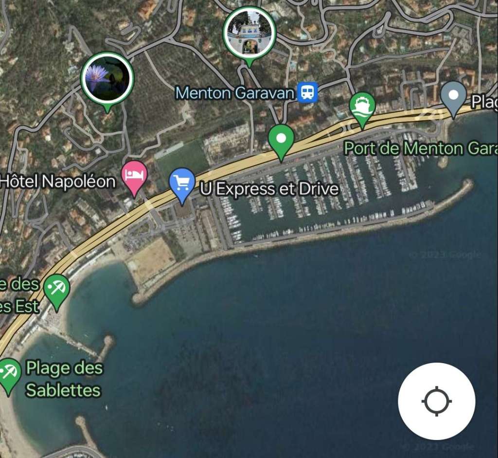
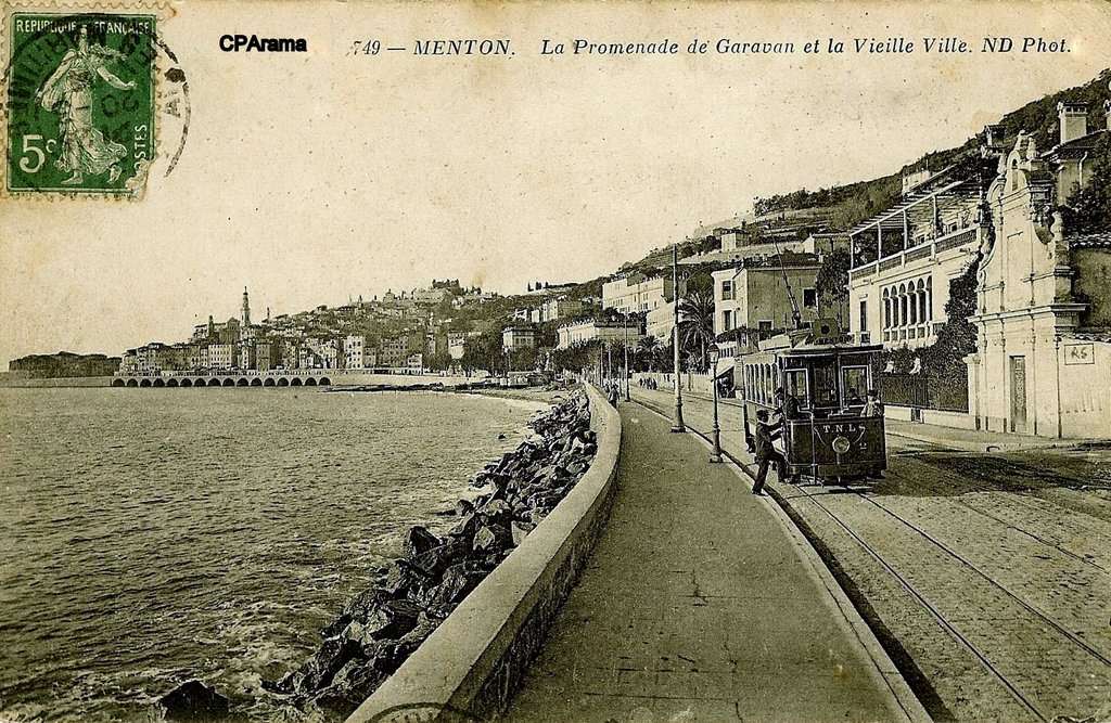
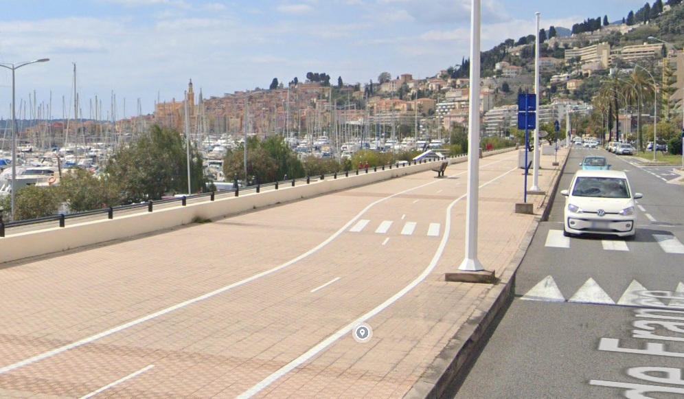
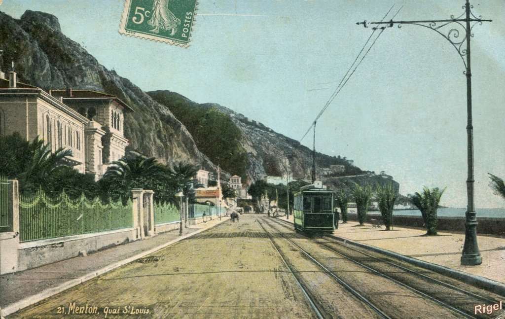
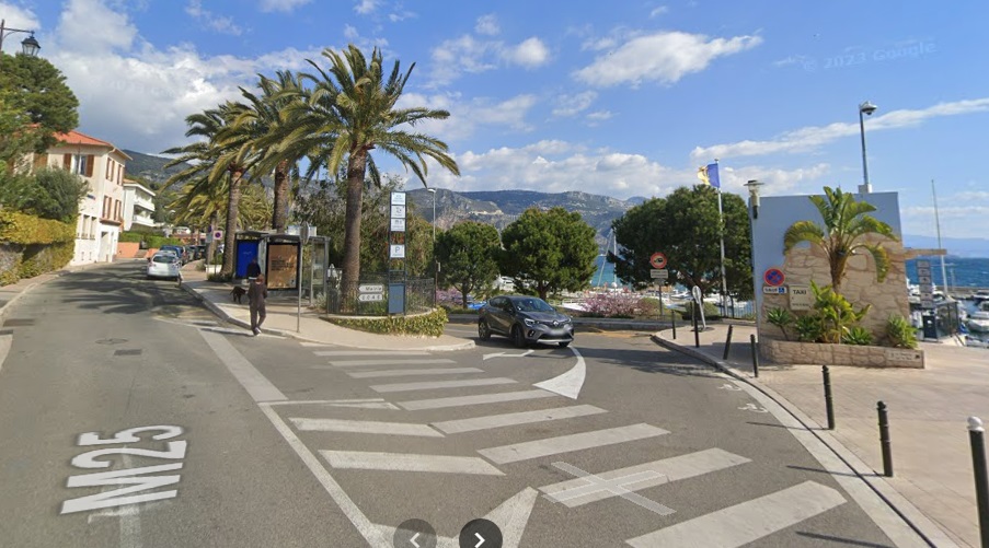
The terminus of the TNL network was on La Promenade de Garavan, immediately West of the Fontaine de la Frontiere which itself was very close to the then Italian border.
Images in this article credited to Jean-Paul Bascoul can be found on his blog: Monaco 4Ever.blogspot.com.
References
- José Banaudo; Nice au fil du Tram, Volume 2: Les Hommes, Les Techniques; Les Editions de Cabri, Breil-sur-Roya, France, 2005.
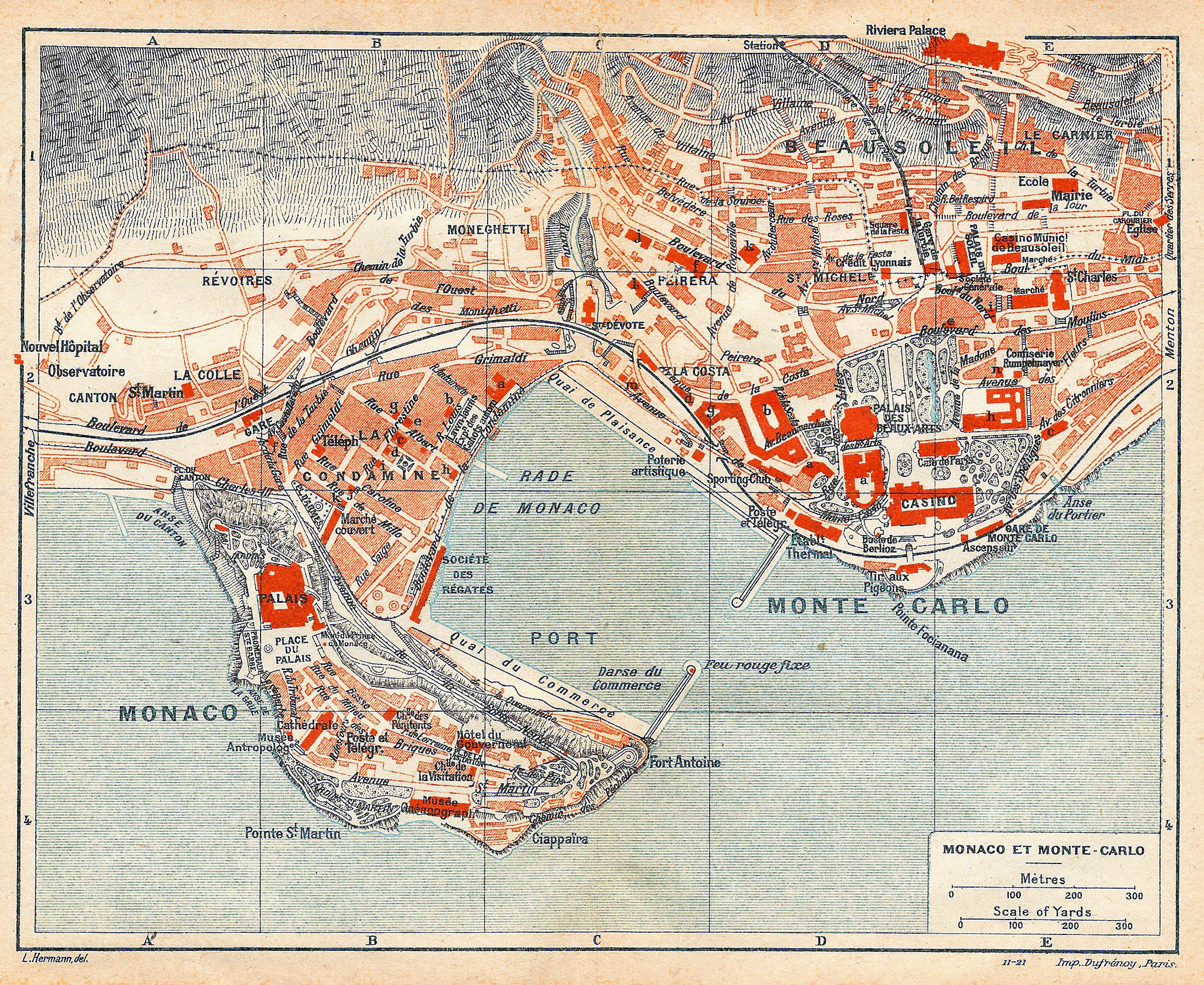
- http://www.vidiani.com/maps/maps_of_europe/maps_of_monaco/large_detailed_old_map_of_Monaco_Monte_Carlo_1921.jpg, accessed on 13th November 2023.
- https://www.facebook.com/groups/1389253567814679/permalink/6968696949870285/?app=fbl, accessegraphs wered on 14th November 2023.
- https://www.facebook.com/groups/1389253567814679/permalink/7097087640364548/?mibextid=rS40aB7S9Ucbxw6v, accessed on 14th November 2023.
- https://www.facebook.com/groups/1389253567814679/permalink/9979281115478505/?mibextid=rS40aB7S9Ucbxw6v, accessed on 14th March 2023.
- https://www.monaco-tribune.com/2023/03/lancien-tramway-de-monaco, accessed on 14th November 2023.
- https://www.facebook.com/groups/1389253567814679/permalink/9166984710041487/?mibextid=rS40aB7S9Ucbxw6v, accessed on 14th November 2023.
- https://en.m.wikipedia.org/wiki/Trams_in_Monaco, accessed on 15th November 2023.
- https://collection-jfm.fr/p/cpa-monaco-monte-carlo-international-sporting-club-tramway-52606, accessed on 15th November 2023.
- https://www.ansichtskartenversand.com/ak/90-carte-postale-ancienne/34051-Monaco/11423949-CPA-Monte-Carlo-Le-Restaurant-de-Paris-tramway, accessed on 15th November 2023.
- https://fotonail.com/europa/monaco/monte-carlo/monte-carlo-avenue-tramway-horse-cart.html, accessed on 15th November 2023.
- https://m.facebook.com/groups/1389253567814679/permalink/9547920741947880, accessed on 15th November 2023.
- https://www.delcampe.net/fr/collections/cartes-postales/france/roquebrune-cap-martin/cpa-roquebrune-cap-martin-le-tram-de-menton-a-monte-carlo-transport-chemins-de-fer-tramway-giletta-946-461482676.html, accessed on 17th November 2023.
- http://transporturbain.canalblog.com/pages/les-tramways-de-nice—de-l-apogee-au-declin/31975780.html, accessed on 17th November 2023.
- https://www.ebay.co.uk/itm/253323731414?mkcid=16&mkevt=1&mkrid=711-127632-2357-0&ssspo=7-GeZfqtTnS&sssrc=4429486&ssuid=afQhrar7TGK&var=&widget_ver=artemis&media=MORE, accessed on 17th November 2023.
- http://www.en-noir-et-blanc.com/roquebrune-cap-martin-p1-813.html, accessed on 17th November 2023.
- https://www.antiquemapsandprints.com/categories/maps-by-cartographer/guides-bleus-hachette/product/roquebrune-cap-martin-vintage-town-ville-city-plan-alpes-maritimes-1930-map/P-6-070870~P-6-070870, accessed on 17th November 2023.
- https://m.facebook.com/story.php?story_fbid=pfbid02cEoY2Gk9V3e73notFARJaZR99QMhQmUgrKjiH1Uyd1yDhxgCAJnqMwcCKaWKFcKDl&id=635920043254797, accessed on 17th November 2023.
- https://www.ebay.co.uk/itm/204509560244?mkcid=16&mkevt=1&mkrid=711-127632-2357-0&ssspo=cTk_hvhSRfe&sssrc=4429486&ssuid=afQhrar7TGK&var=&widget_ver=artemis&media=COPY, accessed on 30th November 2023.
- https://m.facebook.com/groups/rcmentraide/permalink/1282944575478897, accessed on 17th November 2023.
- https://www.facebook.com/groups/1389253567814679/permalink/9478220598917895/?app=fbl, accessed on 17th November 2023.
- https://collection-jfm.fr/p/cpa-france-06-menton-saint-jean-vielle-chapelle-au-cap-martin-92913, accessed on 2nd December 2023.
- https://www.akpool.fr/cartes-postales/26659024-carte-postale-monte-carlo-monaco-tram-route-de-menton-monte-carlo-strassenbahn-panorama-vom-ort, accessed on 17th November 2023.
- https://www.facebook.com/groups/1389253567814679/permalink/9166981643375127/?app=fbl, accessed on 13th November 2023.
- https://images.app.goo.gl/PViRS5rGcYE3NVLg6, accessed on 18th November 2023.
- https://www.cparama.com/forum/viewtopic.php?p=52777, accessed on 19th November 2023.
- https://www.communes.com/cartes-postales-anciennes-roquebrune-cap-martin, accessed on 19th November 2023.
- https://m.facebook.com/story.php?story_fbid=pfbid028EjRwQCxRmB89rEsCt2h8YR32nMKhMhypGPSzF3CAAQc8H4wjmHSq3QRjiTzMGhHl&id=100064481811741, accessed on 19th November 2023.
- https://m.facebook.com/groups/1389253567814679/permalink/3565973976809283, accessed on 3rd December 2023.
- https://www.geneanet.org/cartes-postales/view/5938184#0, accessed on 3rd December 2023.
- https://www.ebay.co.uk/itm/196013394405?mkcid=16&mkevt=1&mkrid=711-127632-2357-0&ssspo=W9cRBoodQSO&sssrc=4429486&ssuid=afQhrar7TGK&var=&widget_ver=artemis&media=COPY, accessed on 3rd December 2023.
- https://www.cparama.com/forum/menton-t979.html, accessed on 3rd December 2023.
- Not used.
- http://www.en-noir-et-blanc.com/le-cap-martin-p1-2800.html, accessed on 2nd December 2023.
- https://m.facebook.com/story.php?story_fbid=pfbid028tjj9vrXVrhWDqtANF258PK7v3kCQKj5ePhuGN1QcsPL1qESvtW6c5BTopfn3LaWl&id=635920043254797, accessed on 20th November 2023.
- https://www.facebook.com/635920043254797/posts/pfbid0c9zVgpCcdqRCBhGj8tXT6kiiCNsmFDTTo7ASaxgFv5TFhaXcN845gT98PtXwof3yl/?app=fbl, accessed on 20th November 2023.
- https://m.facebook.com/groups/ciccoli/permalink/2071367206442471, accessed on 2nd December 2023.
- https://www.ebay.co.uk/itm/314237843895?mkcid=16&mkevt=1&mkrid=711-127632-2357-0&ssspo=nU4A5jgeRzm&sssrc=4429486&ssuid=afQhrar7TGK&var=&widget_ver=artemis&media=COPY, accessed on 2nd December 2023.
- https://collection-jfm.fr/p/cpa-france-06-menton-la-rue-saint-michel-223828, accessed on 3rd December 2023.
- https://www.ebay.co.uk/itm/186145306141?mkcid=16&mkevt=1&mkrid=711-127632-2357-0&ssspo=iaKZOZUrQmi&sssrc=4429486&ssuid=afQhrar7TGK&var=&widget_ver=artemis&media=COPY, accessed on 2nd December 2023.
- https://m.facebook.com/story.php?story_fbid=pfbid0UYtiYEptwyNi1Jw3dZWz9ZABkcPs8JRS6CATMHY1XYRyiM753KXLPM9CfsZ7AiKbl&id=635920043254797, accessed on 20th November 2023.
- Not used.
- Not used.
- Not used.
- https://www.geneanet.org/cartes-postales/view/186292#0, 23rd November 2023.
- https://m.facebook.com/story.php?story_fbid=275995965894297&substory_index=2275002982660242&id=274116476082246, 23rd November 2023.
- https://www.delcampe.net/en_US/collectibles/postcards/france/menton/menton-promenade-de-garavan-et-fontaine-de-la-frontiere-tram-a-chevaux-1911374856.html, accessed on 4th December 2023.
- https://m.facebook.com/groups/172267109778338/permalink/1524067927931576/, accessed on 30th November 2023.
- https://www.cparama.com/forum/viewtopic.php?p=2581, accessed on 2nd December 2023.
- https://www.fortunapost.com/menton/63773-06-menton-les-platanes-avenue-felix-faure-1914.html, accessed on 2nd December 2023.
- https://www.ebay.co.uk/itm/134689074112?mkcid=16&mkevt=1&mkrid=711-127632-2357-0&ssspo=_o2CiTs1S5m&sssrc=4429486&ssuid=afQhrar7TGK&var=&widget_ver=artemis&media=COPY, accessed on 2nd December 2023.
- https://www.communes.com/cartes-postales-anciennes-menton, accessed on 2nd December 2023.
- https://collection-jfm.fr/p/cpa-france-06-menton-la-place-saint-roch-102274, accessed on 3rd December 2023.


