Tag Archives: metre-gauge

Nice to Monte-Carlo Branch Lines – La Ligne du Littoral et ses Antennes, First Generation Electric Tramways – (Chemins de Fer de Provence/Alpes-Maritimes No. 92) …

There were two branch lines worth noting between Nice and Monte Carlo: one from Pont-St. Jean to St. Jean-Cap Ferrat; one from Monaco-Gare to Monaco-Ville.

The tram route from Nice to Monte-Carlo is covered in an article which can be found by following this link:

La Ligne du Littoral et ses Antennes, First Generation Electric Tramways – Nice-Monte Carlo (Chemins de Fer de Provence/Alpes-Maritimes No. 91) …

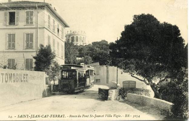
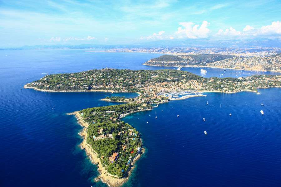
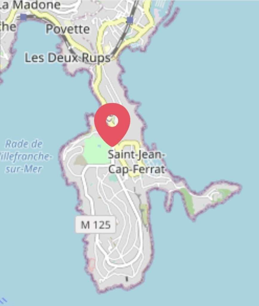
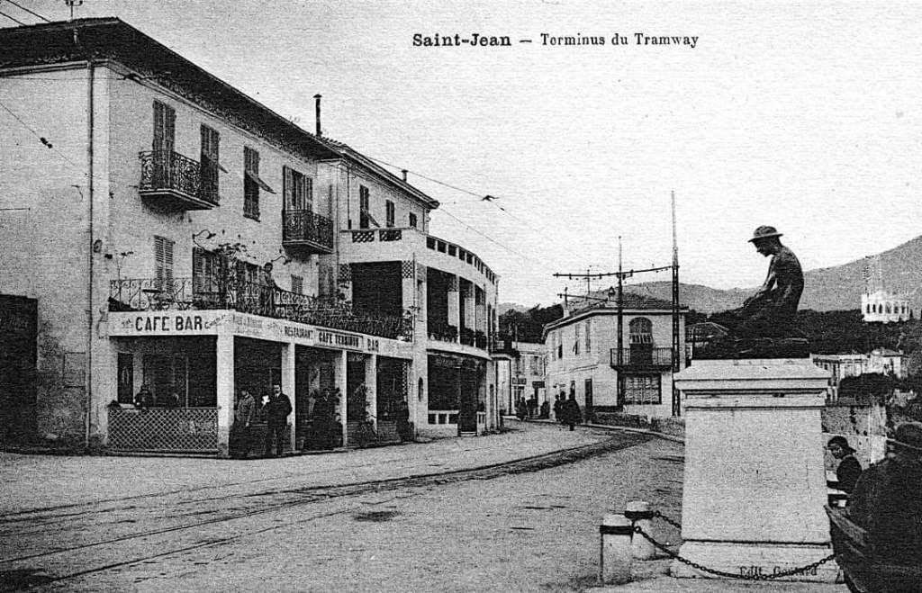
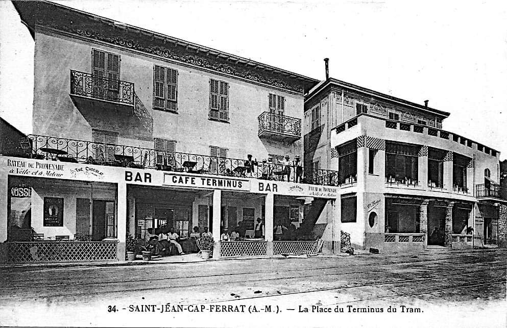
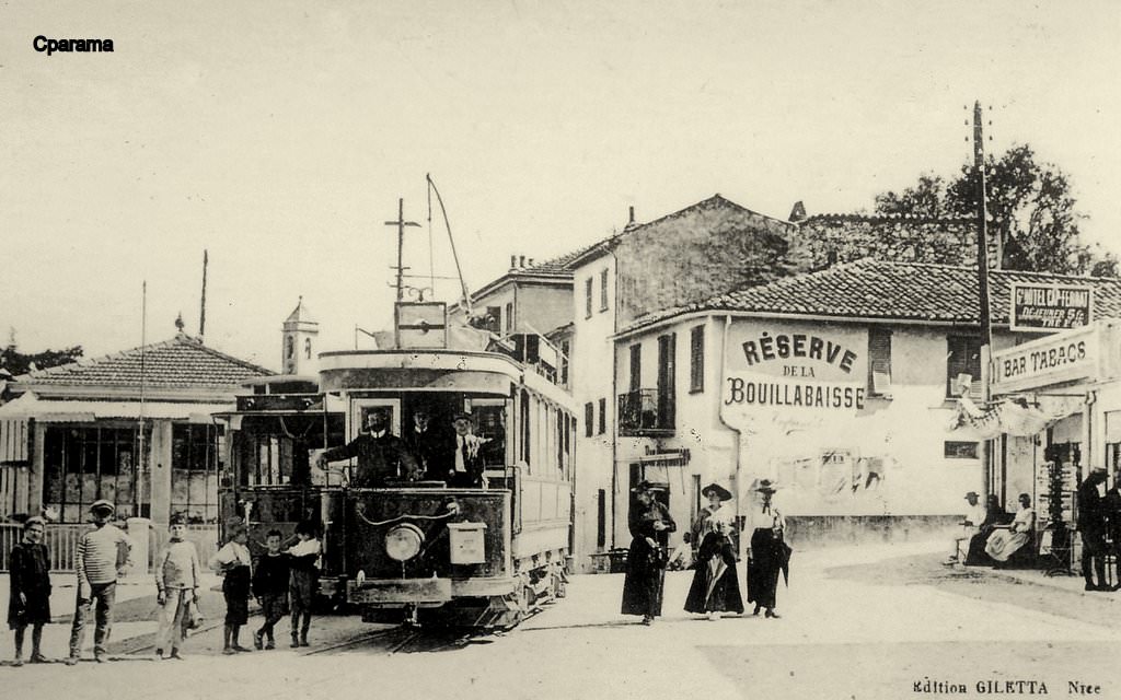
Pont-St. Jean – St. Jean-Cap Ferrat

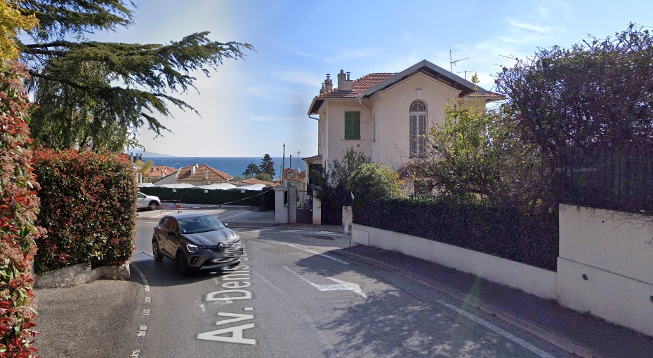
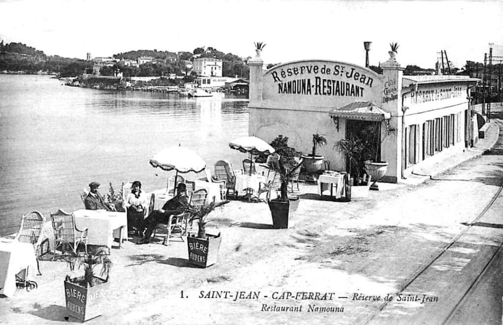
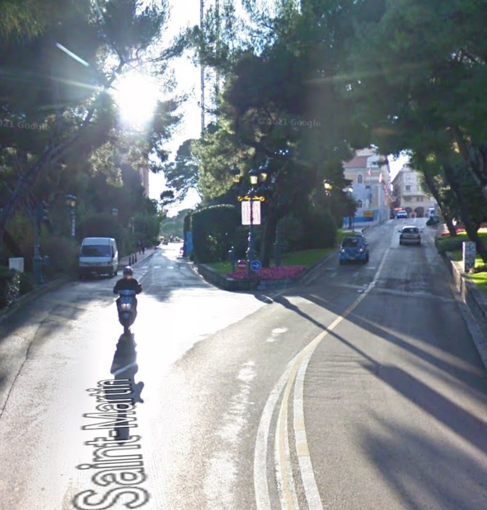
This branch line was just under 2 km in length and ran between Pont-St. Jean at 27 m above sea-level to a terminus in St. Jean-Cap Ferrat at 3 m above sea-level.

Construction of the line started in June 1906 and it was open to traffic by 7th December 1907.

Along with the rest of the network it received a line number on 1st January 1923 – No. 22. It remained in service as a tramway until 9th March 1931, when it was replaced by a bus service. Rails were lifted by 20th June 1933.

A postcard photograph of Pont St. Jean with a tram approaching from the terminus on St. Jean Cap Ferrat, the photograph was shared on the Comte de Nice et son Histoire Facebook Group by Laurent Mannu on 20th April 2022. Travelling the opposite direction a tram would almost immediately stop at l’Octroi. [6]
A very similar view in 2023. [Google Streetview, March 2023]

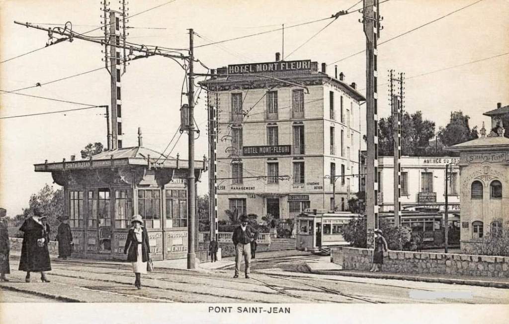
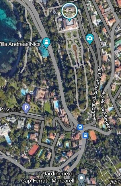
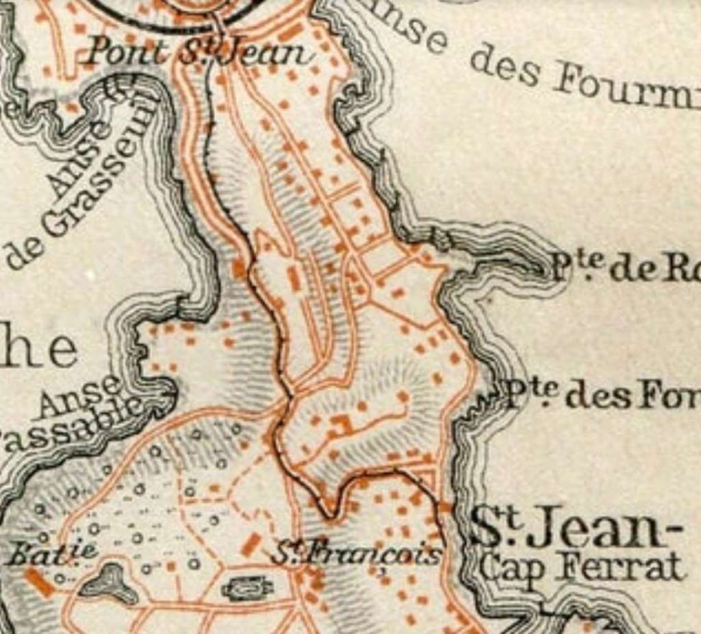
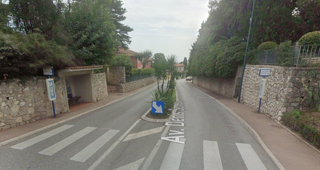
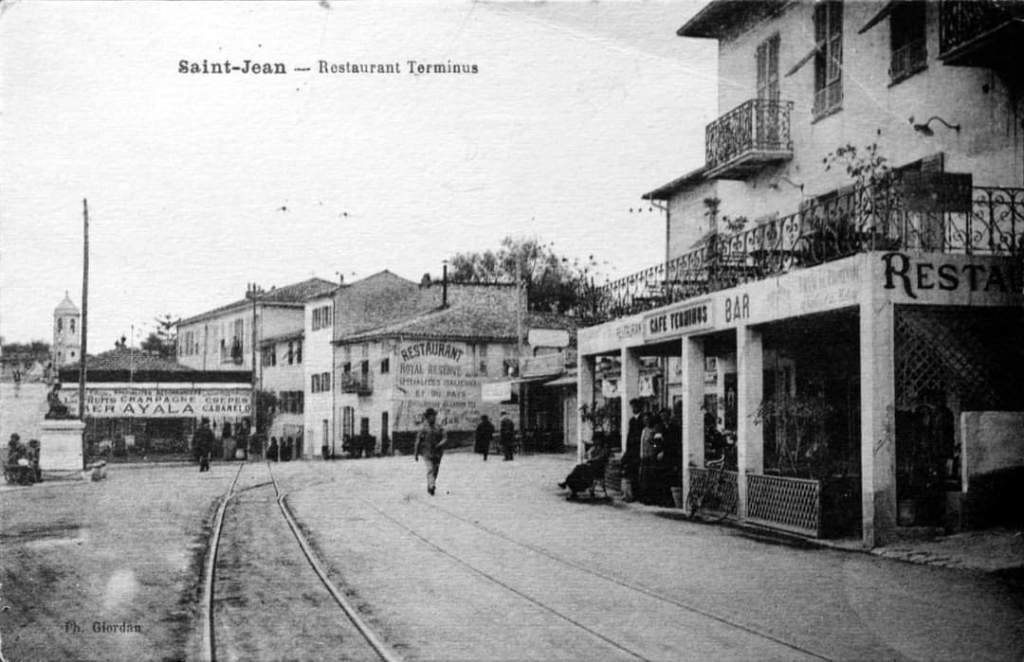
The line was single-track throughout with two intermediate passing places.  It left the mainline between Nice and Monte-Carlo at Pont-St. Jean which sat at the point where the communes of Villefranche and Beaulieu shared a common border and at the point where the PLM line between Nice and Ventimille was bridged to provide access to the coastline. This was also close to the Octroi de St. Jean which, as we have noted elsewhere, was a building which housed  municipal tax collectors and allowed them to control and tax goods transported by travellers.

After crossing the railway line trams headed down Avenue Denis Semaria (M25) out onto the peninsula. The ‘new’ road, M125, can be seen heading West alongside the railway line. [Google Maps, November 2023]

The peninsula was an attractive area to build a home and the Tramway found its way through villas and gardens set among pine trees.

St. Jean Cap Ferrat – a beautiful place! [2]
St. Jean Cap Ferrat, the primrose yellow road out onto the peninsula is route M25. The loop of road to the South is the M125, © OpenStreetMap made available under a Creative Commons Attribution-ShareAlike 2.0 license (CC BY-SA 2.0). [3]
The tramway ran along Avenue Denis Semeria, curving round Villa La Ligne Droit. [Google Maps, November 2023]
The route of the old tramway, approaching Villa La Ligne Droit. [Google Streetview, April 2023]
Villa Ephrussi de Rothschild sat to the East of the tramroad and Villa Andreae Nice to the West. [Google Maps, November 2023]

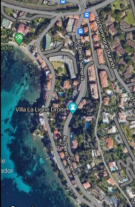
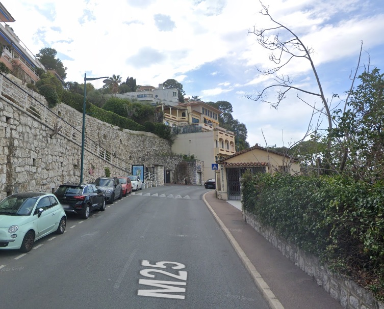
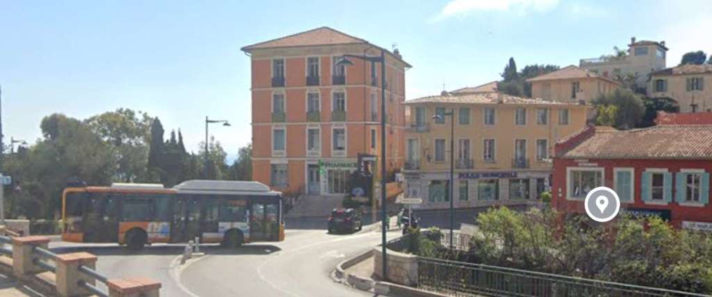
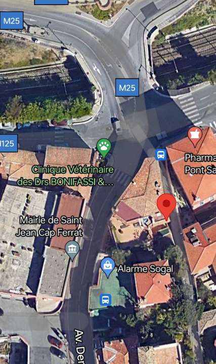
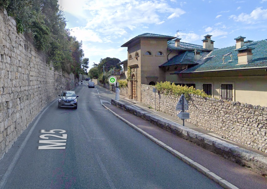
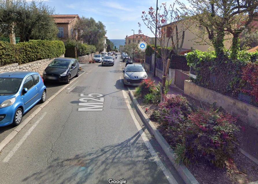
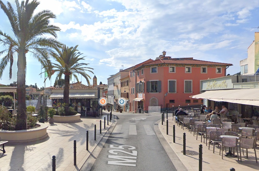
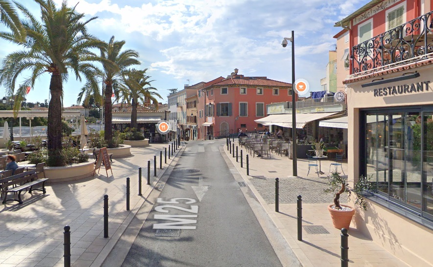
The M25 had to be rebuilt in to the West of and in parallel to its original route which was too narrow to accommodate both trams and other traffic. 

The Gardens of Ephrussi de Rothschild sat above the tramroad to the East and Villa Andreae Nice to the West was to the right. [Google Streetview, April 2023]

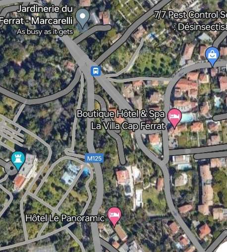
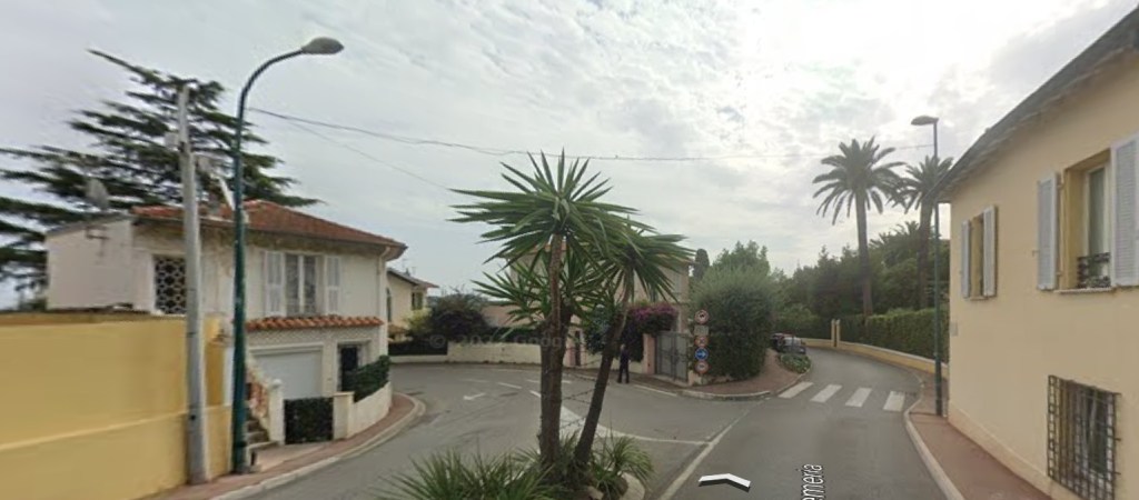
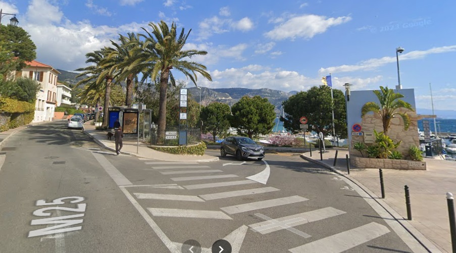
After a passing-loop close to the chapel of St. François in the middle of the peninsula, the line descended eastwards to reach its terminus located at the port of St. Jean-Cap-Ferrat. 

The tram route, as shown on a map of the area around Nice in 1914. [10]
The tramway continued along Avenue Denis Semaria close to Jardinerie du Cap-Ferrat Marcarelli. [Google Maps, November 2023]
The route continued to follow Avenue Denis Semaria and began to head down towards [Google Streetview, October 2022]
The tramway turned away from one arm of Avenue Denis Semaria to head down to the Port along another arm of the same named road and following the route number M25. [Google Streetview, October 2022]
The tramway continued round the curve on Avenue Denis Semaria. [Google Streetview, April 2023]

Avenue Denis Semaria runs first due East and then turns round to the South as it approaches the Port and the location of the tramway terminus. [Google Maps, November 2023]
Now heading due East on Avenue Denis Semaria (M25) and approaching the East coast of the peninsula. [Google Streetview, April 2023]
A tram en-route from Pont-St. Jean down to the Port curving down along Avenue Denis Semaria not far from the Port. This image was shared on the Monaco4Ever Facebook Group on 1st September 2014 by Jean-Paul Bascoul. (Collection privée J-Paul Bascoul). [11]
A very similar view in 2023. [Google Streetview, April 2023]
Turning through 180°, this is the view along Avenue Denis Semaria towards the Port. [Google Streetview, April 2023]
The bus terminus at Port-St. Jean. The tram terminus was a few hundred metres South , behind the camera. [Google Streetview, April 2023]
The tram terminus was established at the port of St. Jean-Cap-Ferrat, Place du Centenaire, near the statue of the Fisherman, the work of Claude Vignon-Rouvier, wife of the politician Maurice Rouvier. Around 1910. The tram in the picture is made up of a powered car and a trailer. [4]
A later view without a tram present. The buildings on the left have seen some significant work undertaken. The first is now a three-storey building and both that and the adjacent property have been extended towards the street. This image was shared on the Comte de Nice et son Histoire Facebook Group on 28th February 2022 by Alain Nissim. [5]
A similar view in 2023 looking through the location of the tramway terminus to the North. [Google Streetview, April 2023]
The cafe at the terminus of the tramway. The image was shared on the Comte de Nice et son Histoire Facebook Group by Alain Nissim on 18th February 2022. [9]
A postcard view of Saint-Jean-Cap-Ferrat – Place du Centenaire – Tram Stop – Publisher: Giletta N°830. The photograph was taken sometime around 1920 and shows a powered car running round its trailer ready for the journey back to Pont-St. Jean. [4]
A similar view in 2023 looking through the location of the tramway terminus to the South. [Google Streetview, April 2023]
The Namuoma Restaurant at St. Jean-Cap Ferrat, with the tramway tracks visible to the bottom right of the photograph. This image was shared on the Comte de Nice et son Histoire Facebook Group by Alain Nissim on 16th August 2023. [7]
Another view of the terminus. This image was shared on the Comte de Nice et son Histoire Facebook Group by Alain Nissim on 5th July 2021. [8]
A similar view in 2023 looking through the location of the tramway terminus to the South. [Google Streetview, April 2023]

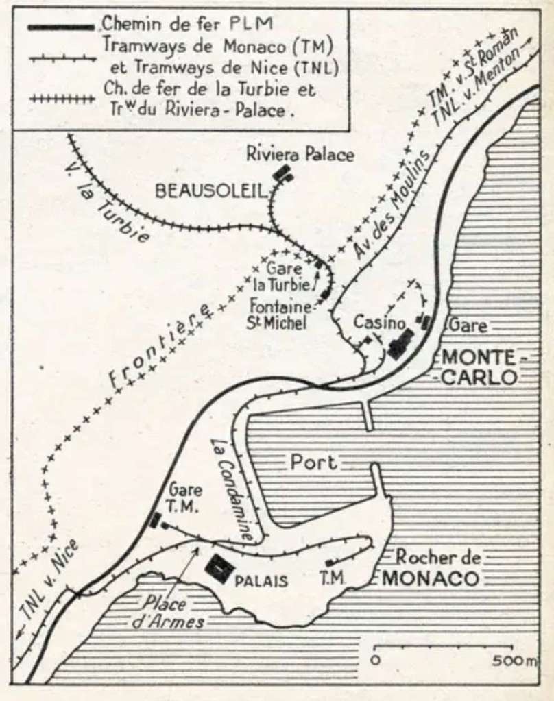
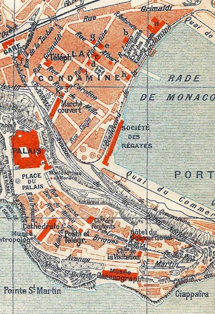
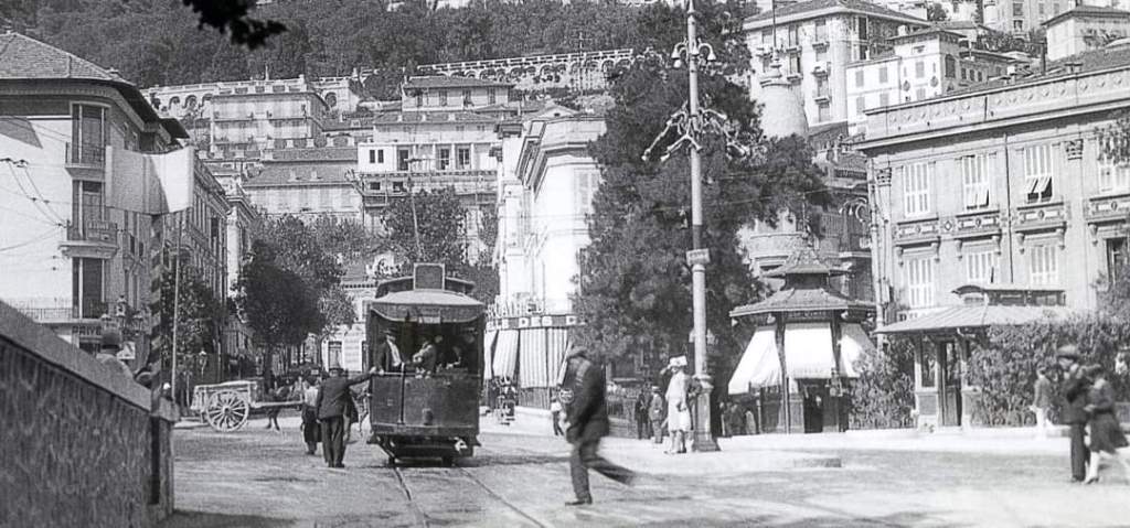
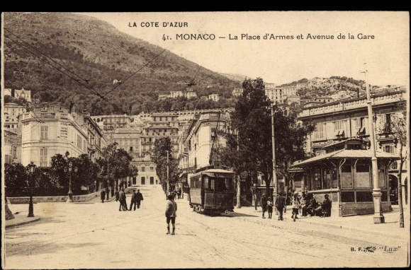
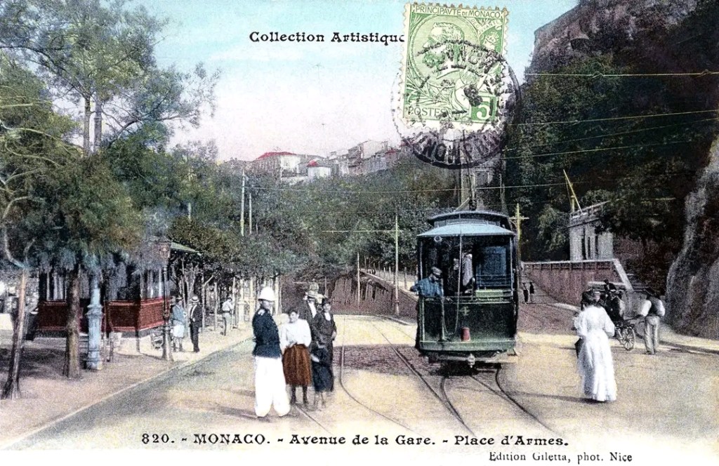
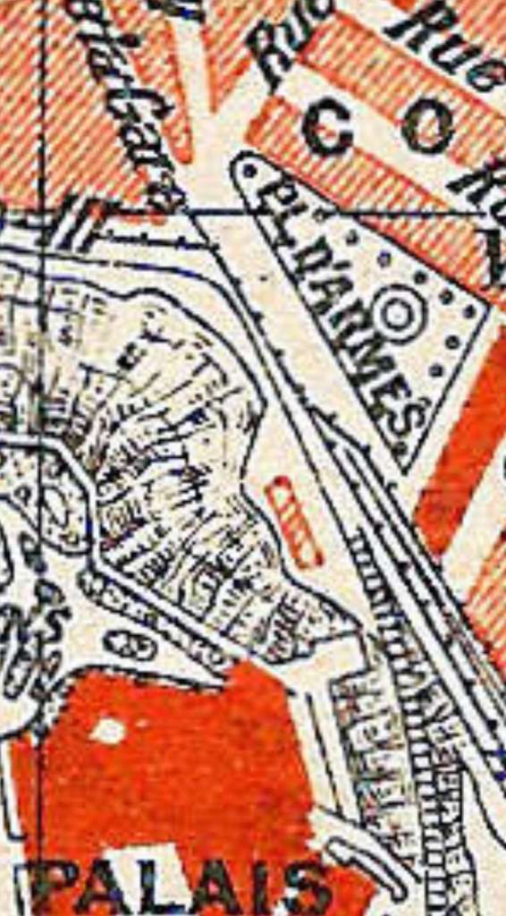
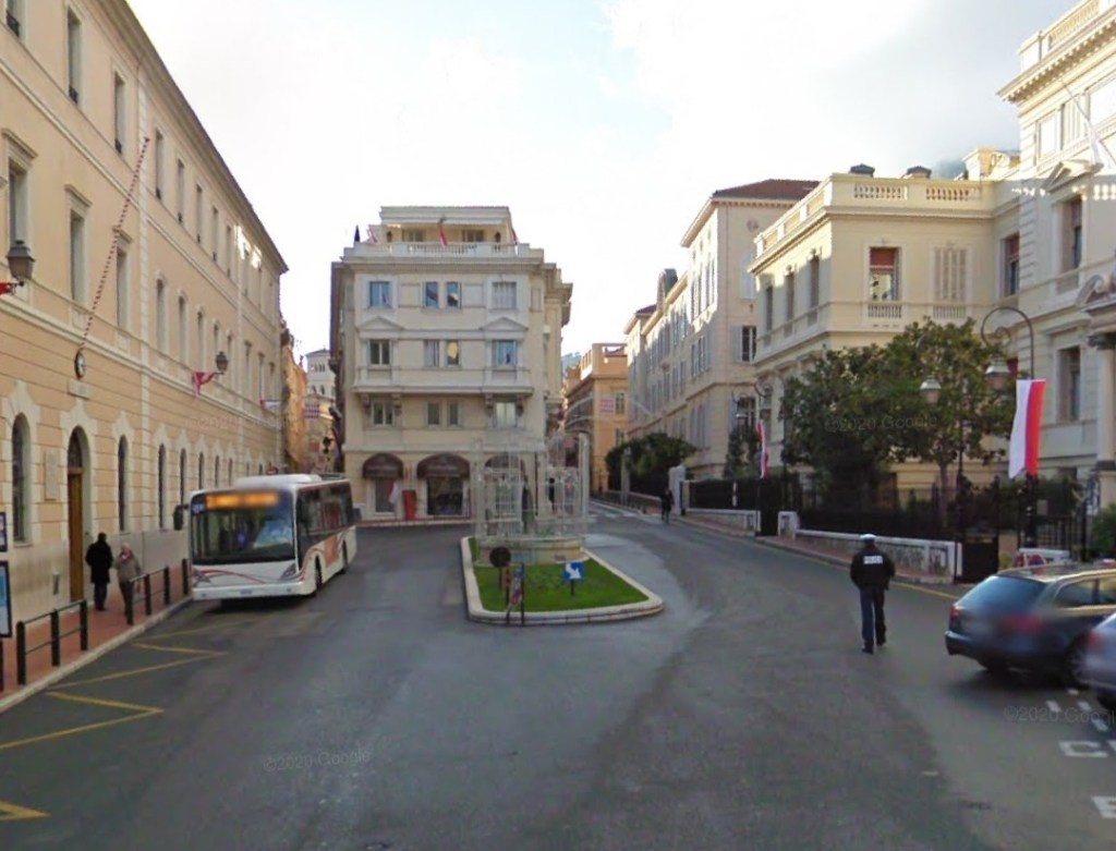
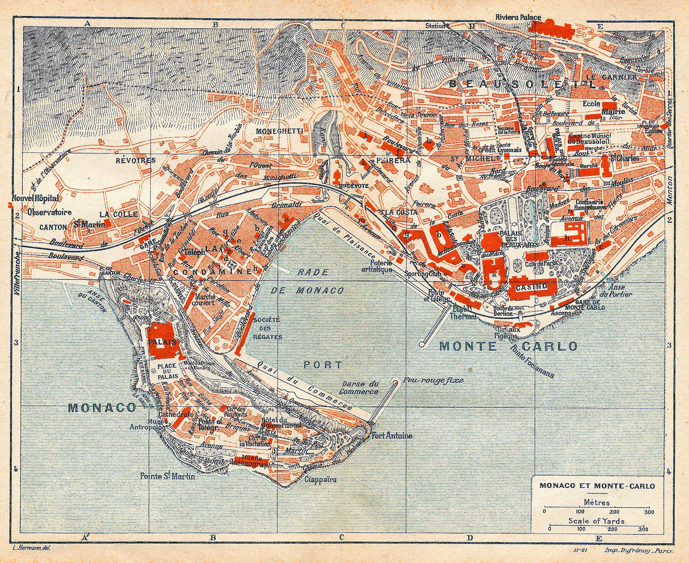
Monaco-Gare – Monaco-Ville

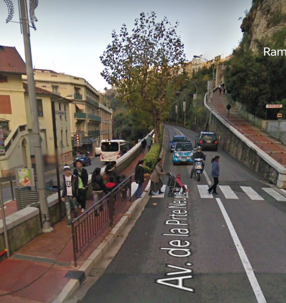
This line was marginally over 1 km in length. It low point was at Place d’Armes, just 19 metres above sea-level, its high point was at 59metres above sea-level at Place de la Visitation. It was single track over its entire length with no passing places . It also did not have passing loops at its two termini as it only used powered cars with no trailers.

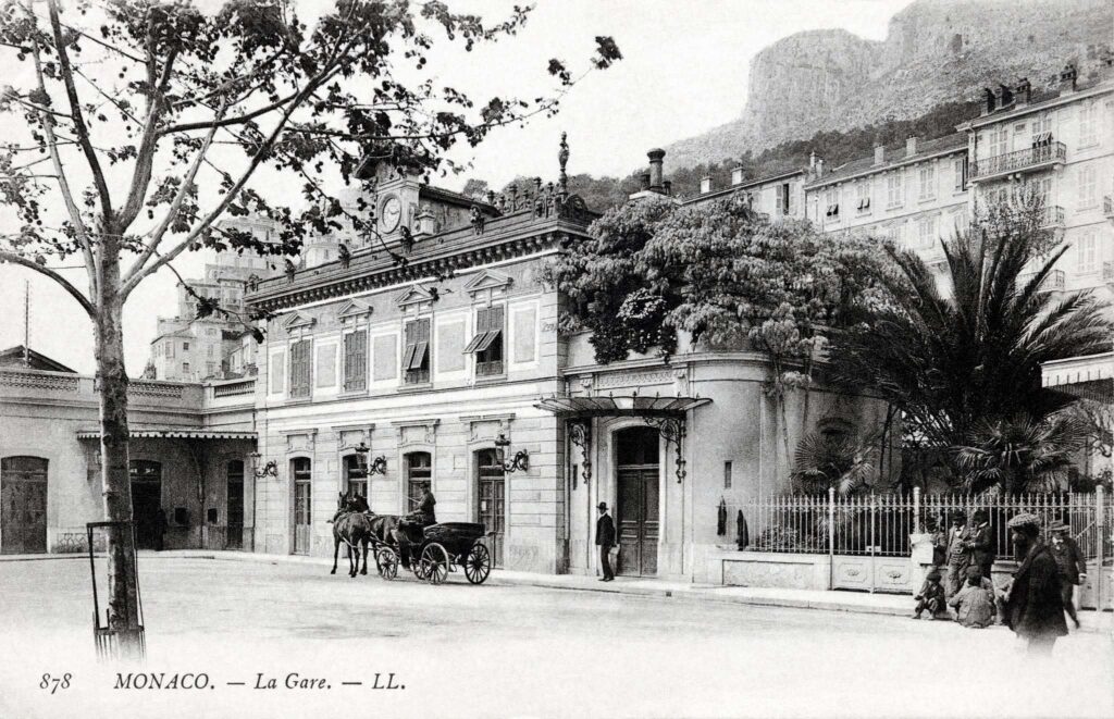
Banaudo tells us that, “Starting from the PLM station square, it went down Avenue de la Gare for 101 m to Place d’Armes. This node in the Monegasque network formed a connection point with the TNL line towards Nice and the TM line towards Monte Carlo and St. Roman. Crossing this, the single track climbed by a long ramp of 77 mm/m the Avenue de la Porte-Neuve to the end of the Rocher dominating Fort Antoine, then a sharp bend brought the line back into the Avenue des Pins. The terminus sat at the entrance to the old town of Monaco, on the Place de la Visitation where the government palace stands.” [1: p54]

A plan of the different tram and train lines in Monaco and Monte-Carlo in the early 20th century. The article from which this image was taken was shared on the Monaco4Ever Facebook Group by Jean-Paul Bascoul on 17th May 2015. The line between the station and the Place de la Visitation runs left to right at the bottom of the map. [15]
This map shows This branch line tramway ran from Monaco-Gare at the Northwest corner of this map extract through Place d’Armes and then along Avenue de la Porte Neuve before swinging sharply round to the West along Avenue des Pins, to terminate in Place de la Visitation. [16]
Monaco Railway Station in the early 20th century. [19]
Looking Northwest along Avenue Prince Pierre towards the location of Monaco Railway Station. [Google Streetview, July 2021]
Looking along Avenue Prince Pierre into Place d’Armes. [Google Streetview, July 2022]
The junction of Avenue de la Gare with Place d’Armes looking towards the railway station. This image was shared by Jean-Paul Bascoul on the Monaco4Ever Facebook Group on 23rd June 2017. (Collection privée J-Paul Bascoul). [13]
A tram on Place d’Armes in the 1920s. This image was shared by Jean-Paul Bascoul on the Monaco4Ever Facebook Group on 20th June 2020. (Collection privée J-Paul Bascoul). [14]
La Place d’Armes looking towards Monaco Railway Station which sits at the far end of Avenue de la Gare (now Avenue Prince Pierre). [12]
A colourised postcard view of the junction between Avenue de la Gare (now Avenue Prince Pierre) and Place d’Armes. [17]
Place d’Armes sat below the Palace of Monaco. It was the point at which trams from the railway station crossed the Nice to Monte-Carlo line and then headed up onto the rock. [16]
The tramway up onto the Rock followed Avenue de la Porte Neuve. The tramway to the casino (and on to Menton) followed the parallel Avenue du Port. [Google Streetview, 2011]
The tramway to the Casino and then on to Menton ran up the West side of the port. The tramway up onto the Rock via the Avenue de la Porte Neuve. [16]
The tramway turned from the Avenue de la Porte Neuve into the Avenue des Pins and heads to its terminus at Place de la Visitation. [16]
The tight curve of Avenue Saint-Martin leads round towards Avenue des Pins. [Google Streetview, 2011]
The tramway followed Avenue des Pins heading off to the right leading towards Place de la Visitation. [Google Streetview, 2011]
Place de la Visitation at the top of Avenue des Pins was the terminus of the tramway. [Google Streetview, 2011]

Images in this article accredited to Jean-Paul Bascoul come from his blog – Monaco4ever.blogspot.com.

References

  1. José Banaudo; Nice au fil du Tram, Volume 2: Les Hommes, Les Techniques; Les Editions de Cabri, Breil-sur-Roya, France, 2005.
  2. https://www.explorenicecotedazur.com/en/info/saint-jean-cap-ferrat-en, accessed on 11th November 2023.
  3. https://www.openstreetmap.org/#map=14/43.6881/7.3294, accessed on 11th November 2023.
  4. https://www.cparama.com/forum/saint-jean-cap-ferrat-t9821.html, accessed on 11th November 2023.
  5. https://m.facebook.com/groups/ciccoli/permalink/3325276507718195, accessed on 11th November 2023.
  6. https://m.facebook.com/groups/ciccoli/permalink/3372278223018023, accessed on 11th November 2023.
  7. https://m.facebook.com/groups/ciccoli/permalink/3745256885720153, accessed on 11th November 2023.
  8. https://m.facebook.com/groups/ciccoli/permalink/3132401830338998, accessed on 11th November 2023.
  9. https://m.facebook.com/groups/ciccoli/permalink/3325276507718195, accessed on 11th November 2023.
  10. https://theoldmapshop.com/products/1914-nice-south-of-france-town-plan-antique-baedeker-map-print-st-jean-cap-ferrat-villefranche-sur-mer, accessed on 12th November 2023.
  11. https://m.facebook.com/groups/1389253567814679/permalink/9801785099894775, accessed on 13th November 2023.
  12. https://www.akpool.fr/cartes-postales/24373465-carte-postale-monaco-la-cote-dazur-la-place-darmes-et-avenue-de-la-gare-strassenbahn, accessed on 13th November 2023.
  13. https://m.facebook.com/groups/1389253567814679/permalink/9397633530309936, accessed on 13th November 2023.
  14. https://www.facebook.com/groups/1389253567814679/permalink/5583715751701752/?app=fbl, accessed on 13thbNovember 2023
  15. https://www.facebook.com/groups/1389253567814679/permalink/9166981643375127/?app=fbl, accessed on 13th November 2023.
  16. http://www.vidiani.com/maps/maps_of_europe/maps_of_monaco/large_detailed_old_map_of_Monaco_Monte_Carlo_1921.jpg, accessed on 13th November 2023.
  17. https://www.facebook.com/groups/1389253567814679/permalink/8938416852898275/?app=fbl, accessed on 13th November 2023.
  18. https://www.facebook.com/groups/1389253567814679/permalink/8938416852898275/?app=fbl, accessed on 13th November 2023.
  19. https://www.monaco-tribune.com/2023/02/un-decor-de-carte-postale-la-gare-de-monaco-monte-carlo, accessed on 13th November 2023.

The Uganda Railway – Part 1

From late April to mid May 2018 my wife and I were in Uganda. This was my 6th visit to the country. On the first, in 1994, I travelled to Kampala from Mombasa on the railway. It was a fantastic journey in a slow moving train with silver service in the dining car and with beds made up for us by staff each night. There were two separate trains, a njght train from Mkmbasa to Nairobi run by the then Kenya Railways and a train from Nairobi to Kampala run by Uganda Railways.

The track is metre-gauge.

This short series of posts tells the story of the line to 2018 and then looks forward from that year into the future. In recent times the railway system in Uganda has had a chequered history and had been relatively badly managed, as you will see. The present network is in a dilapidated state. The network is shown in the image below.


The country of Uganda has about 1,350 kms of railway lines and most of it has not been operational for over 25 years. Repairs had been completed on the Tororo-Gulu line and were still ongoing on the Gulu-Pakwach Line in early 2014. [1]

The railway originating at Mombasa on the Indian Ocean connects to Tororo in Uganda, where it branches westward to Jinja, Kampala, and Kasese and northward to Mbale, Soroti, Lira, Gulu, and Pakwach (to the south-east of Arua and on the northern edge of the Murchison Falls National Park – the Pakwach Bridge crosses the White Nile close to the town).

There was no chance, in 2018, for me to check out the railway system. After a very short stay in Kampala we spent the rest of our time in the south-west of the country in Kyegegwa, Rukungiri and Kisoro.

Back in 1994, I was taking slides and being very careful not to exhaust my supply of film. How much things have changed! I do have four pictures, taken at Mombasa railway station, of coaches from the early to mid 20th Century which were stored among slightly more modern stock, at least three seemed still to be in use. …..

The last photo above is courtesy of Jennifer Wu (https://www.flickr.com/photos/wippetywu/8333244855), those below are some early postcards of the station in Mombasa.

The Early History of the Line

The Uganda Railway was built during what became known as the Scramble for Africa, (the struggle between European powers for dominance in Africa). It provided a strategic link between the coast at Mombasa and the Great Lakes region. In doing so, it effectively secured British domination of the region.[2],[3]

The Uganda Railway was named for its ultimate destination. Its original length of 660 miles (or 1056 kilometres) lay entirely in what we now call Kenya.

Work on the railway began at the port of Mombasa, in what was then called British East Africa, in 1896. The intended terminus at Kisumu on the shores of Lake Victoria was reached in 1901.[2],[4]

Construction was carried out principally by labourers from the Indian subcontinent, 32,000 of whom were brought in because of a lack of local labour in very sparcely populated areas of East Africa. The horrendous truth is that the line was built on the lives of those labourers. 2,498 workers died during the construction of the railway.[2],[5] An artists impression of the work is shown in the image below (courtesy of Charan Kundi).

Many of the labourers returned to India but 6,724 decided to remain after the line’s completion, creating a community of Indian East Africans.

The railway is, almost in its entirety, single-track. A massive logistical exercise was put in place to import from India a very significant amount of steelwork – rails; fishplates and bolts; keys; and girders. Over 1.2 million sleepers were also required. To secure the necessary throughput of materials, Kilindini Harbour ws created in Mombasa. “The railway was a huge logistical achievement and became strategically and economically vital for both Uganda and Kenya. It helped to suppress slavery, by removing the need for humans in the transport of goods.” [2],[6]

The railway line had a significant impact. It effectively created Uganda and Kenya as the countries that they became. As we have already noted, the railway defeated the slave trade in British East Africa. It allowed heavy equipment to be transported with relative ease.

The use of indian sub-continent labour resulted in a very significant minority of Asians in East Africa. These Indians worked as “dukawallas” (shopkeepers), artisans, traders, clerks, and, finally, lower-level administrators. Excluded from the middle and senior ranks of the colonial government and from farming, they became a commercial middleman and professional community.[7] The British administration encouraged European settlement and farms were set up for coffee and tea production with the railway available to ensure easy shipping to Europe for processing. As the numbers of settlers and farms increased native populations became alienated from their land and seeds were sown for the later struggle for independence. At the same time, inceeases in white settlement made demands on the railway. New small stations were required to allow transportation of agricultural produce. These stations included: Nakuru, Naivasha, Tigoni, Kijabe and Sigona.

In addition, the railway contributed to increased urbanisation. Many of today’s towns in Kenya, and some in Uganda, have reulted from the presence of the railway. Mombasa urbanisation can be traced to the start of the construction of the line. Nairobi was a rail depot placed in the middle of a swamp, and is now the capital of Kenya. Other towns for which this is true are … Kikuyu, Naivasha, Nakuru (where the main line splits, one branch going to Kisumu and the other to Uganda), Nanyuki, Eldoret (originally called “64″ its distance, in miles, from the railhead at the time), Kitale (a small farming community in the foothills of Mount Elgon), Kisumu (then called port Florence, a city and port on Lake Victoria allowing ferry transport between Kenya, Tanganyika (modern Tanzania) and Uganda), Port Bell (a rail-linked port, near to Kampala, on Lake Victoria allowing ferry transport between Kenya, Tanganyika and Uganda), and Jinja.

Tourism also began to develop. “The railway provided a ‘modern’ means of transport from the East African coast to the higher plateaus of the interior. US president Theodore Roosevelt is one of the notable people who had safari adventures aboard a train in the early days of the use of the Kenya-Uganda railway.”[7]

The railway also opened up the interior to systematic government programmes to attack slavery, witchcraft, disease and famine. [7]

We have already heard that close to 2,500 of the 32,000 workers on the line died during its construction. There are two particular causes worthy of significant note.

The first concerns the death of a number of conctruction workers in 1898 during the building of a bridge across the Tsavo River. Hunting mainly at night, a pair of maneless male lions stalked and killed at least 28 Indian and African workers – although some accounts put the number of victims as high as 135.[2],[8] The picture above shows one of the two lions and Lieutenant-Colonel John H Petterson who killed it.

The second concerns resistance from locals. Building the railway met local resistance on various occasions. A major incident was the Kedong Massacre, when the Maasai attacked a railway worker’s caravan killing around 500 people because two Maasai girls had been raped. An Englishman unconnected to the railway, Andrew Dick, led a counter-attack against them, but ran out of ammunition and was speared to death by the Maasai.[2],[9] At the turn of the 20th century, the railway construction was disturbed by the resistance of the Nandi people led by Koitalel Arap Samoei. He was killed in 1905 by Richard Meinertzhagen, finally ending the Nandi resistance.[2],[9]

Some of the socio-economic background to the construction of the Uganda Railway will be considered in later articles in this series.

References

1. Lucy Styles, Uganda Railway Assessment, January 2014 (updated to June 2015); http://dlca.logcluster.org/plugins/servlet/mobile#content/view/3375402, accessedon 8th May 2018.

2. Wikipedia, Uganda Railway; https://en.m.wikipedia.org/wiki/Uganda_Railway, accessed on 6th May 2018.

3. Richard T. Ogonda & George M. Onyango; Development of Transport and Communication. In William Robert Ochieng’; Historical Studies and Social Change in Western Kenya. Nairobi: East African Educational Publishers, 2002. p219–231.

4. Richard T. Ogonda; Transport and Communications in the Colonial Economy. In William Robert Ochieng’ & R. M. Maxon; An Economic History of Kenya. Nairobi: East African Educational Publishers, 1992. p129–146.

5. Christian Wolmar; Blood, Iron & Gold: How the Railways Transformed the World. London: Atlantic Books, 2009.

6. Frank Richardson Cana; British East Africa. In Hugh Chisholm. Encyclopædia Britannica. 4 (11th ed.). Cambridge University Press, 1911. p601–606.

7. The Enzi Museum, Construction of the Kenya-Uganda Railway;
http://www.enzimuseum.org/archives/275, accessed on 8th May 2018.

8. Man eating lions – not (as) many dead; Railway Gazette International. 27 November 2009. http://www.railwaygazette.com/news/single-view/view/man-eating-lions-not-as-many-dead.html, accessed on 8th May 2018.

9. David Kaiza; End of Lunatic Express; The East African. 21 September 2009. http://www.theeastafrican.co.ke/magazine/-/434746/660876/-/view/printVersion/-/32dc3d/-/index.html, accessed on 8th May 2018.