
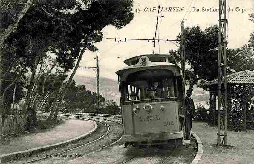
The TNL (Tramways de Nice et du Littoral) had four lines which ran some distance inland from the coast. Three ran out from Nice, serving: Levens, Bendejun, and La-Grave-de-Peille. All followed valleys of the Paillon and its tributaries. As well as the line to La-Grave-de-Peille, the line to Contes and Bendejun was to have had another Branch to l’Escarene. Major work was undertaken on that line but it was never brought into use.
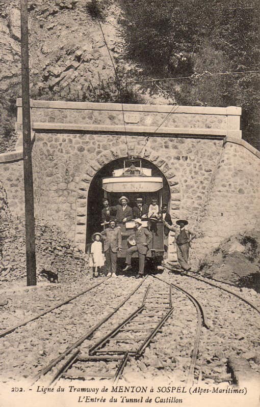
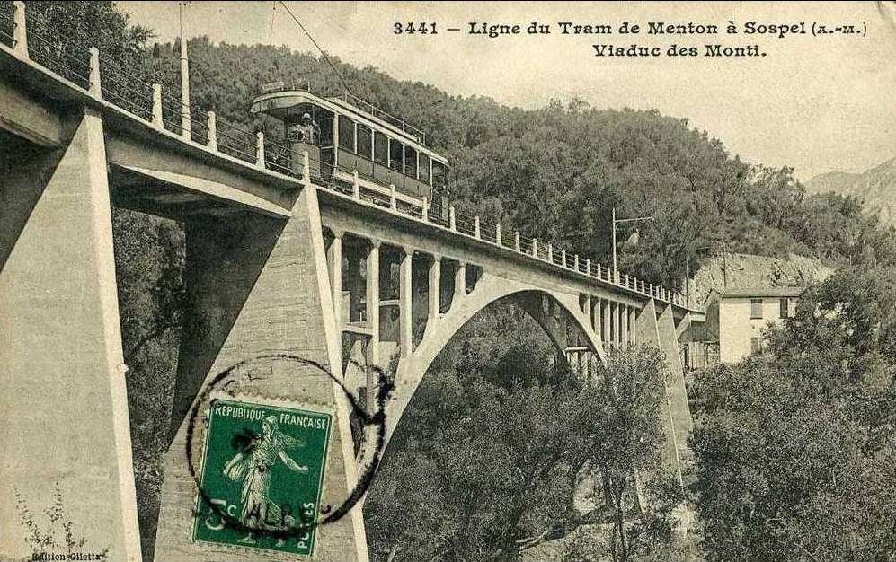
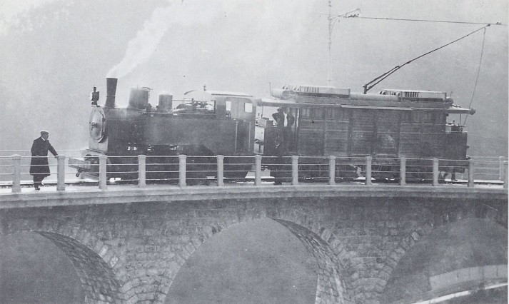
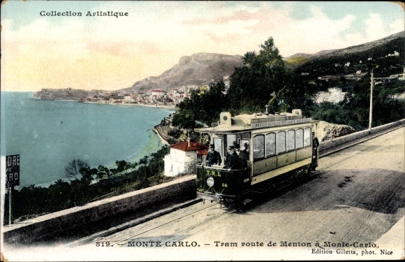
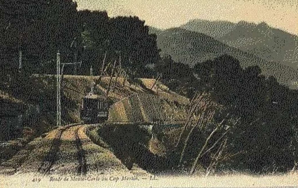
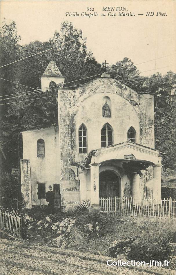
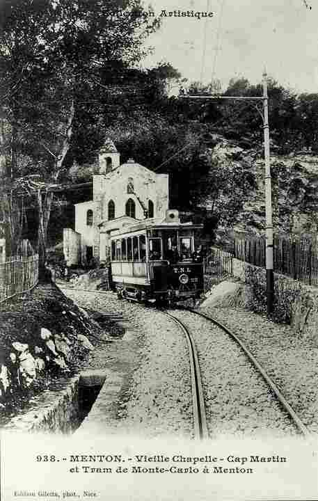
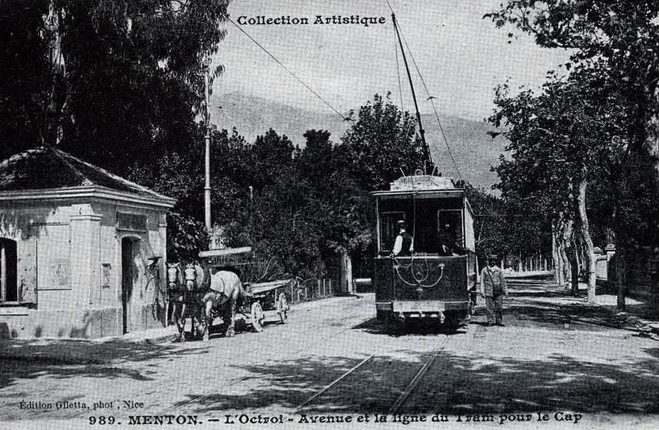
The fourth significant line operated by the TNL ran from Menton to Sospel. This line required some significant feats of engineering. The featured image above (public domain) shows one of the structures on this line.
You will find earlier articles about two of these lines on this website. They can be found by following these links:
Levens
Two earlier articles, the second of which involves some flights of fancy on my part – looking at a possible alternative routes for the tramway. As we will see below, those thoughts are not without merit given the discussions which took place around the best way for the tram network to serve Levens village.
The Nice to Levens Tramway – Part 1 (Chemins de Fer de Provence 55)
The Nice to Levens Tramway – Part 2 (Chemins de Fer de Provence 56)
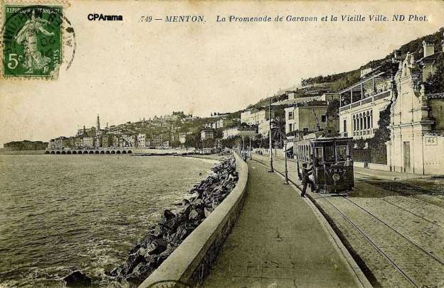
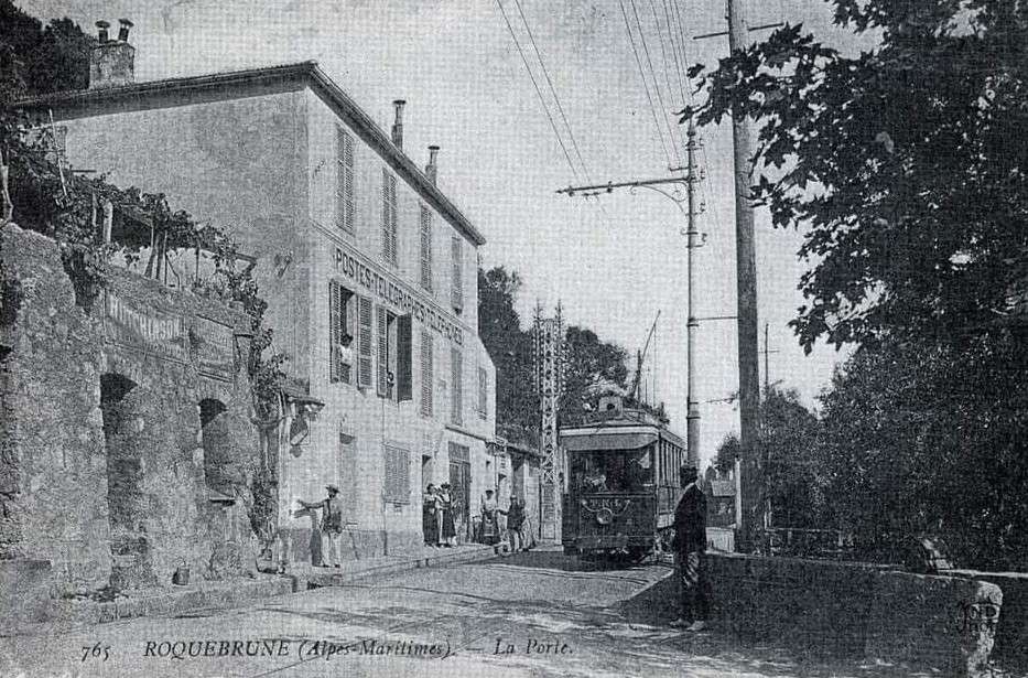
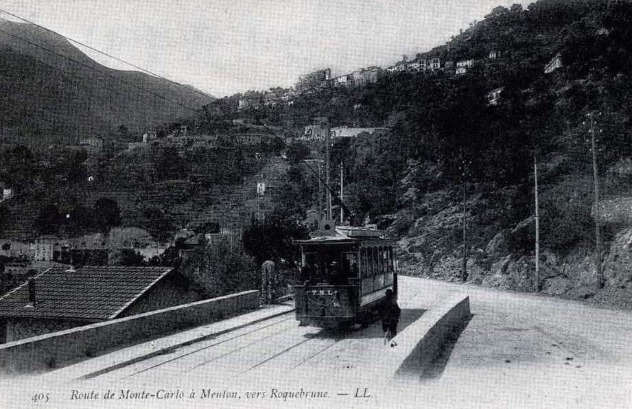
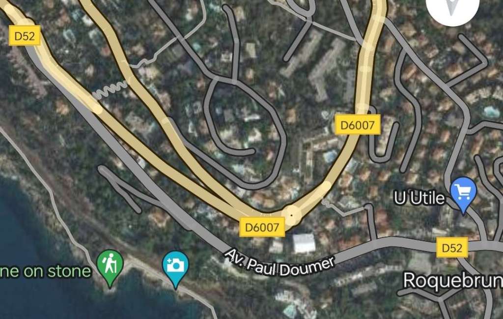
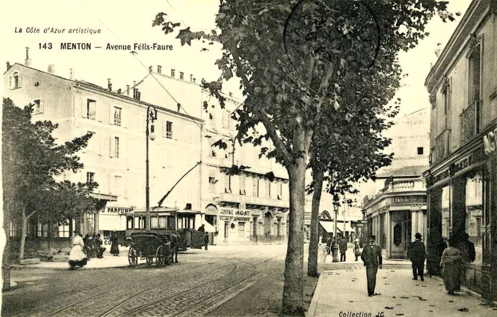
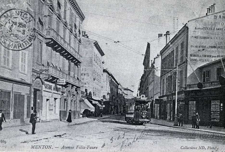
Menton to Sospel
Three articles written at different times. In chronological order, these are:
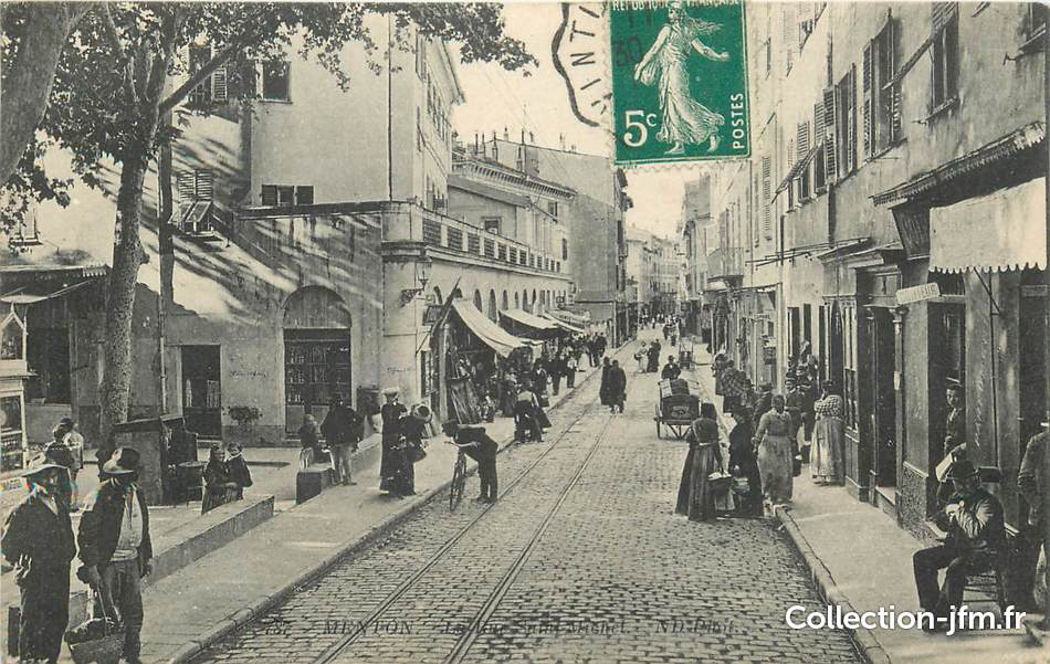
Sospel to Menton Tramway
The Sospel to Menton Tramway Revisited (Chemins de Fer de Provence 51)
The Menton to Sospel Tramway Revisited Again! (Chemins de Fer de Provence 61)
Bendejun, and La-Grave-de-Peille
Bendejun and La-Grave-de-Peille will be covered in a future article. This article focusses on updating earlier articles about the tramways between Nice and Levens, and between Menton and Sospel. ……
Further notes on the Nice to Levens Tramway
The full length of the line from Place Masséna to Levens was just over 23 km of which a little less than 6km were part of Nice’s urban network (between Place Masséna and St. André).
Apart from the articles mentioned above, the first 6 km are covered in another, recent article (which also covers a number of lines which were part of Nice’s urban network), and can be read by following this link:
The First Generation Electric Tramways of Nice again. Five more lines. (Chemins de Fer de Provence/Alpes-Maritimes No. 89) …
These new notes are based around a section of José Banaudo’s French text: ‘Nice au fils de Tram, Volume 2: Les Hommes, Les Techniques‘ [1] Direct quotes are referenced.
In the main, the length of the line covered here is that from St. André to Levens (as built), and a section just over 1km in length which would have served the centre of Levens, Levens-Village but which was not completed because of the advent of WW1.
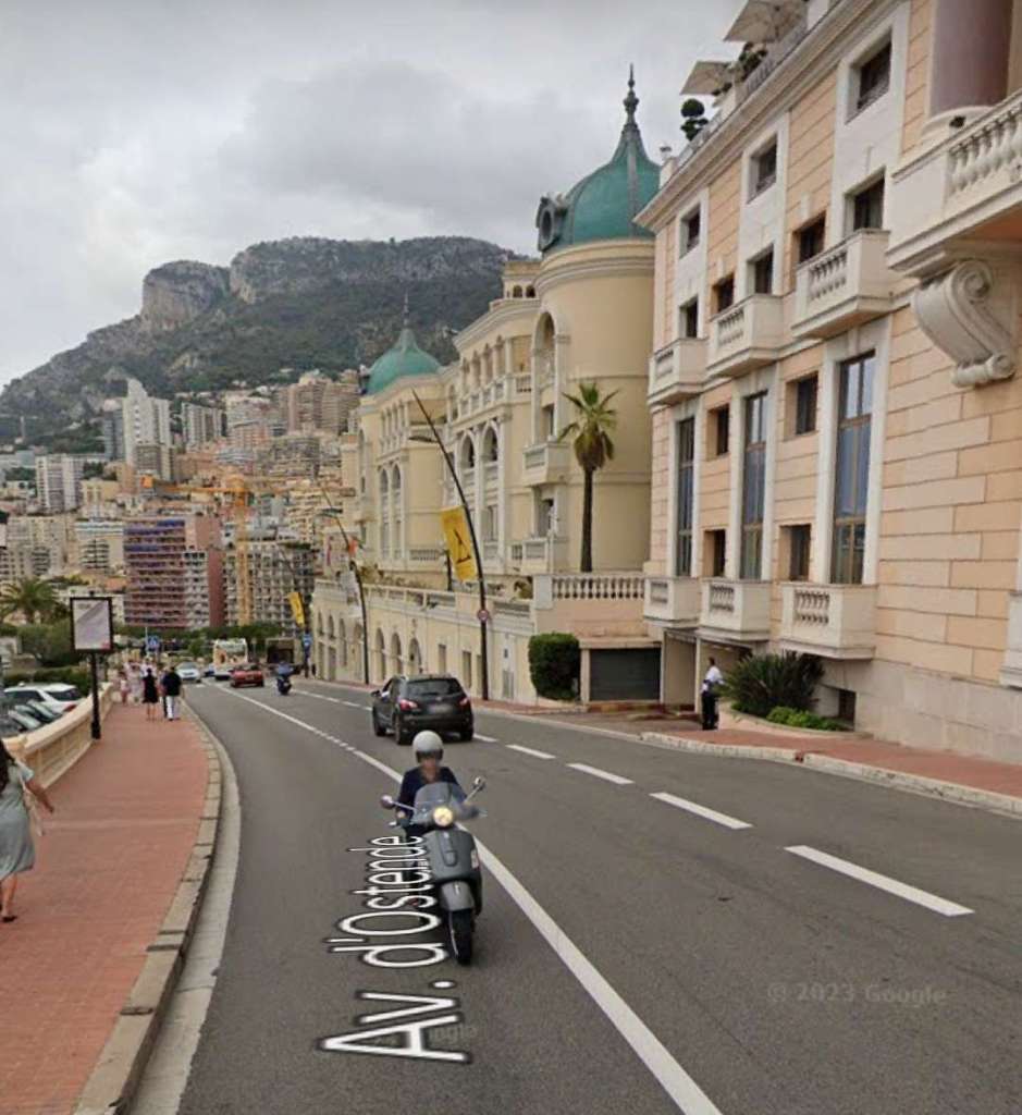
There was, however, a short length of tramway used by the Levens trams which did not follow the route of the urban trams to St. André. This detour followed the left bank of the River Paillon through Place Garibaldi, Rue de la République then Rue Barla and the Barla bridge, before rejoining the urban line of St. André on the right bank.
In addition, we need to note the significant impact of bad weather in the construction of the line in the area now known as ‘Pasteur’. Banaudo speaks of very significant storms during the winter 1907-1908. In particular, storms occurred on: 29th September; 3rd, 15th and 30th October; 3rd November; 10th and 27th December. Eventually work could recommence on 20th January and was finished on 27th March. Banaudo comments that “The additional work and necessary consolidations of the Paillon embankment ultimately increased the cost of the first construction contract for the Nice – Levens line by a third, compared to initial forecasts.” [1: p66]
Banaudo tells us that the maximum gradient on the whole line was 63mm/m and that less than 2 km of the line were level, having no gradient. At Place Masséna the line was only 9 metres above sea level, at Levens it reached 538 metres above sea level. [1: p62]
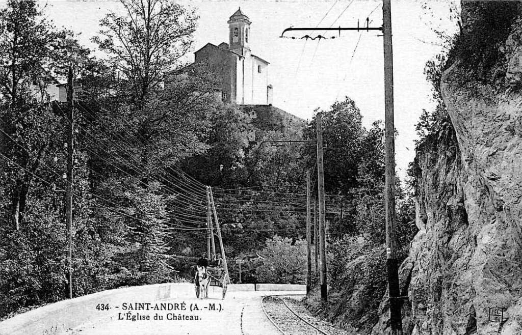
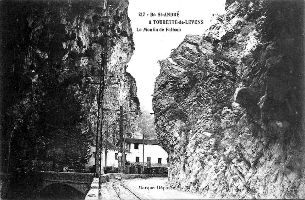
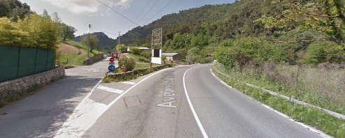
The St. André tram stop was the terminus of urban services. Banaudo tells us that “Beyond St. André, the tramway went up the valley of the Banquière or Gahre, right bank tributary of Paillon. It passed several caves and two mills nestled at the bottom of deep gorges between the heights of Falicon and L’Ahadie. Upstream of the Tinon bridge, the pass became so narrow that the tramway, hitherto on the shoulder, had to be embedded in the roadway with which it crossed the valley on several occasions. After the place called Les Clues, the valley widened a little and a tram stop served the hamlet of Moulin-de-Tourrette.” [1: p62]
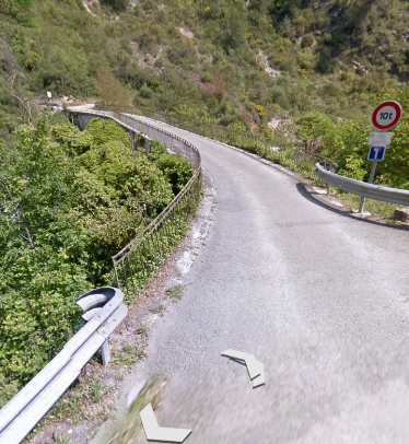
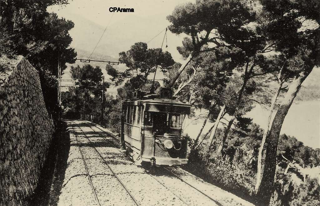
From this point trams followed their own route a little removed from the main road for about 3 km, “punctuated by the curved Rio-Sec Viaduct and a short tunnel. The route overlooked the road, moved away from it, then finally rejoined it at the foot of the old village of Tourrette-Levens, renowned for its ancient castle. This locality, the most important encountered on the route. was served by a station established in the Quartier du Plan,” [1: p62] at the foot of the road serving the old village.
As noted above, a sequence of photographs of this separated tram route can be found here. [5]
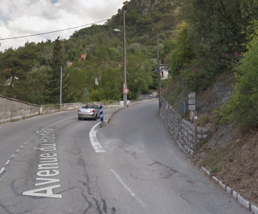
Beyond Tourrette Levens, trams continued to climb through the Western slopes of the Mont Ferion range, “the line encountered two other passing places: at a place called Lava where a siding allowed wood to be loaded, and at the hamlet of Ste. Claire. The highest point of the line was reached on the plateau which forms the Grands Prés de Levens where festivals, sporting events and horse races are organized. The Levens terminus was located at a place called Les Traverses, where a wooden building housed a buffet enjoyed by travellers before the final climb on foot” [1: p62] to the village of Levens which is perched on a hillock at an altitude of 570 m above sea-level. “A superb site with both a Mediterranean and alpine appearance with the high peaks of the Vésubie valley in the background. In order to get closer to the center, a steep ramp extension including a curved line on its own site was undertaken to reach the current Lov Roux esplanade at the entrance to the village. Unfortunately, the war interrupted the work and this extension was never put into service.” [1: p62] Some further notes about the planned extension can be found after the review of key structures on the route.
Structures on the route included:
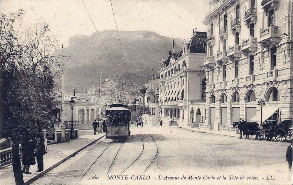
A. the Garibaldi and Barla bridges over the River Paillon (each made up of three cast iron arches);
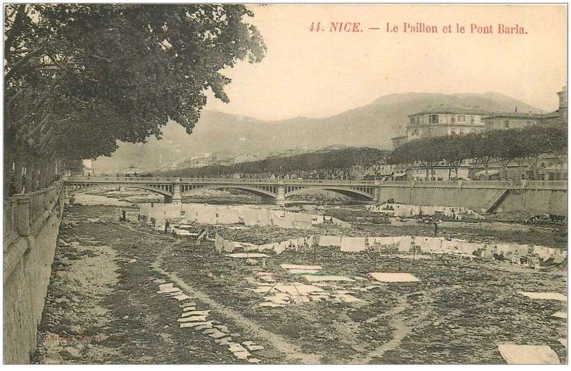
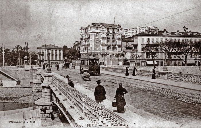
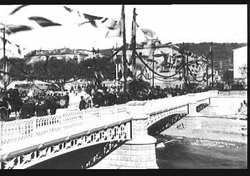
Three views of Pont Barla over the River Paillon in Nice, one even has a tram travelling over it! [3]
15th April 1912 – the line from Villa Caserta to Sospel was opened to passengers and the short branch to the PLM Station in Menton was closed.
B. the Tinon, Falicon and Clues bridges over the River Banquière (each a single masonry arch);
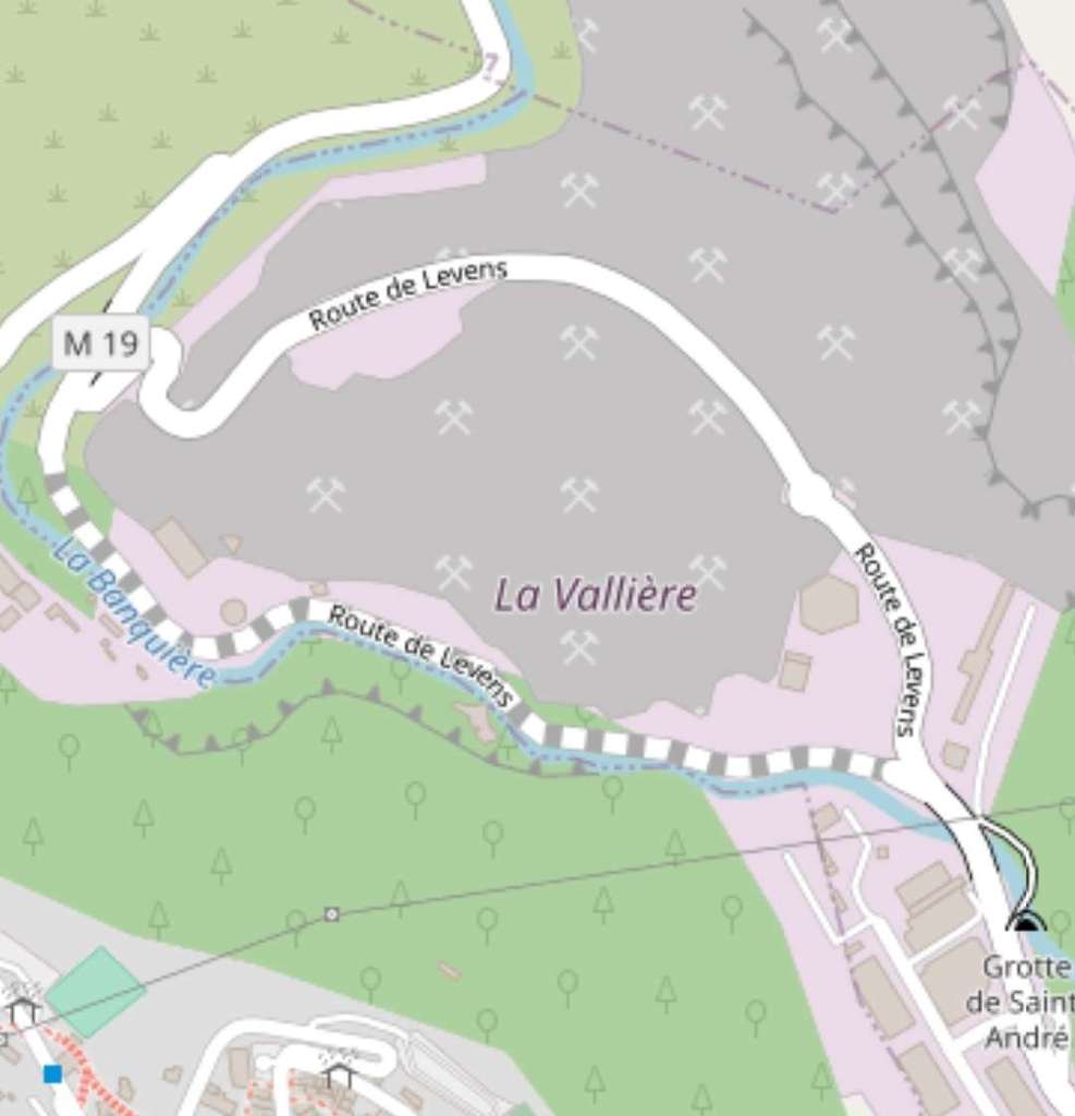
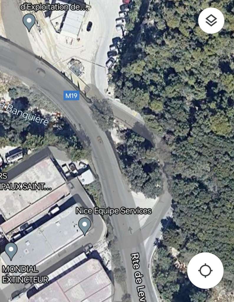
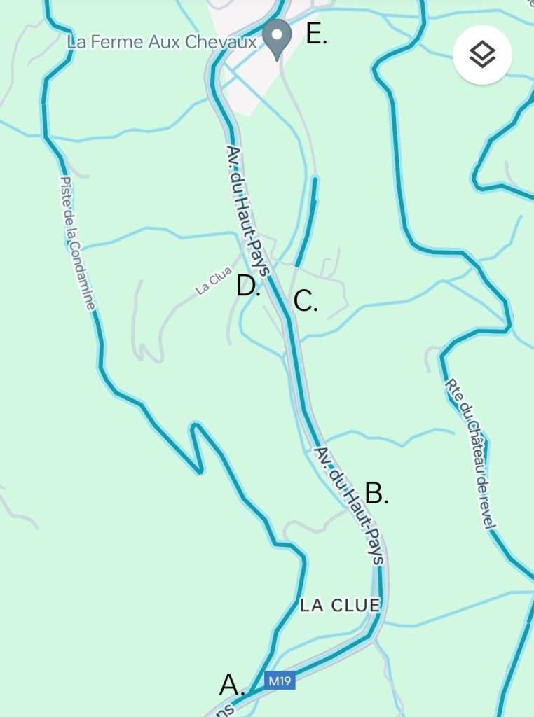
Banaudo tells us that the tramway was remote from the main road on its own formation over this length for around 3 km “punctuated by the curved Rio-Sec Viaduct and a short tunnel.” [1: p62] That length of tramway commences at ‘C’ and continues through ‘E’ and onwards to Tourette-Levens. Some details of that length appear below but a fuller series of photographs can be found at https://rogerfarnworth.com/2018/03/20/the-nice-to-levens-tramway-part-1-chemins-de-fer-de-provence-54.
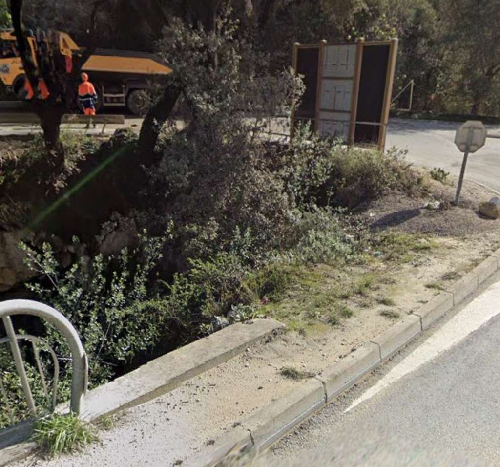
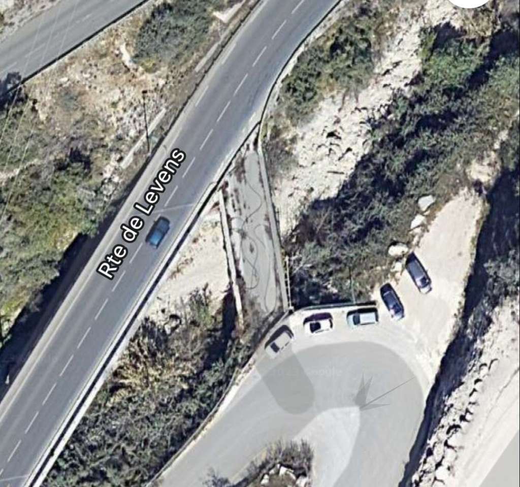
C. the Rio-Sec Viaduct (a single curved masonry arch) and the Moulins tunnel (40 m) which were on an independent formation a short distance to the East of the M19;
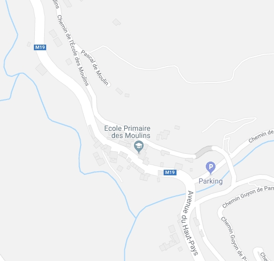
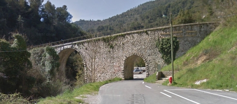
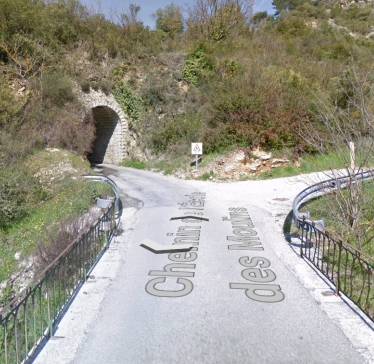
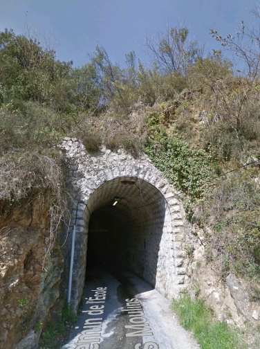
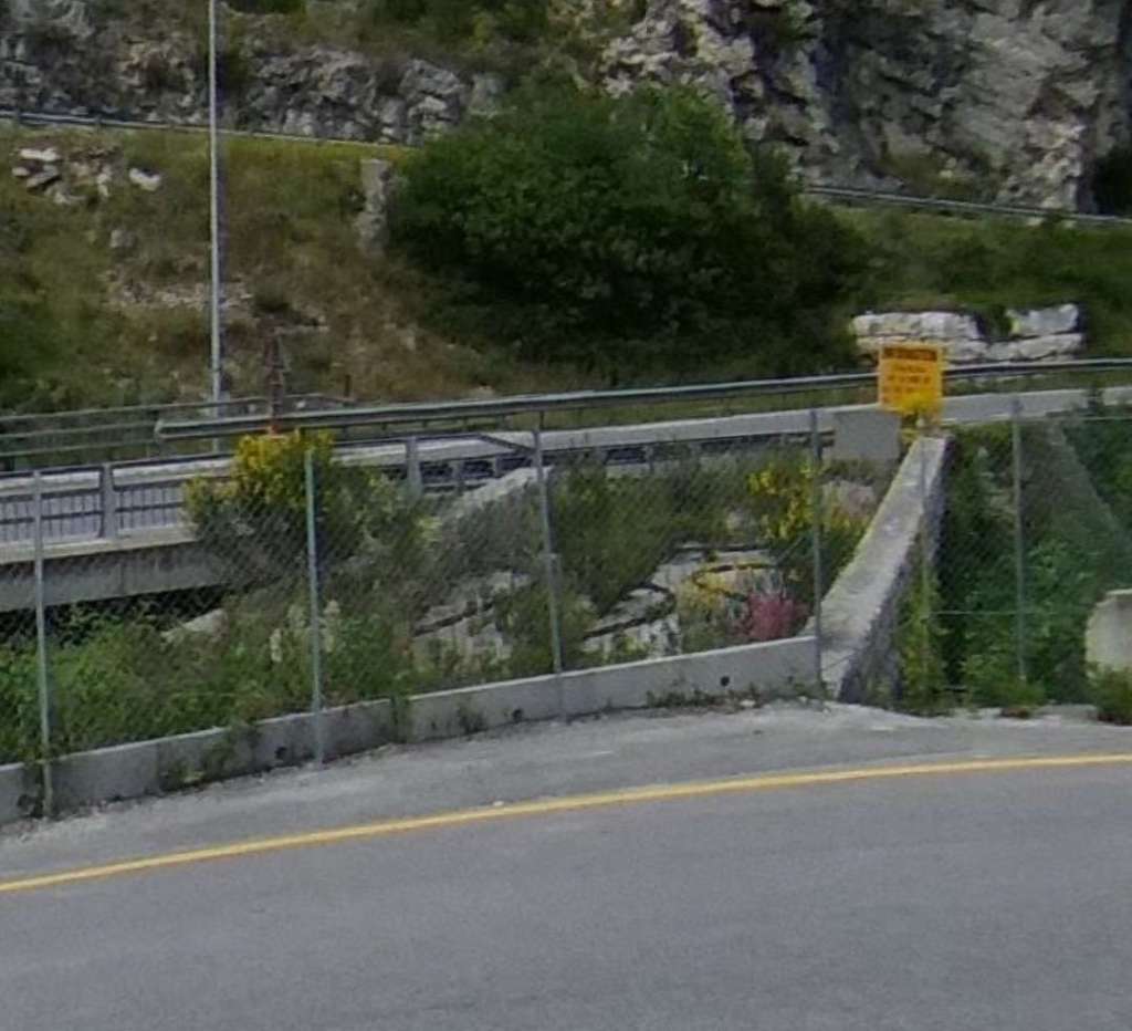
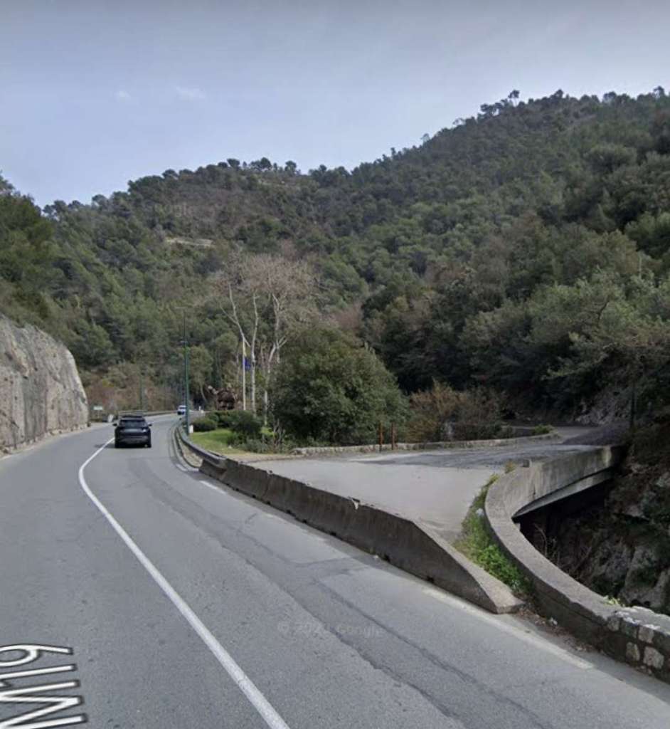
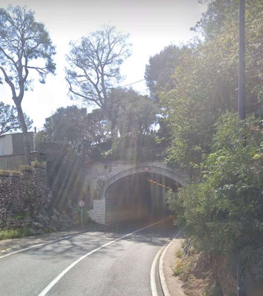
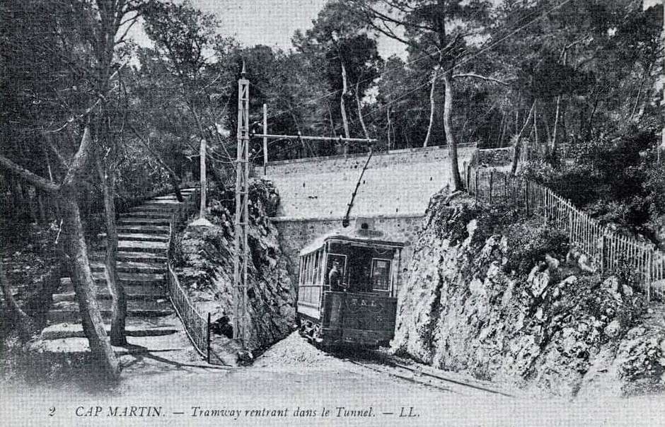
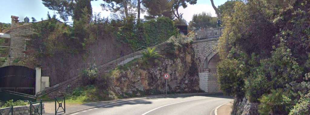
D. the Levens tunnel (95 m, on the section built but not opened and now in use as a vehicular route into the centre of the village).
Some further observations ……..
Banaudo tells us that the process of agreeing the TNL tramway route serving Levens was different than for other routes (which were primarily dictated by the terrain and the orientation of the valleys). Early studies led to some elected officials recommending “linking Nice to St. Martin-Vésubie via the traditional stagecoach route via Tourrette, Levens, Duranus and St. Jean-la-Rivière.” [1: p66]
When the project took shape in 1904, three routes were considered:
- One extended the Cimiez line in the direction of Rimiez, L’Aire St. Michel, and Gairaut, from where it skirted the Mont Chauve massif to the west to serve the hilltop villages of Aspremont, Castagniers and St. Blaise, before arriving at Levens. This extremely picturesque cornice route would have served a well-populated area, but the travel time to Levens would have been prohibitive.
- Another left the Paillon valley in St. André and climbed in switchbacks to the village of Falicon, then it joined the previous route in Gairaut. This route would have been even longer and more tortuous!
- The last also left from St. André, but it went up the Gorges de la Banquière towards Tourrette, Ste. Claire and Levens. It served a smaller population than the previous ones, but had the advantage of being more direct route.
The third option was chosen and built between 1907 and 1909!
Banaudo continues to explain that the Compagnie du Sud [which ran the TAM tram network] applied for the concession of the Nice – Levens line, in the hope that, should an extension from Levens to St. Jean-la-Rivière be built it would connect with its own line in the Vésubie valley. But the chief engineer of bridges and roads decided to allocate the route to the TNL. His decision meant that the usage figures for the TNL network were reduced by this lightly populated route and as a result greater the line attracted greater subsidies from the State. [1: p66]
After the completion of construction in 1909, the commune of Levens lobbied for an extension into the village. Banaudo tells us that a route had already been considered by the Bridges and Roads Department which took the form of a long loop to keep gradients as low as possible. Initially a sizeable cutting was proposed which ultimately was superseded by a tunnel. [1: p66]
A contract was awarded and work started early in 1914. Work continued through to 1916-1917 slowed by the shortage of labour during the War. After the war, work restarted but disagreements over the financing of station facilities held up the works. Finally, the general council decided in 1926 to postpone the completion of the line and then, in 1929, proposed converting the route into a motorable road. It is in use as a road under traffic-light control in the 21st century. [1: p66]
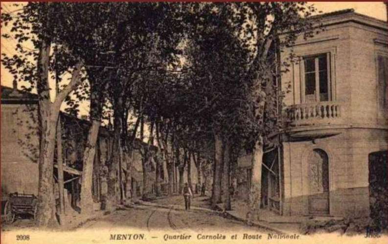
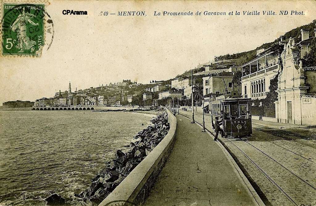
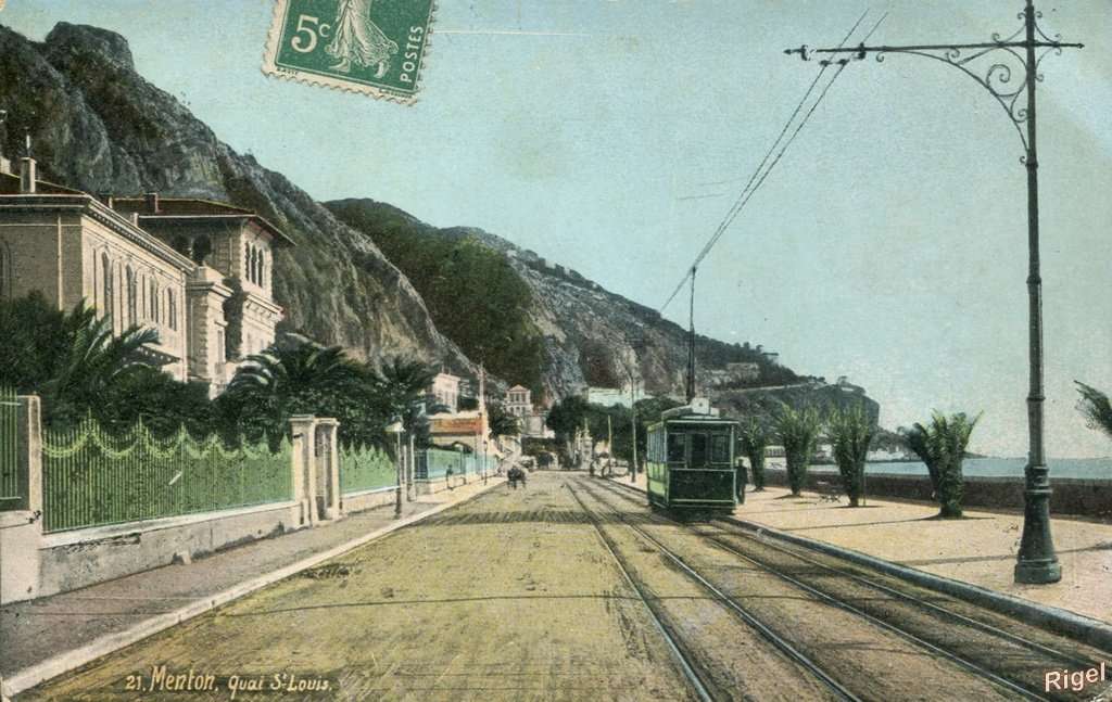
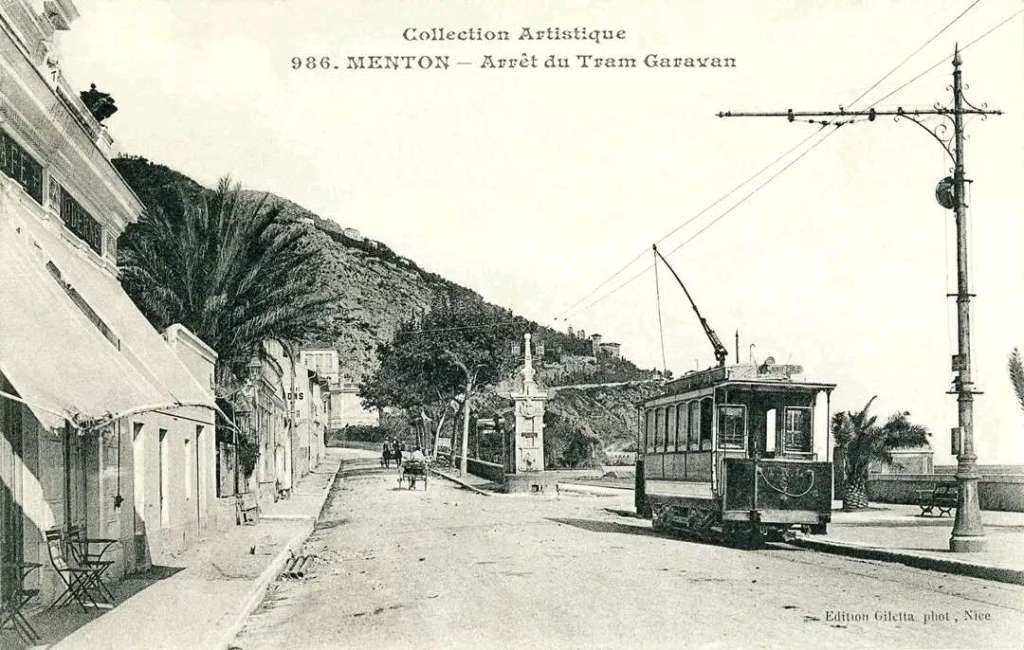
Further notes on the Menton to Sospel line
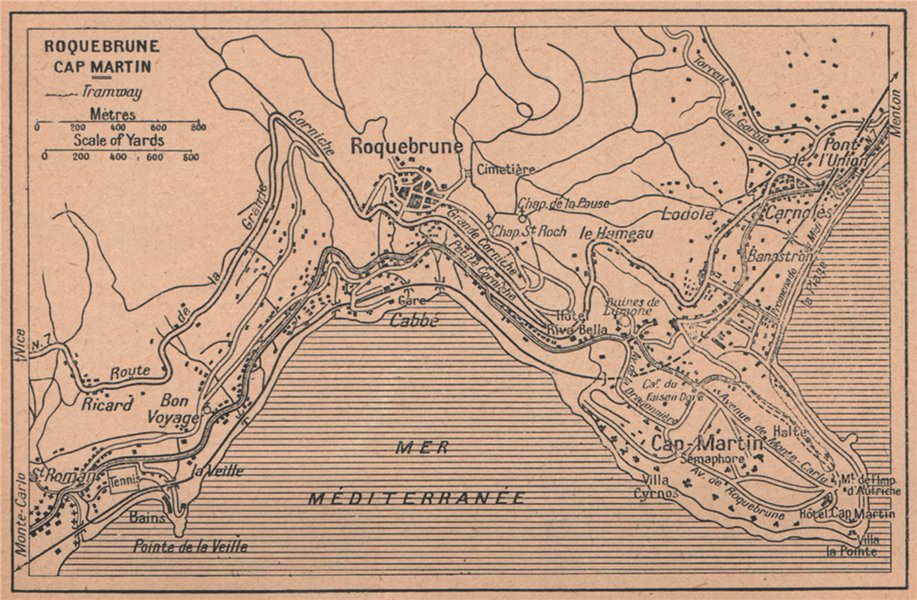
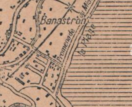
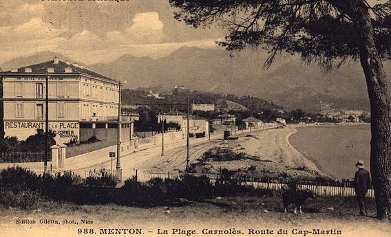
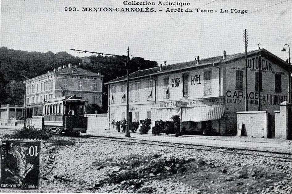
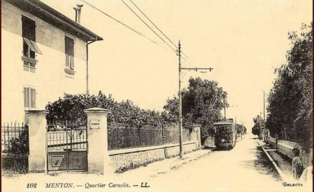
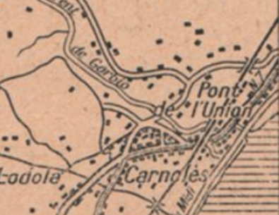
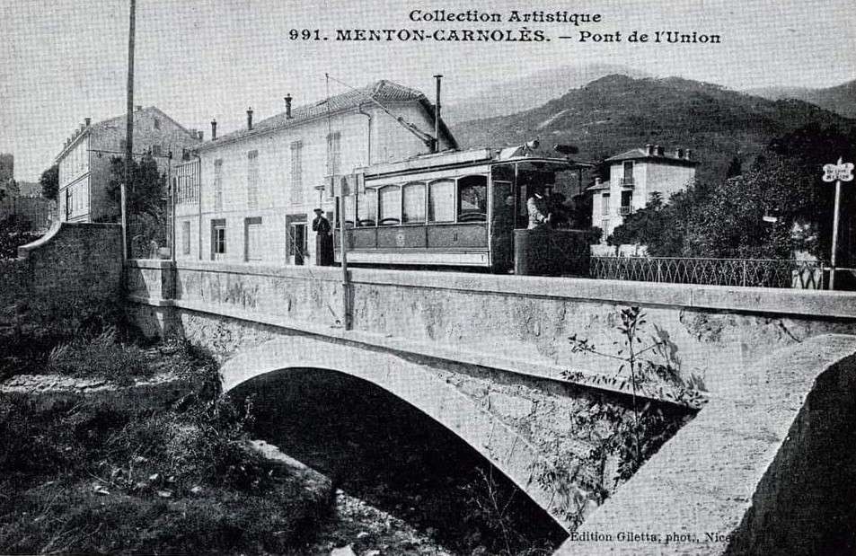
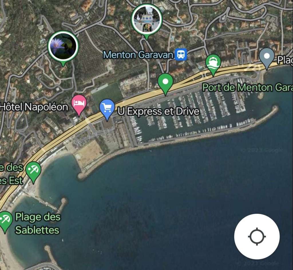
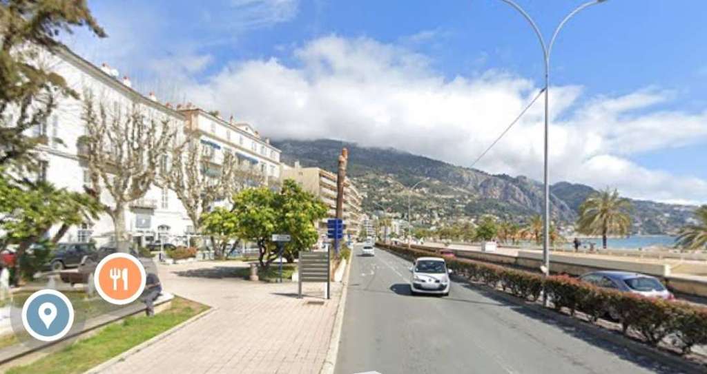
Banaudo tells us that the total length of this line was close to 17.4 km of which the TNL saw the length from Place St. Roch along Rue Partouneaux to Villa-Caserta (2.4 km) and the short stub to Menton Railway Station (0.15 km) as part of its coastal network. The remaining length from Villa Caserta to Sospel (14.9 km) was deemed part of their departmental network. [1: p77]
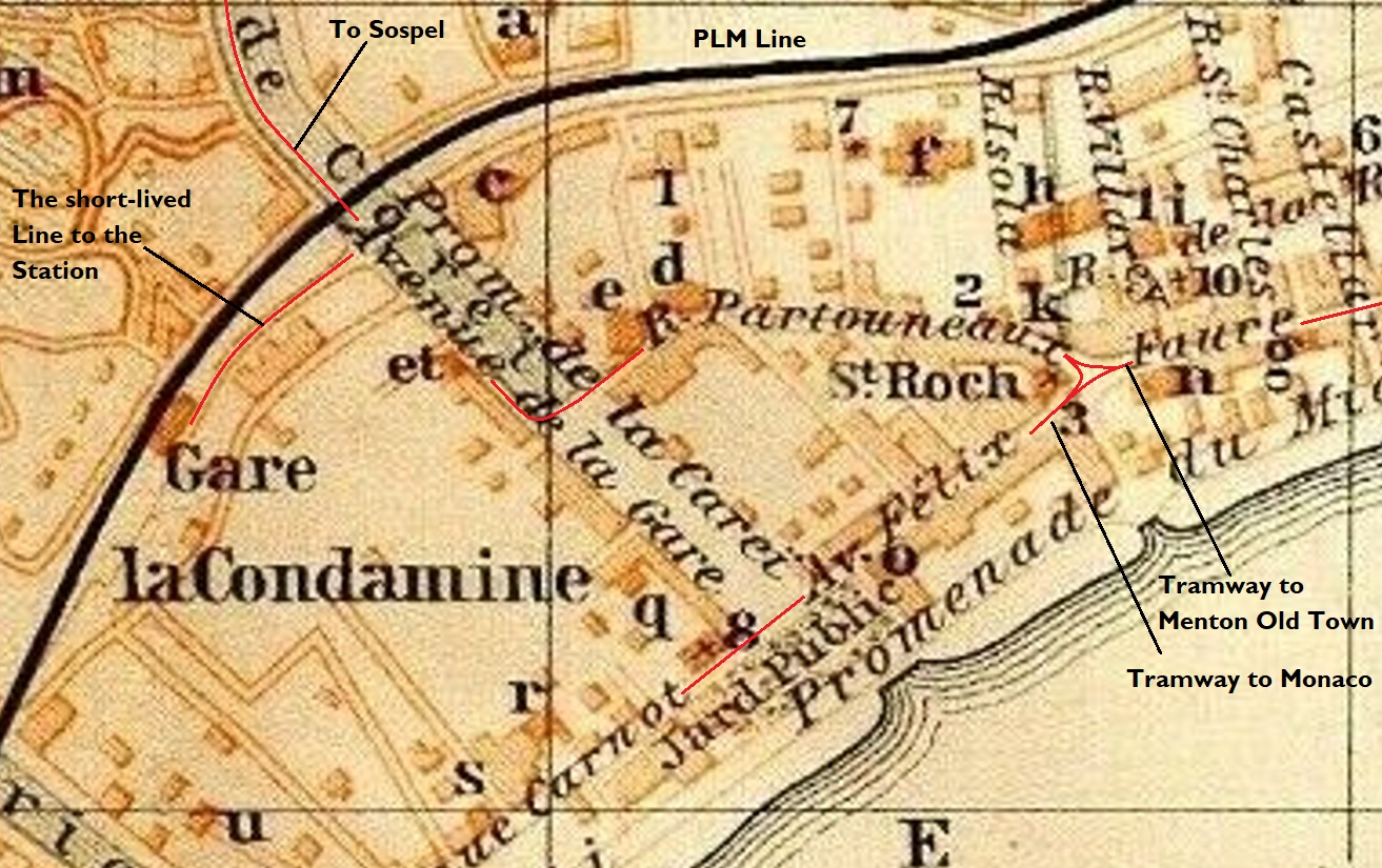
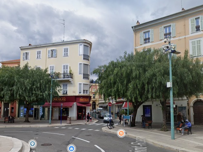
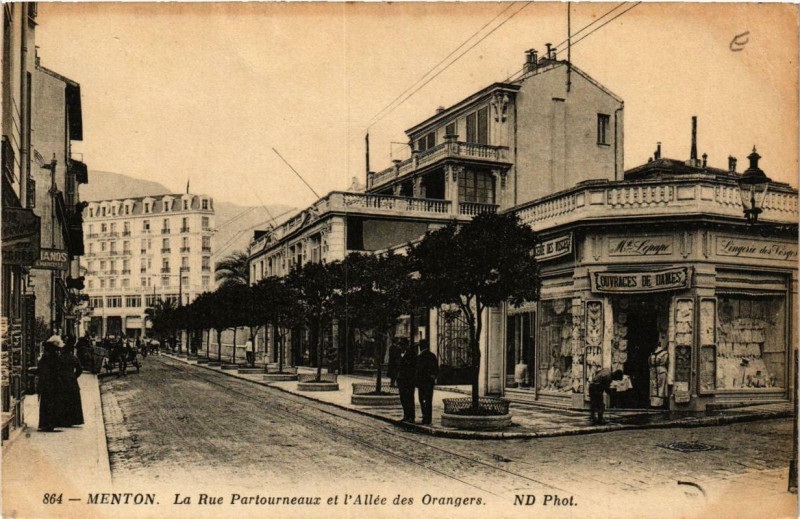
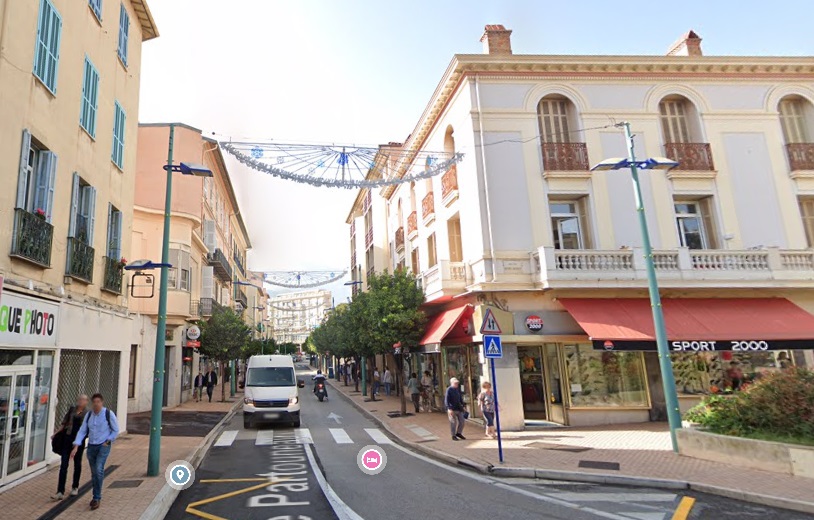
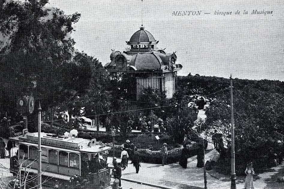
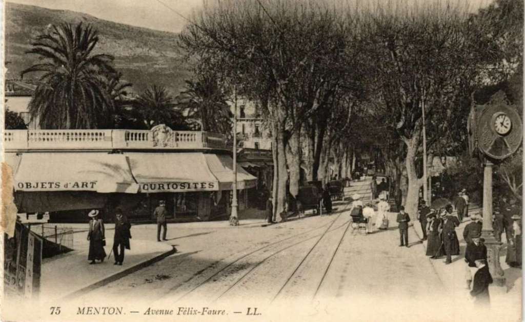
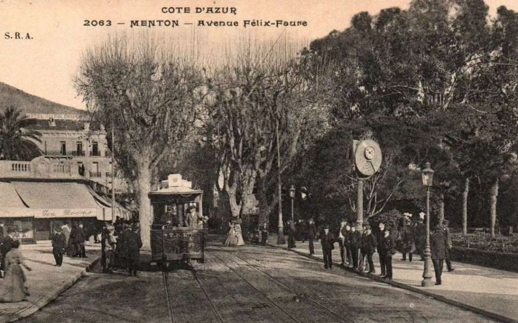
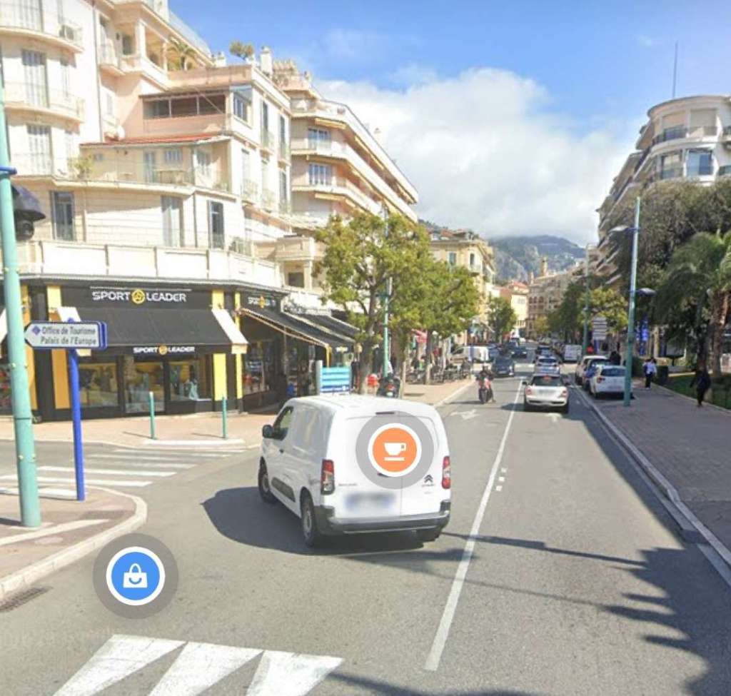
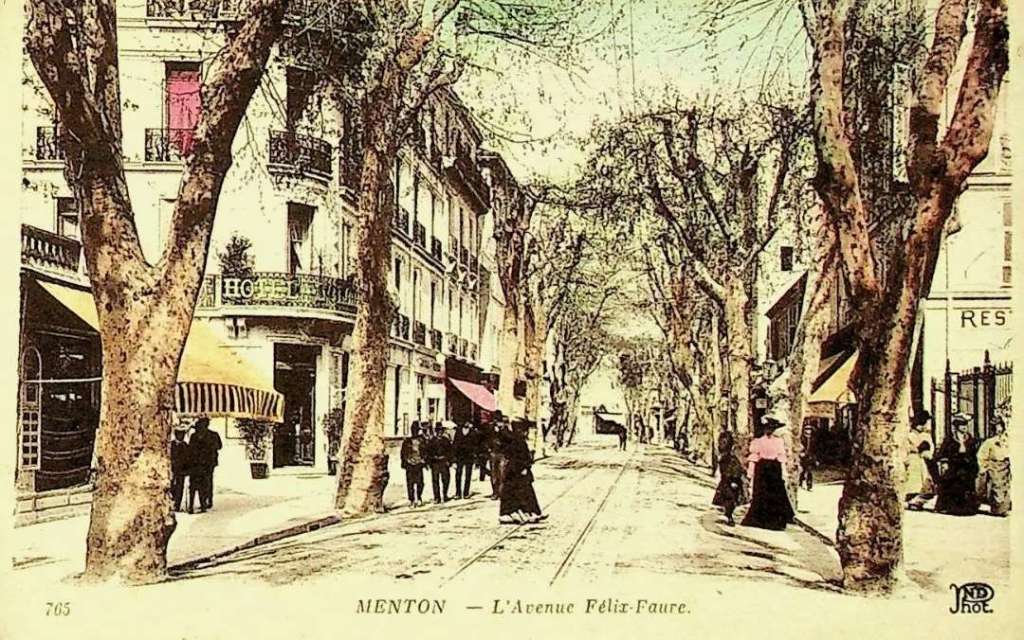
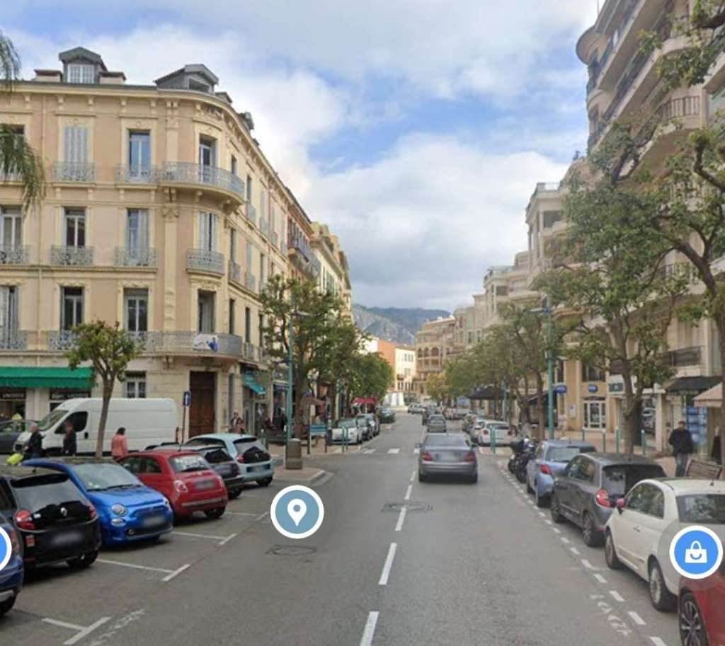
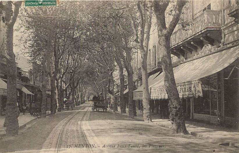
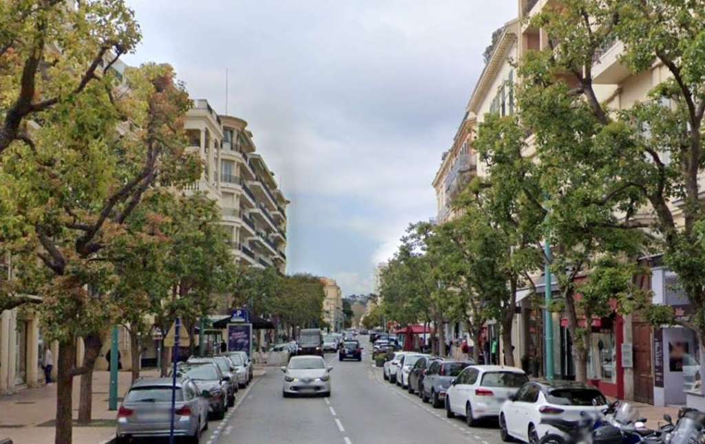
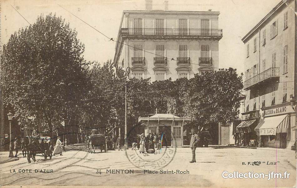
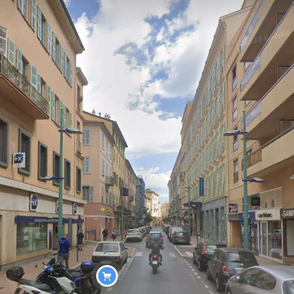
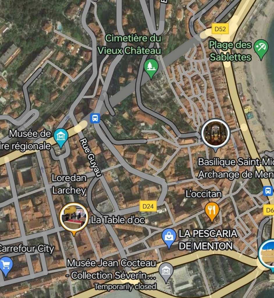
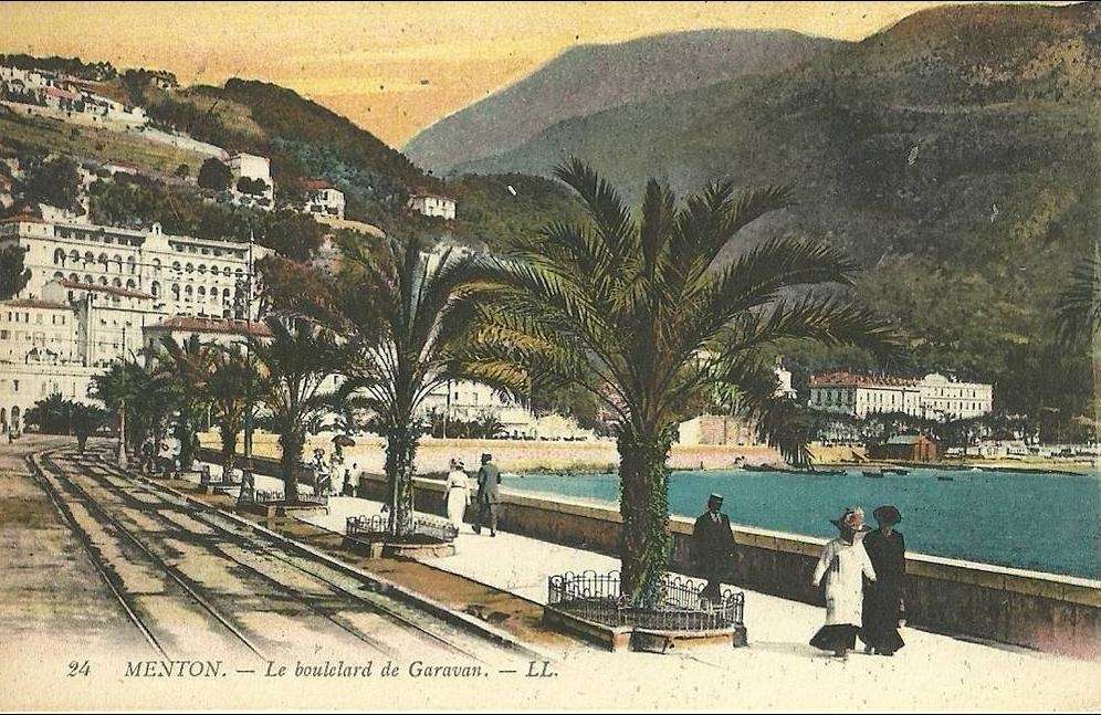
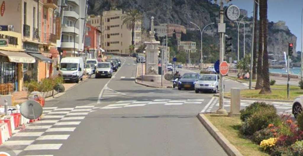
The line originated in Place Saint Roch and ran first along Rue Partouneaux.

The maximum gradient on the line was 68mm/m, only 0.144 km of the line was on a level formation. The line started in Place St. Roch at 3 metres above sea level and reached a maximum altitude of 572 metres above sea level at the Castillon tunnel. In all, trams had to negotiate 482 curves as they travelled the line of which 143 had a radius less than 40m. [1: p77]
Over 75% of the route was independent of the road between Menton and Sospel, now the D2566/D2566A. With its tight curves, “its imposing structures and its stations with spacious buildings, the Menton – Sospel line appeared much like a real mountain railway. In this way, it was more similar to the daring branches of the TAM network than to the other TNL lines in the Nice hinterland which retained the appearance of urban tramways.” [1: p77]
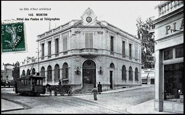
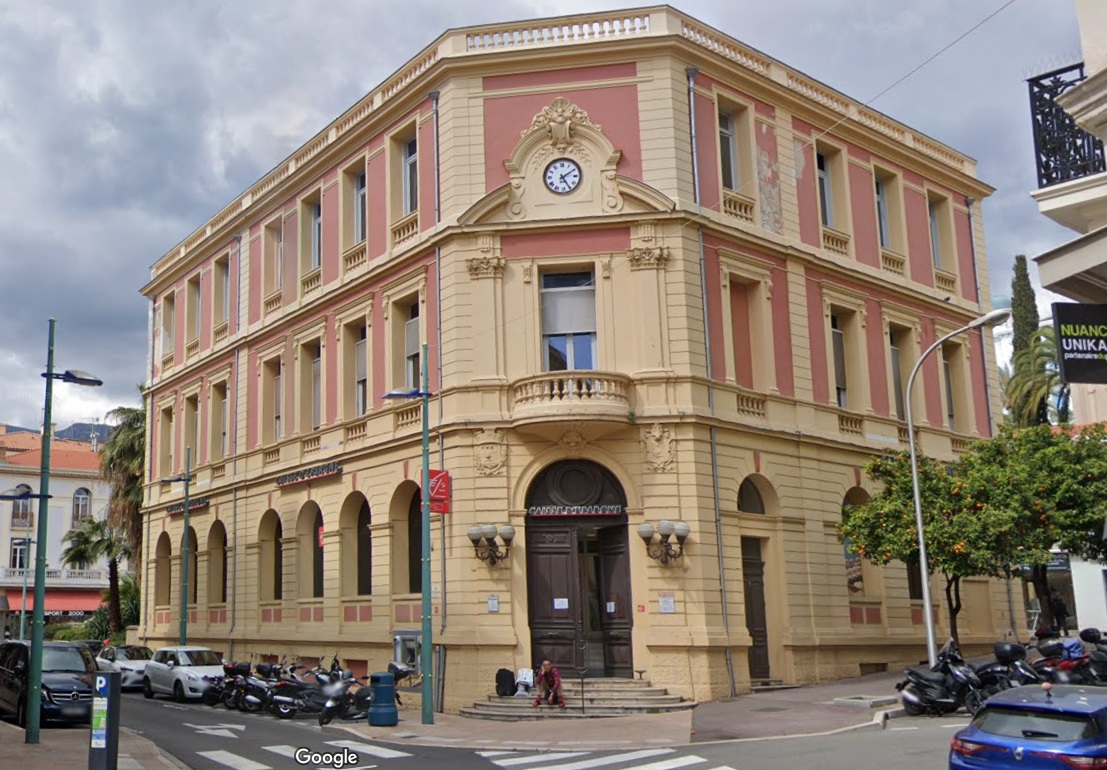
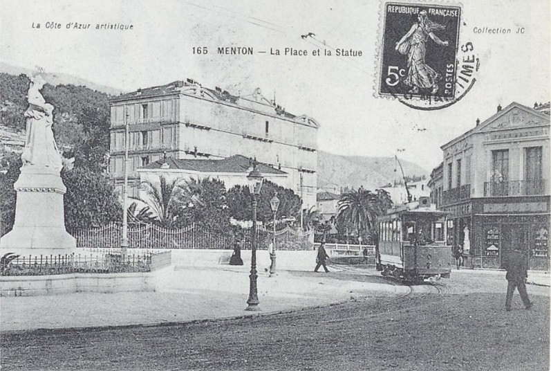
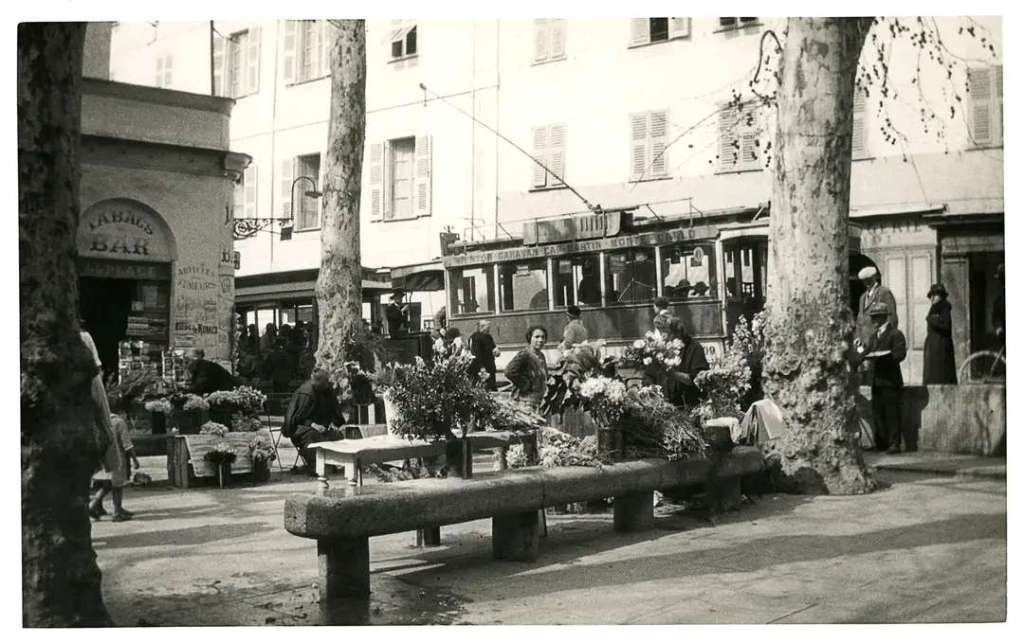
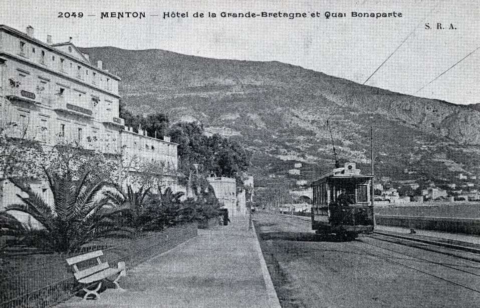
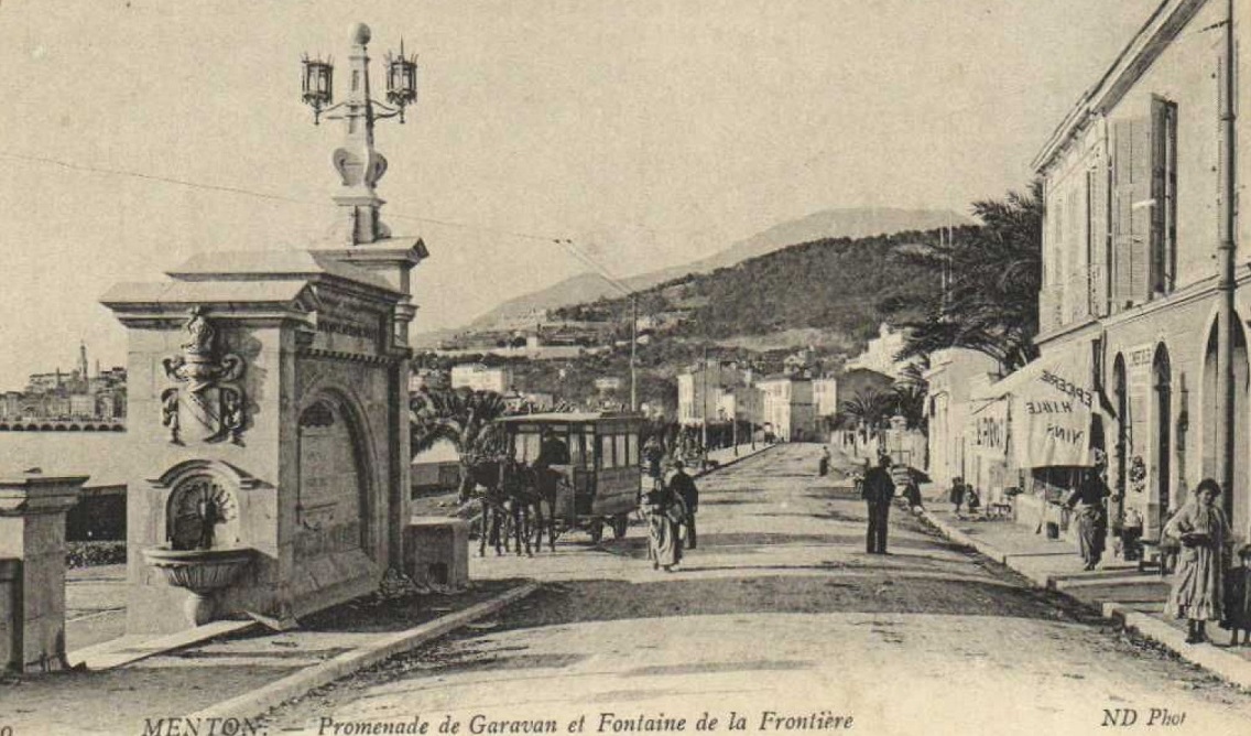
Banaudo tells us that “the line was entirely single track. It met the coastal artery at a triangular connection on Place St. Roch, at the entrance to the old town of Menton. The tram left from the western branch of the triangle, along which a wooden kiosk housed travelers and company agents. Via Rue Partouneaux, trams accessed the Biovès public garden which occupies an esplanade created by covering the River Careï. At the top of Avenue de la Gare (today Verdun) there was a short branch of 147 m on a ramp of 40 mm/m which ended in a dead end at the entrance to the courtyard of Menton PLM station. [That branch] served as a terminus for urban shuttles from Place St. Roch.” [1: p77] The branch lineline was brief both in length and life since, “after only operating from 1903 to 1912, it was abandoned during the First World War.” [1: p77]
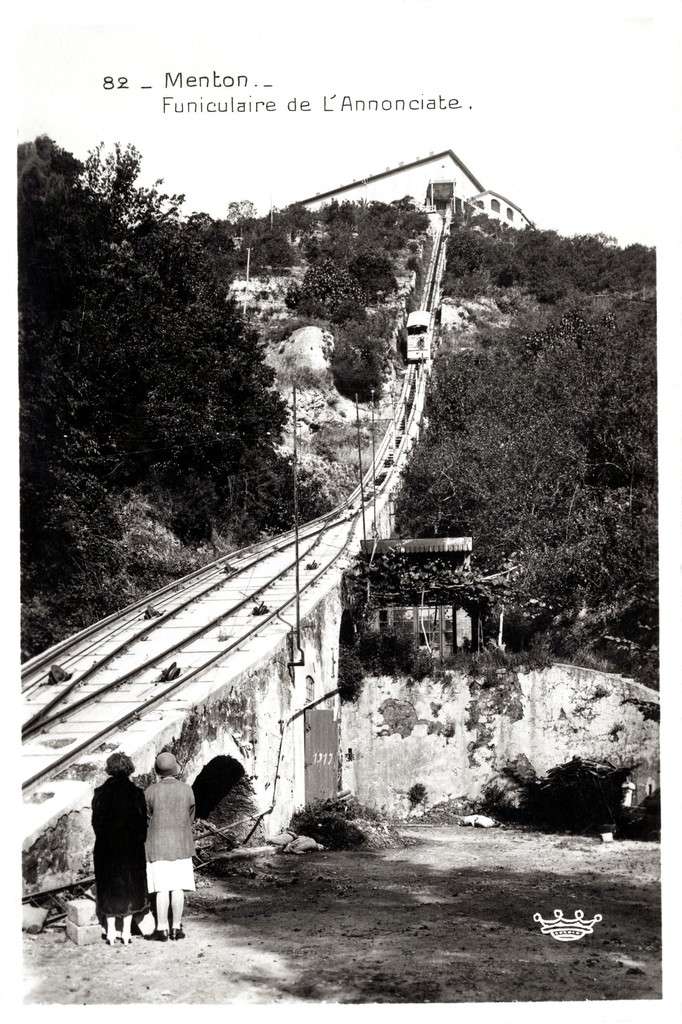
Immediately beyond the station branch, the tramway passed under the bridge of the PLM Nice – Ventimiglia line then continued up the right bank of the River Careï where there was a goods station. Banaudo says that, “the line passed at the foot of the L’Annonciade Hill, where a funicular served a hotel and a monastery.” [1: p77]
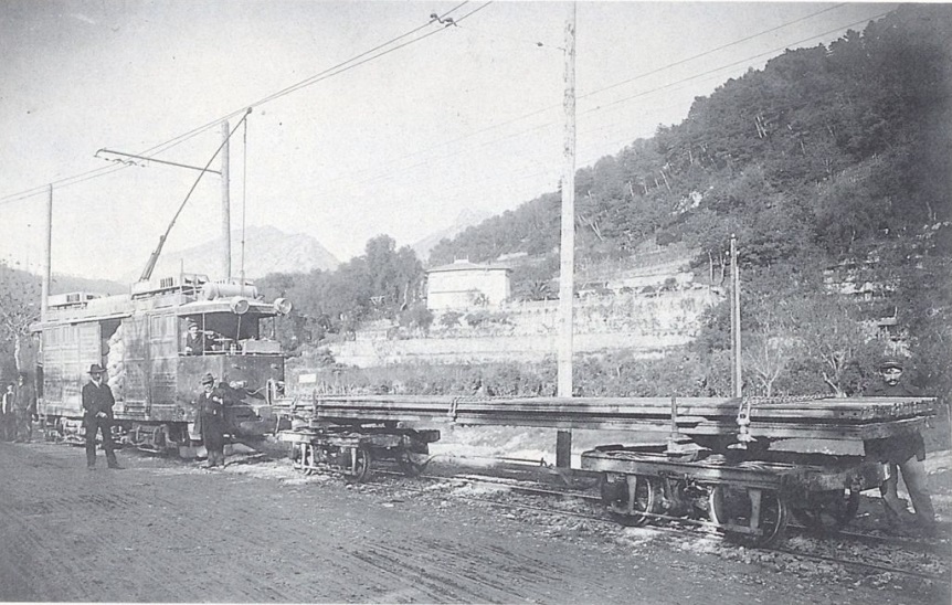
Continuing North, three passing-loops were provided at “Villa-Beau-Séjour, at the Gioan-Bosio property Ans at l’Octroi-due Careï. Soon after, “the Villa-Caserta tram stop marked the terminus of urban services. Upstream and downstream of this point, two dedicated branch lines allowed the Mercier and Gianotti companies to load materials to be sent to Sospel for the construction of the PLM Nice – Cuneo line.” [1: p77]
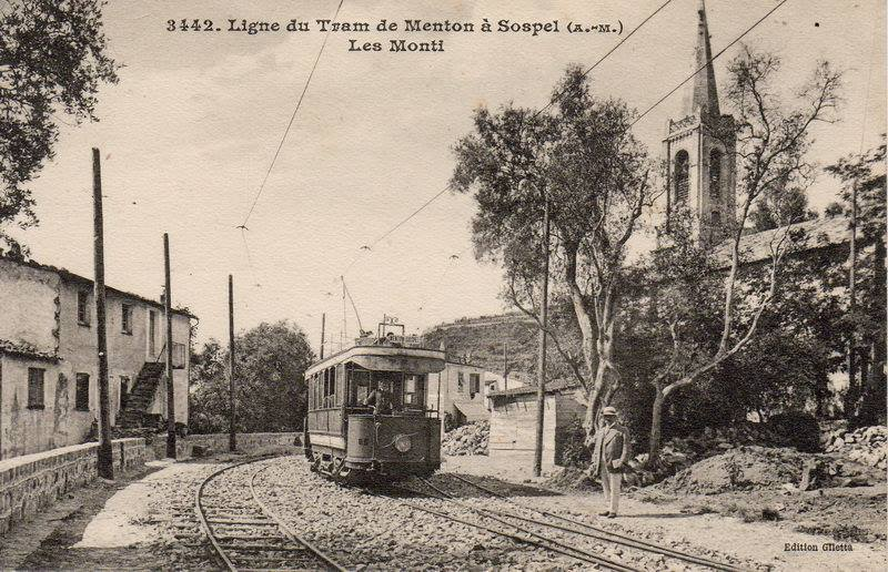
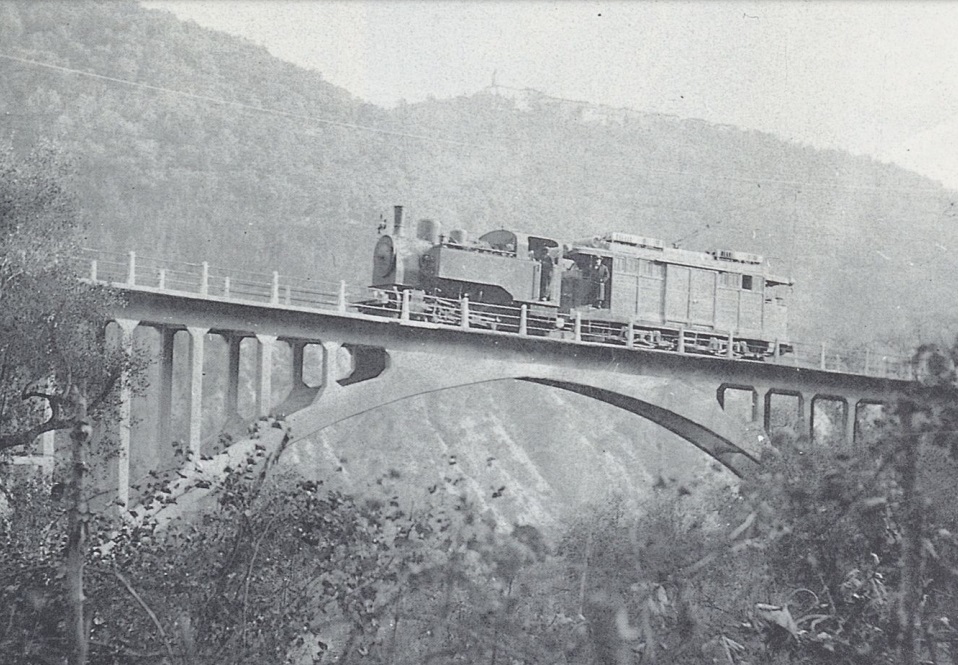
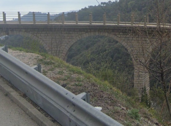
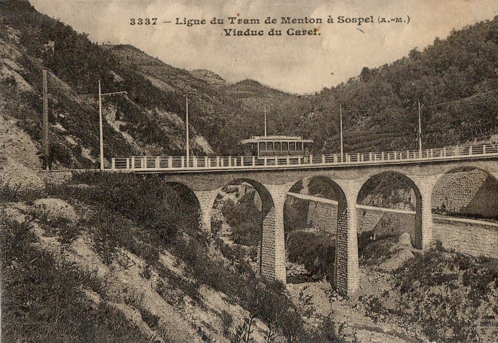
The route continued North along what is now the D2566 avoiding one tight bend by following its own course for approximately 450 metres. The hamlet of Monti had its own tram stop and was the location of a reinforced concrete viaduct which spanned both a ravine and the road. Pictures of this structure can be seen further down this article.
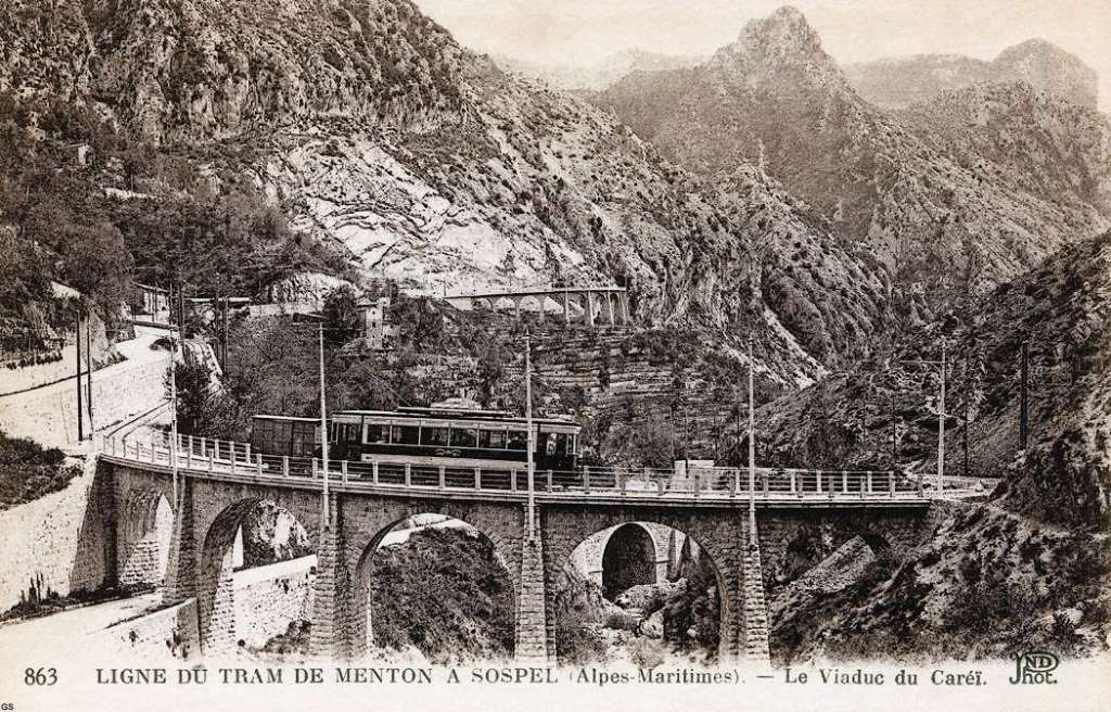
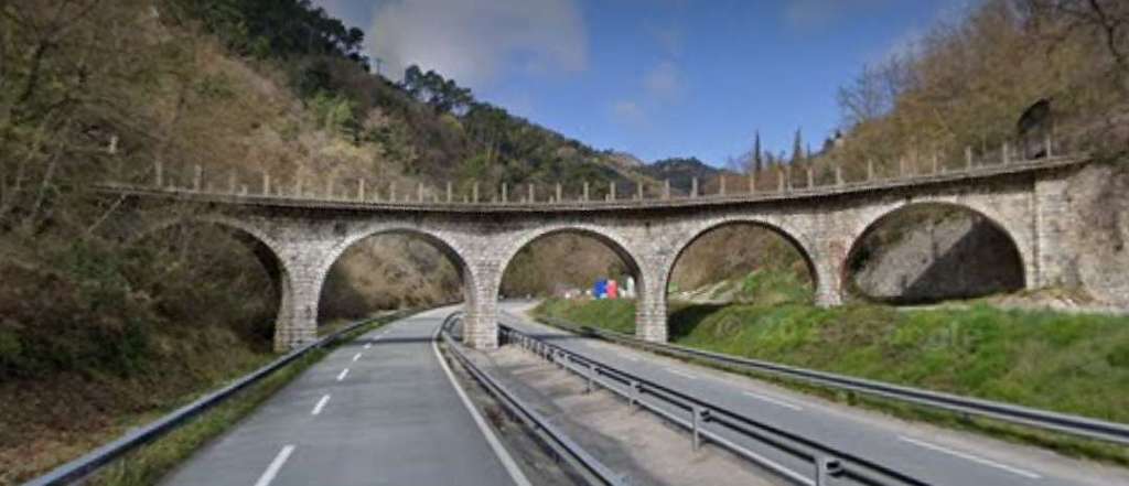
Now running on its own formation, the tramway climbed above the road for 2.3 km. Banaudo explains that the road climbed to meet the tramway “at the Ubac-Foran forest house. Arriving at a point where the valley narrows sharply and where the gradient becomes steeper, the track ran again on its own formation to span the road and the River Careï on the curved Careï viaduct, with five masonry arches.” [1:p77]
Over the River Careï the tramway continued climbing steeply in a Southeasterly direction to the location of the Caramel viaduct, “whose bold silhouette had already been visible for several minutes standing out against the mountainside. This major [structure] on the line had thirteen arches with a total length of 120 m, which were part of an omega-shaped loop below the road.” [1: p77] To the Northwest of the Viaduct, two dead-end tracks were provided, one to serve a quarry, the other to stop trams whose brakes had failed before they ran out onto the viaduct.
Continuing its ascent, the tramway again left the road and approached the bottom of the valley where the Castillon tram stop was located. “It was in a damp and isolated site below the village and the pass of the same name. A substation incorporated into the station building provided the line’s electrical supply. This was also the location of the southern portal of the 763 m tunnel under the Col de Castillon, the longest structure of this type drilled for a tramway in the Alpes-Maritimes.” [1: p77]
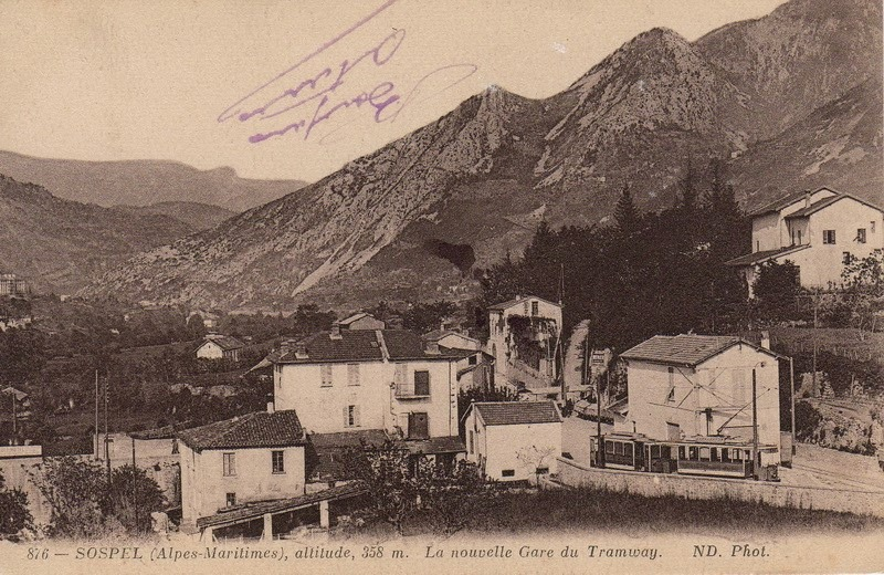
At its Northern portal, the tunnel opened into the green valley of Merlanson at an altitude of 572 m, the highest point on the TNL network. “From there, the line descended on its own formation for 4900 m on the right bank of the river. To the west stands Mount Barbonnet crowned with a fort while in the background, at the foot of the amphitheater formed by the mountains of the Authion massif, the Bévéra valley widens to form the basin where the town of Sospel is located.” [1: p77]
Approaching Sospel, the tramway ran under the embankment of the PLM Nice – Cuneo line then ended its journey at the entrance to the town where a station was built with a passenger and goods facilities and a motor shed. Banaudo tells us that during the years of construction of the PLM railway, “the track extended to the platform of the future PLM station, where the materials could be supplied by the Mercier and Gianotti companies.” [1:p77]

Key Dates
Banaudo provides details of dates relating to the life of the whole line. [1: p78] The more significant of these are: 1903 (the line between Place St. Roch and the PLM Railway Station was opened to traffic); 1911 (the route between Avenue de la Gare, Menton and Villa Caserta was opened); 1912 (a courier service between Menton and Sospel was opened); 1913 (the goods service between Menton and Sospel was inaugurated); 1923 (the new numbering system was put in place: No. 45 was given to the urban service between Menton and Villa Caserta; No. 46 TP the interurban service Menton to Sospel); 1927 (the urban service (No. 45) was extended to Route-de-Monti); 1931 (trams on Ligne No. 46 were replaced by buses and the tram service (Ligne No. 45) between Villa Caserta and Route de Monti ceased); January 1932 (trams on Ligne No 45 between Avenue de la Gare and Villa Caserta were replaced by a bus service); March 1932 (the remaining length of the line between Place St. Roch and Avenue de la Gare was closed). In the summer of 1933 the full length of the line was decommissioned.
The full service between Menton and Sospel was active for less than 20 years!
The Main Structures on the Line
These were: the Peïrola Ravine Bridge; the Monti Viaduct (1 concrete arch of 36 m, total length 79 m); the Ture Ravine bridge; the Pian Ravine Bridge; the Careï Viaduct (5 arches of 8 m); the Caramel viaduct (13 arches of 8 m, length 120 m); and the Castillon Tunnel (763 m).
Structurae.net provides a number of photographs of the Viaduc de Monti which remains standing in the 21st century. These images can be found here. [9]


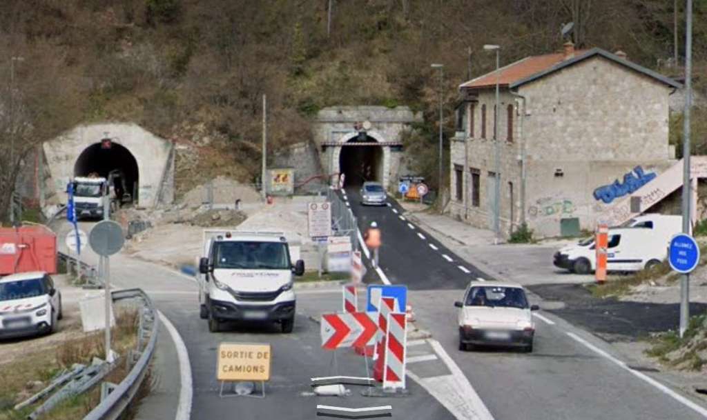

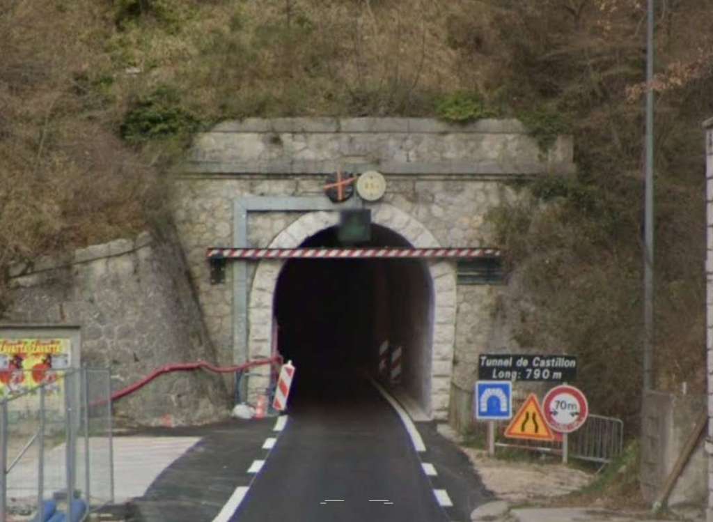
The Tunnel de Castillon was an essential element of the scheme, the additional climb to the village would have required a significant series of loops either side of the pass and severe gradients. Structurae.net provides a number of photographs of the Tunnel which remains standing in the 21st century and is in use as a road tunnel. These images can be found here. [24]
Steep Gradients on the Menton to Sospel Tramway and the wider tram network
Banaudo’s book has a short feature relating to the exceptional gradients on the Menton to Sospel line and throughout the TNL and TAM networks. [1: p81]
99% of the Monton to Sospel tramway was on a gradient. The average gradient between Menton and the summit of the line at the North end of the Tunnel de Castillon was 46mm/m over almost 12.4 km. This was unique in the Alpes-Maritimes and “assez exceptionelles (quite exceptional) en France.” [1: p81]
Over 7.7 km was graded between 46mm/m and 60 mm/m. 60 mm/m was specified as the steepest grade permitted, but during construction it became obvious that complying with the specification would unduly lengthen the line. Ultimately, the Department of Bridges and Roads permitted over 4.1 km to be built with steeper grades (between 61 and 68 mm/m), mainly in the Careï valley.
Banaudo points out that at “the same time, in Switzerland, Italy and Austria, such lines were put into service with vehicles equipped with specifically adapted traction and braking mechanisms, the Departement des Alpes-Maritimes and concessionaires (the TNL on Menton-Sospel and the Sud-France on the entire TAM network) did not seem to appreciate the level of risk involved in such operations.” [1: p81]
The TNL had been successfully running 168 hp bogie trams equipped with compressed air brakes on the Contes and Levens lines. However, trials on the Menton-Sospel line demonstrated that their electrical equipment could not sustain the stresses imposed by such long and steep gradients. “As soon as sustained effort was required, the entire circuit was at best overheated, the circuit breaker tripped and the fuses blew, the wheels of the trolleys could melt, the controller would start to smoke, and soldered connections could melt and cables ignite. It was therefore decided to modify these trams and equip them with more powerful motors. But pressure from the Departement to put the Sospel line into service, meant that the service was opened in the spring of 1912 with two standard type T2 passenger trams and one self-propelled goods van. These two-axle vehicles only had a power limit of 70 and 84 hp which did not even allow for the lightest of wagons to be towed. The handbrake was supplemented by (un freinage rheostatique) rheostaic braking. No air-brake was provided!” [1: p81]
Banaudo goes on to explain that, “The inadequacy of this equipment was tragically brought to light on 11th September 1912, when a train carrying gravel for finishing work on the line ran down the steepest slope: The handbrake was unable to hold it and the power pole separated from the overhead supply, rendering rheostatic braking inoperative. The convoy ended up derailing and crashing at the foot of the Monti viaduct, killing the driver and the conductor.” [1: p81]
Sadly, just two weeks later the first of the modified bogie power cars Nos. 214 to 216 entered service (on 23rd September 1912). These were equipped with “hand, air and rheostatic brakes, developing a power of 240 hp, these tramcars proved to be better adapted and could tow two passenger trailers or three goods wagons on the steepest slopes. In June 1913, two self-propelled goods vehicles were modified in the same way and moved to the Sospel line, which ensured regular freight traffic from summer onwards. A third ‘tracteur’ of a similar design was put into service the following year.” [1: p81]
In the meantime a derailment of a train on the TAM line between Cagnes-sur-Mer and Grasse occurred on 17th September 1913 at the Viaduc de Cloteirol near Villeneuve-Loubet. “This disaster caused many deaths and the commission formed following this accident to improve the safety of the departmental network covered all the lines, including that of Sospel on 29th January 1914. Following its conclusions, the Department of Bridges & Roads limited tram speeds to 16 km/h uphill and 12 km/h downhill as well as when crossing viaducts. Four safety stops were established for descending convoys at points located at the top of steep slopes: above the Viaduc du Caramel viaduct, at l’Ubac-Foran, above the Pont de Monti and at km 3,350 between this hamlet and the stop at Villa Caserta. The first two stops, where the tramway could leave and pick up passengers, were equipped with a point directing an out-of-control convoy into a dead-end siding with a strong contrary slope. … In Villa-Caserta, a similar device was provided to stop any runaway of vehicles parked at the terminus of the urban service.” [1:p81]
References
- José Banaudo; Nice au fil de Tram, Volume 2: Les Hommes, Les Techniques; Les Editions de Cabri, Breil-sur-Roya, France, 2005.
- https://artplastoc.blogspot.com/2023/02/1292-nice-la-passerelle-et-le-pont.html?m=1, accessed on 21st November 2023.
- https://twitter.com/actualites_nrv/status/990903681389400064?t=rpQXwAb7jIlpMfdfM8RoIg&s=19, accessed on 21st November 2023.
- https://www.mapsof.net/saint-andre-de-la-roche-fr, accessed on 22nd November 2023.
- https://rogerfarnworth.com/2018/03/20/the-nice-to-levens-tramway-part-1-chemins-de-fer-de-provence-54.
- https://m.facebook.com/groups/ciccoli/permalink/3231219313790582, accessed on 23rd November 2023.
- https://m.facebook.com/groups/ciccoli/permalink/3504633499782494, accessed on 23rd November 2023.
- https://cronobook.com/pic/1e977519-3f4c-427f-9bdb-ba67e3c07054, accessed on 27th November 2023.
- https://structurae.net/en/structures/monti-viaduct, accessed on 27th November 2023.
- https://commons.m.wikimedia.org/wiki/File:Viaduc_de_Monti_(1910).jpg, accessed on 27th November 2023.
- https://upload.wikimedia.org/wikipedia/commons/1/1d/Viaduc_du_Carr%C3%A9i_%281910%29_Ouest.jpg, accessed on 27th November 2023.
- https://www.facebook.com/photo/?fbid=10210534413814255&set=a.10210534255570299, accessed on 28th November 2023.
- https://www.facebook.com/photo/?fbid=472351886472746&set=pcb.2011981832381009, accessed on 28th November 2023.
- https://m.facebook.com/groups/ciccoli/permalink/3158590614386786, accessed on 28th November 2023.
- https://www.facebook.com/groups/1389253567814679/permalink/9979281115478505/?mibextid=rS40aB7S9Ucbxw6v, accessed on 14th March 2023.
- https://m.facebook.com/franckasfaux06/photos/a.1412935558990256/1412939378989874/?type=3 accessed on 30th November 2023.
- http://dofusleguide.com/2019/12/photos-et-cartes-postales-anciennes-de-menton-06500.html, accessed on 30th November 2023.
- https://cartorum.fr/carte-postale/204383/menton-menton-la-rue-partourneaux-et-lallee-des-orangers, accessed on 5th December 2023.
- https://excerpts.numilog.com/books/9782903310608.pdf, accessed on 30th November 2023.
- https://www.facebook.com/MentonDuPasseAuPresent/photos/a.635924896587645/904791879700944/?__cft__[0]=AZX5F8XW__jQPAyygfwvR03xmeAlwW_69beRs7RwlwE6xsjQfZ63F76O9fVpVPdM1BJs7Sko4cCH399fbkWwRbZM3L9NxeGF889CfcQ1_7n1krmUaygG3KAdo2h7ZHbuHUUryowX6X5bDwpFxz0OAGE5IBIgQ4UTuX_U-hOLi7R9JLmGRwSgl8bz-28sshkfnjk&__tn__=EH-R, accessed on 20th November 2023.
- https://www.ebay.co.uk/itm/203526019792, accessed on 5th December 2023.
- https://commons.m.wikimedia.org/wiki/File:Ligne_du_tramway_de_Menton_%C3%A1_Sospel,_Tunnel_de_Castillon.jpg, accessed on 7th December 2023.
- https://structurae.net/en/structures/castillon-tunnel, accessed on 7th December 2023.


.jpg)