This is the second article in a series about the Border Counties Railway. The first can be found here. [3]
An online acquaintance pointed me to a film made in the mid-1980s, ‘Slow Train to Riccarton’ which records something of the lives of people associated with this railway line:
The film shows different lengths of the line and records a number of people speaking about their life on and around the line.
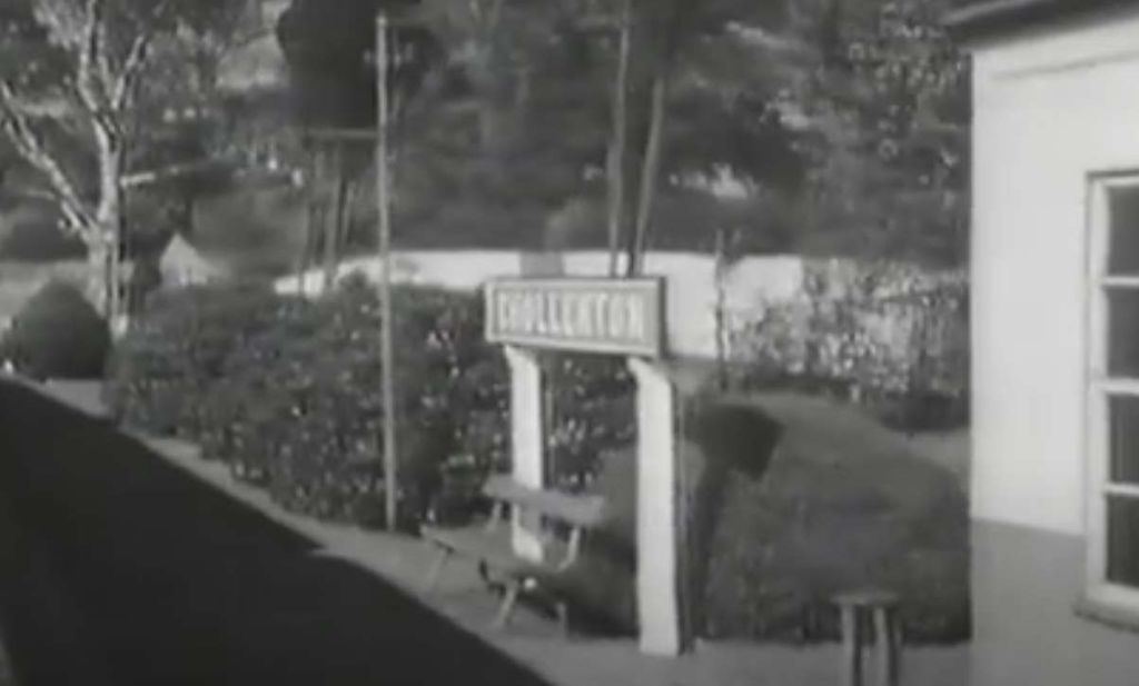
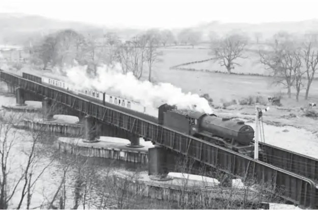
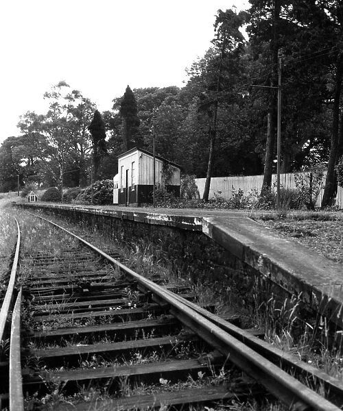
This first image is a still from the film which denotes where we are starting this next length of the journey along the line. A few more ‘stills’ will help to locate us as we travel along the line.
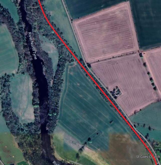
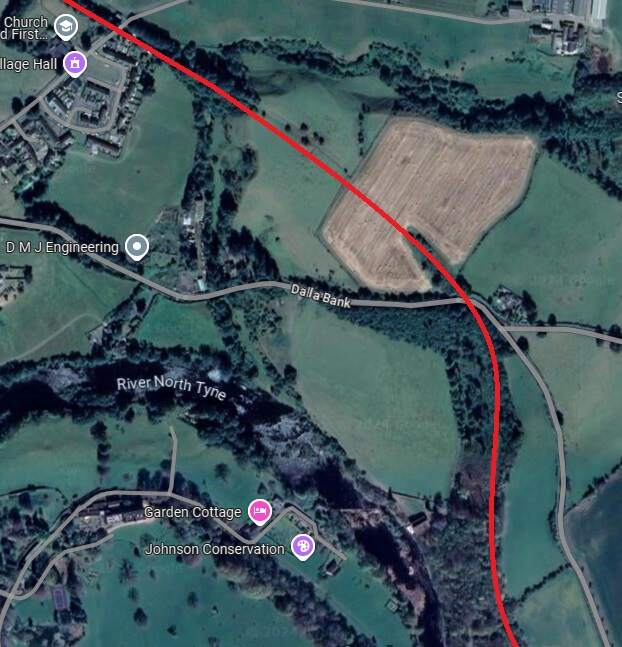
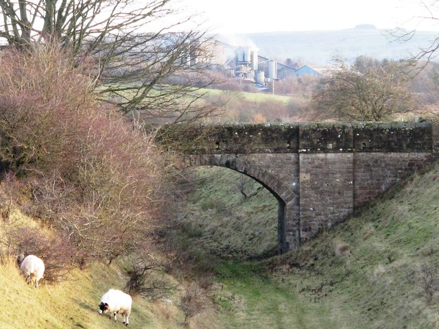
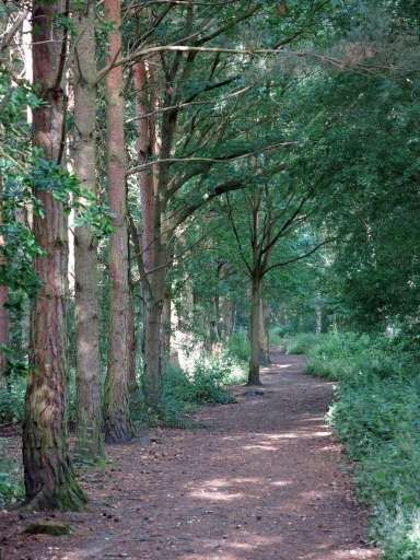
The line travelled on, Northwest from Chollerton, much of the time in deep cutting as far as Dallabank Wood, by which time it was running on a northerly course. Soon after the wood, the line turned towards the Northwest, passed under the local road (Dalla Bank), crossed a short but high embankment under which Barrasford Burn was culverted, and entered Barrasford Railway Station.
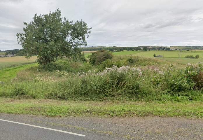
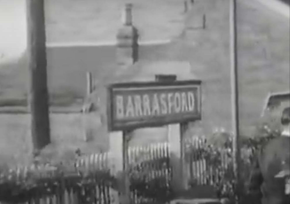
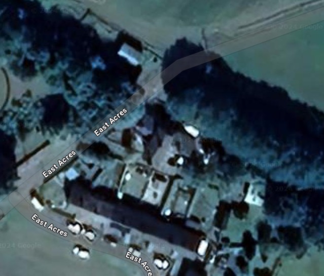
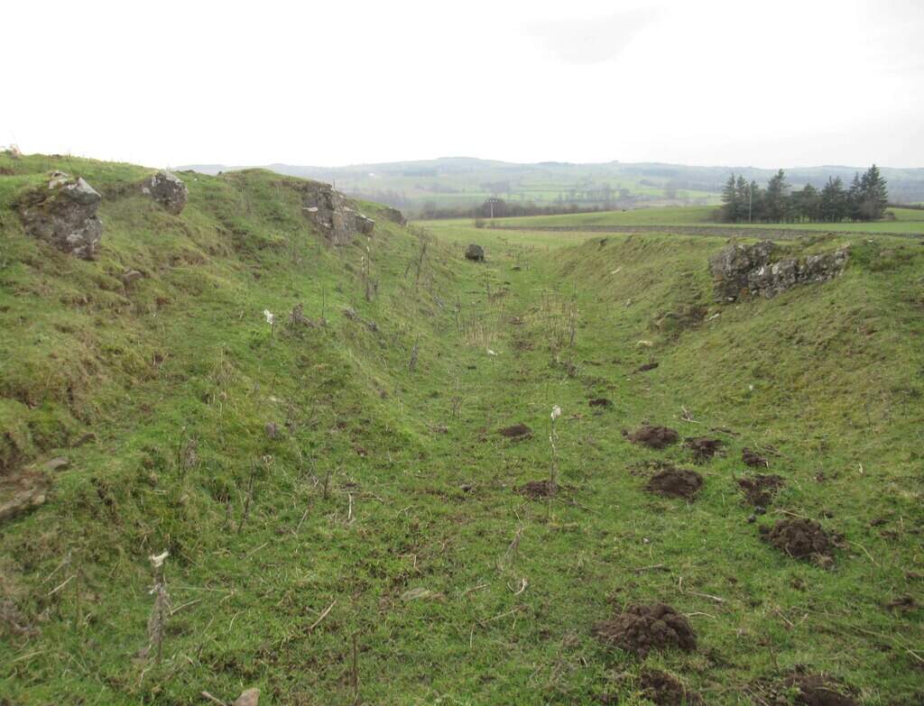
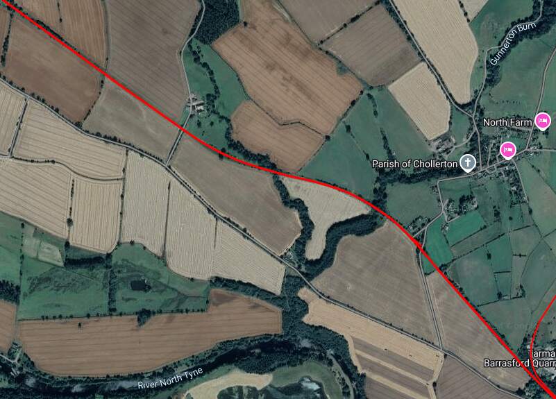
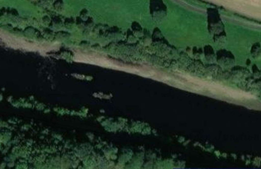
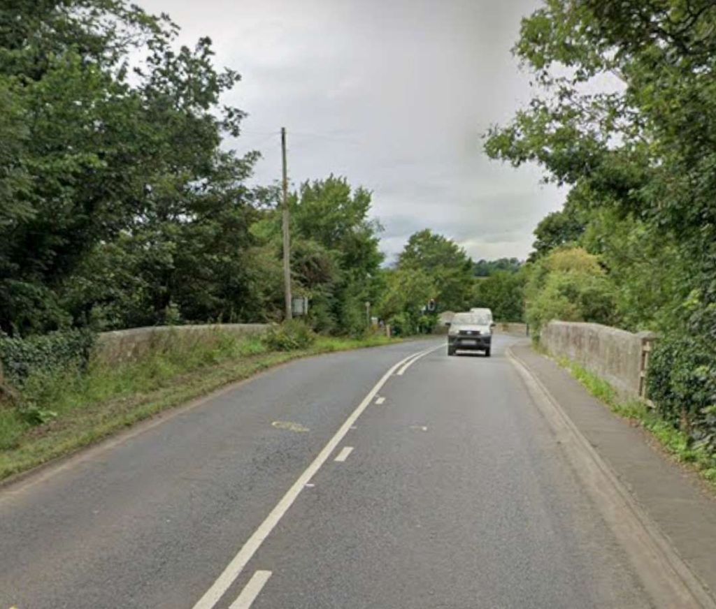
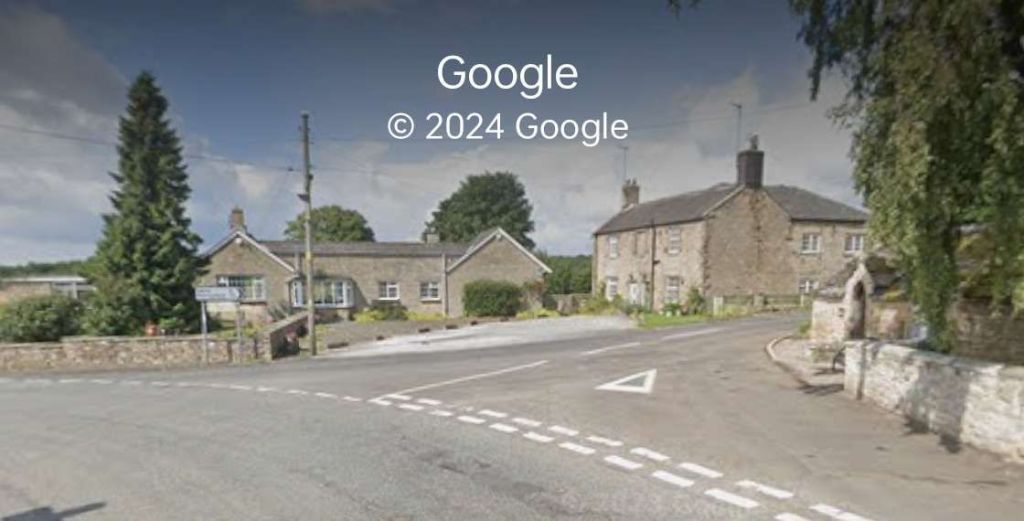
The red line shows the route of the old railway immdiately to the North of Chollerton Railway Station. [Google Maps, October 2024]The cutting South of Dalla Bank, Facing towards Chollerton in 2013, (c) Mike Quinn and licensed for reuse under a Creative Commons Licence (CC BY-SA 2.0). [15]The line continued on as marked by the red line under Dalla Bank and on to Barrasford Station which was located at the top left of this extract from Google’s satellite imagery. [Google Maps, October 2024]The view along the old railway line North-northwest from Dalla Bank. [Google Streetview, August 2023]Barrasford Railway Station name-board. [2]
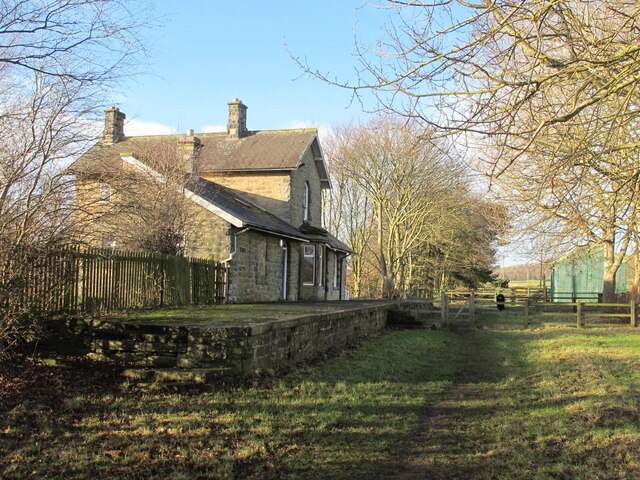
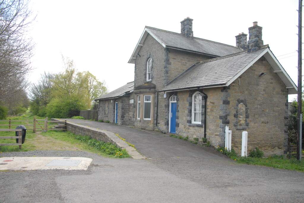
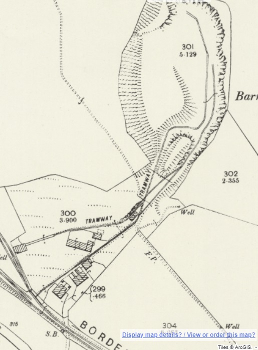
Barrasford Railway Station opened on 1st December 1859 by the North British Railway. The station was situated on a lane to Catheugh, around “200 yards northeast of the centre of Barrasford village. A siding adjoined the line opposite the platform and there was a further loop to the northwest. Both of these were controlled by a signal box, which was at the northwest end of the platform. The station was host to a camping coach from 1936 to 1939.” [4]
“Barrasford station was closed to passengers on 15th October 1956 but remained open for goods traffic until 1st September 1958, although it was downgraded towards an unstaffed public siding.” [4]
A short distance Northwest of Barrasford Railway Station, was Barrasford Quarry which was provided with its own siding.
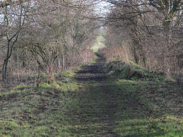
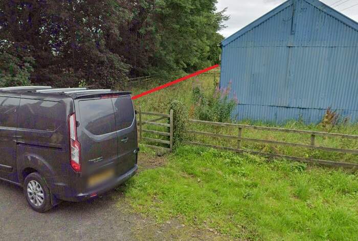
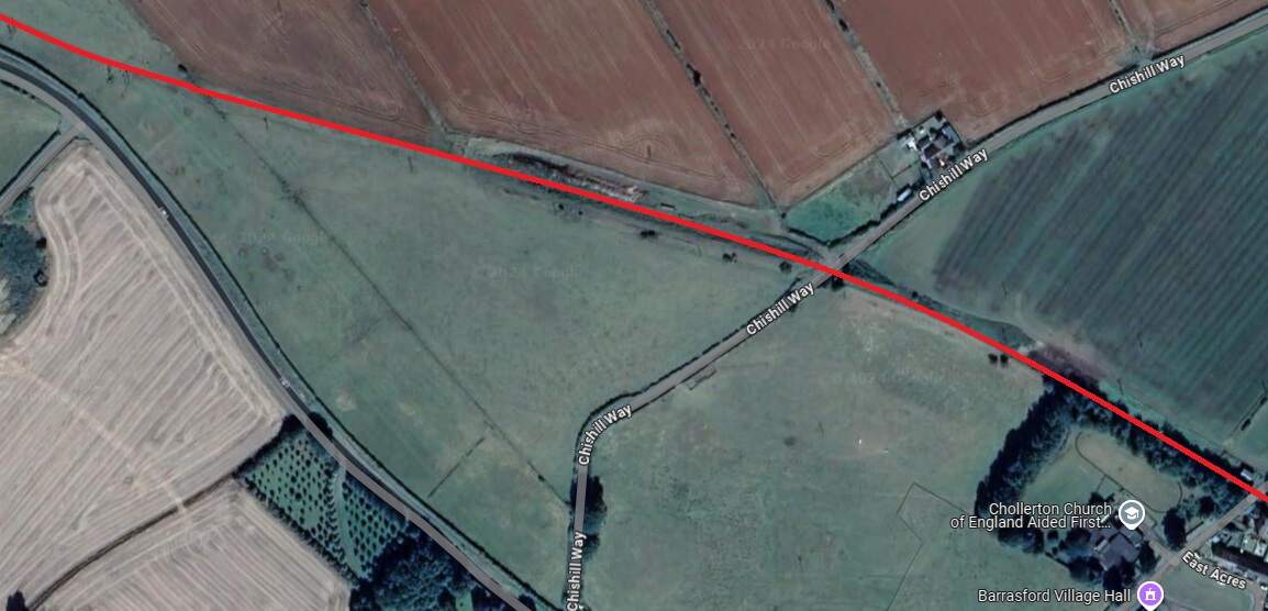
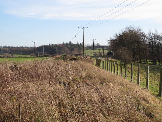
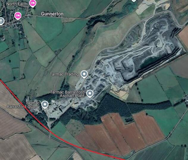
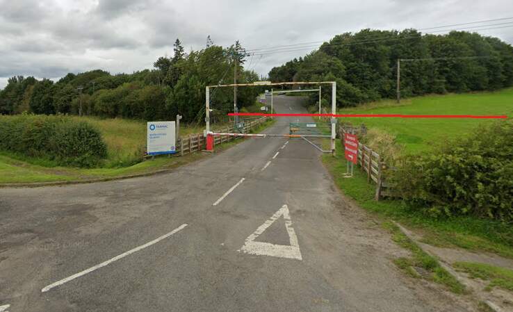
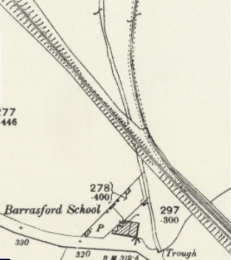
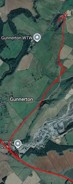
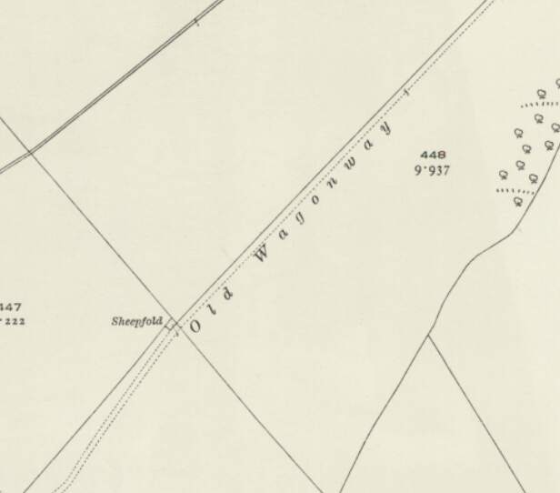
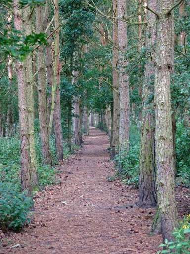
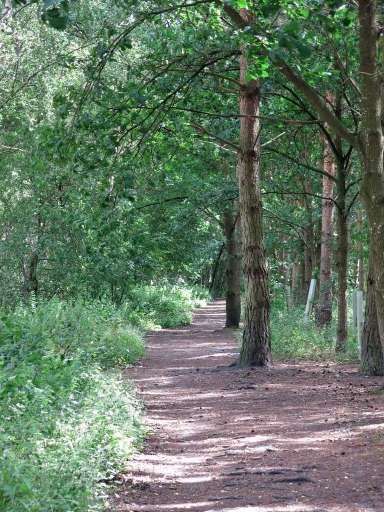
The line Northwest of Barrasford Railway Station. [Google Maps, October 2024]The track bed of the old railway a little to the Northwest of Barrasford Railway Station, looking back along the line towards the station in December 2013, (c) Mike Quinn and licensed for reuse under a Creative Commons Licence (CC BY-SA 2.0). [12]Looking back towards Barrasford Station from Chishill Way. The line was carried at high level over the road. Only the embankments remain. [Google Streetview, August 2023]A wintertime view along the old railway to the West from the East side of Chishill Way, in December 2013, (c) Mike Quinn and licensed for reuse under a Creative Commons Licence (CC BY-SA 2.0). [13]Looking West from Chishill Way. The railway embankment is to the right of the trees. [Google Streetview, August 2023]The track bed further West from Chswell Way, in December 2013, (c) Mike Quinn and licensed for reuse under a Creative Commons Licence (CC BY-SA 2.0). [14]Barrasford Quarry Sidings and Tramway. [7]Tarmac’s quarry at Barrasford is a much larger affair in the 21st century. [Google Maps, October 2024]The entrance to Barrasford Quarry. The red line indicates the approximate route of the old railway which is treelined to the West of the quarry road and through open fields to the East of the quarry road. The siding was on the North side of the line. [Google Streetview, August 2023]Just to the Northwest of Barrasford Quarry Siding was a branch line to Camp Hill, Gunnerton Quarry.This branhc was about 2 miles in length and is recorded on some maps as an old Waggonway. [8]The same location in the 21st century with the old railways superimposed. [Google Maps, October 2024]
The Camp Hill Branch as shown on satellite imagery from Railmaponline.com. The branch was a short industrial line serving a relatively small quarry to the North of Barrasford Quarry. It appears to have been disused by 1920 as one of the local OS Map sheets across which the line travels shows the line lifted by that time and referred to as an ‘Old Waggonway”. The line is present on map sheets surveyed in 1895.
A short section of the Camp Hill Branch Line as shown on the 1920 25″ Ordnance Survey which was published in 1922. [18]
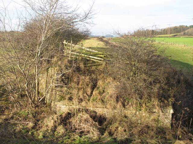
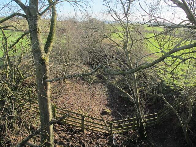
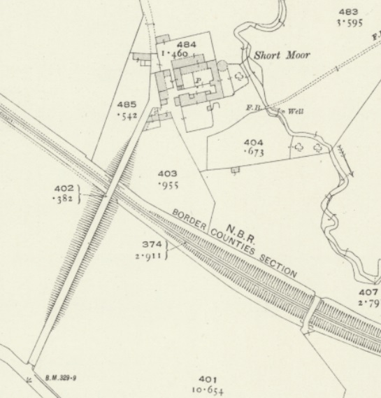
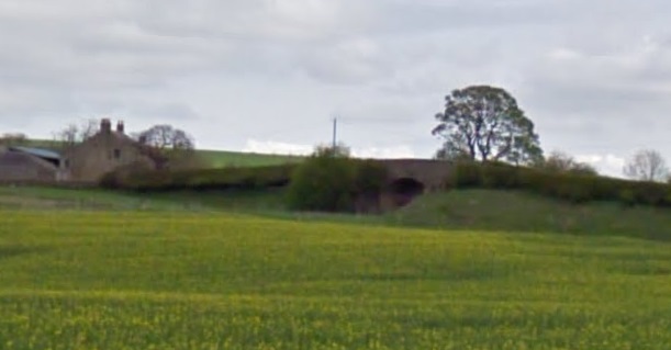
A little further to the Northwest, the access road to Short Moor crossed the old railway. Just before that lane there was another stone bridge which gave access between fields either side of the line.
Stone bridge Southwest of the Short Moor access road in December 2013, (c) Mike Quinn and licensed for reuse under a Creative Commons Licence (CC BY-SA 2.0). [28]Two bridges crossed the line close to Short Moor. [29]
A distant view from the Southwest of the bridge carrying the access road to South Moor which is on the left of this image. The stone-arched bridge is just to the right of centre. [Google Streetview, April 2011]
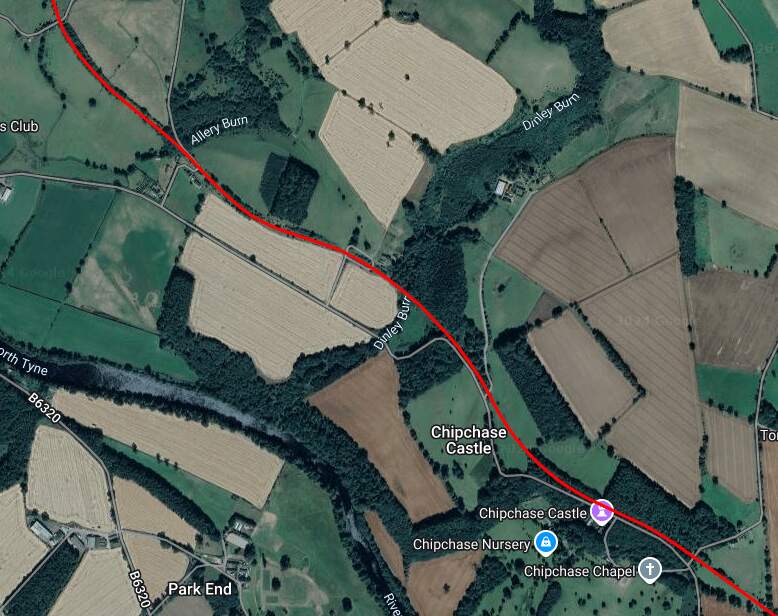
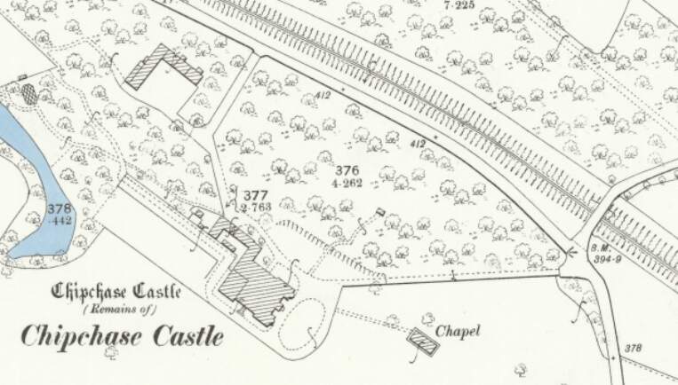
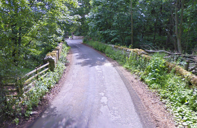
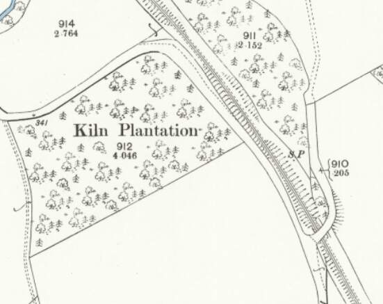
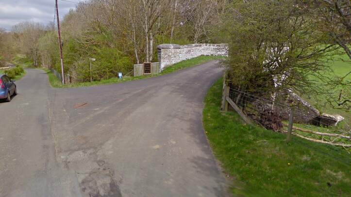
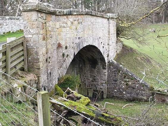
Further to the Northwest, the line as shown on the railmaponline.com satellite imagery. {17}The line ran on to the Northwest and this is the next significant point on the old railway. Close to Chipchase Castle the line was bridged by a minor road. [20]The view across the old railway bridge from the Northeast. [Google Streetview, June 2009]This next roadoverbridge carries an access road over the Border Counties Railway close to Kiln Plantation shortly before the highway turns away from the railway to the West along the North side of the plantation. [21]The view from the South of the road bridge in the map extract above. [Google Streetview, April 2011]The same structure in a photograph taken by Paul Hill and shared by him on the Border Counties Railway Facebook Group on 17th August 2020. [23]
A short distance to the Northwest another access road runs off the highway and crosses the Border Counties Railway.
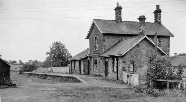
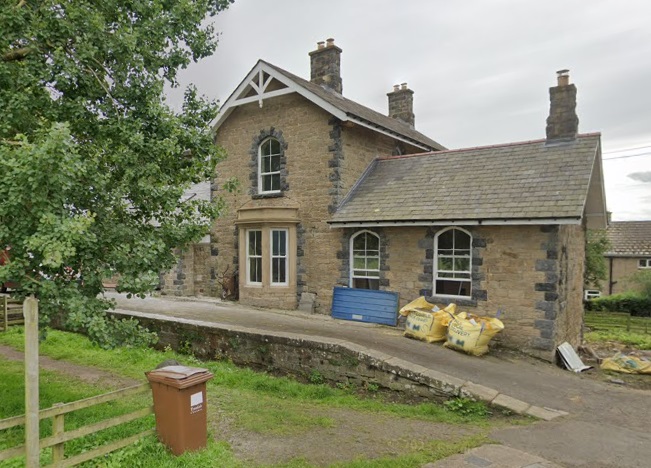
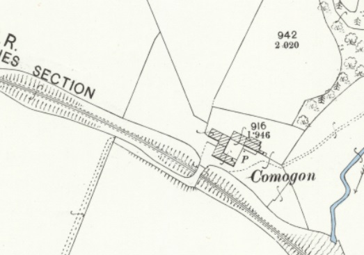
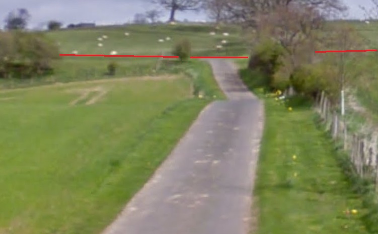
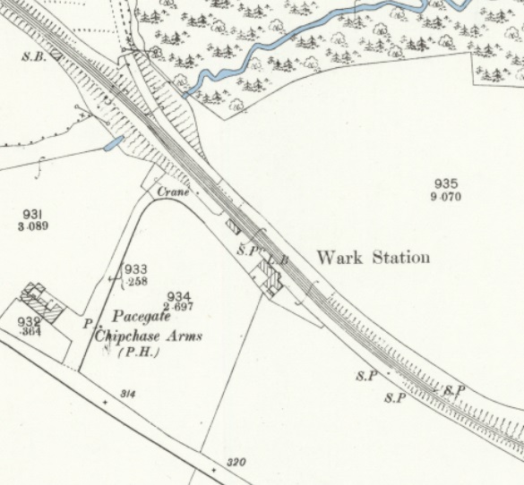
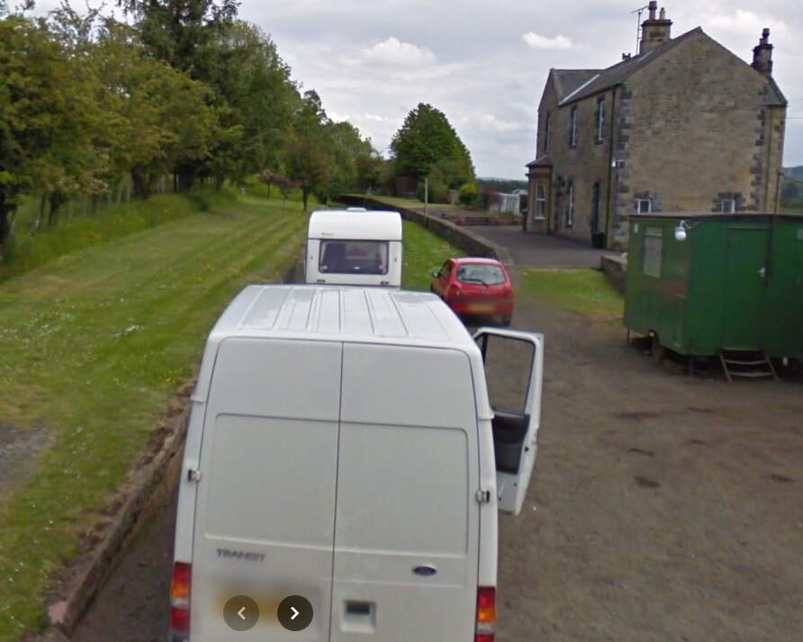
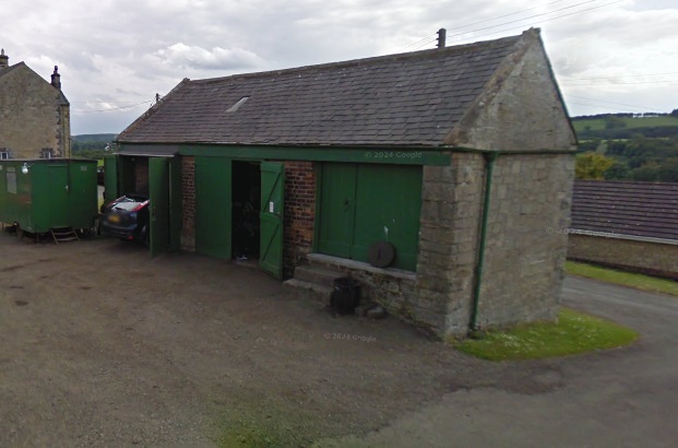
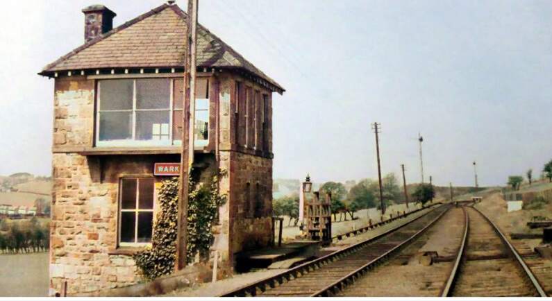
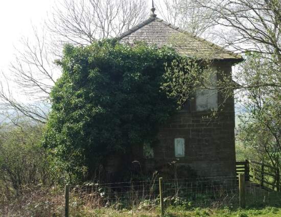
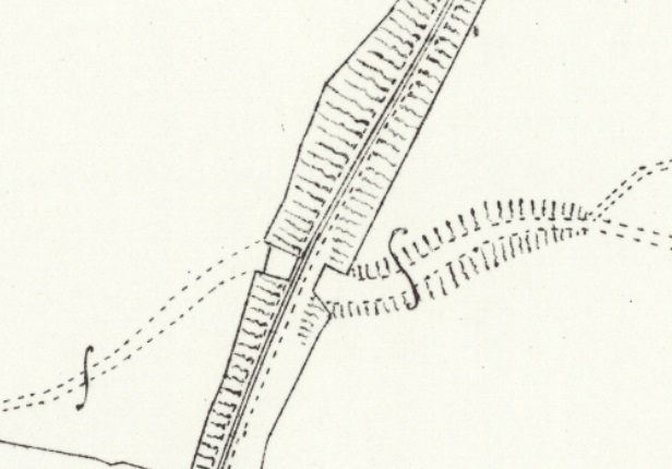
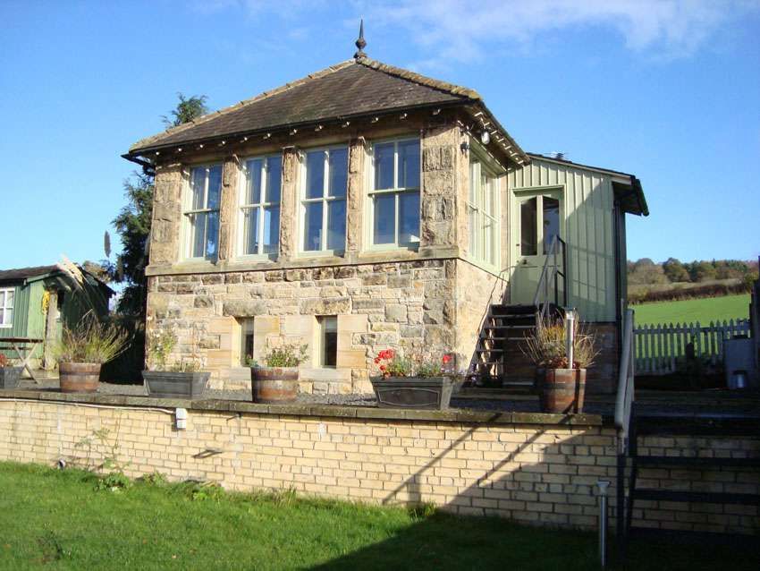
This map estract shows the lane leading to Comogon in 1920, which was carried over the old railway by means of a private access bridge. [24]The access road is private and this is the closest view of the old line at this location that is possible. The red lines show its route which was in a slight cutting to the right of the access road and a slight embankment to the left of the road. [Google Streetview, April 2011]Wark Railway Station as shown on the 25″ Ordnance Survey of 1895. [25]The view Southeast along the Border Counties Railway through Wark Railway Station. [Google Streetview, June 2009]The Goods Shed at Wark Railway Station. [Google Streetview, June 2009]Wark Signal Box when still in use. It sat just Northwest of the station platforms. This image was shared by Ian Farnfield on the Border Counties Railway Facebook Group on 6th April 2022. The provenance of this image is not known. [26]Wark Signal Box in the 21st century. This image was taken by Ian Farnfield and shared by him on the Border Counties Railway Facebook Group on 6th April 2022. [26]
A short distance Northwest from Wark Railway Station the Border Counties Railway passed under another minor road.
This next extract from the 1895 25″ Ordnance Survey shows that bridge mentioned above crossing the old railway. [27]The bridge mentioned above. [Google Streetview, July 2023]
From this point, the line turns to a more northerly direction as this next extract from the railmaponline.com satellite imagery shows. An accommodation track and Blind Burn next passed under the line of the railway. The image below shows the location.
The view Northeast along Piper Gate towards what was a bridge carrying the Border Counties Railway over the Burn and road. [Google Streetview, Aril 2011]
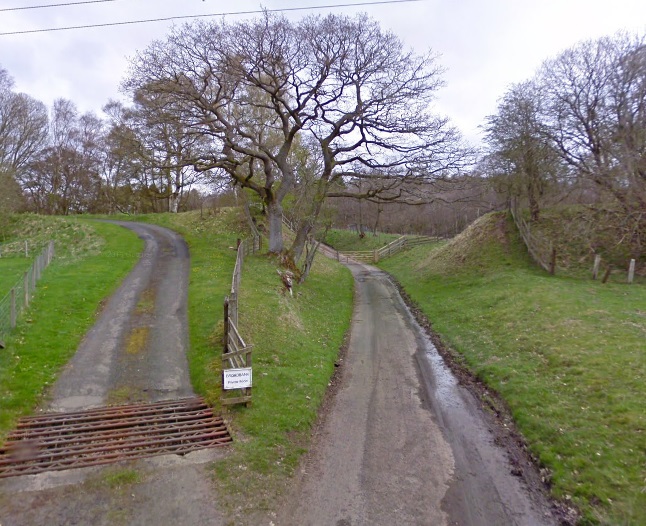
Northwest of Piper Gate a private access road follows the track bed to a private dwelling. Further North another access track passed underneath the line (shown in the first map extract below)
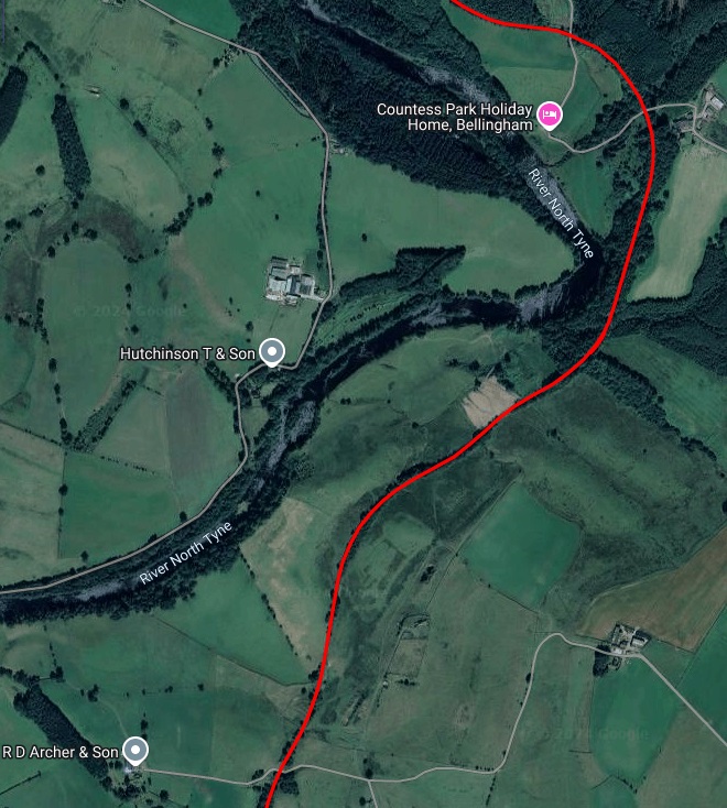
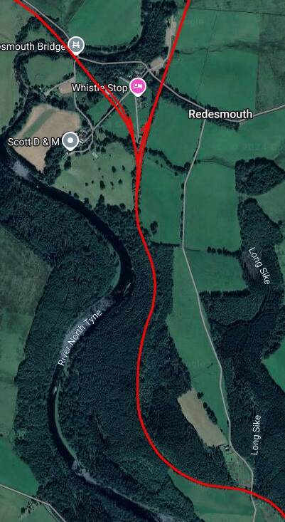
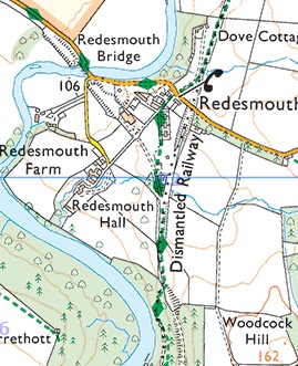
Continuing North from Countess Park alongside the River North Tyne, the Border Counties Railway reaches Redesmouth Railway Station which was a junction station.
Redesmouth as shown on the OS Explorer Map Sheet. The dismantled railways can easily be seen. The Border Counties Railway bears Northwest from the Station and crosses the River North Tyne.
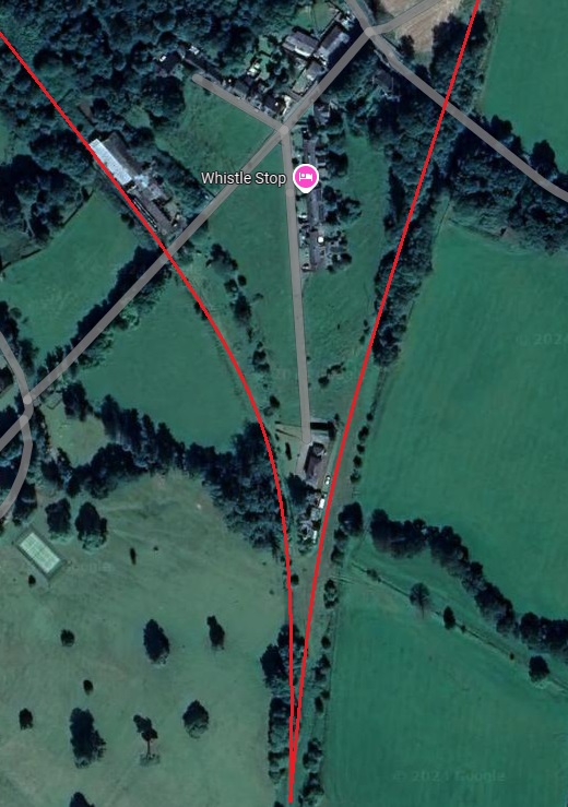
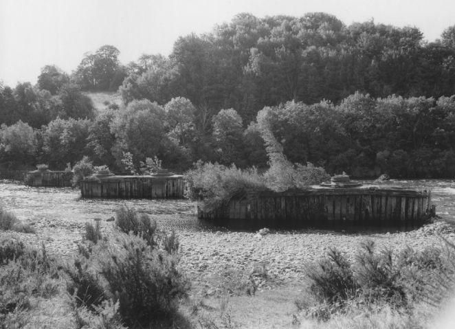
The two images immediately above focus on the railway infrastructure at Redesmouth which spreads over quite a large site surrounding the hamlet of Redesmouth. [Google Maps, October, 2024] [36]
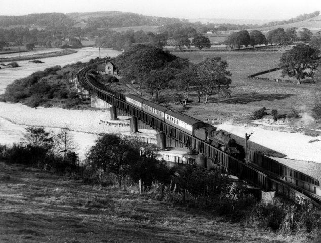
The featured image above was included in a Steam Days article in September 2021. Crossing the River Tyne on approach to Border Counties Junction is Gresley ‘K3’ class 2-6-0 No 61897, a St Margarets allocated locomotive that has worked through, and the stock is different too, ex-LNER and cascaded down from main line work. In due course the condition of the Border Counties Bridge and the predicted cost of repairs was a major factor in the abandonment of this ex-NBR route, with passenger trains ceasing to run on 13th October 1956, although the passage of goods trains continued through to 1 September 1958. [37]
At the end of August 2024, we visited Kielder Water Reservoir, passing through Bellingham on the way. We noticed a disused railway for which a good number of structures and embankments/cuttings remained in place.
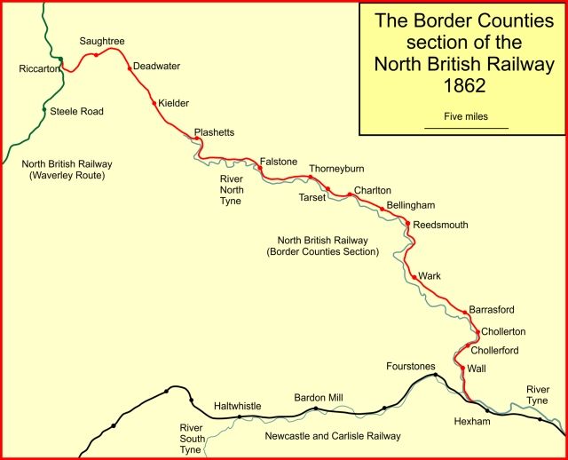
This was the Border Counties Railway (BCR), a line connecting Hexham in Northumberland, with Riccarton Junction on the Waverley Route in Roxburghshire. [1]
The BCR was also known as the North Tyne Railway as it ran beside the River North Tyne for much of its length.
The line between Kielder and Falstone is now under the waters of the Kielder Water Reservoir.
“In 1844 the North British Railway (NBR) was authorised to build a line from Edinburgh to Berwick to join an English line there. The NBR line ran close to the coast avoiding most high ground and opened in 1846. In 1845 the Caledonian Railway was authorised to construct a line from both Glasgow and Edinburgh to Carlisle, crossing the Southern Uplands at Beattock Summit, 1,033 ft (315 m) above sea level.” [1][2][3][4]
In 1853, talk was of a significant coal seam around Plashetts and in 1854, Robert Nicholson was engaged to survey a railway route to serve this coalfield. “His line was to run from Hexham, … through Reedsmouth to Bellingham, and on to the coal deposits at Falstone. His work was remarkably quickly done, for a bill for the Border Counties Railway was submitted to Parliament for the 1854 session. … The scheme was authorised when the Border Counties Railway (North Tyne Section) Act 1854 (17 & 18 Vict. c. ccxii) was given royal assent on 31st July 1854. The capital was to be £250,000.” [1]
The line was built as a single line, but land was acquired for later doubling, and all the bridges except the Hexham bridge, were built for double-track The full length of the authorised line was initially not built before “a public train service started on 5th April 1858; there were four passenger trains each way Monday to Saturday, and two on Sunday. They ran from Hexham to Chollerford, with an intermediate station at Wall.” [1]
It was to be only a further 16 months before the remaining length of the line was authorised when the Border Counties Railway (Liddesdale Section and Deviations) Act 1859 (22 & 23 Vict. c. xliii) got royal assent on 11th August 1859. The authorised capital for the whole line was increased by £100,000. The North British Railway were authorised to make a working arrangement with the BCR.
“From Wark, the line approached Reedsmouth, and there was a temporary goods terminus at Countess Park there while the river bridge was completed. The passenger service terminated at Wark. There was a demonstration train from Newcastle to Countess Park run on 1st December 1859. Public opening was expected ‘within the week” but this proved to be inaccurate, and the opening throughout to Falstone was delayed until 2nd September 1861.”
By 1860 the BCR was seriously short of cash; “the authorised capital had never been fully raised and the hoped-for coal reserves at Plashetts were disappointing. There seemed little chance of raising more capital now. The North British Railway was expansive, and was happy to take over the local line, and the result was the North British and Border Counties Railways Amalgamation Act 1860 (23 & 24 Vict. c. cxcv), passed on 13th August 1860; … the act regularised the use by BCR trains of Hexham station of the Newcastle and Carlisle Railway. The BCR network was known now as the NBR (Border Counties Section).” [1]
The construction of the line throughout to Riccarton was completed by mid-April 1862, but the opening of the line to Riccarton did not take place until 24th June 1862 for goods, and 1st July 1862 for passengers. [1]
On 1st May 1865, “the Wansbeck Railway was opened, between Morpeth and Reedsmouth. The Wansbeck Railway had been promoted independently but was taken over by the North British Railway in 1863.” [1]
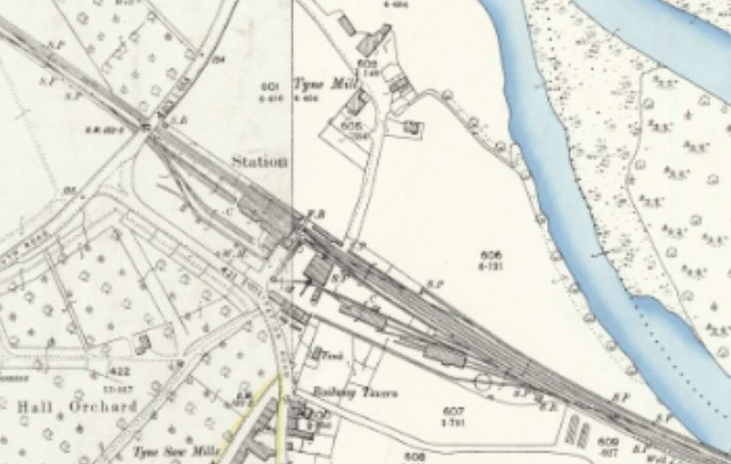
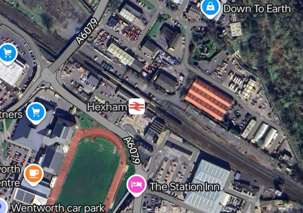
Hexham sits on what was once the Newcastle to Carlisle Railway (NCR) and which is, in the 21st century, known as the Tyne Valley Line.
Hexham Station was opened on 9th March 1835 by the NCR which became part of the North Eastern Railway (NER) in 1862.
The original station was probably designed by the architect Benjamin Green of Newcastle-upon-Tyne. It was altered and extended between 1835 and 1871 and again by 1901. It is now a Grade II listed structure and stands in a conservation area. The station was restored in 1998/1999. [5]
After the NCR had been absorbed by the NER, the station became a junction, with the opening of the first section of the BCR, between Hexham and Chollerford in April 1858. The first section of a second branch, the Hexham and Allendale Railway, was opened for goods in August 1867. Initially promoted to serve lead mines, that line opened for passengers in March 1869. [6][7]
Since the closure of the Hexham and Allendale Railway to passengers in 1930 (completely in 1950), as well as the BCR in 1956 (completely in 1958), the station has diminished in size and importance. Both lines met with the Tyne Valley Line to the West of the station. [6][7][8: p134]
The Disused Stations website covers Hexham Station in some detail. [9]
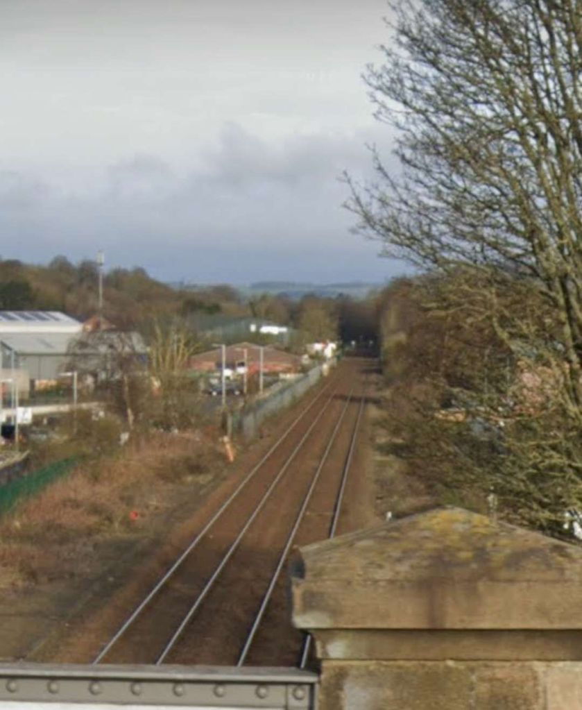
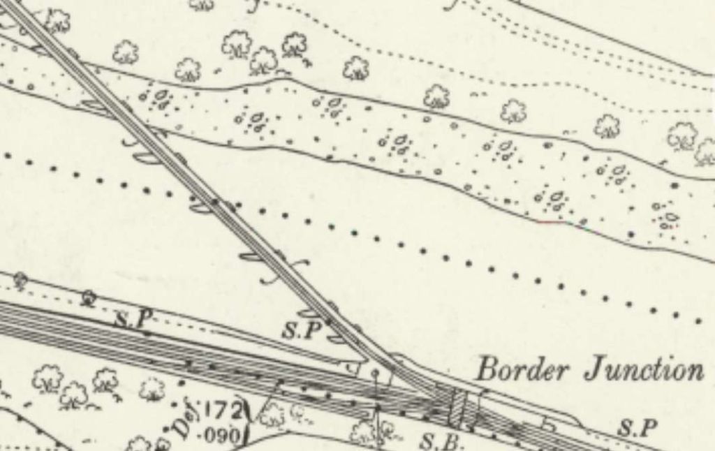
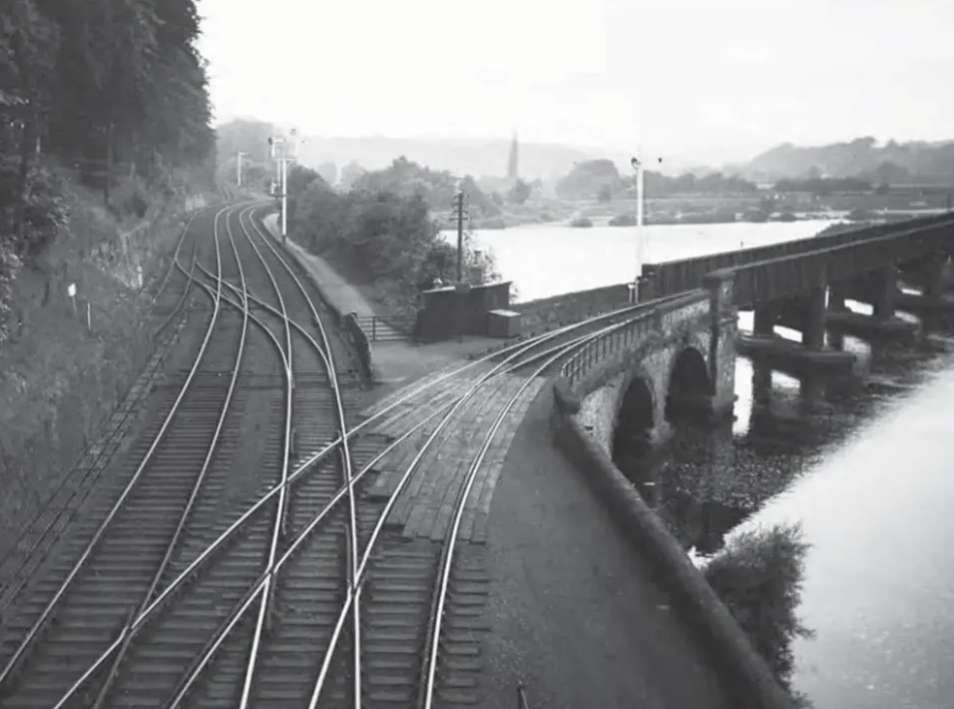
A straight length of line brings the railway to the banks of the Tyne. The line curves round toward the West and follows the South bank of the Tyne as far as Border Counties Junction where trains for Riccarton Junction and Hawick left the Borders Railway and crossed the Tyne on an angled viaduct.
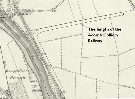
A short distance beyond the viaduct on the Border Counties Railway was a private colliery line which served Acomb Colliery.
“Mining at Acomb seemed to stop and start between the mid 19th century until 1909, when a larger complex opened until 1952.” [20]
There were various owners before the pit was taken on at nationalisation by the NCB. … Messrs. Stobart & Co. (1840s), J. Morrison & Co. (1860s), Messrs. Morrison (1880s), Tynedale Coal Co. Ltd. (1910s), Acomb Coal Co. Ltd. (1920s), National Coal Board (1947). [20]
For more information about the coal workings on the site, please consult the Durham Mining Museum. [21]
It is worth noting that the half-mile long line was worked by one engine, Black Hawthorn 0-4-0ST No. 1068 for over 30 years until closure of the mine in 1952. [13: p12]
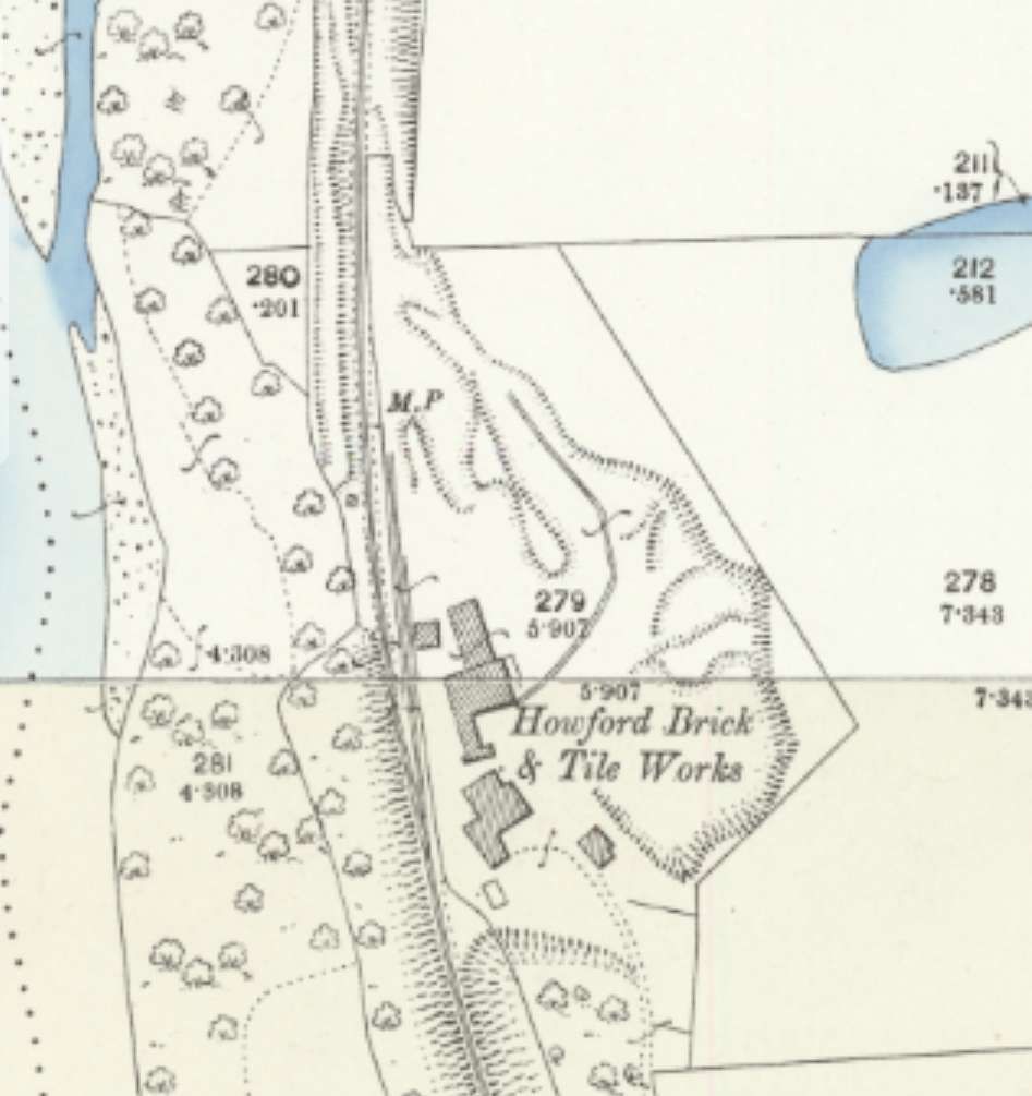
These works sat alongside the line, just a few hundred metres North of the Acomb Colliery Railway.
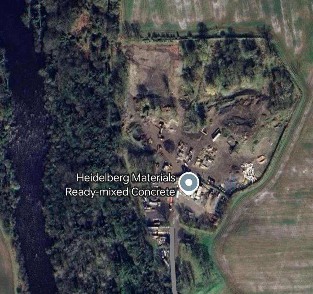
Howford Brick & Tile Works. [23]The location of Howford Brick & Tile Works hosts Heidelberg Materials Ready mixed Concrete plant in the 21st century. The route of the old railway is shrouded in trees. [Google Maps, September 2024]
North Tyne Colliery
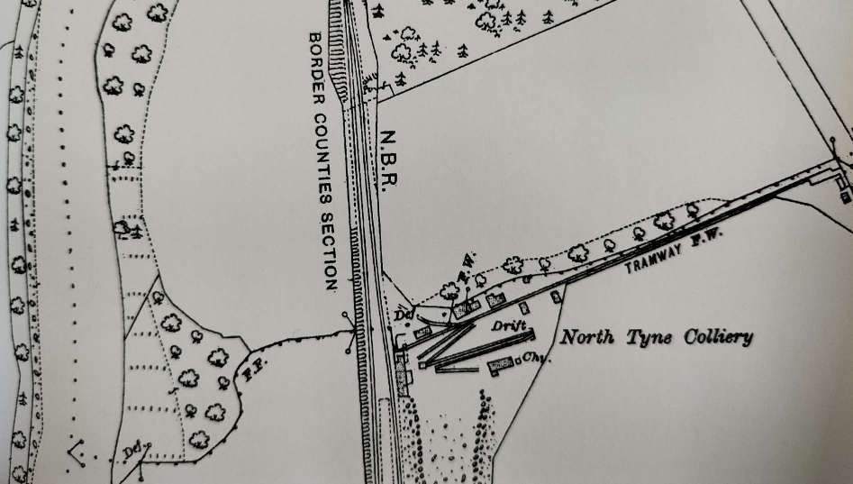
Some distance further North, North Tyne Colliery sat adjacent to the line.
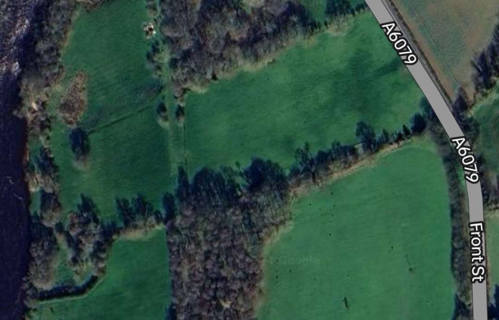
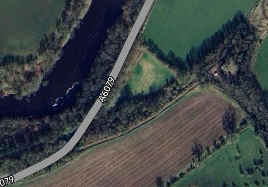
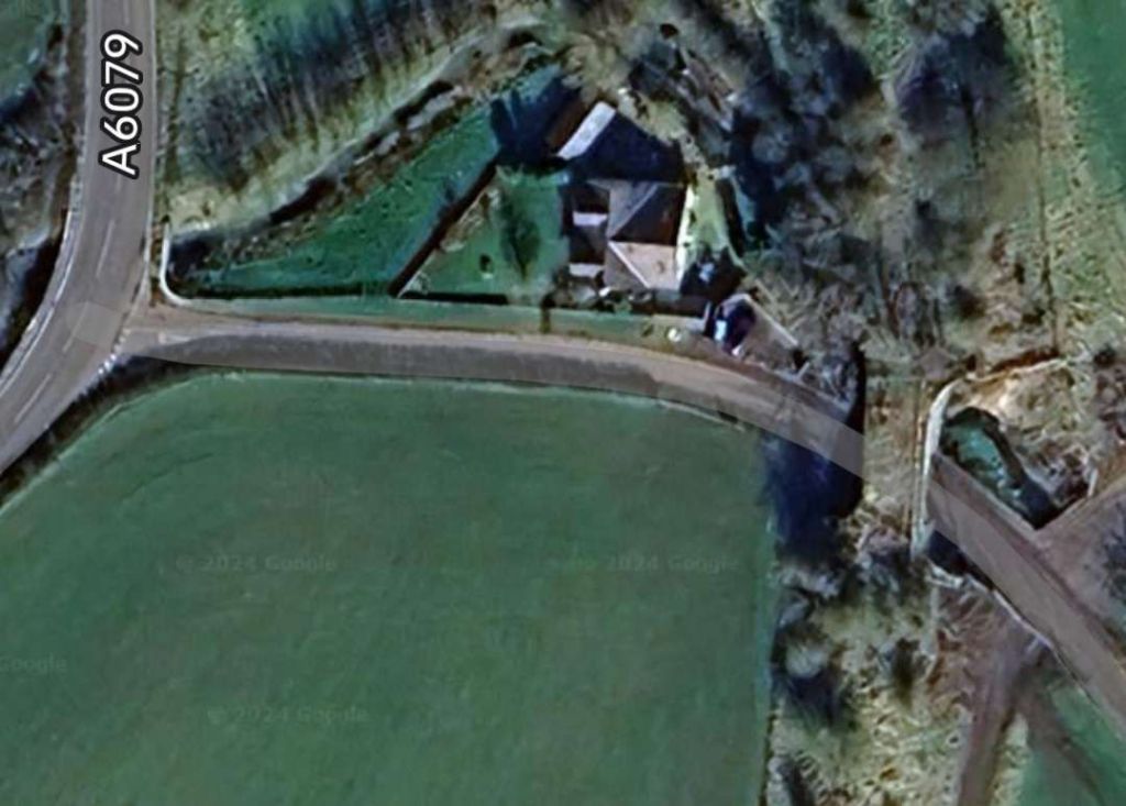
North Tyne Colliery was served by a 500yd. loop off the Border Counties Railway, it also had a tramway linking it to the road network (A6079). Messrs Walton & Cooper worked a drift mine here from 1906 to 1922. This extract comes from the 25″ Ordnance Survey of 1921. [13: p13][23]Approximately the same area as shown on the OS map extract above. The site of the colliery is now heavily wooded. [Google Maps, September 2024]
For further information about this colliery, please consult Durham Mining Museum. [22]
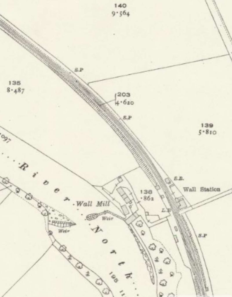
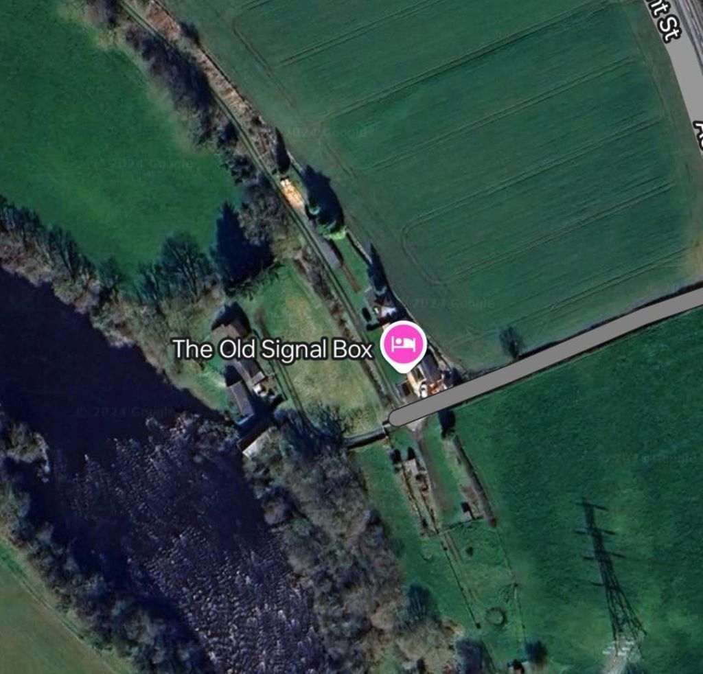
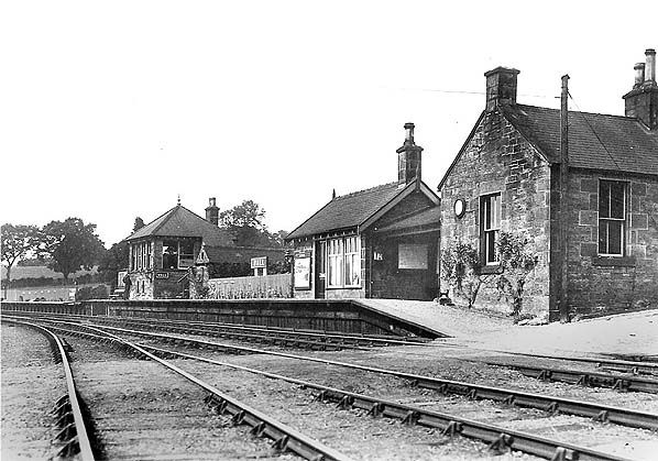
Wall Railway Station
Wall Railway Station was 1/3 mile from the village. It sat alongside the River North Tyne on its East bank a few hundred metres North of North Tyne Colliery.
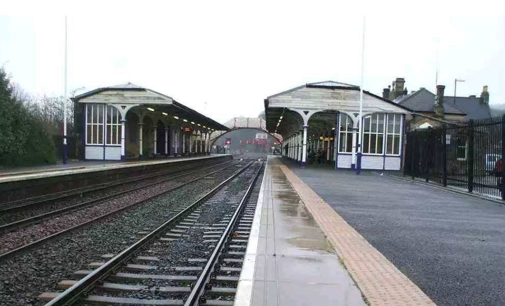
There is good coverage of Wall Railway Station on the Disused Stations website. [25]
Humshaugh Railway Station
North of Wall Railway Station there was little to interest us until the BCR reached Humshaugh Railway Station. Darsley & Lovett say that “the station was opened as Chollerford on 5th August 1858 and was the BCR’s first temporary terminus. Sidings once led to a lime depot, where a tramway, inclined at 1 in 5, led to Brunton kilns. Another tramway led to the quarry. They closed in 1895.” [13: p18]
Historic England say that the grade II listed kilns were located North of Brunton Bank near Chollerford were probably built in the early 19th century. [29] Nearby was Brunton Bank Quarry. There is no evidence of a tramway, in the immediate vicinity of the station, leading to these two sites on the Ordnance Survey of 1896.
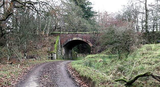
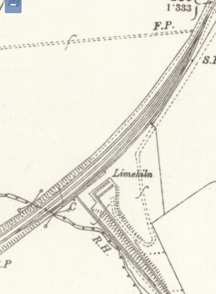
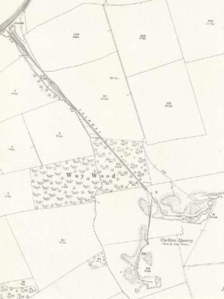
Only a short distance beyond Humshaugh Railway Station, the old railway passed under what became the A6079 and then passed a Limekiln at the bottom of a tramroad which served Cocklaw Quarry.
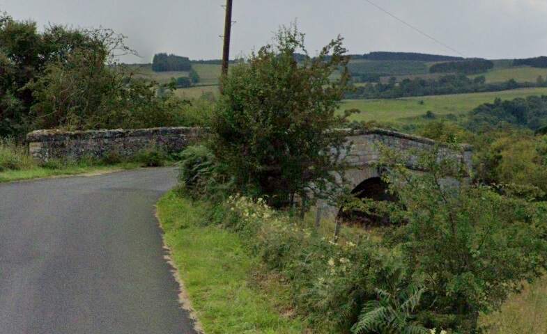
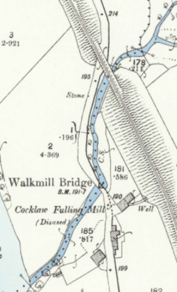
Another extract from the 25″ Ordnance Survey completed before the turn of the 20th century. Shows both the location of the road bridge and the Limekiln. [28]The same location on 21st century satellite imagery. The line of the BCR can easily be made out, as can the location of the limekiln at the junction of the tramroad and railway. [Google Streetview, September 2024]An enlarged extract from the 25″ Ordnance Survey which shows the loop provided by the NCR at the limekiln. [28]This extract from the 25″ Ordnance Survey at a small scale than the previous extracts shows the full length of the tramroads serving Cocklaw Quarry. This was a 3ft gauge tramroad with an incline. [28]
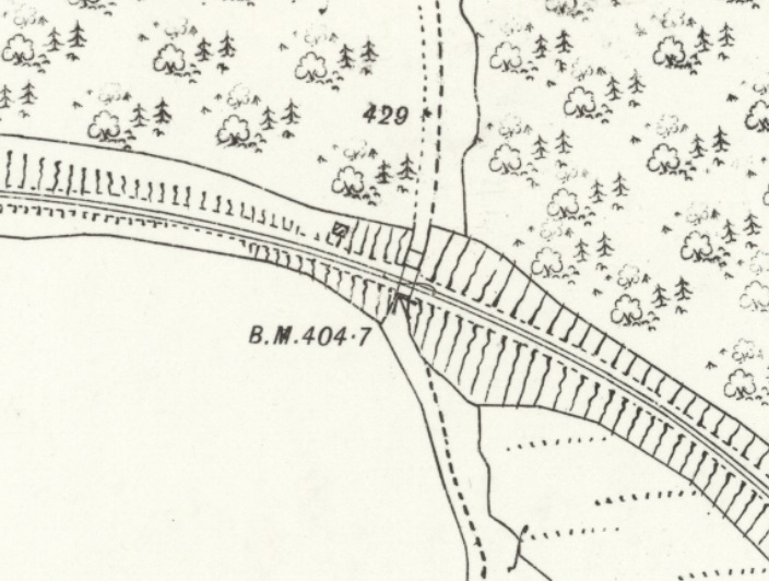
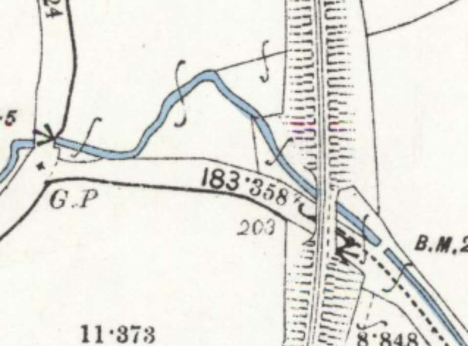
A short distance further North the line bridged a road and stream at the same location. …
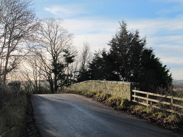
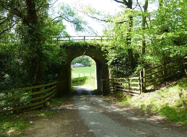
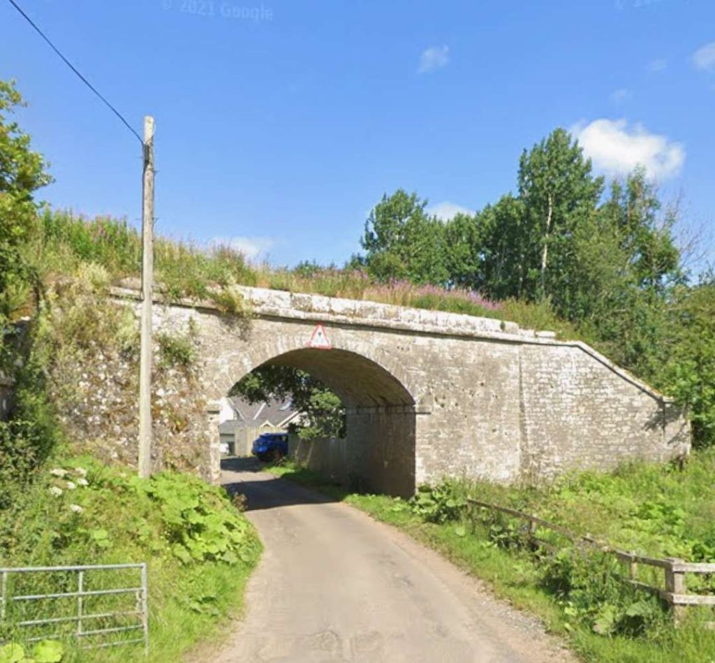
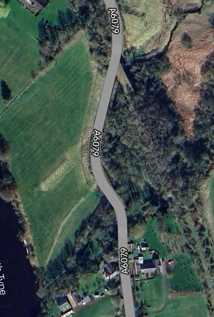
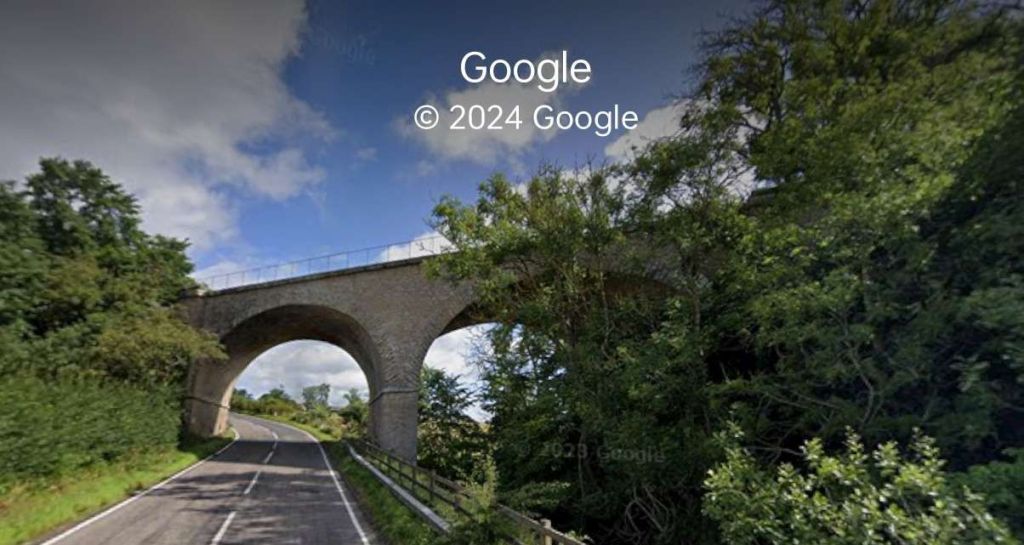
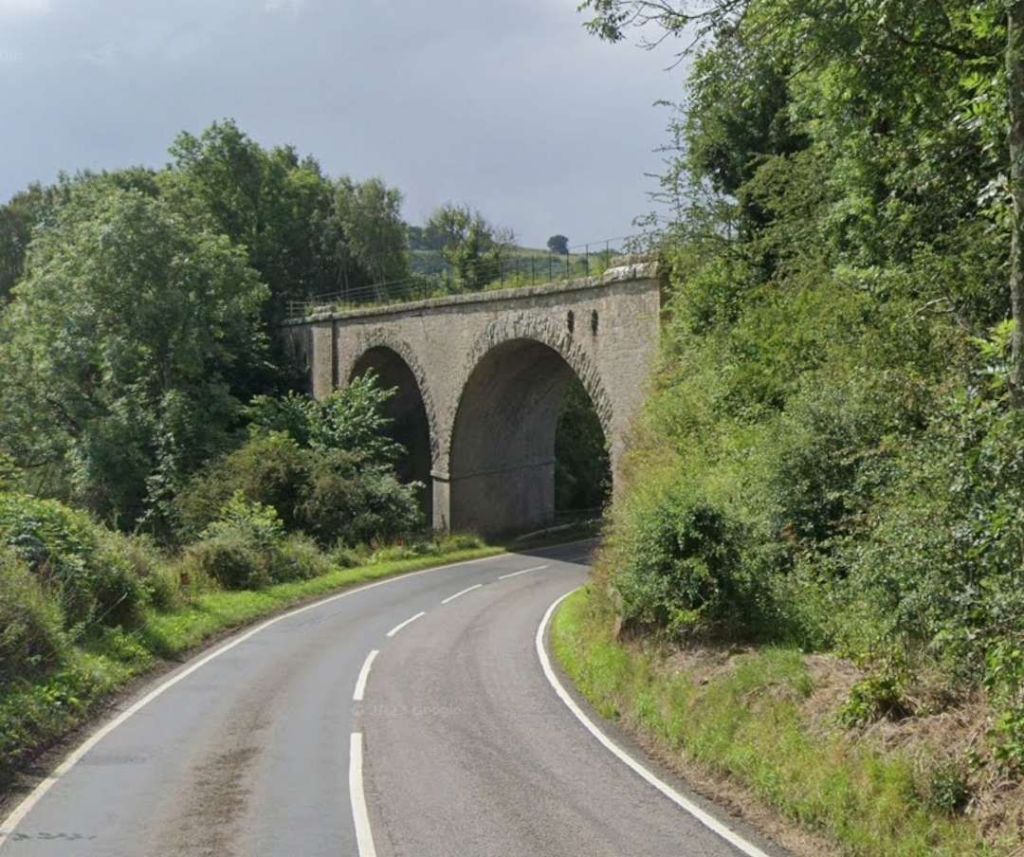
An enlarged extract from the 25″ Ordnance Survey of 1895/6 which shows the next significant structure on the BCR. [32]The same location in the 21st century. [Google Maps, September 2024]The line bridged both road and stream by means of a stone-arched structure. This photo of the bridge is taken from the Southeast. [Google Streetview, July 2021]Another extract from the 25″ Ordnance Survey. Another bridge, this time spanning both the road which became the A6079 and a tributary to the River North Tyne. [34]The same area on 21st century satellite imagery. [Google Maps, September 2024]The viaduct which carried the BCR over what became the A6079. [Google Streetview, July 2023]The view from the North on the A6079 of the same viaduct. [Google Streetview, July 2023]
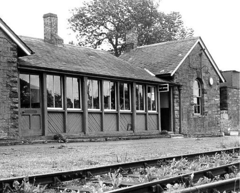
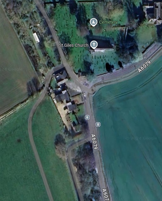
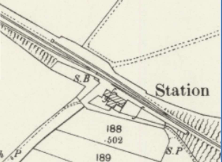
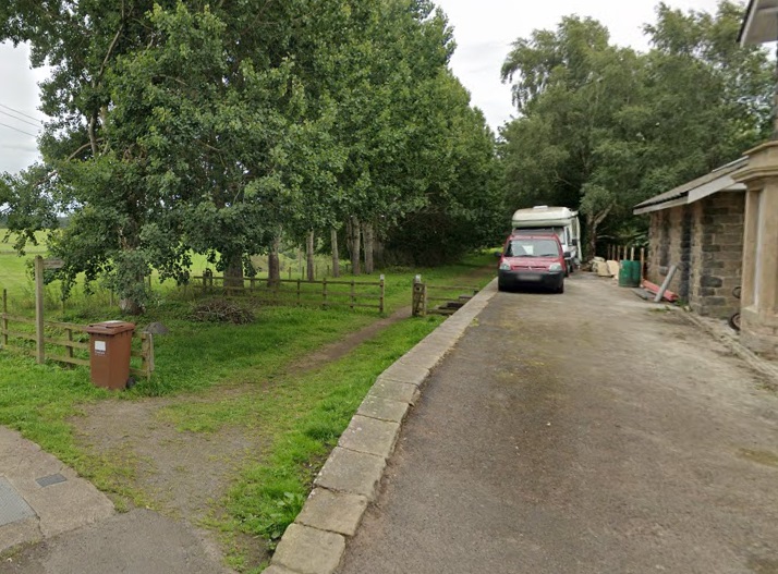
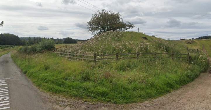
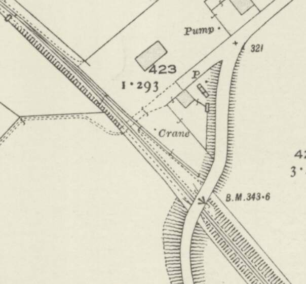
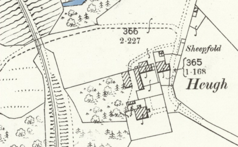
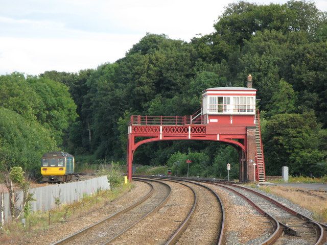
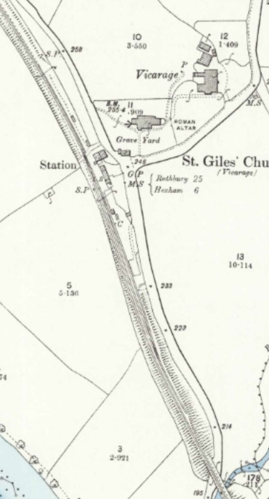
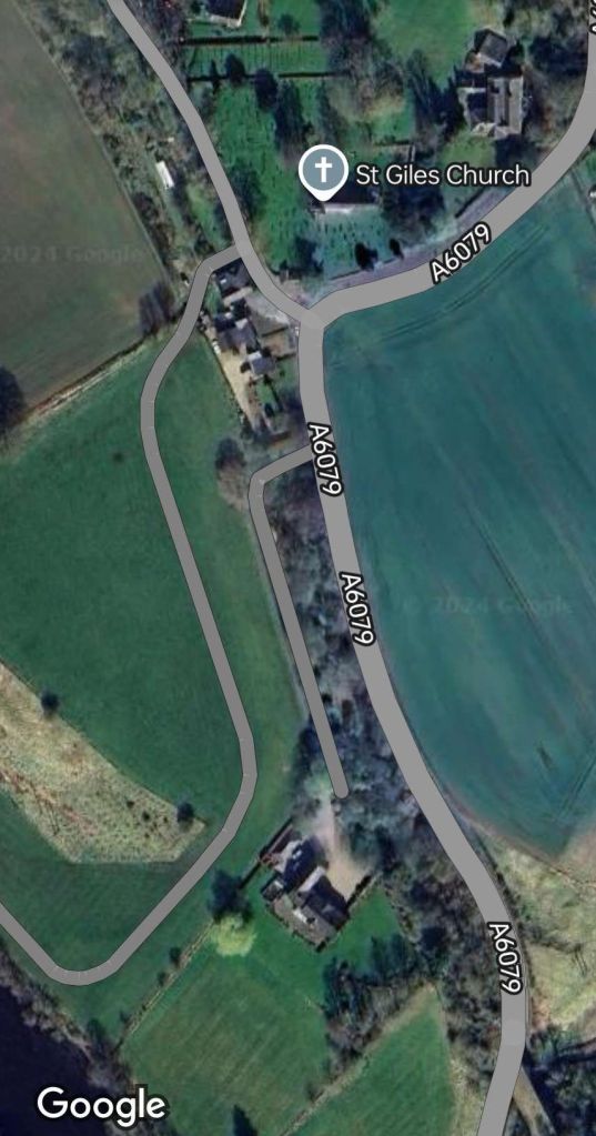
Chollerton Railway Station
“The station was opened on 1st December 1859 by the North British Railway. It was on the west side of the A6079 at the junction with an unclassified road and immediately southwest of Chollerton village. A goods loop and a coal depot were to the south. A small goods shed was sited at the south end of the platform. Instead of extending the platform, the NBR built a new one to the north with a wooden waiting shelter. The original buildings remained in use and the siding was adjusted so that one of the two docks used the old platform. There was a three-ton crane in the goods yard. The station closed to passengers on 15th October 1956 and closed completely on 1st September 1958.” [33]
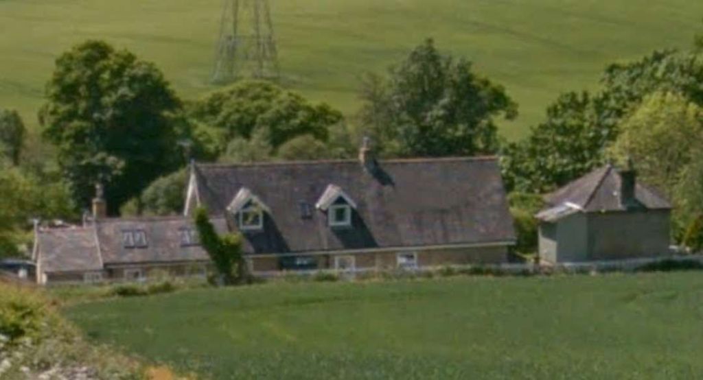
Shortly after crossing the viaduct above the line entered Chollerton Railway Station. The station sat opposite the village church, St. Giles. [35]The same area on modern satellite imagery. [Google Maps, September 2024]The northern end of Chollerton Railway Station looking North. [36]A view of the site of Chollerton Railway Station from the East on the A6079. [Google Streetview, July 2023]
Chollerton Railway Station is the end of this first part of the journey along the Border Counties Railway.
The new companies which came into existence with the grouping in 1923 addressed once again the best way to serve lightly populated rural communities. The options available to them centred on various forms of light railcars. Two forms of propulsion were available, the internal combustion engine and the steam engine. Electricity, in many cases required too large an investment for the likely traffic on the intermediate routes in rural areas.
Given, the lack of success of the steam railmotor experiment in the first two decades of the 20th century, it must have seemed unlikely that steam railcars/railmotors woul prove to be a success in the inter-war years. But the LNER’s persistence and the arrival of a new articulated “form of steam railcar developed by the Sentinel Waggon Works Ltd. in association Cammell Laird & Co. Ltd. [brought about] a renewed assessment of the role of the railcar.” [1: p46]
Jenkinson and Lane say that rather than simply using railcars to replace existing services, the aim became one of enhancement of services. A greater frequency of service would reduce the need for unsuitable powered units to pull trailers. Higher speeds would shorten journey times.
But, to do this “in the steam context … meant using a vehicle which, owing to its lightness and simplicity, needed a smaller and less complicated power unit than was offered by the conventional locomotive style of construction. … A tricky balancing act … because railway vehicles need to be much stronger than the road equivalent, … but the Sentinel-Cammell steam railcars were a very fine attempt.” [1: p46]
The LNER Sentinel Steam Railcars
The “Sentinel Waggon Works of Shrewsbury built their first steam railcar in 1923 for the narrow gauge Jersey Railways & Tramways Ltd. This used coachwork constructed by Cammell Laird & Co. of Nottingham, and was reportedly successful.” [2] This partnership with Cammell Laird continued when Cammell Laird became a part of Metropolitan-Cammell Carriage, Wagon & Finance Co. Ltd (‘Metro-Cammell’) in February 1929.
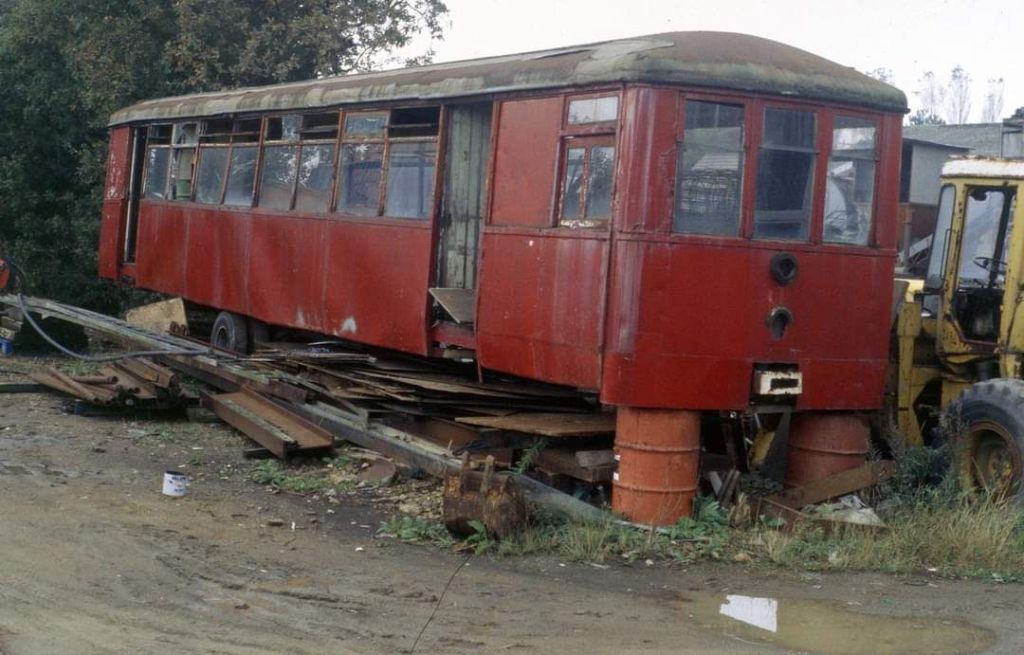
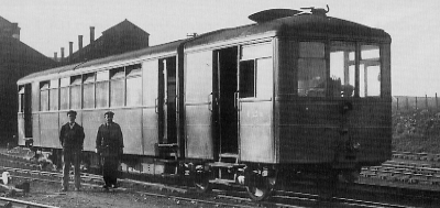
The first narrow-gauge railcar on Jersey plied its trade on the line between St. Hellier and St. Aubin. [4][2] The remains of a later steam railcar is shown below, It was supplied to Jersey as a standard-gauge railcar.
The remains of Sentinel railcar ‘Brittany’ as it appeared in 1997. It was possibly one of a pair supplied by Sentinel in 1923 which ran on the 3ft 6in gauge lines on the Island of Jersey between St. Hellier and Corbiere. Were the pair articulated? Essery and Warburton say that the total weight of each original unit “was 15 tons 3 cwt 2 quarters … The engine was totally enclosed with 6.25inch diameter cylinder with a 9inch stroke having poppet valves and mounted horizontally above the floor of the engine room. The drive from the crankshaft was by roller chain to an intermediate shaft then by separate chains to each axle of the 7’ 0” wheelbase bogie. The Sentinel vertical boiler with cross water tubes and super-heater supplied steam at 230lbs/sq. inch. Coal consumption was 5.37 lb per mile.” [12: p4]
Essery and Warburton note 3 such vehicles being employed on the narrow-gauge. [12: p7] These vehicles were probably re-gauged to standard-gauge when the narrow-gauge line closed. They also note a later purchase of 2 standard-gauge units. Although they give a date of 1924 for the later units [12: p7] which, given that this unit appears not to be articulated, is quite early. Is this, perhaps, actually one of the later rigid-bodied units? If so it would perhaps have been supplied to Jersey between 1927 and 1932.
This image was shared on the Narrow Gauge Enthusiasts Facebook Group on 20th December 2018 by John Carter, permission to include this image here is awaited. [3]
Sentinel exhibited a railcar at the British Empire Exhibition in 1924, which was noticed by Gresley. “The LNER was in need of vehicles that were cheaper than steam trains but with better carrying capacity than that of the petrol rail bus and autocar on trial in the North East (NE) Area. Hence Chief General Manager Wedgwood informed the Joint Traffic and Locomotive Committees on 31st July 1924 that a railcar would be loaned from Sentinel for a fortnight. If successful, this would be followed by the purchase of two railcars. The trial took place from 17th to 31st August 1924 in the NE Area.” [2]
The successful trial resulted in the purchase of eighty Sentinel steam railcars from 1925 to 1932.[2] (Essery & Warburton suggest that the very early Sentinel railcars were rigid-bodied units with later versions being articulated vehicles. [12: p4] This does not seem to have been the case. Early Sentinels were, in fact, articulated. There was a period when Sentinel railcars were rigid-bodied, Jenkinson and Lane talk of rigid-bodied Sentinel railcars being delivered in the years from 1927 up to 1932, [1: p54] which may have been a response to competition from Clayton. Clayton’s steam Railcars are covered below.)
In addition to the LNER’s own railcars, the Cheshire Lines railcars (4 No.) were maintained by the LNER and the Axholme Joint Railway (AJR) railcar No. 44 was transferred to the LNER when the AJR ceased serving passengers in 1933.
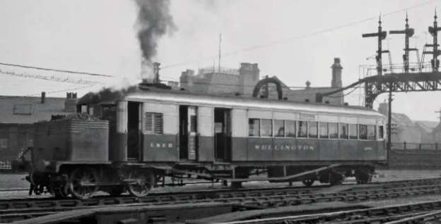
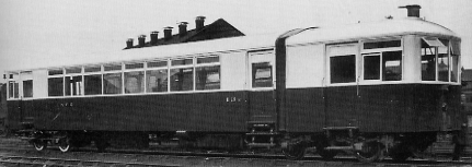
The first two Sentinel railcars purchased by the LNER were set to work in “East Anglia to operate between Norwich and Lowestoft and from King’s Lynn to Hunstanton.” [1: p46]
The East Anglian pair of railmotors “were considered to be lightweight. Later LNER Sentinel railcars were more substantial and included drawgear and buffers. Both railcars were withdrawn from traffic in November 1929 and sent to Metro-Cammell to be rebuilt into heavier railcars.” [2]
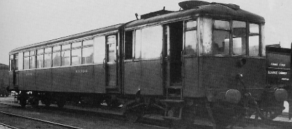
Sentinel offered two options. “One scheme was to rebuild the cars so that they resembled the later cars as closely as possible. The LNER chose to rebuild railcar No. 12E to this scheme, and was described as Diagram 153. The second scheme was to rebuild the railcars to the minimum necessary to meet the requirements. No. 13E was rebuilt to this scheme, and was described by Diagram 152.” [2]
Initially No. 13E was rebuilt without conventional drawgear and buffers. This was corrected within a few months of re-entering LNER service in 1930. [1: 46-47][2].
“No. 13E was renumbered as No. 43307 in April 1932 and withdrawn in January 1940 with a mileage of 269,345 miles.” [2]
No. 12E was subject to an almost complete rebuild. It returned to the LNER by Metro-Cammell on 29th May 1930 and started trials at Colwick. After repainting at Doncaster in late June, it entered traffic on 26th September 1930. The body was raised by just over 10 inches and a third step was added below the doors. Drawgear and buffers were fitted before it re-entered service on the LNER network. [2]
“No. 12E was renumbered as No. 43306 in November 1931, and was withdrawn in April 1940 with a mileage of 232,462 miles.” [2]
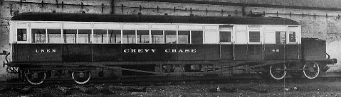
The RCTS tells us that, “The majority of the Sentinel railcars were named after former horse-drawn mail and stage coaches. The exceptions were the two original cars, Nos. 12E and 13E, No.51915 taken over from the Axholme Joint Railway and Nos. 600-3 on the Cheshire Lines which were all nameless. In addition the two 1927 cars, Nos. 21 and 22, ran without names for a while, before becoming Valliant (sic) and Brilliant respectively. The named cars had a descriptive notice inside detailing what was known about the running of the mail coach from which the car took its name and offering a reward for additional information.” [5: p13]
The story of the various Sentinel Railcars is covered in some detail in the LNER online Encyclopedia here. [2] If greater detail is required, then the RCTS’s Locomotives of the LNER Part 10B considers the Sentinel Railcars in greater depth. This can be found here. [5]
Sentinel produced their steam railcars for the LNER in a series of relatively small batches. Each batch varied in detailed design.
Rigid-bodied railcars were supplied by Sentinel in the period from 1927. The last rigid-bodied units being delivered in 1932. [1: p54,56] The first was an experimental unit which was in use on LNER lines in 1927 but not purchased until June 1928. [1: p58] A further 49 rigid-bodied Sentinels were ordered in 1928, 12 in 1929, 2 in 1930 [1: p56] and 3 further in 1932 [1: p54]
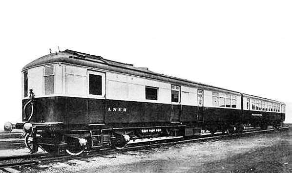
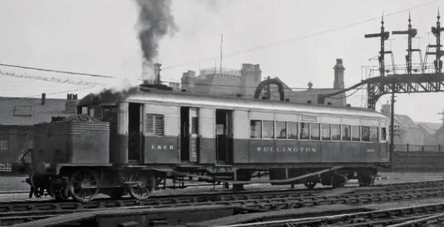
Jenkinson and Lane tell us that a solitary twin unit, LNER Sentinel No. 2291 ‘Phenomena‘, was developed in 1930. The rear bogie on the powered unit was shared with the trailer. They explain that the articulation between the coaches “allowed the individual unit lengths to be reduced compared with a single unit car. A more than doubled carrying capacity was achieved with only a 25% increase in tare weight.” [1: p64]
‘Phenomena’ was an articulated twin, the powered unit had much in common with the rigid-bodied Sentinel Railmotors. This image was carried by ‘The Engineer Journal of November 1930. [17]
As the number of Railcars on the LNER network increased the company felt that it would be prudent to undertake a review of the performance of all its railcars in use on its network. This review covered the year ending 30th September 1934. The best Sentinel steam railcars out-performed others on the network (particularly those of Armstrong-Whitworth). The fleet of “Sentinel railcars recorded over 2.25 million miles in the year, with railcar mileages often exceeding 30,000 miles.” [2].
“With the exception of No. 220 ‘Waterwitch’ which was wrecked in 1929, all of the Sentinel steam railcars were withdrawn between 1939 and 1948.” [2]
The LNER Armstrong-Whitworth Diesel-Electric Railcars
As a quick aside, the Armstrong Whitworth Railcars were direct competitors for the Sentinel Steam Railcars. They were early diesel-electric cars, diesel-powered precursors of what, from different manufacturers, became the dominant form of power source for railcars as the steam railmotors were retired; although what became the dominant form of diesel railcar was to use direct drive rather than traction motors. [1: p71] What became the GWR railcars were privately developed by Hardy Motors Ltd., AEC Ltd., and Park Royal Coachworks Ltd. [1: p72-73] The story of the GWR diesel railcars is not the focus of this article, but the Armstrong Whitworth Diesel-Electric railcars were direct competitors for the Sentinel railcars and, as such, worth noting here.
In September 1919, Armstrong Whitworth became a Sulzer diesel engine licensee. During 1929 the board of Armstrong Whitworth approved the decision to enter the field of diesel rail traction and obtained a license from Sulzer Brothers for the use of their engines in these rail vehicles.
In 1931, Armstrong Whitworth began construction of “three heavy diesel electric railcars [for the LNER] which operated under the names of ‘Tyneside Venturer’, ‘Lady Hamilton’ & ‘Northumbrian’. They were powered by an Armstrong-Sulzer six cylinder 250hp four stroke diesel engine coupled to GEC electrical equipment. The vehicles were 60 feet long with a cab at each end and a compartment for the engine. They weighed 42tons 10cwt, could carry sixty passengers and luggage at 65mph. The bodywork was provided by Craven Railway Carriage & Wagon Co of Sheffield. The body was of sheet steel panels riveted together. Operating costs were expected to be half those of a steam service of similar capacity.” [8]
As well as running singly the railcars could haul a trailer coach.
“A fourth Armstrong-Whitworth diesel-electric vehicle entered service with the LNER in 1933. This was the un-named No. 294 lightweight railbus. Completed in May 1933, it performed six months of trials before entering regular services in the Newcastle area in September 1933. It was not taken into official LNER stock until August 1934, and is believed to have only been kept as a standby for one of the larger railcars.” [9][cf: 1: p70]
All of the Armstrong Whitworth railcars gave their best performances during the initial trials. “During regular operation, the Armstrong Whitworth diesel-electric railcars suffered from gradually declining performance. This was probably partly due to relatively poor maintenance on what was still a steam railway.” [9]
Ultimately, these units retired relatively early in April, May and December 1939. [9]
The LNER Clayton Steam Railcars and Trailers
The LNER on-line Encyclopedia comments that, “Clayton Wagons Ltd of Lincoln started to build steam railcars in 1927. The LNER purchased a total of eleven between 1927 and 1928.” [10]
Jenkinson and Lane note an earlier date for Clayton Wagons Ltd’s entry into the market. They say that the Clayton cars originated in 1925, originally for use in New Zealand.
These cars were handicapped by the financial instability of Clayton Wagons Ltd. [10][1: p50] The LNER at times had to manufacture parts which were not available from suppliers. The first was withdrawn in July 1932. “With increasing maintenance problems, and a shortage of less strenuous short mileage work, the remainder were withdrawn between April 1936 and February 1937. Due to their short lives and persistent problems, none of the Clayton railcars clocked up significant mileages.” [10] Final mileages ranged from 72,774 to 174,691.
Trailer cars were supplied to the LNER by Clayton Wagons Ltd. The trailers were 4-wheeled with very basic accommodation. Their 4-wheel chassis may well have affected their riding quality. [1: p65] They were “classed as ‘Trailer Brake Thirds’, eight only were built and never seem to have very popular. Pictures of them in use are somewhat rare and little is on record of their working life; they were all withdrawn between March 1948 and March 1949.” [1: p55]
Three photographs can be found in Jenkinson and Jane’s book, one external and two internal views. [1:p 65]
The LMS Steam Railcars
In parallel with the LNER, the LMS had its own programme trials of Sentinel railcars. Jenkinson & Lane tell us that trials were carried out in 1925, “with a hired prototype on the Ripley Branch and a fleet of thirteen cars (the prototype plus a production batch of twelve) was put in service during 1926-7, a year or so ahead of the main LNER order. The LMS cars were all of lightweight low-slung design with less of the working parts exposed below the frames and no conventional drawgear. They were unnamed and finished in standard crimson-lake livery.” [1: p49]
In many respects these railcars were very similar to the two early lightweight LNER vehicles. Differences were minor: “the LMS cars had only 44 seats and a slightly over 21T tare weight whereas the LNER lightweights were quoted with 52 seats at 17T tare. … The later … LNER … cars were almost 26T except for the 1927 pair (just over 23T).” [1: p49]
Essery and Warburton say that, “The thirteen LMS Sentinel/Cammell vehicles were authorized by LMS Traffic Minute 1040 dated 28th July 1926 at a cost of £3800 each and were allotted Diagram D1779 and ordered as Lot 312. The numbers first allocated are not known except one that was number 2232 with the 1932/3 renumbering scheme allocating numbers 29900-12 with all receiving the LMS standard coach livery in the first instance. … These early models suffered from poor riding qualities and so in 1928 a gear driven 100 hp vehicle was designed. The boiler was on the mainframe and the vertical two cylinder engine was mounted over the rear axle of the power bogie with the axle driven through gearing. The LNER purchased the only one built (named ‘Integrity’) that suffered from severe vibration.” [12: p4]
Essery and Warburton also provide more detail about the Axholme Joint Railway (AJR) Sentinel railcar. The line was jointly owned by the LMS and LNER “with the motive power supplied initially by the LYR and then the LMS after the grouping. The LMS supplied one of the thirteen steam railcars purchased in 1926/7 to the AJR. In February 1930 a larger car was ordered from Sentinels numbered 44 in the LMS carriage list and carried a green/cream livery carrying the name “Axholme Joint Railway” on each side. On 15th July 1933 the passenger service ceased. The car having done 53,786 miles was then purchased by the LNER and numbered 51915.” [12: p4] It seems as though the AJR railcar was rigid-bodied. [1: p62] Which suggests that the full series of LMS railcars were rigid-bodied. The illustration of the AJR railcar provided by Jenkinson and Lane shows it with drawgear and buffers which must have been added after it’s transfer from the LMS.
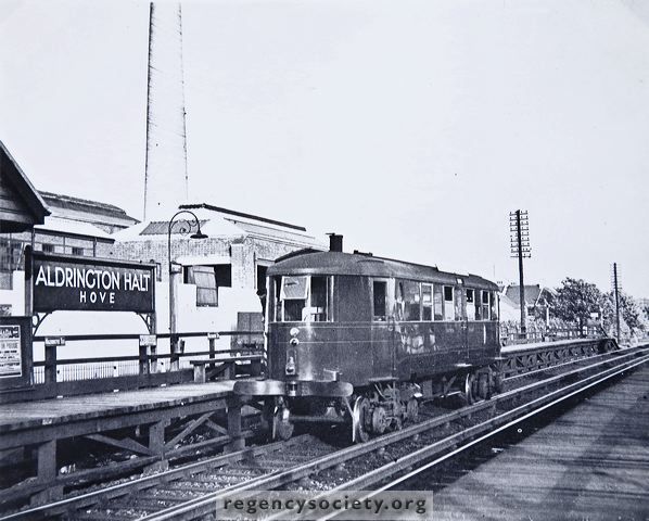
The last steam railcar to be devised for use in the UK was an unusual unit supplied by Sentinel to run on the Southern Railway’s steeply graded branch line from Hove to Devil’s Dyke. Its design was signed off by Richard Maunsell at much the same time as the SR was introducing its new electric services to Brighton in 1933. [1: p67]
The unit was a lightweight Sentinel-Cammell railcar. It was numbered No 6 and had wooden wheel centres to reduce noise but this created problems with track circuit operation on the main line and necessitated the provision of lorry-type brake drums. [13][14][15]
Jenkinson and Lane do not have much that is positive to say about this railcar. They talk of, “the strange ‘torpedo’ shape of the solitary Southern Railway Sentinel … that … was designed for one man operation: the Devil’s Dyke branch was very short and the nature of the machinery was such as to make it possible to stoke up for a complete trip at the start of each journey.” [1: p66]
“Instead of using one of the well-proved LNER type cars (or even the lighter weight LMS alternatives), the whole operation was made the excuse for creating a new sort of one-man operated bus unit … [with] a fashionably streamlined ‘Zeppelin’ type body which seemed to be perched on top [of the chassis] as an afterthought.” [1: p67]
References
David Jenkinson & Barry C. Lane; British Railcars: 1900-1950; Pendragon Partnership and Atlantic Transport Publishers, Penryn, Cornwall, 1996.
This illustration appeared in ‘The Engineer’ of 28th November 1930. It was included in the third page about Cambridge in the era of the Big Four on the Disused Stations website: http://www.disused-stations.org.uk/c/cambridge/index6.shtml, accessed on 25th June 2024.