Tag Archives: Liguria

Genoa – Casella Narrow Gauge Railway Part 2 – Sardorella to Casella

This article covers the northern half of the line and has a quick look at the motive power and rolling-stock used.

Another article covers the history of the Line and the southern half of its route. It can be found here. [18]

This article covers the length of the line from Sardorella to Casella. [1]
A topographical map of the route. [1]
Perhaps a little clearer than the topographical map. [2]

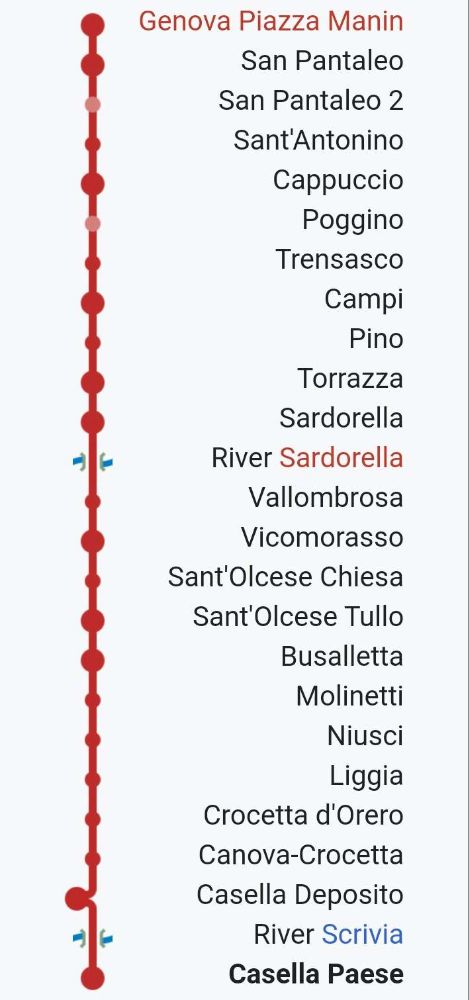
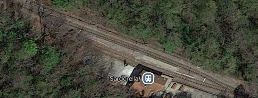
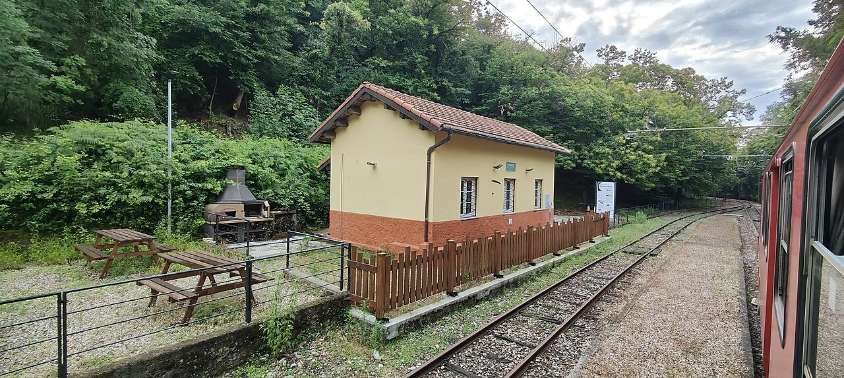
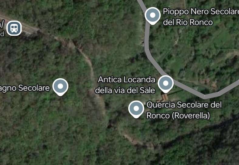
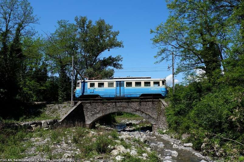
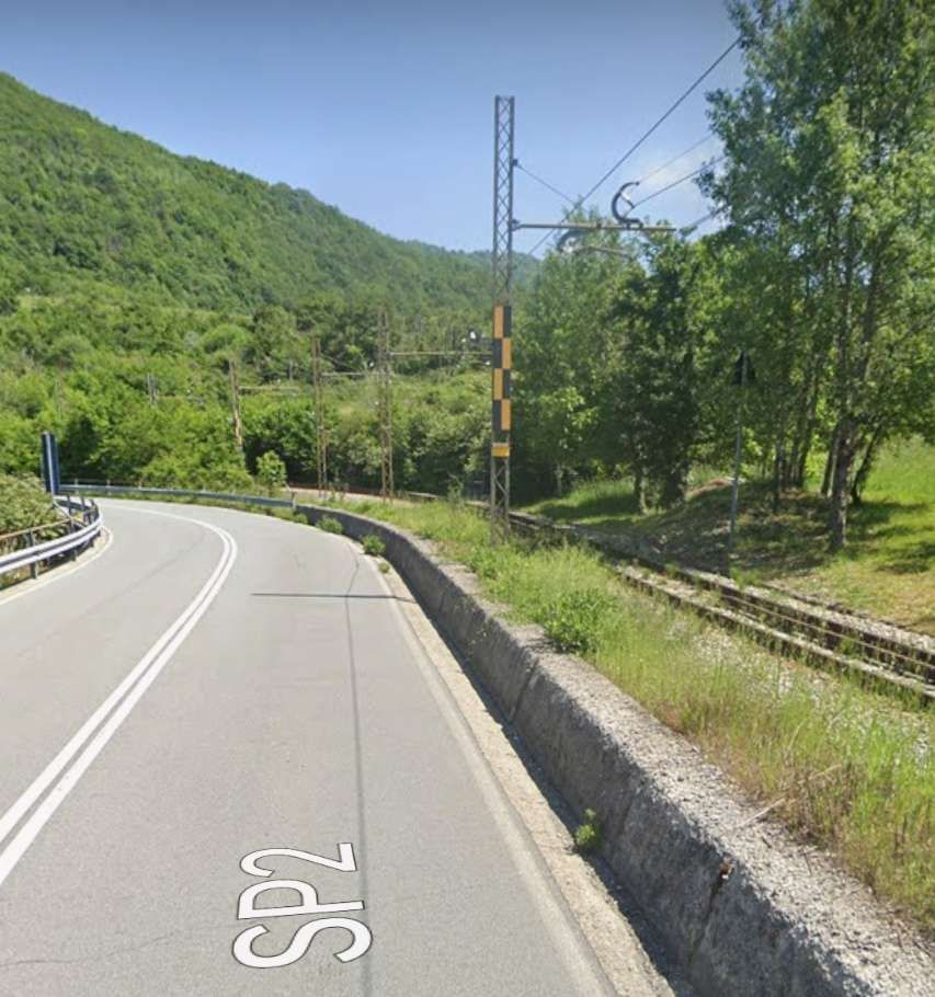
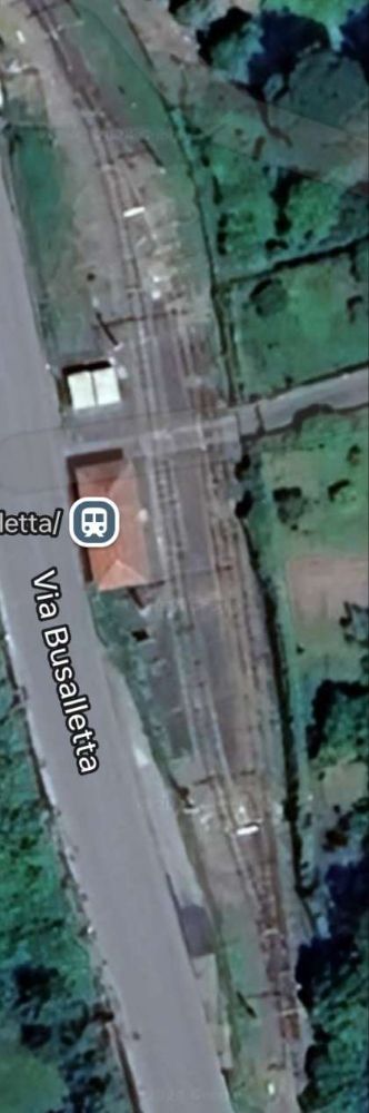
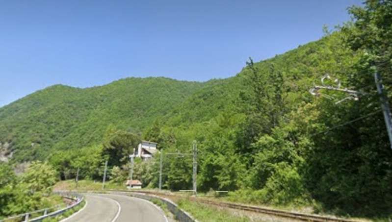
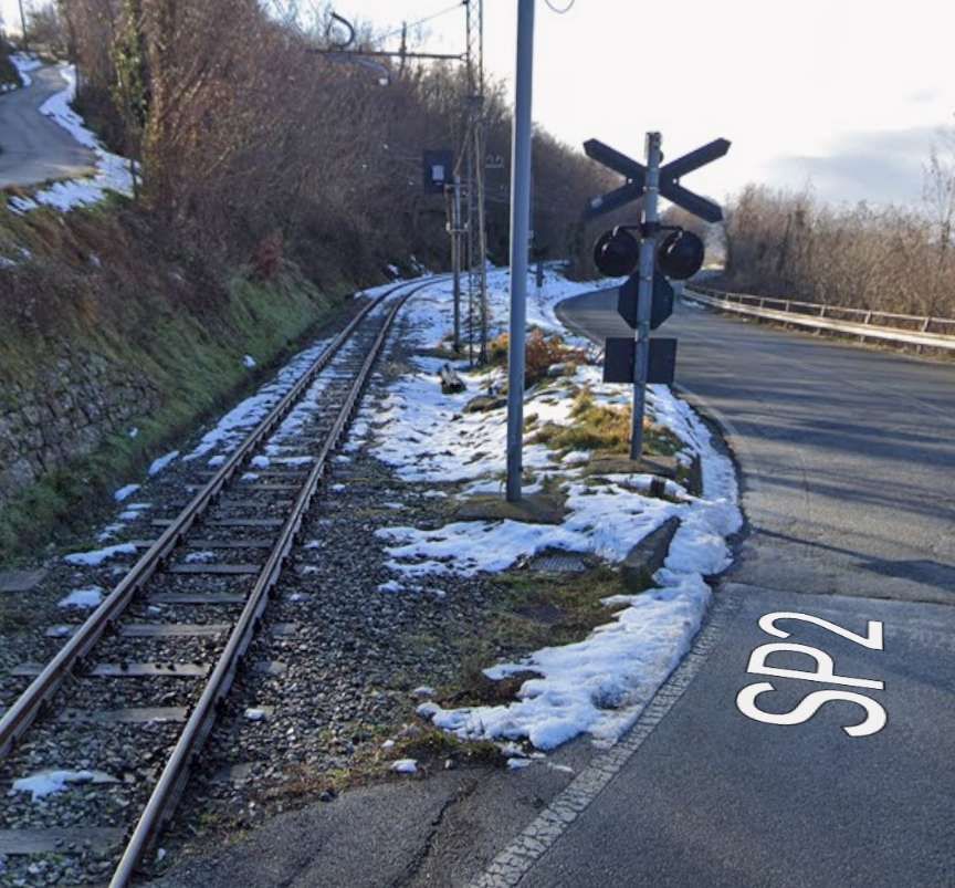
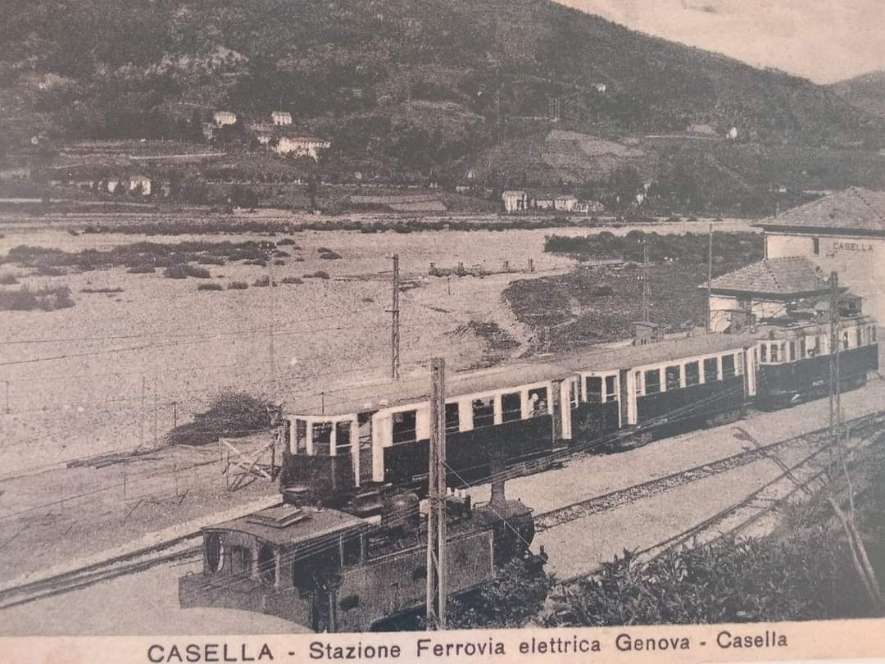
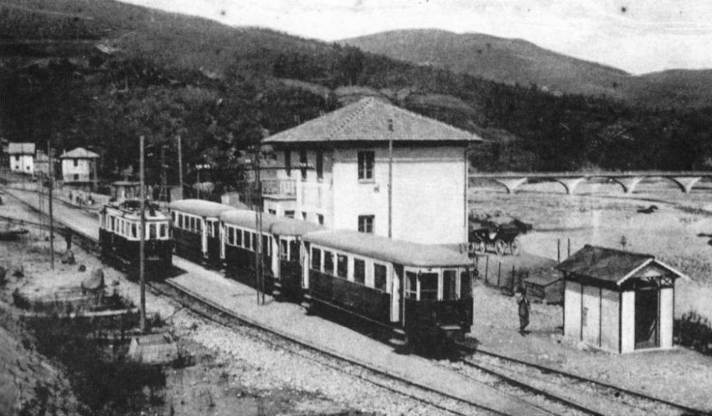
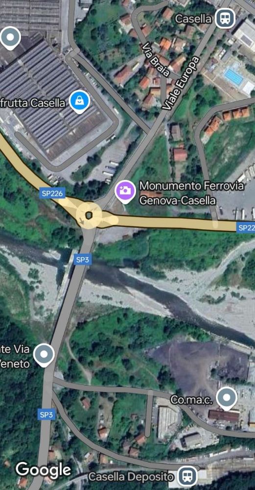
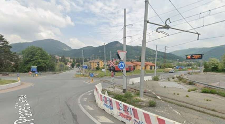
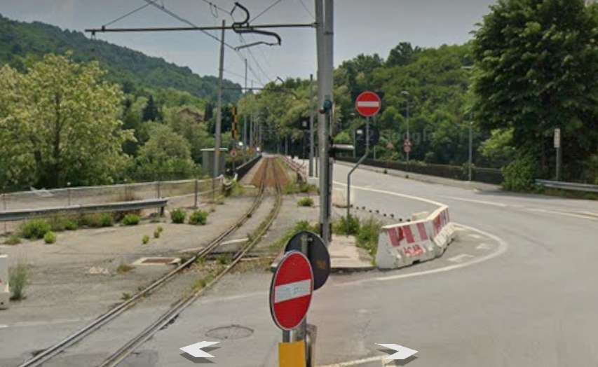
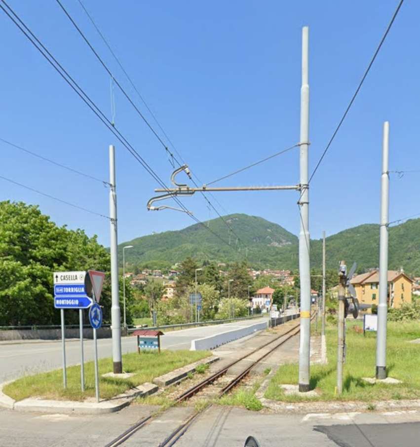
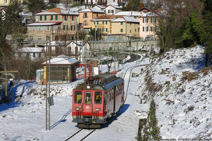
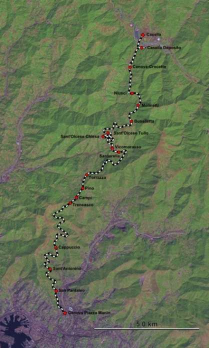
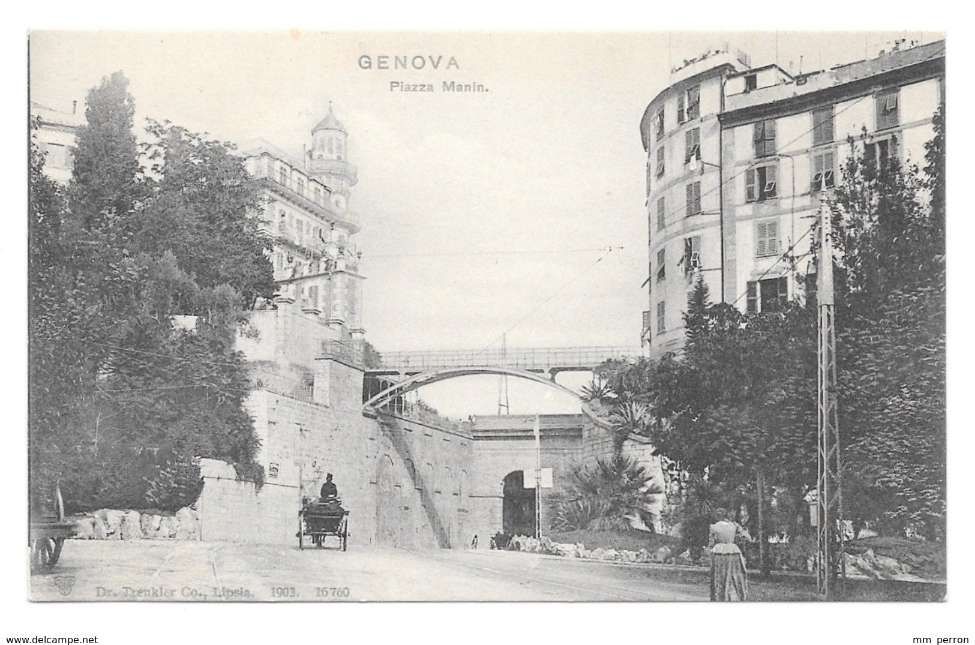
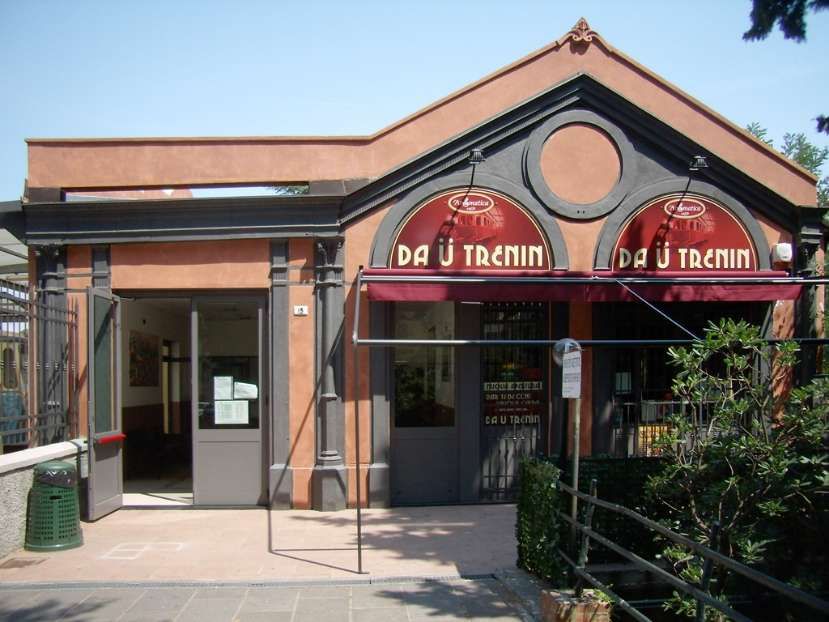
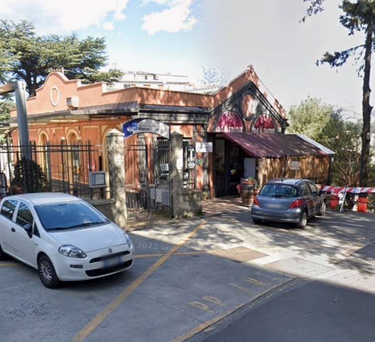
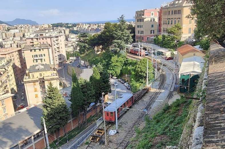
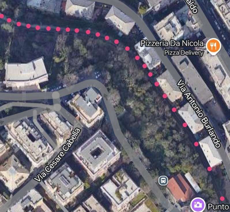
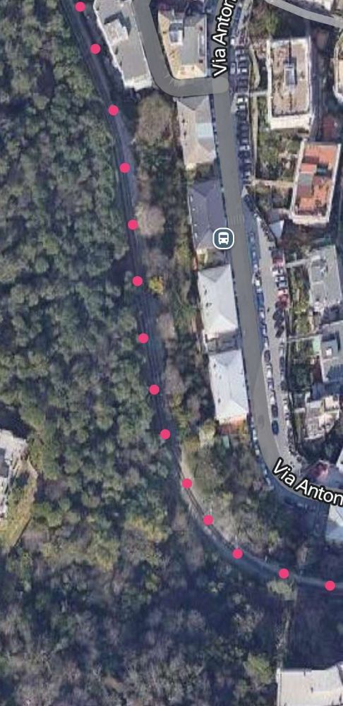
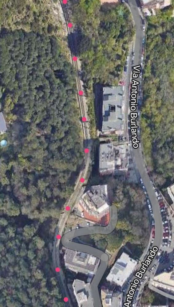
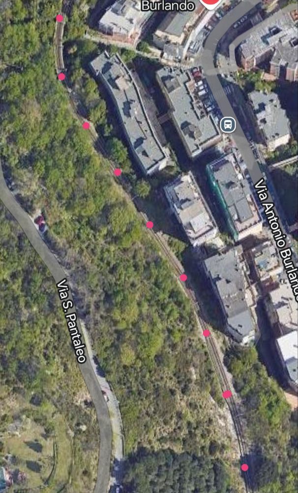
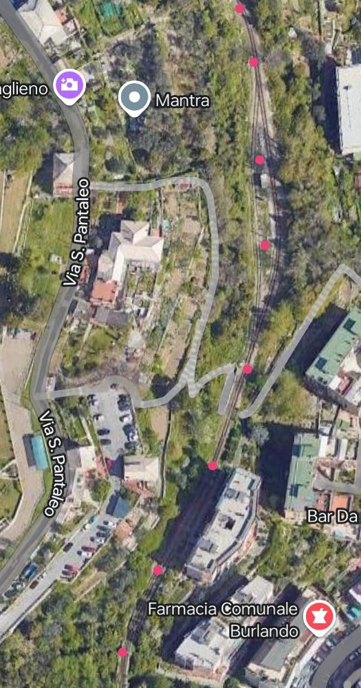
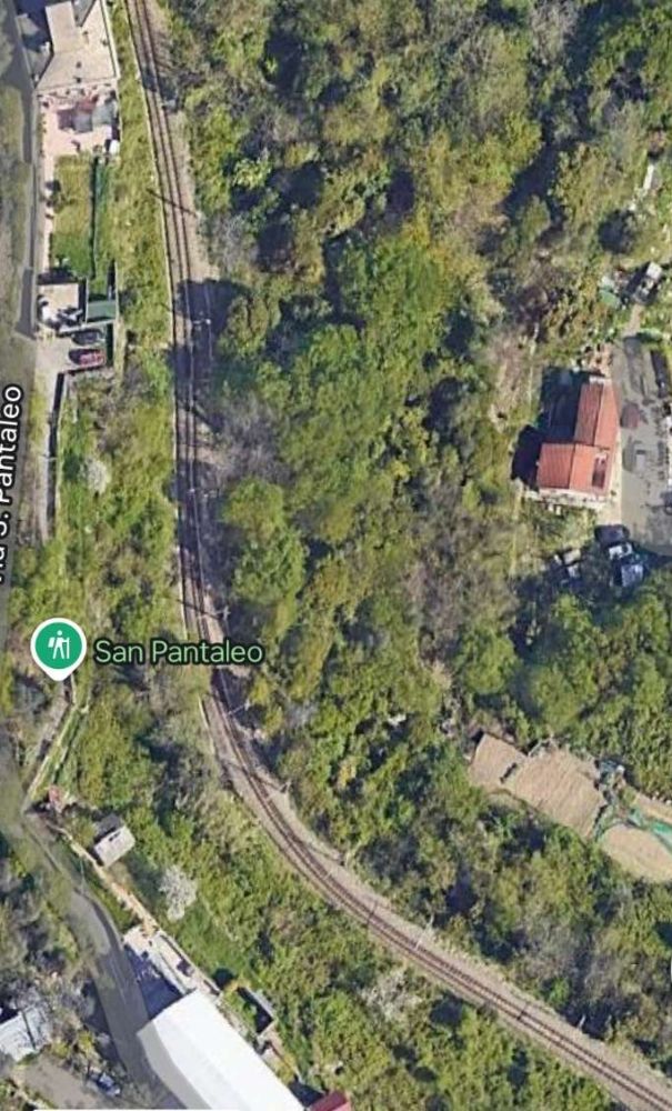
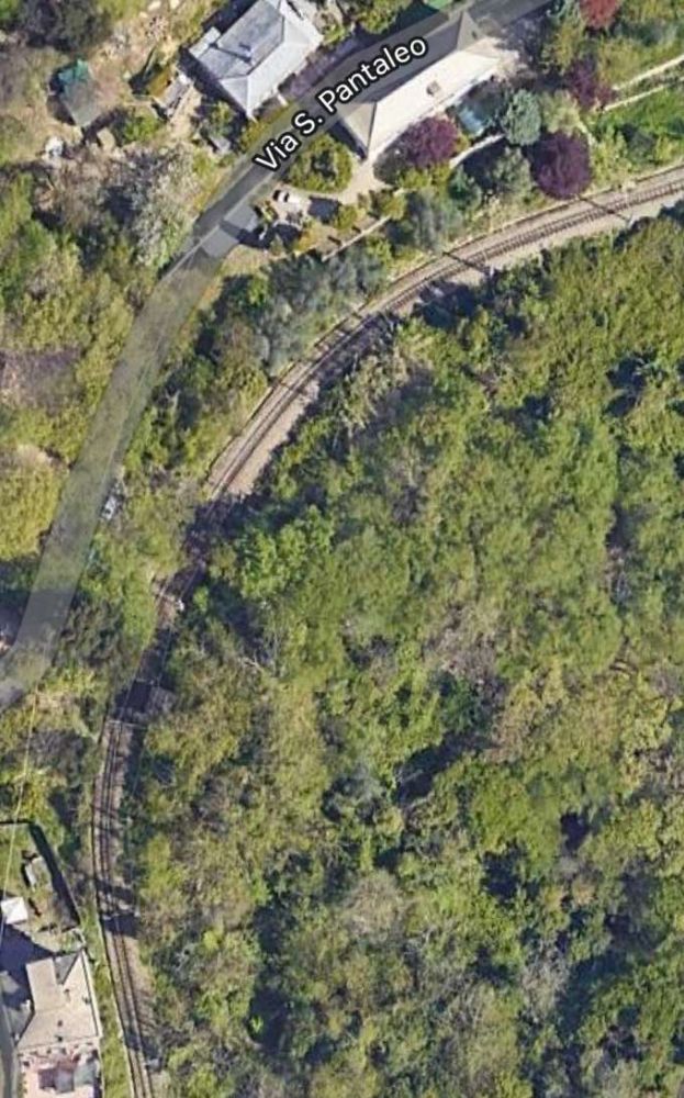
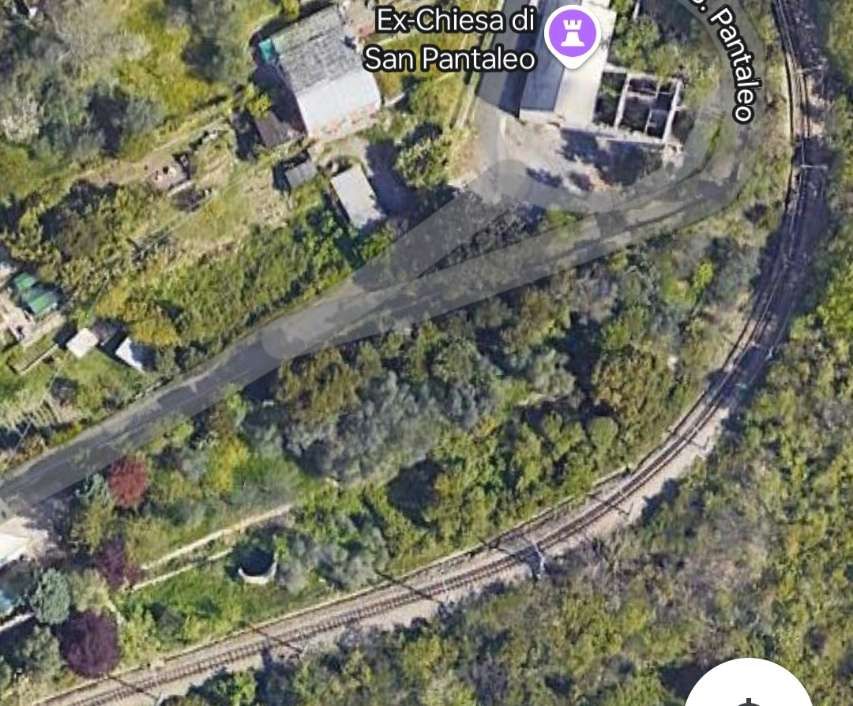
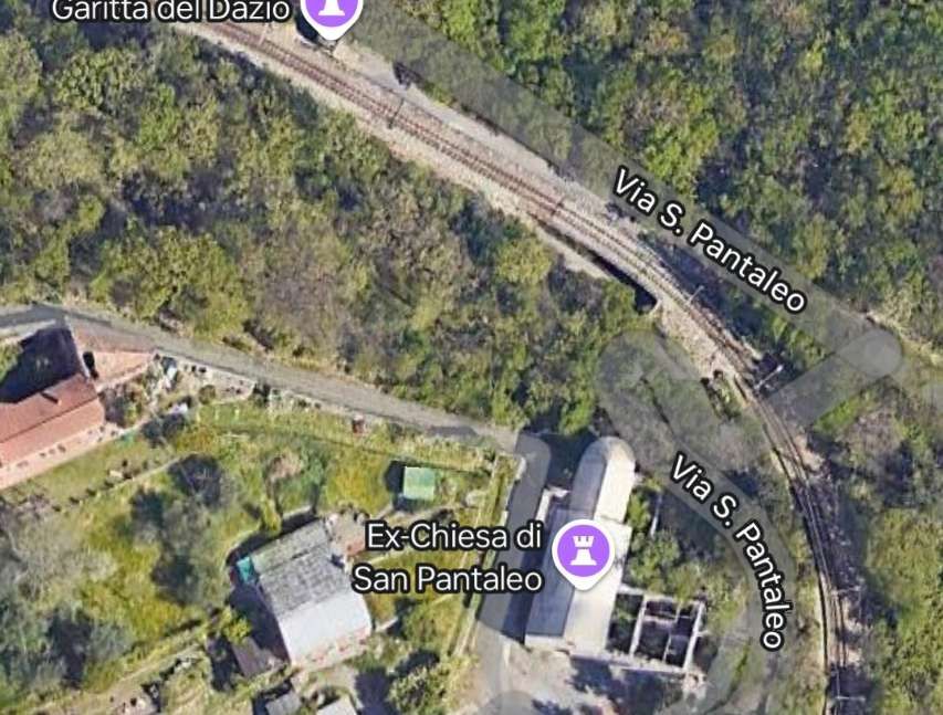
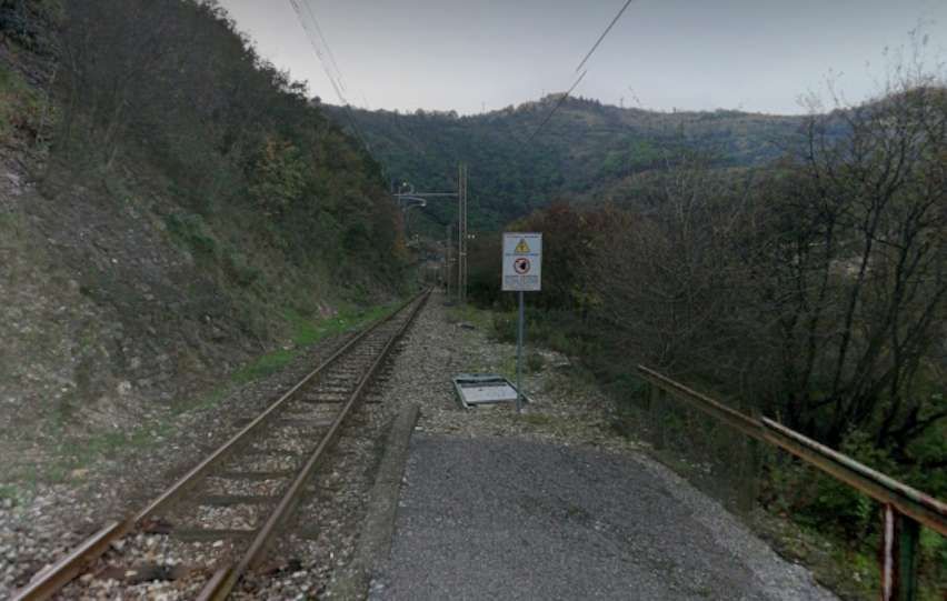
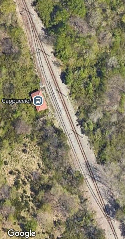
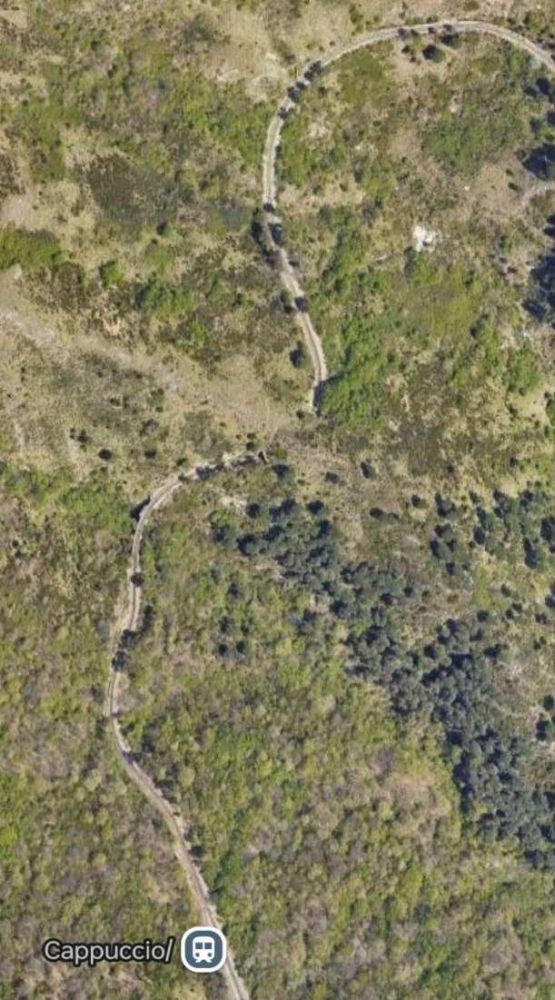
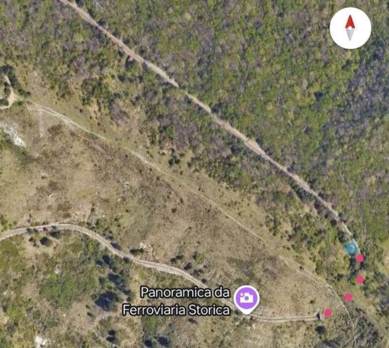
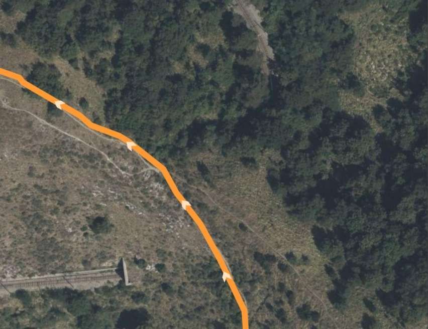
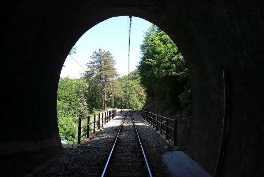
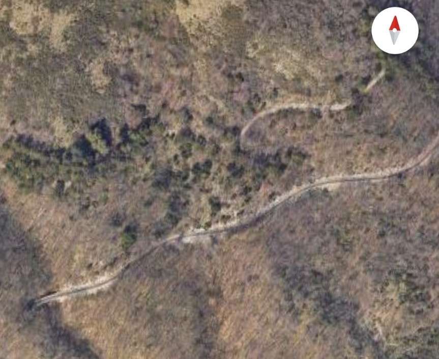
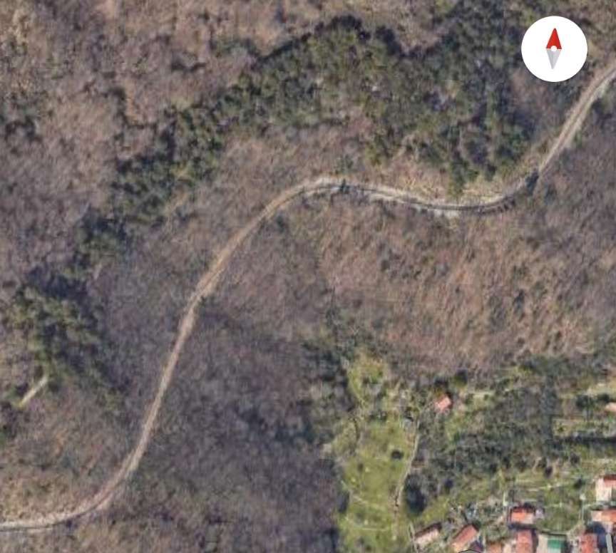
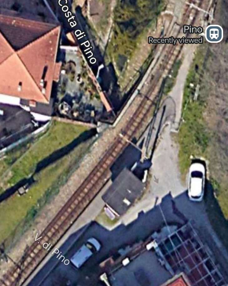
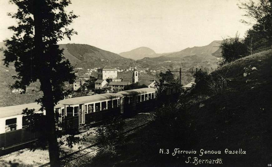
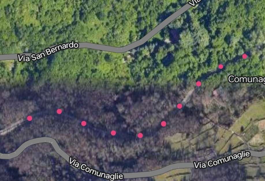
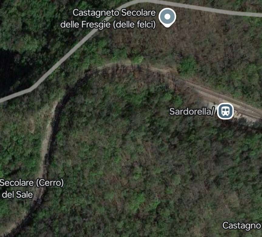
We restart our journey from Genoa to Casella at Sardorella Halt. …

Sardorella Halt. [Google Maps, November 2024]
Sardorella Halt seen from a Genoa-bound train, © Al*from*Lig and authorised for reuse under a Creative Commons Licence (CC BY-SA 4.0). [3]
From Sardorella, the line drops South for a short distance before turning to the East. [Google Maps, November 2024]
It then heads Northeast towards Ponte Sul Sardorella. [Google Maps, November 2024]
At Ponte Sul Sardorella the line turns sharply round through 180° to run West. [Google Maps, November 2024]
The Ponte sul Sardorella (the bridge over the River Sardorella), authorised for reuse under a Creative Commons Licence (CC BY-SA 3.0). [4]
The line continues to the West beneath the village of Vicomorasso, before turning North into Vicomorasso Railway Station. [Google Maps, November 2024]

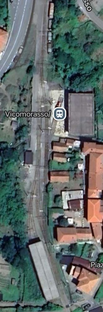
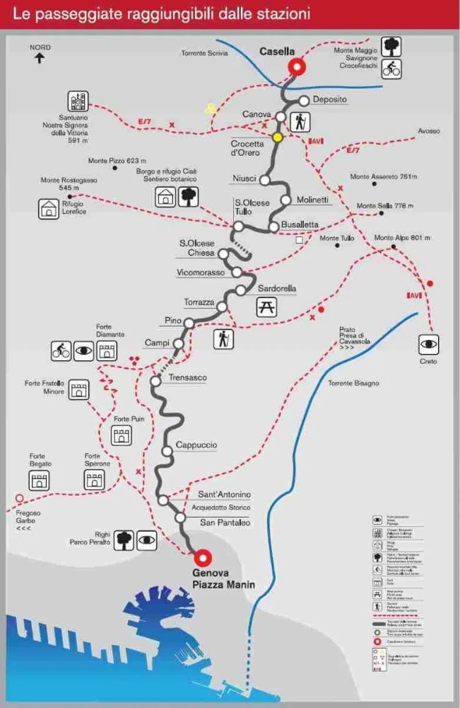
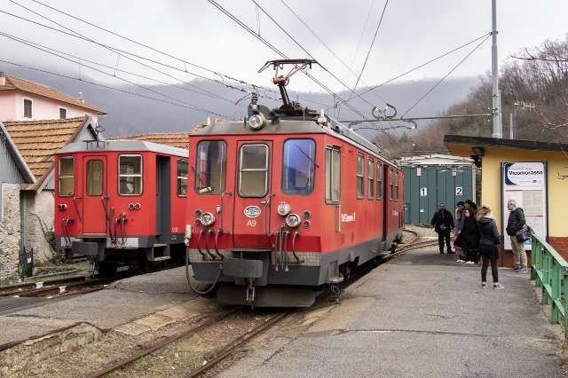
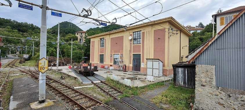
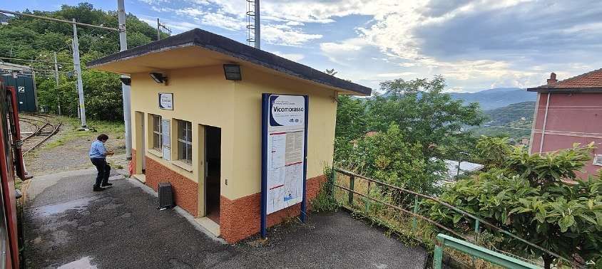
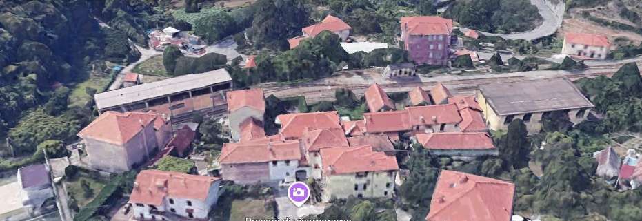
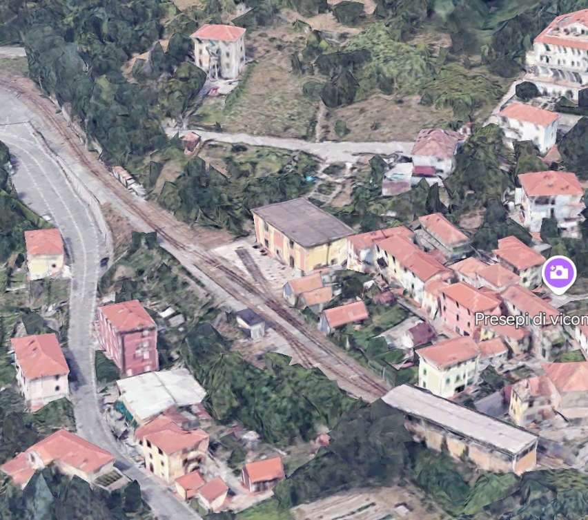
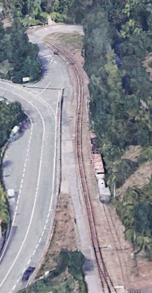
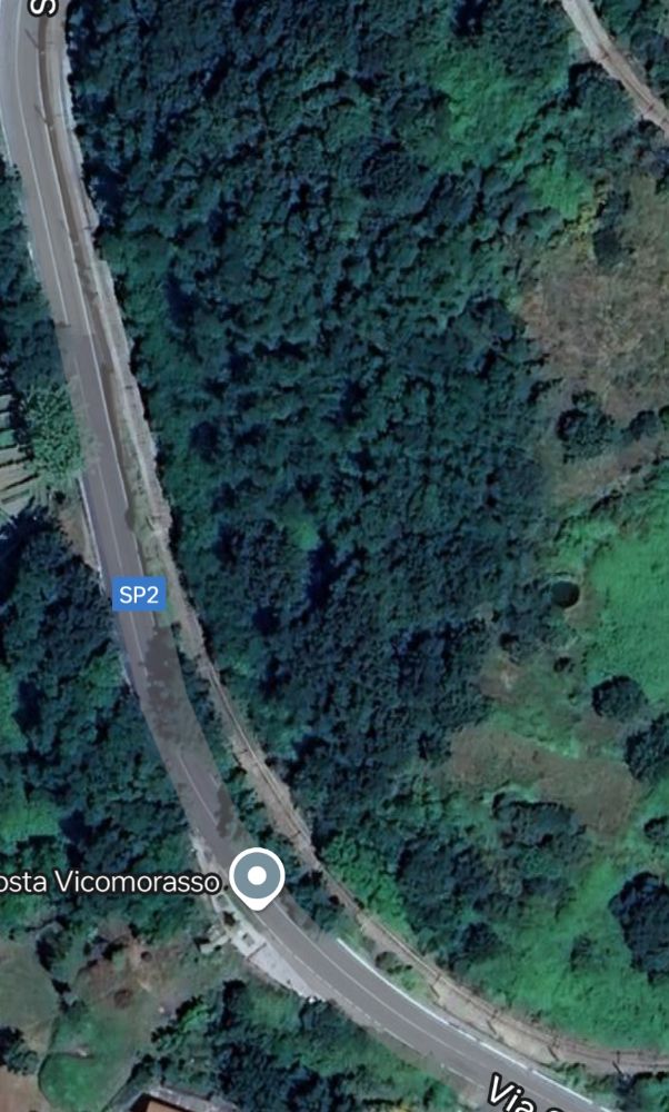
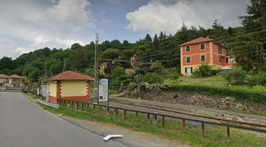
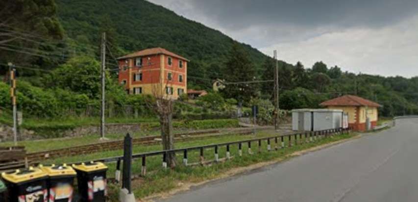
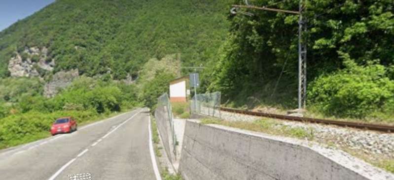
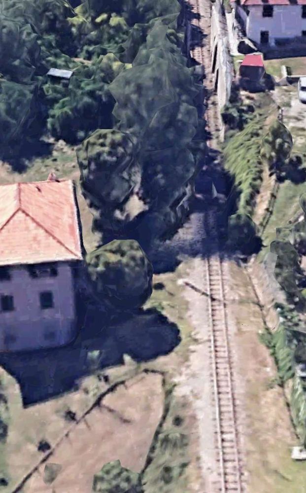
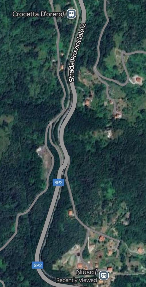
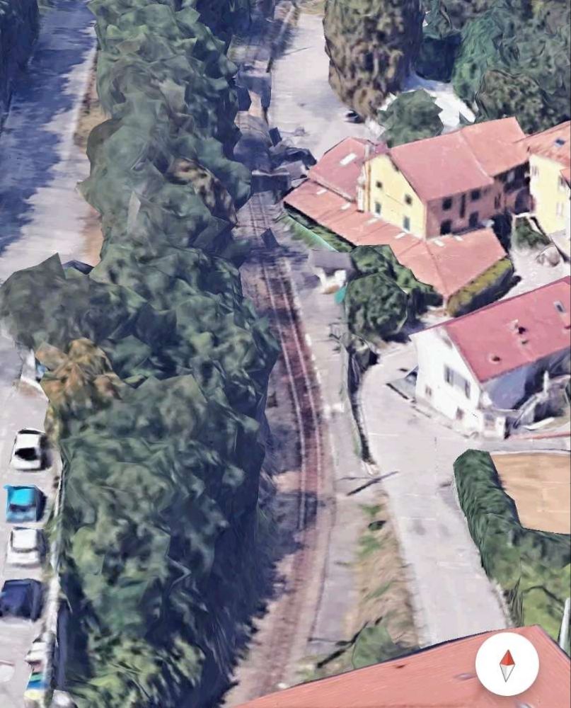
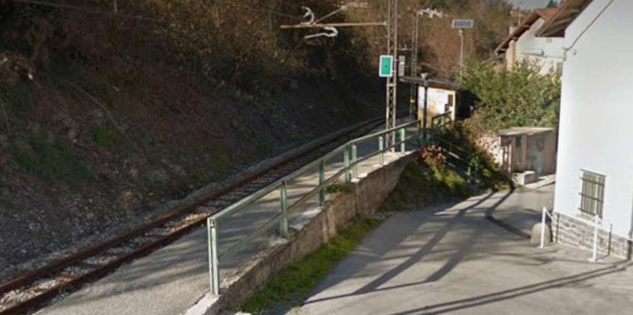
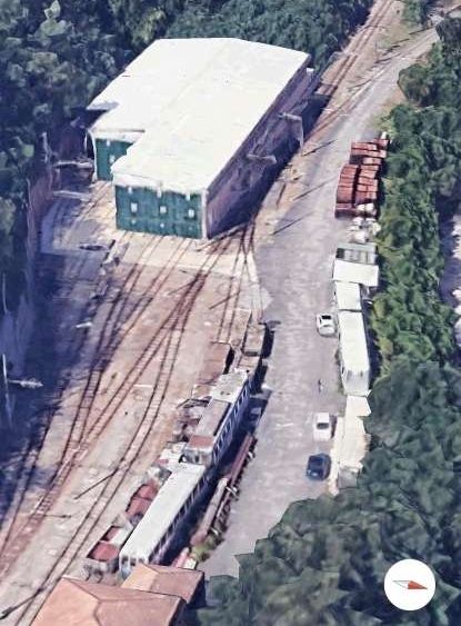
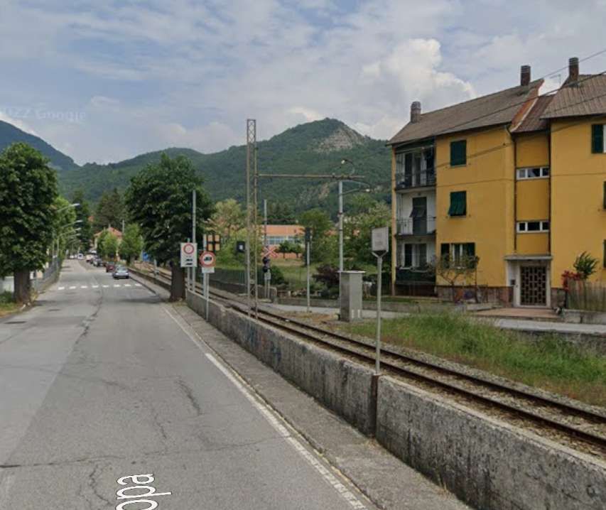
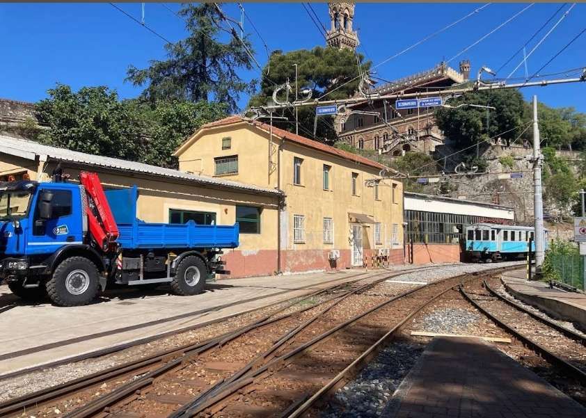
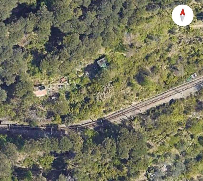
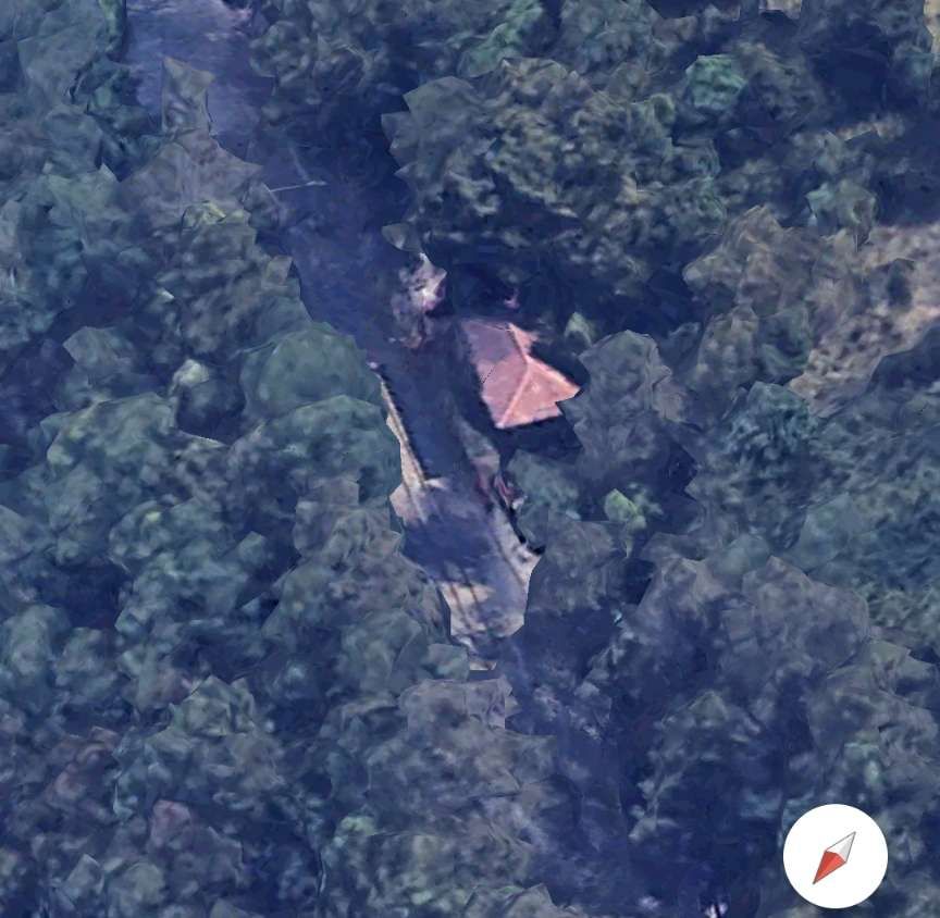
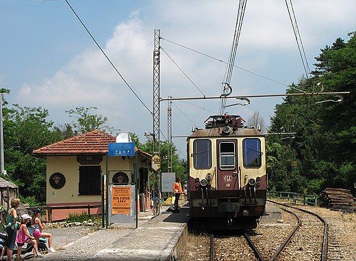
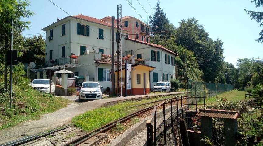
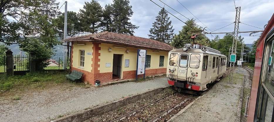
Vicomorasso Railway Station is a more substantial site than those already encountered since leaving Genoa.

Vicomorasso Railway Station, © Jeremy Segrott and licenced for reuse under a Creative Commons Licence (CC BY 2.0). [5]
Vicomorasso Railway Station, © AlfromLig and licenced for reuse under a Creative Commons Licence (CC BY-SA 4.0). [6]
An aerial view from the East across the village to Vicomorasso Railway Station. [Google Earth 3D, November 2024]
a1-1990vicomorasso
This image is embedded from Flickr and shows an A1 Class (ex FEVF) electric locomotive at Vicomorasso in 1990, © prazene, August 2010. [7]
A.2 in manovra a Vicomorasso.
This image is embedded from Flickr and shows an A2 Class electric locomotive of 1929, about to resume its journey towards Casella after a stop in Vicomorasso, © Andrea Catzeddu, June 2024. [11]
An aerial view from the Southwest of Vicomorasso Railway Station. [Google Earth, November 2024]
An aerial view of the railway immediately to the North of Vicomorasso Station. After a short length travelling North the line turns West, crossing Via Vicomorasso at level. [Google Earth 3D, November 2024]
Looking back towards Vicomorasso Railway Station from the junction of the Via Sant’Olcese (SP2) and Via Vicomorasso. [Google Streetview, December 2020]
Looking ahead from the junction of the SP2 and Via Vicomorasso, the line can be seen entering another tunnel. [Google Streetview, December 2020]
The tunnel at Vicomorasso. [Google Maps, November 2024]
The railway turns North and runs alongside the SP2 at a higher level than the road. [Google Maps, November 2024]
A tight S-bend takes the railway along the contours above the SP2 and to Sant’Olcese (Chiesa) Halt. [Google Maps, November 2024]
Sant’Olcese Halt. [Google Maps, November 2024]
Sant’Olcese Halt looking North. [9]
Looking Northeast this aerial view across Sant’Olcese (Chiesa) Halt shows the railway disappearing into a tunnel just to the Northeast of the Halt. [Google Earth 3D, November 2024]
The tunnel under Via A. de Gasperi in Sant’Olcese. The East portal of this tunnel is hidden by the tree canopy. [Google Maps, November 2024]

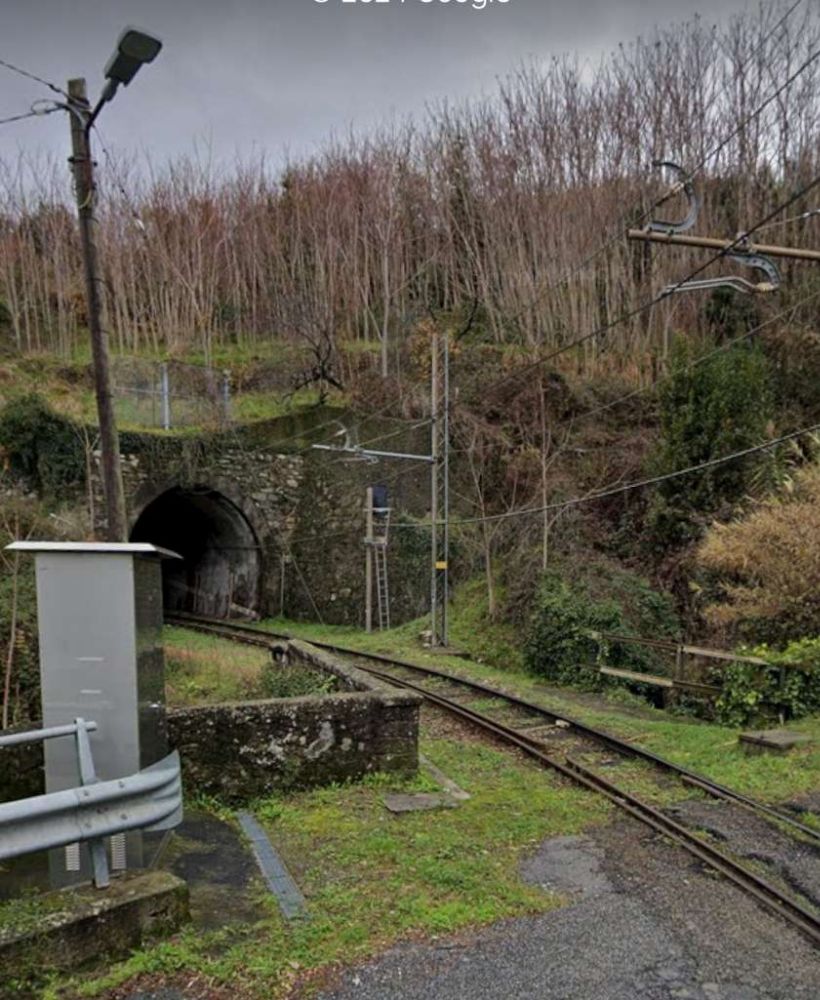
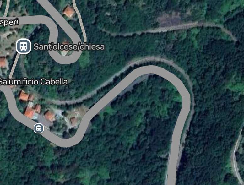
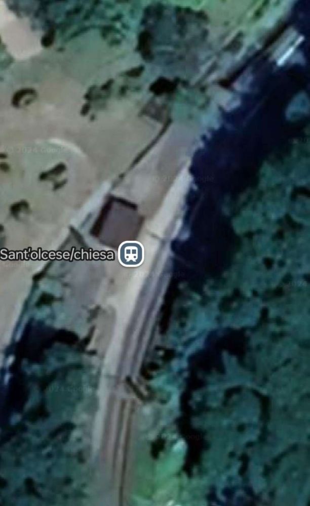
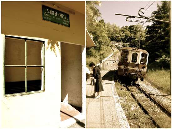
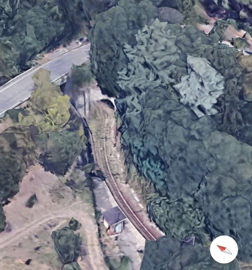
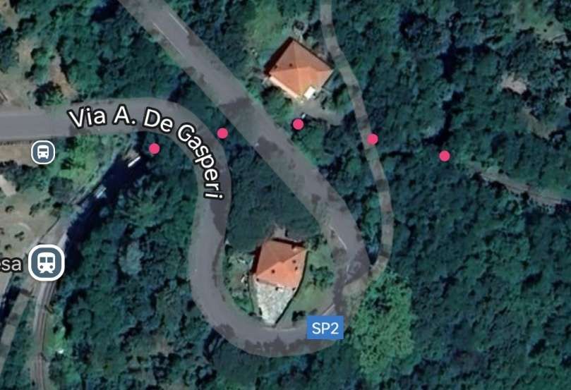
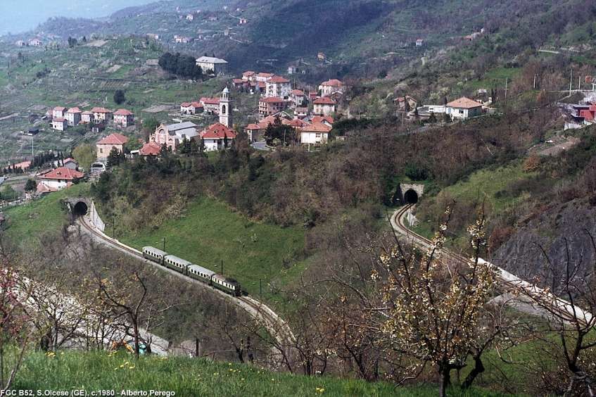
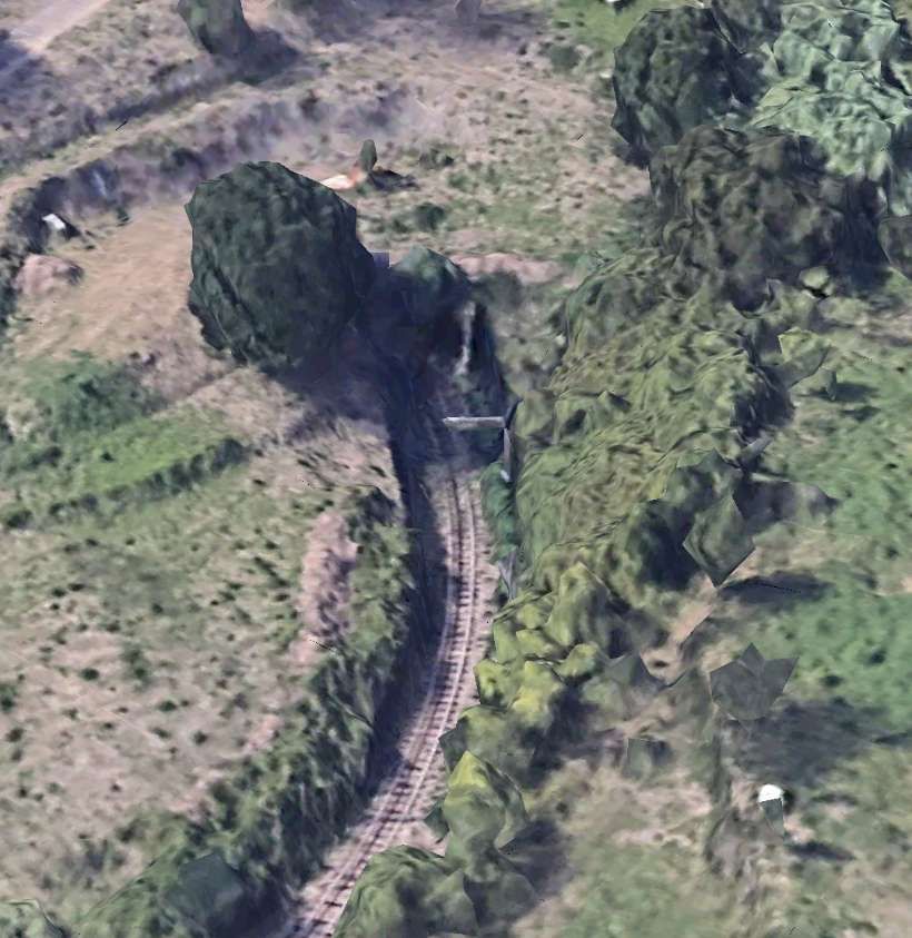
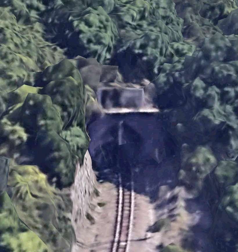
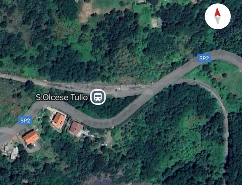
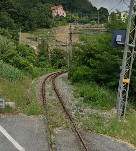
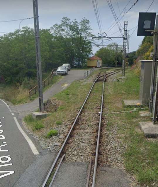
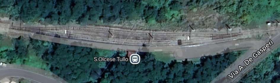
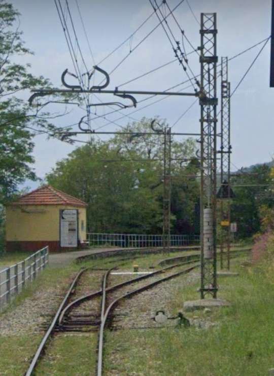
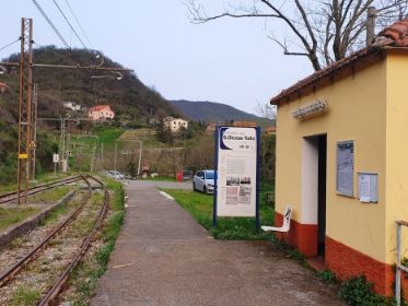
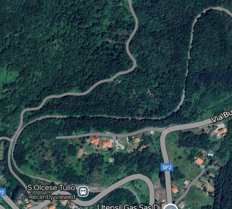
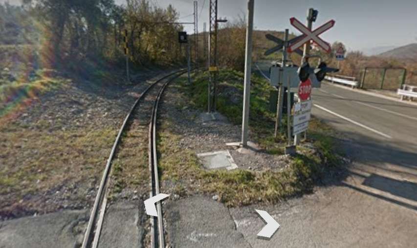
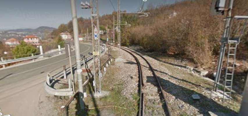
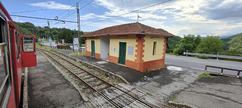
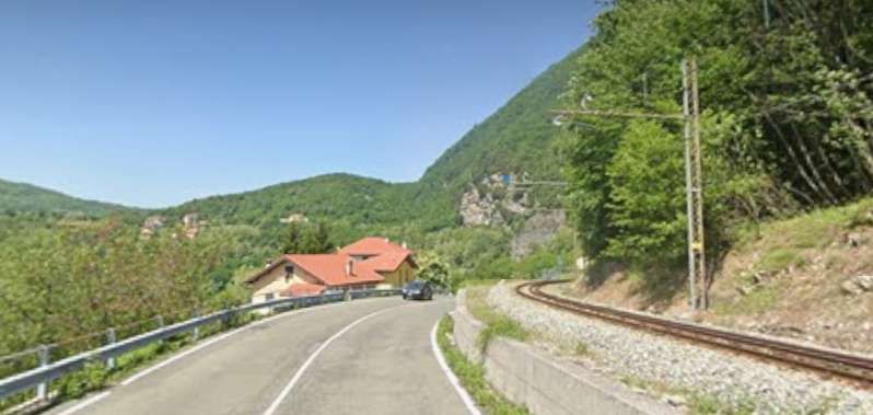
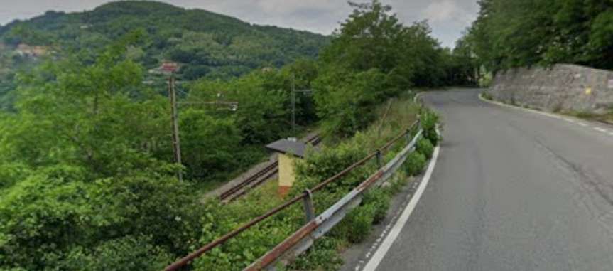
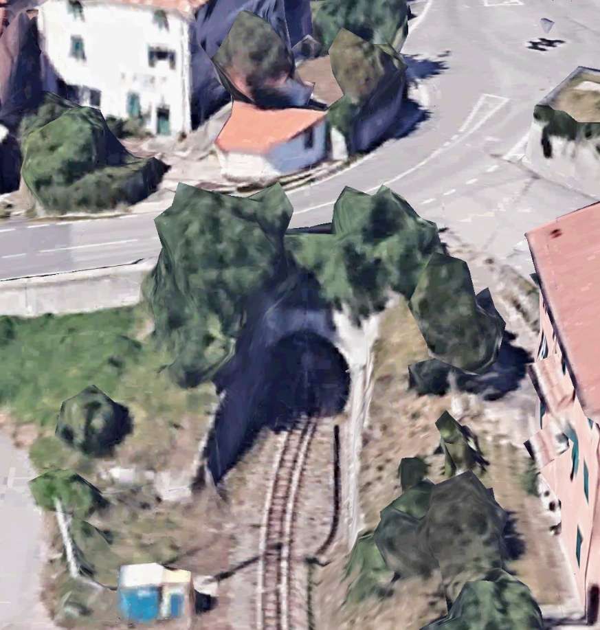
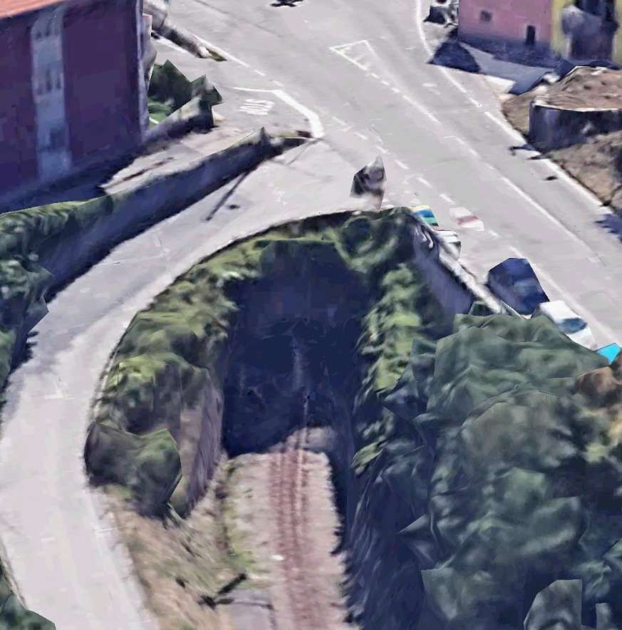
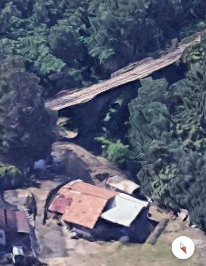
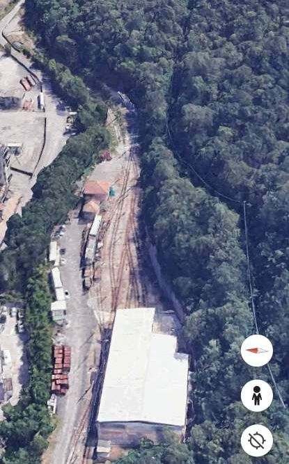
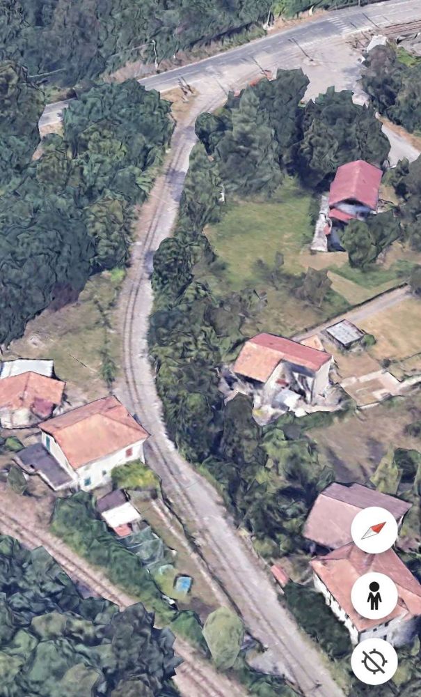
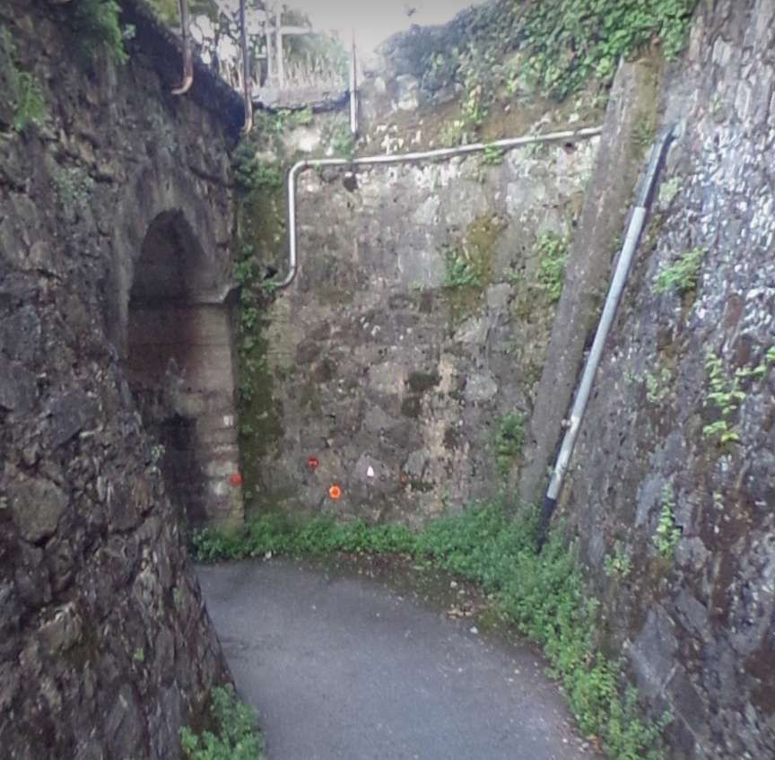
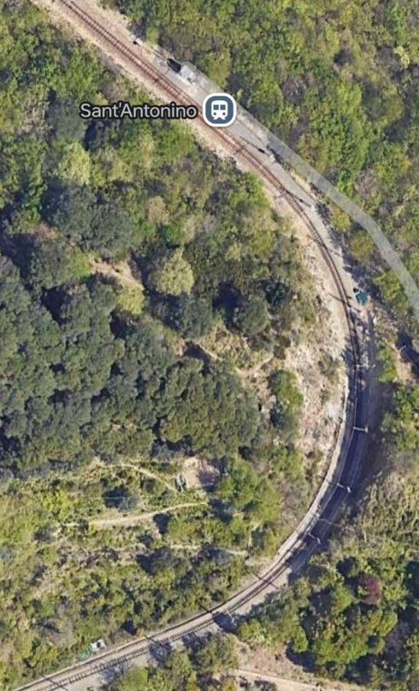
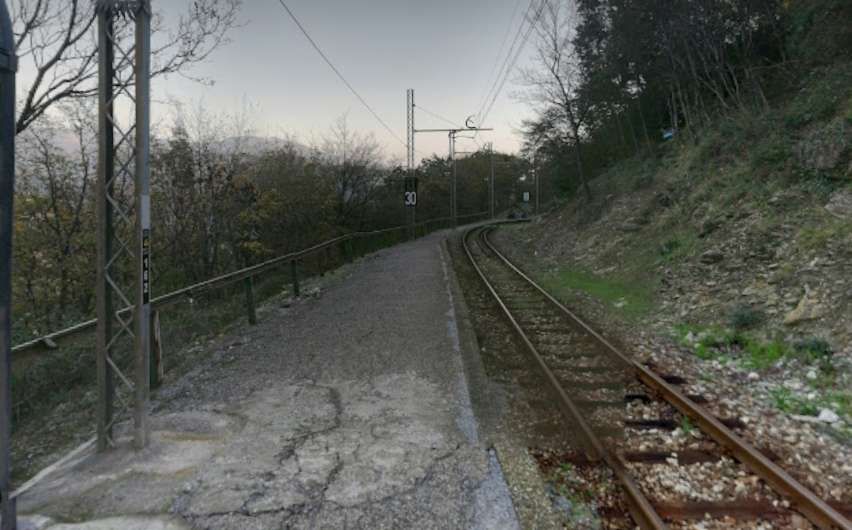
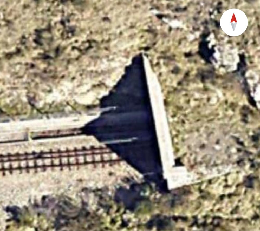
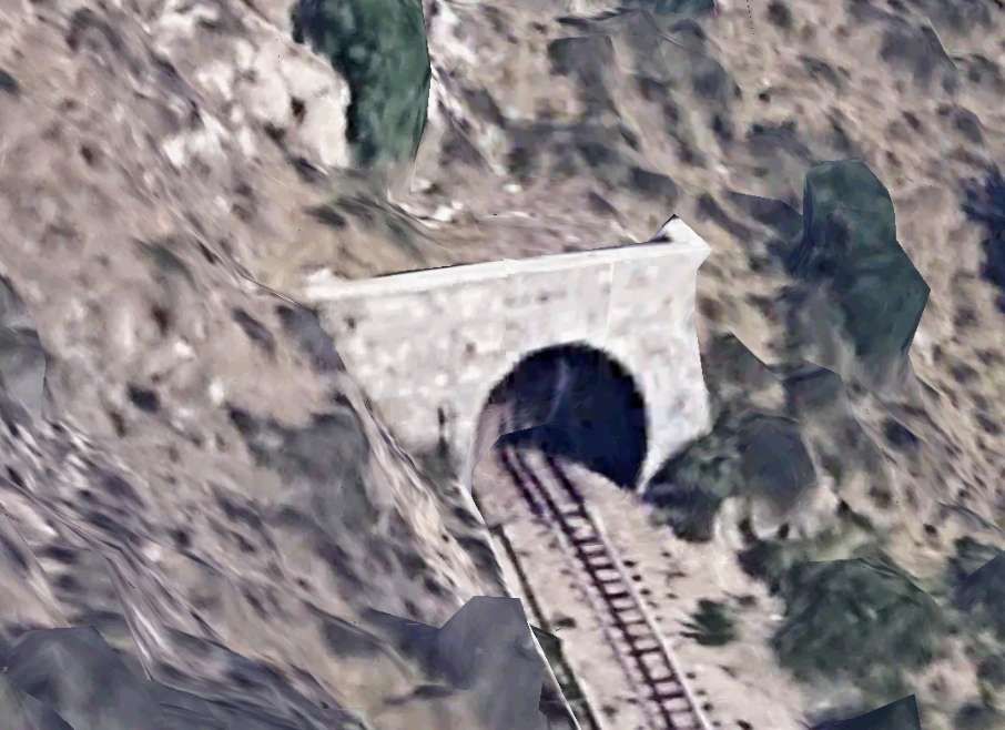
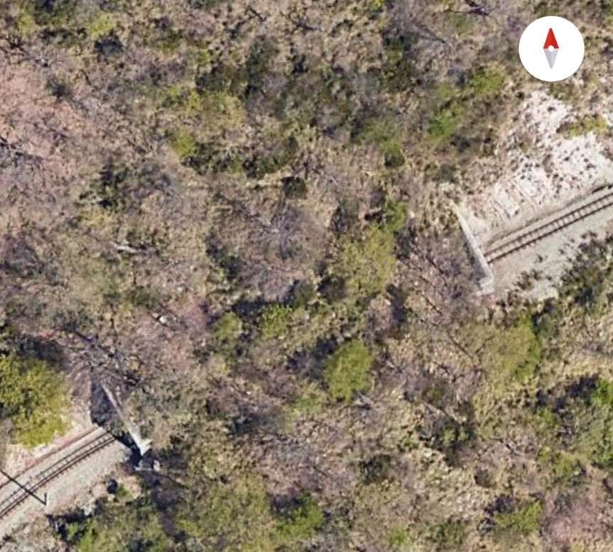
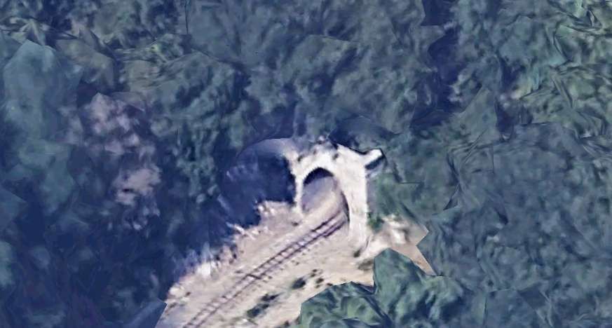
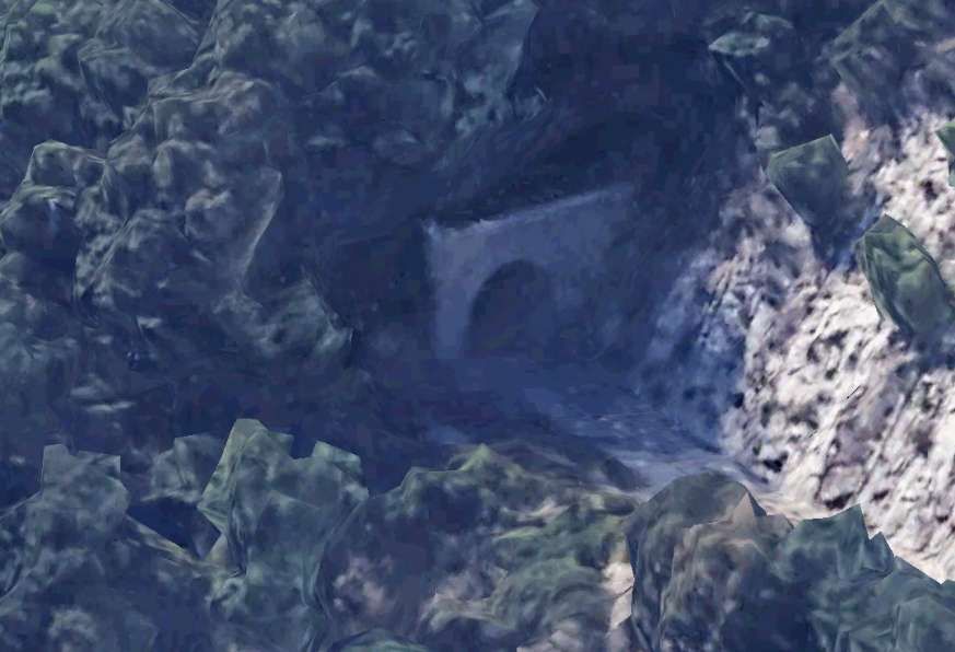
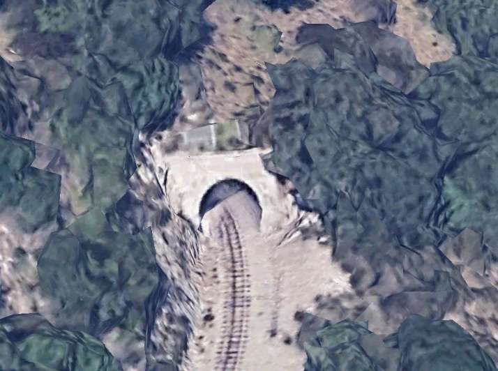
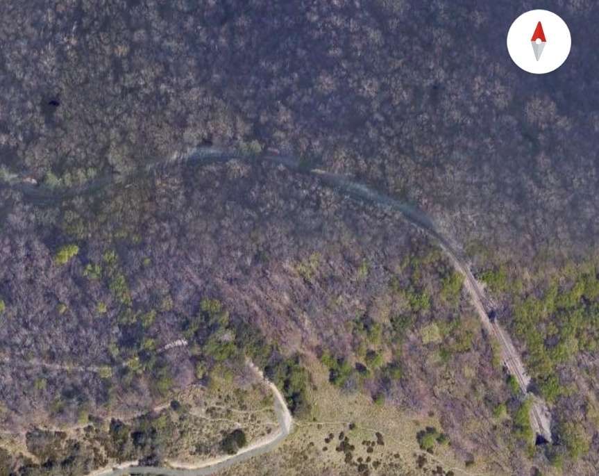
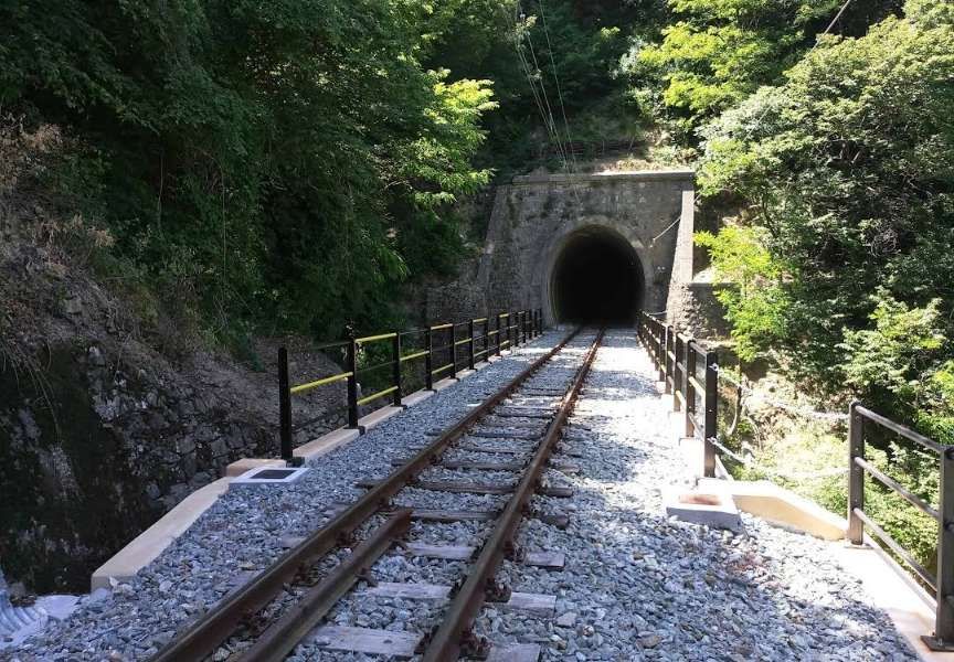
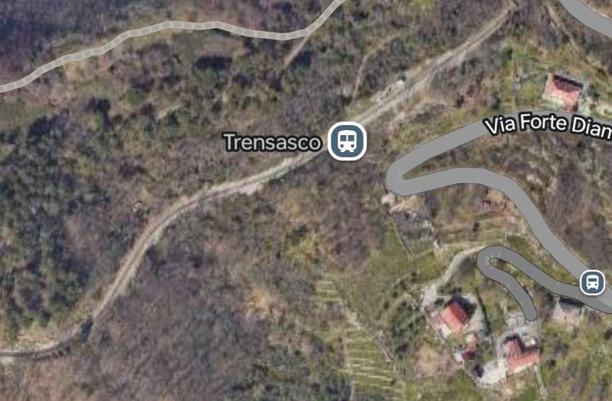
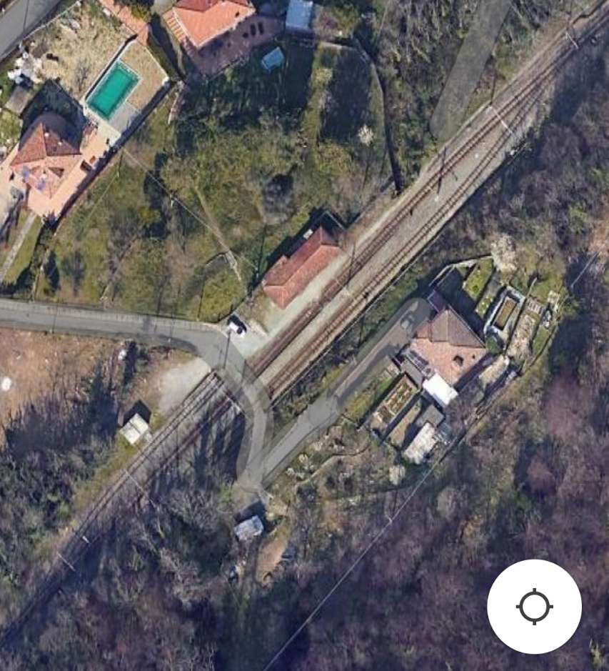
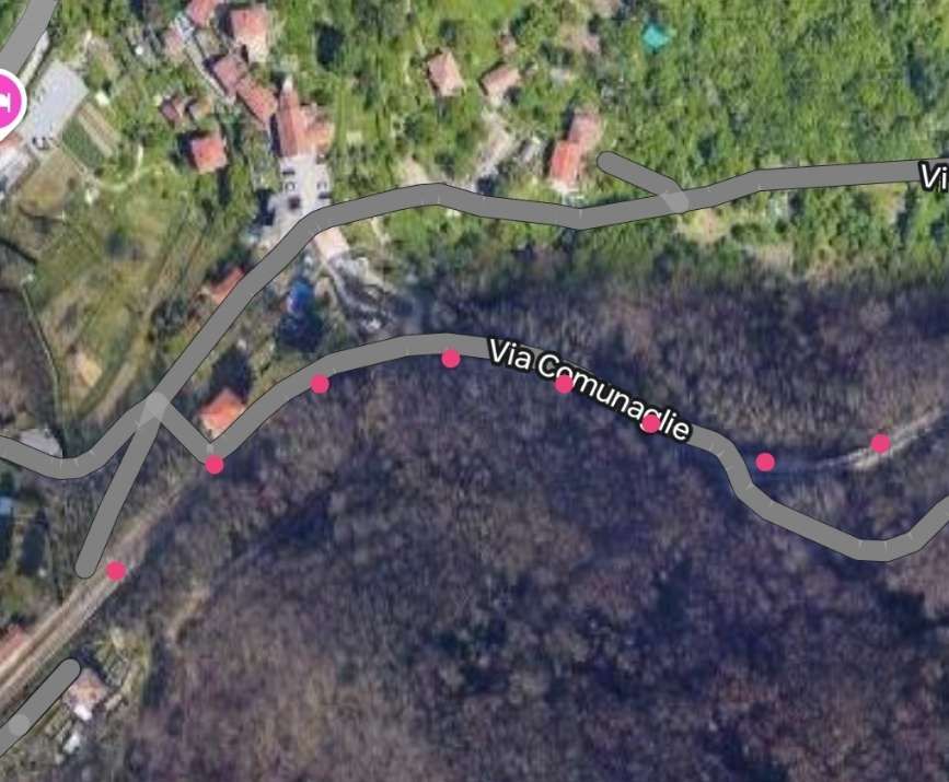
The railway is on three different levels on the hillside at Sant’Olcese. The first accommodates the Chiesa Halt, the tunnel above opens out onto the second level. The third level hosts the Tullo Halt.

Loco B52 in charge of a train heading towards Genova with the village of Sant’Olcese in the background. Something of the track arrangement here is visible. Another section of the line runs at a higher level off to the right of this image and runs into Sant’Olcese Tullo Halt, © Alberto Perego and authorised for reuse under a Creative Commons Licence (CC BY-SA 3.0). [30]
Both the lower level (adjacent to the SP2) and the middle level of track (which includes the tunnel marked by the red dots) can be seen in this satellite image. The North portal of this tunnel is hidden by the tree canopy. The South Portal is shown below. [Google Maps, November 2024]
The South Portal of the tunnel shown on the satellite image above. [Google Earth, November 2024]
Leaving the tunnel the line runs South for a short distance before swinging round through close to 270° before entering another tunnel and then heading North. [Google Maps, November 2024]
The East portal of the tunnel on the above satellite image is shrouded in the shadow of the adjacent tree. [Google Earth, November 2024]
The Northwest portal is a little clearer. [Google Earth, November 2024]
The line turns West again, crosses the SP2 by means of a level crossing and enters Sant’Olcese Tullo Halt which offers a loop for trains to pass. [Google Maps, November 2024]
Looking back East along the line from the level crossing on Via A. De Gasperi (SP2). [Google Streetview, May 2022]
Looking ahead into Sant’Olcese Tullo Halt from the level crossing on Via A. De Gasperi (SP2). [Google Streetview, May 2022]
Sant’Olcese Tullo Halt. [Google Maps, November 2024]
Sant’Olcese Tullo Halt. [Google Streetview, May 2022]
Sant’Olcese Tullo Halt, looking back towards Genoa, © Eugenio Merzagora. [13 – Structurae.net]
Sant’Olcese Tullo Halt, © Andrea Martinelli and licenced for reuse under a Creative Commons Licence (CC BY-SA 3.0). [12]
Leaving Sant’Olcese the line winds northwards following the contours, first alongside Via Rino and then switching over to the North side of Via Busalletta. [Google Maps, November 2024]
The railway alongside Via Ronco. [Google Streetview, May 2022]
The line runs alongside Via Busalletta at a lower level before rising to cross the road at a level crossing. The route of the line is obscured by the Google Maps superimposed line of the SP2. [Google Maps, November 2024]
The railway on the North side of Via Busalletta. [Google Streetview, May 2022]
The railway crosses Via Busalletta at a level crossing. [Google Streetview, May 2022]
The same crossing from above. [Google Earth, November 2024]
Looking back along the line towards Sant’Olcese from the level crossing on Via Busalletta. [Google Streetview, May 2022]
Looking forward from the level crossing towards Busalletta. [Google Streetview, May 2022]
Via Busalletta runs beside the railway towards Busalletta Halt. [Google Streetview, May 2022]
Looking back from Via Brigata Balilla at the South end of Busalletta Halt towards Sant’Olcese. [Google Streetview, May 2022]
Looking forward from Via Brigata Balilla at the South end of Busalletta Halt. [Google Streetview, May 2022]
A closer view of Busalletta Halt. [Google Maps, November 2024]
A wide angle view of Busalletta Halt from the South. [Google Streetview, May 2022]
Busalletta Halt from the South. [Google Streetview, May 2022]
Busalletta Halt from the Northwest. [Google Streetview, May 2022]
Busalletta Halt, © Al*from*Lig and licenced for reuse under a Creative Commons Licence (CC BY-SA 4.0). [14]
Busalletta Halt © Giorgio Stagni and licenced for reuse under a Creative Commons Licence (CC BY-SA 3.0). [14]
Busalletta Halt, © Giorgio Stagni and licenced for reuse under a Creative Commons Licence (CC BY-SA 3.0). [14]
Busalletta Halt, © Giorgio Stagni and licenced for reuse under a Creative Commons Licence (CC BY-SA 3.0). [14]
Busalletta to Molinetti Halt. [Google Maps, November 2024]
To the North of Busalletta Halt, the line runs on the East side of Via Molinetti. [Google Streetview, May 2022]
Further along the line towards Molinetti. [Google Streetview, May 2022]
And again, further still towards Molinetti Halt. [Google Streetview, May 2022]
Much closer now to Molinetti Halt. [Google Streetview, May 2022]
Heading North still and closing in on Molinetti Halt. [Google Streetview, May 2022]
Molinetti Halt seen from the South on Via Molinetti (SP2). [Google Streetview, May 2022]
Molinetti Halt. [Google Earth, November 2024]
Molinetti Halt to Niusci Halt. The line is further from the SP2 and at a higher level. [Google Maps, November 2024]
Niusci Halt seen from the East. [Google Earth, November 2024]
Niusci to Crocetta D’orero. Google Maps, November 2024]
West and North of Niusci Halt, the SP2 and the railway run in parallel. Initially the railway is too far from the road to be seen. Later the two run immediately adjacent to each other. [Google Streetview, May 2022]
The line crosses the road on the level. [Google Streetview, May 2022]
Looking back towards Niusci from the level crossing. [Google Streetview, January 2021]
Looking ahead towards Liggia Halt. [Google Streetview, May 2022]
Beyond the crossing, the SP2 begins to rise above the railway. [Google Streetview, May 2022]
Liggia Halt. [Google Streetview, May 2022]
Liggia Halt, looking North. [Google Earth, November 2024]
Crocetta D’orero Halt seen from the SP2 to the South of the Halt. [Google Streetview, May 2022]
Crocetta D’orero Halt seen from the South. [Google Earth, November 2024]
North of the Halt, the line tunnels under Crocetta D’orero village. The southern tunnel.mouth is towards the bottom of this image. [Google Earth, November 2024]
A better view of the tunnel entrance can be seen in this picture. [Google Earth 3D, November 2024]
The tunnel at Crocetta D’orero.[Google Earth, November 2024]
The North tunnel mouth in shadow. [Google Earth 3D, November 2024]
Canova Crocetta Halt sits immediately to the North of the tunnel under the village. [Google Maps, November 2024]
Canova Crocetta Halt. [Google Earth, November 2024]
Canova Crocetta Halt, seen from the South on the SP3. [Google Streetview, 2011]
North of Canova Crocetta Halt, the line headed North-northeast above Via Pianogrande. [Google Maps, November 2024]
The line continues into Casella Depositi Halt. [Google Maps, November 2024]
As the line curved into Casella Deposito it crossed this stone arched viaduct. The image is of quite poor quality. [Google Earth 3D, November 2024]
Casella Deposito and Halt. [Google Maps, November 2024]
An early view of the first station at Casella, now known as Casella Deposito. Steam was employed during construction. This view looks Northeast across the site of the station and across the River Scrivia. © Public Domain. [16]
Casella Station, now Casella Deposito, on the South bank of the River Scrivia. The town of Casella is on the North bank.  The bridge over the Scrivia is in the right background, © Public Domain. [8]
The final run into Casella requires trains to reverse at Casella Deposito Halt. The line curved round to the North, crossed the River Scrivia (Flume Scrivia) on a bridge shared with the SP3. [Google Maps, November 2024]
Looking East through the site of Casella Deposito. [Google Earth 3D, November 2024]
Looking West through the site of Casella Deposito. [Google Earth 3D, November 2024]
The line from Casella Deposito curves round towards Casella Paese. [Google Streetview, May 2022]
The curve from Casella Deposito to the bridge over the River Scrivia seen from the Southeast. [Google Earth 3D, November 2024]

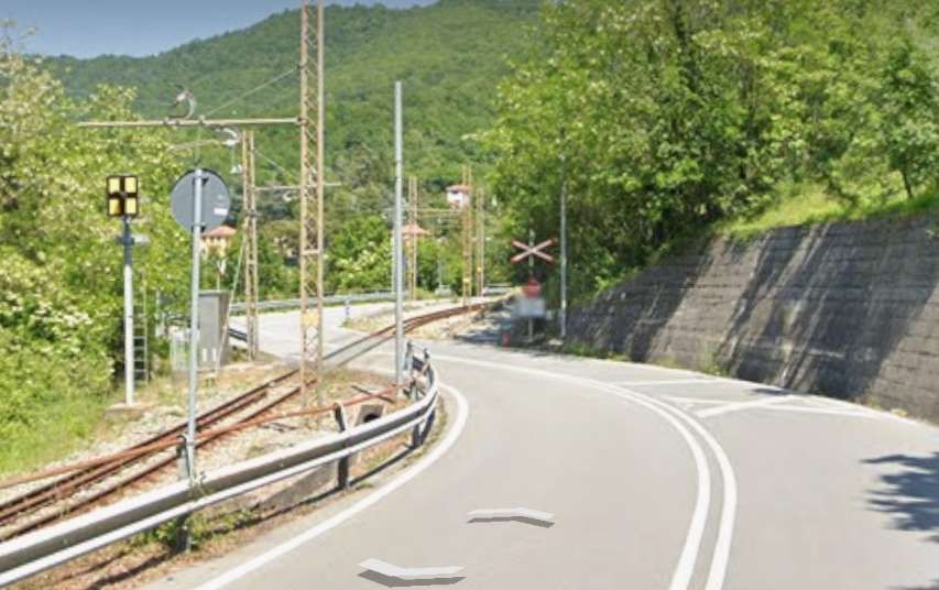
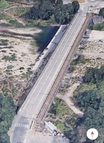
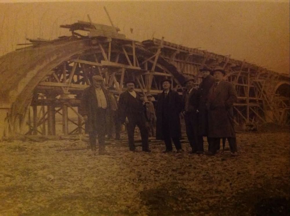
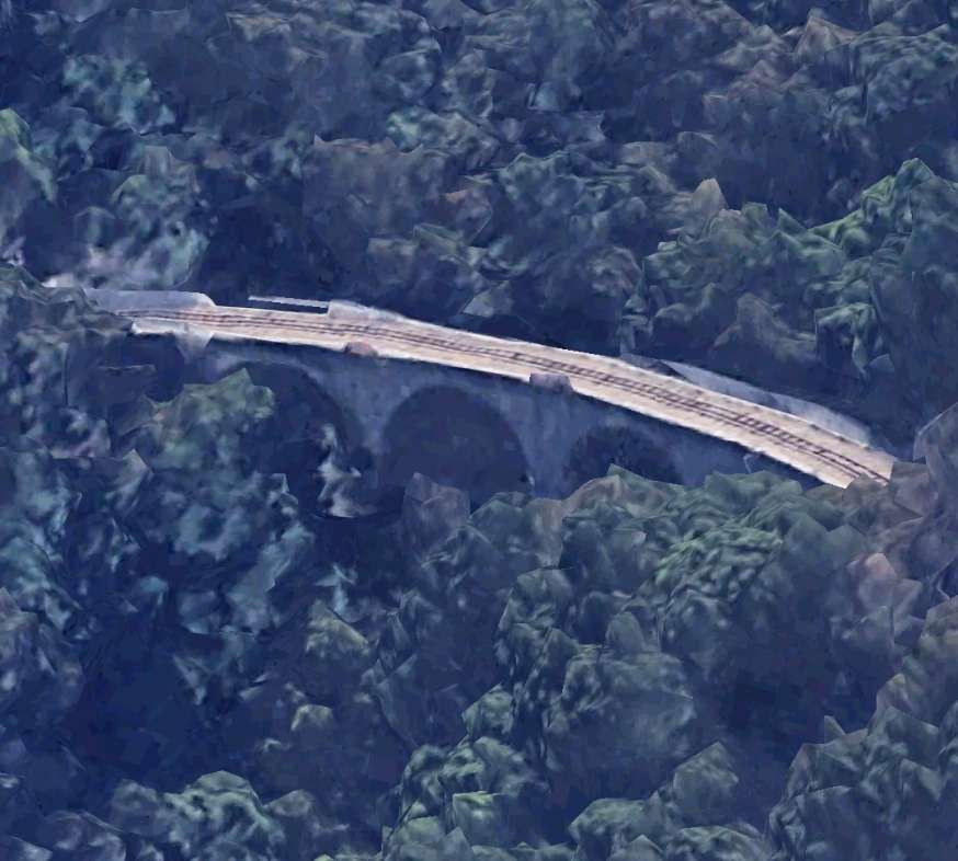
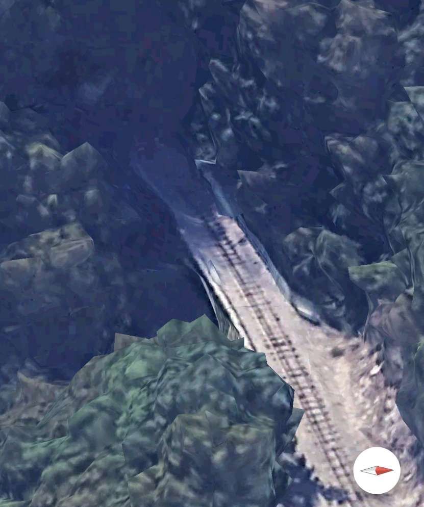
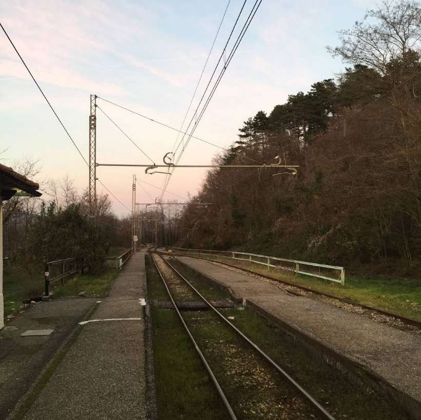
A photograph of a later elettromotrice travelling on this curve can be found here. [17] In the linked image, unit A12 is shown on the curve from Casella Deposito to the Vittorio Veneto bridge (over the River Scrivia). It was shared by Gian-Paolo Codebo on the Sei de Casella se… Facebook Group on 7th May 2020.

The Vittorio Veneto bridge over the Flume Scrivia. [Google Earth 3D, November 2024]
The construction of the bridge over the River Scrivia at Casella © Public Domain. [15]
Looking North across the Ponte Vittorio Veneto. The railway runs along the East side of Via Ponte Vittorio Veneto over the bridge. [Google Streetview, May 2022]
Approaching the roundabout at the North end of the bridge. [Google Streetview, May 2022]
The railway crosses the SP226 immediately adjacent to the roundabout and then runs down the East side of Viale Europa. [Google Streetview, May 2022]
Looking back South over Ponte Vittorio Veneto. [Google Streetview, May 2022]
The railway heads Into the centre of Casella on the East side of Viale Europa. [Google Streetview, May 2022]
The line remains on the East side of Viale Europa right through to its terminus. [Google Streetview, May 2022]
The station throat, Casella Paese. [Google Streetview, May 2022]
The terminus at Casella Paese. [Google Earth 3D, November 2024]
The end of the line: Casella Paese Station seen from Via Aldo Moro to the North of the buffers. [Google Streetview, May 2022]

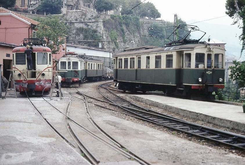
Locomotives and Rolling Stock

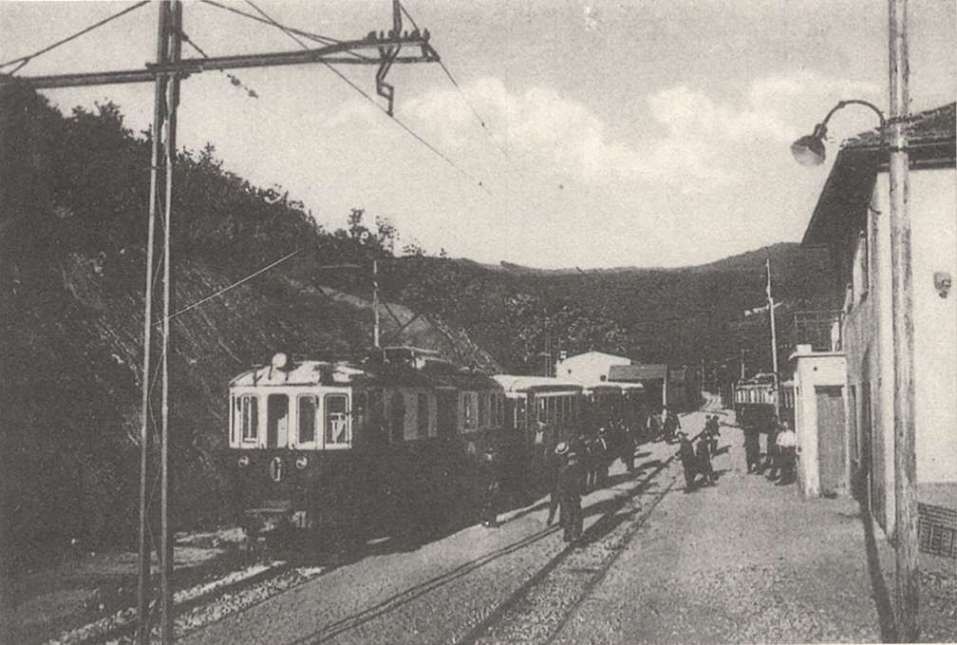
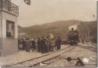
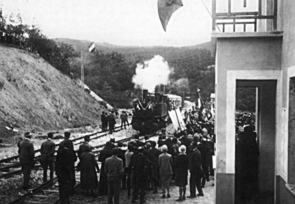
During Construction steam power was employed by the contractor and there are images around which show at least one excursion event that was steam hauled prior to the Line’s formal opening.

Two pictures can be found on the first article in this series, here. [18]

In that first article, we noted that the electric supply was originally 2400V DC. “The first electric locomotives were supplied by Breda, numbered 1 to 3. They were 360 horsepower Bo-Bo locomotives with an innovative Breda-Somarini energy recovery system, unique in Italy. In addition to the motive power, 4 third-class carriages (Nos. 50-53); 3 mixed first-third class carriages (Nos. 20-22) and 16 freight wagons of various types were delivered in 1926, well before the railway opened.” [1]

Unless noted otherwise, the paragraphs below are translated/paraphrased/amended from the Italian Wikipedia page about the Genoa (Genova) to Casella Railway. [21]

Locomotives

At the commencement of the service on the railway, the three locomotives mentioned above were supplied by Breda and numbered 1 to 3. [21]

The first electric train to arrive at Casella (now Casella Deposito). This image has already appeared in this article. It shows one of the first three locomotives supplied by Breda at the head of the train, © Public Domain. [21]
At the same location one of the three elettromotrices runs round its train of three coaches, © Public Domain. [21]

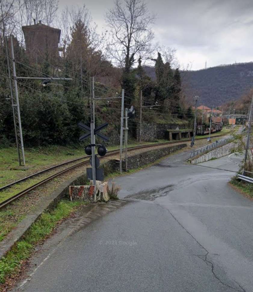
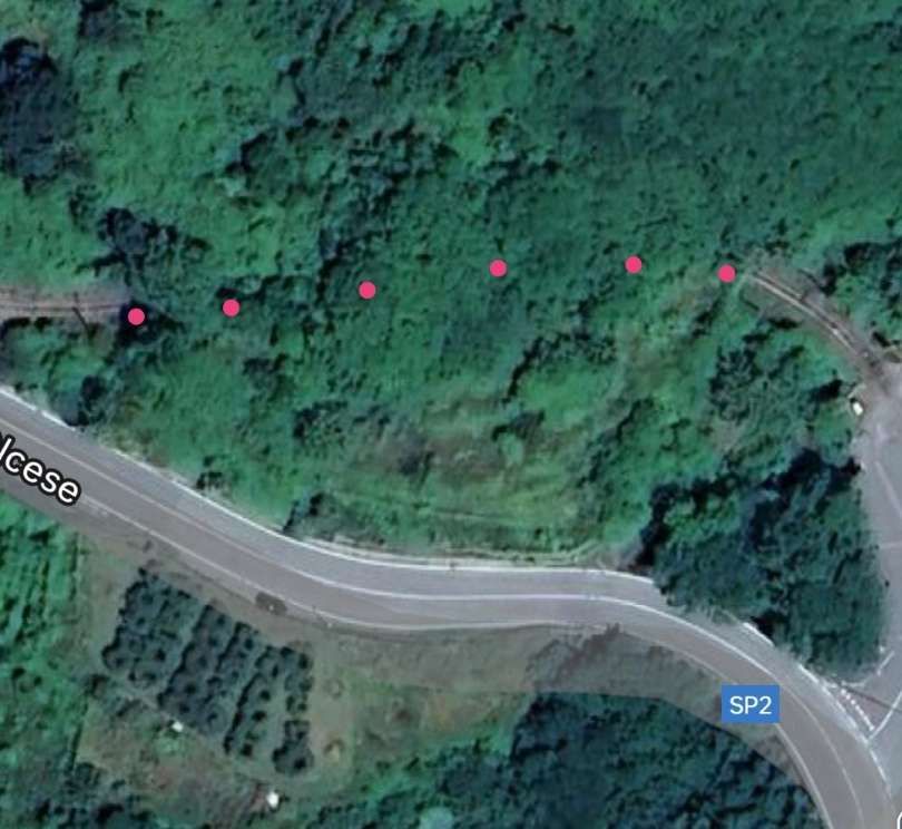
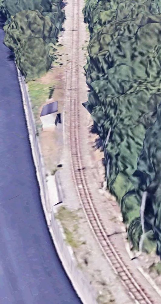
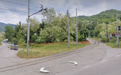
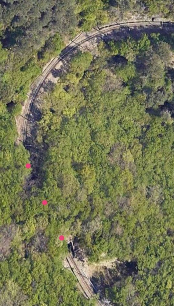
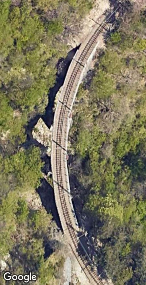
On 23rd August 1937, two of the locomotives were destroyed in an accident near Vicomorasso in which five people lost their lives. [22: p67] 

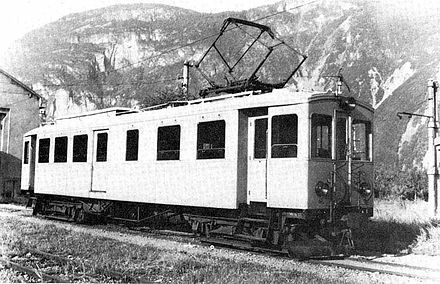
This accident meant that replacement locomotives were required. Three electric locomotives were purchased from the Società Veneta. They had been built by MAN in 1913 for the Montebelluna – Asolo and Montebelluna – Valdobbiadene tramways in Veneto which closed in 1931. [21]

One of the locomotives mentioned in the paragraph above at Stazione di Caerano sometime between 1913 and 1931 in Montebelluna, at  [23]

These locomotives entered service in 1939, initially maintaining the original numbering (053, renumbered 055 in 1943, 054 and 056), after conversion of the original power supply system from 975 V DC to 2400 V DC.” [1]

Locomotive 28 and 29 were built in 1924 for the Adriatic-Appennino Railway. The electrical equipment was supplied by TIBB of Vado Ligure; the body and bogies were made by Carminati & Toselli of Milan. Originally, they were part of a 1922 order for 14 locomotives of 950 mm gauge for the Sangritana Railway. Two (Nos. 28 and 29) were sold to Ferrovia Genova Casella (FGC) – No. 28 in 1956 and No. 29 in 1960. [22: p98 & 184] Conversion was necessary as the locomotives required a gauge change and modification from freight/baggage locomotives to passenger locomotives.

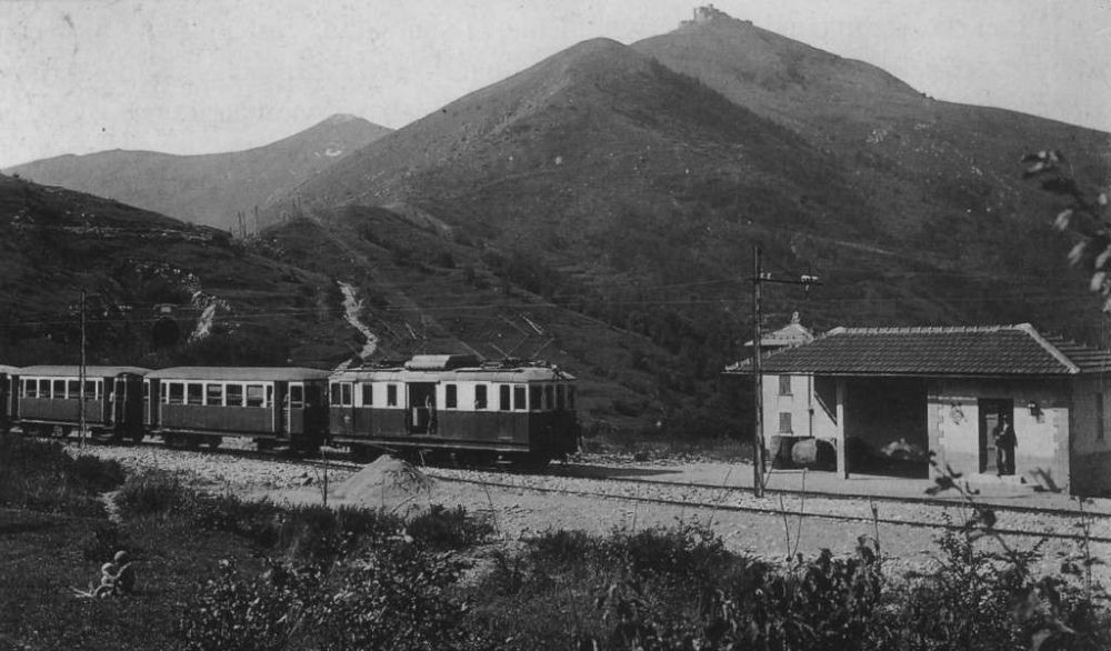
Locomotive No. 29 can be seen here. [24]

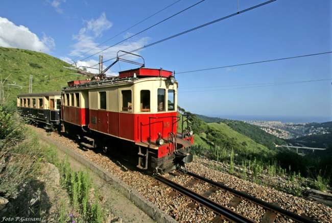
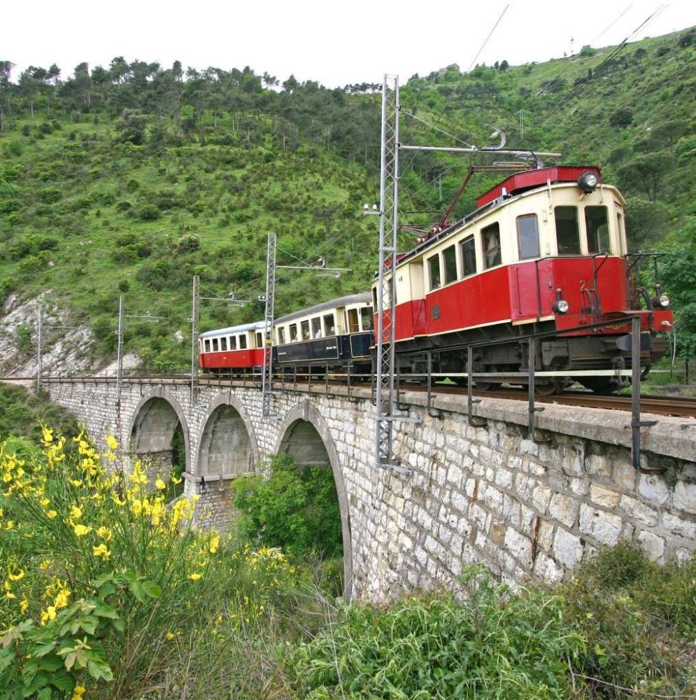
The two locomotives entered service in 1962. No. 29 is currently the oldest electric locomotive still in operation in Italy and is used in composition with three carriages (C22-C103-C104) as a historic train used on charters. No. 28 was placed in storage in 1975 and finally decommissioned and dismantled in 1998. [21][22: p184]

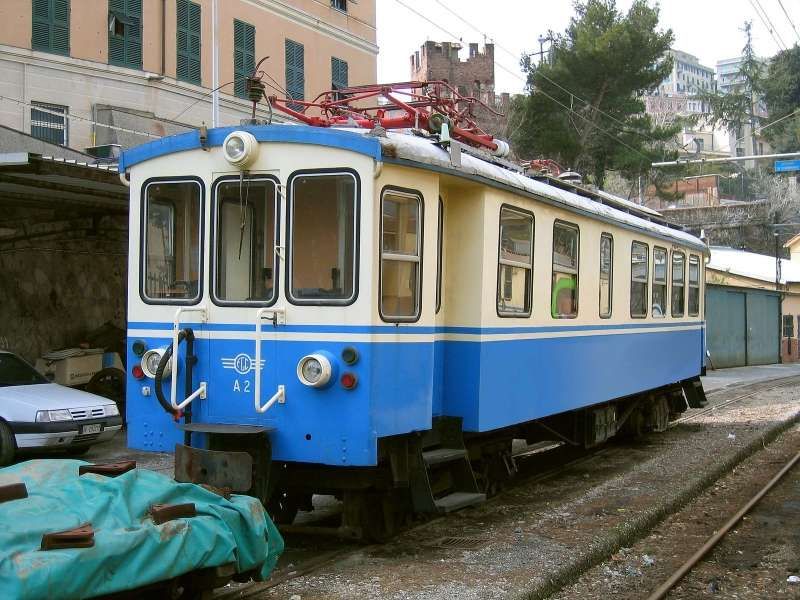
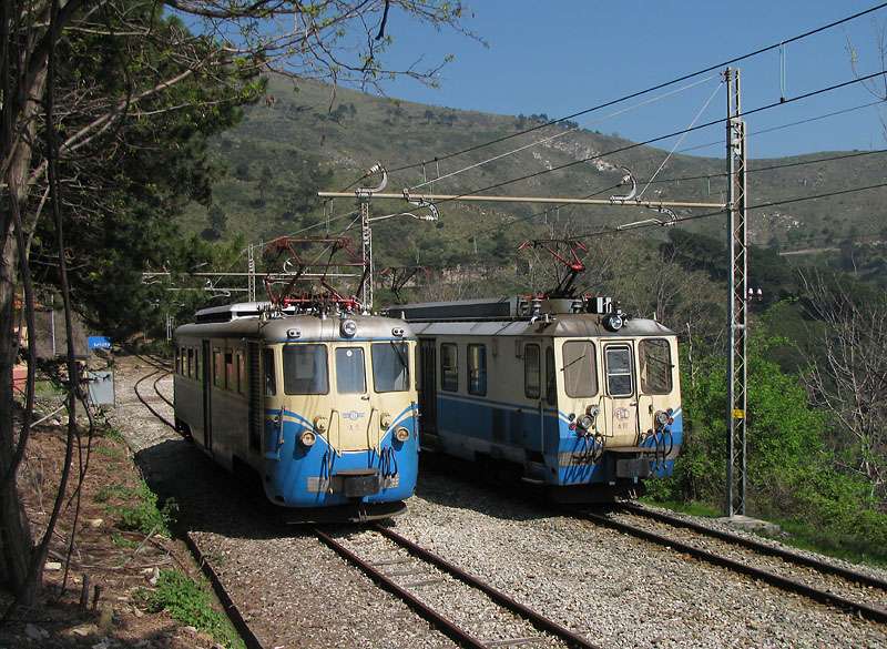
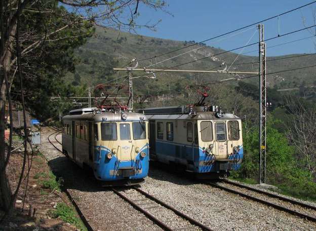
Electtromortices A1, A2 and A3 were built in 1929 for the Ferrovia della Val di Fiemme (Ora – Predazzo), similarly by TIBB and Carminati & Toselli. These were transferred on the closure of the Ora – Predazzo line in 1963 to the Ferrovie Genoa Casella. [21][1]

Elettromotrice A1 while employed by Ferrovia della Val di Fiemme (Ora – Predazzo) at Ora depot. [25]

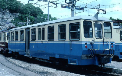
A1 was painted blue/cream in 2011 with AMT logos. It was used for ordinary trains until 2019 and in 2022 it was set aside awaiting significant maintenance. [21]

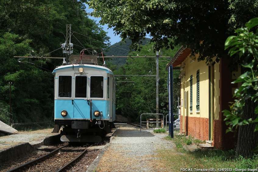
A2 was reconditioned and returned to its 1929 condition. It re-entered service in June 2018.  In that December it was involved in an accident but emerged with little damage. In September 2019, further restoration work was completed and from February 2020 it was undertaking a regular historic train service, usually being timetabled for Saturday running. [21][26]

Elettromotrice A2, © Ale Sasso, June 2006. [20]
Elettromotrice A3 in charge of a Genoa-bound train at Ponte Rovena. [27]

A3 was built by Gleismac/EAA, after having suffered serious damage in an accident at Sardorella in 1974. It returned to service in 1983. It remained in service until 1999. After it was withdrawn, it doesn’t 12 years in storage before ultimately being dismantled in 2011. [21]

Elettromotrices, A1, A2 and A3 were part of a batch of about thirty electric locomotives which were built by Carminati and Toselli of Milan. Twenty-three of these were very similar to each other. being produced between 1924 and 1940. Three of this batch of locos (A1-A3) were deployed on the Ora-Predazzo line and on its closure came to the FGC. [21]

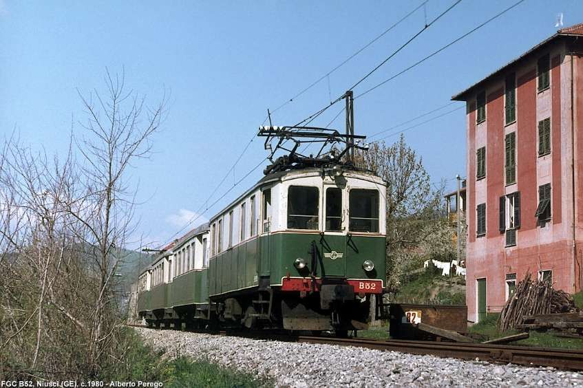
In addition, two 420 horsepower locomotives (max. speed 45 km/hr), B51 and B52 with Bo-Bo running gear were also transferred to the FGC in the early 1960s. [1]

Locomotive B52 at Niusci in the 1960s. The bogies of B51 and B52 were reused on the A8 and A9 elettromortrices of 1993, still in service. Locomotive B51 was restored/rebuilt and is preserved as a historic vehicle on the Trento-Malè Railway. That railway purchased it in 2008 and in 2009 the restored loco was in use pulling a single carriage on the Trento-Malè Railway, © Alberto Perego and licenced for reuse under a Creative Commons Licence (CC BY-SA 3.0). [30]

Also from Val di Fiemme came six bogie-carriages, two longer coaches numbered C101 and C102 and four of shorter carriages, numbered from C103 to C106. [1]

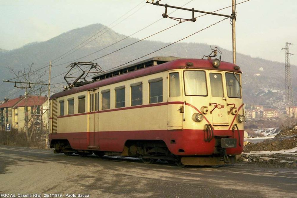
Elettromotrices A4-A7 were built in 1957 on the chassis and bogies of locos built by TIBB/Carminati & Toselli in 1926 for the Spoleto-Norcia railway. That reconstruction was undertaken by Casaralta-TIBB. It saw the application of new electrical equipment and the adoption of a new rounded body, typical of the mid-20th century. These elettromotrices transferred to Genoa in 1970 with the closure of Spoleto-Norcia line. They entered regular service, re-numbered A4-A7, between 1971 and 1973 after gauge-conversion from 950mm to metre-gauge. [21]

This monochrome image shows A4 climbing into Sant’Olcese Tullo Halt, © Georgio Stagni and licenced for reuse under a Creative Commons Licence (CC BY-SA 3.0). [28]
This image shows A4 in a later colour scheme at Torrazza, © Georgio Stagni and licenced for reuse under a Creative Commons Licence (CC BY-SA 3.0). [28]
A5 crossing Ponte Vittorio Veneto in the days prior to the railway being moved to the side of the road. In early days the railway ran along the road into Casella, © Georgio Stagni and licenced for reuse under a Creative Commons Licence (CC BY-SA 3.0). [28]
A5 leaving Casella and approaching Ponte Vittorio Veneto in a later guise, still in the days prior to the railway being moved to the side of the road, © Georgio Stagni and licenced for reuse under a Creative Commons Licence (CC BY-SA 3.0). [28]

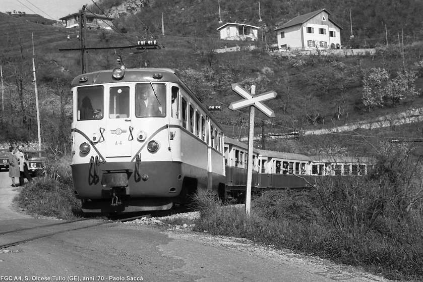
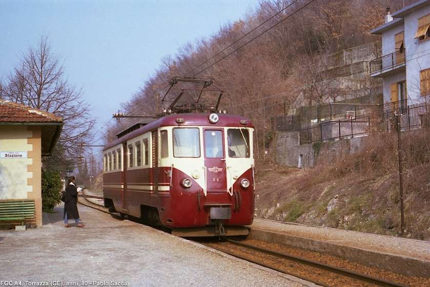
Units A6 and A7 were visually the same as units A4 and A5.

Elettromotrice A6 at work on the line before it was set aside. [10]

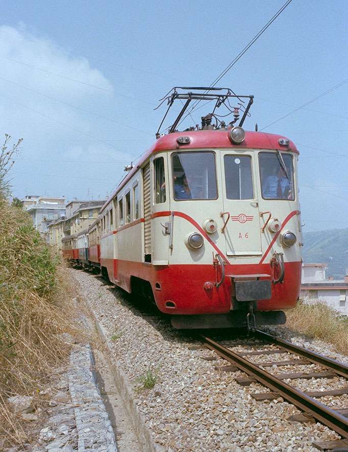
Units A4 and A7 were scrapped (in 2014 and 2016 respectively), while A5 was restored to running order in February 2010, with the installation of fully electronic speed measuring devices and a dead man’s device, the application of a cream/blue anti-graffiti film and new AMT logos. It was taken away for restoration in 2022, and finally A6 has been shelved for over 10 years awaiting restoration. [21][22: p191]

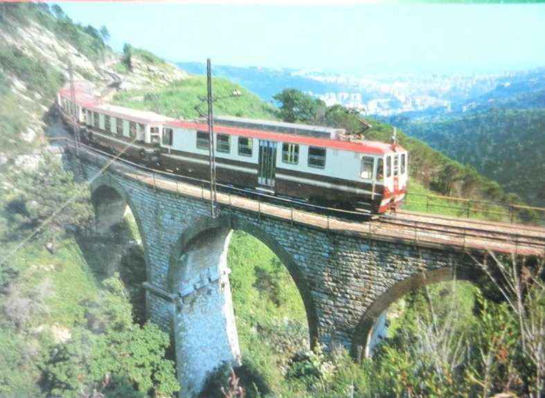
Electric locomotives A8-A10 were built in 1993 by Firema-Officine di Cittadella at the request of Ferrovia Genova-Casella, they have identical bodies to the decommissioned A3. However, A8 uses the TIBB bogies from B51, the A9 those from B52 and the A10 those from A3. This last unit also has a body slightly different from the others due to the lower window line. [21]

This image shows A8 (on the left) and A12 (on the right) at Genova Manin Railway Station, © Al*from*Lig and licenced for reuse under a Creative Commons Licence (CC BY-SA 4.0). [21]
A9 in the snow at Crocetta, © Georgio Stagni and licenced for reuse under a Creative Commons Licence (CC BY-SA 3.0). [29]
We have seen this image before. Its value here is to allow Elettromotrice A10 on the right, to be compared to Elettromotrice A5 on the left, © Andrea Martinelli and licenced for reuse under a Creative Commons Licence (CC BY-SA 3.0). [1]

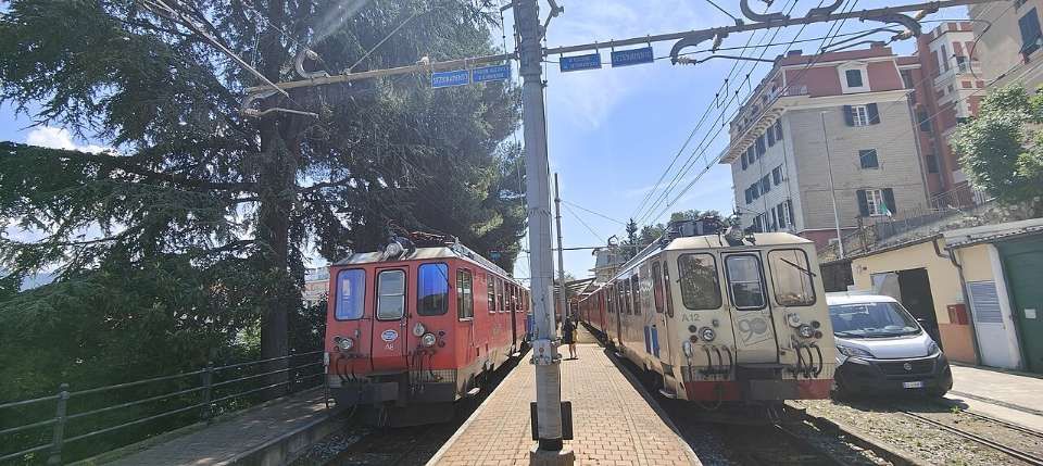
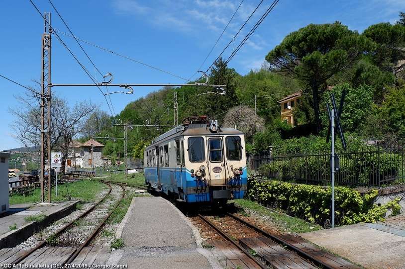
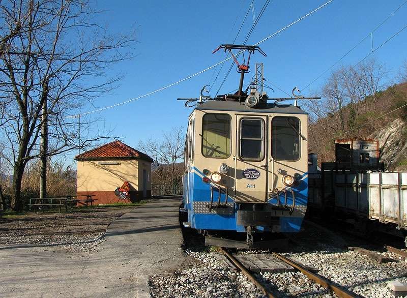
Elettromotrices A11-A12 were built in 1998 by FiReMa-Officine di Cittadella at the request of Ferrovia Genova-Casella. They have a body identical to the A10. A11 underwent a restyling in 2011 with the application of cream/blue anti-graffiti film and new AMT logos and is currently used in regular service. A12 is also back in service after an extraordinary overhaul of the bogies. [21][22: p198]

Elettromotrice A11 at Sant’Olcese Tullo, © Andrea Martinelli and licenced for reuse under a Creative Commons Licence (CC BY-SA 3.0). [31]

A12 can be seen on Flickr here. [32]

Locomotive D1 was built in 1964 on behalf of the German railways by the manufacturer Gmeinder & Co. by adapting the MaK V100 standard-gauge locomotive to metre gauge, it was numbered V52 902 (later 252 902) and used on the 28 km long Mosbach-Mudau metre-gauge line. When it’s service on that line came to an end (2nd June 1973), it was first converted to standard-gauge by Gmeinder and used by Sudwestdeutsche Eisenbahngesellschaft (SWEG) which put it to work on the Breisach-Endingen-Riegel line (numbered VL46-01). In 1986, it was sold to the Gleismac company which converted it to metre-gauge and then sold it to the FGC. It was used to haul construction and passenger trains during the renovation of the overhead line. It was then set aside at Casella Deposito for over 10 years until in 2008 it was sent to Monopoli where it was rebuilt by 2014 and it returned to service on the line in November 2015. [33][34]

Locomotive D1 responsible for a single coach. [9]
And here with two coaches. [9]
And here, escaping from a tunnel portal. [19]

Other Rolling Stock

We have already picked up some snippets of information about coaching stock and wagons. …

When the line opened there were “4 third-class carriages (Nos. 50-53); 3 mixed first-third class (Nos. 20-22) and 16 freight wagons of various types (delivered in 1926, well before the railway opened).” [1]

We also noted that, along with the B51 and B52 locos “from Val di Fiemme came six bogie-carriages, two longer coaches numbered C101 and C102 and four of shorter carriages, numbered from C103 to C106.” [1]

The following information is gleaned from H Rohrer’s detailed website about Italian railways. That website can be found here. [35]

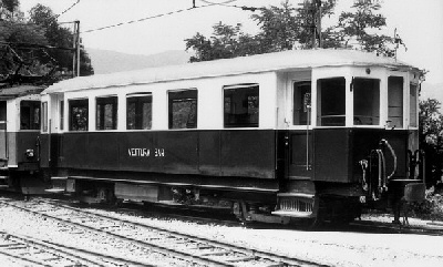
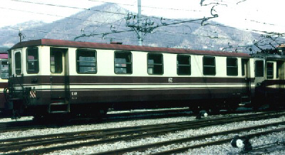
Coaches C20-C22 were built by Breda and supplied in 1926, of which C22 was renovated by FGC in 1960 and C21 was renovated by Gleismac in 1979-1980. An image of Coach 22 can be found here. [36]

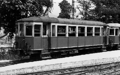
Coaches C50-C53 were built by Breda and supplied in 1926. An image of Coach C50 can be found here. [37] An image of refurbished Coach C53 can be seen here. [38]

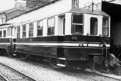
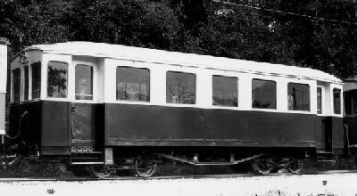
Coaches C101-C102 were long-wheelbase bogie coaches, built by Carminati Toselli and supplied in 1929. These were later renovated by Gleismac between 1980 and 1983. An image of Coach 101 in original condition can be found here. [39] The renovated Coach 101 can be seen here. [40]

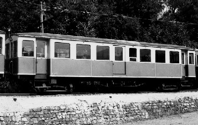
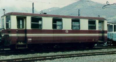
Coaches C103-C106 were short-wheelbase bogie coaches built by Conti (?) and supplied in 1929 (?). Of these C105 and C106 were later renovated by Gleismac between 1980 and 1983. The original Coach 104 can be seen here. [41] A refurbished Coach C106 can be seen here. [42]

Coaches C60-C62 were built by Citadella Firema and supplied in 1996/1997. An example can be seen here. [43]

References

  1. https://en.m.wikipedia.org/wiki/Genova%E2%80%93Casella_railway, accessed on 11th November 2024.
  2. https://www.bimbeinviaggio.com/en/italy/liguria-en/genoa/genoa-casella-train-route-timetable, accessed on 19th November 2024.
  3. https://it.m.wikipedia.org/wiki/Stazione_di_Sardorella#/media/File%3AStaz.Sardorella.jpg, accessed on 21st November 2024.
  4. https://www.stagniweb.it/foto6.asp?File=fgc19&Inizio=11&Righe=10&InizioI=1&RigheI=100&Col=5 , accessed on 21st November 2024.
  5. https://www.flickr.com/photos/126337928@N05/47033340152, accessed on 21st November 2024.
  6. https://commons.m.wikimedia.org/wiki/Category:Vicomorasso_train_station, accessed on 21st November 2024]
  7. https://www.flickr.com/photos/prazene/4889371810, accessed on 21st November 2024.
  8. https://www.ferroviagenovacasella.it/geca/il-primo-decennio, accessed on 19th November 2024.
  9. https://www.ferroviagenovacasella.it/geca/la-seconda-guerra-mondiale, accessed on 19th November 2024.
  10. https://www.ferroviagenovacasella.it/geca/dagli-anni-settanta-ad-oggi, accessed on 19th November 2024.
  11. https://www.flickr.com/photos/188768670@N06/53771228353, accessed on 21st November 2024.
  12. https://m.wikidata.org/wiki/Q56371269#/media/File%3AFCG_A11_Sant_Olcese_Tullo_20111228.jpg, accessed on 21st November 2024.
  13. https://structurae.net/en/structures/sant-olcese-tullo-station, accessed on 21st November 2024.
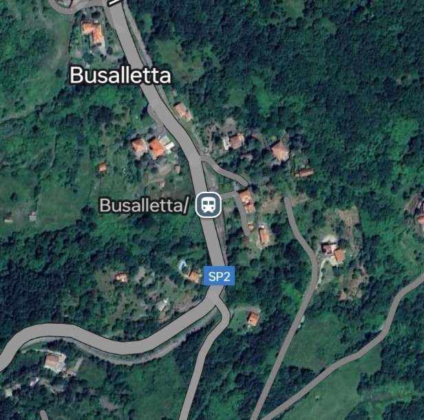
  14. https://commons.m.wikimedia.org/wiki/Category:Busalletta_train_station, accessed on 22nd November 2024.
  15. https://www.facebook.com/share/p/rHqZdscSXSdCuAKT, accessed on 22nd November 2024.
  16. https://www.facebook.com/share/p/hcrJ3NCNeUdQFZxX, accessed on 22nd November 2024.
  17. https://www.facebook.com/share/p/a1WSMYTtU7vbsyjT, accessed on ,22nd November 2024.
  18. https://rogerfarnworth.com/2024/11/21/genoa-casella-narrow-gauge-railway-part-1-genova-to-sardorella.
  19. https://www.mentelocale.it/genova/57212-ferrovia-genova-casella-dal-6-settembre-il-servizio-avverr-con-bus-sostitutivo.htm, accessed on 23rd November 2024.
  20. https://commons.m.wikimedia.org/wiki/File:Elettromotrice_A2_della_Ferrovia_Genova_Casella.JPG, accessed on 23rd November 2024.
  21. https://it.m.wikipedia.org/wiki/Ferrovia_Genova-Casella, accessed on 23rd November 2024.
  22. Corrado Bozzano, Roberto Pastore and Claudio Serra; Illustrated History of the Genoa-Casella Railway; Recco (GE), Il Geko Edizioni, 2016.
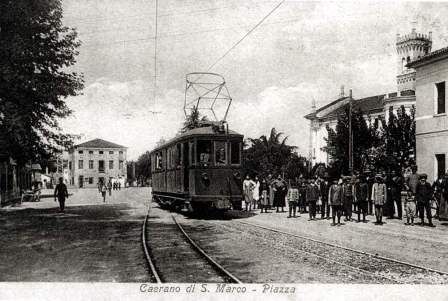
  23. https://commons.m.wikimedia.org/wiki/File:Caerano.jpg, accessed on 23rd November 2024.
  24. https://passionetrasporti.com/wp-content/uploads/2021/07/fgc-29-campi-2008-11-22-cerizzamatteo-1.jpg?w=1110&h=, accessed on 23rd November 2024.
  25. https://it.m.wikipedia.org/wiki/Ferrovia_della_Val_di_Fiemme, accessed on 23rd November 2024.
  26. https://www.ferroviagenovacasella.it/geca/wp-content/uploads/2020/02/VOLANTINO-viaggio-storica-AGGIORNATA-al-11.02.-2020.psd.pdf, accessed on 23rd November 2024.
  27. https://www.ebay.co.uk/itm/115360290908?mkcid=16&mkevt=1&mkrid=711-127632-2357-0&ssspo=Fbvtwm00Q0S&sssrc=4429486&ssuid=afQhrar7TGK&var=&widget_ver=artemis&media=COPY, accessed on 23rd November 2024.
  28. https://www.stagniweb.it/foto6.asp?File=casella2&Inizio=2&Righe=10&InizioI=1&RigheI=150&Col=5, accessed on 24th November 2024
  29. https://www.stagniweb.it/foto6.asp?File=fgc21&InizioI=1&RigheI=100&Col=5, accessed on 24th November 2024.
  30. https://www.stagniweb.it/foto6.asp?File=fgc19&Inizio=66&Righe=10&InizioI=1&RigheI=100&Col=5, accessed on 24th November 2024.
  31. https://commons.m.wikimedia.org/wiki/File:FCG_A11_Sant_Olcese_Tullo_20111228.jpg, accessed on 24th November 2024.
  32. https://api.flickr.com/photos/188768670@N06/50009526478, accessed on 24th November 2024.
  33. Maria Vittoria Cascino; Il trenino di Casella arranca in ritardo tra guasti e amianto; on ilgiornale.it, 20th March 2008; accessed on 24th November 2024.
  34. Andrea Martinelli, La D1 è tornata!, in iTreni N° 388, January 2016, p24-26.
  35. https://www.hrohrer.ch/railways/carrozze/cap19.htm, accessed on 24th November 2024.
  36. https://www.hrohrer.ch/railways/carrozze/f1904.jpg, accessed on 25th November 2024.
  37. https://www.hrohrer.ch/railways/carrozze/f1901.jpg, accessed on 25th November 2024.
  38. https://www.hrohrer.ch/railways/carrozze/f1905.jpg, accessed on 25th November 2024.
  39. https://www.hrohrer.ch/railways/carrozze/f1902.jpg, accessed on 25th November 2024.
  40. https://www.hrohrer.ch/railways/carrozze/f1906.jpg, accessed on 25th November 2024.
  41. https://www.hrohrer.ch/railways/carrozze/f1903.jpg, accessed on 25th November 2024.
  42. https://www.hrohrer.ch/railways/carrozze/f1907.jpg, accessed on 25th November 2024.
  43. https://www.hrohrer.ch/railways/carrozze/f1908.jpg, accessed on 25th November 2024.

Genoa – Casella Narrow Gauge Railway Part 1 – Genova to Sardorella

The Genova–Casella railway is a 24.3 km narrow gauge railway that connects Genoa to Casella, a village in the mountains inland from the city. [1] The stations on the line are shown in the graphic immediately below:

The Route of the Line. [1]

This article covers the history of the line and a journey along the southern half of the railway (Genoa to Sardorella). The second article covers the northern half of the railway and its rolling stock. That second article can be found here. [16]

The route shown on a topographical map, © Public Domain. [1]
Perhaps the route is easier to follow on this map? [5]

When it is operating, “the line operates nine trains per day and it is used for both commuting and tourist purposes; it crosses three valleys and was opened in 1929. While it is owned by Liguria Region, it has been operated since 2010 by AMT Genova.” [1]

At the end of the nineteenth century, a direct railway link between Genoa and Emilia Romagna was proposed, as an alternative to the Turin–Genoa railway. The railway had to start from the Port of Genoa and cross the Ligurian mountains to reach Piacenza railway station and Borgotaro. It was intended to be a fast, long-distance line primarily for goods.” [1]

As a result, SAFEL (Società Anonima Ferrovie Elettrici Liguri) considered the construction of a local passenger line, complementary to the Genoa-Piacenza freight line. Its purpose was to connect the city centre to all the small municipalities and holiday resorts of the Ligurian hinterland … The first section of this network was the Genoa-Casella line.” [1]

The original project was planned with a bifurcation to provide a branch towards Busalla and a line to Torriglia, which in a second phase would be extended to Piacenza.” [1]

These were just the first proposals from SAFEL. It considered a wide range of other schemes intended to follow on from their successful completion. A start was made when, in 1908, “SAFEL applied to the Ministry for a concession for the construction of the Genoa-Casella line. This concession was obtained on 17th June 1915. Like most of the local railways of the time, the line was almost entirely single-track and had a tortuous alignment (in order to follow the topography of the Ligurian mountains). Electrification was part of the original plans and the 950 mm track gauge was chosen to minimise infrastructure costs in accord with a directive from the Council of Public Works which recommended the adoption of an ‘Italian metric gauge’ (950 mm) for railways unlike the true metric gauge (1000 mm) adopted for tramways.” [1]

To allow the construction of a connection at Manin with the Genoa tram network , the operating company presented a variation to the project, approved by the Higher Council of Public Works, which sanctioned the adoption of the 1000 mm gauge. This connection, however, although reported in the first design tables, was never built.” [12 – translated from Italian]

The coming of the First World War imposed a long postponement to the construction of the railway line. It was not until 28th February 1921 that the final agreement between the Government and SAFEL was signed, which gave the permitted a start to construction work.” [1 – translated/adapted from Itailan]
On 26th June 1921 the first stone was laid. The construction of tunnels, bridges, and station buildings was entrusted to the ‘Consorzio Cooperative Liguri di Produzione e Lavoro tra Combattenti’, which gave work to thousands of former soldiers and workers who remained unemployed after the first world war. The construction was entirely financed with private funds.” [1]

On 26th June 1921 the first stone was laid. The construction of tunnels, bridges, and station buildings was entrusted to the ‘Consorzio Cooperative Liguri di Produzione e Lavoro tra Combattenti’, which gave work to thousands of former soldiers and workers who remained unemployed after the first world war. The construction was entirely financed with private funds.” [1]

Construction work proved to be complex. The section from Genoa to Trensasco required steep gradients. To facilitate construction, “a 1.2 km-long cable car was installed in order to transport  building materials from the Bisagno River valley. The cable car system lifted materials over a height of 450 m. Electric excavators and crushers (modern machinery at the time) were also adopted to produce the necessary sand and cement on site.” [1]

In 1924 the S.E.N. (Società Elettrica Nazionale), a subsidiary of the Ernesto Breda industries, was awarded a contract for the laying of track, the construction of the overhead line, the construction of electrical substations, and for the supply of rolling stock.” [1]

Meanwhile, resources were expended on pursuing a succession of extension projects, some of which were very unlikely. This resulted in ongoing financial instability and a slowing of the construction work already on site.” [1]

The first tracks were laid in 1926 starting from Vicomorasso, with the help of a Mallet-type steam locomotive purchased by the Ferrovie dell’Appenno Centrale, but operations were interrupted due to lack of funds.” [1]

Work resumed in 1927 thanks to a grant from the Municipality of Genoa and the National Bank. The Breda company was asked to complete the remaining civil engineering work in addition to the electrification of the line and the laying of the track (the bridge between the two Fontanassa tunnels, the Cicala and Puin viaducts).” [1]

The construction loco made an inspection journey along the line on 7th June 1928, pulling a passenger car with the Podestà of Genoa, Sant’Olcese, Serra Riccò and Casella on board, © Public Domain. [1]
Another photograph taken on 7th June 1928, © Public Domain. One of these two photos appears to be transposed. They are from different angles but the building and flag cannot be both sides of the line! [1]

On 7th June 1928, the steam locomotive used in the construction of the line made an inspection trip to Casella pulling a passenger car with the Podestà of Genoa, Sant’Olcese, Serra Riccò and Casella on board. It was welcomed by the citizens in celebration along the way. Only on 2nd October 1928 was the first electric train – reserved for two hundred members of the Italian Electrotechnical Association which in those days held its annual congress in Genoa – able to travel the entire line.” [1]

On 1st September 1929 the official inauguration took place. … Due to the lack of external funding, the ambitious projects planned for a Ligurian railway network were never fulfilled – Casella became the terminus.”[1][2]

The electric supply was originally 2400V DC. “The first electric locomotives were supplied by Breda, numbered 1 to 3. They were 360 horsepower Bo-Bo locomotives with an innovative Breda-Somarini energy recovery system, unique in Italy. In addition to the motive power, 4 third-class carriages (Nos. 50-53); 3 mixed first-third class carriages (Nos. 20-22) and 16 freight wagons of various types were delivered in 1926, well before the railway opened.” [1]

In 1930, “the Vittorio Veneto bridge over the River Scrivia [was constructed], but the railway was not immediately extended along the route.” [1][3]

The first train arrived at Casella (now Casella Deposito) on 1st September 1929, © Public Domain. [1]

In 1933, even though the railway was operating at full capacity with a high numbers of passengers and freight, SAFEL was on the verge of bankruptcy. … The company had invested heavily in the extension projects without [paying] off outstanding debts with Breda and banca Nazionale del Lavoro, which had financed much of the construction of the line. … In 1934 SAFEL was declared bankrupt after a court trial, and the management of the railway was acquired by the Lazzi bus companies.” [1]

On 23rd August 1937, two of the locomotives were destroyed in an accident near Vicomorasso. … Three [replacement A1-1A locos] were purchased, … built by MAN in 1913 for the Montebelluna – Asolo and  Montebelluna – Valdobbiadene tramways [which] closed in 1931. … The machines entered service in 1939, …  after conversion of the original power supply system from 975 V DC to 2400 V DC.” [1]

During the Second World War the railway experienced its period of maximum use, since numerous families were evacuated to the area to the North of Genoa and the train operated both for passengers and for freight. … At the end of the conflict, both the infrastructure and the rolling stock were seriously damaged by intensive use and poor maintenance, so much so that use of the line was suspended and in 1949 it was placed under Government Commissioner Management.” [4: p16 – translated/adapted from Itailan]

“In 1953 the line was extended from the Casella depot to the town. … Since 1975, the railway has undergone complete … renovation, with the replacement of the rails, the electrical substation and the functional restructuring of the depots.” [4: p16 – translated/adapted from Itailan]

In 1956, a locomotive (No. 28) with a power of 355 kW with a maximum speed of 50 km/h was acquired from the Sangritana Railway; in 1960 another unit (No. 29) and spare parts were acquired.  “The locomotives were part of a contract of fourteen four-axle locomotives built in 1924 with electrical equipment and bogies supplied by TIBB and case made by Carminati & Toselli. Originally narrow-gauge at 950 mm, they were converted to [metre-gauge].” [1]

The ‘Casella train’ remains one of the few secondary Italian railways still in use because not only does it serve a route for which there is no alternative road network, but it also is a tourist attraction (the route intersects numerous hiking trails, including those to the Forts of Genoa and a stretch of the Alta Via dei Monti Liguri) and has low operating costs.” [4: p16 – translated/adapted from Itailan]

In the four-year period 1997-2000, the line was entrusted to the Italian State Railways to achieve a technical-economic recovery, and from 1 January 2001 it became the property of the Liguria Region.][4: p16 – translated/adapted from Itailan]

Starting from the terminus at Manin, the route winds its way out of the city: running along a stretch of the Val Bisagno, it serves the localities of S. Pantaleo, Cappuccio, Campi, Pino Soprano, Torrazza, before passing through the Trensasco tunnel into Val Polcevera and reaching the terminus at Casella, in Valle Scrivia.” [4: p16 – translated/adapted from Itailan]

The Route

The terminus in Genoa is the Genova Manin railway station, located above the Piazza Manin and can be reached via a flight of steps or by bus No. 64.

An early postcard view of Piazza Manin, taken prior to the construction of the steps giving access to the railway station and the removal of the graceful cast iron arched bridge, beyond which can be seen the arches which appear in the image below, © Public Domain. [6]
Looking West on Piazza Manin in the 21st century. [Google Streetview, August 2024]
Piazza Manin is bottom-left of this extract from. Google satellite imagery. The railway station is towards the top-right. [Google Maps, November 2024]
Genova’s Manin Railway Station. [Google Maps, November 2024]
The entrance to Genova Manin Railway Station in the 21st century, © Arbalete and approved for reuse under a Creative Commons Licence (CC BY-SA 3.0). [7]
The same building seen from Via alla Stazione per Casella. [Google Streetview, April 2023]
The Station platforms seen from Via alla Stazione per Casella. [Google Streetview, April 2023]
Trains gathered at Manin station as they appeared in 1980, © trams aux fils and authorised for reuse under a Creative Commons Licence (CC BY 2.0). [1]
Another view of the throat of Manin Railway Station, this time from the 21st century, © Emanuele Mauri (2022). [Google Maps, November 2024]
The station throat and the line North of Manin Railway Station. [Google Maps, November 2024]
Genova Manin Railway Station seen from the North. © Public Domain. [8]
Genova Manin Railway Station seen from the Northwest. © Public Domain. [11]
Genova Manin Railway Station in the 21st century, © Al*from*Lig and approved for reuse under a Creative Commons Licence (CC BY-SA 4.0). [7]
Once beyond the station limits the line curves to the West. It is shown here and in subsequent satellite images by the dotted line. [Google Maps, November 2024]
The line then curves back to the North. [Google Maps, November 2024]
The line continues heading North. [Google Maps, November 2024]
The line continues generally heading North. [Google Maps, November 2024]
The line continues heading generally to the North. The first halt on the line (San Pantaleo Halt) appears towards the top of this satellite image and in greater detail in the image immediately below. [Google Maps, November 2024]
San Pantaleo Halt. [Google Maps, November 2024]

In subsequent satellite images, red dots will only be used where the route of the railway is less clear than it might be. The next 5 satellite images take us as far as the Ex-Chiesa San Pantaleo where the Via San Pantaleo passes under the railway.

Close to Ex-Chiesa di San Pantaleo the Via San Pantaleo passes under the railway. Google Maps, November 2024]
The stone-arched underpass which takes Via San Pantaleo under the railway, Luca Spinelli (2018). [Google Maps, November 2024]

The next sequence of 7 satellite images takes us to the San Antonino Halt.

Another sharp curve brings the line to Sant’Antonino Halt. [Google Maps, November 2024]
Sant’Antonino Halt, looking back towards Genova, © Filippo M., (2020). [Google Maps, November 2024]
Sant’Antonino Halt, looking forwards towards Casella, © Filippo M., (2020). [Google Maps, November 2024]

Three wider satellite views take the line as far as the Cappuccio Halt.

The line continues Northwest from Sant’Antonino Halt and the wends its way round, first to the East and then to the Northwest. [Google Maps, November 2024]
Further meanderings take the line around a large horseshoe curve over the A12 Autostrada (which is in tunnel) close to the Genova Est junction. [Google Maps, November 2024]
Before turning round to the North again and arriving at Cappuccino Halt. [Google Maps, November 2024]
A closer view of Cappuccino Halt which provides a loop to allow trains travelling in opposing directions to pass. [Google Maps, November 2024]
The Genoa to Casella Metre-gauge Railway, © Andrea Martinelli and authorised for reuse under a Creative Commons Licence (CC BY-SA 3.0). [1]

The next two satellite images take the line on from Cappuccio Halt to one of the line’s tunnels.

The line continues its tortuous path To the North and then to the East. [Google Maps, November 2024]
It continues East to the tunnel which passes under the ridge carrying the Salita Preli (Mountain Path). [Google Maps, November 2024]
The route of the Salita Preli is marked on this satellite image in orange. The West Portal of the tunnel is more easily discernable than the northern portal. The Salita Preli is a long-distance hiking/mountain path. [12]
The Western portal of the tunnel. [Google Maps, November 2024]
The same portal in Google Earth 3D. [Google Earth 3D, November 2024]
The tunnel curves round to the North and the North portal is shrouded by the tree canopy. ,[Google Maps, November 2024]
This next length of the line includes a viaduct and two tunnels. The long straight length of the line at the bottom of the image may also include Poggino Halt. [Google Maps, November 2024]
The probable location of Poggino Halt seen from the Southeast. [Google Earth 3D, November 2024]
A closer view of the viaduct. [Google Maps, November 2024]
Google 3D image of the viaduct. [Google Earth, November 2024]
A closer view of the first of the two tunnels on this length. [Google Maps, November 2024]
The West Portal of this tunnel. [Google Earth 3D, November 2024]
The East portal of this tunnel. [Google Earth 3D, November 2024]
A closer view of the second tunnel. [Google Maps, November 2024]
The Southwest portal of this tunnel. [Google Earth 3D, November 2024]
It is just possible to make out the North portal of the tunnel under the tree canopy. [Google Earth 3D, November 2024]
Leaving behind the tunnel above, the line turns to the West and can still be made out in the lower quality portion of this satellite image. [Google Maps, November 2024]
Continuing in a generally westerly direction the line crosses Ponte Fontanassa and enters a tunnel. [Google Maps, November 2024]
A closer view of Ponte Fontanassa. [Google Maps, November 2024]
Ponte Fontanassa and the tunnel portal immediately adjacent to it, © Alessio Danovaro (2017). [Google Maps, November 2024]
Ponte Fontanassa seen from withinbthe tunnel to its Northwest, © Alessio Danovaro (2017). [Google Maps, November 2024]
Ponte Fontanassa is in the bottom-right of this next satellite image. The tunnel curves through a third of a full circle. Its Northeast portal is towards the middle-left of this image. A second tunnel follows almost immediately with its Northeast portal towards the top-right of the picture. In between the two tunnels the line bridges a narrow ravine and emerging from the second tunnel it again crosses a viaduct. [Google Maps, November 2024]
A closer view of the length of line between the two tunnels. This is the best view possible of this short section of line. Viewed on Google Earth 3D the tree cover is dense.  [Google Maps, November 2024]
A closer view of the line emerging from the second tunnel and crossing another viaduct. [Google Maps, November 2024]
The tree canopy shrouds the tunnel entrance but the bridge/viaduct can be picked out in this image, viewed from the Northeast. [Google Earth 3D, November 2024]
The line is now generally travelling in a northeasterly direction. [Google Maps, November 2024]
The line continues to meander Northeast. [Google Maps November 2024]
It then reaches Trensasco Halt. [Google Maps, November 2024]
A closer view of Trensasco Halt. Some limited passenger facilities are provided on the North side of the line. [Google Maps, November 2024]
Looking Northeast along the line through Trensasco Halt the passenger shelter is brightly painted, © Frankie Galway (2017). [Google Maps, November 2024]
Trensasco Halt seen from the road to the Northeast. [Google Streetview, December 2020]
Northeast of Trensasco Halt another tunnel take the line under the next ridge (which carries Via Forte Diamante). The red dots show the line through the tunnel and the shadowed area beyond. [Google Maps, November 2024]
The Southwest portal of the tunnel just to the Northeast of Trensasco Halt. The portal at the far end of the tunnel was shrouded by the tree canopy when the Google 3D images were drawn up. [Google Earth 3D, November 2024]
The next Halt was Campi, only a short distance to the Northeast of the tunnel. [Google Maps, November 2024]
A closer view of Campi Halt which was provided with a loop to allow trains to pass. [Google Maps, November 2024]
A vintage postcard shows an early service at Campi Halt, © Public Domain. [15]
Campi Halt is seen looking Northeast from Via Bastia. [Google Streetview, 2019]
A train from Casella has just arrived at Campi Halt, authorised for reuse under a Creative Commons Licence, (CC BY-SA 3.0). [9]
The line Northeast of Campi Halt, © Huanchun Xi (2017). [Google Maps, November 2024]
The line continues Northeast from Campi. [Google Maps, November 2024]
Passing through Pino Halt, the line turns to the North. The roads appearing to cross the line close to the Halt are in tunnel under the line. [Google Maps, November 2024]
A closer view of Pino Halt. [Google Maps, November 2024]
Pino Halt seen from the North, © Simone Manno (2018). [Google Maps, November 2024]
The line continued North of Pino. [Google Maps, November 2024]
Turning to the Northeast on the approach to Torrazza Halt. [Google Maps, November 2024]
Torrazza Halt. [Google Maps, November 2024]
A vintage postcard shows a train at Torrazza Halt, © Public Domain. [15]
Torrazza Halt seen from a Casella-bound train, © Al*from*Lig and authorised for reuse under a Creative Commons Licence (CC BY-SA 4.0). [13]
Torrazza Halt once again. This image is authorised for reuse under a Creative Commons Licence (CC BY-SA 3.0). [8]
The line turns East from Torrazza running close to Via Comunaglie. [Google Maps, November 2024]
When Via Comunaglie turns away, the finds its own route East following the contours. [Google Maps, November 2024]
The route is easier once again to make out among the trees as it turns North. [Google Maps November 2024]
The line continues to follow the contour, turning East then North. [Google Maps, November 2024]
And enters Sardorella Halt. [Google Maps, November 2024]
A slightly closer view of Sardorella Halt. [Google Maps, November 2024]
Sardorella Halt seen from a Genoa-bound train, © Al*from*Lig and authorised for reuse under a Creative Commons Licence (CC BY-SA 4.0). [14]

This first part of the journey finishes here at Sardorella.

References

  1. https://en.m.wikipedia.org/wiki/Genova%E2%80%93Casella_railway, accessed on 11th November 2024.
  2. Il trenino di Casella: terapia su rotaia contro noia e stress; in ilGiornale.it (in Italian), https://www.ilgiornale.it/news/trenino-casella-terapia-su-rotaia-contro-noia-e-stress.html 28th November 2007; accessed on 11th November 2024.
  3. Ferrovia Genova Casella: https://www.ferroviagenovacasella.it/geca, accessed on 11th November 2024.
  4. http://www.uwrbancenter.comune.genova.it/sites/default/files/quaderno_arch_2011_03_21.pdf, accessed on 16th November 2024.
  5. https://www.bimbeinviaggio.com/en/italy/liguria-en/genoa/genoa-casella-train-route-timetable, accessed on 19th November 2024.
  6. https://www.delcampe.net/fr/collections/cartes-postales/italie/genova-genoa/16458-00-italie-genova-piazza-manin-469897224.html, accessed on 19th November 2024.
  7. https://it.m.wikipedia.org/wiki/Stazione_di_Genova_Piazza_Manin, accessed on 19th November 2024.
  8. https://www.stagniweb.it/foto6.asp?File=fgc21&Inizio=29&Righe=10&InizioI=1&RigheI=100&Col=5, accessed on 21st November 2024.
  9. https://it.m.wikipedia.org/wiki/Stazione_di_Campi, accessed on 21st November 2024.
  10. https://commons.m.wikimedia.org/wiki/File:A5_A10_cappuccio.jpg, accessed on 11th November 2024.
  11. https://www.ferroviagenovacasella.it/geca/storia, accessed on 19th November 2024.
  12. https://it.wikiloc.com/percorsi-escursionismo/salita-preli-preli-passo-gandino-sella-del-diamante-forte-diamante-camporsella-chiesa-del-brasile-b-62000826, accessed on 20th November 2024.
  13. https://it.m.wikipedia.org/wiki/Stazione_di_Torrazza#/media/File:Locomotiva_A11_(1998)_a_Torrazza.jpg, accessed on 20th November 2024.
  14. https://it.m.wikipedia.org/wiki/Stazione_di_Sardorella#/media/File%3AStaz.Sardorella.jpg, accessed on 21st November 2024.
  15. https://www.stagniweb.it/foto6.asp?File=fgc19&Inizio=11&Righe=10&InizioI=1&RigheI=100&Col=5, accessed on 21st November 2024.
  16. https://rogerfarnworth.com/2024/11/25/genoa-casella-narrow-gauge-railway-part-2-sardorella-to-casella/