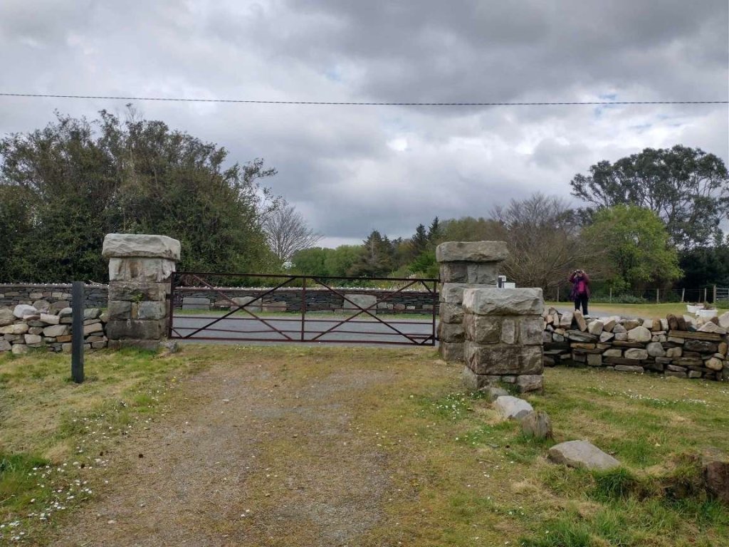
The November 1899 edition of The Railway Magazine carried a short article about the L&LSR which was not heavy on technical detail. It mostly reads as though it were a holiday brochure rather than an article in a railway journal. None-the-less, the article is still of interest, particularly for the fact that it was written during the period when the L&LSR was expanding.
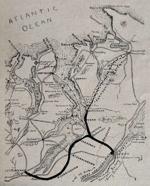
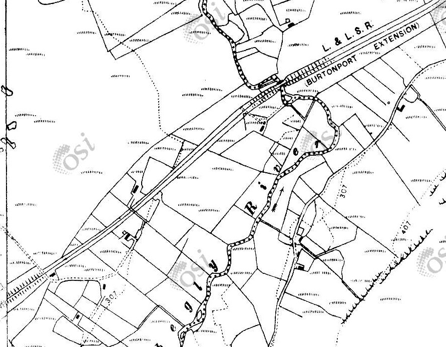
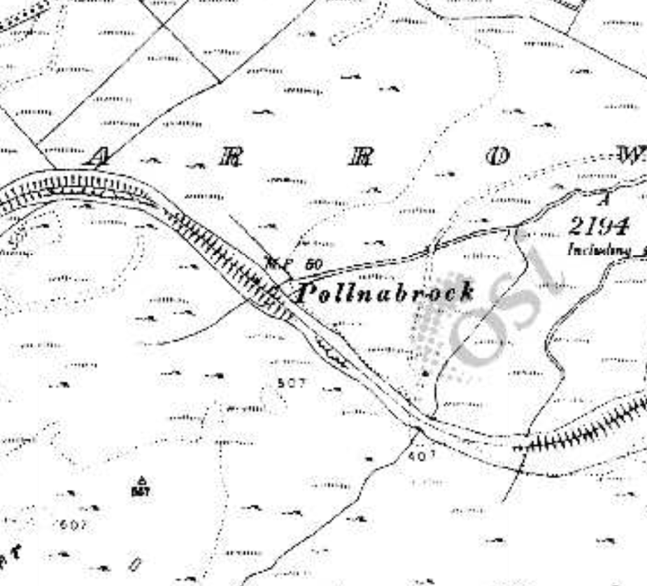
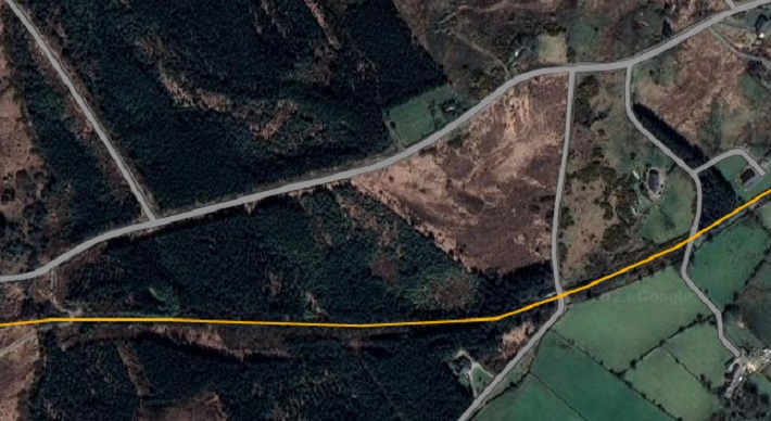
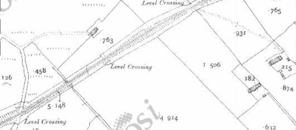
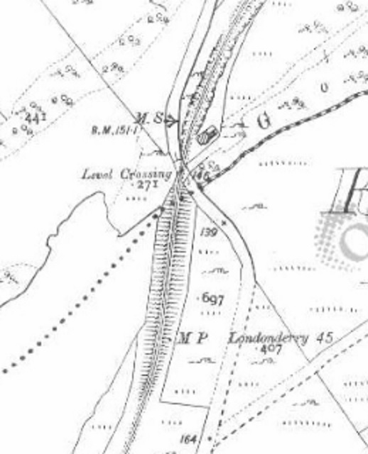
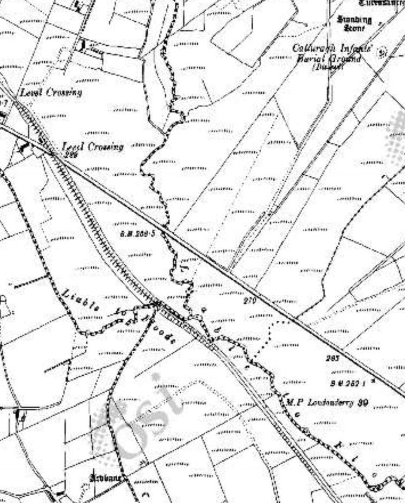
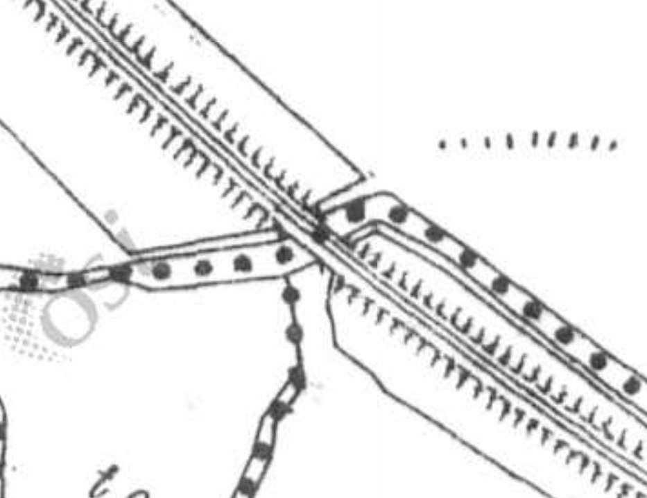
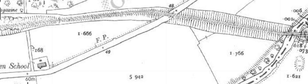
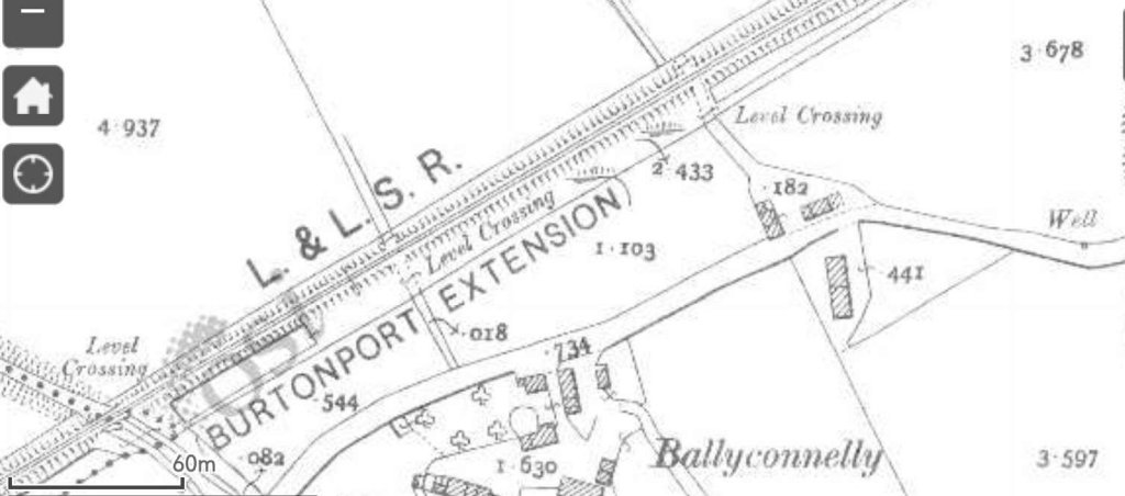
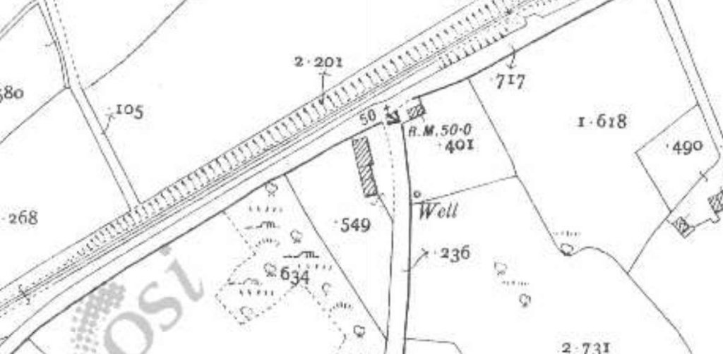
A map of the L&LS Railway in 1899, before its significant expansion. I was particularly drawn to this map as my wife and I spent our main holiday this year in Rathmullan directly across Lough Scilly from Buncrana. I have still to complete a series of articles about the L&LSR between Derry and Cardonagh. [1: p461]
Chisholm starts his article: the L&LSR “is one of those excellent little lines constructed on the narrow gange principle, which are to be found in all parts of Ireland. The country has the benefit of light rail ways It is with one of these lines that the present article is intended to deal. It is to be hoped that the following notes respecting the L&LSR will prove interesting to readers.” [1: p461-464]
Chisholm then spends a number of paragraphs explaining how best a traveller from the mainland to Derry.
I found his outline of the route from London interesting as it highlighted the number of railway companies whose rails the journey would cross. “Leaving London (Euston or St. Pancras) the passenger is taken to Carlisle, the ‘Clapham Junction of the North’. The journey is continued to Stranraer on the Portpatrick and Wigtownshire Joint Railway, owned by the London & North Western, Midland, Caledonian, Glasgow & South Western, Companies. The steamers run alongside the harbour station, Stran raer. The boats are well built, and are fitted with the latest improvements, The joint companies are financially interested in this steam boat service, as is also the Belfast and Northern Counties Railway. The time occupied in crossing is approximately two hours. Larne harbour station also adjoins the steamer pler, … A narrow gauge train awaits the arrival of the boat, and by this train the traveller is taken to Ballymena, It is necessary to change here into the broad gauge ‘Londonderry Express’, which speedily runs to the city on the banks of the Foyle.” [1: p464-465]
At that time, Derry “consist[ed] of two towns, one on each side of the River Foyle. The waterside station of the Belfast and Northern Counties Rail- way is on the eastern bank. The river is spanned by the stately Carlisle Bridge, a fine structure, which can truly be termed ‘[Derry’s landmark’. … The [L&LSR’s] station was on the western bank of the river. On entering it and viewing for the first time the rolling stock therein, the Londoner’s thoughts [would] immediately fly to the London and South Western Railway. The carriages before him [were] painted almost exactly after the style of that Company’s coaching stock. In addition to this, [the L&LSR] Company paint their engines a bright grass green – another prominent ‘South Western’ feature.”
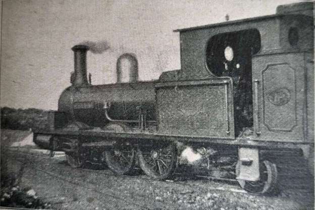
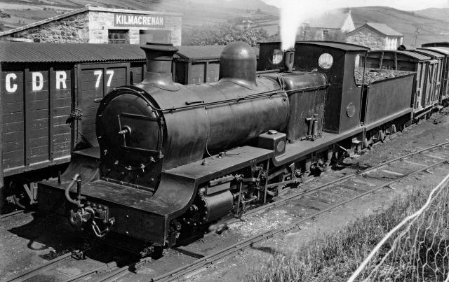
The featured image for this article shows L&LSR Locomotive No.1 J.T. Macky which was built by Black, Hawthorn & Co., of Gateshead in 1883. At the time of Chisholm’s article this locomotive was only around 6 years old. In a surprising digression from the more general nature of his article, Chisholm provides quite some detail about this locomotive. “It was named after the then Chairman of the Company. Mr. Fred. Dawson, the … General Manager of the Company, … supplied the [Chisholm] with the leading dimensions of ‘J.T. Macky’. It [was an 0-6-2T loco], a six-coupled engine with a two-wheeled pony truck at the rear. The diameter of the coupled wheels [was] 3 ft. 6 in., the diameter of the trailing wheels being 2 ft. 2 in. The gauge of the line [was] 3 ft 0 in. ‘J. T. Macky’ [had] cylinders 13 in. by 19 in.; a total heating surface of 592 square feet. …(112 tubes); a steam pressure of 140 lbs. per square inch, and a total length over the buffers of 27 ft. The total weight of the engine in working order [was] 23 tons 3 cwt.” [1: p462]
L&LSR Locomotive No. 1 ‘J.T. Macky’. [1: p463]
It is clear that Chisholm was quite taken by this locomotive: “The locomotive is extremely handsome, being painted … brought green picked out with black and white stripes. A bright brass dome is mounted on the top of the barrel.” [1: p462]
In 1899, Chisholm claimed that the L&LSR owned ten locomotives the first four named, respectively, J.T. Macky, Londonderry, Donegal and Inneshowen. The remaining engines bore numbers only. J.T. Macky, Londonderry, and Donegal were numbered ‘1’ to ‘3’ and were all 0-6-2T locomotives supplied by Black, Hawthorn & Co. Inneshowen was numbered ‘4’, supplied by the same company it was an 0-6-0T. I have only found evidence of a further four locomotives having been supplied to the L&LSR by 1899: No. 5(A) and No. 6(A), both supplied by Robert Stephenson & Co. in 1873, both 2-4-0T locomotives; and No. 5 and No. 6, both supplied by Hudswell Clarke in 1889, both 4-6-2T locomotives. [3]
Chisholm continues: The L&LSR consisted of “two branches. … The longer branch extend[ed] to Letterkenny, and the shorter to Buncrana. [At that time] the company work[ed] and own[ed] 14.5 miles of line.” [1: p462-463]
Chisholm goes on to write about the L&LSR’s expansion plans. Looking forward from the end of 1899, he says: “It aspires to greater things, … there are now being made extensions of great importance.The first of these is a line from Letterkenny to Burtonport, 49.5 miles. An extension from Buncrana northwards to Carndonagh (see map) is also now being undertaken. The latter will be 18.5 miles long. It will be seen that when these extensions are completed, the Lough Swilly Railway will be a comparatively big concern.” [1: p463]
From this point in his article, Chisholm sells the area around the L&LSR as a holiday destination. “The scenery in and around … County Donegal is exceptionally fine. … Buncrana has truly been described as a lovely spot. It is an ideal holiday resort. A fine building – the Lough Swilly Hotel – has been erected, where tourists will find excellent accommodation. The Lough Swilly Railway is fully alive to the fact that the district served by its line is essentially a resort for the tourist. With this view, [the Company] has introduced a number of facilities for holiday makers. For example, cheap tickets are issued daily between Londonderry and Buncrana – the fare for the double journey being only one shilling. The tickets are available by all trains. The passenger has not to get up at an unearthly hour in the morning to catch a special train. … There has also been introduced, … passengers proceed by rail from Londonderry to Buncrana, thence to Fahan, by steamer from Fahan to Rathmullan, by coach from Rathmullan to Rosapenna, Dunfanaghy, Gweedore, Dungloe, Glenties, Ardara, Carrick, Killybegs, thence by rail to [Derry]. ” [1: p463]
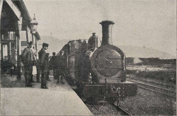
A train from Derry arrives at Buncrana. The Locomotive is L&LSR No. 4, ‘Innishowen’. [1: p464]
In Chisholm’s concluding remarks, he comments that “the railway is a thoroughly up-to-date concern. … The management is … thoroughly enterprising. The railway … is an interesting and well-managed line; the scenery in the district it serves can truly be described as amongst the grandest in the British Isles.” [1: p464]
References
A J. Chisholm; The Londonderry & Lough Swilly Railway; in The Railway Magazine, London, November 1899, p461-464.
My completed articles about the L&LSR can be found on this blog on the following links:
Images of traffic on the line when it was still operating seem to be few and far between. I am continuing to look for images and may post an addendum if sufficient come to light in due course.
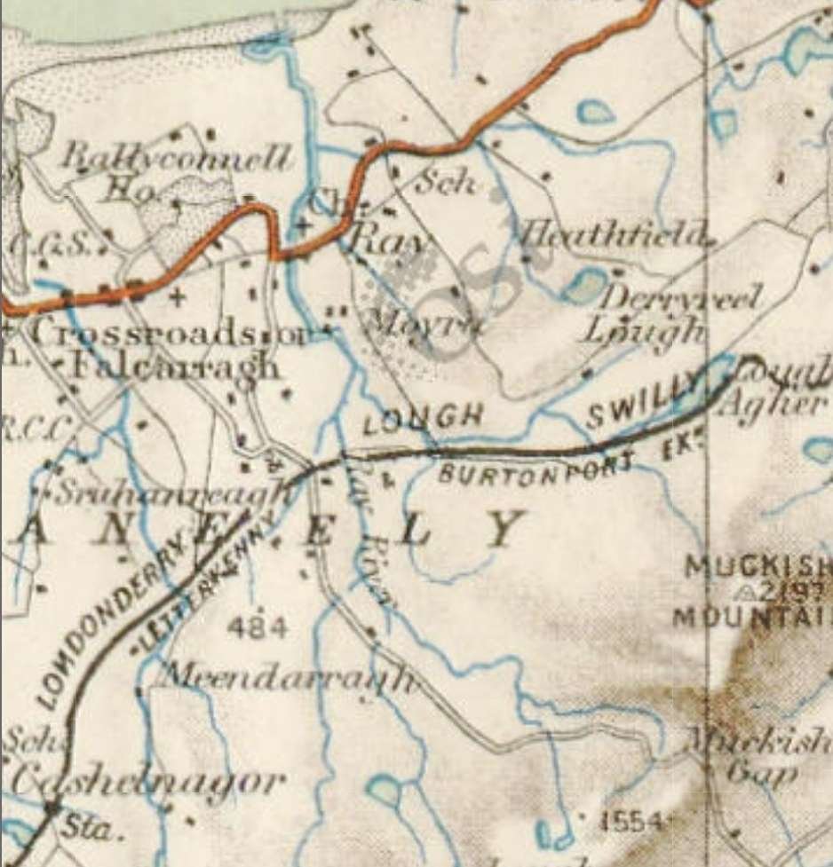
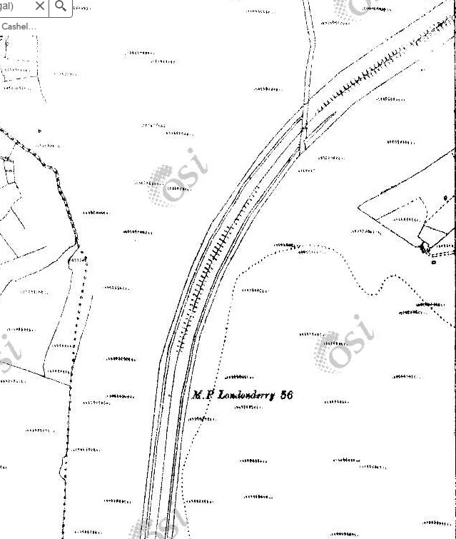
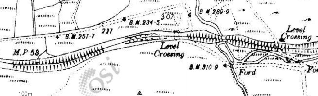
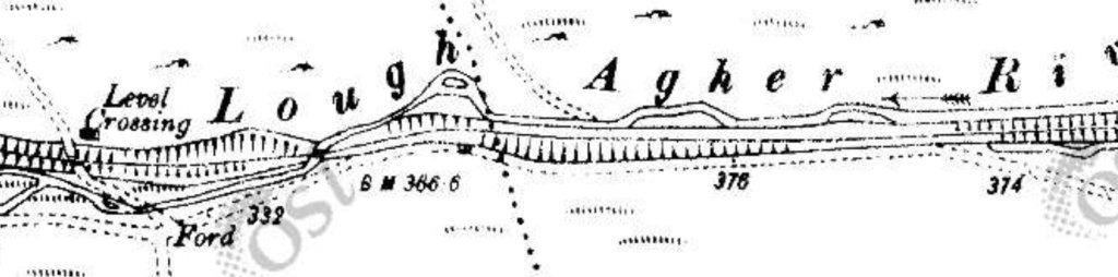
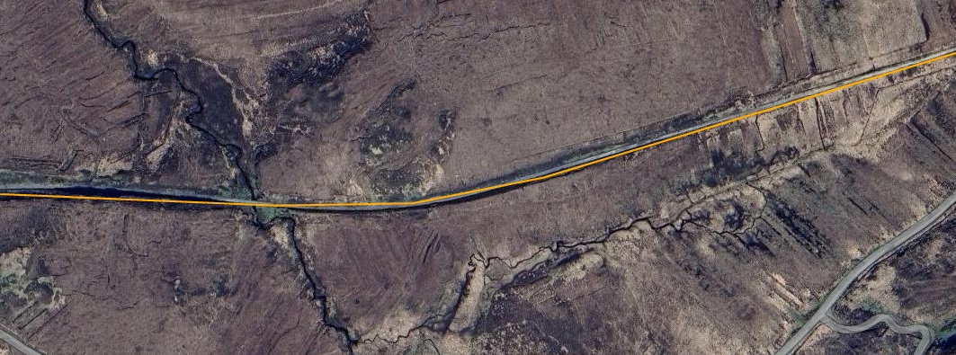
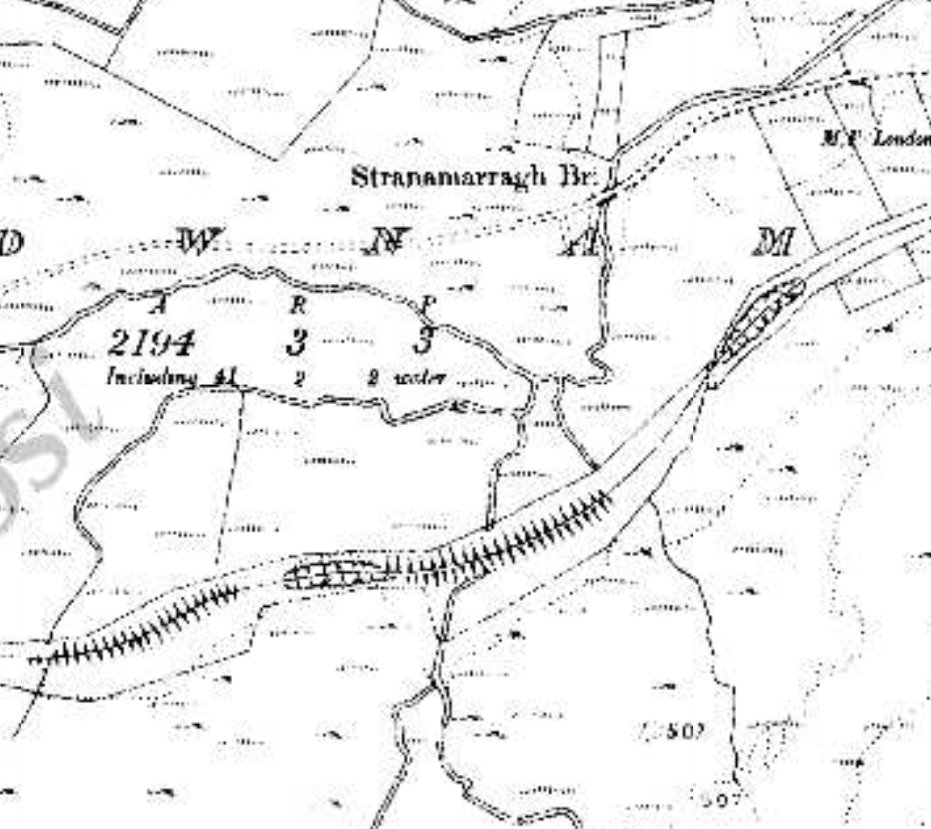
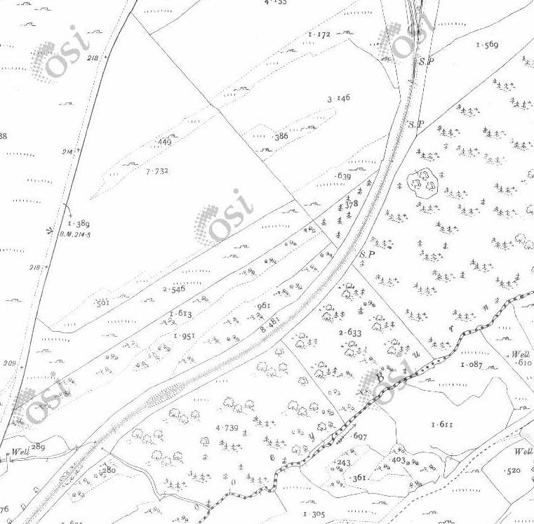
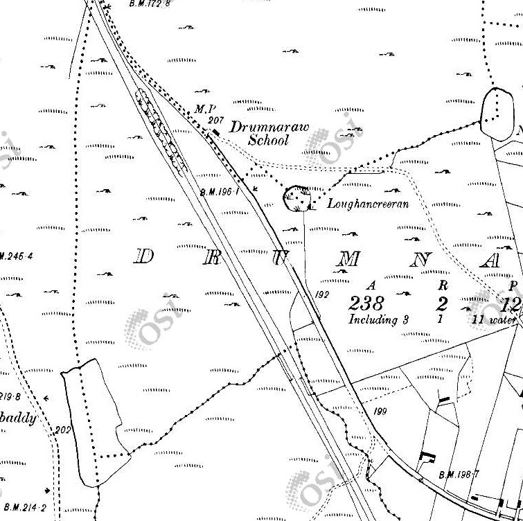
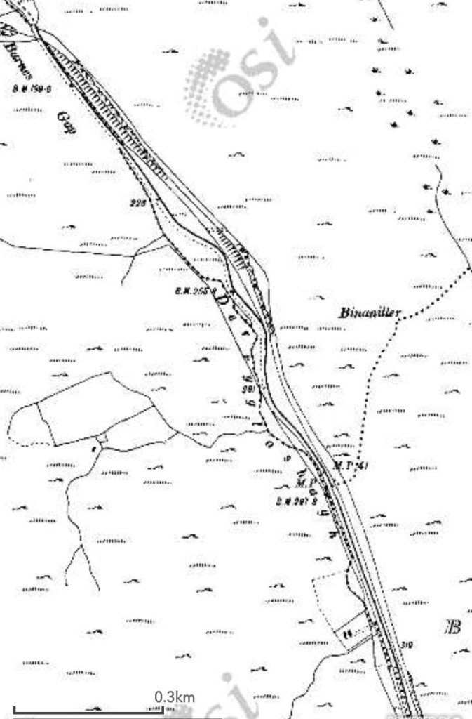
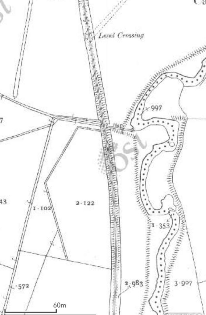
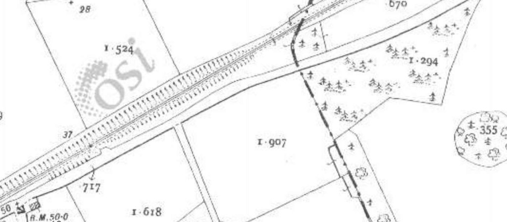
The 1940s 1″ OSi mapping below shows the length of the covered in this third article.
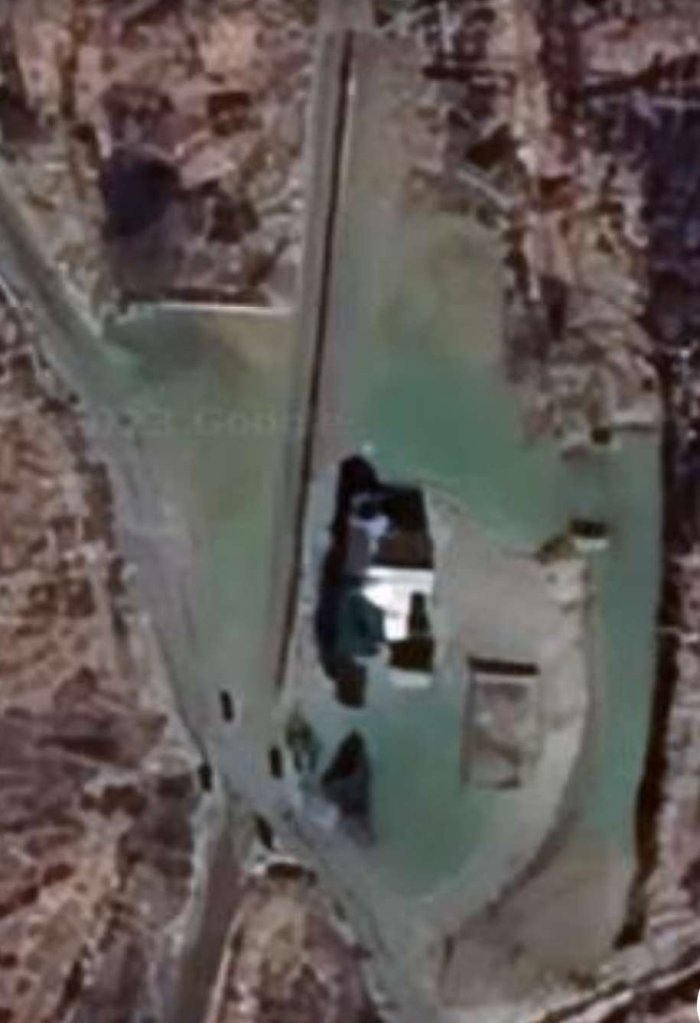
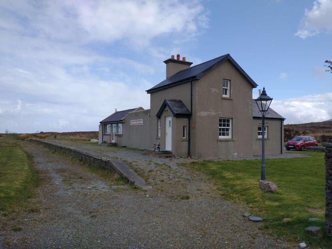
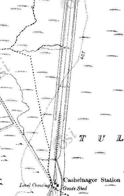
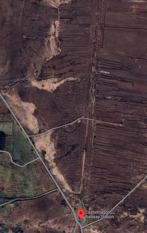
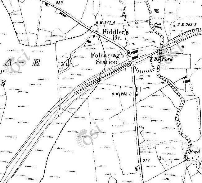
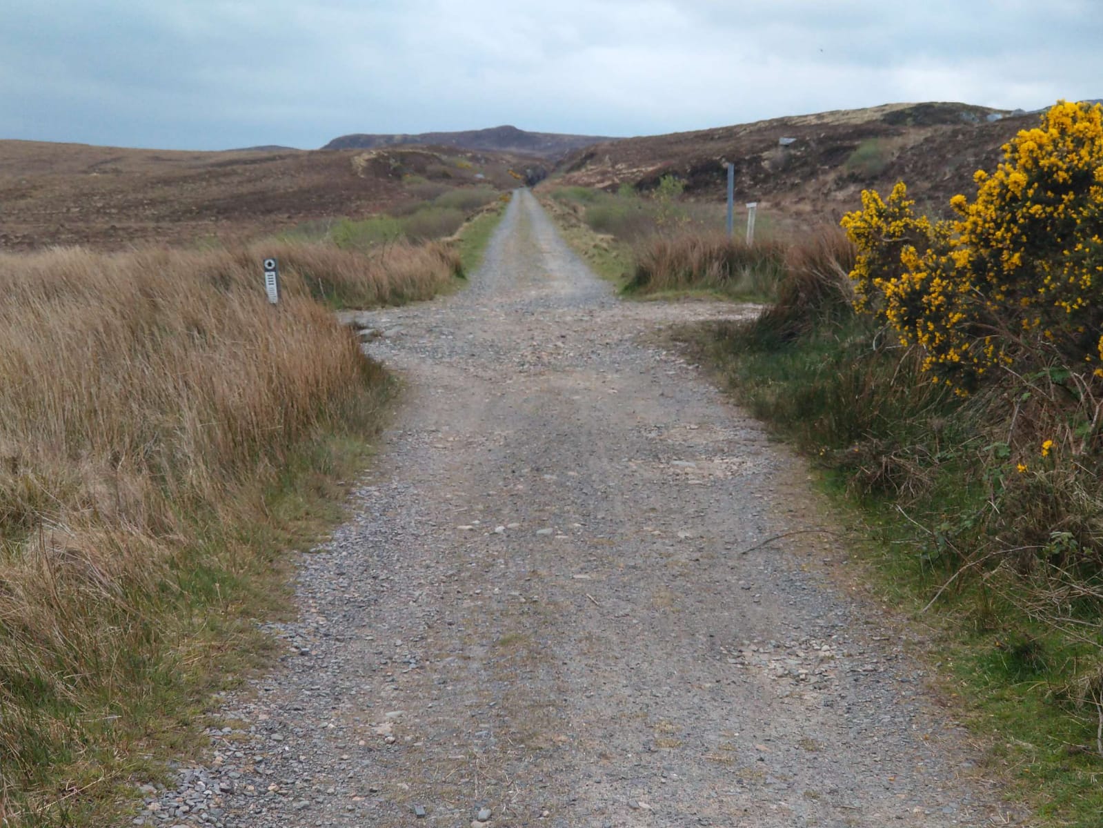
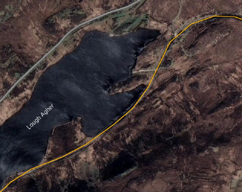
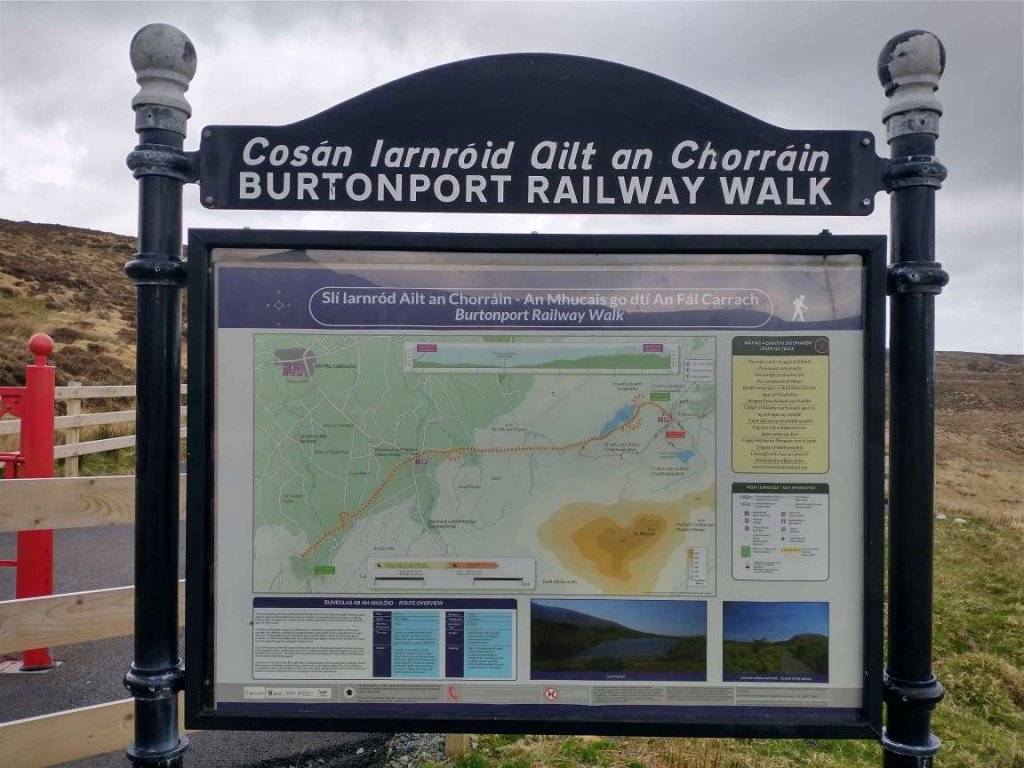
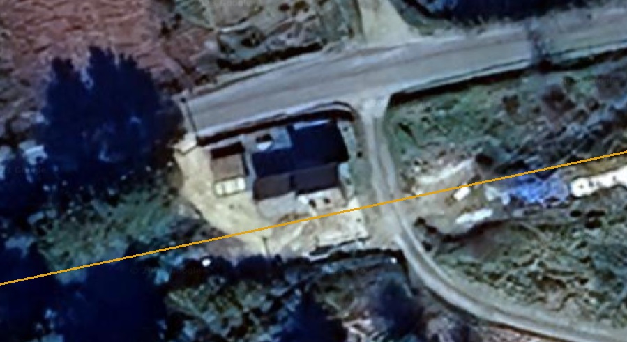
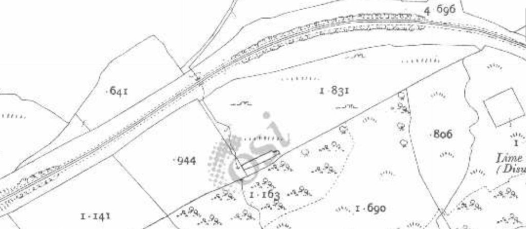
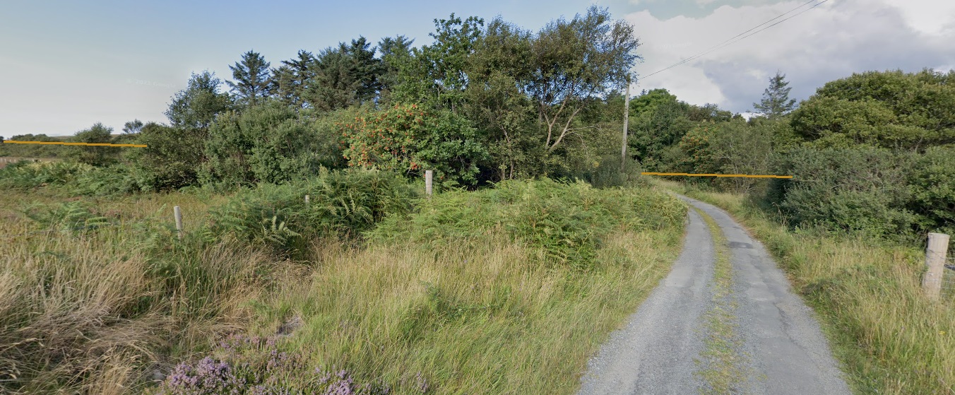
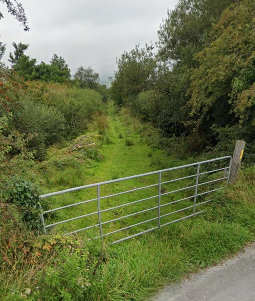
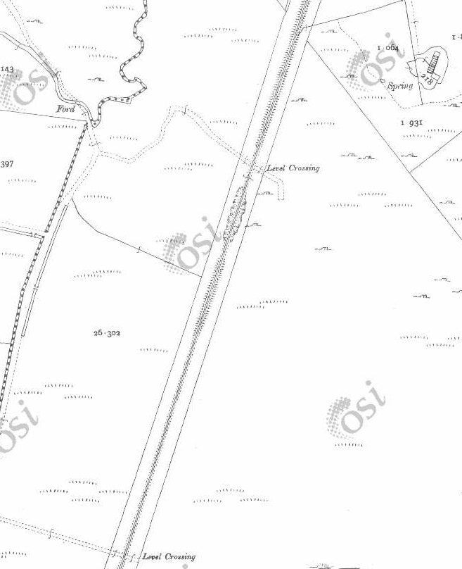
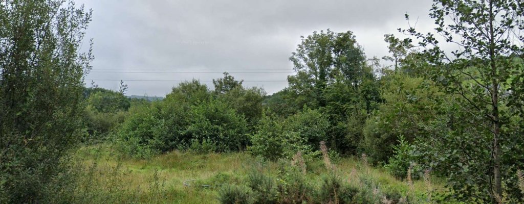
This first segment covers Cashelnagor Railway Station via Falcarragh Railway Station to Lough Agher. [2]This next segment runs from Lough Agher via Dunfanaghy and Creeslough Railway Stations, across the Owencarrow Viaduct and through Barnes Gap. [2]Our starting point for this part of the journey along the Burtonport Extension Railway is at Cashelnagor Railway Station. This is an extract from the 25″ OSi mapping of the early 20th century. [2]A very similar area as covered in the map extract above. This is how the site of Cashelnagor Railway Station appears on the satellite imagery provided by Google Earth [May 2023]Cashelnagor Railway Station viewed from the crossing location to the South of the Station in April 2023. As we noted in the lst article about the line, the station building has been refurbished and is in use as a holiday let. [3][My photograph, 24th April 2023]
The length of the line from Cashelnagor Railway Station to Falcarragh Railway Station is best seen on the 6″ OSi mapping of 1901 as one sheet of the 26″ mapping covering the route is not available on line. The quality of the reproduction of the map extracts below is not as good as it might be, but it is the best available at present. [2]
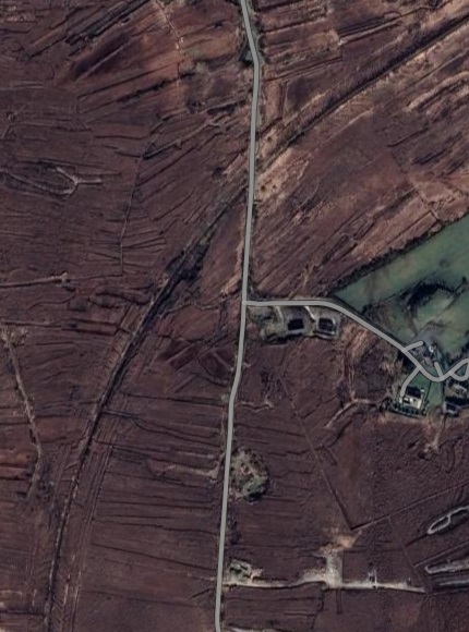
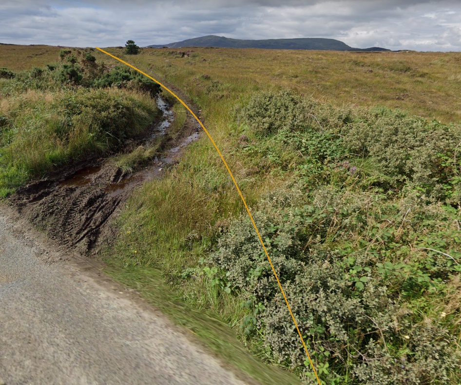
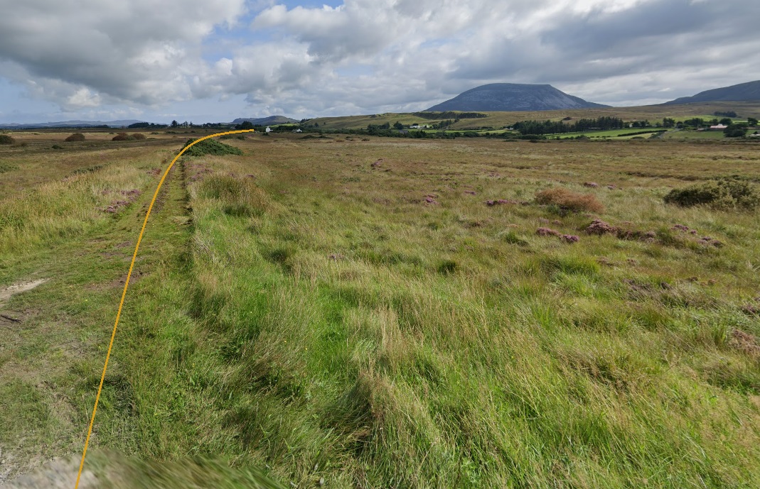
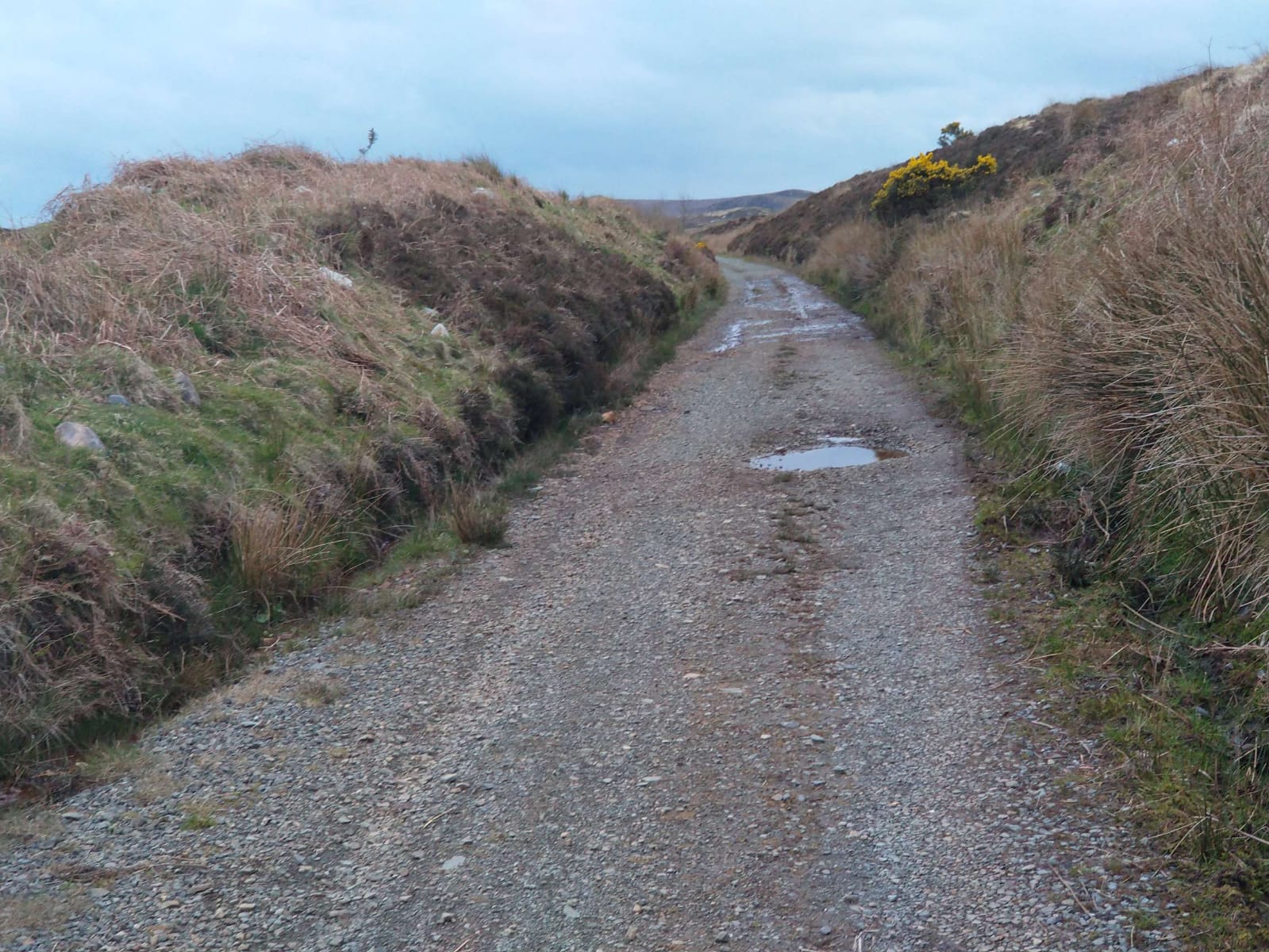
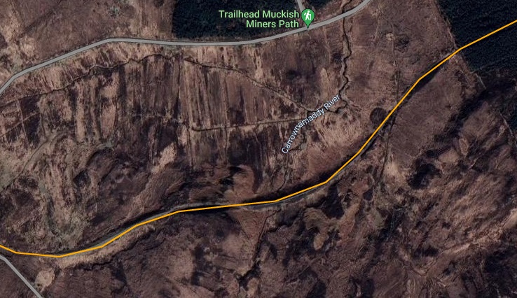
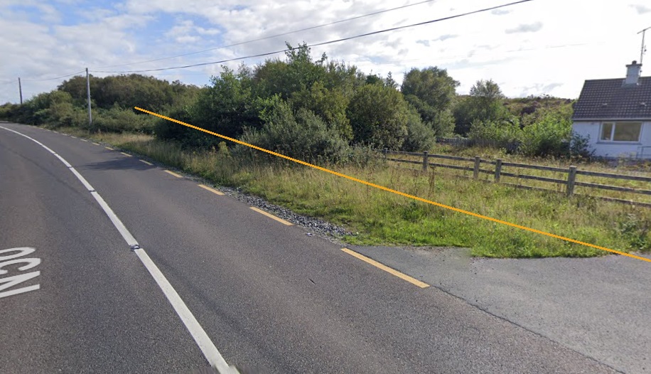
The 6″ OSi mapping shows the old railway heading almost due North away from Cashenagor Railway Station. [2]A similar length of the old line as it appears on Google Earth in 2023. [Google Earth, 31st May 2023}At Milepost 56 (56 miles from Derry) the line begins to curve round to the East. [2]Another Google Earth satellite image which shows the route of the old line as it appears in 2023. [Google Earth, 31st May 2023]Looking back Southwest from the minor road which appears on the Google Earth satellite image above. The route of the old railway is shown by the superimposed yellow line. [Google Streetview, August 2021]At the same location, looking Northeast along the route of the old railway. The minor road on which we are standing was no more than a track in the days when the railway was operating. The map extract above shows it petering out after crossing the line. It linked in to another track to the North of the line. [Google Streetview, August 2021]The old railway crossed the Tullaghobegly River on embankment while running in a Northeasterly direction. We are on the next OSi 6″ map sheet from 1901 and the detail is a little easier to make out. In the bottom left of the extract there is a track crossing the old railway. [2]This extract from the Google Maps satellite imagery shows the same length of the old railway as the map extract above. The Tullaghobegly River is easy to make out running across the image from South to North. The old railway route is still clearly visible as well running from the lower left of the image to the top-right. [Google Maps, 31st May 2023]This enlarged extract from Google Maps satellite imagery shows the minor road crossing the line of the old railway which appeared in the bottom-eft of the image above. [Google Maps, 31st May 2023]Looking back Southwest from the minor road shown on the Google Maps extract above. [Google Streetview, August 2021]From the same location, looking Northeast towards Falcarragh Railway Station, with the line of the old railway superimposed. The house here is not recorded as a crossing keeper’s hose so the track will have crossed the line at an ungated crossing. [Google Streetview, August 2021]The railway bridge over the Tullaghobegly River still stands in 2023. We did not get a photograph of this bridge when we walked to Falcarragh Railway Station. [Google Maps, 31st May 2023]
“The Tullaghobegley River (also known as the Bawaan River) flows for some 9 miles, emptying into Ballyness Bay and thence to the sea. The source of the river is Lough Altan at the base of Mount Errigal in Glenveagh National Park. … The Tullaghobegley, though small, is a productive salmon and sea trout fishery recording around 300 salmon per season. The river fishes from June onwards. During spates there are some nice pools above the Main Road Bridge, above the old Railway Bridge and at Meendarragh.” [4]
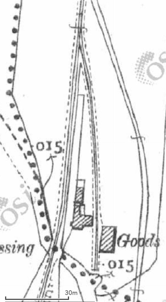
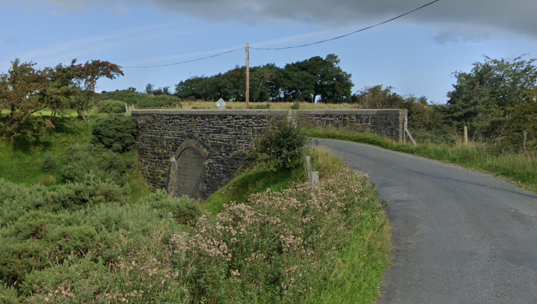
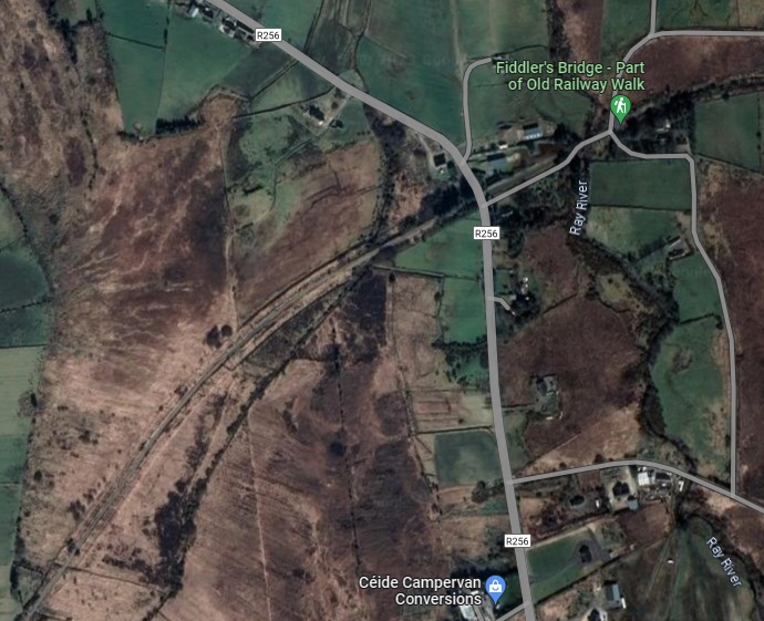
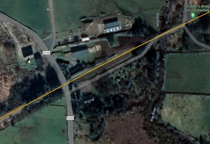
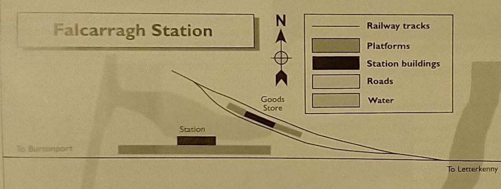
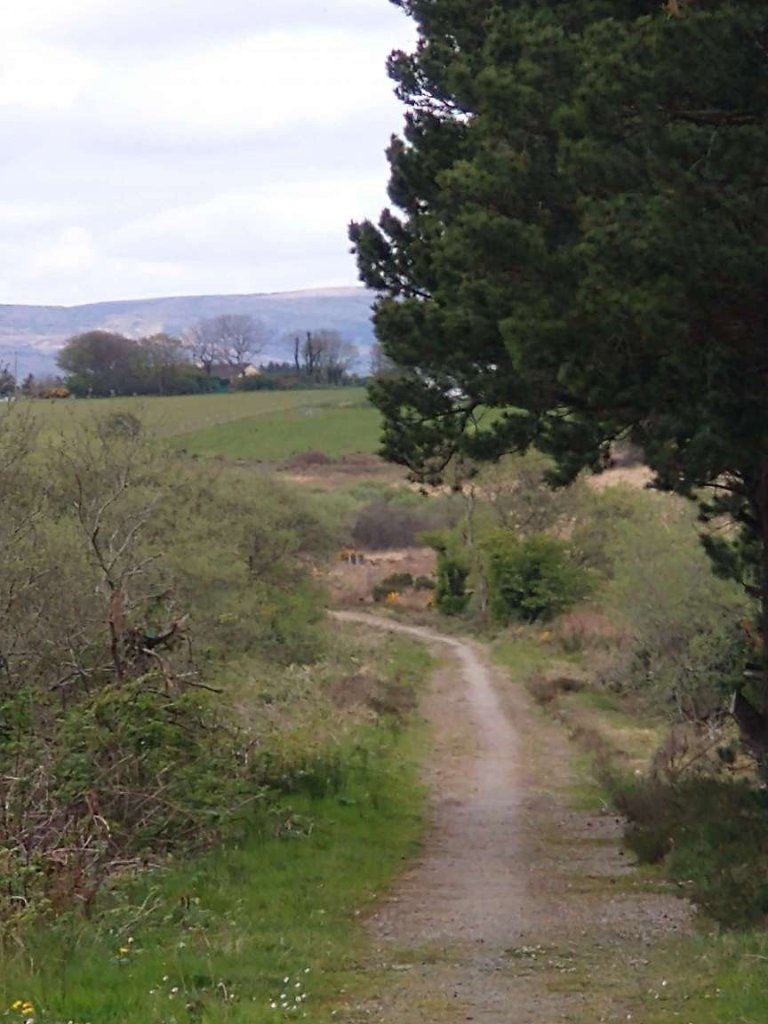
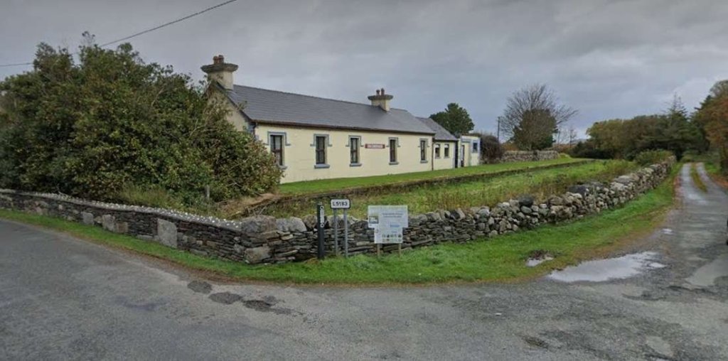
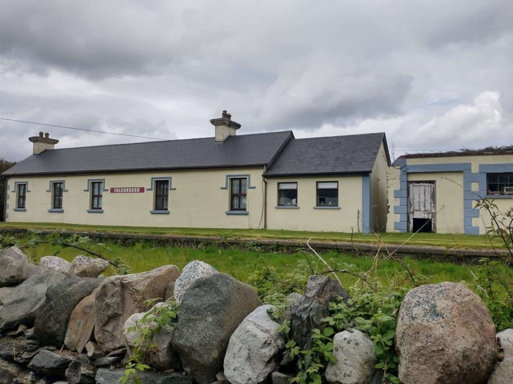
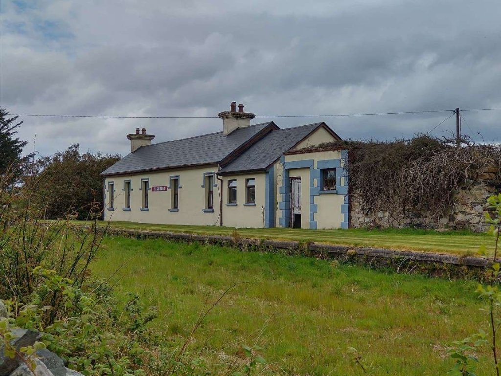
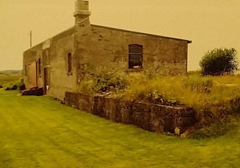
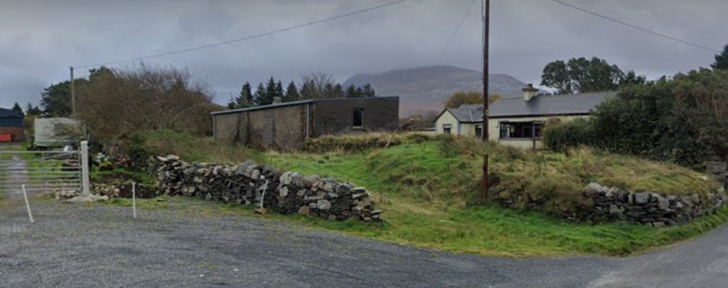
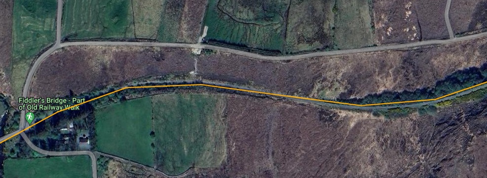
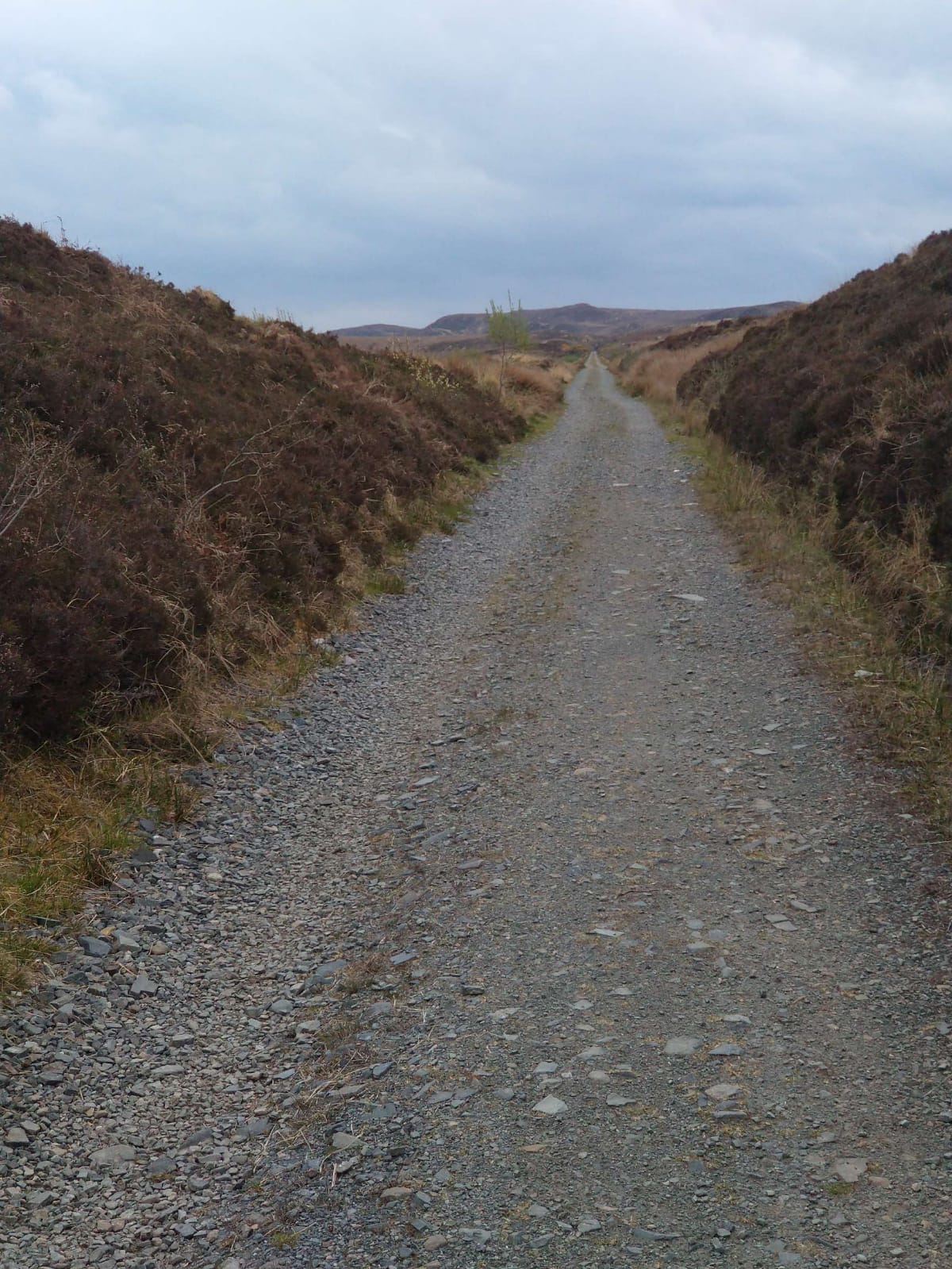
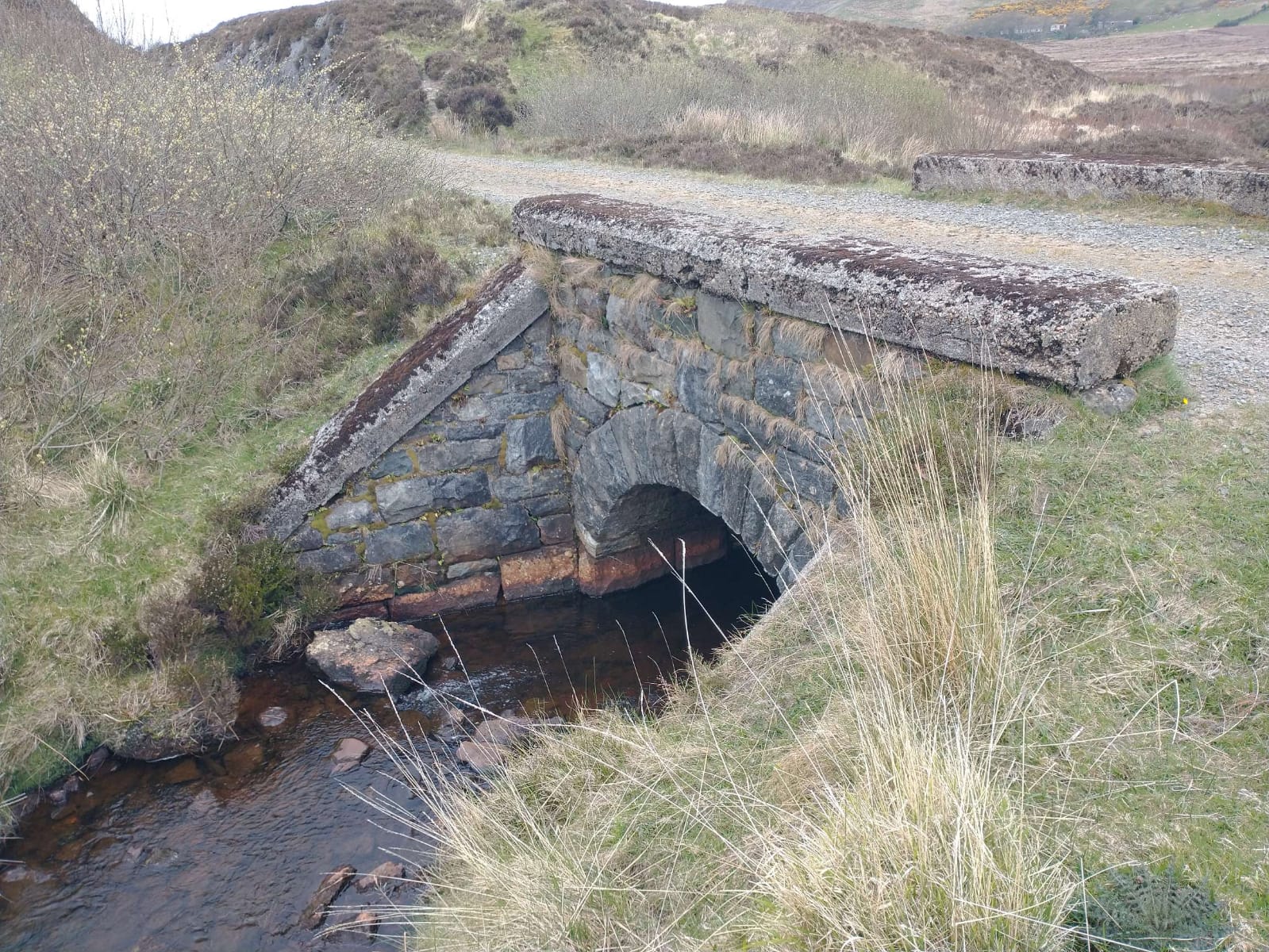
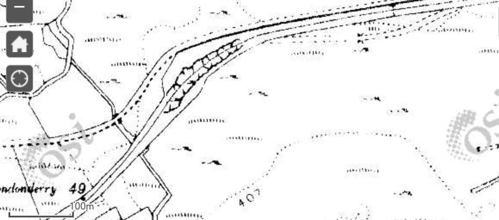
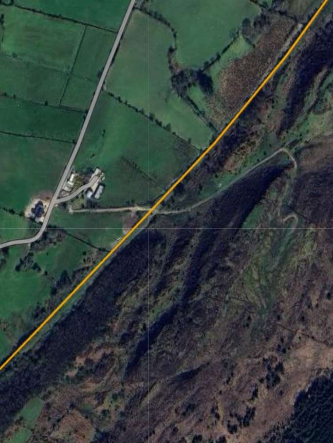
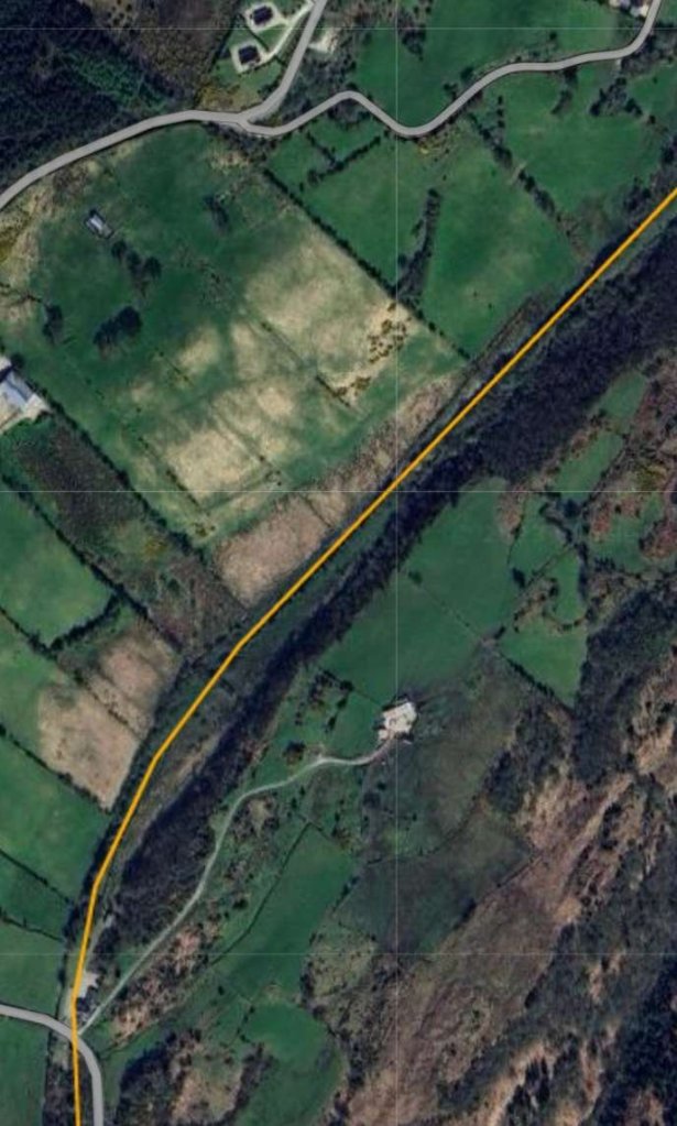
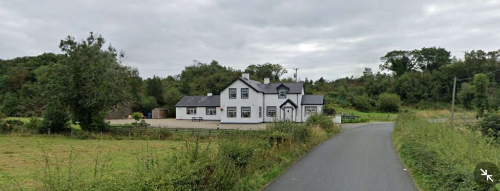
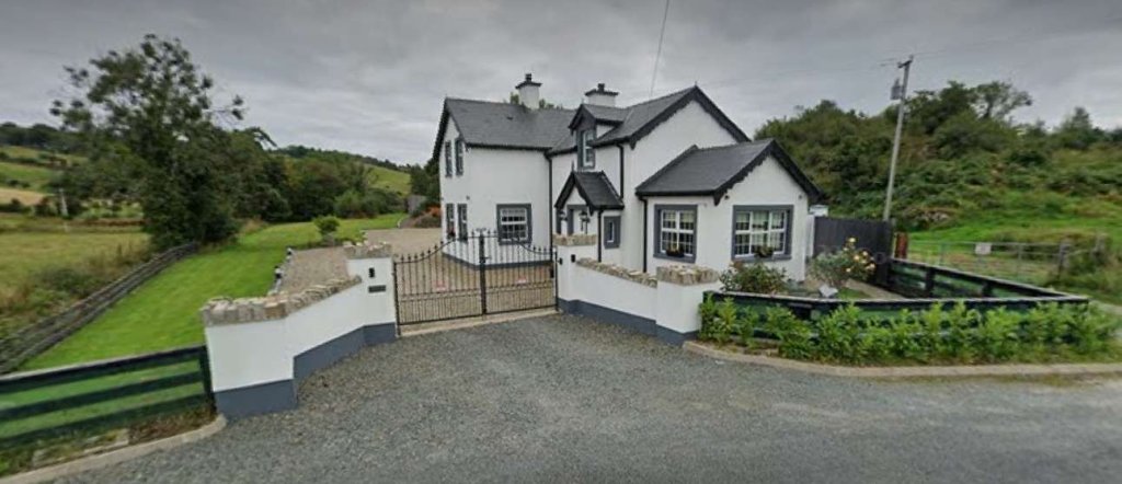
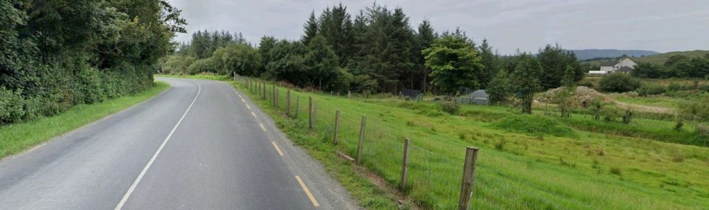
The railway continued in a Northeasterly direction, running to the Northwest of Creenlougher and on past Milepost 54. [2]A similar area on Google Maps satellite imagery to that shown in the extract above. Note the bridge over the old railway in the bottom-left of this image. [Google Maps, 31st May 2023]Looking North from the road which bridged the old railway, at the bridge which still carries that road. AS can be seen, the arch has been infilled with concrete. [Google Streetview, August 2021]Looking back to the Southwest from the road bridge at Creenlougher. {Google Streetview, August 2021]Looking Northeast from the bridge over the old railway at Creenlougher in 2023. [Google Streetview, August 2021]Curving a little to the East, the railway approached Falcarragh Station at Fiddler’s Bridge. [2]A very similar area to that shown on the map extract above, as it appears on Google Maps in 2023. [Google Maps, 31st May 2023]A closer view of Falcarragh Railway Station from above. The line of the old railway is superimposed. The station building was immediately adjacent to the road with the goods shed behind it (to the North), both are still in use in 2023. [Google Maps, 31st May 2023]This station layout appears in Dave Bell and Steve Flanders book about the Londonderry and Lough Swilly Railway. The layout of the station is such that should it have been required to allow a train from the opposite direction to pass, laying back into the goods loop, or pulling into the goods loop would be possible. [5: p77]The view Southwest along the old railway from just to the West of the R256. [My photograph, 27th April 2023]The view East across the R256 into the site of Falcarragh Railway Station. [My photograph, 27th April 2023]The view East along the line if the old railway from the location of the level crossing on what is now the R256. [My photograph, 27th April 2023]This photograph shows Falcarragh Railway Station after final closure of the line in 1947. It was shared by Joe Begley on the Memories of Falcarragh/Gortahork Facebook Group on 30th January 2018. [9]Falcarragh Railway Station as seen in the early 2000s. This picture was included in E. M. Patterson, Joe Begley and Steve Flanders book about the line. [6: p167]A similar view to the monochrome image and the early 2000s image above as the Station appears in 2023. [My photograph, 27th April 2023]
“Falcarragh railway station served the village of Falcarragh, 4 km (2.5 mi) away. … [It] opened on 9th March 1903 when the Londonderry and Lough Swilly Railway opened their Letterkenny and Burtonport Extension Railway, from Letterkenny to Burtonport. It closed on 3rd June 1940 [to passenger traffic] when the LLSR closed the line from Tooban Junction to Burtonport in an effort to save money.” [7] Final closure to all traffic occurred on 6th January 1947. [8]
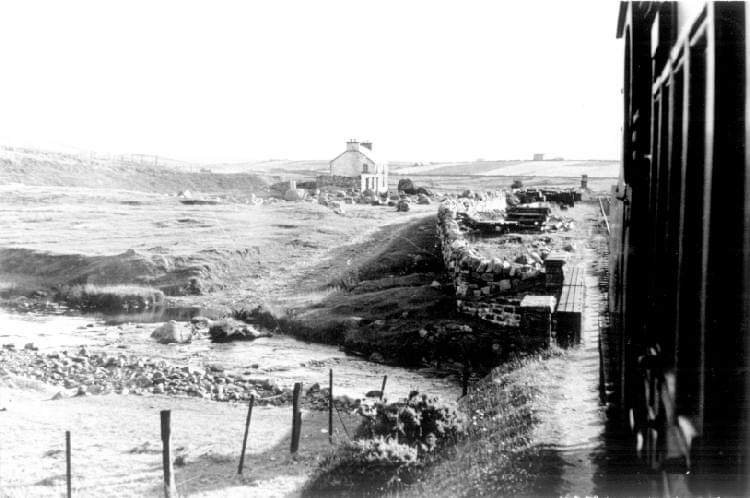
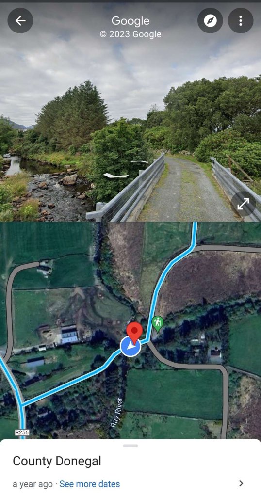
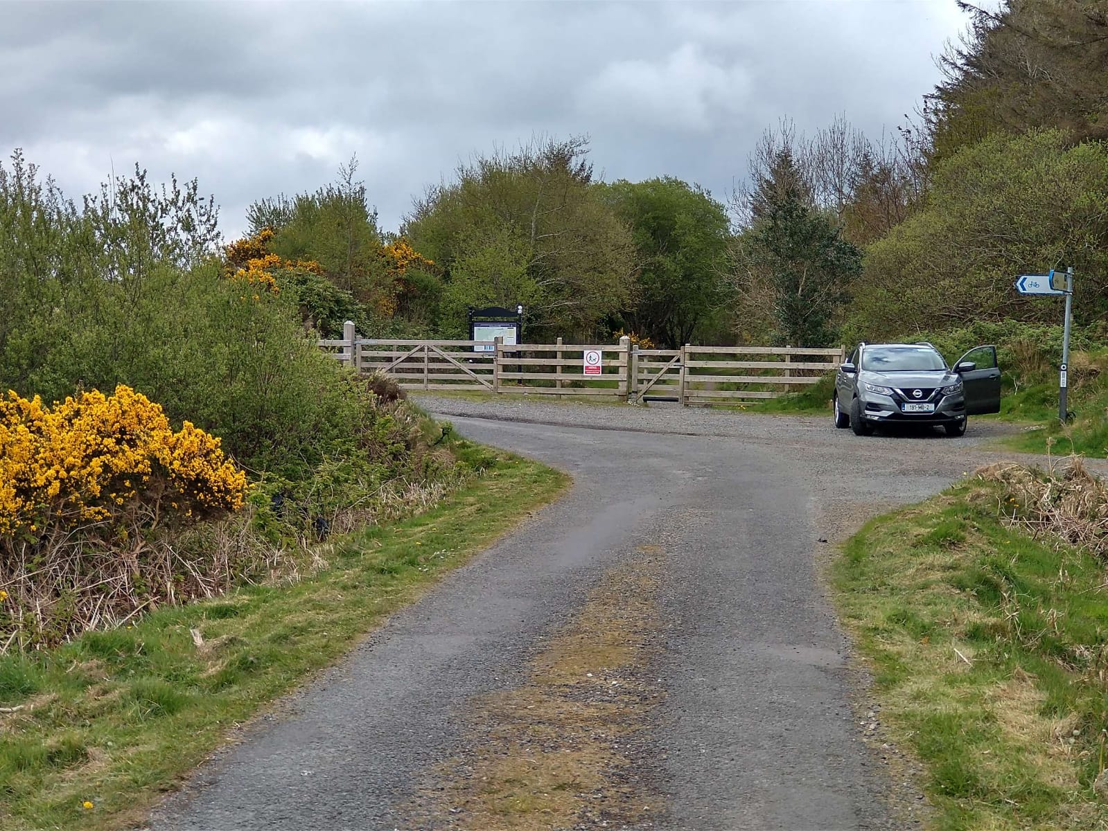
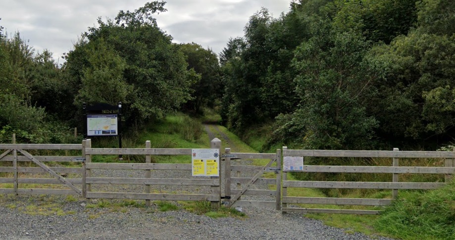
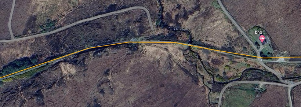
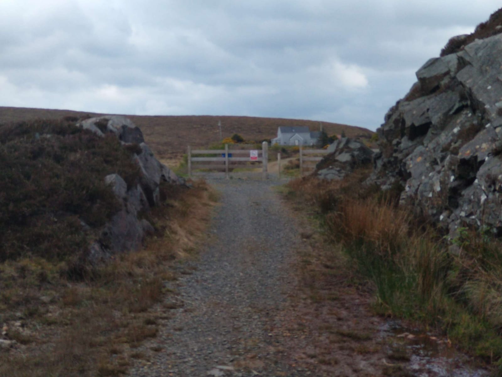
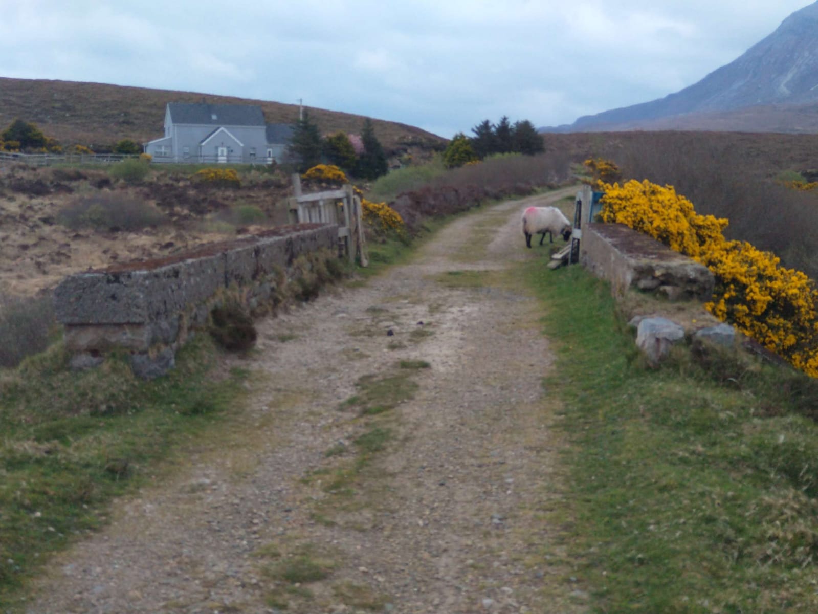
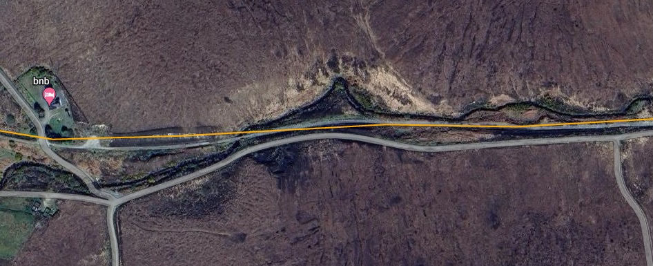
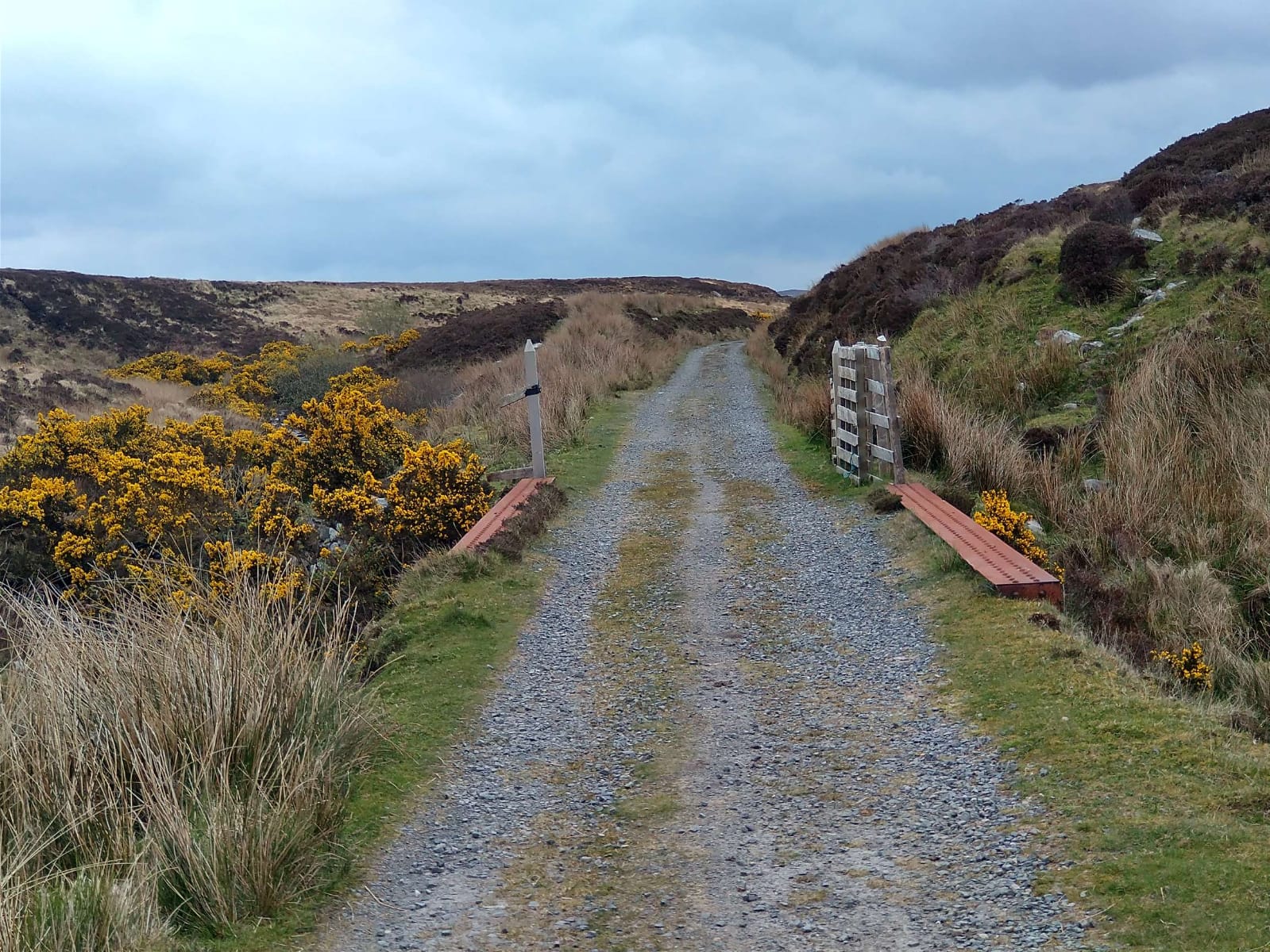
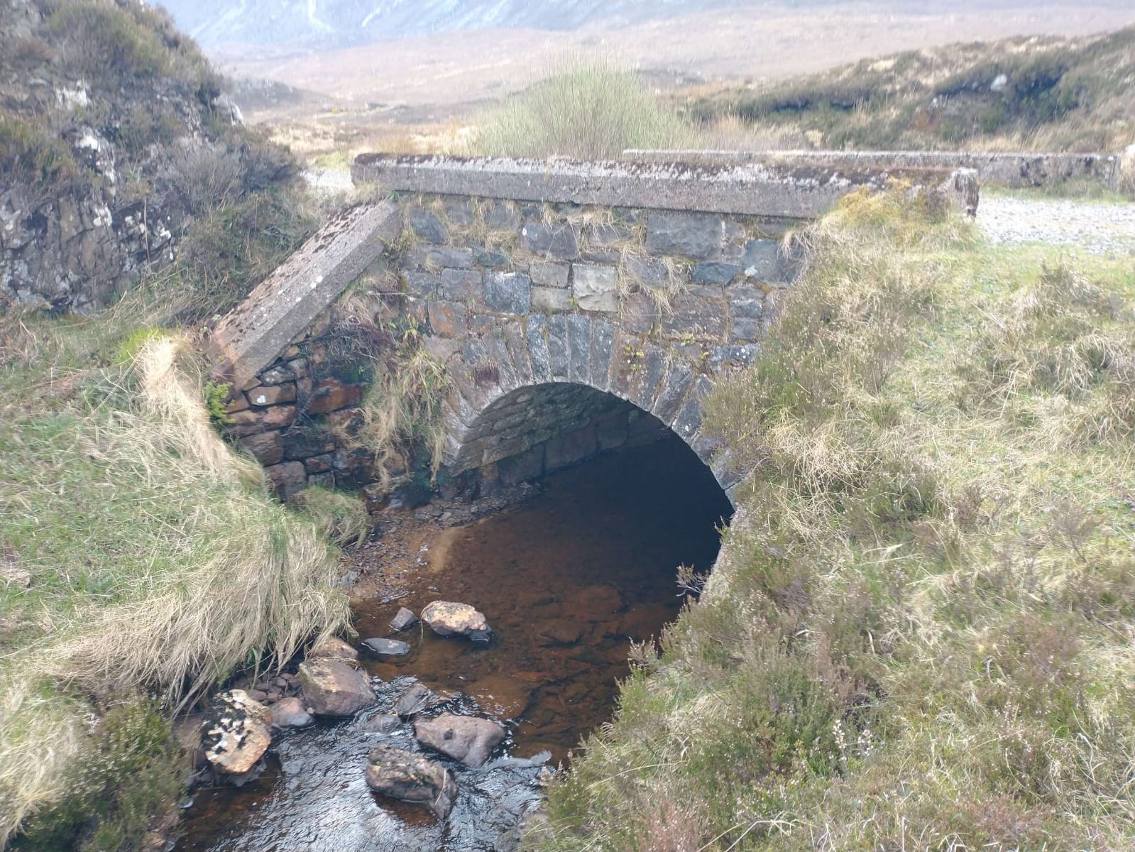
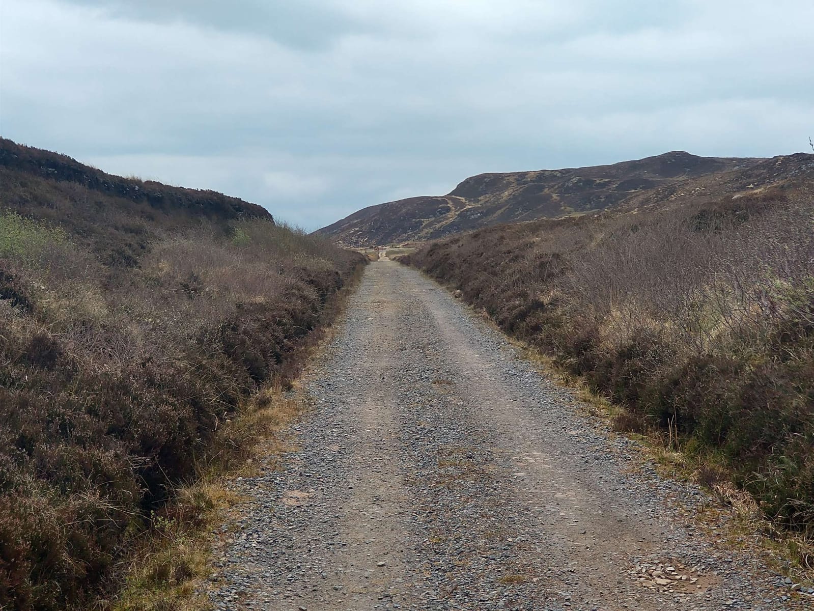
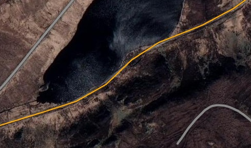
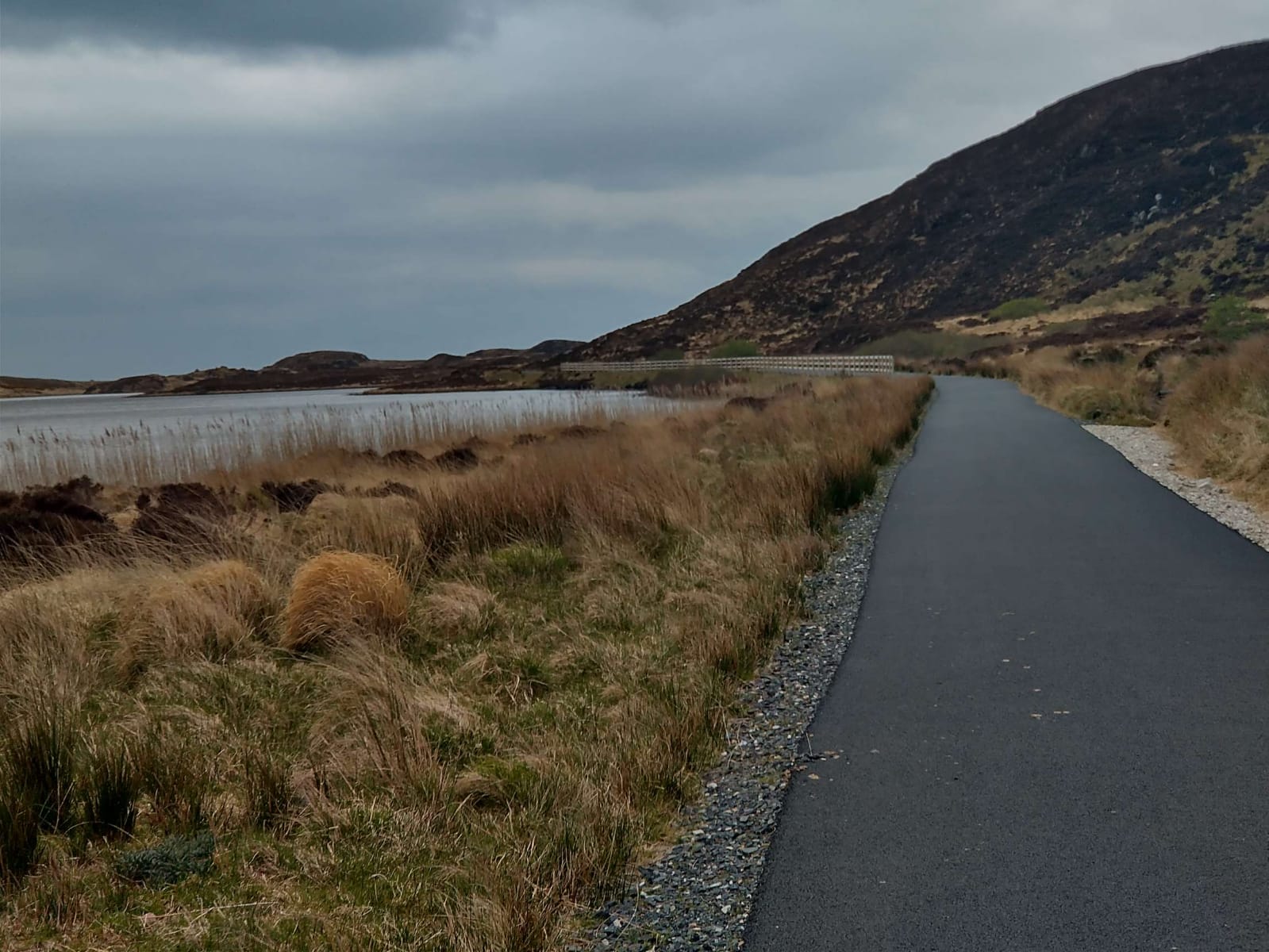
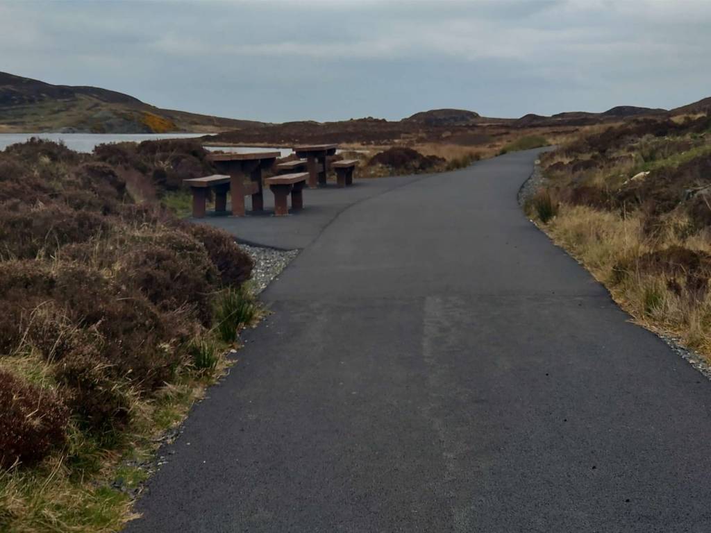
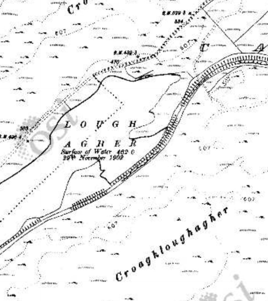
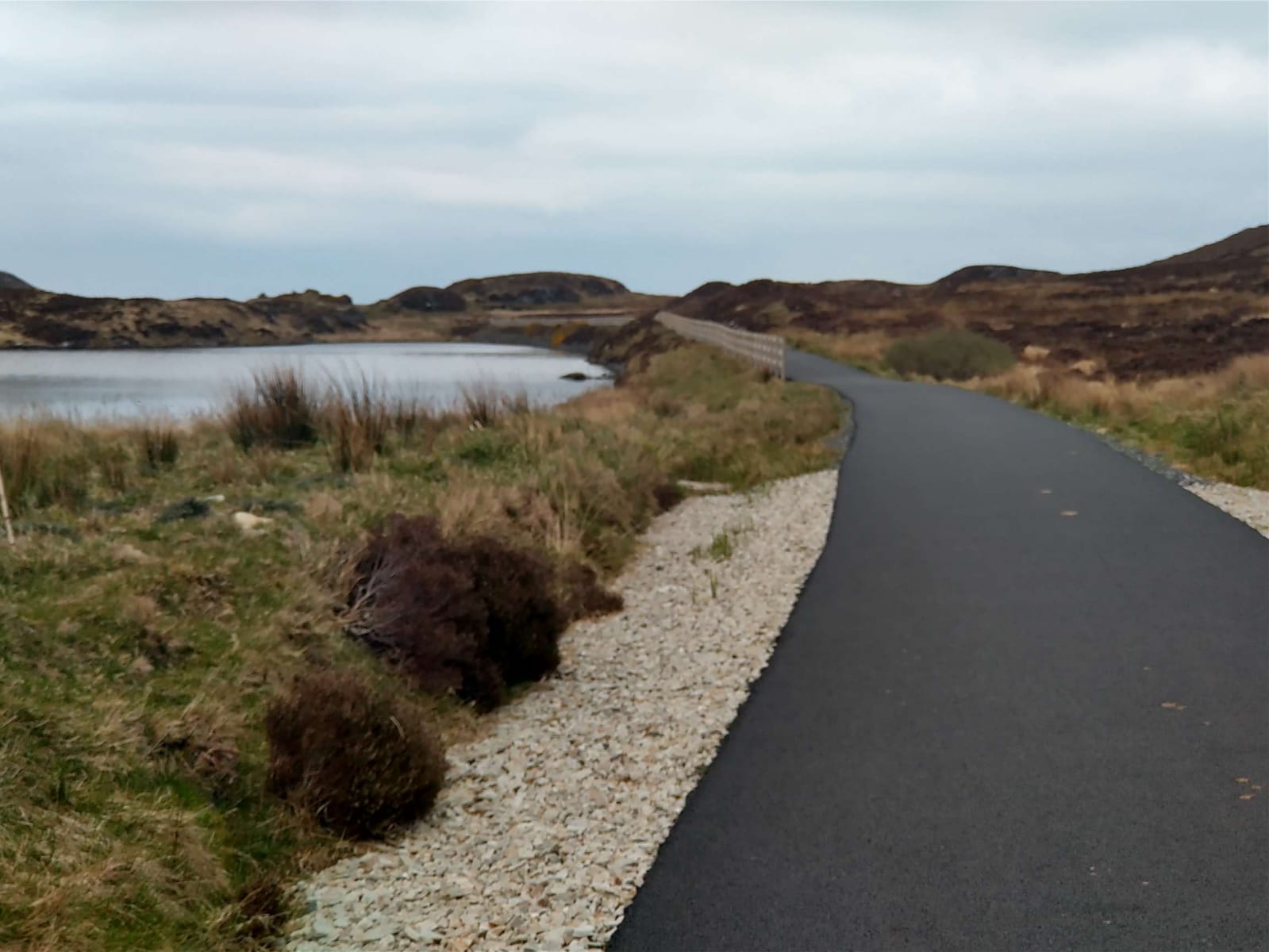
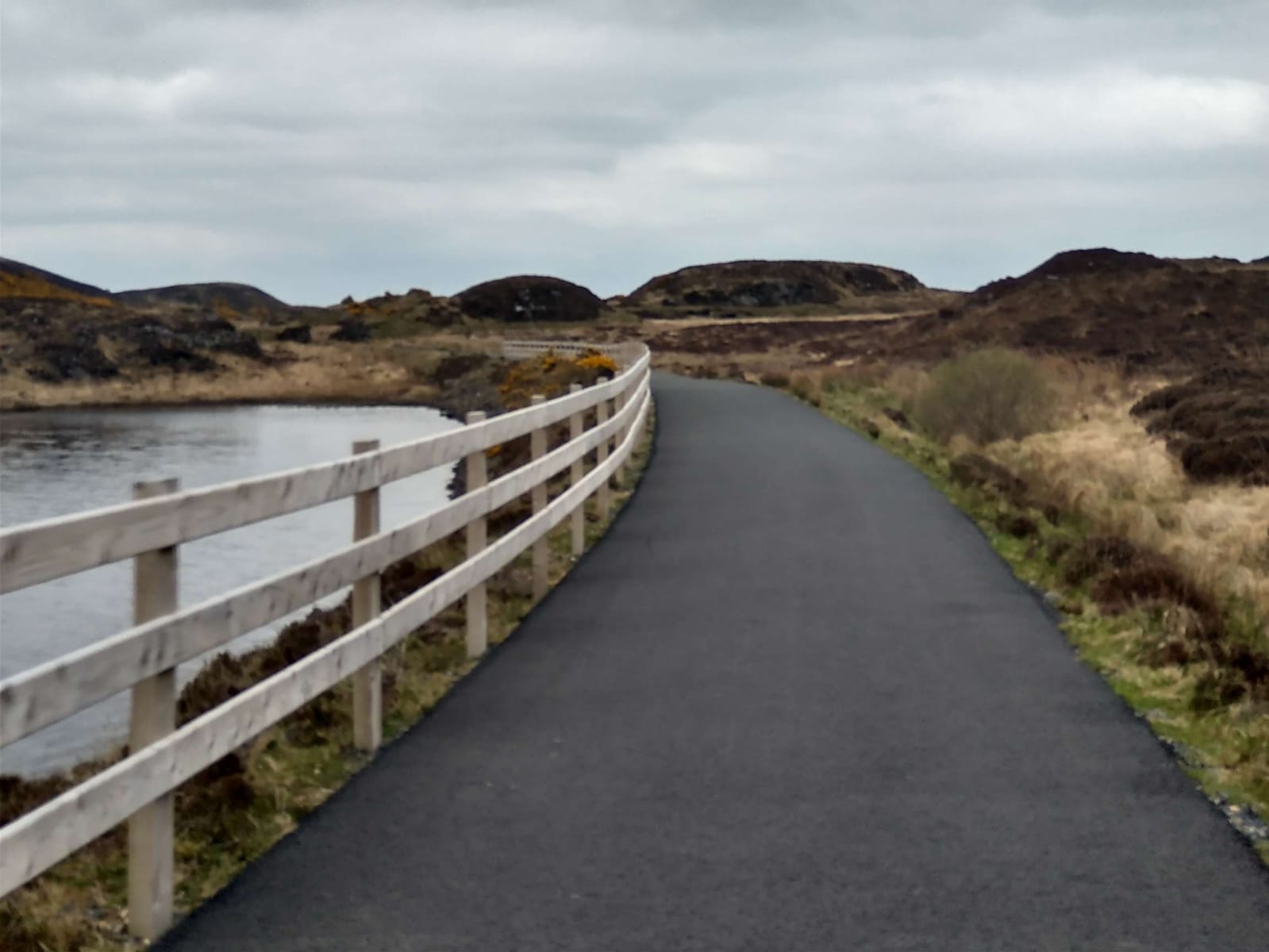
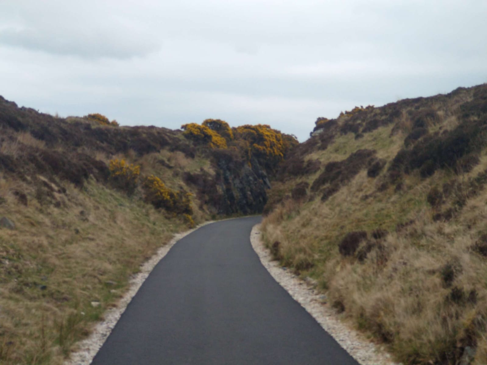
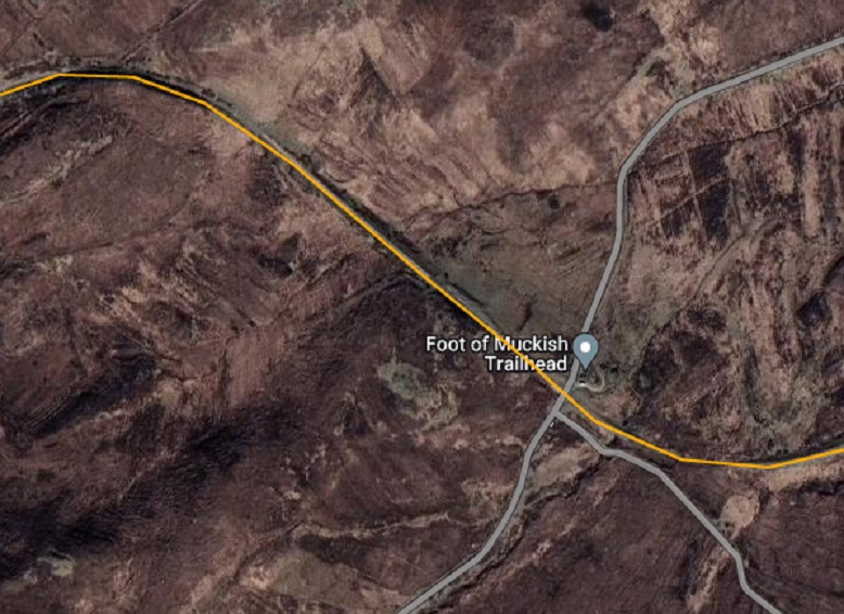
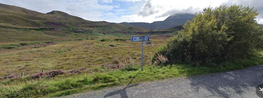
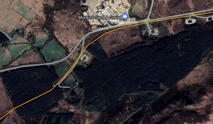
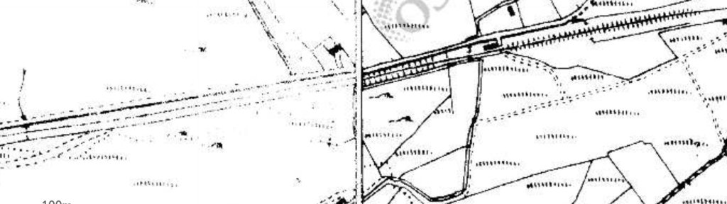
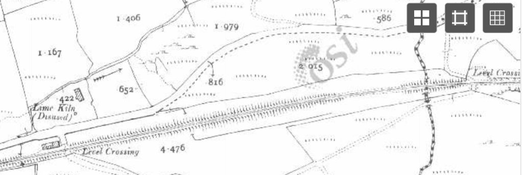
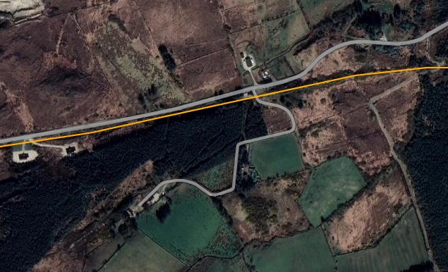
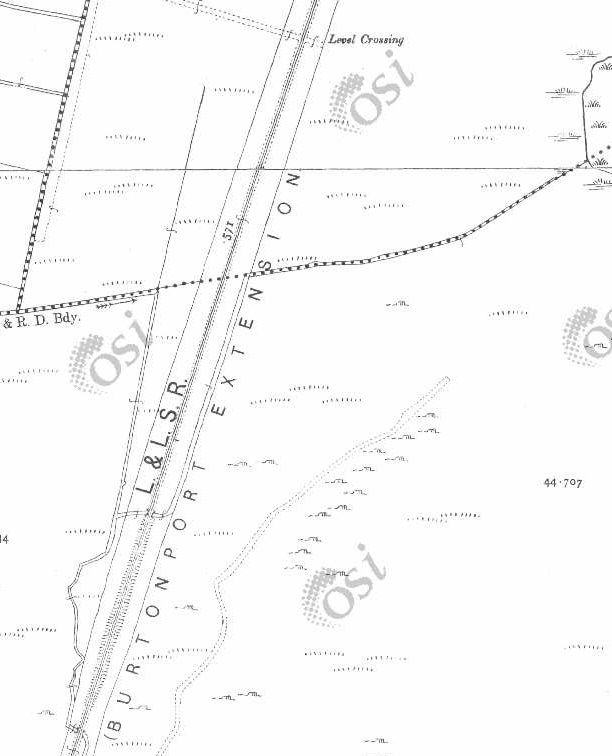
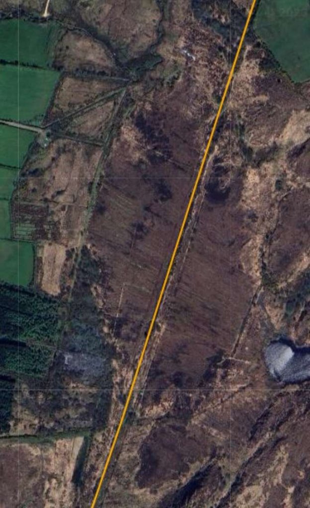
Two further views of Falcarragh Railway Station in April 2023. Notice the Station Nameplate now on the platform face of the building. [My photographs, 27th April 2023]The house facing the Railway Station. [My photograph, 27th April 2023]The Falcarragh Goods Shed/Store as shown in Patterson, Begley and Flanders book. This view is from the East. [6: p167]The view of the old goods shed/store and the passenger station building from the R256 looking East. [Google Streetview, November 2022]The approach to Falcarragh Railway Station from the East. The ford across the River Ray is to the left of the line. The station buildings were on the other side of the line facing the house visible in the distance. This photograph was shared on the Memories of Falcarragh/Gortahork Facebook Group on 30th January 2018 by Joe Begley. [9]The same location as it appears on Google Maps/Google Streetview on 2nd June 2023 on my mobile. The top half of this image is the view at the location marked by the red flag and looking in the direction of the white on blue arrow indicates in the bottom half of the image. We are looking West across the bridge over the River Ray. The trees on the left camouflage the house opposite the Station, those immediately beyond the bridge hide the Station site.[Google Streetview, August 2021]This is the only picture that I have been able to find which shows the old railway bridge from river level. It was shared by Carmel Boyle on the Memories of Falcarragh/Gortahork Facebook Group on 24th September 2021. [11]The River Ray Bridge viewed from the South, on the old road where it forded the river, in 2023. [My photograph, 27th April 2023]Looking East from the throat of the ols railway station across the moderm road bridge which replaced the old railway bridge. [Google Streetview, August 2021]The OSi 6″ Map shows the old railway heading sinously East from Falcarragh. [2]RailMapOnline shows the route of the old railway East of Falcarragh Railway Station. [10]The view East from the bridge over the River Ray. Pedestrian access is permitted beyond the fence line ahead. [My photograph, 27th April 2023]Looking East along the old railway formation. [Google Streetview, August 2021]The old railway continues to run East. [My photograph, 27th April 2023]Two level crossings and a relatively significant structure appear on the next extract from the 6″ OSi mapping of 1901. As will be seen on the Google Maps extract below, the first of these, approximately at the centre of this image, seems to be of lesser importance in the 21st century than it was at the beginning of the 20th century. The second, more Easterly, of the two crossings seems to be on a slightly more used track in the image below. The building adjacent to the crossing is a B&B now. [2]The old railway formation continues East. [10]The fenceline marks the end of the permissive length of the route over private land. The building in the distance is the B&B marked on Google Maps to the right of the satellite image immediately above. [My photograph, 27th April 2023]Closer to the B&B the line crosses a moorland river. the low parapet walls belie the substantial nature of the structre. [My photograph, 27th April 2023] The bridge carrying the old line across a moorland river, (The Lough Agher River). [My photograph, 27th April 2023]The line continues in an Easterly direction. [2]The moorland river/stream (The Lough Agher River) crossed to the West of the B&B closely follows the old railway formation; passing under it once again through the bridge shown below. [10]Two images of the bridge which we noted on the RailMapOnline.com image above. The first is taken looking East, the second looks from the South across the line of the old railway. [My photographs, 27th April 2023]Looking Southeast from the line of the Burtonport Extension close to the right edge of the RailMapOnline.com image above. The ropad/track heading South appears both on the above satellite image and on the left side of the one below. [My photograph, 27th April 2023]The old railway continues eastward. [2]The old railway continued East as this next RailMapOnline.com satellite image shows. [10]Looking East at the point where a track crosses the line of the old railway. This location appears at the right side of the satellite image above. [27th April 2023]Walking these long straight sections of the old line takes time. The distant hills only gradually appear closer. [My photograph, 27th April 2023]The view North from the track running on the South side of the old railway. The very shallow embankment carrying the line at this point can just be made out. This image comes from a point on the track at the right-hand edge of the RailMapOnline.com image above and the left-hand side of the satellite image below. [Google Streetview, October 2009]The old railway turned to the Northeast just beyond the small bridge shown in images below. [2]Another moorland stream is crossed on this next length of the route of the old railway, as shown on RailMapOnline.com, and the line turns to follow as East-Northeast alignment. [10]This picture is taken looking East from the bridge over the moorland stream mentioned above. The line curves towards the North ahead taking an East-Northeast alignment. [My photograph, 27th April 2023]The view from the Northwest of the culvert/bridge which takes the stream under the old railway formation. [My photograph, 27th April 2023]The view from the Southeast of the same culvert/bridge. [My photograph, 27th April 2023]Further round the curve seen ahead on the view along the line across the stream culvert/bridge above. [My photograph, 27th April 2023]Now beyond the curve, the line ran straight towards Lough Agher ahead. a careful study of the phto will shw that the line is crossed by a fence line ahead. [My photograph, 27th April 2023]This next extract from the 6″ OSi mapping of 1901 shows a further straight length of the line crossing a moorland track at a shallow angle by means of an ungated crossing and then following the southern shoe of Lough Agher which appears in the top-right of the extract [2]As this satellite image shows, alongside Lough Agher the line curved further to the Northeast and followed the shore of the lough. As we will see below the route of the old railway is metalled to the East of the moorland road shown here. [10]Approaching a moorland lane which crosses the old railway route at a shallow angle we reached the length of the old line which had very recently been metalled. Lough Agher is just beyond the horizon at the left of the image. [My photograph, 27th April 2023]A similar view to that shown above looking along the line of the old railway. This time from 2009. Lough Agher can just be seen close to the horizon in the centre of this image. This and the following image are provided to give an indication of the dramatic change in the accessibility which has been achieved in recent years. [Google Streetview, October 2009]Looking back West towards Falcarragh in 2009! [Google Streetview, October 2009]The line followed the southern shore of the lough. [2]A similar area as shown on the satellite imagery provided by RailMapOnline.com. [10]The mettalled track follows the southern shore of Lough Agher. [My photograph, 27th April 2023]The powers that be have provided some excellent amenities along the route. [My photograph, 27th April 2023]At the Northeast end of the Lough the railway curved round from its Northeasterly trajectory towards the Southeast. [2]A similar area as shown on the modern satellite imagery with the route of the railway superimposed in yellow. [10]These two images show the metalled footpath on the old railway line approaching the Northeast corner of Lough Agher. The line curves round between the two hills directly ahead of the camera in the second shot. [My photographs, 27th April 2023]The line beginns to curve round to the Southeast. [My photograph, 27th April 2023]The 6″ OSI survey of 1901 shows little in the way of features around the old railway as it ran first in a Southeasterly direction and then began to curve round to the Northeast again. [2]The same area as shown by RailMapOnline.com with the route of the old railway shown in yellow on the Google satellite imagery. [10] The Foot of Muckish Trailhead provides a some parking and access to a number of local footpaths. [10] Examples of the walking available can be found here. [12]
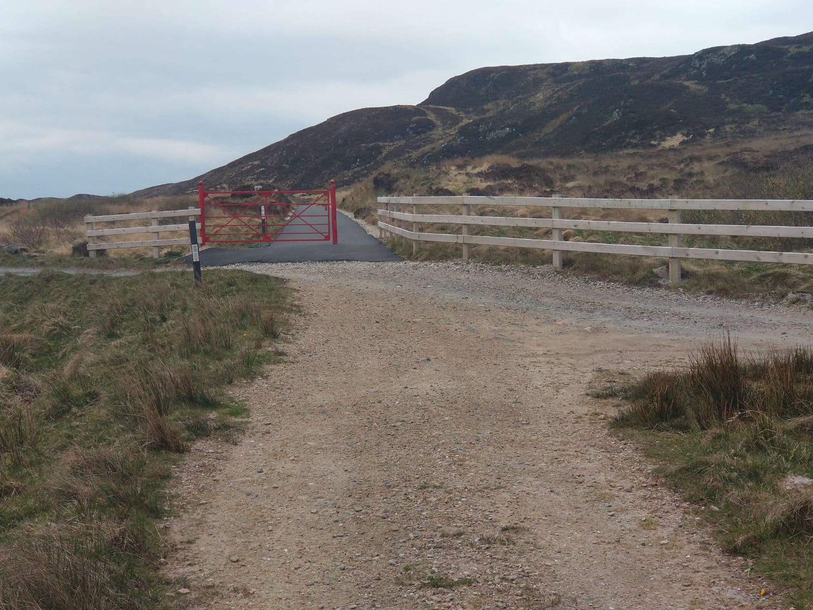
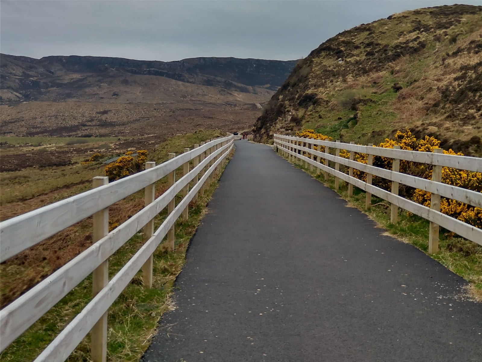
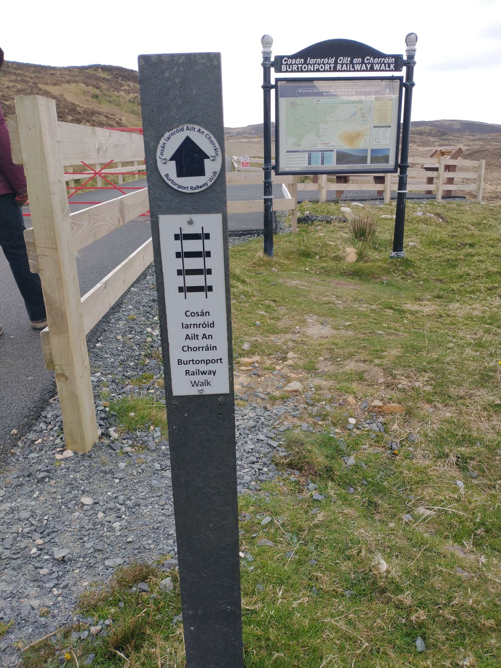
The Foot of Muckish Trailhead provides a some parking and access to a number of local footpaths. Examples of the walking available can be found here. [12] The sequence of photographs immediately below follow the tarmacked trail to the car park at the Muckish Trailhead.
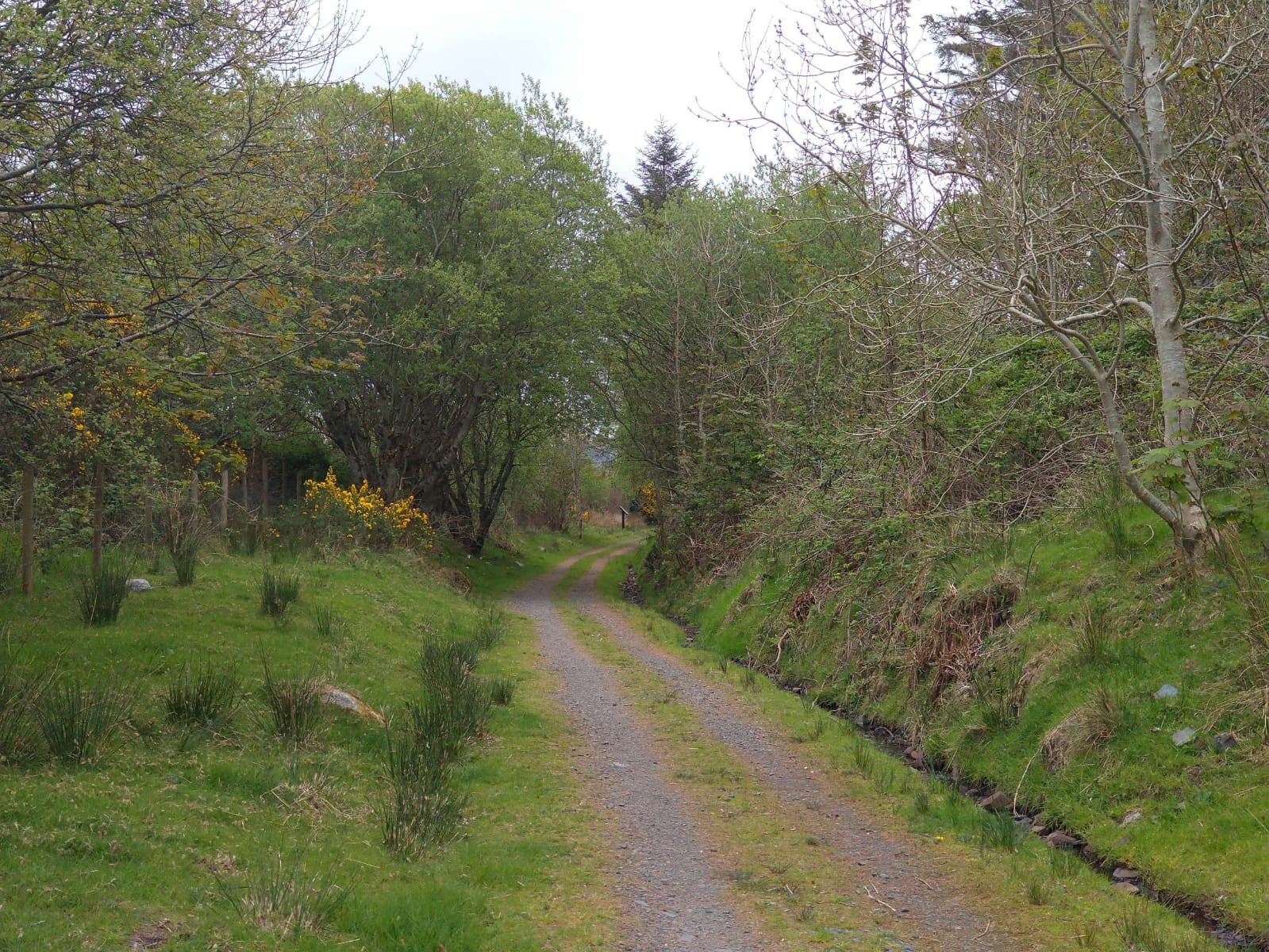
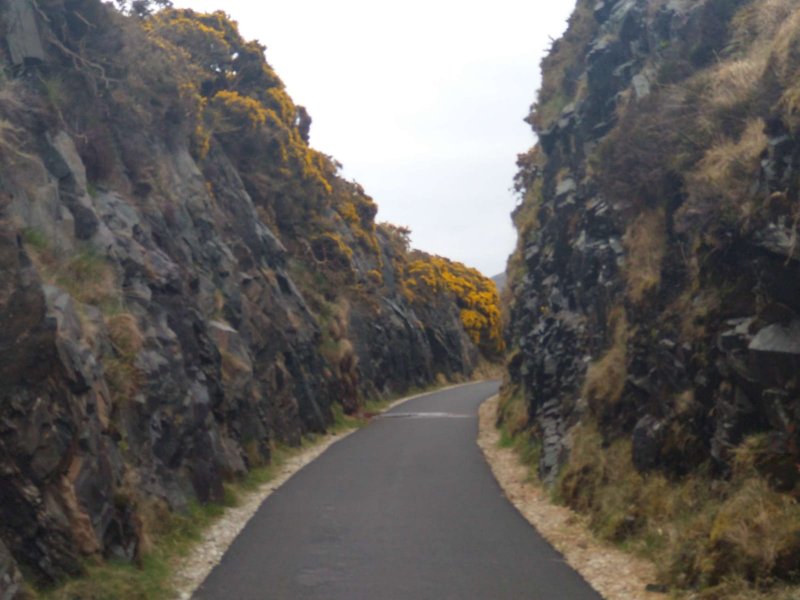
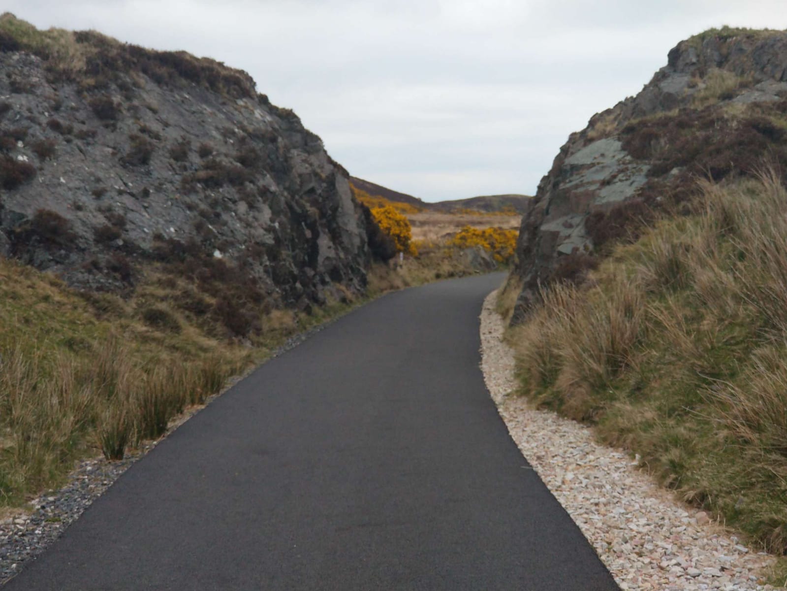
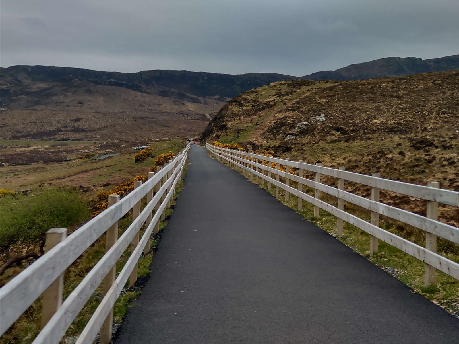
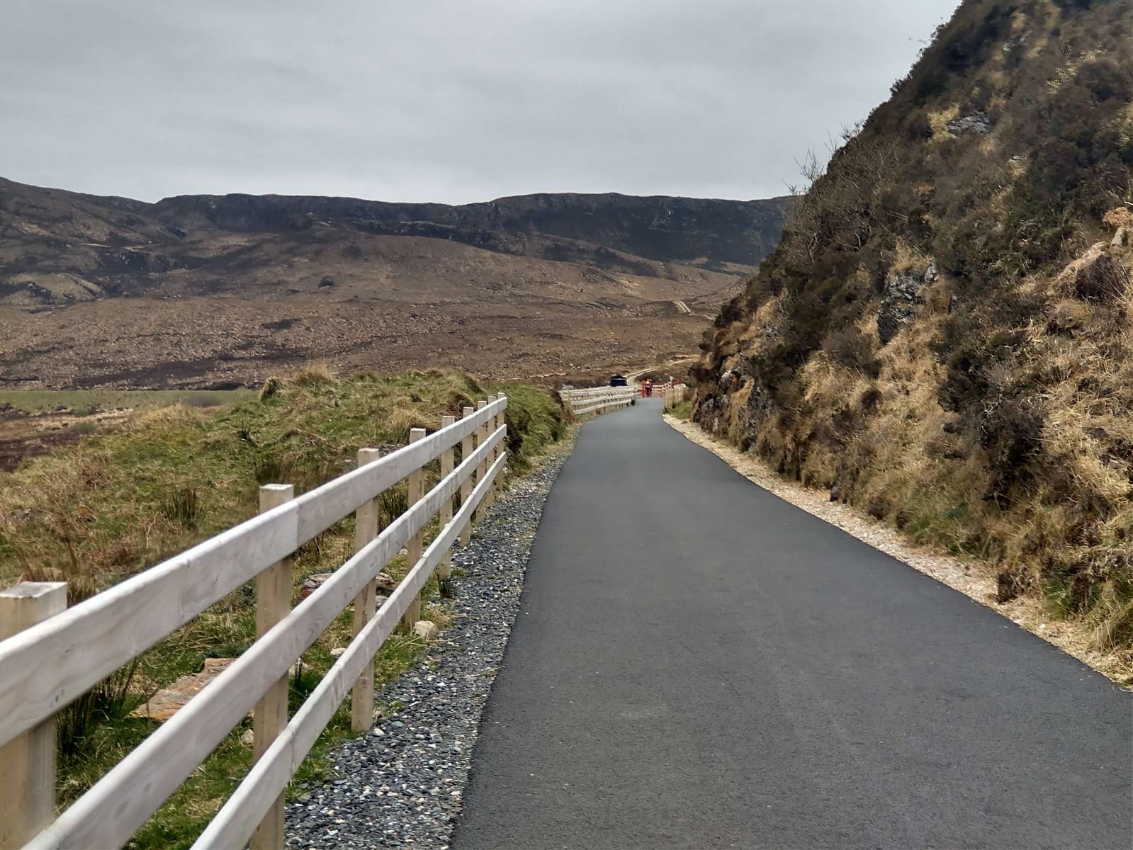
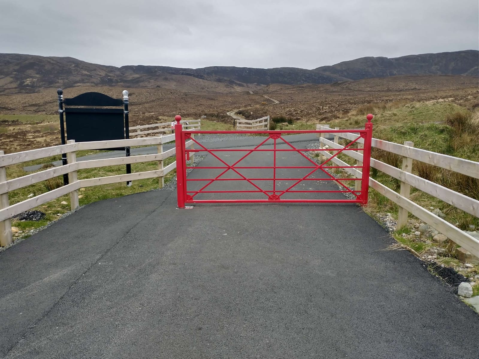
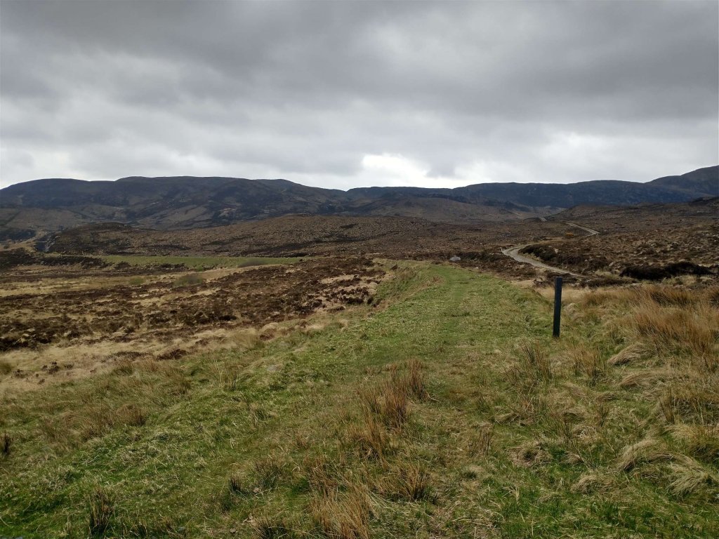
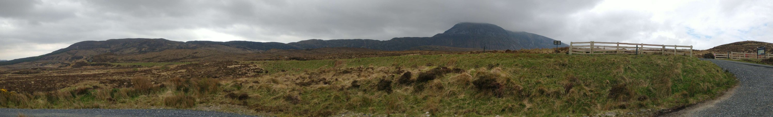
The sequence of photos above shows the route of the old railway as it appears in the 21st century, approaching the Muckish Trailhead and car park. [My photographs, 27th April 2023]The information board at the Muckish Trailhead. [My photograph, 27th April 2023]A few metres beyond the information board stands a trail marker for the tarmacked length of the old railway formation. [My photograph, 27th April 2023]The view ahead to the Northeast along the line of the old railway which runs on shallow embankment for much of the next kilometre. [My photograph, 27th April 2023]A panoramic view looking South from adjacent to the Muckish Trailhead Car Park with Muckish Mountain right-of-centre and the old railway embankment visible across the middle of the image. [My photograph, 27th April 2023]The 6″ OSI survey of 1901 now shows the old railway meandering Northeast on embankment. [2]This RailMapOnline.com extract shows the same area as it appears in 2023, as the map extract above. [10]A view of the old railway embankment from the Muckish Miner’s Path Trailhead. The line of the embankment is below the horizon and just above the top of the signpost. [Google Streetview, August 2021]Still 49km from Derry, the line continued East-northeast.The same area, once again, as in the map extract above. [10]
Before moving on, it is worth noting that Begley and Saunders [6] number the next two crossing-keeper’s cottages differently from Bell & Saunders [5]. In order to reflect both of these opinions the Bell & Saunders numbers are referred to in brackets below.
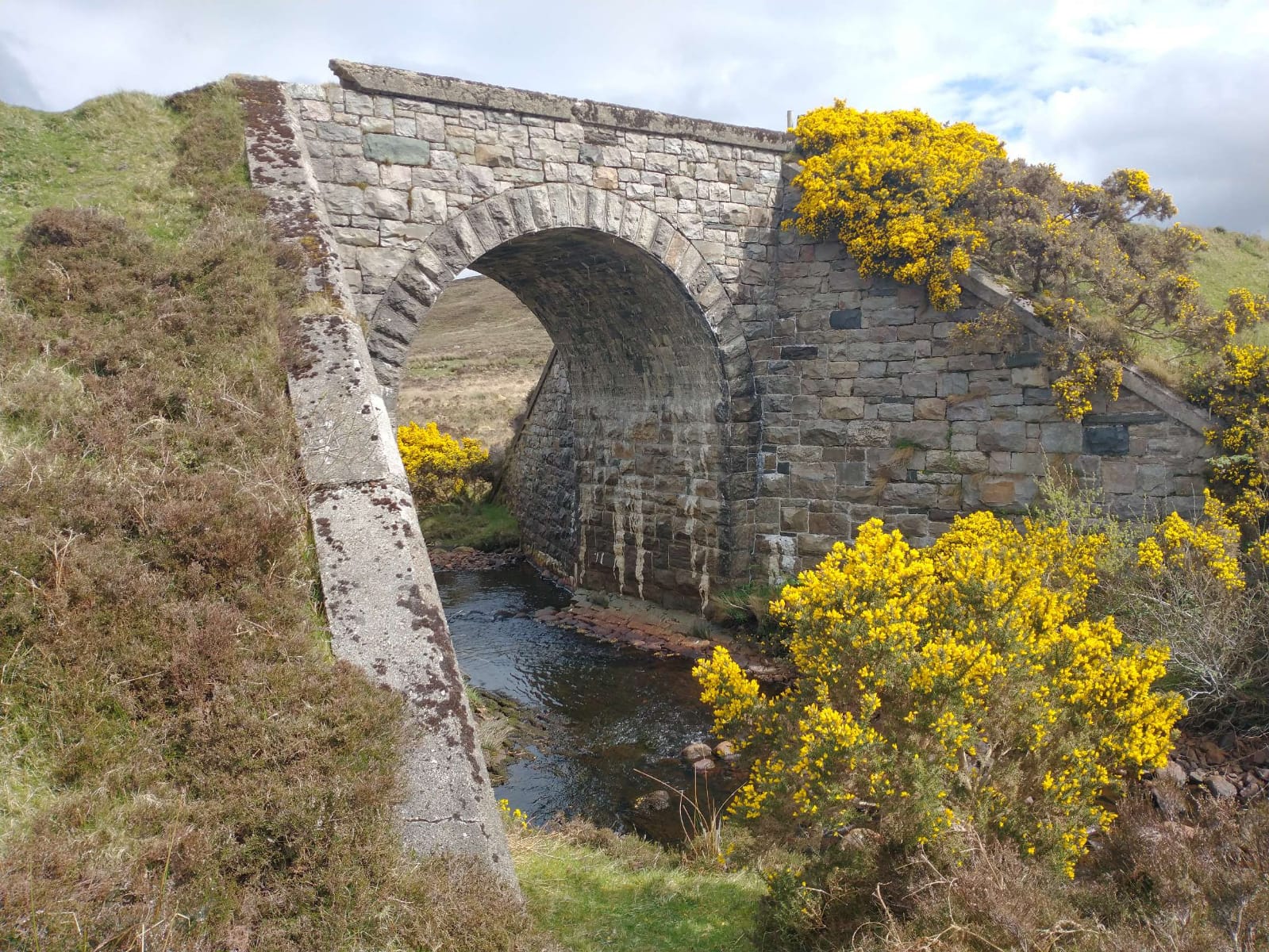
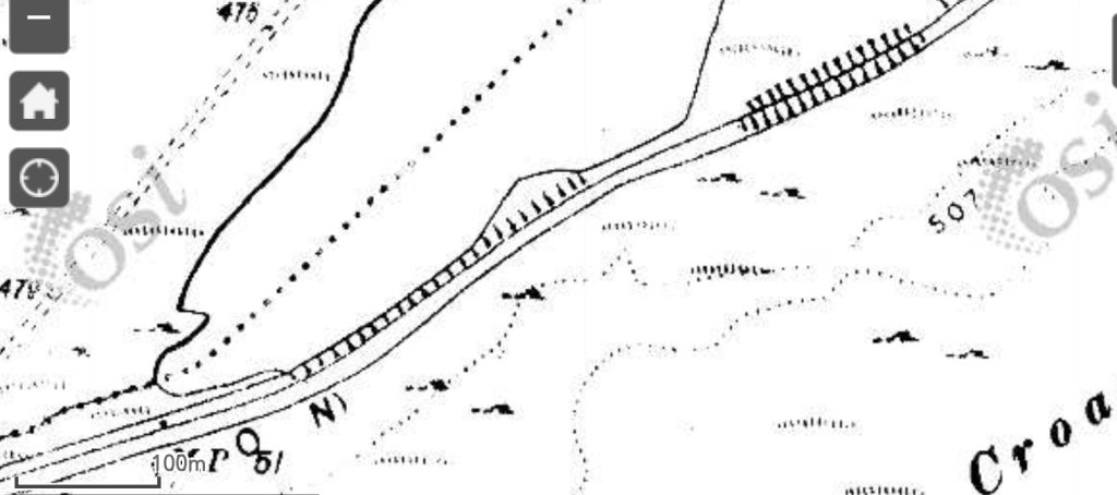
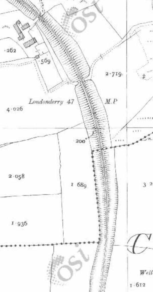
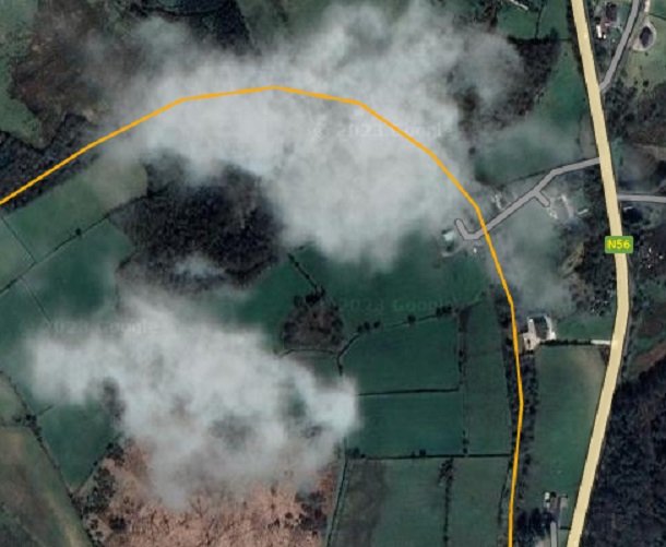
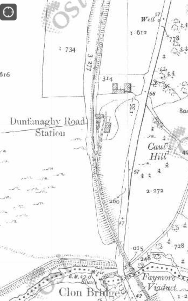
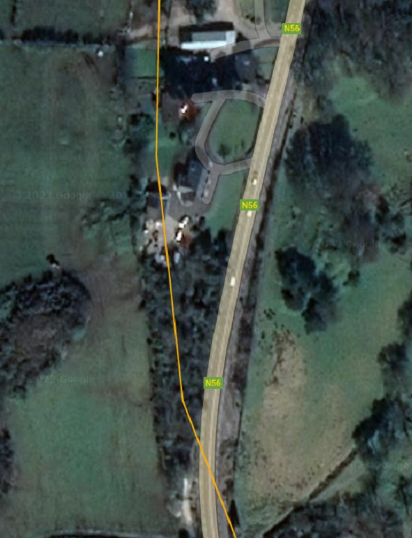
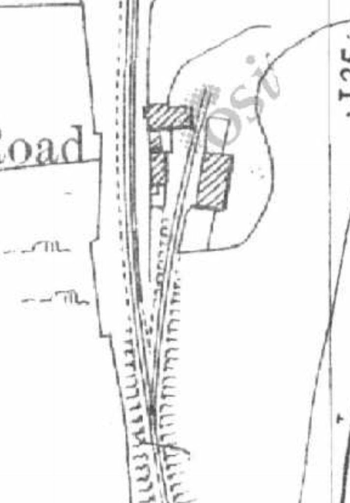
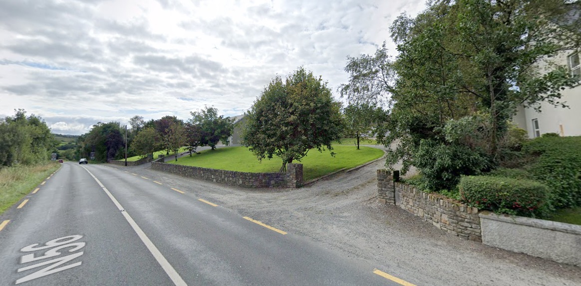
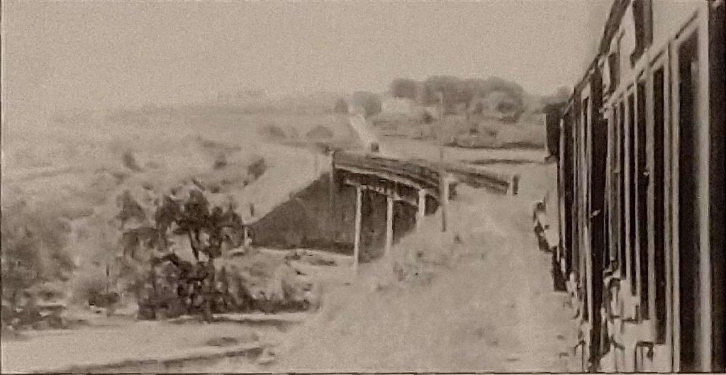
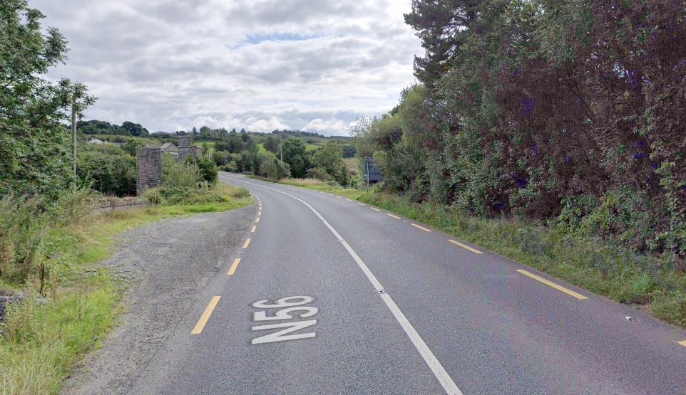
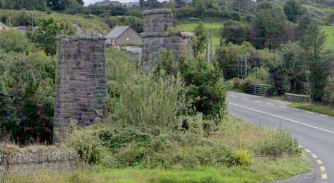
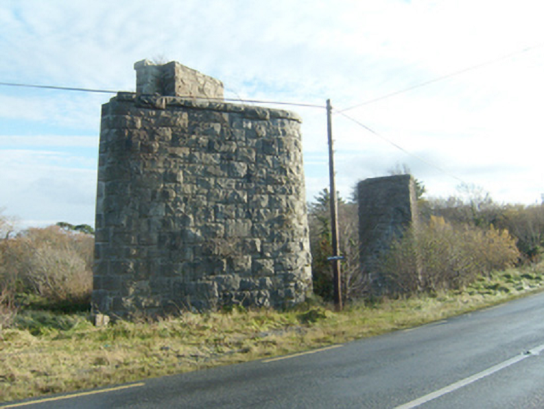
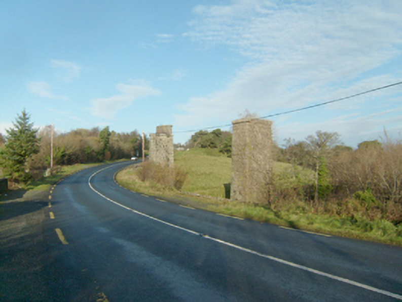
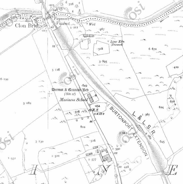
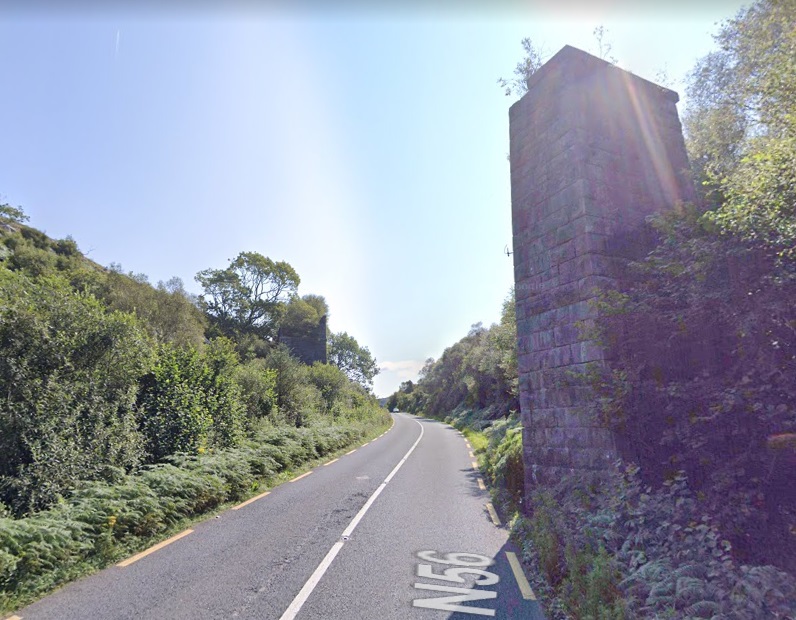
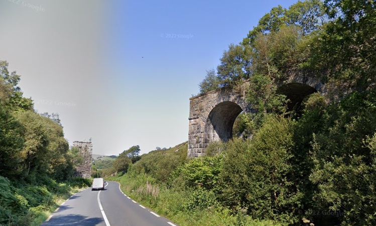
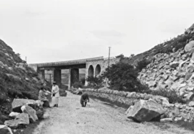
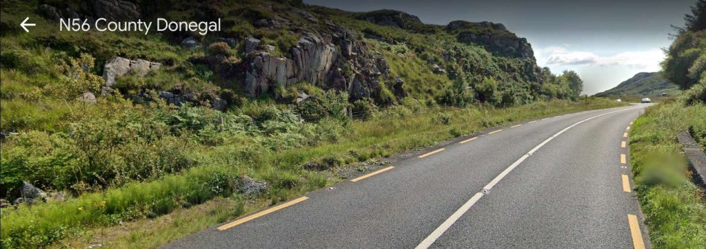
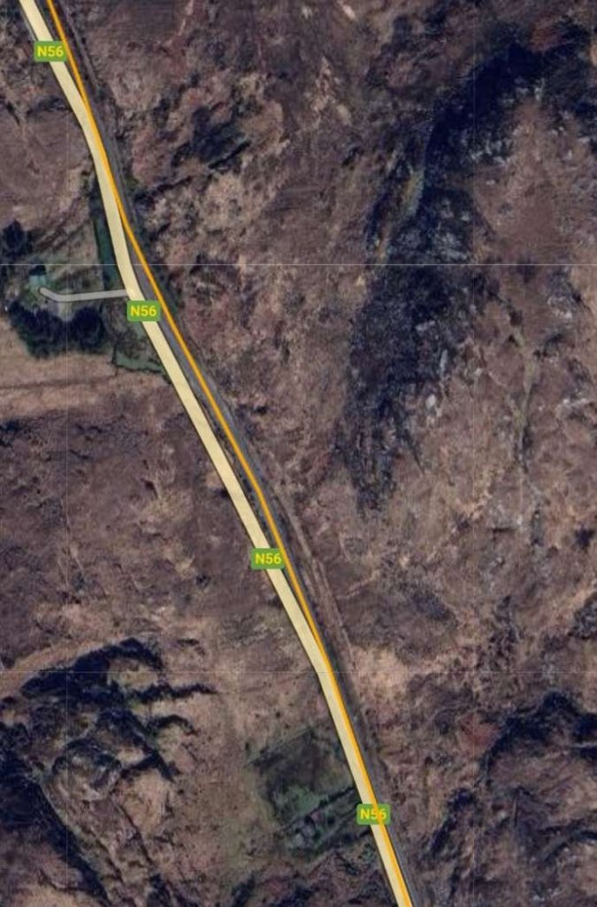
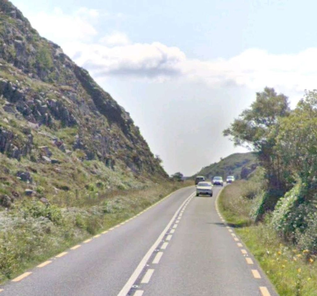
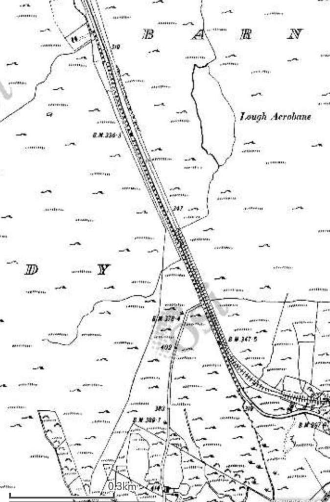
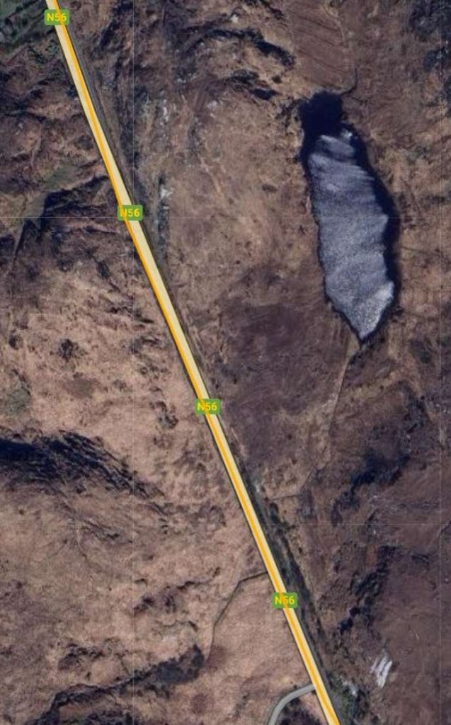
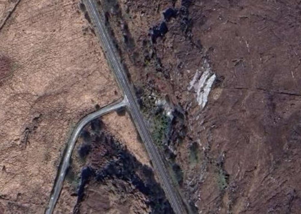
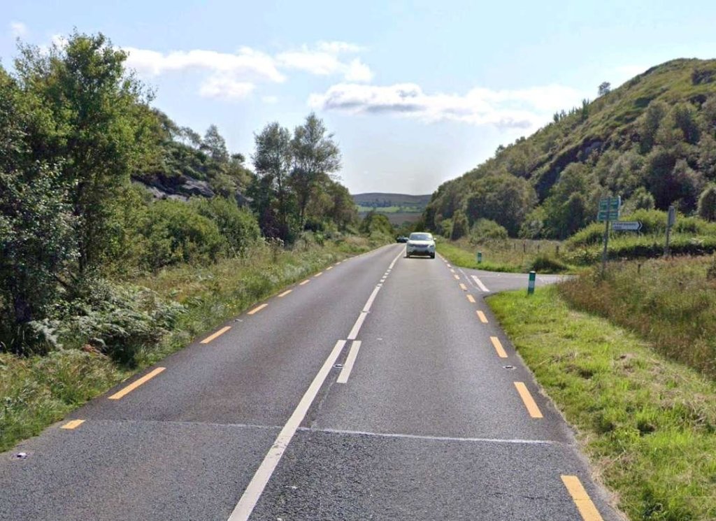
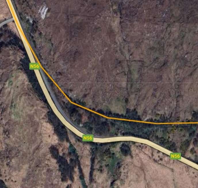
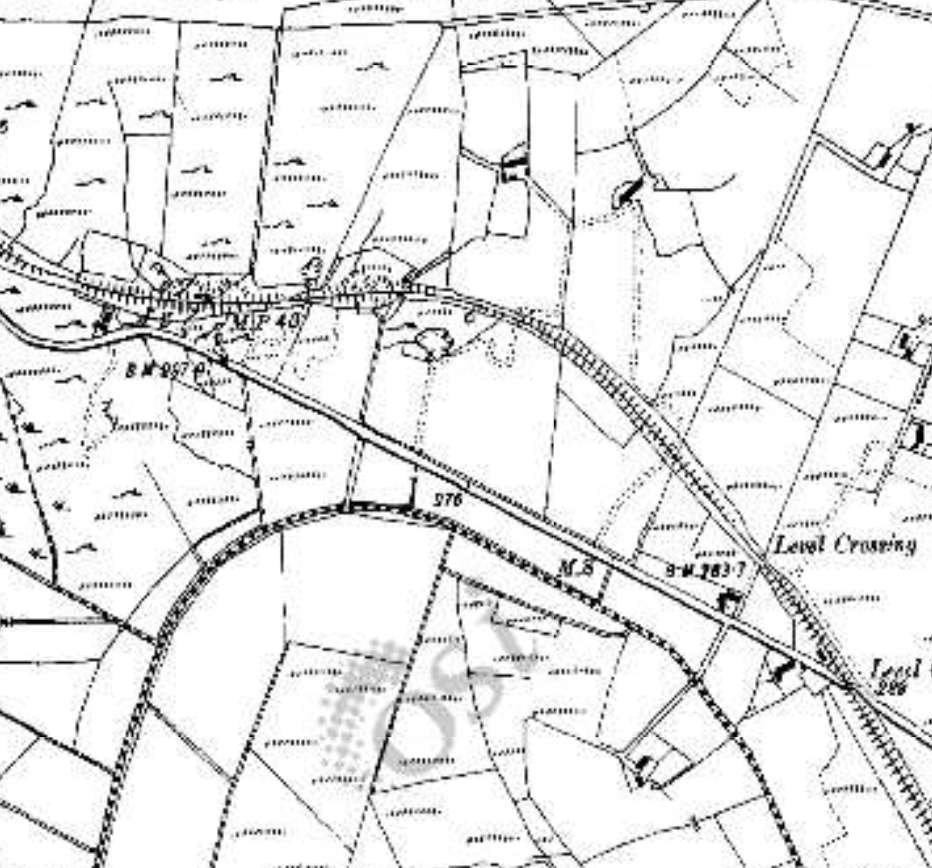
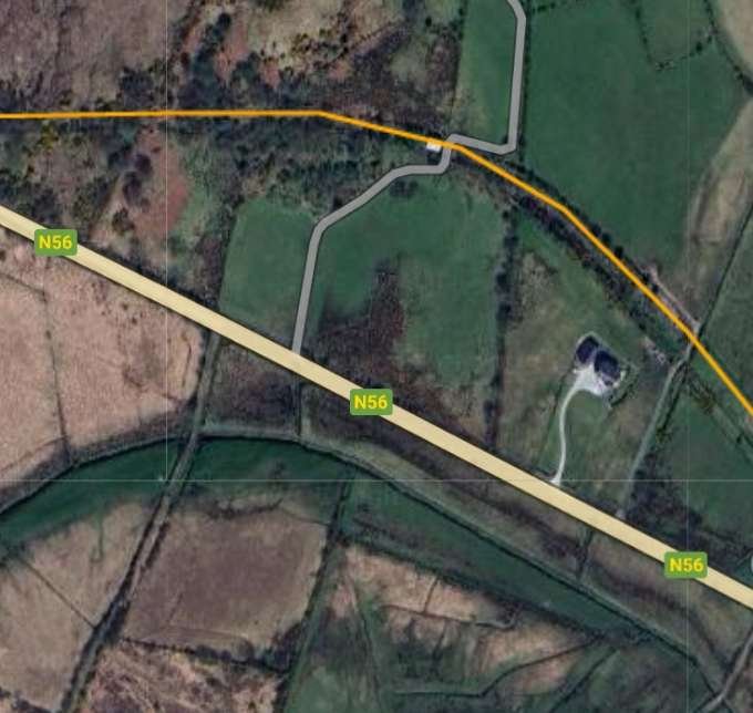
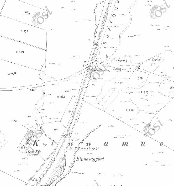
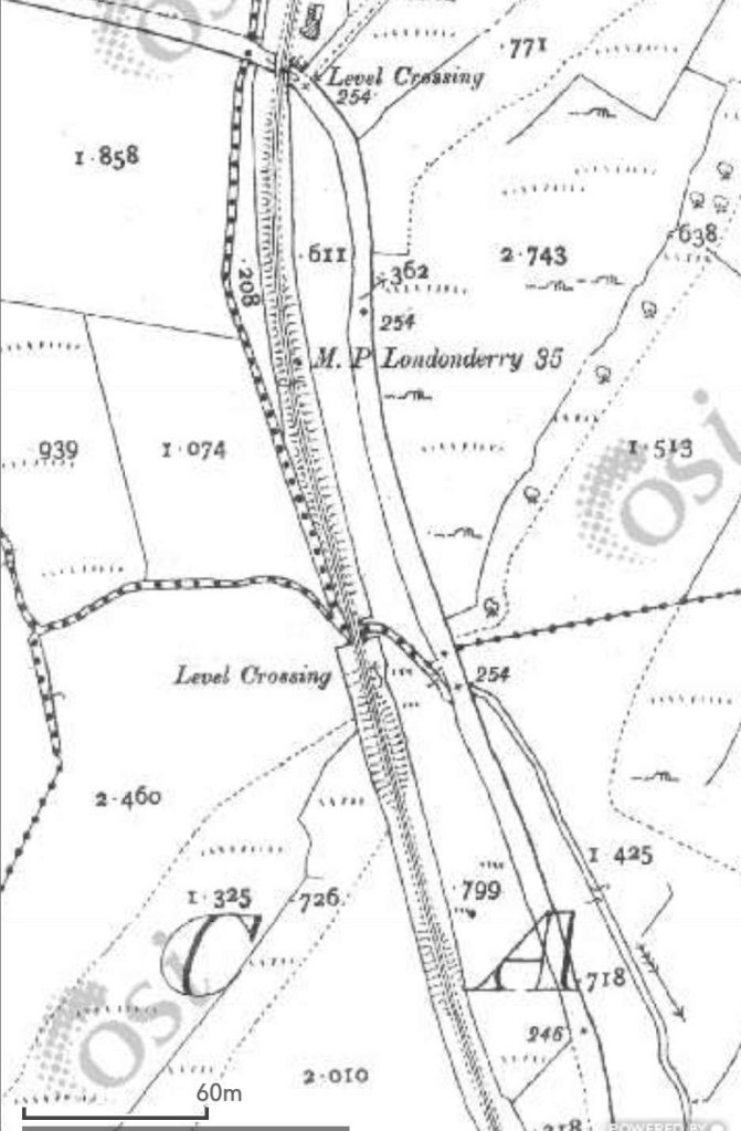
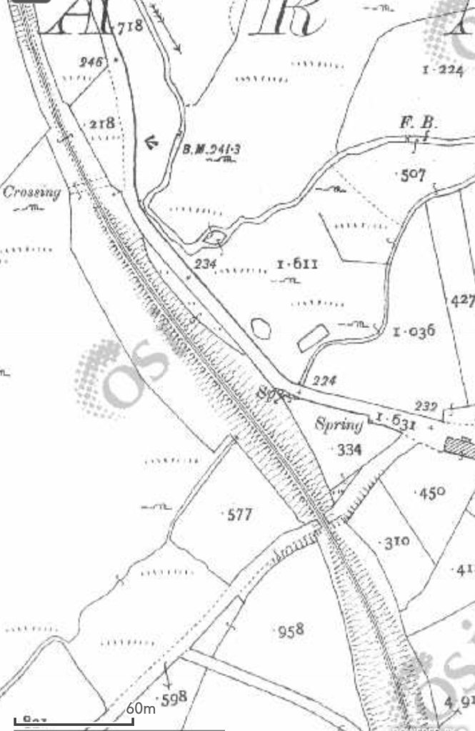
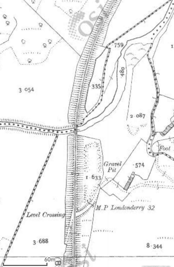
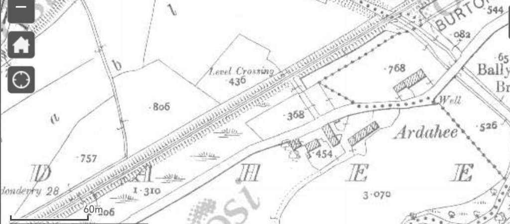
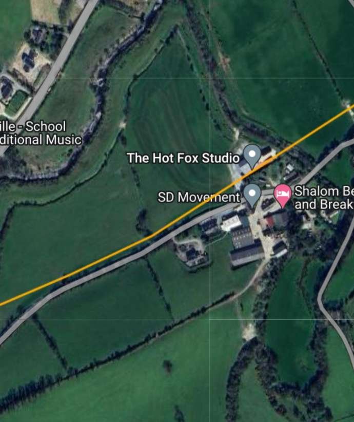
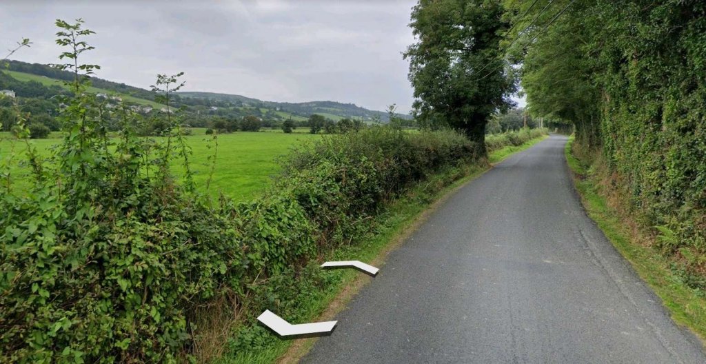
These two extracts from the OSi historic mapping show the next length of the old railway. The first is from the 6″ survey and shows Gatehouse No. 12 (14) just to the East of the join between two map sheets. The second covers a length eastwards from a point just to the West of Gatehouse No. 11 (13). It is taken from the 25″ survey. [2]This satellite image from RailMapOnline.com shows the same length of the old railway as covered by the two images above. Gatehouse No. 12 (14) is just to the right of centre and guarded access across the line on the lane which meanders around to the South of the route of the old line. [10]Gatehouse No. 12 (14) as shown on Google Maps with the old line superimposed. [Google Maps, June 2023]Two images of Gatehouse No. 12 (14) as it appeared in 2021. [Google Streetview, August 2021]Gatehouse No. 12 (14) in 2023. [My photograph, 27th April 2023]Looking back to the West along the old railway formation with renovation being undertaken at Gatehouse No. 12 (14) which encroaches across the line if the railway. [My photograph, 27th April 2023]Looking East along the old railway formation from the track outside Gatehouse No. 12 (14). [My photograph, 27th April 2023]The 25″ OSi survey of 1901 shows the old line continuing first in an Easterly direction and then turning to the Northeast. [2]RailMapOnline.com shows the same length of the old line as the two map extracts above. [10]A much closer view of Gatehouse No. 11 (13) as seen on Google Maps satellite imagery. [Google Maps, June 2023]Gatehouse No. 11 (13) at the turn of the 21st century. [6: p166]Gatehouse No. 11 (13) in 2023. The site around the building was relatively rundown. [27th April 2023]This sequence of three map extracts from the OSi 25″ mapping show the line maintaining its Northeasterly direction of travel. [2]The same length of line is represented by this single extract from RailMapOnline.com’s satellite imagery. [10]These two map extracts are both taken from the OSi 25″ 1901 Survey. They show the line curving round from an Northeasterly trajectory to a Southerly one. [2]The last two map extracts from the 25″ 1901 OSi Survey are covered by the scope of this satellite image, the old railway route is shown again by the yellow line. [10]The old line continued South. This extract from the 25″ OSi survey of 1901 shows both Dunfanaghy Road Station and Faymore Viaduct. [2]The same location in 2023 as shown on RailMapOnlone.com’s satellite imagery with the route of the old railway superimposed. [10]Dunfanaghy Road Railway Station as shown on the 25″ OSi mapping of the turn of the 20th century. The station had no passing loop, but did have a single goods siding which could be used to allow trains to pass. [2]The view Southwest from the N56 into what was Dunfanaghy Road Railway Station. [Google Streetview, August 2021.Faymore Viaduct seen in 1937 from a train which has just left Dunfanaghy Road Station heading for Letterkenny. [5: p70]A little further South on the N56, we get a first view of what remains of Faymore Viaduct. [Google Streetview, August 2021]The two remains stone piers of Faymore Viaduct. [Google Streetview, August 2021]Two images of the remaining parts of Faymore Viaduct. [13]
The National Inventory of Architectural Heritage records the structure as follows:
Faymore Viaduct is now a “series of freestanding piers formerly supporting multiple-arch railway viaduct, built c. 1903, formerly carrying the Letterkenny to Burtonport section of the Derry (Middle Quay) to Burtonport railway line over road and the Faymore River. Viaduct now out of use with railway deck now removed (closed 1947). Piers constructed squared and snecked stonework with drafted margins to corners, and with projecting stringcourse to girder level. Spans road (N56) and Faymore River in the rural landscape to the north\north-west of Creeslough.
This series of impressive piers that formerly supported a long railway viaduct that spanned the road and the Faymore River. The piers are well-built using good-quality mildly rock-faced and snecked stone masonry that is a feature of Victorian and Edwardian railway engineering and architecture in Ireland. The piers now stand almost like pieces of sculpture, and are interesting features of some historic merit in the scenic rural landscape to the north\north-west of Creeslough. The viaduct was originally built to serve the Letterkenny to Burtonport section of the Derry (Middle Quay) to Burtonport railway; this section was built by the Letterkenny to Burtonport Extension Railway Company and was opened in 1903. This railway line was built to the 3 foot narrow gauge, a feature of many of the former railway lines in Donegal. The railway line was closed from Gweedore to Burtonport in 1940 but the Letterkenny to Gweedore section remained in use until 1947. This former railway forms part of a group of structures associated with this railway line in the area, and is an integral element of the built heritage and transport history of County Donegal. It was probably built to designs by Taggart Aston of Belfast who was responsible for the design and construction of many of the bridges on the Letterkenny to Burtonport narrow gauge railway line.” [13]
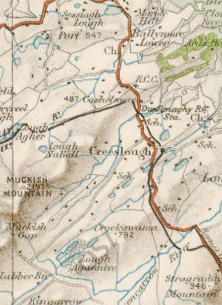
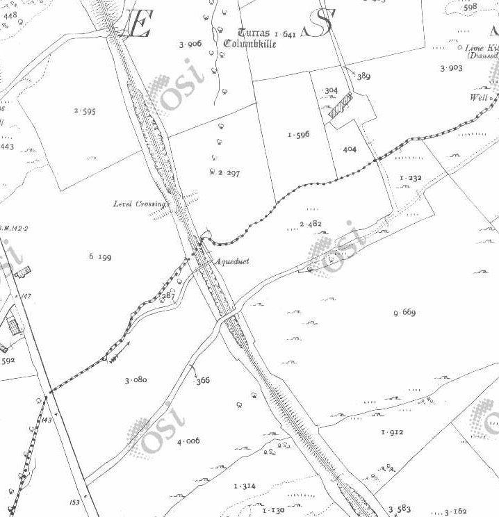
To the South of the River Faymore the old railway line continued in a southerly direction towards Creeslough Railway Station just a short distance to the South.
This series of three map extracts, from the 25″ OSI mapping of 1901, show the length of the line from Faymore Viaduct (at the top of the first extract) to Creeslough Railway Station which just creeps onto the bottom-right corner of the third extract. [2]This satellite image from RailmapOnlime.com shows the same length of the old railway as appears in the three map extracts above. [10]
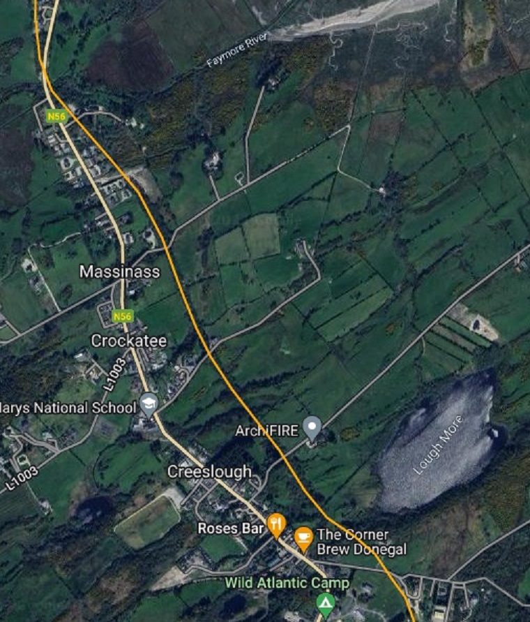
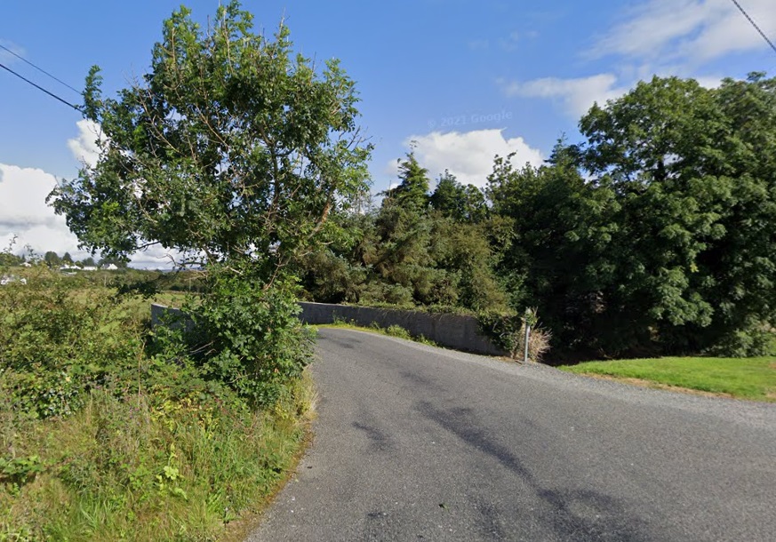
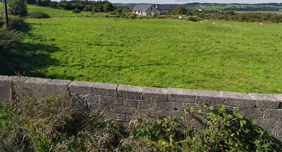
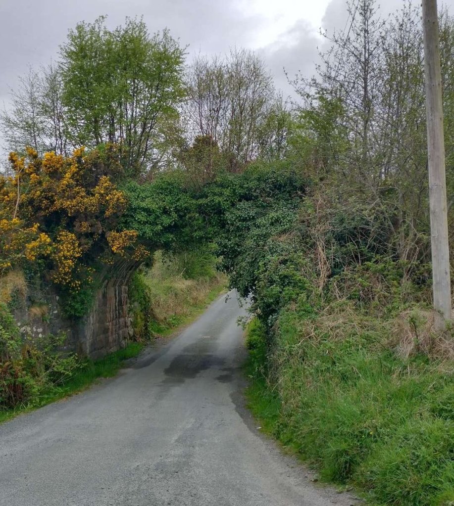
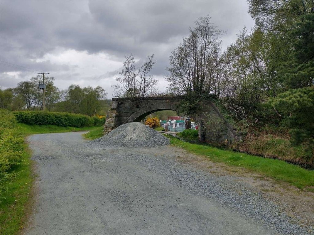
At Massinass a side road leaves the N56 and would once have passed under the old railway. The bridge abutments still remain.
The abutment of the old bridge remain. This view is from the West. [Google Streetview, August 2021]The same bridge but from the East. [Google Streetview, August 2021]
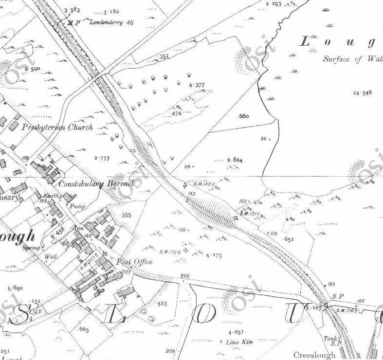
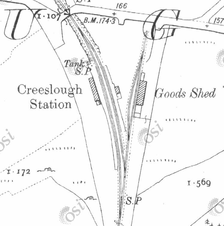
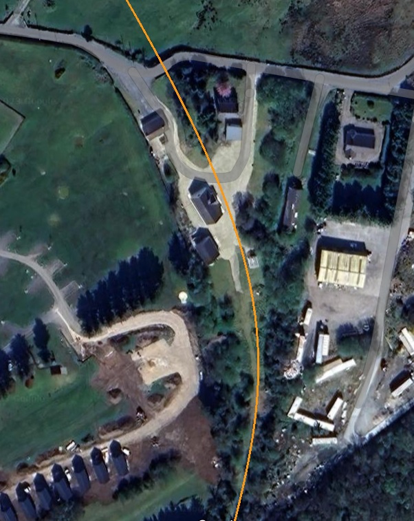
This picture of Creeslough Railway Station is embedded from Andrew Lance’s flickr stream. This is the view from the North end of the station some time after closure. [18]The view South from the road bridge along the cutting that defined the throat of Creeslough Railway Station. The rock cutting is now filled with vegetation. [Google Streetview, August 2021]Creeslough Railway Station site, seen from the East, as it appeared in 2021. The old railway line curved round behind the house and garage seen here. [Google Streetview, August 2021]The good shed is still standing. This telephoto image was taken from the road to the North of the station site and is as a result not as sharp as it could be. [Google Streetview, August 2021]The view South from Creeslough Railway Station taken from the train. The engine is No. 12 and it heads the 8.30am service from Burtonport to Letterkenny on 24th June 1937. [5: p68]
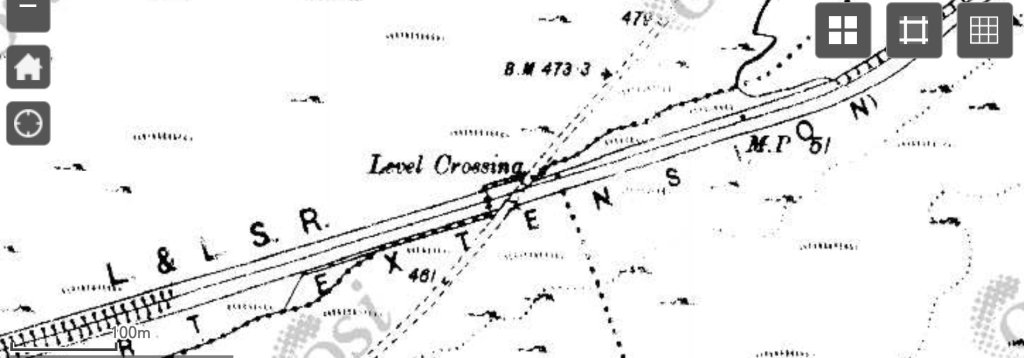
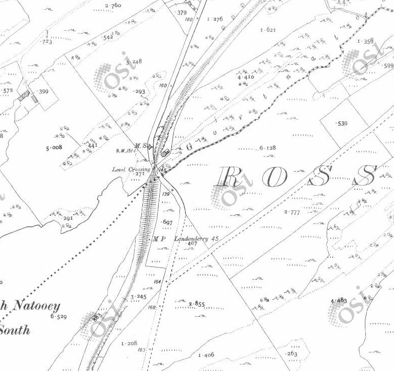
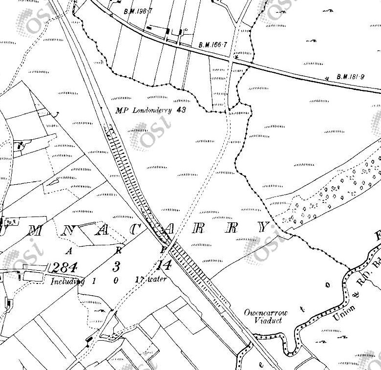
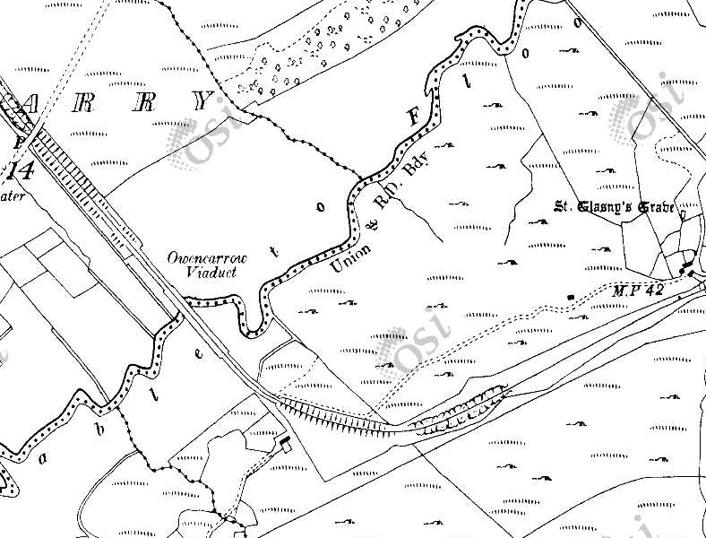
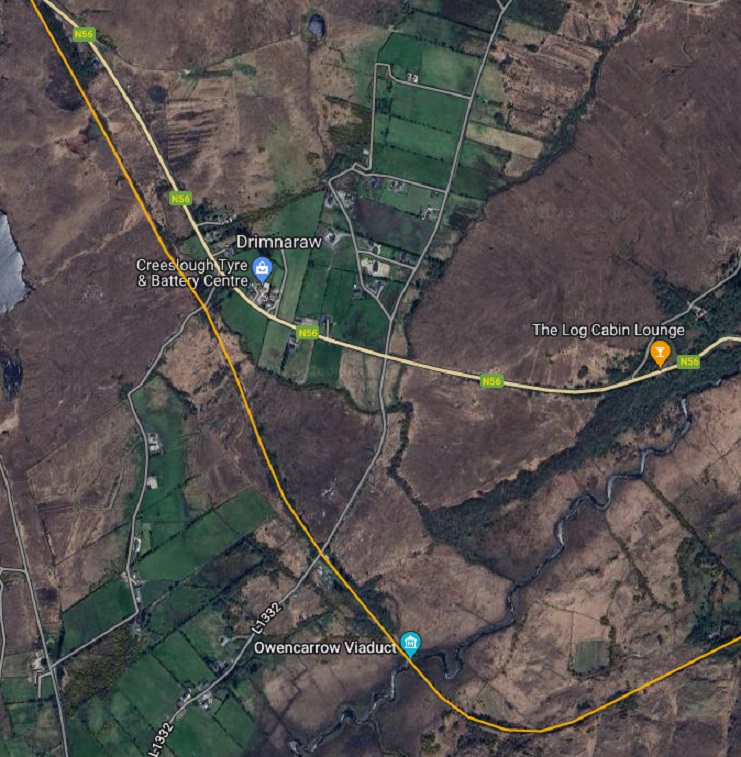
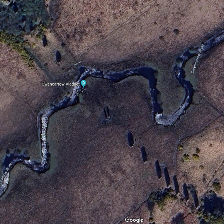
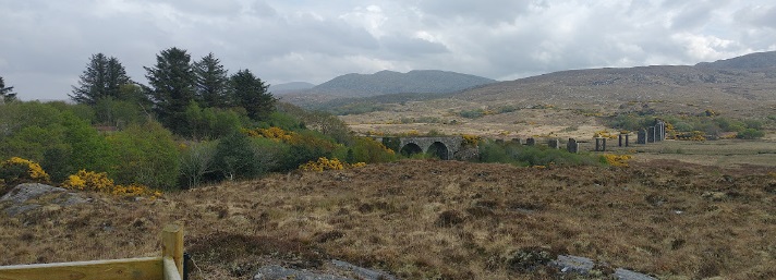
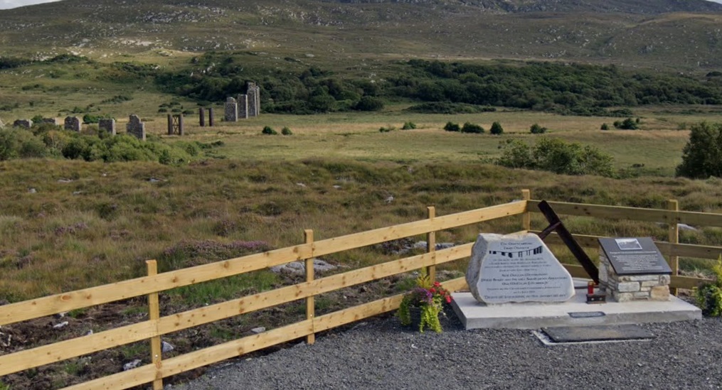
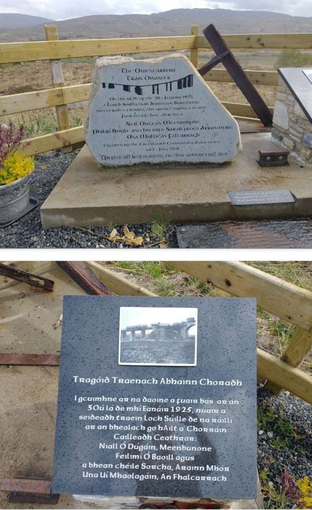
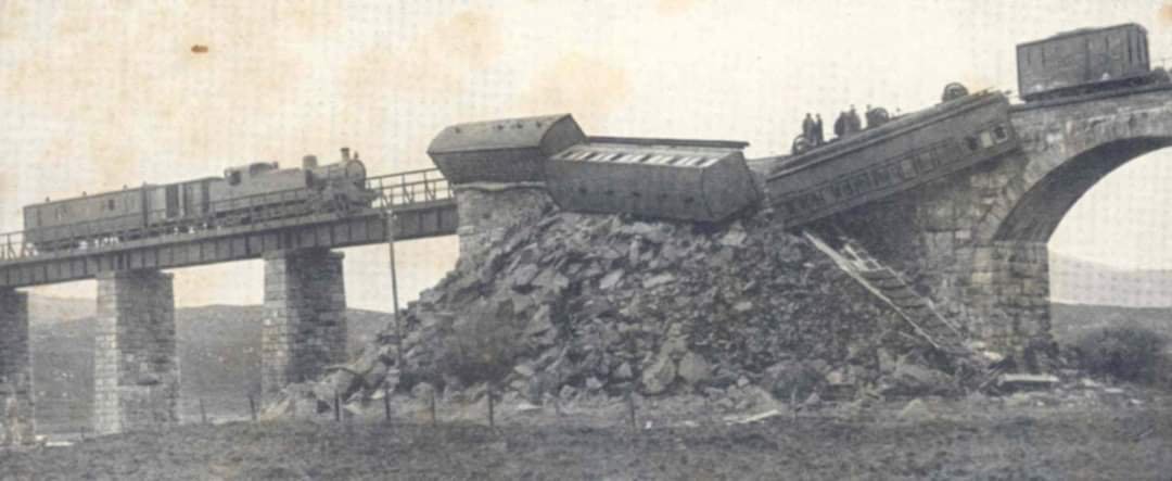
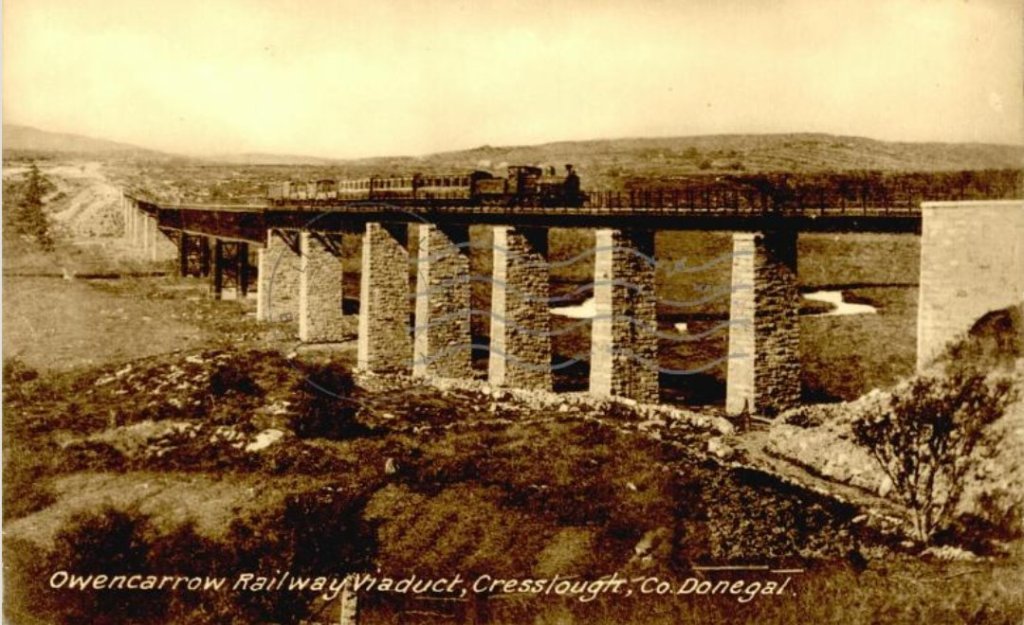
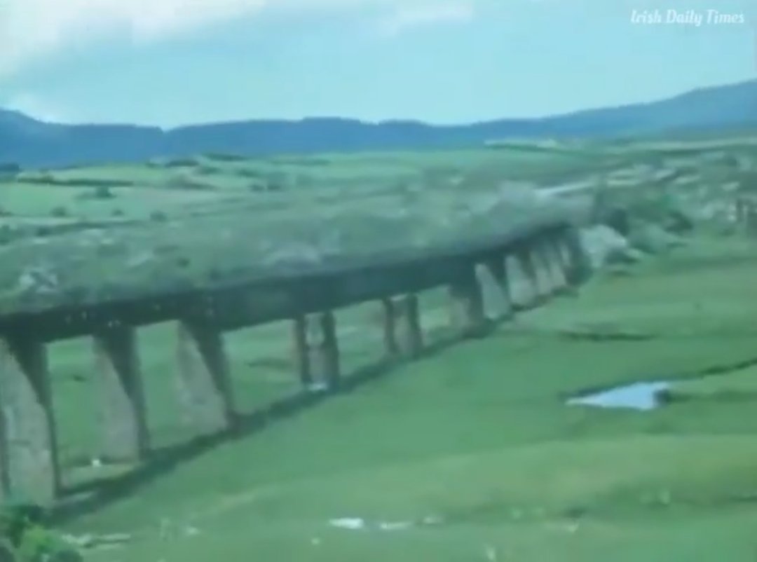
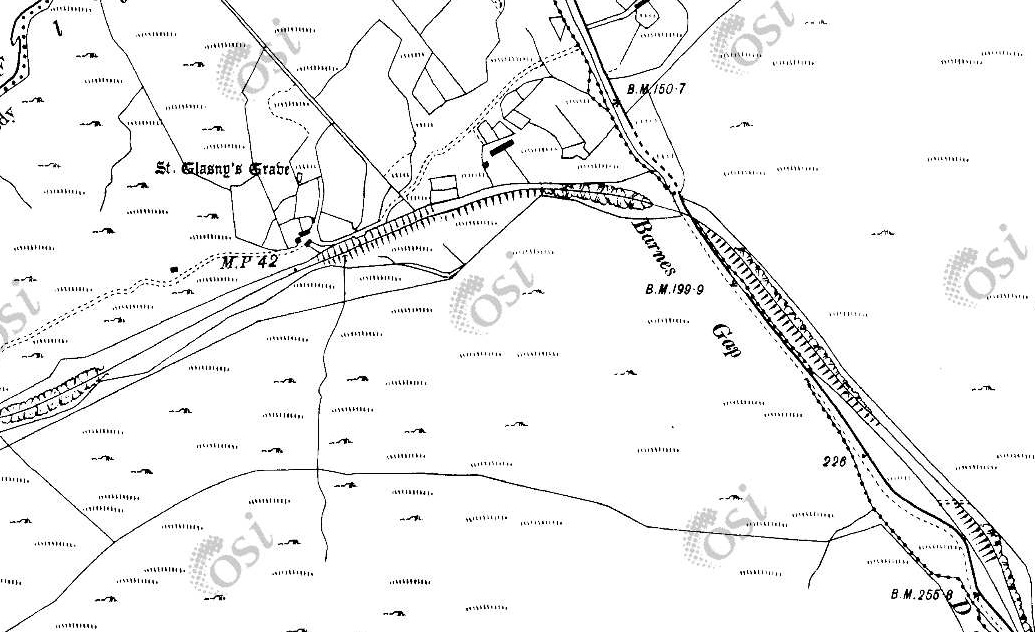
South of Creeslough Station the line curved round to the Southwest and then back towards the Southeast heading for the Owencarrow Viaduct which was the site of a notorious railway accident in the early 20th century. [14] The first three map extracts below are taken from the 25″ survey of 1901. The next map sheet at that scale is not available online at present. The subsequent map extracts come from the 6″ OSi survey of the early 20th century.
These two map extracts show the old railway heading Southwest and then running along the East shore of Lough Natooey South (named Creeslough on modern satellite imagery).This RailMapOnline.com satellite image covers the same length of the old railway as covered by the map extracts above.This Google Streetview image from 2009 shows the route of the old railway. The photo looks North from the point where the old railway line met the old mainroad, now the N56). The drive on the right of the picture follows the line of the old railway. In later images the vegetation has grown considerably to mean that this view is not available in the 2020s. [Google Streetview, August 2009]
For a short distance, the old railway and the old road ran alongside each other and then the railway crossed the old road at a level crossing with an adjacent crossing-keepers cottage (No. 10), which can be seen on the enlarged map extract, before then running along the shore of the Lough Natooey South (Creeslough).
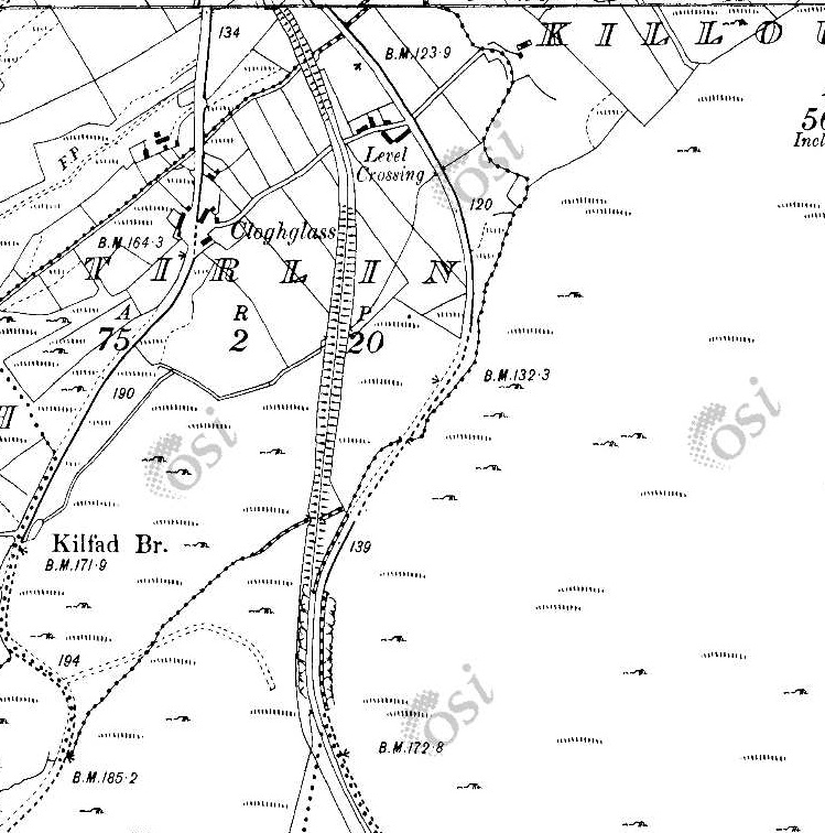
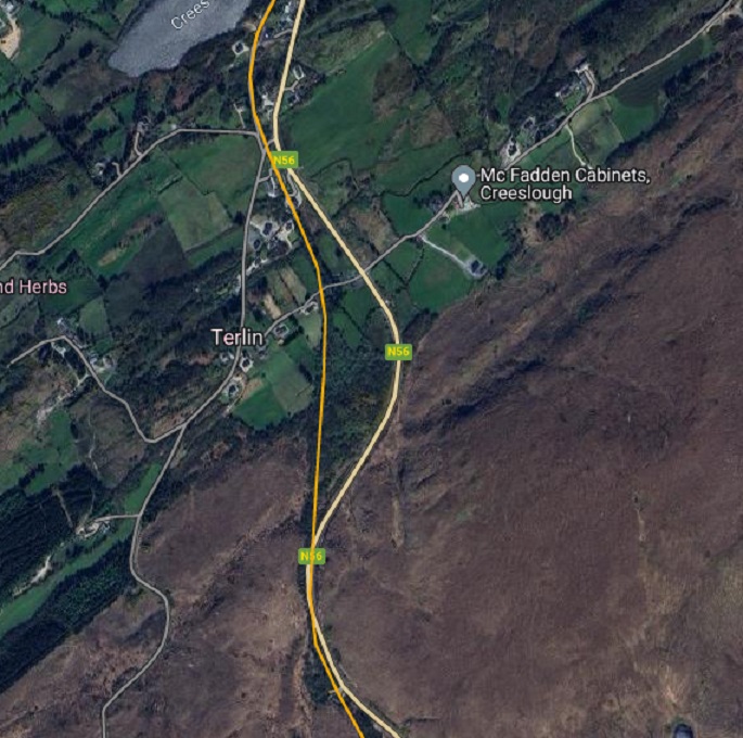
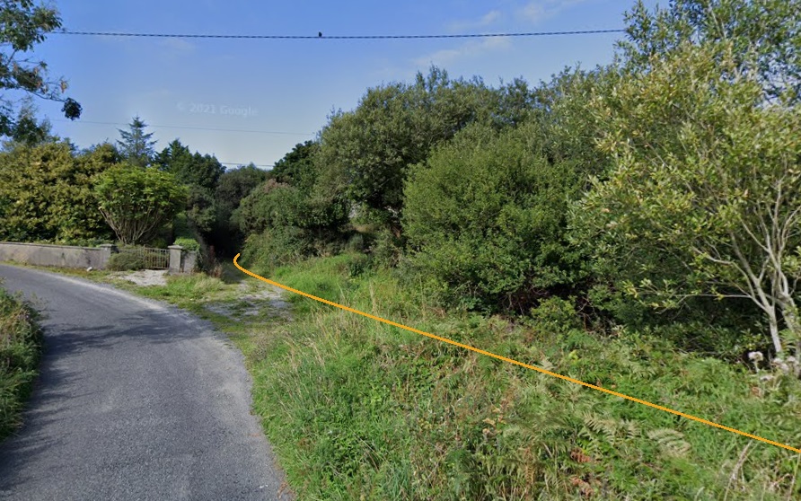
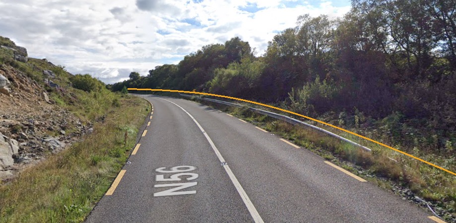
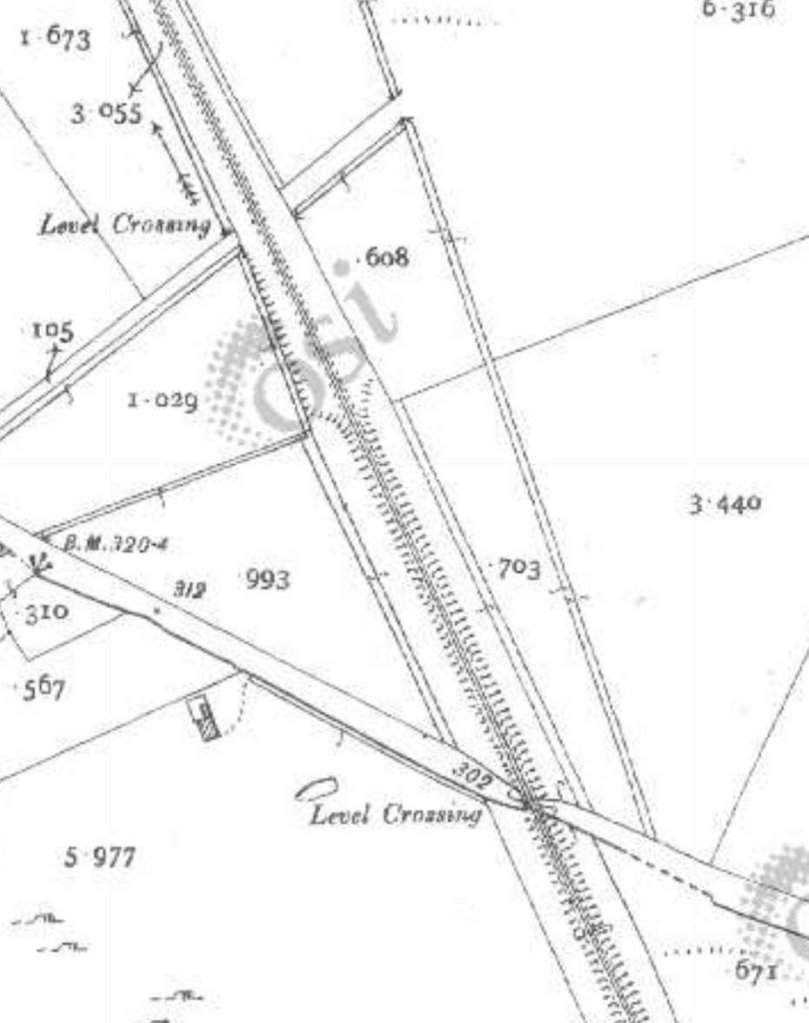
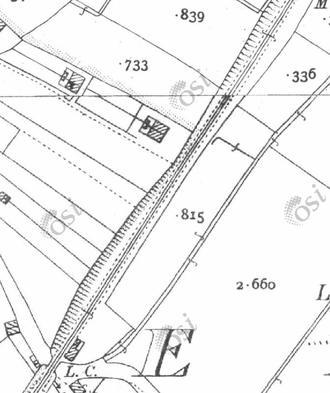
Taken on the same day as the last photograph but a little further South on the N56, the route of the old railway can be seen running away from the road. Creeslough (or Lough Natooey South) can be seen on the right side of this image. [Google Streetview, August 2009]A very similar view in 2022. The track which follows the old railway formation can still be seen beyond the galvanised steel gate. [Google Streetview, November 2022]South of the Lough, the line crossed a minor road junction as shown on this extract from the OSi 25″ Survey of 1901. Crossing-keeper’s Cottage No. 9 can be seen to the South of the road junction. [2]From this point southwards there is no 25″ OSi Survey Sheet. Only 6″ OSi survey mapping is available for the next section of the old railway. This 6″ extract shows the road and railway running close together. The track from the N56 to Terlin crosses the old line on the level at an ungated crossing. At the bottom of this extract, road and rail run immediately next to each other. [2]This satellite image shows the same length of the line as covered on the two map extracts immediately above. [10]A view North along the formation of the old railway from the minor road which has a junction with the N56 just off to the right of the image on the opposite side of the old railway. [Google Streetview, August 2021]
South of the junction mentioned above the line and the road ran immediately next to each other, as shown below.
The National Inventory of Architectural Heritage describes the structure as being a:
“Former railway viaduct taking former Letterkenny to Burtonport line over road, erected c.1903, comprising two rusticated arches to southeast and two freestanding rusticated stone piers to northwest, formerly carrying steel girders. Rusticated stone voussoirs forming round arches, with coursed rusticated masonry with drafted margins to spandrels and extending to low parapet having concrete copings with string course at springing level of arch to northwest. Coursed rusticated piers with drafted margins and ashlar rusticated copings. Set adjacent to, and crossing, N56 road to south of Creeslough.
This is an impressive structure of considerable architectural, social and technical significance to the region. The remains of the Barnes Gap Viaduct represent the latest expansion of transport networks in the late nineteenth/early twentieth centuries. It was built to carry the Letterkenny to Burtonport railway line, which opened in 1903 and closed in 1947. The viaduct exhibits high-quality stone masonry and the robust texture of the rusticated stonework enhances the visual aesthetics of the structure in the landscape.” [17]
This brings us to the end of this length of the old railway. In the next post we will continue on towards Letterkenny.
Dave Bell & Steve Flanders; Donegal’s Railway Heritage Guide No. 2, The Londonderry & Lough Swilly Railway: A Visitor’s Guide to the old railway and all the bits that can still be seen; County Donegal Restoration Society, Donegal Town, Co. Donegal, 198….. The Donegal Railway Heritage Trust hold the copyright of this book and images are used here with the kind permission of Jim McBride, a director of the Museum Trust.
Joe Begley, Steve Flanders & E.M. Patterson; The Lough Swilly Railway: Revised Edition; Colourpoint Books, Newtownards, 2017.
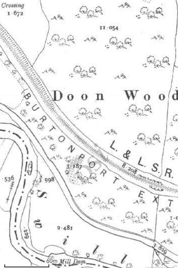
The line ran from Derry to Burtonport. Initially constructed from Derry to Letterkenny it was later extended, via a circuitous route, to the fishing village of Burtonport. We have been following the route of the line from Burtonport to Letterkenny in a series of articles of which this is the fourth.
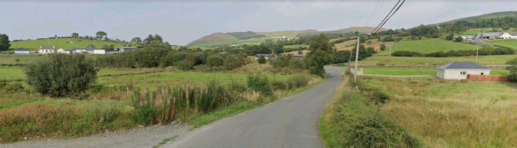
This length of the line begins at Barnes Gap (not to be confused with Barnesmore Gap further South on the Co. Donegal Railways network) and travels first in a generally Southerly direction before approaching Letterkenny from the West.
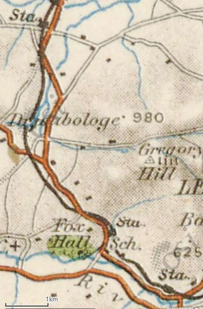
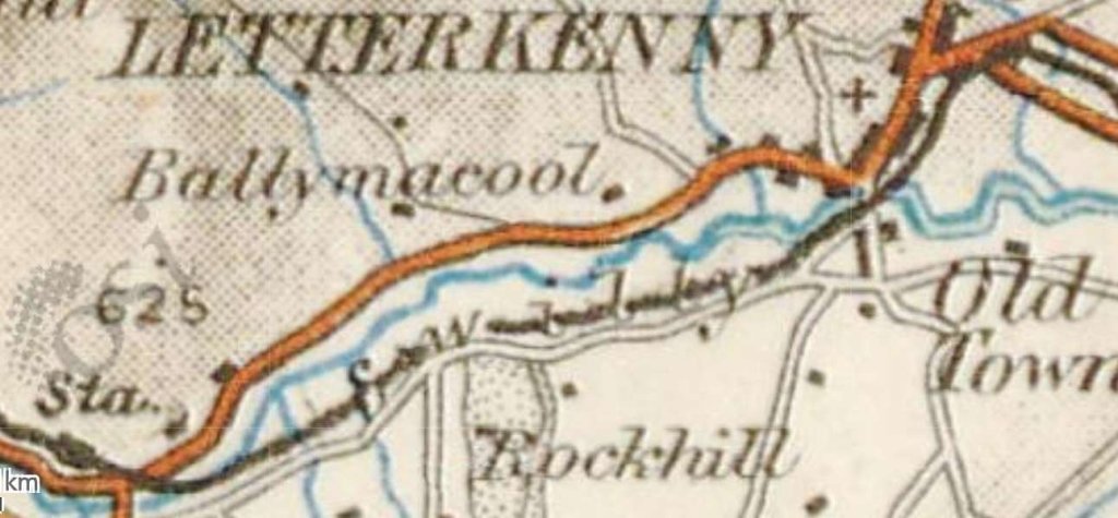
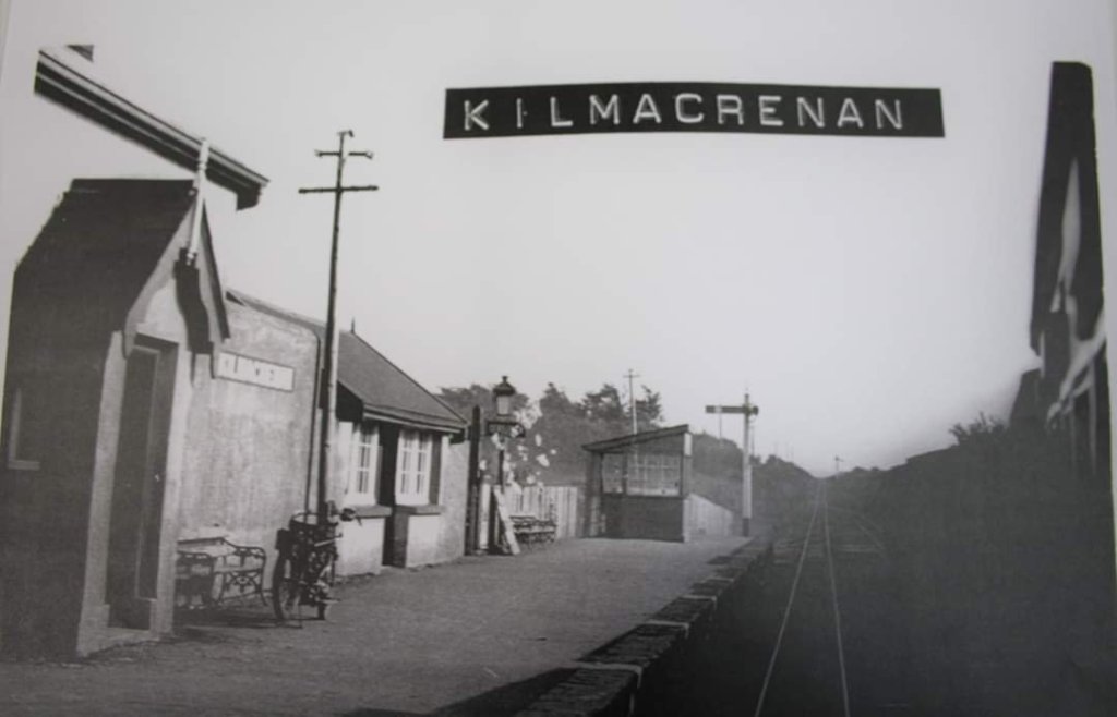
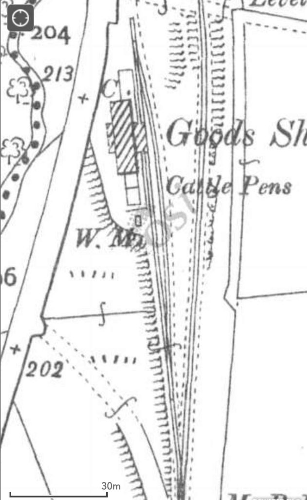
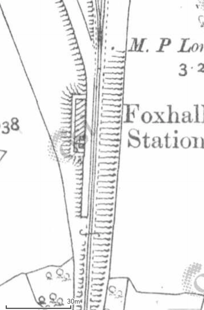
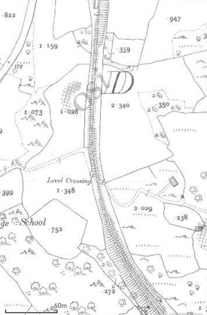
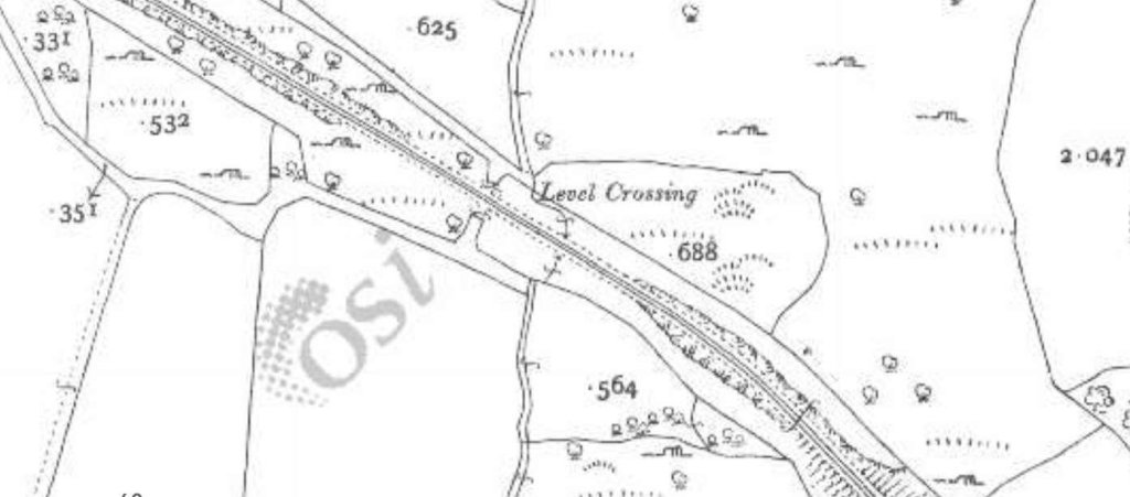
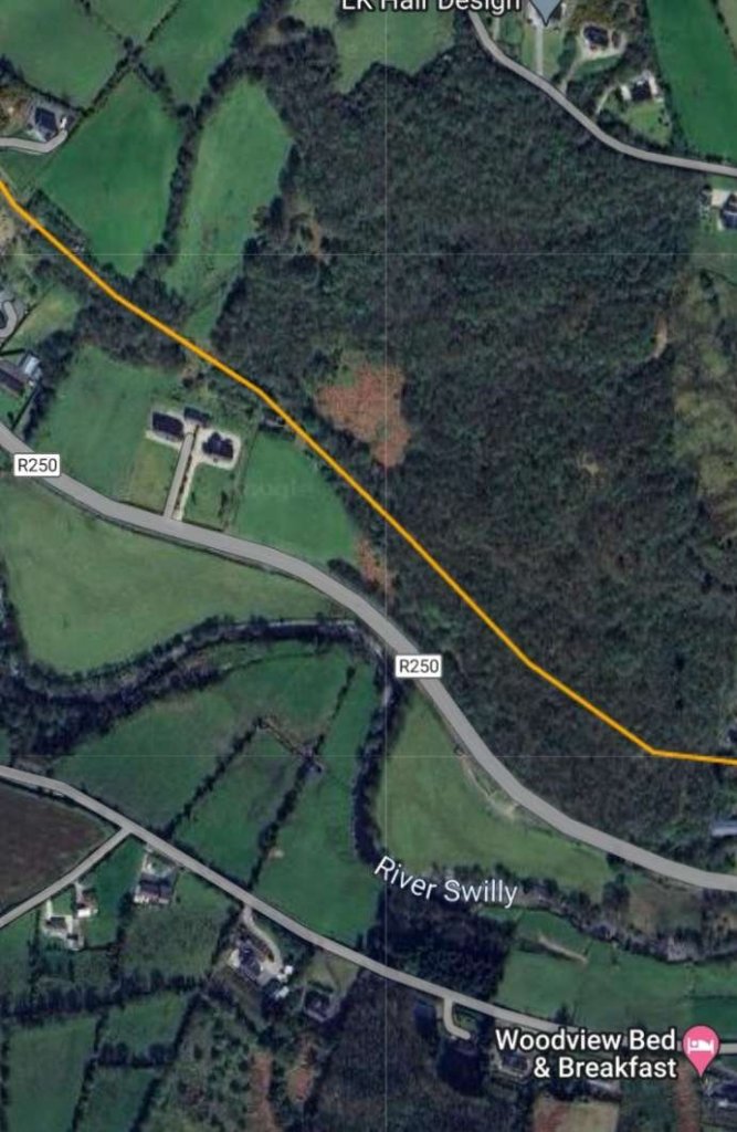
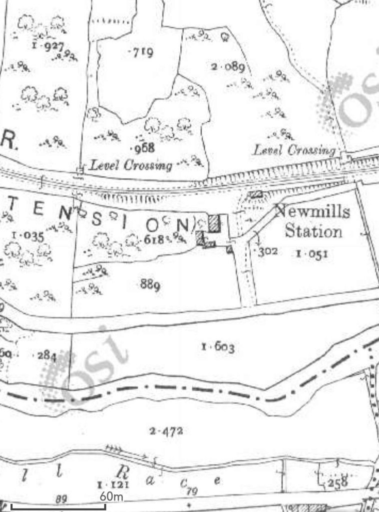
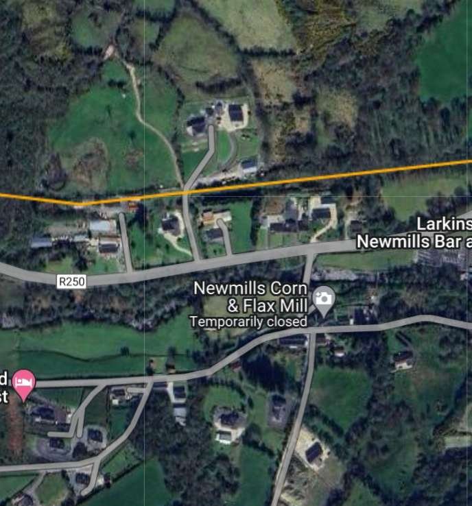
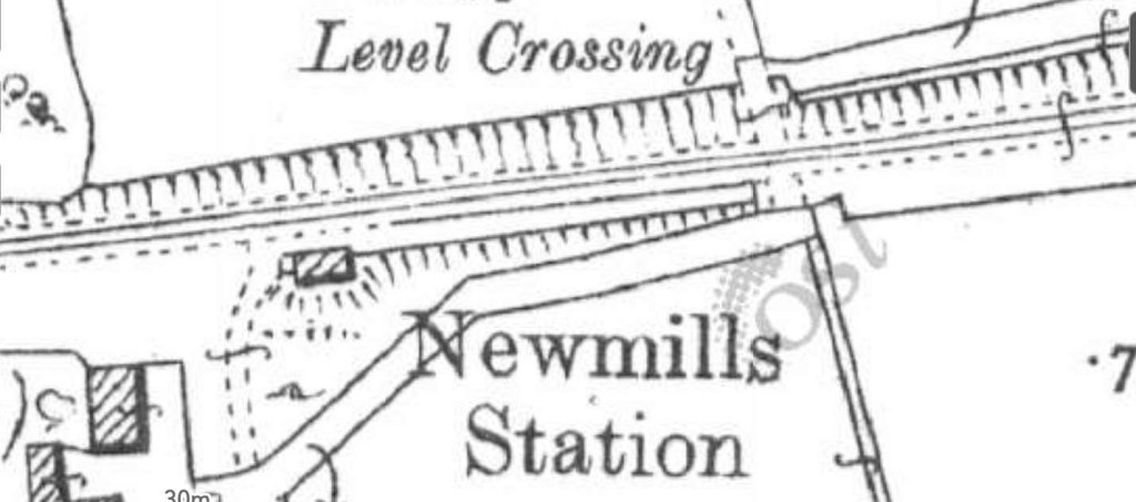
The first length of this part of the route of the old railway begins at Barnes Gap and travels via Kilmacrenan Railway Station to Churchill Station as shown on this extract from the 1″ OSi mapping of the mid-20th century. [2]Churchill Station is at the top-left of this next extract. The next Station was at Fox Hall at the point where the old railway entered the valley of the River Swilly. A little further to the East was Newmills Station which can be seen in the bottom-right of this image. [2]The the East of Newmills Station the railway bridged the River Swilly and ran along its South side at far as Old Town in Letterkenny where the line bridged the river once again and ran on into Letterkenny Station which sat at the right-hand edge of this map extract. [2]
We now look at this section of the Burtonport Extension Railway in more detail, starting at Barnes Gap.
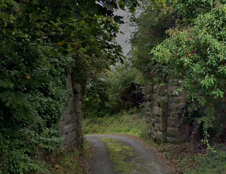
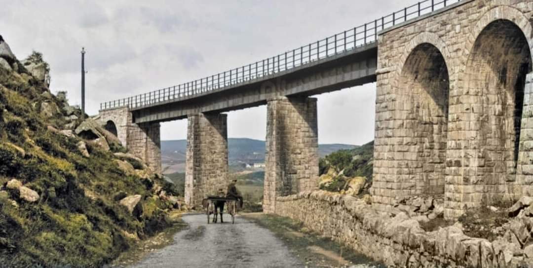
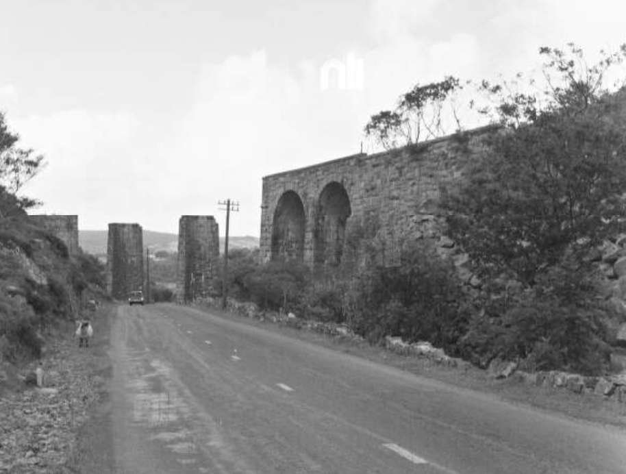
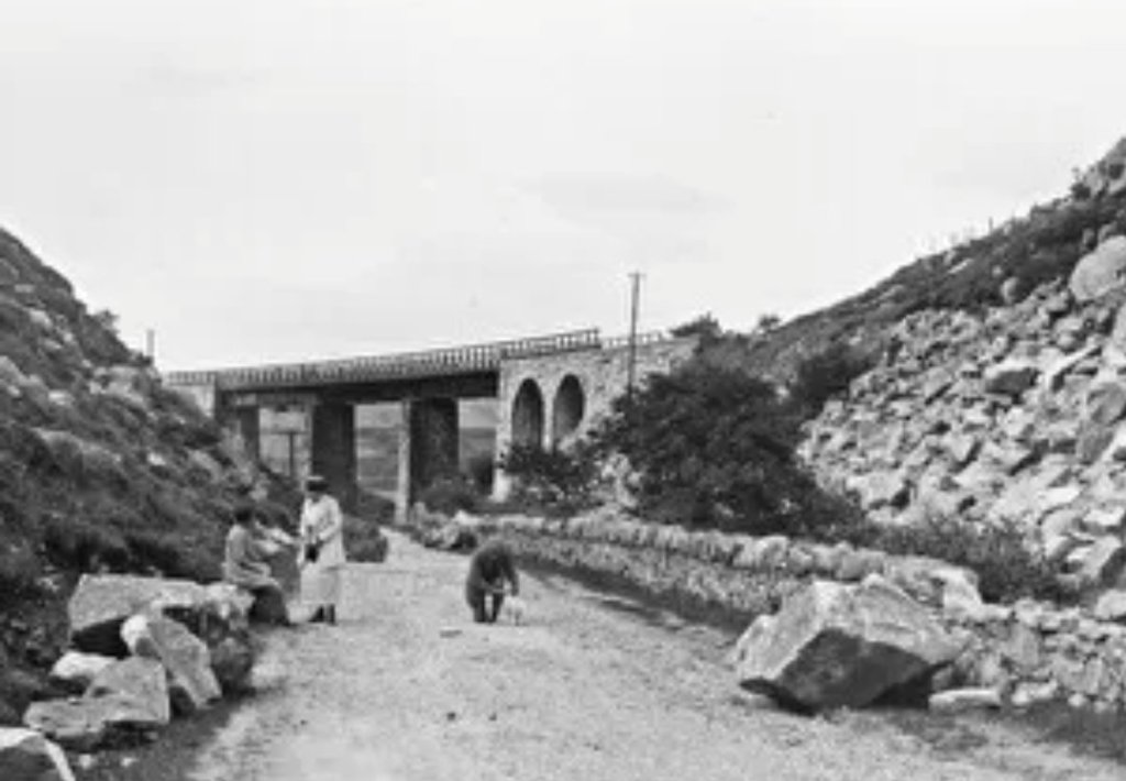
The first image is an excellent view of the viaduct by which the old railway crossed the road at Barnes Gap. It seems as though rock falls may have been a problem at this location, evidenced by the large rocks which sit alongside the road and a large boulder sitting on the right hand edge of the unmetalled carriageway
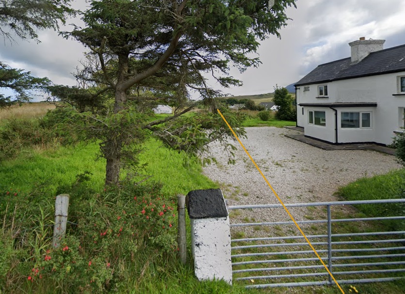
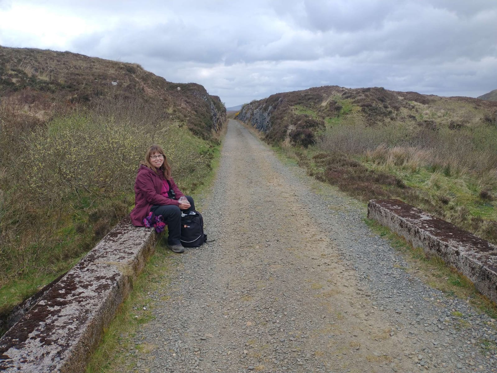
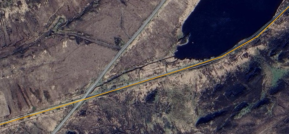
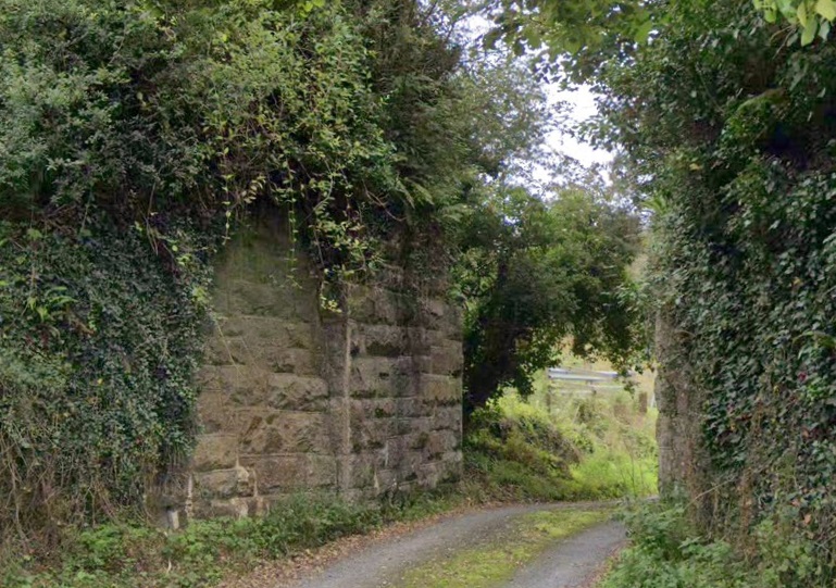
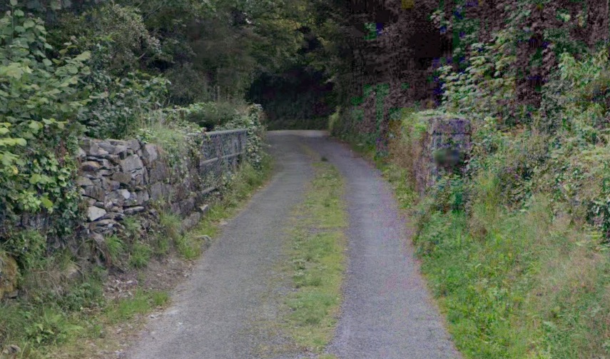
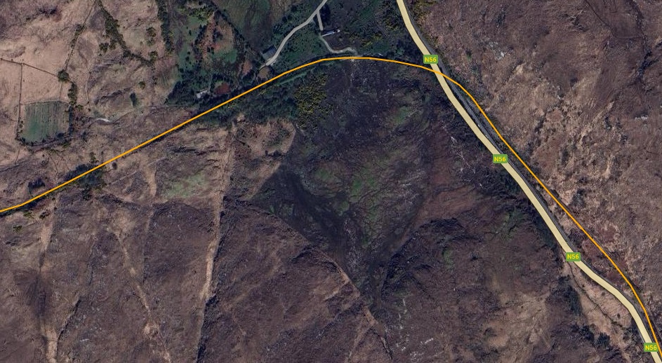
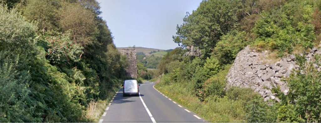
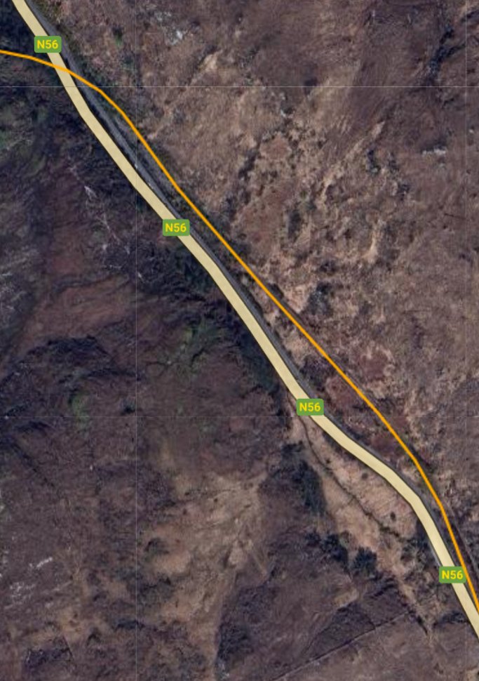
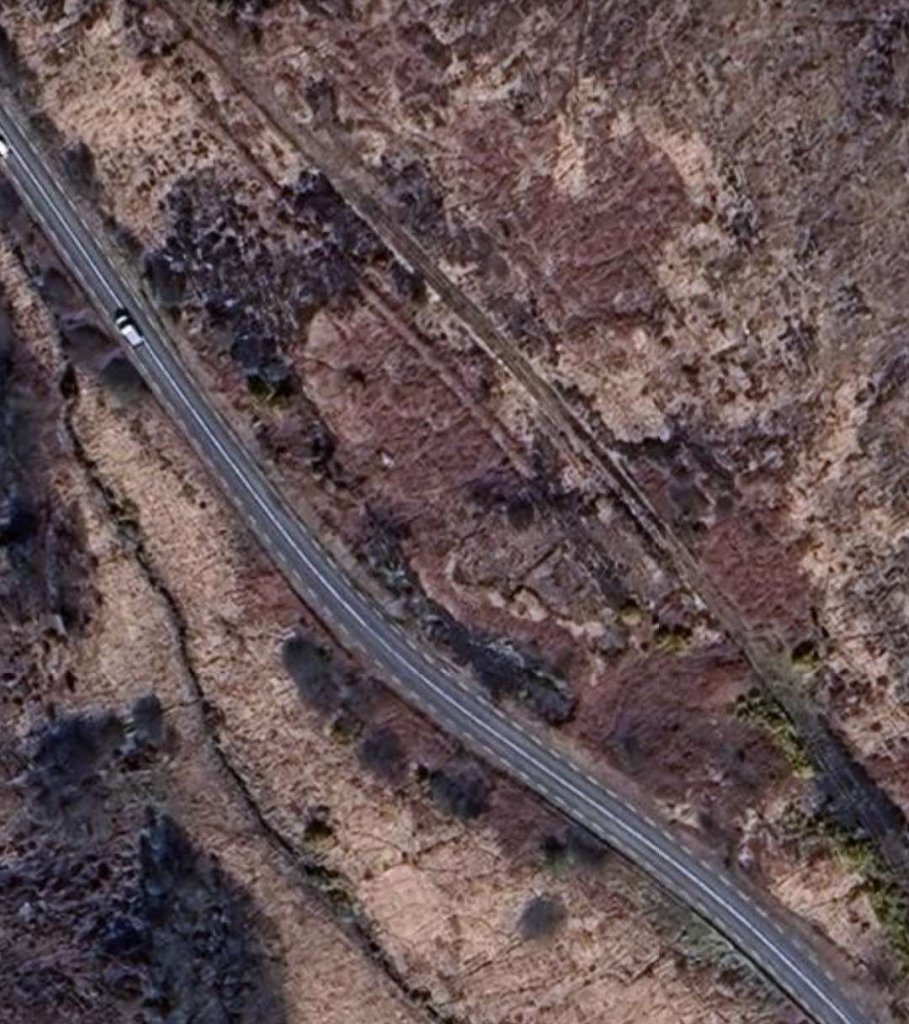
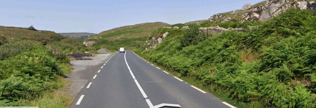
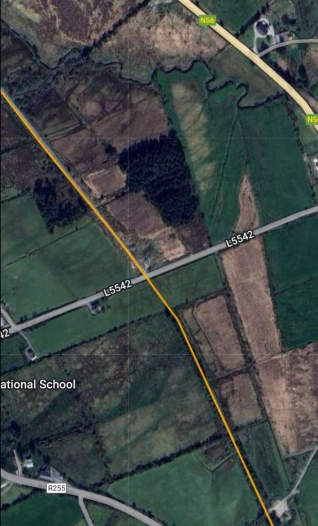
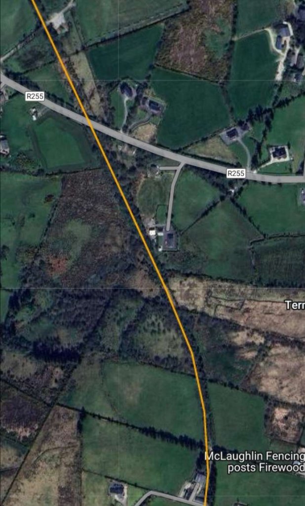
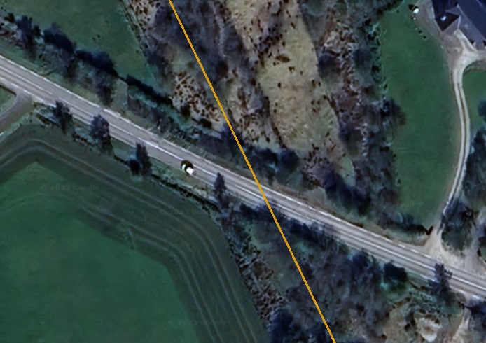
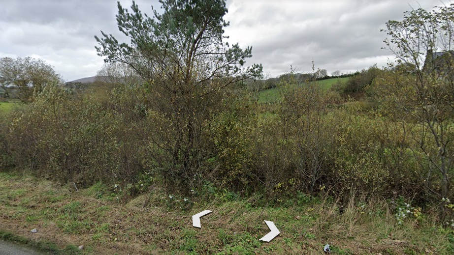
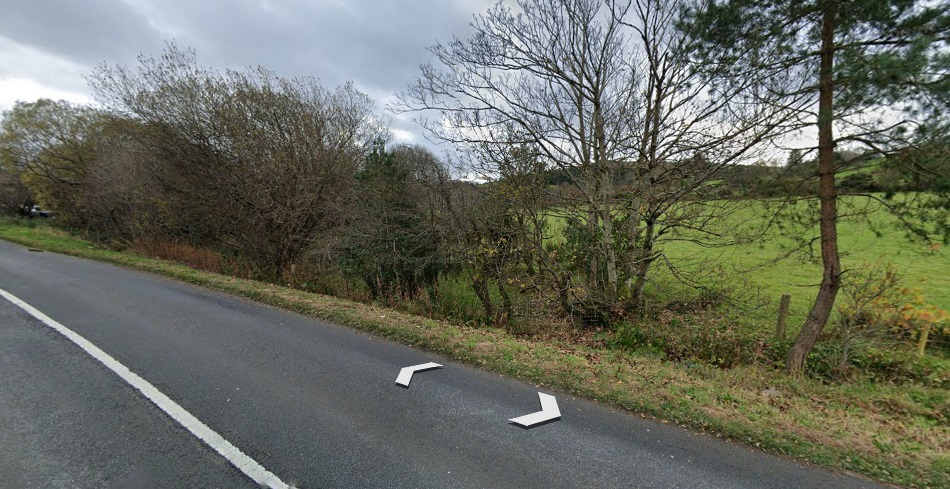
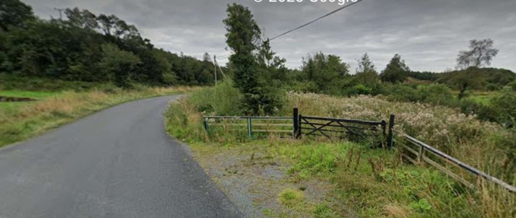
A view looking North towards the viaduct at Barnes Gap. [3]Approximately the same view in August 2021. [Google Streetview, August 2021]Barnes Gap, not to be confused with the Barnesmore Gap further South in Co. Donegal, sits at the top left of this first map extract from the 6″ OSi survey of 1901. Road and rail run close to each other with the road on the valley floor and the railway above. [2]This extract from RailMapOnline.com’s satellite imagery covers the top half of the map extract above. [4]A closer view as can be seen on Google Earth, the railway formation can be seen 50 metres or so to the Northeast of the N56. [Google Earth, June 2023]Taken just to the Southeast of the location of the satellite image immediately above, this photograph looks Northwest along the N56 as the old railway formation, marked by the stone wall to the left of the road, closes in on the line of the road. [Google Streetview, August 2021]Turning through 180° to look Southeast along the N56, the old railway formation is now at the same level as the road. It runs between the road edge and the rock outcrop its left. [Google Streetview, August 2021]This next satellite image emphasises how close the road and old railway ran as they headed South and it covers the bottom half of the map extract abovel. [4]Further to the South and looking South-southeast along the N56. The old railway alignment runs parallel to the road on its Eastern (left) side. [Google Streetview, August 2021]The road and railway followed each other closely for another kilometre or so until, as this extract from the OSi mapping shows, the railway required a larger radius curve, shown at the bottom-right of the extract. [2]The road and old railway formation are shown coinciding on this next RailMapOnline image. The reality on the ground is a little different as the next two images show. [4]This extract from the Google Earth satellite imagery, sowing the road junction at the bottom of the RailMapOnline image above. It also shows that the two forms of transport, road and rail were generally separated by a few metres with them closer where ground features needed them to be. [Google Earth, June 2023]The view South-southeast along the N56 and the road junction in the satellite image above. The tree line to the left of the road indicates the location of the old railway formation. [Google Streetview]Here we see the two alignments, road and old railway, diverging as shown on the OSi map extract above. The modern N56 seems to follow the alignment of the old road. [4]This extract from the 25″ OSi survey shows what was probably an ungated crossing over the lane that linked the crossroads close to Termon School to the main road, now the L5542. The crossing appears in the top-left of the 6″ OSi map extract above. [2][4]The road and the old railway follow separate paths once the valley broadens out. The railway remained, at first, on the North side of the road. [2]This extract from RailMapOnline shows the majority of the area covered by the 6″ OSi map extract above. [4]Once it crossed to the South side of the road the line drifted away from the road in a Southeasterly direction and crossed to the South side of the river valley. The line headed Southeast, the road East-southeast. [2]This satellite image shows approximately the same length of the line as the top half of the map extract above. [4]This enlarged extract from the 25″ OSi survey from the early 20th century shows the precedence given at the time to rail traffic with the gated crossing requiring traffic to turn to cross the line. [2]This enlarged image from Google Streetview shows the location of the level crossing in the 21st century. The larger building on the top-left, just North of the road is the crossing-keeper’s cottage. [Google Earth, June 2023]The view Southeast along the N56 through the location of the level-crossing. [Google Streetview, August 2021]The view Northwest along the N56 through the location of the level-crossing. The crossing-keeper’s cottage is on the right of the road. The railway ran to the right of the cottage. [Google Streetview, August 2021]The crossing-keeper’s cottage, the old railway ran to the right of the cottage. [Google Streetview, August 2021]Looking Southeast along the N56. The old railway formation is the track on the right of this image. [Google Streetview, August 2021]
Barnes Halt was adjacent to the road at this location. This is how it is described on Wikipedia:
“Barnes Halt was not a ‘station’ in the ordinary sense. It was simply a stopping point at the level crossing across the Kilmacrennan-Creeslough road, a few miles north of Termon. There was no station building or platforms, only the embankment on which the rail track ran, and the house occupied by the railway employee responsible for manning the level crossing gates.” [5]
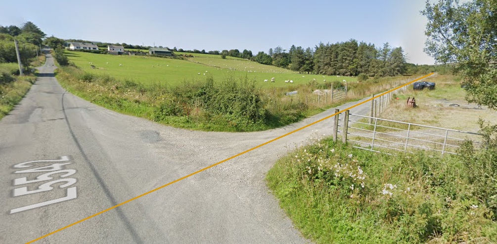
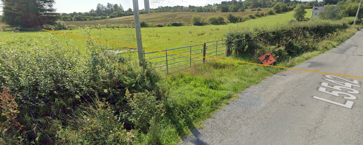
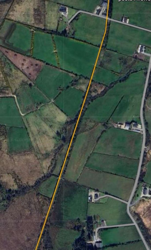
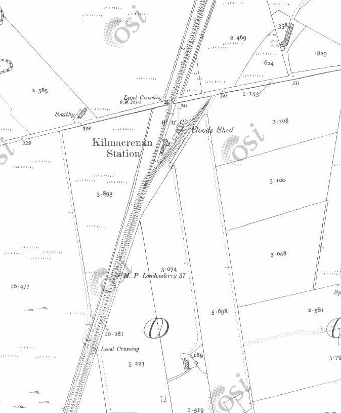
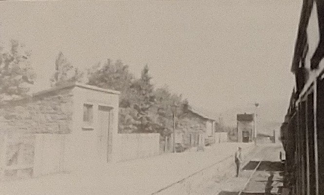
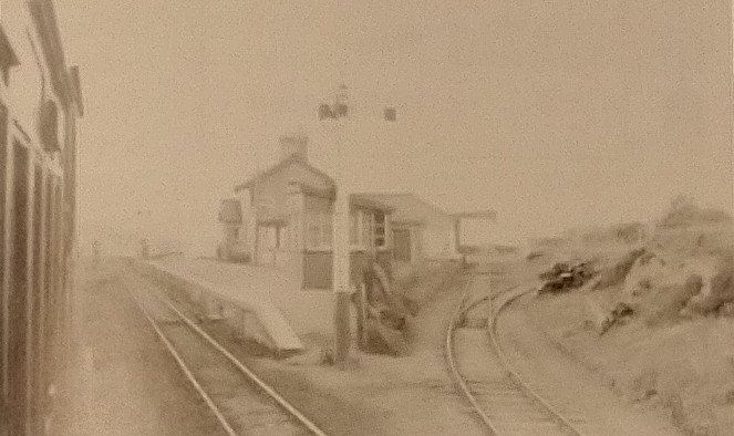
This next extract from the 25″ survey shows the bridge which carried the line across the river to the Southeast of the road crossing. The bridge appears at the bottom-right of the RailMapOnline image above. I do not have a photograph of this location in 21st century. However the image below shows that the bridge is still in place in 2023. [2]This grainy image is an enlarged view of the bridge as it appears on Google Earth. The old railway formation is in use as a moorland access track. [Google Earth, June 2023]This satellite image shows approximately the same length of the old railway as appears in the bottom half of the 6″ OSi map extract above. [4]This next extract from the 6″ OSi survey of 1901 shows the line turning from a South-southeast trajectory to a Southerly direction. In this length the line crossed what became two metalled minor roads. The mapping also crossed onto a new map sheet just to the South of the first of those level-crossings. [2]This image covers the top half of the map extract above. It again comes from the RailMapOnline.com website with the route of the old railway shown as a yellow line. [4]Looking West along the L5542 through the location of the old level crossing. The track to the right of the image follows the formation of the old railway. The crossing was gated (Gates No. 7), although no crossing-keeper’s cottage was provided. This suggests that train crews would probably have been responsible for opening and closing the gates. [Google Streetview, August 2021]Looking Southeast at the same location. The Burtonport Extension Railway route is marked by the yellow line. There is a line of conifers at the left side of this image which run along the line of the old railway. [Google Streetview, August 2023]The extract from the 25″ OSi survey shows two further level crossings. The more northerly of the two provided field access across the railway and would have been ungated. At the more southerly of the two the old railway crossed what eventually became a metalled road, the R255. This map extract ties in with the bottom half of the 6″ OSi map extract and the top left of the next RailMapOnline.com image below. [2]The old railway continued in a generally southerly direction beginning to turn towards the South-southwest. [4]A closer view of the location of the old railway crossing. Comparing this image with the map extract from the 25″ OSi survey shows that the carriageway is a little wider. Interestingly, looking back at the map extract from 1901, the road only seems at that time to have narrowed slightly at the crossing rather than turning to allow a crossing at right-angles to the railway. The crossing was gated (Gates No. 6) with train crews again needing to operate the gates. The location of the boundary fences which marked the extent of railway land can easily be seen North of the road. South of the road the railway land has become a woodland corridor. [4]Looking North at the location of the level crossing. [Google Streetview, August 2021]Looking South from the R255 at the same locagtion. The old railwayroute runs through the undergrowth directly ahead. The edge of railway land is the edge of the field on the right. [Google Streetview, August 2021]This and the next map extract are taken from the 25″ OSi survey of 1901 and show the railway heading South-southwest towards Kilmacrenan Station. There were two ungated crossings on this length of the line. [2]This map extract shows the length of the line just to the North of Kilmacrenan Railway Station. [2]This satellite image from RailMapOnline.com covers approximately the same length of line as shown on the two 25″ map extracts above. [4]This map extract shows the layout of Kilmacrenan Railway Station. This was another station with no passing loop at the turn of the 20th century, and where trains would need to lay back into the goods sidings to allow another one to pass. The road crossing on the Northern boundary of the station site would have been gated. The gates probably would have been operated by station staff. [2]The length of line South of Kilmacrenan Railway Station. [2]This satellite image covers approximately the same length of line as the two 25″ map extracts above. The line runs on a South-southwest/North-northeast axis. [4]The approach to Kilmacrenan Railway Station from the North as seen from the minor road at the North end of the station. [Google Streetview, August 2021]Kilmacrenan Railway Station site in 2021. The station is seen from the minor road at the North end of the Station platform. The goods shed/store is left of centre, the platform edge remains, as does the station house. [Google Streetview, August 2021]
“Kilmacrenan Station was to the west of the town, approximately two miles away by road in the townland of Doon. Nearby is Doon well, which was a pilgrimmage venue which generated passenger traffic to the station. The station building and platform were on the Up side with a goods store and two sidings behind this.” [6]
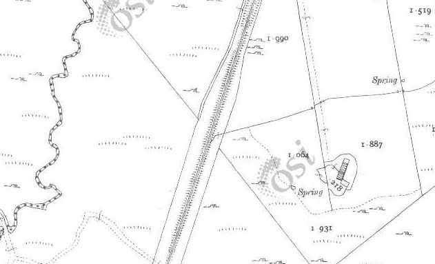
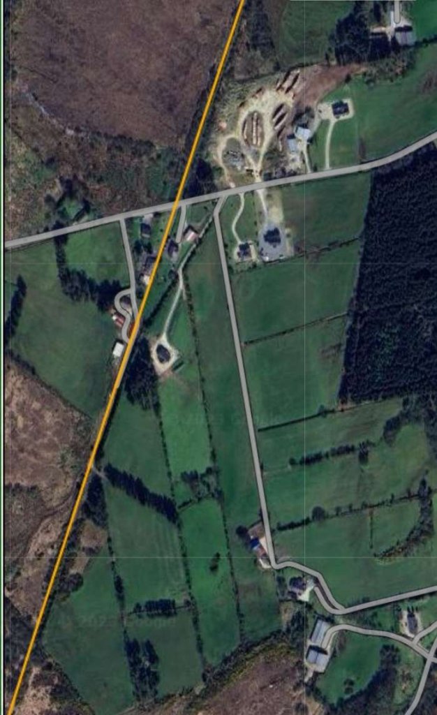
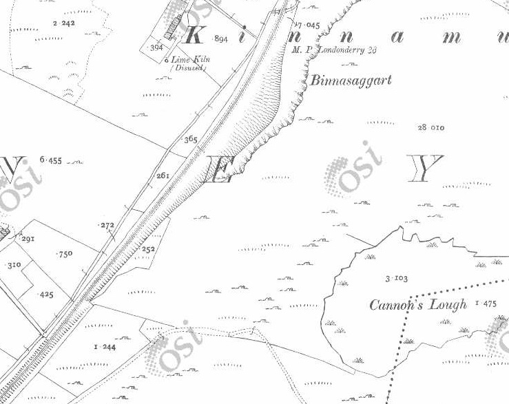
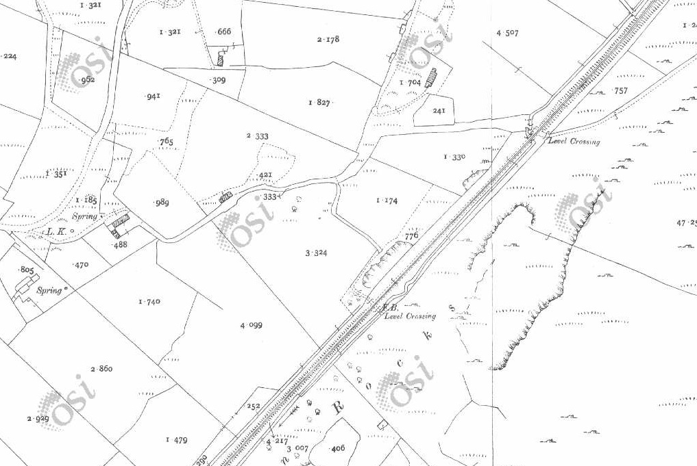
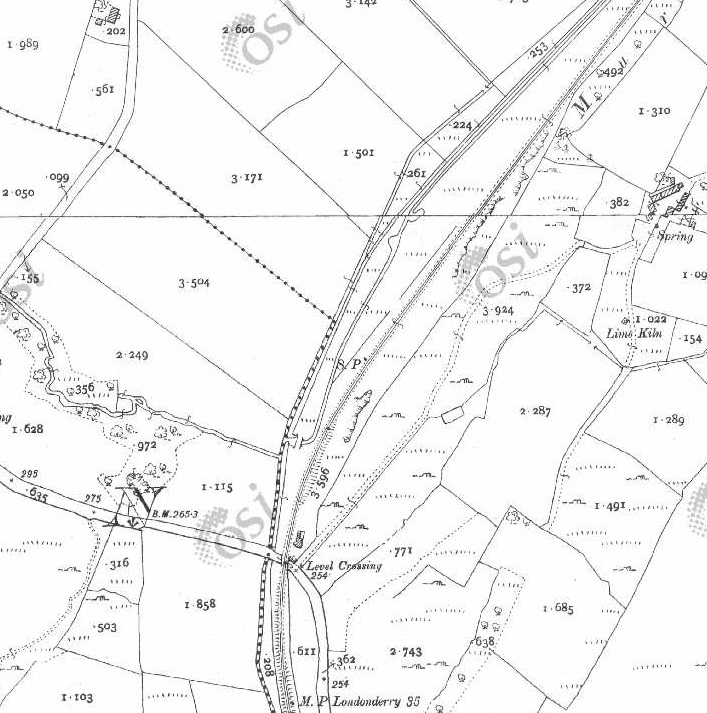
These two photographs show Kilmacrenan Railway Station as it appeared in 2007. The goods shed and the station house are seen above in a photograph taken from the Northeast, just to the South of the road serving the station. [7]This photograph looks along the line of the sidings at Kilmacrenan Station from close to the location of the buffers. Both this image and that immediately above were shared on the Londonderry & Lough Swilly Railway Facebook Group on 19th November 2020 by Chris Stewart. [7]This photograph of 4-8-0 Locomotive No. 12 shows it on a goods train at Kilmacrenan Railway Station. Two trains appear to be passing each other. The picture was shared by the Donegal Railway Heritage Centre on Facebook on 25th March 2022. [8]This image was shared on Facebook by Donegal County Museum on 17th August 2020. It shows the passenger station building on the left. It seems that, in this picture, two lines ran alongside the platform. The photograph was taken from a train in 1937 by H.C. Casserley. [9]These two further pictures of the station were also taken by H.C. Casserley in 1937 from the train on which he was travelling. This image looks North, the train appears to be heading South. [1: p64]This photograph also looks North but from a different train heading North towards Barnes Gap and Creeslough. The photograph was also taken by H.C. Casserley. [1: p63]These two map extracts show the railway line further to the South of Kilmacrenan Station. The line ran for some distance on a straight course. [2]This RailMapOnline.com satellite image shows approximately the same length of the line as shown on the two 25″ map extracts immediately above. [4]The line continues, eventually curving further to the Southwest, through Mile Point 36 (from Londonderry). [2]And on, passed Cannon’s Lough. [2]Again, this satellite image covers the same length of the line as the two map extracts above. [4]This and the next two extracts from the 25″ OSi survey of 1901 take the line as far as Level Crossing No. 5. [2]These two images cover the same length of the line as the three map extracts above. [4]Crossing-keeper’s cottage and gates No. 5 appear at the bottom-left of this satellit image.[4]
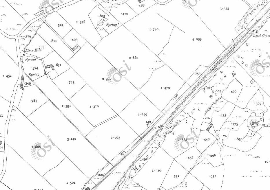
Crossing Cottage No. 5 has been significantly extended since the demise of the line.
Crossing No. 5, the Keeper’s Cottage sat on the East side of the line, North of the minor road which crossed the line.Crossing Cottage No. 5 as it appeared in August 2021. The original cottage is much extended. The old railway ran across the image left to right (or vice- versa) in front of the cottage. [Google Streetview, August 2021]Looking North along the line of the Burtonport Extension Railway from the location of Crossing No. 5. The original cottage is the two storey section of the building closest to the camera. [Google Streetview, August 2021]The minor road curves sharply to the South on the East side of the crossing and runs roughly parallel to the old railway formation which can be seen running South behind the field gate. [Google Streetview, August 2022]
Being at one of the significant crossings along the line warrants us noting the comments about these crossings made by Bell and Flanders: “These Gates were a regular feature along the route of the line and were much more important than the accommodation crossings. … Whereas accommodation crossings were private accessways for local farmers the Gates were placed where the railway crossed public roads and were always staffed – opened and closed – by railway employees who lived in the adjoining houses.
Accommodation crossing gates [where they existed]were kept open for the railway and closed to the farm tracks until someone needed to cross. Crossing Gates, on the other hand were always kept open for the road and closed to the trains until it was time for a train to pass by.
Being a crossing keeper was a good job as it was a steady income, good living accommodation and, as there were few trains even in the railway’s golden days, the work wasn’t strenuous. But crossing keepers did have to know the railway regulations and any special instructions issued from time to time. Crossing keepers were often the wives of railway gangers who had their length of track to check and maintain each day. As the years went by the gated crossings sometimes became regular, though “unofficial” stopping places for passengers and goods.” [1: p61]
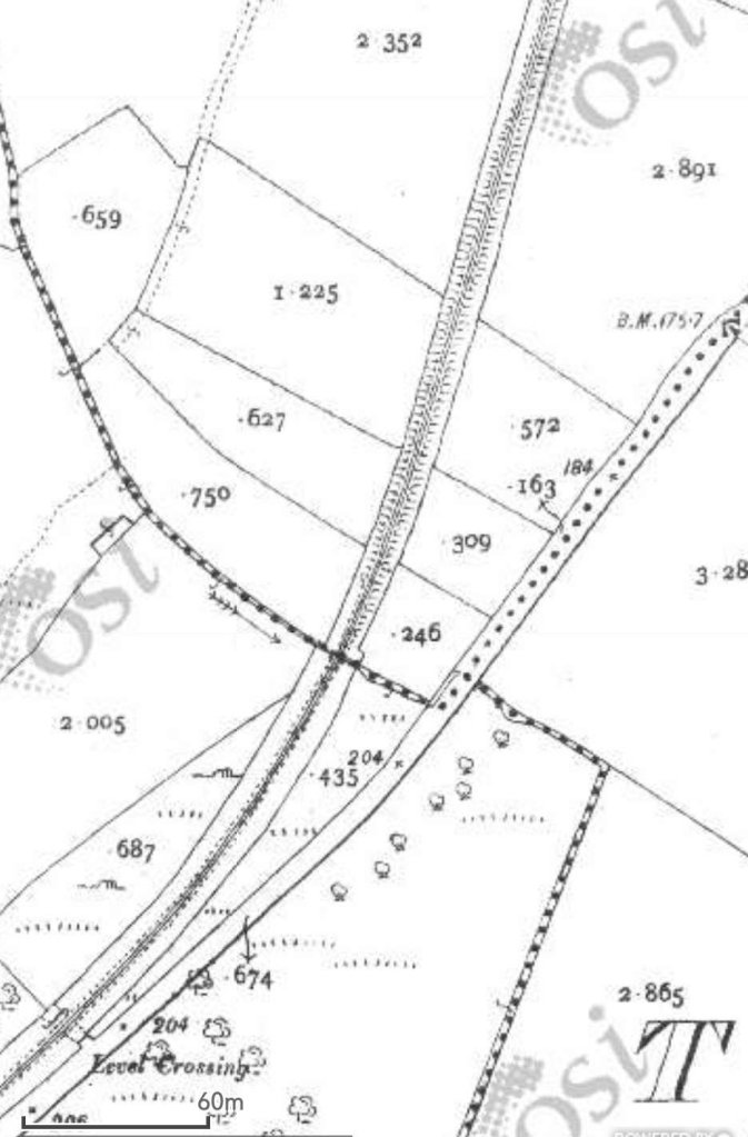
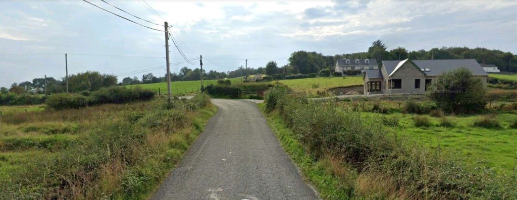
The old line continues in a South-southeast direction alongside the minor road which leads to Treantagh. [2]Both these two images are map extracts from the 25″OSi 1801 survey. Close to Treantagh the old railway turned towards the South, crossing a road bridge in the process.The next RailMapOnline extract shows roughly the same area as the two map extracts above. The route of the old railway continues to be shown by the yellow line. [4]The building on the right of this image is built across the line of the old railway. This image is taken looking South adjacent to Bridgeburn House B&B flagged on the satellite image above. [Google Streetview, August 2021]A short distance to the South, the old railway ran along the verge of the road for a short distance, approximately on the line of the boundary wall before heading through what is now a stand of trees which can be seen on the left of this image. [Google Streetview, August 2021]The line is rising as the road falls away and turns to the left. The trees mentioned above fill the right half of this image. [Google Streetview, August 2021]
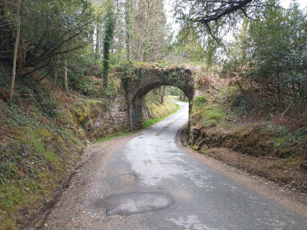
A little further to the South the line crossed a different minor road by means of a stone arch bridge.
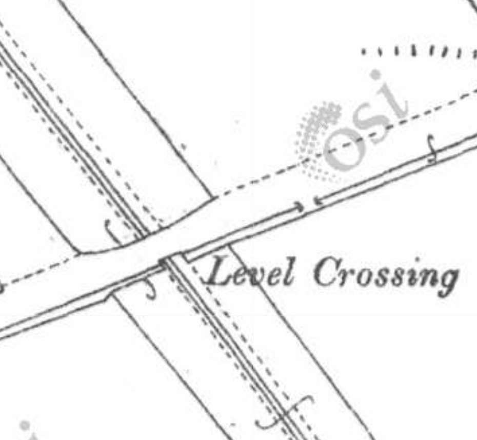
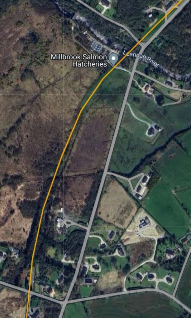
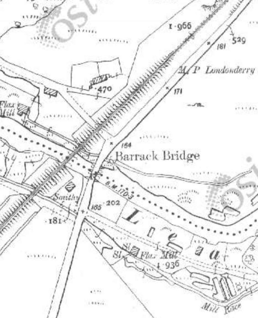
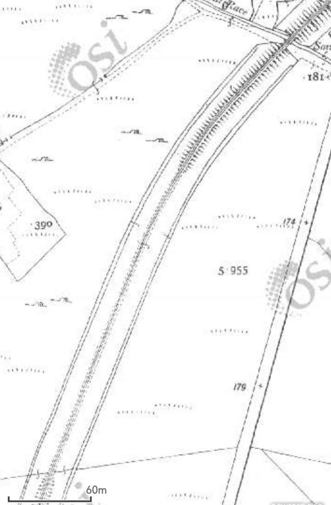
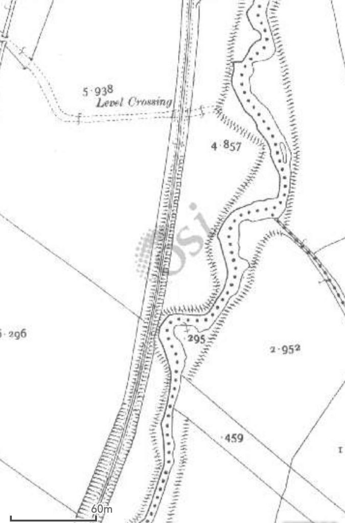
The bridge shown in the satellite images above. The photograph looks along the minor road from the Northeast. [My photograph, 29th April 2023]The line continued to the South, curving round towards the Southwest. [2]The line continues turning to the Southwest, beginning to run alongside another minor road. [2]Road and rail ran in tight formation heading Southwest. [2]This satellite image from RailMapOnline.com covers the length of the old line illustrated on the three extracts from the 25″ OSi mapping of 1901. [4]The route of the old railway is shown on the satellite image above as running through woodland on the North side of the minor road. [Google Streetview, August 2021]The bungalow on the right of this image is approximately on the line of the old railway. [Google Streetview, August 2021]This image shows the next bungalow along the minor road which again sits on what was the old railway formation. [Google Streetview, August 2021]The old railway, while travelling in a Southwesterly direction, was carried over a series of obstacles as this extract from the 25″ OSi 1901 survey shows: a road, a mill-race, the River Lennan, another mill race and then an access road. [2]This and the next map extract show the length of the line North of Churchill (Church Hill) Railway Station. [2]Churchill Railway Station appears at the bottom of this map extract. [2]This satellite image covers the same ground as the map extracts immediately above. [4]Another minor road leading to Milltown Carrick is spanned by a stone arch bridge, which appears at the top-right of the satellite image above. [My photograph, 29th April 2023]Looking Southwest along the minor road crossing the River Lennan at Barrack Bridge. The route of the old railway was only a very short distance to the right of the road at this location. In the summer months, the arch bridge carrying the old railway over the River Lennan is shielded from the road bridge by modern vegetation. However, at the time of our visit in April/May 2023 the vegetation was not carrying its full summer weight. [Google Streetview, August 2021]The railway bridge across the River Lennan is shown in this photograph taken from the road carriageway. [My photograph, 29th April 2023]A very short distance to the Southwest was a viaduct carrying the old railway across an access road and a mill stream. In the 21st century, the road provides access to Millbrook Salmon Hatchery which is noted on the satellite image above. Originally the road served flax mills downstream. [My photograph, 29th August 2023]
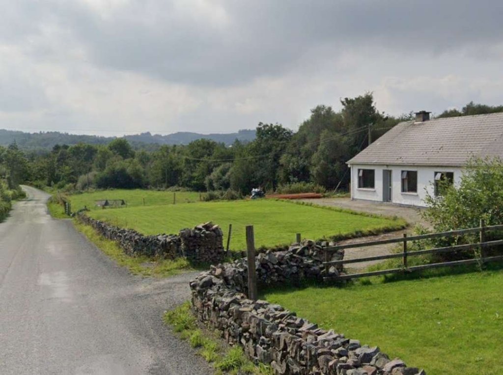
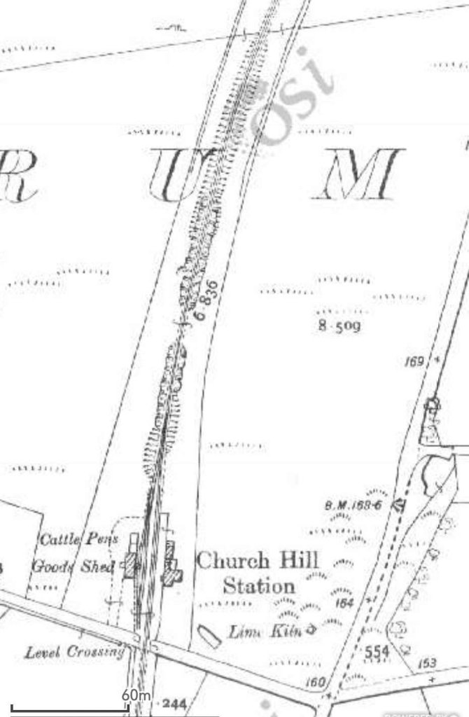
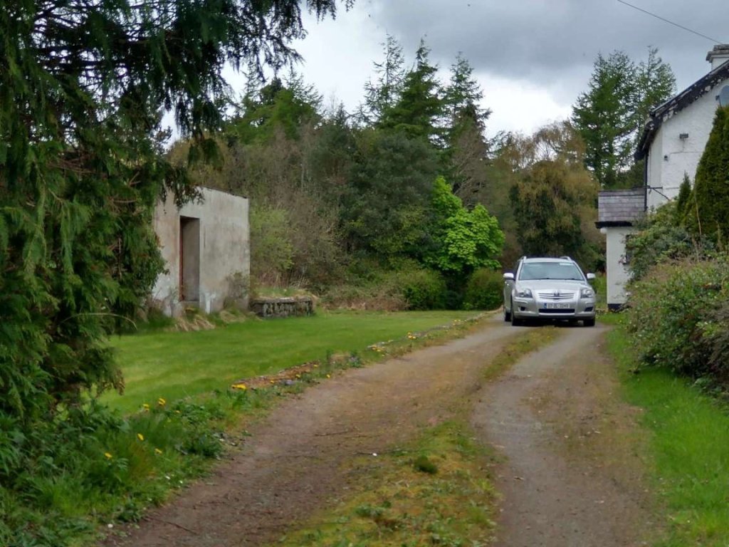
The next location that we have access to is the point at which the old railway crossed the next minor road. That location appears both at the bottom of the satellit image above and the top of the next section of the line, both on the OSi mapping and the satellite imagery below: the location of Churchill (Church Hill) Railway Station.
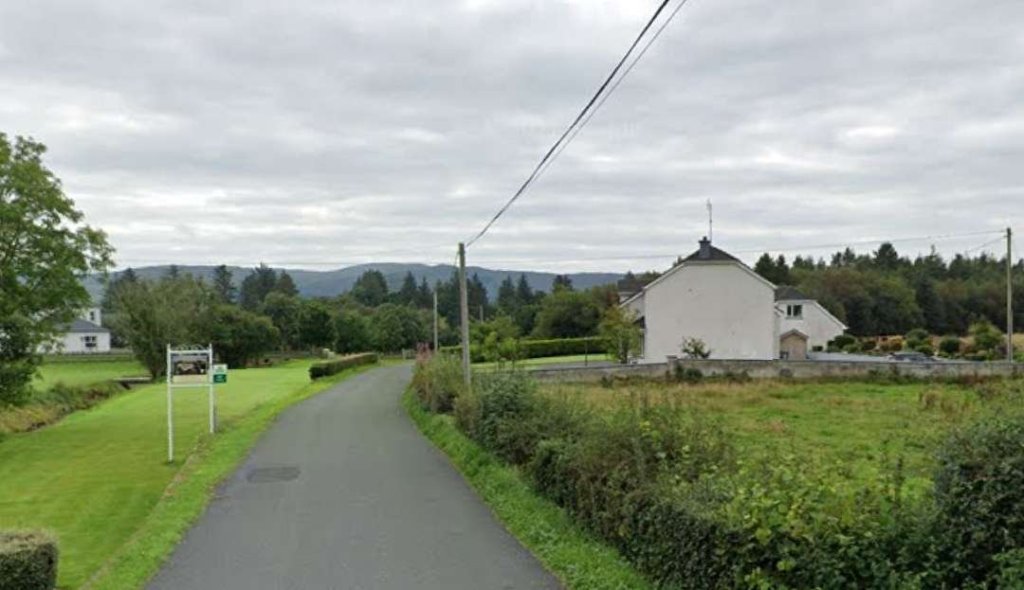
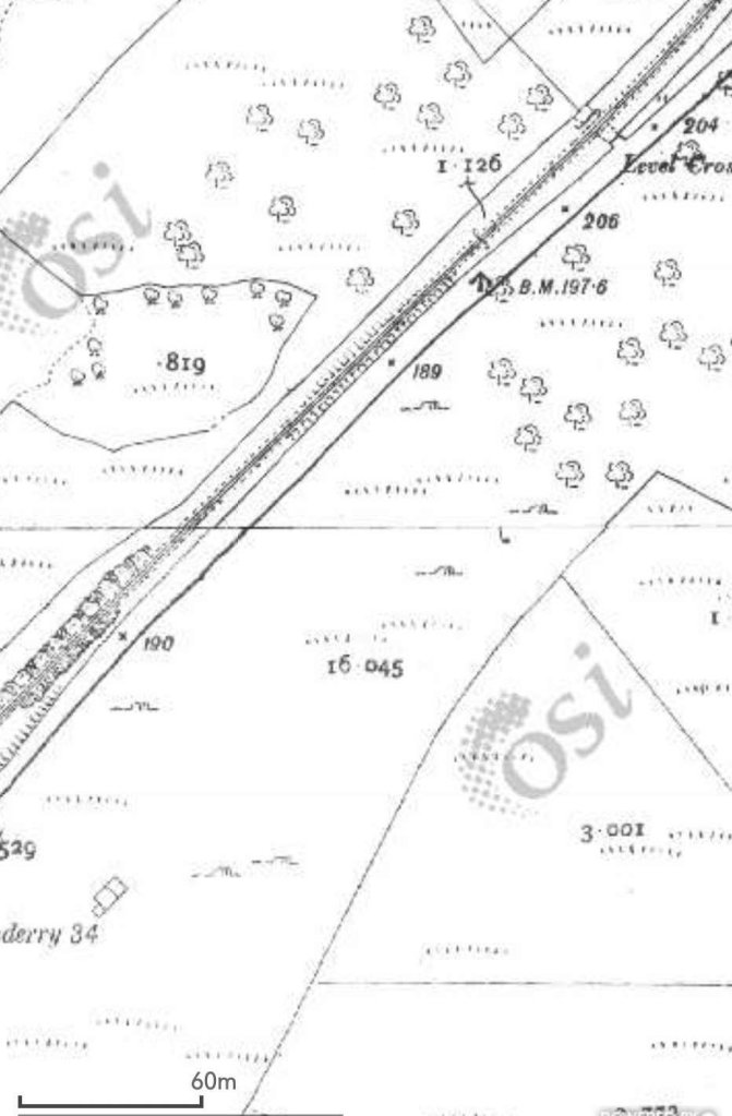
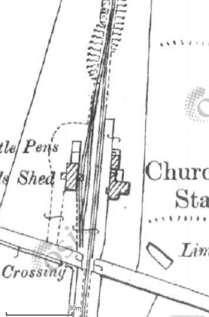
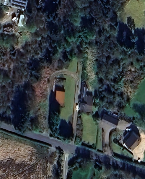
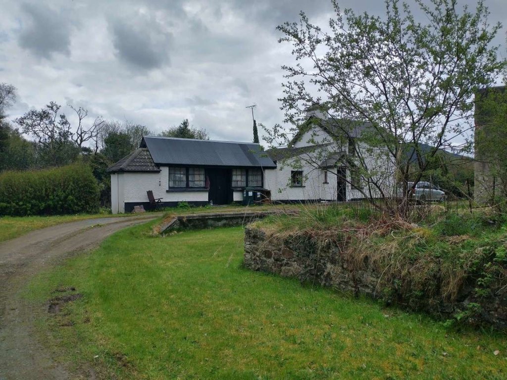
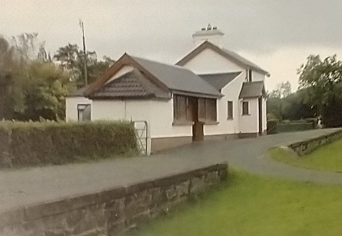
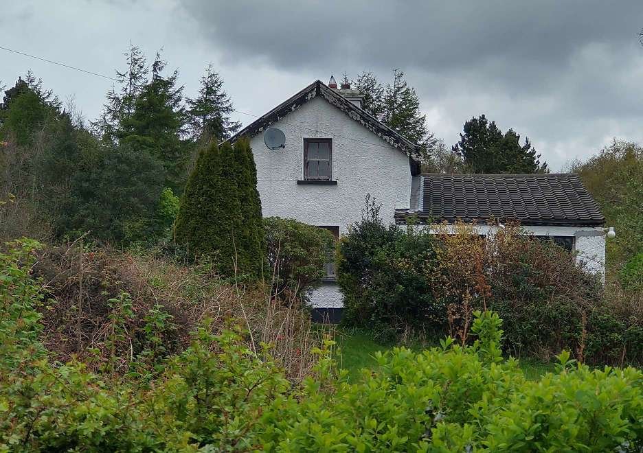
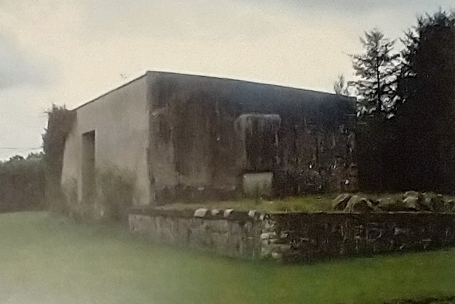
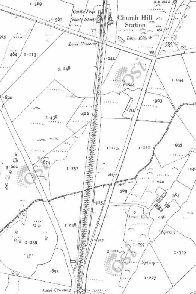
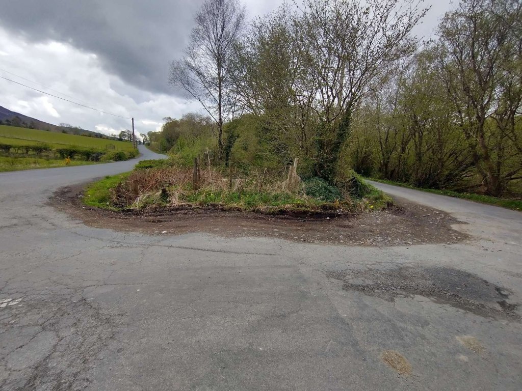
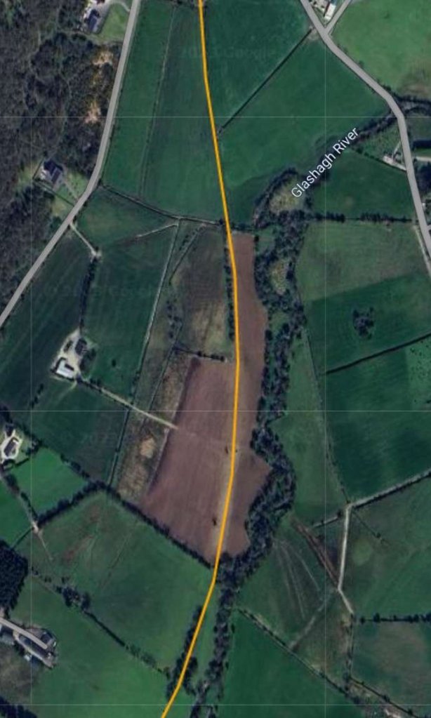
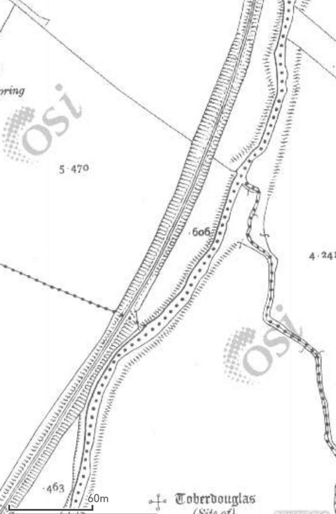
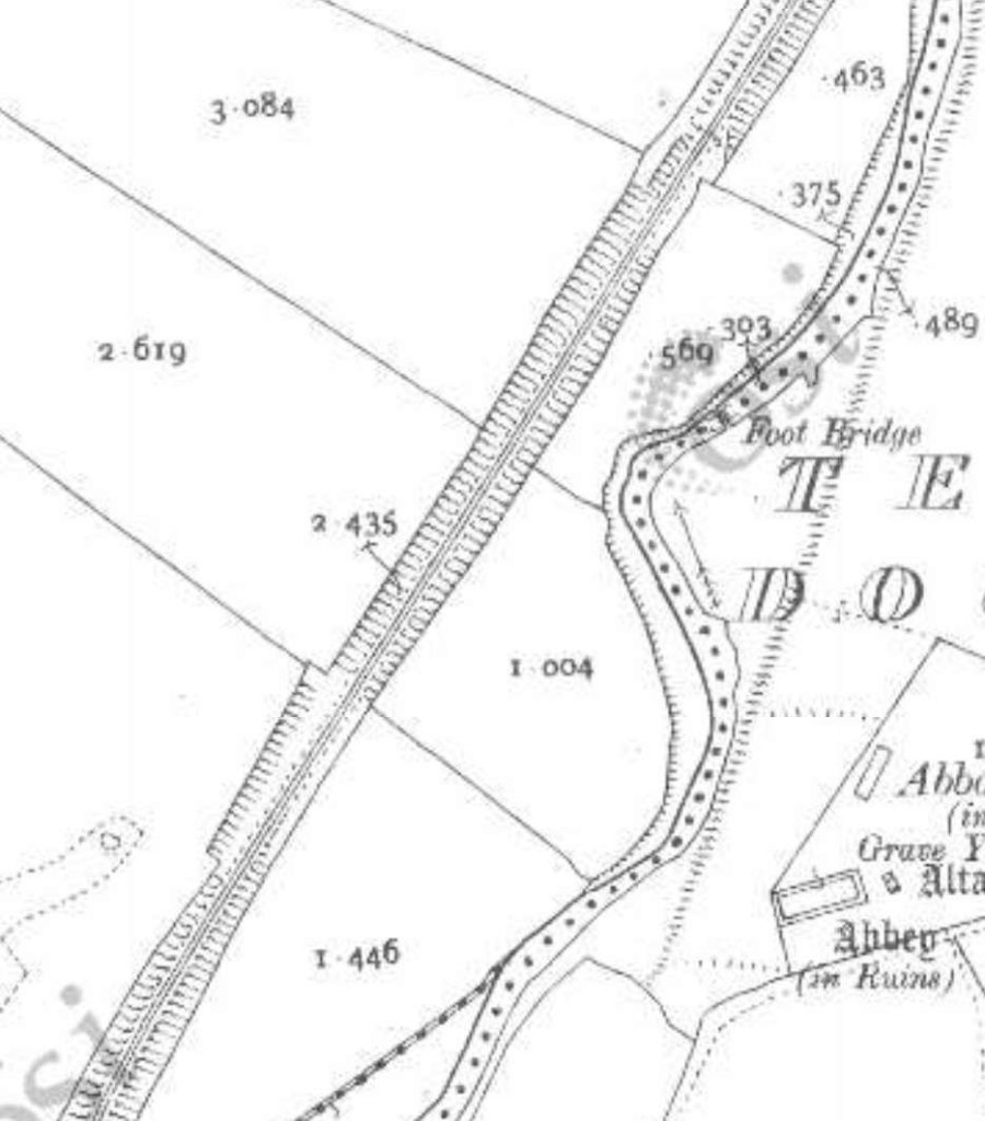
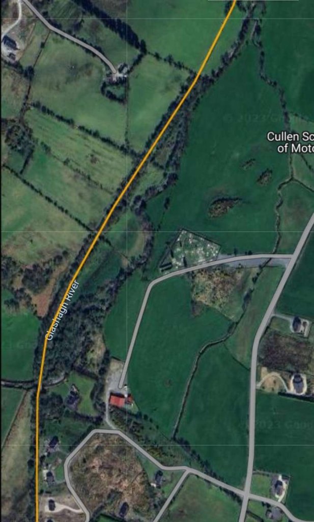
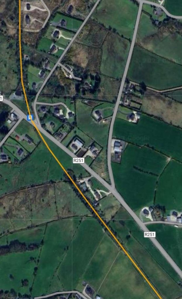
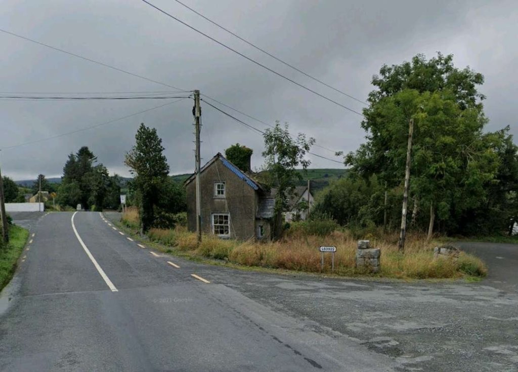
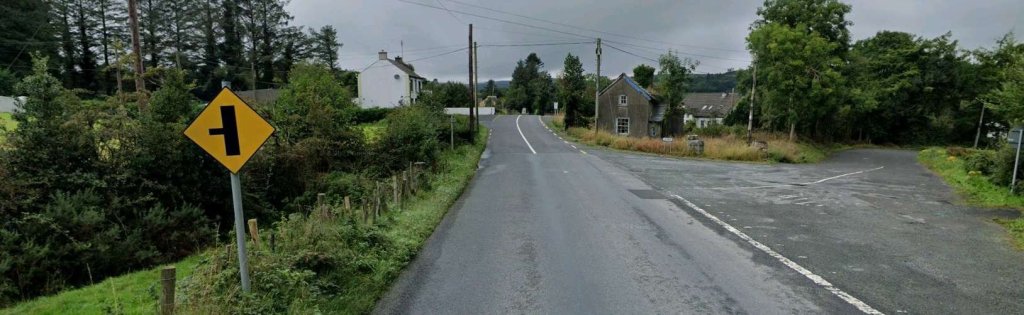
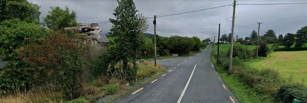
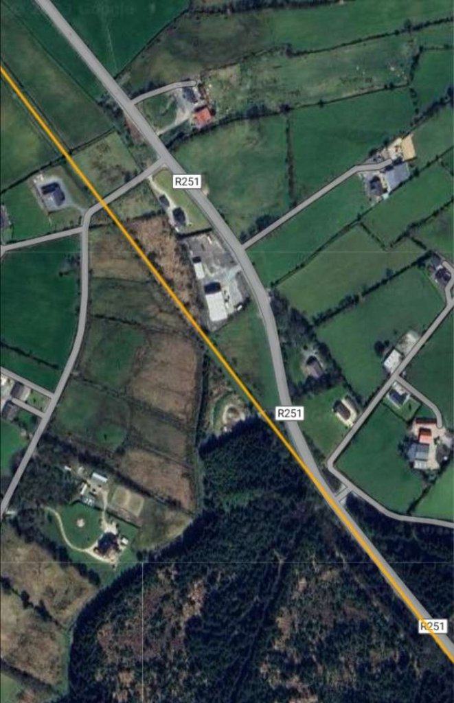
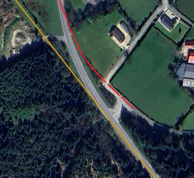
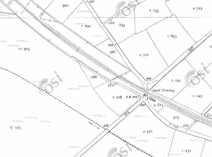
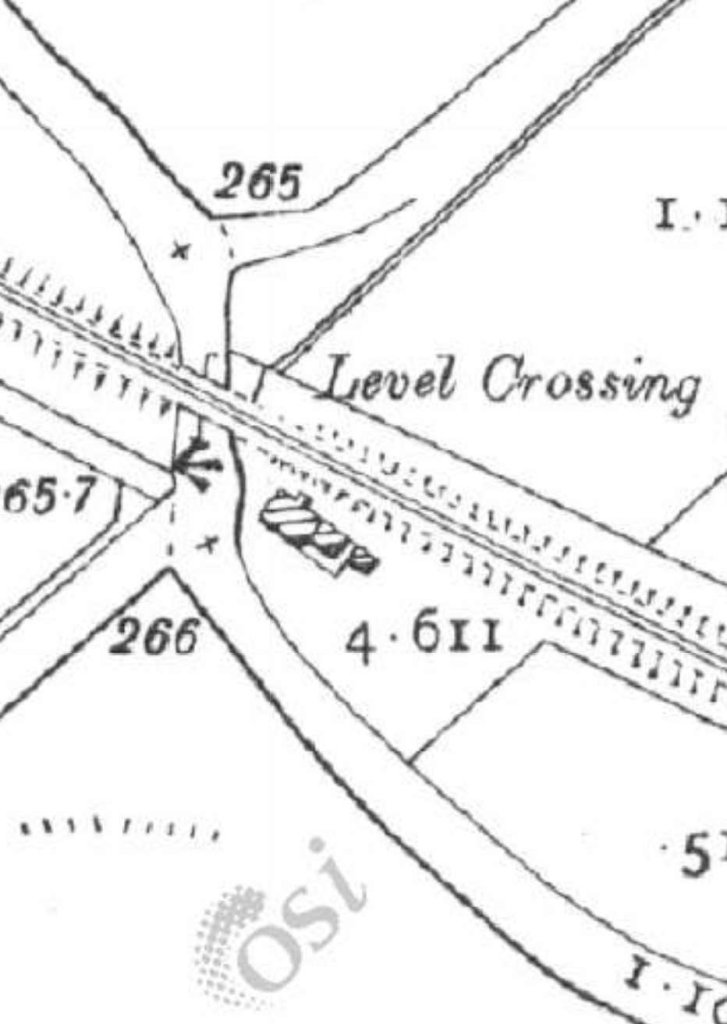
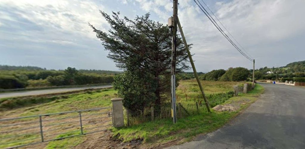
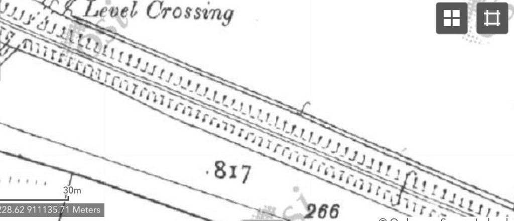
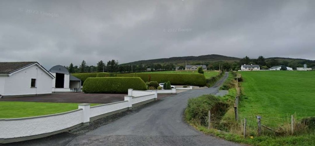
An enlarged map extract of Churchill (Church Hill) Railway Station as shown on the 25″ OSi survey of 1901. The goods shed/store can be seen on the West side of the line, the passenger facility is on the East side of the line. It appears that in 1901, there was no passing loop at the station. [2]The location of Churchill (Church Hill) Railway Station as it appears on Google Earth in 2023. [Google Earth 3rd July 2023] Church Hill Railway Station passenger facilities still stand in the 21st century and are now a private home. This photograph looks at the buildings from the Northwest. [My photograph, 29th April 2023]This is how the buildings appeared at the turn of the 21st century or perhaps a little later. The photograph looks onto the site from the North-northwest. [10: p164]This view from the South looks along Ng the old station platform. The Goods Shed is on the left and the station building on the right. [My photograph, 29th April 2023]The Church Hill Station building as seen from the road which crossed the old line at the South end of the station site. [My photograph, 29th April 2023]The Goods Shed seen from the North. The platform close to the camera was the location of the cattle pens. [10: p164]This next extract from the 25″ OSi mapping shows the old railway heading almost due South as it left Church Hill Railway Station. At the bottom of this extract two roads flank the old railway for a short distance. [2]South of the level crossing the roads diverged from the old railway. [2]This satellite image provided by RailMapOnline illustrates the convergence and divergence mentioned above. It covers the same length of the old railway as the two map extracts above. [4]Looking South along the route of the Burtonport Extension Railway from the road which crossed the old railway at the Southern end of Church Hill Railway Station. [My photograph, 29th April 2023]Looking back North from the level crossing noted above. [My photograph, 29th April 2023]Turning through 180° to look South along the old railway as it headed towards Letterkenny. In a rural context, the road arrangement at this location must be unusual! [My photograph, 29th April 2023]The two map extracts above show the old line curving gently from a South-southeast direction to a South-southwest trajectory and following the Glashagh River. [2]This extract from RailMapOnline.com shows much the same length of line as covered by the two 25″ map extracts above. [4]The three extracts from the 25″ OSi survey of 1901 show the Burtonport Extension curving back towards the South and bridging the Glashagh River. [2]This extract from RailMapOnline.com shows the same length of the old railway. [4]This is the best image that I can provide of the railway bridge crossing the River Glashagh. It can be seen between a quarter and a third of the way up the last image from the bottom, just in from the left margin. [Google Streetview, 4th July 2023]These three map extracts take the old railway through its crossing over the junction between what are now the R251 and the L63922 roads before taking a Southeasterly path. [2]Another extract from the RailMapOnline.com satellite imagery which covers the same length of the old line as the three 25″ map extracts above. Note both the location of Crossing No. 3 and that of the accommodation bridge to the Southeast. [4]The junction between the R251 and the L63922, looking Northwest back along the route of the old railway towards Church Hill Railway Station. The gatekeeper’s cottage is in a state of decay, parts of two of the gateposts remain adjacent to the road number sign for the more minor road. This location was Crossing No. 3 on the Burtonport Extension Railway. [Google Streetview, August 2021]The road that is now the R251 used to curve round to cross the old railway at right-angles. That curve is visible as th edge of the tarmac highway in the modern pictures of the junction. [2]This is a wide angle image of the same crossing, also looking Northeast. This image allows the full location of the crossing to be seen. The railway passed to the right of the crossing keeper’s cottage, crossed what is now the R251 at an angle and ran along the line of the trees on the left of this image. Google Streetview, August 2021]Walking a little to the Northwest, this image looks through the same crossing but is taken looking Southeast. The ruined crossing keeper’s cottage is on the left. The old railway formation passes behind the cottage and crosses the road, heading away along the line of trees/bushes to the right of the road, behind the first telegraph pole. [Google Streetview, August 2021]
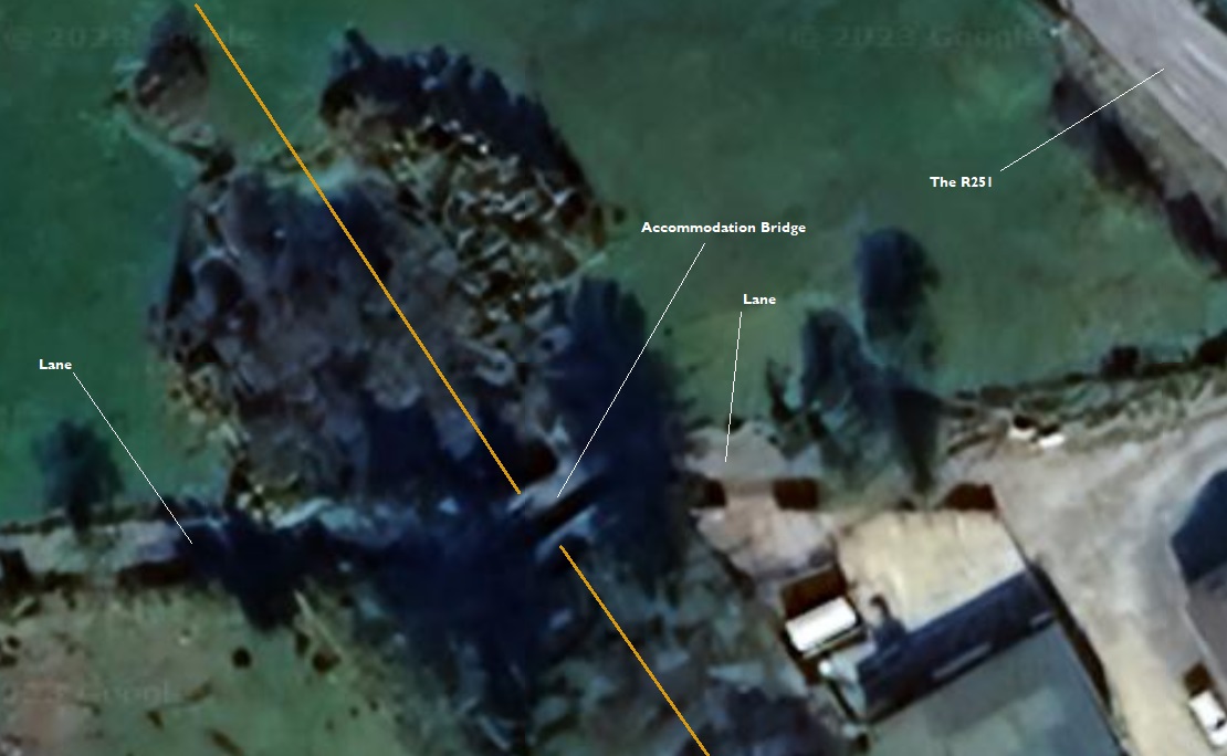
Around 200 to 300 metres Southeast of the crossing the old line entered a cutting as the land around it rose. Shortly after it entered the cutting it was bridged by a lane. Both the bridge and the lane appear to remain today.
The cutting and the accommodation bridge mentioned above are shon on this enlarged map extract from the OSi survey of 1901. The road running from the centre-top tp close to the bottom right is now the R251. [2]The accommodation bridge to the Southeast of Crossing No. 3, as it appears on Google Earth. [Google Earth, 5th July 2023]
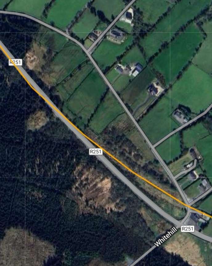
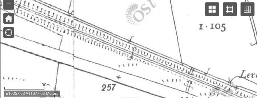
A further 700 to 800 metres to the Southeast the old railway crossed a minor road at level. This can be seen in the images below. The R251 and the old railway route run parallel to each other for a distance before the road drifts closer to the old railway and finally runs on the formation of the Burtonport Extension Railway for
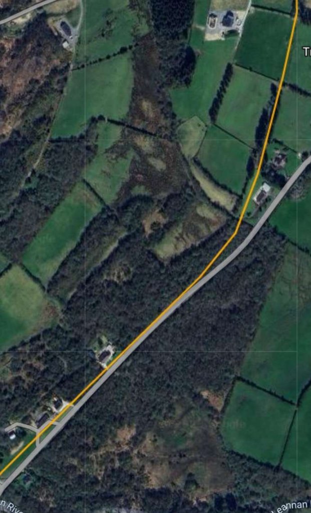
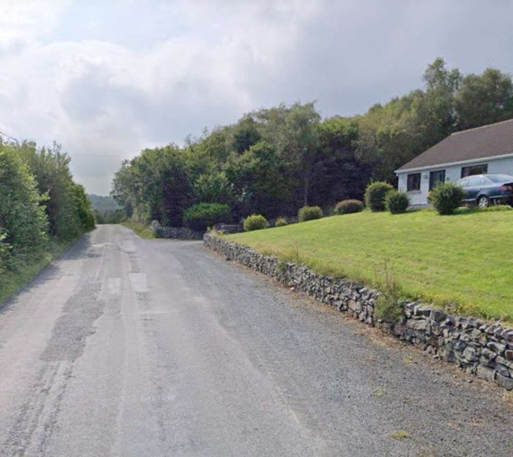
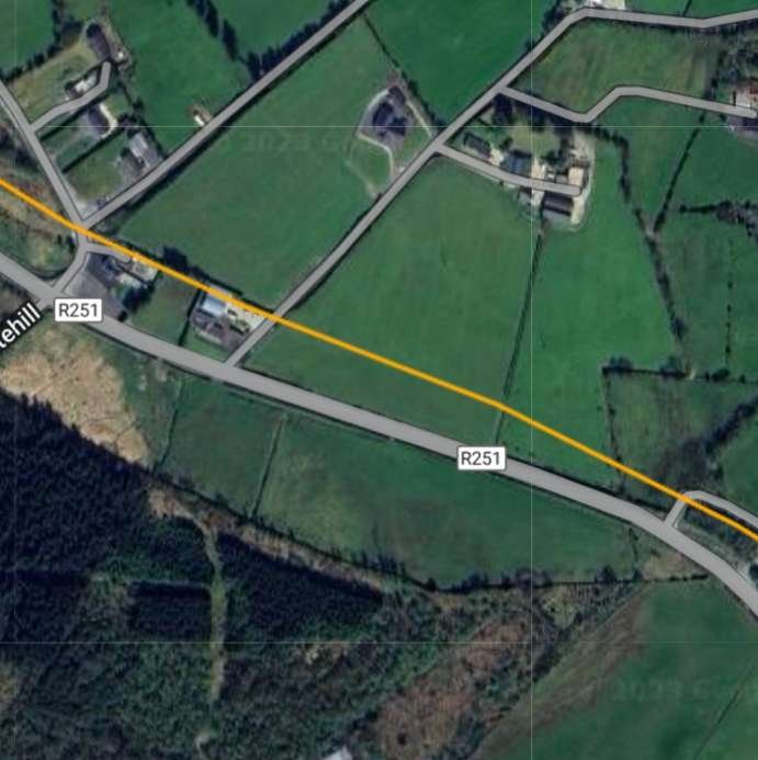
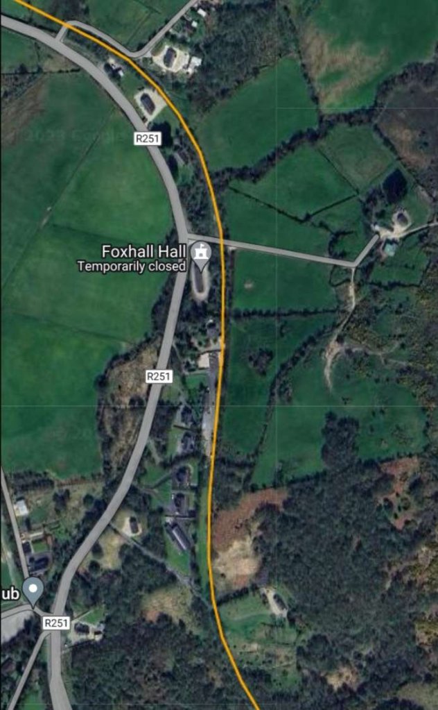
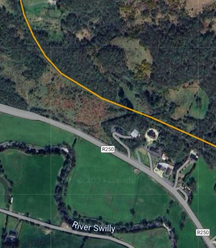
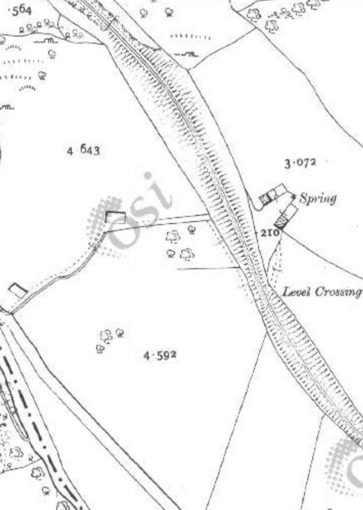
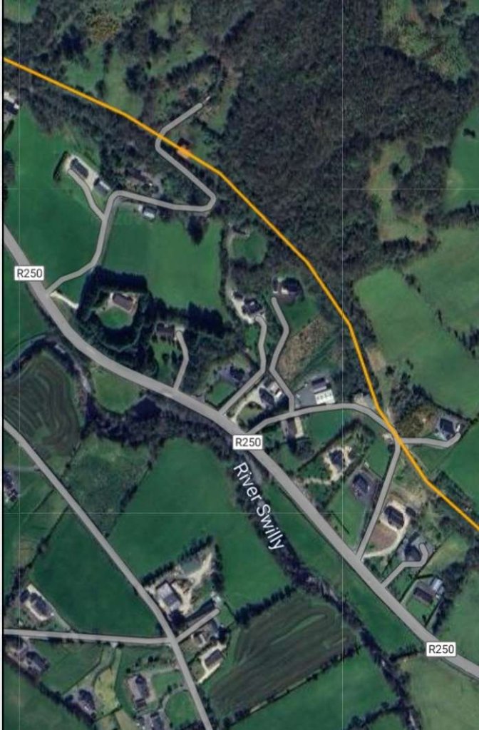
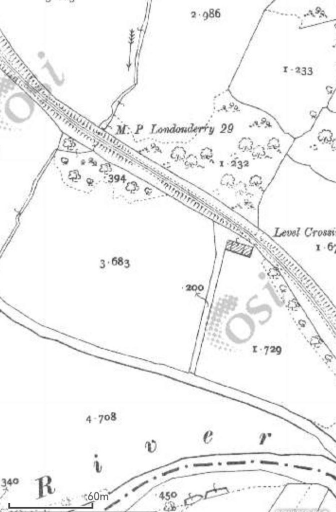
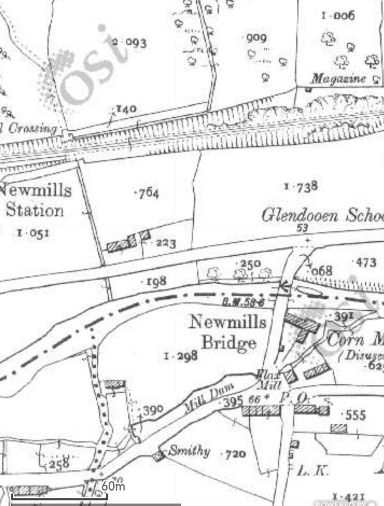
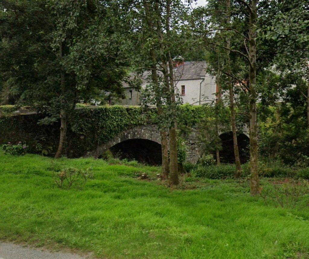
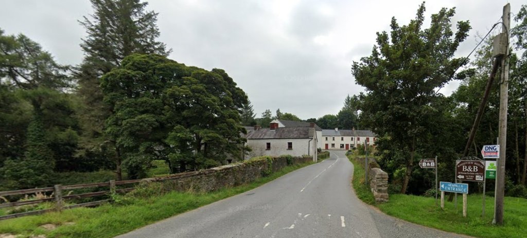
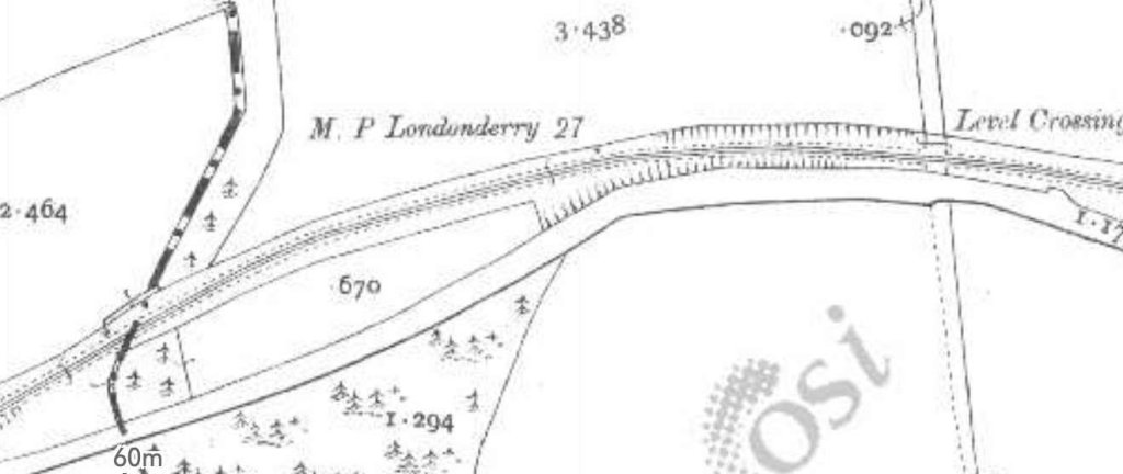
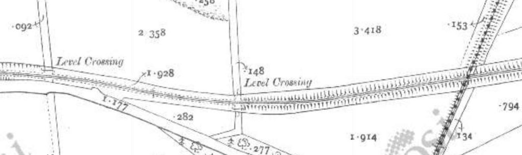
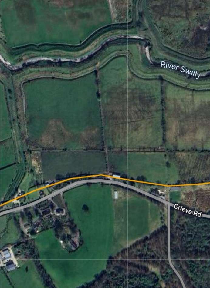
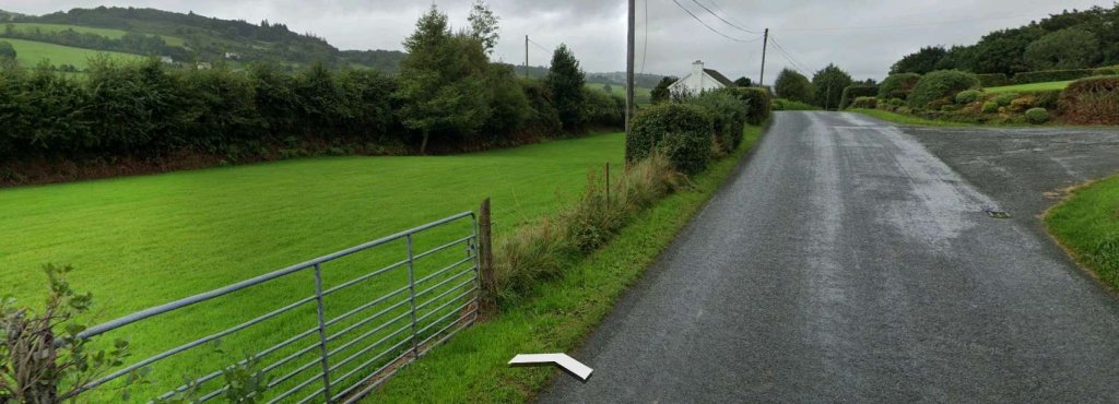
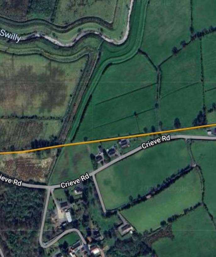
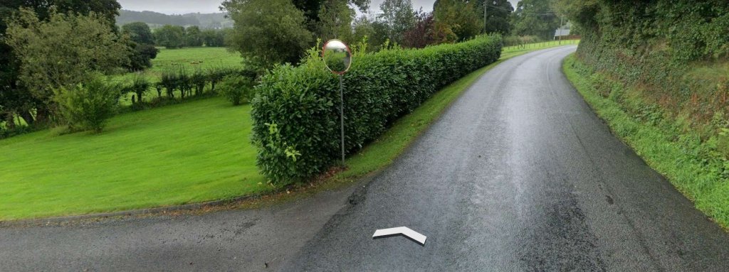
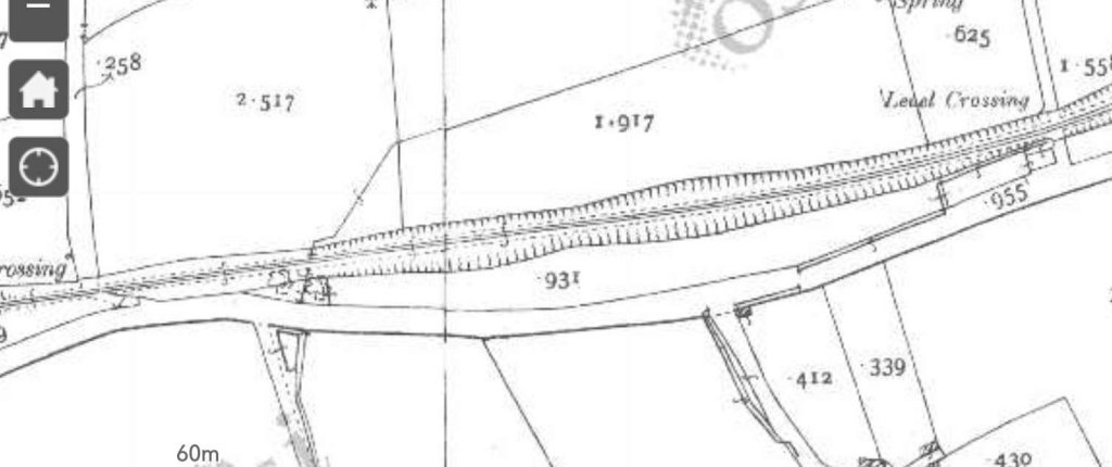
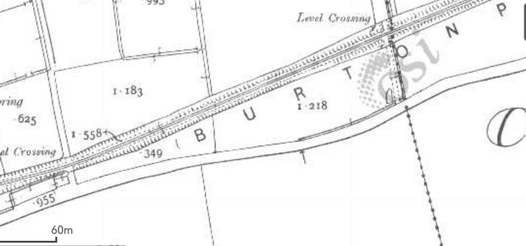
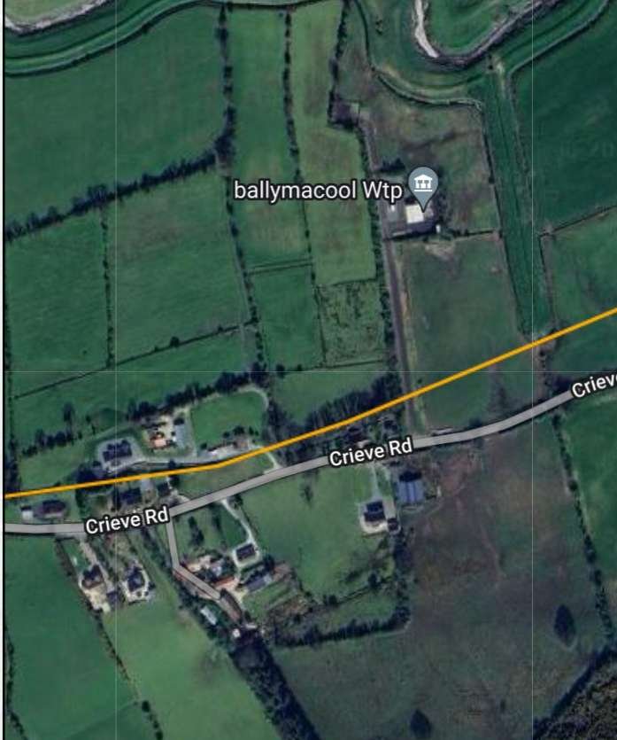
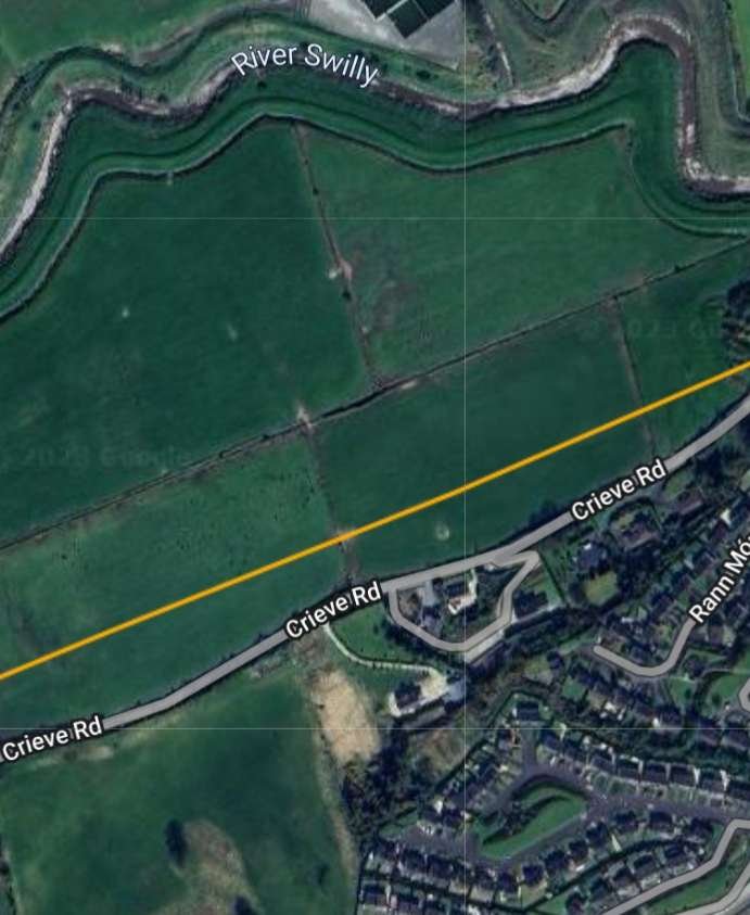
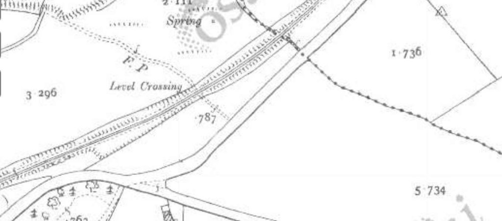
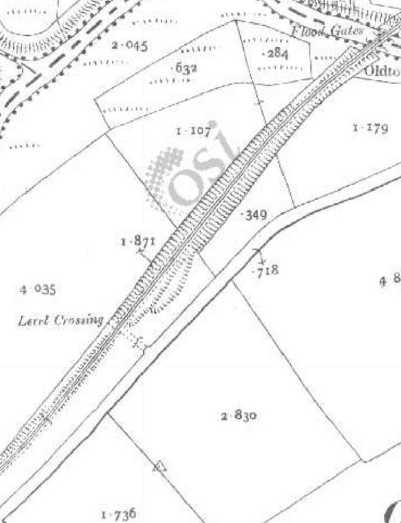
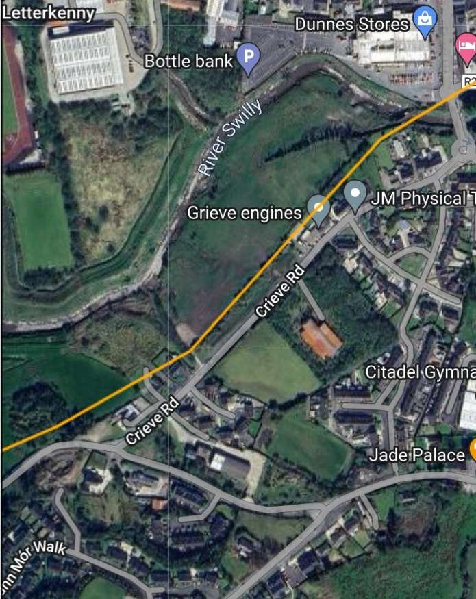
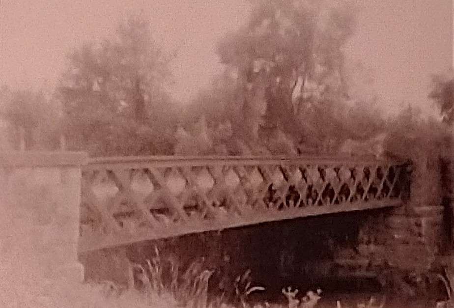
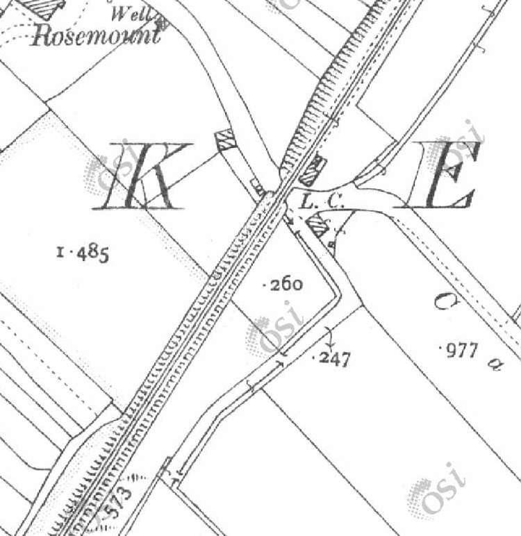
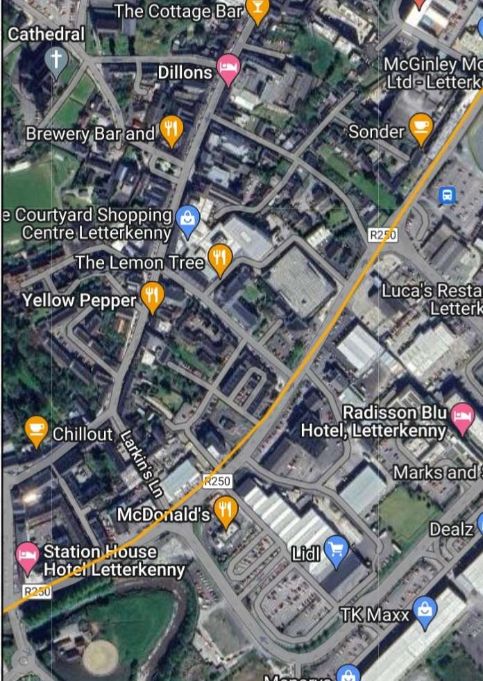
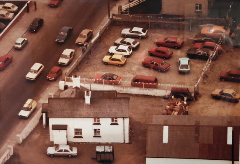
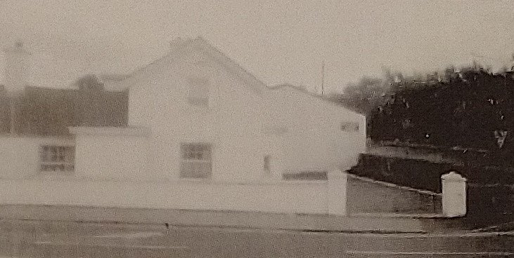
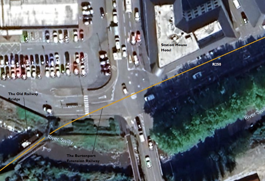
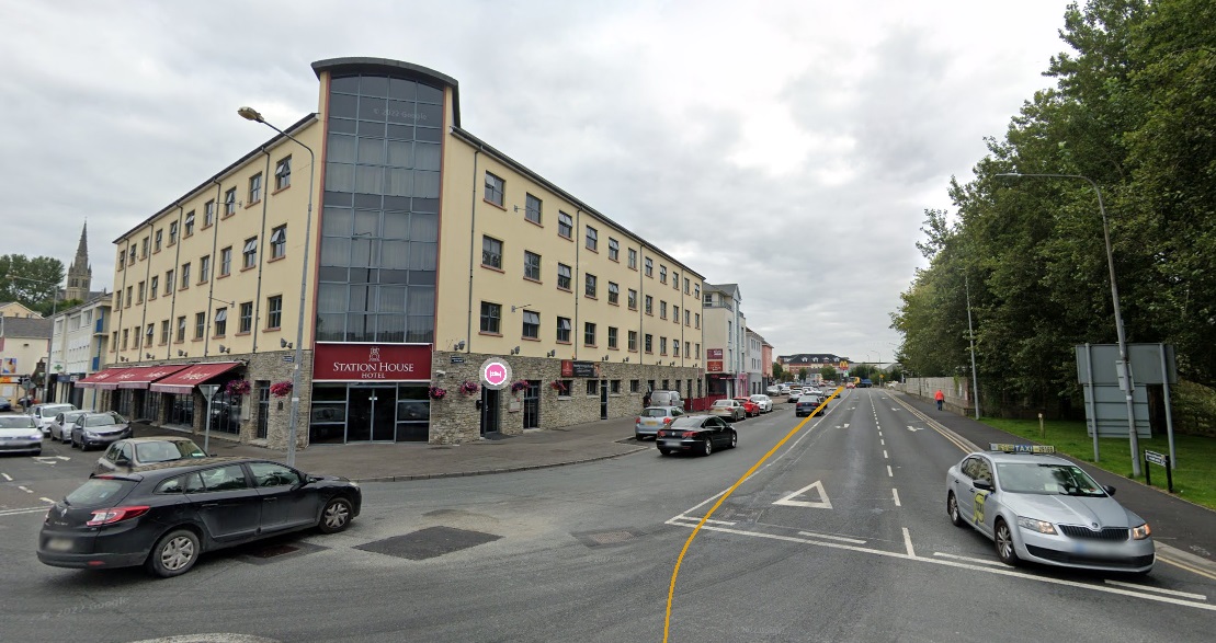
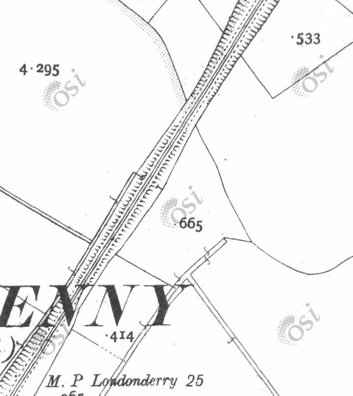
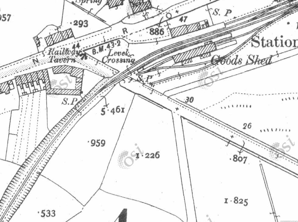
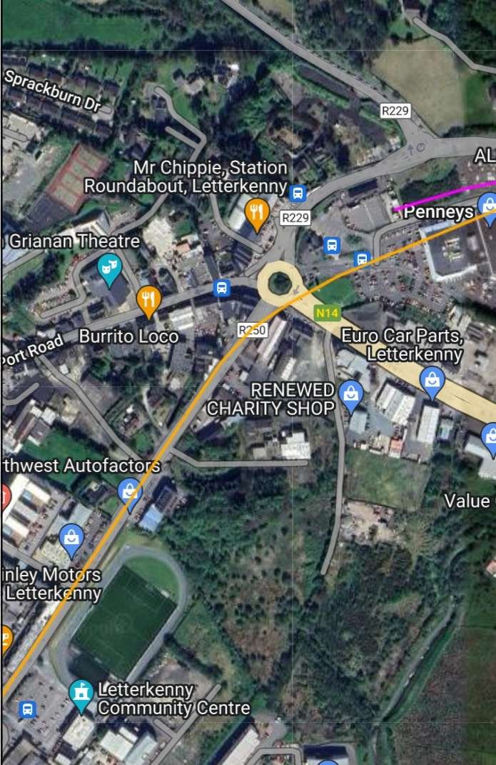
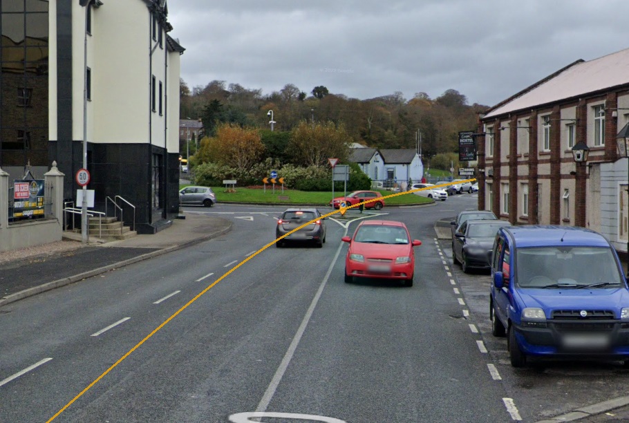
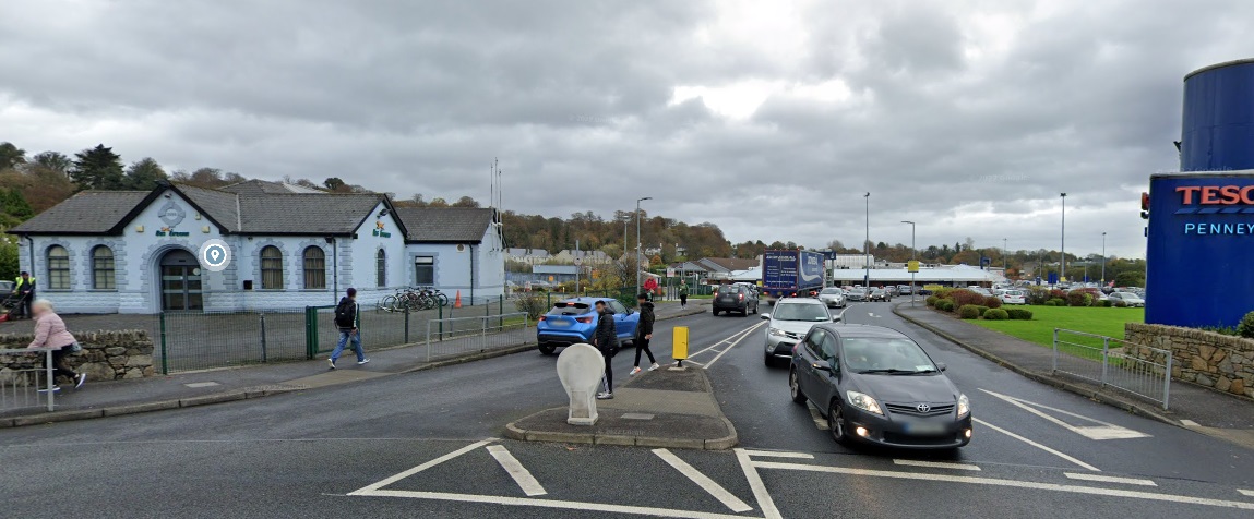
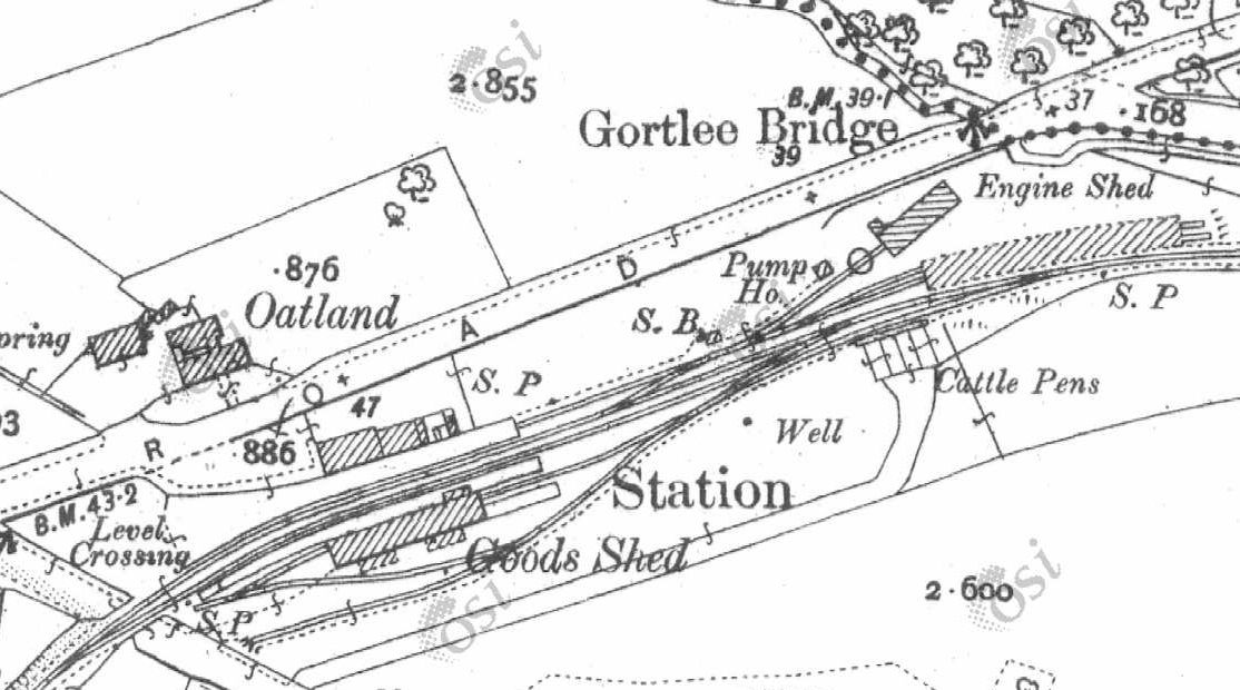
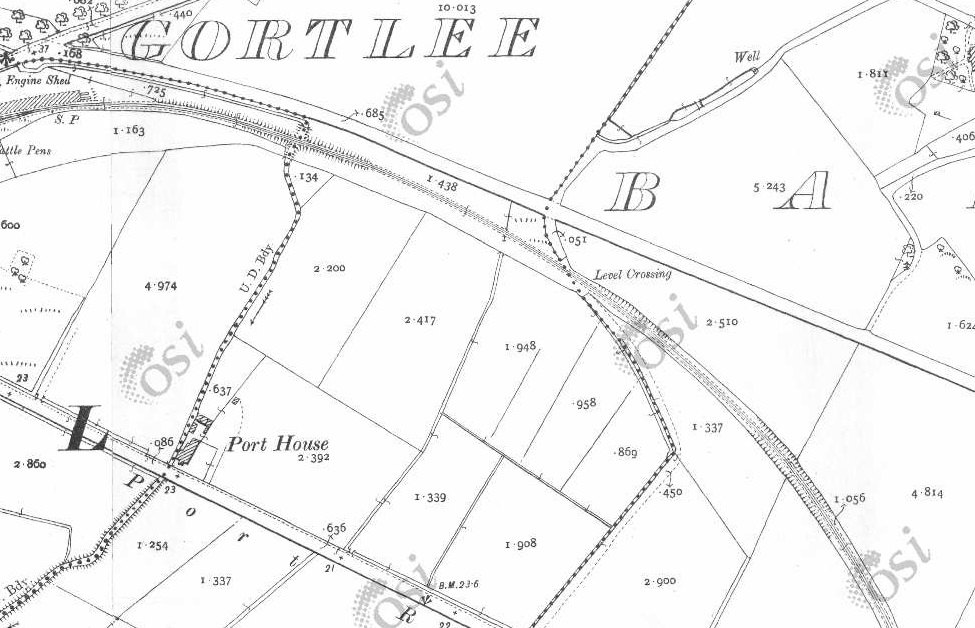
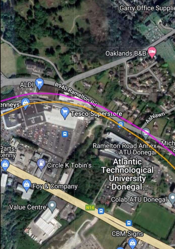
This next extract from the 25″ OSi survey shows the old road and the railway coming very close (bottom-right and then the road heads away again from the old railway line. [2]Google Maps moderna satellite imagery which is used by RailMapOnline shows the R251 leaving the old road alignment and then running Southeast along the old railway formation. [4]Looking Southwest along the minor road referred to above. The old railway ran along the line of the fireld boundary and bushes which can be seen on the right of this image. It crossed the road and then ran on in front of the hadge/bushes seen on the left of the image. [Google Streetview, August 2021]The view Northeast across the old railway line formation, looking along the same road. The Burtonport Extension Railway ran behind the bush shown on the left of this image, crossed the road and continued on the same bearing. {Google Streetview, August 2021]The road and the old railway formation become closely aligned at the tree line ahead. The old formation can still be picked out running into this photograph from the right. [Google Streetview, August 2021]Hopefully this enlarged extract from Google Earth shows clearly how the road has been moved to follow the old railway formation. The red line is the old road. The yeallow line is the old railway. The R251 is shown as the wide grey route. [Google Earth, 6th July 2023]These two map extracts cover the length of the old railway as far as Crossing No. 2, which can be seen in the bottom-right quadrant of the lower image. [2]This is the same length of line as shown on the two 25″ map extracts above. [4]An enlarged extract from the 25″ OSi survey of 1901 shows the old road crossing the railway at Crossing No. 2. The crossing keeper’s cottage is at the centre of this image, to the Southeast of the level crossing. [2]Looking back along the old railway towards Crossing No. 3. The line ran to the right of the tree in the foreground. [Google Streetview, August 2021]Turning through 180° this image shows the crossing keeper’s cottage. The line ran to the left of the cottage approximately through the shed at the left of the image. [Google Streetview, August 2021]The crossing keeper’s cottage as seen, in 2021, from the R251. [Google Streetview, August 2021]These three map extracts show the line continuing towards Foxhall Railway Station in a Southeasterly direction. [2]This single extract from RailMapOnline.com covers the same length of the old railway as the three map extracts above. [4]A view North from the R251 towards the route of the old railway. The railway ran approximately on the line of the second hedge in the image. [Google Streetview, August 2021]Looking Northeast from the R251. The old railway crossed this side road immediately before it turned round to the right. [Google Streetview, August 2021]Three extracts from the 25″ OSi survey take the old railway to the northern approach to Foxhall Station. [2]These two extracts show the Foxhall Station site. [2]South of Foxhall Station the line curved gradually round to a Southeasterly direction. [2]This RailMapOnline.com satellite image covers the same length of the old railway as do the six map extracts above. [4]The Goods Shed at Foxhall Station served as a village community centre after the demise of the Burtonport Extension Railway. It is seen here from the R251. [Google Streetview, August 2021]We are now in the valley of the River Swilly and heading for Letterkenny there are just two more stations before Letterkenny Railway Station, Mill ….. Station and Old Town Station. At this point the line was travelling in a Southeasterly direction to the North of the road which became the R250. The River Swilly is beyond the road to the South. [2]This extract from the RailMapOnline.com satellite imagery shows the route of the old railway, the R250 and the River Swilly and covers nearly the same length of railway as the map extracts above. [4]These two map extracts show the line continuing Southwest down the Swilly valley. [2]This RailMapOnline.com satellite image covers much the same length of the old railway as the map extracts above. [4]A further two map extracts has the River Swilly, the R250 and the Burtonport Extension Railway in close order still heading Southeast. [2]This satellite image mage covers a similar length of line to the two map extracts above. [4]Two more extracts take the line as far as Newmills Station and the cluster of buildings around Newmills Bridge – Flax Mill, Corn Mill and associated buildings. [2]Newmills and the location of Newmills Station in the 21st century. [4]A closer view of Newmills Station which was effectively no more than a halt. [2]Newmills Bridge seen from the R250. The mills are hidden beyond the trees. [Google Streetview, August 2021]The mills at Newmills seen from the R250. [Google Streetview, August 2021]Two more map extracts show the old railway bridging both the R250 and the River Swilly. [2]Again this satellite image covers much the same area as the two map extracts above. [4]Looking Northeast on the R250 at the remaining bridge abutment on the North side of the road. [Google Streetview, August 2021]A little further to the East, this view shows trees and undergrowth on the line of the old railway embankment on the South side of the R250. The bridge abutment on the South side of the road would have been off the image to the right but will have been removed when the road was improved. [Google Streetview, August 2021]A single map extract shows the line travelling Northeast towards Letterkenny. [2]This RailMapOnline.com satellite image takes the route of the old line to the same point as the map extract above. [4]The old railway ran on the North side of the minor road between Newmills and Letterkenny, effectively just beyond the hedge line. [Google Streetview, August 2021]These two map extracts show the line heading on Northeast towards Letterkenny. [2]This satellite image covers the same ground as the two map extracts above. [4]These two map extracts show the old railway and the adjacent road back immediately next to each again. [2][4]In this image, taken 200 metres or so to the West of the side road shown in the above satellite image, the route of the old railway was immediately to the left of the hedge line. [Google Streetview, August 2021]These three map extracts see the old railway running East through Mile Point 27. [2]Crieve Road and the old railway route run West to East across this satellite image which covers a similar length of line as the three map extracts above. [4]Further Northeast, the boundary of railway land can be discerned, the parallel hedges to the left of the road delineate the route of the old railway. [Google Streetview, August 2021]The old line and Crieve Road come close to each other again. [2]Another satellite image which covers the same area as the map extract above. [4]This is the view Northeast at the right quarter point of the satellite image above. The hedge which runs in from the left side of the image marks what was the boundary of railway land. [Google Streetview, August 2021][4][4]These two further map extracts show the old railway heading Northeast towards Letterkenny. The bridge crossing the River Swilly at Letterkenny Old Town can be seen in the top-right of the lower of these two extracts.. [2]This satellite image covers the same length of the old railway as the two map extracts above. There is a marked encroachment of the built up area of Letterkenny! [4]The Burtonport Extension Railway crossed the River Swilly at Letterkenny Old Town on a substantial girder bridge which had stone abutments. This picture was probably taken in the late 1980s. By this time it had not been in use for around 40 years. [1: p60]A similar view of the bridge in 2023. [My photograph, 29th April 2023]Another view of the railway bridge, this is taken from the East, from the modern road bridge over the River Swilly. These two pictures show a bridge that is continuing to bear up to the effects of the environment in 2023, some 75 or so years after the closure of the Burtonport Extension Railway. [My photograph, 29th April 2023]After crossing the River Swilly, trains crossed a level crossing which protected the Western approach to Old Town Station. Old Town Station was a halt rather than a Station, it had a short single platform adjacent to the level crossing on the road South out of Letterkenny Old Town. [2]These two map extracts show the old railway line heading Northeast outside the old limits of Letterkenny Town. The level crossing in the middle of the second extract was provided with a crossing keeper’s cottage. The location of the cottage is now a car park. [2]Letterkenny has developed considerably since the 25″ OSi survey was undertaken at the beginning of the 20th century. The line heading Northeast from Old Town station was once in fields but is, in the 21st century, overwhelmed by modern development. The formation of the Burtonport Extension Railway appears now to be the route of the R250 which runs round the South side of the town centre. This extract from RailMapOnline.com’s satellite imagery covers roughly the same length of line as the three map extracts immediately above. [4]This is an aerial view from the 1980s of the former Oldtown Railway Station House. In 2005 it was knocked down and rebuilt, opening first as the Ramada Encore Hotel in 2006 before officially being renamed in 2010 as the “Station House Hotel.” This image was shared on the Letterkenny History Facebook Page on 1st July 2023. [11]This photograph of Old Town Station building also comes from the 1980s when it was a private dwelling. The photograph is taken from the road before the new R250 was built along the old railway formation. [1: p59]Google Earth provides this satellite image of the old railway bridge over the River Swilly and the Station House Hotel which stands on the site of the old Station House which served Old Town. [Google Earth, 10th July 2023]This view looks Northeast from the line of the Burtonport Extension Railway and shows the modern Station House Hotel which sits on the site of Old Town Station building which was demolished as noted above. The yellow line is an approximation to the route of the old railway which might have run a little closer to the modern hotel. [Google Streetview, November 2022]The view Northeast from the R250 towards the location of the crossing-keeper’s cottage, which is shown at the bottom of the map extract below. I have been unable to find a picture of the old railway building. [Google Streetview, November 2022]Three extracts from the 25″ OSi survey of 1901 show the length of the line from the final crossing-keeper’s cottage on the Burtonport Extension Railway to Letterkenny Railway Station. [2]The final approach to the location of Letterkenny Railway Station as shown by RailMapOnline.com. The pink line entering from the right is the Co. Donegal Railways line to Strabane. [4]Looking Northeast along the R250 in November 2022 at what would have been the station throat. The approximate line of the old railway is shown in yellow. The sky-blue building at the centre of the image is the old Co. Donegal Railways station building now in use as a bus station. [Google Streetview, November 2022]Looking East-northeast into the site of what was the L&LS Railway Station in Letterkenny. The sky-blue building, as we have already noted, was once the Co. Donegal Railways Station building. [Google Streetview, November 2022]Letterkenny Station in 1901, before the arrival of the Co. Donegal Railways line from Strabane. When the Co. Donegal Railways line from Strabane arrived at Letterkenny, the road running diagonally across the map extract had to be moved over to accommodate the new Station. [2]At a smaller scale, this extract from the 25″ OSi Survey of 1901 shows the line to the East of Letterkenny as it heads away towards Derry. [2]Letterkenny Railway Station area and the line to the East as shown by RailMapOnline.com. As noted above, the pink line is the route of the Co. Donegal line to Strabane. [4]
Ernie’s Railway Archive on Flickr has a range of photographs of the L&LS Letterkenny Railway Station site from the 1950s, the links are embedded here below, click on each link to see the image in Ernie’s Railway Archive on Flickr:
https://flic.kr/p/2nMqBvu – The L&LSR Station site from the East in 1952. The carriage shed is closest to the camera on the right of the image. The locomotive shed and turntable are hidden behind the carriage shed. At the centre-top of the image, the Goods Shed can be seen.
https://flic.kr/p/2nM8xYs – The Goods Yard of the L&LSR in 1952. Beyond wagons L&LSR No. 124 and L&BER No. 73 the Goods Shed and the passenger station building can be seen.
https://flic.kr/p/2nWyB5y – The L&LSR Goods Yard in 1952. The side elevation of the Goods Shed is visible beyond the wagons in the yard. Prominent in the picture is L&LSR Wagon No. 71.
https://flic.kr/p/2nCR8dg – L&LSR No. 12 is featured in this image from 1952. No. 15 is just poking its nose into the shot on the left.
https://flic.kr/p/2kHNdD9 – L&LSR No. 8 is being turned on Letterkenny’s turntable on 27th June 1952.
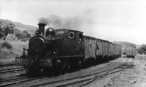
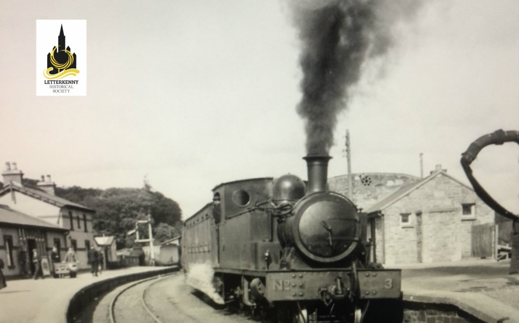
https://flic.kr/p/BWoyiF – L&LSR No3 at Letterkenny. On the left, the image is framed by the wall of the Goods Shed. The crossing gates at the West end of the station are visible beyond No. 3’s train. The passenger facilities are on the right. Note the coach acting as a brake van for the train. (c) JW Armstrong/ARPT
https://flic.kr/p/BvajsP – L&LSR No. 12 in the Engine Shed at Letterkenny, (c) JW Armstrong/ARPT
https://flic.kr/p/2ma5Lo3 – The L&LSR Station at Letterkenny on 1st July 1959 after the rails had been lifted. The Goods Shed door is closed (on the left) and the station buildings are on the right.
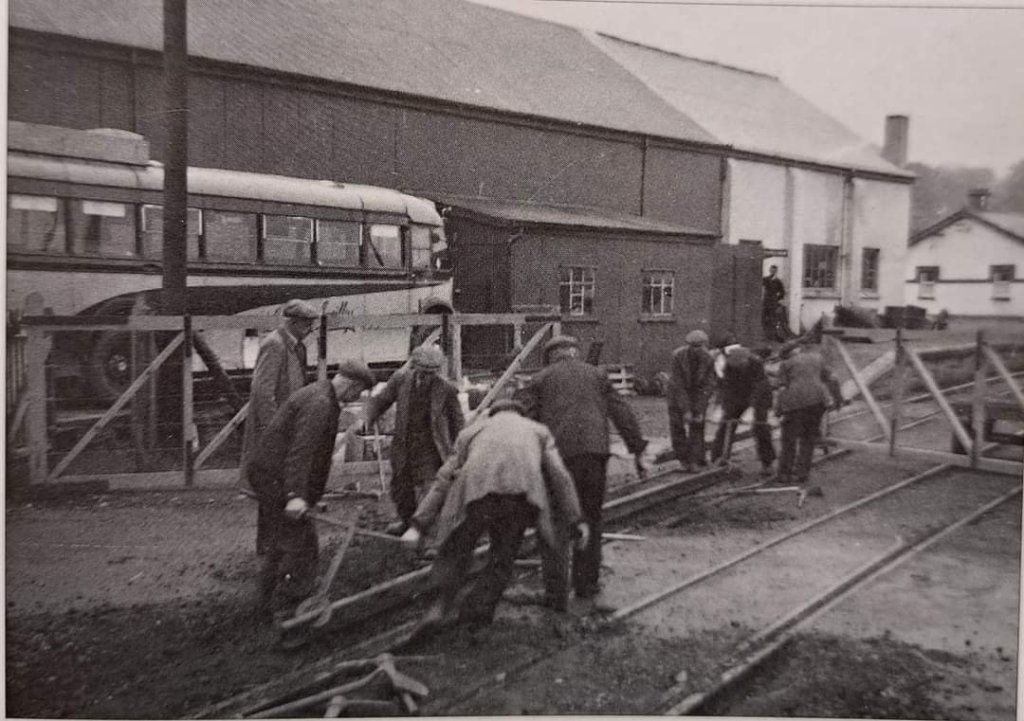
https://flic.kr/p/2k1hGvQ – The L&LSR operated a daily goods service by lorry after the closure of the line. A company rail lorry bearing the number plate IB7024 is shown standing where trains would once have passed, adjacent to the station building at Letterkenny. The photograph was taken on 23rd August 1954.
Other photographs of Letterkenny’s L&LSR railway station can be found on Flickr or elsewhere on line:
This image shows 4-6-0T No. 3, probably, in the Yard at Letterkenny station. No. 3 was built by Barclay in 1902. The image was shared by ‘Trainiac’ on Flickr and noted as being in the Public Domain. [12]
Dave Bell & Steve Flanders; The Londonderry & Lough Swilly Railway: A Visitor’s Guide; County Donegal Railway Restoration Society, The Donegal Railway Heritage Centre, Donegal.


