Images of traffic on the line when it was still operating seem to be few and far between. I am continuing to look for images and may post an addendum if sufficient come to light in due course.
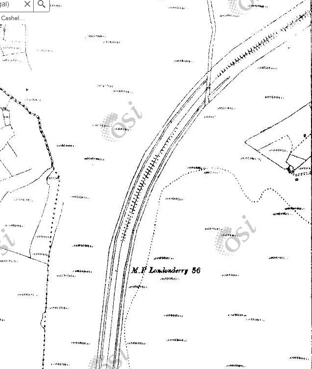
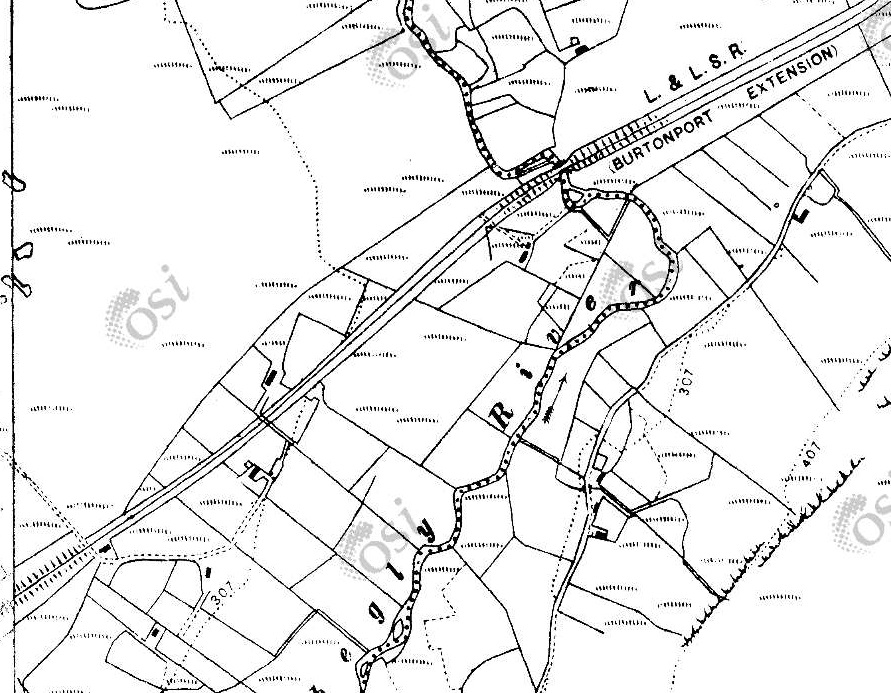
The 1940s 1″ OSi mapping below shows the length of the covered in this third article.
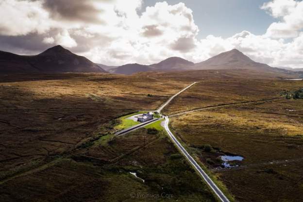
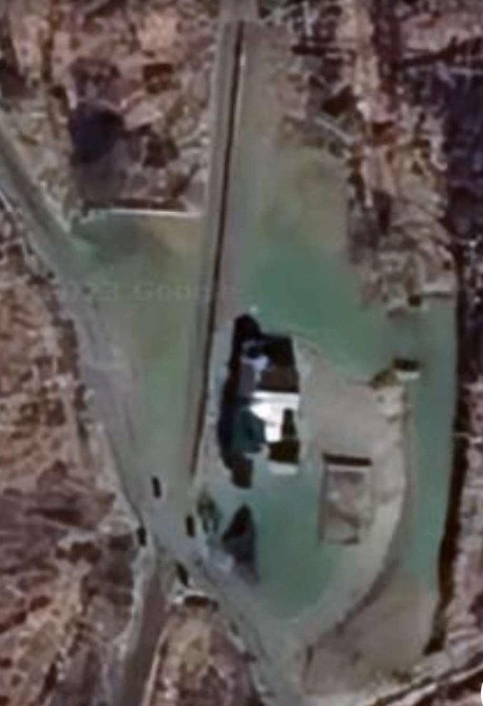
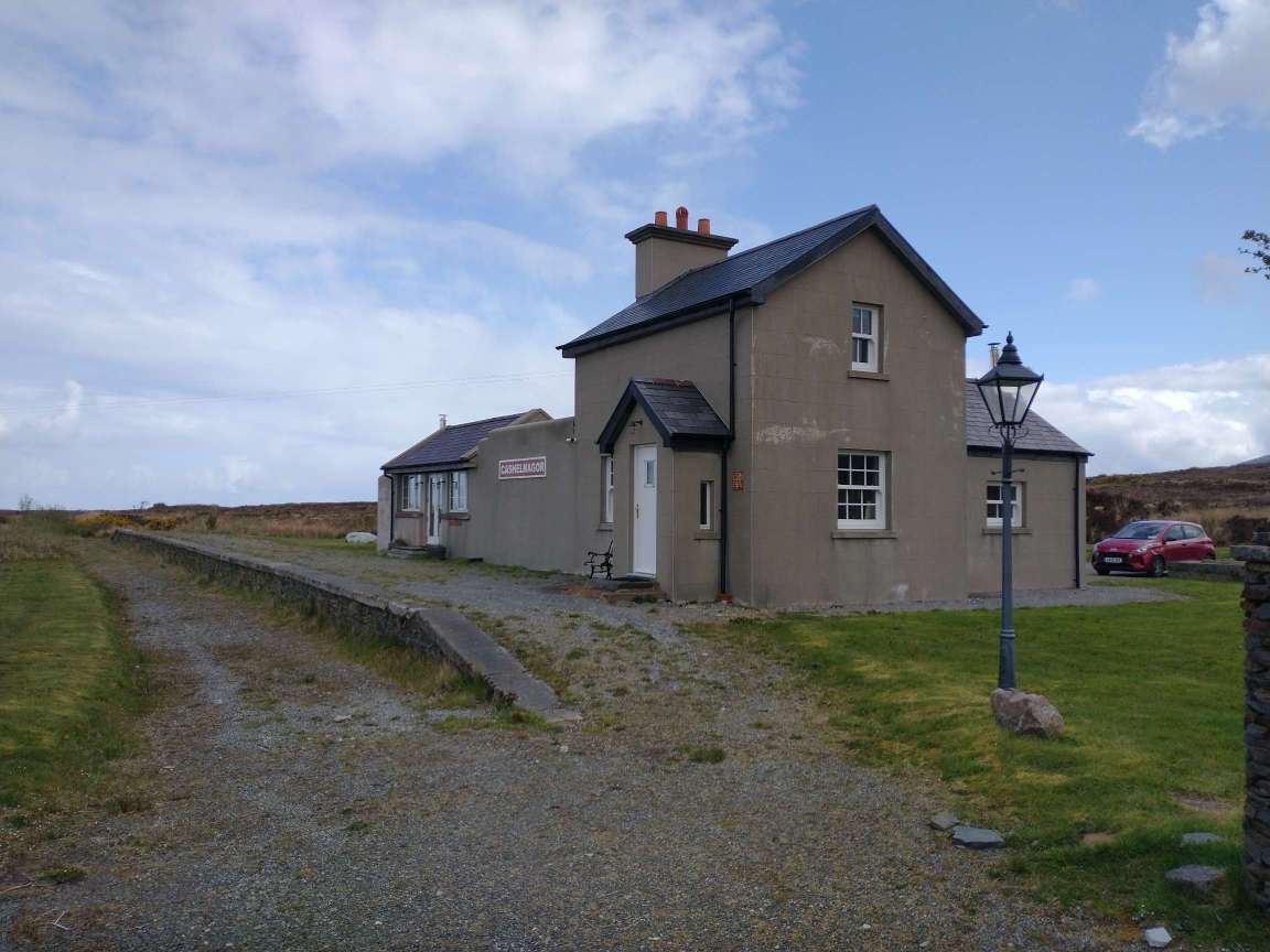
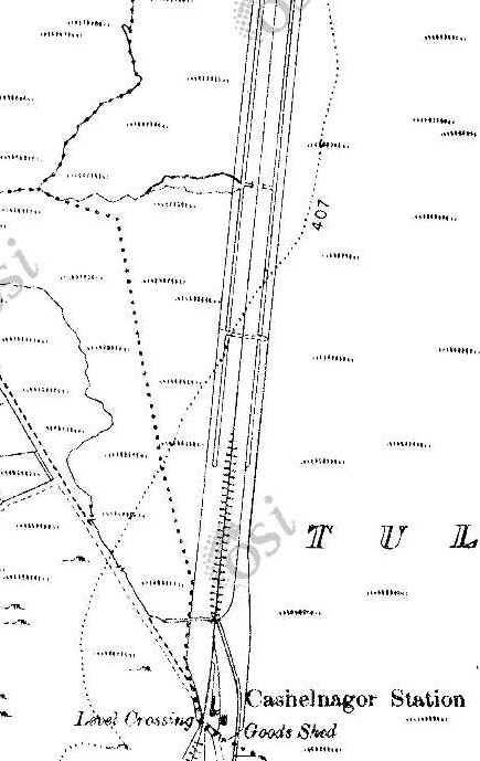
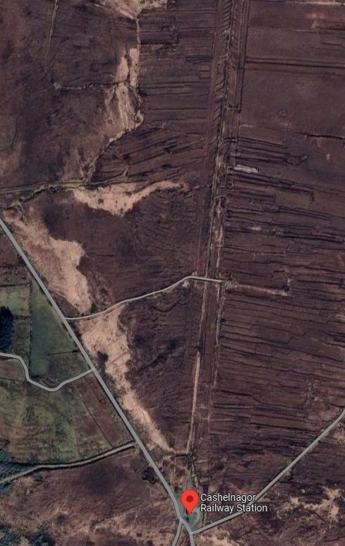
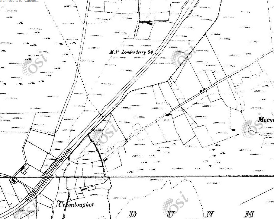
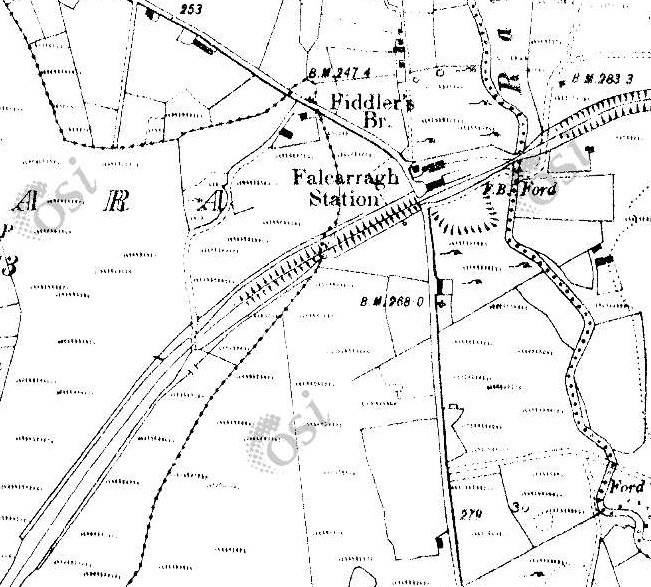
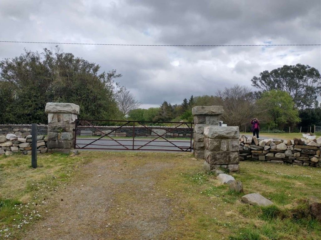
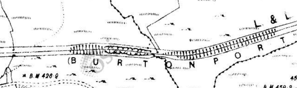
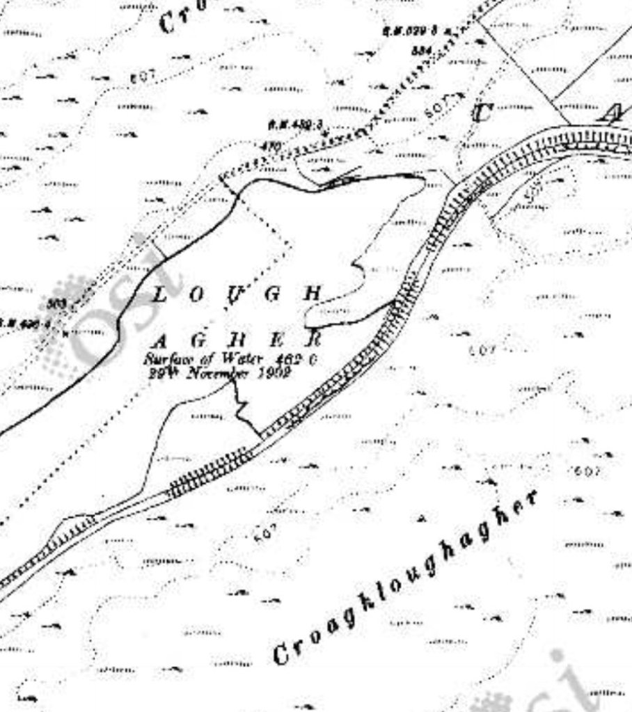
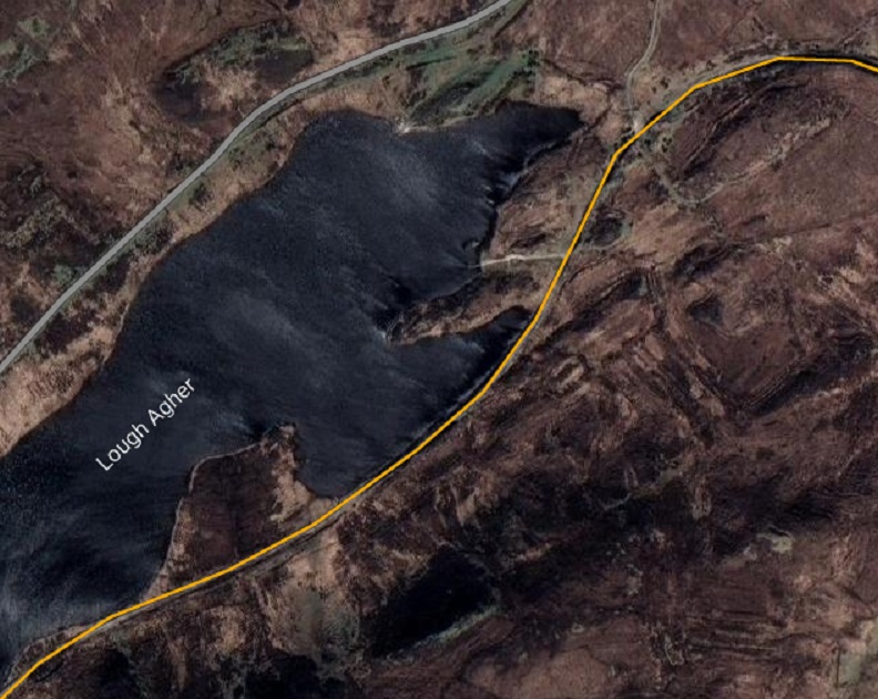
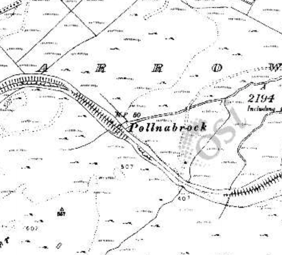
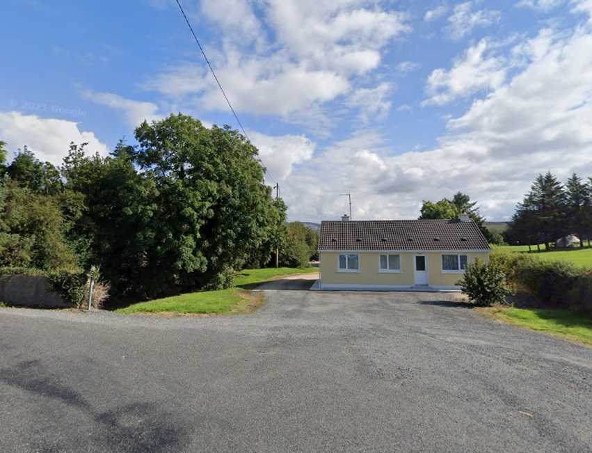
This first segment covers Cashelnagor Railway Station via Falcarragh Railway Station to Lough Agher. [2]This next segment runs from Lough Agher via Dunfanaghy and Creeslough Railway Stations, across the Owencarrow Viaduct and through Barnes Gap. [2]Our starting point for this part of the journey along the Burtonport Extension Railway is at Cashelnagor Railway Station. This is an extract from the 25″ OSi mapping of the early 20th century. [2]A very similar area as covered in the map extract above. This is how the site of Cashelnagor Railway Station appears on the satellite imagery provided by Google Earth [May 2023]Cashelnagor Railway Station viewed from the crossing location to the South of the Station in April 2023. As we noted in the lst article about the line, the station building has been refurbished and is in use as a holiday let. [3][My photograph, 24th April 2023]
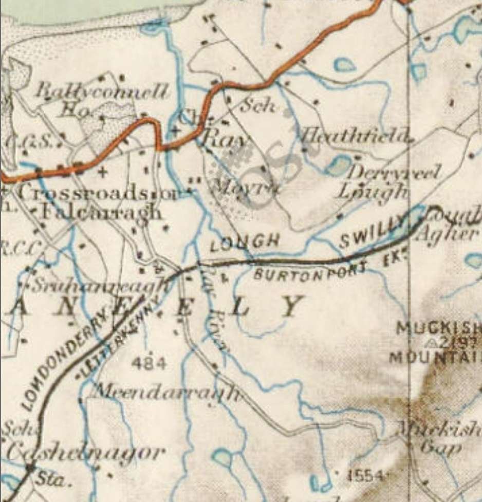
The length of the line from Cashelnagor Railway Station to Falcarragh Railway Station is best seen on the 6″ OSi mapping of 1901 as one sheet of the 26″ mapping covering the route is not available on line. The quality of the reproduction of the map extracts below is not as good as it might be, but it is the best available at present. [2]
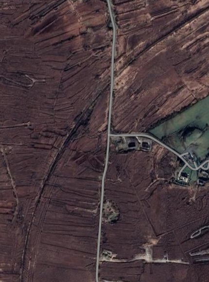
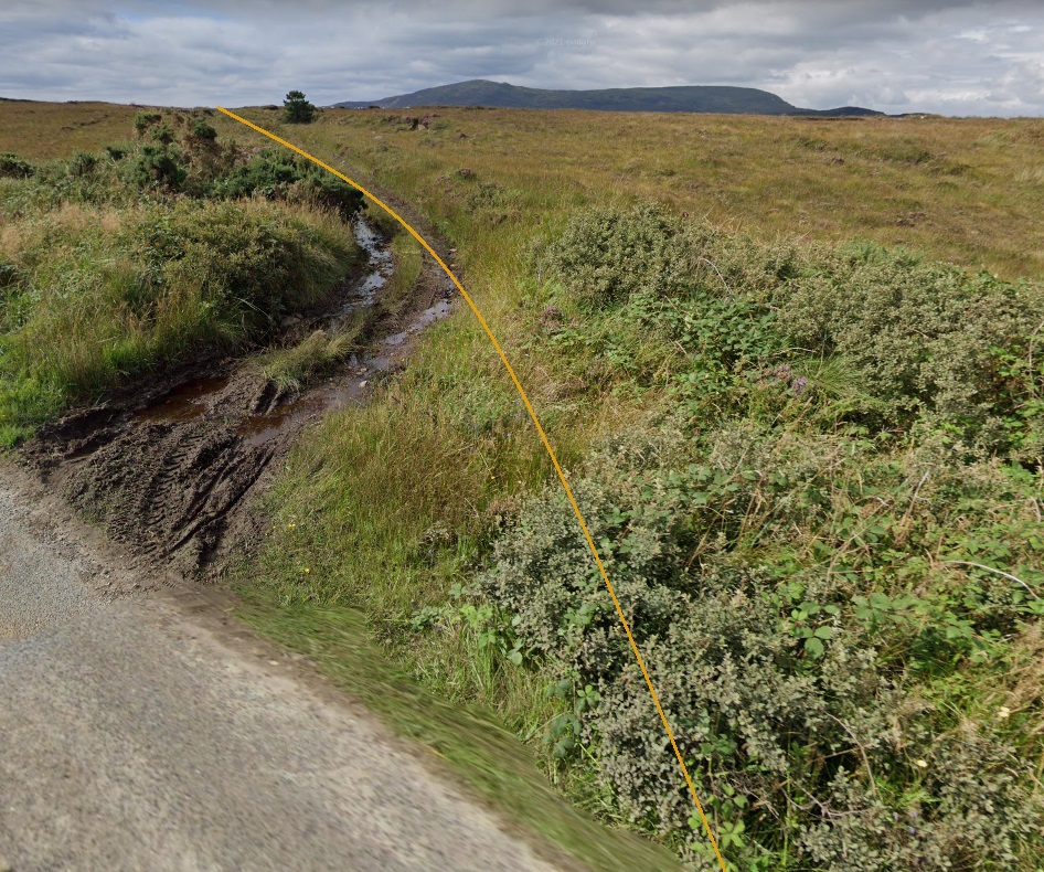
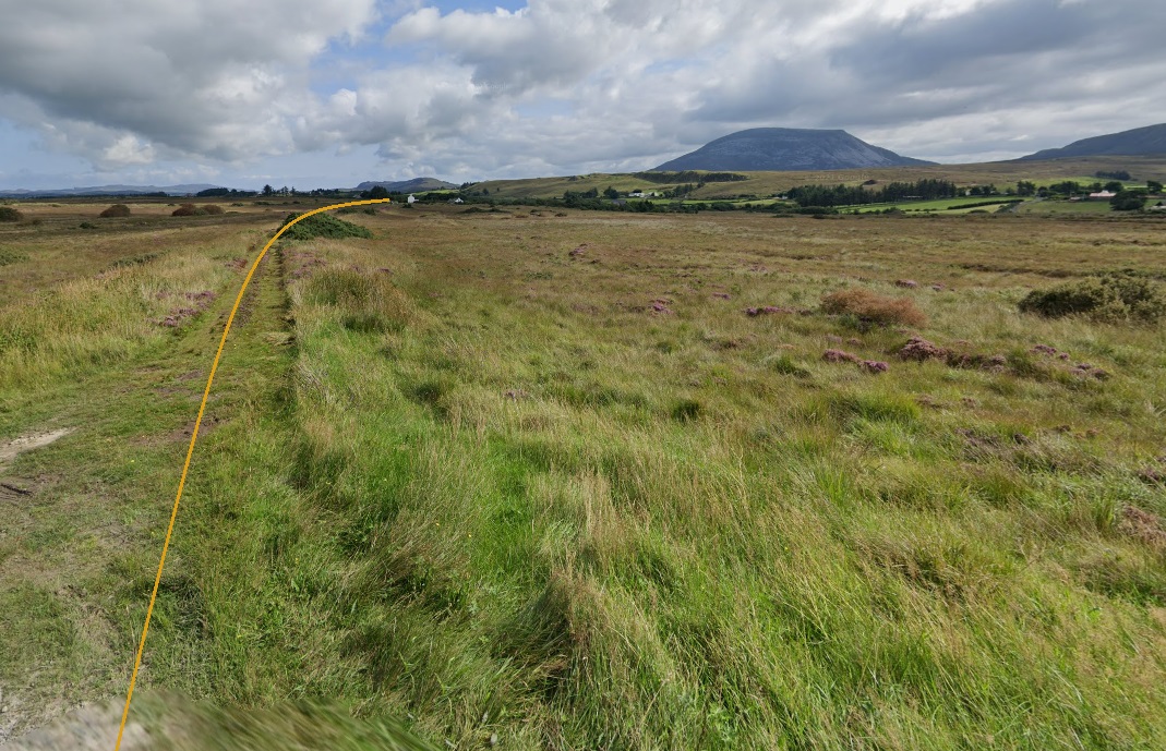
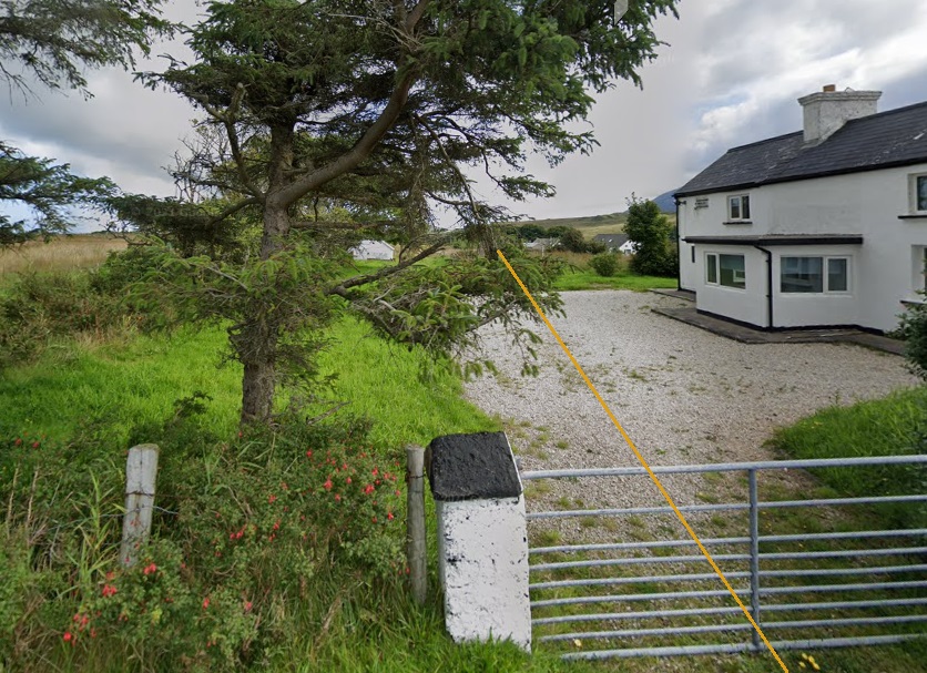
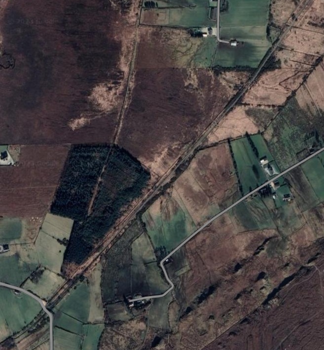
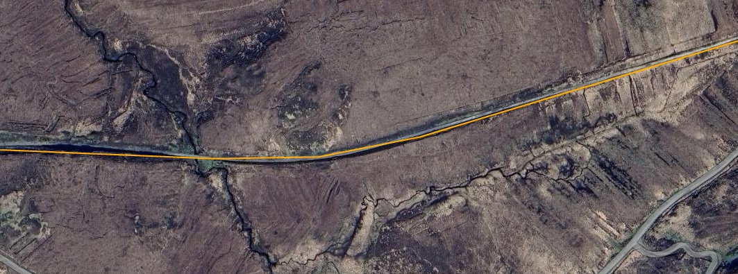
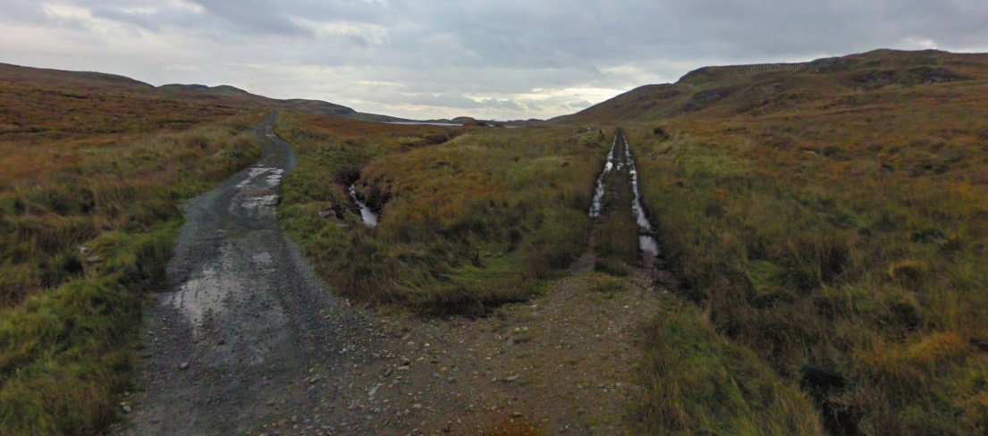
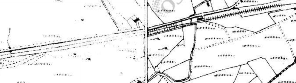
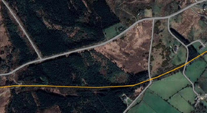
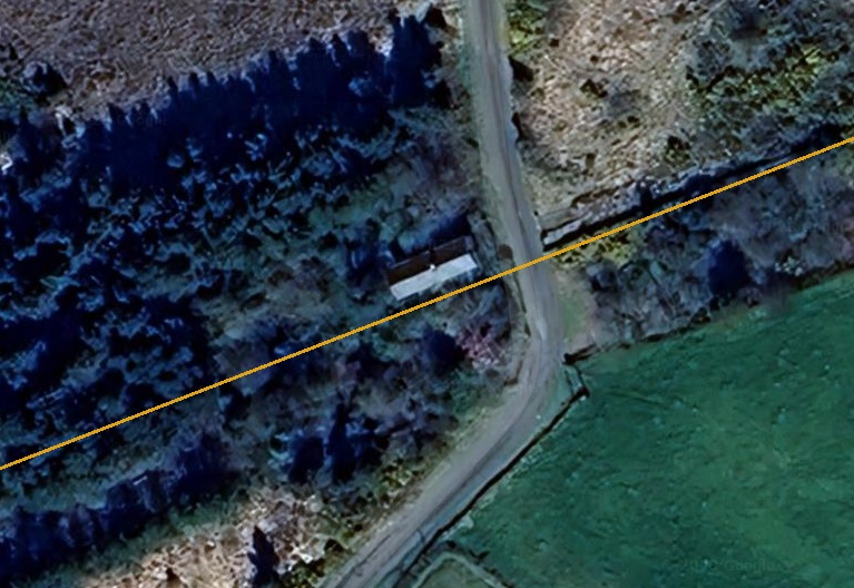
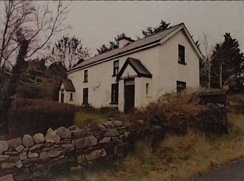
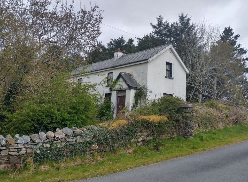
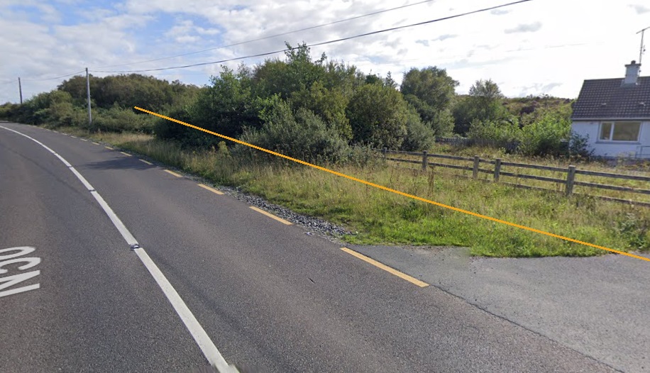
The 6″ OSi mapping shows the old railway heading almost due North away from Cashenagor Railway Station. [2]A similar length of the old line as it appears on Google Earth in 2023. [Google Earth, 31st May 2023}At Milepost 56 (56 miles from Derry) the line begins to curve round to the East. [2]Another Google Earth satellite image which shows the route of the old line as it appears in 2023. [Google Earth, 31st May 2023]Looking back Southwest from the minor road which appears on the Google Earth satellite image above. The route of the old railway is shown by the superimposed yellow line. [Google Streetview, August 2021]At the same location, looking Northeast along the route of the old railway. The minor road on which we are standing was no more than a track in the days when the railway was operating. The map extract above shows it petering out after crossing the line. It linked in to another track to the North of the line. [Google Streetview, August 2021]The old railway crossed the Tullaghobegly River on embankment while running in a Northeasterly direction. We are on the next OSi 6″ map sheet from 1901 and the detail is a little easier to make out. In the bottom left of the extract there is a track crossing the old railway. [2]This extract from the Google Maps satellite imagery shows the same length of the old railway as the map extract above. The Tullaghobegly River is easy to make out running across the image from South to North. The old railway route is still clearly visible as well running from the lower left of the image to the top-right. [Google Maps, 31st May 2023]This enlarged extract from Google Maps satellite imagery shows the minor road crossing the line of the old railway which appeared in the bottom-eft of the image above. [Google Maps, 31st May 2023]Looking back Southwest from the minor road shown on the Google Maps extract above. [Google Streetview, August 2021]From the same location, looking Northeast towards Falcarragh Railway Station, with the line of the old railway superimposed. The house here is not recorded as a crossing keeper’s hose so the track will have crossed the line at an ungated crossing. [Google Streetview, August 2021]The railway bridge over the Tullaghobegly River still stands in 2023. We did not get a photograph of this bridge when we walked to Falcarragh Railway Station. [Google Maps, 31st May 2023]
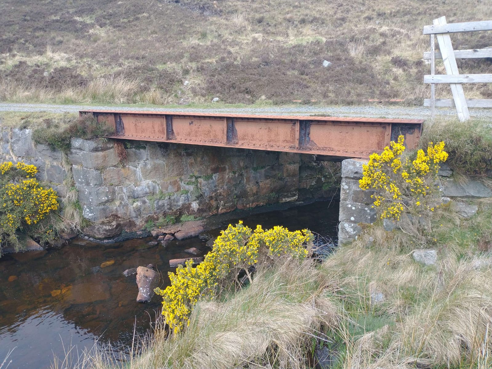
“The Tullaghobegley River (also known as the Bawaan River) flows for some 9 miles, emptying into Ballyness Bay and thence to the sea. The source of the river is Lough Altan at the base of Mount Errigal in Glenveagh National Park. … The Tullaghobegley, though small, is a productive salmon and sea trout fishery recording around 300 salmon per season. The river fishes from June onwards. During spates there are some nice pools above the Main Road Bridge, above the old Railway Bridge and at Meendarragh.” [4]
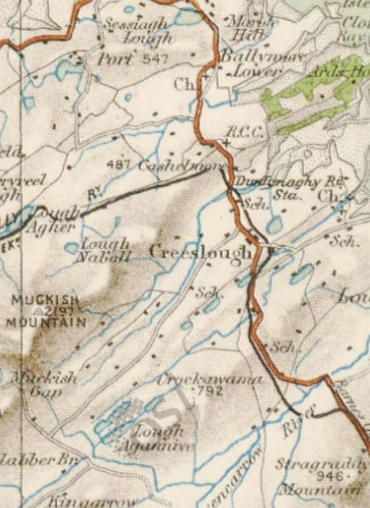
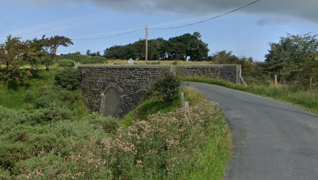
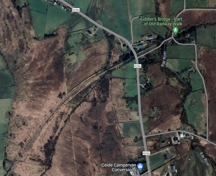
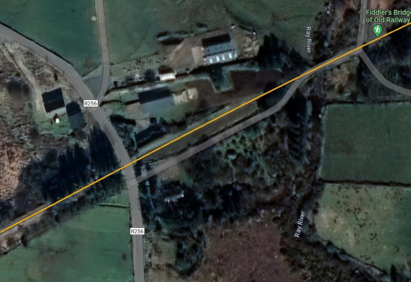
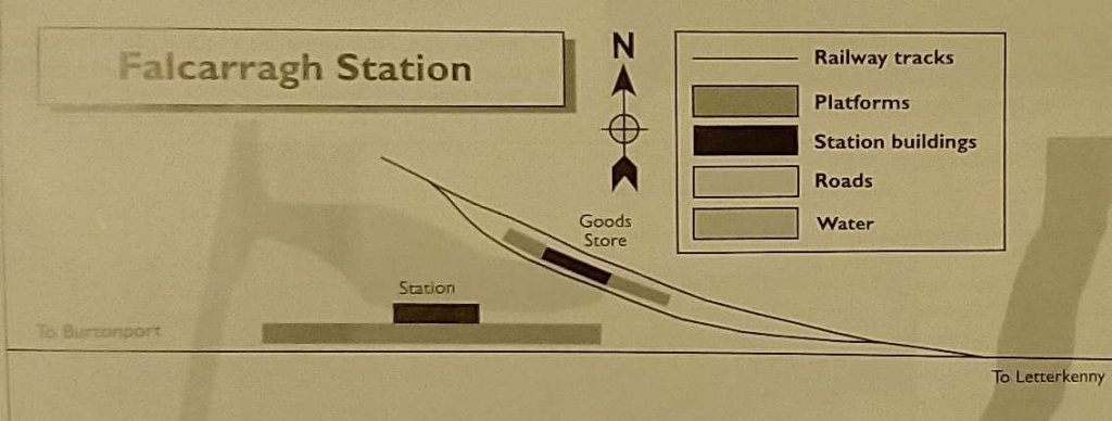
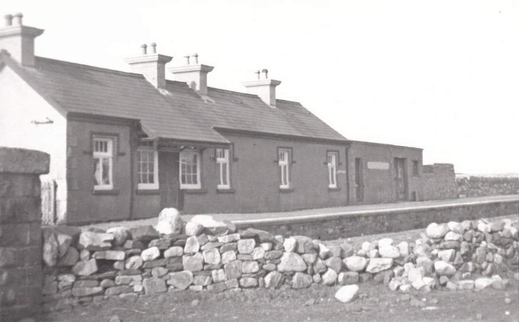
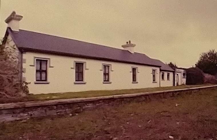
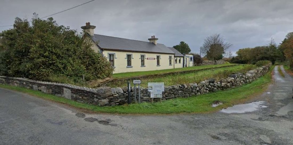
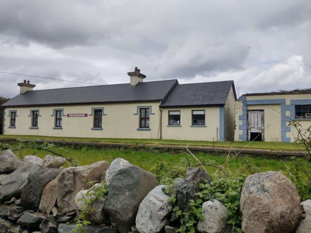
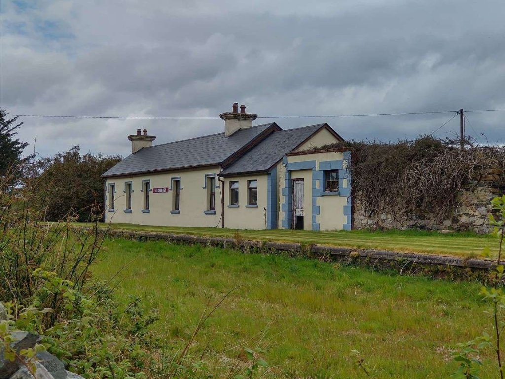
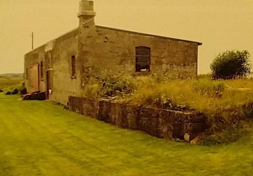
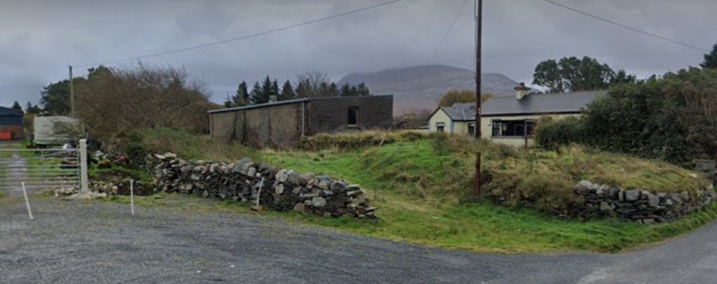
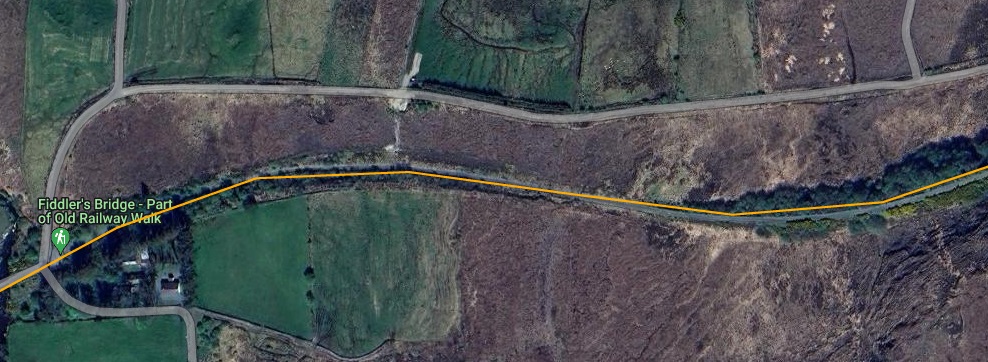
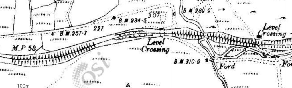
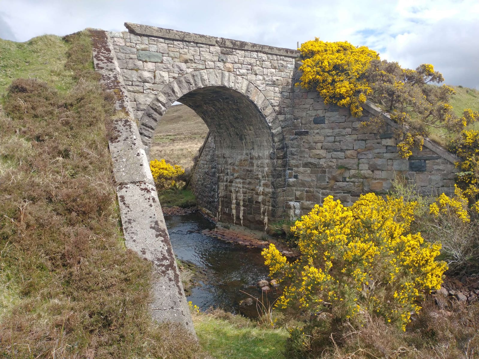
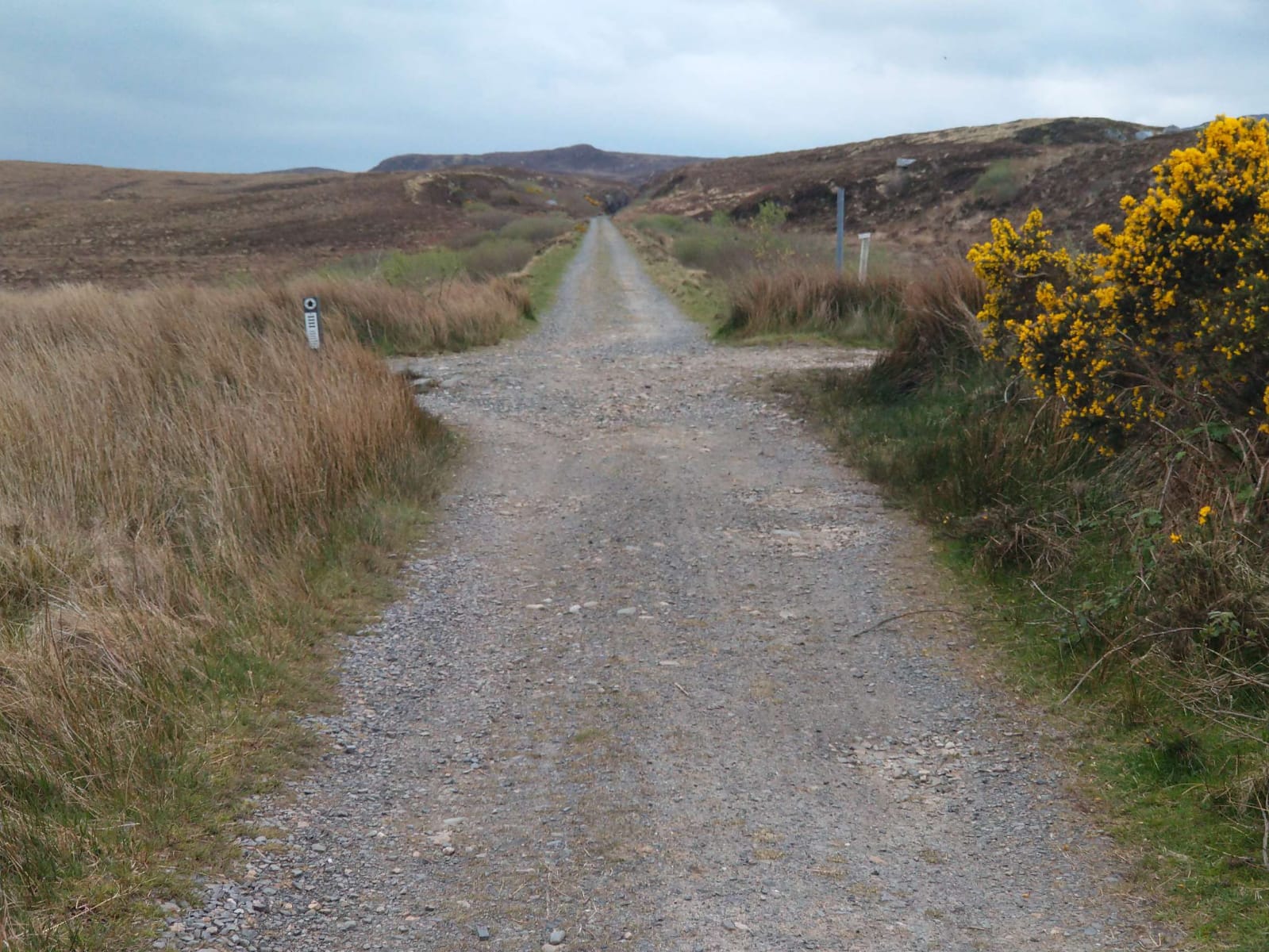
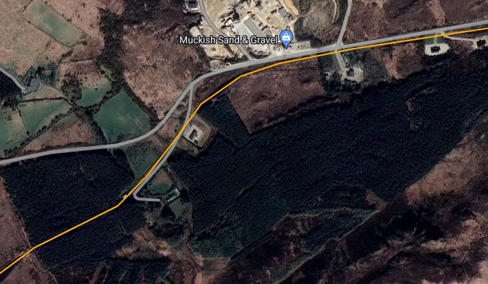
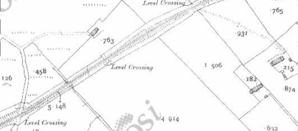
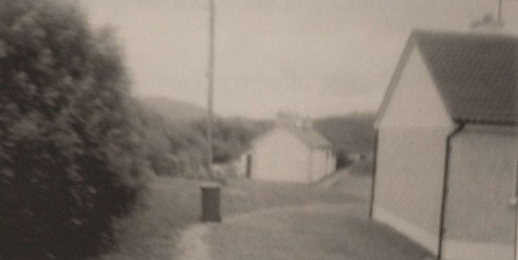
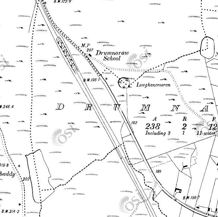
The railway continued in a Northeasterly direction, running to the Northwest of Creenlougher and on past Milepost 54. [2]A similar area on Google Maps satellite imagery to that shown in the extract above. Note the bridge over the old railway in the bottom-left of this image. [Google Maps, 31st May 2023]Looking North from the road which bridged the old railway, at the bridge which still carries that road. AS can be seen, the arch has been infilled with concrete. [Google Streetview, August 2021]Looking back to the Southwest from the road bridge at Creenlougher. {Google Streetview, August 2021]Looking Northeast from the bridge over the old railway at Creenlougher in 2023. [Google Streetview, August 2021]Curving a little to the East, the railway approached Falcarragh Station at Fiddler’s Bridge. [2]A very similar area to that shown on the map extract above, as it appears on Google Maps in 2023. [Google Maps, 31st May 2023]A closer view of Falcarragh Railway Station from above. The line of the old railway is superimposed. The station building was immediately adjacent to the road with the goods shed behind it (to the North), both are still in use in 2023. [Google Maps, 31st May 2023]This station layout appears in Dave Bell and Steve Flanders book about the Londonderry and Lough Swilly Railway. The layout of the station is such that should it have been required to allow a train from the opposite direction to pass, laying back into the goods loop, or pulling into the goods loop would be possible. [5: p77]The view Southwest along the old railway from just to the West of the R256. [My photograph, 27th April 2023]The view East across the R256 into the site of Falcarragh Railway Station. [My photograph, 27th April 2023]The view East along the line if the old railway from the location of the level crossing on what is now the R256. [My photograph, 27th April 2023]This photograph shows Falcarragh Railway Station after final closure of the line in 1947. It was shared by Joe Begley on the Memories of Falcarragh/Gortahork Facebook Group on 30th January 2018. [9]Falcarragh Railway Station as seen in the early 2000s. This picture was included in E. M. Patterson, Joe Begley and Steve Flanders book about the line. [6: p167]A similar view to the monochrome image and the early 2000s image above as the Station appears in 2023. [My photograph, 27th April 2023]
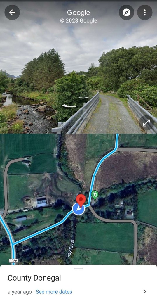
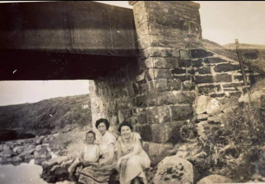
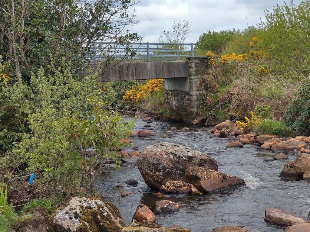
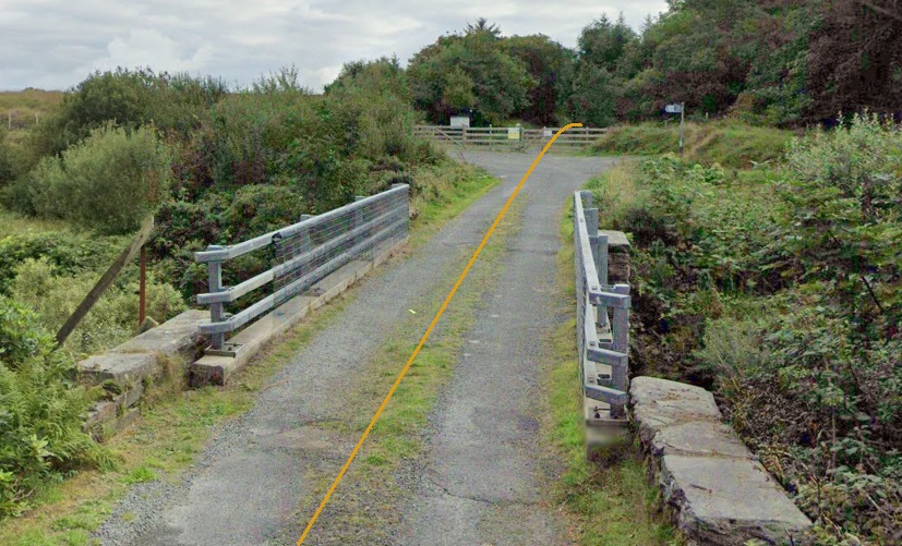
“Falcarragh railway station served the village of Falcarragh, 4 km (2.5 mi) away. … [It] opened on 9th March 1903 when the Londonderry and Lough Swilly Railway opened their Letterkenny and Burtonport Extension Railway, from Letterkenny to Burtonport. It closed on 3rd June 1940 [to passenger traffic] when the LLSR closed the line from Tooban Junction to Burtonport in an effort to save money.” [7] Final closure to all traffic occurred on 6th January 1947. [8]
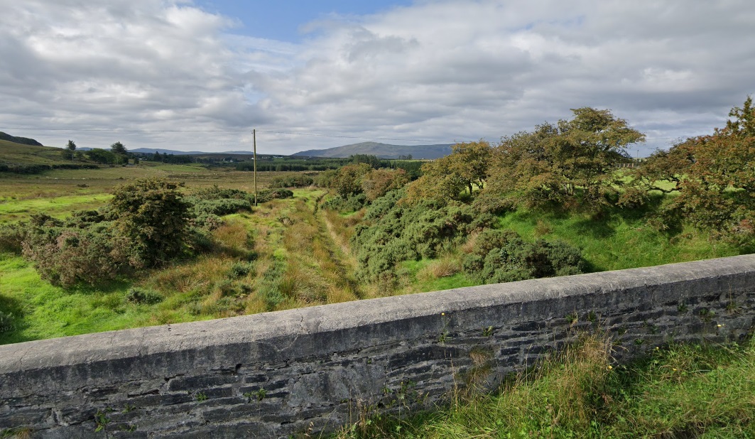
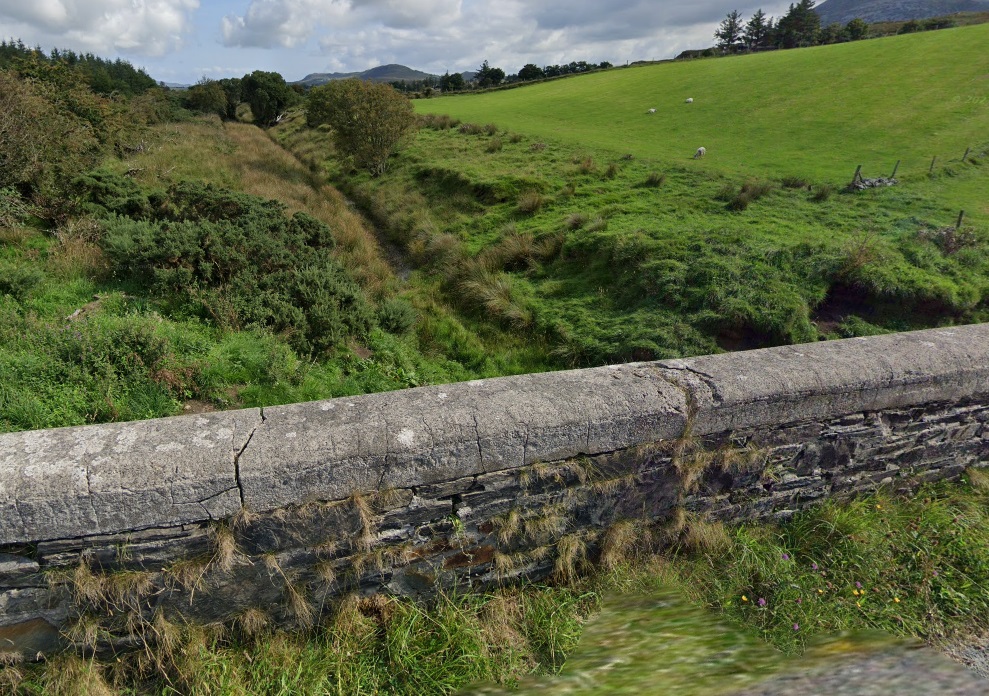
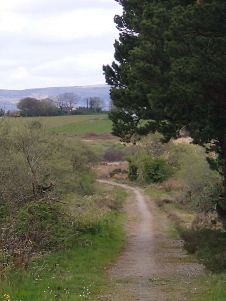
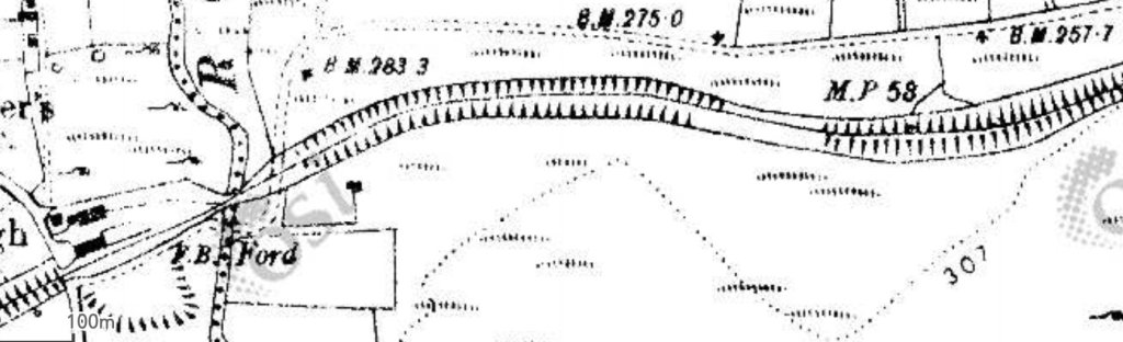
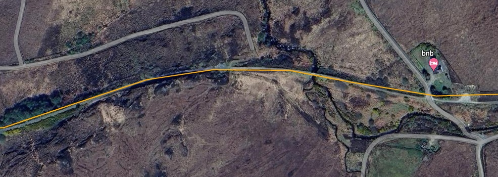
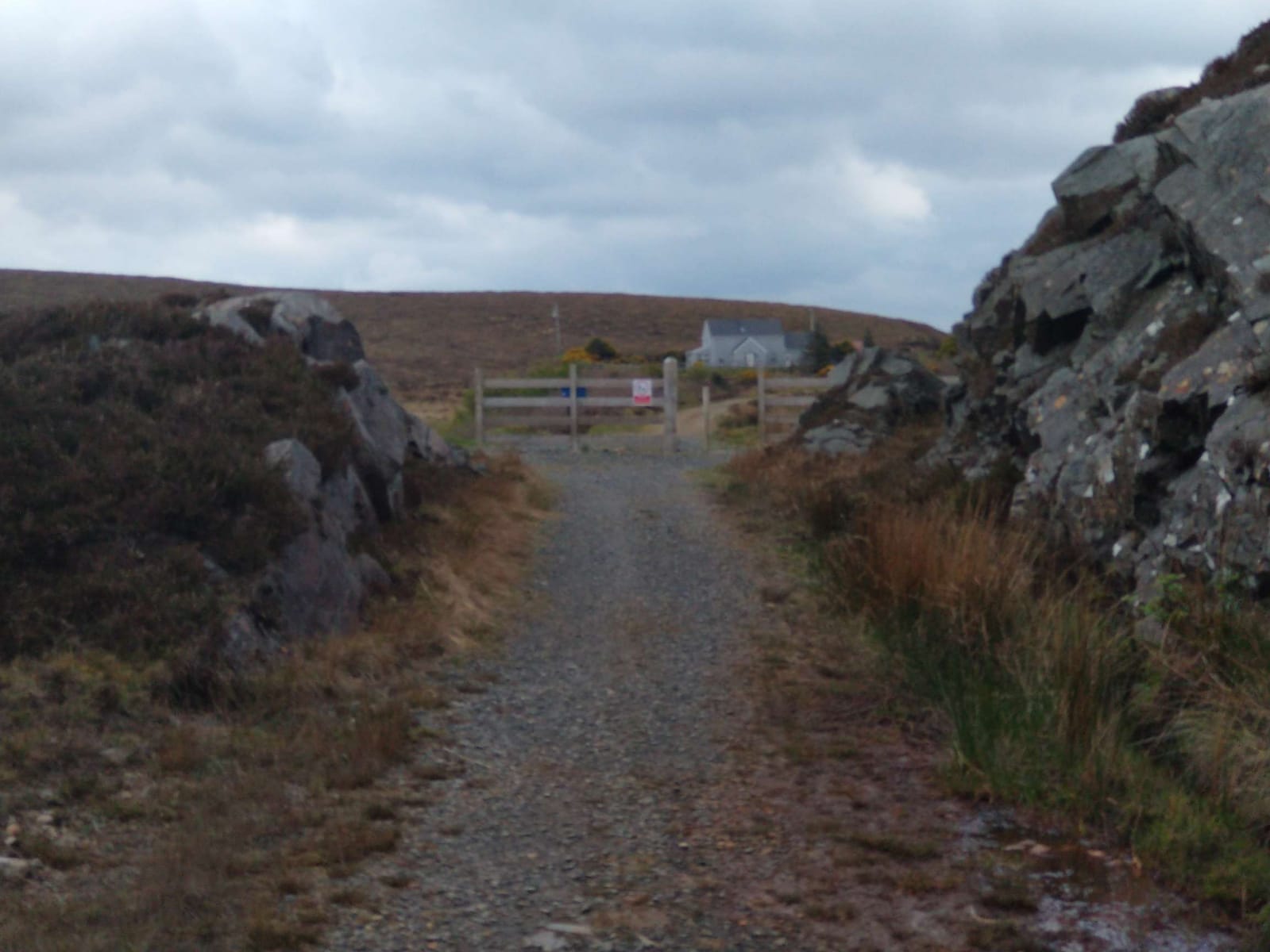
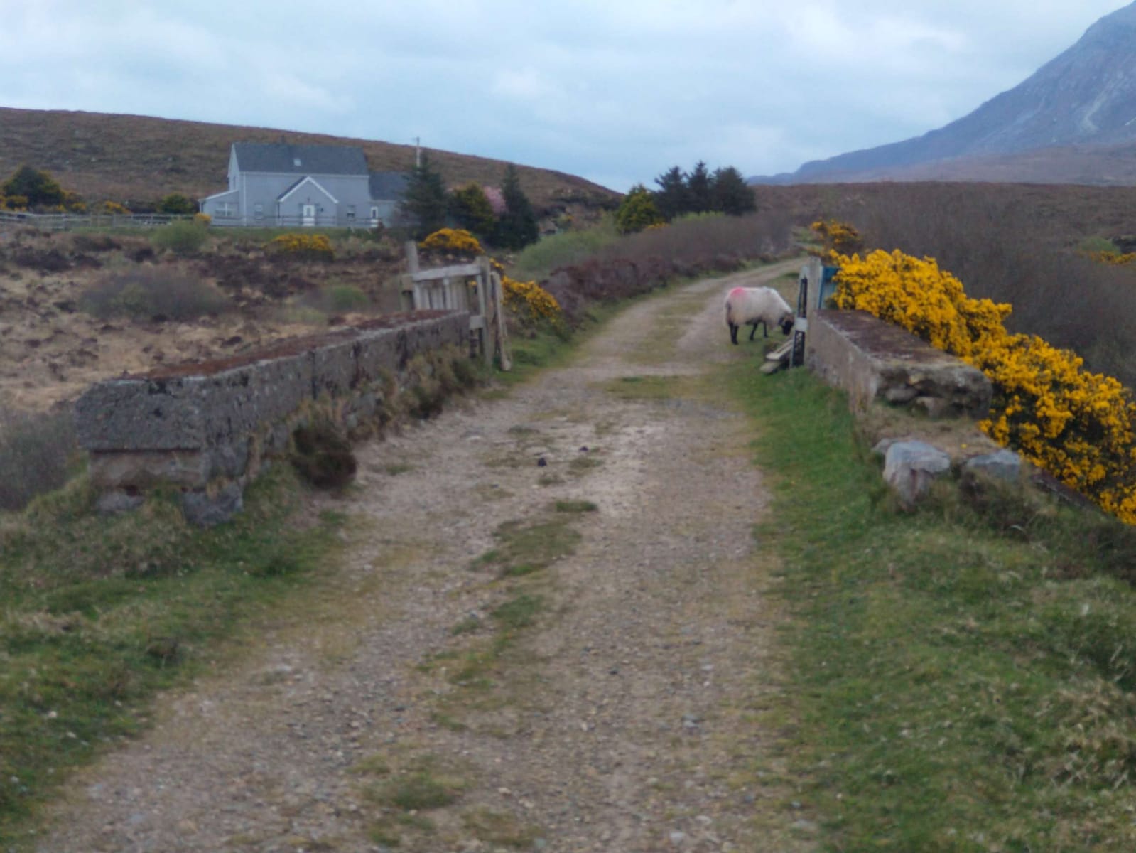
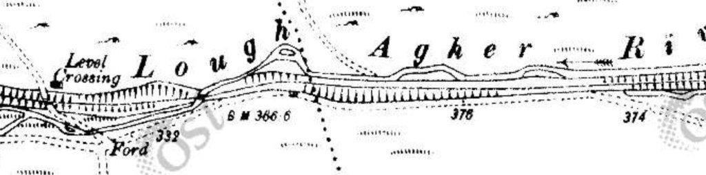
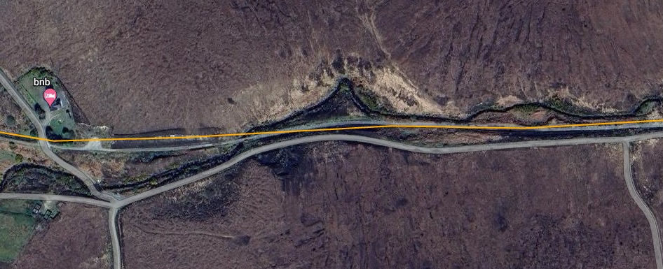
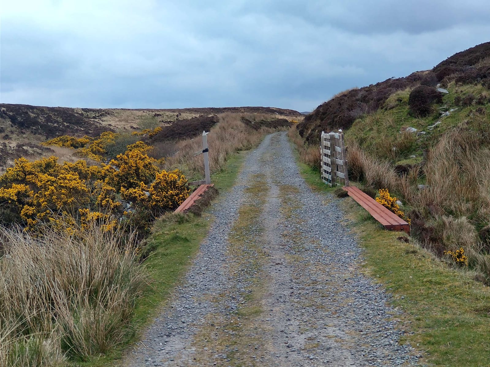
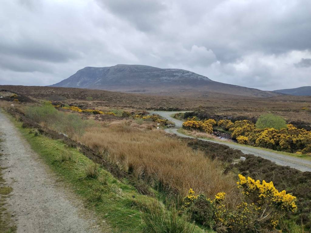
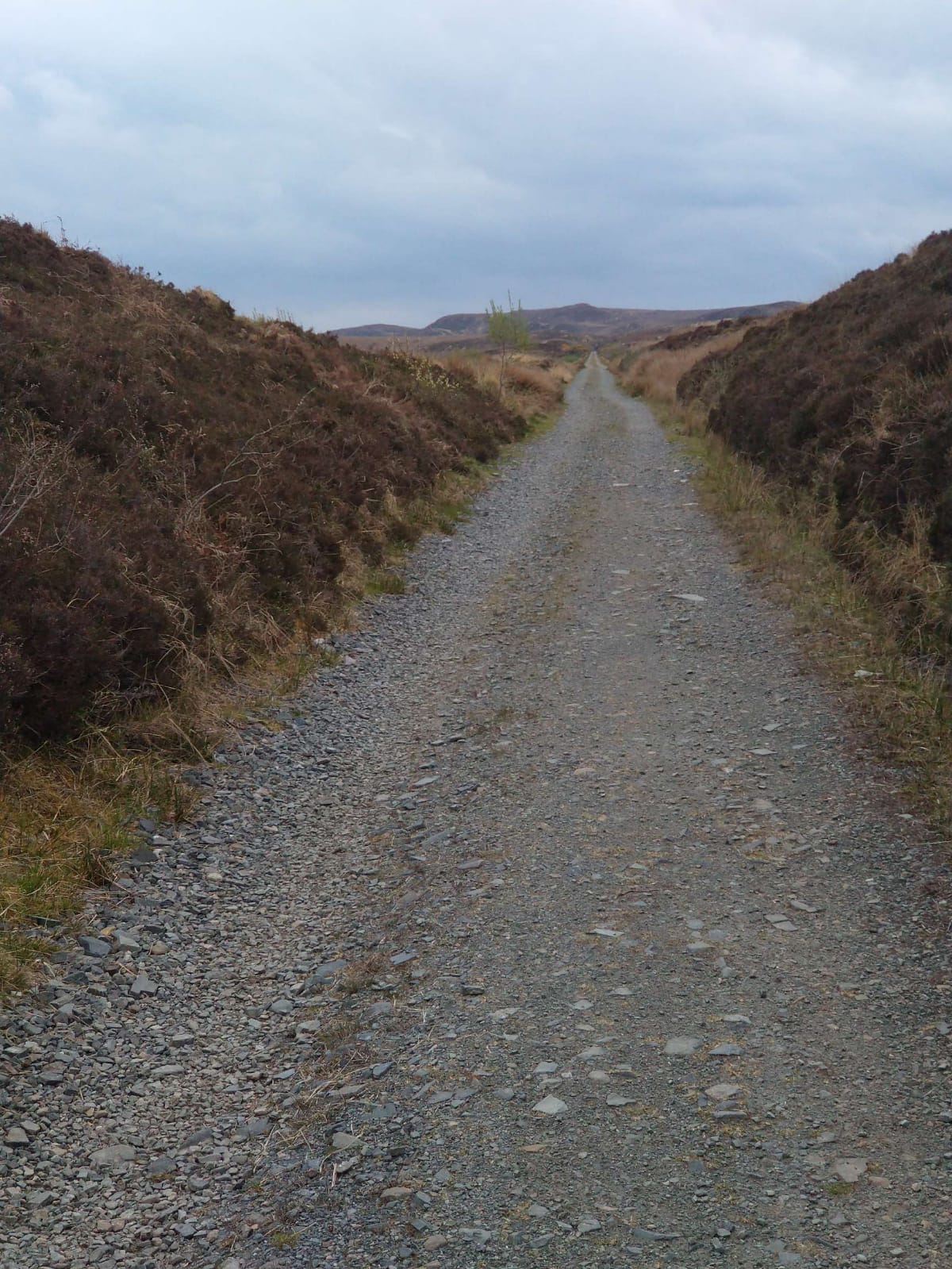
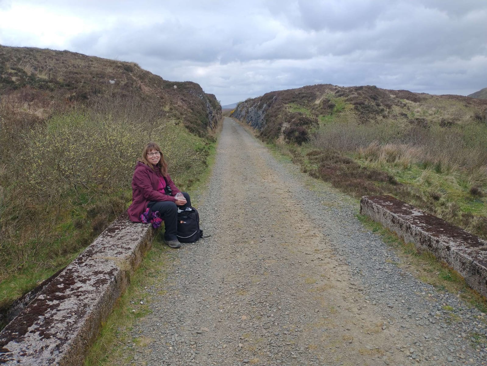
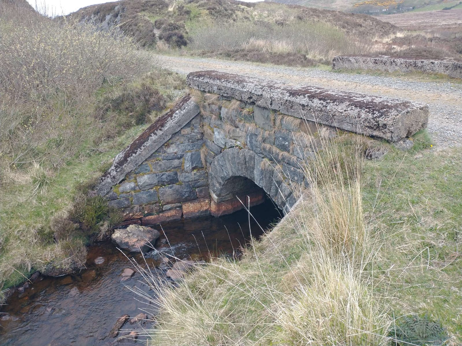
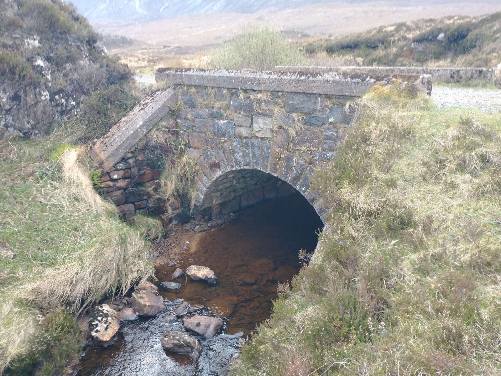
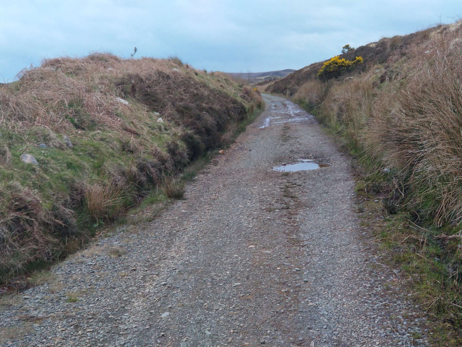
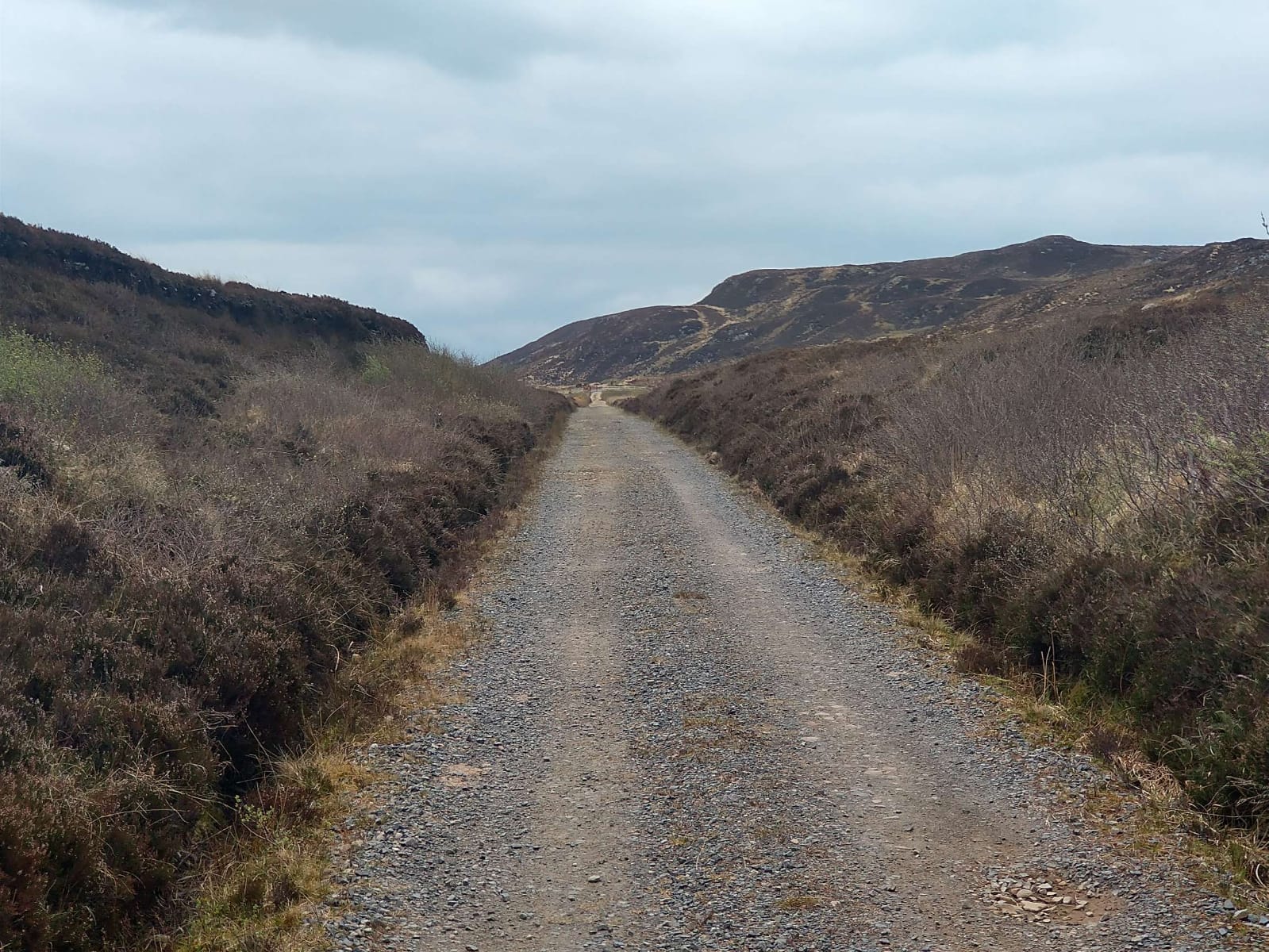
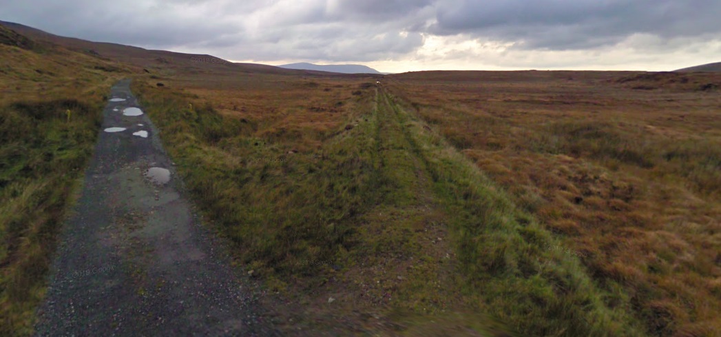
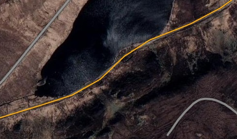
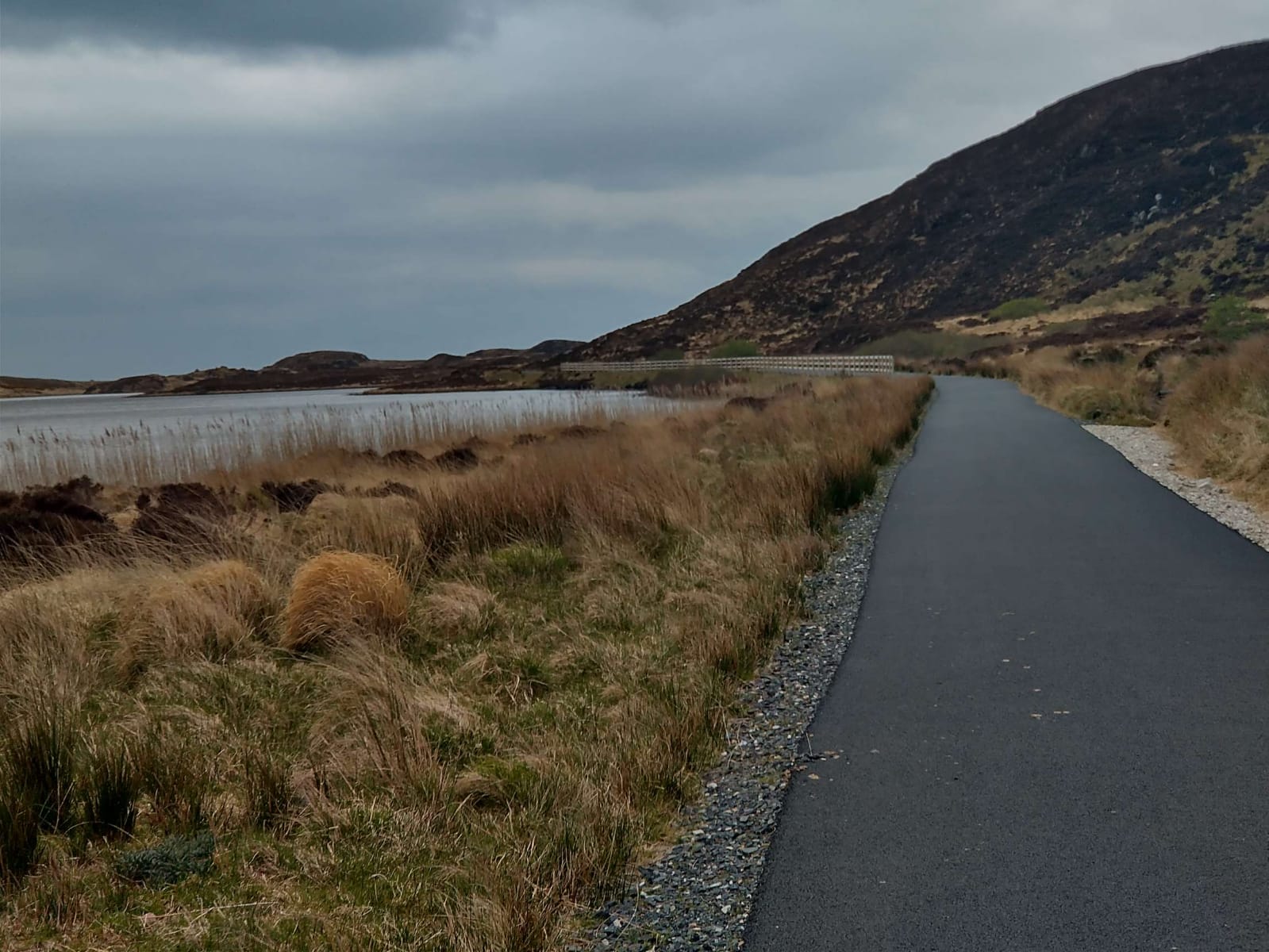
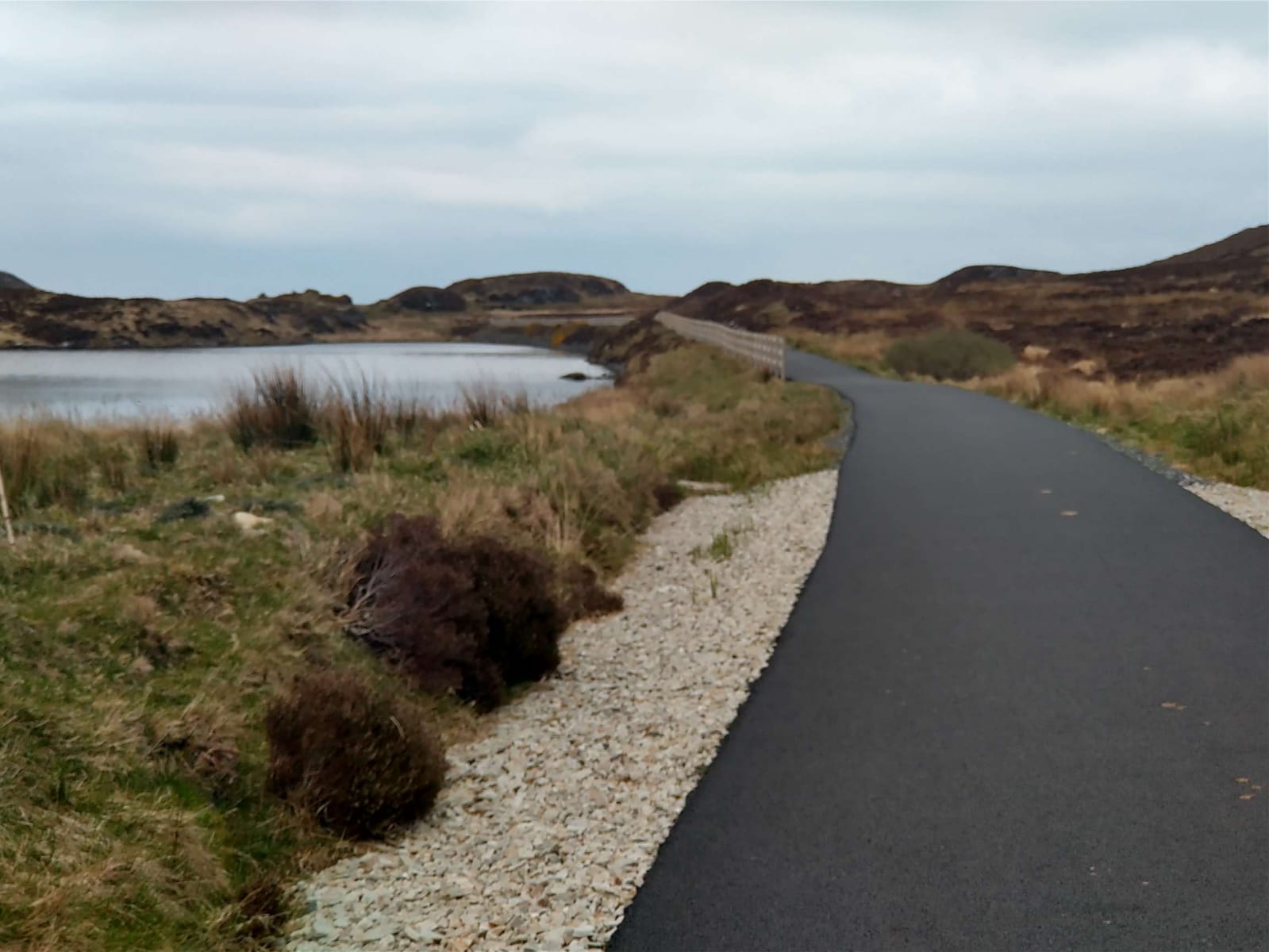
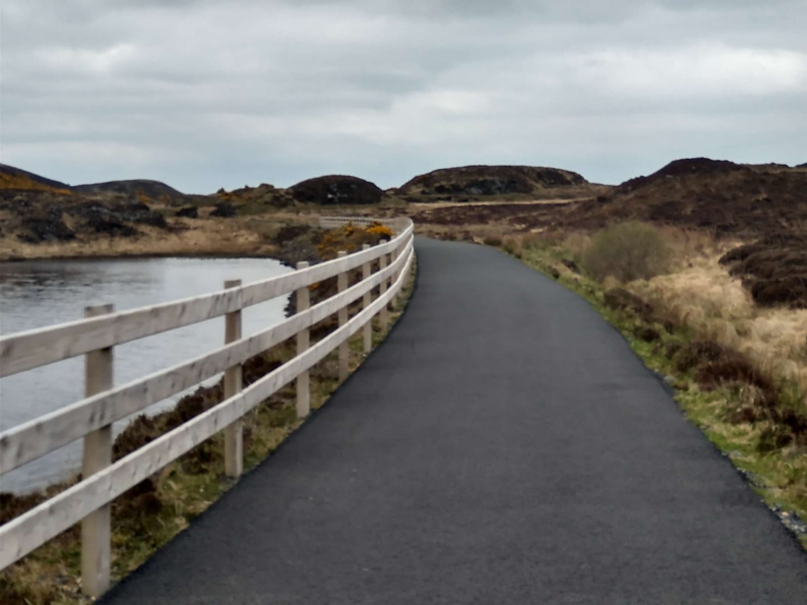
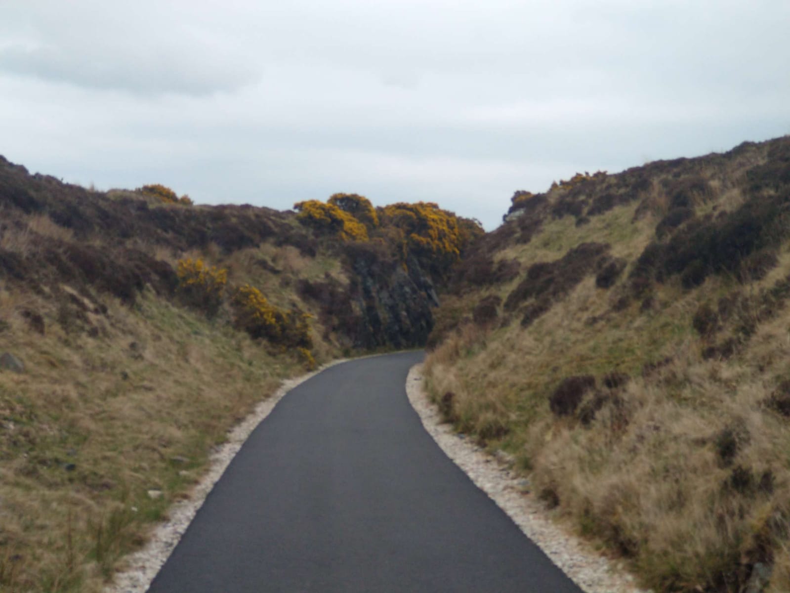
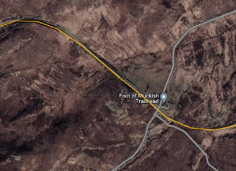
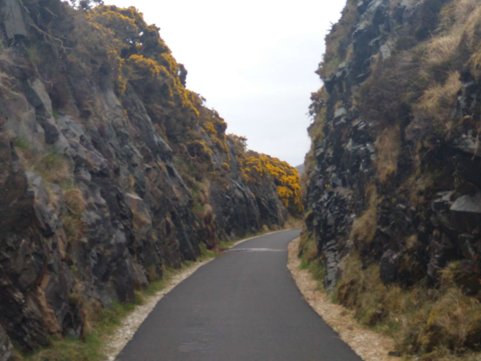
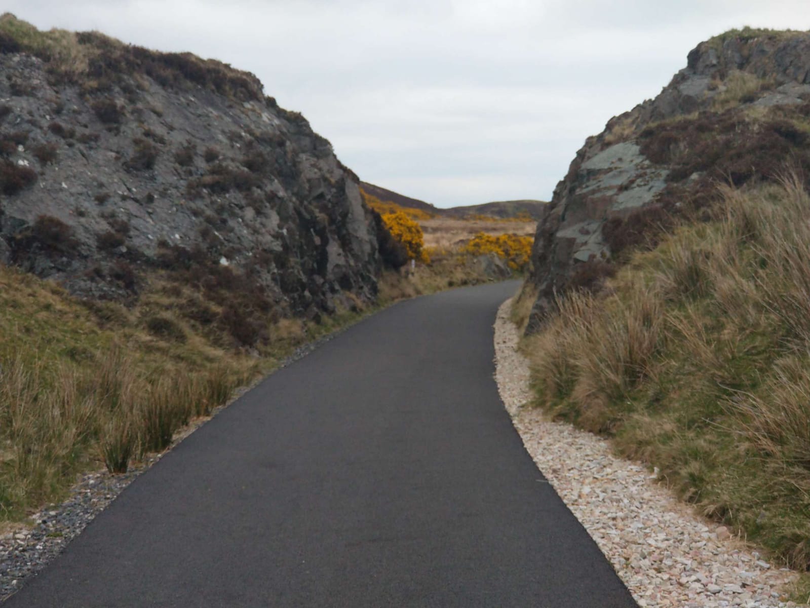
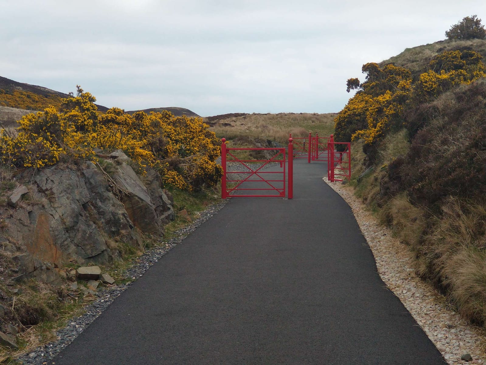
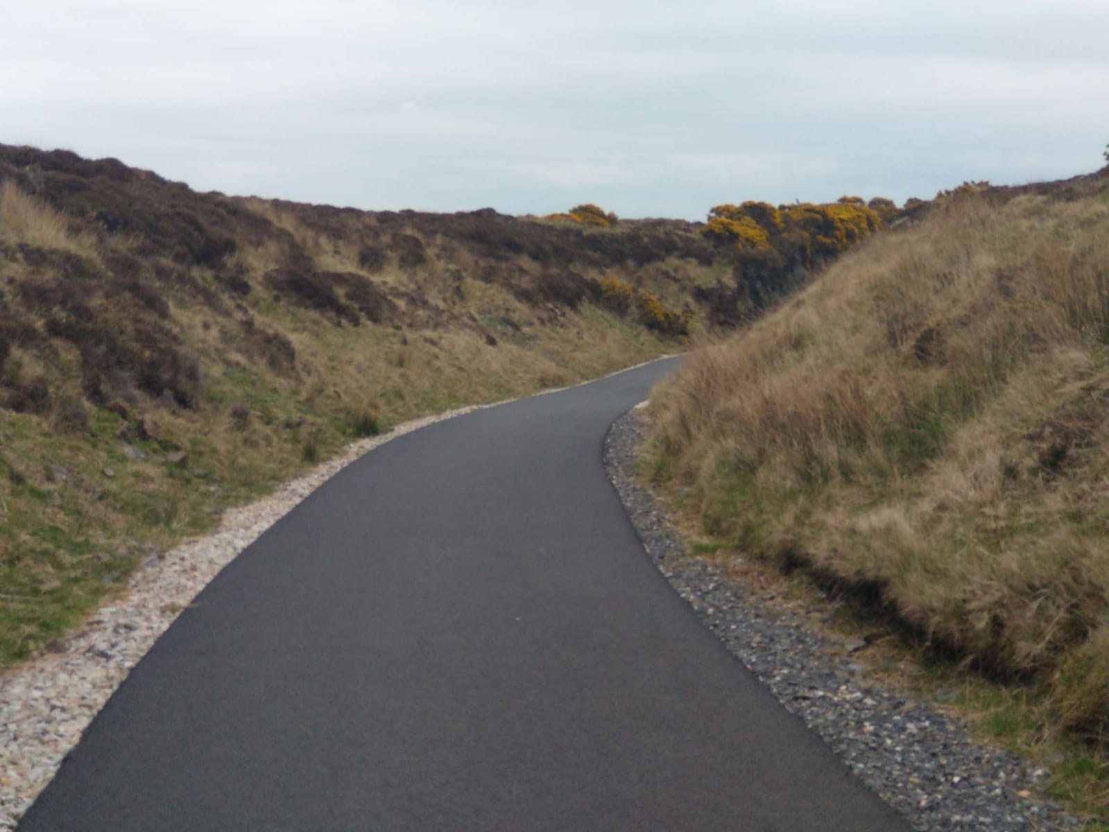
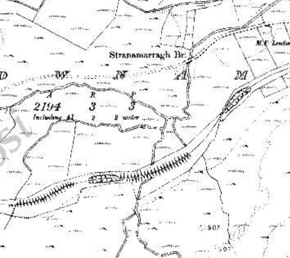
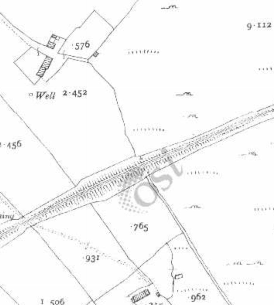
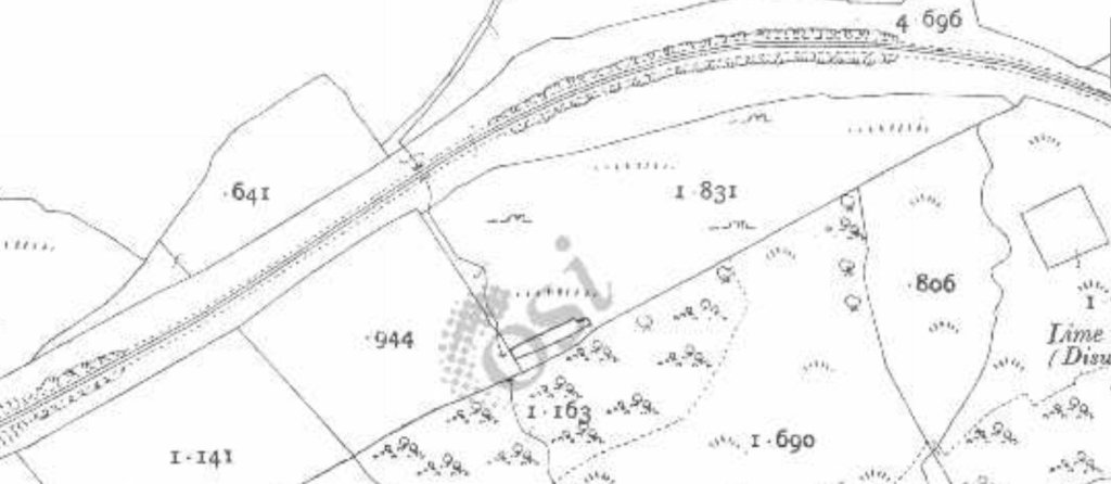
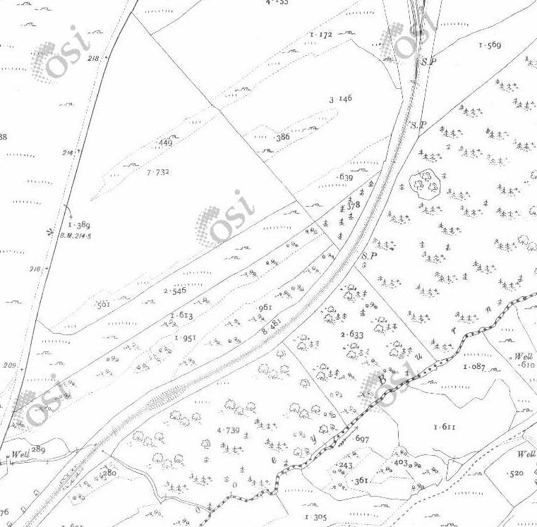
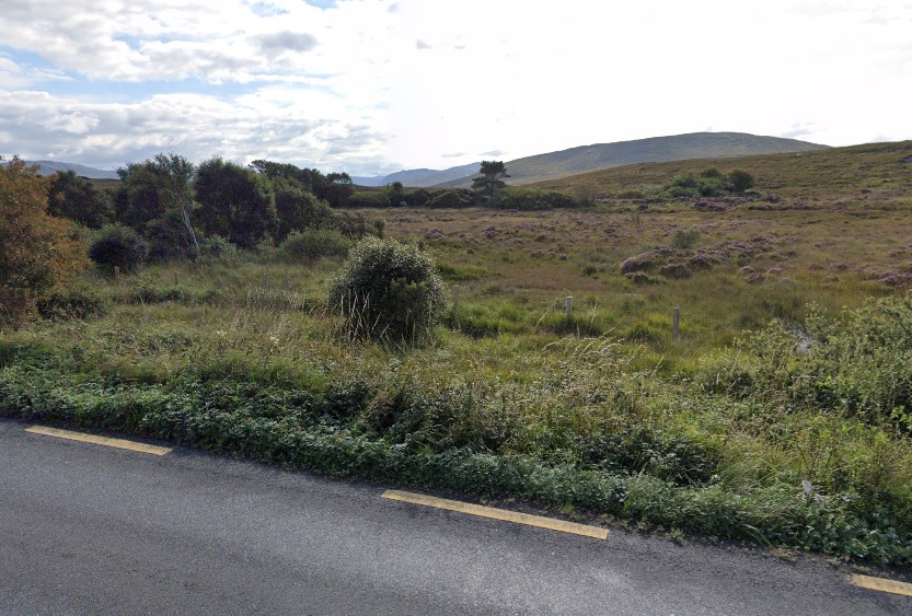
Two further views of Falcarragh Railway Station in April 2023. Notice the Station Nameplate now on the platform face of the building. [My photographs, 27th April 2023]The house facing the Railway Station. [My photograph, 27th April 2023]The Falcarragh Goods Shed/Store as shown in Patterson, Begley and Flanders book. This view is from the East. [6: p167]The view of the old goods shed/store and the passenger station building from the R256 looking East. [Google Streetview, November 2022]The approach to Falcarragh Railway Station from the East. The ford across the River Ray is to the left of the line. The station buildings were on the other side of the line facing the house visible in the distance. This photograph was shared on the Memories of Falcarragh/Gortahork Facebook Group on 30th January 2018 by Joe Begley. [9]The same location as it appears on Google Maps/Google Streetview on 2nd June 2023 on my mobile. The top half of this image is the view at the location marked by the red flag and looking in the direction of the white on blue arrow indicates in the bottom half of the image. We are looking West across the bridge over the River Ray. The trees on the left camouflage the house opposite the Station, those immediately beyond the bridge hide the Station site.[Google Streetview, August 2021]This is the only picture that I have been able to find which shows the old railway bridge from river level. It was shared by Carmel Boyle on the Memories of Falcarragh/Gortahork Facebook Group on 24th September 2021. [11]The River Ray Bridge viewed from the South, on the old road where it forded the river, in 2023. [My photograph, 27th April 2023]Looking East from the throat of the ols railway station across the moderm road bridge which replaced the old railway bridge. [Google Streetview, August 2021]The OSi 6″ Map shows the old railway heading sinously East from Falcarragh. [2]RailMapOnline shows the route of the old railway East of Falcarragh Railway Station. [10]The view East from the bridge over the River Ray. Pedestrian access is permitted beyond the fence line ahead. [My photograph, 27th April 2023]Looking East along the old railway formation. [Google Streetview, August 2021]The old railway continues to run East. [My photograph, 27th April 2023]Two level crossings and a relatively significant structure appear on the next extract from the 6″ OSi mapping of 1901. As will be seen on the Google Maps extract below, the first of these, approximately at the centre of this image, seems to be of lesser importance in the 21st century than it was at the beginning of the 20th century. The second, more Easterly, of the two crossings seems to be on a slightly more used track in the image below. The building adjacent to the crossing is a B&B now. [2]The old railway formation continues East. [10]The fenceline marks the end of the permissive length of the route over private land. The building in the distance is the B&B marked on Google Maps to the right of the satellite image immediately above. [My photograph, 27th April 2023]Closer to the B&B the line crosses a moorland river. the low parapet walls belie the substantial nature of the structre. [My photograph, 27th April 2023] The bridge carrying the old line across a moorland river, (The Lough Agher River). [My photograph, 27th April 2023]The line continues in an Easterly direction. [2]The moorland river/stream (The Lough Agher River) crossed to the West of the B&B closely follows the old railway formation; passing under it once again through the bridge shown below. [10]Two images of the bridge which we noted on the RailMapOnline.com image above. The first is taken looking East, the second looks from the South across the line of the old railway. [My photographs, 27th April 2023]Looking Southeast from the line of the Burtonport Extension close to the right edge of the RailMapOnline.com image above. The ropad/track heading South appears both on the above satellite image and on the left side of the one below. [My photograph, 27th April 2023]The old railway continues eastward. [2]The old railway continued East as this next RailMapOnline.com satellite image shows. [10]Looking East at the point where a track crosses the line of the old railway. This location appears at the right side of the satellite image above. [27th April 2023]Walking these long straight sections of the old line takes time. The distant hills only gradually appear closer. [My photograph, 27th April 2023]The view North from the track running on the South side of the old railway. The very shallow embankment carrying the line at this point can just be made out. This image comes from a point on the track at the right-hand edge of the RailMapOnline.com image above and the left-hand side of the satellite image below. [Google Streetview, October 2009]The old railway turned to the Northeast just beyond the small bridge shown in images below. [2]Another moorland stream is crossed on this next length of the route of the old railway, as shown on RailMapOnline.com, and the line turns to follow as East-Northeast alignment. [10]This picture is taken looking East from the bridge over the moorland stream mentioned above. The line curves towards the North ahead taking an East-Northeast alignment. [My photograph, 27th April 2023]The view from the Northwest of the culvert/bridge which takes the stream under the old railway formation. [My photograph, 27th April 2023]The view from the Southeast of the same culvert/bridge. [My photograph, 27th April 2023]Further round the curve seen ahead on the view along the line across the stream culvert/bridge above. [My photograph, 27th April 2023]Now beyond the curve, the line ran straight towards Lough Agher ahead. a careful study of the phto will shw that the line is crossed by a fence line ahead. [My photograph, 27th April 2023]This next extract from the 6″ OSi mapping of 1901 shows a further straight length of the line crossing a moorland track at a shallow angle by means of an ungated crossing and then following the southern shoe of Lough Agher which appears in the top-right of the extract [2]As this satellite image shows, alongside Lough Agher the line curved further to the Northeast and followed the shore of the lough. As we will see below the route of the old railway is metalled to the East of the moorland road shown here. [10]Approaching a moorland lane which crosses the old railway route at a shallow angle we reached the length of the old line which had very recently been metalled. Lough Agher is just beyond the horizon at the left of the image. [My photograph, 27th April 2023]A similar view to that shown above looking along the line of the old railway. This time from 2009. Lough Agher can just be seen close to the horizon in the centre of this image. This and the following image are provided to give an indication of the dramatic change in the accessibility which has been achieved in recent years. [Google Streetview, October 2009]Looking back West towards Falcarragh in 2009! [Google Streetview, October 2009]The line followed the southern shore of the lough. [2]A similar area as shown on the satellite imagery provided by RailMapOnline.com. [10]The mettalled track follows the southern shore of Lough Agher. [My photograph, 27th April 2023]The powers that be have provided some excellent amenities along the route. [My photograph, 27th April 2023]At the Northeast end of the Lough the railway curved round from its Northeasterly trajectory towards the Southeast. [2]A similar area as shown on the modern satellite imagery with the route of the railway superimposed in yellow. [10]These two images show the metalled footpath on the old railway line approaching the Northeast corner of Lough Agher. The line curves round between the two hills directly ahead of the camera in the second shot. [My photographs, 27th April 2023]The line beginns to curve round to the Southeast. [My photograph, 27th April 2023]The 6″ OSI survey of 1901 shows little in the way of features around the old railway as it ran first in a Southeasterly direction and then began to curve round to the Northeast again. [2]The same area as shown by RailMapOnline.com with the route of the old railway shown in yellow on the Google satellite imagery. [10] The Foot of Muckish Trailhead provides a some parking and access to a number of local footpaths. [10] Examples of the walking available can be found here. [12]
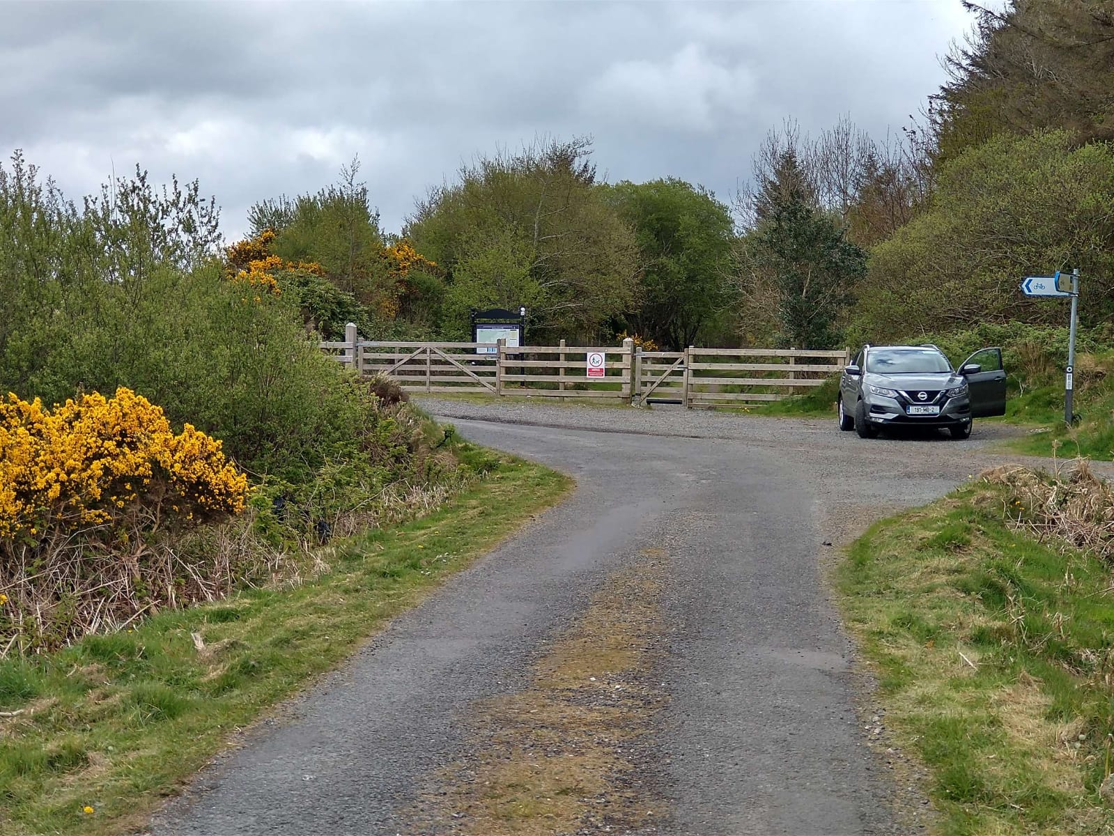
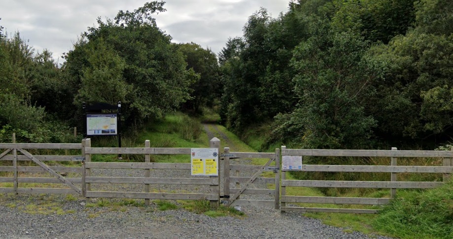
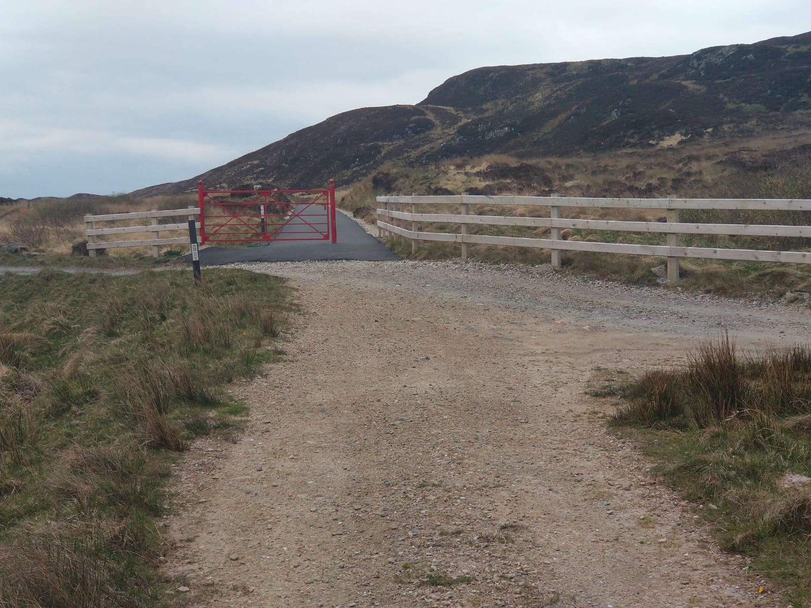
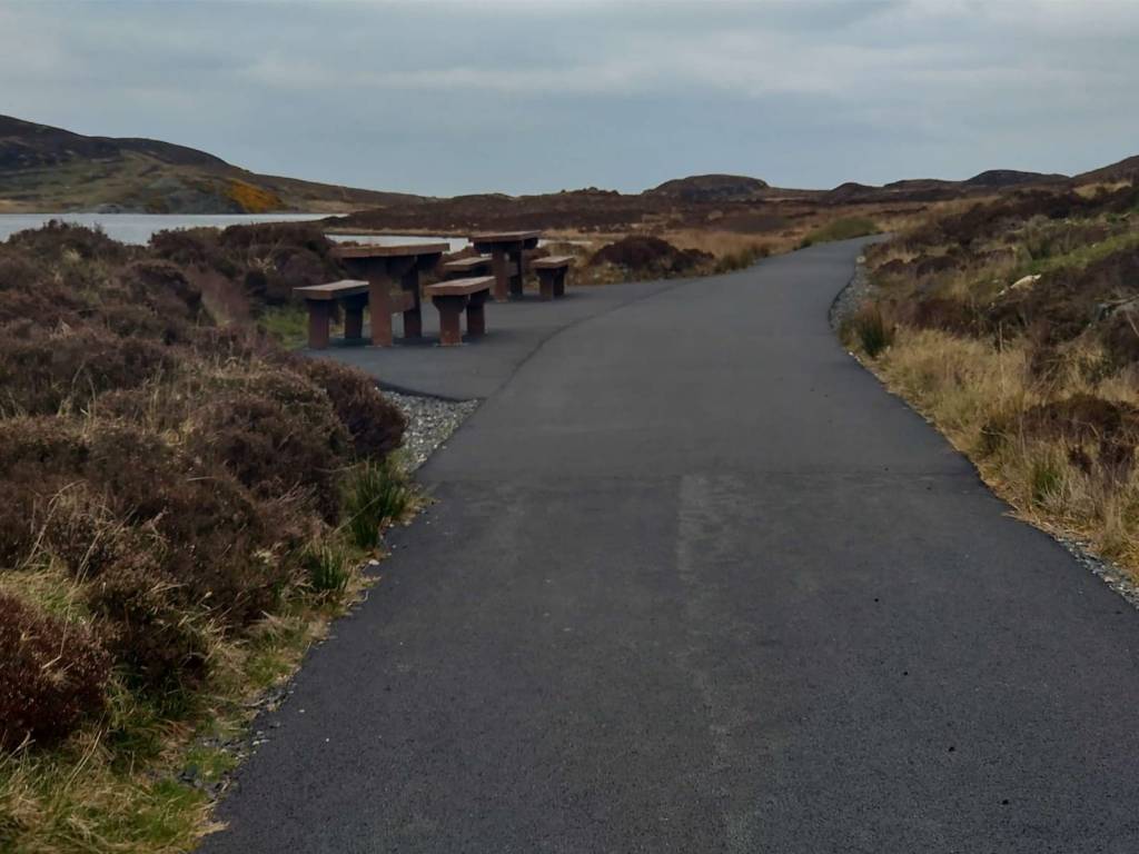
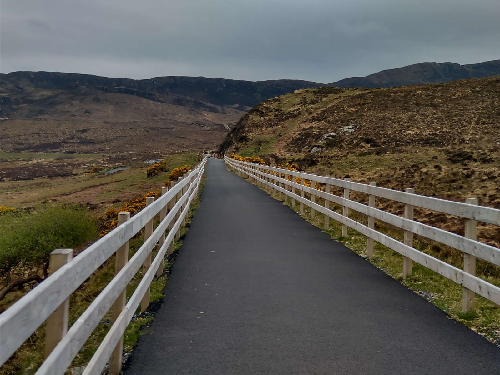
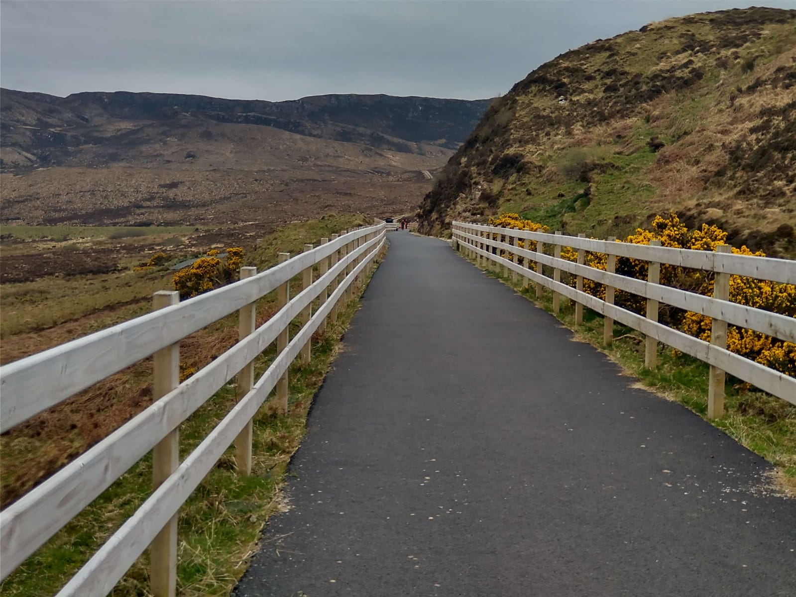
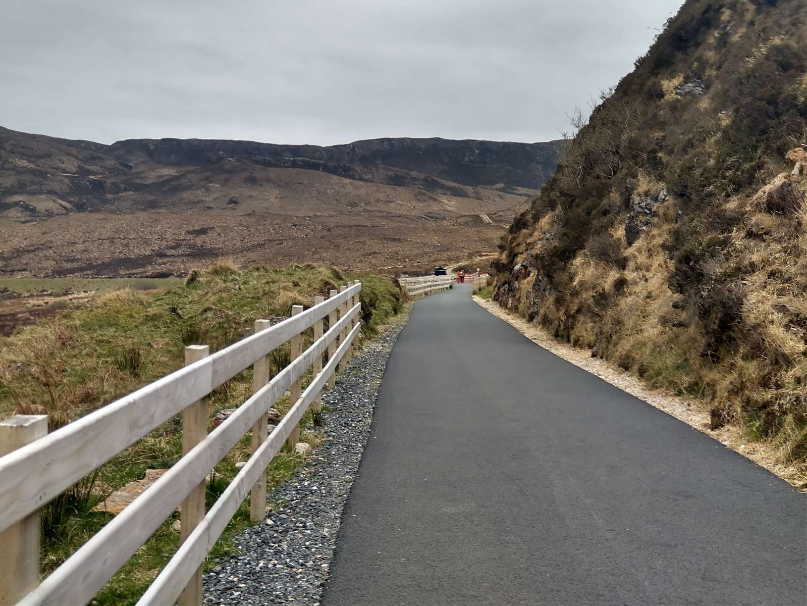
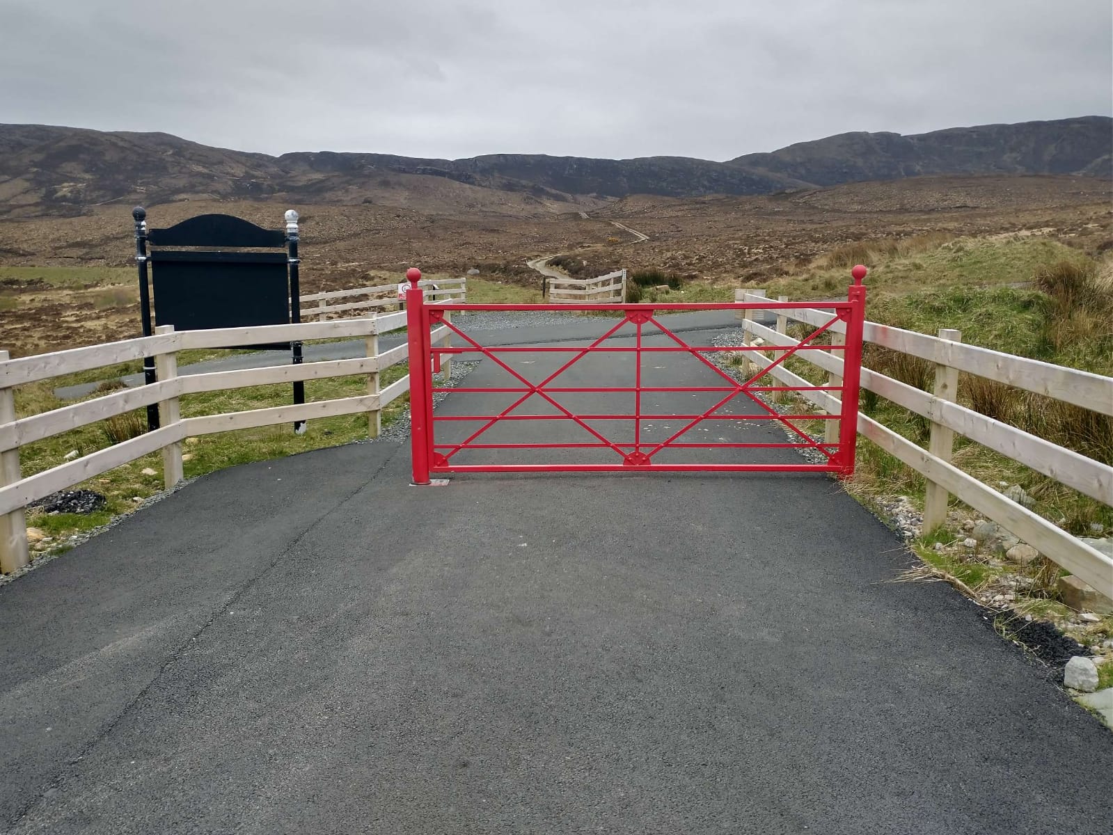
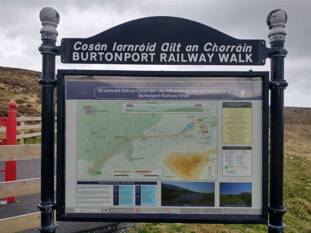
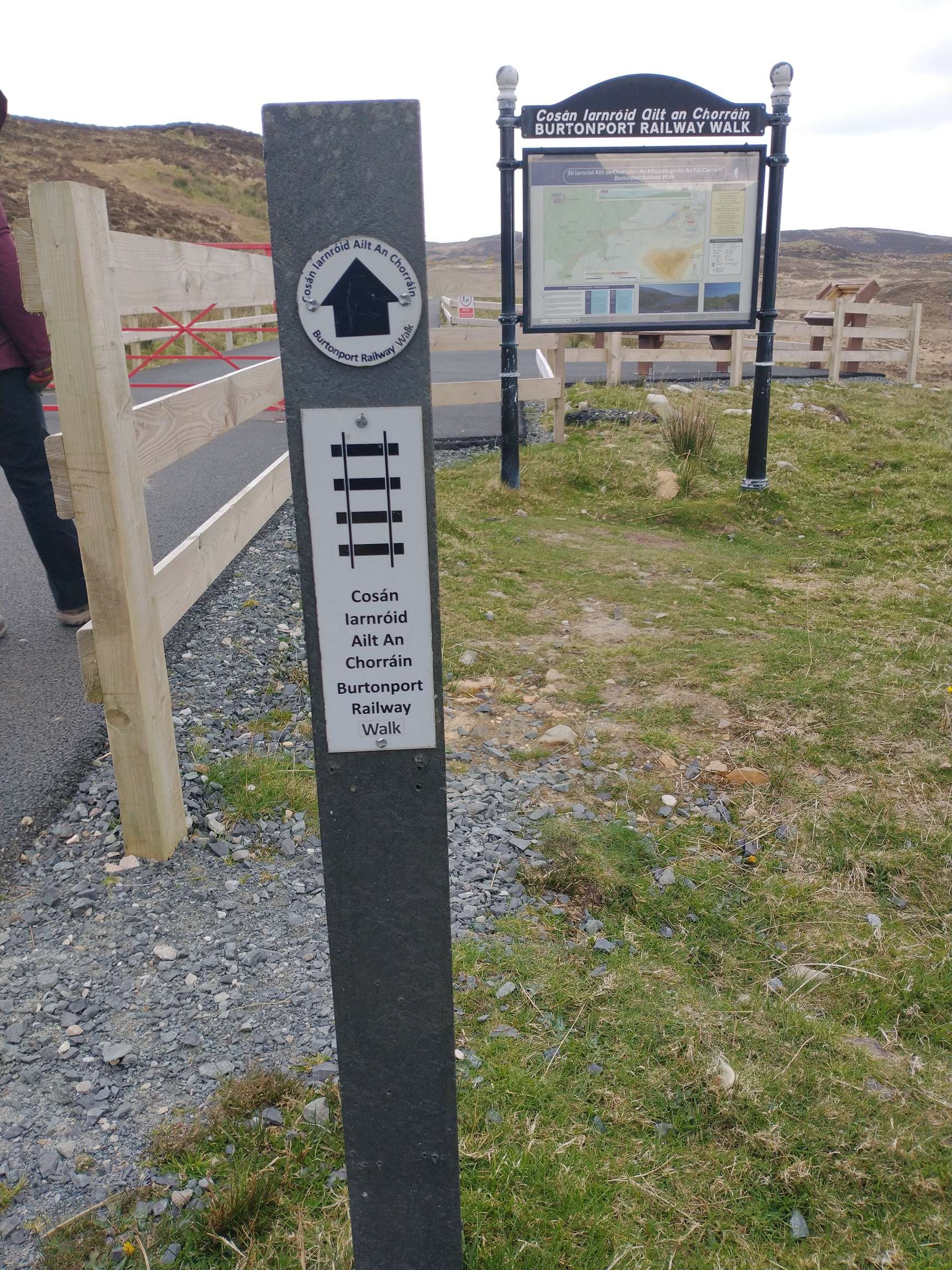
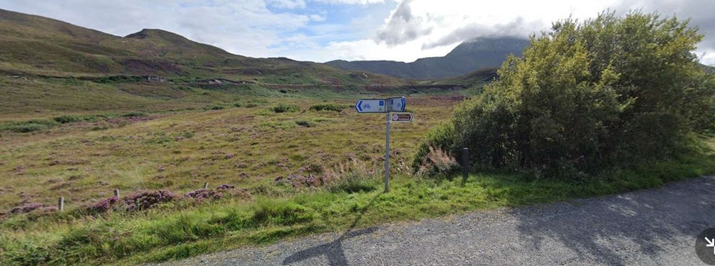
The Foot of Muckish Trailhead provides a some parking and access to a number of local footpaths. Examples of the walking available can be found here. [12] The sequence of photographs immediately below follow the tarmacked trail to the car park at the Muckish Trailhead.
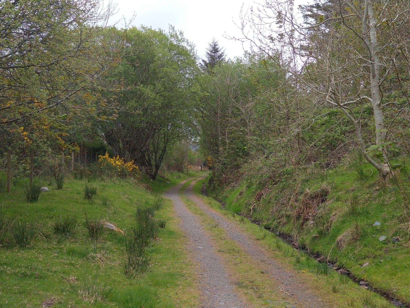
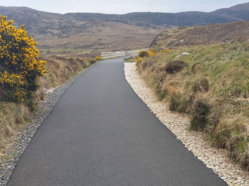
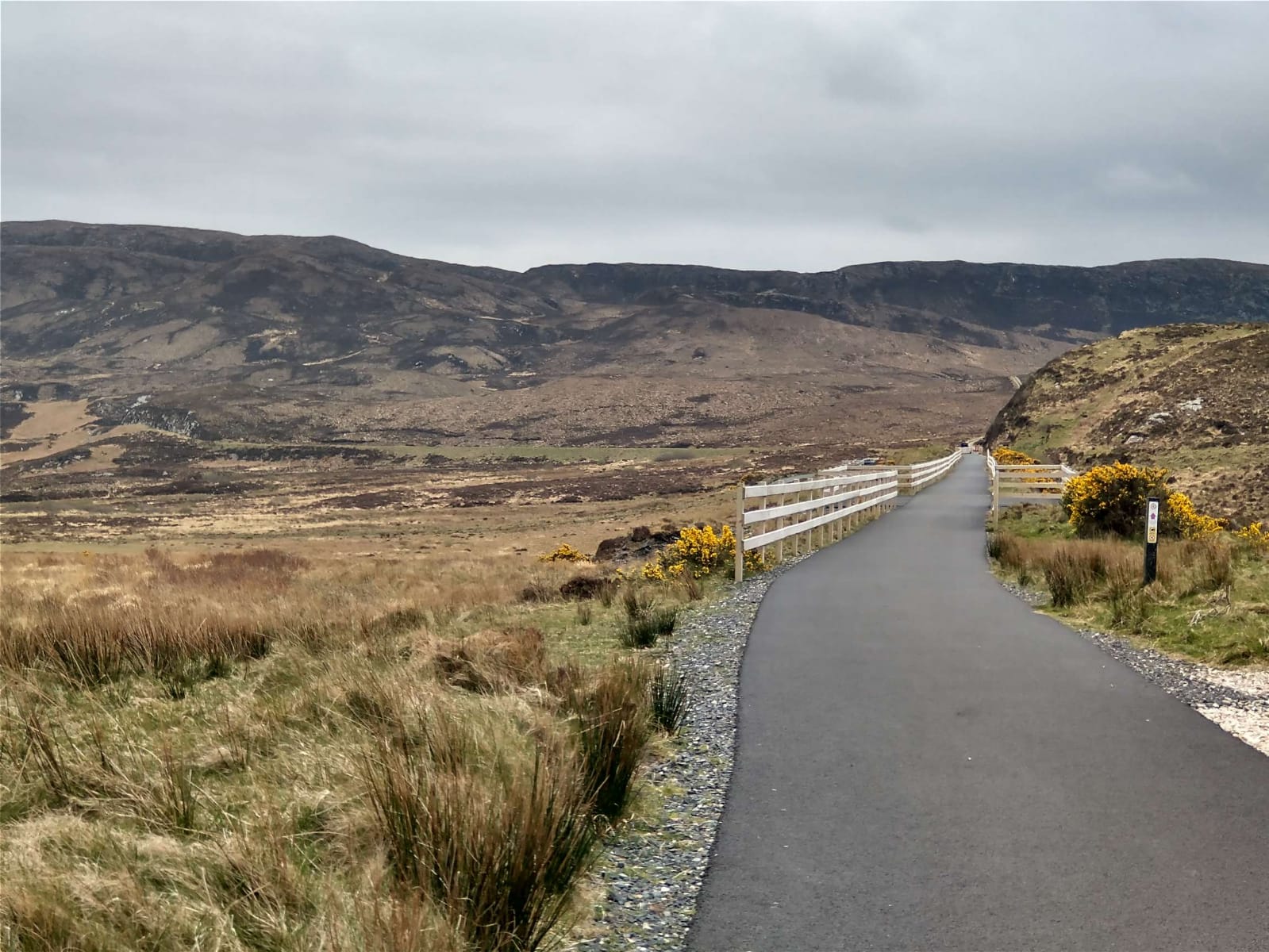
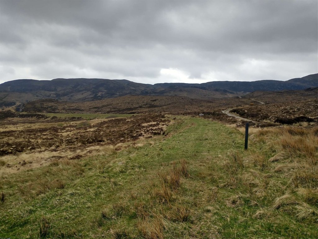
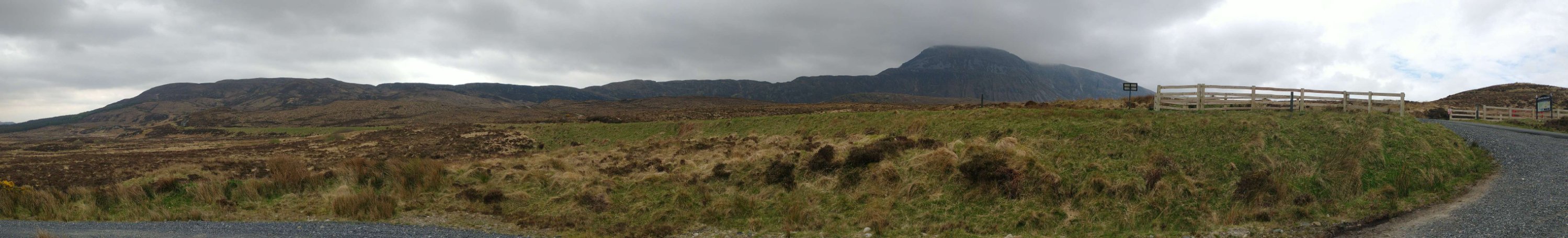
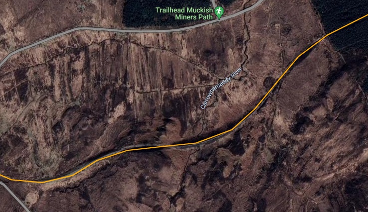
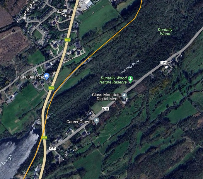
The sequence of photos above shows the route of the old railway as it appears in the 21st century, approaching the Muckish Trailhead and car park. [My photographs, 27th April 2023]The information board at the Muckish Trailhead. [My photograph, 27th April 2023]A few metres beyond the information board stands a trail marker for the tarmacked length of the old railway formation. [My photograph, 27th April 2023]The view ahead to the Northeast along the line of the old railway which runs on shallow embankment for much of the next kilometre. [My photograph, 27th April 2023]A panoramic view looking South from adjacent to the Muckish Trailhead Car Park with Muckish Mountain right-of-centre and the old railway embankment visible across the middle of the image. [My photograph, 27th April 2023]The 6″ OSI survey of 1901 now shows the old railway meandering Northeast on embankment. [2]This RailMapOnline.com extract shows the same area as it appears in 2023, as the map extract above. [10]A view of the old railway embankment from the Muckish Miner’s Path Trailhead. The line of the embankment is below the horizon and just above the top of the signpost. [Google Streetview, August 2021]Still 49km from Derry, the line continued East-northeast.The same area, once again, as in the map extract above. [10]
Before moving on, it is worth noting that Begley and Saunders [6] number the next two crossing-keeper’s cottages differently from Bell & Saunders [5]. In order to reflect both of these opinions the Bell & Saunders numbers are referred to in brackets below.
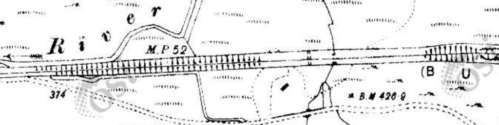
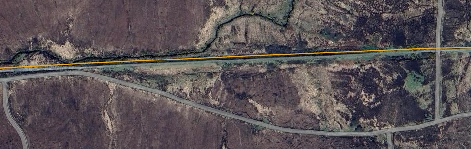
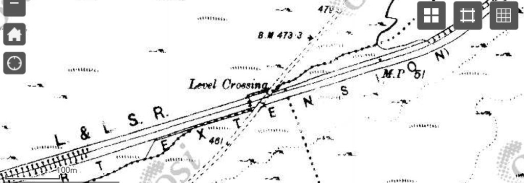
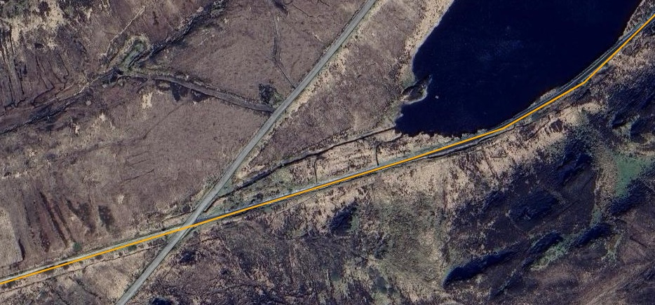
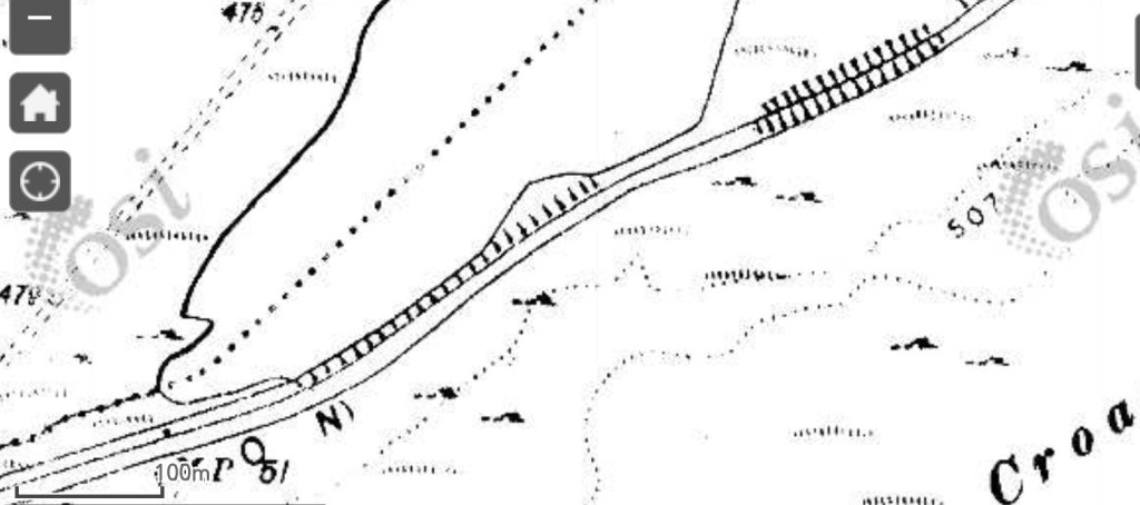
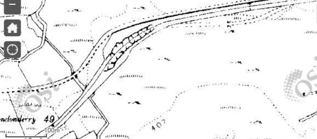
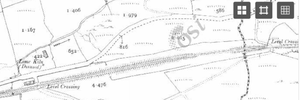
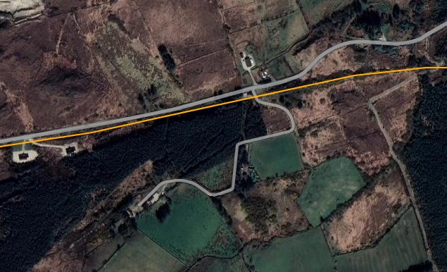
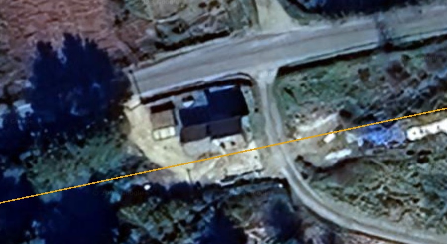
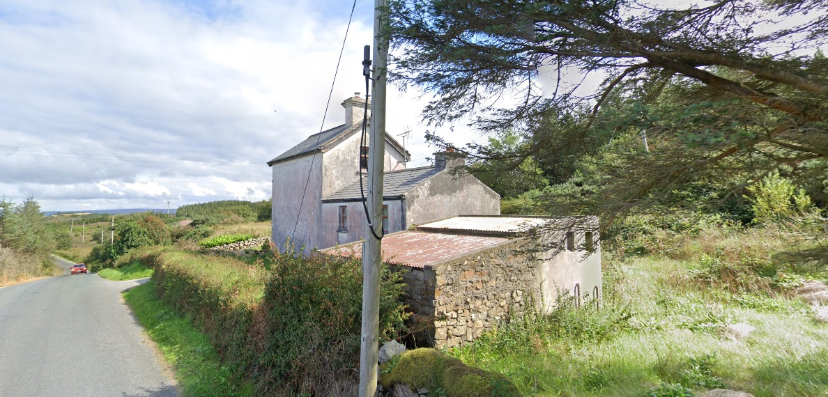
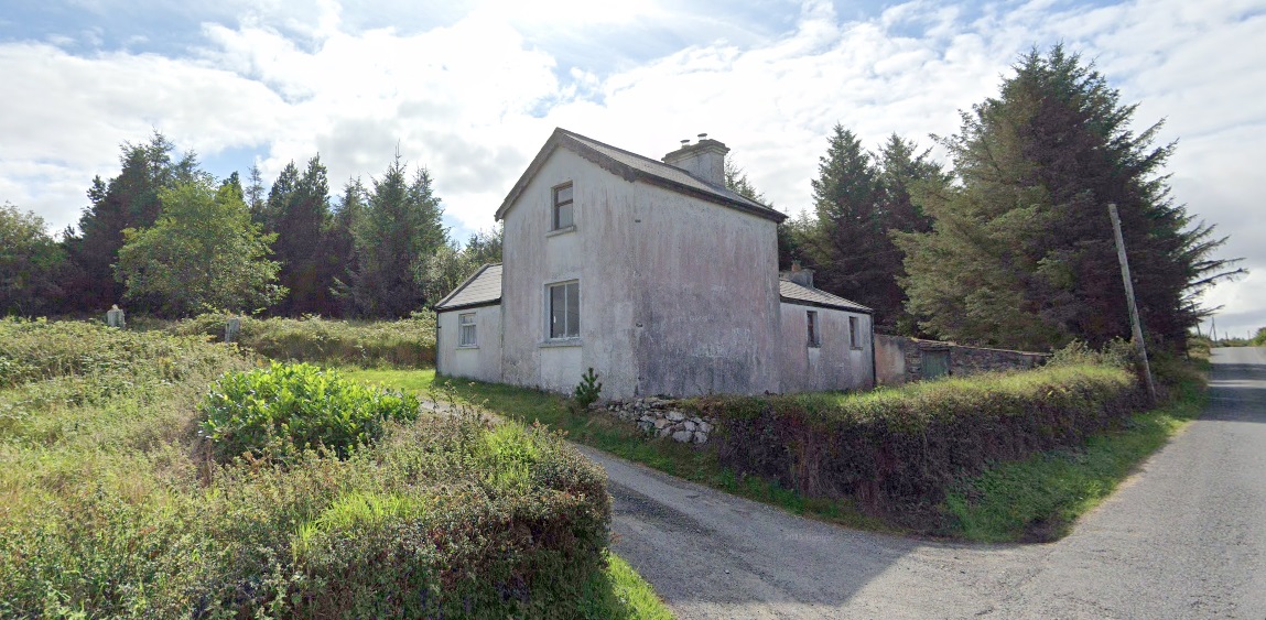
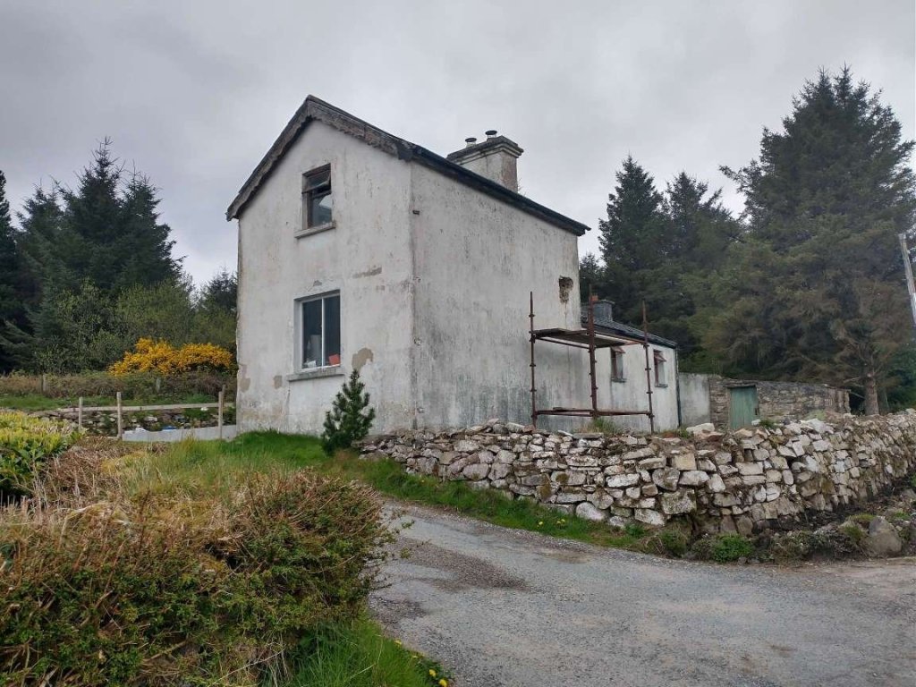
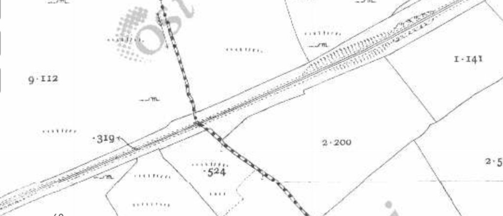
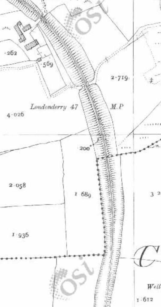
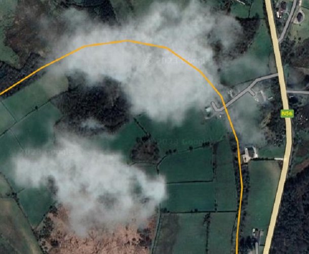
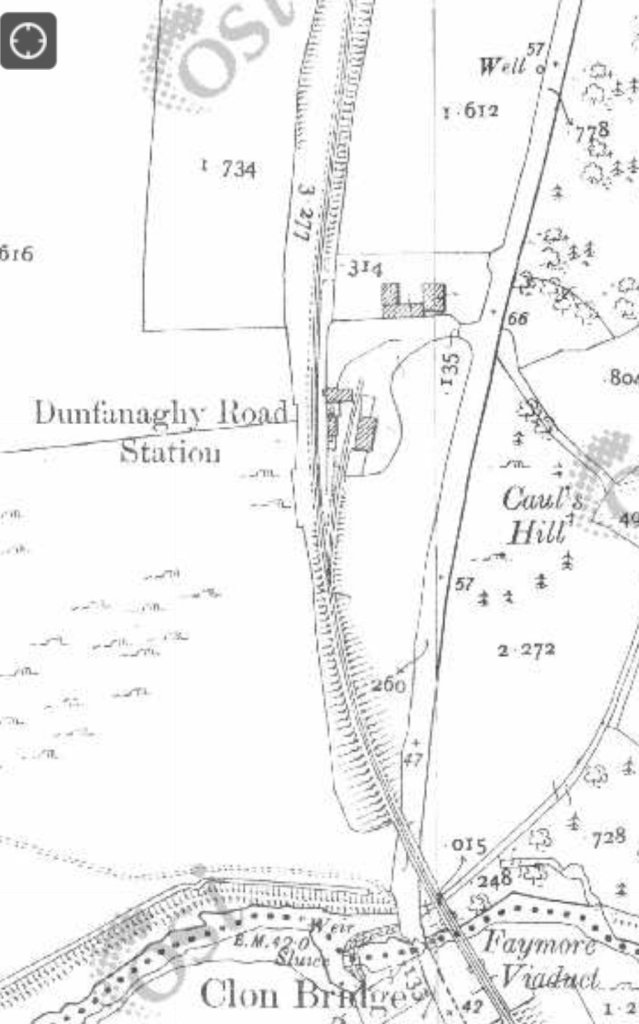
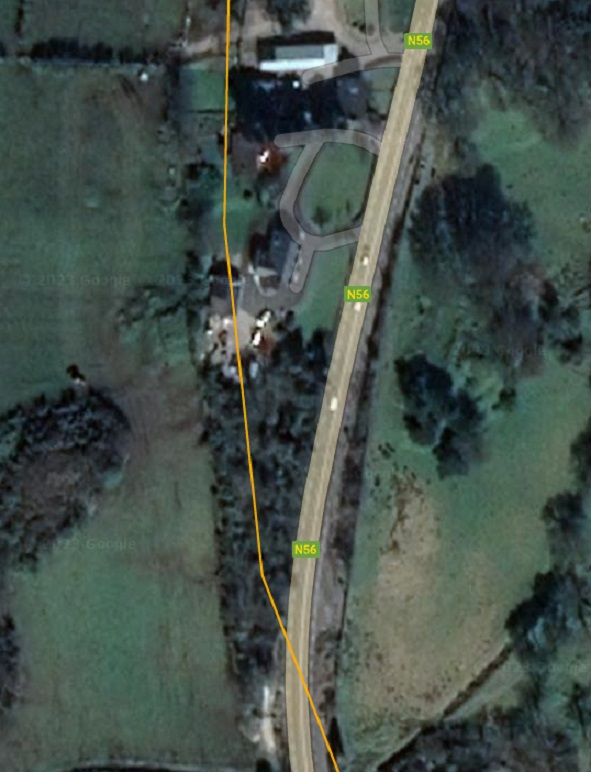
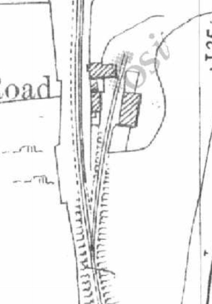
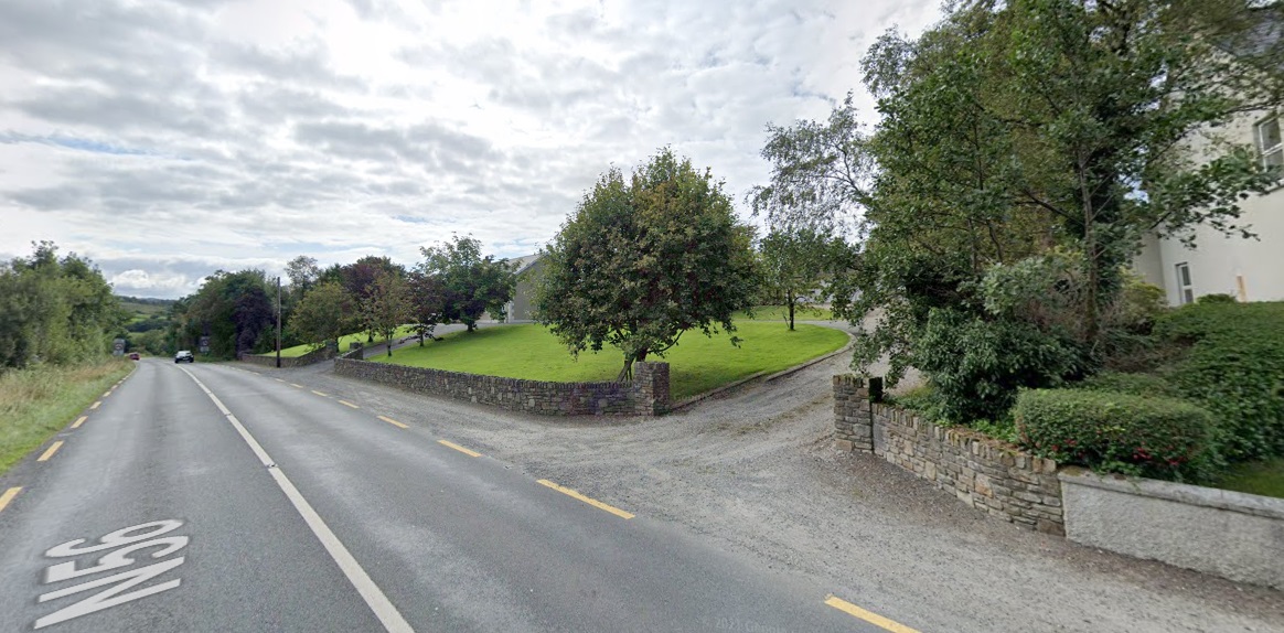
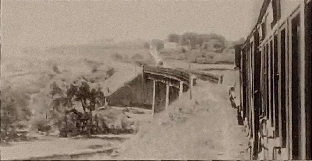
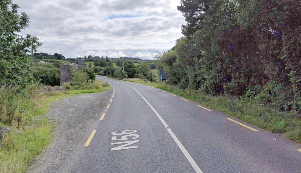
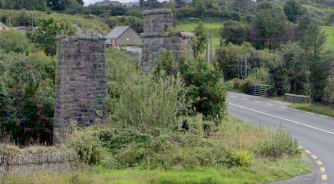
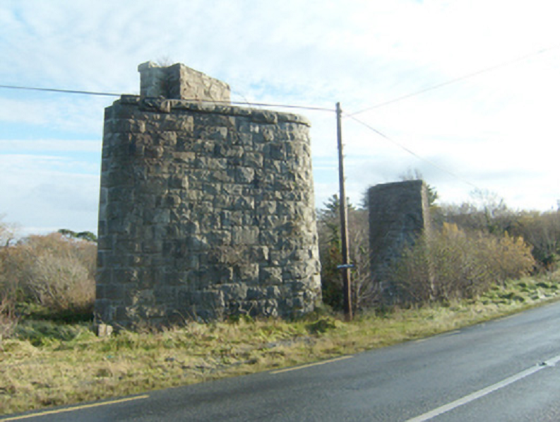
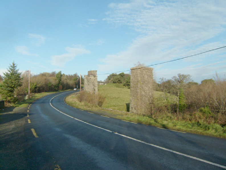
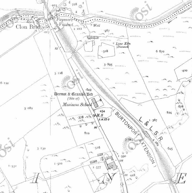
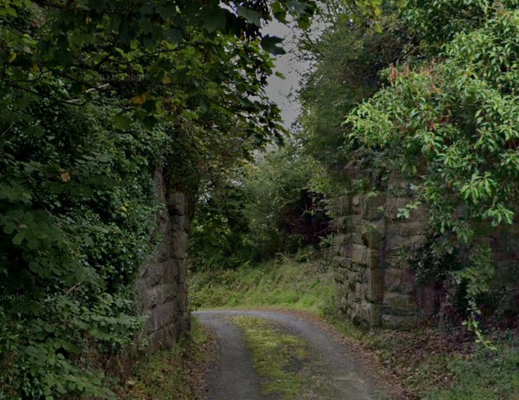
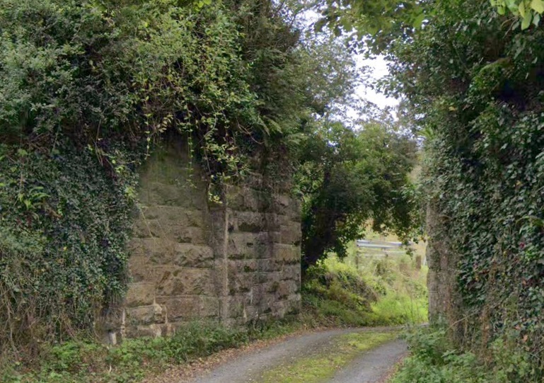
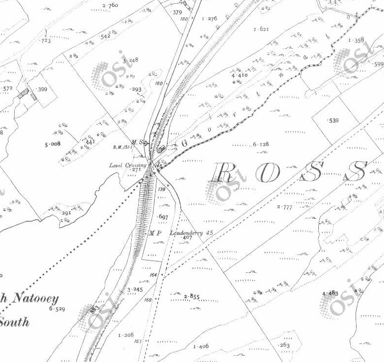
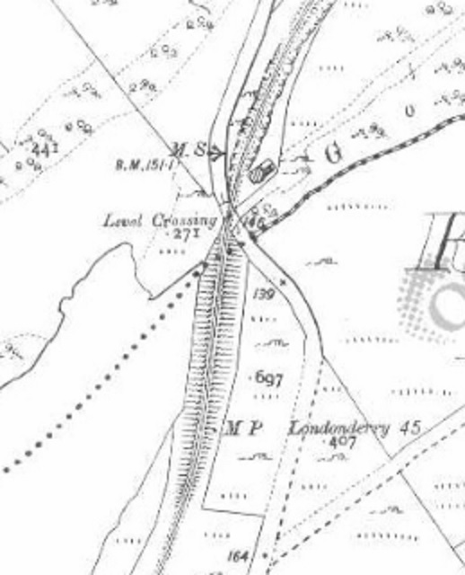
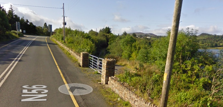
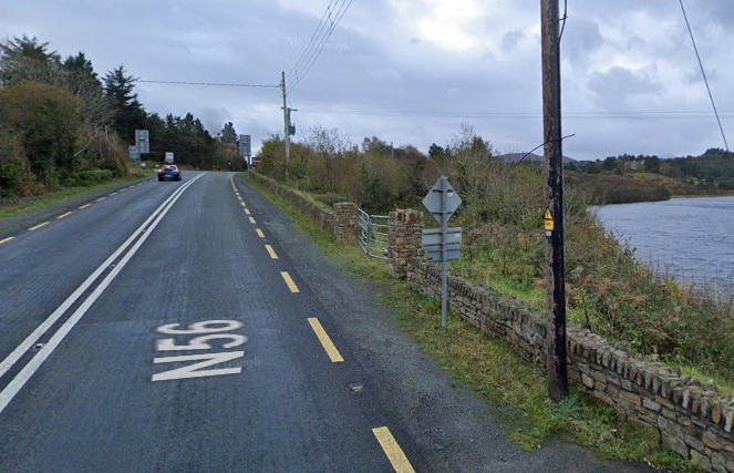
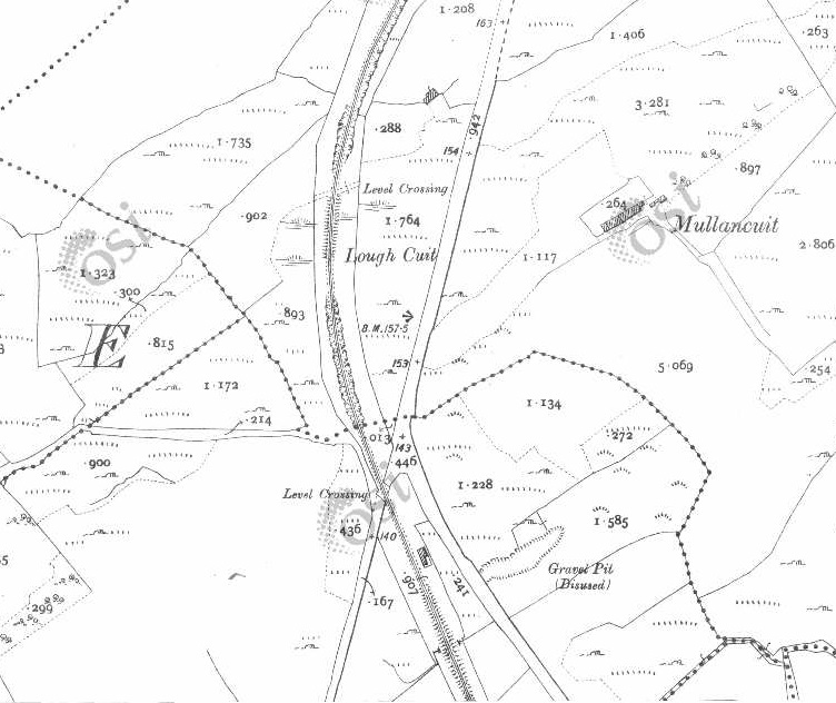
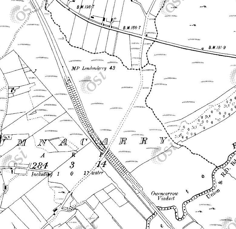
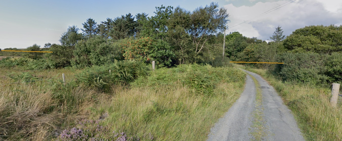
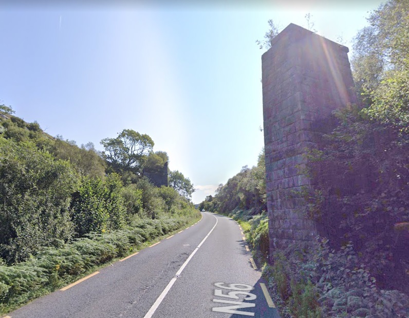
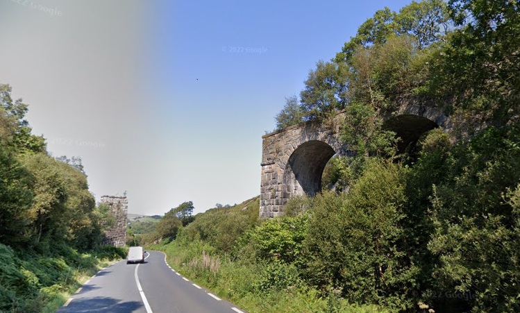
These two extracts from the OSi historic mapping show the next length of the old railway. The first is from the 6″ survey and shows Gatehouse No. 12 (14) just to the East of the join between two map sheets. The second covers a length eastwards from a point just to the West of Gatehouse No. 11 (13). It is taken from the 25″ survey. [2]This satellite image from RailMapOnline.com shows the same length of the old railway as covered by the two images above. Gatehouse No. 12 (14) is just to the right of centre and guarded access across the line on the lane which meanders around to the South of the route of the old line. [10]Gatehouse No. 12 (14) as shown on Google Maps with the old line superimposed. [Google Maps, June 2023]Two images of Gatehouse No. 12 (14) as it appeared in 2021. [Google Streetview, August 2021]Gatehouse No. 12 (14) in 2023. [My photograph, 27th April 2023]Looking back to the West along the old railway formation with renovation being undertaken at Gatehouse No. 12 (14) which encroaches across the line if the railway. [My photograph, 27th April 2023]Looking East along the old railway formation from the track outside Gatehouse No. 12 (14). [My photograph, 27th April 2023]The 25″ OSi survey of 1901 shows the old line continuing first in an Easterly direction and then turning to the Northeast. [2]RailMapOnline.com shows the same length of the old line as the two map extracts above. [10]A much closer view of Gatehouse No. 11 (13) as seen on Google Maps satellite imagery. [Google Maps, June 2023]Gatehouse No. 11 (13) at the turn of the 21st century. [6: p166]Gatehouse No. 11 (13) in 2023. The site around the building was relatively rundown. [27th April 2023]This sequence of three map extracts from the OSi 25″ mapping show the line maintaining its Northeasterly direction of travel. [2]The same length of line is represented by this single extract from RailMapOnline.com’s satellite imagery. [10]These two map extracts are both taken from the OSi 25″ 1901 Survey. They show the line curving round from an Northeasterly trajectory to a Southerly one. [2]The last two map extracts from the 25″ 1901 OSi Survey are covered by the scope of this satellite image, the old railway route is shown again by the yellow line. [10]The old line continued South. This extract from the 25″ OSi survey of 1901 shows both Dunfanaghy Road Station and Faymore Viaduct. [2]The same location in 2023 as shown on RailMapOnlone.com’s satellite imagery with the route of the old railway superimposed. [10]Dunfanaghy Road Railway Station as shown on the 25″ OSi mapping of the turn of the 20th century. The station had no passing loop, but did have a single goods siding which could be used to allow trains to pass. [2]The view Southwest from the N56 into what was Dunfanaghy Road Railway Station. [Google Streetview, August 2021.Faymore Viaduct seen in 1937 from a train which has just left Dunfanaghy Road Station heading for Letterkenny. [5: p70]A little further South on the N56, we get a first view of what remains of Faymore Viaduct. [Google Streetview, August 2021]The two remains stone piers of Faymore Viaduct. [Google Streetview, August 2021]Two images of the remaining parts of Faymore Viaduct. [13]
The National Inventory of Architectural Heritage records the structure as follows:
Faymore Viaduct is now a “series of freestanding piers formerly supporting multiple-arch railway viaduct, built c. 1903, formerly carrying the Letterkenny to Burtonport section of the Derry (Middle Quay) to Burtonport railway line over road and the Faymore River. Viaduct now out of use with railway deck now removed (closed 1947). Piers constructed squared and snecked stonework with drafted margins to corners, and with projecting stringcourse to girder level. Spans road (N56) and Faymore River in the rural landscape to the north\north-west of Creeslough.
This series of impressive piers that formerly supported a long railway viaduct that spanned the road and the Faymore River. The piers are well-built using good-quality mildly rock-faced and snecked stone masonry that is a feature of Victorian and Edwardian railway engineering and architecture in Ireland. The piers now stand almost like pieces of sculpture, and are interesting features of some historic merit in the scenic rural landscape to the north\north-west of Creeslough. The viaduct was originally built to serve the Letterkenny to Burtonport section of the Derry (Middle Quay) to Burtonport railway; this section was built by the Letterkenny to Burtonport Extension Railway Company and was opened in 1903. This railway line was built to the 3 foot narrow gauge, a feature of many of the former railway lines in Donegal. The railway line was closed from Gweedore to Burtonport in 1940 but the Letterkenny to Gweedore section remained in use until 1947. This former railway forms part of a group of structures associated with this railway line in the area, and is an integral element of the built heritage and transport history of County Donegal. It was probably built to designs by Taggart Aston of Belfast who was responsible for the design and construction of many of the bridges on the Letterkenny to Burtonport narrow gauge railway line.” [13]
To the South of the River Faymore the old railway line continued in a southerly direction towards Creeslough Railway Station just a short distance to the South.
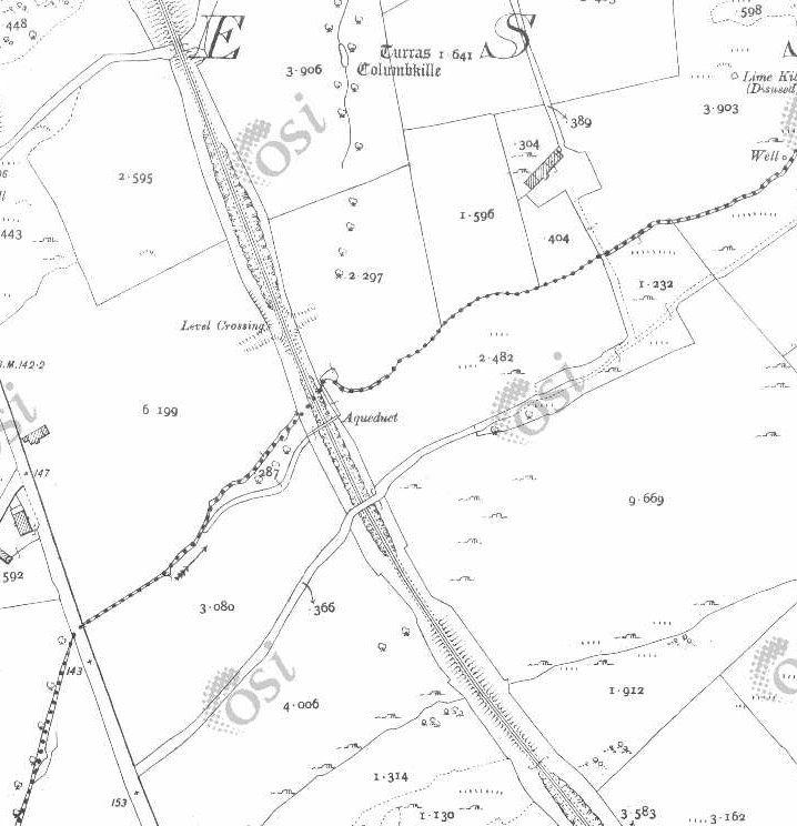
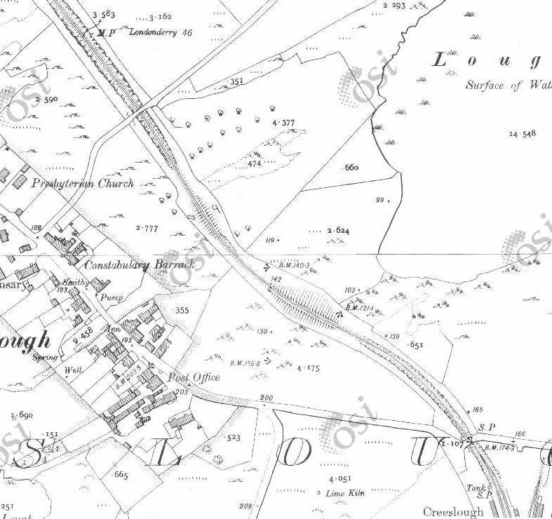
This series of three map extracts, from the 25″ OSI mapping of 1901, show the length of the line from Faymore Viaduct (at the top of the first extract) to Creeslough Railway Station which just creeps onto the bottom-right corner of the third extract. [2]This satellite image from RailmapOnlime.com shows the same length of the old railway as appears in the three map extracts above. [10]
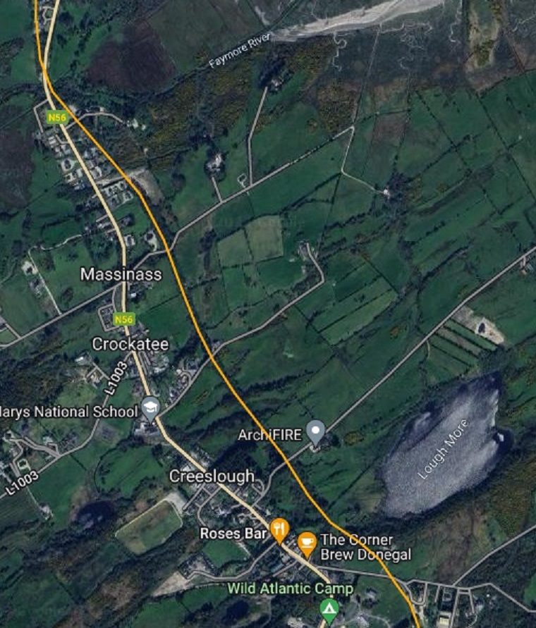
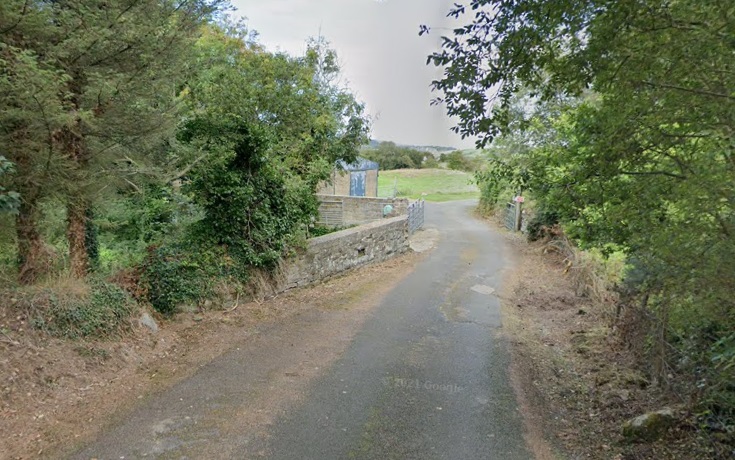
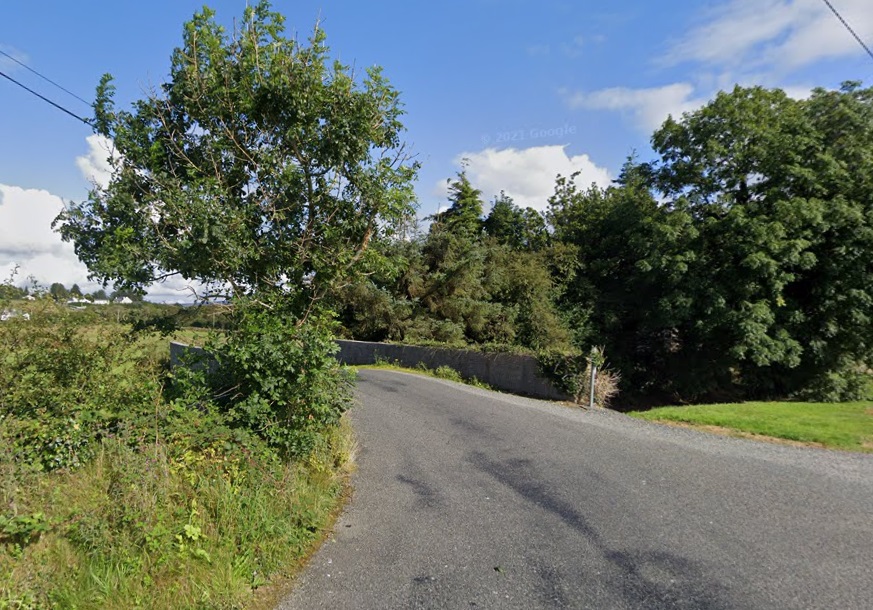
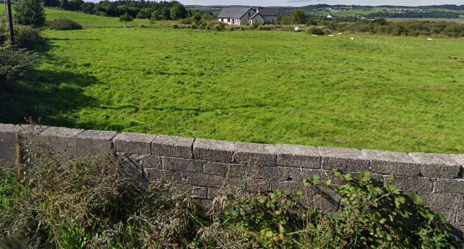
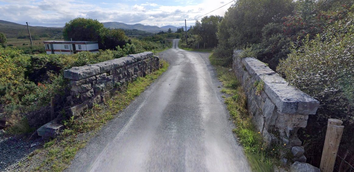
At Massinass a side road leaves the N56 and would once have passed under the old railway. The bridge abutments still remain.
The abutment of the old bridge remain. This view is from the West. [Google Streetview, August 2021]The same bridge but from the East. [Google Streetview, August 2021]
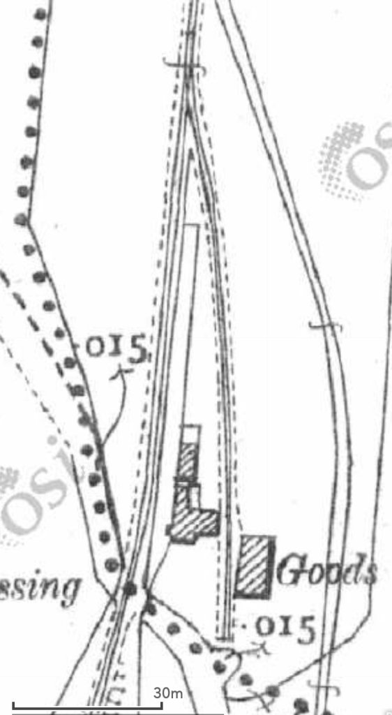
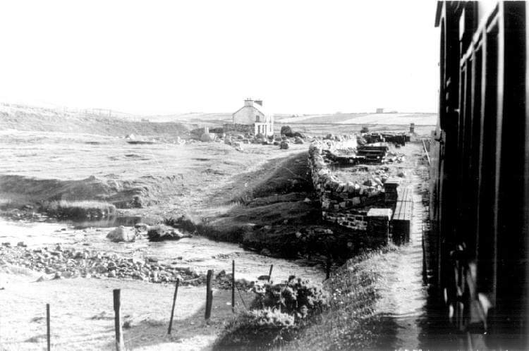
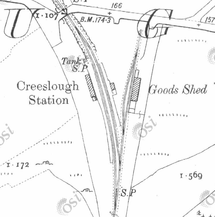
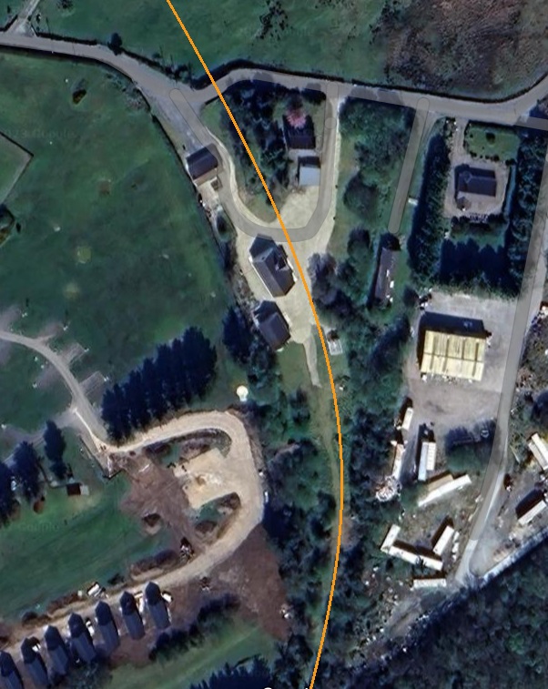
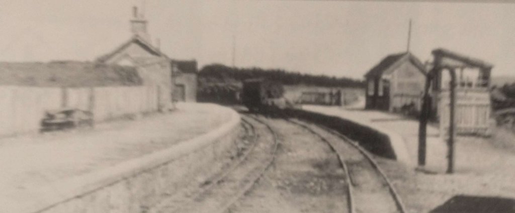
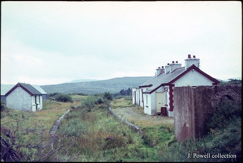
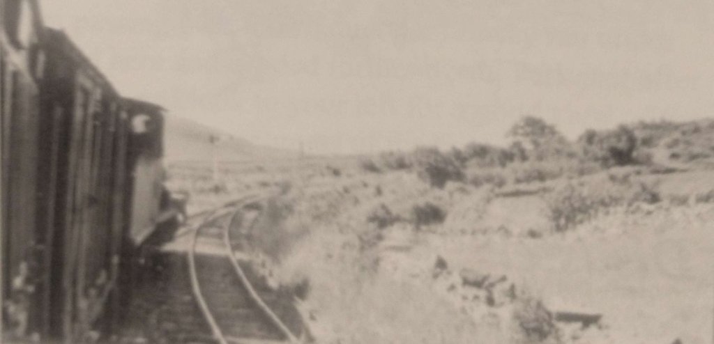
This picture of Creeslough Railway Station is embedded from Andrew Lance’s flickr stream. This is the view from the North end of the station some time after closure. [18]The view South from the road bridge along the cutting that defined the throat of Creeslough Railway Station. The rock cutting is now filled with vegetation. [Google Streetview, August 2021]Creeslough Railway Station site, seen from the East, as it appeared in 2021. The old railway line curved round behind the house and garage seen here. [Google Streetview, August 2021]The good shed is still standing. This telephoto image was taken from the road to the North of the station site and is as a result not as sharp as it could be. [Google Streetview, August 2021]The view South from Creeslough Railway Station taken from the train. The engine is No. 12 and it heads the 8.30am service from Burtonport to Letterkenny on 24th June 1937. [5: p68]
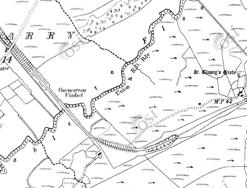
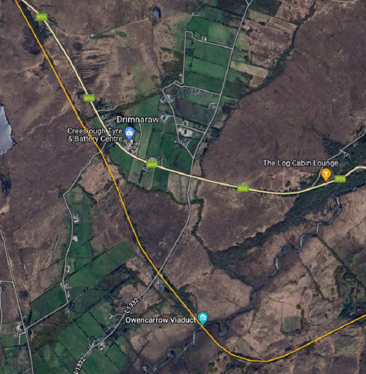
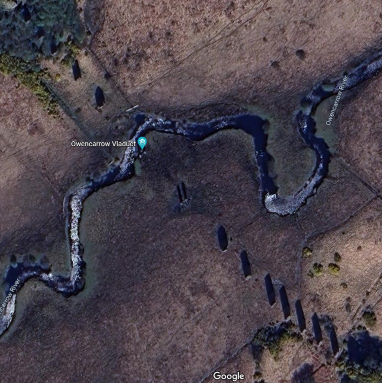
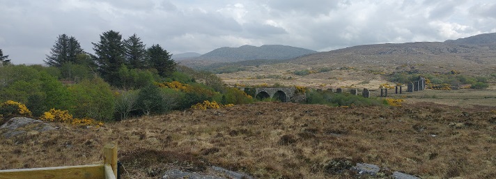
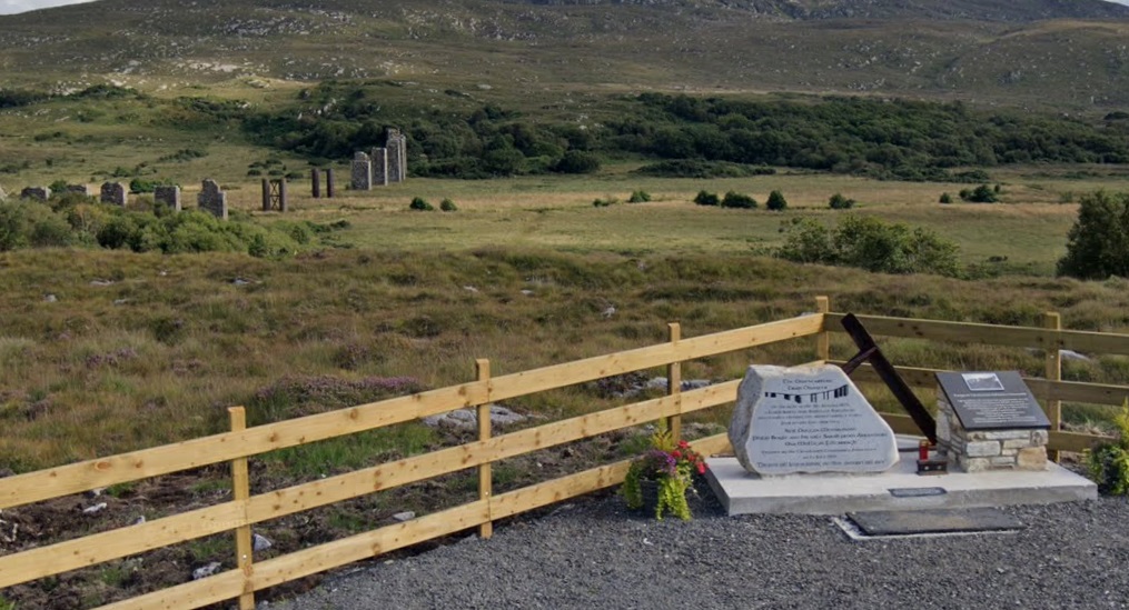
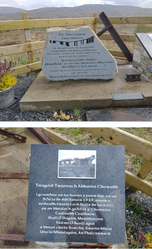
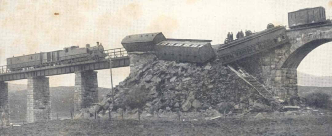
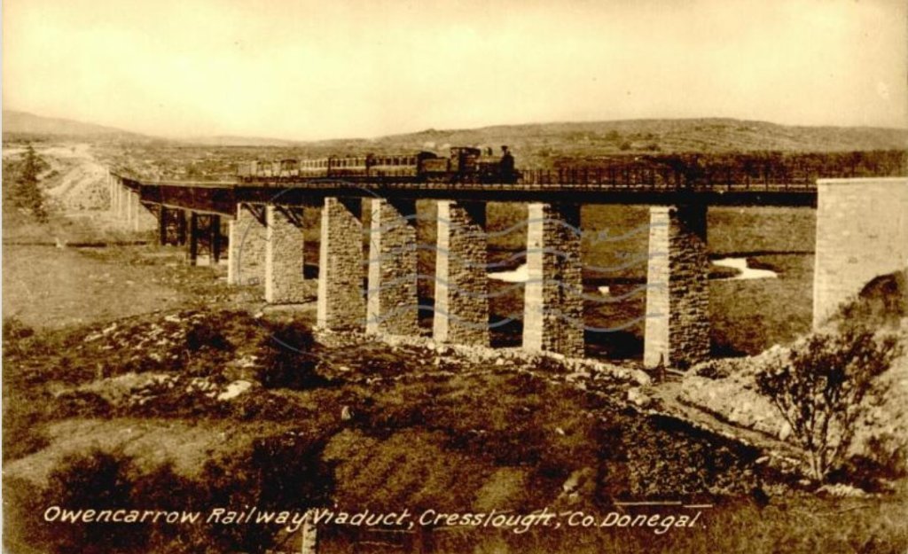
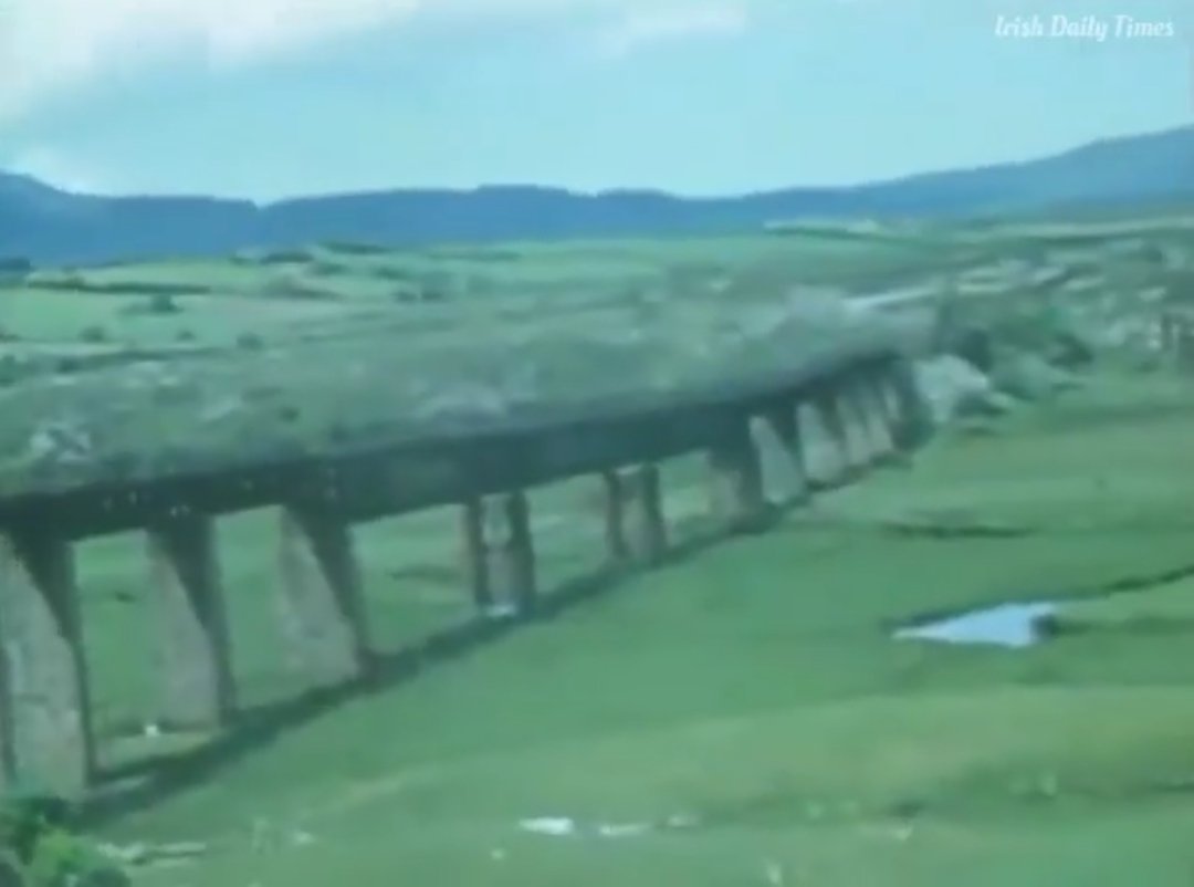
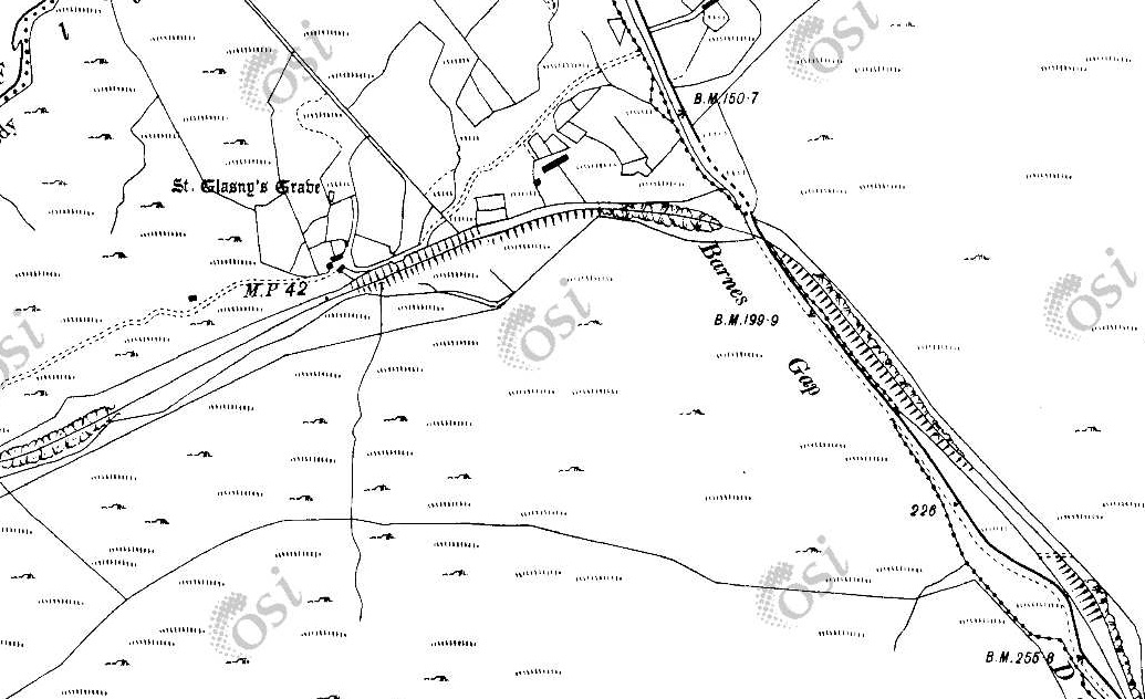
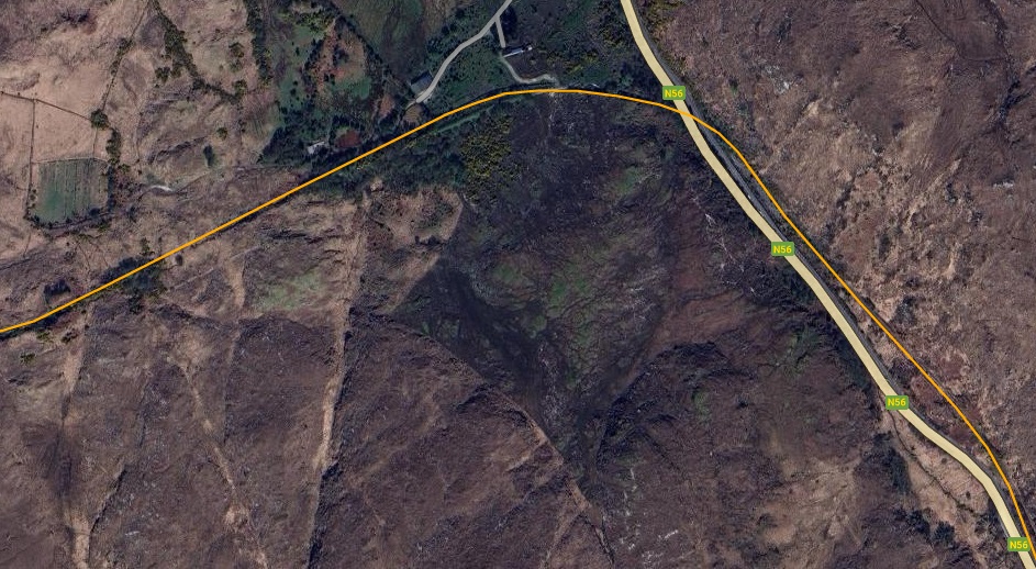
South of Creeslough Station the line curved round to the Southwest and then back towards the Southeast heading for the Owencarrow Viaduct which was the site of a notorious railway accident in the early 20th century. [14] The first three map extracts below are taken from the 25″ survey of 1901. The next map sheet at that scale is not available online at present. The subsequent map extracts come from the 6″ OSi survey of the early 20th century.
These two map extracts show the old railway heading Southwest and then running along the East shore of Lough Natooey South (named Creeslough on modern satellite imagery).This RailMapOnline.com satellite image covers the same length of the old railway as covered by the map extracts above.This Google Streetview image from 2009 shows the route of the old railway. The photo looks North from the point where the old railway line met the old mainroad, now the N56). The drive on the right of the picture follows the line of the old railway. In later images the vegetation has grown considerably to mean that this view is not available in the 2020s. [Google Streetview, August 2009]
For a short distance, the old railway and the old road ran alongside each other and then the railway crossed the old road at a level crossing with an adjacent crossing-keepers cottage (No. 10), which can be seen on the enlarged map extract, before then running along the shore of the Lough Natooey South (Creeslough).
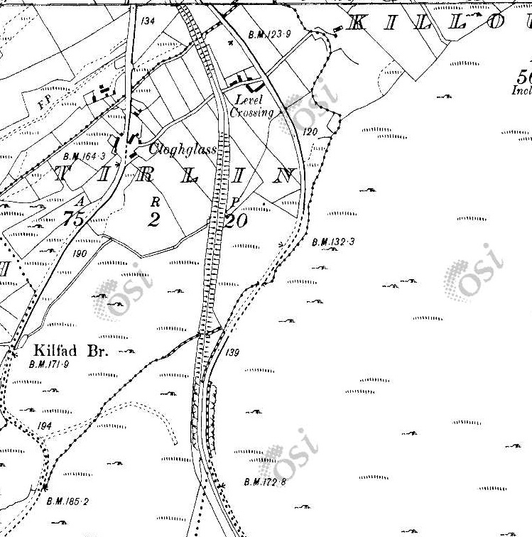
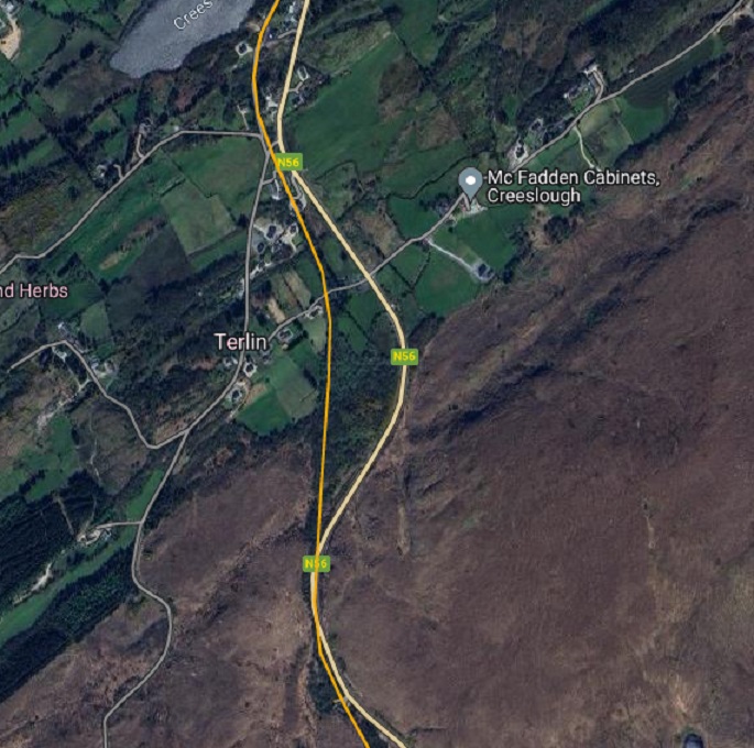
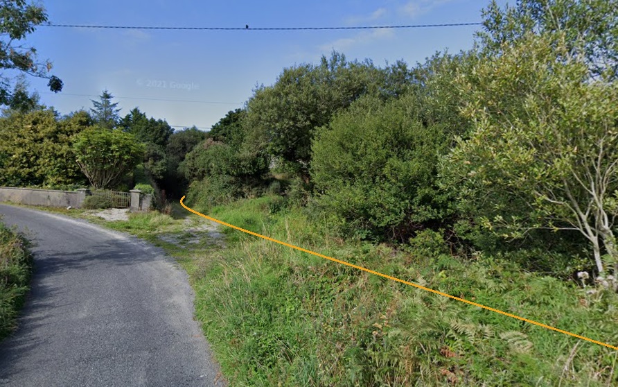
Taken on the same day as the last photograph but a little further South on the N56, the route of the old railway can be seen running away from the road. Creeslough (or Lough Natooey South) can be seen on the right side of this image. [Google Streetview, August 2009]A very similar view in 2022. The track which follows the old railway formation can still be seen beyond the galvanised steel gate. [Google Streetview, November 2022]South of the Lough, the line crossed a minor road junction as shown on this extract from the OSi 25″ Survey of 1901. Crossing-keeper’s Cottage No. 9 can be seen to the South of the road junction. [2]From this point southwards there is no 25″ OSi Survey Sheet. Only 6″ OSi survey mapping is available for the next section of the old railway. This 6″ extract shows the road and railway running close together. The track from the N56 to Terlin crosses the old line on the level at an ungated crossing. At the bottom of this extract, road and rail run immediately next to each other. [2]This satellite image shows the same length of the line as covered on the two map extracts immediately above. [10]A view North along the formation of the old railway from the minor road which has a junction with the N56 just off to the right of the image on the opposite side of the old railway. [Google Streetview, August 2021]
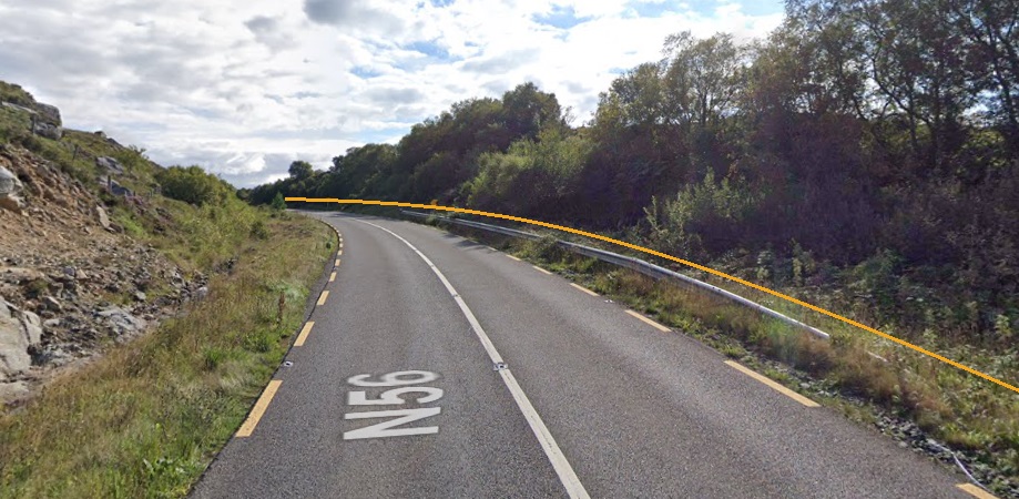
South of the junction mentioned above the line and the road ran immediately next to each other, as shown below.
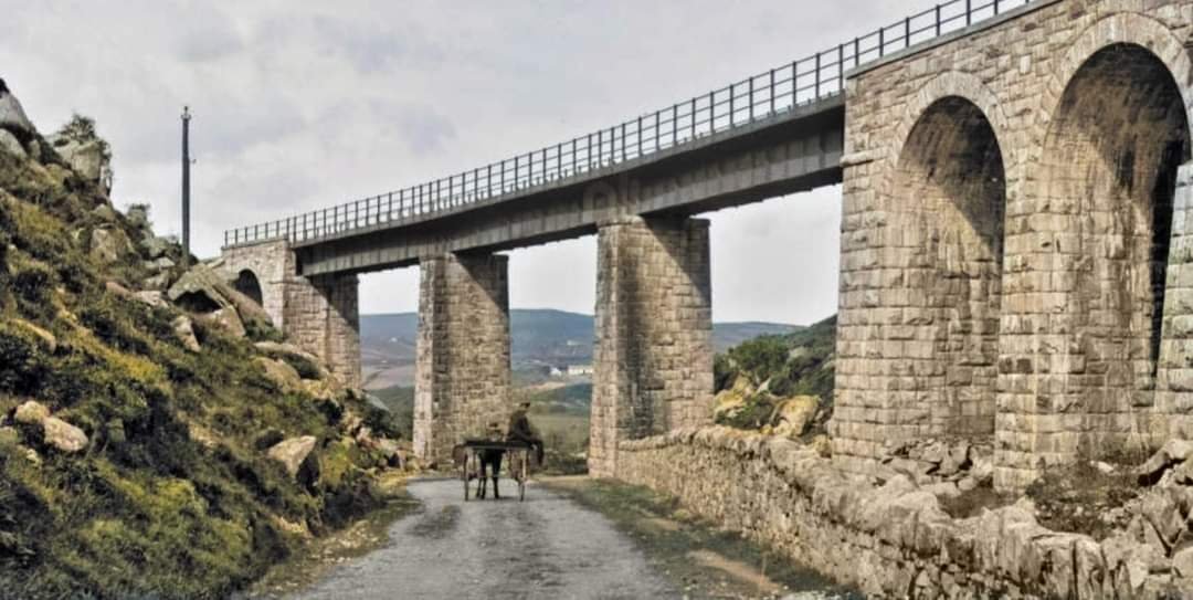
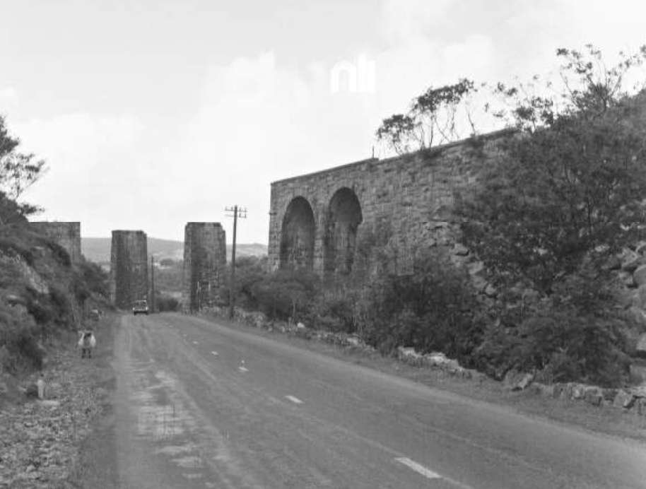
The National Inventory of Architectural Heritage describes the structure as being a:
“Former railway viaduct taking former Letterkenny to Burtonport line over road, erected c.1903, comprising two rusticated arches to southeast and two freestanding rusticated stone piers to northwest, formerly carrying steel girders. Rusticated stone voussoirs forming round arches, with coursed rusticated masonry with drafted margins to spandrels and extending to low parapet having concrete copings with string course at springing level of arch to northwest. Coursed rusticated piers with drafted margins and ashlar rusticated copings. Set adjacent to, and crossing, N56 road to south of Creeslough.
This is an impressive structure of considerable architectural, social and technical significance to the region. The remains of the Barnes Gap Viaduct represent the latest expansion of transport networks in the late nineteenth/early twentieth centuries. It was built to carry the Letterkenny to Burtonport railway line, which opened in 1903 and closed in 1947. The viaduct exhibits high-quality stone masonry and the robust texture of the rusticated stonework enhances the visual aesthetics of the structure in the landscape.” [17]
This brings us to the end of this length of the old railway. In the next post we will continue on towards Letterkenny.
Dave Bell & Steve Flanders; Donegal’s Railway Heritage Guide No. 2, The Londonderry & Lough Swilly Railway: A Visitor’s Guide to the old railway and all the bits that can still be seen; County Donegal Restoration Society, Donegal Town, Co. Donegal, 198….. The Donegal Railway Heritage Trust hold the copyright of this book and images are used here with the kind permission of Jim McBride, a director of the Museum Trust.
Joe Begley, Steve Flanders & E.M. Patterson; The Lough Swilly Railway: Revised Edition; Colourpoint Books, Newtownards, 2017.