Tag Archives: Leeds

The Manchester and Leeds Railway – The Railway Magazine, December 1905 – Part 1

An article in the Railway Magazine in December 1905 prompted a look at the Manchester and Leeds Railway. For a number of years my parents lived in sheltered housing in Mirfield which is on the line. Looking at the line as it appeared in 1905 and again in the 21st century seemed a worthwhile exercise! Part 1 of this short series provides a short history of the line and takes us from Manchester to Sowerby Bridge.

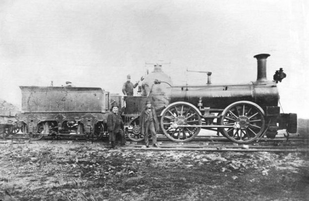
The featured image at the head of this article shows the Manchester & Leeds Railway locomotive ‘Victoria’, in about 1878-80. This locomotive was designed by Edward Bury and built at his works in Liverpool. It was one of a batch of 0-4-0 engines ordered in 1845, and later converted to an 0-4-2 wheel arrangement (c) Public Domain. [65]

In his first article in 1905, about the Manchester and Leeds Railway which was accompanied by a series of engravings included here, Herbert Rake wrote that on 11th September 1830 a committee tasked with improving communications between Leeds and Manchester, emboldened by the success of the Liverpool and Manchester Railway, decided to hold a meeting to form a new railway company.

On 18th October 1930, the decision was taken. A board of directors was appointed, a survey was authorised and work was undertaken to prepare for an application to Parliament. It was based on a junction with the Liverpool and Manchester Railway at Oldfield Lane, Salford and at St. George’s Road, Manchester.

The route from Manchester to Sowerby Bridge was easily agreed, that from Sowerby Bridge to Leeds was more difficult to agree. The Bill prepared for Parliament focused on the Manchester to Sowerby Bridge length of the planned line and was presented on 10th March 1831. Opposition from the Rochdale Canal Company and others and then the dissolution of Parliament halted the progress of the Bill.

Resubmission was agreed on 8th June 1830 but once again failed in its progress through Parliament. In the end, the project was revised, the company was reorganised, and the capital fixed at £800,000 in £100 shares in a meeting in October 1935.

Rake tells us that this “new project abandoned the Salford junction line, but embraced a deviated extension beyond Sowerby Bridge, along the lower portion of the Vale of Calder, past Dewsbury and Wakefield, to Normanton, thence to Leeds, in conjunction with the North Midland Railway. … [The line was] intended to form a central portion of a great main line running east and west between Liverpool and Hull.” [1: p469-470]

The prospectus noted a few important facts, particularly:

  • The population density with three miles either side of the proposed line was 1,847 persons per square mile. The average for England was 260 persons per square mile.
  • Within 10 miles of the line there were 29 market towns, twelve with a population greater than 20,000.
  • Within 20 miles of the line there were 48 market towns with more than 10,000 inhabitants.

Rake tells us that “The Act of Incorporation received the Royal Assent on the 4th July 1836, and authorised a joint stock capital to be raised of £1,000,000, with an additional amount by loan of £433,000.” [1: p470]

Construction commenced on 18th August 1837. On 14th February 1838 it was decided to apply to Parliament for an Act authorising branch lines to Oldham and Halifax.

Victoria Station, Manchester, was first known as Hunt’s Bank Station. [1: p468]
Part of the original station at Manchester Victoria, as it appeared in 1989. In around 1860, the single storey station building was extended by the addition of a second floor. The Lancashire and Yorkshire Railway sensitively incorporated the original building into the new 1904 facade of Victoria station, © Whatlep and authorised for reuse under a Creative Commons Licence (CC BY-SA 2.0). [2]

Late in 1838, “a modification of the original plan for effecting a junction of the Manchester and Leeds Railway with the Liverpool and Manchester Railway was proposed, by an extension of both to a joint terminus within 500 yards of the Manchester Exchange. … The Act of Parliament for this and other purposes received the Royal Assent on the 31st July 1839, authorising the sum of £866,000 to be raised for the purpose of constructing the Oldham and Halifax branches, for making a diversion in the railway at Kirkthorpe, for enlarging the station in Lees Street, and for constructing the line to join the Liverpool and Manchester extension.” [1: p470]

Rochdale railway Station as shown on the 25″ Ordnance Survey 0f 1908, published in 1910. [21]
View NE from south end of Rochdale Station. On the left, Hughes/Fowler 5P 4F 2-6-0 No. 42724 on the 11.58am Wakefield to Manchester; on the right, Stanier 4MT 2-6-4T No. 42653 on a local to Bolton, © Ben Brooksbank and licenced for reuse under a Creative Commons Licence (CC BY-SA 2.0). [22]

Rake explains that the railway ran through Miles Platting where the Ashton and Stalybridge branch diverges. At Middleton the Oldham branch connected to the main line. Mill Hills embankment (maximum height 75 feet) carries the line towards Blue Pits Station where the Heywood line joins the main line. The line runs on through Rochdale, Littleborough and Todmorden Vale before running in cutting (maximum depth 100 feet) to Summit Tunnel.

During construction, “Six contracts were awarded between the Manchester terminus and the Summit Tunnel and were progressing satisfactorily by August 1838.” [6]

The West Portal of Summit Tunnel is approached from Manchester through a deep cutting. [1: p469]
The same portal of Summit Tunnel in 20th century steam days. [3]

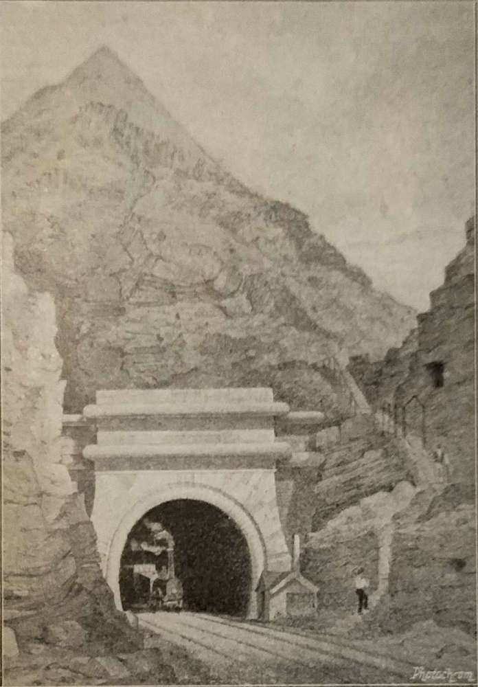
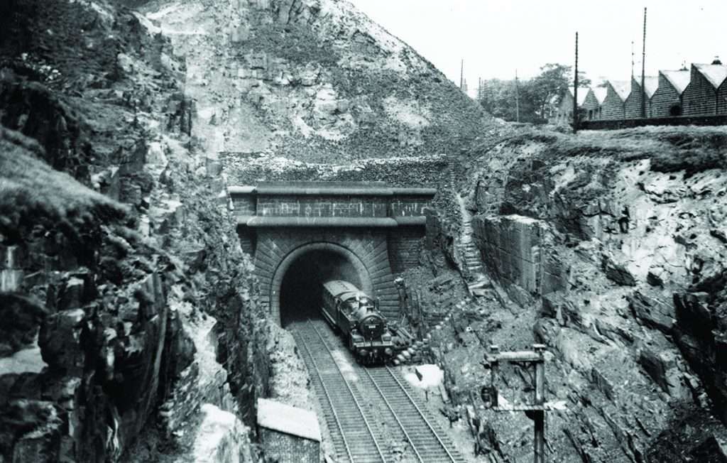
When built, Summit Tunnel was the longest in the world. It opened on 1st March 1841 by Sir John F. Sigismund-Smith.

The tunnel is just over 1.6 miles (2.6 km) long and carries two standard-gauge tracks in a single horseshoe-shaped tube, approximately 24 feet (7.2 m) wide and 22 feet (6.6 m) high. Summit Tunnel was designed by Thomas Longridge Gooch, assisted by Barnard Dickinson. Progress on its construction was slower than anticipated, largely because excavation was more difficult than anticipated. … It … cost £251,000 and 41 workers had died.” [4]

Rake noted that the tunnel is “14 shafts were necessary, and the strata of rock shale and clay was of so treacherous a character that the brick lining of the roof, which is semi circular, consists in places of no less than 10 concentric rings.” [1: p471] He also comments that: the tunnel entrance is if an imposing Moorish design; 1,000 men were employed with work continuing day and night.

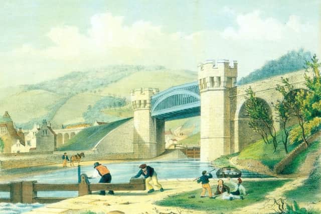
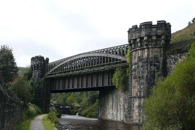
Beyond the tunnel, the railway “entered a cutting in silt, which required piling to secure a foundation. Continuing onwards, we pass through the Winterbut Lee Tunnel, 420 yds. in length, and across a viaduct of 18 arches, one of which is of 60 ft. span we then proceed over the Rochdale Canal, on a cast iron skew bridge 102 ft. in span, at a height of 40 ft. above the surface of the water.” [1: p471]

A colourised engraving of the bridge over the Rochdale Canal by A.F. Tait. [6]
The Manchester and Leeds Railway’s castellated bridge over the Rochdale Canal to the South of Todmorden on 16th September 2007, © Tim Green and authorised for reuse under a Creative Commons Licence (CC BY 2.0 Generic). [5]
The railway bridge illustrated above as it appears on the 25″ Ordnance Survey of 1905, published in 1907. [9]

Tenders for work on the eastern section were advertised in 1838. … Contractors then worked fastidiously under the threat of heavy penalties should they over-run the set time limits. They were also forbidden to work on Sundays.” [6]

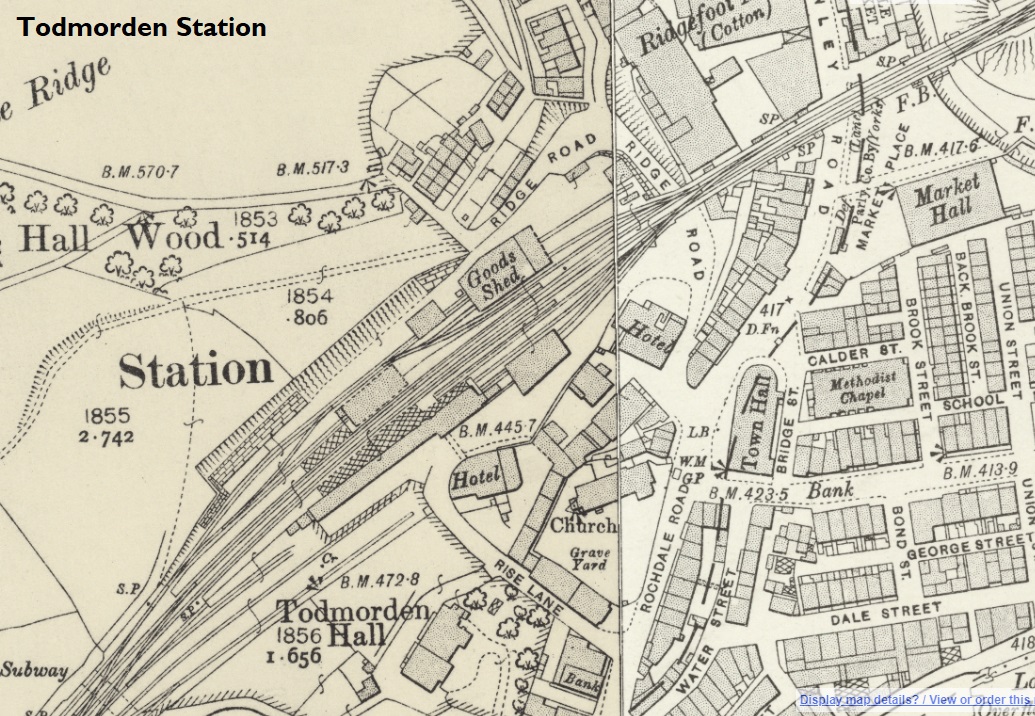
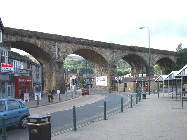
At Todmorden, “the railway is carried over almost the entire breadth of the valley by a noble viaduct of nine arches, seven of which are each of 60 ft. span, and two of 30 ft., at a height of 54 ft. above the level of the turnpike road.” [1: p471]

Todmorden Railway Station on the 25″ Ordnance Survey of 1905, published in 1907. The viaduct which spans Burnley Road to the East of the Railway Station appears top left on this map extract and below on a more modern photograph. [8]
Todmorden Railway Station, seen from Platform 2, in the 21st century, © Ian Kirk and licenced for reuse under a Creative Commons Licence (CC-BY 2.5). [20]
Todmorden – Railway Viaduct over Burnley Road: The railway viaduct reaching the station is a prominent feature and is here seen crossing Burnley Road with the bus station on one side of it and the local market on the other, © David Ward and licensed for reuse under a Creative Commons Licence (CC BY-SA 2.0). [7]
The junction with the Burnley Branch on the 25″ Ordnance Survey of 1905, published in 1907. [10]
Looking West from Hallroyd Road Bridge in 2023. Hallroyd Road Bridge overlooks Hall Road Junction close to the right side of the map extract above. [Google Streetview, April 2023]
Looking East from Hallroyd Road Bridge. [Google Streetview, April 2023]

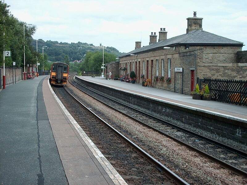
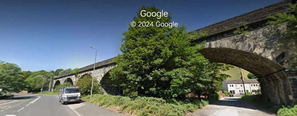
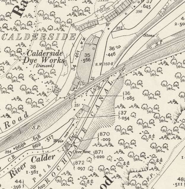
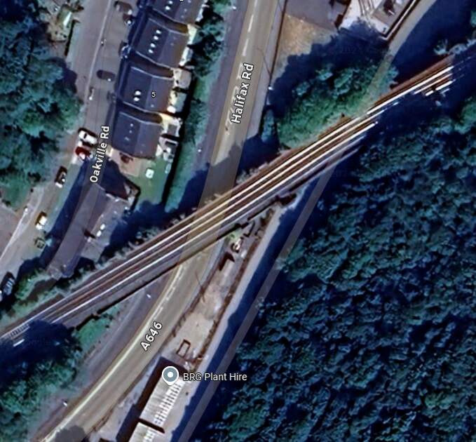
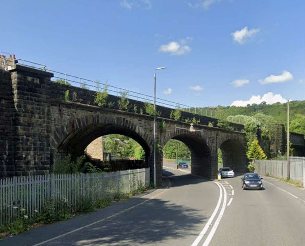
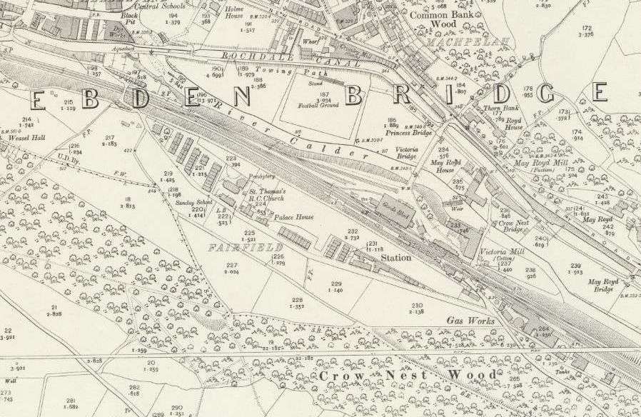
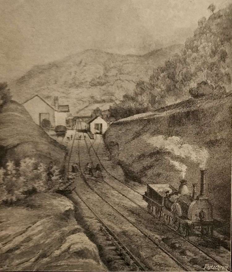
Quitting Todmorden, where the Burnley branch diverges, the line enters Yorkshire, passes through Millwood Tunnel (225 yards), Castle Hill Tunnel (193 yards), and Horsefall Tunnel (424 yards) and then arrives at Eastwood Station. Some distance further on is Charlestown. Afterwards the railway “crosses river, road, and canal, by a skew bridge of three arches, the canal being separately spanned by an iron bridge.” [1: p471]

Looking back West from Cross Stone Road across the western portal of Millwood Tunnel. [Google Streetview, April 2023]
Looking East from the corner of Phoenix Street and Broadstone Street, above the eastern portal of Millwood Tunnel. [Google Streetview, April 2023]

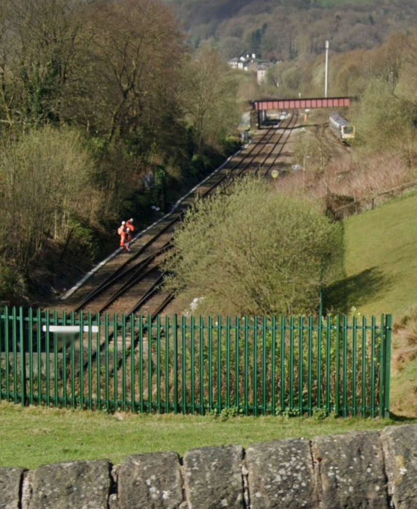
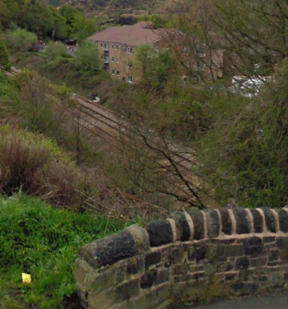
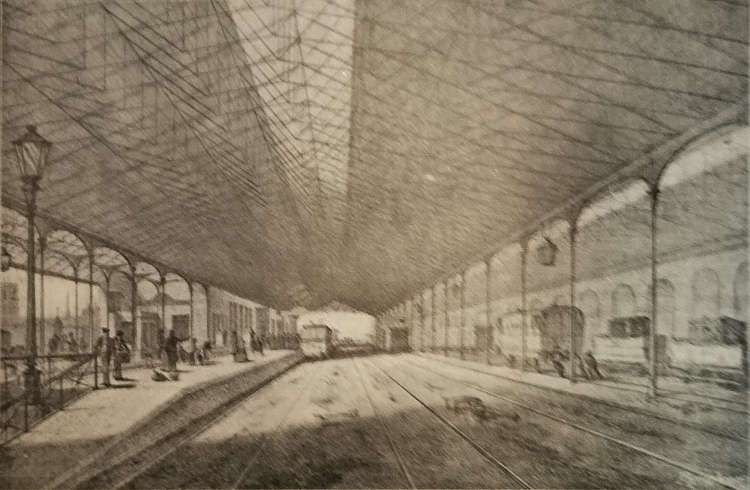
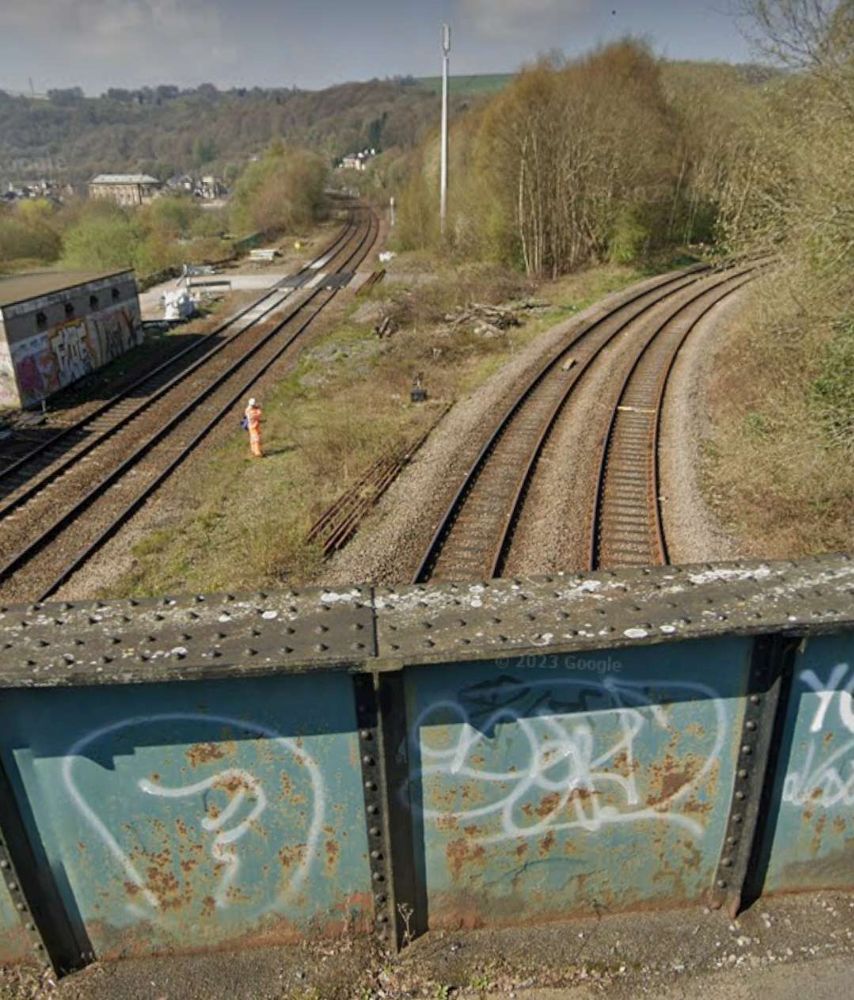
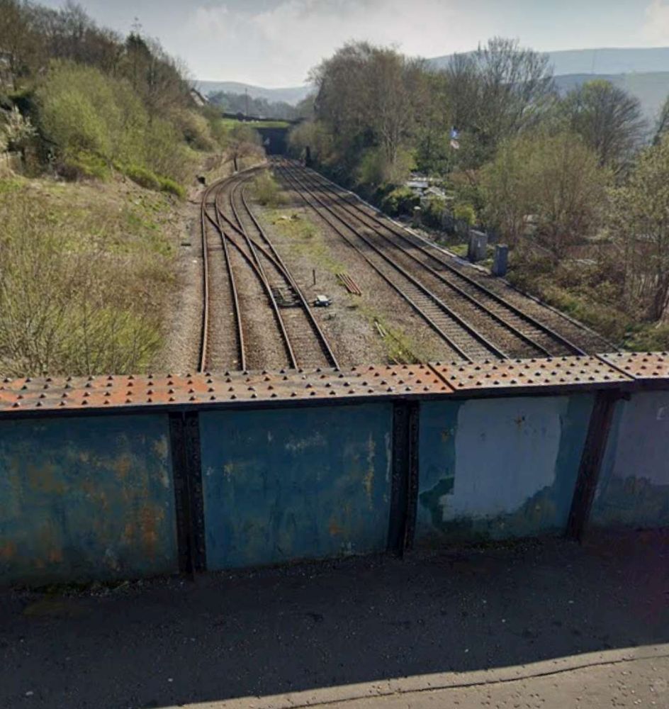
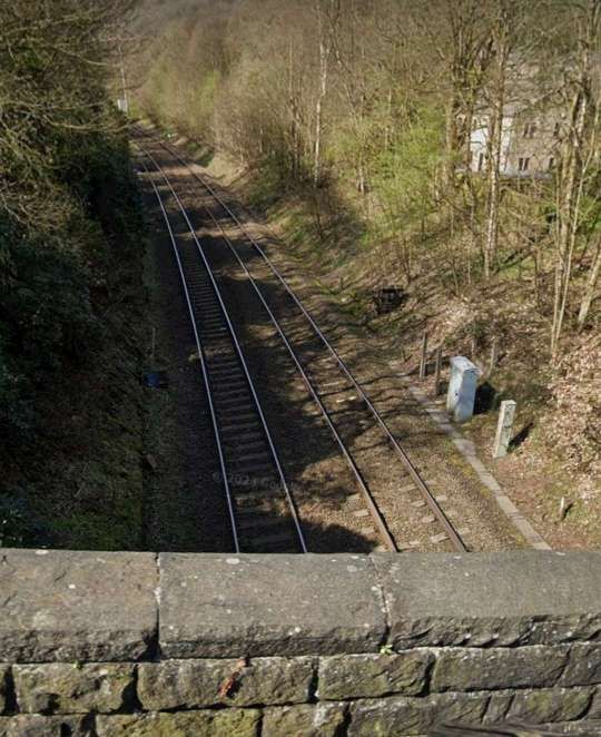
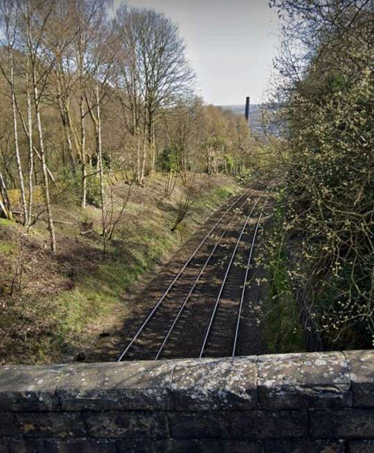
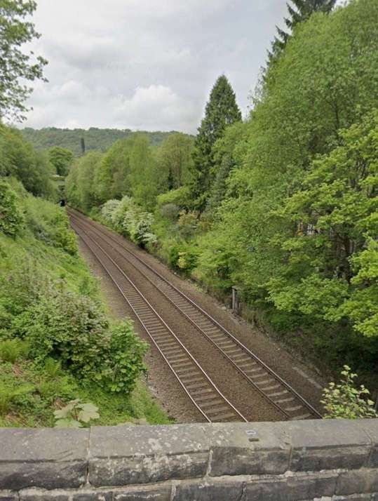
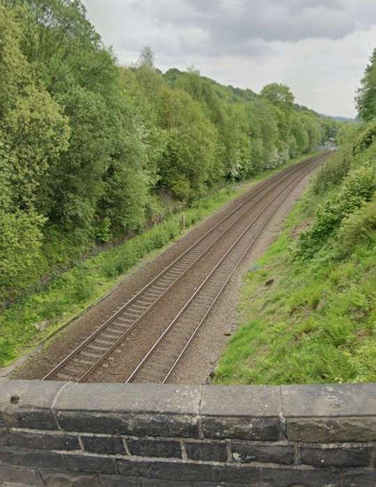
These next few images give a flavour of the line as it travels towards Hebden Bridge.

Lobb Mill Viaduct sits alongside the A646, Halifax Road between Castle Hill Tunnel and Horsefall Tunnel. [Google Streetview, June 2023]
Looking Southwest along the line towards Todmorden from E. Lee Lane. [Google Streetview, April 2023]
A little to the Northeast, Duke Street passes under the railway. This view looks West from Halifax Road [Google Streetview, June 2023]
Eastwood Railway Station as it appears on the 1905 25″ Ordnance Survey. [63]
Thye approximate location of Eastwood Station as it appears on Google Maps satellite imagery in 2024. [Google Maps, October 2024]
A little further Northeast, this is the view Northwest along Jumble Hole Road under the railway. [Google Streetview, June 2011]
The view Northwest from he A646, Halifax Road along the Pennine Way Footpath which passes under the railway at this location. [Google Streetview, June 2023]
Again, looking Northwest from Halifax Road along Stony Lane which runs under the railway. [Google Streetview, June 2023]
The view Southwest along Oakville Road which runs next to the railway. [Google Streetview, April 2023]
The view Northeast from the same location on Oakville Road. [Google Streetview, April 2023]

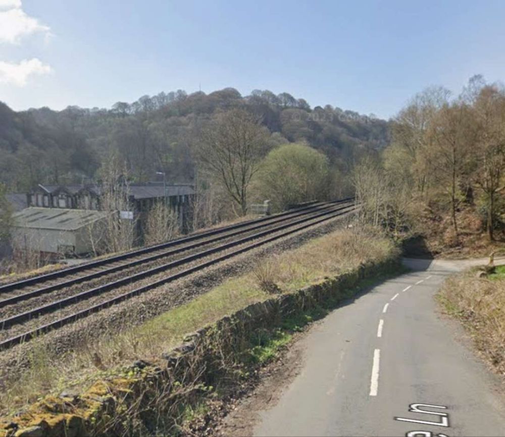
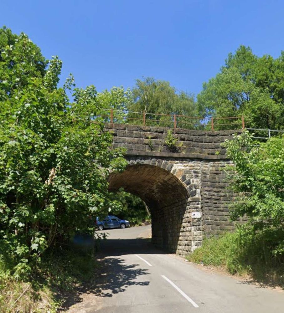
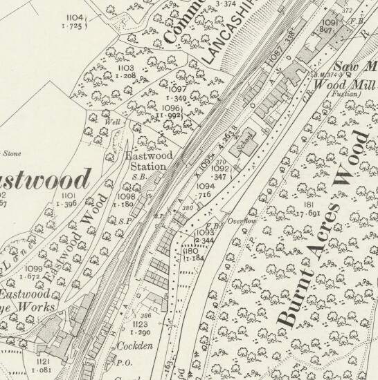
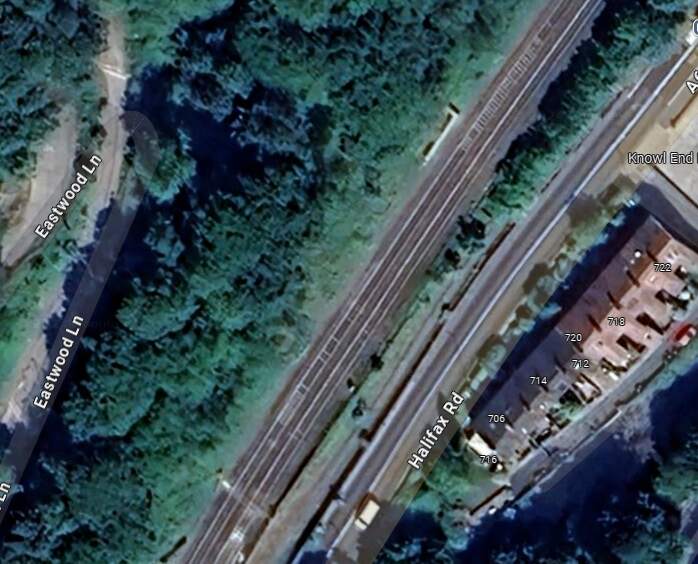
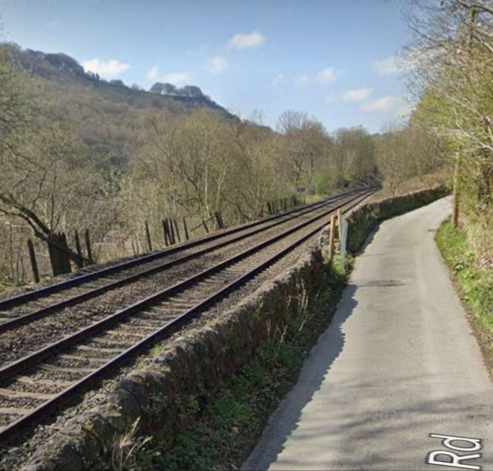
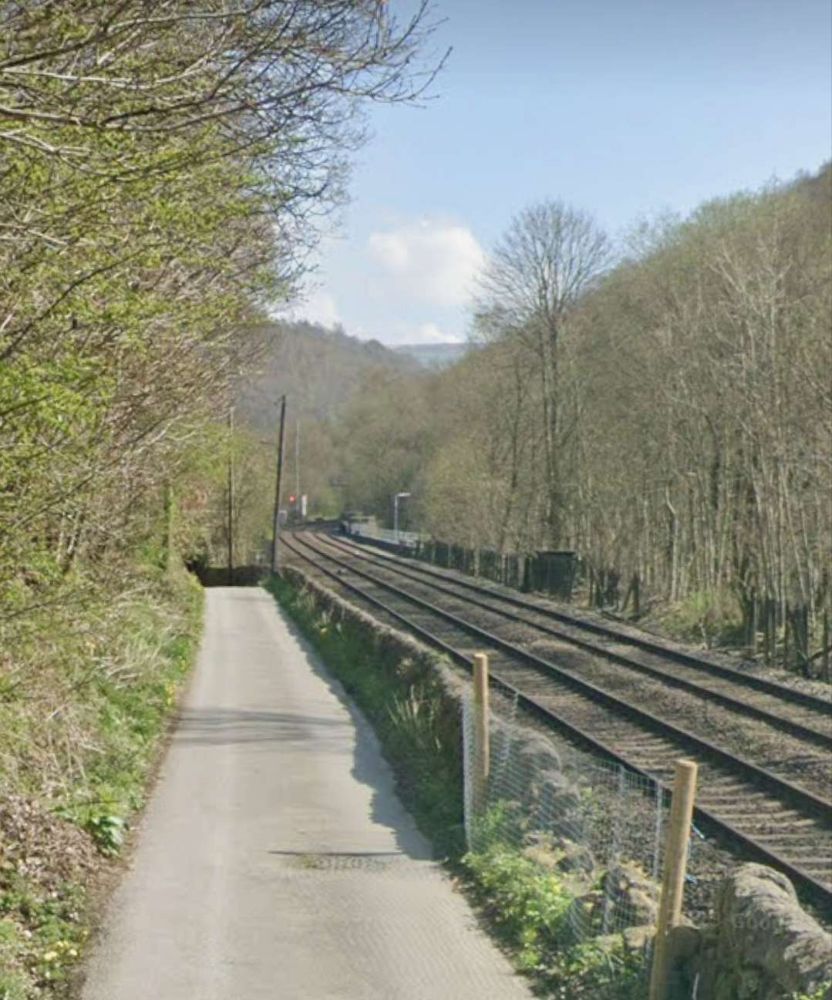
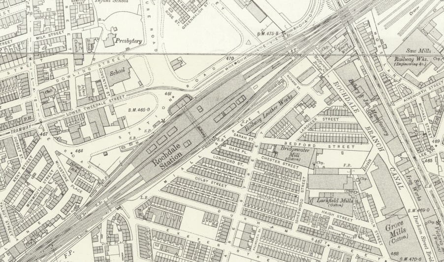
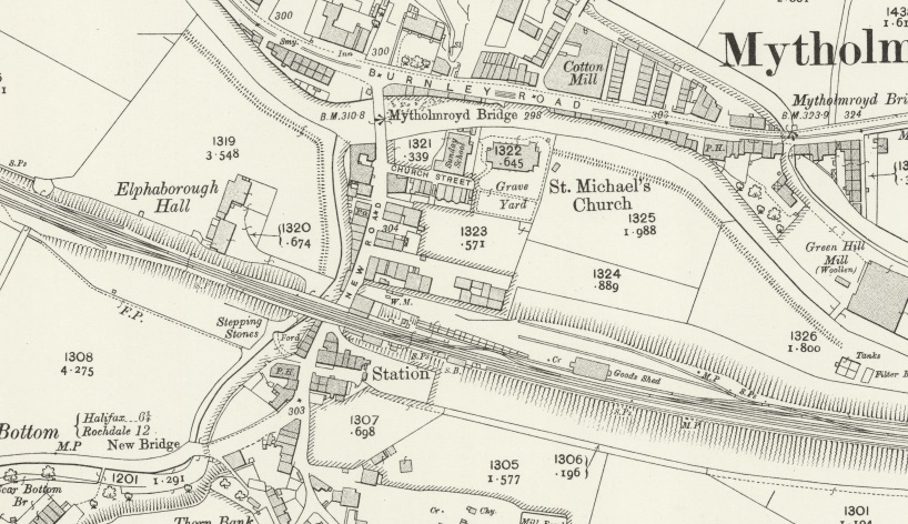
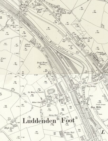
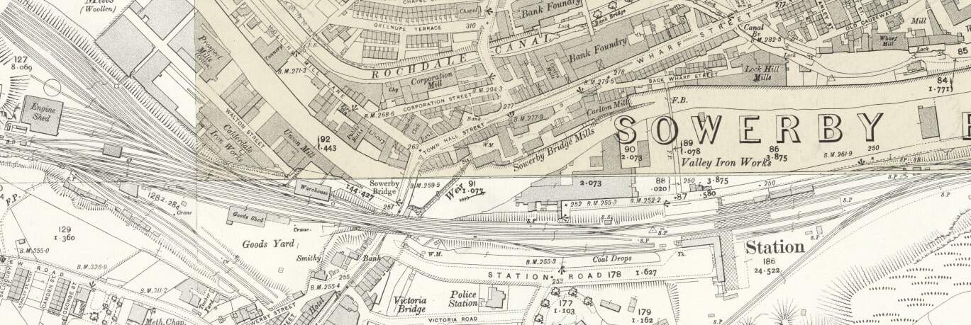
A short distance Northeast, the railway “crosses river, road, and canal, by a skew bridge of three arches, the canal being separately spanned by an iron bridge.” [1: p471] The location is shown on the 25″ Ordnance Survey of 1905 below.

The bridge mentioned above, as it appears on the 25″ Ordnance Survey of 1905. [11]
The same location shown on Google Maps satellite imagery in 2024. [Google Maps, October 2024]
Looking Northeast along Halifax Road, the three arches of the viaduct are easily visible. Beyond it there is a girder bridge which Rake does not mention. [Google Streetview, June 2023]

A little further East Stubbing Brink crosses the railway.

Looking West along the railway from Stubbing Brink Bridge. [Google Streetview, April 2023]
The view East along the line from Stubbing Brink. [Google Streetview, April 2023]

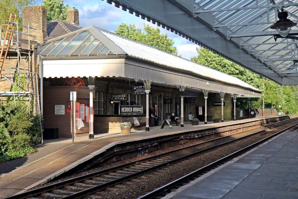
The line next passes through a short short tunnel (Weasel Hall Tunnel (124 yards)) and arrives at Hebden Bridge Station.

Looking West-northwest from Shelf Road Bridge, it is just possible to make out the mouth of Weasel Hall Tunnel. [Google Streetview, April 2023]
The view East-southeast from Shelf Road Bridge towards Hebden Bridge Railway Station. [Google Streetview, April 2023]
This next extract from the 25″ Ordnance Survey shows Hebden Bridge Station. [12]
Platelayers at work at Hebden Bridge Station in 1840. [1: p470]
Hebden Bridge Railway Station (Platform 2) in the 21st century, © El Pollock and licenced for reuse under a Creative Commons Licence (CC BY-SA 2.0). [18]

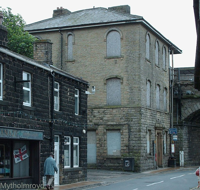
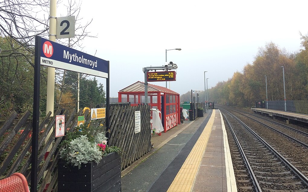
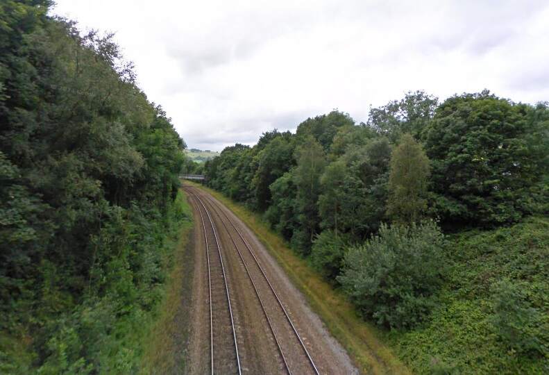
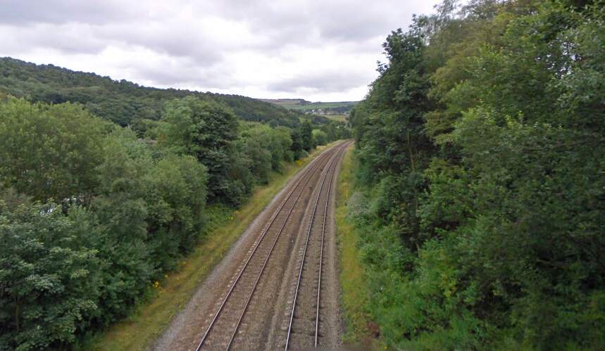
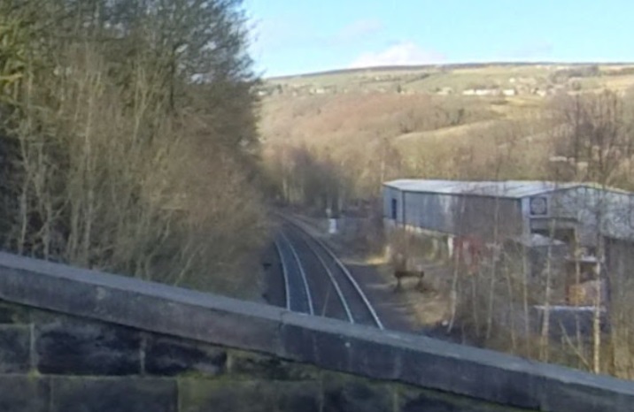
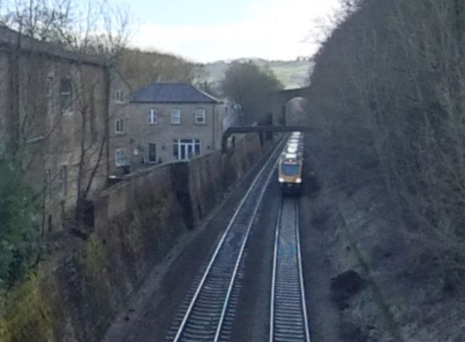
After Hebden Bridge Station, the line proceeds along the South bank of the River Calder, through two small stations (Mytholmroyd and Luddenden Foot) and by a number of riverside mills.

Mytholmroyd Railway Station as it appeared on the 1905 25″ Ordnance Survey. The Station is still open in the 21st century. [13]
The original station building at Mytholmroyd, seen from the North in 2006, with the line crossing New Road at high level, © Ian Kirk and licenced for reuse under a Creative Commons Licence (CC By 2.5) . The building has since been renovated. [16]
Mytholmroyd Railway Station in the 21st century, © Rcsprinter123 and licenced for reuse under a Creative Commons Licence (CC BY 3.0,). [19]

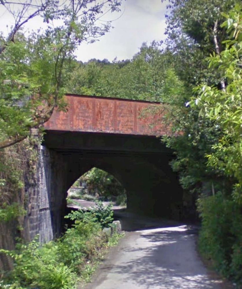
East along the line towards Luddendenfoot, Brearley Lane bridges the line.

Looking West from Brearley Lane Bridge towards Mytholmroyd Station. [Google Streetview, July 2009]
Ahead to the East, the line curves round towards the location of Luddendenfoot Railway Station. [Google Streetview, July 2009]
Luddenden Foot Railway Station. The station closed on 10th September 1962. The site has been developed since 2007 and the northern half is now occupied by the Station Industrial Park, which is accessible via Old Station Road. Two gate pillars from the original station flank the entrance to the road. [14][17]
The location of the erstwhile Luddendenfoot Railway Station as seen from Willow Bank, (c) Matt Thornton. [Google Streetview, February 2021]
Looking Southeast from Willow Bank. The arch bridge visible ahead carries Jerry Fields Road over the line, (c) Matt Thornton. [Google Streetview, February 2021]

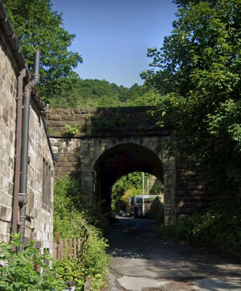
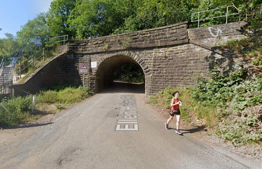
To the Southeast, Ellen Holme Road passes under the line.

Ellen Holme Road passess under the railway to the Southeast of the old Luddendenfoot Railway Station. [Google Streetview, June 2023]

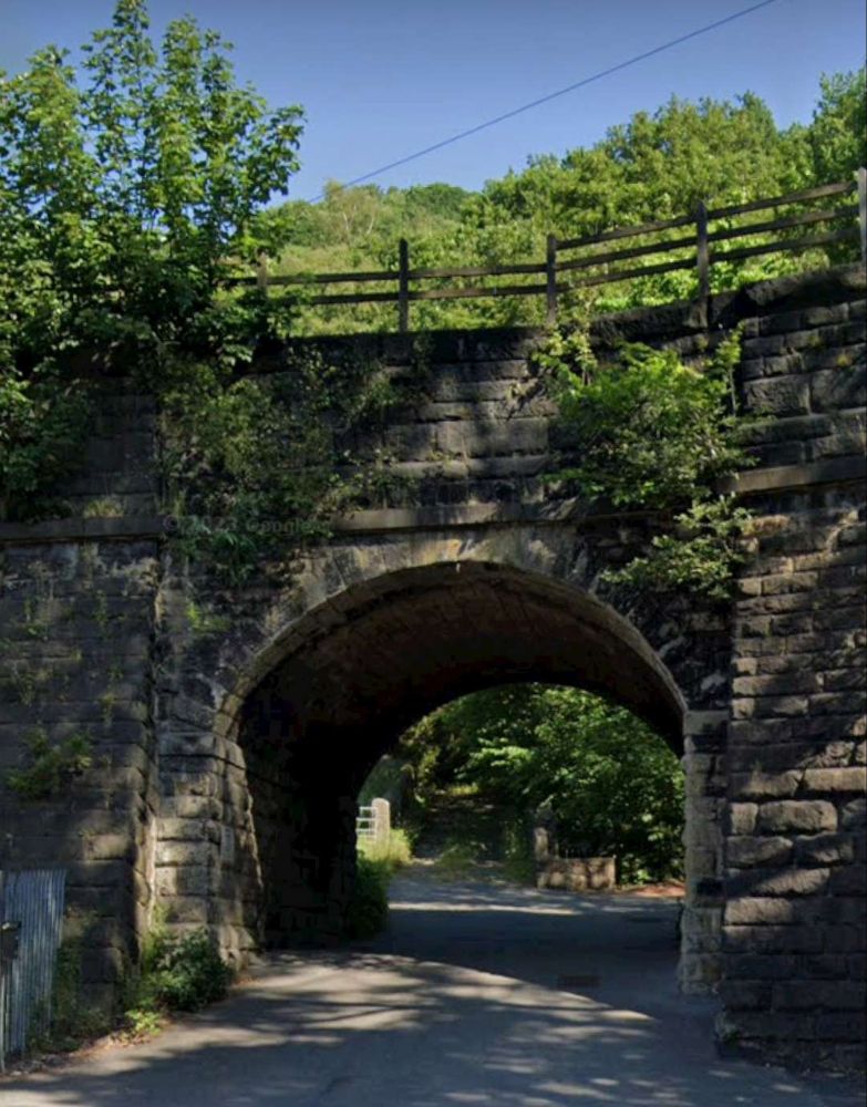
Passing other mills and traversing a deep cutting the line enters Sowerby Tunnel, (645 yards) and reaches Sowerby Bridge Station.

Class 101 At Sowerby Bridge Tunnel.
This image is embedded her from Flickr. It shows a Class 101 DMU entering Sowerby Bridge Tunnel from the East while working 2M14 10:31hrs York to Southport service on 8th May 1987, (c) Neil Harvey 156. [59]
Sowerby Bridge Railway Station – note the Ripponden Branch emerging from a tunnel and joining the Manchester and Leeds Railway at the East end of the Station. [15]
An early postcard image of Sowerby Bridge with the railway station in the foreground, © Public Domain. [23]
A colourised postcard view of the Station Forecourt at Sowerby Bridge around the turn of the 20th century. [60]
Sowerby Bridge Railway Station in 2006, (c) Ian Kirk and authorised for reuse under a Creative Commons icence (CC BY 2.5). [24]

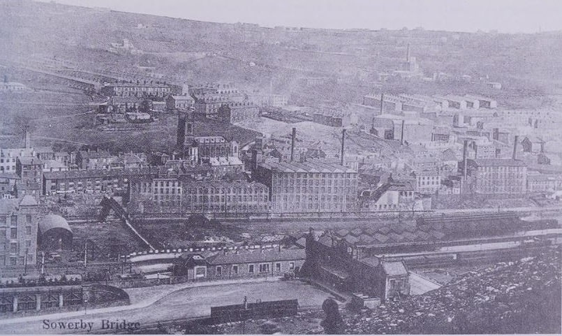
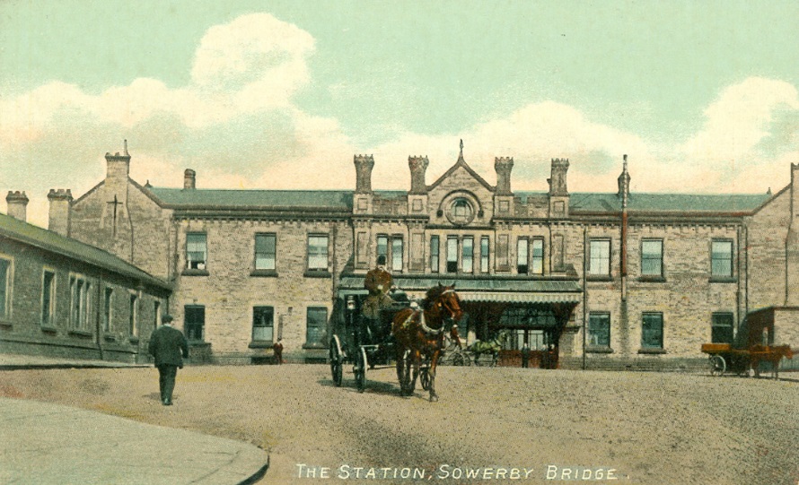
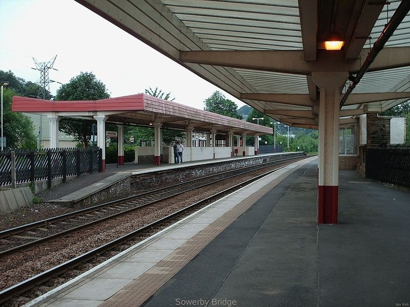
We complete this first part of the journey along the Manchester and Leeds Railway here at Sowerby Bridge Railway Station.

References

NB: These references relate to all the articles about the Manchester and Leeds Railway.

  1. Herbert Rake; The Manchester and Leeds Railway: The Origin of the Lancashire and Yorkshire Railway; in The Railway Magazine, London, December 1905, p468-474
  2. https://www.geograph.org.uk/photo/820318, accessed on 23rd September 2024.
  3. https://premierconstructionnews.com/2016/04/14/summit-tunnel, accessed on 23rd September 2024.
  4. https://en.m.wikipedia.org/wiki/Summit_Tunnel, accessed on 23rd September 2024.
  5. https://commons.m.wikimedia.org/wiki/File:Gauxholme_Bridge,_Todmorden.jpg, accessed on 23rd September 2024.
  6. https://www.yorkshirepost.co.uk/news/opinion/columnists/trans-pennine-rail-in-the-age-of-victoria-1807452, accessed on 23rd September 2024.
  7. https://www.geograph.org.uk/photo/504379, accessed on 23rd September 2024.
  8. https://maps.nls.uk/geo/explore/#zoom=17.9&lat=53.71428&lon=-2.09924&layers=168&b=ESRIWorld&o=100, accessed on 23rd September 2024.
  9. https://maps.nls.uk/geo/explore/#zoom=18.9&lat=53.70635&lon=-2.10701&layers=168&b=ESRIWorld&o=100, accessed on 23rd September 2024.
  10. https://maps.nls.uk/geo/explore/#zoom=16.9&lat=53.71706&lon=-2.09298&layers=168&b=ESRIWorld&o=100, accessed on 23rd September 2024.
  11. https://maps.nls.uk/geo/explore/#zoom=17.1&lat=53.73968&lon=-2.03054&layers=168&b=ESRIWorld&o=100, accessed on 23rd September 2024.
  12. https://maps.nls.uk/geo/explore/#zoom=16.5&lat=53.73833&lon=-2.00992&layers=168&b=ESRIWorld&o=100, accessed on 23rd September 2024.
  13. https://maps.nls.uk/geo/explore/#zoom=16.1&lat=53.73044&lon=-1.98307&layers=168&b=ESRIWorld&o=100, accessed on 23rd September 2024.
  14. https://maps.nls.uk/geo/explore/#zoom=16.1&lat=53.72280&lon=-1.94806&layers=168&b=ESRIWorld&o=100, accessed on 23rd September 2024.
  15. https://maps.nls.uk/geo/explore/#zoom=16.8&lat=53.70808&lon=-1.91151&layers=168&b=ESRIWorld&o=100, accessed on 23rd September 2024
  16. https://commons.wikimedia.org/wiki/File:Mytholmroyd_3.jpg, accessed on 24th September 2024.
  17. https://en.wikipedia.org/wiki/Luddendenfoot_railway_station, accessed on 24th September 2024.
  18. https://www.geograph.org.uk/photo/4500324, accessed on 24th September 2024.
  19. https://en.wikipedia.org/wiki/Mytholmroyd_railway_station#/media/File:Mytholmroyd_railway_station,_November_2020.jpg, accessed on 24th September 2024.
  20. https://commons.wikimedia.org/wiki/File:Todmorden_station_p2.jpg, accessed on 24th September 2024.
  21. https://maps.nls.uk/geo/explore/#zoom=17.0&lat=53.61032&lon=-2.15338&layers=168&b=ESRIWorld&o=100, accessed on 24th September 2024.
  22. https://www.geograph.org.uk/photo/2160438, accessed on 24th September 2024.
  23. http://www.halifaxpeople.com/Sowerby-Bridge-Train-Station.html#google_vignette, accessed on 24th September 2024.
  24. https://commons.wikimedia.org/wiki/File:Sowerby_Bridge_stn.jpg, accessed on 24th September 2024.
  25. https://maps.nls.uk/geo/explore/#zoom=17.0&lat=53.70193&lon=-1.88141&layers=168&b=ESRIWorld&o=100, accessed on 24th September 2024.
  26. https://maps.nls.uk/geo/explore/#zoom=17.0&lat=53.69406&lon=-1.85773&layers=168&b=ESRIWorld&o=100, accessed on 24th September 2024.
  27. https://en.wikipedia.org/wiki/Greetland_railway_station, accessed on 24th September 2024.
  28. http://www.halifaxpeople.com/Historic-West-Vale.html, accessed on 24th September 2024.
  29. https://maps.nls.uk/geo/explore/#zoom=17.0&lat=53.69065&lon=-1.84016&layers=168&b=ESRIWorld&o=100, accessed on 24th September 2024.
  30. http://www.halifaxpeople.com/Historic-Elland.html, accessed on 24th September 2024.
  31. https://maps.nls.uk/geo/explore/#zoom=17.0&lat=53.69860&lon=-1.77905&layers=168&b=ESRIWorld&o=100, accessed on 24th September 2024.
  32. https://www.flickr.com/photos/tcs-pics/6805337658, accessed on 24th September 2024.
  33. https://commons.wikimedia.org/wiki/File:Brighouse_station.jpg, accessed on 24th September 2024.
  34. https://maps.nls.uk/geo/explore/#zoom=17.0&lat=53.68478&lon=-1.72933&layers=168&b=ESRIWorld&o=100, accessed on 24th September 2024.
  35. https://www.geograph.org.uk/photo/2151166, accessed on 24th September 2024.
  36. https://www.chiark.greenend.org.uk/~owend/interests/rail/stnpages/mirfield.html, accessed on 20th May 2010.
  37. https://en.wikipedia.org/wiki/Thornhill_railway_station, accessed on 24th September 2024.
  38. https://www.geograph.org.uk/photo/2146249, accessed on 24th September 2024.
  39. https://maps.nls.uk/geo/explore/#zoom=17.0&lat=53.67578&lon=-1.65453&layers=168&b=ESRIWorld&o=100, accessed on 24th September 2024.
  40. https://maps.nls.uk/geo/explore/#zoom=17.0&lat=53.67662&lon=-1.63870&layers=168&b=ESRIWorld&o=100, accessed on 24th September 2024.
  41. https://maps.nls.uk/geo/explore/#zoom=17.0&lat=53.67609&lon=-1.62408&layers=168&b=ESRIWorld&o=100, accessed on 24th September 2024.
  42. http://lostrailwayswestyorkshire.co.uk/Dewsbury.htm, accessed on 26th September 2024.
  43. https://maps.nls.uk/geo/explore/#zoom=17.0&lat=53.67145&lon=-1.61316&layers=168&b=ESRIWorld&o=100, accessed on 27th September 2024.
  44. https://maps.nls.uk/geo/explore/#zoom=17.0&lat=53.65930&lon=-1.56897&layers=168&b=ESRIWorld&o=100, accessed on 27th September 2024.
  45. https://en.wikipedia.org/wiki/Horbury_and_Ossett_railway_station, accessed on 27th September 2024.
  46. https://maps.nls.uk/geo/explore/#zoom=16.0&lat=53.66442&lon=-1.58084&layers=168&b=ESRIWorld&o=0, accessed on 27th September 2024.
  47. https://en.wikipedia.org/wiki/Healey_Mills_Marshalling_Yard, accessed onn 27th September 2024.
  48. https://www.geograph.org.uk/photo/864329, accessed on 27th September 2024.
  49. https://maps.nls.uk/geo/explore/#zoom=17.0&lat=53.65617&lon=-1.55890&layers=168&b=ESRIWorld&o=100, accessed on 27th September 2024.
  50. https://maps.nls.uk/geo/explore/#zoom=17.0&lat=53.65728&lon=-1.53700&layers=168&b=ESRIWorld&o=100, accessed on 30th September 2024.
  51. https://www.horburyhistory.org/Horbury-Junction/, accessed on 30th September 2024.
  52. https://maps.nls.uk/geo/explore/#zoom=17.0&lat=53.66955&lon=-1.50480&layers=168&b=ESRIWorld&o=100, accessed on 30th September 2024.
  53. https://maps.nls.uk/geo/explore/#zoom=17.4&lat=53.67749&lon=-1.49163&layers=168&b=ESRIWorld&o=100, accessed on 30th September 2024.
  54. https://maps.nls.uk/geo/explore/#zoom=17.4&lat=53.67943&lon=-1.48383&layers=168&b=ESRIWorld&o=100, accessed on 30th September 2024.
  55. https://maps.nls.uk/geo/explore/#zoom=17.4&lat=53.68334&lon=-1.47138&layers=168&b=ESRIWorld&o=100, accessed on 30th September 2024.
  56. https://maps.nls.uk/geo/explore/#zoom=17.4&lat=53.69000&lon=-1.43723&layers=168&b=ESRIWorld&o=100, accessed on 2nd October 2024.
  57. https://maps.nls.uk/geo/explore/#zoom=17.4&lat=53.69243&lon=-1.43590&layers=168&b=ESRIWorld&o=100, accessed on 2nd October 2024.
  58. https://maps.nls.uk/geo/explore/#zoom=15.4&lat=53.70320&lon=-1.42452&layers=168&b=ESRIWorld&o=100, accessed on 2nd October 2024.
  59. Embedded link: https://www.flickr.com/photos/neil_harvey_railway_photos/7834033734, accessed on 3rd October 2024.
  60. https://www.invaluable.com/auction-lot/two-albums-containing-300-cards-incl-yorkshire-ox-166-c-6fd4b7e9e0, accessed on 3rd October 2024.
  61. https://www.blipfoto.com/entry/3134415230512138681, accessed on 3rd October 2024.
  62. https://maps.nls.uk/geo/explore/#zoom=17.0&lat=53.69371&lon=-1.76350&layers=168&b=ESRIWorld&o=100, accessed on 3rd October 2024.
  63. https://maps.nls.uk/geo/explore/#zoom=15.0&lat=53.72852&lon=-2.05697&layers=168&b=ESRIWorld&o=100, accessed on 3rd October 2024.
  64. https://igg.org.uk/rail/3-sigs/sigs-1.htm, accessed on 5th October 2024.
  65. https://commons.wikimedia.org/wiki/File:L%26MR_engine_%27Victoria%27.jpg, accessed on 6th October 2024.

‘The Modern Tramway’ – Part 8 – Leeds City Tramways, 1956. …

The Modern Tramway Journal in February 1957 carried an article about the tramways of Leeds. The data for the article was collated by A.K. Terry and the article was written by J.H. Price. [1] Please note that the copyright of the featured image above is owned by the National Tramway Museum at Crich. The museum are content for it to be shared in this way provided that their copyright is acknowledged.

The Suez crisis brought a temporary halt to a number of things within the UK economy. One of these was the planned scrapping of the tram routes and tramcars in Leeds. That pause provided the opportunity for the Light Railway Transport League to compile a map, fleet list and list of services for the city. Everything included in the February 1957 article was correct as of 31st December 1956.

In 1953, Leeds City Council decided to substitute buses for trams over a period of ten years. This meant tha by the end of 1956, ten nineteen of the city’s tram routes had been abandoned and the 1953 roster of 417 tramcars reduced to 170.

Those changes were recorded by the article as follows:

“The first conversion was the service from the Corn Exchange to Half Mile Lane (No. 14) on 4th October 1953, followed on 4th April 1954, by Kirkstall Abbey (No. 4) and Compton Road (No. 10). The latter abandonment saw the withdrawal of the last ex-Manchester and ex-Southampton cars and the Pivotal-truck Chamberlain cars, while Headingley depot was closed to trams at the same time. No further abandonments took place in 1954, but 1955 and 1956 have witnessed six closures and the concentration of all tramway operations on the large central depot at Swinegate.

Chapeltown Depot was closed as a running shed on 24th April 1955 … and the Gipton tram service (No. 11) was replaced by buses on the same day, followed by Meanwood (No. 6) and Elland Road (No. 8) from 26th June. But as a result of the oil crisis, trams are now running to Elland Road again, after an absence of over seventeen months! The explanation is that this line remained intact to serve Low Fields Road scrapyard, and with the oil shortage special trams now run again on certain Saturday afternoons in connection with football matches at the Leeds United ground.

The replacement by buses of the Beeston service (No. 5) on 20th November 1955, enabled the depart- ment to cease using Torre Road depot (except to store some cars awaiting scrap) and this building is being converted to a bus garage, unlike Chapeltown depot which is to be sold. The 1956 abandonments – Lawnswood (No. 1) from 4th March, followed by Whingate (No. 15) and New Inn (No. 16) from 22nd July have removed trams from the city’s busiest thoroughfare (Boar Lane) and have eliminated the last of the Chamberlain cars. These vehicles were former Pivotal cars of 1925-26 remounted on new P.35 type trucks built at Kirkstall Road Works from 1944 onwards, mostly after the patent had been purchased in 1948 from the Brush company. Save for works journeys, trams no longer run through City Square, another notable traffic centre which provided one of the few British examples of the familiar Continental technique of using the centre of a square or roundabout as a full-scale tramway station.

The abandonment of the routes on the west side of Leeds has left the works at Kirkstall Road rather unfavourably placed. At present, tracks are maintained from Swinegate through City Square and Wellington Street to the works, but the Chairman of Transport Committee … stated some time ago that the Department was considering moving trams to and from the works on a special road vehicle. This has not materialised, and it is thought that when the fleet has been further reduced, the rear tracks of Swinegate Depot will be fitted with lifting gear and equipped to carry our body repairs, the trucks, motors and controllers then being taken by road to and from Kirkstall Road Works for attention.

Although no definite indication of policy has been given, it seems likely that after the completion of the present scheme to convert all lines laid entirely in streets (of which three remain Hunslet, Dewsbury Road and Moortown), the routes with reserved tracks may remain for several years. Track renewals have been taking place on all routes, notably on York Road where some of the former wooden sleepers have given way to a concrete base as already used on the Belle Isle reservation. The Roundhay reserved track has also received attention.

Since the Leeds Transport Committee seem to consider the sub-ject solely from the financial angle, the retention (or otherwise) of the reserved-track routes will presumably depend on the Department’s ability to keep the cost of tramway operation down to a figure comparable with that of the buses. The Chairman has admitted that reserved tracks are much cheaper to maintain than street tracks, and the concentration of all the cars at one large depot is evidently another step in this direction, as is the elimination of non-standard cars and equipments from the tram fleet. The diversity of types in the Leeds tram fleet will be seen from the accompanying table, and it is significant that only Horsfield and Feltham cars are now receiving major overhauls; these two classes between them would be more than sufficient to work the reserved-track routes.

Of the other types, the Headingley streamlined and Chamberlain cars have already departed from passenger service, and one of the three ex-London H.R.2 cars (No. 277) has been withdrawn following a collision, while London’s famous No. 1 (Leeds 301) will soon find its way back to its birthplace at Charlton as a prized exhibit in the B.T.C. collection of historic vehicles. The most unfortunate demise in Leeds is that of the Middleton bogie cars, of which only one (No. 268) now remains in service. Whatever the virtues of standardisation and maintenance-simplification, one cannot but regret the passing of what were some of the smoothest-riding double-deck cars ever built; so far as can be judged from personal observation, their withdrawal is due to body defects and the need to retyre the wheels at very frequent intervals lest the swing links of the trucks fail to clear the road surface. The extra cost of four-motor maintenance, as also experienced in Liverpool, may have been a factor. Enquiries were made as to the possibility of preserving one of these cars, but the scrap value and consequent purchase price would be in the region of £145. Nevertheless, anyone willing to help is invited to contact Mr. C. Routh, 17, Wynford Rise, West Park, Leeds 17, so that the potential financial support for such a scheme may be assessed.

The former preserve of these cars, the No. 12 route to Middleton, is now linked with the Belle Isle and York Road services and served mainly by Horsfields and Felthams. Both classes acquit themselves surprisingly well on the reserved track, but on such a route as this the 4-wheeled double-decker must inevitably proceed more cautiously than an equal-wheel bogie car, and the exhilarating dash down through the woods by the last few cars at night is now almost a thing of the past. Various minor improvements are being made to the Horsfield cars, including the replacement of air bells by electric bells, smaller destination boxes which no longer occupy the entire end window space, and fixed upper-deck windows with sliding ventilators to replace the winding type made famous elsewhere by the twin notices “Do not spit on the car. The conductor will adjust the win- dows on request.”

Since Leeds does not intend to buy or to build any more trams, the life of the reserved track lines may in the end be determined by the life of the cars, most of which are already 26 years old. Yet the Middleton route with its private express track has a wonderful potential advantage in time and distance over the shortest route to Middleton by road, and if the private track were extended into the city along the colliery railway, and modern coupled single-deckers introduced to run at railway speeds, the earning power of the trams would certainly be superior to that of buses using the increasingly congested streets. Birmingham is considering using its former tramway reservations, linked by subways, to form a rapid-transit system, but Leeds is even more fortunately placed, for the modern substations and suburban reserved tracks already exist, and present slum-clearance and road-widening schemes could bring the York Road reserved track almost to the city centre. It would be a short step to link this with the Middleton route by a subway, a new road, or even a private surface line laid partly over the river. These are real possibilities, and should be examined now, while the chance exists, so that they can be taken into account in town planning schemes. The opportunity is far too good to miss. [1: p23-24 & 27]

The article included a plan of Leeds City Tramways as they existed on 31st December 1956.

The Leeds City Tramway Network as on 31st December 1956. [1: p22]

The article also provides a table showing tram services in Leeds as at 31st December 1956

Leeds Tram Services recorded at the end of 1956. [1: p25]

The next two images show the table of rolling stock still in use on the tramway network at the end of 1956. The first image tabulates the rolling stock, the second provides explanatory notes and details of manufacturers.

Tramcars in use in Leeds at the end of 1956. [1: p30-31]

A separate numbering system was used for ‘Works Cars’ – snowplough cars, rail grinders, stores cars, water cars and rail Derrick’s. All of the Works Cars apart from the snow brooms and rail derrick No 1 were converted from passenger cars.

Works Cars and Former Passenger Cars [1: p32]

The article also included photographs of some of the Leeds tramcars.

This and the image below show two of the Middleton bogie-cars, No 268 (still in service at the end of 1956) with the bow collector introduced in Leeds between 1935 and 1938, and No. 255 with its original trolley-poles. Both tramcars are in the dark blue (pre-war?) livery. [1: p26]
These two images show ex-London cars numbered in Leeds as 278 and 301 (London Nos 1881 and 1) © A.K. Terry & R. Brook respectively. [1: p28]
These two images show experimental single-deck cars Nos. 600 and 601, © R. Brook and R.B.Parr respectively. [1: p29]

References

  1. J.H. Price & A.K. Terry; Leeds City Tramways, 1956; in The Modern Tramway, The Light Railway Transport League, Volume 20, No. 230, p22-32.