I am indebted to Alan Young for a number of the images in these articles about the Micklehurst Loop. This is his drawing of the Loop which appears at the head of his article about the Loop on the ‘Disused Stations‘ website. It is used with his kind permission, (c) Alan Young. [7]
The maps used in this sequence of articles are predominantly 25″ OS Maps from 1896 through to 1922 and have been sourced from the National Library of Scotland. [1] There are a number of websites which focus on the Loop which are excellent. The sites concerned are noted immediately below and the relevant link can be found in the references section of this page or by clicking on the highlighted text here:
- The most detailed treatment of the line and its stations can be found on the Disused Stations – Site Records website. The particular pages on that site which cover the Loop were provided by Alan Young. One page covers the route and pages covering each of the stations can be accessed from that page. [7]
- Particularly good for old photographs of the Loop is the Table 38 webpage about the railway. [9]
The first articles about the Micklehurst Loop can be found at:
There is a series of three addenda to the first of those two articles which include a series of photographs relating to the first part of the line from the 1950s, 1960s, 1970s, 1980s and 1990s. These can be found on the following links:
The Micklehurst Loop – Part 1C – Including Hartshead Power Station
In my perambulations around the internet, I have also encountered a series of videos (on YouTube) which start from the Northern end of the line. 5 videos cover the length of the line in 2020 and a separate video covers some of the structures on the line. These videos are easily available on YouTube. This is the first [3] in the series:
Part 3 – Micklehurst Station to Chew Valley Road, Greenfield
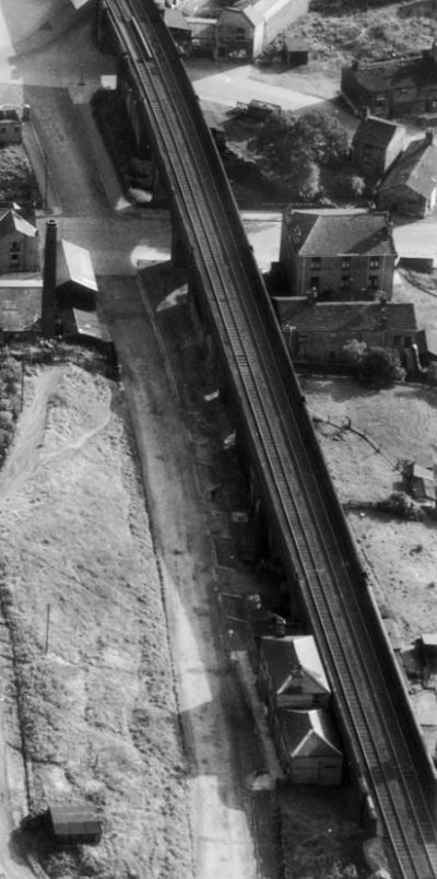
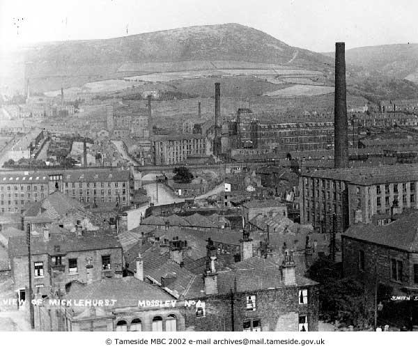
We continue our journey travelling North along the Micklehurst Loop. We start from the site of Micklehurst Station. Our first picture shows the view back along the line that we have already travelled from close to the southern wall of the Micklehurst Station House. It looks back through the line of Micklehurst Viaduct.
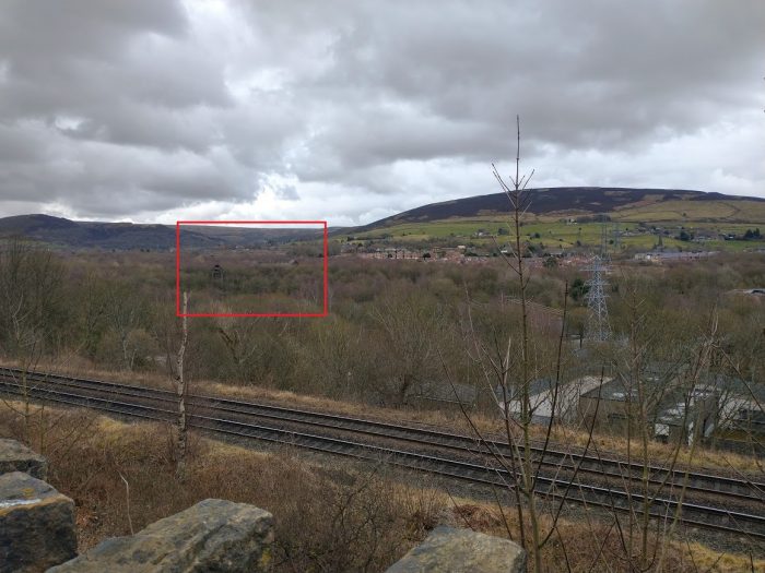
A 21st century view South the location of Micklehurst Passenger Station, taking in the location of the Micklehurst Viaduct. The old line is shown approximately by the red line. We are standing next to the pavement on Station Road and Cheshire Street can be seen in the far distance. (My photograph, 22nd January 2021.)
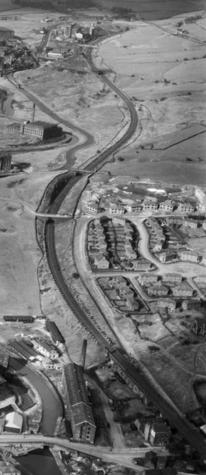
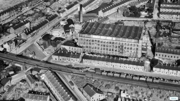
An extract from Britain from Above’s image EAW010809. [2]
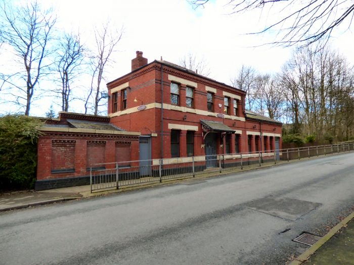
The next image shows that building in January 2021. The canopy that graced the lower portion of the building (the ticket office) was gone even as early as the late 1940s.
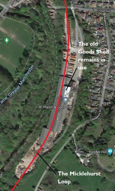
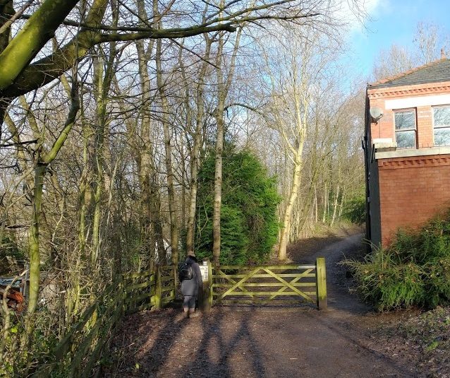
Protected by a five-bar gate immediately adjacent to the Station building, the linear walkway following the line recommences. We had to leave it further South as the Micklehurst Goods Yard is in private hands.
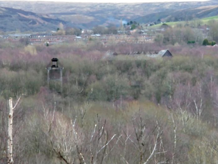
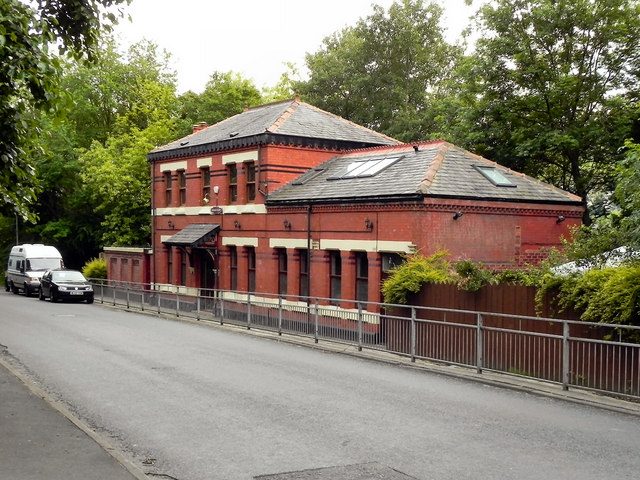
The passenger station building is also in private hands. The platforms were not adjacent to the station building as the railway was still on viaduct as it passed the back of the station house. A covered ramp led up towards wooden platforms a little distance to the North of the Station building. They were located in the position pointed to by the top of the chimney in the adjacent aerial image. Over a few tens of yards, the modern path rises from the road level to track-bed level and then levels out to follow the track-bed.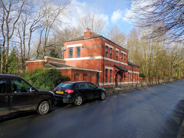 Micklehurst Station Building in January 2021. (My photograph 22nd January 2021.)
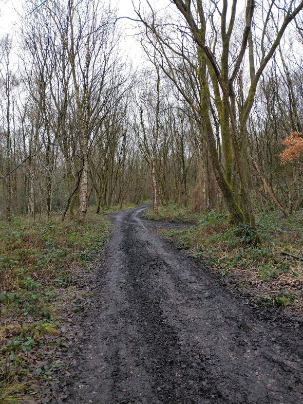
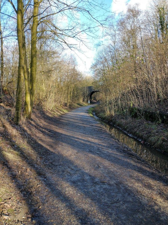
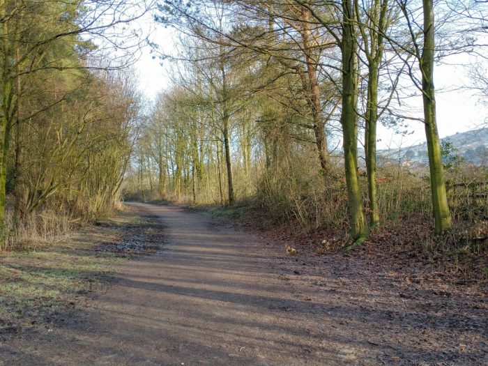
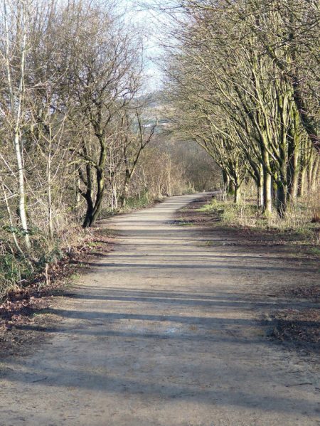
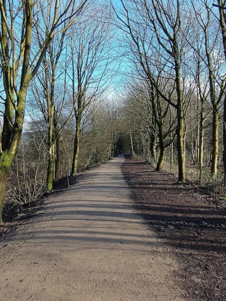
The railway walk continues. (My photograph, 22nd January 2021.)
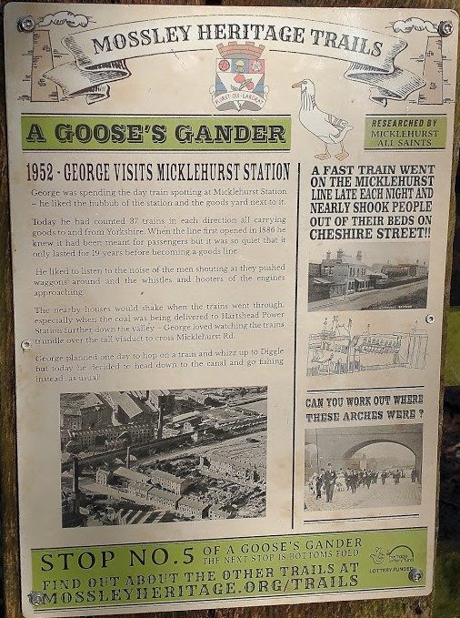
The information board at the five-bar gate. (My photograph, 22nd January 2020.)
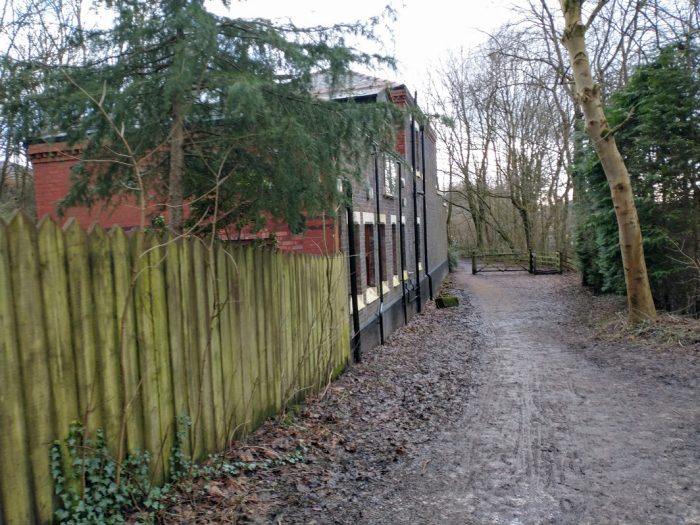
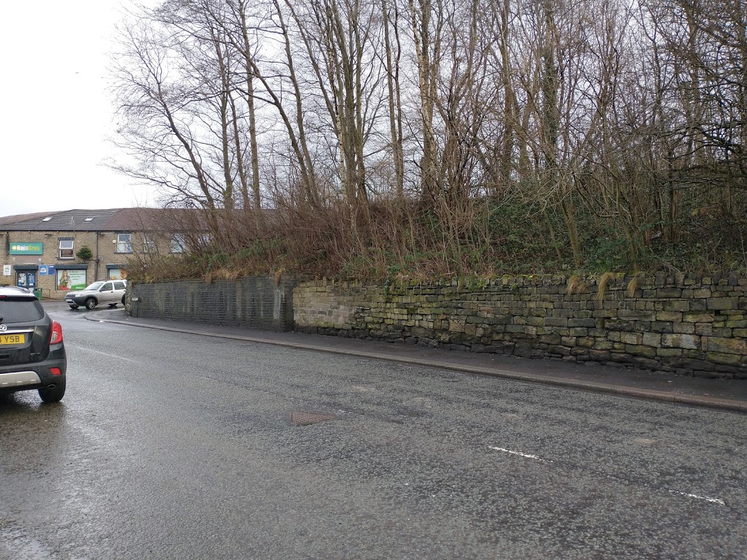
Looking back to the South along the back of the Station building towards Stalybridge. Note the blue brick construction of the back wall which would have been hidden by the Viaduct Wall. (My photograph, 22nd January 2021.)
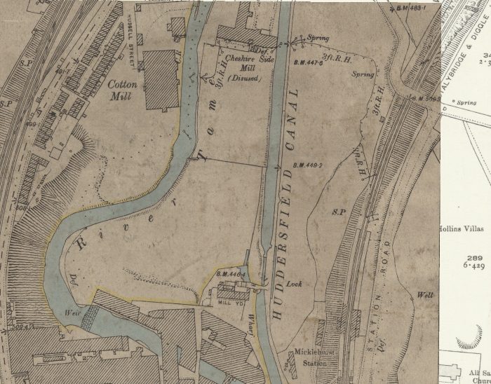
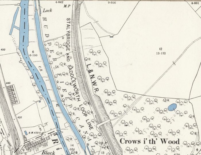
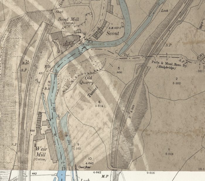
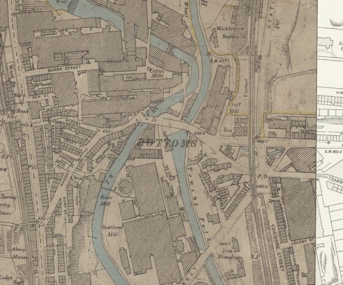
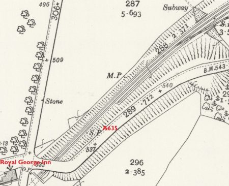
The 25″ OS Map from the turn of the 20th century again. The station building just creeps into this extract on its bottom edge, the station platforms and shelters are shown. The line is curving to the Northeast through the platforms. Visible on the top-right of the extract is the accommodation bridge which carried a lane from Bottom Mossley to Micklehurst. [1]
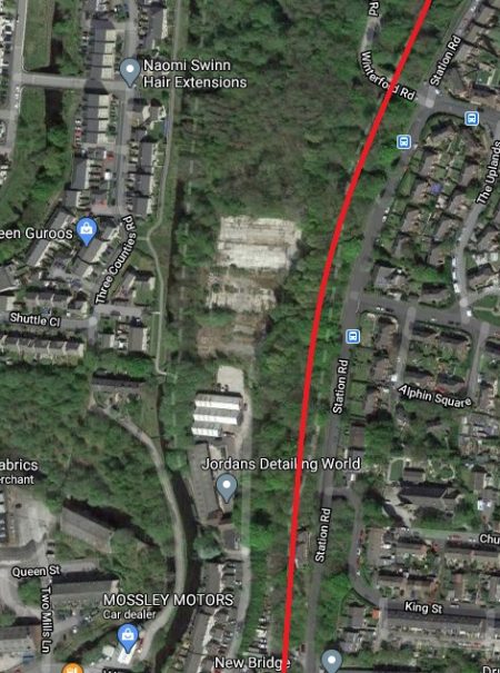
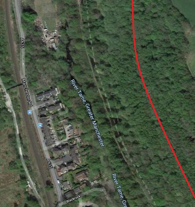
A satellite image of the same area as in the 25″ Ordnance Survey Map in the 21st century. (Google Maps)
The next few images focus on the bridge shown in the top-right of the map extract above. The first comes from the aerial image above. [2]
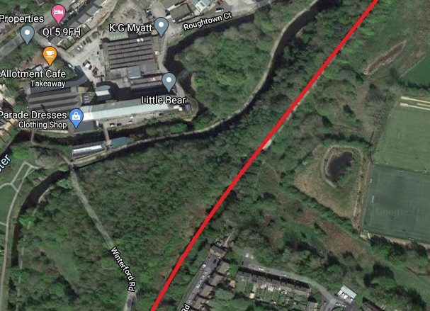
The lane carried by the bridge has the name Winterford Road on the adjacent satellite image.
As can be seen in the pictures below, the bridge was constructed in blue engineering brick, like many of the structures and buildings on the Mickelhurst Loop.
The first picture shows the bridge at the time the Micklehurst Estate was being built after the Second World War.
The Micklehurst estate was under construction when this 1947 picture was taken. [2]
The same structure approached from the South in January 2021, (My photograph, 22nd January 2021).
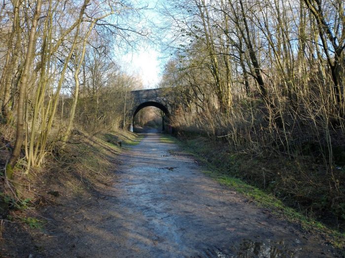
Continuing to approach the bridge, (My photograph, 22nd January 2021).
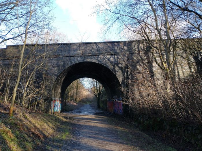
South Elevation of Bridge, (My photograph, 22nd January 2021).
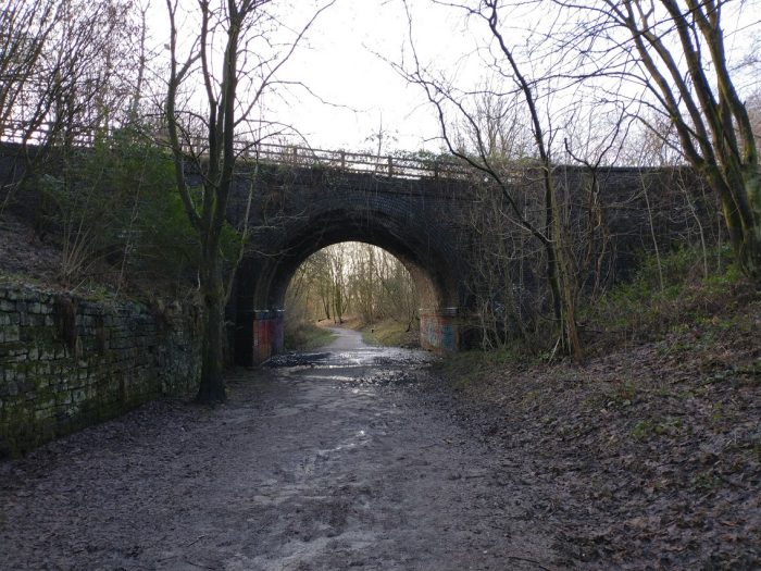
Northern Elevation of the bridge, (My photograph, 22nd January 2021).
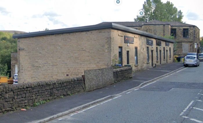
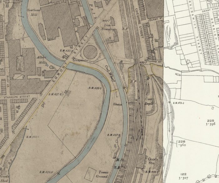
If you plan to walk the route, it is worth knowing that there is an Allotment Café beyond the Mills which are encountered if you walk down Winterford Road towards the River Tame and the Huddersfield Narrow Canal. The Mills are shown on the next OS Map extract below. By the turn of the 20th century, Cheshire Side Mill was disused but Carrhill and Woodend Mills were active.
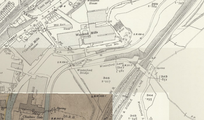
25″ OS Map Extract from the turn of the 20th century. [1]
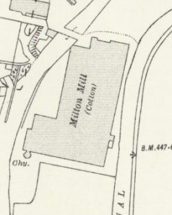
Cheshire Side Mill had by 1916 been replaces by Milton Mill (25″ OS Map drafted in 1916, published in 1922. [12]
Carrhill Mills – were owned in 1891 by Nathaniel Buckley and Sons, and had 84,600 spindles. [4][5: p117]
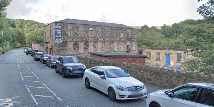
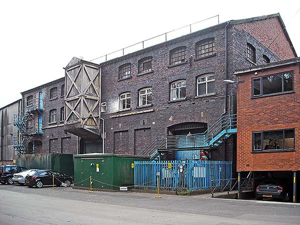
Woodend Mills – were built by 1848 by Robert Hyde Buckley, close to his father’s mills. [8] These buildings made up an integrated cotton mill, built in several phases. Historic England say that they are “a near complete example of a first generation integrated cotton mill site, where both weaving and spinning processes were planned from the outset. Before this the two processes had been done on separate sites.” [6]
Milton Mill – was actually built in 1892 but did not feature on the 1898 OS 25″ Map but was included on the following series as the small extract above shows. The Architects were A H Stott & Sons and the mill was built for the Milton Spinning Co. Ltd. [11][5: p118]
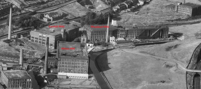
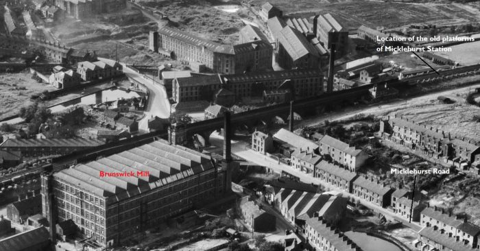
The layout of the mills as seen in 1947 from the air to the South. Winterford Road Bridge is on the right of the image. [2]
The area of Woodend in the 21st century, (Google Maps).
A lane used to run from the point where Winterford Road meets the Canal running in just North of an easterly direction. It was given the name Winterford Lane. It can just about be picked out among the trees in the satellite image above. It crossed the Micklehurst Loop on a bridge which has all but been erased from the map in the 21st century. It can be seen on the next aerial image extract in the top-right corner. Unlike its near neighbour the Winterford Lane Bridge has not survived, probably because it was a girder bridge rather than an arch.
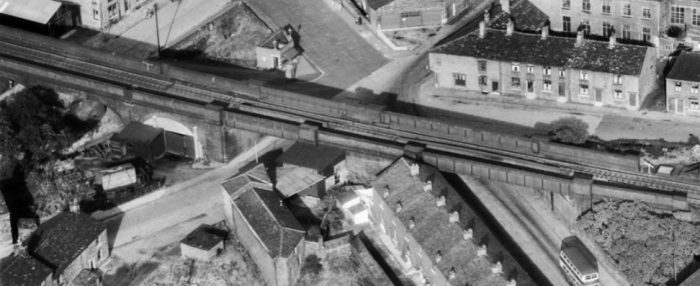
Accommodation bridges over the line at Winterford on the north side of Micklehurst. [2]
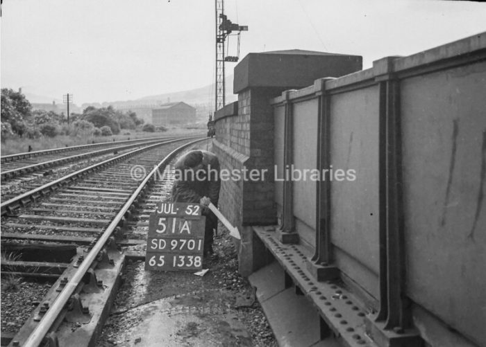
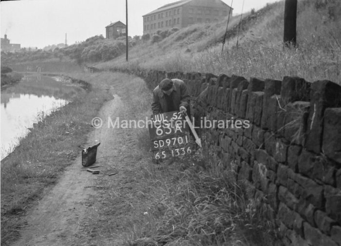
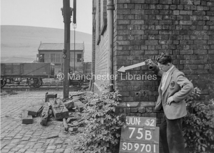
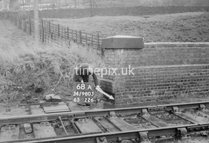
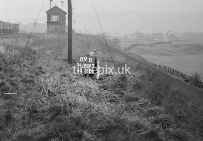
Man marking Ordnance Survey minor control revision point on the parapet corner of the first bridge North of Micklehurst Station – Winterford Road Bridge. Winterford Lane Bridge can be seen beyond, (c) Manchester Libraries. [24]
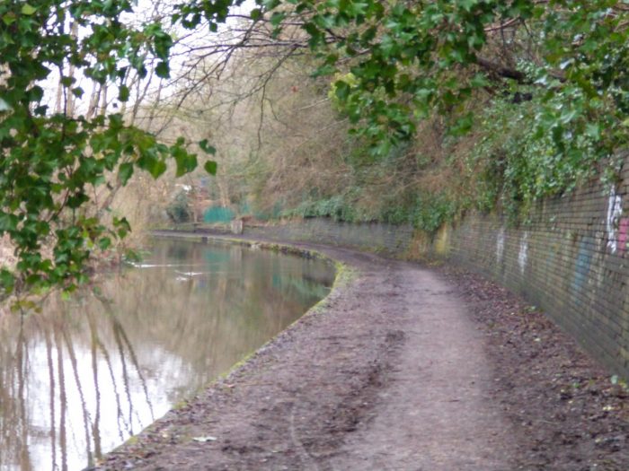
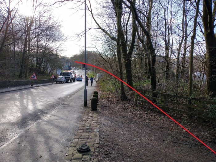
This photograph shows the location where the modern footpath which follows the line of Winterford Lane meets the track-bed of the Loop line. (My photograph, 22nd January 2021.)
Beyond Winterford Lane, the Loop line curved gradually back to the North before encountering another accommodation bridge.
The images immediately below show that length of the track-bed in January 2021.
The line then began another gentle curve towards the Northeast. and passed under a series of three structures. First an arch bridge of similar construction to the first bridge out of Micklehurst Station. Then a footbridge spanning the two track mainline and then a longer footbridge which spanned the running lines and the Gas Works sidings.
Looking North from the point that Winterford Lane crossed the Loop Line. (My photograph, 22nd January 2021.)
A little further North. (My photograph, 22nd January 2021)

An extract from the 25″ OS Map series from the 1920s. which shows Roughtown which sat on the valley side above the river to the West and Woodend in the Valley floor. Both the original mainline and the Micklehurst Loop can be seen. Stamford Mill sits at the centre of the extract. [1]
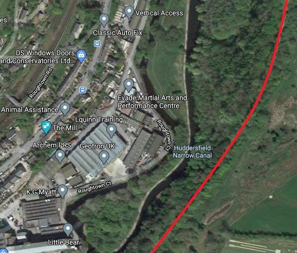
The same area as in the 25″ OS Map extract above. Stamford Mill has been replaced by Roughtown Court. The track-be of the Loop is marked with the read line. (Google Maps.)
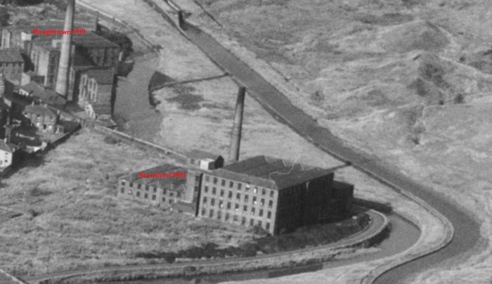
Stamford Mill and Roughtown Mill as they appear on image EAW010809 from the Britain From Above website. [2]
The next map extract shows the two railway lines with Roaches Bridge in the bottom left quadrant and two further mills:
Bank Mill – which was owned by Nathan Meanock, Grace’s Guide tells us that it had 13,500 spindles, 128/328 twist and that pay day was the second Wednesday; [16] and
Union Mill – which was owned by Hilton and Hopkins and had 12,000 spindles, 3011/40′ twist and the same pay day. [16]
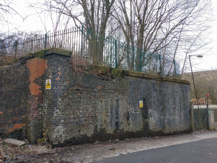
All three of the bridges mentioned in the text above no longer exist. The Mills here have gone and Mossley Gas Works are also long-gone, swept way after the change from Town Gas to North Sea Gas with the development of those offshore Gas fields.
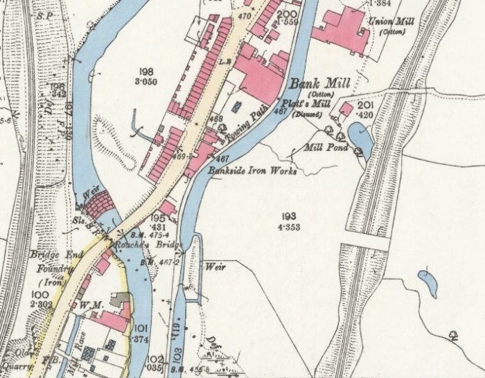
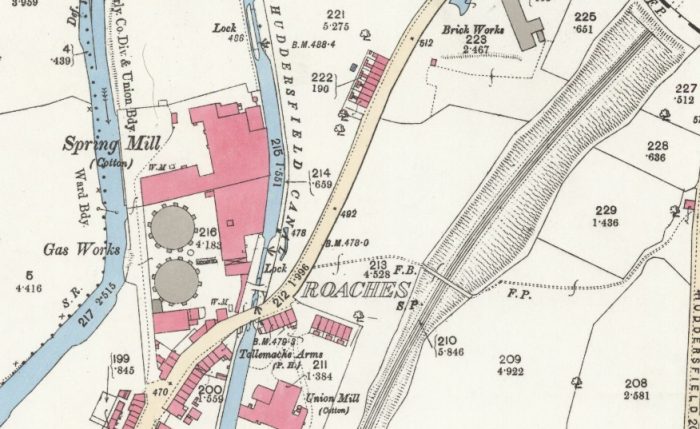
A 25″ OS Map extract from 1894 which shows the location of the Roaches, Bank Mill and Union MIll. [15]
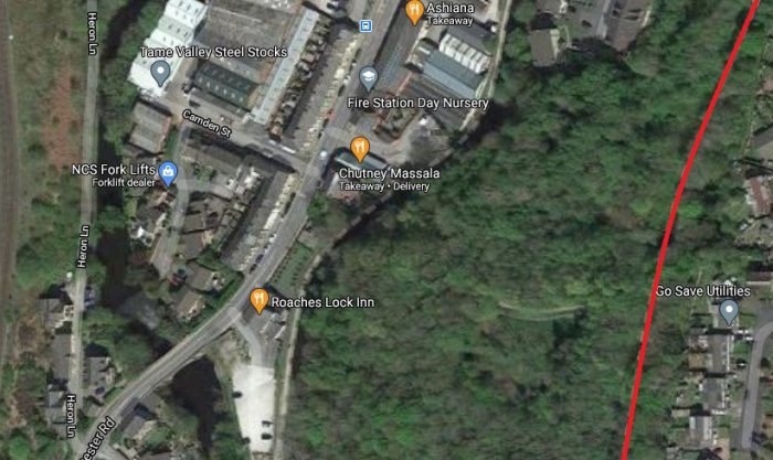
The same area in the 21st century, (Google Maps).The two bridges over the Loop which can be seen on the OS Map extract are no longer visible in the 21st century. One was substantial enough to provide farm access across the Loop, the other was a footbridge.
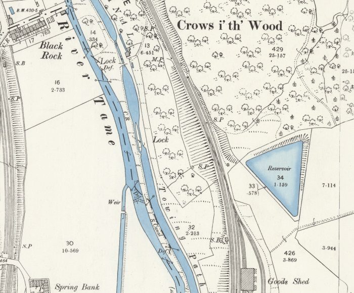
Not too far Northeast of Roaches Bridge (where the Roaches pub sits in the 21st century), was the site of Mossley Gas Works. The area was still known as the Roaches but the pub beside the Canal Bridge was (and is) the Tollmache Arms. The first map extract below comes from the late 1800s. At that time the Gas Works occupied a single site to the West of Manchester Road between it and the River Tame.
25″ OS Map extract from the end of the 1800s. The Gas Works occupies only one site at this time and no sidings are provided on the Micklehurst Loop. [15]
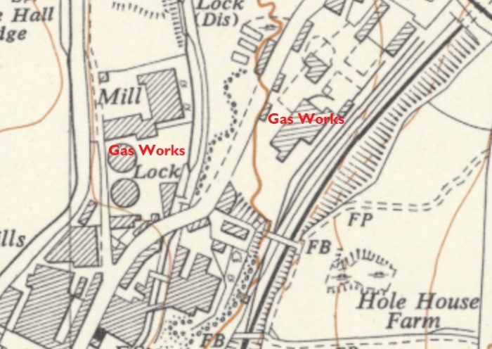
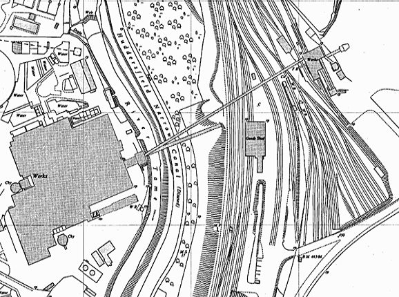
An extract from the OS 1:10,560 series maps of the 1950s. The Gas Works have by this time reached their full extent and the sidings are shown on the Micklehurst Loop as well. [17]
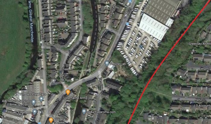
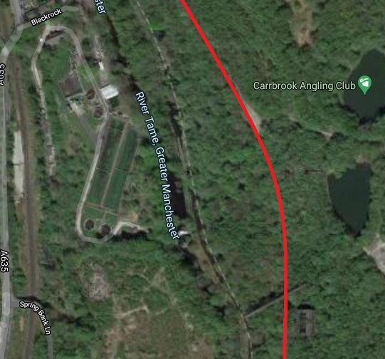
The same area in the 21st Century, (Google Maps).
Spring Mill was owned by Buckley and Lees, Grace’s Guide says that it had 46,000 spindles, 30’/50′ twist. [16] It was positioned on the North side of the original Gas Works site as can be seen in the two map extracts above.
Mossley Gas Works – were first established in 1829 at Micklehurst, they belonged to the Stalybridge Gas Co. Ltd. In 1884, an agreement was made between Stalybridge Corporation and The Local Board of Mossley for the purchase of the Stalybridge Gas Co. and in 1885 the undertaking was divided between the two authorities and run jointly. [18]
By 1925 however, the works were too small and inefficient to satisfy demand and proposals were made for a new gasworks to supply Mossley Corporation. Objections were raised by Saddleworth UDC but were rejected in the House of Lords. The new site was at Roaches and required a great deal of leveling and alteration before the works could be built. The works at Roaches opened in 1931. In 1934 Mossley Corporation sold the undertaking to the newly formed Mossley and Saddleworth Gas Co Ltd. which was then absorbed by the holding company Gas Consolidation Ltd (Severn Valley Gas Corporation Ltd and Palatine Gas Corporation Ltd). In 1949, the undertaking vested in the North Cheshire Group of the NWGB. [18]
The opening ceremony in 1931 took place on 22nd June. The Works were inaugurated by the Rt. Hon. The Earl of Derby, K. G. [19]
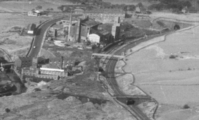
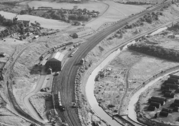
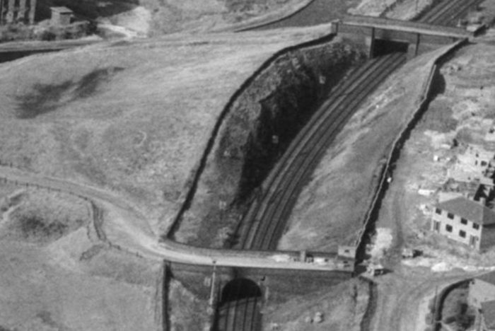
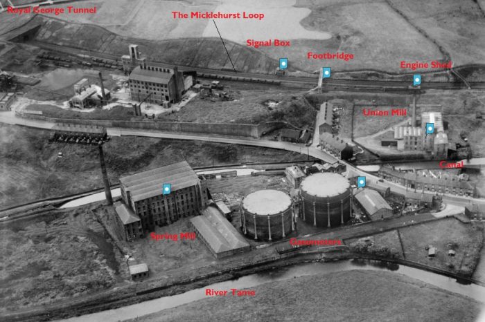
A further enlarged extract from EAW010809 from the Britain From Above website. This shows the three bridges on the Micklehurst Loop alongside Mossley Gas Works and before the Line entered the Royal George Tunnel. [2]
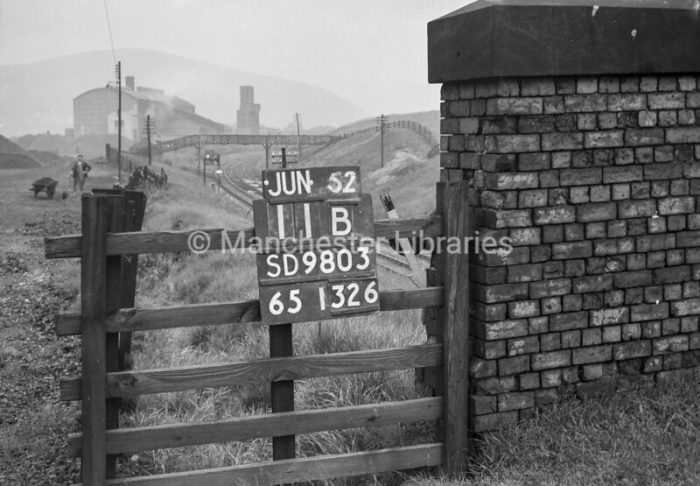
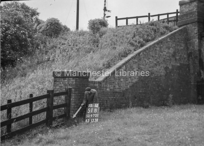
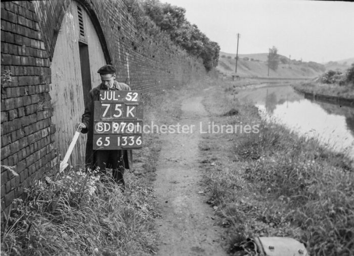
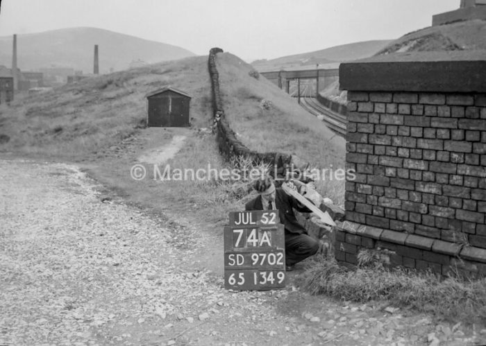
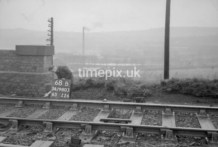
Man marking Ordnance Survey minor control revision point with an arrow on the bridge parapet of the bluebrick bridge across the line which appears in the aerial image above. The Gas Works can be seen in the distance beyond the fragile looking footbridge in the nearer distance, (c) Manchster Libraries.[23]
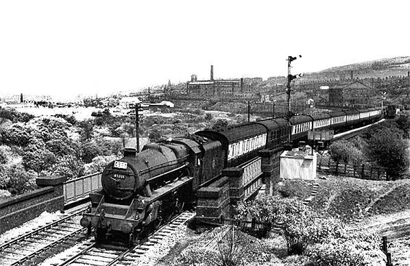
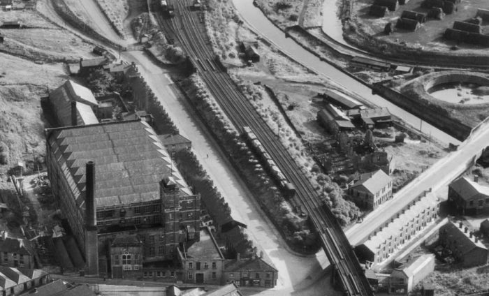
An extract from photograph EAW035919 from Britain From Above website. This view looks from the Northwest across the top of Mossley Gas Works and the Gas Works sidings towards the Micklehurst Loop Line. The three bridges referred to above are evident over the line as it enters the picture in the top-right coming from Micklehurst. Note the small engine shed towards the top-right of the image, (c) Britain From Above. [13]
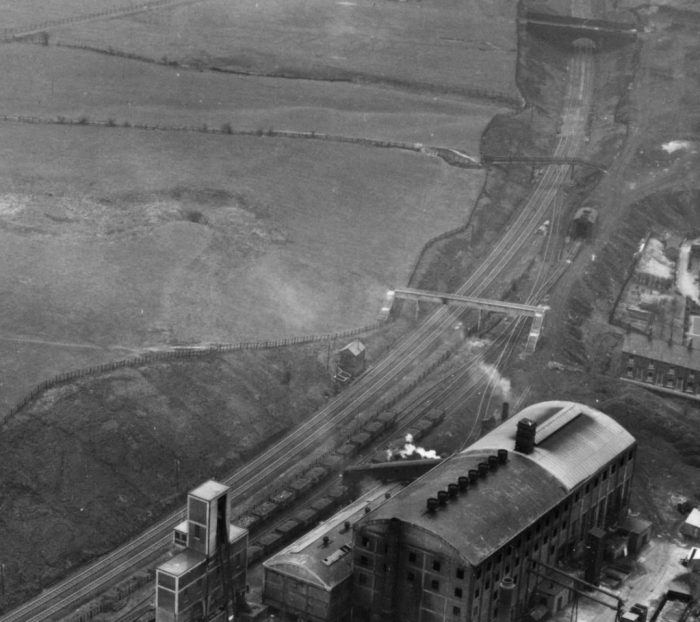
An extract from another photograph (EAW035924) from the Britain From Above website. This image focusses on Mossley Gas Works. [10]
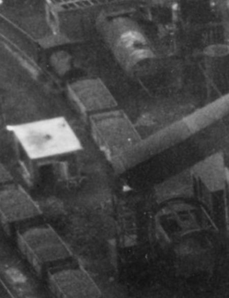
This first extract shows the Gas Works Locomotive maneuvering wagons under the coal lift at the plant. [10]
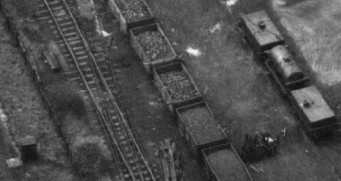
Another extract shows some interesting detail. The site boundary can be picked out, a double slip is visible on the internal Works railway and, in 1951, plenty of private owner wagons and two different types of tank wagon. [10]
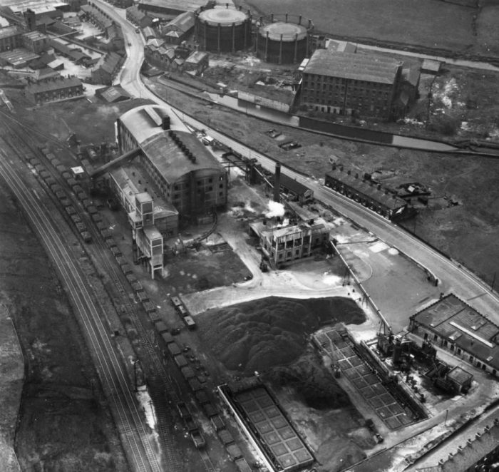
Photograph EAW058239 from the Britain From Above Website, shows the Gas Works site from the West with the River Tame in the foreground. [20]
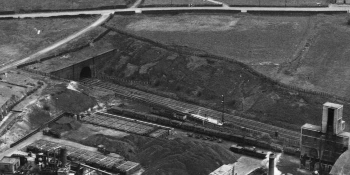
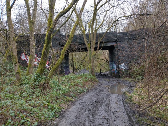
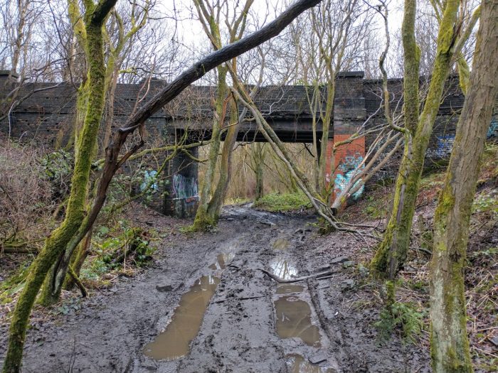
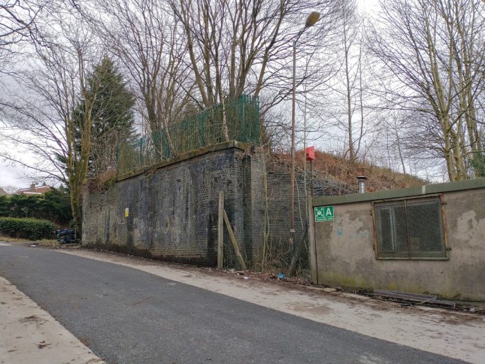
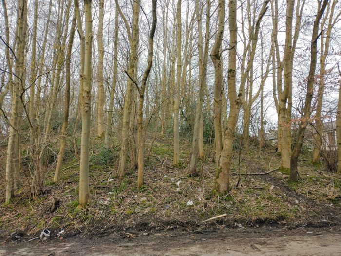
The Southern Portal of the Royal George Tunnel on the Micklehurst Loop was very close to the Gas Works. [21]
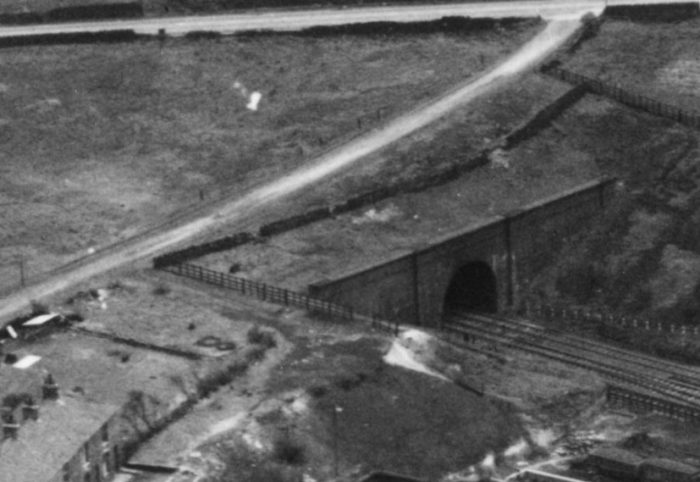
The Royal George Tunnel Southern Portal – the portal and Wingwalls were made of blue engineering brick, like other structures on the Line. [21]
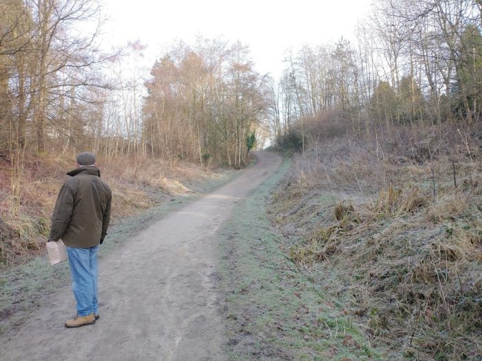
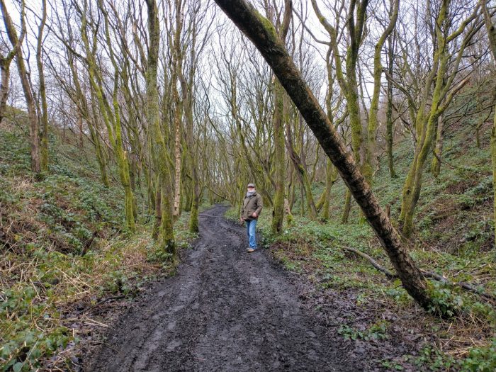
Looking towards the location of the Royal George Tunnel Portal from a point alongside the location of the old Gas Works. The path climbs from the cutting floor at track-bed level up to meet Huddersfield Road ahead. (Photograph by Joanna Farnworth on 15th January 2021.)
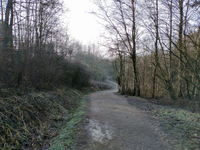
This picture gives a better impression of the level difference. It is taken from close to Huddersfield Road and looks back towards Micklehurst. (My photograph, 15th January 2021.)
The Royal George Tunnel was named for the pub which stood over it at the junction between Manchester Road (A635) and Huddersfield Road/Well-i-Hole Road (B6175). The tunnel was 140 yards (128 metres) long. Immediately at its Northeastern end, the A635 was carried over the Line on a simply supported span.
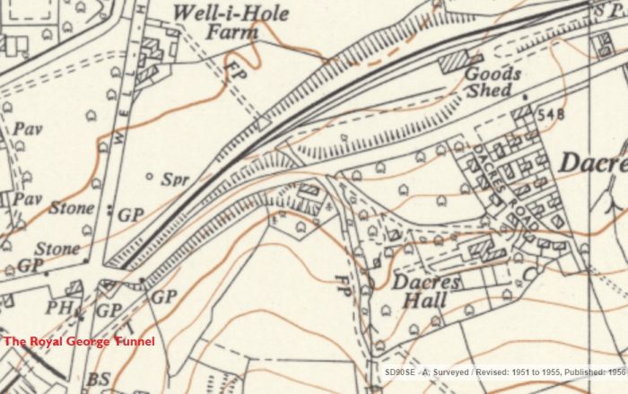
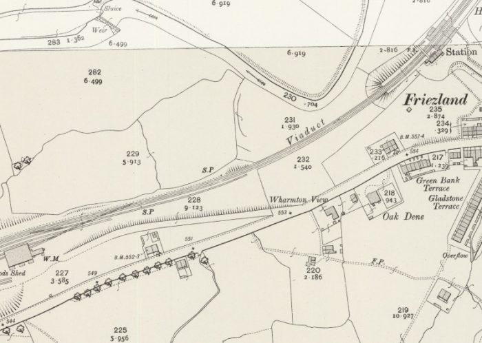
A further extract from the OS 1:10,560 series maps of the 1950s. The Royal George Pub and Tunnel are in the bottom left of the extract. The Goods Shed which features towards the top right was Friezland Goods Shed. [17]
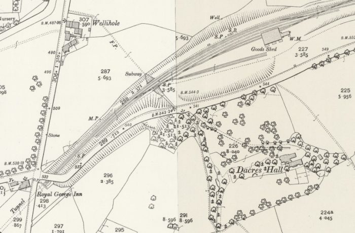
The same location on the 25″ OS Map series from the middle of the 20th century. [22]
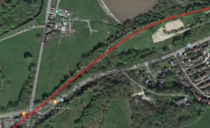
The same location in the 21st century. This time it is a satellite image. With the closure of the line it was possible to realign the A635 to remove the tight bends which kept it close to the tunnel mouth. (Google Maps.)
Just to the North of the Loop, on the West side of Well-i-Hole Road close to the farm was Royal George Mill. It belonged to R R Whitehead and Brothers Limited. They traced their origins back to the seventeenth century, when their farming ancestors began to act as woollen merchants. In 1822, William Whitehead joined his brothers, John Dicken and Edward at Oak View Mill, also in Greenfield. In 1837, William’s four sons, Ralph Radcliffe, James Heywood, Francis Frederick and John Dicken, established a partnership under the name of R R Whitehead and Brothers to carry on business as woollen manufacturers and general traders and moved into the Royal George Mills, Greenfield. [32]
They specialised in the production of felts produced from wool, and also in the manufacture of flags. In 1932, they became part of Porritts and Spencer of Bury, who were, in turn, taken over by the Scapa Group in 1969. In 1980, further amalgamation took place with Bury Masco Industries and Cooper and Company, both of Brynmawr, South Wales. These concerns later closed. During the twentieth century, the Royal George Mills specialised in producing two types of felt; Taper Hammer Felt and Technical Felt. Taper Hammer Felt was used on the hammers in pianos, and the Royal George Mills were renowned for it throughout the world, exporting to Japan, Korea, China and Germany. Technical Felt was used throughout industry in a wide range of machinery. Work at the Royal George Mills gradually decreased throughout the 1990s and they finally closed in 1999. The site has been developed into housing by Wiggett Homes. [32]
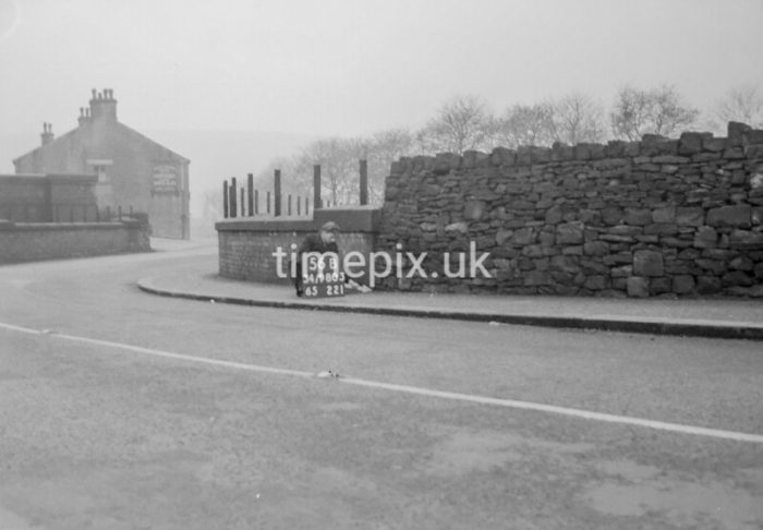
A view from the East on the A635. Man marking Ordnance Survey minor control revision point with an arrow on the corner of the parapet of the bridge which took the A635 over the Micklehurst Loop. In this image the road bridge can be seen crossing the railway just in front of the higher tunnel portal parapet. The Royal George Inn is in the background, (c) Manchester Libraries. [24]
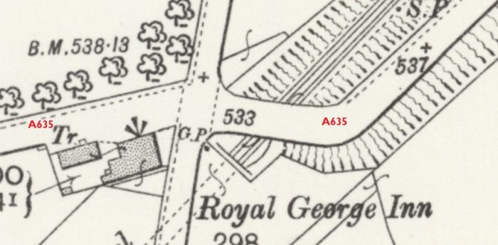
An enlarged extract from the 25″ OS Map above which shows the arrangement of the tunnel portal and the road bridge at the Royal George Inn junction. [22]
Looking South from the bridge over the path to Manchester Road. both this and the next picture are taken at the subway to the East of the Royal George Inn junction, (c) Manchester Libraries. [25]
Looking North from the bridge over the path to Manchester Road, (c) Manchester Libraries. [26]
25″ OS Map extract from 1950s. [22]
On the South side of the Loop Line and also of Manchester Road was Dacres Hall.The hall is a former working farm, the vicarage of Bartholomew Dacre, who was vicar of St George’s Church in Mossley. He had to make a living from the farm since his stipend wasn’t nearly enough to keep his family. Years later, a local industrialist and self-taught amateur architect, Tom Shaw, acquired the property and the hall came into being. [33]
Just a short distance further along the Micklehhurst Loop and Manhester Road from the entrance to Dacres Hall was the Friezland Goods yard and Goods Shed/Warehouse. The next few pictures focus on that site.
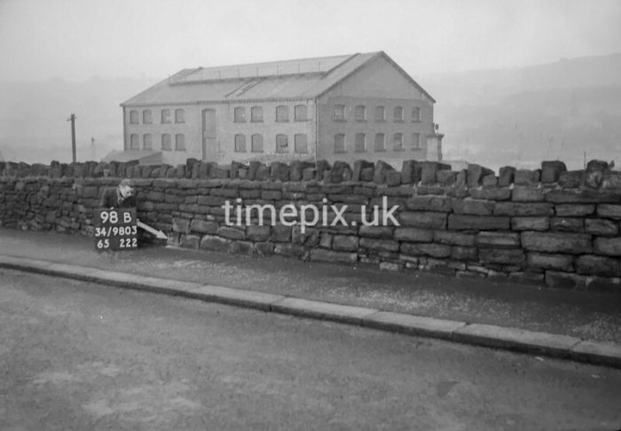
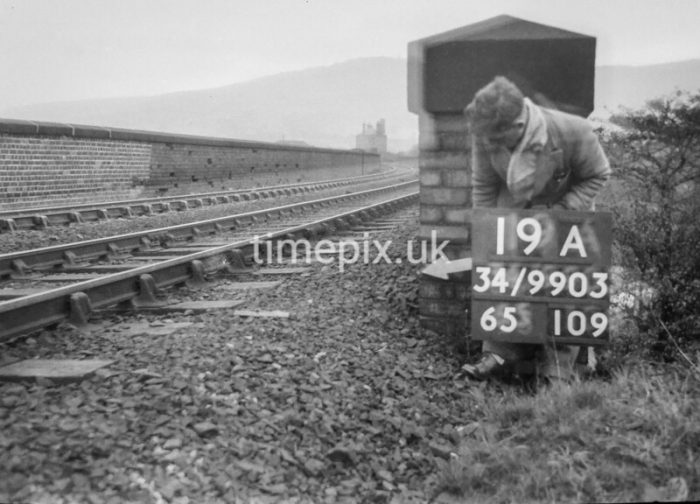
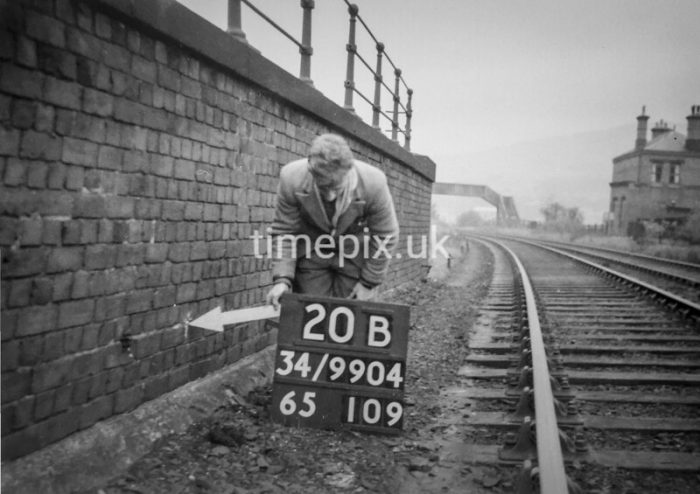
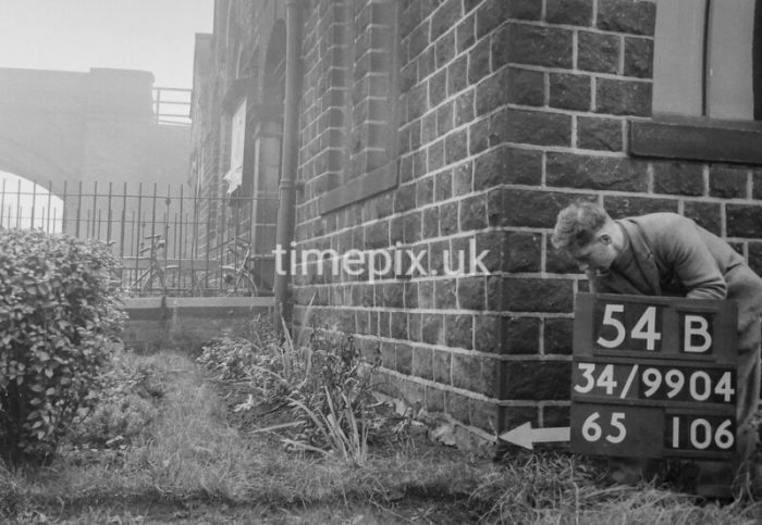
Man marking Ordnance Survey minor control revision point with an arrow on Manchester Road (A635) in Friezland. In the background, Friezland Goods Shed appears out of the mist, (c) Manchester Libraries. [27]
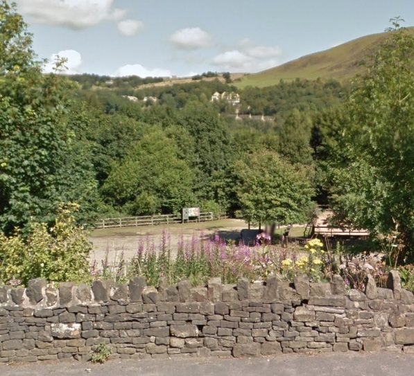
A 21st century view of the location of Micklehurst Goods warehouse from a similar position to the image immediately above (15th August 2015, Google Streetview). The site is now occupied by the Oldham & District Riding Club’s Friezland Arena.
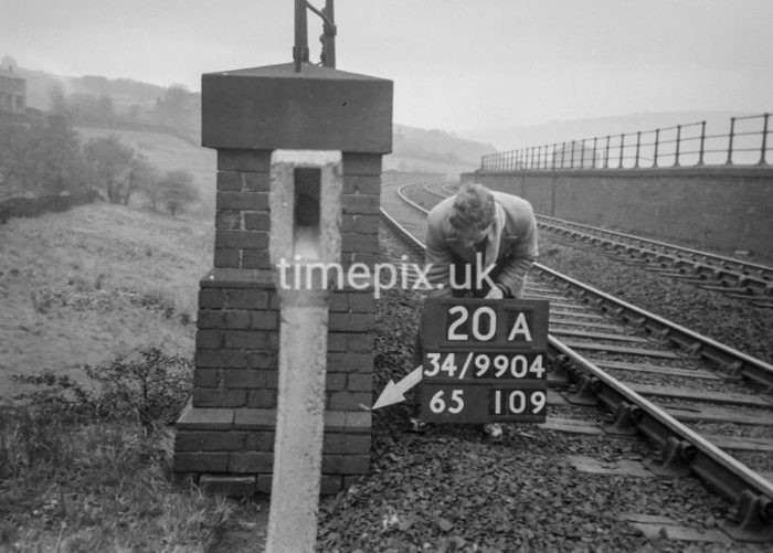
Man marking Ordnance Survey minor control revision point a little further to the East on the A635, (c) Manchester Libraries. [28]

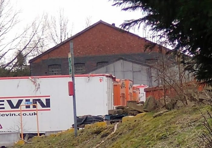
Friezland, railway goods warehouse. The photograph is taken looking from the West at the NorthWest corner of the Goods Shed, (c) Manchester Libraries. [29]
Man marking Ordnance Survey minor control revision point close to Friezland Goods Shed. The picture is taken looking to the West from a point directly opposite the Goods Shed along the North side of the MIcklehurst Loop. The signal box is visible in the middle-distance, (c) Manchester Libraries. [30]
Passing the location of Friezland Goods Yard on 22nd January 2021. (My photograph.)
Following the track-bed of the mainline of the old Micklehurst Loop as it ran alongside the Friezland Goods Yard. (My photograph, 22nd January 2021).
These next two pictures were taken on 22nd January 2021 as we walked away from the Royal Goerge Inn along the old line. They must be at approximately the location of the old Goods Yard.
We passed the Oldham & District Riding Club’s Friezland Arena on our right.
it was not far beyond this point that we had to leave the old track-bed as it would have sat on the now demolished Friezland Viaduct.
Off to the left of these pictures, the River Tame swings closer to the route of the line and sits almost immediately next to the Viaduct ahead, before swinging away once more to its confluence with Greenfield (or Chew) Brook.
The Hudderfield Narrow Canal which once followed the route of the old Loop Line very closely has been carried over the line of the River Tame on an Aqueduct to the West of The Royal George Inn and now follows the Northern flank of the Tame Valley running close to Friezland Church and then on into Uppermill beneath, first the B6175 and then the A6051 (Chapel Road).
Not much further East of Greenfield Station on the mainline, the Canal passes to the North side of Frenches Wharf Marina.
25″ OS Map extract which shows the Good Shed, Viaduct and Station at Friezland in the 1950s. [31]
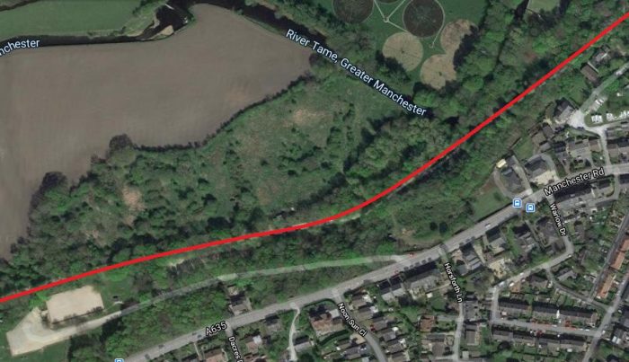
This satellite image shows the same area in the 21st century. The redline is an approximation to the route of the Loop, (Google Maps)

Dacres (or Friezland) viaduct on the Micklehurst Loop line, demolished at the end of 1970. The footbridge in the distance is at Friezland station. Although the station closed in 1917 the building (obscured by the telegraph pole) still stands in 2020, (c) Manchester Libraries.[35]
This picture shows the Southwest parapet pilaster of the Friezland Viaduct. The image immediately above shows the Northwest pilaster of the Viaduct. The building in the distance is the passenger station building at Friezland Station, (c) Manchester Libraries. [36]
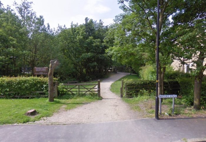
The public footpath dropped off the embankment of the old railway and followed the valley floor, meeting Waters Edge and Croft Edge before crossing Greenbridge Lane (Google Streetview.)
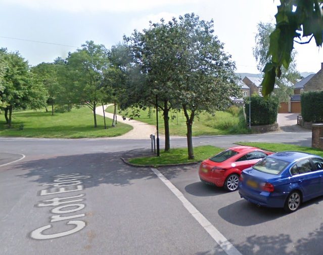
The footpath following the old line crossed Greenbridge Lane at road level and then continued along the path visible ahead which probably is below what was the platforms of Friezland Station. (Google Streetview.)
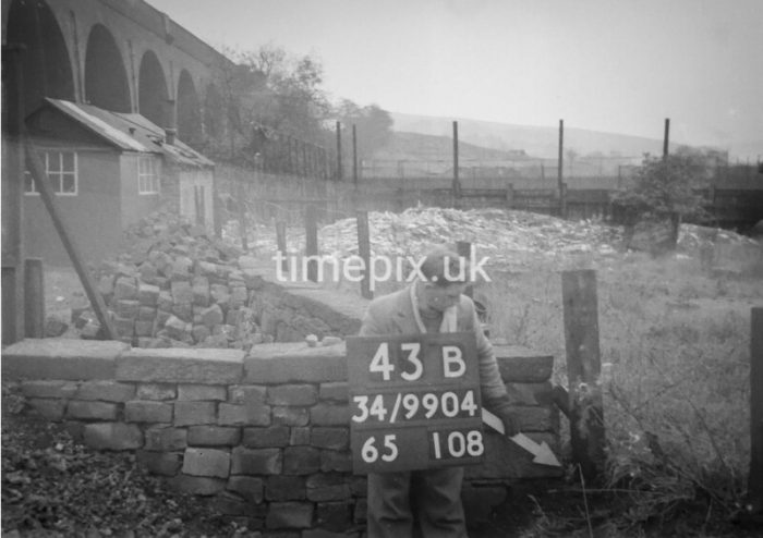
Man marking Ordnance Survey minor control revision point with an arrow on Friezland Viaduct. This picture is taken close to the Northeast pilaster at the end of the viaduct parapet and shows the location of Friezland Station in the 1950s. The station house still stands, as does the footbridge but it appears that the platforms have been removed, (c) Manchester Libraries. [37]
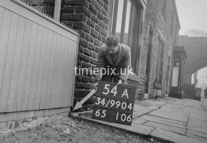
Man marking Ordnance Survey minor control revision point with an arrow on the Southeast pilaster of Friezland Viaduct. The photograph is taken looking along the Loop Line to the West, (c) Manchester Libraries. [38]
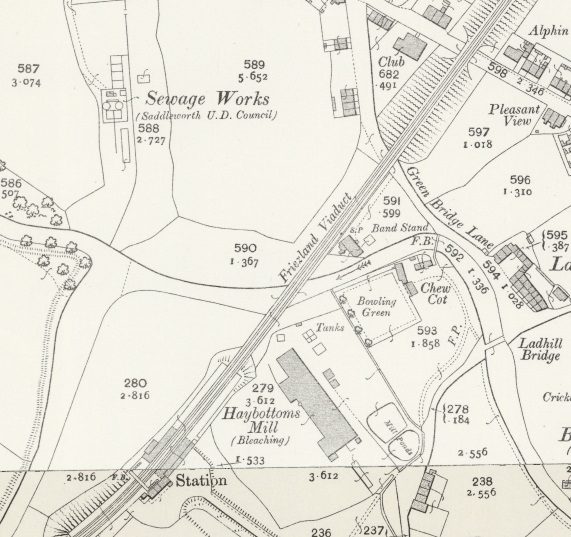
A 25″ OS Map extract from the 1950s shows the length of the old line from Friezland Station to Chew Valley Road. [44]
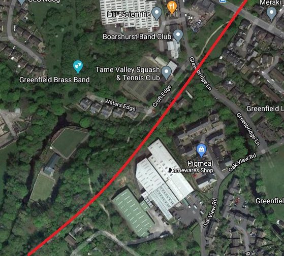
The same area in a satellite image in the 21st century. Friezland Passenger Station still stands, much altered, as a private home. It can be seen just below the red line at the bottom left of the image. (Google Maps.)
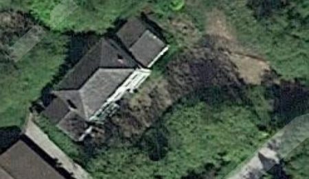
Friezland Railway Station building. (Google Maps.)
The adjacent image shows Friezland Station Building from above. It is in private hands and has been altered significantly. The facia’s have been painted. Alan Young has photographs of the building on the Disused Stations Website which were taken in 2015. [34]
There was a viaduct at each end of Friezland Station as the image below shows. Friezland Viaduct, of twelve brick arches and 187 yards long, was to the West of the Station. Greenfield Viaduct was longer, it was a 16 brick-arch viaduct of 242 yards length with a large span over Chew Brook. Very soon after leaving the Greenfield Viaduct trains would have crossed another arch bridge of brick constriction which spanned Chew Valley Road. [43]
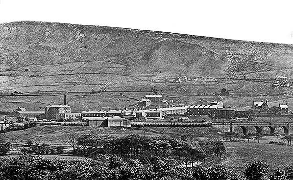
Friezland Station sat between two viaducts. In this view from across the Tame Valley the erstwhile Friezland Viaduct can be seen on the right. The Greenfield Viaduct creeps onto the left of the picture. The wooden platforms and shelters of the Station are at the centre of the image. This image is included here courtesy of Alan Young. He comments: “Looking south-east towards Friezland station from a point close to Greenfield station c1910. Friezland station is seen between Friezland Viaduct (right) and Greenfield Viaduct (left), with the rear of the down platform shown clearly. The waiting room block and down platform are both constructed of timber. The footbridge connecting the platforms is visible in front of the station building, which adjoins the up platform. It is assumed that this platform was also of timber construction, like all others on the Micklehurst Loop. Left of the station, the large building with the chimneystack is Haybottom’s bleaching mill. The desolate heights of Saddleworth Moor provide a dramatic backdrop.” The photograph comes from the Peter Fox ‘Old Saddleworth’ collection. [34]
Haybottom’s Mill – was a bleaching mill. It was immediately adjacent to Friezland Station. I have not been able to find any further details about the mill.
Bentfield Mill – was at different times a cotton mill and a woolen mill. Notes: Built originally at as a woolen mill in around 1790, it was rebuilt as a Cotton Mill by Robinson Brothers in 1868. It reverted to wool in 1892. Chew Brook Drive and its housing is built on the site.
Andrew Mill – appears on the 6″ OS Map extract below. I have not been able to find any further details about the mill.
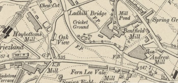
An extract from the 6″ OS Map published in 1909. [45]
Man marking Ordnance Survey minor control revision point with an arrow on what I believe is Greenbridge Lane on the North side of Greenfield Viaduct (confusingly identified as
‘Friezland Viaduct’ on OS plans) looking to the West, (c) Manchester Libraries. [39]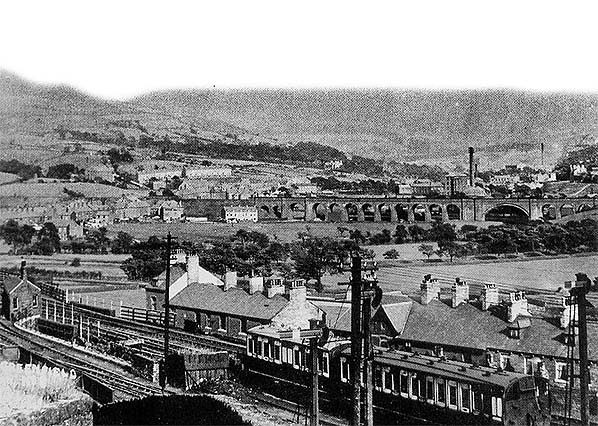 In this image, also used here courtesy of Alan Young, we are looking north-east circa 1906 towards Greenfield Viaduct (confusingly identified as ‘Friezland Viaduct’ on OS plans) on the Micklehurst Loop (between Uppermill and Friezland stations). The Mill which can be seen behind the Viaduct is Bentfield Mill, a cotton and woolen mill. The photograph again comes from the Peter Fox ‘Old Saddleworth’ collection. [34]
Man marking Ordnance Survey minor control revision point with an arrow on Chew Valley Road in Greenfield. The photograph looks Southeast along the Northern pavement of the road with the arch-bridge which carried the Micklehurst Loop visible in the background, (c) Manchester Libraries. [40]
Corner of Greenfield Conservative Club, converted to housing in 2019. The bridge visible carries the Micklehurst Loop line over Chew Valley Road. This view is also looking to the South east but on the opposite side of Chew Valley Road, (c) Manchester Libraries. [41]
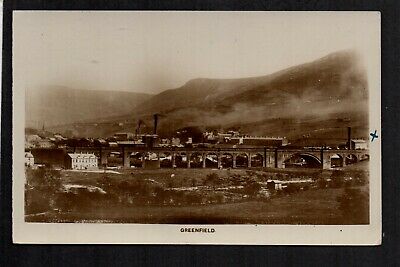
Greenfield Viaduct. [46]
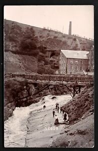
In concluding, we see a couple of older postcard images of Greenfield Viaduct, the second of which looks along Chew Valley Road towards the Southeast, and a 21st century Google Streetview image of the point at which the Loop crossed Chew Valley Road.
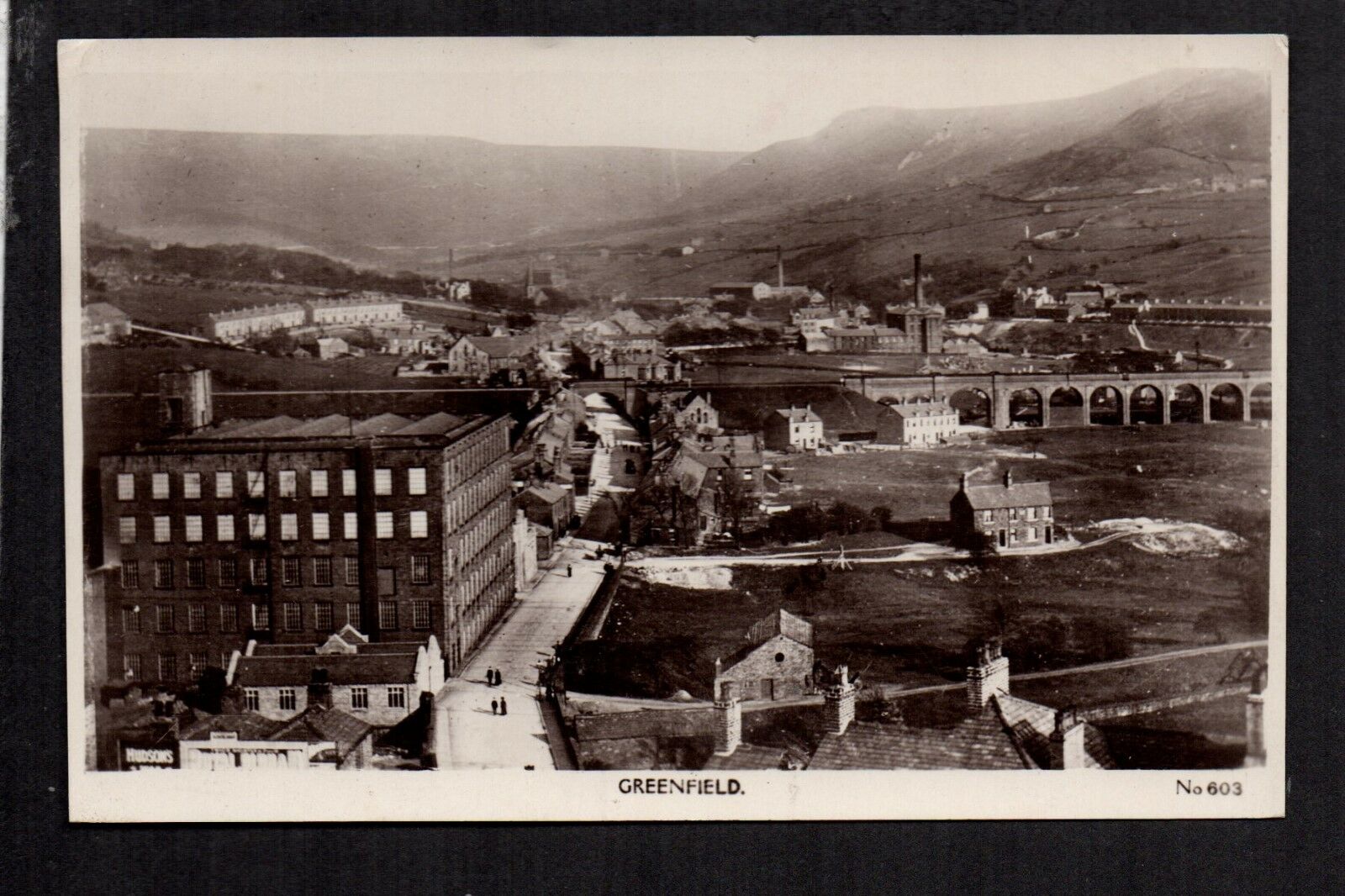
Old Postcard Image looking along Chew Valley Road to the Southeast. Greenfield Viaduct appears on the right side of the image, there is then a short section of embankment before the arched bridge over Chew Valley Road. Bentfield Mill sits behind the Viaduct. [47]
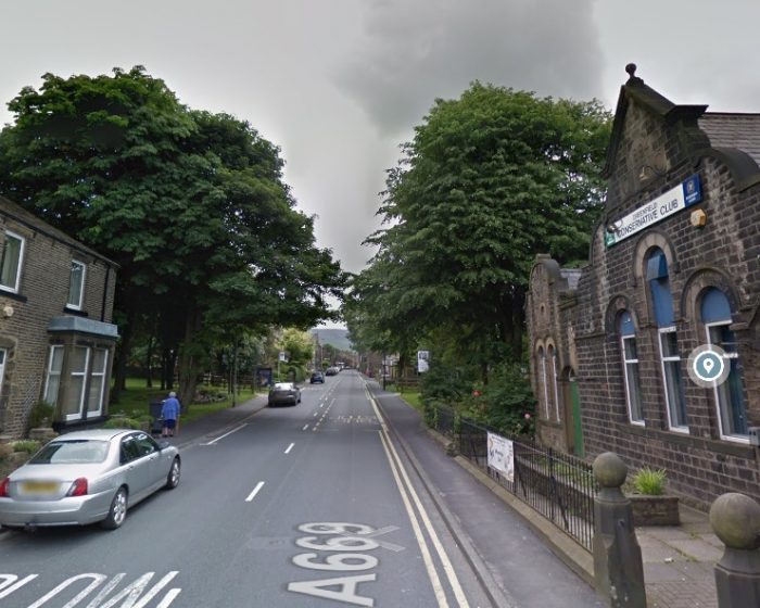
Chew Valley Road at the point where the Micklehurst Loop crossed the road by means of an arched bridge. The trees sit where the bridge abutments once sat! (Google Streetview.)
References
- https://maps.nls.uk, accessed on 31st January 2021.
- https://britainfromabove.org.uk/en/image/EAW010809, accessed on 22nd February 2021.
- https://m.youtube.com/watch?v=doLBsI6J_V8, accessed on 22nd February 2021.
- https://en.wikipedia.org/wiki/List_of_mills_in_Tameside, accessed on 25th February 2021.
- Owen Ashmore; The industrial archaeology of North-west England; Manchester University Press, 1982.
- https://historicengland.org.uk/services-skills/education/educational-images/woodend-mill-manchester-road-mossley-8435, accessed on 25th February 2021.
- http://disused-stations.org.uk/features/micklehurst_loop/index.shtml, accessed on 25th January 2021.
- https://www.gracesguide.co.uk/Robert_Hyde_Buckley_and_Sons, accessed on 25th February 2021.
- http://www.table38.steamrailways.com/rail/Micklehurst/micklehurst.htm, accessed on 24th January 2021.
- https://britainfromabove.org.uk/en/image/EAW035924, accessed on 26th February 2021.
- https://www.uktextilemills.com/milton-mill, accessed on 25th February 2021.
- https://maps.nls.uk/view/126521957, accessed on 25th February 2021.
- https://britainfromabove.org.uk/en/image/EAW035919, accessed on 26th February 2021.
- https://www.gracesguide.co.uk/Robert_Hyde_Buckley, accessed on 26th February 2021.
- https://maps.nls.uk/view/126521918, accessed on 26th February 2021.
- https://www.gracesguide.co.uk/1891_Cotton_Mills_in_Mossley, accessed on 26th February 2021.
- https://maps.nls.uk/geo/explore/#zoom=17&lat=53.52756&lon=-2.03015&layers=193&b=1, accessed on 26th February 2021.
- https://discovery.nationalarchives.gov.uk/details/r/b61350fe-0e72-4a1f-9743-ebdd0c83ed13, accessed on 26th February 2021.
- https://www.mwbooks.ie/pages/books/287731/k-g-the-rt-hon-the-earl-of-derby/mossley-corporation-gas-works-inauguration-of-the-new-works-by-the-rt-hon-the-earl-of-derby-k-g-june, accessed on 27th February 2021.
- https://www.britainfromabove.org.uk/en/image/EPW058239, accessed on 27th February 2021.
- https://www.britainfromabove.org.uk/en/image/EAW035918, accessed on 27th February 2021.
- https://maps.nls.uk/geo/explore/#zoom=17&lat=53.53112&lon=-2.02109&layers=168&b=1, accessed on 27th February 2021.
- https://www.timepix.uk/Collection-galleries/OS-Revision-Points-in-Greater-Manchester/1940s-1950s-Middleton-Oldham-and-Rochdale/Lees-Grasscroft-and-Greenfield/i-MtN66Sm, accessed on 22nd February 2021.
- https://www.timepix.uk/Collection-galleries/OS-Revision-Points-in-Greater-Manchester/1940s-1950s-Middleton-Oldham-and-Rochdale/Lees-Grasscroft-and-Greenfield/i-rdWQnWT, accessed on 27th February 2021.
- https://www.timepix.uk/Collection-galleries/OS-Revision-Points-in-Greater-Manchester/1940s-1950s-Middleton-Oldham-and-Rochdale/Lees-Grasscroft-and-Greenfield/i-tNrDSb6, accessed on 28th February 2021.
- https://www.timepix.uk/Collection-galleries/OS-Revision-Points-in-Greater-Manchester/1940s-1950s-Middleton-Oldham-and-Rochdale/Lees-Grasscroft-and-Greenfield/i-mWfjSKB, accessed on 28th February 2021.
- https://www.timepix.uk/Collection-galleries/OS-Revision-Points-in-Greater-Manchester/1940s-1950s-Middleton-Oldham-and-Rochdale/Lees-Grasscroft-and-Greenfield/i-q9g5tdV, accessed on 28th February 2021.
- https://www.timepix.uk/Collection-galleries/OS-Revision-Points-in-Greater-Manchester/1940s-1950s-Middleton-Oldham-and-Rochdale/Lees-Grasscroft-and-Greenfield/i-SpPSJmx, accessed on 28th February 2021.
- https://www.timepix.uk/Collection-galleries/OS-Revision-Points-in-Greater-Manchester/1940s-1950s-Middleton-Oldham-and-Rochdale/Lees-Grasscroft-and-Greenfield/i-MftfTW9, accessed on 28th February 2021.
- https://www.timepix.uk/Collection-galleries/OS-Revision-Points-in-Greater-Manchester/1940s-1950s-Middleton-Oldham-and-Rochdale/Lees-Grasscroft-and-Greenfield/i-BJtk3F2, accessed on 28th February 2021.
- https://maps.nls.uk/geo/explore/#zoom=17&lat=53.53298&lon=-2.01558&layers=168&b=1, accessed on 28th February 2021.
- https://www.flickr.com/photos/21913923@N03/8353763108, accessed on 28th February 2021.
- https://www.oldham-chronicle.co.uk/news-features/101/features/88521/devoted-jill%E2%80%99s-a-true-public-servant, accessed on 28th February 2021.
- http://disused-stations.org.uk/f/friezland/index.shtml, accessed on 28th February 2021.
- https://www.timepix.uk/Collection-galleries/OS-Revision-Points-in-Greater-Manchester/1940s-1950s-Middleton-Oldham-and-Rochdale/Lees-Grasscroft-and-Greenfield/i-kwZDcNm, accessed on 28th February 2021.
- https://www.timepix.uk/Collection-galleries/OS-Revision-Points-in-Greater-Manchester/1940s-1950s-Middleton-Oldham-and-Rochdale/Lees-Grasscroft-and-Greenfield/i-bzz4Xws, accessed on 28th February 2021.
- https://www.timepix.uk/Collection-galleries/OS-Revision-Points-in-Greater-Manchester/1940s-1950s-Middleton-Oldham-and-Rochdale/Lees-Grasscroft-and-Greenfield/i-56HVnR6, accessed on 28th February 2021.
- https://www.timepix.uk/Collection-galleries/OS-Revision-Points-in-Greater-Manchester/1940s-1950s-Middleton-Oldham-and-Rochdale/Lees-Grasscroft-and-Greenfield/i-xG963VC, accessed on 28th February 2021.
- https://www.timepix.uk/Collection-galleries/OS-Revision-Points-in-Greater-Manchester/1940s-1950s-Middleton-Oldham-and-Rochdale/Lees-Grasscroft-and-Greenfield/i-Khdh2v9, accessed on 28th February 2021.
- https://www.timepix.uk/Collection-galleries/OS-Revision-Points-in-Greater-Manchester/1940s-1950s-Middleton-Oldham-and-Rochdale/Lees-Grasscroft-and-Greenfield/i-sqpQVTp, accessed on 28th February 2021.
- https://www.timepix.uk/Collection-galleries/OS-Revision-Points-in-Greater-Manchester/1940s-1950s-Middleton-Oldham-and-Rochdale/Lees-Grasscroft-and-Greenfield/i-GB6pX6v, accessed on 28th February 2021.
- From an email on the IndustrialRailwaySociety@groups.io email group on 28th February 2021.
- https://www.railforums.co.uk/threads/micklehurst-line.143325, accessed on 25th February 2021.
- https://maps.nls.uk/geo/explore/#zoom=17&lat=53.53553&lon=-2.00878&layers=168&b=1, accessed on 28th February 2021.
- https://maps.nls.uk/geo/explore/#zoom=17&lat=53.53403&lon=-2.00540&layers=6&b=1, accessed on 1st March 2021.
- https://picclick.co.uk/Greenfield-near-Uppermill-Oldham-Ashway-Gap-352652407476.html, 28th February 2021.
- https://www.ebay.co.uk/itm/313086782469?mkevt=1&mkcid=1&mkrid=710-53481-19255-0&campid=5338722076&toolid=10001