Stanley Jenkins tells us that “The opening of the Inverness & Rossshire Railway between Inverness and Dingwall on 11th June 1862 brought the benefits of rail transport to a prosperous farming area in Ross & Cromarty. The line was completed throughout to Invergordon on 25th March 1863, while a series of subsequent extensions eventually resulted in the creation of the Highland Railway’s ‘Far North’ line between Inverness and Wick. Inevitably the 161½ mile ‘Far North’ line omitted large numbers of places that would have benefited from direct rail links, and for this reason several branch-line schemes were put into effect during the latter part of the 19th century.” [1: p48]
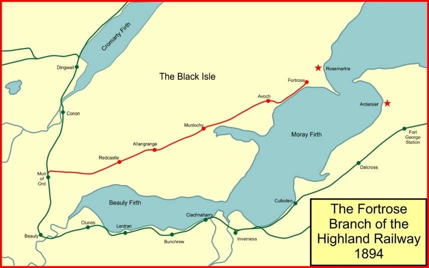
“The Black Isle peninsula, between the Beauly and Cromarty Firths, became the focal point for two such schemes, only one of which was successful.” [1: p48]
Wikipedia tells us that “The Highland Railway was surprised when in 1889 the Great North of Scotland Railway (GNoSR) proposed the construction of a railway to Fortrose, … The GNoSR operated a network from Aberdeen and the nearest place to Inverness served by it was at Elgin, some distance away. The branch would have been detached from the owning railway, but running through the Black Isle it would have made a junction with the Highland Railway at Muir of Ord. A ferry operation from Fortrose to Ardersier, on the south side of the Moray, was included in the plans. Ardersier was then known as Campbelltown, and a railway branch to it was included. Two other schemes striking into Highland territory were proposed at the same time, elevating Highland Railway discomfort about its competitive position.” [2][3]
“The two companies had been adversaries for some time, and in 1883 and the following years there had been a state of continual warfare over junctions, frontiers and running powers. … The Highland saw at once that if this branch were built, it would be easy for the GNoSR to demand running powers into Inverness to reach its branch, and in that way the rival company would have gained access to the Highland’s stronghold.” [2]
After considerable ‘argument’ between the two companies, the GNoSR and the Highland Railway each submitted Bills to the UK Parliament for a line to Fortrose.
It was the Highland Railway’s scheme which received Parliamentary consent on 4th July 1890. Jenkins tells us that it was for a “16 mile branch line between Muir of Ord, on the ‘Far North’ line, and the fishing port of Rosemarkie. The gentle topography of the Black Isle ensured that the proposed line could be built with relative ease, and on 1st February 1894 a single line was opened as far as Fortrose a distance of 13 miles 45 chains. The final section between Fortrose and Rosemarkie was never built, the terminal station at Fortrose being deemed a suitable railhead for the surrounding district.” [1: p48]
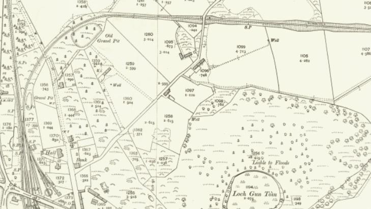
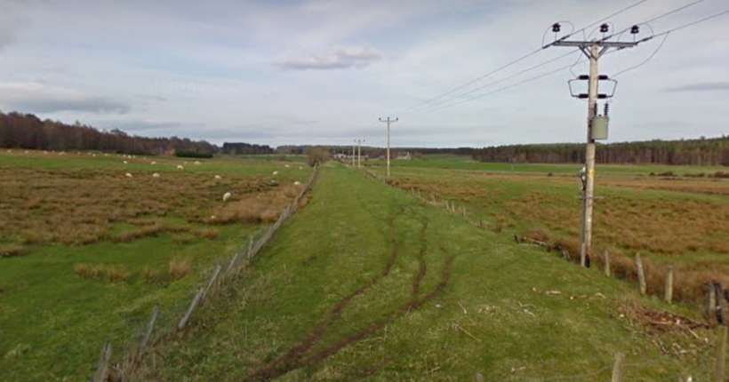
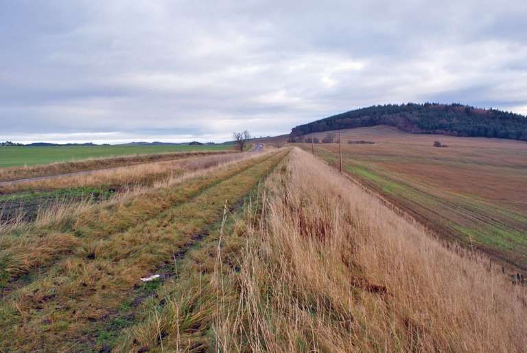
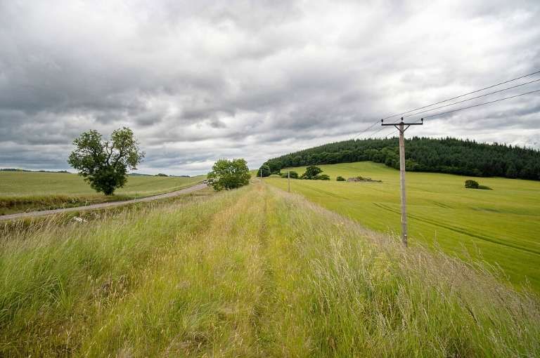
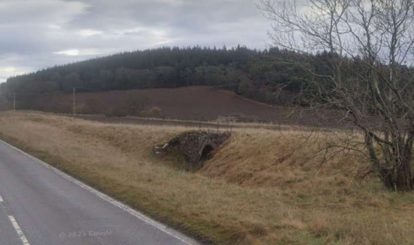
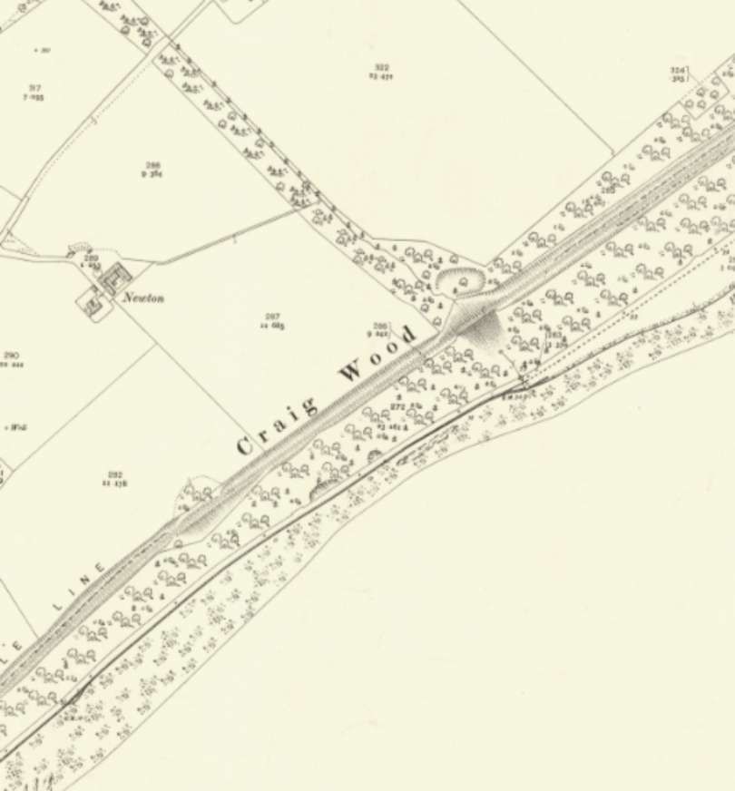
“The Fortrose branch provided useful transport facilities … on the South side of the Black Isle, but it was felt that better facilities were needed on the North side of the peninsula. The 1896 Light Railways Act offered a solution to this local transport problem, and on 1st August 1902 a Light Railway Order was obtained for construction of a 19 mile line between Conon, on the ‘Far North’ line, and Cromarty. Work began at the Cromarty end, but subsequent progress was painfully slow, and extensions of Time Orders were obtained in 1907, and again in 1910. … About six miles of track was actually laid between Cromarty and Newhall, but all work was suspended in 1914 on the outbreak of World War I. At that time, construction work was in hand on a further two miles of line, but little had been done on the remaining eleven miles of line to Conon. The track was lifted around 1915 for use in the war effort, leaving the earthworks and other engineering features of the unfinished light railway in a derelict condition.” [1: p49]
“If the Cromarty & Dingwall Light Railway had been completed it would have had stations at Alcaig Ferry, Culbokie, Drumcudden, and Newhall. Other halts may have been opened once the line was in operation, while there were also suggestions that the route might be extended south-westwards from Cromarty to Rosemarkie and Fortrose, thereby creating a scenic ‘coastal’ route around the Black Isle that would have had considerable potential as a tourist attraction. Unfortunately the changed economic conditions after World War I meant that schemes of this kind were no longer viable, and the Fortrose branch was therefore left in splendid isolation as the only completed railway in the Black Isle area.” [1: p49]
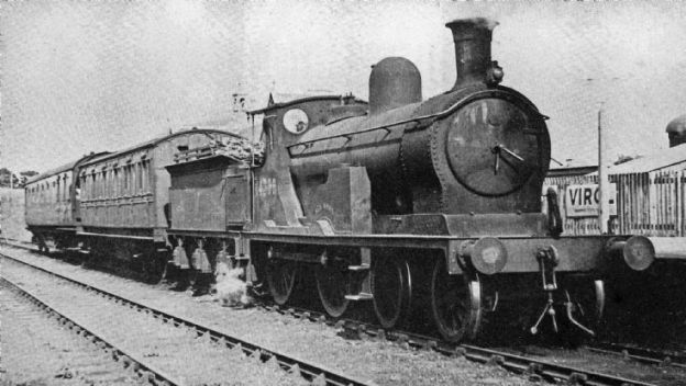
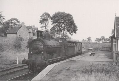
“The Fortrose route was worked as a feeder branch for the ‘Far North’ line, and as such it was moderately-successful. Like other Highland Railway branch lines it was normally worked by small tank locomotives such as the Dübs 4-4-0Ts. Other engines seen on the line were Drummond’s well-known 0-4-4 branch-line tanks.” [1: p49]
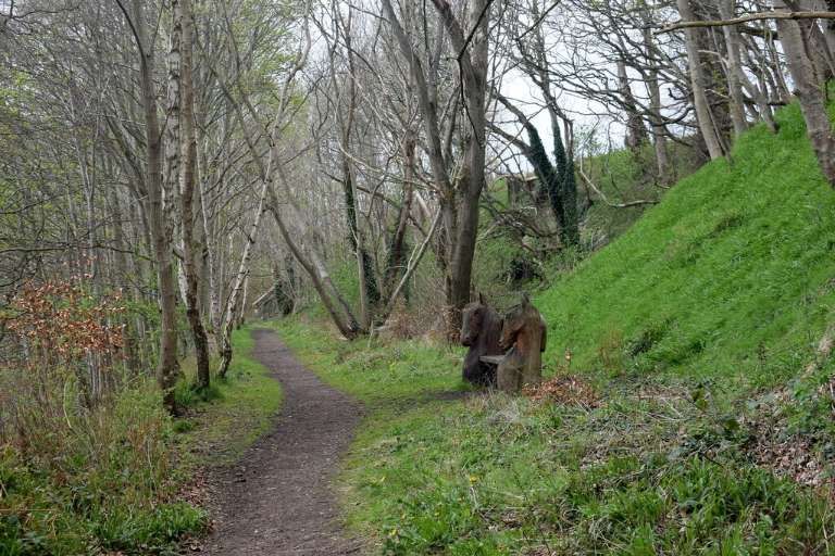
The Route from Muir of Ord to Fortrose
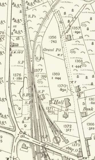
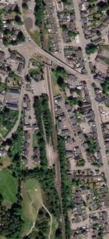
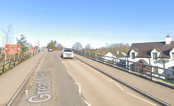
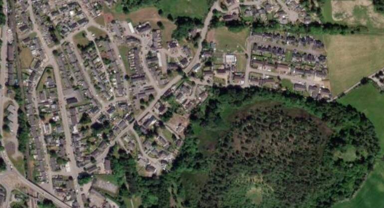
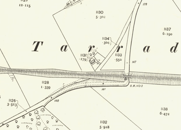
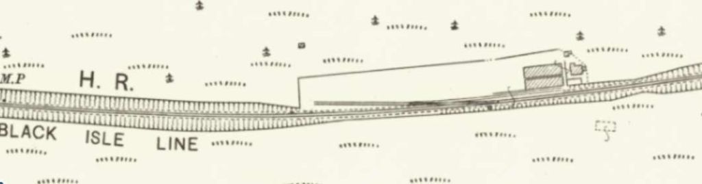
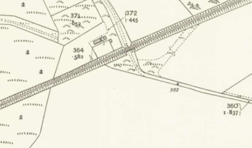
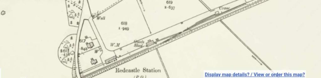
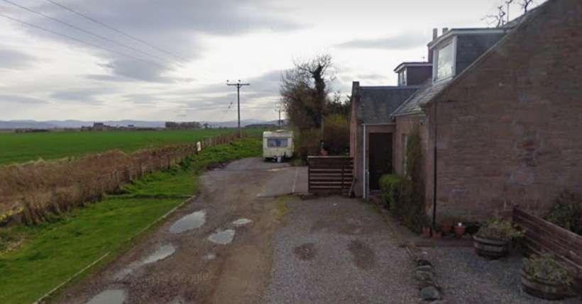
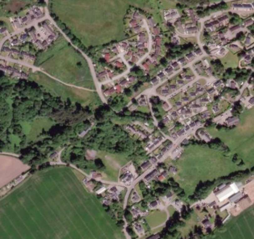
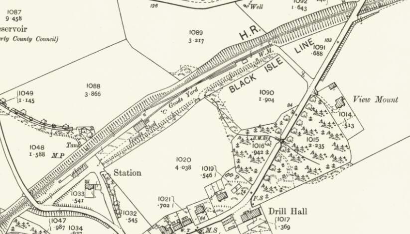
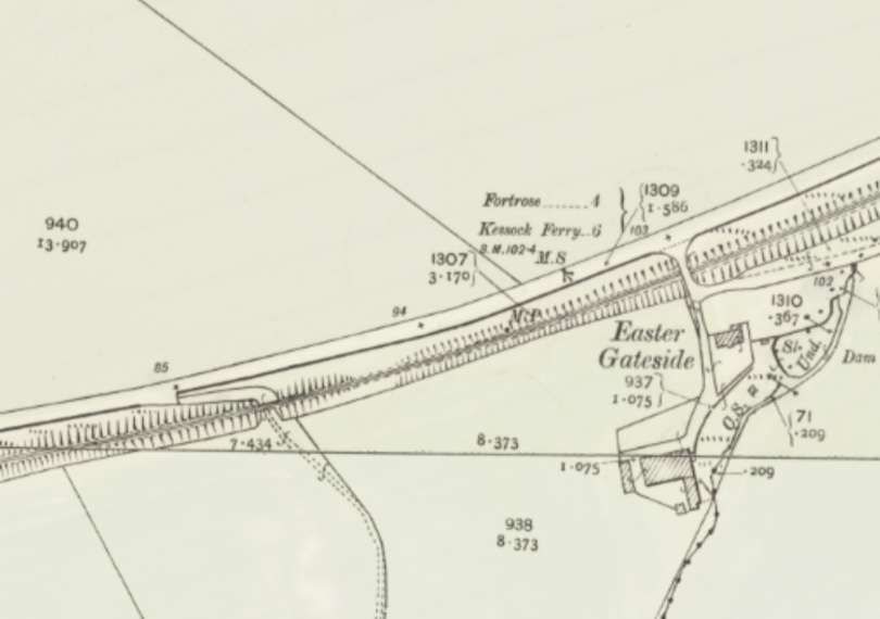
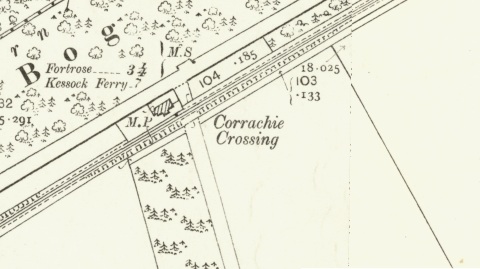
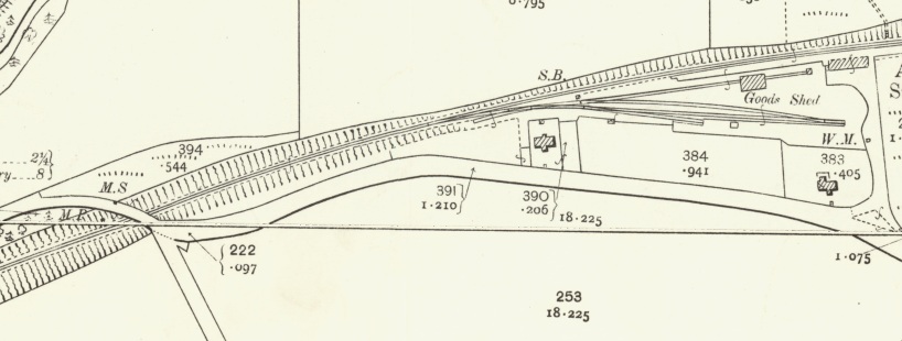
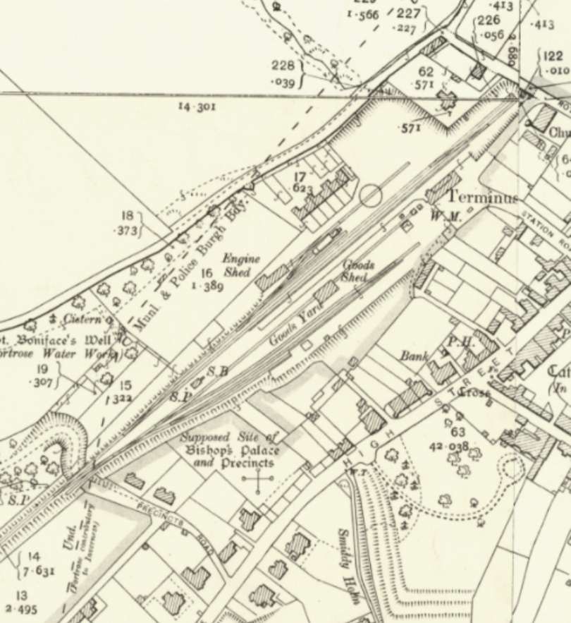
The extracts below from the 25″ Ordnance Survey of 1904, published in 1906 cover the site of Muir of Ord Railway Station. [6] Jenkins tells us that “Muir of Ord – the junction station for branch services to Fortrose – was opened on 11th June 1862 when the initial section of the Highland ‘Far North’ line was brought into use between Inverness and Dingwall.” [1: p49]
“The station was orientated from North to South, with its main station building on the down, or northbound side. The track layout was relatively complex, with sidings on both sides of the running line and a lengthy crossing loop.The main goods yard, with accommodation for coal, livestock, furniture, machinery, and general-merchandise traffic, was situated to the south of the platforms on the down side. One of the yard sidings passed through a goods shed, while others were used mainly for coal or other forms of wagon-load traffic. Further sidings were available on the up side, and one of these gave access to a 50ft diameter locomotive turntable.” [1: p49]
Wikipedia tells us that “The station is 13 miles 4 chains (13.05 mi; 21.0 km) from Inverness, between Beauly and Conon Bridge, and is the location of the sole remaining passing loop on the single line between Dingwall and Inverness.” [5]
“The station building and platform canopy were erected in 1894, [5][7] 32 years after the station itself opened. [8] Passenger services on the branch ceased on 1 October 1951, but the branch remained open for freight until 13 June 1960. Muir of Ord station was closed on 13 June 1960 but reopened in 1976, on 4 October.” [5][8]
“After the railway bridge across the River Ness washed away in February 1989, isolating the entire network north of Inverness, Muir of Ord was chosen as the location for a temporary depot, from which the stranded rolling stock could operate the service to the highland communities which depended on the line.” [5][9]
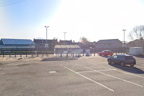
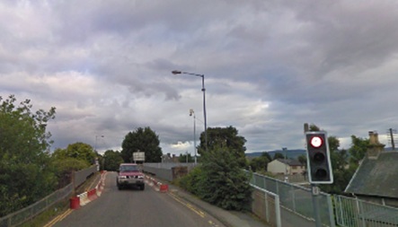
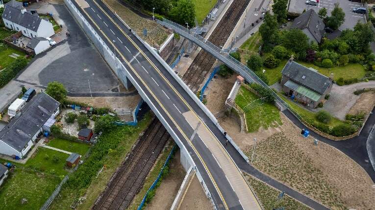
“In November 2015, work commenced on a new A862 road bridge at the northern end of the station.” [5][10]
The project cost £3.7 million and was completed in the Summer of 2017. [11]
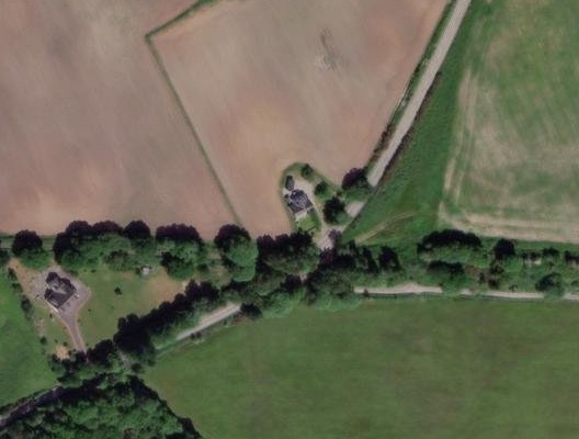
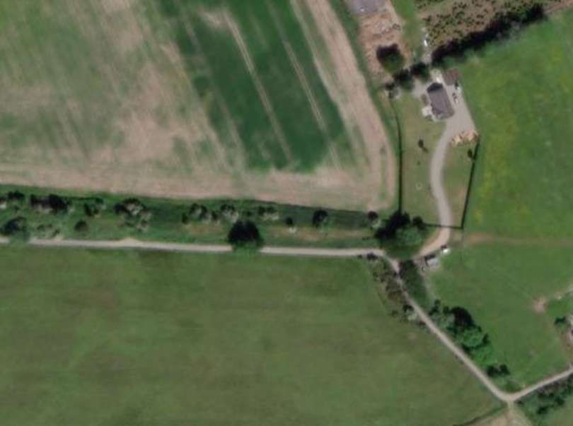
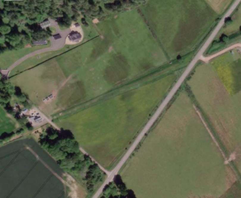
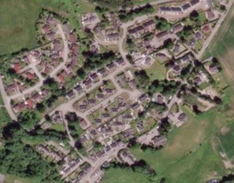
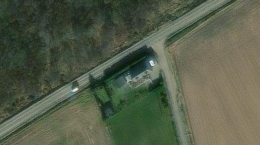
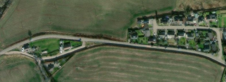
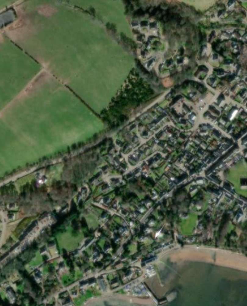
This ESRI satellite image supplied by the NLS shows the station site after the reconstruction of the raod bridge. [6]
Wikipedia tells us that “in the 21st century, both station platforms have modern waiting shelters and benches, with step-free access. There is a car park and bike racks adjacent to platform 1, along with a help point near to the entrance from the car park.” [5]
“As there are no facilities to purchase tickets, passengers must buy one in advance, or from the guard on the train.” [5]
“The station has a passing loop 32 chains (700 yd; 640 m) long, flanked by two platforms which can each accommodate a ten-coach train.” [5][12]
“On 11th June 1862 the Inverness and Ross-shire Railway opened their line between Inverness and Dingwall. It included a station at the village of Tarradale but the company decided to name it after the nearby cattle tryst (market), Muir of Ord. Eventually the name Muir of Ord was applied to the surrounding area.” [14]
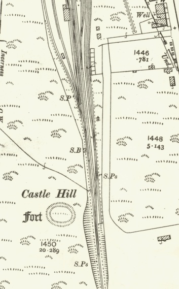
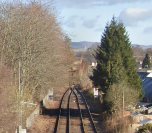
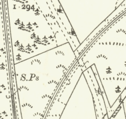
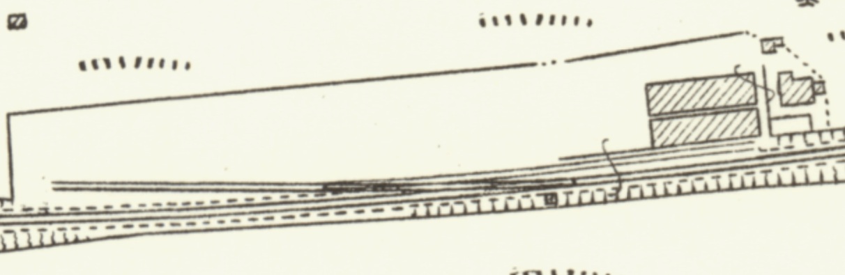
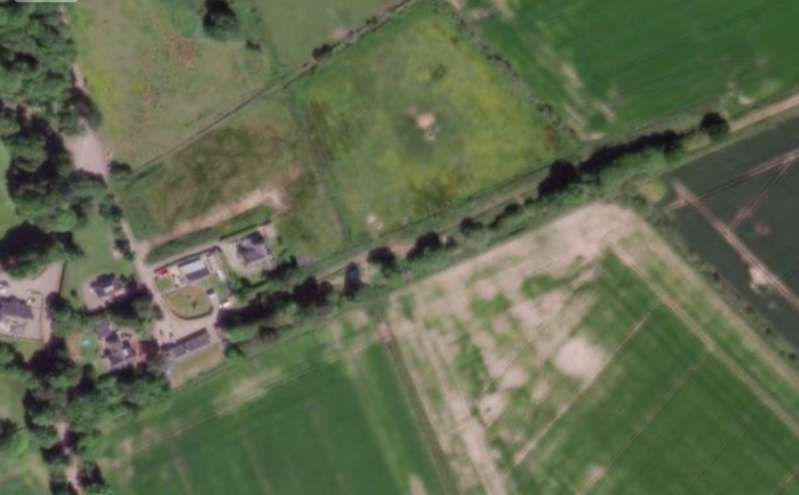
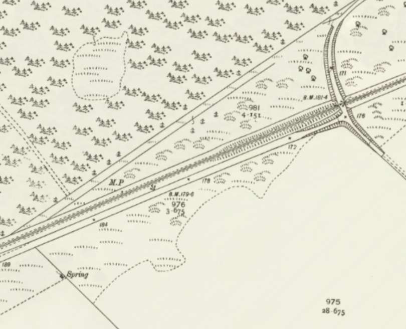
“On leaving Muir of Ord, branch trains diverged eastwards, and having, executed a full 90 degree turn the route maintained its easterly heading for about two miles.” [1: p49]
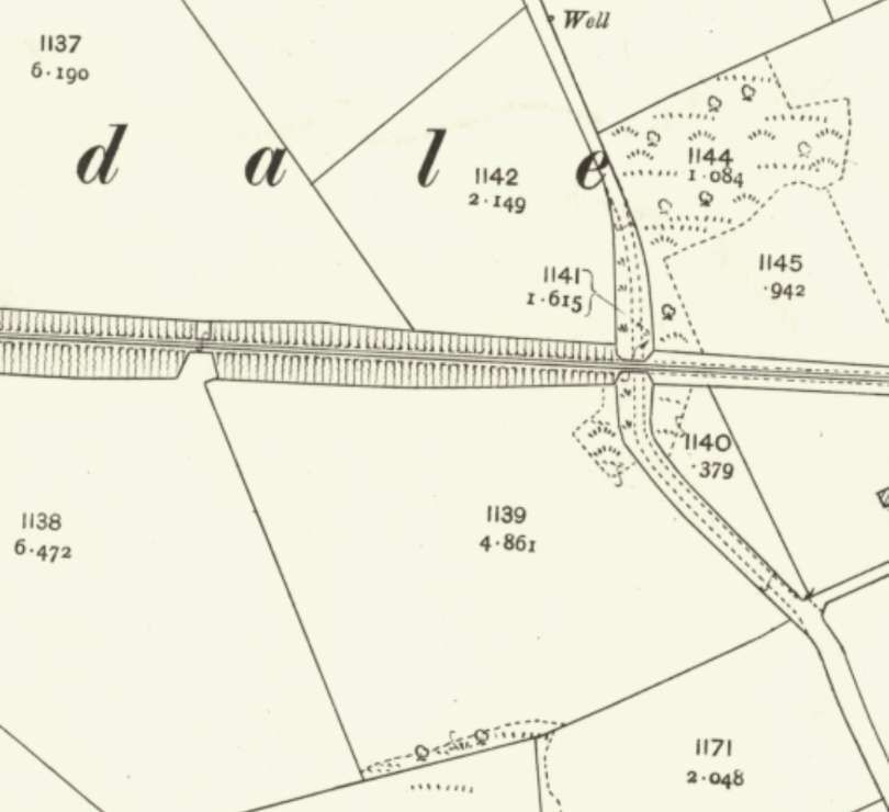
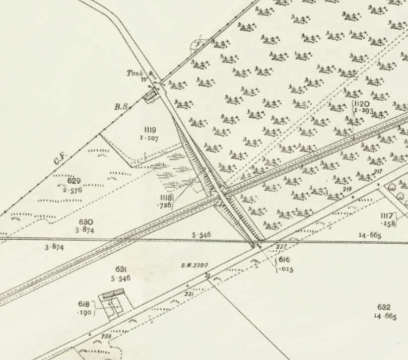
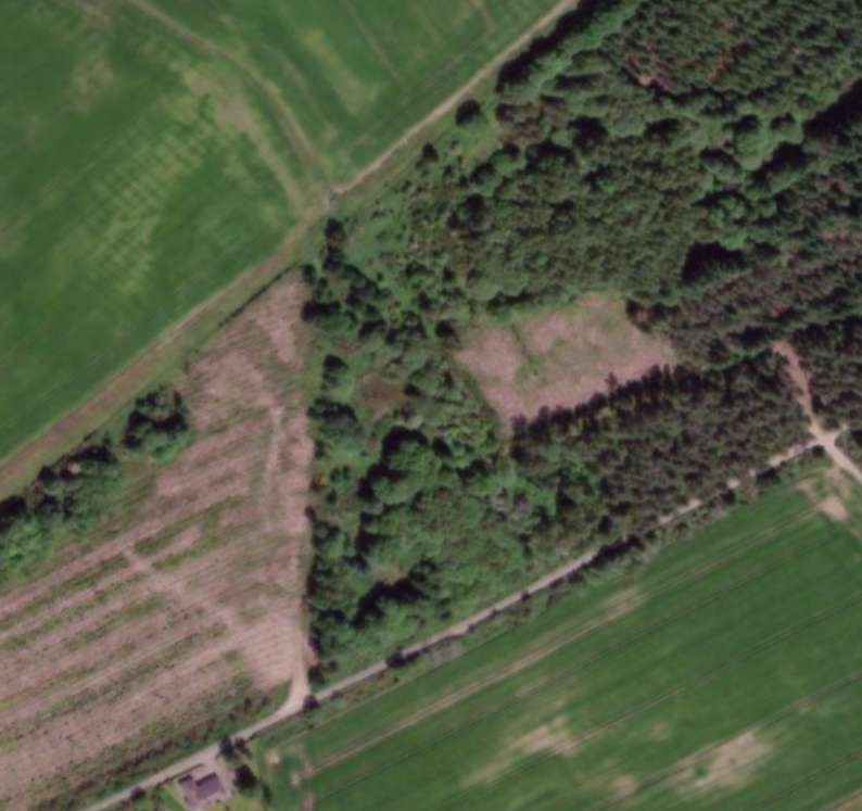
A further extract from the 25″ Ordnance Survey of 1904, published in 1906. This extract shows the brach leaving the main line just North of the Station and heading East. [17]The same area as shown on ESRI satellite imagery provided by the NLS, in the 21st century. [17]As the line curved to the East it was crossed at level by a track. [17]
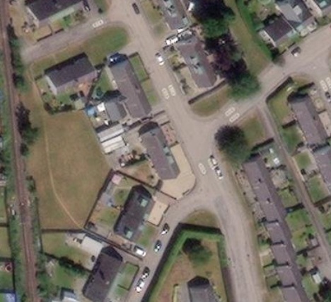
Additional sidings on the north side of the station provided locomotive facilities for the branch engine. The main engine siding gave access to a 50ft turntable, while a ‘kick-back’ spur ran into a single-road engine shed; another siding served as a coaling road. The station building was a typical Highland Railway timber-framed structure which was similar to its counterparts at Hopeman and Burghead, albeit with a second cross-wing at the left-hand end (when viewed from the platform). The resulting building was thus an ‘H-plan’ structure with a central block flanked by two cross-wings.” [1: p51]
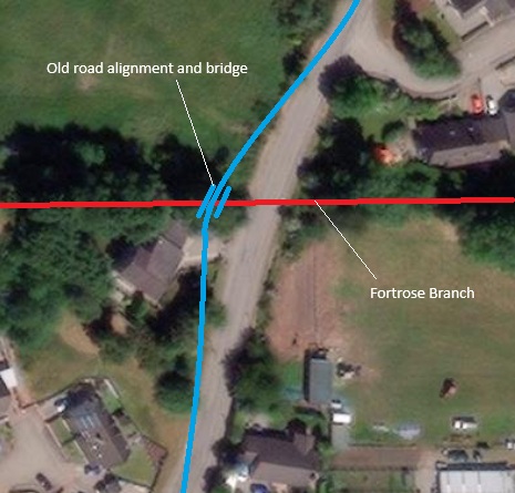
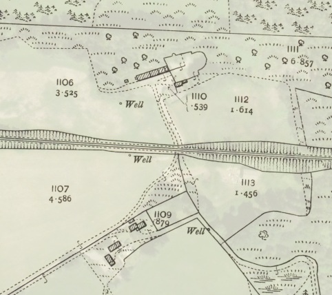
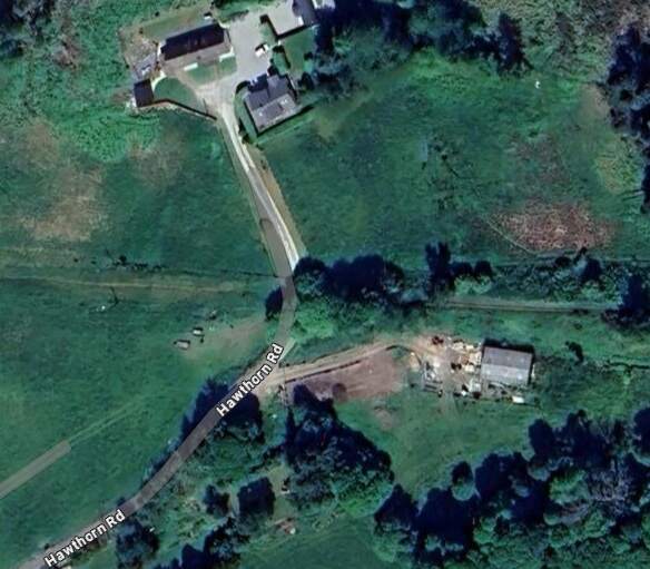
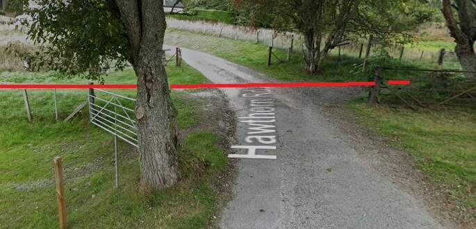
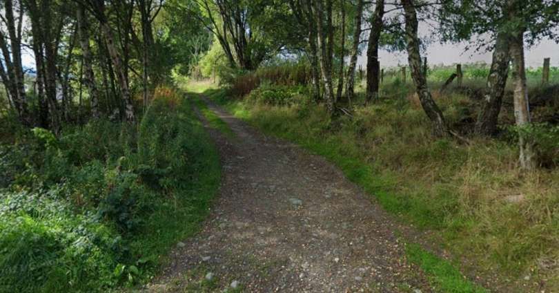
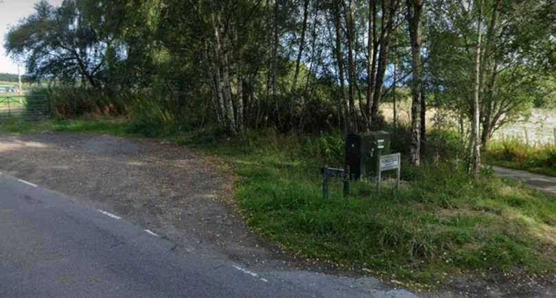
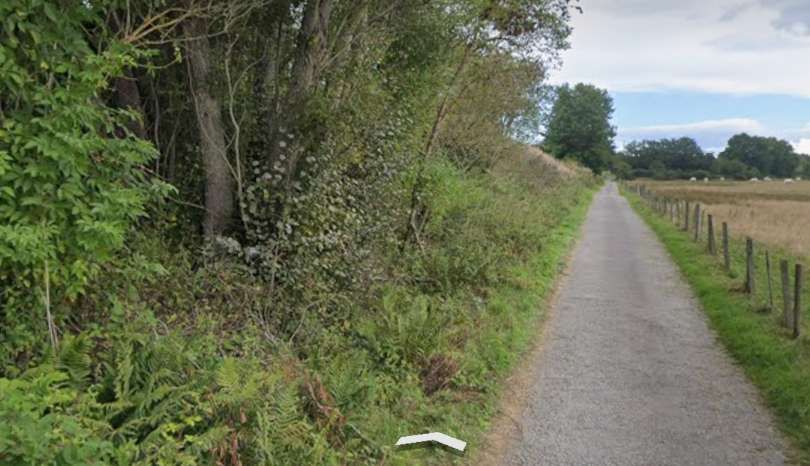
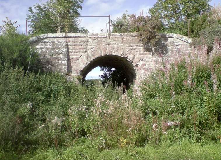
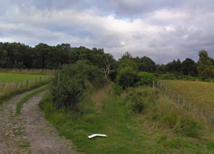
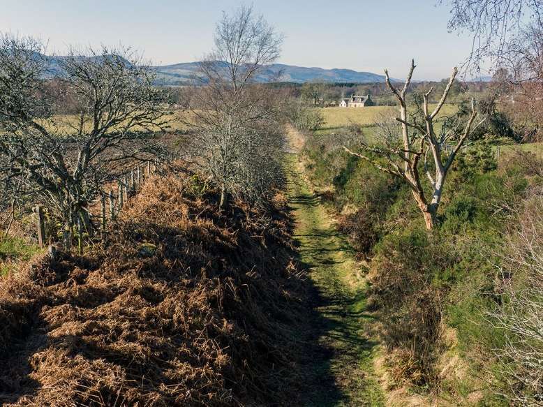
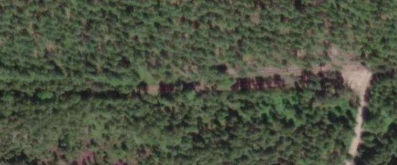
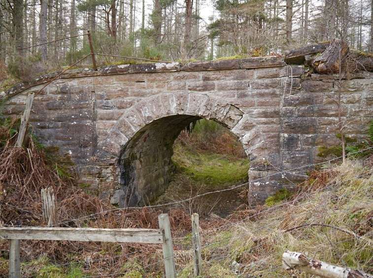
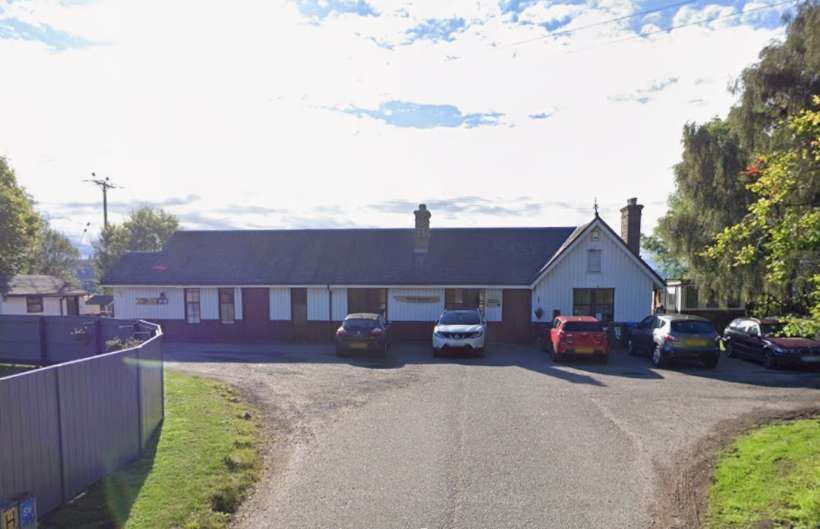
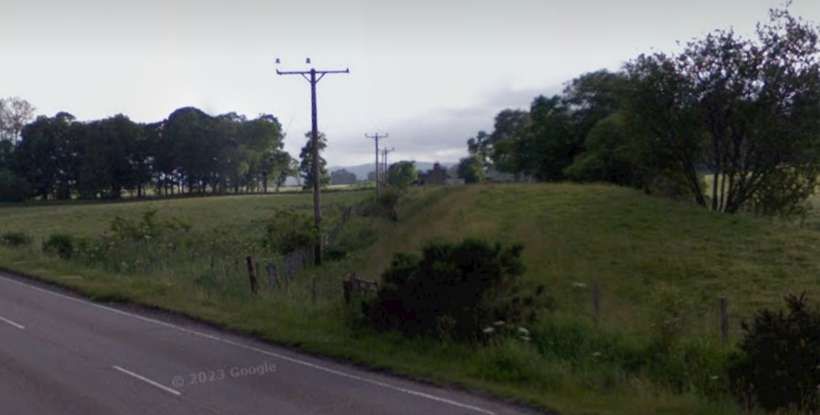
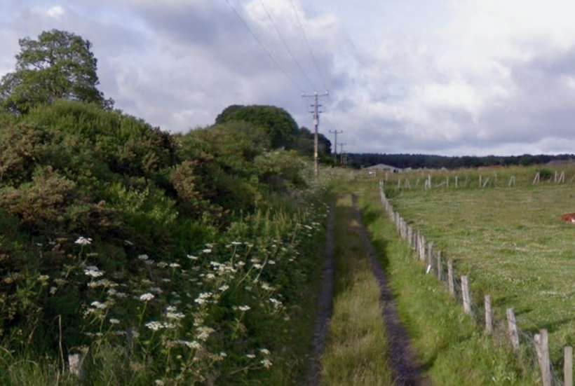
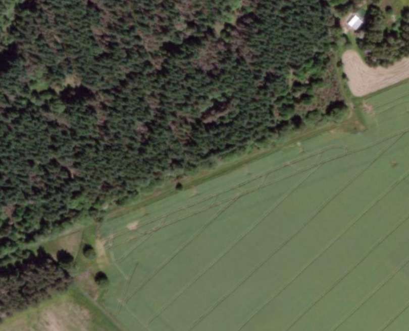
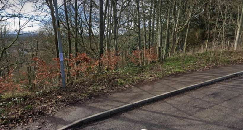
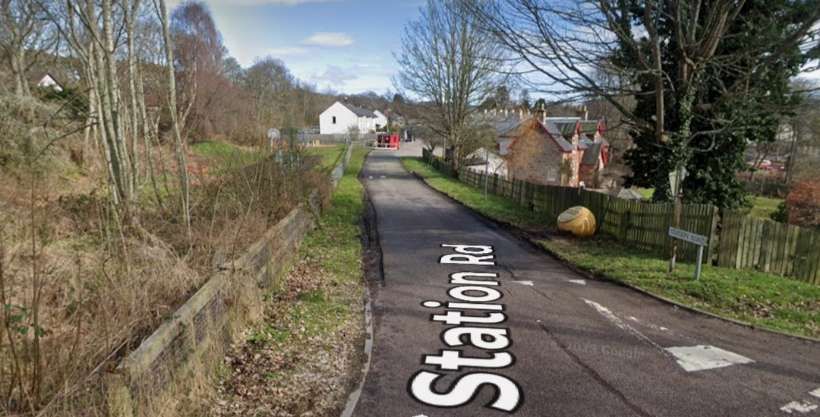
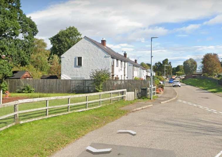
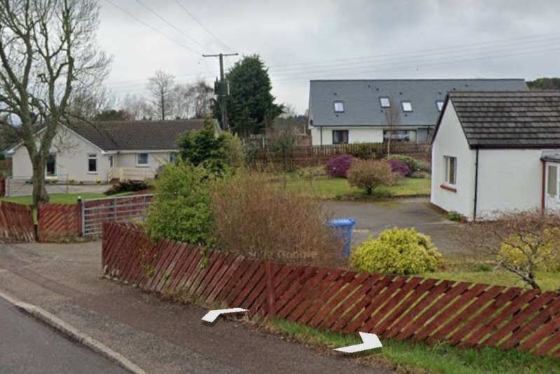
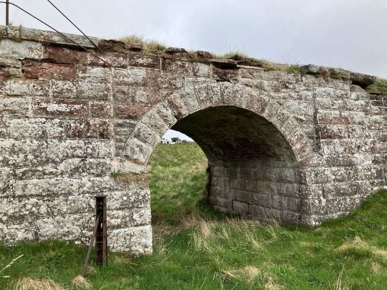
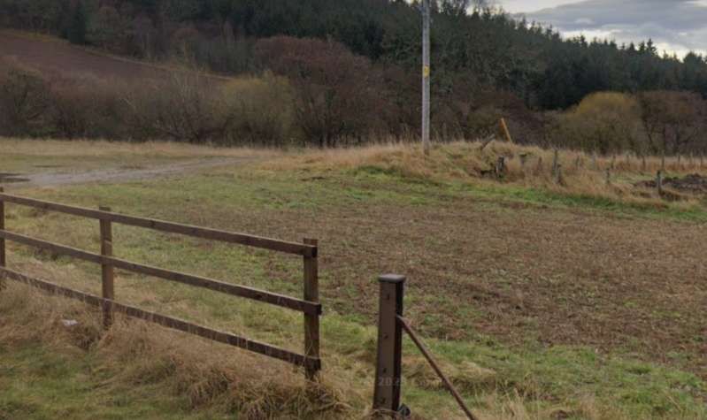
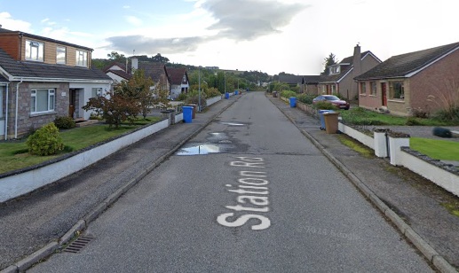
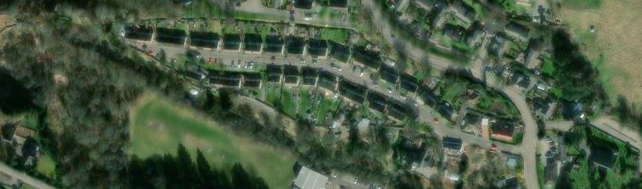
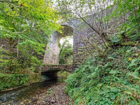
In the 21st century, the track has been replaced by a modern estate road – Highfield Circle. The road entering bottom-centre is Fairmuir Road, that leaving top-right is part of Highfiels Curcle. These two roads approximately follow the line of the old railway. [17]A short distance to the East the line was in cutting and bridged by a minor road. [17]ESRI satellite imagery from the NLS shows the realigned road in the 21st century. The approximate line of the old road (blue) and railway (red) have been superimposed on the image. The modern road is named ‘Balvaird Road’. [17]A short distance further East the line was crossed by a farm access raod at a level-crossing. [18]The same location in the 21st century as shown on Google Maps satellite imagery. The lane is now named ‘Hawthorne Road’. [Google Maps, March 2025]Looking North along Hawthorne Road, across the line of the old railway (marked approximately by the red line). Google Streetview, September 2021]Looking West from Hawthorne Road along the line of the old railway towards Muir of Ord. The line of the railway is gated by the single-bar gate and it ran from there towars the distant trees. [Google Streetview, September 2021]A footpath follows the line of the old railway to the East of Hawthorne Road. [Google Streetview, September 2021]
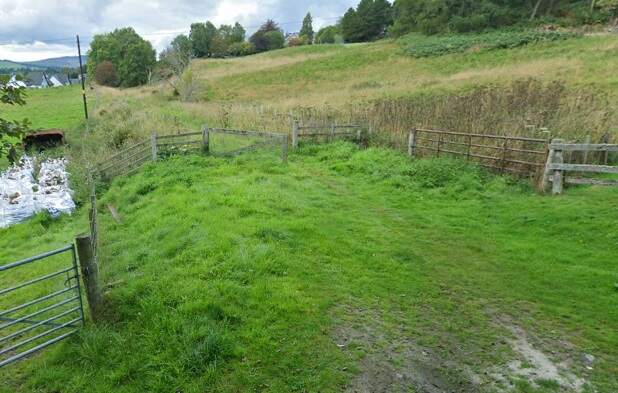
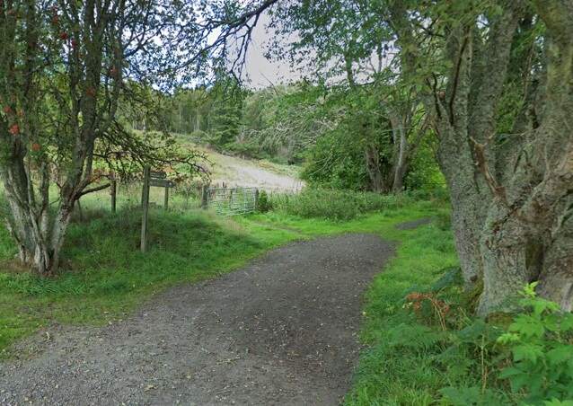
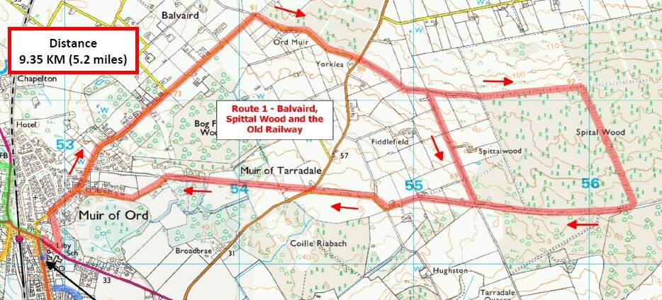
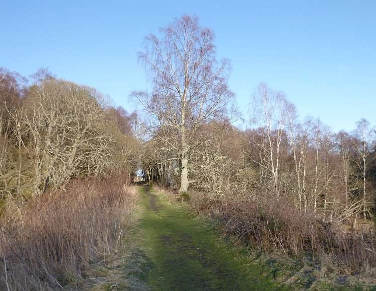
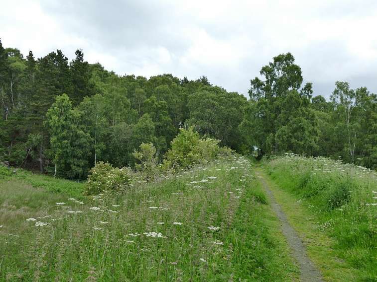
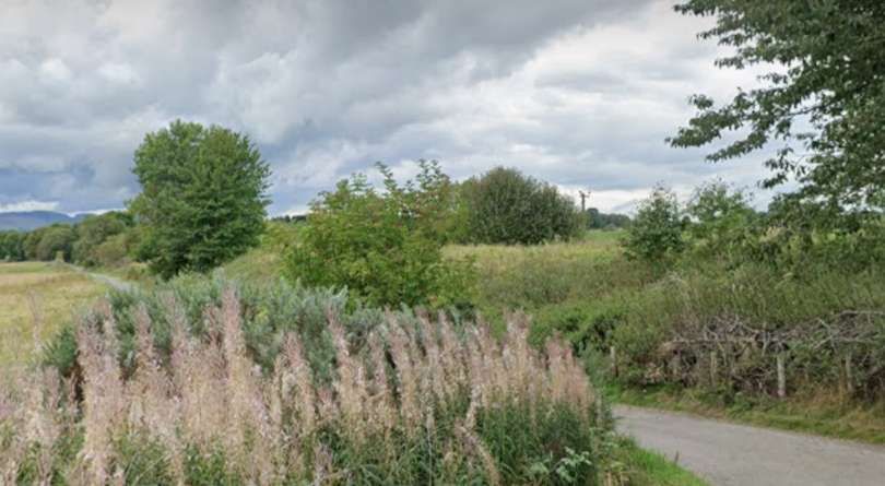
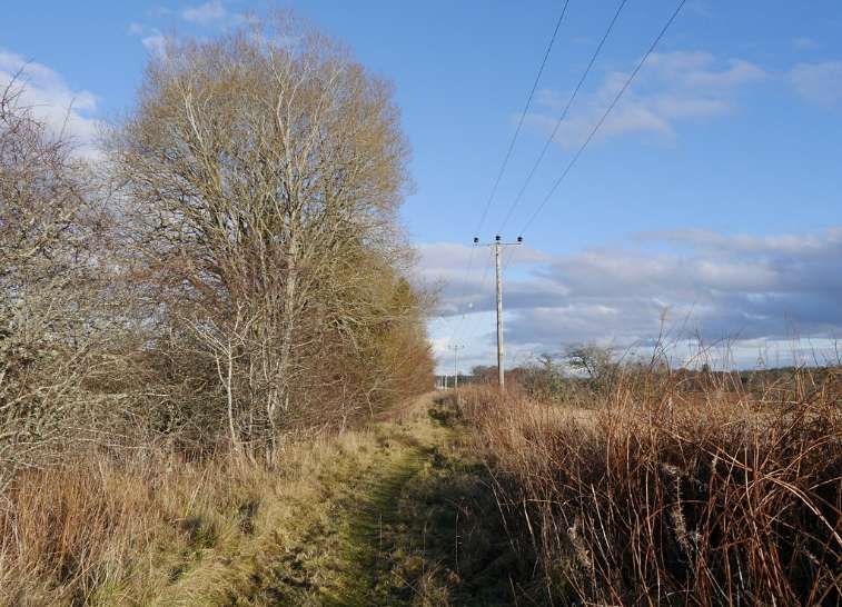
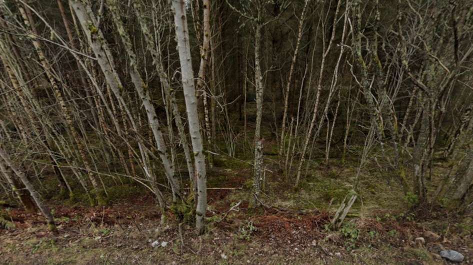
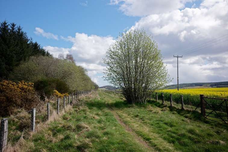
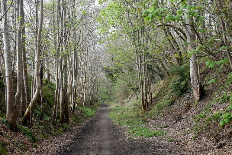
From Hawthorne Road eastwards a public footpath follows the line of the old railway. There is a leaflet of walks for the area around Muir of Ord. One of the four walks included in the leaflet includes a length of the old railway. [19]
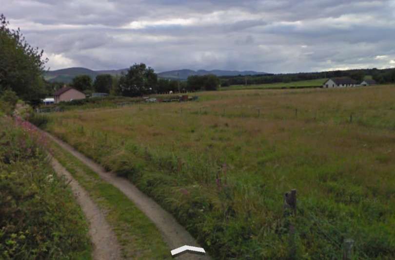
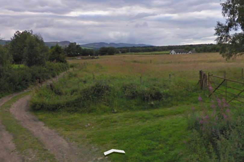
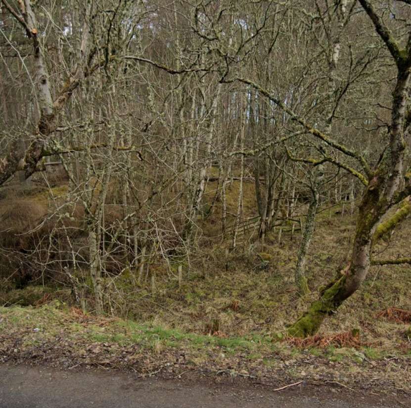
For a short length the old railway formation has been ploughed back into farmland. The next image looks back along the line of the old railway from a point further to the East.
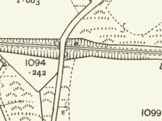
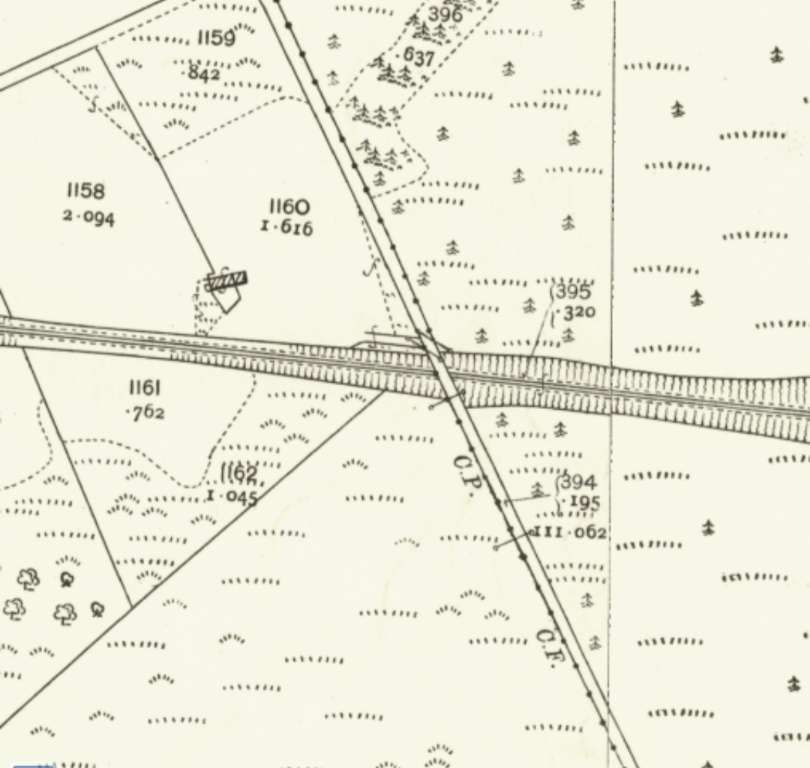
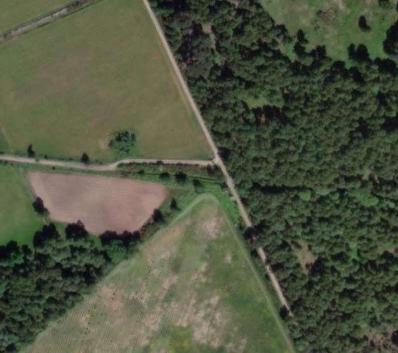
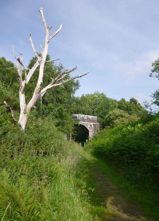
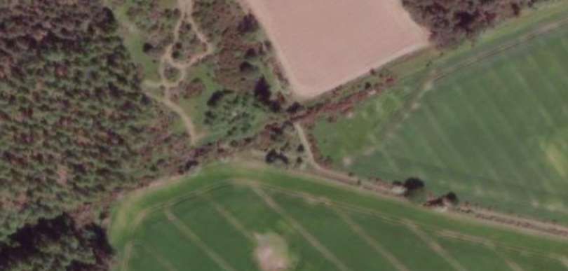
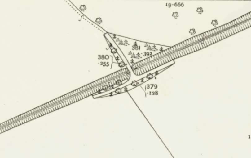
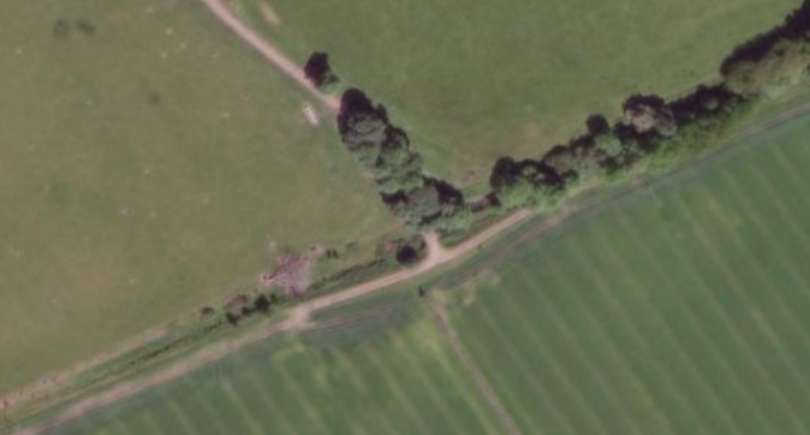
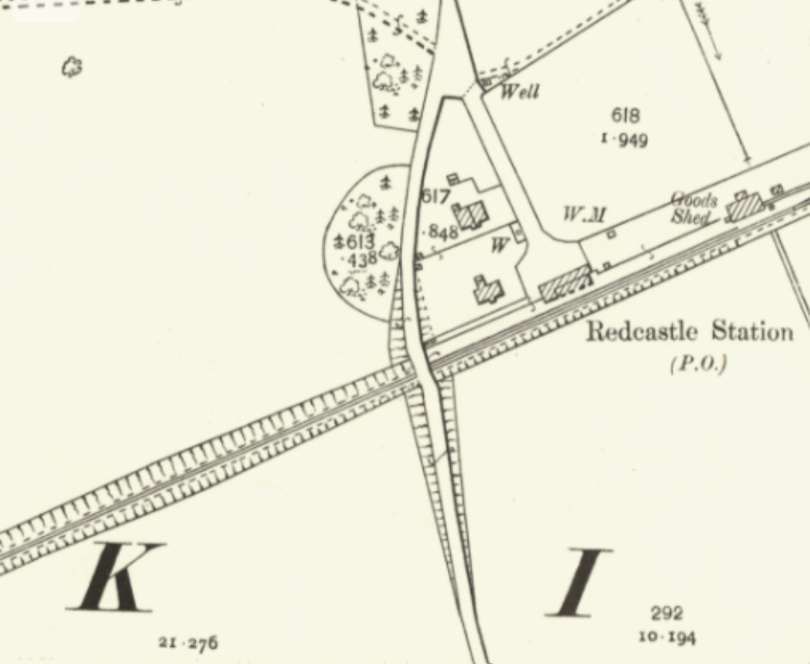
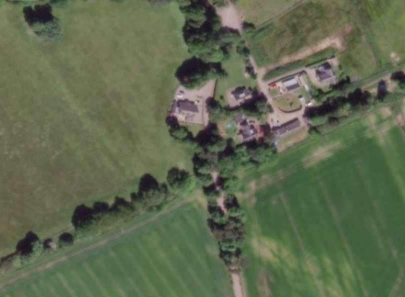
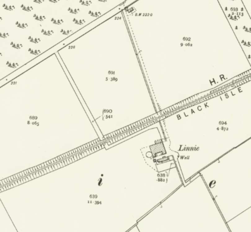
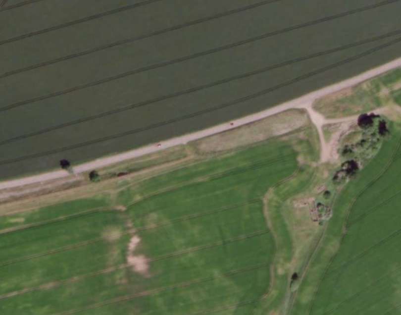
After passing under the accommodation bridge, the old line ran east in cutting through what is now Spital Wood. Then, ” curving east-north-eastwards,” Jenkins tells us, “the railway continued to Redcastle (3 miles 58 chains), where the single-platform station was equipped with a full range of accommodation for goods, passengers, and livestock traffic.” [1: p49]
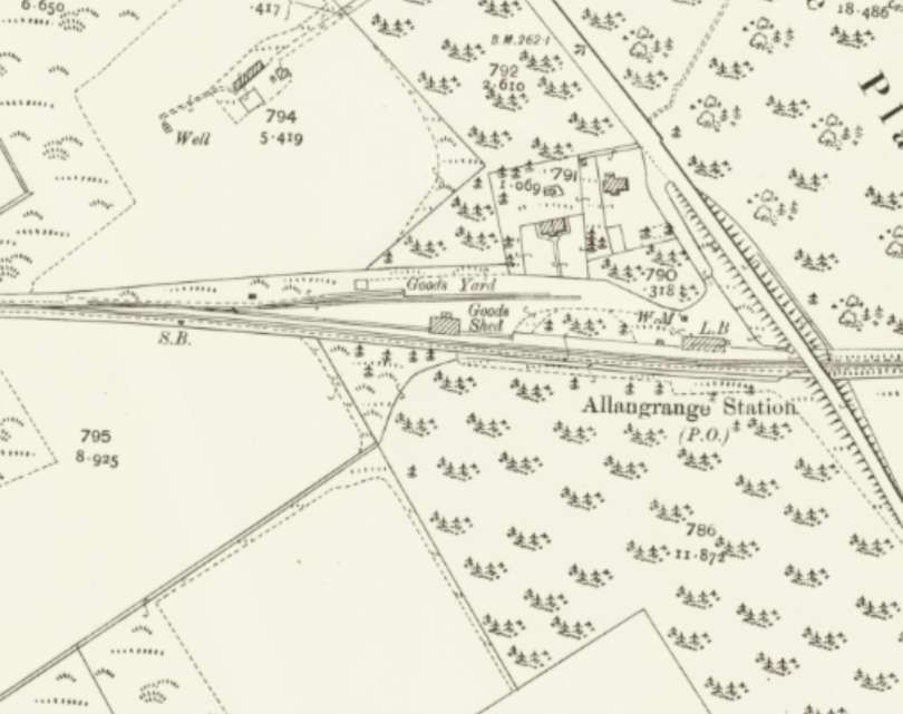
“Beyond [Redcastle], trains climbed towards the 250ft contour, the line’s modest summit of around 260ft above mean sea level being sited near the next station at Allangrange. Situated some 5 miles 39 chains from the junction, Allangrange was another fully-equipped station with provision for a range of goods traffic.” [1: p49]
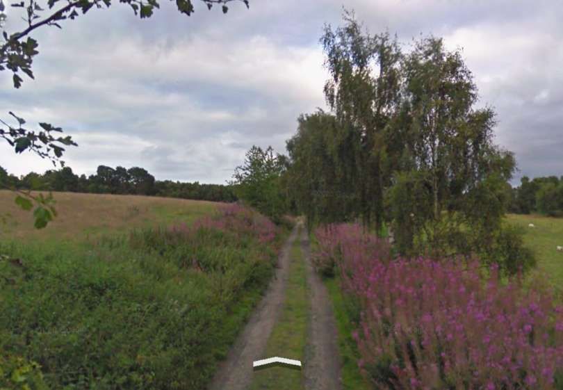
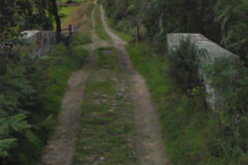
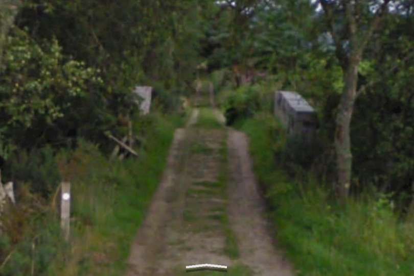
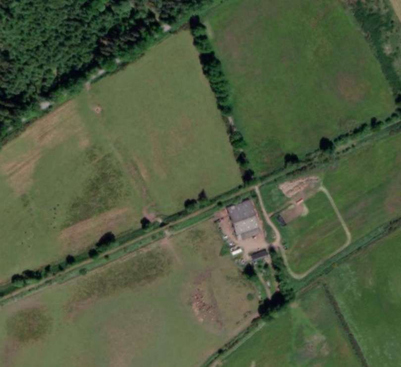
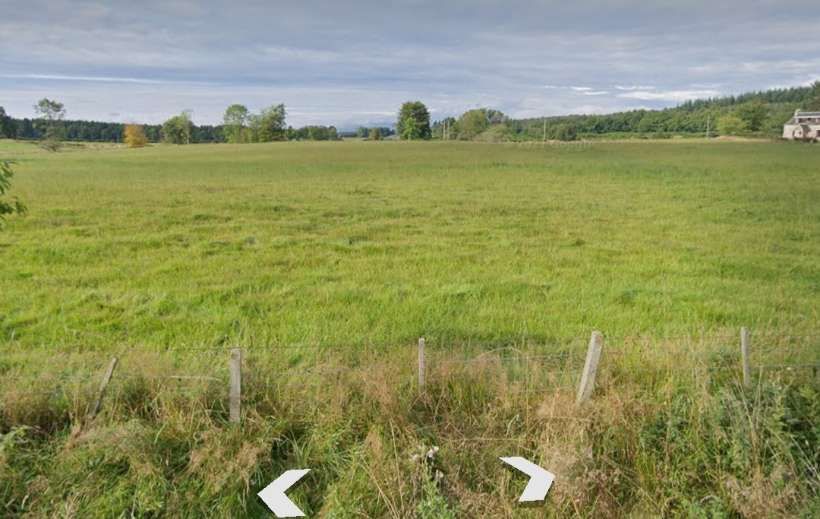
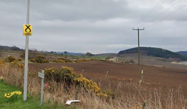
The line continued in an East-northeast direction towards Allangrange Railway Station. [28]The same area as shown on the 21st century NLS ESRI satellite imagery. [28]Looking Southwest along the old railway towards Redcastle Station from the minor road towards the left of the satellite image above. [Google Streetview, April 2011]Looking Northeast along the old railway towards Fort from the minor road towards the left of the satellite image above. [Google Streetview, April 2011]Looking Southwest along the line of the old railway from the A832. [Google Streetview, March 2023]Looking Northeast along the line of the old railway from the A832. [Google Streetview, July 2008]Again, still heading East-northeast, trains drew closer to Allangrange Railway Station. [29]The same area in the 21st century. [29]
The line curved round from an East-northeast direction to and easterly alignment before entering Allangrange Railway Station.
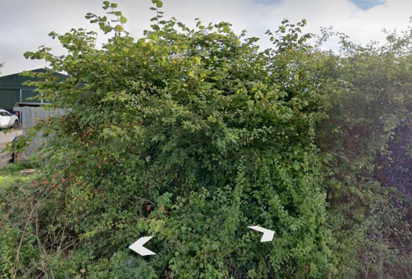
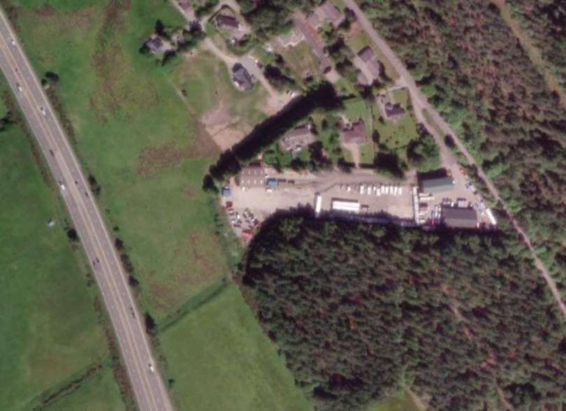
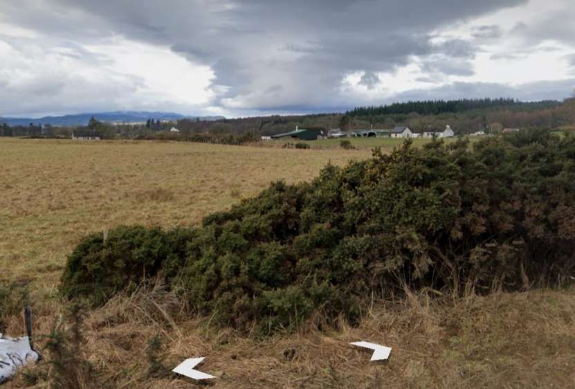
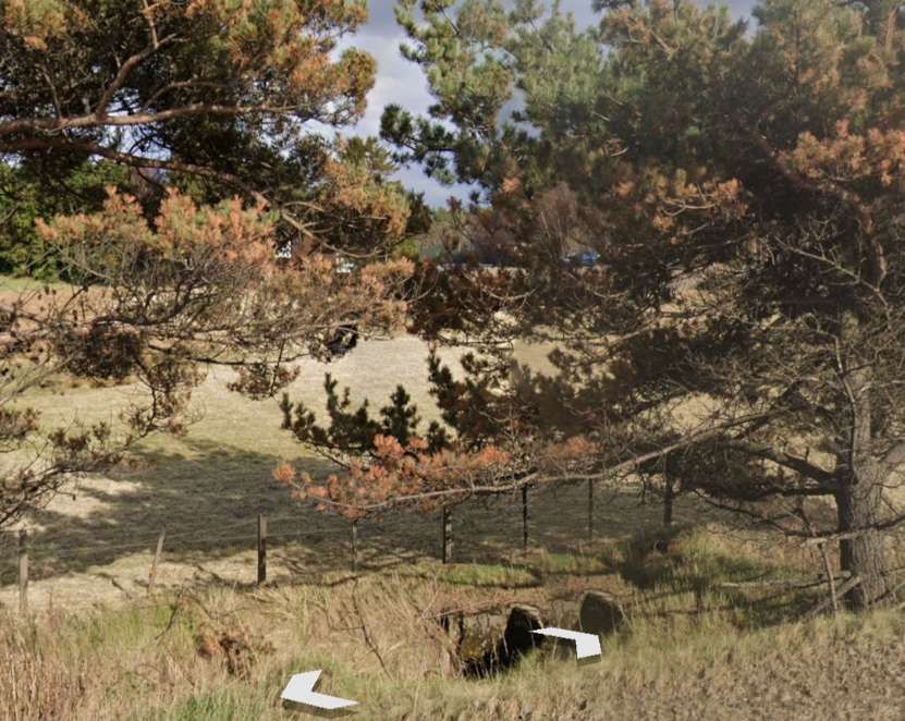
From the point at which the old line crossed another lane, this is the view back towards Redcastle Station. The tree at the centre of the image on the horizon stand immediately adjacent to the line of the railway. [Little can be seen looking towards Allangrange Railway Station from the minor road as the rail alignment close to the road is overwhelmed by vegetation. [Google Streetview, September 2021]The line curved round to run in an easterly direction through Allangrange Railway Station which had a reasonable sized goods yard to the West of the passenger facilities. [30] The same location in the 21st century. The major road at the West end of the old station site is the modern A9 dual carriageway. [30]This is the view East along the line of the old railway from the A9 dual carriageway. [Google Streetview, March 2023]Noe looking East from the A9 through the trees and through the site of Allangrange Railway Station. [Google Streetview, March 2023]Looking West from the old A9 into Allangrange Station site. [Google Streetview, March 2023]Looking East from the old A9 towards Fortrose. [Google Streetview, March 2023]
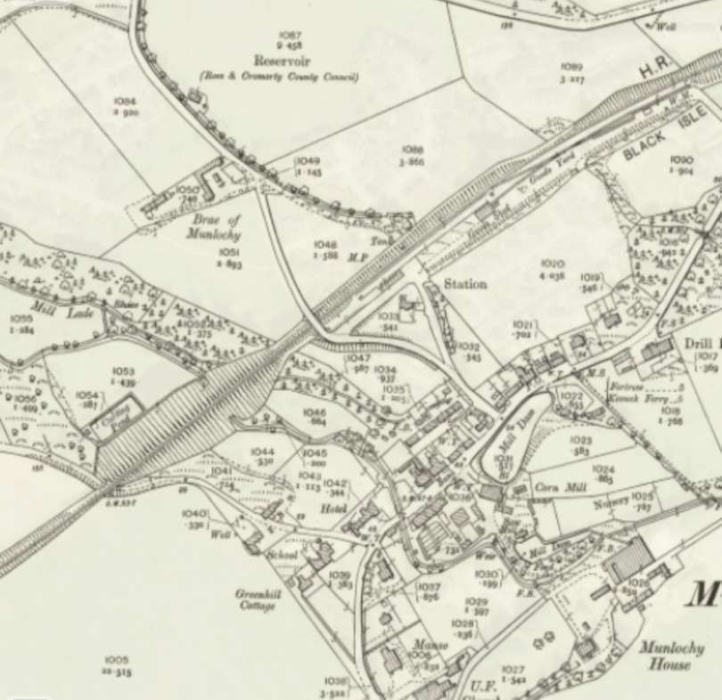
Beyond Allangrange Station, and heading east-north-eastwards again, “the single-line railway descended towards Munlochy (8 miles 2 chains) which, like the other intermediate stations on the Fortrose branch, was fully-equipped for all forms of goods traffic.” [1: p49]
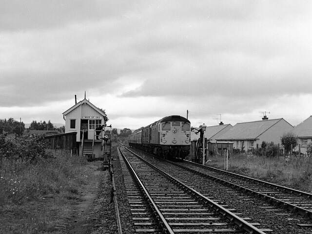
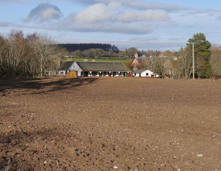
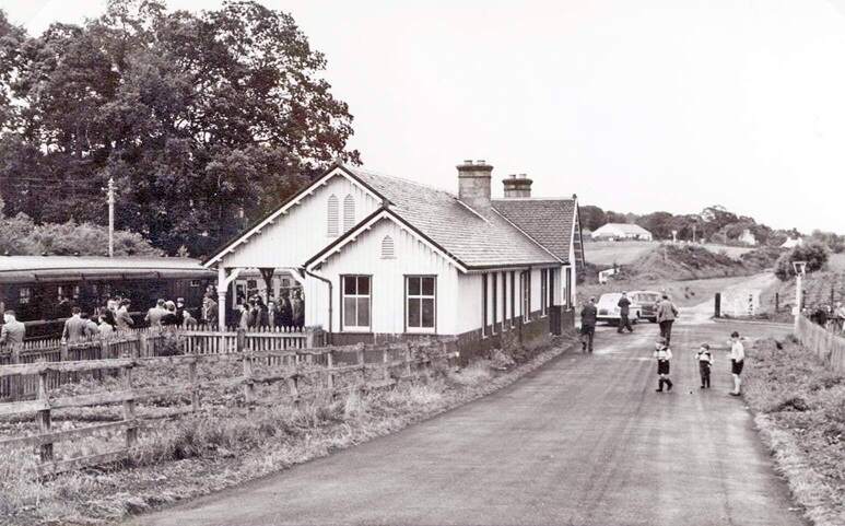
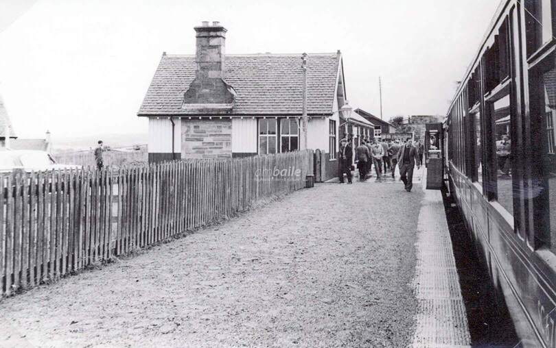
Three images of Munlochy Railway Station can be seen online at http://www.ambaile.co.ukhere, [53] here [54] and here. [55] Kind permission has been given to reproduce two of these images in this article.
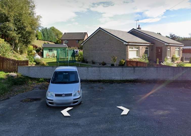
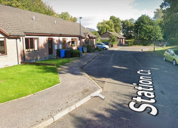
Munlochy Railway Station looking Northeast. [53]Munlochy Railway Station, looking Southwest along the platform. [54]Looking Northeast through the station site from Cameron Crescent. [Google Streetview, September 2021]Again, looking NorthEast through the station site along Station Court. [Google Streetview, September 2021]Looking back Southwest from Millbank Road (B9161) through the station site. [Google Streetview, March 2023]Looking Northeast along the line of the old railway from Millbank Road (B9161) towards Fortrose. The A842 is just to the left. [Google Streetview, March 2023]
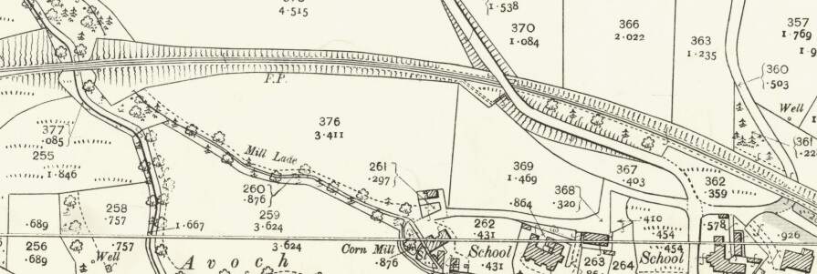
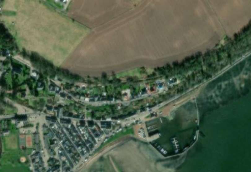
“From Munlochy the route passed over a small underline bridge, and with the A833 (later A832) road maintaining a parallel course to the left, Fortrose trains reached Avoch Station (11 miles 25 chains).” [1: p49]
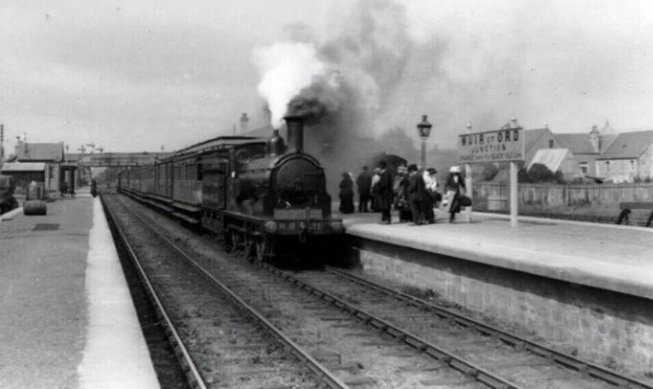
“From Avoch, the line continued north-eastwards for a further … three miles to its terminus at Fortrose where, some 13 miles 45 chains from Muir of Ord, journeys came to an end in a surprisingly large station.” [1: p49-51]
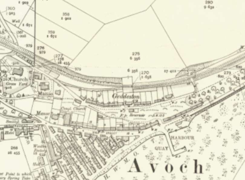
“Fortrose had just one platform on the up side, with a run-round loop to the north and a four-siding goods yard to the south. One of the goods sidings passed through a goods shed, while another served a loading bank; a spur at the west end of the goods yard formed a short headshunt.” [1: p51]
Fortrose Railway passenger station building had “the booking hall and general waiting-room … in the centre part of the building, while the booking office and toilets were housed in the ends. The timber structure was clad in American-style vertical matchboarding, with thin cover strips affixed at each join to produce a ‘ribbed’ effect.” [1: p52] The centre block was recessed between the cross-wings to create a roofed waiting area at the front of the station.
Additional photographs of the Station can be found on the www.ambaile.co.uk website here, [73] here [74] and here. [75] Kind permission has been given to reproduce these photographs here.
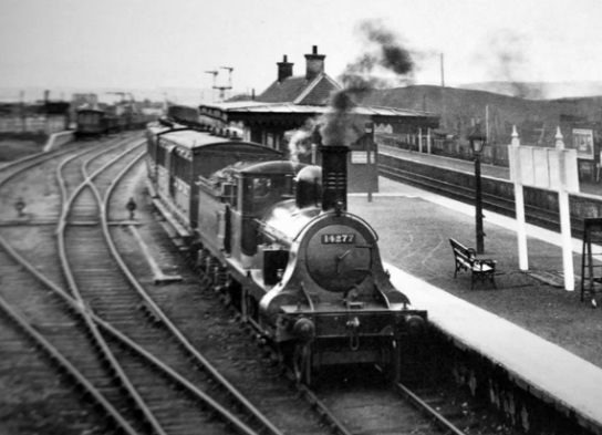
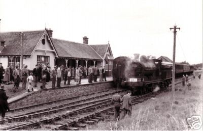
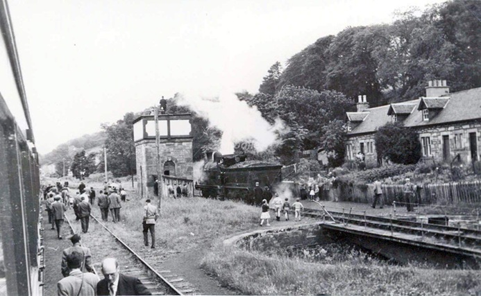
Fortrose Railway Station from the end of the platform in 1912, showing the station building. A branch train is in the platform and a locomotive is on the turntable in the background. [73]Fortrose Railway Station seen from the Northeast (adjacent to the buffers). Llocomotive No. 57594 is described in the notes for the next image. Here it is about to be turned to take its train back to Muir of Ord. [74]Locomotive No. 57594 has just been turned and is being readied to haul the last train from Fortrose. The locomotive is an ex-Caledonian ‘812’ Class 0-6-0, built in August 1900 as CR No. 856, becoming LMS No. 17594 and finally BR No. 57594. It was withdrawn in December 1962. [75]
Decline and Closure
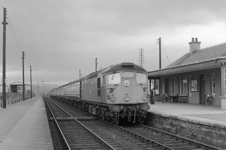
The Fortrose branch was relatively successful. Its passenger services were maintained throughout the LMS era. But the line “became increasingly vulnerable to road competition after World War II, and for this reason its passenger services were withdrawn with effect from 1st October 1951. Goods traffic lingered on for a few more years, but the end came in 1960, with the line being closed to all traffic from 13th June of that year.” [1: p52]
References
Stanley Jenkins; Highland Railway Minor Lines: 2; in Rex Kennedy (ed.); Steam Days; Red Gauntlet Publications, Bournemouth, Dorset, January 2002; p48-57.


