This is the second article in a series about the Border Counties Railway. The first can be found here. [3]
An online acquaintance pointed me to a film made in the mid-1980s, ‘Slow Train to Riccarton’ which records something of the lives of people associated with this railway line:
The film shows different lengths of the line and records a number of people speaking about their life on and around the line.
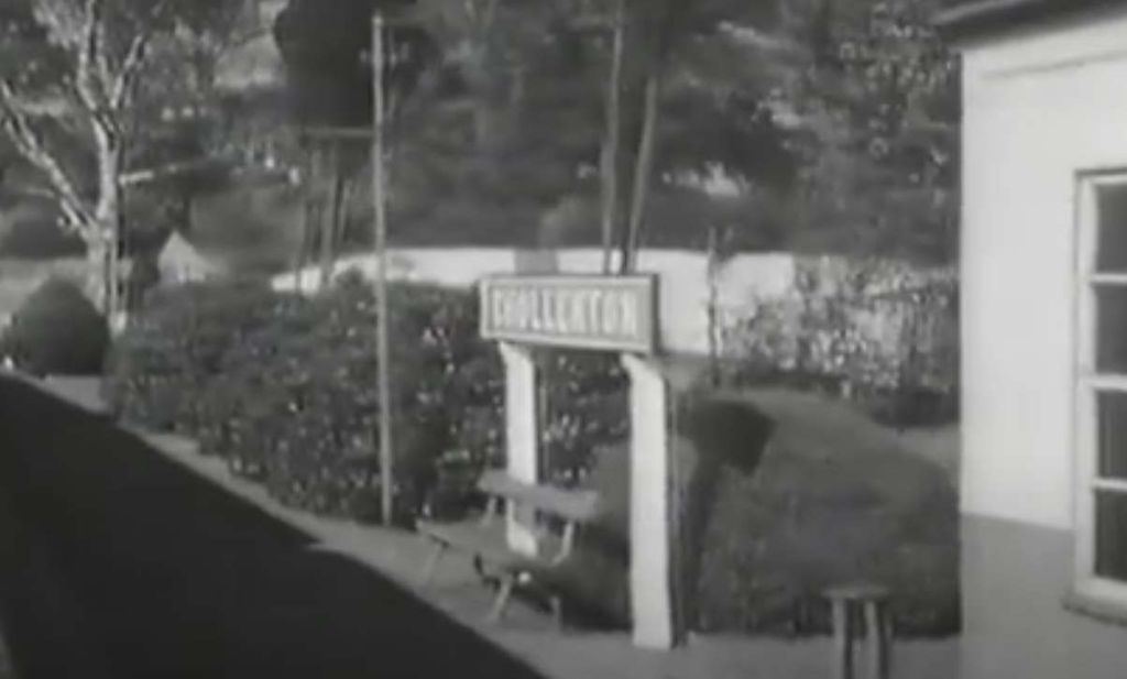
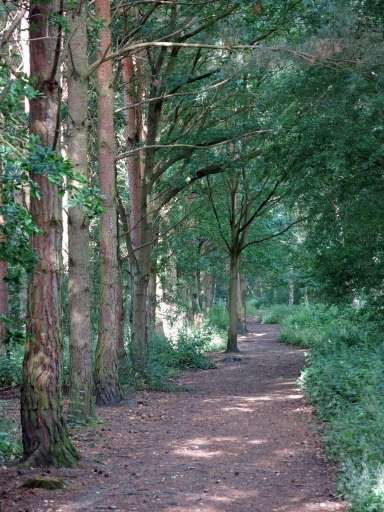
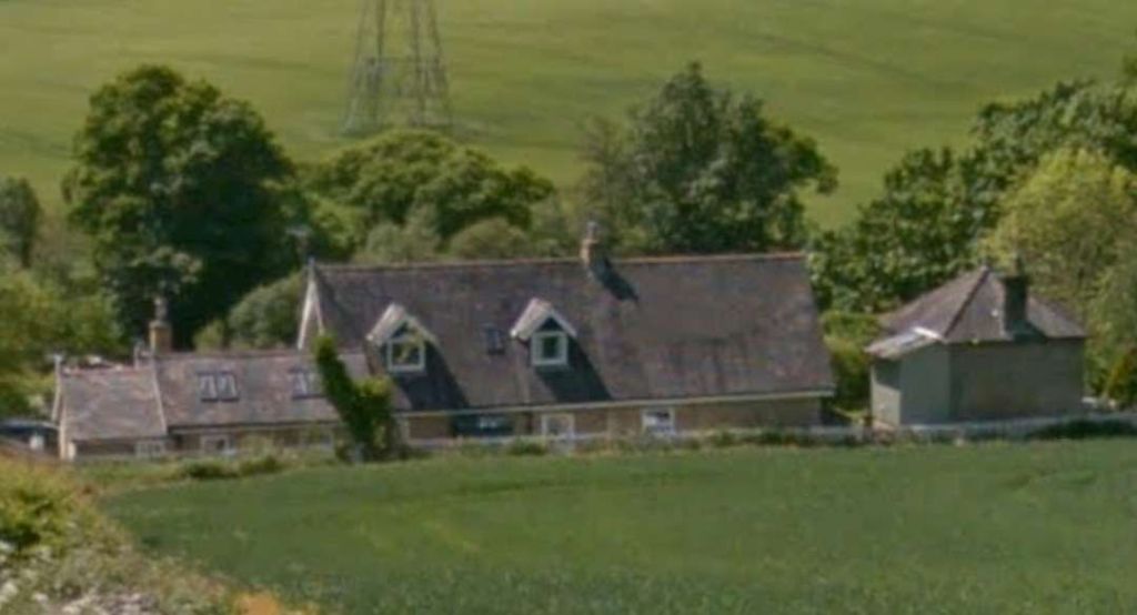
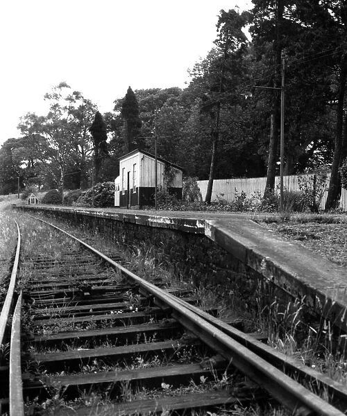
This first image is a still from the film which denotes where we are starting this next length of the journey along the line. A few more ‘stills’ will help to locate us as we travel along the line.
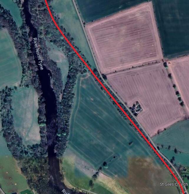
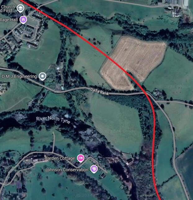
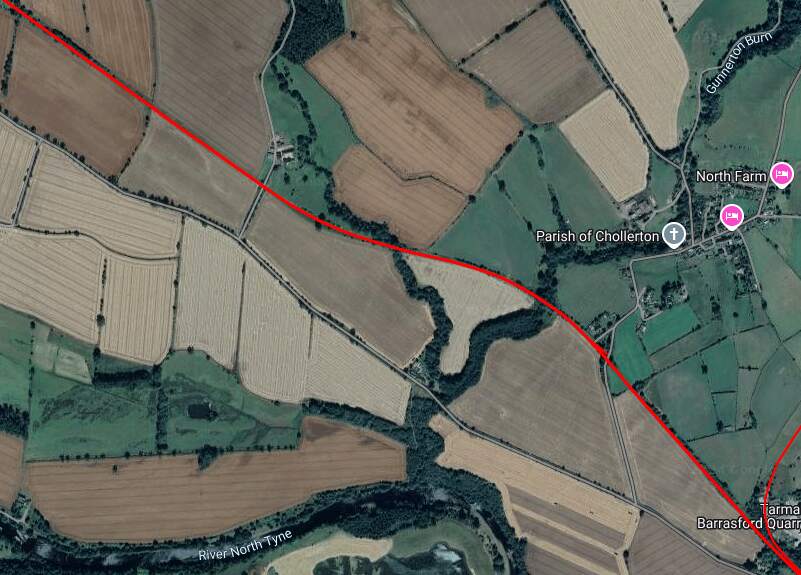
The line travelled on, Northwest from Chollerton, much of the time in deep cutting as far as Dallabank Wood, by which time it was running on a northerly course. Soon after the wood, the line turned towards the Northwest, passed under the local road (Dalla Bank), crossed a short but high embankment under which Barrasford Burn was culverted, and entered Barrasford Railway Station.
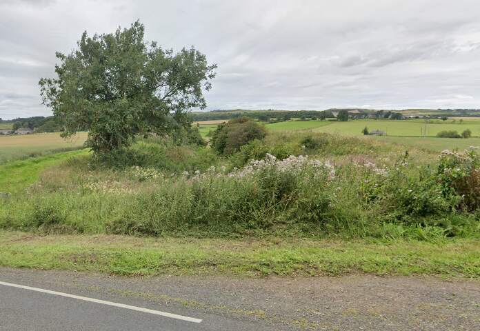
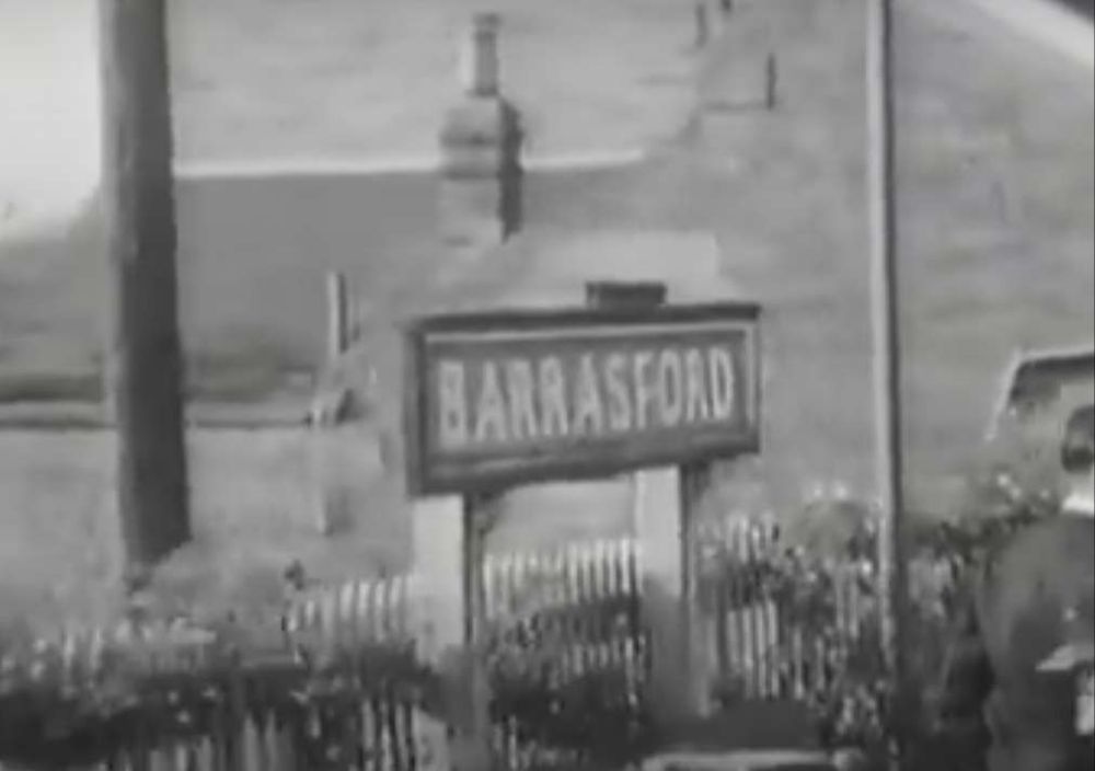
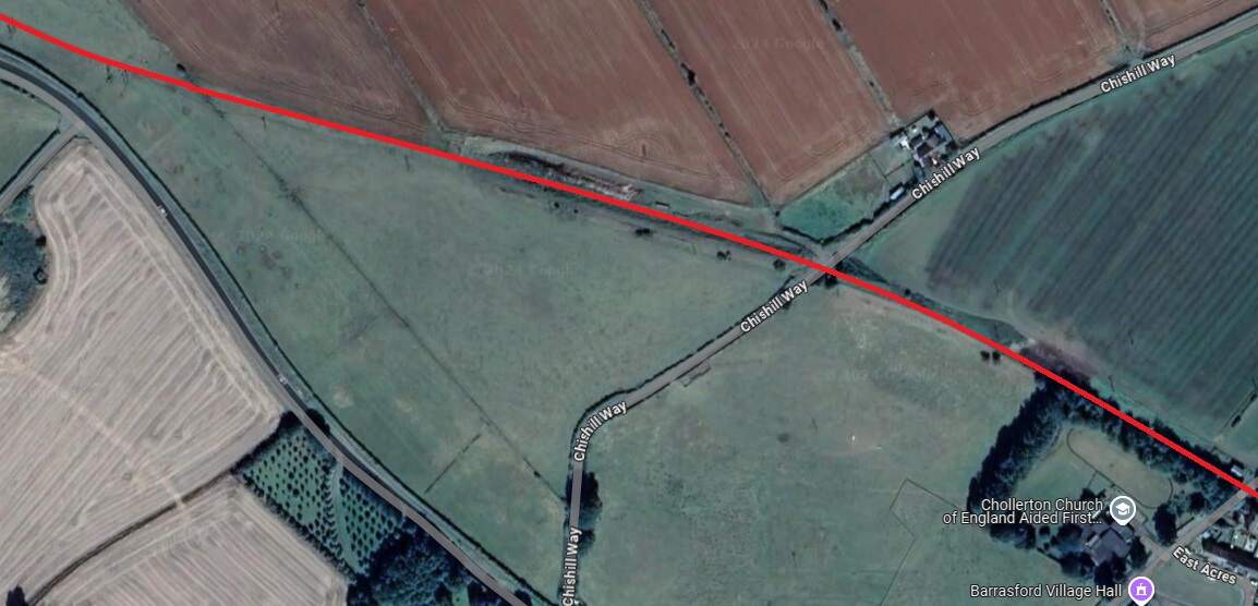
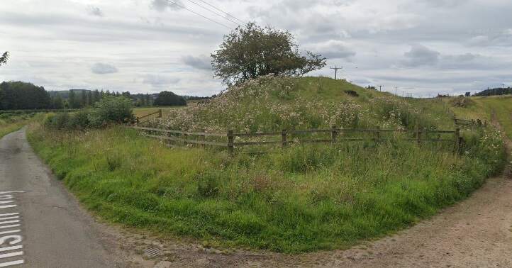
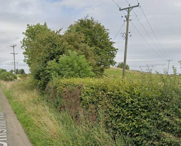
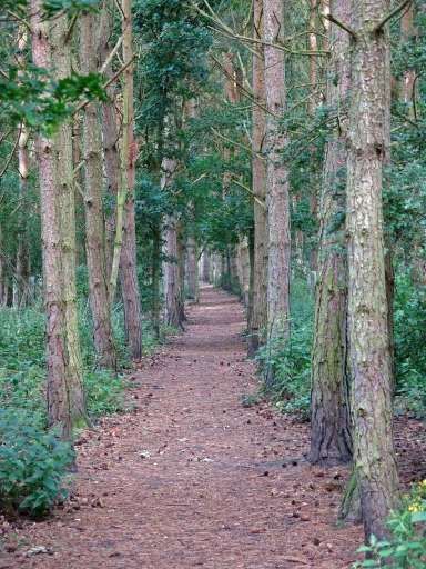
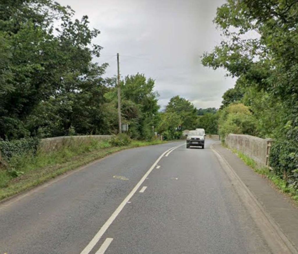
The red line shows the route of the old railway immdiately to the North of Chollerton Railway Station. [Google Maps, October 2024]The cutting South of Dalla Bank, Facing towards Chollerton in 2013, (c) Mike Quinn and licensed for reuse under a Creative Commons Licence (CC BY-SA 2.0). [15]The line continued on as marked by the red line under Dalla Bank and on to Barrasford Station which was located at the top left of this extract from Google’s satellite imagery. [Google Maps, October 2024]The view along the old railway line North-northwest from Dalla Bank. [Google Streetview, August 2023]Barrasford Railway Station name-board. [2]
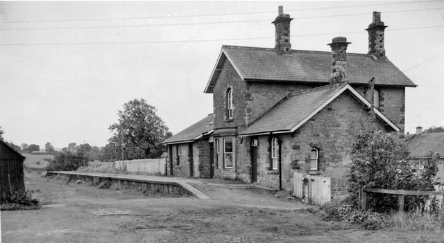
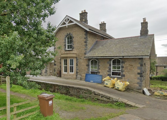
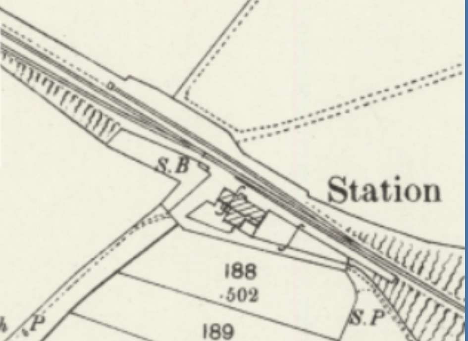
Barrasford Railway Station opened on 1st December 1859 by the North British Railway. The station was situated on a lane to Catheugh, around “200 yards northeast of the centre of Barrasford village. A siding adjoined the line opposite the platform and there was a further loop to the northwest. Both of these were controlled by a signal box, which was at the northwest end of the platform. The station was host to a camping coach from 1936 to 1939.” [4]
“Barrasford station was closed to passengers on 15th October 1956 but remained open for goods traffic until 1st September 1958, although it was downgraded towards an unstaffed public siding.” [4]
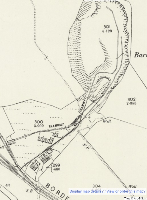
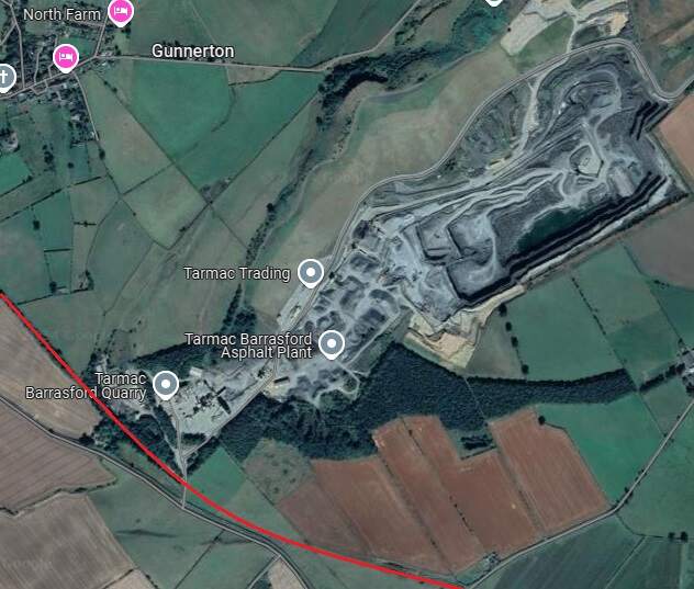
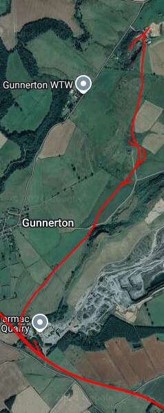
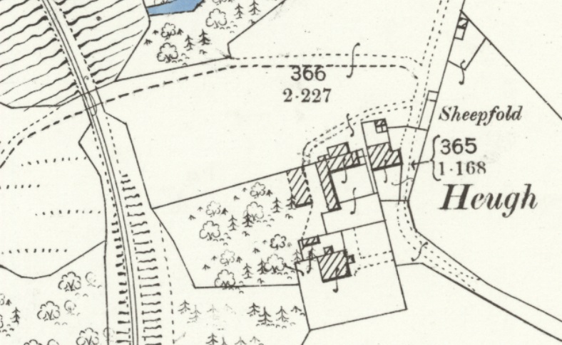
A short distance Northwest of Barrasford Railway Station, was Barrasford Quarry which was provided with its own siding.
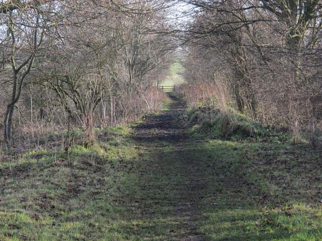
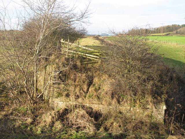
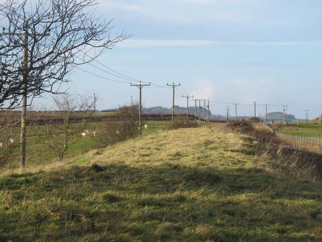
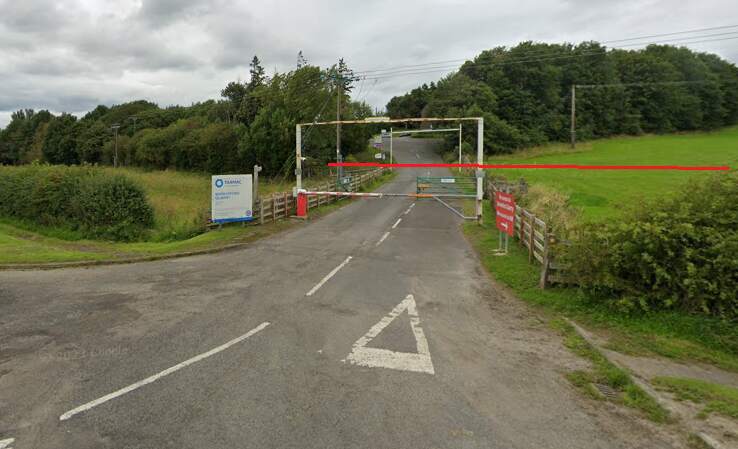
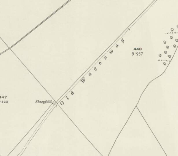
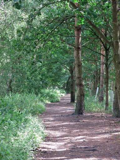
The line Northwest of Barrasford Railway Station. [Google Maps, October 2024]The track bed of the old railway a little to the Northwest of Barrasford Railway Station, looking back along the line towards the station in December 2013, (c) Mike Quinn and licensed for reuse under a Creative Commons Licence (CC BY-SA 2.0). [12]Looking back towards Barrasford Station from Chishill Way. The line was carried at high level over the road. Only the embankments remain. [Google Streetview, August 2023]A wintertime view along the old railway to the West from the East side of Chishill Way, in December 2013, (c) Mike Quinn and licensed for reuse under a Creative Commons Licence (CC BY-SA 2.0). [13]Looking West from Chishill Way. The railway embankment is to the right of the trees. [Google Streetview, August 2023]The track bed further West from Chswell Way, in December 2013, (c) Mike Quinn and licensed for reuse under a Creative Commons Licence (CC BY-SA 2.0). [14]Barrasford Quarry Sidings and Tramway. [7]Tarmac’s quarry at Barrasford is a much larger affair in the 21st century. [Google Maps, October 2024]The entrance to Barrasford Quarry. The red line indicates the approximate route of the old railway which is treelined to the West of the quarry road and through open fields to the East of the quarry road. The siding was on the North side of the line. [Google Streetview, August 2023]Just to the Northwest of Barrasford Quarry Siding was a branch line to Camp Hill, Gunnerton Quarry.This branhc was about 2 miles in length and is recorded on some maps as an old Waggonway. [8]The same location in the 21st century with the old railways superimposed. [Google Maps, October 2024]
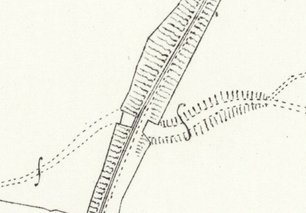
The Camp Hill Branch as shown on satellite imagery from Railmaponline.com. The branch was a short industrial line serving a relatively small quarry to the North of Barrasford Quarry. It appears to have been disused by 1920 as one of the local OS Map sheets across which the line travels shows the line lifted by that time and referred to as an ‘Old Waggonway”. The line is present on map sheets surveyed in 1895.
A short section of the Camp Hill Branch Line as shown on the 1920 25″ Ordnance Survey which was published in 1922. [18]
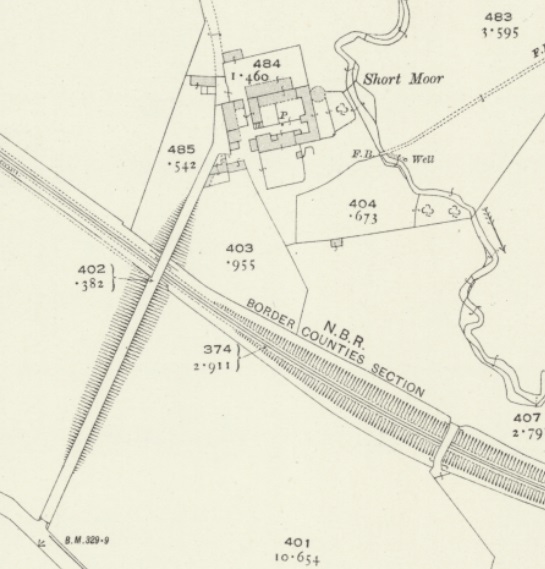
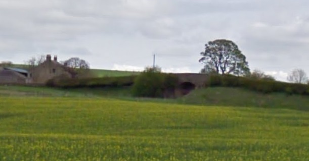
A little further to the Northwest, the access road to Short Moor crossed the old railway. Just before that lane there was another stone bridge which gave access between fields either side of the line.
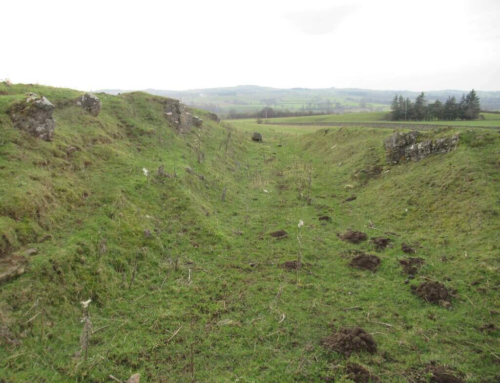
Stone bridge Southwest of the Short Moor access road in December 2013, (c) Mike Quinn and licensed for reuse under a Creative Commons Licence (CC BY-SA 2.0). [28]Two bridges crossed the line close to Short Moor. [29]
A distant view from the Southwest of the bridge carrying the access road to South Moor which is on the left of this image. The stone-arched bridge is just to the right of centre. [Google Streetview, April 2011]
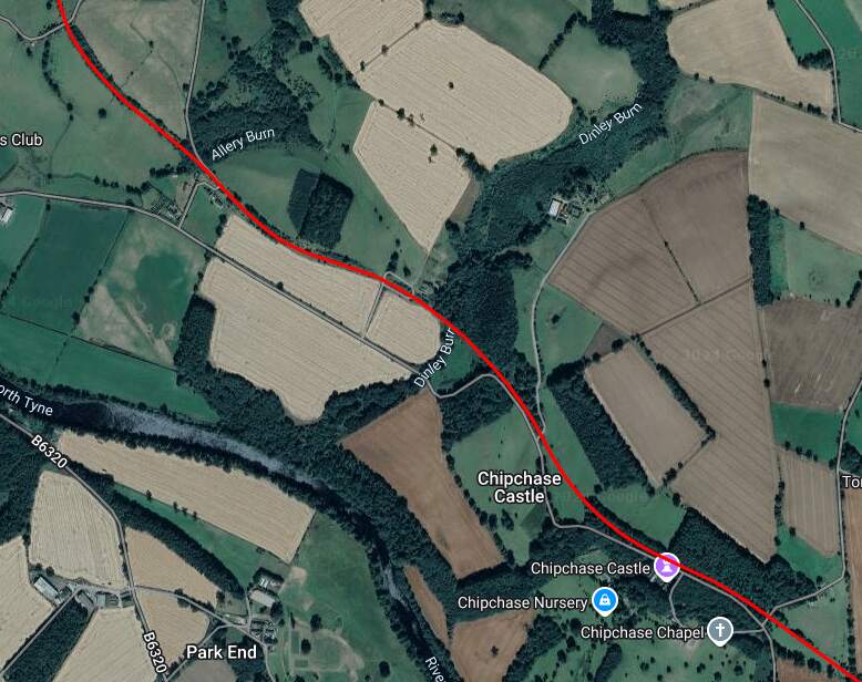
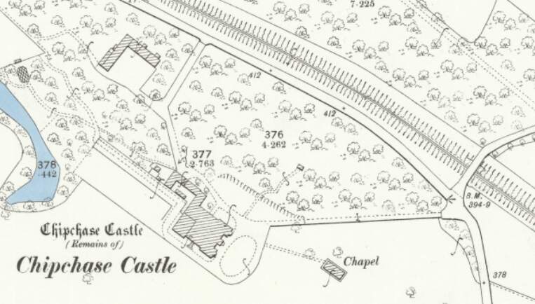
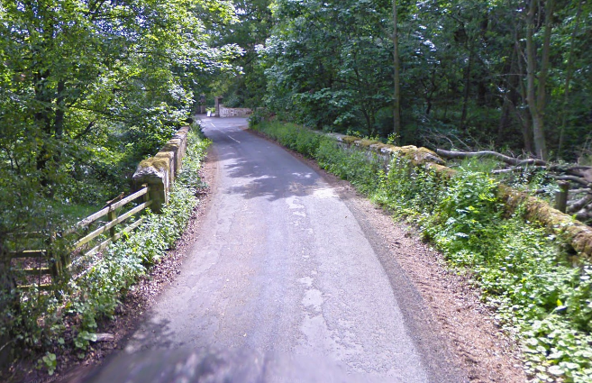
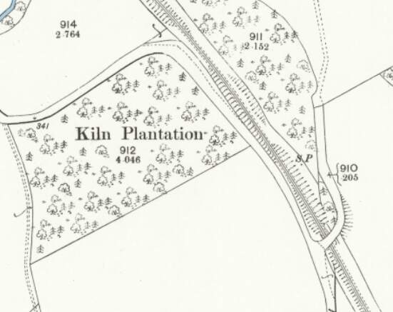
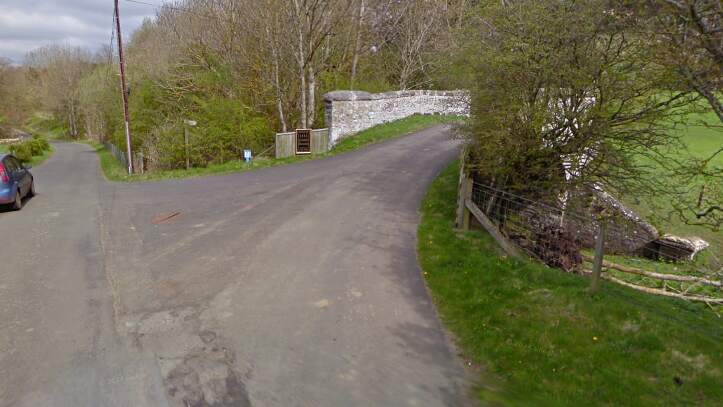
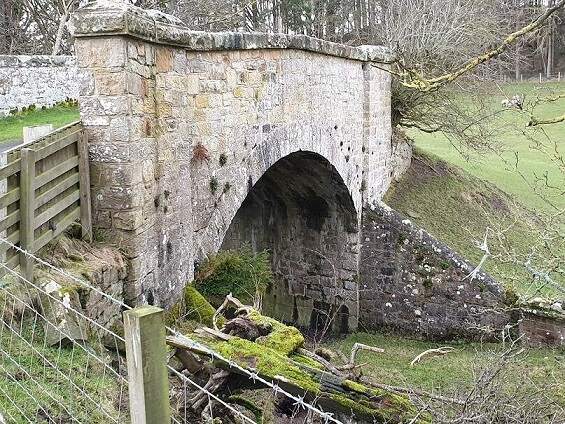
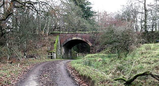
Further to the Northwest, the line as shown on the railmaponline.com satellite imagery. {17}The line ran on to the Northwest and this is the next significant point on the old railway. Close to Chipchase Castle the line was bridged by a minor road. [20]The view across the old railway bridge from the Northeast. [Google Streetview, June 2009]This next roadoverbridge carries an access road over the Border Counties Railway close to Kiln Plantation shortly before the highway turns away from the railway to the West along the North side of the plantation. [21]The view from the South of the road bridge in the map extract above. [Google Streetview, April 2011]The same structure in a photograph taken by Paul Hill and shared by him on the Border Counties Railway Facebook Group on 17th August 2020. [23]
A short distance to the Northwest another access road runs off the highway and crosses the Border Counties Railway.
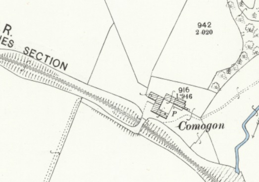
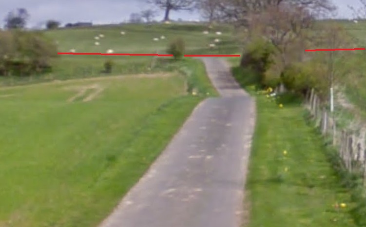
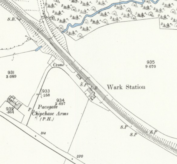
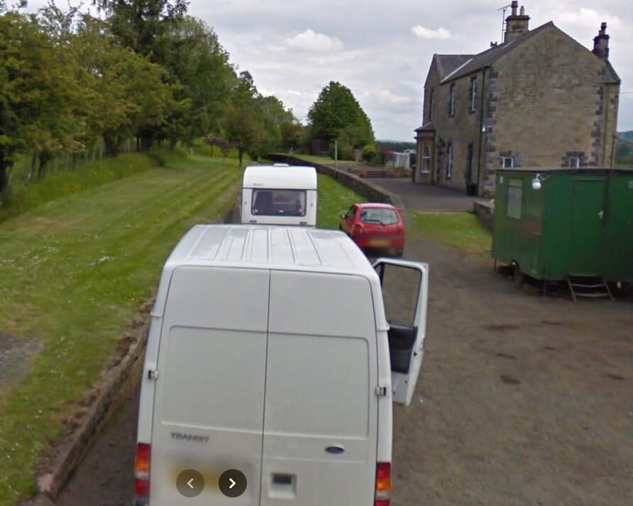
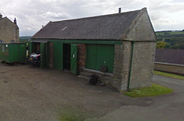
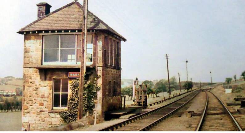
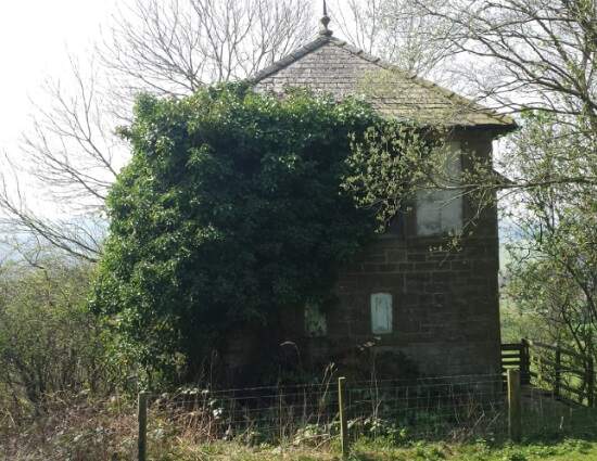
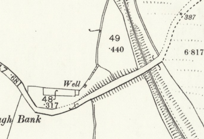
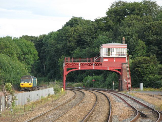
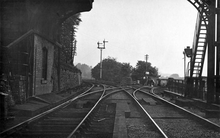
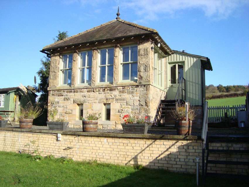
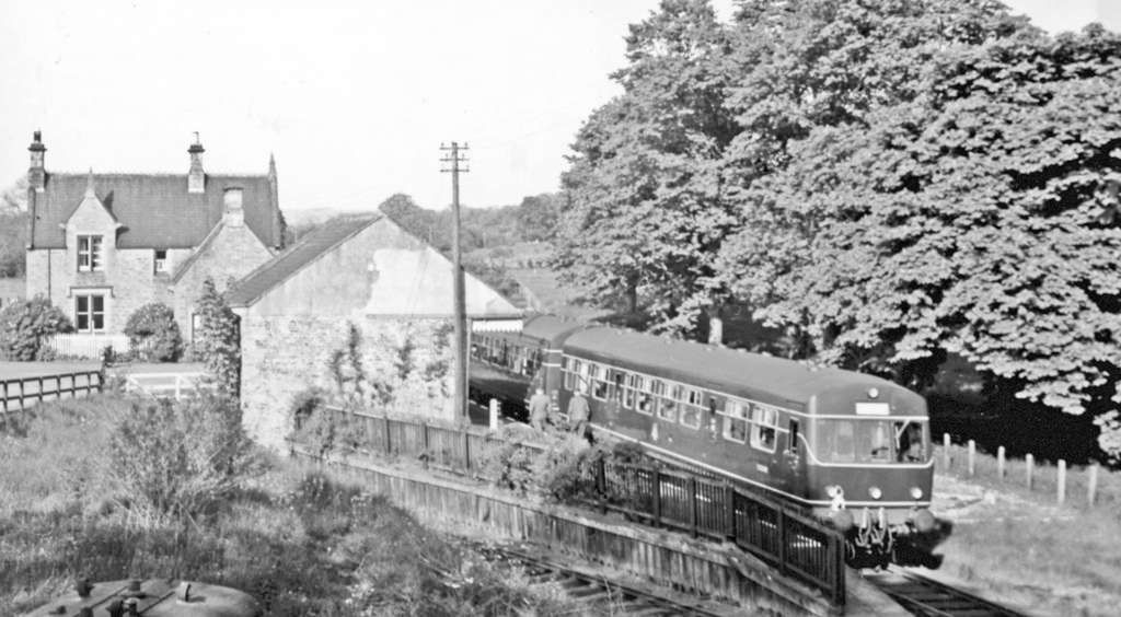
This map estract shows the lane leading to Comogon in 1920, which was carried over the old railway by means of a private access bridge. [24]The access road is private and this is the closest view of the old line at this location that is possible. The red lines show its route which was in a slight cutting to the right of the access road and a slight embankment to the left of the road. [Google Streetview, April 2011]Wark Railway Station as shown on the 25″ Ordnance Survey of 1895. [25]The view Southeast along the Border Counties Railway through Wark Railway Station. [Google Streetview, June 2009]The Goods Shed at Wark Railway Station. [Google Streetview, June 2009]Wark Signal Box when still in use. It sat just Northwest of the station platforms. This image was shared by Ian Farnfield on the Border Counties Railway Facebook Group on 6th April 2022. The provenance of this image is not known. [26]Wark Signal Box in the 21st century. This image was taken by Ian Farnfield and shared by him on the Border Counties Railway Facebook Group on 6th April 2022. [26]
A short distance Northwest from Wark Railway Station the Border Counties Railway passed under another minor road.
This next extract from the 1895 25″ Ordnance Survey shows that bridge mentioned above crossing the old railway. [27]The bridge mentioned above. [Google Streetview, July 2023]
From this point, the line turns to a more northerly direction as this next extract from the railmaponline.com satellite imagery shows. An accommodation track and Blind Burn next passed under the line of the railway. The image below shows the location.
The view Northeast along Piper Gate towards what was a bridge carrying the Border Counties Railway over the Burn and road. [Google Streetview, Aril 2011]
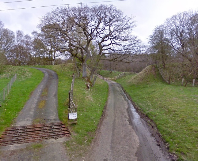
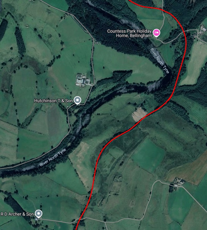
Northwest of Piper Gate a private access road follows the track bed to a private dwelling. Further North another access track passed underneath the line (shown in the first map extract below)
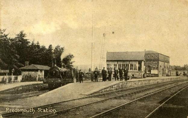
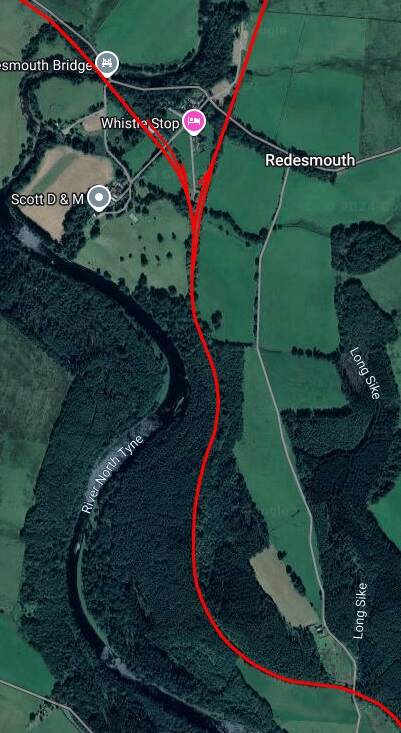
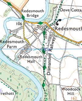
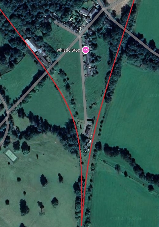
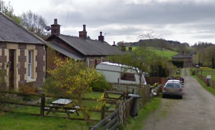
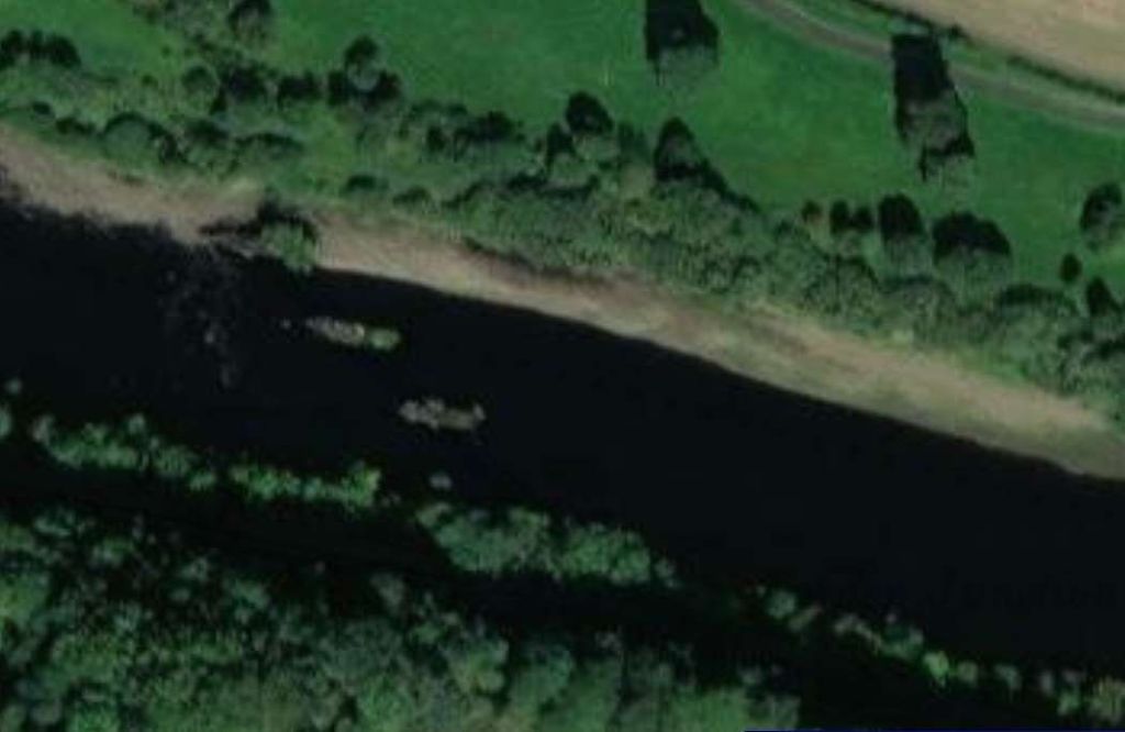
Continuing North from Countess Park alongside the River North Tyne, the Border Counties Railway reaches Redesmouth Railway Station which was a junction station.
Redesmouth as shown on the OS Explorer Map Sheet. The dismantled railways can easily be seen. The Border Counties Railway bears Northwest from the Station and crosses the River North Tyne.
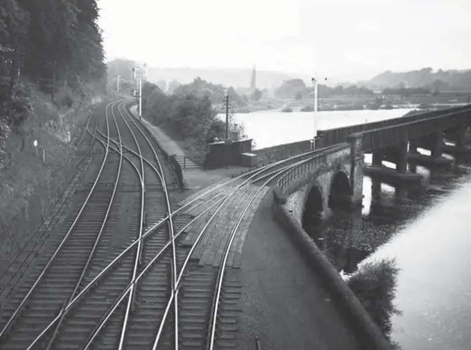
The two images immediately above focus on the railway infrastructure at Redesmouth which spreads over quite a large site surrounding the hamlet of Redesmouth. [Google Maps, October, 2024] [36]
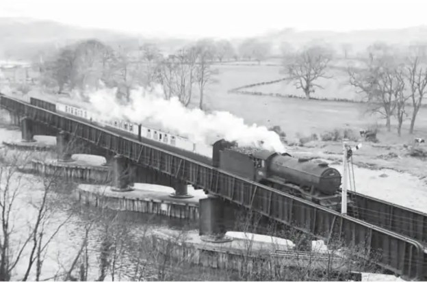
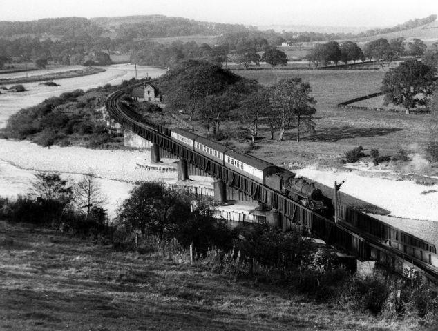
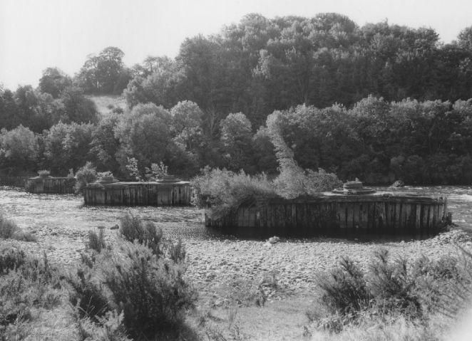
The featured image above was included in a Steam Days article in September 2021. Crossing the River Tyne on approach to Border Counties Junction is Gresley ‘K3’ class 2-6-0 No 61897, a St Margarets allocated locomotive that has worked through, and the stock is different too, ex-LNER and cascaded down from main line work. In due course the condition of the Border Counties Bridge and the predicted cost of repairs was a major factor in the abandonment of this ex-NBR route, with passenger trains ceasing to run on 13th October 1956, although the passage of goods trains continued through to 1 September 1958. [37]
At the end of August 2024, we visited Kielder Water Reservoir, passing through Bellingham on the way. We noticed a disused railway for which a good number of structures and embankments/cuttings remained in place.
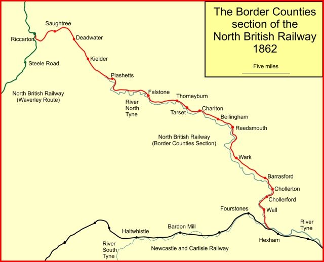
This was the Border Counties Railway (BCR), a line connecting Hexham in Northumberland, with Riccarton Junction on the Waverley Route in Roxburghshire. [1]
The BCR was also known as the North Tyne Railway as it ran beside the River North Tyne for much of its length.
The line between Kielder and Falstone is now under the waters of the Kielder Water Reservoir.
“In 1844 the North British Railway (NBR) was authorised to build a line from Edinburgh to Berwick to join an English line there. The NBR line ran close to the coast avoiding most high ground and opened in 1846. In 1845 the Caledonian Railway was authorised to construct a line from both Glasgow and Edinburgh to Carlisle, crossing the Southern Uplands at Beattock Summit, 1,033 ft (315 m) above sea level.” [1][2][3][4]
In 1853, talk was of a significant coal seam around Plashetts and in 1854, Robert Nicholson was engaged to survey a railway route to serve this coalfield. “His line was to run from Hexham, … through Reedsmouth to Bellingham, and on to the coal deposits at Falstone. His work was remarkably quickly done, for a bill for the Border Counties Railway was submitted to Parliament for the 1854 session. … The scheme was authorised when the Border Counties Railway (North Tyne Section) Act 1854 (17 & 18 Vict. c. ccxii) was given royal assent on 31st July 1854. The capital was to be £250,000.” [1]
The line was built as a single line, but land was acquired for later doubling, and all the bridges except the Hexham bridge, were built for double-track The full length of the authorised line was initially not built before “a public train service started on 5th April 1858; there were four passenger trains each way Monday to Saturday, and two on Sunday. They ran from Hexham to Chollerford, with an intermediate station at Wall.” [1]
It was to be only a further 16 months before the remaining length of the line was authorised when the Border Counties Railway (Liddesdale Section and Deviations) Act 1859 (22 & 23 Vict. c. xliii) got royal assent on 11th August 1859. The authorised capital for the whole line was increased by £100,000. The North British Railway were authorised to make a working arrangement with the BCR.
“From Wark, the line approached Reedsmouth, and there was a temporary goods terminus at Countess Park there while the river bridge was completed. The passenger service terminated at Wark. There was a demonstration train from Newcastle to Countess Park run on 1st December 1859. Public opening was expected ‘within the week” but this proved to be inaccurate, and the opening throughout to Falstone was delayed until 2nd September 1861.”
By 1860 the BCR was seriously short of cash; “the authorised capital had never been fully raised and the hoped-for coal reserves at Plashetts were disappointing. There seemed little chance of raising more capital now. The North British Railway was expansive, and was happy to take over the local line, and the result was the North British and Border Counties Railways Amalgamation Act 1860 (23 & 24 Vict. c. cxcv), passed on 13th August 1860; … the act regularised the use by BCR trains of Hexham station of the Newcastle and Carlisle Railway. The BCR network was known now as the NBR (Border Counties Section).” [1]
The construction of the line throughout to Riccarton was completed by mid-April 1862, but the opening of the line to Riccarton did not take place until 24th June 1862 for goods, and 1st July 1862 for passengers. [1]
On 1st May 1865, “the Wansbeck Railway was opened, between Morpeth and Reedsmouth. The Wansbeck Railway had been promoted independently but was taken over by the North British Railway in 1863.” [1]
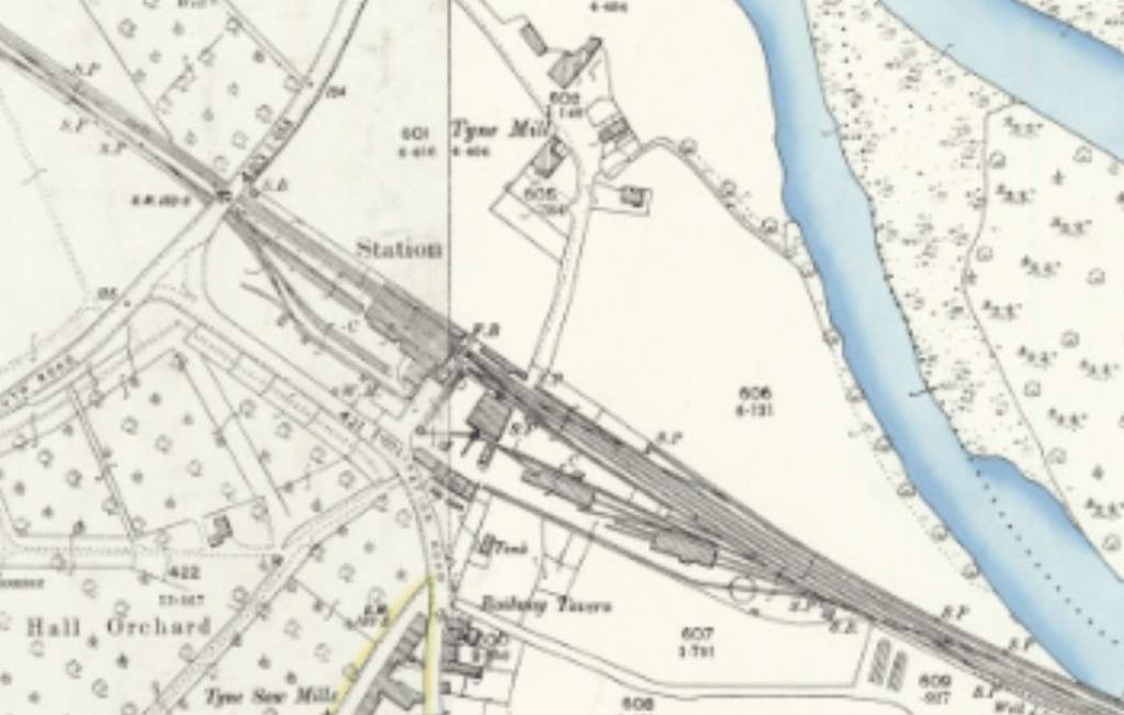
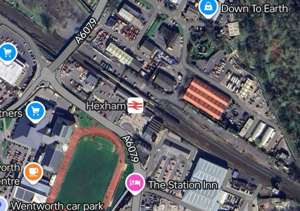
Hexham sits on what was once the Newcastle to Carlisle Railway (NCR) and which is, in the 21st century, known as the Tyne Valley Line.
Hexham Station was opened on 9th March 1835 by the NCR which became part of the North Eastern Railway (NER) in 1862.
The original station was probably designed by the architect Benjamin Green of Newcastle-upon-Tyne. It was altered and extended between 1835 and 1871 and again by 1901. It is now a Grade II listed structure and stands in a conservation area. The station was restored in 1998/1999. [5]
After the NCR had been absorbed by the NER, the station became a junction, with the opening of the first section of the BCR, between Hexham and Chollerford in April 1858. The first section of a second branch, the Hexham and Allendale Railway, was opened for goods in August 1867. Initially promoted to serve lead mines, that line opened for passengers in March 1869. [6][7]
Since the closure of the Hexham and Allendale Railway to passengers in 1930 (completely in 1950), as well as the BCR in 1956 (completely in 1958), the station has diminished in size and importance. Both lines met with the Tyne Valley Line to the West of the station. [6][7][8: p134]
The Disused Stations website covers Hexham Station in some detail. [9]
A straight length of line brings the railway to the banks of the Tyne. The line curves round toward the West and follows the South bank of the Tyne as far as Border Counties Junction where trains for Riccarton Junction and Hawick left the Borders Railway and crossed the Tyne on an angled viaduct.
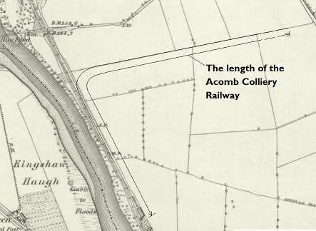
A short distance beyond the viaduct on the Border Counties Railway was a private colliery line which served Acomb Colliery.
“Mining at Acomb seemed to stop and start between the mid 19th century until 1909, when a larger complex opened until 1952.” [20]
There were various owners before the pit was taken on at nationalisation by the NCB. … Messrs. Stobart & Co. (1840s), J. Morrison & Co. (1860s), Messrs. Morrison (1880s), Tynedale Coal Co. Ltd. (1910s), Acomb Coal Co. Ltd. (1920s), National Coal Board (1947). [20]
For more information about the coal workings on the site, please consult the Durham Mining Museum. [21]
It is worth noting that the half-mile long line was worked by one engine, Black Hawthorn 0-4-0ST No. 1068 for over 30 years until closure of the mine in 1952. [13: p12]
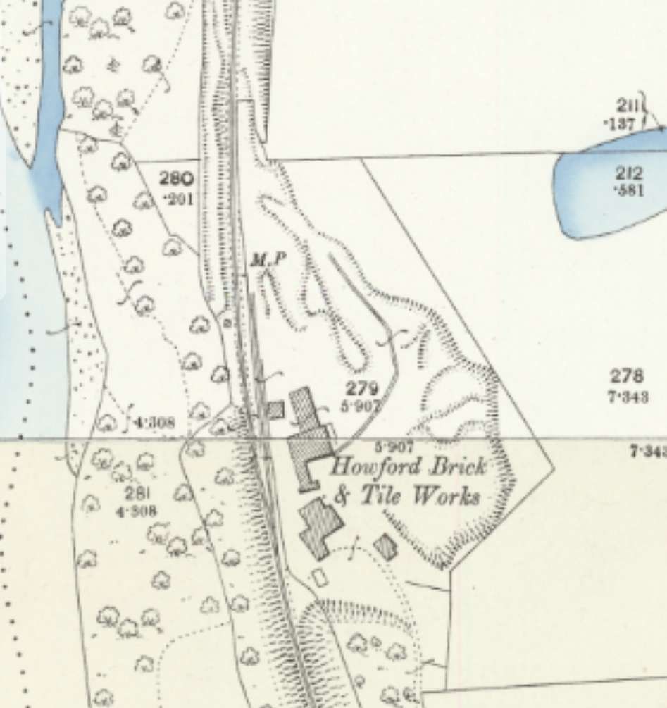
These works sat alongside the line, just a few hundred metres North of the Acomb Colliery Railway.
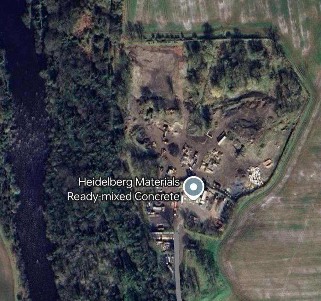
Howford Brick & Tile Works. [23]The location of Howford Brick & Tile Works hosts Heidelberg Materials Ready mixed Concrete plant in the 21st century. The route of the old railway is shrouded in trees. [Google Maps, September 2024]
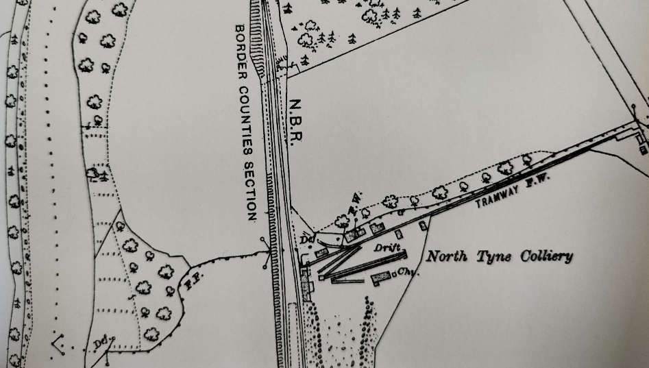
North Tyne Colliery
Some distance further North, North Tyne Colliery sat adjacent to the line.
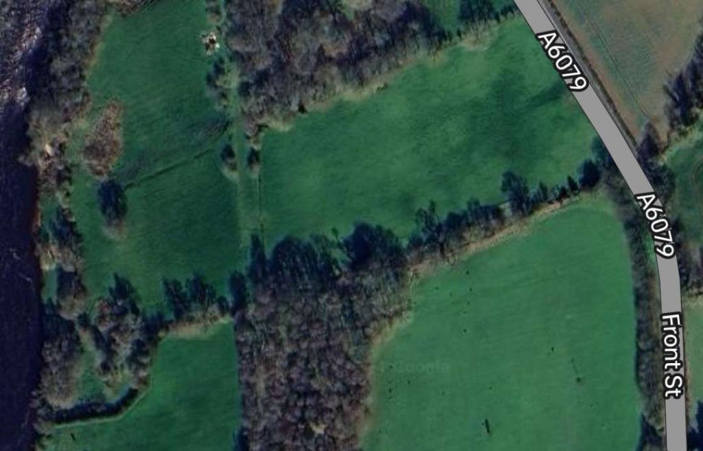
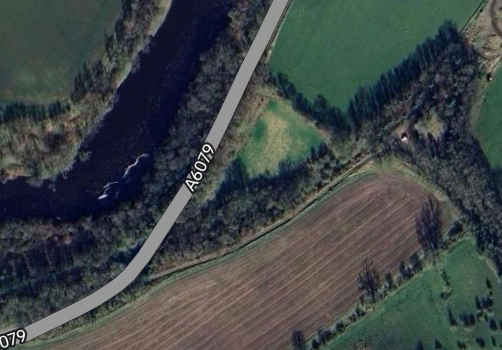
North Tyne Colliery was served by a 500yd. loop off the Border Counties Railway, it also had a tramway linking it to the road network (A6079). Messrs Walton & Cooper worked a drift mine here from 1906 to 1922. This extract comes from the 25″ Ordnance Survey of 1921. [13: p13][23]Approximately the same area as shown on the OS map extract above. The site of the colliery is now heavily wooded. [Google Maps, September 2024]
For further information about this colliery, please consult Durham Mining Museum. [22]
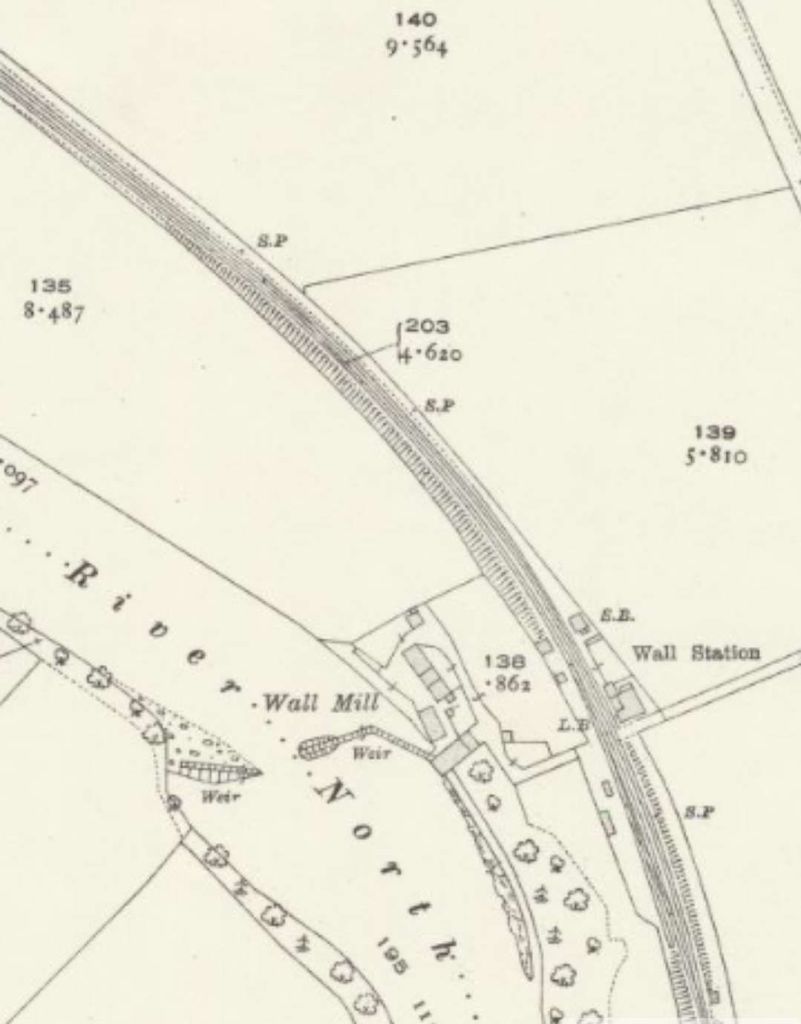
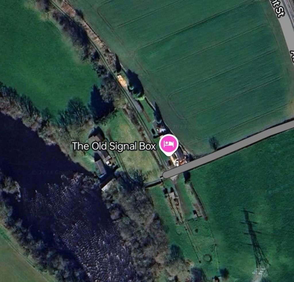
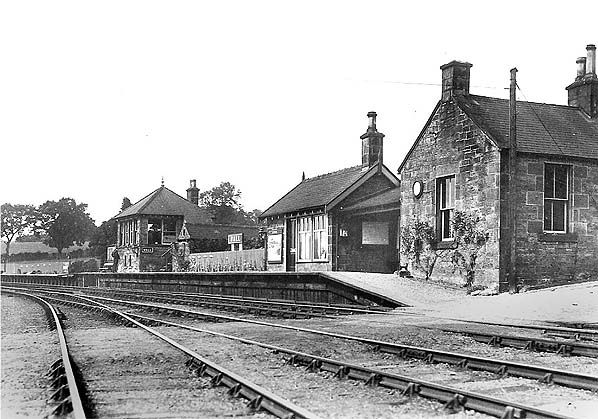
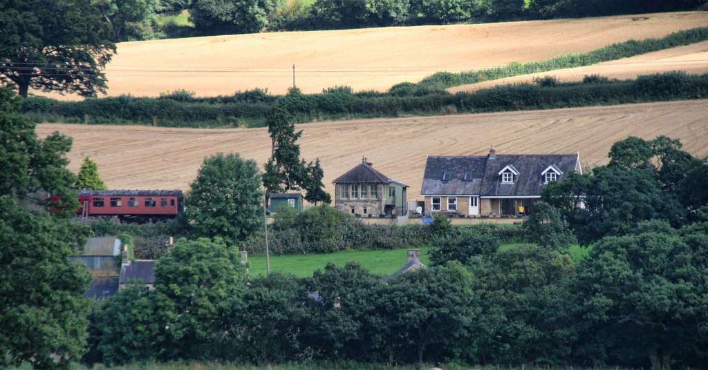
Wall Railway Station
Wall Railway Station was 1/3 mile from the village. It sat alongside the River North Tyne on its East bank a few hundred metres North of North Tyne Colliery.
There is good coverage of Wall Railway Station on the Disused Stations website. [25]
Humshaugh Railway Station
North of Wall Railway Station there was little to interest us until the BCR reached Humshaugh Railway Station. Darsley & Lovett say that “the station was opened as Chollerford on 5th August 1858 and was the BCR’s first temporary terminus. Sidings once led to a lime depot, where a tramway, inclined at 1 in 5, led to Brunton kilns. Another tramway led to the quarry. They closed in 1895.” [13: p18]
Historic England say that the grade II listed kilns were located North of Brunton Bank near Chollerford were probably built in the early 19th century. [29] Nearby was Brunton Bank Quarry. There is no evidence of a tramway, in the immediate vicinity of the station, leading to these two sites on the Ordnance Survey of 1896.
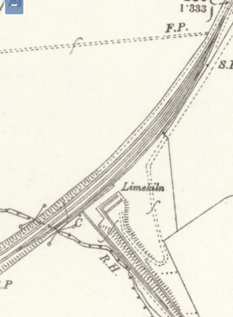
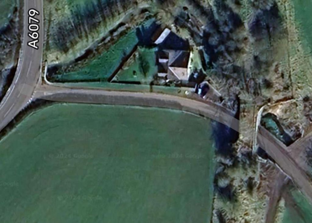
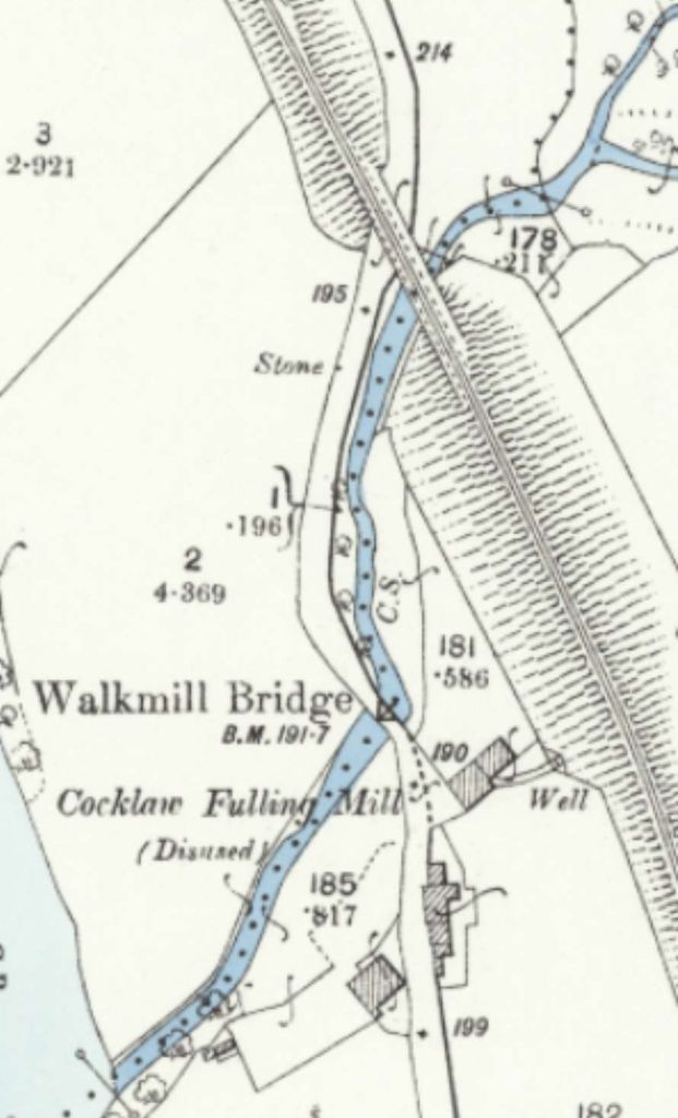
Only a short distance beyond Humshaugh Railway Station, the old railway passed under what became the A6079 and then passed a Limekiln at the bottom of a tramroad which served Cocklaw Quarry.
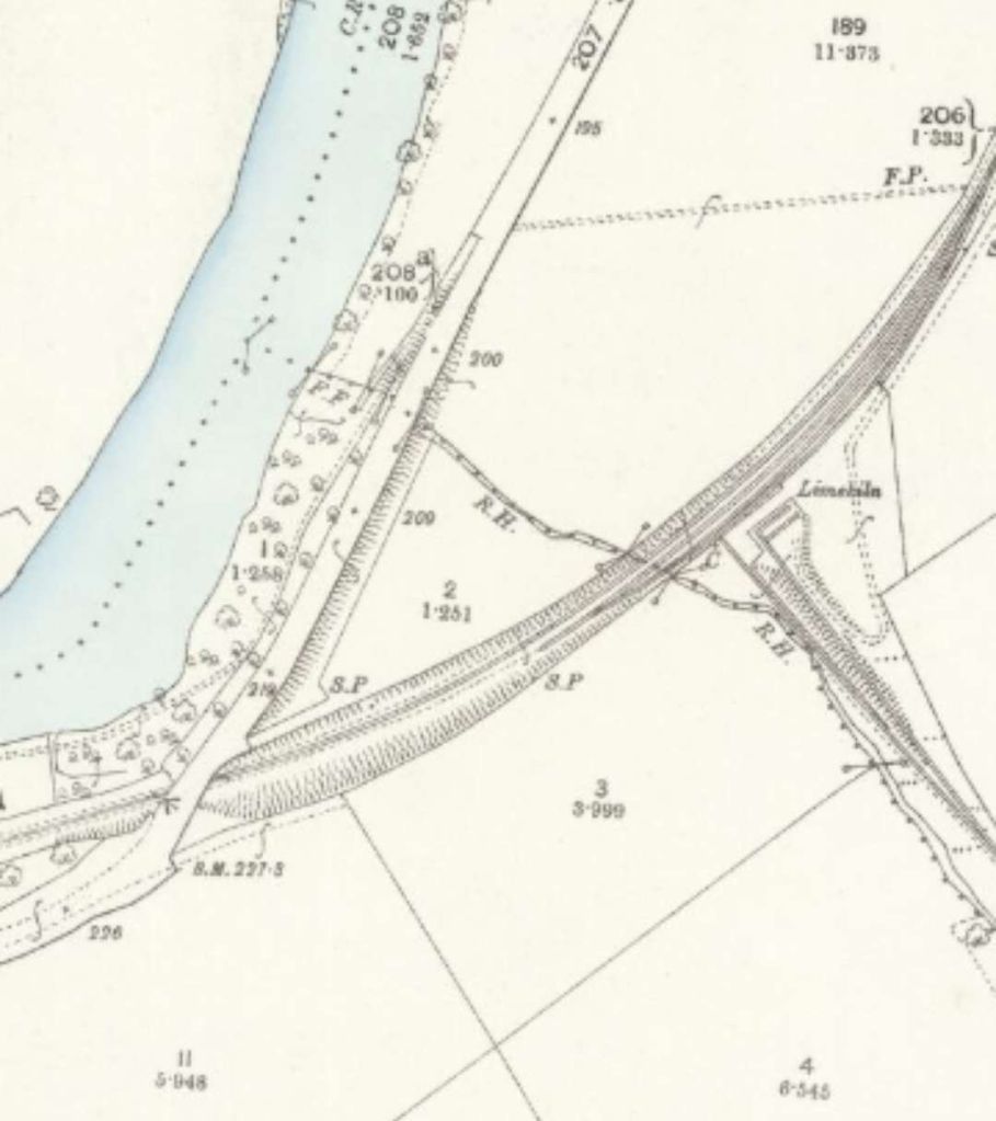
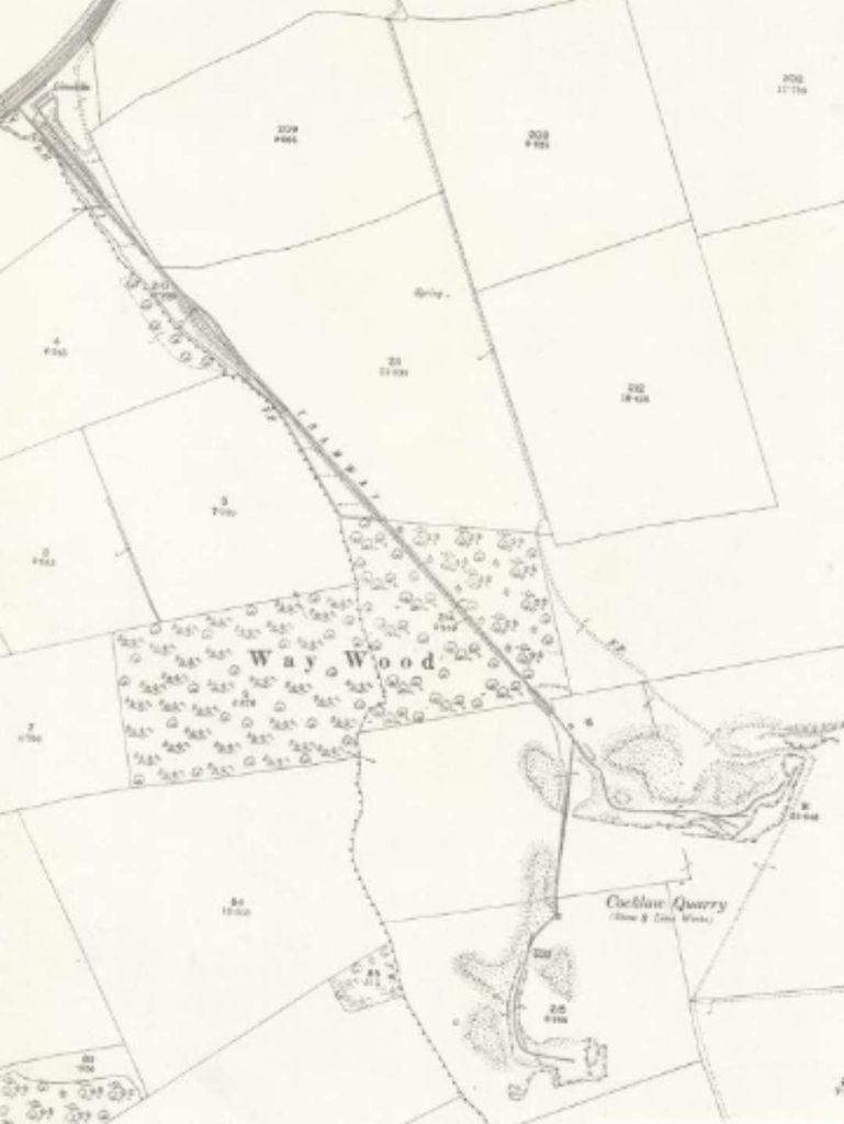
Another extract from the 25″ Ordnance Survey completed before the turn of the 20th century. Shows both the location of the road bridge and the Limekiln. [28]The same location on 21st century satellite imagery. The line of the BCR can easily be made out, as can the location of the limekiln at the junction of the tramroad and railway. [Google Streetview, September 2024]An enlarged extract from the 25″ Ordnance Survey which shows the loop provided by the NCR at the limekiln. [28]This extract from the 25″ Ordnance Survey at a small scale than the previous extracts shows the full length of the tramroads serving Cocklaw Quarry. This was a 3ft gauge tramroad with an incline. [28]
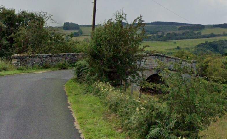
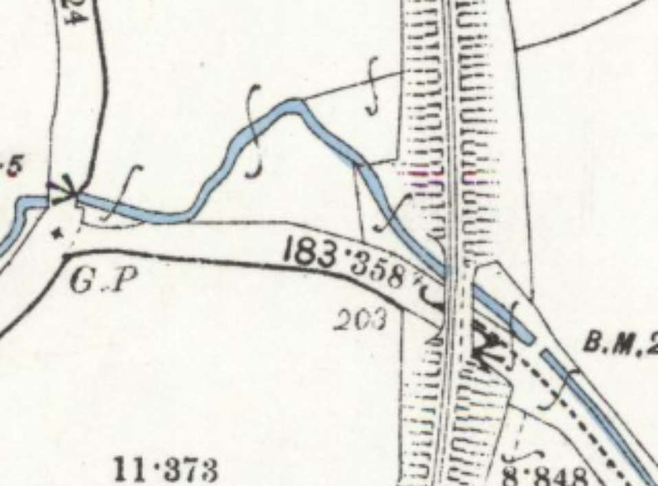
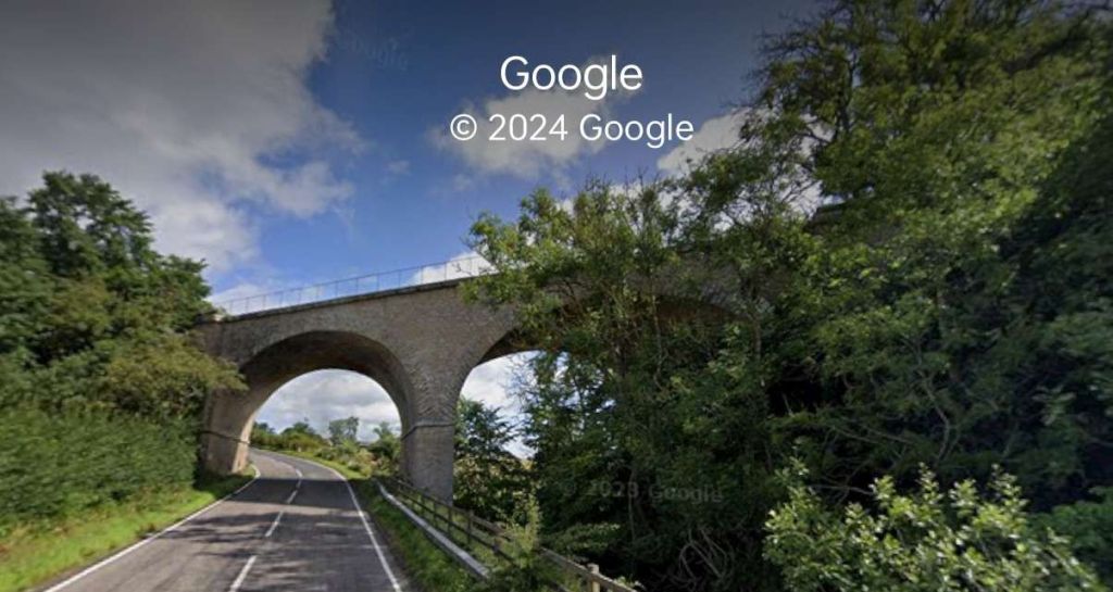
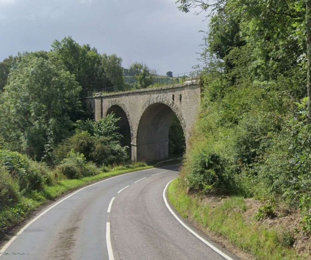
A short distance further North the line bridged a road and stream at the same location. …
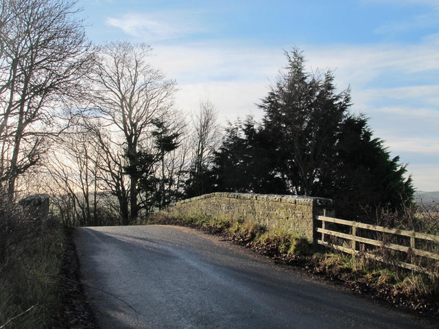
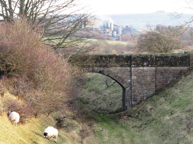
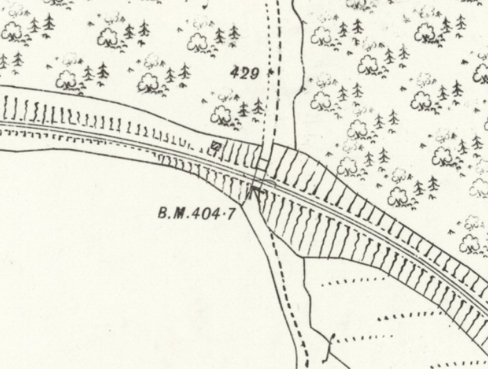
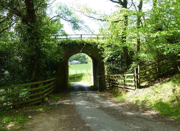
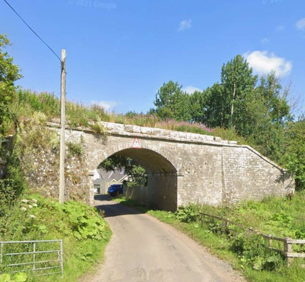
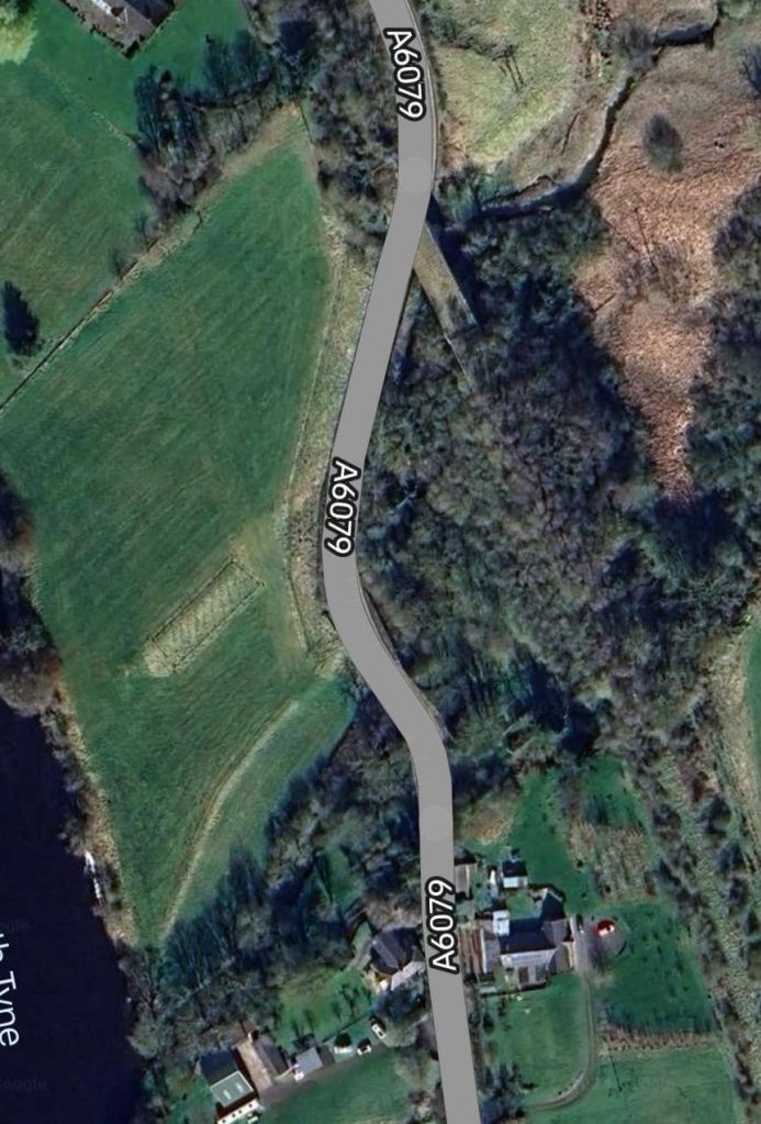
An enlarged extract from the 25″ Ordnance Survey of 1895/6 which shows the next significant structure on the BCR. [32]The same location in the 21st century. [Google Maps, September 2024]The line bridged both road and stream by means of a stone-arched structure. This photo of the bridge is taken from the Southeast. [Google Streetview, July 2021]Another extract from the 25″ Ordnance Survey. Another bridge, this time spanning both the road which became the A6079 and a tributary to the River North Tyne. [34]The same area on 21st century satellite imagery. [Google Maps, September 2024]The viaduct which carried the BCR over what became the A6079. [Google Streetview, July 2023]The view from the North on the A6079 of the same viaduct. [Google Streetview, July 2023]
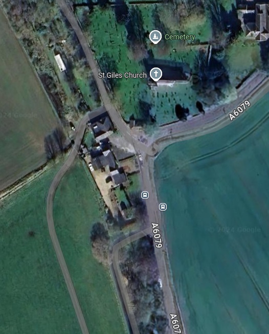
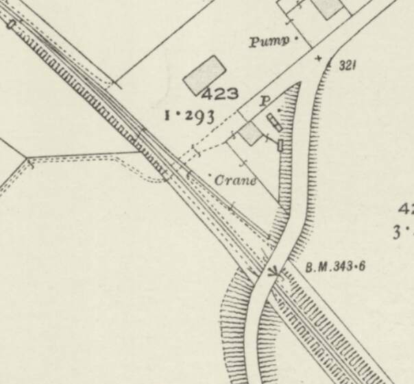
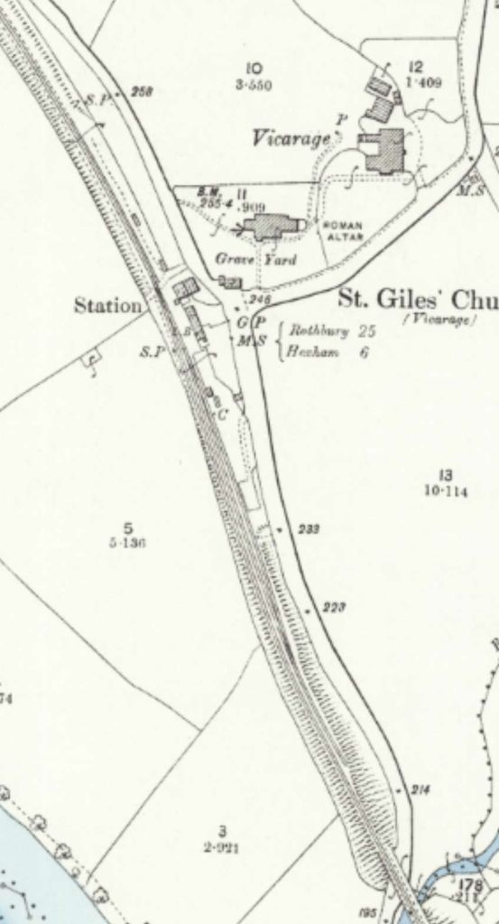
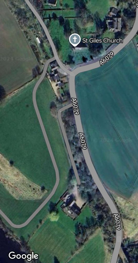
Chollerton Railway Station
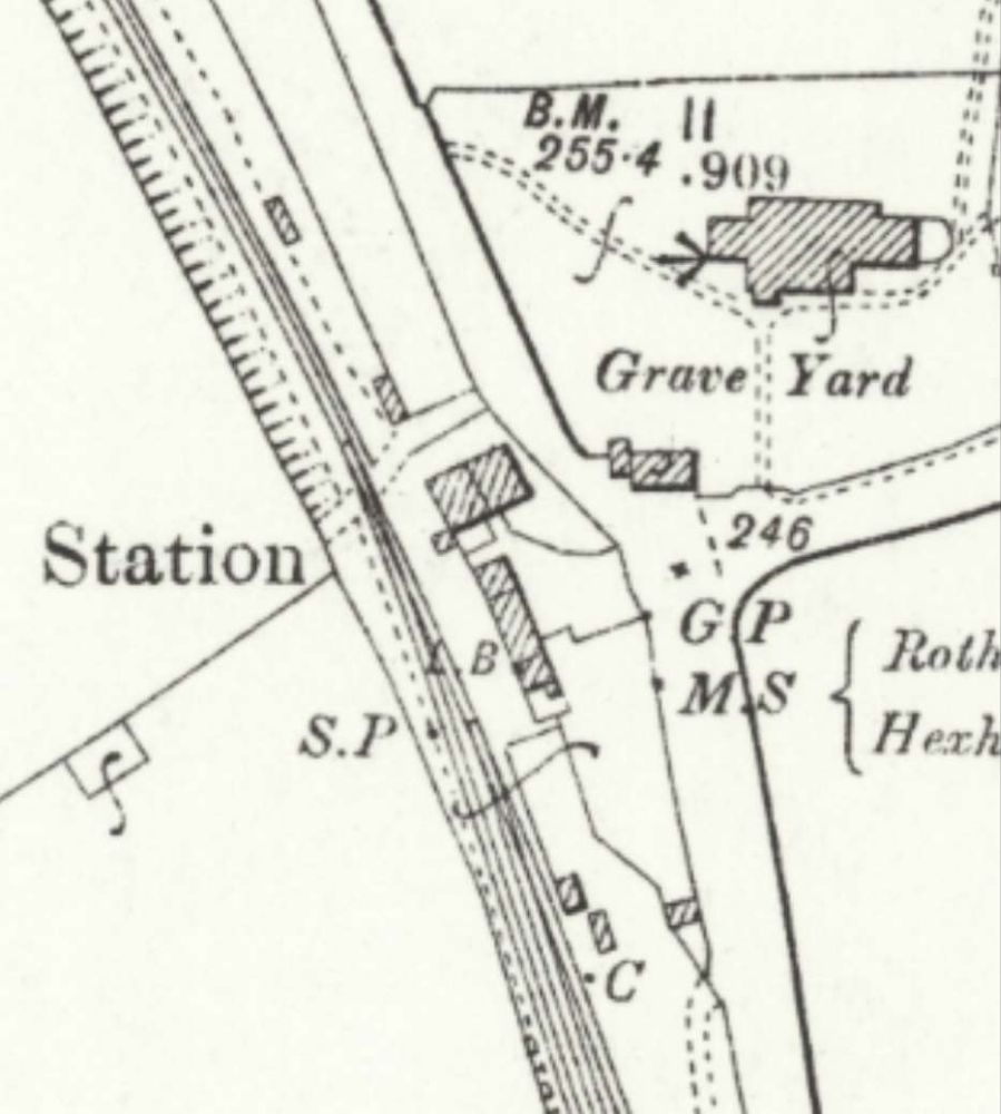
“The station was opened on 1st December 1859 by the North British Railway. It was on the west side of the A6079 at the junction with an unclassified road and immediately southwest of Chollerton village. A goods loop and a coal depot were to the south. A small goods shed was sited at the south end of the platform. Instead of extending the platform, the NBR built a new one to the north with a wooden waiting shelter. The original buildings remained in use and the siding was adjusted so that one of the two docks used the old platform. There was a three-ton crane in the goods yard. The station closed to passengers on 15th October 1956 and closed completely on 1st September 1958.” [33]
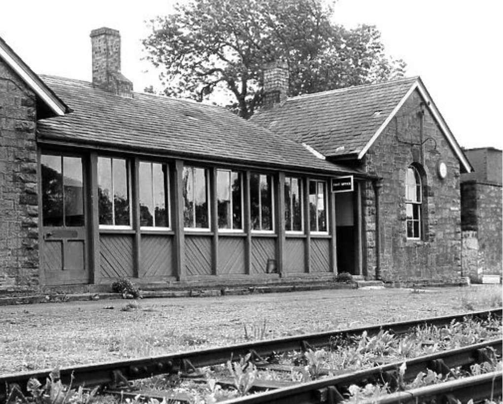
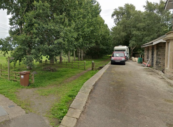
Shortly after crossing the viaduct above the line entered Chollerton Railway Station. The station sat opposite the village church, St. Giles. [35]The same area on modern satellite imagery. [Google Maps, September 2024]The northern end of Chollerton Railway Station looking North. [36]A view of the site of Chollerton Railway Station from the East on the A6079. [Google Streetview, July 2023]
Chollerton Railway Station is the end of this first part of the journey along the Border Counties Railway.