
The Line of the West Clare Railway from Quilty to Moyasta
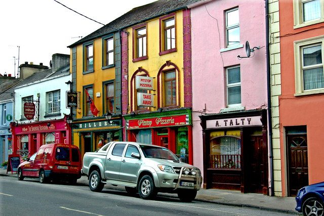
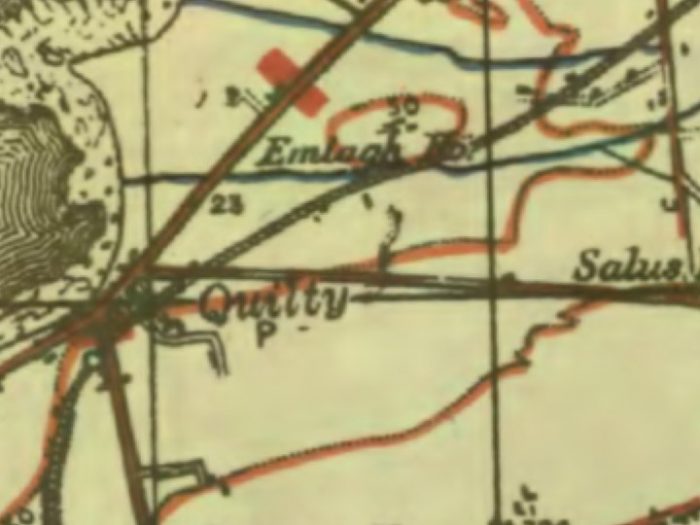
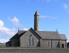 Before setting off on the next leg of this journey South along the Atlantic Coast of Co. Clare it seems sensible to have a little look round Quilty village. The adjacent picture shows its Catholic Church and the village tavern is shown below. The village is really quite tiny but is seeing a growthnin holiday trade in the 21st century.
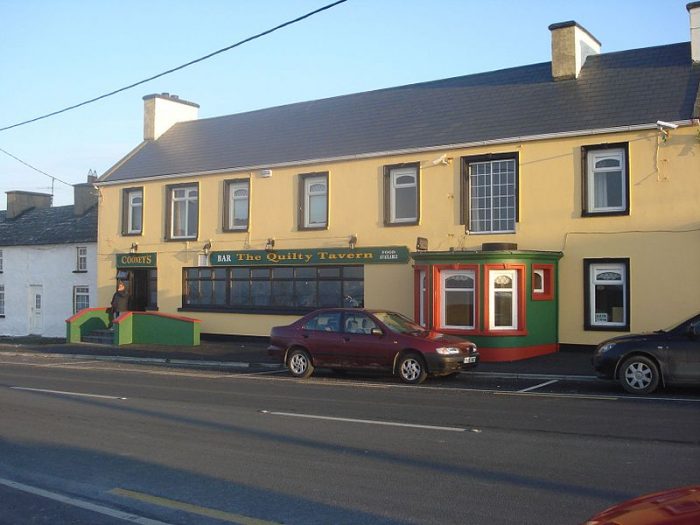 In the 2002 census the village had a population of 234. The Co. Clare Library website says: “Quilty is a coastal village in the parish of Kilmurry Ibrickane. The origin of its name is uncertain but it may be a derivation of “coillte”, meaning woods. In this instance the woods referred to would probably have been an underwood of hazel or holly. Local tradition mentions the finding of tree stumps which indicate the existence of large woods here in ancient times. The same word “coillte” could also refer to “ruined or destroyed” and be a reference to a tragedy of long ago. This particular stretch of coast is dangerous for shipping and is constantly being eroded by the sea. Sean Spellissy, historian, believes that the name refers to the devastation caused by the tidal wave that separated Mutton Island from the mainland in 804AD, drowning 1,010 people in the process. Quilty is set in picturesque surroundings with the Aran Islands on one side, Connemara behind and the Cliffs of Moher on another side. The Kerry mountains are visible in the distance.” [5]
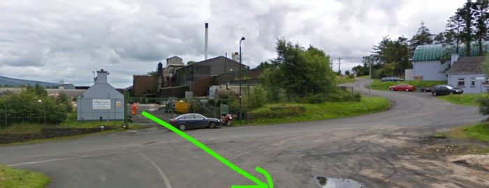
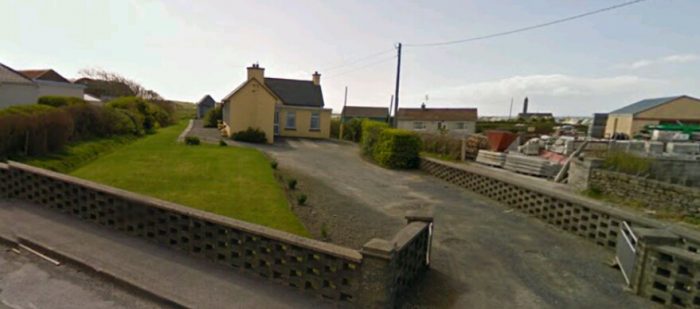 Quilty Station in the early 21st century taken from the N67 in Quilty looking South onto the station site.
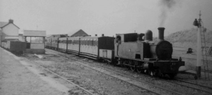
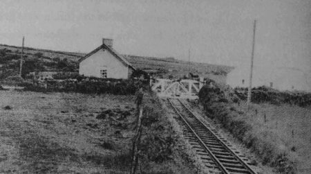
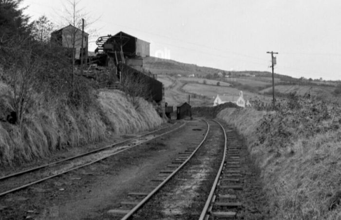
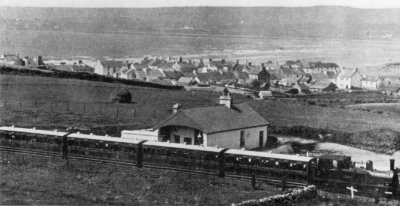
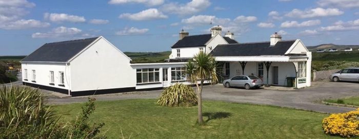
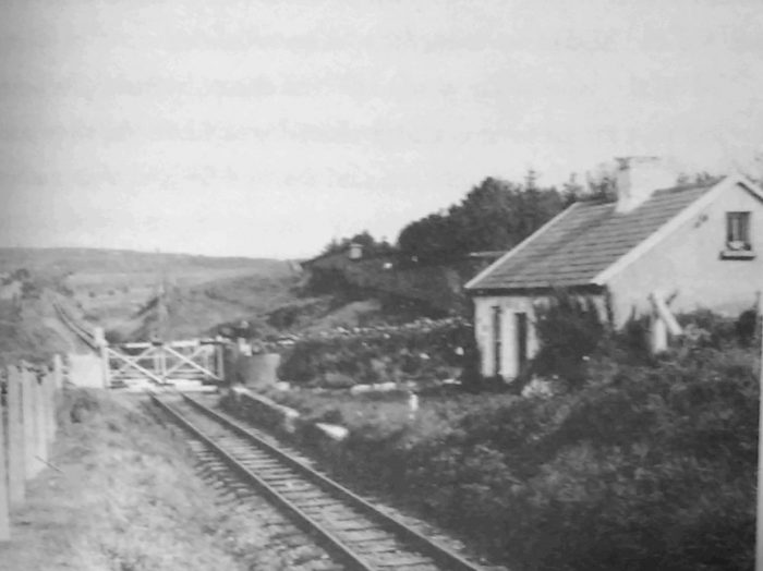
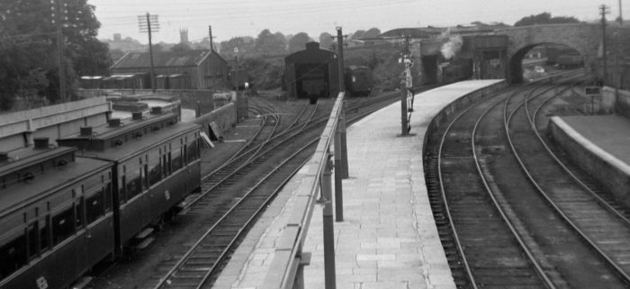
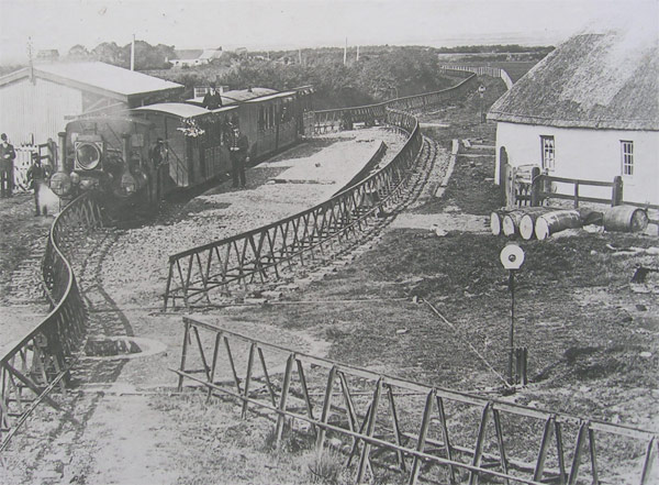
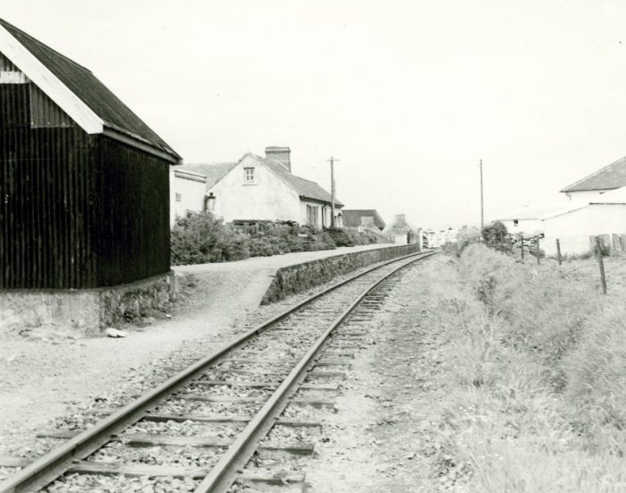 Quilty Station in the late 1950s. The picture was taken from the southern end of the station site. [3]
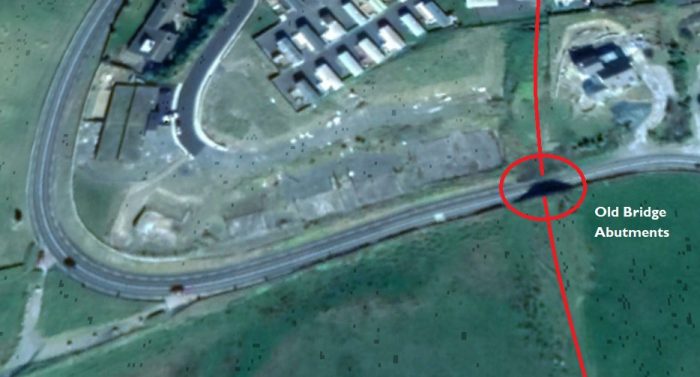
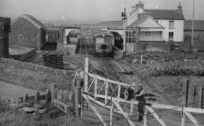
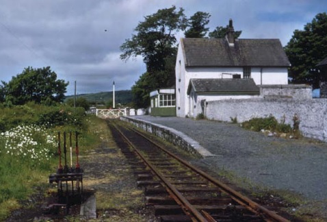
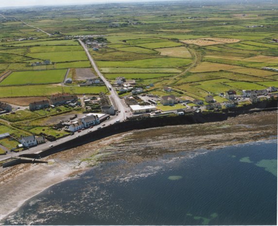 In this 1993 aerial image of the village of Quilty the station is in the centre of the image vans the old railway route can be seen curving away inland to the south (the right side of the picture). [4]
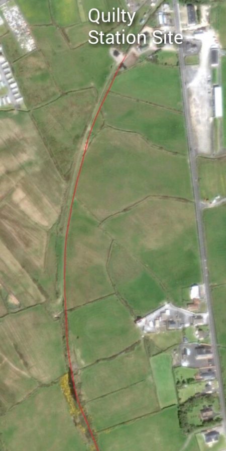
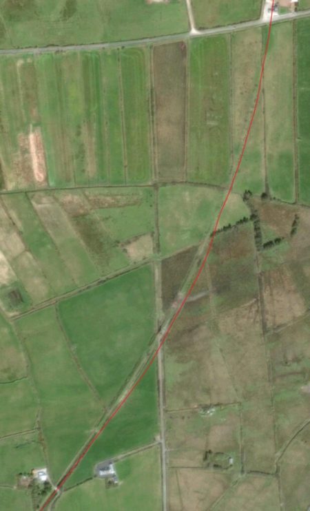
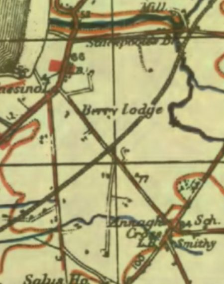
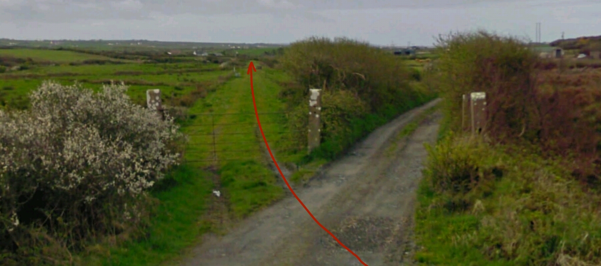
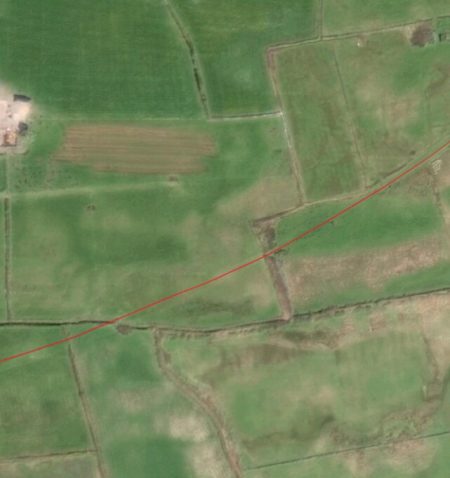
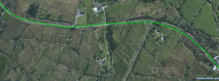
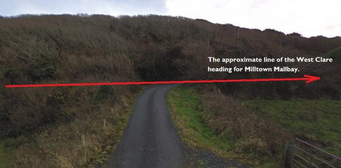
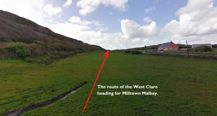
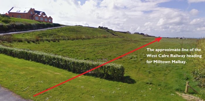
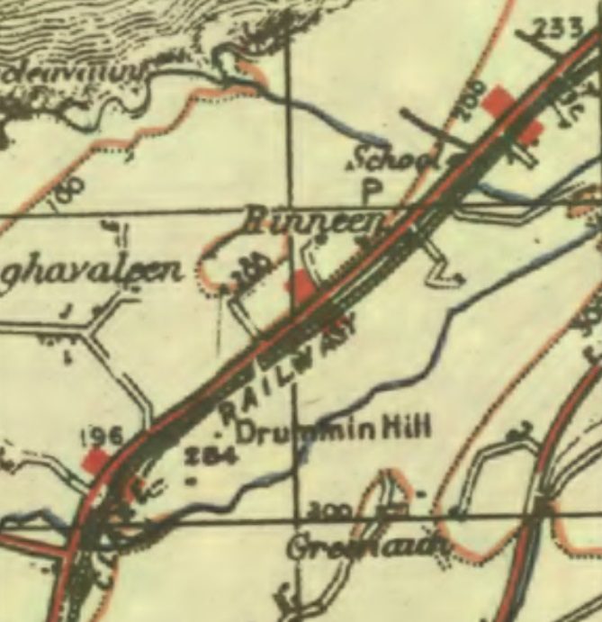
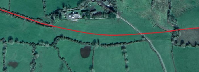
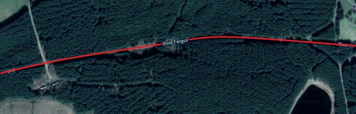
 Edmund Lenihan, writing in the late 1980s, gets us moving once again: “In the mile and a quarter to Kilmurry Station the line makes an S-shape through more or less level terrain, first looping west, then gradually east until it comes side by side with the Kilrush road at Kilmurry Bridge, and finally west again to the station gates.” [2]
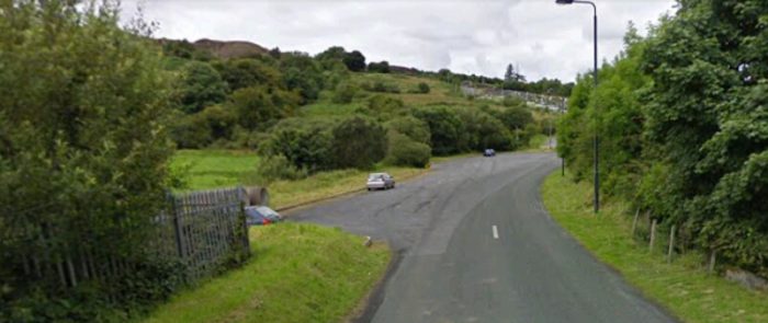
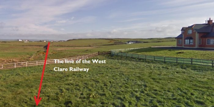
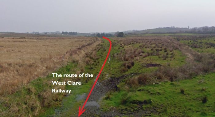
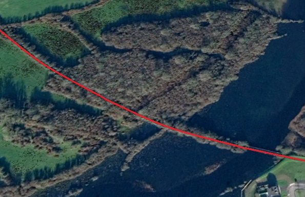
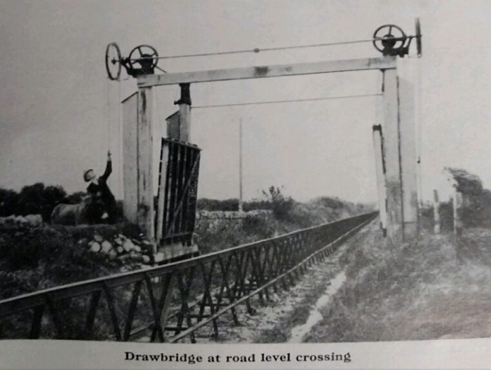
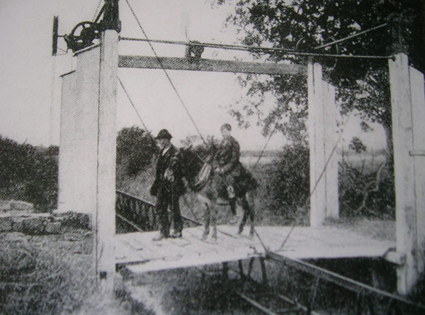
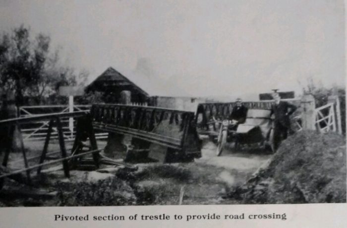
The line was raised above surrounding land. On one side there was an earthen storm-bank, several feet wide at its base and tapering towards the top. Before it was built, the line was totally exposed to the elements.
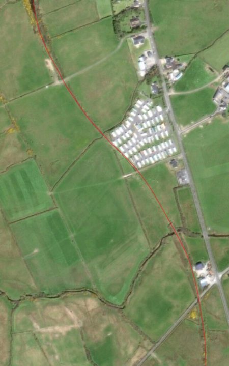
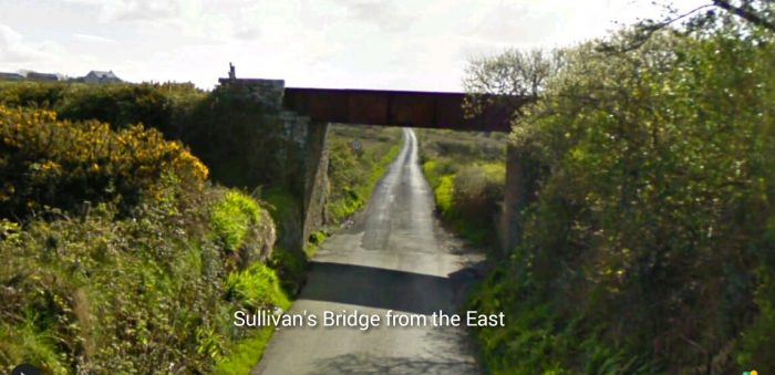
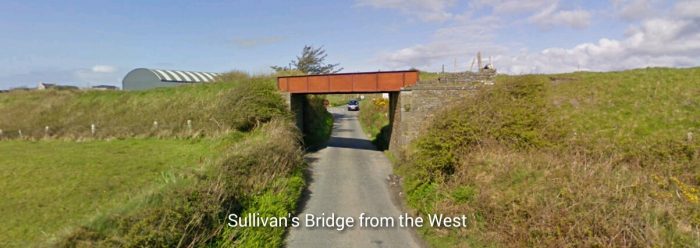
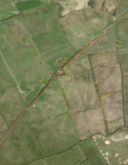
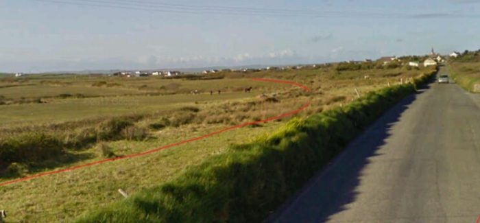
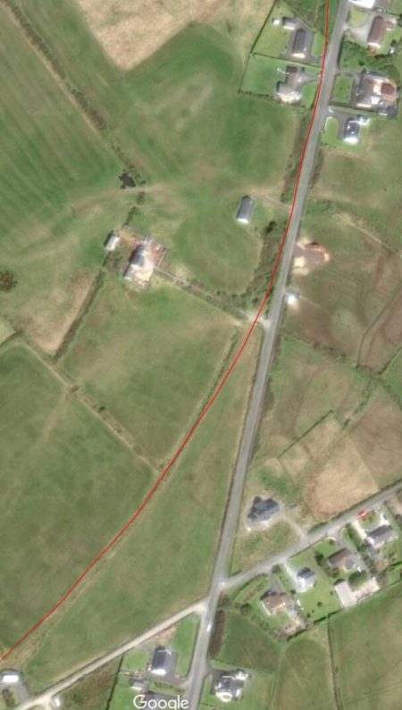
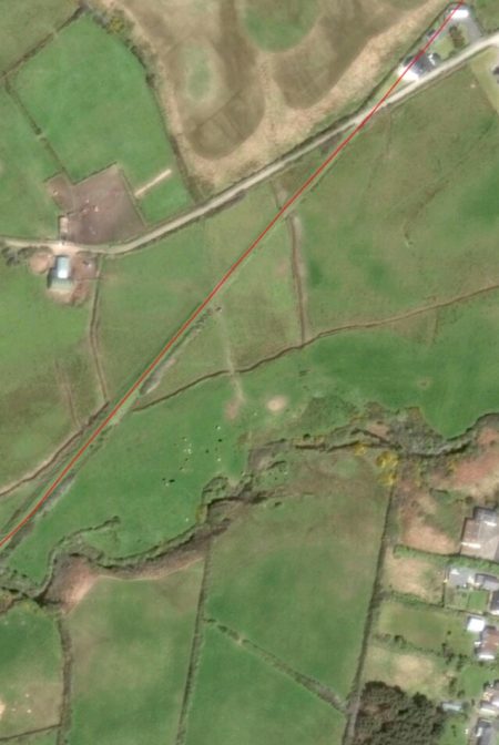
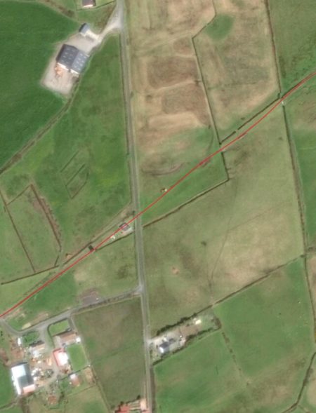
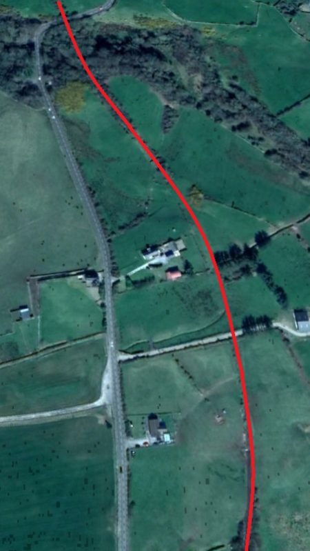
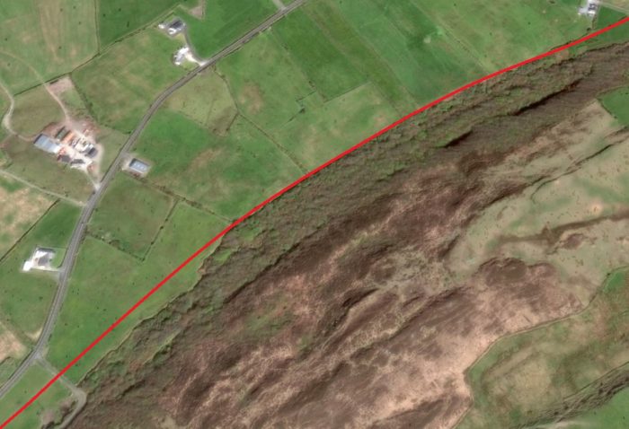
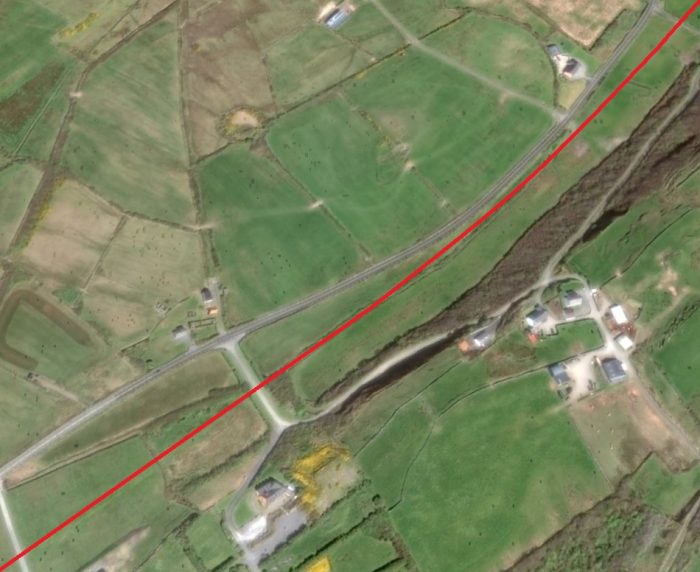
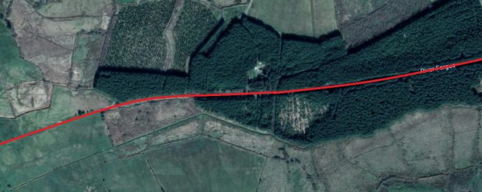
The line passed through a cutting which can be seen in the two adjacent satellite images, and just to the south of the obvious rock face in these images it passed under two accommodation bridges which carried access roads before rising above the surrounding land onto a relatively high embankment. The next obstacles in the way of the line were the Ballymackea River and a minor public highway. Lenihan tells us that the river bridge is Kilmurry Bridge road bridge is called Sullivan’s Bridge. [6] In have not been able to find a photograph of Kilmurry Bridge. It is in the location shown on the first image below.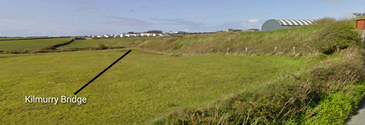
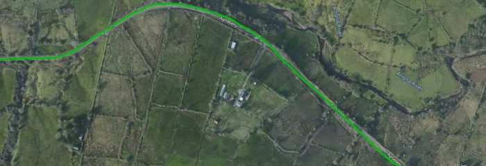
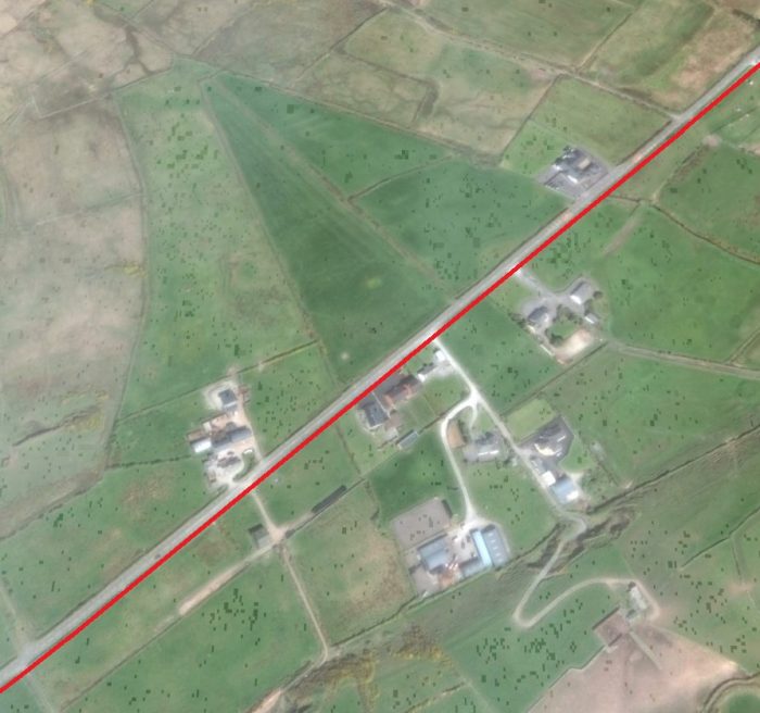
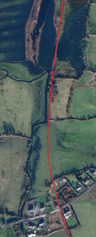
 The line continued south on embankment. It curved gradually back round to the Southwest as the adjacent satellite image shows.
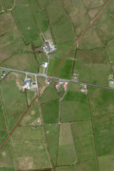
The land and the old track-bed rise on their way to Kilmurry Station which can be seen two-thirds of the way down the adjacent image.
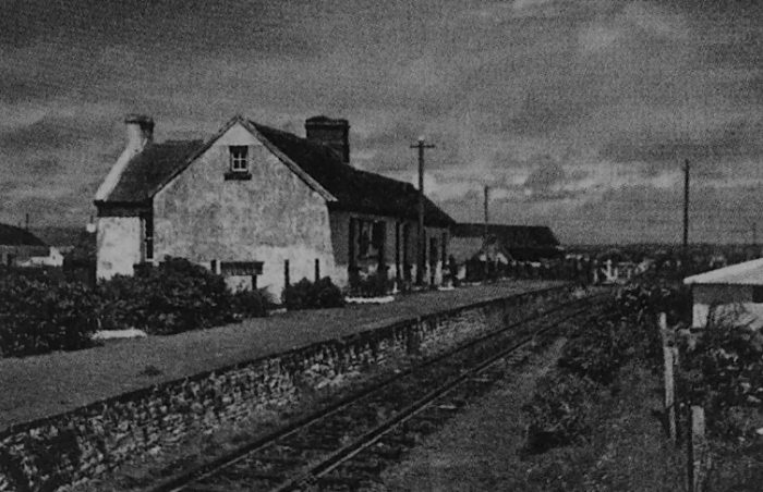
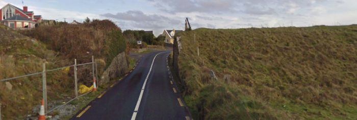
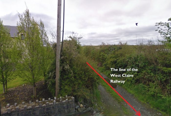
The first picture below is taken from the minor road close to Kilmurry Station and looks back along the old line towards Quilty. The second picture shows Kilmurry Station in the 21st century. The third picture below shows the station in 1952, the fourth in 1960.

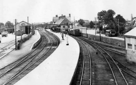
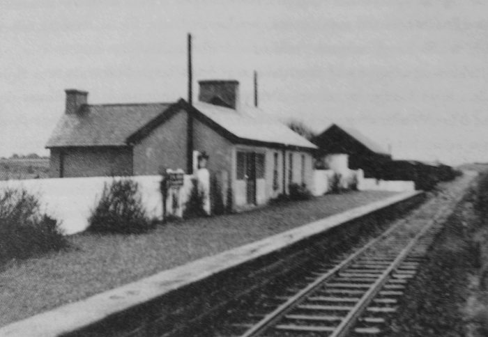 Kilmurry Station in 1952, © IRRS. [7]
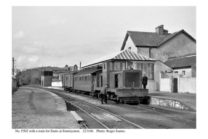
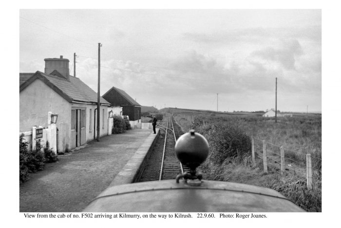 Kilmurry in September 1960, © Roger Joanes. [12]
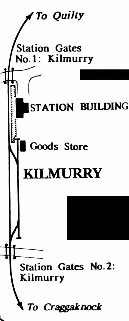
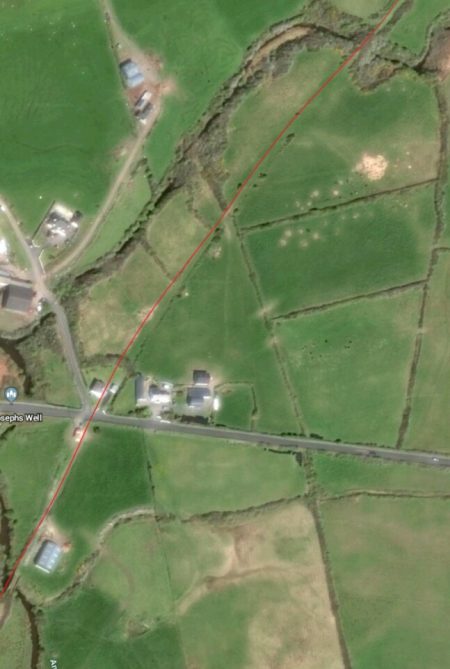
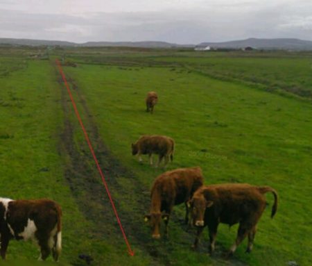
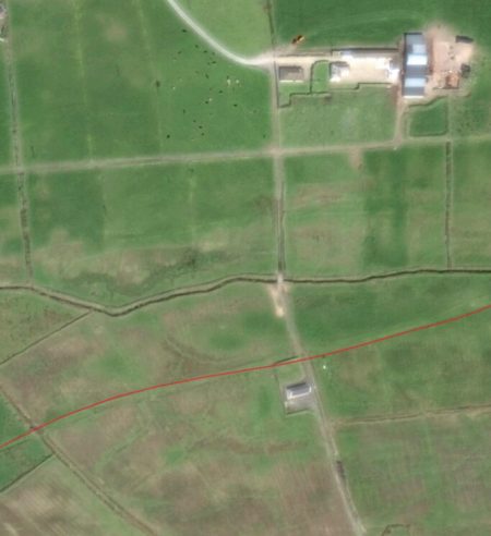
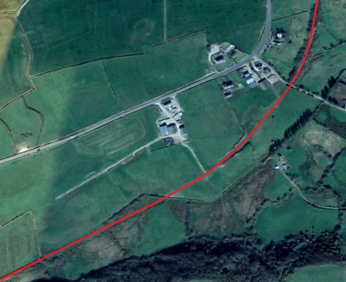
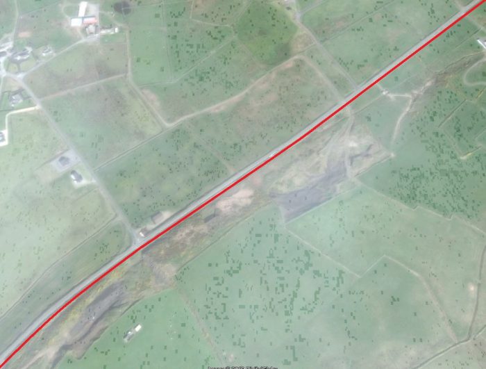
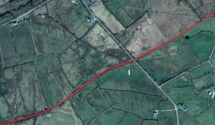
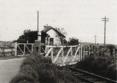
Three hundred yards beyond Kilmurry Station is Kilmurry No. 2 Crossing which was tended from Kilmurry Station. The next two picture are taken from the location of that crossing. The first looks back towards Kilmurry Station which can be seen in the distance. The second looks ahead down the line. A deep cutting through the hill ahead can be seen on the horizon.
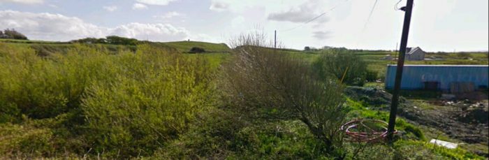
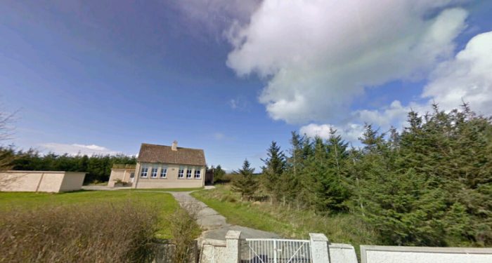
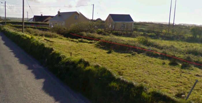
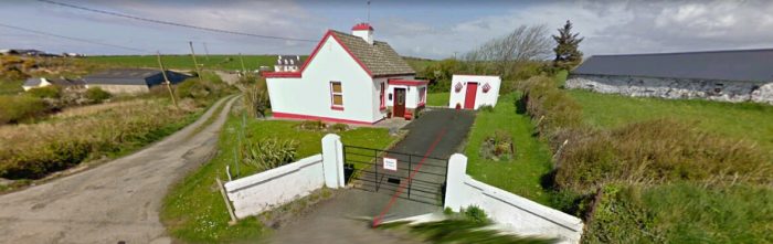
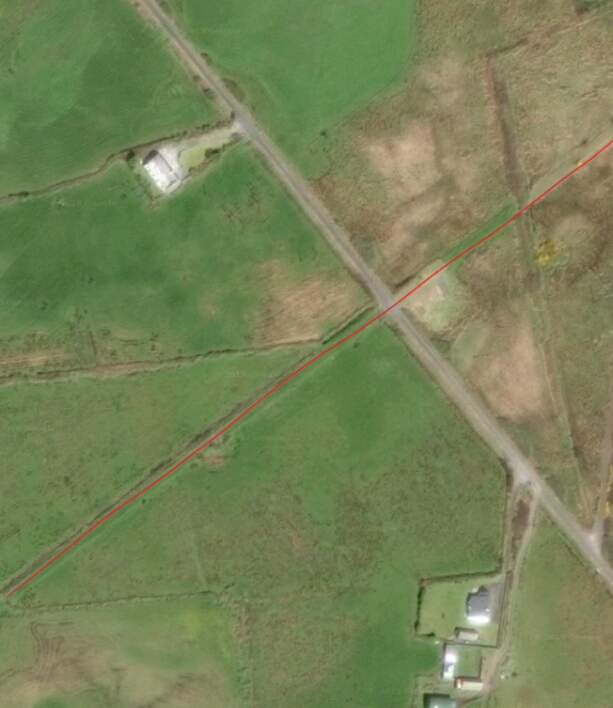
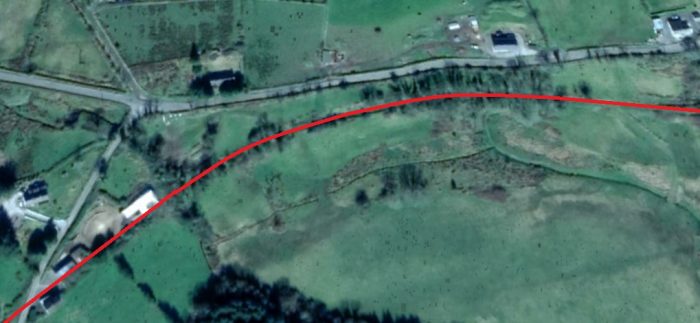
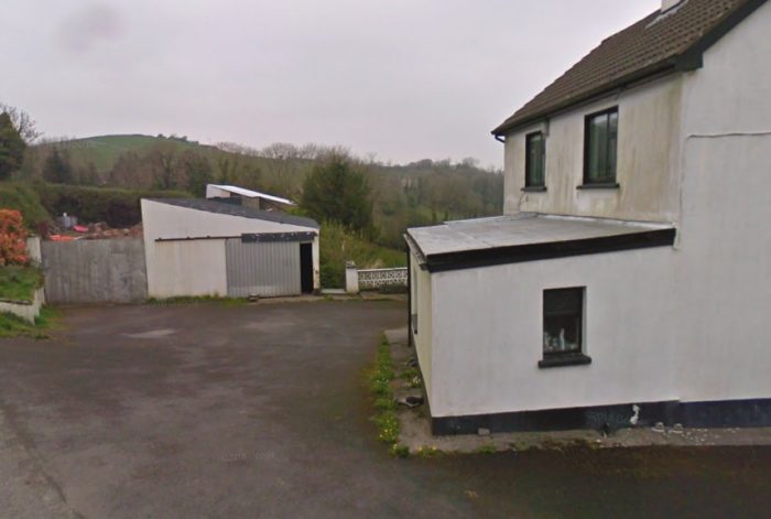
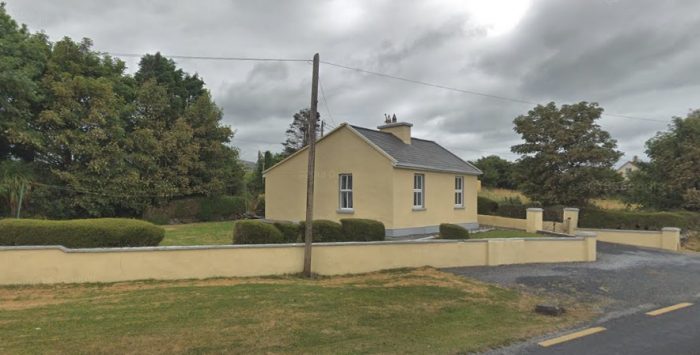
 The line curves South away from the Crossing and across open fields towards Cloonadrum School and railway cottage. The school was to the West of the line and is probably now a holiday cottage. [8] The Crossing-keeper’s cottage to the East of the line is little changed from the days of the railway. Both buildings appear below.
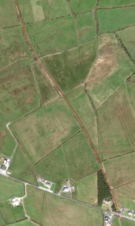
Edmund Lenihan tells a story: “On 13 August 1955 an unfortunate railway accident occurred at Cloonadrum. The crossing gate, though it had been opened at the train’s approach, was loosened by the vibrations and swung closed as the guard’s van passed, splintering the planks of the little wooden outshot where Peter O’Brien was sitting and injuring him severely. Only when the train reached Craggaknock Station, a mile and a quarter away, was it noticed that anything was amiss. When he did not appear, the van was searched and he was discovered dying at his post. Two circumstances which made his death all the more tragic were that he was shortly to be married, and that he was not supposed to be on duty that week, but was standing in for a friend who was on leave.” [9]
The crossing, school and cottage all appear in the bottom right of the adjacent satellite image.
 The old Cloonadrum School building.
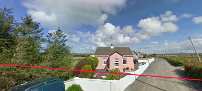
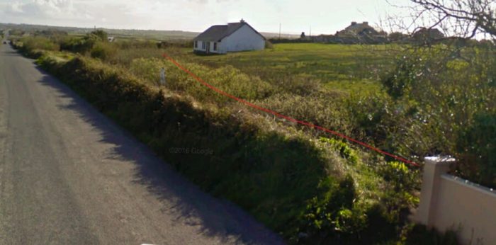
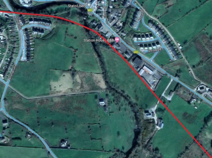
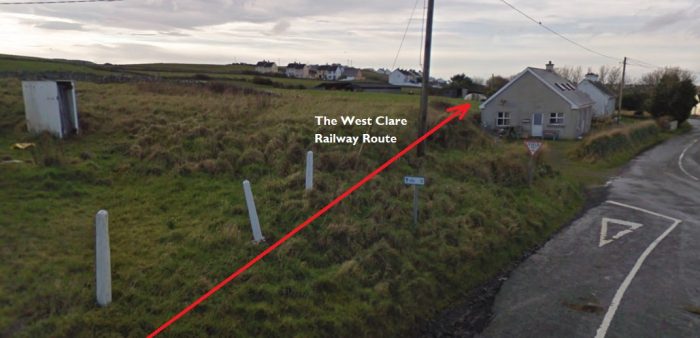
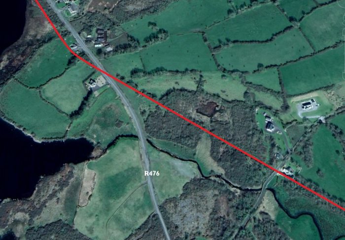
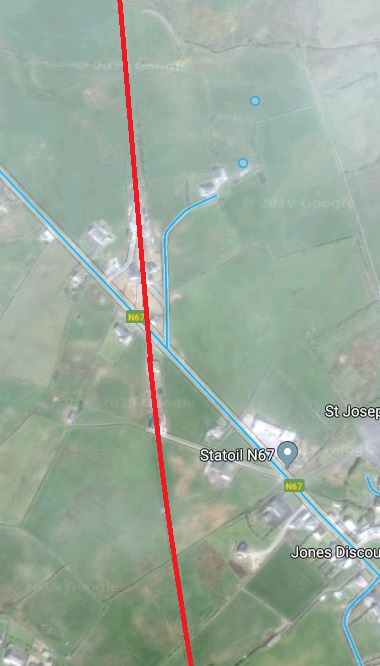
 The Crossing-keeper’s cottage (above) as it is in the early 21st century. The route of the old railway is shown in red.
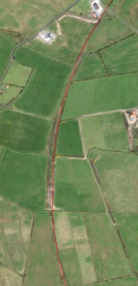
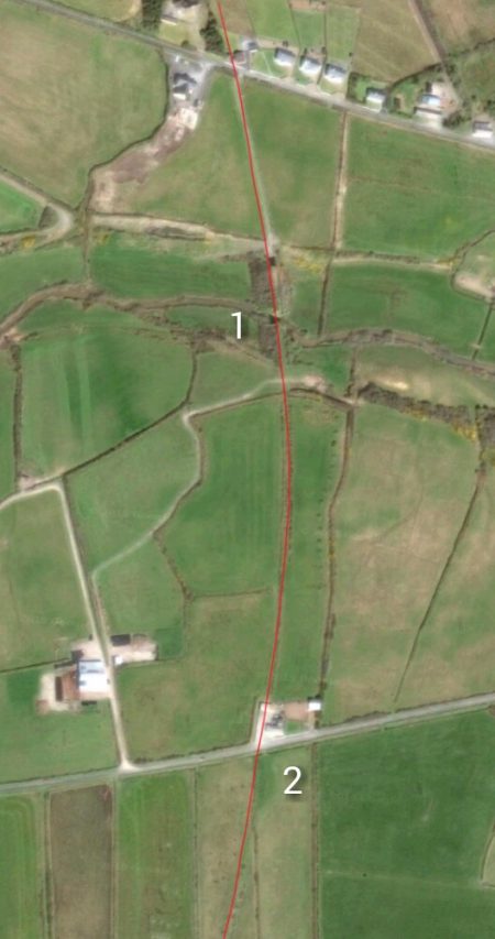
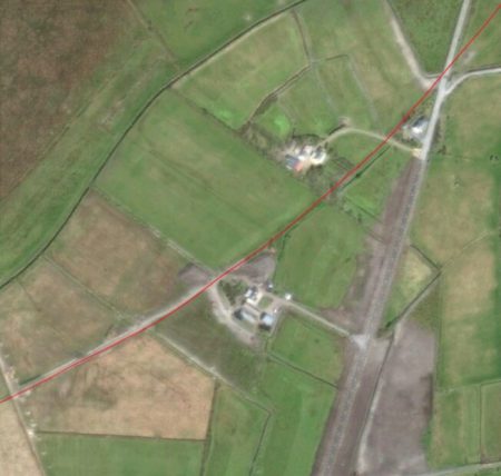
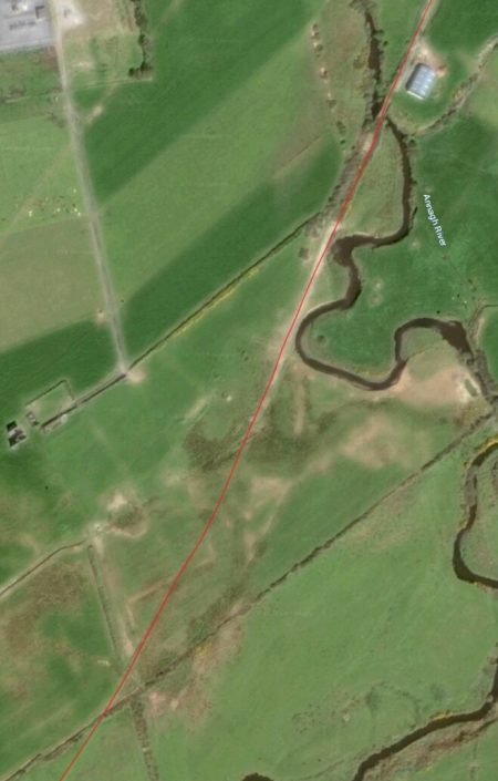
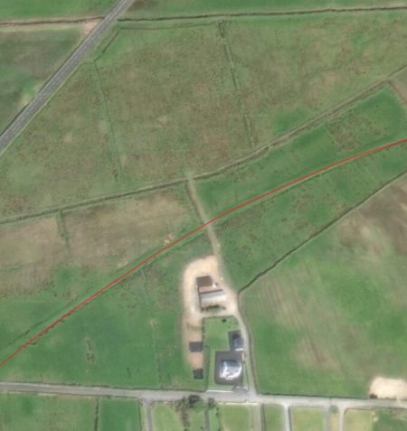
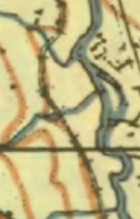
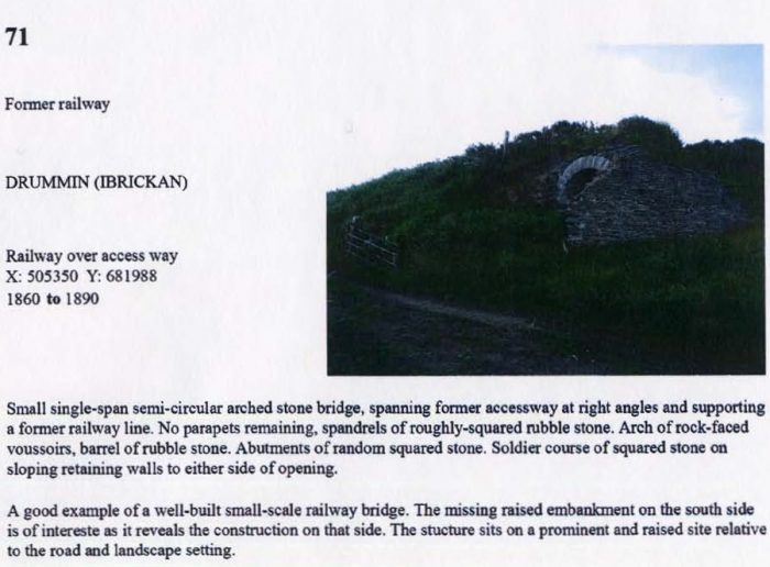
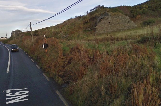
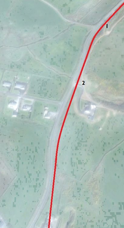
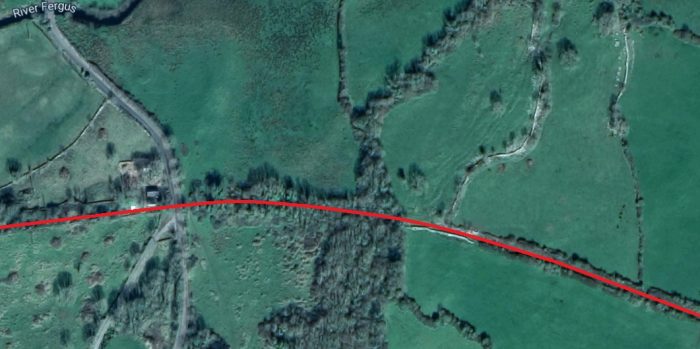
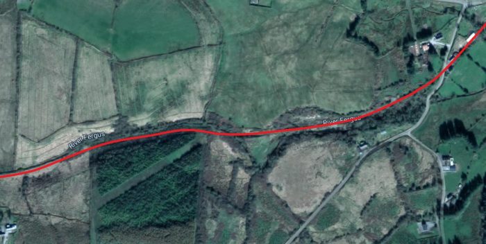
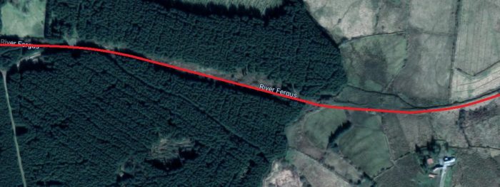
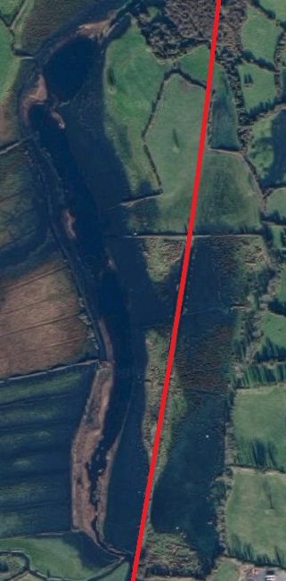
Cloonadrum crossing appears once again at the top of the adjacent satellite image. The feature marked ‘1’ is the site of what was the Annageragh Bridge (or Lissyneillan Bridge) over the Annageragh River.
Lenihan says that, as he and his son stood on the river bank under what used to be the bridge, “the full extent of the feat that was Annageragh Bridge instantly impressed itself on us as incomparably the most forceful structure we had yet seen on our 33- mile journey. Almost 40-feet high the stonework stands, stark now, yet beautiful. This was one of the few bridges put out of commission in 1961, when the line was being taken up — hardly surprising when one considers its height. Beside it we looked, and felt, insignificant.” [10]
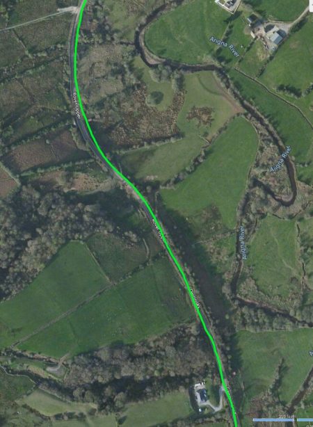
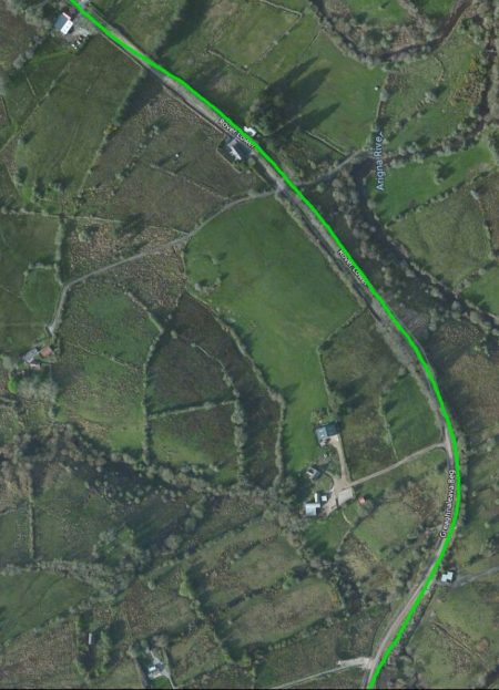
The 400 yards from Annageragh Bridge to Lissyneillan Crossing (marked ‘2’ above) were initially on a high embankment but otherwise unremarkable.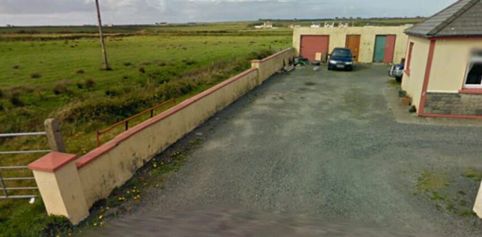 Looking back North from Lissyneillan Crossing towards Cloonadrum. The line of the railway has been severed by the outbuildings of the relatively modern bungalow. The Cloonadrum school and railway cottage can be seen on the horizon, to the left of the row of cottages.
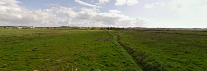
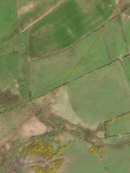
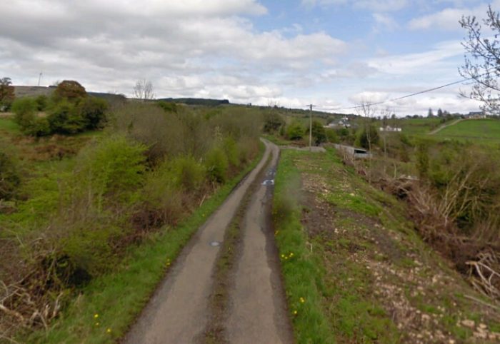
 Looking south (above) from Lissyneillan Crossing, the line travels away into the distance in the centre of the picture. The adjacent satellite image shows its onward course.
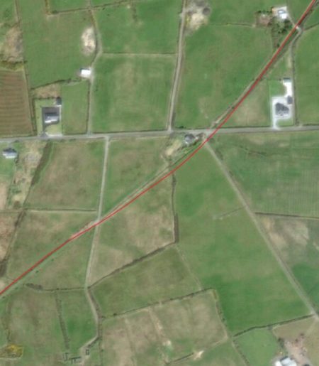
Edmund Lenihan noted a substantial road-bridge which was becoming dangerous which had to be crossed cautiously. [11]
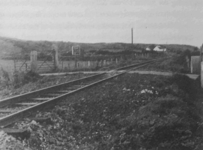
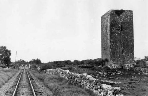
The next feature on the line was the Crossing and Station at Craggaknock.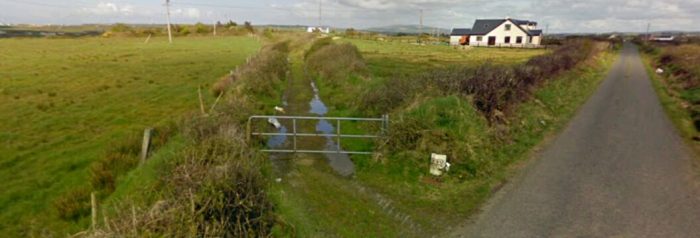 The view back towards Quilty from the minor road adjacent to Craggaknock Station.
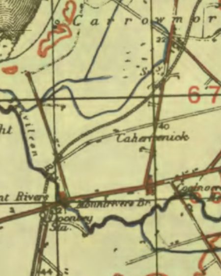
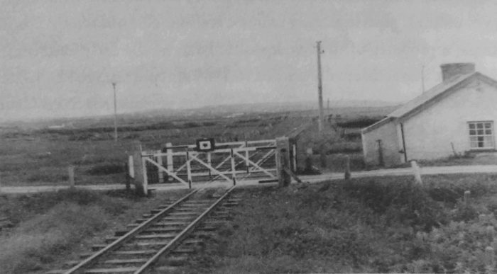
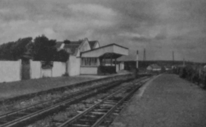
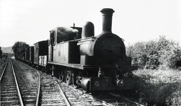
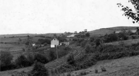
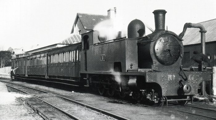
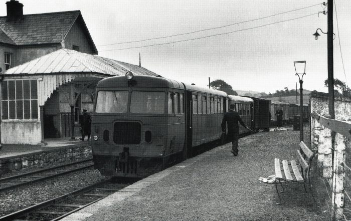
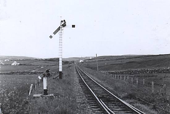
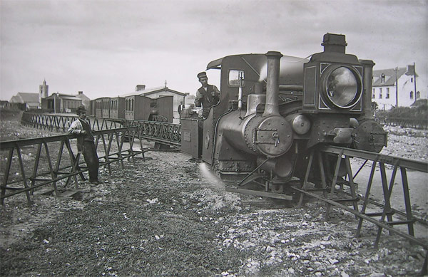
Patrick Taylor is very economical in his use of words as he describes this length of the line: On the far side of Cloonadrum, “Anaghgeragh Bridge (No. 60) over the river of the same name was reached, before passing through Lisseyneslon level crossing beyond the 33.75 milepoint and into Craggaknock flag station at 34.5 milepoint. Having passed through another set of crossing gates adjacent to the station. A small goods store and platform was provided here on the up side.” [1] Lenihan and Taylor often use alternative spellings for place names.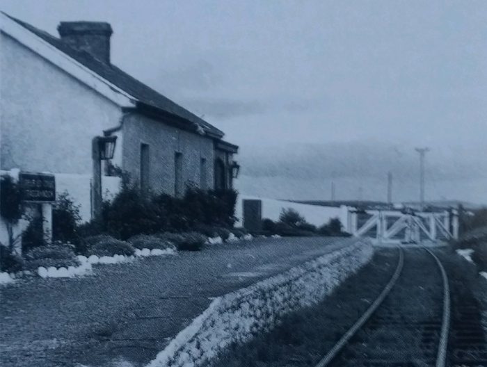 Craggaknock Station was typical of many on the South Clare section of the network. It was situated close to crossing gates on a minor road, © IRRS. [1]
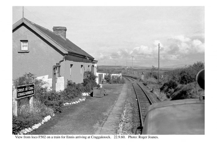
 Craggaknock Station in September 1960. A view from an Ennis-bound train, © Roger Joanes. [12]
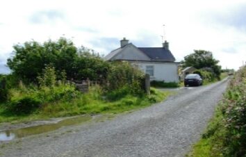
The Craggaknock Station building remains in the 21st century but the line is overgrown. One of the crossing gateposts is still visible, © C. Cooney [13]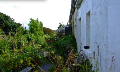
The former platform is shown in the adjacent image and the platform entry point is shown in its early 21st century incarnation in the next image below, © C. Cooney [13]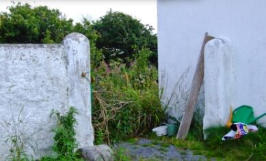
 Edmund Lenihan found the station in a better condition than it is in the 21st century! [14]
 Beyond Craggaknock the line headed away into open country. Lenihan comments: “Today [late 1980s] there are few houses within a mile’s radius of it, and only one of these was dignified by being named on our map. This is Craggaknock House, a plain early nineteenth-century dwelling, less than a mile to the east.” [15]
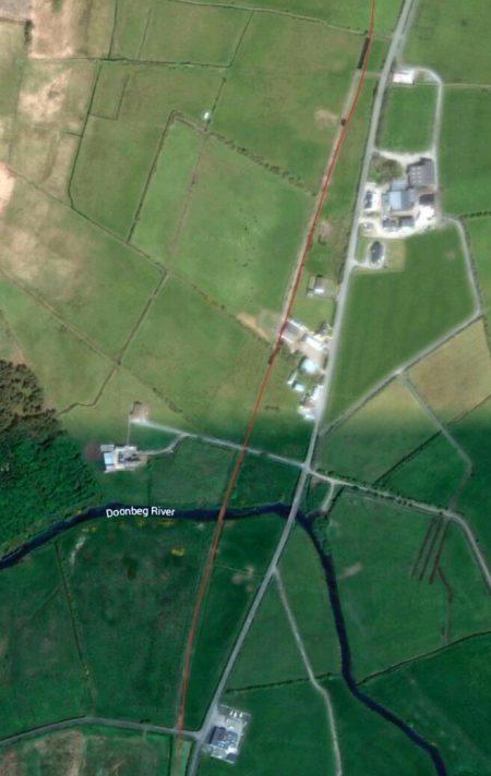
Patrick Taylor describes the route between Craggaknock and Doonbeg succinctly, in one short paragraph: “On the three and a quarter mile journey to Doonbeg the line passed through six level crossings, two situated in the townland of Clohanes and four in the townland of Caherfeenich – they were Clohanes No.1 and No.2, and Caherfeenich Nos. 1-4. Just beyond the last mentioned was Skivileen Bridge (No.63) near the Doughmore sandhills. Less than quarter of a mile on, Doonbeg Station Gates were crossed to enter Doonbeg Station” at the 37.75 mile-point. [1]
The first of a series of Crossings is Clohane crossing No. 1 which can be seen on the satellite image above and in the pictures below.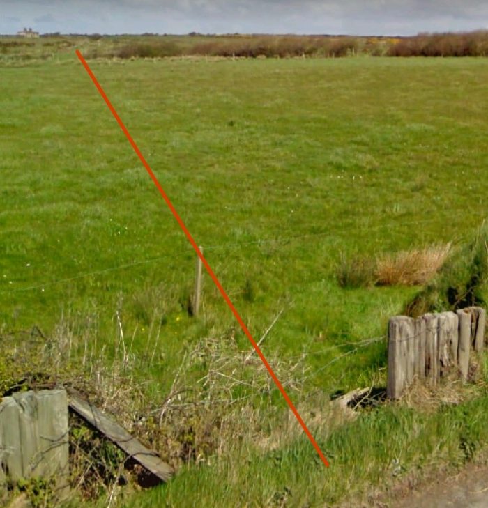 Looking back from Clohanes Crossing No. 1 towards Craggaknock Station.
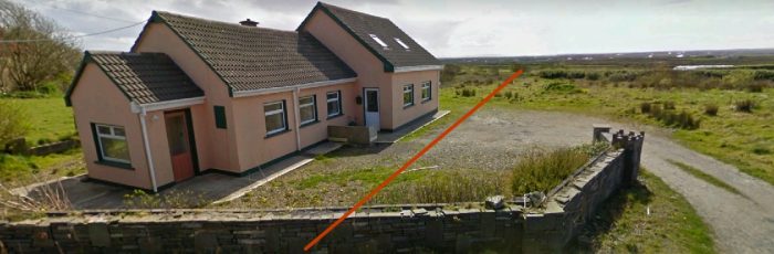 Looking forward from Clohanes Crossing No. 1 towards Doonbeg.
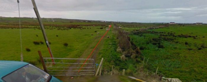
Just 100 yards or so beyond Clohanes Crossing No. 1, Clohanes Crossing No. 2 was encountered. It crossed a lane which at one time was more heavily used than in the 21st Century. It was operated by the crossing keeper at Clohanes No. 1 and can be picked out on the satellite image above to the Southwest of the first crossing.
 Beyond that crossing the railway encountered a falling grade as it headed South. Easier on southbound locomotives, this bank – Clahanes Bank – was “a constant trouble spot for laden steam trains from the south. The gradient here is not as obvious as at Willbrook or the Black Hill, yet it was enough to give the place some measure of notoriety.” [16]
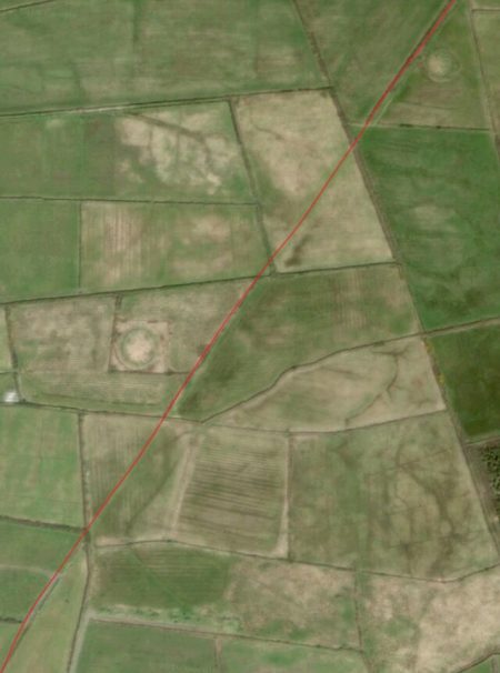
 Very interestingly on the adjacent satellite image two circles can easily be picked out alongside the line (one on the East and one on the West) and a fainter larger circle just a little to the East of the line.
These circles are the remains of what appear to be earthen fortifications.
These are Cahers and they are a frequent occurrence in Co. Clare. There appear to have been around 2400 of them in Co. Clare alone. [17] They were homesteads rather than defensive fortifications which were known as Cashels. The name of the village close to these earthworks highlights their status … Caherfeenick. It appears on the adjacent satellite image.
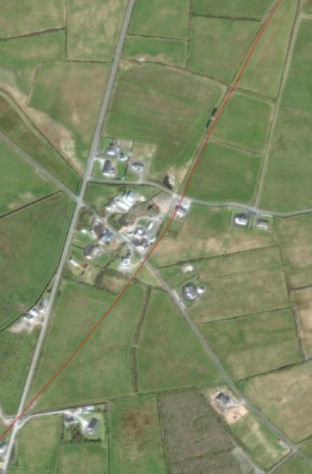
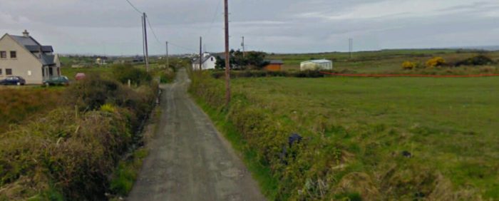
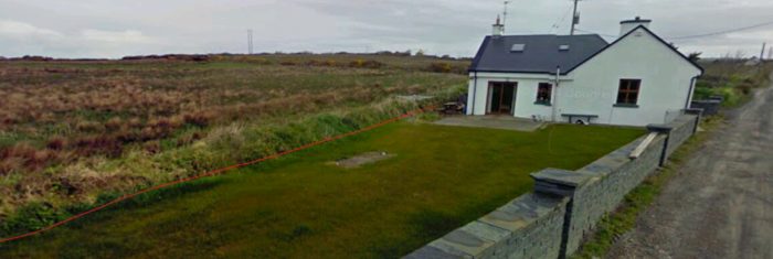
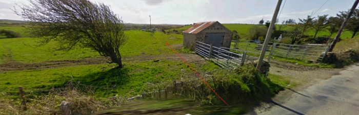
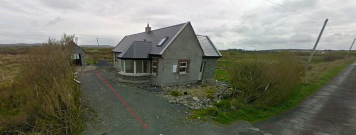
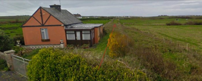
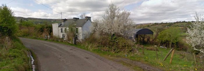
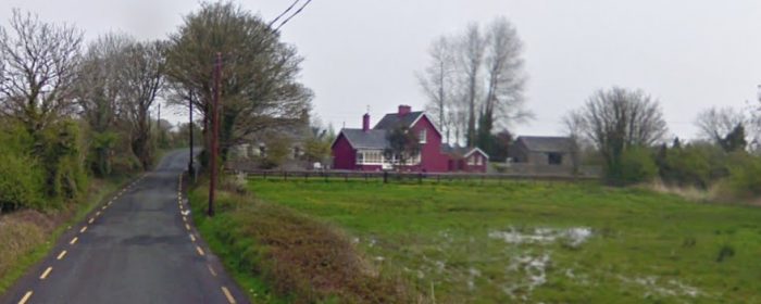
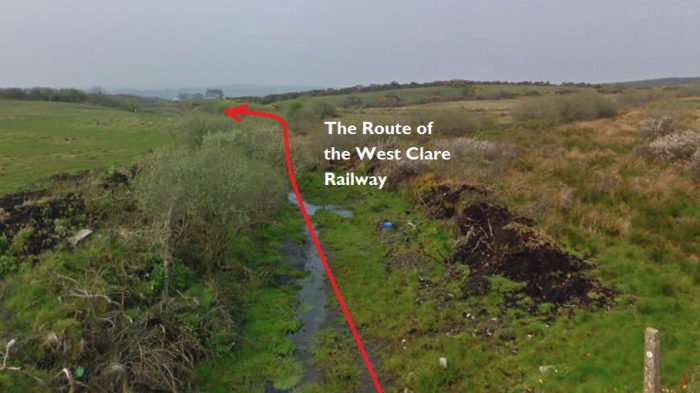
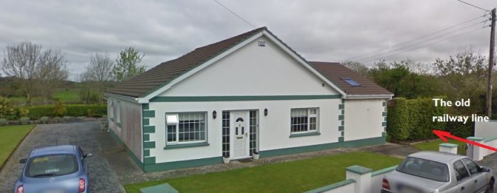
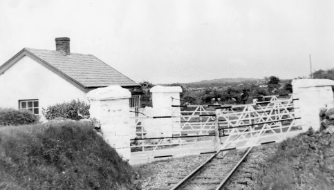
As we have already noted, there are 4 Crossings in the area of Caherfeenick. Caherfeenick Crossing No. 1 was located on a little used lane way northeast of the village. Caherfeenick Crossing No. 2 had a Crossing-Keeper’s Cottage. In the 1980s, when Lenihan walked the route of the line the crossing keeper’s cottage was unaltered since the closure of the line and the last crossing-keeper still lived there. [19] It can be seen above roughly at the centre of the satellite image. In the early 21st century, little has changed. The cottage still stands with only minor changes.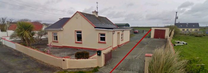 Caherfeenick Crossing No. 2. The route of the old line is marked in red and the crossing-keeper’s cottage still stands sentinel at the crossing location. This view looks back towards Crossing No. 1.
 This picture is taken from the narrow lane at Crossing No. 2 and looks forward along the route of the old line towards Crossing No. 3.
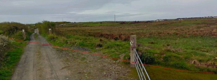
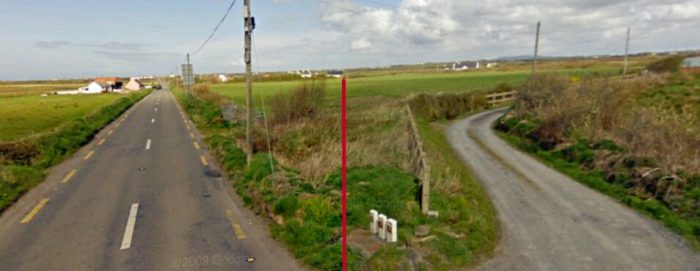 Caherfeenick Crossing No. 3, looking back along the line towards Quilty.
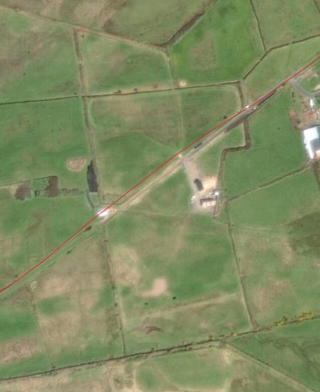
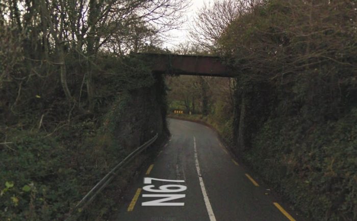
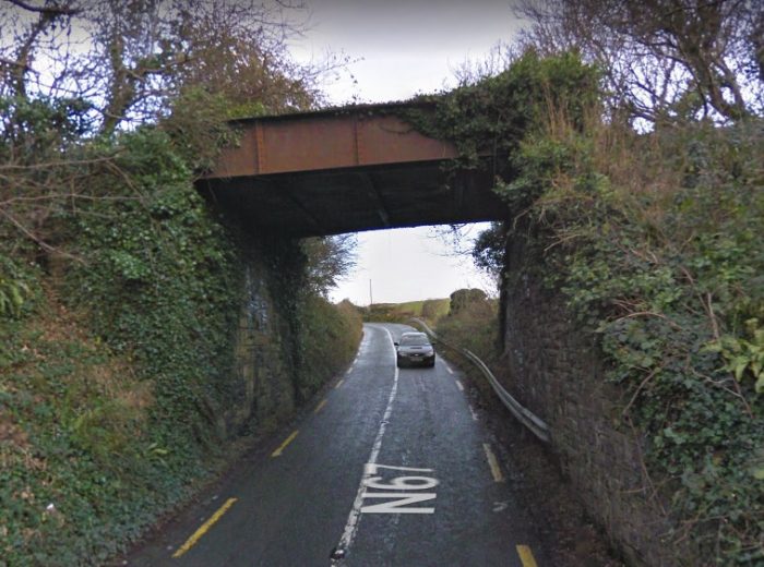
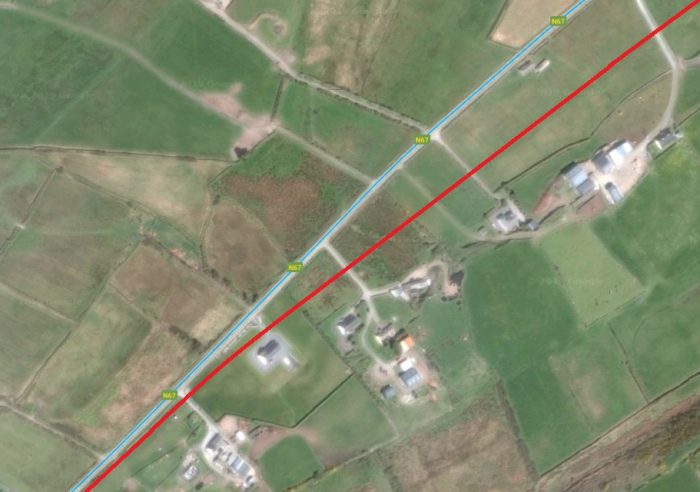
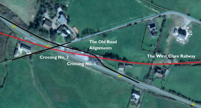
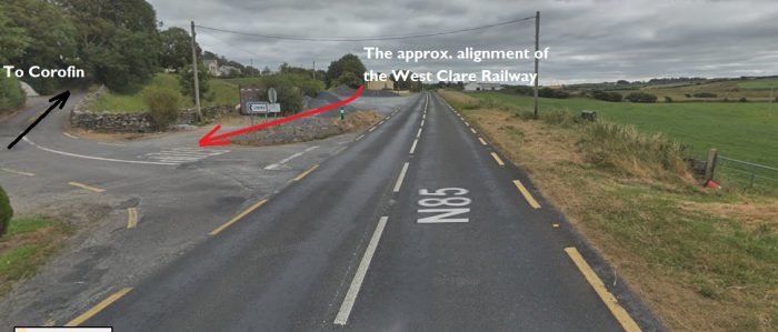
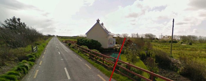 The N67 is crossed by the old line at Crossing No. 3. This view looks forward towards Doonbeg. The crossing appears at the bottom left of the satellite image above.
 Edmund Lenihan describes this crossing which also appears at the top of the adjacent image as follows: “The road at no. 3 is reached through the usual fence of sleepers, and the cottage is 20 yards away, on the down side. It is as though time had stood still here, for the little house is in pristine condi
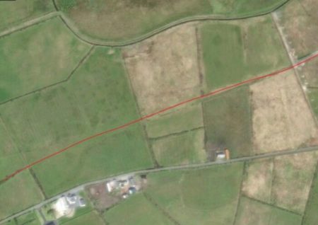 tion, everything as it was when first it was built.” [20]
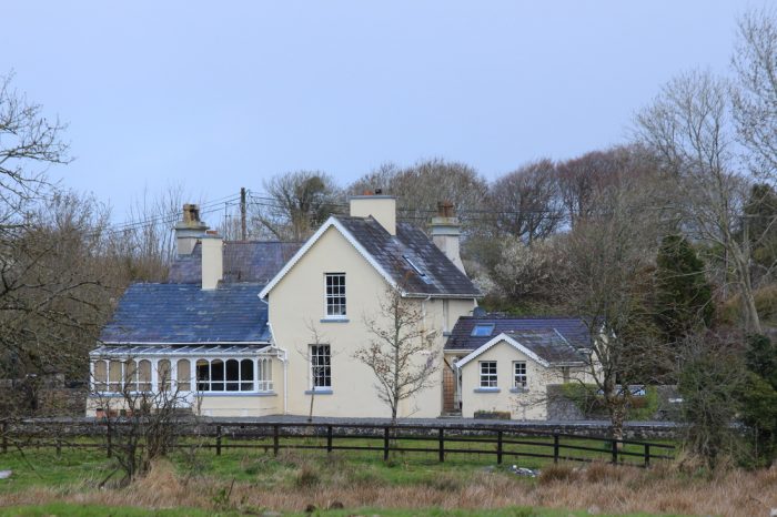
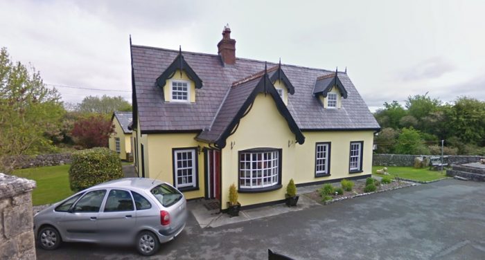
The cottage is much changed in the early 21st century. Lenihan goes on to point out that “Caherfeenick no. 3 has a more recent and cheering claim to fame: it is the home place of Michael O’Halloran, MP for Islington, London, one of the many emigrants who have achieved an eminence abroad that would almost inevitably have been denied them at home.” [20] He was, of course, writing in the late 1980s. The present incumbent of the role of MP for Islington (2019) is the current leader of the Labour Party, Jeremy Corbin.
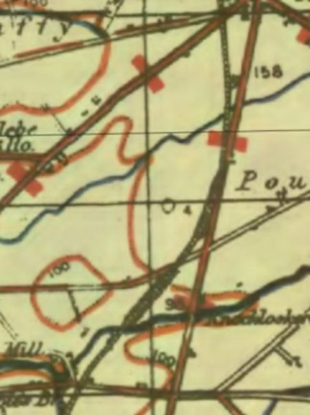
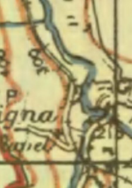
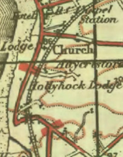
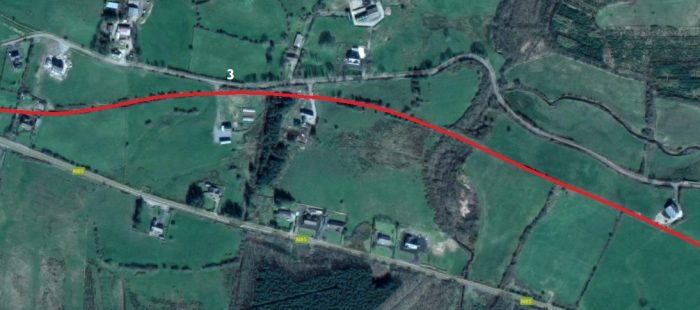
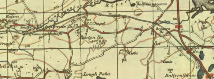
 Caherfeenick Crossing No. 4 was located at the point where the old railway encountered a T-junction of roads at the boundary of two townlands – Caherfeenick North and South. That crossing is evident on the adjacent map. The railway continued on to Doonbeg which was no more than a mile ahead. It appears in the bottom left of the adjacent OS Map from the 1940s. On the way there the railway crossed Skivileen Bridge about 300 yards from Caherfeenick No. 4.
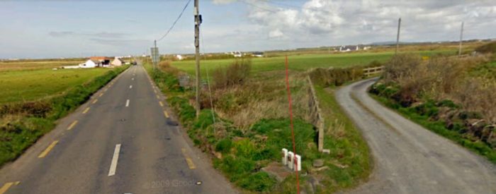 Cahirfeenick Crossing No. 4, looking back towards No.3.
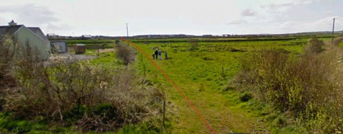 And looking forward towards Doonbeg.
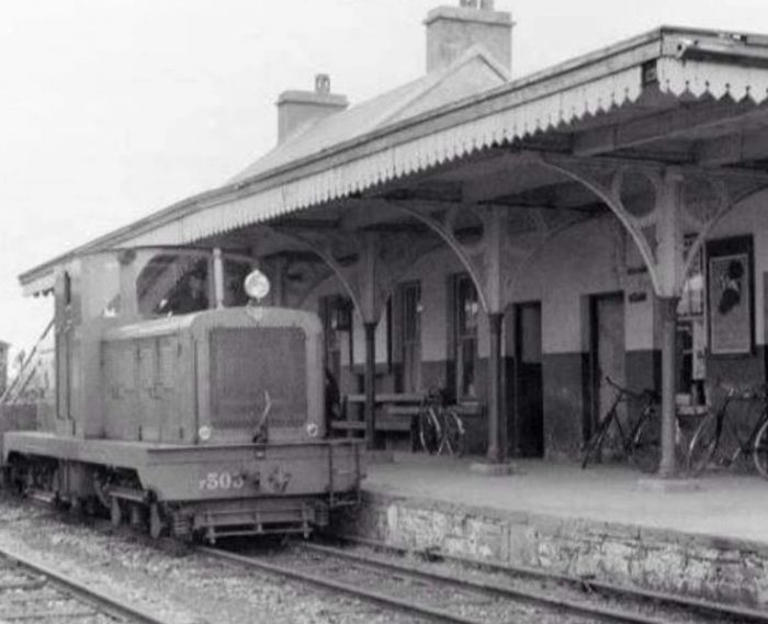
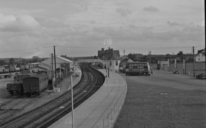
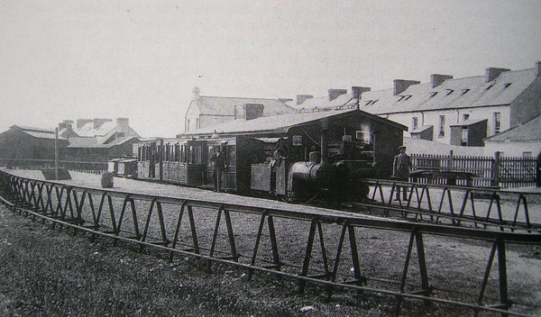
Patrick Taylor says: “Doonbeg (Dunbeag) “The Small Fort” is said to be the longest village in Clare. It is here that the Doonbeg river enters the sea at Doonbeg Bay, and was once a fortress of the McMahons and later O’Briens, where until recent times stood a large stone castle. A short distance on one side lies Baltard Bay and on the other side Doughmore Sandhills. The station at Doonbeg, also a block post, situated on the town side was provided with a platform, car park, loading bank, goods store and a large siding all on the station side, with a two lever ground frame on the opposite side.” [1]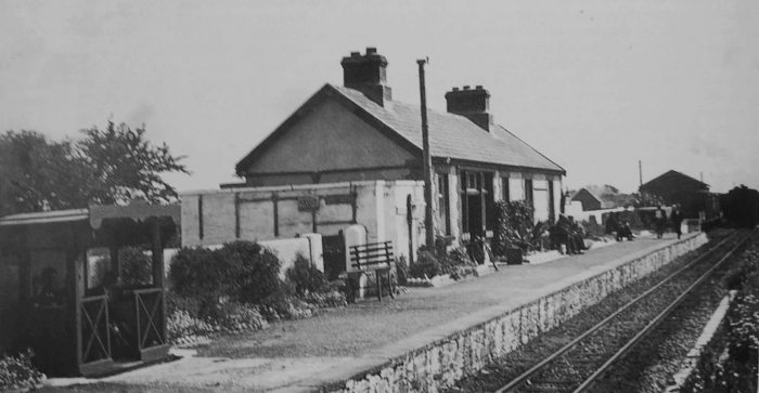 Doonbeg in the 1950s looking towards Moyasta. [1]
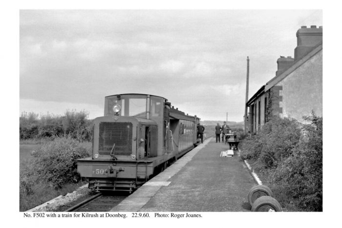 Doonbeg in 1960, © Roger Joanes. [22]
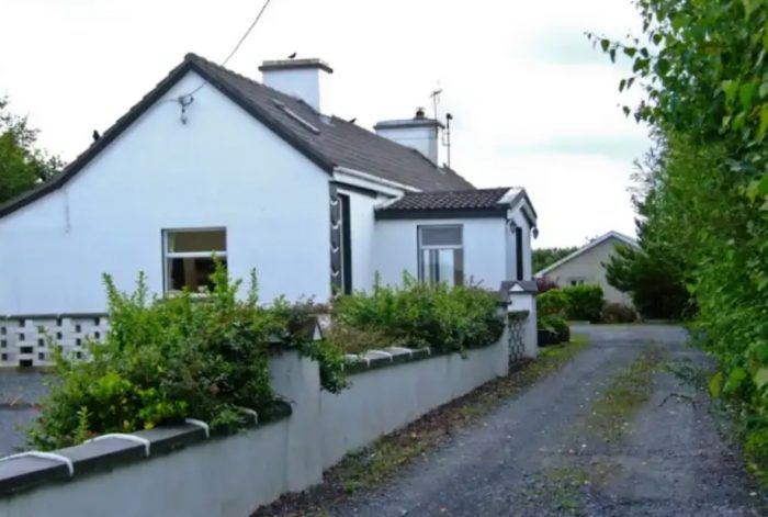 Doonbeg Station building in the early 21st century, © C. Cooney. [21]
 South of the station platform, the Goods shed was at the head of a passing loop decsribed as a siding. Taylor says: “On leaving Doonbeg yard after a slight curve the three arch Mountrivers bridge (No.64) over the Doonbeg river was crossed, and the line ran parallel with the public road for over a mile. The public road veered to the left at this point and the railway continued on a straight line to Shragh siding.” [1]
As the route of the line meets the Doonbeg River the quality of the satellite images available on Google Earth deteriorates. However, Streetview was able to provide a view of the bridge over the Doonbeg River which is a steel girder bridge, not the three-arched bridge mentioned by Taylor. Lenihan confirms that it is the road bridge which is the three-arched structure. [22]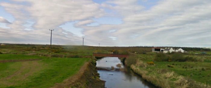
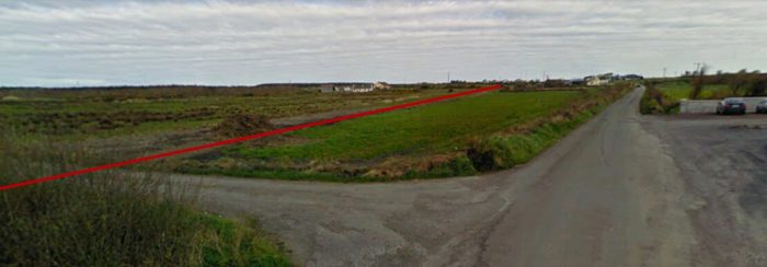
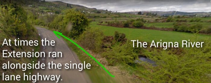
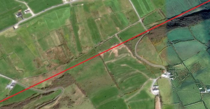
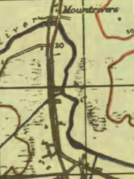 South of the river, the landscape is relatively flat and trains on the old railway would have trundled along in their own sweet way heading for Moyasta Station. The road and railway ran in parallel, as can be seen on the image below. It is taken at the point marked ’30’ on the OS Map and looks back towards Doonbeg.
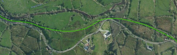
The following image shows the point at which road and rail diverge. This is evident on the adjacent map.
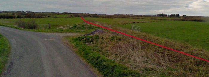
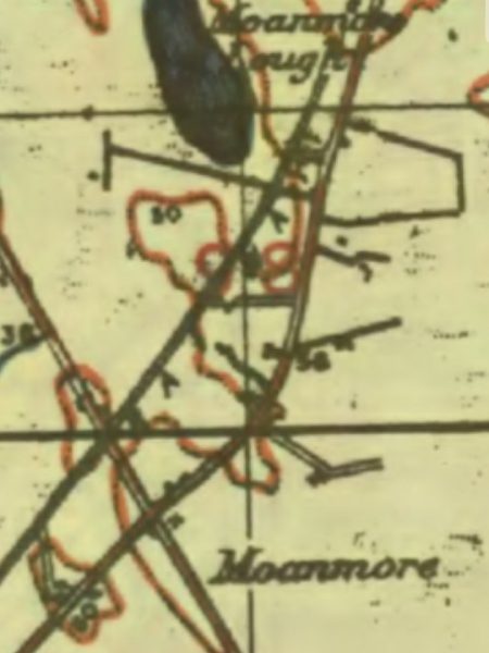
 We see the ongoing journey on the 1940s OS Maps. After leaving the road, the railway continued in a southerly direction before running parallel to another minor road as it travelled passed Moanmore Lough to the west of the line.
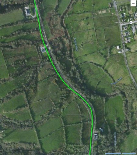
The Google Earth satellite image shows the the relative positions of road (blue line), old railway (red lines) and the Lough. The old railway track bed has been used in places as the formation level for private driveways to properties built over the old line.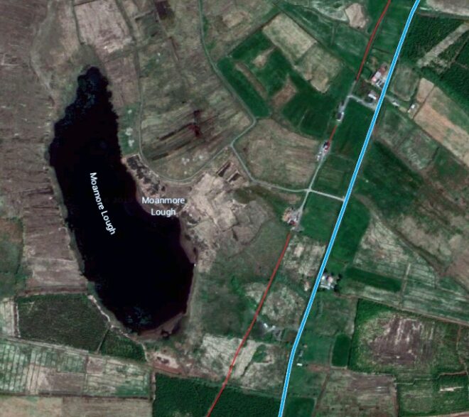
 The line continues to follow (approximately) the line of the road heading to Moyasta.
Moanmore Crossing had can derelict Crossing Cottage when Edmund Lenihan first visited in the 1980s. [23] Later he notes that it had been rebuilt. [24] The next two photographs show the trackbed either side of the crossing. Looking north along the trakbed at Moanmore Crossing.
 And (above) looking with at the same crossing.
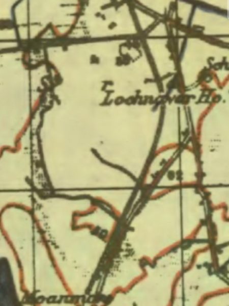
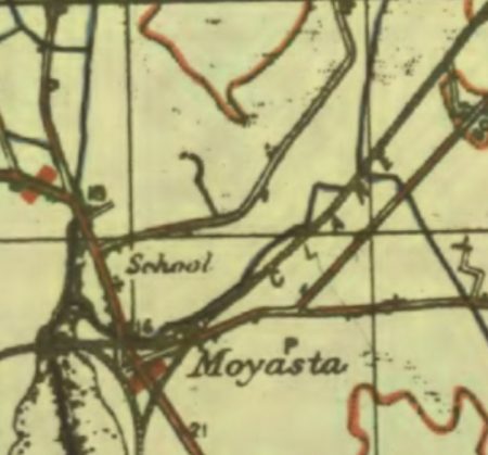
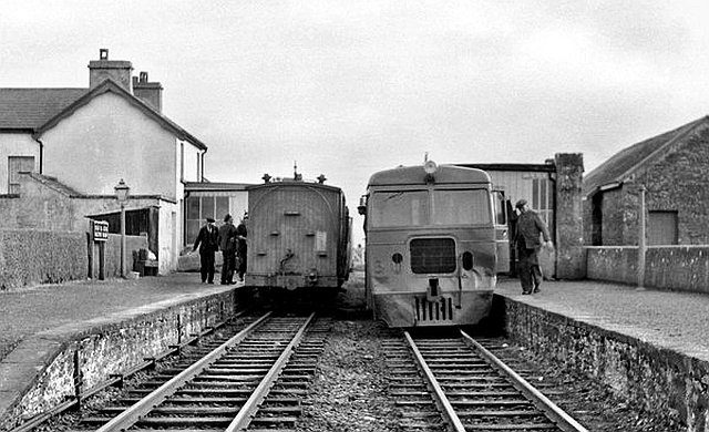
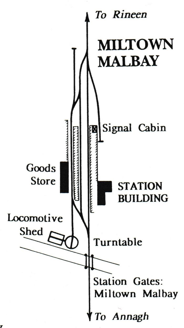
Moyasta Station was a junction station. Here the line separated to serve both Kilrush and Killed and allowance was also made in the form of a triangular junction for through traffic between the two. We will finish this section of the journey here at Moyasta, aware that there will be more to explore than just the history of the line and ready to do so in the next post in this series. A preservation scheme has been in operation for a good number of years in the 21st century and we will in due course explore what has been done.
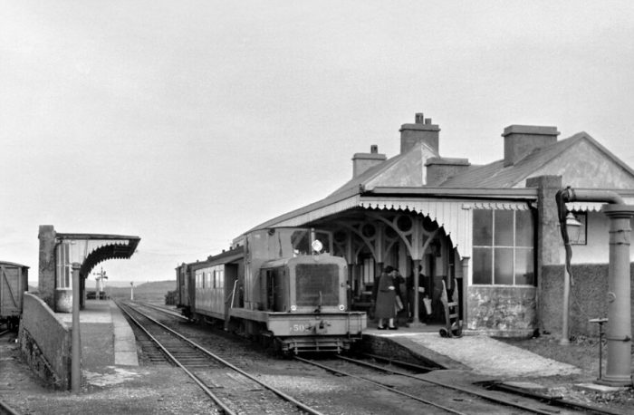
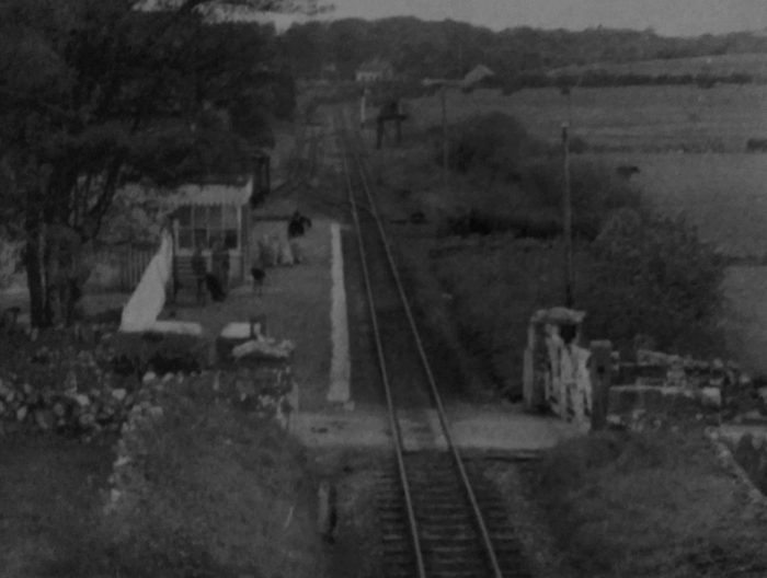
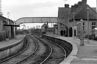
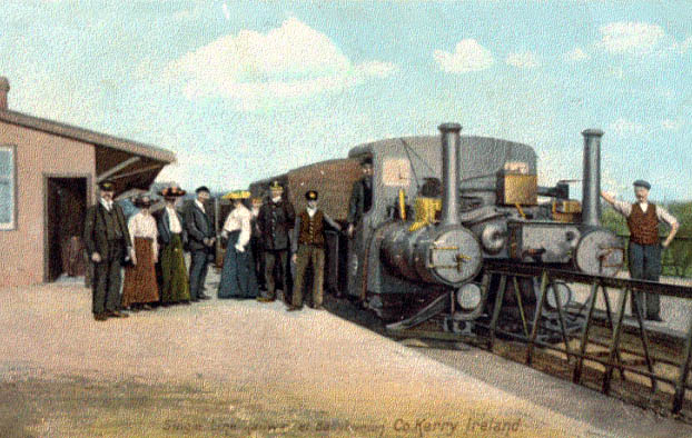
We finish this post with a few images from the past.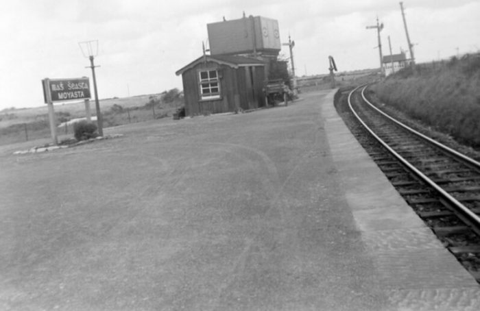 Moyasta Station lookin north in September 1950, © James P. O’Dea, National Library of Ireland. [25]
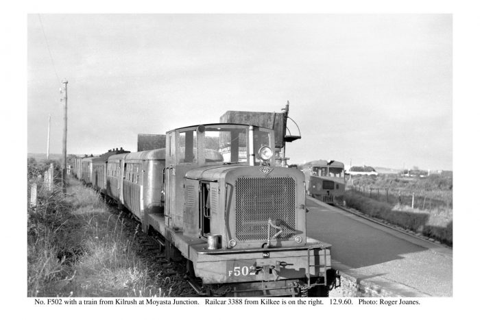
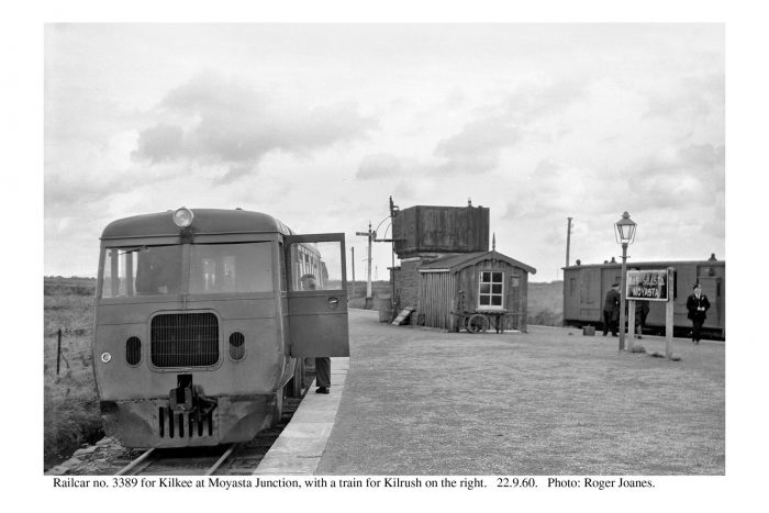
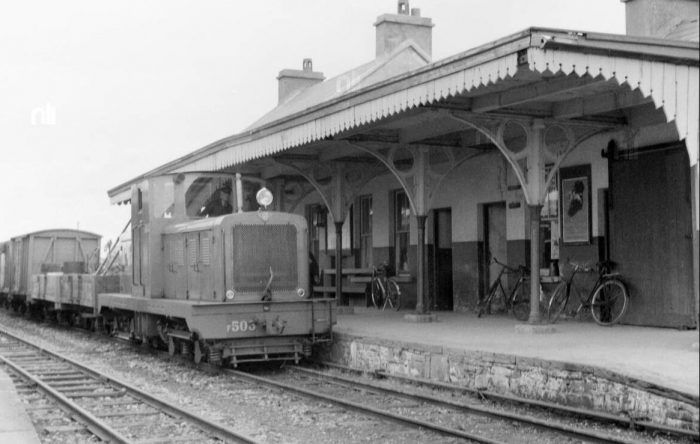
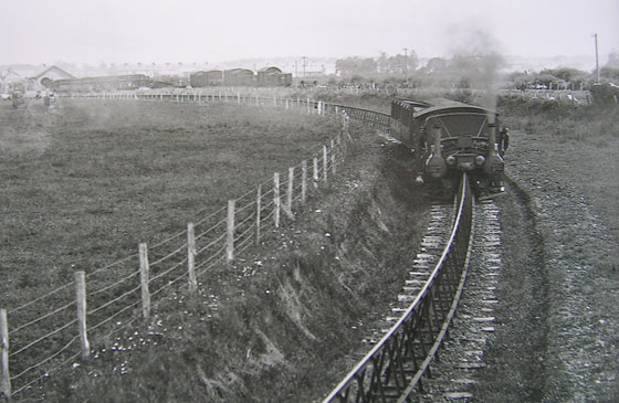
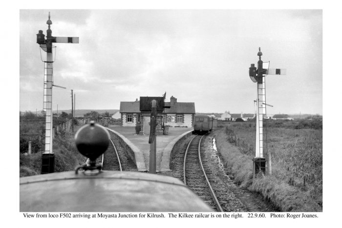 Three images of Moyasta Station in 1960, © Roger Joanes. [26]
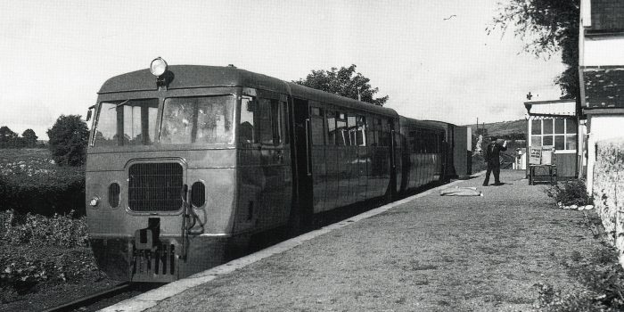
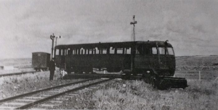
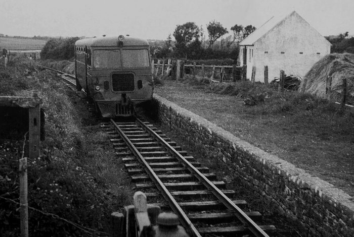 A railcar on the through route from Kilrush to Kilkee in 1953, © Les Hyland. [27]
 The through connection between Kilkee and Kilrush is on the left. The railcar is leaving Moyasta for Kilrush. There were very few through workings between the two towns that did not also need to call at Moyasta, © A.M. Davies. [27]
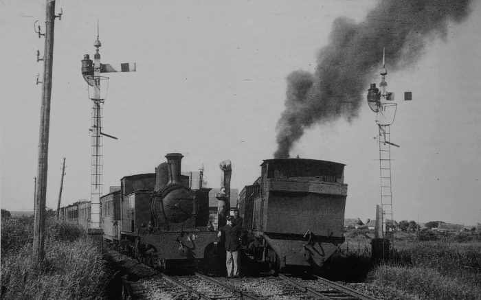 Branch train meets main line train at Moyasta Junction on 17th July 1947. On the left is No. 11C, with the 9.30am ex Kilrush, making connection with No. 6C, on the right, with the 9.35am from Killed through to Ennis. Interestingly, the main line engine is running bunker first -perhaps the Killed turntable was out of use for some reason. The Kilrush train, after departure of the one to Ennis, would propel back out of the platform, and then via the third side if the triangle, proceed to Kilkee, thus providing a Kilrush to Kilkee service, © C.H.A.Townley. [28]
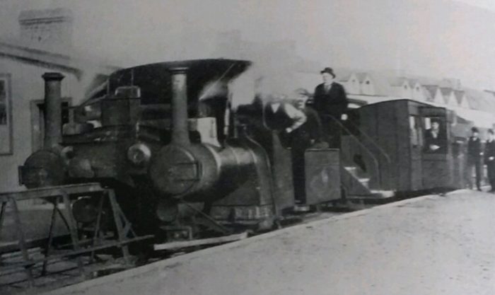
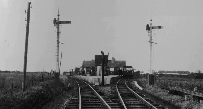 Moyasta Junction in 1952, © IRRS. [29]
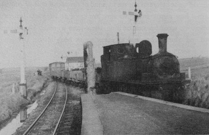 Engine 5C with a down goods at Moyasta, 5th February 1955, © IRRS. [29]
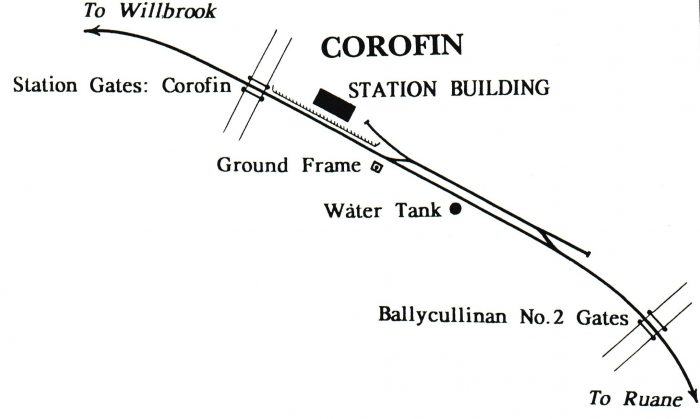
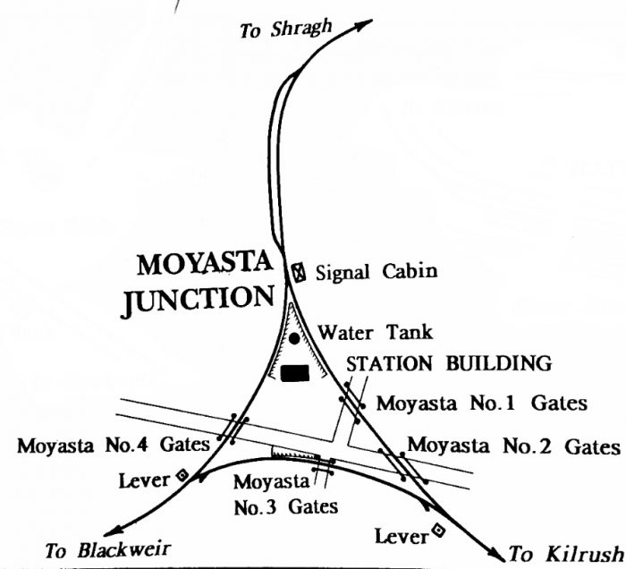 A plan of Moyasta Station before the closure of the West Clare Railway in 1961. [30]
References
- Patrick Taylor; The West Clare Railway; Plateway Press, 1994, p42.
- Edmund Lenihan; In the Tracks if the West Clare Railway; Mercier Press, Dec. 2008, p182.
- http://www.milleens.net/showmedia.php?mediaID=53&medialinkID=54, accessed on 30th April 2019.
- http://www.clarelibrary.ie/eolas/coclare/places/quilty_arialview.htm, accessed on 30th April 2019.
- http://www.clarelibrary.ie/eolas/coclare/places/quilty.htm, accessed on 30th April 2019.
- Edmund Lenihan; op. cit., p184.
- Ibid., p187.
- Ibid., p193.
- Ibid., p194.
- Ibid., p195.
- Ibid., p196.
- http://elevation.maplogs.com/poi/doonbeg_co_clare_ireland.73139.html, accessed on 1st May 2019.
- http://eiretrains.com/Photo_Gallery/Railway%20Stations%20C/Craggaknock/IrishRailwayStations.html#, accessed on 3rd May 2019.
- Edmund Lenihan; op. cit., p198.
- Ibid., p198-199.
- Ibid., p203.
- Thomas J. Westropp; The Cahers of County Clare: Their Names, Features, and Bibliography;
Proceedings of the Royal Irish Academy (1889-1901), The Royal Irish Academy Volume 6, 1900, p415-449; https://www.jstor.org/stable/20488784, accessed on 5th May 2019. - http://www.clarelibrary.ie/eolas/coclare/archaeology/CL047-002—.htm, accessed on 5th May 2019.
- Edmund Lenihan; op. cit., p205.
- Ibid., p206.
- http://eiretrains.com/Photo_Gallery/Railway%20Stations%20D/Doonbeg/IrishRailwayStations.html, accessed on 5th May 2019.
- Edmund Lenihan; op. cit., p212.
- Ibid., p221-222.
- Ibid., p302.
- James P O’Dea Collection, National Library of Ireland, https://www.flickr.com/photos/nlireland/30230379325, accessed on 5th May 2019.
- https://www.flickr.com/photos/110691393@N07, accessed on 5th May 2019.
- Patrick Taylor; op. cit., p44.
- Ibid., p68.
- Edmund Lenihan; op. cit., p224.
- Patrick TaylorTaylor; op. cit., p48.
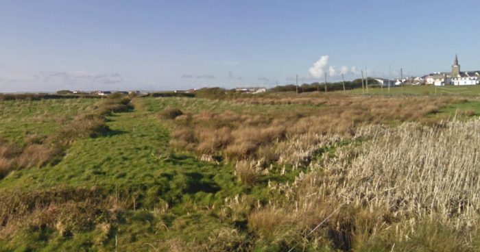


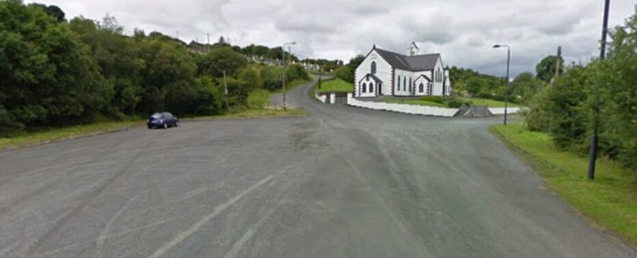


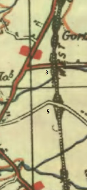
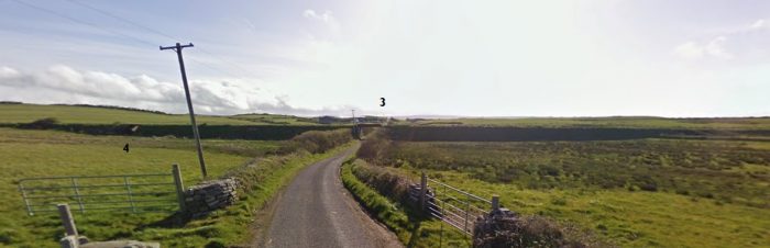
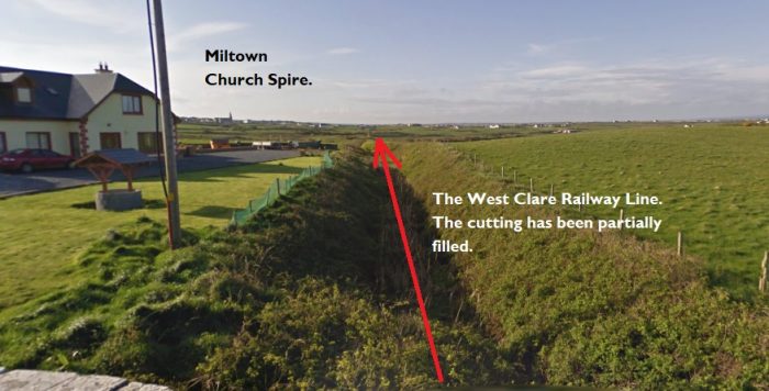

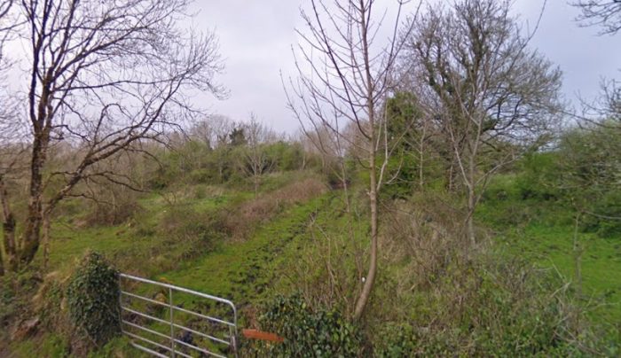
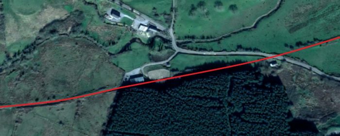
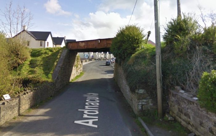
 The partially-filled cutting above clearly shows the line of the railway under the road bridge at location ‘5’. Miltown church spire can be seen on the horizon. Lenihan refers to this as Downes’ Bridge which he says is a “stone-arched span carrying a by-road over the line.” [23]
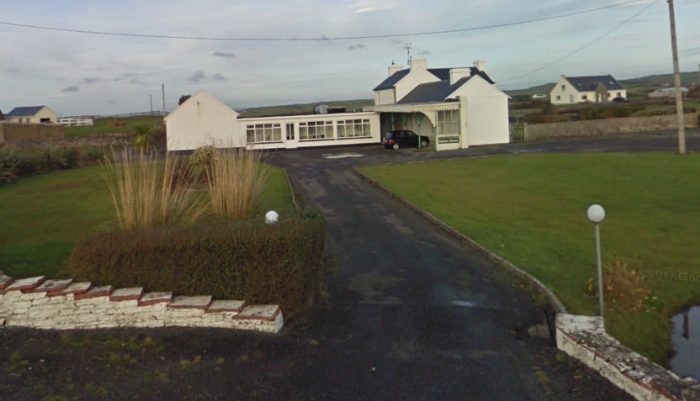


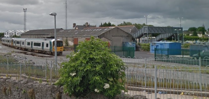


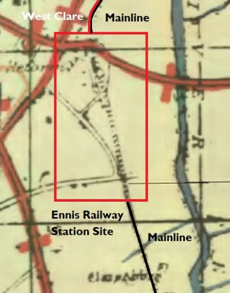
 In the past it was also the terminus of the 3ft-gauge West Claire Railway which ran North from the station alongside the mainline. North of Quin Road the land is shown on the adjacent 1917 OS Map as being used by a rail-served sawmill.


 The extended crossing-keepers cottage is seen above from the Southwest in April 2009.


