Category Archives: Railways and Tramways Blog

Railways of Herault – Route A – Saint Chinian to Beziers Line – Part 1 – Saint-Chinian to Cazouls-les-Beziers

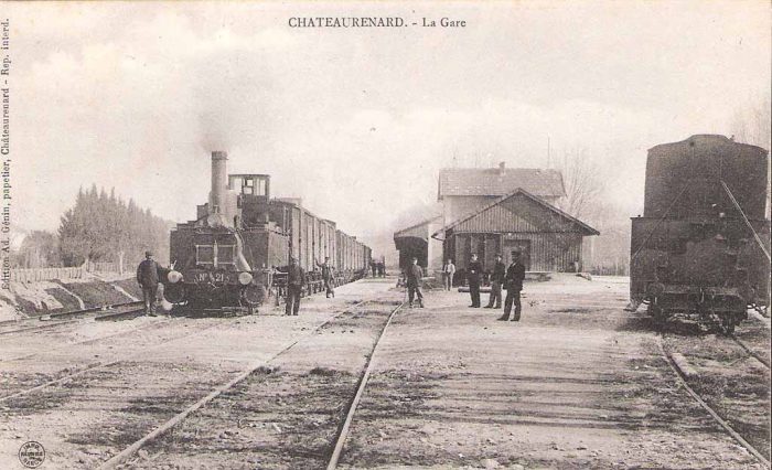
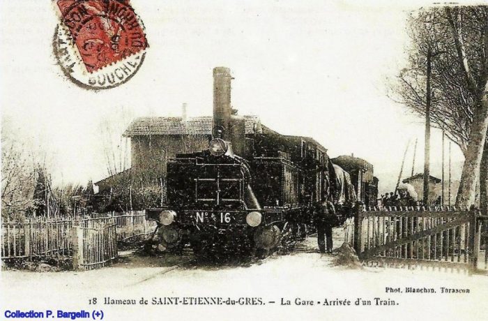
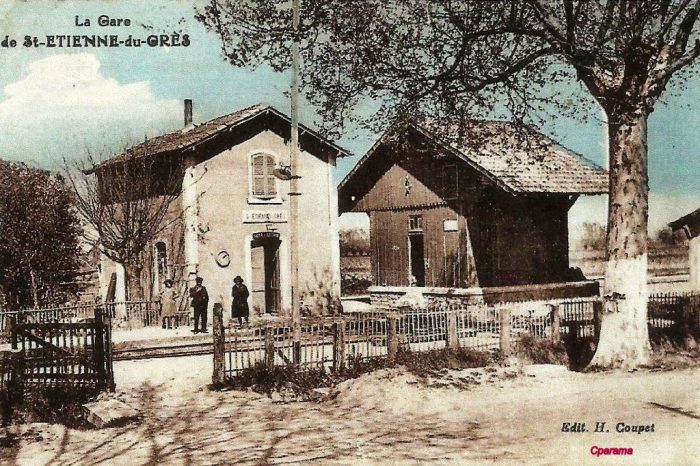
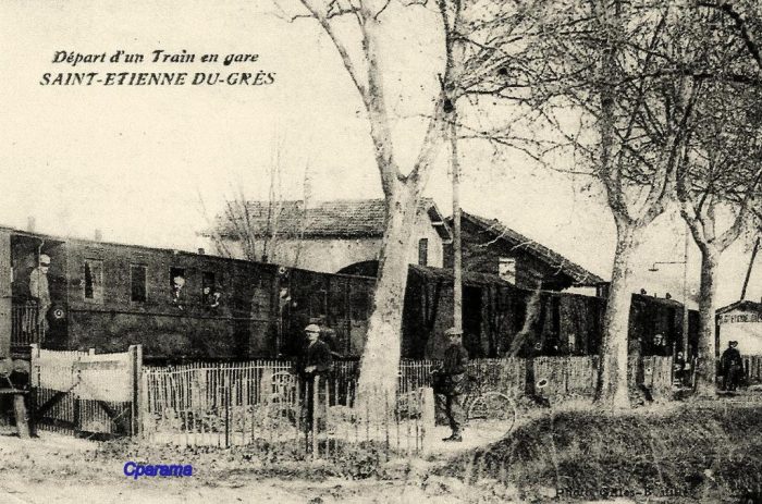
Chemins de Fer de l’Hérault
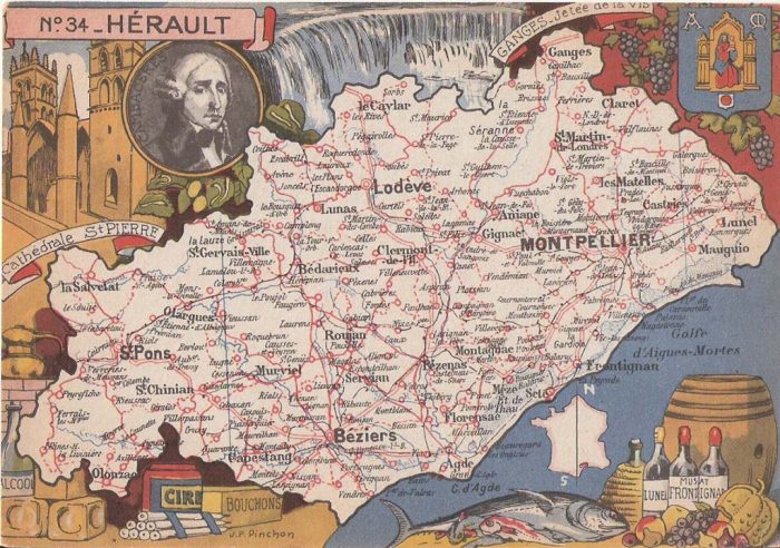
The Departement of the Herault. [7]

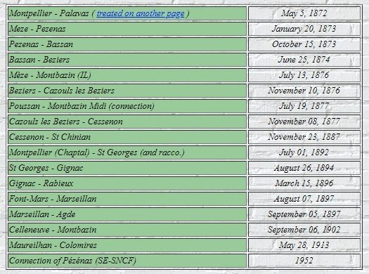
The network of the Company of Railways of Local Interest (IL) of Herault reached a maximum length of 212 km. Its lines were standard-gauge. It was planned in the first years of the second empire, it was given authorisation in July 1865.

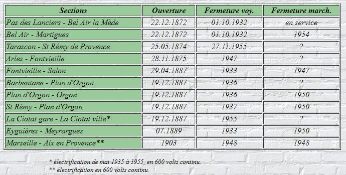
Lines were commissioned as shown in the table below: [1]

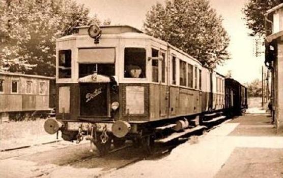
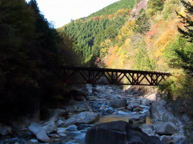
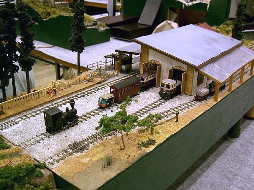
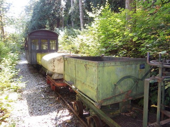
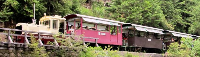
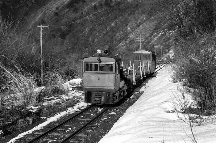
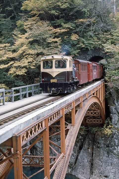
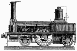
One of the early Mallet locomotives used on the line is illustrated in the adjacent image. [3]

Construction and opening of railways was interrupted for a period of 10 years, from 1877 to 1887 as a result of the poor financial condition of the Company. Bankruptcy apparently occurred in 1884. Although declared bankrupt, the Compagnie de l’Hérault succeeded, inspite of everything, in avoiding forfeiture by signing a concordat with its creditors. It issued new securities listed on the stock exchange and entered into agreements with the departement authorizing it to continue building the network of which it would be both the owner and the operator. [4] By the last decade of the 19th century the company finances were sufficiently stable to allow significant extensions to the network. [1]

The line from Celleneuve to Montbazin, when complete allowed traffic on the two parts of the network without the need to pay tolls to the Compagnie du Midi. It was the same with Colomiers to Maureilhan line.

Except for the Palavas line, which was predominantly beach-side, the other lines were for wine, grapes and bauxite traffic. But the network was fragile financially, because of construction costs, maintenance and operating expenses.

The departement purchased the network in 1928 and entrusted it to the Société Générale des Chemines de Fer Economiques (SE), which undertook some considerable work to stengthen the formation and renovate structres. The new Company also used railcars.

In 1932, under pressure from road transport, it was decided to close the passenger service on all lines except for the line to Palavas. The service was restored in 1939. However after the war traffic could not be sustained and both passenger and goods traffic ceased section by section across the network.

On 1st June 1963, the SNCF resumed serving Mèze but only until 1968. The only remaining part of the network is the line from Cazouls to Colomiers – which is incorporated into the SNCF network. [1]

The first line we will look at is that starting in Saint-Chinian and running to Beziers

Saint-Chinian – Beziers Line – Part 1 – Saint-Chinian to Cazouls-les-Beziers

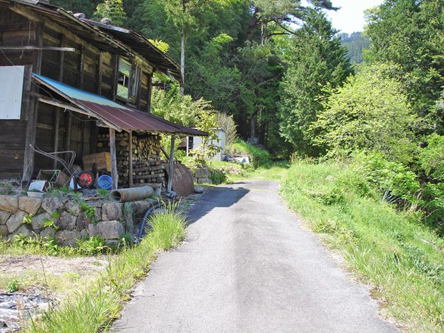
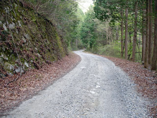
Much of the network is shown below. We start from Saint-Chinian station which is at the western extent of the network. [5] Before setting off, it is worth noting that in 1905, the journey by passenger train from Béziers to Saint-Chinian lasted 1 hour and 30 minutes (departure at 10 am, arrival at 11.30 am) . The mixed passenger/goods train was responsible for the collection of wagons in each station. The actual length of the trip could be over 2 hours in length. [6]
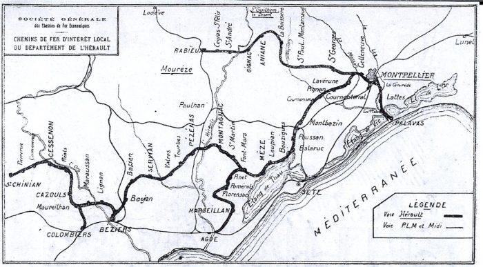
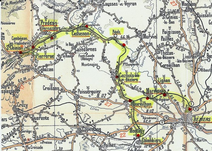
The length of the network covered in this post is the line from Béziers to Saint-Chinian and its branch from Colombiers to Maureilhan. [6]
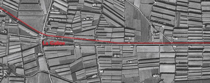
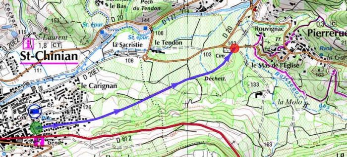
The first few kilometres from St, Chinian to Pierrerue Halt. [2]
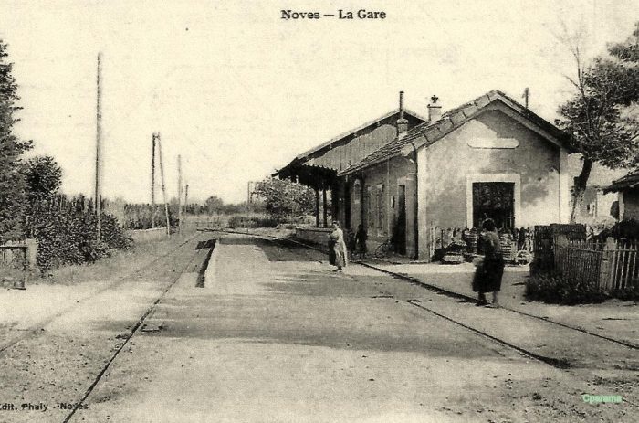
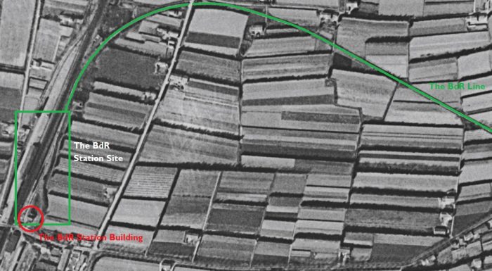
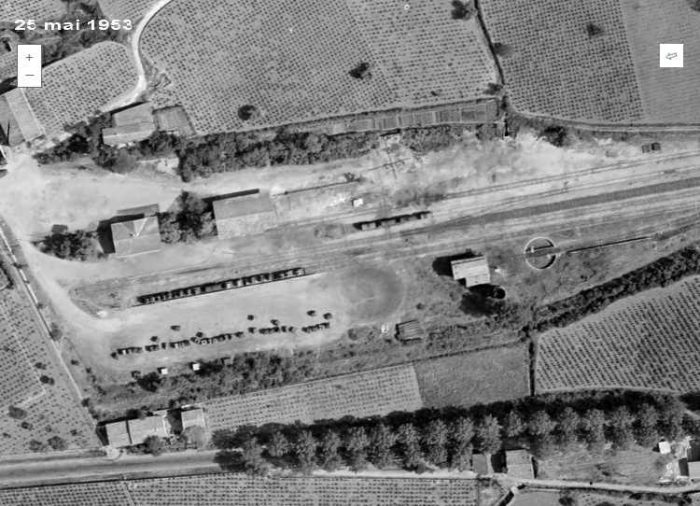
An aerial image from 1953 shows the terminus station at Saint-Chinian. [2]
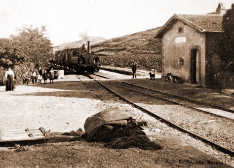
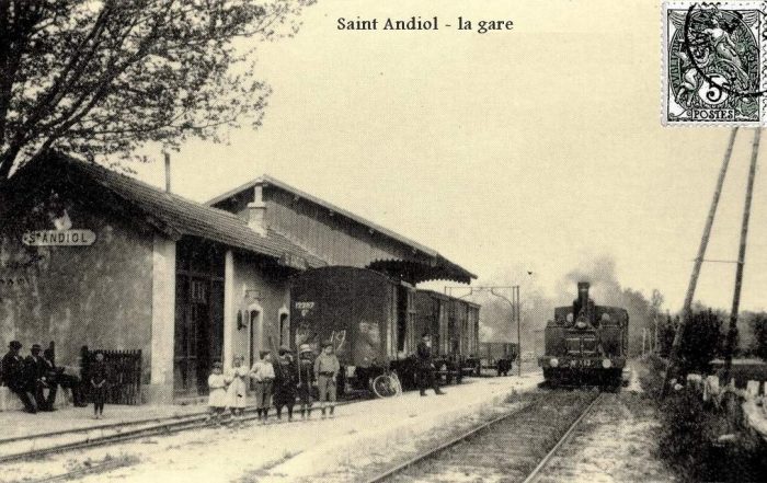
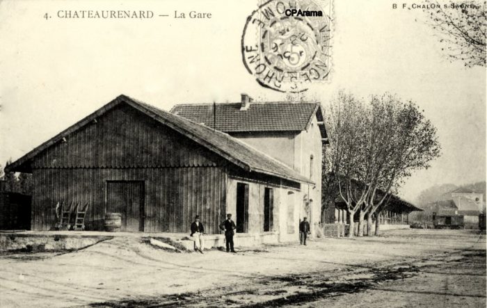
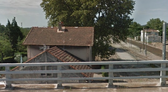
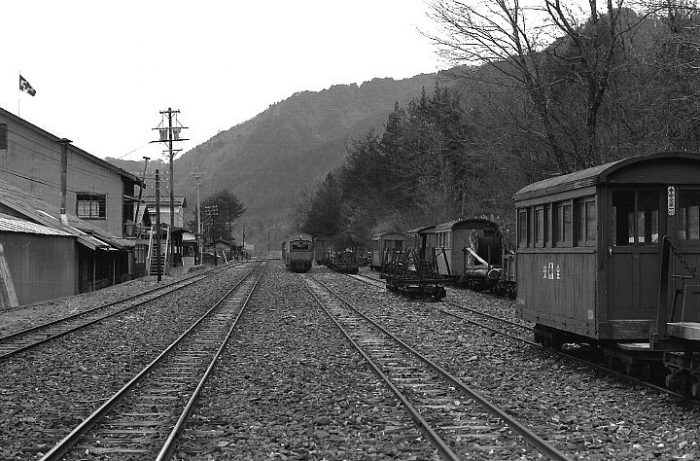
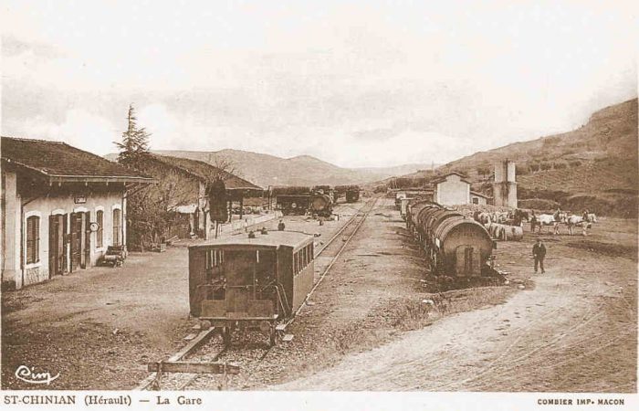
St. Chinian Station. [2]

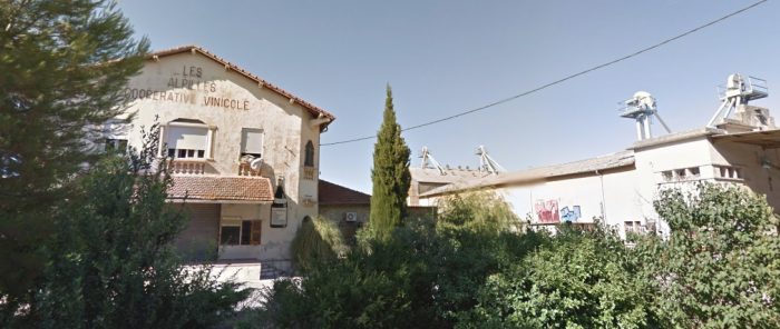
The wine trade between Saint Chinian and Béziers Gare du Nord was very important to the departement. It was around the 1850s that the departement of Herault, which was known for cereals, fields of wheat, oats, alfalfa and barley and was self-sufficient in sheep, goats and horses, began to see significant increases in the size of its vineyards. [3][33]

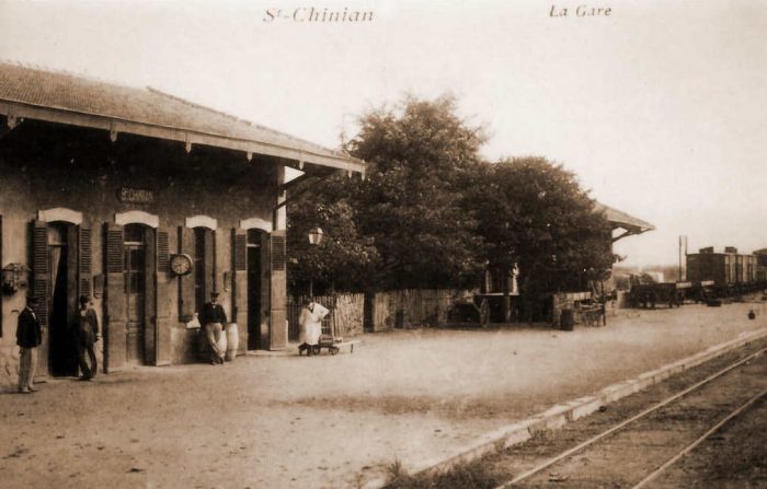
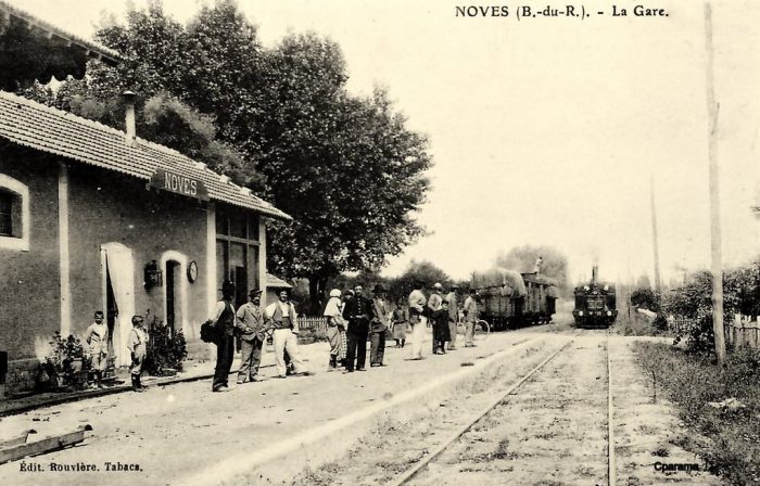
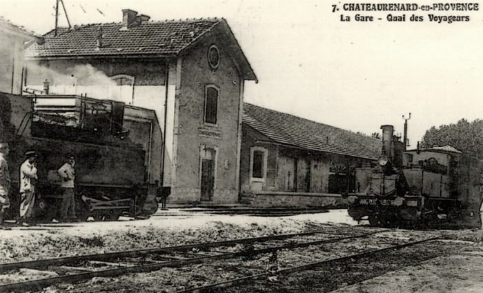
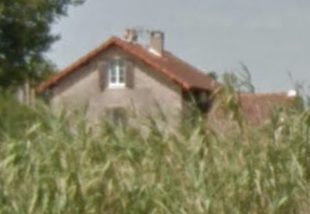
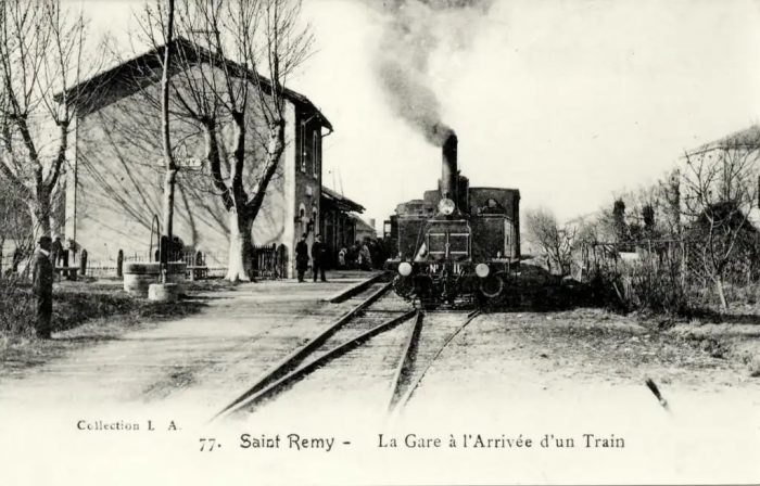
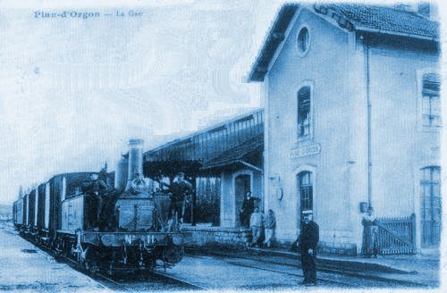
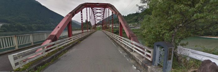
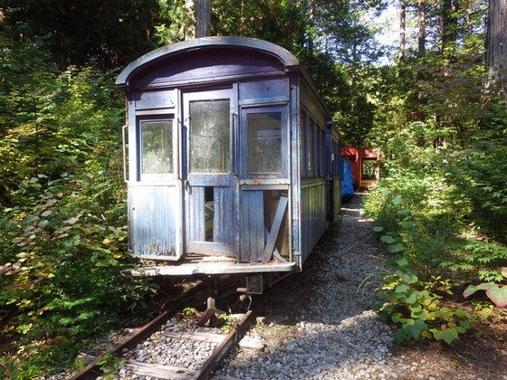
St. Chinian Station is shown above, [2] and in the adjacent image. [3][33]

The vineyard area increased from 96000ha in 1828 to 174000ha in 1850, doubling in 20 years. Little by little, the vineyards came down from the hillsides and invaded the plain. The small walls are there to testify. The main reasons were the urbanization and economic growth which caused the increase of the incomes and especially the arrival of the rail network which made the transport faster, much more reliable and cheaper than by the roads. Herault could deliver wines to Paris and the North, East and Centre of France. [3][33]

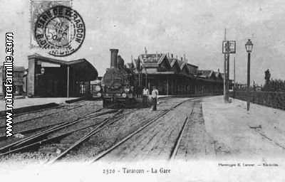
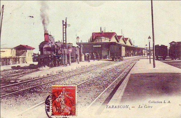
The mainline French rail network in the Hérault was shared by the PLM (Paris-Lyon-Marseille) and the Compagnie du MIDI, which started in Tarascon and headed for Bordeaux; with links to Beziers, Narbonne, Toulouse, Bordeaux and to Perpignan. [3][33]

The Béziers-Saint Chinian line included 10 sidings that connected to: three wine merchants, two cooperative cellars, two large factories, two tank wagon sheds and a repair shop.

The major handicap for the line at the beginning of its operation was the axle load at 11T. It was not until 1934 that the axle weight limit was increased to 16T. It was not until 1963 that the axle load limit was increased to 20T, which made it possible to use 40T tank wagons. An additional handicap for the line was the level of and disparity in tariffs charged by the Company. For example: A tonne of wine in barrels from St Chinian cost 195.78fr in 1934, while Puisserguier, shipped from Quarante-Cruzy to the MIDI line in Colombiers cost 186.90fr. The result was competition between stations and where competition between stations. [3][33]

In 1904, the first industrial scale wine-making cooperative appeared – “L’Egalitaire” of Cébazan. A brokers office was established on the platform of the station at St Chinian, where the sale of wine arriving by carts was negoptiated. The goods platform was a hive of activity . In the midst of the barrels of wine, wine-tasters held sway. [3][33]

The establishment of Cooperatives meant that villages lost their local distilleries. Disease badly affected the crop for a number of years. In 1907 trade began to significantly improve as vines became productive once again. By 1946, the secondary lines of the Hérault transported 74,495 tonnes of wine, of which 26% left the stations of Cazouls, Cessenon and Saint Chinian (Saint Chinian 8152 tonnes – Cessenon 7233 tonnes). [3][33]

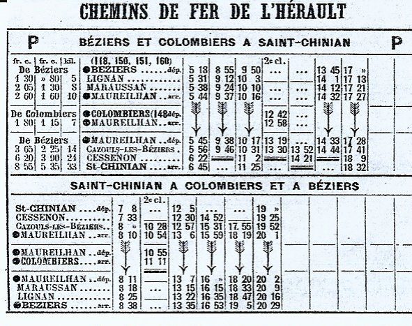
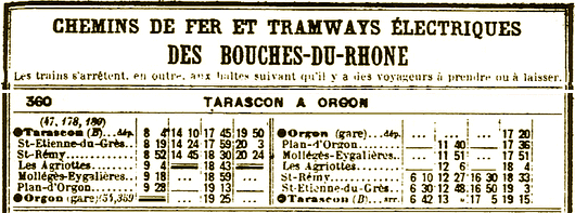
The timetable for the line in the early 20th century is shown above. [5]

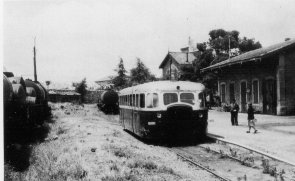
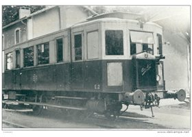
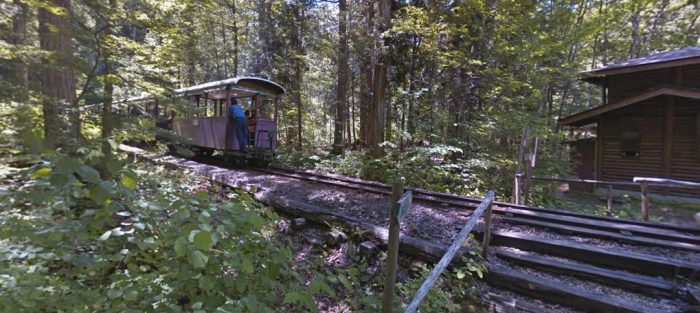
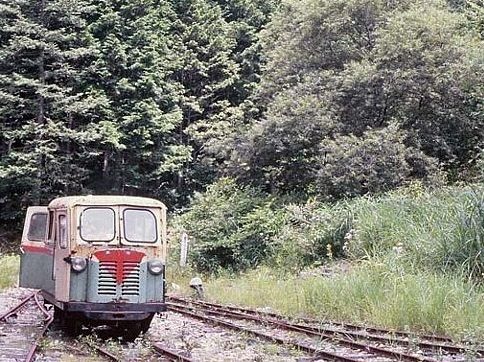
The adjacent image shows an autorail (railcar) at Saint Chinian Station. [6]

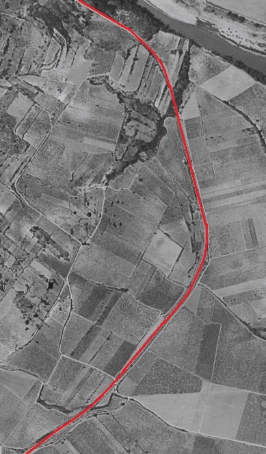
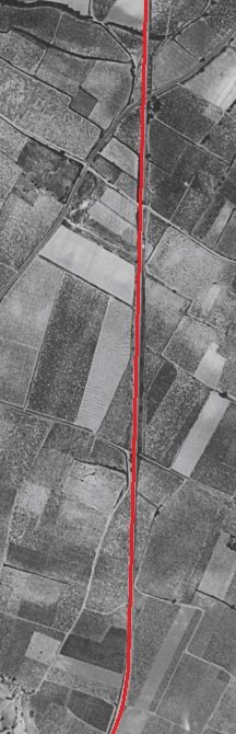
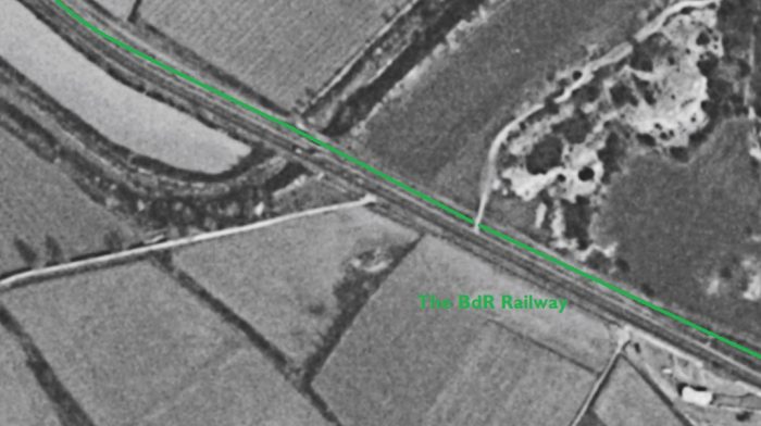
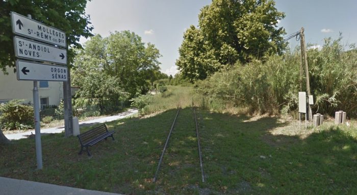
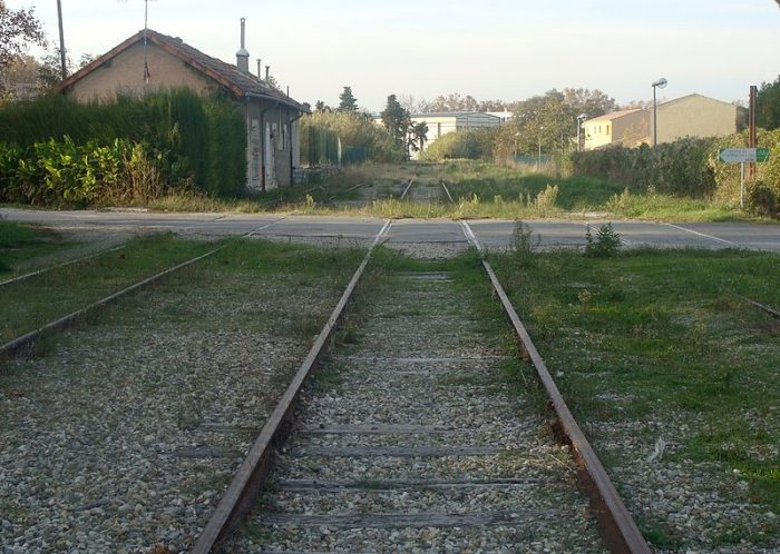
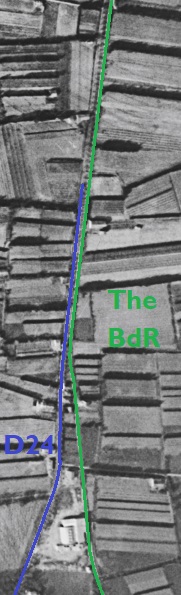
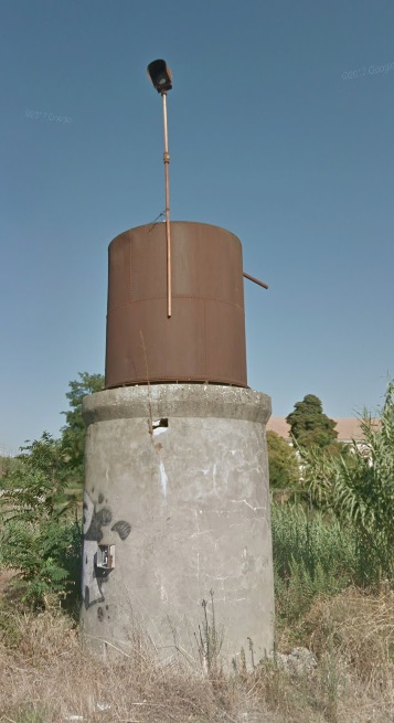
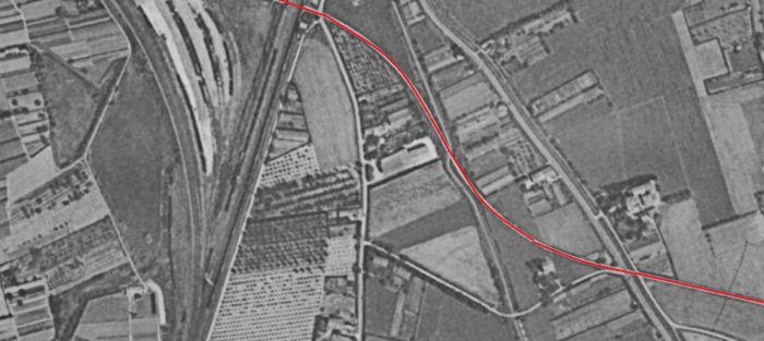
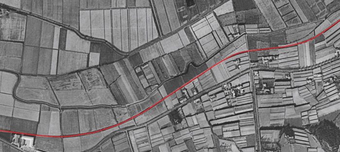
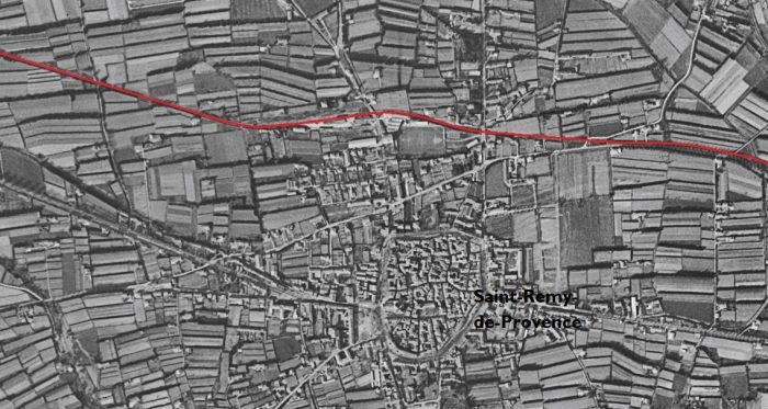
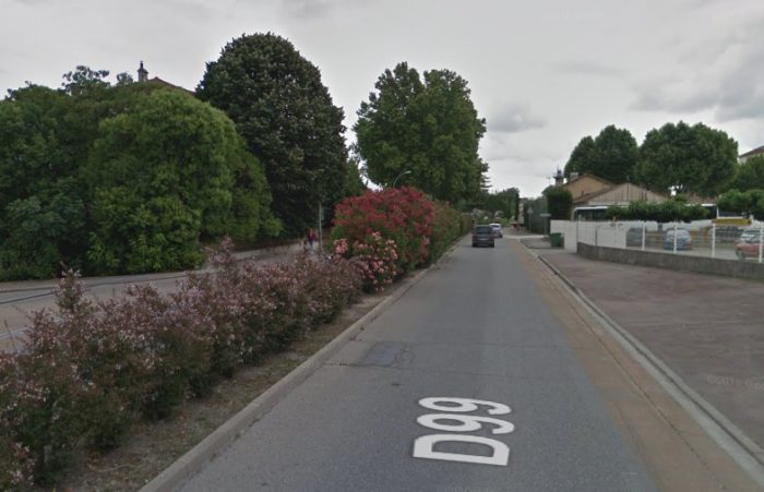
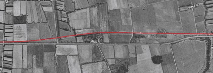
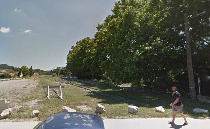
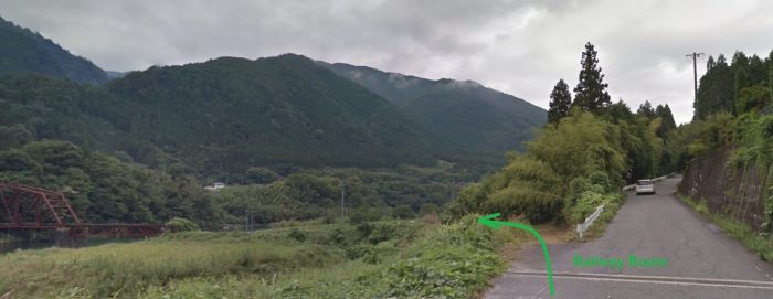
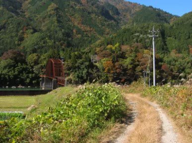
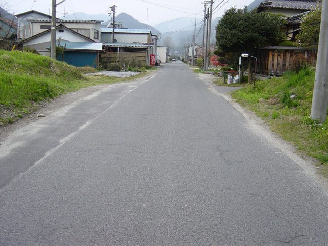
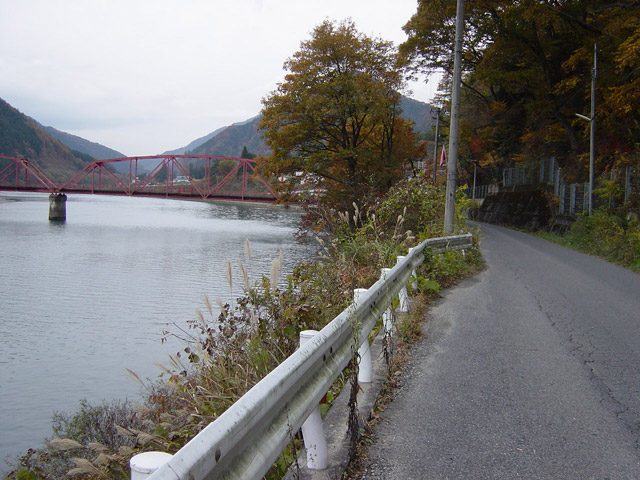
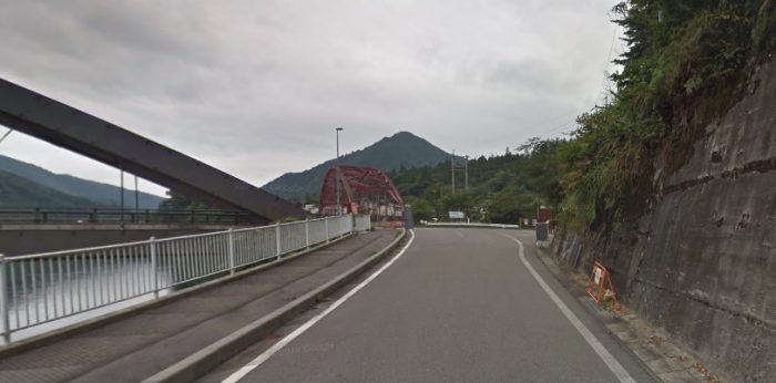
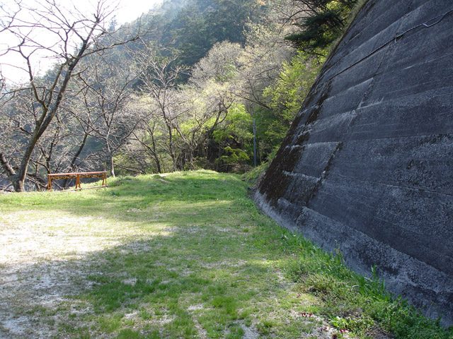
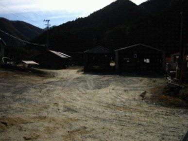
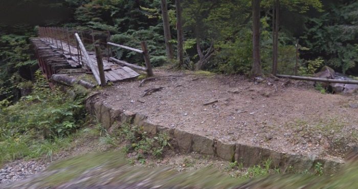
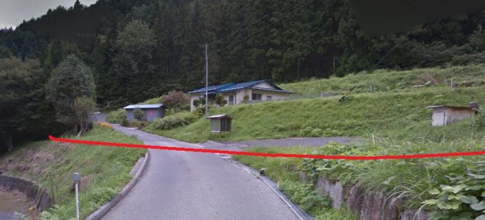
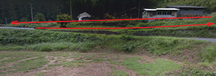
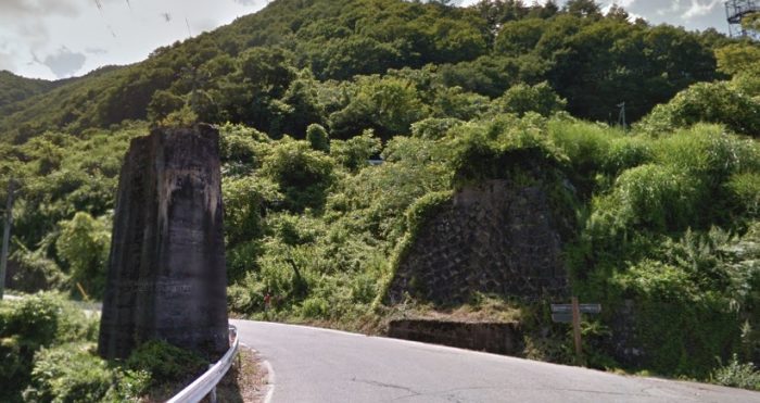
The small town of Saint-Chinian is very pretty and is in the middle of a cool valley. It is the former favorite residence of the bishops of Saint-Pons. The town hall occupies the buildings of the former Benedictine abbey which served as their episcopal palace. The caves of Our Lady of Nazareth, the Roman remains of St. Peter and the Roman cemetery of Cazo must attract our attention. On 12th September 1875, the Vernazobres River flooded two-thirds of the town causing extensive damage and the death of 97 people. [6]
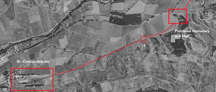
The 1961 aerial image above shows the route of the railway as a white line. It is shown overlain with a red line on the photograph. [8]
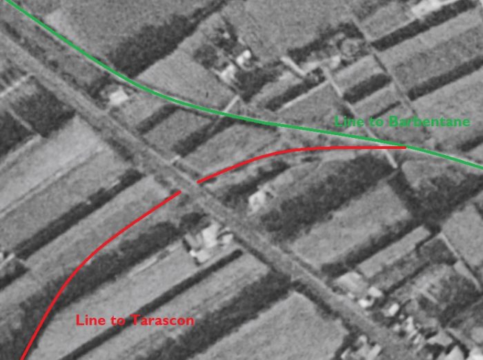
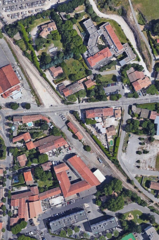
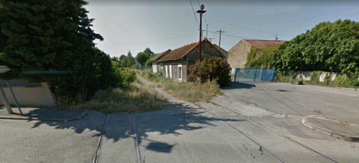
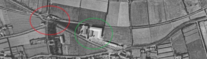
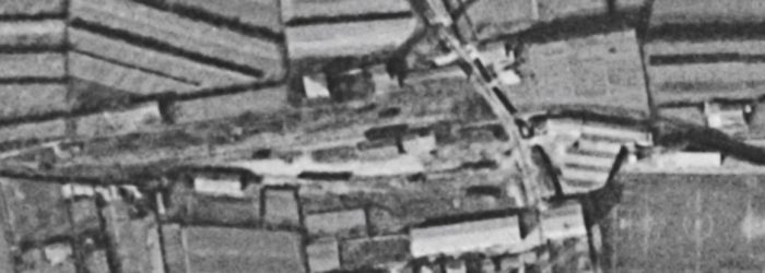
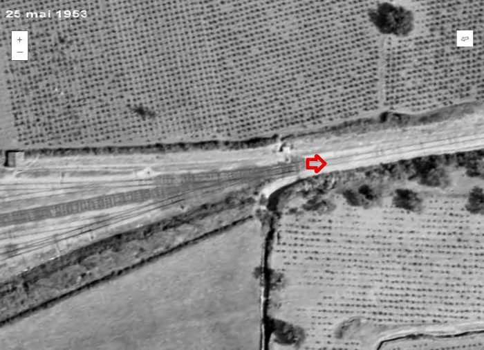
This aerial image is an extract from a 1953 survey and shows location ‘1’ on the 1961 photograph. This is the station throat at Saint-Chinian. The station area and the first part of the line to Beziers are now covered by a housing development as shown below. [2] 
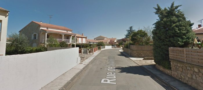
The housing development on the Saint-Chinian Station site.
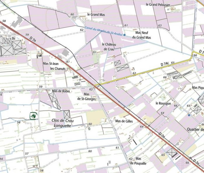
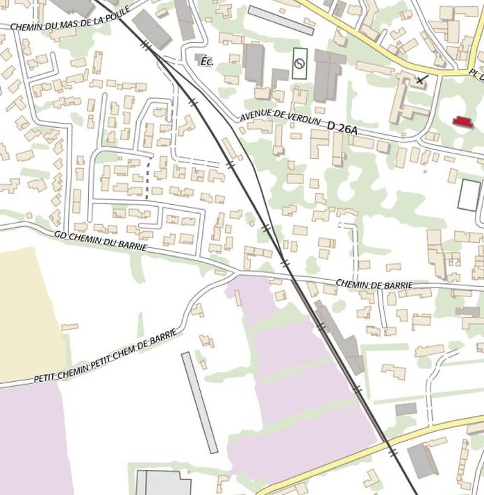
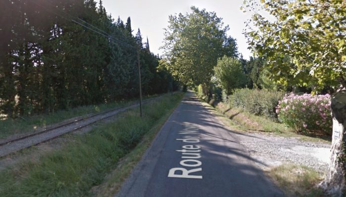
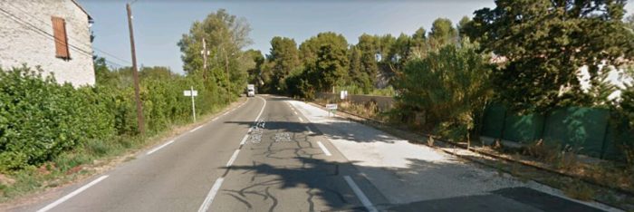
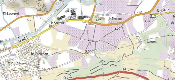
This IGN map covers the same area as the 1961 aerial image. The railway formation is now hidden under the line of the Route de la Voie Ferree through beyond the halt and cemetery at Pierrerue. [8]
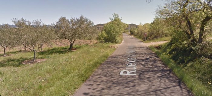
The route of the railway in the early 21st Century.
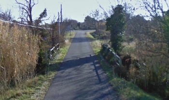
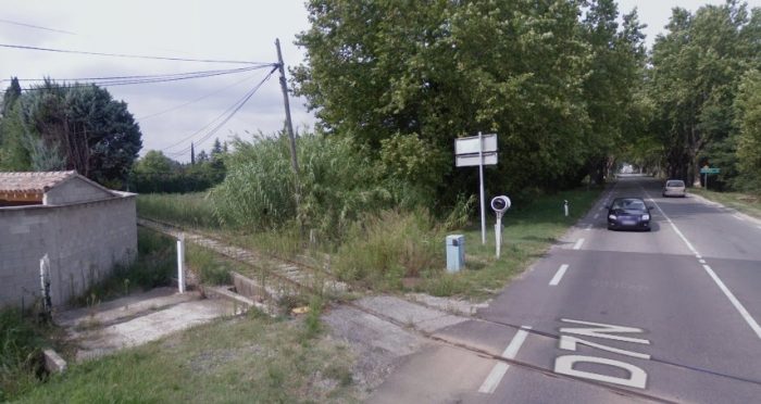
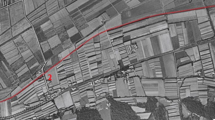
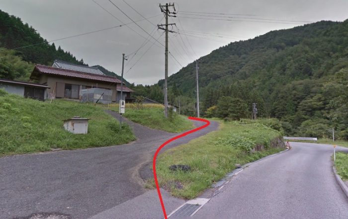
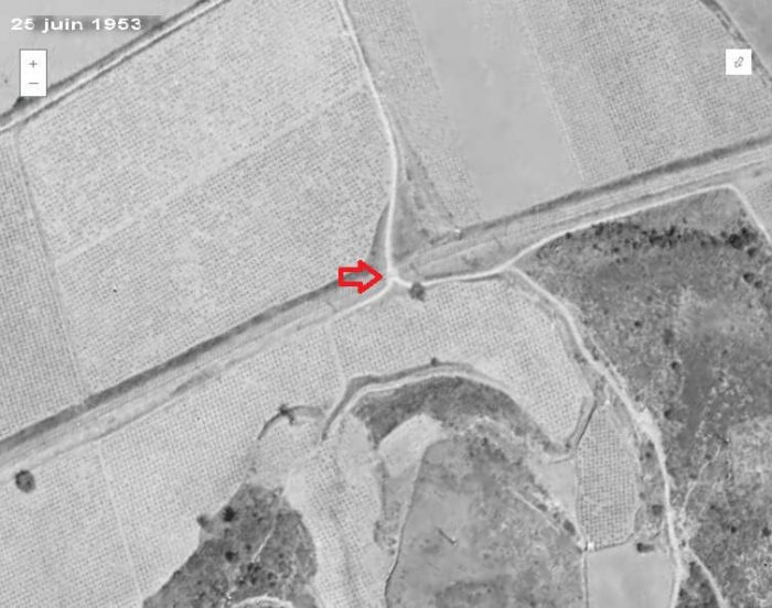
Location ‘2’ on the 1961 aerial photograph. [2]
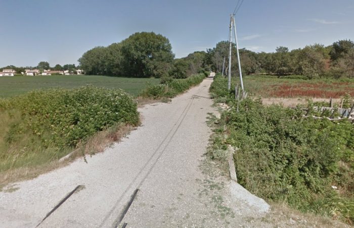
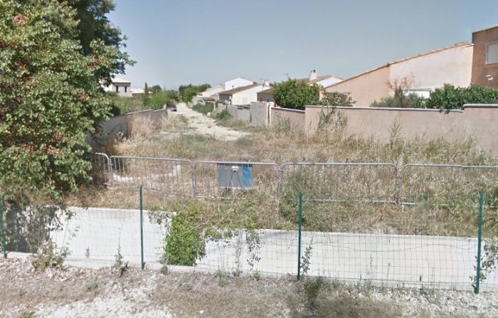
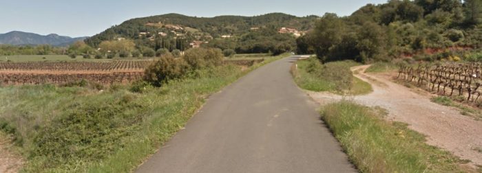
The same location in the 21st Century. The railway track-bed has been used by the tarmac road. The dirt tracks visible on the aerial image immediately above are still present in this picture.
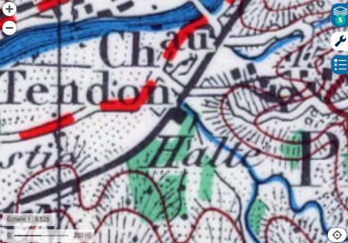
1950s Map showing the railway and Pierrerue Halt. [2]
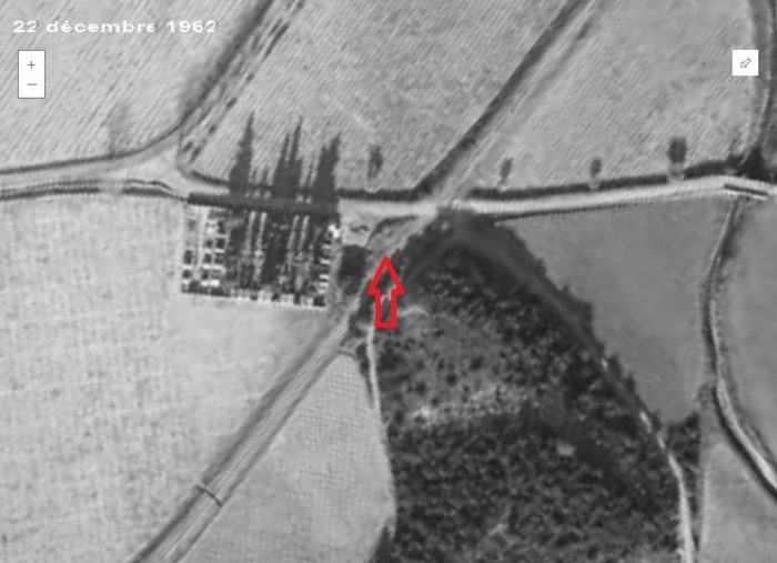
Pierrerue Halt and Cemetery in 1962. [2]
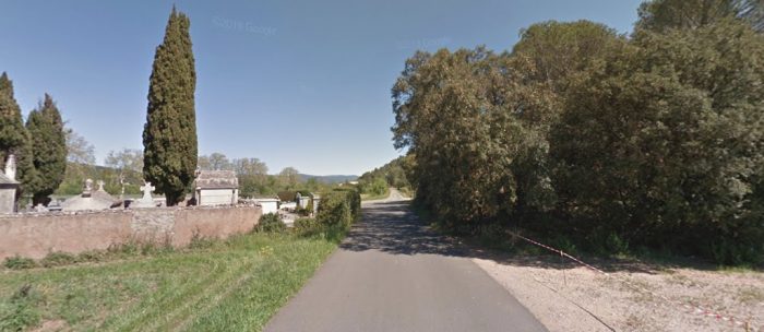
The location of Pierrerue Halt close to the Cemetery in 2016.

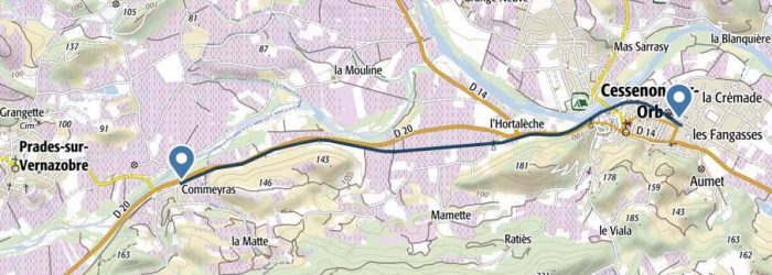
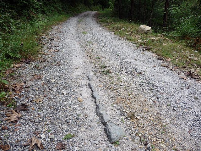
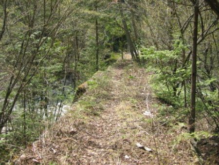
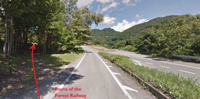
Beyond Pierrerue, the railway continued across flat open farmland to Commyras.

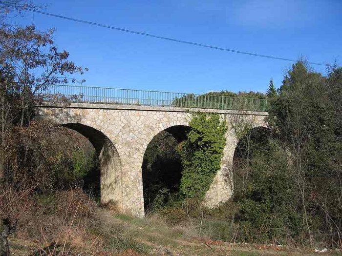
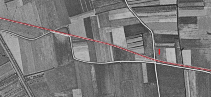
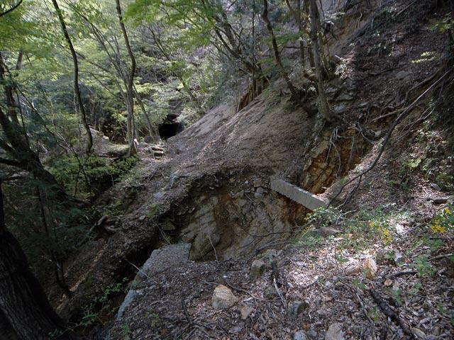
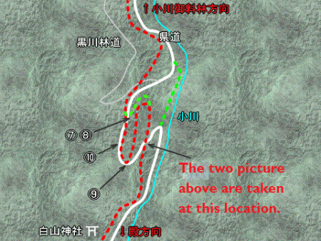
The first few hundred metres beyond Peirrerue Halt are shown on the old drawing below. Teh cemetery can easily be picked out at the bottom of the plan.A plan of Pierrerue from the 1950s which shows the old railway line travelling roughly North-South. North of the Cemetery the old railway crossed the Ruisseau de Mourgues on a short span arch bridge as shown below. [9]
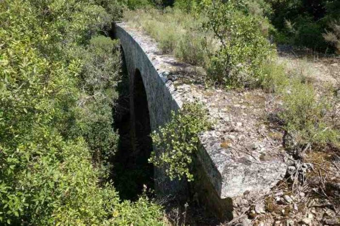
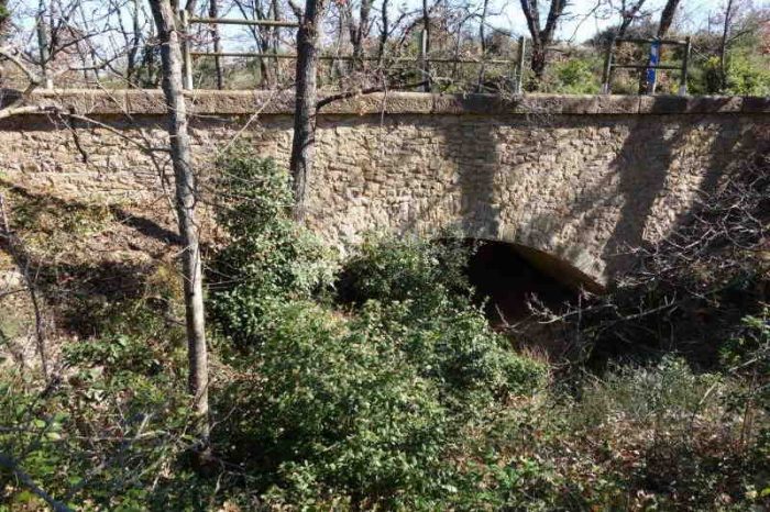
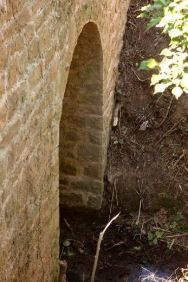
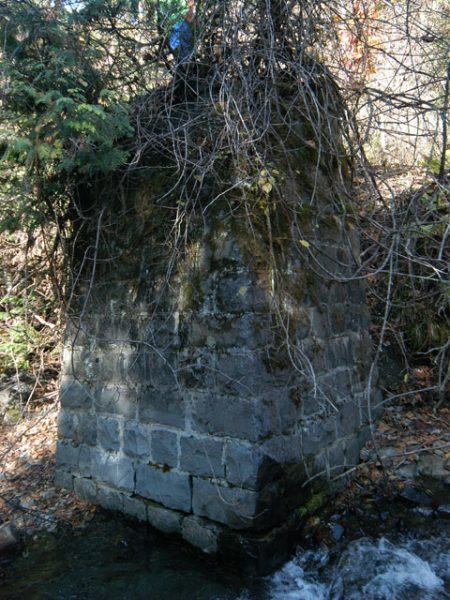
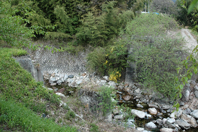
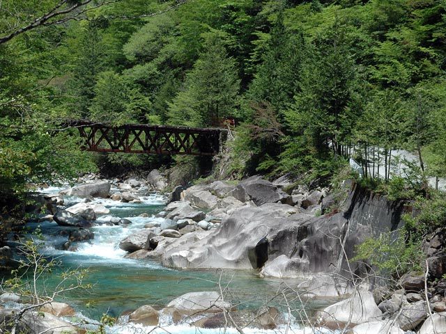
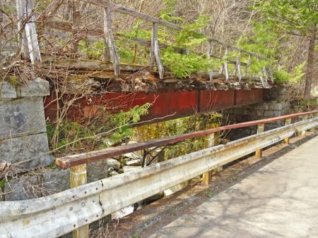
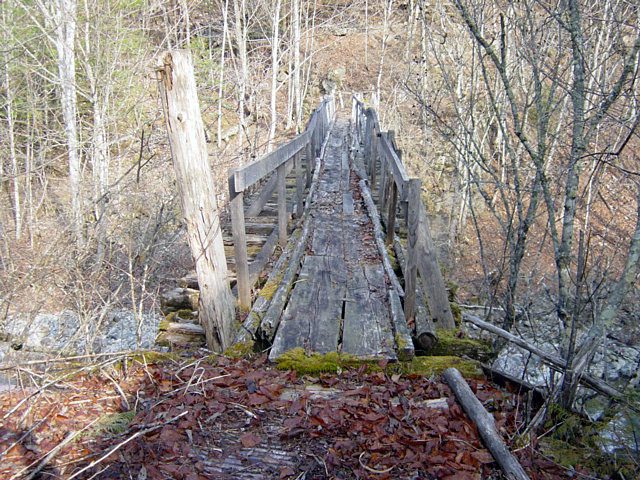
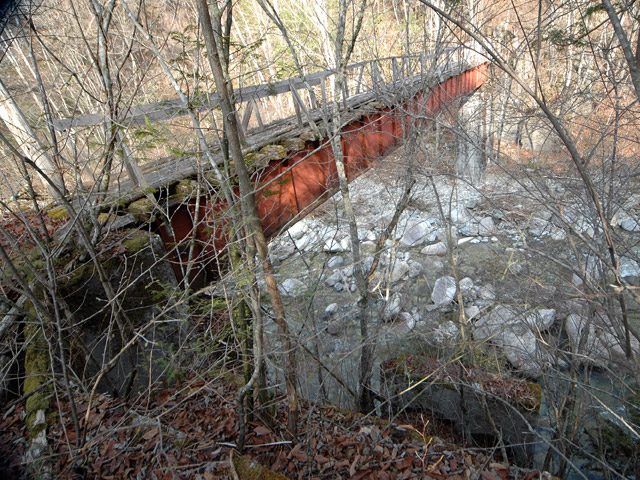
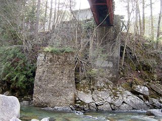
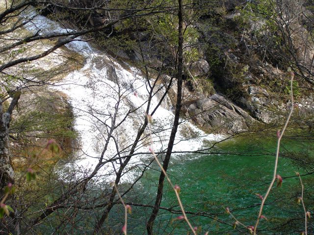
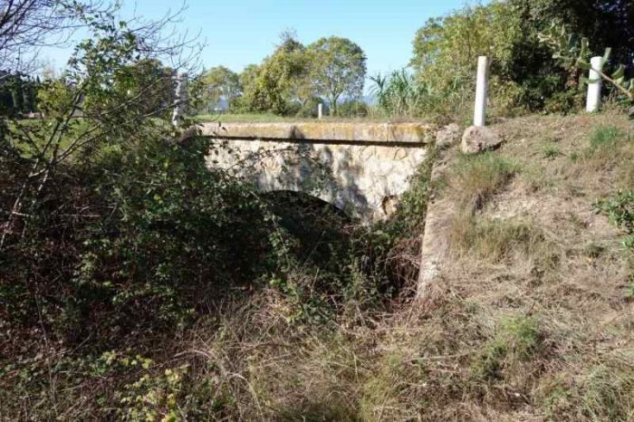
The stone arch bridge which took the railway over the Ruisseau de Mourgues. [11]

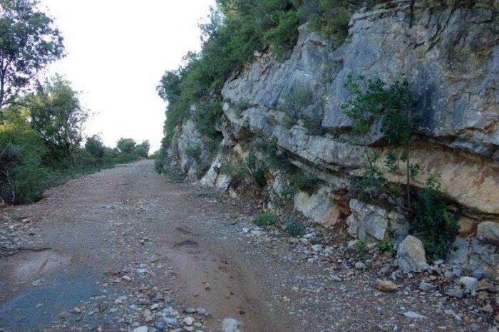
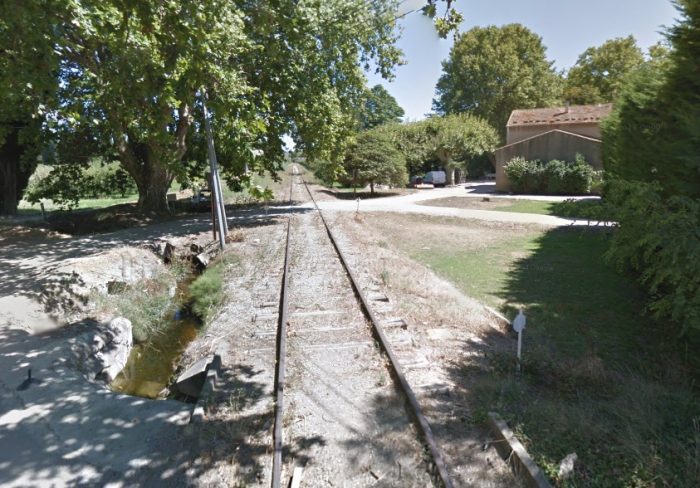
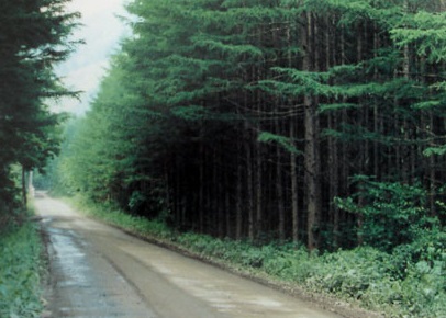
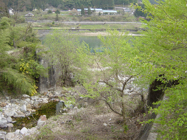
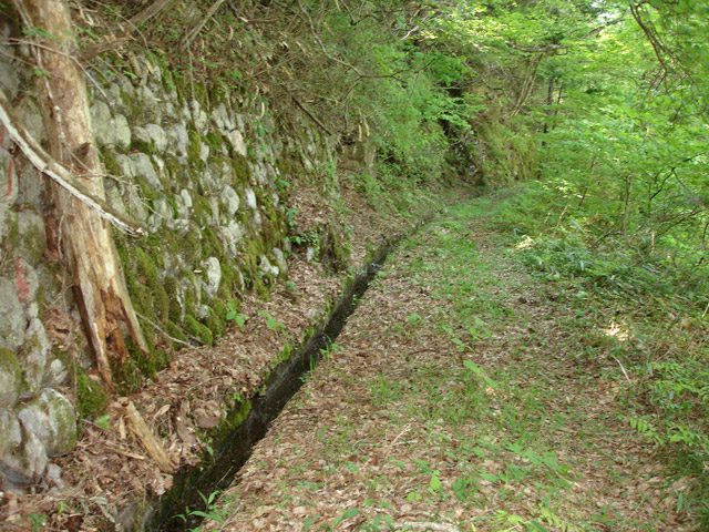
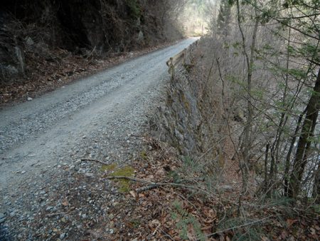
A little further to the North, the railway crossed a smaller stream, the Ruisseau de Recourel and crossed the D134 at an un-gated crossing before running parallel to the D20 alongside the Vernazobre River. The terrain had by this time changed. The railway was running through pine woodland. [11]
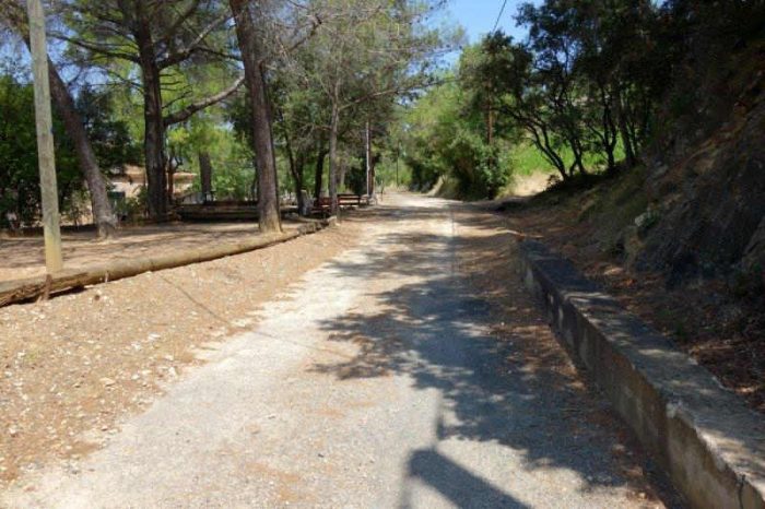
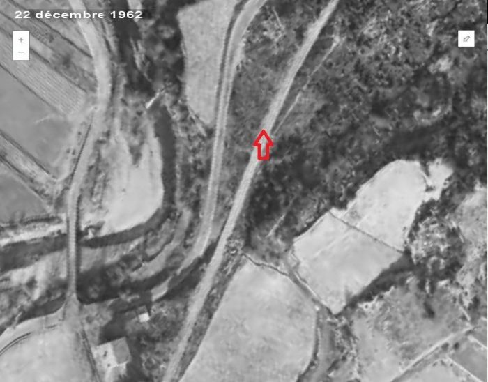
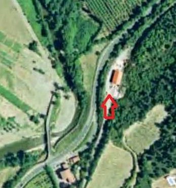
This 1962 aerial image shows the length of the line North of the point where it crossed the D134. The red arrow points to the location of a later building, built on the line of the railway which is highlighted on the adjacent aerial image that was taken in 1996. [11]

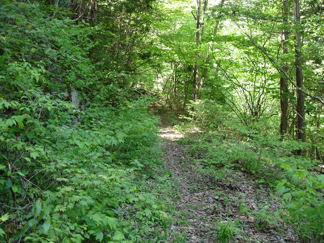
old railway continues beyond this point and the original formation is visible as it circumnavigates the sharp edge of the river valley side.

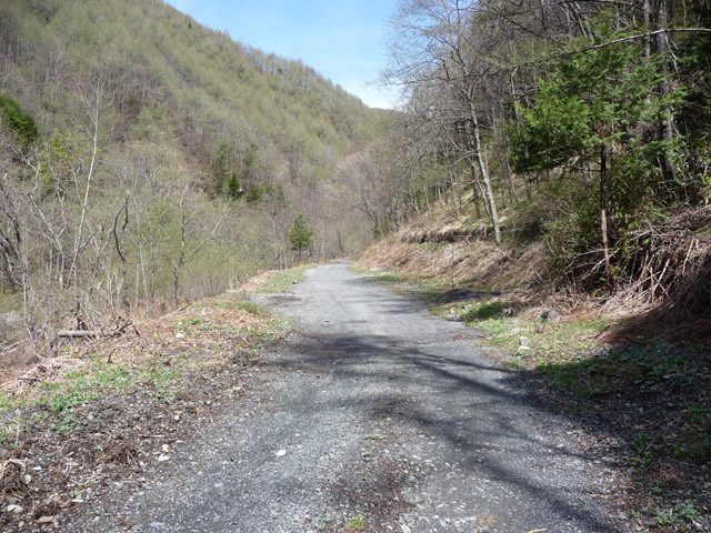
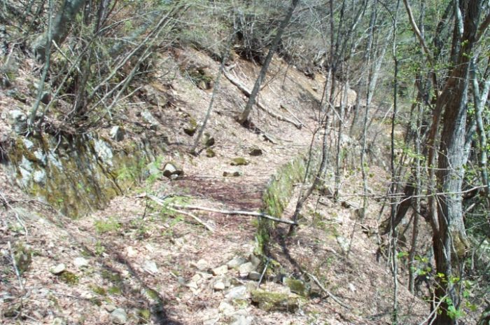
The track-bed which ran alongside the D20. [11]
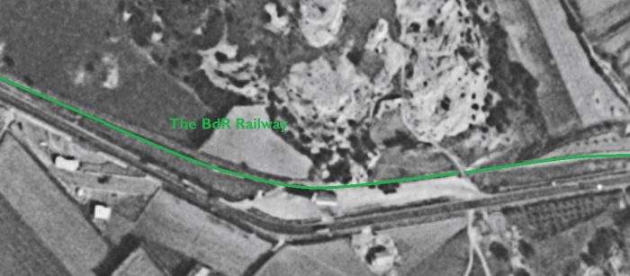
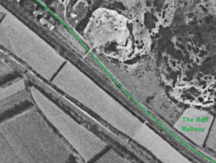
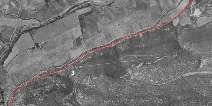
The first length of the railway North and East of Pierrerue. [8]The first relatively significant structure along the route is the two-span arch bridge at location ‘3’ above. It is built over the Ruisseau de Gineste. It is clearly shown on the plan below. [11]
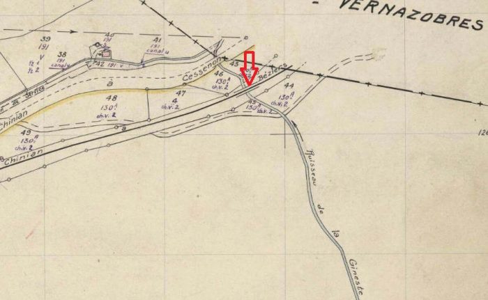
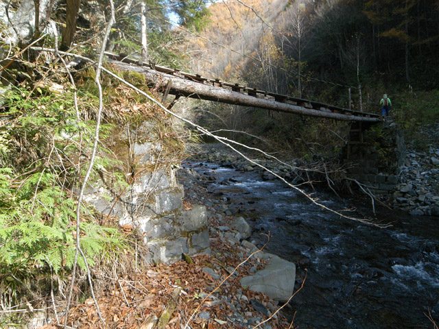
The two-span arch bridge over the Ruisseau de Gineste. [11]
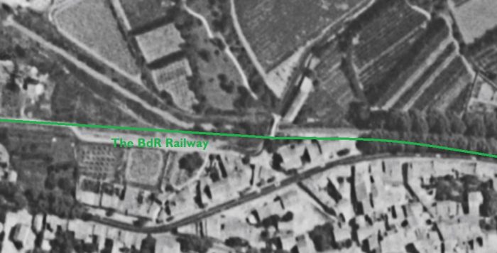
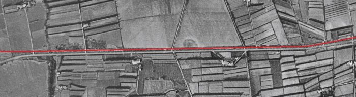
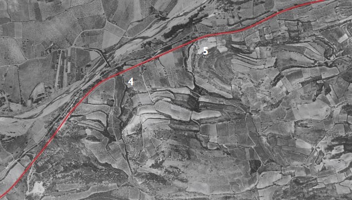
The line continues on to Commeyras which is roughly in the centre of this aerial image from 1961. Just before the halt at Commeyras the line crossed the Ruisseau de la Combe at location ‘4’ in the image above. The bridge was a three-arch viaduct. [8]
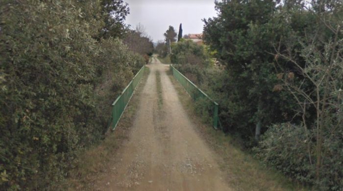
This view was taken by Serge Panabière. [10]
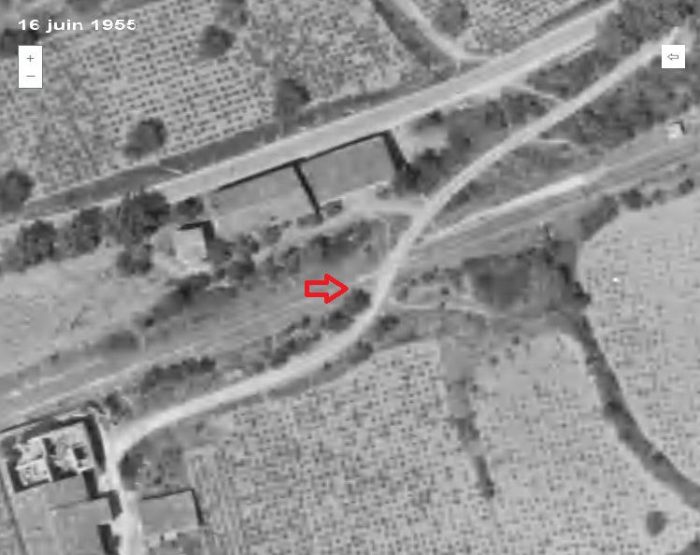
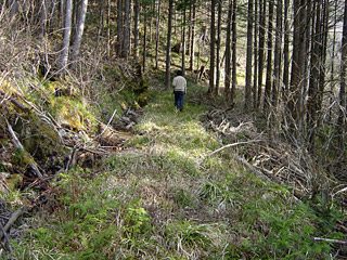
Just after Commeyras, the line crossed the access road to the hamlet via an unprotected crossing (above). [11]


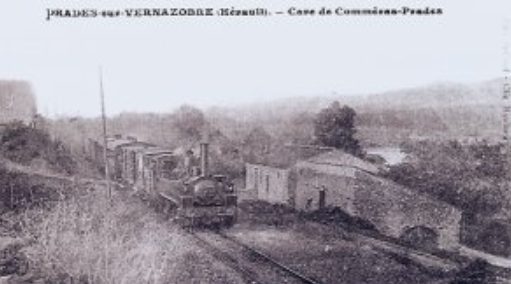
A train passes through Commeyras. [12]

The stop of Commeyras-sur-Vernazobres served the village of Prades-sur-Vernazobres located some 2 kilometres distant. [6]

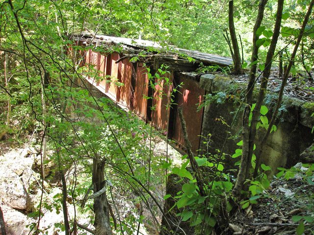
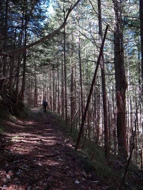
The next viaduct was a little further to the East of Commeyras, at location ‘5’ on the aerial image above. The viaduct has been allowed to become more overgrown than the first 3-arch viaduct we encountered. [12] It crossed the Ruisseau de Mirot.
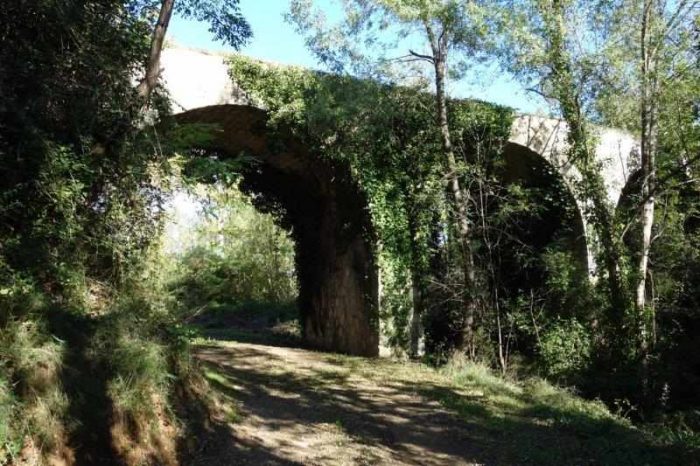
The next length of the route. [12]
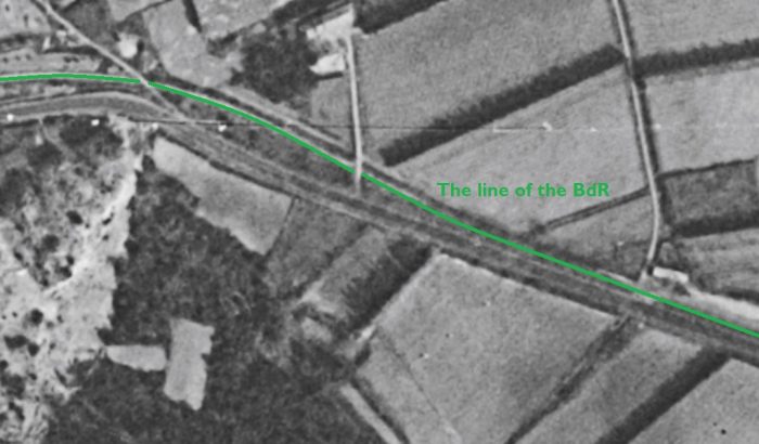
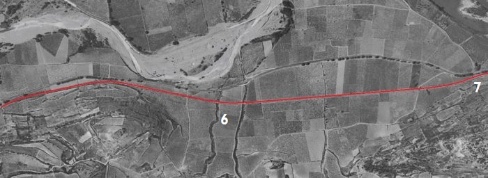
The first kilometre or two beyond the boundary of the small commune of Commeyras is shown on this next aerial image from 1961. The railway, at first, followed the D20 closely and then continued to follow a relatively straight path surrounded by vineyards as the road swung away a little to the North. [8]
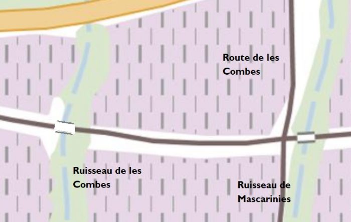
Two bridges in short succession at location ‘6’ on the aerial photograph from 1961 above carried the line across seasonal streams. [8] 
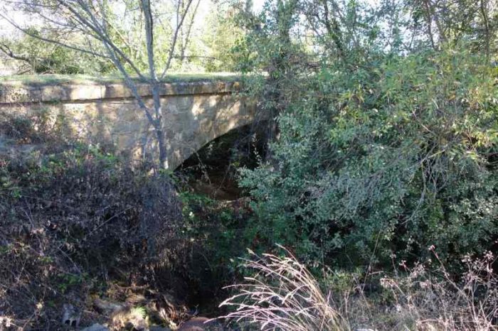
The masonry arch bridge over Ruisseau de les Combes. [12]
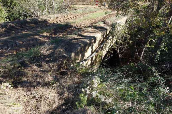
The masonry arch bridge over Ruisseau de Mascarinies. [12]
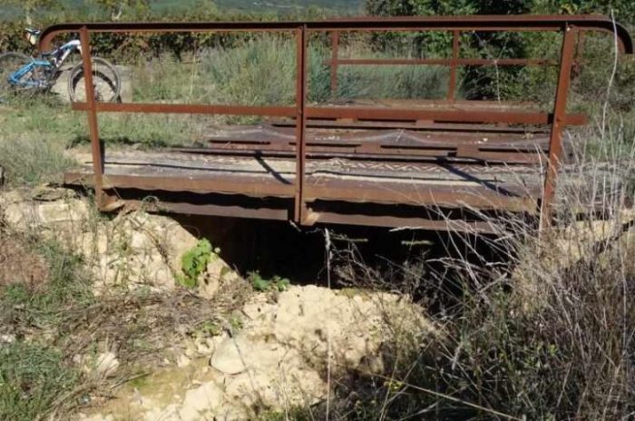
A small metallic railway bridge close to the pint where the D20 converges once again on the line of the old railway – location ‘7’ above. [12]
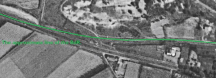
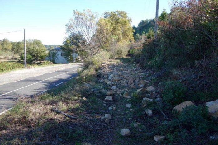
The D20/D14 and the old railway run alongside each other for a short distance before they crossed at an un-gated crossing. When the line was active the road accommodated the railway as shown below in a 1955 aerial image. [12]

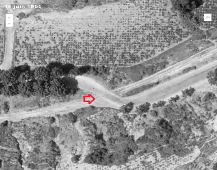
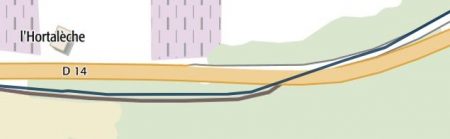
The adjacent map shows the realigned D14 and the old railway alignment. [12]

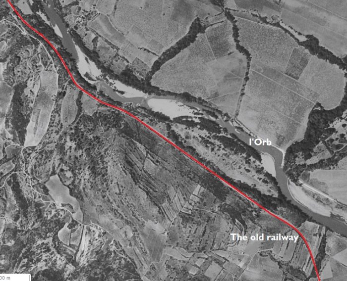
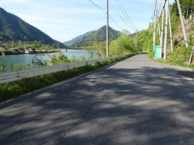
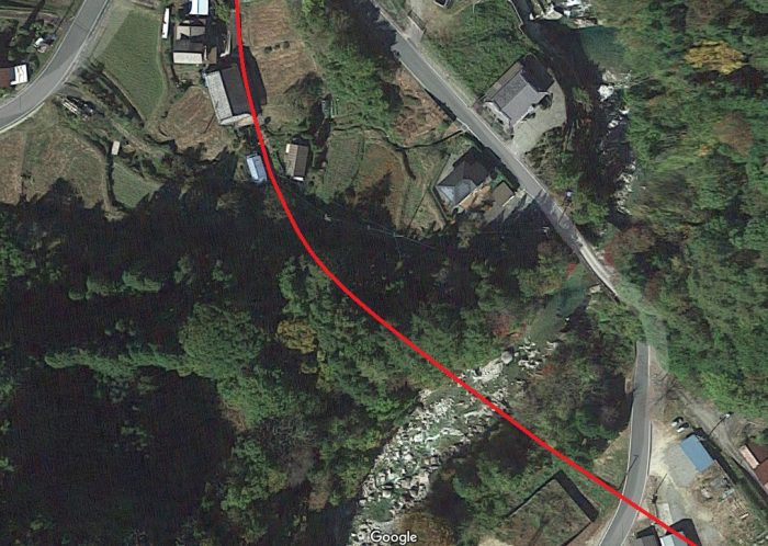
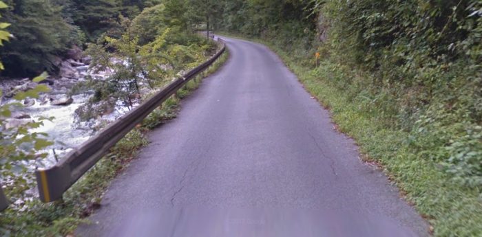
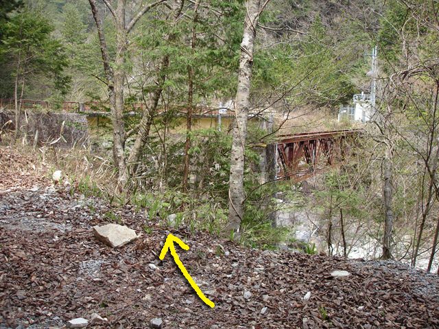
The railway continues to diverge from the road and follows what is now a riverside path known as Boulevard de l-Orb. The Vernazobres River which we have been following relatively loosely is a tributary of the Orb.The old railway curved round the North side of the old town of Cessenon-sur-Orb. [14]
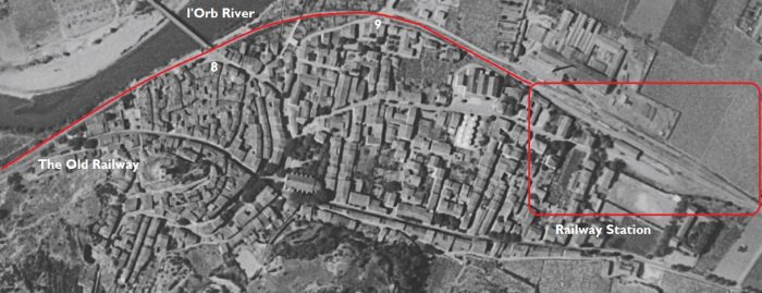
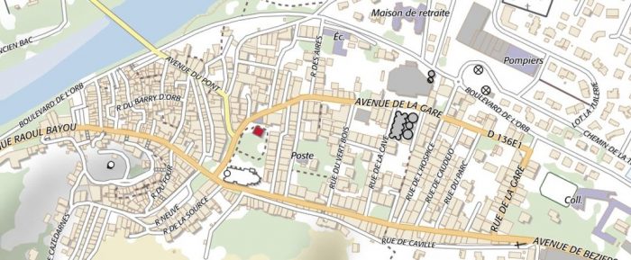
It route through the modern town is described by the Boulevard de l’Orb. [14]
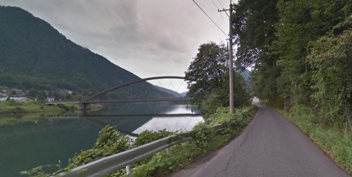
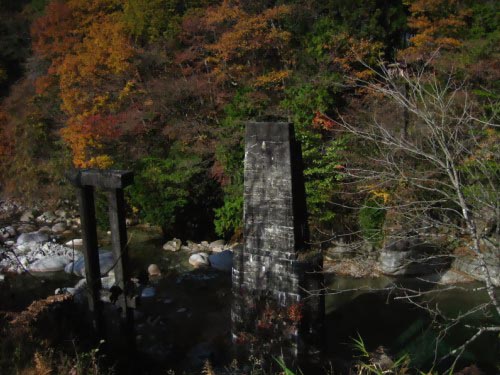
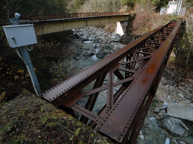
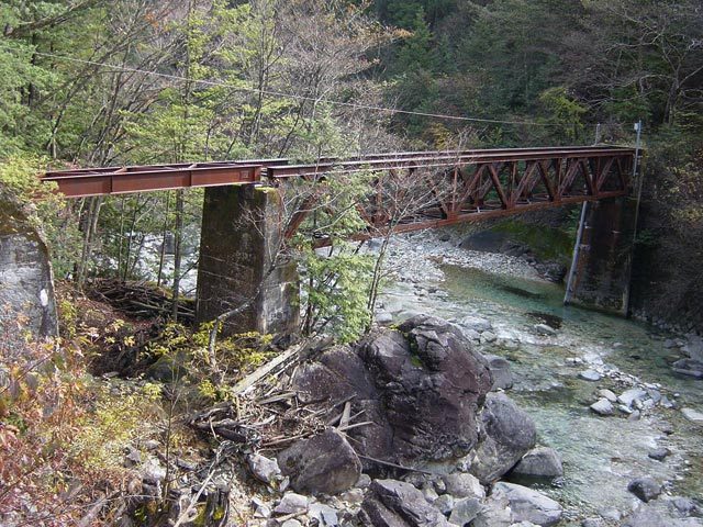
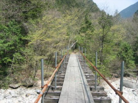
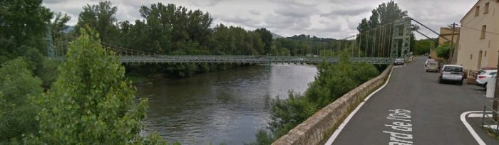
Approaching the suspension bridge which crosses the Orb River along what was the route of the railway but which in the 21st Century is the Boulevard de l’Orb. The picture immediately below is of the older bridge which was at this location. Then picture is taken from the North and shows the old railway line still in place. [6]
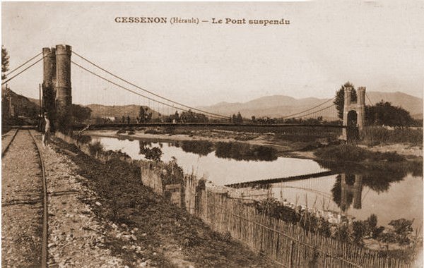
The railway ran just behind the dwarf river wall visible in this modern picture. [16]
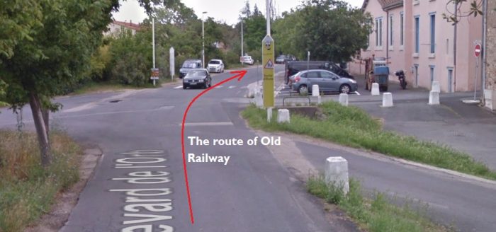
The railway continues round the North side of the old town. This is location ‘9’ on the 1961 aerial photograph.

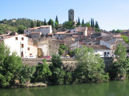
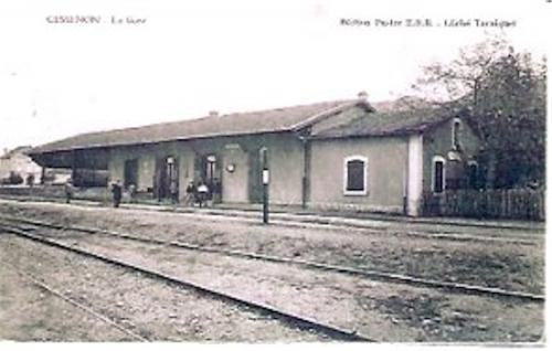
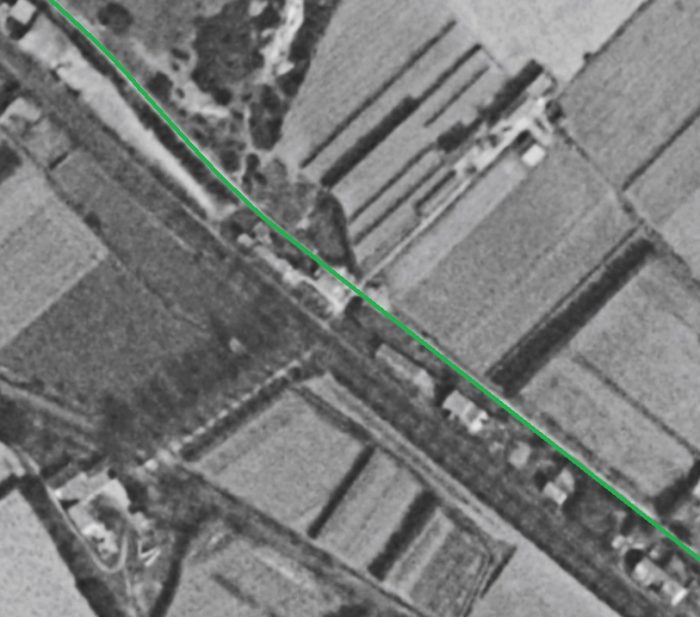
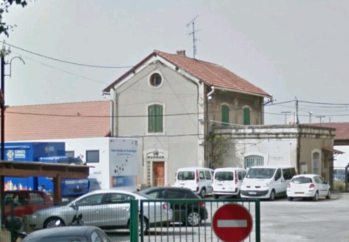
Cessenon is built on the banks of the Orb. It has a 14th century church whose Romanesque portal still exists. A high square tower or dungeon, former bell tower, dominates the houses. The coat of arms of the city are azure with three fleurs-de-lis of gold, with the border Gules; in the center of the shield, a stick perished in the same band. [6]
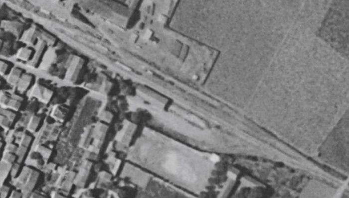
A 1961 aerial photograph of Cessenon Railway Station. [14]
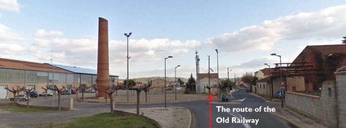
This picture is taken at the station throat at the West end of the station area in the early 21st century.
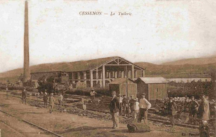
The location of the chimney in the picture above is easily identified on the modern image further above. ‘La Tuilerie’ (the Tile Factory) is approximately on the line of the modern warehouses in the image above. The relative positions  are evident on the adjacent 1955 aerial photograph. [12]

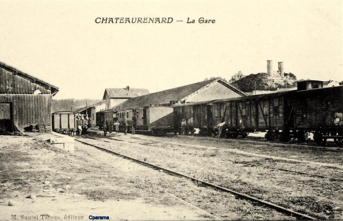
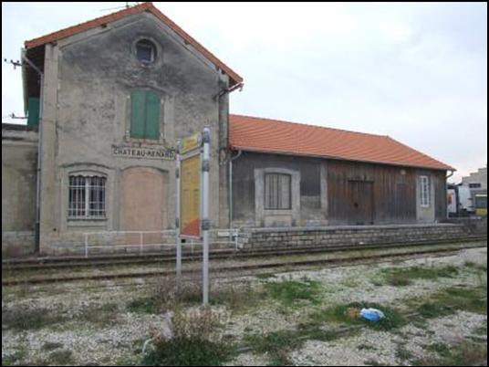
The series of postcard views below show the station building and goods shed at Cessenon.

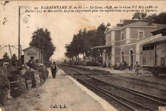
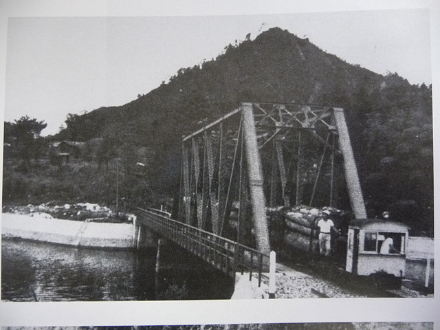
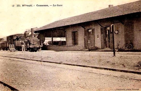
This card was posted in 1905. A mixed train is at the platform in front of the goods shed. The train has arrived from Beziers. The locomotive is probably an 0-8-0T Schneider D-81 engine. The card was sent to Mrs. Dô by her son, Jules. It says: “Do not worry about our fate we are in good health, we find ourselves well, we do not know when we will arrive.” [15]

The Station Building. [17]
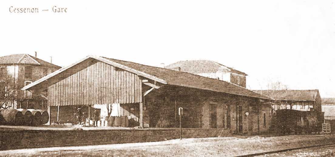
The Station Building swing the goods shed to best advantage. [17]

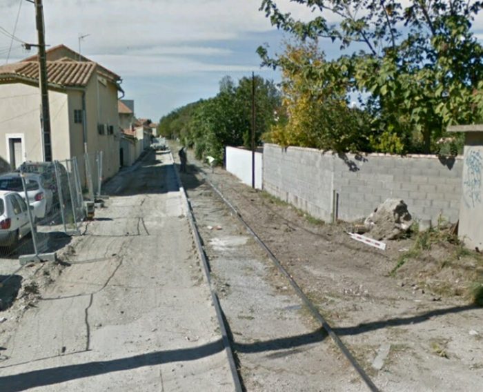
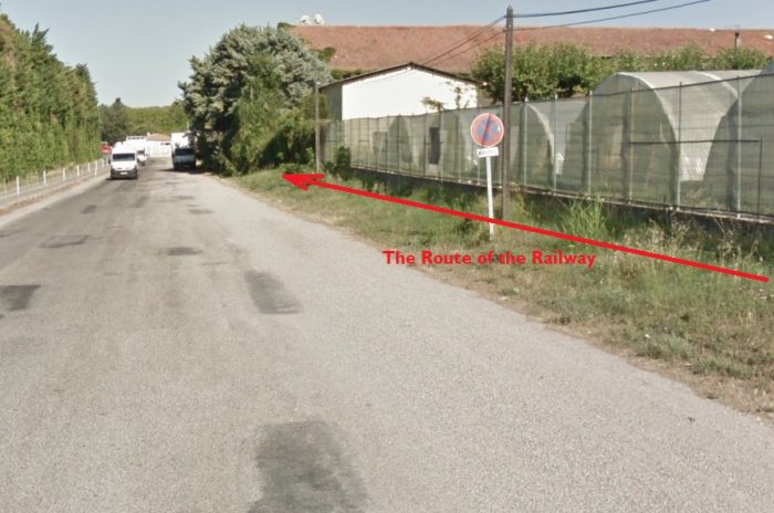
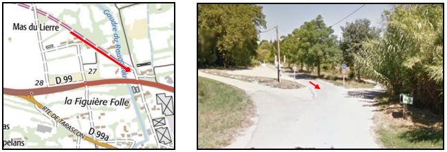
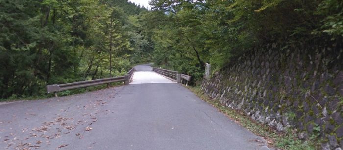
Beyond the station at Cessenon, the railway continued along what is today the Rue de la Capelette and then the Chemin de la Capelette which runs between the D14 and the Orb River as it heads for Reals. [18][19]
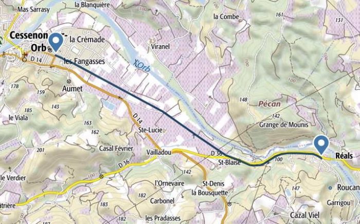
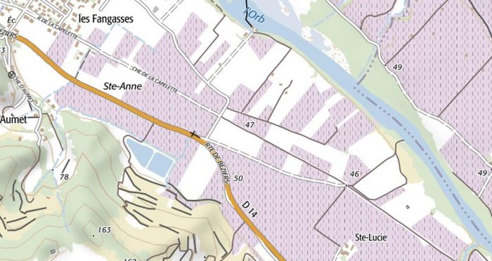
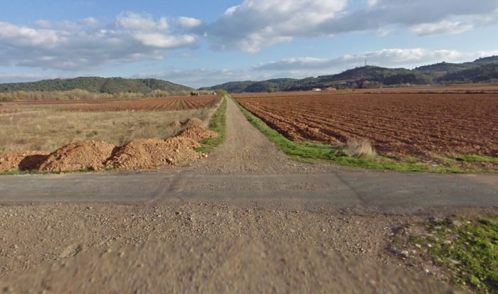
Google Streetview shows the track-bed running Southeasterly in a relatively straight line across the open vineyards and fields towards distant hills. The next relatively significant structure is the bridge over the Ruiseau de Rhonel which is shown in the three images immediately below. [18][19] 
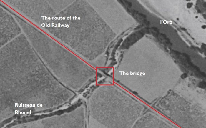
This plan from the 1950s shows the approach to the Bridge over the Ruisseau de Rhonel. [20]
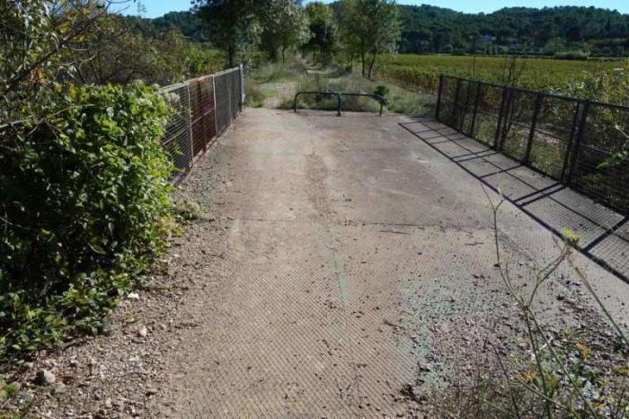
The next hamlet along the line is St.-Blaise
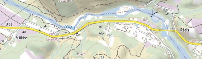
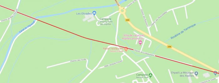
At St.-Blaise, the old railway line crosses the Ruisseau de St. Blaise and is then met by the modern D36 as shown on the adjacent map. [6]

The plan below from the 1950s shows the area of St.-Blaise at that time. [21]
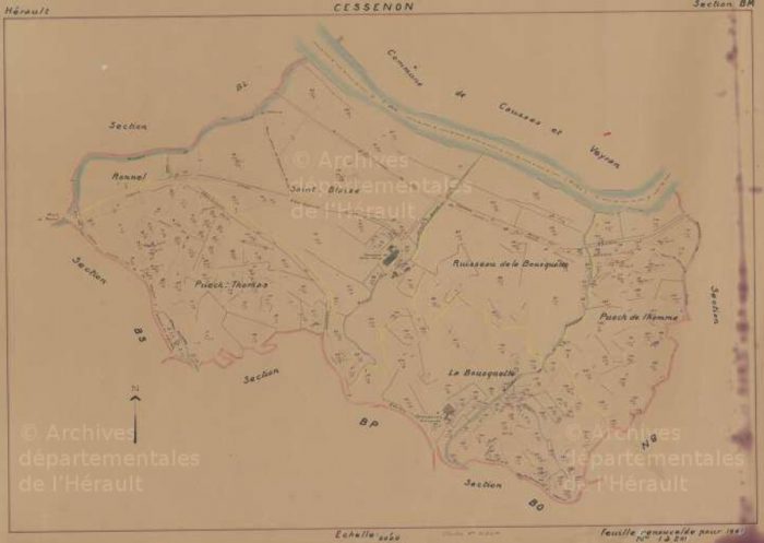
This underpass is actually the route of the seasonal stream, Ruisseau de St.-Blaise and is just to the west of the village. [19]

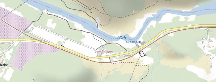
For a short length at St. Blaise, the modern D36 lies on top of the old railway before the railway alignment drifts south of the road. The first image below comes from 1961 and shows the old road and the railway. [18] The second image comes from the early 21st century and the railway route is shown in a light brown line. [19]  
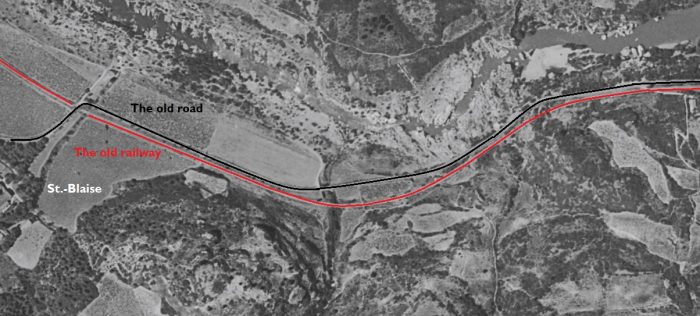
Along this length two steams were crossed.
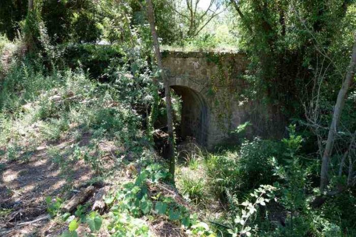
First, the Ruisseau de Gournier [19][21]
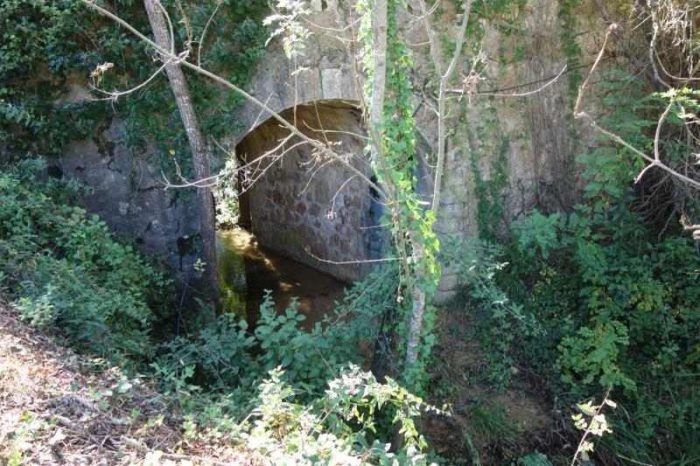
Then, the Ruisseau de la Bousquette. [19][21]

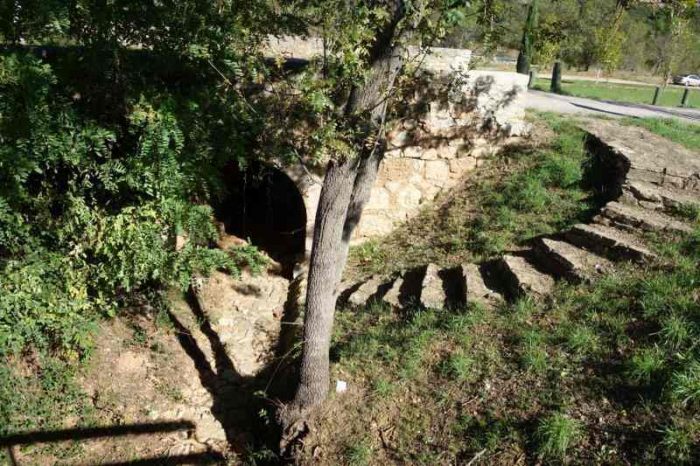
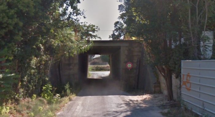
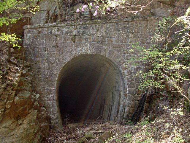
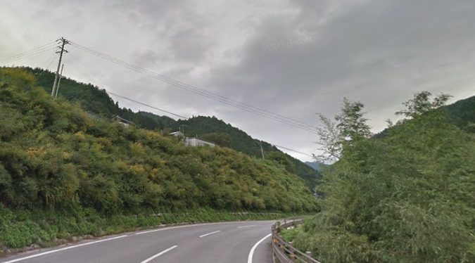
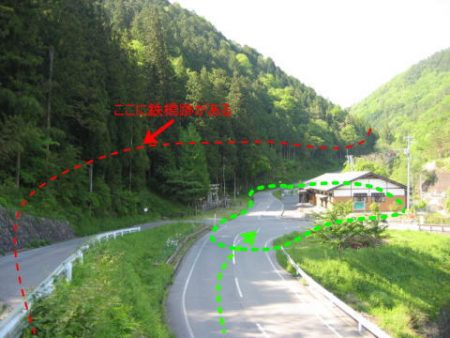
Journeying on from St.-Blaise the line approached Reals. As it passed the location of the modern sports ground which is shown as a black rectangular outline on the map above, a short length of rail is still visible. [19]
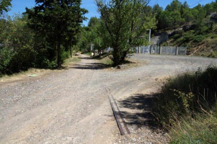
The railway crossed another brook before reaching the tunnel at Reals. The tunnel location is marked below by the orange and green dots. [22]
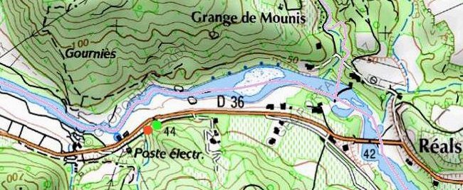
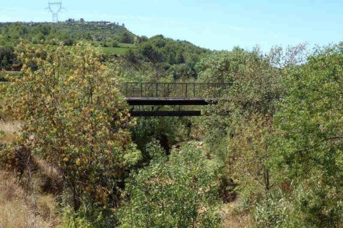
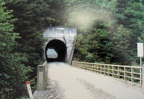
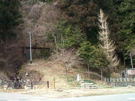
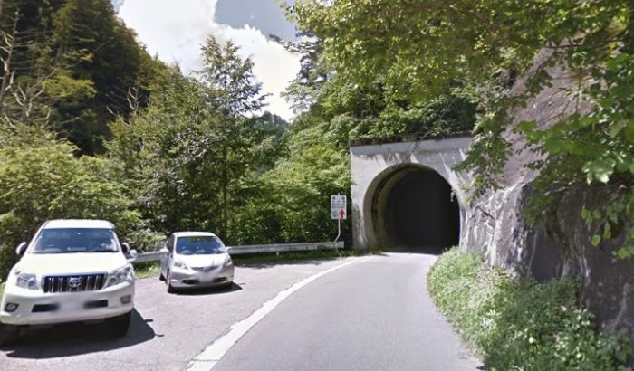
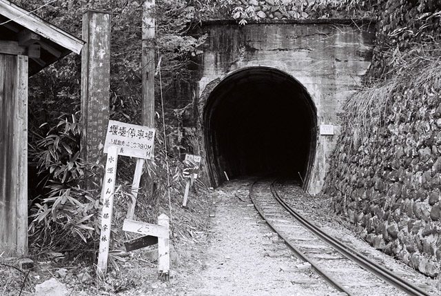
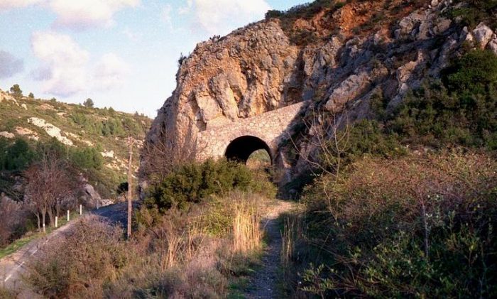
The western portal of the 42 metre-long tunnel. [22]
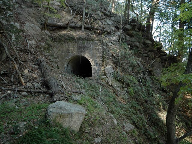
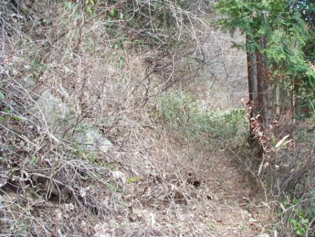
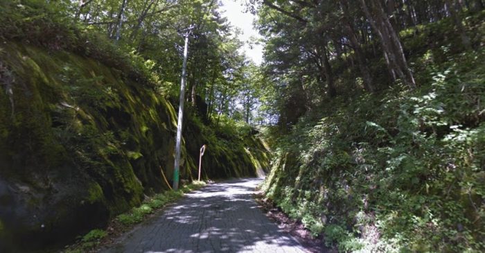
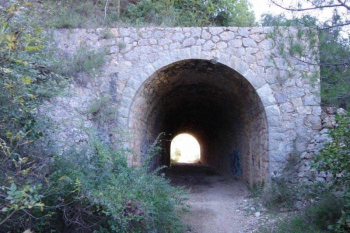
The eastern portal of the tunnel. [19]

Just a short distance ahead as the railway alignment turns to the Southeast we encounter the old railway Station for Reals. 
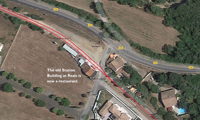
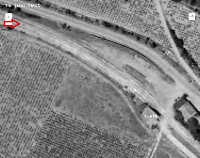
The passing loop at Reals Station is marked above by the red arrow on this 1955 aerial image of the line, the station building is marked ‘Gare’. [19]

The adjacent view is taken from the North. [17]
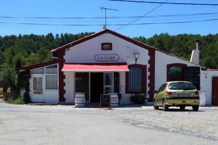
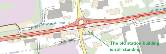
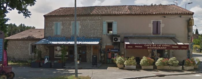
The station building is now a restaurant! [19]

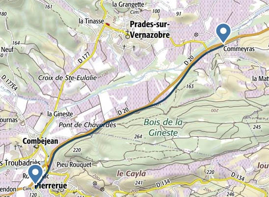
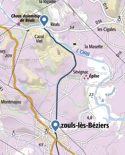
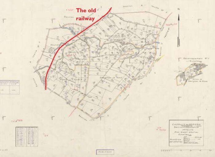
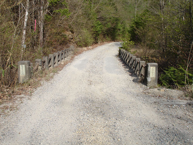
Beyond Reals, the railway turned southwards and headed for Cazouls-les-Beziers as shown on the adjacent map. [23]

Initially it followed the southwestern bank of the Orb River but it then turned away South. For a long length of the route it followed what is now a minor road.

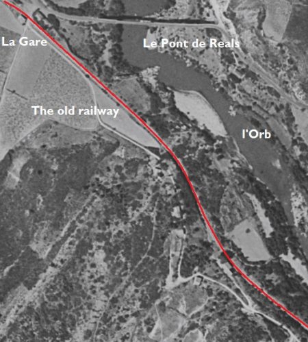
Just beyond Reals Station it is possible to look back to the North to see an impressive road bridge which spans the Orb River.
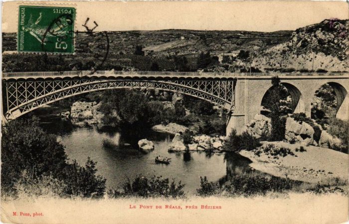
An old postcard view of the Pont de Reals [24]
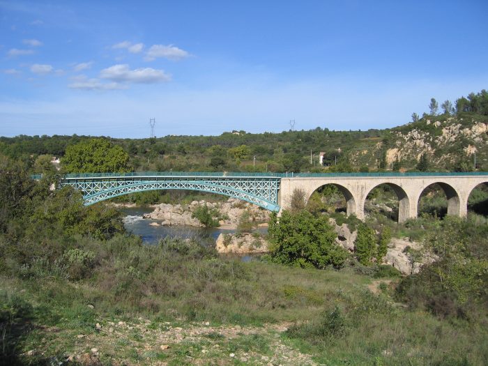
An early 21st Century view from the old railway route. [25]

The aerial image shows the road bridge across the Orb River and the line of the railway turning away to the Southeast. [18]

The next photograph is at a smaller scale and shows the line continuing, first to the Southeast and then to the South [18]

This picture is typical of the old track-bed to the East of Reals. [23]
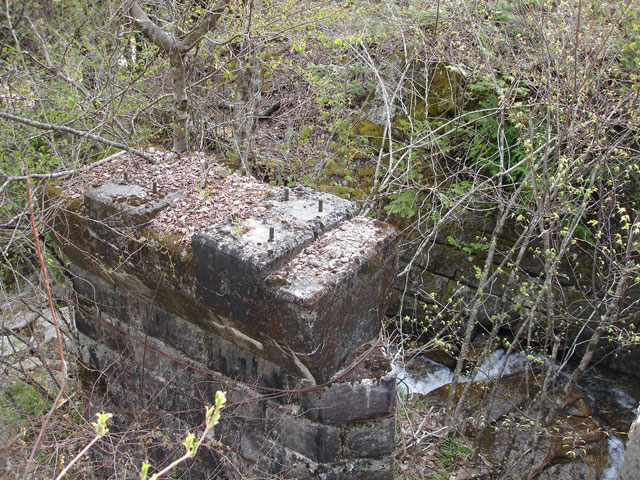
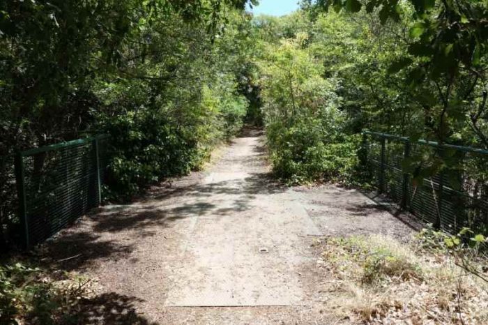
This bridge spans the Ruisseau de Estagnol. [23]

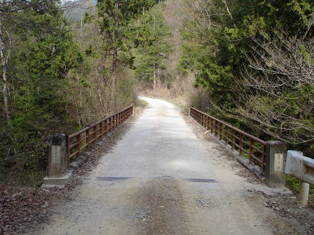
The line turns away to the south and heads for Cazouls-les-Beziers. This is illustrated on the map from the 1950s above and on the adjacent 1961 aerial image. [18][26]

The next image below shows the masonry arch bridge which spanned the Ruisseau des Fourfouilles which is visible both above and in the adjacent aerial image. [23]

Further along the line the route is shown first on a hand-drawn map from the 1950s and then another 1961 aerial image.

Another 1950s land plan (above) shows the route of the railway. [27]

As noted above, the adjacent aerial images were shot in 1961.

The line continued over open fields on a straight path for some way. [18]

The third of the adjacent aerial images takes the line as far as the station at Cazouls-les-Beziers.

En-route the railway crossed numerous small streams and water-courses. Its track-bed along the way is now in use as a single-track road. The structures which carried the line were similar to those already highlighted in this post. Although occasionally this is not the case. One such location is just to the North of what was a gated level-crossing at the D16. The line crossed the Ruisseau de la Mouchère and by the early 21st Century this masonry bridge has been reconstructed.

In the first image below from Google Streetview, the D16 can be seen crossing the line of the railway. The bridge parapets seem to be of a piece with the age of the railway.

However, the arch beneath has clearly been reconstructed as shown on the adjacent picture. [23]

As we have noted, the line crossed the D16 at a gated crossing and as a result there was a crossing-keepers cottage next to the line. This is the first that I have been able to identify along the length of the line from Saint-Chinian.

The building may well have had a small extension at some time over the intervening years. [23]

Beyond the D16 there were a series of small accommodation bridges constructed of steel on brick abutments. Two of these locations are featured in the images below. The first can be seen in the photograph of the crossing-keepers cottage.The crossing-keepers cottage at the D16. [23]
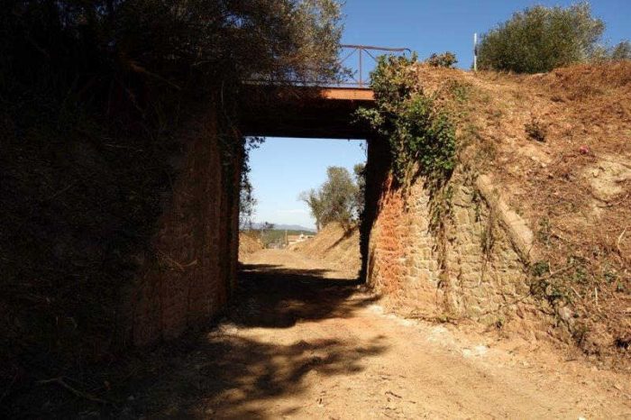
The first of these over-bridges carries the Chemin de Fournic across the route of the railway. [23]
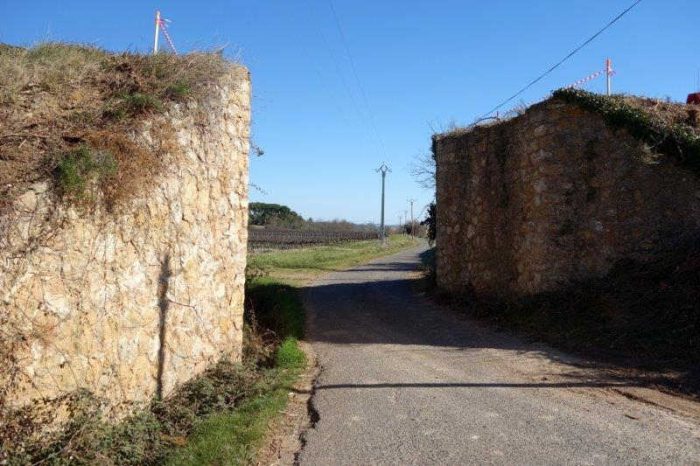
The next structure carried the railway over a local road – the Chemin Vicinal Ordinaire N° 29, called ‘la Gauphine’. [23]

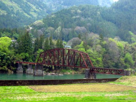
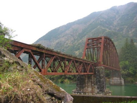
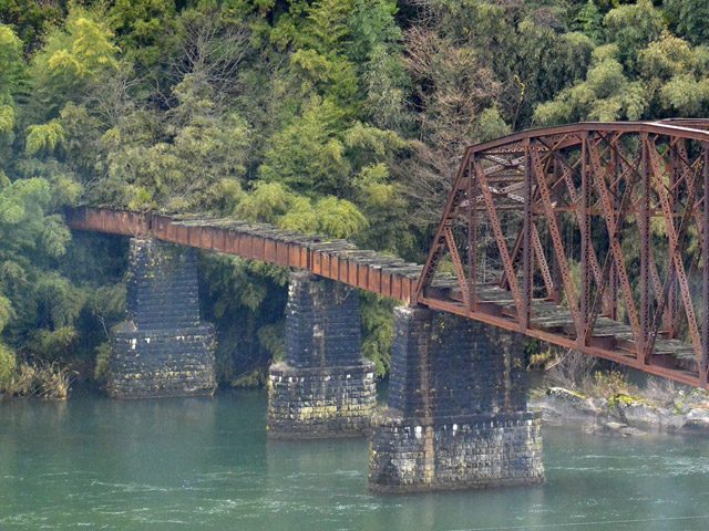
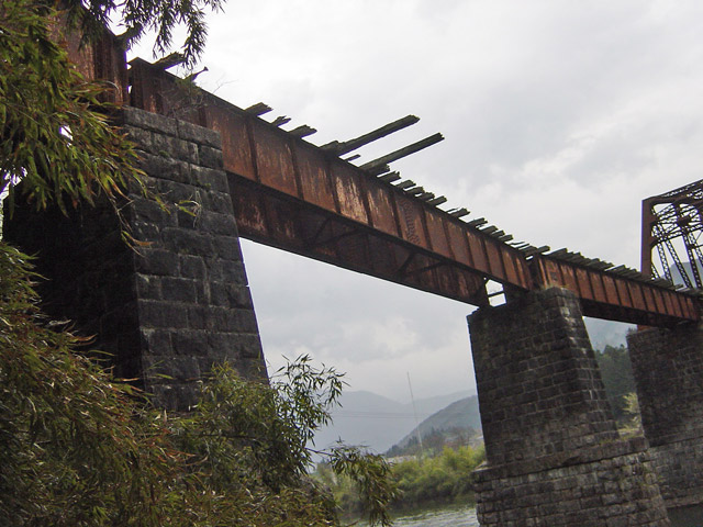
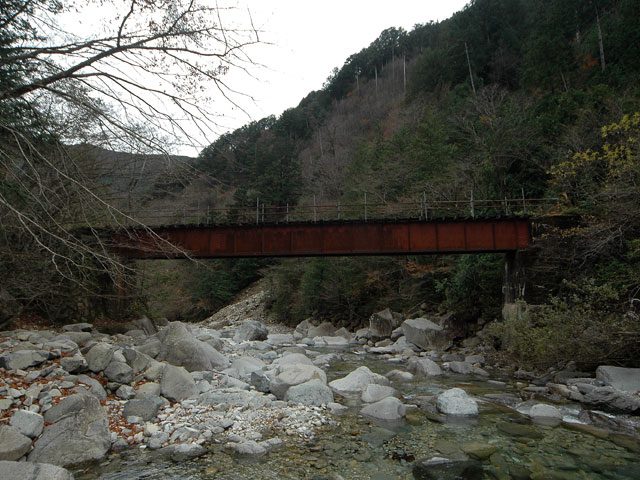
The next location of note on the railway line was one of its more significant bridges. A metal lattice girder viaduct carried the railway over the Ruisseau de Rounel.
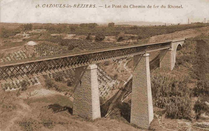
The railway bridge north of Cazouls-les Beziers. [23]
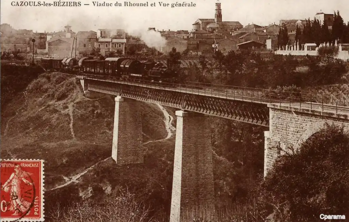
The same bridge looking across towards Cazouls. [28]
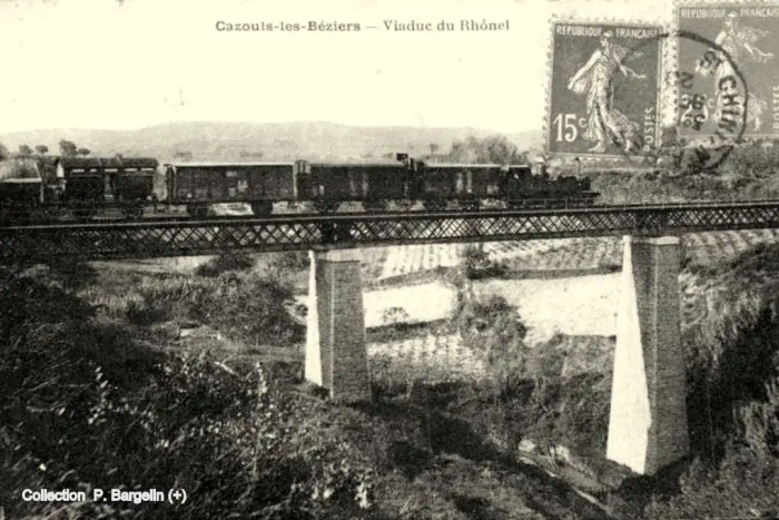
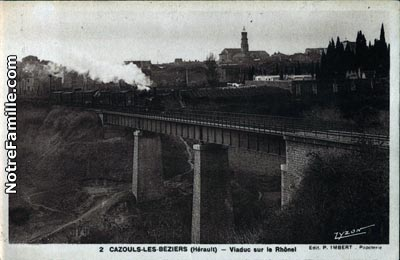
And again (above) from a different angle. [29]

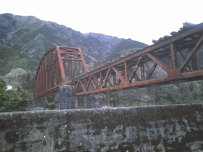
Later in the life f the structure them lattice girders were replace by solid girders as shown in the adjacent picture. [30]
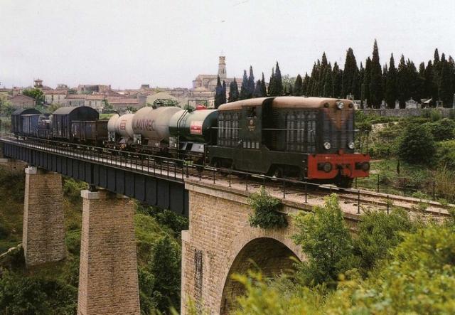
Another picture of the bridge with the village behind it. This was taken before closure of the line in the early 1960s. [32]
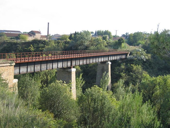
The same bridge again. This picture was taken by Serge Panabière in 2007. [31]
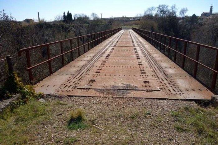
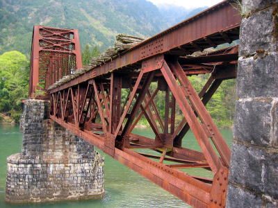
The same structure is shown above at track-bed level in around the year 2000. [23]

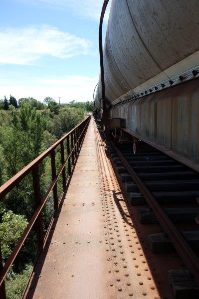
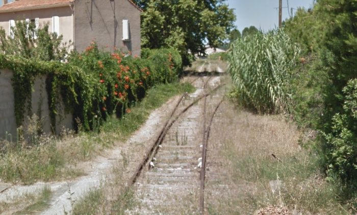
And again, in August 2016. The track-bed from the north side of the viaduct southwards is once again in use as a railway! [23]

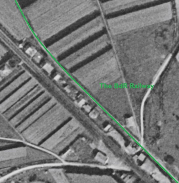
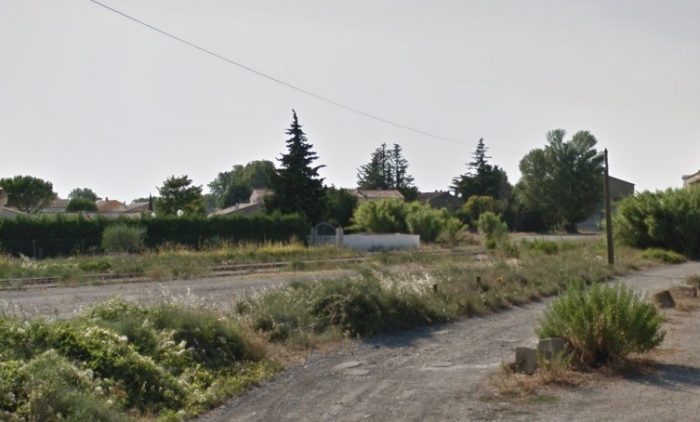
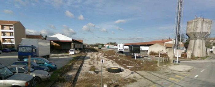
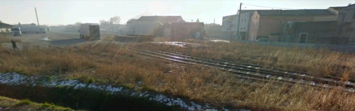
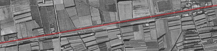
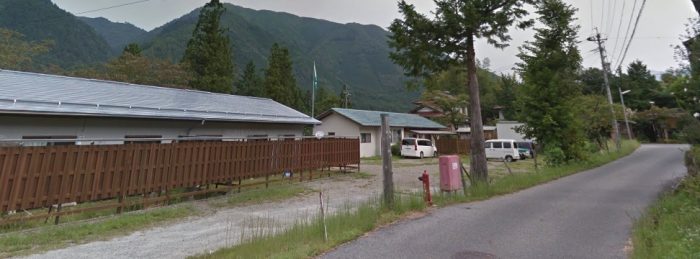
The 1961 aerial image of Cazouls Station above indicates that in 1961 the line was probably still in use as far north as Cazouls. The site is clearly busy!

The IGN map below shows the modern station layout with a significant number of sidings. [18]

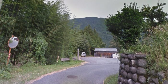
The first photograph below was taken in January 2009 looking North back along the line towards Reals from Rue du 19 Mars 1962. It is a Google Streetview Photograph.

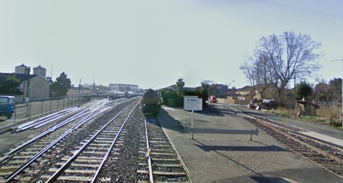
The second photograph is taken from the same location, also in January 2009, but this time looking south into the station site.

These pictures of the station site from 2009 and the following pictures from 2016 seem to make it clear that this modern branch line was secure. It had been fully refurbished and was well-maintained. It clearly (you might think) had a strong future.

This was not (is not) the case. Despite the cash expended on the line, the mayor of Cazouls decided that the line had no future and it was closed in January 2017 in favour of creating a greenway along its route south from Cazouls.

First then, two images from 2009.
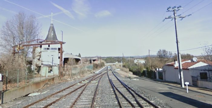
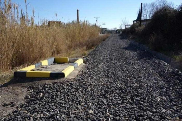
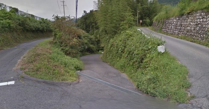
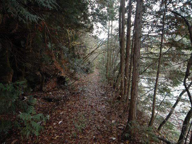
The next two pictures show the line north of the Station, first in 2016 and then in 2018. [23]
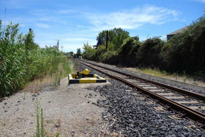
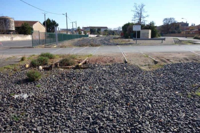
The next two images look south from the Rue du 19 Mars 1962, also in 2016 and 2018. [23]
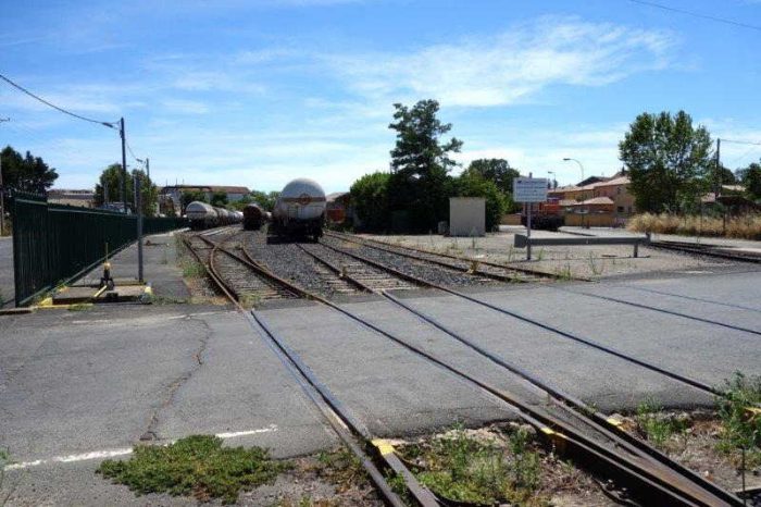
It is at this point that we complete the first post about the railway lines of the departement of l’Herault. The next post will look at the lines south of Cazouls.


References

  1. http://rue_du_petit_train.pagesperso-orange.fr/lignes/sudest/CF-herault.htm, accessed on 14th March 2019.
  2. http://passes-montagnes.fr/htlm1/vf_saint-chinian_beziers-01.html, accessed on 14th March 2019.
  3. http://jc34.eklablog.com/le-trafic-viticole-sur-le-rail-entre-st-chinian-et-beziers-a127745832, accessed on 14th March 2019.
  4. https://fr.m.wikipedia.org/wiki/Chemins_de_fer_de_l%27Hérault, accessed on 14th March 2019.
  5. http://adicab.over-blog.com/article-45469237.html, accessed on 14th March 2019.
  6. http://cahiers.de.minerve.pagesperso-orange.fr/HTML/cdf_bezierssaintchinian.html, accessed on 15th March 2019.
  7. https://www.cparama.com/forum/news/forum/34-herault-f41/page90.html, accessed on 15th March 2019.
  8. https://remonterletemps.ign.fr, accessed on 15th March 2019.
  9. http://archives-pierresvives.herault.fr/ark:/37279/vta558b794304186/dao/0#id:366744235?gallery=true&brightness=100.00&contrast=100.00&center=6293.450,-4742.306&zoom=6&rotation=0.000, accessed on 15th March 2019.
  10. https://commons.wikimedia.org/wiki/File:Chemins_de_fer_de_l%27H%C3%A9rault_-_Commeyras_pont.jpg?uselang=fr, accessed on 15th March 2019.
  11. http://passes-montagnes.fr/htlm1/vf_saint-chinian_beziers-02.html, accessed on 15th March 2019.
  12. http://passes-montagnes.fr/htlm1/vf_saint-chinian_beziers-03.html, accessed on 16th March 2019.
  13. http://www.trains-de-jardin.net/forum/viewtopic.php?f=119&t=2865, accessed on 16th March 2019.
  14. https://remonterletemps.ign.fr, accessed on 16th March 2019.
  15. http://cessenon.centerblog.net/6570059-la-gare-de-cessenon-en-1905, accessed on 16th March 2019.
  16. https://www.france-voyage.com/cities-towns/cessenon-sur-orb-11868.htm, accessed on 17th March 2019.
  17. http://www.inventaires-ferroviaires.fr/hd34/34069.a.pdf, accessed on 17th March 2019.
  18. https://remonterletemps.ign.fr, accessed on 17th March 2019.
  19. http://passes-montagnes.fr/htlm1/vf_saint-chinian_beziers-04.html, accessed on 17th March 2019.
  20. http://archives-pierresvives.herault.fr/ark:/37279/vta5590858566372/dao/0#id:1943000407?gallery=true&brightness=100.00&contrast=100.00&center=6268.000,-4480.000&zoom=6&rotation=0.000, accessed on 17th March 2019.
  21. http://archives-pierresvives.herault.fr/ark:/37279/vta559085856f949/dao/0#id:1248117227?gallery=true&brightness=100.00&contrast=100.00&center=6248.000,-4476.000&zoom=6&rotation=0.000, accessed on 17th March 2019.
  22. http://www.tunnels-ferroviaires.org/tu34/34074.1.pdf, accessed on 17th March 2019.
  23. http://passes-montagnes.fr/htlm1/vf_saint-chinian_beziers-05.html, accessed on 17th March 2019.
  24. https://picclick.fr/CPA-Le-Pont-de-Reals-pr%C3%A9s-B%C3%A9ziers-687055-222976685932.html, accessed on 17th March 2019.
  25. https://fr.wikipedia.org/wiki/Fichier:Chemins_de_fer_de_l%27H%C3%A9rault_-_Pont_routier_de_R%C3%A9als.jpg, accessed on 17th March 2019.
  26. http://archives-pierresvives.herault.fr/ark:/37279/vta55925bc277a29/dao/0#id:1252215251?gallery=true&brightness=100.00&contrast=100.00&center=6268.000,-4468.000&zoom=6&rotation=0.000, accessed on 17th March 2019.
  27. http://archives-pierresvives.herault.fr/ark:/37279/vta55925bc2a04d1/dao/0#id:2095234715?gallery=true&brightness=100.00&contrast=100.00&center=6304.000,-4476.000&zoom=6&rotation=0.000, accessed on 17th march 2019.
  28. https://www.cparama.com/forum/cazouls-les-beziers-t3798.html, accessed on 18th March 2019.
  29. https://dunuby.com/cazouls-l%C3%A8s-b%C3%A9ziers-34-h%C3%A9rault-cartes-postales.html, accessed on 18th March 2019.
  30. https://www.communes.com/cartes-postales-anciennes-cazouls-les-beziers, accessed on 18th March 2019.
  31. https://fr.wikipedia.org/wiki/Fichier:Chemins_de_fer_de_l%27H%C3%A9rault_-_Cazouls_pont_du_Rhounel.jpg, accessed on 18th March 2019.
  32. http://www.mascoo.com/index.php?lg=en, accessed on 17th March 2019.
  33. Philippe Marassé; Rail et trafic viticole entre Saint-Chinian et Béziers : un commerce très actif; Historail, October 2013, p56-63. This article was quoted by  http://jc34.eklablog.com/le-trafic-viticole-sur-le-rail-entre-st-chinian-et-beziers-a127745832, [3] For the sake of completeness an English translation of the french text of Philippe Marassé’s article is reproduced below in Appendix 1. Philippe Marassé made contact with me and offered a copy of the french language .pdf of this article.

Appendix 1

Rail and wine traffic between Saint-Chinian and Béziers: a very active business.

by Philippe Marassé, translated from the original French article.

Rail played a major role in the development of mass viniculture in the four wine departments of Languedoc and Roussillon: Gard, Hérault, Aude and Pyrénées-Orientales. The turning point was in the mid-1850s. In fact, in the middle of the 19th century, the Hérault remained a cereal department even though the surface area of its vineyard had increased from 96,000 ha in 1828 to 174,000 ha in 1850. It was not until the Second Empire and the beginning of the Third Republic that the vineyard expanded while other crops declined: the vine then became a monoculture. There are two reasons for this phenomenon: on the one hand, the development of demand as a result of urbanization and the increase in average income caused by economic growth; on the other hand, the expansion of the rail network. The railways, by making transport faster, safer and more economical, allowed wines – formerly distilled – to be widely distributed in the consumer regions, mainly Paris, the North, the East and the Centre. Conversely, the southerners could receive goods manufactured elsewhere at a better price and the foodstuffs, wheat in particular, that they no longer produced. The trade in alcohol, the source of the prosperity of the Bas-Languedoc – and in particular the Biterrois – since the completion of the Canal du Midi in 1681, was replaced by the trade in wines. The latter found in the railway an indispensable tool to conquer a now national market.

A mixed network of railways of general interest and local interest.

At its peak, the railway network of the four wine departments of Languedoc-Roussillon, shared between the PLM and the Midi on either side of Sète, was structured around the Tarascon-Sète-Bordeaux axis completed in 1858 with its Narbonne-Perpignan-Cerbère junction. Two south-north radial railways, Nîmes-Clermont-Ferrand and Béziers-Neussargues, offered – on paper at least – a direct relationship with Paris through the Massif Central, while transporting the wines produced around the service stations in the Gard and Hérault. Finally, a series of “secondary” lines criss-crossed the vineyards: Nîmes-Le Grau-du-Roi, Nîmes-Sommières-Montpellier, Montpellier-Paulhan-Bédarieux, (Béziers)-Vias-Lodève, (Béziers)-Colombiers-Quarante-Cruzy, Narbonne-Bize, Moux-Caunes-Minervois, Carcas-sonne-Quillan-Rivesaltes, etc. In addition to these lines of general interest, there were standard-gauge local interest lines in the Hérault and the Pyrénées-Orientales, the latter operated by a subsidiary of the Compagnie du Midi, les Chemins de fer des Pyrénées-Orientales, which collected valuable tributary transport at a lower cost.

To refine our understanding of the wine traffic, we conducted a “micro-territorial” study. Our Ariadne’s line will be the Béziers-Saint-Chinian local interest line (33 km), opened by the Compagnie des Chemins de fer d’intérêt local de l’Hérault between 1876 and 1887 and connected in 1913 to the Midi, in Colombiers, by a 6 km branch. In 1929 this line, along with the remainder of the Hérault network, was included in the Société générale des chemins de fer économiques (SE), this line, formed the western end of the Montpellier-Chaptal-Saint-Chinian route, via Montbazin, Mèze and Béziers, provided important transport access to the region located to the northwest of the Biterroise sub-prefecture, in the heart of the Béziers-Saint-Pons district. Some figures show the importance of the latter: in the 1930s, this constituency accounted for 60% of the Hérault vineyards and 10% of the metropolitan vineyards for a harvest of about 7 million hectolitres, i.e. 65% of departmental production and 12% of metropolitan production.

Relative strengths and weaknesses

The Hérault network’s standard-gauge track (CFH) opted for coverage of the territory in a gauge which allowed for the best access without the need for transshipment. In addition, this gauge allowed the circulation of privately owned wagons, a significant advantage when tank wagons played a major role in wine traffic. Finally, this characteristic favoured the flowering of privately owned branches (EP). This built customer loyalty because of the investment made. In 1952, the CFH could count on 30 private branches, 10 of which were on the Béziers-Saint-Chinian line alone. Almost all of these were of interest to viniculture. Specifcally identified sidings gave access to the line to three wine merchants, two cooperative cellars, two tank car garages and a car repair workshop. …..

Viniculture contributed 85% of all goods traffic in 1913, a proportion that would exceed 98% after 1945. However, the CFHs had to fight two handicaps to prevent loss of traffic. The first was technical, while the second one was a matter of dryness. First the technical issue: the original track with rails of 24 kg per metre, and the lightness of the aprons resulted in a limiting axle-load of 11 tonnes. This ruled out the use of many wagons – in particular tank wagons. In 1932-1934, the installation of 30 kg rails and the reinforcement work areas allowed maximum axle-loads to rise to 16 tonnes. Then, between Saint-Chinian and Colombiers, that axle load was increased to 20 tonnes in 1963-1967, after a general overhaul of the track.

Secondly, tariffs were a major handicap. The split taxation of shipments from/to large networks – i.e. adding taxes levied by each jurisdiction – increased the total price from or for a station in Herault. The problem primarily related to wines which made up a third of all the tonnage of the CFHs. One example of the shipment of one tonne of wine in Saint-Chinian barrels to Paris-Bercy in 1934 easily demonstrates this. The tax amounted to 195.78 F, of which 21.03 F for CFH and 174.75 F for Midi and PLM networks while this same transport from the station of Puisserguier on the Midi line from Colombiers to Quarante-Cruzy cost only 186.90 F – reduction of 8.88 F per ton. This difference disadvantaged traders served by “l’Hérault” and favoured their colleagues based close to the Midi/PLM. This resulted in many shippers, often at the request of their customers, using the nearest Midi or PLM Station – a possibilty facilitated by the interweaving of the networks and, after 1918, by the development of of road transport. The solution was in the application of a common tariff for CFHs and the large networks – the 6-106 tariff for drinks. End-to-end taxing according to this common special tariff resulted in the above-mentioned transport cost reducing to 174.10 F, including 12.77 F to be paid to the Hérault and 148.43 F to the PLM/Midi networks (the balance of 12.90 F represented tax). However, this change was only brought about through difficult negotiations. The reform was certainly beneficial to the public and led to a decrease in receipts for the Midi (in our example: 10.42 F per tonne).

It was not until 1897 [sic] that the Minister of Public Works Turrel certified the first common tariff for the CFH/PLM on the journey to Paris-Bercy (about a third of the tonnage of wines on the CFH). It is true that, for the owner of a large wine estate in the Aude, this measure could impact on the result of an election. (About this political figure, divided between Parisian political activity and his lands in the Aude, see Jean-Louis Escudier, Viniculture and politics in Languedoc. Adolphe’s action Turrel, Minister of the Third Republic, Les Presses du Languedoc, 1995.) The secondary network was nevertheless excluded in 1919, during the general revision of the national network, and it had to wait until 13th October 1938 to be included following a lively campaign and under pressure from road competition.

There were negative impacts of the policy of a national network tariff: indexation of stations established in 1951 by SNCF, in accordance with the principles of its new price-based pricing of cost, led to a movement of wines away from the CFH, in particular on the Béziers-Saint-Chinian line. Bezeiers-SNCF station received an index number of ‘4’. CFH stations nearby were given the index number ‘6’ which was much more expensive. 

In 1953, in the face of protests from the CFH, the SNCF granted index ‘4’ status to only one station in the area around Beziers – Beziers-Nord. To get round the problem, the CFH invented a device which consisted in taxing all wine shipments from their Béziers Station. The route from the loading station to Beziers being covered by a trucking rate. This was a fcition! Wagons continued to go directly to Colombiers without going through Béziers. This combination which was advantageous for the customer, lasted until 1962 when a new pricing structure was set up.

Similarly, the CFH had to obtain an exclusion for their “territory” when the SNCF introduced road collections in 1950-1953. Thos collection rotues had a significant effect on the network by focussing railheads for wine at Sète, Béziers, Narbonne, etc. In 1952, the CFH evaluated, in respect only of the line to Saint-Chinian, that 15,000 tonnes was the loss of traffic caused by recent measures by the SNCF. Those measures were also detrimental to smaller stations in the national network.

The growth of wine trade on the line from Béziers to Saint-Chinian

The wine trade traditionally included three categories of professionals: traders/retailers,
commission agents (commissionaires) and brokers. This distinction became blurred over time. A number of traders became commissionaires to avoid large disbursements and the dreaded risk of devaluation of their stocks. The trader buys wine from the producer and, after processing, resells it to the customer. The wholesaler, who requests a fixed price including the price of the goods and transport, deals with trade wholesale or semi-wholesale of products, while the “barricailleur” focussed on particular locations.

The commissionaire buys the wine on behalf of a dealer of a place of consumption and, after processing the case if necessary, sends it to him. He gets a fixed commission, all costs, transport in particular, remaining at the expense of of the buyer. The broker limits himself to connecting a buyer, trader or commissionaire, and a producer. To complete the picture, it should be added that, at the beginning of the 20th century, the cooperative wine-cellars appeared and multiplied quickly after the first world war. They developed so effectively that they often resulted in the death of smaller properties/vineyards.

At the opening of the CFH, the region had already resolutely oriented itself towards viniculture. However, the railways facilitated “industrialization” and encouraged the development of an active wine trade in the communities served, including between Béziers and Saint-Chinian. So, the large cellars of Cessenon were built after 1877, the vat room of the estate of Viranel was built in 1881, as was the cellar of the Mas Sarrasi. Similarly, the distilleries, that had operated in this same village since the first third of the 19th century, disappeared, most of them around 1880, which shows that the wine was now predominantly “exported”.

Some traders, in particular in Maureilhan and Cazouls, continued to transport their product direct to the Midi station in Beziers, because of the difference in tariff that we noted above.
The Negoce of Béziers often had wine moved by cart to his stores in Biterrois.

The following traders were significant in marketing wine in early years:  Sahuc, Tindel and Balaman to Marausan, Barbezac in Maureilhan; Bonnet & Gibaudan, Sèbe, Pagès,
Andrieu, Borrel and Robert in Cazouls.

At Cessenon, which was the interim terminus of the line from 1877 to 1887, and where various commission agents were carrying out purchases for houses in the East and
of the North, Auguste Cazanove (1832-1885), wine merchant and banker, was head of a Important house that ranked first among his contemporaries in the region. In the early 1880s, he owned two wine stores and a coopers workshop near Cessenon station, in the middle of the built-up area. In 1880, he even created a distillery which, however, turned out to be ephemeral since it was demolished in 1883.

It should be noted here that, from 1879 to 1881, while phylloxera was gradually devastating
the Hérault vineyards, the municipalities between Béziers and Cessenon, which had been spared, provided most of the line’s traffic between Cessenon and Montbazin, hence the trains
continued towards Montpellier (taking the Midi line through Paulhan for a fee. Traffic which was much more profitable than wine, was sent to the Centre and the North of France and
even Switzerland, covered covered costs in such a way that completion became less significant.

A universe of branches

At the beginning of the 20th century, after the crisis of phylloxera and the reconstitution of
vineyards, very active centres of wine trade flourished along the line, especially in Cazouls,
Cessenon and Saint-Chinian.

In Cazouls, in 1908, seven brokers could be found: Aoust, Calas, Faucheron, Py, Robert, Sèbe and Sénégas to whom a further five dealers were later added: Chabbert, Omer Martel, Léon Maux, Maynaud and Poussines. After the first world war, in 1921, the telephone yearbook for
Hérault identified 17 traders or brokers in wines. In 1921, Pétrier Frères Co., commissioner in
wines in Béziers, built a modern cellar close to Beziers station, with concrete tanks, with two sidings connected to the railway which were about 180 metres in length. After the dissolution of this company, in 1925, François Pétrier (1890-1971), whose offices were located in in front of the Midi station in Béziers, kept the private sidings until 1960.

In Coursan (Aude), his native village, François Pétrier owned a “buying house”, as well as the domains of Fouléry, near Servian, and Creyssels, near Mèze. Pétrier was entrusted, in May 1939, with the presidency of the Groupement des usagers de l’intérêt local de l’Hérault, founded by the main clients of the network to defend the CFH which was threatened with closure. The designation of a trader at the head of this group, which was based in the premises of the Trade Union of Wines in Béziers, underlined the role of rail transport to his profession. Finally, F. Pétrier, who also owned tank wagons (31 in 1936), chaired the Chamber of Commerce of Béziers between 1960 and 1964.

At Cessenon, still in 1908, four brokers animated the place. In 1921, according to the PTT directory, the locality had six professionals in the wine trade, including two commissionaires-
shippers and four brokers. In the 1930s, two new wine trading companies, Maurel and Puech, branched out at Cessenon station. It was in 1897 that the blacksmith André Maurel
(1864-1937), “descended” from his native Tarn, bought a piece of land close to the station to create a metal workshop. In 1926, his son Paul (1896-1947), also a blacksmith, had a 30 metre siding laid, connected to the station via a turntable  for the reception and the shipment of wagons built or repaired in his workshop.

The sidings were expanded in 1932 (a siding of 95 metres was complemented by an 18m  perpendicular track connected to the siding by a wagon turntable. The private sidings now served Paul Maurel’s construction site and the loading wharf belonging to his brother Charles (1898-1963), commissionaire in wine since 1923 and operator of tank wagons. He gave his widow Blanche Herry- Adam, as of 1st January 1964, the business and the branch line
particular. The Herry house continued to use the siding and stayedin business until long after its removal in 1970.

Opened in 1931, the second siding at Cessenon served Augustus Puech’s cellar (an 85 m siding). Born in Cessenon, A. Puech (1893-1982) led a parallel career to that of F. Pétrier. In April 1947, he became Secretary General and local representative of the new Syndicat
des usagers des chemins de fer économiques de l’Hérault, formed in 1939. More recently,
from 1964 to 1973, he succeeded F. Petrier as the head of the Chamber of Commerce in Béziers. He was then, from 1968, President of the Chamber Regional Commerce in of  then received, in Languedoc-Roussillon.

In Saint-Chinian, from the beginning of the 20th century, about ten brokers or traders, some of whom were located near of the station, carried out important shipments (tank wagons and (barricaille?)): Cauquil, Chabbert, Fréchinet, Hugoné, Phalippou, Salvestre, List, etc. There was no specific siding but the trade used the old cattle dock (100 metres in length) located on the across the tracks, from the station building. Established traders along the line were supplemented by trade shipments from Biterrois.

Let’s finish our overview with the two connected cooperative cellars on the Saint-Chinian railway line. In Maraussan, “Les Vignerons Libres”, one of the first cellars founded
in the Hérault, was served from 1905 by a siding of 85 metres which was lengthened in 1913.

Before 1914, it transported wine to a depot in Charenton (Seine). Built in 1937, the Cessenon cellar obtained a 93m private siding in 1948. In addition, after the first world war, industrial-sized distilleries appeared for each Marc. Distilleries appeared in Lignan and also at Cazouls, Cessenon and Saint-Chinian.

A few figures illustrate the vitality of the wine trade on the Beziers-Saint-Chinian line
and the decisive role played by the railways in a region away from the main lines. In
1946, the CFH transported 74495 tonnes of wine and alcohol. Of this total, 19298 tonnes, or 26%, left from Cazouls, Cessenon and Saint-Chinian. Saint-Chinian
and Cessenon ranked respectively in second and third place (after Mèze) for the importance of their wine traffic with 8,152 tonnes for the first and 7,233 tonnes for the second. Very sought-after, the red wines of Saint-Chinianais were rated special at Bercy before 1914 before joining the family of delimited wines of superior quality (VDQS) and then, in 1982, as one of the AOC wines. But by then the railway had disappeared! While the wines of the Hérault had dramatically improvedmon quality. …

Philippe Marassé


Bouches-du-Rhone and its Railways – Part 2 – Orgon to Barbentane

Réseau des Bouches du Rhône (BDR)

The line between Orgon, Chateaurenard and Barbentane is shown on the sketch-map below. The North-point is at about 11 o’clock.

In 1900, about 60,000 passenger tickets were sold. It took 1hr 23min to go from Barbentane to Orgon-Gare and 1hr 30min in reverse. The passenger service was terminated on April 10, 1937, this was surprising as at the time alternative road services were not available. In 1941 the service was, it seems, provisionally restored but in 1946 the line was permanently closed to passengers. [1]

The freight traffic was significant. In 1900, 24,500 tonnes of fertilizers, cereals and other goods were transported on slow speed trains and 20,000 tonnes of vegetables which required rapid delivery.The line from Orgon to Barbentane. [1]Trains to Barbentane and Tarascon followed the same route out of Orgon until just beyond the station at Plan d’Orgon. The route of the line to Tarscon is sown in pick on this 1930s Michelin Map and is covered elsewhere. [2]

The present station at Orgon served the PLM line. The secondary branch line to Barbentane was served by a smaller structure close to the PLM station. The PLM line had travelled North alongside the N7 before turning to the East and crossing the Durance River. The station buildings were of a more substantial nature than those on the secondary lines. The image below comes from Google Streetview and shows the station building in the early 21st century.The view above shows the station at Orgon. The picture is taken from the North-east.

The adjacent satellite image is taken from Google Earth. The station building is clearly substantial. The waiting shelter on the opposite platform also of some substance. There were a series of sidings at the station of which a number were still in use in the early 21st Century.

The station at Orgon sat on a piece of land between the Vallat Meyrol and the Canal Septentrional des Alpines and the Durance River. Just to the North of the station the PLM line crossed the Vallat Meyrol. That bridge can be seen at the top of the adjacent image.

The station for the secondary line to Barbentane sat, as shown below, close to the PLM station. It sat alongside the shelter on the platform across from the station building.The BdR railway station is on the right side of the above image. [1]

The adjacent image shows the location of the BdR station building and shows the approximate route of the line in green. [3]

From the station the BdR swung round the North side of Orgon alongside the Canal Septentrional des Alpines. The next two aerial images show the that alignment. [3]

The postcard image which follows that shows the line from the North with the town and castle behind.The old railway runs across the centre of this image. [4]

Before heading away from Orgon it is worth a look at contemporary images of the PLM bridge across the Durance River. The next few images give a good impression of the structure.The four images immediately above show the bridge between Orgon and Cheval Blanc across the Durance River. [5]Leaving Orgon it appears the the line first followed the south bank of the Canal Septentrional des Alpines for just a short distance, but when that turned away to the Northwest the line continued in a westerly direction. The route to Plan d’Orgon is shown on the following excerpts from 1955 aerial images from the IGN site. [6]

The aerial images show the old railway line deviating away from the D7N as it approaches Plan d’Orgon.

The Station at Pland’Organ was on the north side of the town and was still in use as a railway goods yard until 2006. The station building was demolished in 1979.

Railway tracks still remain at the site of the station in the early 21st century. Details of the station are provided in another of my posts. [2]

Plan d’Orgon station site seen from the Southeast. [7]

Plan d’Orgon was a junction station. We have already covered the line which served Tarascon, leaving the Barbentane Line just to the Northwest of the station. It is shown as a red line on the staellite image below. We continue along the green line.After crossing Route de Cavaillon at level, the line continued in a Northwesterly direction. This Google Streetview image is taken from Route de Cavaillon looking Northwest. The aerial image below shows the route of the two lines in 1955. [3]Travelling Northwest, trains followed the D7N. The line ran around 30 metres to the Northeast of the road for some distance. Modern maps still show the line which closed relatively recently. [6]Looking back along the line from the D74C (Route de Saint Jean).The image above is taken looking Northwest along the line from the same location.

The adjacent map shows the route of the line through the village of St.-Andiol. [6]

St.-Andiol Station still has its tracks in place and part of the station building as well. The tracks are overgrown on the approach to the station from the Southeast but they are still in place as the picture from Avenue de 19 Mars shows below.Looking North from Avenue du 19 Mars in Saint-Andiol.Looking South from the D24C (Route des Agasses/Avenue des ANC Combattants) in Saint Andiol.Looking North through the Saint-Andiol Station site from approximately the same location in the early 21st Century. [8]Saint-Andiol Railway Station in the early 20th Century. [9]The view from Chemin des Muscadelles North of Saint-Andiol Station, looking back South along the line.The image above looks North from a side street close by in 2012.

The adjacent image shows the D24 and the railway, North of Saint-Andiol, travelling North in very close proximity. The route of the line then follows the Chemin Vieux de Saint-Andiol through Saint-Michel and the southwestern suburbs of Cabannes. As the road bears Northeast towards the town centre, the railway turns Northwest and runs into what was the Railway Station site. The IGN map below shows Station. [6]

Once again the tracks remained in place in 2012 when the pictures were taken from  Chemin de Barrie and from the end of Avenue de Verdun. These modern pictures are supplemented by 4 early postcard photographs of the Station.

Northwest of Cabannes, the railway followed a straight course alongside the meandering D26 (Route de Noves) before the road and railway ran parallel to each other for just under a kilometre, as can be seen below. The line then ran cross-country away from the route of roads until reaching Noves. On the way it crossed the D26 and the D7N.

Looking Northwest towards the site of Cabannes Station from Chemin de Barrie.The view of the station site from the end of the tarmac on Avenue de Verdun. Two very early images of Cabannes Railway Station. [11]Two early 20th century pictures of Cabannes railway station. [11]The D26, Route de Noves and the BdR Railway run parallel to each other for around a kilometre. The picture is from Google Streetview and was taken in 2012.Looking towards Noves from the D7N, another Google Streetview image.The railway approaches Noves from the Southeast along the line of trees visible in the bottom right of this image and which crosses the D7N road running up the right side of the satellite image.The railway line still passes North of the Noves Stadium and then curves towards the Northwest, entering the station site .The tracks can still be glimpsed through the bushes at the edge of the Stadium car park.Two photographs of the Station at Noves in the early 20th Century. [10]Noves Station. Noves Station from Avenue Agricol Viala. This Google Streetview image looks back towards Cabannes.The railway left (and still, in the early 21st century, leaves) Noves in  Northwesterly direction alongside the Cd28 (Route de Chateaurenard). This picture comes from Google Streetview and was taken in 2012. By the time the D28 has been reached the railway is travelling in a Westerly direction. The IGN map below shows the route as it approaches the outskirts of Chateaurenard. [12]This image is a second map from IGN of Chateaurenard and shows the railway running across the North side of the modern town. [12] This image covers the same area as the map immediately above. It is a 1955 aerial photograph of Chateaurenard. [12]

The Station at Chateaurenard was one of the significant stations on the route to Barbentane. The building was commensurate with that status. Unlike many of the other stations/halts on the line, the station building was a two-storey structure.

The four images above show Chateaurenard Station near the beginning of the 20th Century. [13].

These two images show engines and rolling stock on the Station site. [13]Google Earth satellite image of Chateaurenard Railway Station in the early 21st century.Map of the Station site provided on line by IGN. [12]Looking back from Chateaurenard Station towards Noves. The photographer is standing on Avenue Leo Lagrange.Looking forward through the station site from the East. The photographer has turned through 180 degrees from the last picture. The water-tank is on the right. The two-storey station building can just be seen beyond the canopy left of centre.The two-storey station building, taken from Rue de la Gare to the South.The Station building from the North. [1]Looking back across the station site from Chemin du Mas de Quentin.Looking West from Rue Paul Aubert at the Western end of the Station site.The present railway line follows the route shown here through Rognonas to join up with the main line which heads Southwest to Tarascon from Avignon, just to the North of Mas de Corne. This is alos the route of the old railway, as can be seen on the aerial photograph below. 

There was a small Halt at Rognonas on the BdR line of which there appears to be no evidence on aerial photographs from 1955 or more modern maps.

On the route of the PLM line from Tarascon to Avignon there was a station for the two villages of Barbentane and Rognonas. It is marked ‘Gare de fret’ on the map from IGN below.The same area is shown on this 1955 aerial image.

Barbentane-Rognonas Station Buildings.

The picture above shows Barbentane-Rognonas Station on the PLM line. The old BdR station building is behind the photographer over his left shoulder. [14]

The adjacent IGN map shows both station buildings and illustrates their relative positions. [12]

The pictures below show the BdR building today.The BdR Station Building in the 21st century. The picture is taken from the south at the end of the Impasse de la Gare.The same building taken from the West. [1]The picture above is taken from the bridge over the main-line which sits just to the North of the BdR Station building. The old PLM building can be seen in the right-background. This is a Google Streetview image.

The adjacent image is taken over private land from the East. This 1955 aerial image clearly shows the location of the station, its buildings and track work were still complete in 1955.

Finally a few notes about the whole line and the station at Barbentane.

On 24th July 24 1843 Messrs Talabot and Frères [15], of the Railway Company of Avignon in Marseilles , obtain the concession of the line Avignon to Marseilles. On 18th October 1847 the Barbentane- Saint-Chemas section of the PLM line opened and the Barbentane station was declared open. It was given the name “Barbentane-Rognonas,” although initially it had been thought to call it Rognonas Station. [14]

The secondary line from Barbentane to Orgon was developed as part of a series of secondary lines financed and built in the Departement of Bouche-du-Rhone by the Société de construction des Batignolles. [16]  In 1882, in Bouches-du-Rhone, the company changed its name to: , this company became the Société nouvelle des chemins de fer des Bouches-du-Rhône, then in 1886, Compagnie des chemins de fer régionaux des Bouches-du-Rhône. The company folded in 1913 and was taken over by the Departement. It became known as the Régie départementale des transports des Bouches-du-Rhône, better known under the acronym RdT13. [1]

This explains how the BdR station for the Barbentane-Orgon Line became known as the Batignolles station. The line was declared of public utility  by promulgation on 30th August 1884. Its purpose was to serve the rich agricultural plains located between the Rhône, Durance and Alpilles and promote the transport of the crops both to the Rhone valley via the station PLM Station at Barbentane, and to Marseilles and the Côte d’Azur via the Orgon PLM station. [1]

The work on the line began in November 1886> Temporary track was laid to access the River Durance where the gravel necessary for the embankments was extracted. Construction was complete in January 1888 and the line opened that spring, along with the line from Saint-Rémy to Plan-d’Orgon.

The line measured/measures 28 km.and was travelled in just over an hour. The track has/had very shallow gradients. The ruling grade was downhill from Plan-d’Orgon to Barbentane, which was the direction of travel of the most heavily loaded trains.

References

  1. http://bne.lagramillere.free.fr/barbentane-la-ligne-du-bdr-de-barbentane-a-orgon-gare.htm, accessed on 7th March 2019.
  2. https://rogerfarnworth.com/2019/03/09/bouches-du-rhone-and-its-railways-part-1-tarascon-to-plan-dorgon.
  3. https://remonterletemps.ign.fr, accessed on 11th March 2019.
  4. https://www.geneanet.org/cartes-postales/view/2941816#0, accessed on 12th March 2019.
  5. http://www.en-noir-et-blanc.com/orgon-p1-1471.html, accessed on 12th March 2019.
  6. https://remonterletemps.ign.fr, accessed on 12th March 2019.
  7. http://marc-andre-dubout.org/cf/baguenaude/plandorgon-tarascon/plan-tara.htm, accessed on 7th March 2019.
  8. https://commons.wikimedia.org/wiki/File:St-Andiol-gare-81.JPG, accessed on 12th March 2019.
  9. http://papybricolo.over-blog.com/2018/06/cp-gare-de-saint-andiol.html, accessed on 12th March 2019.
  10. https://www.cparama.com/forum/noves-t15640.html, accessed on 12th March 2019.
  11. https://www.cparama.com/forum/cabannes-t29102.html, accessed on 12th March 2019.
  12. https://remonterletemps.ign.fr, accessed on 13th March 2019.
  13. https://www.cparama.com/forum/chateaurenard-de-provence-t12184.html, accessed on 13th March 2019.
  14. http://bne.lagramillere.free.fr/barbentane-gare-de-barbentane-rognonas.htm, accessed on 13th March 2019.
  15. Paulin François Talabot (1799-1885) was a polytechnic engineer, banker and French politician. In 1836 he created the Compagnie des mines de la Grand-Combe et des chemins de fer du Gard. He was principal shareholder of the Compagnie du chemin de fer d’Avignon à Marseille which eventually became part of the Compagnie du Chemin de fer Paris-Lyon-Méditerranée (PLM),  of which he became the general director (1862 -1882). He participated in the creation in 1863 Credit Lyonnais and, in 1864 with the help of the Rothschild family, he created the bank Societe Generale (of which he was the first director), to compete with the Crédit Mobilier of the Péreire brothers. In addition to being a very wealthy industrialist, Paulin Talabot was elected several times as a deputy of the government (supporting Napoleon III) and general adviser of the Gard. [14]
  16. Société de Construction des Batignolles [19] was a civil engineering company in France created in 1871 as a public limited company from the 1846 limited partnership of Ernest Gouin et Cie. Initially founded to construct locomotives, the company produced the first iron bridge in France, and moved away from mechanical to civil engineering projects in France, North Africa, Europe, and in East Asia and South America. Conversion to a public company, the Société de Construction des Batignolles (SCB), in 1872 allowed the company to raise capital. By 1880 over 5 million francs of shares had been issued. [17] The new company was to continue the work of Ernest Gouin et Cie.; shipbuilding, bridges and other civil engineering works, and machine and locomotive building. Ernest Goüin died in 1885, to be succeeded by his son Jules as chairman of the company. [17] With most mainline railways in Europe complete by the 1870s, the group’s search for contracts became increasingly international. By the 1880s civil engineering was becoming the core business.[6] The company undertook some large railway construction projects such as the construction of the line from Bône to Guelma in Algeria for the Compagnie des chemins de fer Bône-Guelma, and the line from Dakar to Saint-Louis, Senegal. These were operated as concessions by subsidiaries of the SCB. By 1913 the company had fourteen subsidiary companies located throughout the world running railways.[17] The company also constructed canals for irrigation, ports and harbours, and water and sewerage systems.[5][6] Profits from concessions in north Africa, in particular Tunisia, were high (over 25% in the 1890s), and allowed expansion without share issues or loans.[17]
  17. Rang-ri Park-Barjot, “The French Societe de Construction des Batignolles : From manufacture to public utilities”http://www.econ.upf.edu, Department of Economics and Business, Pompeu Fabra University; European Business History Association (EBHA), 2004 Conference.
  18. https://en.wikipedia.org/wiki/Soci%C3%A9t%C3%A9_de_Construction_des_Batignolles, accessed on 13th March 2019.

Bouches-du-Rhone and its Railways – Part 1 – Tarascon to Plan d’Orgon

Réseau des Bouches du Rhône (BDR)

The Departement of Bouches-du-Rhone

The different routes which made up the Bouches-du-Rhone network. [1]

The first line that we will look at is that from Tarascon to Plan d’Orgon which passed through St. Remy de Provence. The route is shown on the 1930s Michelin map below. [2]This line branched off the line between Orgon and Chateau-renard which can also be seen on the map above. That line continued beyond Chateau-renard to Barbentane as the map below shows. [3] On this map, the route to Tarascon can be seen leaving the route shown at the Gare de Plan d’Orgon in the bottom right of the map. We will return to the Barbentane to Orgon line once we have looked at the Tarascon to Plan d’Orgon line.The line from Tarascon to Saint-Rémy section of the route to Plan d’Orgon was built by the Bouches-du-Rhône railway company, and opened in 1874. The section of Saint-Rémy at Orgon was opened only in 1887, at the same time as the Barbentane-Orgon line of which it constituted a branch. [5]

On 19th February 1870 the concession for the Pas-des-Lanciers to Martigues and Tarascon to Saint-Rémy-de-Provence lines was granted to the Société des railways of Bouches-du-Rhône. The line between Tarascon and Saint-Rémy-de-Provence opened on 25th May 1874. [4]

The company became, in 1913, the Departmental Board of Bouches-du-Rhone, which continued to operate the line until its closure in 1950. [5]

The map above shows the location of the west end of the line at Tarascon (close to Beaucaire) and North of Arles. The map below shows schematically the relation between Becauaire and the terminus at Tarascon.The plan above shows the relative arrangement of the various stations and railway lines either side of the Rhone in Beaucaire and Tarascon in 1904. [4]

The adjacent images show the mainline station at Tarascon. The station formed a junction in the mainline. Tarascon junction station sat at the meeting of lines from Marseilles, Nîmes and Avignon and the companies PLM and Midi. The station for the line to Orgon was behind the station buildings in these pictures. [2][5]A series of views of the standard-gauge station at Tarascon taken from a variety of vantage points. [2]

The green box below highlights the location of the standard-gauge station, the red circle highlights the secondary line station and the line which heads Southeast from it is shown in red.The site of the station is shown above in the mid 1990s. The water tower and the passenger facility were still standing at that time, as were a number of other buildings. [2]

The adjacent picture was taken for Google Streetview in 2016. The water tower remained at that date but the passenger building had disappeared.

There was a relatively large station yard at the lower level alongside the curving line from Tarascon to Arles and originally a connecting line on a gradient that allowed the transfer of goods vehicles between the main and secondary lines.

The mainline from Avignon direct to Arles had a number of goods sidings and the Tarascon to Orgon line passed under these in a tunnel which is still evident in the 21st Century, as the image below shows.

The line from Tarascon Station passed under the mainline in a short tunnel as it headed out into the countryside. This image is taken from Google Streetview.These two monochrome aerial images show the route of the line travelling East. [7]Trains left the secondary station at Tarascon just after 8am and again at 2:10pm, 5:45pm and 7:50pm. All of these trains travelled as far as St.-Remy-de-Provence. Two reached Plan d’Orgon and one of these travelled on to Orgon. [2]

The rout East from Tarascon was only very gently graded and the farmland through which the line travelled was essentially flat. The image below looks back along the track-bed towards Tarascon at the location marked on the momochrome aerial image above with the numeral 1.This second Google Streetview image is taken at the same location as the first and it shows the railway formation as it heads East. The picture illustrates how flat the countryside was. From this point onwards, for a number of kilometres the railway followed a relatively straight path to Saint-Étienne-du-Grès.The Station at St.-Étienne-du-Grès. [6]Three further pictures taken in the early 20th Century at St.-Étienne-du-Grès from the Cparama website. [6]

Occasionally it is relatively easy to fix accurately on the line of an old railway. As the line approached St.-Étienne-du-Grès, the picture below (taken in 2012) shows some remaining track from the railway where it crosses a minor road (Chemin du Mas d’Artaud).Looking back West along the line towards Tarascon. From the crossing at Chemin du Mas d’Artaud, the railway crossed the fields to arrive on the North  side of St.-Étienne-du-Grès. A length of that route is the modern single lane road – Chemin de la Malautière. The station at St.-Étienne-du-Grès was just off the bottom right corner of the above map. Pictures of the station in the early 20th Century are shown above.The station at St.-Étienne-du-Grès was at the location ringed in red. The St.-Étienne-du-Grès Co-operative is still in existence at the location ringed in green. [7]The route of the line between the station and the co-operative in St.-Étienne-du-Grès. In this aerial image the co-operative at Saint Etienne du Gres is visible in the bottom-left. The route of the old line is shown as a red line. The route runs along a line roughly equidistant between the D99 and the Roubine de Terrenque (a narrow slow flowing canal /river. [7]This view of the Co-operative buildings is taken from Place du Marché (the D99). The route of the old railway is behind these buildings.Looking East along the old line from Chemin du Pont Carlin (location 2 on the above aerial image). The station which served Mas-Blanc-des-Alpilles was somewhere along this length of the track-bed.A similar location on an modern IGN map, the mauve dotted line indicates what was the route of the old railway. [7]A cycleway follows the route of the old railway fro a short length – Eurovelo 8. This is the view along the line at the start of the cycleway. [8]This is the view along the line adjacent to the Zone d’Activites de la Massane. [8]The D99 now switches from it original route (nowthe D99a) to follow the line of the old railway. The cycleway joins the route close to the crossing of the Gaudre du Rougadou. [8]The four monochrome aerial images above from 1955 show the route of the railway between Saint-Etienne-du-Gres and Saint-Remy-de-Provence. [7]The old railway track-bed follows the mauve dotted line to reach the line of the modern D99 which then follows the old track-bed across the North of Saint-Remy-de-Provence. [7]A closer view,  extracted from the aerial image above, is focussed on the location of theSaint-Remy de Provence Railway Station in 1955. The railway formation is now hidden under the D99. [7]Looking from West to east along the D99 through what was the railway station site. This image is taken from Google Streetview looking along what is now Avenue du Marechal Juin.

The next few pictures show the railway station while it was still in use. The first two show railcars (automotrices) standing in the station at Saint-Remy-de-Provence. The following two  images show the station when in use at the time steam power was in use.The old station building was still standing in 2017. This picture is taken from the old station forecourt. The railway lines were on the far side of the building where the D99 now runs, as shown below.South of the present town, is the site of what was a roman city – Glanum. Some remains are still visible. The destruction of the site in 270 by the Barbarians, followed by the development of Saint-Rémy, resulted in the ruins being covered gradually by alluvial silt.Moving on from Saint Remy, the line continued across relatively flat terrain towards Plan d’Orgon. The route first follows the D99 along Avenue du 19 Mars 1962, Avenue Mal de Lattre de Tassigny and Avenue General Goislard Monsabert before leave the D99 behind for a while to run along Voie Communale de Jean Piquet as far as La Galine.The line then ran along the North shoulder of the D99. [7]Occasionally pulling away from the road to the North. [7]The station at Mollege appears at the top right of the last monochrome image above. The modern IGN plan shows the location and the station building is marked on the map. [7] The building has been extended a little, as shown below.The railway then ran along the North side of the D99 towards Plan d’Orgon. Before reaching the town, it first drifted away from the D99 and then deviated away to the North so as to be able to swing round the town and join the Barbentane to Orgon line.The line from Tarascon reached the Barbentane line after crossing the D7N.After the junction, the line crossed the D99 (Route de Cavaillon) and entered the station area.Plan d’Organ’s station remained in use as a goods facility until 2006 when the town’s fertilizer plant closed down. The station building had been removed in 1979.The Station at Plan d’Orgon. [2]The Station at Plan d’Orgon. [9]The Station at Plan d’Orgon. [10]Tracks remain at the station site. This view is taken from the South-East. [2]

References

  1. http://rue_du_petit_train.pagesperso-orange.fr/lignes/sudest/reseau-BDR.htm, accessed on 7th March 2019.
  2. http://marc-andre-dubout.org/cf/baguenaude/plandorgon-tarascon/plan-tara.htm, accessed on 7th March 2019.
  3. http://bne.lagramillere.free.fr/barbentane-la-ligne-du-bdr-de-barbentane-a-orgon-gare.htm, accessed on 7th March 2019.
  4. https://trains.fandom.com/wiki/Tarascon_-_Saint-Remy-de-Provence, accessed on 7th March 2019.
  5. http://voiesdesaffectees.free.fr/tarascon-orgon.html, accessed on 7th March 2019.
  6. https://www.cparama.com/forum/saint-etienne-du-gres-t29127.html, accessed on 8th March 2019
  7. https://remonterletemps.ign.fr, accessed on 7th, 8th, 9th March 2019.
  8. http://www.inventaires-ferroviaires.fr/hd13/13057.a.pdf, accessed on 9th March 2019.
  9. https://www.cparama.com/forum/plan-d-orgon-t29120.html, accessed on 9th March 2019.
  10. http://bne.lagramillere.free.fr/barbentane-la-ligne-du-bdr-de-barbentane-a-orgon-gare.htm, accessed on 10th March 2019.

Japanese Narrow Gauge -762mm Lines – Part 6 – The Kiso Railway – Part E – The Ogiso Line from Yabuhara

[NB: As far as I am aware permission has been granted for the use of all the photographs below. This is particularly the case of the site rintetsu.net which I have relied heavily on in producing this post. I have sought, where-ever possible to attribute all sources and have no intention of contravening copyright. Should there be an issue with any of the images below, if you are the copyright holder, please contact me. Please accept my apologies in advance if this has occurred.]

This sketch map shows the location of the JR Chuo Line station as a white rectangle. The Kiso Forest Ibarahara (Yabuhara) Forestry Office & yard extended south of the red dot labelled 木曽森林管理署.  [1] The darker black line shows the short branch from the JR Station to the transshipment area. The thick green lines show the 762mm gauge lines.Yabuhara JR Chuo Line Station. [2]The yellow arrow shows the route of the short branch to the logging yard. The picture was taken in 1999. [2]Looking back at the station along the approximate line of the short branch in 2014.The approximate line of the branch running into what was the logging yard.A view across the logging yard showing the rote of the branch from the station in the top-right.The sketch plan above shows the arrangement of tracks in the transshipment yard. The yellow lines are those connecting with the JR Chuo Line and are at the approximate position of the red arrow on the image immediately above. The green lines are the 762mm Lines. North is to the right of the sketch. [2]

The adjacent annotated satellite image from Google Maps shows how the area of the sidings has been developed over the years.

The JR transshipment sidngs are shown in 1964 in the image below. Timber is shipped from here all over Japan.The JR transshipment sidings. [3] The same transshipment sidings. [4]An overview of the location showing the JR sidings in the centre of the image and the 762mm lines at the bottom of the picture and above the JR lines. The village is behind. This picture also comes from 1964. [5]This modern image from Google Maps shows the line of the old 762mm gauge railway in 2014. Its location is about two-thirds up the monochrome image immediately above.Less than a kilometre further north the old railway route leave the modern prefectural highway No. 26 when it crosses the river. The old railway remains of the East bank of the river. It appears that the old line was on the West side of highway No. 26 and crossed the road to take the route shown above. The location is marked on the sketch map below by the first indicator arrow above the red dot which marks the southern terminus of the line. [6]A little further north the main line (Green) continues to follow the river while a branch-line (Light Green) heads off the the Northeast. The point is marked by the second indicator arrow above and is shown in 2014 below.The route continues North along the East side of the Kiso River before running through Ogiso (小木曽), the village in the picture below.In Ogiso another branch-line departed from the main logging route. It can be seen branching off the the West across the river close to the top of the sketch map above.The Sasagawa Line left the main line in Ogiso. Currently it is the site of a sawmill. [7]

From Ogiso the line continued on the East bank of the river eventually reaching the modern-day Miso Dam.The Miso Dam is shown at the top of this sketch map. For most of the journey to the dam the railway followed the East bank of the Miso River, only crossing the course of the river close to the location of the modern Dam. [8]Prior to the construction of the Miso Dam the railway crossed the river as shown here and then passed through a short tunnel before continuing up the West side of the river [9]The forest road which replaced the railway before the construction of the Dam. The bridge was built after the railway closed, the tunnel was built for the railway. [9]The same location during construction of the Dam. The bridge span has been removed but the tunnel portal remains (Construction record photos). [9]The railway followed the valley floor as shown above. There is little to see today other than the water of the lake. [10]

The adjacent image was taken as a record photograph before construction of the Dam. The railway route at this point was a long straight section. The longest in the Kiso Forest network. [11]

This next picture is taken at the site of the Takase stop. The caption indicated that there were 4 or 5 tracks at the station. This picture was taken before the flooding of the valley when the Miso Dam was finished. [11]

The line continues northward and branches again towards the top of the modern lake as shown on the sketch plan below. [12]The route of the two lines at the junction is highlighted on the satellite image above. The bridge at the bottom of the satellite image is shown in the picture below. [13]Okinoiso Bridge. [13]The confluence of the two rivers before the formation of the reservoir. This image was also taken as a record photograph before construction of the Dam. The river to the left is the Sasaozawa. [13]

The railway route up the valley of the Sasaozawa was constructed to a lower standard than the main line as it was designated as a working track. The satellite image above shows a spiral track arrangement to allow the logging line to gain the necessary height to continue up the valley. That spiral is shown below.This ramshackle spiral was eventually removed at the end of the Second World War when the Sasaozawa working track was abandonned. [13]


A full survey of the length of the Sasaozawa Line has not been attempted but rintetsu.net carries a few photographs of the line which were taken in 1929 and originally included in a Japanese language book entitled “Ogiso Forest Railway” which was issued by Yabohara Forestry.

The first two of these show Diesel Locomotive No 26 negotiating the spiral. The pictures were taken at different times or on different dates as the train formation is different in each of the pictures. [13]

The third of these images appears immediately below and shows the line further up the Sasaozawa River. The construction techniques are clearly shown. The railway has a temporary look to it and would almost inevitably have been at risk in the event of the river being in spate. [13]This final photograph in the sequence from 1929 shows as the caption says: Trolley riding down gold shoe curve (say horseshoe shape). both the last two photos illustrate the fact that the line use gravity as a tractive force. Pairs of trolleys travelled down the line in the hands of a single brake-man. [13]

Returning to the main line, the adjacent image is one of relatively few which shoe one of the Baldwin steam locomotives at work. The location is north of the confluence between the two rivers. The tunnel is now under water, although at times of low water it is said to be possible to negotiate the tunnel in a canoe. [13]

The next picture shows the forest track that replaced the railway. It is another picture taken for record purposes before the valley was flooded. [13]

Beyond the end of the modern reservoir the landscape has been altered as regrading has been undertaken. The old railway formation is occasionally visible as below. [13]The old railway track-bed is on the right in this image. [13]This image is taken looking back down the old railway line. [13]This is the location of what was once a two track station and passing loop – Senmizawa Station. [13]The old railway continues running northeast along the Miso River Valley following the path of what is now a gravel forest road. There is little evidence left of the old railway as forest road bridges have replaced the old railway structures. [14]

The line travelled on through Funagawa (a station on a curve with a passing loop). The location is shown below in May 2014. [15]Funagawa Station (舟ヶ沢). [15]Funagawa Station (舟ヶ沢) is the lower red dot on the plan the next significant point is where a branch-line heads off to the East at Sawa Bridge of the Pond (池の沢橋梁). [16]The branch-line (the pond line, 池の沢) was built to the same standard as the main line because it was heavily used. [17]

Some distance further along the line comes another branch-line. It appears at the top of the sketch map above at the location of Ogasawa bridge (尾頭沢橋梁).The line from the south enters this plan from the right. The branch-line follows the Ogasawa River. The station is named after the river. [18]The Ogasawa junction with a train coming off the branch line. The branch is clearly a ‘work line’ as the construction standard is lower and it runs on timber piers. The photograph comes from “Ogiso Forest Railway” issued by Yubarahara Forestry Bureau. Note that this train is also pulled by one of the Baldwin Steam Locomotives. [18]Ogasawa Station in 2008. [18]Ogasawa Station in use. It included a logging plant of which the offices are behind the locomotive. The photograph comes from “Ogiso Forest Railway” issued by Yubarahara Forestry Bureau. [18]The line continues up the valley. The Ogasawa Station is the lower red dot above. Hakubaki Station is the red dot at the top of the map.  [19]

At times the old line does not follow the forestry track. The 7th Misogawa Bridge (第7味噌川橋梁) is one such location. As the adjacent photograph shows, one of the abutments of the old railway is still visible. [20]

This applies for the 8th Misogawa bridge (第8味噌川橋梁), below. The track-bed between these bridges is indistinct and follows the opposite bank of the river to the forest road. [20]The 7th Misogawa Bridge (第7味噌川橋梁)  and the 8th Misogawa bridge (第8味噌川橋梁) are shown above. There are copious photos available on the Japanese language website (rintetsu.net) which can be found by following the link in the references below. [20]Hakubaki station (鉢伏停車場) [20]The rail route continues to completion on the sketch map above. [21]Upper Zokotsuzawa Bridge No. 1. The forest road sits alongside the abutment and piers of the old railway bridge. for many of the structures up the remainder of the valley the picture is the same, a newer forest road bridge alongside old abutments. (上ゾコツ沢橋梁第1号) [22]The sketch map above shows two hairpin bends on the line. This if the first, the photo was taken in 2014 looking north. [22]The hairpin bends. [23]The second hairpin bend. [23] Beyond this point the route of the old line become increasing indistinct but it can be followed on the Japanese language website rintetsu.net. [24]

Just occasionally highlights stand out along the route. These two pictures show a typical bridge on the working line. The construction is entirely from locally sourced timber. [25]


References

  1. http://rintetsu.net/nagano_05/yabuhara01/yabumap_1.html, accessed on 2nd March 2019.
  2. http://rintetsu.net/nagano_05/yabuhara01/yabuhara_001.html to http://rintetsu.net/nagano_05/yabuhara01/yabuhara_004.html, accessed on 2nd March 2019.
  3. Kisei Village History; cf. http://rintetsu.net/nagano_05/yabuhara01/yabuhara_003.html, accessed on 2nd March 2019.
  4. Kisei Village History; cf. http://rintetsu.net/nagano_05/yabuhara01/yabuhara_004.html, accessed on 2nd March 2019.
  5. History of Kisan Village 100 Years; cf. http://rintetsu.net/nagano_05/yabuhara01/yabuhara_004.html, accessed on 2nd March 2019.
  6. http://rintetsu.net/nagano_05/yabuhara02/yabumap_2.html, accessed on 3rd March 2019.
  7. http://rintetsu.net/nagano_05/yabuhara02/yabuhara_008.html, accessed on 3rd March 2019.
  8. http://rintetsu.net/nagano_05/yabuhara03/yabumap_3.html, accessed on 3rd March 2019.
  9. http://rintetsu.net/nagano_05/yabuhara03/yabuhara_009.html to http://rintetsu.net/nagano_05/yabuhara03/yabuhara_013.html, accessed on 3rd March 2019.
  10. http://rintetsu.net/nagano_05/yabuhara04/yabumap_4.html, accessed on 3rd March 2019.
  11. http://rintetsu.net/nagano_05/yabuhara04/yabuhara_014.html to http://rintetsu.net/nagano_05/yabuhara04/yabuhara_019.html, accessed on 3rd March 2019
  12. http://rintetsu.net/nagano_05/yabuhara05/yabumap_5.html, accessed on 3rd March 2019.
  13. http://rintetsu.net/nagano_05/yabuhara05/yabuhara_022.html to http://rintetsu.net/nagano_05/yabuhara05/yabuhara_032.html, accessed on 3rd March 2019.
  14. http://rintetsu.net/nagano_05/yabuhara06/yabumap_6.html, accessed on 3rd March 2019.
  15. http://rintetsu.net/nagano_05/yabuhara06/yabuhara_033.html to http://rintetsu.net/nagano_05/yabuhara06/yabuhara_038.html, accessed on 3rd March 2019.
  16. http://rintetsu.net/nagano_05/yabuhara07/yabumap_7.html, accessed on 3rd March 2019.
  17. http://rintetsu.net/nagano_05/yabuhara07/yabuhara_039.html to http://rintetsu.net/nagano_05/yabuhara07/yabuhara_041.html, accessed on 3rd March 2019.
  18. http://rintetsu.net/nagano_05/yabuhara07/yabuhara_046.html to http://rintetsu.net/nagano_05/yabuhara07/yabuhara_051.html, accessed on 4th March 2019.
  19. http://rintetsu.net/nagano_05/yabuhara08/yabumap_8.html, accessed on 4th March 2019.
  20. http://rintetsu.net/nagano_05/yabuhara08/yabuhara_052.html to http://rintetsu.net/nagano_05/yabuhara08/yabuhara_063.html, accessed on 4th March 2019.
  21. http://rintetsu.net/nagano_05/yabuhara09/yabumap_9.html, accessed on 4th March 2019.
  22. http://rintetsu.net/nagano_05/yabuhara09/yabuhara2_hz01.html to http://rintetsu.net/nagano_05/yabuhara09/yabuhara2_hz08.html, accessed on 4th March2019.
  23. http://rintetsu.net/nagano_05/yabuhara11/yabuhara2_hz17.html to http://rintetsu.net/nagano_05/yabuhara11/yabuhara2_hz18.html, accessed on 4th March 2019.
  24. http://rintetsu.net/nagano_05/yabuhara11/yabuhara2_hz19.html to http://rintetsu.net/nagano_05/yabuhara11/yabuhara2_hz20.html and http://rintetsu.net/nagano_05/yabuhara13/yabuhara2_25.html to http://rintetsu.net/nagano_05/yabuhara13/yabuhara2_39.html  , accessed on 4th March 2019.
  25. http://uguigawa.blog42.fc2.com/blog-entry-448.html, accessed on 4th March 2019.

A Monorail in Kampala?

Charles Ewing who was based in India designed a monorail system. It was a single rail tramway arrangement. [1] His invention was a success. By 1899 a number of his design of lines had been laid in India. These included a twenty-two mile line at the Scottish firm of Messrs. Finlay, Muir and Co.’s tea estates in the Travancore Hills. [2]

In 1902, the Madras (now Chennai) Government approved the construction of a Ewing type monorail tramway in the environs of Madras, in the Chingleput (now Chengalpattu) District which was about 56km south west of madras. [3]

Ewing type monorail tramways became popular. In Patiala State, one connected Sunam to Patiala via Bhawanigarh. [4] An earlier line connected Sirhind to Morinda via Bassi and Alampur. [5] In the Punjab a line was constructed between Morinoa and Karar. [6] In Kerala, a similar monorail was constructed between Munnar and Top Station [13] in the Kundala Valley. [14]

Patiala State Monorail Trainways (PSMT) was a unique rail-guided, partially road-borne railway system running in Patiala from 1907 to 1927. [9]. PSMT was the second monorail system in India, after the Kundala Valley Railway [10] and the only operational locomotive-hauled railway system built using the Ewing System in the world. [11]. The Kundala Valley Railway pre-dated this, also using the Ewing system between 1902 and 1908, although this only used bullocks for haulage. Following the conversion of the Kundala Valley Railway from a monorail to a narrow gauge railway in 1908. [12] PSMT was the only monorail system in India until its closure in 1927.

Uganda – Of great interest to me, given my personal interest in the Country of Uganda, is the fact that Ewing’s system spread outside the sub-continent of India. “In 1907, Winston Churchill visited Uganda and discussed with the authorities ways of improving transport between Port Kampala, known then as Luzira, and Kampala town. Amongst those consulted was a Mr Watts who had experience of the Ewing system in India. The environment and transport needs were considered to be similar and the Ewing system was subsequently adopted.” [7][8] The rolling stock was pulled by bullocks throughout the majority of its life.There was however at least a trial of a steam locomotive on the line as a picture taken on, probably, 22nd April 1908 indicates. [17]

The short article in the ‘Uganda Journal’ in 1969. [8]

The Encyclopedia Britannica of 1911 notes the presence of the monorail between Kampala and the port: “Some 7.5 m. S. by E. of Kampala, and connected with it by monorail, is Kampala Port, on Victoria Nyanza.” [15]

It was a short-lived experiment, because by 1913 when a metre-gauge railway was being constructed, the monorail was not in a sufficiently usable state to serve as a construction line. [8]

Cambridge University Library has a small collection of items which relate to this ‘monorail’ these include:

A 85 x 78 mm view looking along the monorail track towards the jetties on the shore of the lake; [16] and

A 99 x 73 mm view showing the steam engine and carriages leaving Port Bell for Kampala. This ‘monorail’ was ordered (at a cost of about £3000) by Sir Henry Hesketh Bell and was intended for use until proper road and rail facilities could be established. The monorail was first tested on 22nd April 1908 and this photograph may well have been taken on its trial run. [17]

References

  1. Adrian S. Garner; Monorails of the 19th Century; Lightmoor Press, Lydney 2011; p226
  2. Ibid.; p227.
  3. Ibid.; p227.
  4. Ibid.; p230.
  5. Ibid.; p229.
  6. Ibid.; p233.
  7. Ibid.; p233.
  8. W.J. Peal & J. Crompton; ‘The Luzira-Kampala Monorail’; Uganda Journal, Volume 33, Part 1, 1969, p88-89; accessed via https://www.wdl.org/en/item/13781/view/1/96, on 27th February 2019.
  9. The Imperial Gazetteer of India. Volume 20, p44; accessed via https://dsal.uchicago.edu, on 27th February 2019.
  10. Mumbai gawks as train chugs overhead; https://m.telegraphindia.com/india/mumbai-gawks-as-train-chugs-overhead-september-start-on-track-for-indias-first-monorail/cid/332693#.UT3OENZgfSg, 19th February 2013, accessed on 27th February 2019.
  11. https://en.m.wikipedia.org/wiki/Patiala_State_Monorail_Trainways, quoting Cassell’s Railways of the World By Frederick Arthur Ambrose Talbot, 1924 edition; accessed on 28th February 2019.
  12. https://en.m.wikipedia.org/wiki/Patiala_State_Monorail_Trainways, quoting “Sands of Time” (PDF). Newsletter of Tata Central Archives. Tata. V (1): 5–6th January 2006. Archived from the original (PDF) on 19th July 2008; accessed on 28th February 2019.
  13. https://en.wikipedia.org/wiki/Top_Station, accessed on 28th February 2019.
  14. https://pazhayathu.blogspot.com/2009/11/1924-single-railmonorail-railway-at.html, accessed on 28th February 2019.
  15. https://en.wikisource.org/wiki/1911_Encyclop%C3%A6dia_Britannica/Uganda, accessed on 28th February 2019.
  16. The Monorail from Port Bell to Kampala, 1906 – 1909, GBR/0115/RCS/Y3011G/5. Cambridge University Library. https://archivesearch.lib.cam.ac.uk/repositories/2/archival_objects/205595, accessed December 17, 2022.
  17. Tractor and monorail leaving Port Bell from Kampala, 1908-04-22, GBR/0115/RCS/Y3045C/18. Cambridge University Library. https://archivesearch.lib.cam.ac.uk/repositories/2/archival_objects/177108, accessed December 17, 2022.

Book Review: Monorails of the 19th Century

Monorails of the 19th Century by Adrian S. Garner, published by Lightmoor Press, Lydney in 2011.

This book records the development of the monorail railway from its inception in the 1820s, when conventional two rail railways were still in their infancy, through to the construction of the successful Wuppertal Schwebebahn built at the end of the nineteenth century. [2]

In addition to their history, a full technical description of each unique system is provided together with drawings and illustrations. The book is based on original documentation and full references are provided to enable further research. Many of the designs were eccentric and very few were commercially successful but this energetic period of industrial growth encouraged novelty. [2]

This book is the story of these unusual railways and their inventors.

The earliest patent for a vehicle designed to run on a single rail can be traced to UK patent No 4618 dated 22 November 1821. The inventor was Henry Robinson Palmer, [3] who described it as ‘a single line of rail, supported at such height from the ground as to allow the centre of gravity of the carriages to be below the upper surface of the rail’. The vehicles straddled the rail, rather like a pair of pannier baskets on a mule. Propulsion was by horse. [1][4]

This book follows the story of the development of Monorails from Henry Palmer’s first patent through the various experiments in the 19th Century. An intriguing monorail was that built on the flanks of Mount Vesuvius which relied on lava crust of as little a 300mm in thickness for its foundations. By the end of the 19th Century, the main protagonists for the monorail where Charles Lartigue and F. B. Behr. Lartigue constructed Palmer monorails in Algeria to transport esparto grass, to replace mules and camels, although the motive power is recorded as ‘animal’. He also demonstrated his ideas in Paris (1884), Westminster (1886), Tours (1889), St Petersburg (1894), Long Island (1894) and Brussels (1897). Behr proposed a high speed monorail between Liverpool and Manchester, but construction never started through lack of financial support. [4]

The most famous Lartigue monorail was the Listowel and Ballybunion Railway, (please see my post for further details: https://rogerfarnworth.com/2018/12/31/the-listowel-and-ballybunion-railway [5]) in Ireland, which stayed in service from 1888 until 1924. Part of this railway survives as a preserved railway and tourist attraction. [4][5]

A complete chapter is dedicated to the Listowel and Ballybunnion Railway; two chapters in all to the full range of Lartigue monorails.

The book is very well illustrated. With the exception of drawings of the Hunslet locomotives for the Listowel and Ballybunnion Railway which were drawn in pen and ink, all the drawings by the author were drawn using AutoCad LT.

I love the sometimes archane, sometimes odd different systems which were invented. It seems to me that the delightful Listowel and Ballybunnion Railway (and the Lartigue priniciple) was the one of these early systems which got closest to working as an effective branch-line. The pictures (both drawings and photographs) of that railway in this book are superb.

At the end of the chapter about the Listowel and Ballybunnion Railway there are two appendices. The first contains a list of all the patents taken out by Lartigue. The second provides details of surviving cine-film of the railway.

The second chapter about the Lartigue system of monorails focusses on other lines using his design/patents. Lartigue himself worked on a significant scheme in France which ultimately never opened to the public – the Feurs to Panissieres Railway in the Loire. In Garner’s book, there is a wealth of photographs of the construction work and the rolling stock made for the line.The Feurs to Panissieres Monorail. [8]

Monorails. colleague Behr worked on a number of schemes which he hoped would result in high-speed electrically powered connections between cities. He demonstrated a high-speed system on a short line in Belgium in 1897 where his test train achieved speeds of 70 mph.

He went on, among other schemes, to propose a double-track monorail between Liverpool and Manchester. This project got as far as receiving Parliamentary approval in 1901 and design work being undertaken, but it ultimately failed when Behr was unable to raise the necessary capital. The project was finally wound up in 1903. Behr also worked on a number of schemes in the rest of the world. The Listowel and Ballybunnion line was the only one to see public use. Although it was built within budget, no real assessment of its viability in service had been undertaken and its failure was primarily due to the lack of passengers and freight using the line. [2]

Garner’s book goes on to explore a number of other schemes: Captain Meigs’ elevated monorails; the Enos railways; the Boynton bicycle railroads; Zipernowski’s balancing tram. These are focussed on in some detail. Awhile variety of other schemes from the 1890s are outlined before the author acknowledges the Wuppertal Schwebebahn in Germany.This is a superb book. It contains a wealth of detail and has provided me with hours of enjoyment. The querkiness of the subject matter enhances the experience of reading the book.

References

  1. Henry Palmer. Description of a Railway on a New Principle; in J. Taylor; Monorail Railroads, 1823; accessed via https://books.google.co.uk/books?id=HezfU0-Af4QC&redir_esc=y on 23rd February 2019.
  2. Adrian S. Garner; Monorails of the 19th Century; Lightmoor Press, Lydney 2011.
  3. https://www.gracesguide.co.uk/Henry_Robinson_Palmer, accessed on 25th February 2019.
  4. https://en.wikipedia.org/wiki/History_of_monorail, accessed on 22nd February 2019.
  5. https://rogerfarnworth.com/2018/12/31/the-listowel-and-ballybunion-railway.
  6. https://www.gracesguide.co.uk/Lartigue_Railway_System, accessed on 25th February 2019.
  7. https://realsteampunk.wordpress.com/tag/monorail, accessed on 25th February 2019.
  8. http://www.ewiranda.org/Ruines-de-Donzy-et-Monorail-entre.html, accessed on 26th February 2019.
  9. https://rarehistoricalphotos.com/wuppertaler-schwebebahn-oldest-electric-elevated-railway-1913, accessed on 26th February 2019.


Japanese Narrow Gauge -762mm Lines – Part 5 – The Kiso Railway – Part D – The Atera Valley and the Nojiri Forest Railway

[NB: As far as I am aware permission has been granted for the use of all the photographs below. I have sought, where-ever possible to attribute all sources and have no intention of contravening copyright. Should there be an issue with any of the images below, if you are the copyright holder, please contact me. Please accept my apologies in advance if this has occurred.]

The Nojiri Forest Railway runs alongside the Kiso River. A branch from this line heads up the Atera Valley. The track layout close to the modern Nojiri Railway Station on the JR Chuo Line was complex with a large logging yard adjacent to the mainline. Nojiri Railway Station is shown below as a white line on the map. The red dot next to it is the logging yard.Narrow gauge lines in the area of the Atera Valley and the Kiso Valley confluence. [1]Railways in the immediate vicinity of Nojiri Railway Station. The green lines are the 762mm-gauge lines. To the North of Nojiri Railway Station a short stub line led from the logging yard across a bridge to the Nojiri Forestry repair shop and Forestry Office. The location of the repair shop and forestry office is marked with the letter ‘A’. It is from this point that we start our survey of the lines in this area.The end of the line was in the vicinity of these buildings.This view looks back towards the forestry yard from what was the line of the railway and is now a single lane access road.The mirror in the previous image can be seen to the right of this photo. The railway from the forestry depot crossed the lower road in this image and the road on the left-hand side of the picture on a bridge which had three spans. The shorter side-spans were made of concrete the longer middle span of steel girders.The bridge in place. The road layout is unchanged. The logging yard adjacent to Nojiri Railway Station is off to the left of this picture. The three roads converge on the location of the photographer and travel under the JR Chuo line and yard in a tunnel. [3]This Google Streetview image looks back into the logging yard from the road at it main entrance to the Southwest.This picture is also taken from Google Streetview and is taken from the same location as the previous image but looking to the East across the JR Chuo Line.And this image shows the routes of the two lines which left the yard at its Southwest corner. The first followed the road to the left of the image alongside the JR Chuo Line, the second followed the road alignment on the right of the picture.The route of the first line follows this road. Initially its course was roughly parallel tot he main Chuo Line. but later, after crossing a watercourse it followed that watercourse down to the Kiso River.The watercourse is on the right, the old railway route is the route of the modern single lane road.The bridge shows the location of the Kiso River and the route of the Atera Valley can be seen leaving the Kiso River Valley at this point.The line continued alongside the Kiso River for a short distance to what was the location of a sawmill.This is the location shown on sketch map above. The Japanese text has been translated for me by Ichiro Junpu. [42]. The location of the sawmill is highlighted by one of the large red dots. The black line is a rope transport system which was in use prior to the installation of the Kisogawa bridge. The Atera bridges referred to can, I think, be seen on pictures later in this blog.

The second line from the lumber-yard gate began its decent to the Kiso River more quickly. It curved round in a half-circle before reaching the crossroads below. At this point the railway route crossed a pair of minor roads. Its own route is now a minor road as well. The route across the junction is shown on the Google Streetview image below.It curves back through another half-circle before gradually descending to the valley floor where it turns through another sweeping half-circle to run along the riverside. That next half-circle is shown below.The line ran alongside the river as shown on  the adjacent sketch map before drifting away from the river to allow a wide sweep into a significant bridge structure which took it across the Kiso River. The image below shows the route at this point. The old bridge can just be picked out above the more modern road bridge.The embankment approach to the bridge has been lowered as can be seen on the adjacent image. [5]

The image above shows the old bridge as seen from the road bridge over the Kiso River. This image is from Google Streetview.

The adjacent image is taken on a better day. [7]

While the approach embankment has removed, somehow the bridge has remained. It is interesting that the bridge is a mixture of different construction types. From the Nojiri bank of the river: a Warren Truss is followed by the large span open arched-truss bridge and then two plate-girder spans. The two plate girders are on a curve to the left. There is no super-elevation on the curve so trains must have passed across the bridge carefully at slow speed. [7].

The three additional pictures adjacent to this text were taken in 2003. [6]

The size and complexity of this structure is indicative of the amount of money to be made in the early 20th Century from forest logging operations in the Kiso Forest.

It is worth dwelling at this structure for a little while and there are a couple of further photographs and text below which come from another Japanese language website. [8]

The bridge was constructed in 1920. Before this there was a light logging line in the Atera Valley but without direct access to the wider railway network. That line was constructed in 1901. The first trains to cross the Kisogawa Bridge did so in 1921 and were able to run from there into the Nojiri Timber Yard directly. [4][5]

After the construction of the bridge it was two years before a new, more substantive logging line was completed in the Atera Valley. [5]

I have chosen a few pictures from a survey of the bridge undertaken in January 2009 by ‘tyaffic’ who is the author of the  “Traffic Remains Research Office” (交通遺跡調査). A much fuller picture of the condition of the bridge at that time can be found on his website. English speakers can use automatic translation software to get a good idea of the text. [8]

The bridge was fabricated by “Nihonbashi Co. Ltd.”  [8]Another view from the East bank of the Kiso River. [8]

‘Tyaffic’ describes the bridge like this: From the East, there is an “Upper road Warren Truss (length 24.4 m). Next, …, the powerful, Underworld crown platform truss (length 61.0 m). Next, the upper path plate girder (length 15.9 m ), then another upper path plate girder (length 15.2m) … and lastly also an upper plate girder (15.2 m in length), a total of five spans, a total length of 134.6 m.” [8]An underside view of the Warren Truss. [8]

Three further pictures complete our look at this structure. The first is taken from the East bank of the Kiso River. The remaining two are taken on the opposite (West) bank of the Kiso River and show the curved approach to the main bridge. These three pictures show the approach spans on the West bank of the Kiso River. [9]A logging train crosses the three approach spans to the Kisogawa Bridge. [25]

Beyond the bridge, the railway curved to the South and followed the West bank of the Kiso River.The area to the south of the bridge is overgrown and the route of the railway cannot easily be picked out. [10]

Just before the old railway reached the location of the new road bridge it crossed a mountain stream on what is known as the Nagatogawa 1st Bridge. Its abutments remain. Nagatogawa 1st Bridge abutment are shown in these two images. [10]The house in this picture has been built over the line of the old railway. The route from the Kisogawa Bridge meets the Nojiri Forest Railway at the location of this road junction. The left arrow shows the approximate line of the Nojiri Forest Railway. We will return to the left-hand route, but for now we continue South alongside the Kiso River. [10]

The pictures along the railway line at this point are provided courtesy of the rintetsu.net Japanese language website. A far more comprehensive set of photos can be found by following the links to that site provided at the bottom of this post.This is the location of what was once the Nojiri Stop on the Forest Railway. [10]The line continues Southwards alongside the Kiso River which is just beyond the trees to the left of this image. [13]This is a beautiful area. The Kiso River is visible in this shot. We are aiming for the area beyond the bridge which is visible here. [13]This Google Streetview image takes us closer to the road bridge. The old railway continues immediately next to the river and has been replaced by this single-track tarmac road.This image was taken in 2006 before the new road bridge was installed. [13]The road bridge is relatively new. The old railway continued to follow the river bank.I have not been able to find many images of the railway in use. This appears to have been taken in 1960, when the old Atera River Bridge was in place. The more modern structure was built in 1990 and is shown in the Google Streetview image below. [13]The old railway continued beyond the Atera River.Taken in 1986, this picture shows both the older bridges at this location, (c) Mr. Teruo Hayashi. [13]The route of the old railway beyond the Atera River taken in 2018. [13]This Google Streetview picture shows the route of the old railway a further 0.5 kilometres from the Atera River. The crash barriers on the right of the photograph show the route of the Atera Forest Railway.In this aerial image, it is possible to pick out a logging train travelling along the old railway at the location shown above. [13]The yellow arrow shows the Atera Line which we will return to in due course. [2]Beyond the point where the Atera Line left the Nojiri Line there was a station which probably had three traffic lanes. [13]

The Line continued South beyond this point. It continues to be hidden under the tarmac of this single-lane road. Its route takes it passed the Reading Dam (読書ダム) and after that beyond the limits of the tarmac road, marked by an ‘x’ on the map below.North of the Reading Dam, in the adjacent image, a mixed train is heading towards Nojiri. [21]


The route beyond the tarmac is much less easy to identify! [22]Just beyond the Dam the trackbed has collapsed into the Kiso River, (c) Mr. Walzawa 2008. [23]A few steps beyond the collapse is the first tunnel on the old railway line. [23]The southern portal of the same tunnel. The tunnel is about 55 metres long. Further collapses of the railway have occurred beyond this point. [23]

Key locations on the railway can still be picked out along its route. The next significant bridge is Mike Bridge (三ケ其橋梁) at about 24 metres in length.Mike Bridge from the south abutment. [23]The next tunnel follows immediately after the bridge. This is the North portal. [23]This is the south portal. The tunnel is about 44 metres long. [23]

This is as far as it is reasonable to follow the railway line along the West side of the Kiso River. Further south I have sought to identify the line of the railway where it crosses modern roads in the next tributary valley to the south, close to the Kaki Sokoji Waterway (Canal) Bridge which is marked by the red flag on the satellite image below. The probable line of the railway is shown in red. The line was known as the ‘Persimmon Line’ (柿其線).The line crossed the end of the Canal Bridge and then entered ‘Perspration Station’ (柿其の停車場及び機関区跡) of which only the loco shed and some light rail remain. The loco shed is shown in the adjacent image. [29]

The image below shows the stack of old rails which sits alongside the loco shed. [29]In the above satellite image the Kakiko River can be seen. The railway crossed the river on a girder bridge of which the abutments and pier remain. [29]

The railway was by this time a route of lesser significance and construction standards were lower. [29]

These three satellite images above cover the length of the line as shown on the sketch map above.

Having followed as closely as possible the length of the line south from Nojiri, which I believe is know as the “Kakizo line” and which follows the Kameki River, in the Kakisi valley, [8] we return to look at the Atera Line which follows the Atera River and Valley.The Atera Line climbed away from the main Nojiri Line at a relatively steep gradient. [2]

The nishimiyaushiro.web.fc2.com website claims that the Atera line is the oldest in the Kiso Forest area. [6] If this is the case it is referring to an early line built in 1901. This line was probably replaced by a higher standard line in the years immediately after the building of the Nojiri Kisogawa Bridge in the early 1920s.The line turned gradually into the Atera Valley. [30]

This picture was taken just a little further along the line for the colour photograph above. It probably shows the earliest incarnation of the Atera Railway. [30]The line crossed a minor road and continued to climb. [30]Within a few hundred metres the tarmac comes to an end and the old line’s route becomes a footpath. [30]The old track-bed continues as a footpath. It follows the West bank of the river. [30]The quality of the formation gradually degrades and in certain places has collapsed into the river. [30]The Asi Yamazawa bridge (アシ山沢橋梁). [30]

The adjacent photograph shows the same bridge. This time the photograph is taken from the forest road on the other side of the Atera River. The bridge is about 13 metres long and is on a steep gradient.  The abutments are made of concrete and faced in masonry. The girders are mild steel and the bridge was constructed by the Japan Bridge Co., Ltd. Construction started in 1924 and was completed in 1925 (Taisho 14 years).  [11]Beyond the Asi Yamazawa bridge the track bed is relatively stable and appears to continue to be used as a footpath. [12]

The route that we are following is the green line on the map below. The tributary of the Atera River is the location of the Asi Yamazawa bridge ( the Japanese text in yellow,アシ山沢橋梁, marks the position)The Atera Valley [14]The old railway formation continues towards the red ‘x’ on the above plan which marks a significant collapse of the track-bed into the Atera River. [12]The first bridge on the line which crosses the Atera River(第1阿寺川橋梁). [15]

The adjacent smaller image was taken in Autumn from the east bank of the river. [16]

The same bridge appears in this Google Streetview photograph taken from the forest road.A closer picture of the bridge showing the Warren Truss to good advantage. [17]Google Streetview shows the bridge again. This time the formation/track-bed is visible adjacent to the forest road as the line turn upstream after crossing the river. the picture below shows this in more detail.The modern single-lane road now sits on the track-bed of the old railway which heads upstream on the East bank of the river.The next crossing of the Atera River. The old railway and the modern road cross the river at the same point. The adjacent image was taken prior to the forest road receiving a tarmac top surface. The oldest bridge at the site was placed on abutments which are just visible in this picture alongside the more modern bridge. [18]

The image below is taken at a large modern car park which provides access to some of the most beautiful river gorge pools that you might imagine. Typical of these pools is the one in the following image.

An Autumn image of one of the azure-blue pools in the Atera Gorge. [24]The railway continued up the West bank of the Atera River.En-route we pass a location where a more temporary logging-line crossed the river. [20]This image is just a few metres along the route of the line from the last image. It was taken in the 1960s. the building in the distance is Tarugaruzawa sand hut (樽ヶ沢ー砂小屋). [25]We have now reached the camp-ground in the top left of this image – Kitazawa Station (北沢停車場). [19] For a time a caboose and a B-Type Coach were exhibited at this site but by 2010 these had been removed. This picture was taken in 2000 (c) Mr Yuzawa. [25]From this point on the old railway formation is only accessible on foot. [26] The route onwards is shown on the sketch map below. [27]The track-bed follows the modern gravel forest road. It was on the right of this picture and is defined by the stones visible in the gravel of the modern road. [26]Just a hundred metres or so further along the line, the old railway turned to the right to cross the Atera River again. The bridge girders are still in position. It was known as the Atera River No. 3 Bridge (阿寺川第3号橋梁). [26]The bridge girders still appear to be in reasonable condition. The grey box in the image is a water-level measuring device. [26]A view from the North bank of the river, upstream of the bridge. The Warren Truss is extended by a short girder bridge. [26]The next station on the railway was Magomezawa Station (奉行沢停車場). A loop was provided here to allow trains to pass. [26]The forest railway continues to follow the North bank of the river. [26]

On the left (above) we pass another temporary wooden structure which is in a state of disrepair. The bridge, when it was in use, provided access for construction traffic for a dam built in one of the Atera River’s tributaries. [26]

The route of the old line then deviates from the gravel forest road as shown in the adjacent image. [28]

The route of the old railway follows the river bank. [28]

The old railway crosses the Atera River once again. The bridge has a walkway over it which in 2006, as the picture below shows, was in good condition. [28]The same bridge taken from the riverbed upstream. Rintetsu.net names this bridge Aoshigawa No. 4 Bridge (阿寺川第4号橋梁). [31]The railway continues alongside the river. [31]

Soon after this the track-bed becomes increasingly difficult to follow with a variety of different collapses and small bridges which no long are accessible. The line continued a significant distance further up the valley as the map below shows. [32]A schematic plan of the hairpin bends on the line. [33]It remains accessible to some degree as far as the red ‘x’ marked on the map above. At that point the railway crossed the Atera River once again. [34] The bridge is shown below.Atera River Bridge No. 5 (阿寺川第5号橋梁). [35]The ongoing route of the railway. The grey line is the gravel forest road. [36]The route continues to follow the Atera River Valley. Its route matches that of the forest road except where gradients are too steep, as below. [37][38]The website “rintetsu.net” continues to follow the route of the old railway right along the valley floor. For much of the distance there is little to see other than the gravel forest road.

We still have not completed our exploration of the railways around Nojiri. We return to the point where the line from Nojiri which crossed the Kisogawa Bridge met the line running along the Northwestern bank of the Kiso River. The “http://www.soleil1969.com” refers to the line heading to the left in the image below as the “Gluteal line” (殿線). [39]  The route from the Kisogawa Bridge meets the Nojiri Forest Railway at the location of the road junction in the image above. The left arrow shows the approximate line of the Gluteal Line (殿線). [10]

The adjacent image looks back towards the junction along the Gluteal Line (殿線). [40]The line followed the North bank of the Kiso River. The adjacent plan shows its route. [40]

Along much of this section of the route a tarmac road is all that is left of the old railway route. In the image below, the track-bed was roughly at road level.

Travelling beyond this point road-widening has occurred and the route of the old railway has been lost.

The adjacent image shows the track-bed climbing away from the old road. [40] The same location in 2019 is very different, as the Google Streetview image below shows.The railway route stayed above the line of the old and the more modern tarmac road. The approximate line is the dotted red line in the adjacent picture. [40]

The access to the Shirayama Shrine can just be seen in the adjacent picture. The railway travelled below this shrine and above the road.

In this next image, taken from the approximate location of the building in the image above, the remnants of a railway bridge can be seen. [40]

The next image, below, shows the state of the old railway line to the Northeast of the bridge. [40]

The line continued above the route of the road in the valley. The road turns through two hairpin bends as it seeks to gain height and the line of the old railway crosses its path as shown by the red line below and in the following picture.The approximate line of the old railway is shown on the adjacent plan. The location of the two Google Streetview images above is marked by the arrow and the red text. The most likely route of the railway is that marked by the red dots on this plan and by the red arrows on the Google Streetview image below. [40]The adjacent satellite image probably gives the best perspective on the arrangement of the railway tracks as the railway gained height at this location.

North of this point the old railway track-bed is most likely to have followed the route of the present tarmac road only just above it on the hillside as show below. The line appears to have travelled above the retaining wall at the roadside but below the just visible revetment on the top-left of the Google Streetview image. From this point, for a time, the route of the old railway is hidden in undergrowth on the hillside above the road.

The route continued to follow the road for a little while further before heading away to the West. To gain the necessary height on the hillside, a series of hairpin bends in the railway were necessary. The satellite image below shows the presumed trajectory of the railway as it climbs the hillside.

The adjacent image show the likely path of the railway as it returns to meet the relatively steeply climbing valley road. The blue lines on these two images are the Streetview traces on the Google Earth satellite images.

The image immediately below shows the present road bridge at the location where the old railway crossed the river.

The railway only continued a few more kilometres to the north of this bridge on the east bank of the river. For the majority of its remaining course the old railway track-bed has become the modern single-lane forest road.

This area is referred to on the http://www.soleil1969.com website as Ogawa Tandami (小川御料林), not to be confused with the are to the north which is served by the Ogawa Forest Railway details of which can be found in a separate blog post. [41]


[4] Nojiri Forest Railway is a forest railway that jurisdrucks from the Nojiri Forestry Station originating from Nojiri Station. It was composed of Atera line, Kitazawa line, persimmon line (Kakusotsen), Kitazawa gaze line, giraffe line etc. [4]

References

  1. http://rintetsu.net/nagano_06/nojiri06/nojirimap_2.html, accessed on 22nd February 2019.
  2. http://rintetsu.net/nagano_06/atera01/atera01.html, accessed on 22nd February 2019.
  3. http://rintetsu.net/nagano_06/nojiri00/nojiri_ns01.html, accessed on 22nd February 2019.
  4. https://haikyo.info/s/10766.html, accessed on 23rd February 2019.
  5. http://www.geocities.jp/tentacles344/kisogawakyoryo.html, accessed on 23rd February 2019.
  6. http://nishimiyaushiro.web.fc2.com/haisen/nojiri1.html, accessed on 23rd February 2019.
  7. http://kyuragi2011.blog.fc2.com/blog-entry-137.html, accessed on 23rd February 2019.
  8. http://kotityobunsitu.blog135.fc2.com/blog-entry-76.html?sp, accessed on 23rd February 2019.
  9. http://rintetsu.net/nagano_06/nojiri04/nojiri1_kb08.html, accessed on 23rd February 2019.
  10. http://rintetsu.net/nagano_06/nojiri05/nojiri1_kbn1.html to http://rintetsu.net/nagano_06/nojiri05/nojiri1_kbn3.html, all accessed on 23rd February 2019.
  11. http://rintetsu.net/nagano_06/atera01/atera13.html, accessed on 24th February 2019.
  12. http://rintetsu.net/nagano_06/atera02/atera15.html, to http://rintetsu.net/nagano_06/atera02/atera23.html, all accessed on 24th February 2019.
  13. http://rintetsu.net/nagano_06/nojiri06/nojiri1_at01.html to http://rintetsu.net/nagano_06/nojiri06/nojiri1_at12.html, all accessed on 23rd February 2019.
  14. http://rintetsu.net/nagano_06/atera01/ateramap_1.html, accessed on 23rd February 2019.
  15. http://rintetsu.net/nagano_06/atera02/atera23.html, accessed on 24th February 2019.
  16. http://nishimiyaushiro.web.fc2.com/haisen/nojiri1.html, accessed on 22nd February 2019.
  17. http://www.rinya.maff.go.jp/chubu/press/kikaku/140411.html accessed on 24th February 2019.
  18. http://www.soleil1969.com/ruinstop/adera/adera2.html, accessed on 24th February 2019.
  19. http://minsyuku-matsuo.sakura.ne.jp/yorimiti28/aderakeikokuheiku30.html, accessed on 24th February 2019.
  20. http://rintetsu.net/nagano_06/atera05/atera51.html, accessed on 24th February 2019.
  21. http://rintetsu.net/nagano_06/nojiri07/nojiri1_ay03.html, accessed on 23rd February 2019.
  22. http://rintetsu.net/nagano_06/nojiri07/nojiri1_ay06.html, accessed on 23rd February 2019.
  23. http://rintetsu.net/nagano_06/nojiri08/nojiri1_y2t02.html to http://rintetsu.net/nagano_06/nojiri08/nojiri1_y2t12.html, all accessed on 23rd February 2019.
  24. https://www.nagano-tabi.net/modules/enjoy/enjoy_76005001.html, accessed on 24th February 2019.
  25. http://rintetsu.net/nagano_06/atera05/atera52.html to http://rintetsu.net/nagano_06/atera05/atera55.html, all accessed on 24th February 2019.
  26. http://rintetsu.net/nagano_06/atera06/atera56.html to http://rintetsu.net/nagano_06/atera06/atera64.html, accessed on 24th February 2019.
  27. http://rintetsu.net/nagano_06/atera06/atemap_3.html, accessed on 24th February 2019.
  28. http://www.soleil1969.com/ruinstop/adera/adera5.html, accessed on 24th February 2019.
  29. http://nishimiyaushiro.web.fc2.com/haisen/nojiri2.html, accessed on 23rd February 2019.
  30. http://rintetsu.net/nagano_06/atera01/atera03.html to http://rintetsu.net/nagano_06/atera01/atera12.html, all accessed on 23rd February 2019.
  31. http://rintetsu.net/nagano_06/atera06/atera66.html to http://rintetsu.net/nagano_06/atera07/atera70.html, accessed on 24th February 2019.
  32. http://rintetsu.net/nagano_06/atera07/atemap_4.html, accessed on 24th February 2019.
  33. http://rintetsu.net/nagano_06/atera08/atera78.html, accessed on 24th February 2019.
  34. http://rintetsu.net/nagano_06/atera10/atemap_5.html, accessed on 24th February 2019.
  35. http://rintetsu.net/nagano_06/atera10/atera2_16.html, accessed on 24th February 2019.
  36. http://rintetsu.net/nagano_06/atera11/atera2_19.html, accessed on 24th February 2019.
  37. http://rintetsu.net/nagano_06/atera12/atemap_6.html, accessed on 24th February 2019.
  38. http://rintetsu.net/nagano_06/atera12/atera2_31.html to http://rintetsu.net/nagano_06/atera12/atera2_39.html, all accessed on 24th February 2019.
  39. http://www.soleil1969.com/ruinstop/ruinstop.html, accessed on 24th February 2019.
  40. http://www.soleil1969.com/ruinstop/tono/tono001.html to http://www.soleil1969.com/ruinstop/tono/tono003.html, all accessed on 24th February 2019.
  41. https://rogerfarnworth.com/2019/02/21/japanese-narrow-gauge-762mm-lines-part-4-the-kiso-railway-part-c-the-ogawa-forest-railway
  42. I have been helped to correct Japanese translation/transliteration in this post by Ichiro Junpu. His own work focusses more recently on Chinese Narrow Gauge Railways. His website: “Narrow Gauge Railways in China” can be found on the following link: http://www.kii762mm.com/modules/pico/index.php?cat_id=250 (for Japanese: http://www.kii762mm.com/index.html).

Japanese Narrow Gauge -762mm Lines – Part 4 – The Kiso Railway – Part C – The Ogawa Forest Railway

[NB: As far as I am aware permission has been granted for the use of all the photographs below. I have sought, where-ever possible to attribute all sources and have no intention of contravening copyright. Should there be an issue with any of the images below, if you are the copyright holder, please contact me. Please accept my apologies in advance if this has occurred.]

The Ogawa Forest Railway

The 762mm line south from Agematsu was known as the Ogawa Forest Railway. A small part of this line has been preserved as the ‘Ohtaki Forest Railway’ at the Akazawa Railway Memorial Hall. Agematsu in the 1960s. [5]

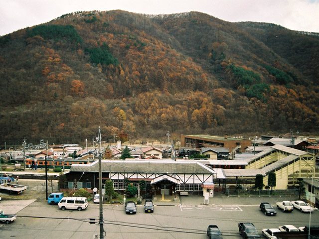
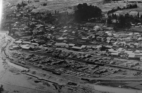
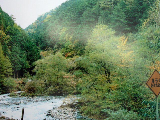
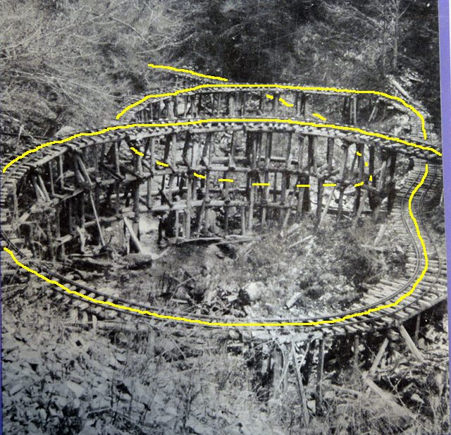
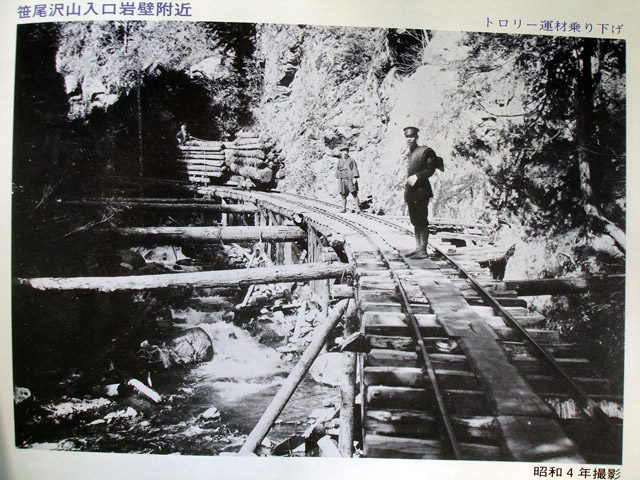
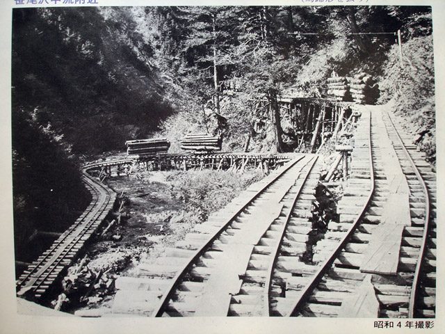
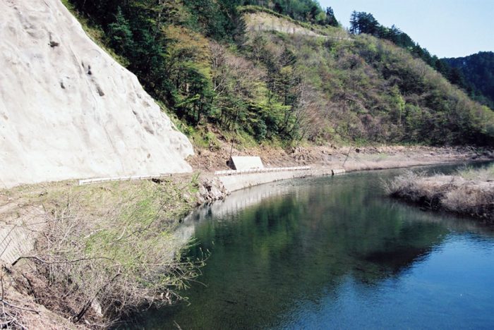
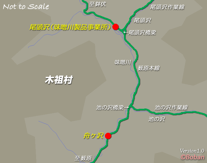
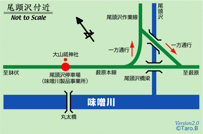
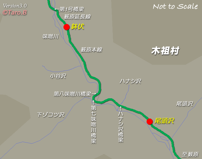
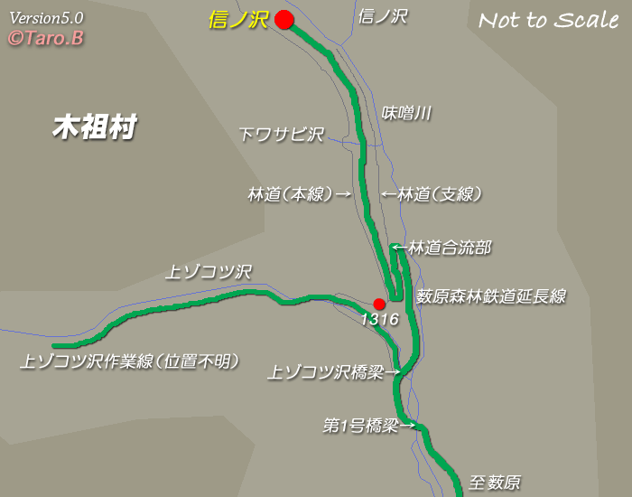
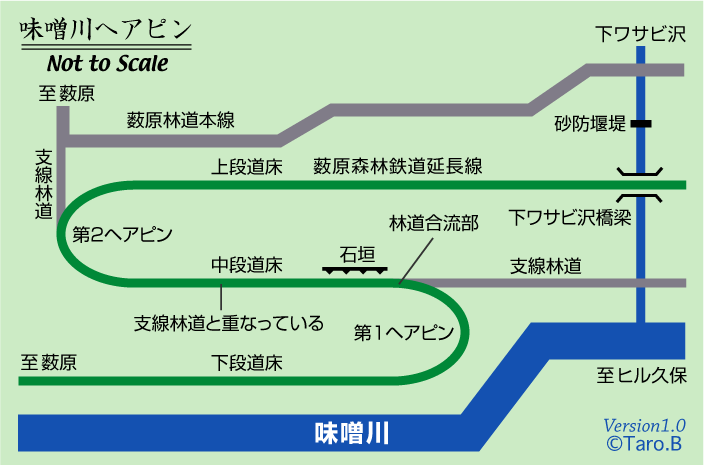
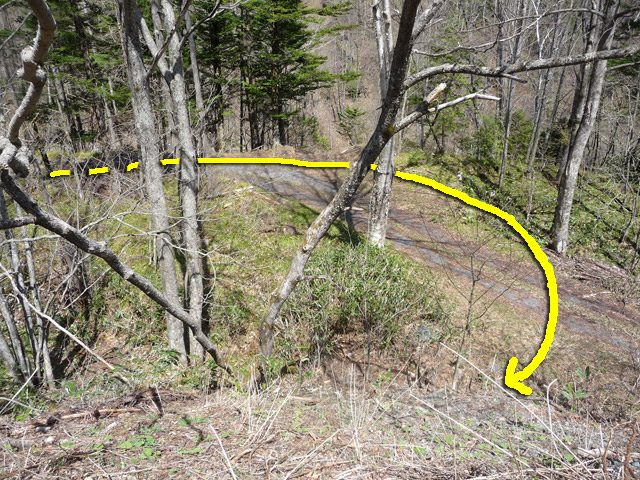
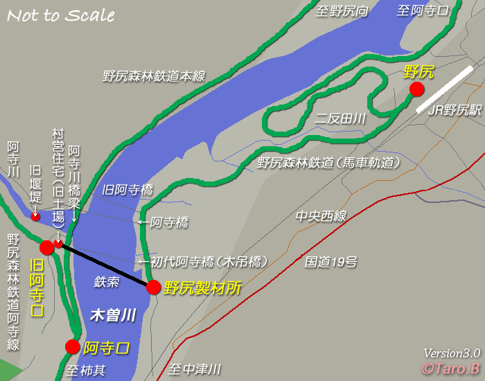
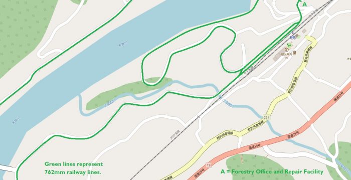
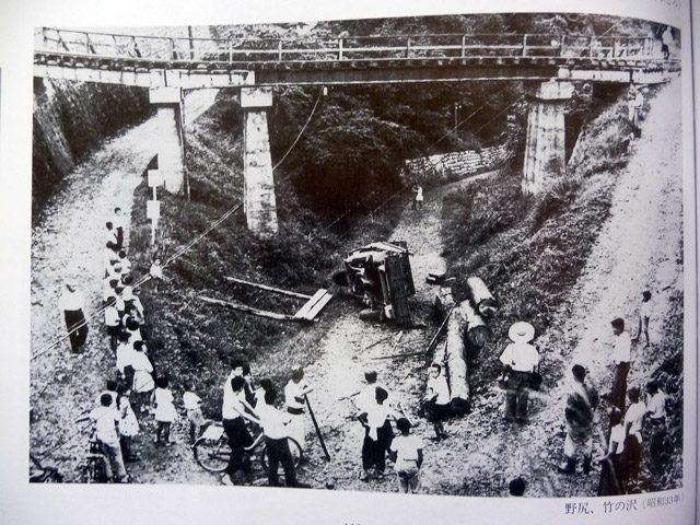
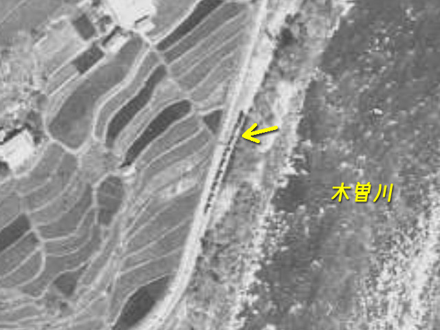
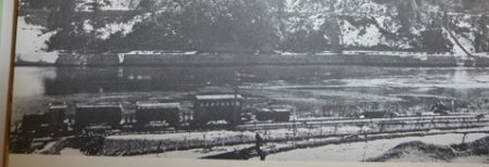
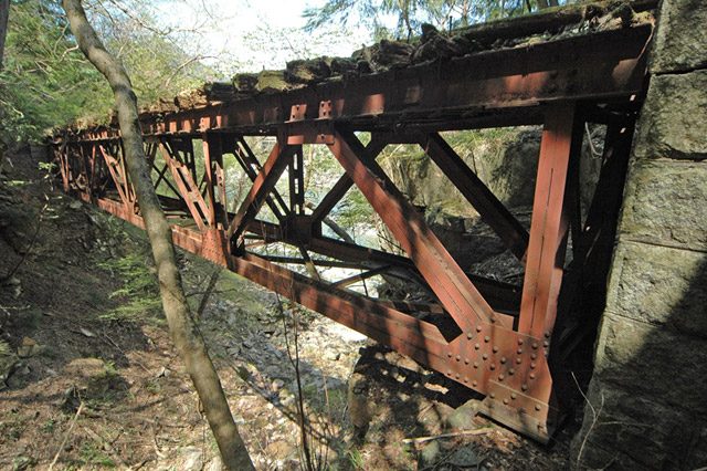
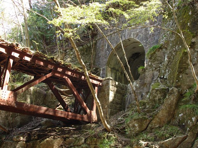
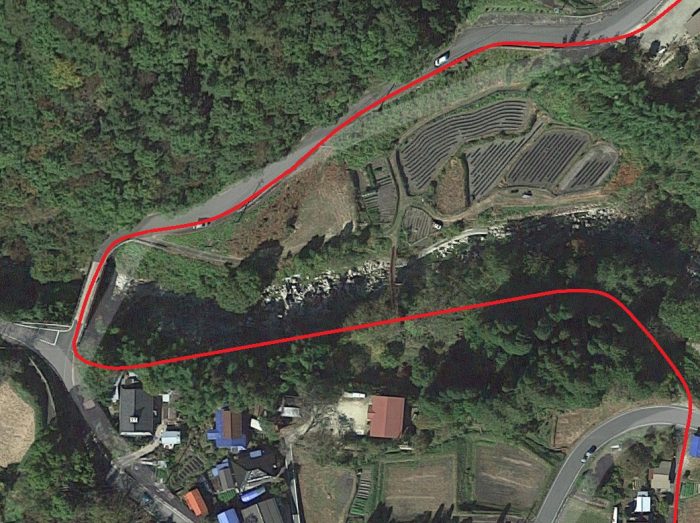
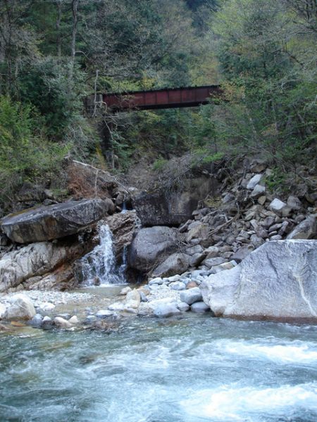
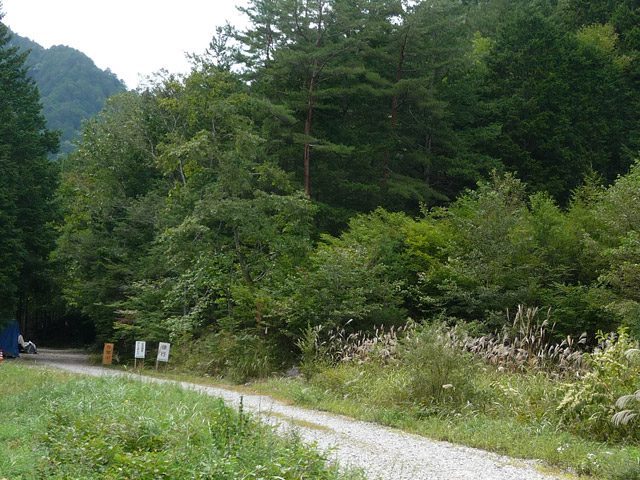
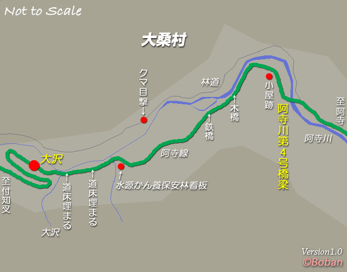
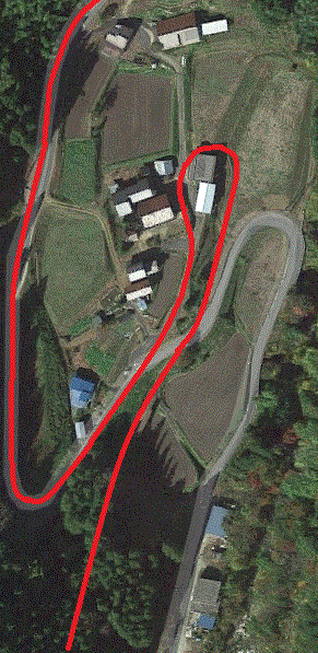
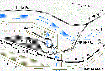
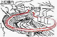
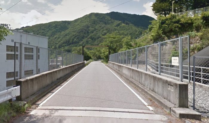
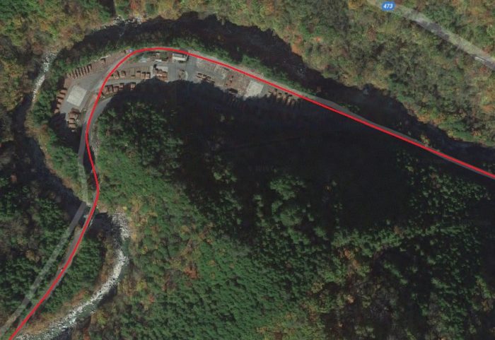
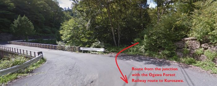
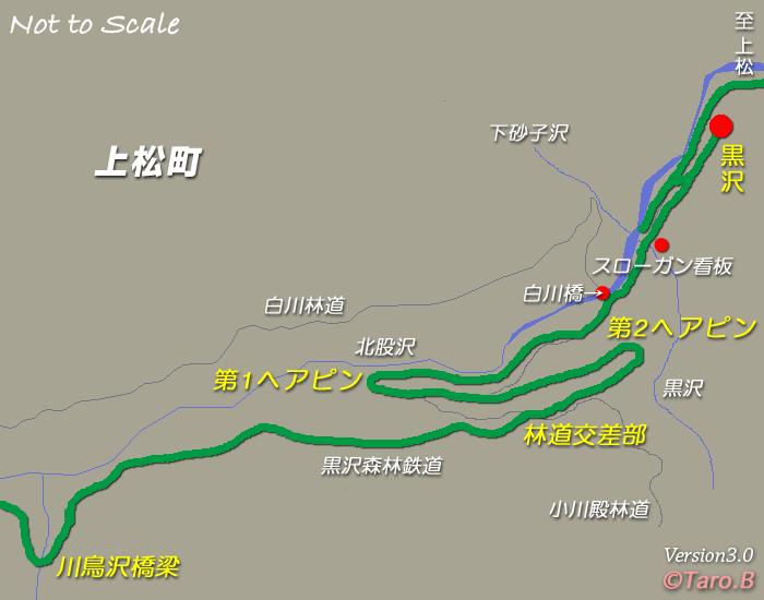
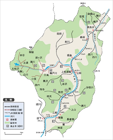
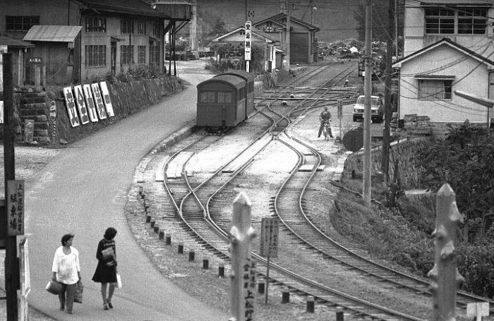
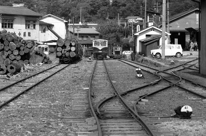
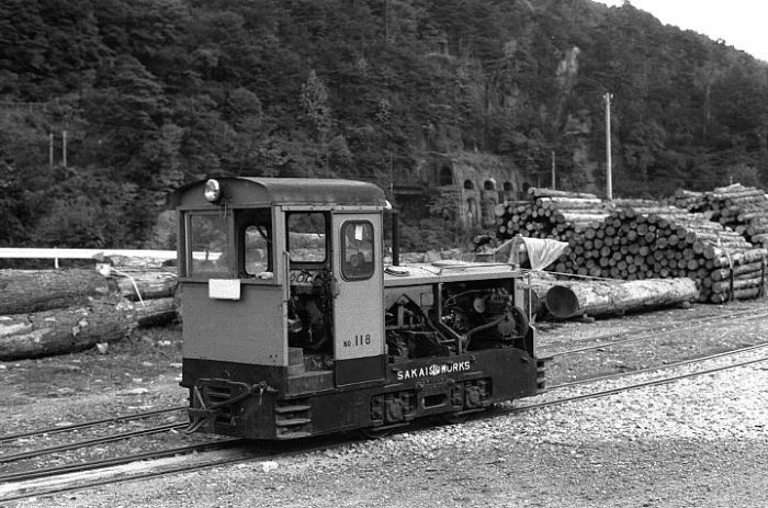
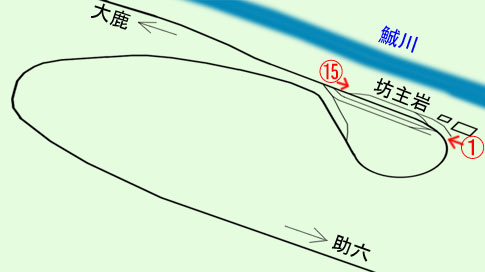
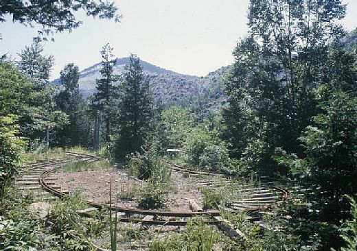
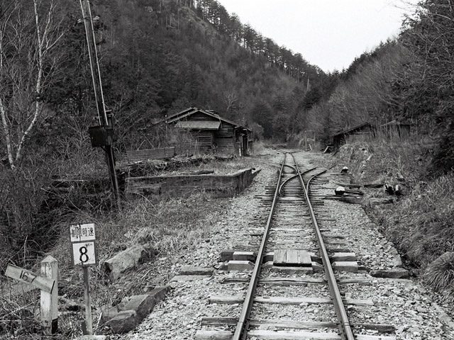
There is an interesting feature in Agematsu which I have discovered on-line. [27] There was a short link line between the high-level railway station and yards and the sawmill in the Kiso River Valley floor. It included a sharp loop as shown in the adjacent image at position ‘A’. [27]
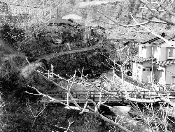
The adjacent image shows at least part of the line still in place in the 1960s. It was very steeply graded and required a very sharp curve to gain the lower level where the sawmill was placed. [28]

The location of the loop is shown above. The adjacent sketch shows it most clearly. [27]

Trains from Agematsu which intended to follow the Ogawa line followed the route north out of Agematsu and crossed the Kiso River using the same bridge as those heading up the Ohtaki Valley. Once over the river, the trains would reverse to take the Ogawa Line.The Ogawa Line travelled South down the West side of the Kiso River. By the mid-1970s there was little evidence that it had been there. The red arrow above shows the route taken by the line from Onibuchi. [1]

Trains ran south for a kilometre or so. The first part of the route can be picked out on the adjacent map close to the Ogawa River. The JNR Chuo line is visible in the top right corner of the map. Initially, the formation has been turned into a modern, tarmacked, single-lane road. The first image below shows the tracks still in position in around 1970. [3]It passes the hydroelectric scheme opposite Agematsu across the Kiso River, bridging the water supply pipes (as can be seen below).The railway then turned gently westward into the valley of the River Ogawa and ran along the North side of the valley. The map below shows the extent of the various routes associated with the Ogawa Forest Railway. The main routes are shown red-dotted on the plan.The Ogawa Forest Railway routes are shown red-dotted on the plan above. [2]

The route of the railway followed this road. [2]

The road meets the  highway No. 473 and the line follows that for a short distance before dropping away to the left as shown below.This picture shows this location in September 1982, (c) Teruo Hayashi. At that time the route of the old line was clearly visible form the main road. Although that road itself was much narrower! [4]Shortly after this the railway crossed form the North to the South side of the Ogawa River on the Odano Railway Bridge. The bridge remains in position in the early 20th century as the satellite image above and the adjacent photograph show. [2][29]

The track-bed beyond the bridge is gradually becoming overgrown as these next two images show. [2][6]

The Ogawa Forest Railway continues to follow the South side of the valley for some kiloemetres. Its route can be accessed easily where modern roads cross its path.This Google Streetview image looks back along the line towards Agematsu.The route continues on, parallel to the river.It passes through a number of old station sites on the way. These included Takakura which was located at a crossing point on the Ogawa River.The route of the line approaching Takakura can easily be picked out on the satellite image above.

At Takakura, a bridge marks that spot of the station today. The present concrete bridge may itself be old enough to have been in place when the railway was in use. If not so, there are signs of the abutments of a previous structure at this location. [7]Takakura Bridge. [7]Looking back along the line of the railway toward Agematsu from Takakura Bridge. The road on the left is the old railway route.Looking ahead along the old railway at Takakura Bridge.The map above shows the next section of the journey from Takakura (the red dot on the right of the map). [8]

The adjacent image shows the state of the track-bed beyond Takakura. [9]

The route of the old railway line once again meets tarmac close to Yakisoba Station.The image above looks forward along the line towards Yakisoba Station.

The adjacent picture shows the lumber yard which now sits on the approximate location of the station at Yakisoba (Yakisasa) [10] where the line turns to the south and crosses the Ogawa River once again, as shown below. The bridge over the Owaga River just to the south of the timber yard (Google Streetview).

Once across the above bridge and now on the West bank of the River Ogawa, the line travelled in a southerly direction. Its route is now under the tarmac of a forest road.The next station along the line was Naka Nakao. Two railway bridges spanned the creek on the North side of the River. The station was on a reversing spur as shown above. The modern road runs along the lower of the two lines. The remains of the upper bridge can be seen in the Google Streetview image below.Trains had to reverse over this bridge. [13] The old railway line then ran above the modern road as it headed on. 

A schematic plan of the complex track arrangement over the next part of the line is shown below.This schematic plan shows the Akasawa line crossing the Ogawa River on the right side of the map. [15]The Akasawa line follows the yellow line to the left. The line towards Kurosawa followed the modern road. [20]The line to Akasawa crossed the Ogawa River at this point. The bridge piers remain. This is the Ushikabuchi Bridge. [16]The wider area around the confluence of the two rivers. [19]

The Akasawa line led to what is now the Akasawa Forest Railway in the Akasawa Natural Recreational Forest via Ushiguchi and Hinomiya. It is this line that we will follow first.

Once the Ushikabuchi Bridge had been negotiated, trains ran along the eastern side of the river valley as shown above.The railway formation now lies under the road to Akasawa.Between rail/road and river we pass the entrance to the Himemiya Shrine.The shrine relates to a princess who dived into a pool in the river, (c) Ken Matsu. [17]The river pool, (c)110 nari. [21]This map shows the planned walking routes around the Akasawa Centre and the route of the Forest Railway at the Centre. [22]The original track layout at Akasawa, in schematic form. [25]

The following pictures show the line from Akasawa terminal to Maruyamado Terminus further to the South. The first four images show the terminal buildings at Akasawa. All are taken from Google Streetview.View firm the Car park.Station Entrance.Locomotive Sheds.The route ahead.A model of the same location. [23]Looking back towards Akasawa.Looking forward towards Maruyamado Terminus from the same location.Two shots from further along the line!Just missed the train to Maruyamado Terminus.Entering Maruyamado Terminus.At the far end of the terminus station the railway branches in two. To the right is a stub end to allow locomotives to run round their train ready for the return journey to Akasawa. The line to the left continues into the forest but is now only used for storage.A diesel locomotive has run round its train and then pushed the train back beyond the terminus station. [14]

In 2017, Masato Chinu undertook some exploration in the area of the terminus station where a line leaves the tourist line. The line extends some distance into the forest. Its route is the line deviating to the left in the image above. Along the first section some old vehicles are stored. [14]On 13th October 2017 these items of rolling stock were stored on the branch. [14]The line continued for some distance. Scaffold boarding has in places been used to make walking along the route easier. [14]The line continued for at least 2 kilometres into the forest and probably much further. [14]After about an hour’s walking Masato Chinu retracted his steps to Maruyamado Terminus Station. [14]Train en-route back to Akasawa. [24]Two shots taken inside the loco shed/display hall at the museum at Akasawa. [26]

Having covered the Line to Akasawa, we return to the route to Kurosawa.

Just after the Akasawa Line split from the Kurosawa Line, the railway route to Kurosawa deviated from the modern road as shown by the yellow arrow in the adjacent picture. [20] Then the railway crossed the Ogawa River once again. The railway bridge piers can be seen alongside the forest road bridge in the Google Street view  image below.The bridge abutments can be seen on the Streeview photograph above and on the adjacent image. [11]

Once over the river, the railway turned to the right and continued alongside the Ogawa River.The Kurosawa Line is now a gravel-surfaced forest road that runs parallel to the Hokutozawa River.

The next location on the route translates to English as ‘Five Store Cabin Stop’ (五軒小屋停車場).  There was a junction at this point, the Naka Nakao Line left the Kurosawa line and crossed the Hokutozawa River.

The bridge has deteriorated badly. It was converted to a  footbridge on its abutments and beams. The ‘footbridge’ was in a very poor state of repair in 2004. It was the only way of crossing the river at this point to get to the Naka Nakao Line beyond.Two pictures of the Hokutozawa bridge, in a state of decay in 2004, with a ‘temporary’ footbridge placed over it. [30]

The present Hokutozawa bridge replaced an earlier timber bridge whose abutments are still visible from the river. [30]

Naka Nakao Line continued deep into the forest above the Ogawa Forest Railway. Along its route it was possible to look down on all the railway lines in the immediate vicinity.Just beyond the bridge the track was supported by a small retaining wall. [40]

A short distance further from the bridge a section of the old track-bed has collapsed into the river.

Once this length has been negotiated, the track-bed can be followed relatively easily. A couple of pictures of the route are provided here from a set of pictures on the Rintetsu website. [31]

The pictures were taken at different times in 2004 and 2011 but are typical of the condition of the more minor logging railway routes nearly half-a-century after closure.

Returning to the Kurosawa line, the formation of the old railway continues to be covered by a gravel forest road. Along the journey we pass a picturesque waterfall, which can be seen from the old track-bed -see the second image below.The Kurosawa Line continues to head West along the river valley. This picture was taken in May 2009. [32]Otaru Waterfall. [33]The Forest road bridge over the Kisame Kisawa. [34]The old railway bridge sat alongside the forest road bridge. The first railway bridge at this site was a timber structure which was later replaced by a bridge made of two iron girders. [34]Nasayama bridge over the Hokutozawa River. This bridge was built in 1964 after the removal of the old railway bridge in 1962. [35]

The railway continued for some considerable distance to Kurosawa. The formation remained under the modern gravel forest road. At Kurosawa (黒沢) the railway switched back on itself to gain height as shown on the plan below. Kurosawa (黒沢) is on the right-hand side of the map. [36]Traces of track-work at Kurosawa. [37]

Beyond Kurosawa, the railway continued to follow the river valley higher into the mountains. Two tight hairpin bends were necessary. [38]Beyond the hairpins, the route of the railway becomes increasingly indistinct. [39]The route of the Line is shown by the yellow arrow. [39]

It is clear that the Line continued some distance into the forest from this point but its route is relatively indistinct. The track can be followed further in the links provided at reference [41] below.

References

  1. http://tsushima-keibendo.a.la9.jp/kiso/onibuchi1.html, accessed on 9th February 2019.
  2. http://www.soleil1969.com/ruinstop/ogawa/oga001.html, accessed on 17th February 2019.
  3. http://rintetsu.net/nagano_01/ogawa04/ogawa_28.html, accessed on 17th February 2019.
  4. http://rintetsu.net/nagano_01/ogawa05/ogawa_33.html, accessed on 17th February 2019.
  5. http://www.cnet-kiso.ne.jp/h/harahiro/kiso/haisen.html, accessed on 17th February 2019.
  6. http://rintetsu.net/nagano_01/ogawa06/ogawa_42.html, accessed on 17th February 2019.
  7. http://rintetsu.net/nagano_01/ogawa07/ogawa_49.html, accessed on 17th February 2019.
  8. http://rintetsu.net/nagano_01/ogawa07/ogawa_map4.html, accessed on 17th February 2019.
  9. http://www.soleil1969.com/ruinstop/ogawa/oga003.html, accessed on 17th February 2019.
  10. http://www.soleil1969.com/ruinstop/ogawa/oga004.html, accessed on 17th February 2019.
  11. http://www.soleil1969.com/ruinstop/ogawa/oga005.html, accessed on 18th February 2019.
  12. http://rintetsu.net/nagano_01/konakao01/konakao01.html, accessed on 18th February 2019.
  13. http://uguigawa.blog42.fc2.com/blog-entry-412.html, accessed on 18th February 2019.
  14. https://blogs.yahoo.co.jp/masatochinu/42145179.html, accessed on 10th February 2019.
  15. http://rintetsu.net/nagano_01/ogawa10/ogawa_85.html, accessed on 18th February 2019.
  16. http://rintetsu.net/nagano_01/ogawa09/ogawa_84.html, accessed on 18th February 2019.
  17. https://www.google.co.uk/maps/@35.758142,137.620113,3a,75y,90t/data=!3m8!1e2!3m6!1sAF1QipMXL-Jex6LLlKgqWdrzdswbDOFRdwpU7m_OheV2!2e10!3e12!6shttps:%2F%2Flh5.googleusercontent.com%2Fp%2FAF1QipMXL-Jex6LLlKgqWdrzdswbDOFRdwpU7m_OheV2%3Dw203-h134-k-no!7i1500!8i997, accessed on 19th February 2019.
  18. http://tsushima-keibendo.a.la9.jp/kiso/kiso-map.html, accessed on 10th February 2019.
  19. http://rintetsu.net/nagano_01/ogawa09/ogawa_map5.html, accessed on 18th February 2019.
  20. http://rintetsu.net/nagano_01/kurosawa01/kurosawa_01.html, accessed on 19th February 2019.
  21. https://www.google.co.uk/maps/@35.7582246,137.6219955,3a,75y,90t/data=!3m8!1e2!3m6!1sAF1QipOQnjJoz_VO_QPrpMogMJpcHcyMsFGV4f0YMRGq!2e10!3e12!6shttps:%2F%2Flh5.googleusercontent.com%2Fp%2FAF1QipOQnjJoz_VO_QPrpMogMJpcHcyMsFGV4f0YMRGq%3Dw203-h152-k-no!7i1024!8i768, accessed on 19th February 2019.
  22. http://www.avis.ne.jp/~hinoki/en/akasawamap.pdf, accessed on 19th February 2019.
  23. http://www.kiso-mc.com/blog/index.php?c=3-20, accessed on 20th February 2019.
  24. https://go-centraljapan.jp/route/monozukuri/en/10.html, accessed on 20th February 2019.
  25. http://rintetsu.net/nagano_01/akasawa2/akasawa_10.html, accessed on 20th February 2019.
  26. https://tokutomimasaki.com/2015/09/trip_to_nagano_in_summer_2015_24.html, accessed on 20th February 2019.
  27. https://sakurayamalr.at.webry.info/201612/article_5.html, accessed on 20th February 2019.
  28. http://www.kisoji.kiso.nagano.jp/harahiro/kiso/haisen.html, accessed on 20th February 2019.
  29. http://usa-nekosando.pupu.jp/miti_otano.b.html, accessed on 20th February 2019.
  30. http://rintetsu.net/nagano_01/konakao01/konakao01.html, accessed on 21st February 2019.
  31. http://rintetsu.net/nagano_01/konakao02/konakao08.html to http://rintetsu.net/nagano_01/konakao02/konakao24.html, all accessed on 21st February 2019.
  32. http://rintetsu.net/nagano_01/kurosawa02/kurosawa_07.html, accessed on 21st February 2019.
  33. http://rintetsu.net/nagano_01/kurosawa02/kurosawa_08.html, accessed on 21st February 2019.
  34. http://rintetsu.net/nagano_01/kurosawa02/kurosawa_09.html, accessed on 21st February 2019.
  35. http://rintetsu.net/nagano_01/kurosawa02/kurosawa_11.html, accessed on 21st February 2019.
  36. http://rintetsu.net/nagano_01/kurosawa04/kurosawa2_map1.html, accessed on 21st February 2019.
  37. http://rintetsu.net/nagano_01/kurosawa03/kurosawa_17.html, accessed on 21st February 2019.
  38. http://rintetsu.net/nagano_01/kurosawa05/kurosawa2_09.html, accessed on 21st February 2019.
  39. http://rintetsu.net/nagano_01/kurosawa05/kurosawa2_12.html, accessed on 21st February 2019.
  40. http://www.geocities.co.jp/SilkRoad-Desert/8044/ko.htm, accessed on 21st February 2019.
  41. http://rintetsu.net/nagano_01/kurosawa06/kurosawa2_13.html to http://rintetsu.net/nagano_01/kurosawa06/kurosawa2_30.html, all accessed on 21st February 2019.


Japanese Narrow Gauge -762mm Lines – Part 3 – The Kiso Railway – Part B – The Otaki Forest Railway

[NB: I have sought, where-ever possible to attribute all sources and have no intention of contravening copyright. Should there be an issue with any of the images below, if you are the copyright holder, please contact me. Please accept my apologies in advance if this has occurred.]

Acknowledgement: I have been helped to correct Japanese translation/transliteration in this post by Ichiro Junpu who also provided the images relating to the Uguigawa Line below. His own work focusses more recently on Chinese Narrow Gauge Railways. His website: “Narrow Gauge Railways in China” can be found on the following link: http://www.kii762mm.com/modules/pico/index.php?cat_id=250 (for Japanese: http://www.kii762mm.com/index.html)

The Ohtaki Forest Railway

The red-dotted route on the featured map above represents the Ohtaki Forest Railway which came to be representative of the whole Kiso Forest Railway. It had the greatest route mileage and made the most significant contribution in timber carrying revenues. [13]

The Kiso Valley’s first forest railway to use mechanical power was the Ogawa Forest Railway. It was completed in 1916. Other lines quickly followed: the Ohtaki Line, the Atera Line, the Ogiso Line, the Nishinogawa Line, and so on. …. There were 57 routes in all, the length of the lines totaled over 428 kilometres. This can be increased, if all the work areas and sidings are included, to over 500 kilometres. [13]

Construction of the Ohtaki Line was started in 1917 by the Imperial Forestry Bureau. At that time the first 25 km to Kohrigase along the Ohtaki River were completed. Extensions to the system followed relatively quickly – the extension of the main-line to Miure (about 17 kilometres) and branches including the Setogawa, the Uguigawa, branch-lines at Takigoshi and small branches around Ohtaki, Mitake, and Kaida.

By 1975, Japan had entered a period of rapid economic growth, and the transportation environment shifted once again. Railways became electrified and refinements of the internal combustion engine produced trucks that conveniently allowed lumber to be transported without the need for railway tracks. And so the Kiso Forest Railway was deemed to no longer serve an essential function. The Ohtaki line eventually closed in May 1975. [13]
As the forest railways disappeared, one after another, Kiso became a focus for public attention. A special program was aired on TV, and as the final operating date approached, bustling tent villages developed at each station. [10]

The last logging trains ran commercially in the Forest in 1976. [1]

It wasn’t until much later, in the summer of 1987, the Akasawa Forest Railway finally resumed operation as a tourist attraction. [10] The line at Akasawa bills itself as The Ohtaki Forest Railway. It Is a remaining remnant of the old Kiso Forest Railway system. It still runs for tourists through Akasawa Natural Recreational Forest, a 300-year-old natural forest. [7] However, it is not on the line of what was originally the Ohtaki Forest Railway. That railway followed the valley of the River Ohtaki a little further North in the Kiso River Valley catchment area. Details of the original line follow here:

The name “Ohtaki Forest Railway” has become synonymous with the Kiso Forest Railway. So perhaps it is important to follow the actual line of that railway alongside the Ohtaki River (its route is shown by the red line on the map above). We will leave the Akasawa line alone for now!

The Ohtaki line was lengthy. It ran for 48 kilometres from Agematsu Station in the East to Hontani, but even at that length it only made up around a tenth of the whole network in its prime. The map is part of 1/200,000 “Iida” from the Geographical Survey Institute, issued on 30th March 1968. [18]
The sketch plan above shows, schematically, the network of 762mm lines in and around Agematsu. [21]

An overview of the station and lumber yards at Agematsu. [21]

As we have noted the main Ohtaki Forest Railway closed in the mid-1970s. Pictures can therefore be found from the later period of the line’s operation. Among the photos below are a number selected from the on-line Tsushima Keibendo Photo Gallery. [18] Each item is referenced directly to the page in that gallery and following the link provided in the references at the bottom of this blog is very rewarding. Most of the monochrome images were taken in 1974. I am writing in 2019, so these pictures take us back 45 years. [18]

Agematsu Station in 1973. [18]

Agematsu Station in 1973, this picture is taken looking back towards the location of the first. [18]

Agematsu Forestry Office in 1973, a small 5 tonne diesel locomotive and passenger carriage sit in front of the storehouse. [18]

There were two goods yards at Agematsu and moving between the two required accessed to the larger gauge mainline. Over a short length that railway was dual-gauge as can be seen on the adjacent picture taken in 1974. [11]

There was a substantial operation transferring timber from the narrow gauge line of the Forest to the JNR Chuo Line.

The logging operation at Agematsu. [18]

After leaving Agematsu the line travelled alongside the JNR Chuo line and alongside the Kiso River until it reached the Onibuchi Railway bridge. Here it crossed the Kiso River to its West bank and then followed the river for about 4 kilometres. [18]

The Ogawa Line left the Ohtaki Line at this point. Its route heads off to the right of the monochrome image above. The next two images show this location in the early 21st century.

The modern road bridge sits alongside the old railway bridge. This view from Google Street view is taken in the direction of travel from Agematsu to the Ohtaki Valley.

The old railway bridge can be seen more easily from the West side of the Kiso River. This bridge has already featured in the previous post about the Kiso Forest Railways.

From Onibuchi, the railway formation follows what is now Highway 508 alongside the Kiso River.

A few kilometres further along the line was a timber storage point near Kakehashi Cliff. The English translation of the name appears to be ‘Bar’. The Kiso River flows behind the locomotive in this picture and the JNR line is on the far bank. Above the engine hood of the loco a tunnel/gallery can be seen. [18]

The Ohtaki Forest Railway continued from here either under or alongside what is now the modern Highway 508 and then an unnamed/unnumbered road. The railway then turned to the West on the southside of the Ohtaki Valley, passed what is now the Kiso Dam.

Taken from the opposite bank of the River Kiso, this picture shows a Kiso Forest Railway timber train close to the point where the Ohtaki River meets the Kiso River. [18]

As the line turned into the valley of the River Ohtaki, it followed the Southbank of the river through Numa Station which had a grounded passenger vehicle as a waiting room and Ohshima Station were once a branch-line left the main route to serve Nishinogawa. The modern Route 20 and then Route 473 appear to sit between the Ohtaki River and what was the route of the railway. It appears that the railway sat above Route 473 on the valley side and then crossed it to follow the river.

The Ohtaki Forest Railway crossed the route of the modern road No. 473 on a viaduct. Only the abutment and pier remain.

The Railway then followed the river closely as its course turned to the North in a relatively large loop. For a time the railway formation travelled North and we pick it up once again close to the Ohtaki River on the relatively recently constructed road below.

The line then ran passed the modern Tokiwa Dam and ran along under or alongside what is now Highway 256 and gradually, with the river valley, turned to a southerly course.

At Futagomochi Route 256 crosses the Ohtaki River. The Ohtaki Forest Railway remained on the South side of the river and then travelled alongside Lake Ontake which was formed by the construction of the Makio Dam. An unnamed/unumbered road now follows the Railway’s route beside the lake.

A timber train alongside Lake Ontake, travelling towards Agematsu. [18]

The present road runs into Tajima alongside the Lake. The old railway followed a course slightly to the South and ran behind the buildings that made up the village.

This image shows Tajima Station in 1974. The view is taken from the West looking back along the line to Agematsu. The modern road is off to the left of the picture. Tajima was the closest station to Ohtaki village. [18]

Tajima Station is nearly 21 kilometres from Agematsu. Just beyond it the modern road crosses the narrowing lake. The old railway route continues along the southern side of the valley. It is shown in the image below.

The next location along the route is Matsubara 23 kilometres from Uematsu, where there is now a Sports Park. The station at this location closed well before the line itself was shut down.

Matsubara station was at his location. Nothing of the station is visible in this March 1974 image. [18]

Matsubara is significant in more modern times as the location of a triannual ‘Forest Railway Festival’ which takes place at Matsubara Sports Park. The first of these events took place in 2004, the second in 2007, the third in 2010 and the fourth in 2013, etc. The “Ritsutetsu Club” is based here. It undertakes preservation work. The club was based at Tajima Station but moved to this new location in 2006. [12]

It may be of interest to note that Matsubara Sports Park is a park reconstructed by regrading earth and sand which flowed into Ontake Lake as a result of the Nagano Ken Western earthquake and the Makio Dam Sedimentation Project above the Matsubara station of that time. [18]

The landfill places the route of the old forest line under some 20 metres of fill and the new track runs on top of that landfill. The line is known as the “Seseragi Line.” It was built by volunteers over 5 years to reach a length of about 400 metres in 2007 and over 800 metres in 2010. [18]

The Seseragi Line in 2007. [18]

This locomotive is No. 132 which has been preserved and restored to working order. [18]

The route of the line surrounds the sports park. [15]

Beyond the Sports Park, the railway formation closely followed the river bank.

The next station along the line was at Ohshika, where a line branched off the line that we have been following and followed the valley of the Uguigawa River. It seems that although the Ohtaki line closed in 1975, it was still possible to follow the branch-line in 1977. [2] The adjacent map shows the line.

This map was
published in 1974 by the Geographical Survey Institute and is at 1/50,000 scale. Main stations of the Uguigawa Line are marked with a blue circle and letters. Important locations are marked in red with red lettering. Red ‘x’ symbols mark the extent of accessible lines.

The Railcar No.4 used for the trip in 1977 is shown in the image below, taken at Bohzuiwa Station, which is about halfway along the Uguigawa Line at the point where the line negotiates two tight hairpin bends. [2]

Motor railcar at Bohzuiwa Station in 1977. [2]

Bohzuiwa Station track diagram, the picture above is picture (1) on the plan, the picture below is picture (15). [2]

Another picture of a motor railcar at Bohzuiwa Station in 1977. [2]

The next few pictures give an impression of the state of the Uguigawa Line in 1977. For a much better appreciation of the line please use the link at reference [2] below.

The Tarugasawa bridge. [2]

The Nakanosawa Bridge with the tunnel portal just beyond. [2]

Sukeroku, the end point of Uguigawa line in 1977, this curve radii is very tight. [2]

Level differences can be dramatic! This is the view down on Sukeroku Station from an abandoned line. [2]

Back at the mainline alongside the Ohtaki River we get to Ohshika Station. It is shown immediately below a couple of years after closure. The enlarged extract from the Geographical Survey Institute, 1/50,000 map shows Ohshika Station highlighted by the larger red oval.

Ohshika in 1977, 2 years after the closure of the line. [2]

Ohshika Station in October 1974. [3]

Looking back at Ohshika from the Hoya side. The track behind the slogan is the Uguigawa Line, © unclefuku . [16]

Beyond the station at Ohshika, both of the two lines entered tunnels which were immediately adjacent to each other.

Beyond Ohshika, the line enters a short tunnel before crossing the River Ohtaki on an arch-shaped iron bridge (Ohshiabuchi).

The two pictures above were taken in 1974 of trains crossing the Ohshikabuhi Bridge. [6]
The very short tunnel shown in the second of the two pictures above is seen from its western end in the adjacent image from 2017. Immediately beyond this tunnel, Kohrigase storehouse was at hand which was also the limit of road transport when the line was in operation.

The railway is now travelling on the North side of the Ohtaki River.

A further couple of kilometres along the line Shimokurosawa was reached. The Shimokurosawa Railway Bridge was an excellent location for railway photography.

A forest train crossing the Shimokurosawa Railway Bridge in 1974. The reference provides a link to series of photographs at this location. [4]

Since the days of the railway, the valley has been flooded to create a lake. The same bridge is shown from the later road in the next image. The camera is beyond the bridge in the monochrome image above looking back towards Agematsu.

As the monochrome photograph above and the map below (at the right-hand edge of the map extract) show, just after the line crossed the Shimokurosawa Railway Bridge it entered a tunnel which took it through a significant rock outcrop. That tunnel is just off the modern photograph to the right. The portal is shown below.


The line then followed the river until it reached the scattered village of Takigoshi. Its route to the village forms the foundation of the single track road to Takigoshi.


Although roads are shown on the map below, the only access to this village and beyond was by railway or on foot. It was the abandonment of the railway which, in the main, provided a suitable access route for road vehicles. The railway crosses from East to West and the village and station are at the centre of the map.

Takigoshi Village. The map shows the Shirakawa Branch-line head south from the main line.

A misty day in October 1974 at Takigoshi. [5]

Takigoshi in the snow in March 1974. [4]

The same location in around 2015.

Lattice Girder bridge close to the start of the Shirakawa Line. [4]


The line continues on alongside the River and passes through Ichinose before reaching Tsuchiura Station (marked a Sato on the satellite image).

Ichinose in the 1950s. [17]

Ichinose in the 21st century. [17]

This sketch plan shows the railway close to Miure Dam. Three different routes are shown. At the 40 kilometre point a line to the base of the dam diverges to the south of the main line and then close to the Dam a line diverges close to the mouth of Tunnel No. 25, heading south and then round the southern shores of the lake. [19]

Tunnel No. 25. [20]

The next image is taken on the line running alongside Miure Lake which is the lake behind Miure Dam.

The train in this image is travelling from Hontani back towards Tsuchiura. The picture was taken in October 1974. [8]

Beyond Sato the railway followed the northern bank of Lake Miura to is terminus at Hontani. The red line on the satellite image above is approximate. The route is, in the 21st Century, increasingly overgrown.

Hontani Station was the end of the line. This picture was taken in October 1974. Only light logging lines extended West beyond the station at Hontani. [9]

References

  1. https://en.m.wikipedia.org/wiki/Kiso_Forest_Railway#cite_note-Small-1, accessed on 7th February 2019.
  2. http://tsushima-keibendo.a.la9.jp/kiso/uguigawa.html, accessed on 12th February 2019.
  3. http://tsushima-keibendo.a.la9.jp/kiso/ooshika1.html, accessed on 12th February 2019.
  4. http://tsushima-keibendo.a.la9.jp/kiso/shimokurosawa.html, accessed on 12th February 2019.
  5. http://tsushima-keibendo.a.la9.jp/kiso/takigoshi5.html, accessed on 12th February 2019.
  6. http://tsushima-keibendo.a.la9.jp/kiso/ooshika3.html, accessed on 12th February 2019.
  7. http://www.kisoji-isan.com/s/en/heritage/2326.html, accessed on 8th February 2019.
  8. http://tsushima-keibendo.a.la9.jp/kiso/tsuchiura.html, accessed on 12th February 2019.
  9. http://tsushima-keibendo.a.la9.jp/kiso/hontani.html, accessed on 12th February 2019.
  10. https://kiso-hinoki.jp/en/01akasawa2.html, accessed on 9th February 2019.
  11. http://www.dagashi.org/tro/kiso01.html, accessed on 14th February 2019.
  12. http://rintetsuclub.client.jp, accessed on 13th February 2019.
  13. http://www.ontake.jp/%E3%81%84%E3%81%AE%E3%81%A1%E5%91%BC%E3%81%B3%E8%A6%9A%E3%81%BE%E3%81%99%E3%81%A8%E3%81%93%E3%82%8D/%E7%8E%8B%E6%BB%9D%E6%9D%91%E3%81%AE%E6%97%A5%E6%9C%AC%E9%81%BA%E7%94%A3%E3%80%8C%E6%A3%AE%E6%9E%97%E9%89%84%E9%81%93%E3%80%8D, accessed on 10th February 2019.
  14. http://blog.livedoor.jp/otaki_maki/archives/cat_10012707.html, accessed on 13th February 2019.
  15. https://ameblo.jp/rintetsu-club/entry-12206226664.html, accessed on 13th February 2019.
  16. http://rintetsu.net/nagano_02/outaki13/outaki_ot14.html, accessed on 16th February 2019.
  17. http://rintetsu.net/nagano_02/outaki25/outaki_it01.html, accessed on 16th February 2019.
  18. http://tsushima-keibendo.a.la9.jp/kiso/kiso-map.html, accessed on 10th February 2019.
  19. http://rintetsu.net/nagano_02/outaki27/oo_ie.html, accessed on 16th February 2019.
  20. http://rintetsu.net/nagano_02/outaki28/outaki_25t01.html, accessed on 16th February 2019.
  21. http://tmu-11e.cocolog-nifty.com/ryokou/2014/08/post-4af1.html, accessed on 4th March 2019.

Book Review: John Minnis; Britain’s Lost Railways – A Commemoration of our Finest Railway Architecture

John Minnis is an architectural historian with English Heritage. He has a particular interest in transport buildings and has published widely on both rail and road architecture.

A friend gave me his book, ‘Britain’s Lost Railways’, [1] for Christmas in 2018. It is February 2019 as I write, and I have just completed reading this book. It is a striking photographic record of how the closure of railway lines, predominantly, but not exclusively, as a result of the Beeching report, and a search for modernity decimated our heritage in and around our once all pervasive railway network during the 20th Century. The cover price is £25.00 but I have seen new copies on sale on internet sites for £16.00 or so.

The author provides examples from across the rail network of buildings that have been lost. In many cases, not just individual buildings but whole station sites have been lost, sites which had an integrity all their own and which probably needed to be preserved as complete sites. The outcome, in some cases, seems to be the preservation of an individual building but not its context and as a result the preserved building is diminished by the resulting changes around it.

This book is primarily a pictorial record of what has been lost but not a detailed and comprehensive survey of those losses. It is a memorial to what has been lost! It seems to me to evoke memories of the past, without being over sentimental. Minnis says that the book is probably aimed more at those whose interest is in architecture rather than railways. While that is true, it seems to me that there is every good reason for those who are excited by railways and railway history to understand the environment though which they run, and particularly the railway infrastructure that surrounds the locos, carriages and wagons that already hole their interest.

The process of destruction has been going on since the dawn of the railway age and some buildings are included in this book that were demolished well over 100 years ago, in some cases they are illustrated by the only photographs known to exist. Minnis has a specific focus on the main line companies rather than minor or narrow gauge railways, although there are some examples of the latter included in the book.

In some cases, the stations or lines remain open, in others, the lines themselves are closed, but the one thing that unites all the buildings and structures in Minnis’ book is that they have gone and all we have left is a photographic image. Perhaps, their disappearance was inevitable. Redundancy and changes in the way in which we live our lives led to considerable destruction of obsolete railway buildings and structures. But, in the 1960s and early 70s, the rate of destruction in Great Britain was really high, perhaps higher than anywhere else in the world.

Increased understanding of railway architecture, coupled with a growing awareness of the quality of Victorian buildings, has led to railway architecture being appreciated to a much greater extent. Minnis notes that from the end of the 1960s the widespread demolition of railway infrastructure began to be constrained by professional, and to some extent, public opinion. But it is still true that the second half of the 20th Century saw the loss of swathes of Victorian infrastructure. “In large areas of the country, the Victorian railway infrastructure, at least in terms of buildings, has effectively vanished. Throughout much of urban Lancashire and Yorkshire, on Tyneside and Teesside, and in South Wales, there are no more than a handful of Victorian stations left through a combination of an official policy of demolition in the late 1960s and ’70s and the effects of the inevitable vandalism that follows in the wake of de-staffing stations. In the south, the position is rather happier as more stations remain open and staffed for at least part of the day.” [2]

Minnis asserts that the buildings lost include “a range of work of extraordinary quality. Wholesale demolition of Victorian buildings of all types was only to be expected in the 1950s and 1960s when they were generally unappreciated, but much destruction of railway structures has taken place within the last forty years. The small wayside stations, both urban and rural, have been at the heart of the destruction.” [3]

This book was first published in 2011. © Quarto Publishing PLC 2011, 2014, 2017 Text Copyright © John Minnis 2011, 2014, 2017.

References

  1. John Minnis; Britain’s Lost Railways – A Commemoration of our Finest Railway Architecture; Quarto Publishing PLC, London, 2011.
  2. Ibid., p13-16.
  3. Ibid., p16.