

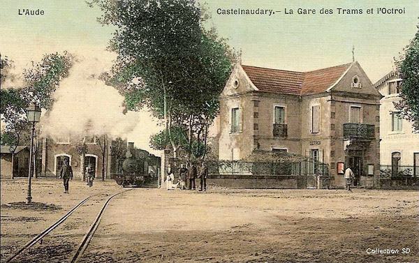
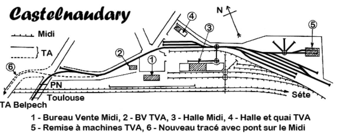
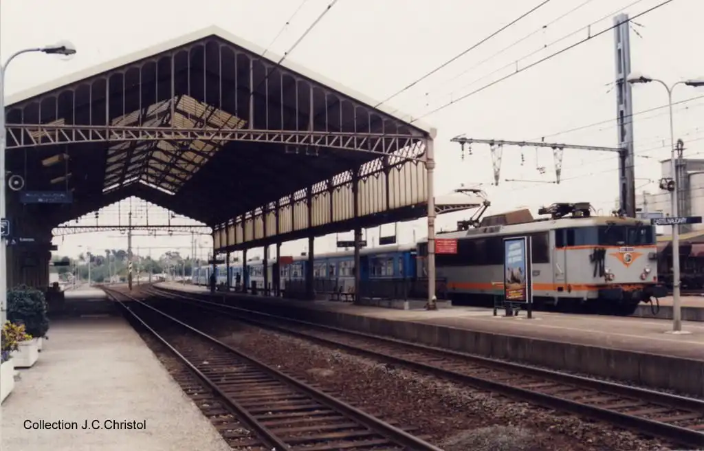
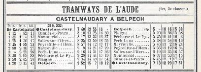
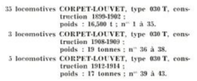
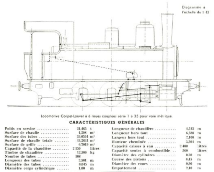
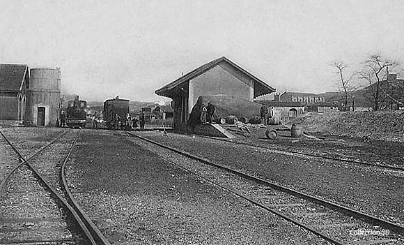
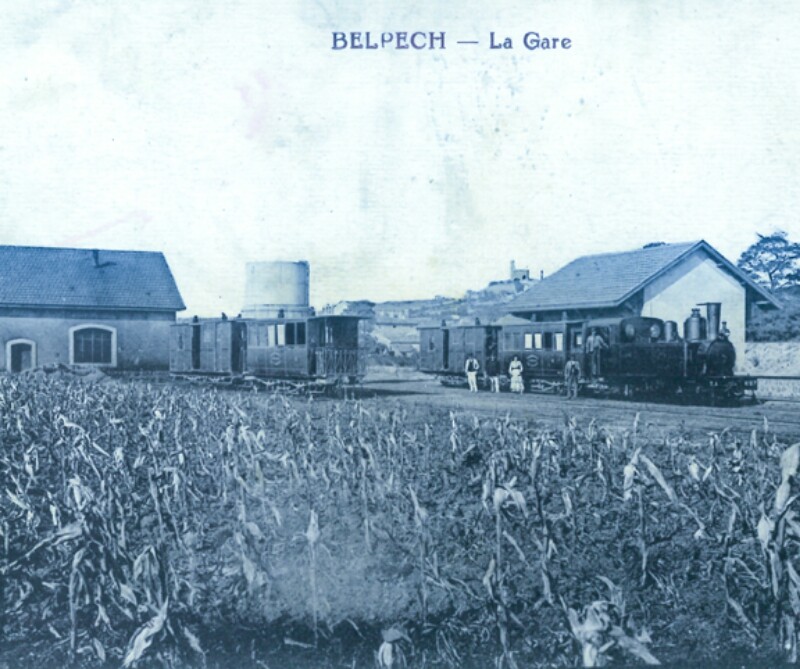
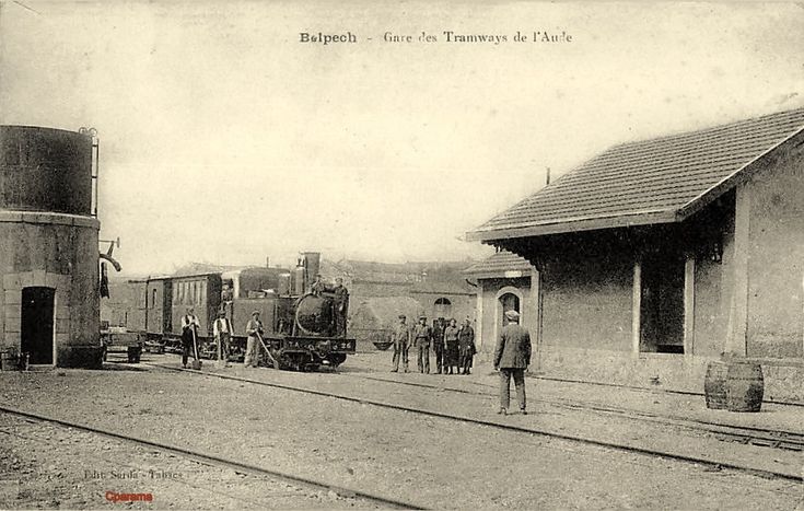
We started by looking at the most westerly line of the Tramways de l’Aude and the story of the line from Belpech to Castelnaudary can be found in two posts:
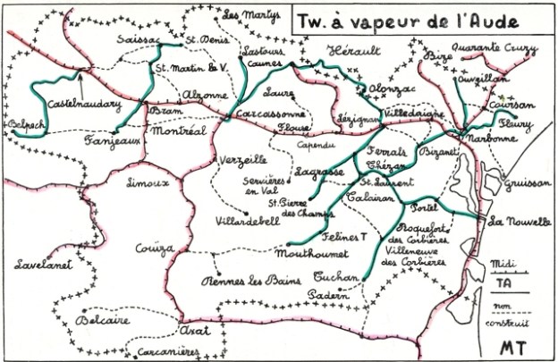
The next most westerly of the Tramways de l’Aude lines was that from Fanjeaux running north through Bram to Saissac and then east to Saint Denis. This is a journey along the route of that line seeking to find any possible remaining evidence of its existence.
Fanjeaux is located west of Carcassonne. Between 1206 CE and 1215 CE, Fanjeaux was the home of Saint Dominic, the founder of the Roman Catholic Church’s Dominican Order, who preached to the Cathars in the area. It is a small town of under 800 people. [1]
Fanjeaux is an important Cathar site. It was a major centre, and in the 13th Century was a significant citadel with a population of over 3,000. [2] It was then surrounded by a moat and defended by ramparts with fourteen towers (tours). Two entries serve as reminders of the medieval gates which controlled entry into the town. Like most Languedoc castra it had a large castle (Château) within its walls. Almost nothing of it remains today.
In 1204 Esclaremond de Foix received the Cathar Consolamentum at the Château here in the presence of her brother, the Count of Foix. The site of the Château hall where the ceremony took place is now marked by a Catholic Dominican chapel, supposedly marking the site of one of Saint Dominic’s miracles. You can trace the old city walls and surrounding dry moat, now marked by a road. An outbuilding belonging to the new Château (13th century) also survives and according to a dubious Dominican tradition once served as Saint Dominic’s Fanjeaux residence. [3]
Bram is part of the old province of Lauragais. It was a centre of Cathar belief and that heresy brought the intervention of Simon de Montfort who, besieged the town in 1210. He succeeded in three days and took revenge on resistants by cutting off the top lip of all his prisoners and gouging out the eyes of all but one. For the last he gouged out only one eye so that he could lead the others out of the town to the château of Lastours.
By the 17th century Bram had outgrown its walls and expanded in concentric circles. It population in the early 21st Century is around 3,100. [11]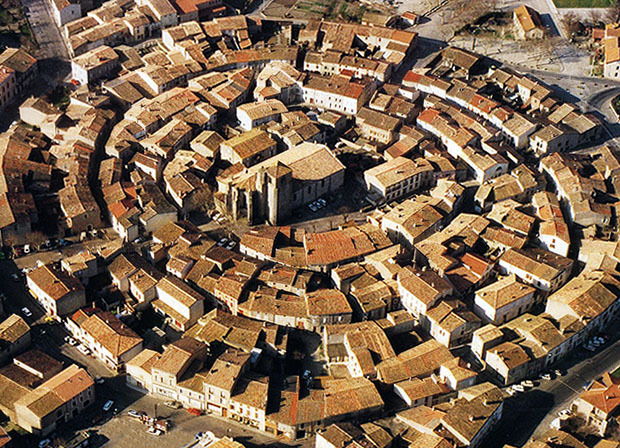 The citadel and old town of Bram. [12]
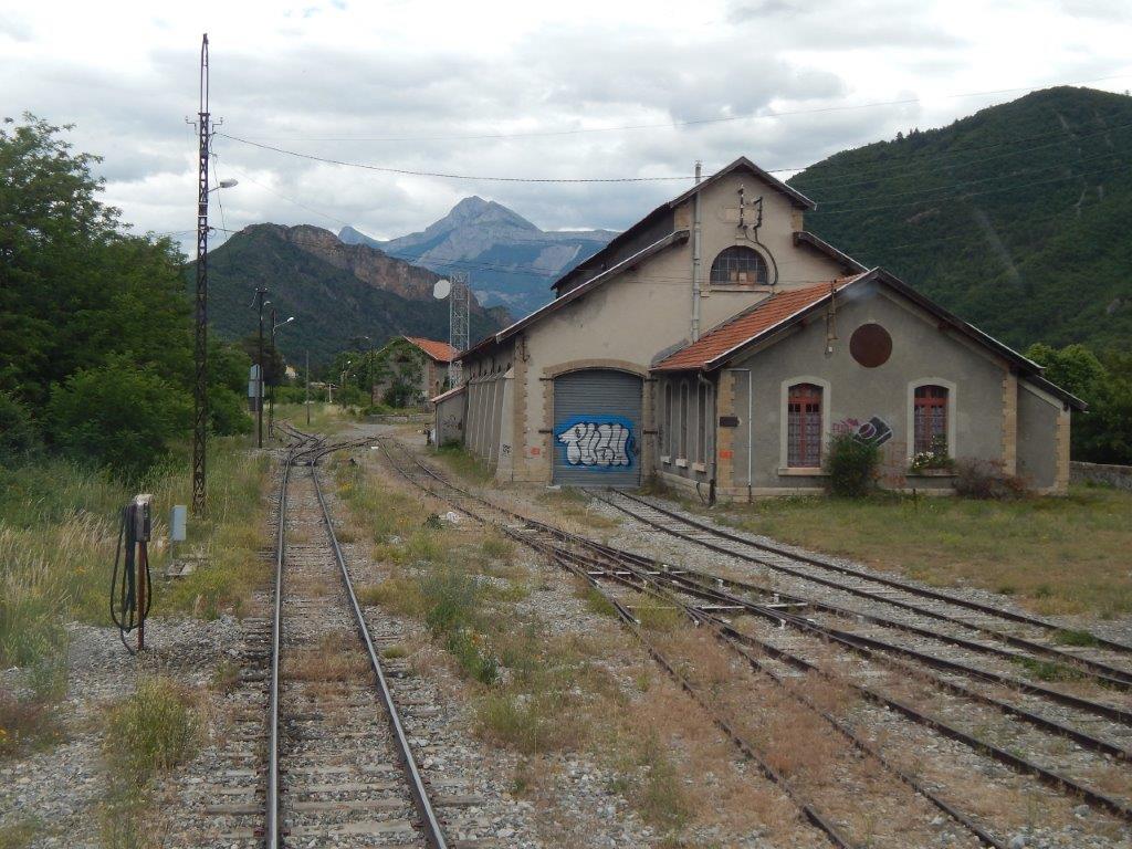
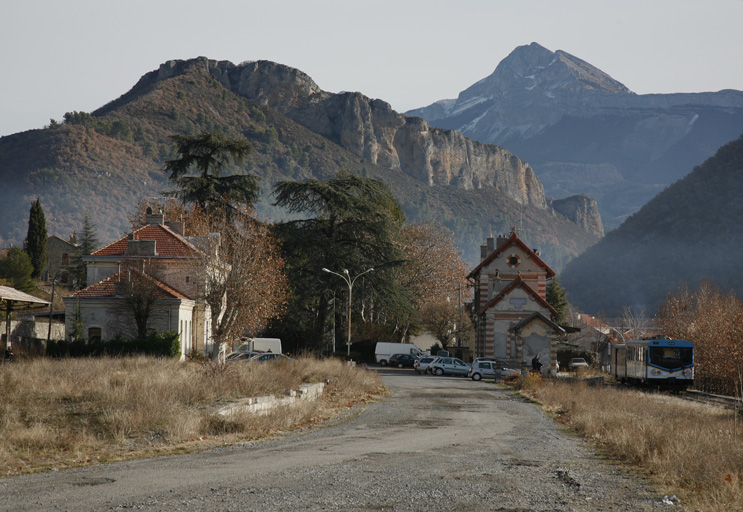
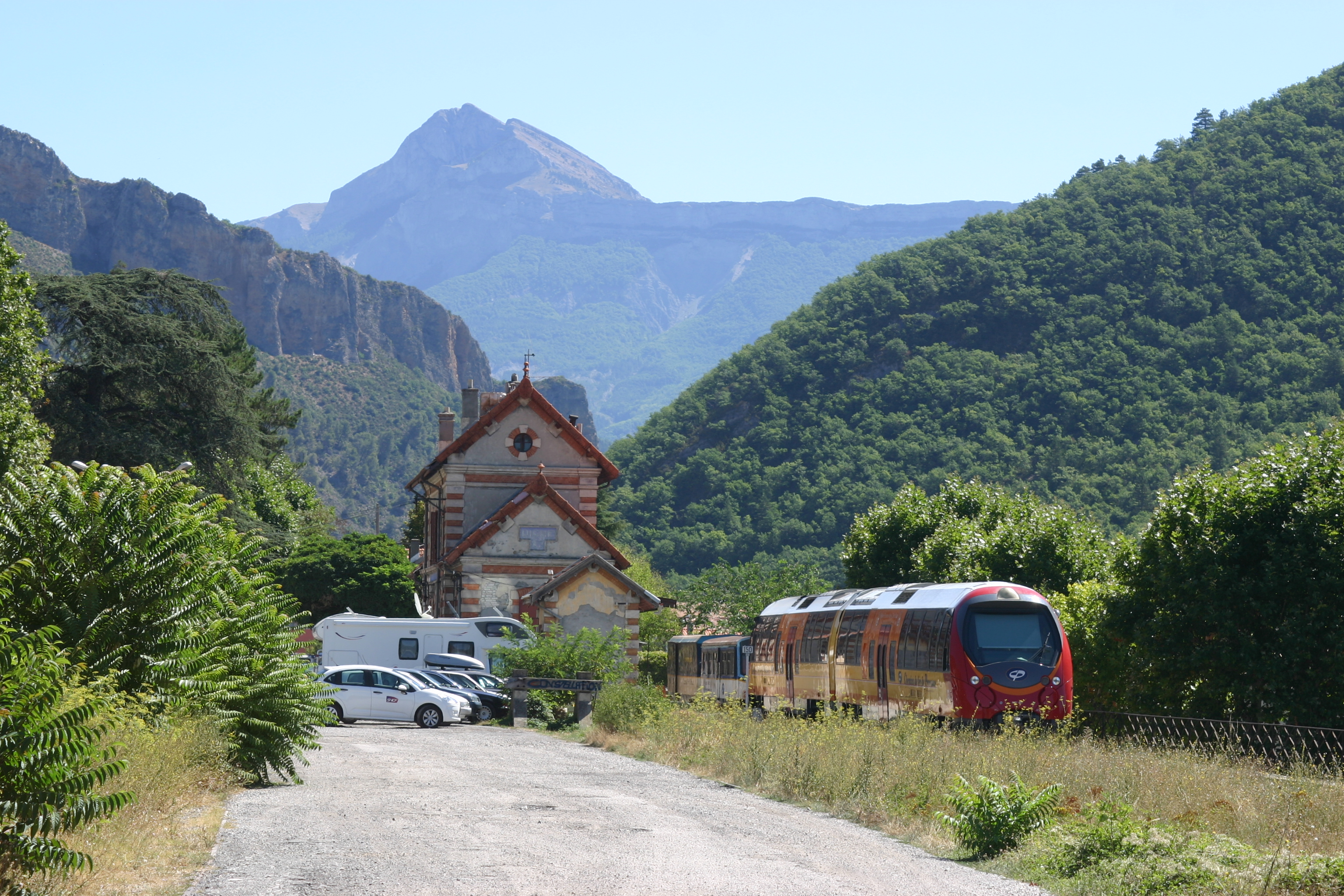
Saissac is perched in the foothills of the Montagne Noires (Black Mountains) at an altitude of 467 m and boasts stunning views of the Vernassonne Gorge as well as the valley plain which stretches between Carcassonne and Castelnaudary. It first appeared in history in the 10th century, the name originates from the Gallo-Romain Saxiago. The history of the village is strongly linked the Château built in the 10th century. [13]
The Château de Saissac is a ruined Cathar Castle on a promontory at the southernmost tip of the commune of Saissac, in the Aude département located north-west of Carcassonne.
Saissac is mentioned in a legal document (an Acte) from the Abbey of Montolieu in 958, and again in a text of 960. The village is typical of the Black Mountains and is built between the ravines of the rivers Aiguebelle and Vernassonne, just above their confluence. Things to see in the village include the porte d’Autan, a lavoire built in granite, a second covered lavoire and a fine echauguette. Vestiges of the city walls (enceinte) are still visible around the ancient village. These walls date from the Fourteenth century, the same period that the castle of Saissac was restored. [14]
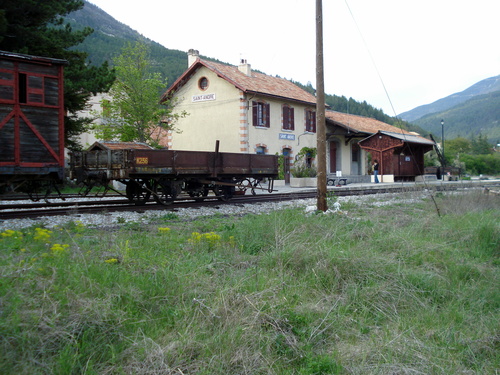
Saint Denis is a village of less than 500 people. [15] It is located in the foothills of the Black Mountains between the valleys of Alzeau in the west and Linon in the east. It is a little to the east of Saissac.
The tramway provided for the sharing of agricultural produce between the plains and the foothills of the Pyrenees, and trains of wheat and maize from the Lauragais plain also crossed those of milk and butter produced in the pastures of the Montagne Noires. [4]
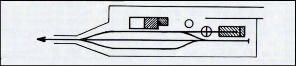
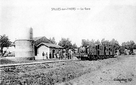
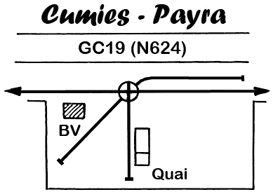
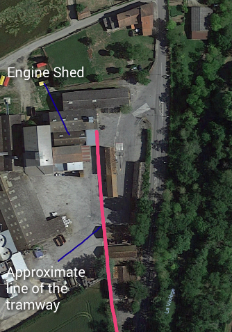
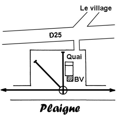
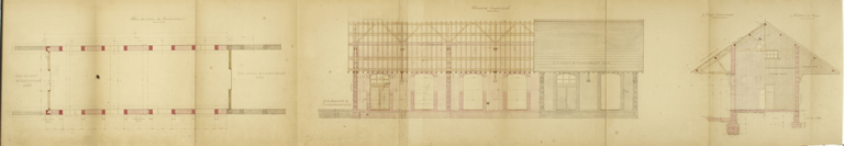
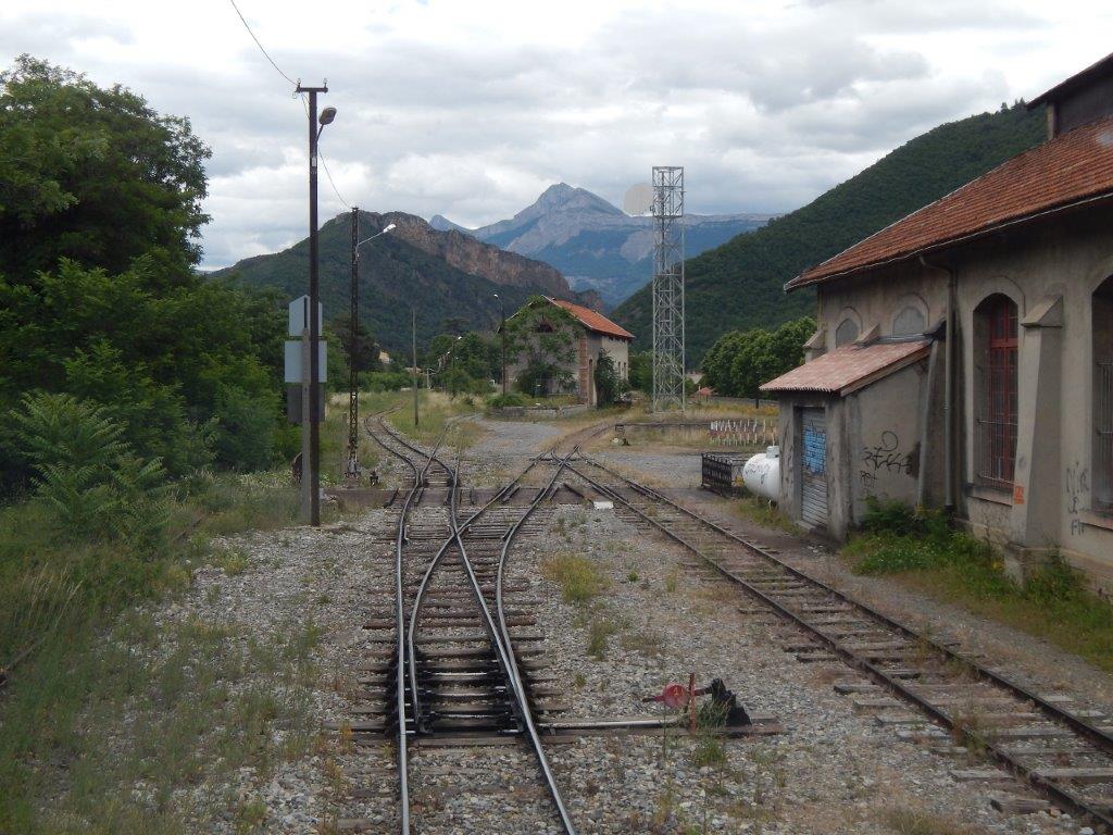
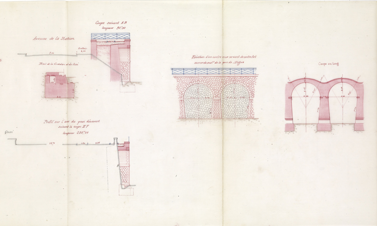
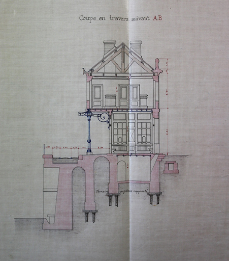
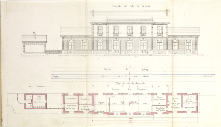
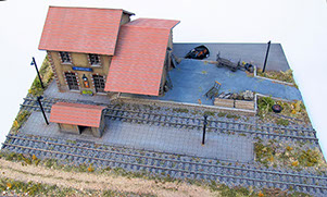
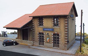
The journey commences at Fanjeaux. A sketch plan of the station is provided below. The station was situated below the town and was on a long thin site with its main buildings strung out along the hillside. This can be seen in both of the postcard images below the sketch. [5]

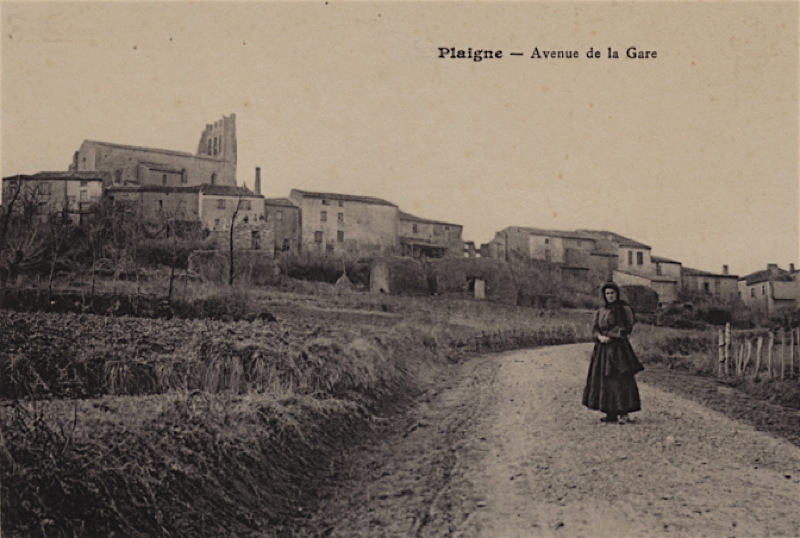
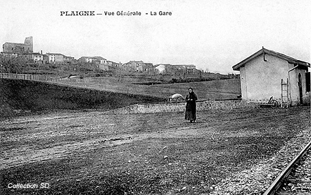
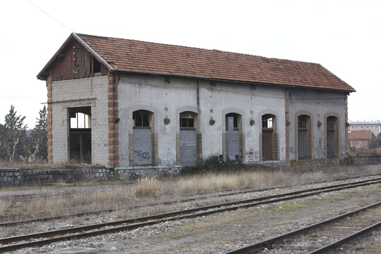
 The station facilities focussed more on goods than on passengers. The goods shed features clearly in the adjacent picture with the water tower and engine shed beyond. The second image is taken from a distance showing the station in its place beneath the town. It shows even more clearly just how far apart the various facilities were.
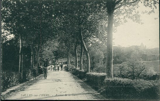
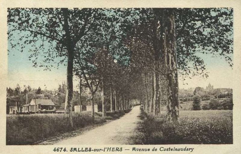
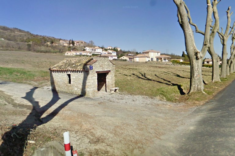
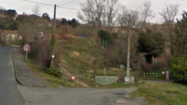
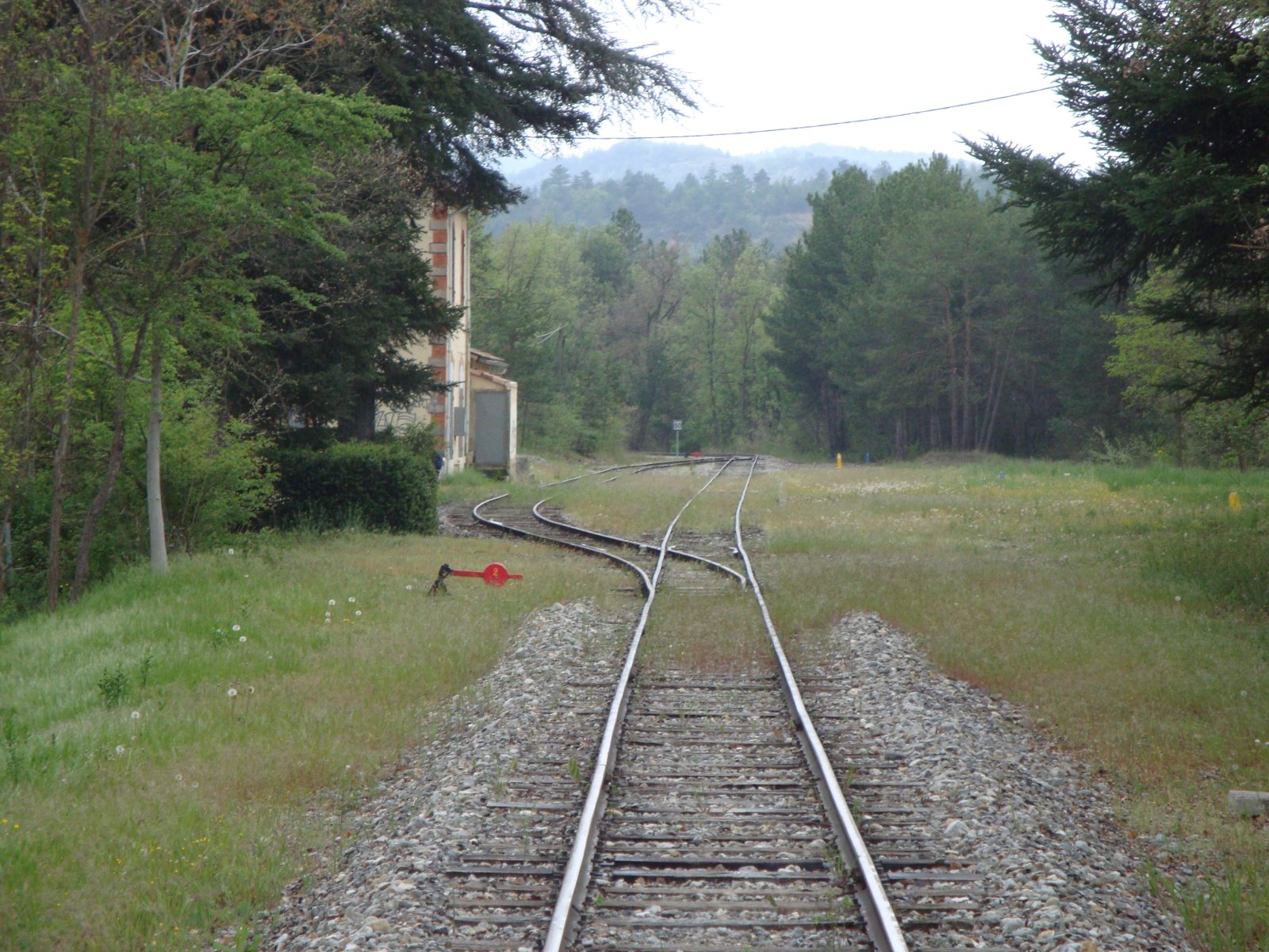
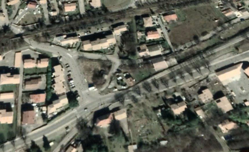
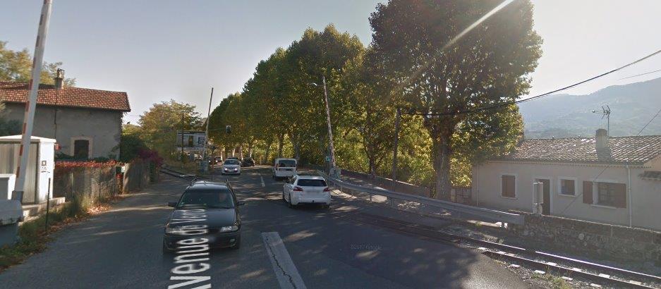
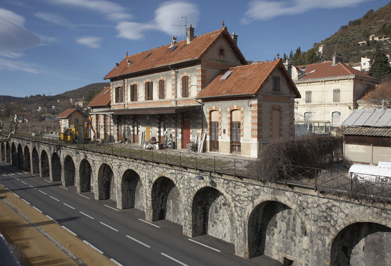
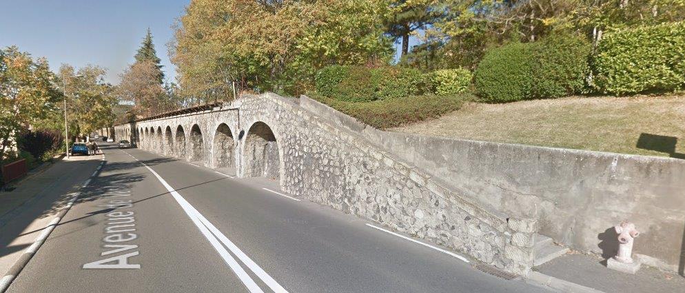
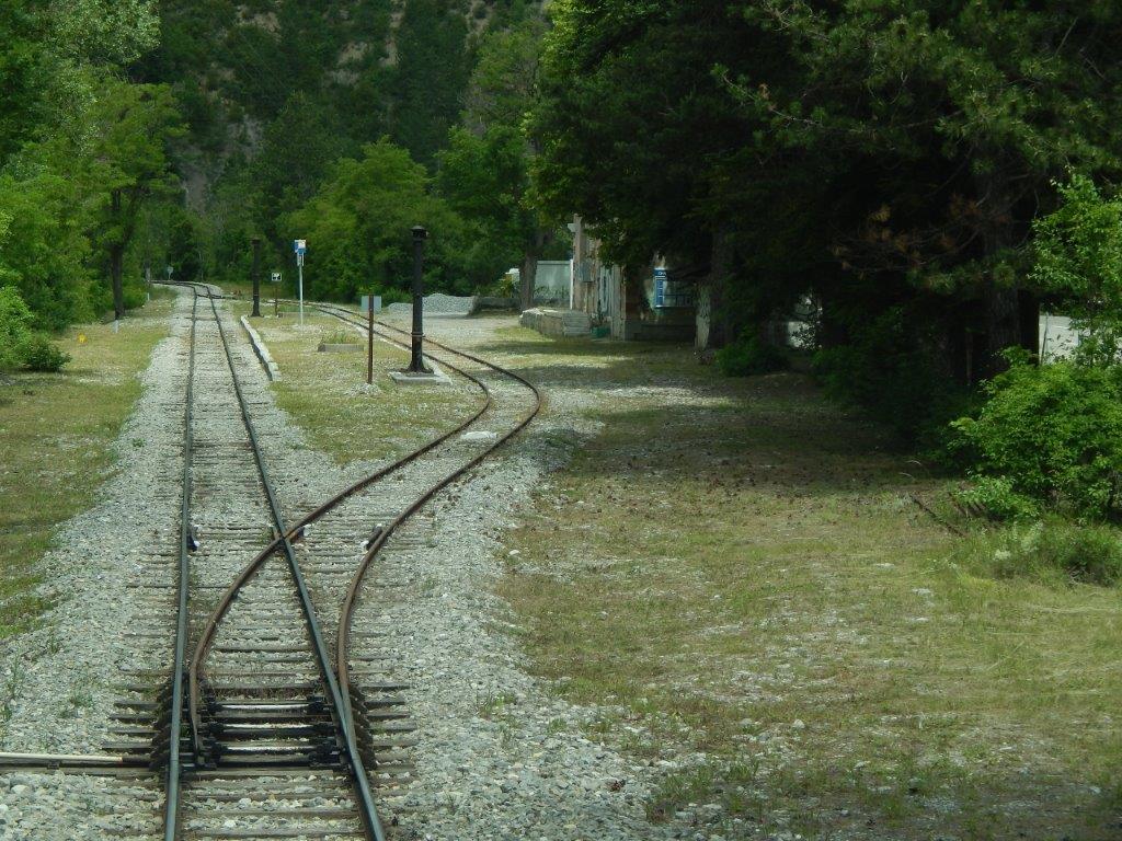
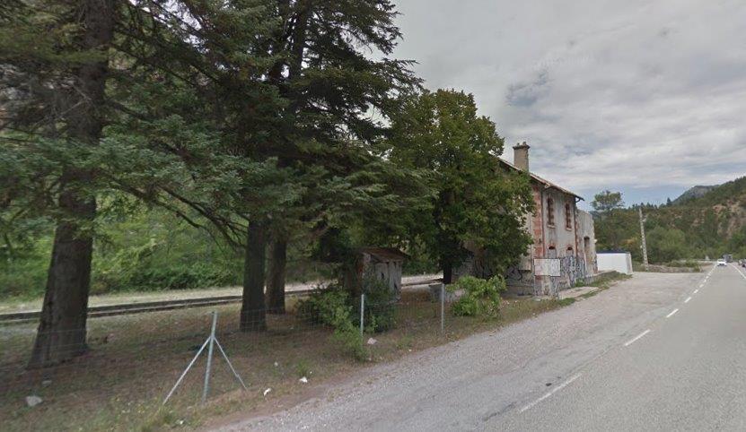
The track layout at the station makes far more sense than that seemingly provided at Belpech. It seems to have been spread out to allow it to occupy a place on the steep slopes of the town. An additional postcard picture shows the station and the village of Fanjeaux. [16]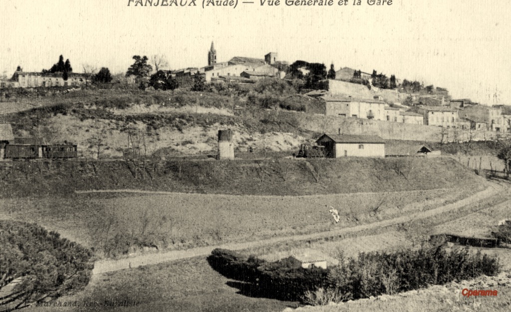 My wife and I visited Fanjeaux on 6th September 2018 and I was able to take a number of photographs. The first shows the top of the access road to the Station – Avenue de la Gare.
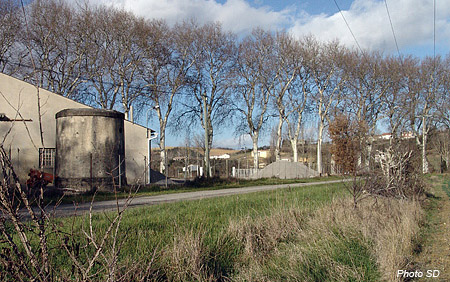
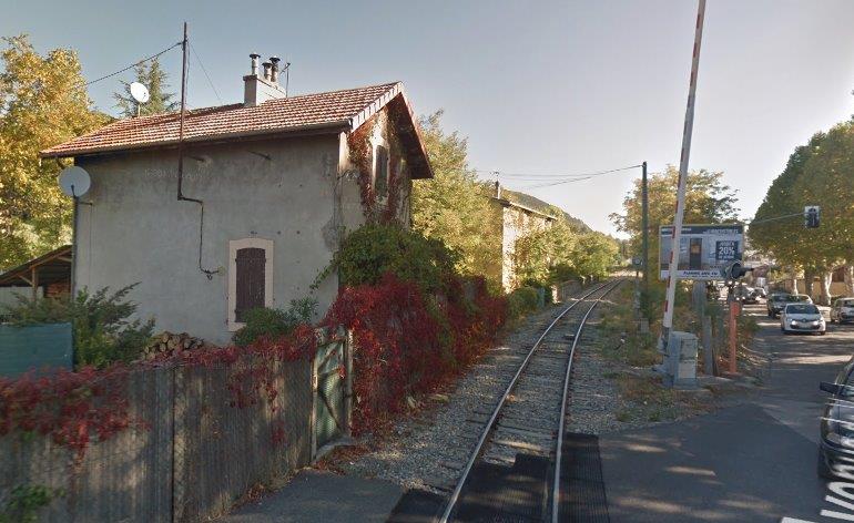
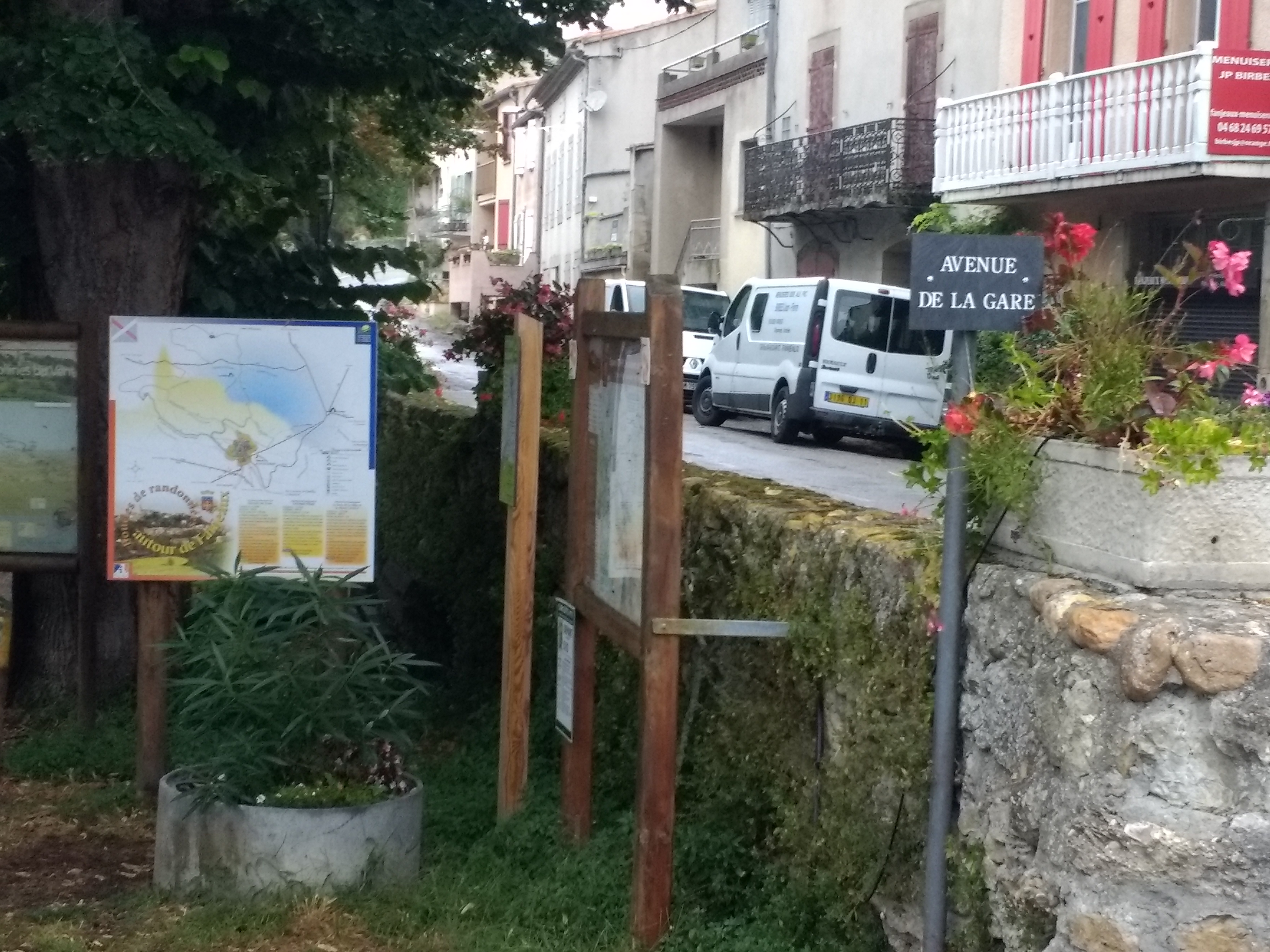 The second is taken below the retaining wall visible in the black and white pictures of Fanjeaux and its station. This is where the station used to be!
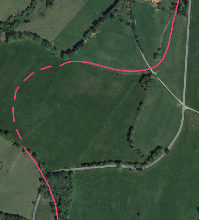
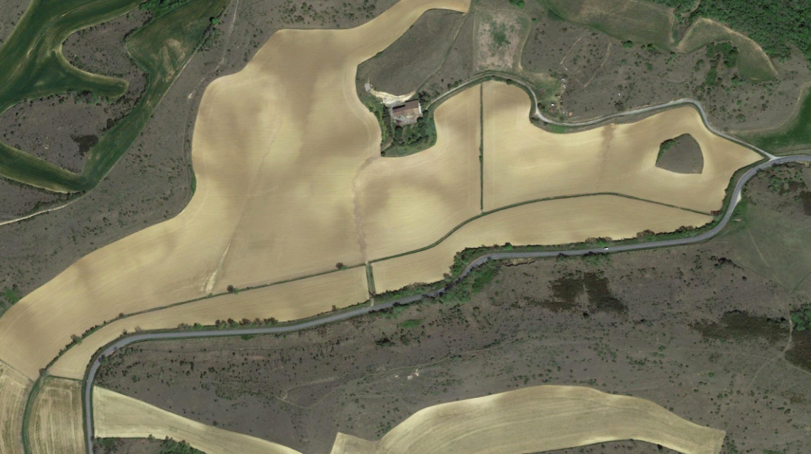
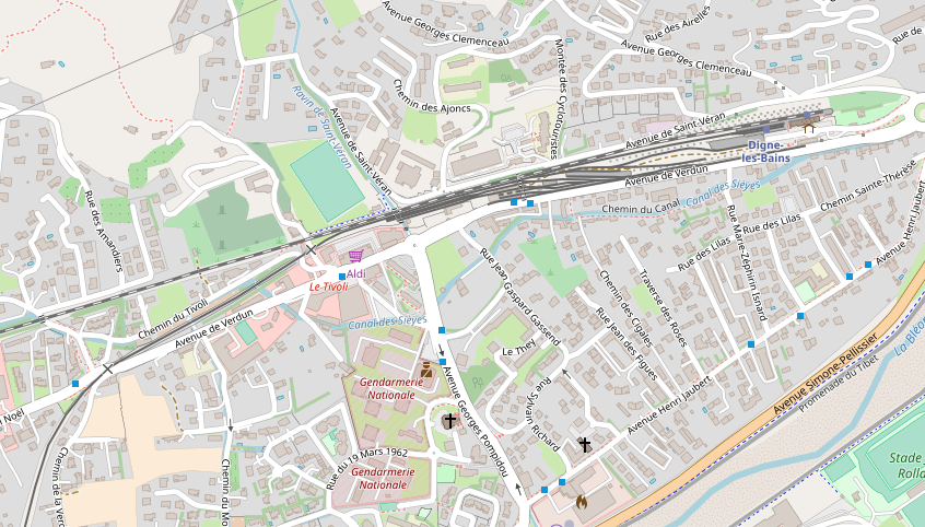
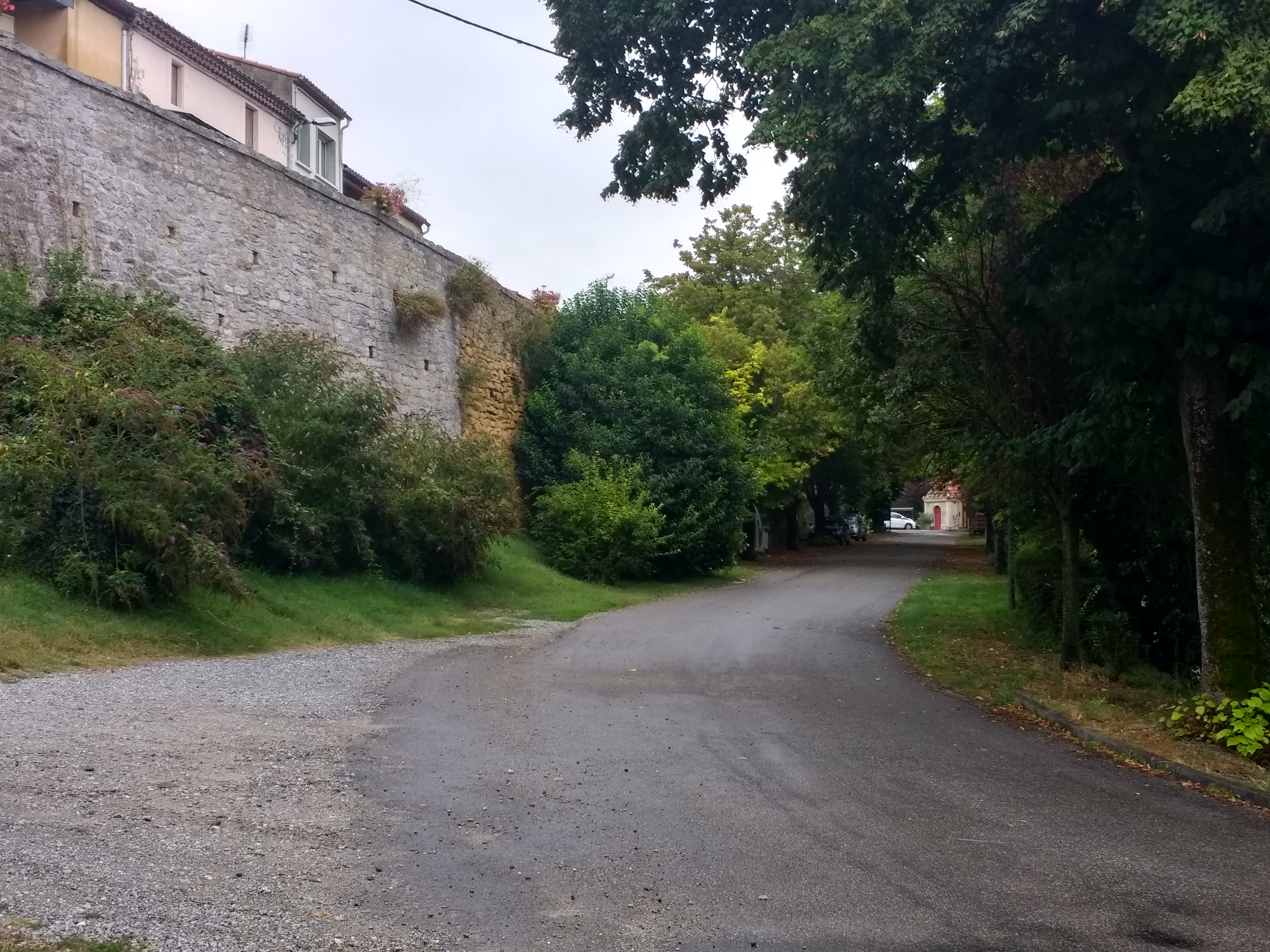 When trams left Fanjeaux Station, they followed a circuitous route around the village. The station was to the Southwest of the centre of the village and trams headed west, then north, then east, before leaving the environs of the village. The route can easily be picked out on the modern satellite image of the village below.
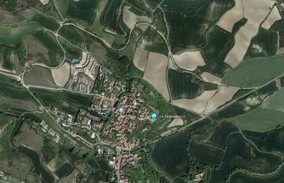
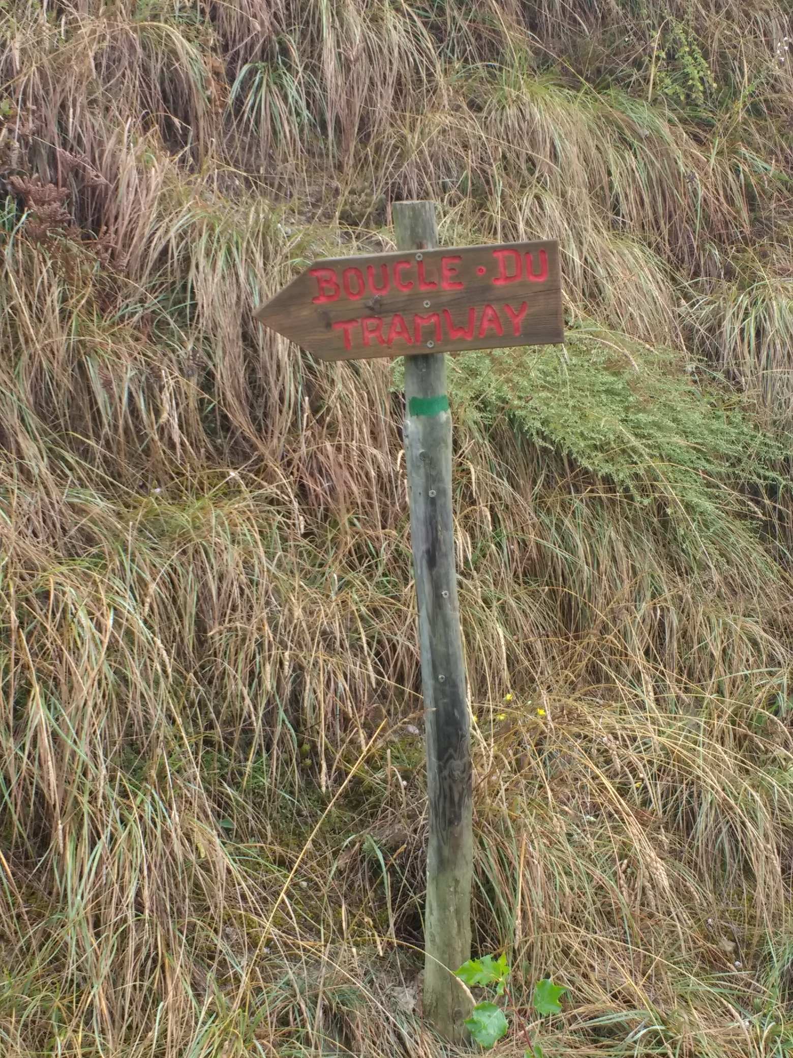
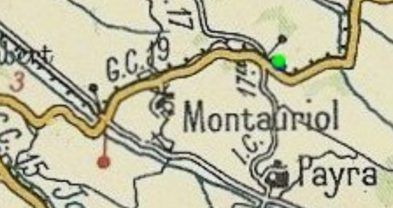
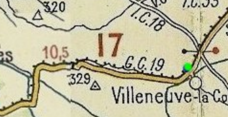
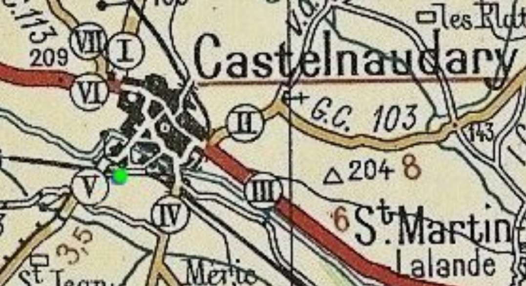
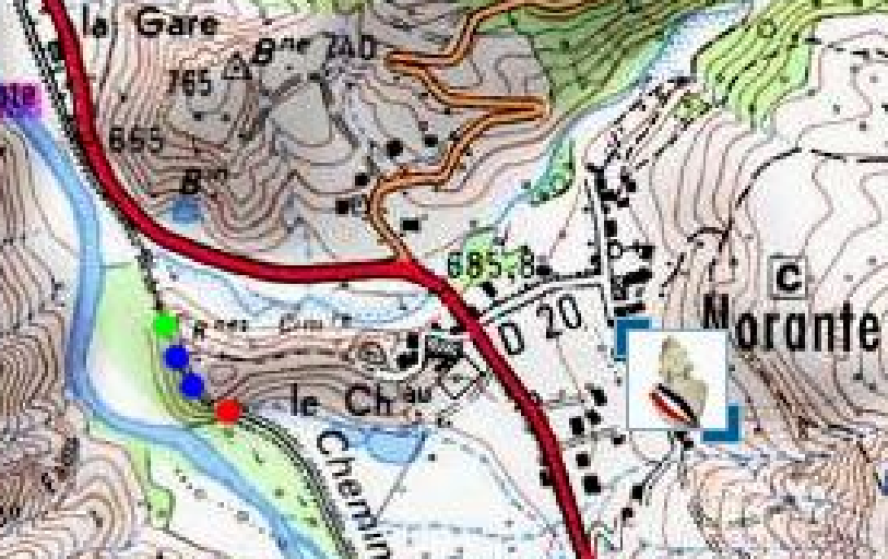
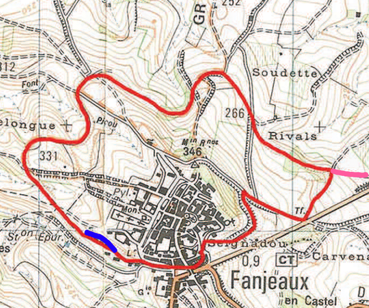 This map shows one of the advertised footpath trails around the town. It uses the old tramway for over 66% of its length. The station was at the location that I have highlighted in blue. The line continued its journey away from Fanjeaux along the pink line to the right of the map. The tramway ran round the north side of the village. [17]
On 6th September 2018, my wife and I walked the route marked in red above. I took a number of pictures as we walked around the village. A few will suffice here to give an impression of the current state of the old tramway route.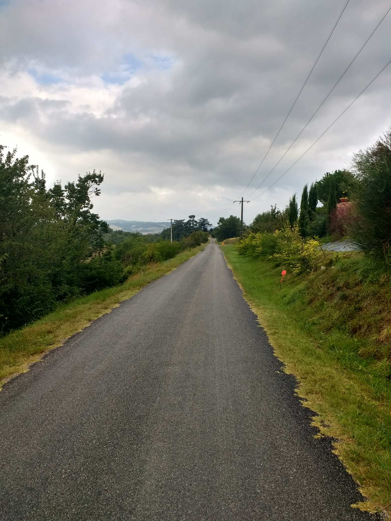
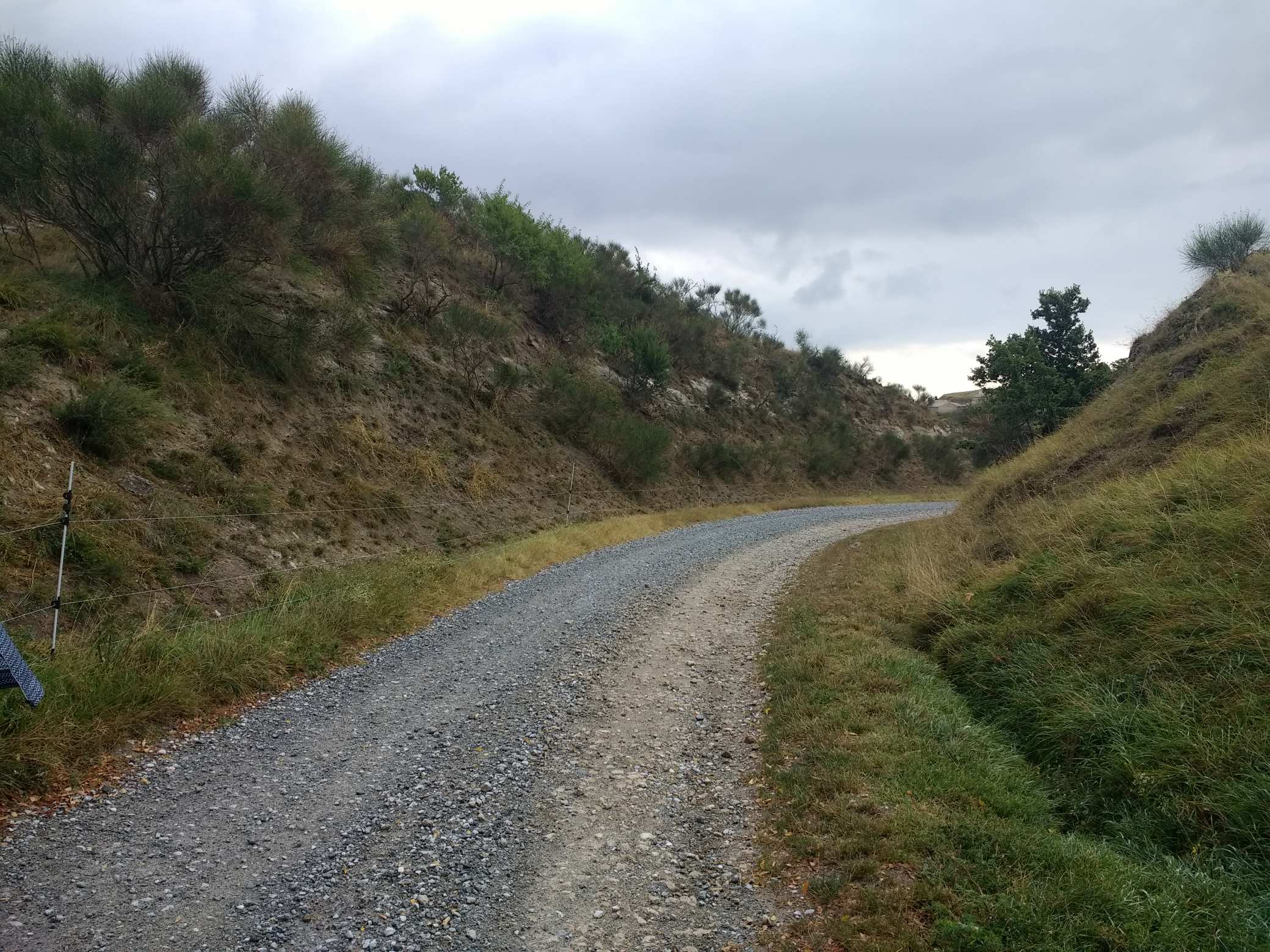
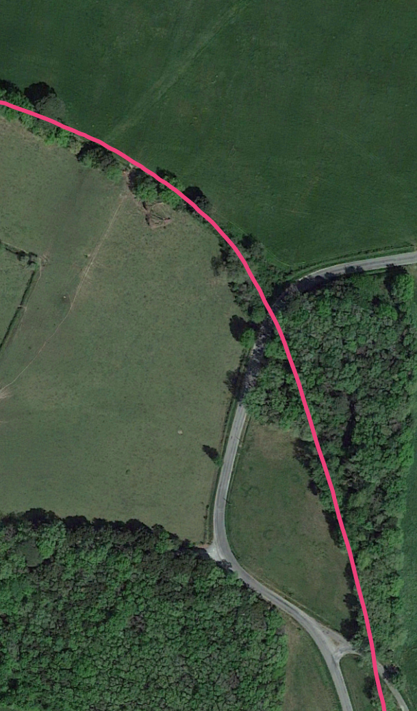
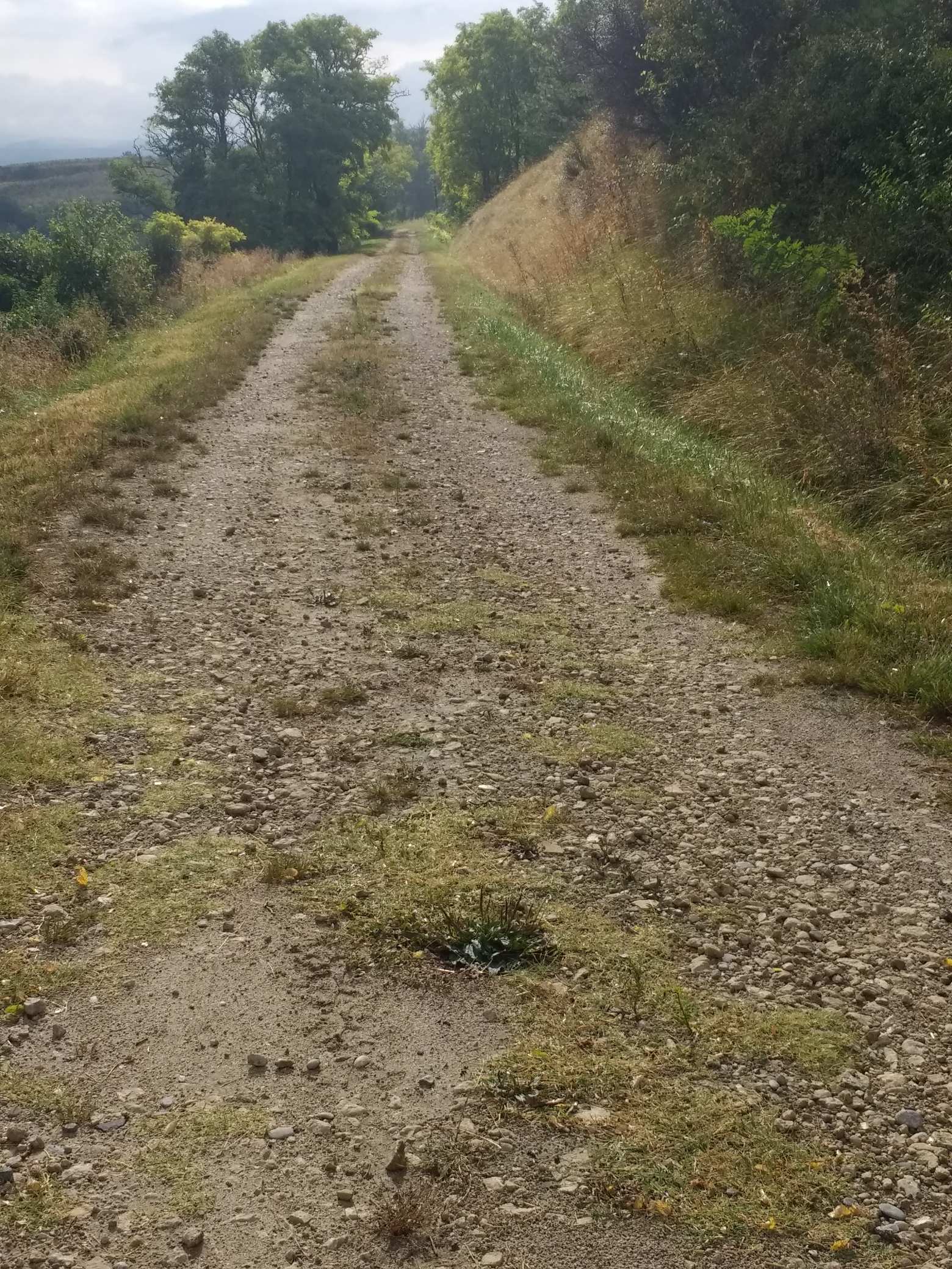 The first evidence of the tramway to the east of Fanjeaux is the slip road approaching the roundabout at Prouilhe. The slip-road follows the old tramway formation.
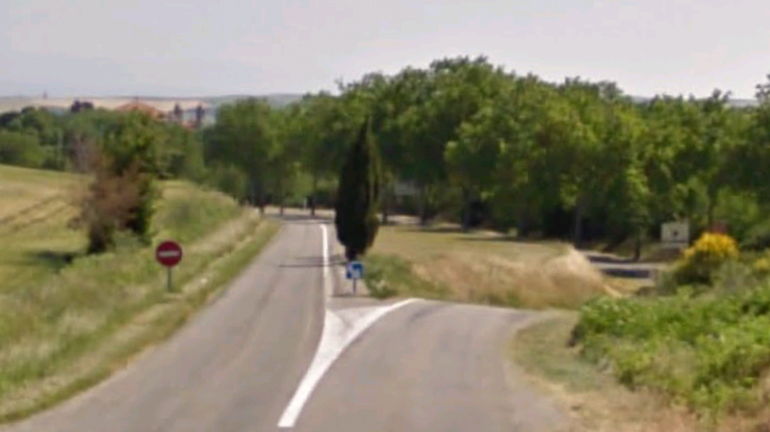
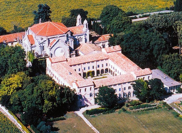
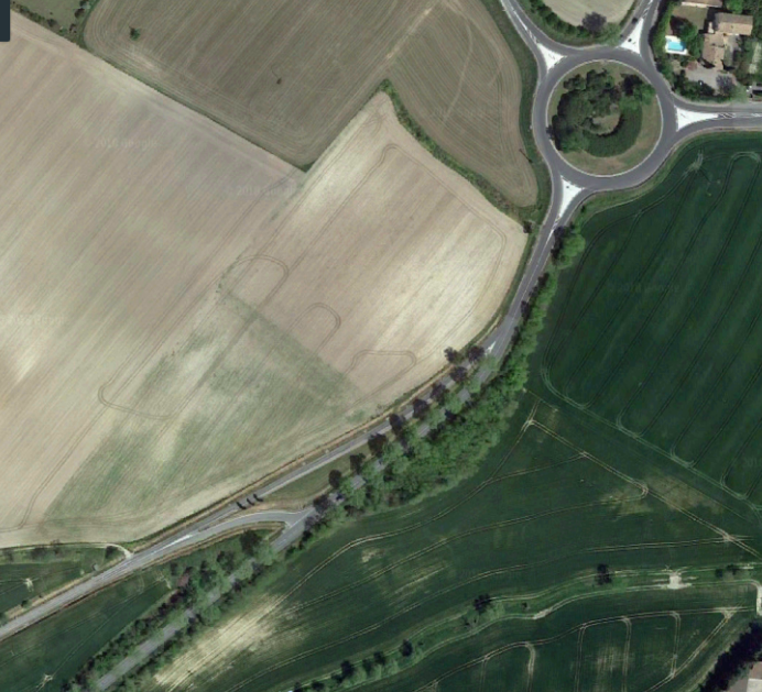 Prouilhe was the first halt on the tramway beyond Fanjeaux. Its claim to fame was that it was the location of the mother-house of the Dominican order, ‘Notre-Dame des Prêcheurs’. Evidence of the tramway halt is nonexistent but the monastery and the Covent buildings attached to it are still very much present.
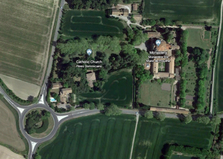
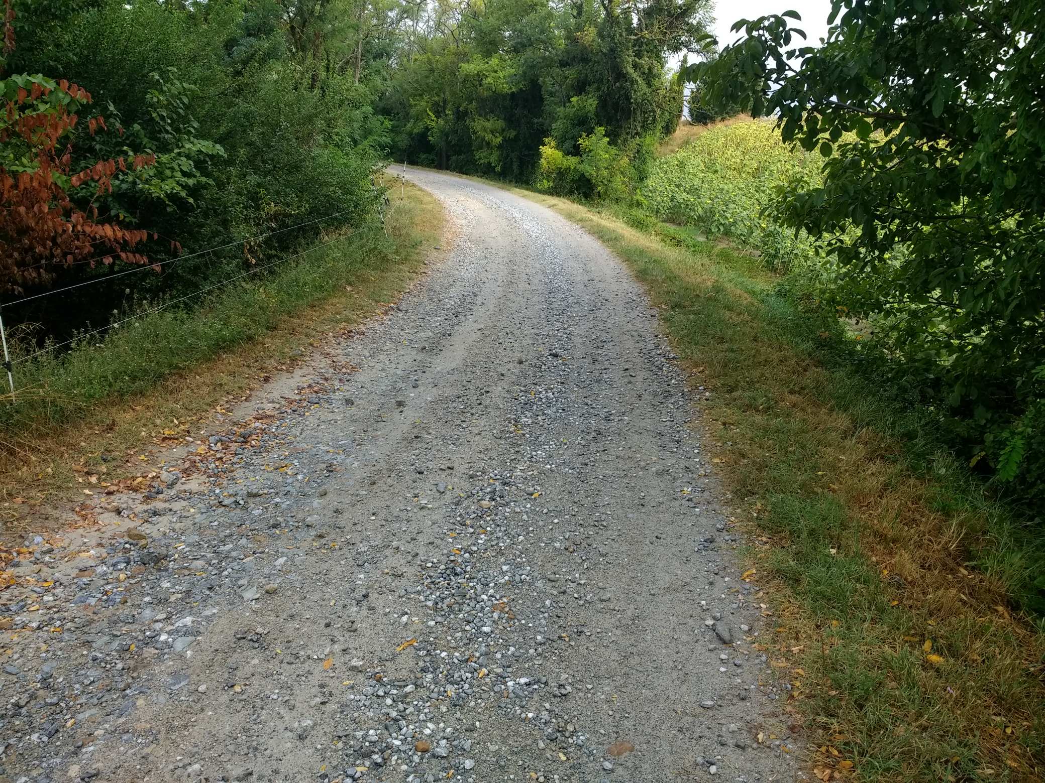
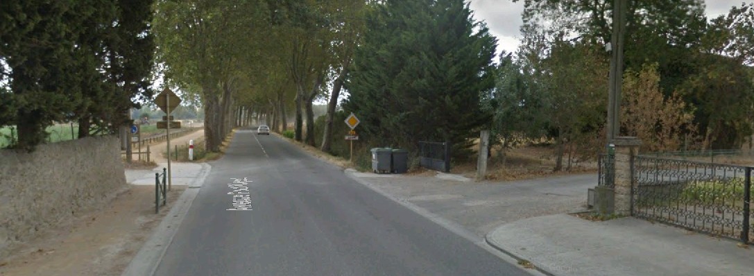
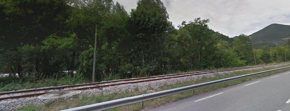
 From Prouilhe, the tramway continued northeast towards Bram alongside what is now the D4. It passed through Taurines and Villesiscle on the way. There are long straight sections of single- carriageway road with no evidence of the old tramway.
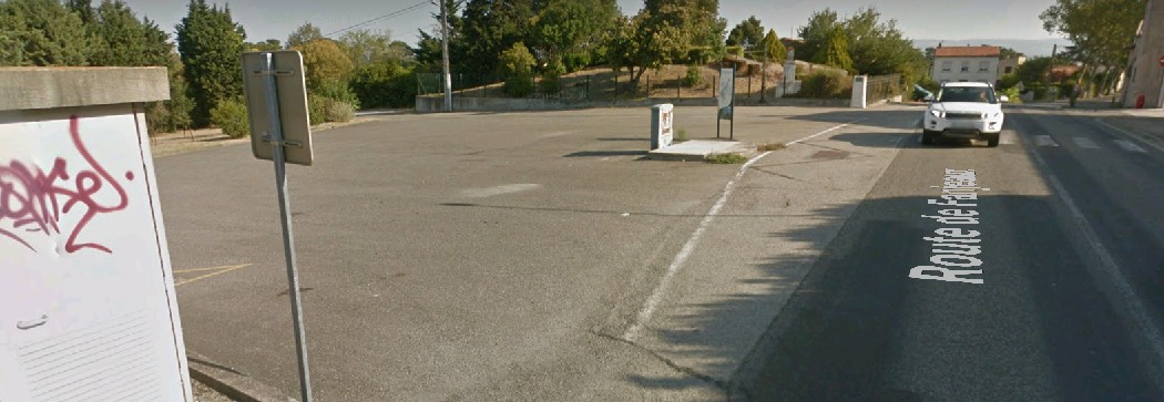
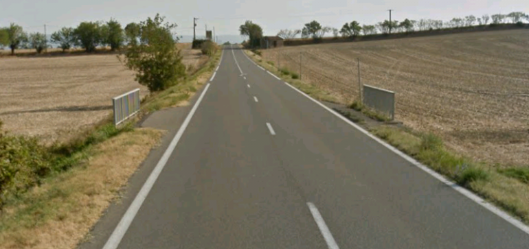 The station area at Villesiscle is still a flat open space with little indication of its use as a tramway station in the past.
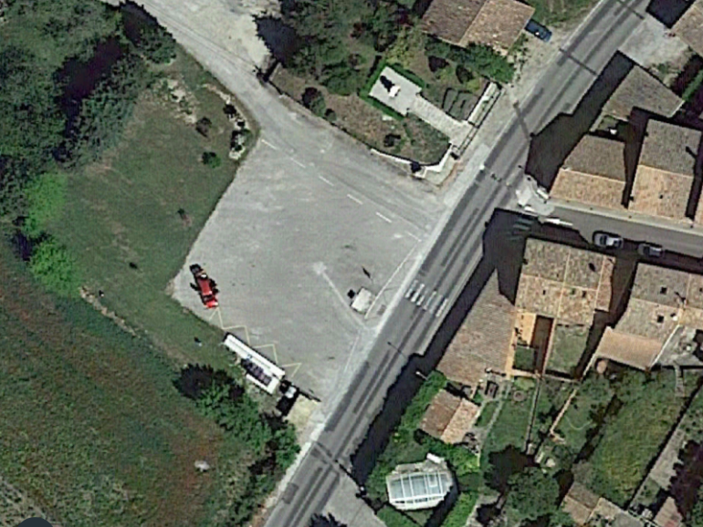
 Perhaps clutching at straws here, but the alignment of the boundary fence to the memorial garden suggests that the tramway album alignment dictated its location back from the road.
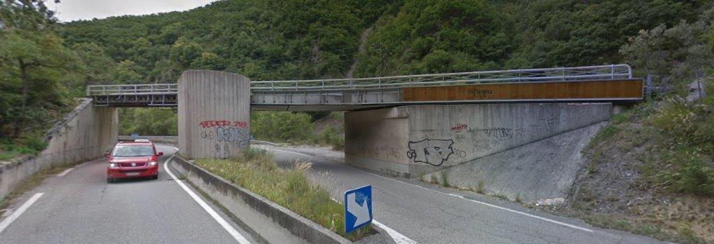
Heading out of Villesiscle thev D4 approaches the modern motorway. The road was diverted to bridge the motorway and the old road alignment is still visible and not surfaced. It s possibly a good example of what the road might have been like when the tramway was in use?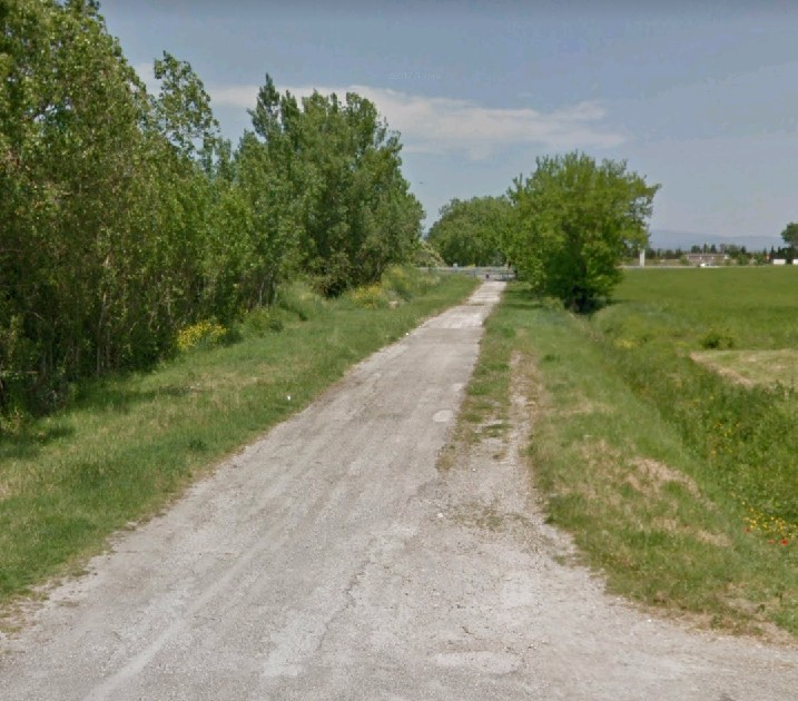 The old road into Bram. The motorway which crossed it can just be seen in the far distance.
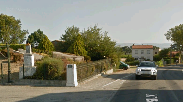
The tramway entered Bram along what is now Avenue Georges Clemenceau and Avenue du General de Galle. In those days, ‘Route de Fanjeaux’. 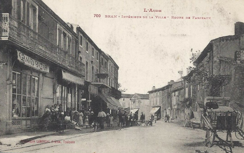 Bram, Route de Fanjeaux. The tramway tracks are just visible on the left. [8]
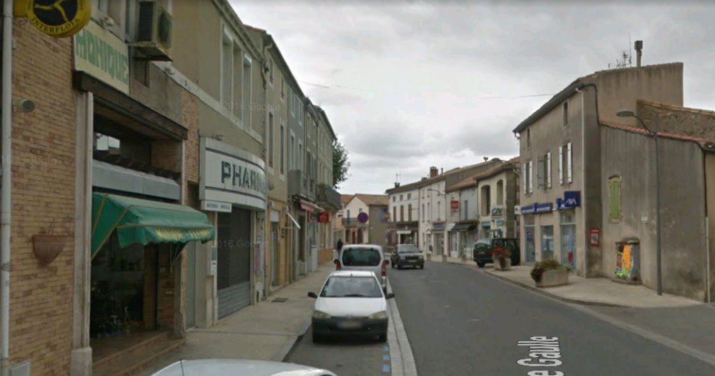 The view from almost the same location in 21st Century.
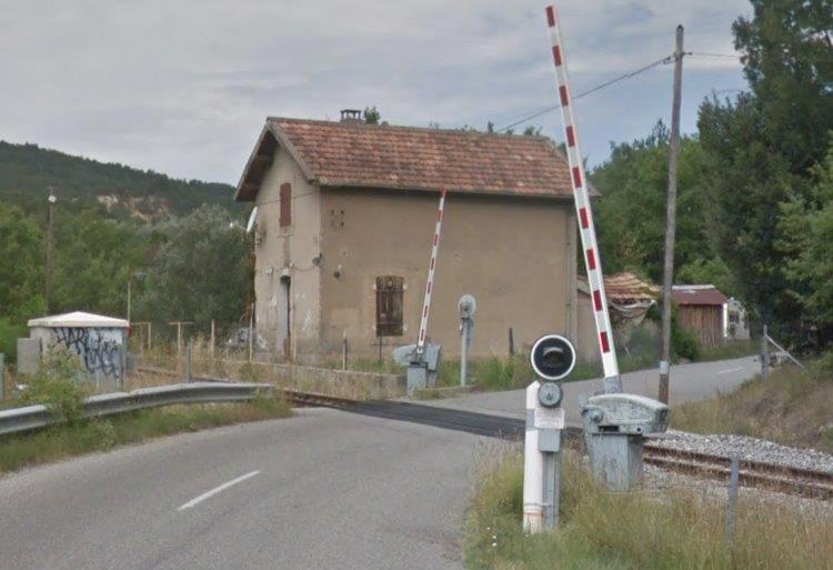
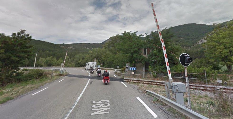
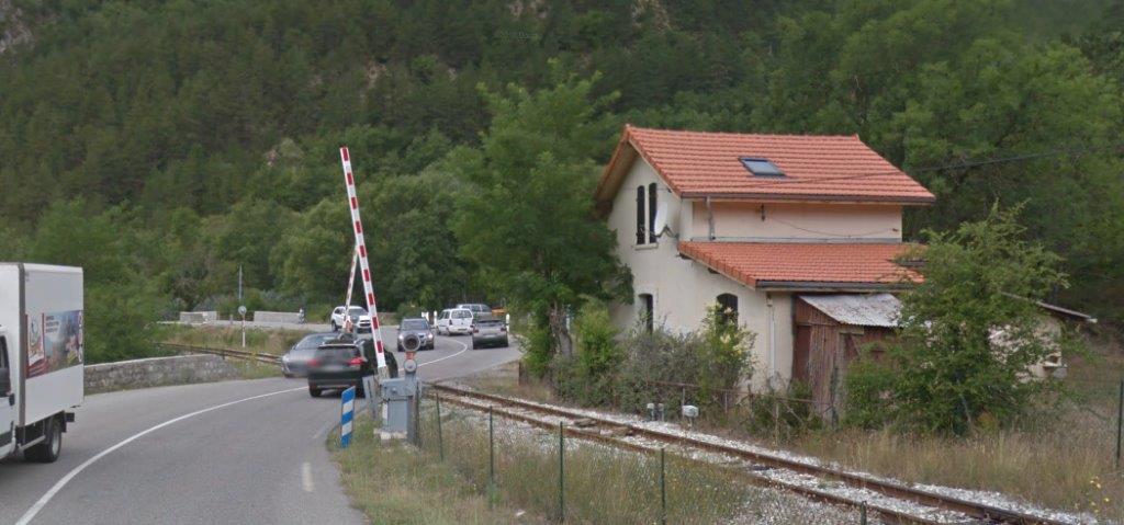
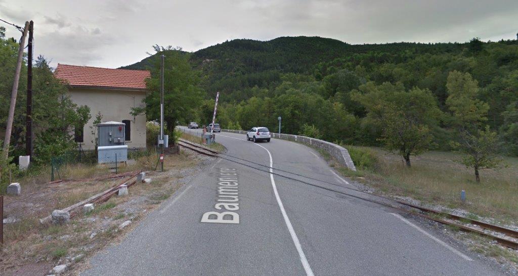
In the centre of Bram, the tramway divided. One branch headed north, the other provided access to the Midi Station.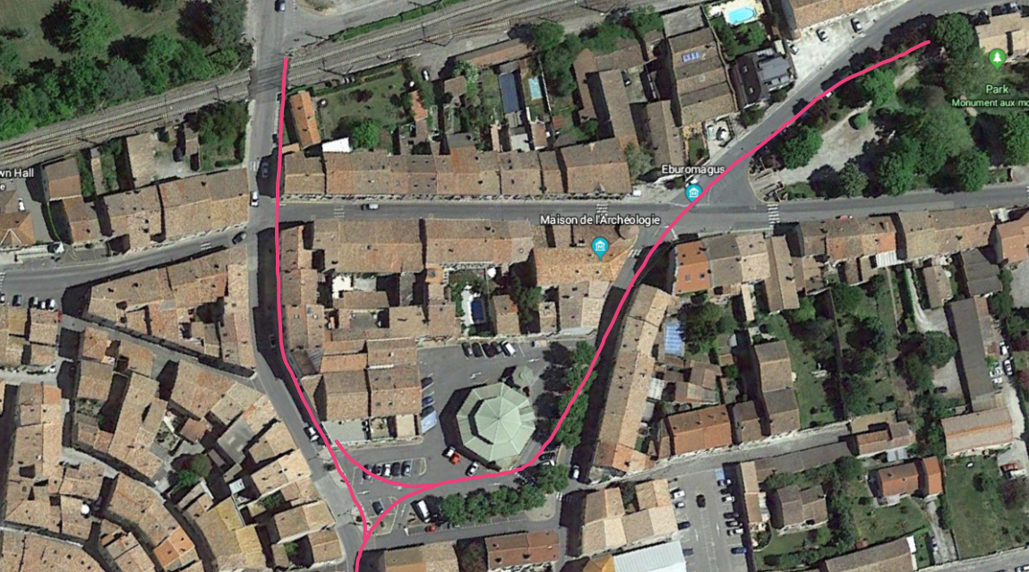 I have found no indication of the actual track arrangement for the Tramway in Bram. The pink lines sketched on the satellite image are indication of the routes which are evident on postcard pictures. The line going north made for Saissac and Saint-Denis and crossed the Compagnie du Midi line, along with the road at a level crossing which is still in place in the 21st Century.
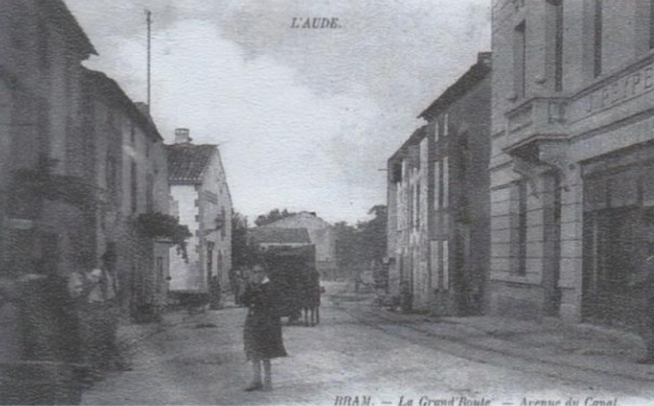 The first of a few images of the line heading towards the level-crossing. [18]
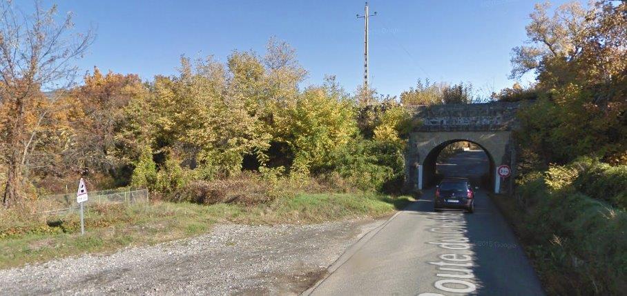
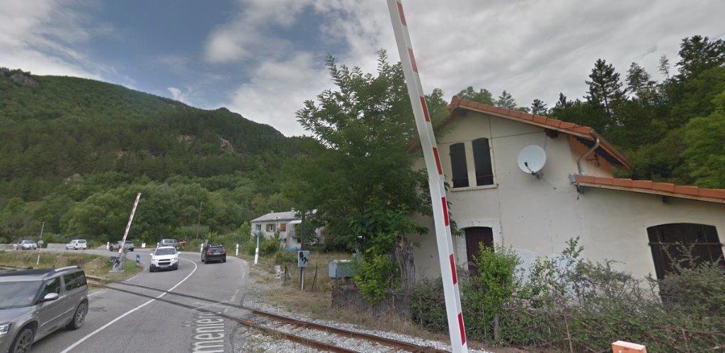
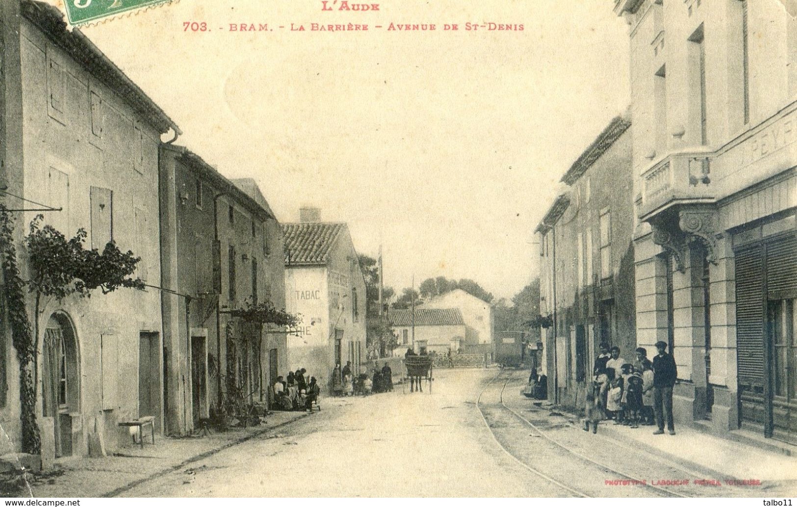 Bram, Avenue de St. Denis. The railway crossing gates can just be picked out in the distance. The view is taken north looking away from the town centre. [7]
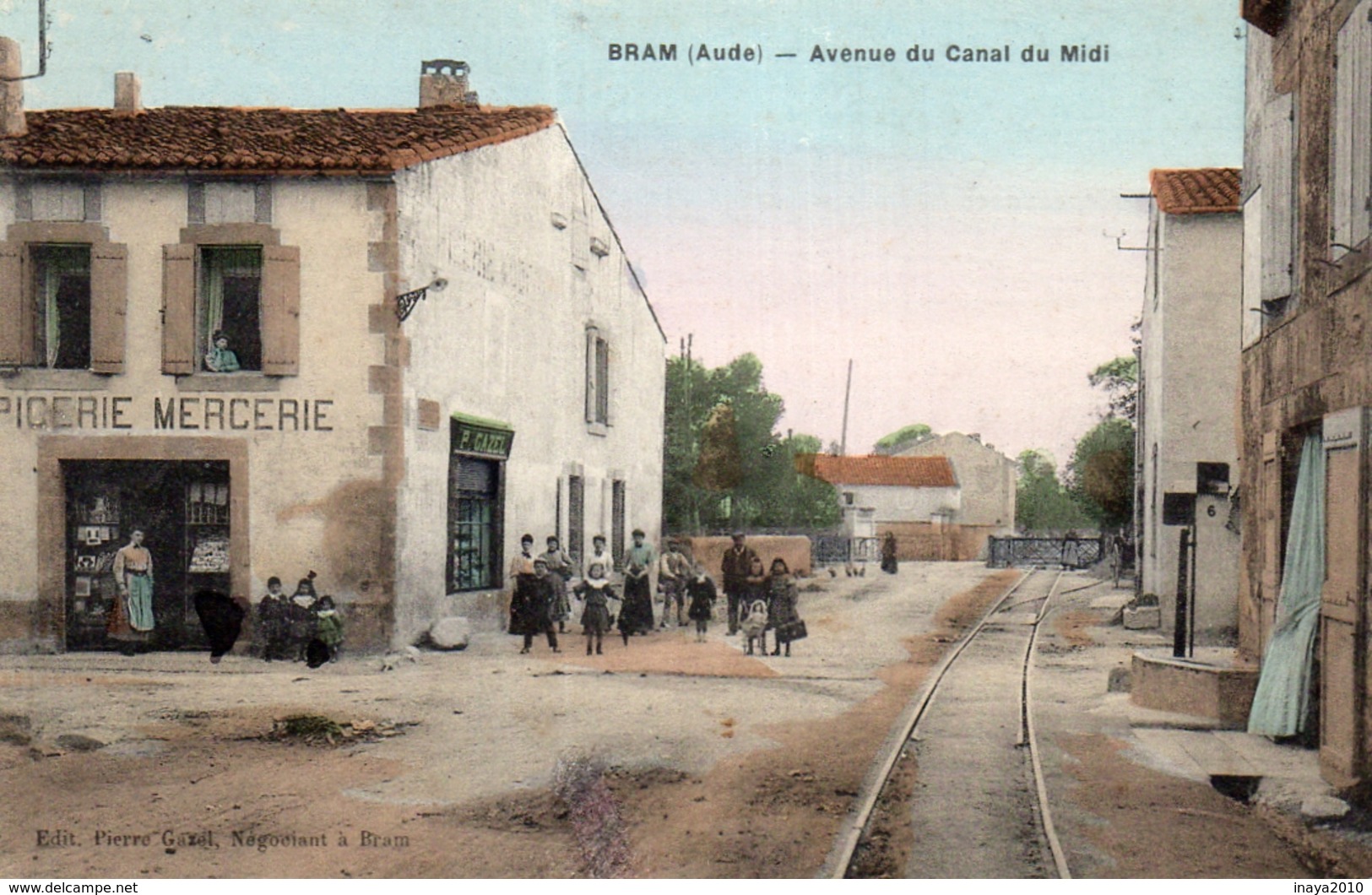 Bram, Avenue de Canal du Midi, or Avenue de Saint-Denis (today’s Avenue Paul Riquet). This tinted image is taken from a point a little further out of the centre of Bram to the north. The crossing gates for the Compagnie du Midi mainline are more easily seen. It is also possible to make out a point with a branch off the tramway heading in the direction of the mainline railway station. As we have seen above this ward not the main tramway access to the Midi station. [8]
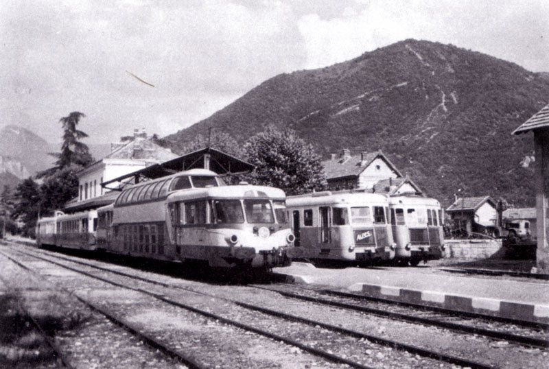
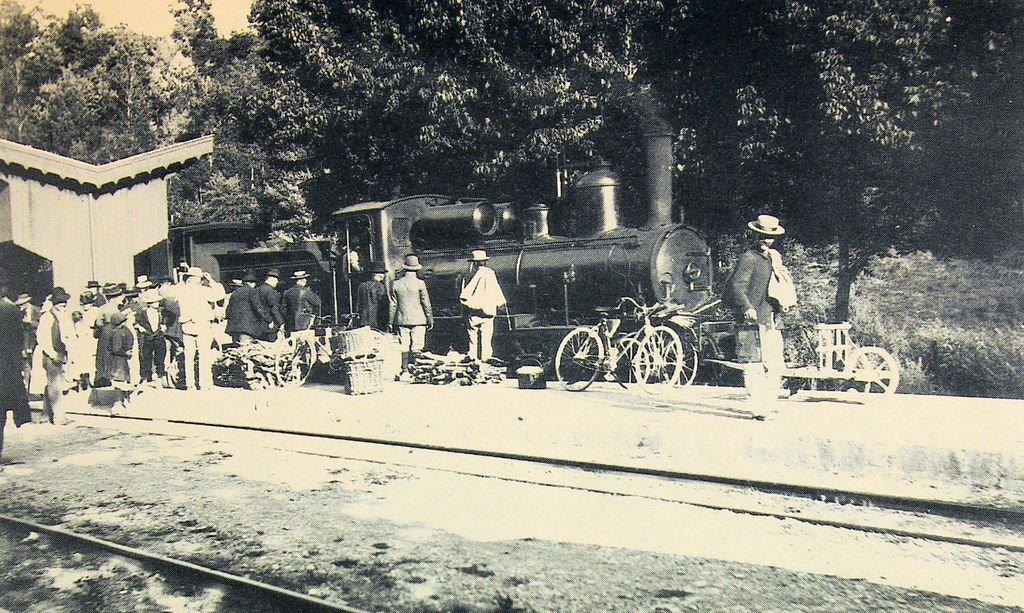
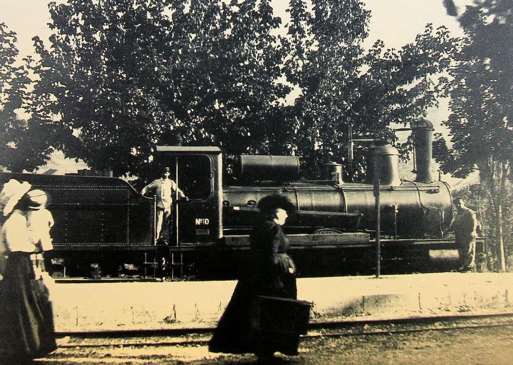
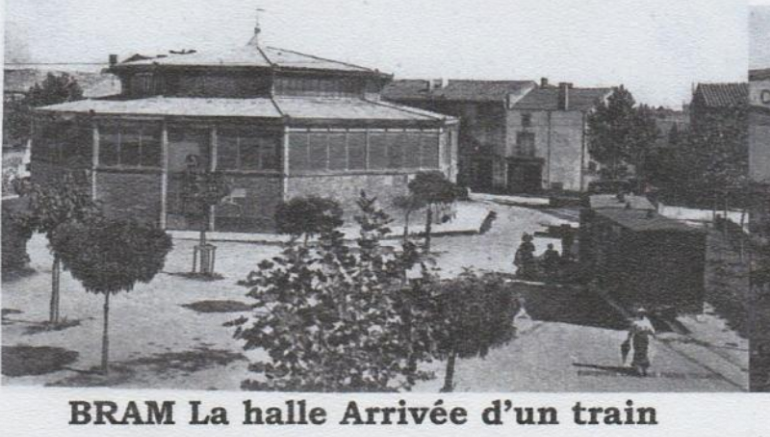 This picture is taken from a blog about Saissac written in French by Jean Michel of Saissac. The image shows the arrival of a train from Fanjeaux. A triangular arrangement of tracks existed in this square in Bram. The second arm of that triangle can be picked out running to the left of the train and behind the trees in the foreground of the picture. [18]
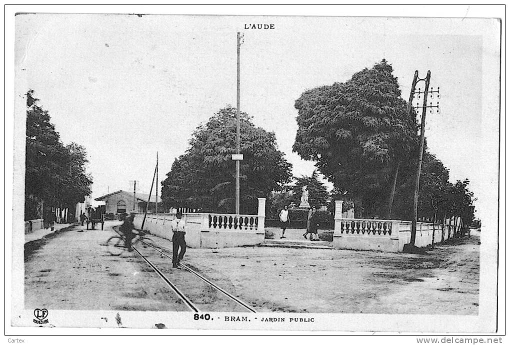 Bram, Jardin Public. The image above of the arrival of the train is taken in the square behind the photographer of this picture. The road directly ahead is the Avenue de la Gare. [8]
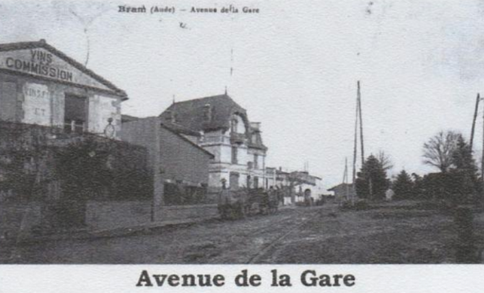 Another picture of Avenue de la Gare taken from a similar position. [18]
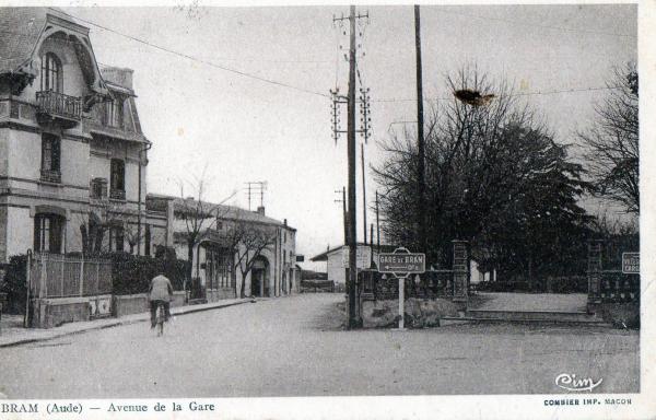 Avenue de la Gare. [19]
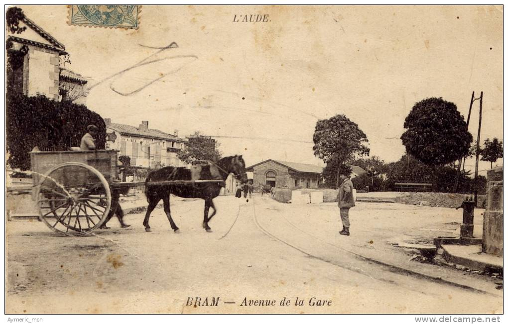
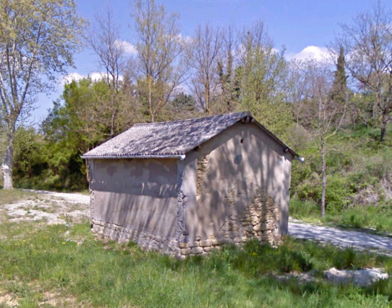
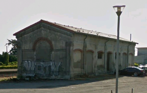 Avenue de la Gare (above). The goods facilities at the mouth of the combined station yard are visible ahead. [19] On 6th September 2018, I was unable to take a photograph, but I could confirm that the goods shed is still there.
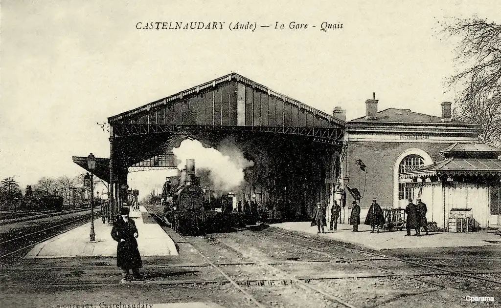
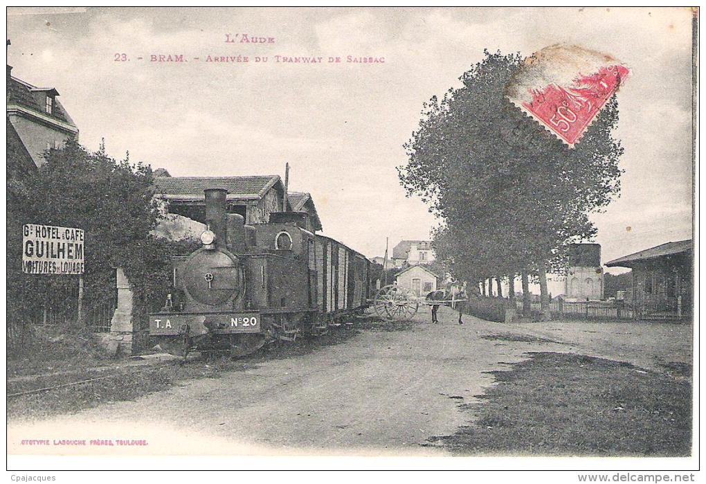 The entry of a train from Saissac into the station yard at Bram. [8]
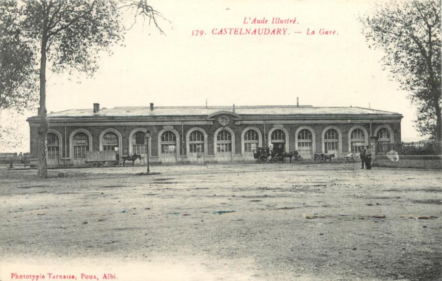
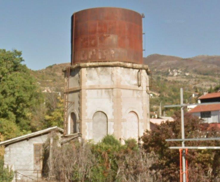
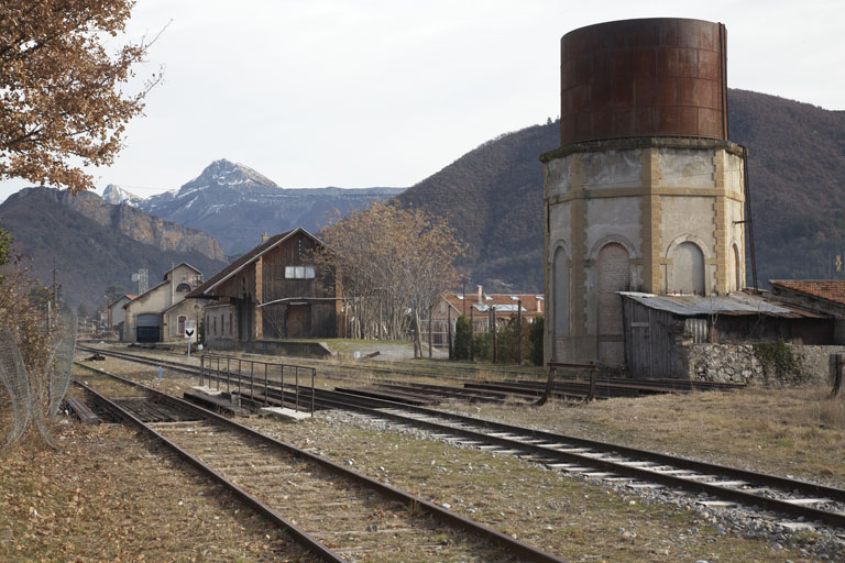
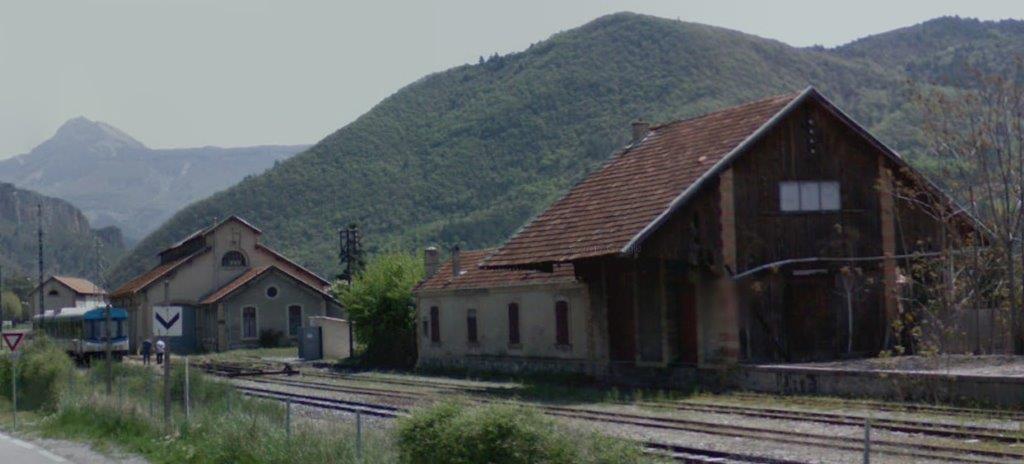
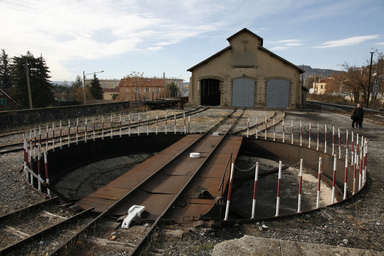
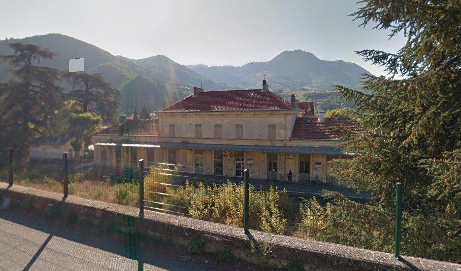
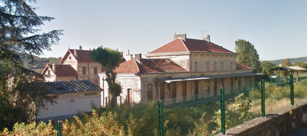
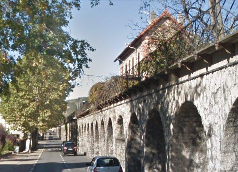
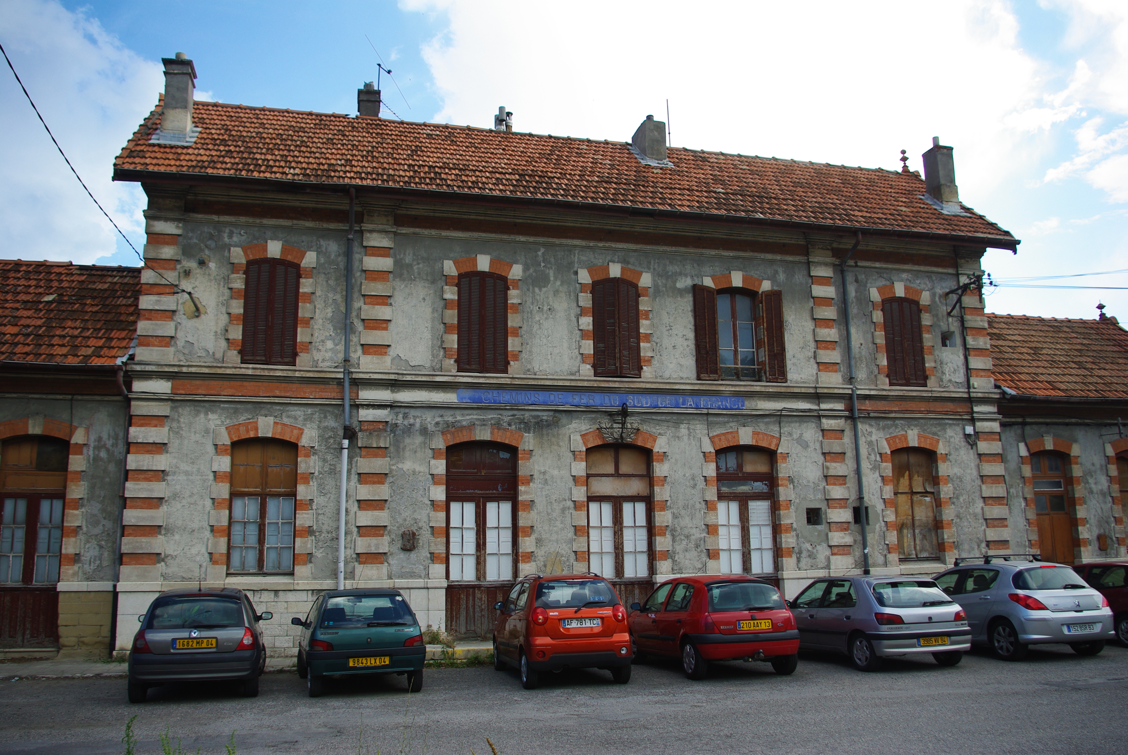
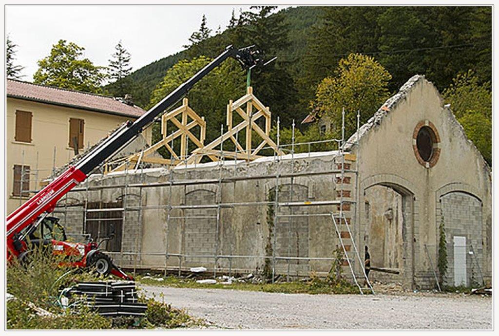
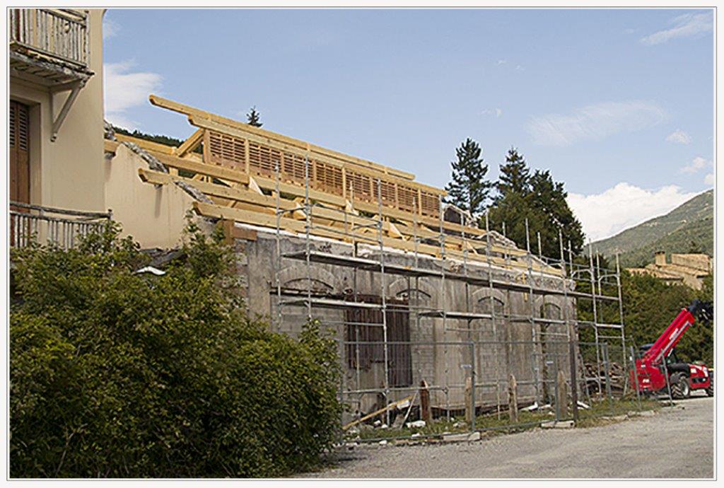
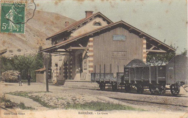
The Mainline Railway Station at Bram was/is positioned to the East of the town centre.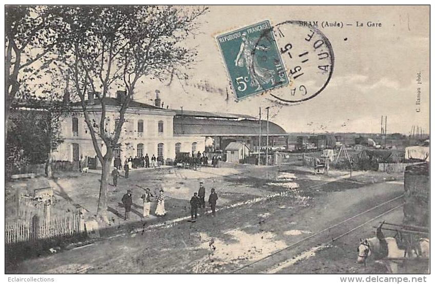 Bram, Compagnie du Midi Station. The tramway branch which led into the station yard can be seen in the bottom right of this picture. [8]
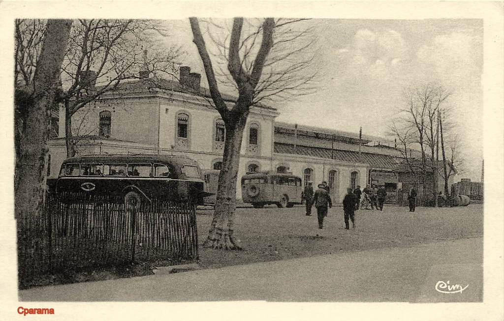 Bram, Compagnie du Midi, Station Forecourt. [9]
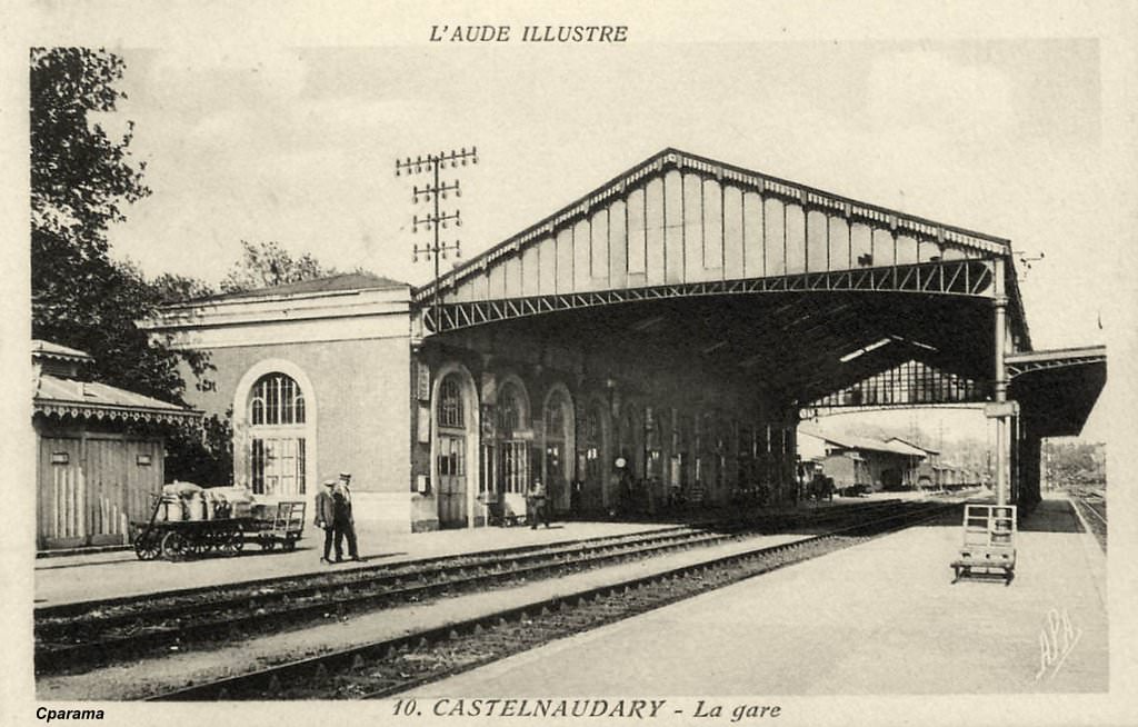
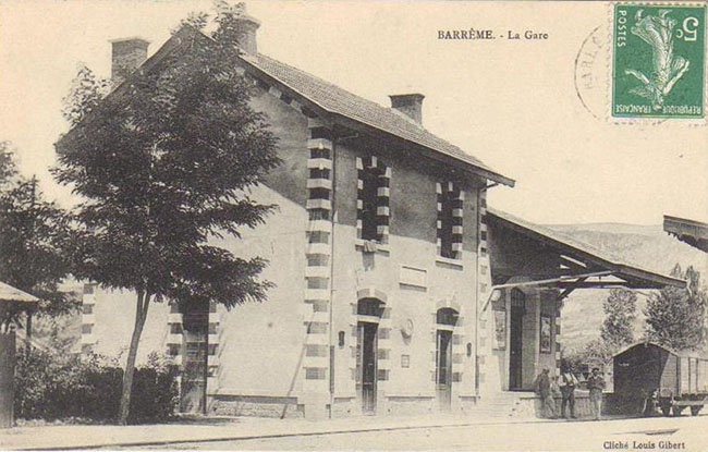
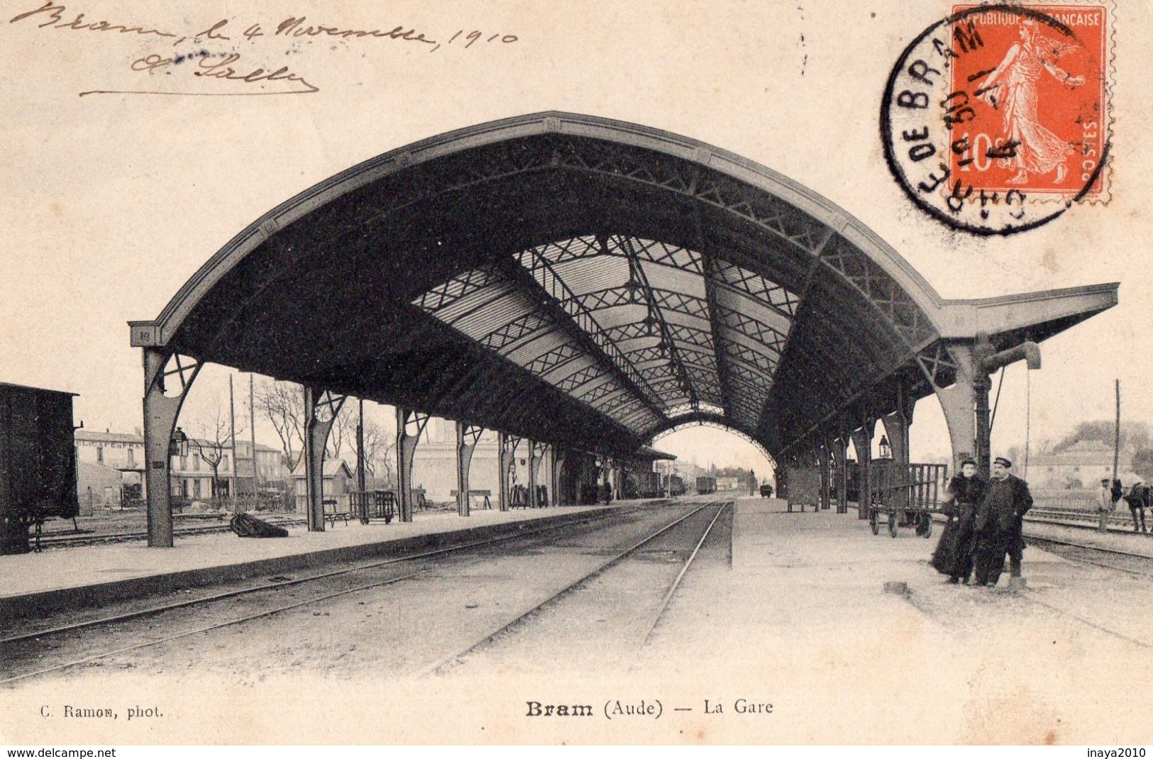 Bram, Compagnie du Midi Station Train-shed, 1910. [6]
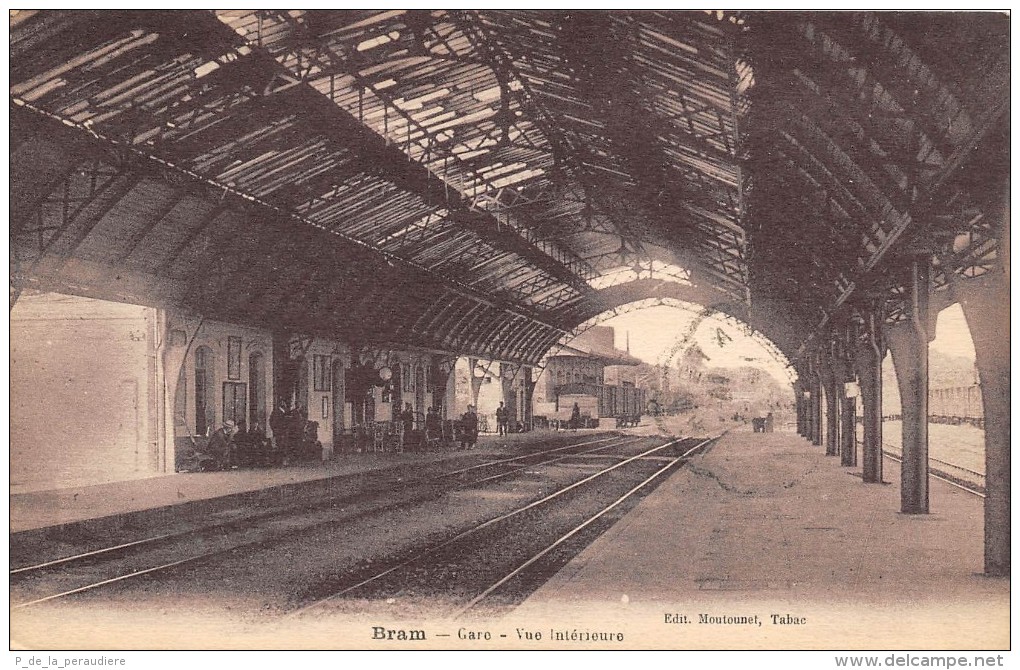 Bram, Compagnie du Midi Station, Train-shed Interior. [6]
 The Station at Bram from the East. [19]
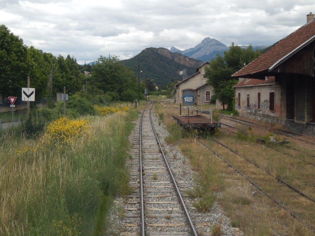
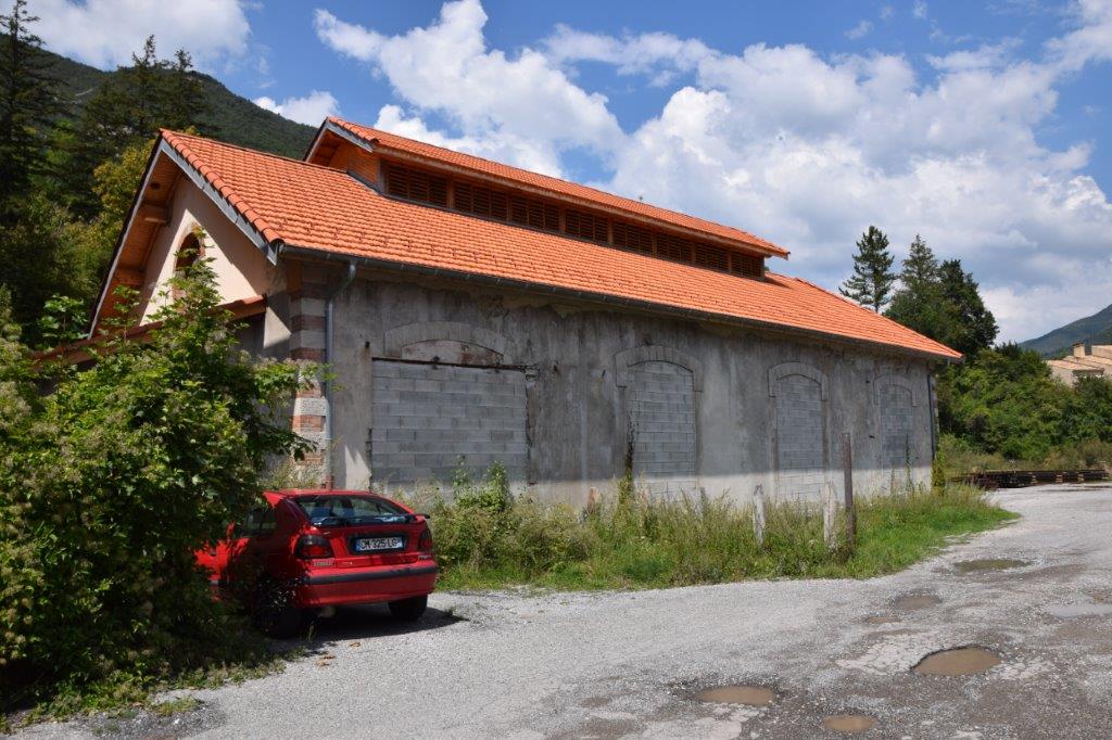
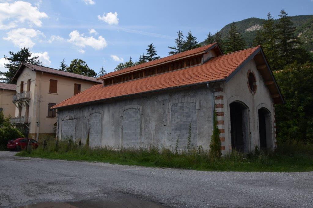
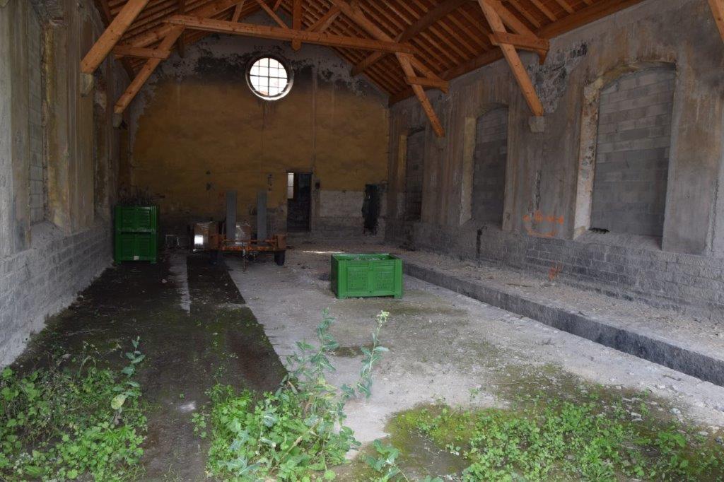
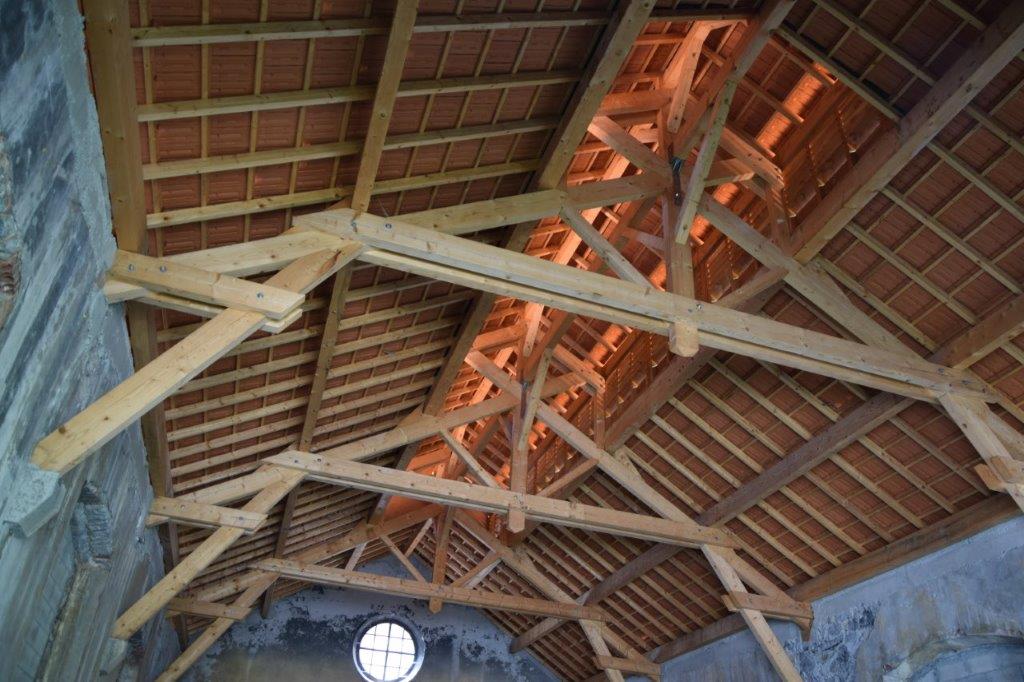
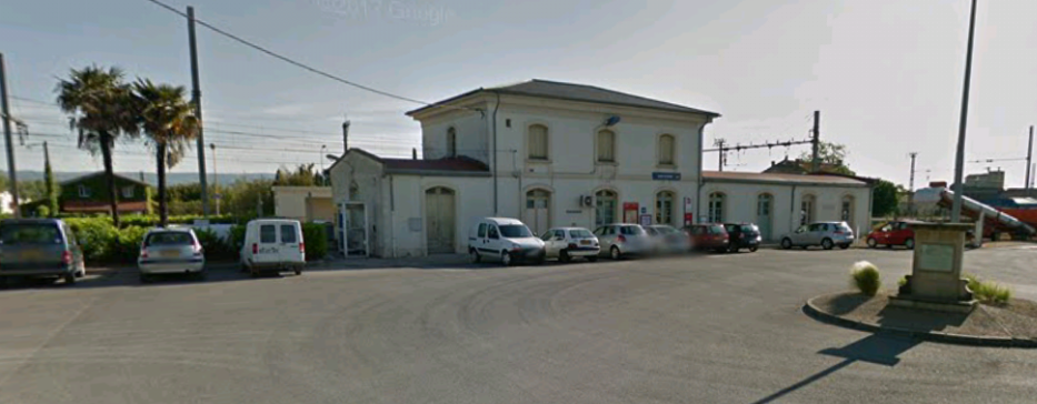 The overall shed roof is now missing in the 21st Century. The tramway buildings and lines are long-gone.
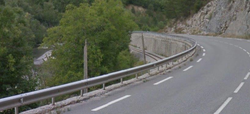
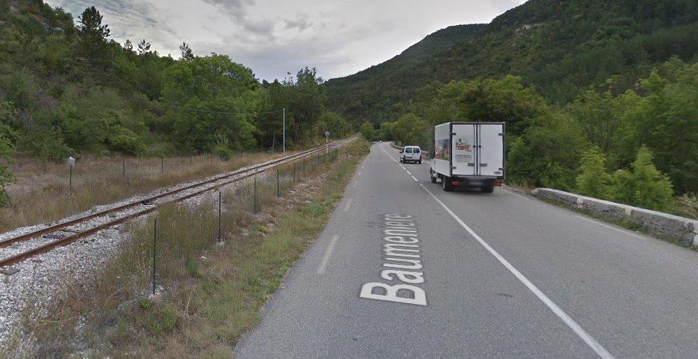
Returning to the tracks which headed north out of Bram, we cross the level crossing and head out of town. At this point the tramway was on the east (right) side of the road.
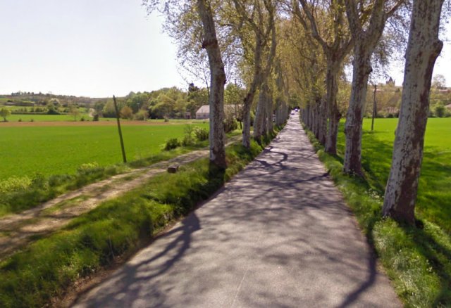
 As we leave Bram behind the road is flanked by an avenue of plane trees. As we approach them, I imagine, without much supporting evidence, that the tramway switches from the East to the West side of the road. If this proves to be incorrect, please forgive the excessive use of my imagination!
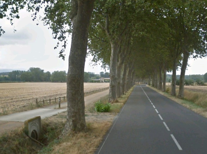 The cycleway on the left, on the West side of the road, may be on the formation of the old tramway.
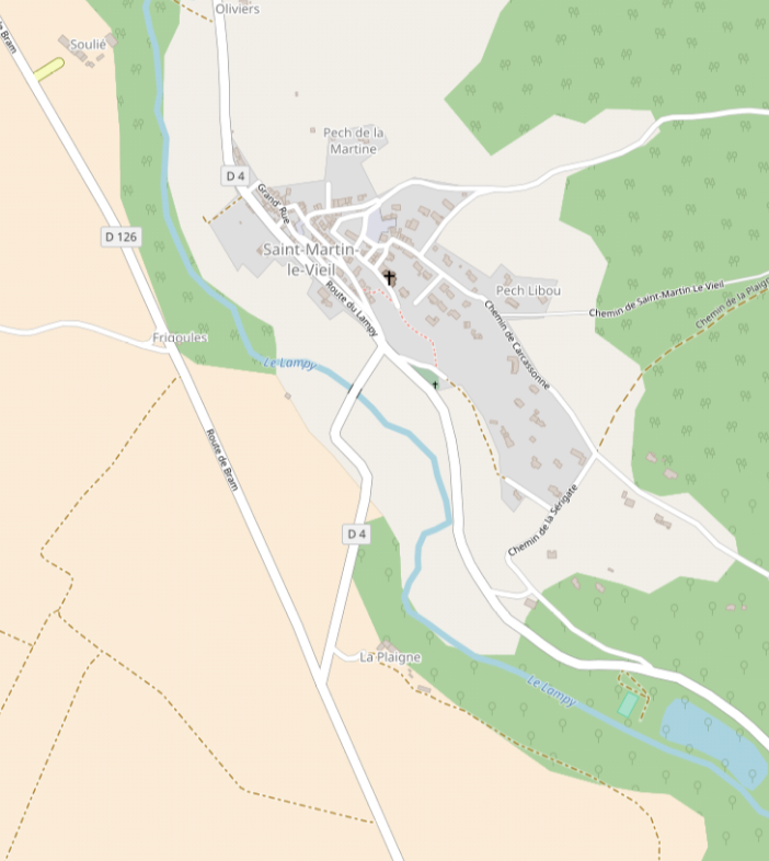
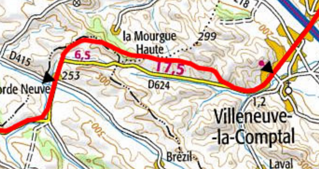
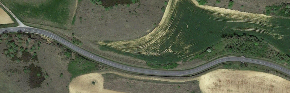
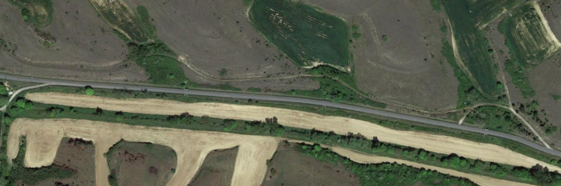
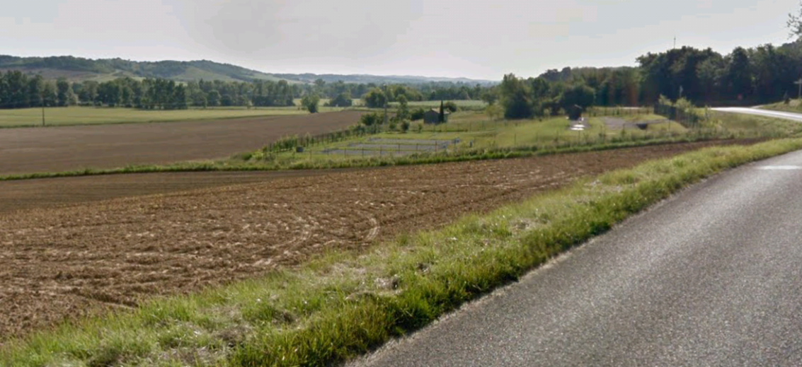
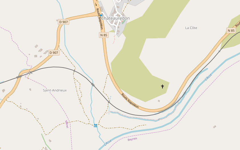
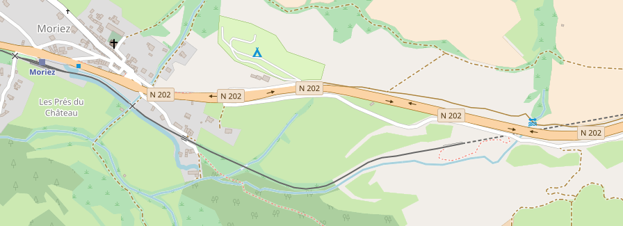
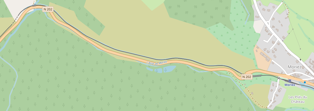
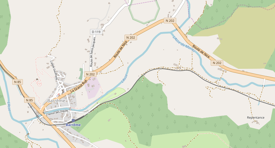
We are heading for Saissac, and as the journey continues we pass through a series of different stops – Montplaisir-la-Leude, St-Martin-le-Vieil, Cennes-Monesties, and Cap-de-Port. We also cross the Canal du Midi. We cross the canal just north of Bram.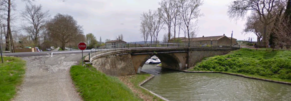 The tramway continues North. The countryside north of the Canal due Midi is relatively flat and it ius likely that the route chosen for the tramway was dictated by the desires and dictates of various landowners. The tramway ran on the western shoulder of what is now the D4. The road seems to have been designed to work with the tram. Long straight sections are punctuated by relatively smooth and generous bends.
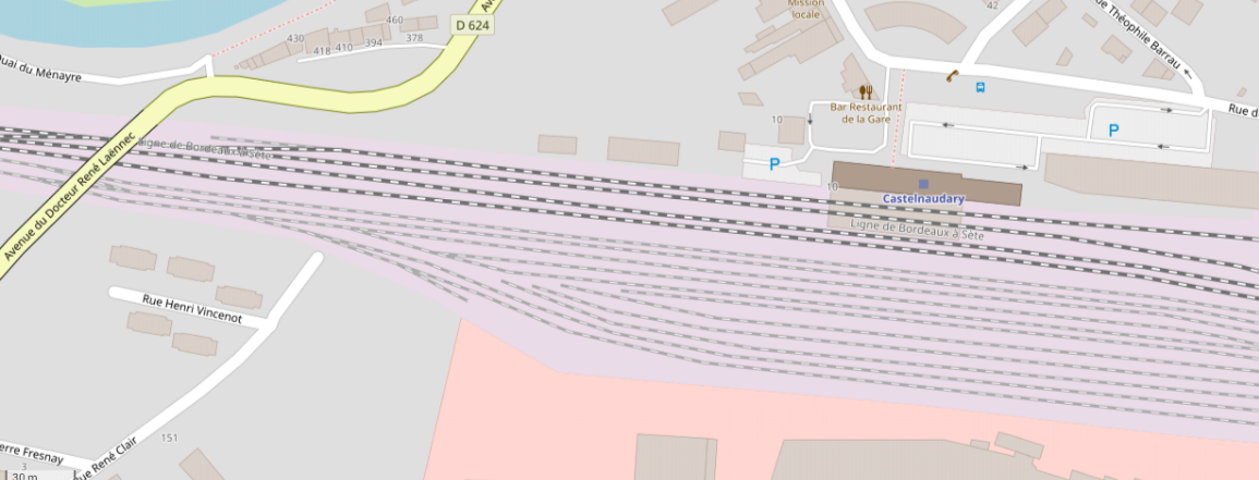
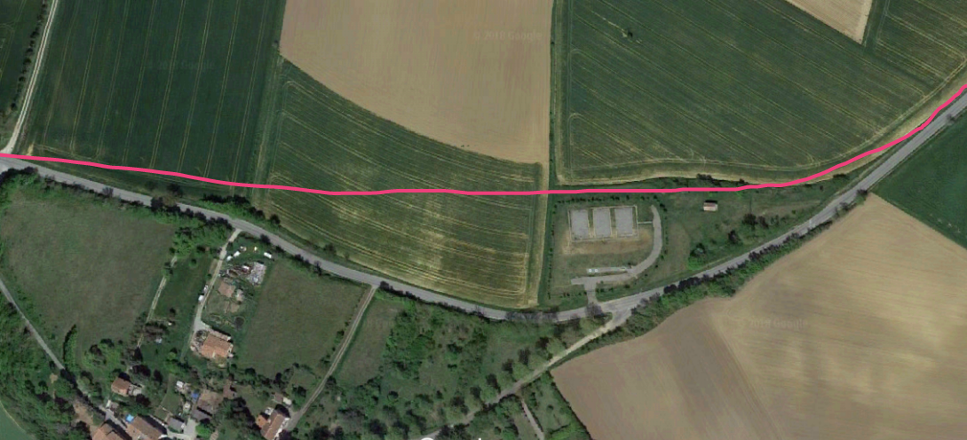
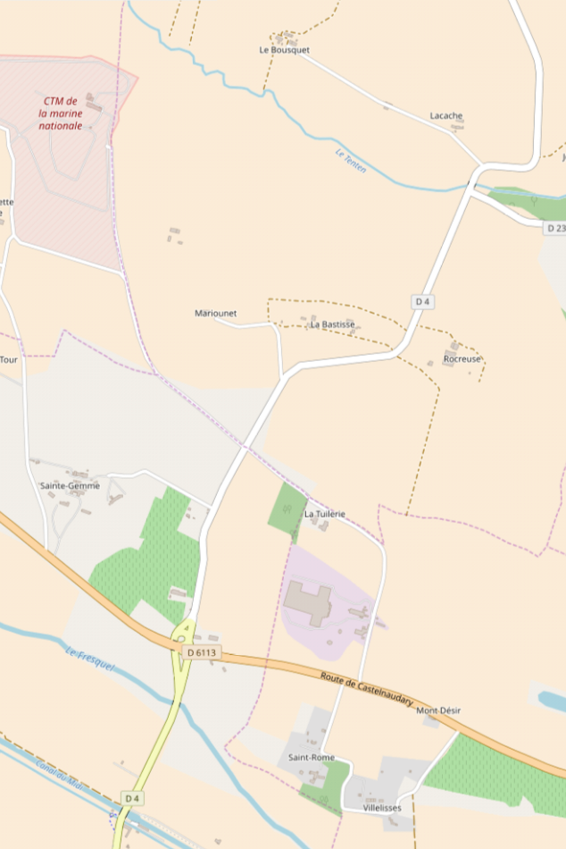 This OpenStreetMap excerpt shows the route. The Canal is visible in the bottom left of the image. The tramway and GC116 (D4) then crossed the River Fresquel and the present D6113. The first halt north of Bram was at this junction – Montplaisir-la-Leude. North of the River Tenten the tramway/road diverted around the edge of a field before heading for St-Martin-le-Vieil.
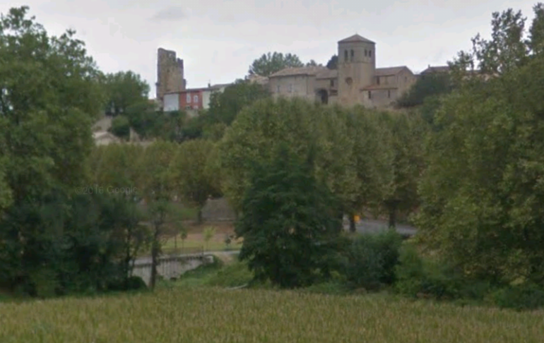
 Things changed as the tramway reached its next stop in St-Martin-le-Vieil. This was the main village in Canton immediately North of the Canton of Bram.
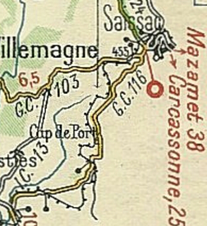
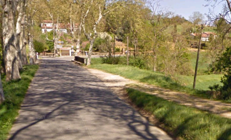
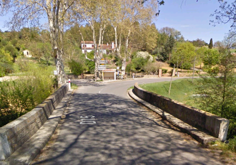
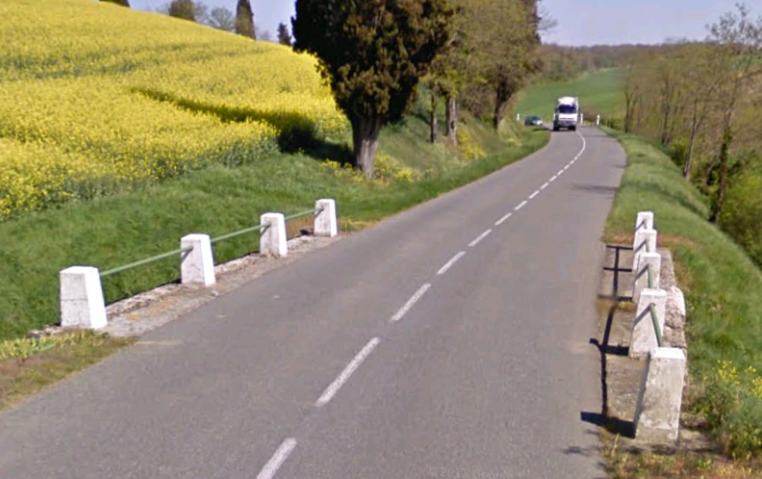
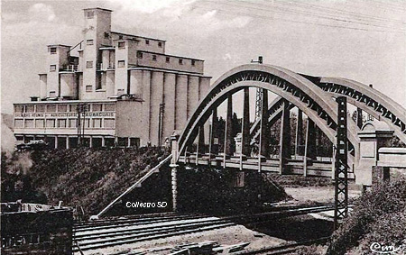
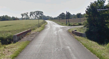
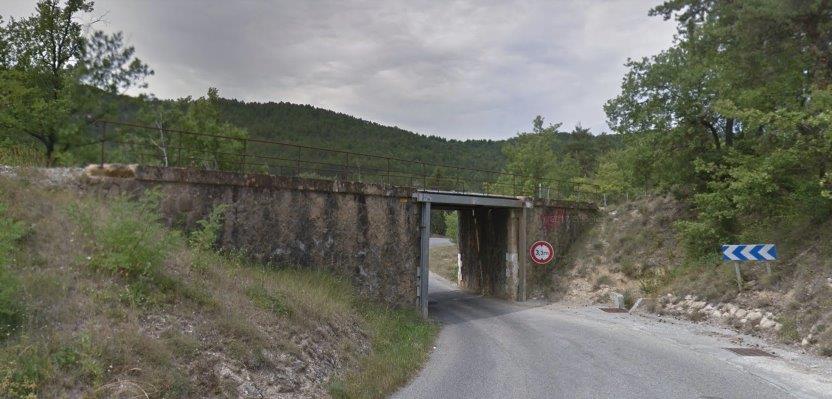
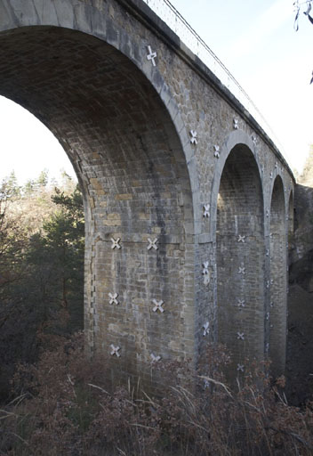
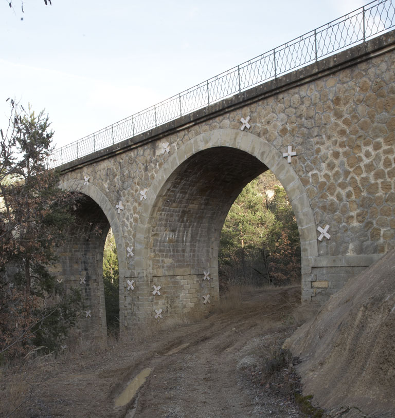
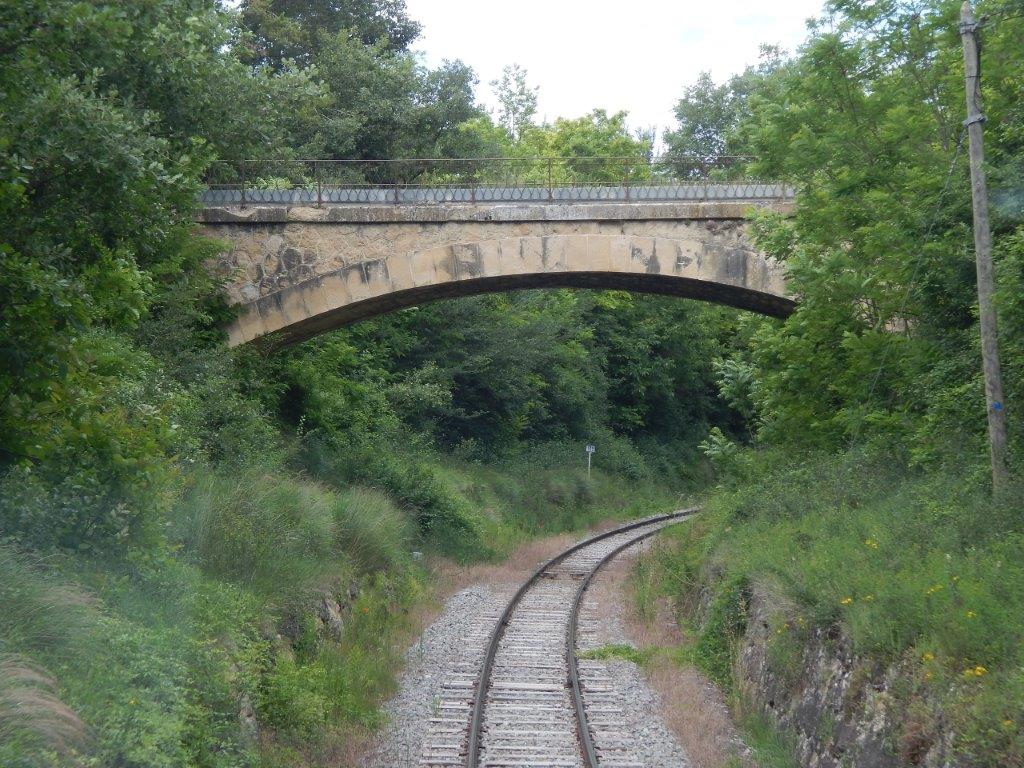
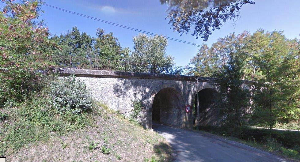
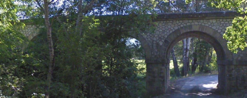
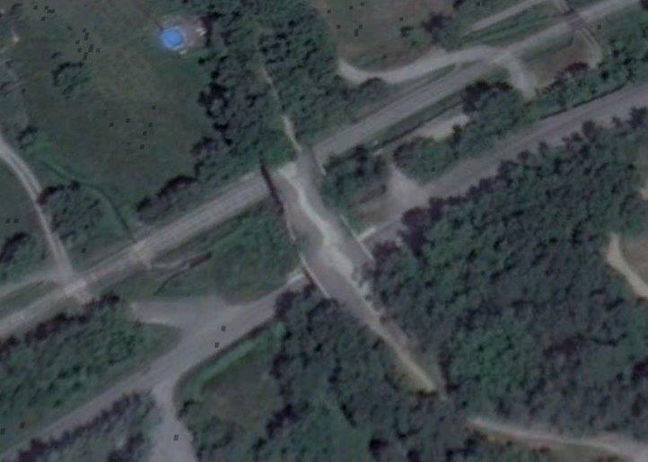
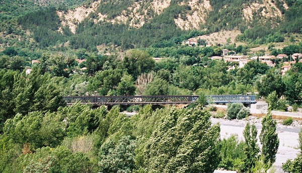
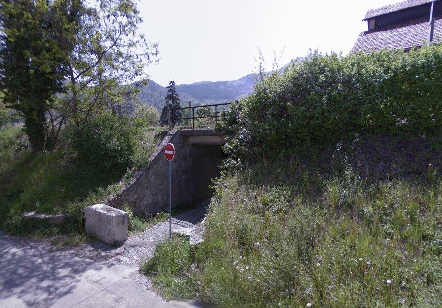
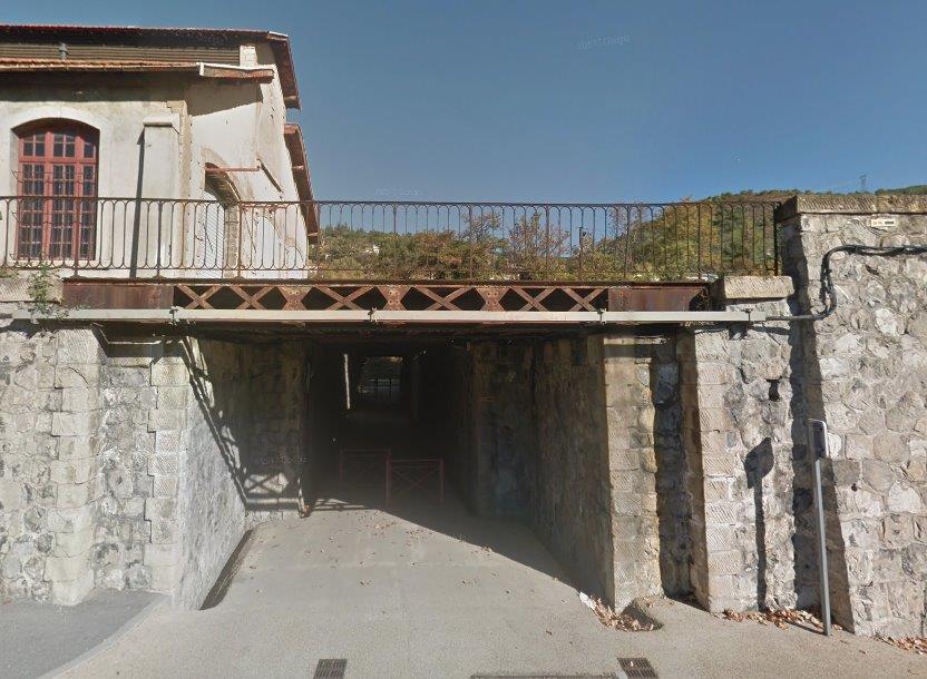
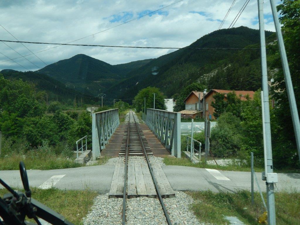
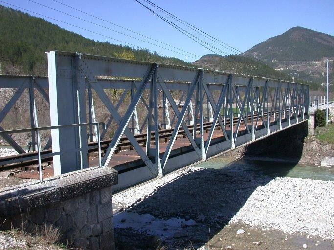
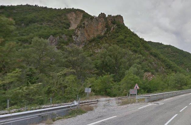
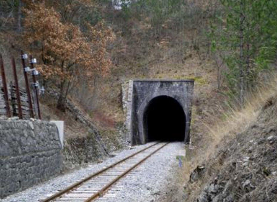
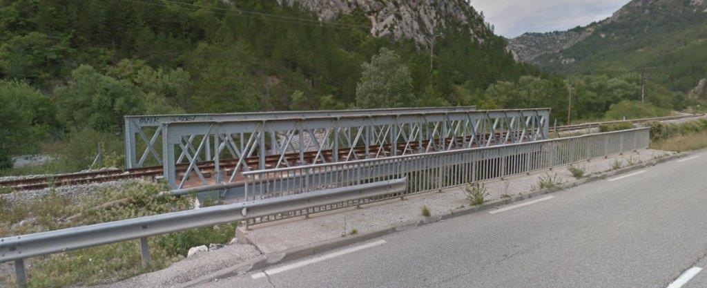
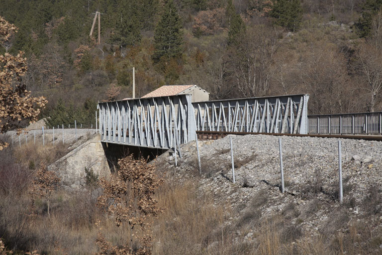
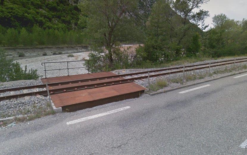
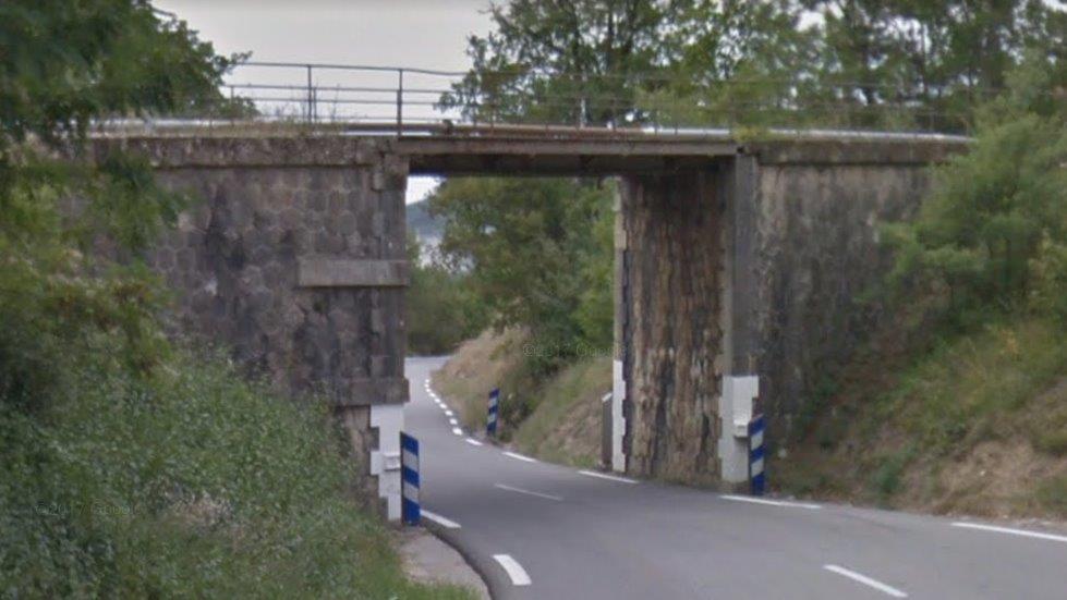
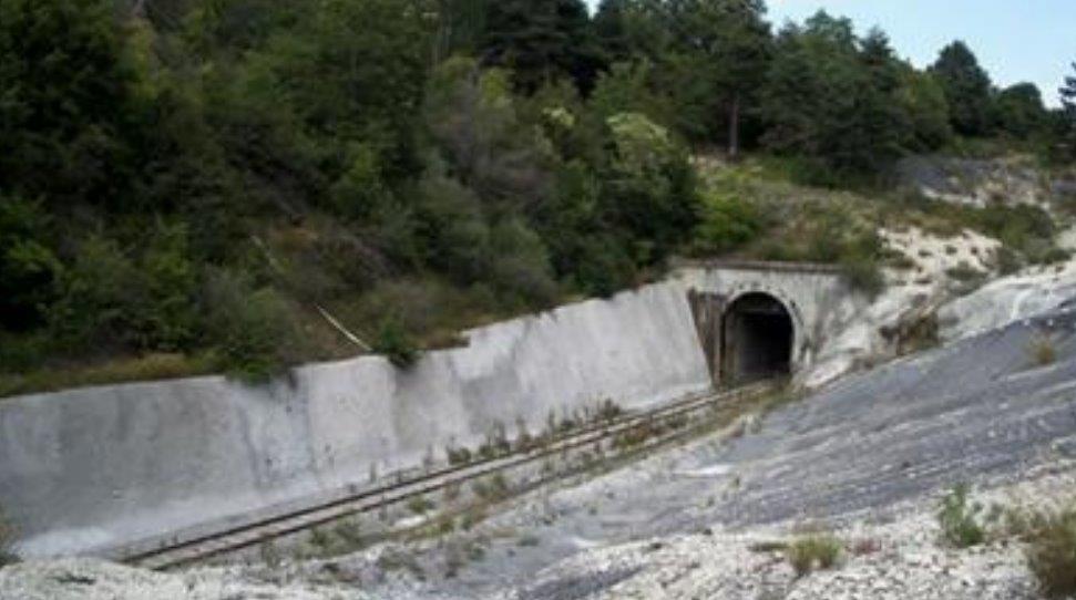
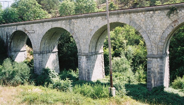
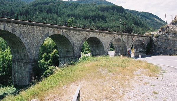
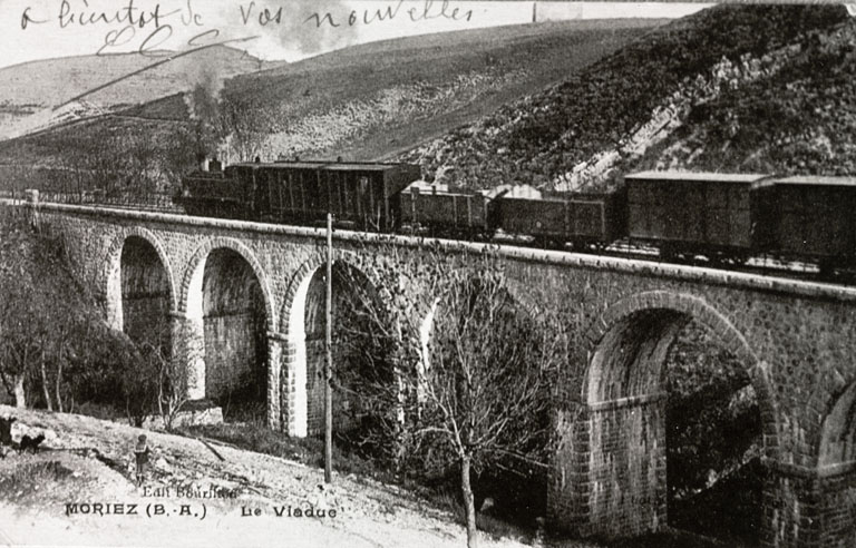
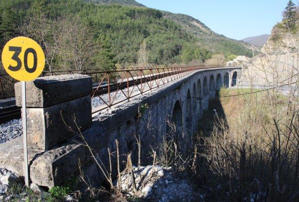
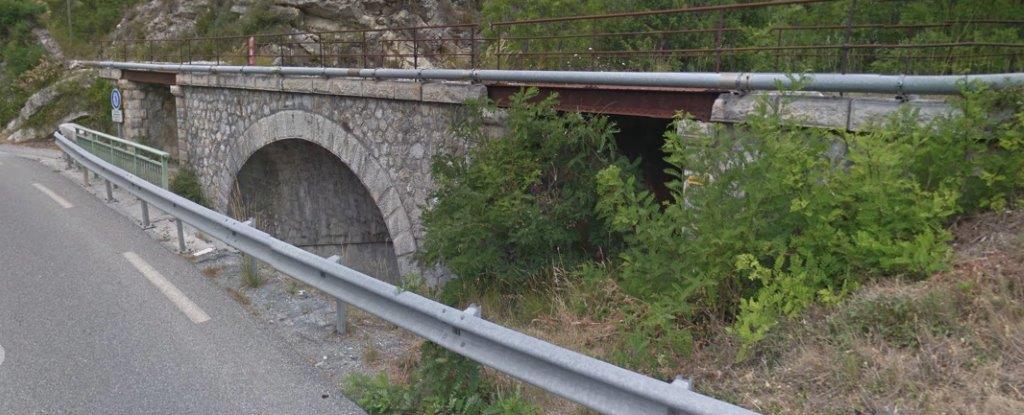
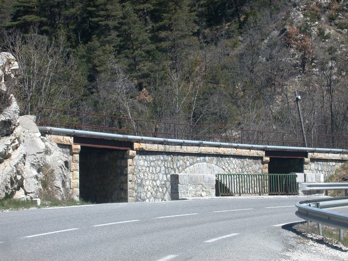
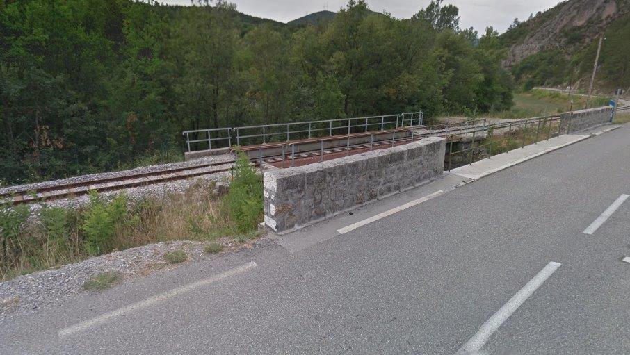
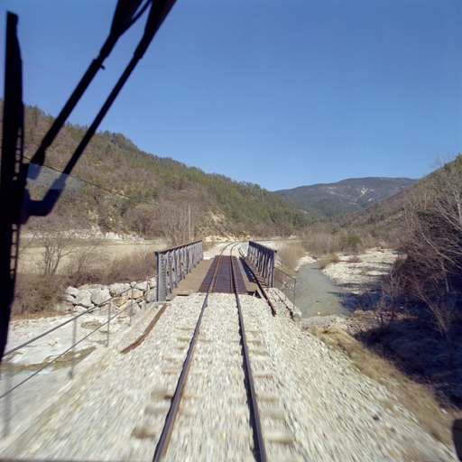
To access the village the tramway/road crossed the River Lampy on an ancient masonry arch bridge. The picture below is not of the highest resolution but sows the bridge early in the 20th century, perhaps while the tramway was still working. The adjacent 1930s Michelin map shows the tramway crossing the Lampy on a separate bridge to the road. The lie of the land and the road alignment suggest that this is very unlikely. No evidence exists to suggest that the tramway diverged from the road over this length.
 The bridge is just visible in this modern view of the village.
St-Martin-le-Vieil is a historic Cathar site with three significant elements: the castle; the church and the abbey; and a series of caves excavated by hand in the 9th Century. Its origins go back to the 8th century.
The castle is mentioned as early as 1180. It was donated by Simon de Monfort to the Abbey of Villelongue in 1213. It was ravaged during the wars of religion (1578 ), rebuilt in 1676 as shown by the date inscribed on one of the faces of the small tower. It seems that by 1759 it still possessed its moat and three towers, the stone from one of which was used in the 1870s to build the town hall and school. [20]
The abbey appeared first in the twelfth century (1152 according to some historians). It became of significance in the crusade against Catharism in the thirteenth century. In particular, Simon de Monfort granted it all the lands of Saint Martin le Vieil. It was plundered by the Protestants in 1568 and saw a slow decline until 1789 when there remained only two religious. It was confiscated in 1792 and auctioned off. It was turned into a farm. Later, in 1916 it was listed as a historic monument and now receives aroun 6,000 visitors a year. [20]
The parish church is dedicated to Saint Martin, it is dated to the 14th century. It was built in the Gothic style and remodelled in the 15th century. [20]
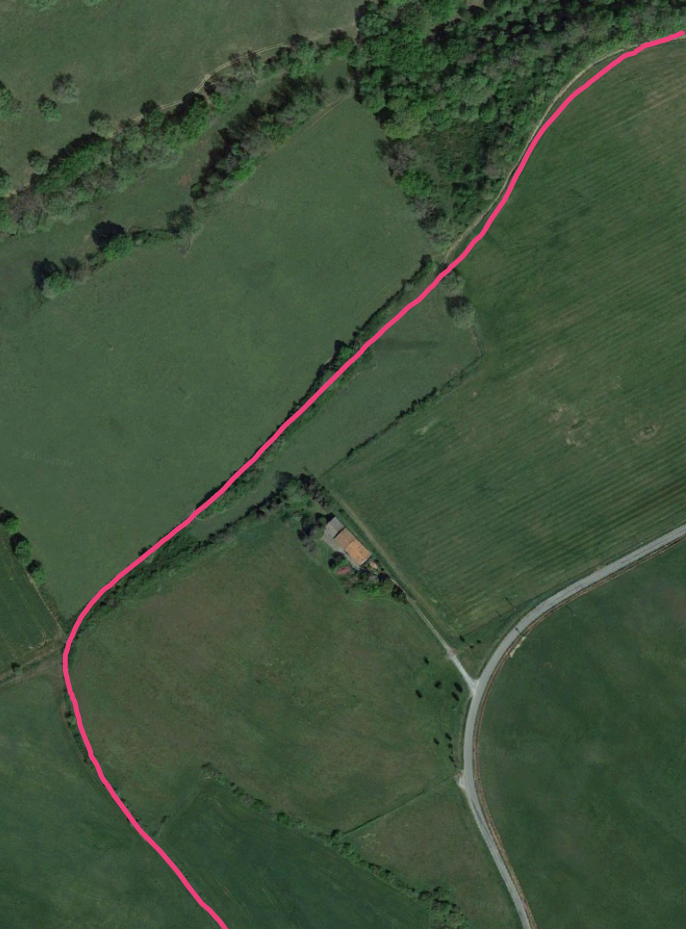
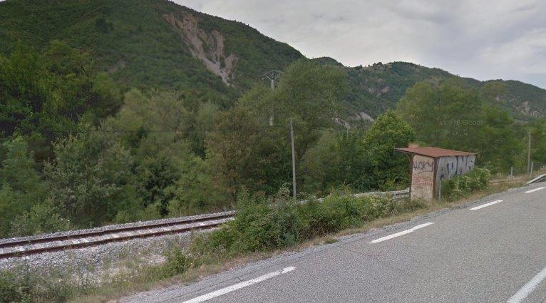
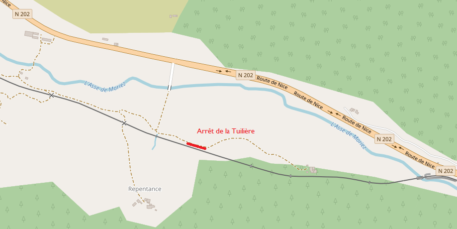
The tramway ran along the GC116 (D4) through the village and continued alongside the road and river until close to Cennes-Monesties. The road to Cennes-Monesties diverges to the left. The tramway continued to the right still following the shoulder of the GC116(D4). There was a halt at this location for Cennes-Monesties. I have been unable to find any details.
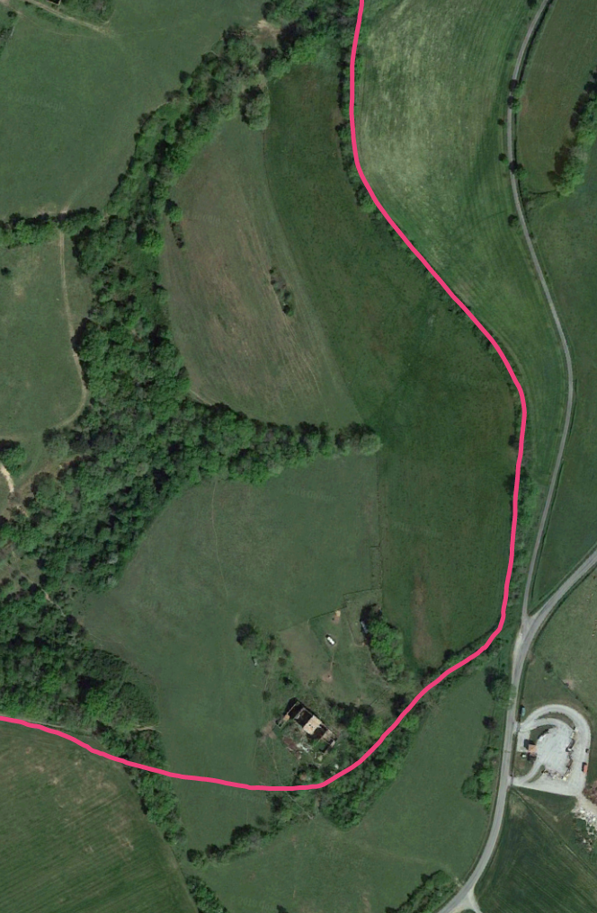
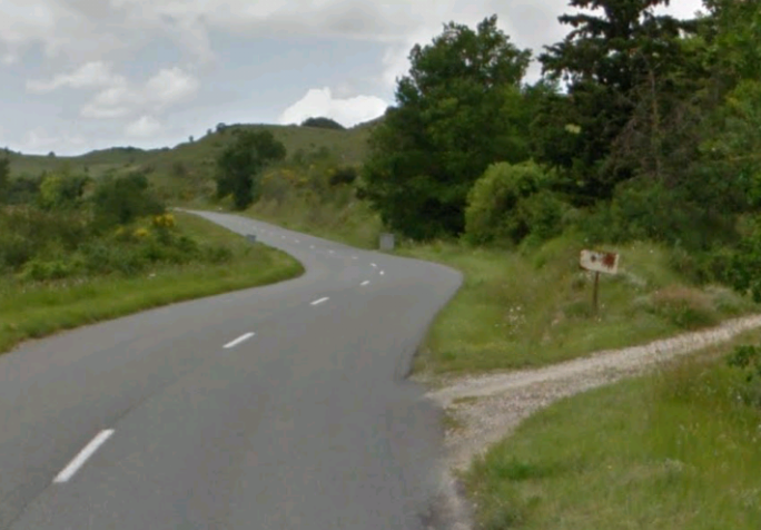
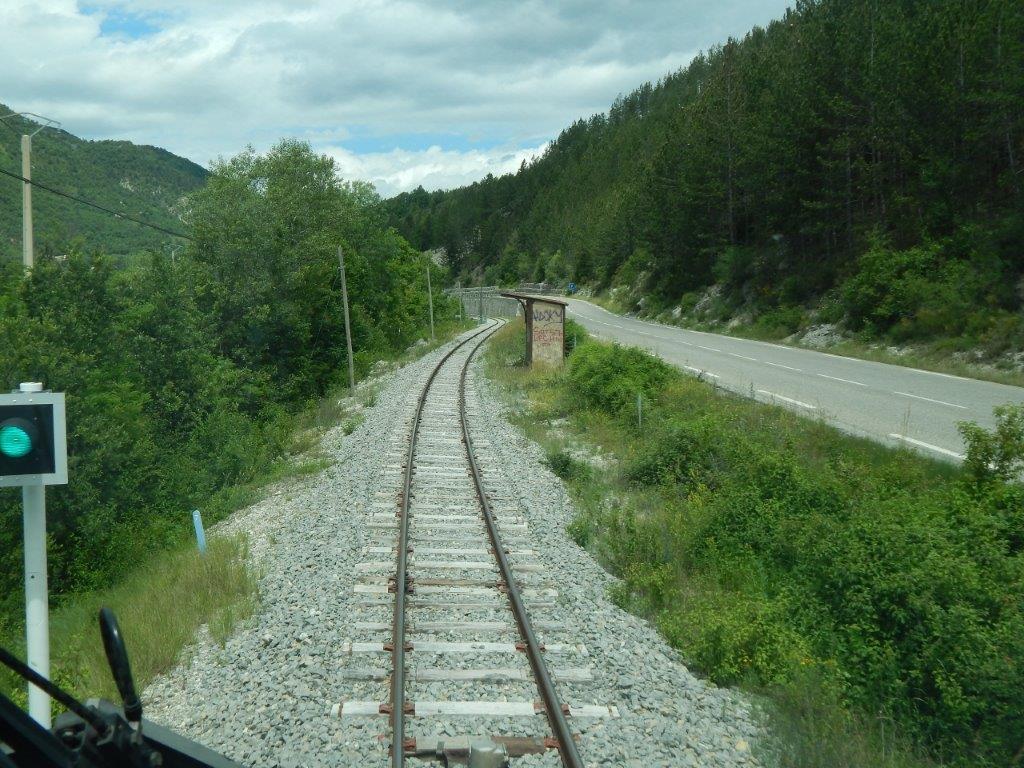
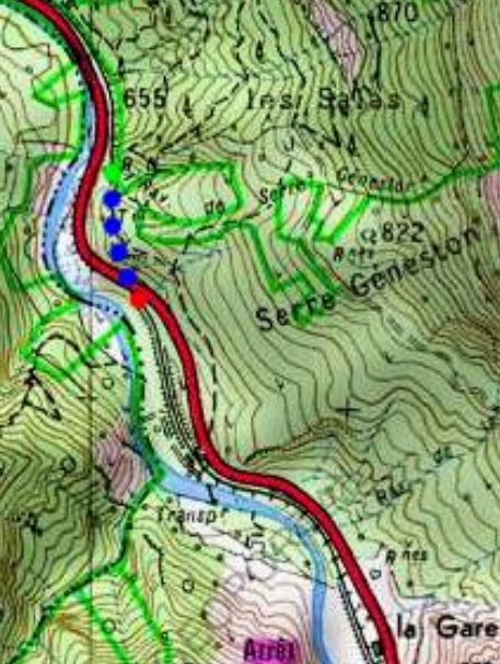
 For most of its length the Saint-Denis/Saissac line followed the route of the existing roads, but because of the road gradients, 8 kilometres separate lines were created. [18] These next few paragraphs and photographs trace the line as it meanders away from the road over the length between Cennes-Monesties and Saissac.
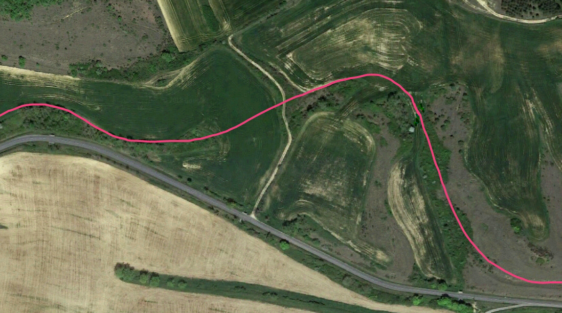
The first deviation is significant both in direction and length, leaving the road for some distance to the south before swinging round to the north and then following the road, but at a distance to the East as far as the next highway junction. The satellite images below confirm the route which appears only as alteration to the color of the ground or crops along its length. At points it is impossible to verify the line but those parts which can be established indicate the route elsewhere. 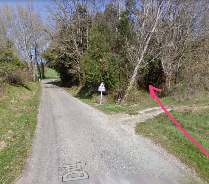 The tramway leaves the shoulder of the road at this point. The tunnel through the undergrowth marks its most probable line. From this point it curves away to the south.
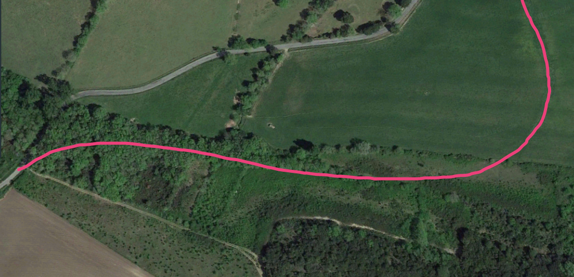 The tramway swings away from the road through shrub-land. Its route is approximately marked by a line of taller trees. Once arable land is reach the route of the tramway shows on the satellite image as a wide curve as marked by the pink line.
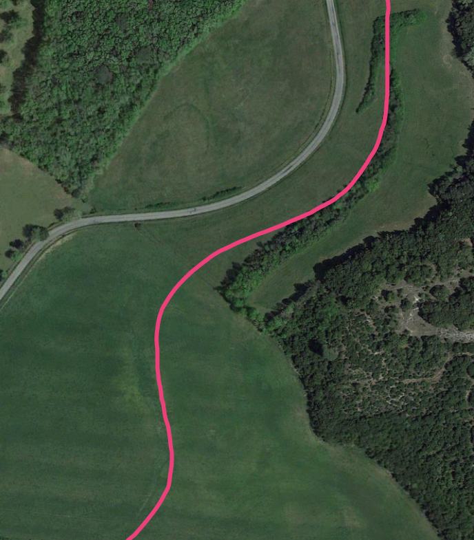
 The pink line is only approximate. In the image above, from the route through the open field the line curves back again towards the East and follows the edge of the elongated copse of trees in the field.
In the adjacent image the north end of we features at the bottom of the picture. The line of the tramway snakes through the open field towards the point at which the two roads in the image meet. The route is most clear at the top of the picture. A small copse appears at the top of this picture. It becomes a much larger copse to the north of the side road as can be seen on the next picture.
The route of the tramway crosses the D4 at a point where the road bends eastward. It is difficult to identify the point at which the tramway began to turn back eastward. One possible location, suggested by some marks in the field to the north, is approximately where the first lighter free trees are to the northwest of the D4. I cannot be sure.. However, the alignment to the north side of that field, as the tramway returned towards the D4, is clear.
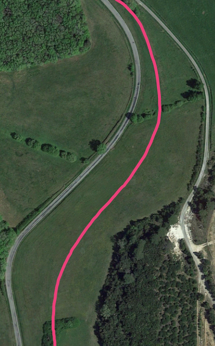
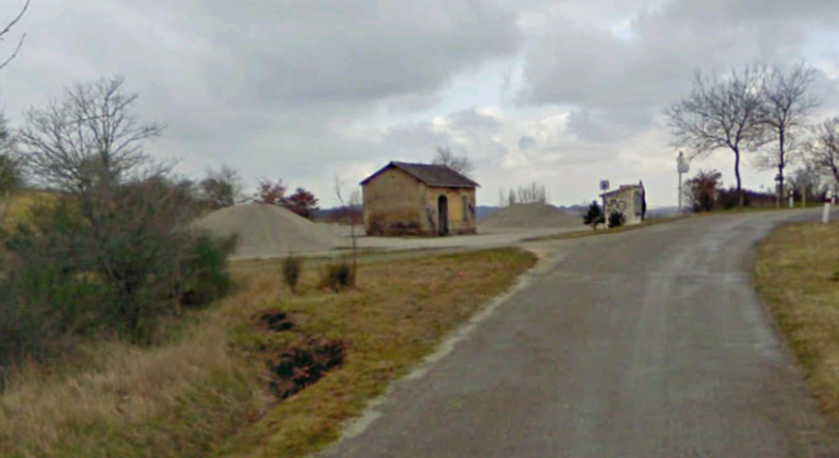
The pink line is again only approximate and the actual alignment can be made out crossing the field and turning north. The next halt at Cap-de-Port was adjacent to the building in the bottom right of the next image, not far from the road.
 The tramway continued north a distance west of the modern D4. It turned this way and that, seemingly mirroring the changes in direction of the road until, at another junction with a minor road, it struck off away from the present D4 (GC116) and curved round to run along the shoulder of the GC103 (the modern D103).
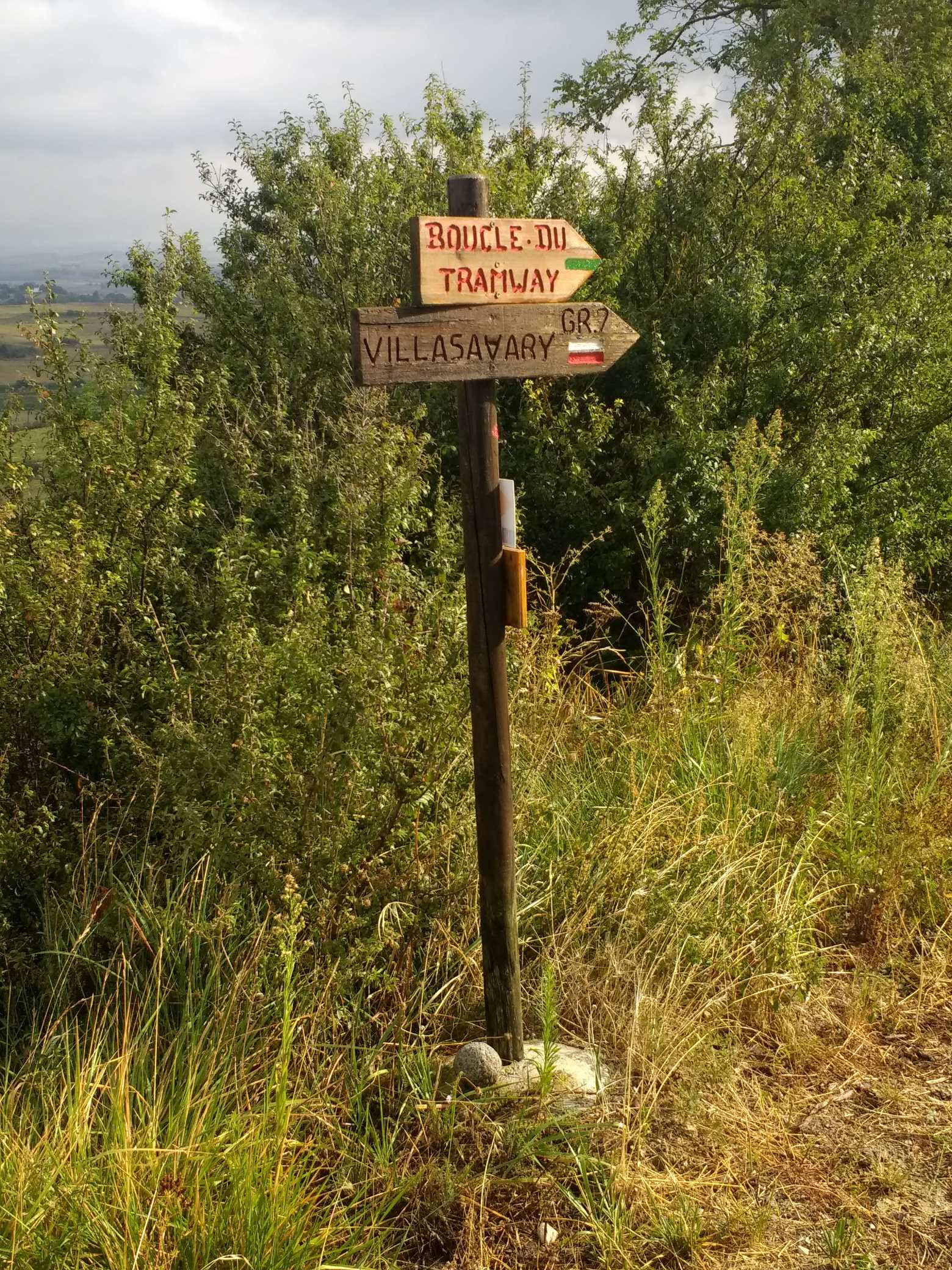
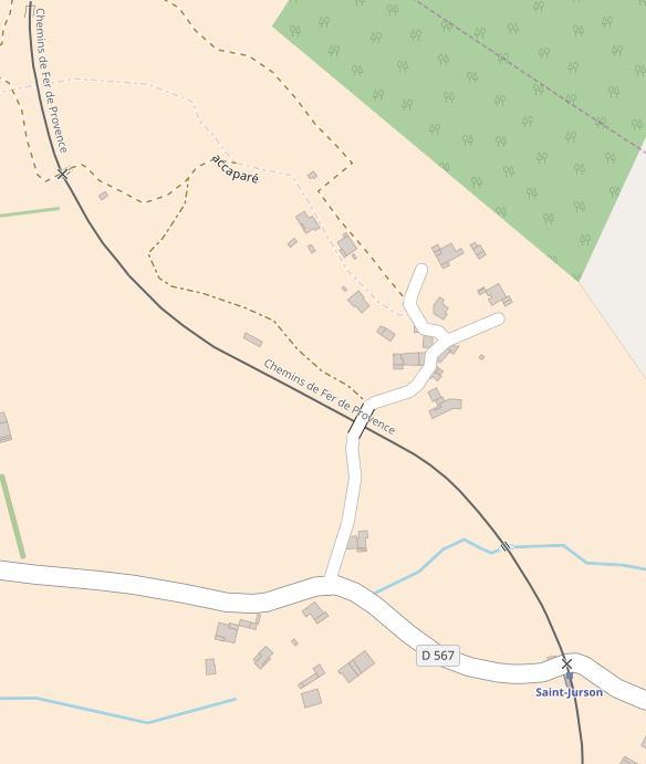
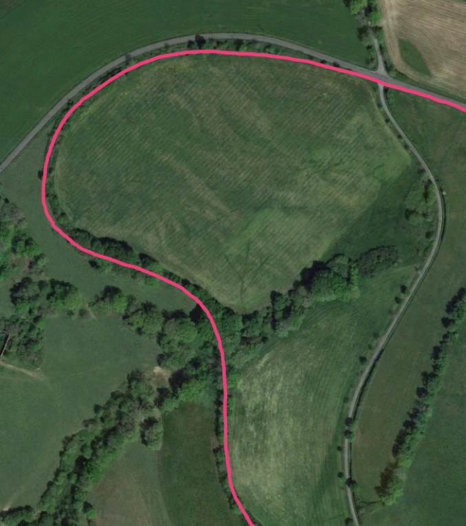 The OpenStreetMap plan below shows the route of the D103 (and therefore the route of the tramway) into Saissac. Its route out of Saissac is along the D408.
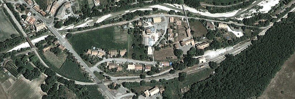
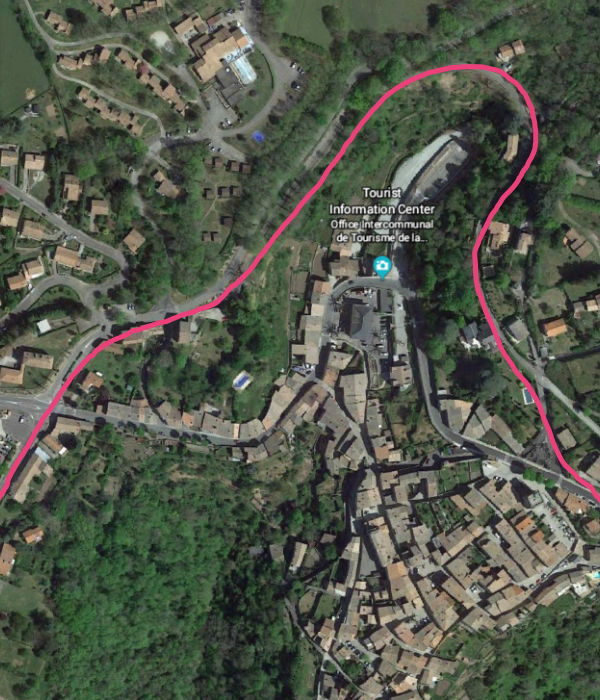 The route of the tramway through Saissac is well preserved as a street – the Allee de la Promenade. The route is again shown in pink on the adjacent satellite image of the town.
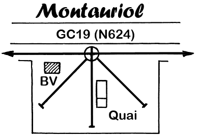
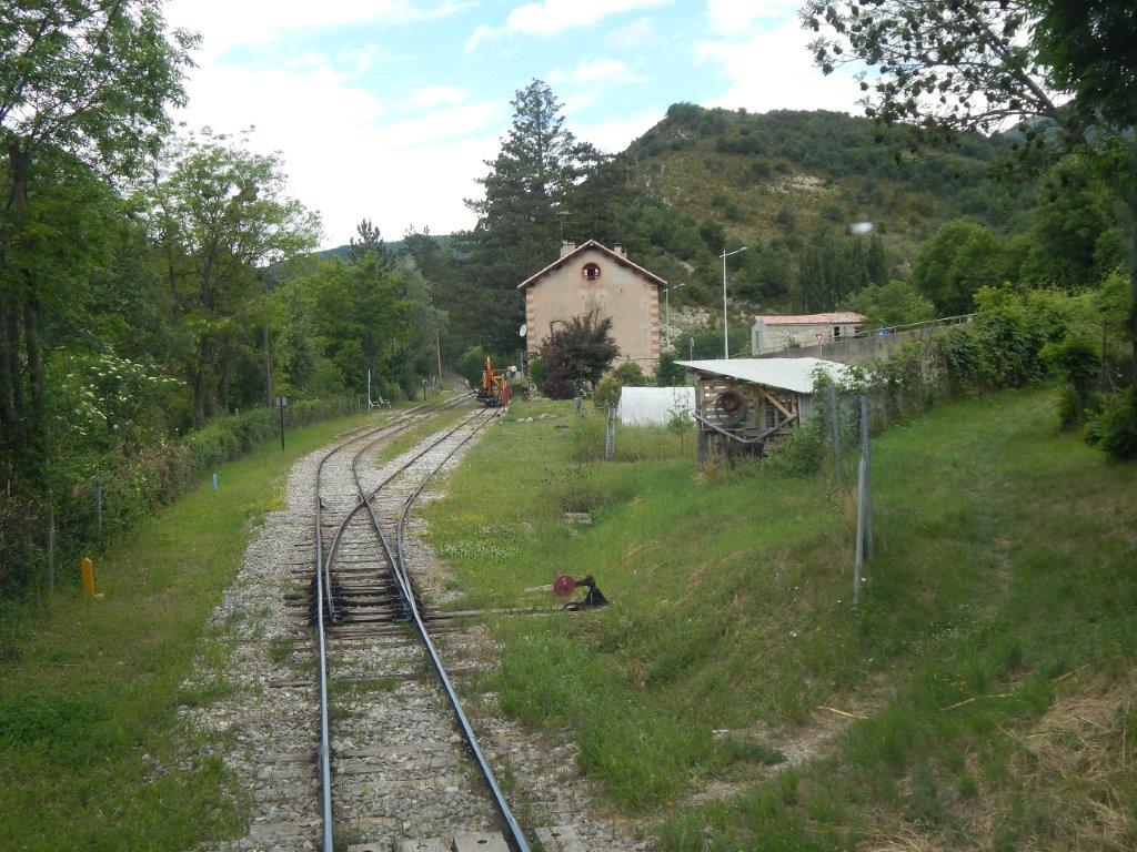
The route closer into the town is called the Avenue Georges Clemenceau. It was not suitable as the tramway roue because of the narrowness of the street on the west side of the town and the steep drop, west to east, into the town and then the climb, west to east out of the town-centre. The Allee de la Promenade is shown on the OpenStreetMap plan below.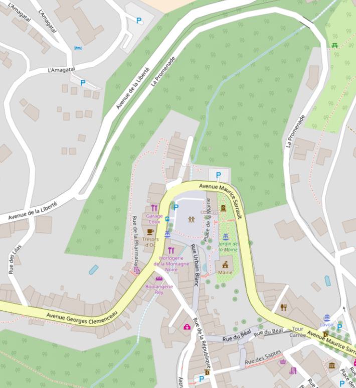 Two postcard images of the station are immediately below.
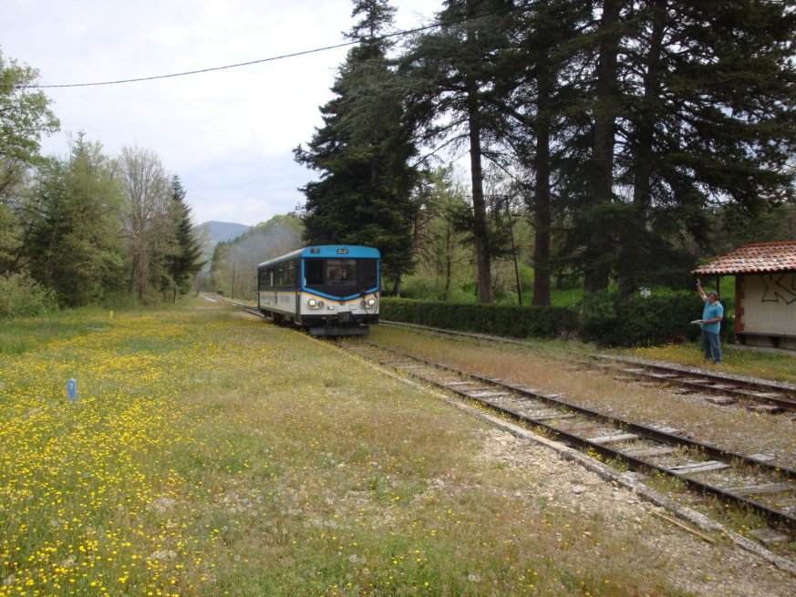
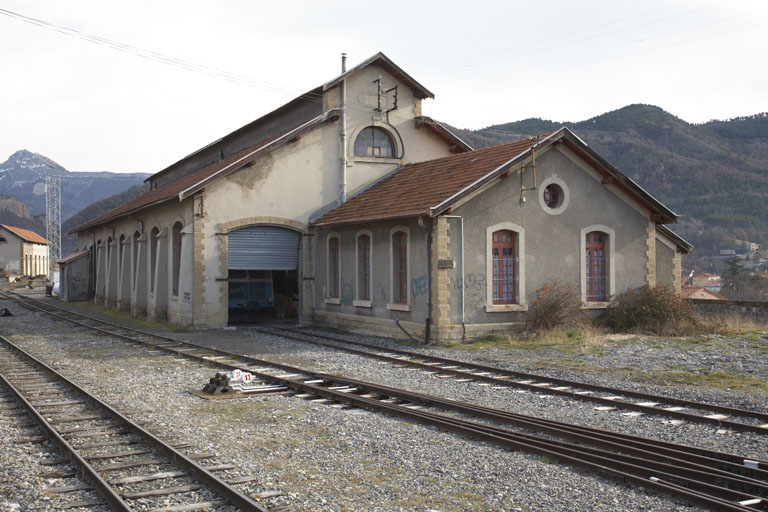
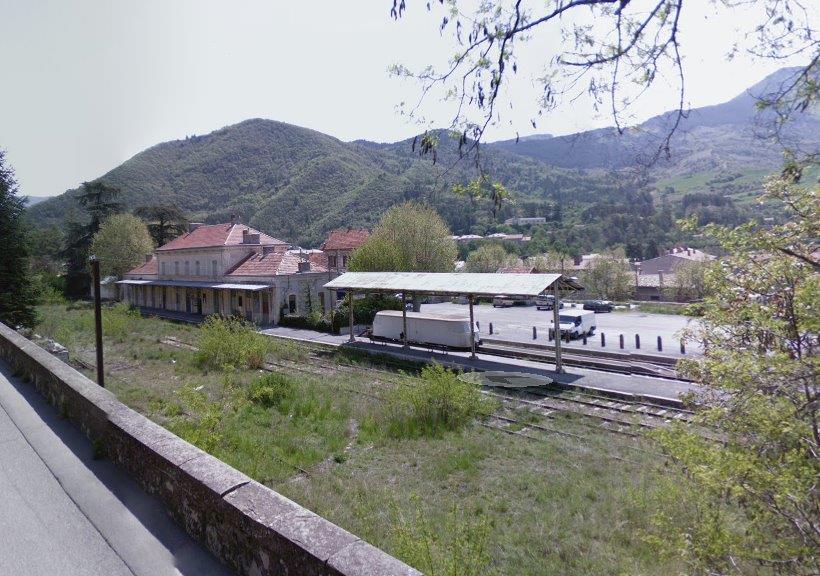
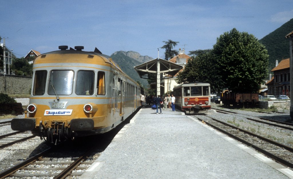
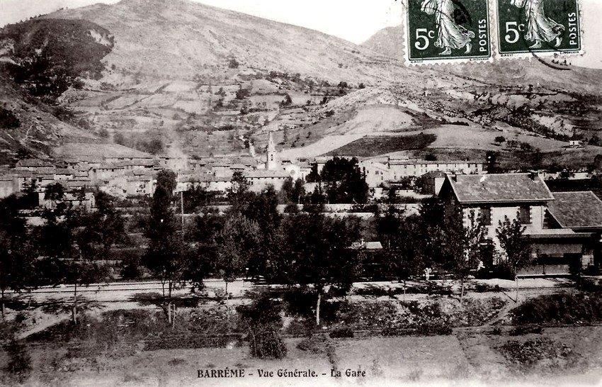
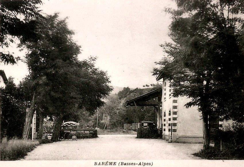
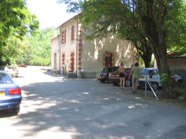
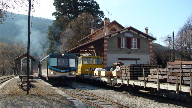
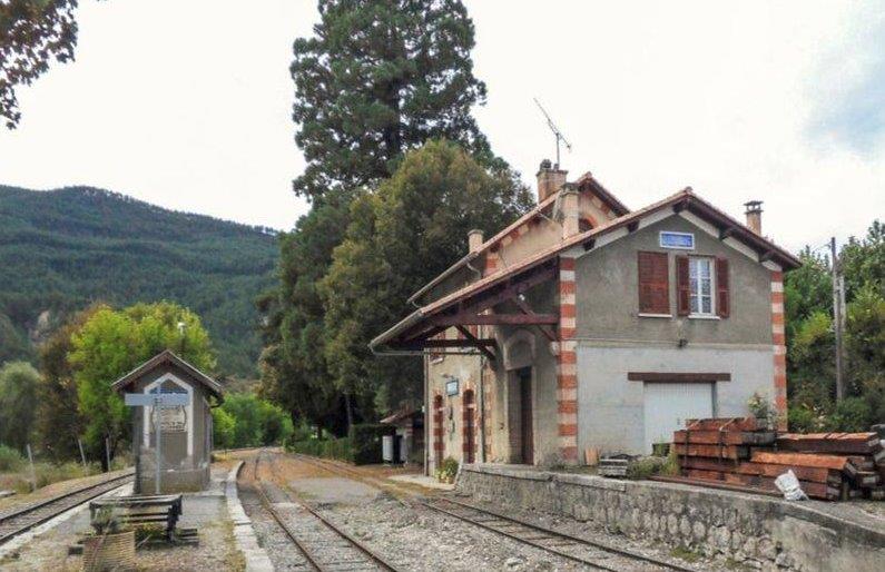
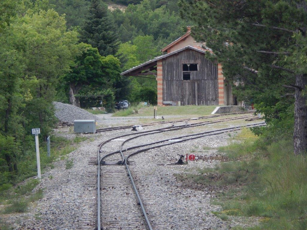
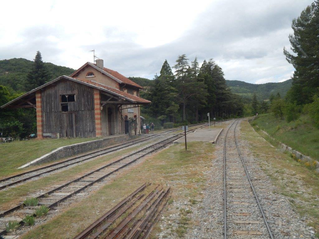
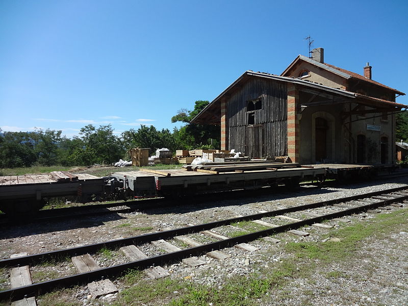
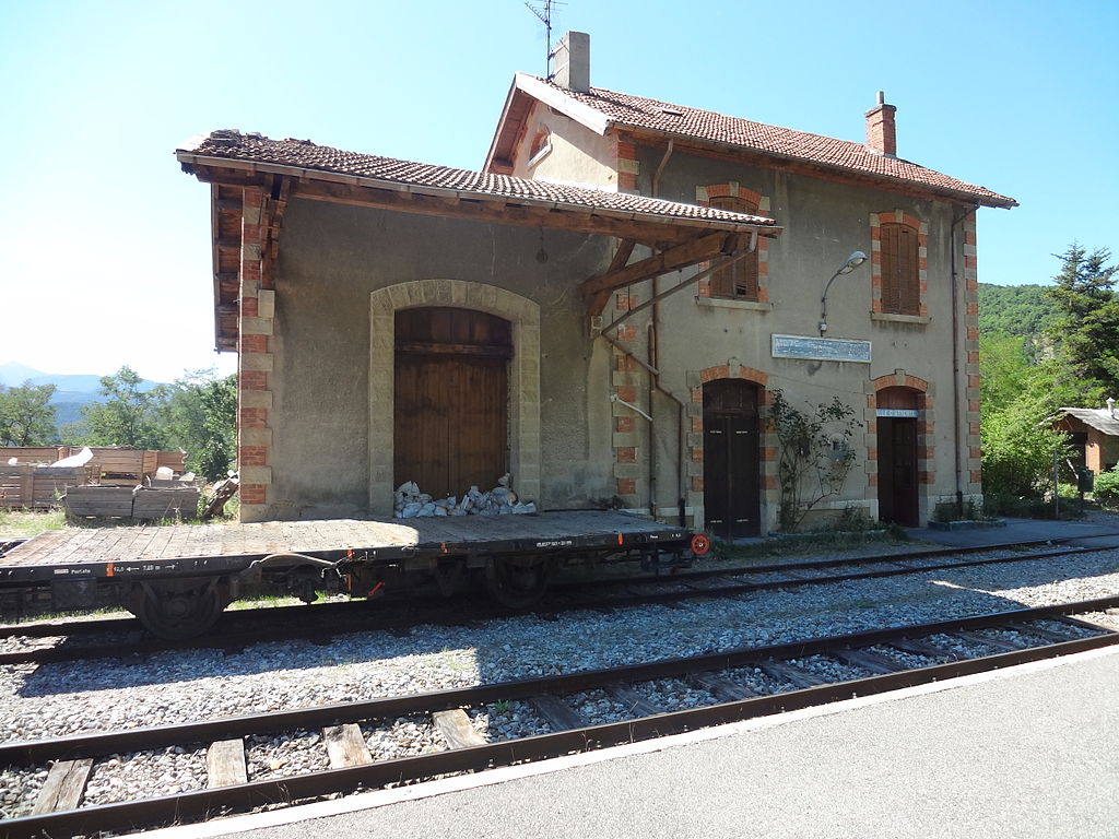
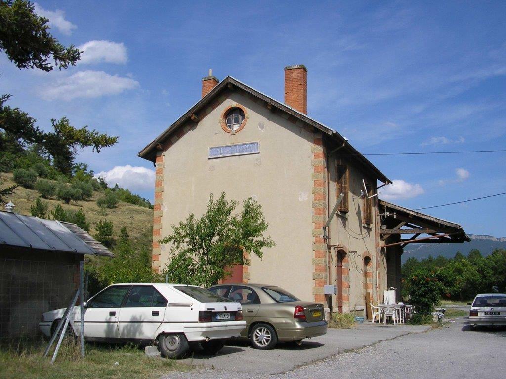
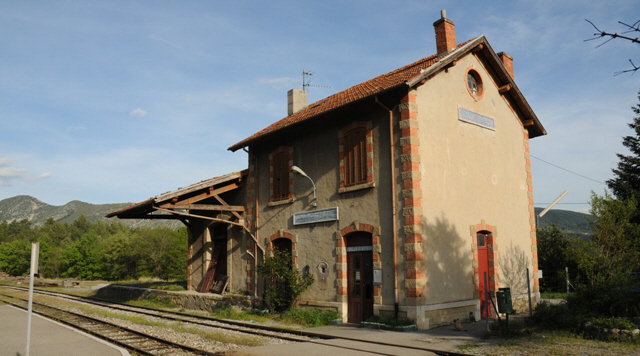
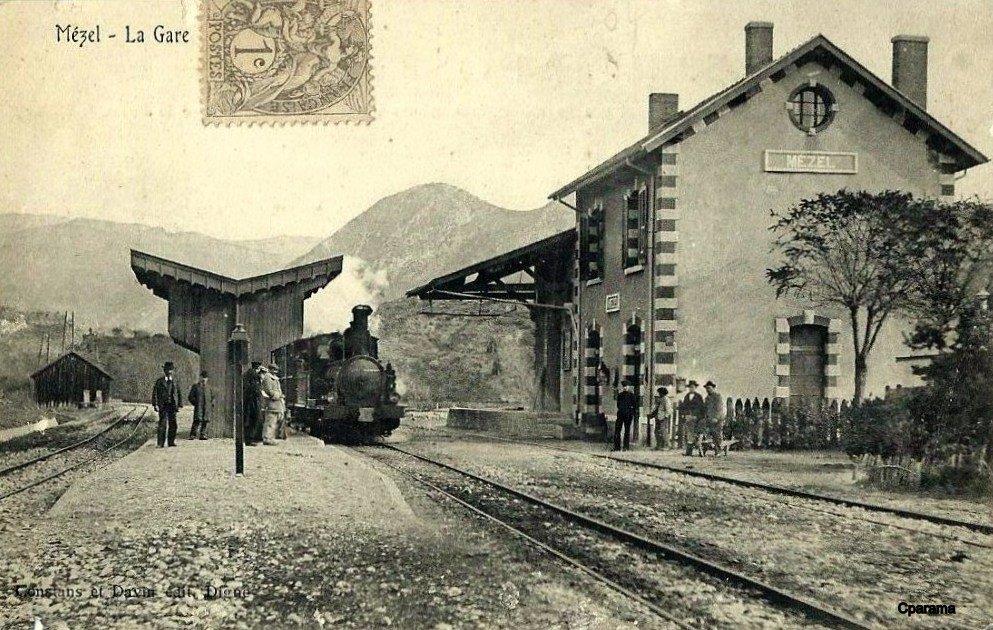
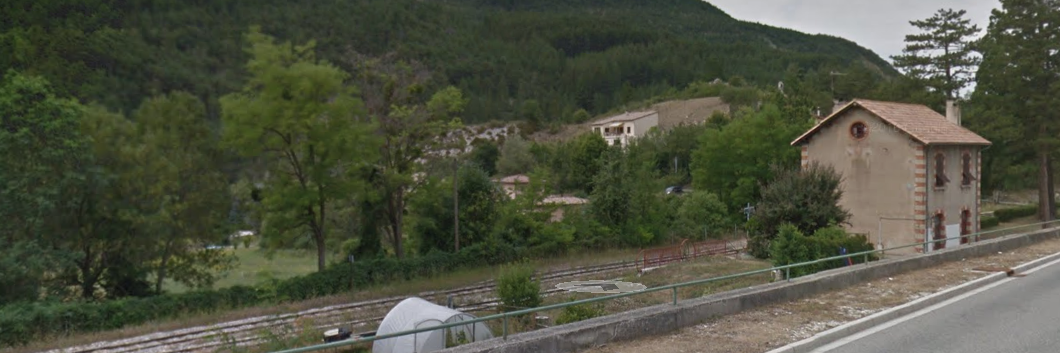
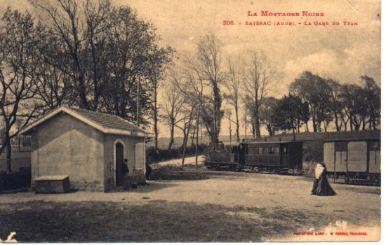 Saissac [10]
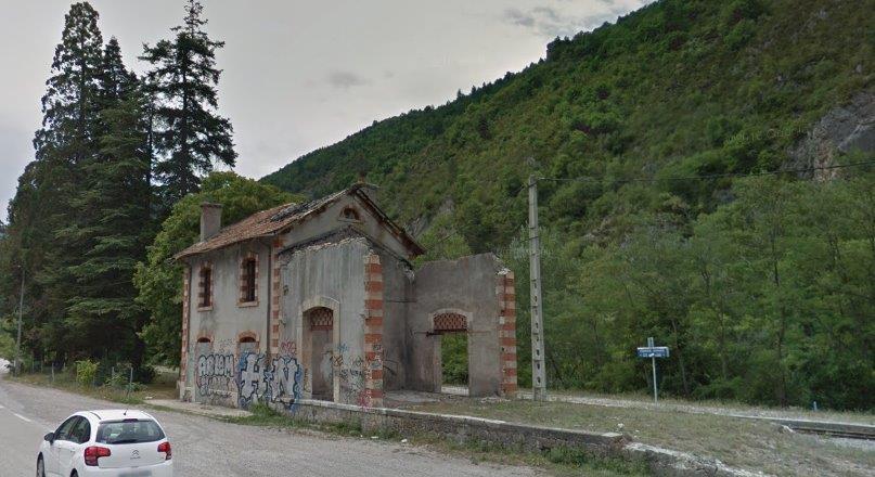
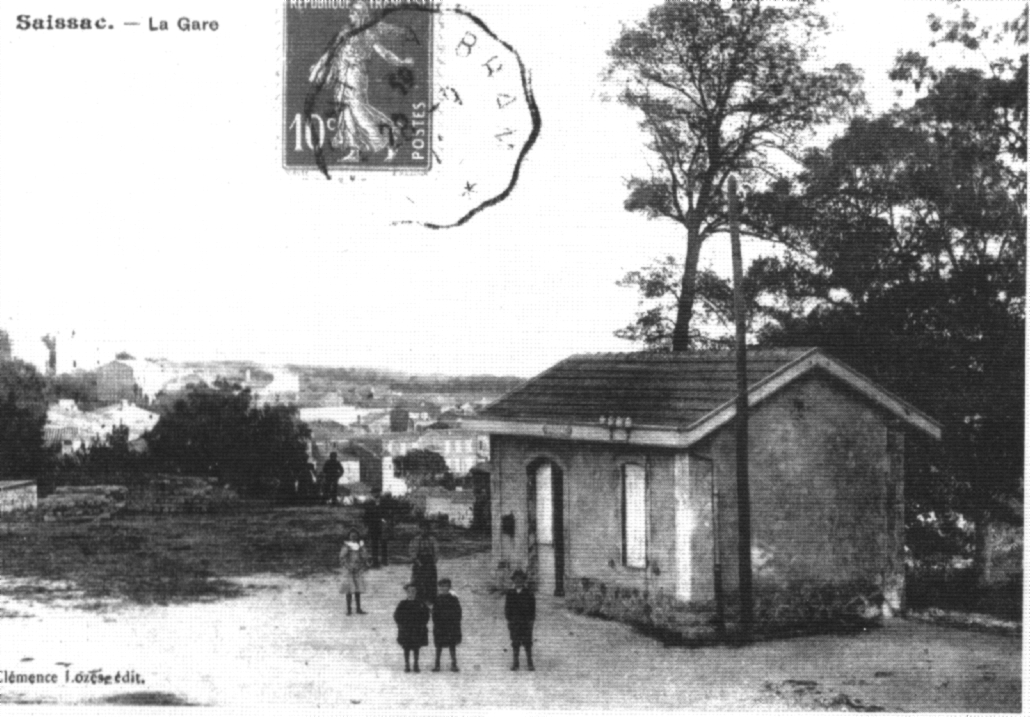 The old station of Saissac was built around 1904. The first tram arrived in Saissac on 10th May 1905. The station grounds were first used, after closure in 1932 as part of a sports field (1940). at that time, the station room served as a locker room for Rugby and football teams, eventually the land was used for the present gendarmerie. [22]
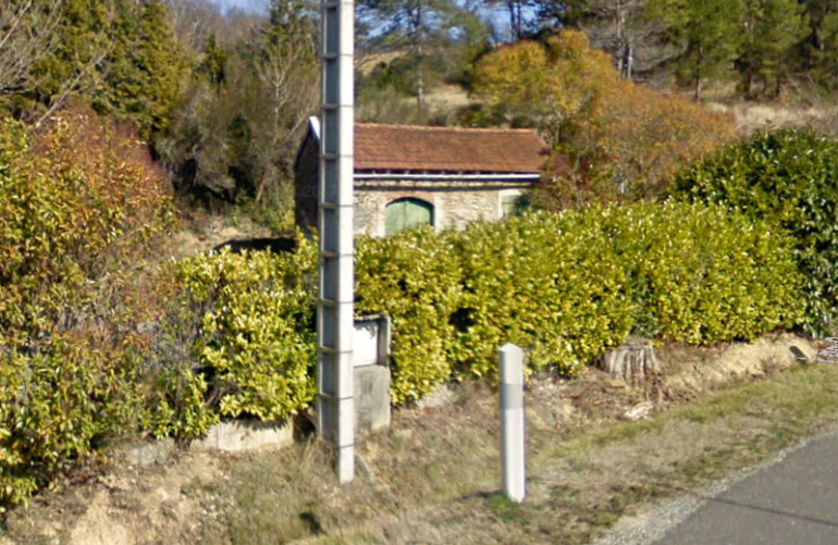
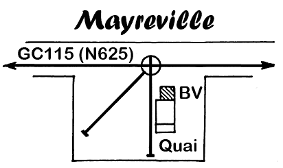
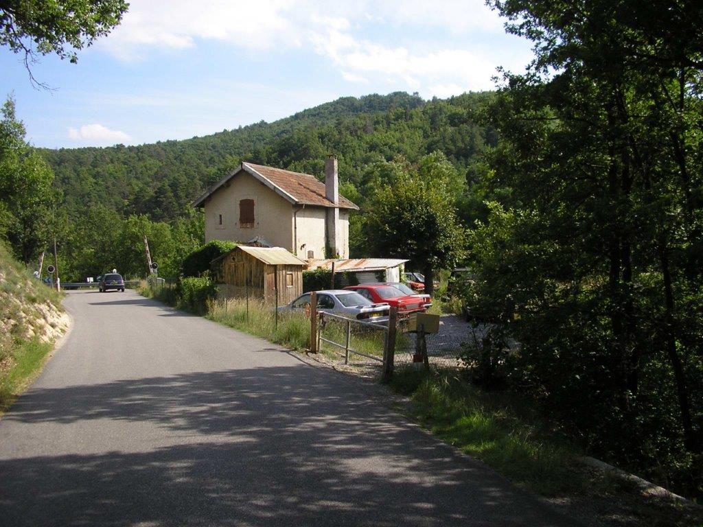
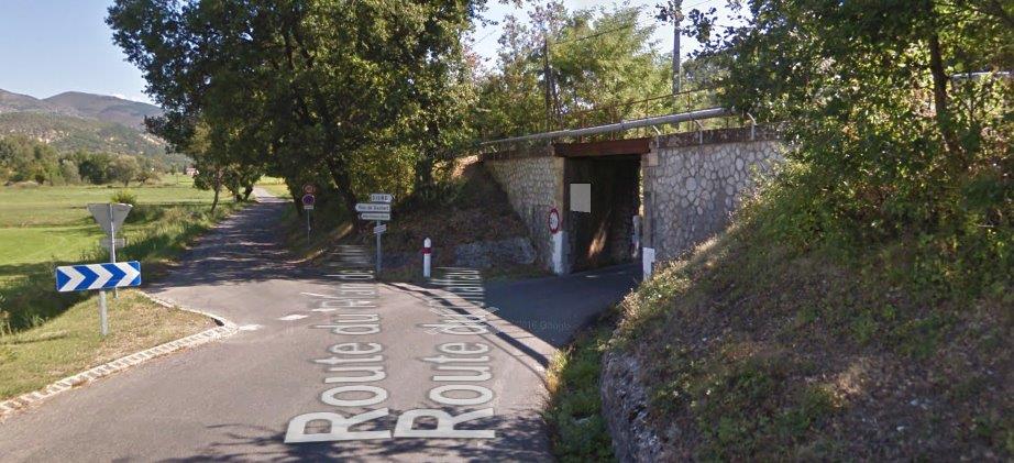
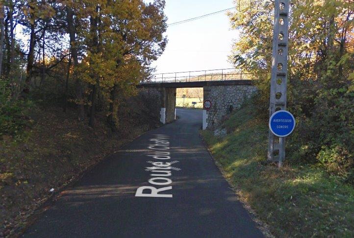
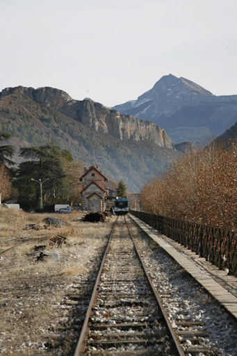
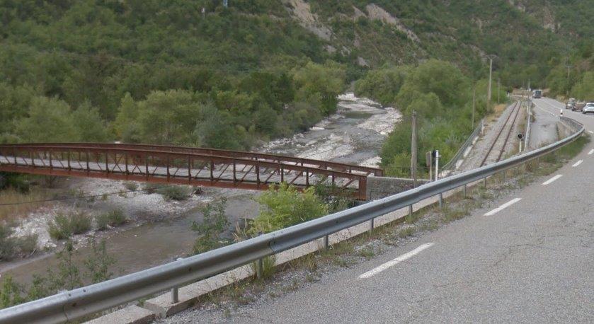
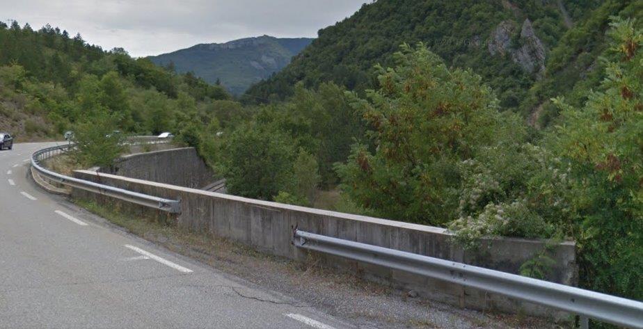
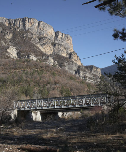
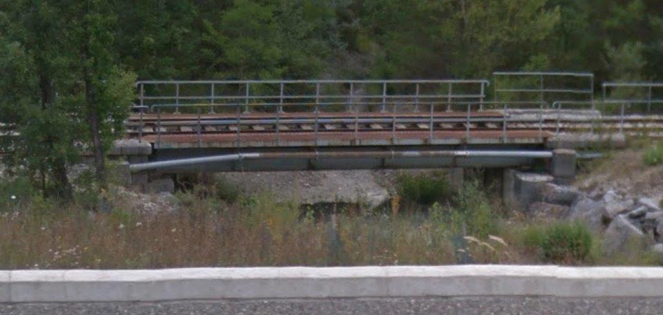
 The tramway route leaves Saissac on what is now the D408. It was once the GC103. The final leg of the journey to Saint-Denis is short – just 5 or 6 kilometres. Initially the tramway ran on the southern shoulder of the road. It then crossed to the northern side just before entering the valley of l’Alzeau and remained there until reaching Saint-Denis.
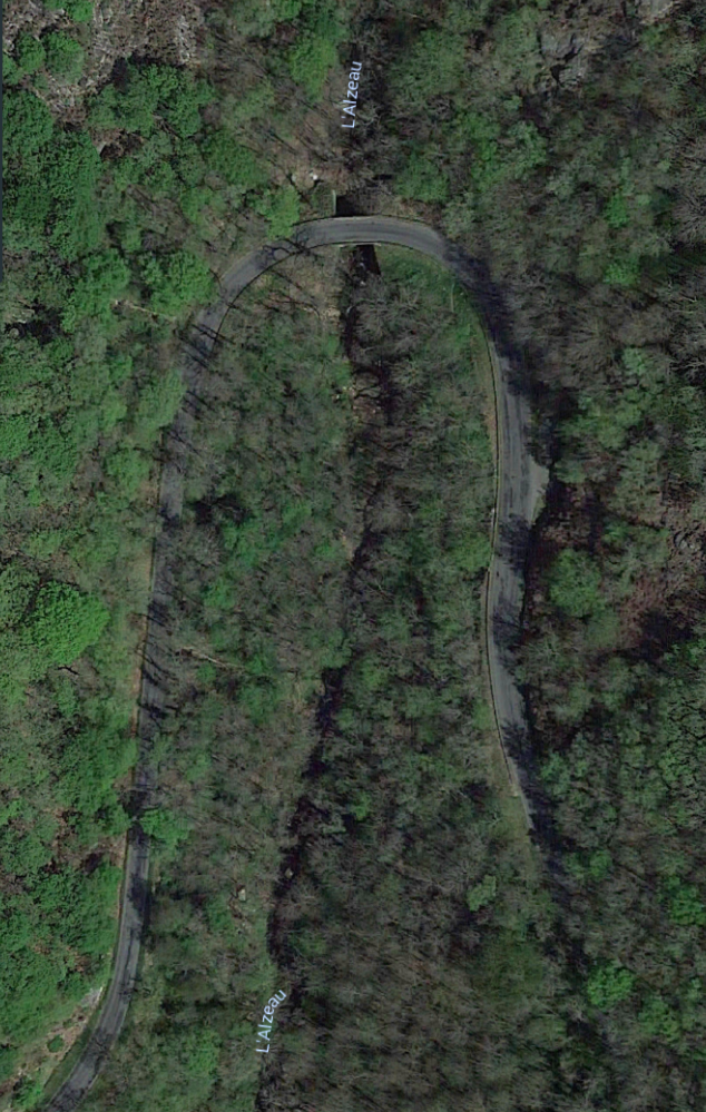
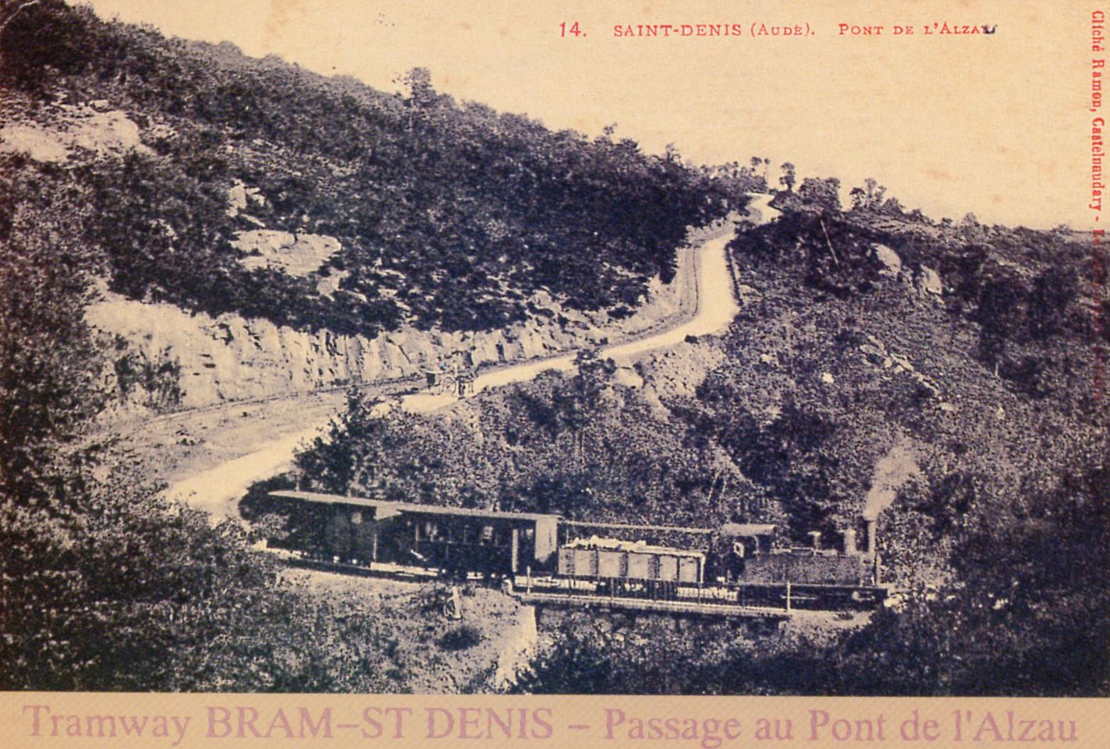
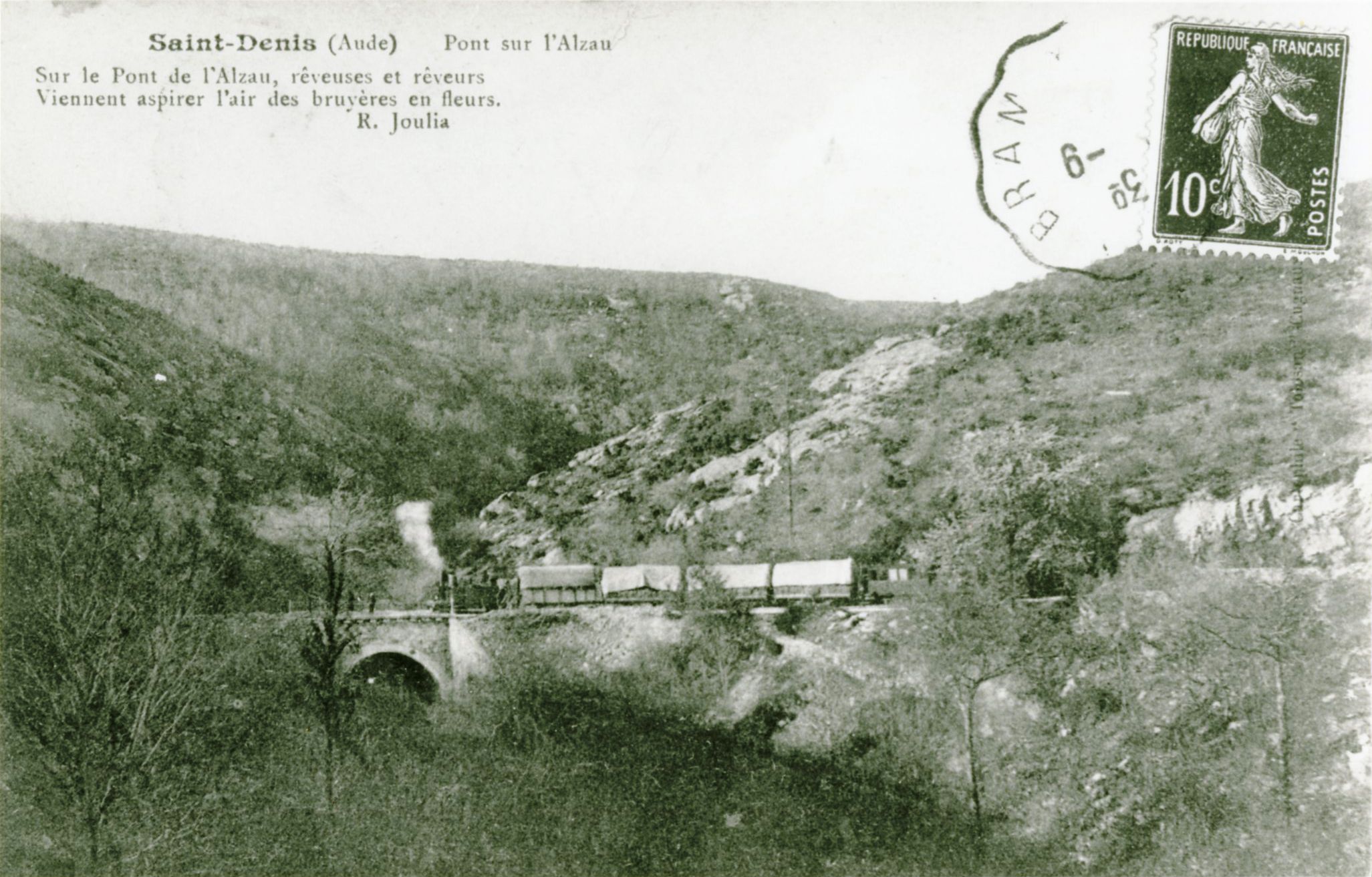
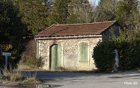
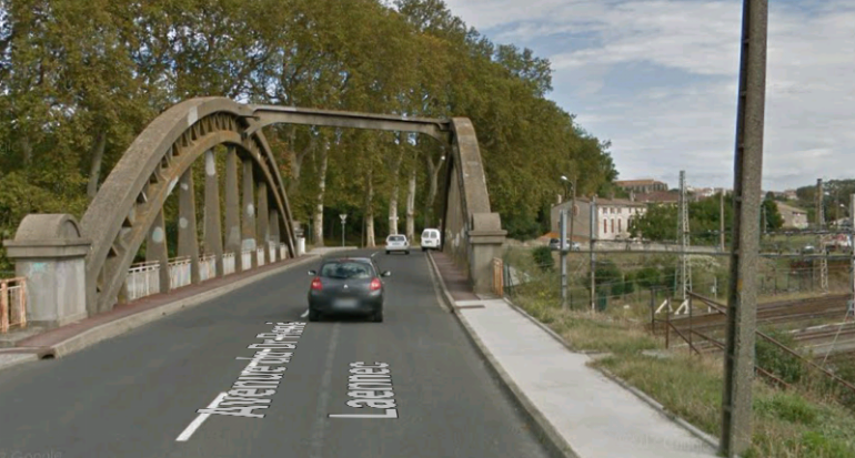
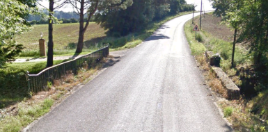
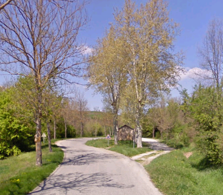
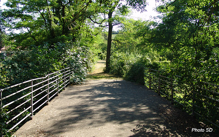
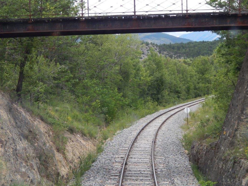
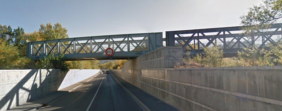
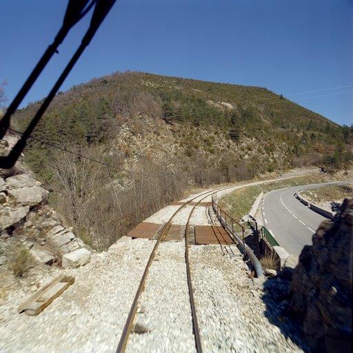
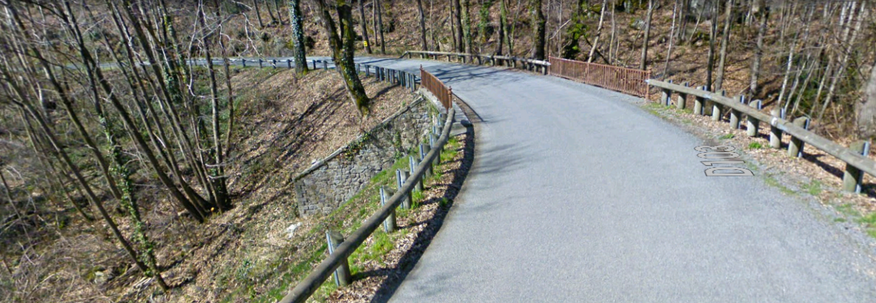 The bridge in the two postcard views above, taken in the early 21st Century looking back towards Saissac.
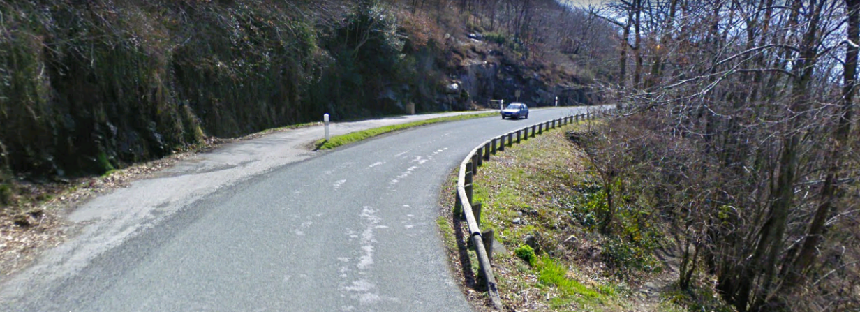 Looking forward from the bridge, the old tramway formation can be seen on the left.
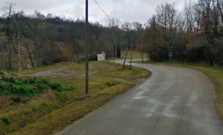
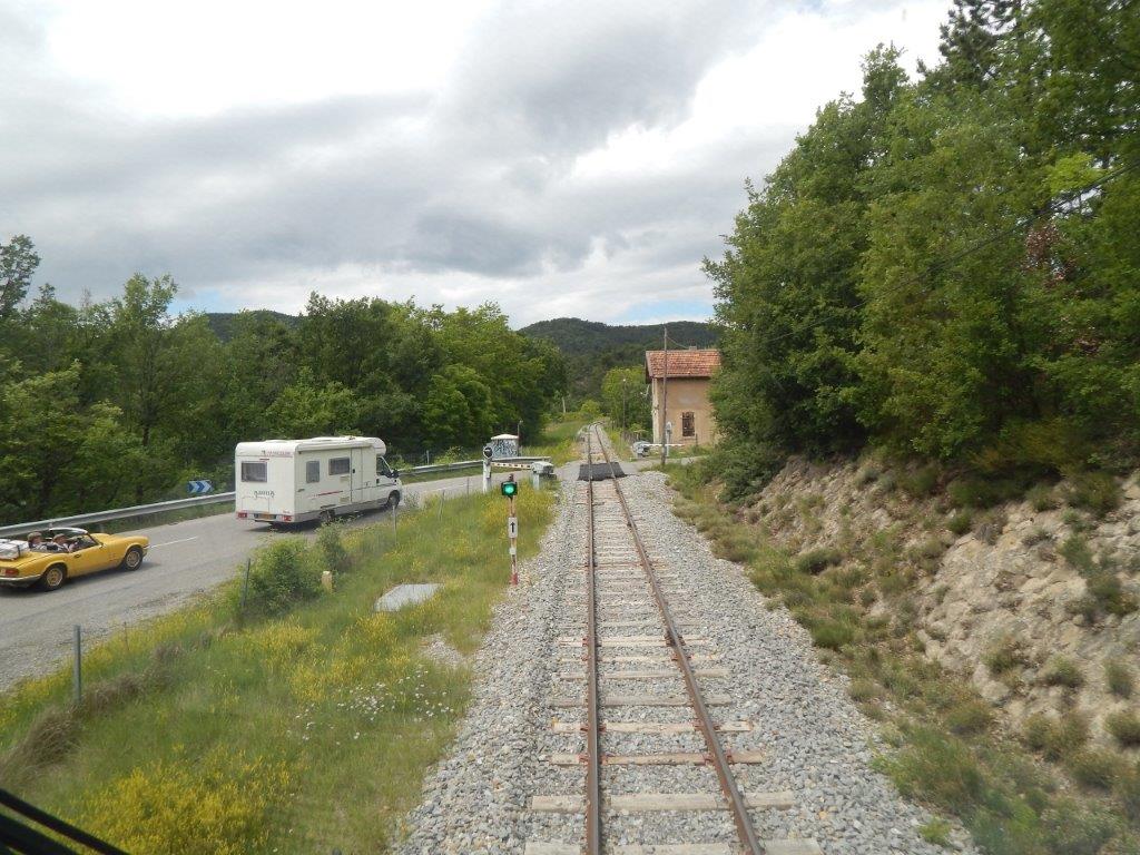
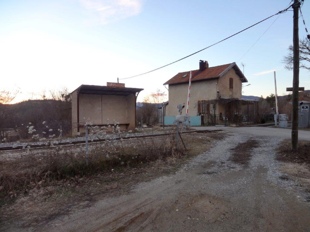
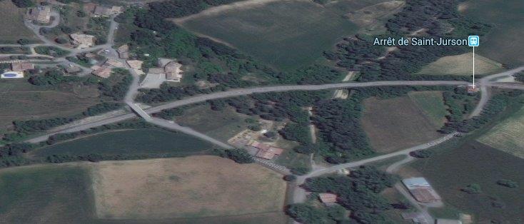
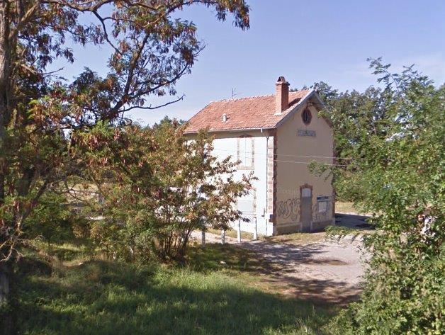
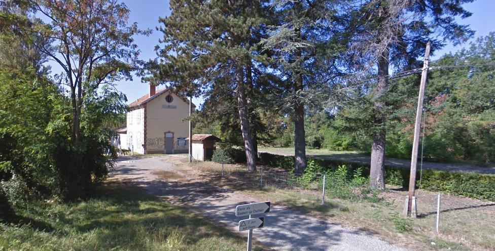
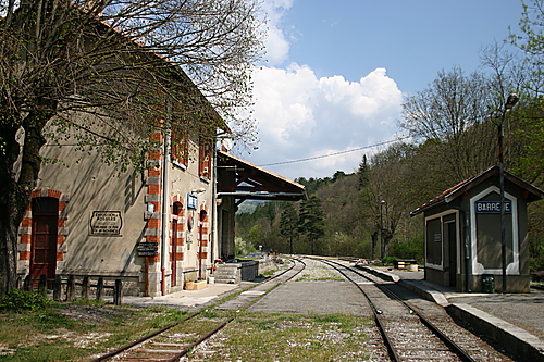
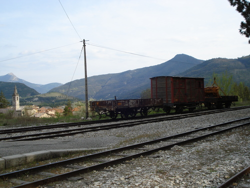
Very soon after leaving the valley of l’Alzeau the tramway entered Saint-Denis. The remaining pictures in this post show the station at Saint-Denis.
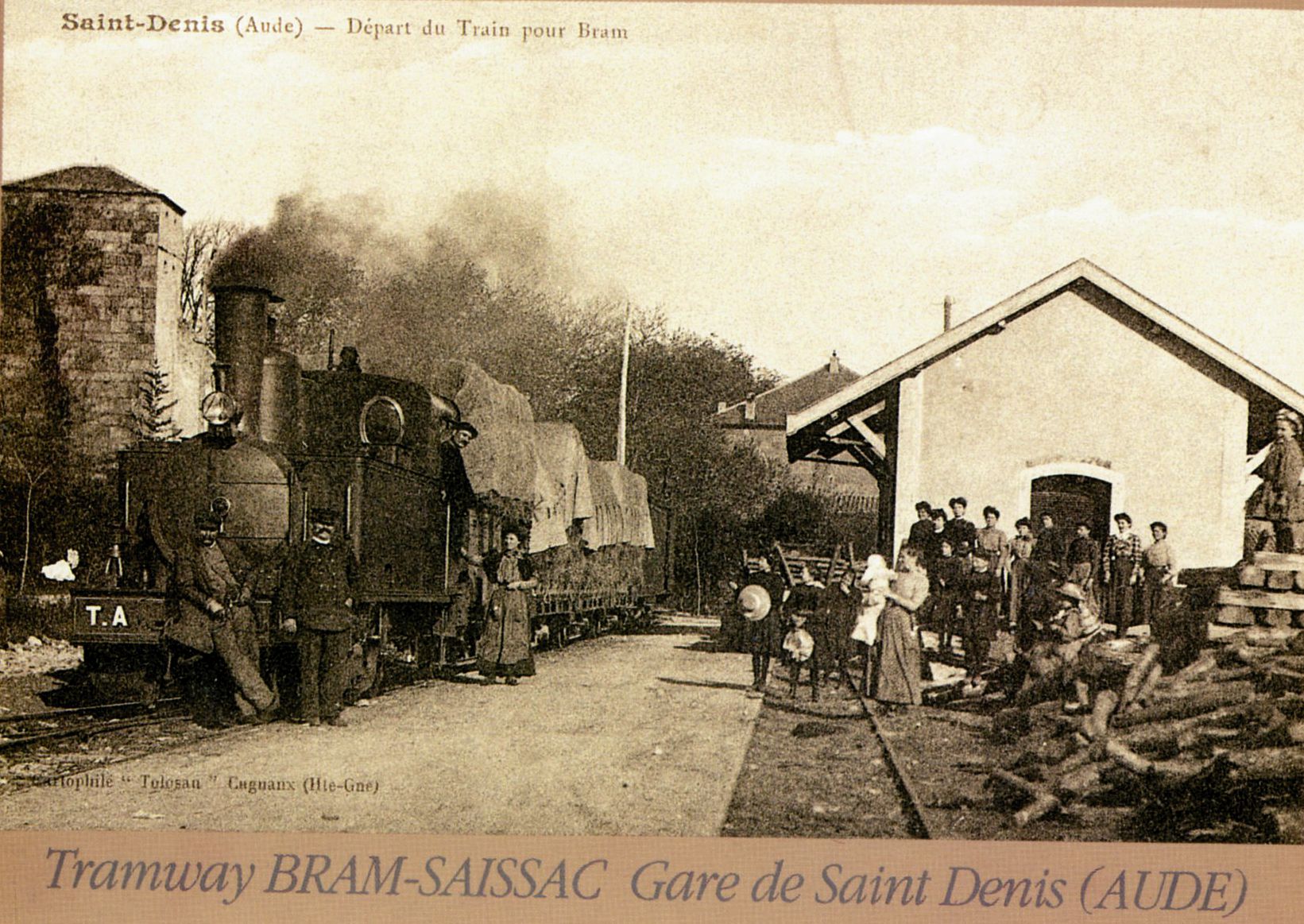
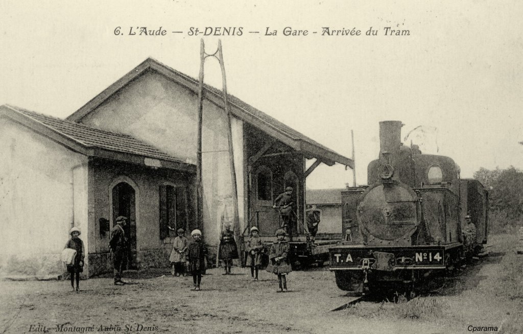
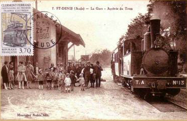 The final picture shows the location of the station in the 21st Century. The site has private dwellings built on it. The main identifying factor is the church tower which appears on the first postcard above.
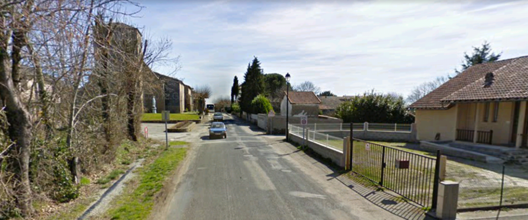
References
1. https://en.m.wikipedia.org/wiki/Fanjeaux, accessed on 2nd September 2018.
2. http://m.audetourisme.com/diffusio/en/activities/culture-and-heritage/fanjeaux/the-citadel-of-fanjeaux_TFOPCULAR0110000004.php, accessed on 2nd September 2018.
3. http://www.catharcastles.info/fanjeaux.php, accessed on 2nd September 2018.
4. https://www.lindependant.fr/2011/06/26/fanjeaux-sur-le-chemin-de-l-ancien-tramway,35014.php, accessed on 2nd September 2018.
5. http://www.cpaaude.fr/THEMES/TRAMWAYS/index_fichiers/Page1575.htm, accessed on 2nd September 2018.
6. https://www.delcampe.net/fr/collections/cartes-postales/france/bram/cpa-11-bram-la-gare-les-voies-les-quais-483494836.html, accessed on 3rd September 2018.
7. https://www.delcampe.net/fr/collections/cartes-postales/france/bram/11-bram-la-barriere-avenue-de-st-denis-485091341.html accessed on 3rd September 2018.
8. https://www.delcampe.net/fr/cartes-postales/europe/france/11-aude/bram, accessed on 3rd September 2018.
9. https://www.cparama.com/forum/bram-t193.html, accessed on 3rd September 2018.
10. http://saissac.e-monsite.com/pages/la-ligne-de-tramway-de-bram-a-st-denis.html, accessed on 3rd September 2018.
11. https://en.m.wikipedia.org/wiki/Bram,_Aude, accessed on 3rd September 2018.
12. https://catharcountry.tumblr.com/post/172928586207/the-town-of-bram-aude-france, accessed on 3rd September 2018.
13. https://en.m.wikipedia.org/wiki/Saissac, accessed on 2nd September 2018.
14. http://www.catharcastles.info/saissac.php, accessed on 3rd September 2018.
15. https://fr.m.wikipedia.org/wiki/Saint-Denis_(Aude), accessed on 3rd September 2018.
16. https://www.cparama.com/forum/fanjeaux-t273.html , accessed on 3rd September 2018.
17. https://www.google.co.uk/url?sa=t&source=web&rct=j&url=http://fanjeaux.com/wa_files/Tram.pdf&ved=2ahUKEwjghtK6sp7dAhXCBcAKHcrsAnMQFjABegQICBAB&usg=AOvVaw3wVxg8xf3nh0hfQV2KWiOC, accessed on 3rd September 2018.
18. http://saissacdautrefois.e-monsite.com/blog/tramway-bram-saint-denis-aude.html, accessed on 3rd September 2018.
19. https://www.delcampe.net/fr/cartes-postales/europe/france/11-aude/bram?f=keyword:gare-bram, accessed on 3rd September 2018.
20. https://www.saintmartinlevieil.fr/patrimoine-et-tourisme/saint-martin-le-vieil-en-peinture, accessed on 5th September 2018.
21. https://www.delcampe.net/fr/cartes-postales/europe/france/11-aude/autres-communes?f=lieux:pont, accessed on 5th September 2018.
22. http://saissac.e-monsite.com/blog/gardons-la-memoire-intacte/l-ancienne-gare.html, accessed on 5th September 2018.
23. http://saintdenis-aude.fr, accessed on 5th September 2018.


