
Steam Locomotives on the East African Railways and Harbours Lines (1948 – 1977)
Until 1948, the Kenya and Uganda Railways and Harbours (KURH) Corporation ran harbours, railways and lake and river ferries in Kenya Colony and the Uganda Protectorate. It included the Uganda Railway, which it extended from Nakuru to Kampala in 1931. [1]
In 1948, it was merged with the Tanganyika Railway to form the East African Railways and Harbours Corporation (EAR&H which provided rail, harbour and inland shipping services in all three territories until the East African High Commission’s successor, the East African Community, was dissolved by its member states in 1977. [1]
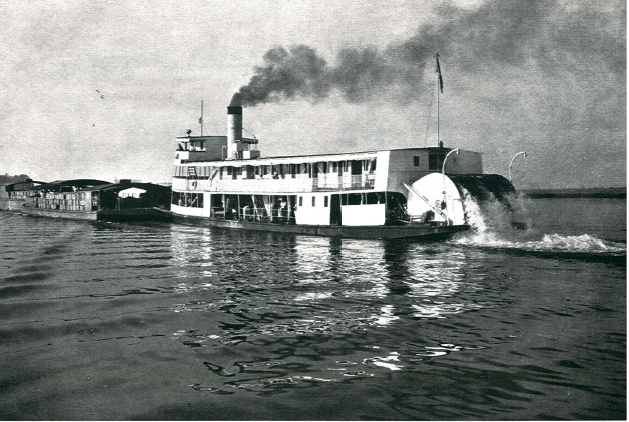
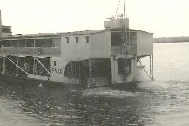
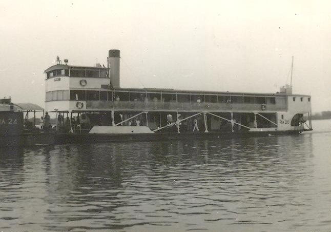
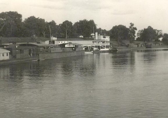
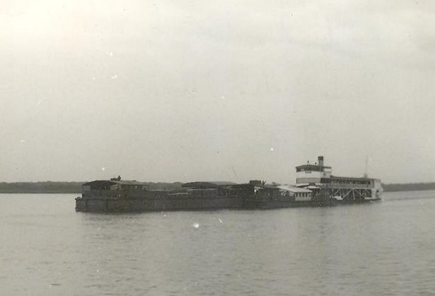
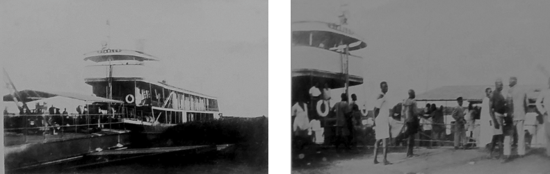
As well as running railways and harbours in the three territories it ran inland shipping services on Lake Victoria, Lake Kyoga, Lake Albert, the Victoria Nile and the Albert Nile. [2]
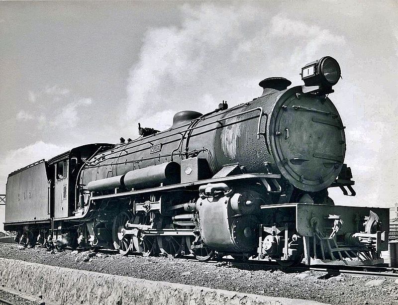
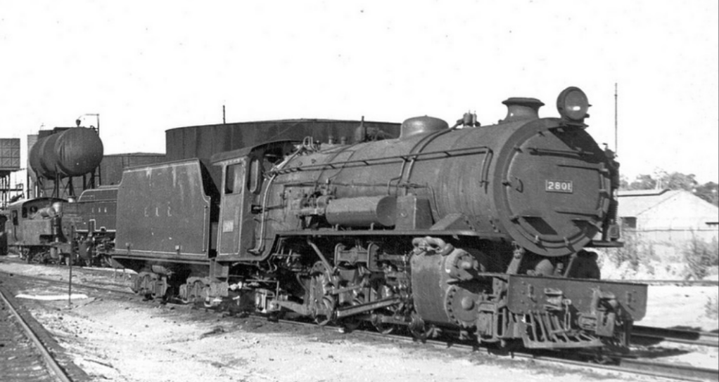
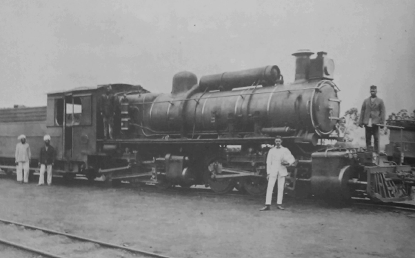
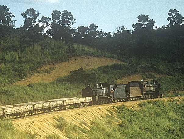
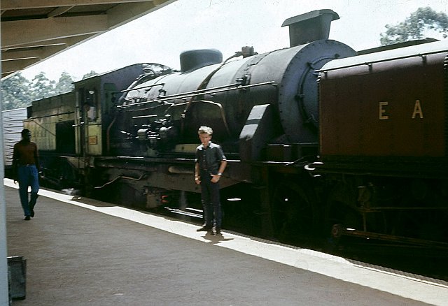
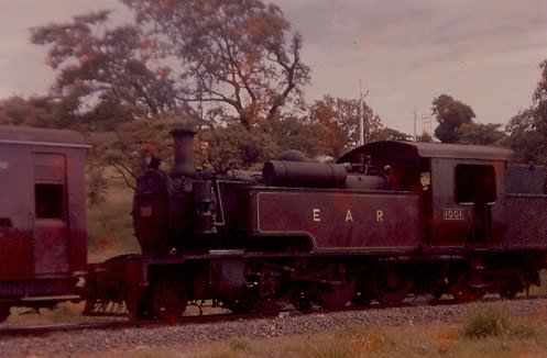
The Malayan Railway sold EAR&H eight USATC S118 Class steam locomotives in 1948, and another eight in 1949. EAR&H converted them to oil fuel and numbered them 2701–2716, making them the 27 class. EAR&H allocated them to its Tabora Depot on its Tanganyika section. They entered service in 1949 and 1950, working the lines to Mwanza, Kigoma and Mpanda, where their light axle loading was an advantage and their high firebox enabled them to run through seasonal flooding on the Kigoma and Mpanda branches. EAR&H built further S118 from spare parts in 1953 and numbered it 2717. EAR&H withdrew them from service in about 1965 and they were in Dar es Salaam awaiting scrapping in 1966. [3]
In 1955 and 1956, EAR&H introduced new and much more powerful steam locomotives for its Kenya and Uganda network: the 59 class Garratts. These were the mainstay of the section’s heaviest traffic until they started to be withdrawn from service between 1973 and 1980.
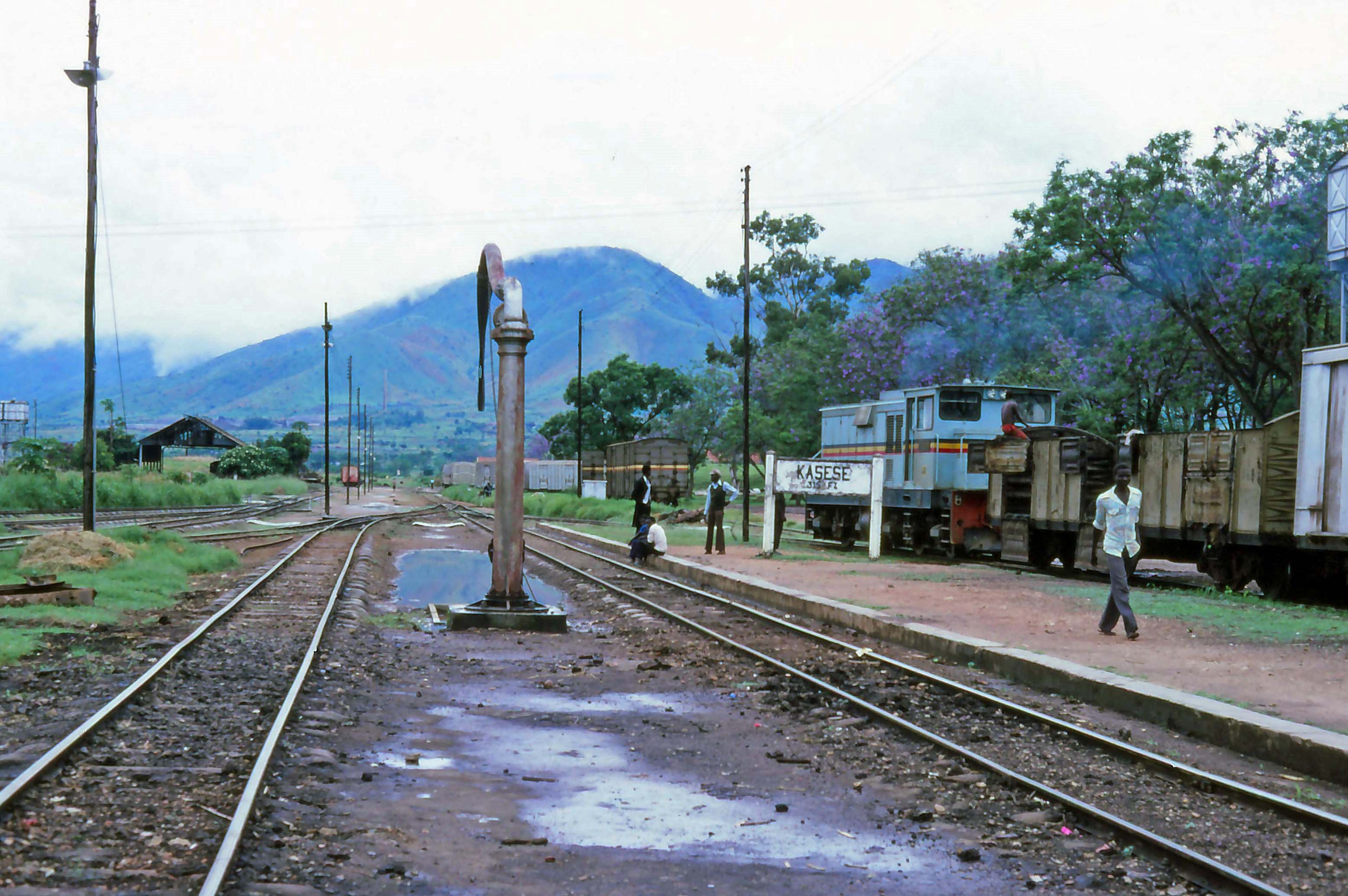
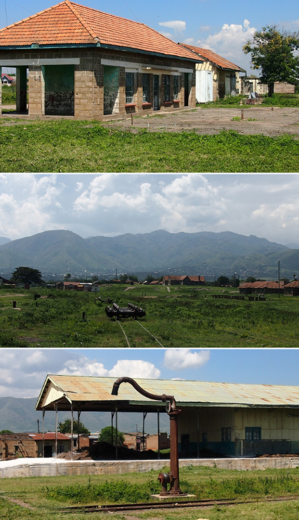
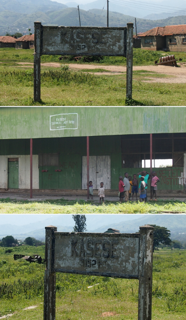
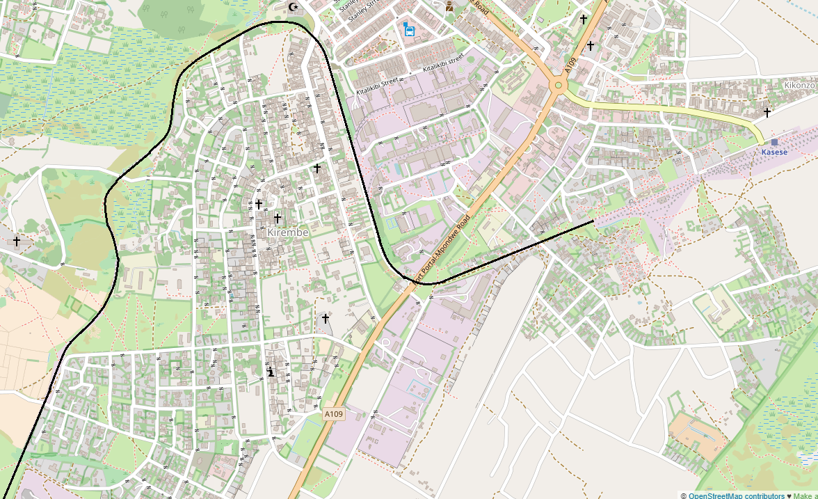
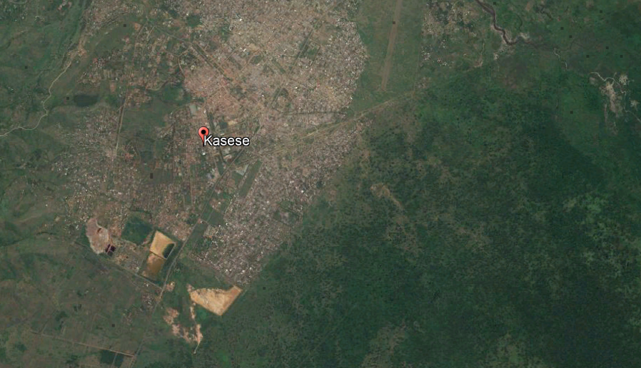
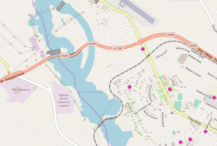
EAR&H extended the Uganda Railway from Kampala to Kasese in 1956 and thence to Arua in 1964. In 1962, it completed the northern Uganda railway from Tororo to Pakwach, thus superseding the Victoria Nile steamer service. [4]
This post focusses primarily on locomotives to be found within Kenya and Uganda. Those found primarily in Tanzania will need to be the subject of another series of posts in the future.
Older Classes of Locomotive
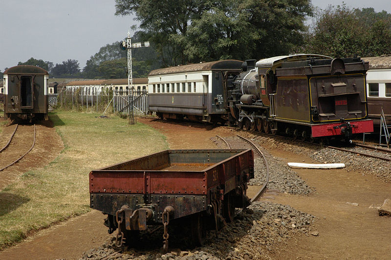
The network continued to make use of the best of the locomotives purchased by both the Uganda Railway and the Kenya Uganda Railways and Harbours Corporation. The EAR&H renumbered all of the older locomotives into a consistent numbering system. The first two digits of four referred to the class of locomotive and the second two digits to the number in the class. Before we move on to the new purchases, here are a few images of the older locomotives on the system, furthger information about these classes can be found in the previous posts in this series:
Classes 10 to 19 were designated shunting locomotives; Classes 20-49, tender locomotives; Classes 50-79, articulated locomotives; and Class 80 and above, diesel locomotives.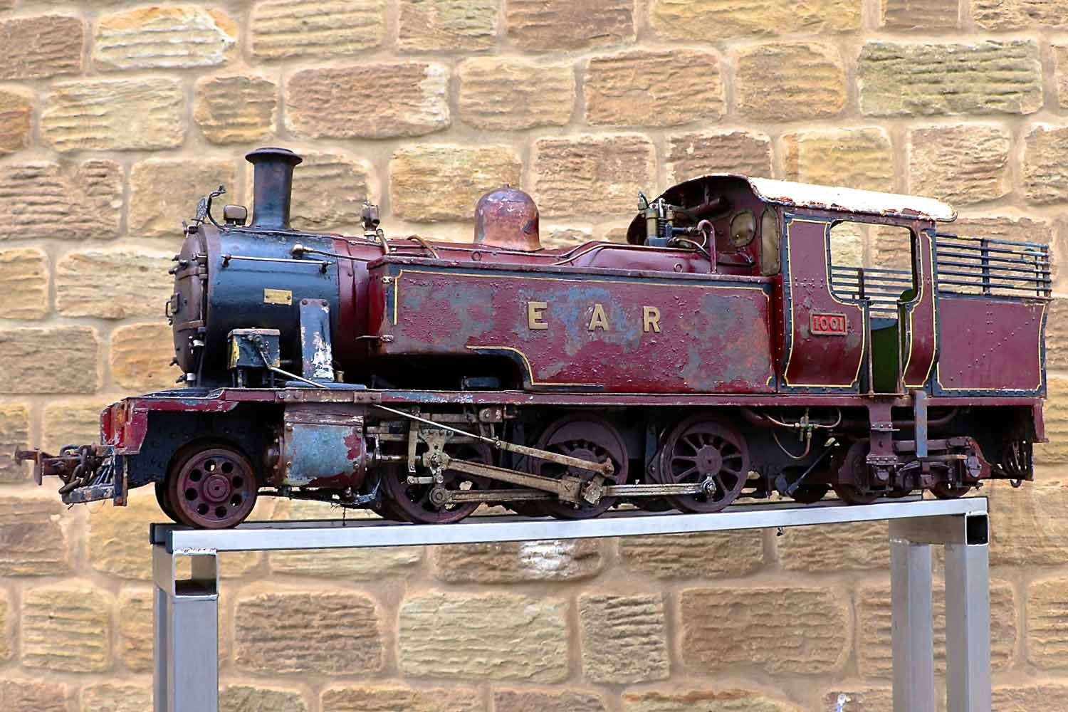 EAR Class 10, No. 1001 2-6-4 locomotive in live-steam 5″ gauge. [17]
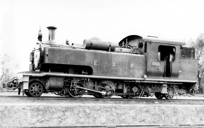 Class 11 2-6-2 Locomotive. [16]
 Class 11, No 1105 refuelling at Nairobi MPD, (c) Anthony Potterton. [10]
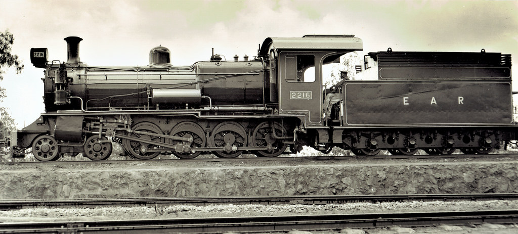 Class 22, 4-8-0 No. 2216, built by North British Locomotive Company in Glasgow, Scotland, for the Uganda Railway (UR) and continued in use well into the life of the EAR. [8]
 Class 23, No. 2306 – a rare visitor to Nairobi, freshly turned out from the paint-shop in EAR livery, (c) Iain Mulligan. [13]
 Another Class 23, No. 2309 stabled ready for disposal along with a couple of diesel locomotives in Mombasa sidings (c) Kevin Patience. [9]
 Class 24, 4-8-0 No. 2449 outside Mombasa Shed, (c) Kevin Patience. [9]
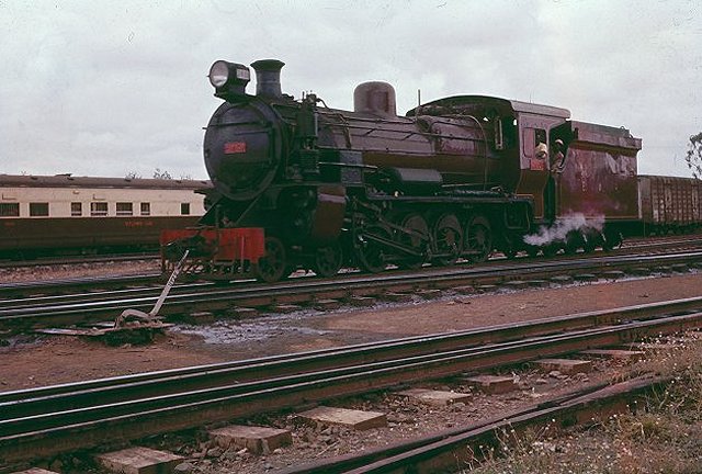 Class 24, No. 2402 on Nairobi Yard, in the background is one of the diners used on the overnight Nairobi-Mombasa service, (c) Geoff Pollard. [10]
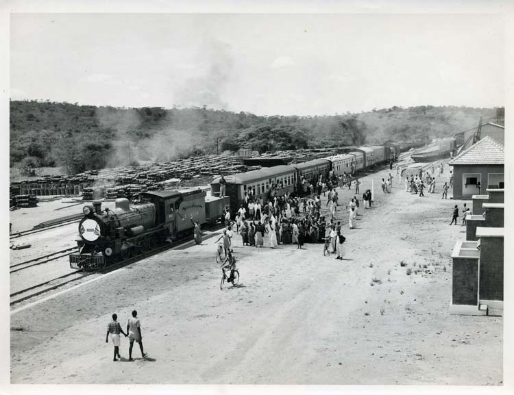 Class 24, No. 2428, on 1st of August, 1953, on the occasion of the opening of the first section of the Western Uganda extension from Kampala to Mityani. (See EAR&H Magazine Volume 1 No.6 Page 8ff), from the collection of A.J. Craddock. [21]
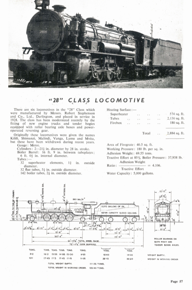
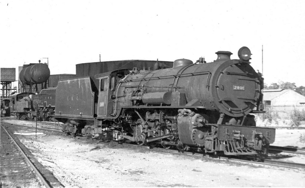 We have already seen this picture of a Class 28 2-8-2 locomotive in the previous post in this series. It is included here as representative of this class which was popular with drivers and firemen throughout their time on the network.
 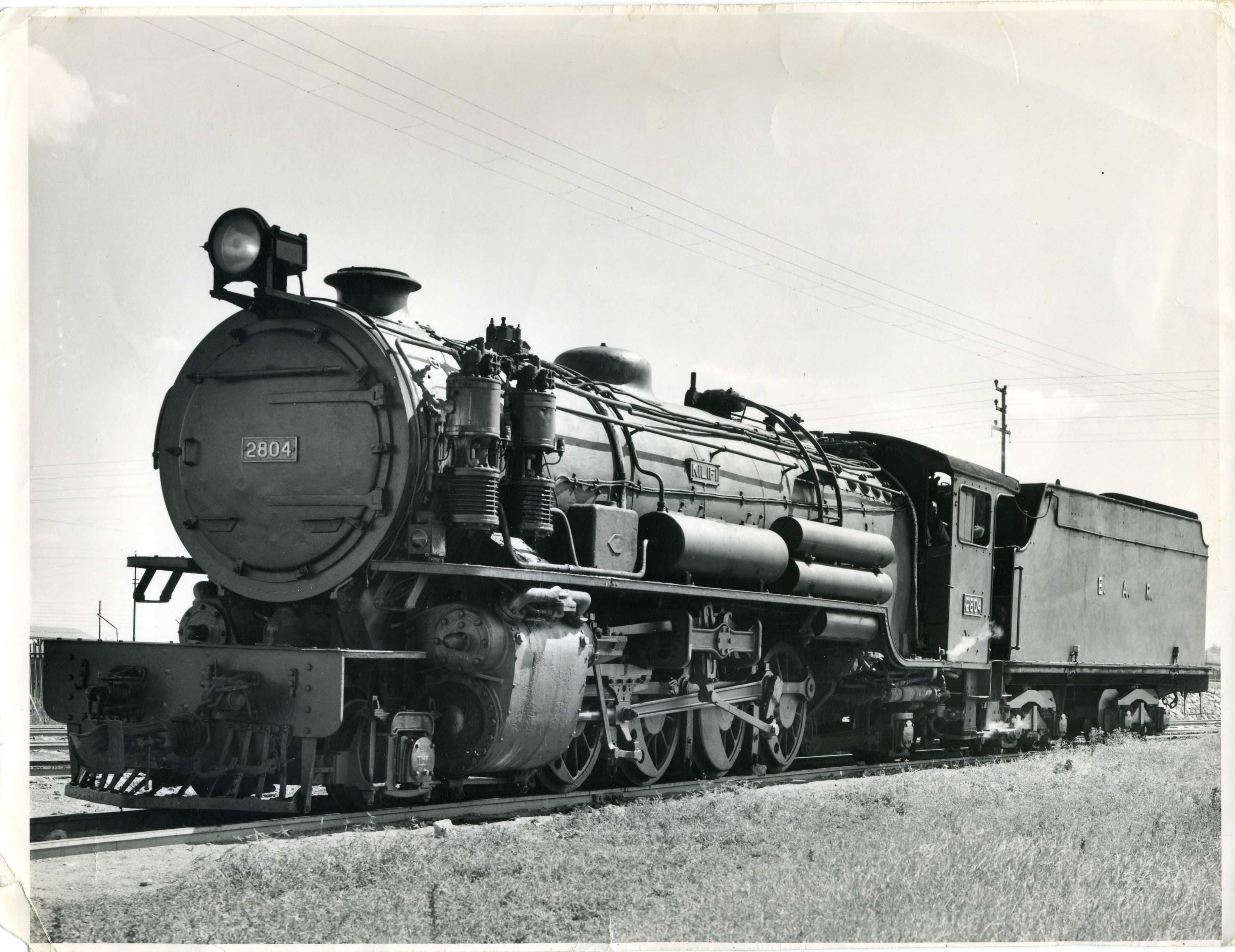 Class 28, No. 2804, ‘Kilifi,’ (c) A.J. Craddock. [21]
 The twenty Class 50 locomotives were almost identical to the two Class 51 locomotives. [23]
 Class 50 being scrapped (c) A.J. Craddock. [21]
 Class 52 4-8-2 + 2-8-4 pre-Second World War Garratts were unusually built by North British. 5204 was the last survivor and was photographed on the triangle at Morogoro in 1967 en-route to Dar for scrapping. [24]
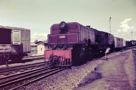
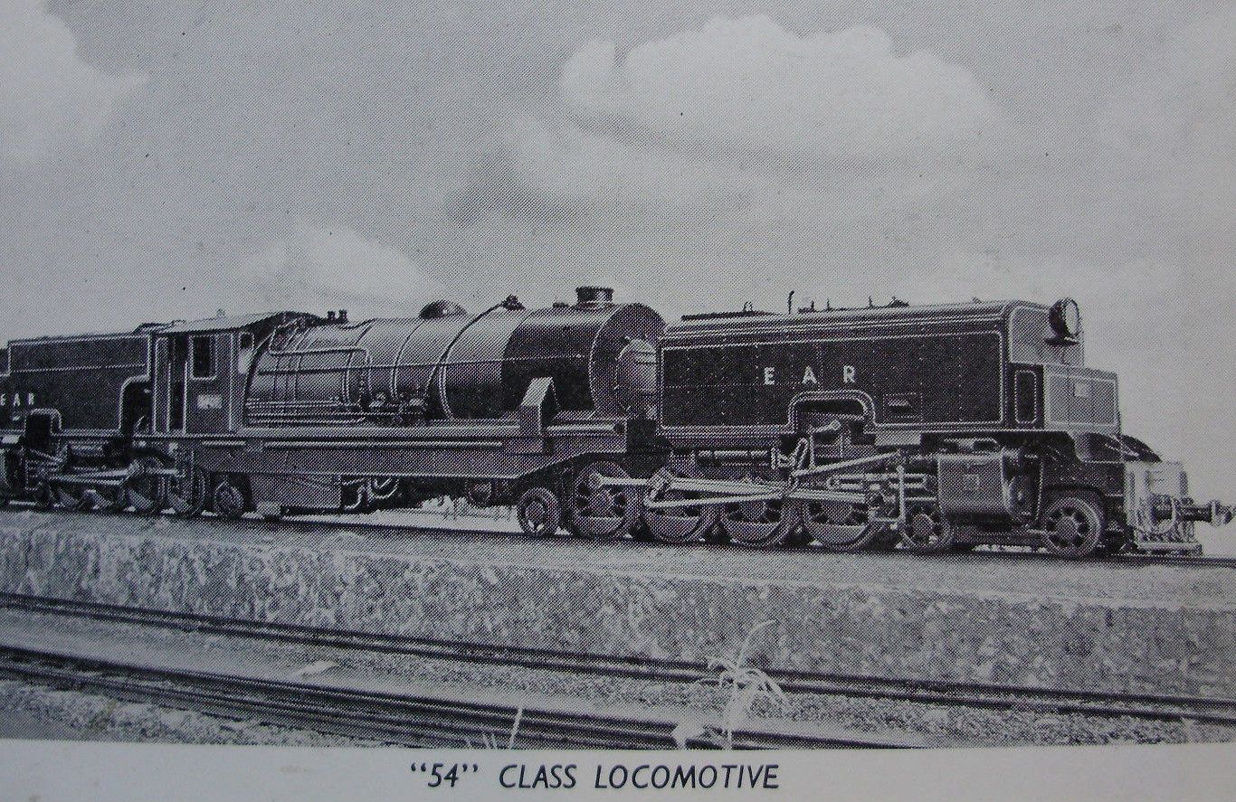
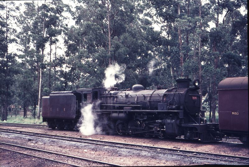
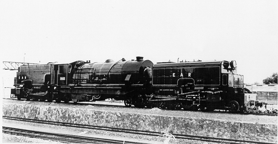 Class 54, EAR No. 5402. (Chris Greville collection). [18]
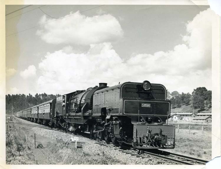 The same locomotive from the collection of A.J. Craddock. [21]
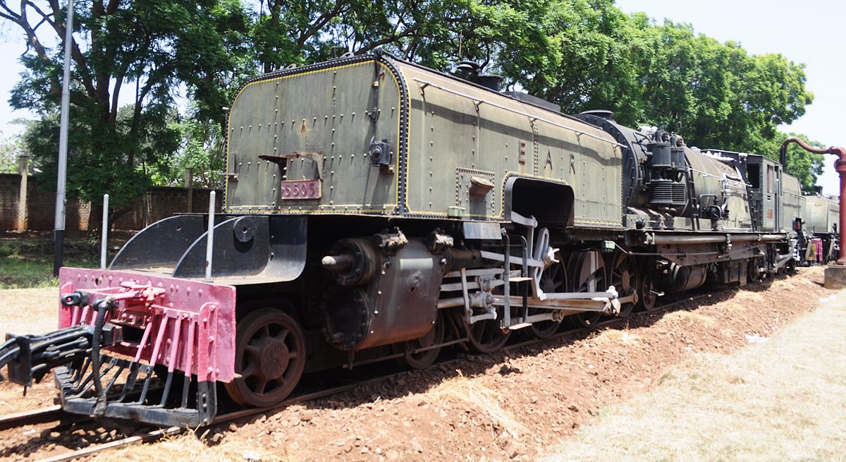
 Class 55, EAR No. 5505 at Nairobi Railway Museum. [19]
 A Class 55 Garratt 4-8-2+2-8-4 awaiting its fate at Voi, (c) Kevin Patience. [9]
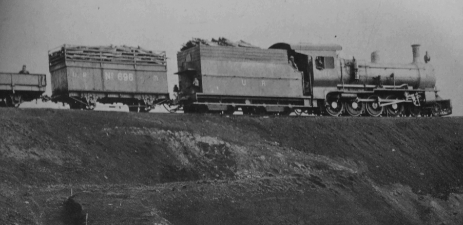
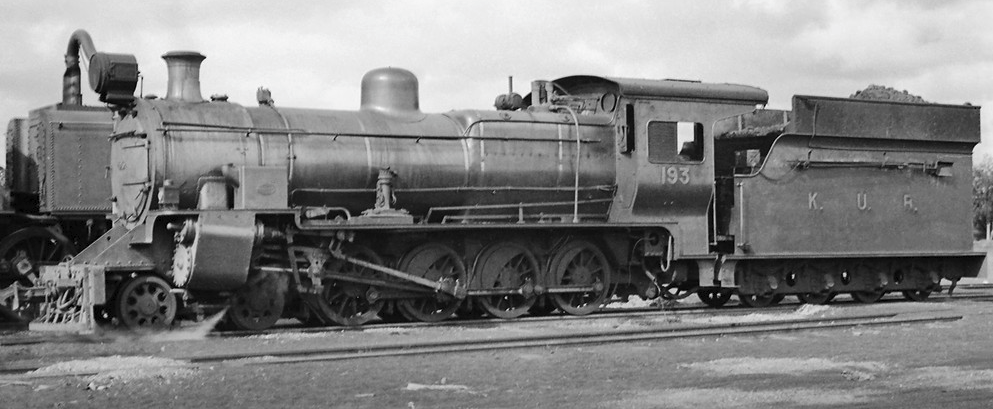
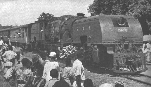
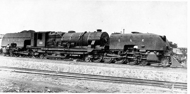 Coal burning Class 56 Garratt still bearing its KUR&H Number. The first of the batch of KUR&H EC6 Class, this locomotive naturally became 5601. Six of these locomotives were delivered in 1949 pending the arrival of the 58s. After service on the Kenya-Uganda Section, they were banished to Tanganyika to replace the ex-Burma 55 Class which ended up in the Kenya-Uganda Section, (c) EAR&H Magazine. [13]
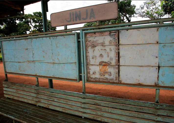
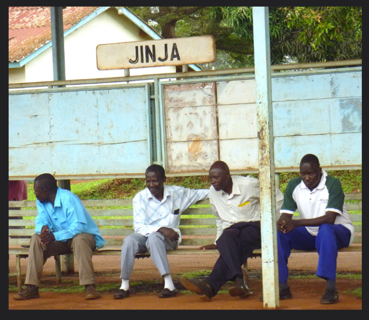
 Class 56, No. 5603: “A Guide To Uganda” (Crown Agents, Curwin Press 1954) shows a 56 Class, 5603, at a station between Kampala and Jinja. The 56s were replaced by the 60s in 1954-5, (c) East African Railways and Harbours. [22]
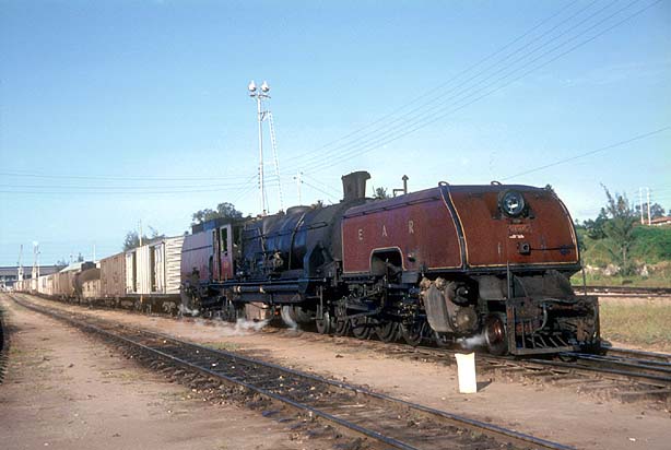 Class 56, No. 5605 preparing to depart from the docks area in Dar. [24]
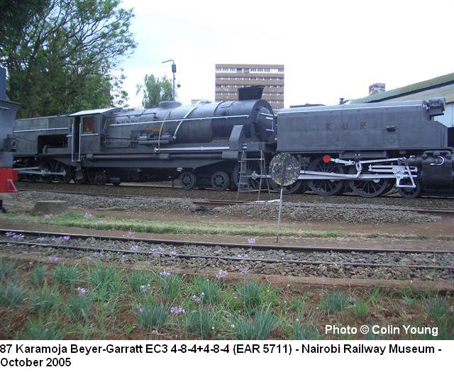
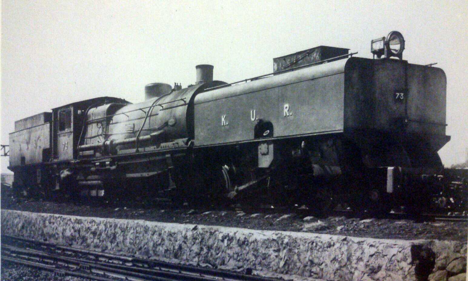
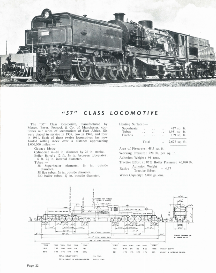
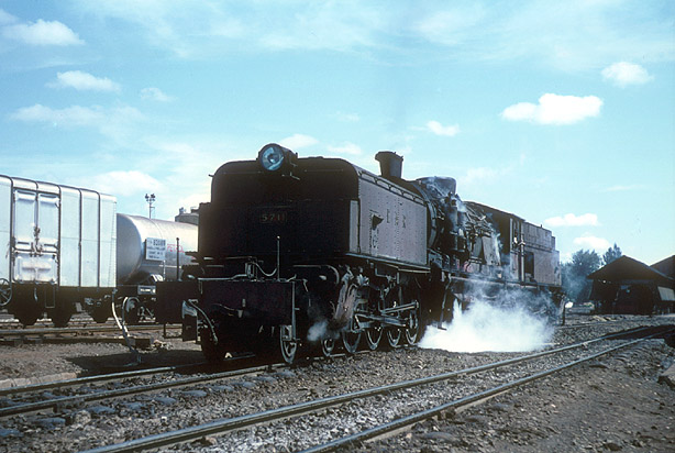
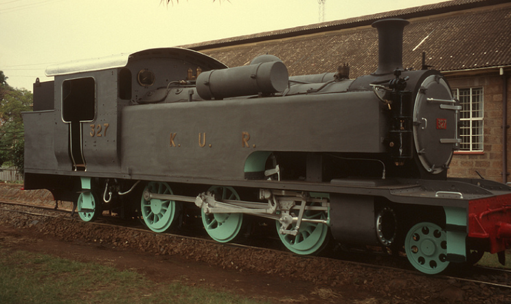
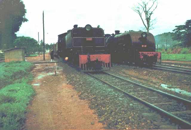
The Class 57 stands in Nairobi Railway Museum yard, painted in the grey livery of the Kenya Uganda Railway. [25]
The Locomotives Introduced by the EAR&H
The EAR&H had tenure of the whole network for over 29 years. During this time new locomotives were bought and others were moved around the East African system. This next section of this post focusses primarily on the classes of locomotives that were new to the Kenyan and Ugandan rails.
Class 58 Garratt Locomotives
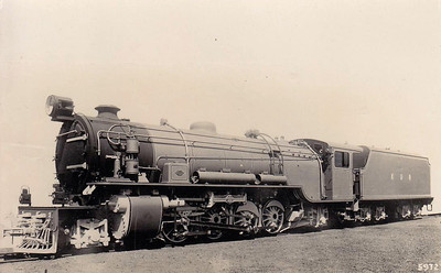
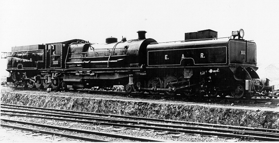
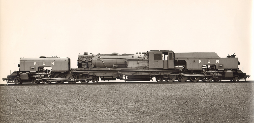
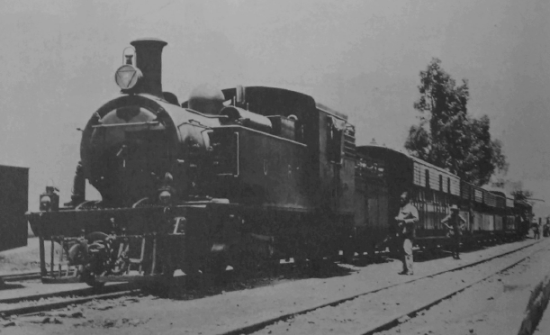
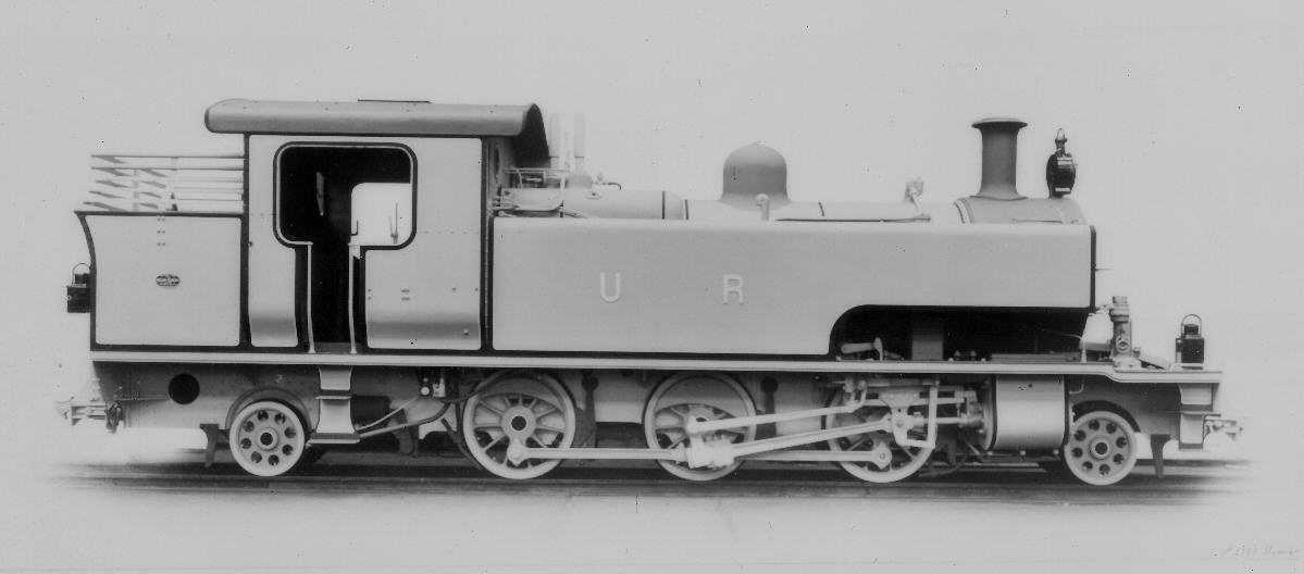
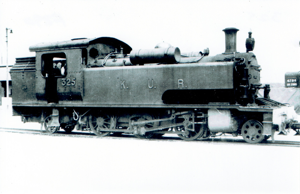
The EAR 58 class was a class of 4-8-4+4-8-4 Garratt-type locomotives built by Beyer, Peacock & Co. in Manchester, England, in 1949. The eighteen members of the class were ordered by the Kenya-Uganda Railway (KUR) immediately after World War II, and were a slightly modified, oil-burning version of the KUR’s existing coal-fired EC3 class. By the time the new locomotives were built and entered service, the KUR had been succeeded by the East African Railways and Harbours Corporation (EAR&H), which designated the coal-fired EC3s as its 57 class, and the new, oil-burning EC3s as its 58 class.[8] Wikipedia informs us that the early numbers in this class arrived in East Africa in time to receive their KUR numbers (Nos. 89-95, later Nos. 5801-5807). The first of the Class to arrive too late to receive their designated KUR number was No. 5808. The full Class 58 bore the numbers 5801 to 5818.
 Class 58 No. 5803 at Changamwe, Kenya, with the Mombasa–Kampala mail train, circa 1950-51. [7]
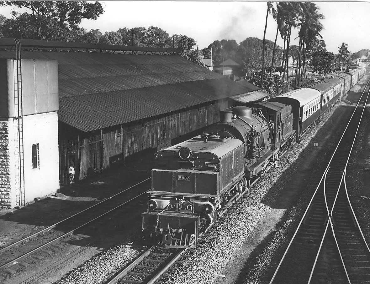 Class 58, No. 5807 (c) Kevin Patience. [20]
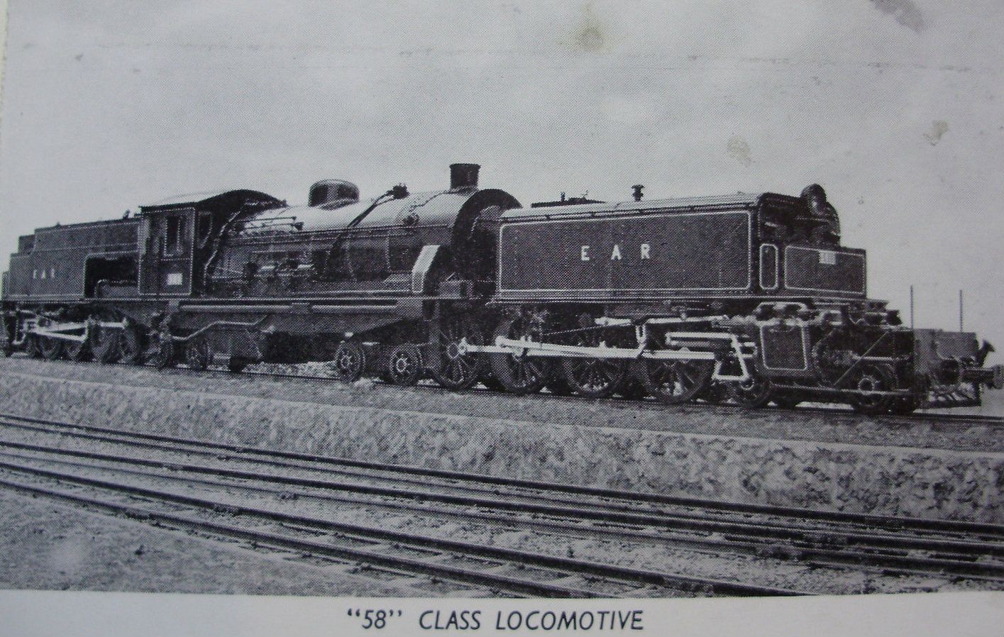
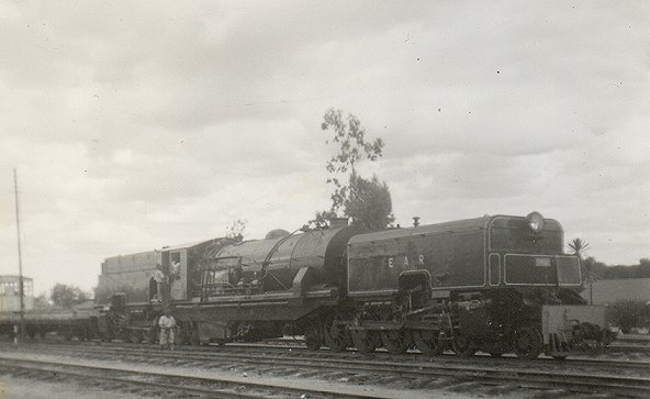
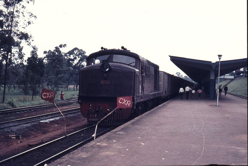
 Class 58, No. 5804 was unique in that it had the letters EAR&H on its tenders rather than EAR. It is seen here about to depart the high level platform at Kampala with the mail train for Nairobi in 1962. [14][22] And again below, (c) Geoff Pollard. [5]
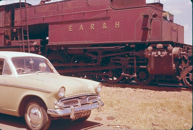
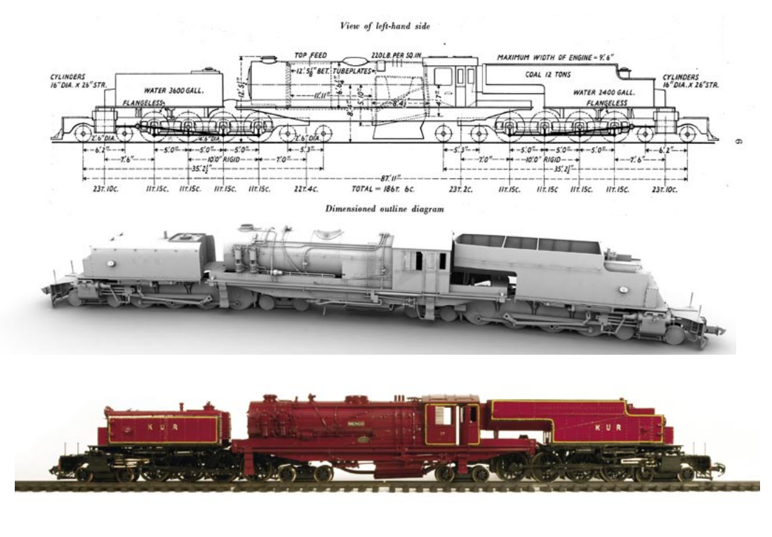
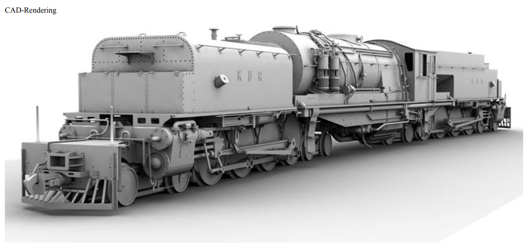
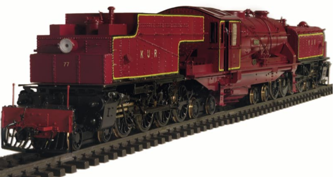
Class 59 Garratt Locomotives
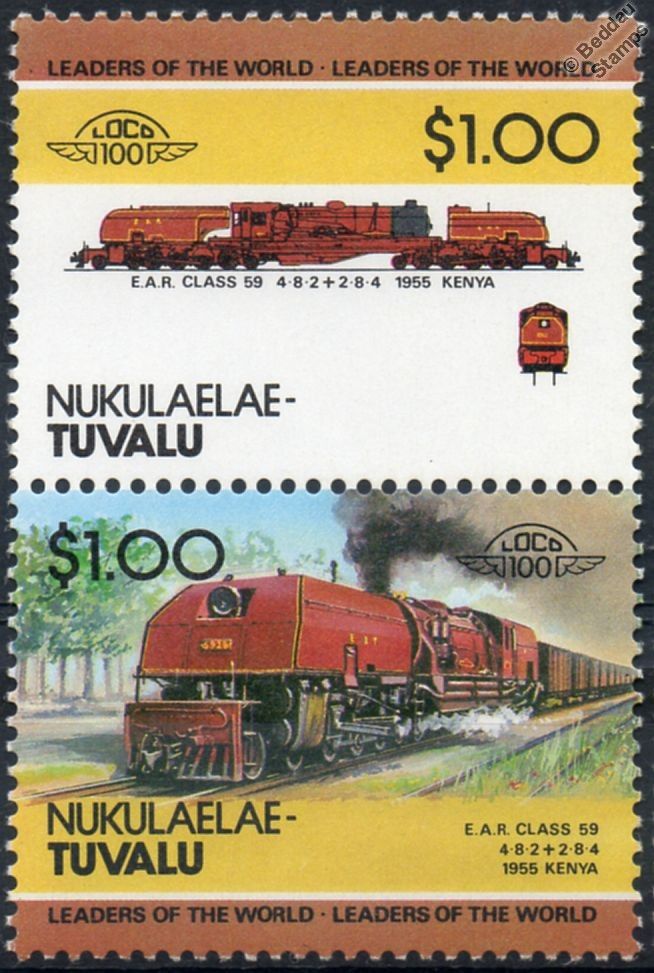 The EAR 59 class was a class of oil-fired 1,000 mm gauge Garratt-type articulated steam locomotives. The 34 members of the class were built by Beyer, Peacock & Co. in Manchester, England, for the East African Railways (EAR). They entered service in 1955–56, and at 252 tons, were the largest, heaviest and most powerful steam locomotives to operate on any metre-gauge railway in the world
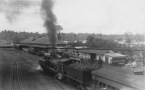
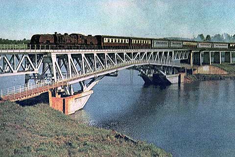
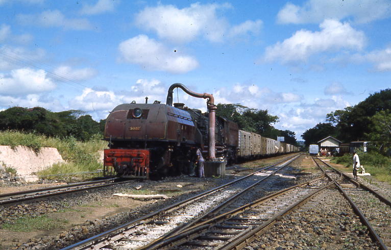 Class 59 Garratt taking water at Kibwezi in Kenya. [2]
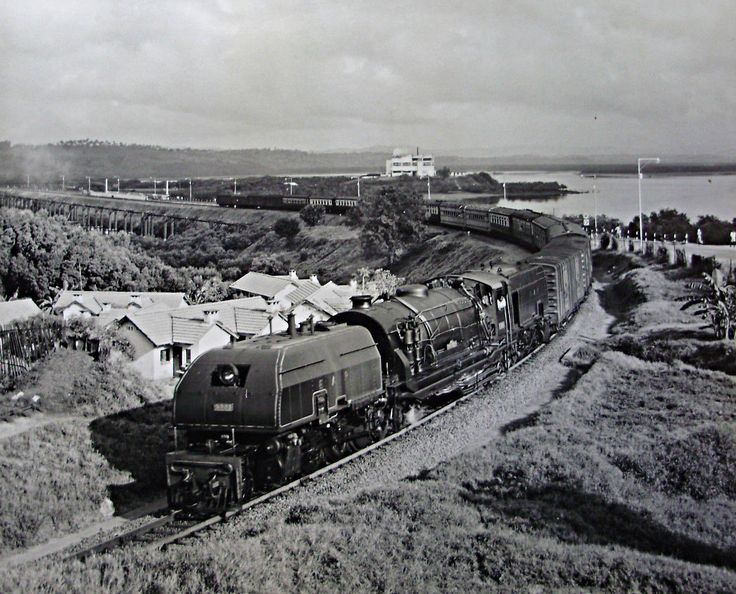 Class 59 No. 5909 near Mombasa. [12]
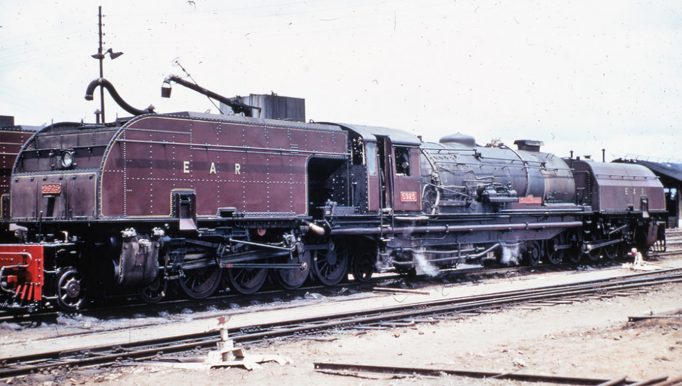 Class 59 No. 5925 “Mount Monduli.” [6]
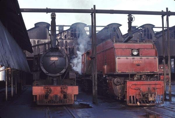
 An unidentified Class 59 and a Class 24 in front of Mombasa Shed, © Kevin Patience. [9]
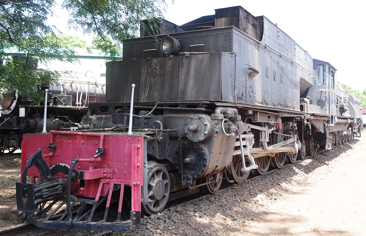
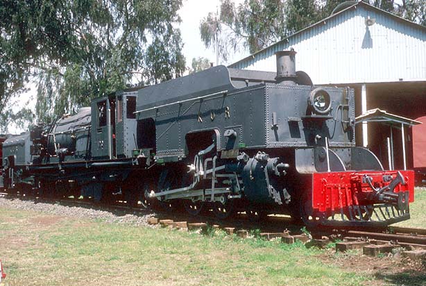
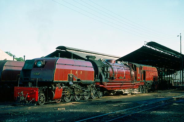 Class 59, No. 5918, ‘Mount Gelai’ (c) Lou Johnson, taken on Nairobi loco shed in December 1977. “Mount Gelai” was always kept in immaculate condition by a dedicated crew of two Indian drivers and two African firemen who shared the 24 hour journey between Nairobi and Mombasa resting in a caboose attached to the train when off duty. The cab was pristine with polished brass. Linoleum floor and many other non-standard features. Kirpal Singh and Walter Pinto were the drivers but the fireman were just as dedicated to the task of keeping this 250 ton metre-gauge giant in superb condition. [11]
It was this loco which was refurbished and brought back into steam in the very early years of 21st Century as these youtube videos attest:
Class 60 Garratt Locomotives
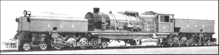
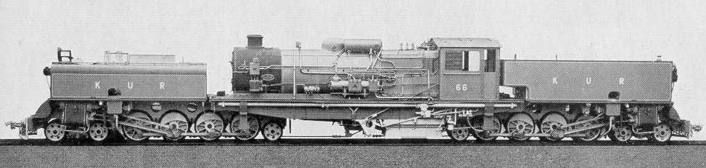
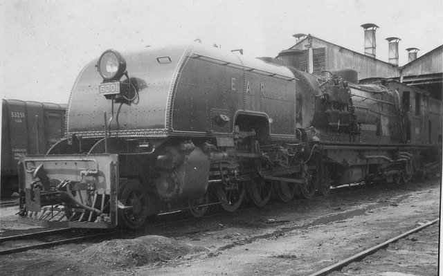
The EAR Class 60, also known as the Governor class, was a class of 4-8-2+2+8-4 Garratts built for the EAR&H as a development of the EAR&H’s existing Class 56 Garratts. [8, p77]
The 29 members of the class were ordered by the EAR&H from Beyer, Peacock & Co. The first 12 of them were built by sub-contractors Société Franco-Belge in Raismes(Valenciennes), France, and the rest were built by Beyer, Peacock in Gorton, Manchester, England. The class entered service in 1953-54. Initially, all members of the class carried the name of a Governor (or equivalent) of Kenya, Tanganyika or Uganda, but later all of the Governor nameplates were removed. [8, p77-78]
 Line-up of East African Railways motive power at Nairobi MPD with 60 Class Garratt 6024 Sir James Hayes Saddler prominent left and 57/58 Class right. Five 59 Class Garratts, two 29 (Tribal) Class and two tank engines are also quite clearly discernable. The post card was probably produced around 1955-6 – EAR&H Postcard via Cliff Rossenrode. [5]
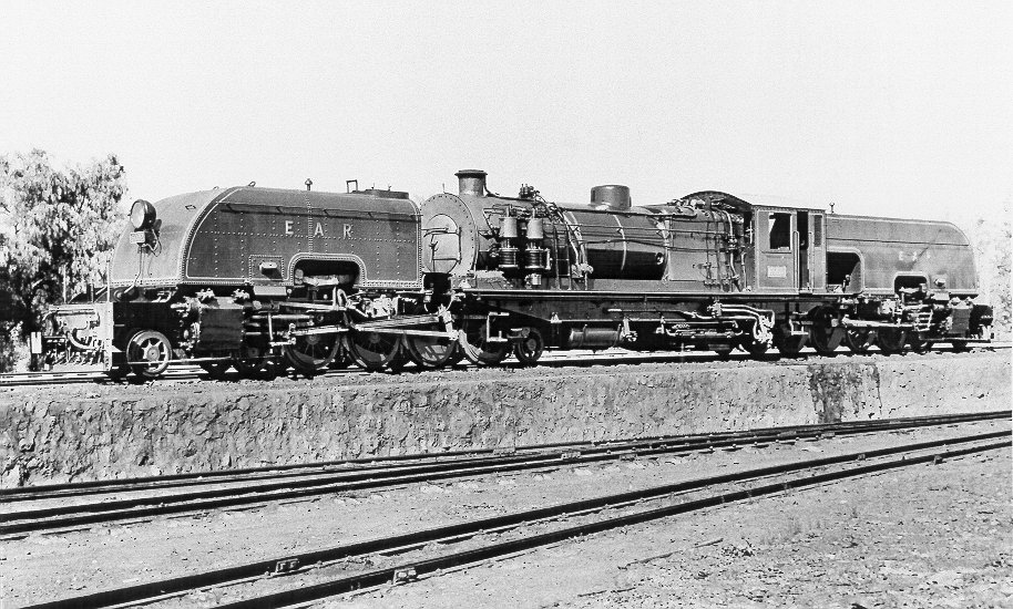 East African Railways class 60, 6002 (Franco-Belge Raismes 2984/1954, BP7655). (Chris Greville collection). [28]
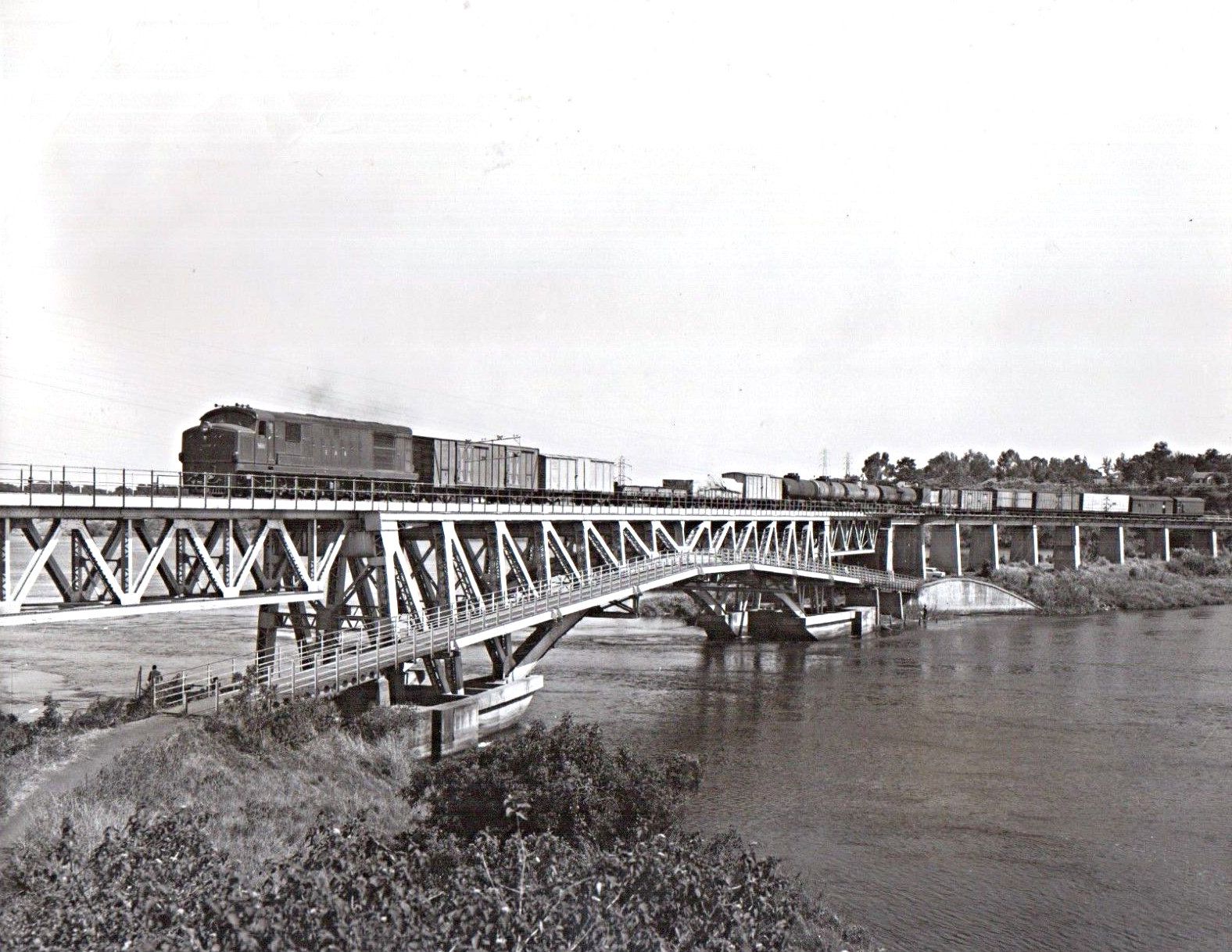
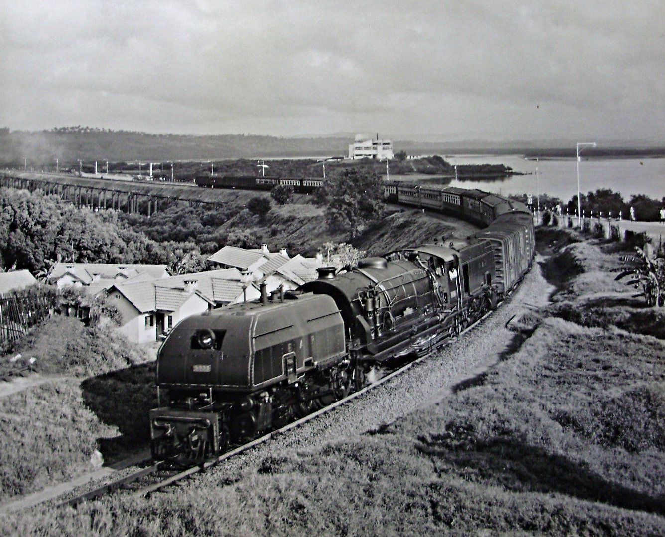 Class 60 No. 6029 near Mombasa.
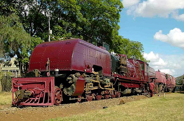 Class 60 No. 6006 after receiving a much needed repaint – taken in 2004 (c) Graham Roberts. [29]
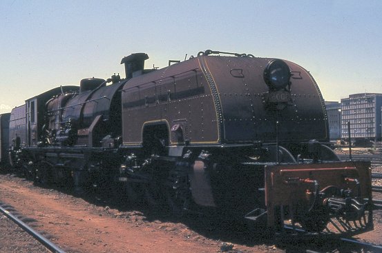 Class 60 No. 6008 Sir Wilfred Jackson with Giesel ejector at Nairobi. Most classes were refitted with Giesel ejectors which, although improving efficiency, arguably detracted from the appearance of the locomotive, (c) Kevin Patience. [5]
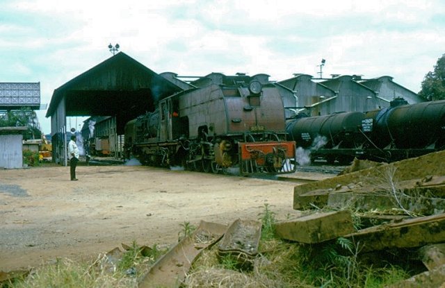 No. 6022, formerly named Sir Andrew Cohen who was governor of Uganda in the mid 1950s. Before independence all 29 in the class introduced in the 1953-4, with the first twelve built by Société Franco-Belge at Raismes in France due to the British manufacturer having no capacity to accept the complete order, (c) Anthony Potterton. [5]
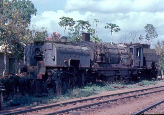
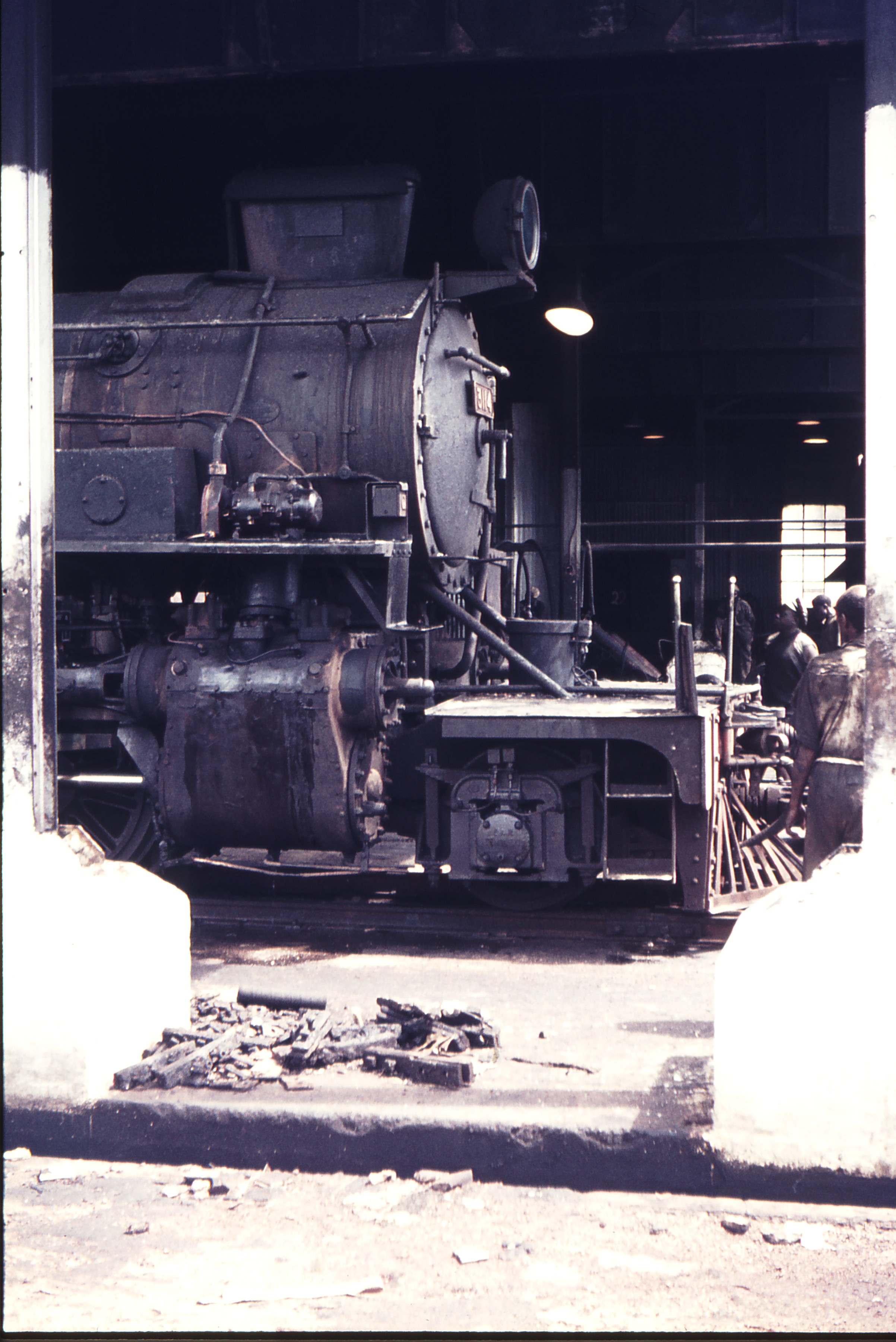
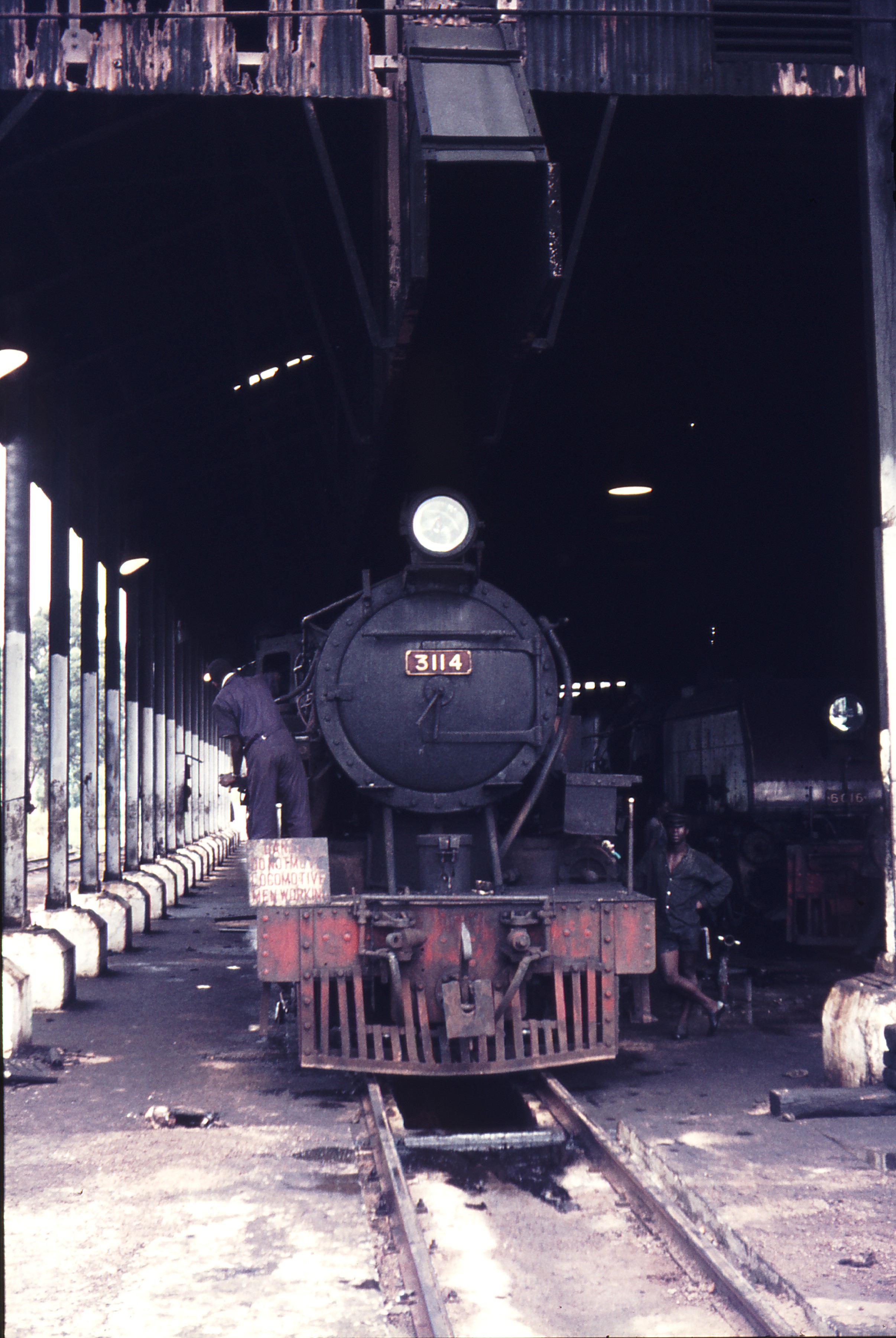
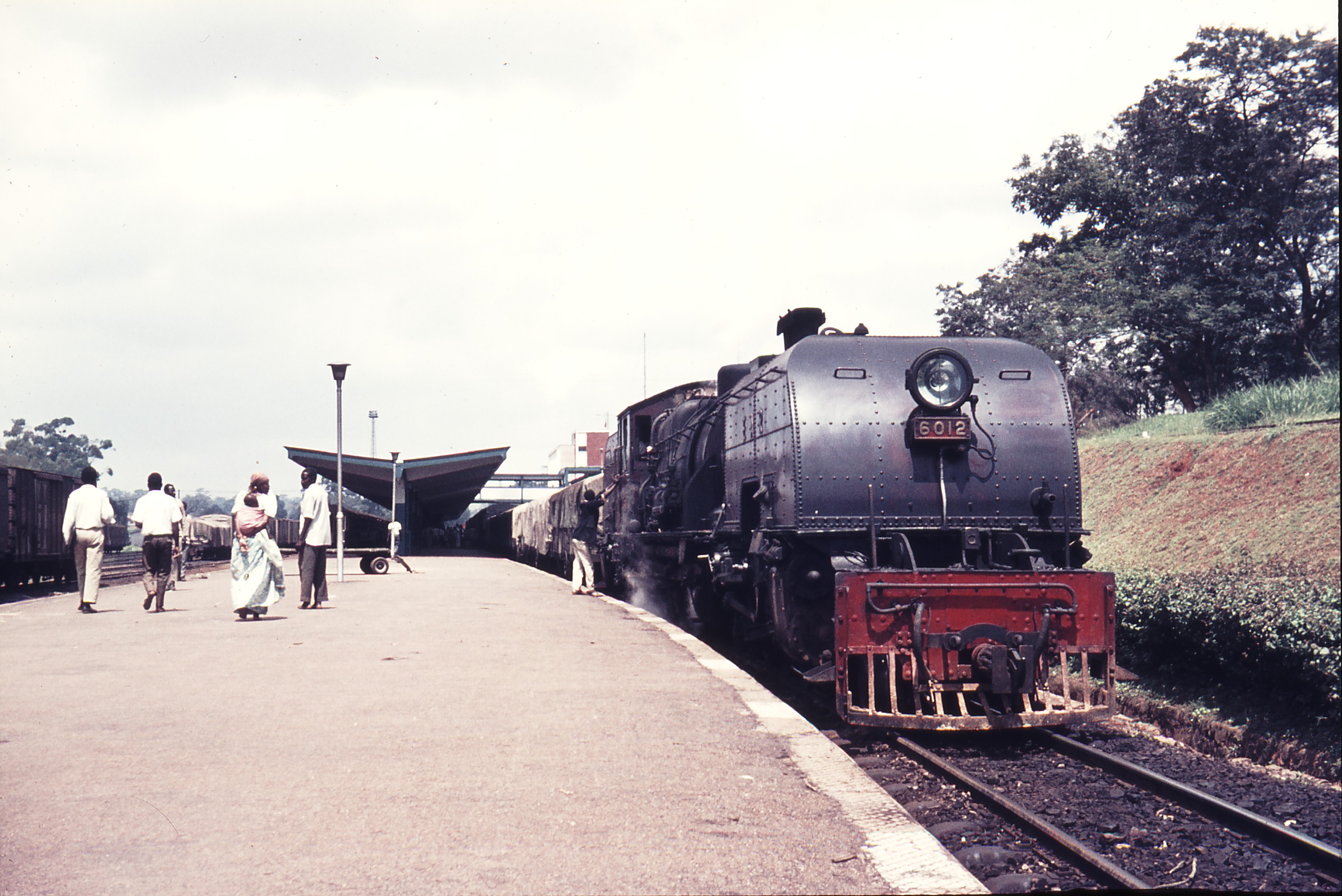
 No 6012 at Kampala Shed, marked up as “reserved for museum”, a scheme that appears never to have come to fruition. The picture was taken on 26/3/84 (c) tormaig. [30]
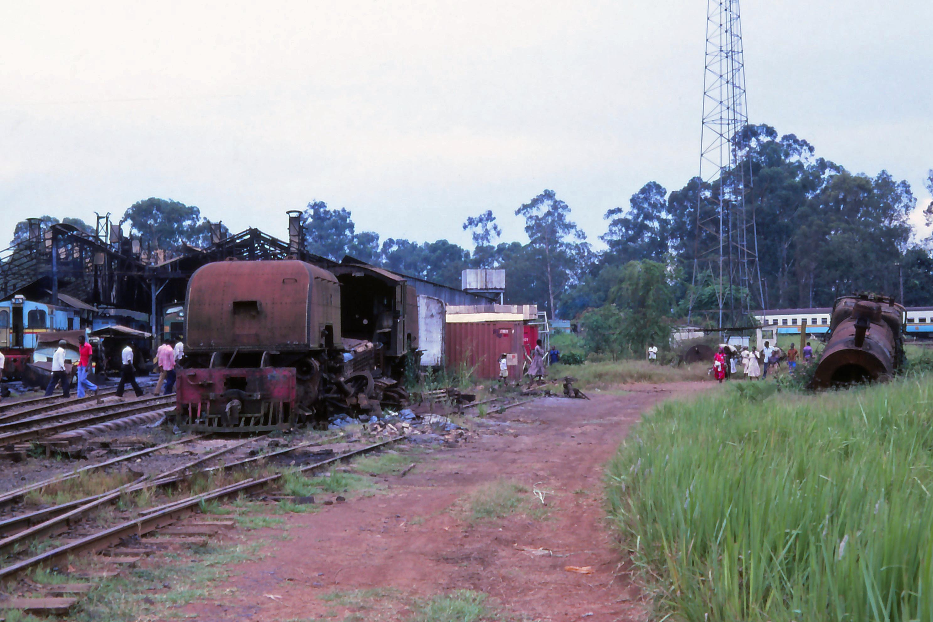 No 6017: At the other end of the shed was the partially dismantled remains of another Garratt, 6017, whose boiler had been cut up in situ. Nearby is a class 31 boiler. No other steam locos were to be seen , although there were several bashed and battered diesels scattered around the shed. Picture taken on 26/3/84 (c) tormaig. [30]
These Garratt’s were the flagship locomotive of the fleet but they were by no means the only significant locomotive classes on the EAR&H. We have already noted the long-serving older locos but there were also a series of new purchases and transfers to the Uganda and Kenya lines.
New Steam!
Class 13
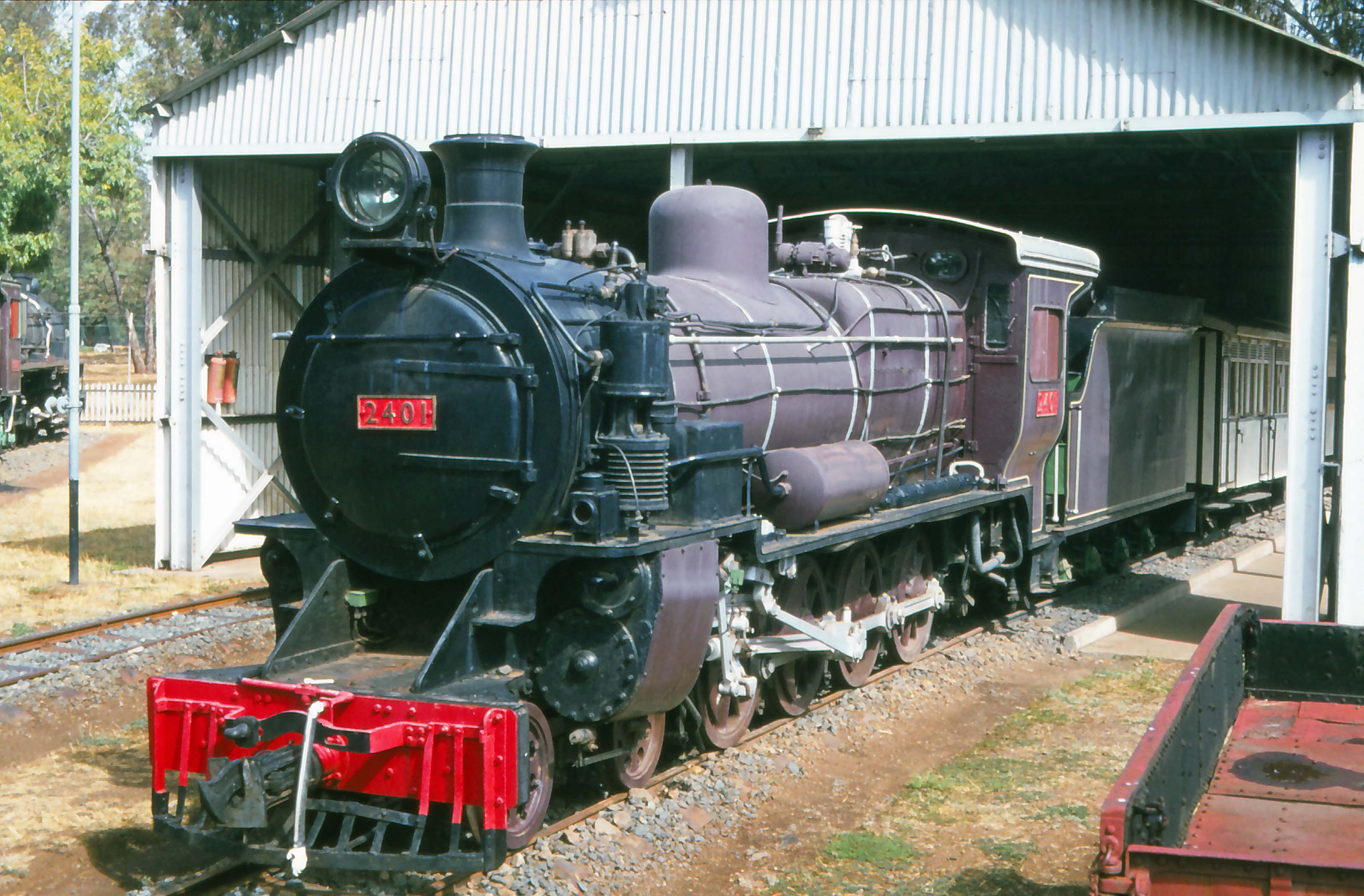
The EAR 13 class was a class of 4-8-2 T steam locomotives built by North British Locomotive Company in Glasgow, Scotland, for the East African Railways (EAR). The 18 members of the class were built in 1952 and entered service in 1953. They were later converted into 4-8-4 Ts, because of a tendency to de-rail when operating in reverse, using bogies (trucks) salvaged from EAR 50 class Garratt-type locomotives, which were then in the process of being withdrawn from service. [8, p78]
Class member 1315 was for many years an exhibit in the Nairobi Railway Museum. However, in the late 1990s the locomotive was removed by Kenya Railways and broken up for scrap after the boiler was re-purposed for use in the main railway works. [32]
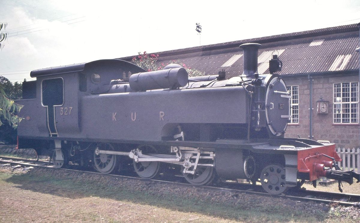
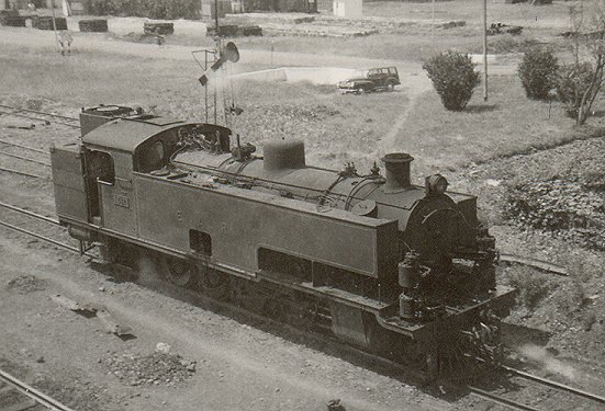 Class 13 Tank Locomotive at Nairobi West, (c) Iain Mulligan. [31]
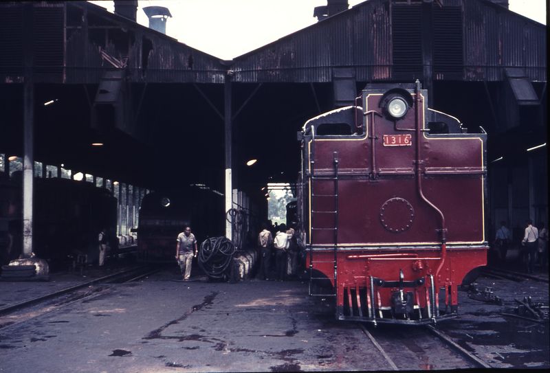
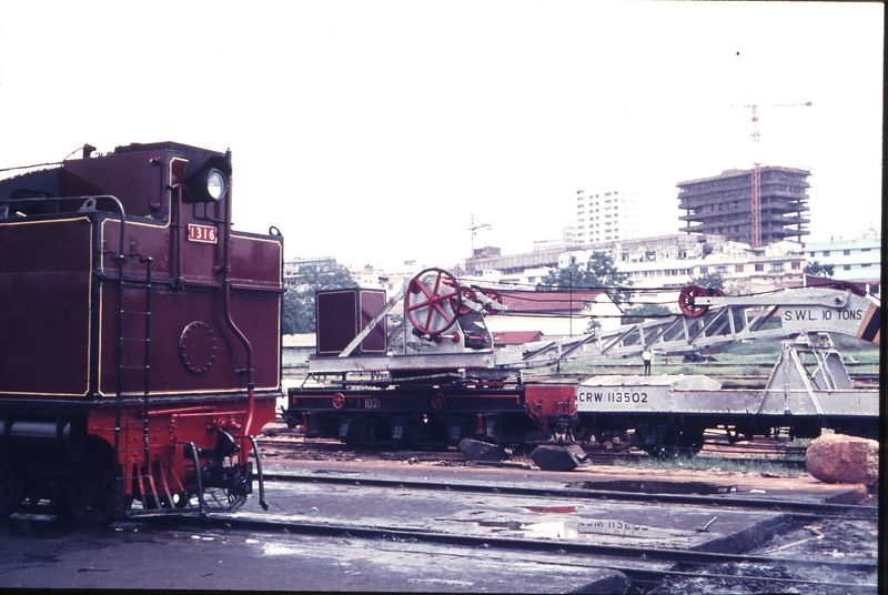
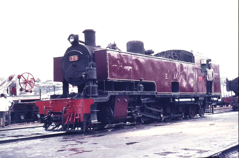
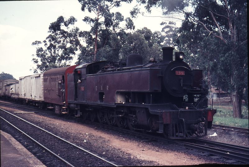
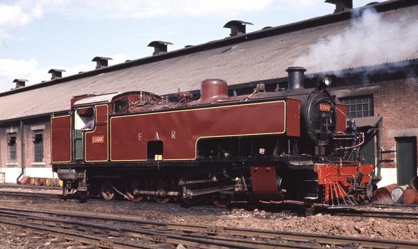 Newly out-shopped Class 13 tank No. 1308 gets up steam – note the traditional green and white paintwork in the cab. Note the absence of the front bogie [truck], (c) James Waite. [5] A further image of a Class 13, No. 1316 at Nairobi MPD can be found on flickr, © CPH3. [37]
Class 29
The EAR 29 class was a class of oil-burning 2-8-2 steam locomotives based upon the Nigerian Railways River class. The 31 members of the 29 class were built for the East African Railways (EAR) in two batches, of 20 (in the years 1950 and 1951) and 11 locomotives (in the year 1955) respectively, by North British Locomotive Company in Glasgow, Scotland. [8, p80f]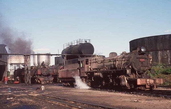 Tribal Class 2930 Tiriki ahead of two 13 Class tank engines and a 5912 Mount Oldeani on the re-fuelling roads. Mount Oldeani can be distinguished by its unique smoke deflectors. It also had an experimental blast pipe arrangement, © James Waite. [5]
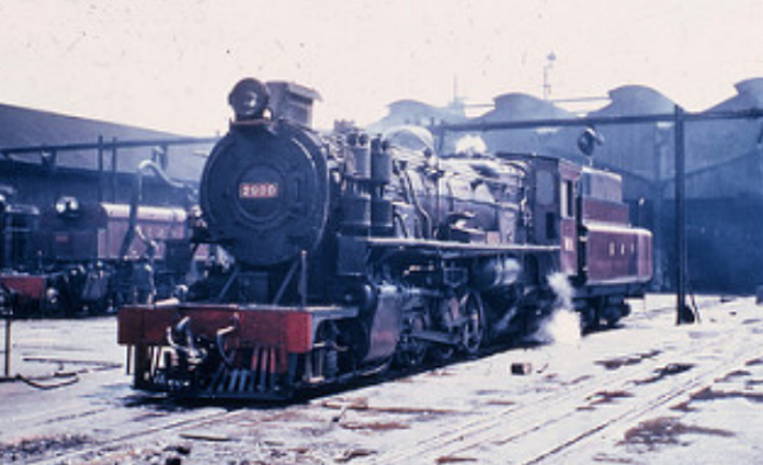 East African Railways – EAR 29 Class 2-8-2 steam locomotive No. 2908 “Elgeyo” in Nairobi Shed, December 1967. [38]
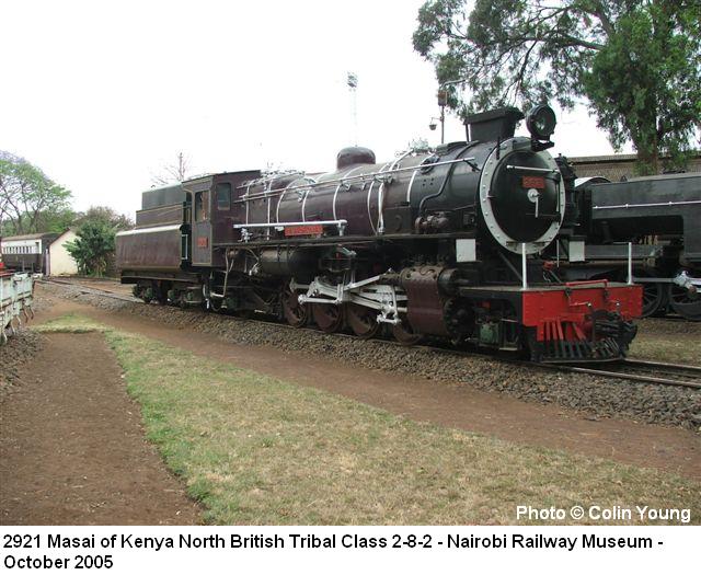
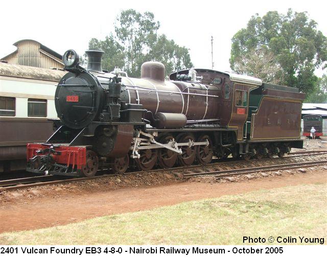
 Class 29 locomotive 2913 Kamasia, later Tugen behind the unidentifiable Class 31. Tanzania Railways had about a dozen Class 31 locomotives which were built between 1955 and 1956 by Vulcan Foundry, © David Addis. [39]
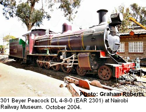
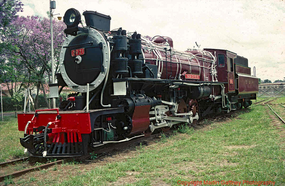 Class 29, No. 2921 “Masai of Kenya” at Nairobi Ralway Museum. The loco was built in Glasgow. [41]
Class 30
The EAR 30 class was a class of oil-burning 2-8-4 steam locomotives. The class was built in 1955 by North British Locomotive Company in Glasgow, Scotland, for the East African Railways (EAR). Its design was derived from the 2-8-2 EAR 29 class, which, in turn, was based upon the Nigerian Railways River class. [8, p81]
The 26 members of the class served their entire careers in Tanganyika/Tanzania, one of the three territories/countries served by the EAR.[36, p81]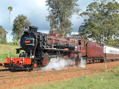 In 2003, Beyer Garratt No. 5918 was joined by this 2-8-4, Class 30 No. 3020 on a roster of available locomotives for steam journeys on the system in the early 21st Century. Also rescued in decrepit condition from the museum, these locos can operate passenger excursions and the occasional revenue freight out of Nairobi. The loco is pictured in December 2004 at Kikuyu, © Trevor Heath. [40]
The video immediately above covers movements of a variety of different classes of locomotive on East African metals between Mombasa and Nairobi. The video above it shows Class 30 No. 3020 operating in the early years of the 21st Century in its restored state.
Class 31
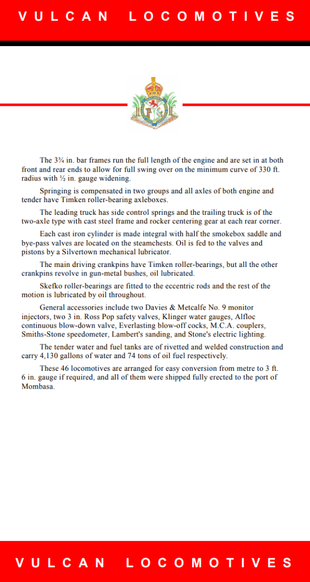
The EAR 31 class was a class of oil-burning 1,000 mm (3 ft 3 3⁄8 in) gauge 2-8-4 steam locomotives. The 46 members of the class were built in 1955 by Vulcan Foundry, in Newton-le-Willows, Lancashire (now part of Merseyside), England, for the East African Railways (EAR). They were a lighter, branch-line version of the EAR 30 class, and worked from various sheds throughout the EAR system. [8, p80ff][36, p83]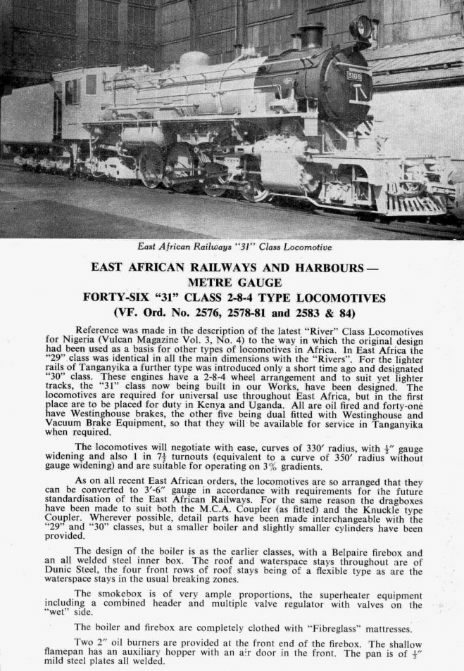

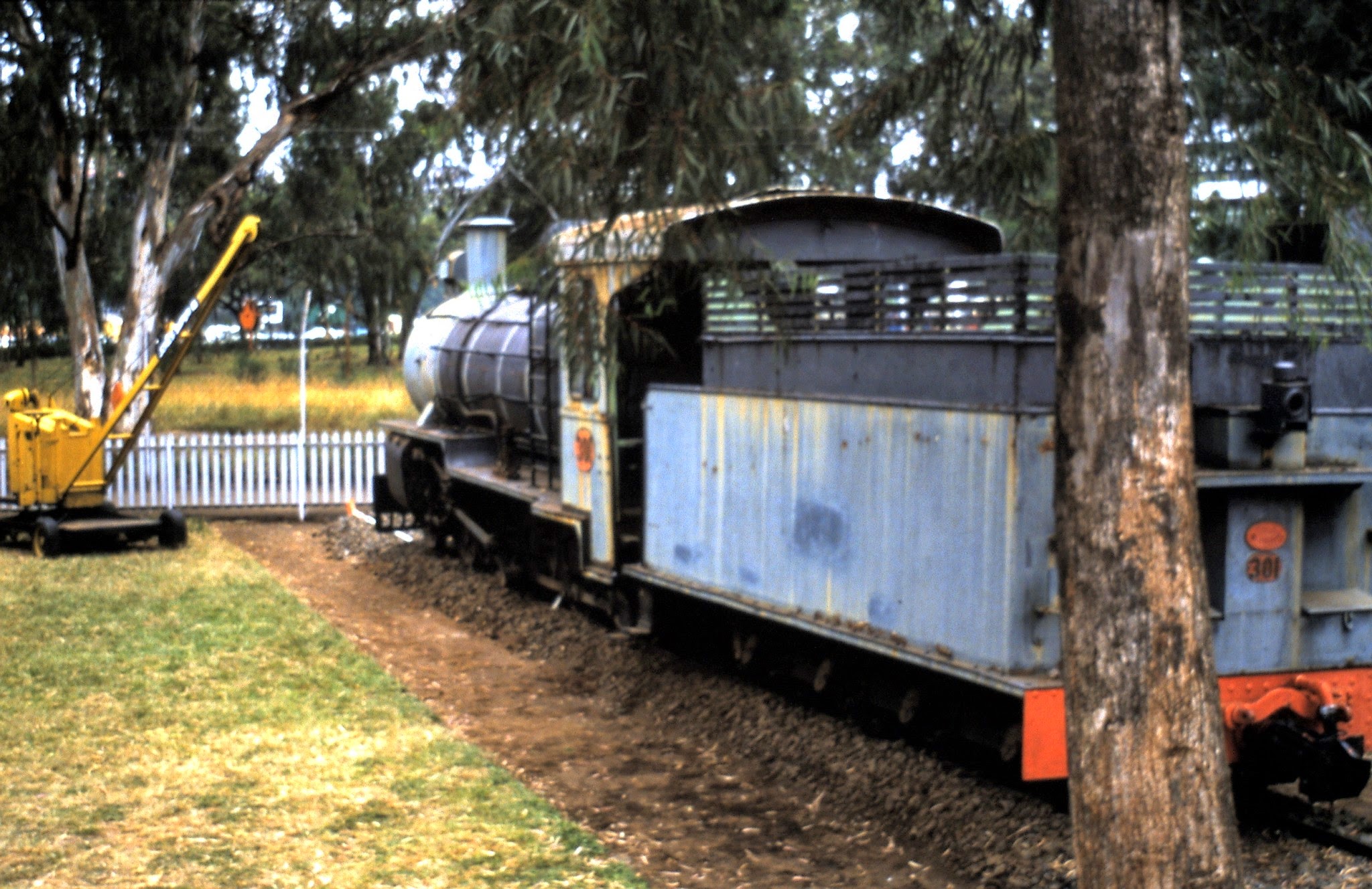
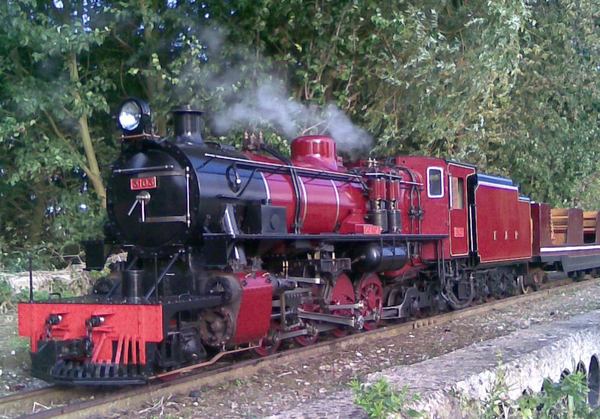 A 1/4 scale replica of Vulcan built East African Railways Class 31 locomotive. It has been built to be as an exact a replica as can be achieved albeit running on Kerosene rather than heavy oil with all the controls etc being scaled down from the original from works drawings. This powerful 10 1/4 inch gauge locomotive is a regularly works on the Stapleford railway and both the railway and the loco’s owner would love to hear from anyone that was involved with the 31 class build or operation although I guess they would be very old now! The loco is owned by John Wilks , © John Wilks. [42]
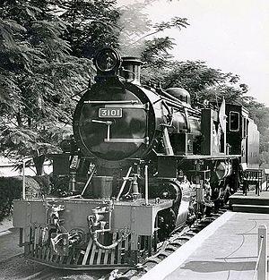 East African Railways Class 31, No. 3101 at its naming ceremony. [35]
 Class 31, No. 3105 ‘Bagisu’ has just been out-shopped in Nairobi, © Anthony Potterton. [5]
 Class 31 No. 3130 Karamojong, © Anthony Potterton [5]
 A dirty Tribal Class 31 No. 3133 ‘Lango’ with a very clean Class 29 behind © Anthony Potterton [5]
References
- https://en.m.wikipedia.org/wiki/Kenya_and_Uganda_Railways_and_Harbours, accessed on 17th June 2018.
- https://en.m.wikipedia.org/wiki/East_African_Railways_and_Harbours_Corporation, accessed on 21st June 2018.
- R. Tourret; War Department Locomotives. Abingdon: Tourret Publishing; 1976; p. 35.
- Cambridge University Library: Royal Commonwealth Society Library, Mombasa and East African Steamers, Y30468L. Janus. Cambridge University Library.
- http://www.mccrow.org.uk/EastAfrica/EastAfricanRailways/NairobiMPD.htm, accessed on 1st June 2018.
- https://www.flickr.com/photos/124446949@N06/38099544455, accessed on 21st June 2018
- https://en.wikipedia.org/wiki/EAR_58_class, accessed on 21st June 2018.
- Roel Ramaer; Steam Locomotives of the East African Railways; David & Charles Locomotive Studies. Newton Abbot, Devon, UK, 1974, p65-85.
- http://www.mccrow.org.uk/EastAfrica/EastAfricanRailways/EARKevinPatience/PatienceMombasaMPD.htm, accessed on 21st June 2018.
- http://www.mccrow.org.uk/EastAfrica/EastAfricanRailways/NairobiMPD.htm, accessed on 1st June 2018.
- https://www.world-railways.co.uk/general-photo-159, accessed on 22nd June 2018.
- https://www.pinterest.co.uk/pin/512143788857414150, accessed on 21st June 2018.
- http://www.mccrow.org.uk/eastafrica/eastafricanrailways/EARIainMulligan/IainMulliganEAR.htm, accessed on 1st June 2018.
- https://libcom.org/library/east-african-railway-strike-1959-60-labour-s-challenge-inter-territorialism, accessed on 22nd June 2018.
- https://www.flickr.com/photos/124446949@N06/35821749336, accessed on 16th June 2018.
- https://www.pinterest.co.uk/pin/131871095322011646/?lp=true, accessed on 16th June 2018.
- http://www.steamworkshop.co.uk/portfolio/5-ear-10-class, accessed on 22nd June 2018.
- http://www.beyergarrattlocos.co.uk/pics5.html, accessed on 22nd June 2018.
- https://www.pinterest.co.uk/pin/496662665137202654/?lp=true, accessed on 22nd June 2018.
- http://www.oldcambrians.com/Train4.html, accessed 1st June 2018.
- http://www.energeticproductions.com/EARandH/PublicityPhotos.htm, accessed on 22nd June 2018.
- http://www.mccrow.org.uk/eastafrica/eastafricanrailways/KampalaNairobi.htm, accessed on 16th June 2018.
- https://en.m.wikipedia.org/wiki/KUR_EC1_class, accessed on 16th June 2018.
- http://www.internationalsteam.co.uk/articulateds/garrattsafrica02.htm accessed on 22nd June 2018.
- http://sa-transport.co.za/trains/museums/nairobi_railway_museum.html accessed 16th June 2018.
- https://en.m.wikipedia.org/wiki/EAR_58_class, accessed on 23rd June 2018.
- https://en.m.wikipedia.org/wiki/EAR_60_class, accessed on 25th June 2018.
- http://www.beyergarrattlocos.co.uk/pics6.html, accessed on 25th June 2018.
- http://www.internationalsteam.co.uk/articulateds/garrattsafrica02.htm, accessed on 25th June 2018.
- https://www.national-preservation.com/threads/uganda-railways.1150502/page-2, accessed on 14th June 2018.
- http://www.mccrow.org.uk/eastafrica/eastafricanrailways/EARIainMulligan/IainMulliganEAR.htm, accessed on 1st June 2018.
- https://en.wikipedia.org/wiki/EAR_13_class, accessed on 25th June 2018.
- https://en.wikipedia.org/wiki/EAR_29_class, accessed on 25th June 2018.
- https://en.wikipedia.org/wiki/EAR_30_class, accessed on 25th June 2018.
- https://en.wikipedia.org/wiki/EAR_31_class, accessed on 25th June 2018.
- A. E. Durrant; C. P. Lewis; A.A. Jorgensen; Steam in Africa. London: Hamlyn, 1981.
- https://www.flickr.com/photos/tags/eastafricanrailways, accessed on 25th June 2018
- https://www.flickr.com/photos/124446949@N06/38099089665, accessed on 26th June 2018.
- http://www.mccrow.org.uk/EastAfrica/EAR&H/Tanzania.htm, accessed on 26th June 2018.
- http://www.trevorheath.com/livesteaming/trevor_heath_1.htm, accessed on 26th June 2018.
- http://therealgaffney.zenfolio.com/p634783771/h5190B4CA#h5190b4ca, accessed on 26th June 2018.
- http://www.enuii.com/vulcan_foundry/models/live%20steam.htm, accessed on 26th June 2018.

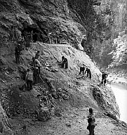
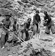


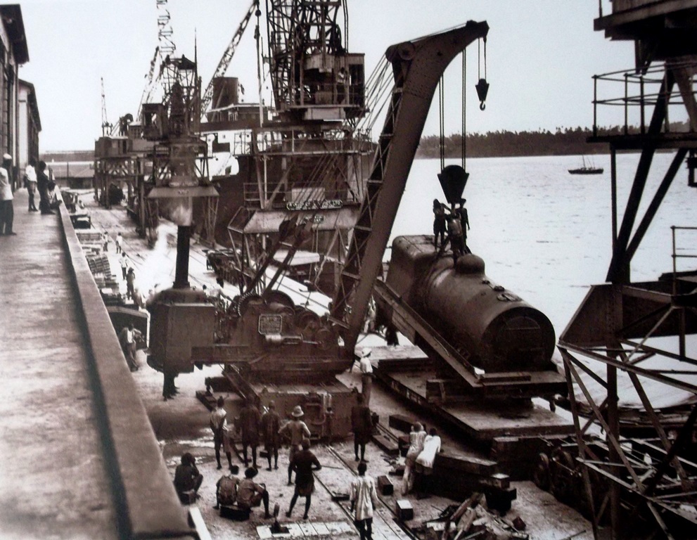
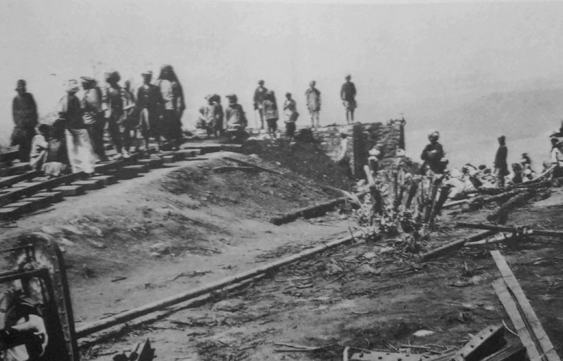
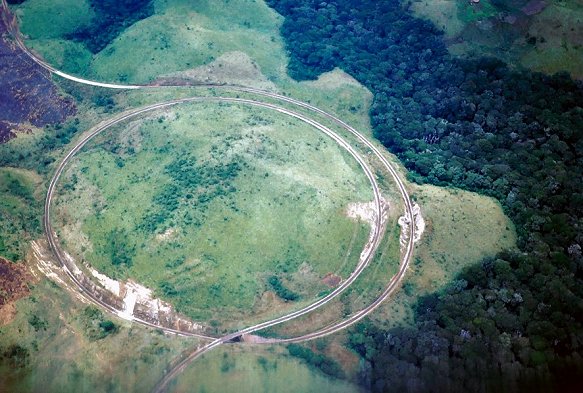
 An Incline was built to move construction materials to the valley floor, two sections of the incline were set at 45 degrees, special cars had to be constructed to carry equipment and in particular locomotives. The incline opened in May 1900 and remained in use until November 1901. Use of the incline advanced the rail-head westward by 170 miles while the line down the escarpment was being built. The pictures immediately adjacent, above and below show the top of the escarpment and two images of a locomotive being lowered to the valley floor. [2]
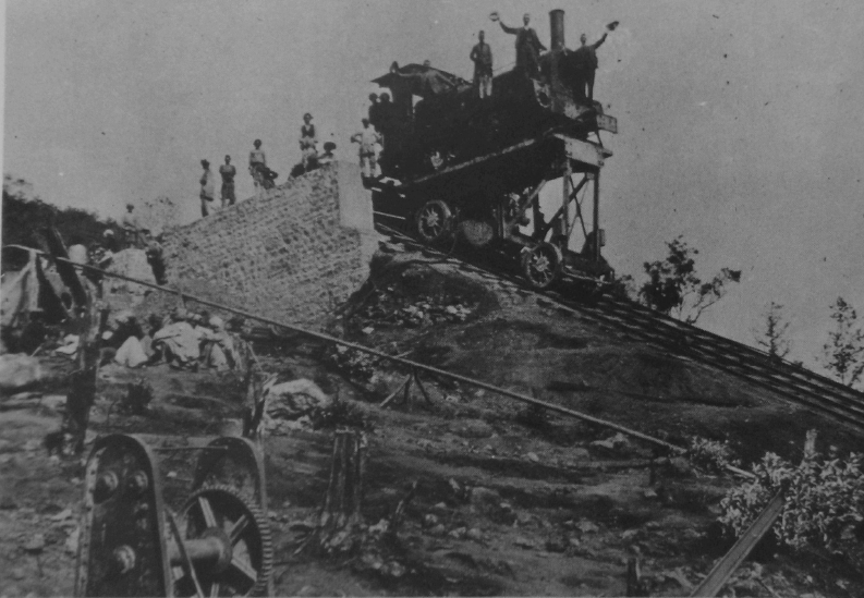

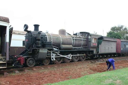


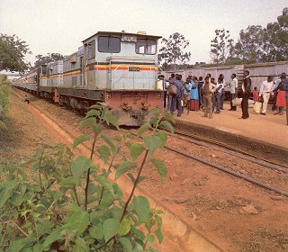
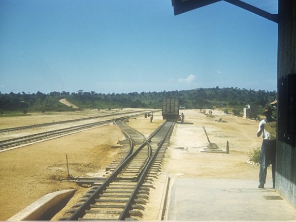

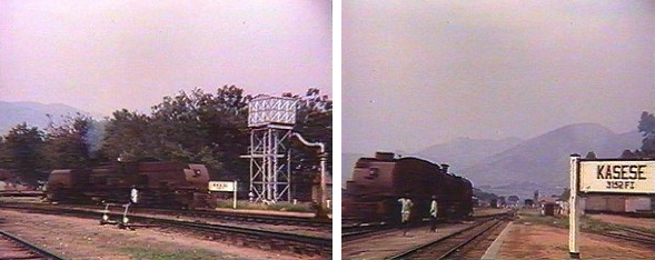


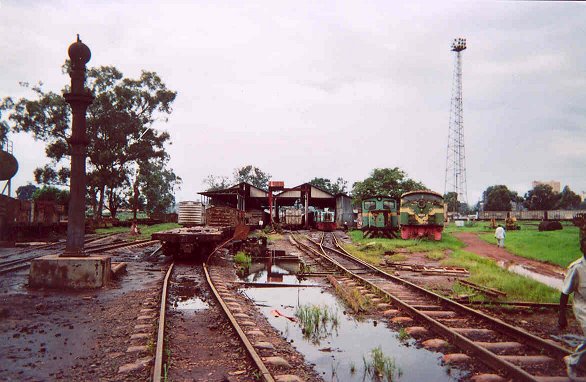


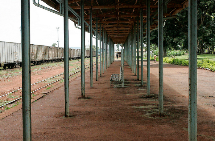


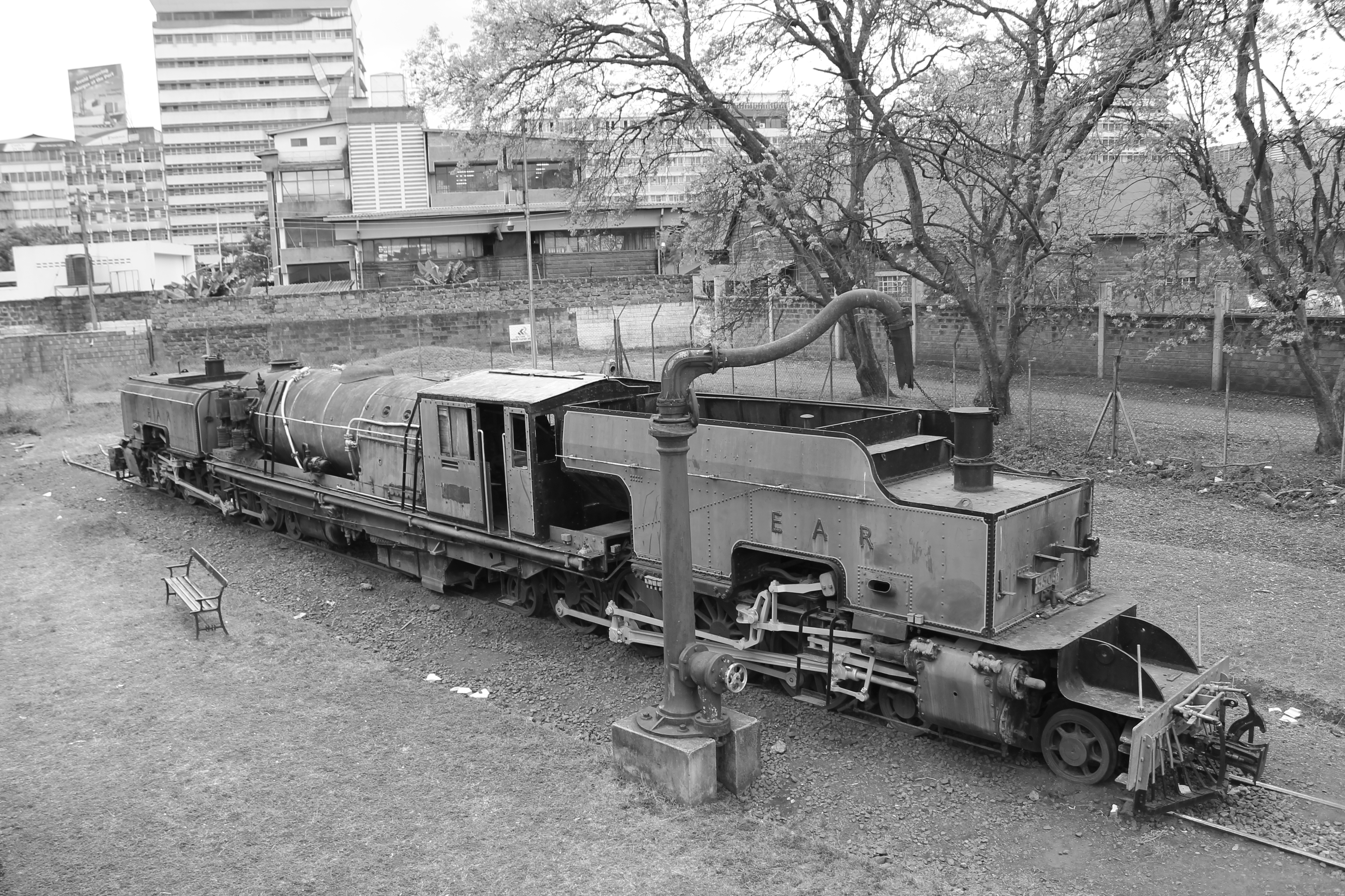
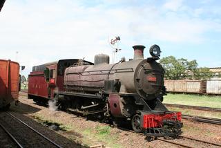
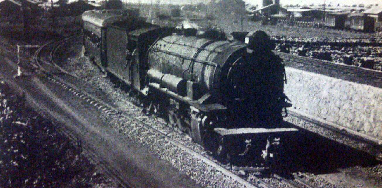
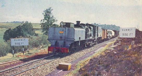
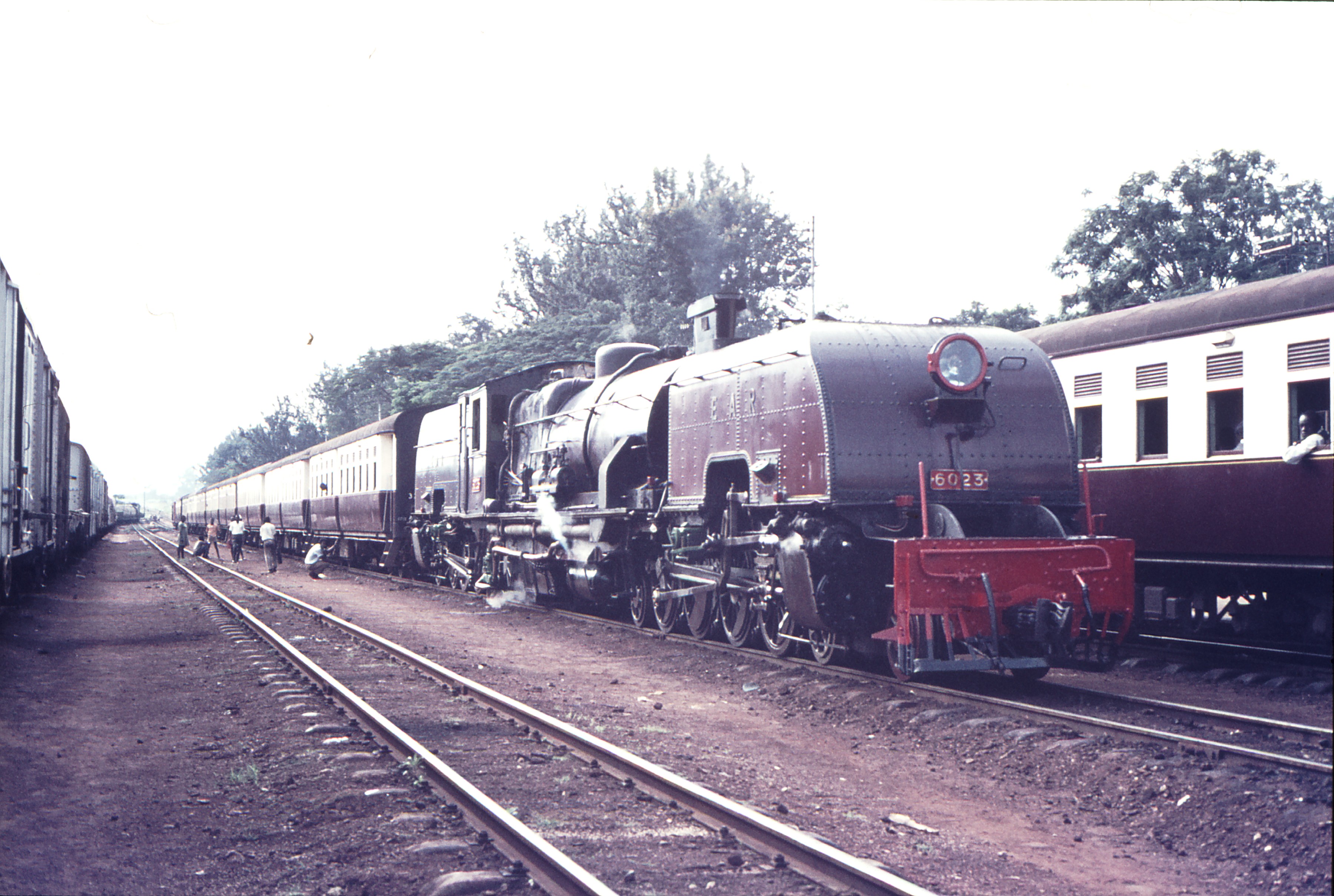 Class 60 Garratt No. 6023 in Tororo in 1971


