
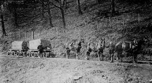
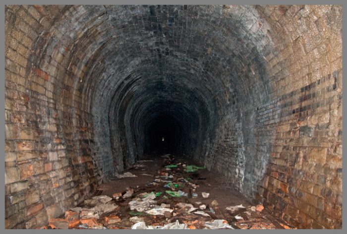
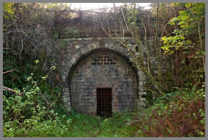
The featured image shows stone being transported down the Bixslade Tramway, one of the feeder tramways to the Severn and Wye Tramroad.
There were at least 12 branch tramroads off the Severn and Wye Tramroad. Many of these remained as feeder routes to the Severn and Wye Joint Railway in the 19th Century.
The branch tramroads included the Mirystock-Lydbrook-Bishopswood tramroad and the privately owned Oakwood and Dyke’s tramroad branches. In addition scores of sidings and short branches served particular mines, quarries and works. Traces of most of the branches remain. I intend over time to look at all these tramroads. The notes are merely an introduction and are picked up from the references below.
With the exception of the Churchway branch (and possibly Moseley Green), locomotives did not serve the branch lines – they were too steep and relied on very tight curves. Various proposals for converting the branches to railways met with little success and they were gradually superseded or abandoned. Three branches however, Bixslade, Howlers Slade and Wimberry Slade, remained in use into the 20th century.
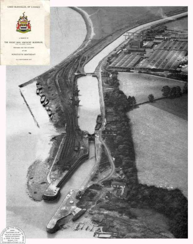
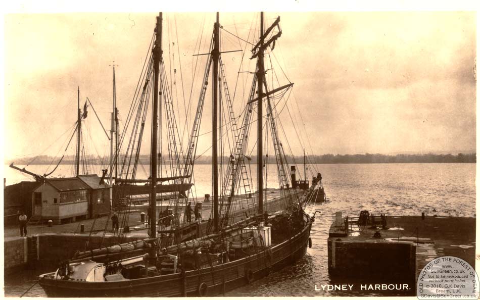
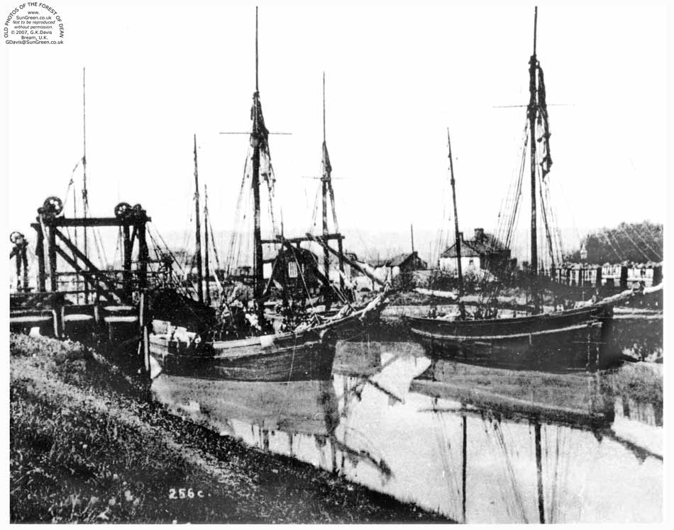
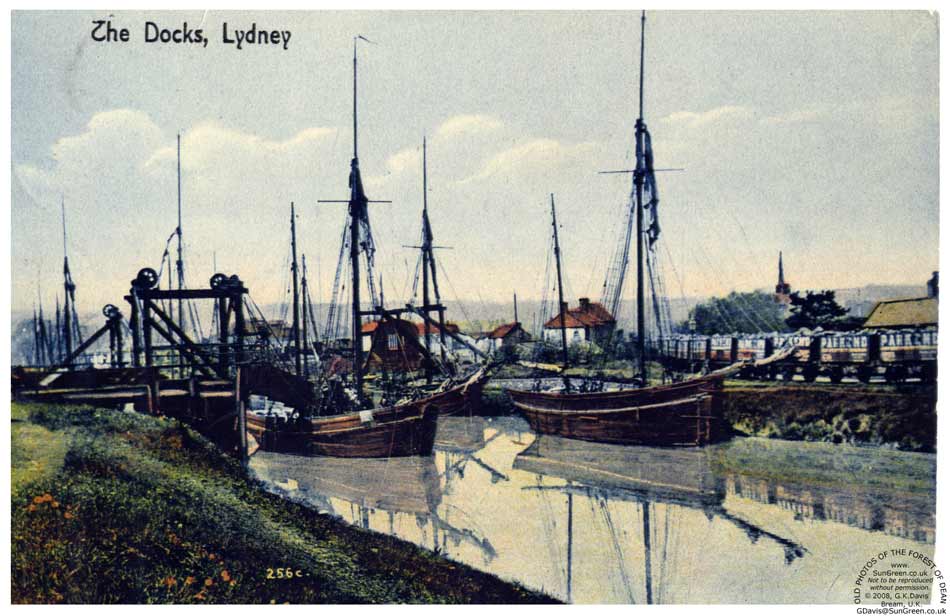
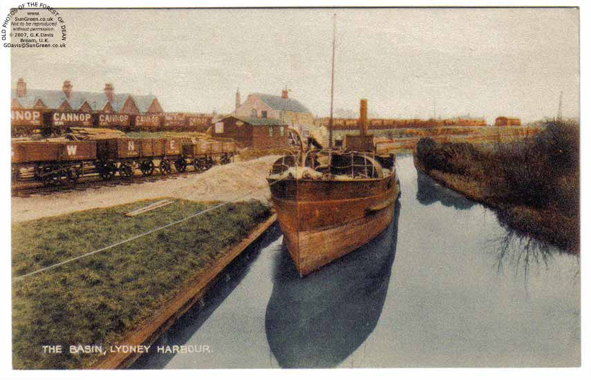
Prior to the construction of the harbour at Lydney, a tramroad ran down to Lydney Pill. Once the outer harbour was completed in 1821, the tramroad was extended along the north side of the canal and a branch which ran across to a new wharf on the west side of the harbour was added in 1823.
Details of some of these branch lines and sidings are included here:
There was a short branch to the Lower Forge, connection to a private tramroad was made in 1818.
In 1814, connections were made to Upper and Middle Forges.
Kidnall’s Mill (or Moseley Green) Branch is covered in a separate article entitled ‘Moseley Green Tramways’ (https://rogerfarnworth.wordpress.com/2017/09/27/moseley-green-tramways)
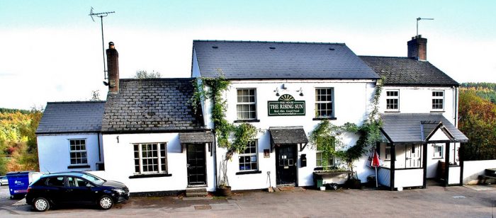
Birches Branch is also partially covered in the above post. It left the main line south of Parkend and passed through Oakenhill Inclosure to Birches Well, Independent, and other coal pits. By about 1849 the branch was disused. The Birches branch can be traced where it crosses the Parkend-Yorkley road as a broad path and can also be picked up on Moseley Green behind the Rising Sun Inn, and where it crossed the Parkend-Blakeney road.
The map in my article (https://rogerfarnworth.wordpress.com/2017/09/27/moseley-green-tramways) shows the approximate position of these locations.
Milkwall or Darkhill Branch brought iron ore from the Milkwall area to Parkend, served collieries and wandered through large quarries. It was under construction in 1812 and followed a torturous hillside route. Some of the worst curves on the branch were being smoothed out in 1860. The tramroad was in operation until the railway was built. When the Coleford Railway replaced the tramroad branch, a section from Milkwall to Sling was left in place with a transhipment wharf at Milkwall, conversion of this section began in 1875.
The tramway route can be found on the 1881 Ordnance Survey … (http://maps.nls.uk/view/109726222) and the 1905 Ordnance Survey …(http://maps.nls.uk/geo/explore/#zoom=17&lat=51.7805&lon=-2.6026&layers=168
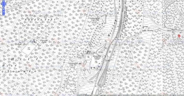
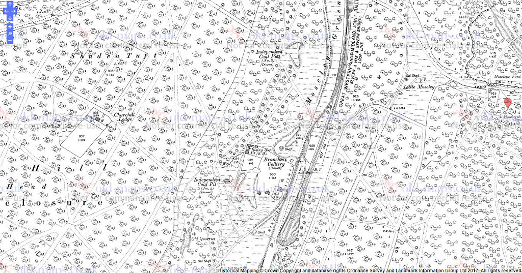
Ivy Moorhead Branch was built by 1813. The line had been taken up and re-aligned by the Park End Coal Co. in 1821 to carrying coal to the ironworks. However, the branch became part of the Severn and Wye tramroad again in 1829. The furnaces of the Parkend Ironworks were served directly by a branch that ran over the main tramroad via a “covered way”. In 1877 the line still served the Royal pit (then Castlehill Colliery), but it had been removed by 1901.
Brookhall Ditches Branch seems to have served for a short time in the second decade of the 19th century before being abandoned. In 1824 a request was made to replace the rails as the abandoned Brookhall Ditches works were re-opened by the Park End Coal Co. A licence was obtained in 1837 for an extension to Foxes Bridge, however the Kidnall’s Mill branch, opened in 1841, offered a more direct outlet, avoiding the busy Parkend area. However, the Foxes Bridge Pit in question never opened. The Brookhall Ditches branch wasnwas abandoned once again in the mid 1870s.
Bixslade Branch
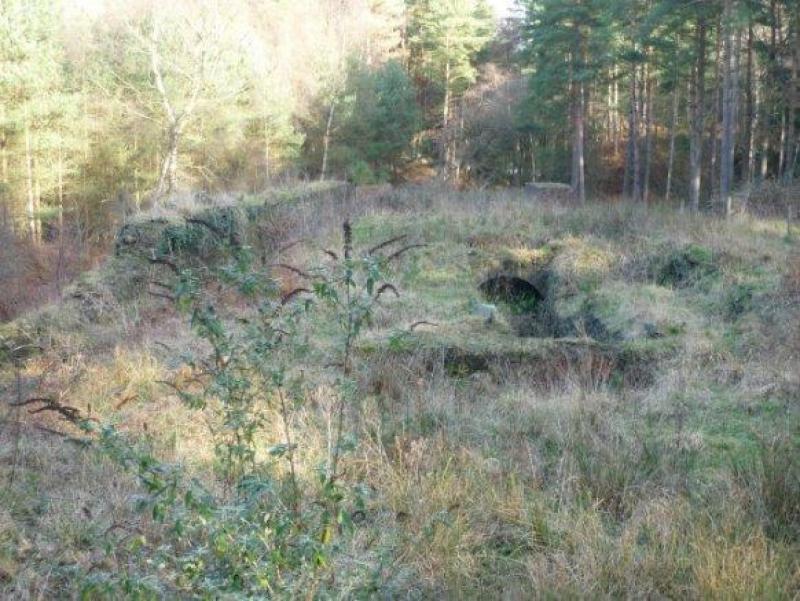
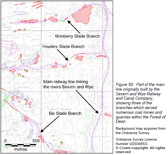 The above image shows this branch and the next two below, it is taken from the English Heritage, Forest of Dean Mapping Project, Gloucestershire: A report for the National Mapping Programme.[3]
")

The Bixslade branch was completed in 1812 and left the main line on an embankment and ran across a dam made by the Forest of Dean Iron Co. in 1825 to create the Cannop Ponds. By 1841 the branch served 3 collieries in addition to the Bixhead quarries. Several licences were granted in the 1890s for extensions around the Bixhead quarries. The line was still in regular use in 1946 by a coal pit near Bixhead, although the last load of stone was brought down the line in 1944.
The branch was owned and maintained by the Severn and Wye Co. to just short of the quarries. The lines within the quarries were provided by the traders although often the S&W provided the tramplates.
The line was extended for short distances from time to time as the quarries developed, the Severn and Wye generally supplying the plates and the owners doing the rest.
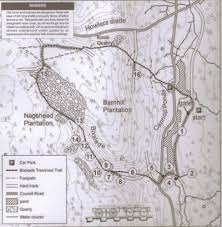 There is a very enjoyable short walk or noted by the Forest of Dean Local History Society, as shown on the map here.
Howler’s Slade Branch ran parallel to but above the Speech House to Coleford road for most of its 1 mile course and was begun in 1811. In addition to various pits and quarries, the branch also served a chemical works at Cannop Bridge and a foundry. Although derelict by around 1920, the track was not removed until 1941. From its crossing of the B4226, its course can be traced, crossing Cannop brook by a bridge with cast iron railings, past the remains of the chemical works and then over the B4234 Cannop-Lydbrook road immediately to the North
Much of the tramway route is over level ground but embankmentss andaand cuttings were employed in places.
Wimberry Slade Branch – originally terminated near Wimberry Colliery, but the line was later extended to serve other pits, and was completed at the same time as the main line. A broad-gauge railway branch was laid over the first half-mile as far as Wimberry Colliery in 1868, however the tramroad branch continued in use. Abandonment was authorised in 1874, however the western section continued in use, terminating on a wharf at Hopewell sidings. A succession of alterations were made to the tramroad over the years – with new sidings being laid as late as 1928. Part of the line was in occasional use in 1939, however in 1940, 14 chains were taken up for repairing the Bixslade branch. In 1943 the remaining 38 chains were damaged by military traffic along the line which was removed entirely in 1946. Traces of the tramway can be followed from where the railway bridge crosses the B4234.

The Wimberrry Slade branch is marked on the tithe map and the 1st-3rd County Series OS maps. The western section of the route can be traced on aerial photographs. The tramroad extends for 520m in an east/west direction along a dry valley and continues to the east a little further. The western end terminates at Wimberry quarry.
Churchway Branch – the tramroad at Churchway was authorised in 1810, however no connection was made to the Forest of Dean Tramroad and in 1814 rails were taken up. Eventually in 1823 a licence for a connection was eventually given. At Mirystock the Churchway branch curved from the main line and in 1847 a new curve was put in making a triangular junction. In 1865 following the opening out of the Mirystock tunnel into a cutting a new line was laid improving the access to the Churchway branch. Abandonment of the tramroad branch was authorised in 1877 and the tracks taken up almost immediately.
The Severn and Wye Co built a branch from Mirystock to Churchway, where a junction was made with the Bullo Pill tramroad in 1812. A short loop line at Mirystock was constructed in 1847 to give better access to the Churchway branch from the south, a second spur to the Churchway branch was constructed in 1865.
Lydbrook Incline is heavily overgrown. The steep descent to the Wye at Lydbrook was an inclined plane controlled by ropes, which was abandoned by 1856.
Bishopswood Branch – completed in 1814, was linked by an inclined plane to the forge on Lodgegrove Brook. The branch ran as far as the Ross road in 1833. It carried little traffic and the track was taken up in 1874.
This was an extension from the original terminus at Lower Lydbrook, taking the line onwards to the Wye at Bishopswood. It was opened to serve the Bishopswood Ironworks. From the site of Lower Lydbrook station it curved towards Vention Lane, which it crossed below the Royal Spring Inn, and then on to the B4228 near the turning to Ruardean. Apparently, until the early 1950s, the route from Ventions Lane was used byuby horse drawn cartstcarts to supply Incline Cottages with coal.
References
1. English Heritage’s Monument Protection Programme (MPP) Step 3 report.
2. Gloucestershire County Council Historic Record Archive which holds a great deal of source information. Monument No. 5701.
3. Fiona Small & Cathy Stoertz; The Forest of Dean Mapping Project, Gloucestershire: A report for the National Mapping Programme; English Heritage, National Monuments Record Centre, Great Western Village, Kemble Drive, Swindon, 2006.

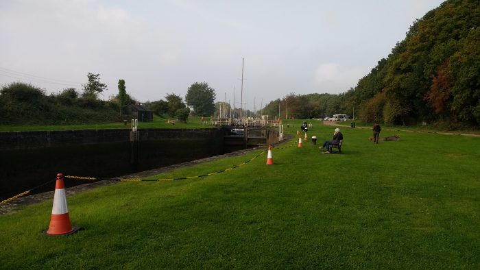
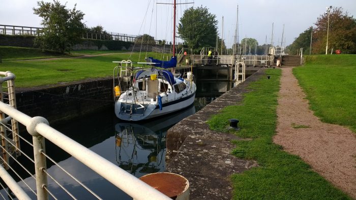
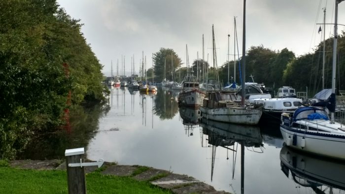
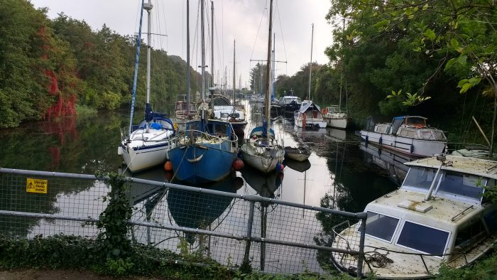
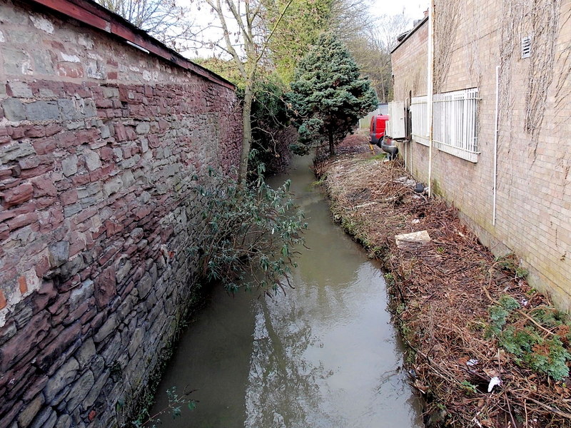 Pidcock’s Canal was a canal in Gloucestershire, England, which connected ironworks at Upper Forge and Lower Forge, and also ran to an inlet from the River Severn called Lydney Pill. It was constructed from 1778 onwards[4], and there were three locks below Middle Forge. Following the construction of the Lydney Canal in 1813, the canal connected to that, rather than Lydney Pill, and it was disused after 1840, by which time a horse-drawn tramway had been built up the valley of The Lyd. The tramway was eventually relaid as a steam railway and is now preserved as the Dean Forest Railway. Most of the canal, colloquially called The Cut, still exists below Middle Forge.
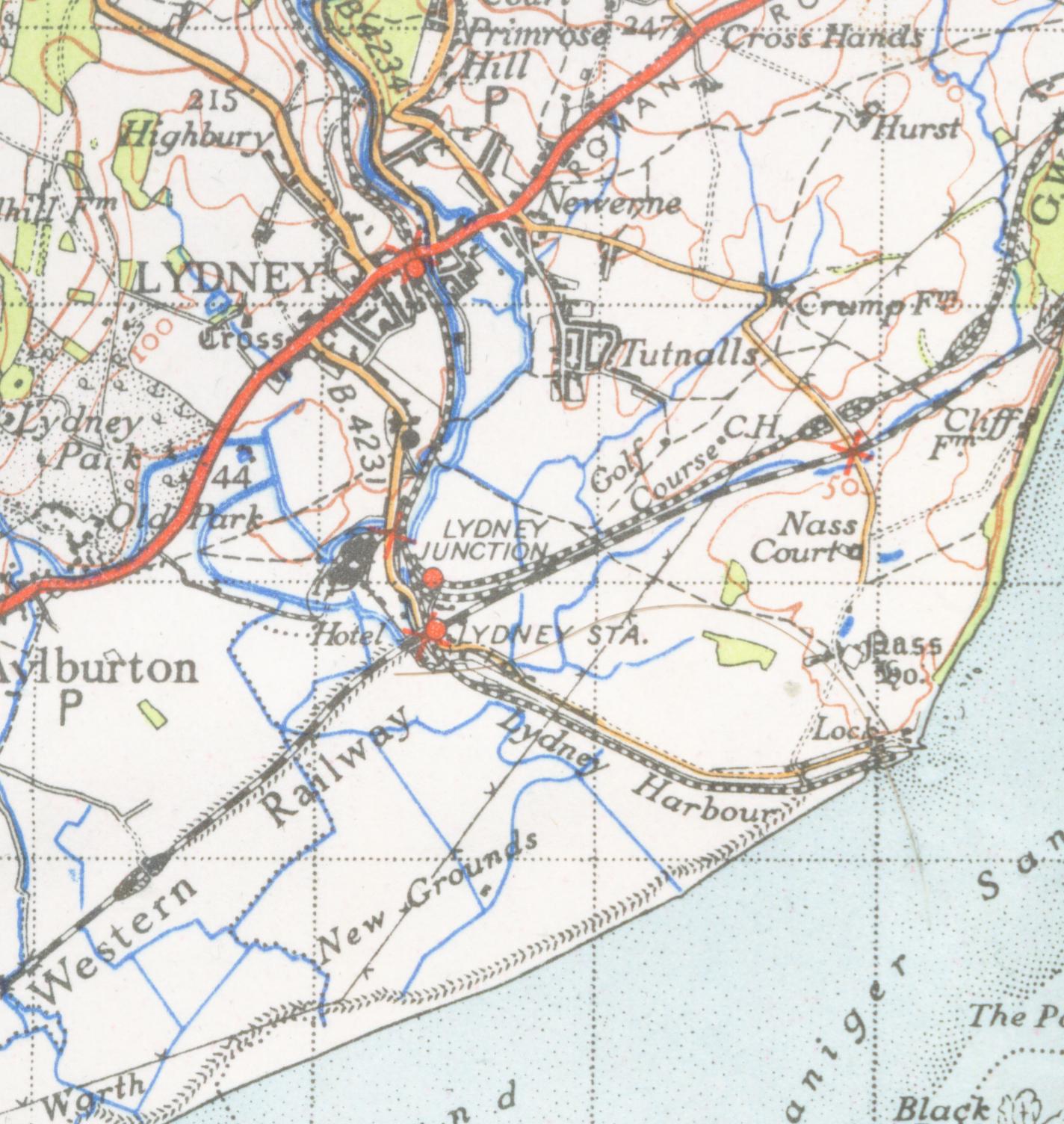 In the late 18th and early 19th centuries, a network of horse-drawn tramroads developed in the Forest of Dean, to transport coal and ironstone to the local ironworks, and, following the development of docks on the Severn at Bullo Pill and Lydney, to ship coal and other Forest products to markets further afield. With the introduction of railways to the Forest, beginning in the mid-nineteenth century, the tramroads were progressively superseded, in places physically overlaid, by the new transport system, though some continued as feeders to the railways well into the 20th Century. Many traces of the old tramroads remain, sometimes as footpaths following a trackbed, or as remains: stone sleeper blocks, earthworks, bridges and other structures.[9]
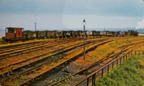


 In 2017, we stayed in Rosebank Cottage in Moseley Green. The cottage was one half of what was built as the Methodist Chapel in 1859 but closed in 1864. In 1960 the chapel was finally converted into two cottages losing most of its ‘chapel’ features. The 1881 Ordnance Survey clearly shows Rosebank Cottage cand its neighbour as Bethlehem Chapel.
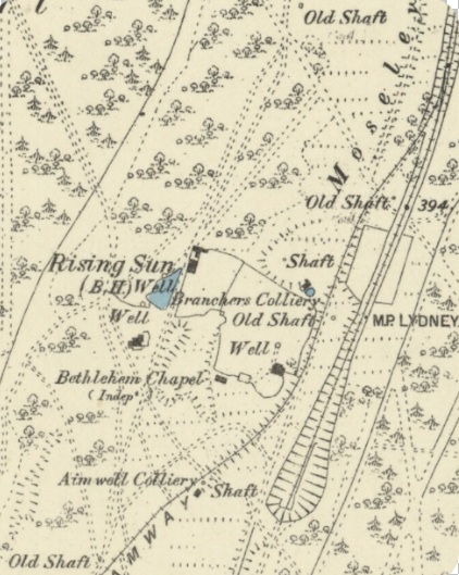
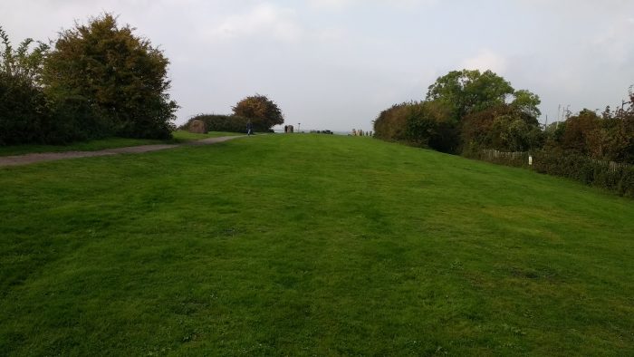
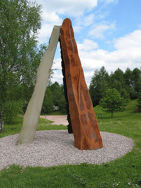 There are now two significant sculptures at the site. The first is the Roll of Honour sculpture which was commissioned by the Forest of Dean Local History Society to honour those who worked and were killed or injured in the mines and quarries of the Forest of Dean. It was buil by Graham Tyler and John Wakefield and was unveiled in 2005. It consists of three elements – stone, iron (represented by rusted steel), and coal (represented by carved and blackened local oak) – and stands around 11 feet (3.4 m) high. Stainless steel discs set into the sculpture represent the tokens carried by miners to determine who was below ground in the event of accidents.
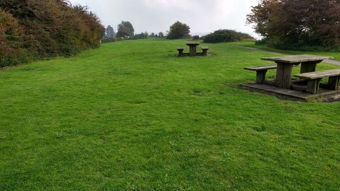
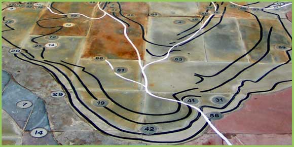 geology and mines of the area, was unveiled at the New Fancy picnic site in May 2008. It was commissioned by the local history society, who received a grant from DEFRA’s Aggregates Levy Sustainability Fund, and was constructed by sculptor David Yeates of Mitcheldean before being assembled on site. The rock strata depicted are built from samples of the rock they represent. Metal discs represent the locations of the main iron and coal mines and quarries, with black lines to represent coal seams and white lines for railway routes. It is flat and polished, but not shiny, and is intended to be walked on.
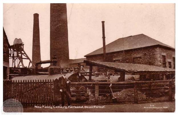
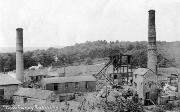 Wikipedia suggests thst the New Fancy colliery was opened by Edward Protheroe in 1827, as part of the Park End Coal Company in the Forest of Dean. It seems that he acquired the interest from his uncle in 1812. Details are scarce, however the 1841 Coal Awards confirmed the possession of the New Fancy gale to Edward Protheroe. In the Third Schedule to the 1841 Awards it is mentioned that in 1831 Edward Protheroe was granted a license to erect a pumping and winding engine at New Fancy but it is likely that this was not done as in a list of coal works in March 1841 there is no mention of New Fancy. The gale itself was certainly being worked by 1840, probably through the Parkend gale, as in that year Protheroe stated that he required a ‘better, cheaper, outlet’ for his New Fancy coals. The cheaper outlet would come about by sinking a shaft on the New Fancy gale thus avoiding the wayleave charged by the Crown on all coal from one gale passing through the barrier into another. The New Fancy gale award covered the coal in the Churchway High Delf, Rockey, Starkey, Park End High Delf, Little Delf and Smith Coal veins.
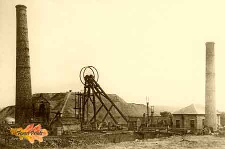 By around 1852 it seems that two shafts were being sunk. These seem to have been completed in 1857. At the first half-yearly meeting of the Forest of Dean Central Railway Company it was stated that the colliery ‘was in a forward state and will when opened afford large traffic’. The colliery was producing coal by 1860 when 250 tons a day were being sent over the Severn & Wye’s Kidnalls Mill, or Moseley Green, branch of the tramroad. A connection to this branch had been authorised and built in 1859. It was to be another ten years before the colliery gained a railway connection in the form of a branch of the Forest of Dean Central which was authorised under a Crown license dated 6th April 1868. The large traffic hoped for over this route diminished rapidly when the Mineral Loop was opened in 1872 and a connection was made to the colliery. It is likely that the rails on the Central’s connection had been removed by 1878.
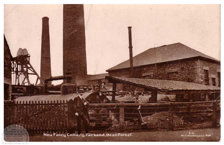 Wikipedia suggests that, by 1860, the Colliery was owned by Sully & Company and in 1885 was sold to the Parkend & New Fancy Collieries Company. However, this may be an oversimplification. By 1878 James Sully was the only remaining partner in the Park End Coal Company and the Parkend Coal Company Ltd. was formed to acquire the collieries. The subscribers to the new company were James Sully and Richard Sully, both described as coal merchants from Bridgewater, Somerset, John Nicholls, also of Bridgewater, William Unwin of Oxford, John Bailey, Sydney Thomas of Parkend House, colliery manager and Thomas Thomas.
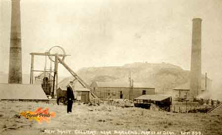 It appears that the new company may have been heavily in debt from the start. By 1880 it was in difficulties. At that time the company wasthought to possess nine-hundred acres of coal in the Starkey seam in connection with New Fancy. Probably the collieries were bought by a Mr. Jackson in 1881.