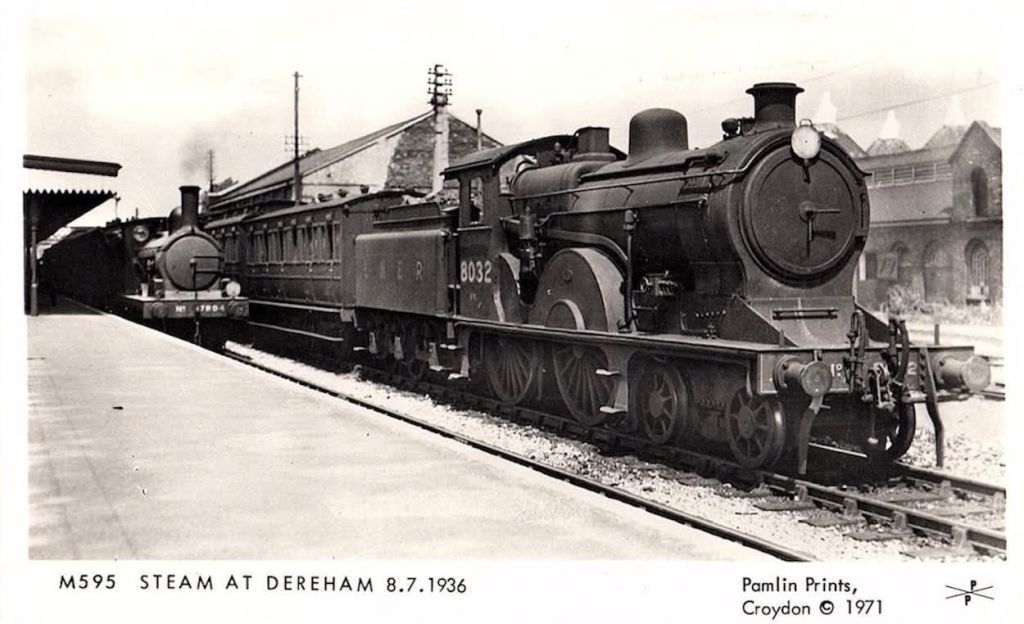
An article in the magazine Railway Bylines, in the September 2002 edition written by Orson Carter prompted a look at the railway system in Dereham Norfolk. [1]
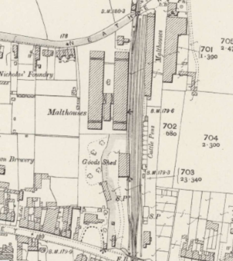
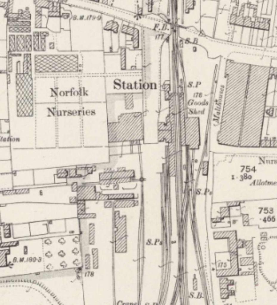
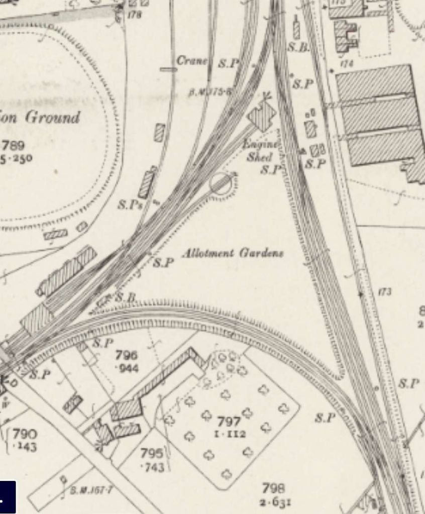
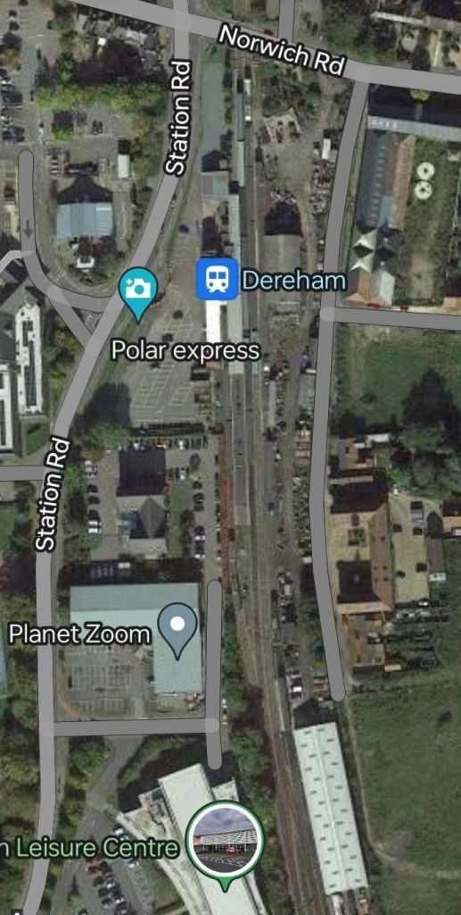
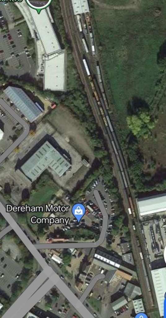
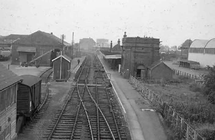
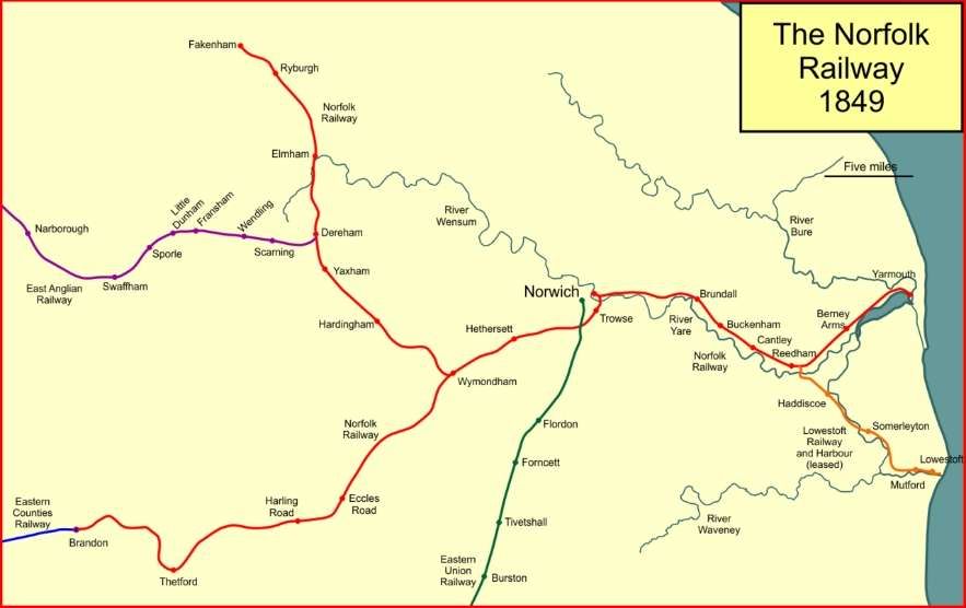
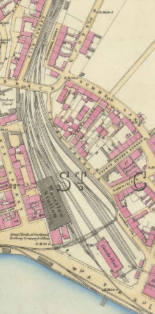
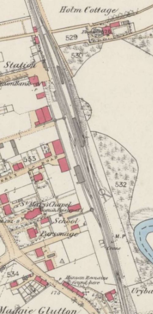
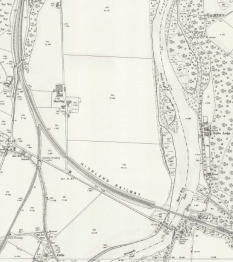
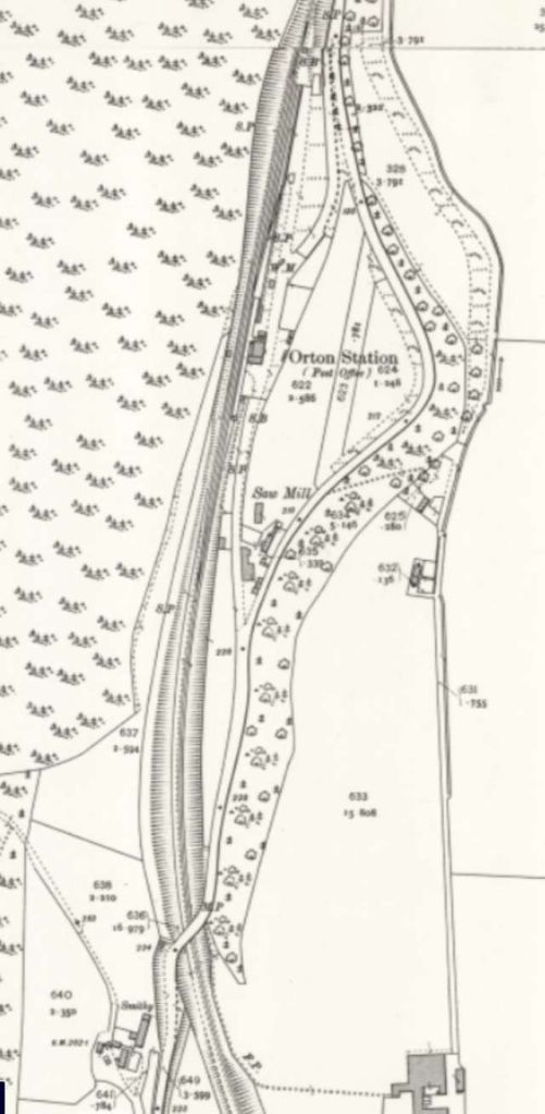
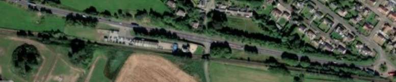
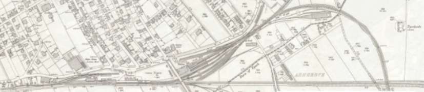
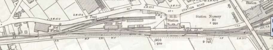
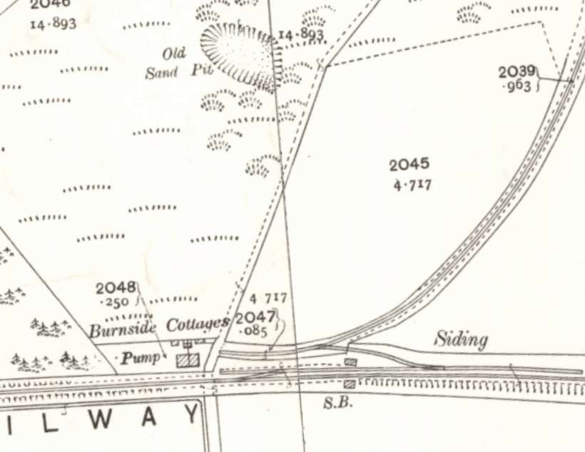
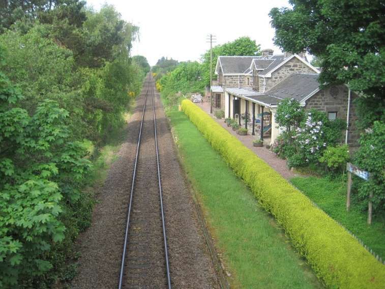
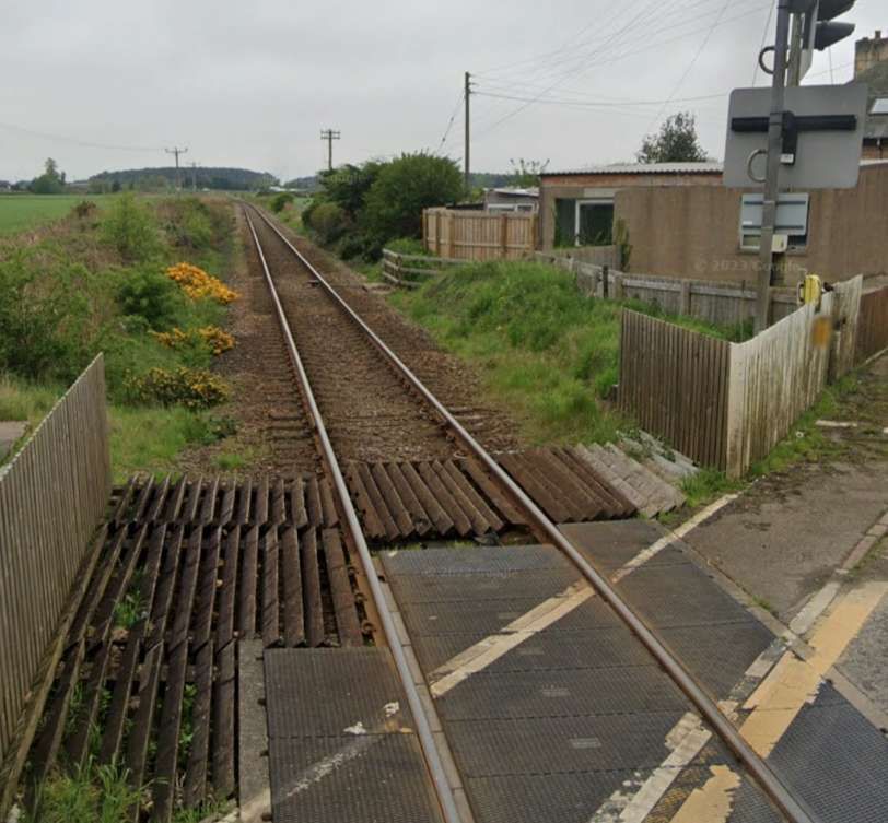
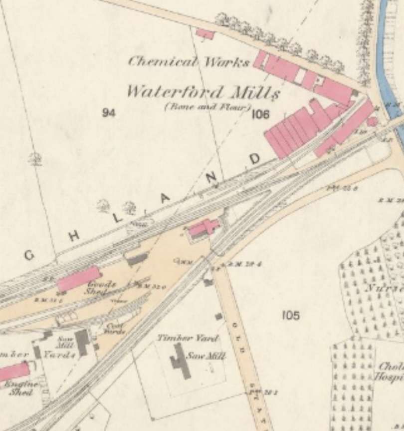
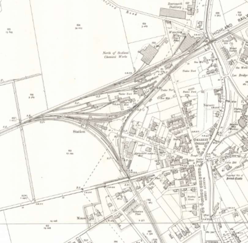
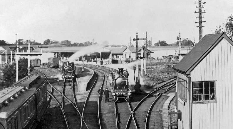
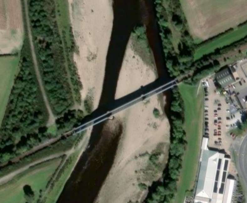
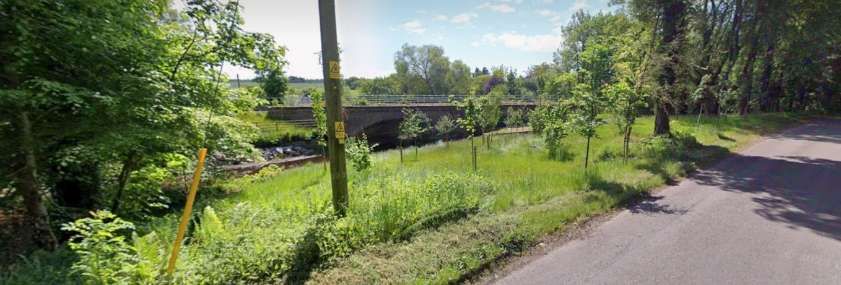
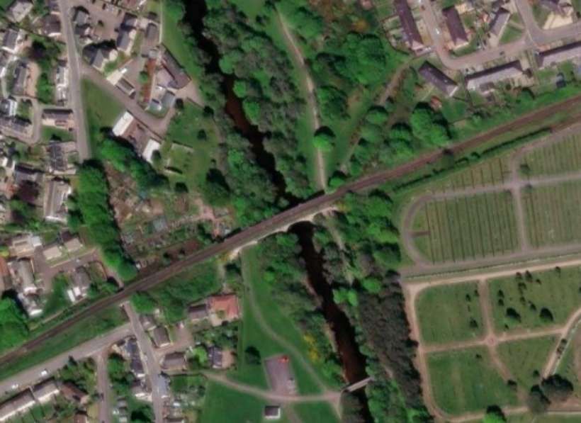
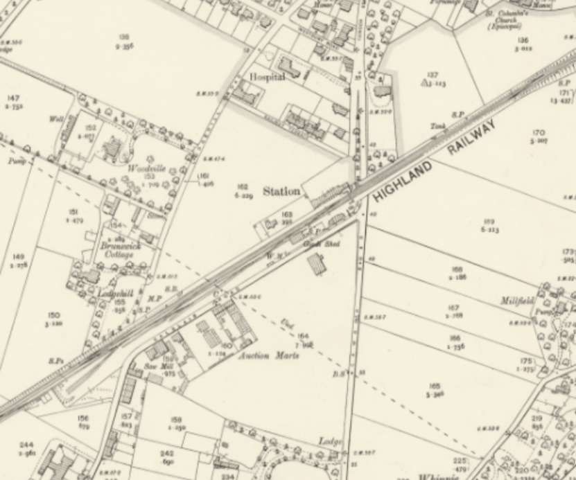
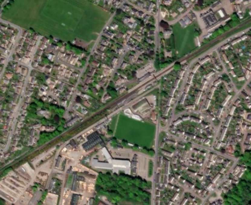
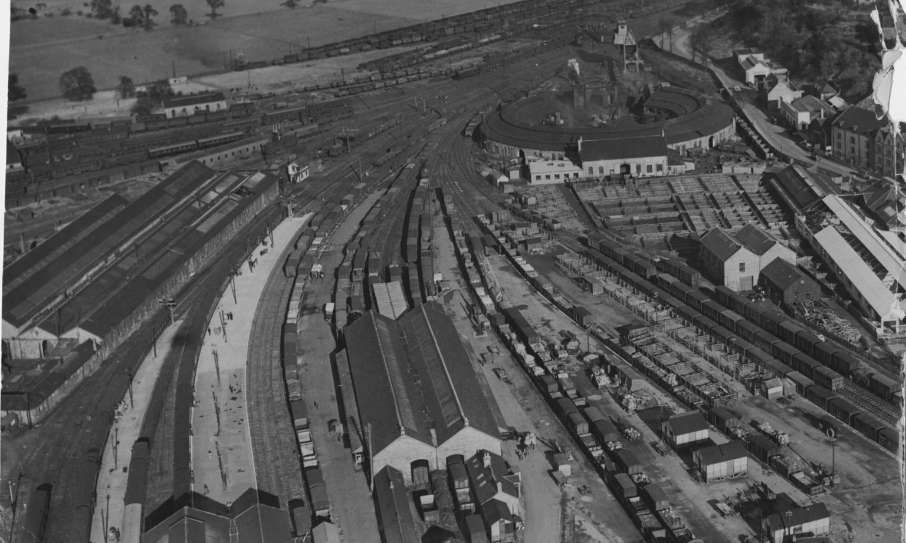
These three extracts from the 25″ Ordnance Survey of 1905, published in 1906, show the railway running North to South through Dereham. Southbound trains on the Wymondham & Wells Branch ran between the town’s Malthouses, crossed Norwich Street and entered the Railway Station. Goods facilities were close alongside the passenger station with the Goods Shed east of the main running lines. Further sidings sat to the West of the line before a triangular junction (including Motive Power Depot and turntable) gave access to lines running Southeast to Wymondham and Norwich and West to King’s Lynn. [2]
Carter’s article primarily reflected on the changes experienced in Dereham as the 1950s and 1960s developed. The line through Dereham remained open as a goods only line into the later part of the 20th century. This made it a prime candidate for preservation. The Mid-Norfolk Railway was formed in 1974 as preservation efforts began. The line re-opened in the mid-1990s. The MNR owns and operates most of the former Wymondham-Fakenham branch line of the Norfolk Railway! [3]
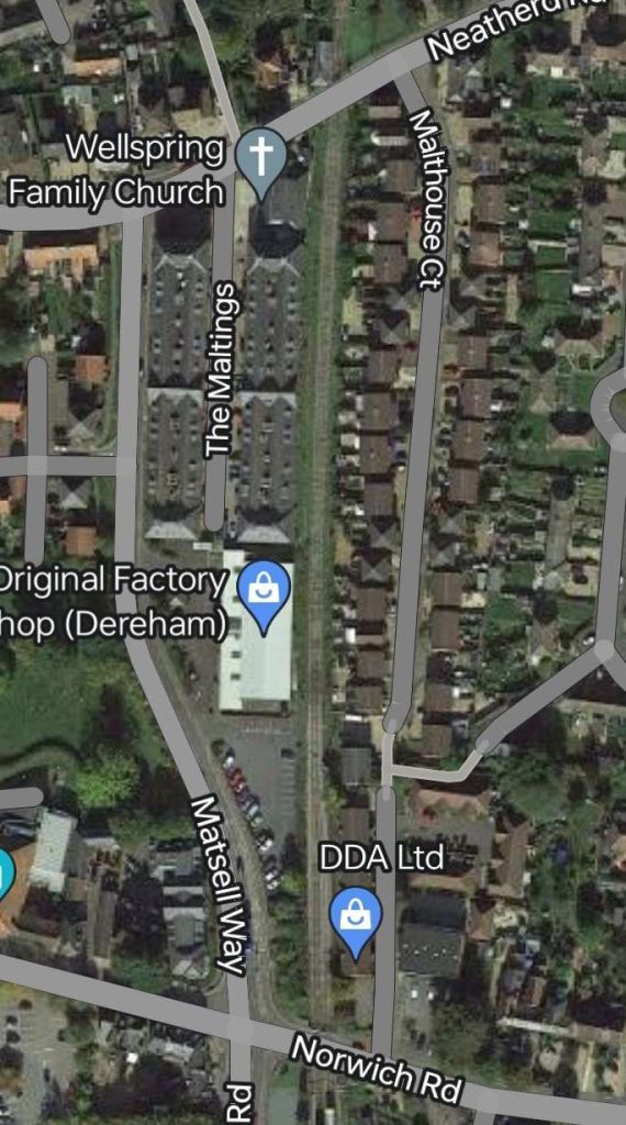
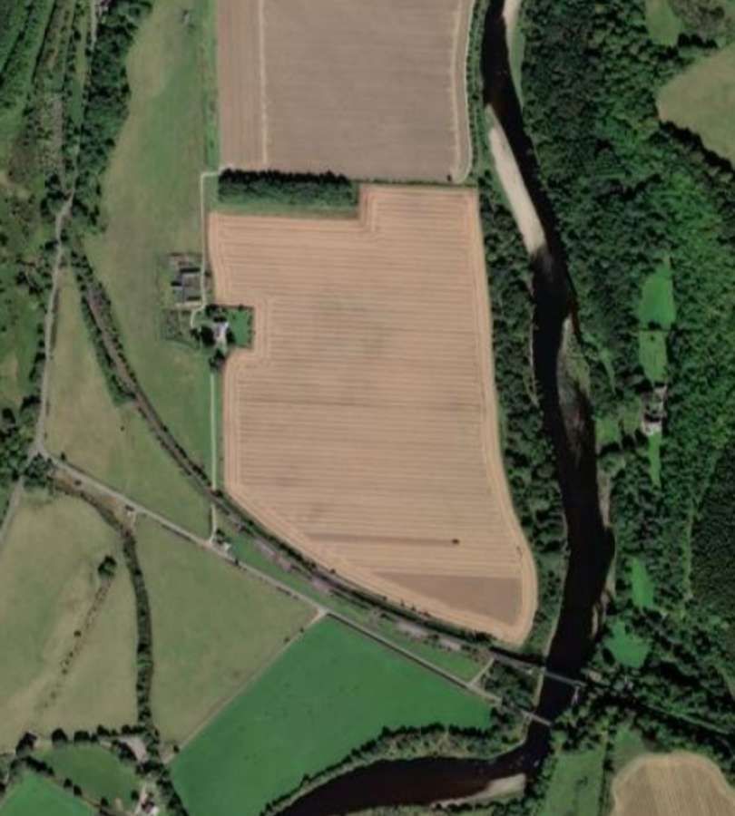
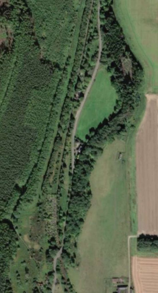
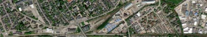
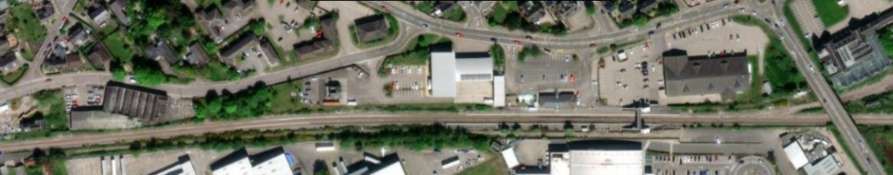
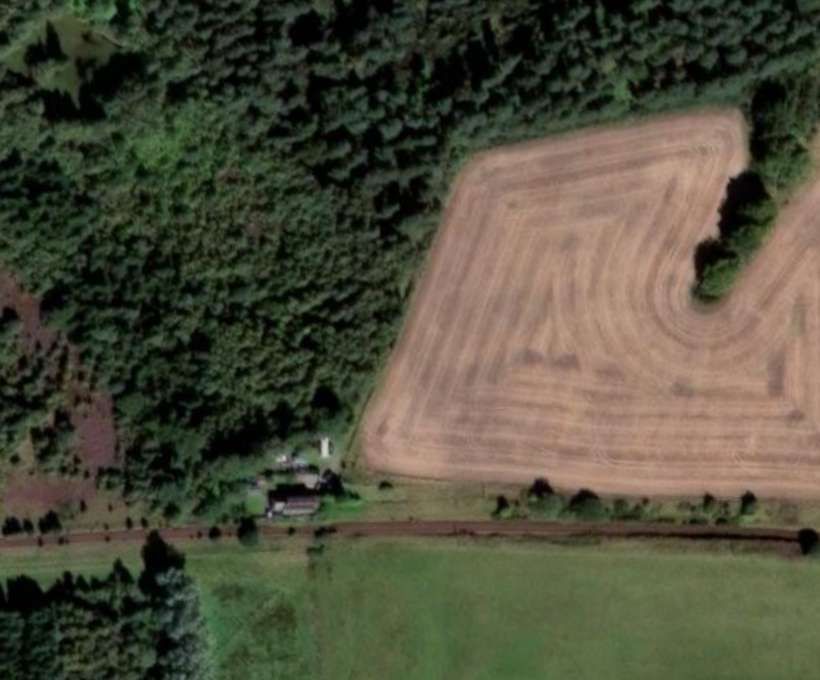
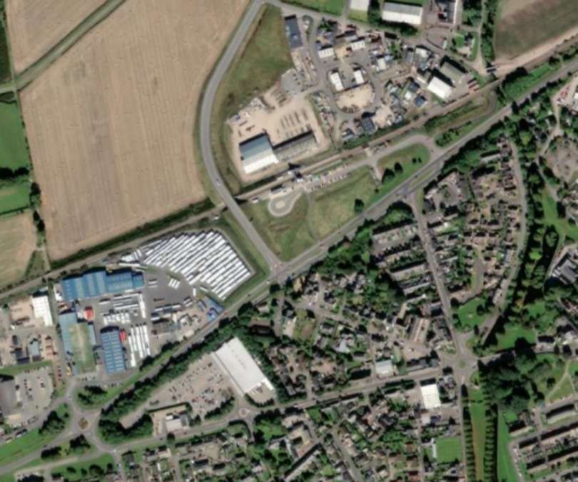
These three extracts from Google Maps show a similar length of the line as that covered by the extracts from the 25″ 1905 Ordnance Survey above. [Google Maps, February 2024]
Carter’s article gives only a limited account of the railway history of East Dereham’s rail network: ” In railway terms the small town of East Dereham in Norfolk belied its size as until the early 1950s it was, in effect, a three-way railway junction which enjoyed a status lofty enough to warrant a ‘Class 1’ grade station master. The ‘main line’ though the term is comparative – was used by trains between Norwich and Wymondham and Wells-next-the-Sea; there was also a branch from East Dereham to Kings Lynn, and until September 1952 the trains on the semi-circular route to/from Norwich via Wroxham and County School also started and terminated at East Dereham. But if one looked in the public timetables for this apparently important junction station, one would not have found an East Dereham the station was invariably listed simply as Dereham.” [1: p522]
Dereham Station was built by The Norfolk Railway. “The Norfolk Railway was an early railway company that controlled a network of 94 miles around Norwich, England. It was formed in 1845 by the amalgamation of the Yarmouth and Norwich Railway opened in 1844, and the Norwich and Brandon Railway, not yet opened. These lines were built out of frustration that the Eastern Counties Railway line that was expected to connect Norwich to London failed to be completed. The Norfolk Railway also leased the Lowestoft Railway and Harbour Company, and built a branch to Dereham and Fakenham, opened in 1846 and 1849 respectively.” [5]
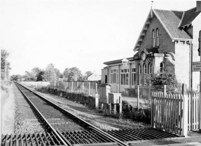
The Mid-Norfolk Railway dates the opening of the station to 1847: “Three years later an agreement was made to allow the Lynn & Dereham Railway to start to use the Norfolk Railway’s station, meaning that they could close their own terminus in the town. In 1857, the line northwards to Well-next-the-Sea was completed – with all the lines becoming part of the Great Eastern Railway in 1862. The station grew and evolved over the decades, with the Great Eastern Railway expanding the original Norfolk Railway ‘Tudoresque’ buildings as traffic grew, and the platforms being raised and extended to accommodate longer and more modern trains. Eventually, the station boasted a licensed buffet and four platforms with extensive canopies. Platform 1 is on the up line, with platforms 2 and 3 being set back to back (making one long platform face) and platform 4 being a short bay originally connected only to the King’s Lynn line.” [6]
The uncertainty over the date of opening of Dereham Station is resolved by Wikipedia quoting D. I. Gordon: A branch from Wymondham to Dereham “opened from Wymondham to Dereham on 7th December 1846 for goods trains and on 15th February 1847 for passengers. [7] … During construction, the Norfolk Railway sought an Act of Parliament to extend the Dereham line to Wells and Blakeney. … The Wells and Blakeney extensions were not built, and the new work was confined to building to Fakenham only. The construction contract [for the Fakenham line] was let to Peto in the Spring of 1847.” [5]
Soon, “The Eastern Counties Railway (ECR) … engaged in talks and … agreement for acquisition of the Norfolk Railway was finalised on 2nd May 1848, and the ECR took over the entire Norfolk Railway system, rolling stock included, on 8th May 1848. It sacked the Norfolk Railway staff and substituted its own. [7] Gordon says that the ECR ‘took the Norfolk on lease, so saving it from financial ‘perdition’.” [7: p164][5]
The Lynn and Dereham Railway also obtained an Act of Parliament to build a line to Dereham in 1845. It did not open its station (Lynn Hill) until 11th September 1848. [8: p41] [13] very close to The Norfolk Railway and formed a junction with it. This station was closed in 1850, when trains were extended to The Norfolk’s Railway station.
The King’s Lynn line was originally operated by the Lynn & Dereham Railway but, in 1848, the ECR leased The Norfolk Railway and absorbed the line to King’s Lynn.
In 1857, the line between Dereham and Wells opened. The Railways in this area became part of the Great Eastern Railway (GER) in 1862.
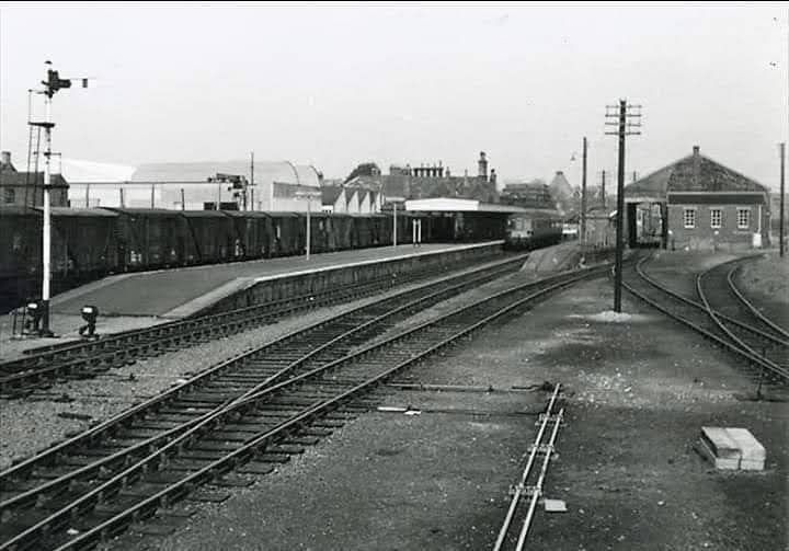
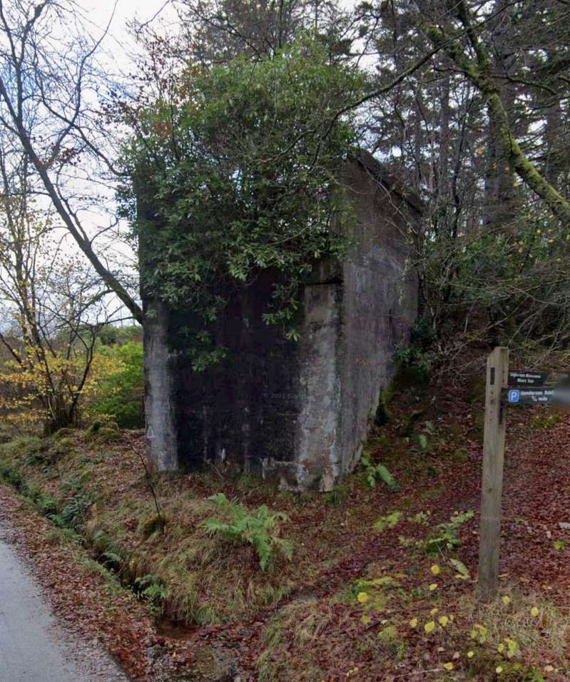
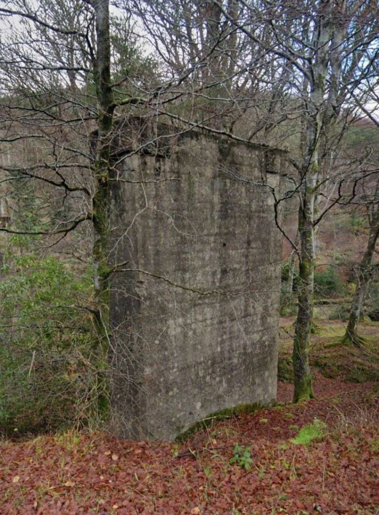
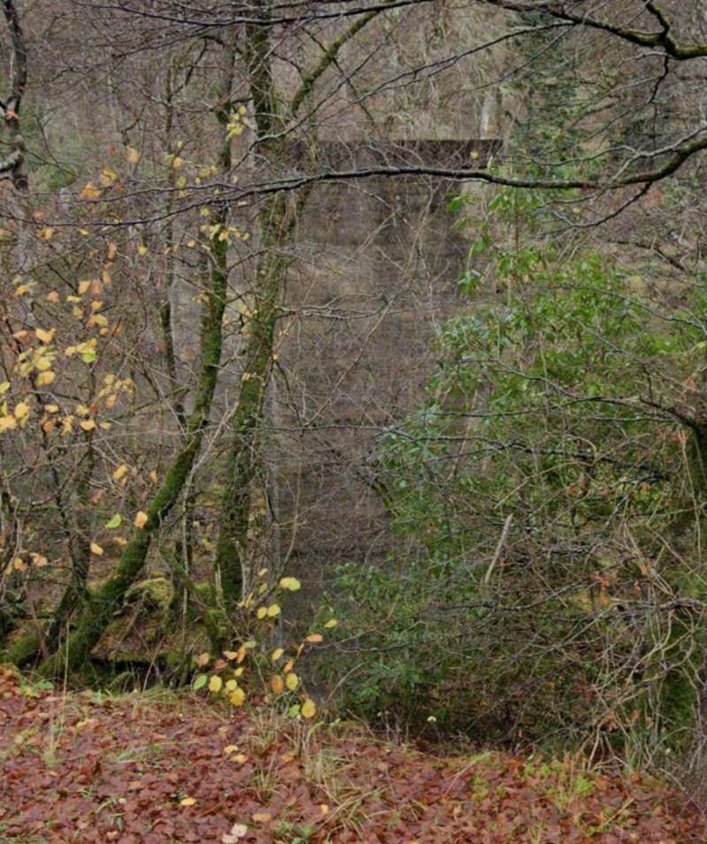
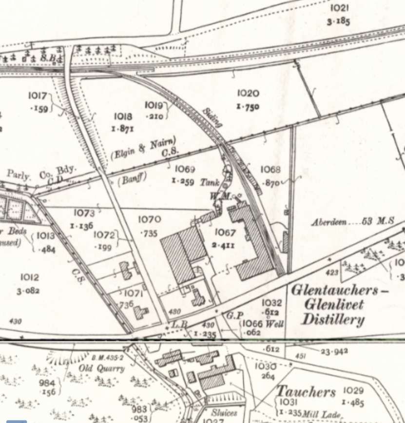
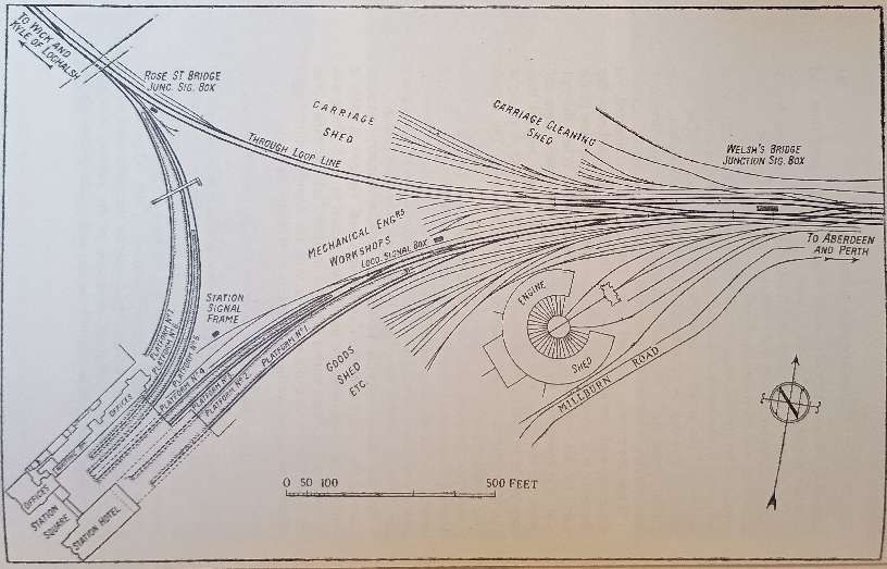
“In addition to the passenger facilities, Dereham had extensive goods facilities. Three goods sheds were provided (the surviving shed, one north of Norwich Road and another on the Lynn line), a large cattle yard, a coal yard, sidings for the town’s maltings trade, the Hobbies’ works, gas works and, during the Second World War, additional War Department sidings were provided on a new site to the east of the line. A triangle was provided for the Lynn line, allowing some trains (including the Royal Train) to avoid having to reverse in the station and a locomotive depot was built inside this triangle – where the town swimming pool now stands. This complex site was controlled by four signal boxes and stables were provided to house the horses used to operate delivery carts and shunt the yards.” [6]
“With an 1841 population of 3,837, Dereham already had several brewers and maltsters, two iron foundries and various small industries geared to the needs and produce of what was described as the ‘Garden of Norfolk’. But by 1855 it had grown to nearly 4,500 and had added a steam saw-mill, two further foundries, and a greatly expanded interest in the making of agricultural implements. In that year White recorded how the town trade had ‘considerably increased’ since the opening of the railways, and described the extensive granaries which had been built near the station and through which extremely large quantities of corn were despatched by rail. East Dereham in fact well illustrated the power of the nineteenth century railways to develop a small town when not too near a major centre and when conditions, in this instance the high fertility of the local soil, were right.” [7]
Derehamhistory.co.uk tells us that, “Along with the railways came the electric telegraph. The Norfolk Railway was a pioneer in the use of this instrument in railway operating and its spare capacity was made available to the public. It provided a nationwide accurate time check, replacing the often erratic local time with ‘Railway Time’. It gave the latest Stock Exchange prices and racing results in advance of the arrival of the newspapers.” [10]
“In the early 1880s, the railway line between Dereham and Wymondham was expanded to a double-tracked line, which was completed shortly after 1882. Yakham, Thuxton, Hardingham, and Kimberley Park all had new platforms constructed on the new up line, while the down line platforms underwent alterations, including the addition of new canopies. In 1886, an avoiding double track line was constructed to the south of the Dereham station. This allowed the Wymondham to King’s Lynn line to be used as a cross-country route. The avoiding line was utilised by freight, excursion, and diverted main-line trains.” [11]
Diesels were introduced in the mid-1950s but rapidly increasing road transport competition meant that rain services in rural Norfolk became increasingly uneconomic. “In 1963, Richard Beeching recommended that the line from Dereham to Fakenham and Wells be closed and, in 1964, the last passenger train ran over this section. He also recommended that the railway from Norwich to Dereham and then to King’s Lynn be retained for express trains and freight. However, in 1968, the connection to King’s Lynn was cut, as part of the formation was wanted for improvements to the A47, and the remaining passenger services between Dereham and Norwich ended in 1969. Concerns had been [raised] in Parliament about the local roads being inadequate for local business needs, specifically the large maltings at Great Ryburgh, so tracks through the station remained in regular use as a goods-only line until the 1980s.” [6]
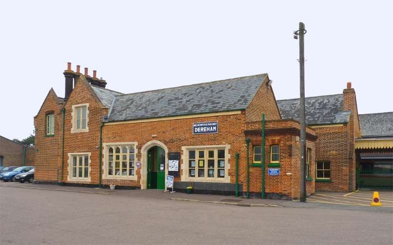
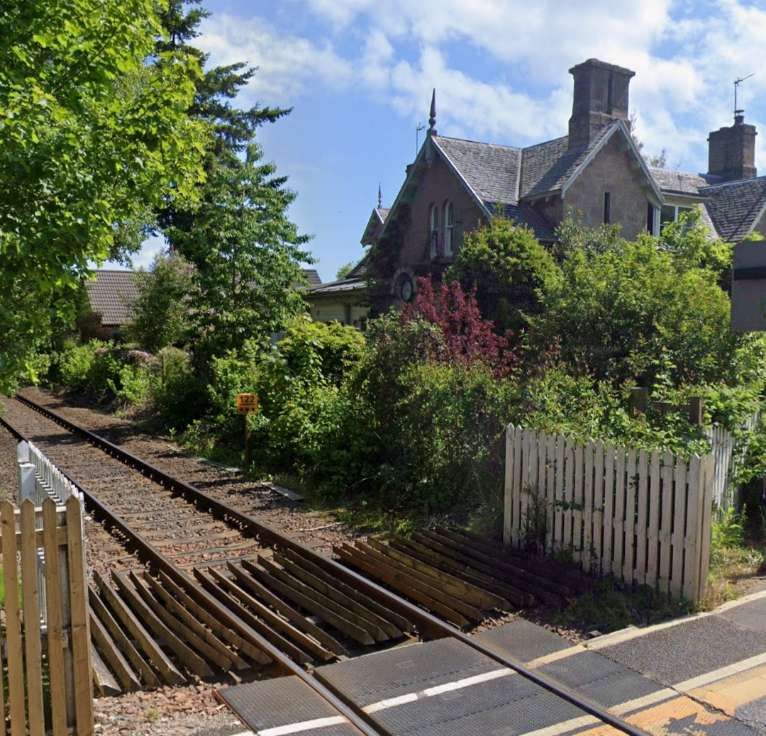
Sadly the main station building at Dereham suffered a significant fire in 1988. The interior and roof were lost. The station master’s house survived in a near derelict condition. After the line was purchased by the Mid-Norfolk Railway it was carefully restored and it re-opened to passengers in 1997. [6]
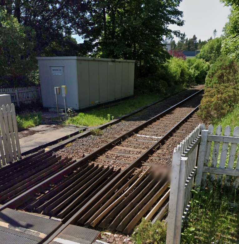
The Mid-Norfolk Railway also reports that “two of the station’s signal boxes have been replaced. The original Dereham Central site is occupied by the former Stratford Southern box, which controls the station site and the line southwards. Dereham North is occupied by the former Laundry Lane box from Lowestoft, and controls the level crossing and line northwards. The original Dereham North box also survives, as holiday accommodation near Melton Constable. With the original locomotive depot site being lost, [their] new maintenance shed has been built in the former goods yard.” [6]
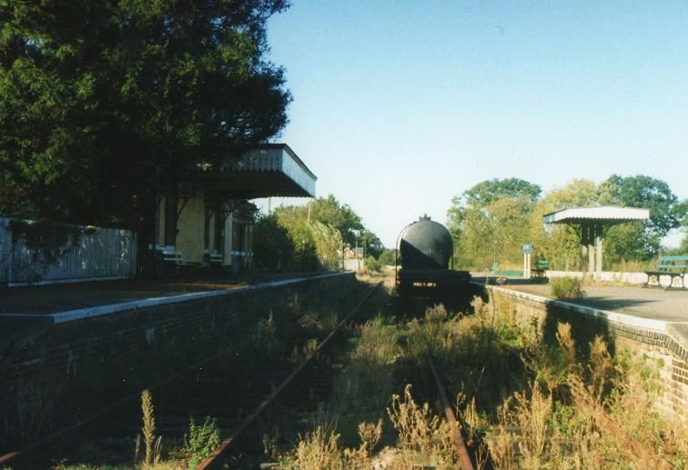
The surviving goods shed, stables and one of the station’s original LNER yard cranes feature in future plans for a heritage attraction at Dereham Station.
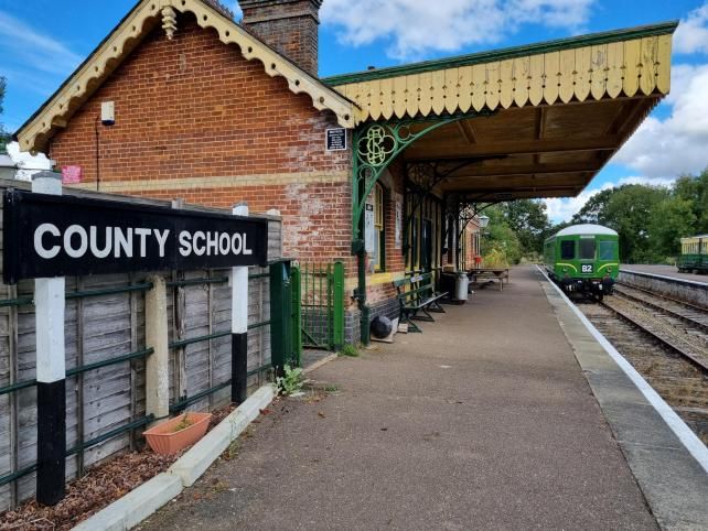
The Mid-Norfolk Railway Preservation Trust also plans to restore another section of track. It intends to bring back into use another mile and a half of the line from North Elmham, near Dereham, up to the former County School station. The Trust will restore the station to an operational standard and make it the line’s northern terminal. “County School once served a nearby boarding school set up in the 19th century, which later became a naval training school and a Dr Barnardo’s home until its closure in 1953.” [12]
Currently, The Mid-Norfolk Railway, at 17.5 miles, is already one of the UK’s longest heritage railways. Once the latest extension is completed, it would be the third longest. [12]
County School Station on the Mid-Norfolk Railway. [12]
References
Orson Carter; Dereham – a Time of Transition; in Railway Bylines, Volume 7, Issue 10; Irwell Press, Clophill, Bedfordshire, September 2022, p522-527.
There is an excellent book by Laurence & Pamela Draper, which they self-published in 1990, entitled “The Raasay Iron Mine: Where Enemies Became Friends.” I picked up a copy second-hand from an online sales site. That book covers the operation on Raasay in some detail. This article looks at the railways involved.
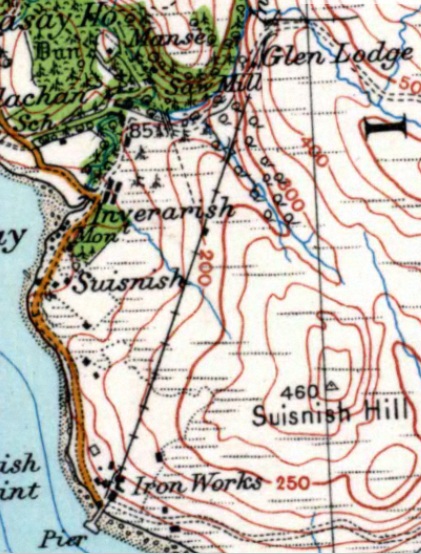
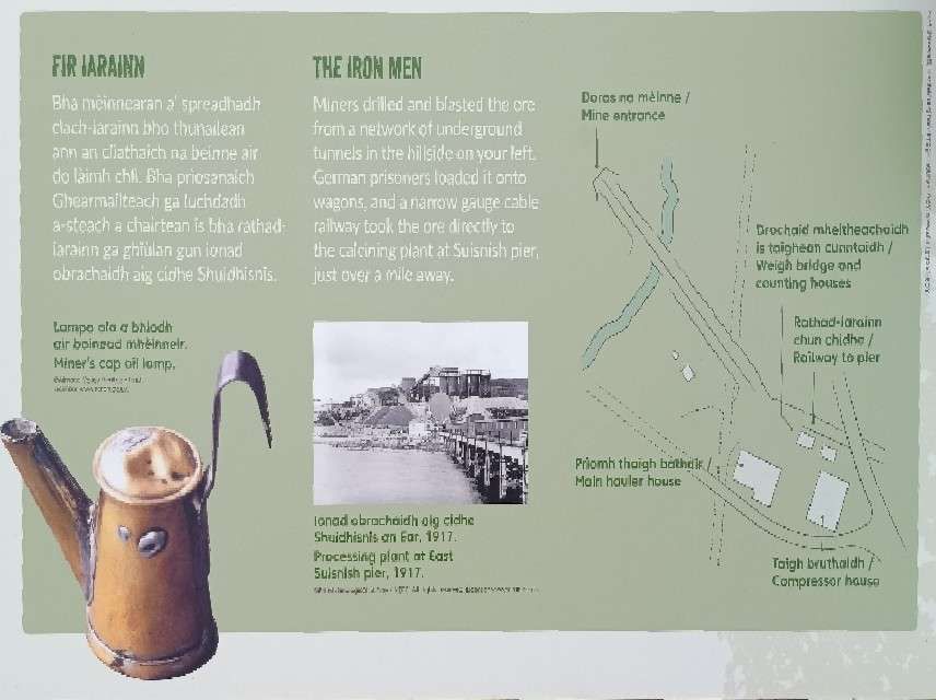
An extract from the Ordnance Survey 1″ Mapping of 1930 (Sheet 25) shows the line of the railway running North-northeast from the pier at Suisnish to Mine No. 1. A dotted line represents the line to Mine No. 2. [8]
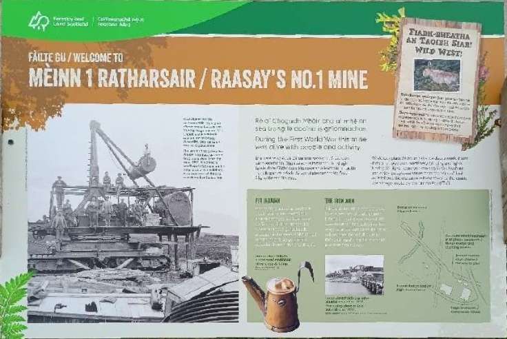
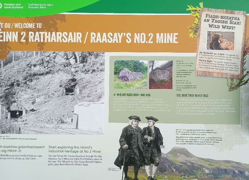
Raasay Iron Mine
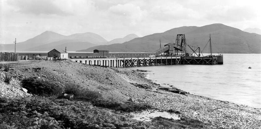
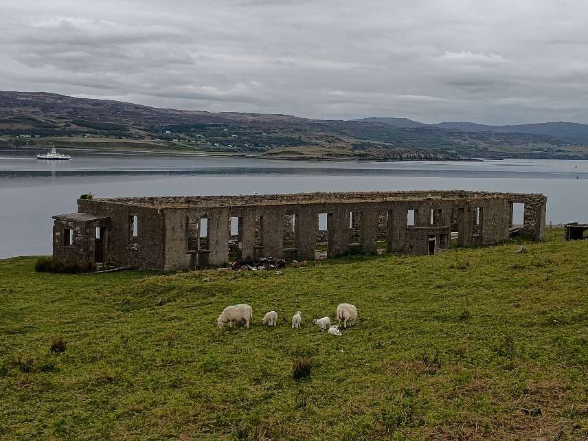
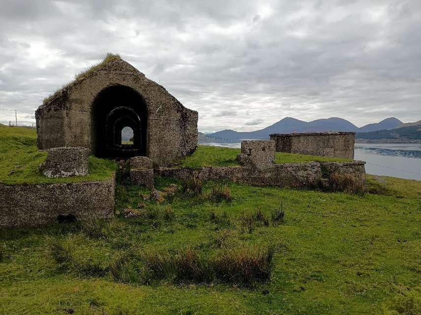
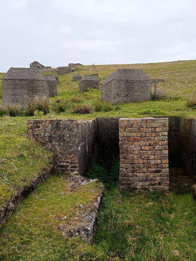
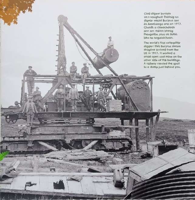
L. & P. Draper tell us that “Just before the First World War the Scottish coal and iron-ore mining, and iron-smelting, firm of William Baird and Company opened up an iron-ore mine on the Island of Raasay in the Inner Hebrides. … In association with the mine, Baird’s built several kilometres of narrow-gauge railway, a crusher, five calcining kilns, a huge ore hopper and a reinforced concrete pier. Many aspects of the installation, such as this pier, diesel-electric power generation and the provision of powerful external electric lighting, were very advanced for their time.” [1: pV][3: p146]
The BBC tells us that “William Baird and Co. Ltd … owned the Raasay estate and initiated the mine’s operations. The mine was developed just before the war and was crucial in providing iron ore for the British war effort, with the ore being transported to Ravenscraig for smelting.” [2]
Because most of the local men had been called up, Baird’s arranged for German Prisoners of War to work the installation from 1916 onwards. In permitting this, the British Government probably “contravened the Hague Convention which specifically banned the employment of Prisoners of War on munitions production; in 1920 the British Government attempted to destroy all relevant records, and was largely, but not entirely, successful. To enable prisoners to be used, the project was effectively nationalised (although that word was not actually used), with Baird’s operating it as agents for the Government; this was a standard system of management in the First World War. … Prisoners and local people worked in harmony together as colleagues, but relationships between Baird’s and the Ministry of Munitions were at times hostile. At the end of 1917 the local men, who were badly paid compared with men doing similar work elsewhere, went on strike, and there were allegations in Parliament that German Prisoners of War were being used as strike breakers, with a result that Winston Churchill himself made statements in response; these allegations were at best only half truths.” [1: pV][3: p146]
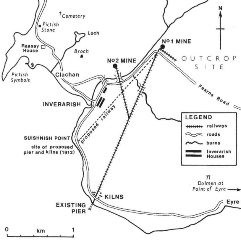
This map was reproduced in an article written by the Drapers for Der Anschnitt in 1999. It shows Baird’s initial plans for a railway were altered to move the kilns away from Suishnish House (modern spelling Suishnish). [1: p2]]3: p150]
A probable total of almost 200,000 tons of raw iron ore was produced over the life of the mines, which in the first instance ran until six months after the end of the First World War. “Everything was maintained in full working order, [but] almost the only further iron to be yielded, in the Second World War, came out as scrap from the dismantled installation itself.” [1: pV][3: p146]
L. & P. Draper tell us that, “After hostilities ceased on 11th November 1918 there was a rapid fall in demand for iron, and on 21st December 1918 the Government stated that it wished to terminate its agreement with Baird’s, asking: … do you want the prisoners after about the end of January 1919? … Baird’s said that it did, for a while, if the Ministry could take the output; otherwise the prisoners were not needed. … The Ministry was anxious that the whole installation should be shut down by 31st March 1919.” [1: p30]
It appears that there was probably no resolution between Baird’s and the government over ownership of remaining stocks of iron ore at the mine when it closed but L. & P. Draper note that in the years after the war, whenever a full load of coal was delivered to Raasay, the steamers involved left Raasay with a full hold of iron ore. [1: p31-32]
“Soon after the war ended there was unrest on the island, partly because the fisheries had failed and partly because many of the veterans returned expecting that their interpretation of promises which had been made to them, that they would be re-located on more fertile ground, would be honoured. Following the example of many other Hebridean islanders since the latter years of the nineteenth century, they forcibly took over the south end of the island and some men served terms of imprisonment as a consequence. However, Baird’s sold the estate to the Scottish Board of Agriculture during the 1921-22 post-war crisis and many islanders were re-settled on land which they had coveted.” [3: p155-156]
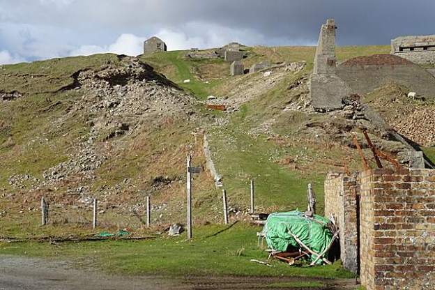
“ln the mid nineteen thirties, twenty years after its heyday, the installation was still in good working order as Baird’s had placed the works on a care and maintenance basis and employed a full-time 3-to-5 man crew … who kept the machinery in perfect working order. They painted the ironwork, including the large expanse of the end of the calcined-ore hopper, with red Iead, and ran the installation once each week. lt was capable of being started at relatively short notice at a time of national emergency. However, this was not to be, probably because of the cost of winning the relatively low grade ore, and after the onset of the Second World War the only iron to come from the site was the installation itself as scrap. lt is not clear whether the formal abandonment on 15th May 1941 was the beginning of dismantling, or just the date on which the plan was drawn. … Three, if not all, of the kilns were taken to Lingdale, in Cleveland, Yorkshire where three were re-erected . They continued in intermittent production until about 1962. lt is not known which ones were rebuilt, but it seems likely that they were Nos 3, 4 and 5 which had been unused on Raasay.” [3: p156]
Raasay Iron Ore Mines Railways
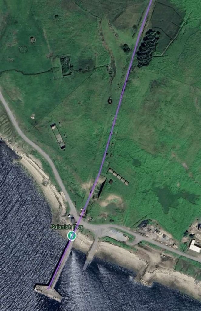
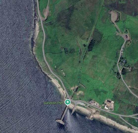
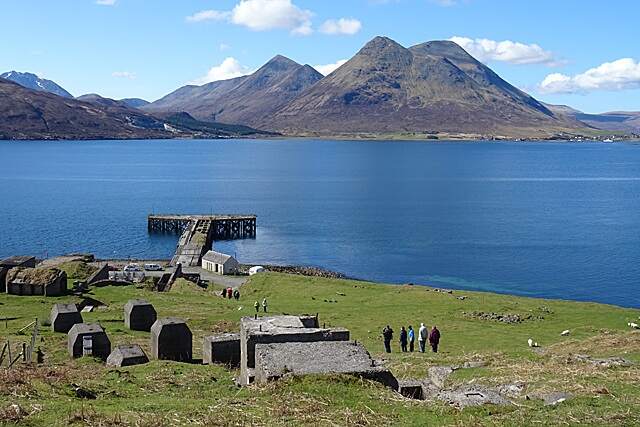
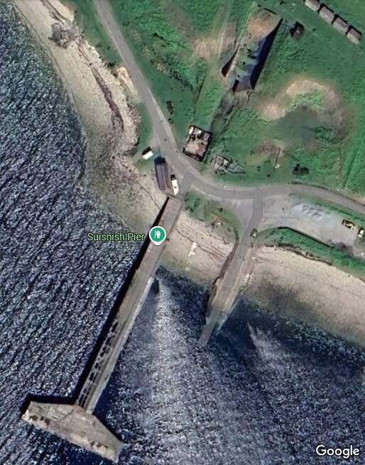
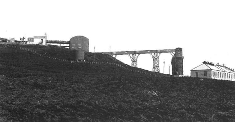
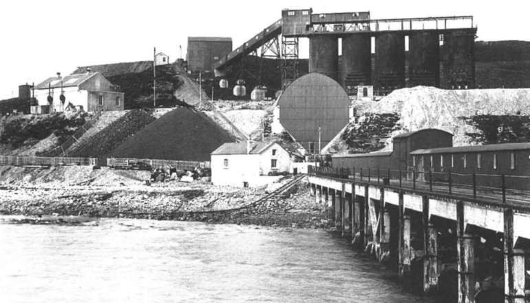
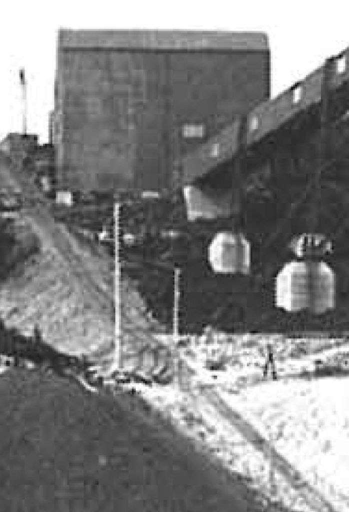
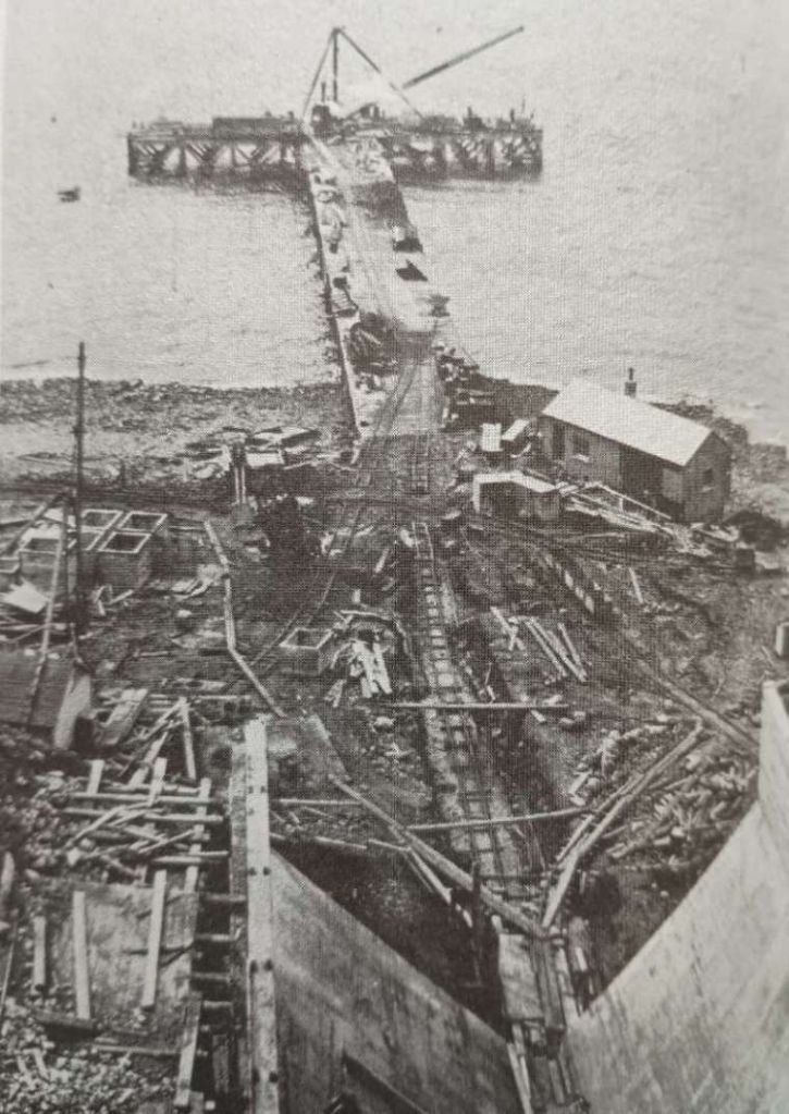
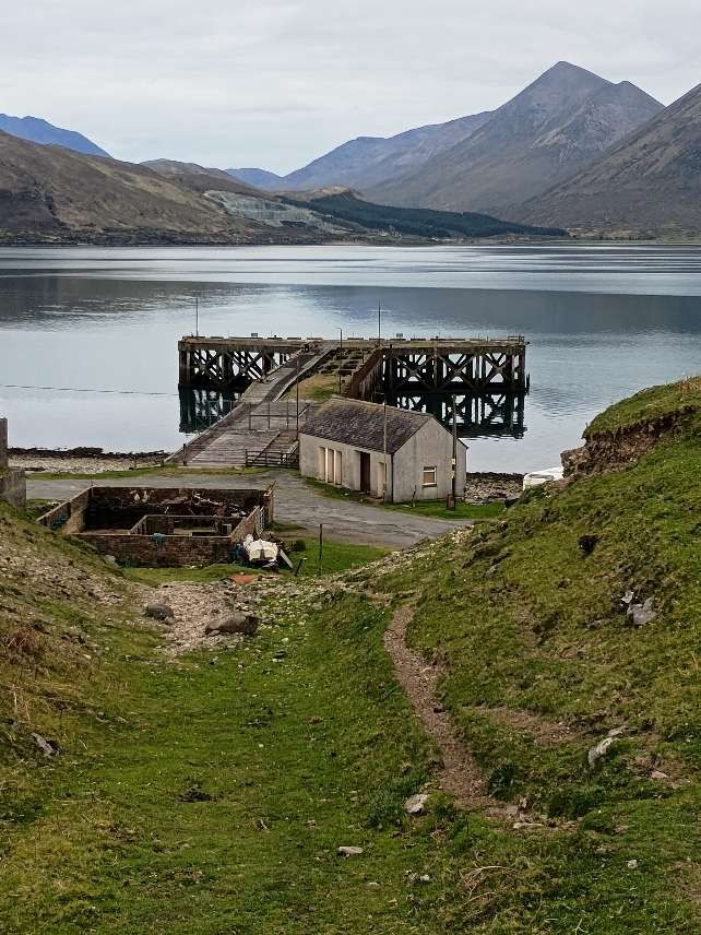
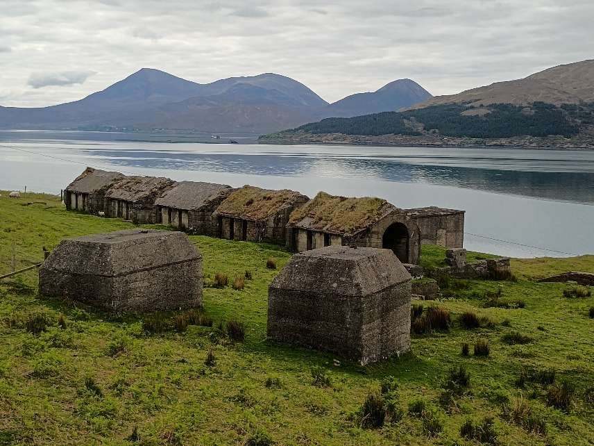
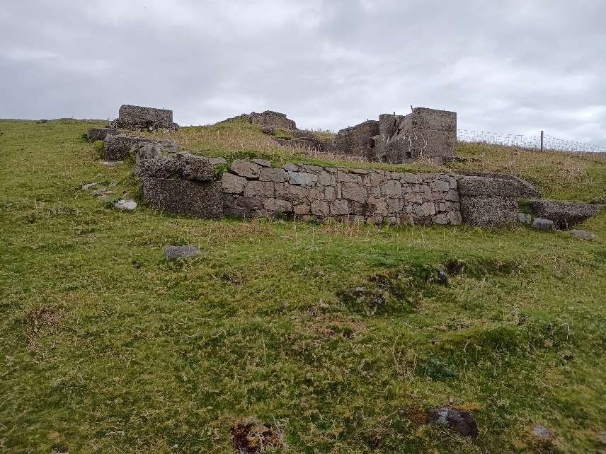
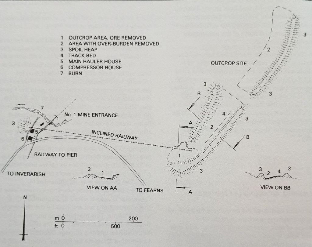
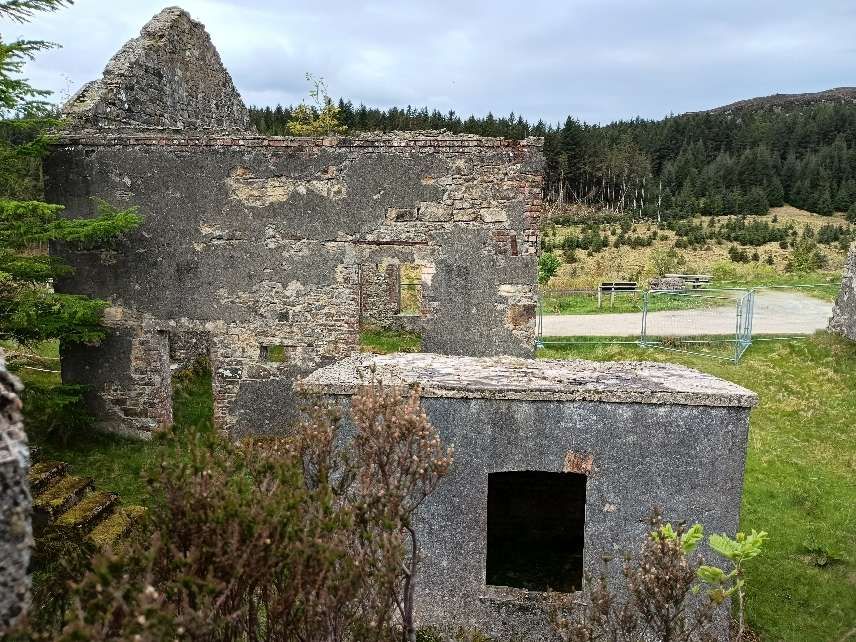
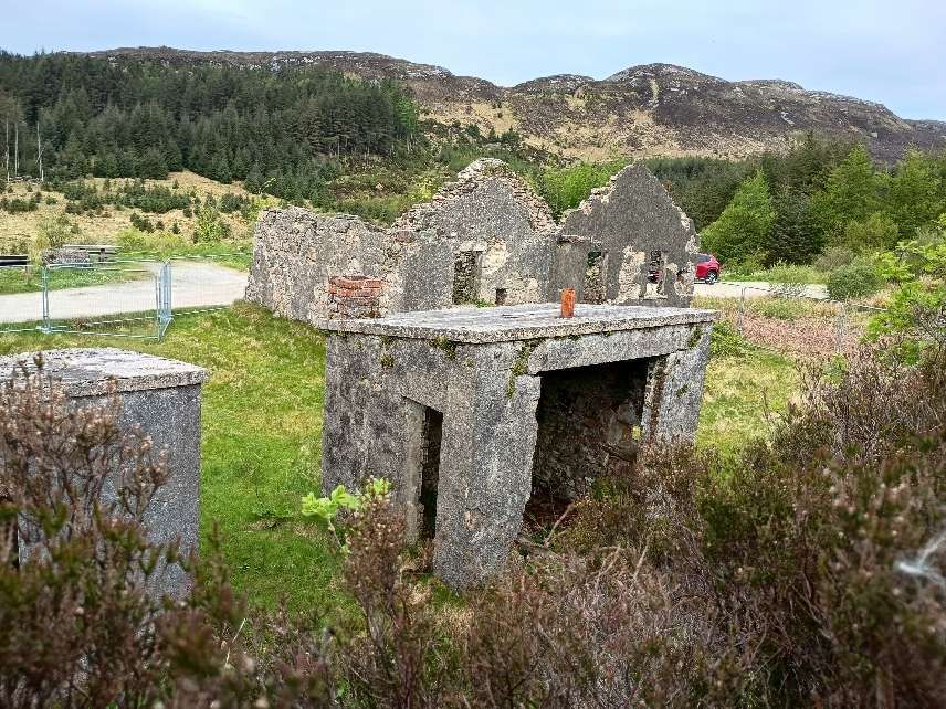
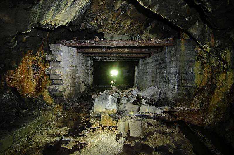
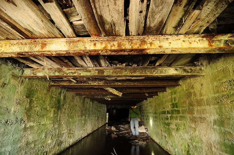
“No 1 Mine was connected to the pier at Suishnish by a virtually straight railway. A short steeply-inclined spur to the outcrop site left the main line at the entrance to No 1 Mine; No 2 Mine was connected by a spur from the main line. The railway led directly from the mines to the top of the crusher, on the hill overlooking the pier. Just below the crusher stood the kilns. An inclined railway connected the area just above the crusher down to the pier; this is also the route by which the coal was taken from the pier up to the crusher. Coal and iron ore were mixed in the crusher and taken by conveyor belt to charge the kilns. Below the kilns, more belts took the calcined ore to a hopper, from whence it was ultimately loaded onto ships at the seaward end of the pier.” [1: p33][3: p151]
Prior to the construction of the 4 ft. 6 in. railway the first output from the iron ore mine was transported by horse and cart down the narrow lane through Inverarish. [5: p78] But before the completion of the facilities near East Suishnish Pier, the incline was already bringing iron ore down from Mine No. 1 and the Outcrop Site.
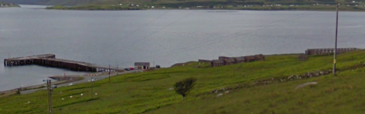
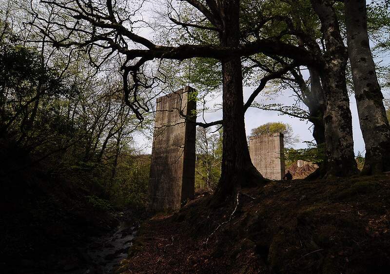
We focus first on the railway infrastructure at the southern end of the line where the processing plant and pier were sited. The drawing below shows the layout of the site.
Two enlarged details from the image immediately above, show parts of the rail infrastructure on the site.
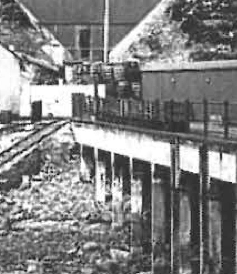
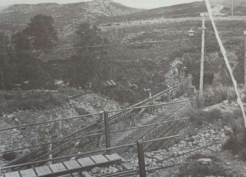
This first enlargement shows the steeply inclined line which ran down the side of the crusher to the pier. [3: p151][British Geological Survey: BGS C 2183]This second enlarged extract shows the rail line running out onto the reinforced concrete pier. A short train of open wagons appears to be sitting on the rail line. [3: p151][British Geological Survey: BGS C 2183]
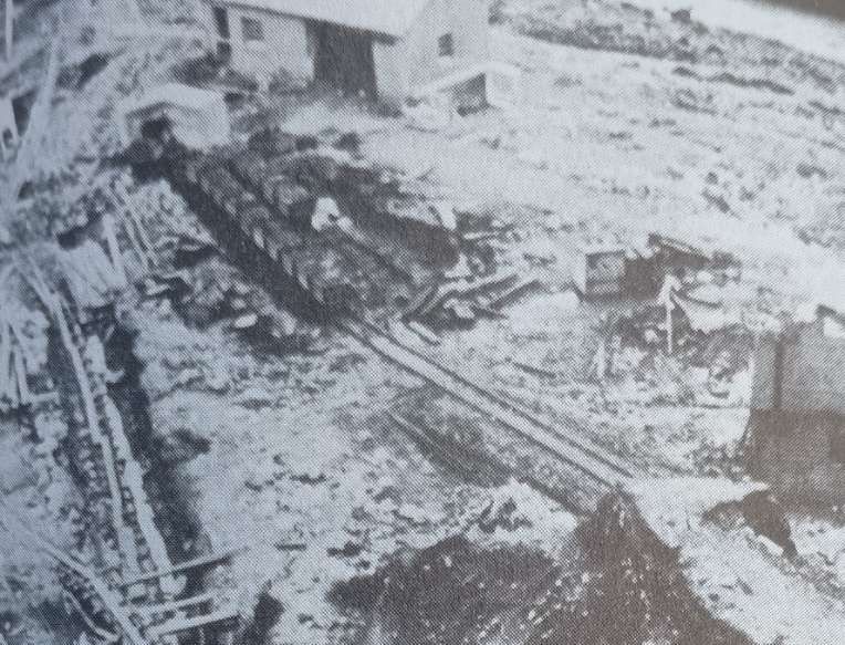
A third and a fourth extract, this time from photographs provided by the Munro Daughters for L. & P. Draper’s book, show the incline in use while the calcined-ore storage hopper was being constructed. …
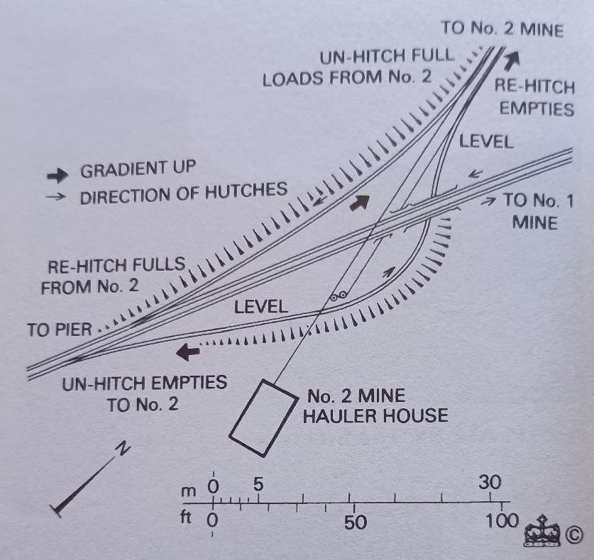
Perhaps it is worth noting here that the wagons used on the network were known as ‘hutches’. They were 5ft long overall, the body being 4ft long x 3ft wide and 2ft in height. Wheels were 1ft in diameter (1ft 2in over the flanges) and the axles were centred 1ft 6in apart. The overall height was 3ft 7in above rail height. [1: p65]
The hutches “were assembled from kits in the top of the crusher. They were pushed by hand initially, and were stiff until they were greased. … 4 wheels and 2 axles weighed 1 hundredweight 1 quarter 14 pounds (70kg). 200 sets were ordered on 28.4.13 and a further 100 on 5.6.14, so the mine must have had at least 300 hutches.” [1: p66]
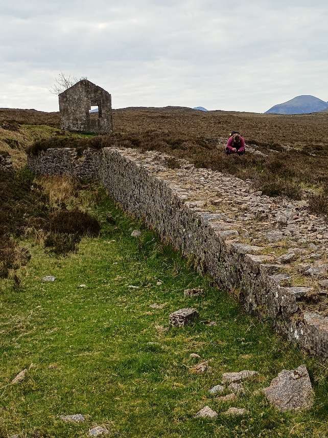
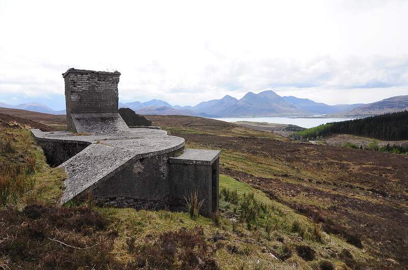
“The Pier Haulage Road was in 3 sections. The lower one, at a gradient of about 1 in 4.5, extended for 67 metres, the middle one at about 1 in 10 for 25 metres, and the upper one at about 1 in 4 for 83 metres. At the bottom of this incline the track was diverted around a huge L-shaped concrete block designed to catch runaways. … The hauler house … was used solely for haulage on the incline above the pier.” [1: p63]
The railway was, apart from the lower section, the Pier Haulage Road, largely double track. It was multi-level in the vicinity of the processing plant and the incline to the Outcrop Site was single track. Rails were 30lbs/yard, spiked into sleepers. Where there was traffic across the rails an inverted U-shaped bridging rail was used. [1: p65]
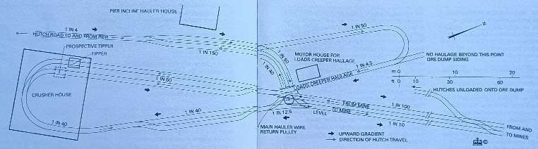
The track plan of the rails around the processing plant provided by the Drapers shows a complex arrangement with some very tight radius curves. It is not surprising that the ‘hutches’ needed to have a short wheelbase.
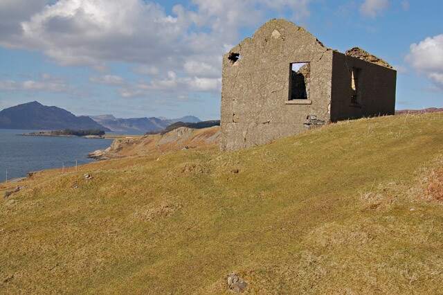
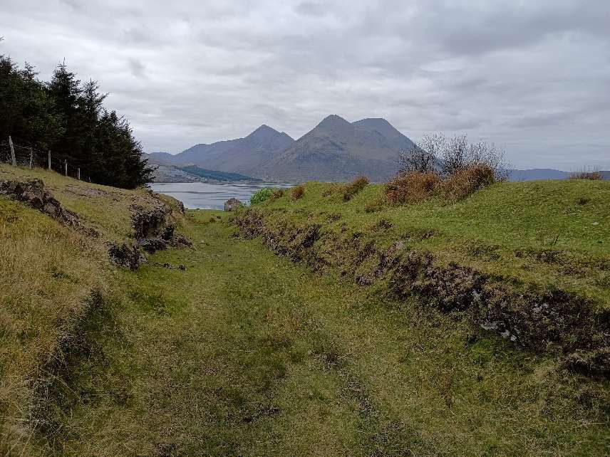
Track layout in the vicinity of the Crusher House. [1: p66-67]The same building, the Hauler House, seen from further North on the second incline. The mountains of Skye sit beyond the Sound of Raasay. [My photograph, 7th May 2025]
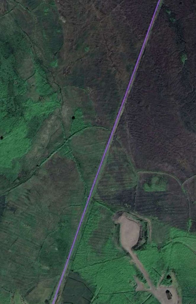
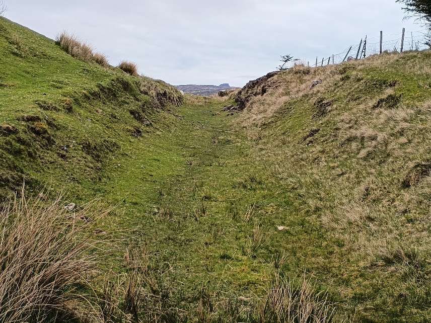
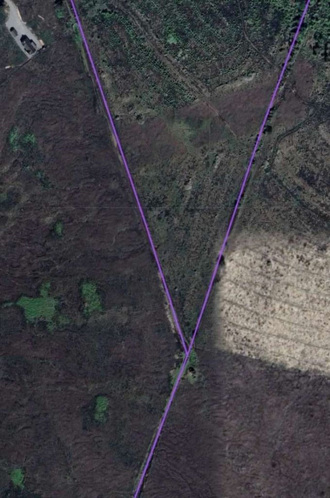
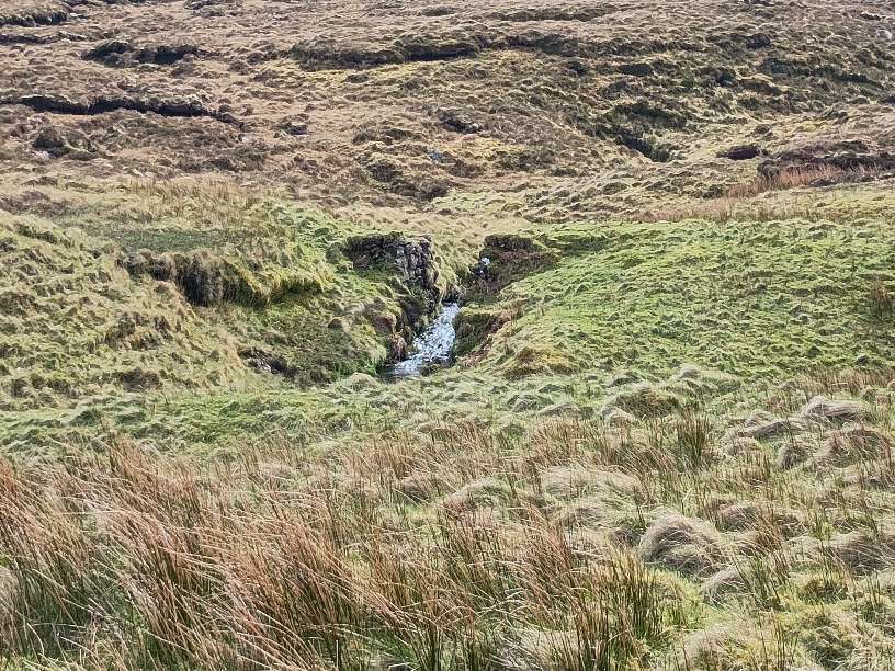
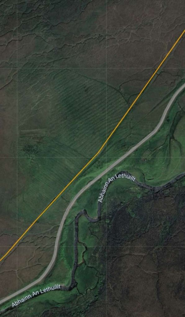
L. & P. Draper tell us that the extensive system of narrow gauge lines were 2ft 3in gauge. The main line “extended in a straight line … from the pier root up an incline, the ‘Pier Haulage Road’, to a level ore storage area above the crusher and on to the No 1 Mine entrance at a distance of 2.6 kilometres. … At a distance of 1.4 kilometres from the pier a straight spur, 0.9 kilometre in length, left the main line … to No 2 Mine. … The junction layout is shown [below].” [1: p63]
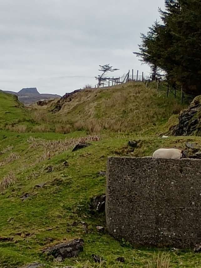
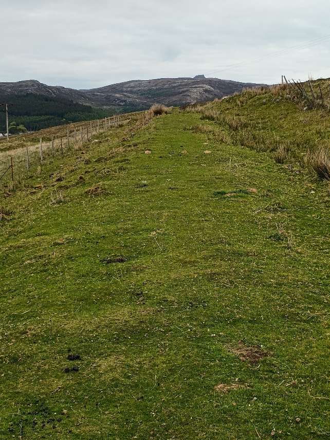
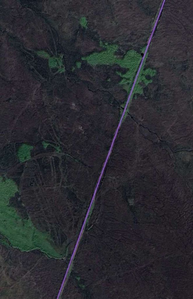
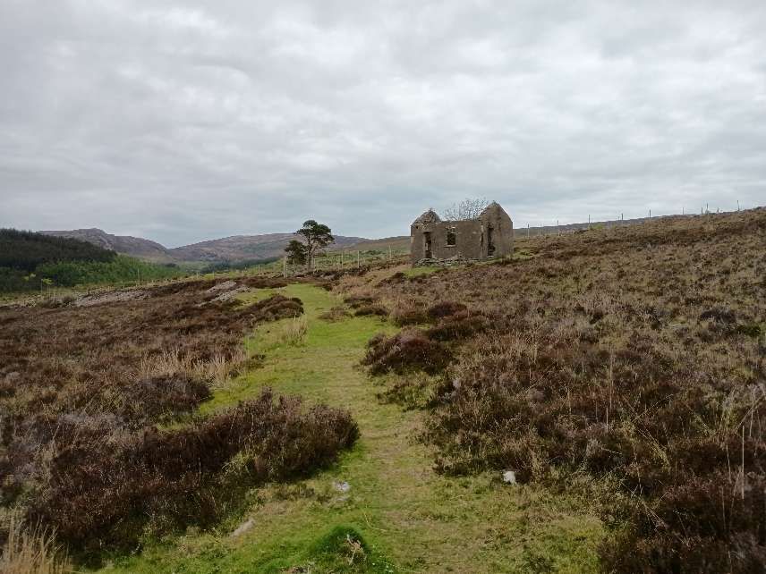
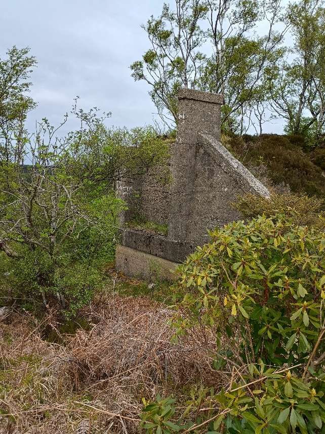
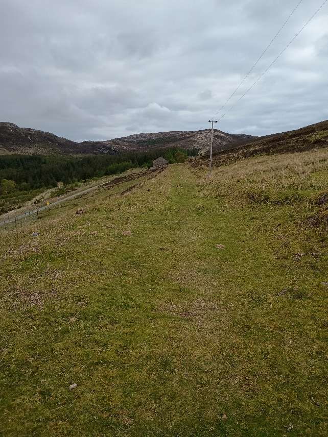
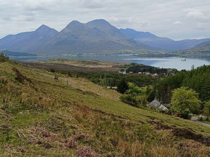
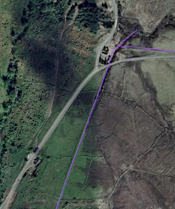
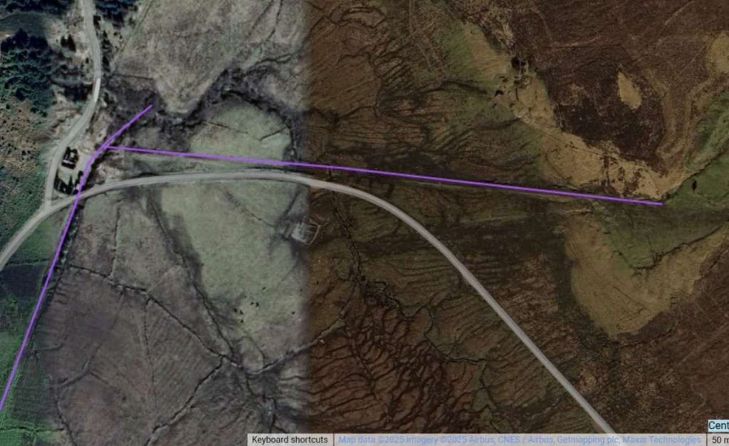
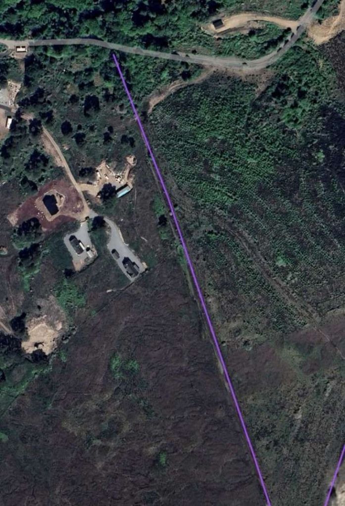
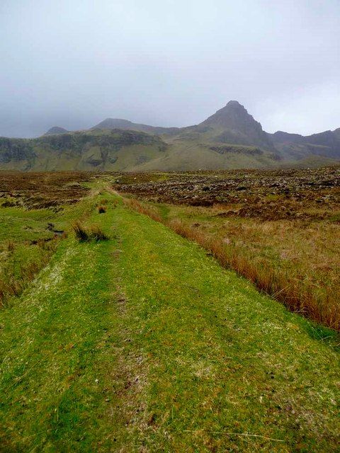
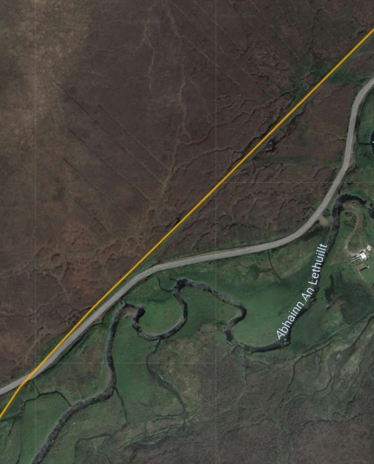
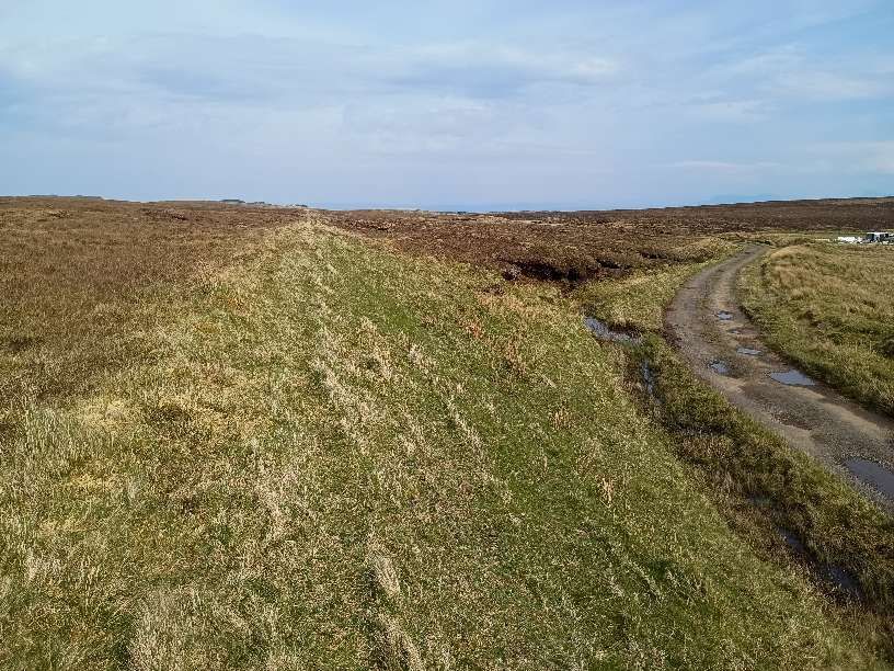
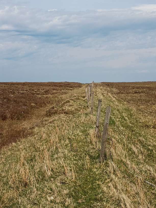
The incline climbs to the North. [My photograph, 7th May 2025]This telephoto shot shows the incline continuing to the North and shortens the distance to the mountain in the distance, which is Dunn Cana (Caan). [My photograph, 7th May 2025]Looking back towards Skye from within the shallow cutting in the previous pictures. [My photograph, 7th May 2025]Further North and looking North, the incline remains relatively clear of vegetation. [My photograph, 7th May 2025]Railmaponline.com shows the line continuing North. [10]Continuing North. [My photograph, 7th May 2025]And again, further North and looking North. Dun Caan has dropped below the horizon as we continue the climb. [My photograph, 7th May 2025]Railmaponline.com shows the location of the junction between the lines toMine No.1 to the North and Mine No. 2 to the Northwest. Just to the South of the junction, the remains of the Hauler House for the line to Mine No. 2 can be seen. [10]Approaching the location of the junction from the South: the remains of the Hauler House sit close to the centre of the image. [My photograph, 7th May 2025]The railway junction between the line to/from Mine No. 2 and the main line which ran between the pier and Mine No. 1. [1: p40]Looking Southeast along the line of the railway built to serve Mine No. 2. The line passed under that serving Mine No. 1. The bridge was between the camera and the Hauler House. [My photograph, 7th May 2025]
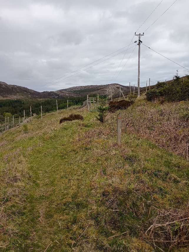
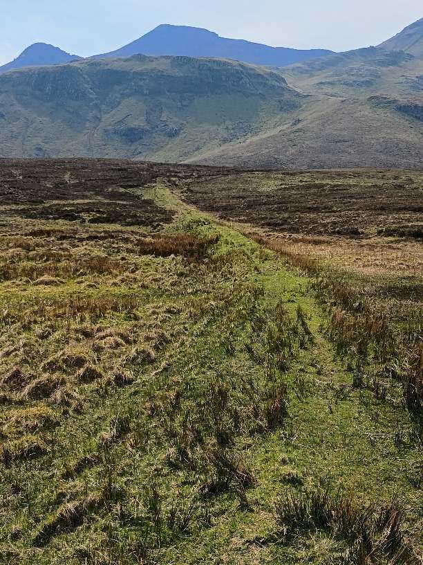
Heading North from the junction, the route of line to Mine No. 1 now runs through a protected area where deciduous native trees have been planted among sparce examples of older trees.
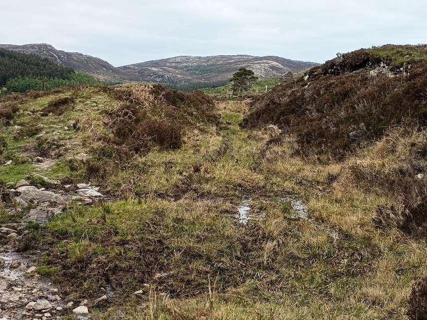
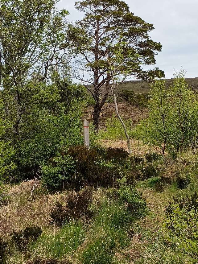
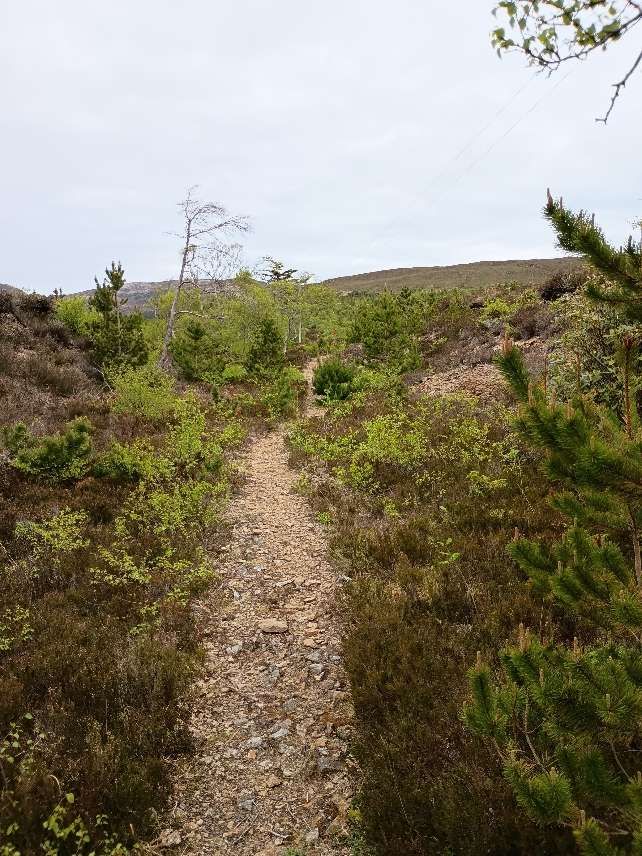
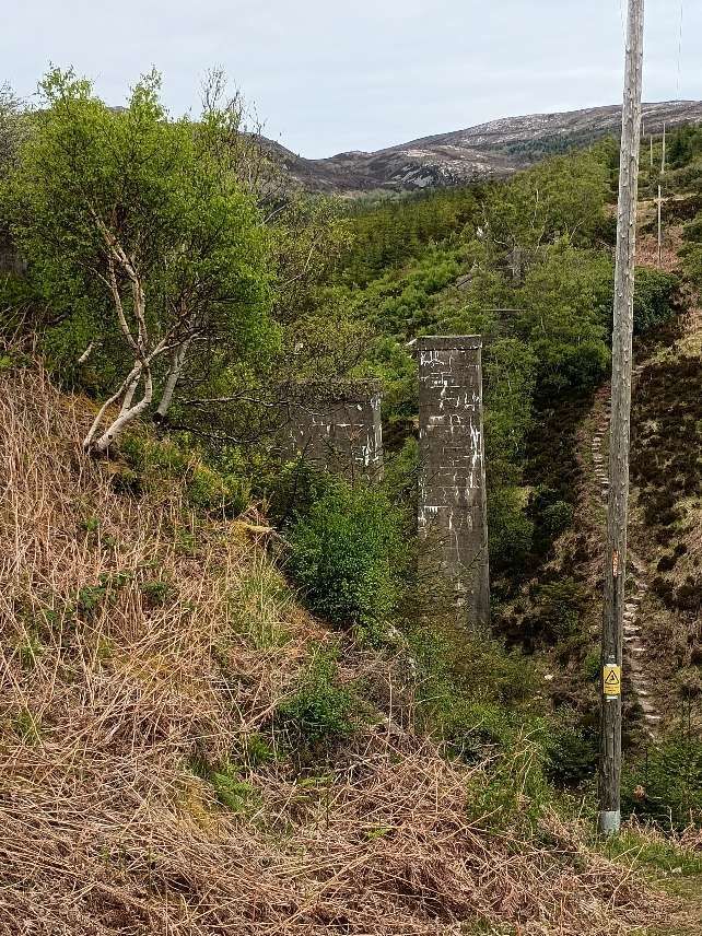
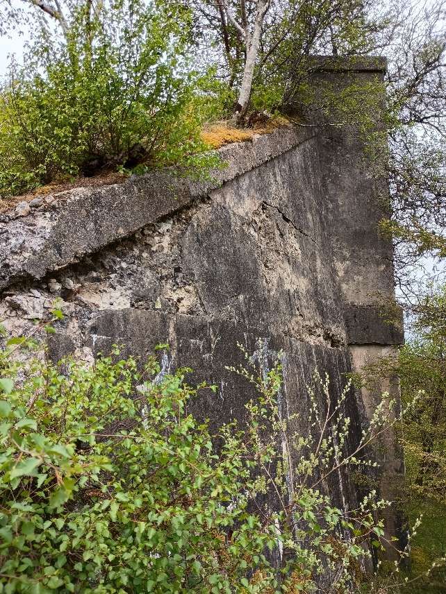
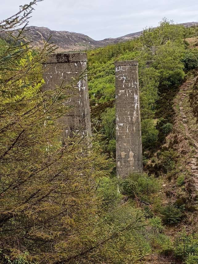
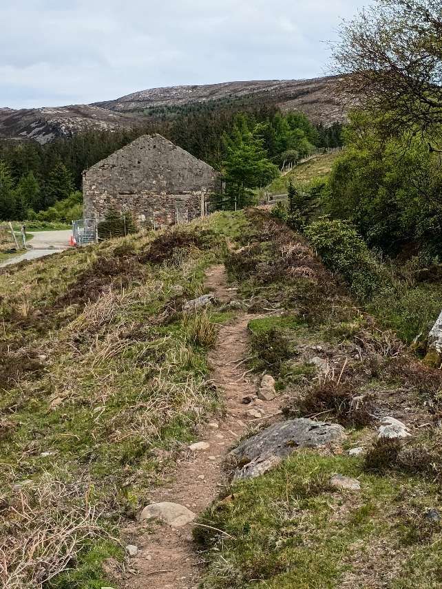
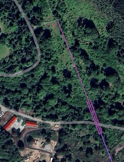
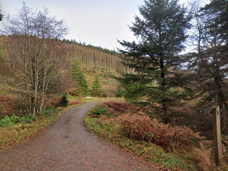
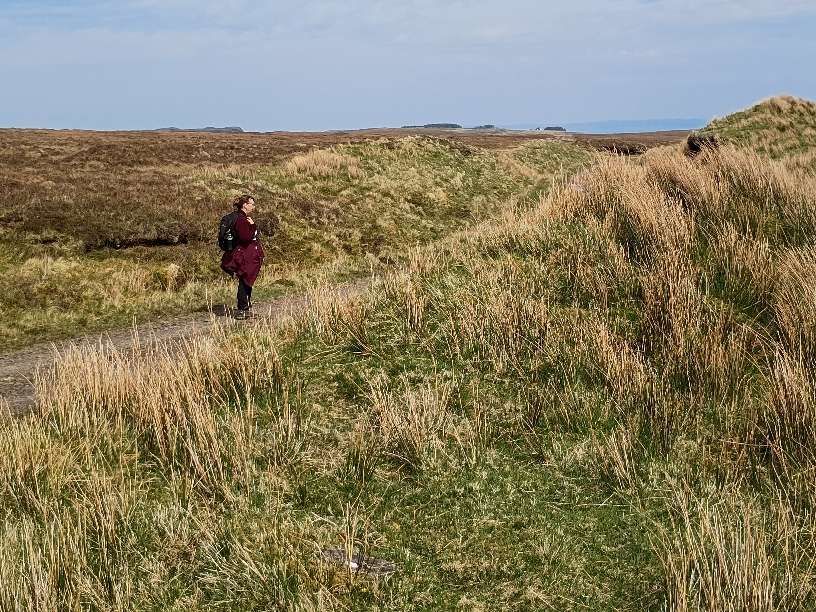
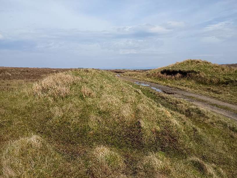
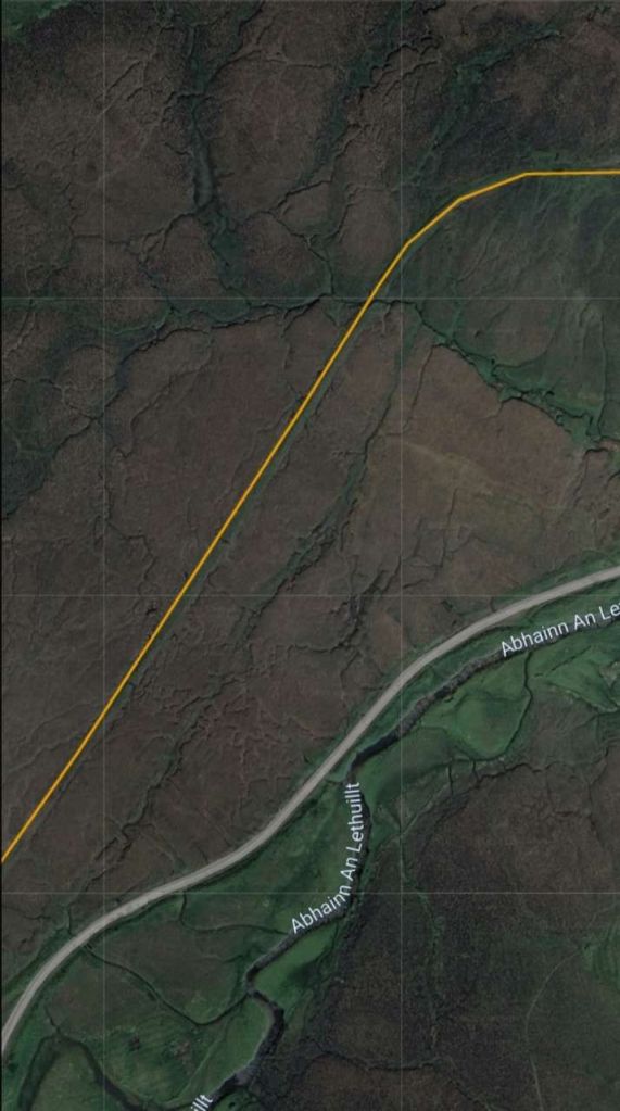
The route of the incline is a waymarked path. For the most part it is a relatively easy walk. A section of the line crosses what is now a plantation protected from deer to allow newly planted native trees to mature. [My photograph, 7th May 2025]The route of the old railway continues North through the plantation. [My photograph, 7th May 2025]Railmaponline.com’s satellite imagery shows the line serving Mine No. 1 continuing North-northeast on the same alignment as the line South of the junction. The planted area can be made out at the bottom of this image. It is also possible to make out the line of the stream valley that the line had to cross. It runs diagonally from the bottom-centre of the image to the left side of the picture. [10]The line continued North towards the location of the viaduct. [My photograph, 7th May 2025]The remains of the viaduct come into view as the land begins to drop away. [My photograph, 7th May 2025]The Southern abutment of the three span viaduct which carried the line to Mine No. 1 over the valley of a tributary of the Inverarish Burn.A view North from the top of the Southern side of the valley. The two tall concrete columns remain in place but the bridge deck is long gone. Note the steep, stepped path on the North side of the valley. [My photograph, 7th May 2025]The Northern abutment of the viaduct remains in place but it has lost the westernmost pilaster. [My photograph, 7th May 2025]
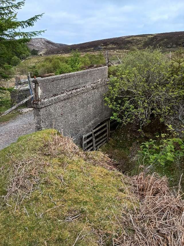
Apart from minor cuttings and embankments to maintain the design gradient on the incline and the structures immediately around the junction, there were only two significant structures. Both were viaducts: that on the main line carried it over a ravine formed by a tributary of Inverarish Burn, that on the line to Mine No. 2 carried it over Inverarish Burn and Fearns Road. The Drapers tell us that these viaducts were “of iron girders with a decking of timbers measuring 12in x 6in in section. They had iron railings on each side, and the one to No. 2 Mine had steel-plate sides to prevent ore accidentally falling onto the road below.” [1: p65]
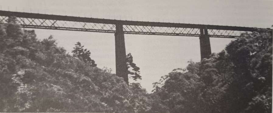
This photograph of the viaduct carrying the line to Mine No. 1 appears in L&P Draper’s book courtesy of John MacLeod. [1: p64]
North of the viaduct on the line serving Mine No. 1, the railway continued in a North-northwest direction towards the mine, continuing to climb towards the mine buildings.
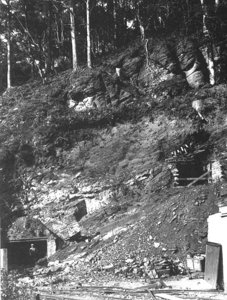
At the northern end of the railway incline, the line from the pier extended into the mine entrance of No. 1 Mine. It first passed under the road to Fearns before also passing under a separate incline which connected the facilities at the mine entrance to the surface workings where the iron bearing strata was exposed at ground level – the outcrop site. L. & P. Draper produced the drawing below which is based on the historic Ordnance Survey mapping.
Mine No. 1 and the Outcrop Site. [1: p46]This extract from the railmaponline.com satellite imagery shows the full length of the single track incline notes above. [10]
The arrangement of the two rail lines is illustrated in the photograph below. …
Having covered the full length of the main line to Mine No. 1, we turn to the branch line serving Mine No. 2.
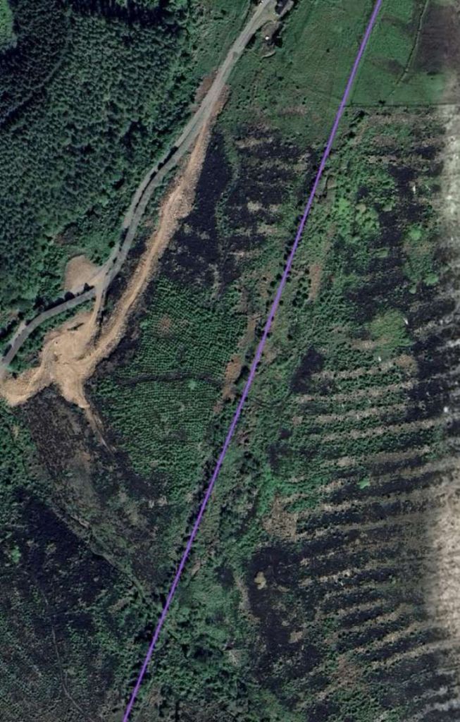
We did not walk the route of the line which served Mine No. 2: the first part of. its route is shown on this extract from railmaponline.com’s satellite imagery. The purple line on this map extract stops short of Fearns Road and Inverarish Burn. The line continued North-northwest across the road and the burn on a three span viaduct. The abutment of the viaduct remains but the bridge decking was removed for scrap some decades back. The viaduct was of the same design as that on the line to Mine No. 1 with additional steel panels attached to the deck parapets over Fearns Road to prevent accidental spillage onto people using the road. [10]This extract from railmaponline.com’s satellite imagery extends the lilac line across the valley of the Inverarish Burn to a terminus at the location of Mine No. 2. Fearns Road is shown running across the image with the Burn at its North. The Valley was crossed by a three-span viaduct to a very similar design to the viaduct on the line to Mine No. 1. Its location is marked by the three parallel lilac line. [10]
Only the abutments and piers of the viaduct carrying the line serving Mine No. 2 remain. The four images below show this remains.
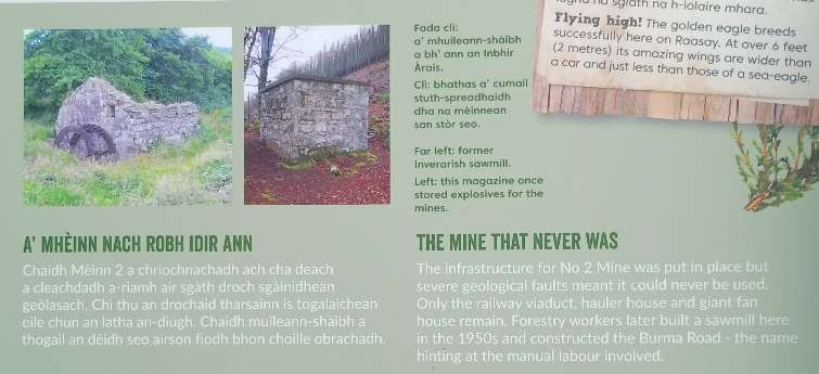
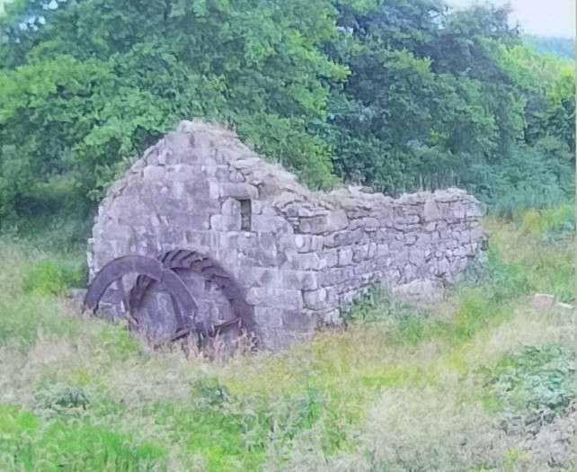
Mine No. 2 only saw very limited use and closed relatively quickly after it opened. L. & P. Draper are of the opinion that, “because of severefaulting there was virtually no production from No 2 Mine, which must have been an expensive white elephant considering the cost of constructing the high viaduct, hauler house and other mine-head buildings. However, it was not entirely unused, as Baird’s built a sawmill by No 2 Mine, and all timbers used in the mine, for pit props, railway sleepers, power poles and other purposes were sawn there and transported by rail.” [3: p153]
Calcination is a process which involves a controlled burn of crushed ore mixed with imported coal. It is specifically designed to draw off water and unwanted minerals from the iron ore but without heating it to a temperature which would result in the production of metallic iron.
Alexander Nicolson; Handbook to the Isle of Skye andAdjacent Islands; Archibald Sinclair, Celtic Press, Glasgow, 1936.
Dolly Parton first sang, ‘Love is like a butterfly’, in the Summer of 1974:
“Love is like a butterfly, as soft and gentle as a sigh,
The multi-coloured moods of love are like its satin wings,
Love makes your heart feel strange inside, it flutters like soft wings in flight,
Love is like a butterfly, a rare and gentle thing.”
Jesus said: “I give you a new commandment, that you love one another.” His words seem to be at odds with our culture. In our society, love isn’t something you can command, love is something that you feel. Love is something that you fall into and fall out of. Love is as much about sexual attraction and desire as it is about anything else. When we say, ‘I love you’, to the love of our life – we are talking about deep feelings not about something that we feel we have much control over.
And yet Jesus says: ‘I command you to love one another’.
We know that love is so much more than sexual desire. We feel love for our parents, our children – we even feel some kind of love for the football team we support, for our friends and our work colleagues. But even in these relationships love can be so temporary or dependent on events and our emotions.
Love is just like a butterfly, made up of multicoloured moods, flitting here and there, dependent on circumstance and passion.
The love Jesus commands, the love that Jesus often talks about, is just not like that. Love, as Jesus sees it. Love modelled on the love of God, is constant and committed love, unwavering in its strength and focus, determined to be there for the one who is loved no matter what they do. Determined to love, even when it seems as though that love is rejected.
In English we have one word for love. The New Testament uses four different words for love.
Eros – for romantic and sexual love
Storge – genuine affection for someone
Philio – for brotherly love or fellowship
Agape – the love God has for us and the depth of love he calls on us to have for each other. A committed, divine, unconditional, self-sacrificing, active love, generously and freely given with no thought for the self, only for the other. It is this word ‘Agape’ that is used in our Gospel reading.
The King James bible translated ‘agape’ as ‘charity’. In today’s world ‘charity’ means something different. It has lost the emphasis on God’s self-sacrificial love for humankind. It has become something that often people do not want to receive, demeaning to their sense of honour. Or, it is the name of a kind of organisation that has some sort of good purposes. We need hold onto the word ‘love’ rather than the word ‘charity’ in today’s world if we are to begin to understand the meaning of the Greek word ‘agape’
C. S. Lewis, in his book The Four Loves, uses ‘agape’ to describe what he believed was the highest level of love known to humanity – a selfless love, a love that was passionately committed to the well-being of the other. It is ‘agape’. It is this kind of love that Jesus commands us to show, not erotic love, not even brotherly or sisterly love, not affection.
In last week’s Gospel (Easter 4), Jesus talked about a love that will not let us go.
“My sheep listen to my voice; I know them,and they follow me.I give them eternal life, and they shall never perish,no one can snatch them out of my hand.My Father who has given them to me, is greater than all;no one can snatch them out of my Father’s hand.”
“No one,” says Jesus, “will ever snatch you out of my hands.” It is not a sense of charity that God feels towards each of us, not a sense of charity that he feels for humankind. It is a love that give its all. No holds barred. A love that throws itself away in order to rescue those who are lost. A love that celebrates over every single person who returns to be enfolded by that love. It is that kind of love which we are commanded to show. Christ calls on us to decide to love others in the same way as God loves us.
Please, allow yourself to hear again that God loves and cares for you. And remind yourself again that God calls you not to love that is flighty or buffeted by circumstance, but to a love which is self-giving, committed and strong.
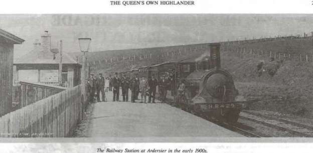
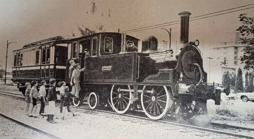
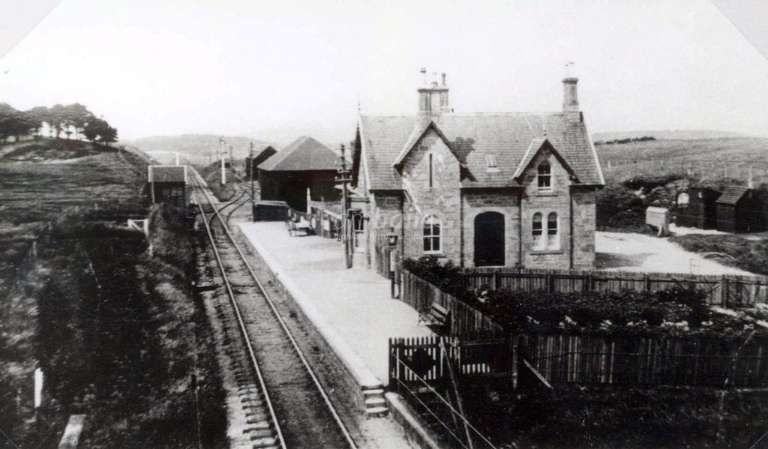
The featured image above shows Highland Railway No. 29 at Fort George Railway Station in Ardersier in charge of a train of four wheel coaches. Staff at the station seem to be included in the photograph. The locomotive was built in October 1863 as a 2-2-2 and originally called ‘Highlander’. She was rebuilt as a 2-4-0 in August 1871 and renamed ‘Forres’. She was withdrawn in 1898 which means that the annotation under the photograph is a little inaccurate. The locomotive is seen in the image above in its latter guise, so the image was probably produced between 1872 and 1898. The picture was shared on The Highlanders’ Museum Fort George Facebook Page on 23rd February 2014. [12]
The Disused Stations Website has full details and photographs of Fort George Railway Station, here. [1]
AmBaile also has a number of photographs which can be found here. [2]
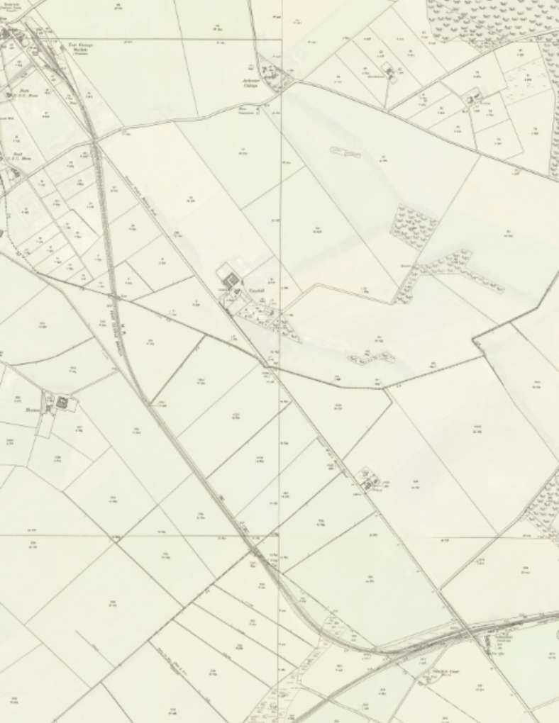
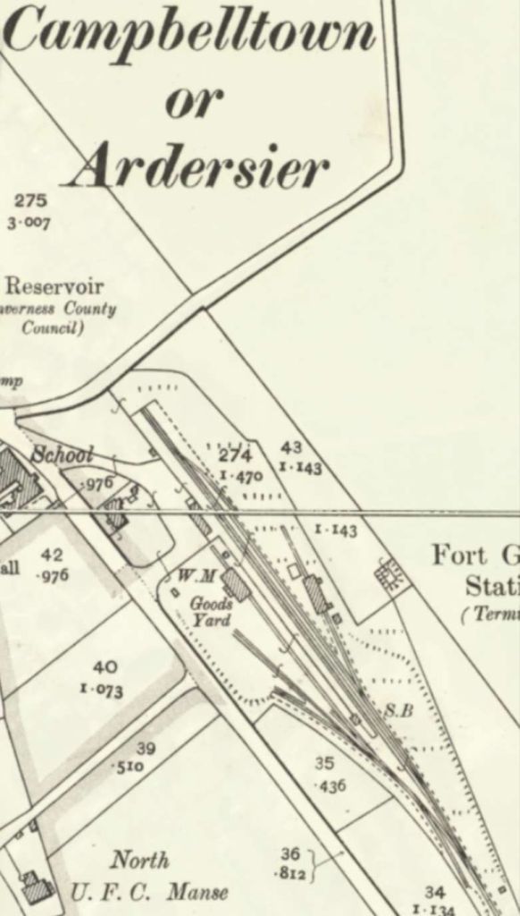
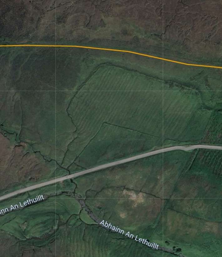
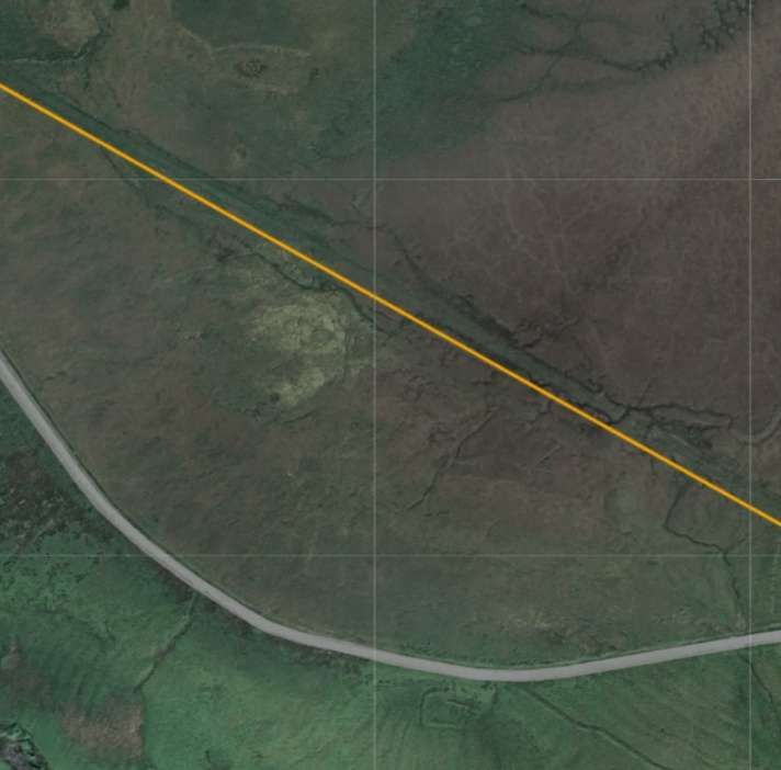
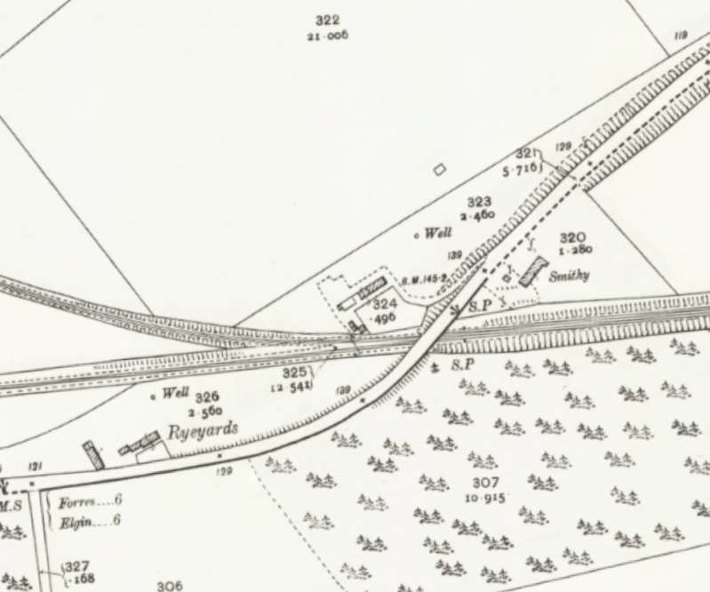
The full length of the Fort George Branch is shown on the extract from the 25″Ordnance Survey from the turn of the 20th century below. …
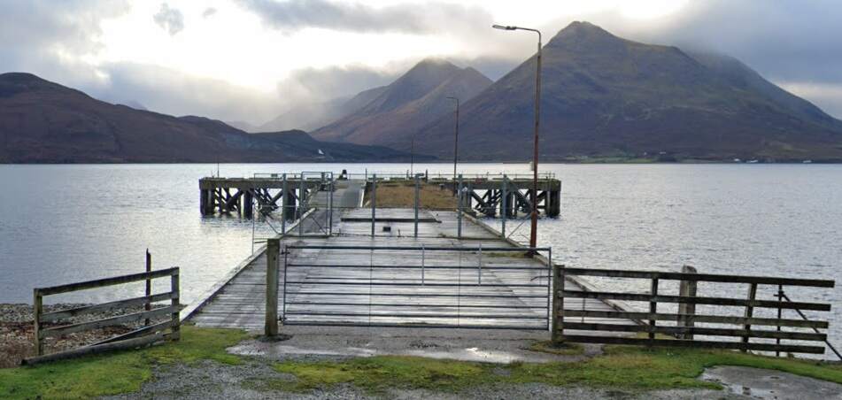
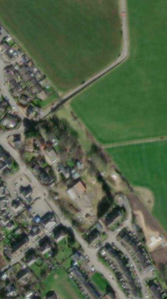
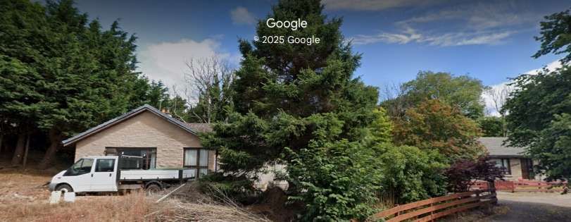
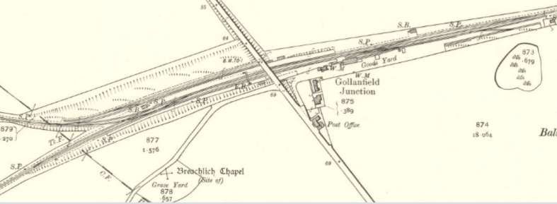
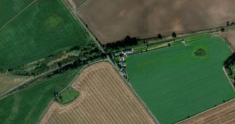
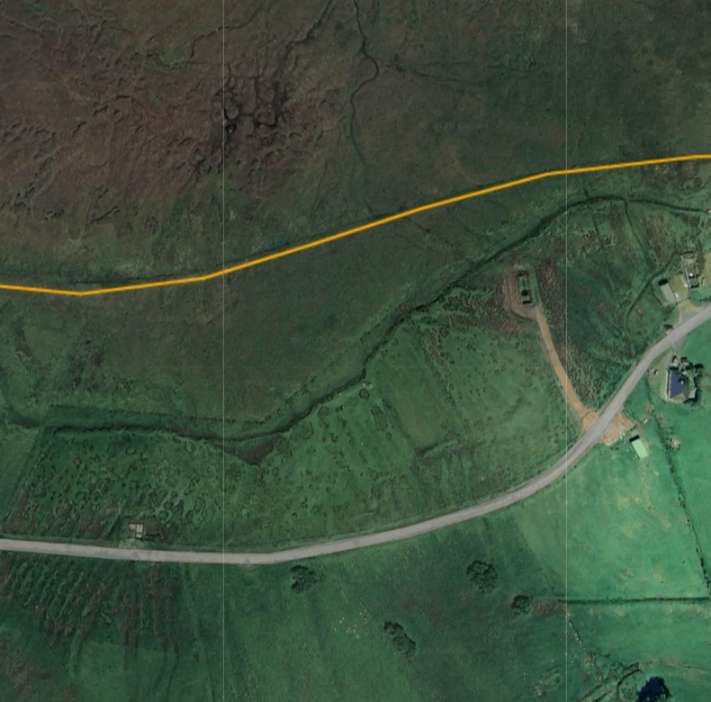
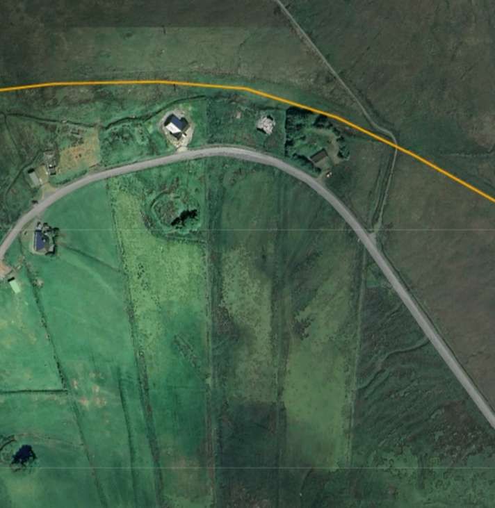
The Fort George Branch of the Highland Railway at the turn of the 20th century. Gollanfield Junction Station and the Highland Railway’s main line between Inverness and Forres appears in the bottom right of the map extract. [3]Fort George Railway Station in Ardersier was built in the 1890s and named after the first station on the Inverness-Nairn line, called Fort George Station, which had been built to serve the Fort to the North. The station on the Inverness-Nairn line was then renamed Gollanfield Junction Station. The station at Ardersier opened 1on 1st July 1899. It closed to passengers and goods on 5th April 1943. [4][5]The same area in the 21st century as recorded on the ESRI satellite imagery from the NLS. [4]These two images show bungalows on the station site in the 21st century. [Google Streetview, August 2021]Looking Northwest along the line or the old railway towards the terminus. [Google Streetview, August 2021]
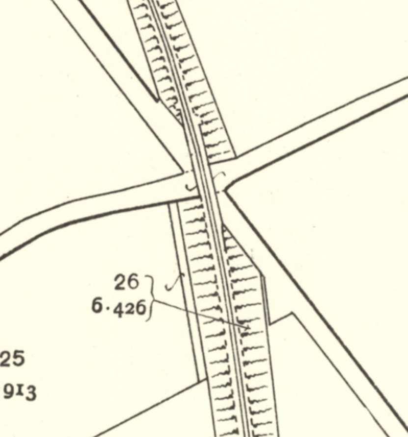
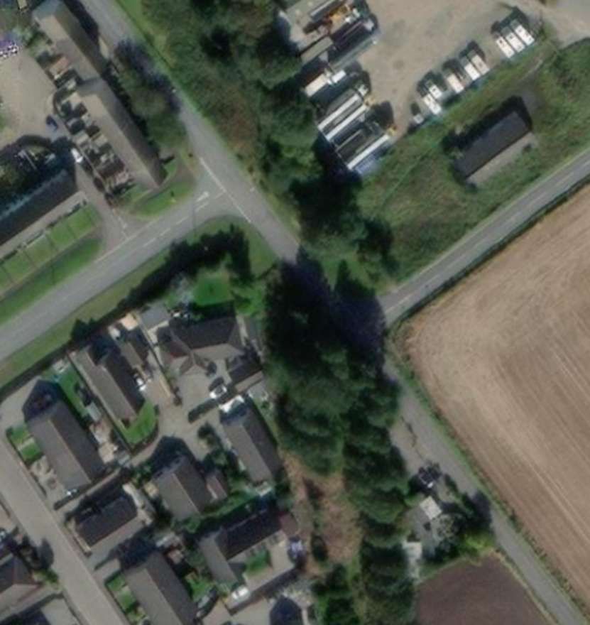
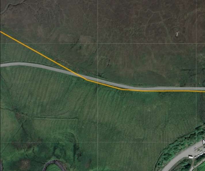
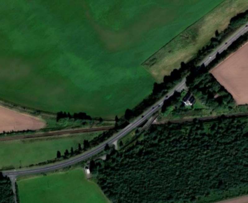
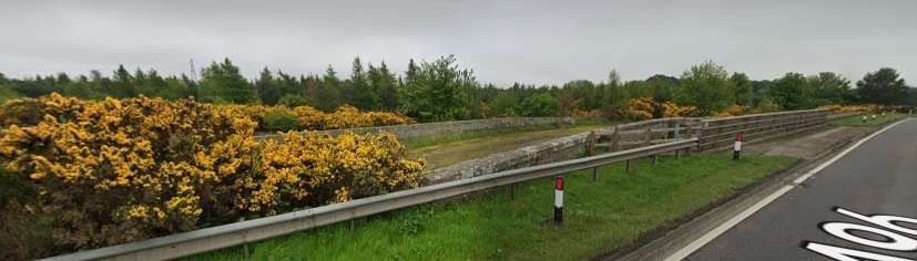
Just to the South of the station throat the line bridged the junction of two roads. These became the B9006 and the B9092.
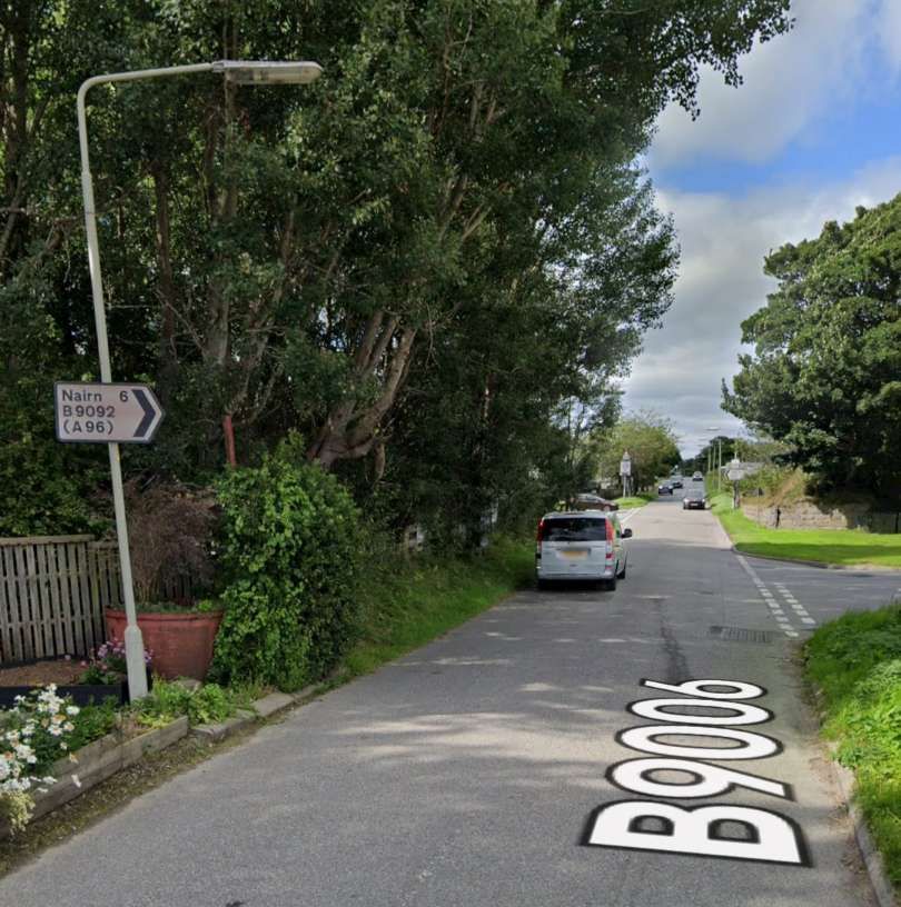
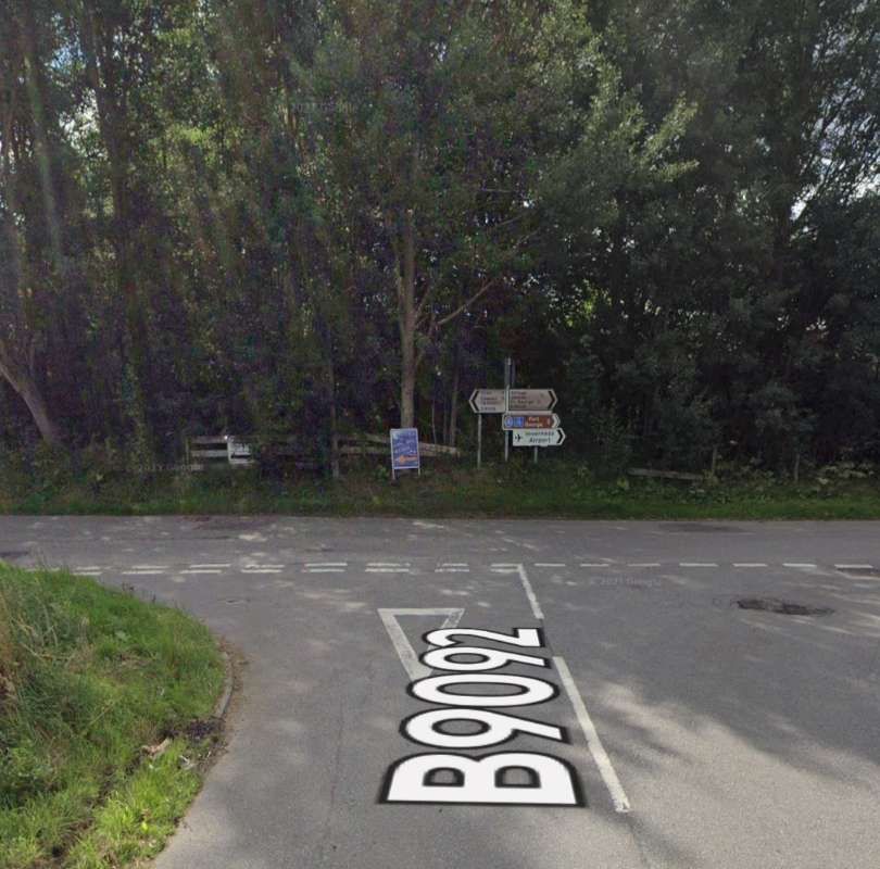
The railway bridged the junction of two roads a short distance South of the railway station throat. [6]The same area in the 21st century. The trees mark the line of the old railway. [6]The location of the railway bridge, seen from the Southeast. The B9006 was an old military road. [Google Streetview, August 2021]The location of the railway bridge, seen from the Northeast. The trees are on the line of the old railway embankment. [Google Streetview, August 2021]The same location seen from the Northwest. [Google Streetview, August 2021]
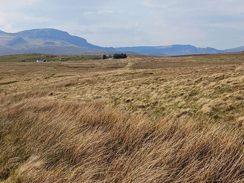
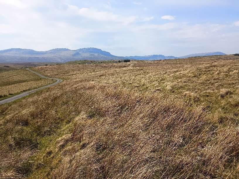
The line ran across open fields with no more structures than a few culverts to carry water from drainage ditches, until it curved to the East into Gollanfield Junction Railway Station.
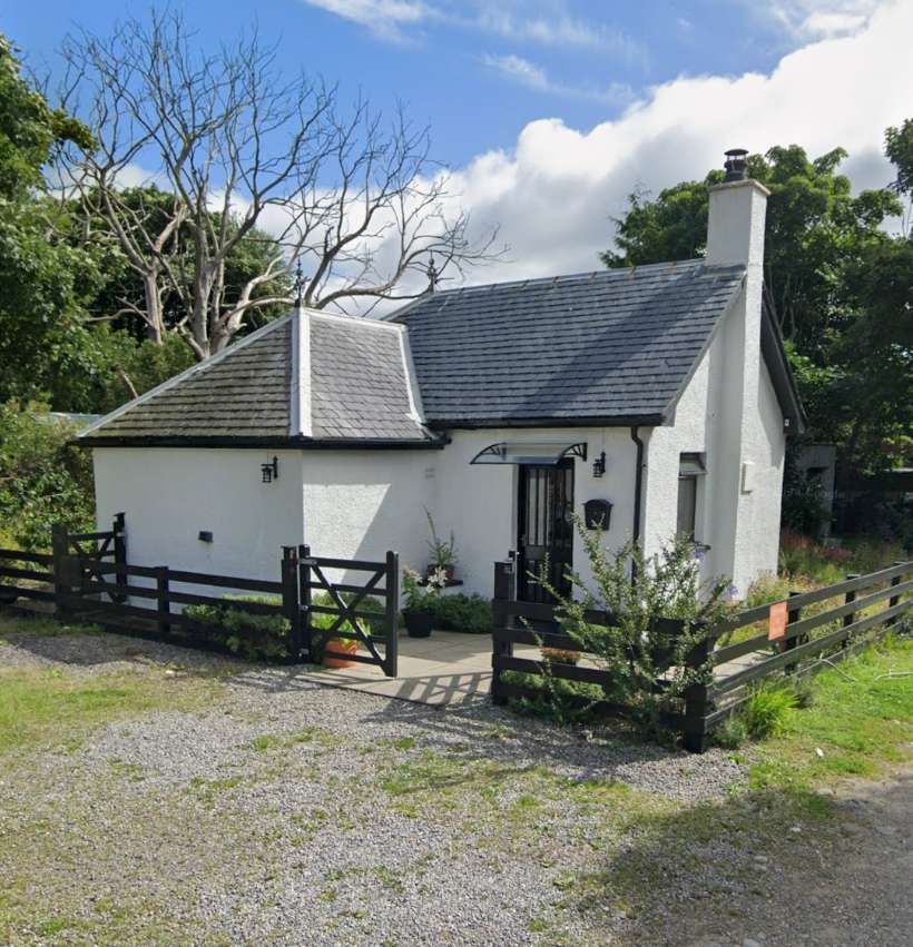
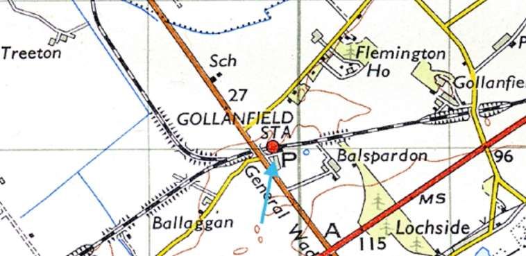
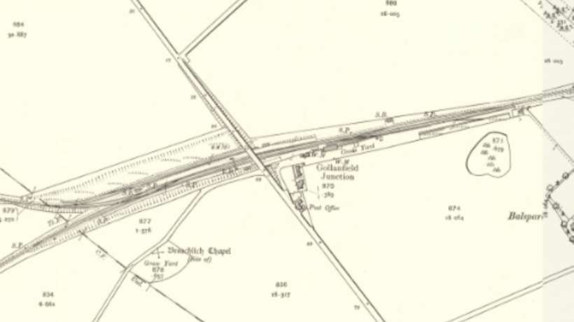
Gollanfield Junction Station as it appeared on the 25″ Ordnance Survey of 1904, published in 1905. It was opened in 1855 by the Inverness and Nairn Railway and initially named Fort George after the military base nearby. In July 1899, the Highland Railway opened the direct branch to Fort George (sited in the village of Ardersier). With the opening of the branch, the station was renamed Gollanfield Junction. Passenger services on the branch were withdrawn in 1943 and it closed to all traffic in August 1958. The following year, the station was renamed Gollanfield by British Railways. [7][8]The same location in the 21st century. Goods traffic at the station ceased in May 1964 and it was closed to passenger traffic on 3rd May 1965. Most of the buildings were subsequently demolished after closure, but the station house remains standing and is used as a private residence. [8][9]
It is interesting that this short branch was deemed worthwhile as an investment. It brought the railhead only a short distance closer to Fortrose George.
Vallance tells us that, “The original line from Inverness to Nairn had provided a station to serve the military post of Fort George. This was only Fort George in name, as the depot itself was some 3½ miles to the north, at the end of a sandy tongue of land jutting out into the Moray Firth. It was felt that the fort should be made more accessible by rail, and powers were granted on 4th July 1890 for the construction of a branch, 1½ miles long, from the existing Fort George station to the village of Ardersier, which lies some two miles south of the depot proper. The terminus of the new line was to be called Fort George. … The surrounding country is level and sandy, and no difficulties were experienced in the construction of the line, which was opened for traffic on 1st July 1899. The junction station was renamed Gollanfield Junction, from the farm of the same name in the neighbourhood.” [10: p46]
David Ross has little to add to this apart from a few fleeting references, primarily to Fort George rather than its railway station, other than to note the construction of the branch line. [11: p95]
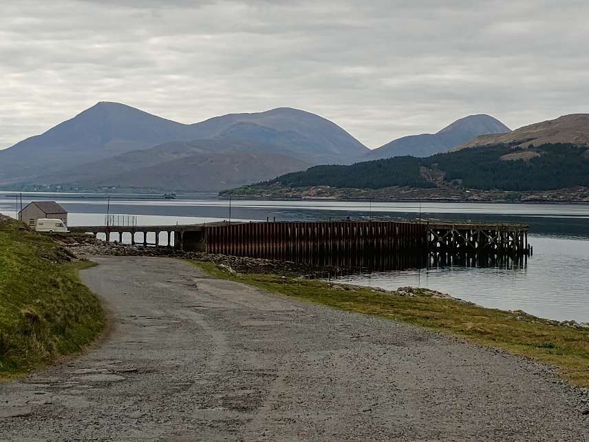
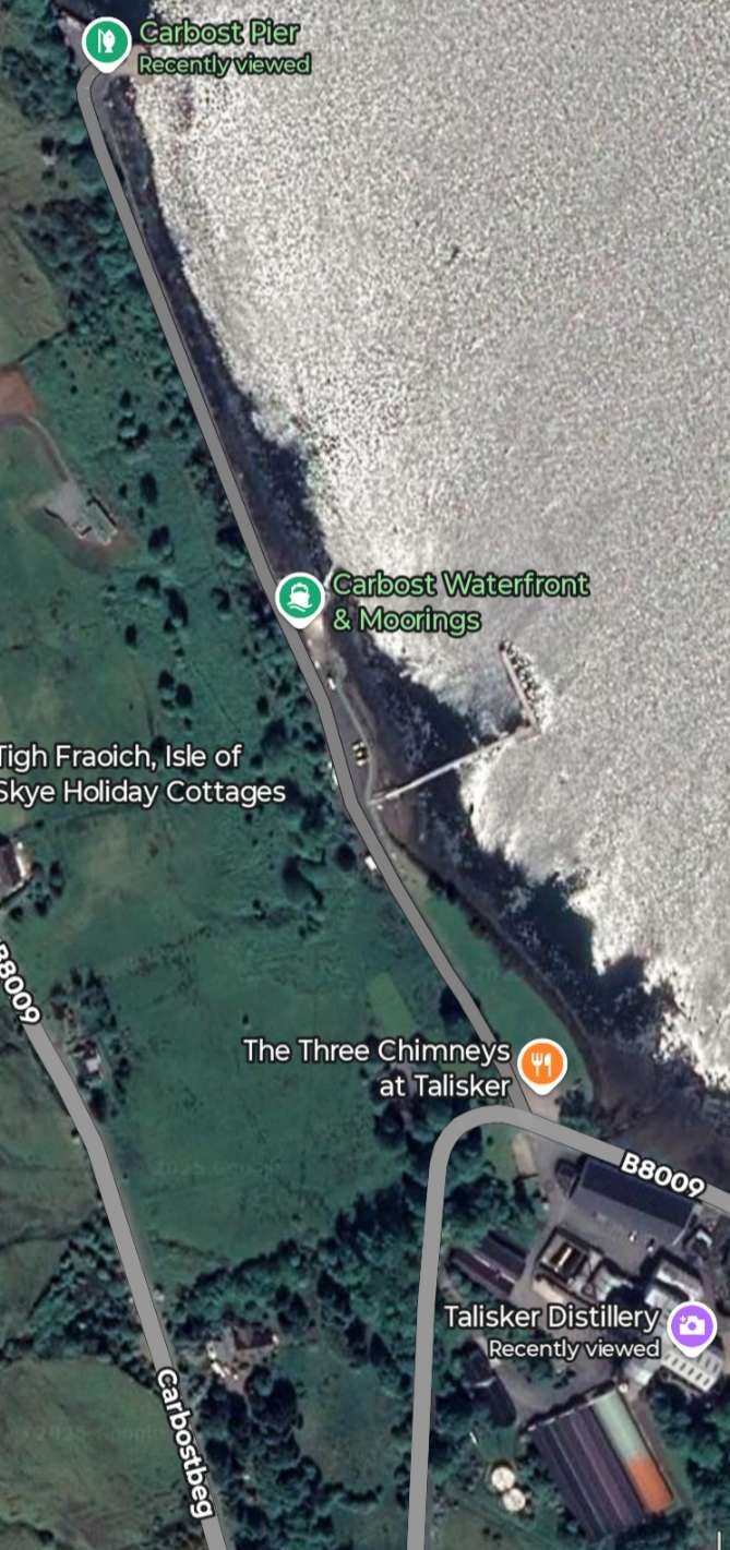
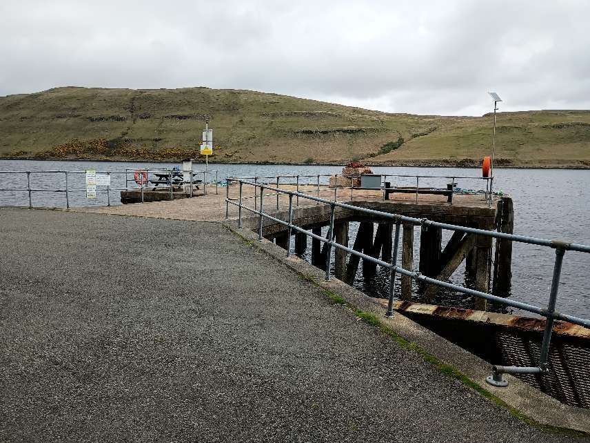
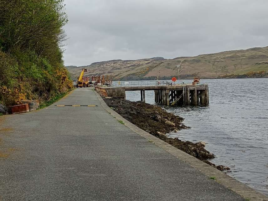
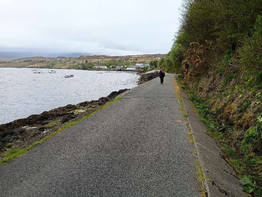
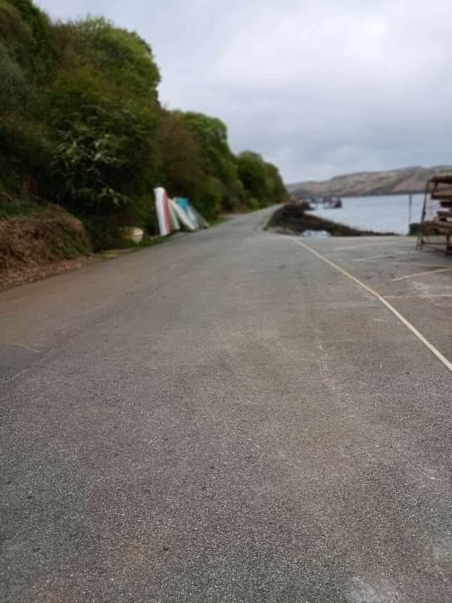
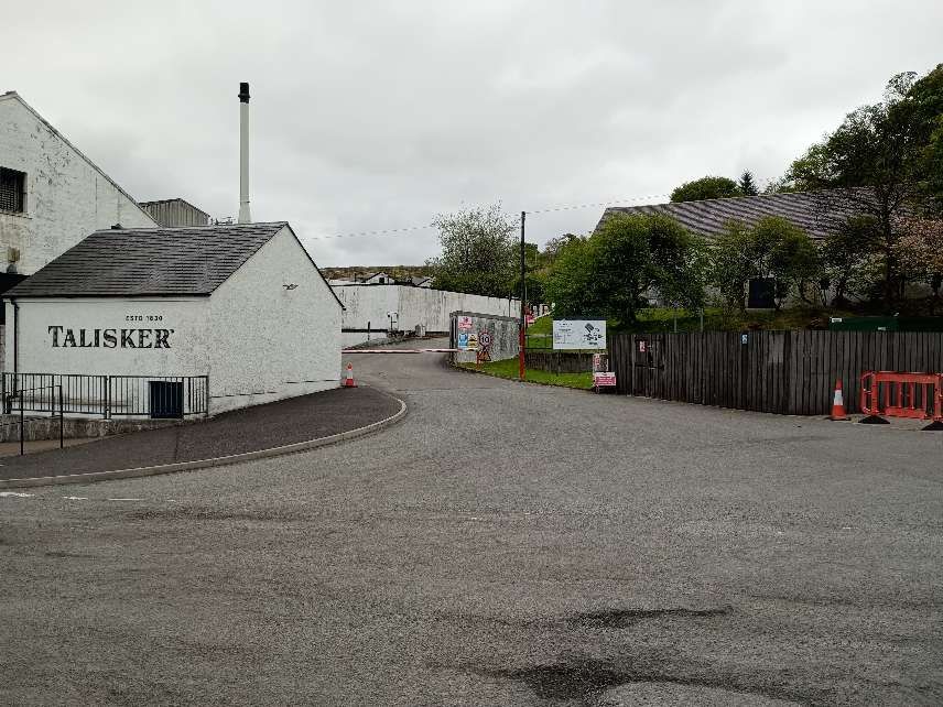
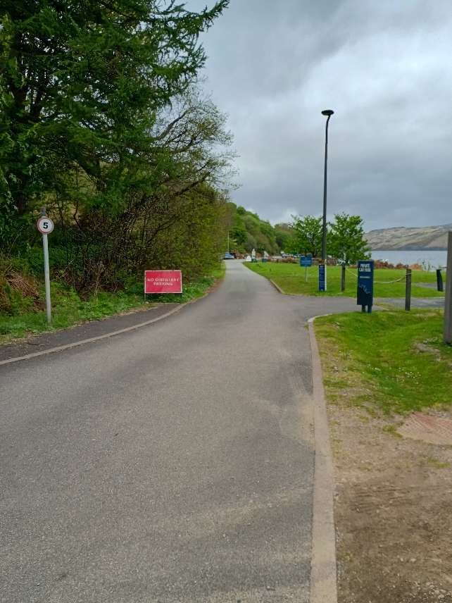
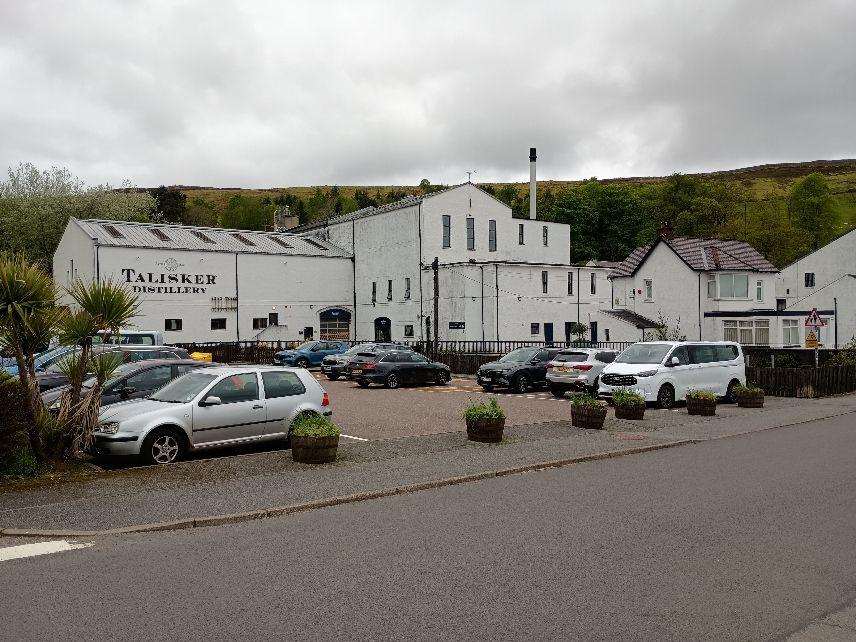
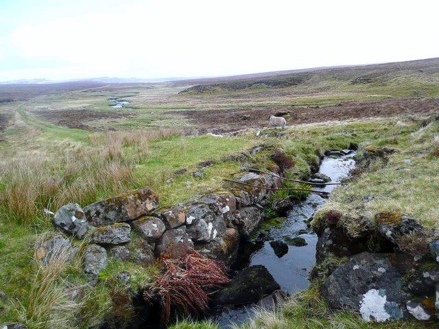
The Talisker Distillery Tramway was a short 2ft-gauge tramway which opened in 1900 and closed in 1948. It ran from Carbost Pier on Loch Harport, along the Harport shore to Talisker Distillery and was used to transport materials for Talisker Distillery. [1]
This extract from the 6″ OS Survey of 1901, published in 1903, shows the full length of the tramway. [2]The same area as it appears on Google Maps. [Google Maps, April 2025]
The tramway was 0.75 miles in length. It is not known who authorised its construction, who designed it, not who built it. [1]
The tramway was initially horse-powered but during the latter years of operation a road tractor was used. Small 4-wheeled open wagons with side-tip mechanism were used for conveying coal to the distillery from the pier and 10′ long flat wagons for transported whisky casks, barley and barrels. Until relatively recently some rails were visible near the pier where they were set in concrete. The route of the old tramway has recently seen som refurbishment, allowing for better access by vehicles to Carbost Pier. One of the flat wagons is preserved in private ownership in the Broadford area of the Isle of Skye. [1]
Photographs from 2010 of the tramway rails at Carbost Pier can be found here, [3] here, [4] here [5] and here. [6]
Links:- to find out more about Talisker Whisky, follow: …
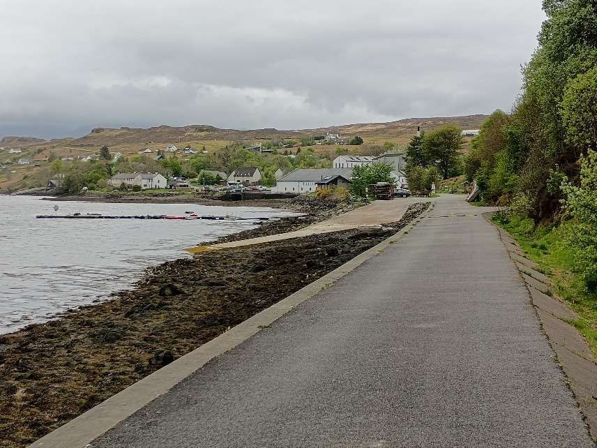
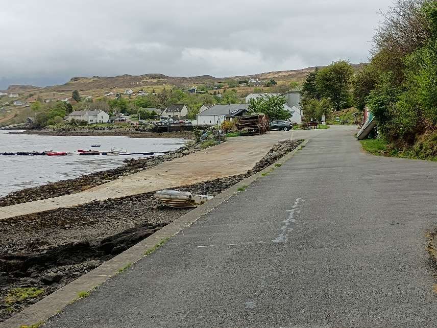
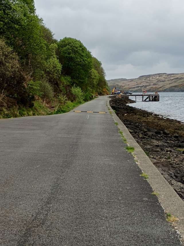
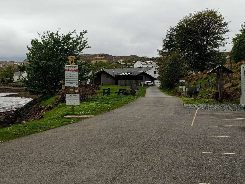
Carbost Pier on Loch Harport. [My photograph, 3rd May 2025]Carbost Pier from the Southeast. The tramway left the pier heading towards the camera. [My photograph, 3rd May 2025]Looking Southeast towards the Talisker Distillery. My photograph, 3rd .ay 2025]Further to the Southeast looking towards the distillery. [My photograph, 3rd May 2025]Closer now to the slipway at Carbost waterfront. [My photograph, 3rd May 2025]Looking Northwest from the same location, some distance now from Carbost Pier. [My photograph, 3rd May 2025]Approaching the distillery, the modern building on the left is the Three Chimneys restaurant at Carbost. [My photograph, 3rd May 2025]Looking back along the line of the old tramway from the same location, towards Carbost Pier. [My photograph, 3rd May 2025]This photograph is taken adjacent to the Three Chimneys restaurant and shows the route of the tramway into the distillery site. [My photograph, 3rd May 2025]From the same location, looking back Northwest towards Carbost Pier. [My photograph, 3rd May 2025]Talisker Distillery. [My photograph, 3rd May 2025]
Relevant publications include: ..
Railways of Skye & Raasay – Wilfred F. Simms; [1] and
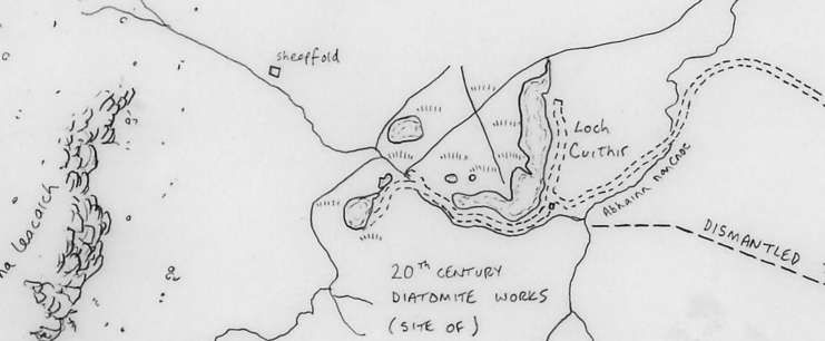
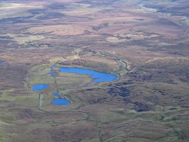
Derived from the remains of microscopic fossilized sea or freshwater algaes, diatomite is a naturally occurring, versatile mineral used in an array of applications from cosmetics to filtration. [4] It was harvested by drag line from Loch Cuithir in the late 19th century and the first half of the 20th century.
“This unique form of silica has an elaborate honeycomb structure, peppered with thousands of tiny holes ranging from a few microns to submicron diameters. No other silica source, be it mined or artificially produced, presents such a structure. Some diatomite deposits are saltwater but most are from freshwater sources. … When ground, this profusion of shapes results in an extremely low-density powder known as ‘diatomaceous earth’ (DE) which has excellent absorption properties that are highly prized for filtration, agriculture, paints, plastics, cosmetics, and pharmaceuticals application.” [4]
Diatomite was also used in the production of dynamite. [2][3]
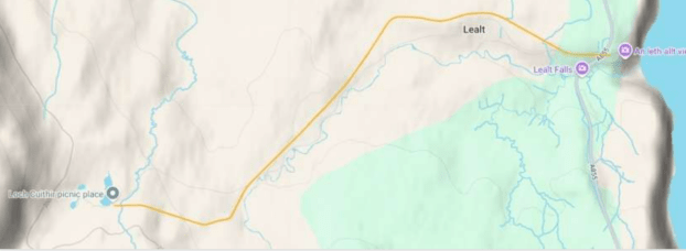
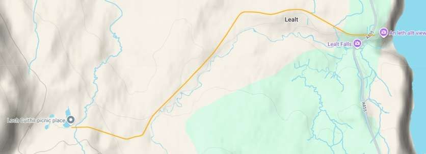
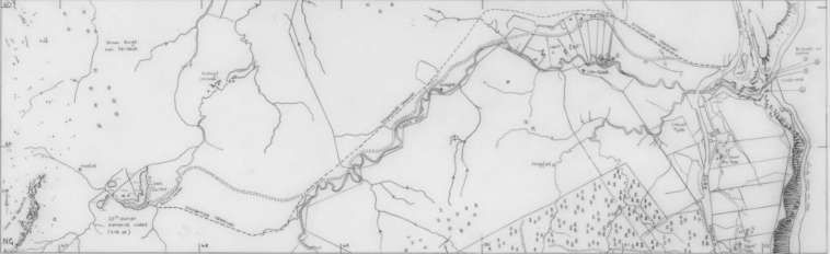
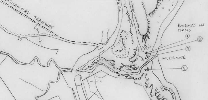
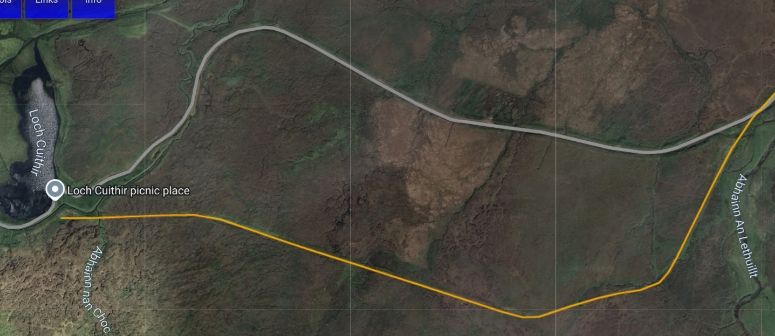
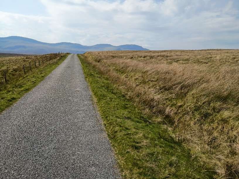
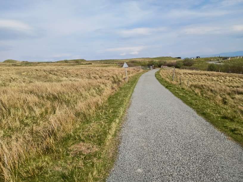
Possibly as early as 1885 [1] but certainly by 1889, [2][3] work was underway at this site. A 2ft [2][3] or 2ft 6in [1] gauge tramway was being constructed in 1889 from the drag-line at Loch Cuithir to Lealt. The tramway followed the River Lealt down to its mouth at Invertote. When first opened the line was worked by gravity and manpower. Apparently, later in the life of the line a small steam locomotive was in use. [2][3]
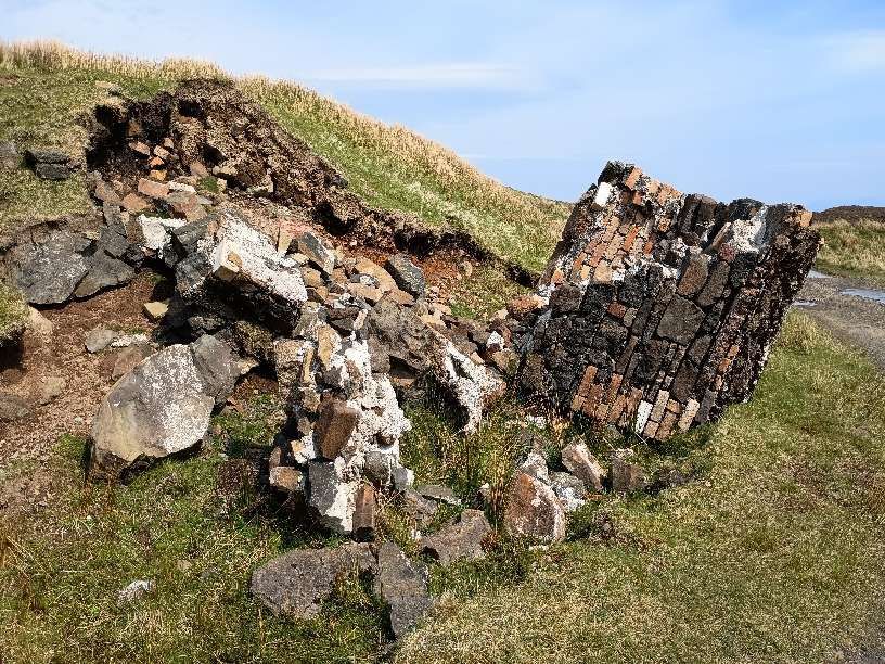
At the “Western end of the line … at Loch Cuithir, … diatomite – known locally as Cailc (Scottish Gaelic for chalk) – was taken out from the loch bed and dried on wire nets. The seaward terminus had warehouses on the cliff-top at Invertote. At the base of the cliff was a factory where the diatomite was kiln dried, ground and calcined. [A] line … extended from the factory onto a pier into the Sound of Raasay.” [2][3]
Diatomite was also gotten from Loch Valerain and transported by aerial ropeway to Staffin Bay and on along the coast to Invertote Apparently, “during its existence, the Skye Diatomite Company extracted 2000 tons of diatomite. … From Invertote, the diatomite was transferred by skiff, onto puffer boats, waiting in the bay, and shipped across to the mainland. The diatomite was turned into kieselguhr which was mixed with nitroglycerine by Nobel Industries, at Ardeer, to make dynamite.” [2][3]
Stornoway Gazette described the operation as follows:
“Over the years, the mine saw periods of inactivity, but when up and running operations made use of the large industrial works at the area – a large factory building, a railway with embankment cuttings, and a rolling stock traversing three miles of landscape, including an aerial ropeway. The light railway was used to transport the Loch Culthir Diatomite to the shores at Invertote for a final drying and grinding, and a large building containing a furnace, grinding machine and storage space was constructed there for this purpose. Such modernised business works were quite remarkable for this part of the world at the time. In those days there was no road between Staffin and Portree, so a puffer boat would anchor in the bay at Lealt, and local skiffs were used to transport the finished Diatomite from shore to boat, ready for shipping to the mainland. There were around 40 to 50 people steadily employed at Lealt, yet on days that the boat came in this total rose to as many as 80 workers.” [7]
“Perhaps one of the most intriguing aspects of the mine’s history comes from the ownership of the drying factory at Invertote by Germans. Although closed during the period of the Great War, surprisingly the now enemy foreign residents were allowed to stay on. Shortly afterwards a rumour began to circulate that the area was haunted and that the ghost of a recent tragic death at the Lealt falls had appeared at the factory. As the local story goes, (the rumour was actually started by the Germans) with the intent of keeping locals away. It turned out that the resident Germans were spies and that, almost unbelievable to the community, the area was being used as a German base with submarines surfacing in the sea bay!” [7]
“Moving on, the year 1950 saw the next development in the mining of Diatomite from Loch Cuithir. As the loch was one and a half miles up the moor, through peat bogs and rivers, the Department of Agriculture and Fisheries for Scotland (DAFS) decided that a road should be built, with the intention of extracting the Diatomite by digger, and then taking it to the Lealt road end above Invertote. The road took around a year and a half to build, during which the mine was put out of operation. Yet, when production started again, the new method of extraction did not reach the high standard of quality which was achieved when extracted manually by spades. The mechanical extraction resulted in the Diatomite being less pure, and full of unwanted dirt. Drying the substance is, in fact, the problem of the process, for it is obvious that in a damp climate like Skye, the diatomite does not lose its moisture quickly. The problems which began after the construction of the 1950s road were further highlighted and compounded six years later. A new factory was built at Uig (the site where the Cal Mac offices are now situated), far from the mining site at Loch Cuithir, and it may be said that this move was the ruining of the entire Diatomite industry upon Skye. As Diatomite was no longer dried at Invertote it now had to be transported by road, wet, for the much-needed drying process to Uig, 23 miles away. A vehicle may have left Loch Cuithir carrying five tonnes of Diatomite, yet only producing one tonne of the finished product after drying had taken place – a finished product which was also not as pure as it ought to be for the specialised work it had to do in various products. A lot of money was wasted on travelling, and within the factory itself, inefficiency was also present, with machinery often breaking down due to the damp state of the Diatomite. Outside the factory, the scenic communities of Trotternish also began to suffer. When the factory was working, it poured out a fine white dust which covered every house in the area. Grass became chalky in colour and after dry spells in the weather, the road-sides from Staffin to Uig would turn white with Diatomite – Uig was constantly under a cloud of dust. With complaints of insubstantial profits and bad management, the factory was finally closed to production for the last time in 1960. Yet, although the Diatomite mining industry on Skye came to an abrupt ending, it was still regarded by many locals as a blessing at the time. Following from World War One, the industrial works provided employment for many returning men who could not find work elsewhere in the island. And at peak production, around 1955/56, 50 to 60 men were paid good wages to work at the factory.” [7]
Bell & Harris tell us that “Loch Cuithir is located upon landslipped material, which overlies Upper Jurassic strata. Only parts of these diatomite workings remain. Some of the brick buildings, together with the line of the tramway used to transport the diatomite to the coast, are still obvious. The diatomite occurred as a 3–6m-thick horizon below a 1m covering of peat. The loch had an original area of 60 hectares (24 acres) and was drained in order to extract the diatomite. Ditches, around the perimeter of the loch, were excavated and the water was drained through a man-made outlet at the northern end of the loch, thus allowing removal of the peat and extraction of the diatomite. East of the drainage outlet are spoil-heaps, mostly of plateau lava boulders, presumably removed from the workings during excavation. The diatomite from this deposit was very pure, with little or no interlayered silt or mud. Macadam (1920) notes that the calcined (heat treated) diatomite contains over 96% [Silicon Dioxide](reported in Anderson and Dunham 1966), whilst Strahan et al. (1917) gave a value of 98.78%. According to Macadam (1920), the absorptive value of the material from Loch Cuithir was over 3.56 (a good diatomite would have an absorptive value in excess of 4.0).“
Some excellent photographs of the derelict factory at Invertote can be seen here. [8]
The Route of the Tramway/Railway
From Loch Cuithir, the railway ran in a Southeasterly direction over boggy ground. Minimal earthworks were undertaken placing the railway at a level just above surrounding ground.
The Canmore National Record of the Historic Environment profiles these notes:
“One of the greatest causes of interest in Skye Diatomite was its potential use as a substitute for Kieselghur by Alfred Nobel in the production of Dynamite in Nobel’s new Scottish factory at Ardeer in Ayrshire during the 1880s. Nobel eventually found a better source of material, but the Extraction of Diatomite nevertheless began in Skye at Loch Cuithir in 1886. The Diatomite was transported by tramway to be processed at Invertote, production continuing until 1913. The industry was briefly revived between 1950 and 1961, using road transport.” [13]
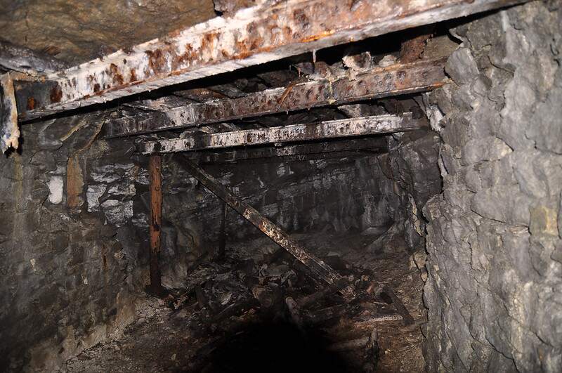
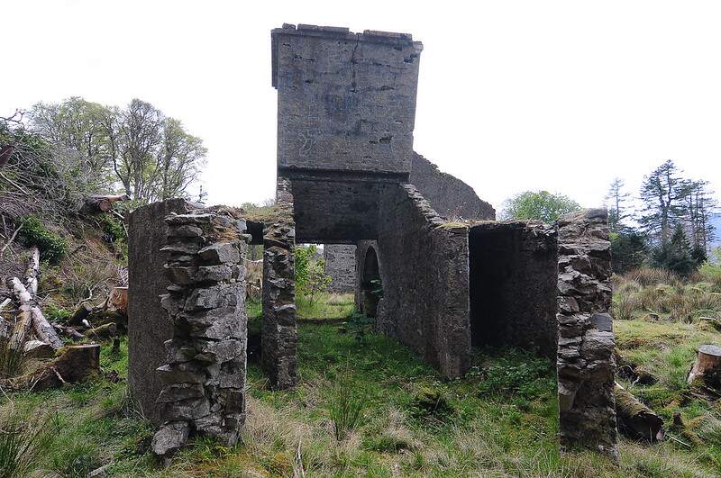
“The principal remains of the Invertote works are a large, rubble-built, rectangular-plan roofless building (NG5201 6049). It has been entirely gutted, but fragmentary remains include a large cast-iron flywheel from a steam engine, and a cast-iron wall-mounted bearing box. The other surviving structure is a kiln (NG5201 6052), comprising a lower chanber or firebox built from Scottish firebricks (produced at the Star Works, Glenboig, Lanarkshire, and Etna Works, Armadale, West Lothian), onto which has been constructed a circular-section fireclay-brick column encased by an outer layer of sheet steel. The exact functions of the processing building and the kiln are uncertain, but it is likely that the latter was used for drying purposes.” [13]
H.A.Vallance notes that in the years prior to the coming of the railways to the North of Scotland there was a series of different initiatives intended to improve transport links. The first were the roads built by General Wade (250 miles of military roads) which “were quite unsuited to the requirements of trade operating under peace-time conditions.” [17: p11] The biggest contribution to raid development was made by Thomas Telford. He “was appointed to survey for new roads and for the improvement of existing highways. In the course of … 17 years he constructed about 920 miles of road, and built some 1,200 bridges.” [17: p11] But it was the coming of the railways to the Highlands, that most effectively addressed the regions transport problems.
Earlier articles about the Highland Railway network can be found here, [3] and here. [4] These two articles cover the Strathpeffer Branch and the Fortrose Branch repectively.
Trains Illustrated No. 18 which was published in 1976 focussed on The Highland Railway. [1] The introductory article, ‘Highland Retrospect’, was written by Paul Drew. [1: p4-11]
Paul Drew commences his article with a short reflection on the excitement of waking on one of the sleeper services heading North into the Scottish highlands. Two routes provide an intensely enjoyable experience in the right weather: “The awakening on the West Highland line at Garelochhead, perhaps, or on Rannoch Moor … winding in a generally northward direction towards Fort William, Mallaig and Skye and the Hebrides; and daybreak on the Highland line proper, the Perth-Inverness main line of the old Highland Railway, somewhere between Blair Atholl and the outskirts of Inverness, following the old coach road up to Druimuachdar summit, at an altitude of 1484ft, or dropping down the hills between Spey and Findhorn and Findhorn and Moray Firth.” [1: p4]
Drew expresses his opinion that the Highland Railway (HR) route offers the greatest diversity of scenery but whether “you travel from Euston to the Highland or from Kings Cross to the West Highland line the contrast between the [suburbs of London] … and the glories seen on waking – even, for devotees, in a Scotch mist – is one of the attractions of the journey. Before World War II one could start an overnight journey to a Highland line station from Kings Cross as well as Euston, and up to 1914 from St Pancras also with, on a summer evening, a daylight exit from London.” [1: p4]
He seems to like the route taken by trains from St. Pancras best. Their route “was via Leeds, the magnificent MR route across the Pennines, Carlisle, the North British Railway’s Waverley route through the best parts of the Lowlands to Edinburgh, and so by the East Coast route over the Forth Bridge to Perth, the beginning of the HR main line – all far better traversed in daylight.” [1: p4]
He notes too that it was common practice not to disturb a passenger’s sleep which meant that sleeper services on the HR were normally made up of “HR vehicles and through coaches and sleeping cars from England (LNWR, West Coast Joint Stock, GNR, North Eastern, East Coast Joint Stock, Midland, and probably Midland & North British joint stock) and from Scotland (Caledonian and North British) but also of privately hired ‘family’ saloons, horseboxes, flat wagons conveying carriages and, from the turn of the century, motorcar vans, all supplied by a wide variety of English and Scottish railways.” [1: p4]
Occasionally, these trains would also include the “private saloon of the Duke of Sutherland, who owned not only one or two passenger vehicles but a 2-4-0 tank engine, Dunrobin, and its successor, an 0-4-4 tank of the same name, which he ran – often driving himself – on his private railway. It was in Sutherland, and ran from Golspie via his seat, Dunrobin Castle, to Helmsdale. The line was eventually taken over by the Highland and forms part of the Farther North line from Inverness to Wick and Thurso. Both Dunrobins were allowed to work (within limits) over HR tracks, even south of Inverness, but not, it seems on public passenger trains – at least not expresses.” [1: p4]
Drew notes that, “The marshalling of the heterogeneous caravans at Perth, where vehicles were made over by the CR and NBR, was a frequent cause of unpunctuality and indeed chaos. Besides, most of the trains tended to run late during the summer, especially on the HR main line, which even after the central portion south of Druimuachdar has been double-tracked in the 1890s, tended to be congested; a high-season shortage of HR motive power aggravated matters, and reliance on telegraphy for many years before introduction of the telephone did not make for flexibility in train operation. Disgruntled Sassenach passengers in Perth, Edinburgh Waverley and other big Scottish stations would mutter that they ordered this matter better in England.” 1: p4]
It would be easy to take the perspective of a southerner when considering the HR, seeing it “mainly as a means of moving tourists and sportsmen from England, and such consumer goods and other freight as the impoverished Highlands could afford to import.” [1: p4] But it would be quite wrong to do so. “The Highland Railway was conceived by Highlanders, in the Highlands, as an outlet for the fish and agricultural produce of the Highlands from northern Perthshire to John o’ Groats and from Inverness eastwards to the Aberdeenshire border and westwards to Wester Ross, a region that in the 1840s was still only slowly recovering from the oppression and impoverishment that had followed the Forty-Five insurrection a century before. The HR was the creation not of middle-class businessmen but of country landowners who ranged from the rich Duke of Sutherland to poor lairds who could afford little more than to encourage, rather than to oppose (like many landowners in the south) building the railway over their land, often asking for a station to serve their tenants.” [1: p4]
With a route mileage of more than five hundred miles, H. A. Vallance tells us, “the Highland occupied third place among the five fully-independent pre-1923 main line railways of Scotland. Its popularity with those who love railways arise from the scenic charm of its terrain, and also from the way in which the small company succeeded in working its traffic in the face of natural difficulties, and with limited financial resources, over routes that were largely single track.” [17: dust-jacket]
Prior to the 1850s, “there was already a trickle of summer tourists from the Lowlands and England, who used a surprisingly well-developed system of stagecoaches or drove in their own carriages; but it was not until the 1850s, after Queen Victoria and the Prince Consort had ‘invented’ Highland tourism by establishing Balmoral, that the trickle began to grow into a flood. Deerstalking, grouse-shooting and fishing, at least by rich people from south of Perth, developed slowly. For 20 years after the HR Inverness-Perth line, by the original route via Forres, was opened in 1863 the management adopted a take-it-or-leave-it attitude to passengers, though by the 1880s receipts from through passenger traffic from England, including much first class in the summer, were considerable. And for long afterwards the HR left the provision of really comfortable passenger vehicles to the English railways and the Caledonian.” [1: p4-5]
Drew continues: “To promoters seeking a route for a railway from Inverness to the south there were three options. The first was a relatively easy alignment along the flat coast via Forres to Elgin, thence through undulating but not mountainous country to near Inverurie and on through Lowland Buchan to Aberdeen. Second was the route of the old coach road via Kingussie, Druimuachdar and Blair Atholl to Perth, and the third was through [the] Great Glen to the area of Fort William, beyond which progress to Glasgow was through a region of mountains and lochs which had long been thought impassable for a railway – or at least to involve too many major civil engineering works – until it was traversed by the West Highland line towards the end of the century, some years after the threat of a Glasgow & North Western Railway over an even more difficult route than the West Highland.” [1: p5]
The disadvantages of the route via Aberdeen were it’s circuitous route and, at the time particularly, there being no bridges crossing the River Tay and the Firth of Forth and the failure of any such route to serve inland Invernessshire. Also significantly perhaps, was an innate suspicion (perhaps too strong a word) amongst highlander promoters of a railway that there was any need to serve the lowland city of Aberdeen.
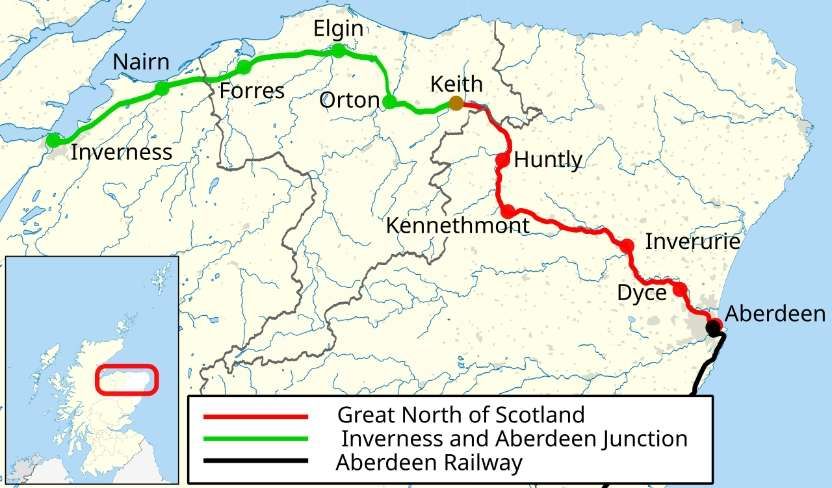
“Nevertheless,” says Drew, “the first train to reach Inverness from the South, in 1858, was from Aberdeen, over the Great North of Scotland [Railway (GNSR)] as far as Keith and then over the Inverness & Aberdeen Junction line, which later became part of the HR.” [1: p5]
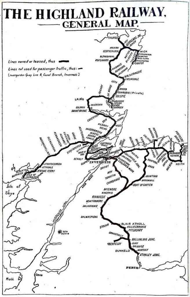
The Aberdeen to Inverness Railway Line, (GNSR – Aberdeen to Keith)
The GNSR was “floated to build a railway from Aberdeen to Inverness. … It obtained its Act on 26th June 1846. It is estimated that [this] cost £80,000 and the company was at once in financial straits, … accentuated by the crash which followed the ‘Railway Mania’s, then at its height. … [Eventually, work] started on 25th November 1852. … The railway was opened from Kittybrewster (1½ miles from Aberdeen) to Huntly, a distance of 39 miles, on 19th September 1854. Four years previously, the railway had been completed from Perth to Aberdeen. A through journey was then made possible between England and the south of Scotland, and Huntly. From this latter point coaches, running in connection with the trains, continued the journey to Inverness.” [17: p12-15]
The line was extended into Aberdeen to Waterloo Quay in 1855, and in October 1856 it reached Keith around halfway between Aberdeen and Inverness. The GNSR had overstretched itself and could not fund the remaining 55 miles of line to Inverness.
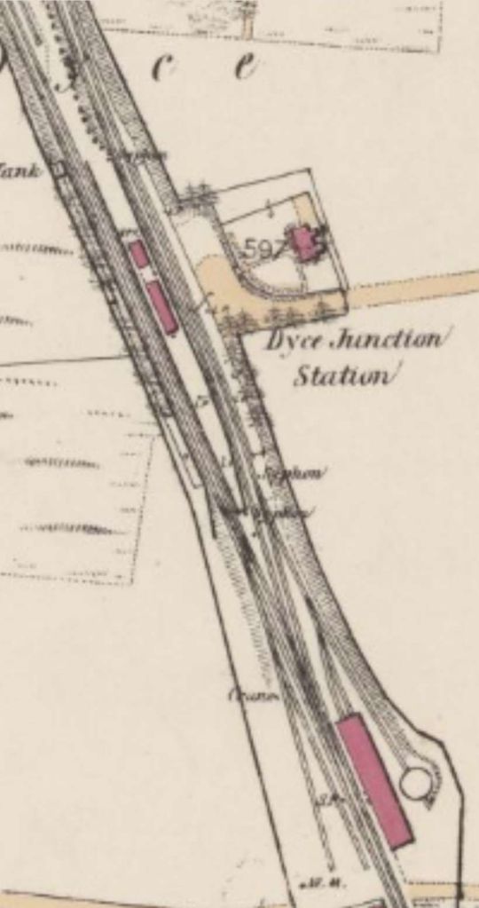
The original Great North of Scotland Railway terminus in Aberdeen opened on 1st April 1856, and closed to passenger service on 4th November 1867 with the opening of Aberdeen Joint Railway Station. This extract from the 25″ Ordnance Survey undertaken between 1864 and 1867, published in 1869 shows the station as it was in its prime. [15][18]The next significant location on the line was the station at Kittybrewster which is shown here as an extract from the 25″ Ordnance Survey undertaken between 1864 and 1867, published in 1868. [19]Dyce Railway Station was opened (along with the line) in 1854 by the Great North of Scotland Railway (GNSR). It later became a junction for the Formartine and Buchan Railway (F&BR) which diverged here and headed north to Peterhead and Fraserburgh; this opened to traffic in 1861 and had its own platforms alongside the main line ones. Passenger services over the F&BR ended as a result of the Beeching Axe on 4th October 1965 but the station remained open until 6th May 1968. [15] Freight continued to Peterhead until 1970 and to Fraserburgh until October 1979. There is still evidence on the ground of the old branch platforms which sat on the site of the station car park. The former branch lines are now a long distance cycle path, accessible from the western end of the car park. The station was reopened by British Rail on 15th September 1984. This extract from the 25″ Ordnance Survey of 1865, published in 1866 shows the station soon after it became a junction station. [16][20]
The GNSR left Dyce and followed the southern edge of the River Don’s floodplain, passing through Kintore before bridging both the Aberdeen Canal and the River Don just to the North of Port Elphinstone Railway Station.
Kintore Railway Station acted as a junction station for the Alford Valley Railway which branched off the GNSR line just to the Northwest of Kintore Railway Station. The Alford Valley Railway opened in 1859. It had stations at Kemnay, Monymusk, Tillyfourie, Whitehouse and Alford. The line also served Kemnay Quarry and three other granite quarries in the area. The train took just over an hour for the 16-mile (26 km) journey. [27][28]This next extract from the 25″ Ordnance Survey of 1864 to 1866, published in 1867, shows Port Elphinstone Railway Station and the bridges over the Aberdeen Canal and the River Don. As can be seen on this extract a short branch line served the canal wharves at Port Elphinstone. [21]Inverurie Railway Station was the next significant location on the GNSR and appears on this extract from the 25″Ordnance Survey of 1864 to 1866, published in 1867. [22]Further to the Northwest, the line bridged the River Urie (Ury). This extract is from the Ordnance Survey of 1866 & 1867, published in 1867. [23]
To the West of Keith, the Highland Railway held sway. The Inverness &Aberdeen Junction Railway was one of the constituent parties that formed the Highland Railway in 1865, as noted below.
The line crossed the River Urie (Ury) once again further to the Northwest. This extract comes from the 25″ Ordnance Survey of 1867, published in 1868. [24]
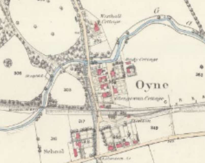
Beyond this viaduct the line ran along the South side of the River Ury and then to the South side of the Gadie Burn. It crossed the Burn just to the West of the village of Oyne and its railway station.
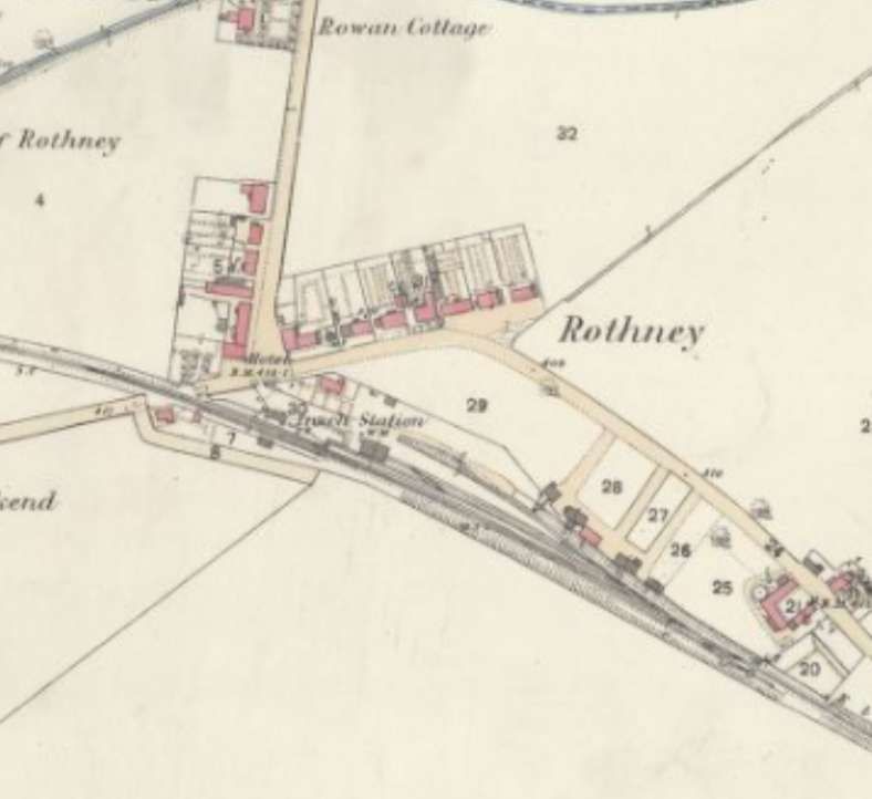
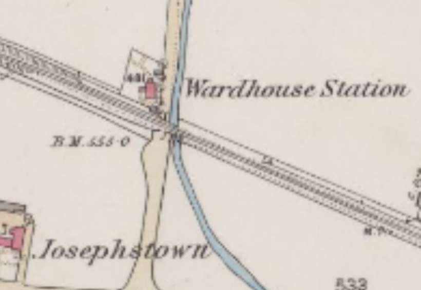
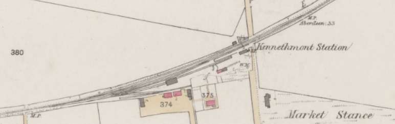
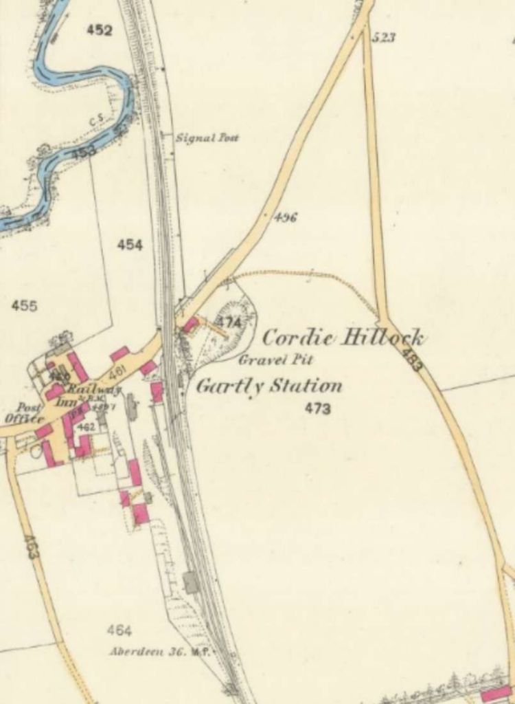
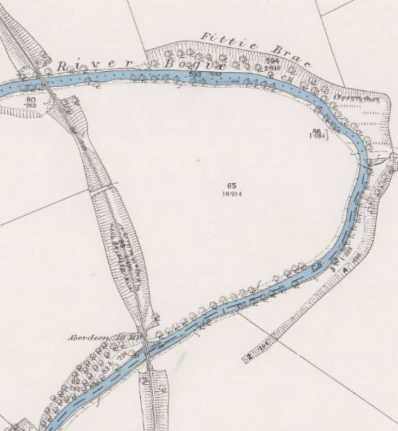
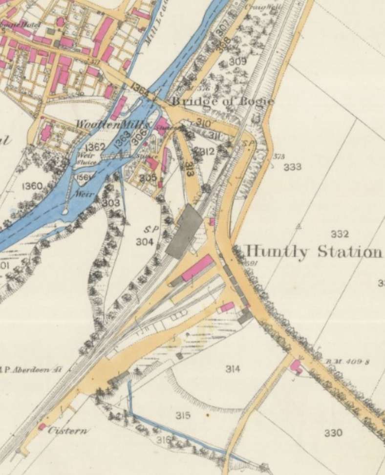
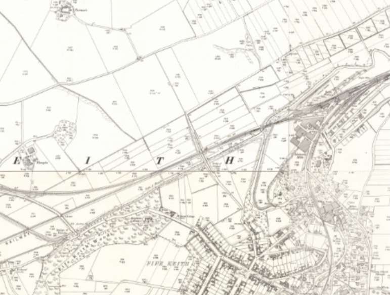
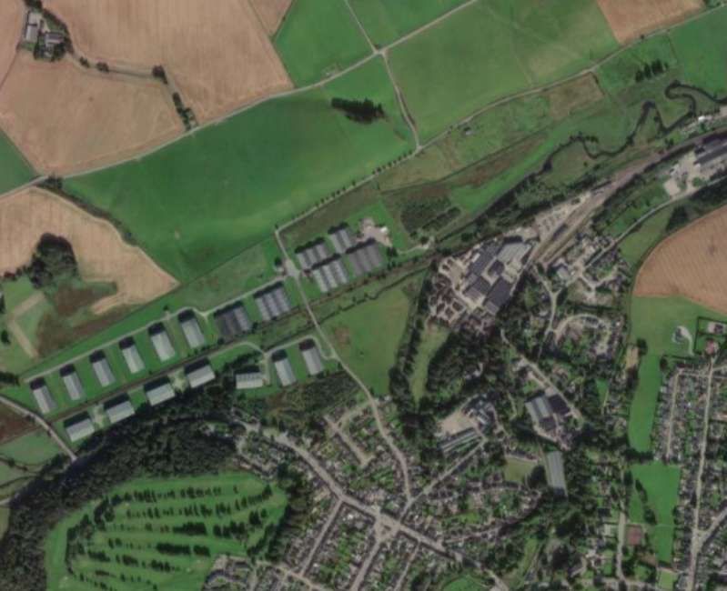
The village of Oyne, its railway station, and both road and railway bridges over the Gadie Burn. This extract is taken from the 25″ Ordnance Survey of 1867, published in 1868. [25]Insch Railway Station at Rothney, as it appeared on the 1867 25″ Ordnance Survey. [26]The next station on the line was Wardhouse Station. [29]And then Kennethmont Railway Station. [30]And Gartly Railway Station. [31]North of Gartly the railway bridged the River Bogie twice in short succession before arriving at Huntly. [32]Huntly Railway Station sat on the East bank of the River Bogie with Huntly to the West of the river. Huntly was the temporary terminus of the GNSR from 19th September 1854 until an extension was opened taking the line as far as Keith in October 1856. [17: p15-16] This extract is from the 25″ Ordnance Survey of 1871, published in 1872. [33]
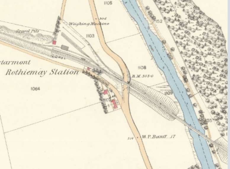
North of Huntly, on the extension to Keith the line. Missed the River Deveron and ran through Rothiemay Railway Station.
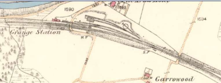
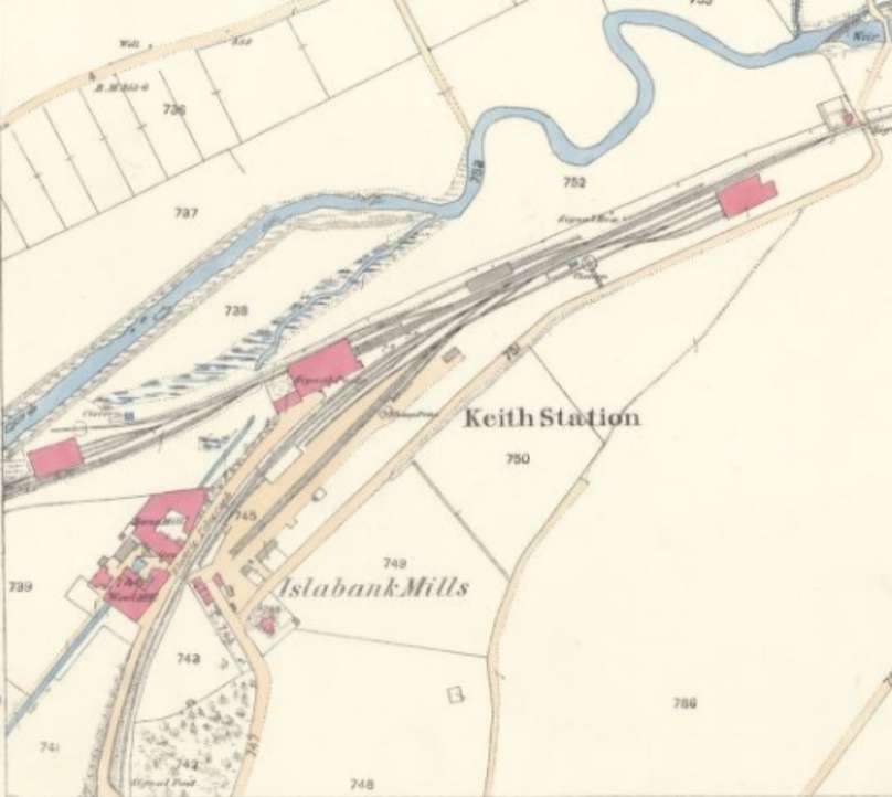
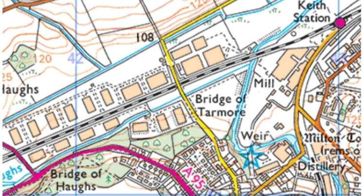
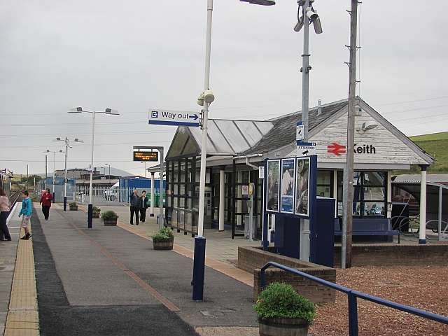
This extract from the 25″Ordnance Survey of 1870 and 1871, published in 1872 shows the viaduct over the River Deveron and Rothiemay Railway Station. [34]Further West the line passed through Grange Station which three years after opening in 1856 became the junction station for the Banff, Portsoy and Strathisla Railway which opened a branch to Banff and Portsoy. [35][36]This next extract from the 25″ Ordnance Survey of 1867 & 1868, published in 1869, shows Keith Railway Station which was the terminus of the GNSR line from October 1856 until the Inverness & Aberdeen Junction Railway reached Keith from Nairn in 1858. . [37][38]
The Keith and Dufftown Railway ran Southwest from Keith to Dufftown. It can be seen curving away from the station at the left of the OS map extract above. At Dufftown, the line made an end-on connection with the Speyside Railway at Dufftown, and the Morayshire Railway connected to the Speyside Railway at Craigellachie, this ultimately gave the GNSR access to Elgin. [39]
The Aberdeen to InvernessRailway Line(HR – Keith to Inverness)
The GNSR’s protracted/torturous efforts to reach Inverness created space for others to act. Interests in Inverness sought to provide a different link to the South via Druimuachdar to Perth but were thwarted by its rejection by Parliament (in 1846), nonetheless they “obtained authority for a short line from Inverness to Nairn with a view both to blocking a GNSR approach to Inverness and also the Inverness route which eventually branched off from the Inverness-Aberdeen route at Forres, Nairn, and ran via Dava summit (1052ft), Grantown-on-Spey, Aviemore and on to Perth via Druimuachdar. (Only in the 1890s was the direct line built from Inverness via Slochd summit and Carr Bridge to Aviemore, affording the shortest route to the South.)” [1: p5-7]
Drew continues: “The Inverness & Nairn railway took only a year to build (1854-55). The eastward extension of the Inverness-Nairn line was the Inverness & Aberdeen Junction, which ran via Forres and Elgin to Keith, to which point it was opened in 1858, met the GNSR and provided the Inverness-Aberdeen through route. Two years later the Inverness & Perth Junction Company was formed. Construction of the Forres-Perth line made quick progress from both ends, despite the need to take the line for 100 miles through the central mountain tract of Scotland. The through route from Inverness via Forres to Perth was completed in 1863. The Inverness & Aberdeen Junction, which had absorbed the Inverness & Nairn, and the Inverness & Perth Junction, were amalgamated in 1865 to form the Highland Railway.” [1: p7]
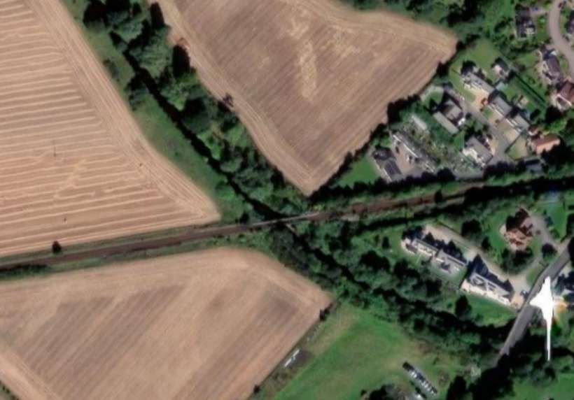
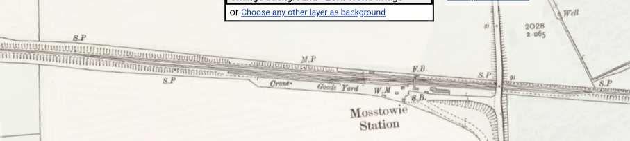
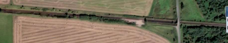
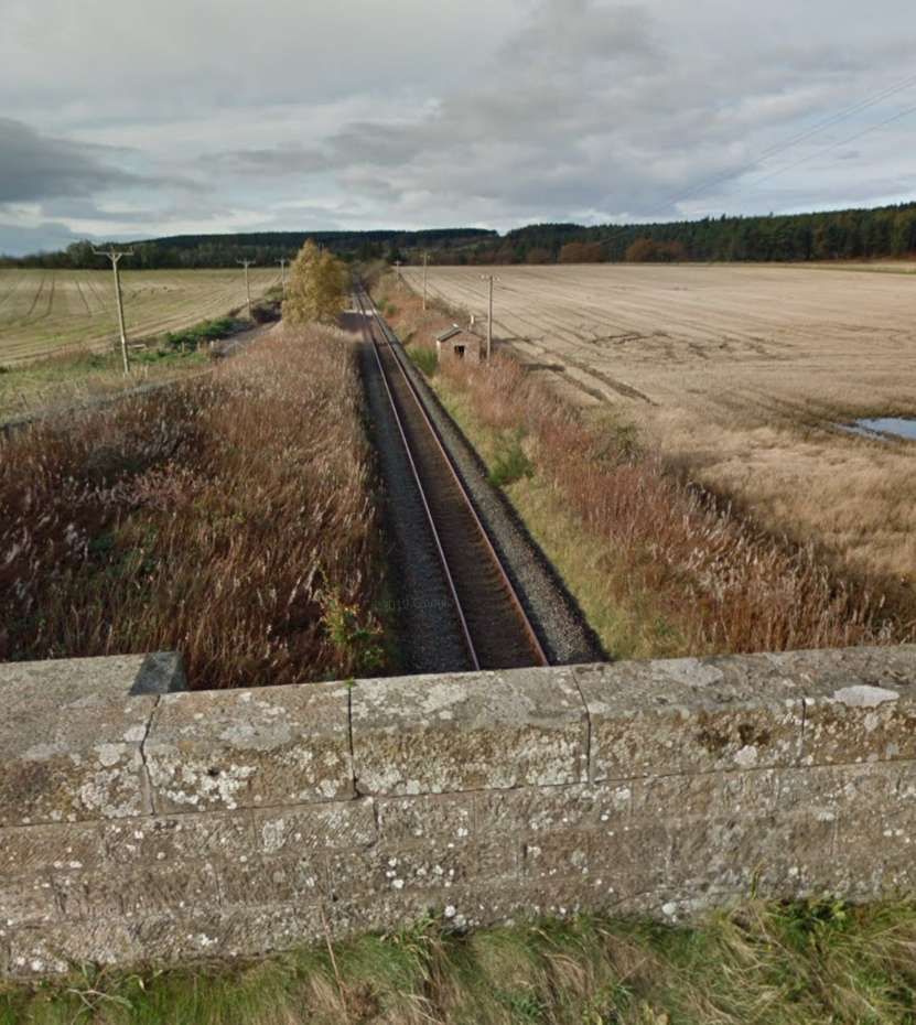
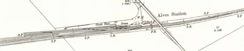
West of Elgin the line bridged the River Lossie before passing through Mosstowie Station, then passed a connection to a mineral railway serving Newton Quarries and on to Alves Station.
After Alves Station it was only a short distance to the junction for the Burghead & Hopeman Branch. The line then continued on to Kinloss.
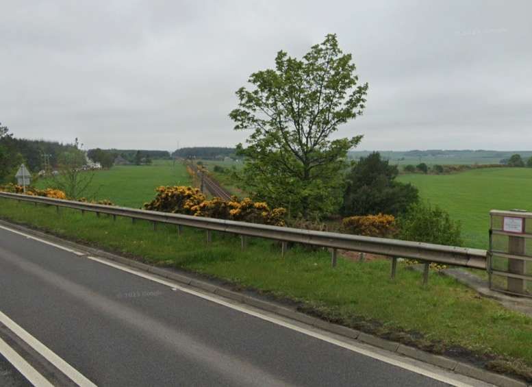
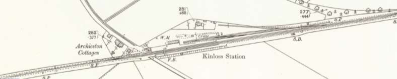
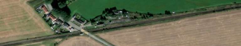
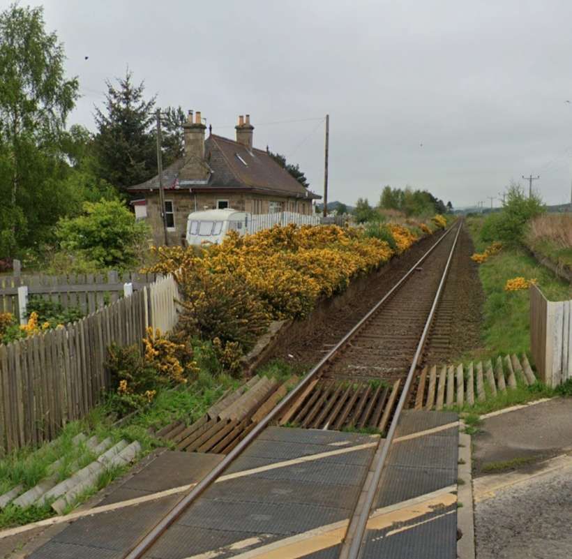
The 25″ Ordnance Survey shows the junction with the HR’s Burghead & Hopeman Branch and the adjacent roads and bridge at around the turn of the 20th century. [58]The same location in the 21st century. The road has been realigned. The route of both railway lines are still easily made out! [58]The old road bridge still crosses the railway adjacent to the newer A96 road bridge. [Google Streetview, May 2023]Looking West along the line from the A96. [Google Streetview, May 2023]Kinloss Railway Station opened on 25th March 1858 by the Inverness and Aberdeen Junction Railway. It was re-sited on 18th April 1860, to the east, but it was moved back to its original location in May 1904. It closed to passengers on 3rd May 1965nand completely on 7th November 1966. [59][60]The same area in the 21st century. [59]Kinloss Railway Station in the 21st century, looking East from the level-crossing. [Google Streetview, May 2023]Looking West from the level-crossing at Kinloss Station site. [Google Streetview, May 2023]
After leaving Kinloss trains for Inverness next ran into Forres Railway Station. Over the years the railway infrastructure at Forres has seen significant changes.
In 1858, the first railway station at Forres was located at the end of Market Street which became known as Old Station Road. The station building was demolished in the 1950s. It had been used as the stationmaster’s house since the junction opened.
A route to the South from Inverness was finally completed in 1863. It met the line running between Elgin and Inverness at Forres. Forres was chosen as the junction for the new mainline south, since it was the half-way point on the Inverness & Aberdeen Junction Railway between Inverness and Keith. Keith was also an important railway junction and the point where the line joined the GNSR and branches to the coast and Strathspey. [62]
A new ‘triangular’ station wastl constructed to allow all trains entering Forres, from either the East or West, to access the new line directly on a curve. The three curved platforms, and three junctions, gave the new Forres station its distinctive layout. [62]
The location of the new station was south-west of the existing Inverness-Aberdeen line. The original line was retained as a goods loop, with trains now leaving and re-joining the line (east-west) on a curve. Services from Inverness to Perth curved to the south on a junction at the west of the station, to arrive at the southbound platforms. [62]
Three individual signal boxes controlled the junctions at each point of the triangle: Forres East, Forres West, and Forres South. [62]
The closure of the link to the South from Forres occurred as part of the cuts following the Beeching Report in the 1960s. Further remodelling of the whole area took place in the 21st century. This saw much of the existing infrastructure removed and a new functional station built by 2017. [62]
West of Bodies the line ran on through Auldearn Station, bridged the River Nairn and entered Nairn Railway Station.
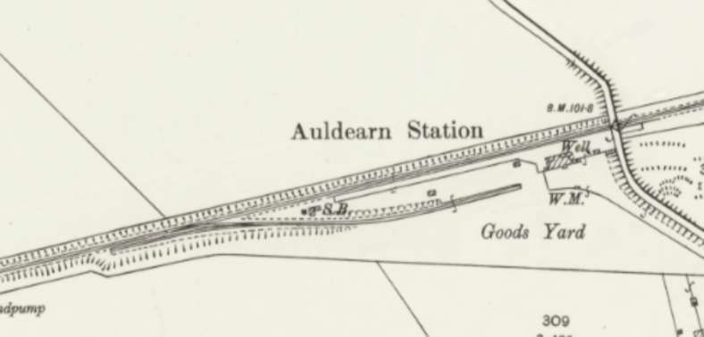
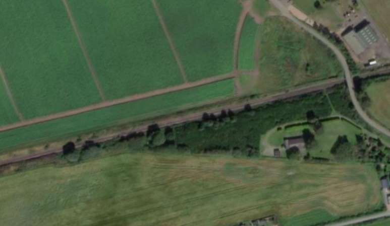
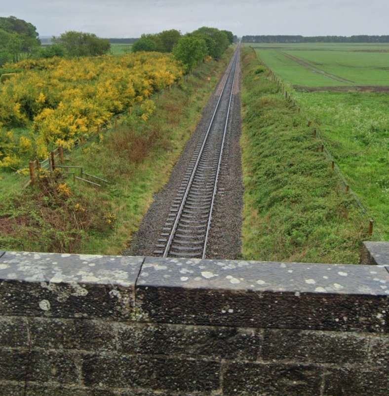
Auldearn Railway Station on the 35″ Ordnance Survey from the turn of the 20th century. It opened on 9th December 1895 and was closed by 6th June 1960. [72]The site in the 21st century – all evidence of the station has disappeared. [72]Looking West from the overbridge at the East end of the site of Auldearn Railway Station. [Google Streetview, May 2022]The bridge over the River Nairn as it appears on the 25″ Ordnance Survey from the turn of the 20th century. [73]The same location in the 21st century. [73]
Nairn Railway Station opened on 7th November 1855. In 1885, the Highland Railway Company agreed to improve the facilities at Nairn. The station buildings were replaced with improved accommodation for passenger and staff. The gables of the cross wings were surmounted with the Scotch thistle, the Prince of Wales feather, and other designs sculpted in stone. The masonry work was completed by Mr. Squair of Nairn. At the same time a new station master’s house was erected. The platforms were extended to around 440 yards (400 m) and raised in height to the level of the carriages. A new iron foot bridge over the line connected the platforms, avoiding passengers using a foot crossing over the running lines. The bridge over Cawdor Road was also widened at the same time. The work was completed in 1886. [76]
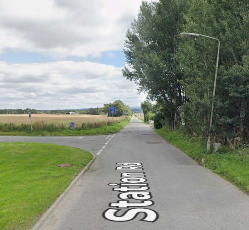
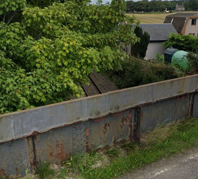
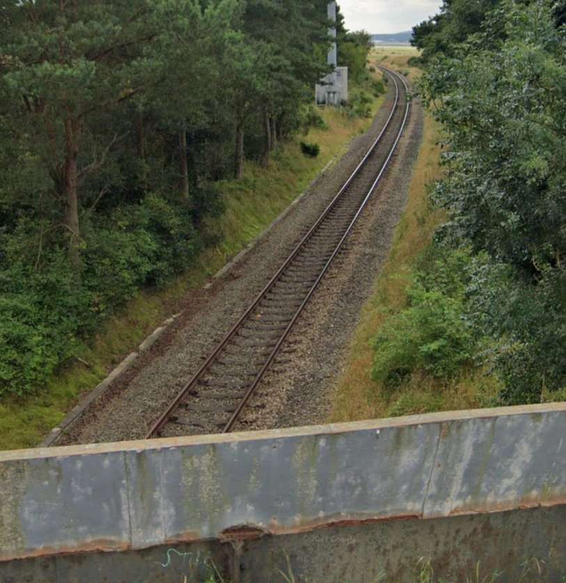
Heading Southwest out of Nairn trains passed through Gollanfield Junction Station which served the short Fort George Branch.
Gollanfield Station as it appeared on the Landranger OS map prior to closure. [79]Gollanfield Junction Railway Station opened in 1855 by the Inverness and Nairn Railway, it was initially named Fort George after the military base nearby. In July 1899, the Highland Railway opened a direct branch to Fort George (which was actually sited in the village of Ardersier). With the opening of the branch, the station was renamed Gollanfield Junction. Passenger services on the branch were withdrawn in 1943 and it closed to all traffic in August 1958. The following year, the station was renamed Gollanfield by British Railways. [77][78]The same location in the 21st century. Goods traffic at the station ceased in May 1964 and it was closed to passenger traffic on 3rd May 1965. Most of the buildings were subsequently demolished after closure, but the station house remains standing and is used as a private residence. [77][78]Looking East from the road bridge which used to span Gollanfield Railway Station, [Google Streetview, August 2021]Looking West from the road bridge which used to span Gollanfield Railway Station, [Google Streetview, August 2021]
Further details of Gollanfield Railway Station and photographs can be found here. [79]
The next stop on the line was at its terminus at Inverness.
J. W. P. Rowledge; The 4-4-0 Locomotives of the Glasgow & South Western and Highland Railways; in Brian Stephenson (ed.) Locomotives Illustrated No 117, January-February 1998, Ian Allan, Berkhamsted, Herts, 1997.


