A Summary of what was covered in the First Article
In the previous article in this short series we looked at the history of trams in Genoa (Genova) – both horse trams and electric trams. We covered the story as far as the beginning of the First World War. That article can be found here. [1]
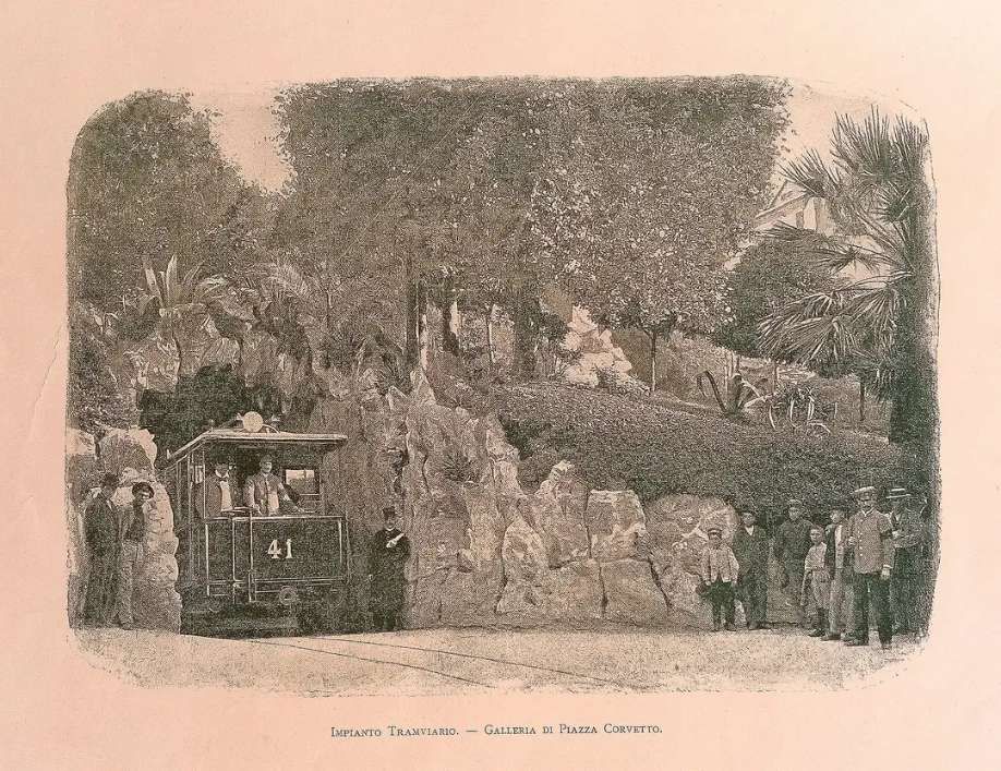
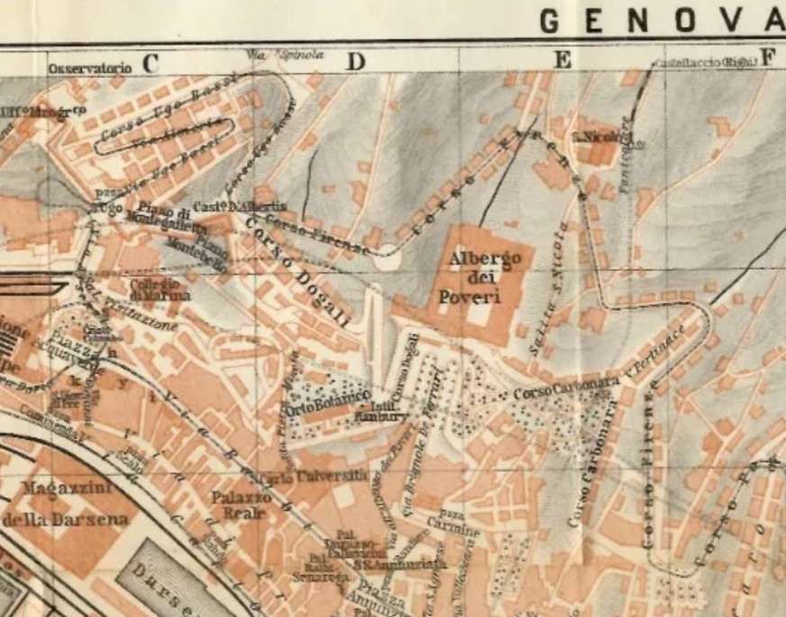
In that article we looked at the tunnels which the city created in order to facilitate access to different parts of the tram network.
That article also covered the Western Network (which is marked in green on the map below). We still have to look at the remainder of the network and the history of the network through to its final closure in the mid-1960s.
As well as looking in detail at the Western network, we noted the services provided on the whole network before the First World War. Details of the lines which formed the Western network can be found in the earlier article – here. [1]
In this article we look at the service provided on another large portion of the remainder of the network in the period up to the First World War.
The Years Before World War One – The Eastern Network
Before the start of World War 1, the Eastern network provided these services: [19]
I. Eastern Network:
21 De Ferrari – Manin – Staglieno 22 De Ferrari – Manin 23 De Ferrari – Manin – Castelletto 24 De Ferrari – Manin – Castelletto – San Nicholo 25 Circuit in the hilly suburbs 26 Piazza Principe – Corso Ugo Bassi 27 De Ferrari – Zecca – Principe 28 Caricamento – De Ferrari – Galliera ‘Ospital 29 De Ferrari – Carignano 30 Circular Raibetta – Brignole – Corvetto – Raibetta 31 De Ferrari – Staglieno – Molassana – Prato 32 De Ferrari – Staglieno – Molassana 33 De Ferrari – Pila – Staglieno 34 Staglieno – Iassa 35 Pila – Staglieno 36 Pila – Staglieno – Molassana 37 De Ferrari – San Fruttuoso 38 De Ferrari – Foce 39 De Ferrari – San Francesco – Sturla – Priaruggia – Quinto – Nervi 40 De Ferrari – San Francesco – Sturla – Priaruggia – Quinto 41 De Ferrari – San Francesco – Sturla – Priaruggia 42 De Ferrari – San Francesco – Sturla 43 De Ferrari – Villa Raggio – Lido 44 De Ferrari – Tommaseo – San Martino – Borgoratti 45 De Ferrari – Tommaseo – San Martino – Sturla 46 De Ferrari – Tommaseo – San Martino 47 De Ferrari – Tommaseo 48 Raibetta – Pila
III. Municipal line: A. De Ferrari – Quezzi
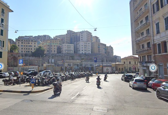
Initially the East and West networks touched only at a location close to Principe Railway Station. Later, after a link was made between Piazza Caricamento and Piazza Raibetta (only a short length of rails) there was a coastal line which linked Piazza Caricamento to the Eastern lines through Raibetta.
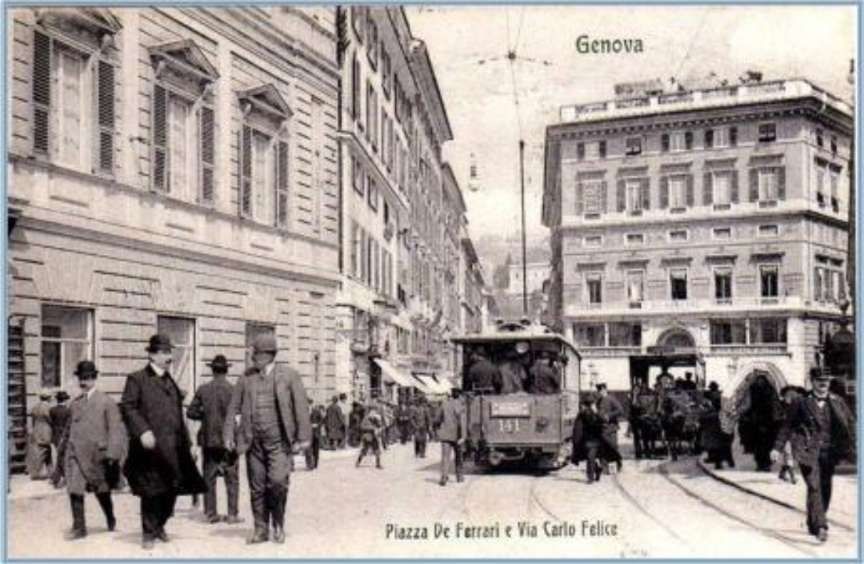
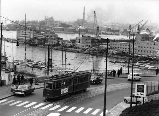
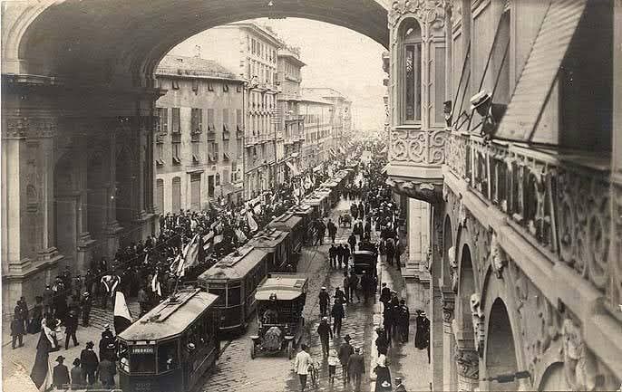
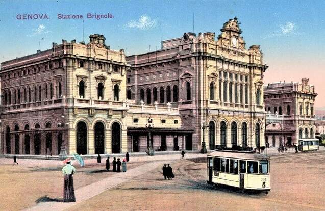
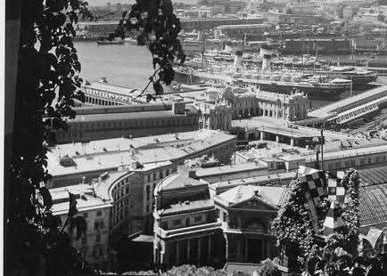
The Eastern network focussed on Piazza Raffeale de Ferrari. We looked at images from that piazza in the first article about the trams of Genoa (Genova). At one time, Piazza de Ferrari was full of ‘circular tramlines’ and it was congested through much of the day.
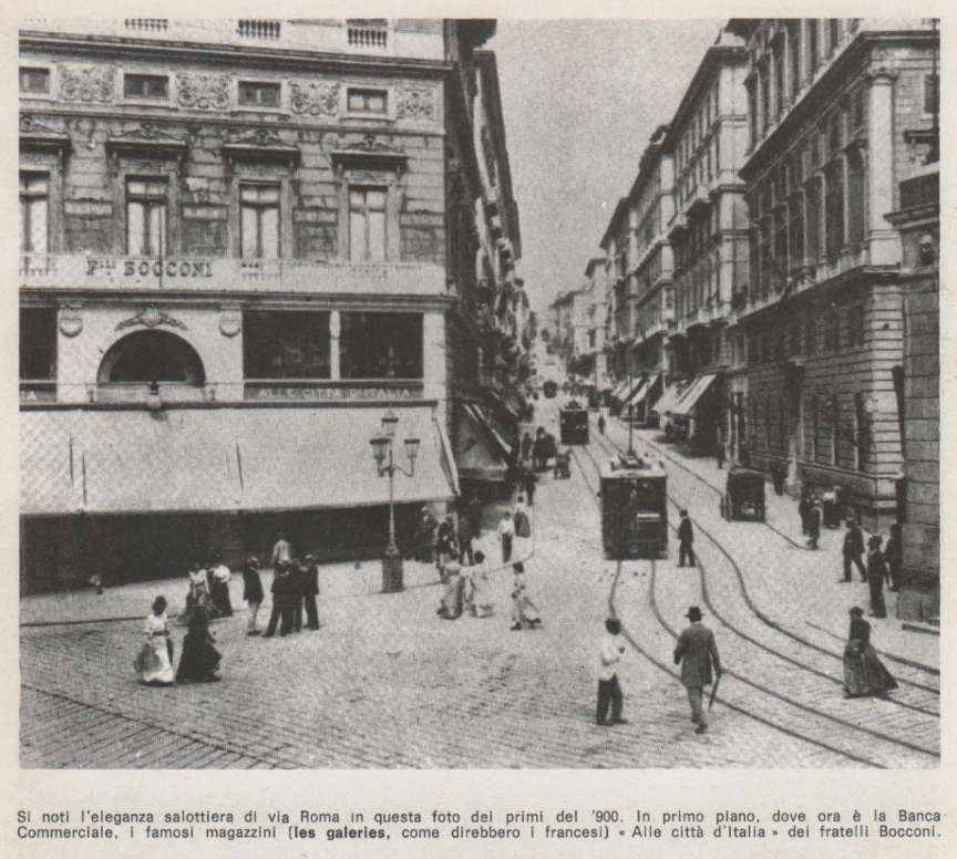
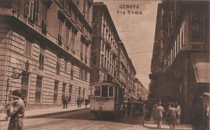
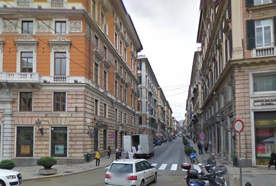
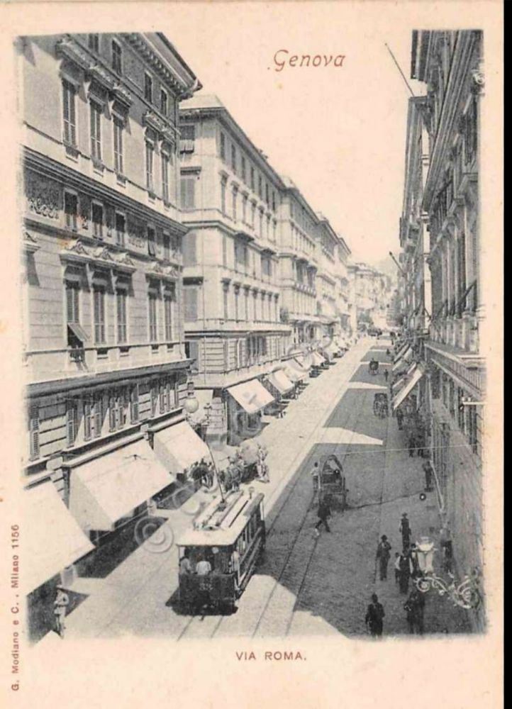
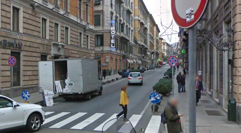
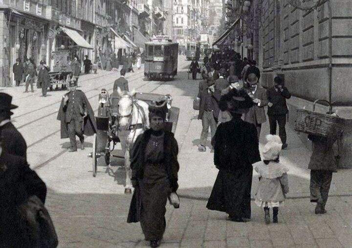
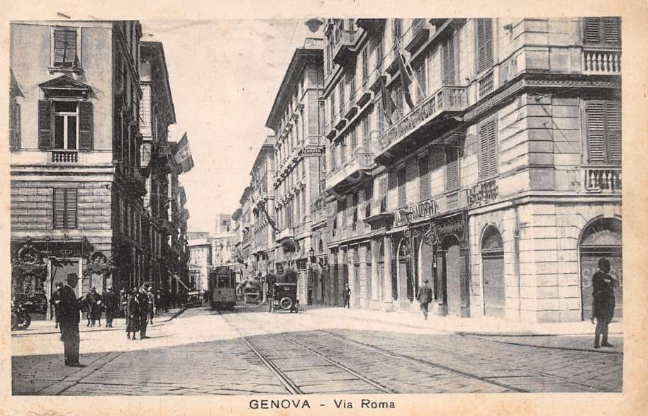
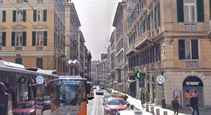
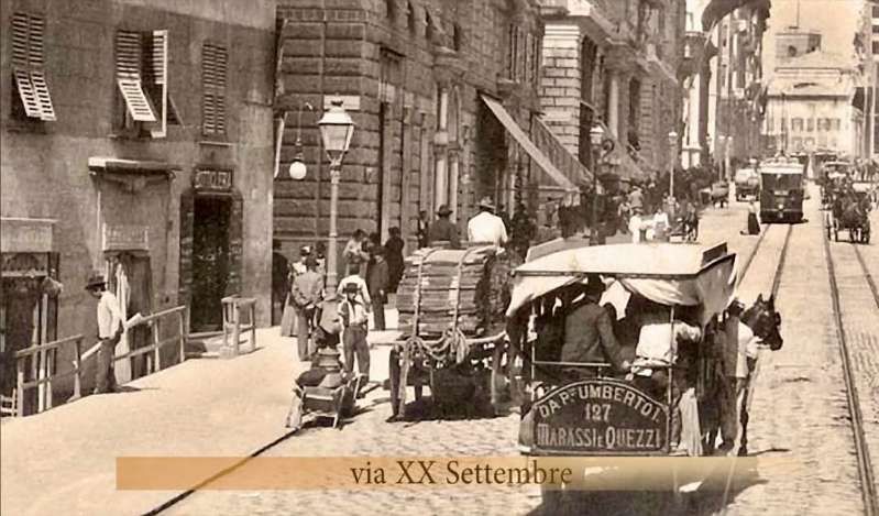
Tram lines left Piazza Raffeale de Ferrari along Via Roma, to the Northeast and along Via XX Settembre.
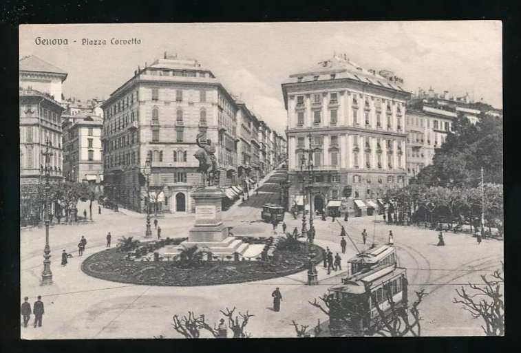
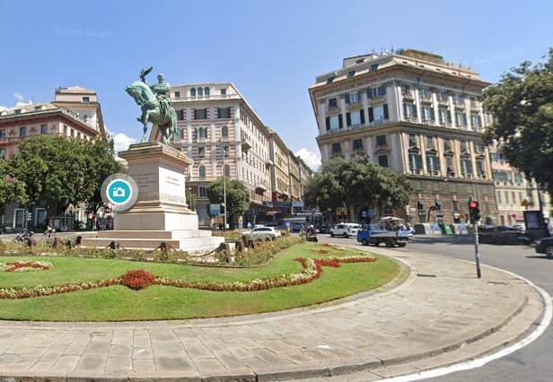
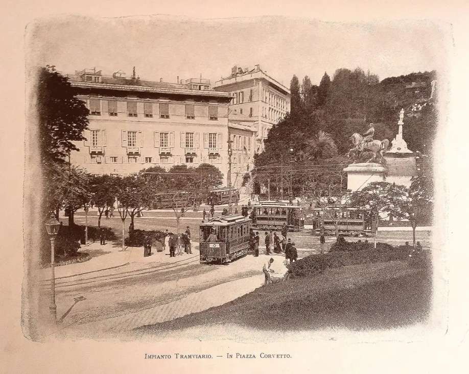
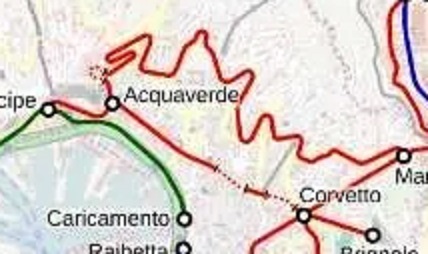
The lines along Via Roma led to Piazza Corvetto where lines diverged to Carignano, Brignole, Manin and Acquaverde and Principe. A further line looped through the hills North of the city centre from Acquaverde to Manon, and a line ran North from Manin up the Val Bisagno to Staglieno and Prato. We will lookat these line in this article, those which ran out of Piazza de Raffeale Ferrari along Via XX Settembre will be for a further article.
As we have already noted, at Piazza Corvetto lines diverged to Piazza Carignano, Brignole, Manin and Acquaverde and Principe.
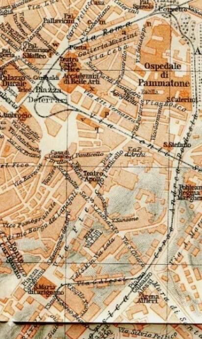
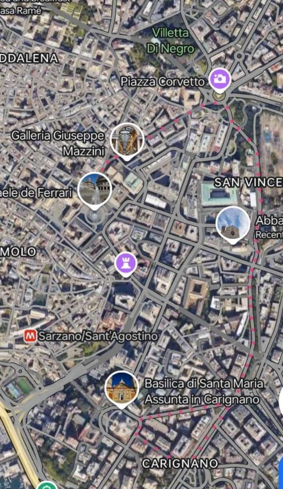
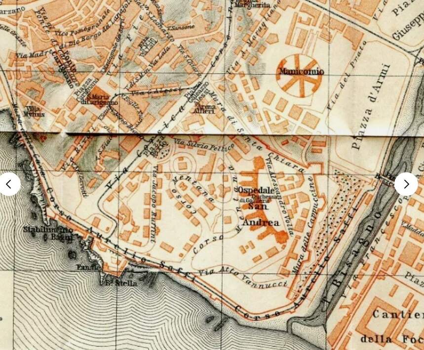
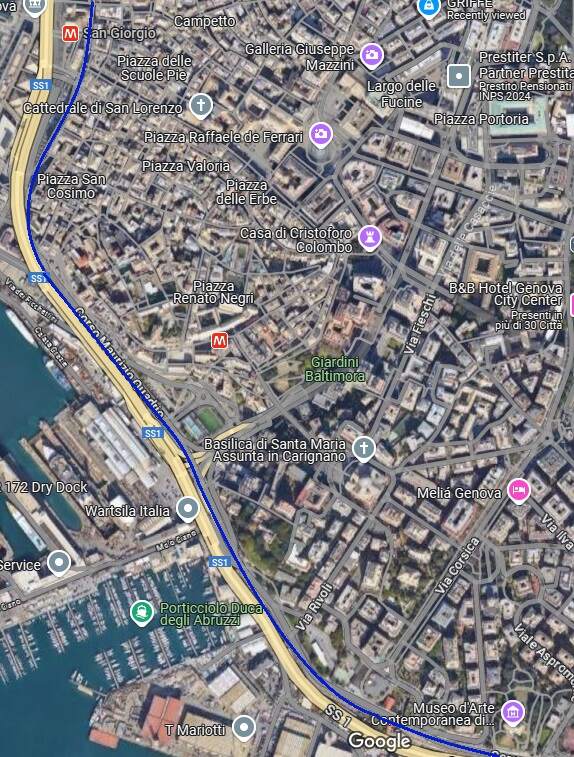
Line No. 29 – Piazza Corvetto to Carignano
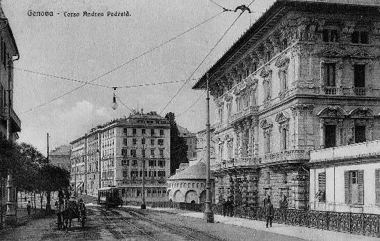
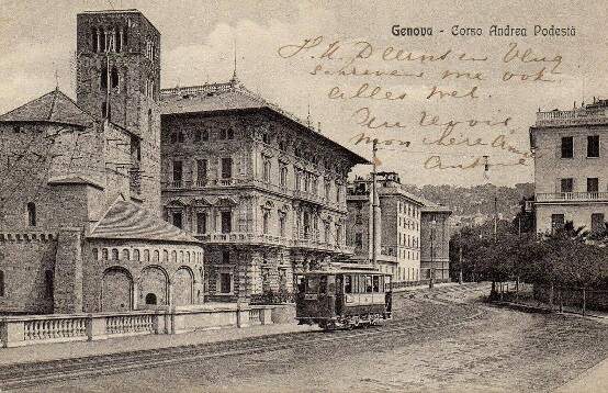
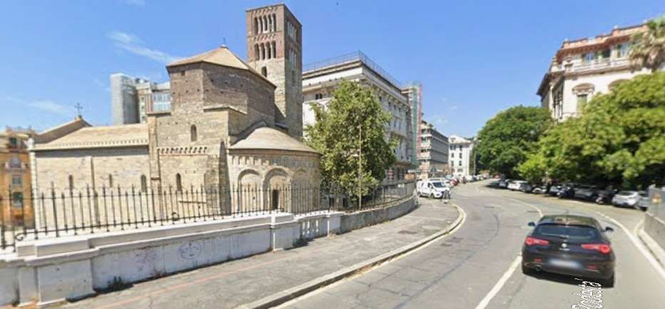
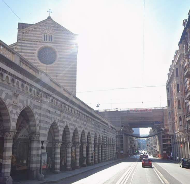
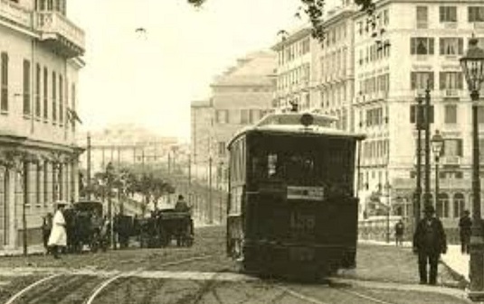
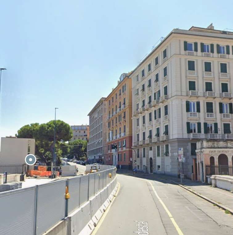
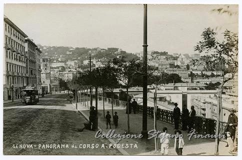
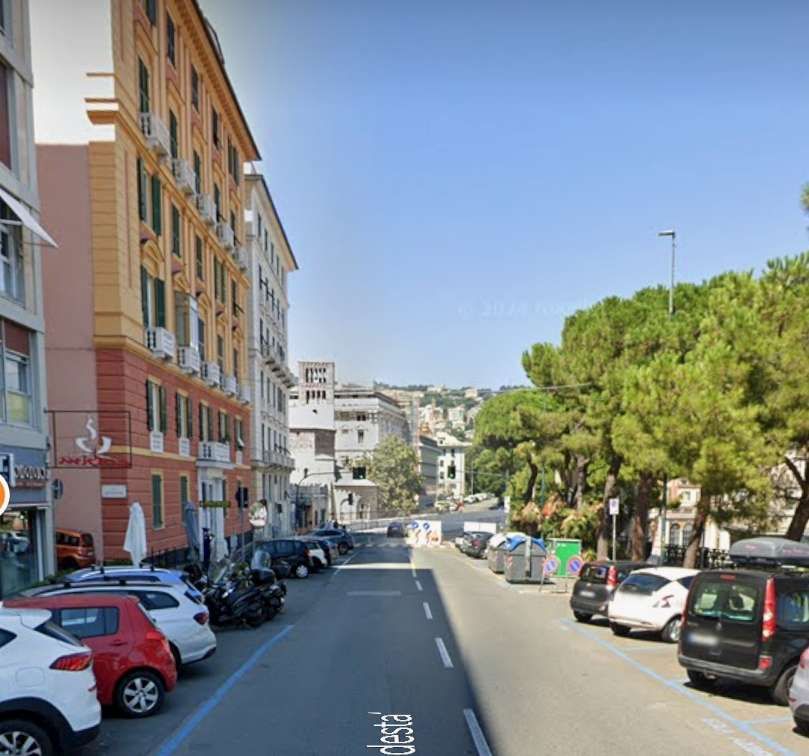
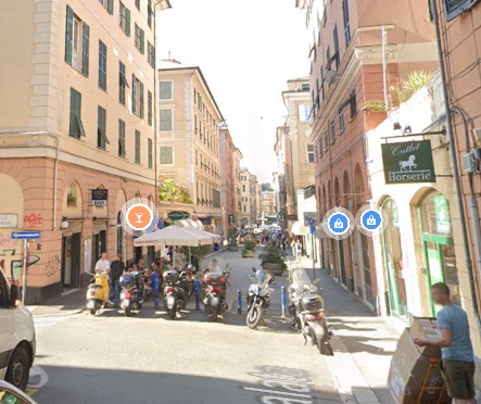
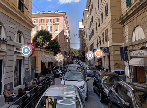
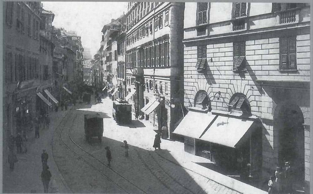
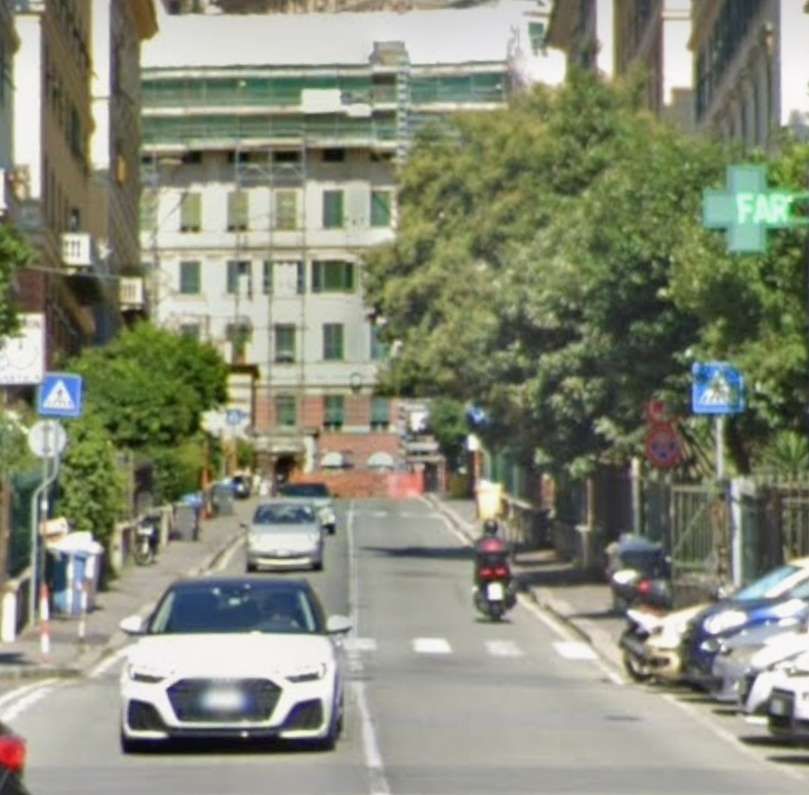
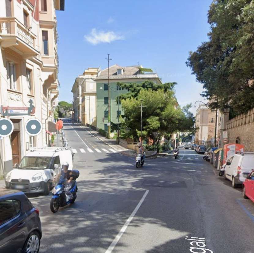
The line to Carignano left the piazza in a South-southwest direction. The roads used are currently named Via XII Ottobre and Viale IV Novembre, Corso Andrea Podesta (which bridges Via XX Settembre), Via Corsica, Via Galeazzo Alessi.
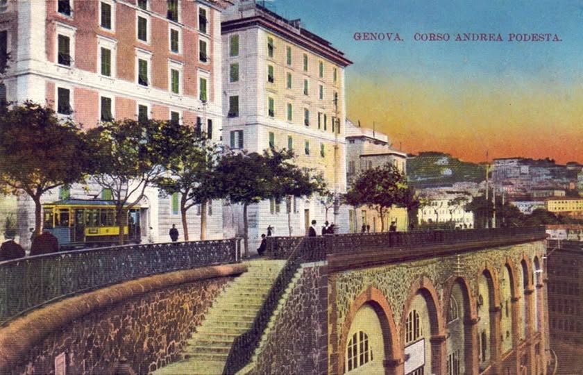
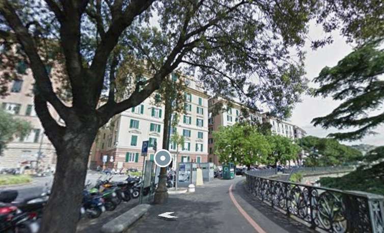
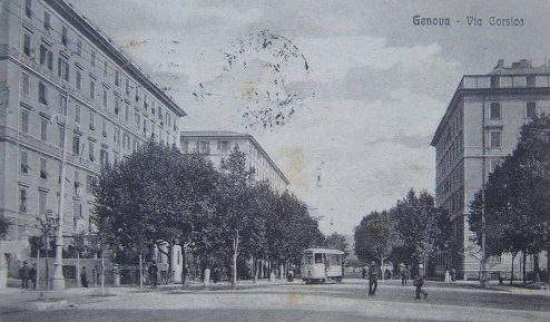
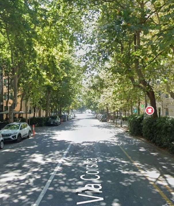
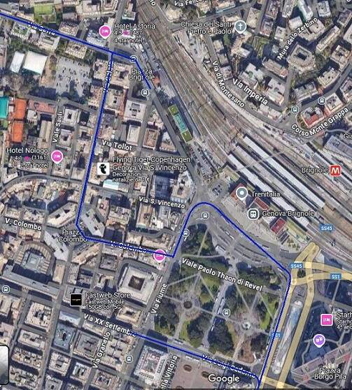
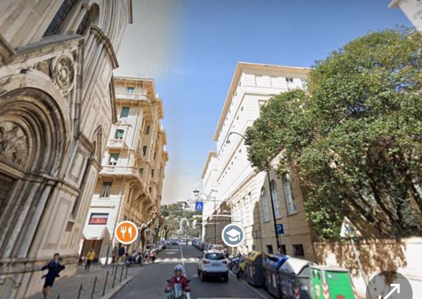
This extract from the Baedeker Map of Genova from 1906 shows the route of Tram No. 29 – from Piazza de Ferrari to Piazza Corvetto, then South on the East side of Ospidale di Pammatone, along Corso Andrea Podesta (which bridges Via XX Settembre), then in a loop including Via Corsica, Via Nino Bixio, Piazza Carignano and Via Galeazzo Alessi, (c) Public Domain. [40]The route of Line No. 29 is shown dotted on this extract from Google’s satellite imagery. [Google Maps, December 2024]This image shows a tram heading out of Piazza Corvetto in the Carignano direction down the present Via XII Ottobre. The image was shared on the C’era una volta Genova Facebook Group by Alessandro Pellerano on 23rd March 2021, (c) Public Domain. [22]A similar view looking towards Piazza Corvetto along Via XII Ottobre in the 21st century. [Googl;e Streetview, August 2024]If this image is prior to 1923, traffic in Genova would have been on the left. This tram would then be travelling away from the camera leaving Viale IV Novembre to run along a short length on Via XII Ottobre to Piazza Corvetto. This image was shared on the Foto Genova Antica Facebook Group by Silvia Brisigotti on 31st May 2024, (c) Public Domain. [26]A similar view towards Piazza Corvetto from Via IV Novembre. [Google Streetview, August 2024]Looking South along Corso Andrea Podesta with Abbazio di Santo Stefano peeping out behind the first building on the right. This image was shared on the Foto Genova Antica Facebook Group on 15th February 2020 by Enrico Pinna, (c) Public Domain. [33]The same view in the 21st century. [Google Streetview, August 2024]Looking North along Corso Andrea Podesta. This image was shared on the Foto Genova Antica Facebook Group on 14th March 2019 by Enrico Pinna, (c) Public Domain. [31]A similar view facing North on Corso Andrea Podesta across the bridge over Via XX Settembre.on the left of the photograph is Abbazio di Santo Stefano. [Google Streetview, August 2024]Looking East along Via XX Settembre with Abbazio di Santo Stefano on the left and the bridge carrying Corso Andrea Podesta ahead. [Google Streetview, August 2024]Corso Andrea Podesta, 1906. This image was shared on the Foto Genova Antica Facebook Group on 26th July 2022 by Renata Fergola, (c) Public Domain. [30]A similar view in the 21st century. The three buildings on the right of the monochrome image above dominate this photo. [Google Streetview, August 2024]Looking North along Corso Andrea Podesta from a point a few hundred metres to the South of the bridge over Via XX Settembre. This image was shared on the Foto Genova Antica Facebook Group on 7th July 2024 by Zenzero Secondo from the Collection of Stefano Finauri, (c) Public Domain. [29]A similar view in the 21st century. [Google Streetview, August 2024]At the South end of Corso Andrea Podesta, looking North. This image was shared on the Foto Genova Antica Facebook Group on 26th July 2024 by Pietro Spanedda, (c) Public Domain. [27]This view seems to be as close as it is possible to get on Google Streetview to the colourised postcard image above. The steps which are prominent in the image above can be seen through the balustrade to the right of this image. [Google Streetview, 2019]Via Corsica, 1916. This image was shared on the C’era una volta Genova Facebook Group on 23rd November 2019 by Pietro Cassani, (c) Public Domain. [34]Via Corsica in the 21st century – the trees evident in the monochrome image above have matured significantly since the early 20th century. As a result it is difficult to determine the modern equivalent of the older view. [Google Streetview, August 2024]
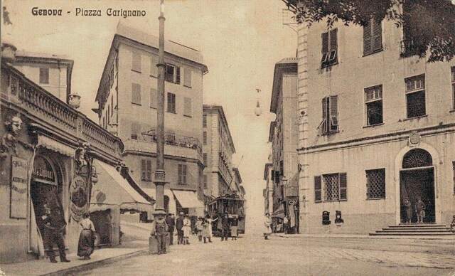
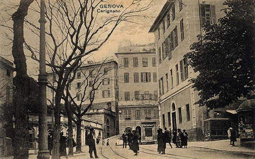
A loop ran round Via Galeazzo, Piazza Carignano and Via Corsica as shown below
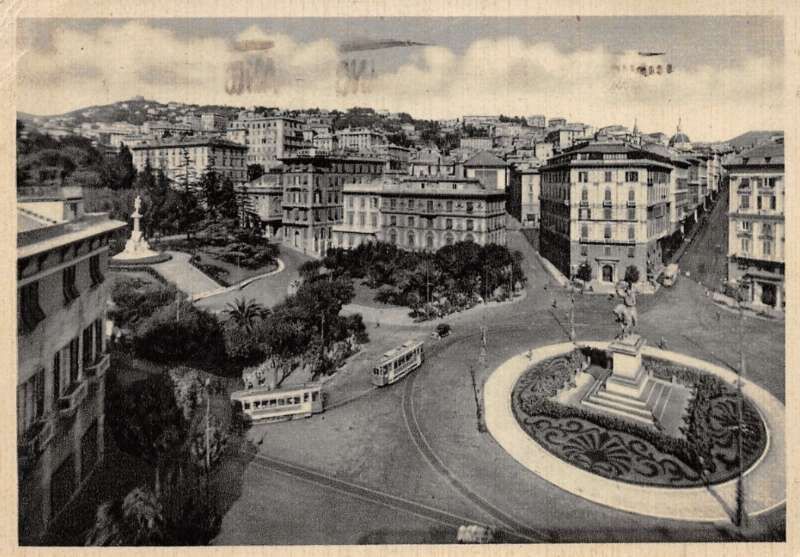
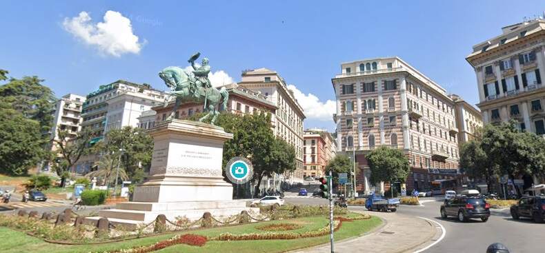
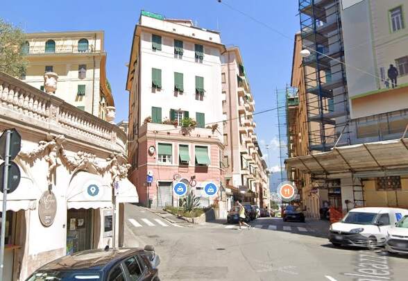
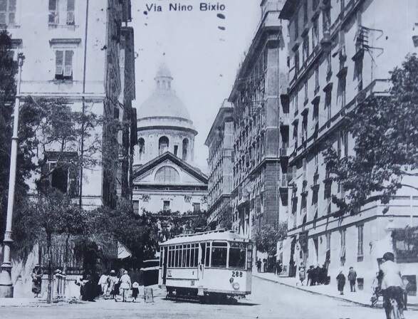
Piazza Carignano in the early years of the 20th century looking along Via Galeazzo Alesi. The tram in the picture appears to have travelled to Piazza Carignano along Via Galeazzo Alesi. It will turn to its left along the side of Piazza Carignano before leaving the piazza along Via Nino Bixio. The loop may also have been travelled in the reverse direction, if so, this tram is leaving Piazza Carignanao down Via Galeazzo Alesi. This image was shared on the C’era una volta Genova Facebook Group by Franco Bonadonna on 18th October 2022, (c) Public Domain. [25]Tha same view in the 21st century. [Googl;e Streetview, August 2024]This picture shows the tram tracks running along the side of Piazza Carignano from Via Galeazzo Alesi and turning down Via Nino Bixio. This image was shared on the Foto Genove Antica Facebook Group on 30th April 2024 by Pietro Spanedda, (c) Public Domain. [23]This view of Via Nino Bixio seen from Via Corsica shows a tram running away from the camera along Via Nino Bixio having turned right from Via Corsica. Prior to 1923 Genova traffic travelled on the left. This image was shared on the C’era una volta Genova Facebook Group by Roberto Cito on 9th September 2023, (c) Public Domain. [24]A similar view in the 21st century of Via Nino Bixio from Via Corsica. [Google Streetview, September 2020]
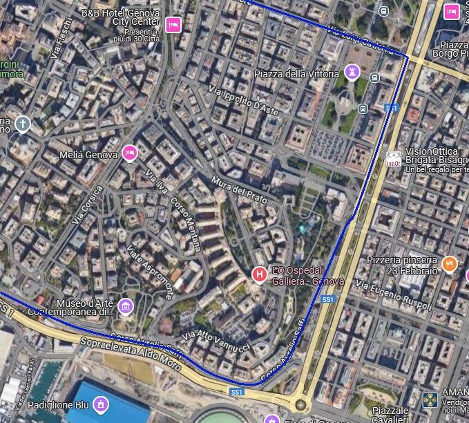
Line 30 – Piazza della Raibetta to Piazza Brignole via Piazza Corevetto
Italian Wikipedia describes this route as a ‘circular’ (Circolare) – we will need to consider how this route differs from an ‘out-and-back’ service (such as Line 29 between Piazza de Ferrari and Piazza Carignano).
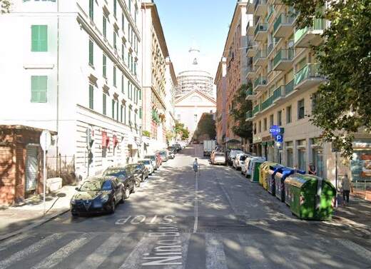
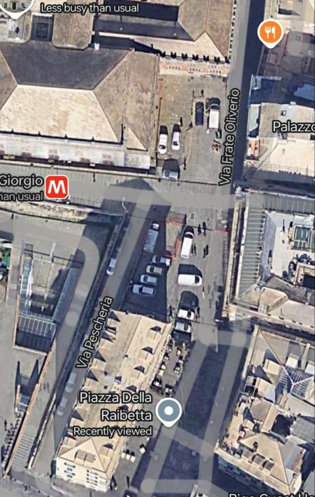
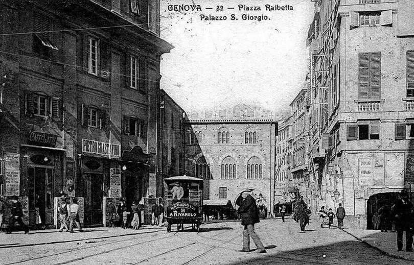
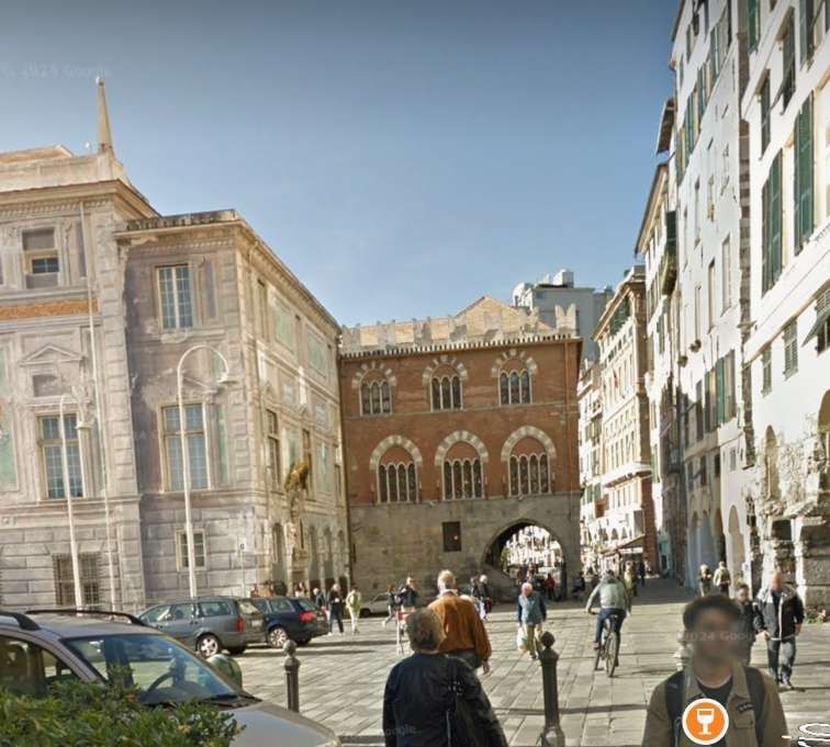
Piazza della Raibetta was the terminus of a coastal tram route. Initially, it was only served by Line No. 30.
These three extracts from the Baedeker 1906 map of Genoa show the route of Line No. 30.
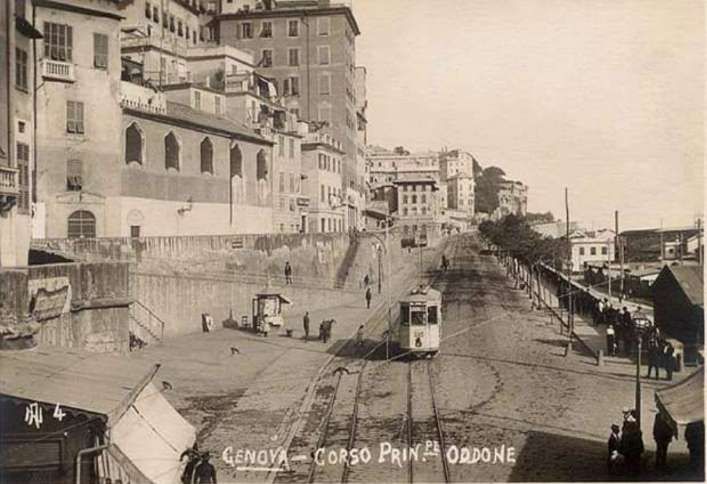
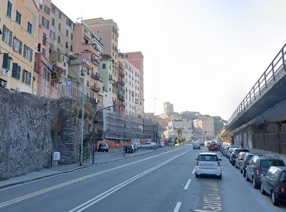
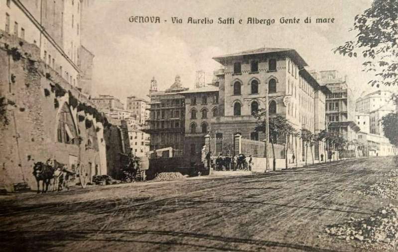
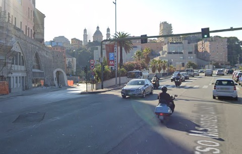
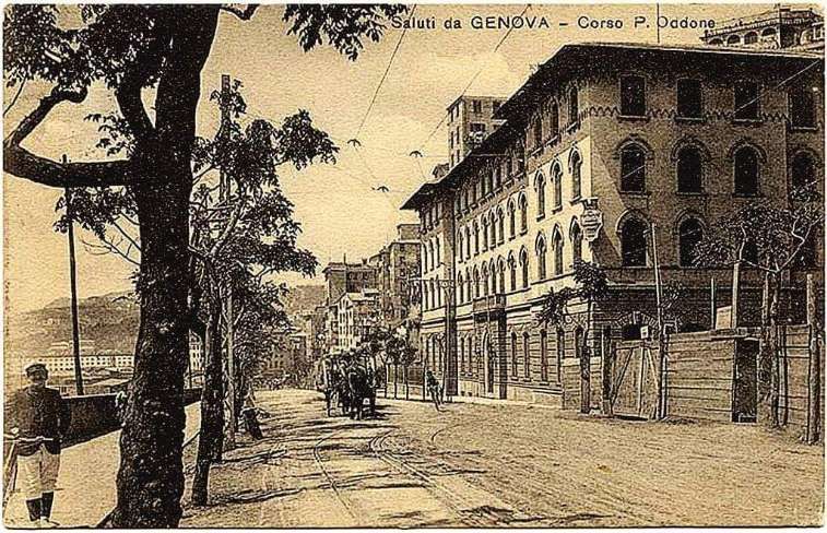
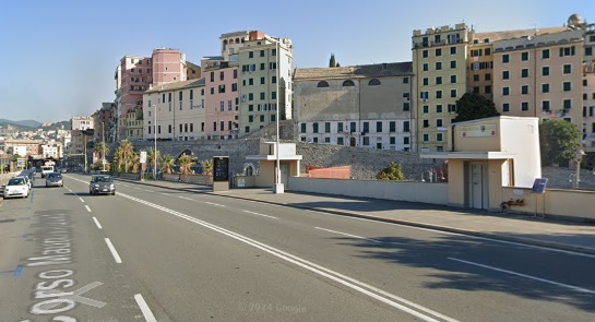
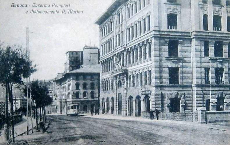
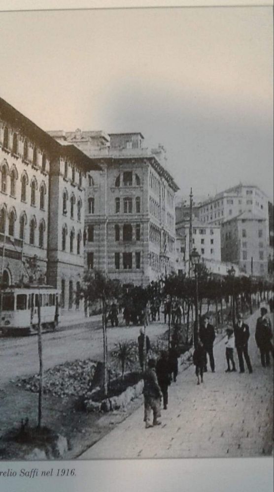
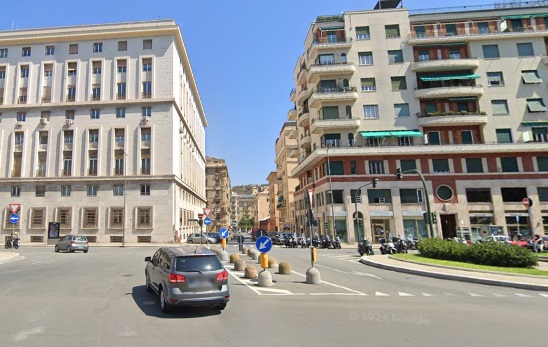
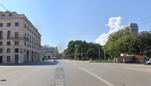
Again, assuming the map by Arbalete is correct, the line ran South from Piazza Raibetta along (probably) Via Filippo Turati and then through Piazza Cavour onto Sottopasso di Carcimento. The line continued around the South side of the city along Corso Maurizio Quadro and Corso Aurelio Saffi (previously Corso Principe Oddone) to the mouth of the River Bisagno where it turned inland, following the Val Bisagno as far as Via Luigi Cardorna where trams turned left following that road to the West which continued into Via XX Settembre. Then into Piazza de Ferrari, Via Roma, Piazza Corvetto, Via Serra and finally Piazza Brignole, (c) Public Domain. [40]
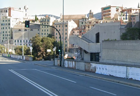
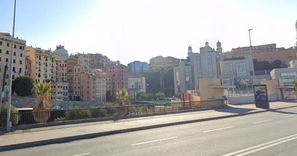
Line No. 30 from Piazza Raibetta along (probably) Via Filippo Turati and then through Piazza Cavour onto Sottopasso di Carcimento. The line then continued around the South side of the city along Corso Maurizio Quadro and, at the bottom of this satellite image, Corso Aurelio Saffi. [Google Maps, December 2024]Trams followed Corso Aurelio Saffi (previously Corso Principe Oddone) to the mouth of the River Bisagno where they turned inland, following the Val Bisagno as far as Via Luigi Cardorna where trams turned left following that road to the West which continued into Via XX Settembre. [Google Maps, December 2024]From Via XX Settembre trams entered Piazza de Ferrari ran along Via Roma, through Piazza Corvetto onto Via Serra and into Piazza Brignole. [Google Maps, December 2024]
There is an alternative to this route. This would have trams returning from Brignole to Ponte Pila by a more direct route and so completing a ‘circular’ as suggested by the route listings above. The 1906 Baedeker below shows a tram route which would permit this option.
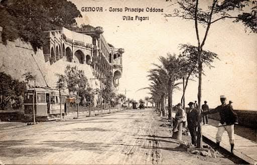
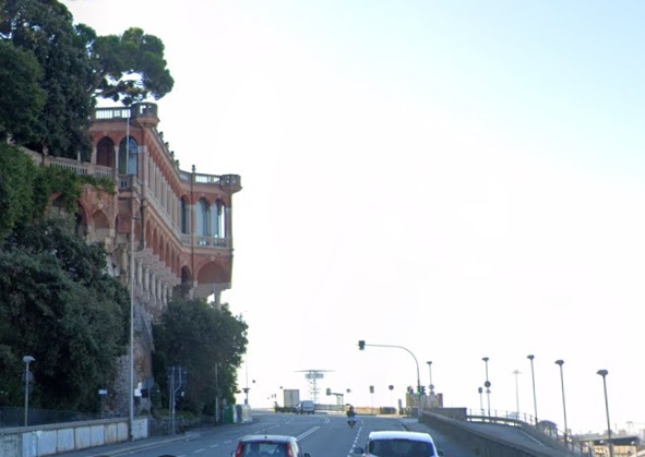
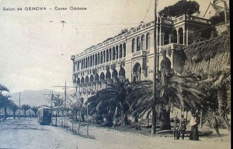
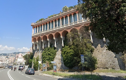
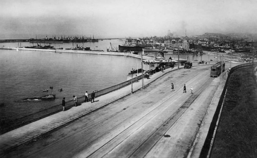
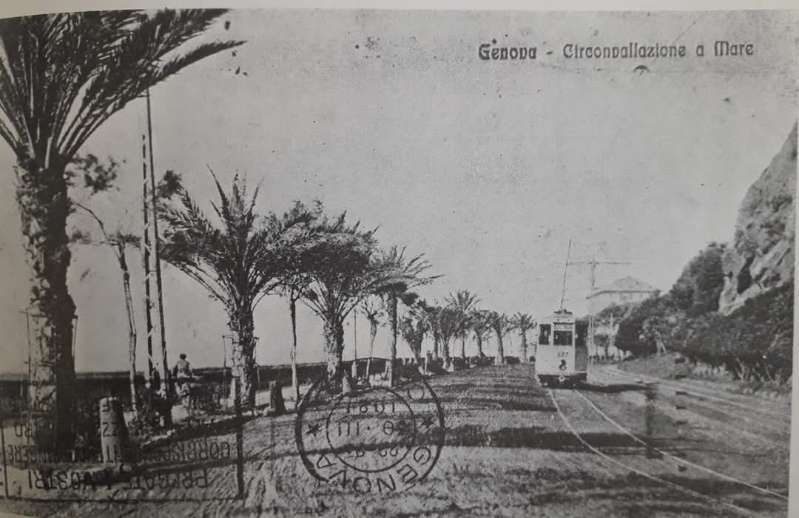
These next few photographs of the coast road (Circonvallazione a Mare) focus on a dramatic Villa which overhung the road – Villa Figari (also known as Villa Mylius).
Via Settembre feeds into Piazza de Ferrari and trams passed through Ferrari onto Via Roma and then on to Piazza Corvetto. Pictures of this length of the route can be found in the part of this article (above) covering Line No. 29.
From Piazza Corvetto the trams ran along Via Serra to Plaza Brignole.
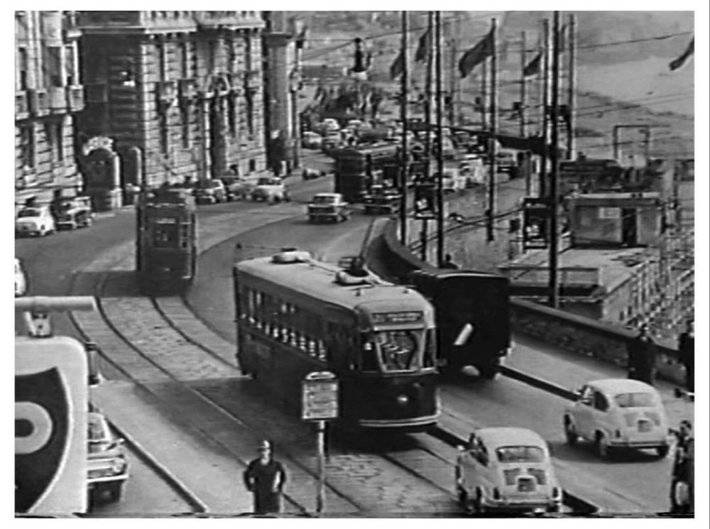
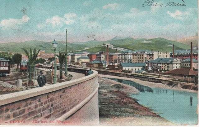
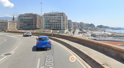
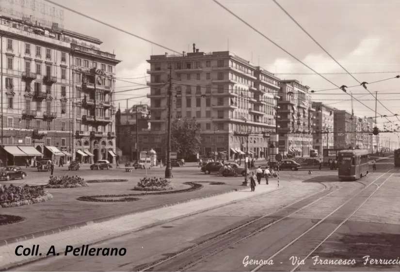
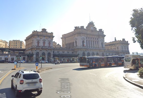
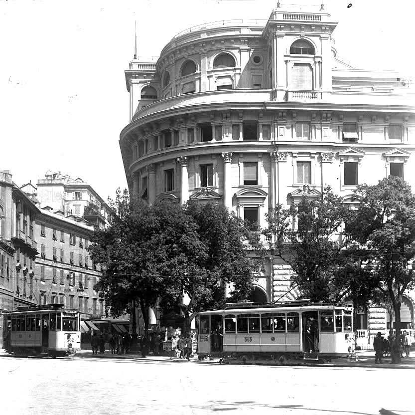
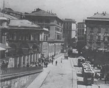
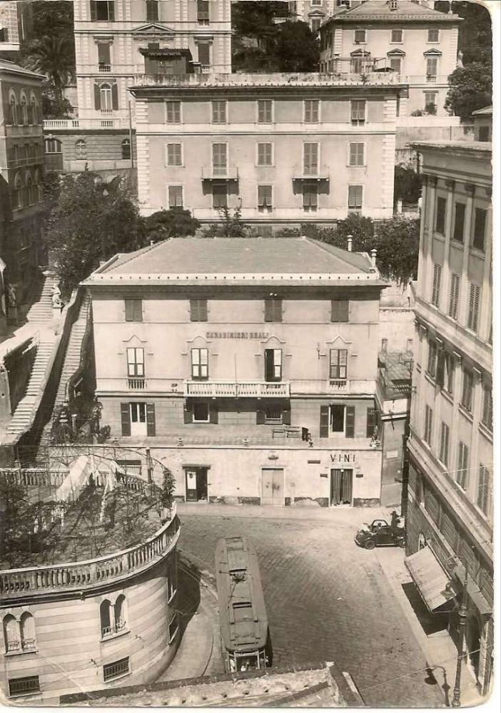
The view East from Piazza Corvetto along Via Serra towards Piazza Brignole. [Google Streetview, August 2024]A view across the railway tracks at Brignole station, looking West through Piazza Brignole and along Via Serra, (c) Public Domain. [50]Looking West from Piazza Brignole along Via Serra. This image was shared by Gino Ratto on the C’era una volta Genova Facebook Group on 14th July 2020, (c) Public Domain. [55]The view along Via Serra from Piazza Brignole in the 21st century. [Google Streetview, August 2024]Piazza Brignole to the Northwest of the Railway Station. This image was shared by Corallo Giorgio on the C’era una volta Genova Facebook Group on 9th November 2016, (c) Public Domain. [61]Piazza Brignole in the 21st century. [Google Streetview, August 2024]
Just to the West of Piazza Brignole, a tram line ran along Via Galata, South from Via Serra to Via Colombo, along Via Colombo to Via Ederra (now Via Fiume), then North on Via Ederra before turning Southeast across the front of Brignole Railway Station (across the North side of Piazza Guiseppe Verdi and then Southwest alongside the River Bisagno on Via Canevari.
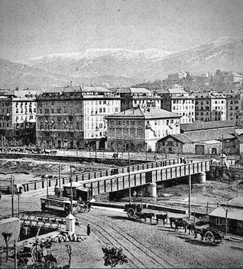
Trams ran South on Via Galata. [Google Streetview, August 24]Trams ran East on Via Colombo. [Google Streetview, April 2023]Looking North on Via Fiume (once Via Edeera) which trams followed towards Brignole Station which sits beyond the trees to the right of this image. [Google Streetview, August 2020]The curve round to the front of Brignle Railway Station, (c) Public Domain. [60]A similar view in the 21st century. [Google Streetview, August 2024]Looking South down the line of the right bank of the River Bisagno (now culverted). The street is Via Canevari. Trams ran South alongside the river on Via Canevari.Looking North up Via Canevari with the River Bisagno on the right. This image was shared on the Foto Genova Antica Facebook Group by Asinus Natator on 7th February 2022, (c) Public Domain. [52]Looking North from a similar position in the 21st century. [Google Streetview, August 2024]
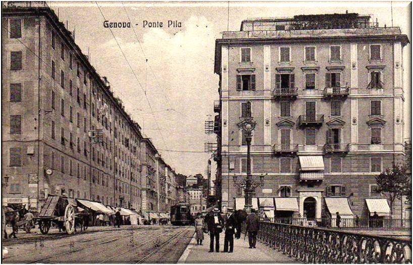
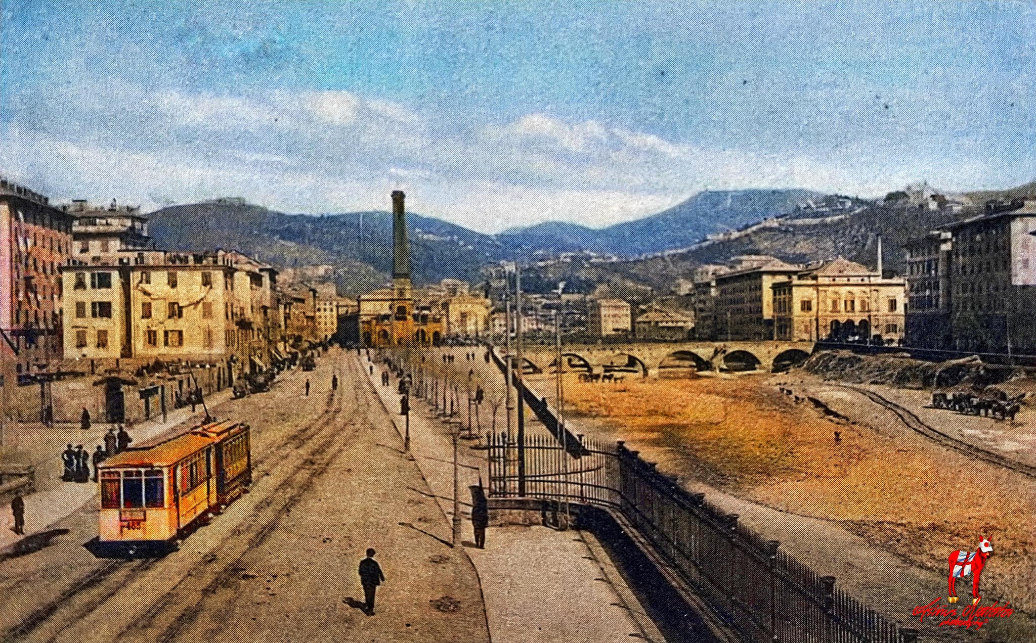
From the location of Ponte Pila trams followed the route alongside the River Bisagno and then along Corso Aurelio Saffi back to Piazza Raibetta.
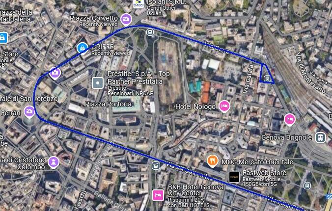
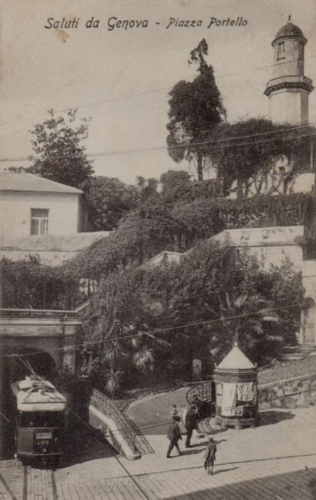
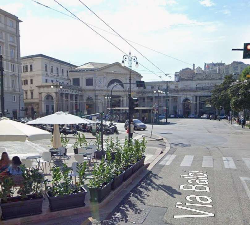
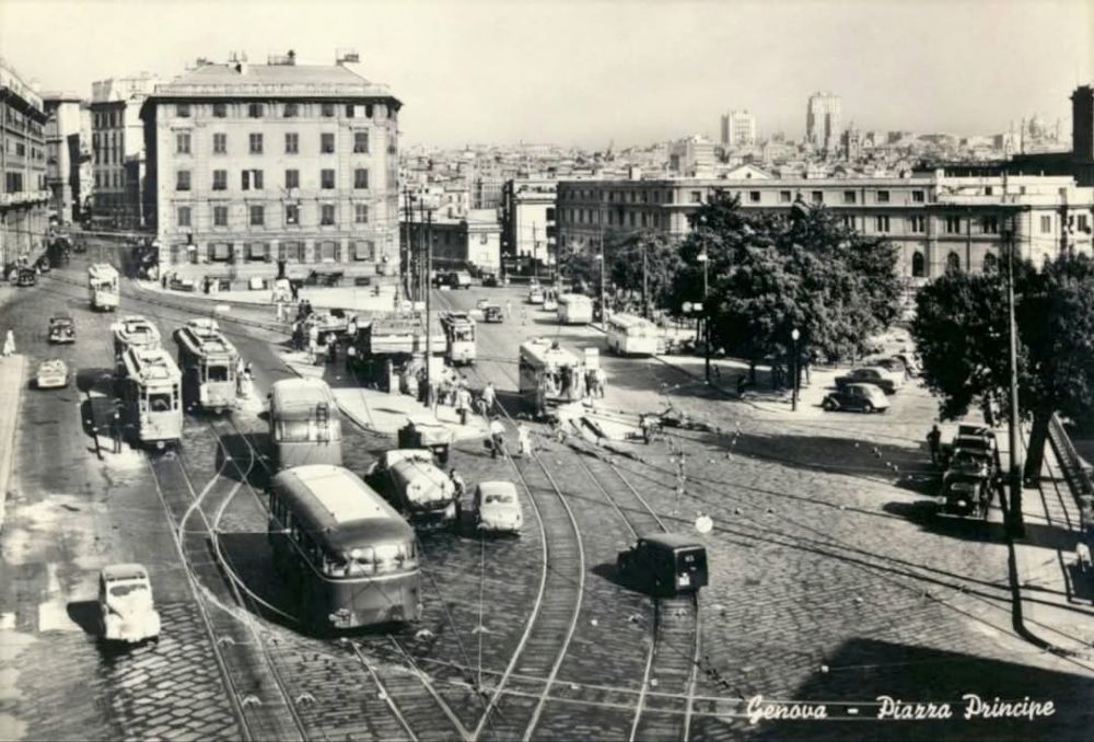
Piazza Corvetto to Piazza del Principe
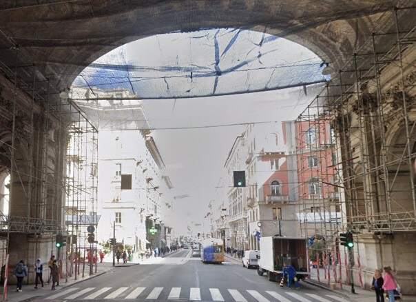
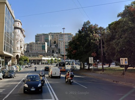
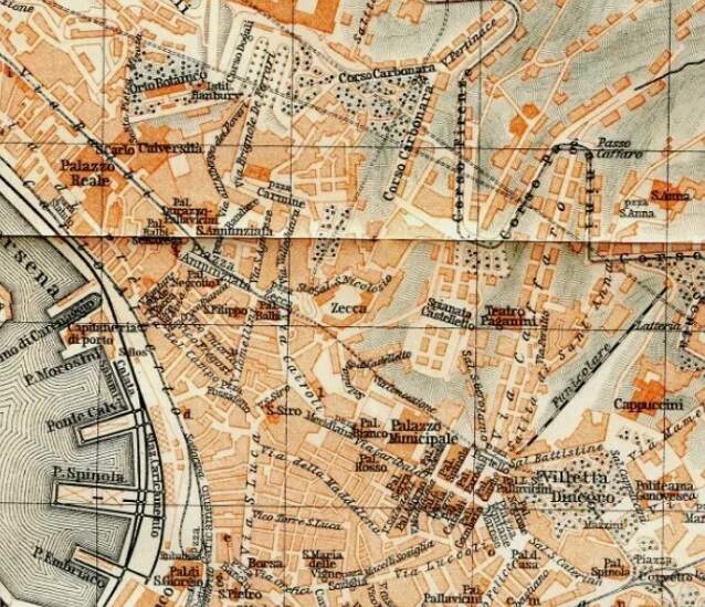
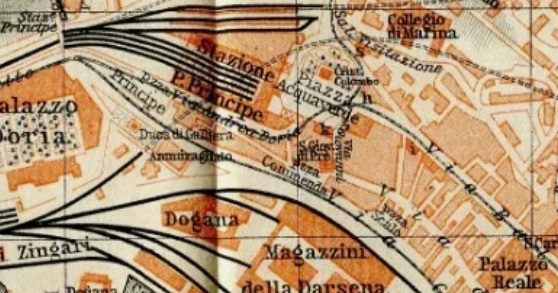
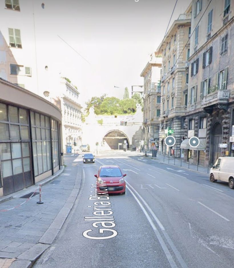
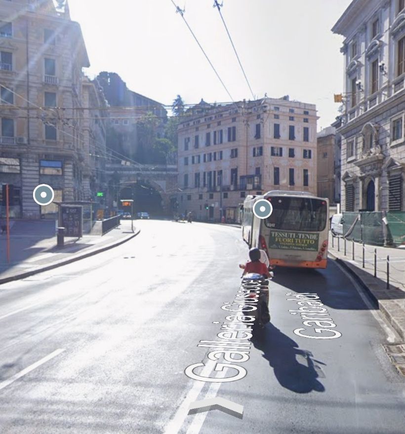
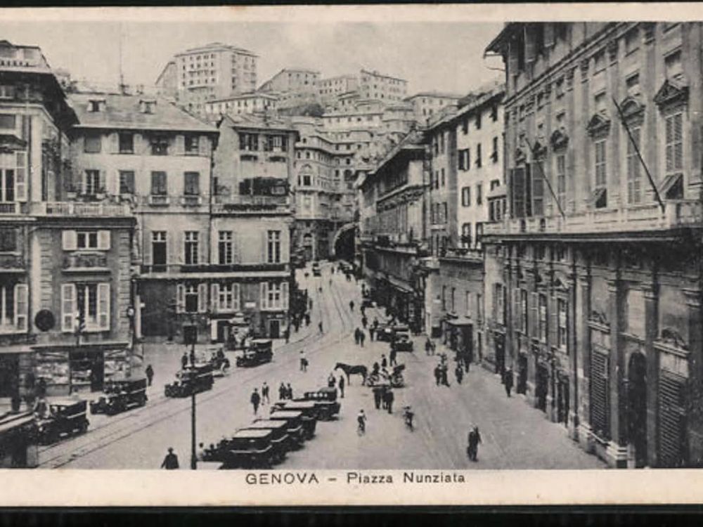
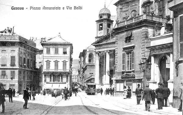
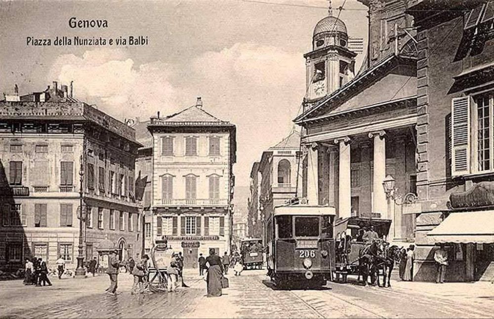
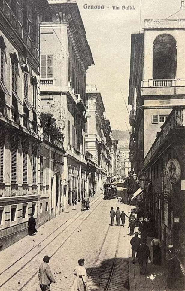
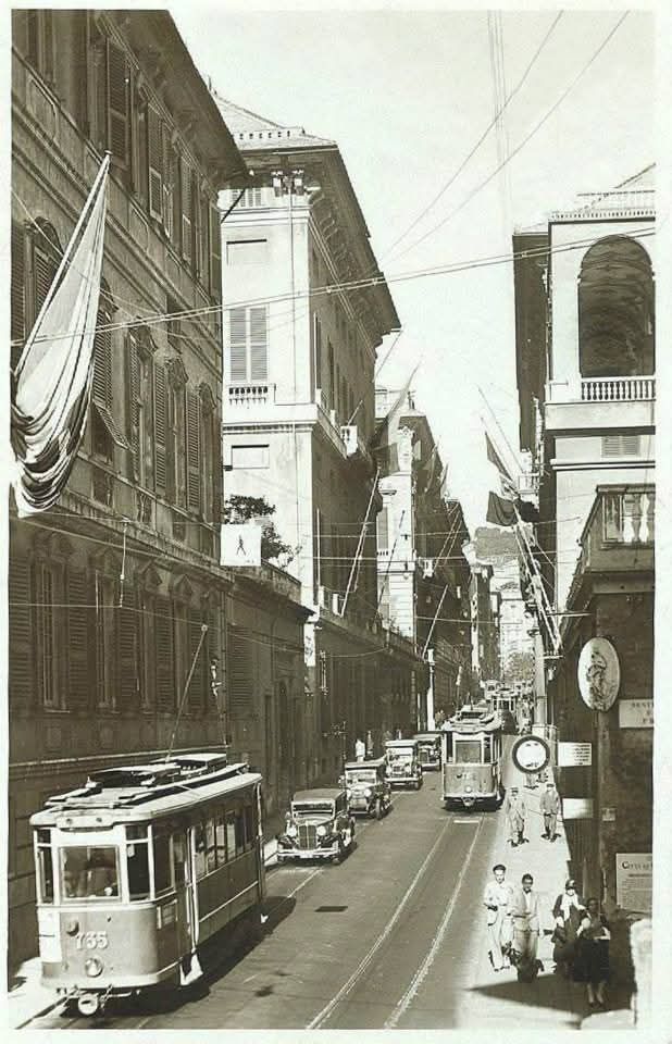
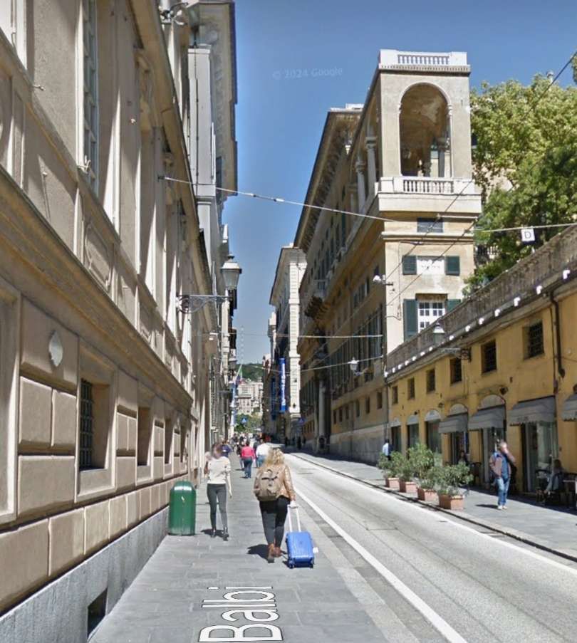
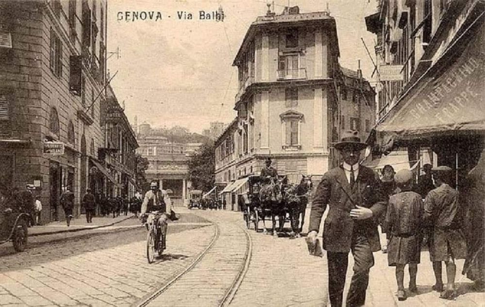
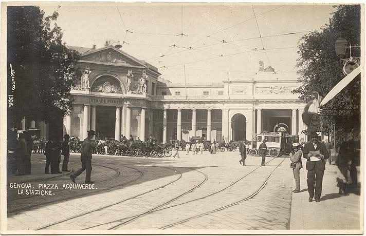
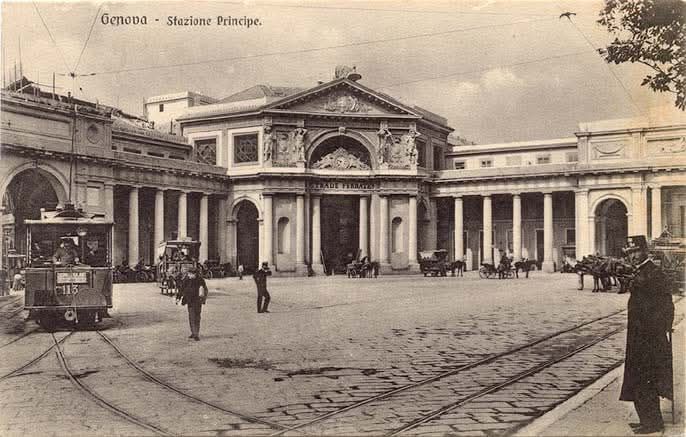
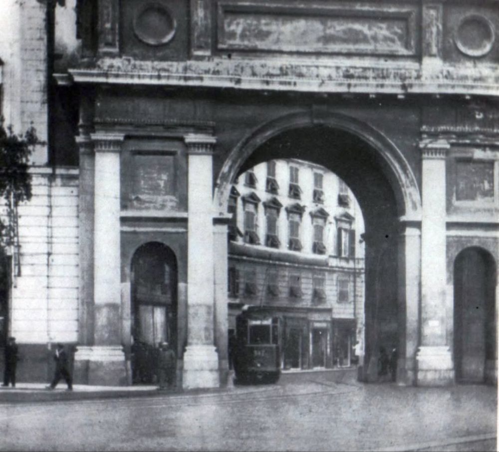
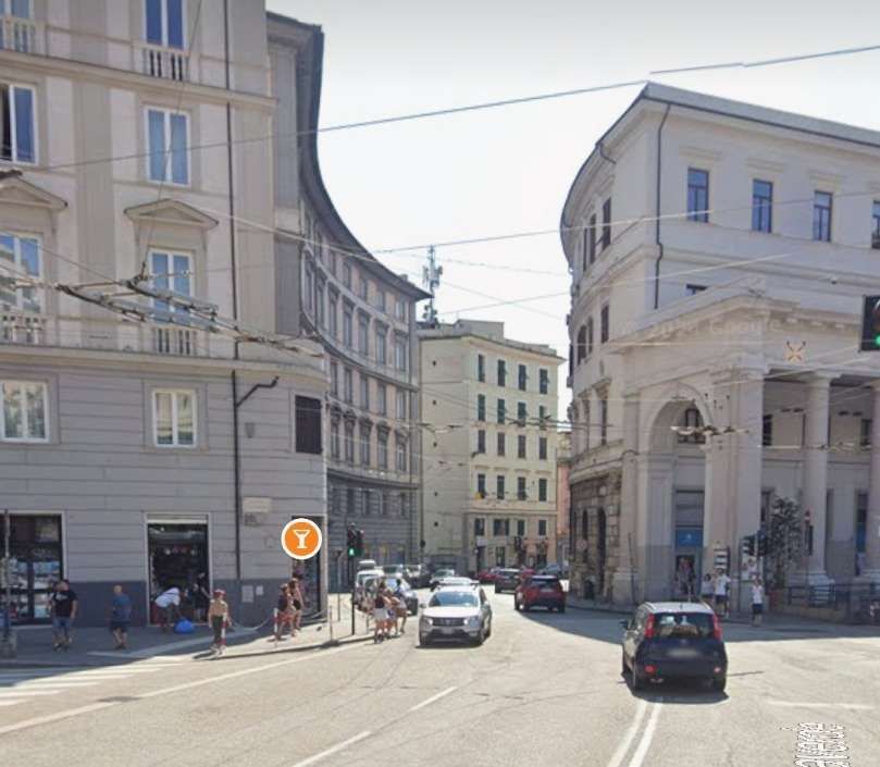
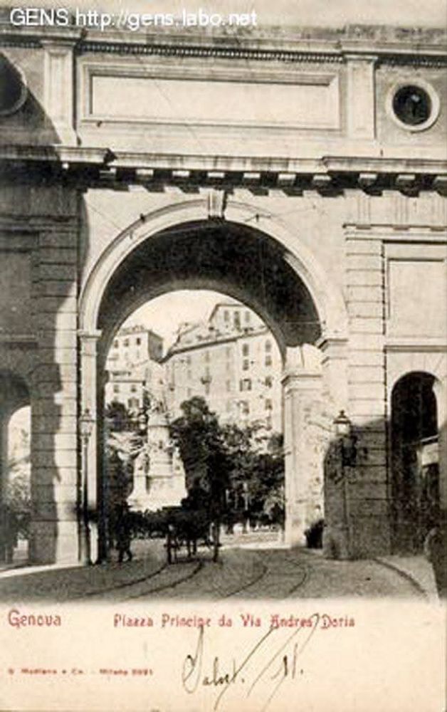
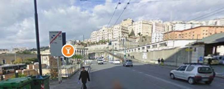
Two tunnels made it possible for trams to run between Piazza Corvetto and Piazza Principe. The route ran via, what are now Galleria Nino Bixio and Galleria Giuseppe Garibaldi, through Largo della Zecca, along Via Paolo Emilio Bensa, through Piazza della Nunziata, along Via Balbi, through Piazza Acquaverde and then along the South side of Principe Railway Station along Via Andrea Doria to Piazza del Principe.
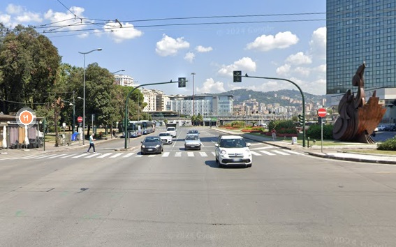
The tram route we are looking at now runs West-northwest out of Piazza Corvetto through two tunnels and through Piazza Acquaverde before reaching Piazza del Principe. A relatively straight route except for the dog-leg close to Piazza Acquaverde. [19]
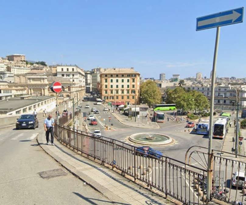
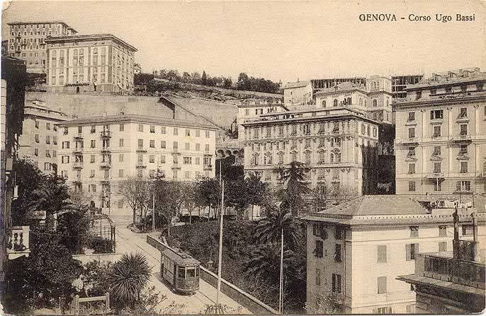
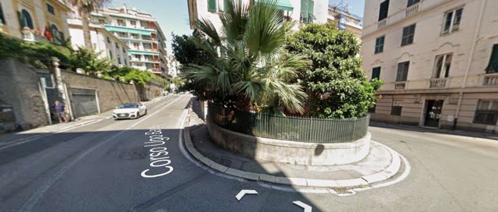
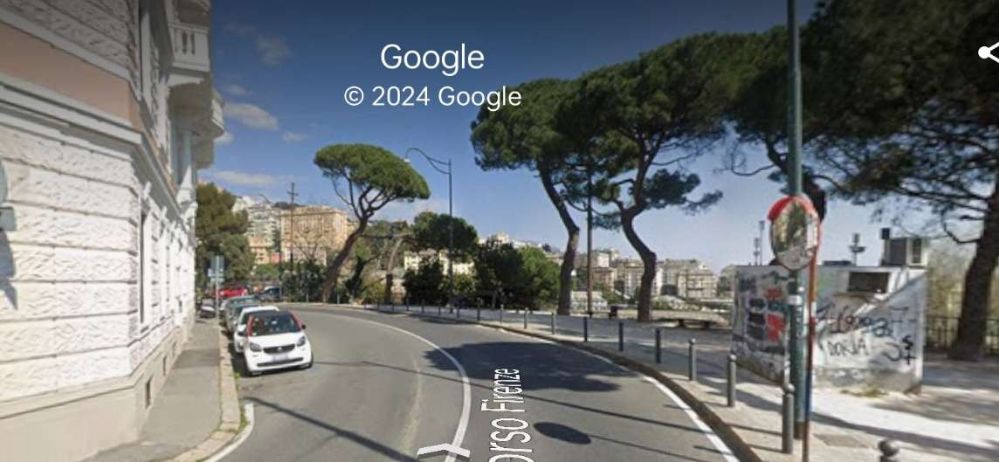
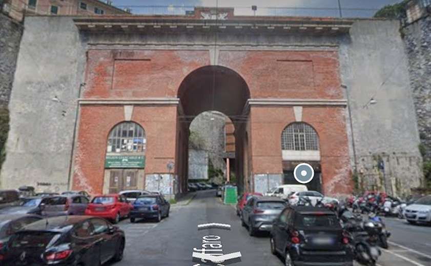
Trams on Line No. 25 turned to the Northwest at the East end of Piazza Acquaverde. A short climb led to the lower entrance to Galleria Sant’Ugo. That tunnel is covered in the earlier post in this short series, here. [1]
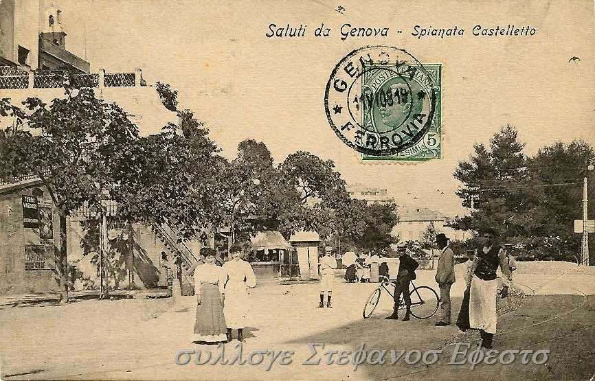
Galleria Sant’Ugo was a horseshoe shaped tunnel which lifted trams to pavement level in Piazza Pedro Ferriera. Leaving the tunnel trams ran Northeast along Via Sant’Ugo.
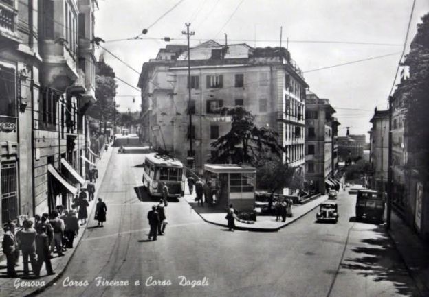
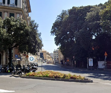
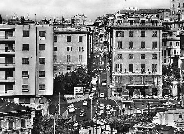
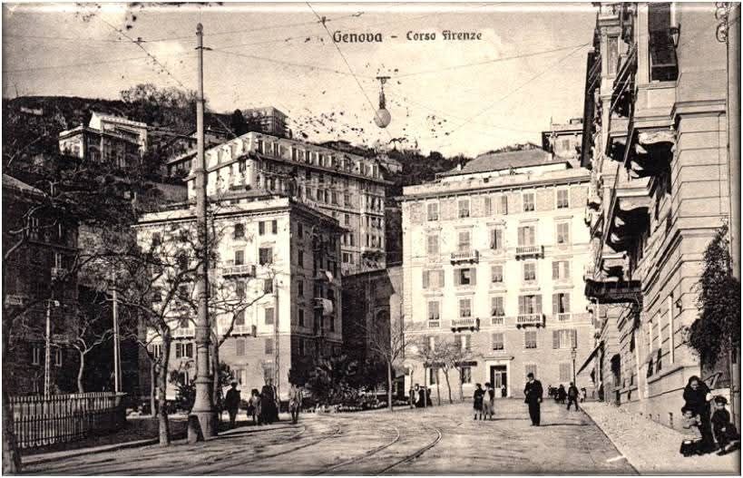
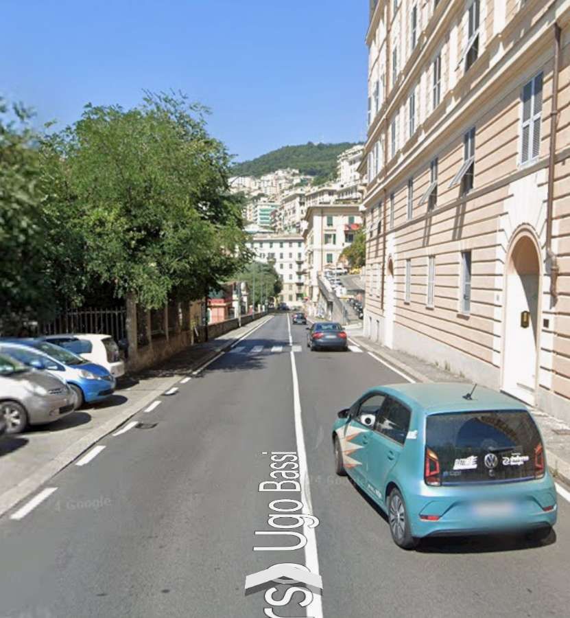
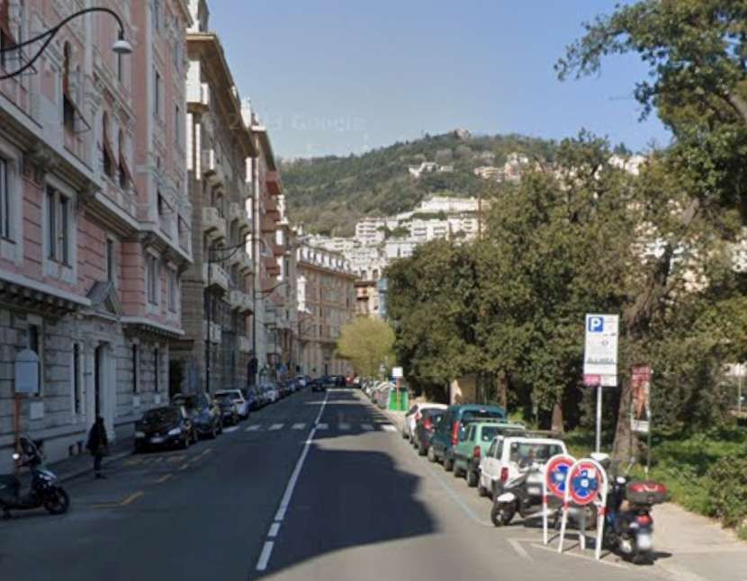
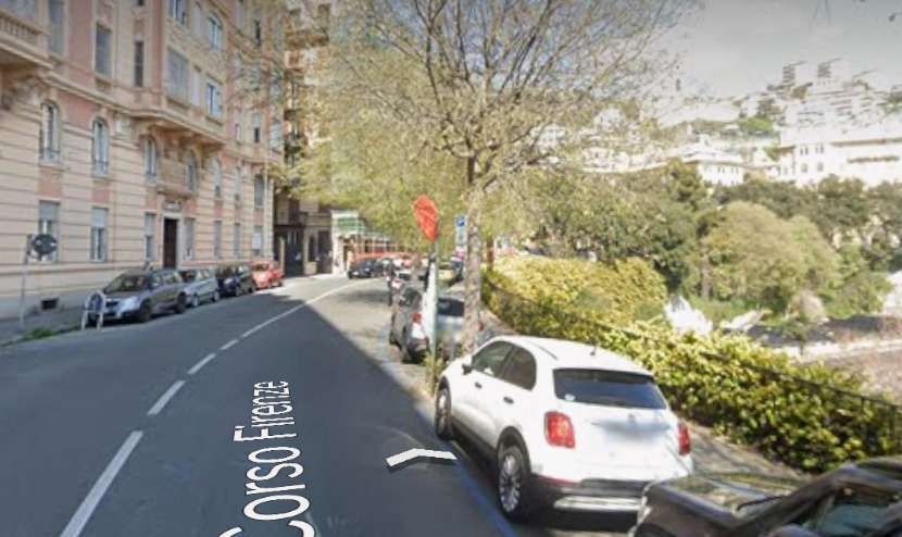
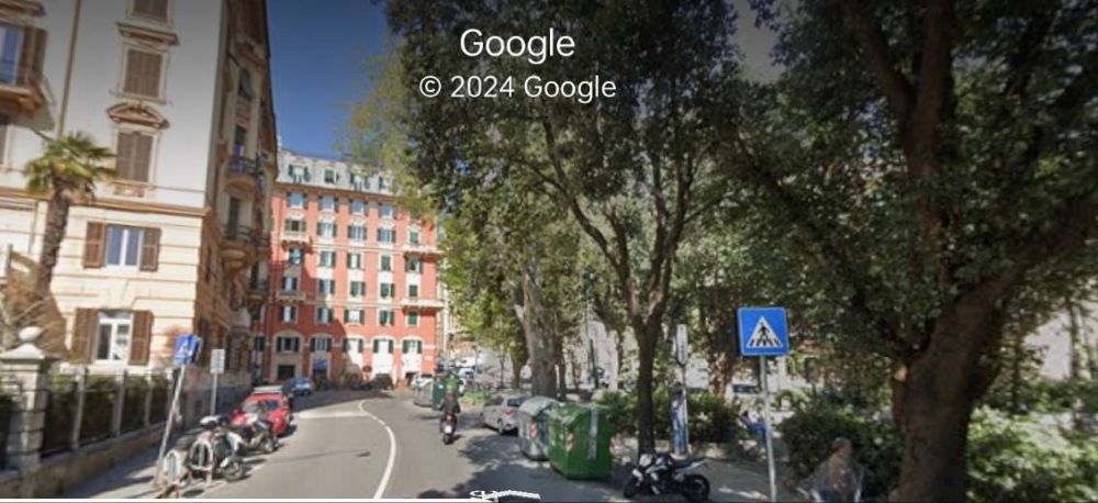
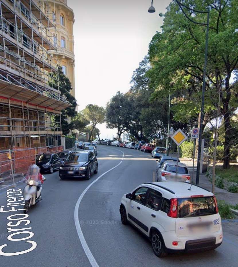
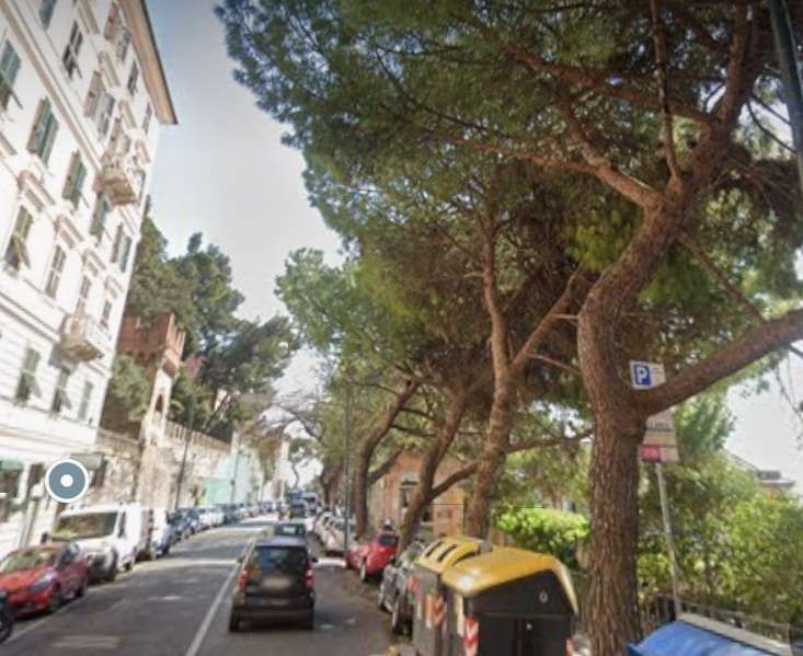
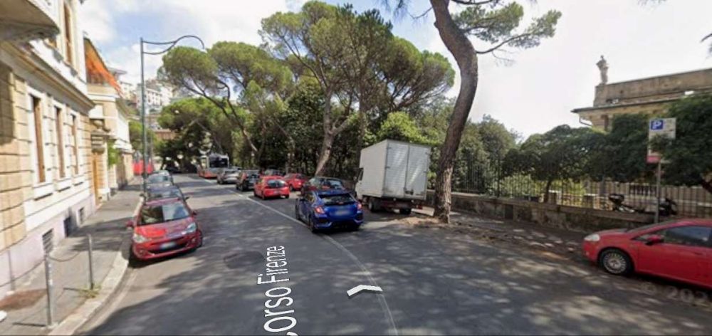
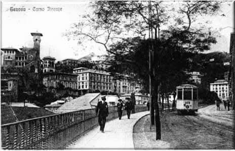
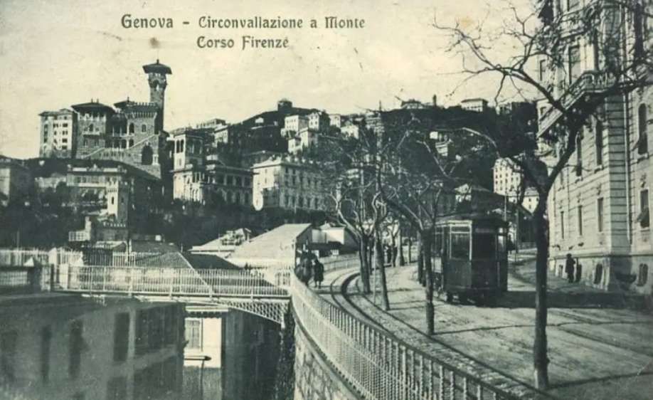
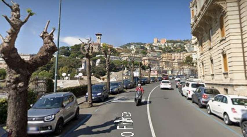
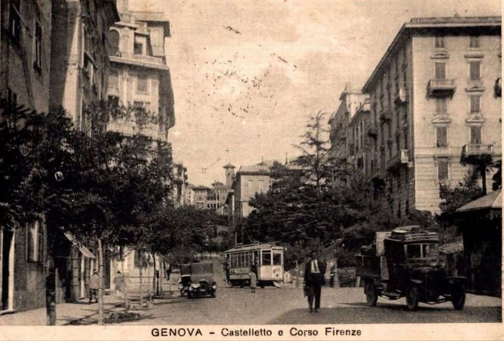
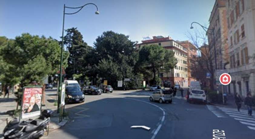
Corso Firenze continues East then Northeast. It then turns sharply to the right, heading Southwest. The next monochrome image looks North from the end of that southwesterly length of the road.
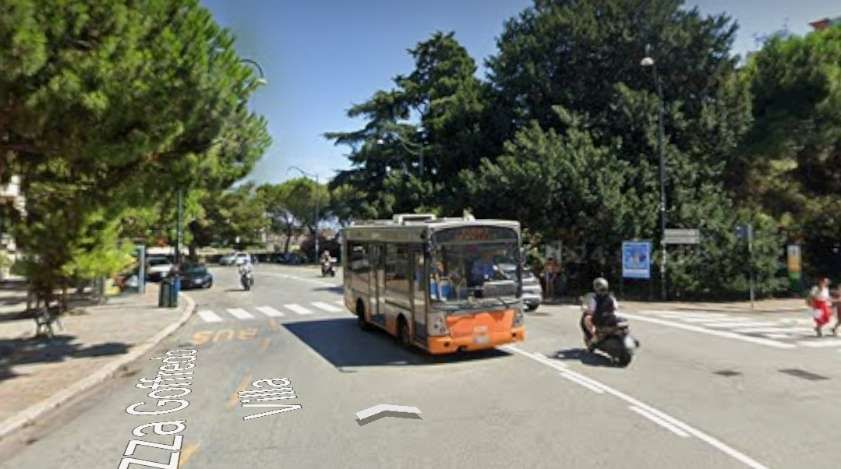
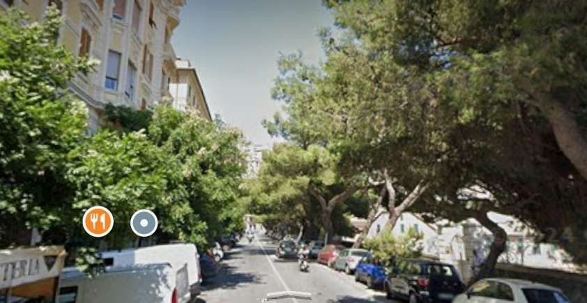
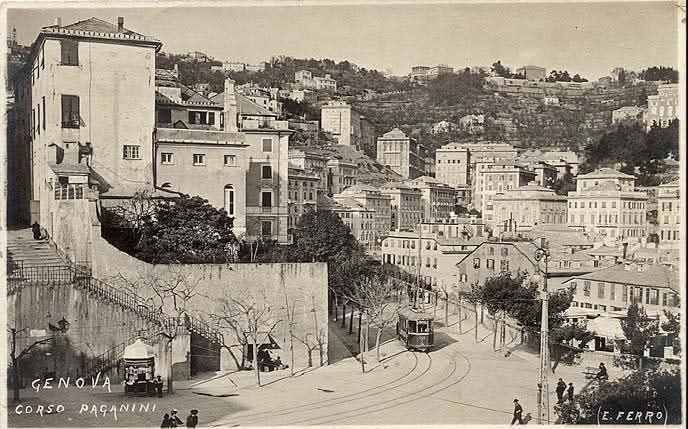
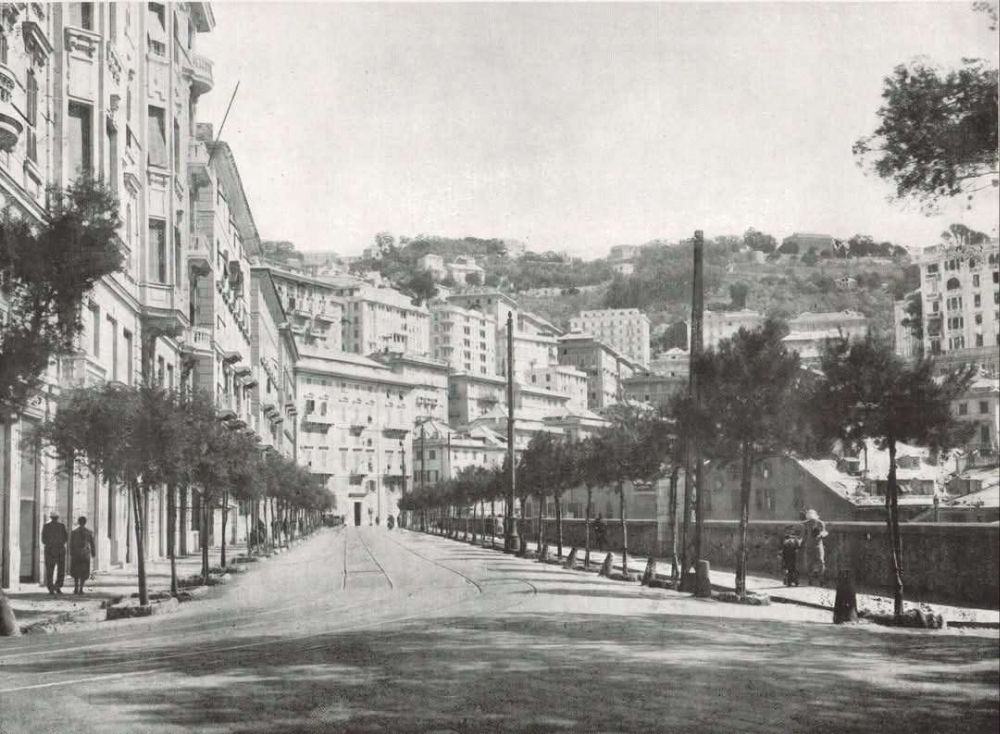
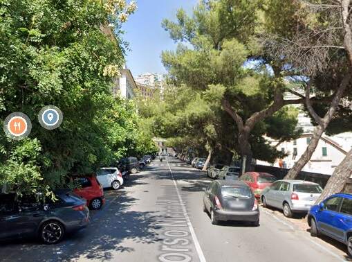
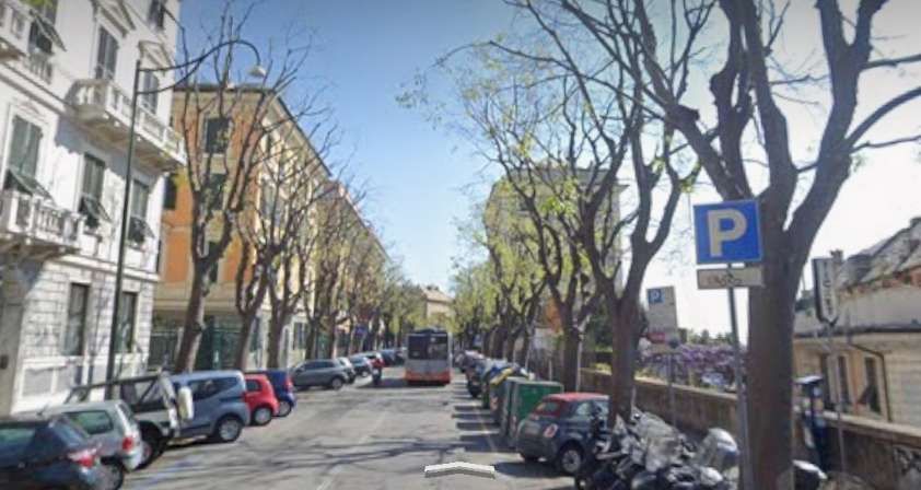
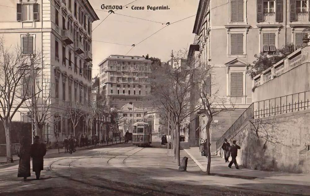
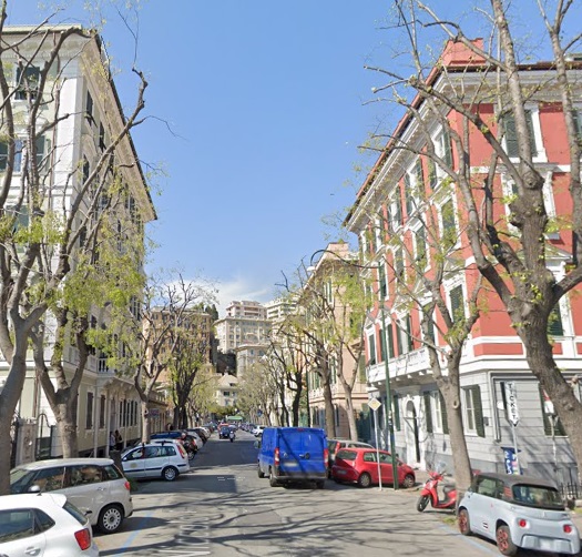
Corso Firenze gives out onto Piazza Goffredo Villa where the tram route ran Northwest-Southeast for a short distance before heading Northeast on Corso Niccolo Paganini.
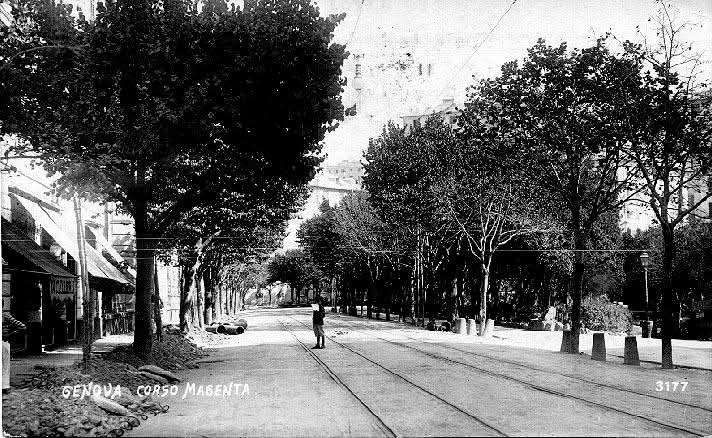
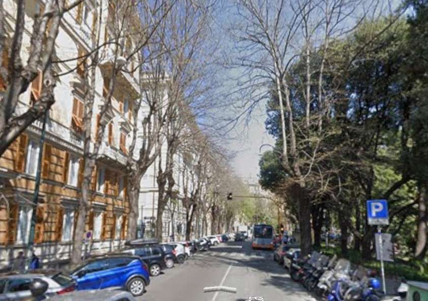
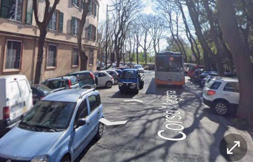
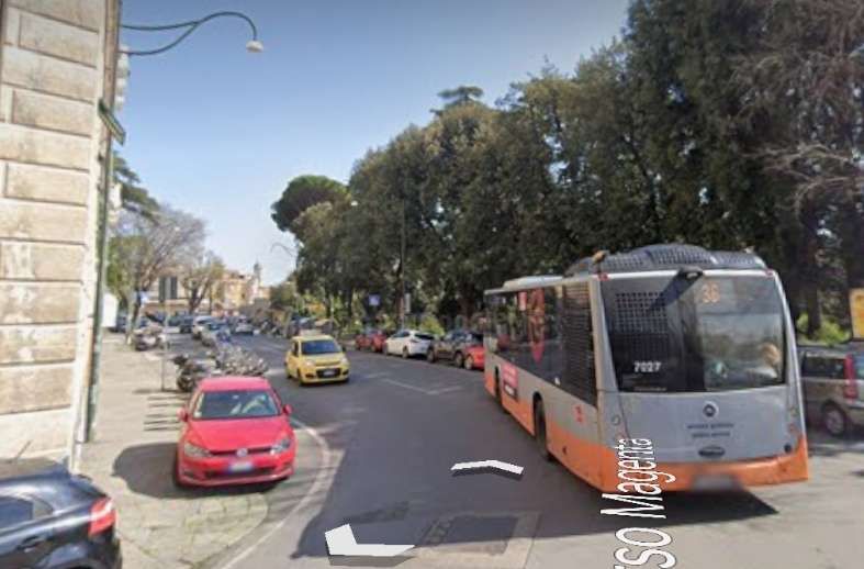
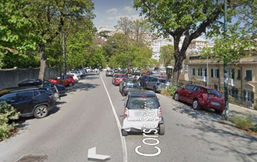
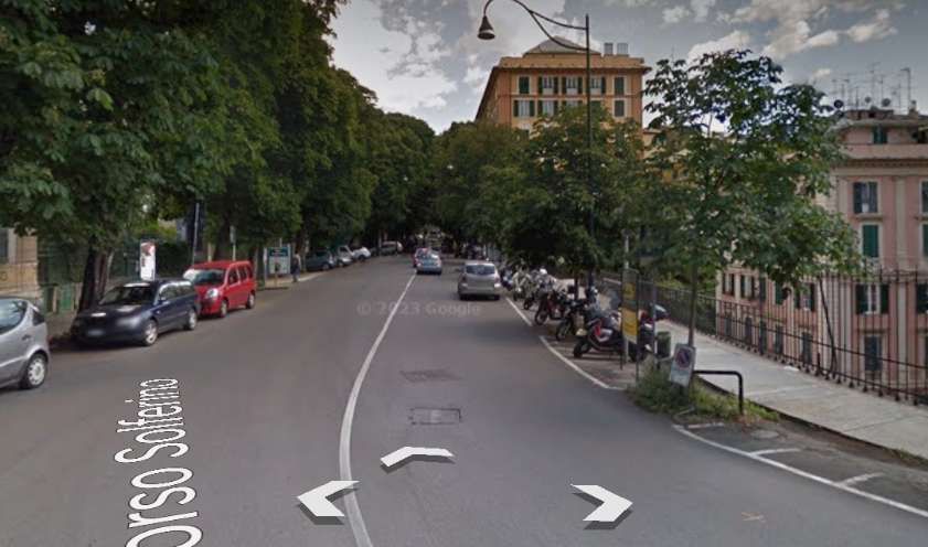
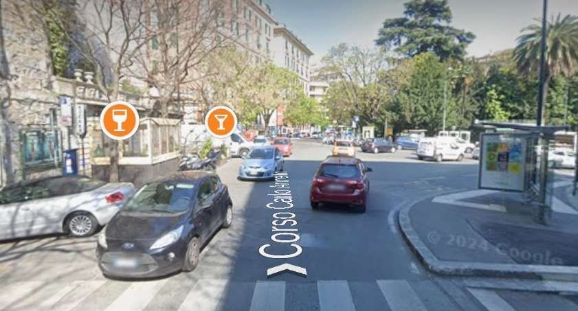
Trams ran the full length of Corso Magenta and onto Corso Solferino which in turn led to Corso Carlo Armellini. Passing the Manin/Contardo Lift on their left, trams entered Piazza Manin.
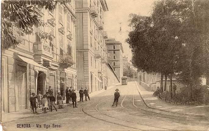
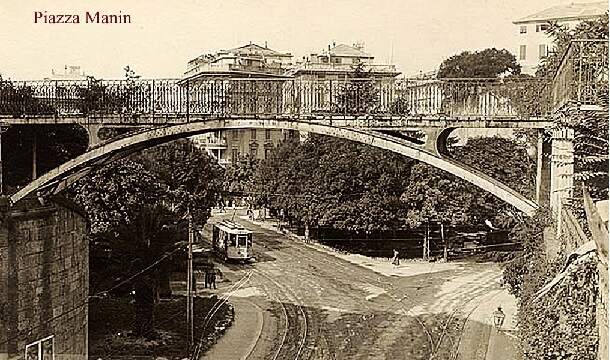
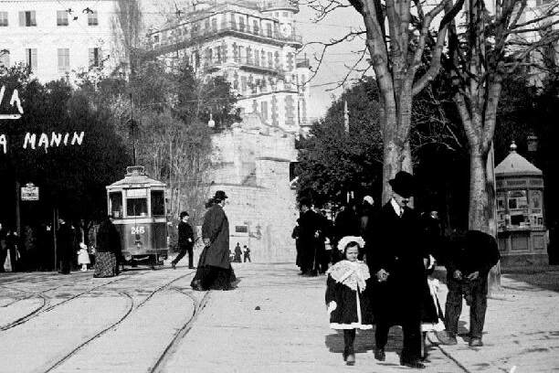
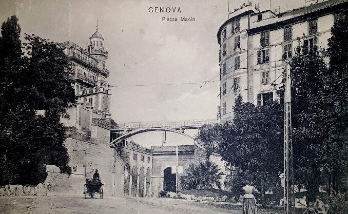
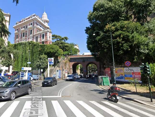
Looking East into Piazza Manin from Corso Carlo Armellini. [Google Streetview, April 2023]Piazza Manin seen from the East looking off The Ponte di Via della Crocetta, (c) Public Domain. [82]Piazza Manin, (c) Public Domain. [84]A simila view in the 21st century. [Google Streetview, April 2023]Piazza Manin, (c) Public Domain. [86]Piazza Manin, looking East, (c) Public Domain. [87]A view looking East from Piazza Manin in the 21st century. [Google Streetview, August 2024]
Piazza Corvetto to Piazza Manin, Staglieno and Prato in Val Biasagno.
This article has covered the Western half of the Eastern tram network. We will cover the length of line from Piazza Corvetto to Plato (via Paizza Manin and Staglieno) along with the lines which ran East along Via XX Settembre to Val Bisagno and then diverged to serve Staglieno, Raibetta (which we have already looked at), Foce, Thommaseo and Nervi in another article.
We will also cover the history of the Genoa Network from the end of the first World War in that next article and, either in that article of a further article, the rolling stock used on the network.


Pingback: Genoa’s Early Tram Network – Part 3 – The Remainder of the Eastern Network before the First World War. | Roger Farnworth
Pingback: Genoa’s Early Tram Network – Part 4 – World War 1 to World War 2 | Roger Farnworth
Pingback: Genoa’s Early Tram Network – Part 5 – World War 2 to its decline and closure in the 1960s and the Rolling Stock used on the Network. | Roger Farnworth