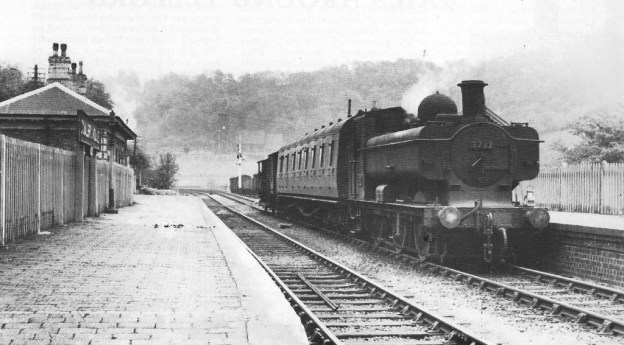
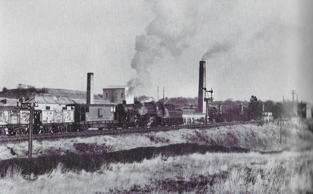
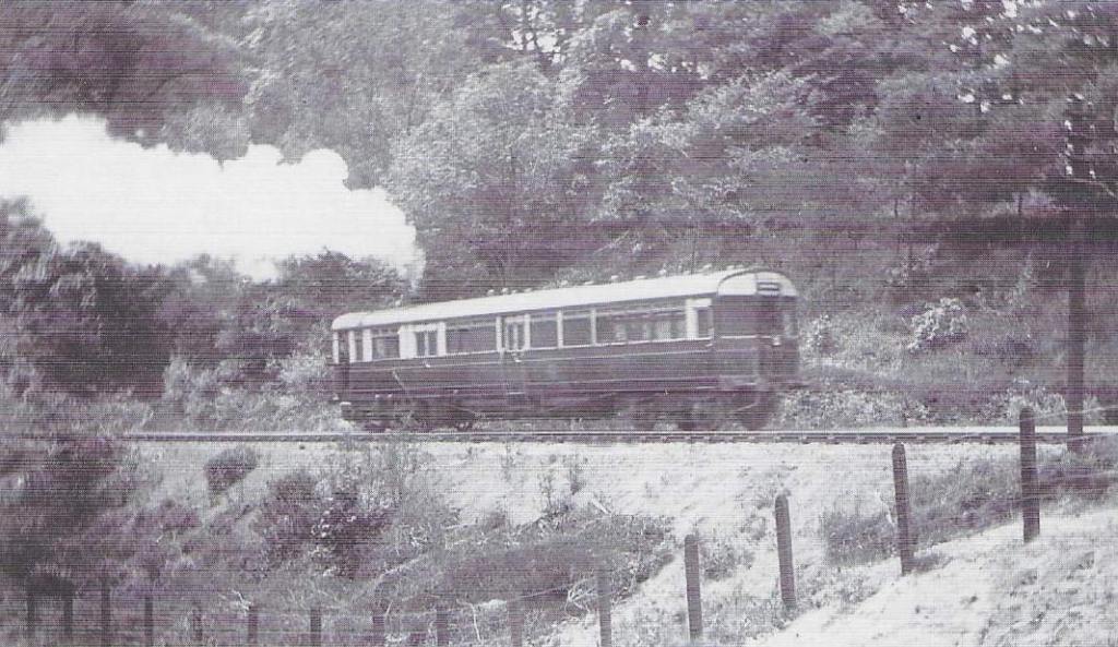
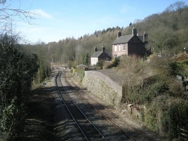
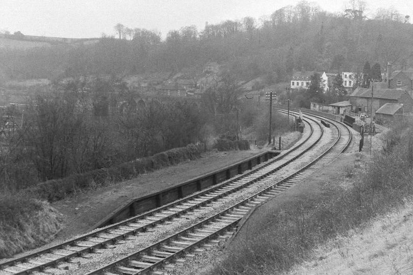
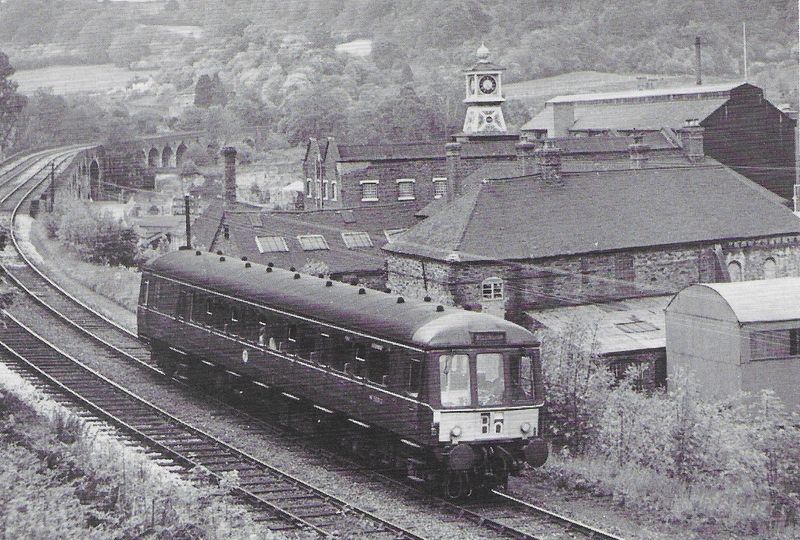
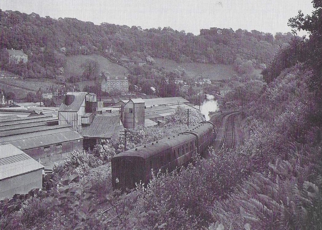
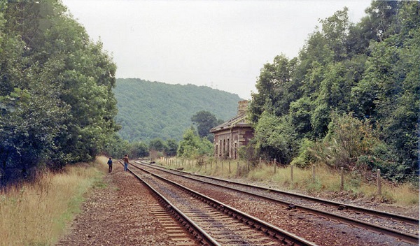
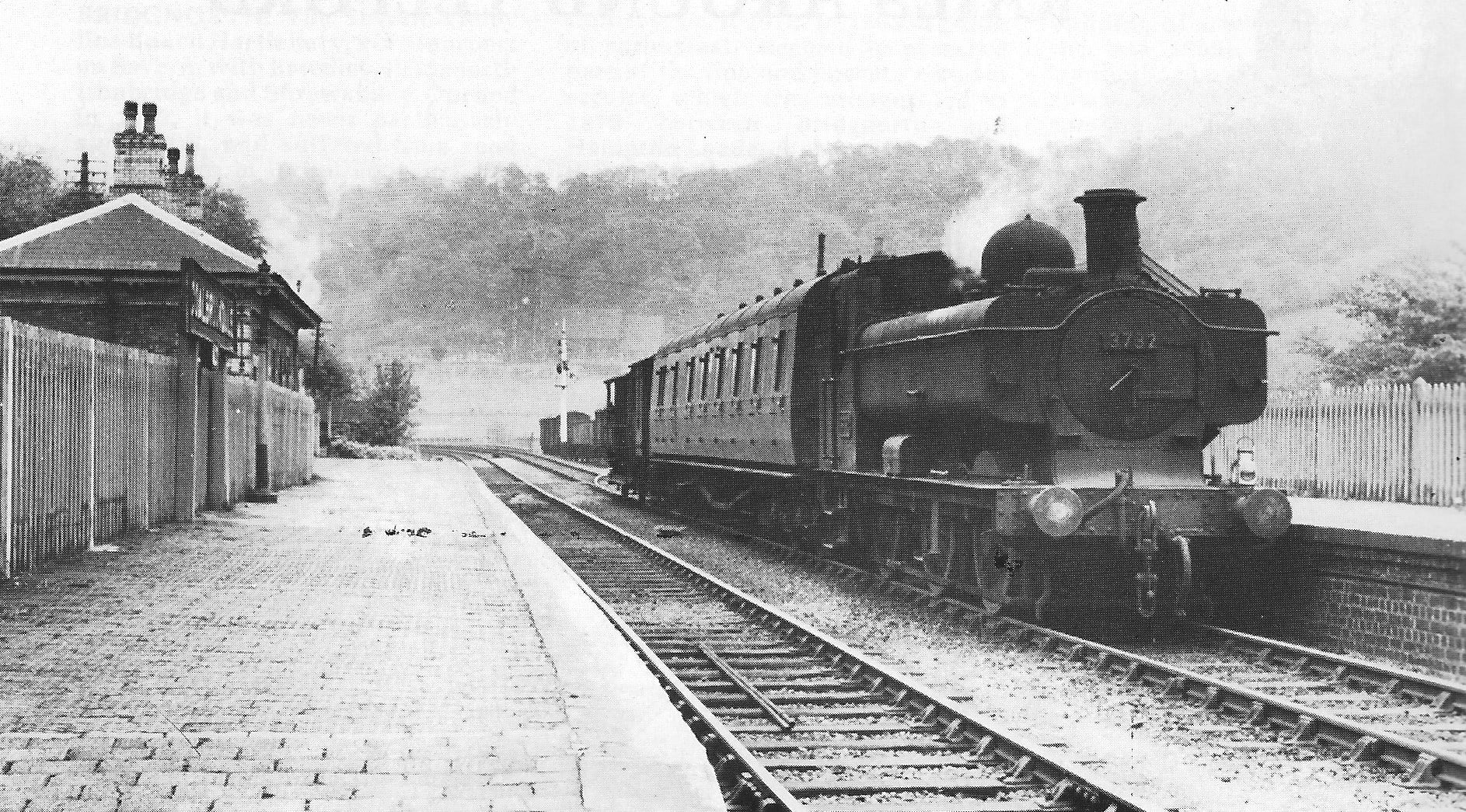
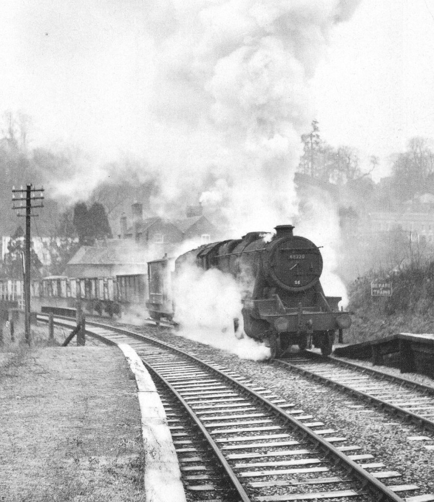
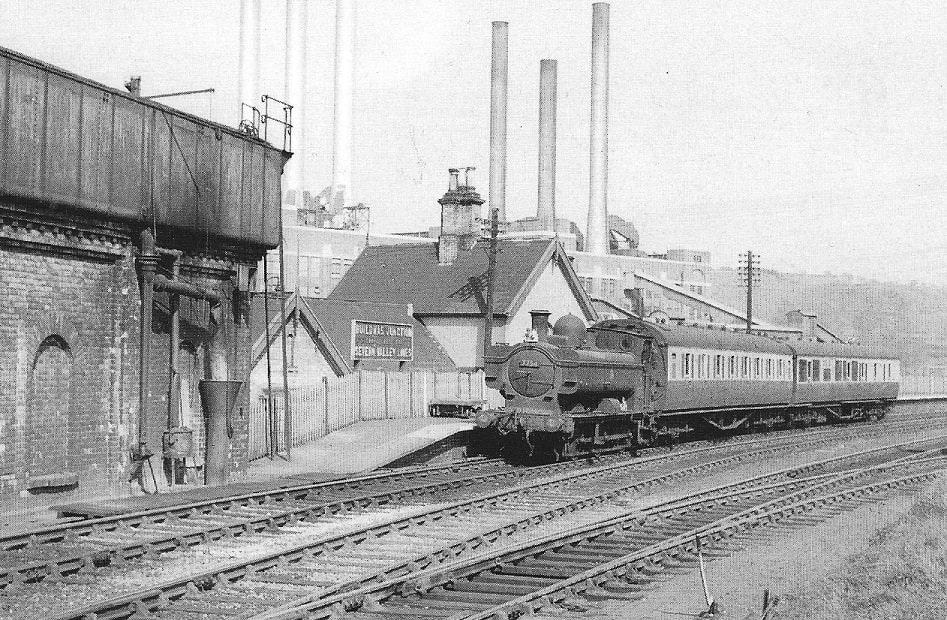
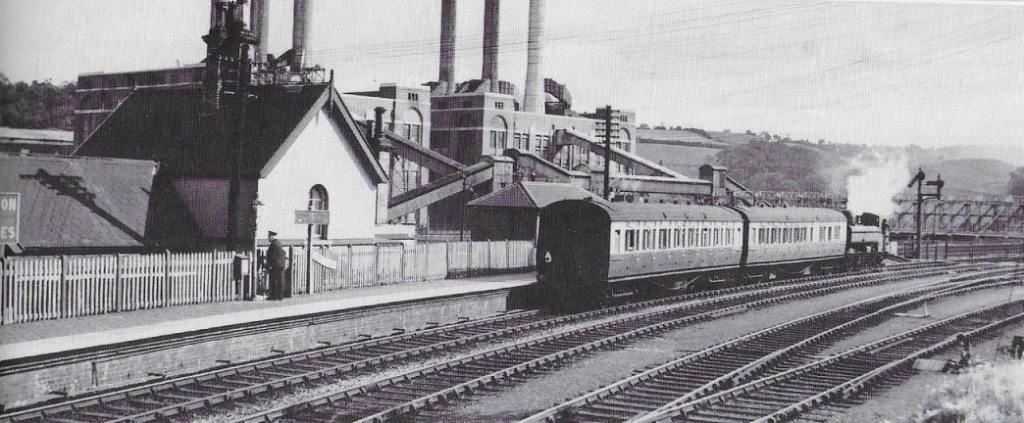
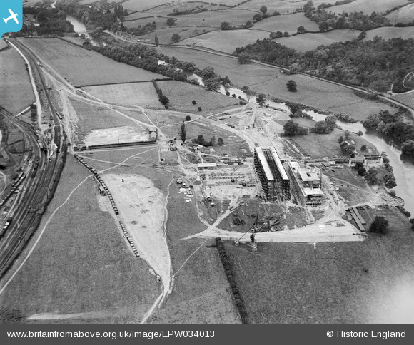
The featured image, from 1957, was shared by Metsa Vaim EdOrg on the Telford Memories Facebook Group on 8th November 2020 with the following comments: “Coalbrookdale in 1957 with the 12.48pm Ketley – Much Wenlock ‘mixed’ train. … I watched this train at Lawley station or from our garden a few times when I was a child.”
Introduction – An introduction to the W&SJR was provided in the first article about the line which covered the length from Wellington to Horsehay & Dawley Station:
Lightmoor Press have produced an excellent book about the line from Wellington through Much Wenlock to Craven Arms, “The Wellington, Much Wenlock and Craven Arms Railway.” The author is Adrian Knowles. [1]
Before continuing our journey along the line, we note that it was built between 1857 and 1861 and in the section we are looking at, passed through the following stations: Lightmoor Platform (Junction), Green Bank Halt and Coalbrookdale, before arriving at Buildwas.
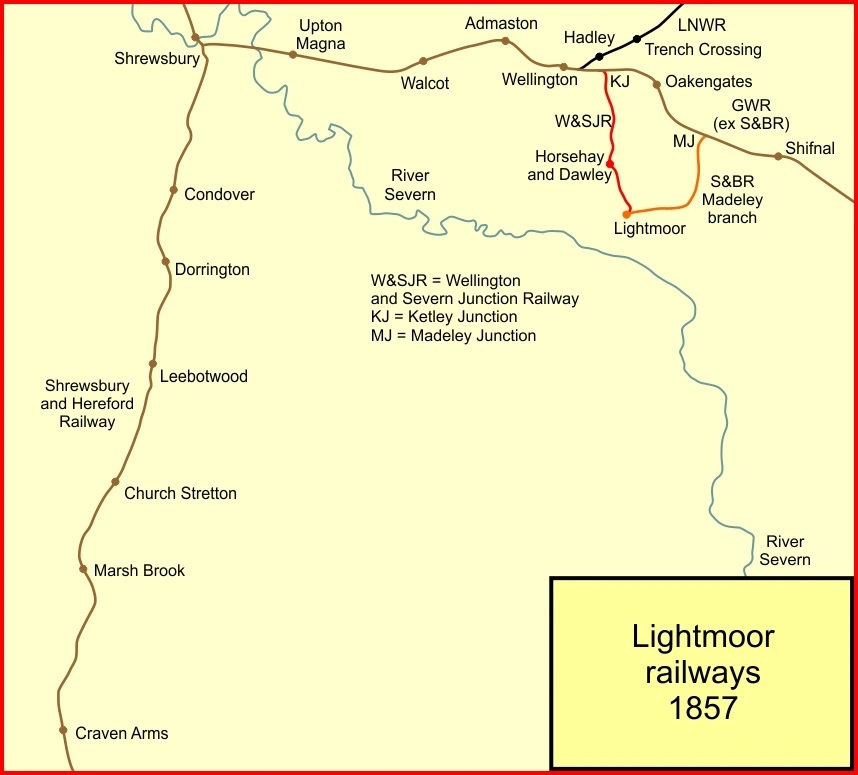
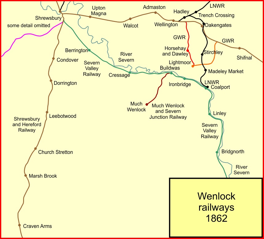
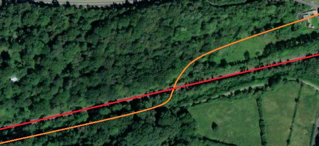
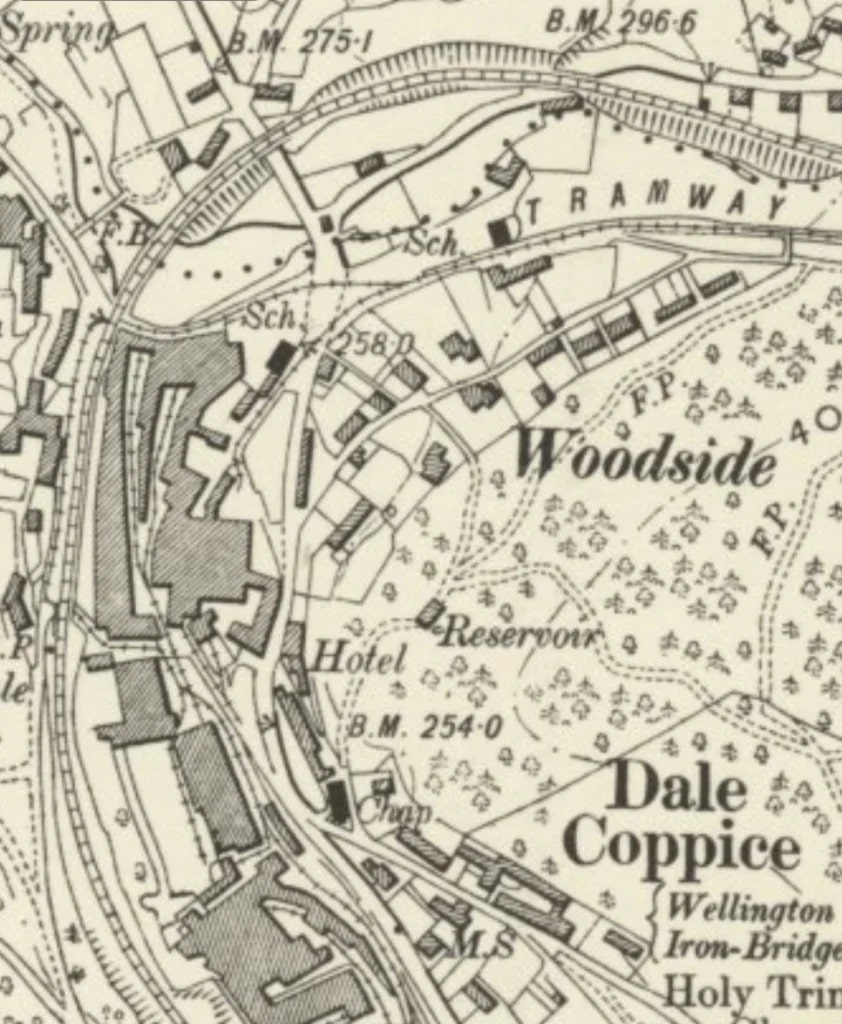
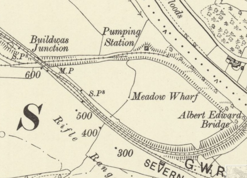
For completeness, the images below, which were included in the first two posts about the line, show the developing standard-gauge rail network around the River Severn. By 1957 the W&SJR linked Ketley Junction to Lightmoor. It was a little longer before the line made a connection with the Severn Valley Railway and eventually the route through to Craven Arms opened.
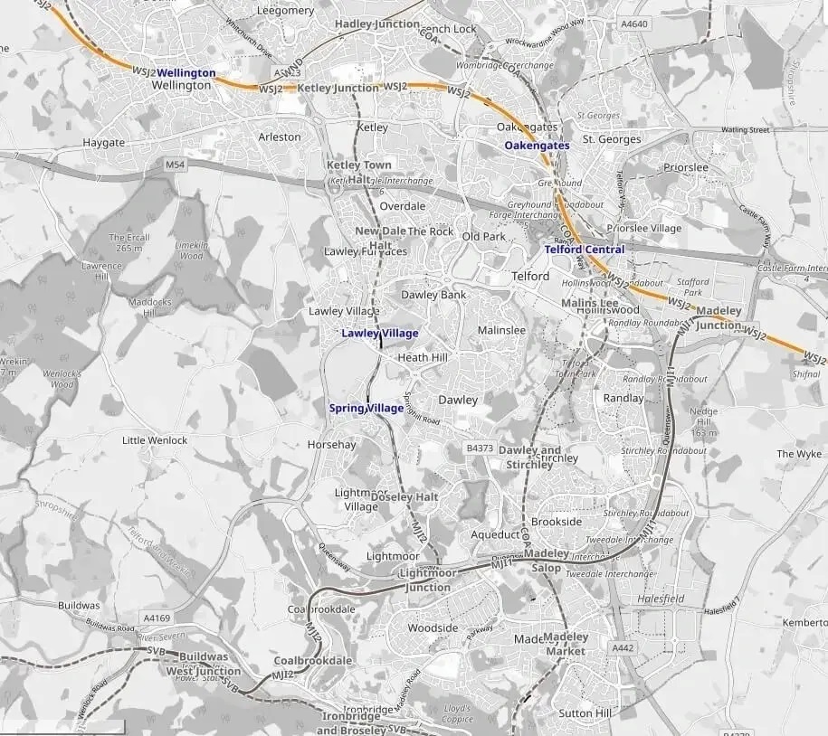
Ketley Junction to Lightmoor was open by 1857. [2]The Severn Valley line was open by the time covered by this map. [2]The complete route of the Wellington, Much Wenlock & Craven Arms Railway was in use by 1867. [2]The railways in the area around what was the Wellington & Severn Junction Railway (W&SJR) as shown on the OpeRailwayMap. OpenRailwayMap (previously called “Bahnkarte”) is a detailed online map of the world’s railway infrastructure, built on OpenStreetMap data. It has been available since mid-2013 at OpenRailwayMap.org [17]
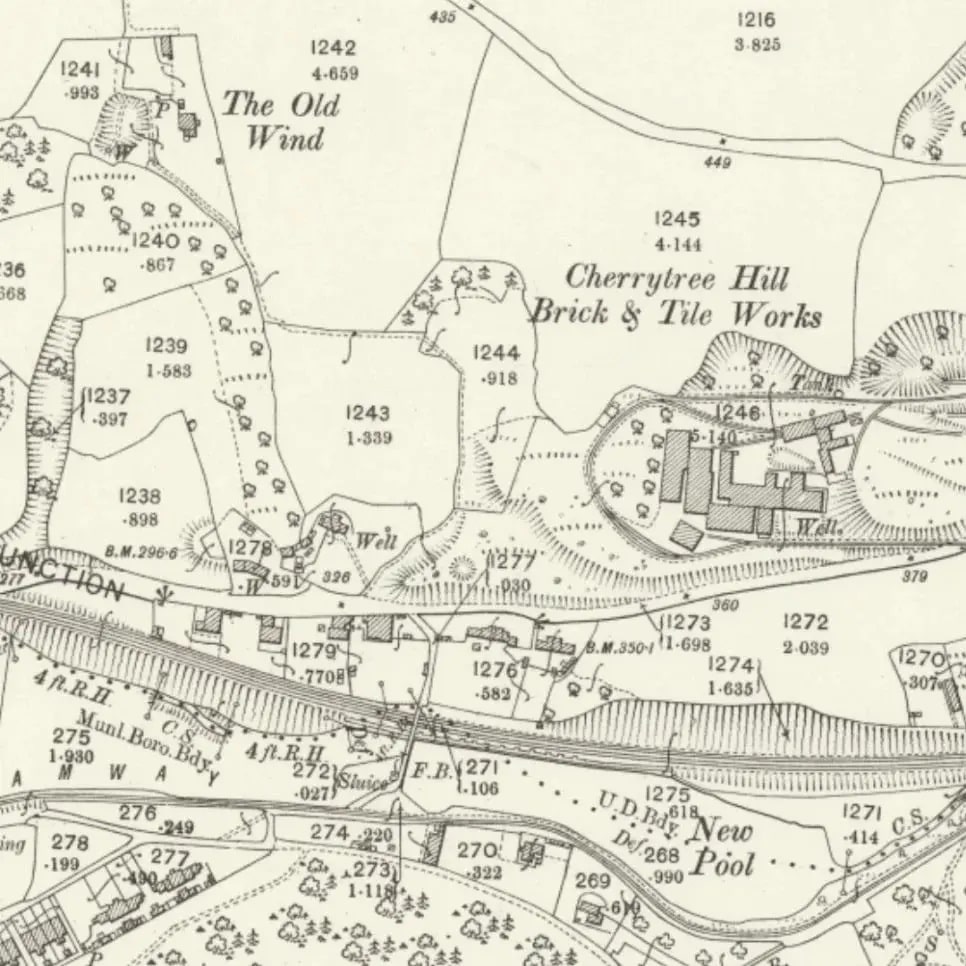
For the sake of completeness, it is worth noting (as was the case in part 2 of this short series), that there was a very significant network of plateways/tramroads in the immediate area of the line. These were essentially a private system belonging to the Coalbrookdale Company. The network from 1881 onwards is discussed in an earlier article about the East Staffordshire Tramroads owned by the Coalbrookdale Company:
It is also worth noting again the 21st century plans of Telford Steam Railway to extend its preservation line to the site of what was Ironbridge Power Station at Buildwas. Their plans and progress can be followed here. They have called their plans ‘Steaming to Ironbridge‘.
In essence this will be a phased process and one which will have been significantly affected by the Covid19 pandemic. The first phase was to reach Doseley Halt through renewing exiting sub-standard trackwork. The next step will be to receive planning permission for a new bridge to cross the A4169 and to construct the line to Lightmoor. It will require two level crossings as well as the bridge. The bridge deck has already been supplied by Network Rail and is stored at Horsehay Yard.
Telford Steam Railway already leases the signal box at Lightmoor Junction from the rail authorities for future use, when operating the extended railway.
The main goal of ‘Steaming to Ironbridge’ is to create a Park and Ride steam service to serve the Ironbridge Gorge.
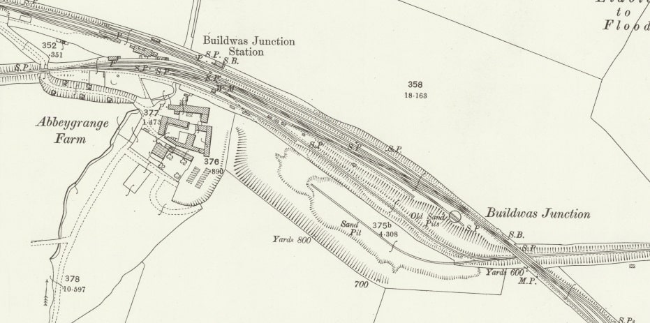
The Route– Lightmoor Junction Station to Buildwas
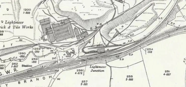
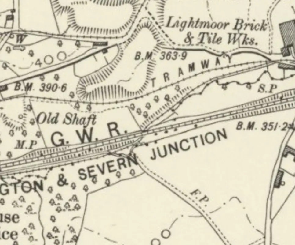
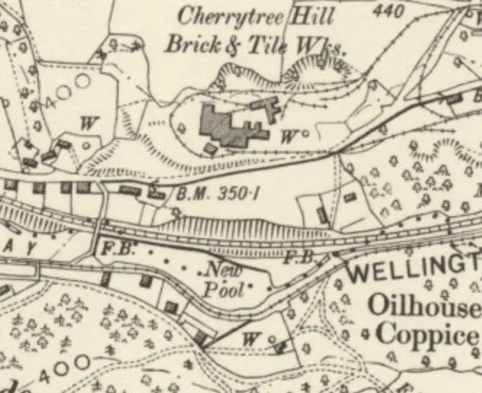
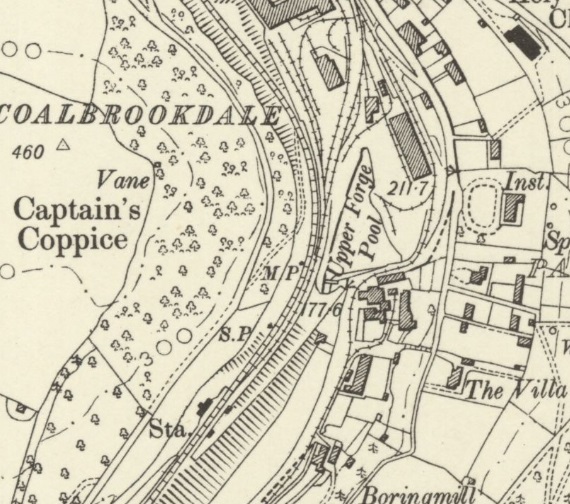
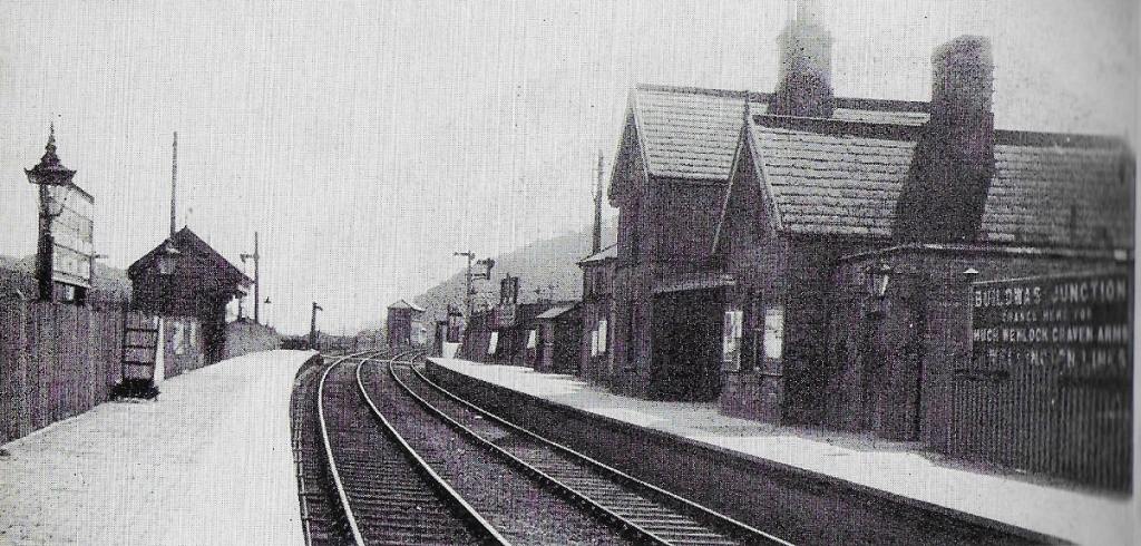
Lightmoor Platform as it is referred to in some sources, Lightmoor Station in others is shown on the first OS Map extract below:
This 25″ OS Map extract was included in the second article about the W&SJR. It is from the 25″ 1925 edition which was published in 1927. The double track provision from the junction towards the West is clear. The station (above the word ‘Branch’) and the first signal Box on the south side of the line opposite the goods yard can easily be picked out. The later replacement signal box was sited just to the east of the road-bridge at the east end of the station and was on the North side of the line [18]
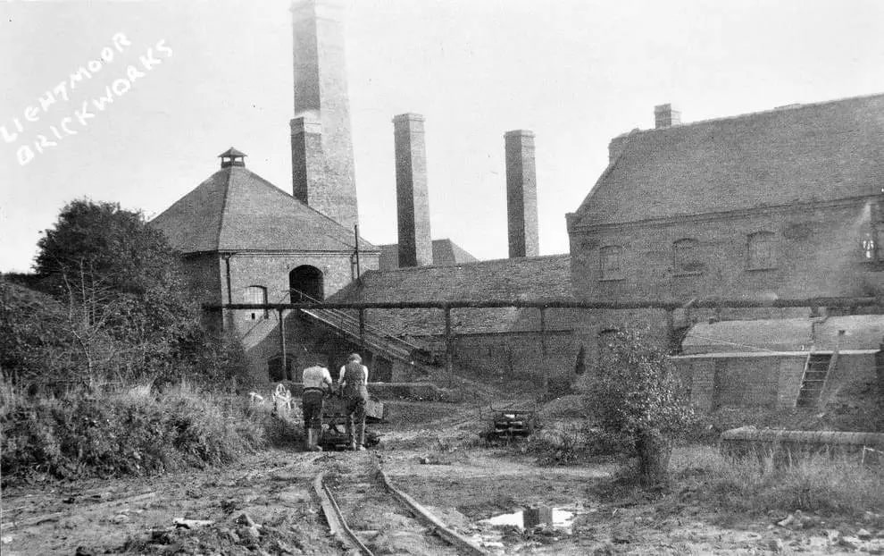
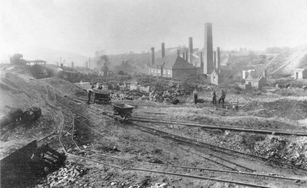
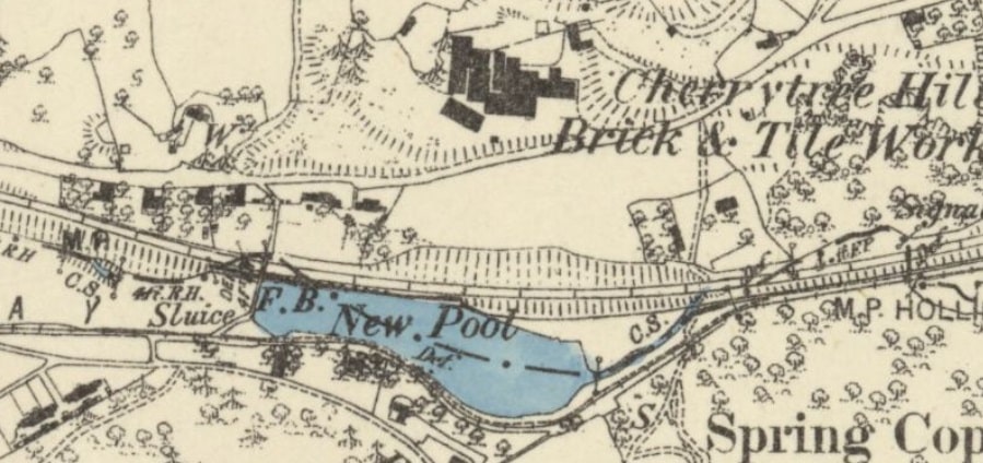
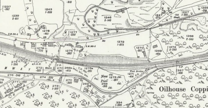
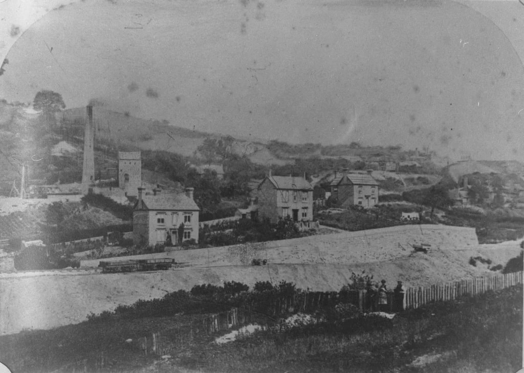
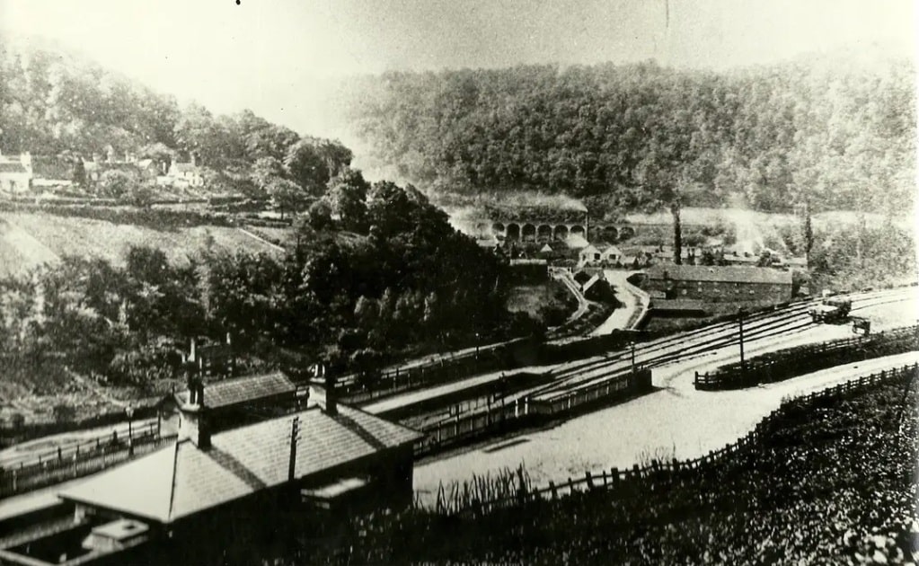
Two images shared on the last post about the W&SJR are worth sharing again here as they show the Lightmoor Brick and Tileworks site in the early 20th century.
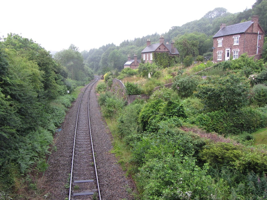
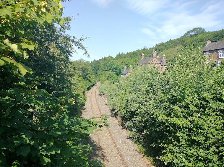
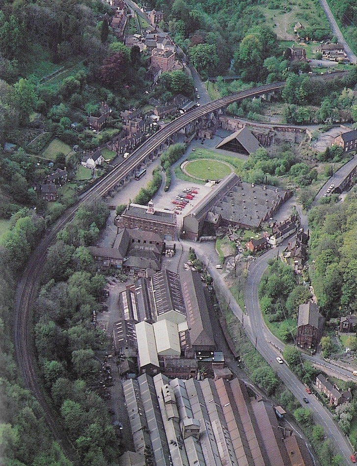
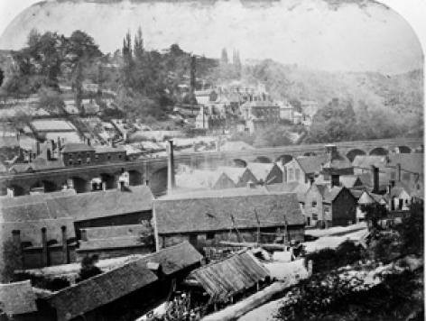
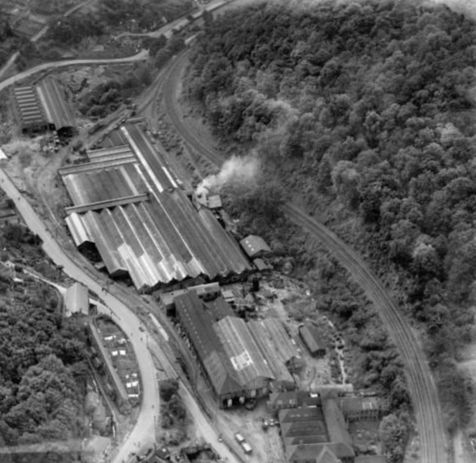
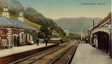
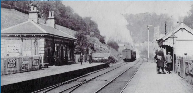
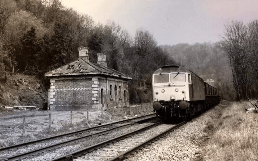
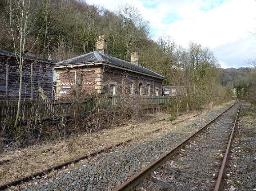
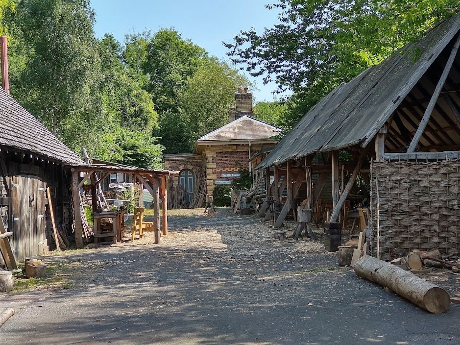
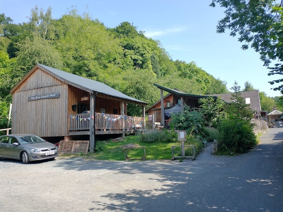
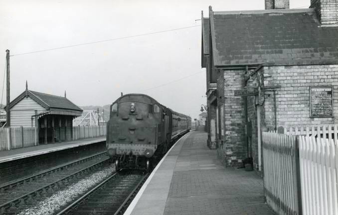
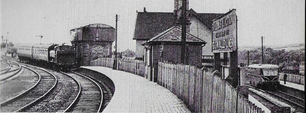
The next series of photographs are all taken in or around the site of Coalbrookdale Railway Station. In sequence, the camera location generally runs from Northeast to Southwest.
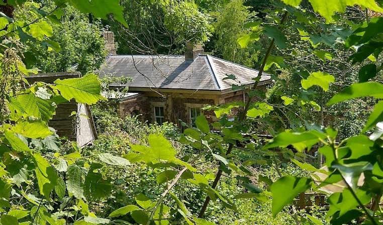
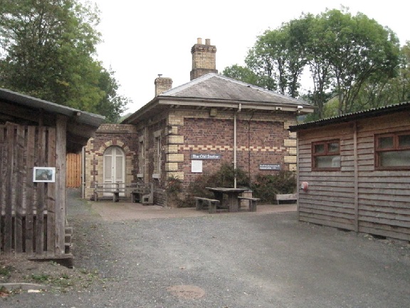
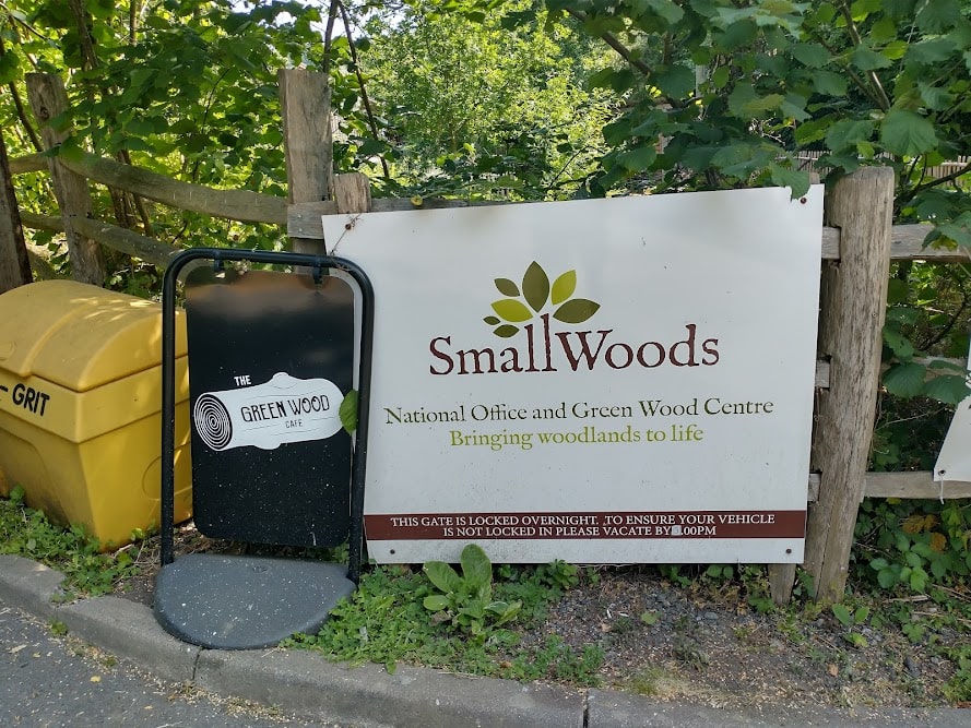
The Small Woods Association is based on the site of the old Coalbrookdale Railway Station. The Association are the UK organisation for woodland owners, workers, supporters, and social foresters. They “stand for living, sustainable woodlands alive with wildlife, people and work. Managed and used well, small woodlands are vital to thriving local economies, wildlife, and the health and wellbeing of local communities, as well as hugely valuable in the fight against climate change.” [43]
Alongside the Association offices on the station site is the Green Wood Centre. It promotes “sustainable living through a wood-based economy by running courses and events in sustainable woodland management, coppicing, crafts and related activities. … Activities at the Centre include woodland volunteering projects, fun family sessions and woody events for the whole community.” [44]
There is also an independently run café on the site, the Green Wood Café. The café is associated with Coffee With Soul and Gorge Grub. It is part of J Grant Catering Ltd; a family-run business in Shropshire. [45]
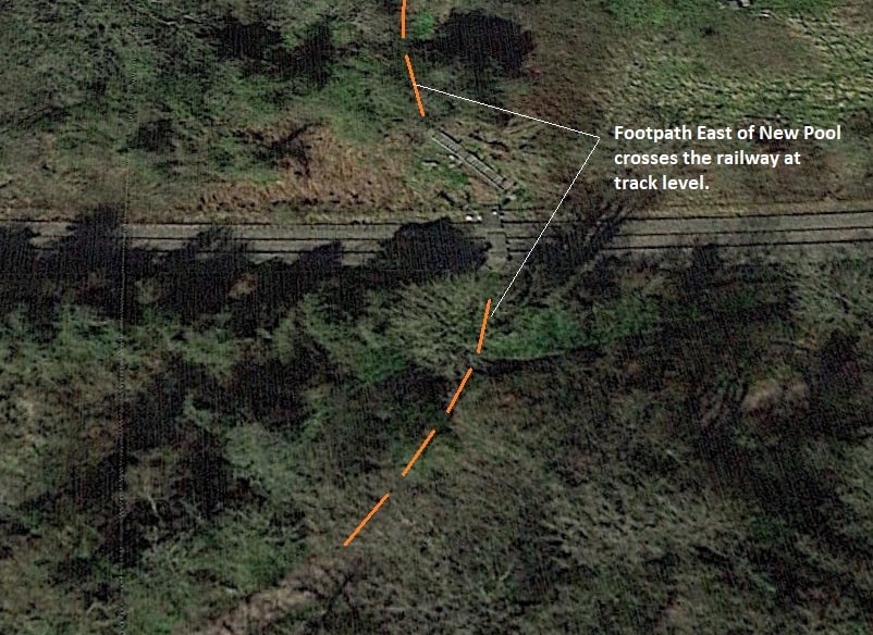
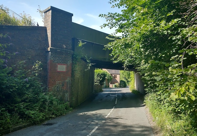
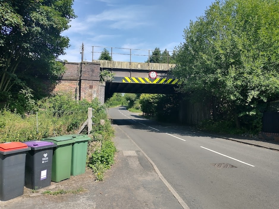
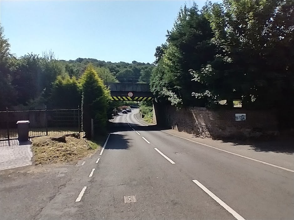
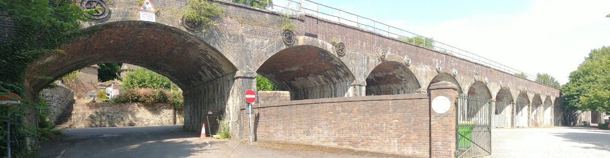
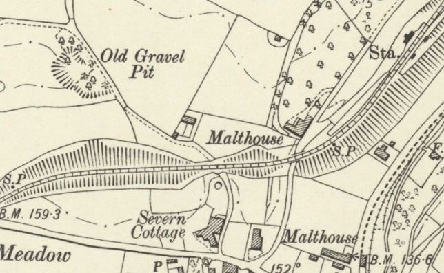
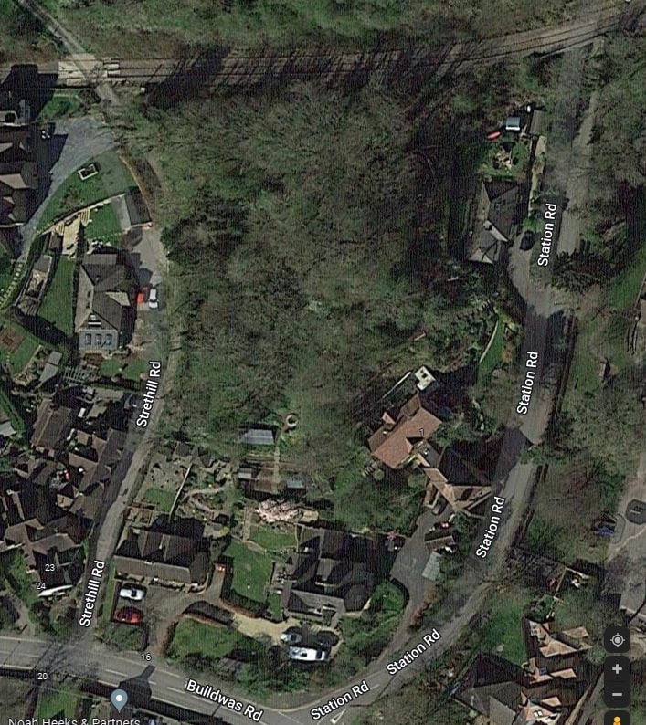
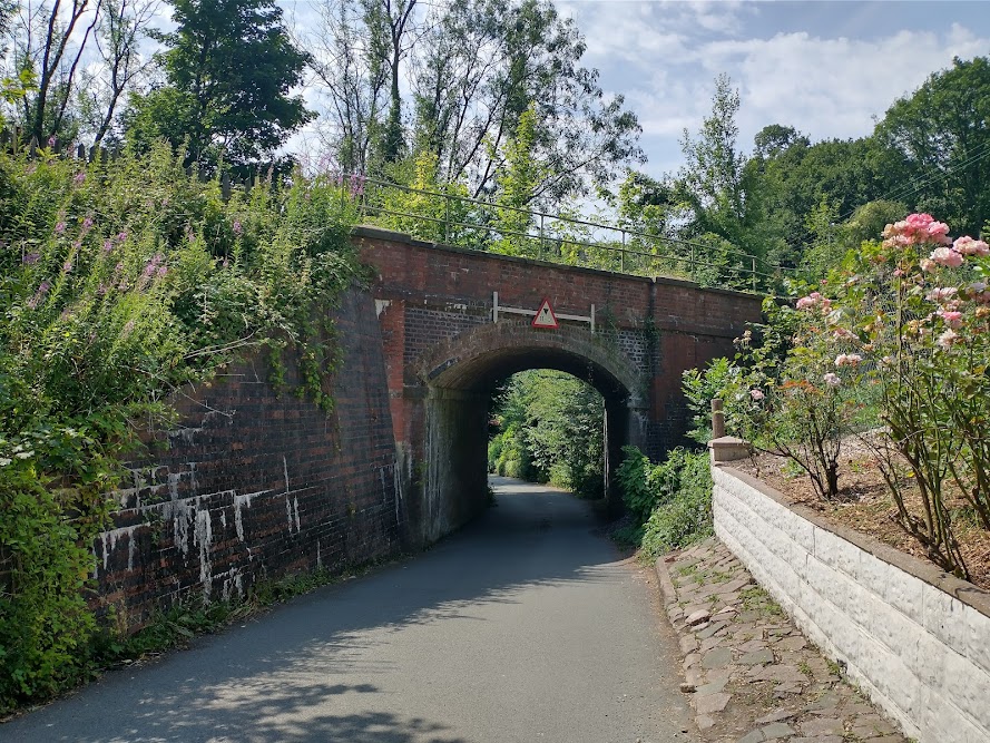
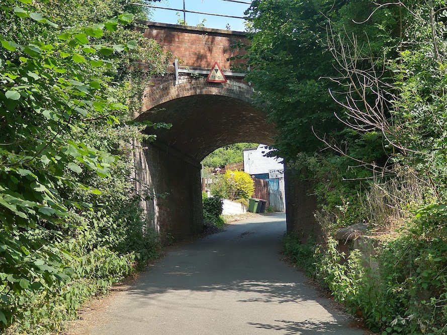
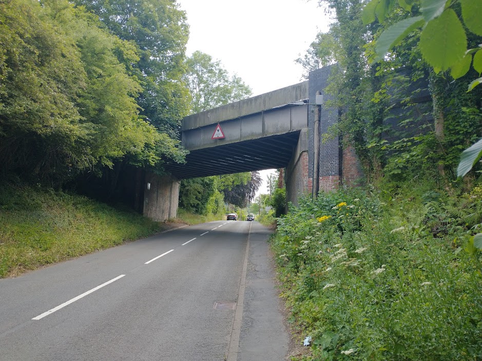
The old station site at Coalbrookdale which has been significantly repurposed by the Small Woods Association. [My photograph, 18th July 2022]A wider view of the station site showing the various buildings on the site in the 21st century. The old station building is visible on the right side of this image. [My photograph, 18th July 2022]Southwest of the railway station, the line turns to the West, crossing Station Road by means of a four-ring brick arch bridge. Almost immediately, it crosses, at level, a lane which led to an old Gravel Pit. These locations are pictured below. This is another extract from the 1901/2 OS Map. [15]This satellite image shows the immediate vicinity of Station Road, Buildwas Road and Strethill Road. It shows the railway line crossing both Station Road and Strethill Road as shown in the photos below. [Google Maps]Station Road Bridge from the Northeast on Station Road. [My photograph, 18th June 2022]Station Road Bridge from the South on Station Road. [My photograph, 18th June 2022]The level-crossing on Strethill Road, just to the North of Buildwas Road. [Google Streetview, 2011]
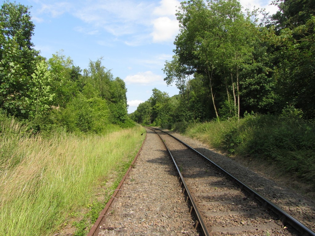
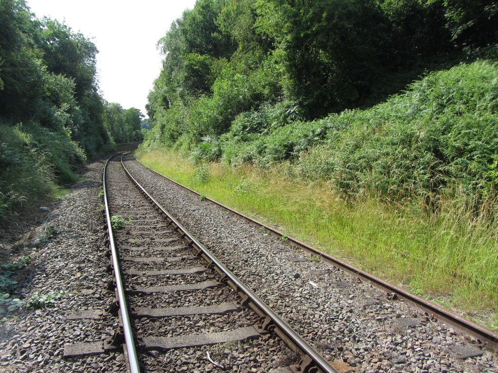
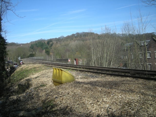
Apart from the location of the level-crossing on Strethill Road the railway remains on a relatively high embankment after leaving Coalbrookdale Railway Station. It turns first to the West as shown on the map extract above and then back towards the Sothwest as it heads for the River Severn.
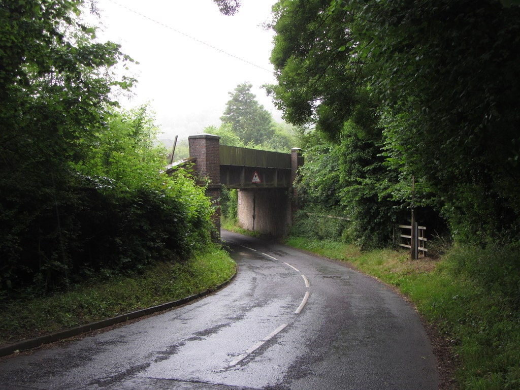
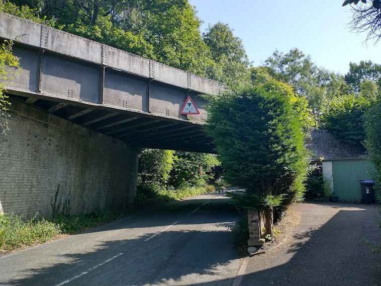
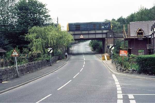
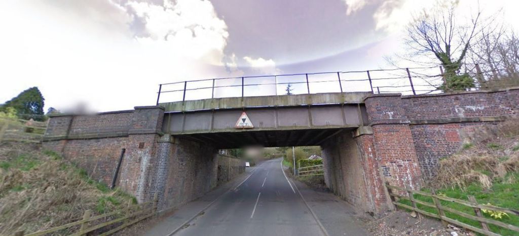
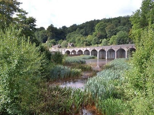
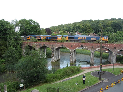
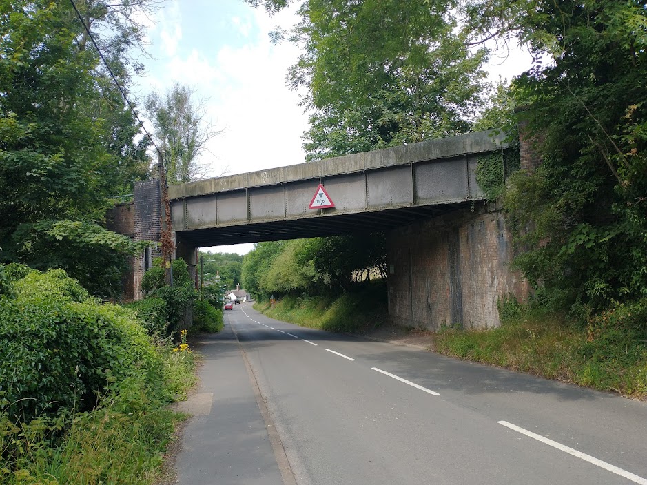
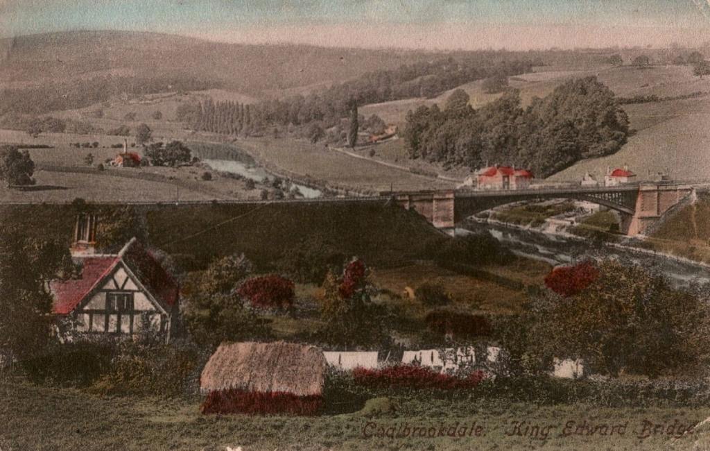
Another OS Map extract from the 1901/2 6″ survey shows the railway crossing the River Severn on the Albert Edward Bridge. Immediately to the Northeast of the Albert Edward Bridge, the line crosses the Buildwas Road on a skew-span girder bridge as pictured below. Immediately to the Southwest of the Severn the line turned relatively sharply to the right crossing an accommodation bridge before joining the GWR Severn Valley Railway at Buildwas Junction. [15]The skew span girder bridge which carries the railway over the Buildwas Road, looking West towards Buidlwas. [My photograph, 18th July 2022]The same bridge viewed, this time, from the West, looking back towards Coalbrookdale and Ironbridge. [My photograph, 18th July 2022]The Albert Edward Bridge, viewed from the Northwest. It was opened on 1st November 1864 and named after the Prince of Wales (later Edward VII), its design is almost identical to Victoria Bridge which carries the Severn Valley Railway over the Severn between Upper Arley and Bewdley in Worcestershire.
It was designed by John Fowler, its 200 feet (61 m) span cast-iron arch has four ribs, each of nine parts bolted together. The patterns for the radiused beam castings for the bridge were prepared by Thomas Parker at the Coalbrookdale Iron Company. Originally it was built to carry the Wenlock, Craven Arms and Lightmoor Extension Railway of the Wellington and Severn Junction Railway across the river.
Until the closure of Ironbridge power station it carried coal traffic as part of the line between Lightmoor Junction and Ironbridge Power Station. The bridge’s timber and wrought iron deck was replaced by a structural steel deck in 1933. It may be one of the last large cast iron railway bridges to have been built. Due to its age and the condition of the ironwork, traffic over the bridge is restricted to a 5 miles per hour (8.0 km/h) speed limit to minimise stress. Although it carries two tracks only the one on the downstream side was still in use to supply the Ironbridge Power Station site. The line was mothballed in 2016 after the closure of the power station.
9 thoughts on “The Railways of Telford – the Wellington to Severn Junction Railway (W&SJR) – Part 3 – Lightmoor Junction to Buildwas”
Alan Watkins
Congratulations on a fantastic historical railway journey through Telford.
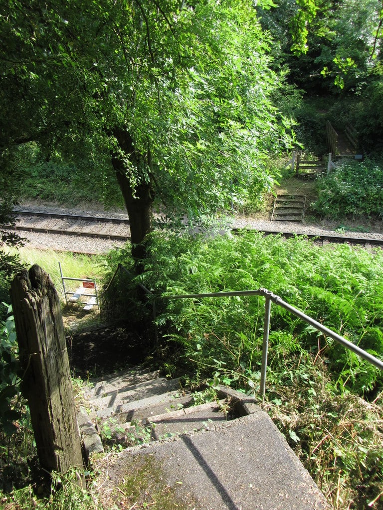
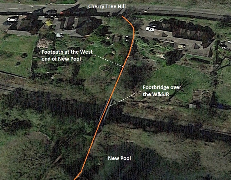
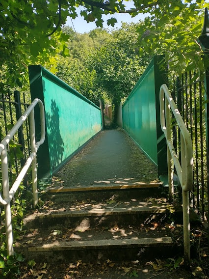
A good friend of mine lived on Cherry Tree Hill right next door was the footbridge to new pool. I remember him recalling that whilst watching television one night, the quietness outside was shattered by an almighty bang. He leapt out of his living room chair and down the path to the footbridge to find the footbridge had been knocked off its abutments by some sort of NW permanent way train that was carrying a digger with large jib, they had left the jib up and not realised there was an overbridge. There were voices and expletives in the dark on how they were going to explain their way out of that ! The bridge was closed for a substantial period of time until NW relocated it back on to the abutments. Circa 15 years ago.
A wonderful history. I’ve read many such histories but it takes one that includes detail that is inside one’s own memory to really become fascinating and this one certainly brings back memories for me, growing up in the are in the 1950s and 1960s. I know it’s a long time ago (history to many younger people!) but I look at some of these photos and wish I could somehow go back in time to my younger days and relive the opportunity to travel all over this area in the old steam trains!


Congratulations on a fantastic historical railway journey through Telford.
A good friend of mine lived on Cherry Tree Hill right next door was the footbridge to new pool. I remember him recalling that whilst watching television one night, the quietness outside was shattered by an almighty bang. He leapt out of his living room chair and down the path to the footbridge to find the footbridge had been knocked off its abutments by some sort of NW permanent way train that was carrying a digger with large jib, they had left the jib up and not realised there was an overbridge. There were voices and expletives in the dark on how they were going to explain their way out of that ! The bridge was closed for a substantial period of time until NW relocated it back on to the abutments. Circa 15 years ago.
Quite a tale Alan, thank you!🙂
A wonderful history. I’ve read many such histories but it takes one that includes detail that is inside one’s own memory to really become fascinating and this one certainly brings back memories for me, growing up in the are in the 1950s and 1960s. I know it’s a long time ago (history to many younger people!) but I look at some of these photos and wish I could somehow go back in time to my younger days and relive the opportunity to travel all over this area in the old steam trains!
Thank you for your kind comments.🙂
Pingback: The Railways of East Shropshire (and Telford) – the Much Wenlock and Severn Junction Railway, Buildwas to Much Wenlock. | Roger Farnworth
Pingback: The Wenlock Branch from Much Wenlock to Presthope | Roger Farnworth
Pingback: The Wenlock Branch from Presthope to Longville | Roger Farnworth
Pingback: The Wenlock Branch from Longville-in-the-Dale to Marsh Farm Junction and Craven Arms | Roger Farnworth
Pingback: The Wenlock Branch from Harton Road Station to Marsh Farm Junction and Craven Arms | Roger Farnworth