The Cornwall Minerals Railway is mentioned in an article in the journal “Railway Archive.” about the first locomotives purchased for the Cornwall Minerals Railway. [1]
The Cornwall Minerals Railway developed out of a series of older Tramroads which served the Cornish Mining Industry. It owned and operated a network of 45 miles (72 km) of standard standard gauge railway lines in central Cornwall. It started by taking over an obsolescent horse-operated tramway in 1862, and it improved and extended it, connecting Newquay and Par Harbours and Fowey.
Wikipedia tells us that the Cornwall Minerals Railway had a chequered history having been hurt by a collapse in mineral extraction due to a slump in prices. But after a period in bankruptcy it recovered enough to take over a defunct route between Fowey and Lostwithiel – theLostwithiel and Fowey line.
In 1896 it finally sold its line to the Great Western Railway which had been leasing it for some time.
Its main passenger line from Par to Newquay is still in use as the Atlantic Coast Line, and also carries some mineral traffic, but the Par to Fowey line has been converted to a private road. [2]
CMR No. 1, Treffrey was built, along with all of the CMR locomotives, by Sharp, Stewart & Co. Ltd of Manchester. It was named for Joseph Austin Treffrey but the name plates were mis-spelt. These locos were intended to work in pairs, back to back and it is likely that the lack of rear bunker and the open cab were intended to facilitate this way of working. There is no evidence to suggest that the traffic on the railway was ever large enough to justify this intention. [1][2]
The Cornwall Minerals Railway was adventurous in its intentions and purchases. It anticipated far more traffic from the mines than was to materialise and bought 18 (yes, eighteen) 0-6-0T steam engines to serve the anticipated high demand. [1] When the line was leased to the GWR in 1877, the new lease-holders quickly realised that the over provision of motive power was a financial drain on the Line. The GWR returned 9 of the engines to their makers, leaving 9 to serve the needs of the Line. [1:p30]
Of the 9 remains locos, a further one was sold by 1883 to the Sharpness New Docks Company and based on the opposite side of the River Severn from the Forest of Dean. [1:p31]
Of the 9 locos returned to Sharp, Stewart, 8 were purchased by the Lynn & Fakenham Railway and ended their days in various guises on the Midland & Great Northern Joint Railway (M&GNJR) which was the ultimate successor to the Lynn & Fakenham Railway. [1:p30] A first batch of three were sold to the Lynn & Fakenham in 1880, a further five were sent to the Lynn & Fakenham in 1881. [1: p36]
The last of the 9 locos returned to Sharp, Stewart was sold to the Colne Valley & Halstead Railway before ending up at a colliery in Northumberland. [1: p30]
This is the first article of what I hope will be a series about the Cornwall Minerals Railway.
References
1. Peter Treloar; A Scattered Family: The Cornwall Minerals Railway’s 0-6-0Ts; Railway Archive Issue 30, Black Dwarf Lightmoor Press, 2011, p27-40.
My wife Jo and I studied together at St. John’s College, Nottingham when we were training to become priests in the Church of England. We both had overseas placements in the Summer of 1998. I went to Sri Lanka for 8 weeks and Jo went to South Africa. My placement was at Lanka Bible College on Christopher Road in Peradeniya, near Kandy which can be picked out on the map below in the centre of the island country. The main building of the college features in the image above! [1]
Sri Lanka, formerly Ceylon, is an island country lying in the Indian Ocean and separated from the Indian peninsula by the Palk Strait. It is located between latitudes 5°55′ and 9°51′ N and longitudes 79°41′ and 81°53′ E and has a maximum length of 268 miles (432 km) and a maximum width of 139 miles (224 km), (c) Encyclopedia Britannica, 1998.
Sri Lanka is primarily a Buddhist and Hindu country. Christians are very much in the minority – perhaps less than 5% of the population. The church is growing quite quickly, particularly in rural areas. … I want to introduce you to two of the people I met while I was staying there. … A woman called Lalani and a man called Anargith.
Anargith gave up work in the capital city, Colombo, to be a missionary in one of the driest and poorest parts of Sri Lanka. He exchanged a comfortable flat for a small grass-roofed mud house with no running water or sanitation. The nearest church was around 50 km away. He started sharing his faith with people in the villages around where he lived and, when I met him, he had a small group of people meeting in his home. In the months after I returned from Sri Lanka they began to build a church. When I last heard from Anargith, which must over 15 years ago now, none of the people in his church had yet been baptised.
Anargith explained that it would only be when they got baptised they would be marked out as converts from Buddhism. It was important that their faith was strong enough to cope with the persecution they most probably would face. They would be threatened and, if experience elsewhere in Sri Lanka was to be matched, the church building and their houses could be burnt down.
Lalani’s story is a little different. When I met her, she was Pastor of an Assemblies of God church in southern Sri Lanka. In the mid to late 1990s, her husband Lionel had a successful ministry in their village – a lot of people were becoming Christians. He received threats from local Buddhist community leaders, but he continued to work, and the church continued to grow.
A contract was taken out on his life and he was shot and killed.
Lalani had trained with her husband and after he died took over the role of Pastor to the Church in their village. When I met her she was still working in that same village – witnessing to people that she knows were involved in her husband’s death.
These are stories that have touched me personally. But throughout the world today there are many Christians suffering and dying for the faith that they hold so dear:
Many of the Saints who fill our Anglican calendar were martyred.
In Pakistan, Christians have regularly been accused under strict blasphemy laws and imprisoned without trial.
Some time ago I was told an astounding fact: There were more Christians tortured and killed in the 20th century than throughout the whole of the history of the church before that.
One example of persecution in the 20th century is the deaths of seven bishops in Romania. Pictured are six of those seven bishops of the Eastern-rite Romanian Catholic Church who died during a fierce anti-religious campaign waged under the communist regime in Romania. Pope Francis recognized their martyrdom and beatified them in Romania on 2nd June 2019. Clockwise: Auxiliary Bishop Vasile Aftenie of Fagaras and Alba Iulia; Bishop Ioan Balan of Lugoj, Auxiliary Bishop Tit Liviu Chinezu of Fagaras and Alba Iulia; Bishop Valeriu Traian Frentiu of Oradea Mare; Bishop Ioan Suciu, apostolic administrator of Fagaras and Alba Iulia; and Bishop Alexandru Rusu of Maramures. Not pictured is Bishop Iuliu Hossu of Gherla. (CNS photo/courtesy Romanian Catholic bishops’ conference). [2]
Since the time of the early church, when the gospel has been proclaimed persecution and suffering have been close at hand. Sacrifices have been made, both by those sharing the good news of God’s kingdom and those accepting God’s rule. And Peter’s epistle reflects that. The passage set for today is about suffering for being a Christian.
But what do stories of persecution in Sri Lanka, or words of comfort from an apostle to Christians in the early church have to do with us in our communities?
Peter wants to stress that being a Christian will not be an easy ride. We can’t take our status as children of God for granted and then sit back with our feet up. Peter warns us what to expect, so as to enable us to be prepared. He then makes it clear what we are called to do:
First, says Peter: “Do what is just and right even if there is a personal cost. … For it is better to suffer for doing what is right than what is wrong.” When you see injustice in your local community do something about it, even if it is inconvenient, even if there is a real cost to you. Be the difference that makes the difference in your community.
Secondly, says Peter: “Be a witness to what God has done in Christ.” Share the faith that is in you. “For Christ suffered for sins in order to bring you to God.” What God does in history is consistent – right from the time of Noah, God has been active saving and transforming his world. Christ’s death and resurrection is part of that plan of salvation which is brought right up to date in our own generation in our own baptism. God’s work of salvation made real for us in our own baptism. God’s work of salvation made real for other’s as we share our hope with them.
And thirdly, let’s remember that in our own country we belong to the majority, there are others who experience being in the minority in our culture. How will we behave towards them? Will we ostracise them? Or will we welcome and support them? Will we push them away? Or will we recognise that although they are different from us, although they may worship in a different way to us, they too are God’s children.
Sadly, the Church, of whatever denomination, over the centuries, has not been good at accepting difference and has justified all sorts of atrocities in the pursuit of purity of doctrine. In our generation we are just as capable of bigotry. We can so easily slip into a pattern of thought which makes the other person less valuable than we are and that makes it seem OK to ridicule and hurt those different from ourselves. Our faith as Christians calls us to love and not to hatred. It calls those of us with the privilege of being in the majority to give space to other views, to recognise those different from ourselves and children of God and fellow human beings. Our faith calls on us to be those who create the space for good dialogue and who always see the good in our neighbours.
So let me remind you of Anargith and Lalani who testify that God is with them in the midst of persecution.
Let me remind you of Peter, who is convinced that we will not find life easy as we give ourselves to God. But who is just as convinced that we will know we are ‘saved’: that we sit in the heart of God’s will, safe and secure in God’s love. Sure too, that as we seek to serve Jesus and to live lives that honour our Lord, we are doing something worthwhile even if we suffer for doing so.
A reflection for Sunday 10th May 2020 – The Fifth Sunday of Easter
Revd. Pat Lodge
This week’s reflection comes from my colleague in the Parish of the Good Shepherd, Ashton-under-Lyne – Revd Pat Lodge.
Oh, my goodness, what an appropriate reading for the current times that we’re living in!
This is a Gospel reading that we may well be very familiar, partly because it often used in the funeral service, and the reason for that is that it is such a comforting reading. It reminds us that Jesus is with us on the journey of life, that he loves us and cares for us particularly when we are sad, lonely, confused and troubled, and that he prepares the way ahead for us.
Before the disciples heard Jesus speak these words to them they knew that there were dark days ahead for them. There they were, closeted in an upper room. It had all been going so well. They would have been planning for a future following Jesus, and helping him in his work. And then, suddenly, their world fell apart. Judas betrayed Jesus to Caiaphas. Jesus was arrested and crucified. Peter had denied even knowing Jesus three times, just as Jesus had said he would, and they had no idea what was ahead of them. For their own safety, they had locked themselves away in fear, in sadness and in apprehension about the future. Ring any bells?
I think that situation chimes with all of us at the moment. Our world was chugging along quite happily. We were making plans for the rest of the year ahead and all was well till, suddenly, this dreadful virus sweeps through our world and stops us all in our tracks. Don’t we feel that fear and apprehension for the future that the disciples felt as we keep our distance from family, friends and neighbours, closeted away as we are in our homes as much as possible? I know I have.
And then Jesus comes to comfort them and to show them the way forward, just as he does with us. He lets them know that he’s with them, and asks them to trust in God the Father and in himself, just as he does us. He tells them to hang on by putting their faith in him, just as he tells us. He assures his disciples that he will be going ahead of them to prepare the way for them, just as he does us.
Thomas, perhaps harshly nicknamed Doubting – for wasn’t he in exactly the same boat that we’re in now in wanting to know more – wants some detail about what’s going to happen in the future? What does Jesus mean by telling them that they know the way they must go? And where is Jesus going? He needs to know so that he knows where to follow him. And then we hear, as the disciples did, those words of infinite comfort, strength, support and healing, “I am the way and the truth and the life.”
No matter what we have to face in these dark and difficult days, no matter how long this uncertainty goes on for, we have Jesus’s assurance that he will be with us always, that he is there to help us on the onward journey from here, and that by following him will we have God’s promise of eternal life – and I think that’s a tremendous comfort right now.
And I said to the man who stood at the gate of the year: Give me a light that I may tread safely into the unknown. And he replied: Go out into the darkness And put your hand in the Hand of God That shall be to you better than a light And safer than a known way.
In the last article in this series we had reached a point of the journey from Cheltenham where the tramroad passed along the North side of what was later to be Barnwood LMR Locomotive Depot.
The first map below is the 6″ 1882 OS Map and shows the approximate alignment of the tramroad which had already been lifted by that date. The 1886 25″ OS Map is very similar to the 1182 Map but things changed somewhat over the next decade. The second map below is the 25″ OS Map from the turn of the 20th century. Tramway cottage has been removed by this time. The MPD roundhouse was at the right hand end of that OS Map extract. The third OS Map extract below comes from the 1930s when the sidings to the Southwest of the Roundhouse had been increased in number.The old tramroad embankment can be made out running behind the two jinties stabled at Barnwoood MPD (c) Roger Smith, used with permission.
The locomotive depot is now long-gone and the land turned over to industrial use. The Google Streetview image below the OS Maps is taken at the end of Myers Road. It is difficult to fix the exact location of the tramroad here. It clearly ran through the site in the picture between the two access roads that are visible. The line probably ran near to the right-hand access road. The view East from the end of Myers Road towards what was the location of Barnwood MPD Roundhouse (Google Streetview).
As the OS Map extract above suggests, the tramroad curved round to the Southwest. To cross Horton Road and the standard-gauge lines on the level. The level-crossing on Horton Road was known as Tramway Junction, now Horton Road Crossing.The next image is a Google Streetview image which looks Northeast from the Horton Road Crossing and which as a result looks along the line of the old Tramroad as it heads to the Northeast. The second image below is again a Google Streetview image taken from a point 20 metres or so to the south of the first image and showing the route of the tramway crossing Horton Road/Derby Road.After crossing what was a small area of open ground and which now carries Metz Way (A 4302) the tramroad joined Millbrook Street. The two following images show this. The first looks to the Southwest and shows the route meeting Millbrook Street, the second looks North East and shows the alleyway which remains long after the tramroad has gone! Both are, again, Google Streetview images.Contact with Millbrook Street is only fleeting. The old tramroad headed away to the West after only a short distance. The footpath shown in the centre of the next Google Streetview image follows its ancient route!The route of the old tramroad through Gloucester can be found in D.E. Bick’s book, [2: p16] and B. Baxter’s article. [3: p118], rather than reproduce either of these images here, the route is followed in detail on OS Map extracts. The first of these shows the length from Tramway Crossing/Junction on Horton/Derby Road in the East to very close to the old Eastgate Station (LMR). One its way, as we have already noted the line touched Millbrook Street and then ran across the backs of the houses on Napier Street towards Barton Iron Foundry. To the North of the old route today is Widden Primary School, and the ASDA superstore.Causton’s 1843 Map of Gloucester shows the Tramroad at this location in open fields. The tramroad was, in 1843, in the heyday of its working life and had not been encroached upon by development. Its route is highlighted in yellow on this extract. [6]
In the extract from Causton’s map above, the tramroad is seen entering from the East and then turning sharply towards the Southwest as it approached what in 1843 was the outer limits of the built-up area of Gloucester. The street entering from the West is Cambridge Street. Marked on the extract is a passing loop. just to the West of the sharp curve in the alignment of the tramroad and perhaps of greater significance a branch heading way to the North along what was to become first Barton Lane and then Station Road.
At this time, there was no Eastgate Station. Gloucester’s only railway station was located on the site of the complex that in the 21st Century continues to serve as Gloucester’s Railway Station. The railway station, in 1843, was to the North of the Tramroad.
The tramroad predated the larger-gauge network in Gloucester and a link must have been provided to connect the Railway Station with the Tramroad when the larger scale lines were opened.
Later maps suggest that the tramroad link to the station was replaced by a larger-gauge (broad-gauge) siding. [4: 1852 Board of Health Map]
To the South, the tramroad ran down to a level-crossing at Barton Street and onto Park Road (or Park End Road). Just South of Barton Street there was another passing loop provided. This length of the tramroad had to be maintained even after the construction of the larger scale railways which used its route over this very short section.
Baxter notes that this section of the tramroad, “was used by the two railways which jointly bought the tramroad shares, but, as the tramroad continued to work independently for more than twenty years after its acquisition, the tramroad track must obviously have been maintained on a course parallel with the new railway.” [3: p119]Sadly, the large scale .jpg image of Causton’s 1843 Map, that I have access to, does not cover the full extent of the tramroad. The tramroad leaves that copy of the map just to the Southwest of the passing loop which we have already noted and which appears at the bottom of the extract above. [6] Other copies of Causton’s map available on line are not so well defined and are blurry. They do, however, show the tramroad looping through open fields as it turns Westward.
Just off the bottom of the copy of the map that I have, the tramroad turned to the right and took a Westerly course along what became Park Road. It ran on the Northside of Park Road. This is shown on the alignment included by me on the OS Map below after significant property development in the city.OS Map from before the construction of Eastgate Station. The map comes from around the 1880s which means that the tramroad was abandoned by the time it was drawn.The Tramroad turns through 90° to head West. This plan is part of a series from 1852. [13]
The tramroad re-appears on my copy of Causton’s map as it travels along the length of Park Road, just to the East of Parker’s Row (later Wellington Street). It is helpful that this length appears on Causton’s map as it allows us to identify a Gloucester and Cheltenham Tramroad depot at the junction of Parker’s Row (Brunswick Road) and Park Road.These buildings stand at the corner of Brunswick Road (one time Parker’s Row) and Park Road on the site of what was once the tramroad depot (Google Streetview).What remains of the Depot in the early 21st century (Google Streetview).
The Gloucester and Cheltenham Tram Road is clearly annotated on Causton’s Map. The route is highlighted in yellow again. [5]OS Map extract from 1880s [5]Looking ahead to the West along the line of the old Tramway (Google Streetview)A view East along Old Tram Road (Google Streetview).Looking West on Old Tram Road (Google Streetview).Looking West along Albion Street (Google Streetview).The route of the Old Tramroad down Albion Street towards Southgate (Google Streetview).Looking back to the East along Albion Street, the route of the old Tramway. The building to the right of the old Tramroad route is the Whitesmiths Arms, the lower portion of the building, on the right-hand edge of the photograph was apparently the only building south of the city walls that was not destroyed during the siege of Gloucester in 1643 during the English Civil War (Google Streetview).
The next sequence of maps are also extracts from Causton’s Map They show the full length of the tramroad alongside the docks with the route from Cheltenham appearing as two lines entering from the right in the bottom map extract of the sequence. The tramroads have again been lightly highlighted in yellow.Gloucester Docks Tramroads before the coming of the railways as shown on Causton’s Map of Gloucester from 1843. The two tramroads shown leaving the bottom right of the map extract immediately above become one tramroad within no more than a few yards and that single tramroad crossed Lower Southgate Street and headed off along Albion Street. [5] In 1824, the Barge Arm, referred to on the above maps as the Barge Dock, was opened and was served by a series of 18 sidings from the tramroad. [6]
The Barge Arm was constructed in 1824-25 permitting smaller vessels to load and unload without occupying space in the main canal basin. Hugh Comway-Jones says that ”the surrounding land was divided into eighteen yards on each side, each yard having a frontage of only twenty feet, although some tenants rented more than one yard. Each pair of yards was served by a siding of the Gloucester & Cheltenham Tramroad. A surviving inventory of 1834 shows that one yard was surrounded by seven foot high fencing, with a pair of gates which opened on wheels. In the yard was a manually operated cast-iron crane capable of pitting seven tons, a tramroad wagon and several barrows used for transferring cargoes between the boats and the tramroad.” [8: p31]
Conway-Jones goes on to describe the various different yards around the Barge Arm and to note that the loss of the tramroad in 1861 was quickly rectified by the provision of sidings by the Midland Railway and by an adjustment of levels of the quay by the dock company. [8: p31]
Tramroad Blocks excavated near the Barge Arm in 1983. Cast Iron plates recover from another location have been placed on the blocks to show the Tramroad construction. [11]
Excavations were undertaken close to the Barge Arm in 1983 and these uncovered some examples of the Tramroad sidings. An example is shown in the adjacent image. (A better picture can be found in Conway-Jones earlier book of 1984. [10: p21])
There is also a map of 1829 which shows the tramroad sidings serving the Barge Arm and with similar sidings on the East side of the main Canal Basin. That map was drawn by Sutherland. [10: p31] The south side of the Barge Arm is also shown on the 1852 series of Health plans as being served by the tramroad. [13]
The 1852 plan showing the tramroad serving the south side of the Barge Arm despite the fact that by this time the north side was served by the Midland Railway. [13]
Looking West into the Docks complex at Gloucester with the approximate Tramroad alignments shown in red (Google Streetview).Reconstructed Trams placed on typical plateway rails on one of the lines of the old Tramroad (Google Streetview).A siding passed down to the East of the Barge Arm (Google Streetview).Approximate Tramroad alignments further into the docks (Google Streetview).At this location, two of the tramroad arms are remembered with rails let into the modern paving (Google Streetview).The old Tramroad route North through the site of the docks (Google Streetview).The old Tramway route between the River Severn and the County Gaol (Google Streetview).
I have not provided extracts from the later 1880s OS Map for the area around the docks, as by that time the docks were served primarily by larger-gauge edge-railways rather than the old plateways and those railways dominate the old maps from that period. There is an excellent reproduction of the 1902 OS Map in Hugh Conway-Jones, ”Gloucester Docks: An Historical Guide.” [8: p30] A similar map can be found on the website of British History Online. [12] And there are an increasing number of online resources available for those who are interested. [9]
Interestingly Bick records the fact that the plateway north of the dock entrance was abandoned in the late 1840s or thereabouts. [2: p27] This is supported by the 1852 series of Health Maps which show the north side of the Barge Arm being served by the Midland Railway. [13]
We have now followed the full length of the Old Tramroad. There are a few other bits and pieces that it is worth us considering before we complete this series of 4 articles about the line.
Tramroad Traffic and Operations
There is short document produced by the Gloucestershire Society for Industrial Archaeology about the Tramroad. [6]. In this document a short paragraph provides details of the operation of the tramroad: “At its peak operating period, the tramroad must have been very busy with up to 60journeys each day carrying over 35,000 tons of general materials and 20,000 tons of stone from the Leckhampton quarries in a single year. Despite competition from the railways and the Coombe Hill Canal, coal from the Forest of Dean was the main material transported along the tramroad, being preferred to Midlands coal and cheaper to purchase. Many different commodities were carried, from stone water pipes from the Guiting Power Stone Pipe Company between 1812-1815, to iron from Horsley in the West Midlands for the new Cheltenham gas lighting project in 1819.” [6]
Other sources such as D.E. Bick note that a tram trains usually consited on 2 trams. Thjis was the usual maximum which could be managed by one horse and the limiting factor was the gradient on the Cheltenham side of Staverton Bridge. I find it really interesting that the tramroad followed a prctice which eventually became prevalent on standard gauge lines of augmenting the power of a locomotive with another on steep sections of line. Stables were provided at Staverton Bbridge for horse which provided support for the tram horses climbing the 1:100 gradient near Arle Court. Could we use a term which became familiar with railways? Could we call this an early example of the principle of ‘banking’? [cf. 2: p36]
Maintenance of the Tramroad
Plateways were maintenance intensive. They required the short cast-iron plates to be leveled regularly, they were particularly intolerant of over-loaded trams. The GSIA document says: “The ‘L’ shaped design of rails needed to be kept clean to prevent derailing of wagons. Replacement of broken cast iron rails was frequently necessary; this may have been aggravated by the desire to carry loads in excess of the weight capacity of the rails. It was reported that poor and unstable ground also contributed to the difficulties of keeping the permanent way open.” [6] It seems that the income derived from the carriage of materials and the tolls levied was never significantly more than the cost of maintenance of the line. [2: p38]
Theft of plates was apparently a common occurrence. Bick quotes one example of a theft of 58 of the plates by one individual. [2: p38]
The Demise of the Tramroad
There were a number of factors which influenced the timing of the final closure of the tramroad. These included:
The rapid decrease in profits after about 1841. Bick quotes figures which show that a profit of £2,100 in 1841 decreased to about £1,000 in 1850 and to less than £100 by the end of the 1850s. [2: p40]
The tramroad was, at one time, the most convenient method of transporting Forest of Dean Coal to the Gasworks at Cheltenham. With the opening of the Midland Railways lines in the area it became possible for that traffic to travel entirely by rail and the tramroad could not compete. [2: p40] Talking about this, Wikipedia says: “The South Wales Railway opened in July 1854 and the tramroad suffered a serious blow, as the Forest of Dean minerals could now come much more expeditiously by rail throughout. Its main business was now the conveyance of Leckhampton stone to Cheltenham, its advantage being that it could unload at any point along its line as compared with the Midland Railway which was obliged to do so at a goods depot.” [7]
One section of the line was overshadowed by the newer edge-railways. … A decision was taken to push a standard-gauge line through Gloucester, close to the alignment of the tramroad where it crossed Barton Street in Gloucester and ran down Park Road. The tramroad and the railway co-existed for a time, although the standard-gauge line cut the tramroad access to the Great Western Railway Station. This removed what had been an important link from the Railway Station to the docks using the tramroad.
Conway-Jones notes that traffic was, “seriously affected by the arrival of the railway [at the docks] and by the loss of the northern end of the tramroad which was cut across by the excavation for the new dock.” [10: p55] He also notes that coal traffic decreased significantly “in the face of competition from the railways, and complaints about the bad state of the rails running unguarded through the streets.” [10: p71]
Baxter points out that the Birmingham & Gloucester Railway Act of 22nd April 1836 “empowered that company and the Cheltenham & Great Western Union Railway to buy the tramroad shares, and each paid £17,500 for a moiety in the early days of 1837. Very little of the early route was adopted for the new railways.” [3: p117-118] The purchase of these shares gave their successor companies a major say in the future of the tramroad. When some local interests sought to keep the Tramroad in use after powers to close it had been sought and won, these major shareholders stepped in to ensure closure and the sale of the company’s assets. In particular, most of the plateway was lifted and sold, a large proportion ended up in the Forest of Dean. [14]
One short section of the Leckhampton Branch remained open for the carriage of stone until late in the 1890s. [14]
The Tramroad served for about 50 years and was a major contributor to the local economy. It’s value to Cheltenham was significant. It brought Forest of Dean coal to the Gas Works which supplied the town’s gas and allowed for significant exports of limestone for building and road construction. It remained popular with a number merchants right up to its demise, as it offered a greater flexibility for deliveries than the newer railways. Ultimately, it seems that it’s end arrived because other forms of transport became cheaper and were faster, even if less flexible.
Hugh Conway-Jones; Gloucester Docks: An Illustrated History; in the County Library Series, Allan Sutton, Gloucester and Gloucestershire County Libraries, 1984.
Bick provides some details of the machinations which went on around closure [2: p27-29] Once the abandonment Act was obtained in 1859, initially little was done by those empowered to take action. It wasn’t until March 1861 that significant action was taken by the GWR to enforce closure and sale. One small remnant of the line was, as we have noted in a previous article, trained almost to the arrival of the 20th century. [2: p29 & 51]
The Mainline Southwest from Knapp Toll Gate in Cheltenham to Gloucester
At Cheltenham the Tramroad terminated at Knapp Toll Gate which was the start of the Turnpike Road to Gloucester. Chris Green says: “The final section ran to the end of The Knapp (in New Street) but was revised to end at the existing turnpike gate on Tewkesbury Road, located at Cheltenham’s western “town’s end” (now Townsend Street).” [1] This suggests that the line was extended a short distance North on Gloucester Road to its junction with Tewkesbury Road. Townsend Road is the extension to Gloucester Road beyond Tewkesbury Road.
We noted in previous articles that most of the descriptions of the Gloucester and Cheltenham Tramroad start from the Docks in Gloucester and run through to Knapp Toll Gate and then talk of the branch to Leckhampton Hill. Their narrative ignores the way in which the tramroad was constructed. Work started first at Leckhampton Hill and once the branch was completed then focussed on the short length from the branch to Knapp Toll Gate before looking towards Gloucester. Bick comments to this effect in his book of 1968: “Initial efforts concentrated on the Leckhampton branch and that part of the mainline from the junction to the terminal depot in Cheltenham. The depot covered one and three quarter acres. The site is now bounded by Market Street and Gloucester Road.” [2: p9-10]
Baxter also notes that the Toll Gate can be picked out on Merrett’s map below. [3: p120]
An extract from Merrett’s Plan of Cheltenham from 1834.
In Merrett’s early plan of Cheltenham above, the Gas Works are shown occupying a small site adjacent to Coach Road. The next plan below does not record that site as Gas Works but the outline of the buildings is similar once one ignores the frontage onto Tewkesbury Road..
This relatively indistinct copy of a 1843 engraving may well be based on an earlier survey as the Gas Works appears to occupy a smaller site than shown on the 1834 plan above. The tramroad is shown terminating in the top-middle of the extract from the map, in a similar position to that shown on Merrett’s plan from 1834. [5]
D.E. Bick [2] provides a sketch plan of the area around the Tramroad Terminus/Depot which is reproduced below. It shows the area in the early 1850s. Development since 1834 has been significant. A series of short branches from the Tramroad main-line serve a number of different sites in the immediate area. BIck comments that the development of the Gas Works was a significant factor in the Tramroad becoming profitable. He says that they were one of two developments that were “of lasting importance to trade on the tramroad. … Sidings for coal trams were laid into the works and remained in use until about 1850 when cheaper supplies were available from the Midland Railway coal sidings some half mile away.” [2: p14]The Tramroad Terminus in Cheltenham, D.E. Bick provided this sketch plan in his book of 1968 .[2: p17]The same location on a plan of 1855 with the tramroad rails annotated with red dotted lines. The crucial position of the junction of the various roots has been lost because of damage to the original map(s). The source for these specific maps is the website ‘Know Your Place’. [15]
Chris Green comments that, “the main wharves formed Cheltenham’s first industrial estate with its mixture of trades. They lay alongside the ancient tithing boundary between Alstone and Cheltenham which was delineated by a new highway – now Market Street.” [1]
By 1901, the date of the OS Map below, [4] the area has changed significantly. All signs of the tramroad are long-gone. The Depot, prominent on the sketch map is now used for housing. Alstone Terrace has been subsumed into an enlarged gas works site. Knapp Road is now Market Street and the site of Albion Brewery now appears to the the town Cattle Market. The layout of the streets is very similar in both the sketch map and the OS map extract.OS 25″ Map from 1901 sourced from the National Library of Scotland [4]
Plaque on the Hop Pole Inn on Gloucester Road. [6]
The area is much less easy to recognise in the 21st century. The Hop Pole Inn which was at the corner of Market Street and Gloucester Road is still there but apparently closed. [6] The building still bears a plaque to highlight that it was built on part of the site of the old Tramroad Depot. The Gasworks site is now the home of Cheltenham’s Tesco Superstore. And at the southern corner of the old gasworks site, there is a clever but sad memorial to one of the old gasometers.The site of what once fwas the town gas works in Cheltenham is now the location of its Tesco Superstore (Google Streetview).DW Sports have built their store on the footprint of one of the old gasometers (Google Streetview).The Depot area in the 21st century (Google Maps).
The Tramroad between Knapp Toll Gate and the Junction with the Branch line to Leckhampton Hill followed the Southeastern verge of Gloucester Road in a Southwesterly direction to the junction at what soon became Queens Road. Beyond that point the line ran across the entrance of what was to become first Lansdown Station and then Cheltenham Railway Station down to the junction between Gloucester Road and Lansdown Road.
Baxter, writing in 1953, talks of two cottages built after the closure of the Tramroad. “At the junction of Lansdown Road and Gloucester Road are two houses curiously built in a position sideways to the Gloucester Road with their front doors facing each other across to narrow elongated front gardens which are obviously the width of the original Tramroad land, and it seems almost certain that these represent two plots of tramroad land sold off for building.” [3: p121]
I have looked at a number of maps from around the time that Baxter was writing, and found it difficult to identify the two properties that he refers to. Two examples of the maps are below and they are accompanied by an aerial image from the 1930s of the same area.Publishing this article has produced a very helpful response from Richard Beamer. I have produced an enlarged extract from the second OS Map above which shows the two properties concerned. This results in a slight amendment to the alignment of the tramroad away from the kerb of Gloucester Road into what are now the front gardens of some of the properties. Richard Beamer comments that these two cottages had disappeared by the time of mapping work undertaken in the 1960s.
Beyond the junction between Gloucester Road and Lansdown Road the tramroad continued along the Southern verge of Gloucester Road. You might expect that the turnpike road was in existence before the tramroad was constructed, however, the reverse is true. The turnpike road was not constructed until the tramroad was operational. Bick tells us that in the same parliamentary session that saw the tramroad powers granted (April 1809) a parallel Acts was granted authorising “a new turnpike road from [Cheltenham] to meet the existing Gloucester road at Staverton Bridge. …The turnpike road and tramroad … were largely supported by the same people, and the new road was planned to run alongside the tramroad, taking advantage of its easy gradients and ready conveyance of stone for construction. … Stone for the road’s upkeep was to be carried toll free on the tramroad. ” [2: p8]
As we have noted the tramroad route was chosen to minimise the use of gradients which would have limited the capacity of the trams. Bick comments that the turnpike road was as a result not a great success, as the route was longer than it needed to be for road traffic. “Financially the road never compared with its iron companion.” [2:p8]
Road and tramroad were tightly paired as they travelled Westwards. The modern roads follow, relatively faithfully the line of the old Gloucester Road.
On the Google Maps extracts above, the tramroad alignment is plotted over the current road arrangement. For a distance it runs along the South side of the A40 before turning away up the old Gloucester Raod (B4063). In order to make the modern road alignments work at the junction of the A40 and the B4063 the modern alignment of the B4063 has been moved away from its old alignment and so also from the tramroad.The old tramway and the old turnpike road followed the approximate route shown above. The roundabout from which the picture is taken is the junction of the B4063 and the A40. The B4063 heads along the right side of this image (Google Streetview).The view back to the East along the alignment of the old Tramroad towards the modern roundabout junction with the A40. The modern B4063 is on the left of the image. (Google Streetview)Looking to the West along the B4063 today. (Google Streetview)
The route of the old tramroad line runs from Arle along the B4063 towards Staverton. It is thought that the old Tramroad ran a little removed from the turnpike road at the point where the Old Goucester Road meets the B4063. The verges at this location in particular are wide and may have accommodated a stabling point for the horses which pulled the trams and the tramroad itself probably passed behing the pub at this location – the former Plough Inn (now White Lion House (AGD)).The route of the old tramway probably passed to the South of the pub at Staverton Junction. (Google Streetview)25″ OS Map from the early 20th century. [7]
The Hare and Hounds Pub in the 21st Century. (Google Streetview)
Beyond Staverton, the road and the tramroad converged again and the old tramroad followed the Southern verge of the road once again. Halfway Bridge was once two parallel structures with three brick arches which took both turnpike and tramroad across Norman Brook. “The tramroad bridge … has long since disappeared, but a perfect image of it remains supporting the B 4063 itself. We know this because in January 1818 an advertisement appeared for contractors to build a new road bridge with three arches ‘to correspond and adjoin with those under the Rail Road’.” [10]
There has been a significant amount of modern development in the immediate vicinity of the B4063 as it passed to the Northside of the Airport and on into Churchdown before gradually drifting back towards what is now the A40 but which was just open fields!
On the way down to the location of the modern roundabout, the tramroad passed behind the Hare & Hounds Pub. The alignment close to the rounabout followed the old B4063 which was diverted to provide good access to the new A40 roundabout.
Some realignment of the B4063 has therefore taken place which takes it away from the old turnpike and tramroad alignment. The first side-by-side images below [8] demonstrate that movement. The old tramroad alignment is now lost under the A40 roundabout!
Again, just beyond Elm Bridge, the tramroad deviates away, for just a short distance) from the modern B4603 following the alignment of the old highway. The second side-by-side images illustrate this. [9]It then crossed Cheltenham Road and ran down along what is now Elmbridge Road. Baxter indicates that when the tramroad was built it crossed open fields along this length. The road was built after the tramroad was in use. [3: p120]The Tramroad runs down Elmbridge Road into Gloucester [11]Elmbridge Road became Armscroft Road to the south side of Ermin Street. Ermin Street is now the A38 Barnwood Road. [12]
At the point where Armscroft Road turned sharply to the Southeast the old Tramroad made its way across open-ground. Its route could still be followed as a footpath on an embankment until relatively recently and part of the route remains as a tree-lined route towards what was Gloucester Locomotive Depot.. The depot is just visible to the bottom left of the map extract above. The map extract below comes from the OS Maps online and the old Tramway route is marked with dotted red lines [12] It left Armscroft Rod, passed across the end of what is now Brookfields Mews and then ran on to cross Wotton Brook before crossing the Gloucester MPD site.
Baxter commented in 1953, that the length of tramroad from Armcroft Road to Barnwood LMR Locomotive Shed and Depot was one of “the few real traces of the tramroad, in the form of a length of original embankment some 350 yd. long. This provides, ” he says,”a convenient footpath for enginemen going to and from the sheds from the Barnwood district. For this reason, a culvert which formerly carried the embankment over the Wotton Brook, and which has at some time been washed out by a flood, has been replaced by a footbridge built of old railway sleepers.” [3: p120] As we have seen, a portion of that embankment remains, the original footbridge sleepers have been removed and the bridge now has a tarmac surface and is part of a cycle track/footpath between Blinkhorns Bridge Lane and Metz Way.
The next article in this series will cover the length of the tramroad from Barnwood MPD to the docks in Gloucester.
Belonging is important. We want to feel that we belong. Even those of us who are introverts still want to feel that we have a place in society. And so many of us join different clubs and societies. So, we belong to things like Soroptimists, Rotary, Round Table, the Bowling Club, the Needlework Group, a Fan Club, a Football Team, we engage in other sports, and nowadays we join on-line groups – we have a Facebook page, a Twitter feed, some of us even have a blog. Even on-line, we belong!
Yet, as adults we like to believe that we a strong enough to make our own decisions, to be our own people. For some of us acknowledging that we need others, that we need to belong can be quite difficult. But we have to accept that it is true when we look at teenage culture over the past 50 years – the need to belong to the ‘in-crowd’, to wear the ‘right’ clothes, to listen to the ‘right’ music, to have the ‘right’ attitudes. All so very obvious and never more so that during the 1970s when I was a teenager. And those of us who are now in our 30s, 40s, 50s ….etc…. have to admit that when we were young we felt the possibility of rejection quite keenly. Indeed it is one of the main causes of serious teenage problems – eating disorders, drug/solvent abuse, delinquency. The need to belong often overcomes all other priorities – it can become more critical than right/wrong. And if we’re honest we’ll admit that it is true for all of us, whatever age we claim to be. The need to belong is so very important.
It’s not just peer groups/clubs/societies – we’re part of families – I’m a Farnworth – I couldn’t be anything else – I’ve habits that I recognise in my father, I’ve got the same concern for neatness and detail that my mother has. I inherit my baldness from my mother’s father. No matter how much I might have wanted to rebel against it in the past, I’m a Farnworth. I belong.
Then there’s our work. Before I went to college to train for the ministry I was a Civil Engineer, a member of the Institution of Civil Engineers, something that I’d worked hard to achieve. I was a manager in Stockport Council – with 120 staff. I had a definite place in society – I belonged. Leaving all that and going back to college was surprisingly disorientating. The way I defined myself, and the sense of place and belonging had suddenly been taken away. Who was I now? How was I going to make my mark? Would I be accepted in this new world? If you’ve changed jobs, or perhaps left work to raise children, or gone back to work after raising children you’ll perhaps know what I mean. Not the end of the world by any means – actually a really positive challenge – but still a need to establish a new identity, a new sense of belonging.
This month the Parish of the Good Shepherd, Ashton-under-Lyne celebrates its Patronal Festival on the 4th Sunday of Easter (3rd May 2020). Each year, on the 4th Sunday of Easter our lectionary has us reading something from the 10th chapter of John’s Gospel, a chapter where Jesus talks of himself as the Good Shepherd. In that chapter of John’s Gospel, Jesus talks of belonging. “You do not belong to my sheep,” he says to his adversaries in the temple. “You do not belong to my sheep. My sheep hear my voice, I know them, and they follow me. I give them eternal life, and they will never perish. No one will snatch them out of my hand.”
There are at least three things that Jesus is saying about those who belong to him:
Firstly – “My sheep hear my voice, I know them and they follow me.” Those who belong to Jesus have been ‘called’ by him – they’ve heard his call and have answered that call. We’ve been chosen – we’ve not just muscled our way into the club, we’ve been selected to play on the team. We have been called by Jesus and we follow his call. But not only are we called, we are known – nothing is hidden from him, he knows us inside out – and even knowing all the things we like to keep hidden, he has still chosen us! … And why are we chosen? … To follow him – to live differently, to try to be like him, his attitudes/actions – to follow him.
Secondly – ‘I give them eternal life.’ Those who belong to Jesus have been given eternal life. All equal, all loved, all given the greatest of gifts – eternal life. Life lived now in friendship with God, life which is no longer purely part of a world which passes away. We often say that it is quality not quantity which counts – but here in Jesus gift of eternal life we get both – life to be enjoyed beyond our imagining, life which continues beyond the grave, both quality and quantity!
Thirdly – ‘No one will snatch them out of my hand.’ The best news of all. Those who belong to Jesus are safe, secure. Jesus is committed to them, no matter how tentative their commitment to him. Belonging depends on his love, not our faithfulness! No matter how black things seem, no matter how rebellious we are. He has hold of us with a grip that he will not release. If we wander away he will draw us back, if we stumble he will pick us up and set us back on our feet.
Belonging to Jesus is real belonging – its for keeps. It gives us the strength we need to cope when all other certainties have gone. We are at home, we’re safe. But don’t just take my word for it, listen to Jesus:
“My sheep hear my voice, I know them, and they follow me. I give them eternal life, and they will never perish. No one will snatch them out of my hand.”
Sunday 3rd May 2020 is the Patronal Festival for the Parish of the Good Shepherd, Ashton-under-Lyne. My colleague Revd. Ben Brady prepared our Parish’s Reflection for the 3rd May. He writes:
Jesus the Good Shepherd
How many times have you heard your name? I only have to think back to being in school and hearing it every registration time. There were also times when teachers didn’t appreciate my stellar performances in Maths, English and Science (to name just a few) – But they all blur into an innumerable mass in my memory.
However, there is one voice that I remember very clearly and even fear…”Benjamin!” My mum. She could always stop me in my tracks (still can). No matter how loud the room or how far out of sight I thought I was getting my cousin into a headlock, over it all I would hear my mum’s voice. For each of us, there are those special voices that we know, trust and immediately listen to.
The passage from John’s Gospel speaks about recognising the voice of Jesus. The calling and promptings we have daily to live by his example, knowing that he draws close to us. Our Gospel reading this week comes after Jesus healed a man of blindness and yet, despite this, the Pharisees still did not believe Jesus was the Messiah. I find it amusing that this Sunday is ‘Good Shepherd Sunday’ but the reading stops short before verse 11 where Jesus actually says ‘I am the good shepherd’. I will sneakily push the set reading forward by a verse to include Jesus as The Good Shepherd because I believe this can help us explore what John is saying to us about Jesus as The Gate.
The Gospel reading has some characters that need unpacking. There are thieves and bandits, strangers, a gate keeper, sheep and Jesus. The back drop to the story is a sheep pen. It has walls and one way in and out through a gate. We can think of ourselves as the sheep and the pantomime villains (who deserve boo’s and hisses) are the thieves and bandits – those things trying to undermine and wreak havoc in our lives. They try to climb in over the wall. They deliberately avoid the gate. The job of the gatekeeper is to protect the sheep by knowing who to let in or out. I think it is interesting to reflect on what the gatekeeper is doing in this story. We are not told what he gets out of doing his job or how much he cares about the sheep. Perhaps this character is only mentioned by Jesus to highlight the fact that Jesus is not just another gatekeeper, he is The Gate! He is the thing that the thieves and bandits can’t tackle. This is where Jesus takes it to another level. Jesus describes Himself as the physical gate that seals and holds secure the sheep within the pen. He was built to do this, his purpose is to guard and protect.
Now the sheep pen is not only used by one shepherd. We are told the shepherd enters, calls his sheep and they follow him. The pen is crowded with other sheep belonging to other shepherds, but we are told that they recognise their shepherd’s voice and ignore that of the stranger. I find it interesting that the sheep follow the shepherd. They trust him as their leader. He does not try to herd them from behind.
Jesus is both The Gate that holds us secure and The Good Shepherd that leads us. We are to follow because we recognise his voice and can feel sure in His guidance. I love this image of being led by someone we can know and trust. Even though I know that Jesus is always with me, I sometimes need to remember that He also goes ahead of me. I find it grounding to think of the future as somewhere with a familiar face ready to meet me. Jesus goes first, we follow. Jesus is not a hired hand letting people in and out who will leave at the first whiff of danger. Jesus the Good Shepherd will listen when we cry out to him. No matter how far we feel we stray or wander, He is already ahead of us and will always call us home and meet us with an embrace that spans all heights, depths, shame and fear.
Reverend Ben
Prayers for Sunday 3rd May with Psalm 23
Also provided by Ben.
Carrying on with our Shepherd theme, here is a reflective prayer using a version of Psalm 23 written by Scotty Smith from The Gospel Coalition.
1 The Lord is my shepherd; I have all that I need.
Dear Lord Jesus, you are my shepherd, my Good Shepherd. You give me everything I need and more than I want. All I need in life is you, plus what you choose to give me.
2 He lets me rest in green meadows; he leads me beside peaceful streams.
Even the most difficult places in life are like green meadows as long as you are there; and in the desert seasons of my journey and the drought like conditions of my heart, you quench my thirst with living water and give me a peace that passes all understanding.
3 He renews my strength. He guides me along right paths, bringing honour to his name.
By your grace I’ve learned to boast in my weakness, and pose and pretend less. For when I come to the end of my strength, you faithfully meet me there—granting me rest in my weariness and strength for my tired heart and body. I am so grateful that you have both marked the path for me, and that you yourself are my Way, Truth and Life. I want to honour your name much more than I want to go my way and get my way.
4 Even when I walk through the darkest valley, I will not be afraid, for you are close beside me. Your rod and your staff protect and comfort me.
Jesus, you never promised me that the journey towards the new heaven and new earth would be easy, quick, or without seasons and circumstances that are overwhelming; but you have promised never to leave or forsake me, even in the darkest valley. That’s all I really need to know—that you are close and that you love me, and that you won’t let anything happen to me outside of your perfect plan for my life. Even when you have to discipline me, the goal is my comfort and always your glory.
5 You prepare a feast for me in the presence of my enemies. You honour me by anointing my head with oil. My cup overflows with blessings.
Jesus, you are taking me to the feast of all feasts—the wedding feast of the Lamb; but long before that Day, you, yourself are my portion, banquet and feast—Bread from Heaven, my nourishment and satisfaction. Though enemies threaten, you feed me, anoint my life with your grace and Spirit, and cause my cup to spill over with blessings, for the benefit of others.
6 Surely your goodness and unfailing love will pursue me all the days of my life, and I will live in the house of the Lord forever.
Absolutely nothing will keep me out of the new heaven and new earth; and, just as certainly, nothing can possibly separate me from your goodness and unfailing love—at any time or in any place. Until the Day I long for more than any other arrives, I rest in your love and trust in your grace. Jesus, thank you for your promise to never stop pursing me.
So very Amen I pray, in your glorious and powerful name.
This article covers the length of the Tramroad up Leckhampton Road and through the Southern ‘suburbs’ of Cheltenham to meet what was the mainline of the Gloucester and Cheltenham Tramroad.
Before covering the route in detail, it is worth noting that a presentation was given in 2010 by Wendy Ellyatt covering the History of the Tramroad. This presentation can be foolowed by following this link: http://www.authorstream.com/Presentation/wendyellyatt-478472-the-history-of-southe-cheltenham-tramroad. [30] The presentation was prepared as part of the work ont he renovation of the Norwood Triangle referred to later in the text of this article.
At the end of the last article about this Tramroad we noted that the branch from Leckhampton Hill into Cheltenham headed North away from the quarries and Leckhampton Hill. The quarry tramway lines were served by a Depot alongside Leckhampton Road. The Depot was built in about 1810. It became the location of Leckhampton Industrial Estate (although I think it has now been developed for housing). In 1923 the depot was transferred to Southfield Farm. [1: p41]
The tramroad only had a short distance to travel between the bottom of Bottom Incline and the Depot. Ownership of the length of tramway from the incline to the depot in the early years is not entirely clear. The 1809 Act gave powers to the Tramroad Company to connect with the tramroads on Leckhampton Hill but included a clause which allowed Trye to complete the connection should the Company not do so. It is therefore clear, given that Trye did make the connection and built a length of 950 yards or so which included Middle and Bottom incline, that the line as far as the bottom of Bottom Incline belonged to the quarry company but the point North of the Incline at which the lines became the responsibility of the Tramroad Company is not entirely clear. [2: p50]
Although gradients on the Tramroad were generally relatively shallow, those along Leckhampton Road and particularly the length closest to the quarries were not. Bick has the gradient on the Branch averaging about 1 in 70, steepening to 1 in 35 on the approach to the bottom of Bottom Incline. [2: p32]
The bottom of Bottom Incline. [19] It was at this point that the public tramroad gave way to the quarry tramroads. Interestingly, Bick gives the date of this photograph as being around 1895. This is evidence that a length of the tramway alongside Leckhampton Road was retained in use after the closure of Gloucester & Cheltenham Tramroad as a whole, in 1861. Bick says: “Here the Leckhampton branch of the Gloucester and Cheltenham Tramroad met C. B. Trye’s quarry lines. c. 1895. (c) A. T. Bendall.” [2: p32a][3] Leckhampton Road/Hill can be seen on the left of the picture.The point where the tramway from Bottom Incline drew alongside Leckhampton Road, as it is in the 21st century. The cottages in the monochrome image from the turn of the 20th century are long-gone. The old depot was located just off the the right of this picture. (Google Streetview).
North of the Depot, the old tramroad ran along the west verge of Leckhampton Road towards Cheltenham.
When we see images, later in this article, of a tramway in the centre of Leckhampton Road, we need to remember that the tramway in those images is a later tramway which operated in the early 20th Century and which was primarily a passenger tramway. The image below comes from the year 1900, the trees in the verge have just been planted, there is no evidence of a tramway in the centre of the road and the old tramway rails are still evident to the west of the road, on the right of this picture. Leckhampton Road under reconstruction. The old tramroad rails appear still to be available at this time as the tramroad wagon on the right of the image testifies. Although some sources do suggest that the rails were lifted when the old tramway closed in 1861, [4: p50][5][6] Bick is clear that the length at this location survived into the 1890s. He says that Trye who owned the quarries in 1861, “retained about 500 yds. of line down the side of Leckhampton Road to a point opposite the Malvern Inn, where he established a stone wharf. This bit of line, the last of the Gloucester and Cheltenham Tramroad, was not taken up until the late 1890s.” [2: p51 (and very briefly on p29)]Leckhampton Road in the 21st Century at approximately the same location as the image above (Google Streetview).
I have not been able to establish the location on Leckhampton Road of this picture. I understand that it was taken in 1902 and is probably of the Cotswold Hunt. It appears that by 1902 the old tramway rails had been removed. [7]
There are very few early images available of Leckhampton Road prior to the introduction of the later trams. The two above are all I have been able to find. The following images come from the early years of the passenger tram service along Leckhampton Road so must be dated 1903 or later.
It is nearly impossible to give an accurate date for this view. The old tramroad would have been on the right of the image and the area seems quite overgrown so must come from a slightly later date than other images below. [11]
Leckhampton Road facing South. The old tramroad would have been in the verge at the right side of the road, although no remains would have been visible when the tram in the postcard picture would have been in service. The first passenger trams appeared in Cheltenham in 1901 on a route from Lansdown to Cleeve Hill. It was two years later that a service began from Leckhampton terminus to the Norwood Arms. They had gone by 1931. It is difficult to be sure of the date of this picture but some of the trees in the verge have had time to grow a little, so perhaps close to 1910 would be a reasonable guess. [9][10] There is a black and white version of this image on the “Archive Images” website which says that it was taken in 1908. [3]
The image immediately below appears to come from the 1940s and is taken looking North up the west side of Leckhampton Road. A prominent feature in the picture is the very regular infill tarmac in the footpath. This is likely to be the route of the old tramroad.
Leckhampton Road looking North in the 1940s. [8]
Both the older tramroad and the newer tramway crossed the Leckhampton Road railway bridge as they travelled North. Although the Gloucester and Cheltenham Tramroad closed in 1861 a section from Leckhampton Hill to the junction at Bath Road remained open until the advent of the 20th century. The Station opened in 1881. [16]
Leckhampton Railway Station in the first half of the 20th century, (c) Brian Rudman. [17]
Leckhampton Road Bridge is at the rear of this photograph of Leckhampton Station. In the 1800s, the old tramway crossed this bridge in the 20th century it was the passenger trams that did so, (c) Malcolm Mitchell. [15]
Leckhampton Road near the North end, sometime after the arrival of the trams in around 1903. [14]
Leckhampton Road at its junction with Shurdington Road and Bath Road in around 1910. The Norwood Arms is just off the picture to the right. [12]
A similar location at the junction between Leckhampton Road and what is now the A46, Shurdington Road/Bath Road. The junction is now a roundabout.. [13]A wider angle image of the same location in the 21st century. The trough can still be seen near the centre of this image. (Google Streetview).
In a final reference here to the passenger tramway network in Cheltenham, Wikipedia has this map (below) of the tramways which were incorporated as the “Cheltenham and District Light Railway.” It shows the tramway on Leckhampton Road as one of two which served the southern suburbs of Cheltenham in the first third of the 20th century. [21]
Returning to the Gloucester and Cheltenham Tramroad: heading North by North-West the old tramroad left the bounds of the highway and travelled cross-country from the present A46. The area is of course now built up but when the tramroad was first built it crossed open fields through areas which are now known as Tivoli, Westall Green and along what is now Queens Road.
D.E. Bick notes that in the middle of the 19th century the route from Westall Green to Leckhampton Road was increasingly flanked with dwellings. He goes on to say: “H.N. Tyre’s branch to Grottens Wharf gave way to Great Norwood Street and was replaced by two long sidings on ground now (1968) occupied by Messrs. Parry’s timber yard opposite the Railway Inn, Norwood Road. These became the new Grottens Wharf. A short distance up the line, sidings diverged into a large coal yard bordering Grafton Street.” [2: p18]
The same length is described by the GSIA (Gloucestershire Society for Industrial Archaeology) as follows: “The Leckhampton quarry branch left the main line immediately to the north of the present Lansdown railway station. It then ran along Queens Road, Andover Road, Norwood Street and past the Norwood Arms public house into Leckhampton Road continuing past the Malvern Inn to the depot where it met the Leckhampton quarry system.” [20: p5]
The Northern part of the Leckhampton Branch. [23: p120]
The Railway Magazine article of February 1953 says that the Leckhampton Branch ran in a Northwest to Southeast axis “through open fields” [23: p121] Baxter, in that article, goes on to say that, “According to a map fifteen years later, this track across the fields had developed and [was] marked as ‘New Queens Road’.” [23: p121] The adjacent sketch map is a small part of the plan provided with the article in The Railway Magazine. North of Leckhampton Road the line can be seen following Norwood Road and Andover Road, both of which owe their existence and alignment to the tramroad.
At the top of Norwood Road the line curves from travelling roughly North-South to take up a Northwest-Southeast alignment along Andover Road. This happens at a place often referred to as the Norwood Triangle.
Norwood Triangle (Google Maps)
The Norwood Triangle was at the Southern end of Great Norwood Street where it met Norwood Road. It was an open area of land formed by the junction of a number of roads close to what was at the time the Railway Inn. The pub has been redeveloped as private dwellings. In 2008, the SPJARA Residents Association was given a National Lottery grant to renovate the triangle. [28]
The excerpt (below) from an ancient map of 1843 shows the route of the tramroad in this part of Cheltenham. The roads named along the alignment are Queen’s Road and Tivoli Place. Norwood Triangle is not easily identified on the map but it is present at the North end of Norwood Road. The engraver of this map was H.W. Darby. [22] Below the 1843 map is an extract from an earlier map – Merrett’s Plan of Cheltenham – which just picks up the location of the Triangle.
I have been unable as yet to find a full copy of the 1834 Plan of Cheltenham and have been able to find this extract on The Cheltonia Blog. [29]
Grotten’s Wharf (Wharves)
In identifying the location of Grotten’s Wharf, it is important to remember, when reading D.E. Bick’s work and the GSIA document referred to above, that both Bick’s review of the tramroad route and that provided by the GSIA set off from Gloucester and follow the line of the Tramroad to Cheltenham and Leckhampton Hill, whereas, in this article, we have started from Leckhampton Hill. This means that the area first known as Grotten’s Wharf in the quote from Bick above was accessed by a short branch line from close to the top of Leckhampton Road.
The building that was Norwood Pharmacy and before that the yard at the north end of Grotten’s Wharf branch from the Gloucester and Cheltenham Tramroad (Google Streetview).
D.E. Bick says that a branch “was laid from the Leckhampton branch to a rural stone depot and workshops known as Grotten’s Wharf, a large area now (1968) partly occupied by the Norwood Pharmacy in Suffolk Road, Cheltenham. The line and depot was very probably made by Henry Norwood Tyre after inheriting his father’s property in 1812.” [2: p15]. The adjacent monochrome picture from the 1950s shows Norwood Pharmacy which faced Suffolk Road and was in business until sometime in the late 1970s or early 1980s. Its premises ran back along Great Norwood Street and included No. 4 Great Norwood Street. [27] The colour image above shows the same location in the early 21st century.
The locations of the Wharves and of the branch-line to Grotten’s Wharf are clarified by comments on the Cheltenham South Town website. Grotten’s Wharf was, “on a short tramway spur opposite what is now (early 21st Century) the Jolly Brewmaster in Painswick Road; another line ran along the future route of Great Norwood Street to a yard in Suffolk Road.” [24] This quote talks of two different locations, one immediately alongside the mainline and the other along a short branch.
David Elder says that “In the 1820s-30s the main stone depot (known as Grotten’s Wharf) was located on the corner of Great Norwood Street and Suffolk Road (then called Commercial Road).” [25]
Elsewhere on the Cheltenham South Town Website, the authors say: “Great Norwood Street was laid out around 1825 on land belonging to Henry Norwood Tyre. … Previously there were only fields here, the one bordering the Suffolk Road being called the “”Grattons” or “Grottens”. Through here ran the horse drawn railway bringing stone from the Leckhampton quarries to Grotten’s Wharf and this street followed the route of a spur line. Number 45, built by 1825 by a stone mason named Richard Allen, may have been the first house erected. The street is named on an 1834 map, where it is still only partially developed.” [26]
Grotten’s Wharf and its branch-line (Google Maps).
An extract from an 1855 plan of Cheltenham. [33]
Taking all of these comments into account, it seems as though we can place Grotten’s Wharf relatively accurately at the Northwest corner of the junction of Great Norwood Street and Suffolk Road. The branch-line serving the wharf followed the line of what is now Great Norwood Street. Evidence suggests that this branch-line was lifted and the original wharf was closed when Great Norwood Street was developed. A 1855 plan, which can be found on the Know Your Place website, [33] shows new wharves close to the Norwood Triangle and the original short branch has disappeared.
“Suffolk Road was formerly known as Commercial Road and it was only partly built up by 1834. However this was already an ancient route from the Old Bath Road to Westal Green, across the open field system called Sandford Field.” [26]
The tramroad is likely to have been a catalyst in the development of much of the South side of Cheltenham.
To conclude the notes about Grotten’s Wharf, D.E. Bick mentions that in 1821 a system of tolls was introduced to manage the traffic on the Tramroad. [2: p15] This sytem mirrored similar arrangements made for traffic on the turnpike roads of the time. Nik Thomas posted a very interesting scan on the Days Gone By in Cheltenham group on Facebook. It shows an old toll permit issued at the foot of Leckhampton Hill for three trams of gravel to Grotten’s Wharf. He comments that the overall figures for the transport of stone from Leckhampton Hill along the old tramroad were significant – 20,000 tonnes came down the line annually between 1820 and 1830. [29]
Andover Road, Tivoli Place and Queens Road (Westal Green)
The Tramroad route continued Northwest along Andover Road to the point where Andover Road now joins Tivoli Place. These roads, together with Queens Road, owe their existence and alignment to the Tramroad.
The road marked ‘Rail Road’ on the 1834 plan below in Andover Road. The road named Lippiate Street is Tivoli Place. By 1834, development of the area was still in its relatively early stages. The extract from the map can be found on the Cheltenham South Town Website. [32]
Extrarct from Merrett’s 1834 Plan of Cheltenham.
Queens Road “was initially formed in the early 1800s as a railroad for horse-drawn trams, going up to the quarries on Leckhampton Hill and bringing building stone into the town. The tram road was an important route in the Regency period and the section which linked up Westal Green with the lower end of Gloucester Road was what became Queen’s Road. The fact that Victoria had been crowned a couple of years previously may have had something to do with the name.” [31] It was later to be improved to provide the main access from the Lansdown estate to what at the time was called Lansdown Station but later became Cheltenham Railway Station. [31]
Talking elsewhere about this area of Cheltenham the Cheltenham South Town Website speaks of C.B. Trye recognising that the stone from the Leckhampton quarries would be in demand as Cheltenham developed. And a result, In 1810, “before there was any significant development to the south of Montpellier Terrace, he built a tramroad link from the quarries, which punched through the fields and hedgerows.” [24]
Queens Road formed a junction with Gloucester Road (B4633) just to the Northeast of what is now Cheltenham Railway Station. Baxter says: “The Leckhampton branch is shown on Merrett’s 1834 map as branching off in a south-easterly direction through open fields at a point three-quarters of a mile south of the mainline terminus at Knapp Toll Gate. The map is of sufficiently large scale to show that there was a double junction with the main line, so that traffic coming from Leckhampton could proceed either southwards down the main line to Gloucester or northwards into Cheltenham.” [23: p121]The junction of the Gloucester and Cheltenham Tramroad with the Leckhampton Hill Branch (Google Maps)
The featured image above was the work of Rowan LeCompte (American, 1925–2014) and Irene Matz LeCompte (American, 1926–1970), Third Station of the Resurrection: The Walk to Emmaus (detail), 1970. Mosaic, Resurrection Chapel, National Cathedral, Washington, DC. Photo by Victoria Emily Jones. [1]
But we had hoped ……………
The BBC Radio 4 Sunday Service on 26th April was led by Revd. Prof. Jennifer Strawbridge and the Revd. Dr Steve Nolan. [2]. The theme was: “But We Had Hoped ……“
I have been reflecting on that short phrase over the past few days. I don’t think I have ever really noticed that little phrase before Sunday.
“But we had hoped …” is an expression of lament. As Professor Strawbridge explained, these are among “the most heart-breaking and realistic words in all of Scripture: … ‘But we had hoped’.”
But we had hoped. …
Everthing has changed for these two people on the road to Emmaus. As Professor Strawbridge explained in the service on Sunday, “Jesus, who they thought was their Lord, was crucified and with his death, their hope for redemption and restoration has died as well. Moreover, the tomb of this hoped-for saviour is empty, his body is gone, and while rumours are flying around that he is alive, they have seen nothing to suggest this is true and they are going home.”
These two friends have lost hope. Hope has withered and died and they are bereft, sad and confused. Going home is all they have left to do.
Professor Strawbridge went on to say that “the words, ‘but we had hoped’, linger in the air. … So much is contained in those four words which speak of a future that is now irrelevant. And pain stems, not only from the tragedy of what has happened, but the empty space of all that could have happened but won’t.”
She continues,” ‘But we had hoped’ are words that speak to each of us still. Not because we enjoy wallowing in dark and sentimental emotions, but because they are true. …
But we hoped to celebrate Easter with our communities in person.
But we had hoped not to get ill.
But we had hoped to be so productive in our isolation.
But we had hoped not to feel lonely.
But we had hoped we could do more to help.
But we had hoped for one final hug.
‘But we had hoped’ infuses our days and our lives in ways big and small.”
‘But we had hoped ….’ is an expression of lament which must for many, if not all of us, say something, at least, about what we feel at this time. It may become a growing and significant element of our feelings as the next month or two unfolds.
“But we had hoped ……”
What we longed for is no longer going to happen! What we longed for has already gone! We cannot get it back! What does life hold for us now? ……
Professor Strawbridge went on to say that, “with this story on the road to Emmaus, more often than not we jump over these first bits to the recognition of resurrection and the burning hearts in the disciples, without recognizing that the same hearts that are burning within them have also been broken.”
It seems to me the most important part of this story of the “Road to Emmaus” is not so much an amazing truth of resurrection breaking into the lives of Jesus’ friends but the darkest of statement of loss which is expressed by the two friends to the stranger who meets them on the road. “But we had hoped ….,” and all that we had hoped for has gone for ever. Deep, dark depression. All hope is gone.
The distance from Jerusalem to Emmaus was about 7 miles. ….
How long does it take to walk 7 miles?
I guess it depends on our age and state of health. The most able of us might walk it in under two hours, for some of us 7 miles is an impossibly long distance to walk, for most of us it will probably take us around 3 to 3.5 hours.
The darkest times for all of us, when we experience them, do last a long time. But how long? The time will vary, it will be different for each of us. Throughout these darkest times, expressing our lost hopes will be so very important. Whether in anger or grief, sorrow or sighing, throughout the darkest times are these … “But Lord, we had hoped ……….”
Jesus himself draws near to us. His Spirit lives with us and in us. But we probably cannot recognise the Lord’s presence in the middle of what we face. Walking this road, for us, will take a while. As we walk this road, we will have to take our own time. And throughout the journey, our faith will probably only be expressed in the reality of loss, “But we had hoped ……”
Our faith somehow keeps us engaging with God, even when what we say to God cannot possibly be expressed to others but it is so full of doubt, anger, hatred and lament. …
“But we had hoped ….”
“We had really hoped, Lord. We had believed in you for the future and you seem to have taken it all away and left us with nothing. How can we possibly continue to believe in you? How?” ….
Professor Strawbridge said in that broadcast, that if we fail to recognise in the story of the Emmaus Road, “that the people filled with overwhelming joy are the same ones who were filled with fear and despair.” If we do not grasp, “that throughout their fear and despair, whether those disciples recognized it or not, they were not alone.” Then, in our rush to get to the news of the resurrection, we miss the crucial reality, “that even in the place of confusion and despair, the Risen Lord walked alongside the disciples.”
We can see that Jesus’ presence with those friends on the Road to Emmaus is robust and challenging. But the challenges come from someone who is walking with them on the road. And he continues to walk with them, whatever the length of the journey, until they reach their place of safety, their home. It is also a presence which does not impose on them. It does not, ultimately, intrude. For Jesus would have continued on the road had they not invited him into their home.
And it is in their home, in the middle of all that is normal, in the simplest of ways, as they share that evening meal together, that finally they recognise their Lord.
Jesus walks with each of us: ahead of us, behind us, but most definitely with us, into all that we fear, into the unknown daily present, into a shrouded, frightening, confusing and uncertain future.
https://www.bbc.co.uk/sounds/play/m000hmx2, available to listen to until the 25th May 2020, although the transcript should be available via the hyperlink for some time, accessed on 26th April 2020.
It is easy, from a Western perspective, to assume that Iran is a country that has chosen to avoid progress. So, I have to admit to being surprised by the current state of the railways in Iran. The network has been developing at a significant pace. Since 1979 there have been a significant number of major construction projects and there have been some significant changes in motive power.
There are holiday companies [1][2][3] advertising railway trips to Iran. Given what is reported about the instability of the country and its sponsorship of, what to Western eyes are, terrorist groups, these holidays do not feel very attractive. Yet the picture on the ground in Iran is seemingly one of relatively energetic technological development. “Since the first railway project was implemented [after] the revolution, 12 railway projects, that is 4676 km of the total 10171 km of the total network have been constructed. That is about 46% of the total rail routes in the country.” [21]
I hope that this article will provide a taster of what things are like on the railways in Iran today.
Before looking at the situation in detail, here is a video which focusses on the Trans-Iranian Railway in recent times. It was shared by D6700 a member of RailUKForums as part of a thread about Iranian Railways. [4] It is produced by a German team but the dialogue is in English. It gives a good impression of technological developments and notes a reluctance from many of the people encountered to talk with the Western film-crew.
The Trans-Iranian Railway. [4]
The notes that follow are inevitably far from comprehensive and rely heavily on sources on the internet (which are all referenced). A railway map of the network in Iran in the 21st century is provided by the national rail service, Islamic Republic of Iran Railways. The schematic plan they provide is shown immediately below. Not all routes are however shown on the map.The Iran Railway Network in the 21st century. [6]
Wikipedia [5] notes the long-distance schemes which were undertaken by the Islamic Republic of Iran Railways in the 21st century, these include:
Bafq — Kashmar 800km 1992—2001 (but see the comments below)
Kerman — Bam 225km 1999—2002
Bam — Zahedan 546km 2000—2009
Isfahan — Shiraz 506km 2001—2009
Khorramshahr — Shalamcheh 16km 2009—2012
Gorgan — Incheh Borun 80km 2012—2013 [22]
Tehran — Hamedan 268km 2001—2017 [23]
Arak — Kermanshah 267km 2001—2018 [24]
In addition to long-distance services, Iran has also developed commuter service for the major cities and a series of light rail/tramway schemes too.
For example, Tehran Metro carries more than 3 million passengers a day. [7] In 2014, 815 million trips were made on Tehran Metro. As of 2019, the total system was 229 kilometres (142 miles) long, [8] 186 kilometres (116 miles) of which is metro-grade rail. It is planned to have a length of 430 kilometres (270 miles) with 9 lines once all construction is complete by 2025. [9][10]
Commuter Services are currently available in Tehran, Tabriz, Kuzestan, Lorestan, Mashhad and Mazandaran-Golestan. [5]
Commuter and Metro Services are not covered in detail in this article and will have to await a further post as time permits. ……..
Major Schemes
Wikipedia provides the list of schemes [5] above which shows construction, commencing in 1992, of a line from Bafq to Kashmar. Farrail, however, indicates that the line from Bafq to Kashmar and on to Mashhad was not started until 2001, this is verifiable from other sources as well. [11] [12]
1. Bafq to Kashmar and Mashhad – Despite its relatively small size, [13] Bafq has become a major junction on the Iranian rail network. Kashmar is in the Northeast of the country. It is in Razavi Khorasan Province and is located near the River Sish Taraz in the western part of the province, and 217 kilometres (135 miles) south of the province’s capital Mashhad. In the 2006 census, its population was 81,527, in 21,947 families. [14][15] The city is the fourth most important pilgrimage city in Iran. [16] It is a major producer of raisins and has about 40 types of grapes. It is also internationally recognized for exporting saffron, and handmade Persian rugs. [14] It appears to be some distance from the railway. The town of Mehneh, approximately 50km Southeast of Kashmar, is close to the railway but has no railway station. This is also true of Shadmehr, which is 55km due East of Kashmar. Mashhad is the second-most-populous city in Iran and the capital of Khorasan-e Razavi Province. It had a population of 3,372,660 (in the 2016 census), which includes the areas of Mashhad Taman and Torqabeh.[27] It was a major oasis along the ancient Silk Road connecting with Merv to the East.
Trains to Mashhad from Bafq have about 800km to travel to their destination.
As we have already noted and as shown below, the Railway Station at Bafq is on the South side of the town.Bafq Railway Station is on the South side of the town of Bafq. It shown at the bottom of this map extract [17]
East of Bafq Station a triangular junction has the line to Kerman and Bandar Abbas heading away to the South and the line to Kashmar setting off the Northeast. A short distance beyond the town limits this line also divides. The more northerly of the lines serves the Choghart Iron Ore Mine.Choghort Iron Ore Mine in February 2019 (c) Reza 39 (Google Maps). [18]Choghort Iron Ore Mine in January 2020 (c) S.I.G Group (Google Maps). [19]
The main line then also curves round to the North by-passing the industrial complex which surrounds Cloghort MIne and continues on towards Kashmar. It curves past another open-cast mining site and climbs into the hills by means of a series of loops. Mining sites and sidings are a regular occurrence on the route through the hills.
This satellite image shows the trailing connection with the branch-line which serves Chadormalu Iron Ore Processing Plant (at the bottom of the picture) and the loop which allows trains from the branch to head towards Bafq (Google Earth).
En-route through the hills a trailing junction is made with a line that serves Chadormalu Iron Ore Processing Plant and extends on some distance to Meybod. (See Part 5 of this series. [20])
Leaving Yazd Province the line enters South Khorasan Province and continues predominantly in a Northeasterly direction across open wilderness and gradually getting closer to Route 68. A long tunnel takes the line very close to the road and the two transport modes run alongside each other to Dashteqarrān and Tabas.
Tabas is the first station on the line after leaving Bafq. In the satellite images there are a signficant number of large open wagons stored in a significant number of sidings.
Tabas Railway Station is sited to the Northwest of the city (Google Earth).
Leaving Tabas, the line heads North-northwest for a distance, passing through a small station at Dehshour before once again turning towards the Northeast and then leaving South Khorasan Province and entering Rasavi Khorasan Province.
The railway line runs into more mountainous territory once again and almost immediately passes through a long tunnel. It then crosses further open plains near Neygenan. A view typical of this area can be found below the satellite images of Tabas Station.
After some distance the line passes under Route 87/91 and through the adjacent railway station pictured in the landscape satellite image further below.
A closer view of Tabas Station (Google Earth).
Before the railway passes under Route 95, the surrounding land begins to be more cultivated. The line then passes to the Southeast of Mehneh and follows Route 95 towards Torbat Heydarieh Railway Station.
The Station at Torbat Heydarieh is also shown on a satellite image below.
After passing under Route 36, the line heads in a northerly direction, looping round to gain height as it once again enters hilly terrain and then follows Route 95 once again. After a time in the mountains the railway line returns to relatively flat land. It passes Fathabad before once again entering the hills.Open plains near Neygenan. [25]Route 87/91 and its adjacent railway station (Google Earth).Torbat Heydarieh Railway Station (Google Earth).
Closing in on its destination of Mashhad the line encounters a triangular junction close to Dizbad Pa’in. At Dizbad Pa’in, the line heading North West through Dizbad Railway Station heads for Neyshabur and the North. That running to the Southeast heads for Mashhad. Triangular junction east of Dizbad Pa’in and south of Mashhad (Google Earth).
Between Dizbad Pa’in and Mashhad, a further triangular junction sees the line to Mashhad continuing North and a line to Turkmenistan heading East. Almost immediately, trains travelling East enter Martyr Motahhari Railway Station shown on the satellite image below. The line passes through the mountains and on to Sarakhs and over the Garagumskij Canal in Turkmenistan. [22]Martyr Motahhari Railway Station (Google Maps).Mashhad Railway Station (Google Maps).
The line terminates at Mashhad, and, rather unusually for Iran, the station is well within the city limits.
2. Kerman toZahedan via Bam: Construction started on the line from Kerman to Bam (225km) in 1999 and was finished in 2002. The 546km line from Bam to Zahedan was started in the year 2000 and finished in 2009. In a previous article we noted that Kerman‘s population was 821,394, in 221,389 households, making it the 10th most populous city of Iran.[15]
Wikipedia comments: “Kerman is … the most important city in the southeast of Iran. It is also one of the largest cities of Iran in terms of area. Kerman is famous for its long history and strong cultural heritage. The city is home to many historic mosques and Zoroastrian fire temples. [28]
Bam‘s popluation at the 2006 census was 73,823, in 19,572 families. [15] Before the 2003 earthquake, Bam had gradually developed as an agricultural and industrial centre, and until the 2003 earthquake was experiencing rapid growth. In particular, the city is known for its dates and citrus fruit, irrigated by a substantial network of qanats (gently sloping underground channels transporting water from an aquifer or water well to surface for irrigation and drinking). [30]
Zahedan is the capital of Sistan and Baluchestan Province. At the 2016 census, its population was 587,730. [31]
Kerman Railway Station (Google Maps)
The new line set off from Kerman Railway Station in a Southerly direction, heading for Reyan. The Railway Station at Reyan is on the Northeast side of the town.
From Reyan, the line heads South-southeast before later turning due East, then Southeast, then East again to head for Bam.
Bam Railway Station is well outside the town limits to the South. The line so far has been relatively level.
Reyan (Ryan) Railway Station (Google Earth).Bam Railway Station (Google Earth).
Beyond Bam the railway turns East. It passes under Route 84, the Bam-Narmashir Road and then follows Route 84 (now the Zahedan-Narmashir Road) on its Northside to the state boundary. The line then enters Sistan and Baluchestan Province and leave Route 84 behind. It crosses open country gradually drifting slightly to the North of East before it encounters mountainous country. The line follows river valleys, first Northeast, then in an Easterly direction, but with tight curves and steep grades, and then predominantly in a South-southeast direction still in mountainous country towards Shuru.
The railway leaves the mountains close to Shuru and then follows the Zahedan-Shuru Road, often switching from one side to the other of the road, to meet Route 95 beofre following Route 95 until close to Zahedan, where the line turns directly East and runs across the South side of the city.
The line runs due East across the south side of the city and then connects with the old line which served Zahedan’s Central Station – the old line linking with Pakistan. The two images immediately below show the old railway station at Zahedan.Zahedan’ Central Railway Station. One of a few which relies on a turntable to turn locomotives rather than a triangle (Google Maps).Zahedan’s Central Railway Station – The view from the concourse. [32]
There is a newer station to the South of the City just to the West of the point where the line from Bam meets the line which heads off to Pakistan. This station is shown on the satellite image below.Zahedan Railway Station (Google Maps).
3. Isfahan to Shiraz – Isfahan is almost precisely due South of Tehran. We have noted before that it is the third largest city in Iran with a population of more than 2 million people. [33] Shiraz is the fifth-most-populous city of Iran . It has a population of around 1.9 million and is one of the oldest cities of ancient Persia. [34]. The size of the population of these two cities suggests that a railway line linking the two makes economic sense, particularly given that otherwise Shiraz would have remained isolated from the rail network in Iran.
As we have already seen, the station at Isfahan is a terminus trains all leave the station heading to the Northeast before turning south to a junction with the inter-regional lines. We have already followed a line West from Isfahan to Zarrin Shahr. [35] The route to Shiraz takes that line as far as Seyd Abad Railway Station. Then, immediately south of Seyd Abad Railway Station a junction allows the railway to Shiraz to head East back towards Route 65 (the Isfahan-Shahreza Expressway). The road and railway share the same corridor to Shahreza.
Shahreza Railway Station is situated on the Southwest side of the city, immediately adjacent to the Ring Road (Route 65) and the line and road continue roughly together to the Isfahan Province boundary and then enter Fars Province. The line follows along the Southwest side of Route 65 (now the Shahrez-Abadeh Expressway) to Abadeh Railway Station and then passes under Route 78 (Eqlid-Sumaq Road) and heads through open country to meet Route 65 (now the Abadeh-Safashahr Expressway) again.
South of Safashahr Railway Station the line runs on the East side of Route 65 (Sa’adatshahr- Safashahr Expressway) before heading away to the South-southeast and then South across the Qaderabad-Harat Road and then through open country in a westerly direction before running for a short distance alongside the Qaderabad Road before following Route 65 (Sa’adatshahr- Safashahr Expressway) into Sa’adat Shahr railway station. From there the railway stays alongside Route 65 (now the the Marvdasht-Sa’adatshahr Expressway). The line and road trun south for a short distance before they separate temporarily. The railway curves away to the West through an outcrop and then emerges from a short tunnel and back to align with Route 65, adjacent to a village called Khalaftahuneh. It then heads generally in a Southwesterly direction towards the city of Shiraz, crossing the Nahr-Azam River and entering Shiraz Railway Station.
Shiraz Railway Station (Google Maps).
The picture below shows the view of the station at Shiraz on the approach from the main road.Shiraz Railway Station in 2016 (c) Hussein Karim Almaliki (Google Maps [36]
4. Khorramshahr toShalamcheh – this is a short, 16 km length of line in the South of the country. Khorramshahr was used as an alternative port during the Second World War and a line was built from there North to join the Trans-Iranian Railway. This resulted in a significant increase in the port capacity for the supply effort to Russia during the War.
Passenger Train en-route between Khorramshahr and Shalamcheh, (Google Maps).
Khorramshahr is also known as Muhammarah. In the 2016 census its population was 133,097. It is an inland port city located approximately 10 kilometres (6.2 miles) north of Abadan. The city extends to the right bank of the Arvand Rud waterway near its confluence with the Haffar arm of the Karun river. [37]
Shalamcheh is situated on the border with Iraq, north-west of Abadan. The town was one of the main sites of invasion of Saddam Hussein’s Iraq in the Iran–Iraq War. Some 50,000 Iranians died in the fighting around the town, and there is today a war memorial in their memory. [38]
The line West from Khorramshahr appears to be truncated some distance short of the border at Shalamcheh with no evidence of more than a single line running to a terminus and no obvious station. However, Google Earth’s imagery close to the border comes from 2004 while only a short distance to the East the imagery comes from 2016. The line is visible in the 2016 imagery and, unsurprisingly (as it was built between 2009 and 2012), not visible on the 2004 imagery.
There are plans at present (2019/2020) to extend this rail link to Basra in Iraq. [39][40][41][42] This would create a rail corridor running between Iran and Syria.
5. Gorgan to Incheh Borun
Gorgan lies approximately 400 km (250 mi) to the north east of Tehran, some 30 km (19 mi) away from the Caspian Sea. In the 2006 census; its population was 269,226, in 73,702 families. [15][43]
Incheh Borun is little more than a small town on the border between Iran and Turkmenistan. At the 2006 census its population was 1,764, in 334 families.[15][44] Its station is about 1 km Northwest of the small town.
Gorgan Railway Station (Google Maps).
The line from Gorgan to Incheh Borun forms part of the Kazakhstan – Turkmenistan – Iran transit corridor east of the Caspian Sea which is being developed under a 2007 agreement between the three countries. The section within Kazakhstan was opened on 11th May 2013, and the Turkmen section was under construction in 2013. Bogie changing facilities are to be provided at the break of gauge in Incheh Borun. [22] The Iranian section, a length of 80 km (50 miles) was completed in 2013. The full line was opened in 2014. [45]
The line from Bandar Torkaman travels East to Gorgan. Around 15 to 20 km short of Gorgan there is a junction. The line into Gorgan continues Eastward and the line to the border turns to the North and follows Route 73 to Incheh Borun.
Transfer facilities are provided at Incheh Borun to allow for the change of gauge between the two countries. Iran uses the international standard gauge of 1,435 mm (4 ft 8 1⁄2 in). Turkmenistan and Kazakhstan use the Russian standard gauge of 1,520 mm.
6. Tehran to Hamedan (Hamadan)
Hamedan (Hamadan) is believed to be among the oldest Iranian cities. It is possible that it was occupied by the Assyrians in 1100 BCE; the Ancient Greek historian, Herodotus, states that it was the capital of the Medes, around 700 BCE. At the 2016 census, its population was 676,105 in 210,775 families. [46]
Construction of the line between the two cities was started in 2001 but not finished until 2017. [5] Work stopped in 2004 before being restarted after the easing of sanctions in 2015. [23]
Hamedan Railway Station is sited some distance Northeast of the city itself. The line now continues South of Hamedan for no more than a kilometre. I guess to allow for future expansion of the railway network.
Just North of the station a junction allows for trains to travel towards Tehran (first heading North) and for a route travelling in a Northwesterly diirection which at the time the Google satellite images were taken in the first quarter of the 21st century was under construction.
The route to Tehran first heads North for some 15 to 16 kilometres before running parallel to Route 37/48 in a Northeastlerly direction, and then parallel to the Saveh to Hamedan Freeway (No. 6) in a more easterly direction. It passes under Route 47 and continues to follow the same transport corridor as the Freeway (at times running immediately adjacent to the road. Route 48 re-appears and for a reasonable distance takes up an alignment between the Freeway and the railway. Close to Nowbaran Route 48 crosses the railway, as in a kilometre or two, does the Freeway.
The Freeway and the railway continue to follow similar paths but with the railway now on the North side of the Freeway as far as Saveh Railway Station.
Saveh Railway Station is 6 or 7 kilometres North-northwest of the city. A little to the East of Saveh, the land begins to rise and the railway and the Freeway find their own way into the hills. Beyond this point it is the Tehran to Saveh Freeway (No. 5) that the track follows.
A line from the South meets the Tehran-Hamedan line near Parandak and from this point two lines head Northeast. The more southerly of these lines passes through Roodshur Railway Station.And then through a series of sharp curves to gain height while also crossing the Shur river valley.The more Northerly of the two lines climbs more steadily and in a gracefully curved bridge crosses the Shur valley.The two lines eventually come togther as they approach Robat Karim Railway Station in Vahidieh on the Southwestern apporaches to Tehran. The line then passes through Kolmeh Station and Eslamshahr Station on the southside of Aprin and on into Tehran.
7. Arak to Kermanshah
This is another line for which construction started in 2001 and was then held up by sanctions. Completion was finally achieved in 2018. It needed 175 kilometres of track laying across a difficult terrain which included building three kilometres of tunnels and seven large bridges. [24]
Kermanshah is located 525 kilometres (326 miles) from Tehran in the western part of Iran. According to the 2016 census, its population was 946,681 (and the 2019 estimate is 1,046,000). [47]
Arak has a population of 526,182, in 160,761 families. [15] The city is nicknamed the “Industrial Capital of Iran”. Arak produces around 50% of the needs of the country in steel, petrochemical, and locomotive industries. [48]Kermanshah Railway Station (c) Mohammad Yousefvand, (Google Maps).
Kermanshah sits adjacent to the border with Iraq in Iran’s western hills. As befits a line completed in the last few years, its station is of a highly modern design.
The line from Kermanshah heads East under the City By-pass – Route 48 – and then runs parallel to Route 48 on its Southern side, crossing under Route 35 and then over the Gamasiab River near Faraash. Route 48 stays on the Western side of the river.
The railway passes from Kemanshah Province into Lorestan Province and finds itself travelling through hilly terrain. It, once again, crosses the River Gamasiab and follows its Northern slopes into the hills. In a short distance along the valley the line leaves Lorestan Province and enters Hamadan Province. Three crossings of the River Gamasiab are quickly followed by a short curved tunnel and then another bridge close to Khalenjah. Now, once again, on the North side of the river, two tunnels precede another crossing of the River Khorram Rud, a tributary of the Gamasiab.
The railway is now on the higher plateau and turns to the North, passing under Route 52 and entering another curving tunnel in which it turns to the East. The land here appears much more fertile. The line travels a distance alongside Route 52, through the Railway Station at Firuzan.The two, road and rail, separate soon after Firuzan Station with Route 52 heading way to the South. Later the line crosses Route 37 (the Malayer to Borujerd Highway).
Malayer Railway Station (Google Streetview).Malayer Railway Station (c) Jabbar Sattari, (Google Maps).Malayer Railway Station (Google Maps).
After the Station, the Railway passes under the Arak-Malayer Highway. The Highway and the Railway then share a transport corridor past Zangeneh and Cheshme Zoragh before the railway turns South-southwest leaving the highway heading East-southeast. The line passes to the West of Jalayer and then curves sharply to the East and rejoins the Arak-Malayer Highway which when it is joined by the Arak-Borujerd Highway becomes Route 56.
Close to Hesar and Tureh the road turns North and the Railway passes to the South of Hesar. On the North side of Akbar Abad the line turns sharply to the North, running past the Shazand Oil Refinery.
It rejoins the Arak-Borujerd Highway (Route 56) just before entering The Railway Station at Samangan.
Samangan Railway Station, (Google Maps).
The Road and Railway contiue together through Feyjan Bala and Senejan where the separate once again as the Road follows the North side of the increasingly urbanised area and the Railway, the South and then runs into Arak Railway Station.
Census of the Islamic Republic of Iran, 1385 (2006); Islamic Republic of Iran. Archived from the original (Excel) on 11th November 2011 and quoted by Wikipedia in references [13] and [14] above and in references [28] and [29] below..
“دومین شهر زیارتی خراسان رضوی”. khorasan.iqna.ir, quoted in reference 16 above and noted on 4th April 2020. This article is not written in English and will need translation software it it is to be read in English


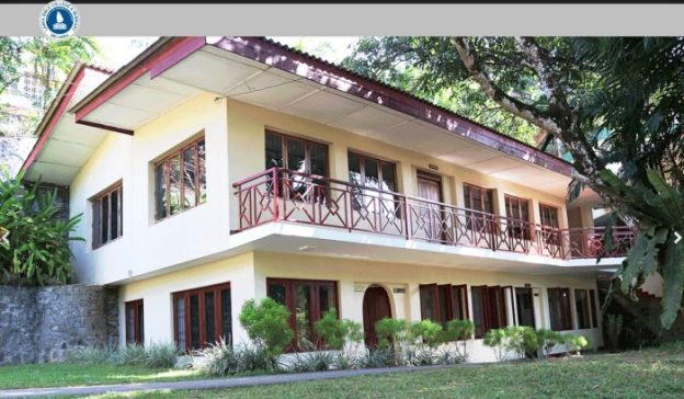
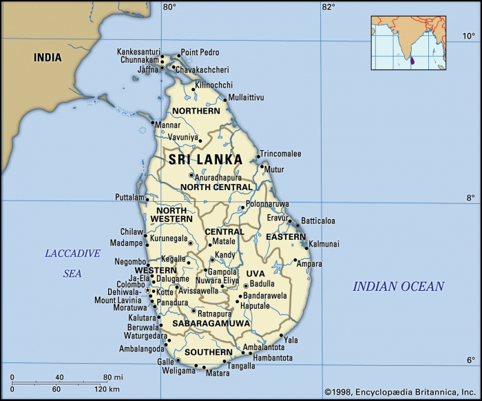
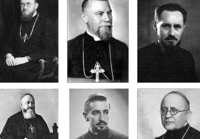


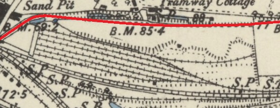


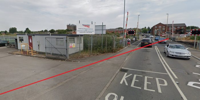

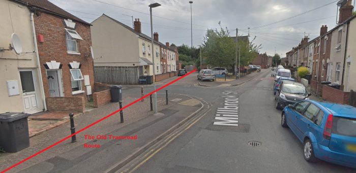


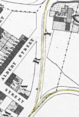


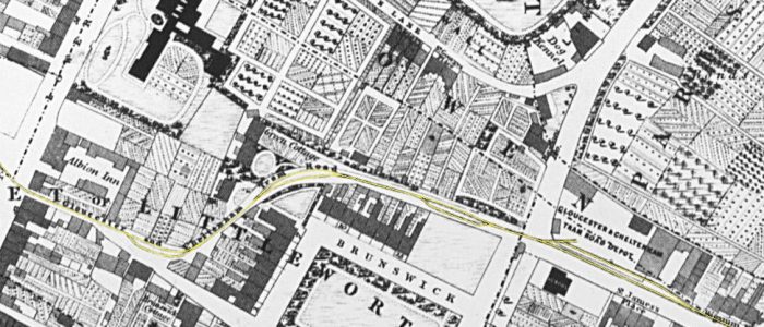

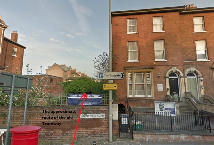
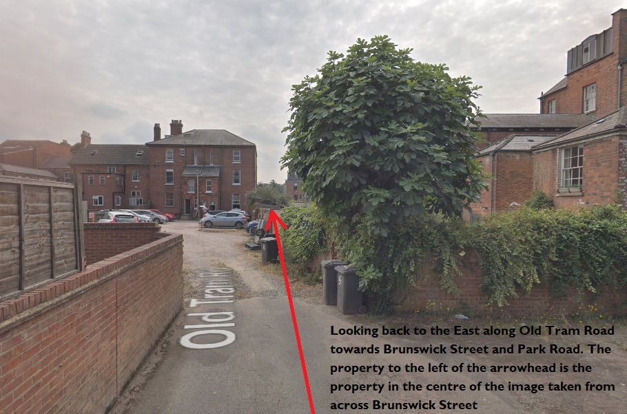

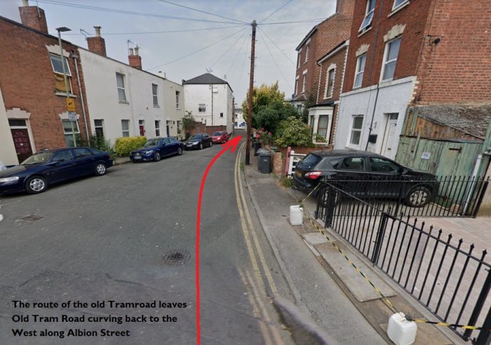

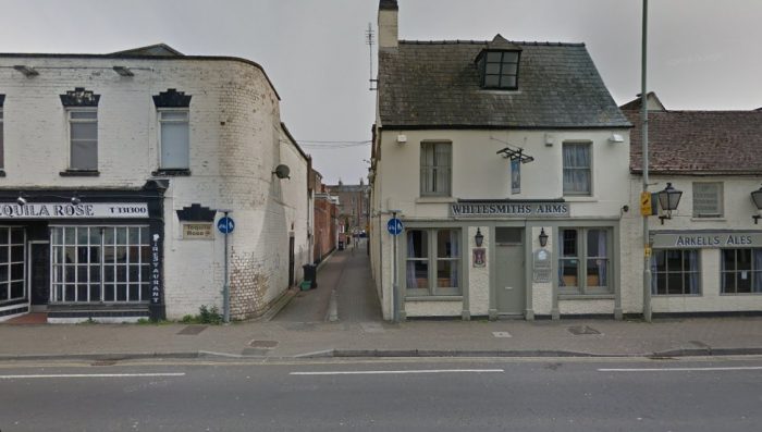


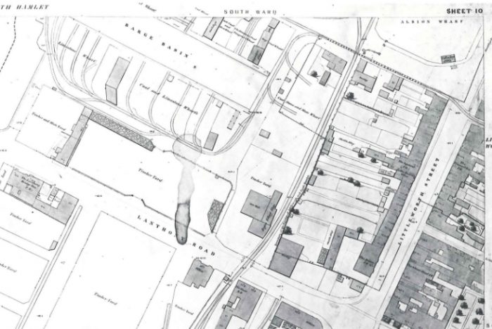
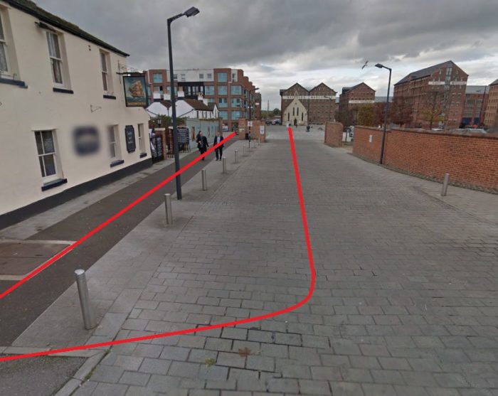

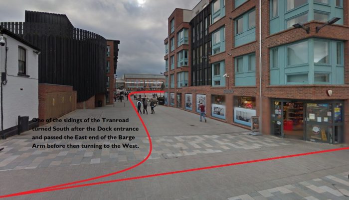
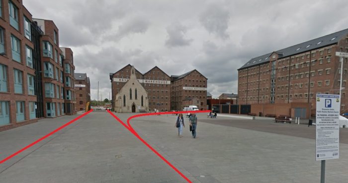
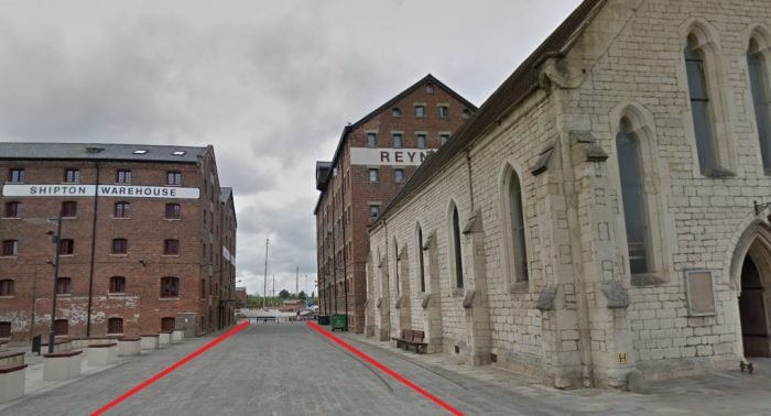


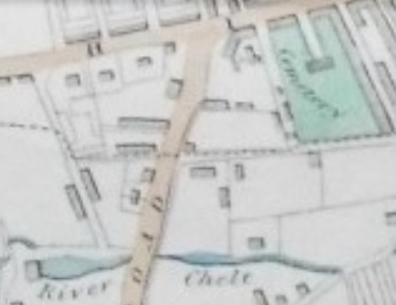


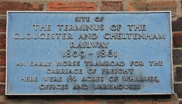
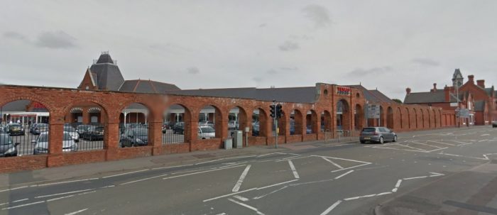


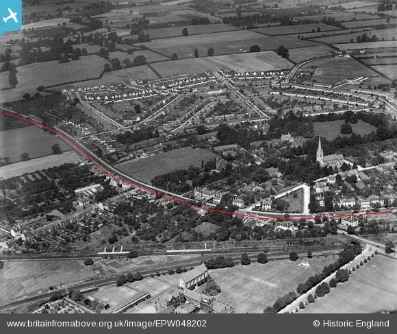


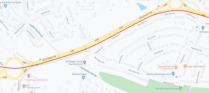


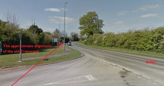


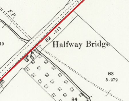


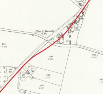


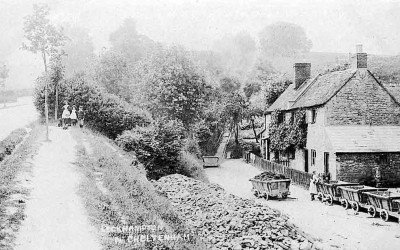
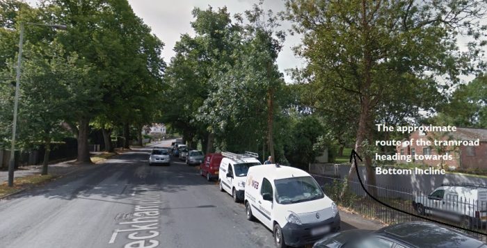
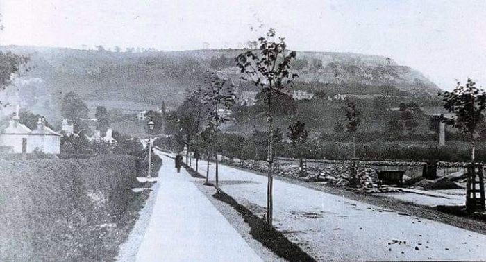
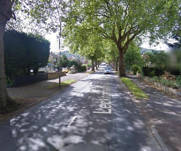

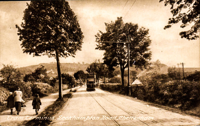


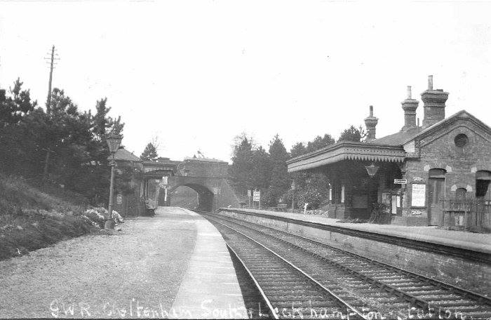


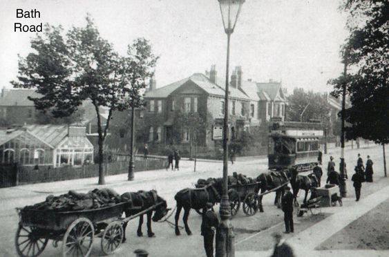


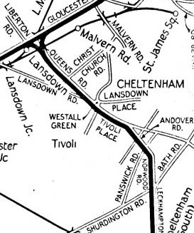


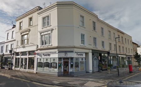

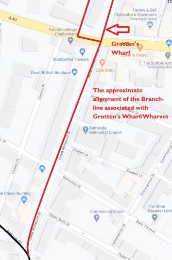


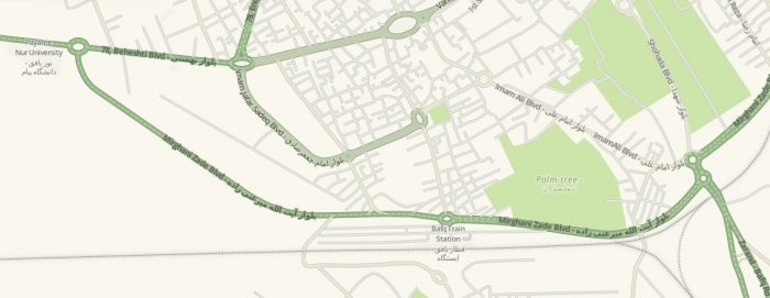

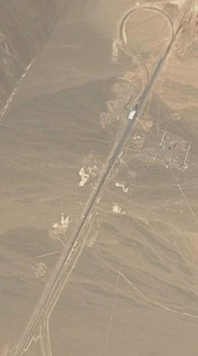
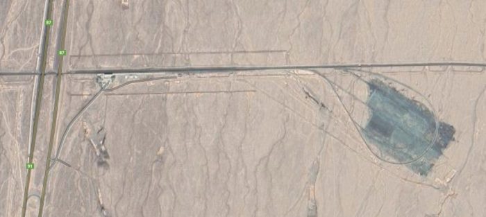
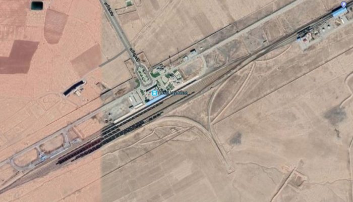
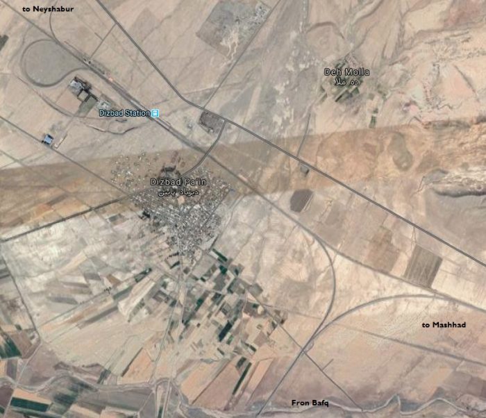
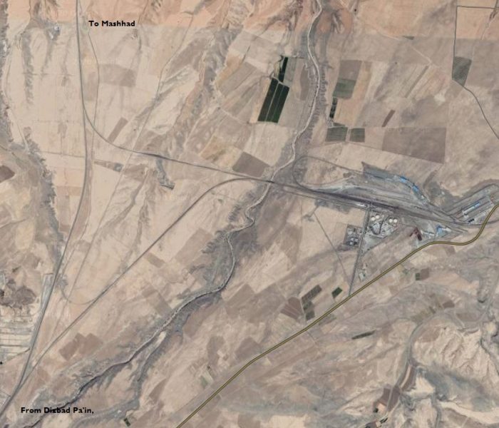
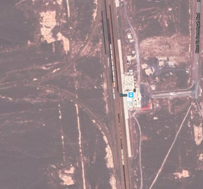
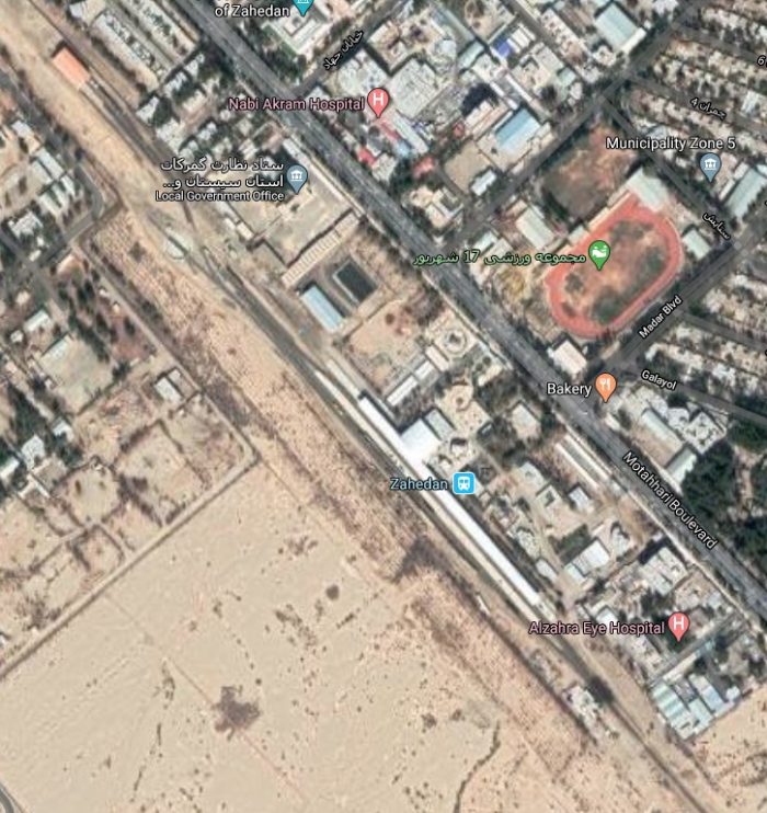
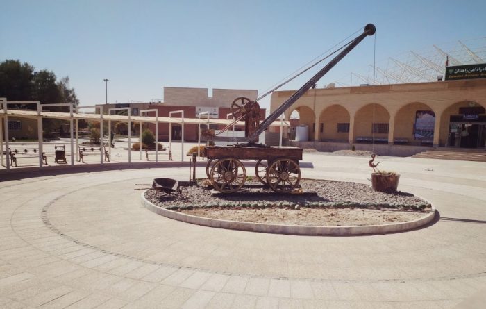
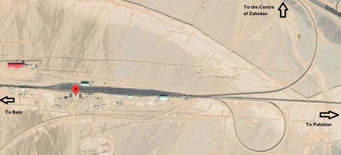
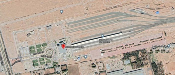
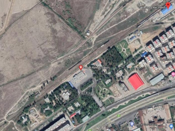
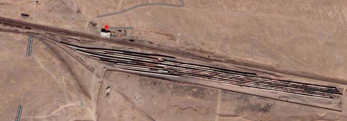
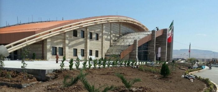
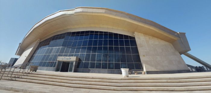
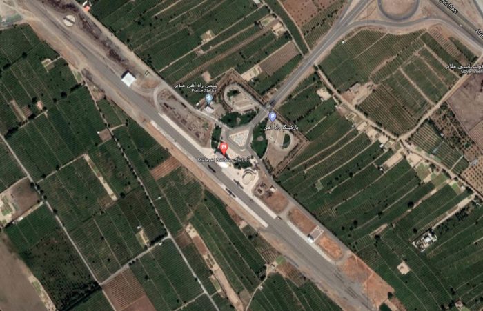
