
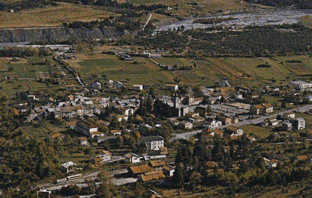
Our journey recommences in Saint-Andre-les-Alpes. The feature image shows the village with the station in the foreground. The image immediately below gives a panoramic view of the village from the north, showing the first of the lakes in the Verdon valley behind the village, as well as the railway station in the bottom-right. [4]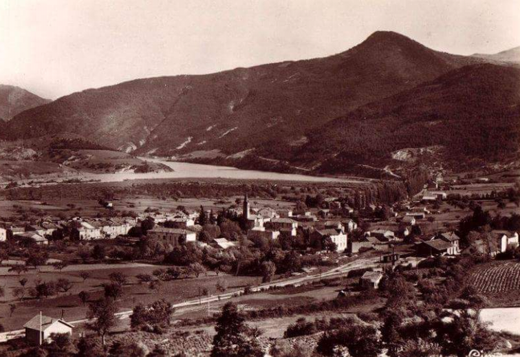
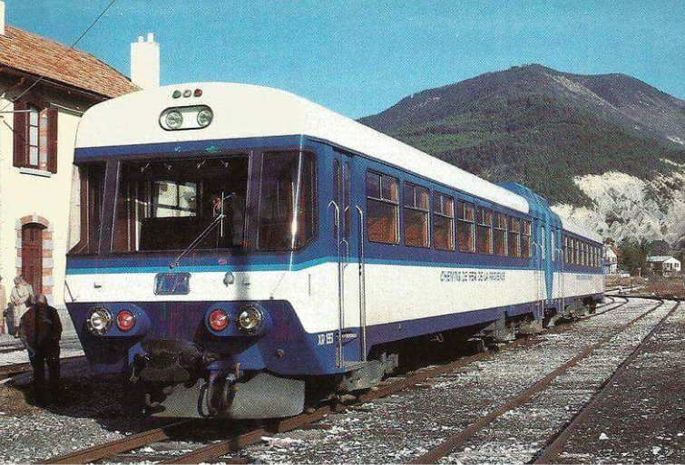 The advantage of travelling in a DMU or an Autorail is that views along the line ahead are possible. This DMU is preparing to leave Saint-Andre. [4]
Recently, the engine shed at Saint-Andre was fully refurbished by Chemins de Fer de Provence with fincance from the PACA region. The two images immediately below show this work underway. [5]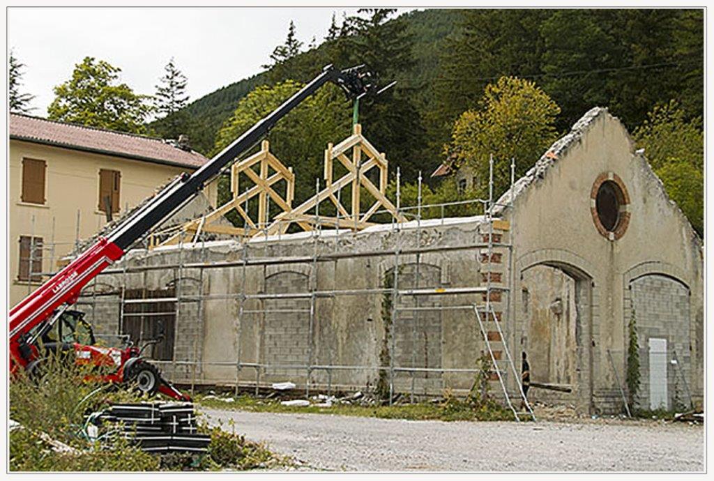
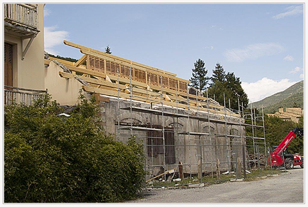 The shed was falling into disrepair. It dates from the opening of the line in 1911. Without prior warning, work started in 2014 on the restoration work. http://www.verdon-info.net reported on the work in September 2014. They established through talking to a railway employee, Stéphane, that: “This is a building for the office of the district chief between Thorame and Digne les Bains, the premises for the employees of the canton of Saint André les Alpes, and the storage of the Praisine and other maintenance machines. At the moment we are restoring the building and then will start the works of tracks to join the building.” [5]
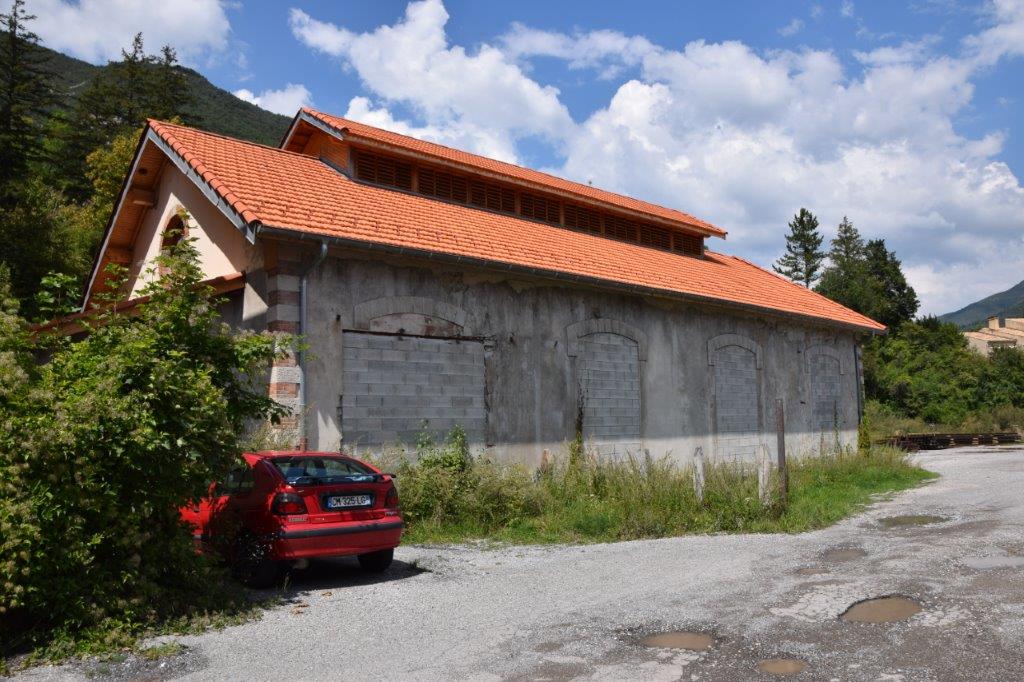
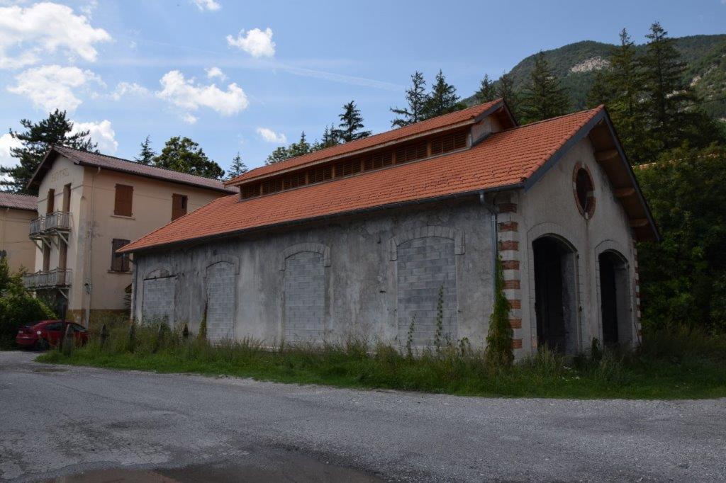
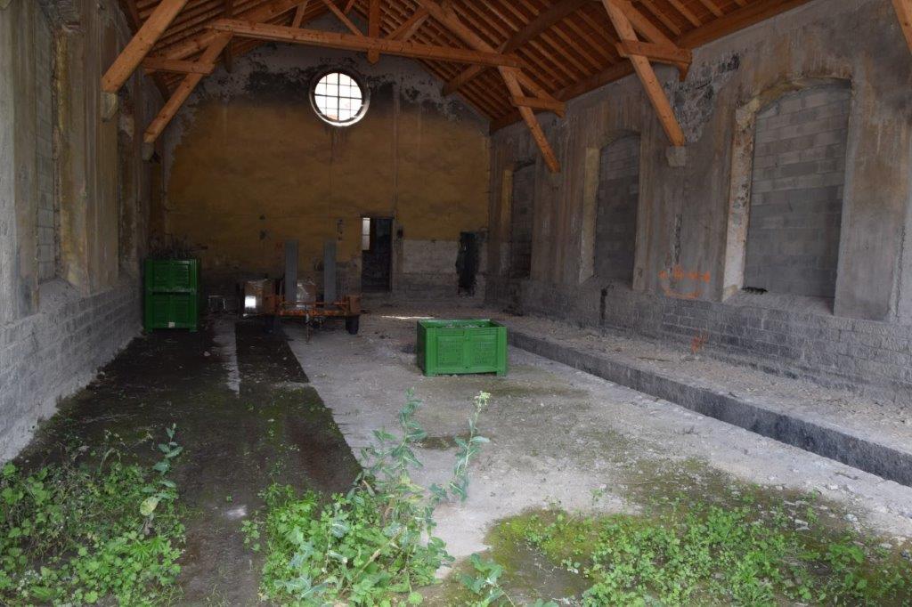
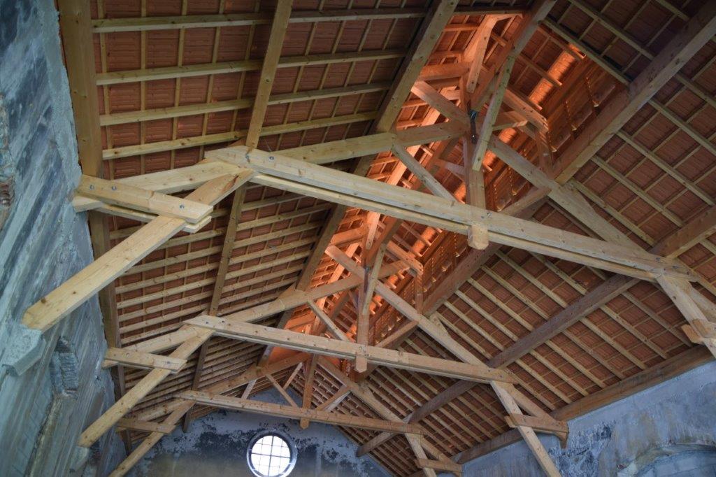 The four images immediately above show that the roof of the engine shed was fully restored to an as built condition, (c) Christopher James.[16]
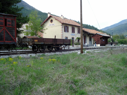
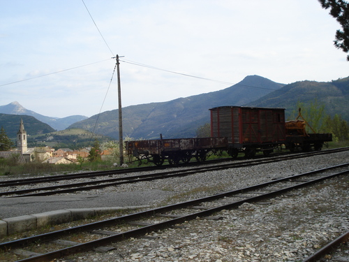 The two images above show wagons at Saint-Andre-les-Alpes Station, (c) Triede. [6]
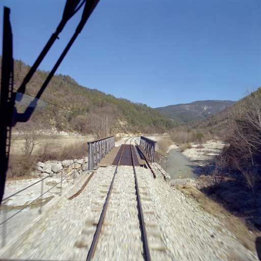
 The driver’s view as the train sets off from Saint-Andre-les-Alpes. [1]
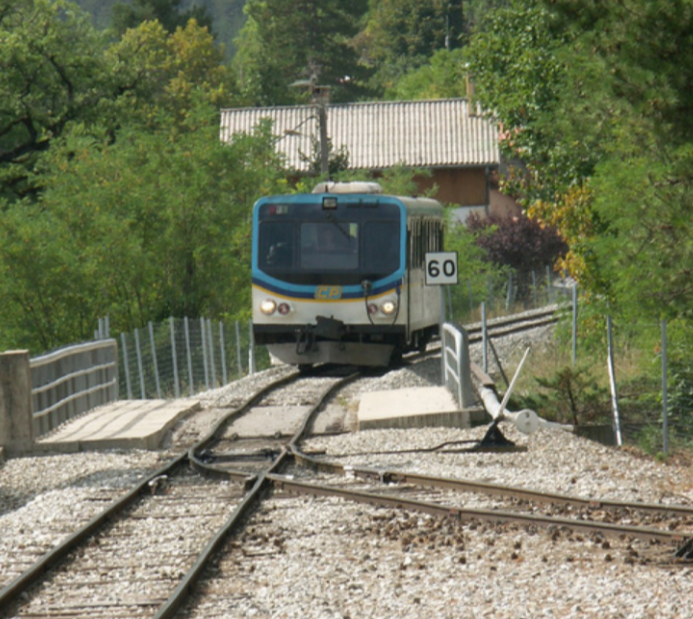 A rear view of an Autorail heading for Digne, or is it an Autorail travelling from Digne? Quite probably as the headlights are on! (c) © JMi 2. There is quite a bit of foreshortening in the image as the bridge on the station side of the Autorail is over a road. [2]
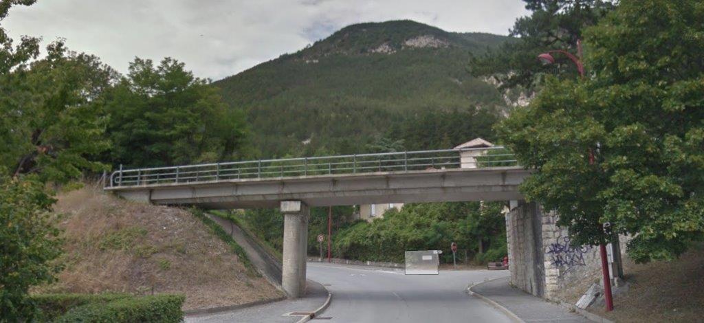
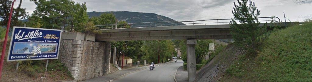 Two views of the modern bridge just to the south of the station in Saint-Andre-les-Alpes.
Saint-Andre sits to the north of the stretch of the River Verdon which includes its famous Gorges. My wife and I spent a day in these Gorges in November 2017.
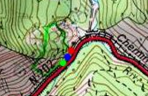
The railway turns away to the West following the N202 road, rather than following the River through the Gorges du Verdon. The OpenStreetMap below shows the station at Saint-Andre in the top right and, after the bridge over the N202, the next major structure on the route, the Tunnel de Moriez in the bottom left as a dotted line.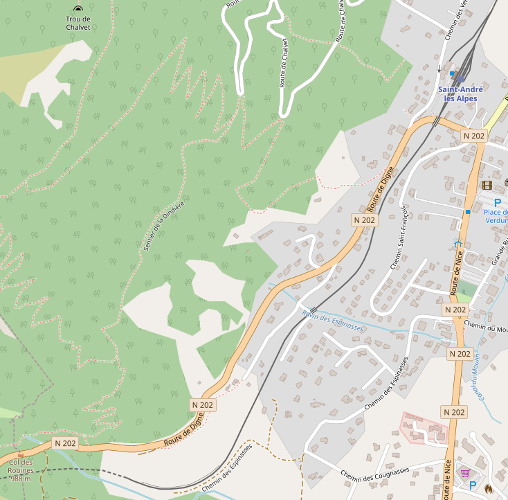 The Tunnel de Moriez passes under the Col des Robines. It is 1195 metres long and at an altitude of approximately 940 metres above sea-level. It is roughly on an east-west alignment, as shown below. It is marked by red, blue and green dots. [7]
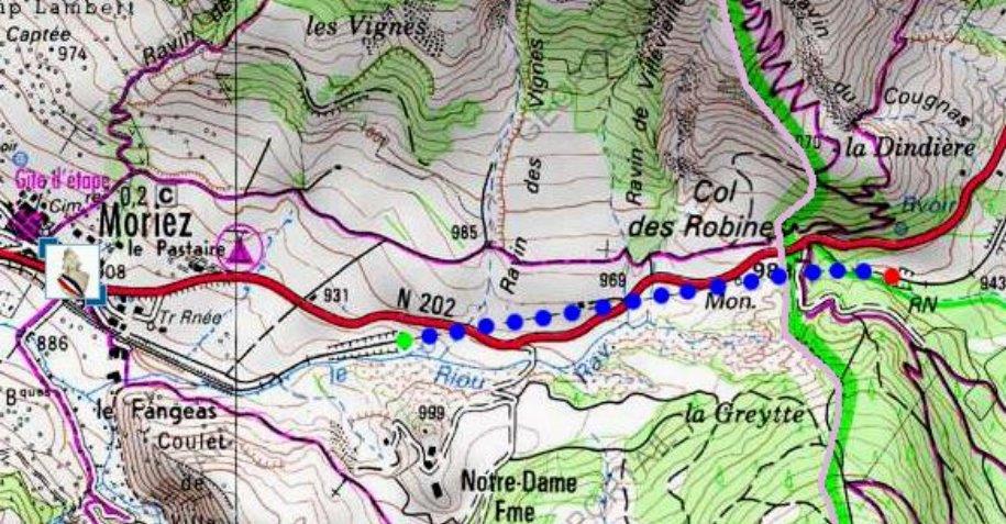 To the East, the railway lines swings sharply into the tunnel mouth. The line leaving the tunnel to the West passes through a deep cutting before meandering its way across a small accommodation bridge into Moriez.
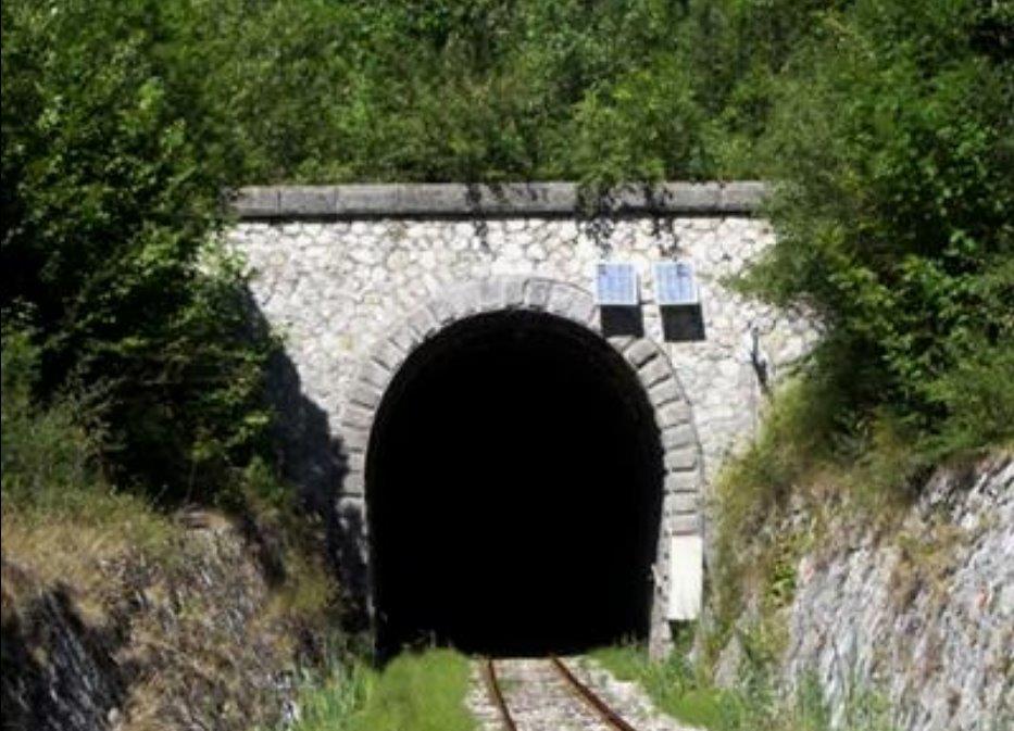 The East Portal. [7]
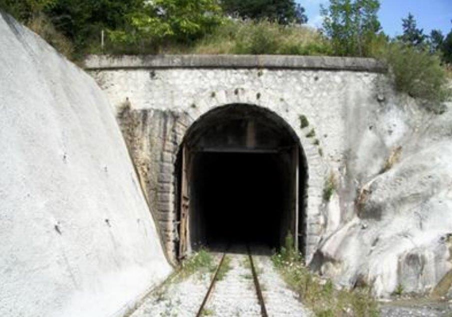
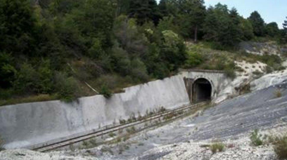 Two images of the West Portal. [7]
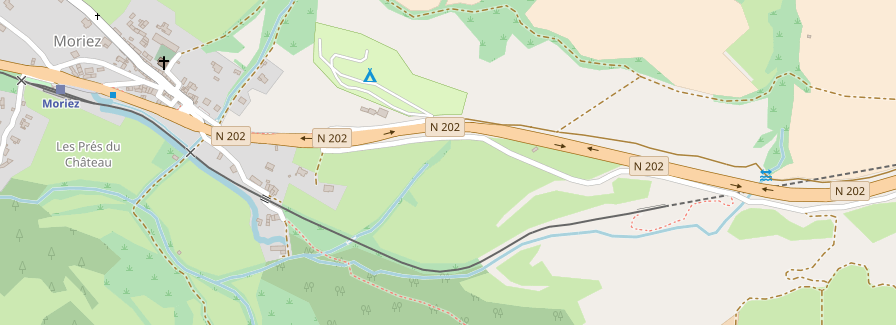 The railway is now in the Ravin de le Riou and follows the river into the village of Moriez.
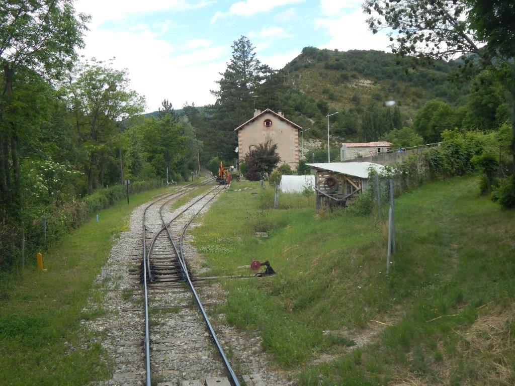 A driver’s eye view of our arrival at Moriez. [1]
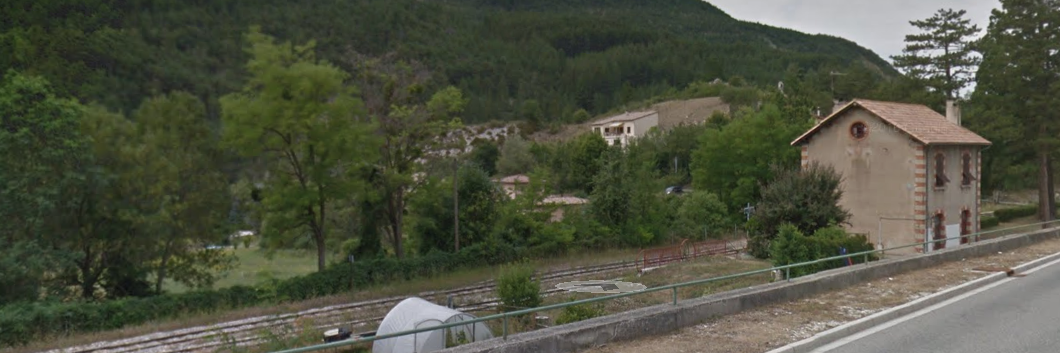 Moriez Station taken from just to the East along the N202.
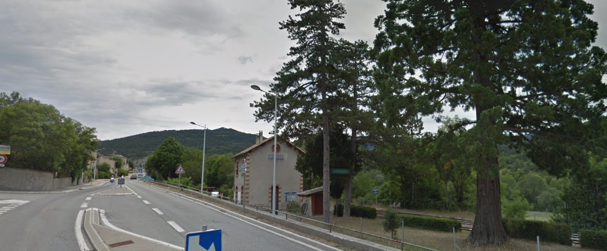 Moriez Station from along the N202 to the West.
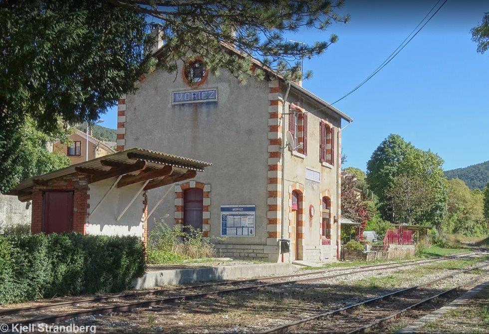 Moreiz Satation (c) Kjell Strandberg. [8]
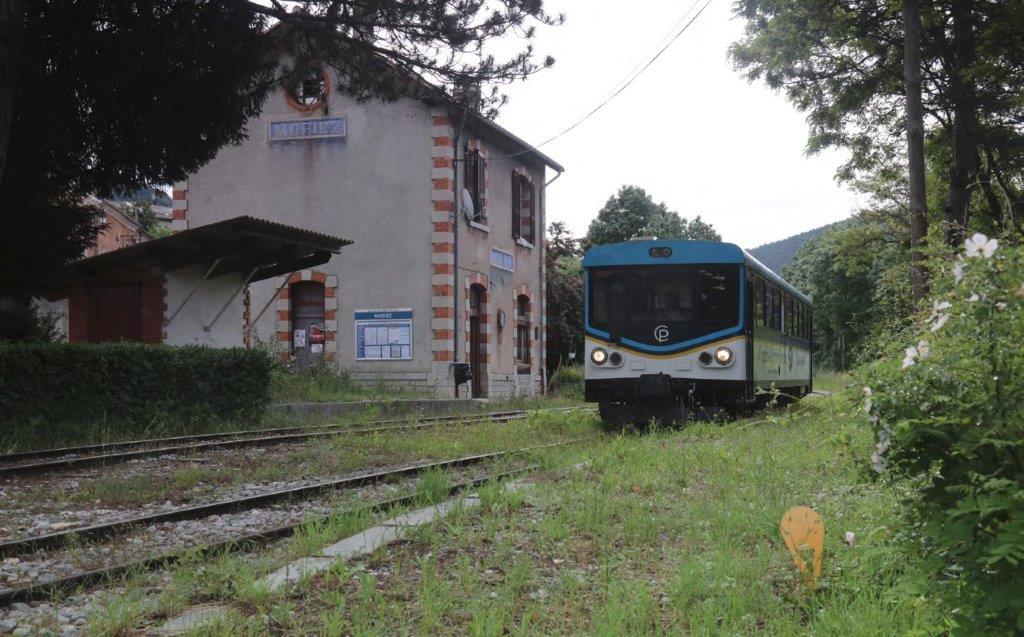 Chemins de Fer de Provence unit No. X304 arrives at Moriez with the 09:27 from St. Andre
les Alpes to Digne les Bains on 13th June 2018, (c) Jeff Nicholls. [16]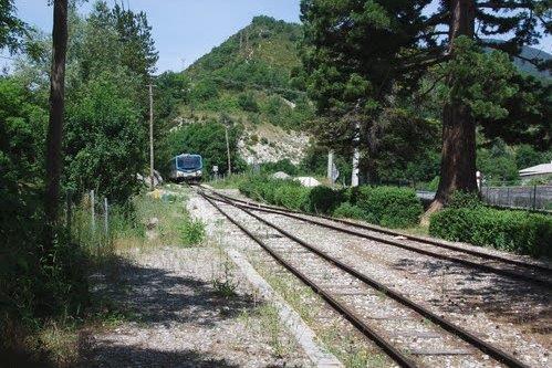 Looking west from Moriez Station (c) Grüni sen. [11]
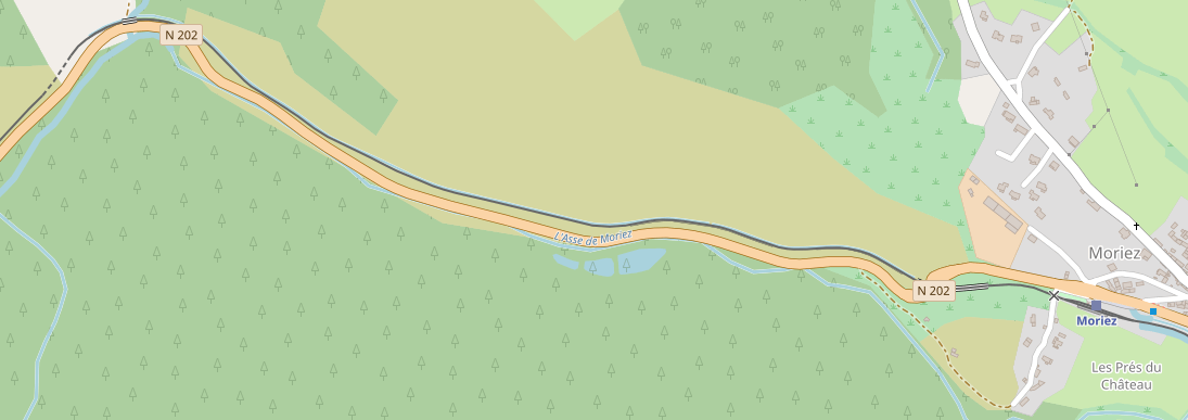 After Moriez, the line follows Le Riou and then L’Asse de Moriez down its valley. It crosses Moriez Viaduct just to the west of the village and then runs parallel to both the road N202 and the river.
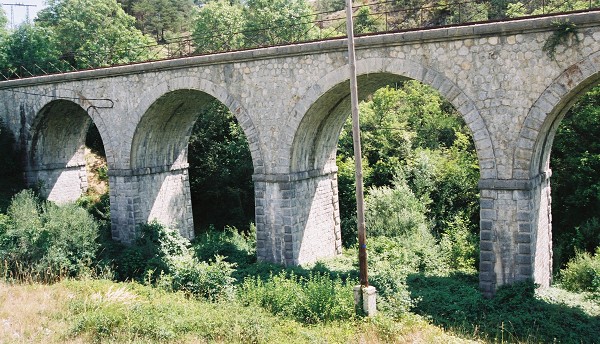
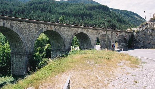 Two images of Moriez Viaduct. [9]
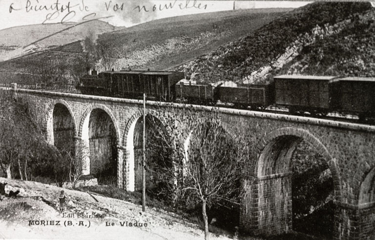 An early image of the viaduct, (c) Frédéric Pauvarel. [10]
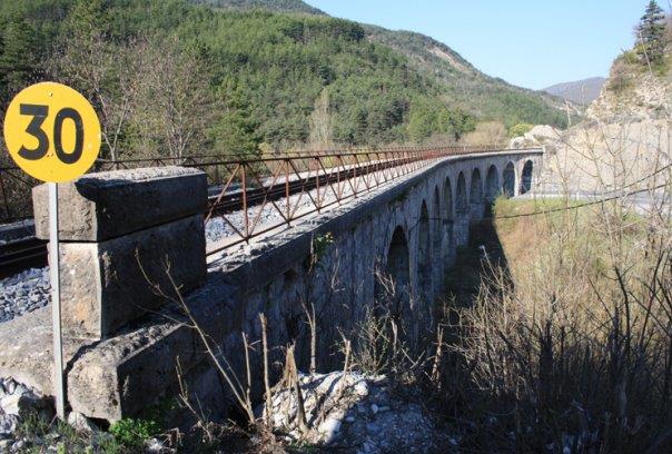 Moriez Viaduct from railside. [13]
As the map above shows, road, rail and river run in parallel travelling west down the valley of Le Riou. The bridge at Hyeges spans a tributary of L’Asse de Moriez – the Torrent d’Hyeges.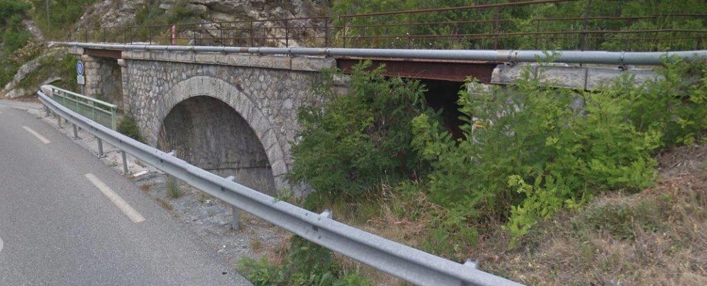 The bridge at Hyeges.
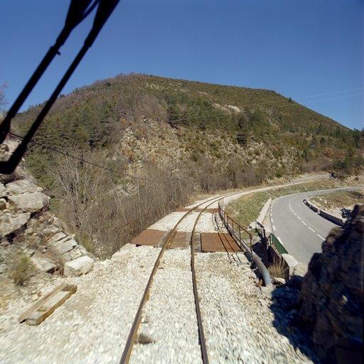 A driver’s eye view of the bridge at Hyeges. [14]
 The bridge at Hyeges from the North West (c) Marc Heller [12]
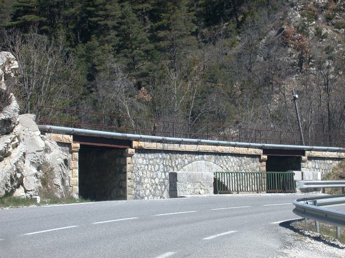 The Bridge at Hyeges from the South West, (c) Géraud Buffa. [14]
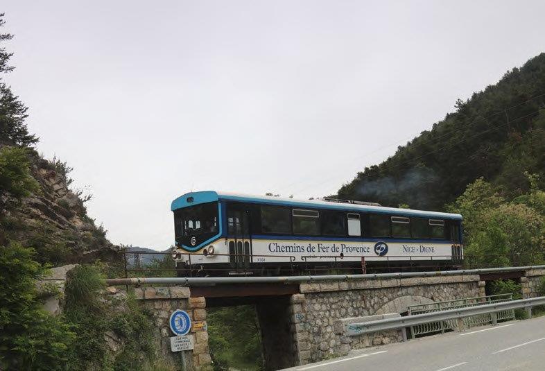 Chemin de Fer de Provence railcar X304 crosses Hyeges viaduct near Moriez with the 09:27 from St. Andre les Alpes to Digne les Bains on 13th June 2018, (c) Jeff Nicholls. [16]
Immediately beyond the bridge the railway enters the Tunnel de Hyeges. This tunnel is only 72 metres in length. The red, blue and green dots fix its location on the adjacent map. [15] The bridge can also be picked out on the north side of the N202 just to the east of the tunnel. The portals of the tunnel are shown below. 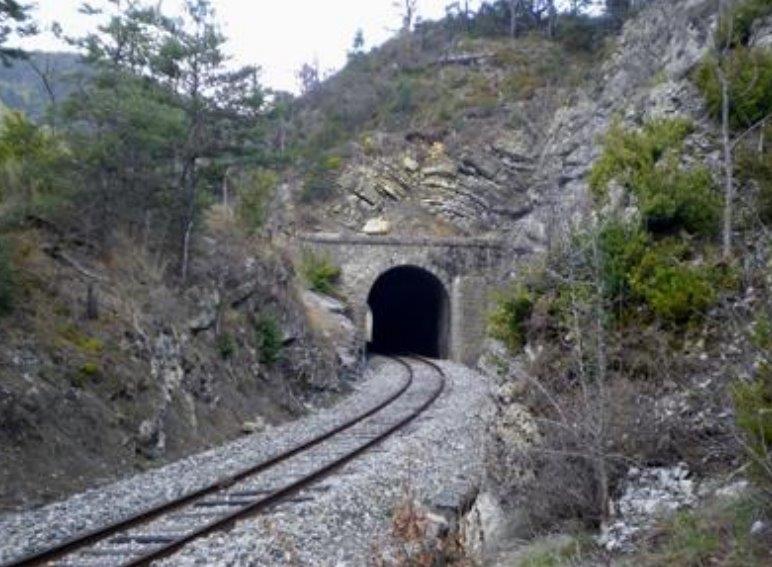 The East Portal. [15]
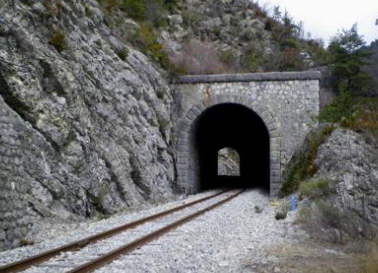 The West Portal. [15]
The road N202, L’Asse de Moriez and the railway continue to run in parallel. 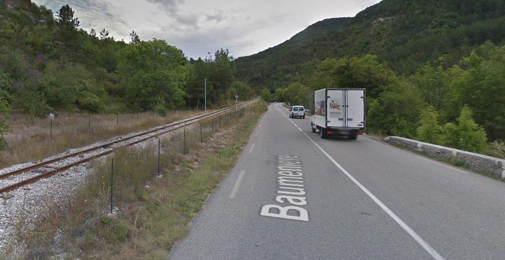 A view looking East towards Moriez along the valley with L’Asse de Moriez below the road to the right.
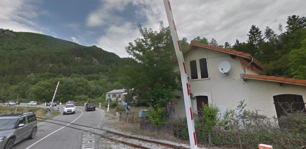
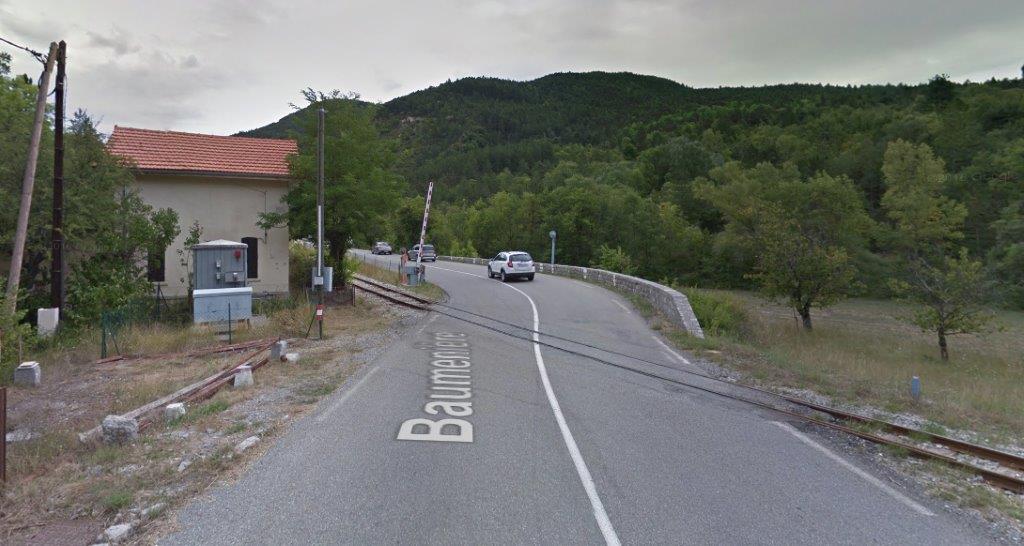
Although the road and rail switch sides at a level crossing at Baumeniere. Some Google Streetview images of the crossing and crossing keeper’s house follow.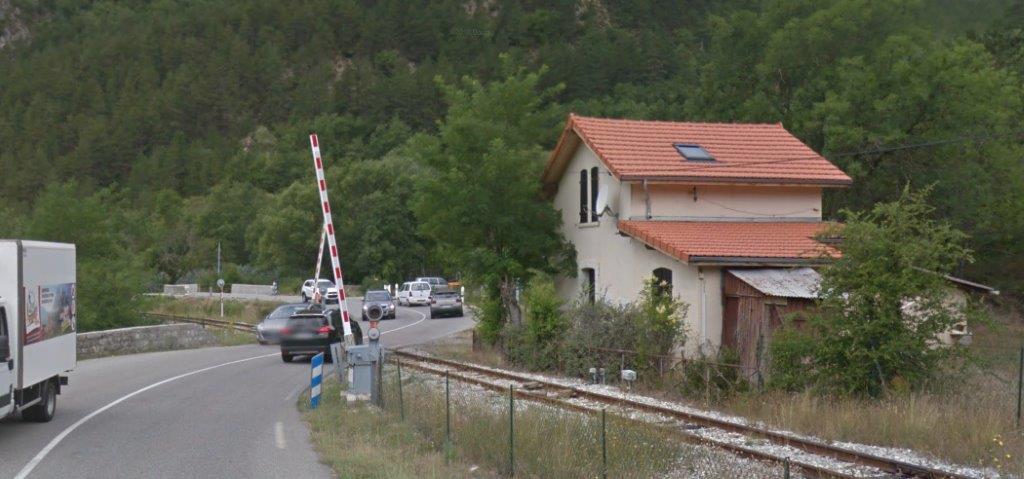
 The railway now continues between road and river, crossing a tributary of l’Asse de Moriez just down the valley from the level crossing – Ravin de Bouquet
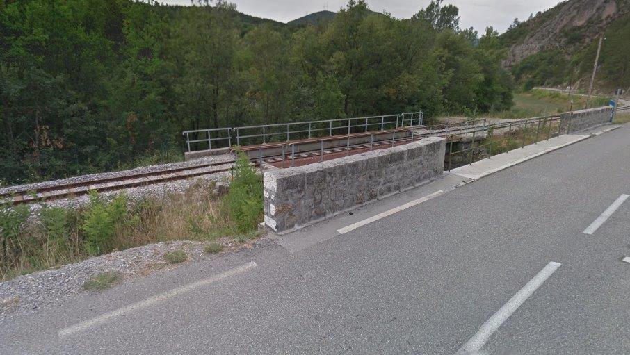 Road rail and river are still together at the next level-crossing, below, at Clôt de Moune.
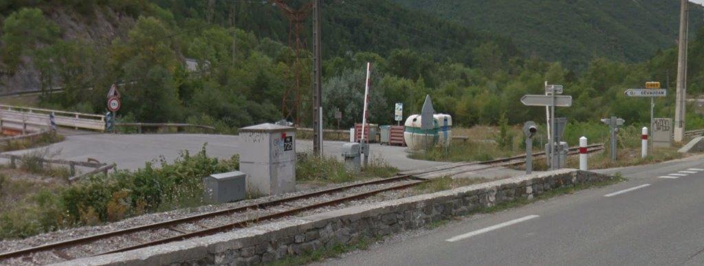 We continue southwest down the valley of l’Asse de Moriez.
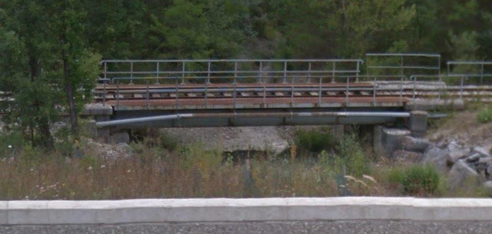 The bridge over the Ravin de la Gourre.
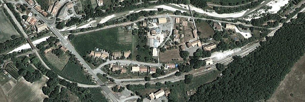
A series of other culverts and small bridges carry the line over a relatively broad flat area in the valley before the valley narrows once again. In the image below, taken from Google Streetview the river is below the railway to the left and the road has recently been widened requiring removal of part of the rock face on the right.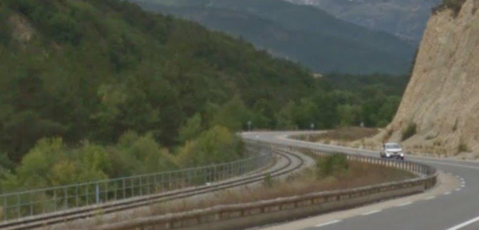 Old road, new road railway and river are all visible in the satellite image below. Just under 1 kilometre to the east of l’Arret de la Tuilière the railway crosses l’Asse de Moriez on a relatively small girder bridge.
 A driver’s eye view of the bridge over L’Asse de Moriez, (c) Marc Heller. [14]
 Railcars Nos. X304 and X306 of the Chemin de Fer de Provence metre gauge Nice – Digne
line chug along between Moriez and Barreme with the 15:23 service from St. Andre les Alpes
to Digne les Bains on 8th June 2018. During the summer of 2018, this was the only northern section of the Nice – Digne metre gauge line in operation due to heavy engineering work taking place over several months between St Andre and Plan du Var, (c) Jeff Nicholls. [16]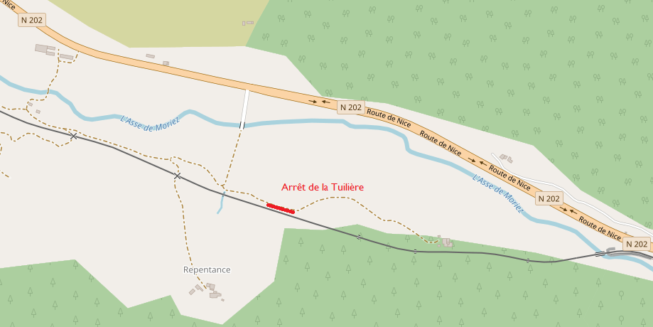 The bridge on the image above appears to the right side of the map immediately above. Arrêt de la Tuilière is shown marked in red. Interestingly to the south of the station there is a small hamlet called ‘Repentance’.
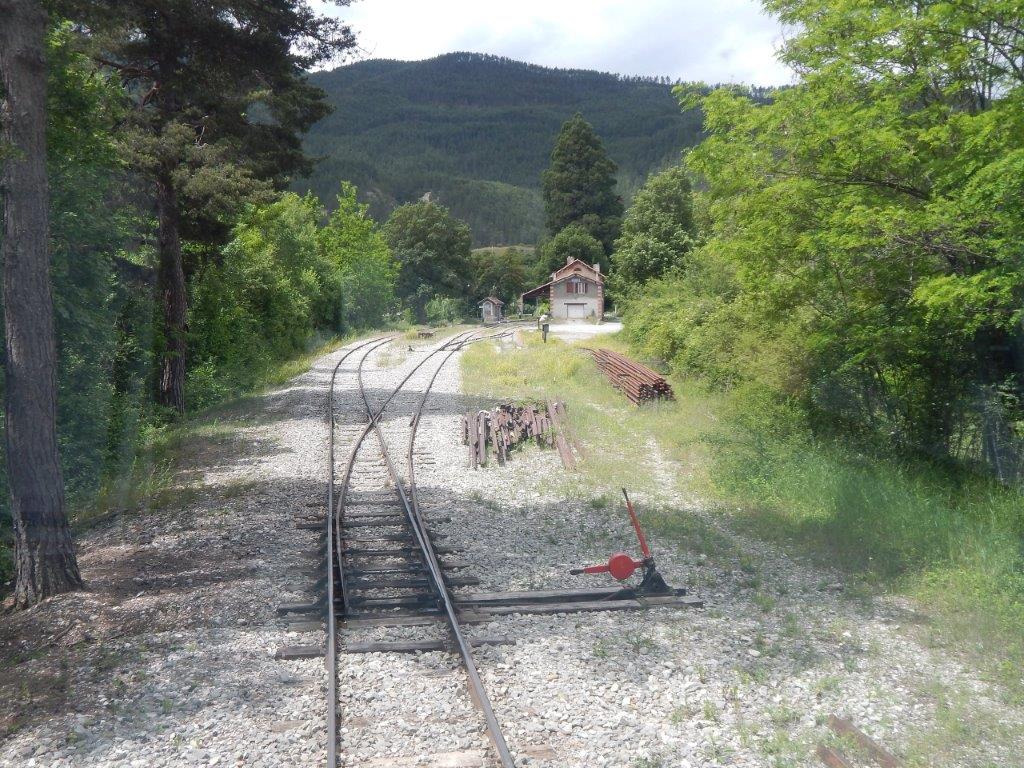
Beyond ‘Repentance the railway has only a short distance to travel before entering the village of Barrême. The map below shows this length of the journey. The satellite image focusses on the village of Barrême.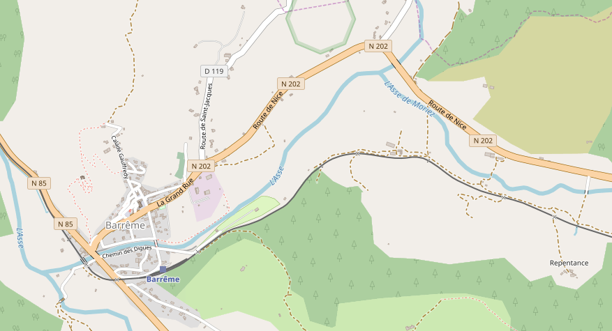
 A driver’s eye view of our arrival at Barrême. [1]
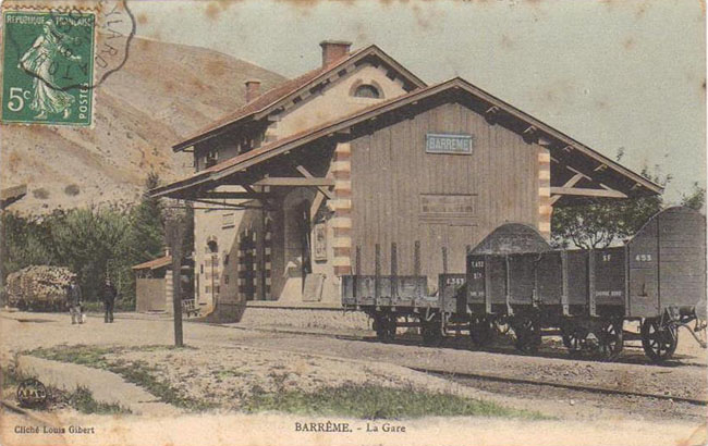
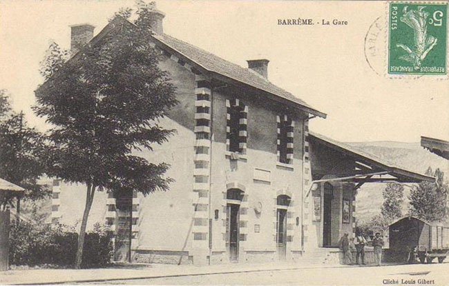 Old postcards showing the station at Barrême. [3]
It is at Barrême that we take the next break in our journey towards Digne-les-Bains.
References
- http://www.rd-rail.fr/1-PHOTOS/PH43/index-ph43.html, accessed on 12th August 2018.
- http://www.proxiti.info/photoscommune.php?o=04136&n=La%20Mure-Argens, accessed on 9th August 2018.
- http://ubaye-en-cartes.e-monsite.com/pages/catalogues-des-editeurs/louis-gibert-photographe-editeur-a-saint-andre-les-alpes.html, accessed on 11th August 2018.
- https://m.facebook.com/Viroulada-en-Tren-dei-Pigna-289910237832039/?modal=admin_todo_tour&ref=page_creation_announcement¬if_t=page_invite¬if_id=1534228488097465, accessed on 14th August 2018.
- http://www.verdon-info.net/2014/09/saint-andre-les-alpes-les-travaux-des-annexes-de-la-gare-sont-en-bonne-voie.html, accessed on 16th August 2018.
- http://trip-suggest.com/france/provence-alpes-cote-d-azur/la-mure-argens, accessed on 16th August 2018.
- http://www.tunnels-ferroviaires.org/tu04/04133.2.pdf, accessed on 16th August 2018.
- https://www.google.co.uk/maps/@43.96093,6.468418,3a,75y,90t/data=!3m8!1e2!3m6!1sAF1QipMRYN0KdwYWFrzmemE0420CdG6aTnfUWmawsPjn!2e10!3e12!6shttps:%2F%2Flh5.googleusercontent.com%2Fp%2FAF1QipMRYN0KdwYWFrzmemE0420CdG6aTnfUWmawsPjn%3Dw203-h135-k-no!7i1500!8i1000, accessed on 16th August 2018.
- https://structurae.net/structures/moriez-viaduct, accessed on 16th August 2018.
- https://dossiersinventaire.maregionsud.fr//gertrude-diffusion/illustration/ivr9320110400179nuc2a/fcb49e2e-e534-4a6e-89a8-03a3653fadd0, accessed on 16th August 2018.
- http://www.map-france.com/Moriez-04170/photos-Moriez.html, accessed on 17th August 2018.
- https://dossiersinventaire.maregionsud.fr/gertrude-diffusion/dossier/ponts-des-chemins-de-fer-de-provence/6db00f0d-4794-4fb9-8d66-a7675e5c748b, accessed on 17th August 2018.
- https://www.google.co.uk/url?sa=i&source=images&cd=&ved=2ahUKEwisqfi6zfPcAhUFyIUKHaUTBfkQjhx6BAgBEAI&url=https%3A%2F%2Fdossiersinventaire.regionpaca.fr%2Fgertrude-diffusion%2Fdossier%2Fpdf%2F1c12de06-0c5a-45db-869f-ffa51aeba1e8%2Fviaduc-ferroviaire-de-moriez.pdf%3Fvignette%3DCompletSansLiens&psig=AOvVaw2RsidYGG5Vx-jGHZ36w8GY&ust=1534578739888539, accessed on 17th August 2018.
- https://dossiersinventaire.maregionsud.fr/gertrude-diffusion/dossier/ponts-des-chemins-de-fer-de-provence/6db00f0d-4794-4fb9-8d66-a7675e5c748b, accessed on 17th August 2018.
- http://www.tunnels-ferroviaires.org/tu04/04133.1.pdf, accessed on 17th August 2018.
- http://www.railtalk.org/product/issue-142-xtra, accessed on 19th August 2018.
- These pictures have very kindly been supplied by Christopher James on 21st August 2018.
