

Part 3 of our study of the Ballachulish line will include material from some present day pictures from along the National Cycleway which follows the line together with parts of a description of that journey from another website, the completion of the journey along the line from Kentallen to Ballachulish Station, and a study of the slate mining at Ballachuish which probably was the main justification for the construction of the branch-line.
The Railway Magazine November 1950
My spare time over Christmas 2018 has been spent looking at a few older magazines which have been waiting my attention for some time. I have discovered an article in “The Railway Magazine” November 1950 edition. The article was written by H.A. Vallance and entitled ‘From Connel Ferry to Ballachulish’.
A copy of that article can be found in the Railway Magazine Archive which grants access on payment of an additional sum over and above the annual subscription to the magazine. [26]
Kentallen to Ballachuish
We finish our journey along the line from Kentallen to Ballachuish ……
Initially we continue our look around the station at Kentallen.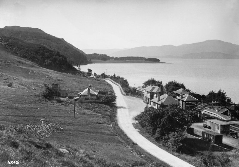 This image provides an overview of the station site. The footbridge, station buildings, signal box and water tank are all visible as well as the siding on the northeast corner of the site. [8]
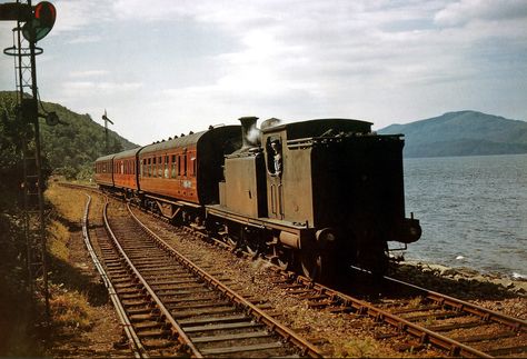 Ex-Caledonian Railway ‘439’ Class (LMSR Class 2P) 0-4-4T 55230 enters Kentallen Station from the South during July 1959 with an Oban – Ballachulish train. [9]
The following images were all taken in the mid-1970s by J.R. Hume, after closure of the railway but before re-development. A Mk 3 Cortina is visible in two images which for the officionados may well date the pictures more definitively. They are all available on the Canmore website. [8]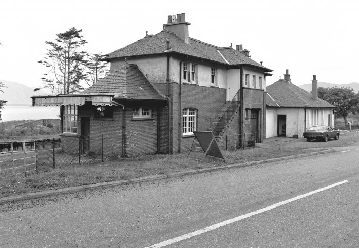 The station from the road-side. [8]
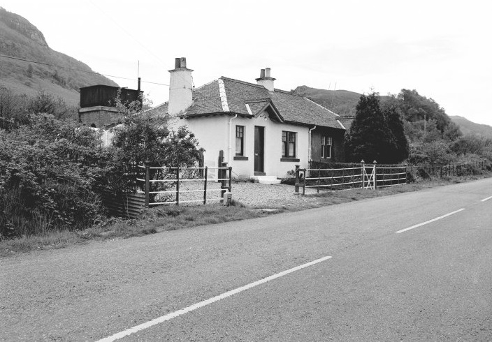 The railway cottages and water tank on the southeast side of the A828. [8]
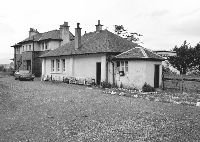 The station buildings from the Northeast. [8]
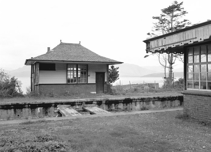 The waiting shelter on the west side of the station with Loch Linnhe behind. [8]
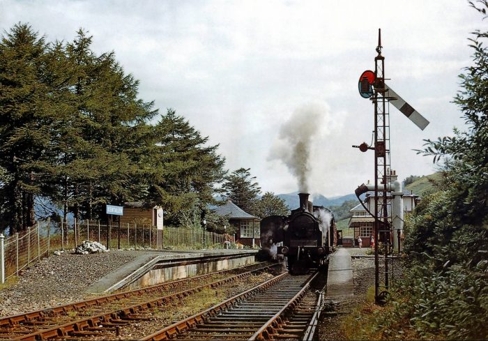 Unidentified ex-Caledonian Railway (LMSR Class 2P) 0-4-4T, the morning Ballachulish to Oban train crosses a Ballachulish-bound train at Kentallen Station during July 1959, (c) Kelvin Hertz. [11]
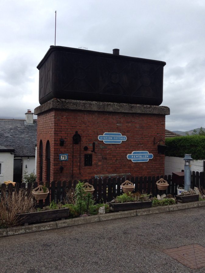
 The water tank at Kentallen, still standing in May 2015. [10]
The water tank in 2014. [13]
Moving on from Kentallen, the next two images are taken just to the north-east of the station.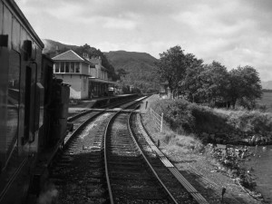 Local passenger train approaching Kentallen in 1961 from Ballachulish, (c) H.B. Priestly. [7]
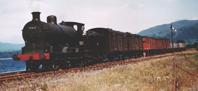 Local pick-up goods approaching Kentallen from Ballachulish in the mid-1960s . [6]
The next station along the line was Ballachulish Ferry, it was reached after a the line had travelled East along the south side of Loch Leven. Close to Ballachulish Pier the A828 crossed the railway on a bridge and then hugged the shoreline as far as the ferry and the hotel.In 2014, we stayed in a bed and breakfast along this length of the A828 and walked a distance along the track-bed on the old railway line. These next few images show the B&B and the cycleway/path. As you will see below the cycleway/path is marked characteristically along its full length by ornate ironwork.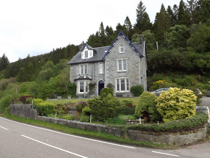

 Part 1 of this short series of posts carried a video of the ferry. Please follow this link:
https://rogerfarnworth.com/2019/01/01/the-ballachulish-railway-line-part-1
Some pictures will suffice here, three images in total, of which the third shows the Ballachulish Bridge under construction.
 Ballachulish Ferry, before the bridge was started. Looking from the north side, towards Sgorr Dhonuill, © Copyright Ian Taylor. [14]
 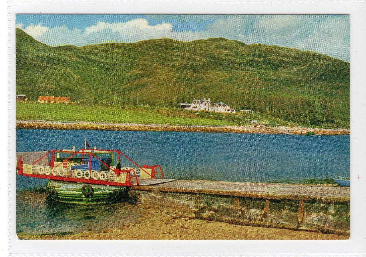 Argyll postcard of Ballachulish Ferry. [15]
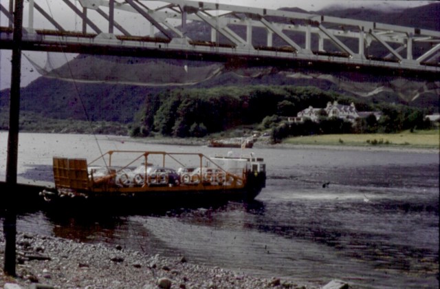
 Ballachulish Ferry and Bridge, © Copyright N T Stobbs. [16]
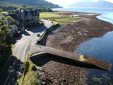
Finally at this location, Ballachulish Hotel and Ferry Slipway [17]
Ballachulish Ferry Railway Station is hidden away inland south of the ferry behind the hotel. It had one platform on the North side of the railway line.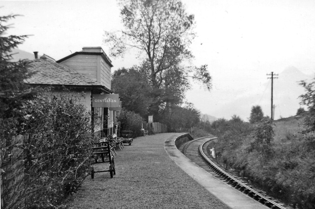 Ballachulish Ferry Railway Station, looking towards the terminus at Ballachulish.[18]
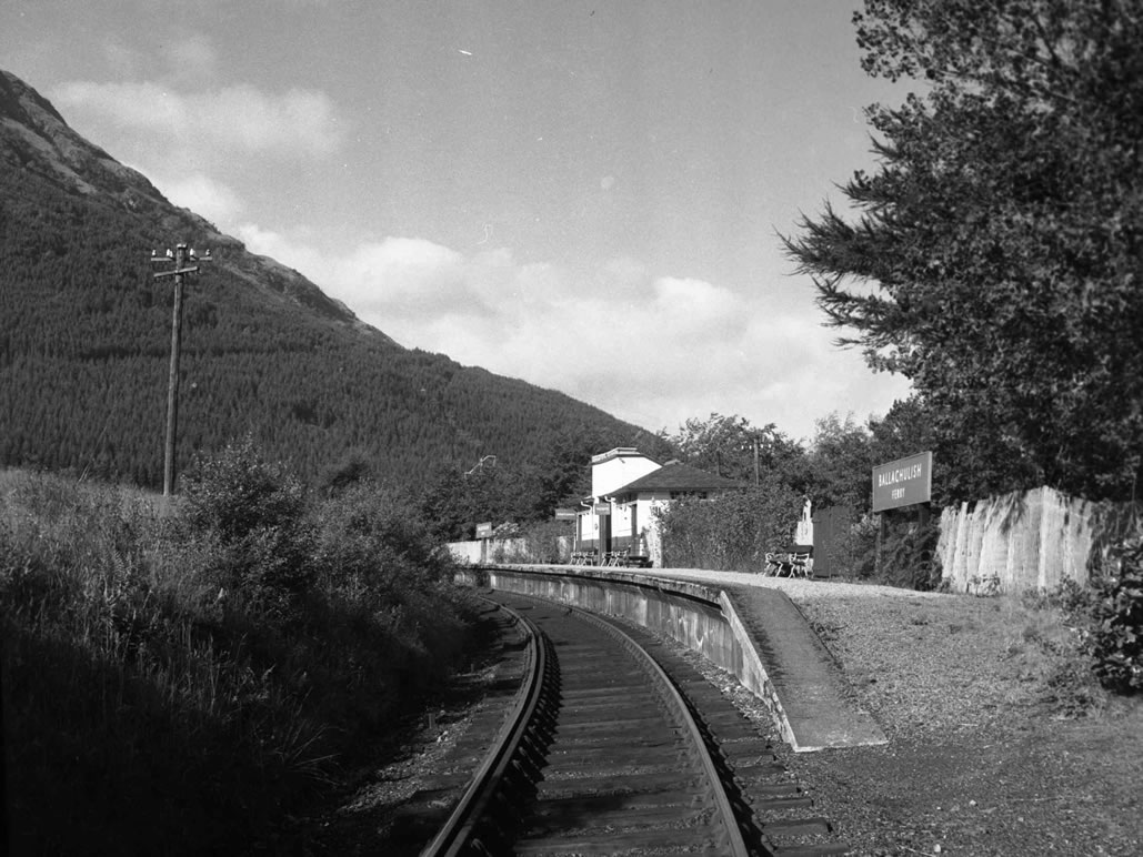 Ballachulish Ferry Railway Station facing West, (c) H.B. Priestley. [19]
The railway continues in an easterly direction towards Ballachulish Station, crossing the A828 and running along the shore. Close to Ballachulish, the A828 turns inland to find a good bridging point across the River Laroch. The railway continued along the shore on embankment so as to have the most convenient approach to Ballachulish.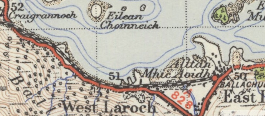 The station opened as Ballachulish on 20 August 1903 [2] with two platforms. There was a goods yard on the north side of the station. [1] Within two years it was renamed as Ballachulish & Glencoe [2] and renamed again following the opening of the ‘new’ road between Glencoe village and Kinlochleven in 1908 as Ballachulish (Glencoe) for Kinlochleven. Apart for a short closure in 1953, this latter name remained until closure in 1966. [2] In the railway timetables the name was shortened to simply Ballachulish with a note stating “Ballachulish is the Station for Glencoe and Kinlochleven”. [3]
The Callander and Oban Railway were responsible for the construction of the branch-line and for the opening of the station. That company was absorbed into the London, Midland and Scottish Railway during the Grouping of 1923. The station then passed to the Scottish Region of British Railways on nationalisation in 1948, and was closed by the British Railways Board in 1966 [2] when the entire length of the Ballachulish Branch closed.
In the early 1990s the station buildings were converted into a medical centre. Houses have been built in the station yard. The engine shed remained, being used by a local garage until 2015, when it was demolished to make way for more private housing.
 Ballachulish Railway Station. [1]
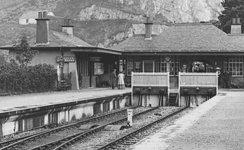 A close up of the station buildings. [20]
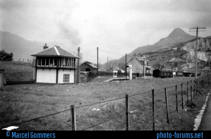 Ballachulish Station in the 1950s, (c) Marcel Gommers. A google search produced this picture, but the link failed to operate and the website appears not to exist.
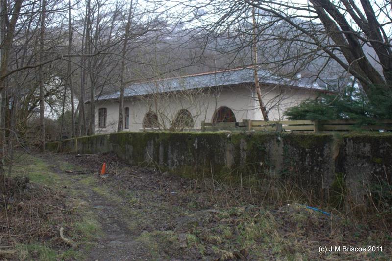
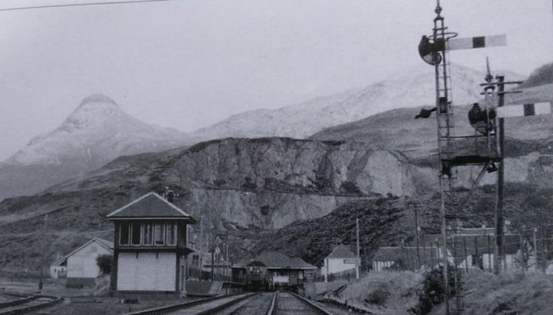 An eye-level view into the station from West along the line. [20]
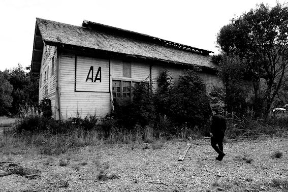 Ballachulish Engine Shed, used as a garage for sometime before its demolition recently. [20]
The adjacent picture shows the shed acting as a local garage in 2012. [21]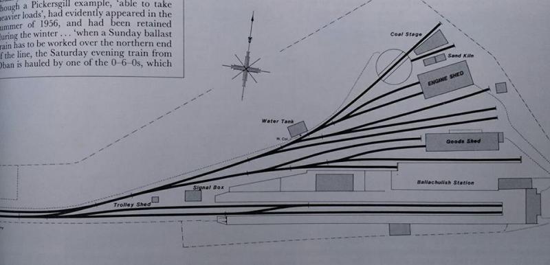 A track plan of the station. [20]
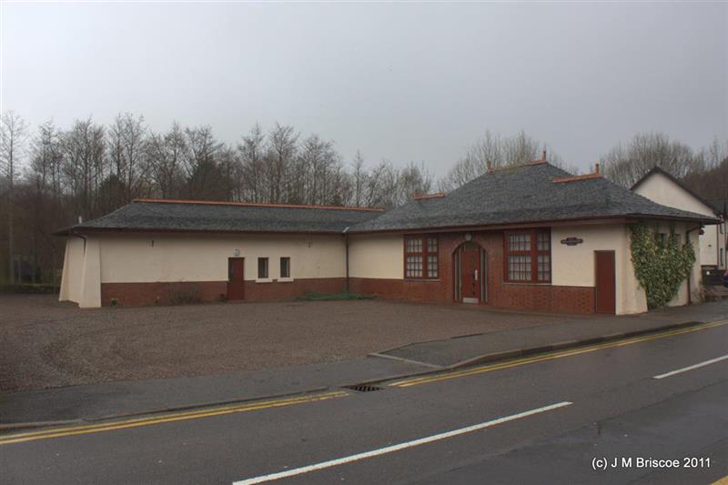
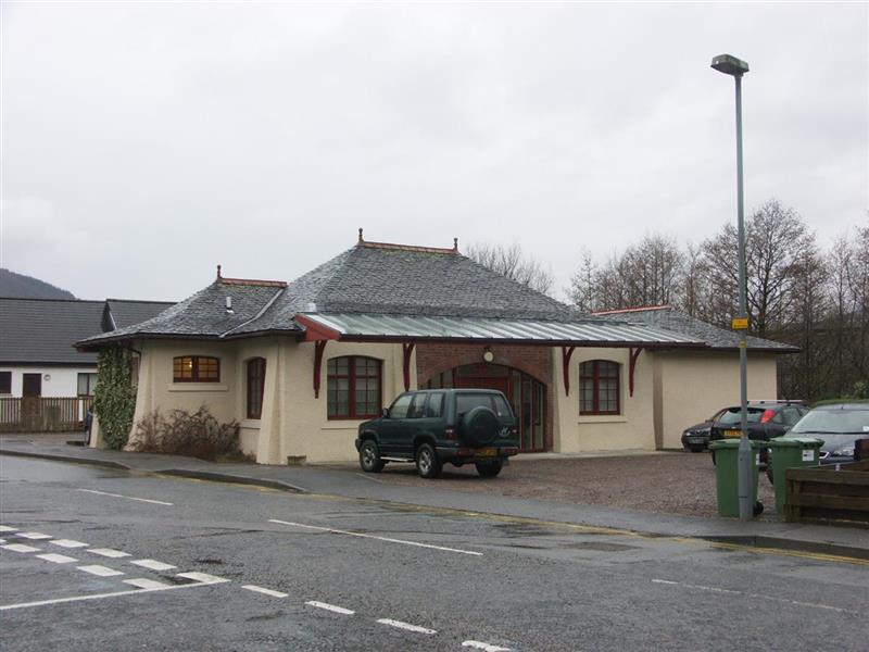 The three pictures above show the old station building in use as a medical centre in 2011, (c) J.M. Briscoe. [22]
We have travelled the full length of the branch-line and done our best to get an impression of it operating as a railway. As we have done so, we have noted on a few occasions that the railway line is now in use as part of the National Cycle Network Route 78.
National Cycle Network Route No. 78
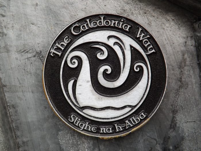
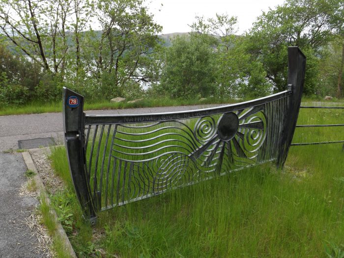
We have already seen some of the ornate ironwork which has been used to give this particular part of Route 78 an identity. These next few images highlight other locations along the route where the ironwork has been used. The cycle-way which follows much of the branch-line is marked by ornate ‘gateways’ and sculpture work as in this image and that below. Details of the cycle-way (Sustrans No. 78) can be found at the end of this post. [5]
 The National Cycle Network gateway close to Kentallen. [12]
![]() Similar ironwork closer to Oban. [23]
Similar ironwork closer to Oban. [23]
The description of the cycle route on the Sustrans website, which is an excellent way of following the route of the branch-line, follows in italics [4]:
Connel Bridge to Benderloch – two miles
Follow the Route 78 signs over the bridge and then through housing and past Connel Airfield. There is a currently a short gap in National Route 78 here. It is possible to join the main trunk road for just under a mile – but please note that this is narrow high-speed road, and it is not recommended for children or inexperienced cyclists. A footpath heads off to the left through the trees before you reach the trunk road, but in addition to being a bit muddy and overgrown this is not part of the National Cycle Network route. This joins with the beginning of the tarmac path to the south of Benderloch. This area (but not the additional path) is shown in this map link.
Benderloch to the Sea Life Sanctuary – four miles
A traffic-free path follows the line of the old railway into Benderloch village. From near the primary school, it runs alongside the A828 trunk road to the Sea Life Sanctuary, which has interesting marine displays, other wildlife such as otters, a nature trail and an adventure play area, plus a cafe.
Sea Life Sanctuary to Appin and Dalnatrat (the Highland boundary) – 13 miles
This is a glorious, almost entirely traffic-free section that starts from the east side of the Sea Life Sanctuary car park. There are several crossings of the trunk road on this section, where you should exercise care. The route runs through woodland and then joins minor roads through the settlement of Barcaldine and the forest of Sutherland’s Grove, and along railway path to above Creagan road bridge. Here you will see signs for the Loch Creran Loop, a six mile route on quiet road. Route 78 continues over the bridge. A traffic-free path runs alongside the road to Inverfolla and then the route rejoins the line of the old railway past Appin and Castle Stalker. Look out for the signs for the Port Appin Loop, which takes you down to Port Appin where you can catch the passenger ferry to the Isle of Lismore. After passing Castle Stalker, there’s a bit under a mile where the route shares a quiet access road with road traffic and skirts a layby, followed by more traffic-free path and less than a mile on very quiet minor road. A further two miles of entirely traffic-free path ends at Dalnatrat, near the foot of Salachan Glen.
Dalnatrat to Duror – two miles
Between Dalnatrat and Duror is currently a gap of almost two miles in the National Route 78. It has not yet been possible to build a path here and to continue a northbound journey temporarily using the busy trunk road is unavoidable. Please note that this is narrow high-speed road, and it is not recommended for children or inexperienced cyclists, or those on foot. Look out for the cycle route signs to the right as you enter Duror village to take you back onto the National Cycle Network.
This area is shown here on Sustran’s mapping. There are some rough paths and tracks in nearby woodland to the southeast of the road – but these are not part of the National Cycle Network, they don’t bridge the gap entirely, and the loose surfaces and steep inclines make them relatively challenging even if on an unladen mountain bike or on foot. Please note that current Google based mapping shows a bridge which no longer exists. Openstreetmap currently (Sept 2017) shows the correct details.
Duror to Ballachullish – six miles
Traffic-free path runs from the south of Duror village and loops round on minor road to rejoin the line of the old railway. The path over the hill to Kentallen takes you to the highest point on the route where you get a seat and a wonderful view over Loch Linnhe. The path then heads down to Kentallen, across the road and onto one of the most scenic sections as the railway path hugs the coastline for a couple of miles, before heading inland and emerging just to the south of Ballachulish Bridge. At this junction, you can continue right for another three miles on a traffic-free link path to the village of Glencoe, or turn left to continue on Route 78 over Ballachulish Bridge to North Ballachulish.
Ballachulish Quarries
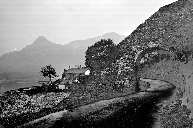
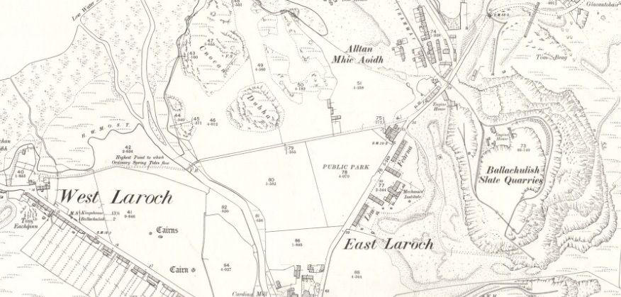 Ballachulish Slate Quarries before the arrival of the Railway (1897 OS Map).
Just to the south of the A82 and at the east end of the village of Ballachulish are the fascinating remains of the Ballachulish slate quarries, which employed up to 300 men at any given time for over two and a half centuries until 1955. Today the quarries have been opened up as a scenic attraction in their own right, and are well worth a visit. [24]
The story of slate quarrying in what was originally known as East Laroch began in 1693, just the year after the Glen Coe massacre took place, a little over a mile and a half to the east. The quarries grew dramatically during the 1700s and slate from here was shipped out to provide roofing for Scotland’s rapidly growing cities. It is recorded that in one year alone, 1845, some 26 million Ballachulish slates were produced.
The arrival of a branch railway from Oban in 1903 gave the quarries a further boost, as it made overland transport of the slates both possible and cheap. The Railway’s arrival was, however, unfortunate timing in one sense, as a major industrial dispute was under way in the quarries at the time over the provision of medical care, which involved the workforce being locked out for a year. Further trouble flared up in 1905, but the quarries remained in business until finally closing in 1955.
 Ballachulish slate had one major drawback compared with some of its competitors. The presence of iron pyrite crystals within the slate meant that rust spots and holes were prone to appear in slates exposed to the weather, which of course is a drawback on a roof. Because of this, only about a quarter of the slate actually extracted could be used for roofing, with the remainder finding less lucrative uses or being wasted.

The adjacent images come from the Undiscovered Scotland Website as does the text above, although it has been edited slightly. [24]
Some further images of the quarries have been provided below. They have been sourced from the Canmore Website. [25] Canmore contains more than 320,000 records and 1.3 million catalogue entries for archaeological sites, buildings, industry and maritime heritage across Scotland. Compiled and managed by Historic Environment Scotland, It also contains information and collections from all its survey and recording work, as well as from a wide range of other organisations, communities and individuals who are helping to enhance this national resource. 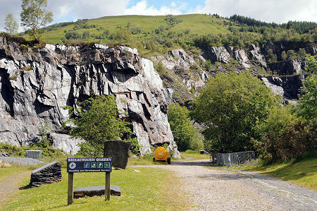
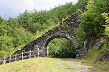
 The old road used to pass under the incline. [25]
  An aerial image of the quarries. The route of the railway line is clearly visible. [25]
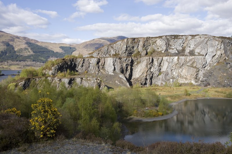 The quarrying operation was of a significant size and lasted for well over two centuries employing around 300 men. [25]
And finally … a video of travel along the branch-line in the 1960s.
References
- https://en.m.wikipedia.org/wiki/Ballachulish_railway_station, accessed on 1st January 2019
- R. V. J. Butt; The Directory of Railway Stations: details every public and private passenger station, halt, platform and stopping place, past and present (1st ed.). Sparkford: Patrick Stephens Ltd., 1995, p23.
- Table 33, British Railways, Passenger Services Scotland summer 1962, quoted in https://en.m.wikipedia.org/wiki/Ballachulish_railway_station, accessed on 1st January 2019.
- https://www.sustrans.org.uk/ncn/map/route/oban-to-fort-william, accessed on 3rd January 2019.
- https://cuilbay.com/2014/07, accessed on 1st January 2019.
- https://hollytreehotel.co.uk/facilities/history, accessed on 5th January 2019.
- https://www.highlandtitles.com/blog/highland-reserve-interviews-lord-douglas-lady-penelope, accessed on 4th January 2019.
- https://canmore.org.uk/site/107540/kentallen-station?display=image, accessed on 5th January 2019.
- https://www.pinterest.co.uk/amp/pin/382031980881862868, accessed on 5th January 2019.
- https://wildaboutscotland.com/2015/05/28/lejog-day-11-connel-to-fort-augustus/amp, accessed on 5th January 2019.
- https://www.pinterest.nz/pin/382031980881872965/?lp=true, accessed on 4th January 2019.
- http://www.scottishanchorages.co.uk/kentallen-bay/4532986587, accessed on 5th January 2019.
- http://www.boydharris.co.uk/w_bh14/140818.htm, accessed on 5th January 2019.
- http://www.geograph.org.uk/photo/362353, accessed on 5th January 2019.
- https://www.ebay.co.uk/itm/BALLACHULISH-FERRY-Argyll-postcard-C31111-/253269532962, accessed on 5th January 2019.
- https://www.geograph.org.uk/photo/753925, accessed on 5th January 2019.
- https://www.undiscoveredscotland.co.uk/ballachulish/ballachulish/index.html, accessed on 5th January 2019.
- https://en.wikipedia.org/wiki/Ballachulish_Ferry_railway_station, accessed on 5th January 2019.
- http://myrailwaystation.com/FORMER%20LOCATIONS/index.htm, accessed on 5th January 2019.
- http://www.rmweb.co.uk/community/index.php?/topic/122717-kentra-bay-a-what-might-have-been-caley-west-coast-terminus, accessed on 5th January 2019.
- http://www.petesy.co.uk/2012/09/28, accessed on 5th January 2019.
- https://her.highland.gov.uk/Monument/MHG346, accessed on 5th January 2019.
- https://www.glencoescotland.com/see-do/mountain-biking/sustrans-to-oban, accessed on 5th January 2019.
- https://www.undiscoveredscotland.co.uk/ballachulish/slatequarries/index.html, accessed on 5th January 2019.
- https://canmore.org.uk/site/23552/ballachulish-slate-quarries, accessed on 5th January 2019.
- H.A. Valance; From Connel Ferry to Ballachulish; The Railway Magazine, November 1950.

I’ve enjoyed reading this account although I only saw where the line went and travelled across the Conned bridge after closure.
I’d recommend this book as a very good account of the building and closure of the Ballachulish Branch.
“Birth and Death of a Highland Railway: Ballachulish Line” by Duncan Kennedy [John Murray, 1971]
Dava
Hi, Yes.
I am keeping an eye out for a reasonably priced copy.
Best wishes
Roger
Thank you for the article . I’ve now read all three parts . A very comprehensive account . I’ve just stayed for a few days in Appin and followed the course of the line from Connel all the way to Ballachulish prior to returning home via Glencoe . This must have been a lovely line to travel on.
Thanks for an great read and the best account Ive read of the line ,Living in Ballachulish in one of the old railway cottages one can only imagine how wonderful it would have been when the line was running
Hi All,
A great article.
My great uncle Colin Christie was a driver on this line. He was born in Oban, married a girl from Ballachulish in 1916, lived in Loanfern, Ballachulish and passed away in 1954.
I’d appreciate any guidance as to where I might possibly unearth any of the old staff records, or photographs of the drivers and other staff which might still exist, tucked away in an archive or a collection somewhere.
Thank you and Best wishes,
Colin W
I am sorry that I do not have information like that , Colin.
Pingback: The Caledonian Railway Rail-motor Car | Roger Farnworth
Pingback: The Callander and Oban Railway | Roger Farnworth
Pingback: The Caledonian Railway | Roger Farnworth
I went to work as a relief clerk at Oban in 1967 and worked under Jimmy Christie, son of Colin who had been a Ballachulish based engine driver. Jimmy had worked as a clerk at Ballachulish and Paisley before becoming the last stationmaster at Connel Ferry. After the SM’s job at Connel was abolished Jimmy became Admin Assistant and then Relief Supervisor to the Area Manager Oban. Other former Ballachulish Branch staff I encounter were: Jessie Rowan, the last clerk at Ballachulish station and subsequently a goods clerk at Oban and Donald MacDonald a Traffic Supervisor at Crianlarich and previouysly stationmaster at Benderloch
Michael, thank you for these memories. Best regards, Roger