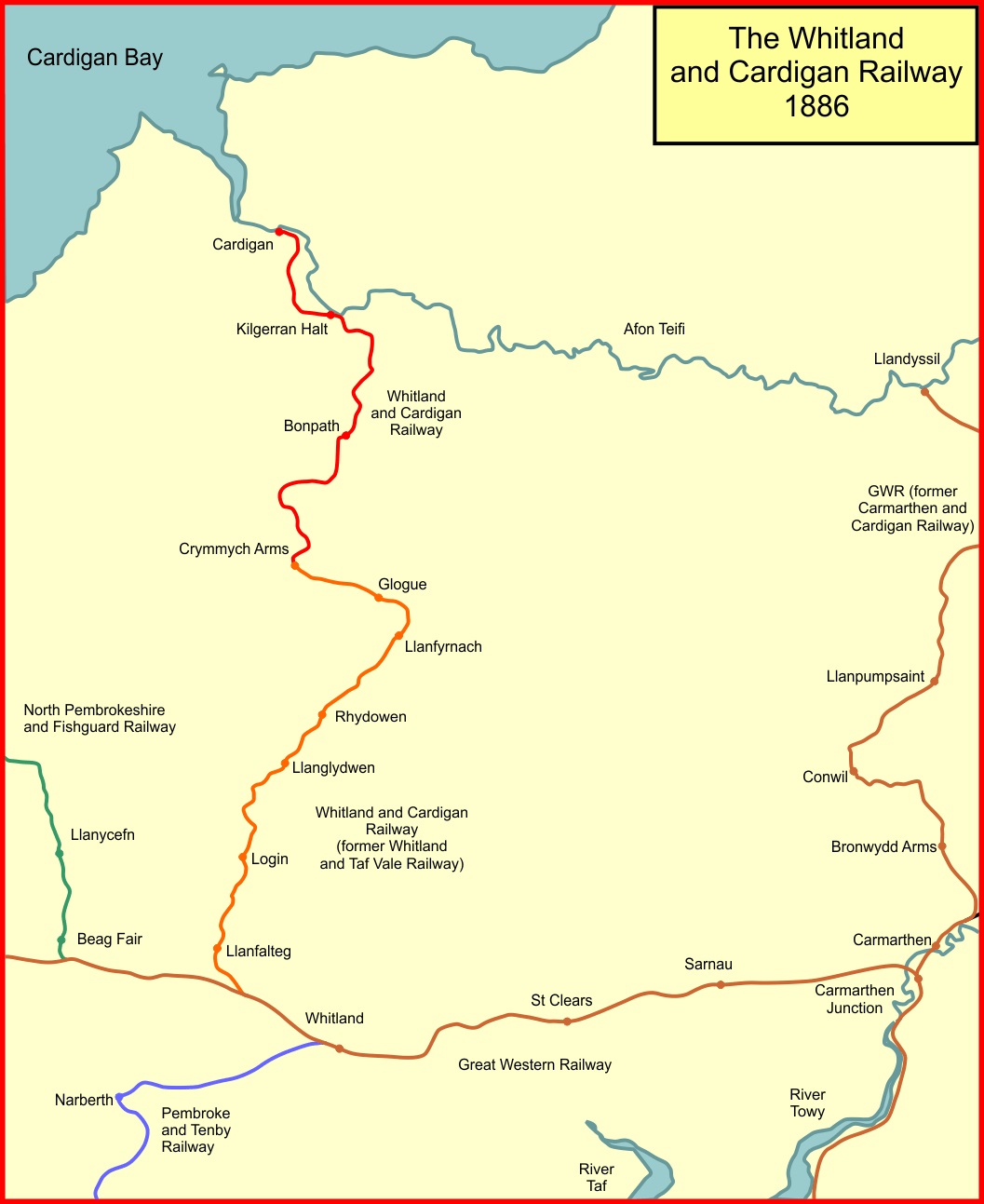
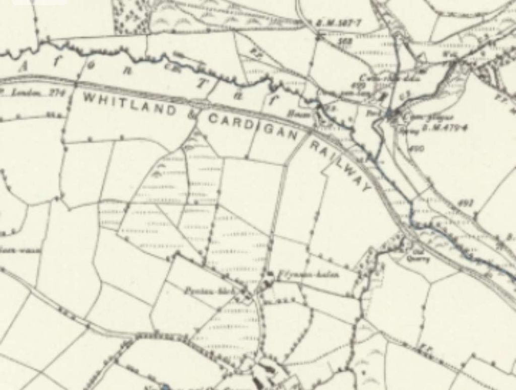
The Whitland & Cardigan Railway was a 27.5 miles (44.3 km) long branch line, “built in two stages, at first as the Whitland and Taf Vale Railway from the South Wales Main Line at Whitland to the quarries at Glogue. It opened in 1873, at first only for goods and minerals and later for passengers. The line to Cardigan opened in 1886; reflected in the company name change.” [2]
“The Company was always short of cash. Huge borrowings made it unable to pay its way; it was taken over by the Great Western Railway in 1886. Still considerably loss-making, it closed to passengers in 1962 and completely in 1963.” [2]
This is the second in a short series of articles about the line. The first of the articles can be found here. [4]
My interest in this branch line stems from reading an article by M.R. Connop Price; Before the Railways: The Early Steamers of Cardiganshire; in the Railway & Canal Historical Society Journal in July 2022. [1] And from staying North of Cardigan in 2023 and walking part of the route of the old line.
We restart our journey from Cardigan to Whitland at Boncath Railway Station.
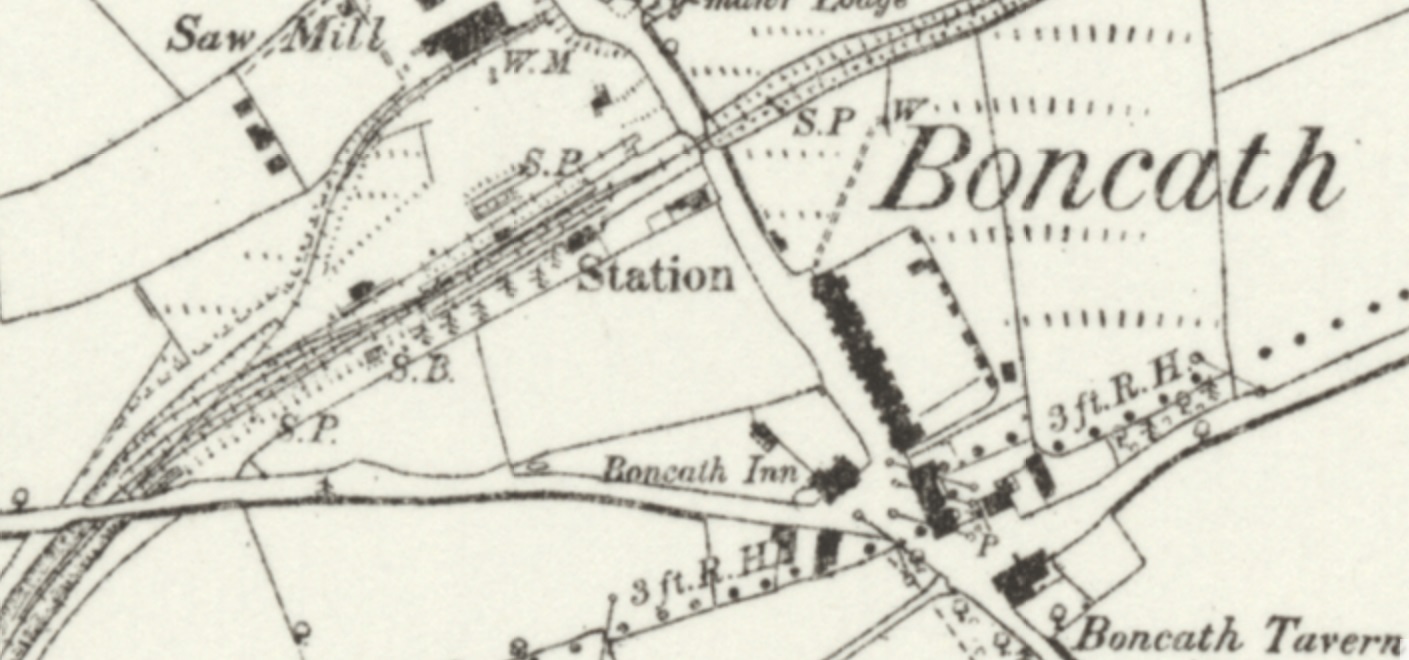
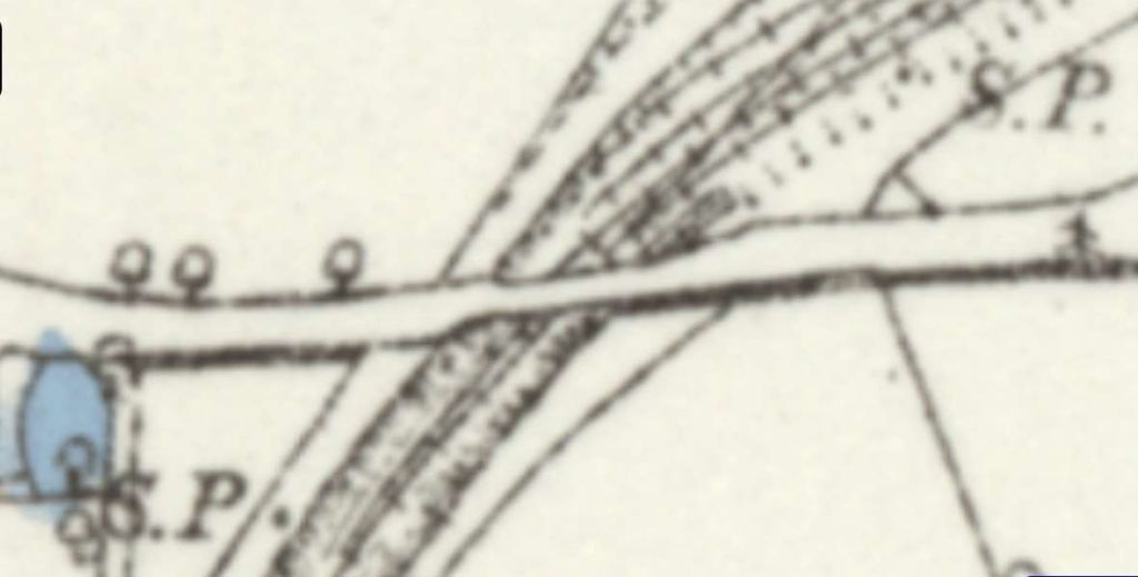
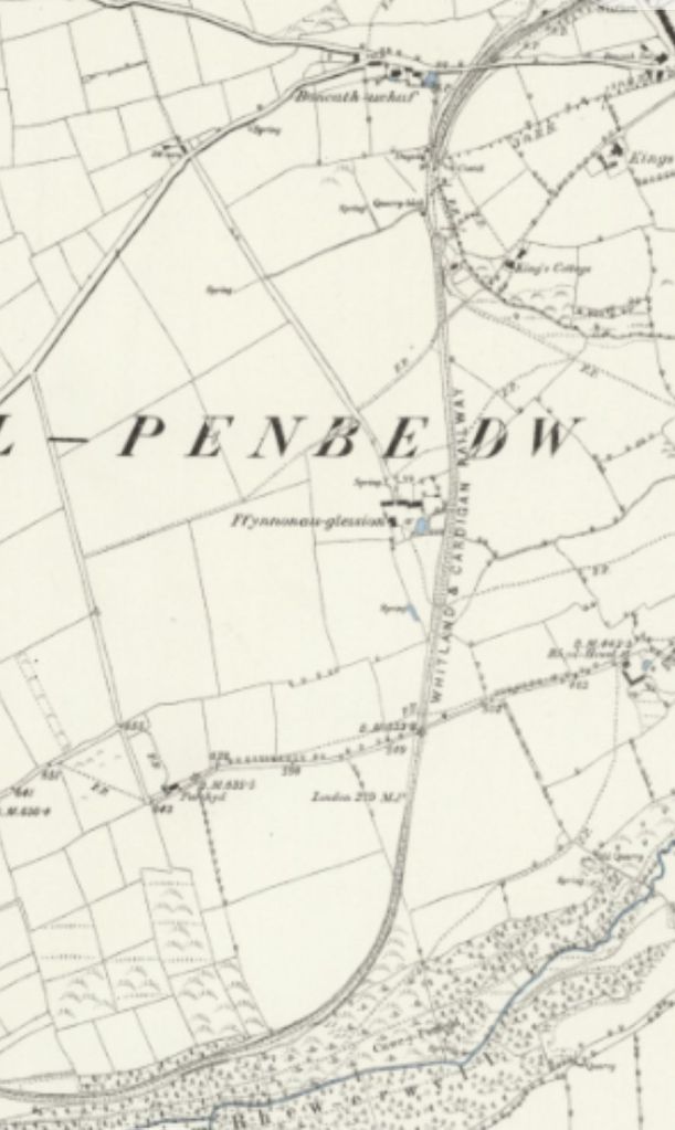
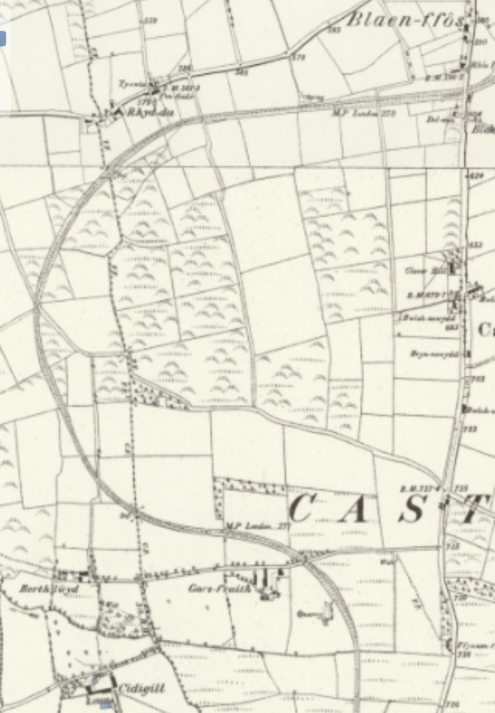
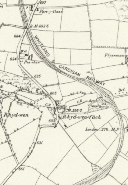
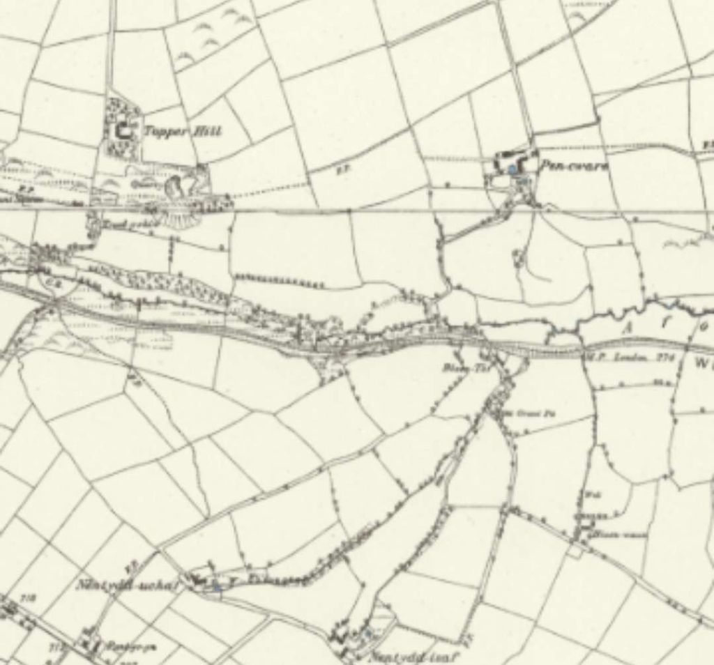
Boncath Railway Station as it appears on the 6″ Ordnance Survey of 1887 (published in 1888). [5]
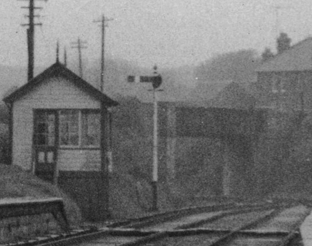
“The station had a passing loop served by two passenger platforms and a goods loop on the down side where there was a small goods yard and shed. A siding from the yard served a saw mill nearby to the north of the station. The single-storey stone-built main station building was on the up platform and, along with the goods shed, still survives, as does the nearby Station House.” [6] The line serving the saw mill can be seen in its entirety in the map extract above.
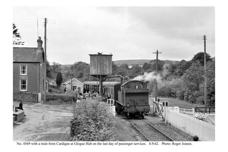
M.R. Connop Price says that Boncath “was a crossing place and a tablet exchange station. The goods yard was quite sizeable, comprising three sidings on the down side, one forming a loop behind the down platform. Traffic consisted mostly of timber from the adjacent saw mills, rabbits and agricultural goods. Apparently the level crossing gates were demolished so often by accident that there was talk of doing away with them. In his two articles on the Cardigan line J.F. Burrell has pointed out that from the platform at Boncath it was possible to see the smoke of a freight train coming up from Cardigan for as long as a quarter of an hour before arrival. The many curves caused it to disappear and reappear at frequent intervals on the way. This was one of the most remarkable sights on a remarkable railway, because the line fell away from Boncath towards Cardigan on a gradient of 1 in 40 for nearly three miles. Climbing up this incline was hardly less exciting than the ever steepening climb up the Taf vale to Crymmych! Had the original route north of Boncath been built it would have kept to some higher ground and been more gently graded. It might also have been less attractive because the line as built ran for a mile and a half above a beautiful and heavily wooded valley towards Kilgerran” (Cilgerran). [15: p82 & 90]
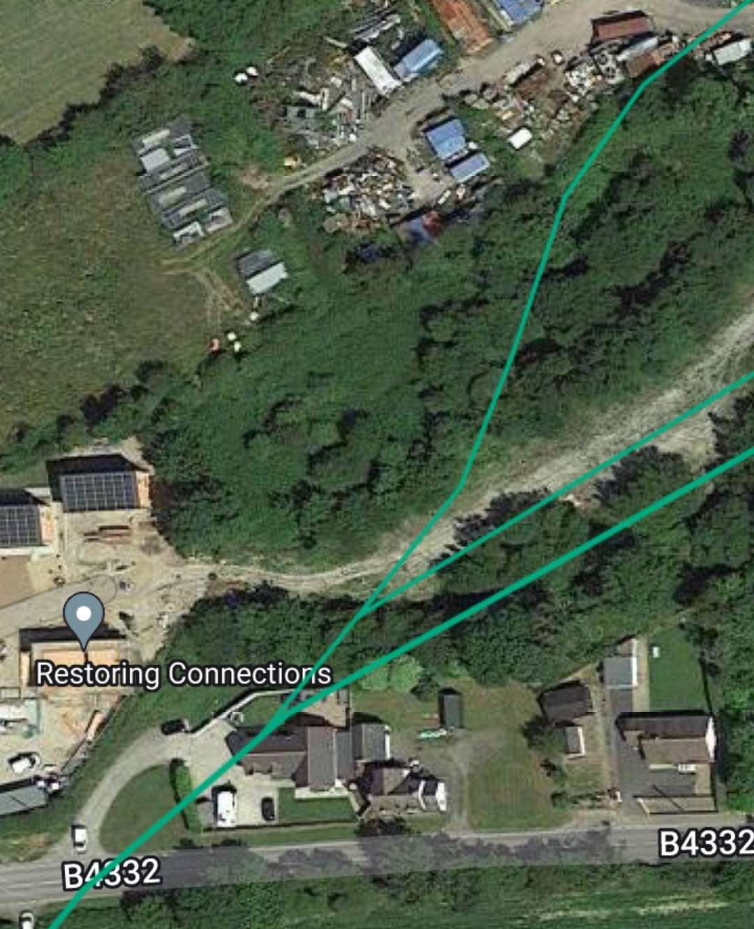
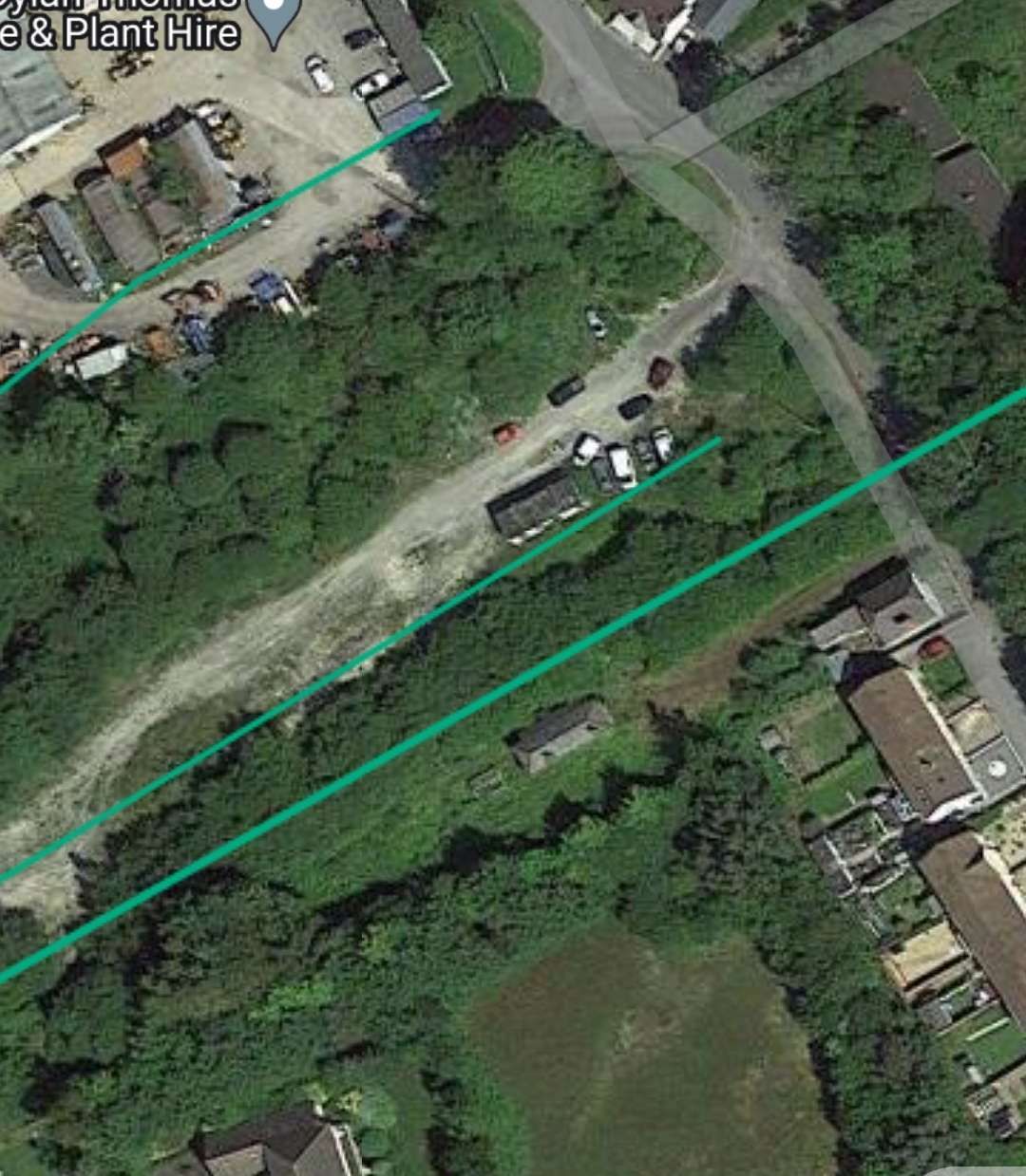
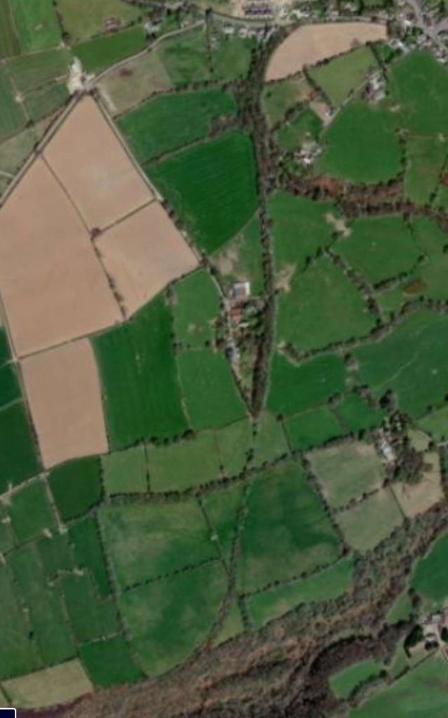
These two extracts from the railmaponline.com satellite imagery cover the full extent of the Boncath Railway Station site. The old railway is shown by the green lines on the images from railmaponline.com. And these green lines include the siding serving the saw mill. [3]
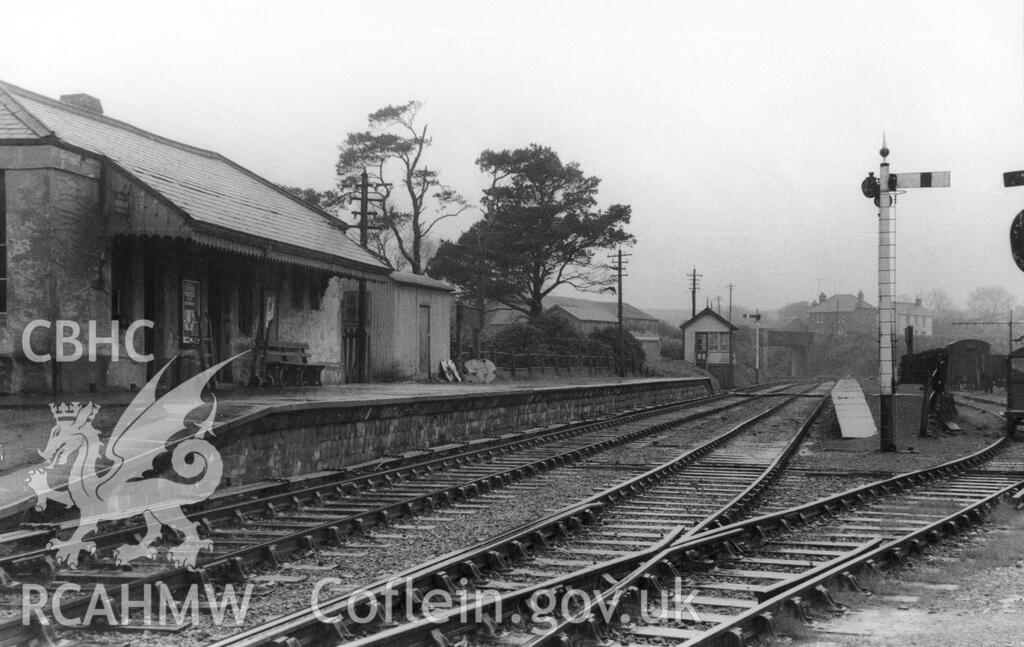
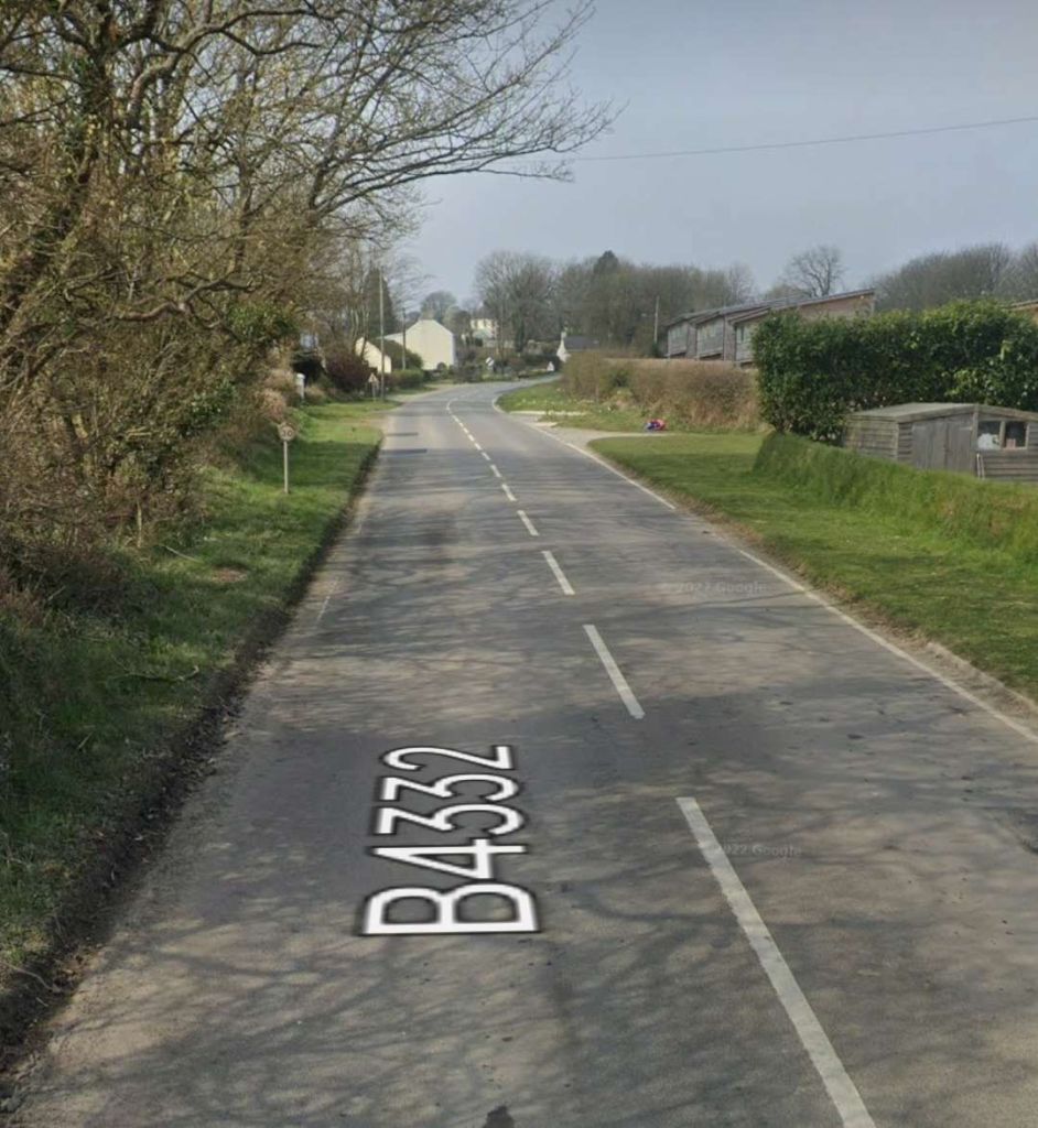
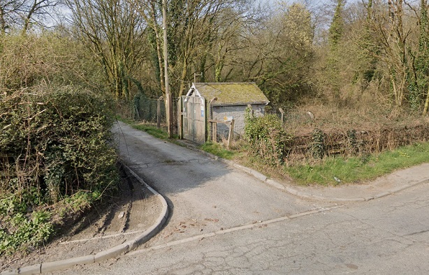
The Southwest end of the Boncath Station site was framed by the highway bridge which carried what was to become the B4332. [5]An enlarged segment of one of the two images shared on the coflein.gov.uk website. This is the best image that I have been able to find of the bridge at the Southwest end of the station site. [6]The view along the B4332 from the East through what was the location of the bridge carrying the road over the old railway. [Google Streetview, March 2022]
Shaun Butler’s TT gauge model of Boncath can be seen in photographs here. [27] Other views of the station can be seen here [28] and here [29]. The station has a page of its own on the Disused Stations website, here. [30]
M.R. Connop Price covers the route of the line from Whitland to Cardigan travelling towards Cardigan – the ‘down’ direction on the line. His description is quite evocative of the line’s rural and meandering nature. He describes the length of the line between Boncath and Crymmych Arms stations but in the ‘down’ direction: “North of Crymmych the [line] … climbed through a deep rock cutting to the summit before descending briefly on a gradient of 1 in 80 and rising again at 1 in 200 to a secondary summit about a mile and 30 chains beyond the station. By now the track was winding round a ledge on the hillside and giving magnificent views westwards to the Prescelly mountains. … On a clear day the view extended across the valley of the Afon Nyfer to the sea near Newport. … Meanwhile, [the line] negotiated a horseshoe bend and a remarkable series of sharp curves across the desolate countryside as it began its steady descent. Just over two miles from Crymmych the railway passed Rhyd-du, where once it was proposed to build a station. … Just beyond Rhyd-du the [railway] passed near Blaenffos and under the main Cardigan-Tenby road for the second time. A short distance further on a tributary of the River Teifi could be seen running through woods far below on the east side of the line, giving confirmation to the traveller that he was now across the watershed” and close to Boncath. [15: p82]
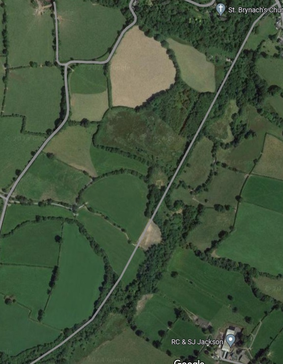
The railway first headed South as it left Boncath and then turned to the West above a wooded valley. [7]This extract from the ESRI satellite imagery from the NLS covers approximately the same area as the 6″ OS map extract above. Once again, the route of the old railway can be followed by tracing the field boundaries, hedgerows and trees. [7]The line then turned West. [8]The route of the old railway was a little difficult to see on the Google mapping, so it is good to have the green line on this railmaponline.com satellite image. [3]
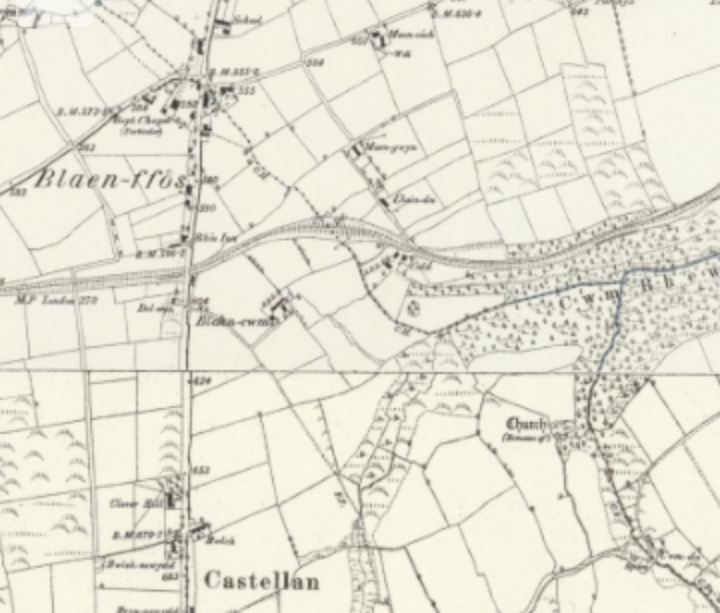
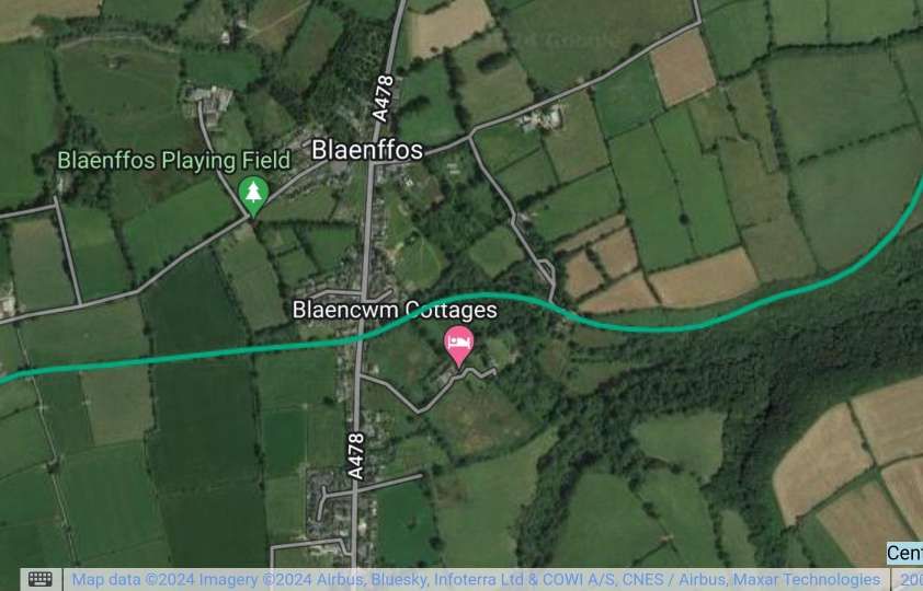
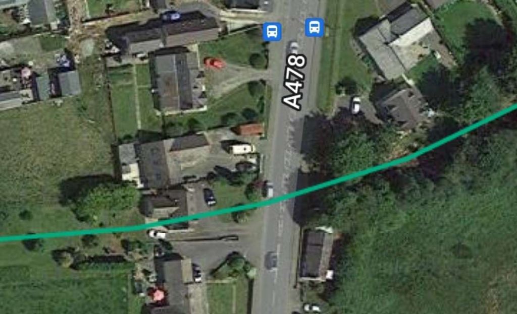
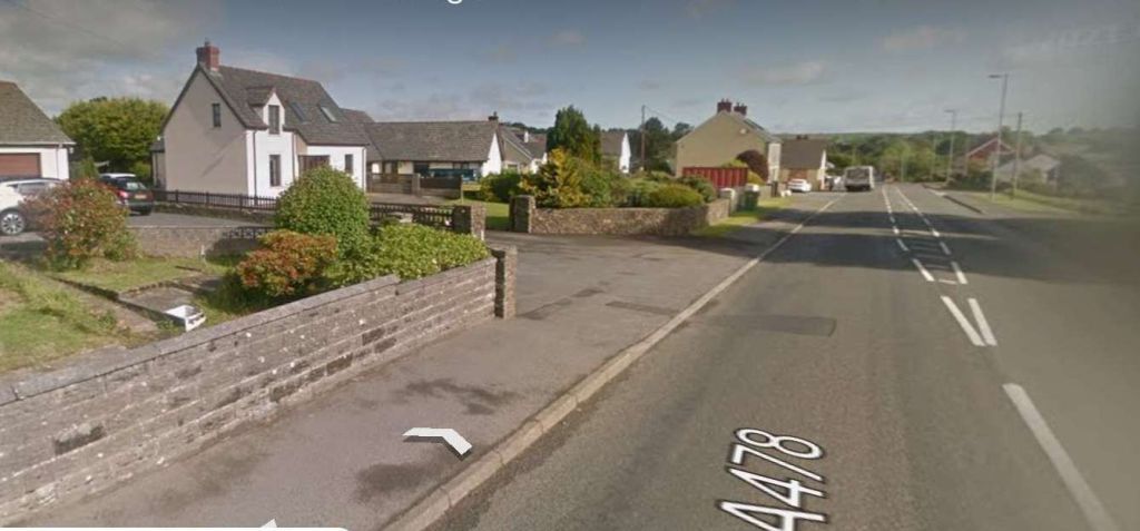
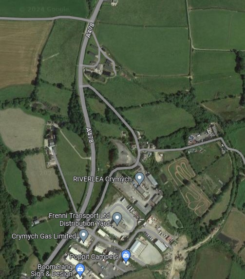
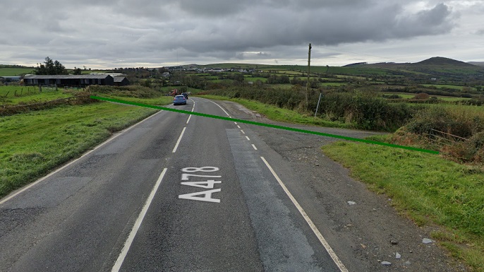
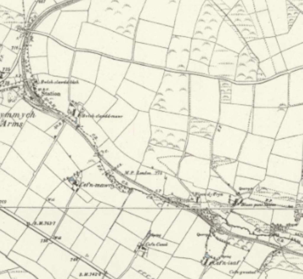
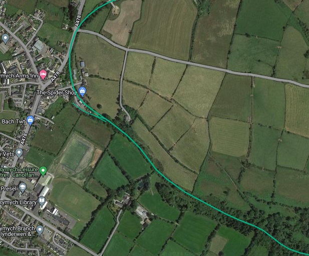
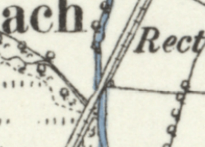
On both of the two images above the Whitland & Cardigan Railway crosses the A478. The next couple of images show enlarged views of the location, on the 6″ OS Map and the railmaponline.com satellite imagery. …
The story of an N Gauge project to model Crymmych Arms Railway Station can be found here. [14] The station is covered in some detail in text and photographs on the Disused Stations website. [16]
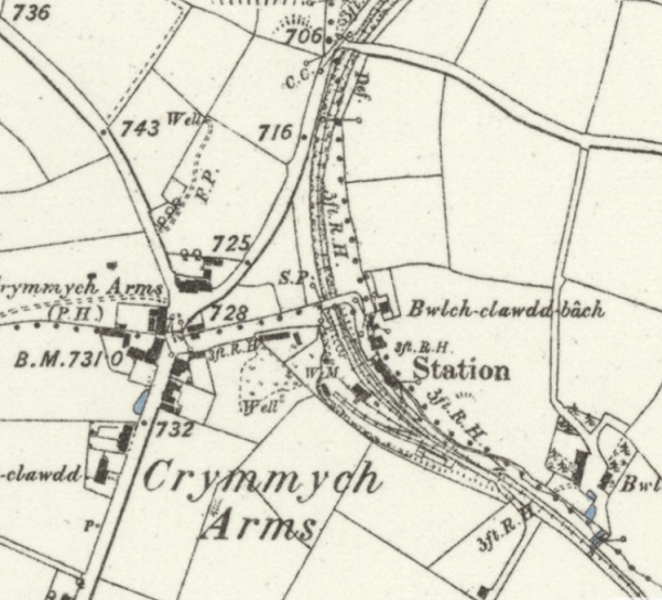
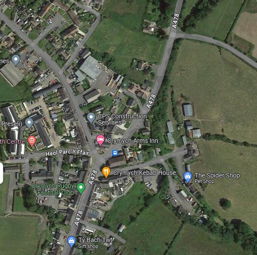
The station was, for a time the terminus of a branch line from Whitland which was extended by the GWR to Cardigan.
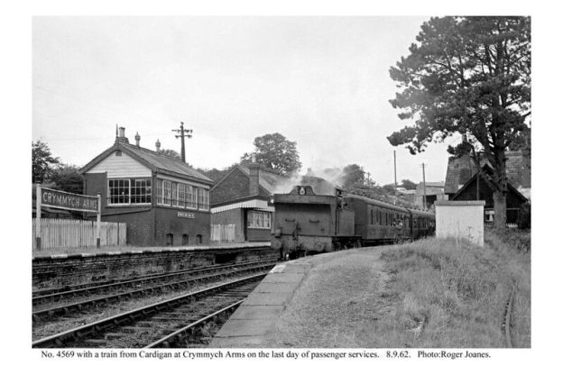
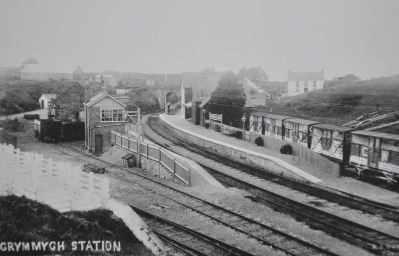
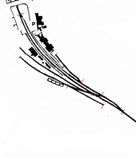
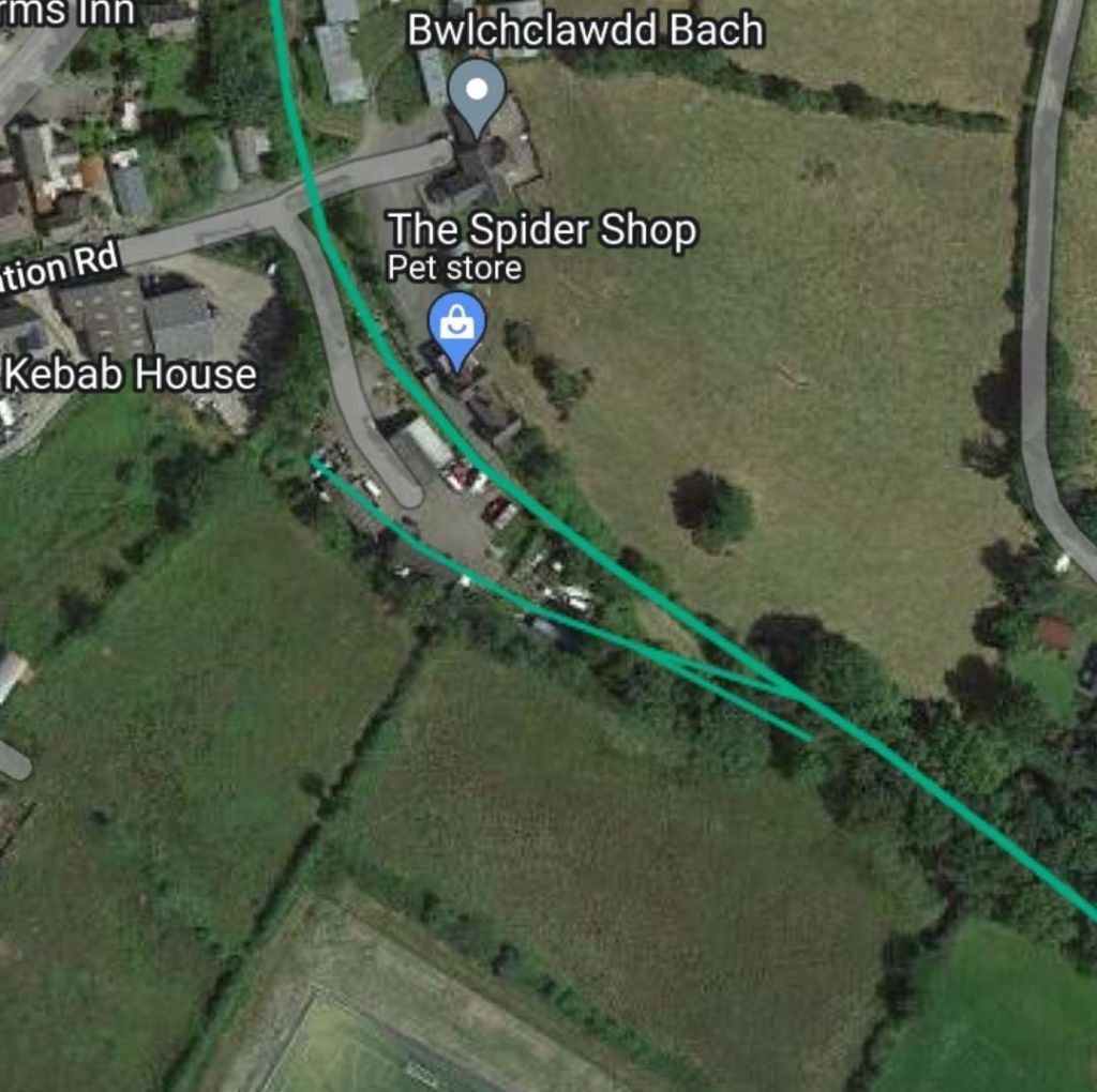
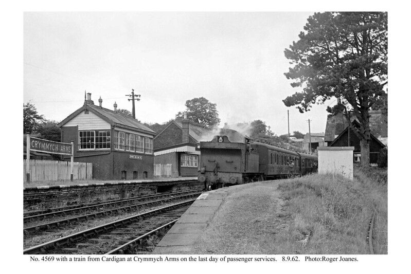
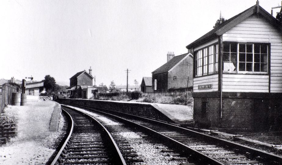
M.R. Connop Price says that Crymmych Arms station was “situated near the source of the [Afon] Taf and in the shadow of the 1,297 ft high Freni Fawr, on the edge of the Prescelly mountains. The buildings were substantial, and right up to the 1960s a pillar box was provided on the wall of the large station house on the up platform. Another facility on the up platform was a well that always gave ice cold water; a GWR cup was available for drinking purposes. After the tablet instruments were removed from Llanfyrnach [further South down the line], Crymmych Arms became [a] … tablet station on the line. Latterly it was the only intermediate station to be in the charge of a station master.” [15: p82]
C.J. Gammell notes that Crymmych Arms, “as well as being a crossing point and block post was closed to the summit of the line, reached by steep gradients from both sides. Up goods and mineral trains had to stop to pin down brakes on the 1 in 35 decent from Crymmych Arms as well as the 1 in 60 rise from the North to the station.” [18: p233]
M.R. Connop Price notes that South of Crymmych Arms “there was a 500 yd stretch at 1 in 35. Train crews [on down trains] undoubtedly entered Crymmych Arms with a great sense of relief!” [15: p77]
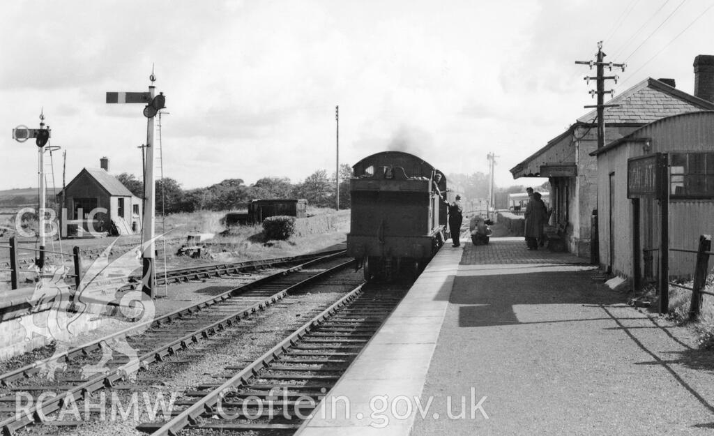
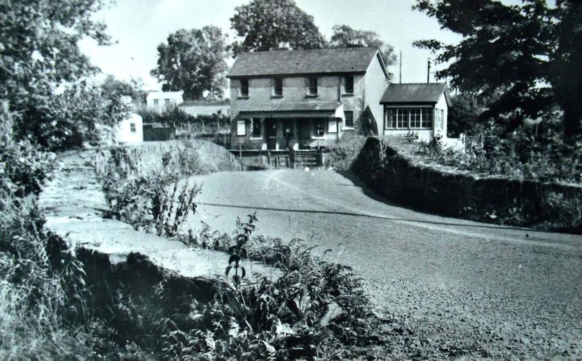
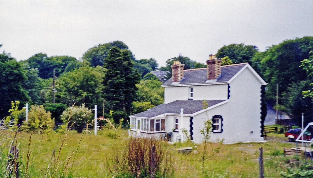
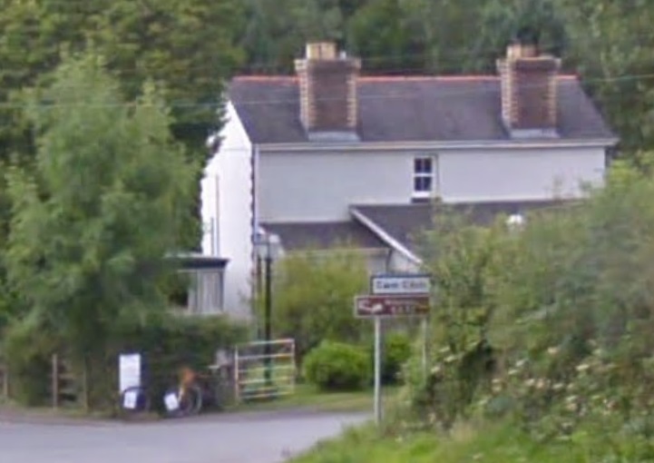
The station has a page on the Disused Stations website. [31] The Coflein record for the station notes that when “the station closed in 1962, the wooden station buildings and water tower were demolished although Station House nearby still survives.” [33]
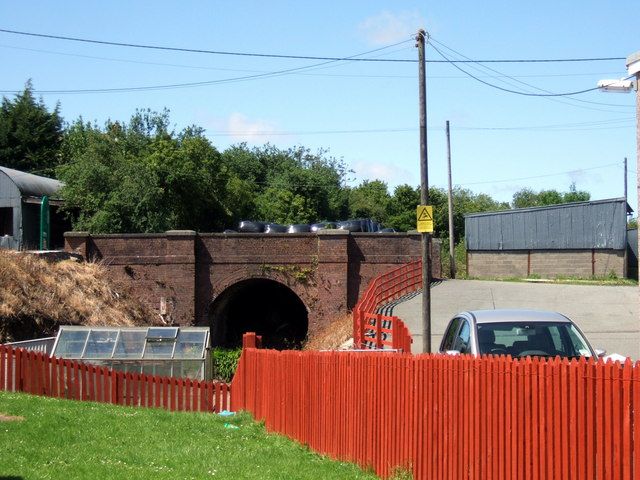
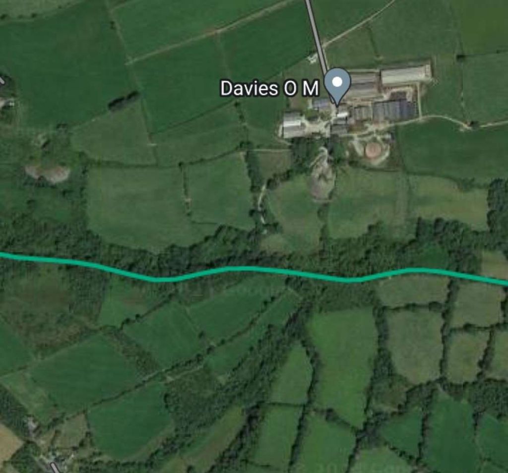
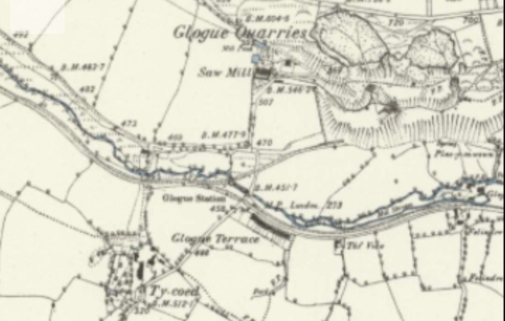
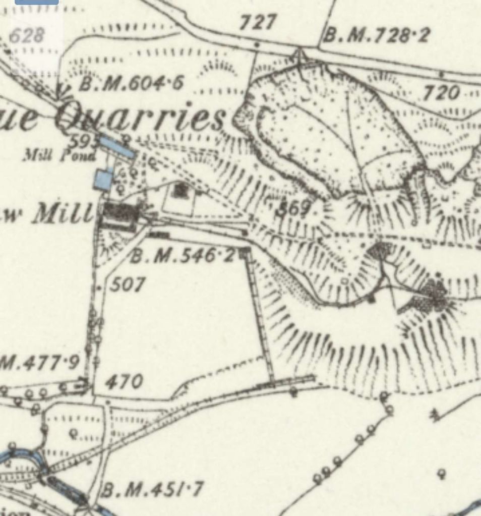
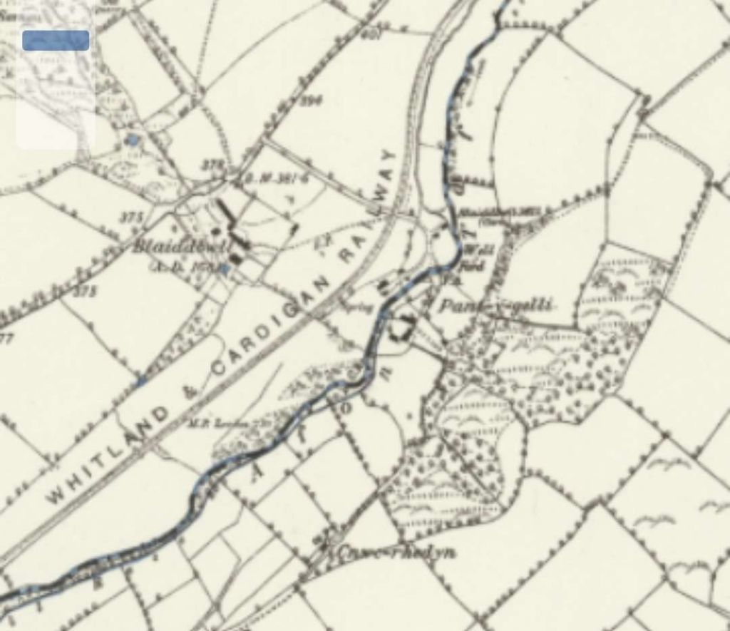
Glogue Quarries were served by a short branch from the Whitland & Cardigan Railway which terminated in two sidings. The quarries had an internal tramway system which included a number of inclines and tunnels. A better map of the quarries can be found in M.R. Connop Price’s book about the old railway. [15: p73][20]
The Coflein record, written by David Leighton, RCAHMW in February 2015, talks of a single quarry formed by “the merging of two early, perhaps seventeenth-century, workings. Material was lowered by two inclines, the upper one abandoned when work deepened and a tunnel was cut to bring material out to the head of the lower incline. The workings were handicapped by a lack of transport. Originally slate was was carted to Blackpool on the Eastern Cleddau, and after 1853 to Narberth Road on the South Wales Railway. Expansion only became possible when in 1873 a siding on the Whitland & Cardigan Railway was laid.” [21] There was a mill, powered by steam and later electricity, at the Western edge of the site. “Roofing slates of good colour were produced but as they were heavy the main output was slab. During the 1920s attempts were made to make bricks from slate dust. But these became uncompetitive when, in 1927, the GWR demanded a transport premium due to their weight; forcing closure. Bulk working has left little to be seen aside from vestiges of buildings in the mill area and the stone-built lower incline. Notably, a terrace of family dwellings was built by the company and is still occupied (in 1991).” [21]
Wikipedia says: “Glogue quarry was a slate quarry … worked from the late 1700s, by the mid-1800s it was owned by John Owen, who wanted to make higher profits by improving his distribution. This led to the construction of the Whitland and Cardigan Railway. The advent of the railway led to Owen expanding his workforce to over 80 men. … After sale to a local consortium, the quarry was worked until 1926.” [32]
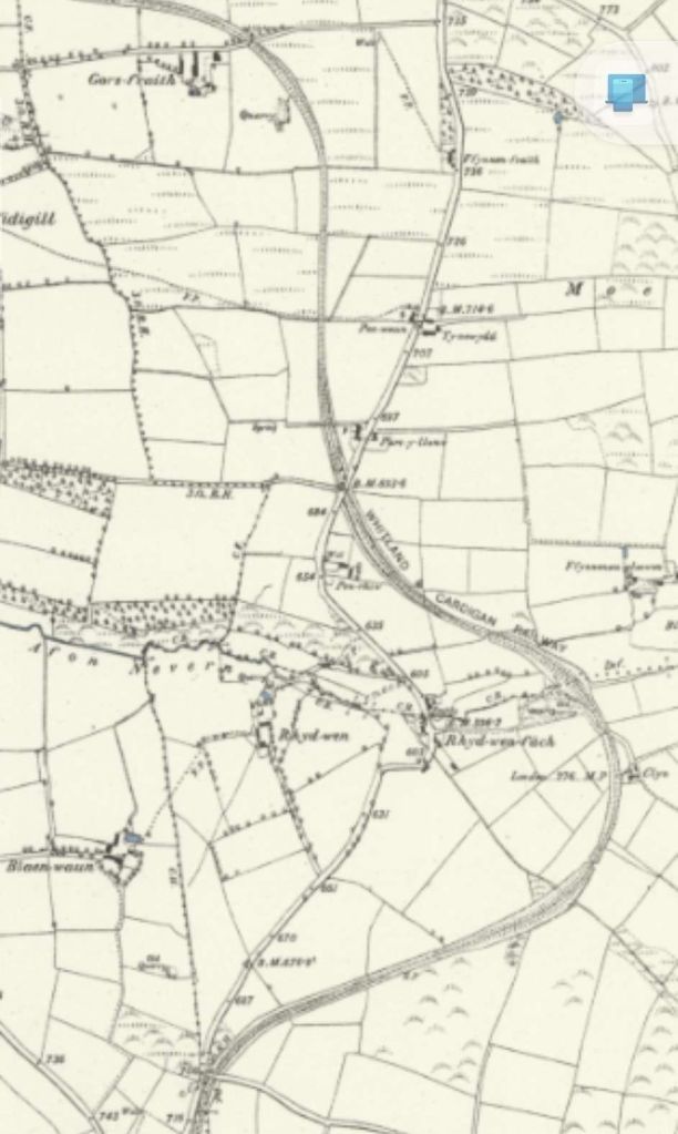
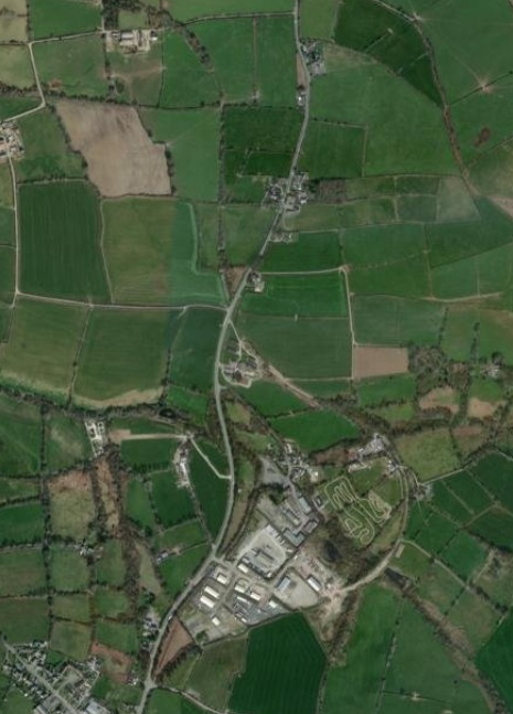
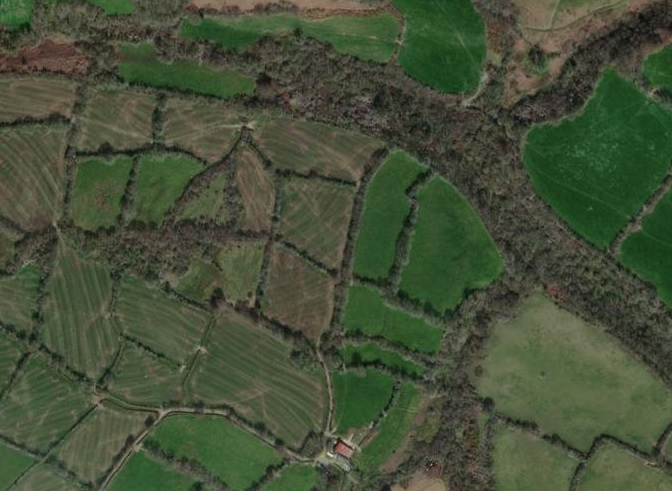
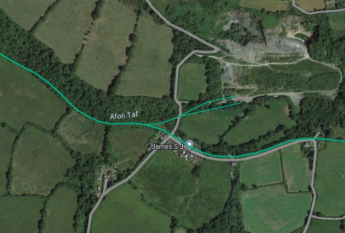
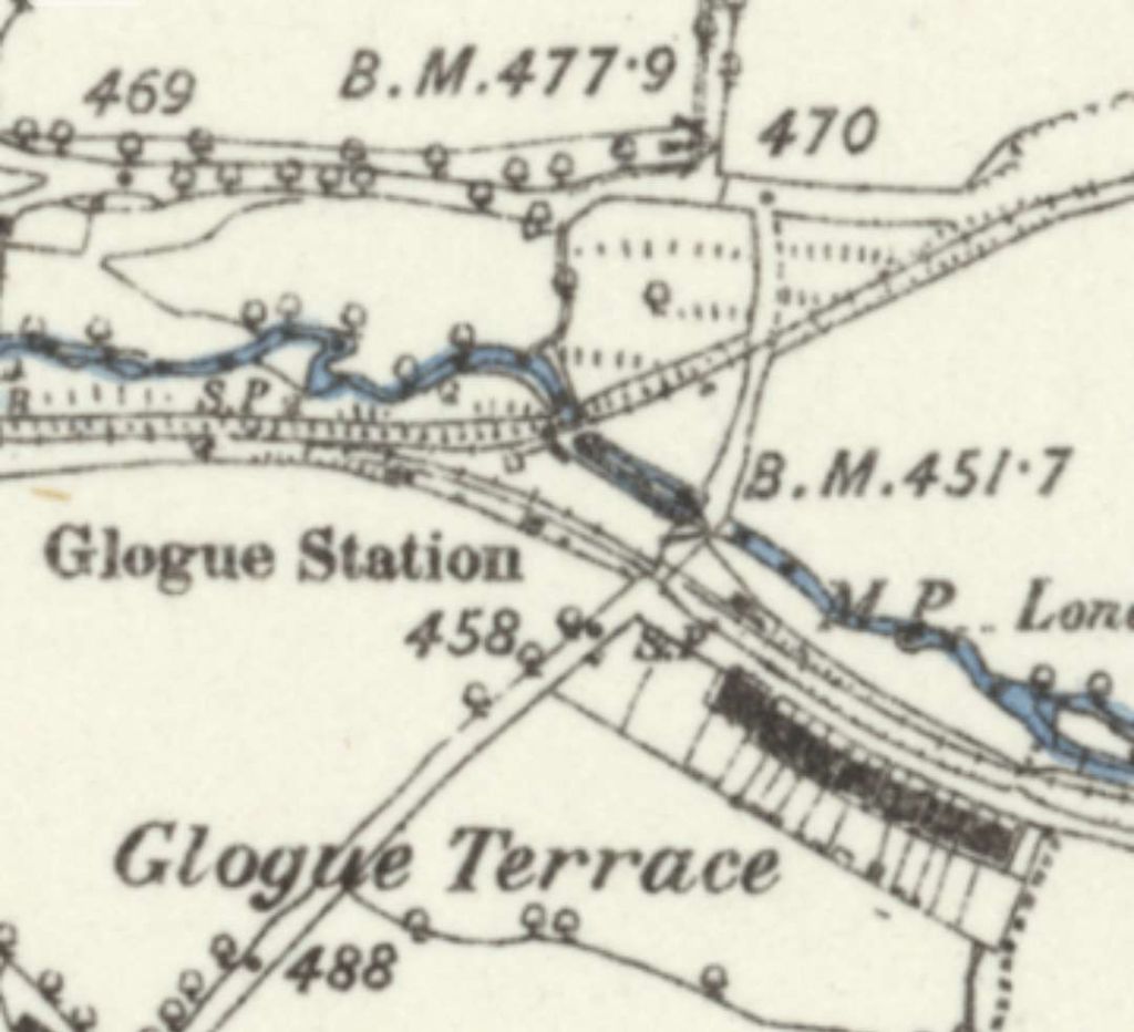
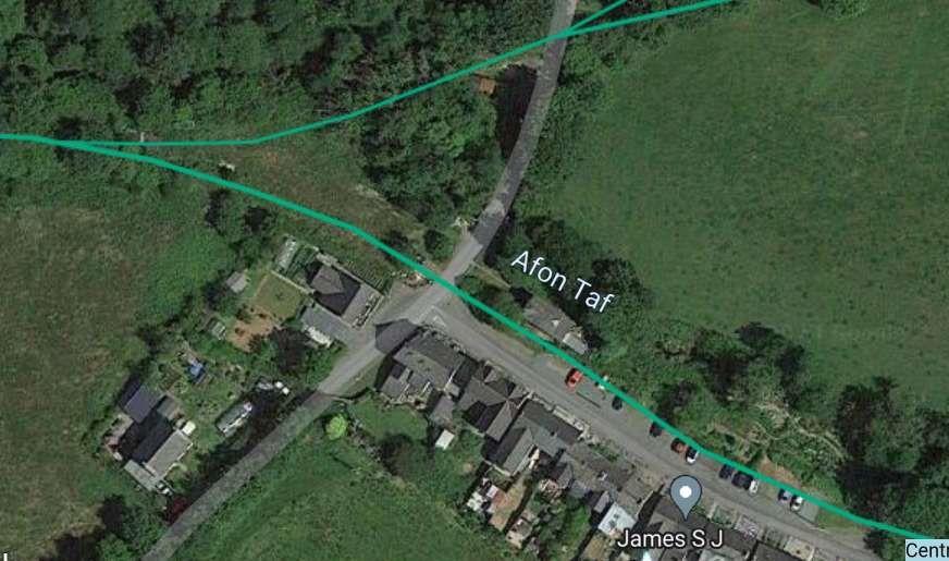
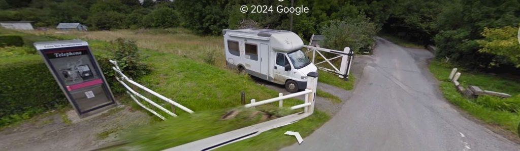
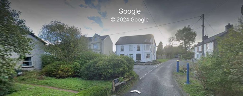
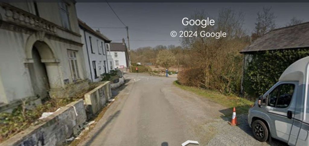
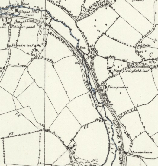
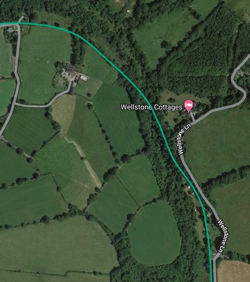
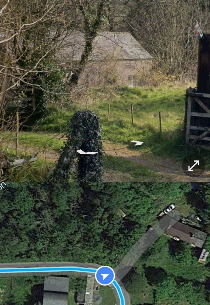
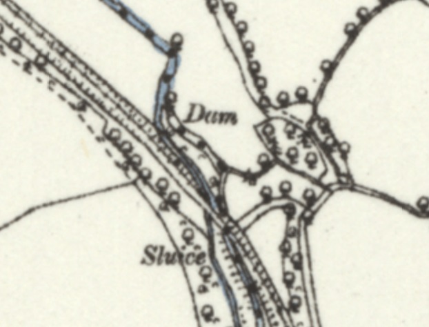
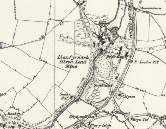
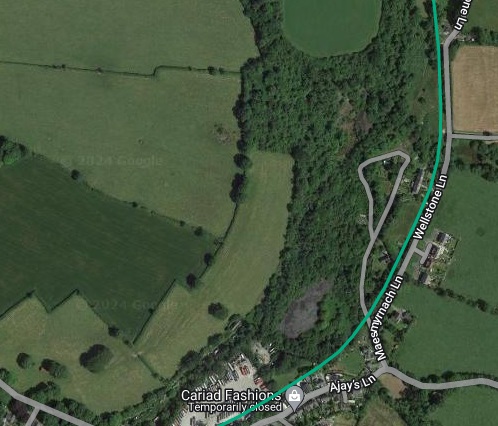
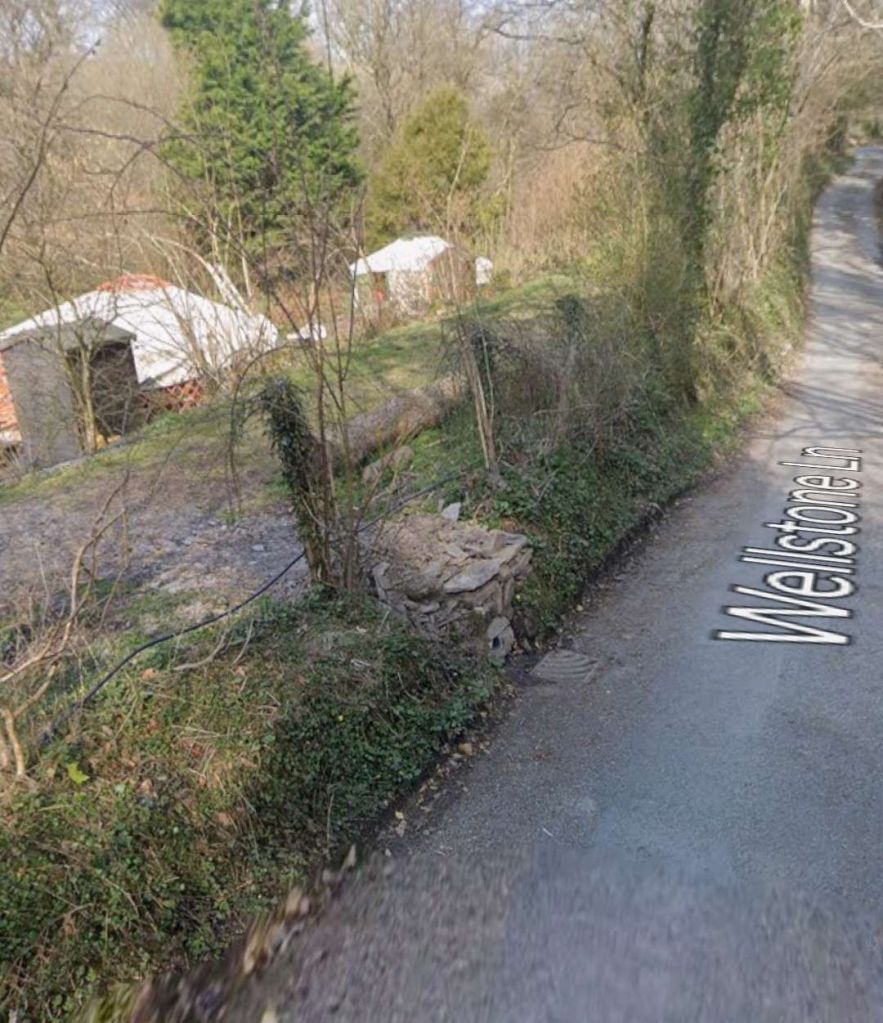
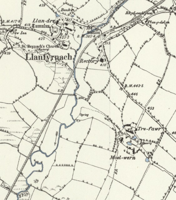
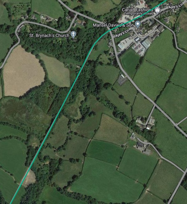
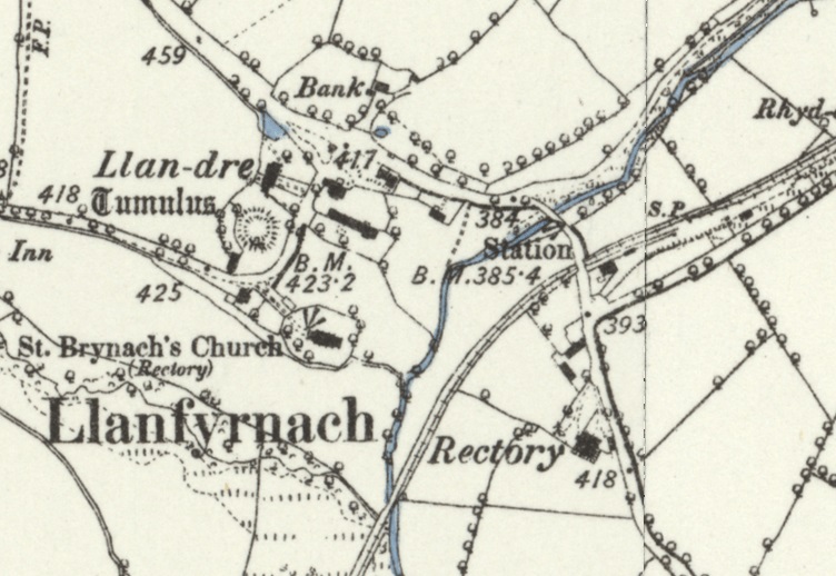
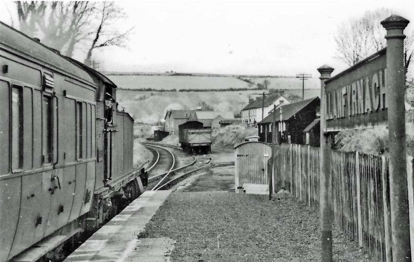
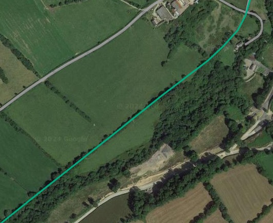
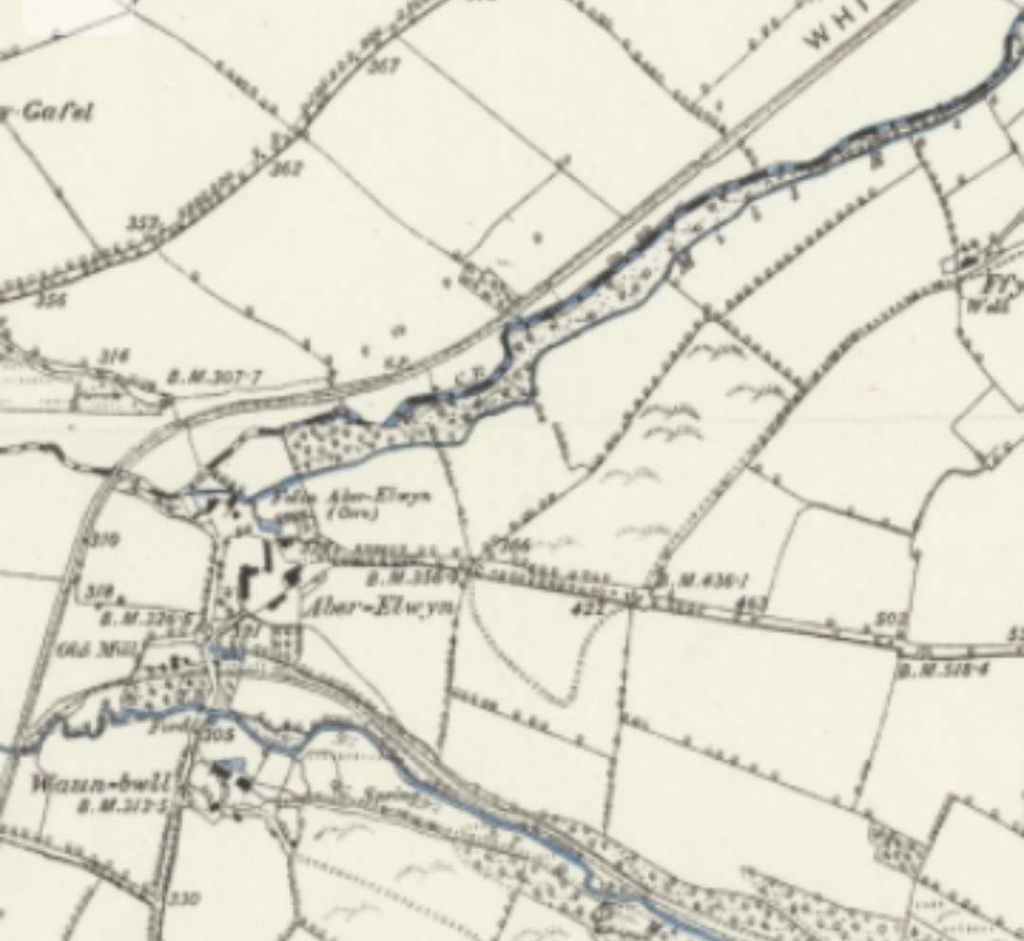
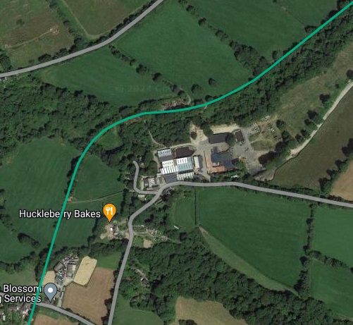
The 6″ Ordnance Survey of 1887 shows the old railway continuing East alongside the Glogue Corn Mill before turning South. All the while, it ran alongside the Afon Taf, although as it turned South it bridged the river, as shown here in the central part of the image and in the enlargement which is a few images below. [22]The same area on the railmaponline.com satellite images. [3]A combined image which shows both the view across the line of the old railway to the buildings of Glogue Corn Mill, in the upper part of the image, and the location of the camera on the lane to the East of Glogue, in the lower portion of the image. [Google Maps/Streetview, November 2021]An enlarged extract from the 6″ OS map above which shows the location where the railway bridged the Afon Taf. [22]As the railway continued heading South it curved round the Llanfyrnach Sliver Lead Mine on the approach to the railway station at Llanfyrnach. [23]A very similar length of the Whitland & Cardigan Railway shown on the railmaponline.com satellite imagery. Both these images show that the old railway ran alongside Wellstone Lane as it travelled South. [3]Looking Northwest from Wellstone Lane, the railway ran on the shoulder next to the lane. The land dropped away into the adjacent field, the other side of the line. The sheds visible in this picture are at the lower level beyond the line of the old railway. [Google Streetview, November 2021]
As its name suggests, Llanfyrnach Silver Lead Mine was a 19th century silver/lead producer; on site in the 21st century there are ruins of Cornish engine house and other mine buildings. [34] It was, “an important lead mine with a number of shafts, extensive tips and tailings heaps, buddle pits, together with a number of mine buildings including the remains of a Cornish engine house and boiler remaining on the site. … [It was] by far the largest of the Pembrokeshire mines, and of the south Wales mines, second only to Carmarthenshire’s Nantymwyn Mine in terms of the recorded output. A reference in the Mining Journal (1879) notes a well-defined east-west lode made up of sugary quartz and containing a good deal of lead, and about 150 tons of lead ore being delivered monthly from this and the old lode. Very little sphalerite was sold until the final few years of its working. Silver was extracted from the galena.” [35]
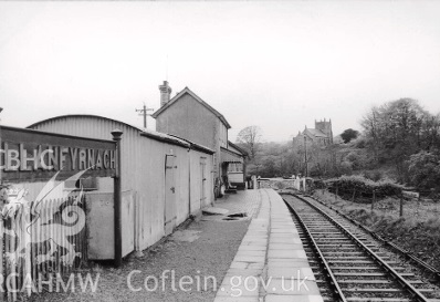
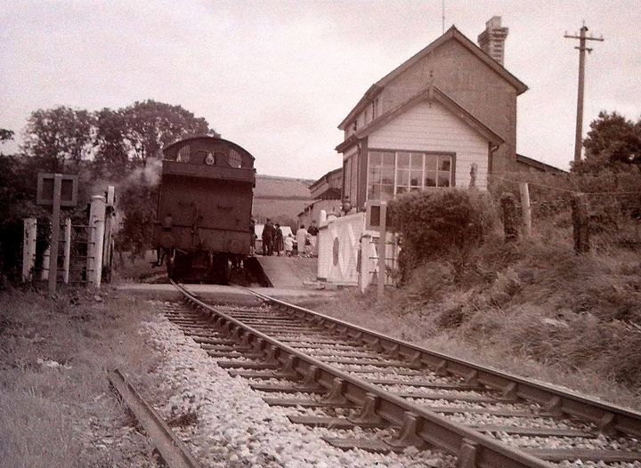
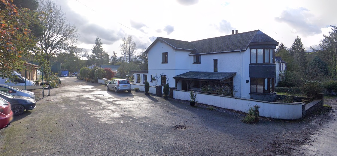
Llanfyrnach Railway Station has its own page which includes text and photographs on the Disused Stations website. It can be viewed here. [36] The Disused Stations page for the railway station suggests that the building in in a considerably worse condition in 2024. Two images showing its condition can be viewed here [38] and here. [39]
This final image taken looking Southwest along the platform at Llanfyrnach Station shows the siding which provided a small goods facility at the station. This image was shared on the Login Railway Station Facebook Page on 8th November 2019. [43]
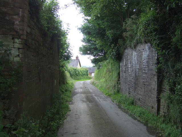
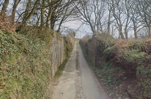
Southwest of the station the old railway is now followed by a modern single track access road.
The Llanfyrnach entrance to the modern track following the route of the old railway. [Google Streetview, March 2022]Google Maps shows the track running along the formation of the Whitland & Cardigan Railway Southwest from Llanfyrnach. [51, Google Maps, July 2024]
A short distance along the access road/old railway route, the line crossed the Afon Taf again. An enlarged extract from the 6″ Ordnance Survey is shown below.
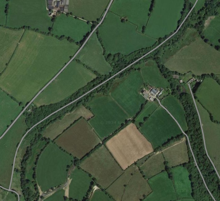
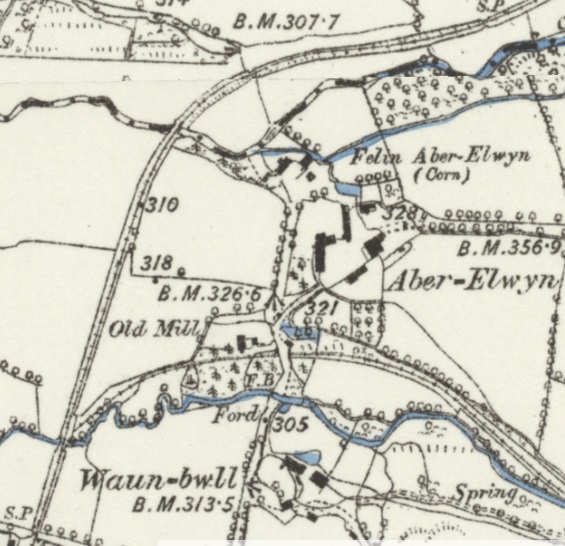
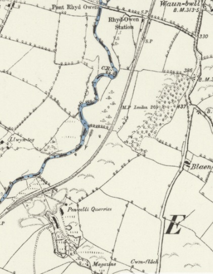
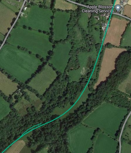
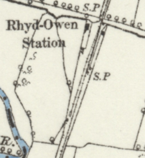
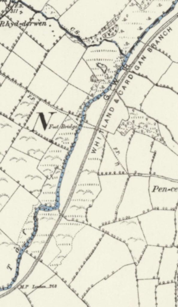
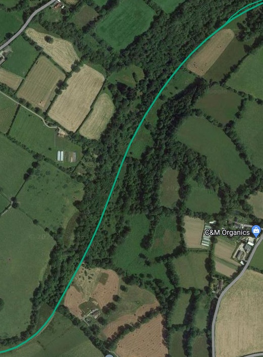
This enlarged extract from the 6″ Ordnance Survey of 1887 shows the location of the bridge across the Afon Taf which was to the Southwest of Llanfyrnach Station. [24]Continuing to the Southwest, the Whitland & Cardigan Railway followed the North bank of the Afon Taf. [44]This extract from Google Maps shows the track running along the formation of the old railway. It covers a slightly larger area than the extract form OS mapping above. In the bottom-right of this image the modern track can be seen terminating at a T-junction with another track. [52, Google Maps, July 2024]Again, continuing to the Southwest, the Whitland & Cardigan Railway followed the contours on the North bank of the Afon Taf, crossing a farm access road. The length of the line Northeast of the access track at the centre of this image is shown on the modern Google satellite image above. That to the Southwest is shown below. [45]The access track which followed the line of the old railway terminated in a T-junction with the farm access road at the top right of this extract from the railmaponline.com satellite imagery. The line continues in a southwesterly direction from that point. [3]Continuing to the Southwest, the Whitland & Cardigan Railway continued to follow the North bank of the Afon Taf as far as Aber-Elwyn. An enlarged extract from the 6″ Ordnance Survey of 1887 below shows the location more clearly [46]A similar length of the old railway is covered on this next extract from the railmaponline.com satellite imagery. [3]An enlarged extract from the 6″ Ordnance Survey of 1887 shows the old railway bridging the Afon Taf to the Northwest of Aber-Elwyn and then a tributary of the Taf to the Southwest of the hamlet, close to Waun-Bwll. The next station on the line sits just off the bottom-left of this extract – Rhyd-Owen Station. [47]This next extract from the 6″ 1887 Ordnance Survey shows Rhyd-Owen Station, top-right and the Pen-celli Quarries, bottom-left. [48]A similar length of the old railway is covered on this next extract from the railmaponline.com satellite imagery. [3]An enlarged extract from the 6″ Ordnance Survey of 1887 focussing on the Rhyd-Owen Railway Station. [49]
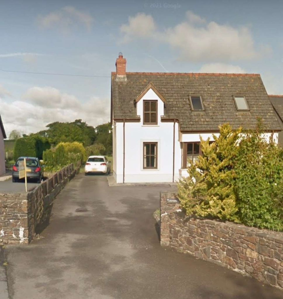
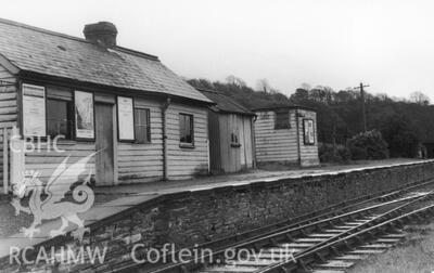
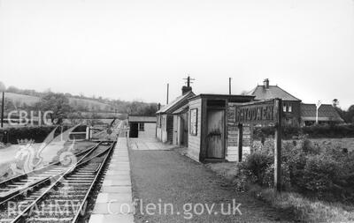
The Coflein record for Rhyd-Owen Station, written in 2010, notes that there was a through line with a passing loop; the passenger platform was on the up side. The station closed in 1962; although the wooden station buildings have been demolished, the nearby station house survives. [53]
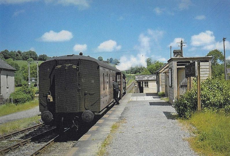
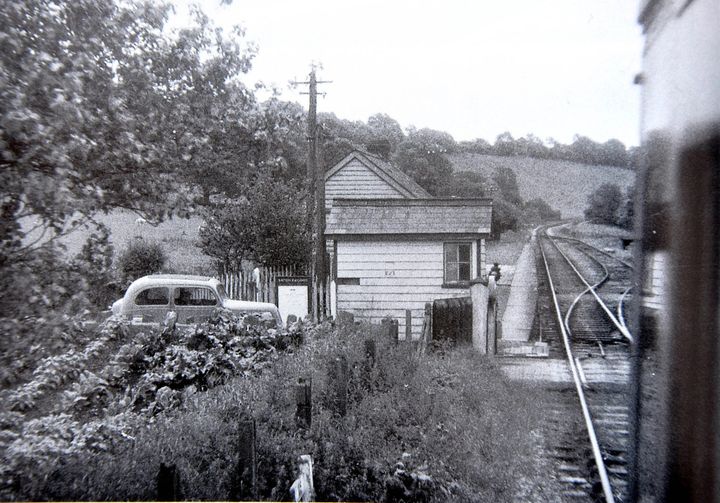
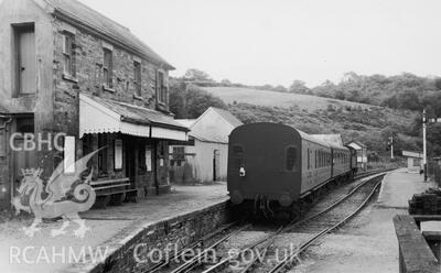
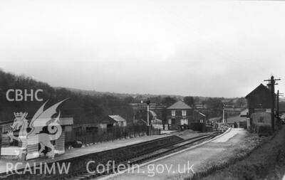
Rhydowen Station in 1961, seen from the road at the North end of the station site, from the Rokeby Collection III ref 25c. It is authorised for use here by Coflein. [53]Rhydowen Station in 1961, seen from the South end of the platform, from the Rokeby Collection III ref 25b. It is authorised for use here by Coflein. [53]Another view of Rhyd-Owen Station. The train is on a down service to Cardigan and consists of a single Hawkesworth Corridor Brake 3rd coach pulled by an unidentified 16xx 0-6-0PT.The station house just appears at the extreme left of this image. This image was shared on the Login Railway Station Facebook Page on 11th February 2022. [54]A view through the station from the North shows the loop siding at Rhyd-Owen. This image was shared on the Login Railway Station Facebook page on 16th September 2015. [55]The site of Rhyd-Owen Railway Station, seen from the road at its northern end. The station itself was on the left side of this image with the station house on the right side. It appears as though the station house has been significantly extended and modernised. [Google Streetview, November 2021]
Rhyd-Owen Railway Station has its own page on the Disused Stations website. Click here. [60]
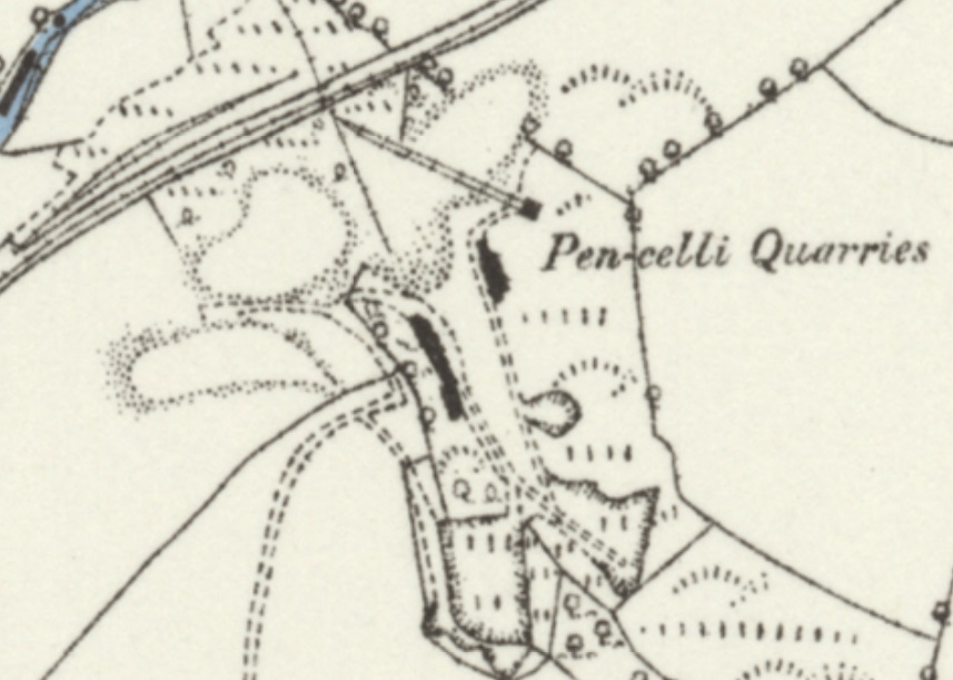
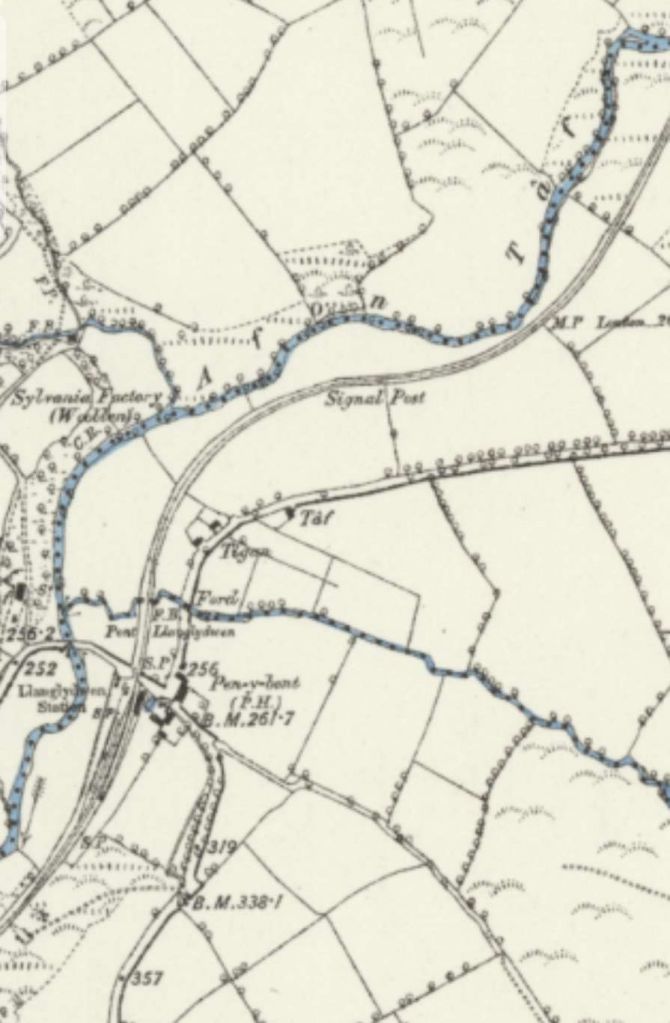
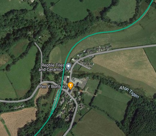
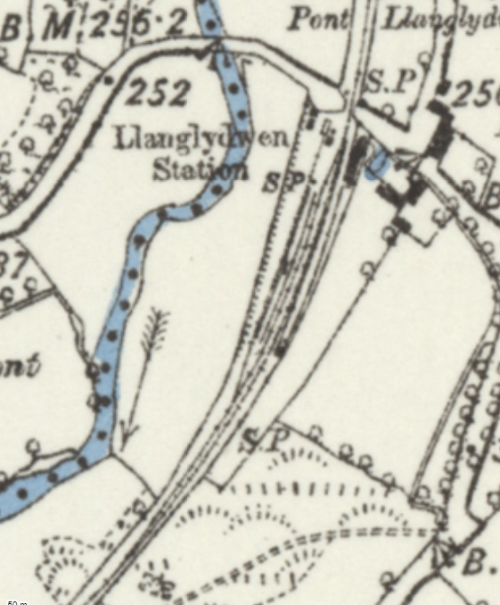
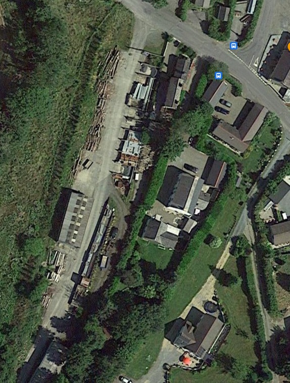
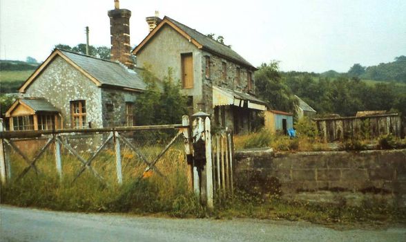
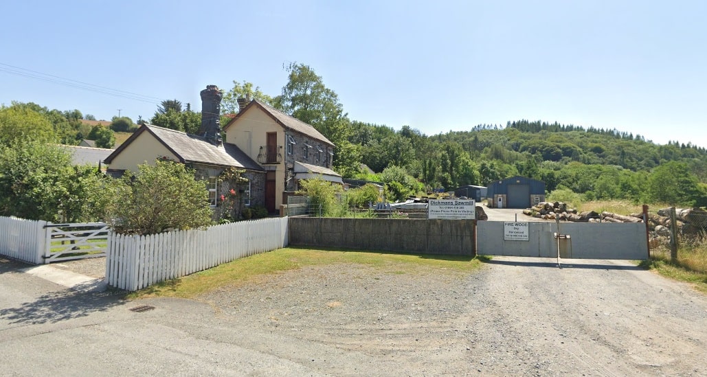
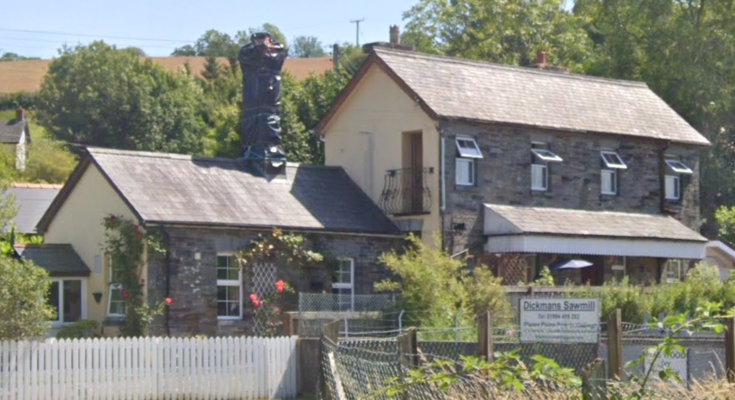
Another enlarged extract from the 6″ Ordnance Survey which shows the site of the Pen-celli Quarries. A single siding was provided for the quarries on the down side of the line. [50]Another length of the old railway which was still heading in a southwesterly direction. [56]This extract from the railmaponline.com satellite imagery covers a similar length of the line to that shown on the map extract above. [3]This next extract from the 6″ Ordnance Survey of 1887 covers the length of the line as far as Llanglydwen Station. [57]This extract from the railmaponline.com satellite imagery covers a similar length of the line to that shown on the map extract above. Llanglydwen Railway Station was sited towards the bottom of this image to the south side of the road through the village. [3]An enlarged extract from the 6″ Ordnance Survey of 1887 which focusses on Llanglydwen Railway Station. [58]The Llanglydwen station site as it appears in the 21st century. [Google Maps, July 2024. [59]Llanglydwen Railway Station in the 1950s. This photo was shared on the Login Railway Station Facebook Page on 9th October 2014. [63]View of Llanglydwen Station in 1962 from the Rokeby Collection III ref 3b. [64]View of Llanglydwen Station in 1962 from the Rokeby Collection III ref 4b. [64]The station building in 1982 when the crossing gates were still in place. This photo was taken by John Gale and was more recently shared on the Login Railway Station Facebook Page on 23rd June 2015. [61]The erstwhile station site at Llanglydwen. The station building remains in place. The white gated driveway is on the line of the station platform and the white fence marks the approximate location of the main running line through the station. The station yard is, in the 21st century, occupied by Dickman’s Sawmill. [Google Streetview, July 2021]A better view of what was the platform elevation of the station building as it appears in 21st century. [Google Streetview, July 2021]
Llanglydwen Railway Station has its own page on the Disused Stations website. Please click here to access that site. [62]
References
M.R. Connop Price; Before the Railways: The Early Steamers of Cardiganshire; in the RCHS Journal, Vol. 40 Part 8 No. 244 July 2022, p471-477.


