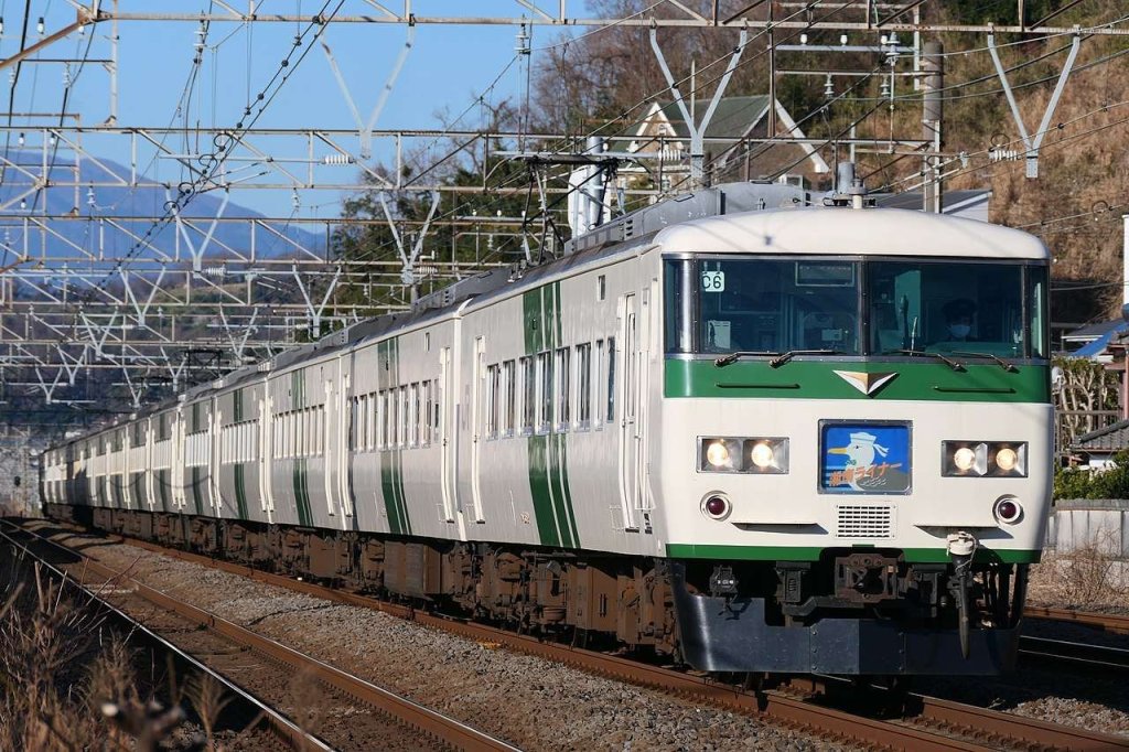
In June 1962, the ‘Modern Tramway’ carried a report by J. W. Higgins and Ralph Forty entitled ‘A New Electric Interurban in Japan’. [1]
The Izu Express was at that time Japan’s newest railway. It had opened on 10th December 1961.
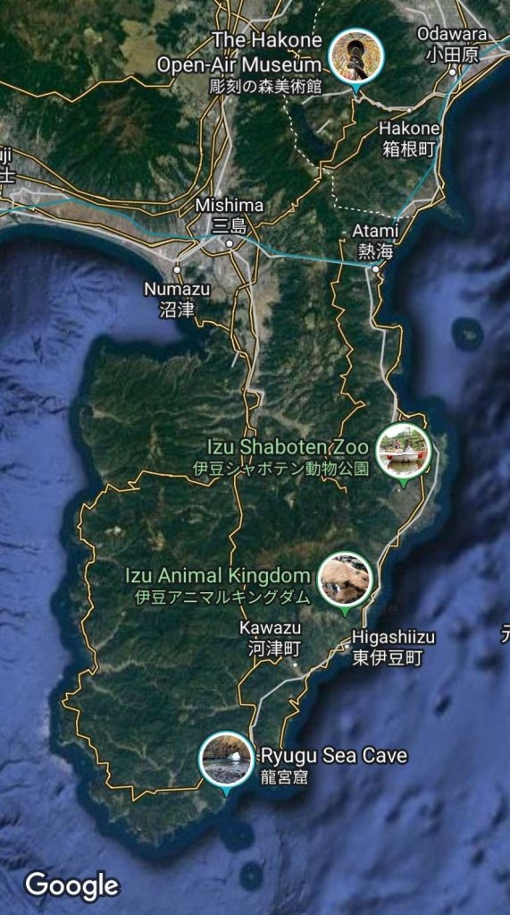
In the 21st century, the line is known as ‘The Izu Kyūkō Line’. It is a privately owned railway line of the Izukyū Corporation in Shizuoka Prefecture, Japan. [2]
The line approximately parallels the eastern coast of the Izu Peninsula, a tourist district noted for its numerous hot spring resorts, and golf courses, between Itō Station in Itō and Izukyū Shimoda Station in Shimoda. [2]
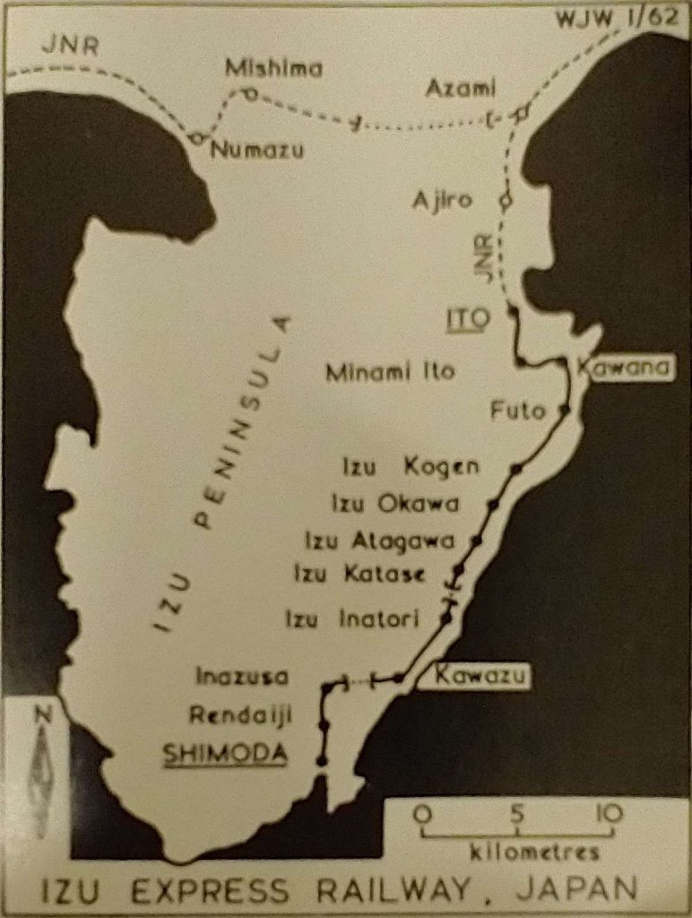
The Izu Peninsula showing the route of the Izu Express as produced for the ‘Modern Tramway’ journal. [1: p206]The Izu Peninsula as it appears on Google Maps in 2023. [Google Maps, 8th August 2023]
The line extended “southwards from the National Railways railhead at Ito, 76 miles south-west of Tokyo, to Shimoda on the south coast of the Izu peninsula, serving Kawana, Atagawa and several other resort towns en-route.” [1: p206]
Higgins and Forty continue:
“The mountainous topography of the peninsula has kept Shimoda relatively isolated in recent years, despite the resort development. Shimoda’s place in history stems from this isolation, for the town was chosen as the site for the first American Consulate in 1853 by a Japanese government trying to minimise the impact of foreign influence. The Izu Express Railway, or IKK, electrified at 1500 volts, d.c., has overcome the mountains by long tunnels and many bridges, and the line took almost two years to build; during this period, 34 workers were killed by cave-ins, landslides and other accidents. Completion of the line was a major engineering feat, and required 31 tunnels and 66 bridges of various sizes. These included an elevated structure on concrete pillars between Ito and Minami-Ito, and the Yazu tunnel, some 2,796 metres long, between Kawaza and Inazusa. A new depôt was constructed at Izu Kogen, equipped with car washers and a repair pit.
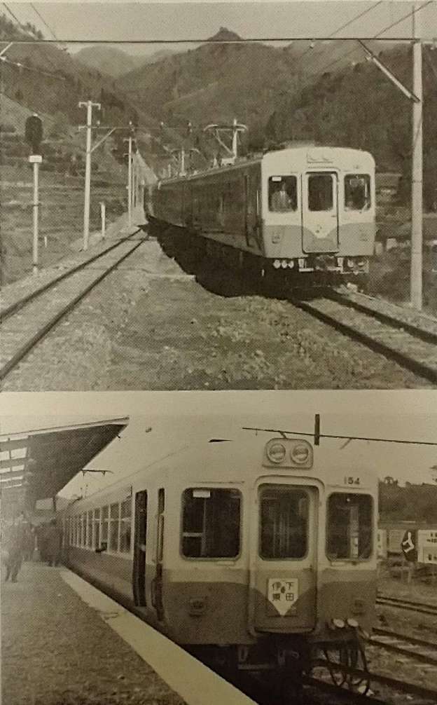
Shiny blue cars of the line’s small fleet provide local service between Ito and Shimoda at intervals of 25 to 55 minutes, the journey taking about 70 minutes. Three of the workings operate through between Shimoda and Atami, where the JNR 10.5-mile branch to Ito connects with the main Tokaido line, and have two classes of accommodation. The remaining 24 (25 on Sundays) workings make connections at Ito with Ito-Tokyo or Ito-Atami trains, and generally have second-class cars only. The JNR runs through expresses on the new line, using ‘Shonan’-type multiple-unit railcar trains which take 2 hours 50 minutes for the through run from Tokyo. Of three such workings, one operates only at weekends and one appears to be worked by Izu Express cars between Shimoda and Ito or Alami. There are only eleven intermediate stops between Ito and Shimoda; all are passing places, and the separation is unusually wide for a Japanese interurban.
The Tokyu Car Company supplied the 22 passenger cars, which have end doors and transverse seating in keeping with the resort-area nature of the traffic. Car design is up to the best of modern Japanese design, though not as luxurious as the new panorama cars of the Nagoya Railway. Fares are high by Japanese standards, at 230 yen (4s. 7d.) for the run from Ito to Shimoda, compared with 130 yen for the same distance on JNR. However, the express buses which the line replaced charged 260 yen plus 50 yen for a seat reservation, and took two to three hours for the journey.
Inatori station has an additional track for freight and express workings, and Shimoda station has a building which could be used for freight when completed, but on 16th December there was no freight service in operation. There is, however, a package-express service using a car borrowed from the Tokyo Express Electric Railway (TKK). The TKK … controls the Izu Express Railway as well as several other railways and bus routes in Japanese tourist centres, and also the Tokyu Car Company.” [1: p206-207]
“With the 1964 Olympic Games drawing near, development of the Shimoda area into a tourist centre is going ahead rapidly. A Luftseilbahn has been opened from Shimoda to Mt. Nesugata, and hotels are under active construction in readiness for the expected influx of business. So, as over a hundred years ago when Admiral Perry arrived in Shimoda with his black ships and opened Japan to foreign commerce, the IKK has also arrived. Now when the yearly ‘Black Ship Festival’ is held, the tourists will arrive, not by bumpy bus ride, but by a fast smooth, efficient electric interurban ride through the hills and along the beautiful Izu peninsula.” [1: p207-208]
All the cars provided at the opening of the line are 20 metres long and 2.8 metres wide. They were:
Class Kumoha 100: Nos. 101-104 each with 68 seats. Their capacity was set at 150 people which means that when full nearly 100 passengers would have to stand. They were double-ended motor cars.
Class Kumoha 110: Nos. 111-120 each with 74 seats. Their capacity was set at 160 people which means that when full nearly 90 passengers would have to stand. They were single-ended motor cars.
Class Kuha 150: Nos. 151-156 each with 74 seats. Their capacity was set at 160 people which means that when full nearly 90 passengers would have to stand. They were single-ended control trailers.
Class Saroha 180: Nos. 181-182 each with 30 first-class seats and 41 second-class seats. Their capacity was set at 116 people which means that when full 45 passengers would have to stand in second-class. They were two-class trailers.
TKK 3608: a passenger car used for package express workings.
The normal train formation consisted of two sets for Atami-Ito-Shimoda workings, made up: 110+180+110+150+110; for Ito-Shimods workings, there were four sets made up: 150+110 or 150+110+100. TKK3608 ran independently, not as part of a passenger consist.
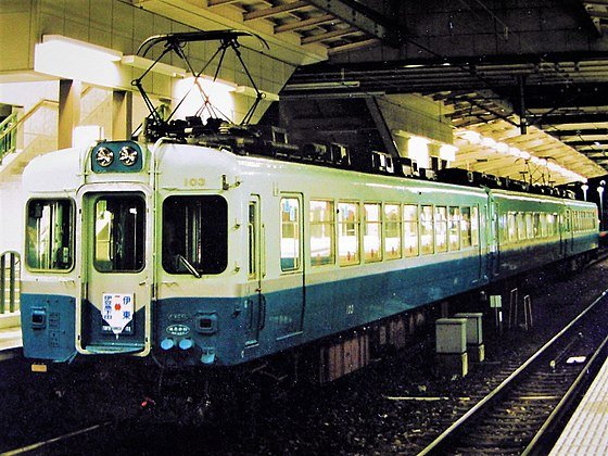
Wikipedia records 21st century stock as:
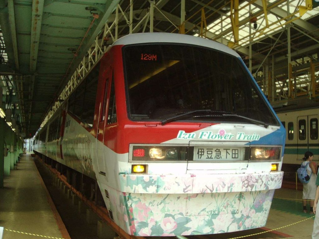
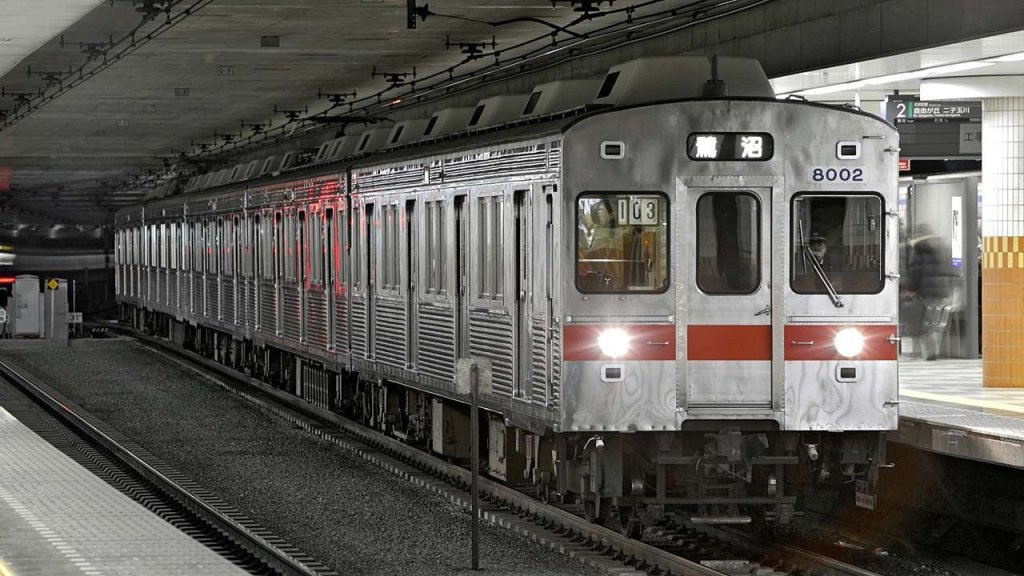
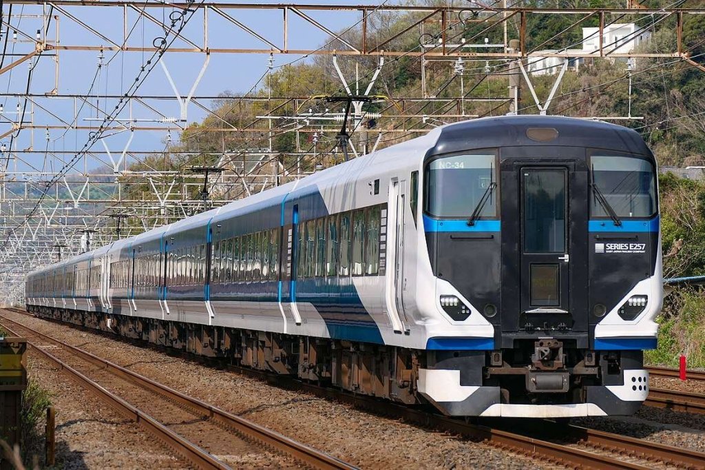
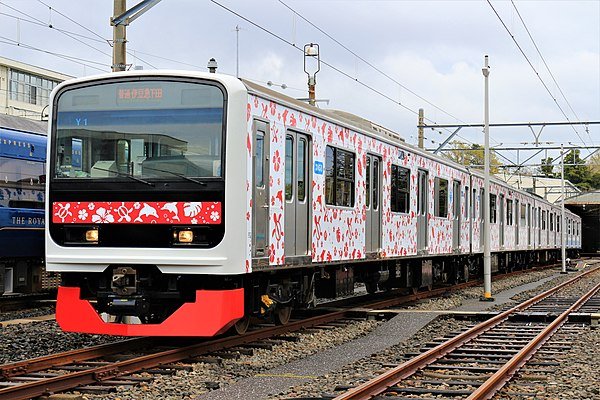
“Izukyu 2100 series, Izukyu 8000 series, E257-2000/2500 series. Future Izukyu 3000 series (Former 209-2000/2100 series). Former 185 series.” [2] This listing does not include the cars first used on the line and shown in monochrome above. It was completed before the Izukyu 3000 series entered service in 2022.
J. W. Higgins and Ralph Forty; A New Electric Interurban in Japan; in Modern Tramway and Light Railway Review, Light Railway Transport League and Ian Allan Hampton Court Surrey, Volume 25 No. 294, June 1962, p206-208.
[NB: I have sought, where-ever possible to attribute all sources and have no intention of contravening copyright. Should there be an issue with any of the images below, if you are the copyright holder, please contact me. Please accept my apologies in advance if this has occurred.]
Acknowledgement: I have been helped to correct Japanese translation/transliteration in this post by Ichiro Junpu who also provided the images relating to the Uguigawa Line below. His own work focusses more recently on Chinese Narrow Gauge Railways. His website: “Narrow Gauge Railways in China” can be found on the following link: http://www.kii762mm.com/modules/pico/index.php?cat_id=250 (for Japanese: http://www.kii762mm.com/index.html)
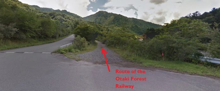
The Ohtaki Forest Railway
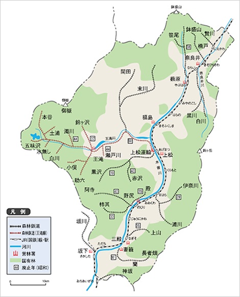
The red-dotted route on the featured map above represents the Ohtaki Forest Railway which came to be representative of the whole Kiso Forest Railway. It had the greatest route mileage and made the most significant contribution in timber carrying revenues. [13]
The Kiso Valley’s first forest railway to use mechanical power was the Ogawa Forest Railway. It was completed in 1916. Other lines quickly followed: the Ohtaki Line, the Atera Line, the Ogiso Line, the Nishinogawa Line, and so on. …. There were 57 routes in all, the length of the lines totaled over 428 kilometres. This can be increased, if all the work areas and sidings are included, to over 500 kilometres. [13]
Construction of the Ohtaki Line was started in 1917 by the Imperial Forestry Bureau. At that time the first 25 km to Kohrigase along the Ohtaki River were completed. Extensions to the system followed relatively quickly – the extension of the main-line to Miure (about 17 kilometres) and branches including the Setogawa, the Uguigawa, branch-lines at Takigoshi and small branches around Ohtaki, Mitake, and Kaida.
By 1975, Japan had entered a period of rapid economic growth, and the transportation environment shifted once again. Railways became electrified and refinements of the internal combustion engine produced trucks that conveniently allowed lumber to be transported without the need for railway tracks. And so the Kiso Forest Railway was deemed to no longer serve an essential function. The Ohtaki line eventually closed in May 1975. [13] As the forest railways disappeared, one after another, Kiso became a focus for public attention. A special program was aired on TV, and as the final operating date approached, bustling tent villages developed at each station. [10]
The last logging trains ran commercially in the Forest in 1976. [1]
It wasn’t until much later, in the summer of 1987, the Akasawa Forest Railway finally resumed operation as a tourist attraction. [10] The line at Akasawa bills itself as The Ohtaki Forest Railway. It Is a remaining remnant of the old Kiso Forest Railway system. It still runs for tourists through Akasawa Natural Recreational Forest, a 300-year-old natural forest. [7] However, it is not on the line of what was originally the Ohtaki Forest Railway. That railway followed the valley of the River Ohtaki a little further North in the Kiso River Valley catchment area. Details of the original line follow here:
The name “Ohtaki Forest Railway” has become synonymous with the Kiso Forest Railway. So perhaps it is important to follow the actual line of that railway alongside the Ohtaki River (its route is shown by the red line on the map above). We will leave the Akasawa line alone for now!
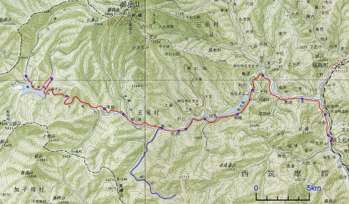
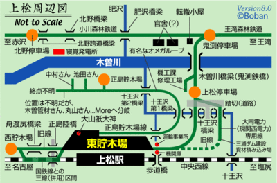
The Ohtaki line was lengthy. It ran for 48 kilometres from Agematsu Station in the East to Hontani, but even at that length it only made up around a tenth of the whole network in its prime. The map is part of 1/200,000 “Iida” from the Geographical Survey Institute, issued on 30th March 1968. [18] The sketch plan above shows, schematically, the network of 762mm lines in and around Agematsu. [21]
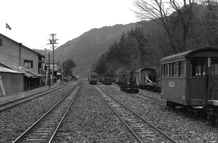
An overview of the station and lumber yards at Agematsu. [21]
As we have noted the main Ohtaki Forest Railway closed in the mid-1970s. Pictures can therefore be found from the later period of the line’s operation. Among the photos below are a number selected from the on-line Tsushima Keibendo Photo Gallery. [18] Each item is referenced directly to the page in that gallery and following the link provided in the references at the bottom of this blog is very rewarding. Most of the monochrome images were taken in 1974. I am writing in 2019, so these pictures take us back 45 years. [18]
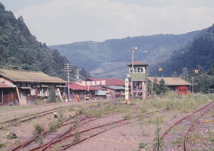
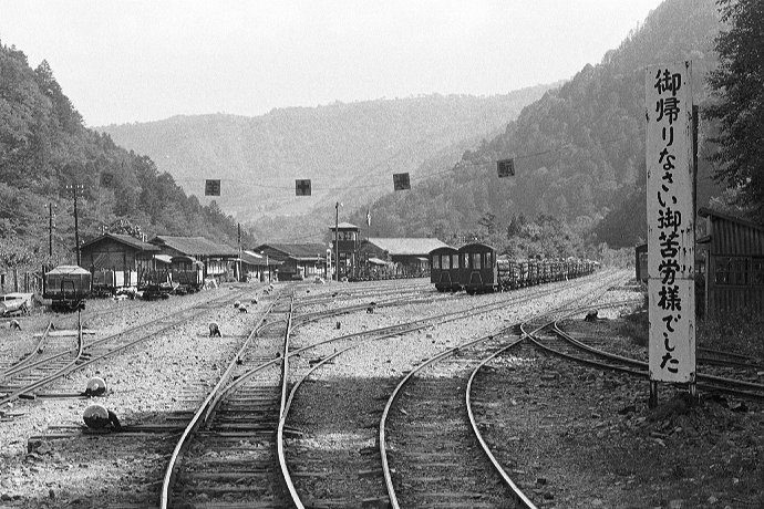
Agematsu Station in 1973. [18]
Agematsu Station in 1973, this picture is taken looking back towards the location of the first. [18]
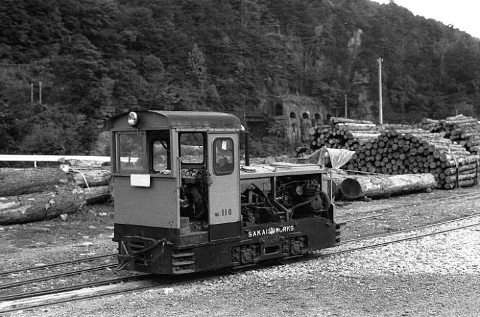
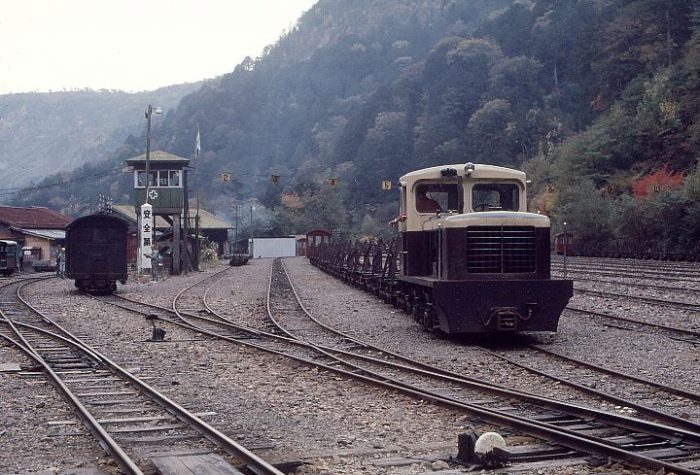
Agematsu Forestry Office in 1973, a small 5 tonne diesel locomotive and passenger carriage sit in front of the storehouse. [18]
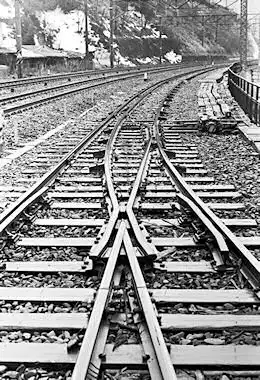
There were two goods yards at Agematsu and moving between the two required accessed to the larger gauge mainline. Over a short length that railway was dual-gauge as can be seen on the adjacent picture taken in 1974. [11]
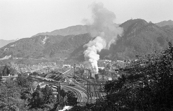
There was a substantial operation transferring timber from the narrow gauge line of the Forest to the JNR Chuo Line.
The logging operation at Agematsu. [18]
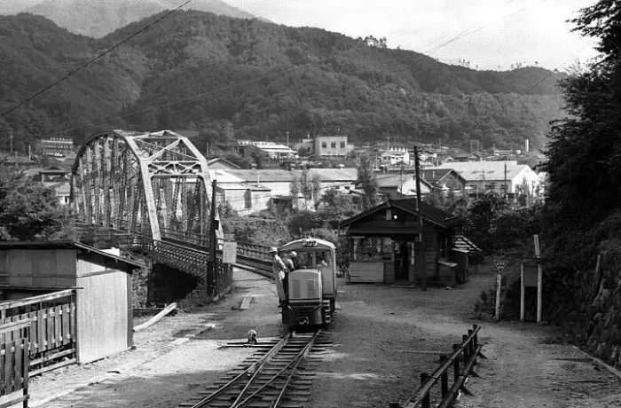
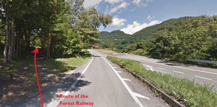
After leaving Agematsu the line travelled alongside the JNR Chuo line and alongside the Kiso River until it reached the Onibuchi Railway bridge. Here it crossed the Kiso River to its West bank and then followed the river for about 4 kilometres. [18]
The Ogawa Line left the Ohtaki Line at this point. Its route heads off to the right of the monochrome image above. The next two images show this location in the early 21st century.
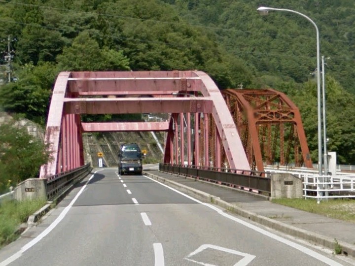
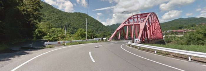
The modern road bridge sits alongside the old railway bridge. This view from Google Street view is taken in the direction of travel from Agematsu to the Ohtaki Valley.
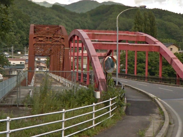
The old railway bridge can be seen more easily from the West side of the Kiso River. This bridge has already featured in the previous post about the Kiso Forest Railways.
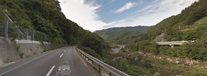
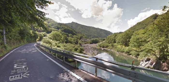
From Onibuchi, the railway formation follows what is now Highway 508 alongside the Kiso River.
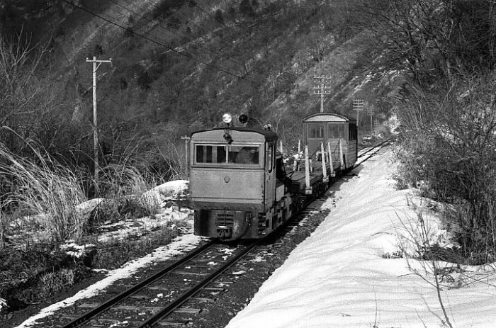
A few kilometres further along the line was a timber storage point near Kakehashi Cliff. The English translation of the name appears to be ‘Bar’. The Kiso River flows behind the locomotive in this picture and the JNR line is on the far bank. Above the engine hood of the loco a tunnel/gallery can be seen. [18]
The Ohtaki Forest Railway continued from here either under or alongside what is now the modern Highway 508 and then an unnamed/unnumbered road. The railway then turned to the West on the southside of the Ohtaki Valley, passed what is now the Kiso Dam.
Taken from the opposite bank of the River Kiso, this picture shows a Kiso Forest Railway timber train close to the point where the Ohtaki River meets the Kiso River. [18]
As the line turned into the valley of the River Ohtaki, it followed the Southbank of the river through Numa Station which had a grounded passenger vehicle as a waiting room and Ohshima Station were once a branch-line left the main route to serve Nishinogawa. The modern Route 20 and then Route 473 appear to sit between the Ohtaki River and what was the route of the railway. It appears that the railway sat above Route 473 on the valley side and then crossed it to follow the river.
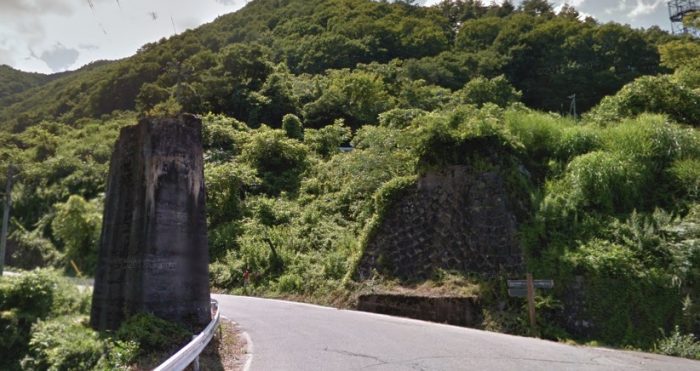
The Ohtaki Forest Railway crossed the route of the modern road No. 473 on a viaduct. Only the abutment and pier remain.
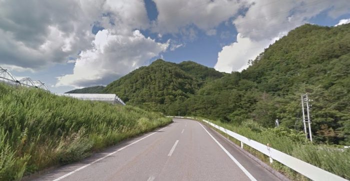
The Railway then followed the river closely as its course turned to the North in a relatively large loop. For a time the railway formation travelled North and we pick it up once again close to the Ohtaki River on the relatively recently constructed road below.
The line then ran passed the modern Tokiwa Dam and ran along under or alongside what is now Highway 256 and gradually, with the river valley, turned to a southerly course.
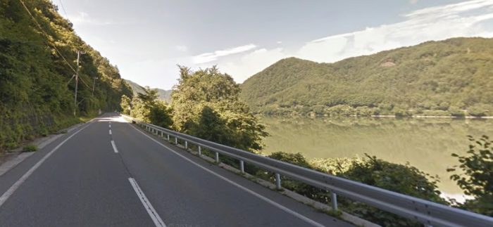
At Futagomochi Route 256 crosses the Ohtaki River. The Ohtaki Forest Railway remained on the South side of the river and then travelled alongside Lake Ontake which was formed by the construction of the Makio Dam. An unnamed/unumbered road now follows the Railway’s route beside the lake.
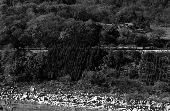
A timber train alongside Lake Ontake, travelling towards Agematsu. [18]
The present road runs into Tajima alongside the Lake. The old railway followed a course slightly to the South and ran behind the buildings that made up the village.
This image shows Tajima Station in 1974. The view is taken from the West looking back along the line to Agematsu. The modern road is off to the left of the picture. Tajima was the closest station to Ohtaki village. [18]
Tajima Station is nearly 21 kilometres from Agematsu. Just beyond it the modern road crosses the narrowing lake. The old railway route continues along the southern side of the valley. It is shown in the image below.
The next location along the route is Matsubara 23 kilometres from Uematsu, where there is now a Sports Park. The station at this location closed well before the line itself was shut down.
Matsubara station was at his location. Nothing of the station is visible in this March 1974 image. [18]
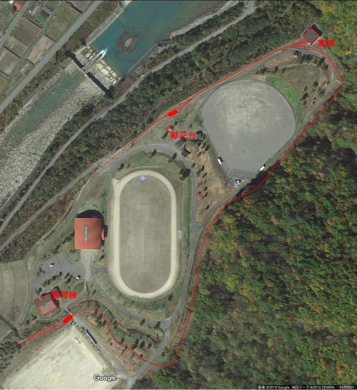
Matsubara is significant in more modern times as the location of a triannual ‘Forest Railway Festival’ which takes place at Matsubara Sports Park. The first of these events took place in 2004, the second in 2007, the third in 2010 and the fourth in 2013, etc. The “Ritsutetsu Club” is based here. It undertakes preservation work. The club was based at Tajima Station but moved to this new location in 2006. [12]
It may be of interest to note that Matsubara Sports Park is a park reconstructed by regrading earth and sand which flowed into Ontake Lake as a result of the Nagano Ken Western earthquake and the Makio Dam Sedimentation Project above the Matsubara station of that time. [18]
The landfill places the route of the old forest line under some 20 metres of fill and the new track runs on top of that landfill. The line is known as the “Seseragi Line.” It was built by volunteers over 5 years to reach a length of about 400 metres in 2007 and over 800 metres in 2010. [18]
The Seseragi Line in 2007. [18]
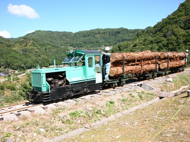
This locomotive is No. 132 which has been preserved and restored to working order. [18]
The route of the line surrounds the sports park. [15]
Beyond the Sports Park, the railway formation closely followed the river bank.
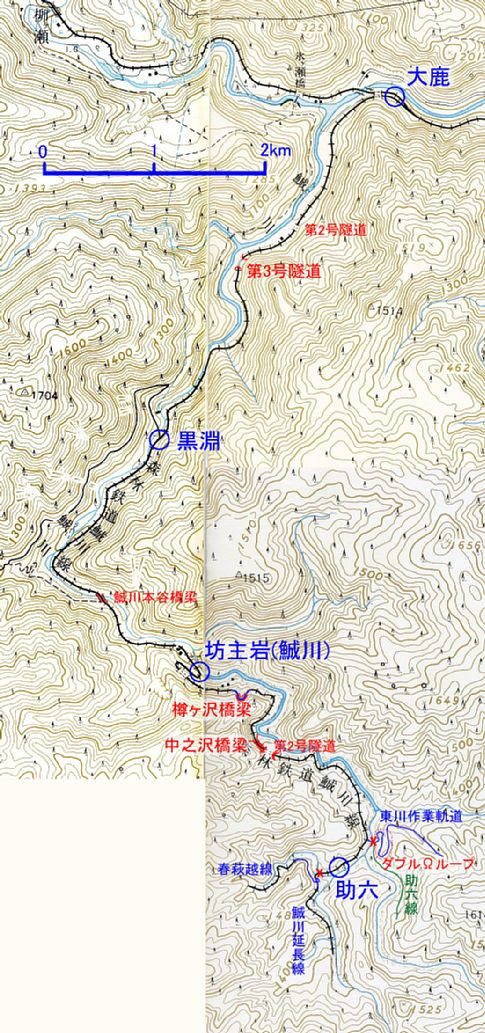
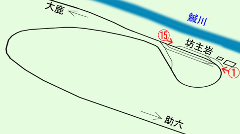
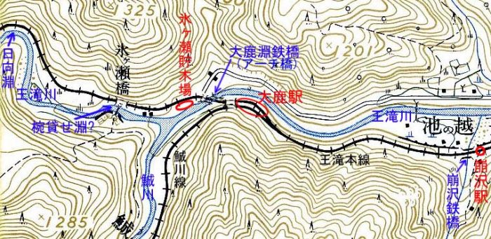
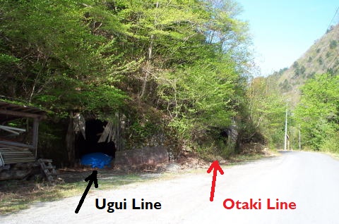
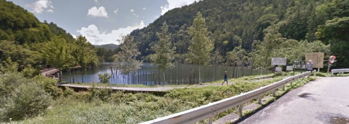
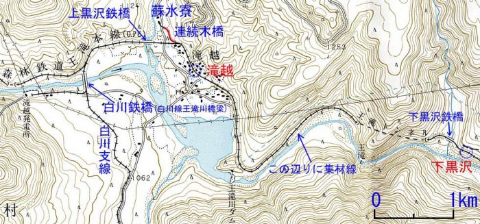
The next station along the line was at Ohshika, where a line branched off the line that we have been following and followed the valley of the Uguigawa River. It seems that although the Ohtaki line closed in 1975, it was still possible to follow the branch-line in 1977. [2] The adjacent map shows the line.
This map was
published in 1974 by the Geographical Survey Institute and is at 1/50,000 scale. Main stations of the Uguigawa Line are marked with a blue circle and letters. Important locations are marked in red with red lettering. Red ‘x’ symbols mark the extent of accessible lines.
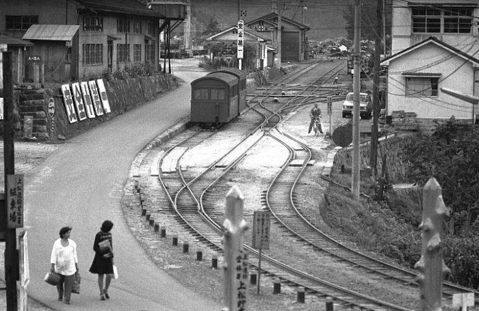
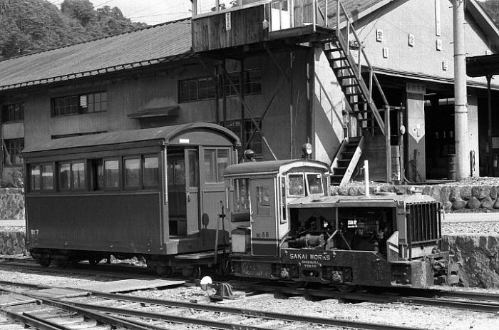
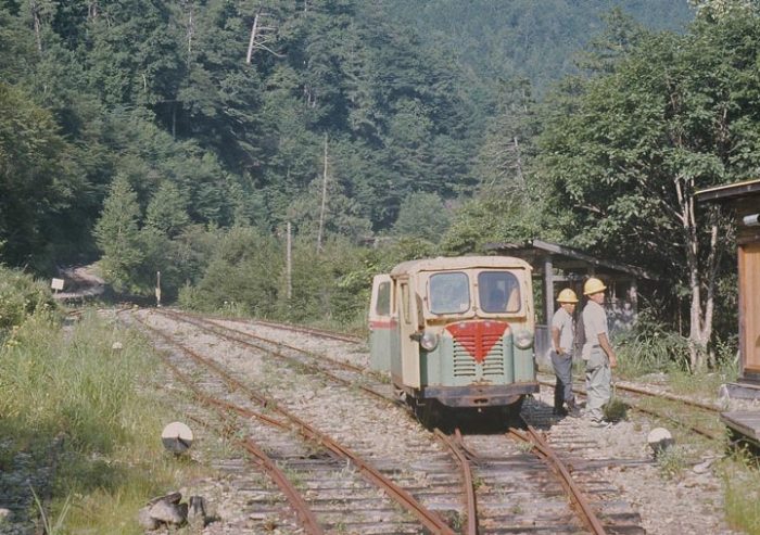
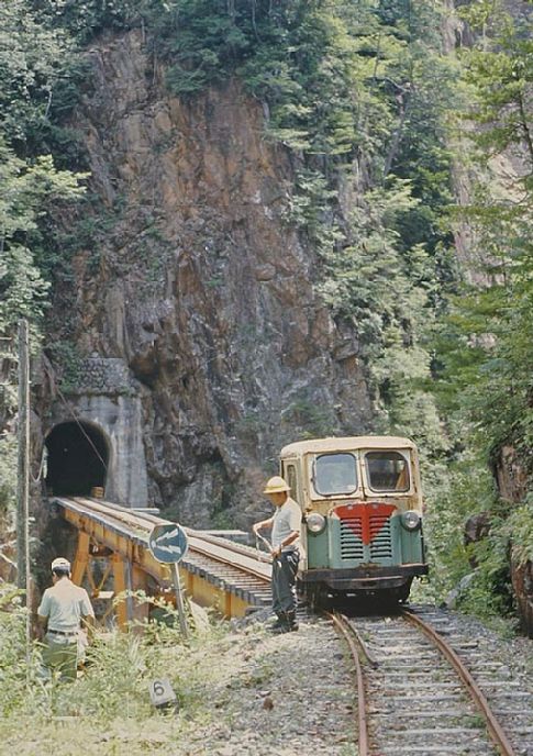
The Railcar No.4 used for the trip in 1977 is shown in the image below, taken at Bohzuiwa Station, which is about halfway along the Uguigawa Line at the point where the line negotiates two tight hairpin bends. [2]
Motor railcar at Bohzuiwa Station in 1977. [2]
Bohzuiwa Station track diagram, the picture above is picture (1) on the plan, the picture below is picture (15). [2]
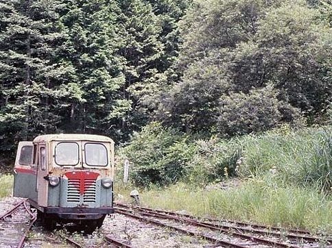
Another picture of a motor railcar at Bohzuiwa Station in 1977. [2]
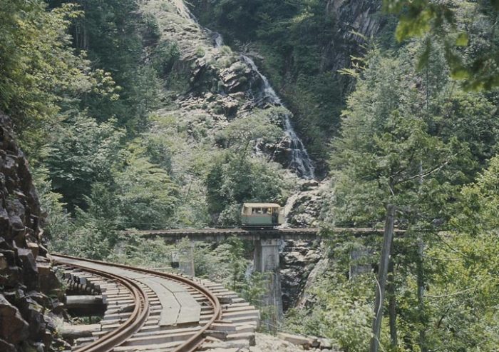
The next few pictures give an impression of the state of the Uguigawa Line in 1977. For a much better appreciation of the line please use the link at reference [2] below.
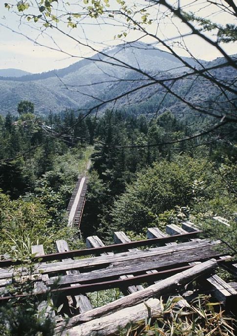
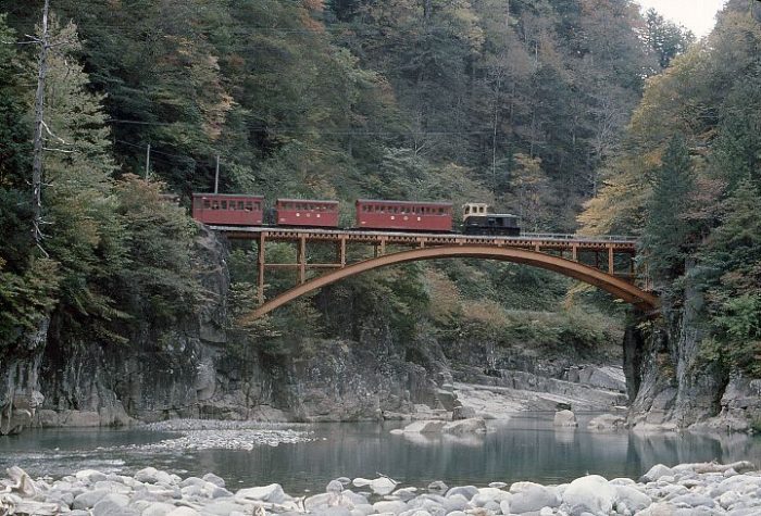
The Tarugasawa bridge. [2]
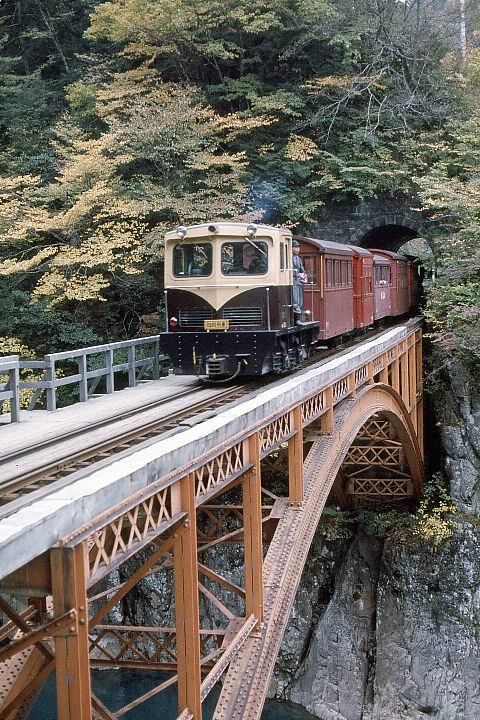
The Nakanosawa Bridge with the tunnel portal just beyond. [2]
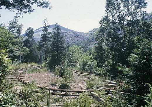
Sukeroku, the end point of Uguigawa line in 1977, this curve radii is very tight. [2]
Level differences can be dramatic! This is the view down on Sukeroku Station from an abandoned line. [2]
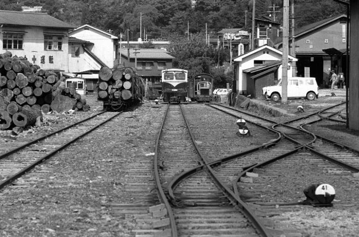
Back at the mainline alongside the Ohtaki River we get to Ohshika Station. It is shown immediately below a couple of years after closure. The enlarged extract from the Geographical Survey Institute, 1/50,000 map shows Ohshika Station highlighted by the larger red oval.
Ohshika in 1977, 2 years after the closure of the line. [2]
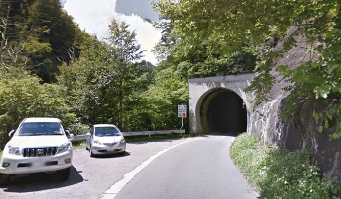
Beyond the station at Ohshika, both of the two lines entered tunnels which were immediately adjacent to each other.
Beyond Ohshika, the line enters a short tunnel before crossing the River Ohtaki on an arch-shaped iron bridge (Ohshiabuchi).
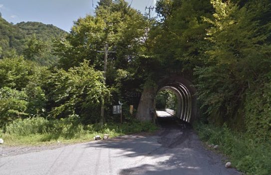
The two pictures above were taken in 1974 of trains crossing the Ohshikabuhi Bridge. [6] The very short tunnel shown in the second of the two pictures above is seen from its western end in the adjacent image from 2017. Immediately beyond this tunnel,Kohrigase storehouse was at hand which was also the limit of road transport when the line was in operation.
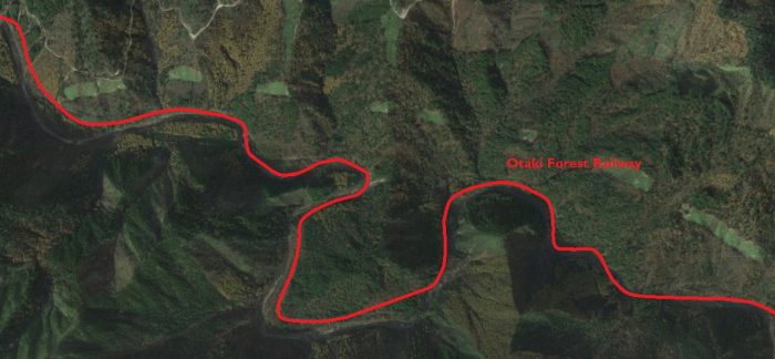
The railway is now travelling on the North side of the Ohtaki River.
A further couple of kilometres along the line Shimokurosawa was reached. The Shimokurosawa Railway Bridge was an excellent location for railway photography.
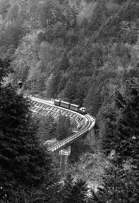
A forest train crossing the Shimokurosawa Railway Bridge in 1974. The reference provides a link to series of photographs at this location. [4]
Since the days of the railway, the valley has been flooded to create a lake. The same bridge is shown from the later road in the next image. The camera is beyond the bridge in the monochrome image above looking back towards Agematsu.
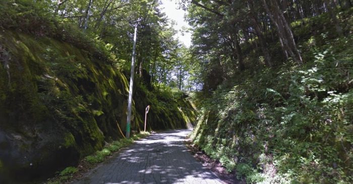
As the monochrome photograph above and the map below (at the right-hand edge of the map extract) show, just after the line crossed the Shimokurosawa Railway Bridge it entered a tunnel which took it through a significant rock outcrop. That tunnel is just off the modern photograph to the right. The portal is shown below.
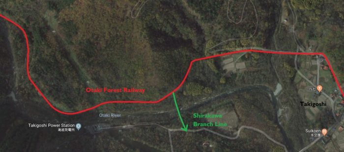
The line then followed the river until it reached the scattered village of Takigoshi. Its route to the village forms the foundation of the single track road to Takigoshi.
Although roads are shown on the map below, the only access to this village and beyond was by railway or on foot. It was the abandonment of the railway which, in the main, provided a suitable access route for road vehicles. The railway crosses from East to West and the village and station are at the centre of the map.
Takigoshi Village. The map shows the Shirakawa Branch-line head south from the main line.
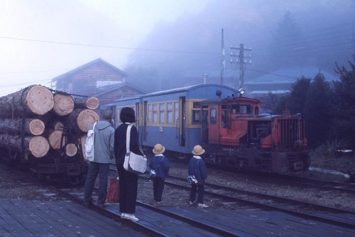
A misty day in October 1974 at Takigoshi. [5]
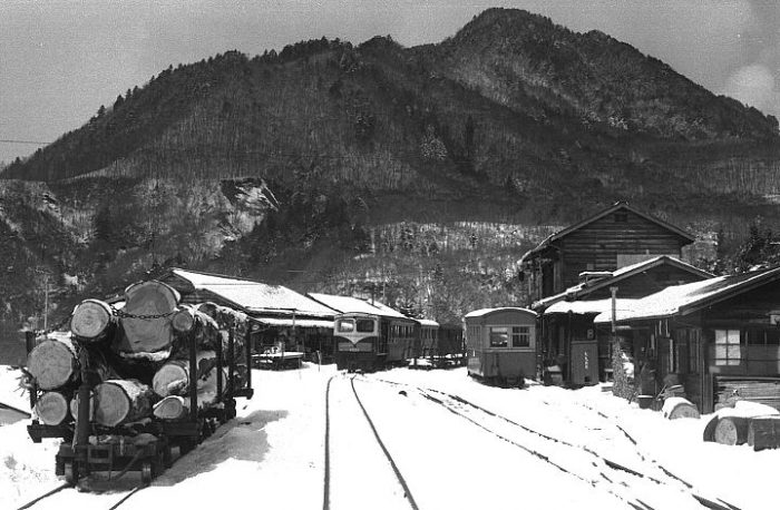
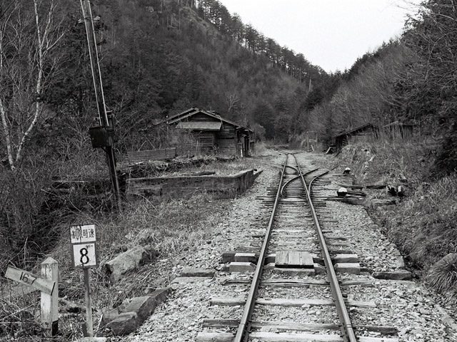
Takigoshi in the snow in March 1974. [4]
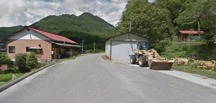
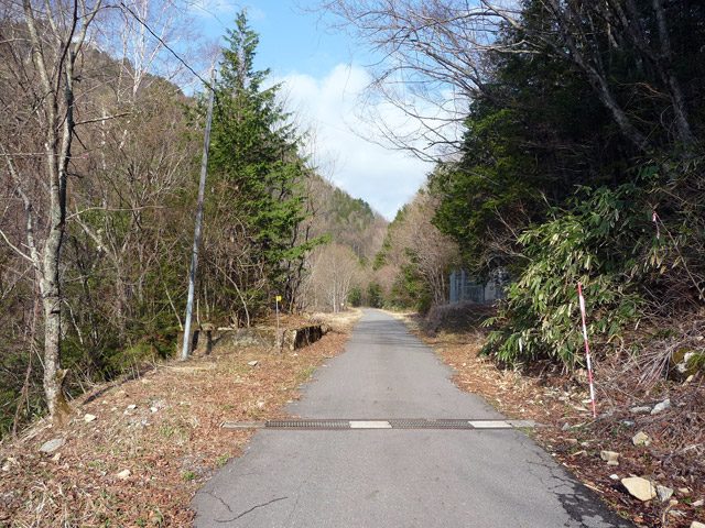
The same location in around 2015.
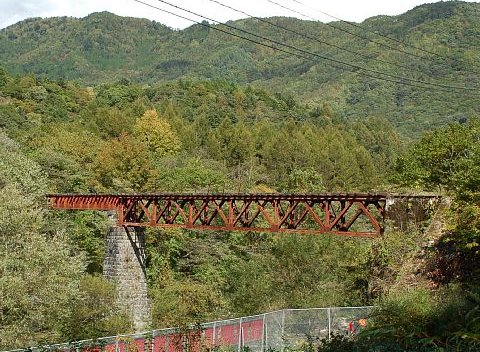
Lattice Girder bridge close to the start of the Shirakawa Line. [4]
The line continues on alongside the River and passes through Ichinose before reaching Tsuchiura Station (marked a Sato on the satellite image).
Ichinose in the 1950s. [17]
Ichinose in the 21st century. [17]
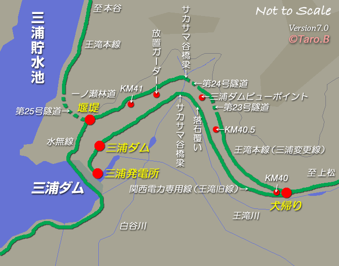
This sketch plan shows the railway close to Miure Dam. Three different routes are shown. At the 40 kilometre point a line to the base of the dam diverges to the south of the main line and then close to the Dam a line diverges close to the mouth of Tunnel No. 25, heading south and then round the southern shores of the lake. [19]
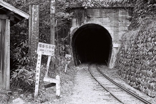
Tunnel No. 25. [20]
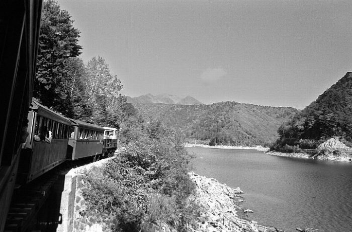
The next image is taken on the line running alongside Miure Lake which is the lake behind Miure Dam.
The train in this image is travelling from Hontani back towards Tsuchiura. The picture was taken in October 1974. [8]
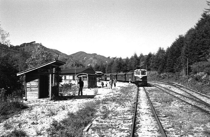
Beyond Sato the railway followed the northern bank of Lake Miura to is terminus at Hontani. The red line on the satellite image above is approximate. The route is, in the 21st Century, increasingly overgrown.
Hontani Station was the end of the line. This picture was taken in October 1974.Only light logging lines extended West beyond the station at Hontani. [9]


