
I was reading (in August 2024) the July 1903 Railway Magazine and came across an article about the Welshpool & Llanfair Light Railway. [1: p64-68] The article marked the opening of the line at the beginning of April 1903.
After the first railway entered Welshpool on 10th June 1862 – the Oswestry (by 1903, the Cambrian) Railway – a series of three different schemes were proposed to connect Welshpool and Llanfair Caereinion. The first scheme was put forward in 1864, the second in 1875, the third in 1887. None of these schemes came to fruition. However, “in 1896 a ray of light (the Light Railways Act) illumined the gloomy darkness of uncertainty and failure. Before the measure had received the Royal assent, Dr. C. E. Humphreys (Llanfair) had launched a scheme for connecting Llanfair with the Cambrian Railways, by means of a line through the Meifod Valley and Four Crosses. This was not allowed to pass unchallenged. Immediately Welshpool … entered the lists with a Bill for a 2ft. 6in. gauge light railway, to run from Welshpool to Llanfair. If Llanfair was to have a railway (which was of all things most desirable) that railway, said they, must run from Welshpool. … A spirited war of routes resulted, terminated by the Light Railways Commissioners giving the award to Welshpool for a 2ft. 6in. gauge railway from Welshpool to Llanfair.” [1: p64]
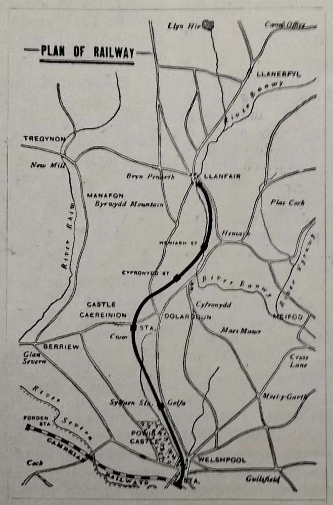
The successful company “was liberally supported by Welshpool, the Montgomery County Council, Forden District Council, and Llanfyllin Rural District Council.” [1: p64]. The Treasury granted a gift of £17,500 – one-third of the estimated cost. The new railway was planned as a single line, 2ft, 6in. gauge running from the road outside Welshpool Railway Station, along “the Lledan Gorge, over the Pass at Glyn Golfa to Castle Caereinion, through the Banwy Valley to Llanfair. An agreement was entered into with the Cambrian Railways to work and maintain the line; the construction of the line [was] … under the supervision of the Cambrian Railway’s Engineer, Mr. A.J. Collin: Mr. Strachan (Cardiff) being the contractor. On 30th May 1901, … Viscount Clive the son of the Earl and Countess Powys … cut the first sod for the new line. In February [1903] the line was completed; and passed by Major Druitt, of the Board of Trade.” [1: p64-65]
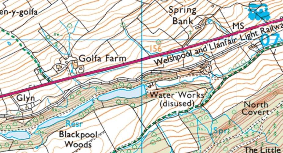
On 4th April 1903, the first passenger train navigated the new line. The Railway Magazine described the route: “The new railway [cut] through the town of Welshpool, over the brook and canal, and burrow[ed] its way up the Golfa Pass.” [1: p66]
The length of the line through the town of Welshpool has already been covered. For the relevant articles, please check these two links …
- Main article. [2]
- Additional images. [3]
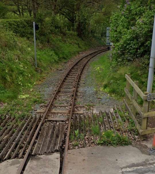
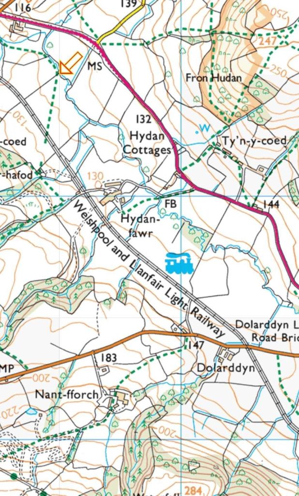
Those articles cover the length of the line abandoned when Welshpool undertook highway improvements, the run from Welshpool Railway Station as far as Raven Square, now a roundabout.
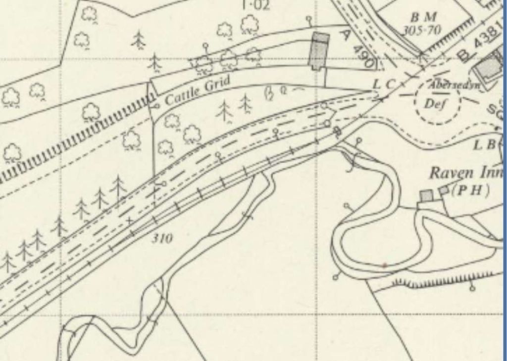
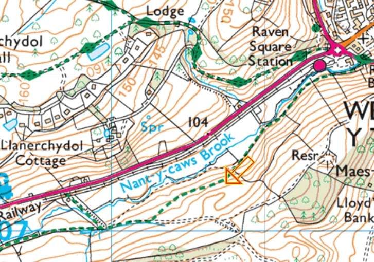
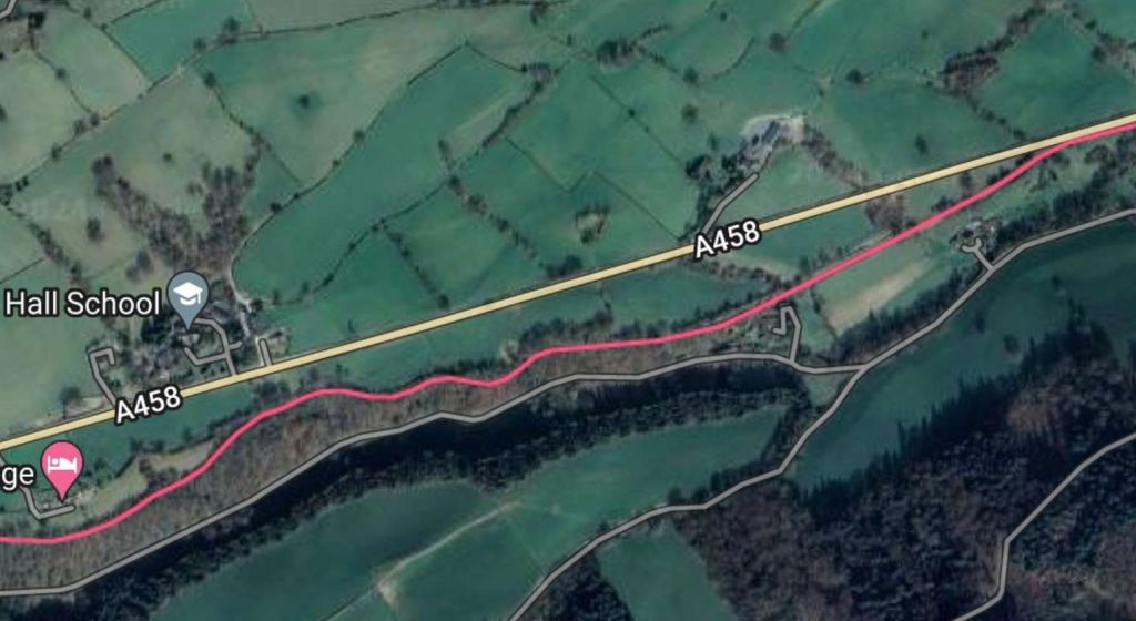
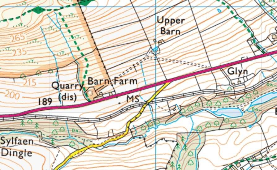
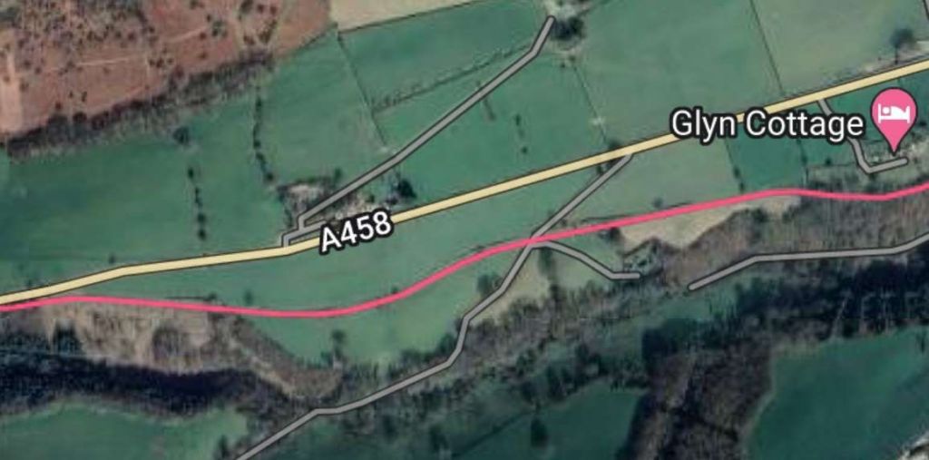
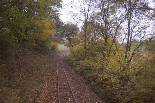
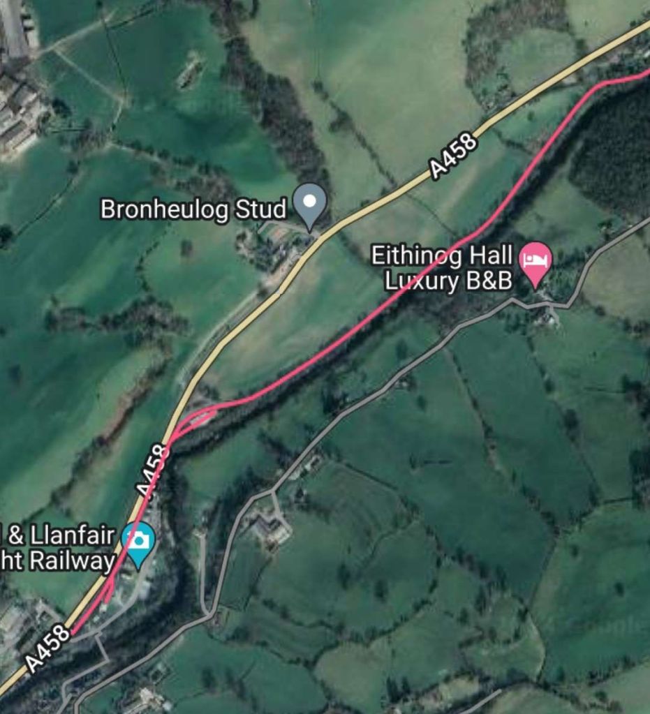
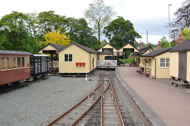
The preservation line occupies the trackbed of the line from Raven Square to Llanfair. It runs immediately alongside the A458 on the North side of Nant-y-caws Brook.
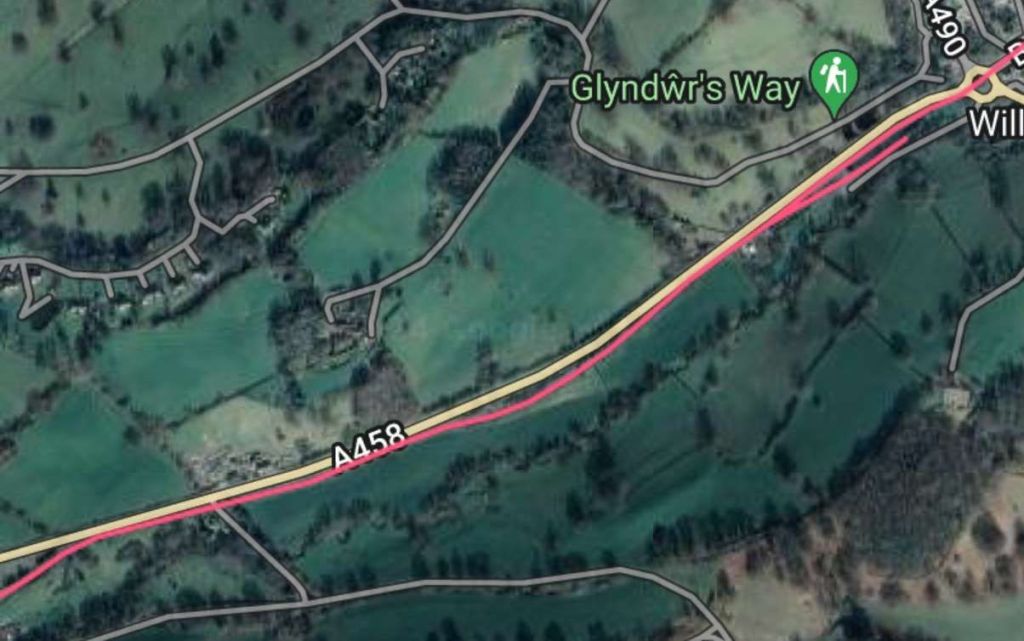
The Railway Magazine continues: In the Golfa Pass, “by means of a series of curves of small radii and steep inclines, the great natural beauty of the surrounding country has been retained. Rising 300ft, in the first two miles it reache[d] Golfa … with its lung-filling expanse of common – its garden of fern, gorse, and broom – where at 1,000ft above the sea level is presented a glorious panorama of typical Welsh pastoral scenery – the ideal of the pedestrian, artist, and rambler.” [1: p66]
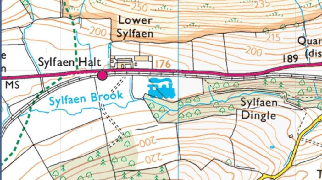
The Railway Magazine continues to describe the route ahead, the line “threads the beautiful Pass of Sylvaen; there, far to westward, is spread the famous vale of Caerinion, where, silhouetted against the misty horizon, Cader Idris and The Arrans lend an air of magnificent solemnity to an impressive scene.” [1: p66]
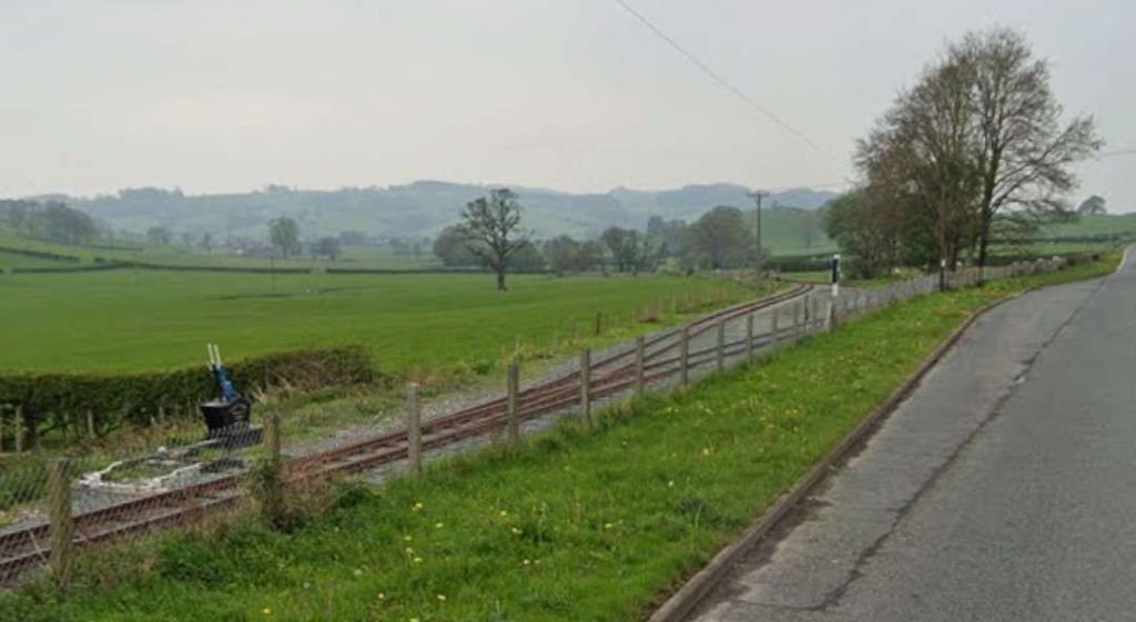
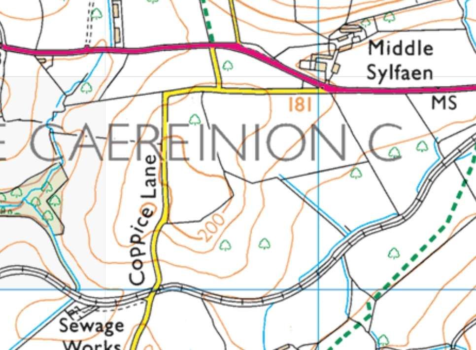
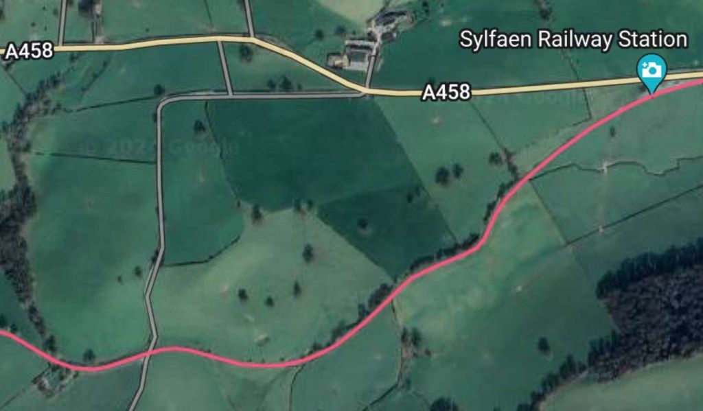
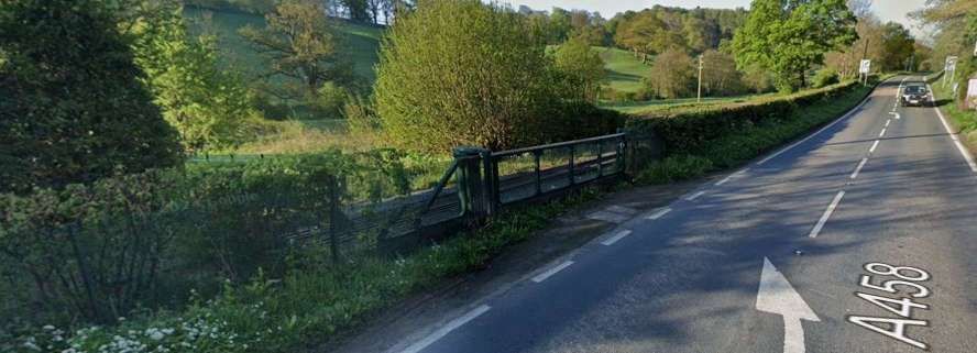
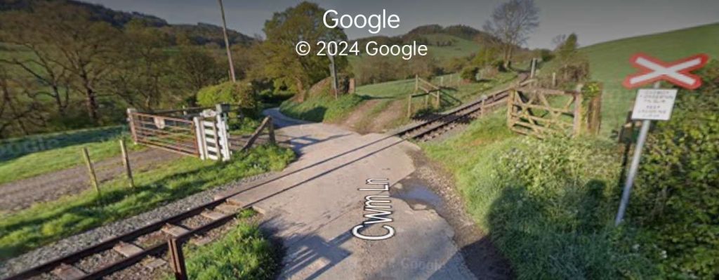
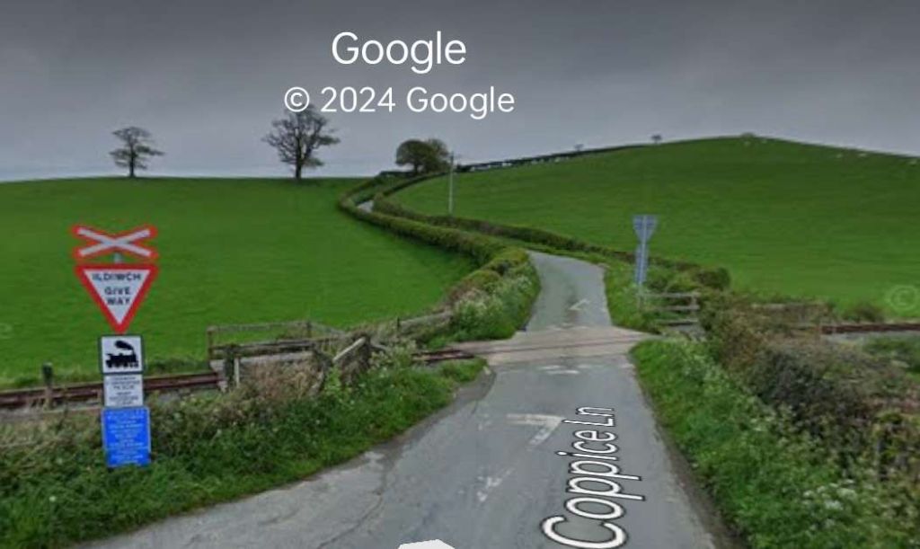
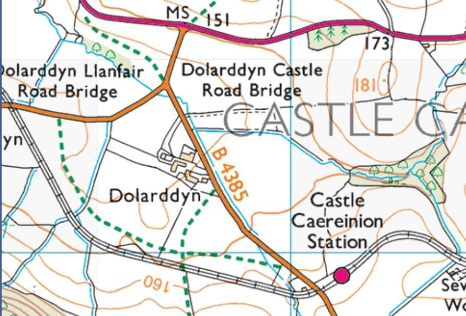
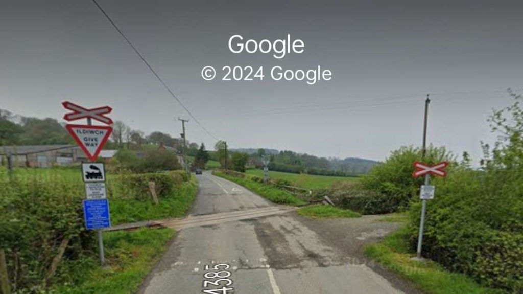
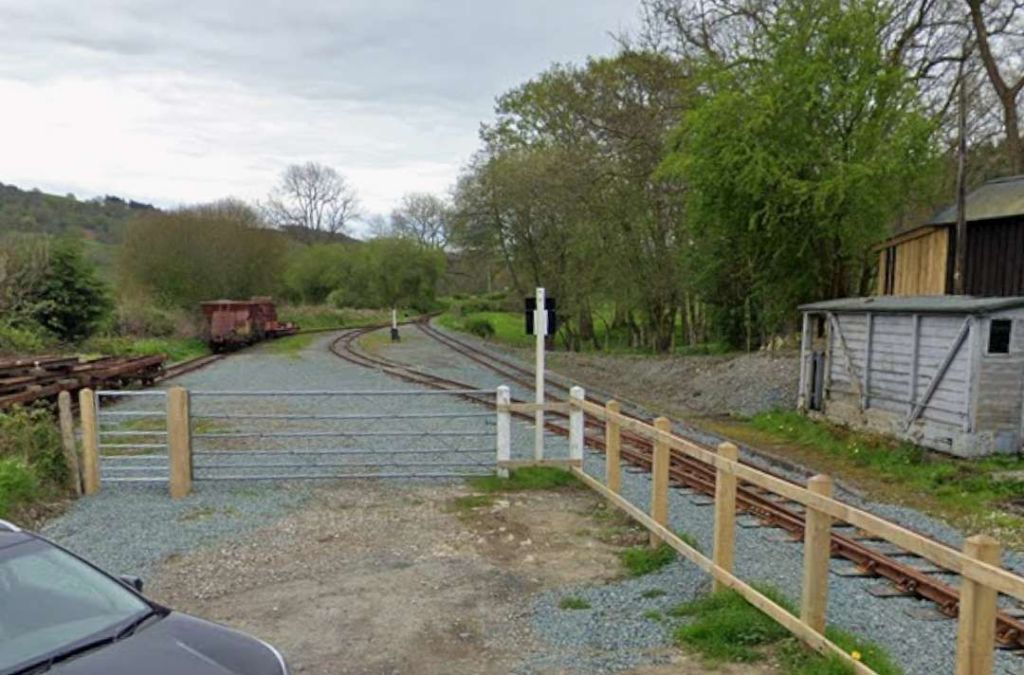
Castle Caereinion is South of the line down Coppice Lane from the level crossing which can be seen in the bottom-left of the image above.
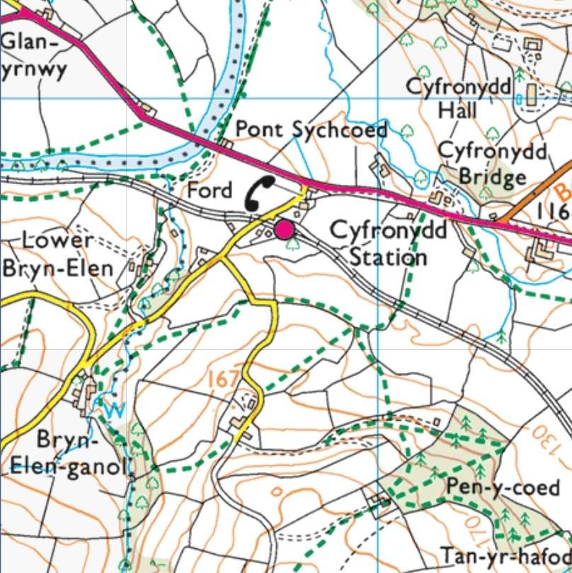
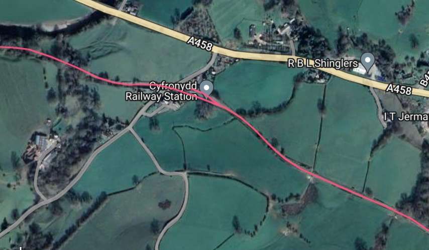
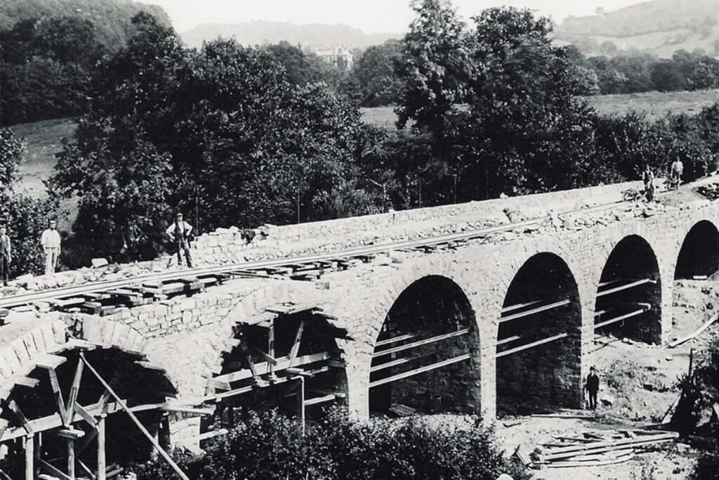
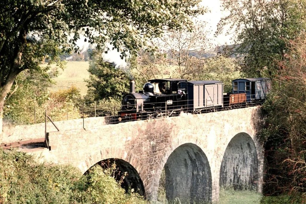
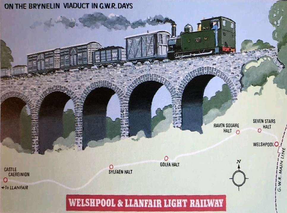
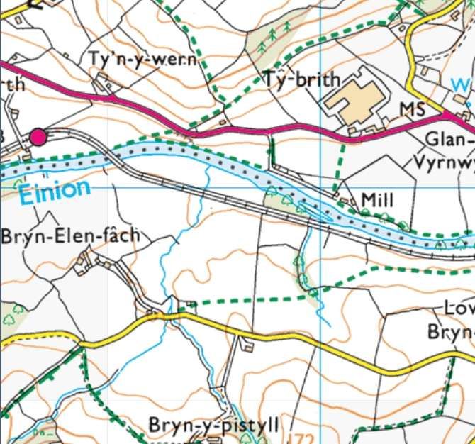
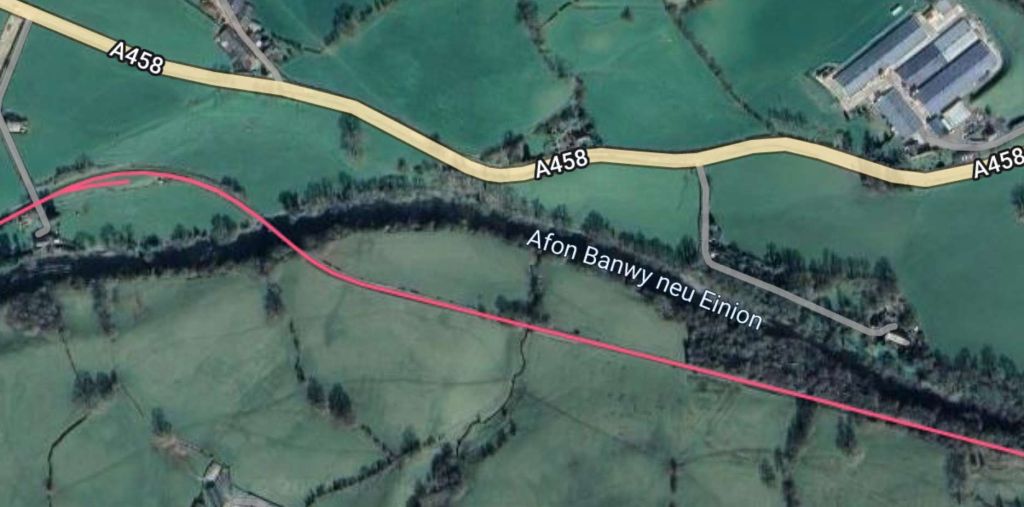
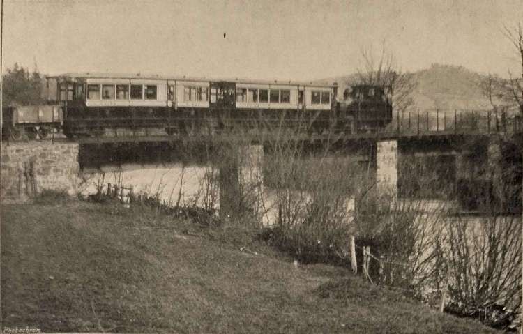
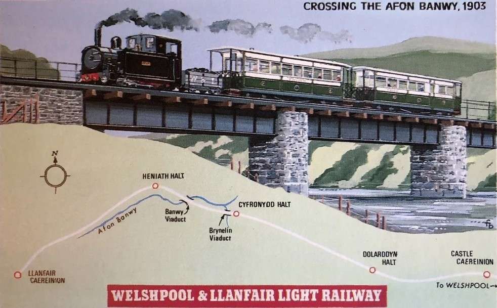
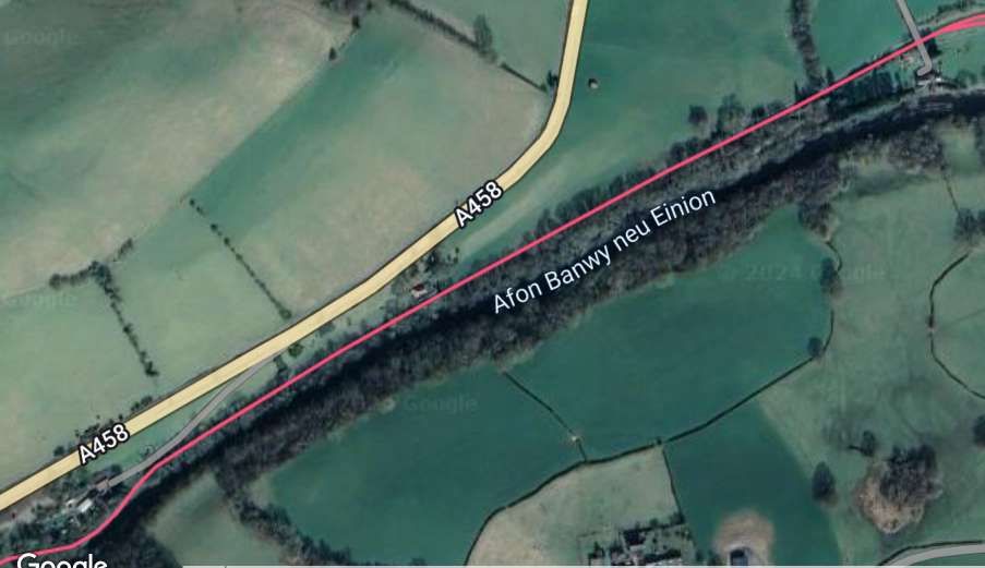
Again, the article in The Railway Magazine continues: the village of Castle Caereinion is about 0.5 mile from the station bearing its name. The line passed the site of the Castle of Caereinion and ran on through Cyfronydd and along the banks of the Afon Banwy, also known as the Afon Einion. It crossed the Bryn-Elen Viaduct, “a very substantial piece of engineering. The rails [were] then carried across the dingle which [ran]up to Cwmbaw by a stone bridge of six arches, at a considerable height above the bottom of the ravine. Half a mile further on is the Banwy Viaduct.” [1: 67]
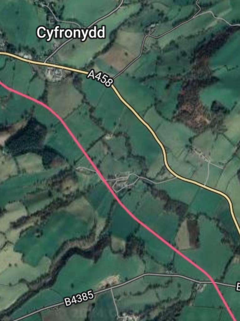
The line continues down through Cyfronydd Railway Station, over Bryn-Elen Viaduct to the banks of the Afon Banwy.
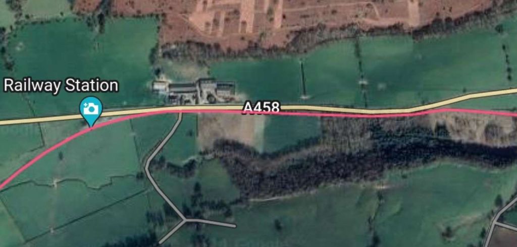
After running for a while on the South bank of the Afon Banwy (Afon Einion) the line crosses the river on a three-span girder bridge, Banwy Viaduct. It turns West once again and enters Heniarth Railway Station. Opened as Heniarth Gate on 6th April 1903 the station was renamed ‘Heniarth’ on 1st February 1913. [16]
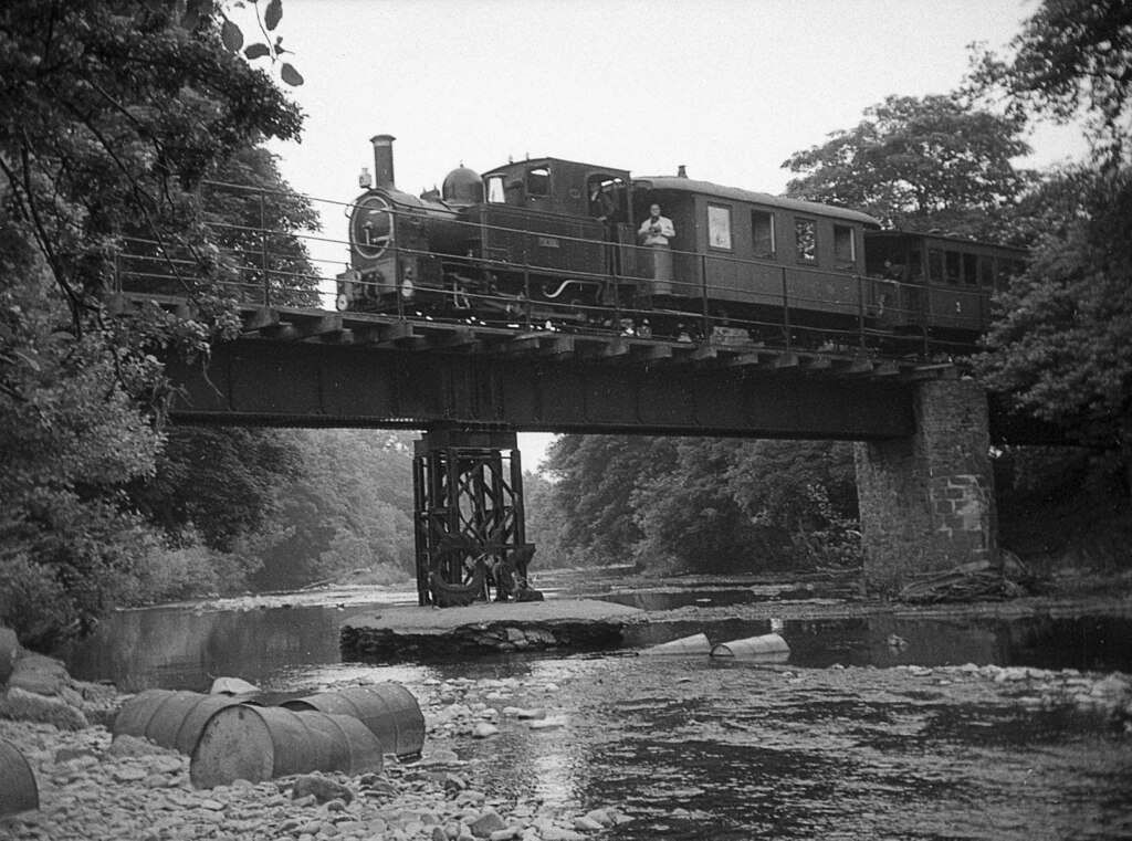
On 13th December 1964, the western masonry pier supporting the steel girder bridge was seriously damaged by flood waters and the bridge dislodged. During the spring and early summer of 1965 the 16th Railway Regiment of the Royal Engineers replaced the damaged masonry pier with a fabricated steel one and repositioned the span. Train services between Llanfair Caereinion to Castle Caereinion resumed on 14th August 1965. The steel pier is clearly evident in the photo. It has since been replaced by a masonry one, but more substantial than the one damaged in 1964, © Martin Tester and licensed for reuse under a Creative Commons Licence, (CC BY-SA 2.0). [11]
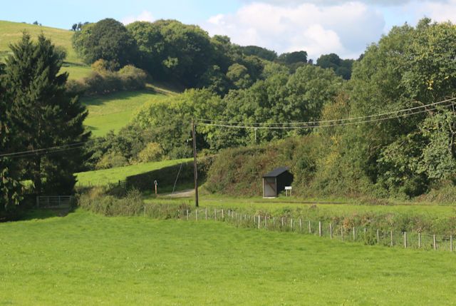
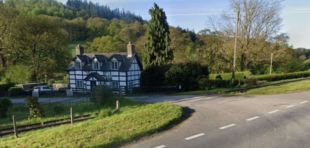
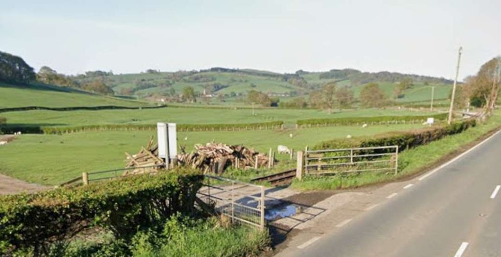
Heniarth “is the centre for Meifod District. A short distance further on is the picturesque Melin [Dol-rhyd-y-defaid] where the rails are carried between the mill race and the River Banwy, by means of a substantial stone embankment.” [1: p67]

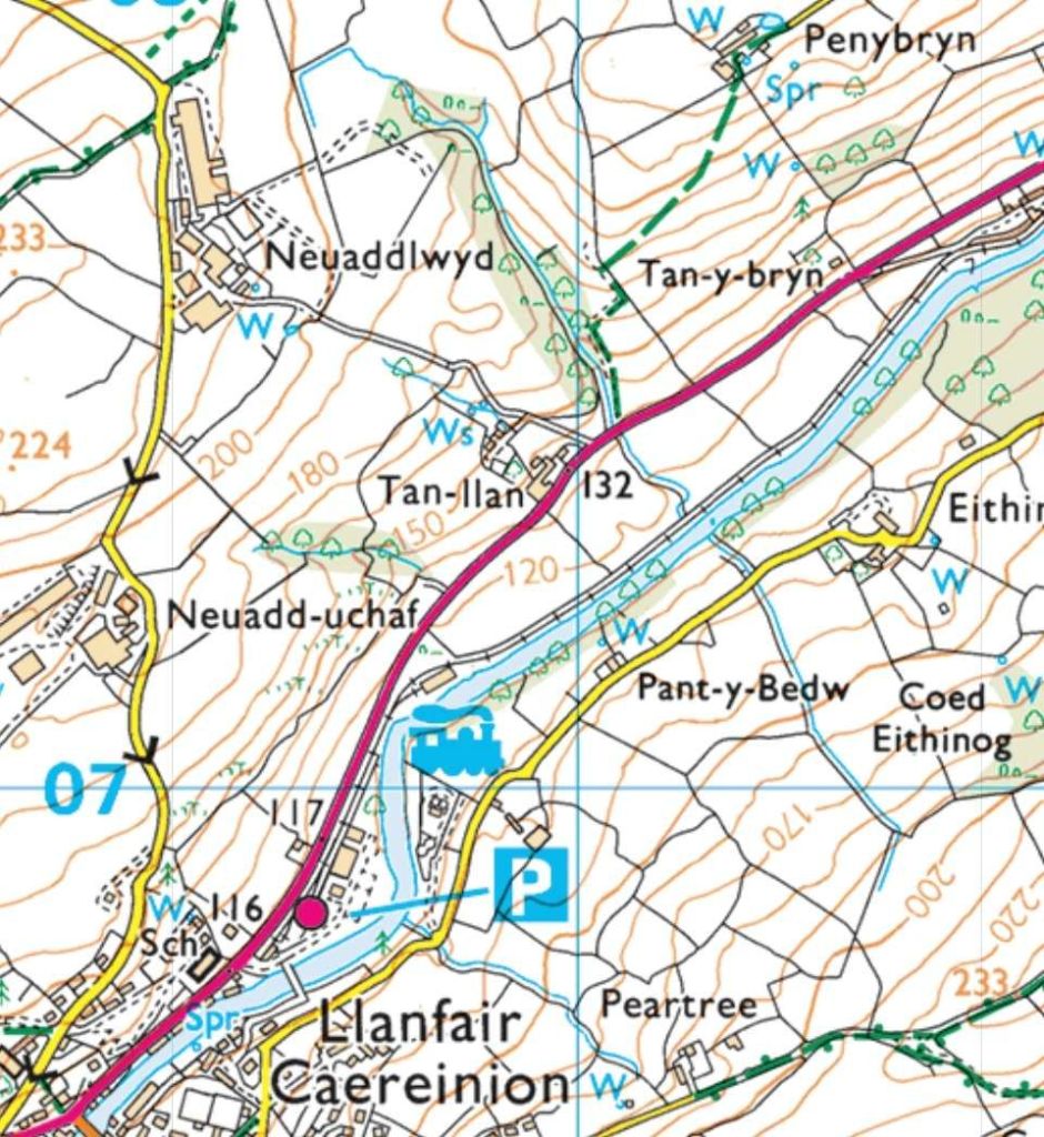
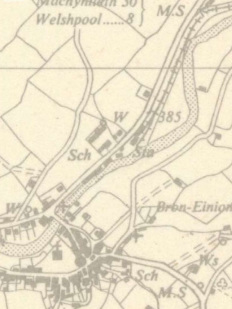
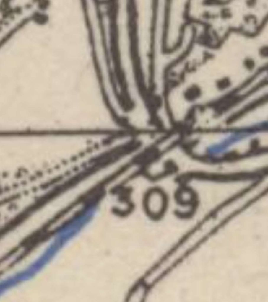
(Revised: 1900 to 1949), originally published: 1952, shows the railway approaching Llanfair Caereinion. Earlier mapping from 1901 does not show the line. The faded appearance of this extract matches the full map sheet provided by the NLS. [20]
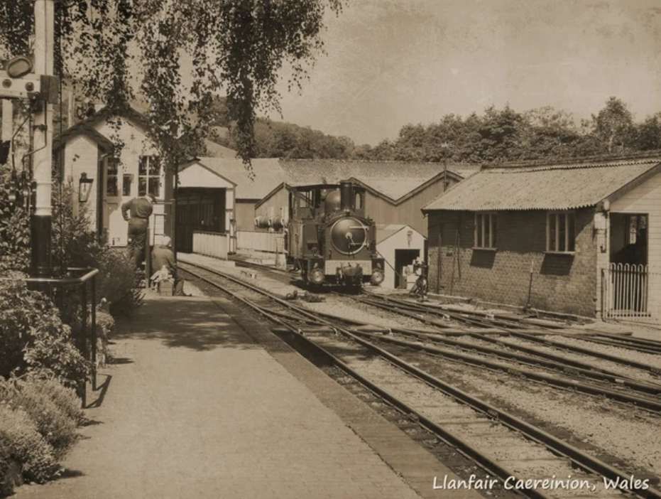
The Railway Magazine commented on the importance of this new railway: “This railway opens up and connects to an established system of railways, an area of over 100 square miles of Welsh scenery of great natural beauty-possessing abundance of excellent fishing and many other attractions. … Llanfair, a typical little Welsh town, is now within easy access, and the greatest obstacle to its success as a health resort has been removed. In the year 1824 (Montgomeryshire Collections) the medicinal properties of the springs of Llanfair, were discovered by one ‘Madock’, sulphur being present in one; another, close by, had chalybeat properties; while a third was saline. Pumps and other appliances were erected for the convenience of those who would make use of the springs, and the value of the waters becoming more widely known, the place was largely visited by invalids. The waters are still in good repute, and now that the difficulties consequent upon bad roads are removed, it is believed that they will become as popular as the waters of Llandrindod and Llanwrtyd in South Wales.” [1: p67]
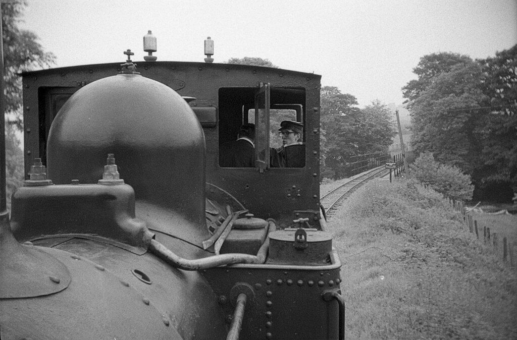
The track is of a small gauge – 2ft 6in. The Railway Magazine described the rails as being “of the Vignoles section, flat bottomed, 421bs. per yard. The small radii of the curves, with their steep gradients, have necessitated a general use of check rails, sole-plates, and cross-stays to ensure a safe and substantial track.” [1: p67]
Although the railway gauge is only 2ft 6in “care in designing the rolling stock has prevented this line being catalogued under the title of ‘Toy Railways’, as will be apparent from the photographs. The responsibility of designing and providing the whole of the rolling stock devolved upon Mr. Herbert Jones, the Locomotive Superintendent of the Cambrian Railways, and is of a substantial and commodious character. The coaches, very roomy and comfortable vehicles – bogie type being built after the style of the one-storey electric car, are provided with first, third, and smoking compartments, divided by sliding doors; adjustable platforms, also, at the ends provide a convenient means of communication.” [1: p68]
The railway was initially worked by the Cambrian Railways, for 60 per cent. of the earnings. [1: p68]
Original Locomotives
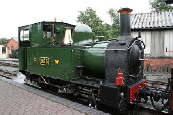
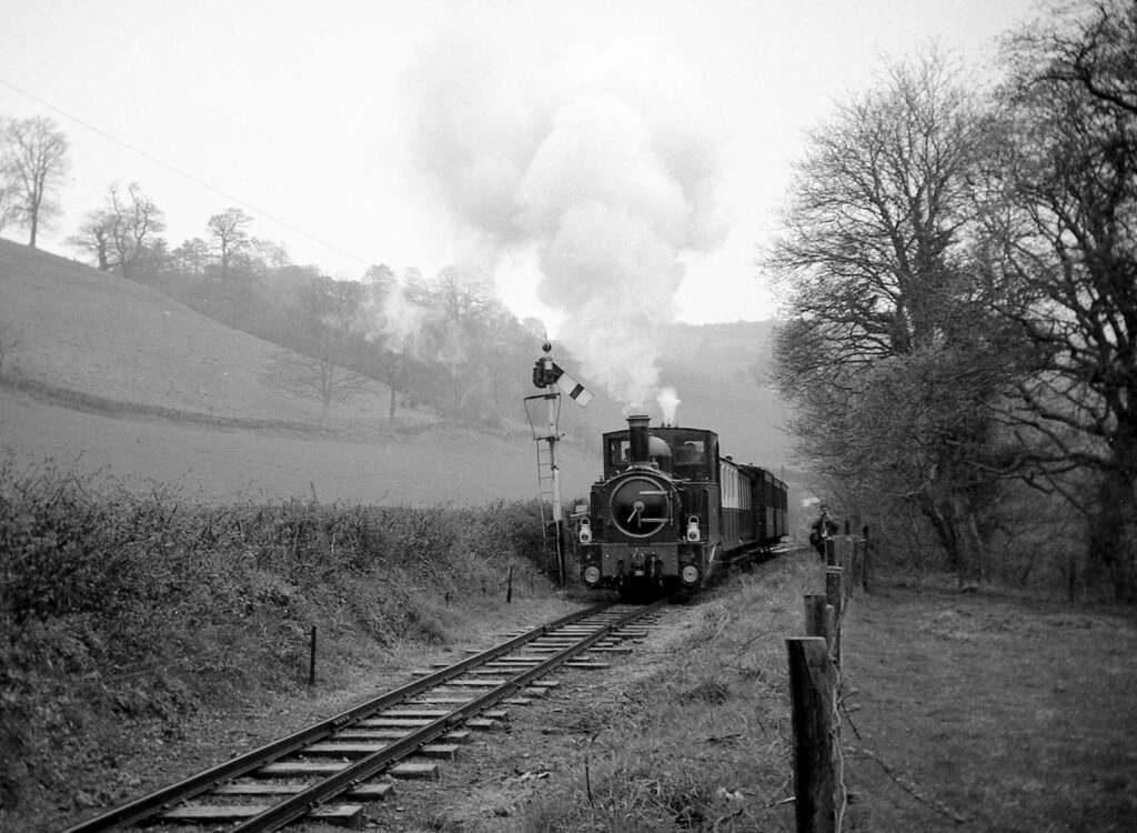
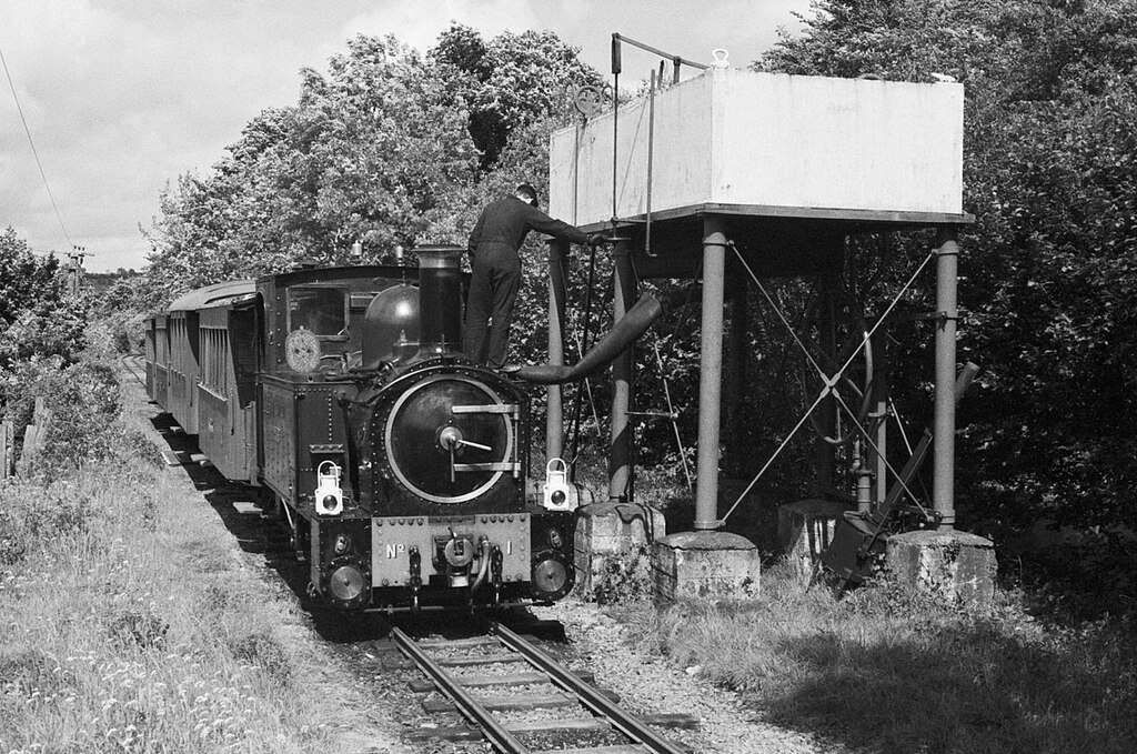
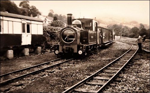
The railway originally operated with two locomotives, No. 1, ‘The Earl’ and No. 2, ‘The Countess’.
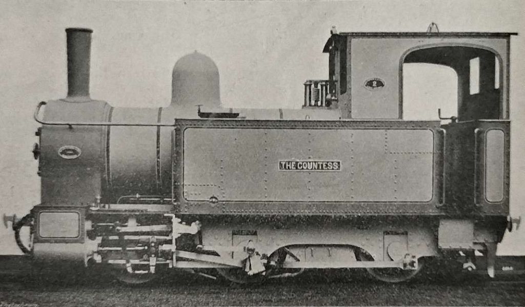
As The Railway Magazine says: the engines were “two in number, named respectively ‘The Earl’ and ‘The Countess’, [they were] six-wheeled coupled, side tanks, with outside cylinders, built by Messrs. Beyer, Peacock and Co. Weight in working order, 194 tons; cylinders, 11in. diameter by 16in. stroke; diameter of cast-steel wheels, 2ft. 9in.; wheel base, 10ft.; steel boiler, 7ft long, 3ft. 5.5in. diameter; 119 copper tubes, 1.75in. diameter.” [1: p68]
With Walschaerts valve gear and a maximum boiler pressure of 150 lbf/in2 (1.03 MPa), they yielded a tractive effort of 8,175 lbf (36.36 kN). [17]
The Earl and The Countess ran the line from 1903 until closure of the railway in 1956. The engines were overhauled at Oswestry Works and were sent there on closure of the railway. [17]
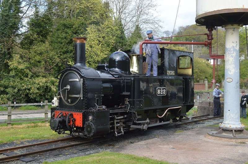
By 1959, negotiations had begun with British Railways and the Welshpool and Llanfair Light Railway Preservation Company had leased the line from British Railways by the end of 1962. On 28 July 1961, The Earl returned after storage and overhaul at Oswestry Works, with Countess following not long after. They have continued to work on the line ever since. [17]
During their lifetime the locos have had many modifications, particularly after the takeover by the Great Western. During this period they were fitted with a larger cab, handles on the smokebox door, rather than the original wheel, a larger dome, a much larger and more sophisticated safety valve and two different funnels. They were painted in Great Western green. … When taken over by British Railways, their shunting bells and chopper couplings were removed, and were repainted black. … From 1997 to 2001, the locomotives were fully overhauled at Llanfair, which included the fitting of new boilers and cylinders. They are currently the same design as the BR era, but have worn different liveries in preservation. [17]
Original Rolling Stock
The Railway Magazine said: “The stock is painted in the Cambrian colours coaches, bronze, green and white; engines, black, picked out with red and yellow.” [1: p68]
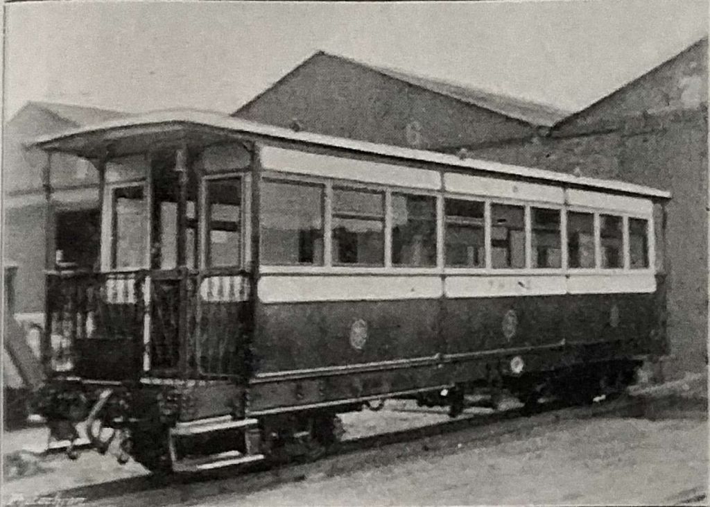
Carriage details were: “Length over headstocks, 35ft.; centres of bogies, 24ft.; width outside, 6ft. 6in.; wheel base of bogies, 4ft.; size of journals, 6in. by 3in. diameter; centres of journals, 4ft. The body [was] built of oak and mahogany, the steel underframes [were] fitted with the automatic vacuum brake, and a hand brake [was] placed on each carriage. Weight of carriage, 94 tons.” [1: p68]
“The whole of the stock was fitted with central ‘buffer couplings’ and safety chains.” [1: p68]
Sadly, the coaches purchased for the opening of the line did not survive into preservation. When passenger services were suspended in 1931 the coaches were sent to Swindon for ‘storage’ but never re-entered traffic and were broken up in 1936. That would have been the end of the story but for a desire by the preserved Welshpool & Llanfair Light Railway to reverse history and through the generosity of donors a complete new rake was built by the Ffestiniog Railway at their Boston Lodge works. [23]
References
- Welshpool & Llanfair Light Railway; in The Railway Magazine, London, July 1903, p64-68.
- https://rogerfarnworth.com/2022/07/24/the-welshpool-llanfair-light-railway/
- https://rogerfarnworth.com/2022/09/23/the-welshpool-llanfair-light-railway-an-addendum/
- https://maps.nls.uk/view/188900409, accessed on 18th August 2024.
- https://www.streetmap.co.uk/map?x=314500&y=307500&z=120&sv=Welshpool&st=3&tl=Map+of+Welshpool+and+Llanfair+Railway,+Powys&searchp=ids&mapp=map, accessed on 18th August 2024.
- https://railmaponline.com/UKIEMap.php, accessed on 19th August 2024.
- https://wllr.org.uk/our-railway/our-history, accessed on 21st August 2024.
- https://www.ebay.co.uk/itm/204467180155?mkcid=16&mkevt=1&mkrid=711-127632-2357-0&ssspo=tL4T-ZhGQ3-&sssrc=4429486&ssuid=afQhrar7TGK&var=&widget_ver=artemis&media=COPY, accessed on 21st August 2024.
- https://www.facebook.com/109476715927837/posts/pfbid0ENUcCSDiS5cYXkJut2j291owAcq3GZAJK7xmfZ25MjnkZJLhzaNgKexKV7fzbg8Jl/?app=fbl, 21st August 2024.
- https://www.geograph.org.uk/photo/7681103, accessed on 25th August 2024.
- https://www.geograph.org.uk/photo/7681029, accessed on 25th August 2024.
- https://www.geograph.org.uk/photo/6788156, accessed on 25th August 2024.
- https://www.geograph.org.uk/photo/1559805, accessed on 25th August 2024.
- https://www.geograph.org.uk/photo/6957406, accessed on 25th August 2024.
- https://www.geograph.org.uk/photo/5542428, accessed on 25th August 2024.
- https://en.m.wikipedia.org/wiki/Heniarth_railway_station, accessed on 26th August 2024.
- https://en.m.wikipedia.org/wiki/Welshpool_and_Llanfair_Light_Railway_No.1_The_Earl_and_No.2_Countess, accessed on 28th August 2024.
- https://maps.nls.uk/view/239291707, accessed on 29th August 2024.
- https://www.redbubble.com/i/poster/Welshpool-and-Llanfair-Light-Railway-by-Yampimon/9375190.LVTDI, accessed on 29th August 2024.
- https://maps.nls.uk/view/196757669, accessed on 29th August 2024.
- https://historypoints.org/index.php?page=llanfair-caereinion-railway-station, accessed on 29th August 2024.
- https://www.geograph.org.uk/photo/2437193, accessed on 129th August 2024.
- https://www.accucraft.uk.com/products/welshpool-llanfair-pickering-coaches, accessed on 17th September 2024.
