
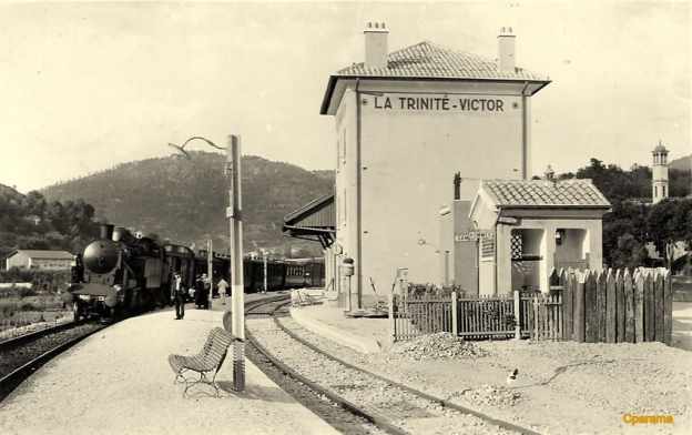
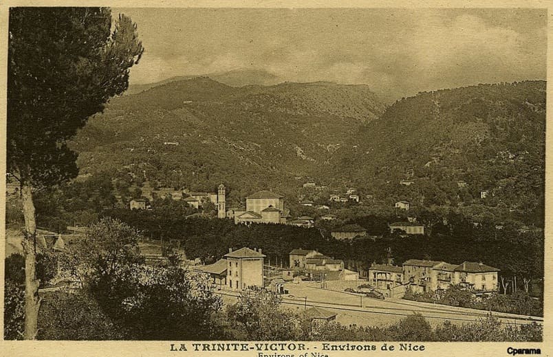
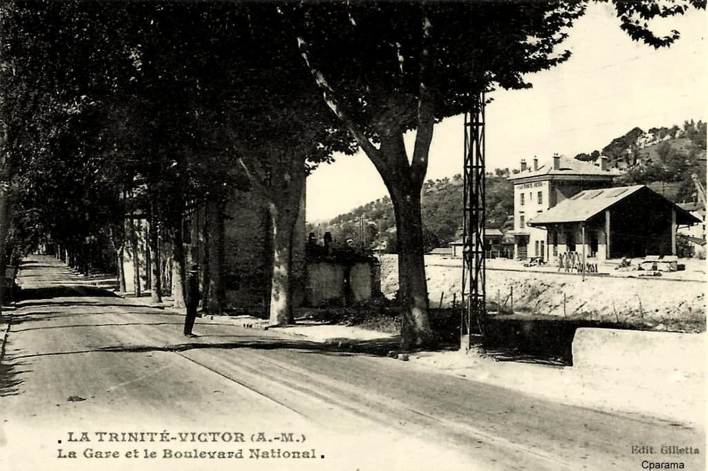
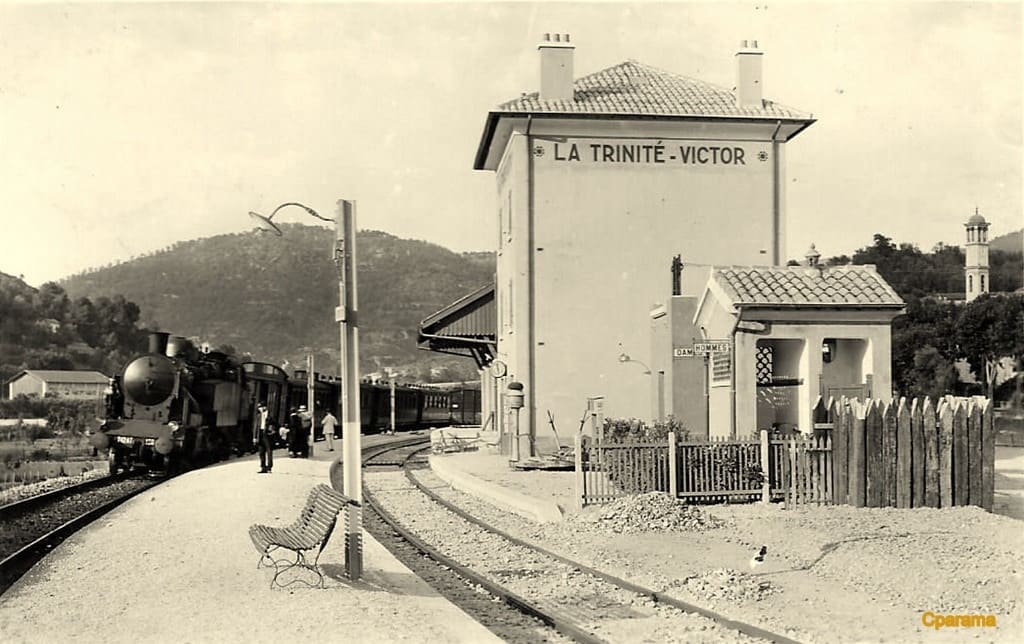
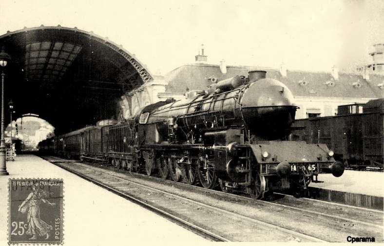
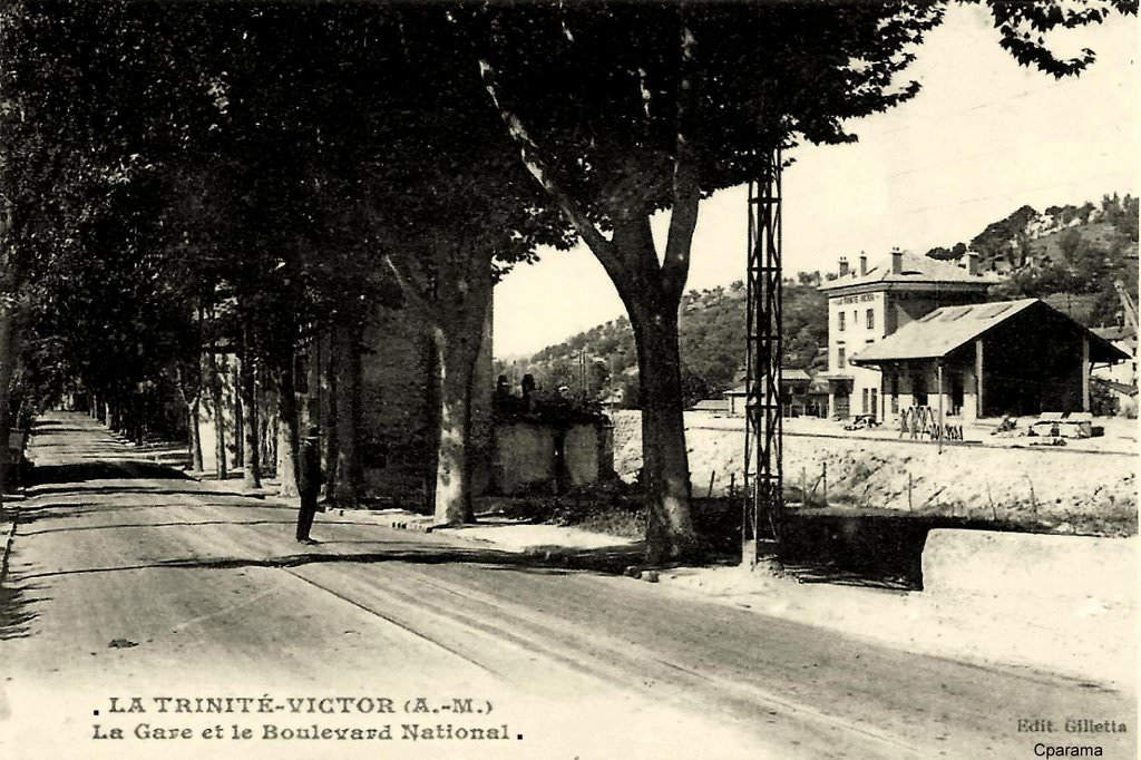
The featured image above is a postcard view of la Trinite-Victor Railway Station in the very early years after the line opened. [20]
In the first seven articles about the line from Cuneo to the sea we covered the length of the line from Cuneo to Breil-sur-Roya and then to Ventimiglia, before beginning to look at the line between Breil-sur-Roya and Nice. These articles can be found here, [9] here [10] here, [11] here, [12] here, [13] here, [14] and here. [15]
Woven into the text below are a series of stills from a video of the train journey from Breil-sur-Roya to Nice. The video can be seen here. [4]
This article begins the journey from Drap-Cantaron Railway Station.
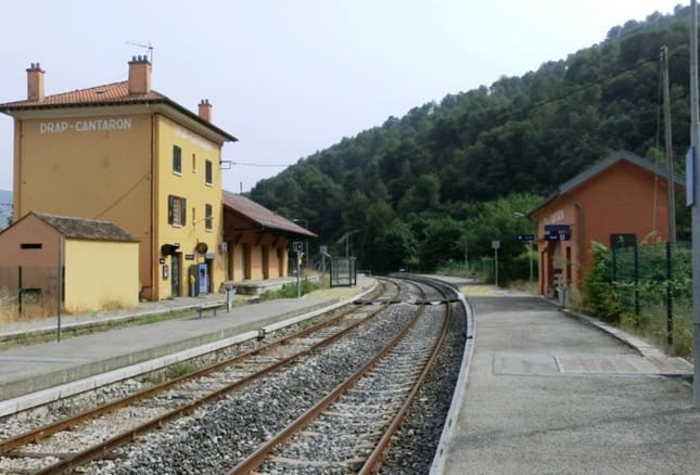
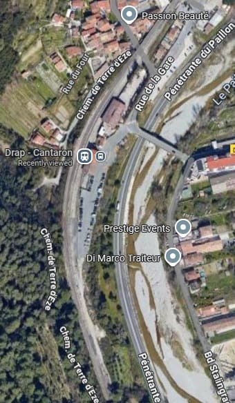
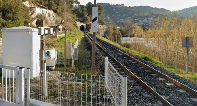
Drap-Canteron Railway Station. [Google Maps, September 2025]
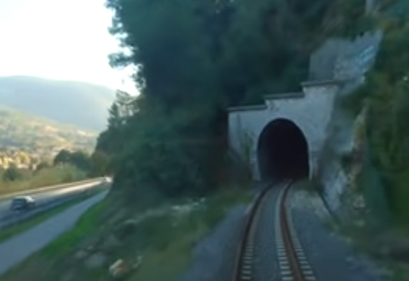
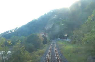
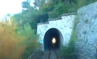
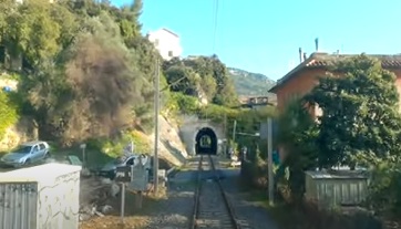
Tunnel de Serradone (33 metres long), seen from the cab of the Nice-bound train. [4]
Tunnel de Serradone. [23]
The view from the cab of the Nice-bound train leaving Tunnel de Serradone. [4]
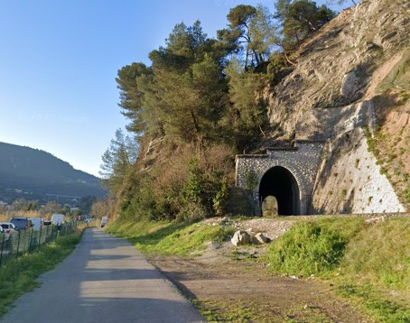
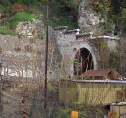
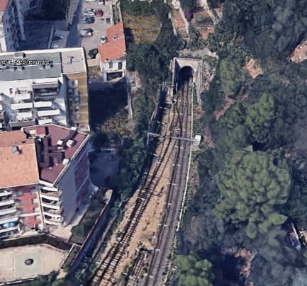
Looking back along the line towards Drap-Cantaron Station, this is the South portal of Tunnel de Serradone. [23]
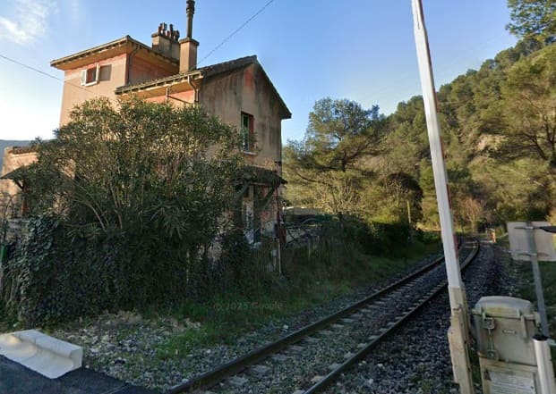
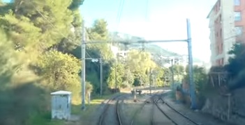
A level-crossing and railway house just beyond Tunnel de Serradone. The crossing takes Terre d’Eze across the line. [4]
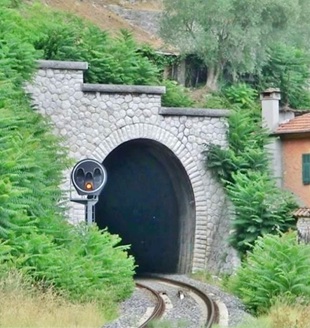
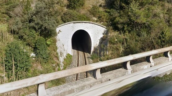
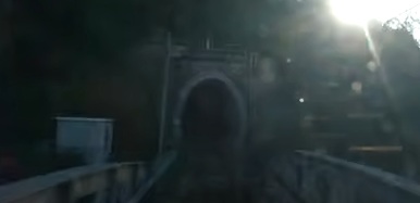
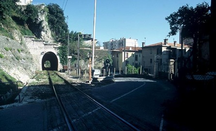
Continuing South along the line, this is the North portal of Tunnel du Moulin (83 metres long), seen from the cab of the Nice-bound train. [4]
Tunnel du Moulin. [22]
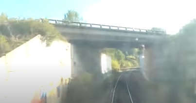
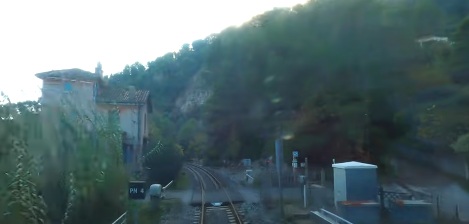
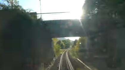
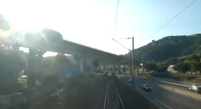
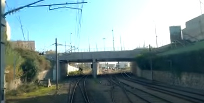
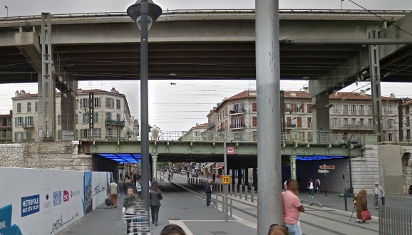
Immediately beyond Tunnel du Moulin, and with the sun in our eyes, the Nice-bound train passes under Penetrante de Paillon (D2204B). [4]
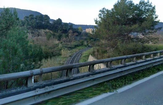
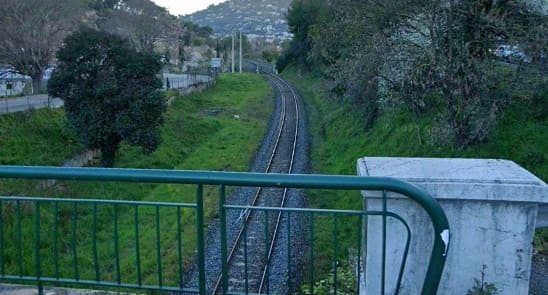
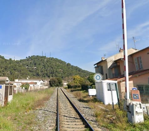
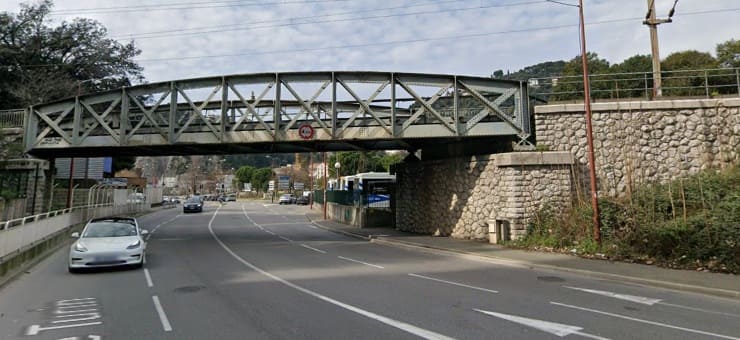
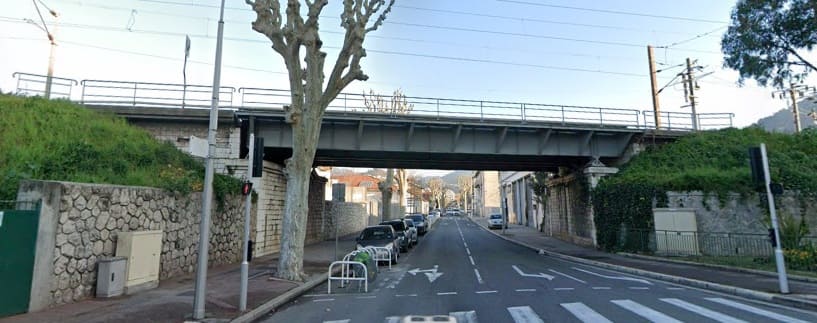
The line continuing towards Nice after passing under the Penetrante de Paillon. [Google Streetview, March 2025]
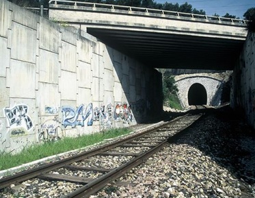
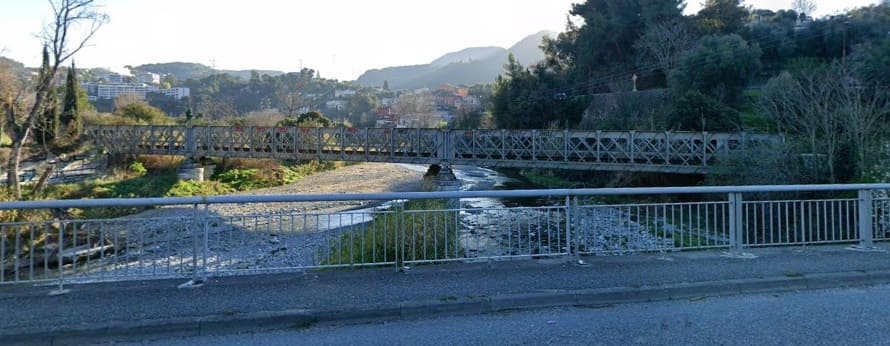
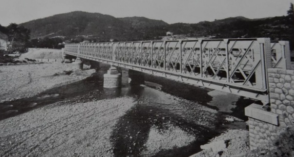
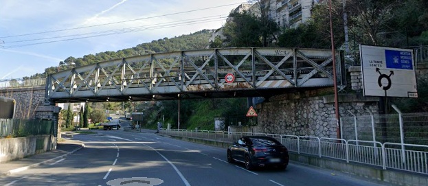
Looking back under the bridge carry the Pentrante de Paillon towards Tunnel du Moulin. [22]
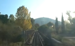
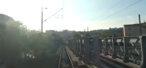
With the sun in our eyes again, the Nice-bound train crosses the Pont de Paillon, a 95 meter long bridge across the River Paillon. [4]
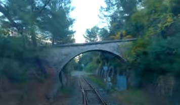
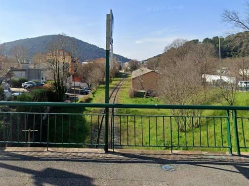
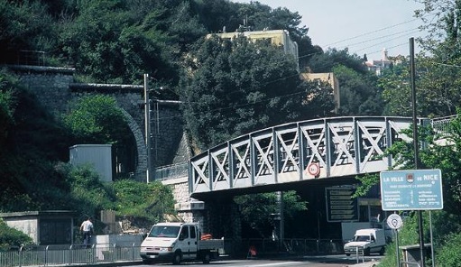
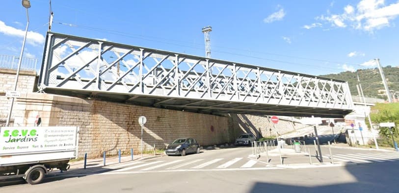
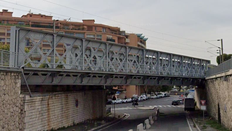
Just a short distance further along the line and with the sun once more in our eyes, this cab view shows the bridge carrying Boulevard George Bueno over the railway. [4]
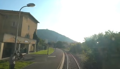
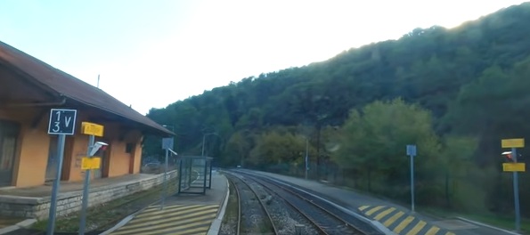
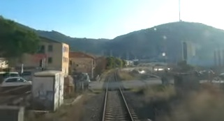
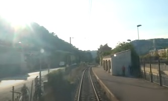
La Trinite-Victor Railway Station as seen from the cab of a Nice-bound service. [4]
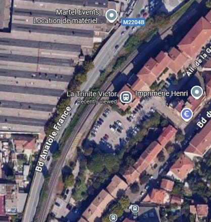
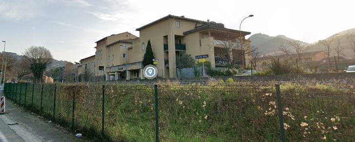
The La Trinite-Victor Railway Station. [Google Maps, September 2025]
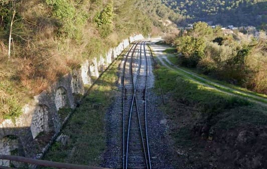
A level-crossing to the South of La Trinite-Victor Station. [4]
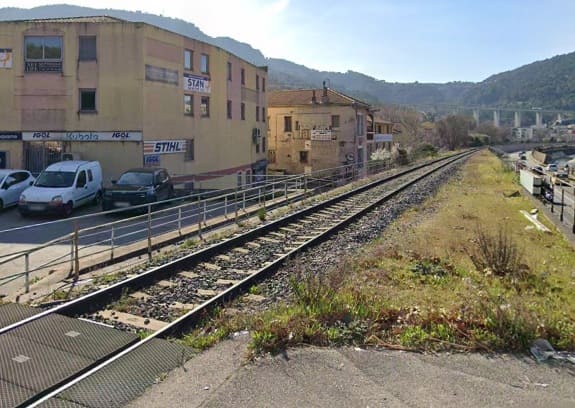
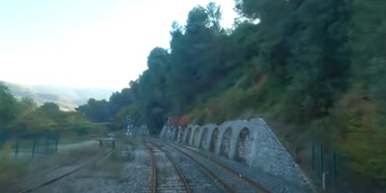
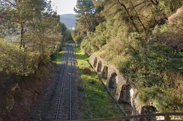
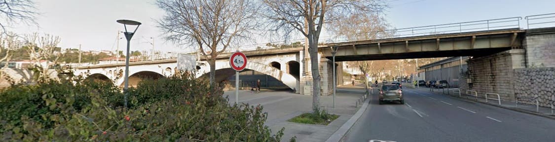
Continuing Southwest alongside the Paillon the railway runs to the East of the modern road which sits below the flood defences on the East side of the River Paillon. The road is a later addition to the river bank and is protected from the river by a high retaining wall. To its East, the railway sits on a stone embankment. …
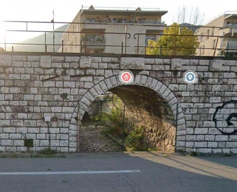
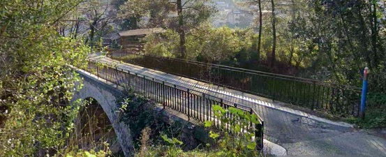
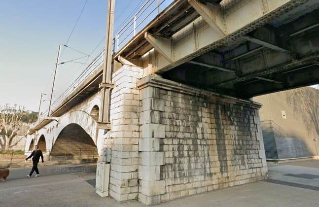
A typical example of the stone retaining wall that holds the railway above the immediately surrounding land and the modern road. The retaining wall is pierced by a stone-arched underpass. A number of such underpasses provided for access under the railway when it was first built. [Google Streetview, February 2025]
The next halt, alongside the River Paillon, is L’Ariane La Trinité. …
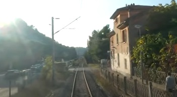
The Halt at L’Ariane La Trinité, seen from the cab of the Nice-bound train. [4]
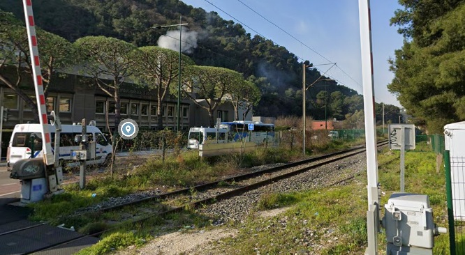
The level-crossing just to the West of the halt at L’Ariane La Trinité. [4]
Another view of La Gare de l’Ariane La Trinité can be seen here. [21]
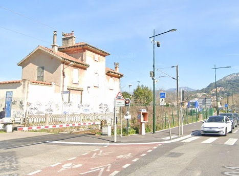
Looking Northeast from the junction of Pont de la Liberté with Boulevard Riba Roussa, the crossing barriers are closed as a train is just about to set off for Nice from the halt at l’Ariane La Trinité. [Google Streetview, March 2025]
Looking towards Nice from the level-crossing on Pont de la Liberté. [Google Streetview, March 2025]
The line soon passes under the A8 flyover. The sun is still in our eyes as we look out from the cab of the Nice-bound service. The road to the right of the line and at a lower level is the Boulevard Anatole France. [4]
The North portal of Tunnel du Bon Voyage (369 metres in length), seen from the cab of the Nice-bound train crossing the bridge over the Route de Turin with the sun low in the sky. [4]
The North portal of Tunnel du Bon Voyage and the adjacent bridge over the Route de Turin. [24]
Tunnel du Bon Voyage. [24]
The view from the cab of the same train as it leaves the South portal of Tunnel du Bon Voyage. [4]
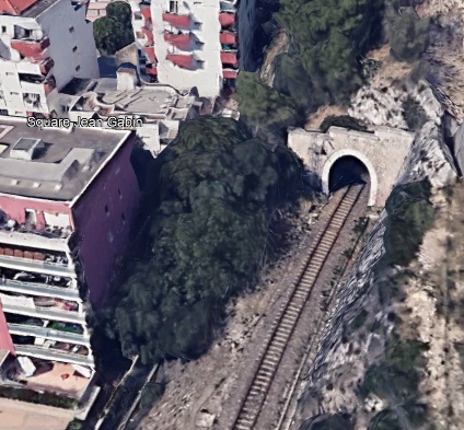
The South portal of Tunnel du Bon Voyage. [Google Earth, September 2025]
A short distance further along the line the railway is crossed on the level by a minor road before it reached Tunnel de Roche. [4]
The Northwest portal of Tunnel de Roche, seen looking East from a minor road. [Google Streetview, December 2010]
A better view of the Northwest portal of Tunnel de Roche, from the level crossing mentioned above. [25]
Tunnel de Roche, 96 metres in length. [25]
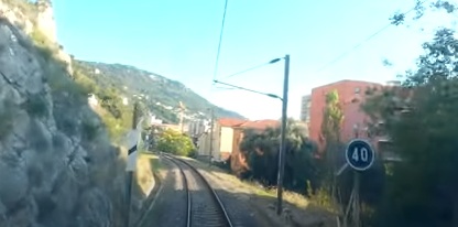
The view Southeast from the Southeast portal of Tunnel de Roche. [4]
The Southeast portal of Tunnel de Roche. [Google Earth, September 2025]
Pont Michel seen from the cab of the Nice-bound service. [4]
A glimpse of the line to the North, from the carriageway over Pont Michel in Nice. [Google Streetview, March 2025]
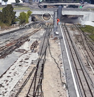
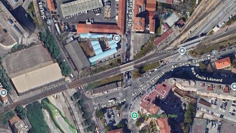
Looking North along the line towards Pont Michel. [Google Earth, September 2025]
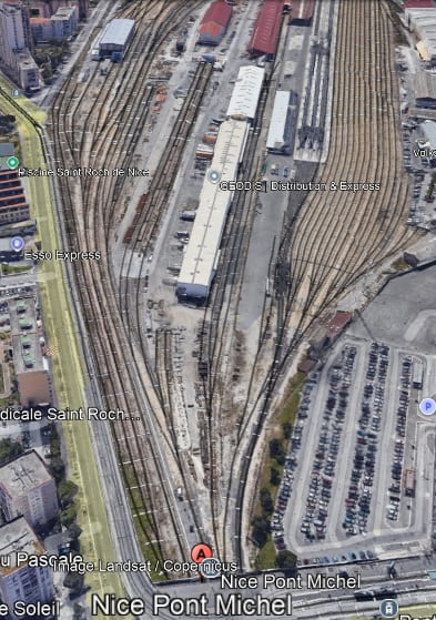
Looking South across Pont Michel. The running lines from Breil-sur-Roya are on the left of this image. The other lines are part of Nice Depot. Pont Michael Railway Station is at the bottom of the image. See the notes below about the history of this location. [Google Earth, September 2025]
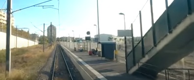
Pont Michel Railway Station. [4]
The platform on the left was part of the Saint-Roch Railway Station, now closed. [4]
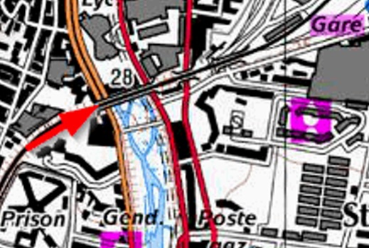
The Saint Roch Railway Station is highlighted in the top-right of this map extract. The line continues towards Nice-Ville bridging a number of roads before crossing the River Paillon again. [26]
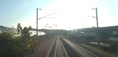
Looking towards Nice-Ville from the cab of the Nice-bound service as it crosses the access road to the Nice-Depot. [4]
After crossing the Paillon the line curves to the South and crosses another modern bridge. …

A short distance further along the line it enters Tunnel de Carabacel.
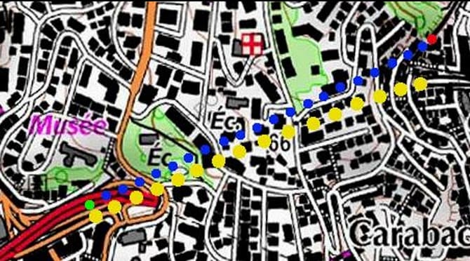
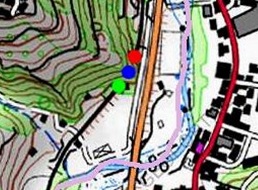
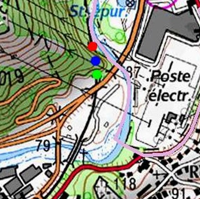
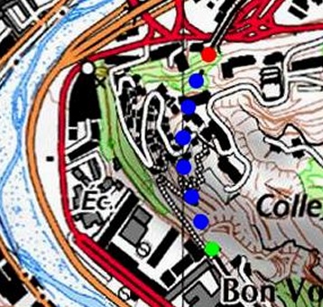
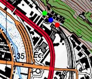
The line of the Tunnel de Carabacel is shown by the red, blue and green dots. It is 663 metres in length. [27]
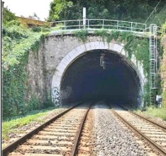
The Northeast portal of Tunnel de Carabacel. [27]
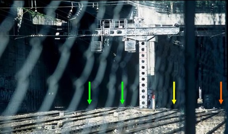
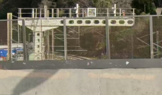
The Southwest portal of Tunnel de Carabacel, seen through mesh fencing. The two tracks marked with the green arrows are those from Breil-sur-Roya. The yellow arrow marks the track which runs through Tunnel de Cimiez Nord and the orange arrow marks the track which runs through Tunnel de Cimiez Sud. [27]
The view West from the cab of the Nice-bound train after it has left Tunnel de Carabacel. [4]
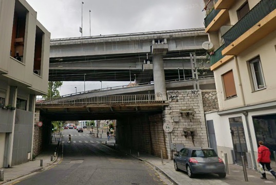
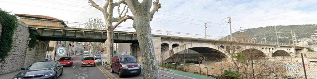
Looking North along Avenue Desambrois, Nice the old railway bridge is dwarfed by the concrete structures of the motorway! [Google Streetview, July 2025]
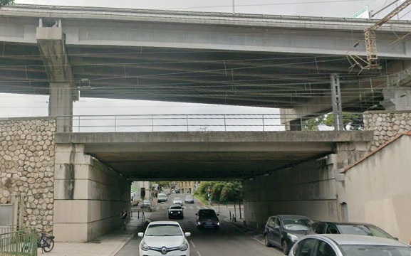
Also looking North, this time on Rue de Lépante, Nice, the motorway structures loom over the old railway bridge. [Google Streetview, July 2025]
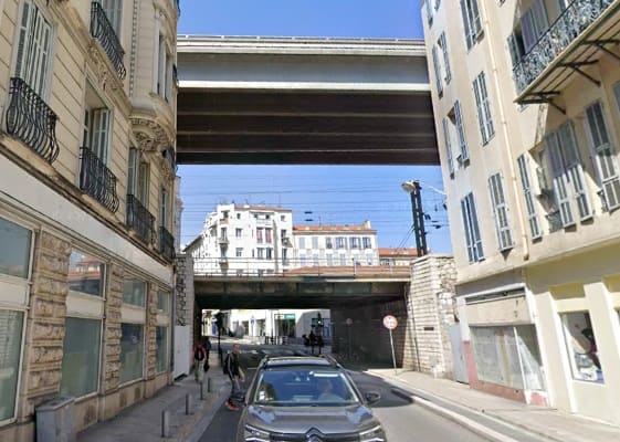
Looking North along Rue Miron, the motorway bridge seems to be even higher! [Google Streetview, April 2025]
The final structure before the line runs into Nice-Ville Station. This bridge spans Avenue Jean Médecin. [Google Streetview, May 2018]
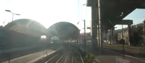
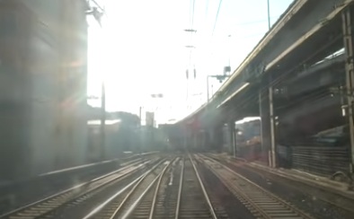
The sun is in our eyes as we approach Nice-Ville Railway Station. [4]
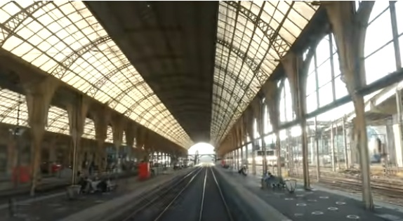
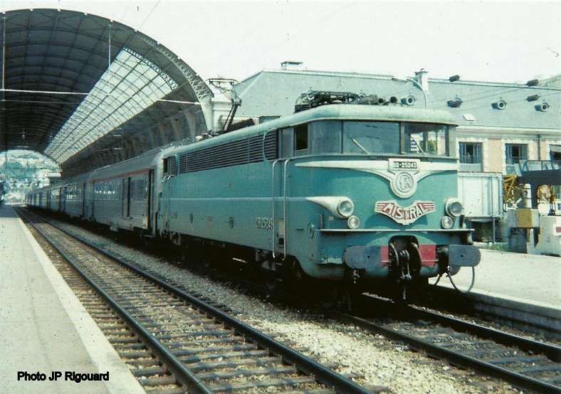
Nice-Ville Railway Station seen from the cab of the train from Breil-sur-Roya which terminates in Nice. [4]

Banaudo et al tell us that The first 5 kilometres of the line in the suburbs of Nice were constructed by the Nice-based company Orizet Frères, work began in August 1909. Their work included three tunnels with a total length of 1,127 metres, a bridge over the Paillon, nine metal-decked road underpasses, an overpass, and three level-crossings. Between Nice-Ville and Cimiez Hill, the track-bed of the existing line to Menton had to be be extensively reworked to accommodate the new tracks. [1: p101]
Work on the site of the Saint Roch station commenced in January 1910 and on the Tunnel de Carabacel in May 1910. Work on the tunnel was only undertaken from the Northeast end so as to avoid the need t remove spoil from close to the railway station in Nice. This also meant that the excavated material could be used in constructing the embankment from the tunnel towards the bridge over the Paillon. The river bad of the Paillon was found to be unstable. “Foundations up to 17 m deep had to be dug using compressed air to firmly establish the piers of the three shallow arches made of La Turbie stone. Despite these precautions, ground movements recurred, which an attempt was made to remedy in the fall of 1912 by overloading the Nice-side arch with a mass of gravel bags representing a pressure of 2,500 kg per square metre, while recording devices measured the gradual settlement of the ground.” [1: p103]
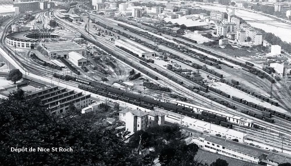
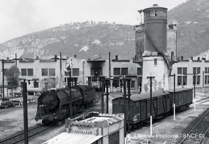
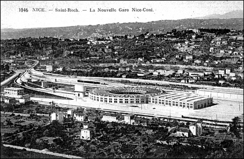
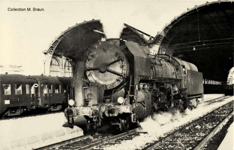
Nice Saint-Roch locomotive depot soon after opening. [30]
The Nice Depot was built on the site of orange groves. “The Société des Travaux en Ciment Thorrand et Compagnie, … originally from Grenoble and based in Nice, used reinforced concrete to build a 110 m diameter rotunda for forty-eight locomotives, a maintenance workshop for six locomotives, a water tower supplied by the Paillon water table, a fuel park with an 80 m quay served by 4.40 m turntables, several buildings housing apprentices, administrative offices, … refectory, oil mill, lamp room, etc.” [1: p103]
And Finally ……
Nice-Premium reported on 2nd September 2024 that major works were to be undertaken on the railway between Nice and Breil-sur-Roya. [32]
The ambitious regeneration program for the Nice to Breil-sur-Roya railway line began in September 2024 and is due to be completed by 14th December 2025.
The work will cost about 78.1 million euros. It will strengthen the infrastructure, improve the transport service, and guarantee better comfort for travellers.
The work aims to reinforce the many engineering structures and improve the stability of the tracks. This will not only secure the transportation of users but also protect this vital infrastructure against climate hazards. It promises concrete improvements for users. By the end of the work, it’s planned that one TER per hour, per direction, will run between Drap and Breil. As well as two TERs per hour between Nice and Drap. This increase of 46% in transport service will be accompanied by a notable improvement in traveler comfort thanks to the renewal of equipment and modernization of infrastructure. These changes aim to make the service more reliable and regular!
The closure of the line between September 2024 and December 2025 is necessary, particularly to permit a large number of tunnels to be renovated The closure will ensure the efficiency and speed of the work, as opposed to a partial closure which could prolong the timeline.
The total cost of the work amounts to 78.1 million euros, with an additional approximately 8 million euros for the transport substitution system. The Region is contributing 56.5 million euros, with participation from the State, SNCF Réseau, the Nice Côte d’Azur Metropolis, as well as the Communauté d’Agglomération de la Riviera Française and the Communauté de Communes du Pays des Paillons. [32]
More information can be found here. [33]
References
- Jose Banaudo, Michel Braun and Gerard de Santos; Les Trains du Col de Tende Volume 1: 1858-1928; FACS Patrimoine Ferroviaire, Les Editions du Cabri, 2018.
- Jose Banaudo, Michel Braun and Gerard de Santos; Les Trains du Col de Tende Volume 2: 1929-1974; FACS Patrimoine Ferroviaire, Les Editions du Cabri, 2018.
- Jose Banaudo, Michel Braun and Gerard de Santos; Les Trains du Col de Tende Volume 3: 1975-1986; FACS Patrimoine Ferroviaire, Les Editions du Cabri, 2018.
- https://youtu.be/rLXAEz-n4mM?si=RLQC31jynGeM_lQR, accessed on 26th August 2025. Permission to use these still images from the YouTube video has been sought.
- https://fr.wikipedia.org/wiki/Sch%C3%A9ma_de_la_ligne_de_Nice_%C3%A0_Breil-sur-Roya, accessed on 17th September 2025.
- https://structurae.net/en/structures/drap-cantaron-station, accessed on 27th September 2025.
- https://i.ebayimg.com/images/g/aJYAAOSwP5pjDPCA/s-l1600.webp, accessed on 28th September 2025.
- https://www.cparama.com/forum/viewtopic.php?f=11&t=8002, accessed on 28th September 2025.
- https://rogerfarnworth.com/2025/07/22/the-railway-from-nice-to-tende-and-cuneo-part-1.
- https://rogerfarnworth.com/2025/07/26/the-railway-from-nice-to-tende-and-cuneo-part-2.
- https://rogerfarnworth.com/2025/08/06/the-railway-from-nice-to-tende-and-cuneo-part-3-vievola-to-st-dalmas-de-tende
- https://rogerfarnworth.com/2025/08/16/the-railway-between-nice-tende-and-cuneo-part-4-st-dalmas-de-tende-to-breil-sur-roya
- https://rogerfarnworth.com/2025/08/25/the-railway-between-nice-tende-and-cuneo-part-5-breil-sur-roya-to-ventimiglia
- https://rogerfarnworth.com/2025/08/29/the-railway-between-nice-tende-and-cuneo-part-6-breil-sur-roya-to-lescarene
- https://rogerfarnworth.com/2025/09/26/the-railway-between-nice-tende-and-cuneo-part-7-lescarene-to-drap-cantaron-railway-station/
- Franco Collida, Max Gallo & Aldo A. Mola; CUNEO-NIZZA History of a Railway; Cassa di Risparmio di Cuneo, Cuneo (CN), July 1982.
- Franco Collidà; 1845-1979: the Cuneo-Nice line year by year; in Rassegna – Quarterly magazine of the Cassa di Risparmio di Cuneo; No. 7, September 1979, pp. 12-18.
- Stefano Garzaro & Nico Molino; THE TENDA RAILWAY From Cuneo to Nice, the last great Alpine crossing; Editrice di Storia dei Trasporti, Colleferro (RM), EST, July 1982.
- https://www.cparama.com/forum/cartes2015/1438155711-06-La-Trinite-Victor-4.jpg, accessed on 28th September 2025.
- https://www.cparama.com/forum/cartes2018/1528437503-ZLa-trinite-victor-06.jpg, accessed on 28th September 2025.
- https://www.provence7.com/a-a-z-des-articles/lariane-quartier-village-de-nice/attachment/gare-lariane-la-trinite-1c, accessed on 28th September 2025.
- https://www.inventaires-ferroviaires.fr/tu06/06149.1.pdf, accessed on 28th September 2025.
- https://www.inventaires-ferroviaires.fr/tu06/06149.2.pdf, accessed on 28th September 2025.
- https://www.inventaires-ferroviaires.fr/tu06/06088.7.pdf, accessed on 28th September 2025.
- https://www.inventaires-ferroviaires.fr/tu06/06088.6.pdf, accessed on 28th September 2025.
- https://www.inventaires-ferroviaires.fr/mx06/06088.07B.pdf, accessed on 29th September 2025.
- https://www.inventaires-ferroviaires.fr/tu06/06088.5.pdf, accessed on 29th September 2025.
- https://papybricolo.over-blog.com/2020/10/nice-st-roch-l-ancien-depot-des-locomotives.html, accessed on 29th September 2025.
- https://www.laviedurail.com/bonnes-feuilles/vif-annees-1960, accessed on 29th September 2025.
- https://journals.openedition.org/rhcf/1792, accessed on 29th September 2025.
- https://www.cparama.com/forum/viewtopic.php?p=99249, accessed on 30th September 2025.
- https://www.nice-premium.com/eur78-million-invested-to-modernize-the-nice-breil-sur-roya-railway-line, accessed on 7th October 2025.
- https://www.soletanche-bachy.com/en/soletanche-bachy-france-contributes-to-the-modernization-and-securing-of-the-nice-breil-railway-line, accessed on 7th October 2025.
