Category Archives: Welsh Railways

The Tanat Valley Light Railway and the Nantmawr Branch – Part 2

These two plans show the route of the Tanat Valley Light Railway and its place within the local railway network. [1]This plan shows the different parts of the Oswestry and Llangynog Railway. Its enabling Act in 1882 had 57 clauses and ran to 20 pages. The railway was described in three parts which were primarily associated with how it was to connect up with existing lines at its eastern end. Railway Number 1 would provide a connection with the Porth-y-Waen branch of the Cambrian Railway. This would give access to Oswestry. This section was to be one mile, one furlong, 5 chains and 10 links long. Railway Number 2 was the main part of the line up the Tanat Valley 13 miles and 2 furlongs in length. Railway Number 3 was a short fork (3 furlongs and 8 chains) at the eastern end of Railway No. 2 that linked the latter with the Potteries Shrewsbury and North Wales Railway branch that ran up to Nantmawr. Railway No. 2 could only connect with Railway No. 1 via a short section of the Nantmawr branch of the Potteries line. The sequence of opening had to be No. 1, then No. 2, then No. 3. [3][20]

Our journey along the Tanat Valley Light Railway (TVLR) commences the western end at Llangynog Railway Station.Llangynog Railway Station in 1930. [2]These two maps show Llangynog in 1840 and in 1902. If the second date is correct, although the railway has arrived at Llangynog, it will still be another two years or so before it is in use! [3] It is interesting to note that the railway station (4) is not the only addition to the village between the two maps being drawn. Some new cottages have been built (1), a school has been set up (2), and a Chapel has been established (3).The Victorian period saw a great rise in the number of chapels as communities set up new places of worship where they could worship in their own way and in their own language. This often meant an over-provision within a local community with chapel and church seats well in excess of the total population of a village or town.

The railway station was situated on the north side of the river. The centre of the small village of Llangynog was on the South side of the river.This picture shows Llangynog Station after closure. It is held by the People’s Collection of Wales. [4] The location is now a caravan park, as shown on the Google Earth image below. This OS Map is an extract from the 1:25,000 series from the mid-20th century. [5]

Wilfred J. Wren provides hand drawn maps in his book about the Tanat Valley which was published in 1968. The drawings were completed in 1966. Llangynog is shown immediately below. [8: p106] The station itself took up a significant area of land on the North side of the Afon Eiarth. At the West end of the site a level crossing allowed access across the village road to two exchange sidings. A tramroad ran from the Granite Quarries further West to the exchange sidings. At a later date the Granite Wharf was moved to very close to the station Goods Shed on the South side of the Slate Wharf.The Tramroad served Maker’s Granite Quarries. In the hand-drawing below, the Tramroad runs along the bottom side of the map, from the wharves close to the village along the Northeast side of the Afon Eiarth until close to the quarry access where a bridge took it over the river opposite Pencraig.  In addition, an incline ran from the tramway up to Ochr-y-Craig Granite Quarry high on the hill on the North side of the river valley. [8:127][9].Maker’s Granite Quarry was opened in 1904 by Maker, who came from the North of England. Stone was crushed on the quarry floor and then lifted to road level up an incline. Initially the minor road was used to transport the granite to Llangynog. It was decided, within a few years, to use the Tanat Valley Light Railway (TVLR) for transporting chippings and a transfer wharf was built at the site of the Ochr-y-craig lead mine and a tramway linked the quarry and the transfer wharf. Wren says: ‘The building of the tramway involved a causeway near the quarry, a timber bridge across the Eiarth, the filling-in of the northern channel of the Eiarth near the corn mill, and high-level banks at the exchange sidings to bring the tramway trollies above the level of the railway trucks for ease of transfer. The tramway worked by gravity, the empties being pushed back by hand.’ [8: p159]

The quarries were worked until 1933 and the leases were then acquired by Amalgamated Roadstone who still held them in the late 1960s.The site of Llangynog Railway Station in 2018. [6]The old railway route runs on the north side of the Afon Tanat as it heads East from Llangynog. At times it runs very close to the river as is evident on the right side of the Google Earth Image above and on the OS Map extract below, near to Glanhafon-fawr [5]The view Northwest from Bont-Fawr showing the route of the old railway on the North side of the lane which followed the bank of the River Tanat. The river is off the picture to the left. The station is off to the right (Google Streetview).Slightly further East in the 21st century, looking back West towards Bont-Fawr which is close to the chevron sign in the centre-right of the picture. The line crossed the road here and entered the station site which was off to the left of the picture (Google Streetview).From the same point looking Northeast. The red line shows the approximate line of the old railway through Pen-y-Bont-Fawr station (Google Streetview).

The following links are provided with permission from Francis Firth [7] using their website’s embedding service. All are photos of Penybontfawr Village c.1955 and all seem to show different portions of the main street at that time:

https://www.francisfrith.com/penybontfawr/penybontfawr-the-village-c1955_p274015

https://www.francisfrith.com/penybontfawr/penybontfawr-the-village-c1955_p274014

https://www.francisfrith.com/penybontfawr/penybontfawr-the-village-c1960_p274029

Sadly, none of these images show the railway station, but they give an excellent impression of the village in the 1950s. The railway station was, as can be seen on the OS extract above, sited a few hundred metres north of the village on the North bank of the Afon Tanat. It was a simple affair with a timber-faced platform and a small waiting shelter for passengers, both on the South side of the tracks. The platform was backed by a fence of vertical iron railings and the boundaries of the site were marked by timber fencing as one of the few pictures of the station shows. That picture is covered by copyright and is regularly for sale as a print on eBay. It seems to show the local goods waiting in the loop while two prospective passengers look West along the line in the hope that the passenger service from Llangynog will soon arrive at the station. [10]Pen-y-bont-fawr Railway Station. [8: p106] The goods facilities and yard were on the North side of the Station.

Penybontfawr Community Council describes to village in the 21st century: “Penybontfawr  is situated at the confluence of the river Tanat and the river Barrog in the upper Tanat valley.The village is surrounded by steep hills, forests and waterfalls and is an excellent start from which to explore the Berwyn mountains. The village has a good range of community services and facilities. Siop Eirianfa and post office, garage, Railway Inn, primary school. community centre, church and chapel are all to be found within easy walking distance of the village centre. Tanat Valley buses provide a service to Llanrhaedr ym mochnant and the local market town of Oswestry. The area has a strong tradition of Welsh culture and many people speak Welsh either as a first or second language – great pride being taken in the traditional and contemporary music making of the community! Each year the combined village horticultural and sheep dog trials on August bank holiday weekend draw visitors from both far and near.” [11] No mention is made on the webpage, as yet, of the importance of the old railway in the development of the valley or the village.

From Pen-y-bont-fawr the old railway continued East along the North bank of the River Tanat with the roads serving the valley running on the South side of the river. The next halt is shown at the right-hand end of the OS Map extract below – Pedair-ffordd Halt.The approximate line of the old railway to the East of Pen-y-bont-fawr (Google Earth).The route of the old line continues to the North side of Castellmoch-fawr Farm (at the right side of this image) (Google Earth).The old line crossed the modern B4396 just before reaching Pedair-ffordd Halt (Google Earth).The view North-northeast from the bridge over the River Tanat along the B4396. The old railway crossed the road just before the bend visible in the distance (Google Streetview).The approximate line of the old railway approaching the B4396 from the West (Google Streetview).Looking East along the route of the old railway line. The B4396 is in the foreground of this image, the location of the Pedair-ffordd Halt halt was just beyond the modern garage (Google Streetview).The remains of Pedairfford Halt in November 1979 (c) Alan Young. [21]

Immediately North of the old level crossing the B4396 turns right to run on an East-West alignment alongside the route of the old railway. Both the modern road and the old railway route follow the contours on the Northern edge of the River Tanat flood plain through Llanrhaiadr Mochnant Station. The station was sited around 3/4 mile to the Southeast of the village it served (Llanrhaiadr-ym-Mochnant).The site of Llanrhaiadr Mochnant Station viewed from the East in 2019. The old line crossed the B4580 on the level at the East end of the station site (Google Streetview). The station had two platforms and a passing loop as well as sidings to a goods yard and cattle dock. [12]Llanrhaiadr-Mochnant-Station taken from a Stephenson Locomotive Society enthusiasts special train in 1958 (above), looking West through the station site. [12] The adjacent image is of the same train in the station, this time taken from the West. The Station was still in use at this time for freight. [13] Llanrhaiadr-Mochnant Station again. This picture show s it in 1947 with a trail heading for Llangynog in the down platform. [8: p80a – Plate 19] The full layout of the station is visible in this image. The level-crossing at the East end of the station can just about be seen. The two platforms are in the centre of the picture. The two buildings on the up platform are, nearest to the camera, the gents and then the main passenger building which included the ladies. Opposite, on the down platform is a small shelter. The cattle dock is not quite visible on the front left of the picture but the yard siding which had a goods shed with an awning is well-used. A hand drawn plan if the station site is available in Wren’s book. [8: p104]

Writing in 1968 Wilfred Wren commented that, “the station yard at Llanrhaiadr-Mochnant [was] still used partly for coal storage; at the western end there [was] a hugh pile of wooden sleepers.” [8: p105]

Beyond Llanrhaiadr-Mochnant the old line remained on the South side of the B4396. Across the width of the first three fields its route has been obliterated by ploughing and can only be made out in the form of a slight shadow on the satellite images that are available. The fourth field has a slight rise in it and the old line needed a shallow cutting. The Google Streetview image below shows that the route of the old line can still be identified by that cutting.The B4396 looking East. The shallow cutting made for the Tanat Valley Light Railway can be made out just to the right of centre in the image (Google Streetview). The line curved round more to the Southeast through the cutting before realigning once more to the East-Southeast.

A few hundred yards to the East both the road and old railway crossed the Afon Iwrch. The crossing point is just visible on the right of the satellite image above and in the top left of the first image below. The line ran Southeast towards Pentrefelin Halt.Pentrefelin Halt served a small village. Wikipedia says that “The platform was located to the east of a level crossing on a minor road to Glantanat Isaf. The platform had a corrugated iron shelter, lamps and a nameboard. There was a goods loop on the north side of the line. The platform is still extant on farmland.” [14] Wren says that, “the large station area at Pentrefelin was used for the unloading and storage of pipes for the second line in the Vyrnwy aqueduct.” [8: p105]

After Pentrefelin Halt, the line drifted closer to the Rivar Tanat crossing the Afon Lleiriog. Eventually, the old line crossed the River Tanat and then followed the South bank of the meandering river. The bridge can be picked out at the bottom right of the last OS Map extract above and its location can be seen on the right of the Google Earth satellite image below.Wren commented that in 1968 the track-bed East of Llanrhaiadr-Mochnant through to Blodwell Junction was in near-perfect condition, broken only by the gaps of the salvaged river bridges near Pentrefelin and Llanyblodwell. Along this length, bridges over the Rhaeadr and Iwrch also only had abutments and foundations left in 1968. [8: p105]Once the River Tanat had been crossed, trains continued Eastward, protected in places by significant earthworks from erosion by the river, to Llangedwyn Halt which can be seen on the OS Map extract below. [5] The Google Streetview image which follows shows a view taken from the North of what was once a level-crossing over the lane to the West of the Halt. The low embankment on which the formation of the old railway was laid can still be picked out carrying the field access to the right of the picture. The Halt was located off to the left of the picture.The halt at Llangedwyn was slightly more substantial that its designation as a halt suggests. At one time, probably until the mid-1920s there was a passing loop here and a long siding followed the North boundary of the station site. The passenger platform was at the South side of the site and was bout 17 ft longh with a small shelter provided to protect passengers from the waether. On the North side of the loop there was a cattle dock. The station was about 400 yards from the village. [8: p104] As can be seen in the Google Earth satellite image above, a number of farm/industrial buildings associated with Llangedwyn Home Farm  have covered the site of the old halt. [15]The next station on the old line was at Llansilin Road. It was reached on a slightly more meandering railway just to the South of the course of the River Tanat. The railway route and the location of Llansilin Road Station are shown on the satellite images from Google Earth above. Wren comments that at “Llansilin Road, a station master with an artistic bent erected three square-tiered ornaments, made of concrete and stuck in the manner of Antonio Gaudi with fragments of chins plates.” [8: p105] These were erected at the back of the passenger platform which was on the South side of the running line. The platform, as at Llangedwyn was about 170ft long with a small corrugated iron shelter at the Eastern end. A cattle dock was placed alonside the passing loop which was on the North side of the main-running line and a further single siding was provided which had a short loading wharf and a coal storage arch. [8: p102][16]

The station had the “Road” suffix due to being 3 miles south from Llansilin and 4 miles by road. The station was located close to the hamlet of Pen-y-bont Llanerch Emrys, two miles east of Llangedwyn village, where the road from Llansilin joins the river valley. The location on the OS Map extracts below [5] was close to the 343ft height marker on the second image. [16]Looking West from the old level-crossing into the site of Llansilin Road Station. The old passenger platform appears still to be present on the left of the picture (Google Streetview).

A short distance after Llansilin Road, the old trackbed turns North following the River Tanat.It then, once again swings round through East towards Southeast as shown on the two OS Map extracts below.The satellite images from Google Earth are less well defined over the next part of the old route. So the high-level images are provided by Bing and are aerial, rather than satellite, images. The old railway followed approximately the 300ft contour with the valley side rising relatively steeply just South of the formation of the railway. The halt given the name Glanyrafon was at the point on the line marked by the word “Garth-fach” on the agacent OS Map extract. [5] Its namesake was on the North side of the river at that point. The halt had a 75ft platform and small shelter.From Glanyrafon Halt, the route continued round the outside of the loop in the River Tanat which circles around Llanyblodwel and crossed the road which ran South through that village and across the River Tanat on the level.

En-route, the old railway passed through Llanyblodwell Halt – a 170ft platform with a shelter sat on the down side of the running line. A gents was provided at the West end of the platform.Llanyblodwell Halt was just to the south of the 278ft height point on the OS Map extract above. [5] Looking West into the site of Llanyblodwell Halt from the road crossing at its Eastern boundary (Google Streetview) Incidentally the spelling of the name of the Halt is correct even though the village it served was named Llanyblodwel.Looking East along the old railway line from the road-crossing at Llanyblodwell Halt (Google Streetview).

The old line crossed the River Tanat again before entering Blodwell Junction Station.The Tanat Valley Light Railway (TVLR) met the Llanymynech Loop line just the the Southwest of the Station at what was known as Blodwell West Junction. [8: p105] The OS Map extract above [5] shows the stub-end of that Loop line which remained in existence until the closure of the TVLR. The Junction Station sat between Blodwell West Junction and the road over-bridge which carried the A495 over the line and which is evident on the same map-extract. [5] The goods facilities were sited to the East of the road over-bridge. [17]Blodwell Junction Station is marked on this aerial view together with the alignment of the old TVLR and the Llanymynech Loop (Bing Aerial Maps).

I am indebted to the Disused Stations website for some of the notes below. [17]

Blodwell Junction was opened in 1870 and at the time called Llanyblodwel. It was opened by the Potteries, Shrewsbury & North Wales Railway (PS&NWR) and was at that time situated on the PS&NWR Nantmawr Branch, a 3¾-mile line that had opened in 1866. The Nantmawr branch provided a link between the Cambrian Railways (CR) line at Llanymynech and quarries at Nantmawr. The PS&NWR was not a financial success and it went into receivership in December 1866. Trains ceased to run just before Christmas that year. [17]

This was only a temporary situation. The receiver began running services again in December 1868 and in 1870 introduced a passenger service onto the Nantmawr Branch for the first time. The terminus for passenger services was at Llanyblodwel. [17]A hand-drawn map of the Nantmawr Branch as it was in 1875, produced by Alan Young in 2016 and used with his permission, (c) A.E. Young. [22]

The platform which was constructed to facilitate passenger services ready for the 1870 opening remained in place on the North side of the run-round loop until final closure occurred. It was “constructed from brick, backfilled with earth and topped with cinders. A single-storey timber building located at the eastern end of the platform provided booking and waiting facilities.” [17] A small ‘gents’ was provided to the west of the passenger building.

The receiver could not make the PS&NWR line pay and eventually withdrew train services in 1880. Llanyblodwel station was closed and fell into a state of dereliction. [17]A view of the station looking north-east in 1903 during the period when it was closed. The station had closed as Llanyblodwel on 22 June 1880 but within a few months of this view being taken it would reopen as Blodwell Junction, (c) E E Fox-Davies – used with permission from the ‘Disused Stations’ website. [17]

Construction of the TVLR started in 1901. “The TVLR route made use of two existing lines. At Llanyblodwel it used 19 chains of the Nantmawr branch through the site of the station. Further east it used 78 chains of the Cambrian Railways (CR) Porthywaen Branch which connected to the CR main line at Llanclys.” [17] An intermediate section of line of 1 mile 21 chains in length was built from Llanyblodwel station to the Porthywaen Branch.Blodwell Junction station and the Nantmawr branch shown on a Railway Clearing House map from 1915. The Nantmawr branch is shown coloured green. Coloured in orange is the Tanat Valley Light Railway the opening of which in 1904 created the Junctions at Blodwell. [17]

The station was renamed Blodwell Junction and a new signal box was constructed at the Southwest end of the station platform to control train movements.Blodwell Junction Station. This picture of the passenger facilities and Signal Box were taken from the A495 road overbridge. The view looks West-Southwest towards Llangynog . In the distance on the left is the route of Llanymynech Loop line. The TVLR eads off the the right. The line from Oswestry (also east from Gobowen) to here was mothballed by Network Rail in 1988 and in 2008 was acquired by the Cambrian Railways Society, (c) Ben Brookbank. [18]Blodwell Junction station looking north-east on 4 November 1979, (c) Alan Young, used with permission obtained through the ‘Disused Stations’ website. This view is taken from a very similar position to the monochrome image from 1903 above. [17]The end of the line! This picture looks Southwest through the road-overbridge carrying the A495 in the late 20th century. Beyond the bridge is the site of what was Blodwell Junction Station platform. The station’s goods facilities were on this side of the bridge. [19]

I was able to take a few pictures in August 2019 at this location. The first shows the access road to the goods yard from the North with the A495 on the right of the photo. The bridge carrying the road over the old line features next. The buffers remain as do the two supporting piers to the bridge. The third view below is taken from the road bridge looking down on the tracks to the Northeast of the bridge. The fourth image is an attempt to look forward along the old track-bed in a Northeasterly direction.An aerial view of the route of the TVLR to the East of Blodwell Junction. The black and white dotted line shows the track purchased by the Cambrian Railway Society which remains in place in the early 21st Century. The Natmawr Branch leads to the location of the Nantmawr Quarry and the length of line in the possession of the Tanat Valley Light Railway Preservation Society, (Bing Aerial Maps).

The remaining length of both the Nantmawr Branch and the TVLR are shown on the OS Map extract below. [5] The TVLR ran through to Porthywaen where it met the Cambrian Railways Branch which served the quarries at Porthywaen. The surviving length of then TVLR is shown in theses two aerial images marked by a black and white dotted line. The quarries are still in use and the old overbridge which took a country lane over the CR Branch is still in place and continues to include the old tramway overbridge for the Crickheath Tramway. The bridge is dated 1861. [8: p100] It appears in the top right of the OS Map extract below.

The old CR Branch to the quarries ran to the North side of Coopers Lane in the first of the aerial images. The two lines met immediately after the Halt location shown below.Porthywaen Halt was just to the Northeast of a road-crossing on the A495 between Llanyblodwell and Llynclys. This picture shows the halt in use in 1979 and is taken from the Northeast end of the site close to the junction with the CR, (c) Alan Young, used with permission. [21]A larger scale extract from the OS Map shows the location of Porthywaen Halt and the junction with the Cambrian Railway Branch close to the road entrance to the quarries to the North of the line. [5]The TVLR crosses a side road (Porthywaen School Road) close to the A495. This view is taken looking Southwest (August 2019).Turning through 180 degrees at the same point as above (August 2019).

Google Streetview has older images at this location which were taken in 2010. The line had clearly, at that time, been cleared of vegetation which has since taken hold. The enxt two images show the condition of the line in 2010.A view looking Southwest in March 2010 (Google Streetview).The same date looking to the Northeast Google Streetview).Looking Southwest towards Llanyblodwel in 2010 from the level-crossing at the A495 (Google Streetview).Turning through 180 degrees, this is the view Northeast along the line. The old halt was on the right of the tracks ahead, close to the bungalow which is visible in the picture (Google Streetview).A view from the end of the bridge parapet down onto the line (August 2019).This is the closest that I could get to the bridge over the line to the Northeast of the old Porthywaen Halt. The cast/wrought iron span is dated 1861. The tramway span can just be made out through the undergrowth. The picture is taken from the colliery access road (August 2019). The view from the same bridge looking Southwest down onto the railway line in August 2019. The old halt was to the left of the track about 100 yards ahead.

This bridge is the limit of our journey along the Tanat Valley Light Railway as we are now over what were Cambrian rails. We need to retrace our steps to Blodwell Juntion to look at the Nantmawr Branch.

The Nantmawr Branch

We have already established that the Nantmawr Branch was in place prior to the construction of the TVLR. Tracks were first laid long before the TVLR was considered. The directors of the Potteries, Shrewsbury & North Wales Railway (PS&NWR) hoped that the link to the quarry at Nantmawr would provide a much needed boost to income for their line to Shrewsbury. The gains in traffic were not sufficient to save the PS&NWR and ultimately the receivers were also unable to make the branch nor the longer line pay, and closure occurred in 1880.

The Branch ran from Llanymynech Junction to the Natmawr Quarry and I have repeated Andy Young’s hand-drawn map which shows the route to best effect. The darker line on the map is the length of the passenger service on the branch when it was operating. This map shows the crossing points for river, rail and canal but, so as not not over-complicate the map, does not show crossing points for the roads in the area. Nantmawr Branch as it was in 1875, (c) A.E. Young. [22]

Wilfred Wren says of the line: “Possibly no such short length of line has had a more fascinating or more chequered history.” [8: p33]

1866 saw the line open from Llanymynech to Nantmawr. Wren continues, “the line crossed the Oswestry-Newton tracks on the level, bore west … under the road and the canal by an expensive double bridge, ran under the Llanfyllin brach at Wren, and crossed the River Tanat twice on timber viaducts to avoid a spur of Llanymynech Hill at Carreghofa.” [8: p34]

The line then turned relatively sharply from a northwesterly direction to the northeast and entered what was then called Llanyblodwell Station. The railway then “turned north up the little steep-sided valley to the Nantmawr quarries; on this section one road crossed it on an over ridge and another by a level-crossing.” [8: p34]

There was at one time an intention by the PS&NWR to push a double-track mainline from Shrewsbury up the Tanat Valley. It is interesting in that context to note that when Wren was writing in the 1960s the Nantmawr branch was crossed by a road bridge between the two Tanat viaducts which allowed for a double-track main line along the Nantmawr branch but Turing away to the West before Llanyblodwell Station.

We noted earlier that the branch was closed in 1880. This is true, but Wren records a number of goods movements over the deteriorating tracks which provided a steady but small revenue. [8: p36]

During the building of the Tanat Valley line, the Cambrian upgraded the two mm internal branches, Nantmawr and Porthywaen, to make them suitable for passenger services. “The original timber viaducts which carried the Nantmawr branch over the Tanat river were rebuilt with concrete piers and abutments, plank flooring and steel railings; the track had previously been laid on longitudinal timbers using tie-bars, the gap between the rails being open to the river below. Both branches were reballasted and not in fact laid with new track, since an observer in 1904 noticed that the rails and chairs bore dates ‘in the sixties’.” [8: p47]

Use of the line between Wern and what was letter called Blodwell Junction was always sporadic. The hoped for link direct from the line to the Tanat Valley line in a westerly direction was never completed. The line “lingered on as part of the Nantmawr mineral branch after the Cambrian had been absorbed into the Great Western at the grouping. In 1925, all traffic on it ceased, the rails were lifted by 1938 and the cuttings filled in, and the track-bed became the tangled wilderness it is today.” [8: p49]Looking South from the A495 towards Blodwell Junction in 2010 (Google Streetview).Looking North along the branch to Nantmawr from the A495 in 2010 (Google Streetview).

In the 21st century, the Nantmawr branch climbs from Llanddu to Nantmawr. It passes under the A495 road bridge and then across Whitegates crossing before curving gently to the left, crossing a small stream and entering the quarry site. A run round loop is provided at each end of the line. The line is operated by a preservation society called the “Tanat Valley Light Railway.” [24]Whitegates Crossing while still is use as a branch-line, looking South towards the A495. [27]Whitegates Crossing in 2010 (Google Streetview).The view down the line from the Quarry in 2019, (c) Chris Allen used under a Creative Commons Licence. [28]Whitegates Crossing in 2019, (c) Chris Allen used under a Creative Commons Licence. The crossing was restored but has since deteriorated. [29]

The pictures above must have been taken at around the time my wife and I visited the line. Sadly we arrived on a day when the preservation site was not open. These are the pictures that I took of the crossing. …….This final picture shows the entrance to the preservation site in August 2019.

There is an excellent short illustrated history of the Nantmawr Quarry and Lime Kilns on the Oswestry Borderland Heritage website:  http://www.oswestry-borderland-heritage.co.uk/?page=133 [26] and http://www.oswestry-borderland-heritage.co.uk/?page=137  [27]

TripAdvisor has a number of photographs of the site. Here are three to whet your appetite. …. [25]This last image shows the dominant limekiln structure on the site. [25]

References

  1. https://en.wikipedia.org/wiki/Tanat_Valley_Light_Railway, accessed on 7th September 2019.
  2. https://en.m.wikipedia.org/wiki/Llangynog_railway_station, accessed on 17th September 2019.
  3. http://history.powys.org.uk/school1/llanfyllin/gyn1902.shtml, accessed on 19th September 2019.
  4. https://www.peoplescollection.wales/items/873156, accessed on 28th December 2019. This item is made available under Creative Archive Licence espoused by the People’s Collection Wales, https://www.peoplescollection.wales/creative-archive-licence, details accessed on 11th January 2020.
  5. https://maps.nls.uk/geo/explore/#zoom=16&lat=52.8251&lon=-3.4038&layers=10&b=1, accessed on 11th January 2020.
  6. https://en.wikipedia.org/wiki/Llangynog_railway_station, accessed on 14th January 2020.
  7. https://www.francisfrith.com/penybontfawr/penybontfawr-the-village-c1955_p274015, accessed on 14th January 2020.
  8. Wilfred J. Wren; The Tanat Valley: It’s Railways and Industrial Archeology; David and Charles, Newton Abbot, 1968.
  9. http://www.oswestry-borderland-heritage.co.uk/?page=185, accessed on 14th January 2020.
  10. https://www.ebay.co.uk/itm/Penybontfawr-Railway-Station-Photo-Llangynog-Pedair-Ffordd-Tanat-Valley-1-/252241054294, accessed on 15th January 2020.
  11. http://www.penybontfawrvillage.org.uk/index.html, accessed on 2nd March 2020.
  12. https://en.wikipedia.org/wiki/Llanrhaiadr_Mochnant_railway_station, accessed on 9th March 2020.
  13. http://www.oswestrygenealogy.org.uk/photos/osw-np-o-5-16-73-llanrhaeadr-junction-1958, accessed on 9th March 2020.
  14. https://en.wikipedia.org/wiki/Pentrefelin_railway_station, accessed on 9th March 2020.
  15. https://en.wikipedia.org/wiki/Llangedwyn_Halt_railway_station, accessed on 11th March 2020.
  16. https://en.wikipedia.org/wiki/Llansilin_Road_railway_station, accessed on 11th March 2020.
  17. http://disused-stations.org.uk/b/blodwell_junction/index.shtml, accessed on 19th September 2019.
  18. https://www.geograph.org.uk/photo/1836071, licensed for reuse under a Creative Commons Licence, accessed on 12th March 2020.
  19. https://mapio.net/pic/p-36639165, accessed on 12th March 2020.
  20. https://oldrailwaystuff.com/oswestry-and-llangynog-railway-acts, accessed on 19th September 2019.
  21. A.E. Young, used with permission, sent by email on 12th March 2020.
  22. A.E. Young, June 2016, used with permission, sent by email on 12th March 2020.
  23. http://www.cambrianrailwayssociety.co.uk/thebranchproject/routedescription.html, accessed on 13th March 2020.
  24. http://www.tanatvalleyrailway.co.uk, accessed on 17th March 2020.
  25. https://www.tripadvisor.co.uk/Attraction_Review-g504106-d8617050-Reviews-Tanat_Valley_Light_Railway-Oswestry_Shropshire_England.html, accessed on 17th March 2020.
  26. http://www.oswestry-borderland-heritage.co.uk/?page=133, accessed on 17th March 2020.
  27. http://www.oswestry-borderland-heritage.co.uk/?page=137, accessed on 17th March 2020.
  28. https://www.geograph.org.uk/photo/6235917, accessed on 17th March 2020.
  29. https://www.geograph.org.uk/photo/6227779, accessed on 17th March 2020.

The Plymouth or South Duffryn Colliery in the Taff Valley

South Duffryn or ‘Plymouth’ Colliery, situated to the south of Pentrebach and just north of Troedyrhiw, was opened by the Hills Plymouth Company in 1862. It was served by the Taff Valley Railway and the Penydarren Tramroad. I have been prompted to write this short post by reading an article written by Clive Thomas in the Archive Journal of September 2014. [1]

The featured image above shows the colliery sidings in a postcard image from the early 20th century. [2] The colliery itself is just off the picture to the right. Most of the wagons in the picture seem to be privately owned by the Plymouth Collieries. The sidings are all standard-gauge and were served by the Taff Valley Railway. A number of the buildings of the disused Duffryn Ironworks can be seen in the centre of the image. Some of these were later used as workshops for the colliery. [1]

Some basic information about the area us provided by Alan George in his website about Old Merthyr Tydfil. [4] … Clive Thomas tells the story of the Plymouth Ironworks and Collieries in Archive Journal No. 83:

“In 1786, a lease was secured from the Earl of Plymouth on a tract of land on the East bank of the River Taff and to the south of the hamlet of Merthyr Tydfil. From that date, the name of the ironworks established there became synonymous with that of the Hill family. For seventy years, first Richard and then each of his three sons, Richard (Jnr), John and Anthony played their part in its development as one of South Wales’ pre-eminent iron-making concerns.

The Plymouth Ironworks, which grew at the three sites of Plymouth, Pentrebach and Duffryn, although never seriously rivalling it’s neighbours at Cyfarthfa and Dowlais in terms of size and iron ore production, should not be regarded as an insignificant player in the history of iron manfacture. By the mid 1840s, the ironworks consisted of ten blast furnaces, twenty-four puddling furnaces, four forges and seven rolling mills, as well as the ancillary machinery and mines associated with iron production. The works had been advertised for sale in 1834, but no buyer was found. While the managerial roles of Richard (Jnr) and John changed and gradually diminished, it was Anthony, as early as 1826, who was responsible for the progress of the enterprise and on the death of Richard in 1844, assumed full control. … Unlike any other Merthyr Ironmaster he provided for his workers, constructing good quality housing, building and endowing schools and churches in the villages of Troedyrhiw and Pentrebach. As recently as 1958, children in the village school at Troedyrhiw, whose grandfathers had worked in the Plymouth Collieries benefitted from a clothing grant when entering the Iocal grammar school.

To ensure the efficient continuity of the iron production, it was necessary to develop extensive coal and ironstone mines which comprised numerous adits and shafts. Almost all of these were to be found on the mountainside, feeding the works by a series of tramways and inclines. The seams exposed on the hillside were exploited by levels and drifts, while shallow pits intersected those found below the valley floor. While the ironstone mined here, like that available to the other Merthyr iron companies, was not of the highest quality, the coal was the best, with seams of bituminous and dry steam found within the property. … The year before Anthony Hill’s death, the Hill’s Plymouth Collieries mined 250,000 tons of coal, 10,000 tons more than Cyfarthfa and only 15,000 tons short of the production of the Dowlais Collieries.

Following Anthony Hill’s death, the assets of the company were acquired by Messrs Hankey, Fothergill & Bateman for a sum of £250,000, a concern that had already bought what remained of the Penydarren Ironworks which had closed in 1859. Under the enthusiastic direction of Richard Fothergill, the Aberdare Ironmaster, efforts were then made to re-vitalise the Plymouth Ironworks.

In an article written for the Mining Journal of October 1869 the virtues of this enterprise were still being proclaimed, with the mention of developing the ironmaking plant at the three sites. The author, M. B. Gardner, however is evidently more impressed with the exploitation of the property’s remaining coal reserves and mentions that ‘the area of coal leased has been greatly increased since the present proprietors purchased the works.’ Coal production we are told averaged 1,300 tons per day. … Of this output, four hundred tons were sent to Cardiff and Swansea with the rest still being used in the production of iron in the works. Eight hundred to a thousand tons of ironstone were still being mined from the property. Mr Gardner details various technical aspects of the Plymouth mines which by this time had developed in a linear fashion along the valley side, between the Plymouth and Duffryn sites and parallel with the Penydarren Tramroad.” [1]

This is the first and only mention in Thomas’ article of the Penydarren Tramroad. Nonetheless, it is a significant reference. It makes it clear that the Penydarren Tramroad was one of the critical factors associated with the siting of the various works which comprised the Plymouth estate. He emphasises this fact by providing a sketch drawing of the Taff Valley. The Penydarren Tramroad is the rail route which runs from top to bottom of the sketch map, to the East of Plymouth Ironworks. [1]The Taff Valley Railway was opened in stages in 1840 and 1841. [3]  Although the Plymouth Colliery itself opened in 1862, many of the significant industrial sites associated with the Plymouth Ironworks and Collieries had been in operation for 20 years or more before the Taff Valley Railway was completed. The Penydarren Tramroad was of significance in determining the siting of these industries in a way that the Taff Valley Railway could not have been.

Thomas highlights a number of the sites shown on the sketch above: the Ellis, Clynmill and Original pits were oldest and were mines for both coal and iron ore; the Graig, Taibach, North Duffryn and South Duffryn pits were newer and around one mile to the Southeast. All would have been in operation for about 40 years by the 1860s. Coal quality was good but extraction methods were relatively primitive. Although coal was good, iron ore was less so, and by 1875 the Plymouth Ironworks and others were in liquidation. “In 1882 the Plymouth Ironworks was for the second time advertised for sale, but once again without success. Consequently it was then possessed under a mortgage of the executors of the late Thomas Alers Hankey. … The firm of Messrs Samuel and John Bailey, Mining & Civil Engineers of Birmingham was engaged to take over the concern with Mr T. H. Bailey as agent to supervise the whole of the colliery property.” [1: p50]

T.H. Bailey kept a typed journal of his first full year in charge of the collieries. The Archive article [1] is based around that journal. It “offers an interesting insight into the life of a mining engineer, working at a time when the South Wales coalfield was enjoying a period of rapid development and for some, great prosperity.” [1: p51]

References are made throughout the diary to train travel on the standard gauge lines which served the valley. Bailey spends time on the internal tramways which served the mines and on providing adequate numbers of coal wagons for distributing the coal countrywide. He also dealt with the planning of new sidings to accommodate wagons and the upgrading if railway links to the main railway lines. [1: p53]

There is no mention of the Penydarren Tramroad in Bailey’s 1883 diary.

References

  1. Clive Thomas; All Change for Plymouth: A Year in the Life of a Mining Engineer, the Diary of T.H. Bailey, 1883; in Archive No. 83, Black Dwarf Lightmoor Press, Lydney, 2014, p49-61.
  2. https://friendsofsaron.wordpress.com/tag/hills-plymouth-company, accessed on 18th September 2019.
  3. https://en.m.wikipedia.org/wiki/Taff_Vale_Railway, accessed on 19th  September 2019.
  4. http://www.alangeorge.co.uk/plymouthironworks.htm, accessed on 13th November 2019.


The Tanat Valley Light Railway and the Nantmawr Branch – Part 1

Llangynog Railway Station in 1930.

The Tanat Valley Light Railway (TVLR) was a 15-mile (24 km) long standard gauge light railway. It ran westwards from Llanyblodwel in Shropshire, about 5 miles (8 kilometres) south-west of Oswestry. It crossed the Wales–England border and continued up the Tanat valley, terminating at Llangynog in Powys. It opened in 1904, providing access to a fairly remote area, and transport facilities for slate production and agriculture. Its promoters were unable to raise the capital to construct the line, but a number of government grants and generosity by the Cambrian Railways company enabled the building of the line. The company was always in debt and in 1921 was obliged to sell the line to the Cambrian Railways. [1] But, in confirming these things, we are getting ahead of ourselves. … Suffice to say, this post looks at the history of the line and the Nantmawr Branch. A subsequent post will look in more detail at the length of the line and its infrastructure.These two plans show the route of the Tanat Valley Light Railway and its place within the local railway infrastructure. [1]

There were several schemes put forward over the years for the construction of a line in the Tanast Valley, but they failed due to lack of interest from subscribers. One ambitious scheme was to extend the West Midland Railway [7] through the region, passing through Montgomery and Bala penetrating the Berwyns by a long tunnel. If this scheme had been successful, it would perhaps have given the Great Western Railway a trunk line to Holyhead; as it was, the Chester and Holyhead Railway was adopted instead. [1]

In 1866 the Potteries, Shrewsbury and North Wales Railway [8] opened from Shrewsbury to the quarries and Nantmawr. That railway was intended to continue through the Tanat Valley to Porthmadog, but it failed to raise the necessary capital. [9]

In 1882 an Oswestry and Llangynog Railway had been authorised by Act of Parliament, but it failed to raise the necessary capital and was formally abandoned in 1889. [10]

The Light Railways Act [11] was passed in 1896, enabling the construction of low-cost railways. This encouraged renewed consideration of a railway in the Tanat Valley, and two alternative schemes were developed. One was for a narrow gauge line from the Llanfyllin terminus of the Cambrian Railways branch. The other was for a standard gauge line from Porthywaen, four miles south of Oswestry. After deliberation, the latter was adopted. [12]

Two months after the passing the of Act, the Oswestry and Llangynog Railway Company met and formed the Tanat Valley Light Railway Company (TVLR). On 5th August 1897 the Company presented its grant bid to the Earl of Jersey who was presiding at the enquiry on behalf of the Light Railway Commission and a grant was awarded. [20]

Wikipedia asserts that, “the Cambrian Railways agreed to work the line for 60% of gross receipts, and a Treasury grant of £22,000 was agreed, as well as an interest-free loan of £6,000. Financial assistance was also made available from local councils; the share capital of the Company was £15,000. The General Manager of the Cambrian Railways, Mr C. S. Denniss, estimated the capital cost of the line at £46,000. Receipts would be £2,950 per annum. After interest and fixed charges, this would enable a dividend of 4% to be paid.” [1] It was noted that the margin for dividends was small.

Wikipedia points out, however, that others saw things differently: alternative figures were “provided by the Town Clerk of Oswestry, Mr J. Parry-Jones. The total capital of the Company was to be £65,500. Local authorities had promised £18,500 in loans or share subscriptions; £18,000 had been promised as a free grant (though with conditions) by the Treasury; £20,000 had been promised by the Trustees of the Llangedwyn Estate, probably as a share subscription; £1,500 in shares by the Earl of Powis, and about £4,000 by other local investors. “The company’s borrowing powers are £12,000, so that towards the £65,500 capital required, they are sure of over £55,900.” [13][1]

The Light Railway Order was granted on 12 September 1899, [14] although modifying Orders were needed in 1904 and 1908 to assist in raising capital.[1]

Cambrian Railways Train operating on the Tanat Valley Light Railway in 1904. [1]

Construction started until July 1901. [14]. The line was inspected by the Board of Trade Inspecting Officer on 21 December 1903; [10] the line was formally opened on 5 January 1904, and the public passenger service started the following day. [9][14]

Industry in the Tanat Valley

The Berwyn Hills are part of the range that begin in Llangollen and end at Cader Idris near Dolgellau. The Western and Northern sides of this range drop steeply into the Dee Valley, but the Eastern side is broken into steep sided channels which form the routes for a number of streams and rivers that begin in the Berwyns. One of these rivers is the Afon Tanat which arises about 5 miles to the West of the small village of Llangynog, flowing eastward past the Llangynog for 12 miles until forced by Llanymynech Hill to flow South to a confluence with the Afon Vyrnwy. [2]

Slate and stone have been quarried across the Berwyn Hills for many years and mining has taken place since prehistoric times. The first documented evidence of mining comes from the latter part of the 17th century. A mine at Craig-y-Mwn was providing considerable amounts of lead but early miners found transporting goods to smelters at Pool Quay by the River Severn, difficult. [2]

Although there is no evidence to show that the South Llangynog Lead Mine was closed because of the inadequacy of the transport system, most authors imply this to be the case for other mines in the area. In 1870, the Craig-y-men Lead Mine closed despite having an annual turnover of £30,000 – a significant sum at the time. [20]

The lead mine at Cwm Maengwynedd and the phosphate mines at Cwm Hirnant and Cwm Gwenen were in a similar situation. Raw materials and supplies sent to Llangynog cost 20s a ton more than at Portywaen. Timber sold at Llangynog raised 7d a foot whereas, at Oswestry, it would sell for 1s a foot. The lack of a railway had limited the industries and was threatening their future. [20]

Joseph Parry, the Liverpool water engineer, reported in 1897 that, without the railway, the Vymwy aqueduct could not be completed. Damage to infrastructe would be too great and repair costs would mean that the venture would have been unprofitable. Industry needed a more sophisticated transport system. The railway was needed for the survival of the industrial life of the valley. [20]

The delay in the coming of the railway meant that the slate mines at Llangynog also found that they could not compete with other areas and gradually declined in importance. The arrival of the Tanat Valley Light Railway came too late to rescue the slate mines as by then the slate industry was in general decline. [2] Only line slate Maine remained open until 1936 (the Rhiwarth Slate Mine). [20]

However, the arrival of the Tanat Valley Light Railway gave new life to other mines in the area. Improved transport made it viable to quarry the granite chippings that abounded and which were being used as surface dressing for roads needed by increased popularity of the car. [2]

At the opposite end of the Tanat Valley there were a number of Limestone quarries which had been enjoying good transport links via the Ellesmere Canal and the associated tramway links for over 100 years. Considering the mineral and ore potential of the Tanat Valley it seems odd that a narrow gauge railway was not considered. [2]

Permission to build the railway had been granted in 1897, yet it was 7 more years before it was completed in 1904. The railway brought a renewed sense of hope to the Tanat Valley which had long been in decline. By 1900, only one of the 19 mines and quarries which had been operating in the valley was still in use. This was the Craig-y-Mwn Mine, 3.5 miles to the north-east of Llangynog. The mine survived because it was closer to the Rhaeadr Valley which had a better road than the Tanat Valley. [20]

By 1913, six mines or quarries had been re-opened. All of them were sited at the western (Llangynog) end of the line and all of them used the TVLR. All were stimulated into new life by the arrival of the railway. Prior to the opening of the line, all of the mines which opened in 1904 had, between 1898 and 1900, been worked by the Belgian Vieille Montage Company. This was one of the most prestigious mining companies of the time but it had been, in every case, unsuccessful in the Llangynog area. [20]

The mines were not workable until the arrival of the railway and the railway, in turn, was the stimulus for the re-opening of the mines. Three of these mines, Craig-y-men, Cwm Orog and Cwm Glenhofen, had closed by 1911, but the others all remained open until at least 1936.  These mines included the Rhiwarth Slate Mine, the West Llangynog Granite Quarry, the Makers Granite Quarry and the Craig Rhiwarth Granite Quarry. [20]

Noticeable remnants of the industrial activity in the valley still remain. Most noticeable are the spoil heaps at Llangynog whilst at the other end of  the valley the limestone quarry remains have mostly been reclaimed by nature. [2]

Agriculture in the Tanat Valley

While the Tanat Valley contained at least 19 mines or quarries, the maiority of its inhabitants worked on the land. A survey carried out on 28th July 1897 showed that 296 vehicles, 777 people and 793 travelled down the valley. Most of this traffic was agricultural in nature. The modes of transport used were old-fashioned and inefficient. [20]

Mark R. Lucas comments: “Many farmers could not afford the time to make these Journeys and were forced to sell the animals at their farms for £2 or £3 less per head than if they had been sold in the open market. The absence of a railway was causing a population decline because farmers could not afford to pay their labourers. [20]

The conditions of the grant that the TVIR applied for stated that the railway must “be profitable to Agriculture.”  As the grant was awarded, we can assume that the Earl of Jersey thought that the railway would “be profitable to Agriculture” [20]

The Tanat Valley Line

Perkins and Fox-Davies described the line in The Railway Magazine of May 1904.

“Passenger trains ran from Oswestry, southwards over the Cambrian Railways line as far as Llynclys, then turning west on the Cambrian Railways Porthywaen branch, leaving that at Porthywaen passenger station, a very small building, and now entering on the Tanat Valley line itself. The track was of much lighter construction now, consisting of Vignoles pattern (flat-bottom) rails [15] dogged direct to the sleepers. The Nantmawr branch of the Cambrian Railways converged from the north. The first TVR station was Blodwel Junction, a single platform station. Blodwel station had been opened in 1866, the terminus of the Potteries line, and known then as Llanyblodwel, part of the mineral branch crossing the path of the TVR. A road crosses the railway by a bridge at Blodwel; this is the only place where there is a bridge crossing of a road.

The next station stop was at Llanyblodwel; a short distance after the station the train stopped for the engine to take water. Glanyrafon was next geographically, but was not yet open when Perkins and Fox-Davies visited, and it was not referred to by them. This section was followed by a crossing into Wales, climbing at 1 in 64. Llansilin Road is the next station, serving Penybont. Llangedwyn station is next, where there was provision for crossing trains on the single line, followed by the small station of Pentrefelin, and then Llanrhaiadr Mochnant, also built as a passing station. A reservoir for Liverpool Corporation Waterworks was built at a location five miles away, and the railway was used for importing some construction materials. The line continues, calling at Pedair Ffordd and terminates at Llangynog. The journey time from Oswestry was 70 to 75 minutes.

The gradients on the line generally rose to Llangynog. It fell with a short section at 1 in 72 to Blodwel Junction, and then rose with a half mile at 1 in 64 but generally more moderate gradients all the way to the terminus. Porthywaen was at 132 feet above Ordnance Datum and Llangynog at 320 feet.” [9]

It seems as though passenger carriages ran with the mineral trains from 1904, but this ended on the first day of 1917. [4] Mineral revenue was about twenty times the value of passenger receipts, and the latter declined further in the 1920s and 1930s as reliable road transport was developed. [1]

From its opening in 1904, the Tanat Valley Light Railway Company was continuously in the hands of the receiver,[17][18] as its income did not enable it to pay the interest on loans. The Cambrian Railways subsidised it, but by 1921 it was obvious that improvements to the track and bridges were required, and this was beyond the financial resources of the bankrupt company. Takeover by the Cambrian was the only way out, and this was authorised by Order of the Light Railway Commissioners. [19]

The Cambrian Railways were themselves taken over by the Great Western Railway the following year. [1]

The passenger train service in 1922 consisted of three trains each way between Oswestry and Llangynog, with an extra train on the first Wednesday of the month. [1] By July 1938 the service was more complicated: successive trains ran from Oswestry to Llangynog respectively on Wednesdays; daily except Wednesday and Sunday; Monday, Tuesday and Friday; Wednesday Thursday and Saturday; daily except Saturday and Sunday; on Saturday only; and on the first Wednesday of every month, but also on 30 July. The return service was a little simpler, running respectively on Wednesday; weekdays only; weekdays only; Monday to Friday; and Saturdays only. [16]

While railways had an inherent advantage in transporting heavy minerals, the line’s viability was dependent on the commercial success of local quarries, and when local quarries output declined the finances of the line became irretrievable. [4]

Passenger services were discontinued on 15 January 1951. The line west of Llanrhaiadr was closed completely in July 1952, a residual goods service continuing as far as that point for the time being. The line closed completely in December 1960. [4]

In the short time that it had served the Tanat Valley, the TVLR had been efficient. regular and useful, but it was no longer needed as the area lapsed back into an agrarian lifestyle The industrial potential of the valley had declined so significantly that the railway could not be sustained. [20]

The seeds of the railway’s failure were sown right at the start of its existence. We have already noted the convoluted arrangements made to finance the line. The opening of the railway was an optimistic and joyous occasion and the then Chairman even announced that a second line between LLanrhaedr and Cwm Maengwynedd would be buikt. This was notbto see the light of day as the TVLR never managed to deal with it own financial difficulties. [20]

In March 1904, the Treasury withdrew all furthwer funding. This left the TVLR with an overdraft of £2,460 and an outstanding contractors bill of close to £14,000. By June 1905, the company owed £20,000 and went into receivership. By 1917, a writ for £40.676 18s 8d issued and six years later the TVLR had to sell its land to the GWR in order to make the repayment. [20] The TVLR was not able to invest in it future. It was in a desperate cycle of financial loss which eventually caused its downfall.

There appears to have been a very significant reduction in all forms of traffic on the line. Agricultural traffic, for some inexplicable reason declined between 1923 and 1938 from 732 wagons per annum to less than 450 wagons per annum. Passenger traffic leached away to the roads. The advent of the motor car and of  parallel bus service were the major factors here, although it is also possible that the condition of the passenger carriages was deteriorating. The close of moist of the mines meant that mineral traffic fell drastically as well as the table below highlights. [20]

Crippling debts and no forecastable traffic inevitably brought about the closure of the line. The Coal Crisis of 1951 was the final straw and after closure because of a lack of coal the line never reopened. [20]

The Nantmawr Branch Line

The Nant Mawr Branch of the Potteries, Shrewsbury and North Wales Railway (The Potts) was opened in 1872 to supply Limestone primarily for road-building and for the manufacturing of Lime. This was a primary incentive for the construction of what became eventually the Shropshire and Montgomeryshire Light Railway.

Access to the Nant Mawr branch was gained using ‘Cambrian’ lines (which the Potteries, Shrewsbury and North Wales Railway had running powers over for this part) these met South of Llanyblodwel station at a twin junction where Nant Mawr traffic then turned northwards onto the actual branch then slowly travelled north-west underneath the Llanfyllin Branch then across the River Tanat by means of a wooden viaduct, underneath the main road bridge and finally across the river once more using a second wooden viaduct and so into Llanyblodwel itself. [3]

The junction was known as Nantmawr Junction until the first world war after which it became the Llanfyllin Branch Junction.

The Nant Mawr branch was on a rising gradient all the way to Nant Mawr, starting from Llanddu it passed under the A495 road-bridge and then across Whitegates crossing which has recently been refurbished. The branch then curved gently to the left, crossing a small stream and finally entered the Nant Mawr quarry complex.

In the early 21st century, only the line from Llanddu to Nant Mawr with a run round loop at each end still exists, there is undoubtedly signs of the former workings buried under the made up land at Nant Mawr, some of which have already been uncovered.

The industrial heritage of the area is to reasonably well documented and like the railway which served it, has a slightly checkered past, in 1860 the Nant Mawr quarry was owned by Mr R France who as main contractor for both the Potts and the Mawddwy railways enjoyed similar interests to Thomas Savin.

Around the same time the Lilleshall Company based at Donnington in Shropshire was finding it difficult to source enough supplies of lime to ensure continuity at its iron furnaces (Lime was used in the fluxing process) and they took a lease on Nant Mawr quarry, after almost 60 years they surrendered the lease sometime in the late 1920’s early 1930’s for by 1938 the quarry was being worked by the Chirk Castle Lime and Stone Company who continued until Amey Roadstone took over in the late 1960’s before the quarry finally closed in about 1977. [3]

Rural passenger use collapsed and the railway closed to passengers in 1951, and completely in 1964. [4]

A new Tanat Valley Light Railway Company was established, and in 2009 opened a heritage railway centre at Nantmawr Lime Kilns, close to the earlier Tanat Valley line. [5][6]

The Nantmawr Lime Kilns

The imposing structure, reputed to be the tallest Lime Kilns in the country, provides a fantastic backdrop alongside the original (now excavated) kiln sidings and the first section of the railway to be restored.

Built in 1870 by a Mr France to service his quarry located further up the valley, the colourful and fractured history of the kilns, the quarry and the railway is only matched by that of Mr France himself who was a Victorian Visionary with a roguish side to his life.

Further work is being carried out in the vicinity of the kilns in order to create a static exhibition of how they would have been worked in their early years. The kilns provided the perfect setting for the return of steam to Nant Mawr in November 2009. [6]

References

  1. https://en.wikipedia.org/wiki/Tanat_Valley_Light_Railway, accessed on 7th September 2019.
  2. http://www.nantmawrvisitorcentre.co.uk/tanat-valley-light-railway/industry-in-the-tanat-valley, accessed on 7th September 2019
  3. http://www.nantmawrvisitorcentre.co.uk/tanat-valley-light-railway/the-nant-mawr-branch, accessed on 7th September 2019.
  4. Peter E. Baughan; A Regional History of the Railways of Great Britain: Volume 11: North and Mid Wales; David & Charles, Newton Abbot, 1980.
  5. Tanat Valley Light Railway; Nant Mawr Visitor Centre; http://www.nantmawrvisitorcentre.co.uk/tanat-valley-light-railway, accessed on 7th September 2019.
  6. Nant Mawr Lime Kilns; Nant Mawr Visitor Centre;  http://www.nantmawrvisitorcentre.co.uk/nant-mawr-lime-kilns, accessed on 7th September 2019.
  7. https://en.m.wikipedia.org/wiki/West_Midland_Railway, accessed on 16th September 2019.
  8. https://en.m.wikipedia.org/wiki/Potteries,_Shrewsbury_and_North_Wales_Railway, accessed on 16th September 2019.
  9. T. R. Perkins and F. E. Fox-Davies, The Tanat Valley Light Railway, in the Railway Magazine, May 1904.
  10. E. F. Carter, An Historical Geography of the Railways of the British Isles, Cassell, London, 1959.
  11. https://en.m.wikipedia.org/wiki/Light_Railways_Act_1896, accessed on 16th September 2019.
  12. C. P. Gasquoine, The Story of the Cambrian: Biography of a Railway, Woodhall, Minshall, Thomas and Co., Oswestry, 1922.
  13. The Wrexham Advertiser: 16 September 1899.
  14. Peter E. Baughan, A Regional History of the Railways of Great Britain: Volume 11: North and Mid Wales, David & Charles, Newton Abbot, 1980.
  15. https://en.m.wikipedia.org/wiki/Rail_profile#Vignoles_rail, accessed on 17th September 2019.
  16. Bradshaws July 1938 Railway Guide, David and Charles Reprints, Newton Abbot, 1969.
  17. C. P. Gasquoine, The Story of the Cambrian: Biography of a Railway, Woodhall, Minshall, Thomas and Co., Oswestry, 1922.
  18. Preamble to the Cambrian Railways (Tanat Valley Light Railway Transfer) Order, 1921.
  19. Cambrian Railways (Tanat Valley Light Railway Transfer) Order, 1921.
  20. Mark R. Lucas; The Industrial History of Llangynog, North Wales; GCE Project, 1986. I came across this paper in the small museum in St Melangell’s Church at Pennant Melangell in August 2019.

The Penydarren Tramroad, South Wales – Part 2

This post follows the route of the Penydarren Tramroad from Abercynon to Merthyr Tydfil as shown on the adjacent sketch map which is taken from The Railway Magazine’ March 1951 edition. [14]

The community of Abercynon grew around the Canal Basin which bears its name. It was identified as the furthest point north on the Glamorganshire Canal where it was realistic to consider undertaking canal-boat repair. It was also just below “the infamous ‘Abercynon Sixteen’ flight of locks. In addition to their headquarters at Navigation House the Glamorganshire Canal Company also constructed warehouses, depot houses, a winding hole, saw pit, blacksmiths shop and dry dock here.” [1]

The basin was also the point where the Merthyr/Penydarren Tramroad and the Llanfabon Tramroad met the canal. There were some significant transfer facilites to allow loads to be moved between the canal and the tramroad and, as the maps below show, the tramroad terminus was of a significant size even in 1884/1885 which are the dates of publication of the maps.

Navigation, on the maps below, is Abercynon. The lower map shows the canal basin and the tramway lines which served it. They seemingly are still in place in 1884/1885.The Canal is seen to turn first westward and then northward again, on the first of the two maps. Some key buildings can also be seen. They include the Smithy and the Post Office as well as the Main Canal Company Offices.

The Post Office building was still standing in 2016 and is shown in the image below.


The building which once housed the Basin Post Office. Now used by the council as part of its depot, it is one of the few remaining signs that the Basin ever existed. [1]Abercynon on Google Earth, showing the approximate locations of the Glamorganshire canal (black line) and the Merthyr/Penydarren Tramroad (red line) The oval shows the location of the main facilities at ‘Navigation’. In the 1st Century this is now the location of the Fire Station in Abercynon. 

The adjacent image shows the marker board for the Richard Tevethick Trail which follows the route of the tramway. [15]

From Abercynon, the tramroad/tramway followed the East bank of the River Taff. There is a ‘road’ following the first part of the route which is marked as the Taff Trail on the OpenStreetMap below.From Navigation to Quakers Yard, the Tramroad has become a single-track road serving a few houses that lie along the route. The line of the old tramway is visible on the 1885 Ordnance Survey Map of the area. A passing loop can be seen on the excerpt below just to the south of the bridge over the Cwm Mafon. Another passing loop is just visible to the top edge of the map.North of the Cwm Mafon the tramway continued to follow the East bank of the River Taff through Craig-berth-lwyd, passed Ynys-hir and the Victoria Inn before crossing the Taff to the West bank just as the river swung round in a tight loop close to Quakers Yard. The Merthyr Tramway is clearly marked on the map excerpt below. A passing loop was located between Ynys-Hir and Victoria Inn. Two more were located on the West bank of the river, the first of these was close to Woddland Cottage, the second was just before the Tramway crossed the river once again.Victoria Bridge on the Penydarren Tramroad is located just to the North of Victoria Inn. The bridge is a Grade II* Listed Building in the area now known as Treharris, Merthyr Tydfil. It is marked by the blue flag on the adjacent map. The Cadw source ID is 80910. [2]

The bridge was built as a substantial stone structure, as can be seen in the picture below. Victoria Bridge, the lower Penydarren Tramroad bridge across the Taff at Quakers Yard. The piers beyond carried a feeder to the Glamorganshire Canal. The arch has now been replaced by a footbridge.   [collection T.J. Lodge] [3]

A short length of the tramway formation either side of the Victoria Bridge is now purely a footpath. Beyond the Victoria Bridge, the tramway route continues as a tarmacked road. Themap below shows the route as ‘Tram Road Side’. The bridge crossing to the East bank is visible on the left side of the map and appears in the photograph immediately beneath it.Greenfield Bridge, Penydarren Tramroad is a Grade II* Listed Building in Treharris, Merthyr Tydfilridge over the River Taff  []– this section of the tramroad is, today, quite tranquil as it passes through a small wood with the river running below (c) John Light. [5]Penydarren Tramway at Quakers Yard Viaduct – the Tramway is now a Cycleway. The viaduct carried the 1841 Taff Valley Railway © nantcoly. [4]This image may be the most significant reproduced in both these two posts about the Penydarren Tramroad. It comes from a book by John Minnis. It shows the widening of the viaduct which appears in the images above and below. The picture was taken in 1862. Brunel’s original viaduct is being widened under the supervision of John Hawkshaw. Its significance comes from the fact that it is the only know photograph of the tramroad in operation. On the tramroad, a southbound train, drawn by two horses and comprising 5 wagons, stands in the loop, whiole a northbound train of a single wagon passes. The line, with a path for horses and the clearly visible stone blocks, stands out well, as do the cast iron tram plates, (c) Jospeh Collings/John Minnis Collection. [33]
Taff Trail passing under Quaker’s Yard viaduct, the Goitre Coed Viaduct. There is access to Quaker’s Yard train station about 100 metres past the viaduct on a grassy path to the right of the trail – best suited to walkers or mountain bikes, (c) John Light. [7]

in 1667 the Quakers were given the use of a small piece of land on an estate owned by Mary Chapman. In her will of 1700 this land was subsequently given to the society and on this pasture land the Quakers decided to create a burial ground. The community of Quaker’s Yard began to take shape. Quaker’s Yard was, until the second half of the 19th century, a quiet rural spot. There was a corn mill and a small woollen mill and a small scattering of houses. With its ancient bridge across the Taff the village could even boast two inns, ideal watering holes for weary travellers on their way to and from Cardiff. [8]

The Industrial Revolution, of course, changed all that. Soon the coal trade totally revolutionized the nature of the environment, creating booming and burgeoning communities like Treharris and Trelewis, both of them just a stones throw away from Quaker’s Yard. Links to Quakerism remained strong. Treharris was named after William Harris, a Quaker businessman whose family owned a fleet of steam ships, while streets in the new towns were named after famous Quakers such as William Penn and George Fox. In 1858 the Quaker’s Yard High Level station was opened. Together with the village’s Low Level station this created a lively and bustling railway junction where passengers could embark for places like Merthyr and Aberdare and coal could be dispatched down the valley to the docks at Cardiff. [8] The advent of these standard-gauge railways in the 1840s saw the start of the decline of the Penydarren tramway/tramroad and ultimately brought about its demise.

The tramway continued round beyond the viaduct and passed to the South of the Quarker’s Yard Station on the Taff Valley Railway. That station was a relatively important junction station in its time. The OS extract below shows the tramroad. Two passing loops can be picked out to the South of the Railway Station and one further to the East beyond the viaduct.The line turned north and passed under the later Great Western Coal Level Viaduct which can just be seen in the top-left corner of the map above. Travelling North, the tramway, the railway and the Canal followed the course of the River Taff. Passing loops were provided every few hundred metres. From Quakers Yard to Pontygwaith Bridge the tramroad formation is a tightly packed stony track. [6]

The adjacent image shows the tramroad formation looking south along this length of the tramroad. Note the stone blocks that once supported the rails of the tramroad, (c) Gareth James. [18]

At Pont-y-gwaith there was a graceful arch bridge over the River Taff which carried a farm access road. That same road crossed the tramway and later the railway as well. The map extract below shows the location.This image looks back along the formation of the tramroad from close to the bridge over the line, (c) Gareth James. [13]Pontygwaith Bridge South Side – road bridge over the Trevithick Trail (Tramroad) at Pontygwaith. Taken Summer 2007. This is taken from the Abercynon side of the bridge, (c) Alan Harris. [16]Pontygwaith Bridge North Side – road bridge over the Trevithick Trail (Tramroad) at Pontygwaith. Taken Summer 2007. This is taken from the Merthyr Vale side of the bridge, (c) Alan Harris. [17] The bridge over the river was an altogether more graceful affair! [19]

South of Ynys-Owen Farm, the tramway and the Taff Valley railway become a little intertwined and the Tramroad is shown on the adjacent map (1885) as being on both sides of the railway. It seems that close to the bottom of the map extract the Tramroad crossed the railway line on a newly constructed bridge (close to Mount Pleasant). At this point stood Black Lion Signal Box and the colliery sidings where coal wagons filled with the best steam coal from Merthyr Vale (Taff) Colliery were marshaled into trains.

From here, the tramroad ran up the East side of the railway, passed the Farm and on beyond the Merthyr Vale (Taff) Colliery. That colliery seems to have had its own tramway (or possibly standard-Gauge sidings) running alongside the river. This colliery was not opened until 1869 and so would not have been present when the tramroad was seeing its peak traffic. [10]  This area of the Valley has been known as Merthyr Vale for many years.

Travelling further North, the line passed Dan-y-Deri Colliery.  Thomas Joseph, in partnership with Samuel Thomas opened a level here in 1842. The coal mined at Dan-y-Deri was coked and transported along the Penydarren Tramroad to be used in the Plymouth Ironworks. Long after the tramroad south of Merthyr Vale had fallen into disuse it continued to be used between Dan y-deri and Merthyr. Joseph Thomas was later to open the Duraven Collieries in the Rhondda Valleys, while Samuel Thomas was the father of D. Thomas (Lord Rhondda), founder of the Cambrian Collieries. [20]

Now-a-days, part of the old tramroad formation is in private hands and it is necessary to follow a route along modern roads. The tramway formation can be followed as far North as the Merthyr Vale Station on the Taff Valley Railway. The modern map below shows the Station and the end of the access to the lower part of the line.

The route can be picked up again opposite Aberfan which is on the far side of the valley. After a short distance the Trevithick Trail rejoins the A4054 Cardiff Road. The route of the tramway cannot be picked up again until we reach Troed-y-rhiw.

The tramway can be seen on the OS extract below, which was published in 1875, running above the road and to its East as it approaches Troed-y-rhiw from the Southeast.

It remains above the small town on the valley side and then heads for the Dyffryn Ironworks. These Ironworks were part of the company that ran the Plymouth Ironworks.

The Plymouth Works relied on water power, long after its use had ended elsewhere. In order to re-use the water, the works expanded by adding 2 other, separate units: the Pentrebach Forge and Dyffryn Furnaces. [21] The first furnace at Dyffryn was erected in 1819.

Steam power was finally introduced leading to a dramatic increase in output following the dry summers of 1843 and 1844. During the second half of the 19th century, obsolete technology and economics combined to the disadvantage of the Plymouth Iron Works. A lack of capital to convert to steel production finally lead to closure in 1880; though the company continued to mine its vast reserves of coal, from the South Dyffryn and other pits. [22]

Dyffryn Ironworks were only a short distance South of The Pentre-bach Ironworks which were also managed by the Plymouth Ironworks. In turn, Pentre-bach Ironworks were only a short distance Southeast of the Plymouth Ironworks. The area effectively became one large industrial site with a variety of lines networking over the whole area.

The website for the Trevethick Trail provides some helpful information about the history of these three works. The route details on their site run North to South whereas our journey is travelling South to North: [23]

Whilst the blast furnaces at Plymouth turned the raw materials of ironstone, coke and limestone into pig iron, the Pentrebach works was constructed to refine that metal. At the site, puddling furnaces and rolling mills were built to turn the useless pig iron into a more malleable material that could be cast or rolled into different shapes. The Hill’s still relied heavily on water to power machinery in the works so the water feeder that served the Plymouth site was continued south to serve Pentrebach. This works became a very important part of the Plymouth concern and in 1841 modern rolling mills were opened.

At the same time as the Pentrebach works were being built the owners decided to erect new cottages for their workers. A number of separate rows were built to the south, but immediately to the north, confined by the bend of the Plymouth water feeder, four rows were constructed, three of these making the shape of a Triangle. Toilets were located in the centre of the enclosed space. These were good quality houses for the skilled ironworkers of Pentrebach. After the death of Richard Hill in 1806 his three sons were involved in the running of the works.

It was however the youngest son, called Anthony after his uncle Anthony Bacon, who became the most notable of the family. He had studied geology, chemistry and metallurgy and became a Fellow of the Geological Society. Although the Hills tried to sell the works in 1834 no buyer came along and the concern remained in their ownership for almost another thirty years. Despite becoming a very wealthy family, the Hills continued to live at Plymouth House overlooking the site of the original works.

They seemed to shun the extravagant lifestyles of the other Merthyr ironmasters, preferring to provide for the education and spiritual welfare of their workers. It was not until 1850 that Anthony built the mansion that still stands at Pentrebach and where he lived until his death in 1862. (The second large building on the site used as a motel is a modern construction). Anthony Hill in particular was a man of great generosity, establishing schools at Plymouth and Troedyrhiw, paying the teachers and leaving money in his will for the maintenance of the buildings.

Travelling south of the Pentrebach Ironworks, a site now occupied by business offices and chain stores, the tramroad continued towards where Anthony Hill was to develop a third location for iron manufacture. At Duffryn he was to build five more blast furnaces with other associated structures, and here too deeper pits were to be sunk which would reach the richer steam coal seams of the Taff Valley. Graig and Duffryn Collieries, sunk alongside the Penydarren Tramroad would continue to produce best quality coal for world shipping for well over a half a century after Anthony Hill’s death.The tramroad ran to the East of the sites at Dyffryn and Pentrebach. As can be seen above a number of tramroads were added at later dates. At Plymouth Works it was necessary for the tramroad to run in a short tunnel some eight feet wide and eight feet high beneath the furnace charging area. This would have provided ample room for horse drawn trams but perhaps made things difficult for the passing of a steam locomotive. [14][24]

The Tramroad Tunnel under the Works is listed by Cadw; Source ID: 4048; the Legacy ID: GM573. [25][26]

The Glamorgan-Gwent Archeological Trust (GGAT) says of this location: “The Penydarren or Merthyr Tramroad was associated with a complex network of interconnecting tramlines by 1850; this was particularly evident near the Pentrebach Iron Works. The 1878 OS map identified features associated with adjacent workings, Graig, Tai-bach and Wern-las Pits situated along the route, and features associated with the Dyffryn Furnaces, ie the Coke Ovens. While isolated Rows industrial housing with associated yards and allotments, such as Pen-Yard Row, Pencae-bach Cottage, and Winches Row were also a characteristic features of the landscape.” [11]

When Richard Hill took over the Plymouth Works it consisted only of ‘one small furnace worked by two giant bellows twenty-five feet high and one large waterwheel’. [24] It is probable that the original supply of water came from the adjacent stream later to become known as Nant Cwm Blacs. After acquiring two partners and additional capital in 1803, Hill was able to expand the enterprise with the construction of a second furnace. As the works grew the tramroad network which linked it with the various pits and levels also expanded. [24]

The coal and ironstone came first from the hillsides immediately above the works. Inclines were built to bring the raw materials down for preparation and loading into the furnace. A large weir across the River Taff at Merthyr Tydfil allowed water to be channeled through an open feeder through the Caedraw area of the rapidly developing town, to the works site. This greatly improved the power output. [24]

North of Plymouth Works and Nant Cwm Blacks, the tramroad continued along the East side of the River Taff towards Mertyr Tydfil.The approximate route of the Tramroad into Mertyr Tydfil is shown here. Most of the route is hidden under modern development but the two roads named Tramroad Side South and Tramroad Side North follow the line of the old Tramroad.

The adjacent plan gives an overview of the tramroads in and around Merthyr Tydfil. [14]

The Penydarren Tramroad passed to the East of the modern terminus of the standard-gauge railway in Merthyr and ran on the East side of the High Street. The road that runs north to Penydarren, behind the former Glove and Shears public house and alongside the Tesco store. [27] The approximate alignment appears on the adjacent OpenStreetMap extract and is shown by a red line.

It appears from the image immediately below that the old tramway received some significant maintenance in the latter part of the 19th Century. The picture shows Tramroadside North at around 1900. It gives a good impression of the conditions of roads in Merthyr at the time and so illustrates the continued value of the tramroad to local industry. The next two images show the same road in the 1960s.Tramroadside North, early 1900s. [28] 1960’s aerial view showing Tramroadside North. [28]Both these images show Tramroadside North, the Railway station and the Tydfil Arms. [28]

The route is picked out with red dashes on the adjacent extract from the 1875 edition of the OS Maps. It shows the extent of the standard-gauge station complex. It shows that the tramroad route was used both as a tramroad and as a highway.

North of the centre of Merthyr, the tramroad curved away to the East following the valley of the Nant Morlais and into the Penydarren Ironworks. Another extract from the early OS Map shows the works and the parkland to its West which centred around Penydarren House. In the 1930s Mertyr Tyfil erected a memorial/monument to Trevitick’s pioneering steel locomotive run on the Penydarren tramway. It sits at what is now the junction between Penydarren Road and Penyard Road. It is shown below on the first image after the OS Map of Penydarren Works.

Trevithick Monument, Merthyr Tydfil: The monument is located on the corner of Penydarren Road and Penyard Road.It is a miniature replica of the first steam locomotive to run on rails, built by Richard Trevithick. On its first run in 1804, it traversed the spot on which this monument stands, (c) Jaggery. [29]

The memorial that commemorates the journey of Richard Trevithick’s steam locomotive from Penydarren to Navigation (Abercynon) on 21st February 1804 stands at the southern extremity of the site of what was the Penydarren Ironworks. By the1840’s all of the Merthyr ironworks had outgrown their original locations. The Cyfarthfa concern had built two furnaces at Ynysfach as early as 1801 while the Plymouth Forge Company had by 1820 time expanded onto sites at Pentrebach and Dyffryn. Dowlais located a new extension to their plant at the Ifor Works.

Penydarren however, as well as lacking the extensive mineral resources of the other companies, also suffered from the fact that the site was confined within a steep sided valley and the company had no alternative site on which to develop. The buildings associated with the works therefore, were all located along Nant Morlais, stretching almost as far as Pontmorlais (close to Mertyr Town Centre), the bridge that carried the road from Dowlais, down into the town. [30] Penydarren was the It was the last of the great ironworks to be built in Merthyr. It was unfortunately the first to be closed in 1859. [31] Two pictures of Penydarren Ironworks photographed in 1875 by Robert Crawshay. [31]

Strictly, I guess, we have now reached the end of the journey along the Penydarren Tramroad. There were, however, a whole series of tramroads in the Merthyr area which warrant attention.

“The original Act of Parliament of 1790, which gave permission for the building of the Glamorgan Canal, had provided for the construction of a branch canal from Cyfarthfa to Dowlais. It very soon became apparent that the difference in elevation between the river level at Merthyr and the Dowlais works made its building completely impractical. Both Dowlais and Penydarren therefore, were forced to construct their own separate tramways to the canal wharf at Georgetown. The Dowlais tramroad, very steeply graded in places, followed the promenade on the opposite side of the road to the monument, (see sketch map below) whist that from Penydarren took a parallel line before passing through a short tunnel at the top of Bethesda Street. Wagons of red-hot furnace waste would also have followed the route for part of the way before being tipped onto the banks of Nant Morlais above the present town centre. This very large tip, extended out toward the infamous part of Merthyr Tydfil known as China, eventually taking the name of the British Tip after 1863 when the British and Foreign Bible Society built the Abermorlais Schools on top.” [30]

Beyond the Peydarren Works to the Northeast were the Dowlais Works. With the completion of the Penydarren Tramroad in 1802 a junction was constructed with the Dowlais Tramroad, enabling the Dowlais Works to have a direct link at this point. For almost fifty years all of the iron produced by Dowlais, and bound for the coast at Cardiff would have passed this point, either in the direction of the canal or along the Penydarren tramroad. As the middle of the nineteenth century approached the Dowlais Works far outshone the other three Merthyr Ironworks in terms of growth and output. Because of its location however, it continued to be disadvantaged as it relied on the steep and tortuous tramroad link via Penydarren to get iron to the canal and Merthyr Tramroad.

The high stonewall opposite the monument to the historic journey of Trevithick’s locomotive was originally part of the boundary of Penydarren House, the home of the Homphray family. Built on the site of a Roman fort, it was in this house that some of the soldiers called into Merthyr Tydfil to quell the riots of 1831 were quartered. Alongside, is Merthyr Tydfil’s once very popular Theatre Royal, a thriving theatre during the late nineteenth and early twentieth century. [30]

Penydarren Works was also served by a Tramroad from the North it linked the Works with the Morlais Quarries. Travelling North along this line, it passed north of the County Grammar School in the street called Tramroad, then in front of Gwaunfarren Nursing Home and Baths towards the Goitre Pond, now filled in. At this spot sleepers of mixed gauge and a passing place could be observed, before the new housing estate and school obliterated all traces. The larger gauge was 4′ 8-1/2″, the narrow one 33″. The track then proceeded under the new Head of the Valleys Road and passed the Pontsarn-Pant Road opposite a disused quarry. [12]

Penydarren quarries and Dowlais quarries were near Morlais Castle and the tramroad was used by the Dowlais works as well as Penydarren works. Plymouth works probably also obtained limestone from these quarries. [12] It appears that Dowlais later exploited the eastern portion of the quarries using its own railway.Morlais Castle Quarries, the tramroad from Merthyr, June 2014. [32]Morlais Castle Quarries Western tramroad branches from above the quarry, May 2017. [32]

A Postcript

Reading an old copy of BackTrack Magazine, I recently came across this next image in an article about a visit by the King of Saxony to the UK. [34]The Dowlais Iron Company’s 4ft 4in gauge plateway rack-and-adhesion 0-6-0 Perserverance. Built at Neath Abbey in 1832, it was still on the Penydarren Tramroad at the time of the King of Saxony’s visit to the district and possibly still in use, although close to the end of its life. Its appearance would also have differed from that depicted here, which shows it as running between 1832 and 1840, in which year the twin chimneys that swung down to lie along either side of the boiler were replaced by a single exhaust which hinged forward. These awkward arrangements were necessitated by the narrow bore of the Plymouth Ironworks tunnel. Based on drawings published in Industrial Railway Record 59 (April 1975), the painting omits, because details are not known, the winch that lowered and raised the chimneys and also the overall casing originally fitted to avoid the locomotive’s frightening animals. Almost certainly this would have been discarded fairly early on as both unnecessary and a nuisance. (© Robin Barnes). [34: p412]

References

  1. https://abercynonhistoryblog.wordpress.com/2016/08/10/the-basin, accessed on 3rd February 2019.
  2. https://britishlistedbuildings.co.uk/300080910-victoria-bridge-penydarren-tramroad-treharris/maps#.XFfzhFz7SUk, accessed on 4th February 2019.
  3. https://www.irsociety.co.uk/Archives/59/Penydarren.htm, accessed on 1st February 2019.
  4. http://www.geograph.org.uk/photo/85780, accessed on 4th February 2019.
  5. https://www.geograph.org.uk/photo/3293539, accessed on 4th February 2019
  6. http://blog.stuartherbert.com/photography/2007/04/22/the-worlds-first-steam-engine-railway-journey, accessed on 2nd February 2019.
  7. https://www.geograph.org.uk/photo/3295097, accessed on 4th February 2019.
  8. http://www.bbc.co.uk/blogs/wales/entries/3bceb0c6-bc6c-3ba4-86a9-664080798702, accessed on 4th February 2019.
  9. https://britishlistedbuildings.co.uk/300080907-greenfield-bridge-penydarren-tramroad-treharris#.XFgwulz7SUk, accessed on 4th February 2019.
  10. http://www.waymarking.com/waymarks/WMVTW5_Merthyr_Vale_Colliery_formerly_Taff_Colliery_Ynysowen_Wales, accessed on 4th February 2019.
  11. http://www.ggat.org.uk/cadw/historic_landscape/Merthyr_Tydfil/English/Merthyr_019.htm, accessed on 2nd February 2019.
  12. http://www.himedo.net/TheHopkinThomasProject/TimeLine/Wales/Industrialization/WelshIndustry1800/MyrthyrTramroad.htm, accessed on 2nd February 2019.
  13. https://www.geograph.org.uk/photo/1999871, accessed on 4th February 2019.
  14. The Penydarren Tramroad; Notes and News; The Railway Magazine Volume 97 No. 599, March 1951, p206-208.
  15. http://www.trevithicktrail.co.uk/gallery.aspx, accessed on 3rd February 2019.
  16. https://www.geograph.org.uk/photo/1699268, accessed on 4th February 2019.
  17. https://www.geograph.org.uk/photo/1699259, accessed on 4th February 2019.
  18. https://www.geograph.org.uk/photo/1999882, accessed on 4th February 2019.
  19. https://www.treharrisdistrict.co.uk/treharris-areas/edwardsville/photography, accessed on 4th February 2019.
  20. http://www.trevithicktrail.co.uk/Locations/merthyr_vale.aspx, accessed on 4th February 2019.
  21. https://www.gracesguide.co.uk/Plymouth_Ironworks, accessed on 2nd February 2019.
  22. http://www.ggat.org.uk/cadw/historic_landscape/Merthyr_Tydfil/English/Merthyr_015.htm, accessed on 4th February 2019.
  23. http://www.trevithicktrail.co.uk/Locations/business_park.aspx, 4th February 2019.
  24. http://www.trevithicktrail.co.uk/locations/plymouth_iron_continued.aspx, accessed on 5th February 2019.
  25. https://ancientmonuments.uk/130487-merthyr-tramroad-tunnel-trevithicks-tunnel-town#.XFnWp2nLc0N, accessed on 2nd February 2019.
  26. http://www.ggat.org.uk/cadw/historic_landscape/Merthyr_Tydfil/Images/Merthyr019_photolrg.JPG, accessed 6th February 2019.
  27. http://www.trevithicktrail.co.uk/locations/tram_south.aspx, accessed on 6th February 2019.
  28. http://www.alangeorge.co.uk/the_tramroad.htm, accessed on 6th February 2019.
  29. https://www.geograph.org.uk/photo/1825912, accessed on 6th February 2019.
  30. http://www.trevithicktrail.co.uk/locations/monument.aspx, accessed on 6th February 2019.
  31. http://www.alangeorge.co.uk/penydarren_ironworks.htm, acessed on 6th February 2019.
  32. http://www.industrialgwent.co.uk/w-a32-merthyr/index.htm, accessed on 6th February 2019.
  33. John Minnis; Britain’s Lost Railways; Arum Press Lts, London, 2011, p32-33.
  34. Robin Barnes; A Royal Progress – Part 2; BackTrack Magazine Volume 16 No. 7, 2002, p406-413.

The Penydarren Tramroad, South Wales – Part 1

This post is prompted by reading a short set of notes about the Penydarren Tramroad carried in the Railway Magazine in March 1951. [13]

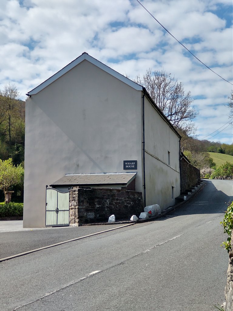
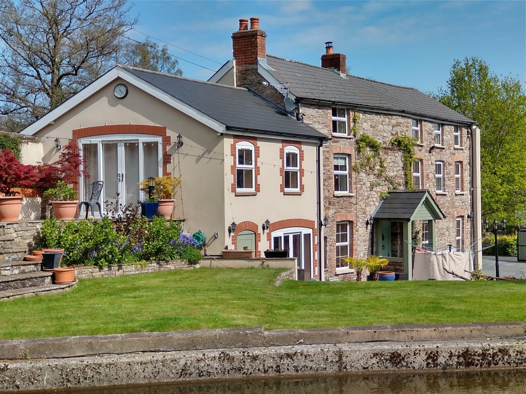
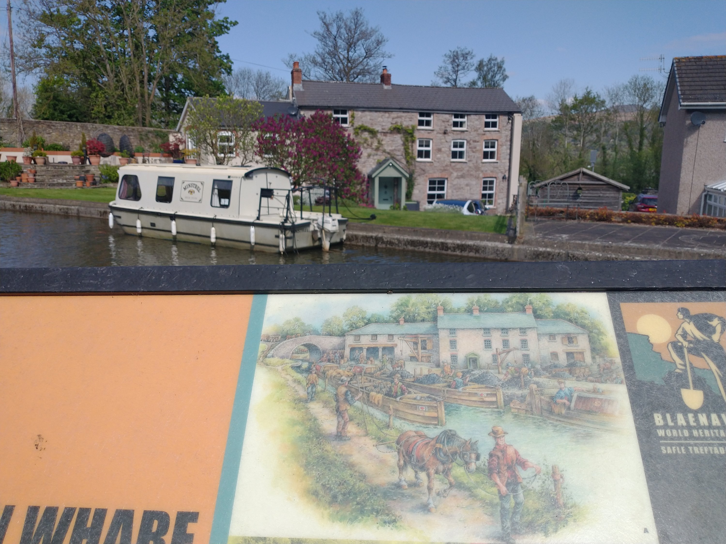
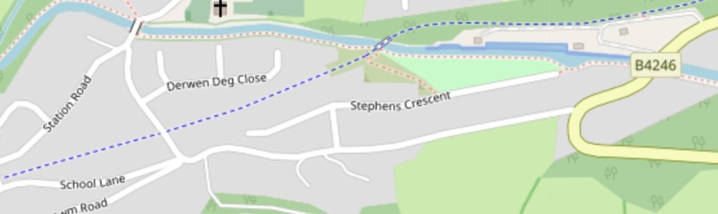
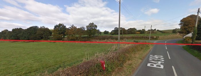
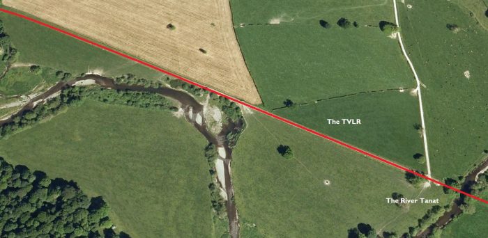
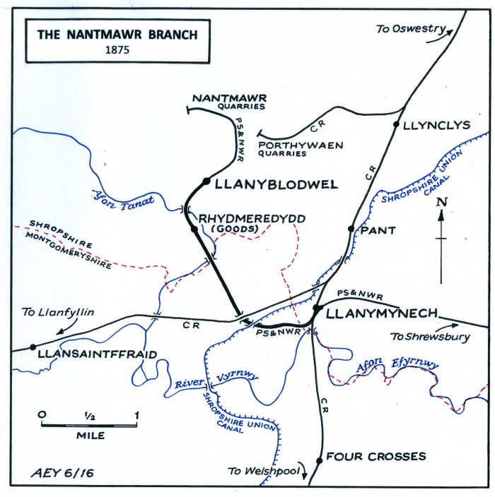
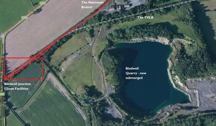
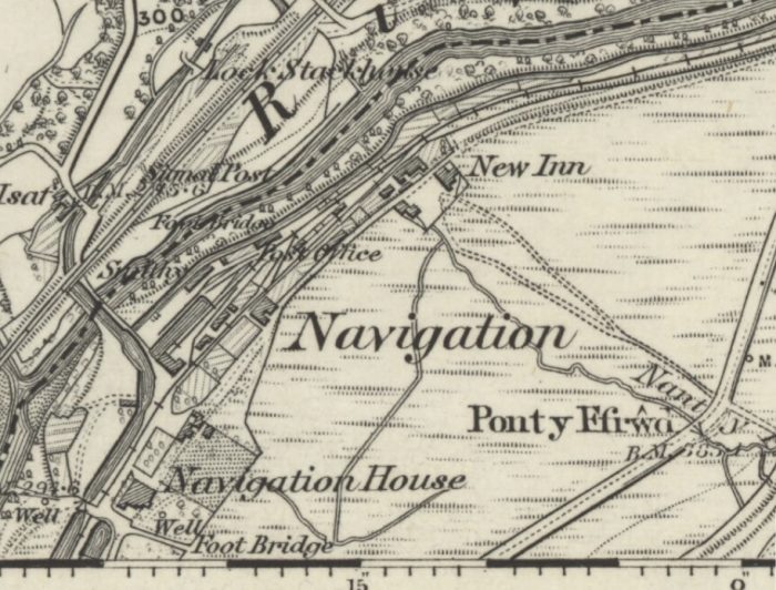
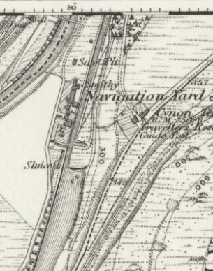
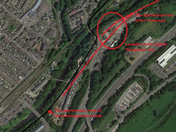
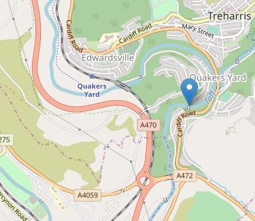
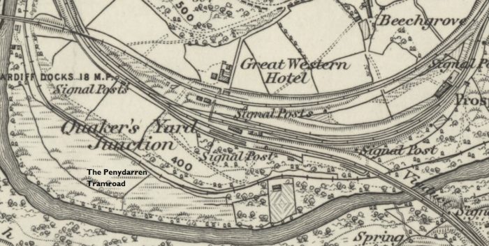
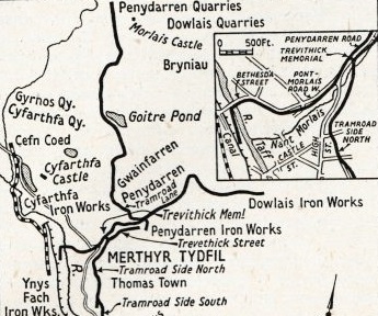
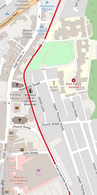
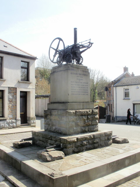
Merthyr Tramroad, or the Penydarren Tramroad, ran from quarries near Morlais Castle via a junction on the Dowlais to Jackson’s Wharf tramroad at SO 0512 0669 (at the present junction of Tramroadside North and Penydarren Road and now marked by the Trevithick Memorial (NPRN No. 91516)) in Merthyr Tydfil, to the Glamorganshire Canal basin at Abercynon (ST 0846 9493) where a commemorative plaque has been erected (NPRN No. 400379).

The tramroad was built because the Dowlais Company’s tramroad ran past the Penydarren Ironworks on a high level course, making it impossible to build a junction for the Penydarren Ironworks to use. In response, Samuel Homfray of Penydarren Works commissioned the tramroad to follow the eastern bank of the River Taff down to Navigation (modern day Abercynon). The tramroad was completed in 1802, and was in use until 1875, except for a period of uncertain length starting in 1815 (and maybe continuing to 1825) because of the collapse of a bridge at Edwardsville just north of Quakers Yard. [5]

Essentially, the Morlais Quarry section was built to supply Merthyr’s Ironworks with limestone, and the Merthyr to Abercynon section to avoid the congested Glamorganshire Canal (NPRN No. 34425). [4]

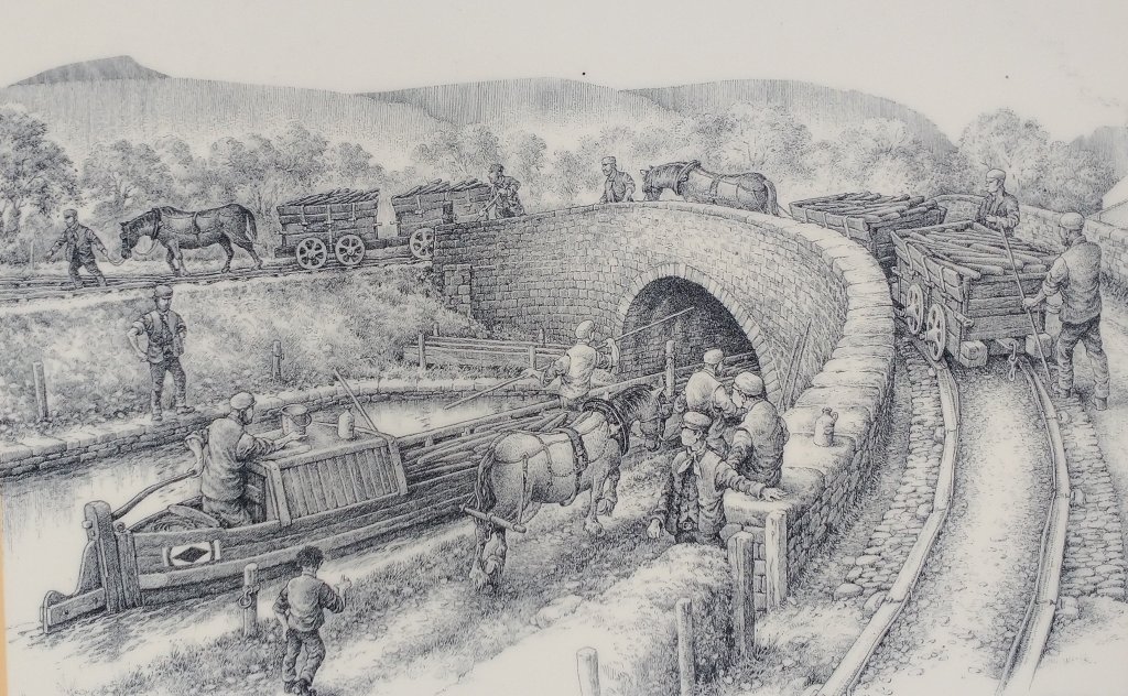
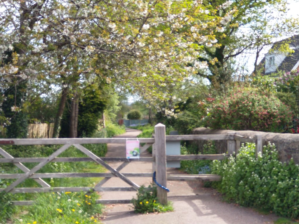
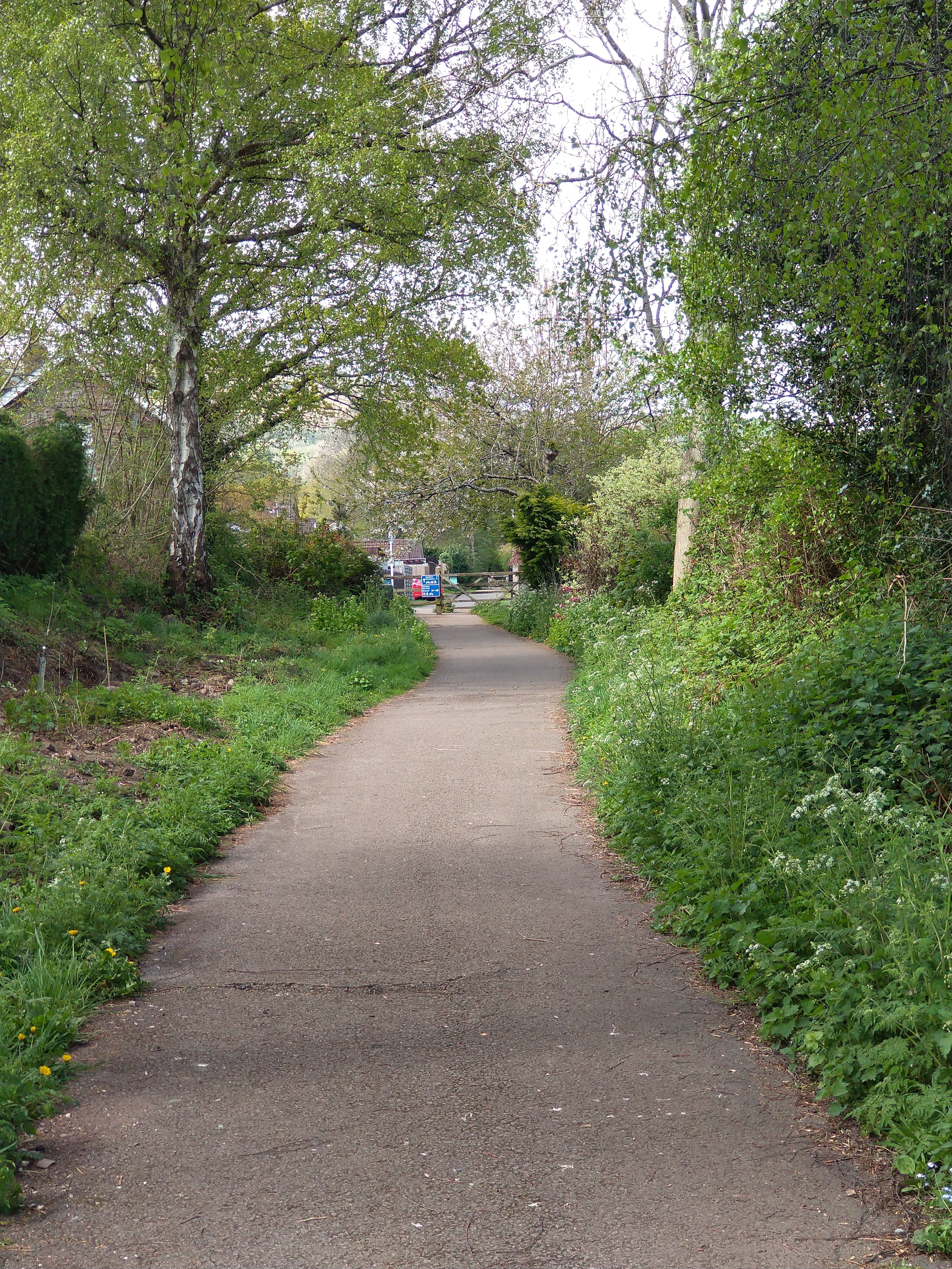
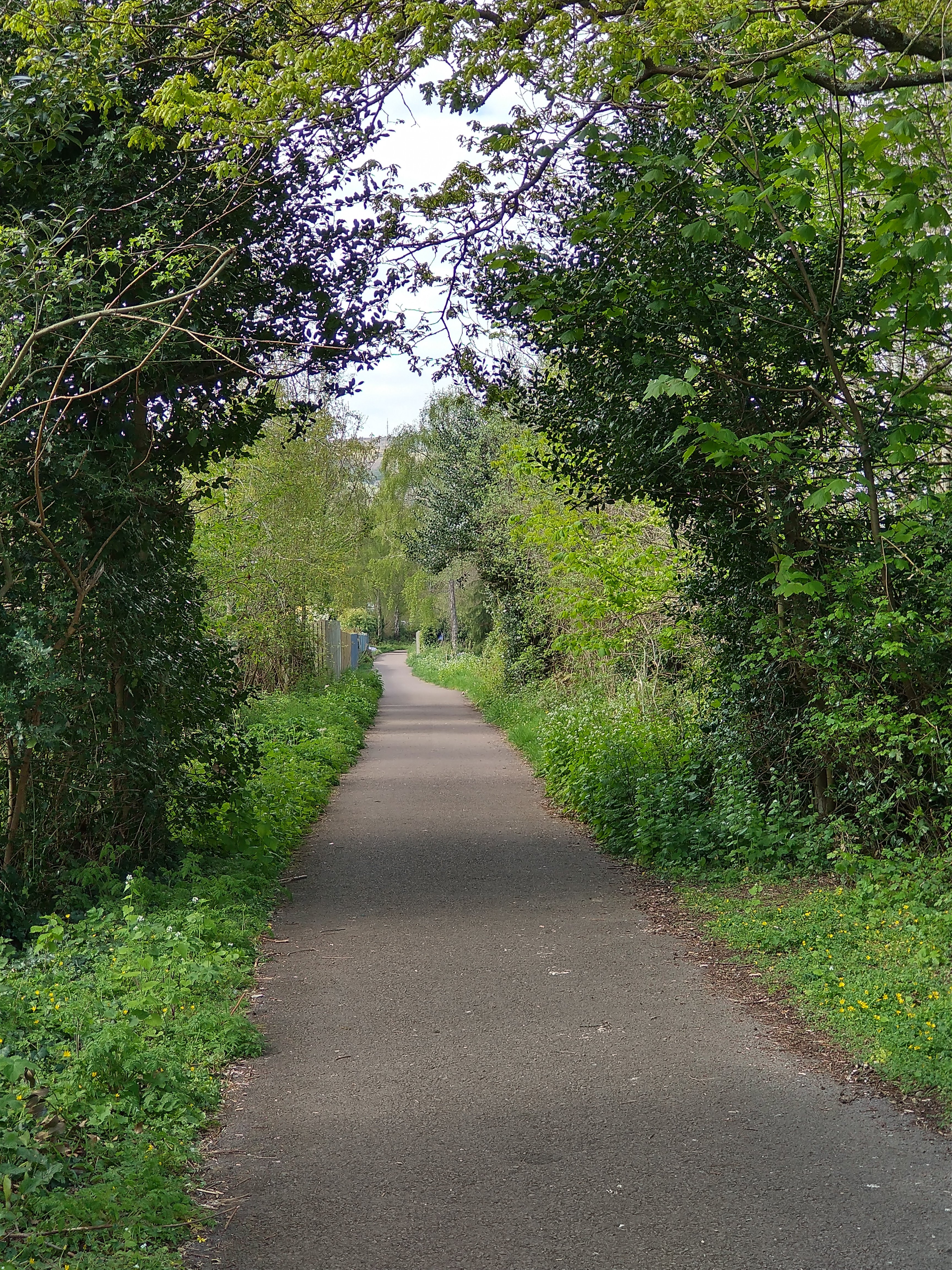
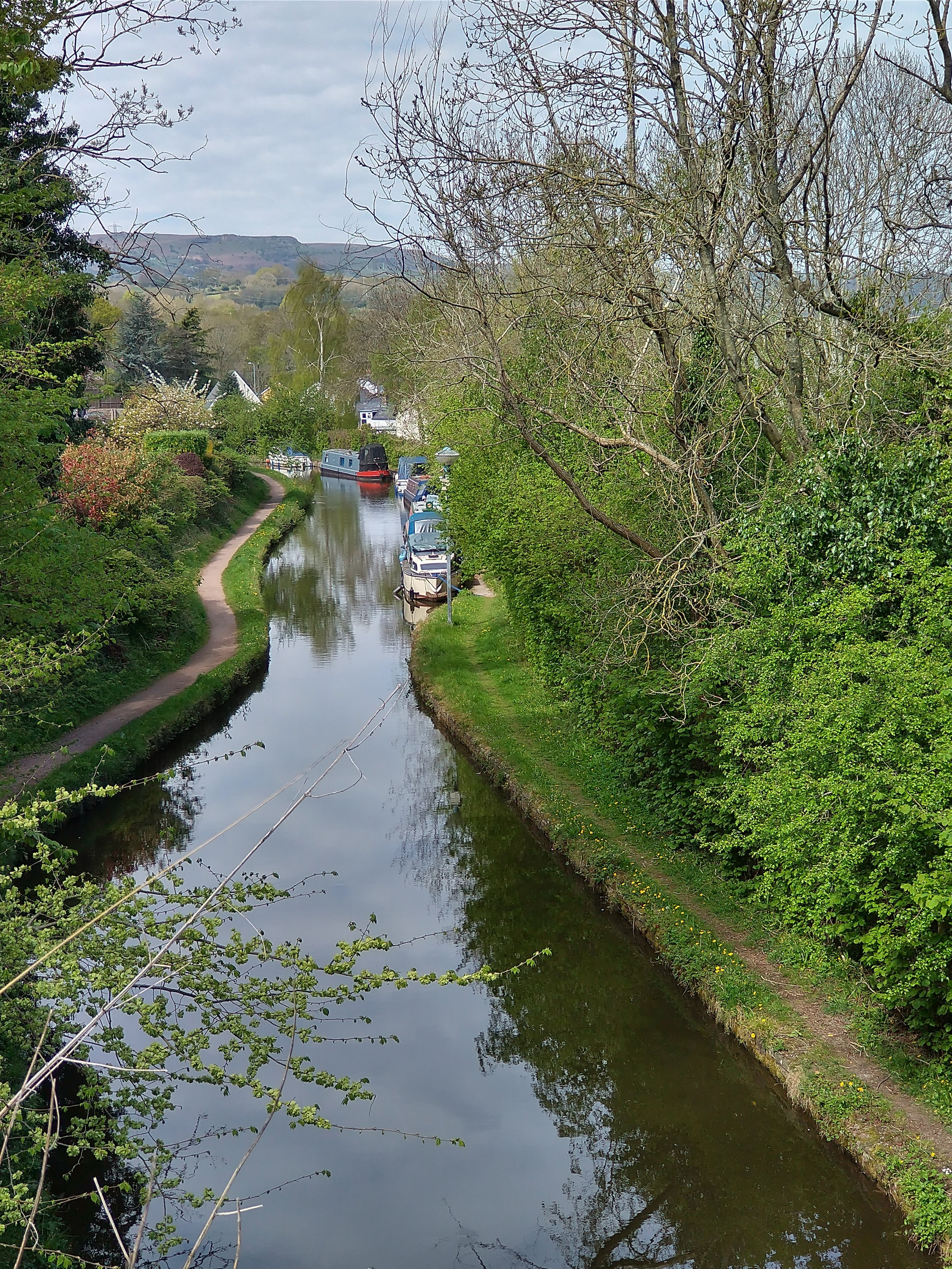
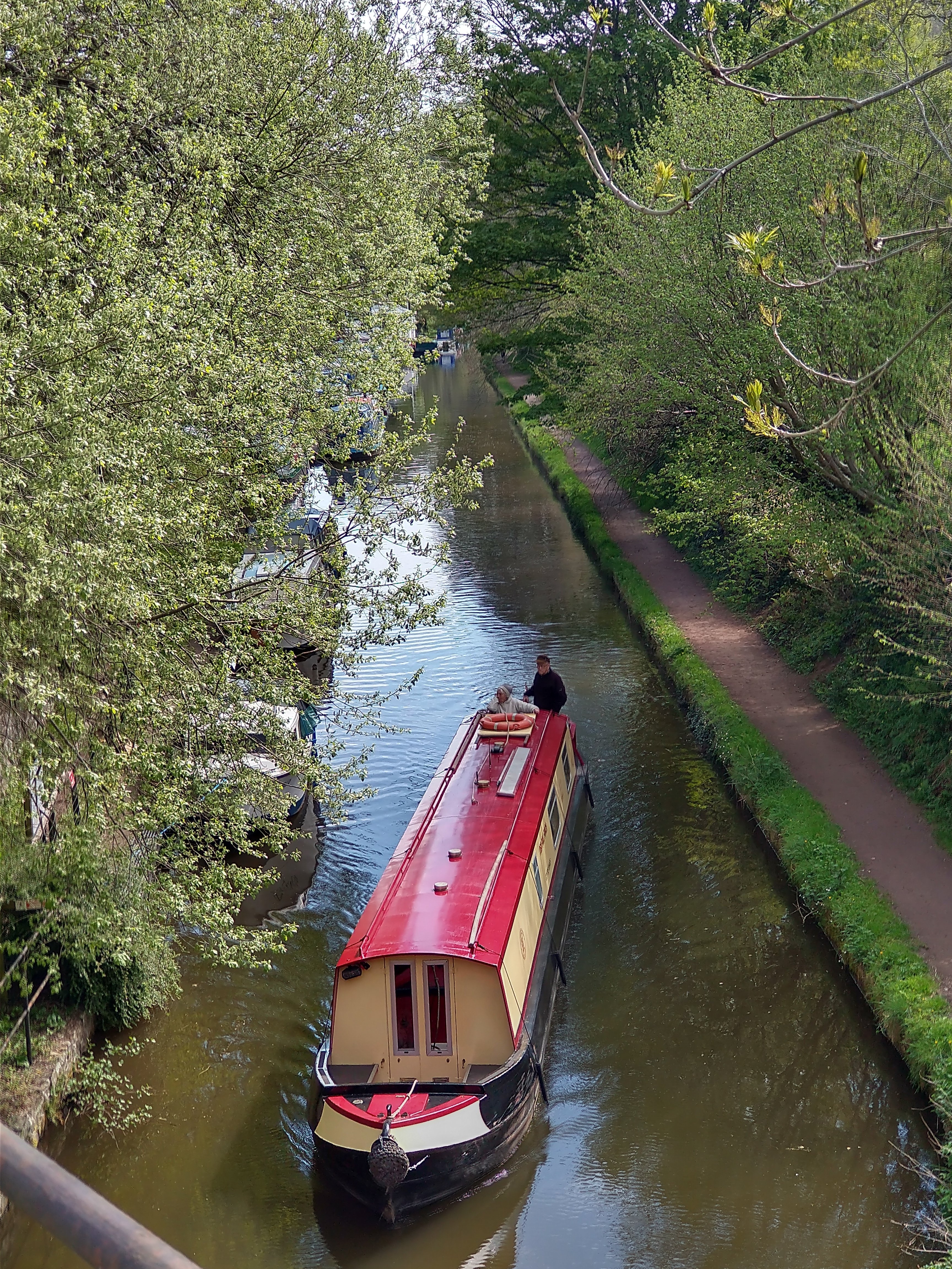
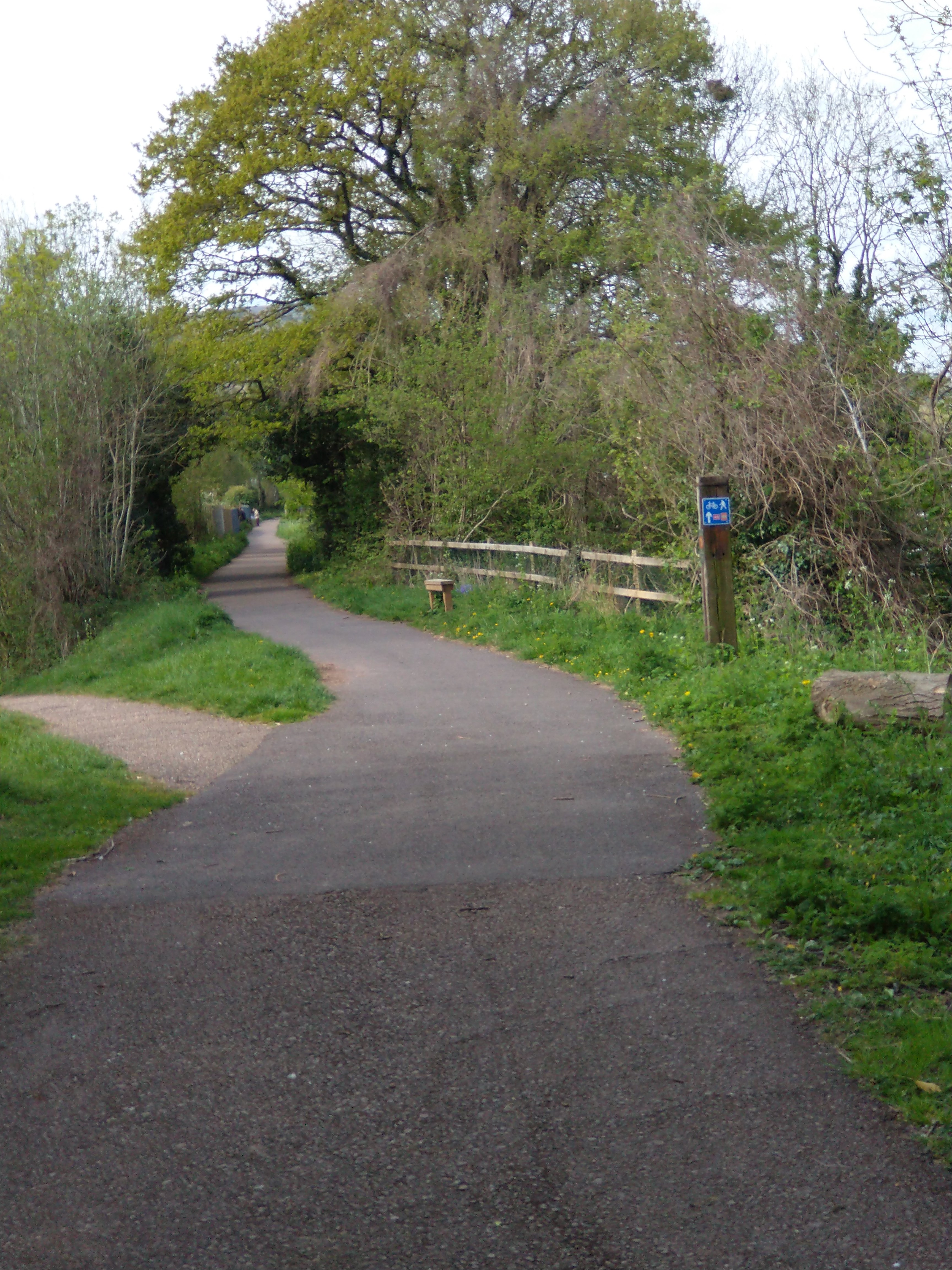
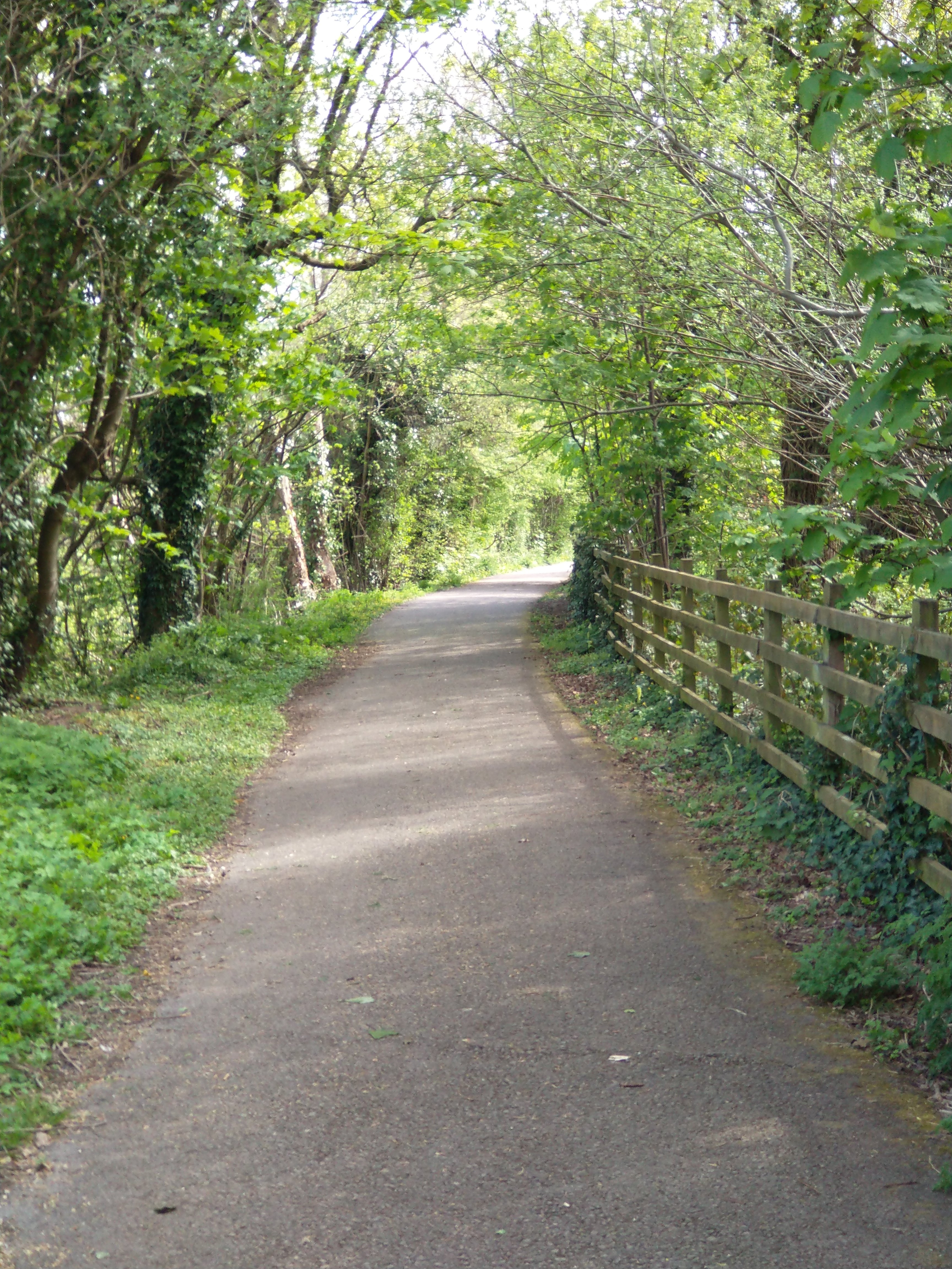
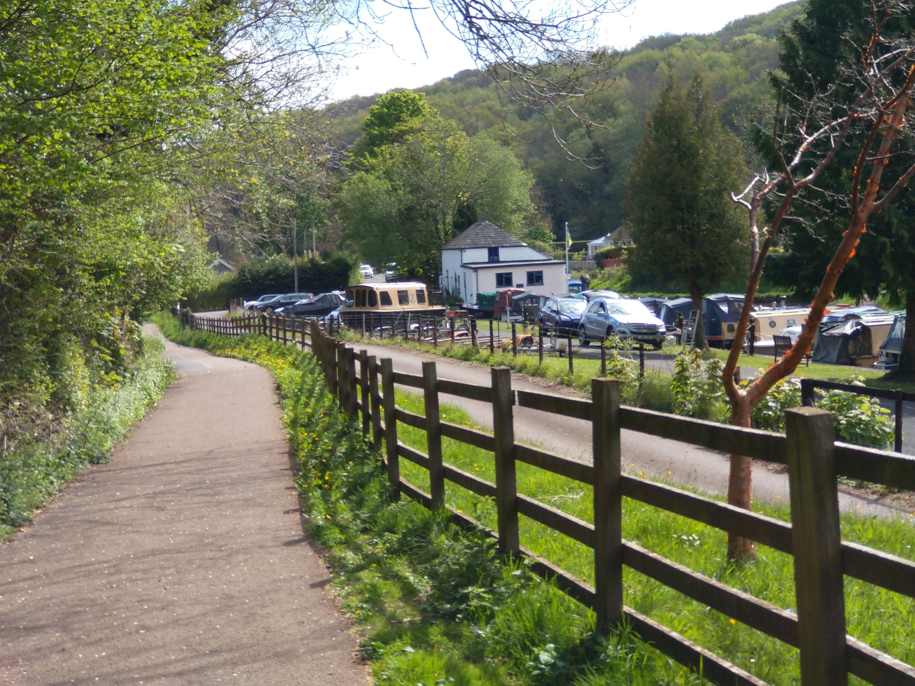
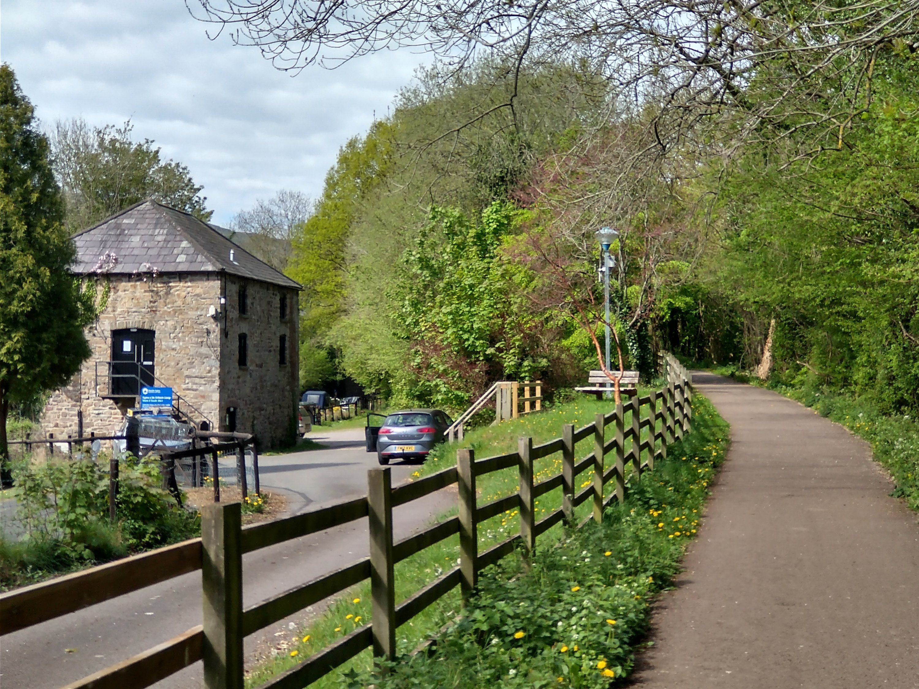
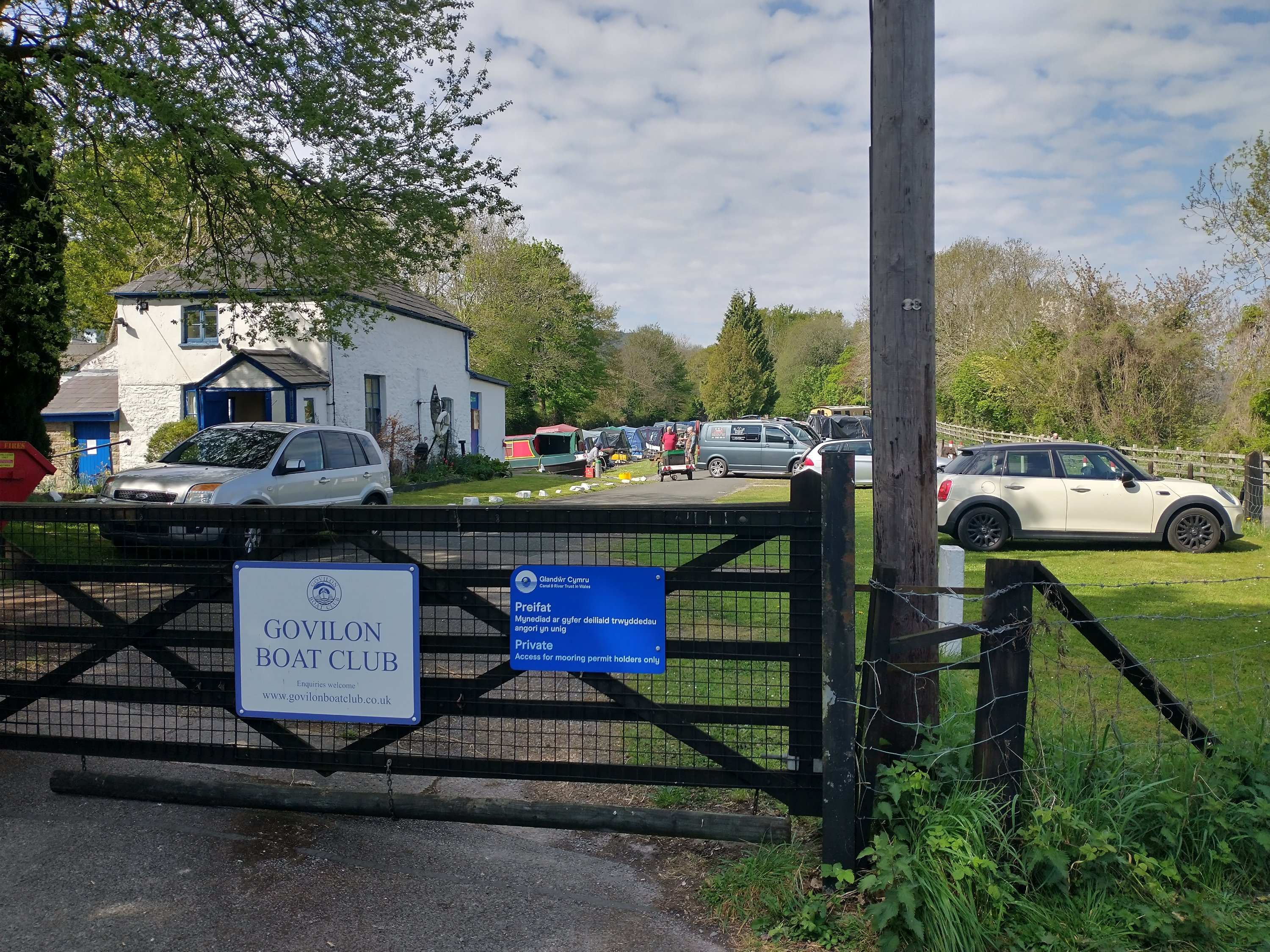
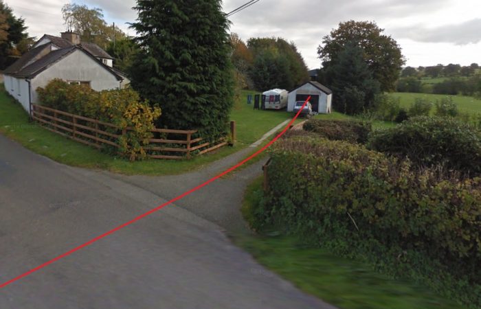
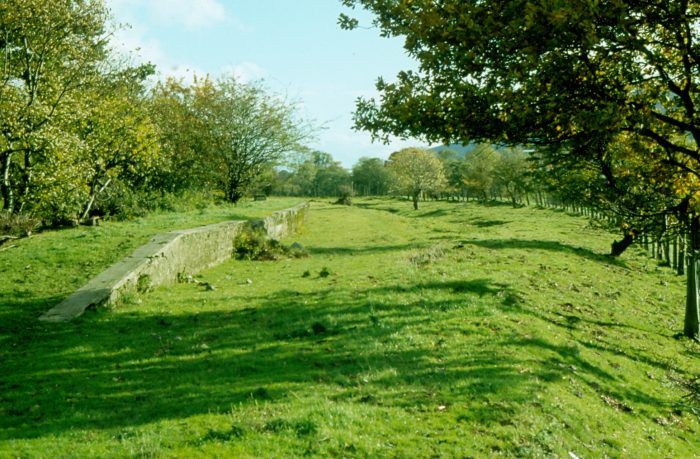
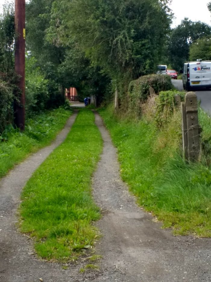
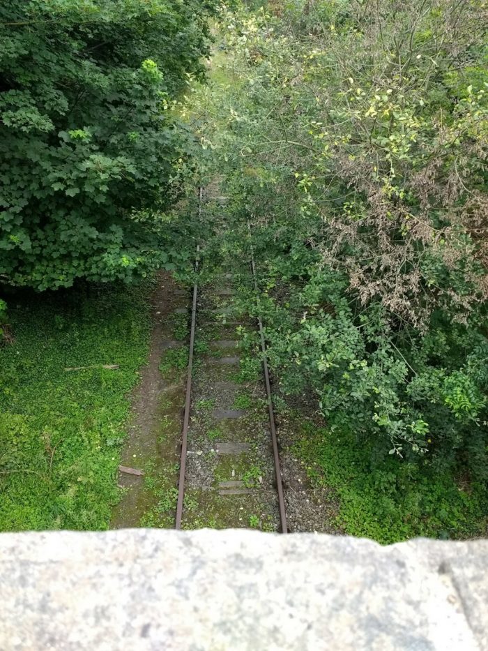
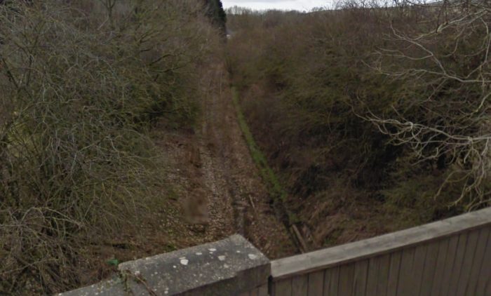
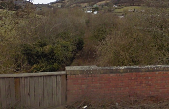
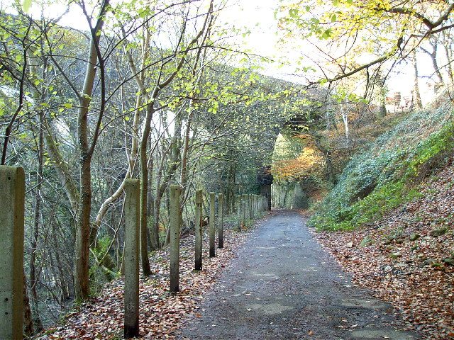
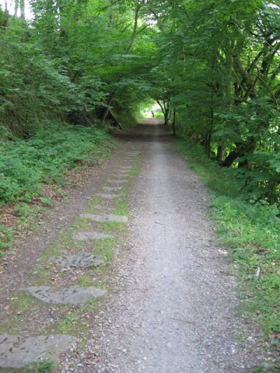
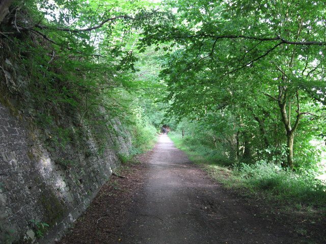
To accommodate the horses, the tramroad didn’t use sleepers as we’re now used to from our modern railways. The rails sat on two lines of stones, allowing the horses to walk between the rails without difficulty. It also made things easier for the man who led the horse throughout the journey! There are several good examples of the tramroad stones still in existence along the route. Today, the rails are gone, but the tramroad formation still exists, and can be followed from Abercynon up to Merthyr Tydfil. The entire length up to Pontygwaith is part of the Taff Trail route of the National Cycle Way. [5]

“The tramroad and the system of which it formed the major part had two other important and interesting features which are less well known: the permanent way of the first railway in the area and the series of early industrial locomotives (most of them Welsh-built by Neath Abbey Ironworks) that traversed the line in the 1830s and 1840s. … The history of these lines is complicated, confusing and at times conjectural.” [1] Many of the notes below come directly from a blog written by M.J.T. Lewis entitled, “Steam on the Penydarren” which is held in the archives of the Industrial Railway Society. [1] These notes are supplemented from other sources, as referenced.

“The major industrial development of South Wales began in the 1780s and especially the 1790s. In Taff Vale and some of the other valleys the main commodity involved was not coal – the real growth in that trade only came later – but iron. Resources were plentiful and demand good; only transport was lacking. It was the canals that began to open up the country, with a series of roughly parallel routes up the valleys, dating mostly from the 1790s. The terrain often prevented these canals from actually reaching the industry, so that feeder railways proliferated.” [1]

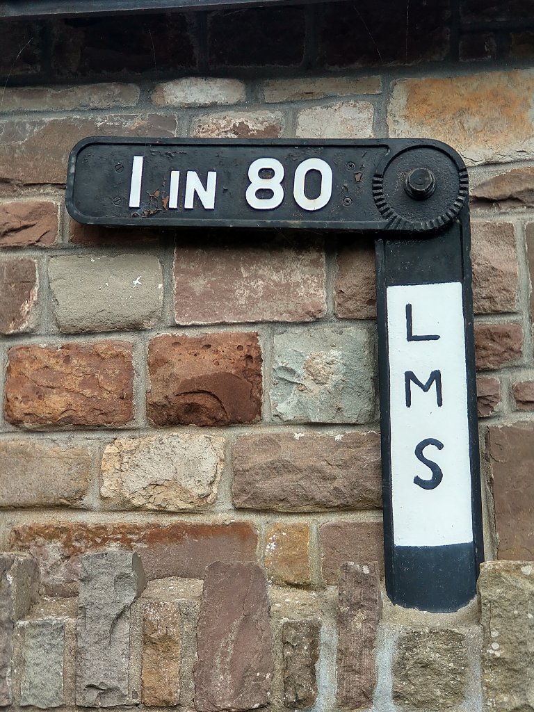
The Glamorganshire Canal was opened from Merthyr down to Pontypridd in 1792 and to Cardiff in 1794. It served Cyfarthfa (see below) directly, and the Dowlais Works has to lay a two-mile railway to carry its iron down to a basin at Merthyr Tydfil. This line was complete by June 1791, and cost about £3,000 of which the Canal Company, wishing to attract traffic, paid £1,000. The gradient was very steep – an average of about 1 in 23, with a maximum of 1 in 16½ – and horses worked the waggons in both directions. [1]

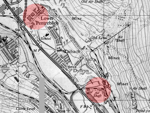
“There were three ironworks to the east of Merthyr Tydfil. Dowlais (begun in 1759) grew rapidly in the early 19th century, until in 1845 it was the largest ironworks in the world, employing a workforce of 10,000. The others were smaller: Penydarren works (1784), adjoining Dowlais on the south and west, and Plymouth (1763), to the south of Penydarren, which established several offshoots nearby  in 1803 a forge and later a rolling mill at Pentrebach, and in 1819 a group of furnaces at Dyffryn. Neither Plymouth nor Penydarren developed nearly as fast as Dowlais. All three companies, sooner or later, mined or quarried their own ore, coal and limestone, and all had their own railway systems leading between the various branches of their undertakings. All three produced primarily pig iron, but converted an ever increasing proportion of it to wrought iron, and as Railway Age got under way they came to concentrate on rolling rails.” [1]

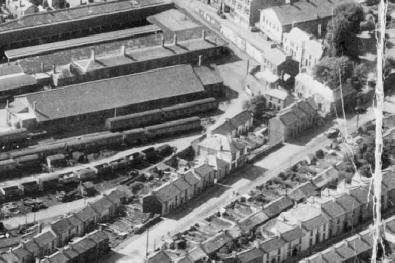
The fourth major ironworks at Merthyr Tydfil was the Cyfarthfa works which were sited on the north-western edge of Mertyr. The Cyfarthfa Ironworks from the air in about 1920. [19]

The Cyfarthfa works were begun in 1765 by Anthony Bacon (by then a merchant in London), who in that year with William Brownrigg, a fellow native of Whitehaven, Cumberland, leased the right to mine in a tract of 4,000 acres land on the west side of the river Taff at Merthyr Tydfil. [6]  The heyday of the works was in the tenure of Richard Crawshay (1739-1810) and the works went into gradual decline thereafter. The Dowlais Works became the leading Ironworks in the Valley. [6] As we have already noted, the Cyfartha Works were directly served by the Glamorganshire Canal. This was not the case for the Dowlais, Penydarren and Plymouth Works. Because the owners of the Cyfarthfa Ironworks dominated the management of the Glamorganshire Canal, the other Merthyr Tydfil ironworks built a tramroad bypassing the upper sections of the canal. [8]

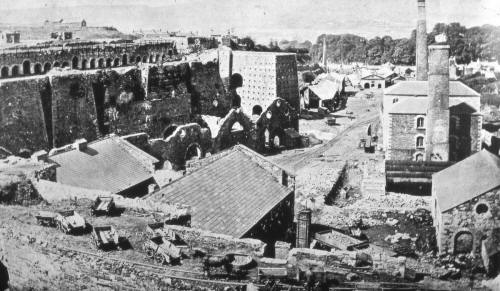
We have already noted that the Dowlais Works became the largest ironworks in the world in  the early to mid-1800s. The Works, founded in 1759, owed much of their success in the 1820s to the production of rails for the railway and tramway industry in the UK. [7] In the 1850s, the Works was the first UK organisation to licence the Bessemer Process for the production of steel. The first Bessemer steel was actually rolled at the works in 1865. Unlike the Cyfarthfa Ironworks nearby, the Dowlais Ironworks converted to steel production early allowing it to survive into the 1930’s. [7] The Dowlais Steelworks. [18]

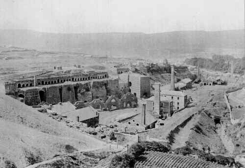
The Penydarren Ironworks were founded in 1784 and operated independently, but at times sporadically, until the late 1800s. [7][8] The Dowlais Works bought mineral ground of the Penydarren Works in 1859. [7]
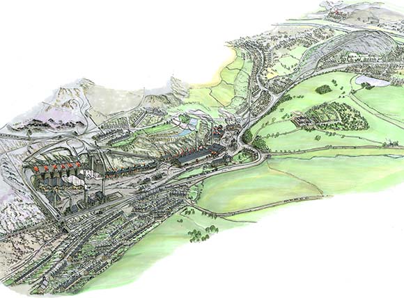
The Penydarren Ironworks, © Bronwyn Thomas [16]

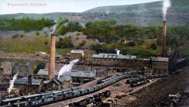
The Plymouth Ironworks commenced operations in 1763 and remained operational until the 1870s. [9]The Plymouth Ironworks ways spread over 3 different sites. [17]

Initially a tramway was built for the Dowlais Works alone to reach the canal near Mertyr Tyfil. We could call this the first Dowlais Tramway. There is record of a dispute between the proprietors of the Dowlais Works and the Penydarren Works. The result appears to have been that Penydarren built their own railway to the canal, closely paralleling the Dowlais line and in places right alongside it. The date was somewhere in the 1790s, but the original type of rail and gauge are quite unknown. This railway, though not the Dowlais one, had a short tunnel under Bethesda Street in Merthyr. [1]

Up to this time, all railways had wooden trackwork. In the north of the UK, a gauge in the 4ft to 5ft range and waggons holding up to 3 tons were the norm, with the wooden rails occasionally protected against wear a tear by thin wrought iron plates. The West Midlands and Wales, however, followed the example set by the Shropshire collieries and ironworks, which favoured narrower gauges (up to 3ft 6in or so), smaller waggons and sometimes flat cast iron plates laid on top of the wooden rails. [1]

“This form of protection was introduced at Coalbrookdale in 1767, but  rail made solely of cast iron, only appeared in 1791. This happened in South Wales, an area that always looked towards Shropshire in mining, ironmaking and transport, and the line involved was the Dowlais-Merthyr railway. William Taitt of Dowlais wrote on 17th March 1791: ‘We are now making Rails for our own Waggon way which weigh 44 li or 45 li [Ib] per yard. The Rails are 6 feet long, 3 pin holes in them, mitred at the ends, 3 Inches broad Bottom, 2½ In. top & near 2 In. thick thus:'” [1]

As far as is known, these were the first all-iron rails ever made for flanged wheel railway. It was copied in the next few years on a number of feeder railways to the Monmouthshire and Brecon & Abergavenny Canals. The gauge of these lines was 3ft 4in, they were engineeered by the Dadford family and as the Dadford’s also engineered the Dowlais tramway, it is likely that this would have been the track-gauge of the line. [1]

Because of difficulties in sourcing materials, the Dowlais Works built a second tramway from the Morlais quarry to the works. (Penydarren owned the western part of Morlais quarries and Dowlais the eastern part, and both no doubt began by carrying the limestone to their respective works by cart.) This second tramway was probably built in 1792, it’s course is uncertain but probably approximated to the future Brecon & Merthyr Tramway from Pantyscallog to Dowlais Central. Whether Penydarren had its own tramway from Morlais in the 1790s is not known. [1]

The story clearly does not end there, Dowlais Works constructed another plateway/tramway in the 1790s linking its colliery, probably to the south-east of the Works to the Works. [1]

In the late 1790s, the accepted design of plate-ways/tramways in South Wales changed. Old edge-railways with flanged wheels were replaced by flanged (usually L-shaped) rails and wagons were fitted with plain wheels. “Practically always, the rail ends were set on separate stone block sleepers instead of on transverse wooden ones. In early days the rails were simply spiked down, through notches at their ends, into wooden plugs in the blocks; later, chairs were introduced and even cast iron cross-ties which, though not spiked down, were held on the blocks by the weight of ballast, the rails being fixed in dovetailed sockets.” [1] George Overton was a protagonist for the new plate-ways and was ultimately responsible for the Penydarren Tramroad. [1]

The later Penydarren Tramroad owed its origin to a quarrel between Richard Crawshay of Cyfarthfa and the ironmasters of Dowlais, Penydarren and Plymouth. Crawshay had a controlling interest in the Glamorganshire Canal Company and claimed preferential treatment in the matter of carriage, to the detriment of the other Merthyr works. The Glamorgan-Gwent Archaeological Trust comments: “The Penydarren Tramroad from Penydarren to Abercynon was constructed in 1802 because of disagreements over tariffs charged on the Glamorganshire Canal between Richard Crawshay of Cyfarthfa, who held the largest share in the Canal Company, and the owners of the other iron works of the area, Penydarren, Dowlais and Plymouth.” [10]

The three iron-masters petitioned Parliament in 1799 for a tramroad from Cardiff with branches to Merthyr, Abernant and the head of the Rhymney valley. The Bill “was defeated by canal opposition, but already, on 18th January 1799, Samuel Homfray of Penydarren, William Taitt of Dowlais and Richard Hill of Plymouth had agreed to build the section from Merthyr to Abercynon: by‑passing, that is, the upper and most inconvenient stretch of the canal. The tramroad was built without an Act; compulsory powers, though not invoked, were already provided by the Glamorganshire Canal Act, which authorised proprietors of works within four miles of the canal to build railways to it. Dowlais and Penydarren each owned five shares in the tramroad, Plymouth four. The line was built under the general supervision of Richard Hill; George Overton was the engineer. ” [1][11] Work began in 1800, and the tramroad was completed in 1802. It was 9½ miles long from a junction with the Dowlais-canal line in Merthyr to the canal basin at Abercynon. The gauge was 4ft 2in inside the plate flanges, or 4ft 4in over them. [1]
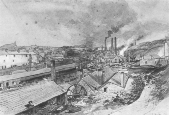
Dowlais Ironworks in 1840. Watercolour by G. Childs  [British Steel Corporation] [1]

“At about the same time there were considerable changes to the private Penydarren and Dowlais systems. The Dowlais-canal line, above the new junction with the Penydarren Tramroad at Merthyr (where the Trevithick Memorial now stands) was converted to 4ft 4in plateway, so that through running from Dowlais to Abercynon was possible; the lower part, from the junction to the canal at Merthyr, was apparently closed. The Penydarren Company’s line to the canal remained, consisting now of plate rails at 3ft outside gauge  the standard Penydarren Company gauge.” [1]

“About 1800 a new tramroad was built from the western Morlais quarries via Goetre Pond to Penydarren works, as part of the general agreement to make the Penydarren Tramroad. … In 1803, the three ironmasters agreed to add 4ft 4in track to this Morlais-Penydarren tramroad, ‘the present Road to remain on the inside of the Wide Road’, and the stone blocks once visible indicated three-rail track. The purpose of this dualling of the gauge was to permit through running via the Penydarren Tramroad to Plymouth works, and thus to free Hill from his bondage to Crawshay in the matter of limestone. The Morlais line became a part of the “General Road”, paid for initially according to the shares each ironworks held, and maintained thereafter according to the tonnage carried by each.” [1]

Also in about 1800, Overton converted each of the Morlais-Dowlais tramway and the Dowlais Colliery to the furnaces tramway into a plateway. The result of these changes was significant. Prior to the alterations one horse pulled one wagon, “now ‘each horse regularly hauled from the farthermost part of the colliery twelve [wagons], carrying fifteen hundred-weight each, and took the empty ones back’. As was usual in such cases, the exact route of this line was frequently altered as new pits were opened and old ones closed. Penydarren also had its own coal lines, which included inclines, on the 3ft gauge and going in the same general direction as the Dowlais ones.” [1]

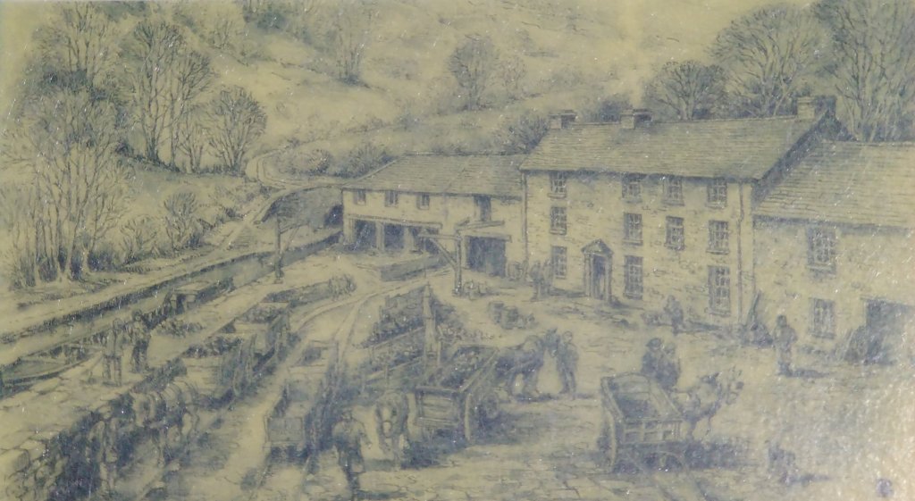
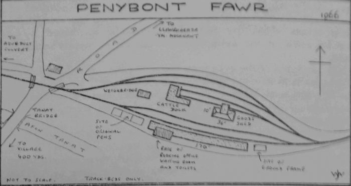
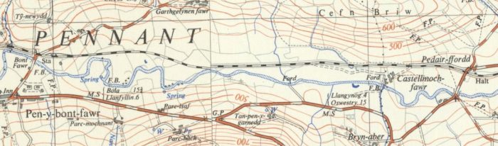
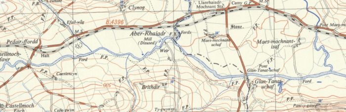
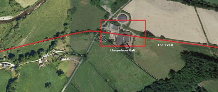
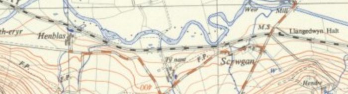
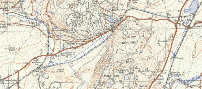
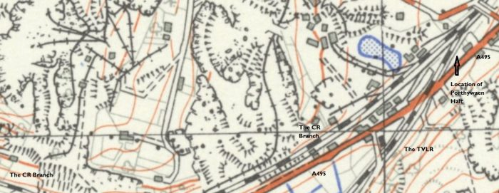
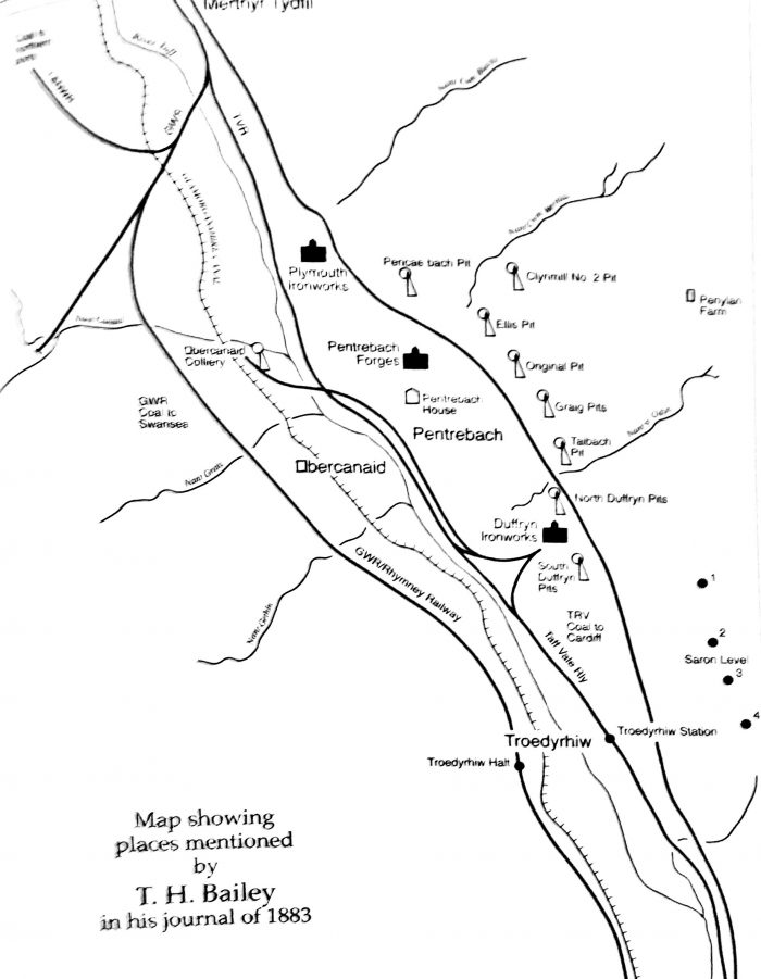
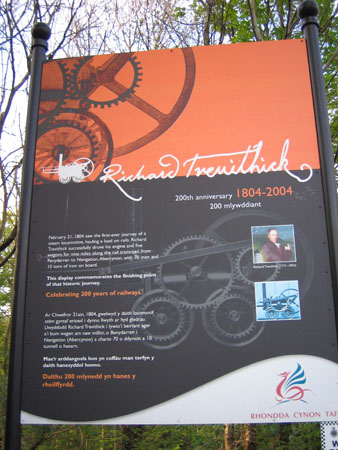
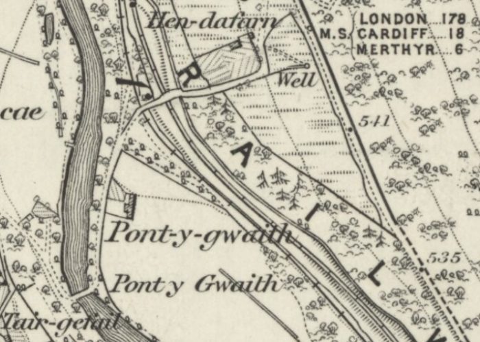
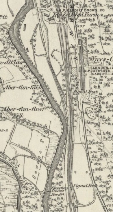
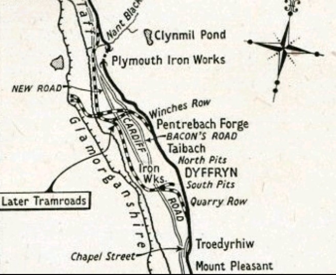
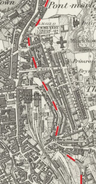
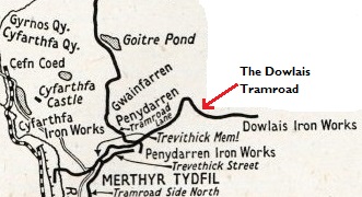
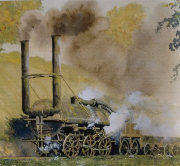
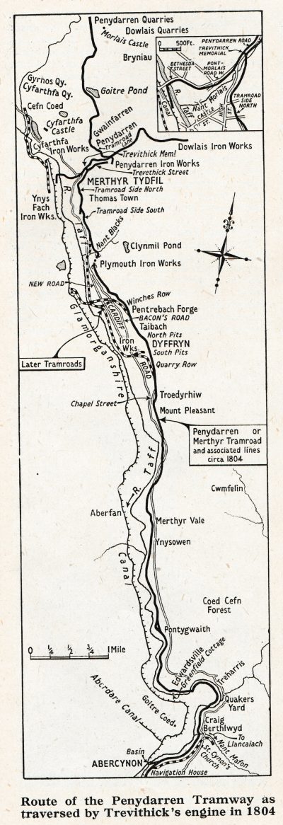
1804 saw the famous trials of a steam locomotive on this tramway. The Route of the line, and that taken by Trevithick’s locomotive, is shown on the adjacent sketch drawing from The Railway Magazine from March 1951. [13] … Richard Trevithick “was, in October, 1803, busily engaged in constructing at Penydarran, in South Wales, a tramway locomotive, to run on rails not exceeding an elevation of 1 in 50, and of considerable length.” [12] On 21st February 1804, the locomotive was active on the Penydarren Tramway with a “full supply of steam and power.” [12] Indeed, “before a week had passed, from the first getting-up of steam, this pioneer of railway-engines had run several times, drawing a load of 10 tons, and was more controllable than horses. Only two miles of road were to be run over during the first trials, but within the week the engine ran a distance of 9.75 miles.” [12] Trevithick’s locomotive was the first steam locomotive to pull a load on a railway. [4] 

The engine in working order weighed about 5 tons its cylinder was 8.25 inches in diameter, with a stroke of 4.5 feet. It took empty wagons up an incline of 2 inches in a yard, at forty strokes a minute, progressing 9 feet at each stroke in other words, it took its load up an incline of 1 in 18 at the rate of four miles an hour. Deatials of the locomotive were provided in an article in the March 1951 edition of The Railway Magazine. [14]
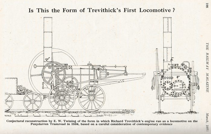
Although the tramway was the route used for this first-ever steam-powered railway journey, those early iron rails couldn’t take the weight of the engine. The tramroad soon reverted back to using horses to draw the wagons down to Navigation (Abercynon). [5]Dowlais furnace tops and tram waggon, 1840. Watercolour by G. Childs. [British Steel Corporation] [1]

…………………………………..

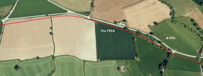
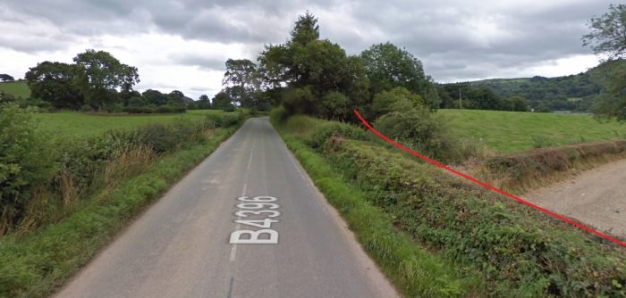
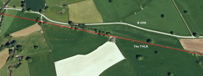
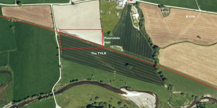
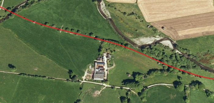
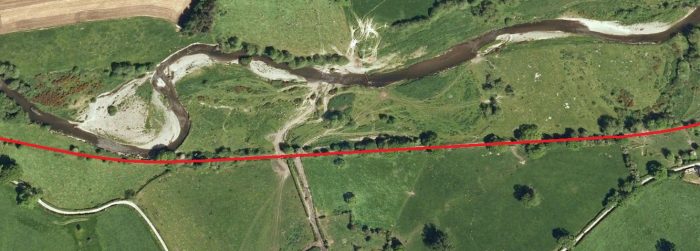
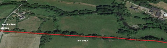
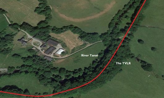
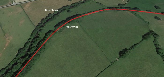
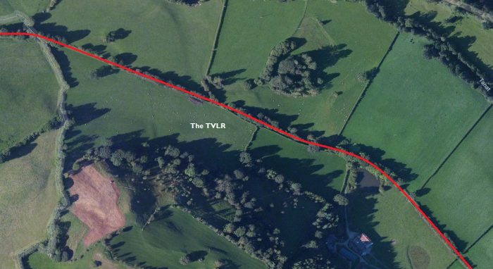
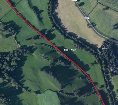
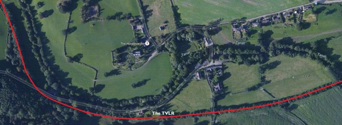
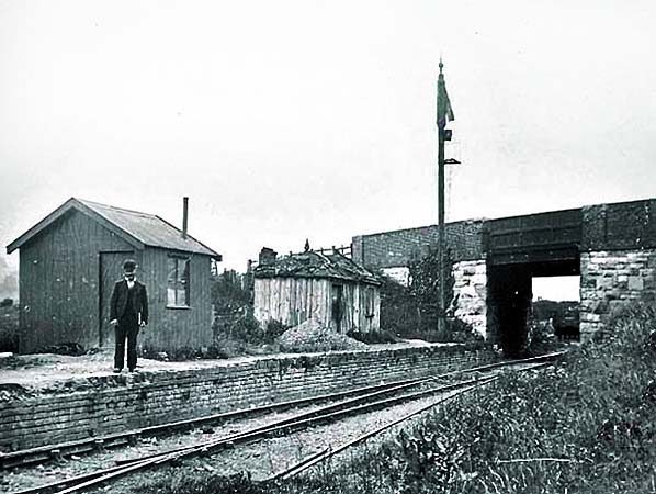
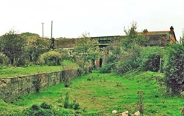
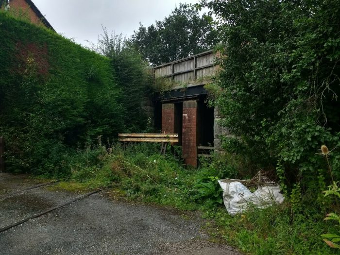
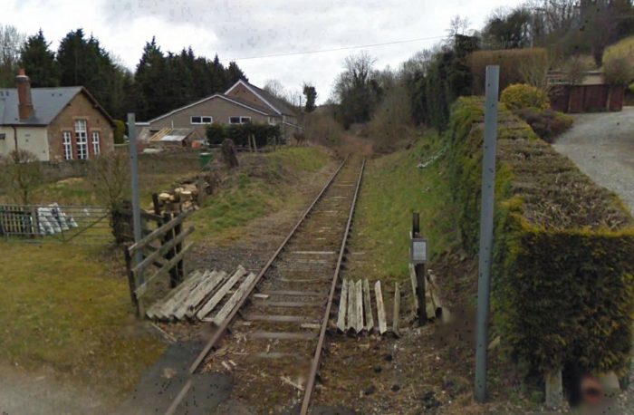
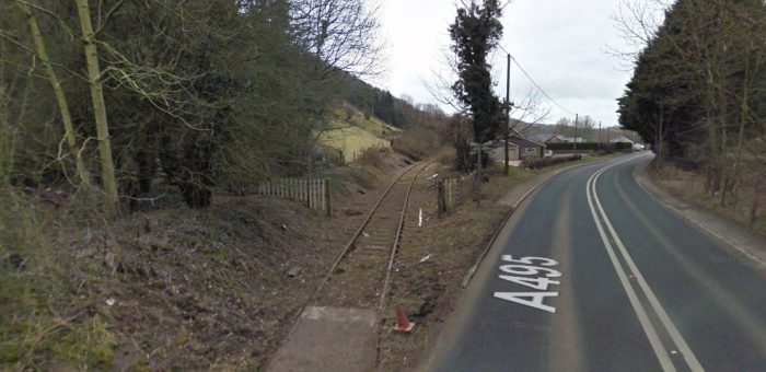
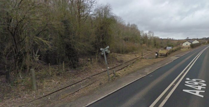
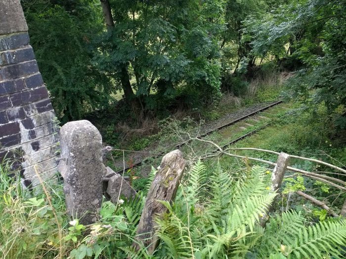
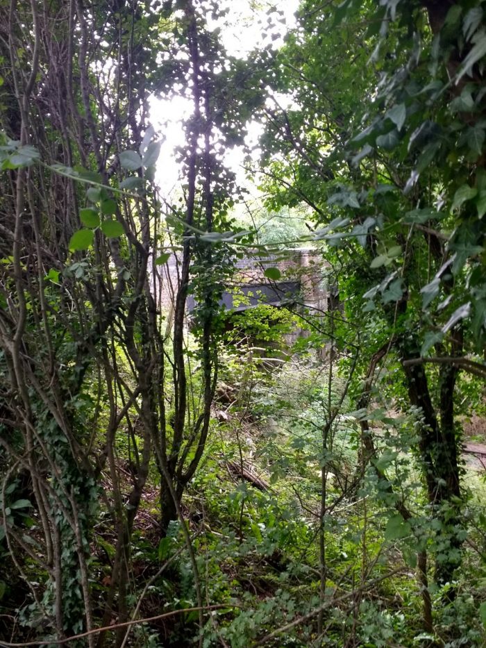
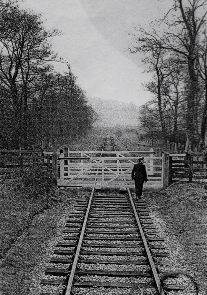
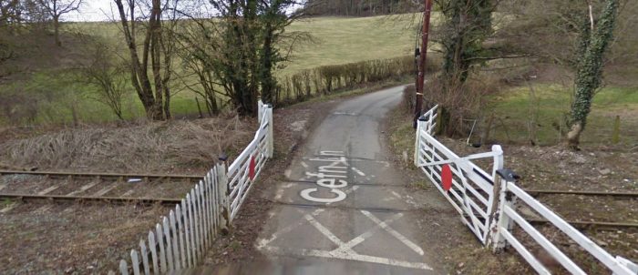
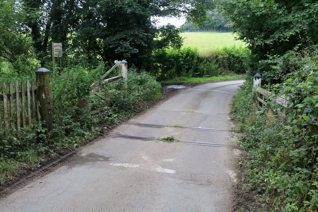
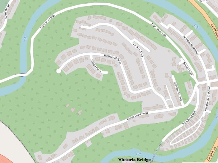
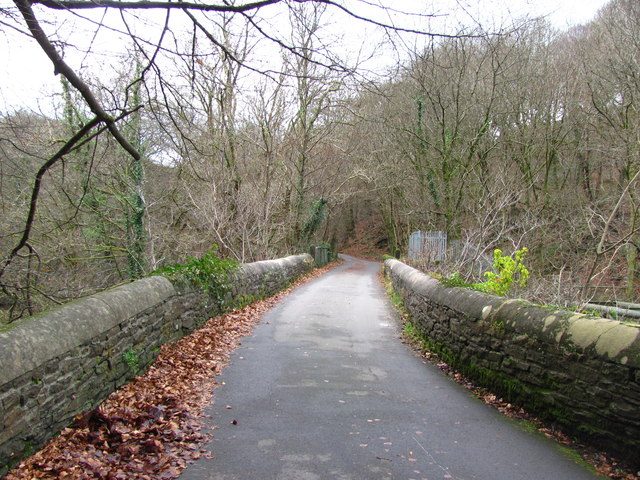
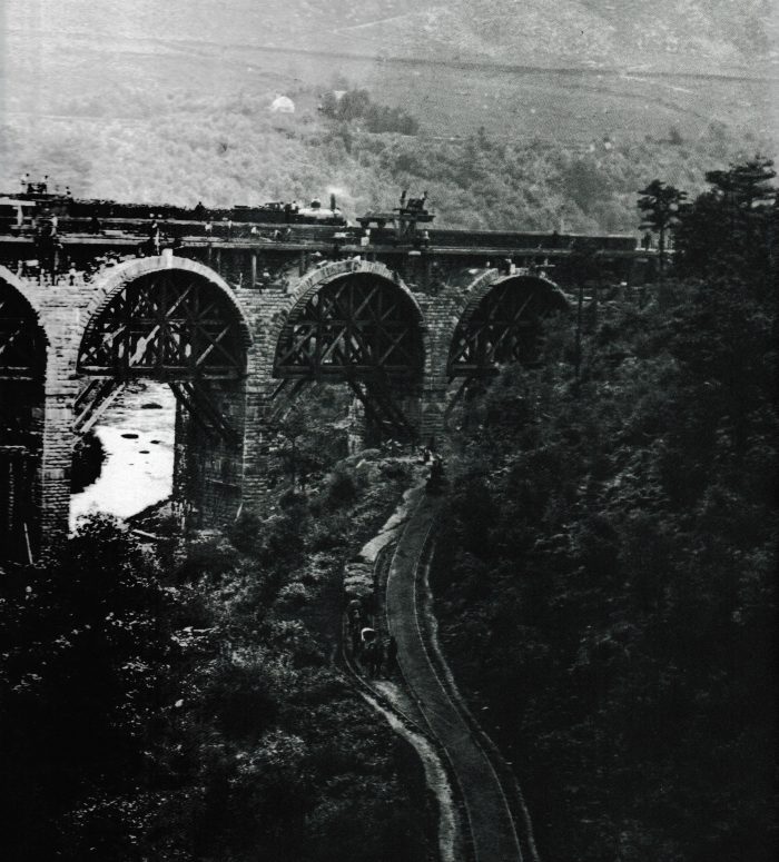
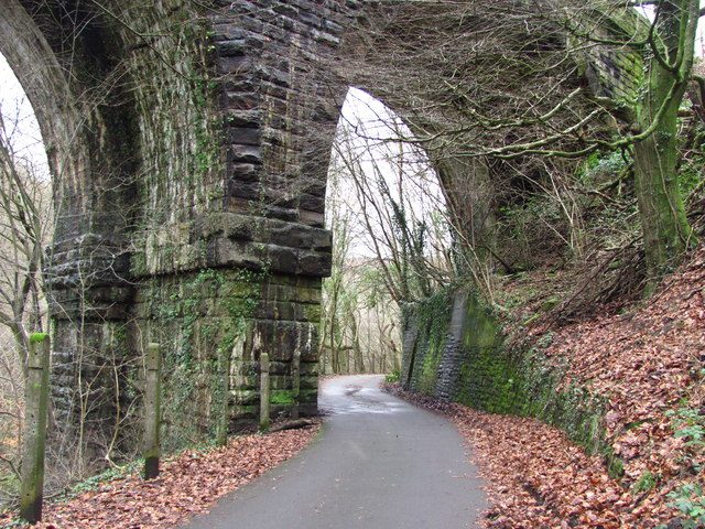
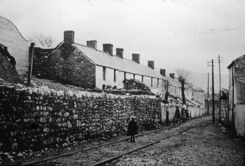
The Penydarren or Merthyr Tramroad clung to the hillside on the east side of the Taff for almost all the way, with the gentle average gradient of 1 in 145. Apart from the occasional road bridge and culvert, it had only three engineering features of note. At Plymouth works, the line passed right underneath the charging area of the furnaces in a tunnel 8ft high and 8ft wide: ample clearance for horse-drawn trams but a distinct impediment to locomotive working. Two bridges carried the line across a large loop of the Taff near Quakers Yard, both of which began life as timber structures. The Wikipedia article about the tramway says: “In 1815 a wooden bridge over the Taff near Quakers Yard collapsed beneath a train carrying iron from Penydarren. The whole train including the horses, the haulier and four other people riding on it fell into the river killing one horse, badly cutting another and injuring two of the people.” [3] Both timber bridges were replaced by large stone arch bridges.

“The Penydarren was a single-track tramroad with frequent passing loops. The original track consisted of 3ft‑long cast iron plate rails with upward-bellied flanges and a strengthening rib below; they weighed about 60 lb each and were spiked directly to rough stone blocks about 1ft 6in square. Later, chairs were introduced to provide a better bearing surface and a new pattern of rail that instead of a spike-notch had a downward projection to prevent longitudinal movement. These rails were keyed in the chairs. A third type of rail was a dual-purpose one, with both notch and projection. All this ironware was doubtless cast at the three ironworks interested in the line. Many blocks are still in position from Mount Pleasant southwards, and some rails may be seen in the Cyfarthfa Museum at Merthyr. … When locomotives were introduced the continual breakage of plates under their weight created a serious problem, but cast iron rails were retained to the end.” [1]

“The trams (or wagons) were about 7ft 6in long by 4ft 9in wide at the top, each side consisting of a vertical plank 1ft high topped by a flared plank 9in high. The bodies were originally of timber strapped with iron, though later 1/8in plate iron was adopted. The cast iron wheels were usually 2ft 6in to 2ft 9in in diameter, with a tread 1¾ in wide. A tram’s capacity was two tons or a little more, and its weight was 15cwt By 1830 there were 250 of them..” [1]

Early on, one horse would pull five trams (a total of about 10 tons of iron) down and the empties back up, making one return trip a day.As demand increased, so did the length of tram trains. As many as three horses could be teamed up and would haul about 25 trams (about 50 tons of iron). Although the line was privately built, other parties were allowed to carry goods on it on payment of a toll; but it is not known if this ever happened. Passenger traffic, though quite unofficial, was winked at: anyone who was ready to tip the driver and to perch on a tramful of iron was allowed a ride.

“The traffic consisted largely of iron for export from Cardiff, and grew markedly for much of the tramroad’s life. In 1820, Dowlais sent down 11,115 tons of iron, Penydarren 8,690 tons and Plymouth 7,941 tons; in 1830, the respective tonnages were 27,647, 11,744 and 12,177; and in 1840, 45,218, 16,130 and 12,922. From the late 1820s, however, more and more iron ore was imported, a traffic which came to outstrip the tramroad’s capacity on the uphill haul, so that the bulk of it was carried by canal up to Merthyr and transferred to the Penydarren Company’s line there.” [1]

In 1835, Dowlais alone imported 15,668 tons of ore and cinders. To deal with the increase in both traffics, locomotives were introduced. Trevithick’s engine had hauled several trains to Abercynon in 1804, but it was simply an experiment which was only a partial success. Regular locomotive working began in 1832, when an engine owned by the Penydarren Company was closely followed by a series belonging to Dowlais, some of which worked the steep section up to Dowlais with the aid of a rack rail laid between the running rails. However, the tramway was becoming increasingly outdated and the Iron Works needed a better method of transport.
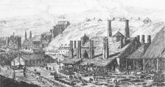
Penydarren Ironworks in 1813.  [J.G. Wood, “The Principal Rivers of Wales Illustrated”]Bethesda Street, Merthyr, looking east. The car is standing on the route of the Penydarren Company’s line to the canal, with Bethesda Street tunnel beyond; the Dowlais Company’s line to the canal ran along the street to the left. [P.G. Rattenbury]

“As early as 1823 they promoted a Bill to extend the tramroad to Cardiff  again the primary cause was a quarrel with the Glamorganshire Canal Company  and again the Bill was lost. In the end, with Hill of Plymouth and Guest of Dowlais among the chief promoters, the Taff Vale Railway obtained its Act in 1836, and was opened from Cardiff to Abercynon in 1840 and to Merthyr in 1841.” [1]

The Taff Vale had powers to make branches to the ironworks, but nothing was done until in 1849. Dowlais obtained its own Act for a standard-gauge line from the works, via a long incline, to the Taff Vale at Merthyr. This was opened in 1851, at first as a public passenger railway, but later carrying the owner’s goods traffic only. [1]

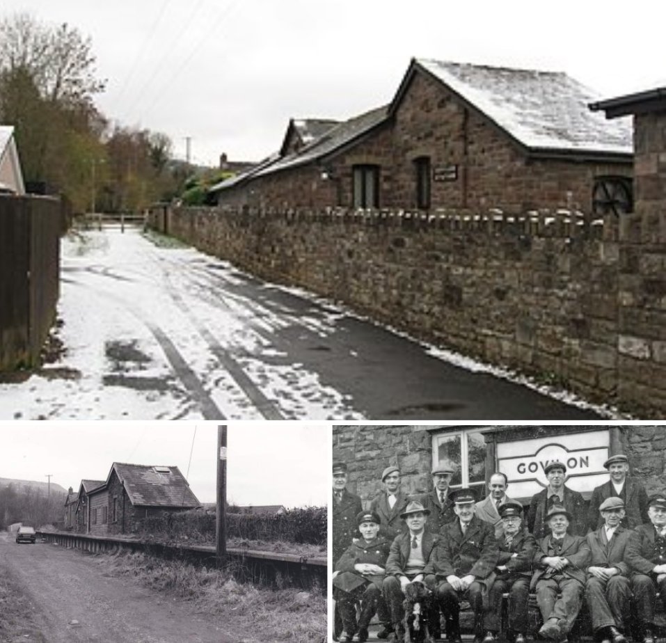
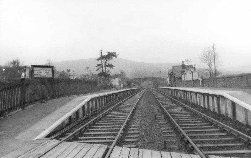
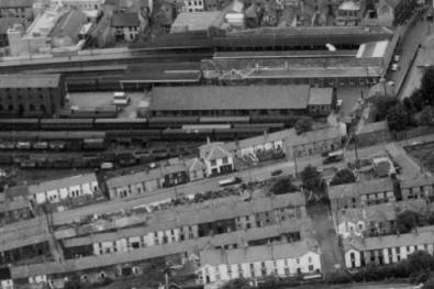
From 1841, Dowlais sent out considerable quantities of traffic from the Taff Vale Railway (TVR) terminus at Merthyr, but it is not clear how produce was transported to the terminus from the Works. The TVR station was actually very  close to the Penydarren Tramroad. Dowlais stopped using the Penydarren Tramroad by 1851 if not before, and it seems likely that the tramway between Dowlais and Penydarren Works was abandoned at the same time. [1]Victoria Bridge, the lower Penydarren Tramroad bridge across the Taff at Quakers Yard. The piers beyond carried a feeder to the Glamorganshire Canal.   [collection T.J. Lodge] [1] Penydarren Tramroad stone block sleeper, showing impressions of the rail ends and the single spike hole.   [T.J. Lodge] [1]
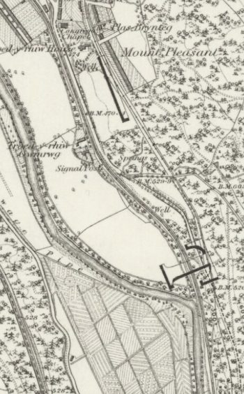
Road bridge over the Penydarren Tramroad half a mile south of Mount Pleasant.   [T.J. Lodge] [1]
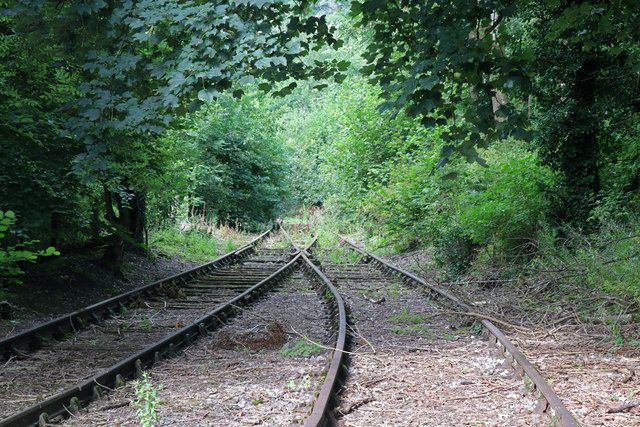
Crossing of a set of points with scallop-edged channel rails for level crossings.   [P.G. Rattenbury] [1]Trackbed of the Moralis-Penydarren tramroad, showing rows of stone blocks which carried the dual gauge track.   [collection T.J. Lodge] [1]

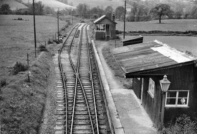
Thereafter the tramroad fell out of use piecemeal. When Penydarren works closed in 1859 the section down to Plymouth was probably closed too. Plymouth went on sending some iron down to Abercynon for a while, but ceased to produce iron in 1880, though it continued its coal mining. Already, in 1871, Plymouth had built a standard gauge mineral line that used parts of the tramroad route as far as Mount Pleasant; south of here the tramroad seems to have been lifted about 1890. [1]
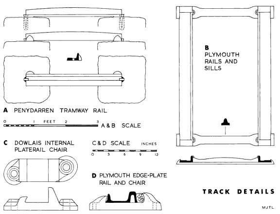
As we have already noted, the Merthyr/Penydarren Tramroad was largely superseded when the Taff Vale Railway opened in 1841 and sections gradually went out of use over the two decades from about 1851. In 1823, a Bill had been unsuccessfully promoted to extend the tramway to Cardiff. It was some of the same promoters who obtained the Act for the TVR in 1836. Although the TVR opened to Merthyr in 1841 it wasn’t until 1851 that the standard gauge Dowlais Railway was completed allowing through running to its works. Penydarren Ironworks closed in 1859. Plymouth Works didn’t cease iron production until 1880 but had built a standard gauge line over part of the tramroad in 1871. South of Mount Pleasant the disused tramroad was lifted in about 1890. [3]

Locomotives

“In 1829 Stephenson supplied a six-wheeled locomotive with inclined cylinders mounted at the rear for use on the narrower gauge internal lines at Penydarren, it cost £375. In 1832 it was returned to Stephensons for conversion to a four-wheeled locomotive for use on the Merthyr Tramroad and at the same time the single flue was replaced by 82 copper fire tubes. It was at this time given the name “Eclipse” and commenced work on the Merthyr Tramroad on 22 June 1832. The chimney must have been hinged to allow it to go through the Plymouth tunnel.” [3]

“The Dowlais Company’s line linking their works to the Merthyr Tramroad had a maximum gradient of 1 in 16.5 and considered too steep for locomotives to work by adhesion alone. In 1832 the Neath Abbey Ironworks supplied a six-wheeled rack and adhesion locomotive weighing 8 tons named “Perseverance” with inclined cylinders and twin chimneys (allowing them to be lowered alongside the boiler to pass through the tunnel at Plymouth).” [3]

Another similar locomotive named “Mountaineer” was built in 1833 by the Neath Abbey Co. for the Dowlais Company. The drawings included a cross section of the Plymouth tunnel and it had a hinged chimney, so it is very likley that it was intended for use on the Merthyr Tramroad (unlike a second smaller locomotive built in 1832 which had a fixed chimney). [3]

The Wikipedia article on the Tramway continues to use information provided by Stuart Own-Jones [15] to describe locomotives used on the line:

The 0-6-0 “Dowlais” built at Neath Abbey in 1836 had inclined cylinders mounted at the front (unlike the previous locomotives which had rear mounted cylinders) and rack drive for use on the incline to Dowlais. “Charles Jordan” delivered from Neath Abbey in 1838 was an adhesion only locomotive very similar to “Mountaineer”. The last record of spare parts being supplied to Dowlais for these locomotives was in 1840-1841. An 1848 inventory of Dowlais plant lists only “Mountaineer” of the above locomotives. No plateway locomotives were listed in 1856. [3]

Locomotives had a maximum 3 ton axle load and as a result plate-layers were carried on the trains to replace broken plates. On 1 April 1839 more than 4,000 plates were required to make the tramway good. By 22nd June that year 1,600 more plates were broken, of which the Dowlais engines were blamed for smashing 1,450. By July the tramroad was reported to be almost impassable, for two days being blocked by a derailed Dowlais locomotive and Anthony Hill of Plymouth unsuccessfully applied to the Trustees for the locomotives to be banned. [3]

Stuart Herbert [5] provides a lot of additional sources to allow a deeper exploration of the history and geography of the line. These include:

  • The Glamorganshire and Aberdare Canal – Volume 1, by Rowson and Wright.
  • Richard Trevithick: Cornwall’s Pioneer of Steam, by the South Western Electricity Historical Society
  • ENGINEERS: Richard Trevithick the Cornish genius, by Cotton Times
  • Trevithick 2004, a joint public/private/voluntary sector partnership to celebrate the 200th Anniversary of the Penydarren Locomotive – the first steam locomotive in the world to haul a load on rails.
  • Cynon Culture, a website dedicated to the history and culture of the Cynon Valley.
    Victoria Bridge, Quakers Yard – Restoration Works Contract Payment, a report to Merthyr Tydfil County Borough Council.
  • Our Woods in Focus, a website by the Woodland Trust.
  • Taff Vale Railway entry on Wikipedia.
  • Map of the Taff Vale Railway, on the GWR modellers website.
  • Isambard Kingdom Brunel 200th Anniversary Exhibitions, from the Heritage In Action (Herian) website.
  • Discover South Wales, a map of heritage sites from the Heritage In Action (Herian) website.
  • The Taff Vale Railway – Volume 1 by John Hutton, ISBN 1-85794-249-3.
  • Newsletter 110 June 2006 [PDF], from the Institution of Civil Engineers.
  • Merthyr Tydfil Tramroads and their Locomotives, by Gordon Rattenbury and M. J. T. Lewis, ISBN 090146152-0.
  • Pontygwaith entry on Wikipedia.
  • Bringing the people of Merthyr closer to nature, the Forestry Commission press release from 29 August 2003 announcing the plan to create the Pontygwaith Nature Reserve.
  • Pontygwaith on Alan George’s website.
  • Cefn Glas Tunnel, on the excellent Cardiff Rail website.
  • Quakers Yard and Merthyr Joint Railway, on the excellent RAILSCOT website.
  • The Taff Vale Railway by D.S.M. Barrie, published on the Trackbed website.
  • The Edwardsville Viaducts on Alan George’s website.
  • Building Control Regulations for Merthyr County Borough Council, which includes a list of listed buildings in the borough.
  • Trevithick and the Penydarren Tramroad on Deryck Lewis’ WalesRails website.
  • ST0799 on the Geograph.org.uk website.

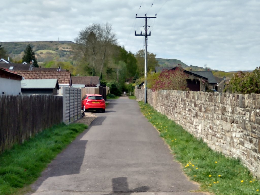
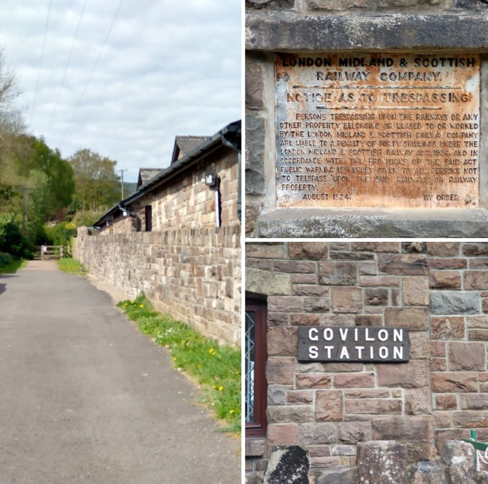
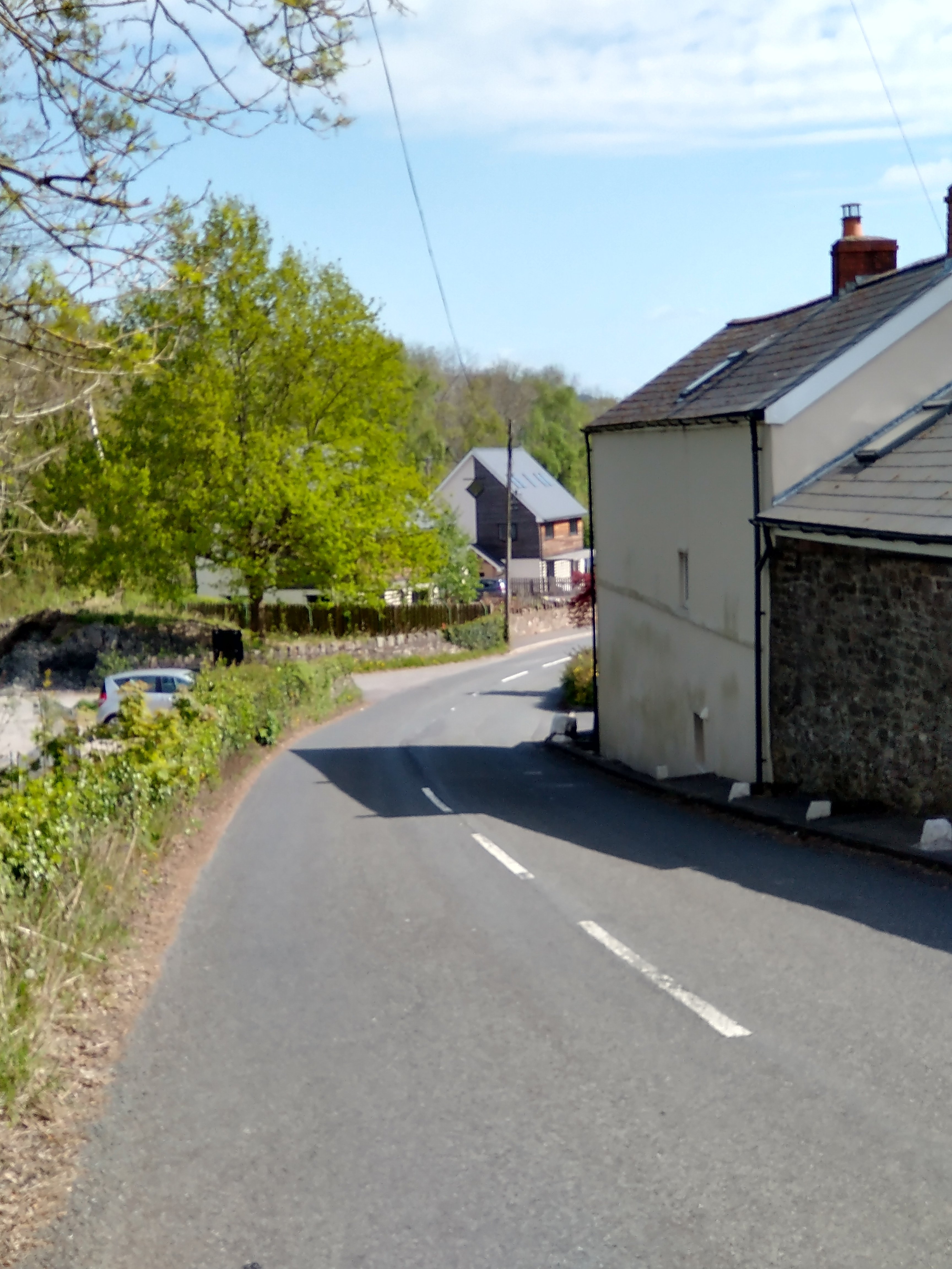
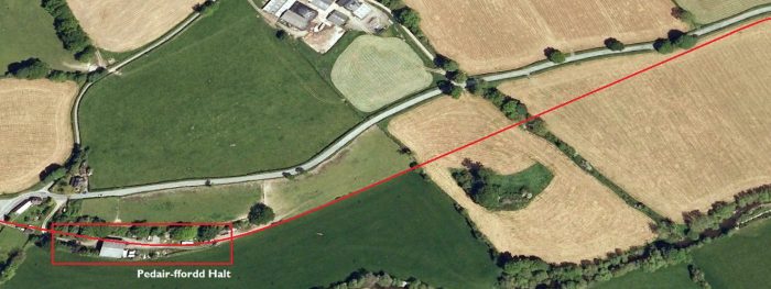
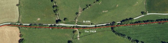
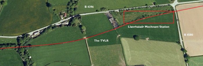
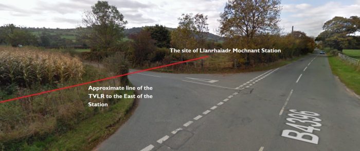
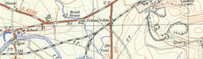
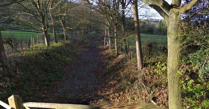
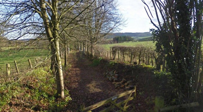
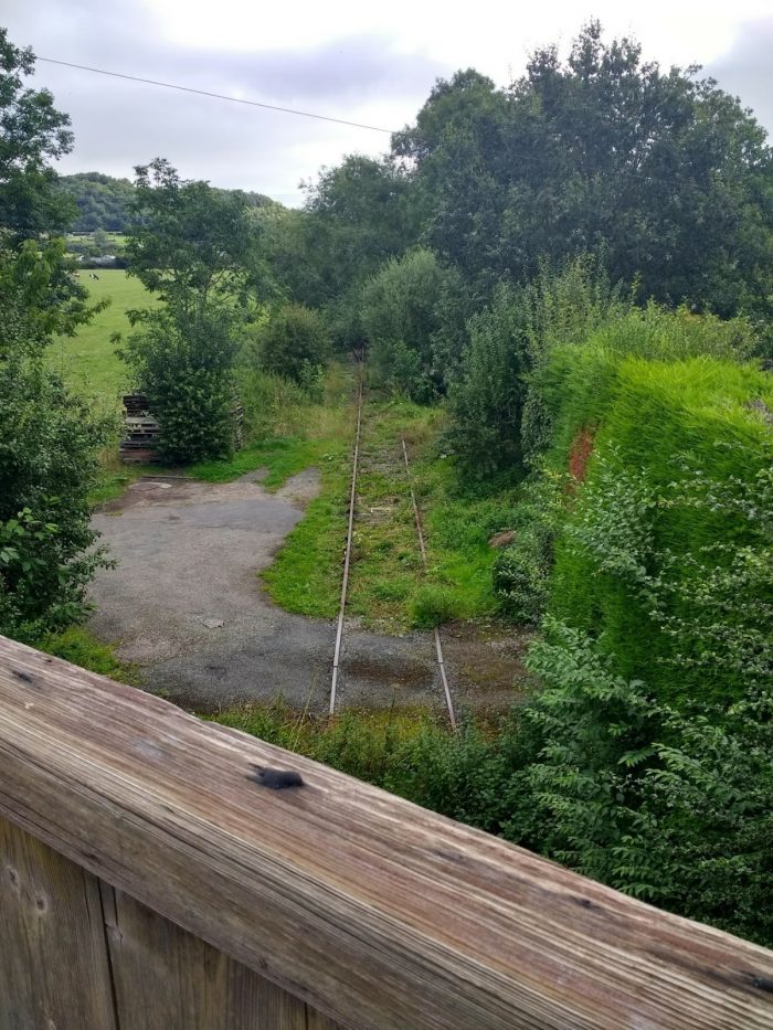
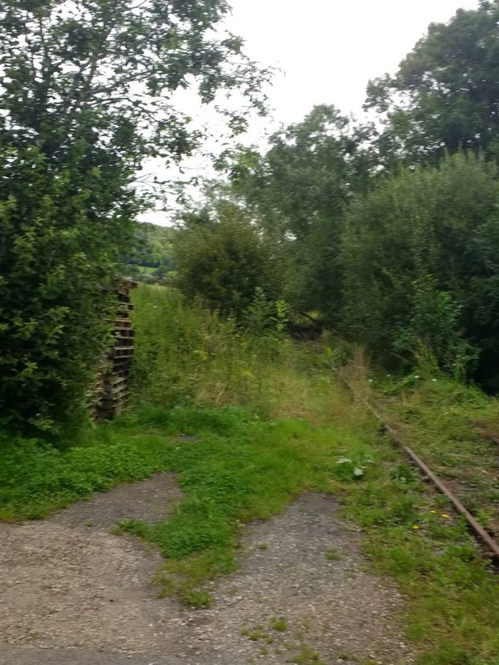
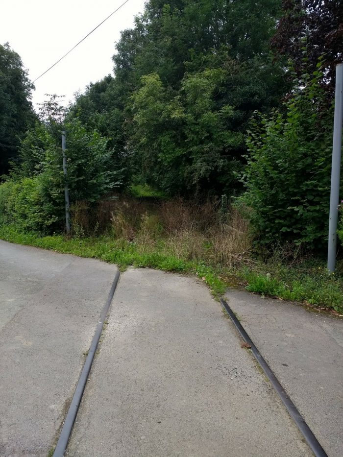
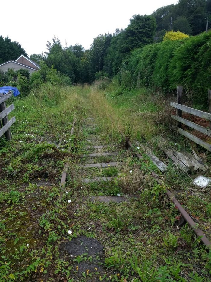
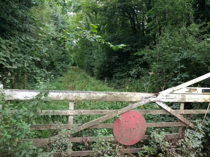
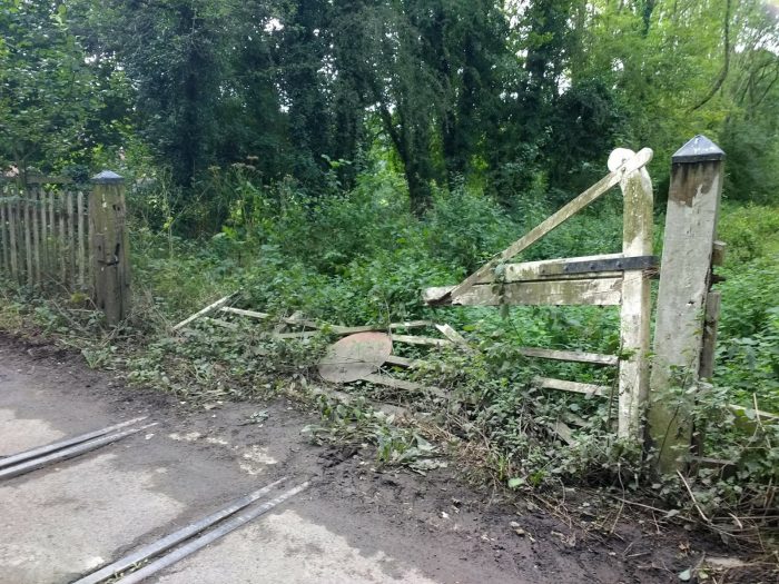
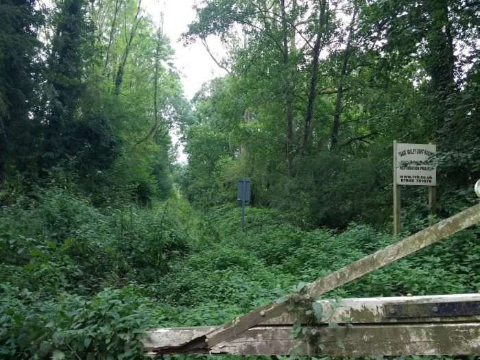
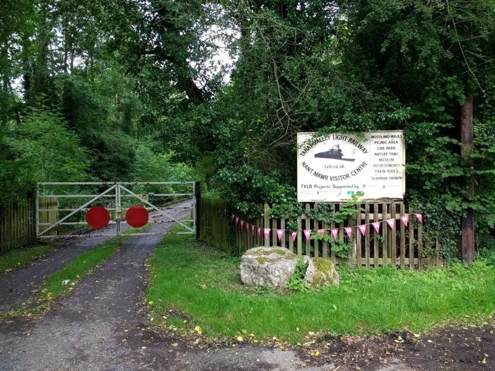
Much of the route can still be followed, though in places it is buried in industrial waste, and most of the southern part has been thoroughly disturbed in recent times by the laying of a large water main. [1] We will follow the route of the line is the next post.

References

  1. https://www.irsociety.co.uk/Archives/59/Penydarren.htm, accessed on 1st February 2019.
  2. https://www.walesrails.co.uk/trevithick.html, accessed on 1st  February 2019.
  3. https://en.wikipedia.org/wiki/Merthyr_Tramroad, accessed on 1st February 2019.
  4. https://www.coflein.gov.uk/en/site/91513/details/merthyr-tramroad-penydarren-tramroad, accessed on 2nd February 2019.(cf.: Mercer, S., Trevithick and the Merthyr Tramroad, in Transactions of the Newcomen Society, xxvi (1947-9), p89-103).
  5. http://blog.stuartherbert.com/photography/2007/04/22/the-worlds-first-steam-engine-railway-journey, accessed on 2nd February 2019.
  6. https://en.wikipedia.org/wiki/Cyfarthfa_Ironworks, accessed on 2nd February 2019.
  7. https://www.gracesguide.co.uk/Dowlais_Ironworks, accessed on 2nd February 2019.
  8. https://www.gracesguide.co.uk/Penydarren_Ironworks, accessed on 2nd February 2019.
  9. https://www.gracesguide.co.uk/Plymouth_Ironworks, accessed on 2nd February 2019.
  10. http://www.ggat.org.uk/cadw/historic_landscape/Merthyr_Tydfil/English/Merthyr_019.htm, accessed on 2nd February 2019.
  11. http://www.himedo.net/TheHopkinThomasProject/TimeLine/Wales/Industrialization/WelshIndustry1800/MyrthyrTramroad.htm, accessed on 2nd February 2019.
  12. F. Trevitick; “The Life of Richard Trevithick”; quoted from … https://www.gracesguide.co.uk/Life_of_Richard_Trevithick_by_F._Trevithick:_Volume_1:_Chapter_9, accessed on 2nd February 2019.
  13. The Penydarren Tramroad; Notes and News; The Railway Magazine Volume 97 No. 599, March 1951, p206-208.
  14. E.W. Twining; The First Railway Locomotive; The Railway Magazine Volume 97 No. 599, March 1951, p197-201.
  15. Stuart Owen-Jones;  The Penydarren Locomotive; National Museum of Wales, Cardiff; 1981. p6–10. 
  16. http://www.bronwenthomas.co.uk/?page_id=325&main_image=352, accessed on 2nd February 2019.
  17. http://www.alangeorge.co.uk/plymouthironworks.htm, accessed on 2nd February 2019.
  18. http://www.alangeorge.co.uk/Dowlais_works.htm, accessed on 2nd February 2019.
  19. http://www.alangeorge.co.uk/cyfarthfa_ironworks.htm, accessed on 2nd February 2019.