Category Archives: French Railways and Tramways

Ligne du Littoral (Toulon to St. Raphael) – Part 12 – La Foux les Pins to Sainte Maxime (Chemins de Fer de Provence 47)

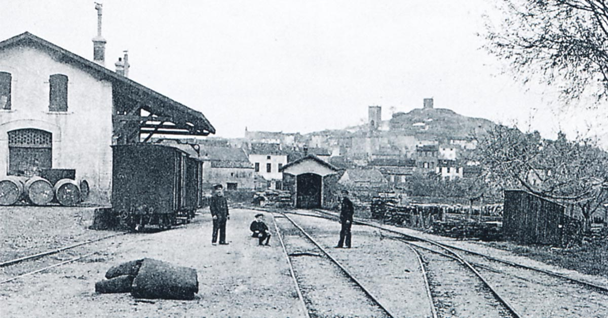
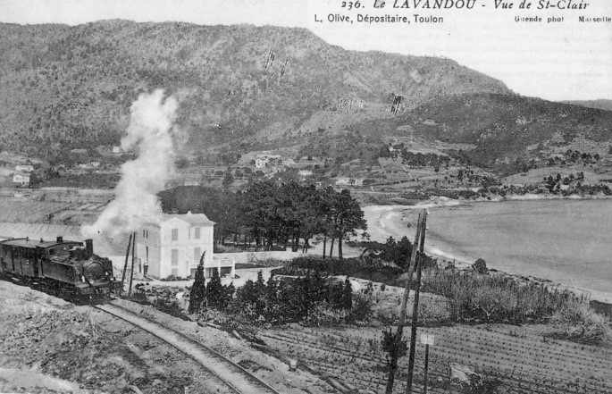
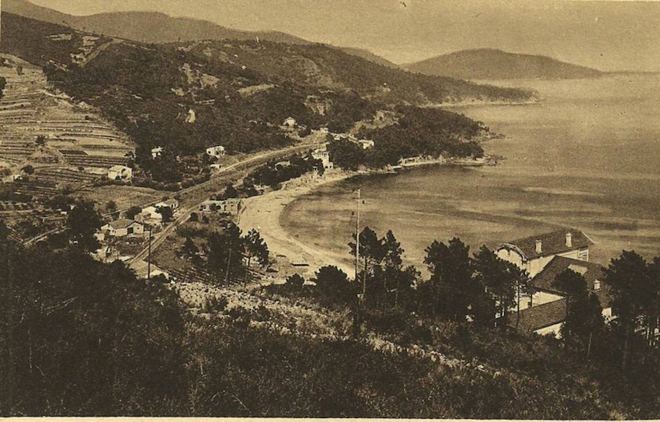
In the featured image above La Foux des Pins is in the bottom left and Sainte Maxime in the top right.

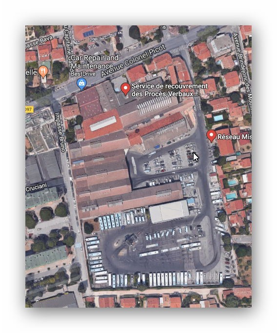
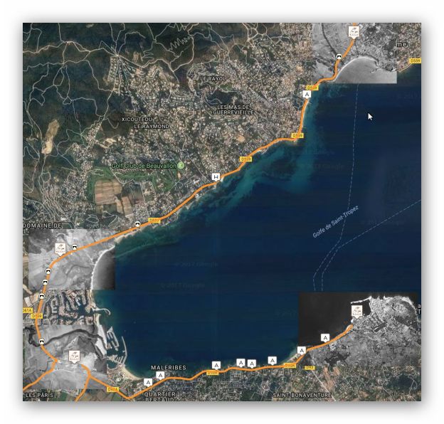
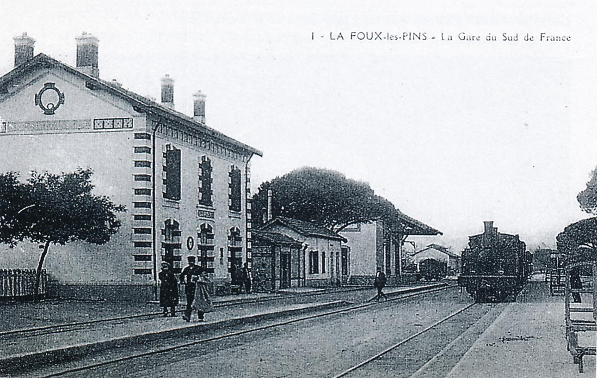
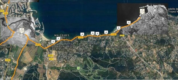
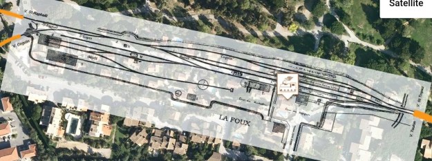
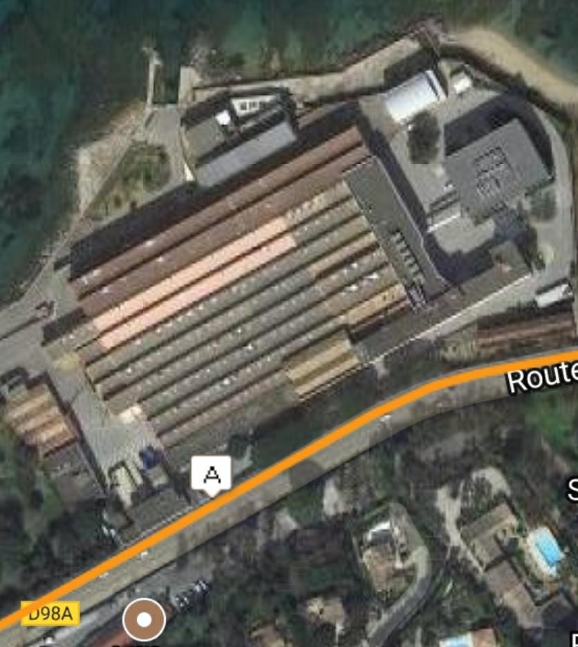
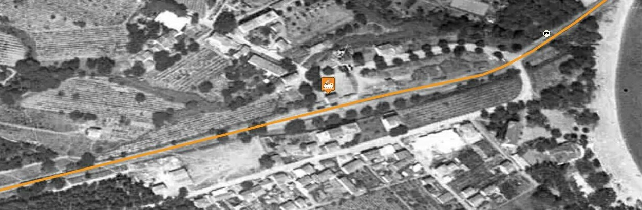
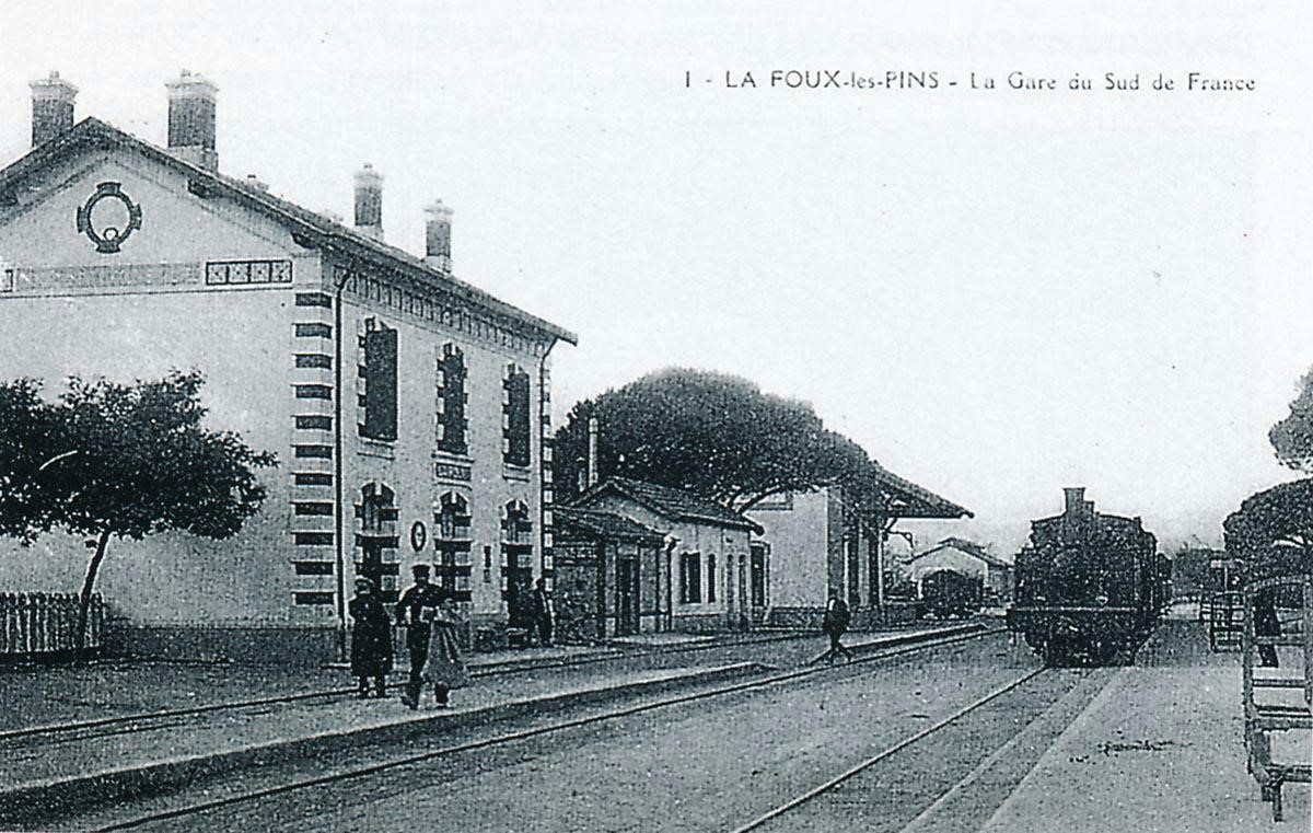
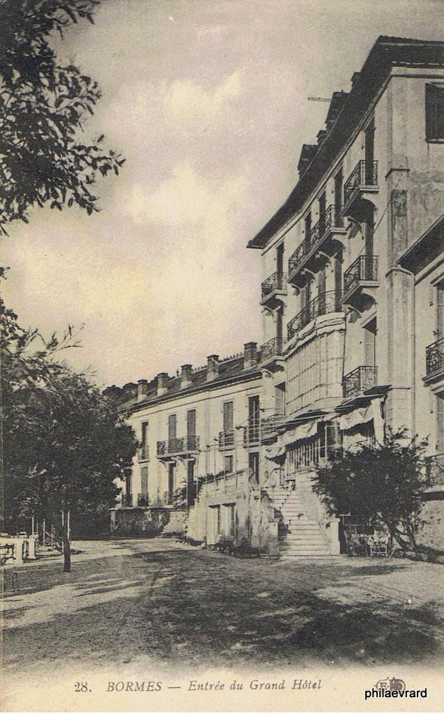
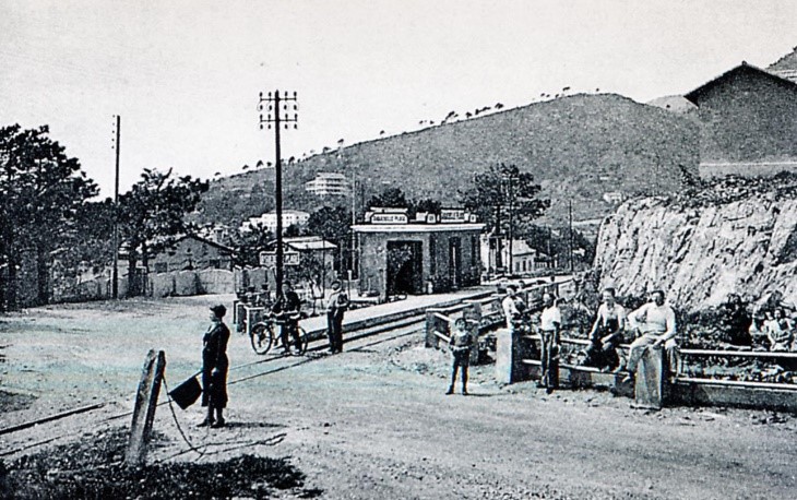
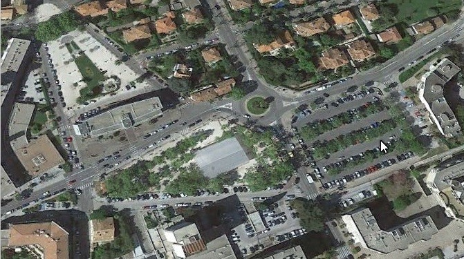
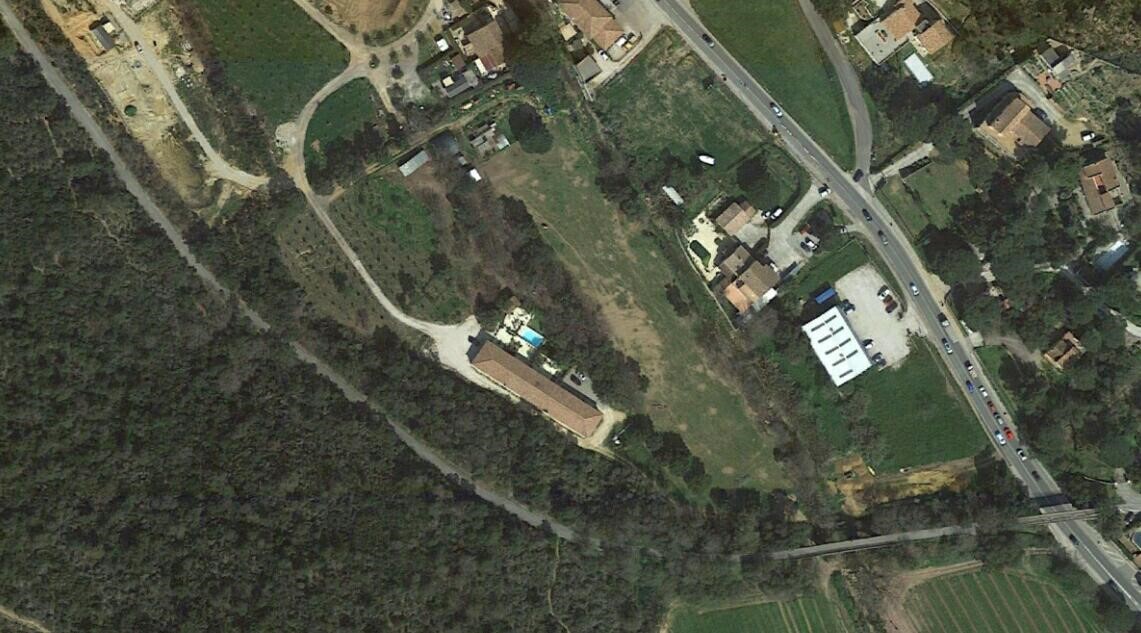
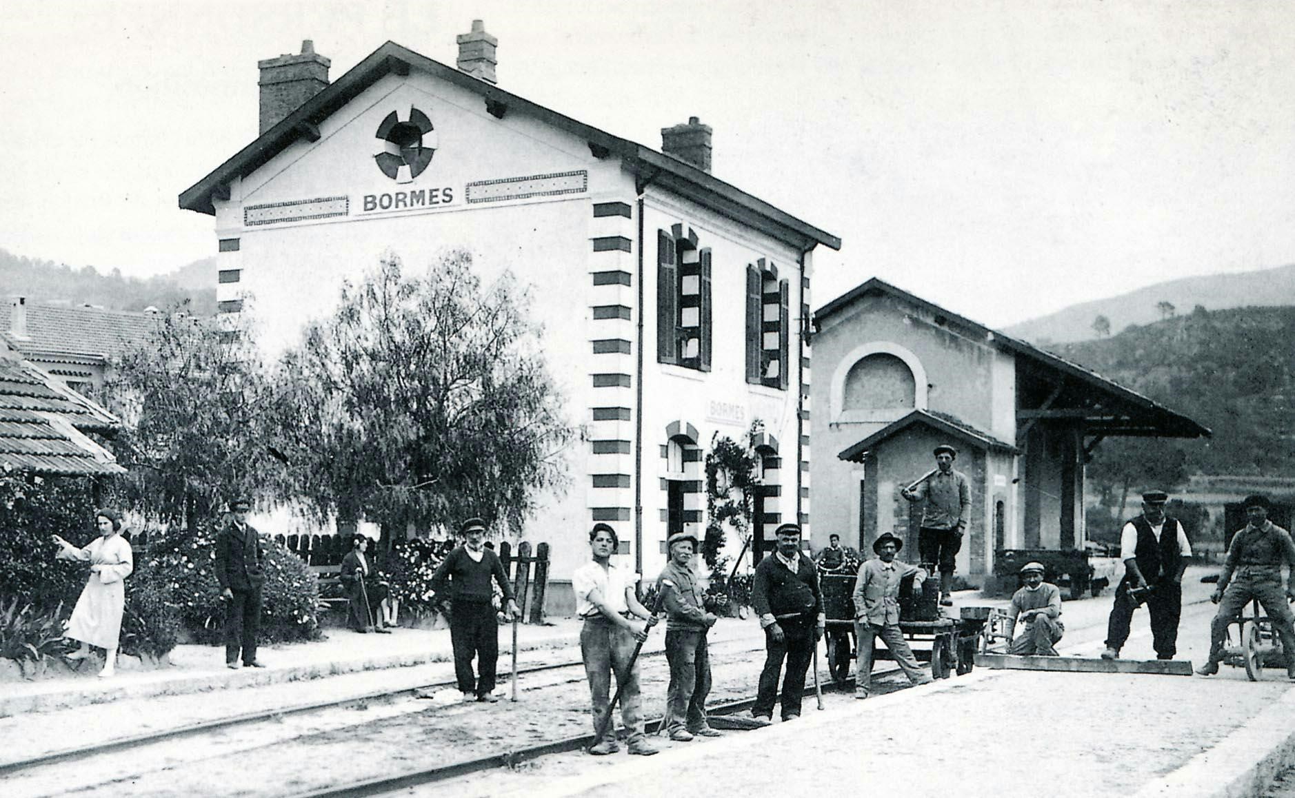
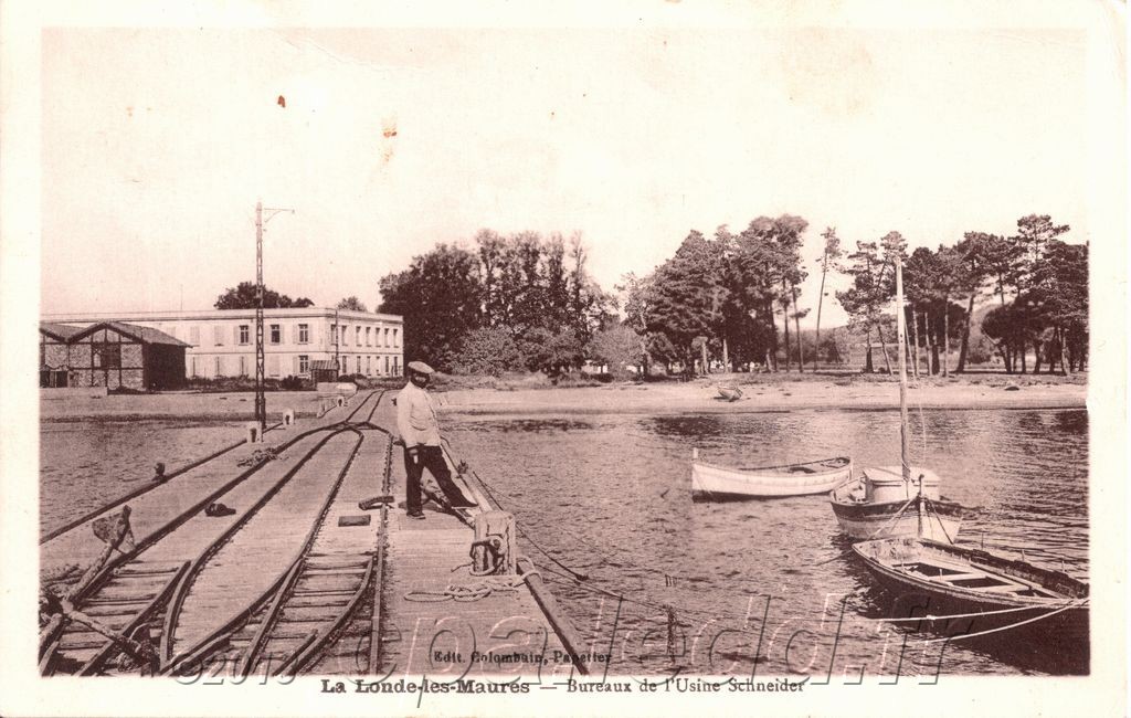
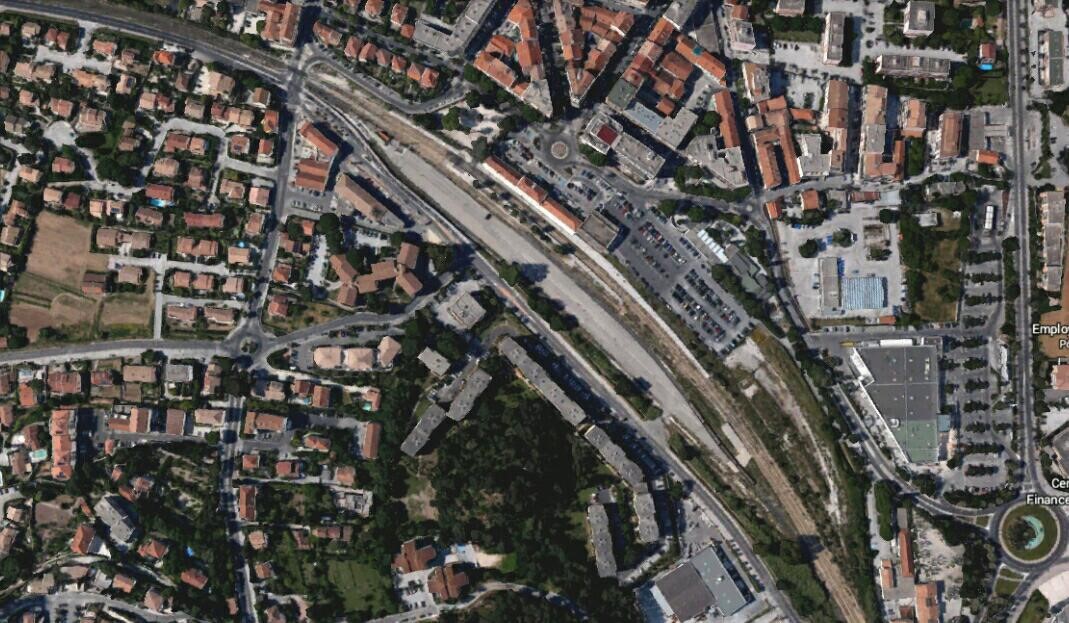
Having enjoyed two diversions from the mainline[5],[6], we return to La Foux ready to travel on towards St. Raphael. Before setting off, there is time to look round the station and its immediate environment. The village and station are sat on the south side of the Golfe de St. Tropez close to the River Giscle estuary and what were once wide-open sand flats. The satellite image with the route of the railway and a series of aerial photos which comes from Jean-Pierre Moreau[3] allow us to orient ourselves once again.
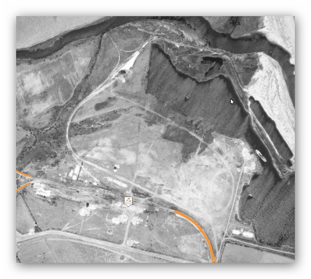
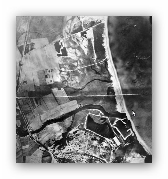
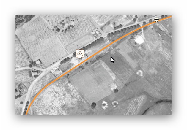
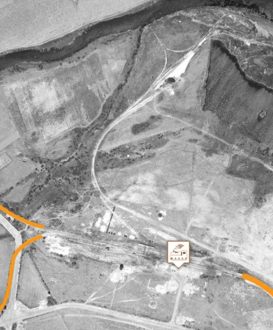
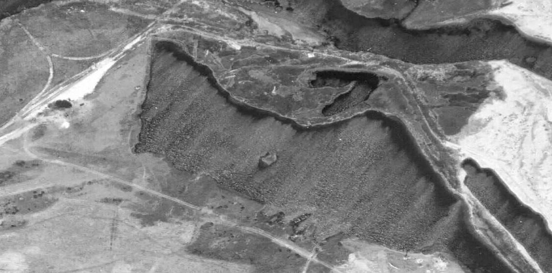
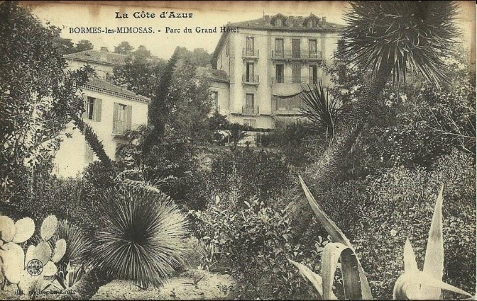
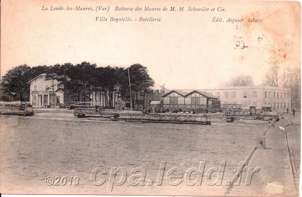
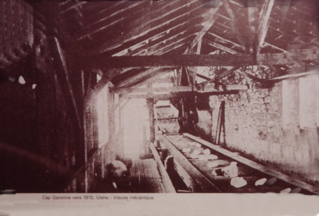
North of La Foux is the modern village of Port Grimaud. It is built on an area that was once used to extract sand. We have already seen some images of that extraction process in an earlier post[6]. The area immediately North of La Foux was an extensive sand quarry and extracted sand was delivered to La Foux station by a private railway. The layout of that railway can be seen on the image below. A picture which includes the locomotive and wagons involved can be seen in a previous post[6]. The area shown in the aerial photograph below includes what is today a large marina, a park and an exclusive residential area. The area immediately north of the station was the Racecourse. The photo below the aerial image is taken from this area looking back at the station.


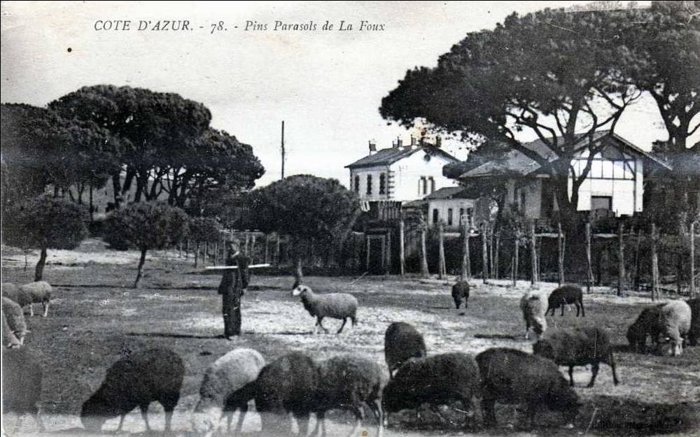
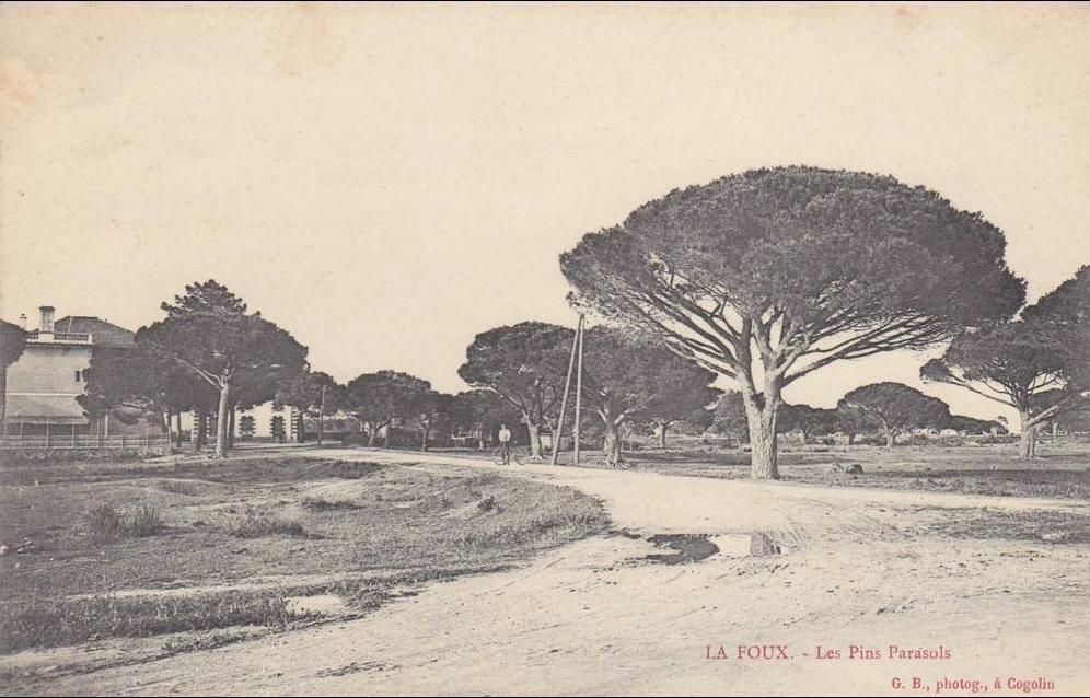
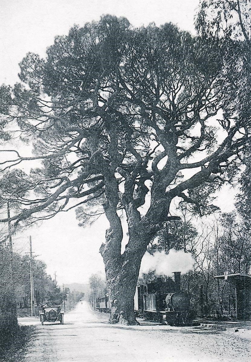
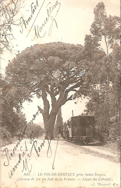
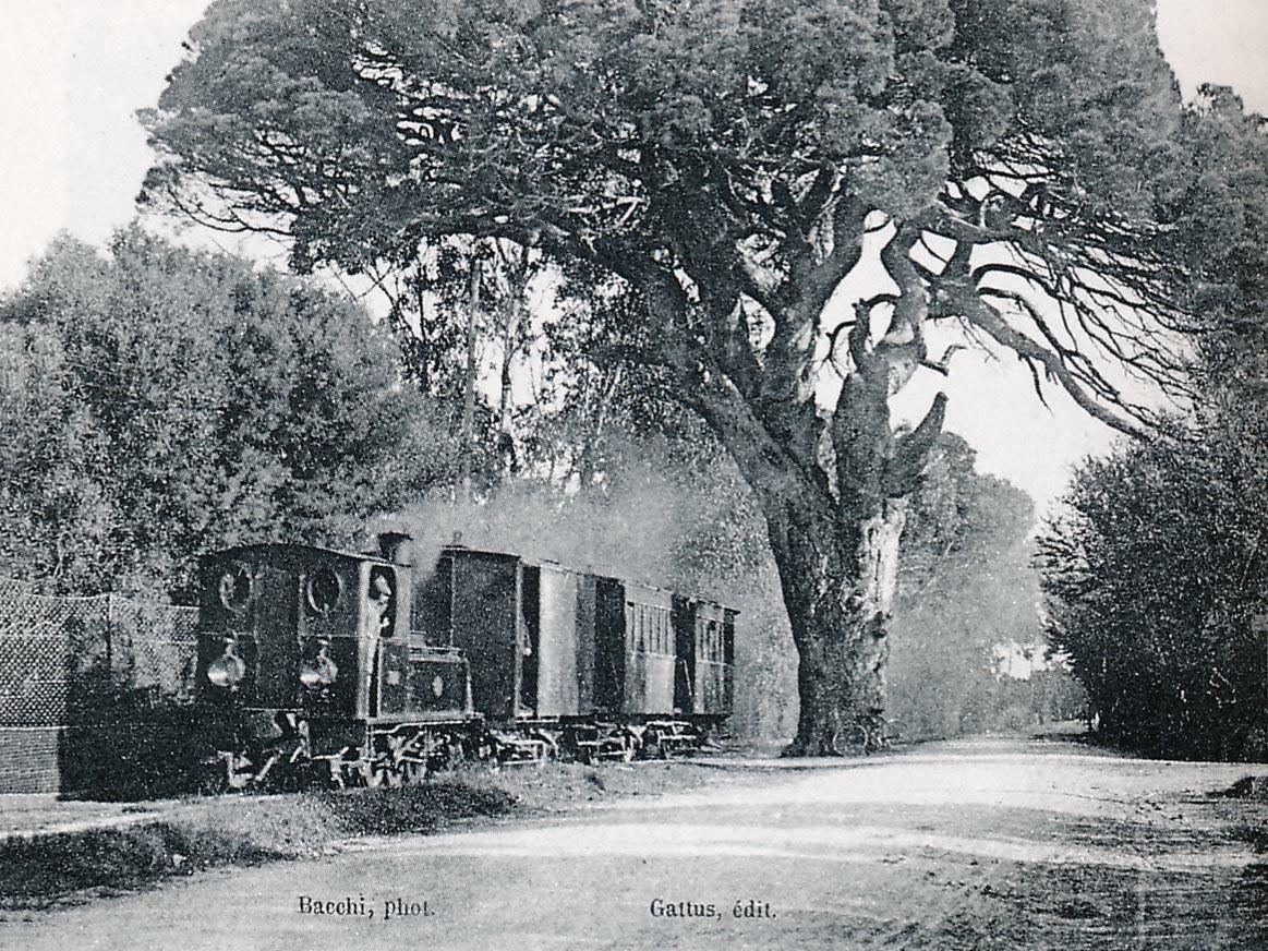
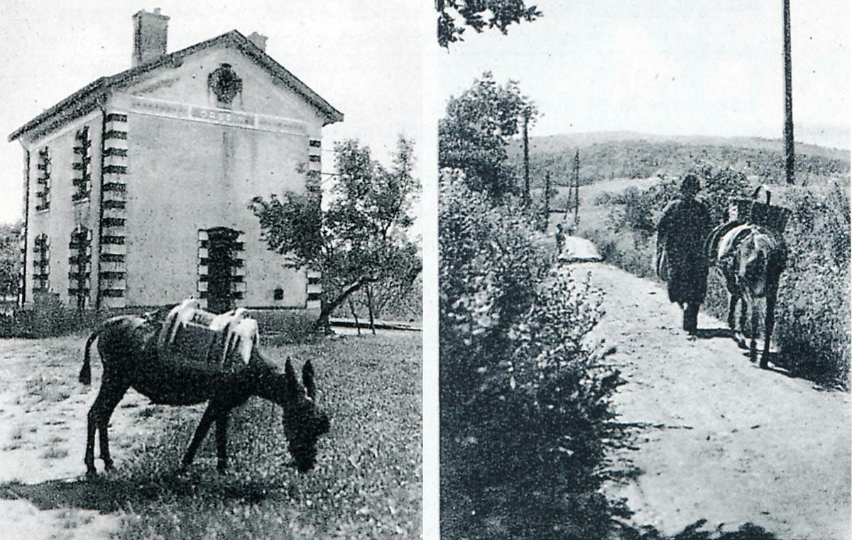
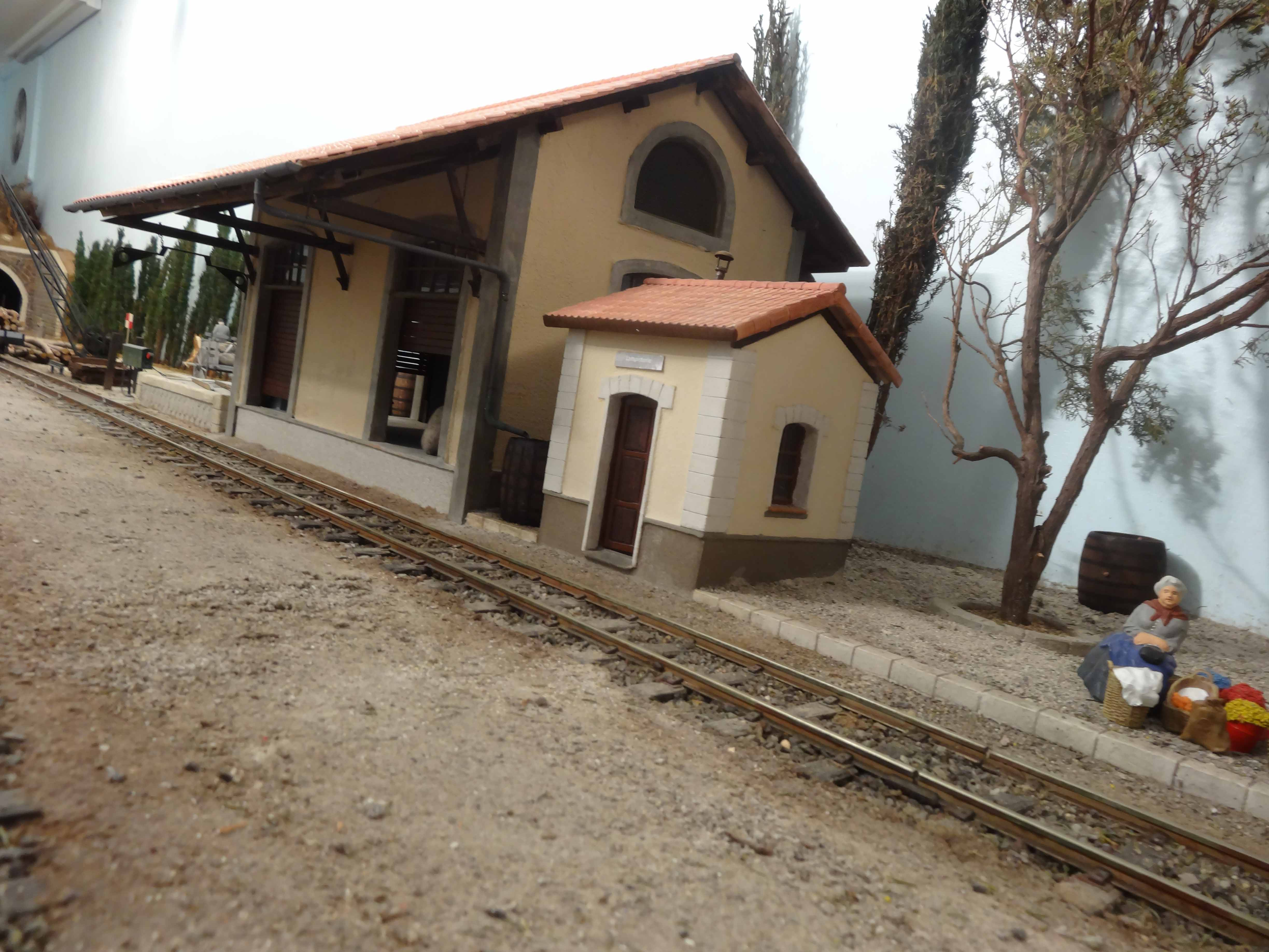
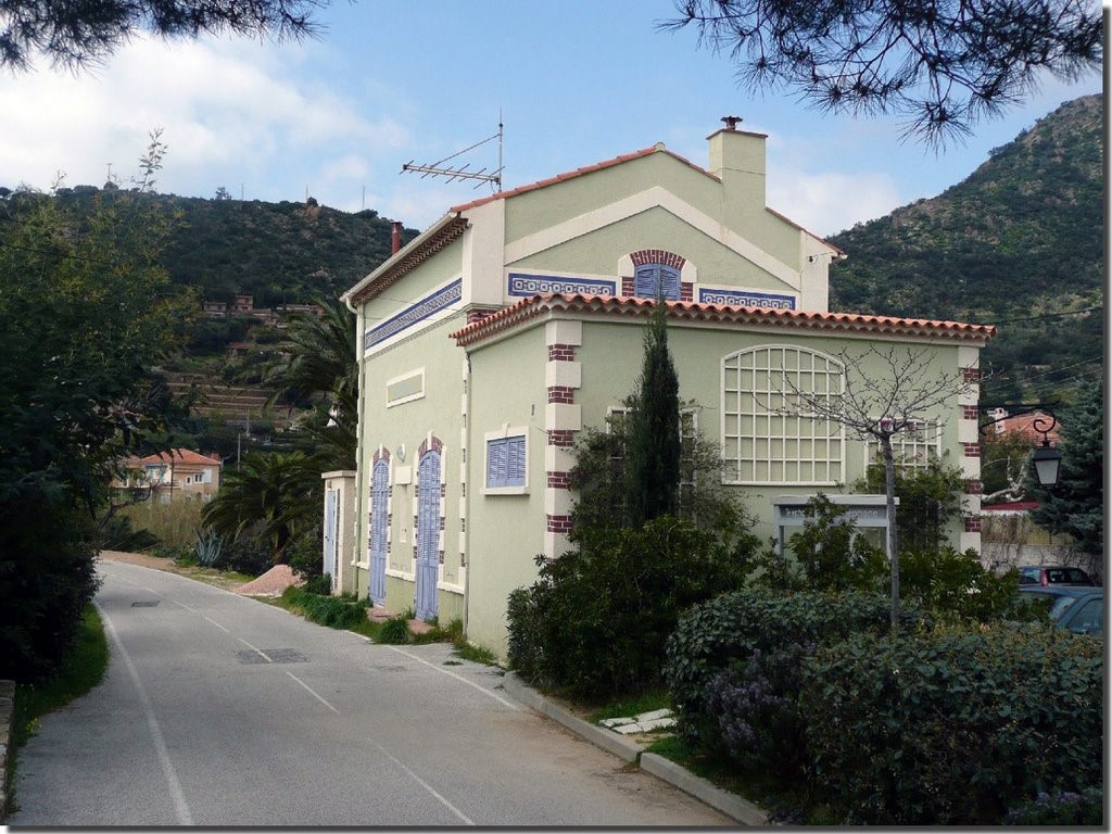
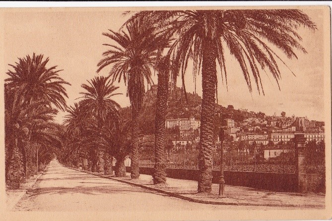
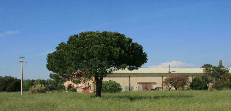
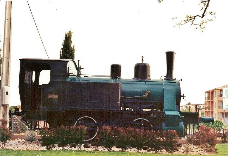
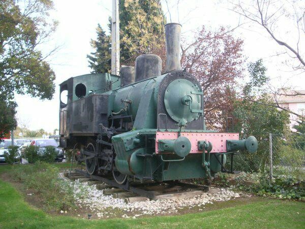
The station is surrounded by pine trees as the following images show.

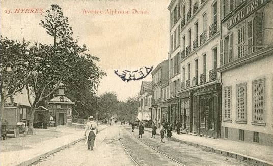
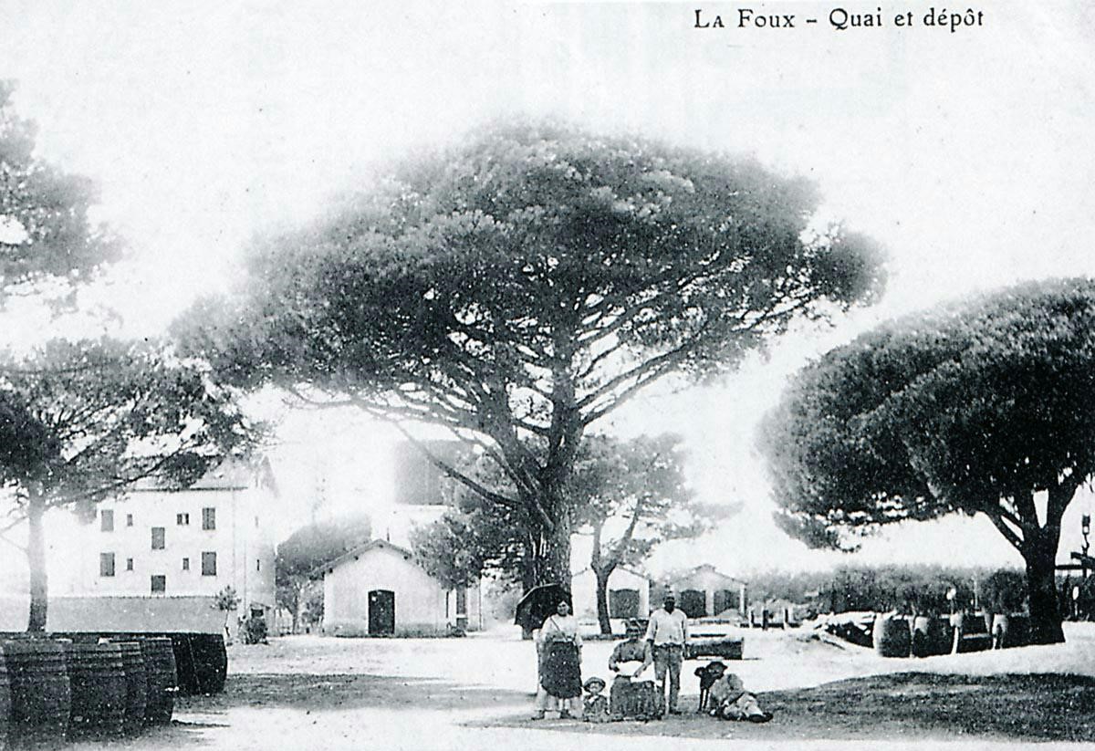
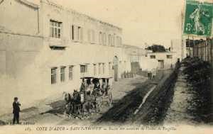
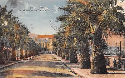
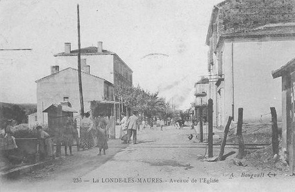
La Foux station knew enormous crowds of travellers in summer, when horse races and bullfights took place on the nearby racecourse. This view is of the avenue leading to the Station (Raymond BERNARDI Collection).
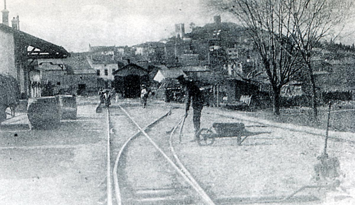
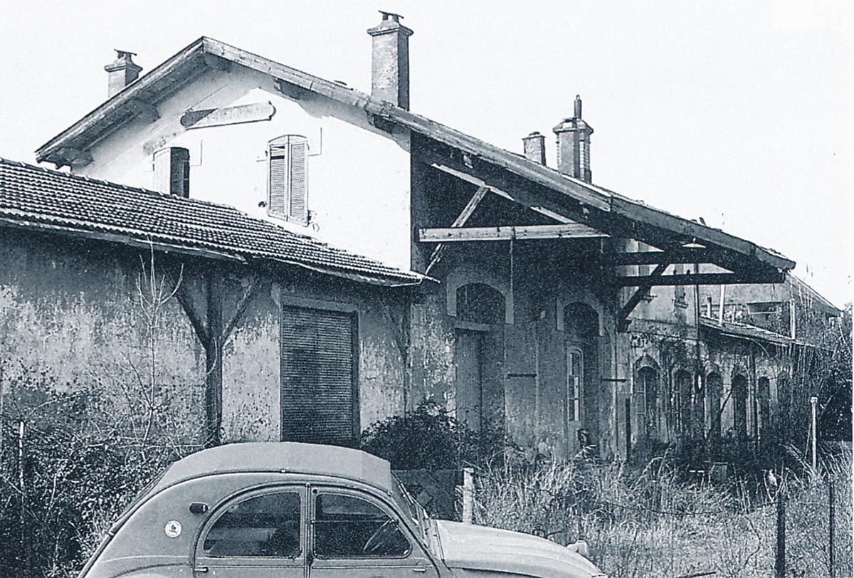
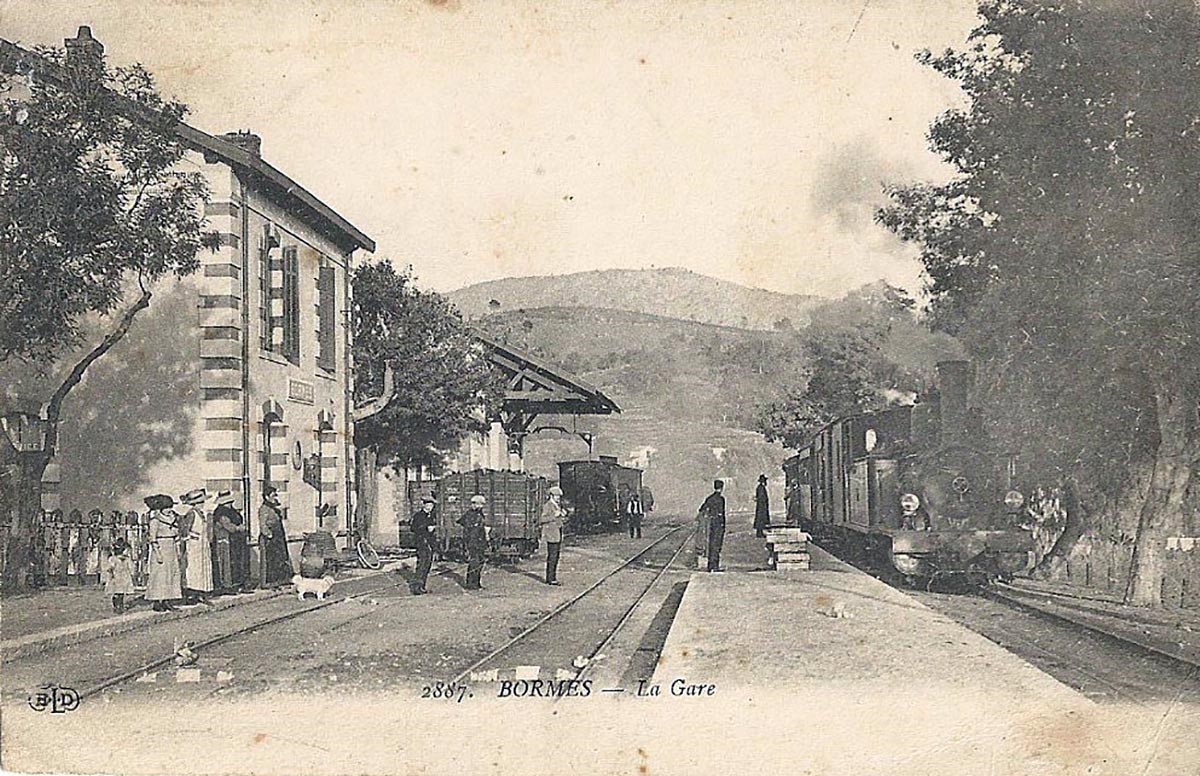
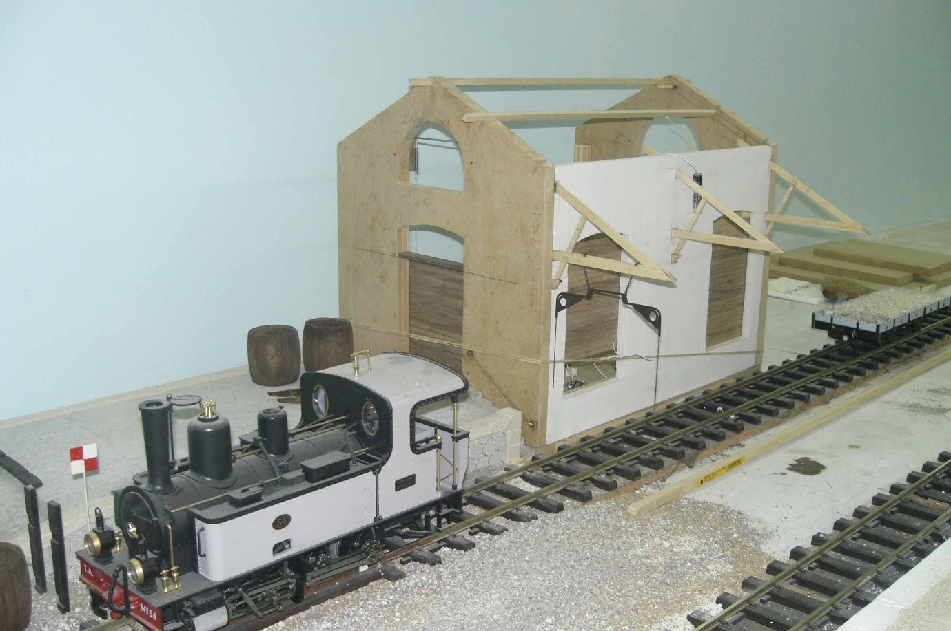
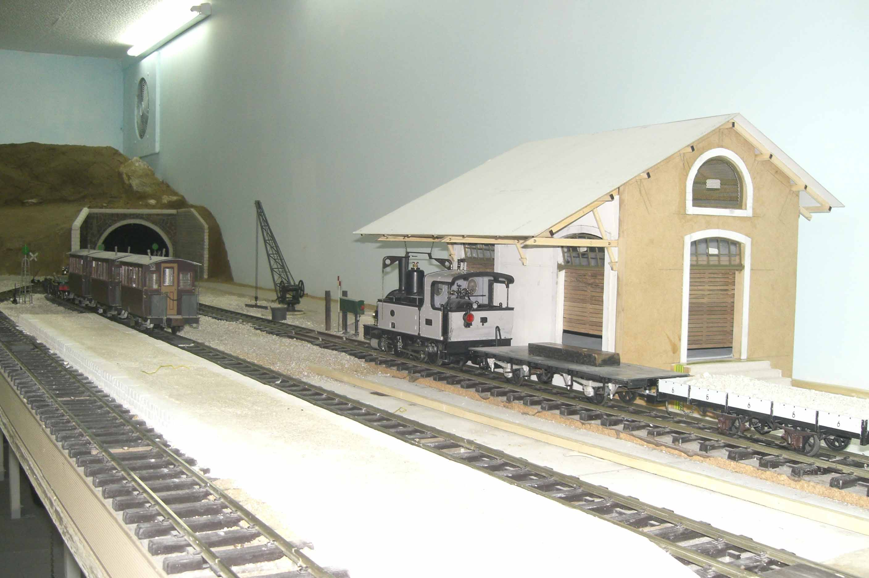
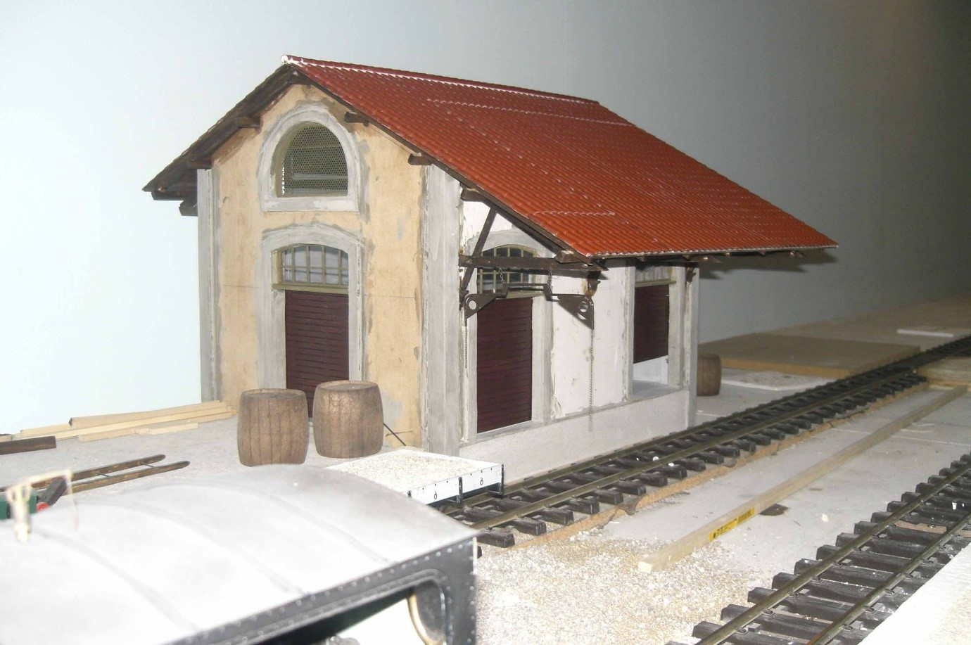
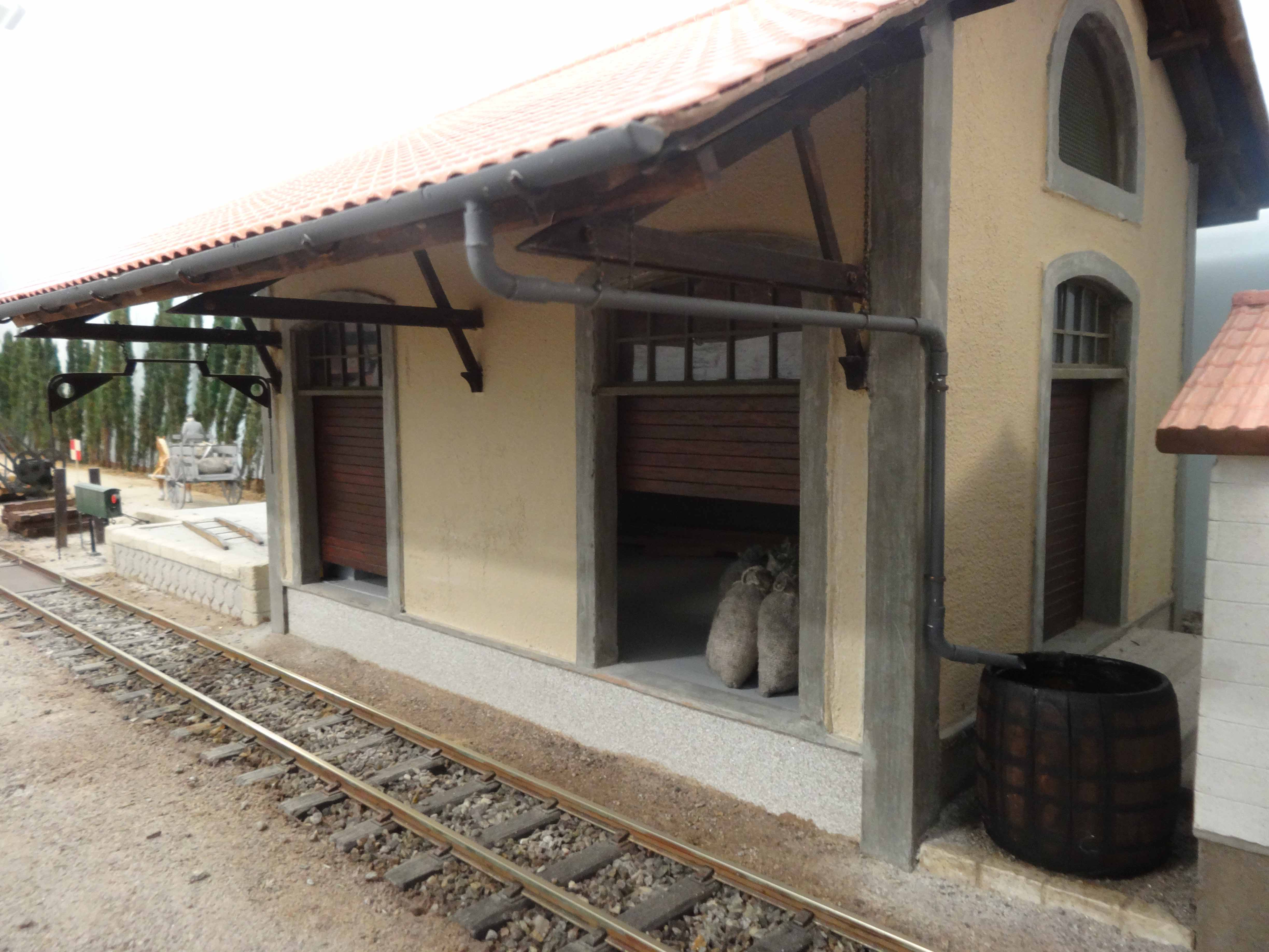
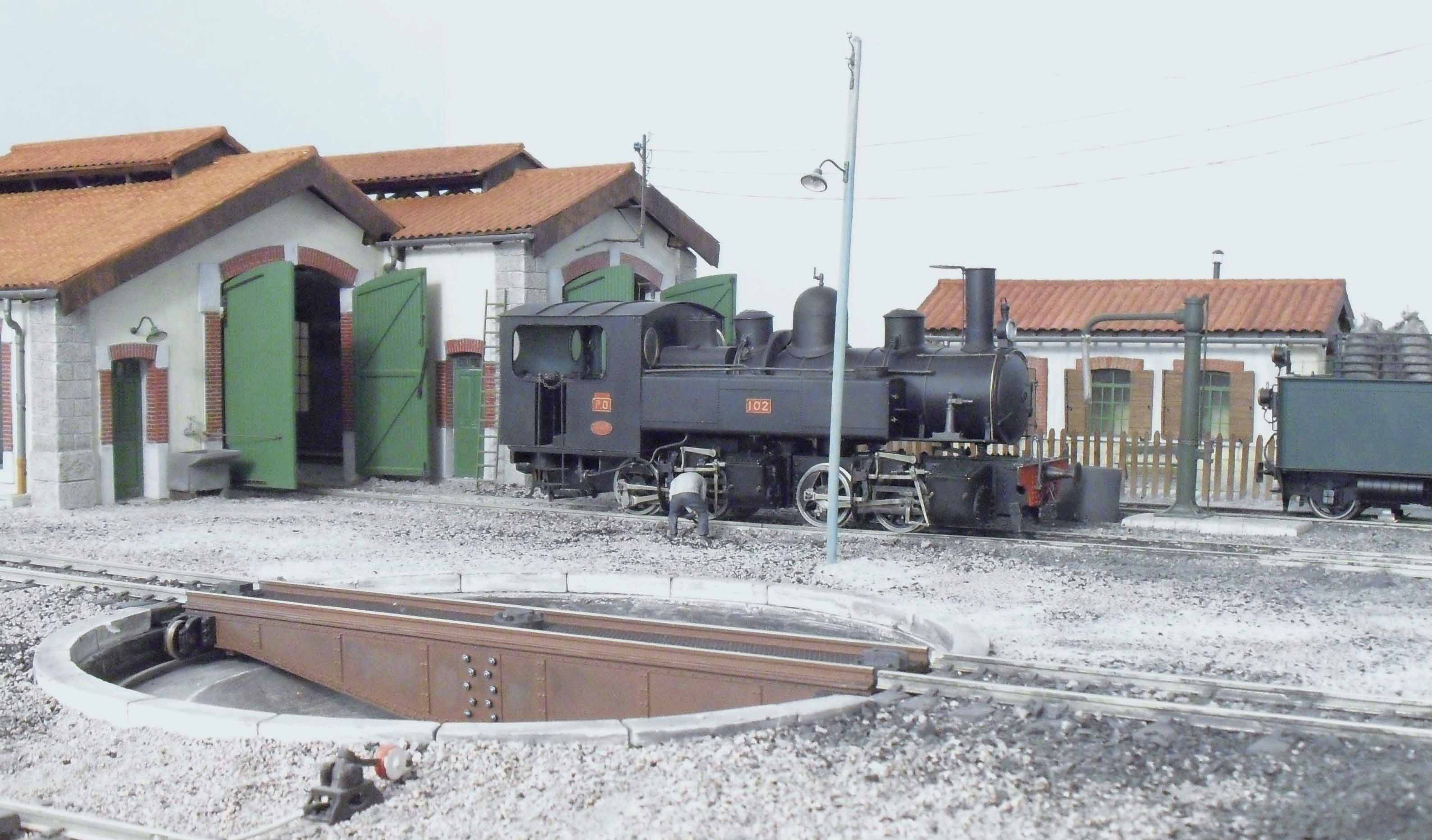
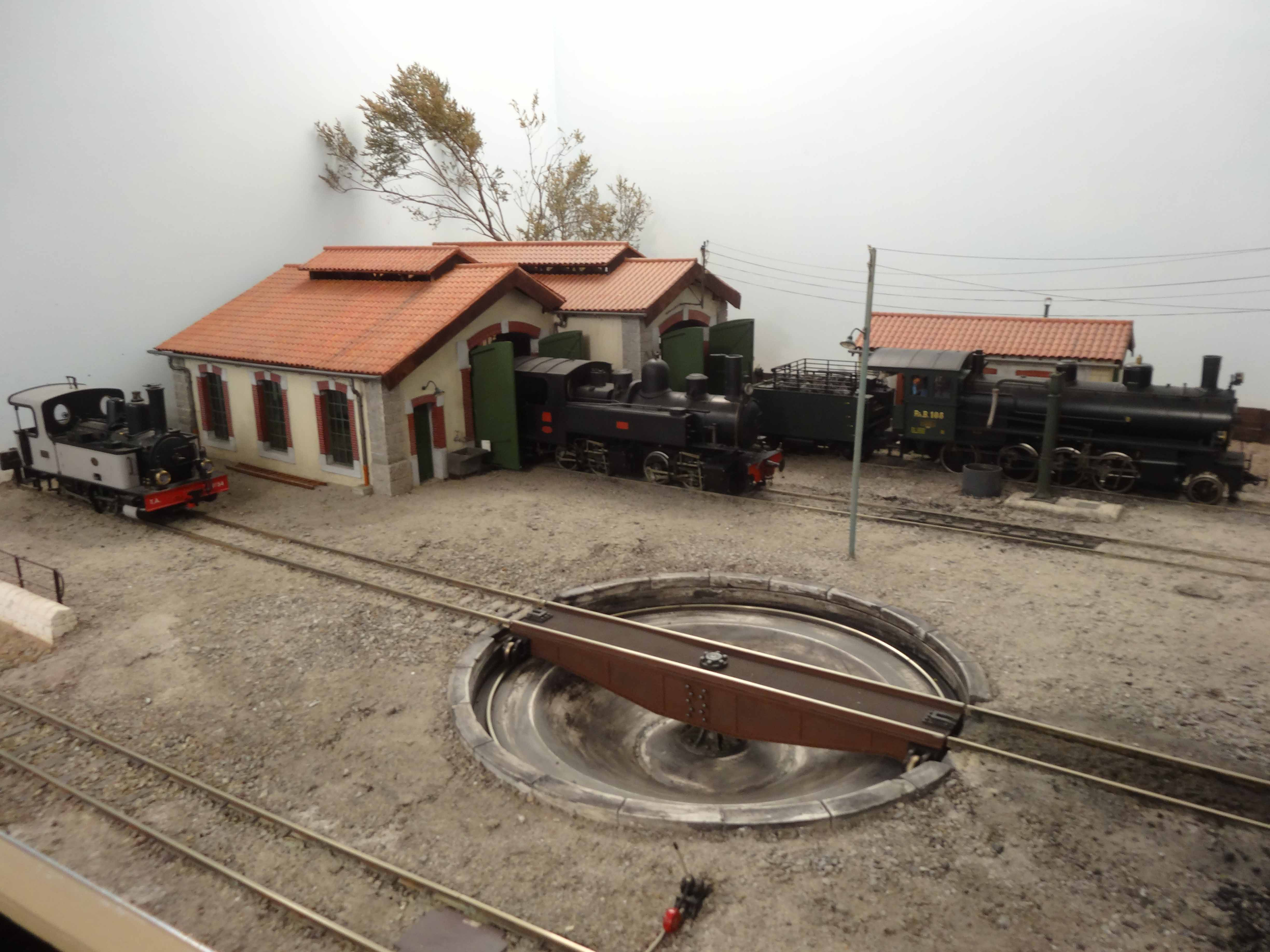
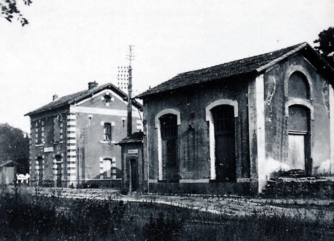
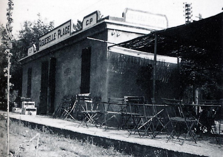
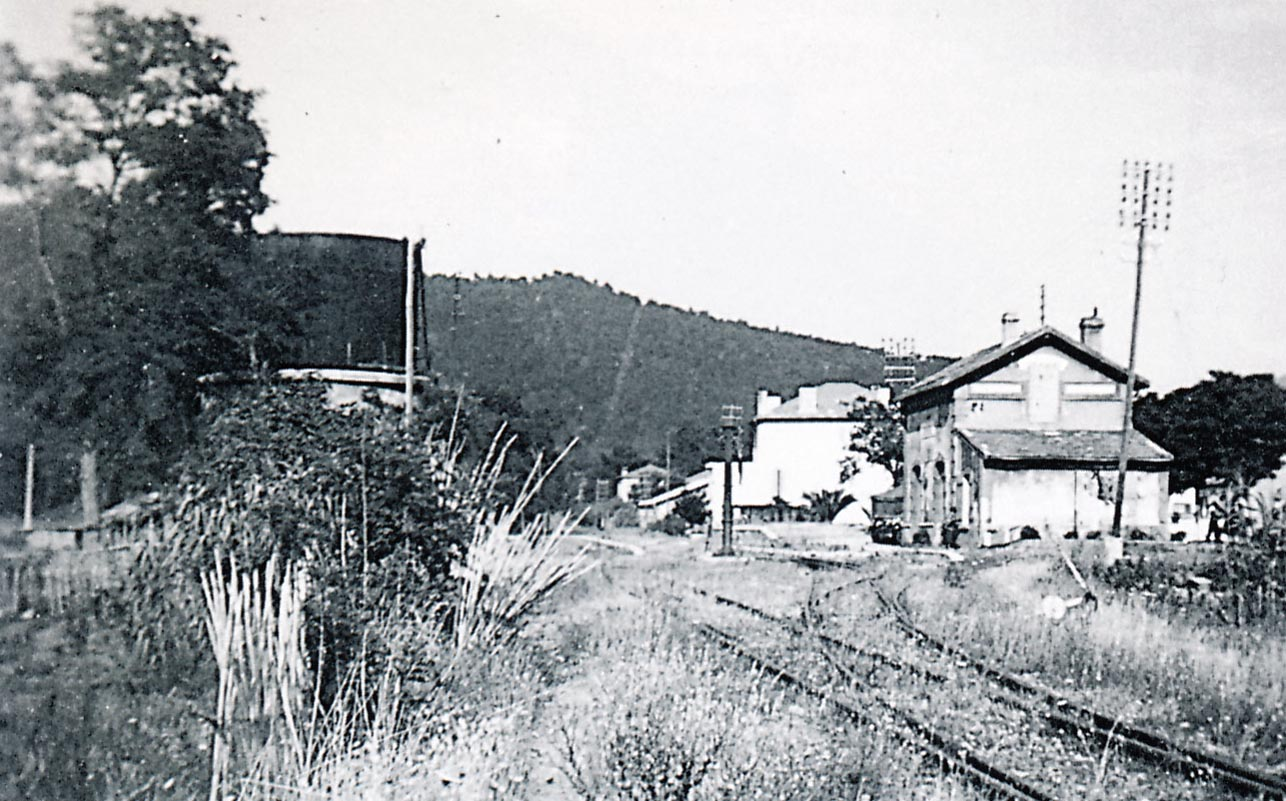
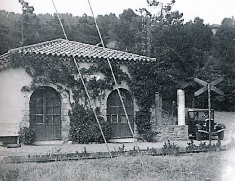
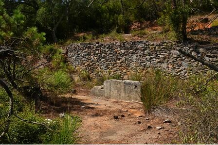
This view shows the courtyard of La Foux station, from left to right, the pumping station which lifts water to the 120 cubic metre water tank, the water tank, the workshop and engine shed (Raymond BERNARDI Collection)
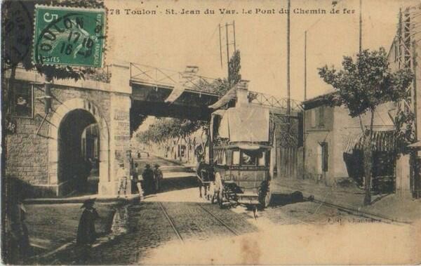
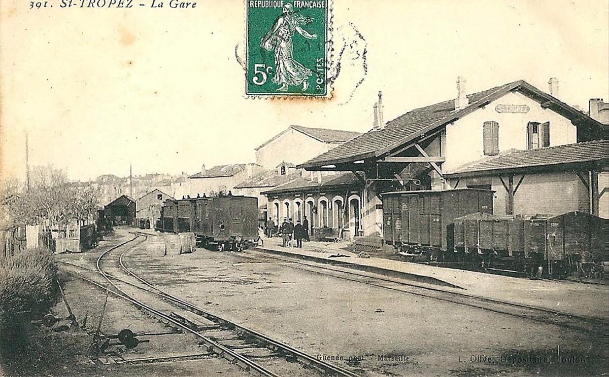
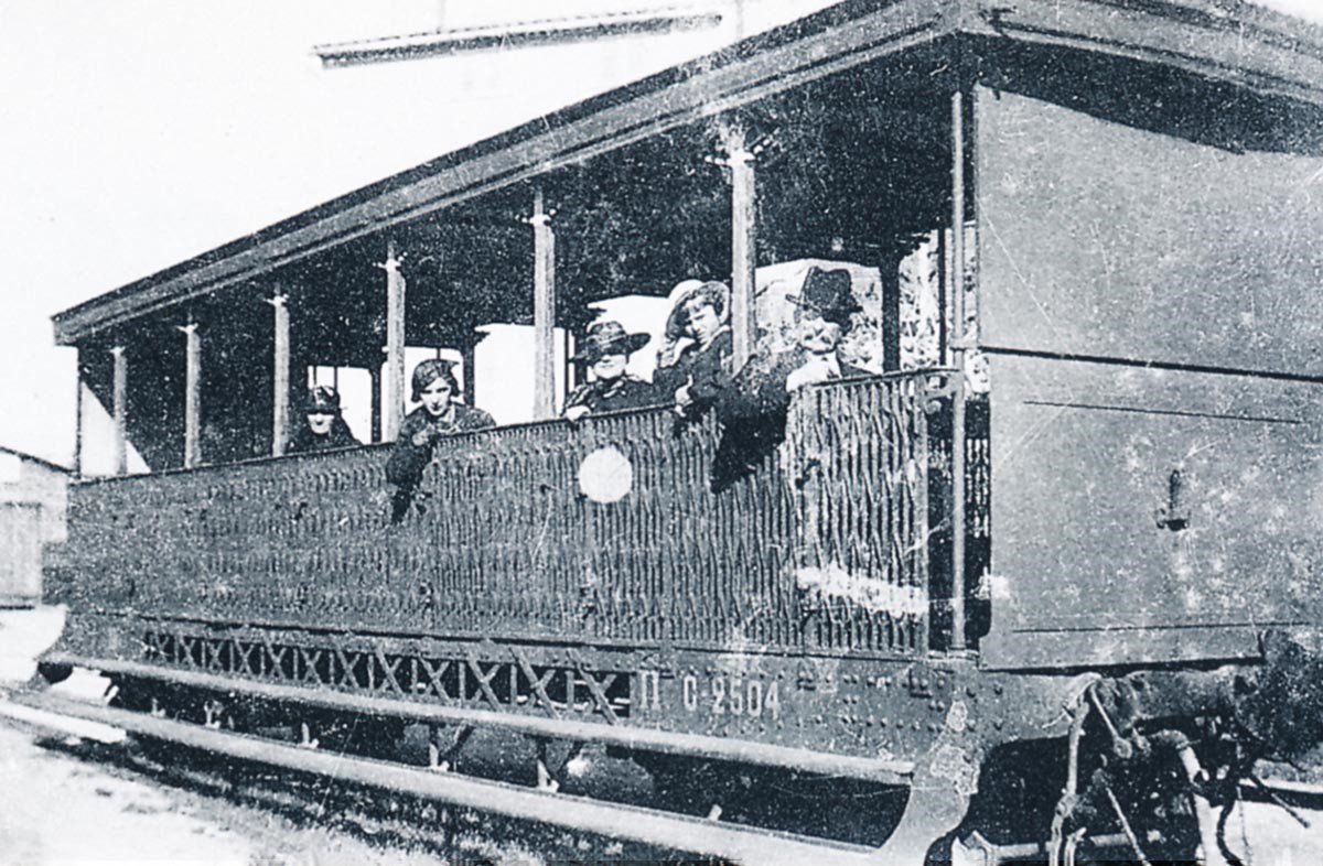
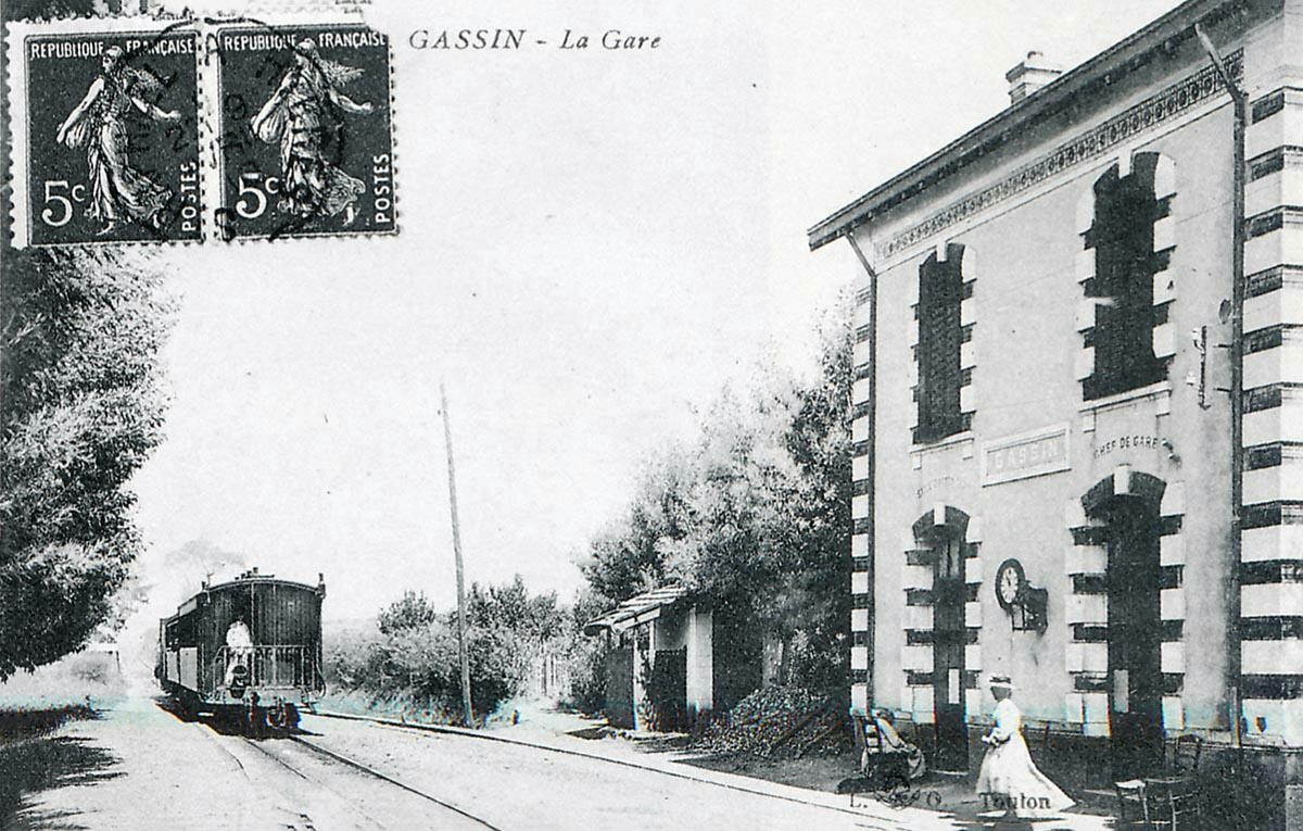
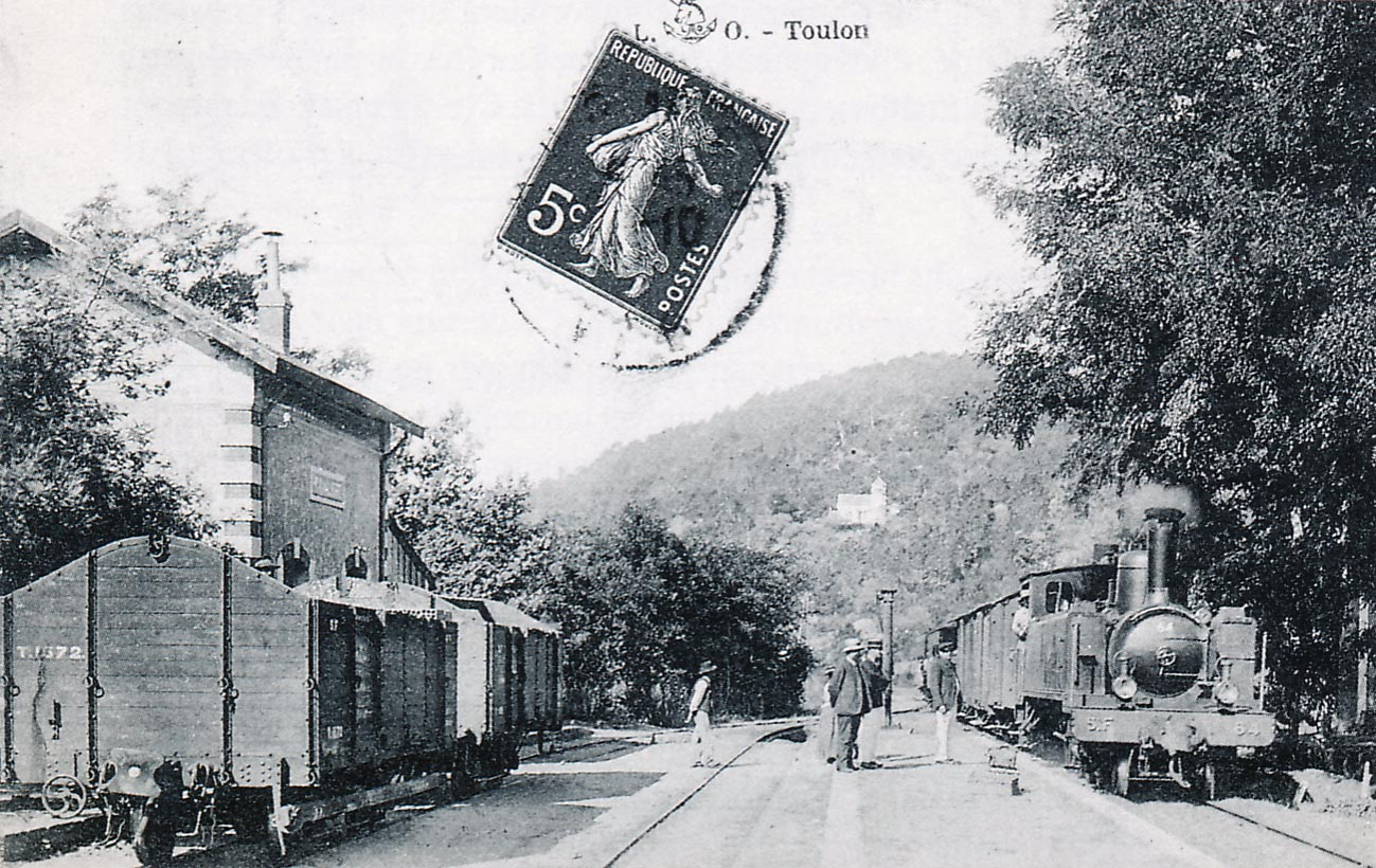
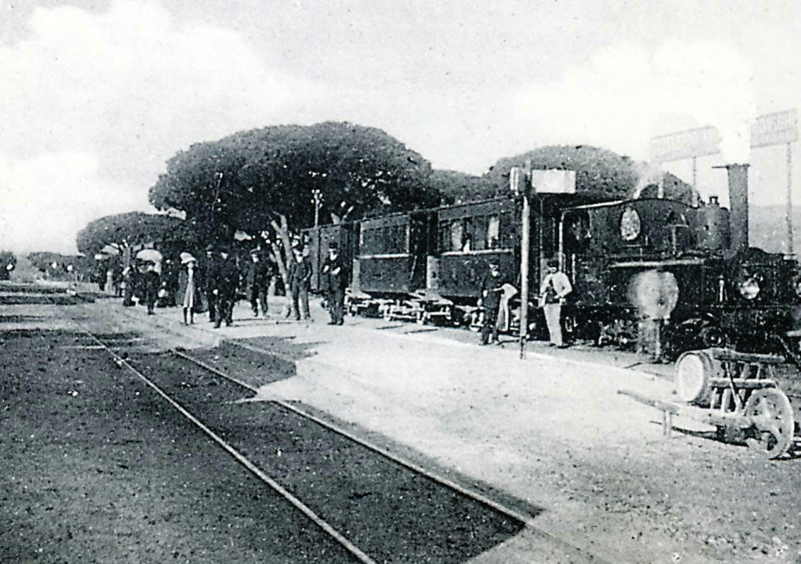
Shortly after its commissioning in 1894, the St.Tropez tramway is seen here. The train is off the Littoral line from Toulon to La Foux station (Raymond BERNARDI Collection).
A 0-6-0T Corpet – Louvet 70-72 locomotive pulls two bogie cars usually used on the main line, on the shuttle on the branch/tramway. The increased passenger traffic necessitated this sharing of resources (Edmond DUCLOS Collection).
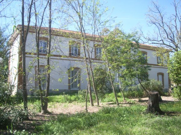
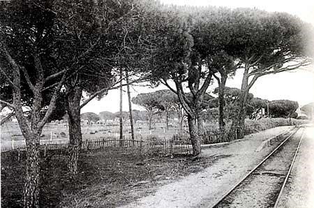
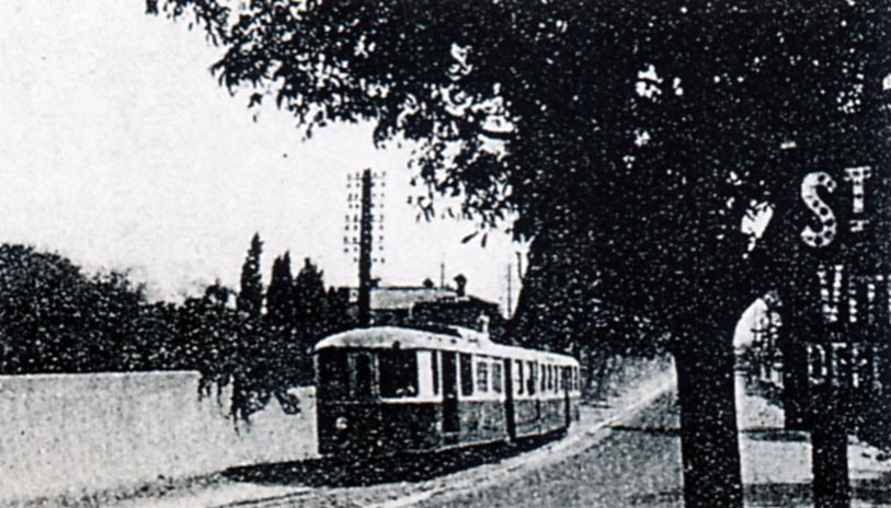
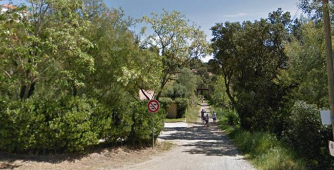
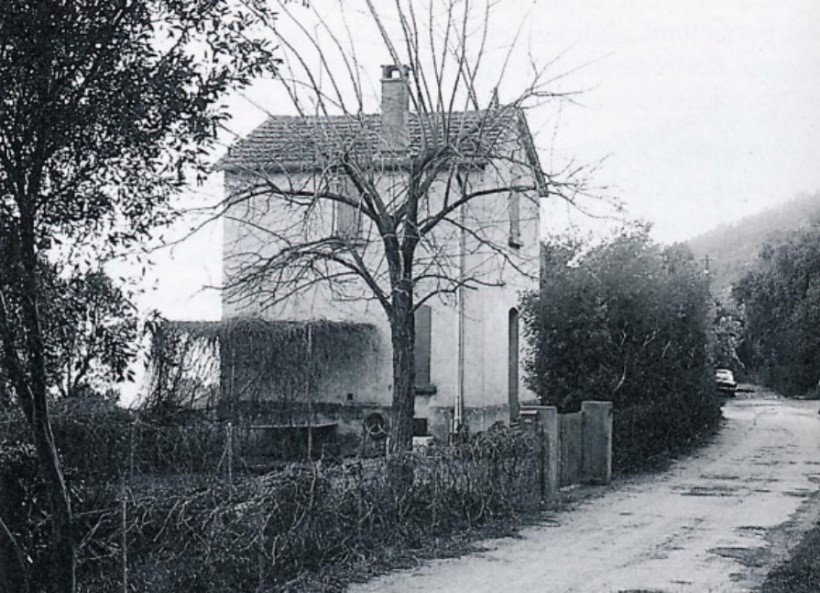
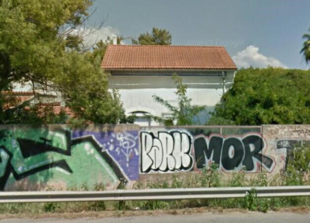
The Station building at La Foux can just be picked out behind the trees in this picture.
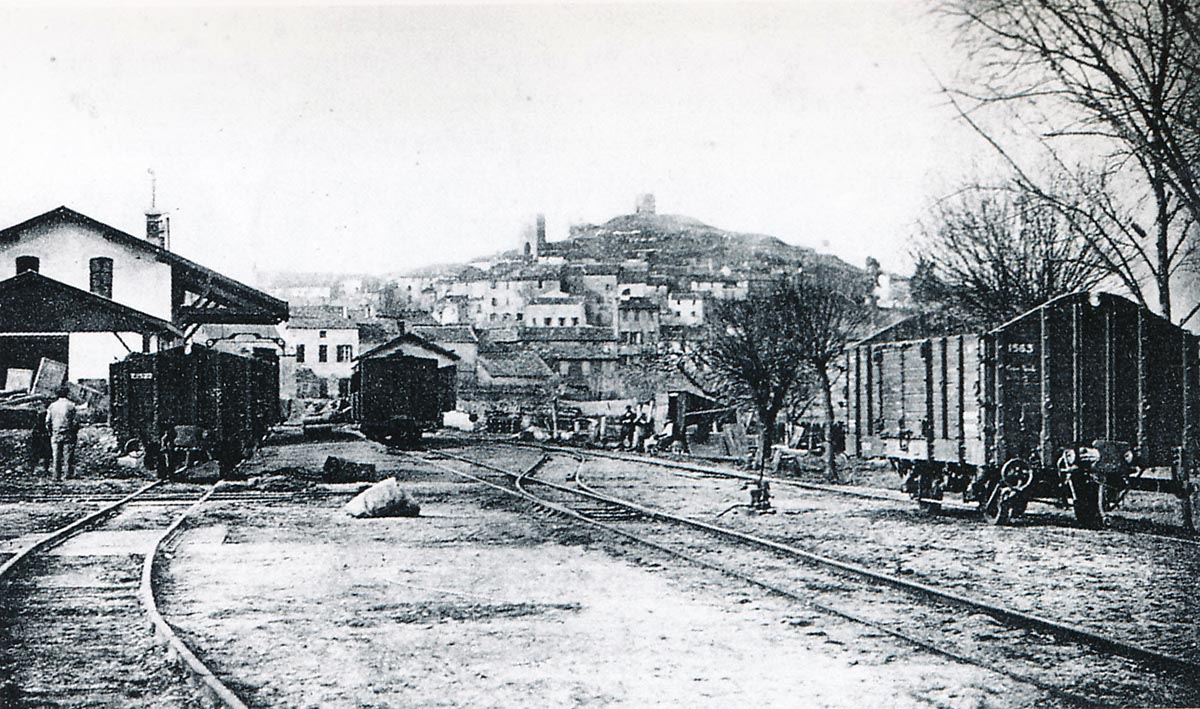
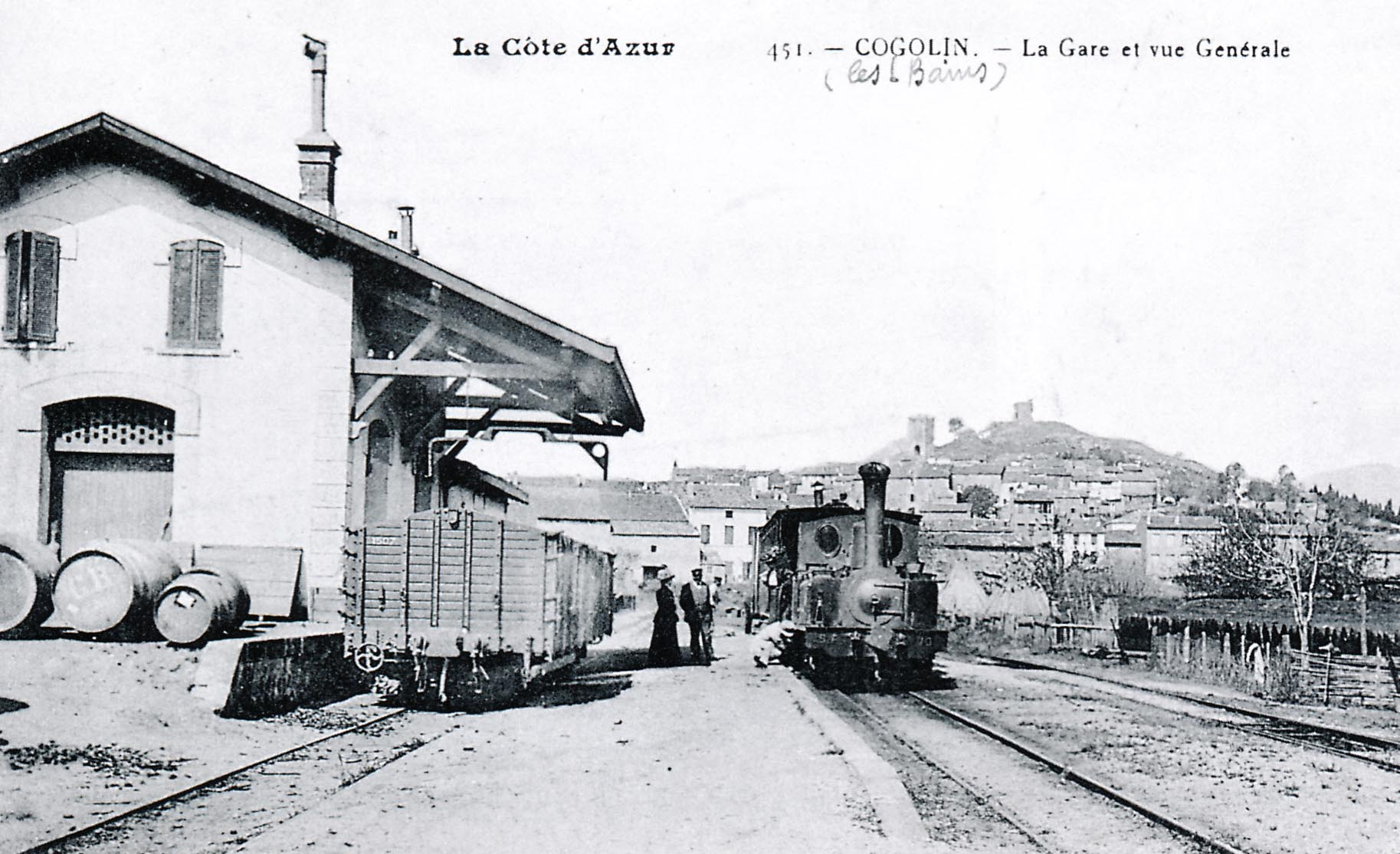
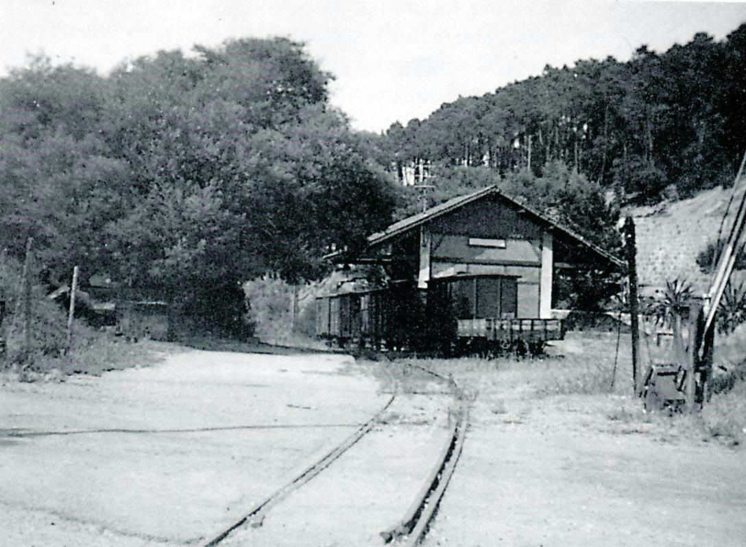
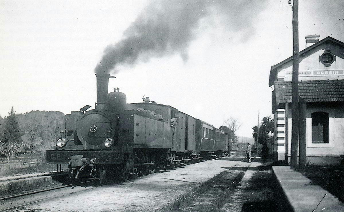
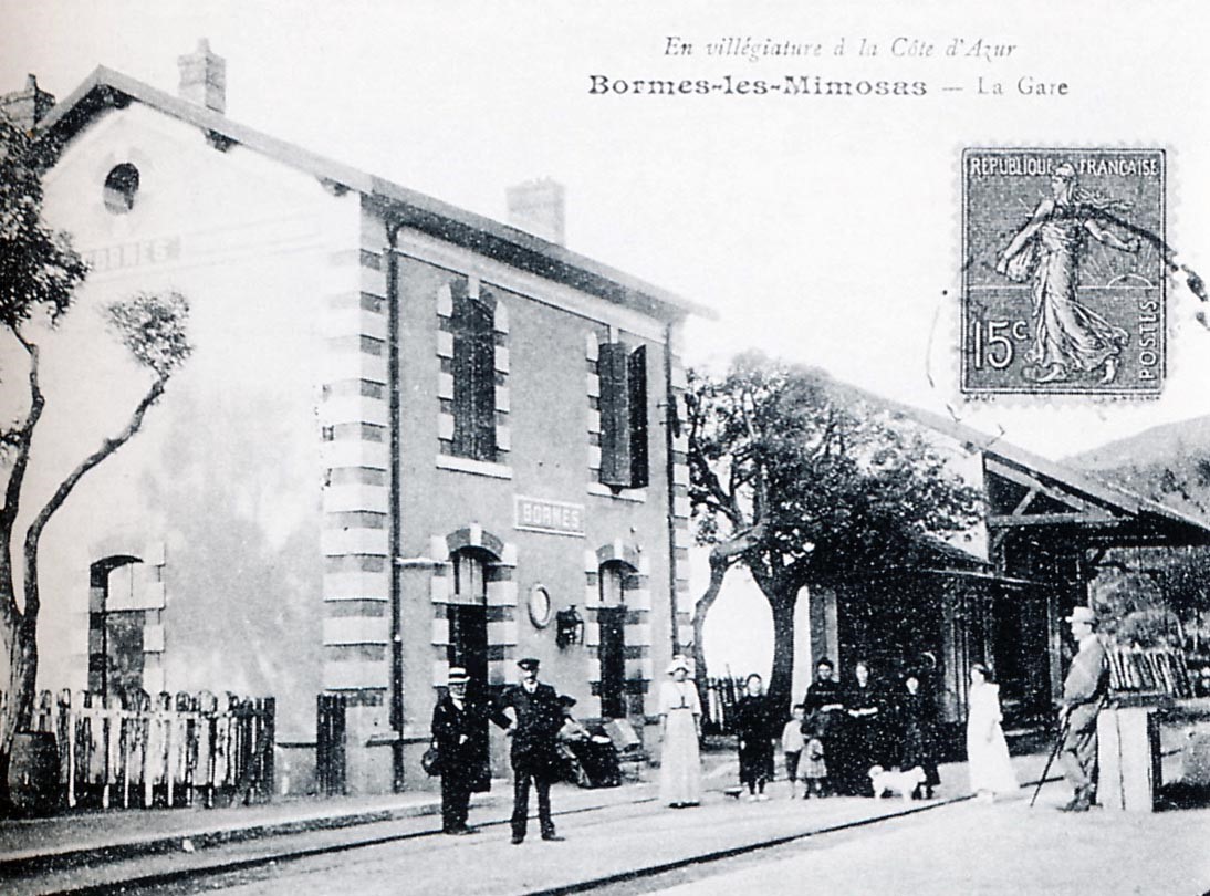
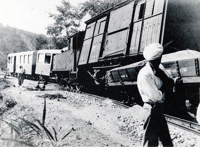
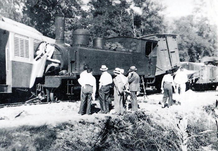
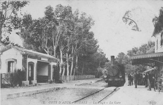
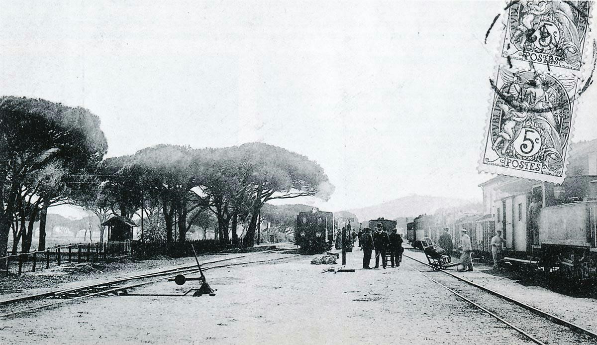
La Foux station at the beginning of the 20th century. From left to right: the pines of the racecourse, the track for St. Tropez, a train for Cogolin with an 0-6-0T Corpet-Louvet series 70 to 72, a train for Hyères and a long mixed train for St.Raphaël behind a 2-6-0T Pinguely series 41 to 44 (Raymond BERNARDI Collection). 
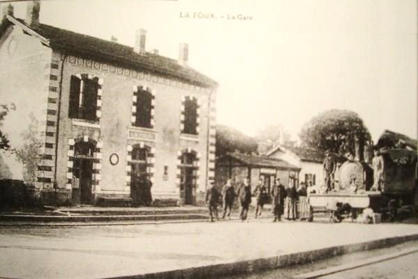
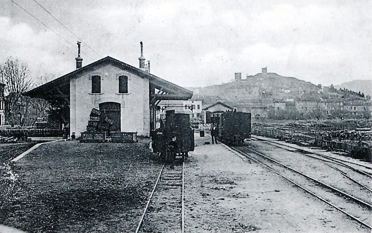
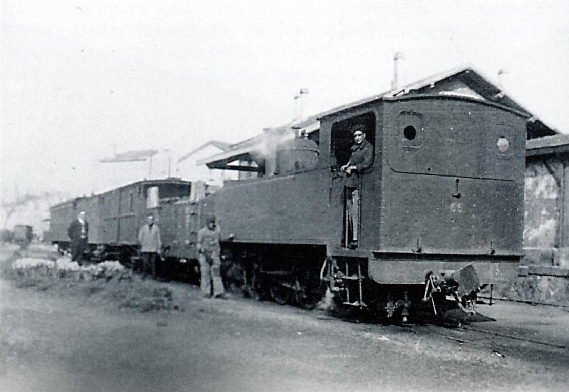
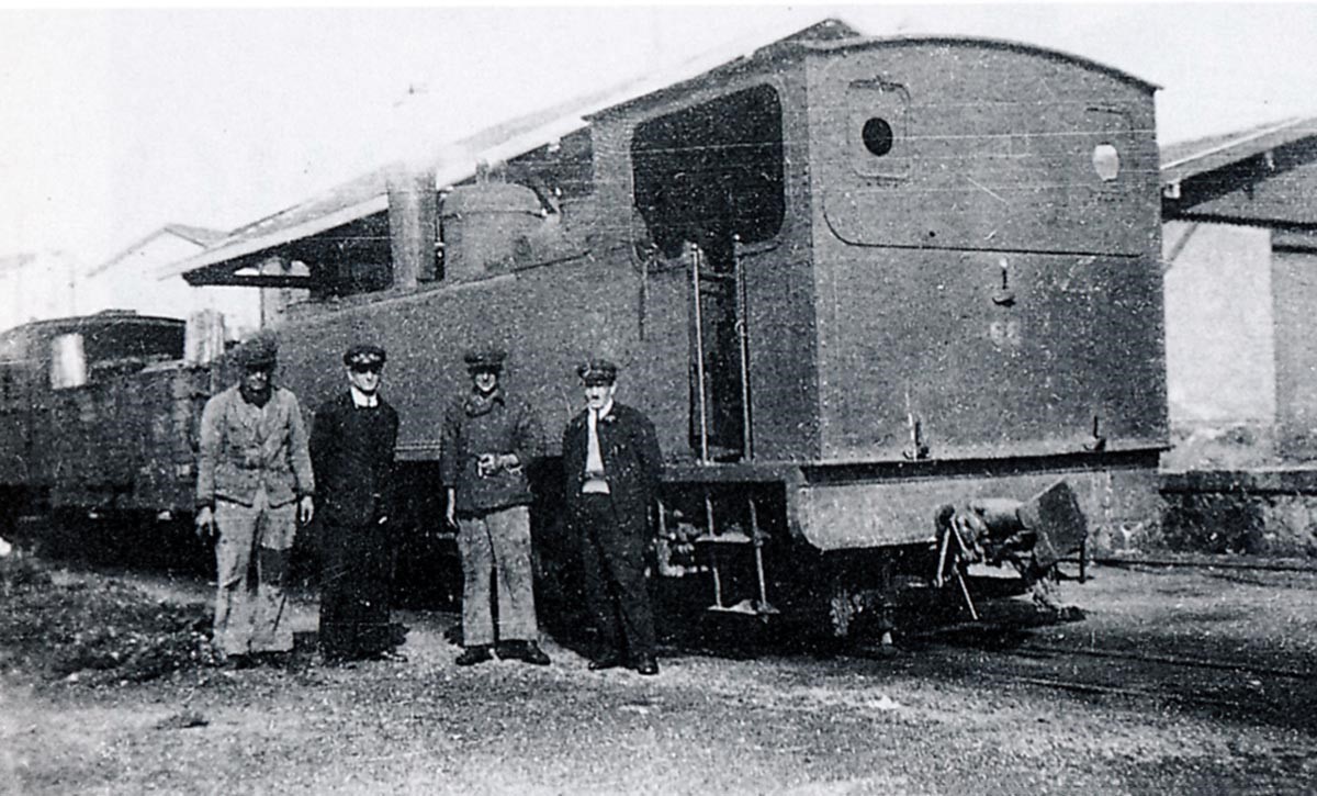
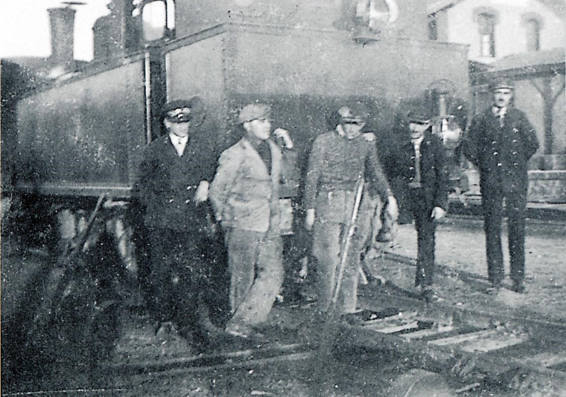
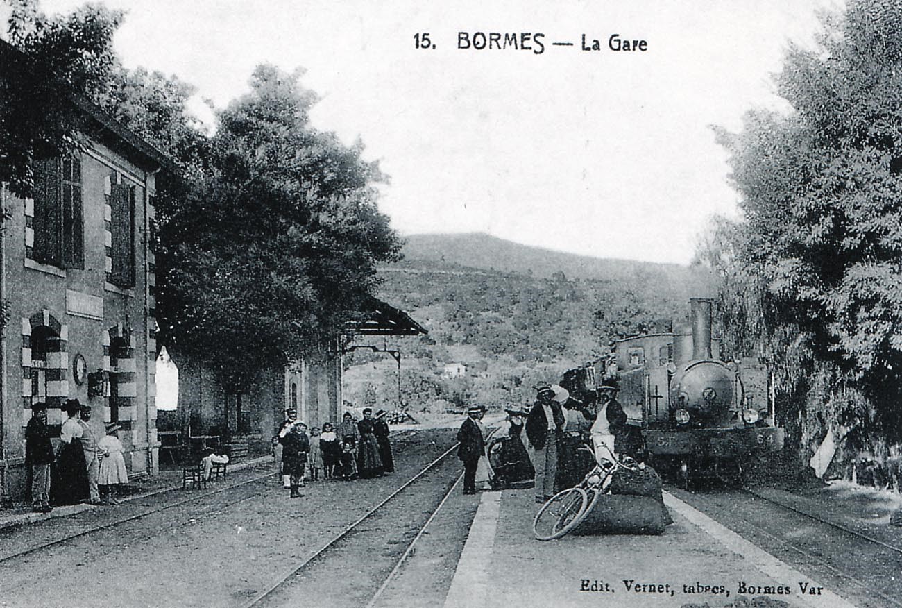
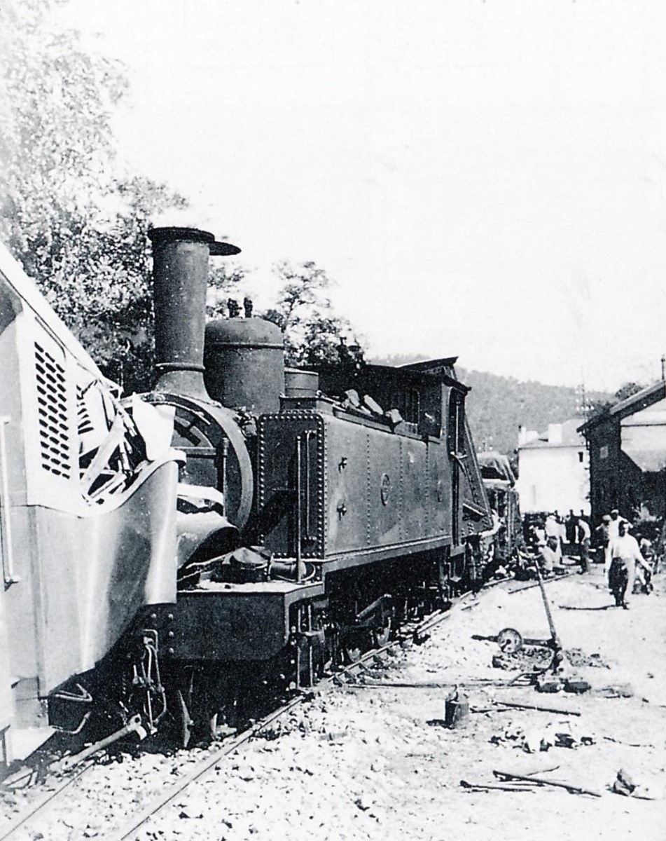
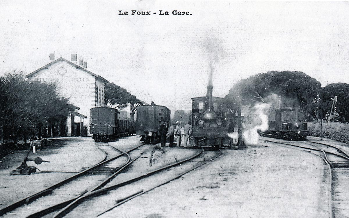
In this view of La Foux station before 1910, the locomotive refueling on the central lane seems to be the 0-6-0T Krauss Weidknecht No. 78 “La Madeleine”, perhaps used to pull trains of sand to and from the area we now know as Port Grimaud. On the right is a 0-6-0T Corpet-Louvet series 70 to 72 at the head of a Cogolin to St. Tropez train (André JACQUOT Collection)

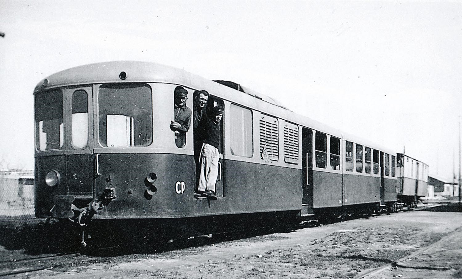
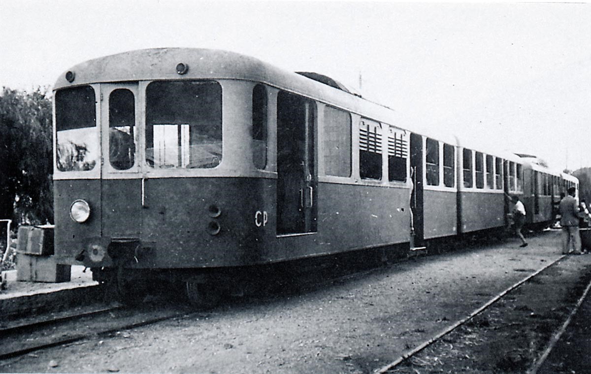
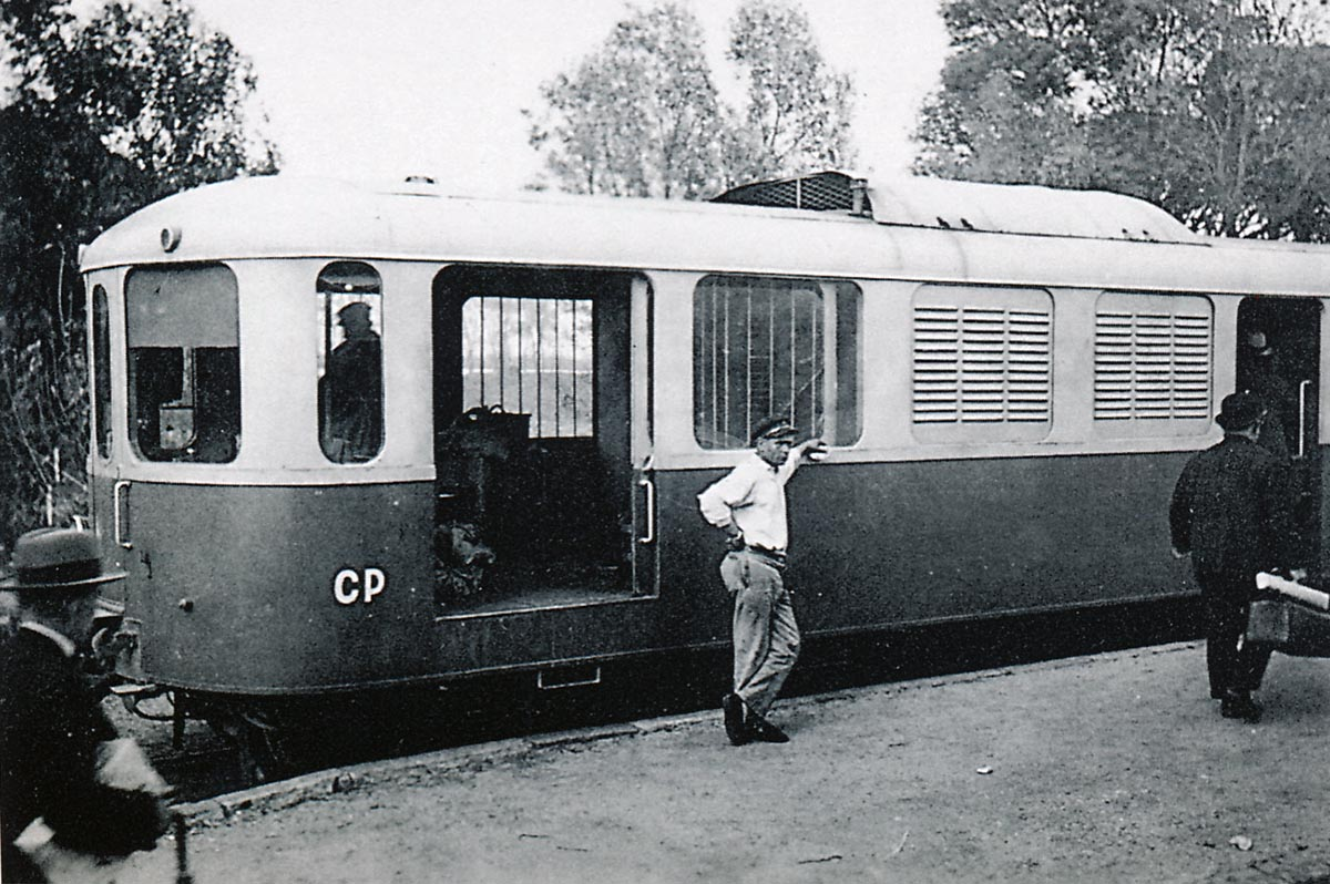
The driver of a Brissonneau & Lotz railcar waiting for passengers to re-embark at La Foux station (Photo Jacques CHAPUIS – FACS-UNECTO collection).

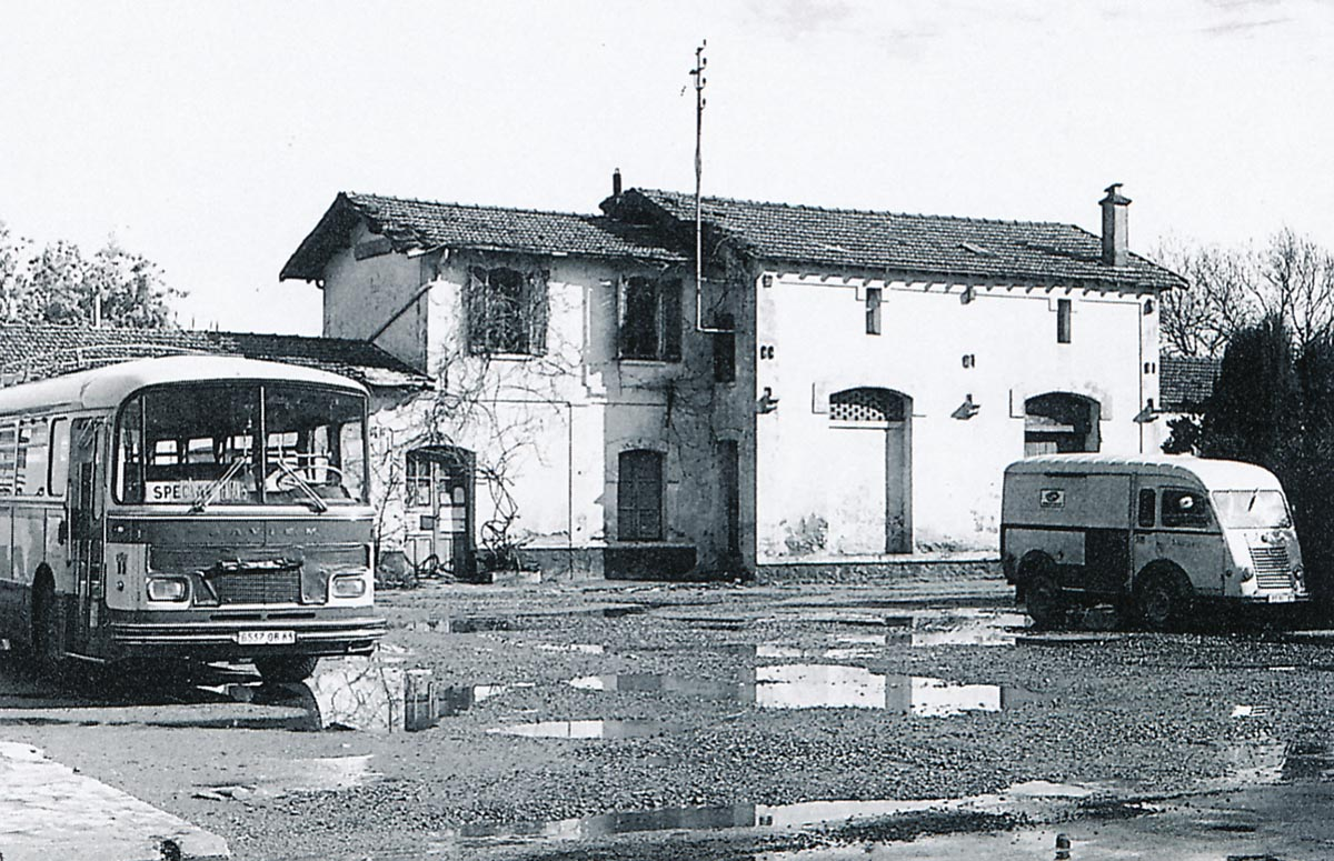
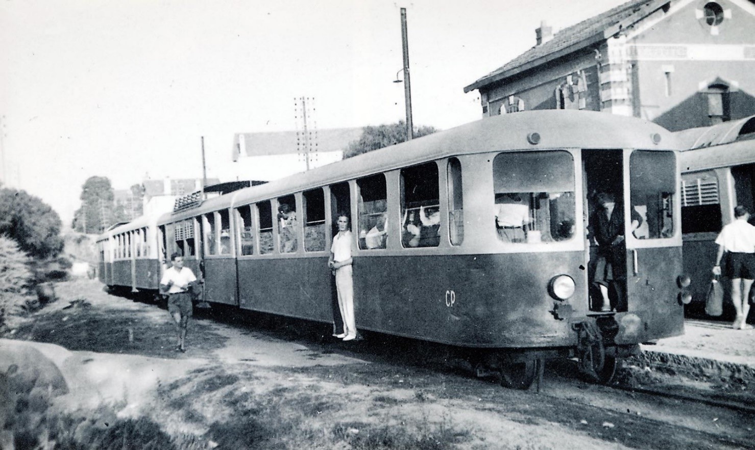
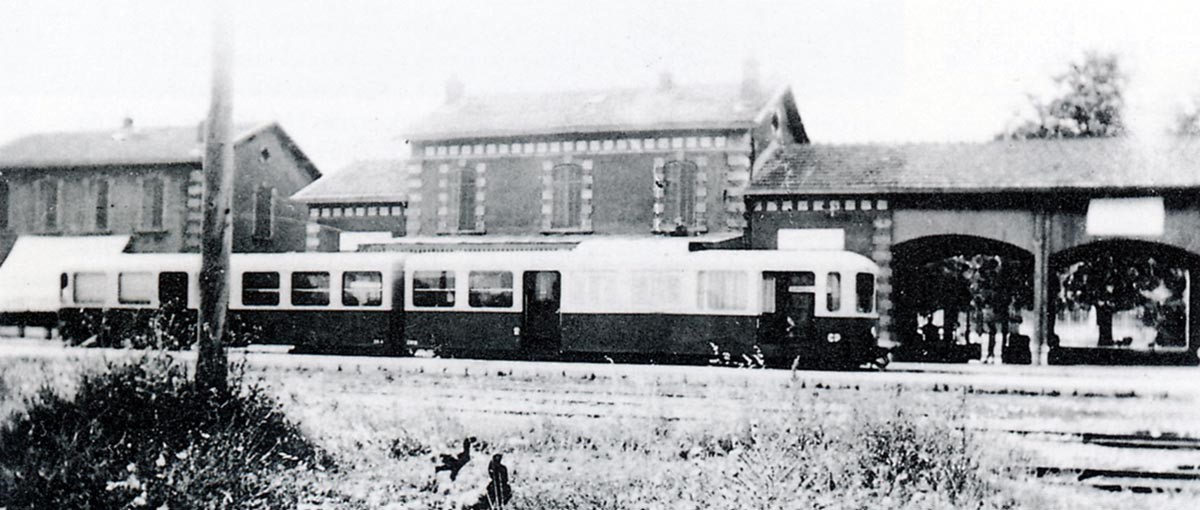
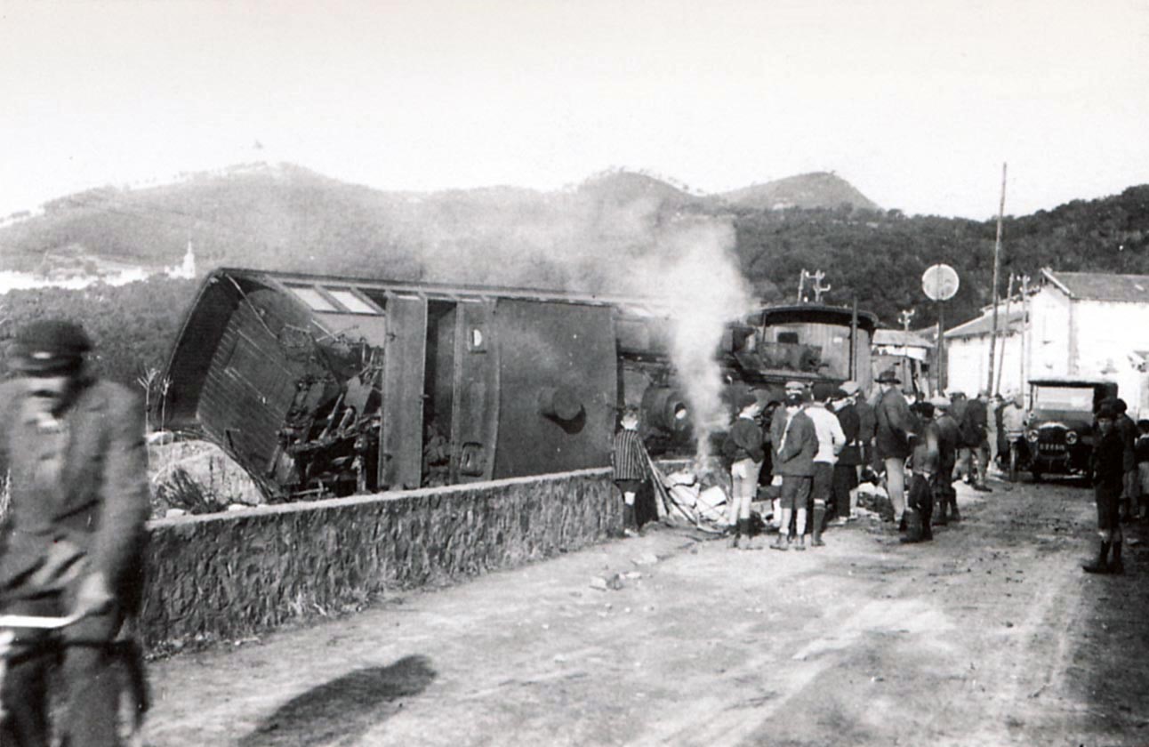
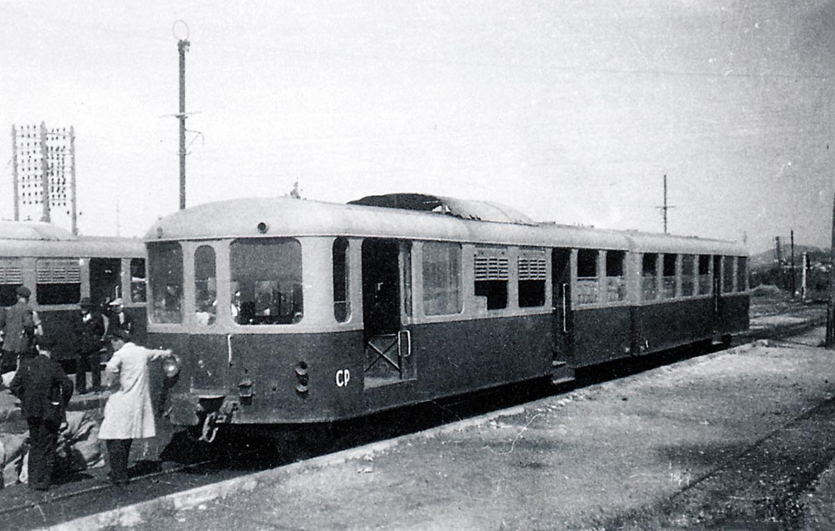
Two railcars cross at La Foux Station on 25th May 1948, shortly before the closure of the line.

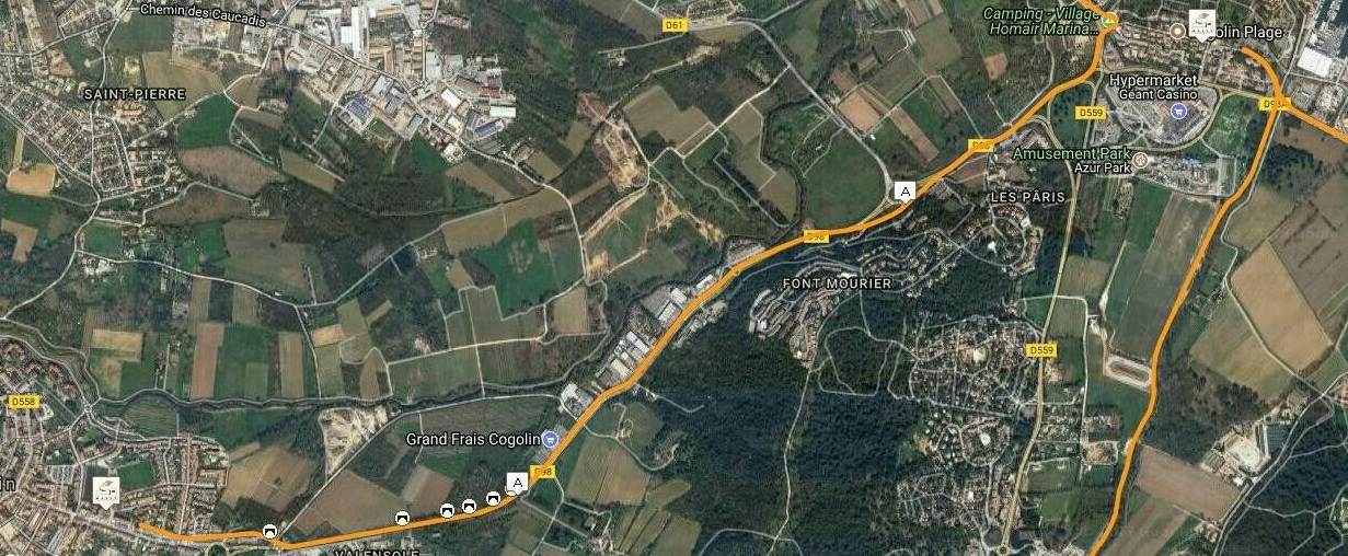
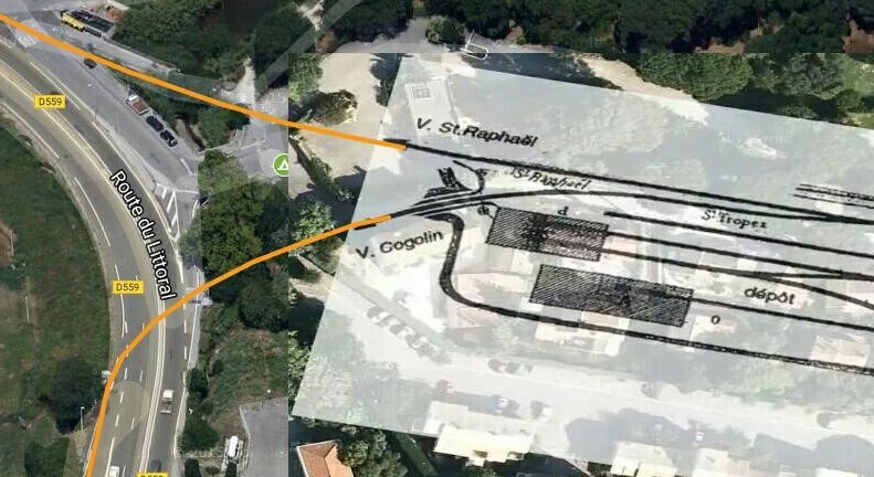
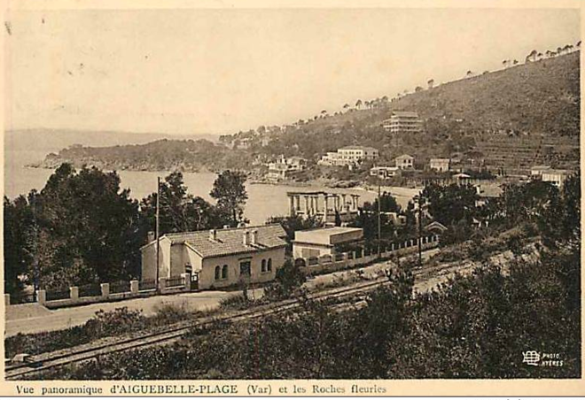
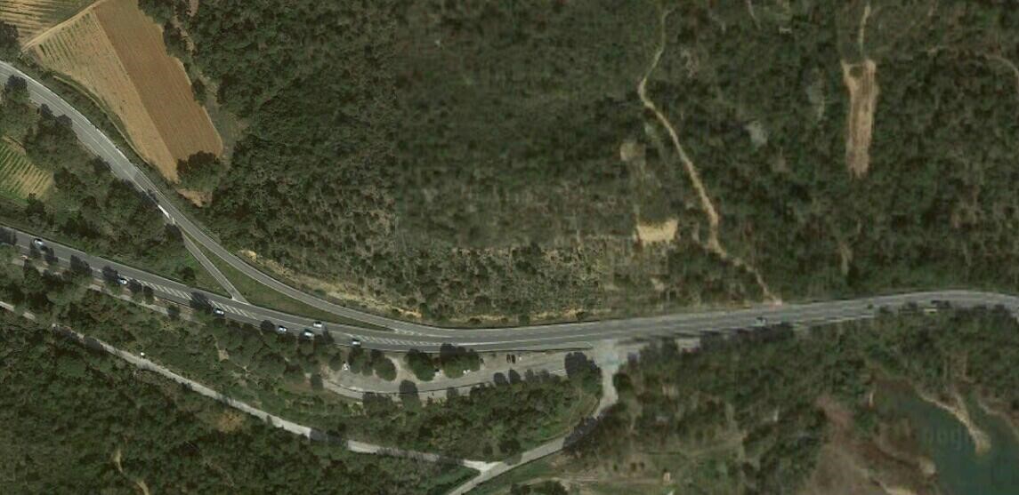
Leaving La Foux Station the line to St. Raphael parted from the line to Cogolin and tuned to the North-west, running alongside the main road. The land to the North of the line was open fields. It is now an area known as Port Cogolin. The area is outlined in blue on the satellite image below.

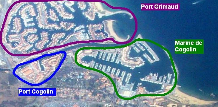
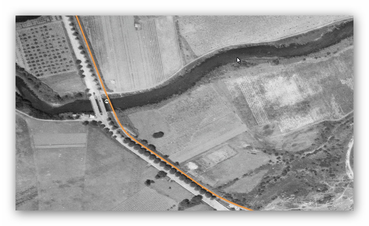
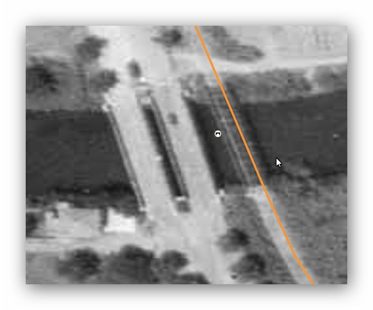
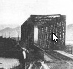
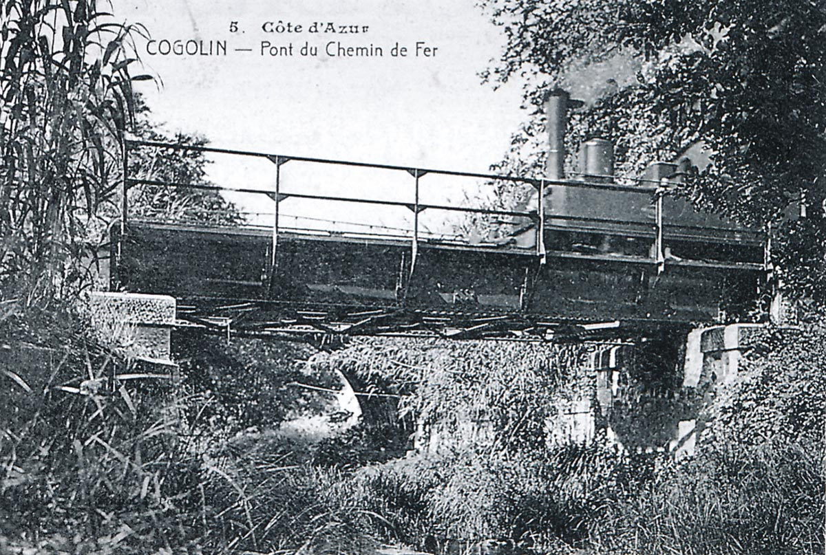
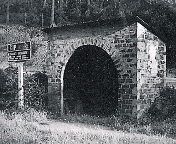
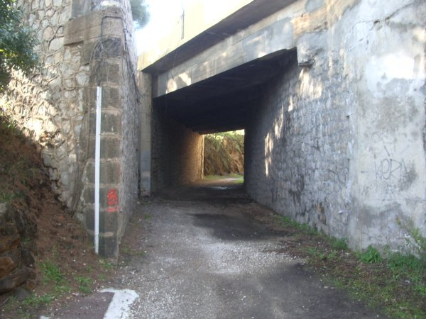
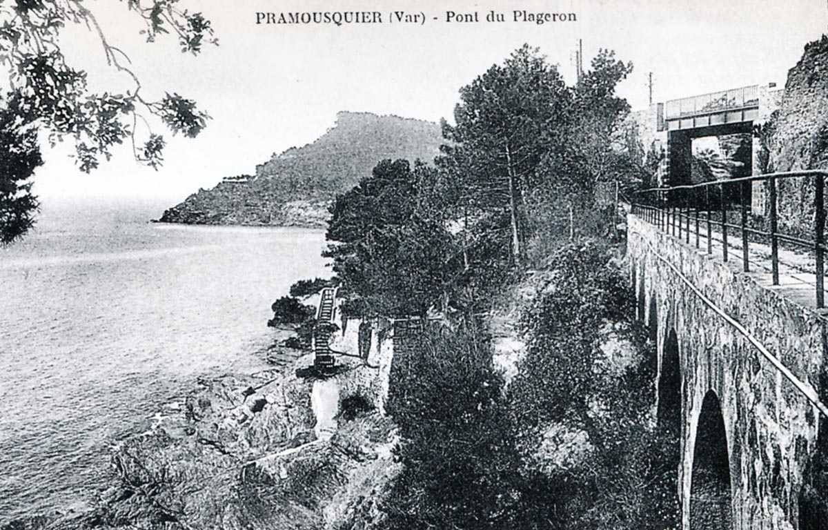
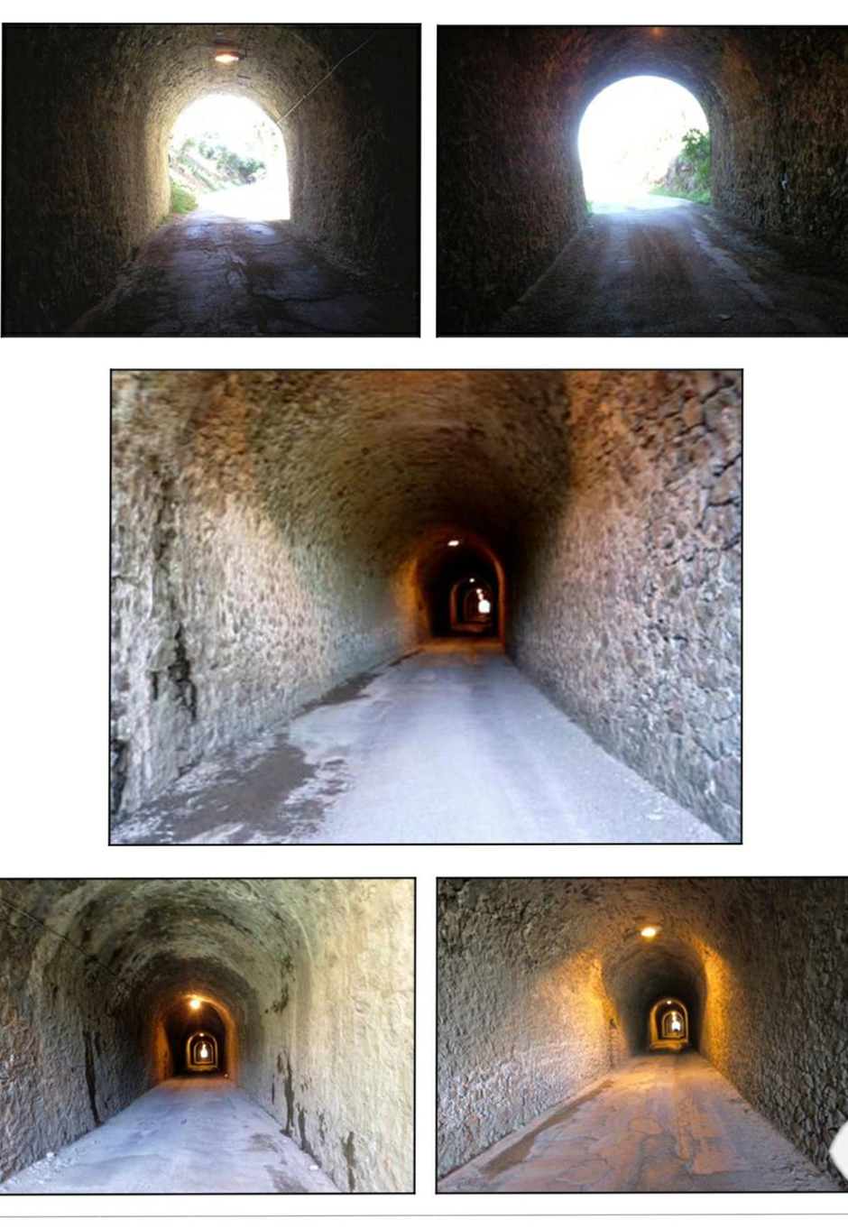
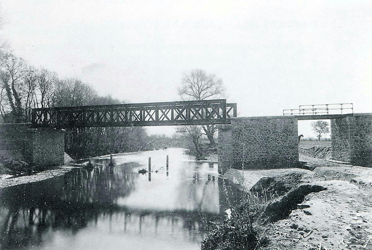
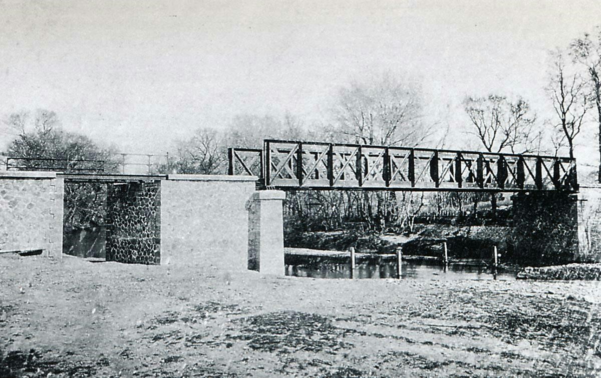
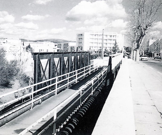
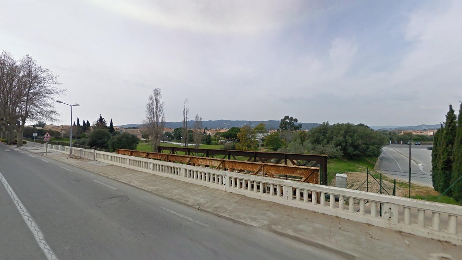
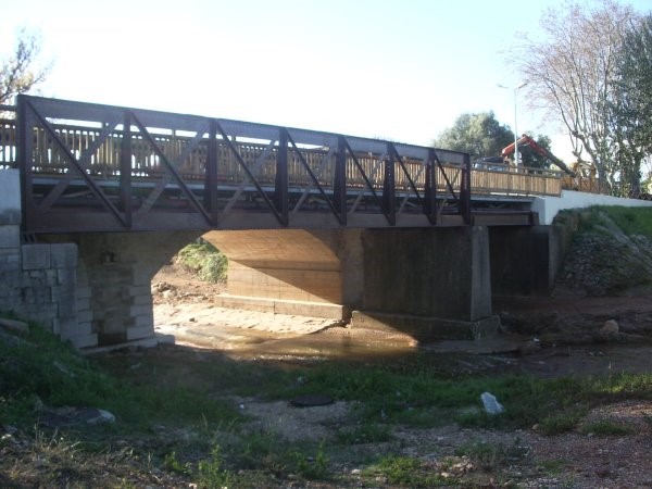
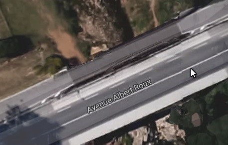
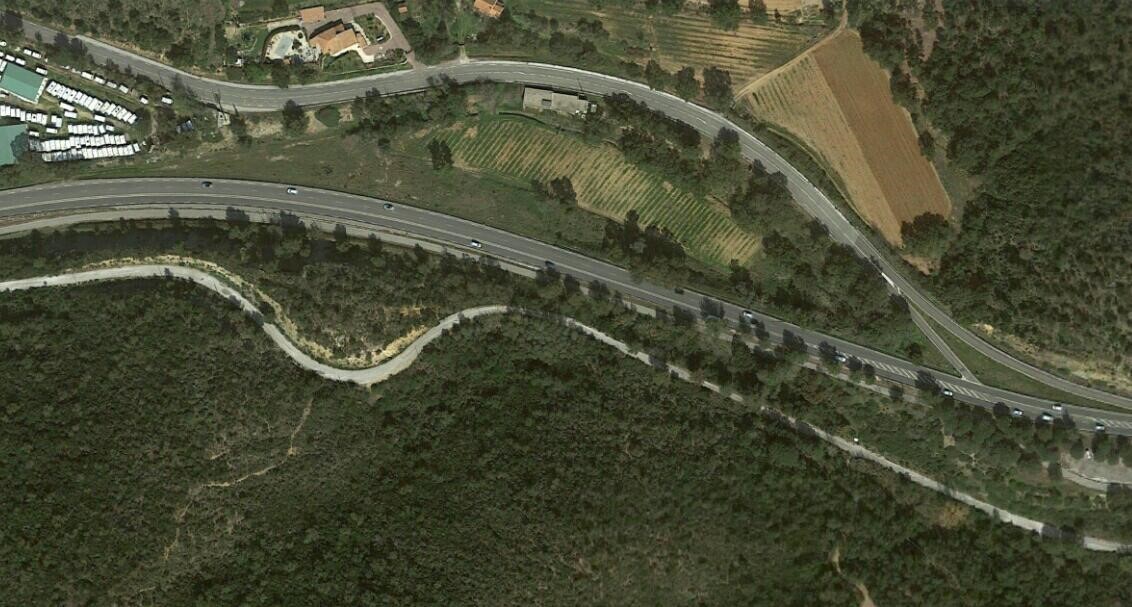
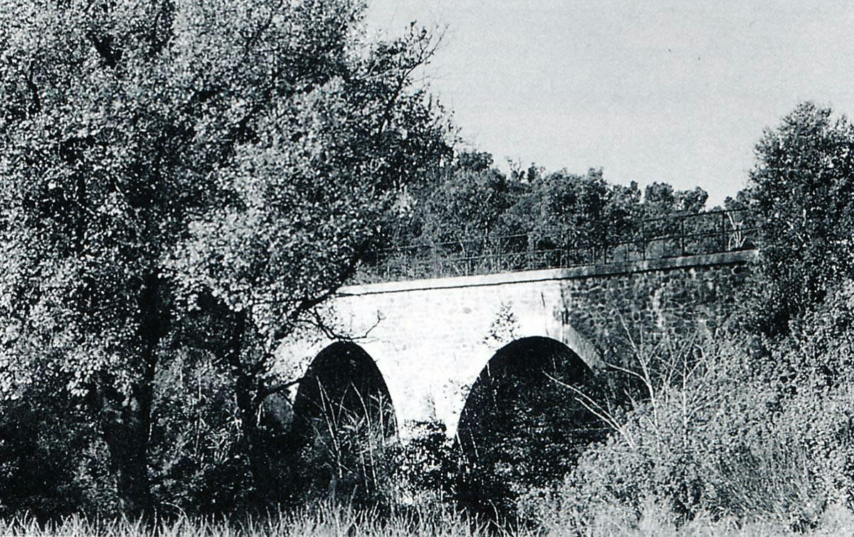
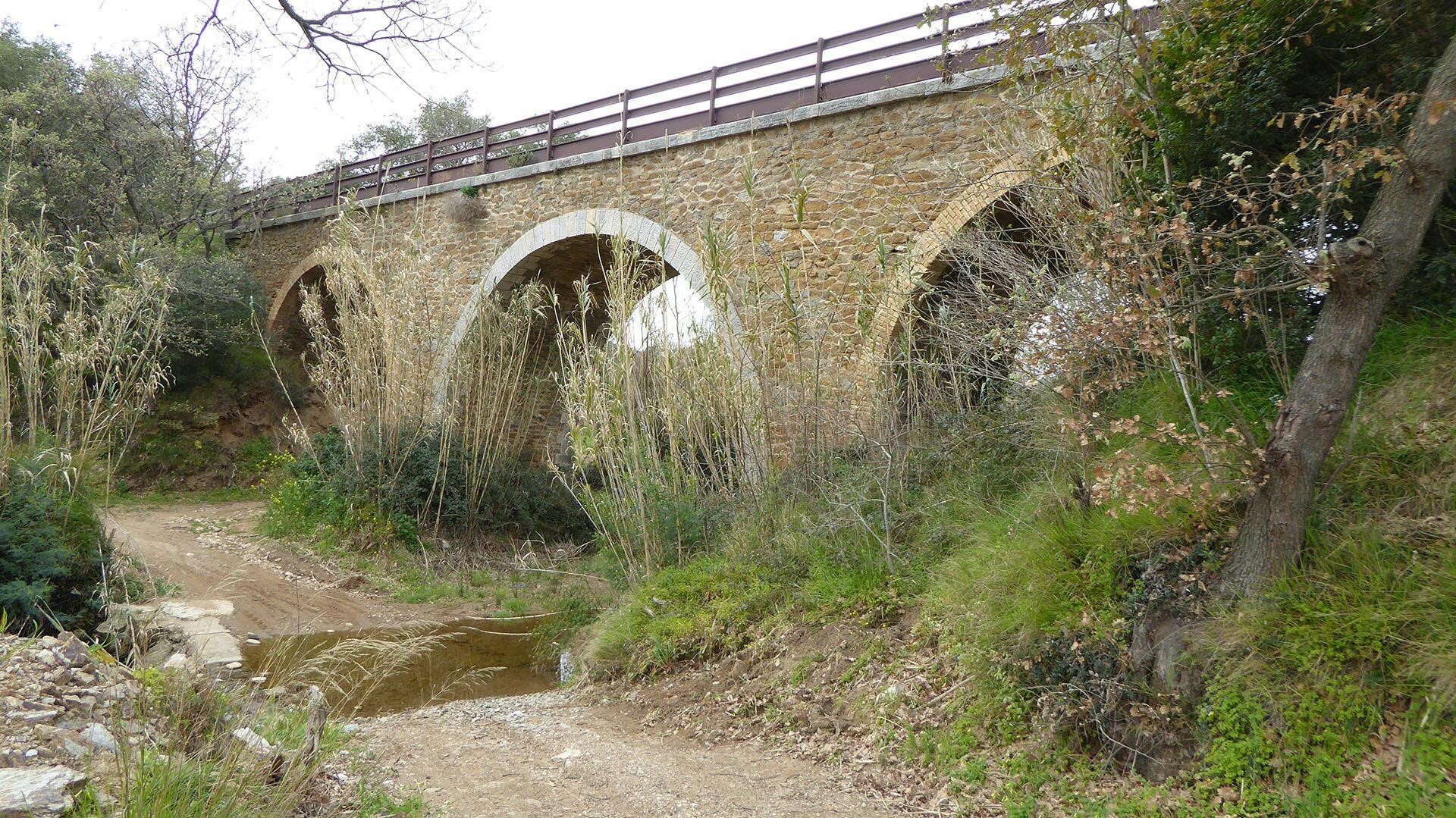
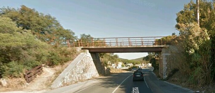
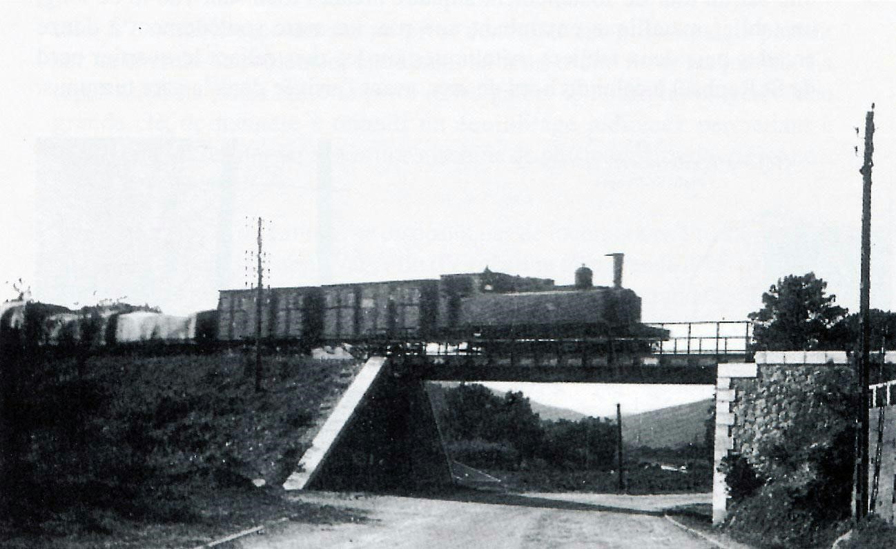
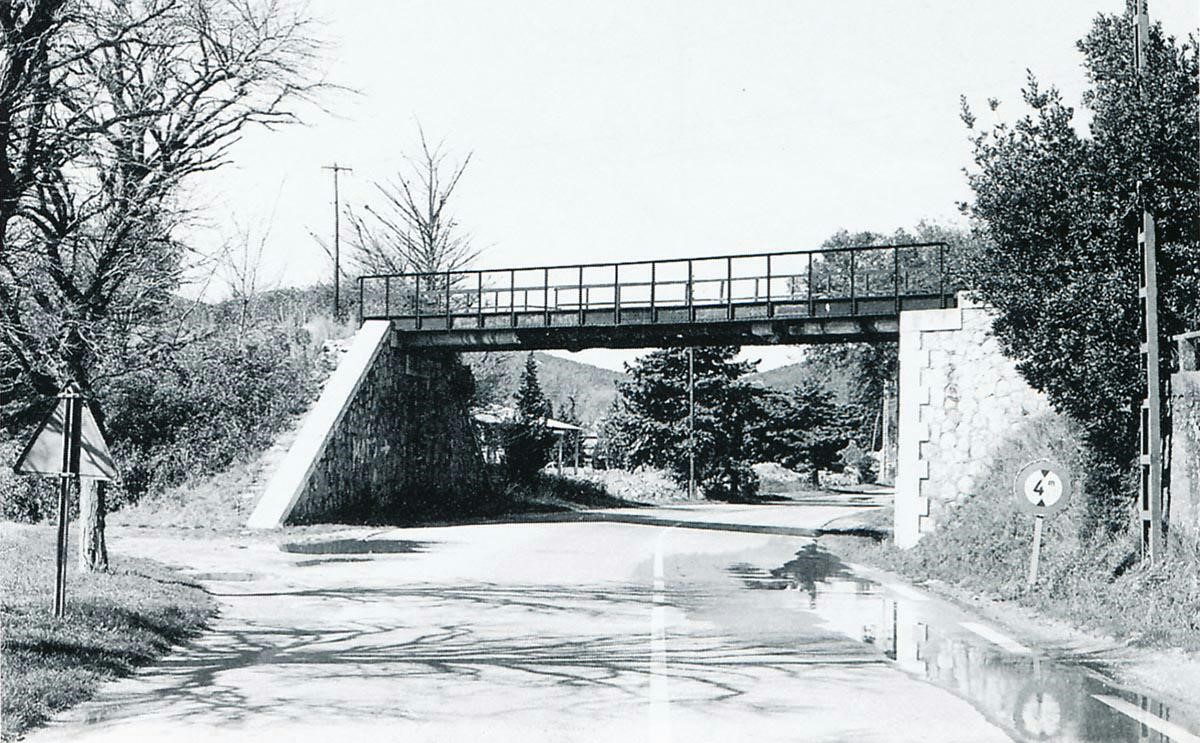
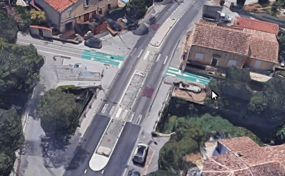
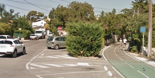
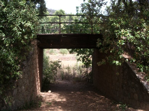
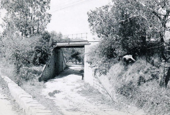
Immediately beyond what is now Port Cogolin the railway crossed the River Giscle on what appears to have been a metal truss girder bridge. The pictures below show the present-day bridges. There is a cycleway on the line of the old railway and the old road bridges have been replaced by a more up-to-date concrete structure. I have provided a picture from elsewhere of what the bridge probably looked like immediately after closure of the line in the late 1940s as well as an aerial photograph at the highest possible resolution of the road and rail bridges at that time.

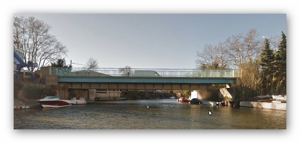
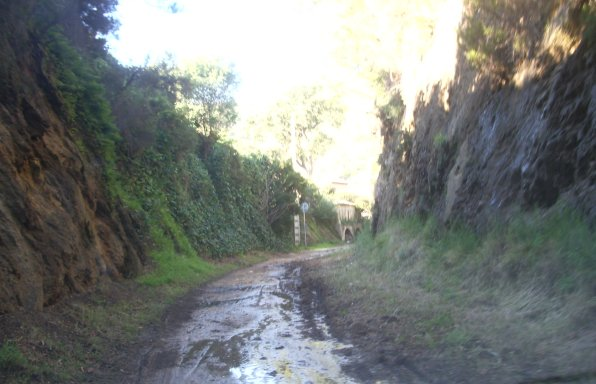
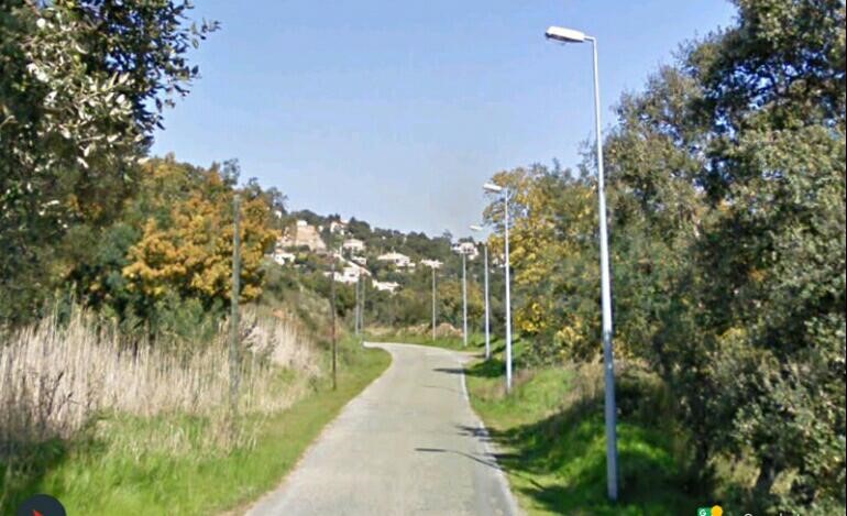
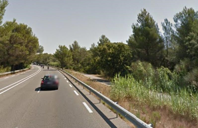
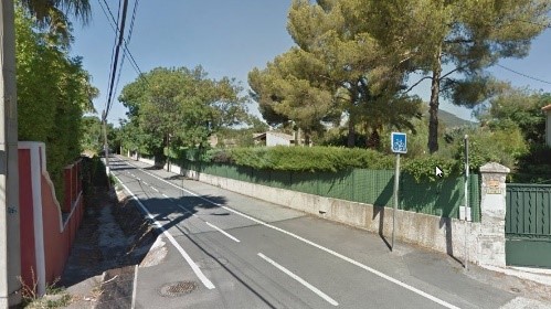
Once across the river, the road and rail routes remained close to each other, sheltered by a single row of trees in the margin of the road.

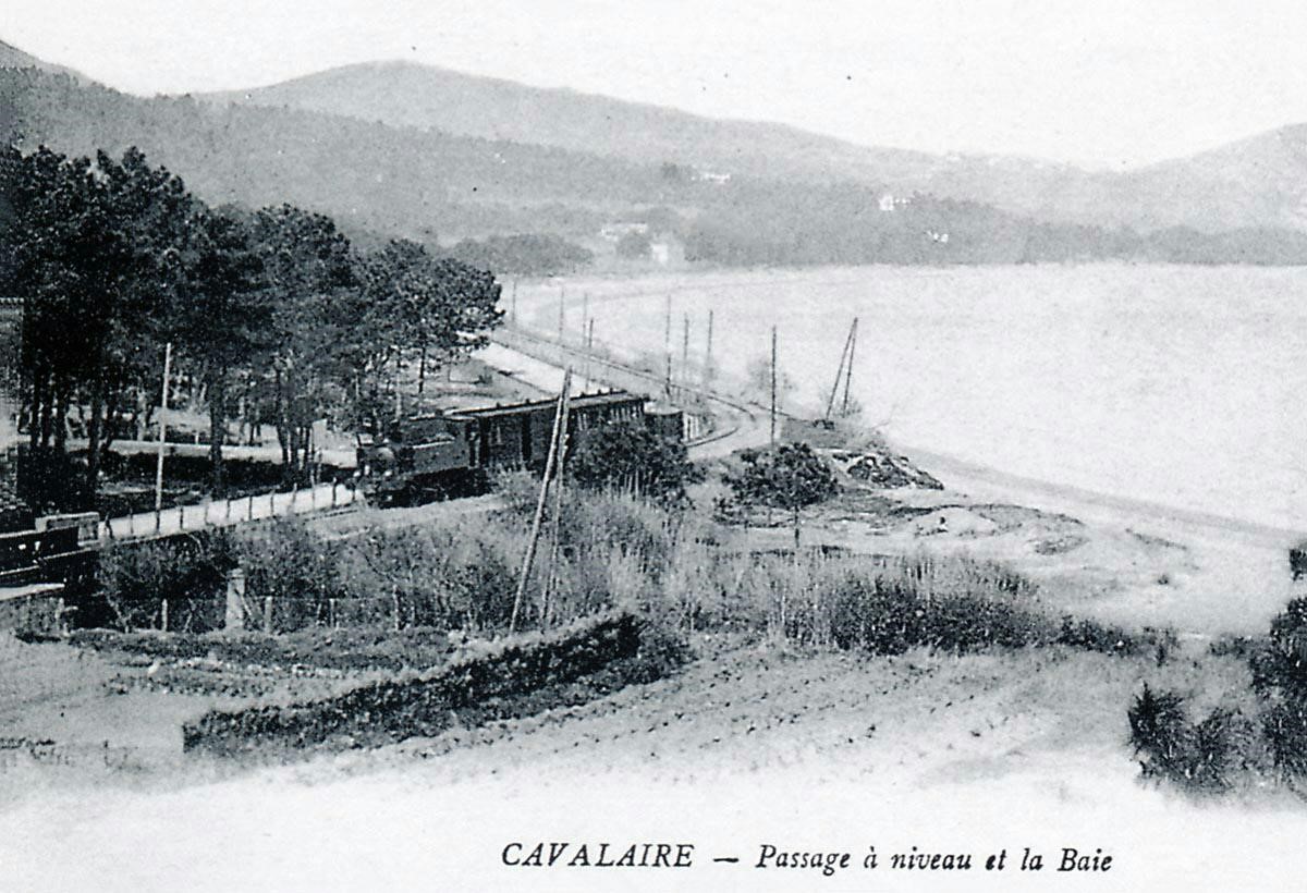
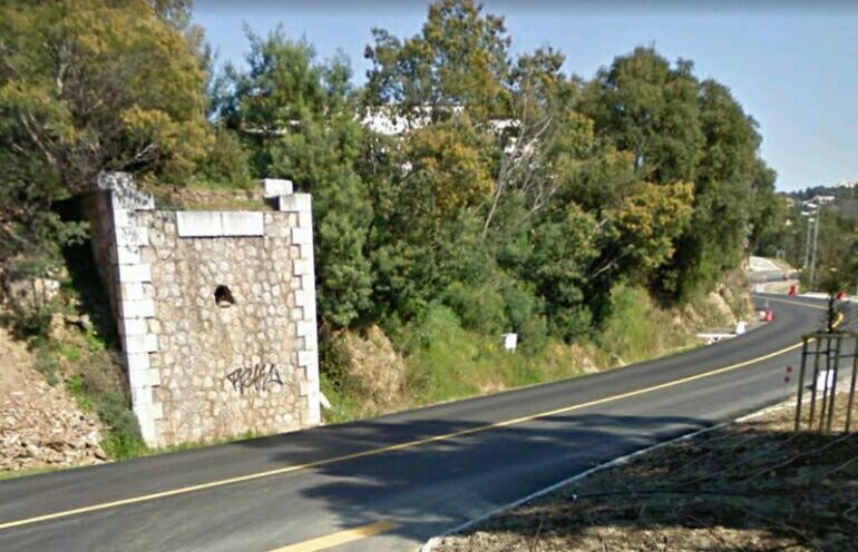
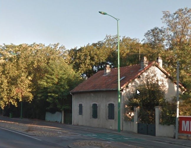
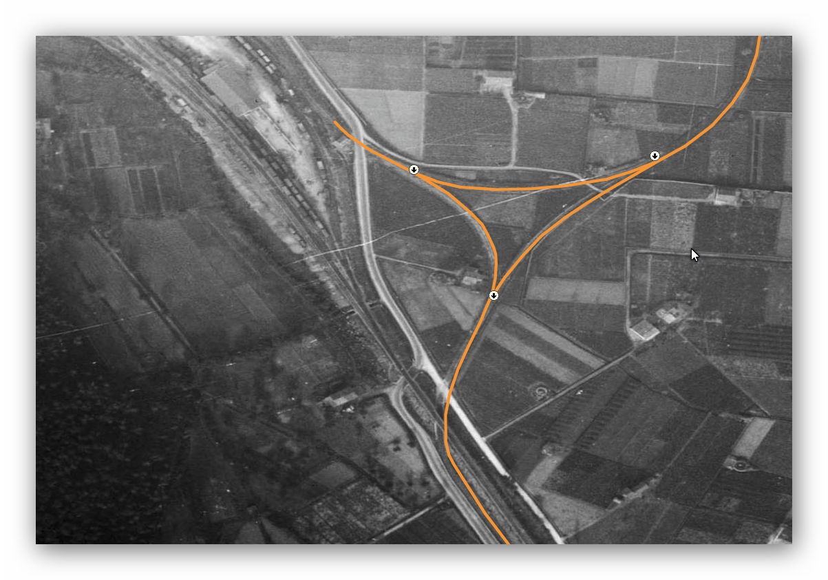
The River Giscle continues to be prone to flooding. Significant flooding meant that the causeway of the road and railway needed to be broken at regular intervals by bridges that would release the peak flood flows. A series of bridges followed the main river bridge. Pont de décharge n°1 de la Gisle was the first of these and was at a position very close to the entrance road to the modern Port Grimaud.

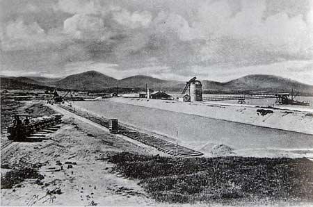
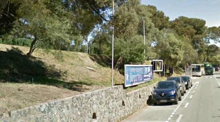
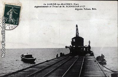
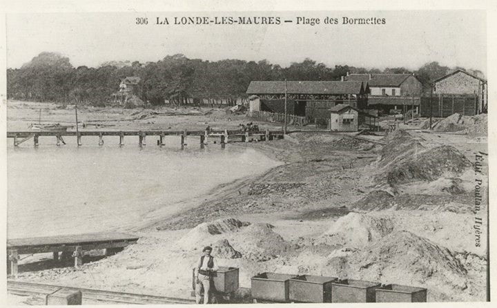
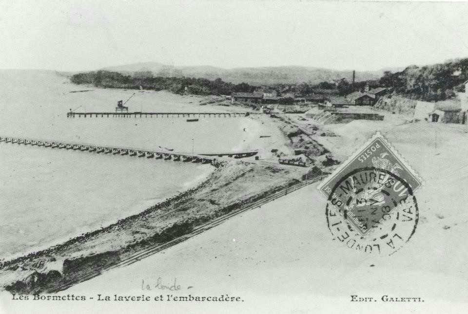
At approximately this location a second track[c.f., 6] of about 850 metres in length headed towards the sea to basins where steam dredgers excavated estuarial sand.

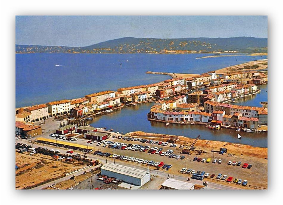
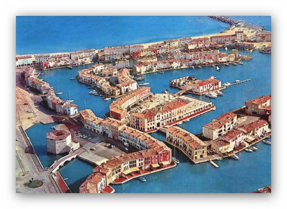
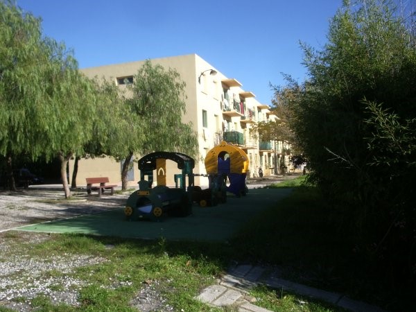
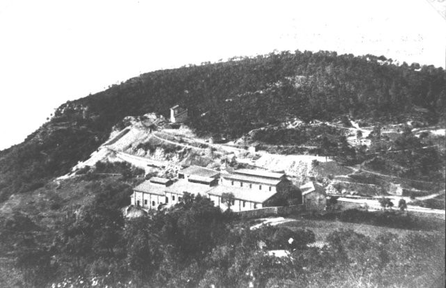
The area is now vastly different. Port Grimaud, as it is now, was the vision of one man. Francois Spoerry had a vision of what the seemingly unusable land at the end of the Golfe de St. Tropez could be used for.

In 1962, Spoerry bought the land at a very cheap price because it was of no interest to developers. It was a swampy area infested with mosquitoes and invaded by reed beds, tall grasses and bushes, among which were a few stoney paths[7].

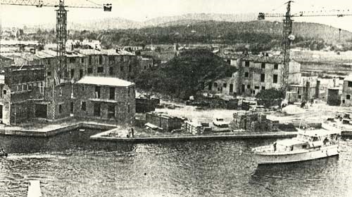
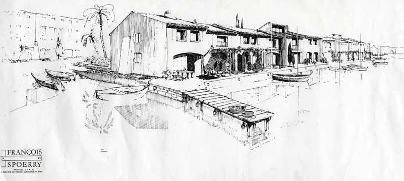
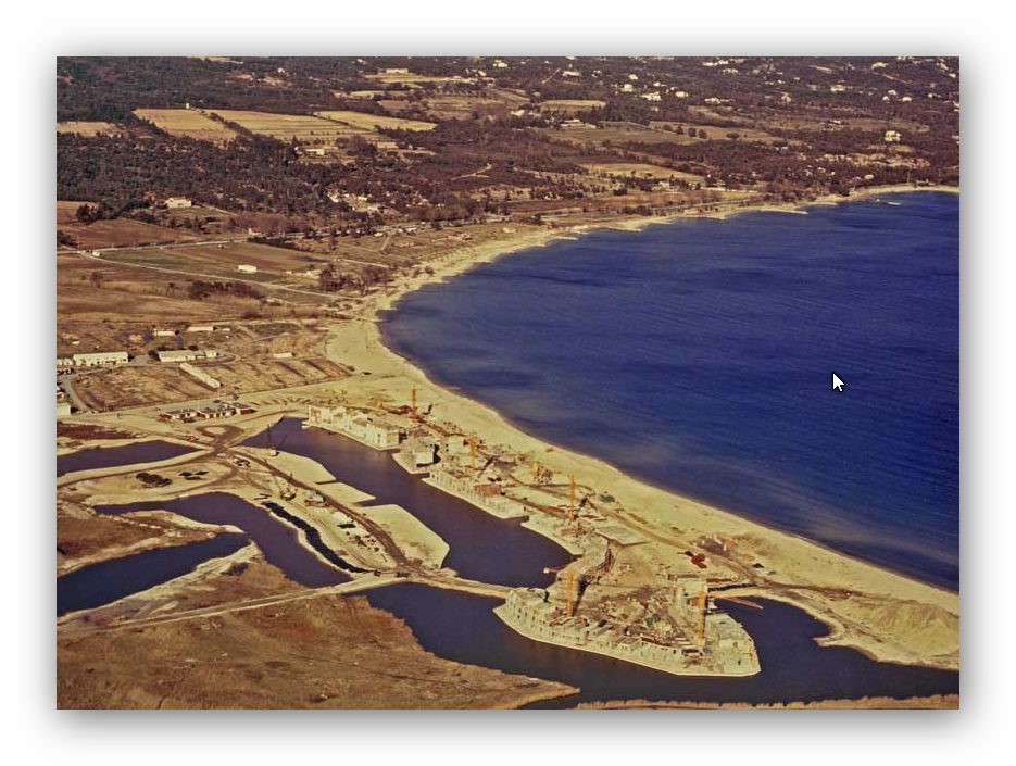
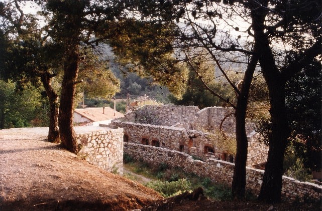
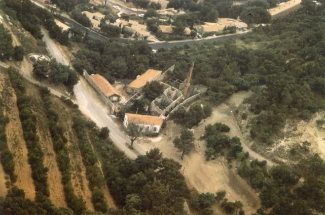
The village and canals were developed over a period of around 10 years. Images from that period follow below. The first is one of the drawings of the site produced by Spoerry, there is then a sequence of images from different years, showing the development of the site.

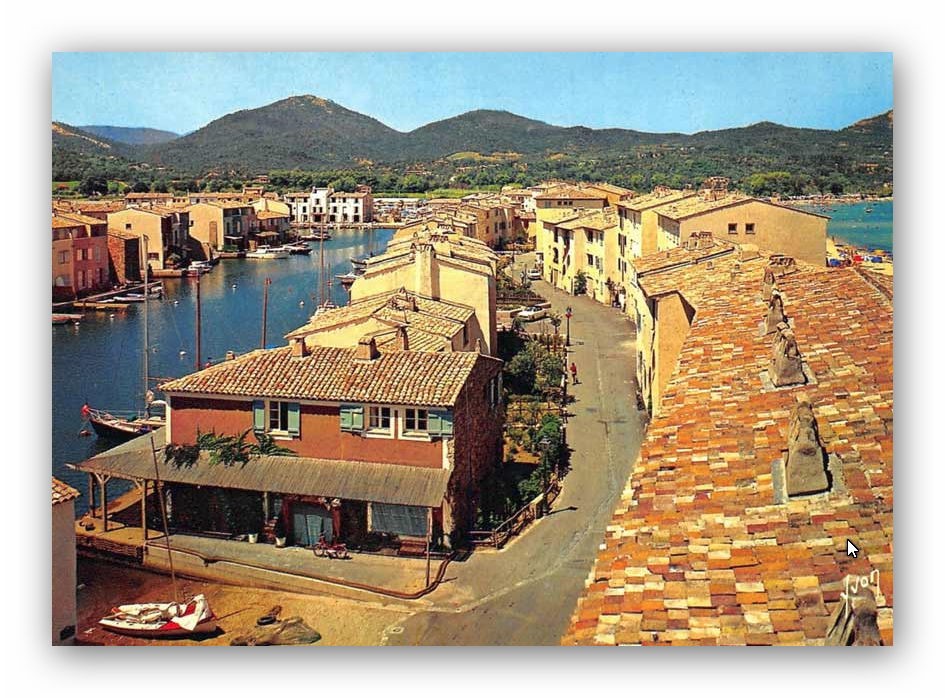
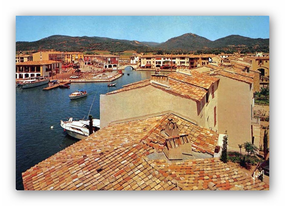
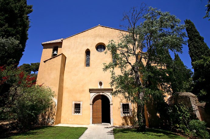
The image immediately above was taken in 1970. The images below show a little of the construction of the church built on site.
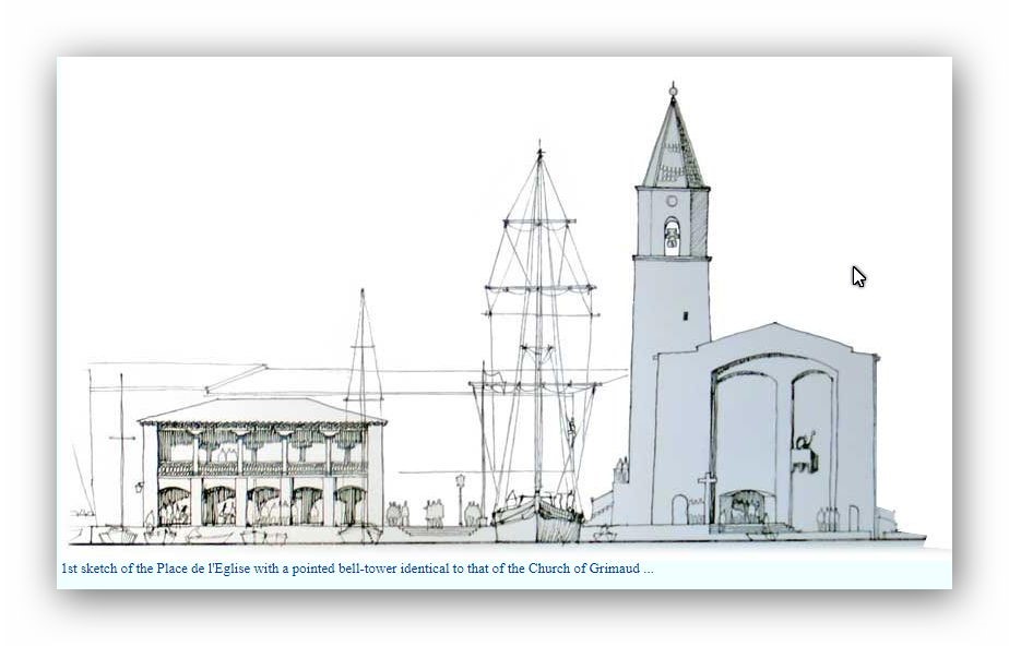
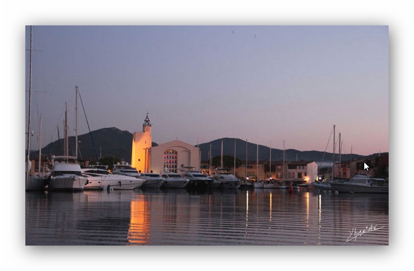
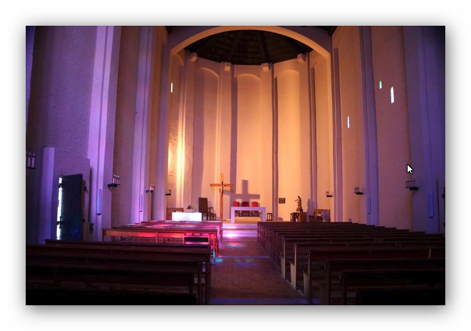
The church design was adjusted before building and no longer reflected directly the design of the church in Grimaud Village.

Port Grimaud has become one of the places to live on the Cote d’Azur, in the middle of the 20th Century it was a sand quarry! Spoerry explained his vision to a journalist from ‘Alsace’: “Port Grimaud was born from my desire to have a small house at the water’s edge with a boat in front of my door. … But I also planned to create a village and not just a collection of houses, a real village with a heart, … a church, hotels and restaurants. … A village as it would have been if architects had not existed. …” [8].

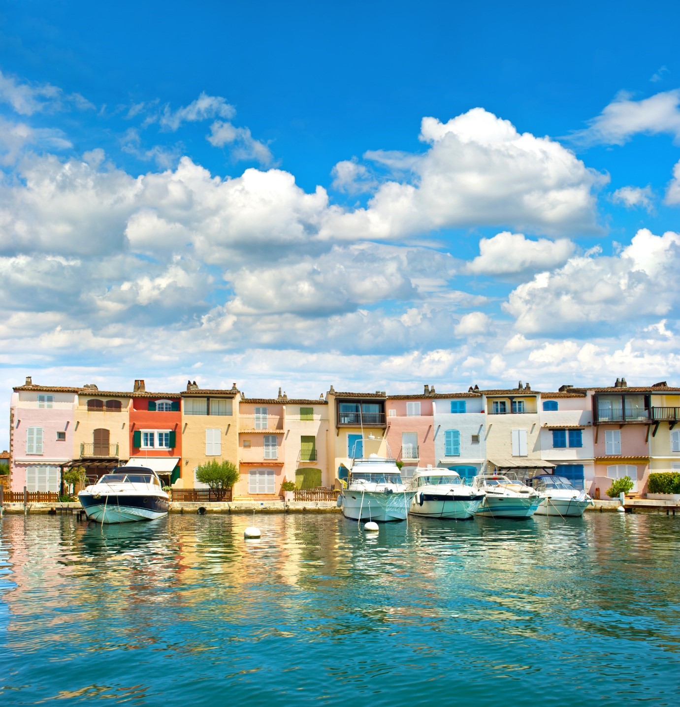
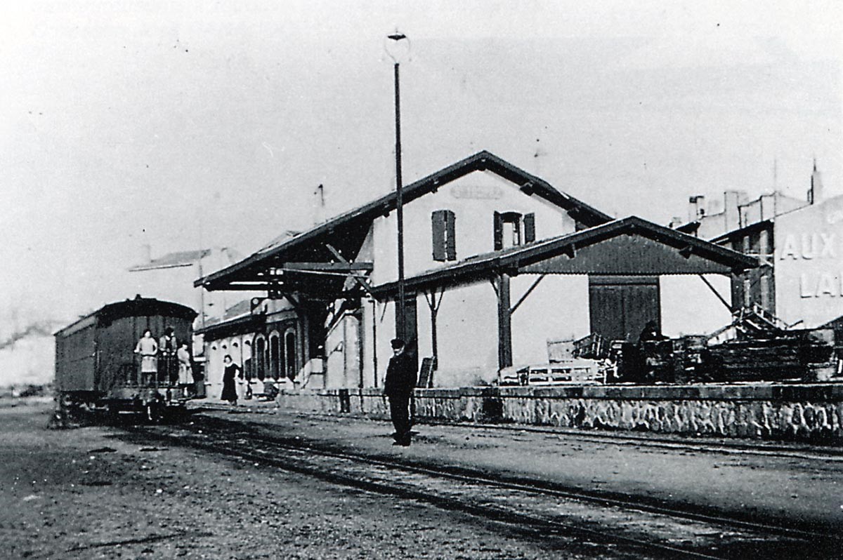
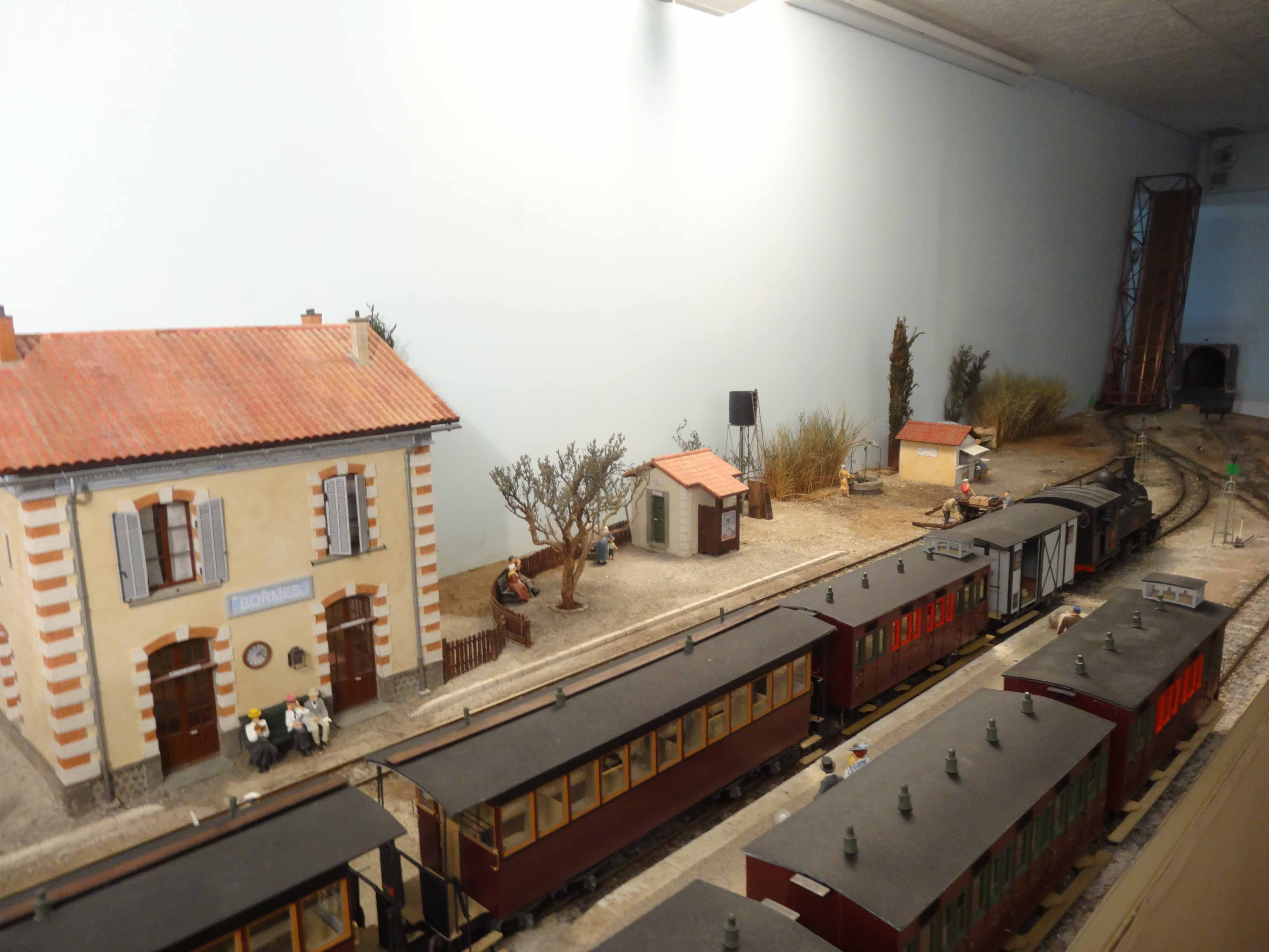
We move on along th e line towards St. Raphael and we encounter two more flood relief bridges, Pont de décharge n°2 de la Gisle, and predictably, Pont de décharge n°3 de la Gisle, before reaching the next station, Saint Pons-les-Mûres (Grimaud until 1904). The Station was a 3rd Class establishment. The picture below is from the Collection of Raymond BERNARDI.
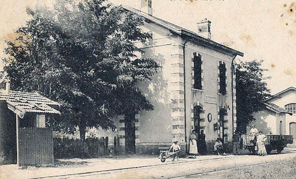
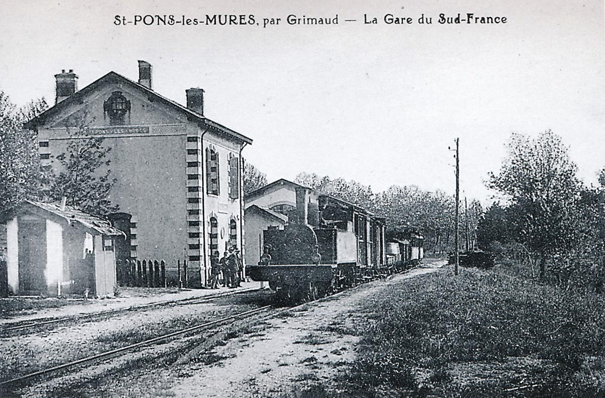
The photo above is of a mixed train from St. Raphael to Toulon pulled by a 4-6-0T Pinguely series 41 to 44, in St.Pons-les-Mûres around 1920 (Collection Raymond BERNARDI).
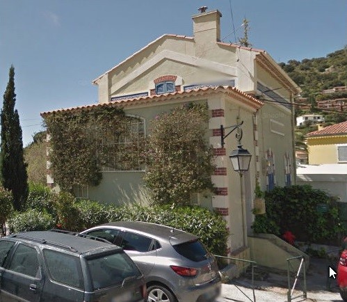
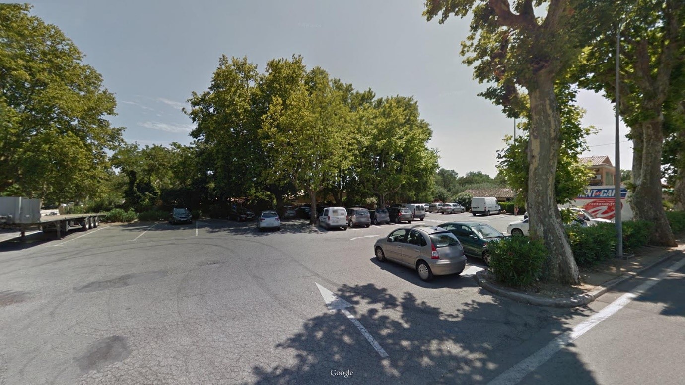
The station has disappeared and has been replaced by a carpark and restaurant.
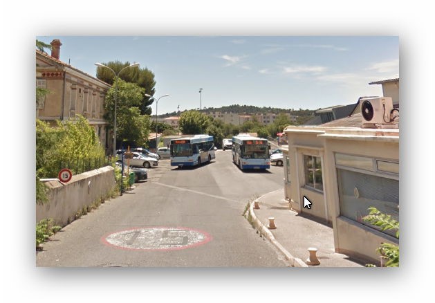
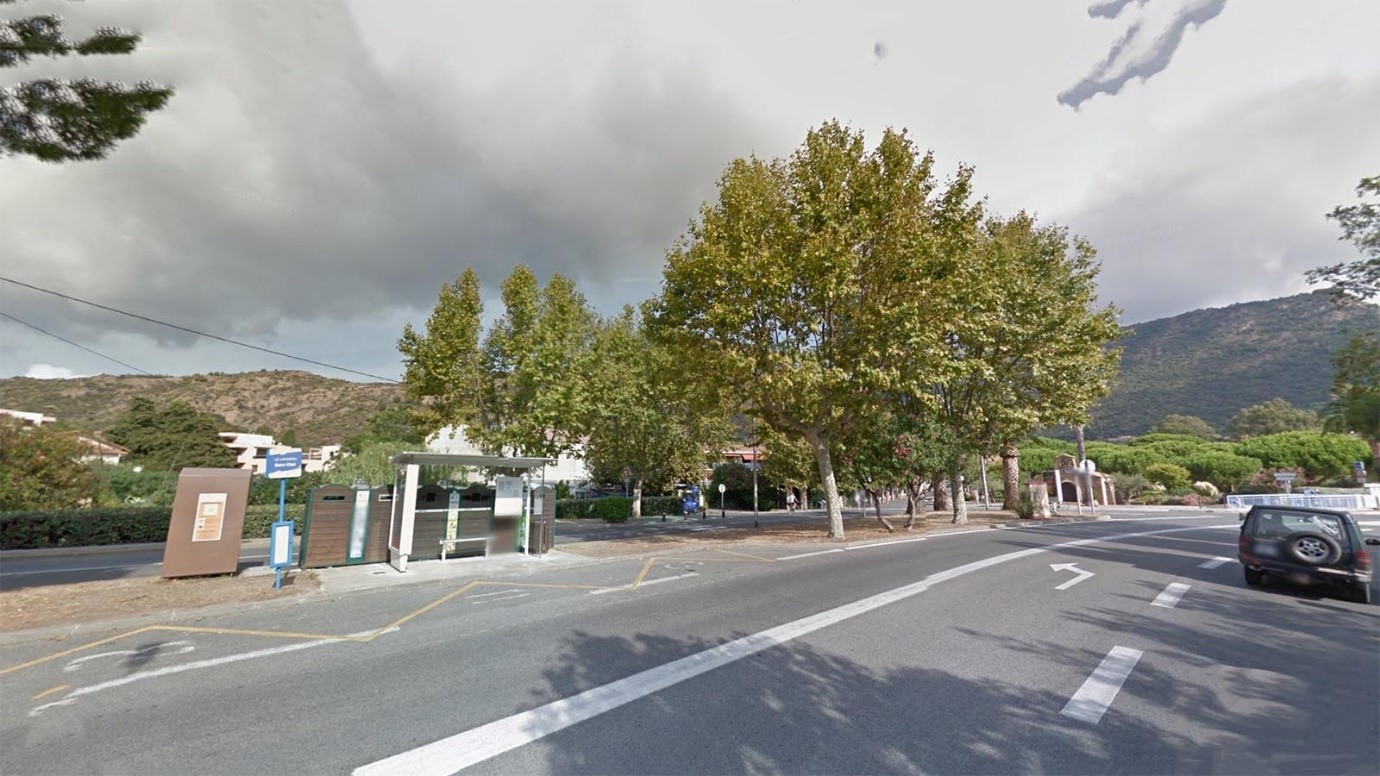
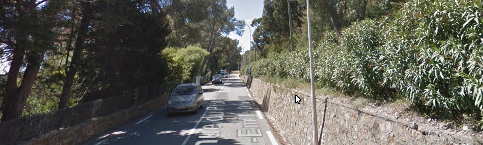
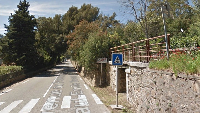
The station was on a curve in the direction of the line. After leaving the station the line travelled straight once more, separated from the road by a line of trees. It soon crossed Pont du Vallat des Mûres and continued in an East-Northeast direction. Its formation is covered by a cycleway. The tress which separate the road from the old railway are now Plane trees, historically they may well have been pines as nearer La Foux. The cycleway can be seen behind the bus-stop in the next image which is taken just beyond the access to the station (now restaurant and car-park).
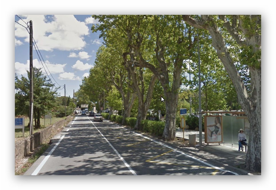
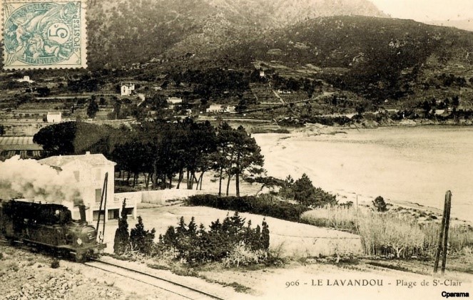
The line crossed another bridge, Pont du ruisseau des Mûres and followed the coastline to the next small halt – Guerrevieille-Beauvallon (Guerrevieille until 1913). The photograph shows a 2-6-0T PInguely Series 41-44 locomotive stopped at the halt.
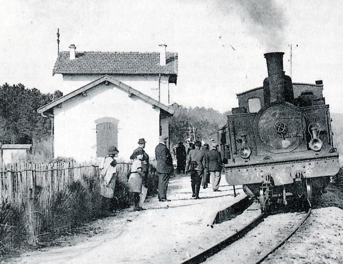
The line continued to follow the D559 and to hug the coast-line to the next stop at La Croisette.
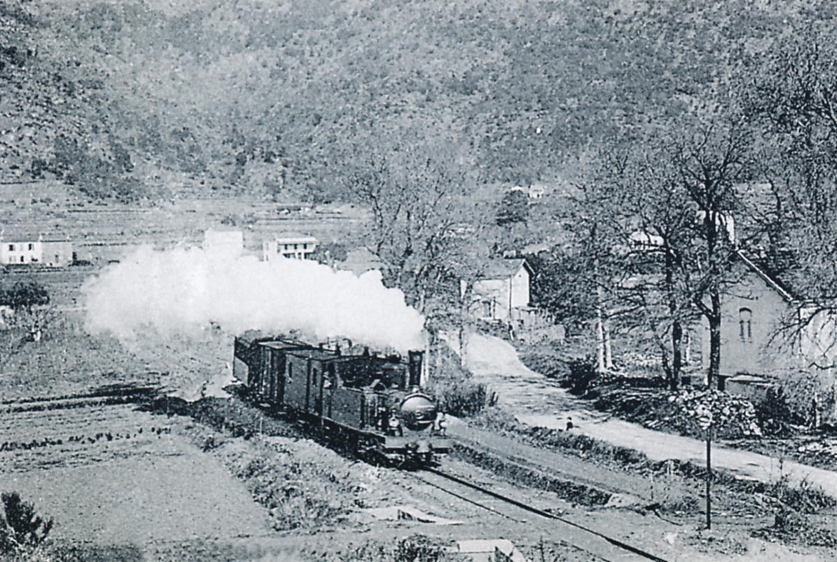
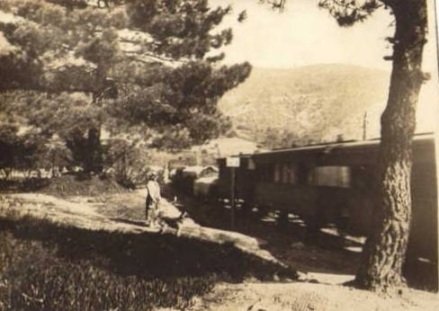
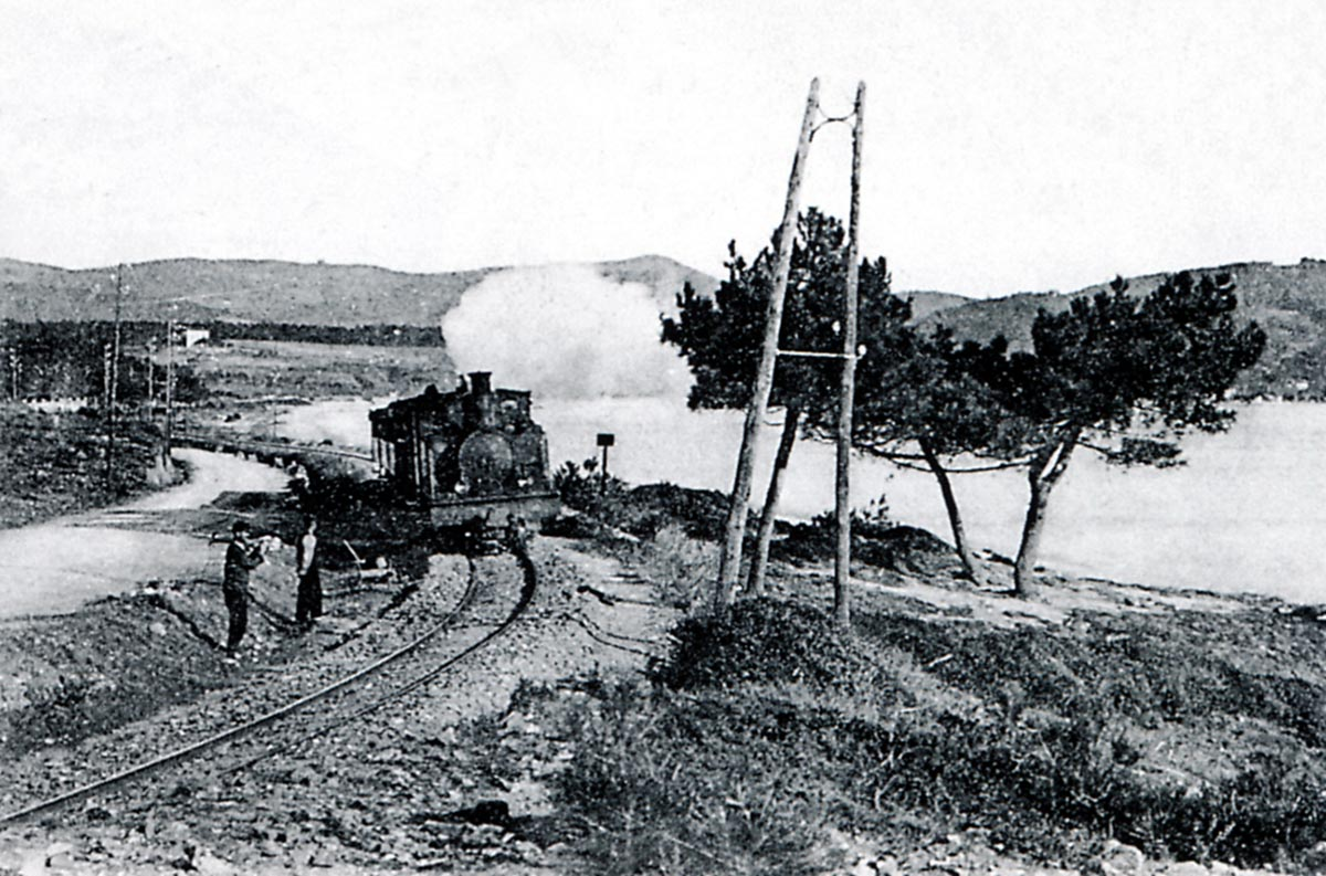
The picture above is taken on the line between Guerrevieille-Beauvallon and La Croisette and is typical of the line along this length. The train is in the care of a 2-6-0T Pinguely series 41 to 44 and travelling towards La Foux. In this area, the railway was frequently subject to the onslaught of the sea during windstorms from the east. Although intended for the length of the line betweem Toulon and Hyères, the 2-6-0T Pinguely series 41 to 44 locomotives were often seen on the Eastern end of the line close to St. Raphael (Jean-Paul PIGNEDE Collection).
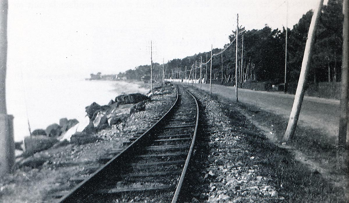
These two images show the proximity of the line to the water’s edge and give an idea too of the boulder protection installed by the railway company to protect their line for the ravages of the sea.

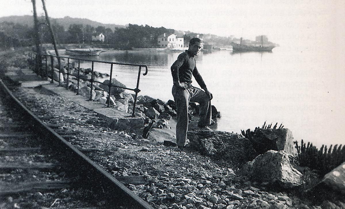
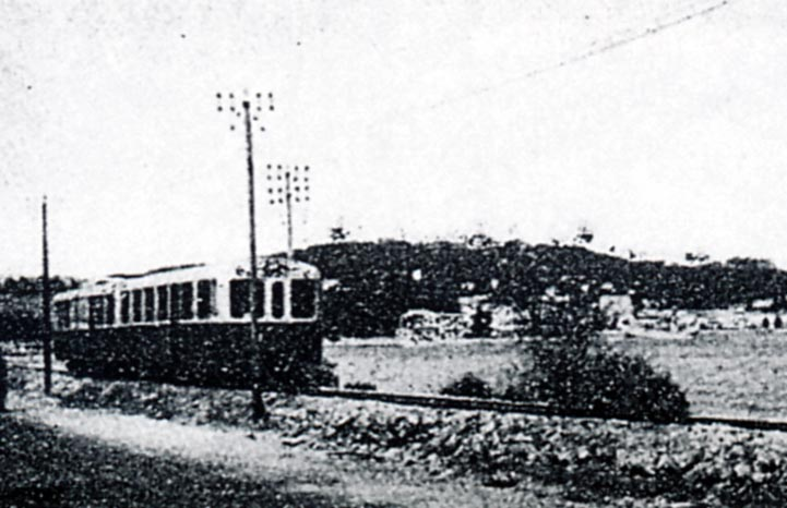
A railcar from St. Maxime close to La Croisette.
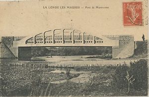
The next major structure on the line was the bridge over the River Préconil. When first constructed the Pont du Préconil was a steel truss girder bridge.
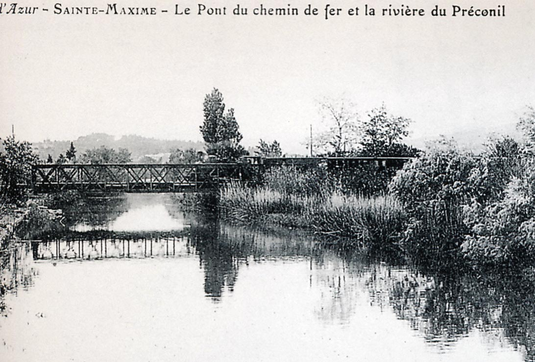
The metal bridge built by Gustave Eiffel over the Preconil west of Ste. Maxime (Jean-Paul PIGNEDE Collection)

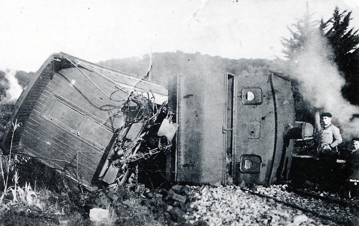
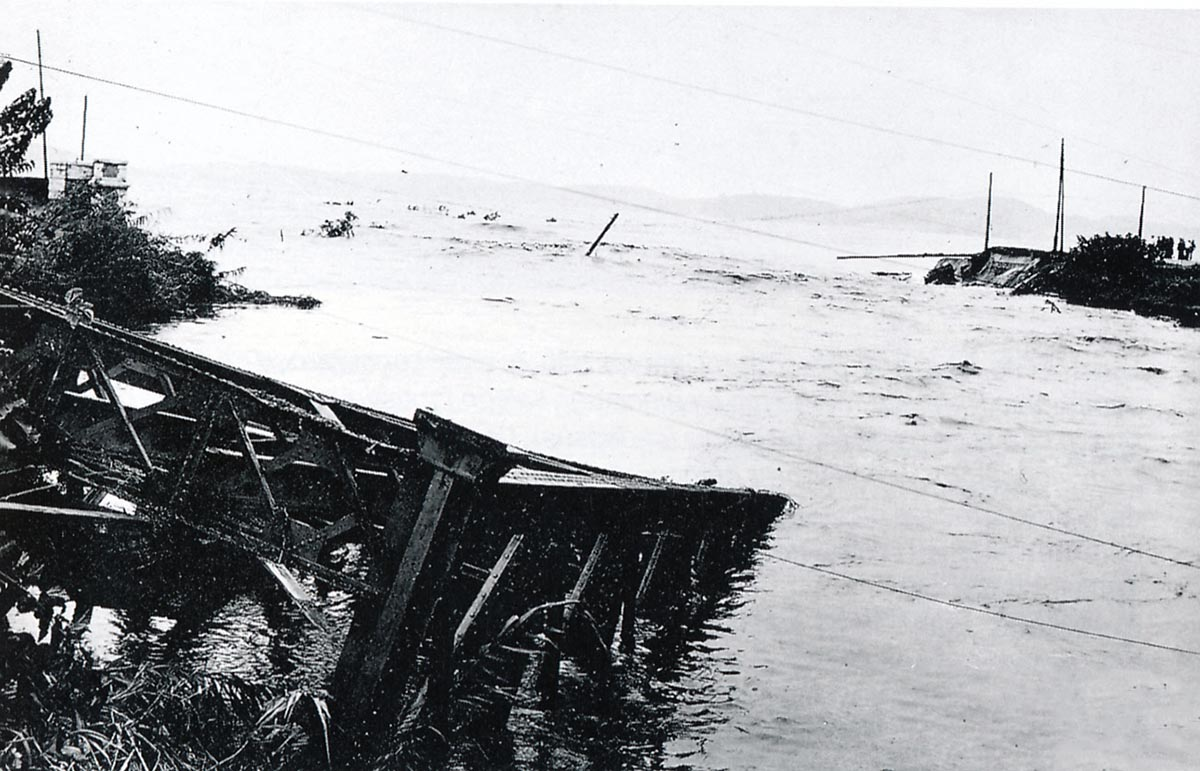
Damage caused by the tidal wave of September 28th and 29th, 1932 at Ste. Maxim. The railway bridge (in the foreground) and the road bridge (beyond) were washed away by the River Préconil (Raymond BERNARDI Collection).
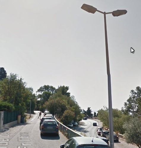
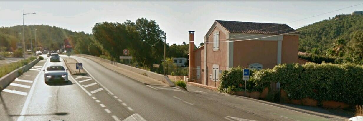
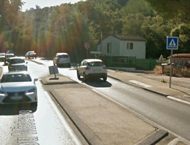
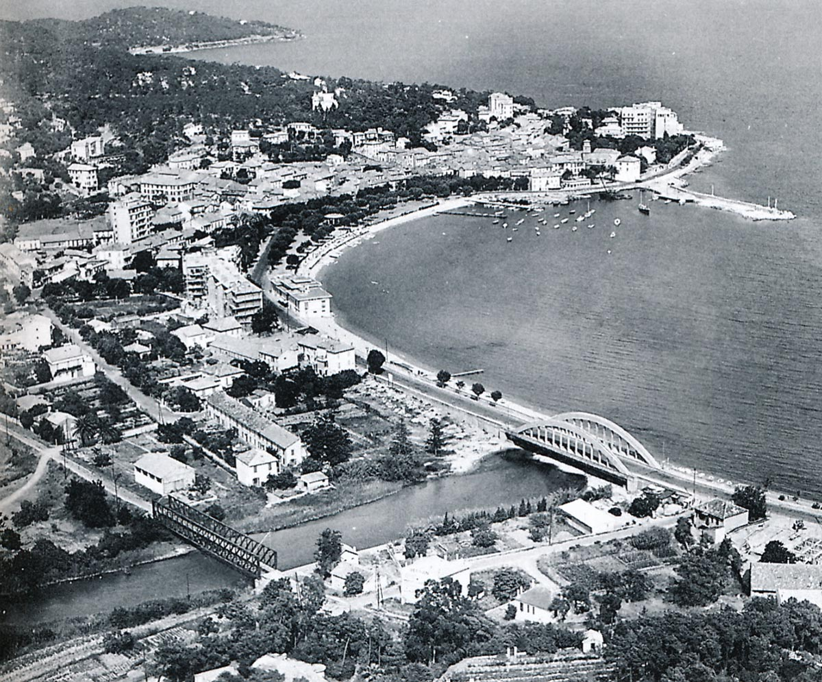
The image above is an aerial view of the western approaches to Sainte-Maxime shortly after the last world war. The Preconil River is in the foreground with the steel railway bridge and the concrete road bridge of the D98. These two structures were rebuilt and widened in 1933, after having been carried away by the flood of 28th September 1932 (Raymond BERNARDI Collection). Google Streetview shows the same location in the picture below.
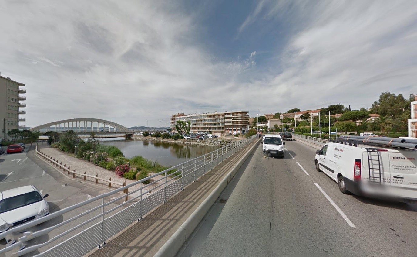
After crossing the river, the railway left the coast behind and travelled into the middle of Sainte-Maxime. We alight from our train at the Station and temporarily end our journey here.

The train in the picture is pulled by a 2-6-0T Pinguely series 41 to 44. The photo is taken on the eve of the First World War and the station is very busy (Raymond BERNARDI Collection).


References

[1] Roland Le Corff; http://www.mes-annees-50.fr/Le_Macaron.htm, accessed 13th December 2017.

[2] Marc Andre Dubout; http://marc-andre-dubout.org/cf/baguenaude/toulon-st-raphael/toulon-st-raphael1.htm, accessed 14th December 2017

[3] Jean-Pierre Moreau; http://moreau.fr.free.fr/mescartes/ToulonGareSudFrance.html, accessed 24th December 2017.

[4] José Banaudo; Histoire des Chemins de Fer de Provence – 2: Le Train du Littoral (A History of the Railways of Provence Volume 2: The Costal Railway); Les Éditions du Cabri, 1999.

[5] Roger Farnworth; Ligne du Littoral (Toulon to St. Raphael) – Part 10 – La Foux les Pins to Saint-Tropez (Chemin de Fer de Provence 45); https://rogerfarnworth.wordpress.com/2018/01/08/ligne-du-littoral-toulon-to-st-raphael-part-10-la-foux-les-pins-to-saint-tropez-chemin-de-fer-de-provence-45.

[6] Roger Farnworth; Ligne du Littoral (Toulon to St. Raphael) – Part 11 – La Foux les Pins to Cogolin (Chemin de Fer de Provence 46);https://rogerfarnworth.wordpress.com/2018/01/08/ligne-du-littoral-toulon-to-st-raphael-part-11-la-foux-les-pins-to-cogolin-chemin-de-fer-de-provence-46.

[7] http://www.port-grimaud-immobilier.fr, accessed 5th January 2018

[8] http://www.atelier-crabe.com, accessed 6th January 2018

Ligne du Littoral (Toulon to St. Raphael) – Part 11 – La Foux les Pins to Cogolin (Chemins de Fer de Provence 46)

We have already noted that La Foux-les-Pins was one of the more important stations on the Chemin de Fer du Sud de la France Littoral. Two tramways, which are often referred to as one, left the station in different directions. The station opened in 1889, it was then called Cogolin-St Tropez for which it was the station before the tramway(s) opened. In this picture, a 2-6-0T engine has been posed with station staff for a photograph. The site of the station today is unrecognizable and has become a commercial complex. Although the station has disappeared the railway itself has become a cycleway.

In addition to the main-line from St. Raphael to Toulon and the two branch-lines, there was another feeder railway that approached the station from the immediate north and the sea. A sand quarry was established in the estuary of the River Giscle and it was served by a line from the station which appears not to have been directly linked into the mainline. Sand from the quarry must have been trans-shipped at the station. The locomotive and wagons used at the quarry can be seen in this picture and the route of the line is visible in the aerial images below.

There was another route out into the sand quarries on the north side of the river but we will leave considering that until we travel on towards Saint-Raphael. For now, we will head off towards the town of Cogolin.

The route is shown above, both Cogolin and La Foux Stations are marked as are two intermediate halts and a series of bridges.

Trains from La Foux for Cologin left in a Westerly direction and separated from the line to St. Raphael within the station limits. After bridging a diverted stream or drainage channel the line turned South and then turned South-west along the D98 Chemin de Grimaud. The first halt was given this name in 1894. The line opened in 1894 and the halt was called Grand-Pont for the first couple of years. The railway continued alongside the D98 through the next halt, Les Garcinières. This halt was 1.3km from Cogolin when the line opened but was moved 400 metres towards La Foux in 1902. Immediately after the halt the line crossed a bridge. The bridges were numbered, this was bridge No. 5, Pont routier de Cogolin No. 5, 1.44 km from Cogolin. The next bridges were: No. 4, 1.35km from Cogolin; No. 3, 1.28km; No. 2, 1.20km; and No. 1, 1.06km from Cogolin. All along this length the railway clung to the side of the D98.

About 0.7km from Cogolin, the railway route diverts away from the modern D98 and crosses the River La Molle on Pont de la Molle (0.63 km from Cogolin). The bridge is shown in the image below. Back when the railway was in operation the road also crossed the river on a relatively short arch span adjacent to the railway bridge, which can just be picked out in the picture. Along much of the length of the route the road and railway were shaded by the large pine umbrellas typical of the area and which gave La Foux-les-Pins its name.

In very short shrift the line arrived at Cogolin station. The plan is superimposed on the modern satellite image from Google by Moreau [3]. A series of images of Cogolin Station follow:

The station site was, as this aerial photo and the picture below show, just outside the eastern outskirts of Cogolin.

View of Cogolin-Grimaud from the station yard, the side of the facilities away from the running lines. The mixed passenger-goods building at the terminus is seen after its extension (Raymond BERNARDI Collection).

A large load of timber waits at Cogolin Station. The picture was taken before the extension to the goods facilities was built (Raymond BERNARDI Collection).

The original station buildings before enlargement.

At Cogolin, there was a small engine shed capable of stabling one small engine. This picture was taken in around 1900, with a locomotive 0-6-0T Corpet-Louvet series 70 to 72 There is a stock of briquettes beside the building (Maurice MAILLET Collection)

The station of Cogolin-Grimaud before the works of enlargement of 1910. (Collection Raymond BERNARDI).

Two open wagons stand in the foreground of this picture, parked at Cogolin-Grimaud station around 1910: on the left a T-1522 with interchangeable sideboards (construction HanquetAufort in 1899), on the right a T-1563 (construction Magnard in 1901). Both are equipped with the hand turned screw brakes, whose steering wheel is visible at the end of the chassis (Edmond DUCLOS Collection). On the main passenger lane, there appears to be a train of 2 or 3 coaches waiting for a locomotive to pull them.

Taken at much the same time as the previous picture. Jean Pierre Moreau’s[3] notes say: “Cogolin-Grimaud station, terminus of St.Tropez tramway and starting point of the unfinished antenna that should have joined La Garde-Freinet (Raymond BERNARDI Collection).” La Garde-Freinet is the next Commune north of Coglin-Grimaud and it seems as though the railway company had hopes of making a connection from Cogolin to La Garde-Freinet.

Cogolin-Grimaud station around 1910 with an 0-6-0T Corpet-Louve series 70 to 72 ready for departure to La Foux and St. Tropez; on the left, a Hanquet – Aufort series TM-15O1 to 1516 open wagon with removable sides (René CLAVAUD collection).

The station of Cogolin-Grimaud in 1910 before any building extensions were built. In 1914 work was started on an extension of the line to La Garde-Freinet. The extension remained incomplete because of the Great War (GECP Collection). No evidence of any earthworks is apparent on the aerial photograph of the site taken after the Second World War.

Another view of the Station taken before the Great War and before the extensions were built.

The Station in the 1920s, after the lengthening of the tracks and buildings. The line towards Grimaud and La Garde-Freinet was to lead off to the right in the direction of the valley of the River Giscle (Photo Jean BAZOT).

In the image above, we see the railway/tramway alongside the main road just after leaving Cogolin.

The platform side of the building in 1978 is shown above, still appearing to be surprisingly complete. The image below is taken from the other side of the building at much the same time. Everything feels derelict. A Saviem S45 coach and Renault Galion courier truck 1400 kg sit on the courtyard side in front of the old Cogolin-Grimaud station (both pictures by Photo José BANAUDO).

In 2023, Tom Baldwin sent an article about the extension to La Garde-Freinet which he wrote in 2009. That article can be found here. [5]

References

[1] Roland Le Corff; http://www.mes-annees-50.fr/Le_Macaron.htm, accessed 13th December 2017.
[2] Marc Andre Dubout; http://marc-andre-dubout.org/cf/baguenaude/toulon-st-raphael/toulon-st-raphael1.htm, accessed 14th December 2017
[3] Jean-Pierre Moreau; http://moreau.fr.free.fr/mescartes/ToulonGareSudFrance.html, accessed 24th December 2017.
[4] José Banaudo; Histoire des Chemins de Fer de Provence – 2: Le Train du Littoral (A History of the Railways of Provence Volume 2: The Costal Railway); Les Éditions du Cabri, 1999

[5] https://acrobat.adobe.com/id/urn:aaid:sc:EU:68dd8e8a-ba74-4731-852f-1947d5dfcaf2, accessed on 18th October 2023.

Ligne du Littoral (Toulon to St. Raphael) – Part 10 – La Foux les Pins to Saint-Tropez (Chemins de Fer de Provence 45)

One branch of the Chemin de Fer du Sud Littoral extended from La Foux Les Pins to Saint-Tropez. The featured satellite image above shows the full route of the tramway from the station at La Foux to St. Tropez. At each end of the line an aerial photo allows us to see what the landscape immediately around each town was like.

The station at La Foux was built with the line from Saint-Raphael and opened in 1889. La Foux Station was known as Cogolin-Saint Tropez until 1894 It was 53 kilometres along the line from Hyères and just 4 metres above sea-level. As a 2nd class station, La Foux had a goods shed, an engine shed capable of stabling two locomotives, two Mason tracks and one goods line. In 1893 two extra tracks were provided for the Cogolin and Saint-Tropez tramways.

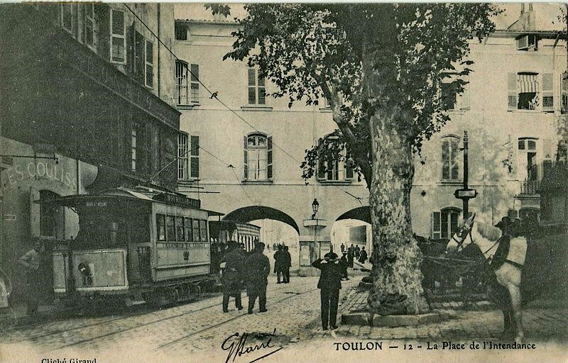
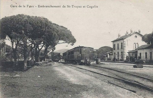
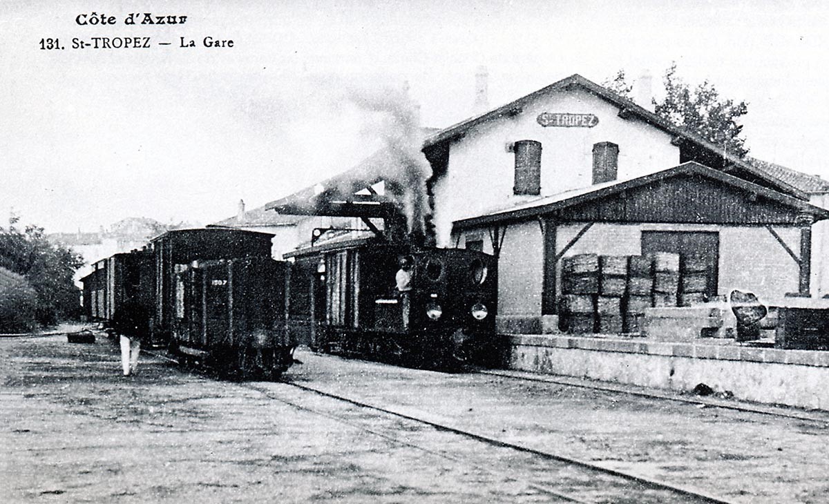
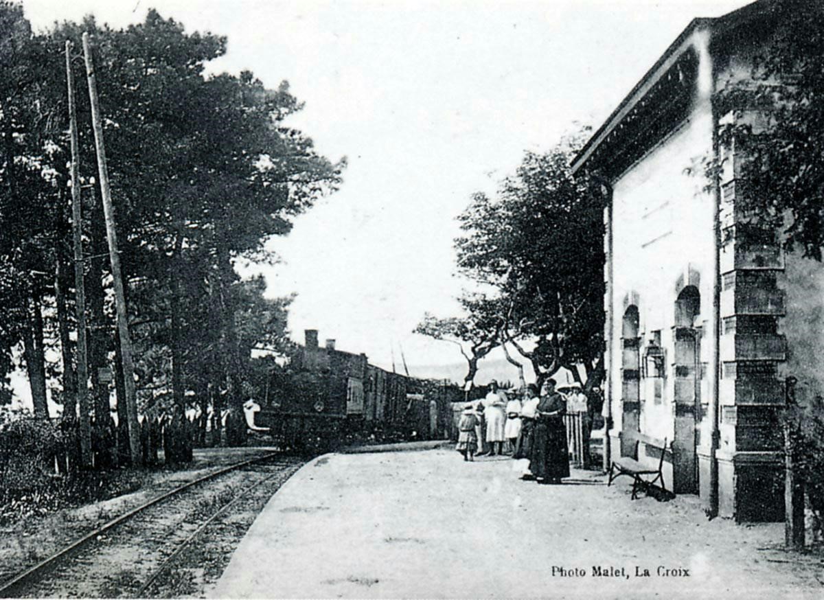
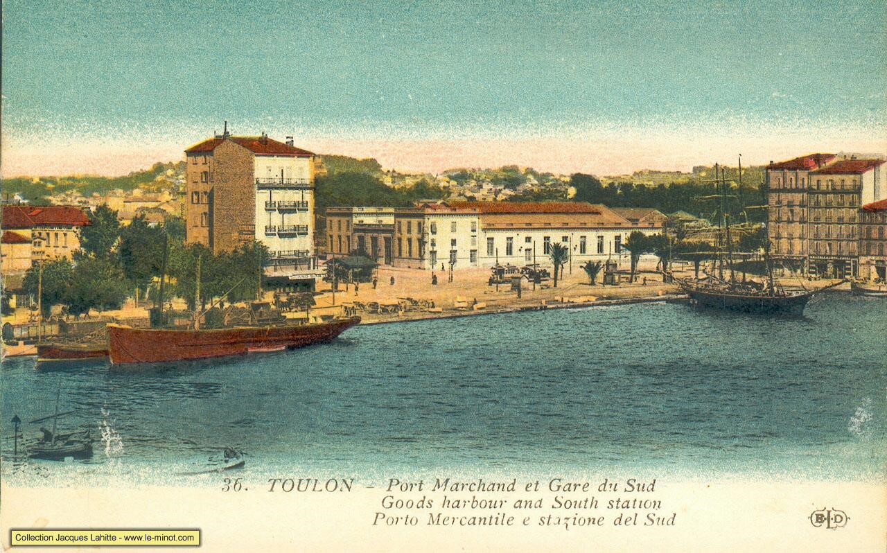
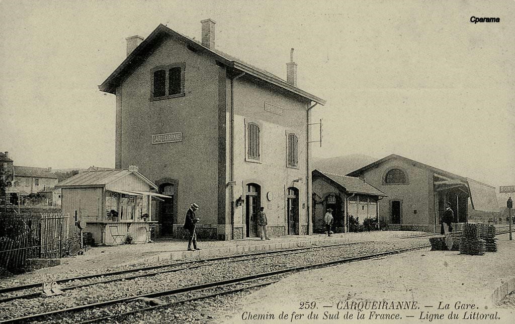
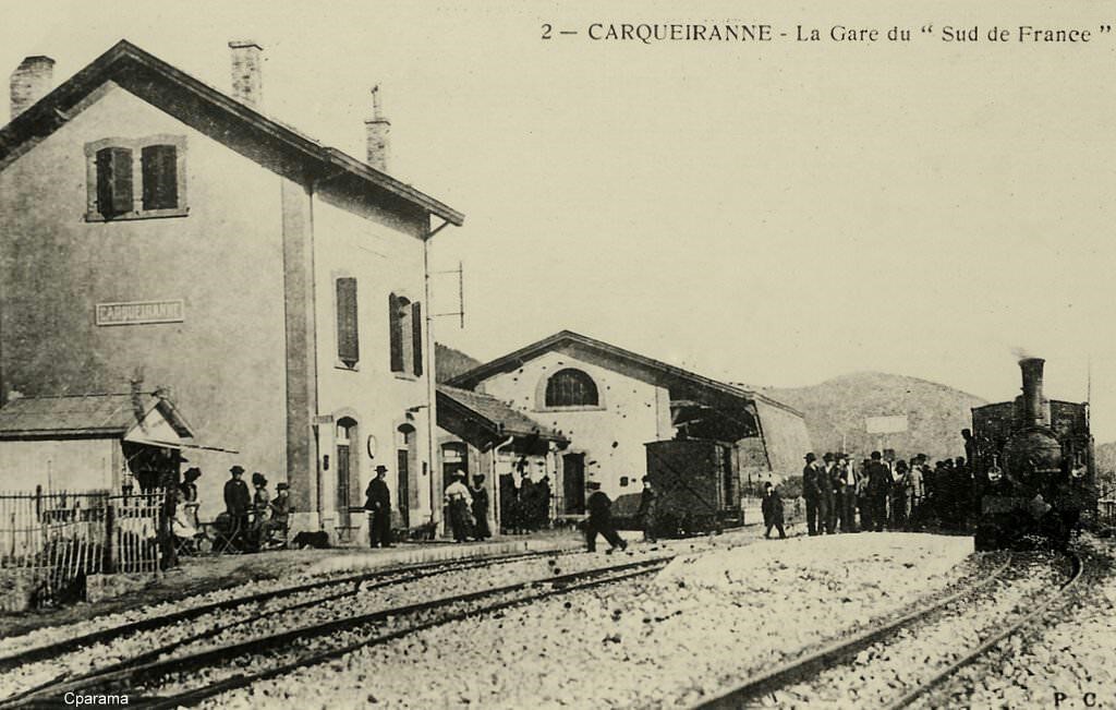
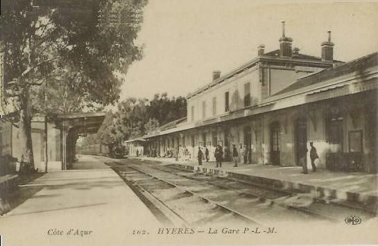
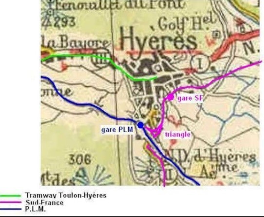
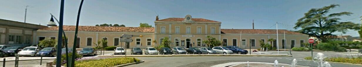
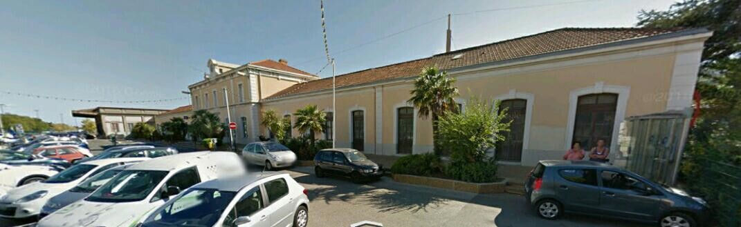
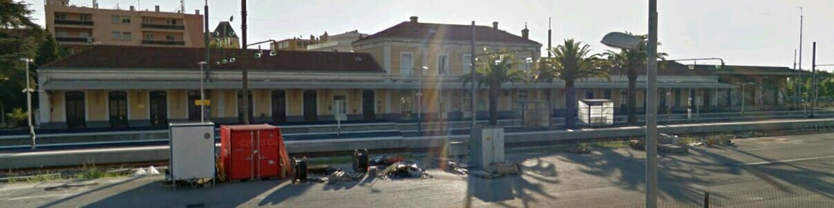
The station was one of the most significant on the line between Saint-Raphael and Toulon and one of the busiest. The line to Saint-Tropez left from the South-east end of the station and ran parallel to the single line to Toulon for a few hundred metres. The two lines separated with the Toulon line turning South and the Saint-Tropez line turning East.
Both the main-line and the two branches were metre-gauge lines. The Saint-Tropez line left the Toulon line and followed what is now the D98A. The first halt on the line was Bertaud.
The most famous site on the line to St. Tropez was in the district of Bertaud, where the D98A and the railway passed on either side of a gigantic pine tree. A mixed train from La Foux to St. Tropez stopped at the halt; there is a ballast wagon at the tail which is loaded with wine barrels that will be shipped by boat from the port of Saint-Tropez (Paul CARENCO Collection).

The La Foux – St.Tropez arrives at Bertaud. The train is pulled by 2-4-2T SACM Series 51-56 locomotive and is composed of bogie coaches (Edmond DUCLOS Collection).

A shuttle St.Tropez – La Foux passes under the Bertaud pine. The trunk of this extraordinary tree reached 2.45 metres in diameter and nearly 7.70 metres in circumference; it was unfortunately cut down in 1928 because its roots deformed the railway and road formations (Edmond DUCLOS Collection).

The next stop on the line was that for the torpedo factory. It is marked on the satellite image of the factory by the ‘A’ marker.

There was a torpedo factory run by the French Navy in the late 19th and early 20th centuries at St. Tropez. Schneider chose to locate one of its key design facilities in this area and conducted trials here at a centre of research and testing for the Navy. Schneider had their factory along the coast at Les Bormettes.

Norman Friedman [5] tells us that in 1866 British engineer Robert Whitehead invented the first effective self-propelled torpedo, the eponymous Whitehead torpedo. French and German inventions followed closely, and the term torpedo came to describe self-propelled projectiles that travelled under or on water. By 1900, the term no longer included mines and booby-traps as the navies of the world added submarines, torpedo boats and torpedo boat destroyers to their fleets.

Initially, Whitehead’s designs were hampered by their clockwork motor, attached ropes, and surface attack mode, all of which contributed to a slow and cumbersome weapon. However, he kept considering the problem and eventually developed a tubular device, designed to run underwater on its own, and powered by compressed air. The result was a submarine weapon, the Minenschiff (mine ship), the first modern self-propelled torpedo. He presented it officially to the Austrian Imperial Naval commission on 21st December 1866.

The first trials were not successful as the weapon was unable to maintain a course on a steady depth. After much work, Whitehead introduced his “secret” in 1868 which overcame this. It was a mechanism consisting of a hydrostatic valve and pendulum that caused the torpedo’s hydroplanes to be adjusted so as to maintain a pre-set depth.

After the Austrian government decided to invest in the invention, Whitehead started the first torpedo factory in Fiume. In 1870, he improved the devices to travel up to approximately 1,000 yd (910 m) at a speed of up to 6 kn (11 km/h), and by 1881 the factory was exporting torpedoes to ten other countries. The torpedo was powered by compressed air and had an explosive charge of gun-cotton. Whitehead went on to develop more efficient devices, demonstrating torpedoes capable of 18 kn (33 km/h) in 1876, 24 kn (44 km/h) in 1886, and, finally, 30 kn (56 km/h) in 1890.

Royal Navy representatives visited Fiume for a demonstration in late 1869, and in 1870 a batch of torpedoes was ordered. In 1871, the British Admiralty paid Whitehead £15,000 for certain of his developments and production started at the Royal Laboratories in Woolwich the following year. In 1893, RN torpedo production was transferred to the Royal Gun Factory. The British later established a Torpedo Experimental Establishment at HMS Vernon and a production facility at the Royal Naval Torpedo Factory, Greenock in 1910. These are now closed.

The Nordenfelt-class Ottoman submarine Abdülhamid (1886) was the first submarine in history to fire a torpedo while submerged.

Whitehead opened a new factory near Portland Harbour, England in 1890, which continued making torpedoes until the end of the Second World War. Because orders from the RN were not as large as expected, torpedoes were mostly exported. A series of devices was produced at Fiume, with diameters from 14 in (36 cm) upward. The largest Whitehead torpedo was 18 in (46 cm) in diameter and 19 ft (5.8 m) long, made of polished steel or phosphor bronze, with a 200-pound (91 kg) gun-cotton warhead. It was propelled by a three-cylinder Brotherhood engine, using compressed air at around 1,300 psi (9.0 MPa) and driving two contra-rotating propellers, and was designed to self-regulate its course and depth as far as possible. By 1881, nearly 1500 torpedoes had been produced. Whitehead also opened a factory at St Tropez in 1890 that exported torpedoes to Brazil, Holland, Turkey and Greece.

Whitehead purchased rights to the gyroscope of Ludwig Obry in 1888 but it was not sufficiently accurate, so in 1890 he purchased a better design to improve control of his designs, which came to be called the “Devil’s Device”. The firm of L. Schwartzkopff in Germany also produced torpedoes and exported them to Russia, Japan and Spain. In 1885, Britain ordered a batch of 50 as torpedo production at home and at Fiume could not meet demand.

By World War I, Whitehead’s torpedo remained a worldwide success, and his company was able to maintain a monopoly on torpedo production. By that point, his torpedo had grown to a diameter of 18 inches with a maximum speed of 30.5 knots (56.5 km/h; 35.1 mph) with a warhead weighing 170 pounds (77 kg).

The French naval torpedo factory at Toulon made Whitehead torpedoes under license. Given its limited output, the French also bought torpedoes directly from Whitehead (Fiume) by 1898 they had ordered 206 after sixty-four had been delivered. About 1905, the French turned to Schneider their main arms company, to produce torpedoes. Schneiders torpedo plant was at Les Bormettes near Hyères. When a US officer visited Schneider in 1913, he commented that the company was clearly finding it difficult to meet Whitehead’s competition. Schneider managed to secure small orders from France and Italy, and in 1913 these torpedoes were running their range trials.

Schneider claimed that they were exceeding requirements. At the same time the prevailing opinion at the French government plant at Toulon was that Schneider had failed to prove superiority over Whitehead, and it was unlikely that they could compete. As for Whitehead, because the property at Fiume physically limited the company’s expansion, in 1913 it built a large new plant at St. Tropez. near Toulon. Whitehead saw the new plant as an extension of its Fiume operation, and definitely not as a plant to fill French government orders. Customers eventually included Brazil, Greece, the Netherlands and Turkey.

Michel Goujon [6] says that in 1912, the English firm Whitehead built a torpedo factory at the bottom of the Gulf of Saint-Tropez, on the site of the castle Bertaud which was not destroyed but integrated into the industrial buildings. The site was accessible to ships of significant tonnage. Prototype production began in 1917 during the First World War. In 1936, the Popular Front decided to nationalize the factory because its production was highly strategic for the country. From 1937 it became a Navy establishment and its torpedo’s became critical to, from 1937. establishment of the Navy. Its torpedoes armed many submarines under the French flag. Amazing activity, only a stone’s throw from one of the most glamorous harbours on the planet.

The factory was built on the immediate site of the castle Bertaud.

In the image below, workers from the torpedo factory wait for the train at the end of their shift.


The factory has recently been sold by the privatised company which took it on when the Navy gave it up.

The next stop after the Torpedo Factory was Oustalet-dei-Pescadous a good few hundred metres along the coast. Then Château-Martin, Sinopolis, Maleribes and then La Bouillabaisse, all of which have disappeared in the time since the line closed. A railcar is stopped at La Bouillabaisse in the photograph below.

Another short distance and the train stopped once again, this time at Le Pilon, its last stop be fore Saint-Tropez. The stagecoach from St. Tropez to Ramatuelle passes through Pilon. The railway can be seen alongside (GECP Collection).


The same location. The image shows that sand has been used for ballast at Le Pilon (Raymond BERNARDI Collection).

From Le Pilon, the line entered Saint-Tropez and approached the terminus on the quayside. The layout of the terminus is shown in the plan superimposed on the satellite image by Jean-Pierre Moreau [3].
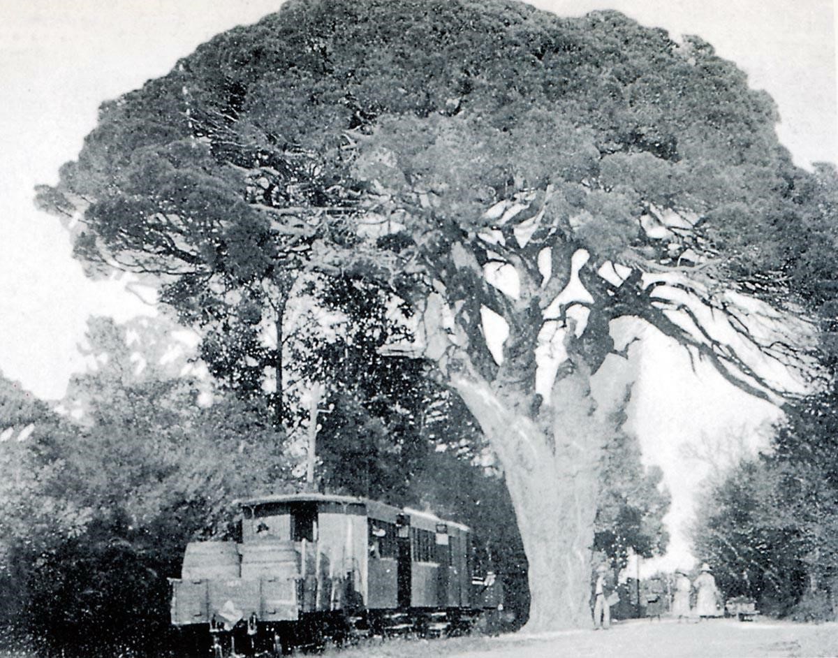
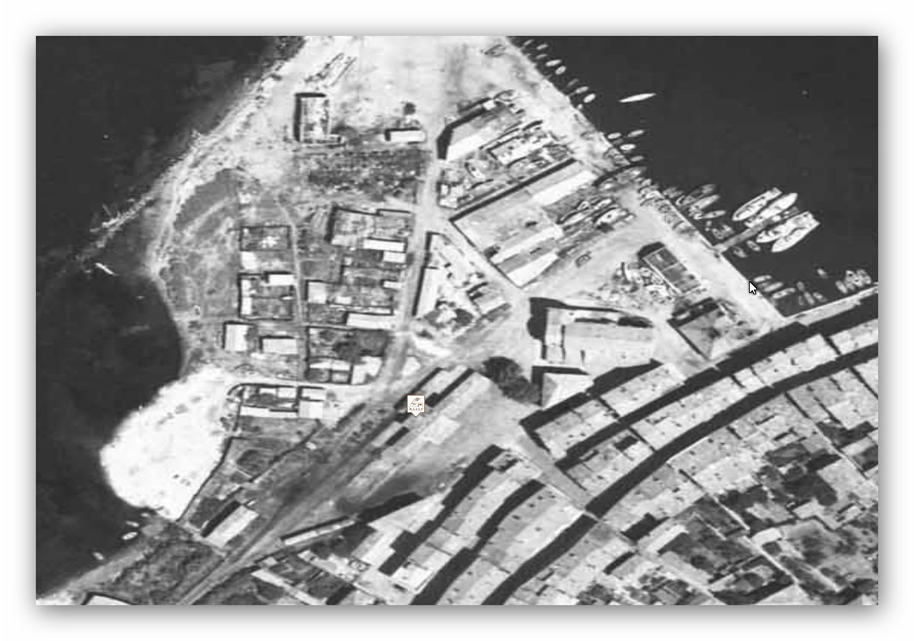
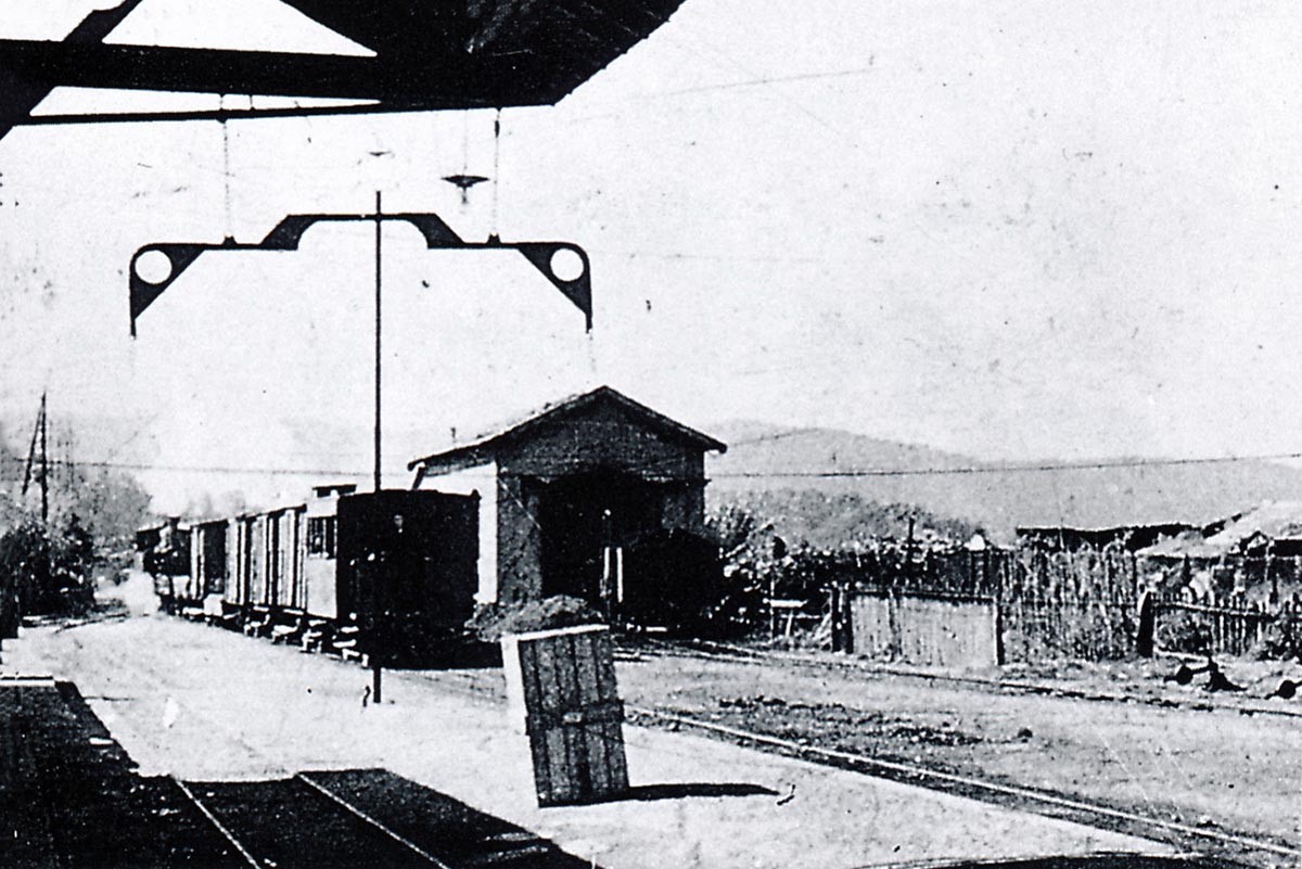
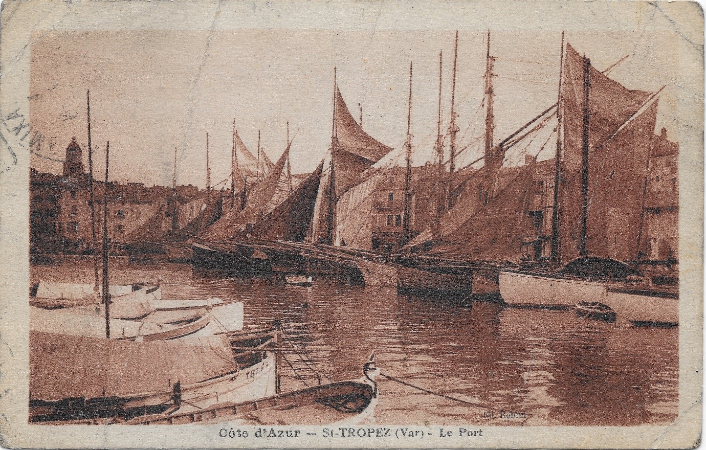
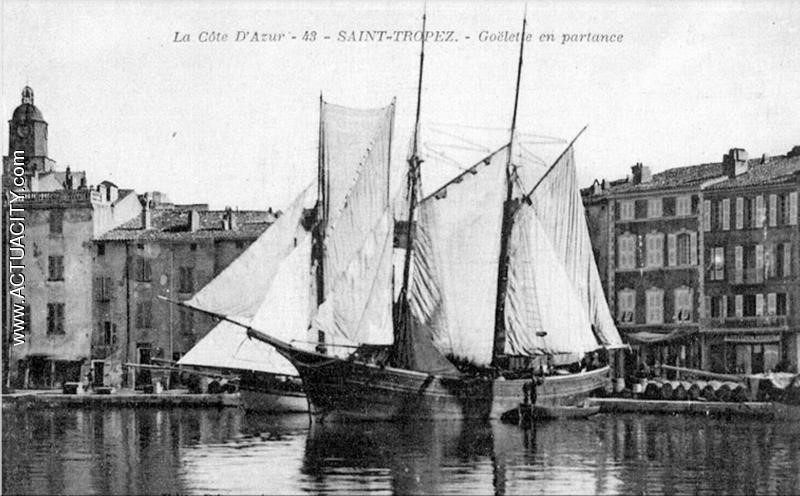
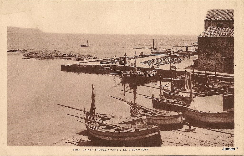
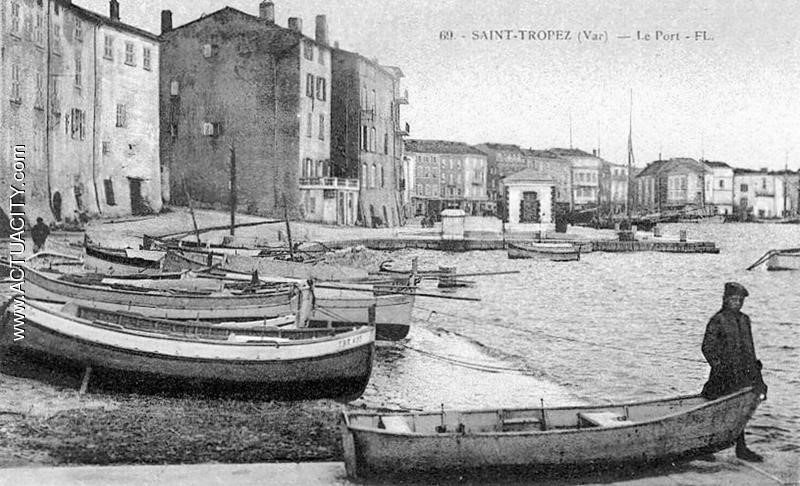
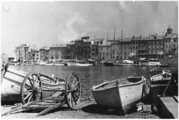
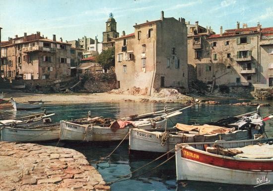
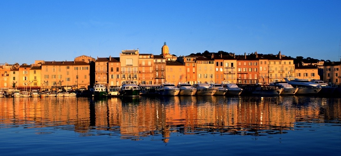
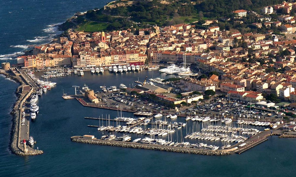
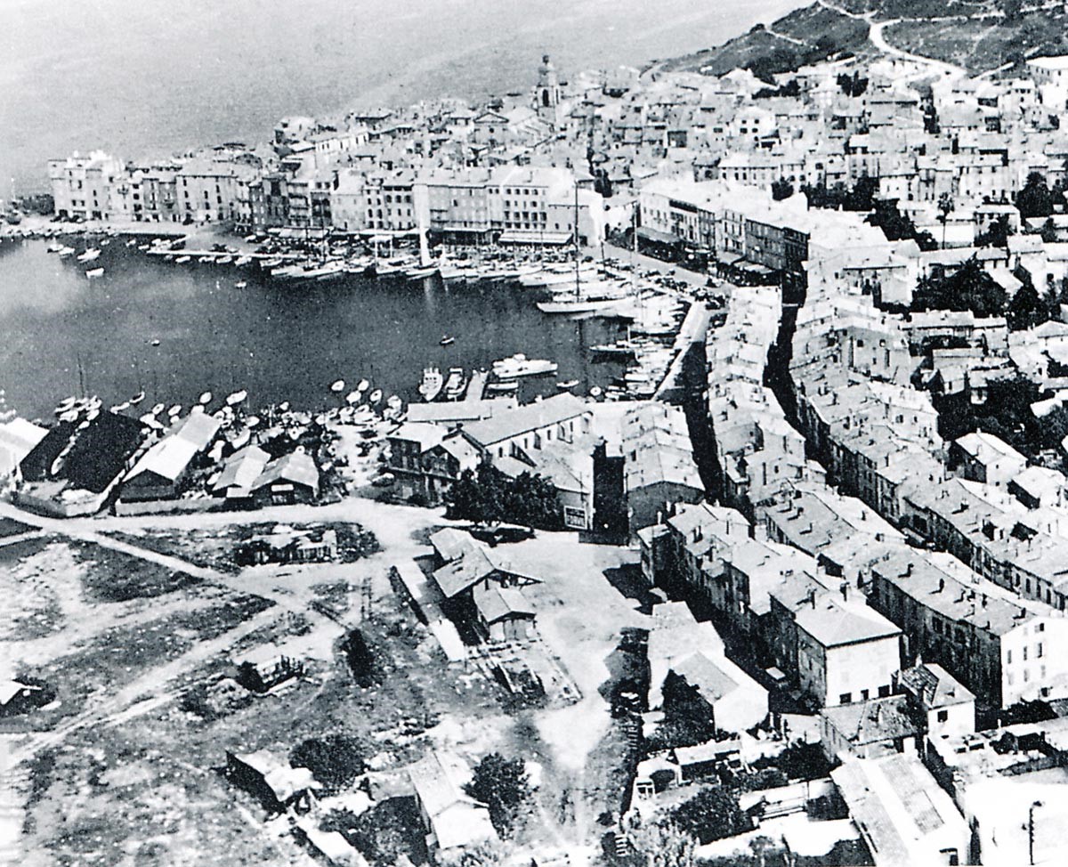
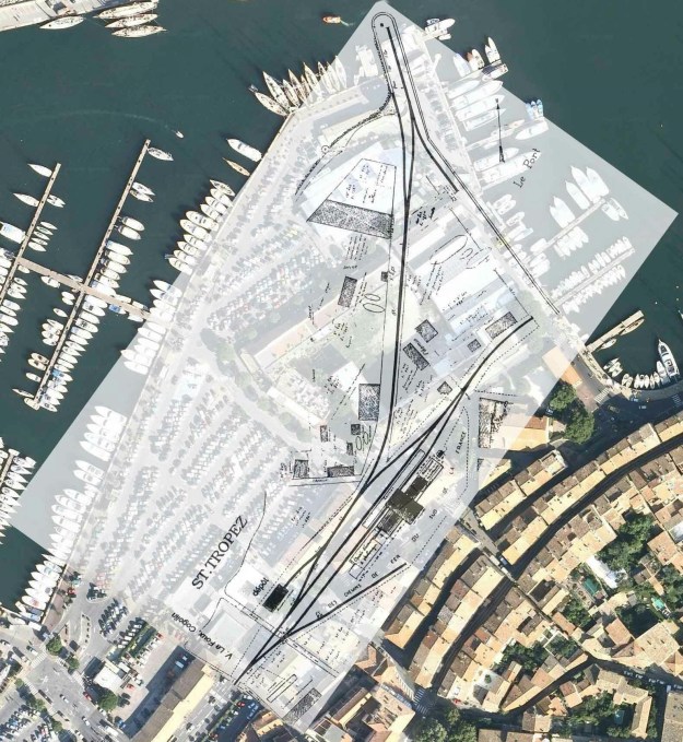
As can be seen in the above image, the original harbour at St. Tropez is much changed and there has been significant land reclamation to enlarge facilities at the port. The aerial photographs below show the port in the time around the closure of the line. Those images are followed by a sequence of photographs culled from the research of Jean-Pierre Moreau [3].

St.Tropez terminus buildings with an open wagon stabled under the loading gauge of the goods shed (Raymond BERNARDI Collection)

This image is taken from roughly the same position in the 21st Century. The station building has been replaced by the town Post Office!

In this view of St.Tropez station around 1910, you can see on the left the access track to the port (René SENNEDOT Collection).

Here, a team of CP railway workers pose in front of the 4-6-0T Pinguely No. 66 locomotive shunting a mixed train in St.Tropez station. The two windows on the rear of the cab, probably all too frequently broken by the heating tools, were closed by sheet metal plates pierced with a circular hole to allow some visibility in the cabin forward (Photo Marcel CAUVIN – Pierre LECROULANT collection).

In the 1930s, station-master Marcel Cauvin (second from the left) poses in St.Tropez station with the driver, fireman and guard of locomotive 4-6-0T Pinguely No. 66 (Pierre VIROT Collection).
The station-master, the driver, the mechanic, the postmaster, and the conductor pose close to the point lever on one of the passenger tracks and beside a 2-4-2T Series 51-56 locomotive at the St. Tropez station (Pierre LECROULANT Collection).
A coach from the lot built by SF workshops, Frejus in 1908: C-2504 is seen in the years 1925-30 at St. Tropez. (Pierre VIROT Collection).

In December 1923, a 2-4-2T SACM 51-56 locomotive, started by mistake by an inexperienced night watchman, ended up in the water of St. Tropez harbour! We see it here the day after this incident, with a 4-6-0T Pinguely series 41-44 trying to get it back on track (Jean-Pierre VIGUIE Collection).

The mixed passenger-goods building at St. Tropez terminus seen after its expansion (GECP Collection).

An 0-6-0T Corpet-Louvet series 70 to 72 manoeuvres along the goods platform at St. Tropez Station. Due to the lack of a turntable, these locos were always oriented cabin Cogolin side and chimney St. Tropez (Pierre VIROT Collection).

The small locomotive shed at the Station is seen in 1925, with the loading gauge and a view of the back of a departing mixed train to La Foux (Collection François MORENAS).
The first railcar to return to St. Tropez station after the war, during the summer of 1945: a normal train (motor + trailer) tows a second train, consisting of two trailers recovered from trains whose motorcar was out of service. This train ensured that workers could get from the surrounding area to the Torpedo factory (Photo Marcel CAUVIN – Pierre LECROULANT collection)

Women constituted up to 30% of the staff of the Littoral network, they were often the wife of an agent of the Railway, like the mail carrier Emilie Cauvin that we see here in front of a railcar in station of St.Tropez, on 10th January 1946. Very unusually it has snowed! (Photo Marcel CAUVIN – Hidalgo ARNERA collection).
The closure of the line from La Foux to St. Tropez was suspended for one year to continue to pick up workers from the Bertaud torpedo factory. The service continued until 4th June 1949. This is one of the last trains visiting St. Tropez accompanied by the conductor Marcel Vinciguerra, towing an old bogie car (Photo Marcel CAUVIN – GECP collection).
A quick look round the port of St. Tropez!

The modern post of St. Tropez has a capacity of 734 moorings divided between two basins on an area of nine hectares in the heart of the village, Saint-Tropez harbour is a main port of call in the Mediterranean. It is one of the most famous marinas in the world. In a very small area racing boats sit alongside large pleasure yachts, the fishing boats which used to be so prominent have sadly disappeared along with the railway that served the village until 1949.

In this final picture, all the buildings of the former St. Tropez Station are still in place at the edge of the harbour and the town; the tracks have been dismantled but the route to the harbour can still clearly be distinguished heading left (Photo Marcel CAUVIN – GECP collection).

References
[1] Roland Le Corff; http://www.mes-annees-50.fr/Le_Macaron.htm, accessed 13th December 2017.
[2] Marc Andre Dubout; http://marc-andre-dubout.org/cf/baguenaude/toulon-st-raphael/toulon-st-raphael1.htm, accessed 14th December 2017
[3] Jean-Pierre Moreau; http://moreau.fr.free.fr/mescartes/ToulonGareSudFrance.html, accessed 24th December 2017.
[4] José Banaudo; Histoire des Chemins de Fer de Provence – 2: Le Train du Littoral (A History of the Railways of Provence Volume 2: The Costal Railway); Les Éditions du Cabri, 1999.
[5] Norman Friedman; Naval Weapons of World War One; Seaforth Publishing, Barnsley, December 2011.
[6] Michel Goujon; L’autre Saint-Tropez; Michel Lafon, Neuilly-sur-Seine, France, 2017.

Ligne du Littoral (Toulon to St. Raphael) – Part 9 – Cavalaire to La Foux les Pins (Chemins de Fer de Provence 44)

Before the railway the most convenient way of travelling along the coast was on the water. Roads were either in very poor condition or non-existent. The first photo taken at Cavalaire is of Les Tartanes au Mouillage. These boats ferried goods up and down the Var coastline.

24th August 1930, a train pulled by locomotive 2-6-0T Pinguely No. 44 waits in Cavalaire station. The two vehicles on the right are open wagons TM-1501 series 1516 Hanquet-Aufort with removable side panels. (Edmond DUCLOS collection).
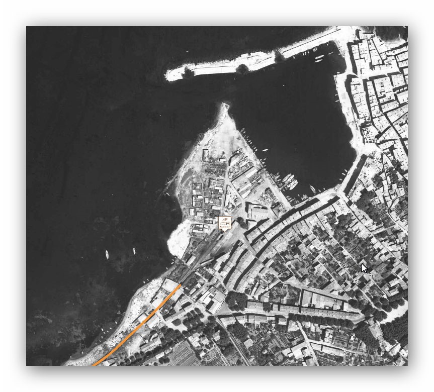
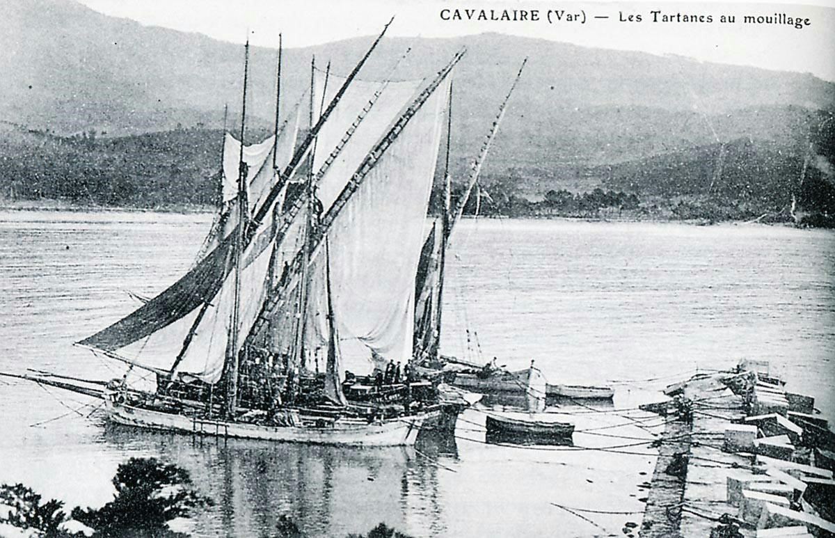
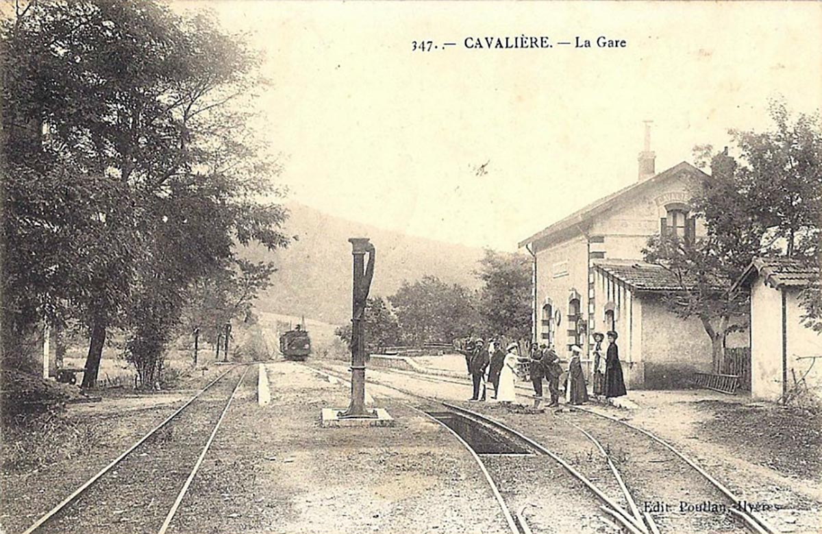
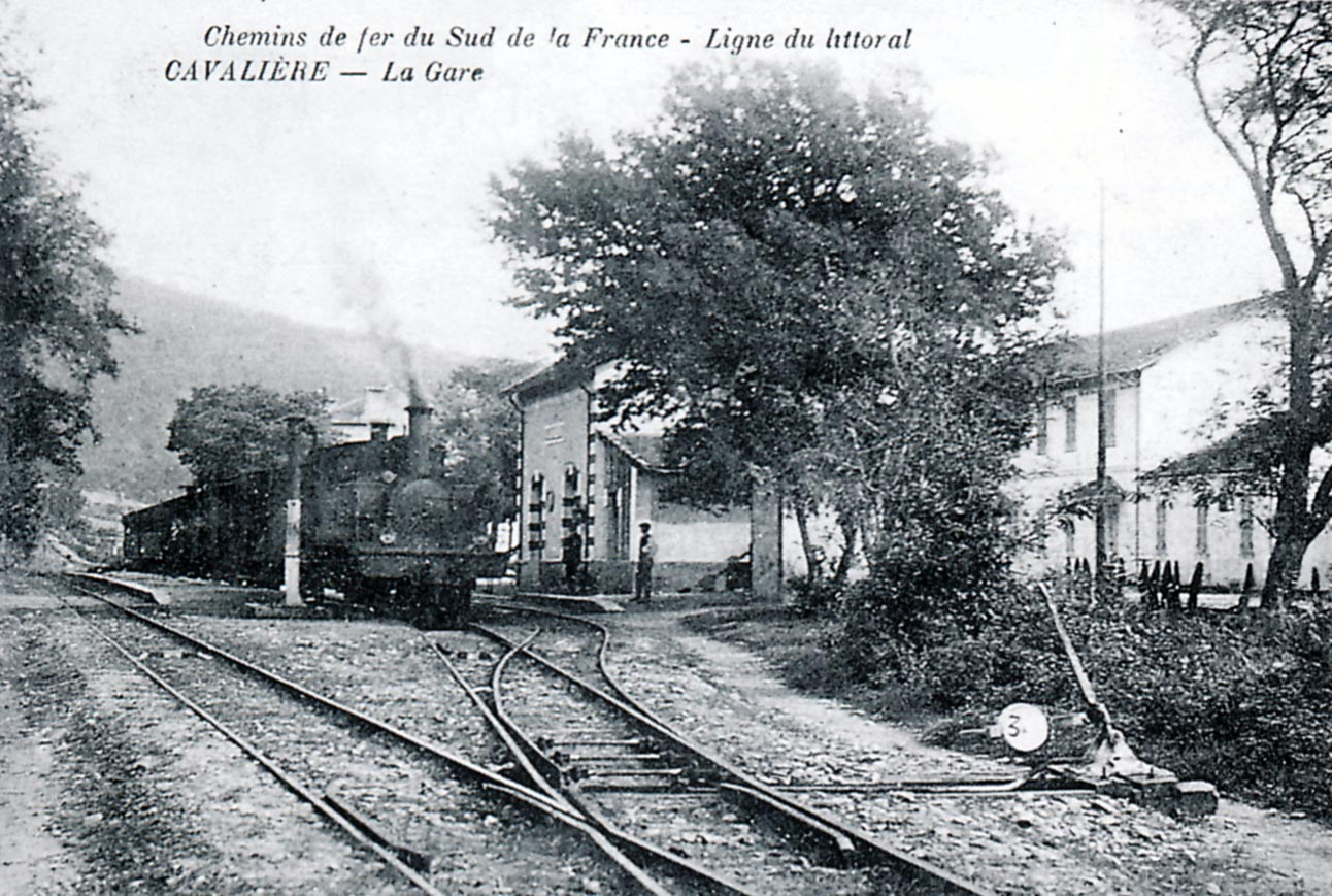
4-6-0T SACM Locomotive No. 62 (Edmund DUCLOS collection).
This photograph and the following one give an idea of how facilities at stations and particularly at Cavalaire had to expand to accommodate growth in traffic. 2-4-2T SACM No. 52 arrives at Cavalaire Station in around 1905. The left track is reserved for goods. Passengers cross that track to reach their platform. There is just an open platform and a single gantry (Michel FRANCHITTI Collection). In the next photograph, taken in around 1920, a good shed is visible which was constructed in 1912. The train entering the station is pulled by a 4-6-0T No. 61 to 66 Series Loco. (Raymond BARNARDI Collection).

At the head of the mixed train from Saint-Raphael to Hyeres, the locomotive 2-4-2T No. 51 from the first series delivered in 1889-90 by the Alsatian Society of Mechanical Engineering enters Cavalaire station. This engine represented Southern-France at the World Fair in Paris in 1889. The boxcar, equipped with a brakeman’s booth, belongs to the series JG-201 to 216 delivered at the same time by the Forges de L Horme and Chantiers de La Buire (Edmond DUCLOS collection).

On two occasions, 4-6-0T Pinguely locomotives from the wider network of the Chemin de Fer du Sud, came to lend a hand to their sisters on the coast. No.93 marks stops at Cavalaire station shortly after 1925 (Collection Jean BAZOT).

In 1942 locomotive 4-6-0T Pinguely No. 64 precedes C-2508 and another car of the same type, deprived of its roof (Photo Jean-P SCHOEN).

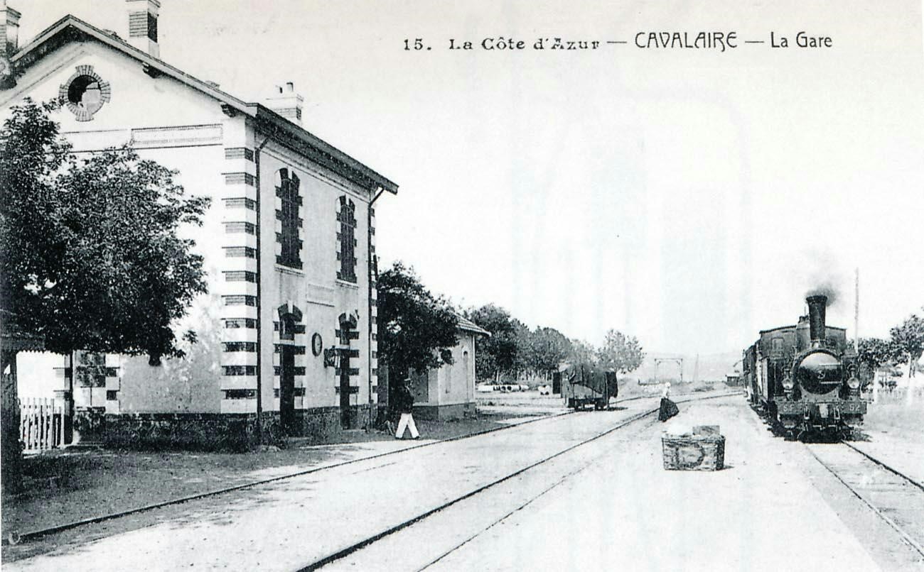
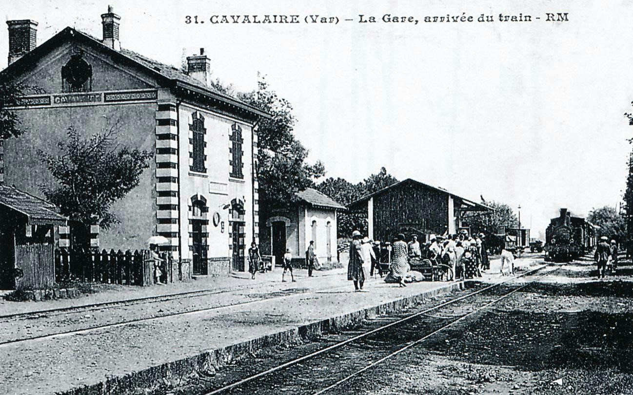
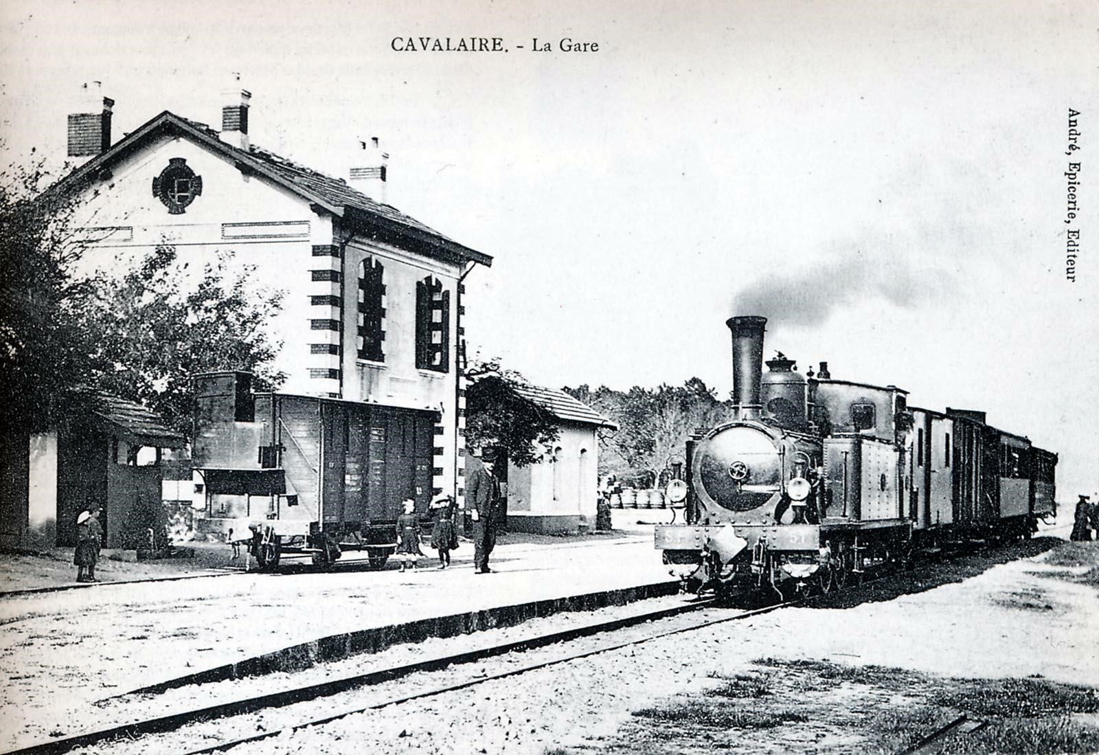
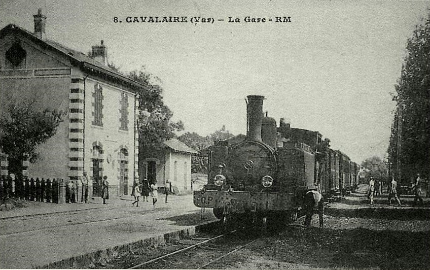
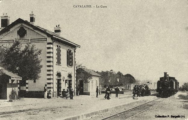
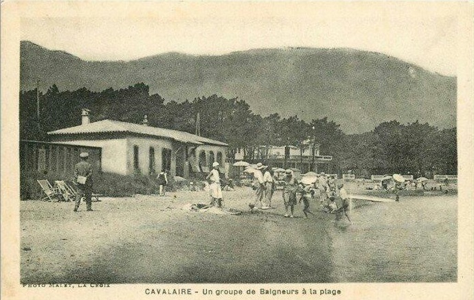
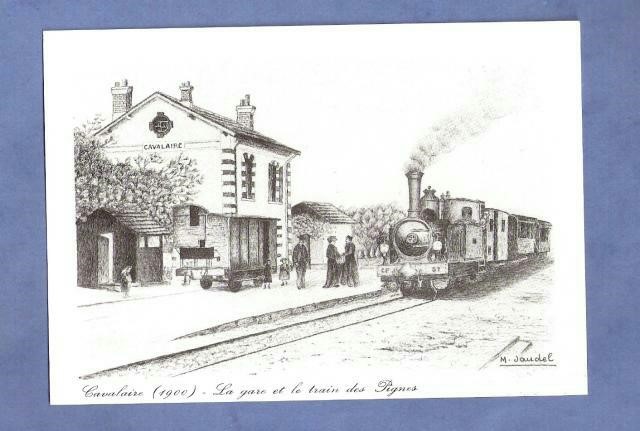
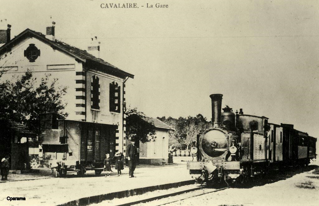
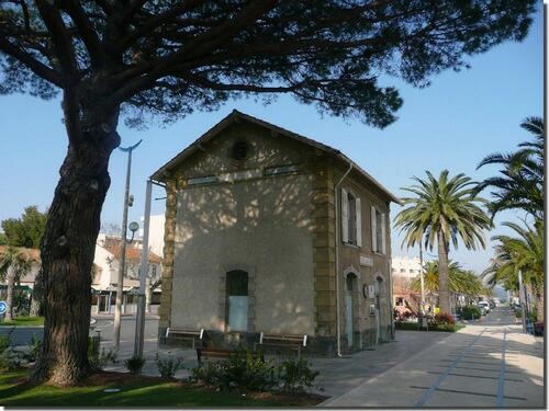
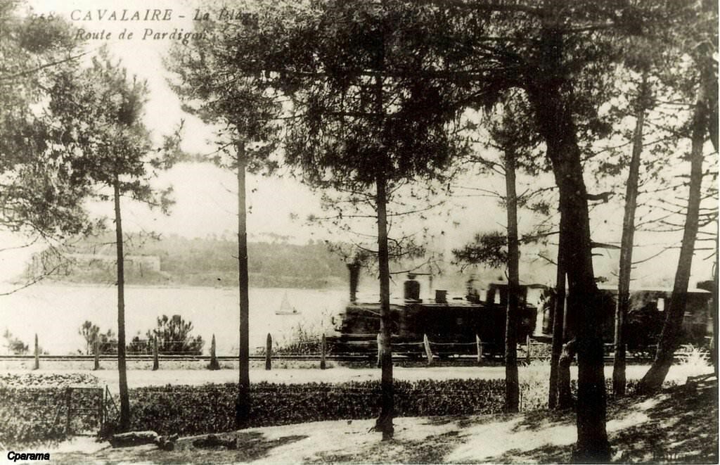
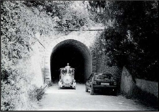
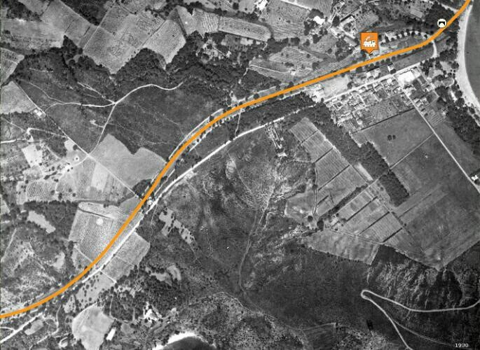
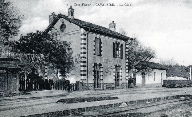
Cavalaire Station sometime between 1925 and 1930. On the platform there is a ladder used to load and unload barrels from van (Jean-Pierre VIGUIE Collection).
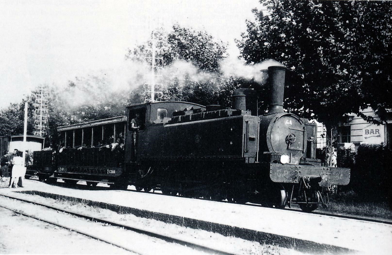
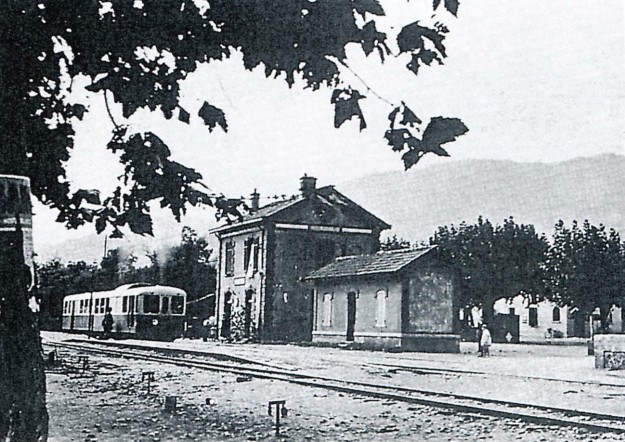
Autorail Brissonneau & Lotz around 1939 in Cavalaire (René SENNEDOT Collection).

The mobilization train in September 1939, at Cavalaire station: the train is composed of two self-propelled railcars towing a wooden vehicle (Patrick GUIMELLI collection).

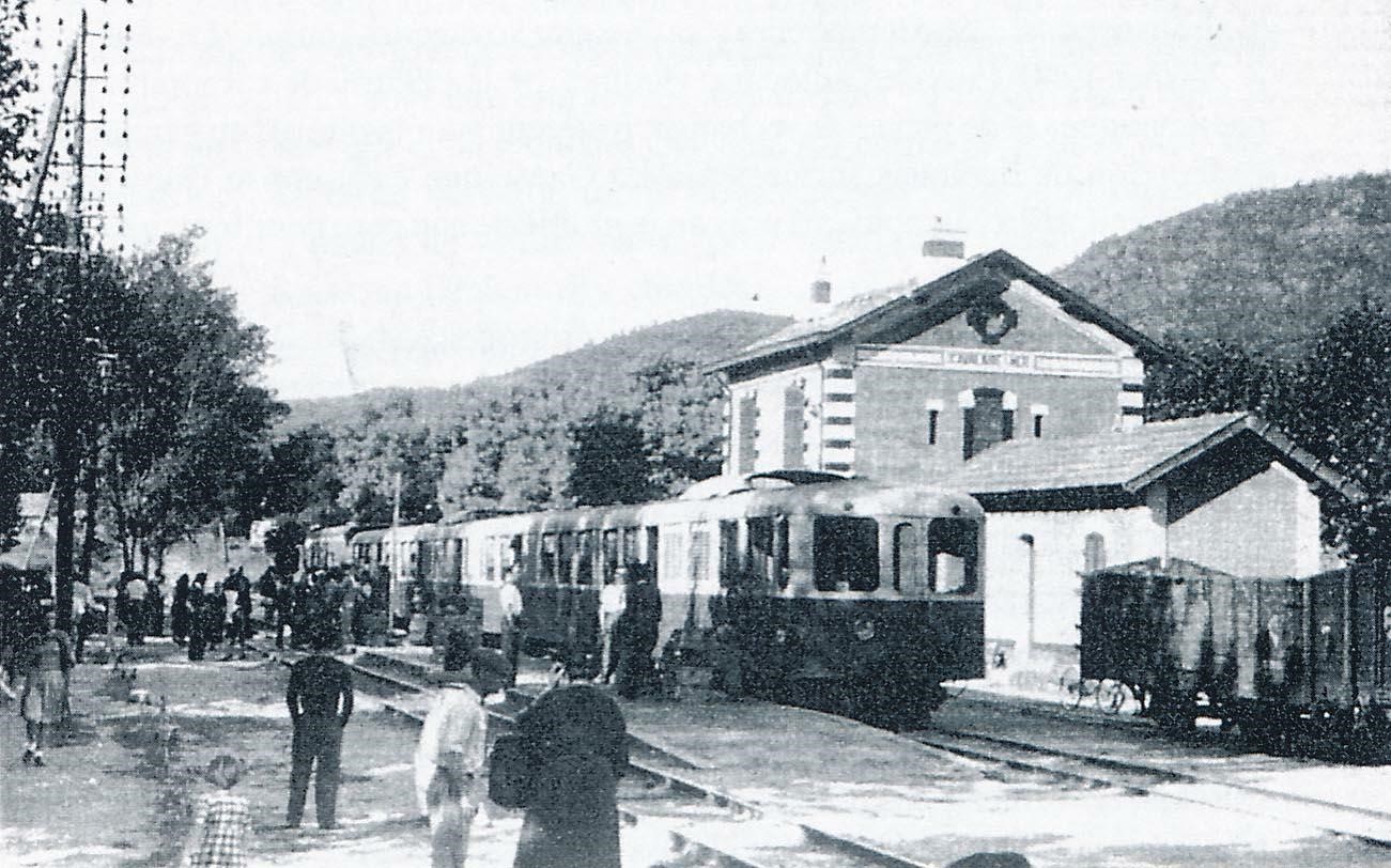
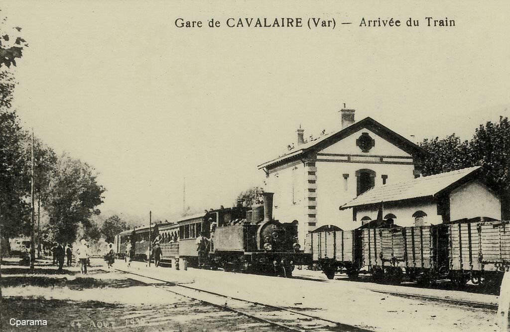
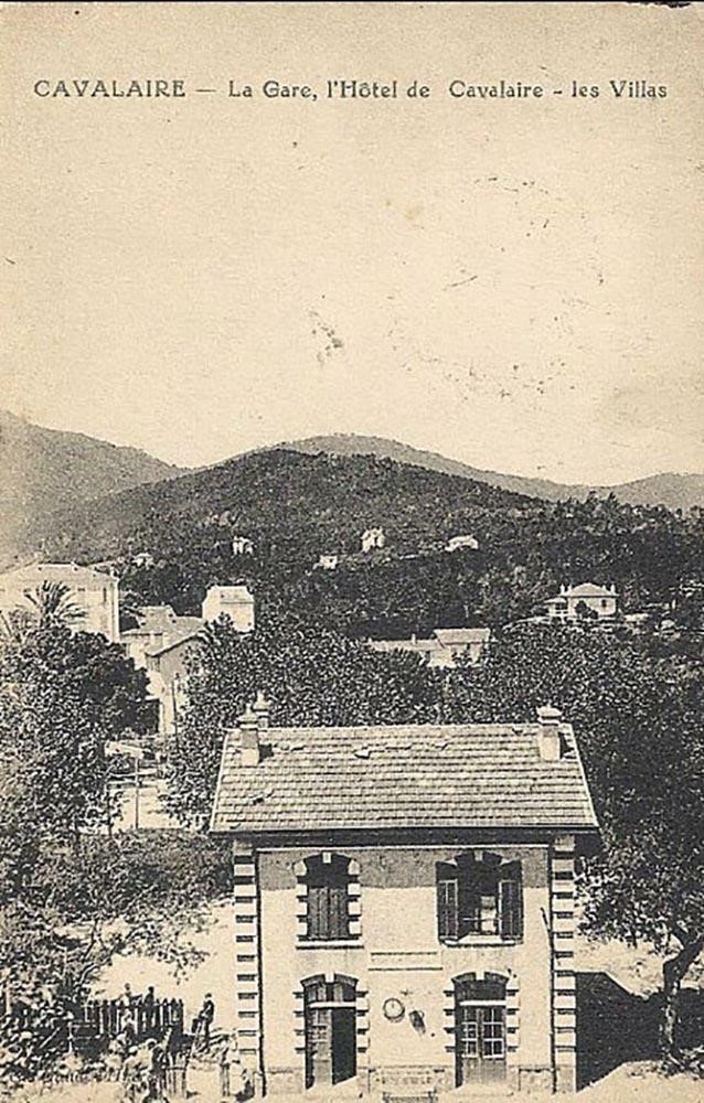
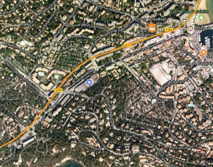
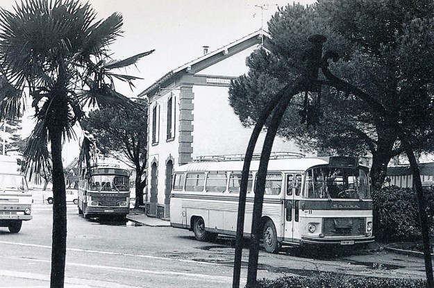
By 1978, Cavalaire Station was being used as the offices of a coach company (Photo José BANAUDO).

Cavalaire-sur-Mere Station as it is today. The station clock has been refurbished. It is typical of station clocks along the line.

This aerial photograph shows the station at or around closure. The station building is marked with the orange marker. The bridge in the pictures below is marked on this photograph as well.

Leaving Cavalaire, the railway crossed La Castillane on a metal bridge parallel to the road bridge. The bridge over La Castillanne had to be lengthened to 15 m after being destroyed by a flood in 1898 (Collection Raymond BERNARDI).

This is the same location. The picture gives a much clearer impression of the road, railway and beach layout. The railway continued along the beach to Pardigon (René CLAVAUD Collection).

Just along the beach from Cavalaire was the halt of Pardigon. The first image of this small station shows 2-6-0T Pinguely Series 41 to 44 entering the halt before hauling its train up the grade towards La Croix (Edmund DUCLOS Collection).

A view of the halt taken from the coast road.

In this picture, 2-4-2T SACM Series 51 to 56 has just surmounted the grade and is entering the station.

After Pardigon, the line climbed away North from the coast. It then turned East through La Carrade. Beyond the village there was another small halt named after the village but all evidence of the halt has disappeared.

The line continued to climb up to La Croix which sits 100 metres or so above sea level. The station at La Croix opened in 1890 with the line, goods facilities were completed in 1898. The track layout was revised and enlarged again by 1900. The station building is intact and in use as the municipal library.

At La Croix, the summit of the grade on the line was reached. The station was originally a simple stop serving a hamlet in the town of Gassin. The station building was built a little above the platforms as the line was in a cutting. There was a ramp and staircase down to what was at first a single platform.

However, it quickly became clear that local agricultural traffic would require the addition of goods facilities and an enlargement of passenger facilities too. These changes, as already noted, took place between 1894 and 1900. In the picture above, the stands proudly in front of his station building which had been enlarged in 1900 (Jean-Pierre RIGOUARD Collection).

This second picture shows the newly installed goods shed.

In this third picture, we see a train from Hyères to St. Raphael pulled by a 2-4-2T SACM series 51 to 56. It has just climbed the grade up from the coast at Pardigon and is coming to a stop at La Croix (Jean-Pierre VIGUIE Collection).

Our fourth picture shows a mixed train, St. Raphael – Toulon, pulled by 2-4-2T SACM No. 56 stopping at La Croix. A line of wagons is stabled in the goods siding. Note the buffer, couplers and coupling for the vacuum brake of the Buire T-1386 open wagon (Philippe LEPINE Collection).
The fifth picture shows the engine driver of 4-6-0T No. 61 wandering round his loco greasing key points while various bicycles and baskets are unloaded (Gérard BERNAUD Collection).

The picture above shows the station layout without a train present and shows the proximity of the tunnel ahead towards La Foux. That below shows a Brissonneau railcar passing through La Croix towards Saint-Raphael in around 1935 (Christiane CHATON collection).

And the next image shows another railcar – a new Brissonneau & Lotz self-propelled train heading for Hyères and seen from behind (Christiane CHATON collection).

Towards the end of operations on the line, the next image shows very limited maintenance with trees overgrowing the line and surrounding the goods shed (Bernard ROZE collection).

Today the station building serves as the municipal library.

La Croix has a significant place in the history of Europe. The Emperor Constantine the Great, on the way to wage war against his brother-in-law Maxentius in 312 AD, is said to have had a vision of a cross in the sky stating “in hoc signo vinces” (by this sign you will conquer) at the location where La Croix-Valmer is now situated.

On April 16, 1893, a stone cross was erected on the site where tradition holds this vision occurred. La Croix-Valmer became a commune on 6 April 1934, separating from the commune of Gassin.

The area has been inhabited since ancient times, as demonstrated by the discovery of remains such as prehistoric tools and the Roman farm of Pardigon (dating from the third century BC).
During the Second World War, the beaches of La Croix-Valmer were part of the Allied invasion of Provence during Operation Dragoon. The name of one of the local beaches, Plage du Débarquement (“Landing Beach”), bears witness to this.

Abel Faivre, (1853-1945), a French painter used to live in La Croix Valmer, near the Gigaro beach.

Beyond La Croix, the line entered a short 30 metre tunnel and then began to drop down towards La Foux.

The tunnel and the cutting to the north of it are marked on the plan above. We have seen the entrance to the tunnel in the photograph looking through the station. The portal at the north side is shown here, after closure of the line.

The railway then drifted down through a small stop at Le Broc and on into the station at Gassin-Ramatuelle (originally Gassin).


In this image from around 1910, a passenger train has just left Gassin station and begun the descent towards La Foux (Edmond DUCLOS collection).
4-6-0T SACM locomotive No. 62 at the head of a light train at Gassin station around 1930 (GECP collection).

Charlotte, the donkey belonging to Gassin’s postman, picks up the mail at the station in the inter-war years. In the first of these pictures the donkey patiently waits for the mail train. In the second picture, the postman walks with his donkey to the station (Raymond BERNARDI Collection). The third picture was taken by Jean-Pierre Moreau in 2016. The donkey is long-gone.

The line continued down to La Foux, rated a 2nd Class station it was an important junction on the Chemin de Far du Sud de La France with branch-lines to Cogolin and Saint-Tropez.

While we are at La Foux les Pins we will learn a lot more about the two branch-lines and about the immediate area around the station.

References

[1] Roland Le Corff; http://www.mes-annees-50.fr/Le_Macaron.htm, accessed 13th December 2017.
[2] Marc Andre Dubout; http://marc-andre-dubout.org/cf/baguenaude/toulon-st-raphael/toulon-st-raphael1.htm, accessed 14th December 2017
[3] Jean-Pierre Moreau; http://moreau.fr.free.fr/mescartes/ToulonGareSudFrance.html, accessed 24th December 2017.
[4] José Banaudo; Histoire des Chemins de Fer de Provence – 2: Le Train du Littoral (A History of the Railways of Provence Volume 2: The Costal Railway); Les Éditions du Cabri, 1999.

Ligne du Littoral (Toulon to St. Raphael) – Part 8 – Bormes les Mimosas to Cavalaire (Chemins de Fer de Provence 43)

One of the most beautiful regions between the French Provence and the Riviera is the village of Bormes-les-Mimosas. The flower called Mimosa has given its name to the area since 1968. Bormes is surrounded by incredible stone coves, charming towns and cities and stunning beaches. The colours are vibrant at the right time of the year with the purple of lavender and the yellow of mimosa flowers.


Our railway journey on from Bormes will start soon, but first a quick look round the small town. We take in a number of the tourist sights ….


The Chapel of Saint François de Paule
The Church of Saint Trophyme, built in the eighteenth century and inspired by old Roman architecture.
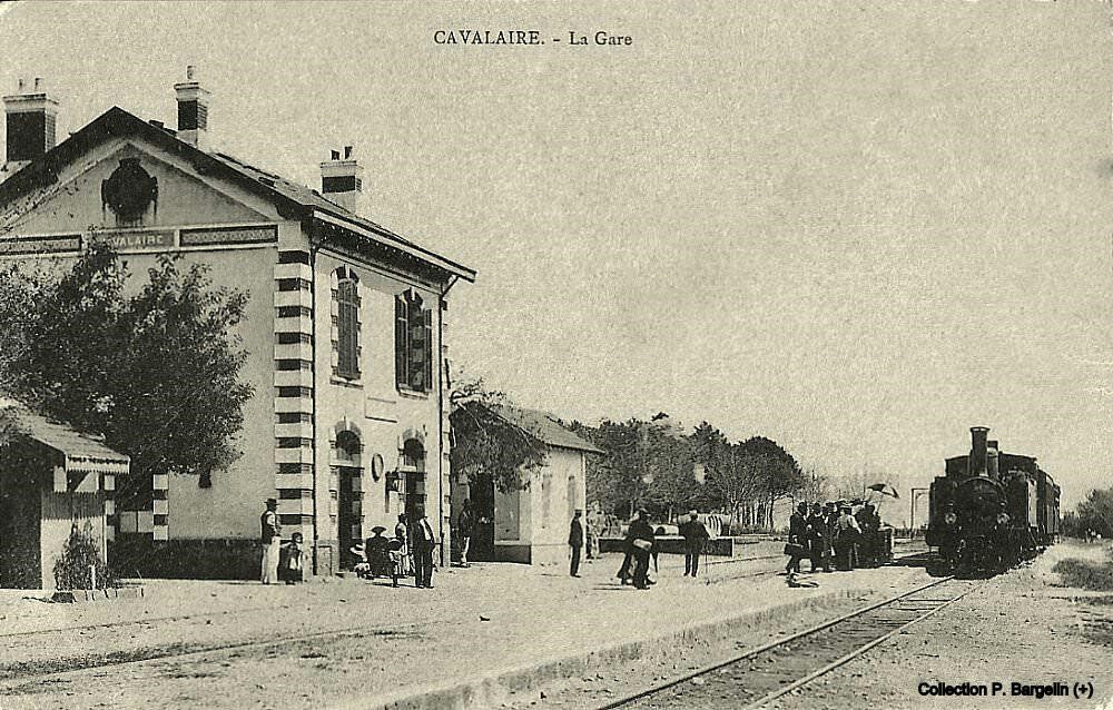
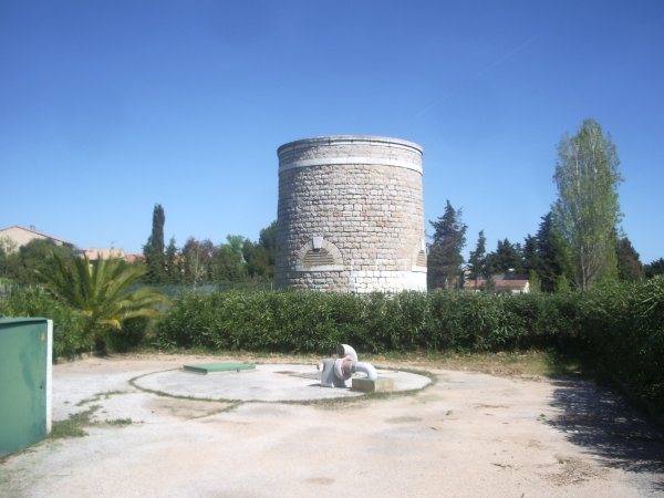
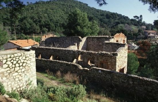
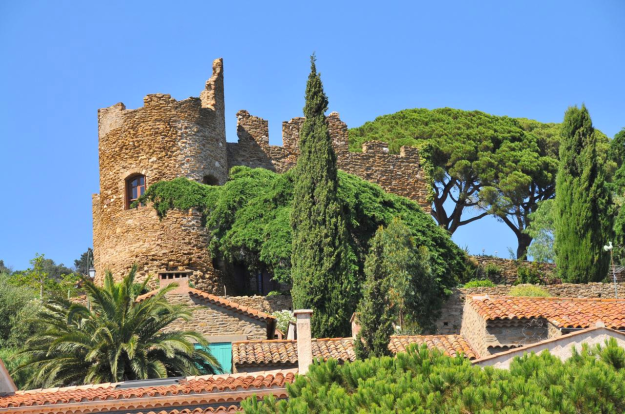
The ruins of the castle of the Lords of Fos.
The Chapel of Notre Dame de Constance has tremendous views from its height, 324 metres above sea-level. A Romanesque building, was built in the 12th century by the Carthusians of the Verne at the request of Constance de Provence, daughter of Robert the Pious. It can be reached by the path lined with oratories which begins behind the castle. From the chapel there is a panoramic view of the village and the islands of Hyères.

The village of Bormes.

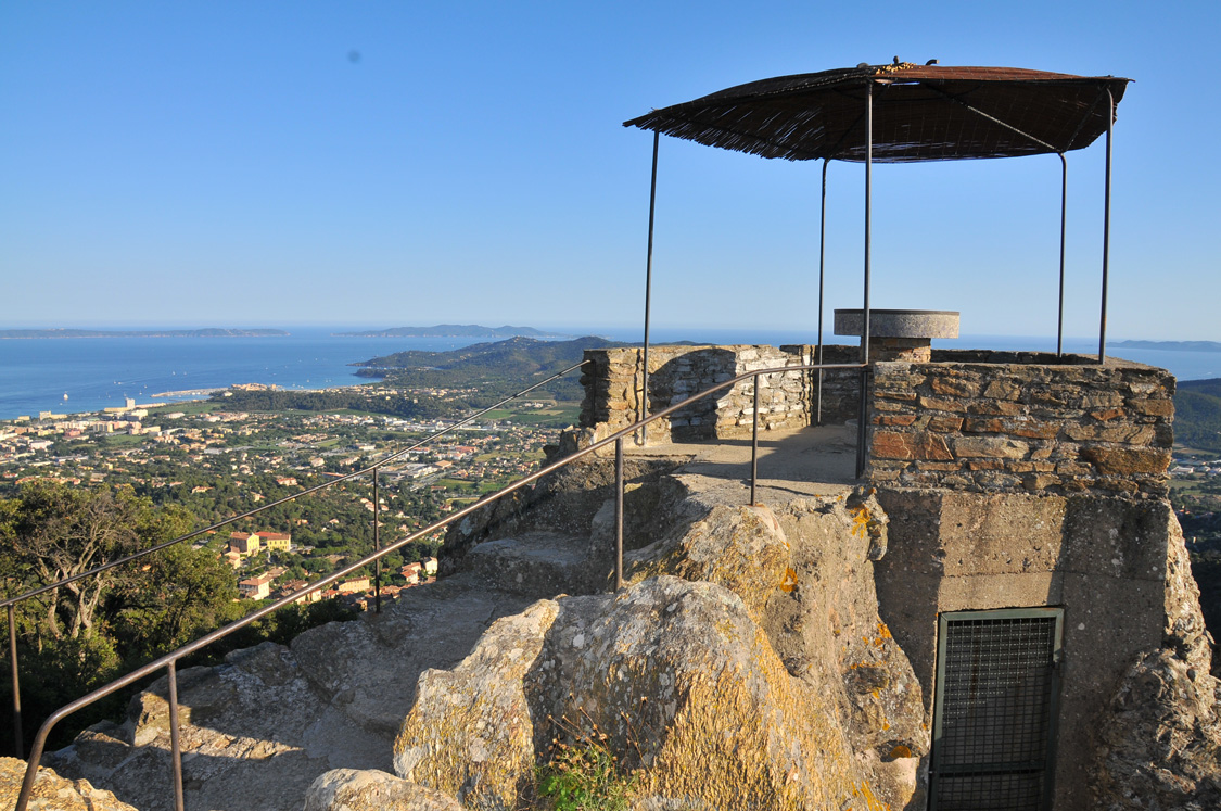
There are squares with fountains, nice shops, art galleries and workshops. We take in the Square of L’Isclou d’Amour, Lou Poulid Cantoun square, square Figuier and des Amoureux square. The old town of Bormes -les -Mimosas has small terracotta coloured houses, provincial windows, stone paths and spectacular sea views.

We cannot dwell too long, but we do want to see what the village looked like around a century ago and so we look at a number of old postcard views before getting back to the railway station.

Just a few great views of the village! Now back to our journey! Sadly, the station is no more and the site has been redeveloped for housing. But we can dream ….

Dreaming is OK, modelling is better. Why not explore http://www.trains-littoral.fr. This is the site of Henri Lacube who has made a relatively large scale model of Bormes station. Just a few images here.


Just for clarity for our purposes here, there were no tunnels close to Bormes-les-Mimosas station, nor was there a locomotive depot. The depot pictures are reproduced here so that a good impression can be gained of the motive power on the Chemin de Fer du Sud de la France Littoral in the days of steam. The station plan is a mirror image of what was on the ground in Bormes, nonetheless it really does help us to feel present at the station.

Bormes-les-Mimosas applied for the railway in 1882. The commune paid a grant of 40000 francs to ensure that it had its own station and did not have to share with Le Lavandou.

Station opened in 1890, building of 3 rd class, goods hall, two main tracks and a goods track.

Trains left Bormes along the line towards La Lavandou following what is now called Le Chemin du Train des Pignes, parallel to and north of the present D559, through a small halt called La Favière which opened in 1937 and closed with the line. Nothing of this stop remains.

Soon after La Favière the line drifts down to run alongside the modern D559 and then follows Avenue de Provence into the town of Le Lavandou. The satellite image below shows the location of the station. It now forms the main bus station for the town.

In the image below, around 1910, a mixed train from St.Raphaël to Toulon enters the station of Le Lavandou where a crowd of travellers are waiting. Routinely there were around 2000 passengers per day during the busiest periods of the year. In front of the station building is the boxcar J-1242 (De Dietrich 1905), on the roof there is a footway through which the allows access to the oil lamp illuminating the interior of the wagon (Jean-Pierre VIGUIE Collection).

This is an earlier image of the station, probably from the last years of the 19th Century (Pierre LECROULANT Collection). The image below is a good train carrying fruit and grapes in wooden crates as seen on the platform. The locomotive is 4-6-0T series 61 to 66 (Jean-Pierre VIGUIE Collection).

In the last years of the line, after the War and before closure in 1948, services were maintained by railcars. The image below was taken on 30th August 1947.


The good shed and station building at Le Lavandou in its final state after the closure of the line in 1948 (Photo Marcel CAUVIN). In the 1970s the building was converted into a bus station.
Leaving the main station in La Lavadou the train travelled through the town and a stop was provided on the line closer to the centre of the town. It opened in 1937 and closed with the line in 1948.
After the centre of Le Lavandou, the line parted company with the modern D559, travelling along the line of what is now called Avenue de la 1ere Div Fr Libre, as can be seen on the adjacent image. The D559 is below the line to the right.Avenue de la 1ere Div Fr Libre, as can be seen on the adjacent image. The D559 is below the line to the right.

Its formation is then obliterated by a road tunnel which cuts the line and has its exit at a much lower level than the old line at Pilon de St. Clair. The next two pictures are taken at approximately this location.

The line turns north to follow the coast-line, before reaching the Halt which served Saint-Clair. The halt was close to a level-crossing – the guardhouse is visible in the background.

The locomotive is a 2-4-2T SACM from the initial series 51 to 56, commissioned for the opening the line (Raymond BERNARDI Collection). The bus-stop in the image below is in almost exactly the same location as the halt.


After the halt, the line turned sharply East and then hugged the coast-line before reaching La Fossette-Aiguebelle (originally La Fossette). The building remains intact. The line followed the modern cycleway, La Fossette and the building can be seen alongside the route.

Photo Fr. Latreille March 2010 (Wikipedia) – A close up of the building with ornamentation typical of buildings in Provence, a corner of red brick angles alternated with white stone and a band of blue ceramic tiles to surround the top of the facade and gables.

Then the cycleway continues along the line of the old railway with the name La Fossette and following relatively closely the line of the D559 towards the next halt at Aiguebelle-Plage.

In the photo below, from the 1930s, the crossing keeper was preparing, red flag in hand, to close the chains of the level-crossing close to the Aiguebelle-Plage stop (Raymond BERNARDI Collection).

The following image is of the café and grocery store which formed the buildings at the stop.


By the time the line left the halt, it alignment relative to the D559 had changed. It now ran on the south side of the road, closer to the beach until the Layet tunnel was reached. The tunnel is still in use, now as a cycleway. It is a little under 170 metres long and curved in layout. The entry and exit portals were identical with some significant retaining walls on the approaches at either end. Research has resulted in one image of a train entering the Eastern portal of the tunnel travelling towards Toulon which can be seen below.


Two different drawings of the tunnel portals exist, as shown below. They can be found on the following two links:

Click to access 83070.1.pdf

Click to access 83070.2.pdf

Photographs of the tunnel follow the image below.

After the tunnel the railway followed the D559 towards Cavalière. The track formation continues to be used as a cycleway and sits between 1.5 metres and 2 metres above the road on its north side.

There is an original underpass just at the western boundary of the village of Cavalière. Cavalière Station buildings are still present and are the village post office. The platforms were on the North side of the buildings.

On 21st September 1935, the point visible at the bottom of the above photo (Collection Raymond BERNARDI) was the location of a collision between a steam locomotive and a railcar.
Photographs from the GECP Collection show the immediate aftermath of the accident which occurred because of a brake failure on the Frejus to Hyères goods train.


The locomotive was 4-6-0T No. 62. It passed the stopping position in the station and struck the Brissonneau & Lotz ZM-10 railcar, train 103 Toulon to St. Raphael. They would usually have passed at this station.

Among the derailed vehicles of the freight train 182, depicted cons-car J-2141 De Dietrich and a flat car V series loaded with sand.


Among the thirty-three wounded were the drivers of the two trains and the mechanic Louis Coulomb who was thrown through the window of the railcar. Two other railway staff were also injured.

During the final years of the railway, immediately after the Second World War, the infrastructure never recovered from wartime neglect. The permanent way and the buildings were in a poor condition.

During the last days of the operation, sidings were overgrown, even the mainline was neglected with grass growing between the sleepers. This final picture of Cavalière Station makes this abundantly clear (Photo Marcel CAUVIN – Bernard ROZE collection).

The line continues on East from Cavalière on the north side of the modern D559 through a small halt at Cape-Negre, most of the way the formation is next to the road and perhaps 1.2 to 1.5 metres above the modern carriageway.


It continues on through Pramousquier. At Pramousquier, a small halt preceded the line going into a deep cutting (seen in the first colour image below) and under the road. It emerged under the bridge which can be seen in the secodn colour image below before running along below the road on an arch vaulted (arcaded) retaining wall (Photo Marcel CAUVIN).

 The route continues hugging the coast-line below the D559. It is given the name Pramousquier but is no longer paved. The arrow on this image shows the formation of the line looking back towards Toulon.
The smaller image is also taken looking back along the line towards Toulon from close to Le Canadel Halt.

Canadel Halt has completely disappeared. Its location is shown in the modern photograph below. It was destroyed in the bombing associated with the 1944 allied landings in Southern France.

On the night of 15th August 1944, the Canadel Halt was the scene of the first contact between the commandos that landed in Provence and French civilians (Christiane CHATON collection). Cavalaire beach was used during the Allied landings in Provence. Operation Dragoon (initially Operation Anvil) was the code name for the Allied invasion of Southern France on 15 August 1944. The operation was initially planned to be executed in conjunction with Operation Overlord, the Allied landing in the Normandy, but the lack of available resources led to a cancellation of the second landing. By July 1944 the landing was reconsidered, as the clogged-up ports in Normandy did not have the capacity to adequately supply the Allied forces. Concurrently, the French High Command pushed for a revival of the operation that would include large numbers of French troops. As a result, the operation was finally approved in July to be executed in August.

Landings took place along the coast from Saint-Raphael to Cape Negre on 15th August and Marseilles and Toulon had been taken by 28th August 1944.

The goal of the operation was to secure the vital ports on the French Mediterranean coast and increase pressure on the German forces by opening another front. After some preliminary commando operations, including the British 2nd Para’s landing behind enemy lines to secure vital transport links, the US VI Corps landed on the beaches of the Côte d’Azur under the shield of a large naval task force, followed by several divisions of the French Army B. They were opposed by the scattered forces of the German Army Group G, which had been weakened by the relocation of its divisions to other fronts and the replacement of its soldiers with third-rate Ostlegionen outfitted with obsolete equipment.

Hindered by total Allied air superiority and a large-scale uprising by the French Resistance, the weak German forces were swiftly defeated. The Germans decided to withdraw towards the north through the Rhône valley, to establish a stable defense line at Dijon. Allied mobile units were able to overtake the Germans and partially block their route at the town of Montélimar. The ensuing battle led to a stalemate, with neither side able to achieve a decisive breakthrough, until the Germans were finally able to complete their withdrawal and retreat from the town. While the Germans were retreating, the French managed to capture the important ports of Marseille and Toulon, putting them into operation soon after.

The Germans were not able to hold Dijon and ordered a complete withdrawal from Southern France. Army Group G retreated further north, pursued by Allied forces. The fighting ultimately came to a stop at the Vosges mountains, where Army Group G was finally able to establish a stable defence line. After meeting with the Allied units from Operation Overlord, the Allied forces were in need of reorganizing and, facing stiffened German resistance, the offensive was halted on 14th September 1944. Operation Dragoon was considered a success by the Allies. It enabled them to liberate most of Southern France in a time span of only four weeks, while inflicting heavy casualties on the German forces, although a substantial part of the best German units were able to escape. The captured French ports were put into operation, allowing the Allies to solve their supply problems soon after.

On 15th August 1944, the main landing force consisted of three divisions of the VI Corps (The Sixth United States Army Group was an Allied Army Group that fought in the European Theatre of Operations during the Second World War). The 3rd Infantry Division landed on the left at Alpha Beach (Cavalaire-sur-Mer), the 45th Infantry Division landed in the centre at Delta Beach (Le Muy, Saint-Tropez), and the 36th Infantry Division landed on the right at Camel Beach (Saint-Raphaël).

The landings were overwhelmingly successful. On Delta and Alpha beaches, German resistance was low. The Osttruppen surrendered quickly, and the biggest threat to the Allies were the mines. A single German gun as well as a mortar position were silenced by destroyer fire. The Allied units in this sector were able to secure a bridgehead and quickly linked up with the paratroopers, capturing Saint-Tropez as well Le Muy. The most serious fighting was on Camel Beach near the town of Saint-Raphaël. This beach was secured by several well-emplaced coastal guns as well as flak batteries. Through heavy German fire the Allies attempted to land at the shore. However, at sector Red of the Camel Beach landing zone the Allies were not able to succeed. A bombing run of 90 Allied B-24 bombers was called in against a German strongpoint here. Even with the assistance of naval fire, the Allies were not able to bring the landing ships close to the shore. They decided to avoid Camel Red and land only at the sectors of Camel Blue and Camel Green, which was successful.

The Allied casualties at the landings were very light, with only 95 killed and 385 wounded. 40 of those casualties were caused by a rocket-boosted Henschel Hs 293 guided gliding bomb launched from a Do-217 bomber aircraft by a rare appearance of the bomber wing KG 100, which sank the tank landing ship USS LST-282. In conjunction with the sea landing, airborne and glider landings (Mission Albatross followed by Mission Dove, Mission Bluebird, and Mission Canary) around the area of Le Muy were carried out. They were as successful as the beach landings, with only 104 dead, 24 of which were caused by glider accidents and 18 by parachute accidents.

Operation Dragoon was considered a success by the Allied forces. It enabled them to liberate most of Southern France in a time span of only four weeks while inflicting heavy casualties on the German forces. However, the Allies failed to cut off the most valuable units of the retreating Army Group G, which retreated over a distance of 800 kilometres (500 miles) in good order, into the Vosges mountains on the German border, with the capability of continuing the fight. The main reason for the failure to capture or destroy Army Group G was the Allied shortage of fuel, which began soon after the landing. The Allies had not anticipated the speed of their own advance and therefore could not adequately provide supplies and logistics to the leading Allied units.

A significant benefit of Operation Dragoon was the use of the port facilities in Southern France, especially the large ports at Marseille and Toulon. After Operation Cobra and Operation Dragoon, the Allied advance slowed almost to a halt in September due to a critical lack of supplies. The ports were quickly brought back into service, together with the railroad system in Southern France. Thereafter, large quantities of supplies could be moved north to ease the supply situation. In October, 524,894 tons of supplies were unloaded, which was more than one third of the Allied cargo shipped to the Western front.

At the time of the great strike of 1910, 300 of the staff of the Littoral network stayed in work. In this picture we see a maintenance gang waiting on Canadel platform. The locomotive is 4-6-0T Pinguely No. 65 at the head of a mixed train (Edmond DUCLOS collection).

Leaving Canadel Halt behind, the line curves across the Ravin de Montanard on an embankment and follows the route of Chemin de la Tour des Sarazins, tracking Eat, then South and then turning sharply back to a North-easterly direction. Just before turning north again the line passed through the 42 metre long, Tunnel de Malpagne (also known the Tunnel de Rayol), pictures of the tunnel are below.

After leaving the Eastern portal of the tunnel, the line turned north-east to follow the coast-line round the Plage du Rayol, although, in order to maintain a level grade a more inland route was needed. The railway followed the line of Le Battier and then Le Dattier cycleways, weaving back and forth so as to follow the contours of the hillside between the coast and the D559.

The next halt was Le Rayol which has been lost in more modern development. The Halt was rebuilt in 1935 after it had been destroyed by a tidal wave in the early 1930s!

After Le Rayol the line continued along a path between the sea and the D559. Initially in open land and then in cutting.

Avenue des Suisses crosses the line on a bridge whose parapets can just be made out in the second colour image. The formation is seen passing under the bridge in the third image.

Then the line passed through another Halt, Le Dattier, seen in the next monochrome photograph in the 1970s (a picture taken by José BANAUDO). The builidng survives today.
After Le Dattier, the line entered a longer tunnel – 245 metres long – Le Tunnel du Bonporteau.

The tunnel is shown below. It ran on a North-east to South-west axis.

Out the other side of the tunnel the line travelled in northeasterly direction, in cutting for a short distance and then across relatively flat ground before rising up on an embankment (now removed) before reaching the D559 which it crossed at high level on a metal girder bridge. All that remains of the structure now is the northern abutment.


Immediately after crossing the road the line turned sharply to the East to run parallel to the road on its North side along Rue Rouget de l’Isle and then Chemin de Train des Pignes. The formation ran 2 to 3 metres above the level of the D559 as can be seen in the next image.

The modern D559 rises to the level of the old railway formation by the time the next roundabout is reached. From this point on the D559 runs along the formation of the old railway into Cavalaire.

The difference between the next two images is marked. The first shows Cavalaire just after the Second World War. The second is a similar view but taken in the early 21st Century. One is bucolic, the other heavily urbanised.

And so we arrive at Cavalaire, our next stop. Perhaps it is time to spend an hour or two on the beach before travelling on?

References

[1] Roland Le Corff; http://www.mes-annees-50.fr/Le_Macaron.htm, accessed 13th December 2017.
[2] Marc Andre Dubout; http://marc-andre-dubout.org/cf/baguenaude/toulon-st-raphael/toulon-st-raphael1.htm, accessed 14th December 2017
[3] Jean-Pierre Moreau; http://moreau.fr.free.fr/mescartes/ToulonGareSudFrance.html, accessed 24th December 2017.
[4] José Banaudo; Histoire des Chemins de Fer de Provence – 2: Le Train du Littoral (A History of the Railways of Provence Volume 2: The Costal Railway); Les Éditions du Cabri, 1999.
[5] https://blog.aboattime.com/sailing-to-france-bormes-les-mimosas, accessed 31st December 2017.
[6] Henri Lacube; http://www.trains-littoral.fr, accessed 31st December 2017.
[7] http://www.tunnels-ferroviaires.org/tu83/83070.1.pdf, accessed 31st December 2017.
[8] http://www.tunnels-ferroviaires.org/tu83/83070.2.pdf, accessed 31st December 2017.
[9] Wikipedia; Operation Dragoon; https://en.wikipedia.org/wiki/Operation_Dragoon, accessed 30th December 2017.
[10] Steven J. Zaloga, Operation Dragoon 1944: France’s other D-Day. Osprey Publishing, p36-50, p71, 2009.
[11] Detlef Vogel, Deutsche und Alliierte Kriegsführung im Westen [German and Allied warfare in the West]. In Boog, Horst; Krebs, Gerhard; Vogel, Detlef. Das Deutsche Reich in der Defensive [The German Reich on the Defence: The Strategic Air War in Europe and the War in the West and East Asia 1943–1944/5]. Germany and the Second World War (in German). VII. Militärgeschichtliches Forschungsamt. Deutsche Verlags-Anstalt. p 419–642, 1983.
[12] Anthony Tucker-Jones; Operation Dragoon: The Liberation of Southern France 1944; Pen and Sword, p175, 2010.
[13] http://www.tunnels-ferroviaires.org/tu83/83036.1.pdf, accessed 31st December 2017.

Ligne du Littoral (Toulon to St. Raphael) – Part 6 – Hyeres to Bormes les Mimosas (Chemins de Fer de Provence 41)

 Hyères-Ville to Bormes

Details of the Chemin de Fer du Sud de la France from Toulon to Saint-Raphael are culled from a number of sources. Three significant ones are: Roland Le Corff [1], Marc Andre Dubout [2] and Jean-Pierre Moreau [3]. Others will be referred to as we follow the route of the line.

We start this section of our journey at Hyères and head eastward along the Chemin de Fer du Sud towards St. Raphael. But first a bit about the station at Hyères.

Situated approximately 22.5 kilometeres from Toulon Station, the Station closest to Hyères, Hyères-Ville was opened in 1890, it had the status ‘1st Class’ which put it on a par with the Gare du Sud in Toulon. It had three passenger platforms and 4 goods tracks. In 1907 the engine shed at Hyères-Echange was abandoned and a new facility, suitable for two engines was constructed at Hyères-Ville. Later in 1908 a restaurant/buffet building was constructed at the station.

The aerial view above shows the conditions extant at the station in the middle of the 20th Century, the land immediately around the station to its West and South is undeveloped. The town of Hyères is on its north side. In the 21st Century there is a very different story to tell. The station site has been swallowed up by the town of Hyères. The next image is taken from Jean-Pierre Moreau’s web pages and shows the old station plan superimposed on a modern satellite image from Google earth.

The station is long-gone and the area has been completely re-developed. The final plan-view is of the site taken from Google Earth.

The station was demolished in 1967 and has been replaced by tax collection offices, the municipal library and the town’s museum.

With nothing remaining of the station we are reliant on old pictures to help us appreciate the site better. Both of the pictures below show the station after the construction of the station buffet building. The designation of the first refers to avenues of palms which bordered roads in the town and which give it the name Hyères-les-Palmiers.

The Station Buffet Bar on Platform 1 (Jean-Pierre VIGUIER Collection)

A number of these images come from the webpages maintained by Jean-Pierre Moreau. All of these pictures show the buffet-bar building and so date from after the first year of operation of the line. The image at the top of these pages can be dated to the first year of operation as there is no buffet-bar building at the side of the platform. The image immediately above is taken in the 1930s, a mixed train from St.Raphaël to Toulon station is standing at platform 3. An open car “jardinière” is located behind the 230T SACM # 61 locomotive. (Photo Marcel CAUVIN – Pierre VIROT collection).

The image below was taken in 1937 at Hyeres. It is a two-axle 2nd Class A-2013 Decauville (José BANAUDO Collection).

These two images show the same Brissonneau & Lotz railcar in Hyères-Ville around 1938 (Edmond DUCLOS & GECP collections).

These following two images of workers on the line were taken in 1943 (during WW2) in Hyères. They show the same class of engine, a locomotive 141 Corpet-Louvet type. The engine in the first photo is named “Dakar.” Three engine drivers from Toulon pose in berets, and a station agent and train agent pose in caps in the first picture (GECP collection). Moreau says that the second locomotive is No. 21 (Marcel CAUVIN & LUGAN – GECP collection).

The final image at Hyères is taken in August 1947. In summer, railcars were coupled, making it possible for each movement to have a capacity of 216 seats (the seating capacity of 120 per unit was often exceeded through overcrowding). This train is travelling from Toulon to St. Raphael (Collection José BANAUDO).

Having spent some time at Hyères, we leave travelling Eastward, the track formation follows what id now Rue de Soleil Levant on a sweeping curve down to what is now the D98. This road is now a dual carriageway with the East-bound (south-side) carriageway over the formation of the railway line.

There was a Halt at Riondet (Riondet-Golf) and then the line bridged the River Gapeau on a bridge designed by Gustav Eiffel.

After having crossed the River Gapeau the line by-passed Les Salins d’Hyères to the south. There was a small halt at St.Nicolas-Mauvanne at the level-crossing on the road leading to Vieux Salins. In the picture below a 121T SACM 51-56 locomotive enters the halt from the St. Raphael direction (Collections Jean-Paul PIGNEDE & Jean-Pierre VIGUIE).

The building is still intact. The line is now running on the north side of the D98, the building is visible from the road but over a concrete wall. The first image is from Google Streetview and is taken from the D98. Moreau provides photographs of the rail-side of the building which were taken in 2014 from the other side of the wall. And finally at this location, a view of the building from the D559A which runs parallel to the D98 to the North. The building is marked on the photograph.

From the halt at halt at St.Nicolas-Mauvanne the railway formation remains under the D98 dual carriageway. Then as the D98 begins to drift northwards, the line of the railway follows the D559A into La Londe. On the way into La Londe the railway formation follows the verge on the D559A (Avenue Albert Roux) and crosses the River Pansard. The bridge trusses remain. The monotone picture below was taken by Robert ROSTAGN in 1996 the second image comes from Google Streetview. The old bridge now carries the cycleway.

This smaller image shows the bridge in plan alongside the highway.

After a re-alignment northwards, the railway line crossed Avenue de l’Eglise (probably Place André Allègre, today). The crossing point is visible below.

The railway line then approached the station at La Londe, still following the line of what is now the D559A. The station at La Londe was rated ‘3rd Class’ but during the war had quite high traffic volumes because of the nearby torpedo factory. The first three pictures below show trains arriving from Saint-Raphael. The fourth shows a train heading towards Saint-Raphael.

La Londe-les-Maures is at the edge of the Maures Mountains and faces out onto the lles d’Or (Golden Islands). Côtes de Provence Wine, flowers (roses, tulips etc.) and herbs, olive groves and cork oaks all add to the appeal of the town. The beaches stretch from the old salt marshes (a nudist beach) to Estagnol (near Fort Bregangon), Miramar, Argentière and on to Pellegrin. All of this makes this small town a prime holiday destination! However, our real interest is the railway and its history and hopefully these pictures aid in gaining a good idea of the station as it was.

La Londe began to develop as a municipality in 1875 when Victor Roux discovered rich mineral deposits. Lead and zince were responsible for turning nan essentially rural laocation dependent on farming and forestry into and industrial area. Mining strated on an industrial scale in 1885 and created numerous jobs.

From 1890 onwards, other veins of minerals were identified across almost two-thirds of the Commune and in parts of Bormes and Collobrières. These mines were so prosperous that they necessitated the construction of a railway in 1899 for the transport of workers and the transport of the ore to the factory where its treatment was done, and its shipment by sea.
Lead ore initially had to be taken away from the area for processing. A foundry was developed to treat the lead locally. It was completed in 1897.

The prosperity of the mine contributed directly to the development of the village (construction of houses, a church, creation of schools, a post office and telegraph office, a gendarmerie, etc …) and the creation of the municipality. Gradually gaining autonomy, La Londe asked for independence from Hyères and was made a commune on 11th January 1901.

The town then took the official name of “Londe Les Maures”. Sadly, as the town grew, the prosperity of the mines decreased. All activity at the mines ceased in 1929. Taking advantage of the available workforce from the declining mine, the Schneider group was formed in Bormettes in 1907, and in 1912 built an armament factory, a subsidiary of the Creusot factories in Burgundy .

This company contributed to the development of the town by building accommodation for its wrokers close to the plant. In 1920, a railway line was created to transport workers, tools and goods to the town. The “Promenade des Annamites”, named in memory of Indochinese soldiers mobilized in France during the First World War and living near this path, follows part of the route today.

In the 1940s, the Navy made use of some buildings and land in Les Bormettes’ It owned, among other things, Château Vernet and the Astrolabe building which had been appropriated by the occupying German troops. After liberation a maritime training centre was developed. In 1972, following a regrouping of Marine schools in St Mandrier, the site became the property of the Ministry of PTT and France Telecom.

Since the 1950s, the town has gradually reinvented itself as a seaside resort with a hinterland of 22 estates and wine chateaux, many greenhouses and the largest olive grove in the Var.

It is the local branch-lines that most interest me. The first was developed around the turn of the 20th Century to serve mining operations and the second served the armaments factory later in the 20th Century.

The armaments factory was on the sea-shore at point ‘A’ on the satellite image provided by Moreau. The route of the later branch-line is marked in yellow and left the main line just to the East of La Londe Station, shown in the top left of the satellite image below.

After the main satellite image below, there is a close up of the station and junction positions. The main-line left the station along the line of what is now called the Impasse du Ruisseau to the South side of the D559A It continued 50 metres or so to the South of the road until close to the River Maravenne. At this point the D559A heads North-east., The railway turned Eastward and crossed the river on a concrete arch bridge.


Dubout says that the image here is of the branch-line to the munitions factory. The works at the coast can be seen on the following images. There are pictures of the mines and of the factory as well as the loading jetty for shipments by sea.

A number of copyright images have been reproduced here from a variety of sources. This image is a case in point. It appears on a search of images relating to La Londe and clearly bears the copyright stamp across the image. Copyright of other images is very difficult to establish as the images are of a significant age. This image is of the jetty on the older branch.

These next few images relate to the munitions and torpedo factory on the seashore and to parts of the line which preceded Schneider’s railway and served the mines which closed in 1929.


Moreau provides images of trains on the branch-line to the factory.

The first is a view of locomotive 0-6-0T No. 79 “Luronne” at the head of the workers’ train from the Schneider torpedo factory in La Londe, circa 1921 (Edmond DUCLOS Collection). The next image is also of the workers’ train at the entrance of the Schneider torpedo factory in La Londe. The locomotive could be the 0-6-0T Krauss No. 78 “La Madeleine” (Gilbert MARI Collection).

The branch shown on Moreau’s plan is the later branch-line built to serve the munitions and torpedo factory. More details of this line and the preceding mineral line are provided in a separate post in this series.

Back to the mainline …. After leaving La Londe the Chemin de Fer du Sud travelled Eastwards on the line of what is now the D559A crossing the River Maravenne and running along what is now the Route de Caroubier before rejoining the D98. Initially, the track formation is hidden by the D98 road construction, but later the formation can be seen on the South side of the road.

The line disappears once again under the D98 and then bears off to the left before swinging back across the line of the road. A short distance later a crossing keepers cottage (or maybe a halt) is visible at the point where the line drifts away from the modern D98. Its position relative to the road suggests that the line was at a lower level and on the South side of the modern road. From this point on the D98 and the old railway diverge and the railway heads into the forest.

A side-road off the D98 passes this side of the crossing keepers cottage in the last of this sequence of photos. The railway line passed just the other side of the building and is the route of a cycle track (Chemin des Renoncules) which runs south of the road swinging away to the South before bridging a small river on Viaduc du Bataillier which was a series of three masonry arches, the side spans being approximately 5 metres and the central span about 10 metres. The viaduct still exists carrying the cycle track. Replacement parapets have been provided in a form more suited to the cycleway.

Immediately after crossing the river there was a small halt called ‘Les Bataillier’ of which nothing remains except steps leading up from the D559. The line then crossed the road at high level. There are photos of this bridge following those of the viaduct. The train seen on the overbridge in 1947 is a 4-6-0T Pinguely series 63 to 66. (Photo Jean-P SCHOEN – LAEDERICH collection)

After crossing the viaduct, trains continued along the line toward Bormes.


References

[1] Roland Le Corff; http://www.mes-annees-50.fr/Le_Macaron.htm, accessed 13th December 2017.

[2] Marc Andre Dubout; http://marc-andre-dubout.org/cf/baguenaude/toulon-st-raphael/toulon-st-raphael1.htm, accessed 14th December 2017.

[3] Jean-Pierre Moreau; http://moreau.fr.free.fr/mescartes/ToulonGareSudFrance.html, accessed 24th December 2017.

[4] José Banaudo; Histoire des Chemins de Fer de Provence – 2: Le Train du Littoral (A History of the Railways of Provence Volume 2: The Costal Railway); Les Éditions du Cabri, 1999.

[5] Roger Farnworth; Ligne du Littoral (Toulon to St. Raphael) – Part 5 – Toulon to Hyeres (Chemin de Fer de Provence 40); https://rogerfarnworth.wordpress.com/2017/12/26/ligne-du-littoral-toulon-to-st-raphael-part-5-toulon-to-hyeres-chemin-de-fer-de-provence-39.

[6] Roger Farnworth; Ligne du Littoral (Toulon to St. Raphael) – Part 7 – La Londe & Les Bormettes (Chemin de Fer de Provence 42); https://rogerfarnworth.wordpress.com/2017/12/29/ligne-du-littoral-toulon-to-st-raphael-part-7-la-londe-les-bormettes-chemin-de-fer-de-provence-42.

Ligne du Littoral (Toulon to St. Raphael) – Part 7 – La Londe & Les Bormettes (Chemins de Fer de Provence 42)

La Londe-les-Maures and Les Bormettes

Les Bormettes is one of the oldest place names in the costal area of Var. It goes back to the time when the Bormani, a Celto-Ligurian tribe, settled on the coast. The name now only relates to a district of La Londe, but once it corresponded to a much larger territory, bounded by the Bormes communes to the east, La Garde to the west, Pignans to the north and the sea to the south.

The first traces of human settlement in this district date back to Roman times. According to excavations of the late nineteenth century, the Romans had built a farm at the foot of Hospital Hill. The discovery of millstocks, amphorae and other items testify to farming by the Romans of wheat, olives and wine.

In the Middle Ages, St Martin’s tower which dominates the wine-making castle of Bormettes was built and it seems to have sheltered the first village of La Londe. It appears first to have been a defensive site built by the Ligurians, in the 7th-6th centuries BC, against the Phoenicians raided the coast from the beginning of the Iron Age, perhaps to exploit lead and silver mines. By the 13th Century, St. Martin’s Tower was a fortified site. The village would have been somewhat more transient but would have developed around the castle hill.

On Hospital Hill, near St Martin’s Tower, it is likely that there was a Hospital set up by the Hospitallers of the Order of St. John, to cure crusaders, unless it was one of those leprosaria built in the 7th Century at the time when leprosy was wreaking havoc in Provence. The only trace we have is a watercolour painted by a native of La Londe just before the last vestiges were destroyed by the German armies in 1943. It seems to be a monastic building. A local legend seems to confirm that it was a crusader hospital. The location of this hospital between the beach of Pellegrin (Pellerin) and the Templar Tower in Hyères seems quite justified.

From the 11th Century, Les Bormettes gradually became monastic property, with the birth of the monasteries of Montrieux and La Verne. The monks acquired land and developed farms which were then tenanted out. Les Bormettes’ income went primarily to the Chartreuse de la Verne, they pursued an aggressive land purchase policy which inevitably led to conflict with the monks of Montrieux. Apparently, boundary markers can still be found that mark the boundaries of the land owned by each monastic house. At the end of the 16th century, following the destruction of their chartreuse, the monks of Montrieux withdrew from Les Bormettes. The monks of La Verne then asserted control and built the first of their castles: Les Bormettes between 1588 and 1642 and then that of Bastidon.

These two areas complemented each other. One cultivated wheat, oats and artichokes and one practiced dairy farming and poultry, Les Bormettes also remained as an area of vineayrds while Bastidon that of mulberry and olive trees. The olives of Bastidon were brought to Les Bormettes where the monks had installed an important oil mill in 1704 which provded a significant income to the monastery. According to an inventory of 1790, the fields around Les Bormettes produced 51 urns of nearly 130 hl of oil and 20 barrels of 380 hl of wine.

In 1707, during the War of Spanish Succession, the estate of Les Bormettes was plundered by the Anglo-Dutch, they destroyed produce and torched buildings.

The estate remained in the hands of the Carthusians until 1791. There was little human habitiation until the Revolution. Nationalisation occurred at the Revolution and the land was auctioned off. Pierre Laure, cousin of Joseph Laure who would be the 1st mayor of Londe, acquired the estate. Then in 1855, Horace Vernet (1789-1863) took ownership.

He was attracted by the warmer winter weather of Hyères in the Côte d’Azur. Les Bormettes reminded him of the landscape of Algeria that he immortalized in his paintings. Suffering from pleurisy and anxious to find calm to pass his final years, he purchased the estate and built an eclectically style castle, which he felt appeared a little like a village. He built a chapel, dedicated to Saint Victor, in memory of the monks of Marseille who owned the land in the 11th Century.

In 1874, Victor Roux, a wealthy Marseille financier, bought the estate. He restored the castle and developed the estate, planting a wide variety of palms, mimosas and eucalyptus, which made it one of the most beautiful parks of the coast.

In 1890, he further enlarged the castle and developed the mining in the area., One sign of the prosperity of the estate is the foundry which processed mineral ore locally and so significantly increased its export value.

The mines were very prosperous until the turn of the 20th Century. The richest vein became exhausted and by 1929 all activity had ceased.

But in their heyday, the mines contributed dramatically to the local economy. They resulted in a significant increase in the local population and the development of the small village of La Londe into a town. The town even gave itself a longer name when it formally became a municipality independent of Hyères – ‘La Londe les Maures’.

The Mines of Les Bormettes and their Railways

Around 1875, Victor Roux rediscovered a silver-lead vein on his estate and, a few years later, he created a company to mine the vein. From 1890, other veins were discovered north of La Londe and were also exploited. At the same time the mainline narrow gauge railway from Hyères to Fréjus completed and Victor Roux developed a line which extended from Les Bormettes in the South through La Londe to the mines he was developing North of the town. The railway connected the extraction wells, the treatment workshops, the Argentière pier and the Hyères-Fréjus line. The opposition of the villagers delayed the construction of the most important section between the extraction sites of the north of the commune, the processing plant and the pier until 1899. The veins of minerals in the mines were quickly exhausted and the exploitation of the mines began to decline in 1904 and ceased completely in 1929.

On the hand drawn plan above the route of the mining railway is shown in blue. This does not do justice to the full extent of the system developed by Victor Roux, although the railway north of La Monde on the 1930s Michelin map below would only have been in use from 1899 to 1929.

It is possible to identify the location of the original mines near the sea-shore on both maps, and the location of the foundry. On the map immediately above, the locations of the Verger Mine and the La Rieille are well marked. Using the hand drawn map, it is relatively easy to determine the alignment of the railway tracks close to the coast. It appears that the foundry buildings are now in use as a hotel known as Les Grottes.

I believe that these certificates are shares in the mining company issued at different times 1908, 1922 and 1924. Apart from the first of these images, which is of the foundry, the photographs are of the mine at Les Bormettes and show also the loading jetty to allow minerals to be removed by sea. The dependence on rail, either within the site or for transport to other rail heads is evident in the pictures.

There is evidence of the route of the older railway in the layout of the roads between La Londe and the coast. It is very difficult to find substantive evidence of the railway north of La Londe. The D88 follows the River Pansard on its West bank, there are sporadic lengths of what may well have been the track-bed of the old railway on the East bank of the river. I did not find evidence of a bridge carrying a branch over the river toward what appears to be the location of the Mine du Verger. It is nearly 80 years since the line closed, so perhaps this is not at all surprising. Three pictures of the mine location appear below, these are taken from the mine data site mindat.org [3]. The first two are of the spoil heaps the third is of the mine location.

Mindat.org also provides details of what remains at La Rieille Mine [4] further up the valley of the Pansard and the terminus of the railway. Three photos again. This time the remains are a little more significant.

These last two images (below) before we turn away from the mining operation to focus on the munitions factory show the old jetty alongside the new office building. In the second image the camera has turned to look slightly further to the West and the factory building can be seen behind the offices. The photographs must have been taken after 1913. As the jetty appears still to be in use they cannot date from after 1929.

A little careful study of the image below will reveal much of the layout of the old mineral railway. It also shows the location of the Munitions Factory set up by Schneider – the large building just left of centre at the bottom of the picture.

And finally a link to a presentation about the mines (in French) – http://slideplayer.fr/slide/1157478.

The Munitions Factory at Les Bormettes and its Railway

At the time when mining activity was declining, the local economy was rescued by the arrival of the Schneider Company. Schneider et Cie (later Schneider Electric) purchased some of the land belonging to Victor Roux and eventually built a munitions/armaments factory close to the shore of the Mediterranean. Initially, its activity was limited to sea trials of torpedoes manufactured in the plants of Harfleur and Le Creusot. To this end, an artificial island made of reinforced concrete, was built in 1908, off the tip of Léoube (Bormes). This is where the first torpedoes made in France were tested.

The people of La Londe called this artificial island the ‘sewing machine’.

Then in 1912, following a large order of torpedoes from France and Italy, the design office from Le Havre settled here. A weapons factory was proposed and built. It was an imposing building, near Tamaris beach that would manufacture parts for the army and it was completed in 1913. By the start of the Great War, 234 torpedoes had been made. During the war, the factory mainly made parts for the army (shells, plane parts, etc.) From 1913 to 1920, Henri-Paul Schneider built housing around the factory for his workers; 103 houses and 11 villas in all. The new village was endowed with a food cooperative, a school, a village hall, a post office, a bakery, a bar, public showers and a sports hall.

People living at Les Bormettes began to have a much better standard of living than people on La Londe les Maures.

Interestingly an Alsatian company called ‘Astrolabe Omininium East’, specializing in film acquired the Castle Bormettes. They were actually a name behind which the German secret service could hide and monitor activity at the torpedo factory. It was expropriated in 1936 and ownership was given to the French Navy.

In the Second World War, the Schneider factory was requisitioned by the Germans when they occupied the Free Zone at the end of 1942, until the allied landing in Provence on 15th August 1944.

In 1972, Castle Bormettes was sold by the Navy, along with the wider estate, to the General Directorate of Telecommunications (today France Telecom) and the Bormettes factory stopped working in 1993.

The railway leading to the works is shown in nearby photographs and its formation remains along much of its length as a cycleway named for the people who built it – Promenade des Annamites.

The final images in this post are shared with the previous post which focusses on the Chemin de Fer du Sud de la France main-line. They show images of the factory, part of the village developed for it and the railways that served it.

The last two images in this post are of trains which served the factory. They have both been provided by Jean-Pierre Moreau. The first is a view of locomotive 0-6-0T No. 79 “Luronne” at the head of the workers’ train from the Schneider torpedo factory in La Londe, circa 1921 (Edmond DUCLOS Collection). The second is also of the workers’ train at the entrance of the Schneider torpedo factory in La Londe. The locomotive could be the 0-6-0T Krauss No. 78 “La Madeleine” (Gilbert MARI Collection).

References

[1] http://www.ot-lalondelesmaures.fr/la-londe-cote-terre/le-village-et-son-histoire/les-bormettes.htm, accessed 28th December 2017

[2] Freddy Genot; http://www.cfchanteraines.fr/lvdc/lvdc0149/carnet04.htm, accessed 27th December 2017.

[3] https://www.mindat.org/loc-127375.html, accesses 28th December 2017.

[4] Roland Le Corff; http://www.mes-annees-50.fr/Le_Macaron.htm, accessed 13th December 2017.

[5] Marc Andre Dubout; http://marc-andre-dubout.org/cf/baguenaude/toulon-st-raphael/toulon-st-raphael1.htm, accessed 14th December 2017

[6] Jean-Pierre Moreau; http://moreau.fr.free.fr/mescartes/ToulonGareSudFrance.html, accessed 24th December 2017.

[7] José Banaudo; Histoire des Chemins de Fer de Provence – 2: Le Train du Littoral (A History of the Railways of Provence Volume 2: The Costal Railway); Les Éditions du Cabri, 1999.

[8] Roger Farnworth; Ligne du Littoral (Toulon to St. Raphael) – Part 6 – Hyeres to Bormes les Mimosas (Chemin de Fer de Provence 41); https://rogerfarnworth.wordpress.com/2017/12/30/ligne-du-littoral-toulon-to-st-raphael-part-6-hyeres-to-bormes-les-mimosas-chemin-de-fer-de-provence-41.

[9] Other pictures from all over the internet which are not included in the main text of this post …

Ligne du Littoral (Toulon to St. Raphael) – Part 5 – Toulon to Hyeres (Chemins de Fer de Provence 40)

Toulon-Hyères

Details of the Chemin de Fer du Sud de la France from Toulon to Saint-Raphael are culled from a number of sources. Three significant ones are: Roland Le Corff [1], Marc Andre Dubout [2] and Jean-Pierre Moreau [3]. Others will be referred to as we follow the route of the line.

The Station in Toulon was in an attractive location close to the waterfront. Sadly it has been completely demolished and the land developed. To help in identifying locations along the line we will work on Toulon Station being at kilometre point zero. The district of Toulon where it was situated is La Rode. And its site is now that of a school – Dumont d’Urville high school. The station site included a good shed, an engine shed for stabling up to four locomotives, three goods sidings, four passenger platform lines, a 120 cubic metre water tower and two hydraulic cranes. Two excellent images show the location of the station in relation to the water front. The lower, line-drawn image shows the sidings of the Chemin de Fer du Sud which left the main line just 50 metres from the station throat and provided direct access to the quay side.

The next two images from the website maintained by Jean-Pierre Moreau not only give a really good impression of the layout of the station at Toulon. They also show clearly the changes in Toulon since the station closed.

The station was a handsome building, as the next early image shows. On the northwest corner of the building there was a double-faced clock which allowed the time to be seen all over the area of the Port-Marchand.

In the adjacent plan (dated 1926) the Station building (1) sits alongside the freight branch to the dockside (2) The repair shop (3) is 70 metres or so from the Station building. The water tower is next to the engine shed (4); the track bends sharply (5) then and crosses the bridge over the Eygoutier River (6). The River Eygoutier is also known as the River Amoureux.

Before we leave Toulon’s Gare du Sud behind we need to confirm one thing which impacts the layout of La Rode and which means that the original position of the station now appears much further from the quay side of the port. Bombing in WW2 devastated the port. Post war rebuilding saw areas of the dock reclaimed. The harbour is now significantly altered in layout compared with its pre-war condition. This leaves the station site further from the quay than it was before WW2.

After the railway had crossed the river it followed the river bank on the southern side of the river for a little under a kilometre where it crossed Ligne 7 (La Gare to Cap Brun-Magaud) of the tramway network at Le Pont de l’Abattoir by a level crossing. This is marked with a blue line on the right side of the map above. A halt was opened here in 1937.

It travelled on towards St-Jean-du-Var (a halt opened here at the same time as Toulon Gare du Sud) and on through La Barre, La Palasse, Collet de Gipon, Armeniers and Pont-du-Suve. Halts were opened in 1905 at both Armeniers and Pont-du-Suve and in both cases the buildings still survive.

The buildings at Armeniers and Pont-du-Suve are typical of the small buildings which were present at halts in the suburbs of Toulon. Armeniers halt was just over 3 kilometres from Toulon Gare du Sud. It is now a private house. The image comes from Google Streetmap.

From the immediate suburbs of Toulon to Le Pradet, the route of the old railway has been converted into a cycleway which follows the River Eygoutier. The aerial view at Pont-de-Suve (4.4 kilometres from Toulon Station) shows both the cycleway and the halt building.

At Le Pradet the cycleway on the formation of the railway runs directly alongside the D559 (Avenue General Brosset). Two shots of the cycleway looking abck towards Toulon are followed by a picture of Halt at Le Pont Clue on the way into La Pradet and shows the cycleway in the foreground alongside the D559 road. We are now 6.3 kilometres from Toulon Station! The next halt is just before entering La Pradet at what was called Les Gravettes (and now-a-days is known as Les Gravettes-Pin-de-Galle). Opened in 1905, the building still exists.


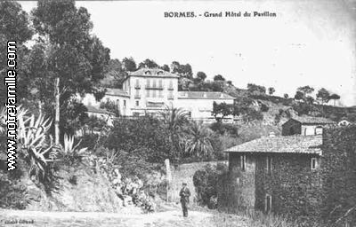
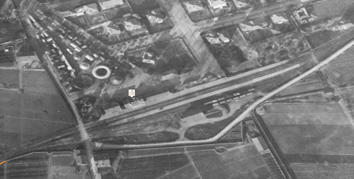
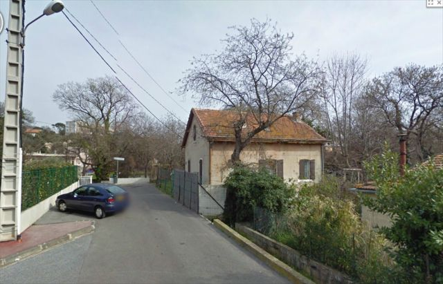
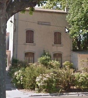
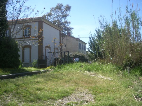
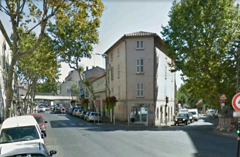
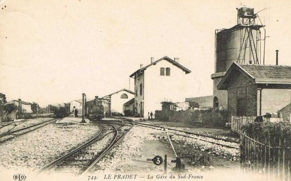
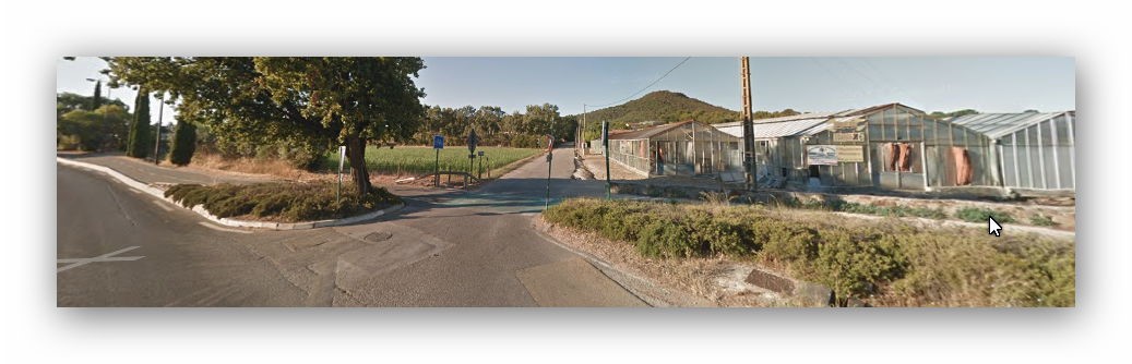
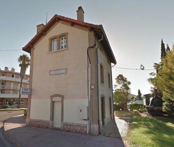
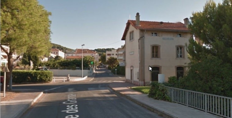
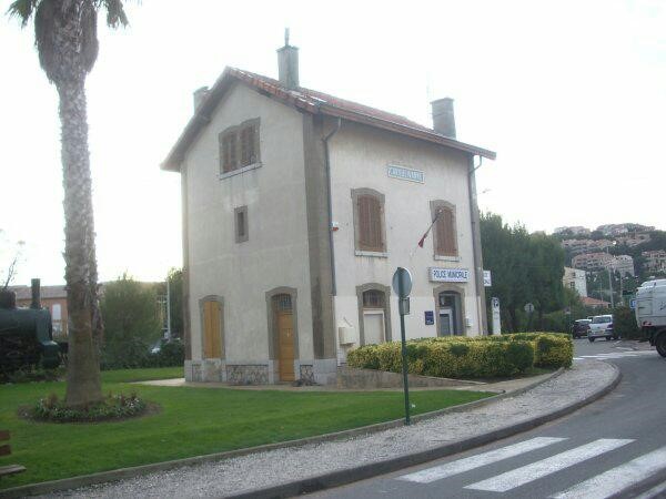
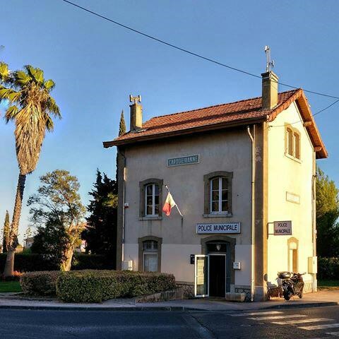
8.7 kilometres from The Gare du Sud in Toulon we arrive at La Pradet Station. It was a more significant stop on the line with passenger facilities, a goods shed, two goods sidings, a passing loop serving two platforms, a 50 cubic-metre water tower and three hydraulic cranes. The Station building still exists, converted into housing it sits close to a cultural centre – “Espace des Arts”, effectively enveloped by it! Little else of the site remains. The first image was taken in 2004 by Jacques Lahitte. The second modern image was taken from Google Streetview in 2017.

1421084168-83-Le-Pradet-1

Three old postcards give a reasonable impression of the station in its heyday!

It was an important station on the line because it provided a loading point for copper ore. In 1950, the station was purchased by the municipality to form a girls’ school.


Leaving La Pradet the railway formation followed the D559 road and now-a-days continues to be used as a dedicated cycleway. Halts were opened with the railway line at La Bayette, La Moutonne and La Colle-Noire.

At La Colle-Noire a short branch left the Chemin de Fer du Sud mainline to provide a rail link to a mine at Cap Garonne – a copper mine.

The branch-line to the Cap Garonne copper mine was 4 kilometres long. It left the mainline between La Moutonne and La Colle-Noire and allowed the transport of copper ore to Toulon. The line was steeply graded and was, from 1907 equipped with the Hanscotte system. The engineer Jules Étienne Hanscotte developed a system to ensure the stability of the train with horizontal wheels in pressure against a central rail it allowed trains to adhere effectively one grades much steeper than normal. The most well-known application in France of the Hanscotte system was the Puy de Dôme tram, which ran from 1907 to 1926.

The Cap Garonne mine was opened in 1873. It was in English hands from that date until 1884. It was owned by John Morley Unwin. It employed about 40 workers during this time. Ownership was transferred to a Mr. Roux after a period in liquidation. He owned the mine from 1892 to 1899. At that time, a small factory was built at the mine for manufacture of copper sulphate from poor quality arisings. The mine was in operation until 1917, served by the branch from 1906 onwards.

The approximate route of the branch is shown on the adjacent extract from the 1930s Michelin map of the area.

The branch left the mainline adjacent to these modern greenhouses and followed a straight path across relatively level ground, before wandering around La Colle-Noire.

The satellite image from Google Earth allows the route of the line to be identified quite easily. In the image below, the route runs diagonally from the North-east to the South-west. In the smaller image the route runs from the middle-top to the mine location at the bottom of the image.

These images show that it is easy to identify the line the immediately following image picks out that line. It comes from the website of Jean-Pieree Moreau.

Marc Andre Dubout provides a few images to help us identify with the area. The first is this accommodation bridge.


The second image shows the factory. He comments that this second image is an overview of the mine and factory now transformed into a museum, with the railway passing immediately behind the buildings.


There are other images which can be found on the internet and some of these follow here. Hopefully they will give a good indication of the size of the operation.

As noted above, the mine closed in 1917 and was only in use after that for a short time as a mushroom farm (1946-1953) before the museum was opened in 1994.

In the years after 1953, the galleries remained open and the mine was looted. Even though the mine was no longer commercially viable for the extraction of copper, it still retained an extraordinary richness of mineral deposits. It was and is host to over 100 different minerals of significant scientific interest. By 1984, environmental considerations and the need to preserve the integrity of the site for heritage purposes resulted in local authorities protecting the site. The mine was situated in the heart of a forest of 300 hectares of significant scientific interest. The three communes that owned the museum formed an inter-communal syndicate which took the decision to close all accesses to the mine to prevent looting in 1990.

The communes of La Pradet, La Garde and Carqueiranne took the shared decision to create a museum at the site. The museum opened in 1994. Displays inside the museum aid in understanding the operation of the mine, give good examples of the minerals which have been extracted within the mine and enable visitors better to understand the mineral composition of ground rocks in the area.

The brochure says: “In the heart of a unique forest overlooking the Mediterranean, the old copper mines of Cap Garonne are among the five most beautiful mineralogical sites in the world. The diversity, the richness, the scientific interest of the identified crystals attract researchers from all over the world. This is the only French museum of copper and micro-minerals. It reveals how humanity has used copper over time, the place that copper has held in our daily lives, how the mine has changed with the changes of civilization, the current uses of copper. In addition, visitors will have a fantastic journey to the heart of the earth. From the life of the miners to the history of the rock, the visit of the mine is a living lesson, a fascinating adventure for young and old.”

The branch-line junction was controlled by means of a ground-frame contained in a small wooden cabin and telegraph apparatus enabled the branch working to demand access onto the mainline for access to the sidings at La Pradet. Once the mine had closed in 1917 there was little need for the branch, however, it does not seem to have been formally closed until 1928 and the track was not lifted until 1930.

Beyond the Cap Garonne branch-line, the modern D559 by-passes the centre of Carqueiranne and to do so it follows the formation of the old railway main-line. A cycleway has been built alongside the by-pass but the formation is hidden under the main carriageway.

About 12 kilometres from Toulon Station a small halt was opened in 1937 at Paradise.

Carqueiranne Station is reached just over 14 kilometres along the railway from Toulon Gare du Sud. It opened in 1905 had had a similar status to the station at La Pradet (3rd class with a goods shed, two main tracks and a good siding). Today, the station houses the police offices. The locomotive which can be seen adjacent to the station is a reminder from the municipal authorities of the historic use of the site. It is, however, misleading.


The locomotive is a 0-4-0 built in 1921 by Henschel & Sohn in Kassel, Germany. It was given the number 18524 and was sold to the F. Béghin sugar refinery at Thumeries (North). It was never used on the Cap Garonne branch, nor on the Chemin de Fer du Sud. It is a standard gauge locomotive and the lines we are interested in are metre-gauge.

I love looking at these old postcards. I don’t know what that is really all about. Perhaps it is nostalgia. But it is more likely to be something to do with fascination for what things used to be like. There wasn’t anything better about those times, but they were different. They were times of amazing progress, but still times of poverty and inequality.

Leaving Carqueiranne, the Chemin de Fer du Sud followed the coast-road through two halts, one at Beau Rivage and Fontbrun. Just before arriving at San Salvadour, 16.1 kilometres from the Gare du Sud, the formation passed in tunnel under the D559 and emerged on the right-hand side of the road.

The tunnel was 284 metres long and on a curved alignment. The postcard below is taken looking through San Salvadour Station towards the Eastern portal of the tunnel.

16.5 kilometres from Toulon Station we arrive at San-Salvadour – Mont-des-Oiseaux Station. This station was of greater importance than earlier ones on our journey. So much so that at the formal opening of the line this station played a significant role. The inaugural train stopped at the station on 6th August 1905.

The station opened with the railway in 1905, it qualified as a 2nd Class Station and the passenger facilities were slightly improved over those we have seen on the line since we left Toulon. There was a good shed, as can be seen above, two platforms served passengers and there was a goods siding as well. The two remaining buildings – the passenger station building, and the goods shed – are used as outbuildings by the nearby hospital. They can be seen alongside the D559 not far from the sea-shore. The railway formation continues to be used as a cycleway close to the road. Below the photograph of the station buildings today there are a sequence of photos, of trains arriving, from St. Raphael, at San Salvadour Station.

These last two postcards show two of the more significant buildings close to the station – the first is the marine hospital/sanatorium of Du Monts des Oiseaux, the second is the Grand Hotel and the Chateau.


The two remaining station buildings are at the centre of the satellite image above.

As we leave San Salvadour Station the line heads eastwards for a short distance before sweeping in an arc away from the coast and heading north towards Hyeres, passing through a small halt at L’Almanarre-Pomponiana (L’Amanarre before 1911), 18 kilometres from the start of our journey. San Salavdour Station is marked ‘A’ on the aerial photograph below and L’Amanarre Halt is marker ‘H’.


L’Amanarre Halt is notorious for a bad accident which happened here on the line in 1911. However, all evidence of the Halt is buried under the modern roundabout junction between the D559 and the D42 roads.

Travelling north from this location the railway formation closely followed the modern D559. Once again, a cycleway runs alongside the road on the approximate line of the railway formation. Before arriving at Hyeres, the railway passed through three more halts at Costebelle, Le Palyvestre and Les Nartettes and then passed under the PLM line from Hyeres to Les Salins d’Hyeres.

After the under-bridge, the line arrived at an interesting triangular junction formed when the mainline from St. Raphael was extended to Toulon. The original terminus of the line, close to the PLM station became a lesser station and gradually changed into a trans-shipment location for goods.

Jean-Piere Mareau has pulled together plans of the area and ariel photographs and imposed these onto satellite images from Google Earth. The resulting images are of great interest.
First, we see the aerial image of the route of the Chemin de Fer du Sud and the triangular junction which interestingly picks up a number of goods wagons on sidings on the PLM line.


The second image is a composite satellite and aerial image which shows both the PLM Station and the Chemin de Fer du Sud transhipment wharves. Both stations show evidence of significant amounts of good traffic.


This close up of the aerial image shows the PLM station the station square, the hotel ‘Terminus des Deux Gares’ (marked with the arrow) and the Chemin de Fer du Sud Hyeres Echange Station (marked with the tag).


In the image which shows the full elevation of the hotel, the terminus building for the Chemin de Fer du Sud can just be picked out on the far right of the photograph. The hotel and the terminus building have long-gone and have been replaced by modern development.

Moreau’s final contribution at this site is, for me at least, the most interesting. He has overlaid a hand-drawn plan of the Hyeres Echange Station onto the modern Google Satellite image. The composite image is shown below. It sows clearly the complexity of the track layout and a sense of the importance of the station. The Station opened in 1890 and was the terminus of the line from St. Raphael before the extension to Toulon was built. It had passenger and goods facilities, an engine shed which could house 4 locomotives, two platforms for passengers and three main goods sidings. In 1900, longer goods transhipment sidings were installed. In 1907, modifications were made which focussed on good transhipment at the station.

Travelling on from the triangular junction, after a short deviation to the North-east, the line continues North, a hundred metes or so to the east of the D559 before turning North-east again and entering Hyeres Station. This is the end of this part of our journey.

References
[1] Roland Le Corff; http://www.mes-annees-50.fr/Le_Macaron.htm, accessed 13th December 2017.
[2] Marc Andre Dubout; http://marc-andre-dubout.org/cf/baguenaude/toulon-st-raphael/toulon-st-raphael1.htm, accessed 14th December 2017
[3] Jean-Pierre Moreau; http://moreau.fr.free.fr/mescartes/ToulonGareSudFrance.html, accessed 24th December 2017.
[4] José Banaudo; Histoire des Chemins de Fer de Provence – 2: Le Train du Littoral (A History of the Railways of Provence Volume 2: The Costal Railway); Les Éditions du Cabri, 1999.

Ligne du Littoral (Toulon to St. Raphael) – Part 4 – Toulon to Les Salins d’Hyeres (Chemins de Fer de Provence 39)

The PLM Railway Line from Toulon to Hyères and Les Salins-d’Hyères

Le Chemin de Fer du Sud faced competition from three different forms of transport. Road transport increasingly became significant as years went by; there was also a tramway from Toulon to Hyères. Details of this line can be found in my post about the Tramways of Toulon. [1]

Alternatively, goods and passengers could use the PLM Branch Line which served Hyères and Les Salins-d’Hyères. This post focuses on that line which is still in use today. On the map below, the tramway is shown in green and the PLM route in pink.

Trains from Toulon to Les Salins-d’Hyères followed the PLM main-line travelling East from Toulon Station. The line travelled East of La Garde as it turned north and then crossed the line of the Toulon-Hyères tramway. The branch left the main-line just north of La Gare de la Pauline. Its trajectory was then generally in a South-easterly direction, running south of Hyères. It met the coast at La Hippodrome de la Plage where it turned to the north-east and followed the coastline into Les Salins-d’Hyères.

The adjacent map shows the three different lines which served Hyères, and the relative positions of their stations in relation to the town. The picture below is of the platforms at Toulon station. The pictures which follow show the PLM station at Hyères.

Hyères PLM Station is of a very similar style to other secondary stations on the PLM network. It now formed the terminus of the branch-line as rails from Hyères to Les Salins d’Hyères have been lifted.

Hyères station was commissioned on 6th December 1875 when the PLM opened the first section of the line. It became a through station on 10th July 1876 when the extension to Les Salins d’Hyères was completed.


The overhead image below was taken in the 1930s. It shows the PLM station and to the bottom right, the triangle which facilitated freight transfer to the Chemin de Fer du Sud. Notice how little development there has been around the station site.

The picture below shows the early means of transport from the station into Hyères – horse-drawn carriages.

The next image is an up-to-date satellite image of the station and its environs. Clearly, in the 21st Century, the area is considerably more developed than it was in the 1930s and car parks have replaced goods sidings. The pictures which follow show the station in the 21st Century.

Within a few hundred yards of the station the line is truncated at buffer stops. What is perhaps surprising is that the route of the line through to Les Salins d’Hyères can still easily be picked out on satellite images.

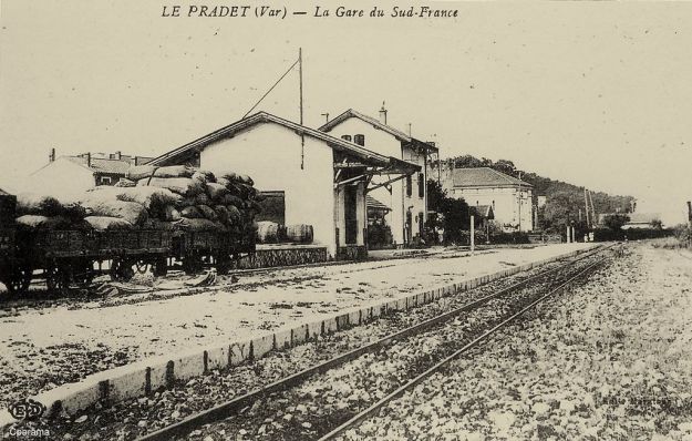
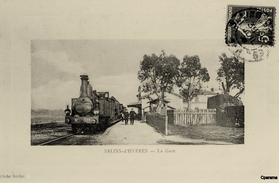
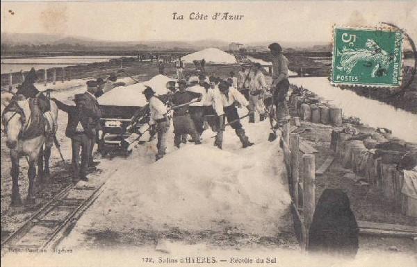
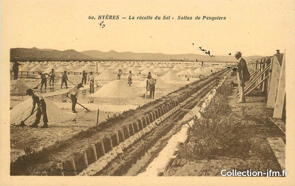
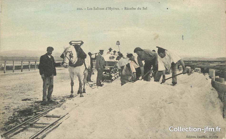
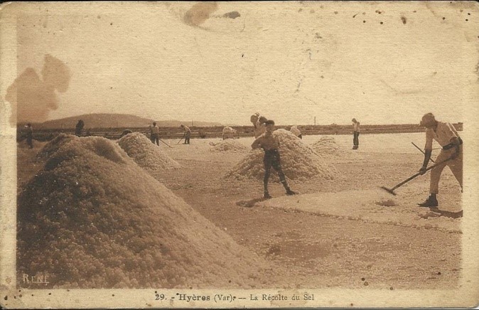
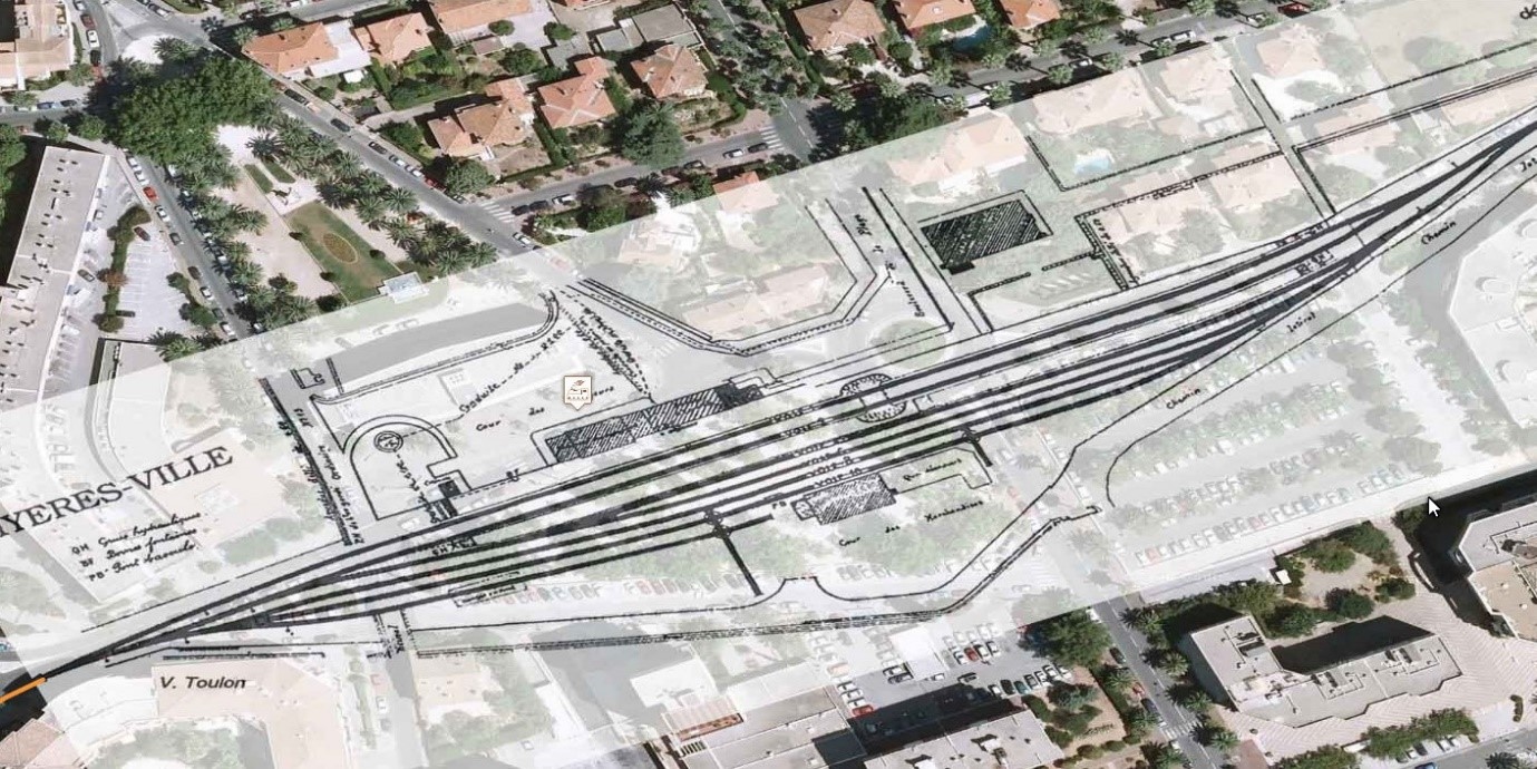
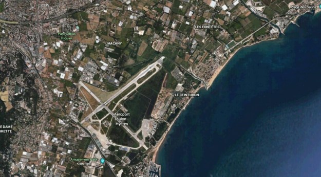
In the image above, Les Salins d’Hyères is in the top right and Hyères Station can be seen in the top left. The tight radius as the line approaches the coast is clearly visible centre-bottom of the image below the airport.

Marc Andre Dubout has provided some pictures to supplement those available as historic postcards which show the last few kilometres of the branch as they approach the coast and travel North-east along it. The first few pictures are of the Station Hyeres La Plage.


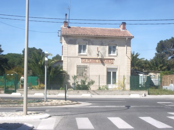
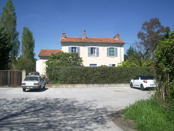
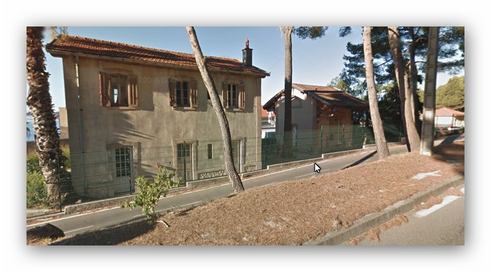
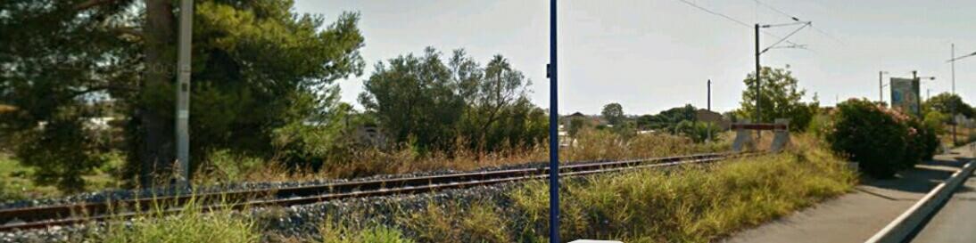
These two pictures show the station after closure and the cycle track which replaced the railway alongside the coast road. The following picture shows a hotel and the airport. The line of the railway is still visible alongside the coast road.


Just before reaching Les Salins d’Hyeres the railway crossed the mouth of Le Gapeau River.

We have a few photos of the station  and its environs, including the remains of the water tower.

The next couple of photos are contemporary, the first looking towards Hyeres and showing the remaining platform edge.

And the second is of what is assumed to be a railway workers accommodation block and which seems to be contemporary to the station itself.

The following pictures are of the work undertaken to extract salt from the salt marshes near the village. At one time this was a highly labour intensive operation.

These images were sourced from a variety of sites on the internet, usually sites selling cards for collectors. A few of the postcard views were obtained from the site maintained by Marc Andre Dubout. [2]

References

[1] Roger Farnworth: Ligne du Littoral (Toulon to St. Raphael) – Part 3 – Trams in Toulon and Hyeres (Chemin de Fer de Provence 38): https://rogerfarnworth.wordpress.com/2017/12/23/ligne-du-littoral-toulon-to-st-raphael-part-3-trams-in-toulon-and-hyeres-chemin-de-fer-de-provence-38.

[2] Marc Andre Dubout: http://www.cfchanteraines.fr/lvdc/lvdc0161/toulon-salins.htm,  accessed 23rd December 2017

Ligne du Littoral (Toulon to St. Raphael) – Part 3 – Trams in Toulon and Hyeres (Chemins de Fer de Provence 38)

Tramways in Toulon and the Surrounding Area

As the fifteenth city of France, Toulon warranted a tram network. Trams first operated in the city in 1886. [1] The map below shows the network in the 1930s. The last trams ran in 1955.

The maps above are the best I could find researching the internet. They give a reasonable impression of the extent of the network at its height. Each in their own way highlighting different things. The last is from the Wikipedia article on the Trams of Toulon.[2] The one above that comes from the web pages of Roland Le Corff.[3]

Two different tramway networks are evident on the plan provided by Le Corff. The urban network and the tramways of Western Var. Those of the Western Var must of necessity be a matter for another day or time. There is an excellent website dedicated to all sorts of things related to Toulon, and in particular its trams, developed by Roland Le Corff (Mes Annees 50).[4]

The History of Toulon’s Urban Tram Network

Toulon’s tramway era began on 17th January, 1881, the date of the inauguration of the very first Bon-Rencontre to Pont-de-Saint-Jean-du-Var line with trams pulled by horses.

Le Corff says that the early ancestor of the tramway was invented in 1775 by Englishman John Outram (whose name well have resulted in the use of the word ‘tram’); Outram’s vehicle, pulled by two horses, ran on two rows of cast iron rails but did not operate in towns. In 1832, John Stephenson built the first urban streetcar in New York between upper Manhattan and Harlem.

In 1852, the Frenchman, Alphonse Loubat , a native of Nantes, proposed the idea of rails embedded in the roadway Loubat’s idea was an immediate success. Loubat built a line on 6th Avenue in New York in 1852; in 1853 it was the turn of Paris between the Place de la Concorde and Saint-Cloud.

Horse-powered trams were very successful, but their range was limited because horses tire. The animals could only travel about 20 km per day and needed a rest every hour (loads were heavy despite the advantages of rails). Moreover, housing, feeding, veterinary care, etc. were all expensive. Dung was also a problem. Mechanical trams were mooted and first attempted in Parish in 1876. Options were considered including steam and compressed air.

Le Corff says that the first electric tram was shown by Werner Siemens at the Berlin exhibition in 1881, a little later, the first operational electric tram line was built in 1888 by the American Frank Julian Sprague (a 27 km line in Richmond in Virginia). 10 years later, 40,000 cars were circulating in the United States. In France, the first electric motor circulated in Clermont-Ferrand on 7th January 1890.

At the end of the 19th century, Toulon had grown significantly, new buildings had been developed along the Boulevard de Strasbourg between 1860 and 1890. The PLM Station was opened in 1852. The outlying districts had expanded: distances from the centre of Toulon were increasing for commuters and services were limited. Horse-drawn buses were working. Small omnibuses served the suburbs, pulled by two horses. The two larger images below show a typical omnibus in Puget Square, and Le Place Armand Vallée which was the starting point of services to the villages of the Var.[5]

The intention to provide a horse-drawn tram network was announced by the State on 18th January 1876. It was not until 16th January 1886 that two lines serving St-Jean du Var and Bon Rencontre were established.

Another line was completed from Place Louis Blanc to Le Mourillon in 1889. Then one to Bains Sainte-Hélène. In 1892, another length was constructed from Valettois to Camille Ledeau.
A switch from horse-drawn trams to electric power was requested and considered by local councils in 1896. On 30th July 1897, the first electric trams ran on the line between Bon Rencontre and Valletta. Everything went very well and further electrification took place. The network reached its fullest extent in 1911.

The network went into decline during and after the war. Poor maintenance left the vehicles and tramways in a parlous condition and the population of Toulon welcomed the eventual replacement of the trams by trolley-buses. The first trolley-buses went into service in 1949. The last trams ran in 1955.

Sadly, no effort at preservation was made. Trams were scrapped almost immediately after their last trips.


The route which most interests us for the purposes of this series about the Chemin de Fer du Sud Littoral is that length of tramway between Toulon and Hyeres.

Trams from Toulon to Hyeres

As can be seen on the map below there was a tram route in direct competition with both the PLM branch to Hyeres and the Chemin de Fer du Sud. Ultimately, this competition was to make the tramway and the two railway routes struggle to guarantee enough income to survive. Ultimately, only the PLM branch-line survives in 2017.

Routes Nos. 1 and 9 are the ones which most interest us, particularly route 9 which served Hyeres. The picture below the map is taken at the junction of Route 1 and Route 9 on the south side of the railway line in the picture above. The Depot Brunet is beyond the railway bridge which can be seen in the distance. The photographer is on Boulevard Marechal Joffre (D97). The road to the right is Avenue Joseph Gasquet (D559). The layout is similar in 2017! The railway bridge has been replaced and the tramlines are long-gone but the building at the centre of the picture remains.

This is the railway bridge in the last postcard. It carried the PLM line over Boulevard Marechal Joffre. Close by was the main depot and maintenance yard for the tram network – Brunet Depot. The picture below shows the same location today on Boulevard Marechal Joffre today.

Brunet Depot was the main storage and maintenance depot on the Toulon tram network. It is still in use as a transport depot today. The line Réseau Mistral use the depot.

Travelling East, Boulevard Marechal Joffre gives way to Avenue Colonel Picot and access to the bus depot (the old tram depot) is on the right down Rue Octave Virgily.

Beyond the tramway depot, Ligne 1 continued to follow the D97 and then the D246 to La Valette du Var. The tram tracks then travel further East on the D98 on the North side of the Campus of Toulon University to Les 4 Chemins.

Ligne 9 leaves Boulevard Marechal Joffre along Avenue Joseph Gasquet (D559). It follows the D559 and then the D29 through La Garde to Les 4 Chemins. It then runs to the south of Gare de la Pauline-Hyeres on the D98. Trams continued along the D98, the D46 and the D554 to Hyeres.

The Green line on this map shows the tramline in Hyeres.

The route approached the centre of Hyeres on Avenue des Iles d’Or. This then became Avenue Alphonse Denis in the centre of Hyeres (although the stretch of road on which the terminus of the tramway was placed is now known as the Avenue General de Gaulle).

References

[1] Wikipedia; https://fr.wikipedia.org/wiki/Tramway_de_Toulon, accessed 20th December 2017.

[2] Wikipedia; https://fr.wikipedia.org/wiki/Tramway_de_Toulon, accessed 20th December 2017.

[3] R. Le Corff; http://www.mes-annees-50.fr/Tramways_de_toulon_plans_reseau.htm, accessed 20th December 2017.

[4] R. Le Corff; http://www.mes-annees-50.fr, accessed 20th December 2017.

[5] Gabriel Bonnafoux & Albert Clavel; 1880-1980: Un Siecle de Transports en Commun dans l’Agglomeration Toulonnaise, Atelier du Beausset – 83330 Le Beausset, 1985.