Author Archives: Roger Farnworth

Unknown's avatar

About Roger Farnworth

A retired Civil Engineer and Priest

Lancaster Green Ayre Railway Station

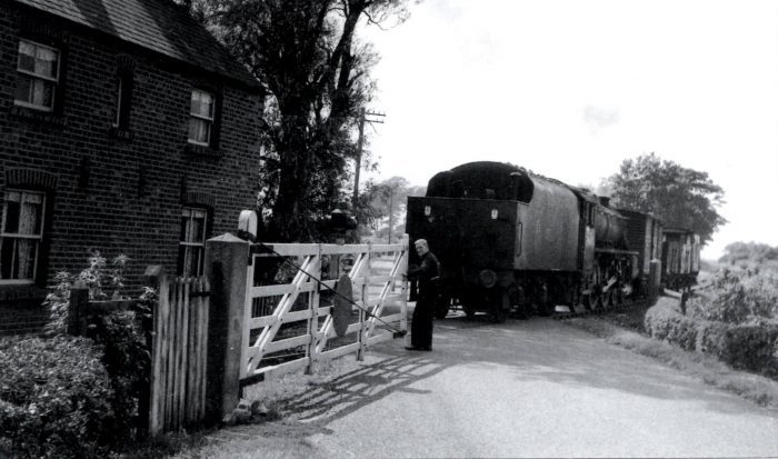
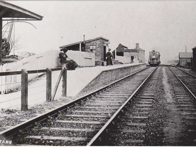
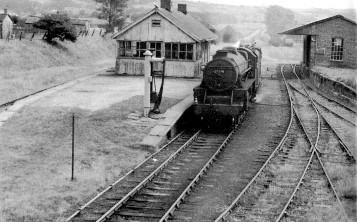
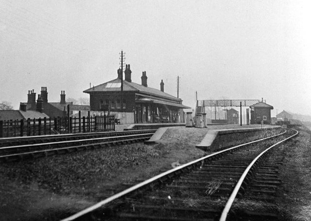
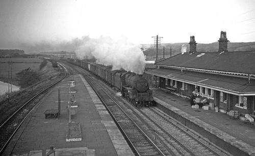
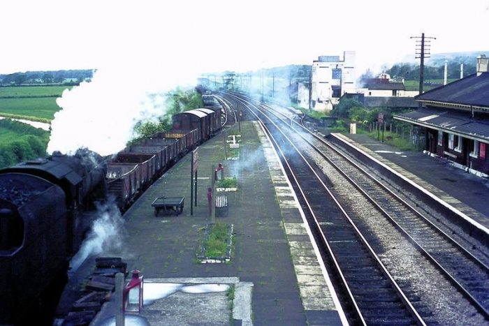
Lancaster Green Ayre Station was the erstwhile Midland Railway Station in Lancaster and it provided an East-West service through the city to Morecambe in the West and Yorkshire in the East. A platform level view of Green Ayre Station which shows M29023M in the Eastbound platform. The platform signal box can be seen to good advantage in this image. The photo appears on the pjbrailwayphotos site and is marked Copyright: N/A  (Public Domain). [21]

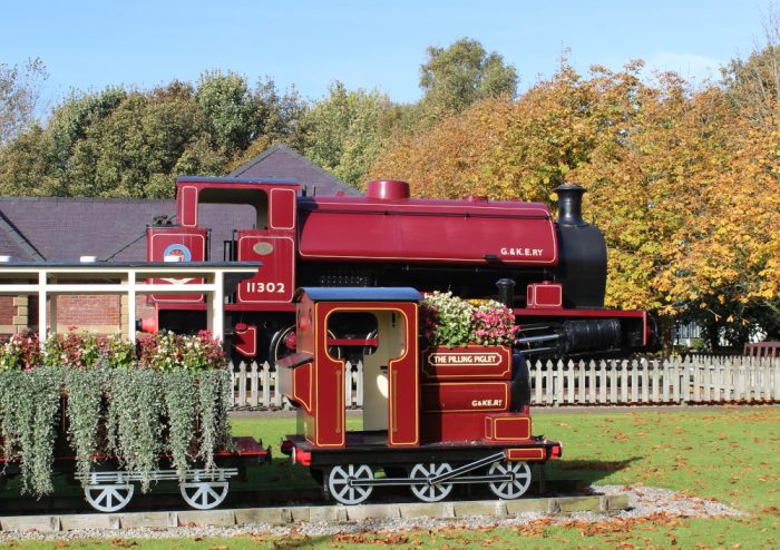
There is a modelling thread on the RMWeb Forum which covers a model of the station built over a number of years by ‘jamie92208’. [2] The thread is worth a visit. It follows the development of the model from 2010 to today and is a saga spread over 72 forum pages. It includes many photographs of the development of the model.

The model was the centre-piece of a two day event in 2016 at Lancaster Library marking 50 years since the closure of the Green Ayre line in 1966. The event also featured unique film and audio material, showing the line on its last day of operation in 1966. Filmed by a former Lancaster curate, Rev. Bob Jackson; the footage had been preserved for 50 years and shows a complete return journey between Lancaster and Morecambe.  Artist Adam York Gregory created an interactive presentation, which enabled visitors to experience a journey on the line. [11]

The railways in Lancaster, Morecambe and Heysham in 1913. The lines shown in red were LNWR lines, those in Green were Midland lines. The ferry service from Heysham served Belfast. [3]

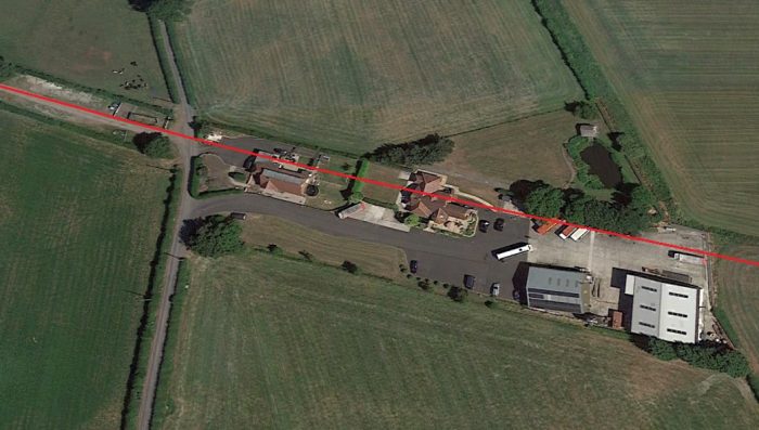
The railways in Lancaster and Morecambe developed over a number of decades. The first station was built by the Lancaster and Preston Junction Railway (L&PJR) and opened in 1840. It only served the city for nine years. Wikiwand states: “Some books refer to the station as “Lancaster (Greaves)” or “Lancaster (Penny Street)” to distinguish it from later stations in the city, although whilst open it was known simply as “Lancaster” as there was no other station of that name at the same time.” [4][6: p127]

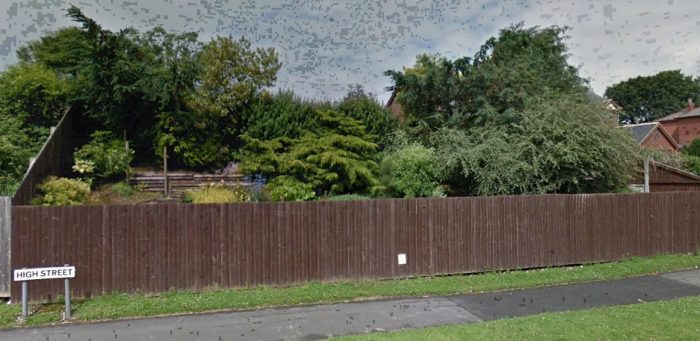
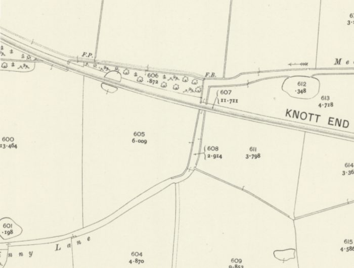
The station was located near the modern-day junction between South Road and Ashton Road, just south of the Lancaster Canal and the southern end of Penny Street.

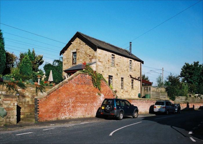
The Lancaster and Carlisle Railway (L&CR) opened Lancaster Castle railway station on 22nd September 1846. [5][7: p96] It built a line southwards from Lancaster Castle station to meet the L&PJR about 0.5 mile South of the old station. On 1 August 1849, the L&CR leased the L&PJR line in its entirety, on which date old Lancaster station was closed to passengers. [5] The Passenger Station can still be seen in Lancaster. It is now a  Grade 2 listed building and a nurses’ home. [8]
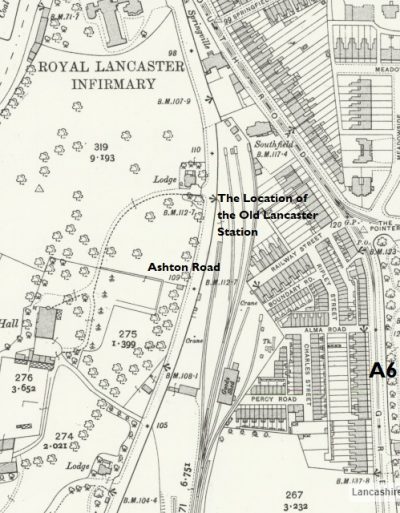
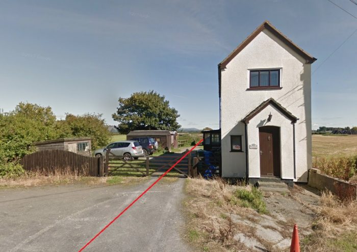
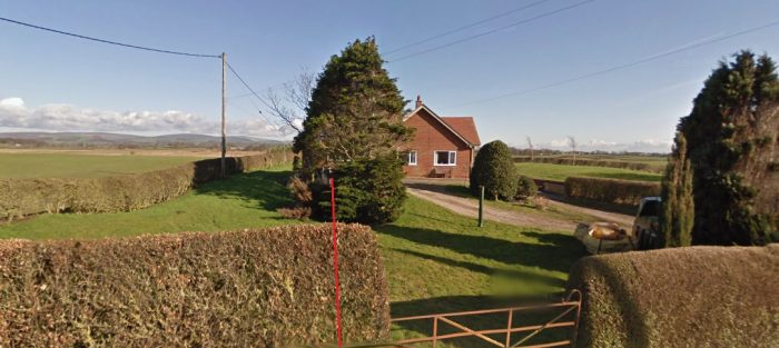
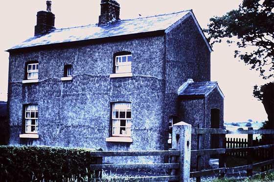
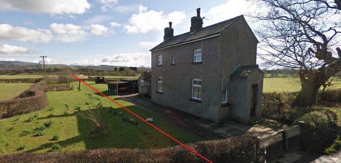
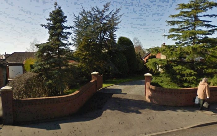
Lancaster Royal Infirmary Nurses’ Home was once the station building for the first Lancaster Station (Google Streetview) [8]

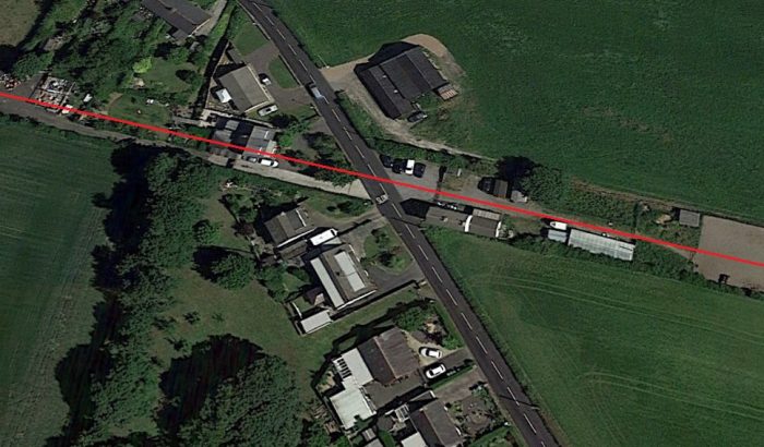
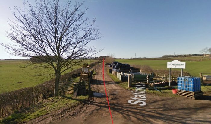
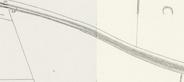
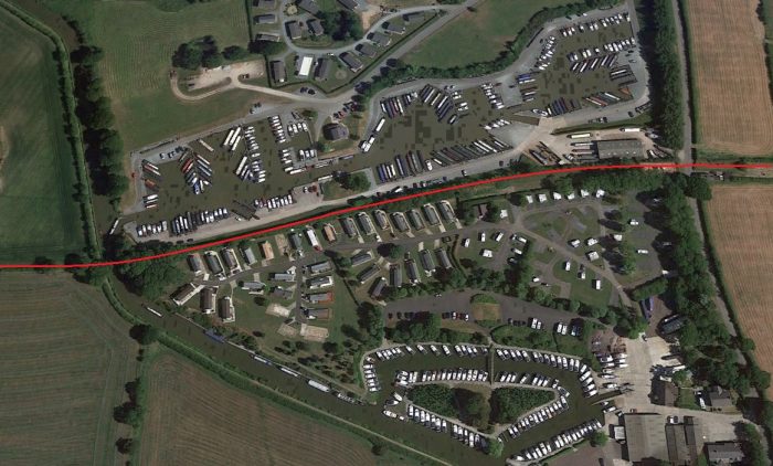
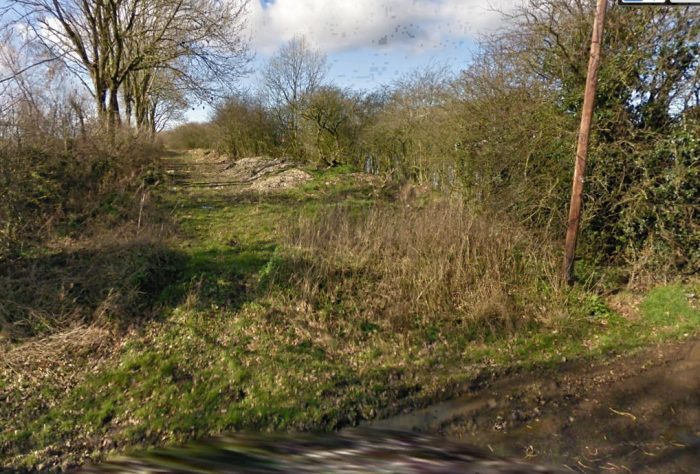
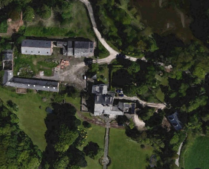
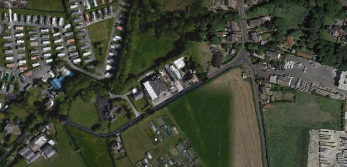
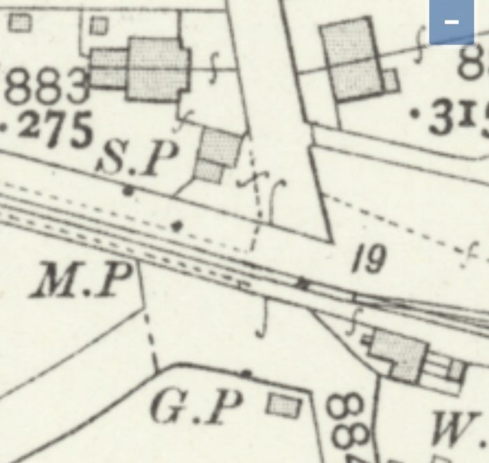
The adjacent OS Map extract shows the old station site and the old passenger building is designated ‘Southfield’. The pictures below show that it is now all laid to car-park and provides for visitors and staff at the hospital. The first image is a Google Earth satellite image of the area included in the OS Map extract. The image below that is taken from Aston Road a looks North across the car-park form approximately the location of the text ‘Ashton Road’ on the OS Map Extract.

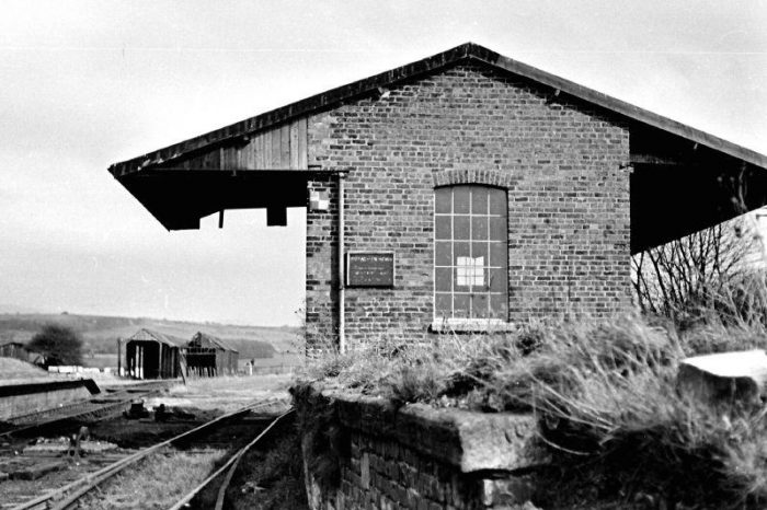
Most of the spur line leading towards the station continued to be used to access a goods station until the 1960s.The plaque above notes the status of the building in the mid-19th century.

The second picture below shows the front of the old station building taken from the A6.

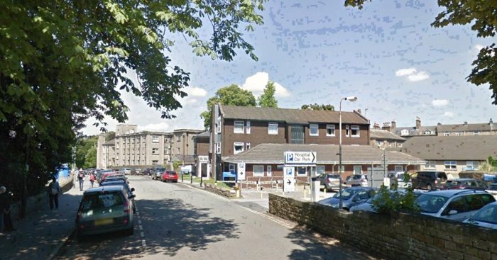
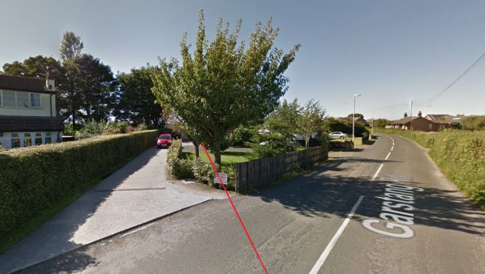
Looking North along Ashton Road across the site of the Infirmary and its car-park (Google Streetview).

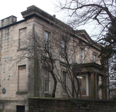
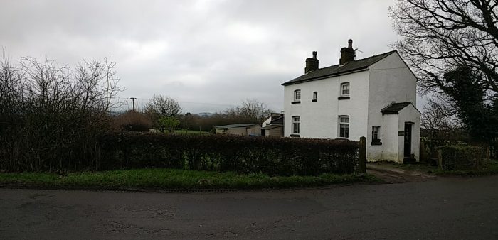
The old frontage of the station built by the L&PJR and used for 6 years for passengers between 1840 and 1846. [4]

As we have already noted, the second station in Lancaster was that built by the Lancaster and Carlisle Railway (L&CR) and which opened in 1846 – Lancaster Castle Station. It is Lancaster Castle Station which remains open as Lancaster Station in the 21st century and which sits on the West Coast Mainline today.

Wikiwand tells us that it was “officially opened on 21st September 1846. The first public service ran into the station on 17th December the same year. The station was built as the southern terminus of the Lancaster and Carlisle Railway after the initial planned route for the line – which would have followed the Lancaster Canal and crossing the River Lune from Ladies Walk to Skerton – was changed in favour of a cheaper route west of the city.” [9]

Wkiwand goes on to say: “The station was remodelled in 1900-1906 when additional lines and platforms were added and further station buildings constructed. The new buildings were styled mock-Elizabethan with the intention of mirroring the battlements of the nearby Lancaster Castle. Platforms 5 and 6 (on the east side of the station) were electrified in 1908 to serve the now-closed Midland Railway route to Morecambe and Heysham. This line closed in January 1966 and the overhead line equipment was removed.” [9] The link to the Midland Railway curved to the East down towards the Rive Lune and met the Midland line at Green Ayre Station.

The Wikiwand notes about Lancaster Castle Station are considerably expanded by the British Listed Buildings website, which says that the station building is now Grade 2 listed. It was, in fact, extended in both 1852 and between 1900 and 1906 and refurbished in 1990. Full details of that station building can be found on the British Listed Buildings website.

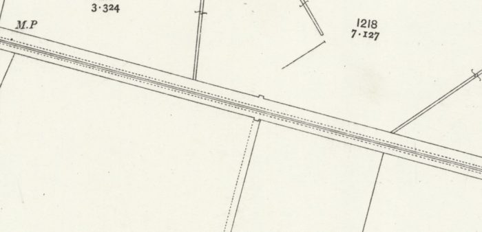
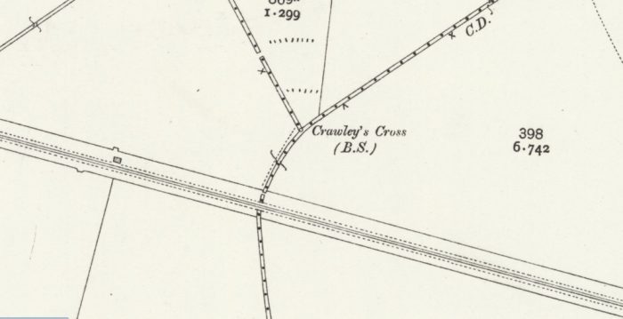
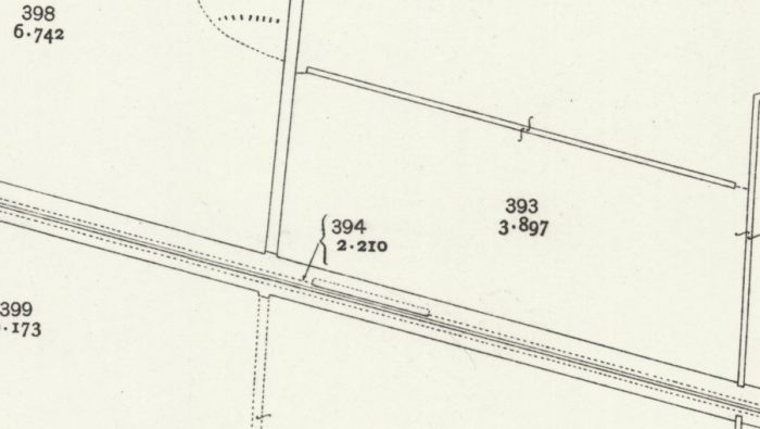
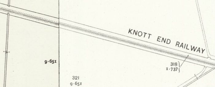
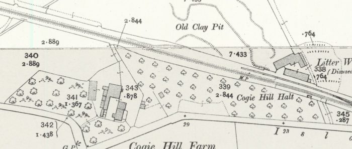
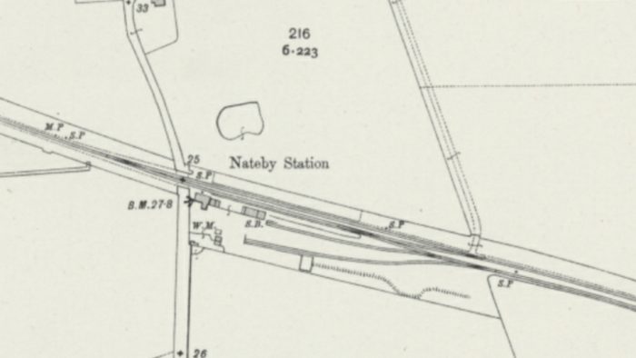
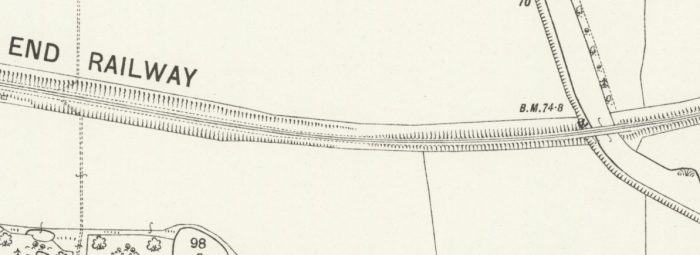
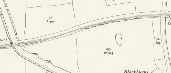
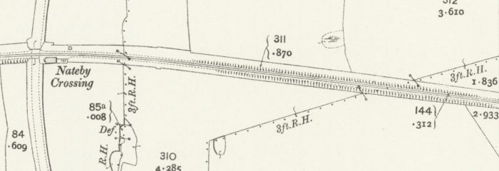
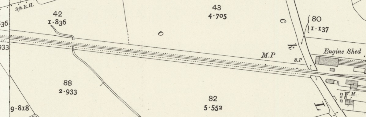
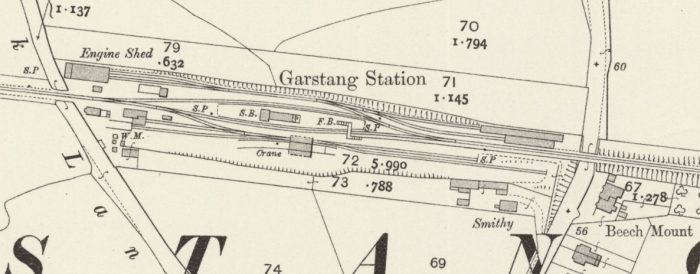
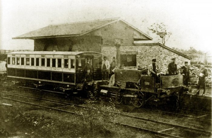
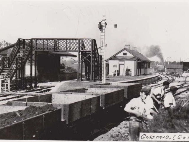
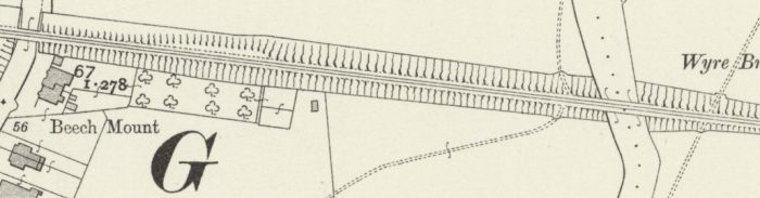
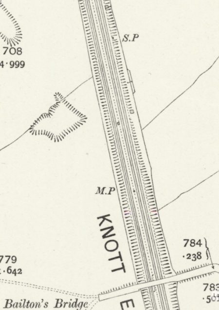
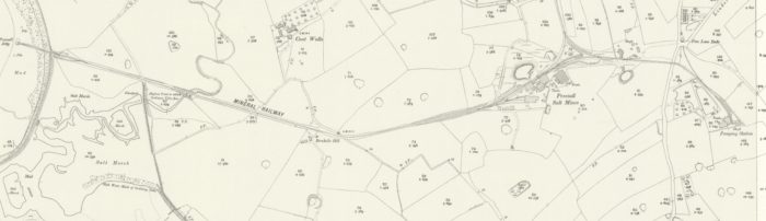
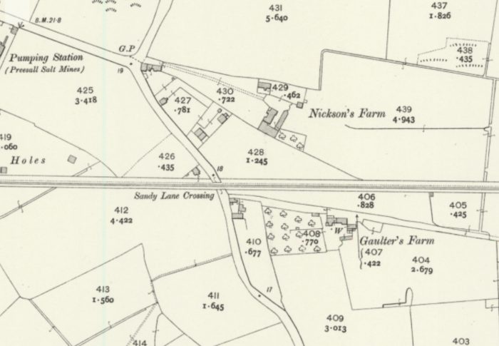
The third Station to be built in Lancaster was built by the Midland Railway and is the station on which this article is focussed. Green Ayre Station sat by the banks of the River Lune. It was at the beginning of a sharp curve which took the Midland mainline to Morecambe across the river on a multi-span bridge (Greyhound Bridge). To the Northeast there were a series of sidings alongside the line and the river beyond Skerton Bridge and to the Southwest were the goods yard and locomotive facilities along with a branch line which lead to Lancaster Castle Station. The coal yard sat to the East of the station. The OS Map extract below shows the layout of lines in the immediate vicinity of the station.
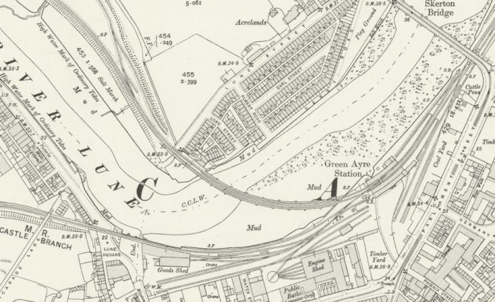
Green Ayre Station on the Southern bank of the River Lune. [12]

Wikipedia tells us that the station was opened by the “Morecambe Harbour and Railway Company (MH&R) on 12th June 1848. [6: p129][7: p96] The station building was designed by Edmund Sharpe. [13: p90][14: p386] … The line originally ran from Lancaster to Morecambe Harbour. The “Little” North Western Railway (Little NWR) was building a line to the East of Lancaster from Skipton, via Ingleton to join the West Coast Line further to the North at Low Gill. CommunityRailLancashire tells us that, as construction proceeded a national recession led to a shortage of capital. Work was stopped at Ingleton, and, on the advice of George Stephenson, efforts were concentrated instead on completing the line from Clapham through Bentham to Lancaster.” [27]

The MH&R and the Little NWR formed an end-on junction at Lancaster Green Ayre  and the two companies amalgamated before construction began. A branch was built from Green Ayre to the Castle Station of the Lancaster & Carlisle Railway.” [27][6: p129][7: p96][15]

George Stephenson’s advice proved to be sound, the connection through Lancaster to what became known as Morecambe, was lucrative. The Little NWR had made the right decision. CommunityRailLancashire tells us that, “the new harbour at Morecambe attracted plenty of freight, but many more passengers than expected. They came for sailings to Ireland, and also to enjoy a sail around the bay, or across to Grange or Arnside (the main pier still stands, as the popular ‘stone jetty’). People were pouring in on excursion trains within months of the opening.” [27]

From 1st June 1852, the Little NWR and MH&R were worked by the Midland Railway. [7: p18]

Then in January 1859, both the Little NWR and the MH&R were leased to the Midland, and in July 1874 they were absorbed by the Midland Railway. [16: p95,97] The line from Skipton to Morecambe gave the Midland Railway a competitive route to the North West Coast in the heart of LNWR territory and a significant port at Heysham.

UnseenSteam comments that, “Although originally built as single track, the line from Skipton through to Morecambe was eventually doubled. The section from Hornby, to the west of Wennington, to Hellifield was doubled by 1850 and extended to Skipton in 1853. Lancaster to Morecambe was doubled in 1877 and Hornby to Lancaster 12 years later. The link between the two stations in Lancaster remained single track through until closure.” [28]

However, the harbour at Morecambe was never seen as entirely satisfactory and at around the turn of the 20th century the Midland Railway promoted  the construction of a new harbour at Heysham This decision saw a further increase in feight traffic and passenger services to Heysham started on 1st September 1904. [28]

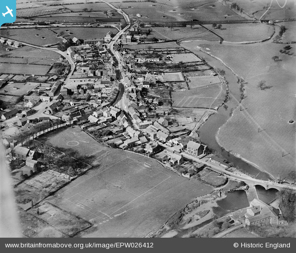
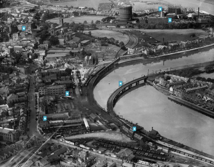
The fantastic aerial image above was taken in 1933. It shows Green Ayre Station at the bottom right with its coal yard across the bottom of the picture. The Greyhound Bridge curves across the River Lune which is at high-water. In the centre of the image is the goods yard with the branch to Lancaster Castle Station curing first to the right along the South bank of the river and then away to the left in front of the highly visible gasometer. Lancaster Castle Station is sited to the left of the parish church beyond the castle buildings. [22]
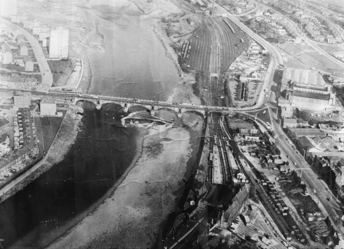
This aerial image is taken from a different direction and looks back along the line to the Northeast. I have not been able to establish copyright for this image. Skerton Bridge elegantly spans the River Lune. Green Ayre Station is in the bottom right with its coal sidings to its right. Beyond Skerton Bridge is a large expanse of exchange sidings. [23]
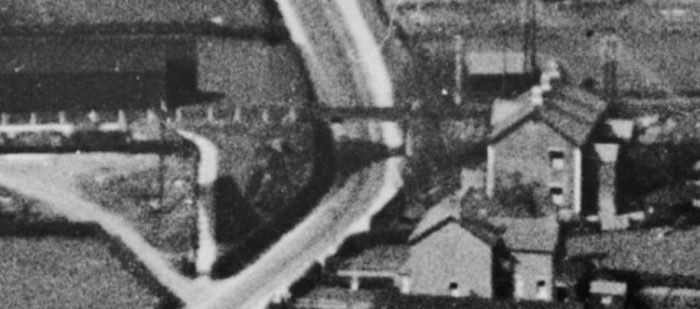
An image from above, taken from further West, shows Castle Station in the foreground and Green Ayre Station in the left background. Greyhound Bridge can be seen curving across the River Lune in the extreme top left of the image. [24]
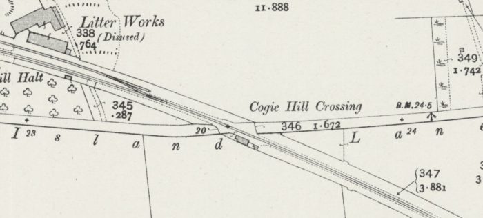
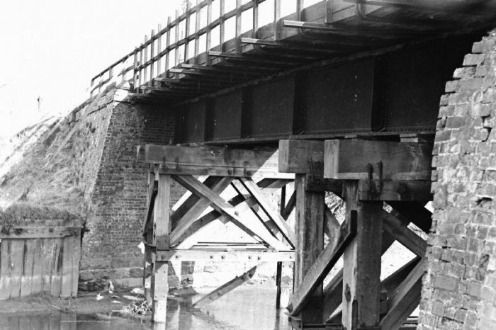
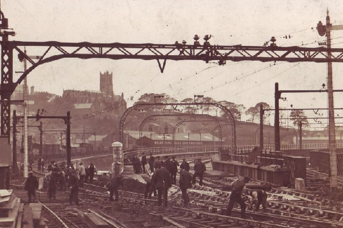
The Southwest end of Green Ayre Station. The line to Morecambe can be seen curving away to the right over the River Lune. The goods yard and the link to Lancaster Castle Station can be seen on the left of this image. [17]The bridge seen curving to the right in the image above was called ‘Greyhound Bridge’. “A wooden bridge crossing the Lune at Green Ayre was completed in 1848.  The timber bridge at Green Ayre was replaced by a steel structure in 1864. This bridge stood until 1912 when a new bridge was built. The girders from the old bridge were used to build a new bridge across the Lune at Halton.  After the closure of the railway in 1966 the bridge was converted to road use.” [19]The ‘Greyhound’ Midland Railway Bridge in Lancaster, built in 1864. Posted to Lancaster Past & Present Facebook group by Nigel Radcliffe appears on Blacks Chippy website [18] with the following note: “In 1864 Lancaster cut the ribbon on its shiny new wrought iron railway bridge, ‘The Greyhound’ bridge. This bridge was a replacement for a previous laminated timber bridge that connected Salt Ayre to Morecambe Harbour.” This bridge was itself replaced in 1911/12 by a steel girder bridge which continues in use in the 21st Century supporting a two lane road.
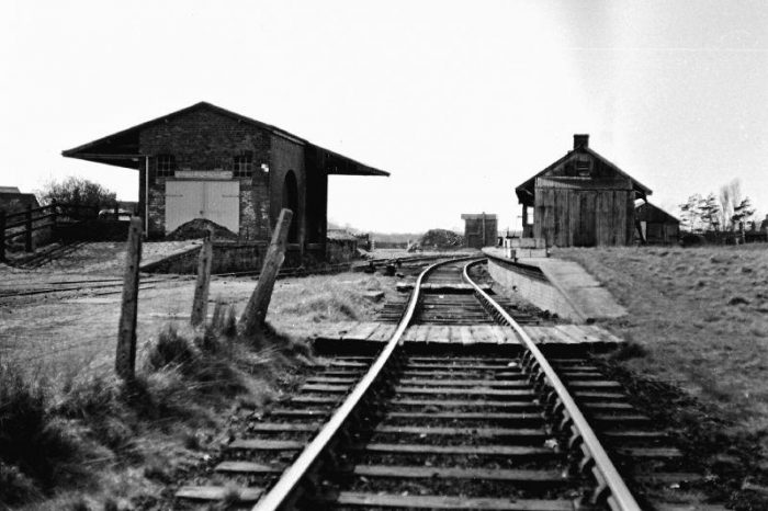
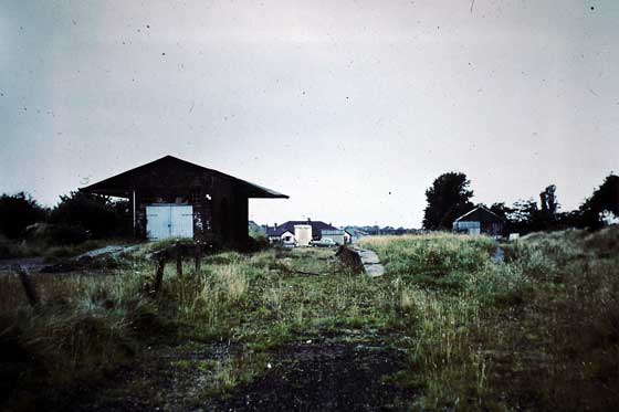
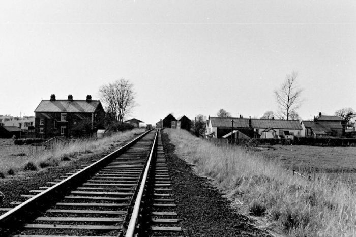
This image shows an overview of the station site after the demolition of the passenger facilities. A single rail-line remains. The bridge constructed in 1912 curves across the River Lune. [20]

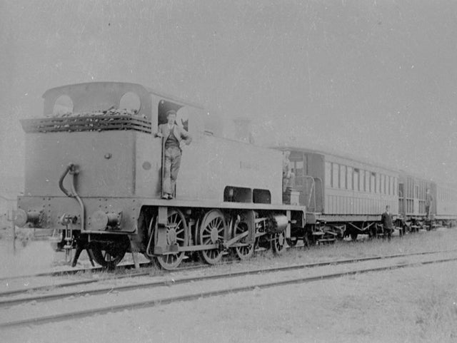
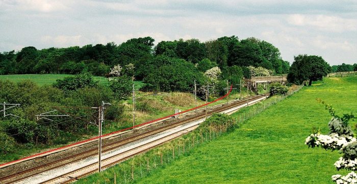
In July 1906, the Midland Railway announced its intention to electrify the lines between Lancaster, Morecambe and Heysham. The German 6,600V AC overhead system was chosen and the Midland Railway’s Derby works built three 60’ motor coaches – two with electric equipment from Siemens in Germany and the third with electric equipment from Westinghouse in the USA.  [25]

Three driving trailers and two centre-coaches were also built at Derby. A third centre-coach was modified from existing Midland stock. These were run either as 3-car or 6-car sets. or using two together as 6-car sets. Along Midland lines the overhead lines were supported by telegraph poles of Norwegian fir. However, the LNWR insisted on the use of steel gantries over the tracks owned by them – specifically the line between Lancaster Castle station and Green Ayre Station. The Midland Railway’s generating station at Heysham, previously built for working cranes and other equipment in the docks, was used to supply the power at 6,600V AC at 25 Hz. [25]

The Heysham to Morecambe line was opened to electric trains on 13th April 1908, followed by Lancaster Green Ayre on 8 June 1908 and Lancaster Castle on 14 September 1908.” [25] The new trains were highly reliable, far more reliable than would have been expected of steam power. They achieved an availability, in their first year, well in excess of 99% and throughout their operational life were exceptionally reliable. They were withdrawn in 1951 at which time diesel traction was introduced. [25]

However, the overhead wires were converted in the early 1950s to accommodate a 6.6kV 50Hz supply and the line was used for trials to investigate the advantages of single-phase AC in railway traction. [26]

UnseenSteam comments that,”Electric services were restored on 17 August 1953 using four Class AM1 three-car EMUs; this stock had been converted from LNWR stock built by the Metropolitan Carriage, Wagon & Finance Co in 1914 for use on the four-rail DC electrification of the West London line but were stored during World War 2 as a result of bomb damage to the West London line that had led to cessation of passenger services over the route. The units were numbered: DMBSO Nos M28219M to M28222M; TSO Nos M29721M to M29724M; and, DTSO Nos M29021M to M29024M. Experience with these units converted to work at 6.6kV was important in determining BR’s decision ultimately to pursue main-line electrification at 25kV.” [28]

Michael C. Duffy in Electric Railways: 1880-1990, says that, “The success of the tests led to the replacement of the HVDC standard by the new inter-national standard of 25 kV, 50 Hz. Part of the tests were carried out with carriage-mounted mercury-arc rectifiers, in anticipation of using them on the locomotives for the West Coast Main Line electrification. In 1953, on the Lancaster-Morecambe-Heysham line, British Thomson Houston successfully tested the world’s first semiconductor rectifiers, made of germanium, in railway service. As early as 1960, the British Railways Class AL5 locomotives were built with germanium rectifiers and within ten years the solid-state rectifier, using silicon, had largely replaced the mercury-vapour unit in locomotives.” [26]

UnseenSteam tells us that, “Although a new station at Scale Hall opened on 8 June 1957, the electrified sections plus the non-electrified line from Wennington to Lancaster Green Eyre were slated for closure in the Beeching report. The complex operation of the line, which included two reversals to get from Lancaster Castle to Heysham via Morecambe, allied to the existence of the parallel ex-LNWR line to Morecambe from Hest Bank made the route vulnerable and all passenger services on the lines from Wennington via Lancaster to Morecambe ceased on 3 January 1966. The line from Wennington to Torrisholme Junction, near Heysham, closed completely on 5 June 1967.” [28]

The Morecambe to Heysham line remained open for passenger traffic, “being relocated slightly on 4 May 1970. Passenger services were withdrawn on 6 October 1975 except for occasional use. Reopened fully on 11 May 1987 the station has been operational since then, apart from a brief closure during 1994.” [28]

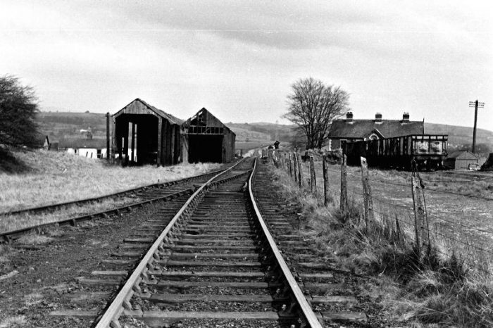
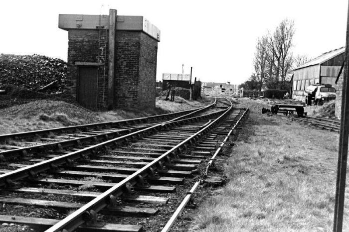
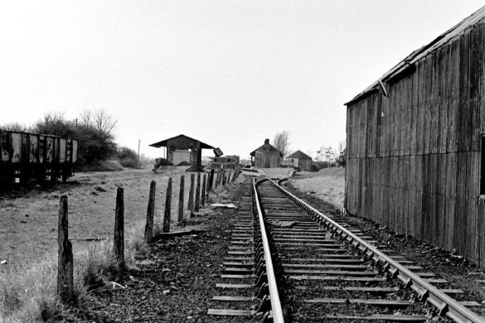
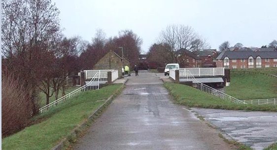
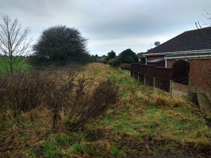
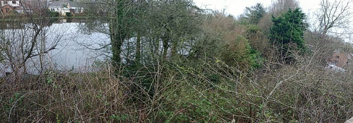
Green Ayre Station closed to traffic on 3rd January 1966 and was demolished in 1976. [3] The following pictures of the site of the station were all taken in January 2020 by myself.
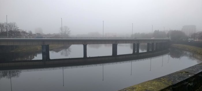
Approaching Greyhound Bridge from the West.
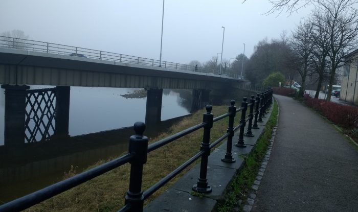
A closer look at the modern bridge. ….. The route we have followed to reach this point followed the line of the old branch between Castle Station and Green Ayre.A view along the River Lune from the East of Greyhound Bridge. …. The bridge curves into the old station site from the Northwest.
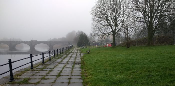
Looking from the same point in a Northeasterly direction towards Skerton Bridge at the Northeast end of the old station site.
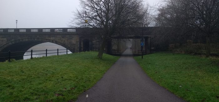
A closer view of Skerton Bridge showing the opening provided for the double track Midland line leaving Green Ayre Station to the Northeast.
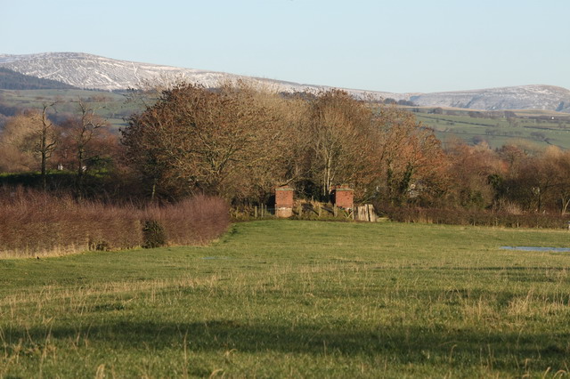
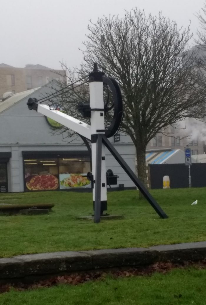
The old yard crane which is still standing close to the location of the old cattle-pens and the entrance to the coal yard at Green Ayre Station.The same crane looking from the East towards the river and Skerton Bridge.
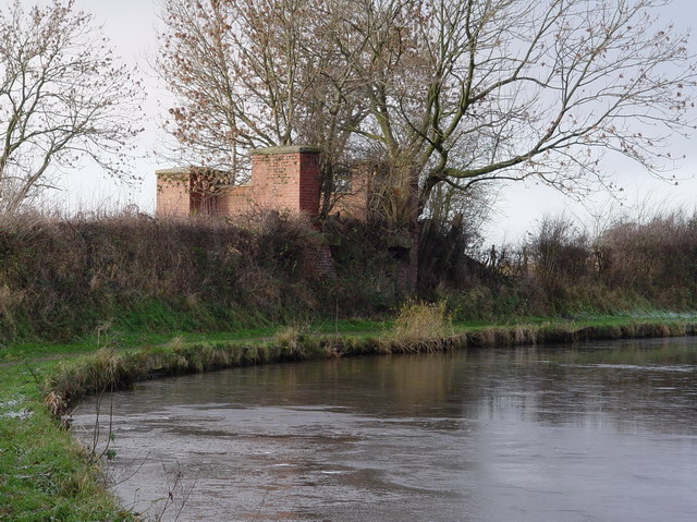
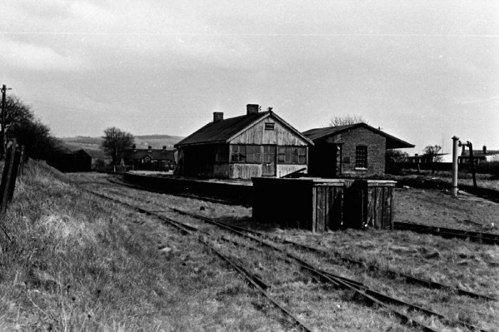
Looking back through the site of the station from a point close to Skerton Bridge. The board visible on the right of the picture gives visitors some idea of what the site was like at different times in its history.The railway span at Skerton Bridge. … Beyond this location railway land widened to include a series of sidings for marshalling goods traffic.The first detailed shot of the information board shows the site of the station as far back as 1610.
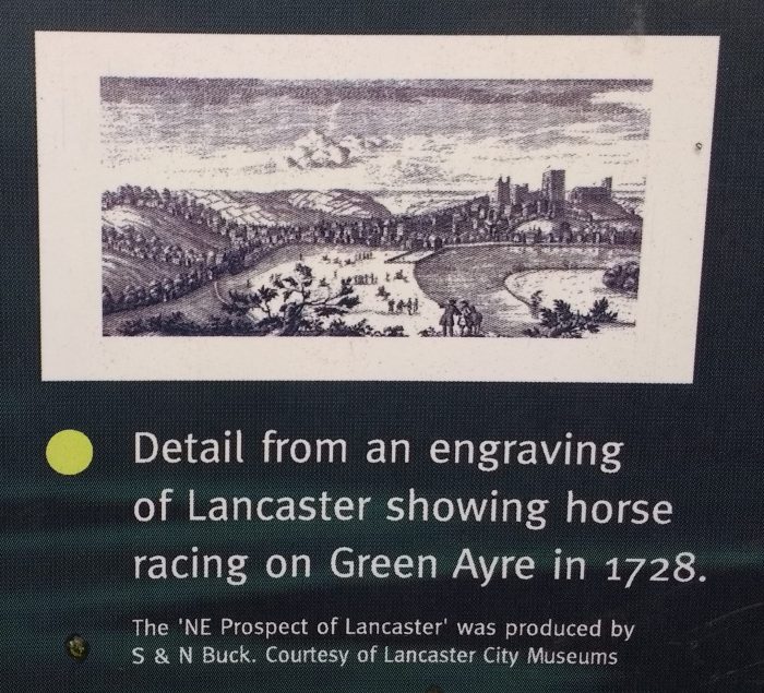
A later engraving showing horse racing on Green Ayre in the 18th century.
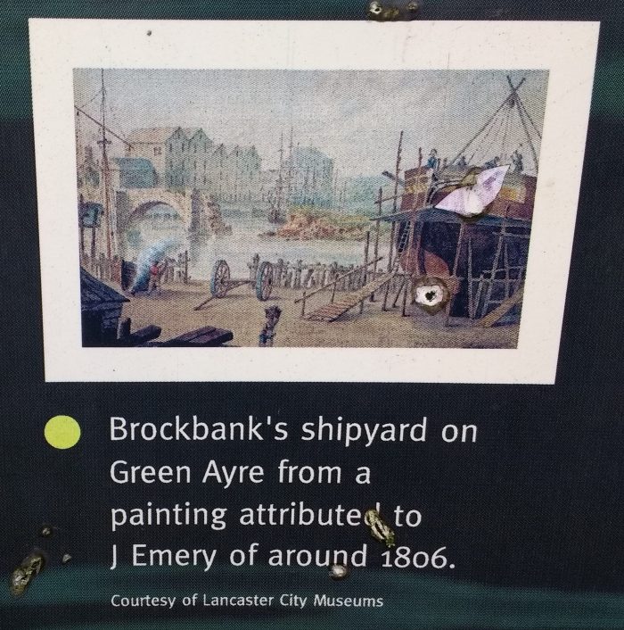
A little later again. … The Green Ayre was used as a shipyard in the early 19th century.1849 was the significant year for railway history at Green Ayre. … The station was opened.
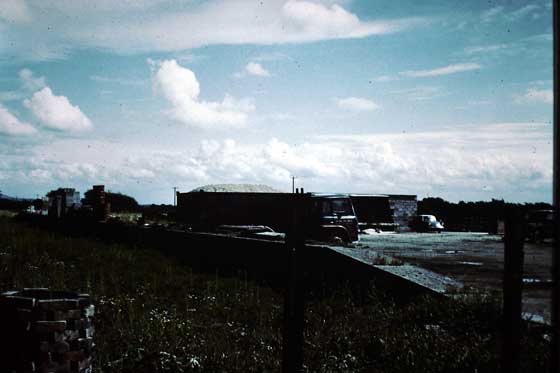
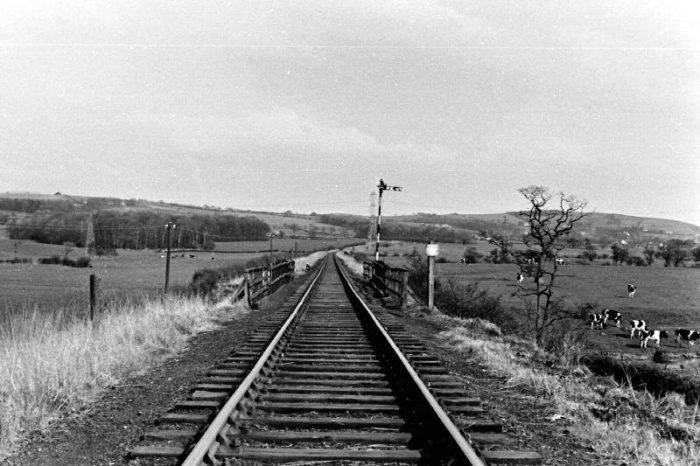
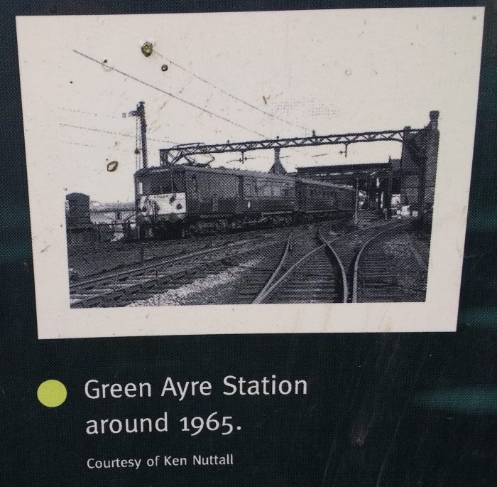
Around 1965 not long before the closure of the old Midland line.

References

  1. http://www.forbeslindsay.org.uk/Q29/Contents/Chapter_1/body_chapter_1.html, accessed on 28th January 2020.
  2. https://www.rmweb.co.uk/community/index.php?/topic/2646-lancaster-green-ayre-let-there-be-light-and-there-was/&tab=comments#comment-18107, accessed on 9th February 2020.
  3. https://www.wikiwand.com/en/Lancaster_Green_Ayre_railway_station, accessed on 9th February 2020.
  4. https://www.wikiwand.com/en/Lancaster_railway_station_(1840–1849), accessed on 9th February 2020.
  5. R.V.J. Butt; The Directory of Railway Stations, (1st ed.); Patrick Stephens Ltd., Sparkford: 1995, p138.
  6. J. Vinter; Railway Walks: LMS, Alan Sutton Publishing Ltd, Stroud, 1990.
  7. M. Bairstow; The “Little” North Western Railway, Martin Bairstow, Leeds, 2000.
  8. Nurses’ Home, Lancaster, British Listed Buildings, accessed 10th February 2020.
  9. https://www.wikiwand.com/en/Lancaster_railway_station, accessed on 10th February 2020.
  10. https://britishlistedbuildings.co.uk/101195054-railway-station-building-lancaster#.XkFuqr4YCUk, accessed on 10th February 2020.
  11. https://www.sjhospice.org.uk/the-green-ayre-rises, accessed on 10th February 2020.
  12. https://maps.nls.uk/geo/explore/#zoom=17&lat=54.0532&lon=-2.7993&layers=168&b=1, accessed on 10th February 2020.
  13. James Price; Sharpe, Paley and Austin: A Lancaster Architectural Practice 1836–1942; Centre for North-West Regional Studies, Lancaster, 1998.
  14. Clare Hartwell & Nikolaus Pevsner; The Buildings of England. Lancashire: North; Yale University Press, New Haven and London, 1969, 2009.
  15. https://en.wikipedia.org/wiki/Lancaster_Green_Ayre_railway_station, accessed on 10th February 2020.
  16. C. Awdry; Encyclopaedia of British Railway Companies; Patrick Stephens Ltd., Wellingborough, 1990.
  17. https://www.google.com/amp/s/www.thevisitor.co.uk/lifestyle/lancaster-green-ayre-station-memories-1-7700707/amp, accessed on 14th February 2020.
  18. https://www.blackschippy.co.uk/news/2017/8/11/a-brigde-over-troubled-waters, accessed on 14th February 2020.
  19. http://lahs.archaeologyuk.org/Tour/Parliament.htm, accessed on 15th February 2020.
  20. https://alchetron.com/Lancaster-Green-Ayre-railway-station, accessed on 15th February 2020.
  21. https://pjbrailwayphotos.piwigo.com/picture?/19345/categories, accessed on 15th February 2020.
  22. https://britainfromabove.org.uk/en/image/epw042035, accessed on 15th February 2020.
  23. https://www.pinterest.co.uk/pin/348677196142256235/?lp=true, accessed on 15th February 2020.
  24. https://www.britainfromabove.org.uk/en/image/EPW002092, accessed on 15th February 2020.
  25. https://spellerweb.net/rhindex/UKRH/Midland/Morecambe.html, accessed on 24th February 2020.
  26. Michael C. Duffy; Electric Railways: 1880-1990; The Institution of Engineering and Technology; 2003.
  27. https://www.communityraillancashire.co.uk/a-short-history-of-the-bentham-line, accessed on 24th February 2020.
  28. http://www.unseensteam.co.uk/Feature/Goodbye-to-Midland-electrics, accessed on 25th February 2020.

The Garstang and Knott End Railway – Part 2

The featured image for this article is a Garstang & Knot End Railway cast iron Trespass Sign dated December 1899. GW Railwayana Auctions described it as “A Grade 1 cast iron sign that hasn’t appeared for sale or publicly before and the most significant cast iron find of this century. The sign was acquired by the vendor in the 1960’s and was from Cogie Hill Halt which was on the section between Pilling and Garstang Town which closed in July 1963. Nicely restored measures 24in x 15in.” It sold in November 2019 for £3,800. [11]

Pilling Station was the most westerly point on the Garstang and Knott End Railway from the completion of the first phase of its construction in 1870 until the eventual construction of the line through to Knott End in 1908. [1] It was actually placed in the hamlet of Stakepool around a mile from Pilling itself.

As noted in the previous article about the line, locomotives had to cross into the road junction at the West end of the station site in order to run round their trains. [2] The station site was approximately as drawn on the adapted OS Map extract below. [3]The bridge over Pilling Water, in the bottom right of the map extract, was originally of a timber construction but was already giving cause for concern in 1877 and repairs were undertaken. Good facilities at the station were limited to two sidings without any shed. All transfers between road and rail would have taken place in the open-air. The passenger facilities were limited to one platform  with a wooden shed. The covered facilities on the platform were probably not present when the line opened in 1870 but may well have been in place by 1874. Richardson tells us that the wooden structure was augmented by a brick structure in 1903, which provided “a booking hall together with waiting rooms and toilet facilities for both sexes. The contractor was Johnathan Collinson of Nateby. …. Photographic evidence suggests that the old wooden hut was retained, perhaps as a storeroom and simply moved a little further down the platform.” [2: p72]

When the line was extended to Knott End, Pilling Station was improved and extended but the station building itself, being relatively new, was left in place. The revised station plan can be seem in the unaltered OS Map extract below [3] The most southerly of the lines leaving the East end of the station yard is a head shunt for the goods yard. It was of a quite significant length. Signlas and signal cabin were installed with the extension of the line. The station yard is, in the 21st century, still essentially as it was less the sidings themselves. The site is screened for the road junction to the West of the station by a relatively modern house sitting across the old running lines. The station-house or crossing keepers cottage remains in place. My picture below the map illustrates the view from the road junction.Looking East into what was the railway station site from the old level crossing location (24th January 2020).The satellite image above shows the old station site in the 21st century. Piling Water can just be made out to the right of the image. Without transgressing into what is now a private site it is impossible to establish what, if anything, remains of the old station site. The long narrow building to the North of the yard in the satellite should not be confused with the old station building. It is on the North side of the old line.

The adjacent picture shows Pilling Station from the East end of the platforms after the loop had been lifted. [6]

The picture below comes from the early to mid-1970s and shows Pilling Station Site after closure of the railway. [5]

Pilling Station Site in the mid-1970s. (Lancaster City Museum.) [5]

Beyond the bridge over Pilling Water the running line continued in a East-Southeasterly direction to a level-crossing over Garstang Road. This length of the line is covered by the three OS Map extracts below. The Crossing Keeper’s Cottage at Garstang Road was to the South-East of the crossing.This panorama shot was taken at the Garstang Road crossing looking East. The Crossing Keeper’s Cottage is on the right. The old line ran straight ahead towards Nateby and Garstang. Garstang Road can be picked out on the far right of the image (24th January 2020).An early 21st century satellite image showing the route of the old line in red, and its Crossing at Garstang Road. The keeper’s cottage is evident on the satellite image to the South East of the crossing.Another view looking East, this time from Google Streetview,. This shows the narrow crossing keeper’s cottage to full advantage. The route of the old line was approximately as shown by the red line. There was a Railmotor Halt here in LMS days between 1923 and 1930.The view looking back to the West from the crossing at Garstang Road. The red line gives the approximate route of the old railway (also from Google Streetview).

Further east, the line continued on an East-Southeast trajectory passing South of Crawley’s Cross (North of the Farm by the same name), on through a short platform which can be picked out on the fourth map extract below. Richardson tells us that this is “Cockerham Crossing Halt or Cockerham Cross as it is recorded in some documents. This was undoubtedly the most remote spot served by the railway as there is no village or hamlet nearby, merely a scattering of farms. It was situated where the line was crossed by a farm road, which still runs from Crawley Cross Farm, northwards across, Cockerham Moss to Moss Edge Farm. However, for passengers alighting at this halt, it was only a relatively short walk to the Garstang to Pilling Road.” [2: p70]Beyond Cockerham Crossing Halt it was only a relatively short distance along the line across to the North of Cogie Hill Farm and into Cogie Hill Halt. The second and third map extracts below shoe the location of Cogie Hill Halt and the old Litter Works, both on the North side of Island Lane.This picture from Google Streetview looks West along Island Lane. The red line shows the approximate route of the Garstang to Knott End Railway. The halt would have been on the right of the picture, North of the lane. The Litter Works are clearly no more and were already disused at the time the OS Map was drawn. The Crossing Keeper’s Cottage dominates the left side of the photograph.Looking East along Island Lane towards Garstang, the Crossing Keeper’s Cottage is another typical example of these buildings on this line. It has been extended to make an effective modern dwelling (24th January 2020).This stunning picture shows Cogie Hill Crossing while still in use. The Black 5 in the picture is bringing it’s train from Pilling to the mainline tender first. The crossing cottage appears to the left of the image again. The guard is operating the gates to allow the passage of the train. (The photographer is not known: used with permission Knott End Collection: Railscot). From 1908 until the termination of passenger services in 1930 there was a request halt at this location [4]The same cottage in the early to mid-1970s. Interestingly, the fence in this image is still present in the 21st century. This image is included courtesy of Lancaster City Museum. [5]

The line continues Southeast from Cogie Hill towards Nateby Station. The next few OS Map extracts show this next length of the line. It travelled across open fields until it reached the crossing on Station Lane immediately West of Nateby Station.Google Streetview has this view back along the old line, looking North West towards Pilling.Looking South-East from Station Lane into what was the site of Nateby Station. A bungalow has been built over what were the passenger facilities. The old Station site boundary is marked by the hedges.

Nateby Station was a some distance North of the Village. In the 21st century, the site is now wholly owned and used by Brough Construction Limited. Google Streetview shows two residential properties on the site of the passenger facilities.Google Earth gives an overall impression of the site in the 21st century.Nateby Station site in the 21st century (Google Earth)

Continuing towards Garstang the old line reverted to an East-Southeast alignment.Then just before it crossed the Lancaster Canal it turned through East to an East-Northeasterly alignment. The bridge across the Canal “was a plate girder bridge with a clear span of 70 feet, with rolled steel joists, cross girders and a diagonal timber flooring. … The abutments were of brick. When the LMS surveyed the railway in 1923, the civil engineer was almost complementary in his report, remarking that additional joists had been put in and that the bridge was now up to the strength required for the engines used on the line.” [2: p67]Looking East along the alignment of the old railway line towards the remaining piers on the West side of the Lancaster Canal (Bob Jenkins). [8]The same West abutment of the old railway bridge over the Lancaster Canal (Bob Jenkins). [7]The satellite image above contrasts significantly with the OS Map above it. The area between the Canal and Nateby Crossing Lane has been developed as a Marina for the Canal.Looking West from Nateby Crossing towards the Lancaster Canal along the line of the old railway in 2009 (Google Streetview). Richardson points out that the land to the North of the line (the right side of the above picture) was at one time a brickworks with its own siding. [2: p66-67]The same view in 2020. There is now a children’s playground over the line of the old railway (24th January 2020).The Crossing Keeper’s Cottage at Nateby Crossing Lane (now Croston Road) in the early 1970s (Lancaster City Museum). [5]Looking East along the line of the old railway in 2009 (Google Streetview).Looking East from the site of Nateby Crossing in 2020. The crossing keeper’s cottage is still in place although the render visible in 2009 is now painted white. (24th January 2020).

The line continued East-Southeast from Nateby Crossing to Garstang Station. A by-pass to the town of Garstang was built in the mid-20th century (A6 – Preston Lancaster New Road) and crossed the old line at high-level on a bridge.Looking West from the A6 towards Nateby Crossing. The route of the old line can still be seen across the fields (Google Streetview). Hedging means that it is not possible to show a worthwhile view looking towards Garstang Station at this point on the A6.

Immediately before the station the old railway line crossed Back Lane (now Croston Lane) on the level. The crossing keeper’s cottage was to the South-East of the Crossing, just inside the Station site and across the running line from the engine shed. It appears on the right-hand side of the second map extract below.The Station was rebuilt in 1908 when the line was extended to Knott End. It is the rebuilt station that is shown on the OS Map extract above. The earlier station is shown in the map extract below to approximately the same scale.Garstang Station in 1890. [12]

The railway station site has all been built over. In the 21st century it is covered by a modern housing estate as the satellite image below shows. The path of the main running line is shown by the red line.Looking West along the route of the old line from Back Lane in the 21st century (Google Streetview).Looking East into the old Station site in the 21st century from Back Lane (Google Streetview). All evidence of the station has been lost.

Unsurprisingly, as Garstang was the major town on the line, its station was the major intermediate station between the LNWR/LMS main line and Knott End. There are also a significant number of pictures available on the internet of the old station and its site. The original station built for the first branch line which ran as far as Pilling was a less sophisticated affair.Garstang Town railway station taken about 1900, it was rebuilt in 1909 (Lancashire Post). [9]An old grainy photo showing the first locomotive of the Garstang & Knot End Railway at Garstang Town around 1871. (The photographer is not known: used with permission Knott End Collection: Railscot) Railscot comments, “This was Hebe, a Manning Wardle 0-4-2ST and when the line opened in December 1870 it was their only locomotive. After more than a year of continuous use it broke down, leading to financial problems for the G&KER and Hebe being repossessed. The line closed in 1872 but reopened in 1875 with two new locomotives, Manning Wardle 0-4-0ST Union and Hudswell Clarke 0-6-0ST Farmers Friend, which had a piercing whistle and became unofficially known as The Pilling Pig.” [13]Work on Garstang station nearing completion in 1909 (Lancashire Post). [9]Locomotive Blackpool which served the Garstang to Knott End line in 1909 hitched to the American style carriages built for the holiday makers (Lancashire Post). [9]Garstang Town Engine Shed. (The photographer is not known: used with permission Knott End Collection: Railscot) [13]

Interestingly, the old engine shed is still is use but was moved from the old station site in the 1970s. This fact was picked up by ‘Railscot’. Mark Bartlett comments that, “It was dismantled in the late 1970s and removed a few hundred yards from its original site for re-use by a livestock haulier. Originally a two road shed it was modified when rebuilt with a single end door seen [below] and a new side entrance (added) but uses the same frame, wall panels and roof. Photographed on private land with kind permission of the owner (who as a young man had helped with the shed removal from the old station).” [14] It should be noted that access to the land is solely at the discretion of the landowner who should be asked for permission prior to access onto the land.View of the barn (old engine shed) from the West in 2017 (Mark Bartlett). [13]A view of the barn (old engine shed) from the South close to the road entrance to the haulier’s site in 2017 (Mark Bartlett). [13]View from Croston Barn Lane (Google Streetview). The old engine shed can be seen above the black estate car in the picture. (Please note: access beyond the gate to the site requires prior permission from the landowner).Black 5 45438 undertakes some leisurely shunting at Garstang Town station, probably in the 1950s judging by the amount of traffic still being carried on this, by now, goods only line. (The photographer is not known: used with permission Knott End Collection: Railscot). Mark Bartlett comments: “This view, taken from the end of the island platform, looks east towards the WCML. The old GKER carriage sheds were still standing at this time, albeit trackless. The large house in the background, Beech Mount, is still on Lancaster Rd in Garstang today.” [13]A goods train going through Garstang station in the 1950s (Lancashire Post) (The photographer is not known: used with permission Knott End Collection: Railscot). [9][13]A view of Garstang Town station, probably from the early 1960s. (The photographer is not known: used with permission Knott End Collection: Railscot). Mark Bartlett comments: “The distinctive narrow station building with the slightly wider signal box at the far end … is on the island platform, which in passenger carrying days was accessed by a footbridge. Beyond and to the right is the old GKER engine shed, later dismantled and rebuilt nearby as a farm building. Straight ahead is the water tower with the small goods shed on the left.” [13]Black 5 45070 enters Garstang Town station on 13th August 1959 with a single brake-van. (The photographer is not known: used with permission Knott End Collection: Railscot). Mark Bartlett comments: “Taken nearly thirty years after passenger services finished, this photo clearly shows the very unusual signal box at Garstang, which was on the island platform but at right angles to the tracks. The signal box was wider than the main station building, although it shared the roof profile, allowing a view to the east for the signalman.” [13]The Good Shed at Garstang Town Station at or around closure of the line. The picture is taken facing East, reproduced with permission from ‘Apollo’ on RMWeb, (R.L. Hill).  [14]A general view of the Station from the Northwest at or around closure of the line, reproduced with permission from ‘Apollo’ on RMWeb, (R.L. Hill). [14]A view East along the main running line close to closure. The sidings serving the carriage sheds seem to have been lifted, reproduced with permission from ‘Apollo’ on RMWeb, (R.L. Hill). [14]The water tower at Garstang. The old engine shed is visible on the right-hand side of the picture. The crossing keeper’s cottage appears to have been removed but the Back Lane crossing gates are still in evidence, reproduced with permission from ‘Apollo’ on RMWeb, (R.L. Hill). [14]The view from the East into the station site at or around closure. The old carriage sheds intrude into the picture of the right. the goods shed is centre-left and the passenger facilities centre-right, reproduced with permission from ‘Apollo’ on RMWeb, (R.L. Hill). [14]The abandoned site of Garstang Station in the mid-1970s (Lancaster City Museum). [5]

The next couple of images show the East end of the station Site in the 21st century.This delightful back garden fills the full width of the station site to the West of the High Street (Google Streetview)Looking ahead to the East from Garstang High Street from the location of the erstwhile railway bridge. The house which just intrudes into the picture on the right is Beech Mount which has been mentioned above (Google Streetview).  The access road provides a private access route to water treatment and flood defence facilities.The length of the line from Garstang High Streeet to the River Wyre Bridge. I have not as yet been able to find any good quality pictures of the old plate girder bridge over Garstang High Street. [3]This aerial image from 1929 comes from the website ‘Britain From Above’ The bridge at the East end of the Station site can just be picked out at the centre-top of the photograph. The detail is not great but it is possible to make out the River Wyre Bridge on the top-right of the image as well. [28]This is a much enlarged view of the top of the aerial photograph. The bridge is at the center of the image. Beech Mount can be seen to the right of the bridge. The station access road and footpath are on the left of the bridge. Lancaster Road (now High Street) at this point dipped down under the railway to provide reasonable clearance for road vehicles. [28]Beyond the station to the East, the railway continued in an easterly direction to cross the River Wyre. This is the view back along the line from a point to the West of the river bridge towards the old station site at or around closure. The house to the left of the image is Beech Mount which still survives in the 21st century, reproduced with permission from ‘Apollo’ on RMWeb, (R.L. Hill). [14]The River Wyre Bridge in 1929. [28]

The River Wyre Bridge on the old line immediately prior to closure, reproduced with permission from ‘Apollo’ on RMWeb, (R.L. Hill). [14]The view East across the River Wyre bridge along the old line towards the LNWR/LMS mainline, reproduced with permission from ‘Apollo’ on RMWeb, (R.L. Hill). [14]The route of the old line to the East of Garstang High Street. The bridge over the Wyre was reconstructed for vehicular access for water treatment purposes (Google Earth). The image below looks back along the line towards Garstang station and shows the water defence and treatment work undertaken. (Railscot: Mark Bartlett). [13]The old line continued Eastwards from the Wyre Bridge. It was initially on embankment as it dropped at 1:125 towards the LNWR/LMS mainline. [2: p63] There was a cattle creep around 2/3rds of the way along the embanked section of track. The old line then entered a cutting passing under a public footbridge before turning to the south to run alongside the LNWR/LMS mainline close to Taylor’s Bridge.The section of cutting before the old line curved to the South (Railscot: Mark Bartlett). [13]

From Taylor’s Bridge the branch trundled alongside the mainline, under Turner’s Bridge and then under Bailton’s Bridge before eventually reaching Garstang and Catterall Station.

The first photograph below shows the point at which the Garstang and Knott End Railway converged with the mainline just to the South of Taylor’s Bridge. A red line shows the route of the line emerging from what, in the 21st century, is a heavily wooded cutting and then running parallel to the mainline. [19]

The combined railway formation was in cutting for much of the length South from Taylor’s Bridge. It was crossed at intervals by accommodation bridges (Turner’s Bridge and Bailton’s Bridges) leading between fields on each side of the line. These bridges, Richardson tells us, were extended to accommodate the branch line and their two separate spans are still visible for the M6 motorway. [2: p63]

Since the middle of the 20th Century, the M6 has run parallel to the mainline only a few tens of metres to the East. The construction of the motorway meant that the accommodation bridge crossings had to be significantly extended Eastward.

Typical of these new bridges and their slender simply-supported reinforced concrete deck and steel beam construction is Turner’s Bridge which is shown in the second colour image below. [20].

Wikipedia tells us that “Garstang and Catterall railway station served as the interchange between the Garstang and Knot-End Railway and the London and North Western Railway. … The station was in the parish of Barnacre-with-Bonds, close to the village of Catterall, adjacent to the Lancaster Canal, and opposite the Kenlis Arms Pub.

This station was on the Lancaster and Preston Junction Railway (now part of the West Coast Main Line) between Preston and Lancaster.” [18]

Wikipedia says of the Lancaster and Preston Junction Railway Company (L&PJR) that it  “was created by Act of Parliament on 5 May 1837, to link the towns of Preston and Lancaster. The company planned to build its Preston terminus at Dock Street (off Pitt Street), near the Lancaster Canal, in the expectation that the rival North Union Railway (NUR) line from Wigan would have its terminus close by. In fact, the North Union built its station 200 yards (200 m) away, just south of Fishergate, in what seems to have been a tactical move to get the L&PJR to contribute towards the cost of a short tunnel and connecting line between the two railways. This marked the start of protracted feuding between the two companies for years to come. Eventually a deal was struck for the L&PJR to use the North Union station.

The Lancaster terminus was on the modern-day South Road, just south of the Lancaster Canal and the southern end of Penny Street.

The line was twenty miles (32 km) long and built by Joseph Locke. [21] It opened on 25 June 1840, with a passenger service from the following day.” [22]

The Lancaster & Preston Junction Railway was amalgamated into the Lancaster & Carlisle Railway in 1859 and the Lancaster & Carlisle Railway was leased to the London and North Western Railway (LNWR), which later absorbed it in 1879.

So, Garstang & Catterall Station opened on 26 June 1840, [15] originally named Garstang Station. [16] Eventually, it was the last of the stations between Preston and Lancaster to close, on 3rd February 1969. [17].

The station was built on embankment above the surrounding land. It was flanked to the West by the Lancaster Canal and to the East by the Kenlis Arms Hotel. The main station buildings were at high level across Kenlis Road from the Kenlis Arms Hotel. They were quite substantial, about 125 ft long and 20 feet deep. Richardson points out that they were built in 1872-1873 as part of a general upgrading of the station facilities  following the opening of the Garstang and Knott End Railway. [2: p63]

The station buildings were separated from the stationmaster’s house by a gap of around 8ft. Rush and Price say that the stationmaster’s house was a most peculiar building It “had apparently no chimneys, and the occupants went downstairs to bed, since the living room and door were on platform level and the other rooms beneath. There was no access from the street.” [23: p43]

The Garstang & Knott End Railway had no connection to the mainline North of the Junction station. Rush and Price tell us that the “only direct connection with the LNWR was in the goods yard, a short distance South of the station, whence the line ran along the outer face of the down platform, which was an island.” [23: p39]

Locomotives were unable to run round their trains while in the platform. ” A short loop opposite the Signal Box provided the run round facilities for Knott End trains.” [23: p39]

Since the station closed in 1969, the stationmaster’s house has become a private dwelling and appears relatively little altered in appearance.Taylor’s Bridge in the 21st century looking to the Northwest, showing the old branch-line entering the cutting of the mainline just South of the Bridge and running parallel with the mainline. The old Garstang and Catterall Station was about 1 miles south of the location of Taylor’s Bridge. [19]Turner’s Bridge over the M6 in 2012 (Creative Commons Licence (Anthony Parkes)). [20]The Kenlis Arms Hotel in the 21st century with the remaining stationmaster’s house beyond. [24]A similar view from the time the branch-line and station were in use early in the 20th century. In this view, the stationmaster’s house is hidden behind the hotel. [24]A much more recent image of the stationmaster’s house in private hands (Mark Bartlett). [25]

The following images appear on the RMWeb Forum [14], on the Railscott website [25] on Flickr [26][27], and are reproduced with permission.A steam-powered (Black 5) ‘up’ goods entering Garstang and Catterall Station on the mainline. The picture is taken from the island platform (R.L. Hill). [14]A similar picture, this time on David Price’s Flickr feed and taken from the station footbridge (David Price). [26]Clan Class Steam Locomotive in charge of a northbound express on the mainline through Garstang and Catterall Station in the late 1950s or early 1960s. The two views immediately below are taken from the footbridge seen in this picture (R.L. Hill) [14]An overview of Garstang and Catterall Station looking North. The Lancaster Canal was in very close proximity to the Station on the West side of the down platform. The branch-line runs from the west side of the island platform and along the west side of the mainline to the North (R.L. Hill). [14]A similar view in diesel days probably taken at around the same time as the picture above, both being taken from the station footbridge. The locomotive in this picture carried the number D305 (R.L. Hill). [14]A Branch goods appears to have just arrived from Pilling (Railscot: Mark Bartlett). Railscot comments: “An unidentified LMS 8F 2-8-0 shunting alongside the old G&KER platform at Garstang & Catterall station. This view looks north from the station footbridge with the Lancaster Canal visible to the left of the steam plume. The main goods yard was behind the camera but the Creamery alongside the Up line also used rail for many years. The line immediately to the left of the main running lines beyond the island platform was the old link to the Knott End branch, which also later formed a long Down goods loop for the main line.” [25]A 1971 image of the Station Signal box to the south of the station (Railscot: Mark Bartlett).  Railscot comments: “The new infrastructure for colour light signalling can be seen as D431 approaches Garstang & Catterall on a service for Scotland. The cars are parked in the old goods yard, which is now occupied by a feeder station for the 25kv power supply, the first building of which can be seen in front of the bracket signal. The signal box closed in November 1972 with the commissioning of Preston power box. The station, behind the photographer, had only been closed for three years at this time but had already been demolished and cleared.”  [25]This view looks North from the goods yard opposite the station signal box (David Price). David Price says: “75048 shunts the yard.The quality is not great- I was using a very basic third-hand Halina – but there is some interest with the box and station visible. Note also the very young member of the footplate crew !! I don’t have a date for this but the slide is stamped Dec 67 so it was probably taken in Oct 1967. ” [27]

I have not had the opportunity in this article to look at operations or rolling stock on the line. I hope that I will have time to return to these matters in a future article. I have already been reminded by one reader of the first article about the line of the relatively unusual practice on the line of the pick-up goods both propelling and pulling wagons in the one train so as to make shunting much less time consuming en-route!

References

  1. https://en.m.wikipedia.org/wiki/Garstang_and_Knot-End_Railway, accessed on 28th January 2020.
  2. D. Richardson; The Pilling Pig; Cumbrian Railways Association, Amadeus Press, Cleckheaton, 2018.
  3. https://maps.nls.uk/geo/explore/#zoom=18&lat=53.9225&lon=-2.8948&layers=168&b=1, accessed between 29th January 2020 and 7th February 2020.
  4. https://www.railscot.co.uk/locations/C/Cogie_Hill, accessed on 1st February 2020.
  5. http://www.kingsownmuseum.com/friendsrly.htm, accessed on 1st February 2020.
  6. Ribble Pilot; https://issuu.com/ribblesteam/docs/pilot_49_web_version/41; p40, accessed on 2nd February 2020.
  7. https://www.geograph.org.uk/photo/1135752, © Copyright Bob Jenkins and licensed for reuse under this Creative Commons Licence, accessed on 3rd February 2020.
  8. https://www.geograph.org.uk/photo/1135765, © Copyright Bob Jenkins and licensed for reuse under this Creative Commons Licence, accessed on 3rd February 2020.
  9. https://www.lep.co.uk/news/all-aboard-lancashires-long-lost-railway-656144, accessed on 5th February 2020.
  10. https://www.blackpoolgazette.co.uk/news/reviving-forgotten-lancashire-rail-route-dream-1154369, accessed on 5th February 2020.
  11. https://www.gwra.co.uk/auctions/garstang-knot-end-railway-cast-iron-trespass-sign-2019nov-0279.html, accessed on 5th February 2020.
  12. https://www3.lancashire.gov.uk/environment/oldmap/towns/garstang, accessed on 6th February 2020.
  13. https://www.railscot.co.uk/locations/G/Garstang_Town, accessed on 6th February 2020.
  14. https://www.rmweb.co.uk/community/index.php?/topic/67100-apollos-grand-days-out/page/2 © Copyright R.L. Hill, accessed on 6th February 2020.
  15. R.V.J. Butt; The Directory of Railway Stations; Patrick Stephens, Yeovil, 1995.
  16. G. Suggitt; Lost Railways of Lancashire; Countryside Books, Newbury, 2003 revised 2004, p28.
  17. M.S. Welch; Lancashire Steam Finale; Runpast Publishing, Cheltenham, 2004, p2.
  18. https://en.wikipedia.org/wiki/Garstang_and_Catterall_railway_station, accessed on 7th February 2020.
  19. https://www.wikiwand.com/en/Garstang_and_Knot-End_Railway, accessed on 7th February 2020.
  20. https://www.geograph.org.uk/photo/3129767, accessed on 7th February 2020.
  21. S. Lewis S (ed); “Lambley–Lancaster”, A Topographical Dictionary of England; 1848, p6–17.
  22. https://en.wikipedia.org/wiki/Lancaster_and_Preston_Junction_Railway, accessed on 7th February 2020.
  23. R.W. Rush & M.R.C. Price; The Garstang and Knott End Railway; Oakwood Press No. 23, Headington, Oxford, 1985.
  24. https://twitter.com/btplancs/status/805378977225474048, accessed on 6th February 2020.
  25. https://www.railscot.co.uk/locations/G/Garstang_and_Catterall, accessed on 7th February 2020.
  26. https://www.flickr.com/photos/144388905@N03/49287457557/in/photolist-2i6n6YZ-2hQ6tqh-QuP2yq-27rPwAA-pinLE6-x7fSyx-xVyKmn-2f3gd1Y-H2uKJJ-AuuxEn-LyGKgj-Dhww3A-99Kbpg-LyGKWC-Mt2MM3-e7VnyK-R972Ce-w6xjLg-bjCmjf-dk32Wp-271b5Bf-dk32Hz-dMVezS-bxxeit-nUG4LY-9qFuHY-U44YAP-eh6FsZ-sD52n6-bxxerp-jz2HSh-egzr3N-smrZCs-e9ewnh-ac3muT-aggKrH-kyHVEy-eiEWyY-MGcg6B-qFy3GY-eiybDs-n3QaoN-qFy3Yu-99HvCg-99Nf7j-poZA2C-99Nfnu-dZAz36-J79khx-dXZHxG, accessed on 8th February 2020.
  27. https://www.flickr.com/photos/144388905@N03/31831162260/in/photolist-2hQ6tqh-QuP2yq-pinLE6-xVyKmn-e7VnyK-R972Ce-bjCmjf-dMVezS-bxxeit-nUG4LY-2i6n6YZ-27rPwAA-x7fSyx-2f3gd1Y-H2uKJJ-AuuxEn-LyGKgj-Dhww3A-99Kbpg-LyGKWC-Mt2MM3-w6xjLg-dk32Wp-271b5Bf-dk32Hz-kyHVEy-eiEWyY-eiybDs-9qFuHY-U44YAP-eh6FsZ-sD52n6-bxxerp-jz2HSh-egzr3N-smrZCs-e9ewnh-ac3muT-aggKrH-MGcg6B-qFy3GY-n3QaoN-qFy3Yu-99HvCg-99Nf7j-poZA2C-99Nfnu-dZAz36-J79khx-dXZHxG, accessed on 8th February 2020.
  28. https://britainfromabove.org.uk/en/image/EPW026412, accessed on 10th February 2020.

The Garstang and Knott End Railway – Part 1

The area across the River Wyre from Fleetwood was, for many years, quite isolated. There was a ferry across the river to Fleetwood, which still operates in the 21st century, otherwise, narrow un-metalled roads had to suffice.

The local community, particularly those with agricultural interests, were determined to have a railway. The line was built between Garstang and Pilling by those local agricultural interests to develop unproductive land. It had been intended to continue to Knott End but the company ran out of money. It eventually opened between Garstang and Pilling in 1870. [2]

In 1898 the Knott End Railway was authorised to continue to Knott End; the extension opened in 1908.

Until around the turn of the 20th century the line operated in the control of the receivers having had a couple of years lying dormant as a result of significant overspend during construction. [1: p68] However, by 1908 the line was solvent. [1: p69] For much of the life of the line, it operated as two separate companies but using the same rolling stock. [1: p70]

Enough income was forthcoming to allow a branch to be constructed to serve the Saltworks at Stalmine Moss. [1: p69] Salt extraction became a dominant industry in the area from 1890, ”and the railway conveyed some remarkable tonnages of salt (outward) and coal (inward, for power).” [2]

Ultimately the line did not survive beyond the 1960s. Passenger traffic ceased in the 1930s although Scott-Morgan points out that excursion traffic continued in the summer months. He goes on to say that in 1950, ”British Railways closed the line to goods traffic between Knott End and Pilling. The remainder of the branch was often worked by Ivatt Class 2 2-6-0 tender locomotives and, strangely, Stanier Black 5 4-6-0s on four or five wagon goods trains. Final closure came on 31st July 1963, and the track was lifted shortly after.” [1: p70]

I am aware of two books of substance which have been written about the line. The first was initially published by the Oakwood Press in the 1960s. Its most recent incarnation was printed in the mid-1980s. [4]

A much more recent contribution was made by Dave Richardson in his book entitled, ‘The Pilling Pig’. It was published by the Cumbrian Railways Association in 2018. [5]

Dave Richardson was able to unearth more information in the 21st century than R.W. Rush and M.R.C. Price had available to them in the 1960s. Nonetheless, Dave Richardson comments: “Given the limited sources of information and facilities for research available at that time, the [earlier] book represented a considerable achievement.” [5: p5]

Both books provide excellent plans, maps and drawings. I particularly appreciated the colour station plans in Dave Richardson’s book. [5]

Both texts describe the line travelling East to West. I plan to do so from West to East. This is the way in which the line would first have been encountered by holiday-makers from Blackpool and Fleetwood. I guess that the railway prioritised passenger traffic coming over on the ferry from Fleetwood. This is shown by the station facilities at Knott End which were not rivalled by any other station on the line.

The Line

As we have noted, there was a relatively substantial terminus station at Knott End. The extract from the OS 25” Map below shows the station and it’s approaches. [3] The station opened with the line in 1908. It closed to passenger traffic in 1930 and goods traffic in 1950. [2][8]The station is long-gone. Quail Holme Road now extends into an estate of 1960s bungalows. Knott End Cafe sits on the site of the old passenger facilities at the North end of the Station site. It appears to be built on the footprint of the old station building, possibly with an extension at the front.Knott End Cafe.A view of the Cafe building from the Northeast. It seems as though the modern structure was built on the foundations of the old. Older brickwork seems to make up the plinth and a number of courses close to the corners of the building.

A large car park and private housing covers much of the rest of the station area as can be seen in the Google Earth satellite image below.The line left Knott End gradually swinging round to an easterly trajectory. It passed the old Quail Holme which was North of the line and Hackensall Hall to the South of the line, and then crossed Hackensall Road on the level. There was a crossing keepers cottage on the North side of the line.The line crossed Hackensall Road at the point where it became a private access road to Hackensall Hall. The crossing was immediately in front of the location of the modern road signs above (24th January 2020).Looking West along the route of the old railway line (24th January 2020).Looking East along the old line. The route goes through the garden of the last bungalow on Hackensall Road which is built on the site of the old Crossing Keeper’s Cottage. An early postcard showing Hackensack Hall (24th January 2020).A satellite image of Hackensall Hall in the 21st century.

A short distance further on, the old railway crossed Whinney Lane at a level-crossing as well. No keepers cottage was provided here.This extract from Google Earth shows the alignment of the old railway running East-West and crossed by Hackensall Road and the extension of Whinney Lane. This length of the line is now a public right of way. Quail Holme was demolished to make way for the housing estate which is visible on the top left of the satellite image. New New Farm is on the right of the image.

To the East of Whinney Lane and a little beyond New Hey Farm a private siding used to exist which for a time provided excellent income for the line. The siding served Preesall Salt Mines. The mines were owned by the United Alkali Co. Ltd and traffic from the mines was marshalled in the sidings at Knott end before transporting across the railway network. The siding opened in 1912. [4: p22] As a result of this traffic the line was solvent for a number of years. Sadly with the advent of the First World War mist of the income was taken by the Government. After the war, the line was included in the LMS estate and under its watch the LMS managed to upset the United Alkali Co. in negotiations over cartage rates. The result was that, in 1925, the United Alkali Co. installed a pipeline under the River Wyre to another of their sites on the outskirts of Fleetwood (Burn Naze) and terminated their arrangement with the railway company. [4: p25] It seems as though the siding remained in place until 1934. The OS Map extract below [3] shows the mineral railway which remained for a time linking the mine, the jetty at the Wyre and the pumping station south of the village of Preesall. Evidence of the link to the Garstang and Knott End line had disappeared by the time surveys were undertaken for the OS Map. Dave Richardson provides a map of its route in his book. [5: p95]Interestingly, a pumping station from the Preesall Salt Mines and its associated boreholes remain evident to the Northeast of Preesall Station on another OS Map extract from the same series below .

Parrox Hall was then passed to the North of the line, with Curwens Hill Farm to the South. Parrox Hall is one of the oldest family homes in Lancashire with a history stretching back at least 600 years. [7]Parrox Hall.By the time that trains passed under the road bridge into Preesall Station they were travelling due East. The road bridge was expensive to construct. Given that it is the only structure over the line and given the extensive embankments required, it may well have been better for the line if an at-grade crossing had been used. The next two OS Map extracts below show the track layout, and the satellite images show the site in the 21st century.The village of Preesall was to the South of the Station. It and the station are shown in the OS Map extract immediately below as they were in the early 20th century, and on the satellite image as they are in the early 21st century.Preesall Station opened in 1908 , lost its passenger service in 1930 and finally closed to all traffic in 1950. [8] A passing loop was provided on the North side of the main line by 1910. [5: p74] A two-track goods yard was on the South side of the line.

The station access road is shown in the picture below as it was on 24th January 2020.The goods facilities are now redeveloped as an egg-packing plant.An egg-packing plant now occupies the site of the old station’s goods yard. The main running line of the old railway followed what is now a line of large trees behind the factory. The view above is taken from Google Streetview.Looking West back along the formation of the old line towards Knott End from the B5377 (24th January 2020).This view from Google Streetview shows the B5377 looking Southeast in the 21st century towards what was the crown of the road over the railway bridge. The opening in the hedge to the right of the image is the footpath down to rail level. The footpath extends in a Westerly direction towards Knott End.The footpath runs down a slope to join the original rail formation (24th January 2020).

The RAILSCOT website has a series of five pictures from this location which are copyright protected and which are worth viewing on their site. [9]

The small lake on the North side of the line is what remains of the gravel pit excavated by the contractor during the construction of the line. This was used to supply ballast to the work undertaken on the extension between Pilling and Knott End. Dave Richardson notes that the “station had the dubious distinction of languishing in a semi-completed state from January 1890 until work recommenced in the extension at the end of 1907.” [5: p73]This panorama shows the small lake which was on the North side of Preesall Station and the station site itself. The old mainline and loop are now heavily covered in trees (24th January 2020).

Preesall station’s two goods sidings came directly off the main line with no headshunt. “One ran behind the passenger platform to serve a small goods shed and loading bank. The 1923 LMS report says that the shed was built of timber, but photographs show that it was of … corrugated iron construction, probably wood-framed and on a brick base. The loading bank was equipped with a crane having a capacity of two-tons.” [5: p 74]

The next crossing was at Sandy Lane, shown on the OS Map below.The Crossing Keeper’s Cottage was on the North side of the line, West of Sandy Lane.The old line continued East from Sandy Lane across what are, in the 21st century, open fields.The line passed South of Bourbles Farm and on toward Green Dick’s Lane.The Crossing Keeper’s Cottage was once again to the Northwest of the Level Crossing. The road crossed the old line at a sharp angle as can be seen on the OS Map extract above. The cottage is own in the Google Streetview image below.On my visit in January 2020 the skies were more leaden but the two images below look back along the line towards Knott End to the West, and forward in the direction of Pilling and Garstang to the East.This picture looks West along the side of what was the crossing keeper’s cottage but gives very little idea other route of the old line to the West. (24th January 2020).Taken from a point slightly to the South of the previous image, this picture allows a glimpse back down the route of the old line (24th January 2020).This final image at the location of Green Dick’s Crossing looks East. The old line passed through the trees to the left of the open gate (24th January 2020).

From Green Dick’s Crossing the line continued in a generally easterly direction, crossing first Lamb’s Lane and then Carr Lane Crossing.At Lamb’s Lane the crossing keeper’s cottage was to the Southeast of the Crossing.The building on the site of the old crossing keeper’s cottage at Lamb’s Lane (24th January 2020).Looking back West along the old line from the site of Lamb’s Lane Crossing (24th January 2020).Looking East along the route of the old line. The modern gates will be a couple of metre a east of the old crossing gates (24th January 2020).At Carr Lane the Cottage was to the Northeast of the Crossing.The Cottage was a substantial older brick structure which appears to have been extended in good-keeping with the original structure. The old line passed to the right of the modern garage (24th January 2020).Looking West from Carr Lane. The formation of the old line is approximately under the plastic wrapped bales in the picture. The house just visible on the right was built long after the closure of the line (24th January 2020).

Beyong Carr Lane the old line gradually swung round from an East-Northeast alignment to a East-Southeast alignment, passing to the North of Fold Houses and approaching Pilling.Pilling Station was the one time terminus of the line. Finances initially only permitted construction from the West Coast mainline as far as Pilling. For the last years of the 19th century and the early years of the 20th century, locomotives ran round their trains at Pilling and in doing so blocked the road junction to the West of the station.

The Crossing Keeper’s Cottage was to the Southeast of the crossing.One of the early locomotives on the Garstang to Knott End line. This is either Hope or Farmers’ Friend at Pilling about 1890. [10]The saddle tank in the picture above has been called ‘The Pilling Pig’, the wooden model has been called ‘The Piglet’. They are sited to the West of the site of The level crossing at Pilling. [11]  They stand at the entrance to the Fold House caravan park. The saddle tank is ex-NCB Mountain Ash Hudswell Clarke 0-6-0ST No 1885 of 1955. It took three days to be transported to the site by road in 2001, was lifted into position over the trees and then restored and named Pilling Pig. [12]The Fold House Caravan Park is in the top left of the satellite image. The old line ran through the modern caravan park. The old station site is on the right side of the image. The old level-crossing is about a third into the image from the right of the picture.This loco was used on the line. It was a Saddle Tank and so has some similarity to the locomotive on display at the entrance to the caravan park. It is Farmer’s Friend (or “Pilling Pig”), an 1875 Hudswell Clarke 0-6-0ST and the third locomotive on the line.

The road crossing at the West end of Pilling Station. The original branch terminated here with the headshunt for passenger locos at the station crossing the road junction. The crossing keeper’s cottage can be seen on the South side of the line on the East side of the road junction on the above map.

We finish this leg of the journey from Knott End to the West Coast mainline with a view looking across the location of the old level crossing into the old station site.Looking East into the site of Pilling Station. A house has been built over the old line. The Crossing Keeper’s Cottage is still present on the right hand side of the photograph (24th January 2020).

References

1. John Scott-Morgan; British Independent Light Railways; p68-70.

2. https://en.m.wikipedia.org/wiki/Garstang_and_Knot-End_Railway, accessed on 1st January 2020.

3. https://maps.nls.uk/geo/explore/#zoom=17.178395503900667&lat=53.9271&lon=-2.9956&layers=168&b=1, accessed from 2nd January 2020 to 26th January 2020.

4. R.W. Rush & M.R.C. Price; The Garstang and Knott End Railway; Oakwood Press No. 23, Headington, Oxford, 1985.

5. D. Richardson; The Pilling Pig; Cumbrian Railways Association, Amadeus Press, Cleckheaton, 2018.

6. https://rover.ebay.com/rover/0/0/0?mpre=https%3A%2F%2Fwww.ebay.co.uk%2Fulk%2Fitm%2F372660735333, accessed on 22nd January 2020.

7. http://www.blackpoolgazette.co.uk/news/life-inside-lancashire-s-oldest-family-home-1-9317599, accessed on 21st January 2020.

8. https://en.m.wikipedia.org/wiki/Preesall_railway_station, accessed on 22nd January 2020.

9. https://www.railscot.co.uk/img/63/448, accessed on 22nd January 2020.

10. https://www.blackpoolgazette.co.uk/news/reviving-a-forgotten-lancashire-rail-route-dream-1-8379821, accessed on 28th January 2020.

11. https://www.picturesofengland.com/England/Lancashire/Pilling/pictures/latest

12. https://redrosecollections.lancashire.gov.uk/view-item?i=236766&WINID=1580218325907#.XjA31R7Lc0M

13. http://www.cumbrianrailways.org.uk/pillingpig.php

British Railways: 1948 – Part 2

We all know that nationalisation of the UK’s railways took place on 1st January 1948.

It is interesting to ask when the idea was first promoted. There were, after all, two periods of effective nationalisation prior to 1948. Both of the two world wars saw UK railways under government control. ……….

So, was the idea of nationalisation first thought of in the preparations for the major conflict which was looming in the early part of the 20th century?

When conflict was declared on 4th August 1914, the Railway Executive Committee, which had been formed in 1912 as an intermediary between Government and the 120 private railway companies, moved swiftly to take control of the network. Within 24 hours of the start of the conflict, the Committee used the powers of the Regulation of the Forces Act 1871 to secure its ascendancy. Direct, day-to-day operations were still the remit of the railway companies but, as Jones explains in ‘The Nation’s Railway‘, “the remuneration for the owners was fixed by the government, which could secure whatever priorities it required for different classes of traffic, a facility with economic as well military significance.” [1: p12] Clearly, this mechanism was already in the mind of the Committee before the start of the conflict.

We know that David Lloyd George was sympathetic to trade union calls for nationalisation of the railway network. He was prime minister from 1916 to 1922. [1: p16] His plan was opposed by Andrew Bonar Law who was the then leader of the Conservative party and followed Lloyd George as prime minister. Bonar Law favoured a grouping of companies into regional monopolies. This was enshrined in the Railways Act 1921 and postponed any thoughts of nationalisation.

Speaking of this time in the development of the railways, Wikipedia tells us that, “during the First World War the railway network was taken under government control and run by the Railway Executive Committee of the Government. This revealed some advantages in running the railways with fewer companies, and after the war it was widely agreed that the required development of the rail network could not be achieved under the conditions that had existed before the war. The nationalisation of the railways, which had been mooted by William Ewart Gladstone as early as the 1830s, was considered, but was rejected by the government and the owners of the rail companies. A compromise was created in the Railways Act 1921. Under this act, almost all of the hundreds of existing rail companies were grouped together into four new companies.” [2]

Back to my question … Was it in the period from 1912 to 1921 that nationalisation was first considered? Or was it earlier?

It appears that the matter was seriously considered much earlier than this. In the midst of the railway mania of the 1840s, it was, surprisingly, the Conservative government of Robert Peel that first proposed nationalisation as a solution to specific problems in the railway industry. The Railway Regulation Act, 1844  was designed to “force the railways to reduce charges in the interests of the whole body of capitalist manufacturers and traders, by holding over their heads the threat of nationalisation.” [1: p8]

W.E. Gladstone

The Act was promoted by W.E. Gladstone, then a Conservative Minister and President of the Board of Trade. He “threatened British railway companies with a state takeover of they did not cut fares for poorer sections of society.” [1: p7]

His threat was the secondary purpose of the 1844 Act. It “enshrined in law the requirement to provide affordable ticket prices for the poorer sections of society, to enable them to travel to find work. … Gladstone’s Act … stipulated that one train with provision for carrying third class passengers, should run on every line, every day, in each direction, stopping at every station, with a fare of no more than a penny a mile and up to 56lb of luggage per passenger carried free of charge. The average speed should be not less than 12mph, and third class passengers should be protected from the weather and be provided with seats.” [1: p8]

Ian McLean asserted, in a paper about the history of regulation in the UK, that “Gladstone’s bill of 1844 was ‘a personal rather than a departmental measure’ and he persevered with it despite the ‘indifference to hostility’ of the rest of the Cabinet … He argued that the need for regulation arose ‘owing to the great and almost unparalleled extent of capital unemployed’ in Britain. Early railways had seemed to be dubious investments. By 1844 they had proved themselves technically and economically and were earning large dividends. Therefore there was a sudden rush to promote new schemes, and the Private Bill Office had more railway bills in hand than ever before. Gladstone did not think that the entry of new railway companies would bring the railway business into competitive equilibrium. Rather, if Parliament were to allow competing routes between the same towns, ‘it would afford facilities to exaction … an increase of the evil, … a mere multiplication of monopoly’ (Hansard 3rd series vol. 72, cols 232-6).” [3]

So, Gladstone proposed, among other things, a power to cap the rates of new railways after a period of years, to a level such that their dividends would be held at 10% of the value of their issued capital, and a power to nationalise any such lines after the same period of time.

The Act’s provision for nationalisation was not invoked. However, it remained as a possibility which the government could use if circumstances were right, or if railway companies failed to deliver on promises made in the future.

It seems as though the events of 1947 and 1948 were part of a long political saga. As we know, those events were in no way the end of the story!

References

  1. Robin Jones; The Nation’s Railway: Birth, Beeching and Beyond; Morton’s Media Group, Horncastle, Lincolnshire, 2017. 
  2. https://en.m.wikipedia.org/wiki/History_of_rail_transport_in_Great_Britain_1923%E2%80%931947, accessed on 23rd January 2020.
  3. Iain McLean; The origin and strange history of regulation in the UK: three case studies in search of a theory; Paper for ESF/SCSS Exploratory Workshop: The Politics of Regulation, Barcelona, November 2002; https://www.nuffield.ox.ac.uk/politics/papers/2002/w29/The%20origin%20and%20strange%20history%20of%20regulation%20in%20the%20UK.pdf, accessed on 23rd January 2020.

Unusual Locomotives and Railcars – Part 2

Some further examples of unusual locomotives and railcars.

1. A First Michelin Pneumatic-Tyred Railcar (Type No.9)

The 1973 Railway World Annual edited by Alan Williams contained an article by W.T. Thornwell entitled, “Forward from Steam,” which featured a number of different proposals for developing passenger and freight services in the 1930s. One of the experimental vehicles which could be seen on British rails was the Michelin Pneumatic-Tyred Railcar. A picture appears in the Railway World Annual © M.W. Earley  [1: p81]

Whether these railcars were small is perhaps a moot point, their appearance was certainly unusual as far as the UK was concerned. As far as I can ascertain, the railcars were trialed at two different locations in the UK.

The GWR put one through its paces between Banbury and Wolverhampton. The LMS used the route between Bletchley and Oxford. Neither company was sufficiently impressed by the trials to order one of the units. It appears that the LMS did go on to trial other railcars as a result. [2][3]

The Commercial Motor Magazine carried an article about this railcar on 16th February 1932, entitled, ”The Michelin Railcar in England.” [9]  The article is full of praise for the railcar and somewhat exaggerates its top speed at 92 mph. Perhaps that should have read kph?

There is an excellent discussion about this railcar on the Disused Stations Website (http://www.disused-stations.org.uk). [10]  It is surprising that the railcar is featured on a page about Cambridge Station as it is very unlikely that it ever visited Cambridge. Nonetheless, the detail provided about the railcar is excellent.


2. Guinness Factory Narrow Gauge Locos and their Standard Gauge conversion vehicle.

I have written about these locomotives elsewhere. [4] A series of small locomotives were purchased to move a variety of goods and produce around the brewery site in Dublin. Once the decision had been taken to use a narrow gauge rail system across the St. James’s Gate site, the basic system was laid between 1873 and 1877 under the supervision of Samuel Geoghegan who joined the brewery engineering staff in 1872 at the age of 28 and rose to the position of Head Engineer in 1875. The track gauge was settled at 1ft 10in, the loading gauge was to have a headway of six feet and a maximum width of five feet, and the maximum gradient was to be not steeper than 1 in 40. [6]

Two years after construction of the line had started, the first of the narrow gauge locomotives was delivered. This was a small Sharp Stewart 0−4−0 saddle tank costing £445, with inside cylinders (unusual for a narrow gauge locomotive) and numbered ‘1’ in the narrow gauge locomotive stock. It weighed only about two tons and proved to be inadequate for the work. One problem encountered with it was maintenance of the motion, which, being very near the ground, was inaccessible whilst the locomotive was on the road. Later, as more engines appeared on the scene, No.1 was used only for hauling the visitors’ special passenger train, and it was eventually withdrawn from service in 1913. [5][6]

In the following year, 1876, two locomotives were obtained from Stephen Lewin, of Poole, Dorset, at a cost of £366 each; they carried numbers 2 and 3 and were named HOPS and MALT respectively.

These locomotives were geared and had large flywheels, similar to steam rollers. Weighing about five tons each they were more powerful than No.1, but repair costs were high, they  damaged the track and were slow and troublesome in operation. [5][6]

1878 saw two new arrivals, Sharp Stewart 0−4−0 side tank engines weighing six tons each and having outside cylinders. As they survived until 1925, they must have had a certain measure of success. [5][6]

After this Geoghegan designed his own locomotives. These were also an 0−4−0 side tank engine with horizontally mounted cylinders. An IRS article says that the cylinders were ”situated above the marine-type boiler driving through a dummy crankshaft and vertical connecting rods, which in turn drove the wheels. Instead of the cylinders being bolted to the boiler, they were fixed to the frames which were carried the full height of the locomotive above the top of the boiler. The side tanks were also attached to the frames. Another novel feature was the independent spring frame which consisted of eight steel leaves in pairs, two pairs on each side of the locomotive and one pair each above and below the axleboxes. It was attached to the front and back stays, so that by removing the pins and connecting rods, and with the locomotive lifted, the spring frame could be wheeled out from beneath the locomotive to receive attention and maintenance. The general layout of these engines was one of accessibility for repair but with maximum protection from dirt.” [5][6] Geoghegan’s drawing is shown in the image above. [5]

Ellison, the author of the IRS article, says that a “prototype locomotive was built in 1882 by the Avonside Engine Company, of Bristol, at a cost of £848, and numbered ‘6’ in the locomotive stock, This was also the last of Guinness’s narrow gauge steam locomotives to be built in England, all others being built by William Spence, of the Cork Street Foundry and Engineering Works, in Dublin. This firm built locomotives 7 to 9 in 1887, 10 to 12 in 1891 and 13 to 15 in 1895. A further four, the largest single order for these engines, were turned out in 1902, whilst 20 and 21 were delivered in 1905. 22 entered traffic in 1912 and the last two finally appeared in 1921. No.6 was withdrawn in 1936 but all the others survived the Second World War and lasted until the introduction of diesel locomotives.” [6]

Locomotive  No. 15. [7]

Locomotives Nos. 22 & 23. [8]

Thompson describes the first of these locos as being “rather odd-looking. To solve the dirt problem it had a heavy box-like frame with the two cylinders mounted on the top horizontally. Their valve gear drove vertical connecting rods which engaged the wheels below. The boiler was inside the “box” with the funnel barely visible. The side tanks were an integral part of the frame.” [5]

The Irish standard gauge lines on the St. James’s Gate site dated from the late 1870s or early 1880s. It connected the brewery with what was at the time known as Kingsbridge goods yard, and at its greatest extent possessed about two miles of track, out of the brewery’s one-time overall mileage of ten. Ellison says: “The line started at the loading and unloading banks and then ran out of the premises and along the public highway for about 500 yards to the goods yard. Compared with the narrow gauge lines, this section had a largely level route, as Kingsbridge yard and the lowest part of the brewery, where the line started, were much the same height above the river. This section of line along the public road was laid in granite setts, rather in the manner of a street tramway, right up to the time of closure. Probably unique in Ireland the rail used was of the centre-grooved type on which the wagons ran on their wheel flanges instead of their treads, whilst another notable feature was the unusual points necessary with this type of rail, wherein the whole rail was moved like a stub point.” [6]

Initially horses were used to convey wagons on the broad gauge, but from 1888, hauling and shunting was undertaken by narrow gauge locomotives mounted on unique vehicles called “haulage wagons”, another of Geoghegan’s inventions.

A narrow gauge locomotive in a haulage wagon. [7]

“The way in which the haulage wagons functioned was most interesting. A narrow gauge locomotive was lifted by an hydraulic hoist which stood astride a short section of gauntletted, dual gauge track. A haulage wagon was then propelled under the narrow gauge engine and the latter lowered between the frames of the former. Both ends of the locomotive were engaged in the wagon and the wheels of the narrow gauge engine rested on rollers whose shafts were geared to the running wheels of the haulage wagon at 3 to 1 reduction.” [6][7]

A view of a haulage wagon from aboveOn the left are the broad-gauge wheels, and in the centre is one of the rollers driven by the wheels of the narrow-gauge locomotive. Immediately to its right is the casing for the 3 to 1 reduction gears. The curved bit of metal at top right was presumably to prevent fore-and-aft movement of the locomotive on the rollers. [7]

3. Colonel Stephens Railcars

These were tiny railcars which usually ran in pairs and occasionally with a filler coach. Stephens bought a number of sets based a on Ford chassis and they were known as Railmotors.

Ford Railmotor set No. 1 arrived on the Kent and East Sussex Light Railway in 1922, featuring in the Commercial Motor Magazine of 12th December 1922. [11] It came from Edmonds of Thetford. The bodywork was made by Eaton Coachworks of Cringleford. The seating capacity was 20 in each car. Later models had the same capacity in seating but some design differences. Set No. 1 can be seen in the picture below. Compared with the locomotive, it is small!

Railmotor No. 1 on the K&ESR at Tenterden in 1923, sitting alongside an Ilfracombe goods loco  (c) Colonel Stephens Museum. In its early years the railmotor sets had headlamps either side of the radiator. Later a headlamp was sited on the roof. [12]

References

1. W.T. Thornwell; Forward From Steam; in A. Williams; Railway World Annual; Ian Allan, Sheperton, Surrey, 1973, p76-84.

2. https://www.warwickshirerailways.com/gwr/gwrwm421.htm, accessed on 2nd January 2020.

3. http://mikes.railhistory.railfan.net/r146.html, accessed on 2nd January 2020.

4. https://rogerfarnworth.com/2019/04/26/the-guinness-brewery-railways-dublin.

5. https://www.beervisits.eu/brewery-visit/brewery-visit-europe/246-bv-ireland-republic/961-dublin-co-dublin-guinness-brewery-part-2, accessed on 26th April 2019.

6. https://www.irsociety.co.uk/Archives/22/Guinness.htm, accessed on 26th April 2019.

7. http://douglas-self.com/MUSEUM/LOCOLOCO/gaugechange/gaugechange.htm, accessed on 27th April 2019.

8. https://www.google.com/search?q=guinness+broad+gauge+engines&client=tablet-android-lenovo&prmd=sinv&source=lnms&tbm=isch&sa=X&ved=2ahUKEwiO8Y3O5_DhAhV0QRUIHWUvB-MQ_AUoAnoECAwQAg&biw=1280&bih=800#imgdii=S5Hd0zqysW0cnM:&imgrc=2A9QGRU_nRYBPM:, accessed on 27th April 2019.

9. http://archive.commercialmotor.com/article/16th-february-1932/49/the-michelin-railcar-in-england, accessed non 3rd January 2020.

10. http://www.disused-stations.org.uk/c/cambridge/index6.shtml, accessed on 3rd January 2020.

11. http://colonelstephenssociety.co.uk/rollingstock%20topics/ford%20railmotors.html, accessed on 27th July 2019.

12. https://twitter.com/KandESRailway/status/923509399003549698?s=19, accessed on 27th July 2019.

Unusual Locomotives and Railcars – Part 1

Across the railway network, and particularly on some of the light railways which sprang to life after the Light Railways Act 1896, [1] there were a number of unusual locomotives and railcars.

One of these was ‘Gazelle’ which was fabricated by Dodman’s in King’s Lynn. [2] Gazelle was eventually used on the Shropshire and Montgomeryshire Light Railway and remained there until closure of that line before being relocated as a static display. The Railway World Annual of 1981 has a picture of Gazelle at Longmoor Camp in June 1953, © R. E. Vincent. [13] Ultimately, Gazelle was moved to the Colonel Stephens Museum at Tenterden. [3]

Ian Melton, \”From Quainton to Brill: A history of the Wotton Tramway\”; R. J., Greenaway (ed.). Underground, Hemel Hempstead: The London Underground Railway Society, 1984.

Colonel Stephens made use of a wide range of locomotives, railcars and carriages to keep the costs of running his network of light railways to an absolute minimum. He would mix-and-match, make-do-and-mend until he was satisfied that a particular solution was appropriate for one of his lines. [4][5]

Similar experiments were undertaken on other light railways. For example, the Brill Tramway made use of a version of a road-running steam engine but of a redesign which enabled it to operate on rails. I came across the small Aveling and Porter locomotive while reading ‘British Independent Light Railways’ by John Scott-Morgan. [6][12]

Old Chainey is a chain and flywheel-driven loco built in 1872, for use on the tramway between Quainton Road and Brill. It was not very successful, especially if loads were heavy. It lasted in service on the Tramway until 1895 when it was sold for use at Nether Heyford Brickworks in Northamptonshire, where it continued working until the Second World War. Indeed the Industrial Railway Society provides a photograph of this Locomotive a (see below) at Nether Heyford in 1936. [11]

It is now a static exhibit. It was placed, first at the London Transport Museum and then on long-term loan from the London Transport Museum to the Buckinghamshire Railway Centre. [6]

The locomotive was Aveling and Porter No. 807 (and became Wotton Tramway No. 1). It was nicknamed “Old Chainey” because it was noisy. It had a flywheel which drove a large-linked chain which in turn drove the wheels. [9]

It was the first steam locomotive used on the Wotton Tramway. [6]

The lightly laid track on the Tramway with longitudinal sleepers limited them to about 9 tons [7] and necessitated the use the lightest locomotives possible. [8: p13] No. 807 was the first of two locomotives converted for use on the Tramway. They cost £398 each. [8: p13] No. 807 was delivered to the Tramway in January 1872. The second loco was delivered in September of the same year. [8: p18][10: p29]

Although the two engines had a top speed of 8 miles per hour, they averaged 4 mph between Brill and Quainton Road. [8: p18]

As we have already noted, No. 807 was sold for industrial use. It appears in the adjacent image at Nether Heyford Brickworks on 11th April 1936, © G. Alliez. This image accompanies an article from ‘The Engineer’ reproduced by the Industrial Railway Society. [11]

That article, discussing a series of tramway locomotives produced by Aveling & Porter, appeared first in the Industrial Railway Record, Volume No. 48. It talks of No. 807 in the following terms: …

Aveling & Porter 807 of 1872 is shown above “at the Nether Heyford Brickworks (Northamptonshire) of Henry Martin Ltd. The engine was one of a pair which were obtained by the Blisworth & Stowe Brick & Tile Co Ltd Martin’s predecessors from the Oxford & Aylesbury Tramroad Co in 1894. Originally supplied in January 1872 to the Duke of Buckingham (for the Oxford & Aylesbury Tramroad), 807 had a single cylinder (7¾in by 10in) and was carried on wheels of 3ft 0in diameter. … The brickworks closed in 1940 but was used as an ammunition store by the War Department. Happily, 807 survived the War, being stored until March 1951. It was then secured by the Industrial Locomotive Society, and is now on display at the Museum of British Transport, Clapham.” [11]

As noted above, it can now be found at the Buckingham Railway.

References

1. https://en.m.wikipedia.org/wiki/Light_Railways_Act_1896, accessed on 1st January 2020.

2. https://rogerfarnworth.com/2019/07/21/gazelle.

3. https://www.tripadvisor.co.za/LocationPhotoDirectLink-g503919-d261283-i102801148-Kent_East_Sussex_Railway-Tenterden_Kent_England.html, accessed on 1st January 2020.

4. https://rogerfarnworth.com/2019/07/27/gazelles-trailers.

5. https://rogerfarnworth.com/2019/08/02/ford-railmotors-on-colonel-stephens-lines-in-general-and-on-the-smlr.

6. https://en.m.wikipedia.org/wiki/Brill_Tramway, accessed on 1st January 2020.

7. Vic Mitchell & Keith Smith; Aylesbury to Rugby; Middleton Press, Midhurst, 2006.

8. Ian Melton, “From Quainton to Brill: A history of the Wotton Tramway”; R. J., Greenaway (ed.). Underground, Hemel Hempstead: The London Underground Railway Society, 1984.

9. Bill Simpson; A History of the Metropolitan Railway; Lamplight Publications, Whitney, Oxon, 2005.

10. Bill Simpson; The Brill Tramway. Oxford Publishing, Poole, 1985.

11. The Industrial Railway Record Volume No. 48, p34-38; https://www.irsociety.co.uk/Archives/48/AP%20Locos.htm, accessed on 1st January 2020.

12. https://images.app.goo.gl/T3ytjyL6xWxAmwqKA, accessed on 1st January 2020.

13. Railway Work Annual, Ian Allan, Shepperton, Surrey, 1981, p87.

Sunday 29th December 2019 – Matthew 2: 13-23

Matthew 2:13-23

If I’m honest with you, I hate this Gospel passage, I wish it had not been written. I wish I could conveniently ignore it, suggest it is untrue and set it aside. … I’d keep the bit about Jesus being a refugee. … Now that is a helpful image .. and it has been used down the centuries to infer that God understands the plight of the refugee and the homeless. And rightly so, for I am sure that God does place the needs of the underdog, the dispossessed, the homeless, very high on his list of priorities.

Yes, I like the bit about Jesus being a refugee – I could write about that now. I could use some material from Christian Aid, Oxfam, Save the Children, Tear Fund or CAFOD, perhaps write about the plight of those who are still unable to go home – like the millions of Palestinians trapped in what is one big refugee camp called the Gaza Strip. I could continue to talk about the refugees from the conflict in Syria, starving, this winter, in the Beqaa Valley, or I could talk of the many people who seek asylum in this country in fear of their lives who are not believed by the authorities.

But that is not what horrifies me about this passage. No, what leaves me floundering is the murder of those innocent children and God’s intervention to save his Son, while leaving others to die – at least that’s what the story seems to say. … What kind of God can save one and leave perhaps 30 or 40 (or maybe many more) to die!

Yet God does seem to intervene in favour of one & not the other…. That is the way the story of the Bible unfolds, and it is also the experience of many people around our world. So, if God is able to intervene, and if God sometimes does intervene, why doesn’t God always intervene?

I really do not like this story of the massacre of the innocents, for it holds me to account. I cannot, without discarding the story altogether, talk of a God who does not intervene at all. But if I have any integrity, I must be left with difficult questions about a God that I believe is a God of love and whose love at times seems arbitrary.

I do not like the story. And I’m not sure that I want to try to ‘justify’ it. What I want to do, in just a few short words, is at least to help us reflect on it.

There are two questions that many people ask about faith: Firstly, “Why does God treat some differently to others?” And secondly, “If God could do something, why didn’t he?” … Honestly facing these kind of questions, has to be part of living by faith. … At times, being a Christian is about ‘Arguing with God’. It is about tenaciously holding him to account for what we see as wrong. It has, at times, to be about ‘wrestling with God’ like Jacob did at the Brook Jabbok. Sometimes we argue for ourselves: “Lord, you are treating me like dirt. How can I continue to believe in you, when you allow me to face such injustice?” Sometimes on behalf of others: “Lord, I watch the injustice persistently meted out on the Palestinian people and other refugees – why do you not intervene?”

There is injustice in our world. While human beings exist there will always be injustice. Lust for power, greed, fear & insecurity are all motivators to self-protection. We protect ourselves and our own even at cost to others. And evil is magnified as it is played out on a world stage between aggressive, powerful men (And it is most often men!). Powerful tyrants, who are also insecure & afraid of being deposed. … Herod was just one of these. So insecure that he saw a baby as a threat. So numbed by previous acts of evil that he saw no problem in killing a few young children to extinguish the threat.

One child escapes Herod, and goes on to be God’s answer to the actions of tyrants throughout history, God’s answer to the ugly evil which invades all our hearts. Not an immediate answer. Not a rescue mission to protect the innocents. Not even a political solution that restricted the action of evil people and evil forces. Not much of a solution at all, if you were to judge it by the standards of the world.

God’s answer, to the massacre of the innocents, to all the injustices in life, was to allow the child, that escaped the massacre, … to die. The Bible suggests all history points to this moment – to the death of Christ. “I’ve heard all your questions,” God seems to say, “here is my answer. The death of my Son.”

It’s almost as though God draws a line under the discussion. “This is my answer,” God says. “No ifs, no buts, it’s my last word. I’m happy for you to judge me on this basis – it’s my final word.”

And we shout out, “but it isn’t enough, I still don’t understand.” And God uses no more words, but continues silently to point to the cross. He draws our attention to a shattered, tortured, broken body which has taken the worst that humanity can throw at it. … Even that seems inadequate – just one death among so many. Yet God invites us to question him only in the full knowledge of the suffering of Christ, and on the basis of that suffering. Whatever else we may accuse God of, we cannot accuse him of not caring. We may not want his answer. We may not like his answer. But it is the one he gives us to ponder on.

There is a debate throughout the Old Testament about why God chose Israel – with different authors struggling to understand that they were chosen not for their own benefit, but so that God could use them for the benefit of the whole world. That they were chosen to serve. That they were special because they were chosen, not chosen because they were of themselves special. The New Testament places Jesus at the centre of the story, and he himself says, “The Son of Man came not to be served but to serve, and to give his life as a ransom for many.” … We are left with our questions, even with our anger, staring at the cross and pondering the love which meant that God had to die, pondering the love which meant the break-up of the relationship at the heart of the Trinity.

The Christ-child was chosen, was rescued, in the story of our Gospel this morning, not ultimately for his own benefit, but for ours. The events of the first Christmas are just as messy as the events which ended Jesus earthly life. They are just as messy as the world has ever been, just as messy as our world today.

God calls us to continue struggling with the realities of life in our world, and to do so in the context he provides for us. The death and resurrection of Christ. That is God’s invitation to each of us as Christains, to place the reality, the mess of our world in context, as we come to Holy Communion and as we encounter once again the self-giving love which is at the heart of our faith.

Holy Trinity, Ashton-under-Lyne

A very small congregation in a Church of England Church in Ashton-under-Lyne has been having a dramatic impact in its local community.

Holy Trinity Church in the West End of Ashton-under-Lyne meets for worship on Thursday afternoons. Its regular congregation is less that 10 people.

Visionary leadership resulted in the completion of a Community Centre in the church nave, and has resulted in the Centre being used extensively by the local community.

St. Peter’s Ward, in which Holy Trinity Church is situated, is in the 2.5% most deprived wards in the UK. The area immediately around Holy Trinity Church has a history stretching back to early Victorian times. Throughout much of its history the neighbourhood has been a diverse place to live.

After the Second World War the local community had a high proportion of Ukrainian and Polish Immigrants. More recently the area has hosted a cosmopolitan mix of different nationalities. The local Church of England Primary School has a delightful mix of children for many of whom English is not their first language. Predominantly children come from families that have their roots in Asia.

Church members in the later part of the 20th century became aware of the changing demographics and decided that the building needed to be a place for the whole community.

A series of grants were obtained to allow major work inside the building. Since the millennium, the very small congregation has first enabled significant projects funded by others to use the building and then more recently has sought grants and employed its own staff to address some of the needs identified by the local community.

Holy Trinity Church and Community Centre was awarded its first ‘Reaching Communities’ grant from the Big Lottery in late 2016 for a project to enhance prospects for women in the immediate community. That project has been running since April 2017 and has just received the news from the Community Fund of the Big Lottery that it will receive a further 3 years of grant funding.

Outreach workers employed by the church have been making a significant difference within the local community. Tameside College is now partnering with the Centre to provide much needed education at a level below usual college entry requirements. The local social housing provider, New Charter (Jigsaw), is funding a number of different projects with the aim of empowering local people and developing skills. Other partners provide, or fund, youth-work, martial arts, sewing classes and slimming classes. One group knits to support the work of neonatal units is a number of local hospitals, another provides much needed community space for older Asian women. The centre provided essential advice and guidance, in a number of languages, for those navigating the increasingly complex, often on-line, world of benefits and asylum claims.

The work at Holy Trinity is visionary by its very nature, as no attempt  is made to dictate to the local community. The work is founded on the understanding that a local community has all the skills needed to make its own decisions. Provided wider society, particularly local and national government and the National Health Service, is willing to provide sufficient resources without dictating to the local community then real change is possible. For many people this seems counter-intuitive, but this (asset based community development) approach has a proven record of success.

Dynamic project leadership is resulting in local people effecting real change.  Community members are growing in self-confidence, local people are developing their skills through being at the Centre and through volunteering. For some, moving on through a process we call ‘Grow Our Own’ into employment with the Centre or in the wider local community.

There is real hope and joy in the faces of many involved with this project.

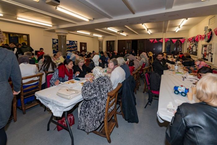
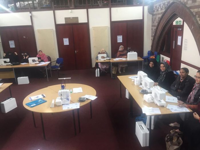
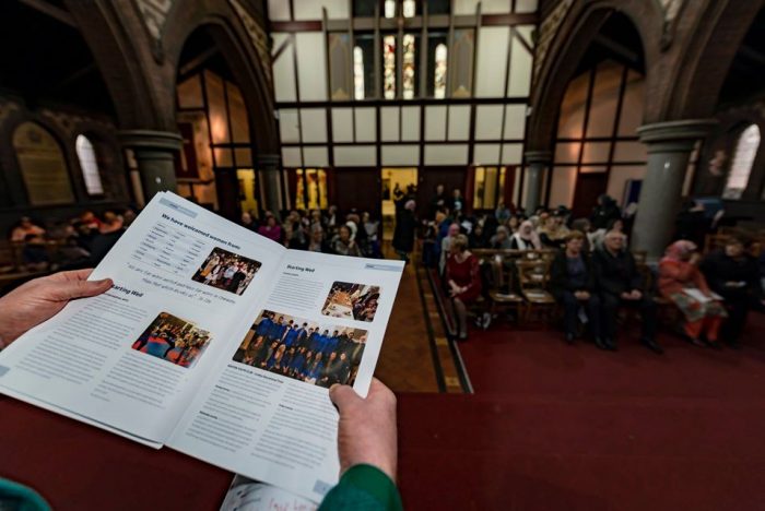
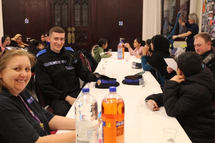
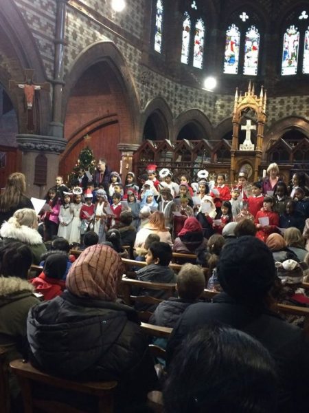
This is Christian Mission at its best! The Kingdom of God is growing. Christians, those of other faiths, and others who profess no faith, working together to bring hope to one local community.

The grant award  secures this work for a further three years, until April 2023.

Copyright

Copyright on Internet Images and Text

The situation relating to copyright on the internet is confusing. The detail of laws in different parts of the world is different and as a result the issue is confusing to most people.

So, for example, the ‘socialmediaexaminer.com’, [1] which is an American page, says the following:

Copyright laws were established not to give the author the right to deny their work to other people, but instead to encourage its creation.

Article I, Section 8, clause 8, of the United States Constitution states the purpose of copyright laws is “to promote the Progress of Science and useful Arts, by securing for limited times to Authors and Inventors the exclusive Right to their respective Writings and Discoveries.”

It’s a delicate balance between the rights of the creator and the public’s interest. When in conflict, the balance tips more heavily toward the public’s interest, which is often contrary to what the creator believes to be fair or just. [1]

However, The UK government [2] says:

Sometimes permission is not required from the copyright-holder to copy an image, such as if the copyright has expired. Permission is also not required if the image is used for specific acts permitted by law (“permitted acts”, or sometimes referred to as “exceptions to copyright”).

People can use copyright works without permission from the copyright owner, such as for private study or non-commercial research, although some exceptions are not available for photographs. Further details are available here:

http://www.gov.uk/guidance/exceptions-to-copyright

If permission is required to use an image, permission will need to be obtained from all the copyright owners, whether it is a single image with numerous creators, a licensed image, or an image with embedded copyright works. Sometimes there will be one person or organisation that can authorise permission for all the rights in that image; in other cases separate permission may be needed from several individual rights owners.
The creator of a copyright work such as an image will usually have right to be acknowledged when their work has been used, provided they have asserted this right. If you are unsure whether or not the creator has asserted this right, then it is recommended that you provide a sufficient acknowledgement when using their work. [2]

The key question for many of us who write blogs and who both quote from other sources and make use of pictures from those sources, is what is meant by the words in bold italics above.

1. Text on the Internet and in other primary sources

The first question to address is what is meant by ‘fair dealing’. Another government website [3] talks about ‘fair dealing’:

Certain exceptions only apply if the use of the work is a ‘fair dealing’. For example, the exceptions relating to research and private study, criticism or review, or news reporting.

‘Fair dealing’ is a legal term used to establish whether a use of copyright material is lawful or whether it infringes copyright. There is no statutory definition of fair dealing – it will always be a matter of fact, degree and impression in each case. The question to be asked is: how would a fair-minded and honest person have dealt with the work?

Factors that have been identified by the courts as relevant in determining whether a particular dealing with a work is fair include:

  • does using the work affect the market for the original work? If a use of a work acts as a substitute for it, causing the owner to lose revenue, then it is not likely to be fair
  • is the amount of the work taken reasonable and appropriate? Was it necessary to use the amount that was taken? Usually only part of a work may be used.

The relative importance of any one factor will vary according to the case in hand and the type of dealing in question. [3]

‘Fair dealing’ is one element of this issue.  A more critical question is: What is meant by ‘Non-commercial research‘? One place to look for answers is with Wikipedia (Creative Commons) and specifically their comments relating to this matter. [4]

Non-Commercial (NC) “means not primarily intended for or directed towards commercial advantage or monetary compensation. The definition is intent-based and intentionally flexible in recognition of the many possible factual situations and business models that may exist now or develop later. Clear-cut rules exist even though there may be gray areas, and debates have ensued over its interpretation. In practice, the number of actual conflicts between licensors and licensees over its meaning appear to be few.” [5]

However, this site, which makes images widely available on the internet and specifies the licence on each item, is an American website and so governed by US Law rather than EU law. A while back I joined the ‘Copyright Aid’ forum so as to be able to check whether particular activity on my blog met the requirements of the law. My usual practice in relation to images is to ask the photographer or copyright-holder for permission to use the image. There are however circumstances when this is unnecessary or it is impossible. Under these circumstances two matters are important, first, a commitment to ‘fair-dealing’ as discussed above. And second, the status of any blog as a non-commercial activity.

Before turning to the advice provided Copyright Aid, here are the comments about these issues carried by the Jisc in the UK (formerly the Joint Information Systems Committee) whose role is to support post-16 and higher education, and research, by providing relevant and useful advice, digital resources and network and technology services. [6] Their website comments as follows (the emphasis is mine):

However, in addition, an image may appear on a blog even if no specific authorisation is provided by the copyright-holder provided a hyperlink is used rather than ‘copy and paste’.

References

  1. https://www.socialmediaexaminer.com/copyright-fair-use-and-how-it-works-for-online-images, accessed on 15th December 2019.
  2. https://assets.publishing.service.gov.uk/government/uploads/system/uploads/attachment_data/file/481194/c-notice-201401.pdf, accessed on 15th December 2019.
  3. http://www.gov.uk/guidance/exceptions-to-copyright, accessed on 15th December 2019
  4. https://wiki.creativecommons.org/wiki/NonCommercial_interpretation, accessed on 15th December 2019.
  5. This conclusion is borne out by the “Defining Noncommercial Study,” https://wiki.creativecommons.org/wiki/Defining_Noncommercial, accessed on 15th December 2019.
  6. https://www.jisc.ac.uk/guides/copyright-law/exceptions-to-infringement-of-copyright, accessed on 15th December 2019.
  7. https://artuk.org/about/copyright-exceptions#, accessed on 15th December 2019.
  8. https://www.copyrightaid.co.uk/forum/viewtopic.php?f=2&t=2788&p=8043#p8043, accessed on 15th and 16th December 2019.
  9. https://artuk.org/about/what-is-non-commercial-use-vs-commercial-use, accessed on 15th December 2019.

Horwich Loco Works 18” Gauge Railway

Horwich was transformed by the building of the Locomotive Works. [11]Horwich Locomotive Works in 1930. [12]

76, Wight Street, Horwich was my grandparents’ home right in the centre of the old village of Horwich, between Chorley Old Road and Chorley New Road. I stayed there frequently as a child (Google Streetview).

For a number of years in the 1920s and possibly also the 1930s my grandfather worked as a blacksmith in Horwich Loco Works. The works have always, as a result, had a specific interest for me. It has been somewhat saddening over the years to see their gradual deterioration and eventual closure.

Horwich Locomotive Works “was the last major British railway works to be established on a green field site.  There were traditionally very strong links between the Lancashire & Yorkshire and London & North Western railways, and John Ramsbottom, late of the LNWR was in 1883 appointed consultant to the LYR regarding the planning of Horwich Works.  He advocated an 18in gauge internal transport system similar to that he had earlier installed at Crewe. Originally extending to 7½ miles, this enjoyed a longer life as the last surviving locomotive built for it, ‘Wren’, was not retired until 1962. The system was used for moving components around the works.” [10]

I am at present (November 2019) reading Issue No. 27 of the Railway Archive Journal published by Black Dwarf Lightmoor Press of Lydney, Gloucestershire.

I have enjoyed reading Jeff Wells article in the journal about the Manchester Exhibition of 1887. [1] The article highlights a number of railway exhibits on display at the exhibition. Among these exhibits was ‘Dot‘ a Beyer Peacock 1ft 6 inch gauge 0-4-0T engine. ‘According to the official catalogue, Dot was ‘specifically built for working on tramways in yards and workshops, and also adopted for tail-rope shunting of ordinary wagons‘. After the exhibition, ‘Dot found work at the L&YR’s Horwich Works, joining two other Beyer, Peacock 18 in engines, Wren and Robin, which had arrived in April 1887. Such engines were considered necessary to convey materials around the seven miles of internal works’ railway.’ [1: p67]

Jeff Wells was unable to find a picture of Dot but could find a picture of Robin which is reproduced here along with the accompanying text from his article. [1: p68] The image included in Jeff Wells article is the Beyer Peacock works image of the locomotive from 1887. Some limited further details of the image can be found on ‘picclick’ and in an edition of the Model Engineer. [17][19] Drawings produced in 2012 can be found on the site ‘Laurel Today’. [20]

This short excerpt from Jeff Wells article prompted further investigation of the internal railway system at the Horwich Loco Works. …

An 18-inch (460 mm) gauge railway, with approximately 7.5 miles (12.1 km) of track was built to carry materials around the works complex at Horwich. It was modelled on a similar system at Crewe Works. John AF Aspinall ordered two 18″ Gauge 0-4-0 tank engines from Beyer Peacock of Leeds at a cost of £250 each. They both arrived at Horwich Loco Works on 7th April 1887 and were named ‘Wren‘ and ‘Robin‘ respectively. A third Locomotive was ordered on the 8th November 1887 at a cost of £300 and on arrival was named ‘Dot‘. A further five similar locomotives were built at Horwich Loco Works and were named, ‘Fly’ ‘Wasp’ ‘Midget’ ‘Mouse’ and ‘Bee’. From 1930 they were gradually withdrawn from service, the last, ‘Wren’, was withdrawn in 1961/1962 and was originally renovated and placed on display in the Erecting Shop. [2][3] It is now preserved at the National Railway Museum. [4: p 215][5: p128-129]

The excellent book by M.D. Smith about Horwich Locomotive Works [6] has a picture on its front cover of the diminutive ‘Wren’ as can be seen in the adjacent image.

As noted above, this locomotive is now preserved at the National Railway Museum as a public exhibit illustrating the use of industrial and military railways. Photographs of ‘Wren’ at work in Horwich follow below. The first comes from the D. Prichard Collection and is in the public domain. [7] The second from Steam World Magazine. [9] ‘Wren’ was fitted with a strongbox on the tender for distributing wage packets. [10]‘Wren’ Horwich Works in the 1950s. [18]

A similar picture was in Steam World Magazine. [9]

The name of the loco shown in the adjacent image cannot be picked out in the picture. Radii were tight and locomotives had to manouvre around many different obstacles. The picture was taken in 1905 within the Locomotive Works (© National Railway Museum / Science & Society Picture Library) [13][18]

M.D. Smith’s book about the Works is a comprehensive review of the Lancashire and Yorkshire Loco Works in Horwich and contains a myriad of monochrome pictures of the works which. Illustrate maintenance and construction practice at the Works over the years. In many of the photographs an 18″ gauge railway can be seen running down the central corridor in each workshop. In some shops the 18″ gauge track runs between the rails of a standard-gauge track serving the workspace. Two images will suffice to illustrate this point. The first shows the north side of the Smithy in 1902 with  the 18″ gauge track running down the centre of the workshop. The second shows the Wheel Shop in 1920 with both track gauges present. [6: p52-53]. Smith’s book is a fantastic exploration of the Works of great interest to anyone with connections to it or with a desire to better understand its workings.Horwich Locomotive Works: The Smithy 1902 [6: p53]Horwich Locomotive Works: The Wheel Shop 1920 [6: p52]

ZM32 (in ‘wasp’ livery) and ‘Wren’ at Horwich works on 4 March 1961. [8]

In 1957 a Ruston & Hornsby Class LAT 20Hp diesel locomotive (ZM32) was built for the system and arrived in British Railways Green with Yellow and Black ‘Wasp’ warning panels.

With works number 416214 it worked up until 1965 when the 18″ gauge railway was abandonned and the diesel loco was put into store.

It had been intended for this loco to be sold to a railway in British Honduras but this fell through and in 1971 it was sold to RP Morris.

The loco was re-built and re-gauged to 2′ gauge and worked at Pen-Yr-Orsedd Quarry, Nantlle and Gloddfa Ganol.

It was finally acquired for preservation in 1997 by The Steeple Grange Light Railway near Wirksworth in Derbyshire. It was fully overhauled and the 18″ gauge wheels were re-instated. It received original British Railways Green and in its honour was named ‘Horwich’.

The Steeple Grange Light Railway website comments that “In the summer of 2004, ZM32 topped an informal poll amongst narrow gauge enthusiasts to determine the ten most popular non-steam locomotives in the UK.” [8]

Other relevant resources:

Notes on RMWeb: ‘An Illustrated History of 18 Inch Gauge Steam Railways’, by Mark Smithers (OPC 1993) devotes 13 pages to the Horwich system, with photos, drawings and a track plan. There are 2 photos in “Lost Lines, British Narrow Gauge” (by Nigel Welbourn, published 2000) on pages 95 & 96 showing Wren and ZM32. A model of ‘Wren was produced in “O-9mm” and can be found here: http://www.springsidemodels.com/id153.htm. [14]

The GN15 Forum: Notes and pictures of a model in GN15 can also be found at the end of a discussion on this forum: http://gn15.info/forum. [21]

Blackrod Station: owed its ongoing existence into the late 20th Century to the Works. [15]

The Condition of the Works in January 2011: is illustrated on the 28 Days Later Urban Exploration forum. The pictures on that site provide a very atmospheric look at the old buildings of the Works. As well as modern monochrome images, the site also has a number of archived images of the Works. [16]

References

  1. Jeff Wells; The Railways Involvement in he Manchester Royal Jubilee Exhibition of 1887; in Railway Archive Issue No. 27, June 2010, Black Dwarf Lightmoor Press, Lydney, Gloucestershire, p57-69.
  2. https://en.m.wikipedia.org/wiki/Horwich_Works#, accessed on 15th November 2019.
  3. “Motive power miscellany: Midland Region Central Lines”. Trains illustrated. Vol. XIV no. 154. Hampton Court: Ian Allan. July 1961. p. 441.
  4. John Marshall, B.W.C. Cooke (ed.), “Notes and News“, The Railway Magazine, Westminster: Tothill Press, vol. 110 no. 759, July 1964.
  5. John Marshall; The Lancashire & Yorkshire Railway, Volume 3; David & Charles, Newton Abbott, 1972.
  6. M.D. Smith; Horwich Locomotive Works; Amadeus, Huddersfield, 1996.
  7. https://commons.wikimedia.org/wiki/File:LandYR_Horwich_Works_locomotive_%27Wren%27.jpg, accessed on 10th December 2019.
  8. http://www.steeplegrange.co.uk/locos-zm32.htm, accessed on 10th December 2019.
  9. https://steamworldmag.co.uk/wp-content/uploads/2015/05/sw321-horwich.compressed.pdf, accessed on 10th December 2019.
  10. https://preservedbritishsteamlocomotives.com/wren-0-4-0st-lyr-horwich-works-narrow-gauge, accessed on 10th December 2019.
  11. https://www.theboltonnews.co.uk/news/13573684.how-the-loco-works-transformed-a-town (5th August 2015), accessed on 10th December 2019.
  12. https://www.theboltonnews.co.uk/news/17827041.loco-works-changed-horwich-sleepy-village-hive-industry (19th August 2019), accessed on 10th December 2019.
  13. https://www.ssplprints.com/image/117089/locomotive-at-horwich-works-c-1905, accessed on 10th December 2019.
  14. https://www.rmweb.co.uk/community/index.php?/topic/50746-horwich-works-narrow-gauge-railway, accessed on 10th December 2019.
  15. http://www.blackrod.org.uk/industry_locoworks.html, accessed on 10th December 2019.
  16. https://www.28dayslater.co.uk/threads/horwich-loco-works-nr-bolton-jan-2011.57166
  17. https://picclick.co.uk/LNWR-loco-ROBIN-at-HORWICH-WORKS-built-BP-142881232407.html, accessed on 10th December 2019.
  18. http://britbahn.wikidot.com/horwich-works-railway, accessed on 10th December 2019.
  19. Jim Robinson; Prototype Locomotives and Railway Practice; in Model Engineer Centenial Celebration Collection, Volume 1 No. 3, 1997, p13. https://www.model-engineer.co.uk/sites/7/documents/me-cen-3-pt1.pdf, accessed on 10th December 2019.
  20. https://laurell.today/prototypes/uk/horwich.html, accessed on 10th December 2019.
  21. http://gn15.info/forum/viewtopic.php?t=6983, accessed on 10th December 2019.

Appendix No. 1

The Bolton News: 5th August 2015 [11]

“Horwich Loco Works was a major source of employment for local folk. It became synonymous with the town. You could barely mention Horwich without reference being made to the Loco Works.

Prior to the building of the works Horwich was described as a “sleepy village” with far fewer residents. It would be transformed into something few could have imagined and this transformation was not without its concerns. According to Horwich Heritage Society chairman Stuart Whittle, fate played a hand in the arrival of the works 130 years ago and, ultimately, in the formation of the popular local society too.

“It is remarkable to think that I wouldn’t be writing this article but for two major twists of fate that completely changed the fortunes of the town of Horwich,” says Stuart. For a start, Horwich was not even on the list of possible sites for a new Loco Works when the directors of the Lancashire and Yorkshire Railway Company met on May 21 1884.

However, with those sites on offer not looking promising, the company’s surveyor and land agent, Elias Dorning, mentioned an announcement in that very morning’s paper that 650 acres of land was for sale in the village of Horwich. This land was to be auctioned at the Mitre Hotel in Manchester in six days time so time was of the essence to decide whether it was suitable.

John Ramsbottom and William Barton-Wright were the two men charged with reviewing the whole of the Lancashire and Yorkshire Railway Company’s railway system and, together with Dorning, they visited the area and reported back favourably, explains Stuart.

“Although the area of land on offer far exceeded their requirements, the directors authorised Dorning to attend the auction and purchase the site for not more than £65,000.

“In the event, Dorning was able to acquire this major part of the village of Horwich for only £36,000 and that Tuesday afternoon, May 27 1884 marked the beginning of a remarkable transformation for the sleepy village. “Within four months site drawings had been approved and in December detailed plans for the buildings were submitted by Ramsbottom.”

The land allocated for the works, south of Chorley Old Road, was relatively flat and presented few problems with the exception of the hill on Old Harts Farm.

“Site works commenced in January 1885 and by the end of July the erecting shop foundations were nearing completion. On November 15 1886 Horwich Loco Works was officially opened and work began immediately.”

The existing Horwich population of fewer than 4,000 most of whom lived on the “top side” (Church Street) were both intrigued and appalled by the prospect of a major influx of new residents and they were right to be concerned, adds Stuart.

“The population more than tripled in 10 years as navvies and new employees came from all over the country to work on and at the new works.

“Such an increase put an incredible strain both on the town’s physical and social infrastructure as the Local Board, Railway Company and local builders struggled to build enough houses, shops, schools, churches and other social facilities.

“This strain was bound to tell and there was increasing tension both on the works’ site and in the town, particularly amongst the navvies.”

Apparently the local police presence had to be increased but this did not prevent a major incident breaking out in 1886 when ill-feeling between English and Irish navvies (allegedly provoked because of different rates of pay) erupted into fighting which extended over a wide area of the town and lasted on and off for a week. “Weapons used in the violent incidents included bricks, pokers, blocks of wood, belts and a scythe,” explains Stuart.

Within the works industrial relations were generally good in the early years but, with so many trades represented by newly-established unions, strikes and lock-outs did occur. The worst was a 12-week strike in 1906 which resulted in real hardship for workers’ families. Soup kitchens were provided by local shopkeepers followed by a bitter nine-week dispute in 1911 which involved a full scale riot and the drafting in of hundreds of extra police to deal with the local unrest. Despite this turbulent start the works quickly got into its stride. Initially it catered for locomotive repairs but on February 20 1889 the first designed and built loco, No.1008, steamed out of the erecting shop.

“The locomotive production age at Horwich had begun. “At its peak the works employed around 5,000 men and would go on to build 1,830 steam locos, 169 diesels and five 18 inch gauge locos.

“Some 50,000 locos were repaired there. The Loco Works effectively built the town of Horwich we know today and many Horwich families have ancestors who arrived from all over the country to work there. The works became the educational, social and recreational centre of the town through the building of the Railway Mechanics Institute and even today, many local clubs and societies still bear the famous RMI initials,” adds Stuart.

The second twist of fate occurred on December 23 1983 when the unthinkable happened — the works closed down almost 100 years after that fateful day in 1884 when the decision to buy the site was taken and 97 years after the first locomotives were taken in for repair. This left a whole community devastated. A hard campaign had been fought to save the works but to no avail. The town had lost its main employer and the industry that was synonymous with the town. So what would the future hold?

It was in the middle of this devastation that Horwich Heritage was formed to raise the spirits of the townsfolk and help them believe that they still had a wonderful town to be proud of. Remarkably, without the closure of the works, there may not have been such an urgent need to recognise the town’s history, particularly its great railway legacy and Horwich Heritage may not have happened at all, says Stuart. “So in a perverse way, we have the closure of the works to thank for everything we have achieved and enjoyed over the past 30 years. Quite a thought!”” [11]