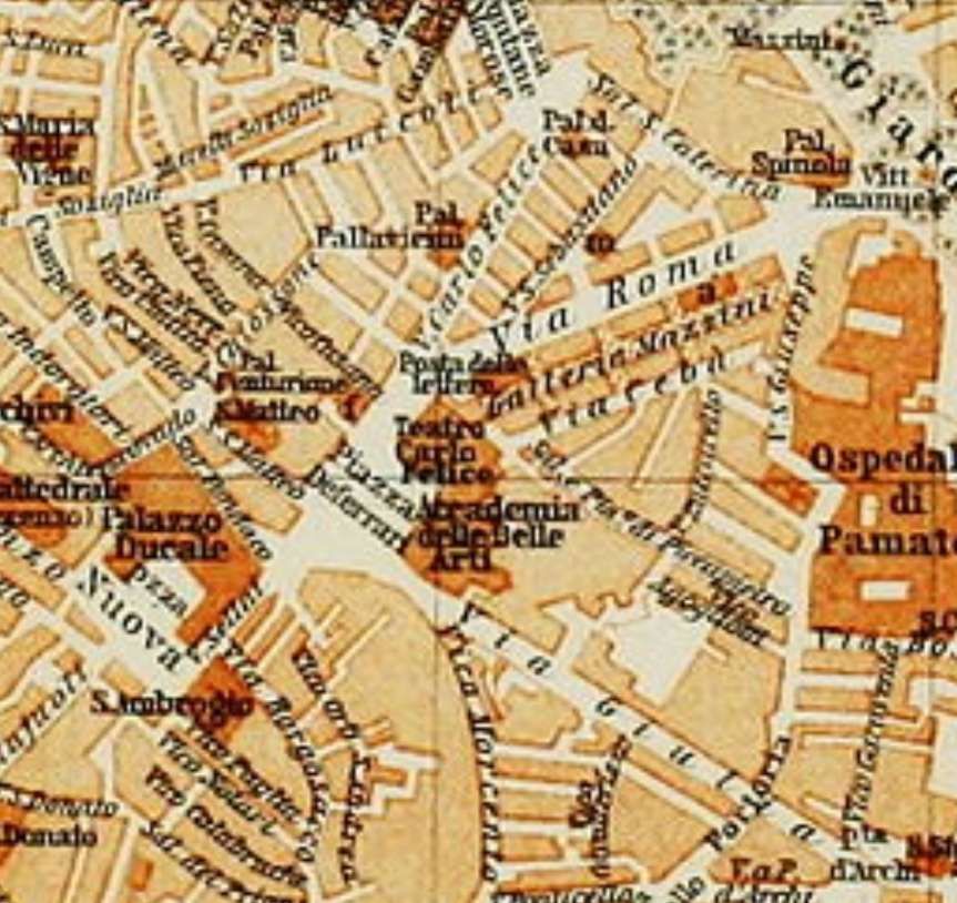
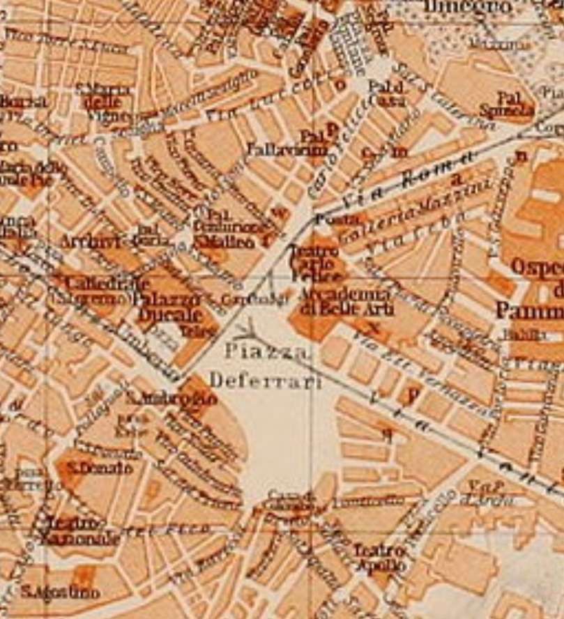
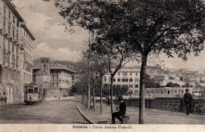
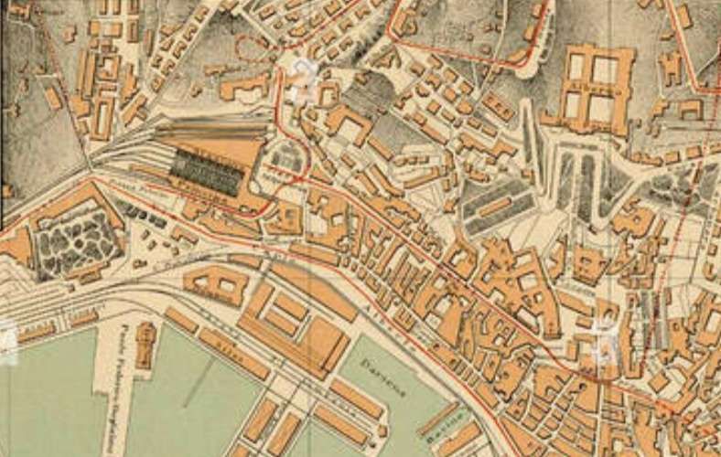
We begin this article with a look at maps of the Piazza Raffeale de Ferrari and its immediate environs over the years around the turn of the 20th century. The Piazza became one of two focal points for tramways in the city (the other was Caricamento).
I found the series of maps interesting and they provoked a desire to find out more about the network of horse-drawn and later electric trams and tramways of Genoa. ….
Italian Wikipedia informs us that: “The first public transport in Genoa was provided by a horse bus service linking the city centre and Sampierdarena, that started in 1873. In 1878, the French company Compagnia Generale Francese de Tramways (CGFT, French General Company of Tramways) began to build a horse tram system.” [16][17]
Towards the end of the century, the new urban plan led to the construction of new roads with wider carriageways, principal among these were:
Via Assarotti connecting Piazza Corvetto to Piazza Manin;
Via XX Settembre, built between 1892 and 1899, widening Strada Giulia and connecting the Palazzo Ducale (Piazza de Ferrari) with Porta Pila and the banks of the River Bisagno (once the eastern boundary of the city);
Corso Buenos Aires, once outside the city walls, was lowered to the level of Ponte Pila and the new Via XX Settembre, to form a single artery that would connect the centre with the Albaro district;
Corso Torino, perpendicular to Corso Buenos Aires.
After this work was done, the city began to look more modern and the widened streets made room for tramways in the centre and East of the city. The municipal administration began to plan new lines, both towards the eastern suburbs and in the central districts of the city. [19]
The city welcomed competition and set up a series of concessions which were given to different groups: the French Company kept the Western concession; Val Bisagno and the hilly areas to two Swiss businessman (Bucher & Durrer); and the east of the city was granted to a group of local businessmen. [19][20: p66]
The two parties, other than the French, formed companies: Bucher created the Società di Ferrovie Elettriche e Funicolari (SFEF) in 1891. [20: p85] The Genoese entrepreneurs founded the Società Anonima Tramways Orientali (SATO) in 1894. [20: p120] The two companies took on the two concessions which envisaged electric traction on metre-gauge lines to accommodate running on the narrow winding streets of the city centre. [19]
“By 1894, SFEF had achieved no more than a single short electric tram line between Piazza Manin and Piazza Corvetto, whilst SATO had not progressed beyond the planning stage. The CGFT system had extended through the city and the Val Polcevera, but was still horse operated.” [16][17]
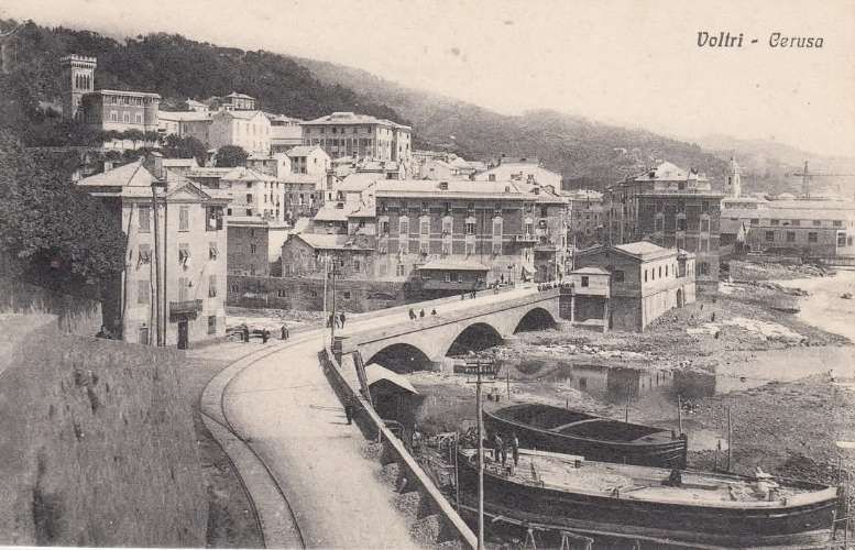
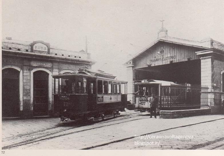
“In 1894, the German company Allgemeine Elektrizitäts Gesellschaft (AEG) … bought both the SFEF and SATO companies. The following year AEG created the company Officine Electrical Genovesi (OEG), … which took over the city’s existing electricity supply company, and the Società Unione Italiana Tramways Elettrici (UITE), … which purchased the CGFT’s concession. By the end of 1895, AEG had a monopoly of both electricity supply and public transport provision in the city.” [16][17] Under AEG’s “ownership, SFEF and SATO developed a tram network of more than 53 km (33 mi) reaching Nervi and Prato, whilst UITE electrified their lines to Voltri and Pontedecimo.” [16][17]
As we have already noted, the first electric traction line connected Piazza Corvetto to Piazza Manin, running along Via Assarotti. [20: p92] It was activated by SFEF on 14th May 1893 [20: p96] The single-track line was 800 metres long and ran on a constant gradient of 7% [20: p95]; the tickets cost 10 cents. The electrification (600 V DC) was via an overhead cable and was carried out by AEG of Berlin, which, as we have already seen, later acquired a significant shareholding in the company. [19][20: p86-87]
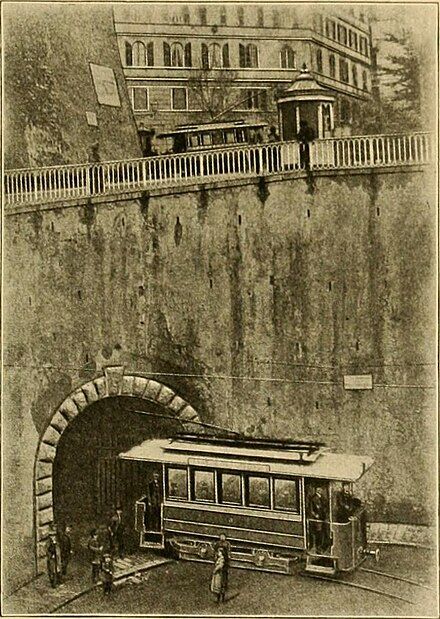
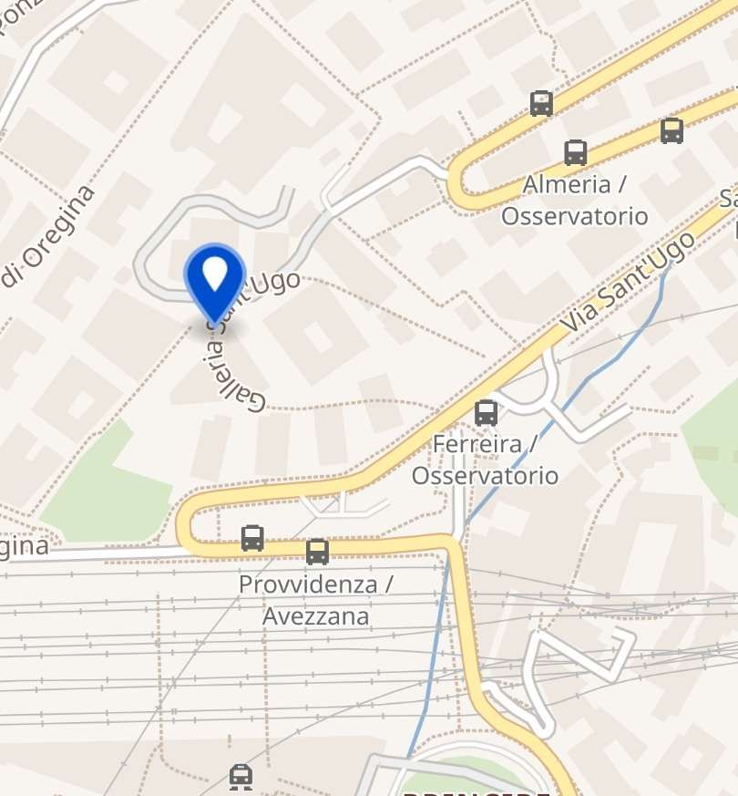
In subsequent years the SFEF network expanded rapidly; in 1895-96 the Monte line to the North of the city centre entered into service, including the Sant’Ugo spiral tunnel; in 1896 the line from Piazza Principe to Piazza Brignole was born. It included two tunnels in the Castelletto area. [21: p20] , In 1897, the Val Bisagno line up to Prato began operation. [19][21: p26]
The first SATO line entered into service on 26th July 1897, connecting Piazza Raibetta to Staglieno through the Circonvallazione a Mare, [20: p122] followed two years later by the long coastal line to Nervi. [20: p127] In 1900 the eastern trams reached the central Piazza de Ferrari, travelling along the new Via XX Settembre which was formed through widening of the old Via Giulia. [19][21: p53]
The two networks, SFEF and SATO, were technically compatible and the two companies, both controlled by AEG, soon unified the two networks. [20: p142]
“Finally in December 1901, AEG merged SFEF and SATO into an enlarged UITE.” [16][17]
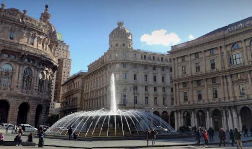
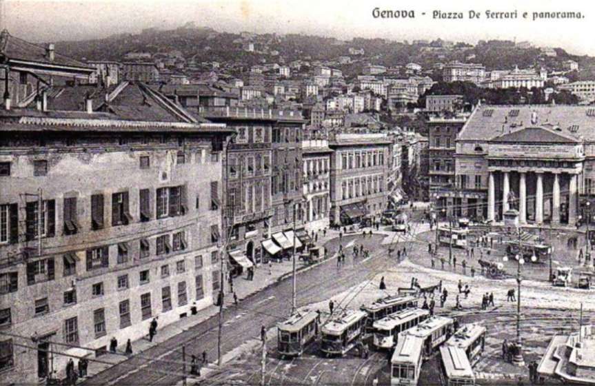
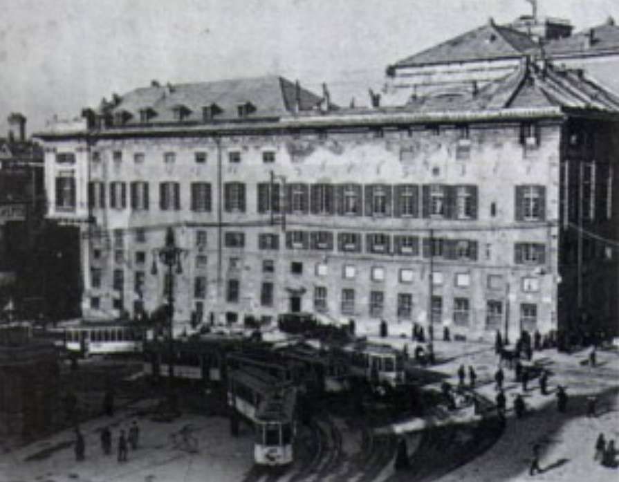
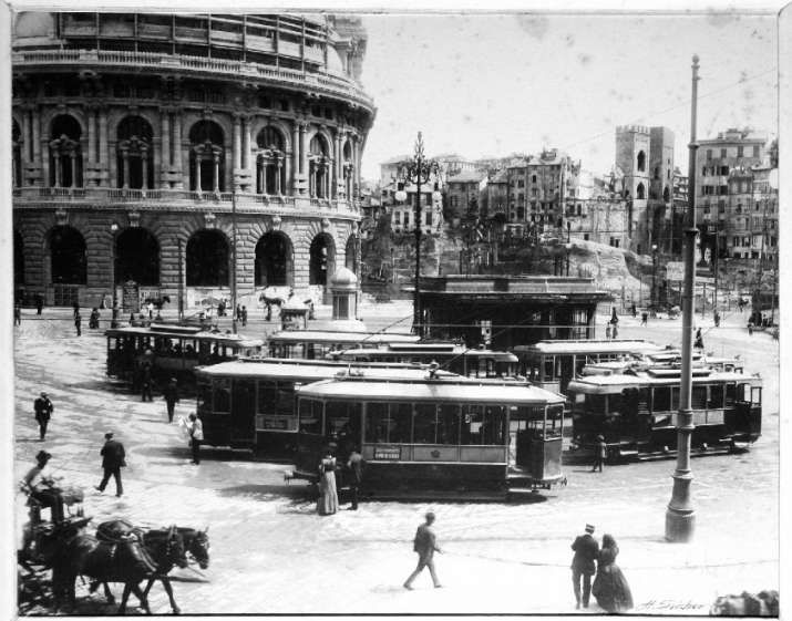
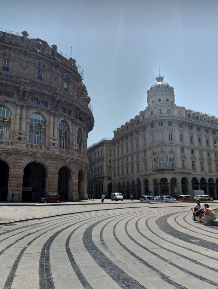
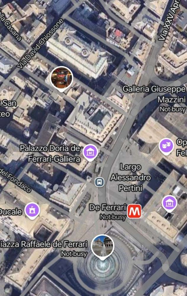
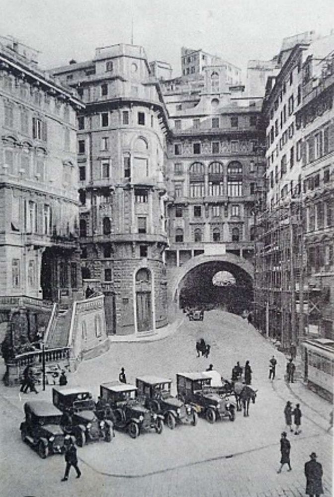
The enlarged UITE found itself managing 70 km of network, divided between the 30 km of the ‘Western network’: (formerly the French Company) and the 40 km of the ‘Eastern network’ (formerly SFEF and SATO). [20: p170-171] The unification of the network led to an increase in overall traffic, symbolised by the creation of the vast ring terminus in Piazza de Ferrari in 1906. [20: p129]
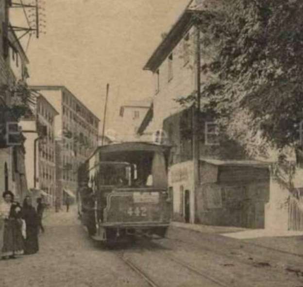
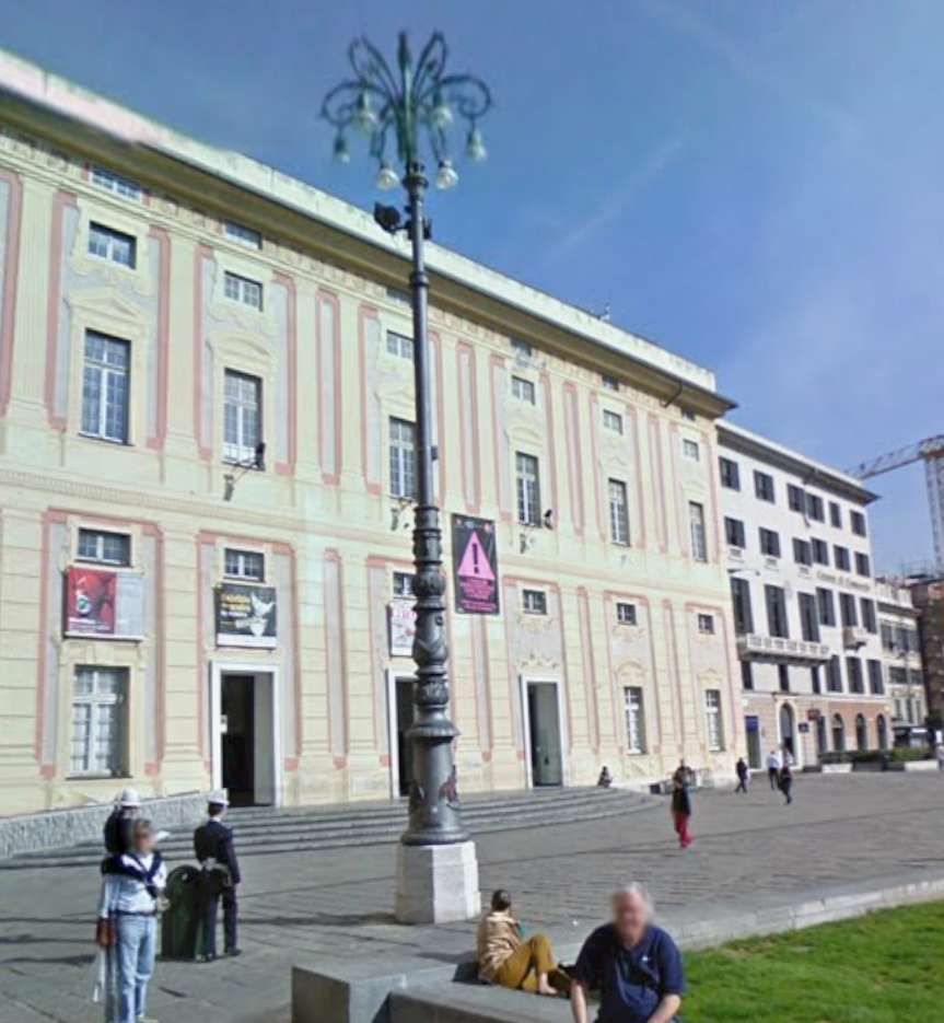
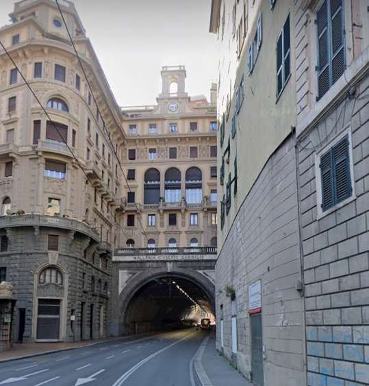
This seems the right time to look again at the ‘ring terminus’ in Piazza de Raffeale Ferrari. ….
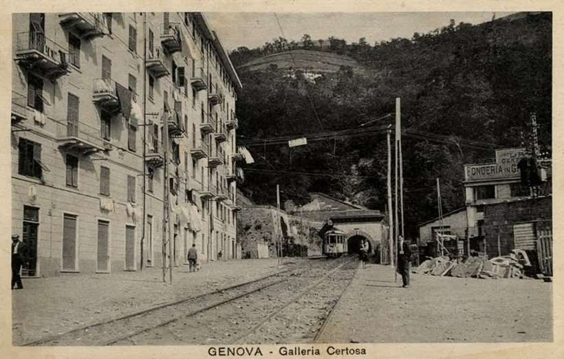
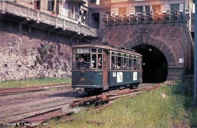
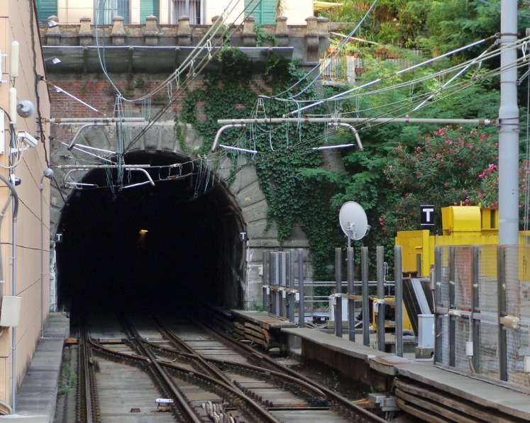
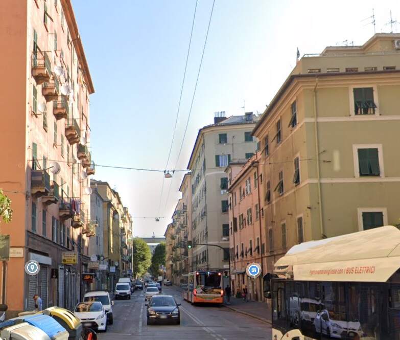
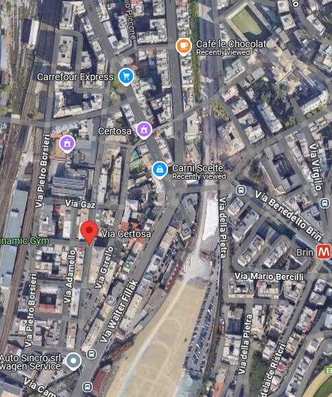
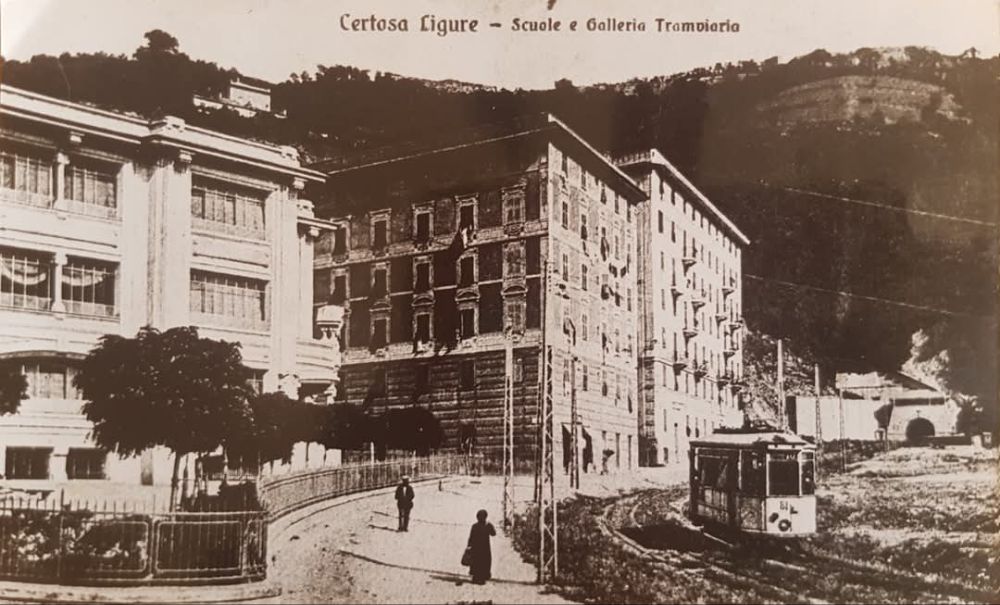
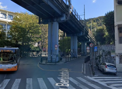
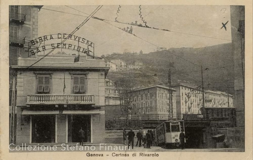
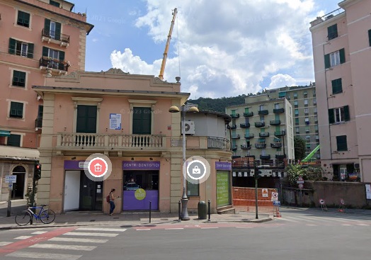
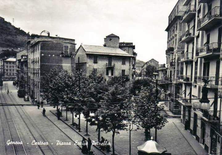
In 1908, after three years of construction work, Galleria Certosa (Certosa Tunnel) was put into use. It facilitated tram journeys to and from the Polcevera valley, avoiding the crossing of San Pier d’Arena. [19][21: p38] The tunnel connected Piazza Dinegro, in the port area, to the Rivarolo district in Val Polcevera. It was 1.76 km long. [22]
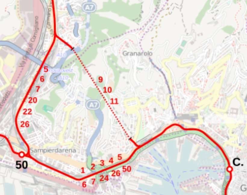
In 1934, Galleria Certosa was used every day by five lines: Tram No. 9 (San Giorgio-Rivarolo), tram No. 10 (San Giorgio-Bolzaneto), tram No. 11 (San Giorgio-Pontedecimo) and the two circular lines between San Giorgio and Sampierdarena. [22]
Having noted the construction of Galleria Certosa in the early years of the 20th century (above), it is worth looking at some other tunnels which were built to facilitate the movement of trams.
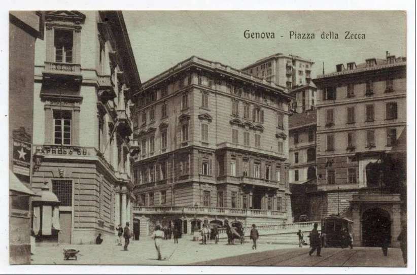
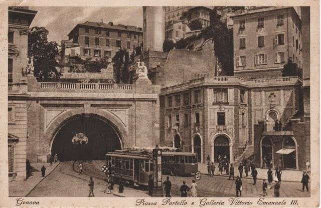
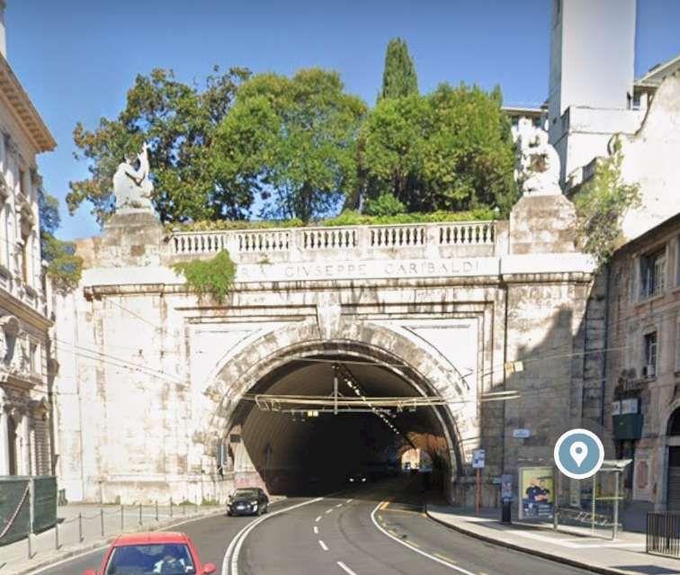
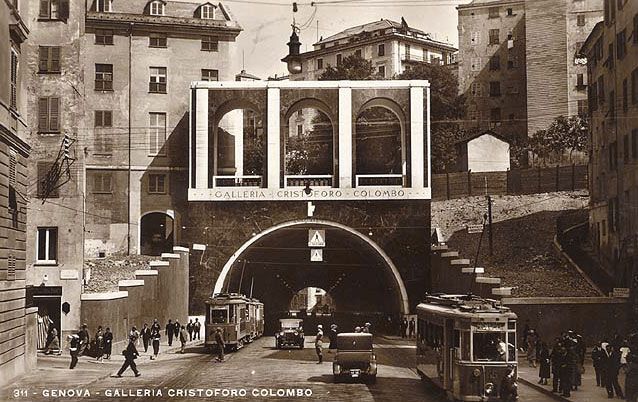
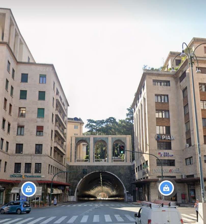
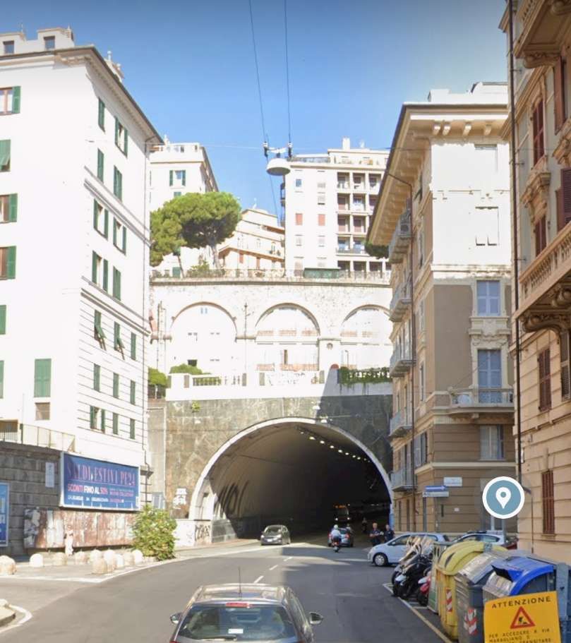
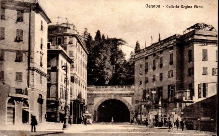
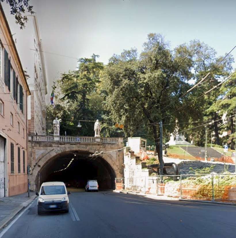
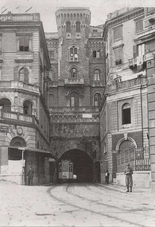
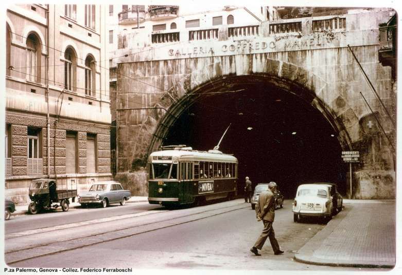
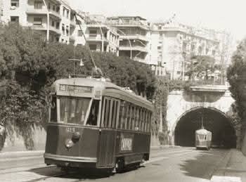
Galleria Vittorio Emanuele III (renamed Galleria Giuseppe Garibaldi on 27th November 1943)
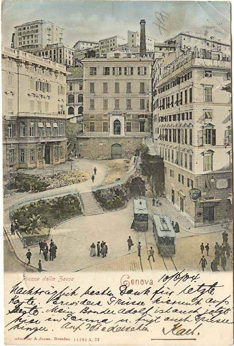
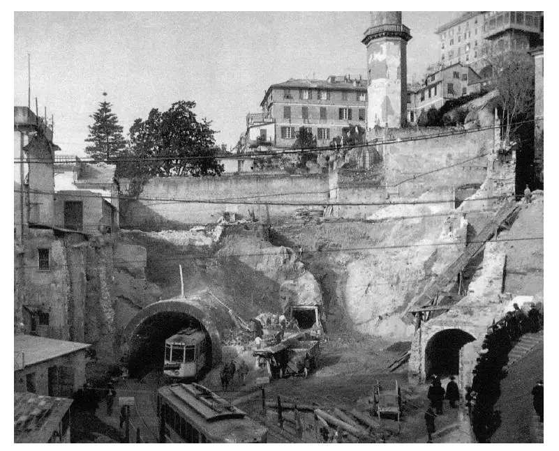
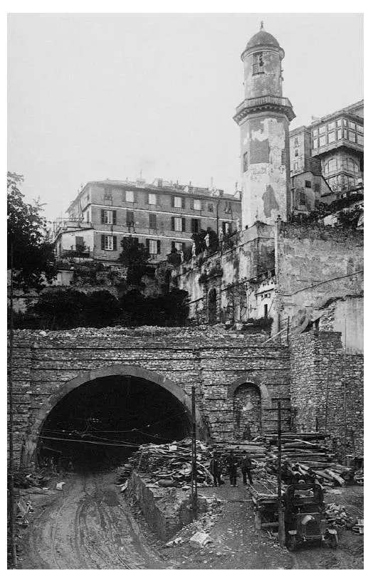
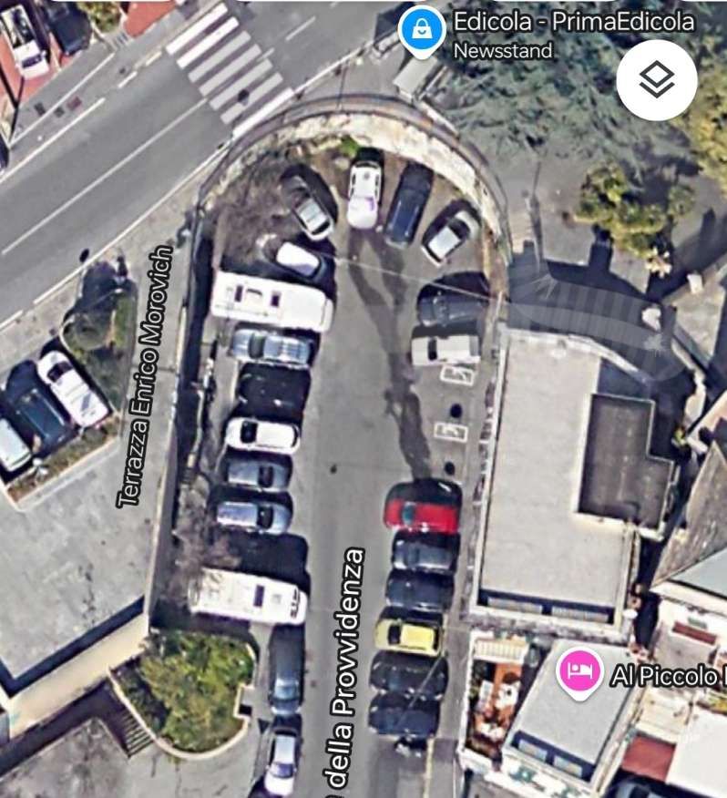
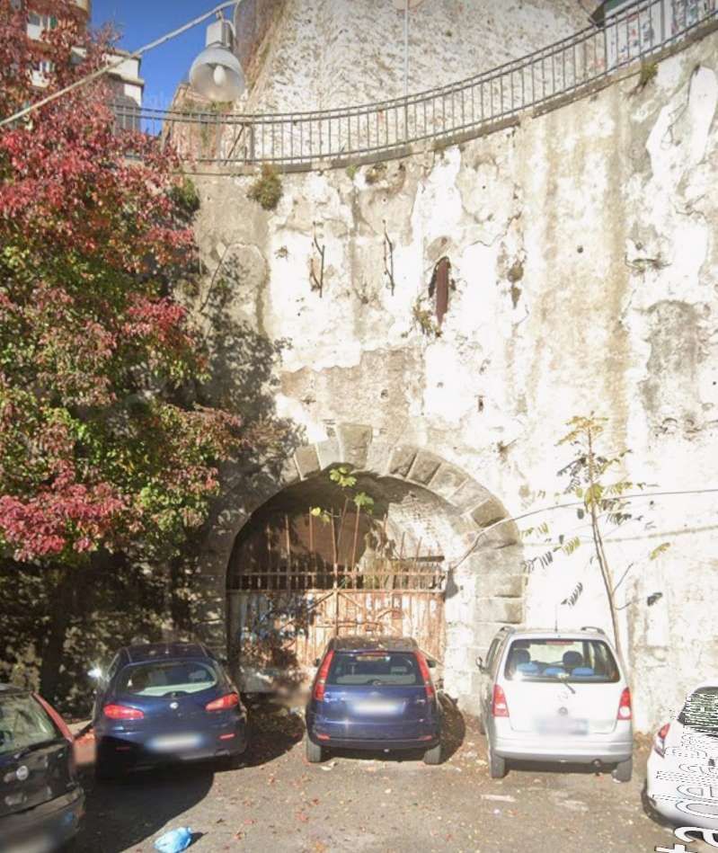
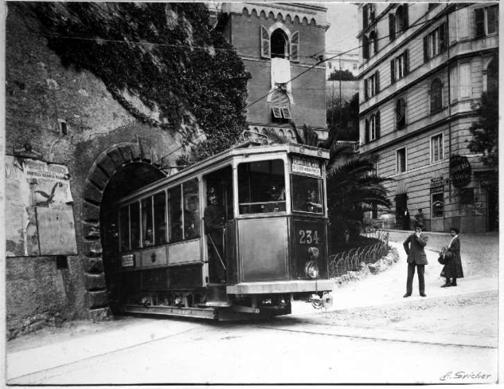
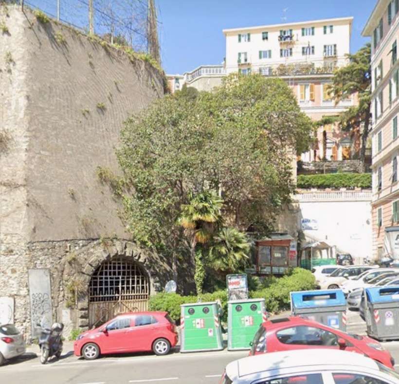
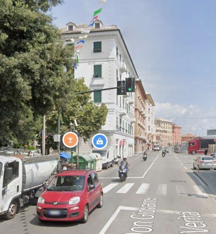
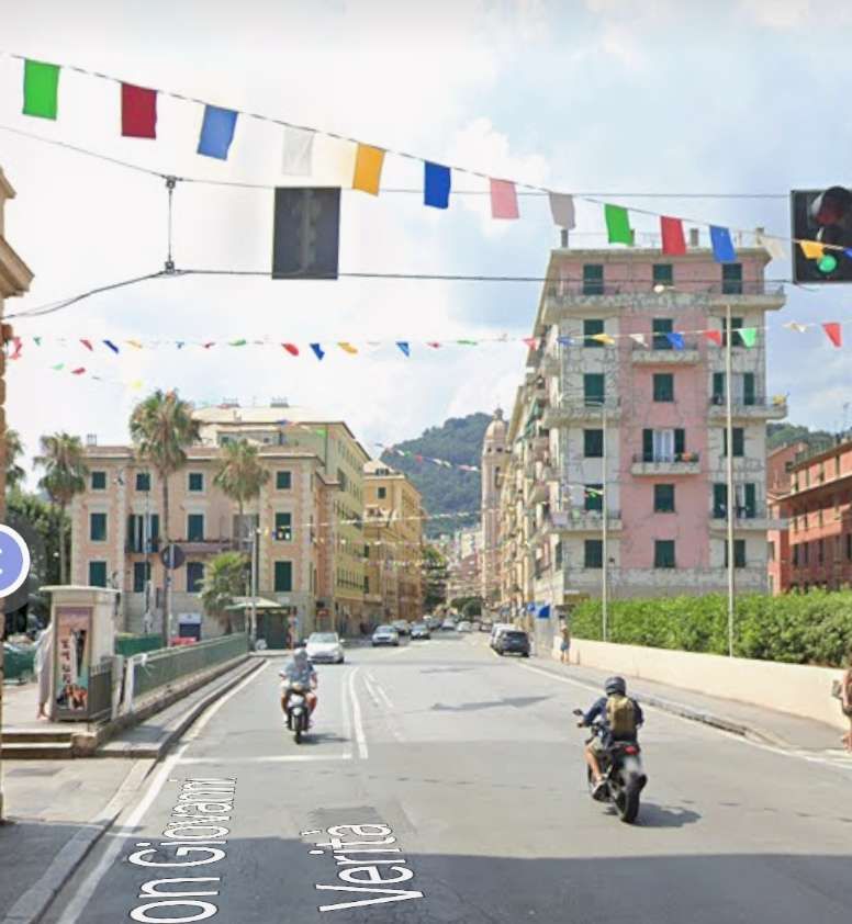
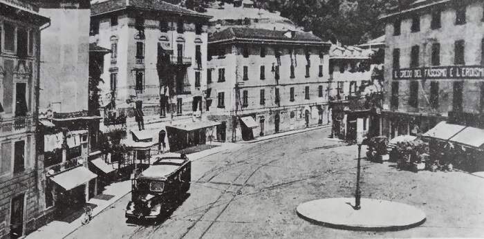
There seems to be quite a story to the life of this tunnel! The first two photographs show the first tunnel. They focus on the portal in Piazza Della Zeccan.
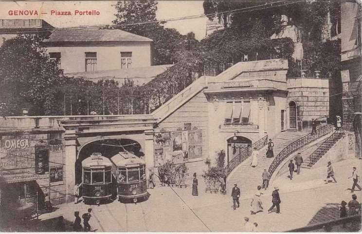
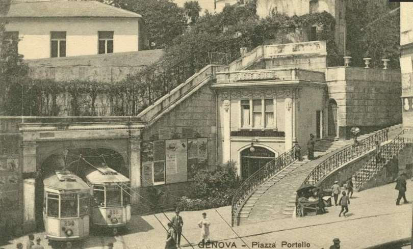
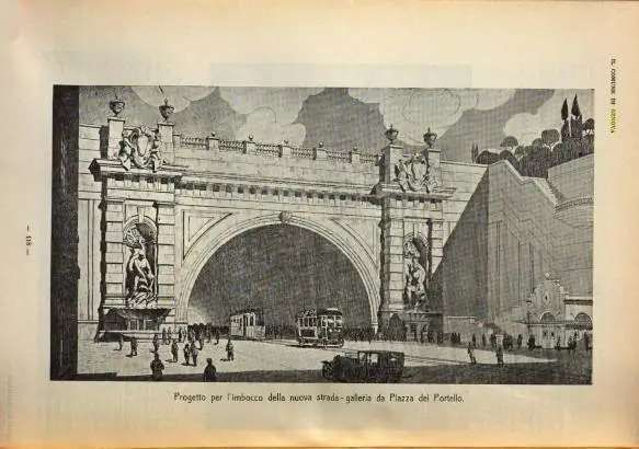
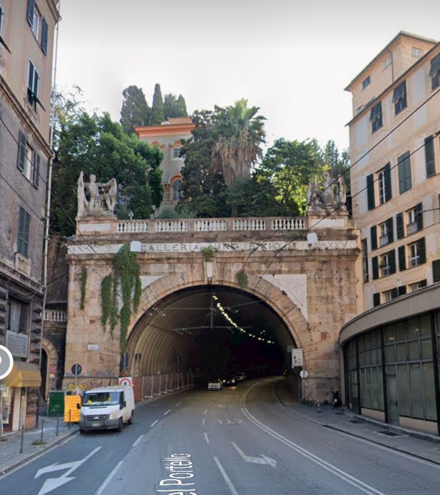
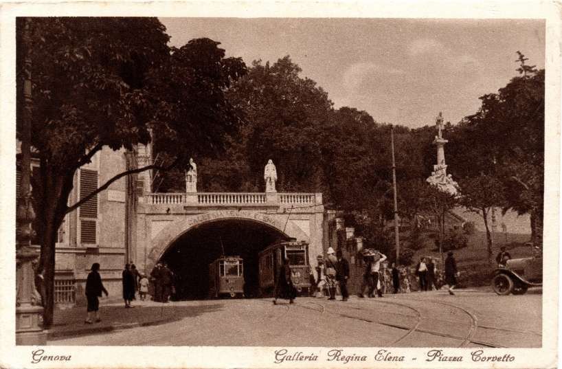
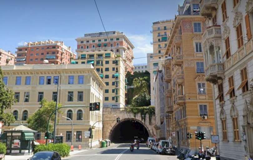
These next two photographs show the tunnel as it was first widened in the form which preceded the Galleria Vittorio Emanuele III which had a much smaller bore.
Named after Christopher Columbus, whose house was nearby, the gallery was opened to the public in the 1930s and was hailed as the city’s gateway to the sea. It connected Piazza de Ferrari and Piazza della Vittoria.
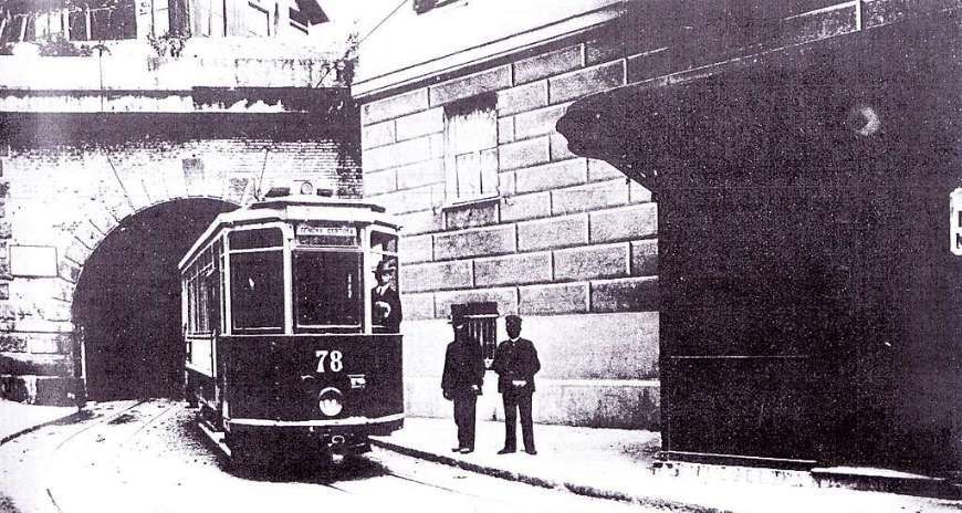
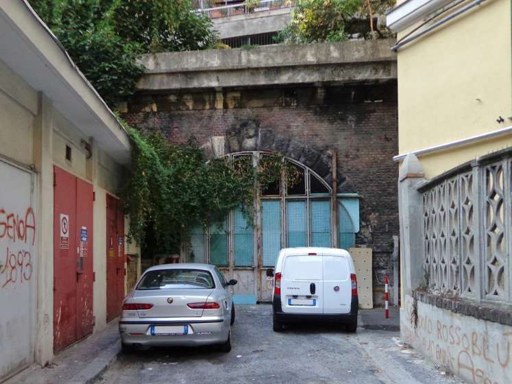
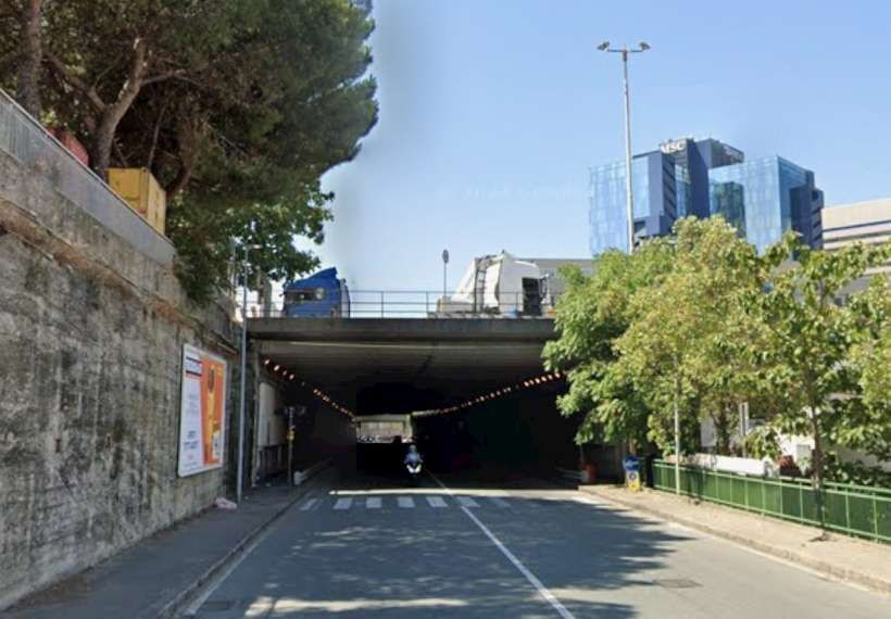
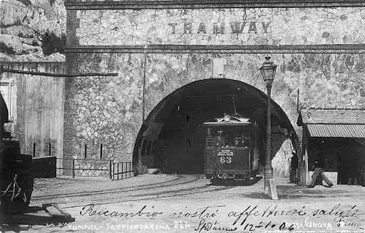
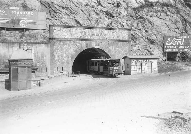
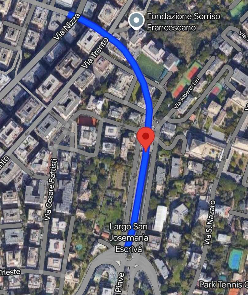
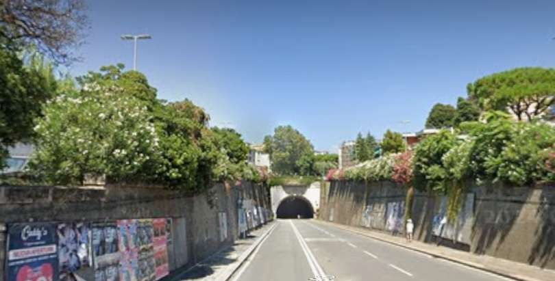
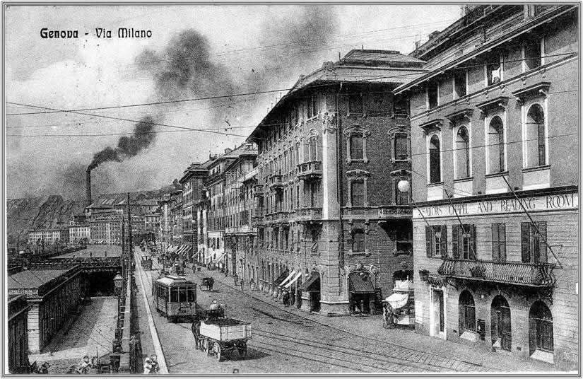
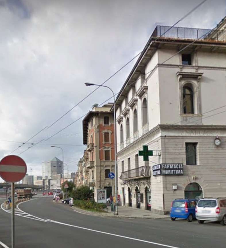
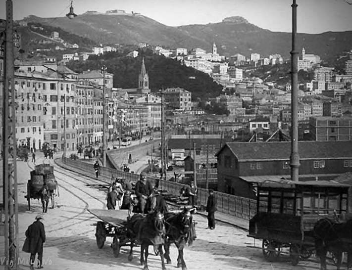
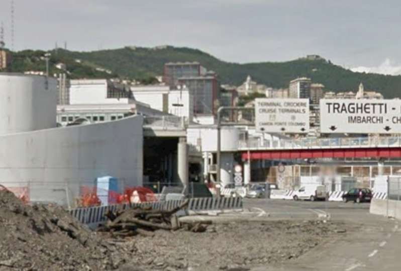
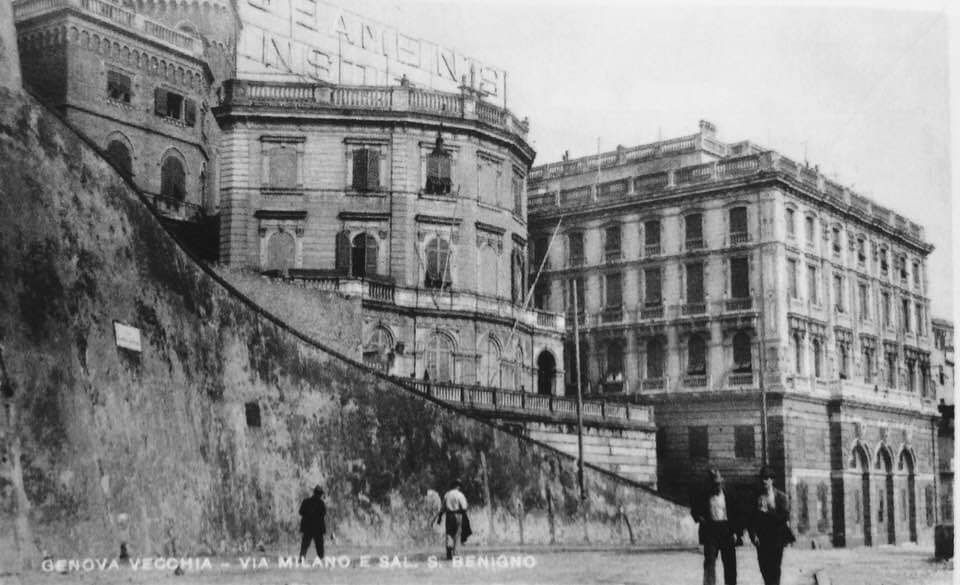
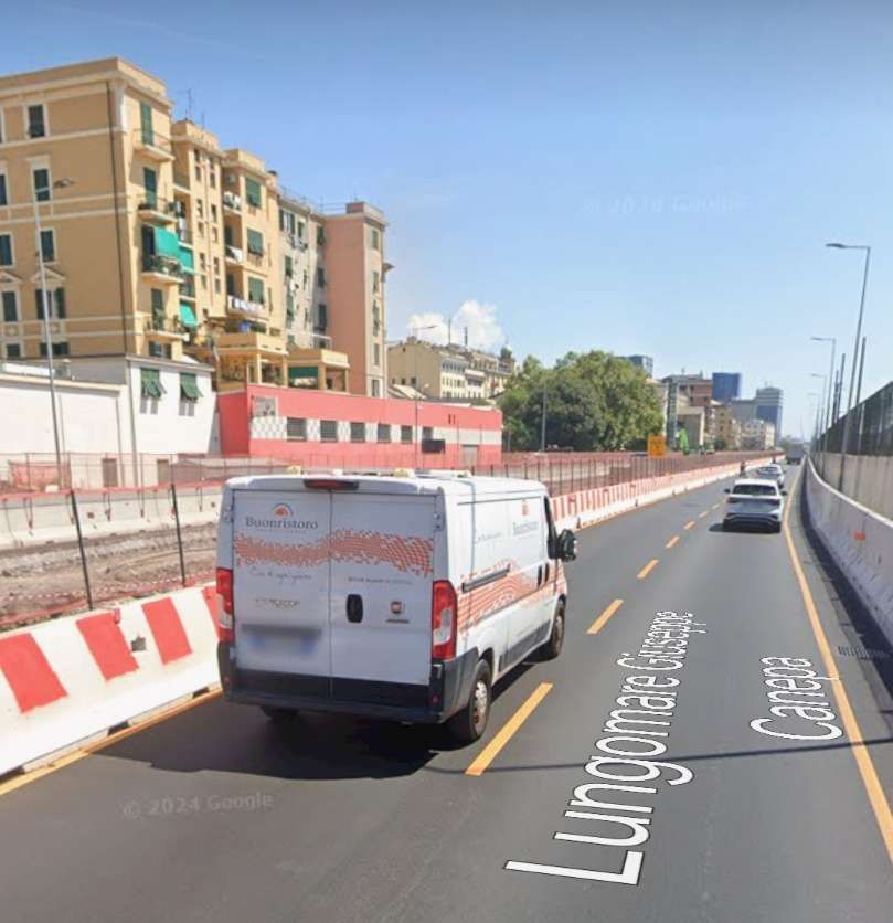
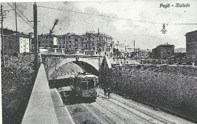
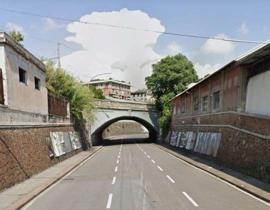
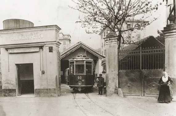
Now long gone, there was a tram tunnel on Via Milano to the Southwest of the city centre. It took the tramway (and roadway) under San Benigno Hill. It was.built in 1878 by the Compagnia Generale Francese dei Tramways for its horse-drawn trams. Its Southwest portal was in Largo Laterna. Its Northeast portal is shown in the first image below.
In the early years of the 20th century, the municipal administration began to consider the idea of taking control of the tram service. In anticipation of this, in 1913, it built its own line from Marassi to Quezzi, known as Municipal Line A, it was operated by UITE on behalf of the Municipality. [19][21: p44]
Before the start of World War 1, the tram network provided these services: [19]
21 De Ferrari – Manin – Staglieno 22 De Ferrari – Manin 23 De Ferrari – Manin – Castelletto 24 De Ferrari – Manin – Castelletto – San Nicholo 25 Circuit in the hilly suburbs 26 Piazza Principe – Corso Ugo Bassi 27 De Ferrari – Zecca – Principe 28 Caricamento – De Ferrari – Galliera ‘Ospital 29 De Ferrari – Carignano 30 Circular Raibetta – Brignole – Corvetto – Raibetta 31 De Ferrari – Staglieno – Molassana – Prato 32 De Ferrari – Staglieno – Molassana 33 De Ferrari – Pila – Staglieno 34 Staglieno – Iassa 35 Pila – Staglieno 36 Pila – Staglieno – Molassana 37 De Ferrari – San Fruttuoso 38 De Ferrari – Foce 39 De Ferrari – San Francesco – Sturla – Priaruggia – Quinto – Nervi 40 De Ferrari – San Francesco – Sturla – Priaruggia – Quinto 41 De Ferrari – San Francesco – Sturla – Priaruggia 42 De Ferrari – San Francesco – Sturla 43 De Ferrari – Villa Raggio – Lido 44 De Ferrari – Tommaseo – San Martino – Borgoratti 45 De Ferrari – Tommaseo – San Martino – Sturla 46 De Ferrari – Tommaseo – San Martino 47 De Ferrari – Tommaseo 48 Raibetta – Pila
III. Municipal line:
A De Ferrari – Quezzi
The Western Network, particularly before World War One
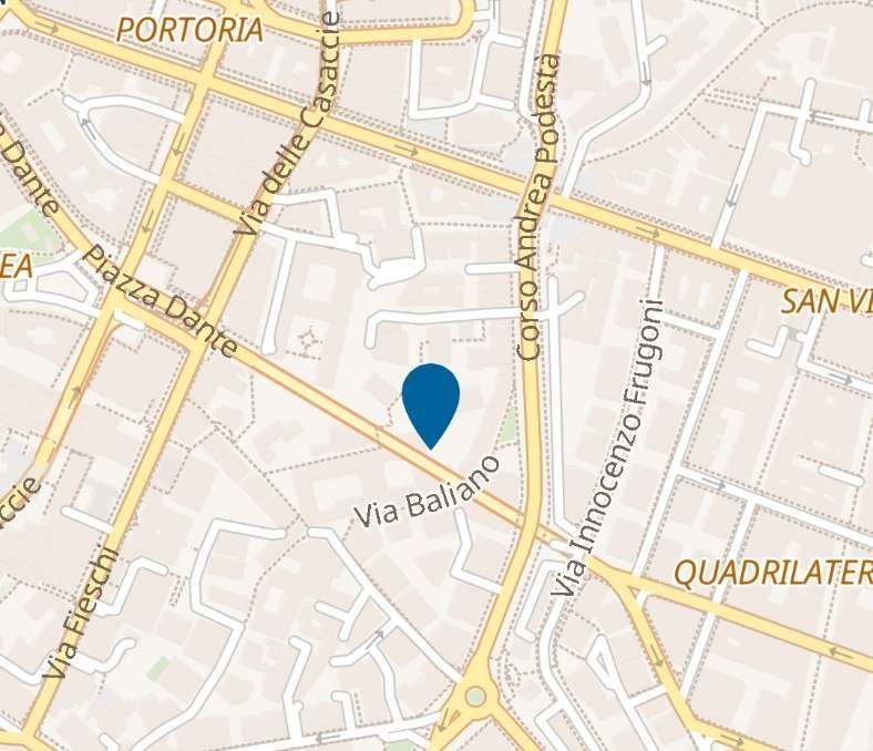
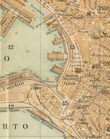
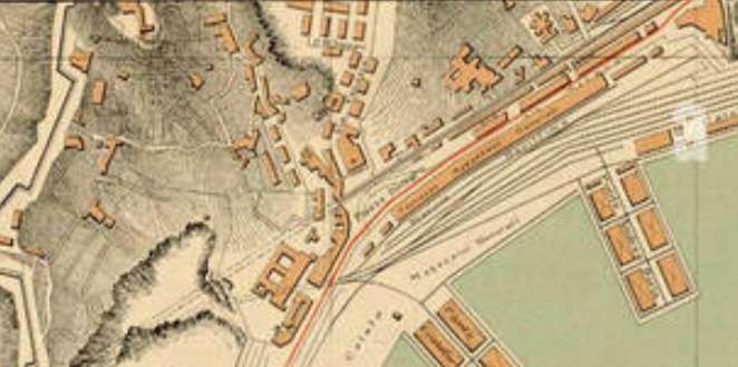
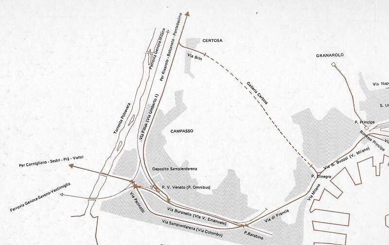
Lines 1 to 11 constituted the Western Network. All of these lines had their city centre terminus at Piazza Caricamento. The Piazza is shown on the adjacent 1916 map.
The map shows part of the Port area of Genoa (Genova) in 1916 with a significant series of standard-gauge railway sidings in evidence (black lines) and some red lines which indicate the metre-gauge tram routes. Piazza Caricamento is close to the water halfway down the map extract. [31]
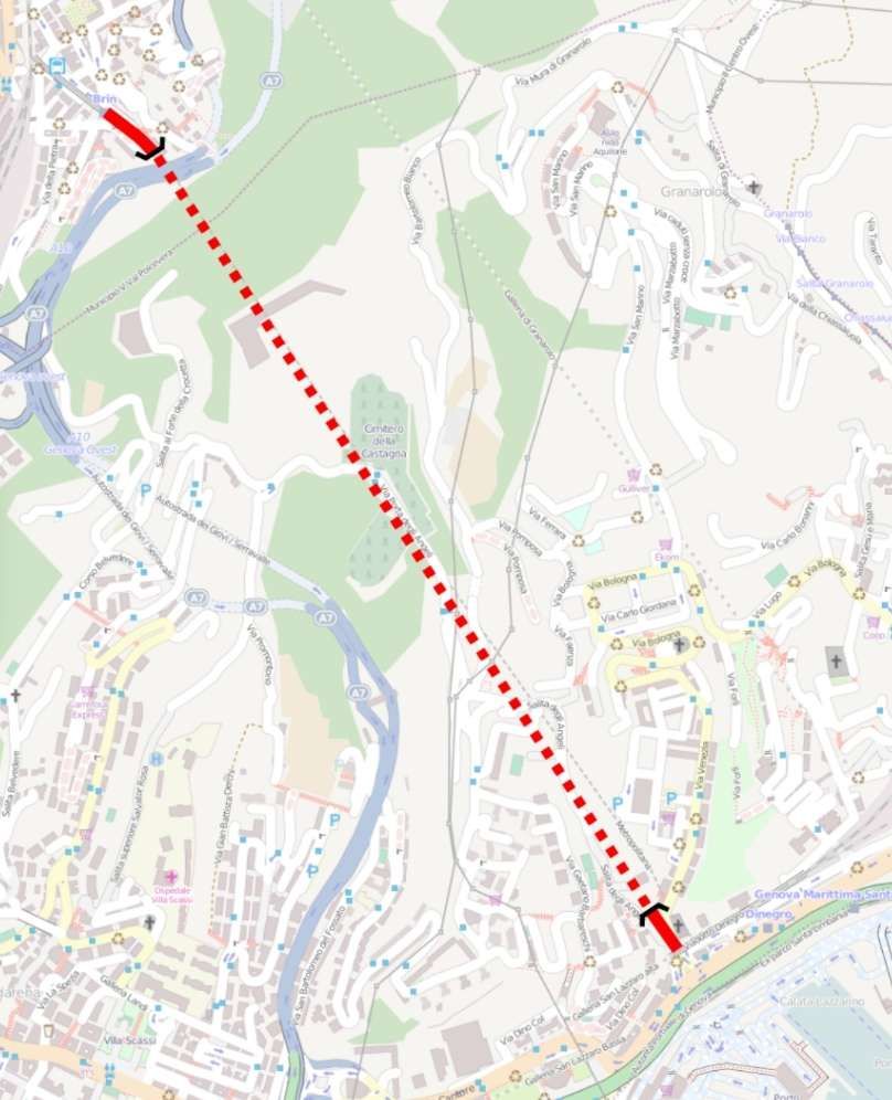
There were three main routes out of Piazza Caricamento, one of which followed the coast round to meet the lines on the East of the city. The other two shared the bulk of the services leaving the piazza. One of these two routes ran West through San Pier d’Arena (Sampierdarena), the other ran through Galleria Certosa.
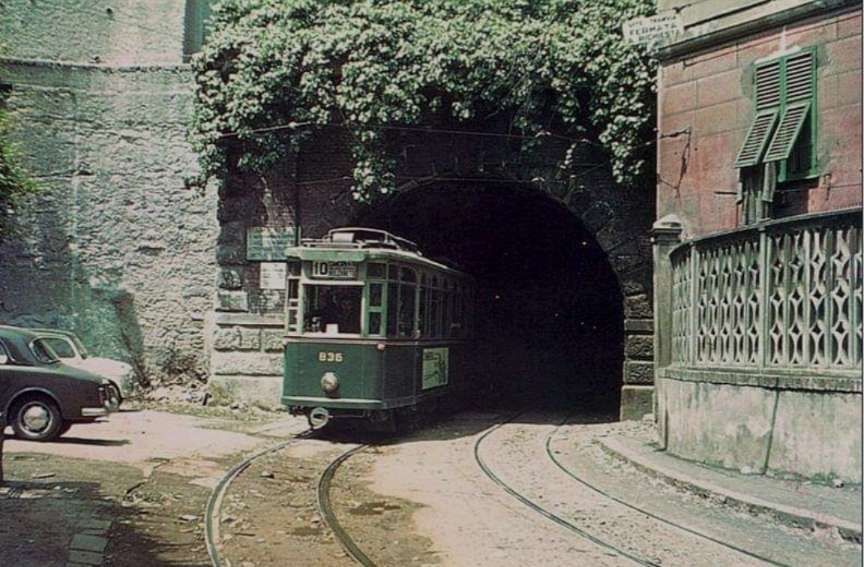
The route to San Pier d’Arena (Sampierdarena) closely follows the coast and ran through the Galleria on Via Milano before the San Benigno Hill was raised to the ground.
Pictures of the Galleria can be seen earlier in this article.
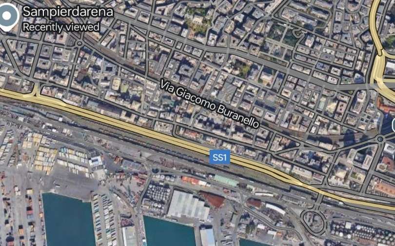
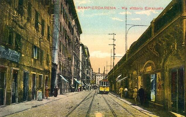
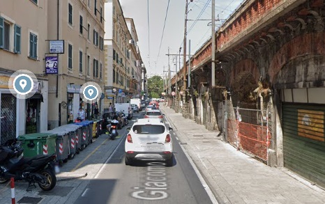
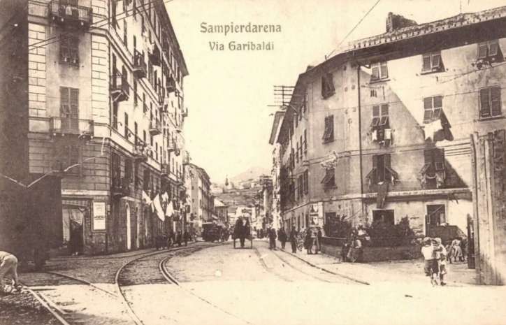
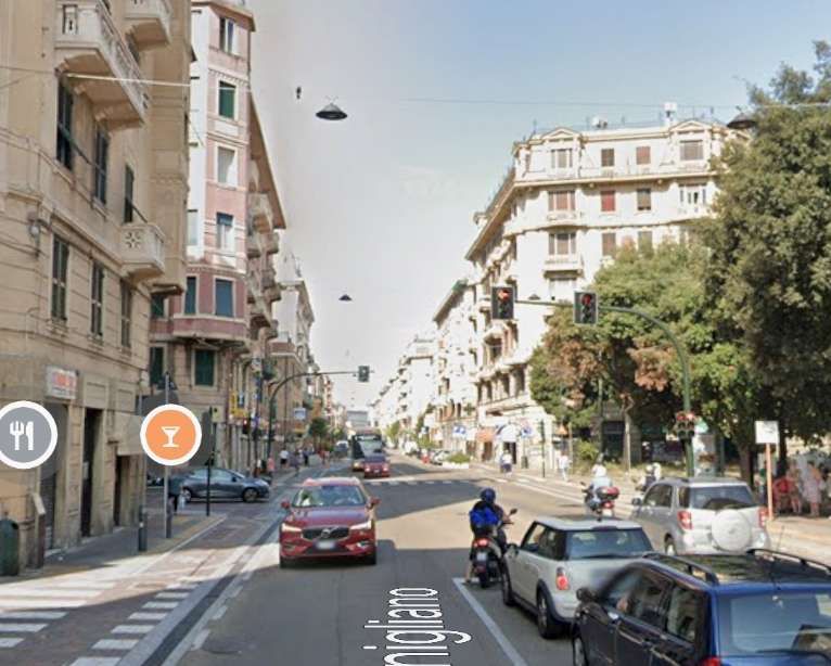
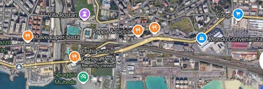
West of the Galleria, the original tramway ran along what is now Via Giacomo Buranello (what was Via Vittorio Emanuele) to Sampierdarena. This route appears to the North of the SS1 on the satellite image below.
Before looking at line further West from Sampierdarena we need to note a line which was added to the network before WW1.
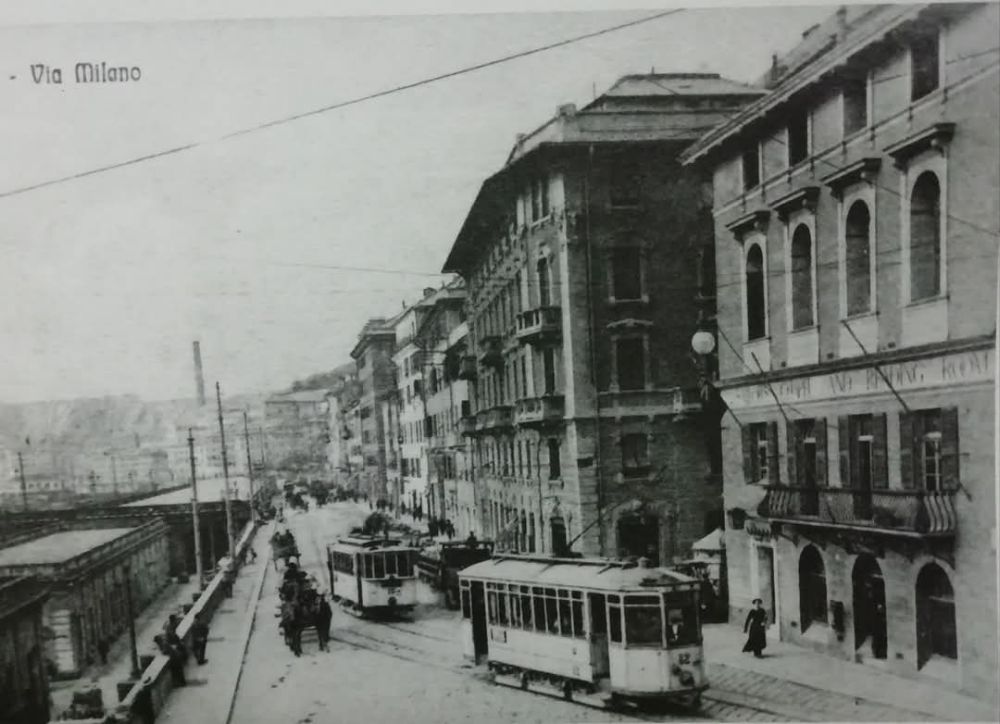
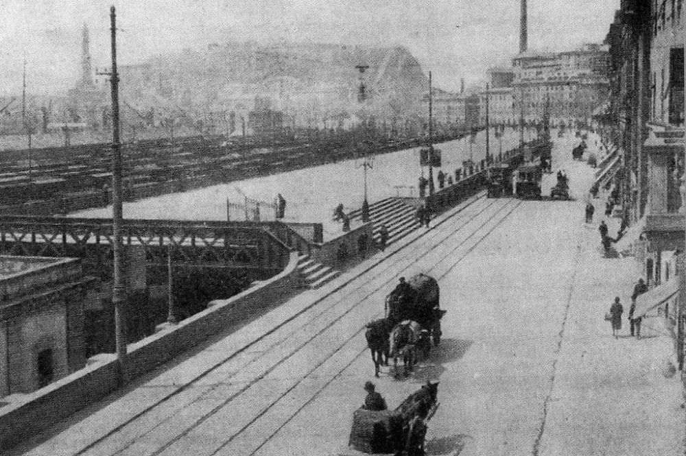
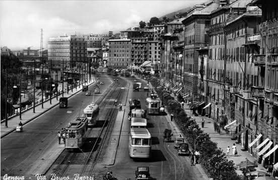
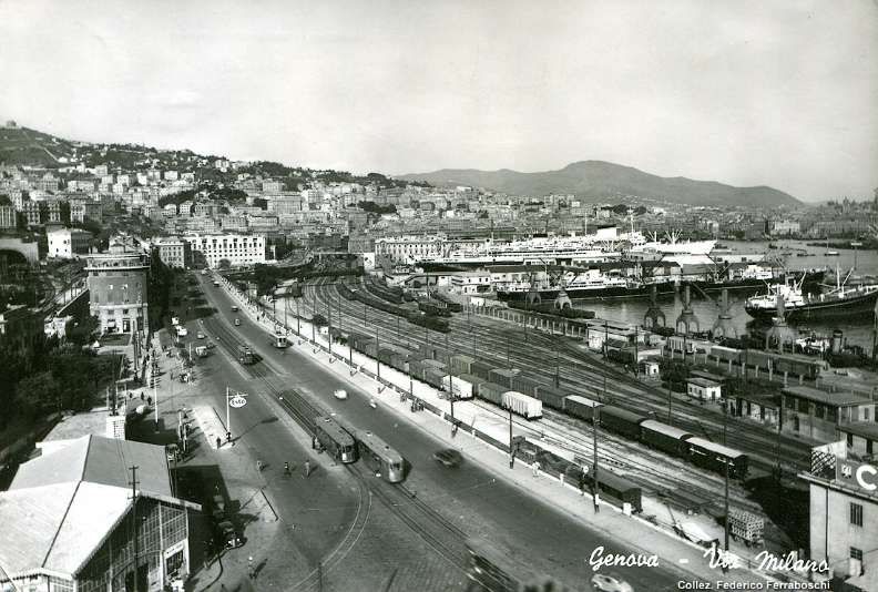
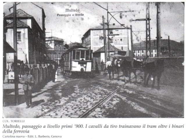
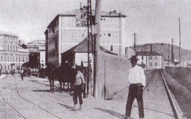
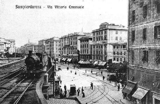
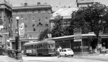
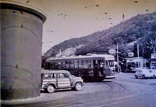
A second tramway was built which ran alongside the railway sidings on what is now the SS1, it was then Via Milano, towards Sampierdarena. The route is illustrated by the mid-20th century view below.
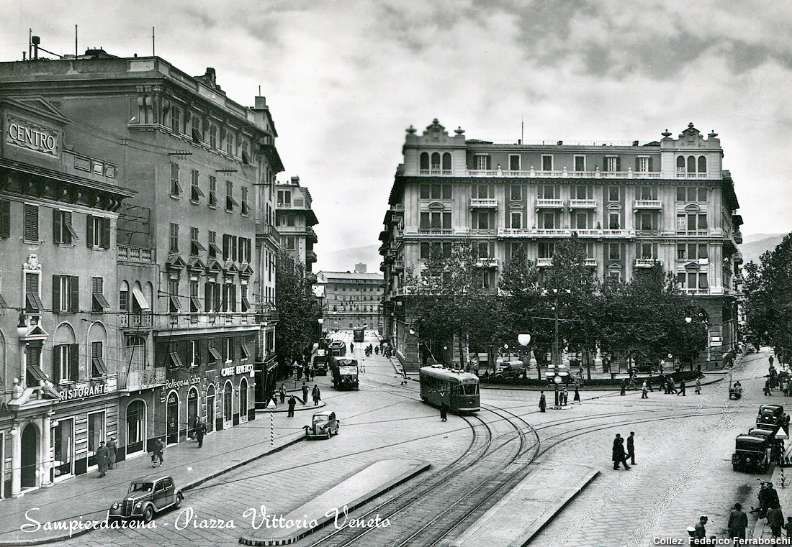
That route along Via Sampierdarena (Via Milano and Via Colombo) and then Via Pacinotti is illustrated at the bottom of the map below. After running along the centre of Via Sampierdarena, trams turned inland, heading Northwest to join the earlier route, West of Piazza Vittorio Veneto on Via Pacinotti.
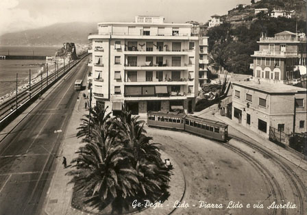
A map provided by the Marklinfan.com Forum which shows the new coastal tram route mentioned above. [92]
The Western Network’s Coastal Line(s)
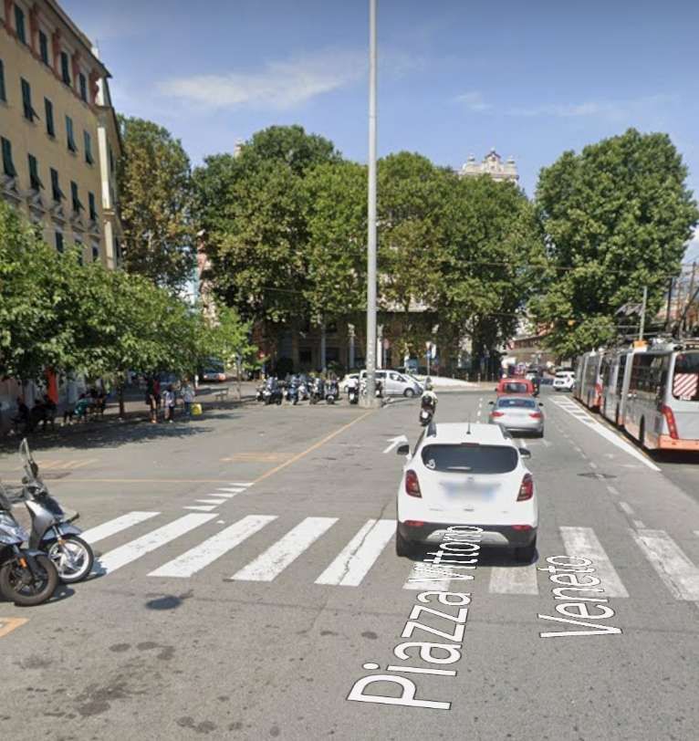
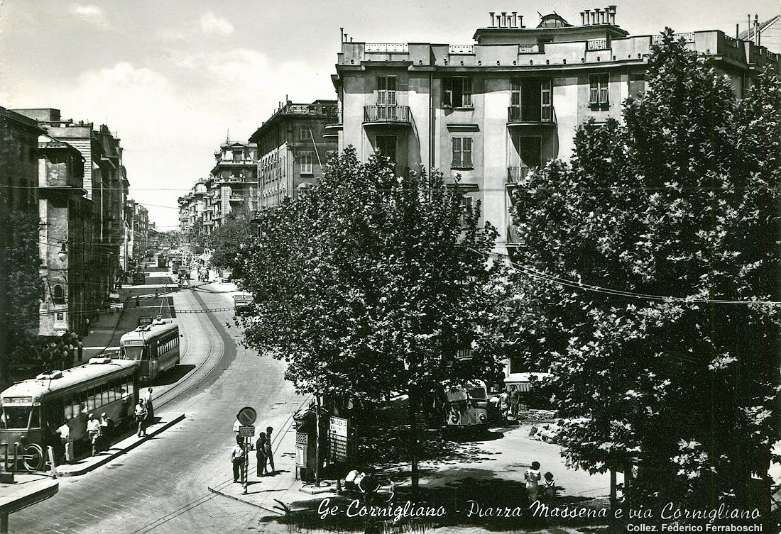
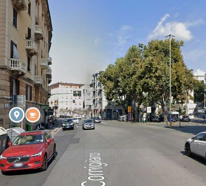
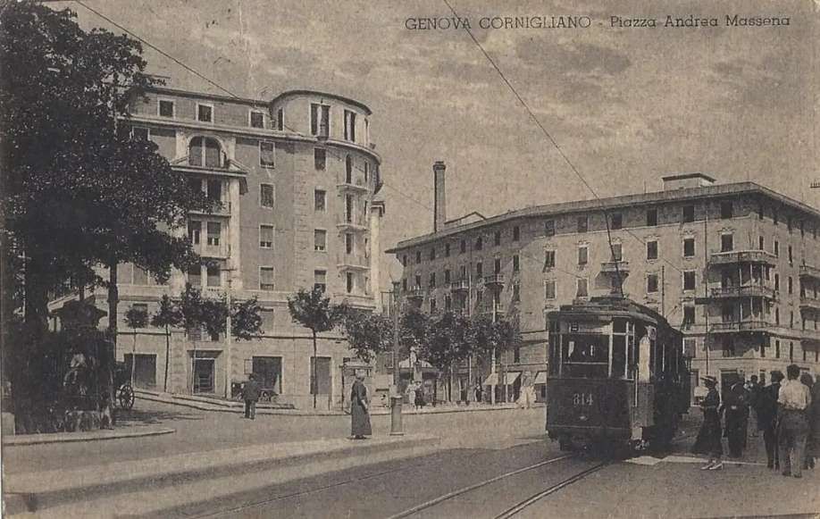
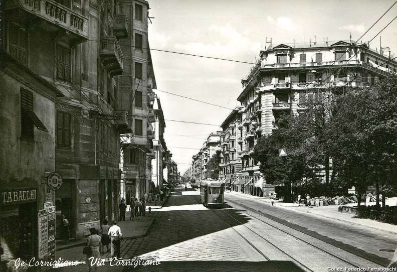
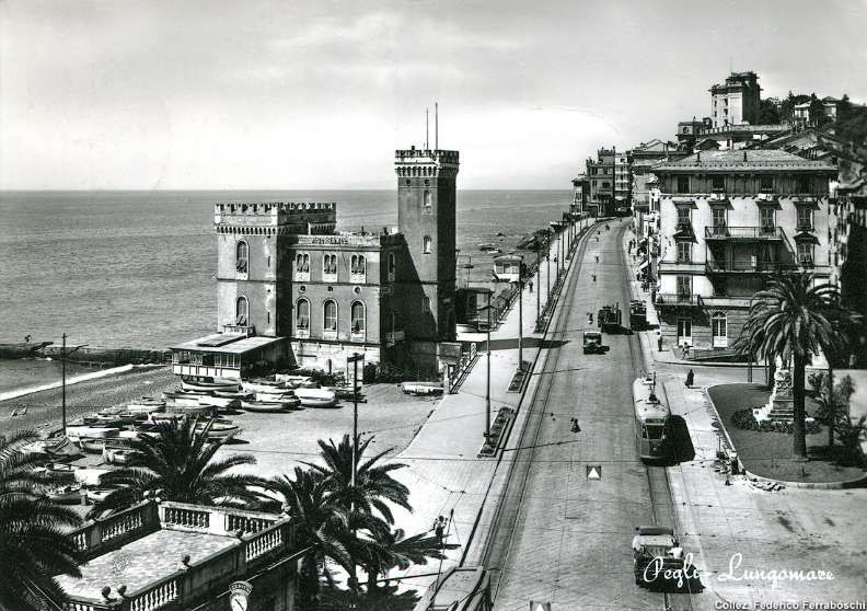
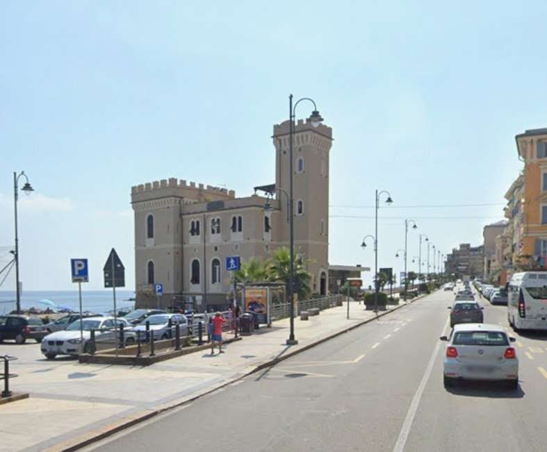
At Sampierdarena the original lines of the Western network separated. Some lines continuing along the coast and others turning inland. The lines diverged at the West end of Piazza Vittorio Veneto. The coastal line ran along what is today Via Frederico Avio, then turned onto what is now Via Antonio Pacinotti, before turning West on what is now Via Raffaele Pieragostini, crossing the River Polcevera at Ponte di Cornigliano, running along Via Giovanni Ansaldo before joining Via Cornigliano at Piazza Andrea Massena.
We have followed the Western Network as far as we can along the coast. We now need to look at the line(s) of the Western network which ran up the valley of the River Polcevera from Sampierdarena.
To do this we need to return to Piazza Vittorio Veneto in Sampierdarena.
The Western Network and Val Polcevera (the Valley of the River Polcevera)
The lines to the North left Piazza Vittorio Veneto at its Western end, passing immediately through an underpass under the FS Standard Gauge railway.
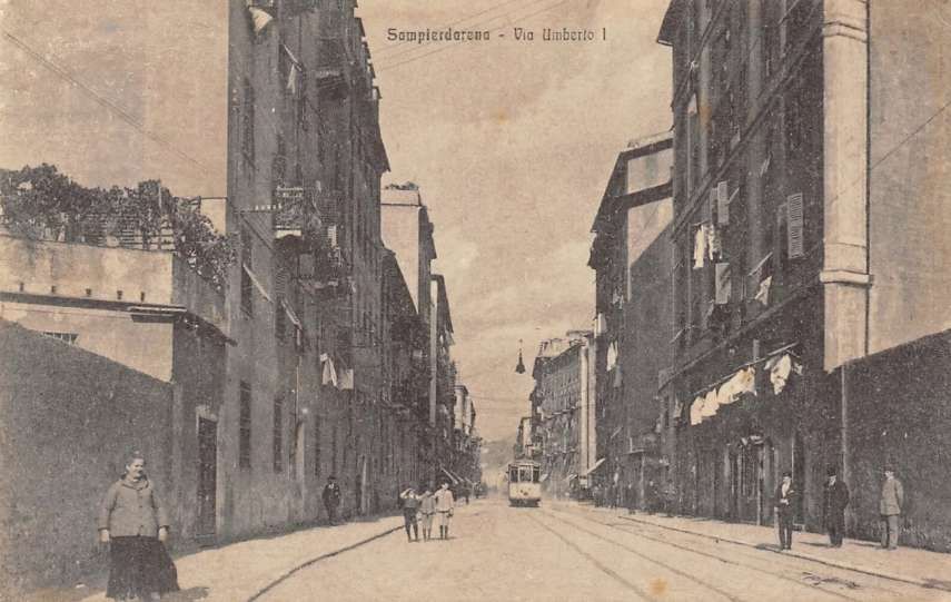
In the 19th century the route was known as ‘Via Vittorio Emanuele’. In the early years of the 20th century the road was renamed ‘Via Umberto 1’. In 1935, the city gave the road the name ‘Via Milite Ignoto’ (the Unknown Soldier). This decision appears to have been short-live as very soon the road was divided into two lengths, the more southerly length becoming ‘Via Martiri Fascisti’, the remaining length, ‘Via delle Corporazioni’. After the end of Word War Two renaming again occurred. In 1945 the names which continue to be used in the 21st century were chosen – ‘Via Paolo Reti’ and ‘Via Walter Fillak ‘. Fillak and Reti were partisans in WW2. [59][66]
A view from above … This is Piazza (Via) Vittorio Emanuele seen from the West. The tram tracks can be seen heading away through the underpass in the foreground. [75]
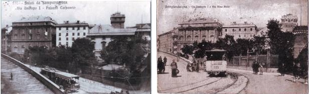
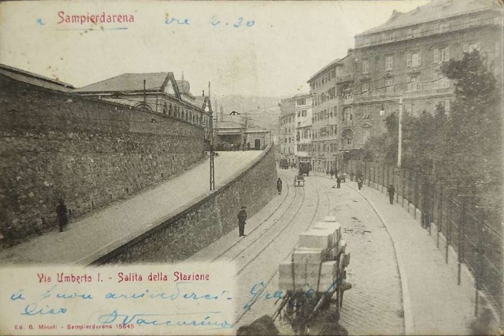
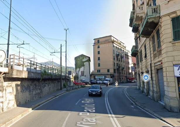
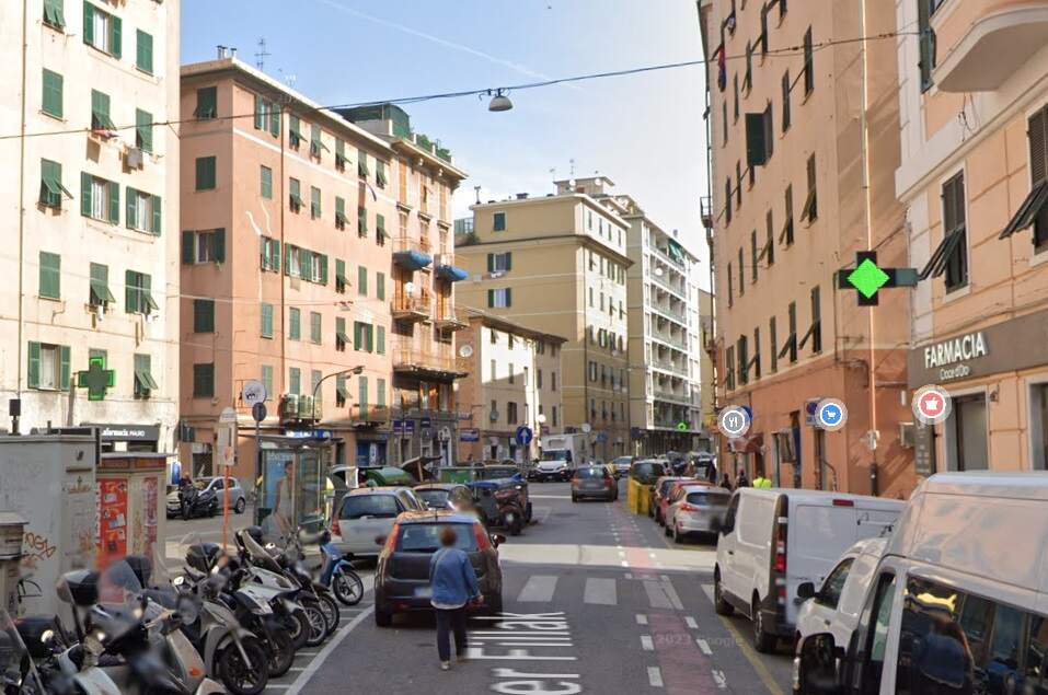
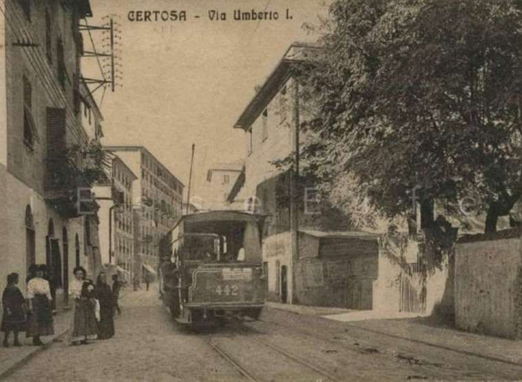
The route of this part of the old tramway network begins at this rail underpass (where the street is now named, ‘Piazza Nicolo Montano’, having once been Via Nino Bixio), [65] before running along Via Paolo Reti and then Via Walter Fillak. Just beyond the underpass the railway station access left the road on the left. The first old postcard views below show this location.
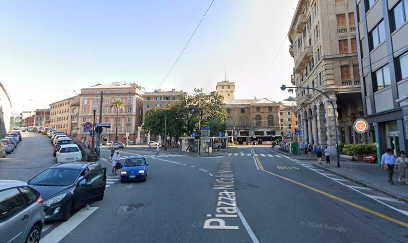
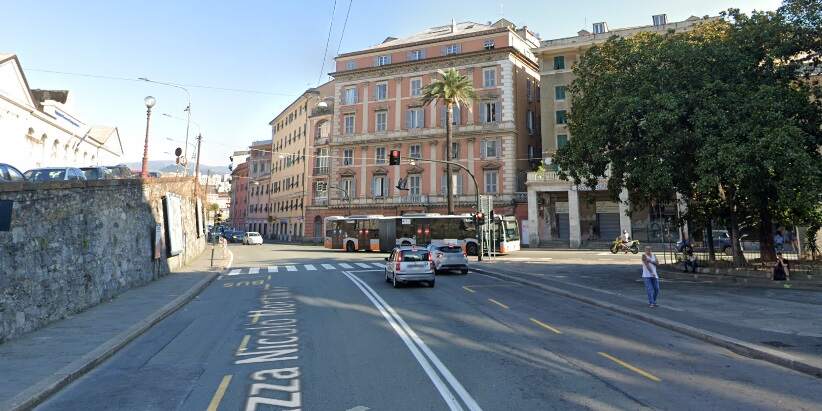
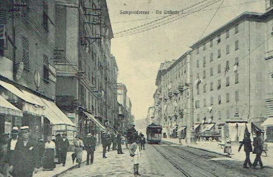
Two pixelated, low definition images showing the bottom end of what was Via Umberto 1. One the left in both images is the incline leading to the Sampierdarena Railway Station forecourt. [59]A tram sits at a stop at Piazza Montano. This image was shared on the Foto Genova Antica Facebook Group by Annamaria Patti on 22nd May 2022. [3]Three further postcard views, of better quality, of the bottom end of Via Umberto 1, (c) Public Domain. [59][62][63]The view to the Northeast from the rail underpass in 2024. The station approach is on the left. The old tramway curved round to the left below the station approach’s retaining wall. [Google Streetview, August 2024]Just a little further along the old tram route. The retaining wall on the left supports the station approach road. The tramway ran on along what is now Via Paolo Reti. For some distance the road was flanked by a retaining wall supporting the FS standard-gauge railway. [Google Streetview, August 2024]
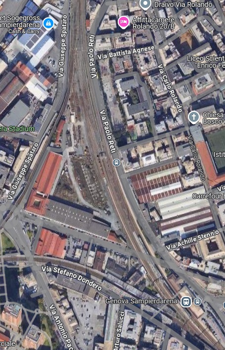
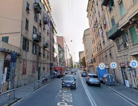
The adjacent Google satellite image shows roads over which the old tramway ran. In the bottom right is Piazza Nicolo Montano. It is also possible to make out the station approach ramp which has a number of cars parked on it. In the immediate vicinity of the passenger railway station, railway buildings can be seen separating Via Paolo Reti from the railway but very soon the road and the railway run side-by-side with the railway perhaps 2 to 3 metres above the road. Via Eustachio Degola passes under the railway just to the North of the station buildings. Towards the top of the satellite image, Via Paolo Reti can be seen turning away from the railway wall. [Google Maps, December 2024]
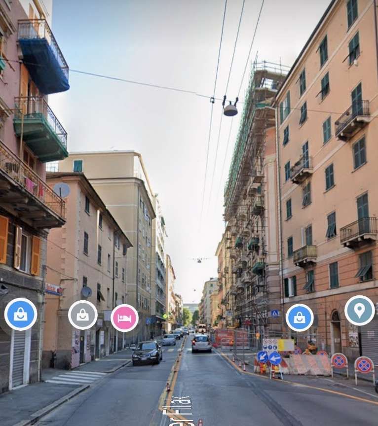
Via Paolo Reti (the former Via Umberto 1) turns away from the railway wall which is now much lower than it was near the station buildings. [Google Streetview, August 2024]Via Umberto 1, looking North from the bend visible in the photograph above where the road leaves the side of the railway, (c) Public Domain. [68]Via Paolo Reti (once Via Umberto 1) at the same location as the monochrome image above. [Google Streetview, August 2024]
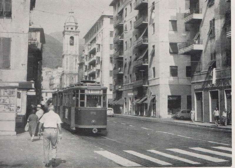
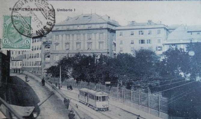
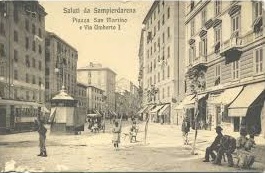
The monochrome image below purports to show Piazza San Marino. As far as I can work out the piazza was historically, ‘Piazza Vittorio Emanuele III’ and later renamed for another partisan from World War 2 – ‘Piazza Ricardo Masnata’.
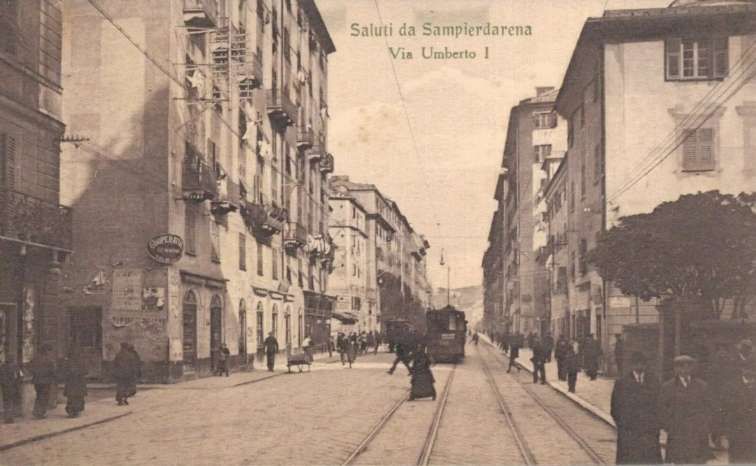
A relatively low quality image of Piazza San Marino and Via Umberto 1. The piazza later became Piazza Ricardo Masnata. This view looks North with a tram visible on the left, (c) Public Domain. [64]Piazza Ricardo Masnata, looking North. There is little to link this image from 2024 with the monochrome image above, other than the alignment of the roads and the shape of the piazza. However, at the centre of this image is a lower building which also appears in the monochrome image. [Google Streetview, August 2024]Via Umberto 1 looking North from what became Piazza Ricardo Masnata, (c) Public Domain. [67]The same location in the 21st century. [GVia Umberto 1, now Via Walter Fillak with a tram heading towards Genoa. [69]The same location on Via Walter Fillak in the 21st century. [Google Streetview, August 2024]
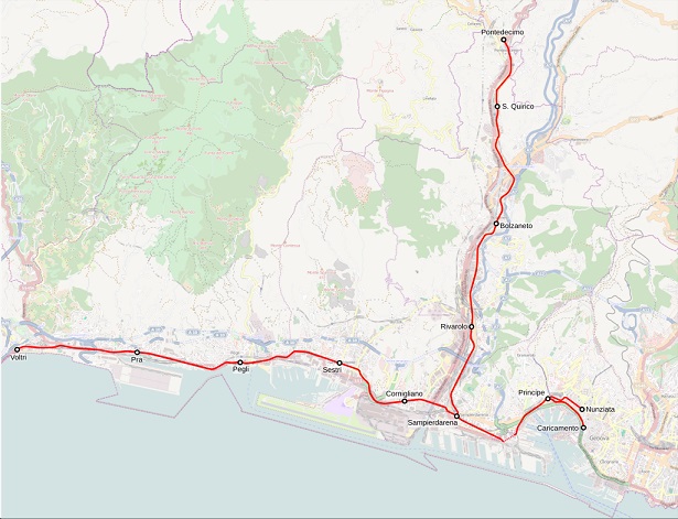
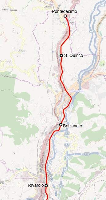
The line from Sampierdarena ran towards Certosa where, once Galleria Certosa was completed, it met the line through the tunnel.
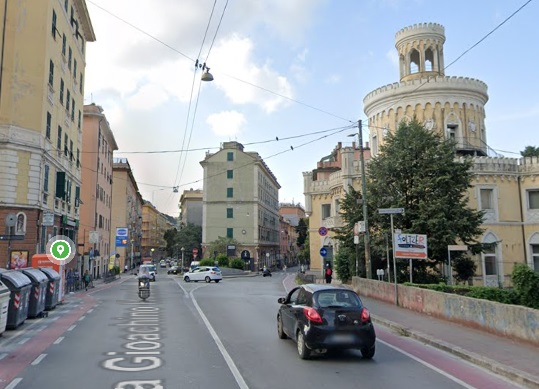
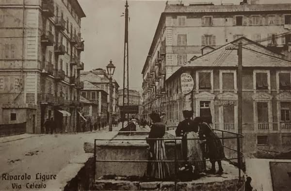
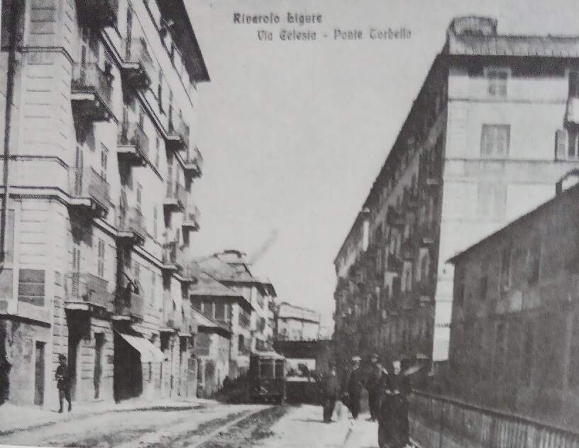
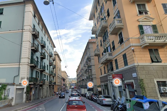
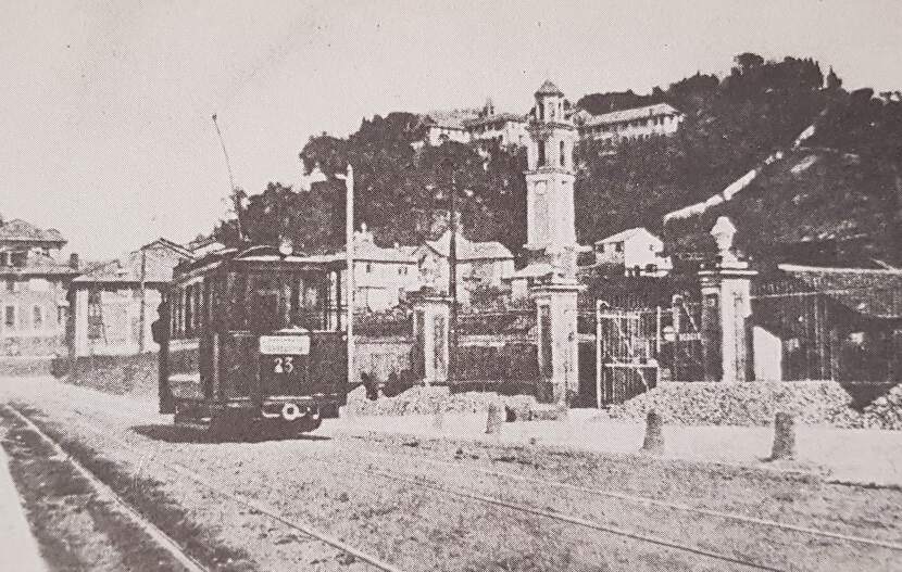
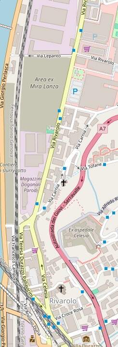
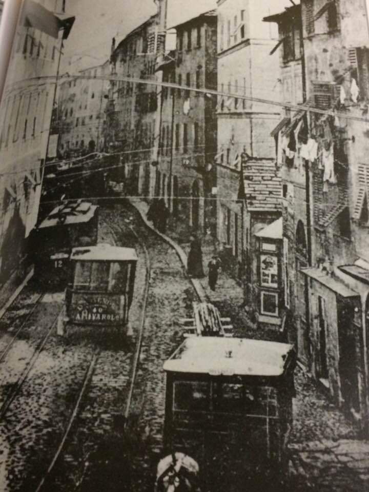
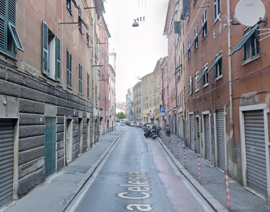
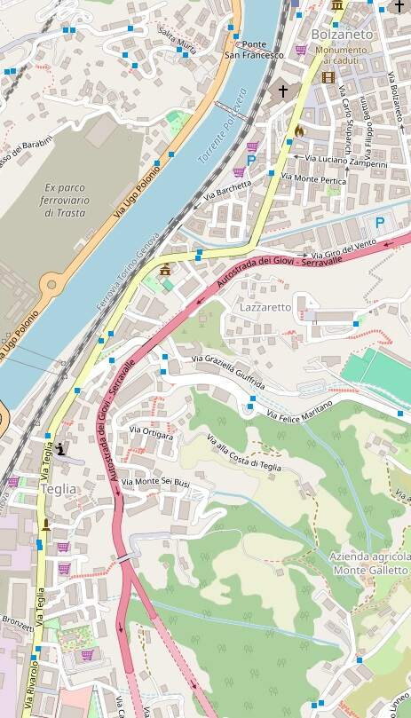
The tramway followed Via Celesia through Rivarolo (Superior). Rivarolo and Via Celesia can be seen at the bottom of this extract from openstreetmap.org. [79]
This image from the early 20th century looks North along Via Celesia. Space on the street was clearly at a premium! [80]Via Celesia in the 21st century. [Google Streetview, August 2024]
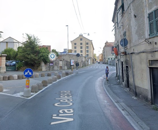
North of Via Celesia, the tramway ran along Via Rivarolo.
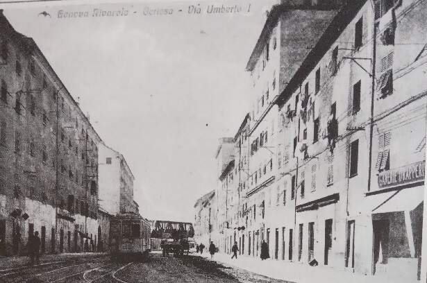
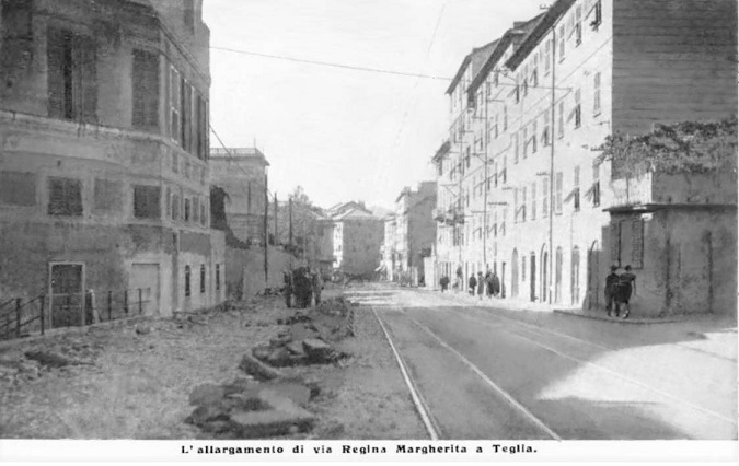
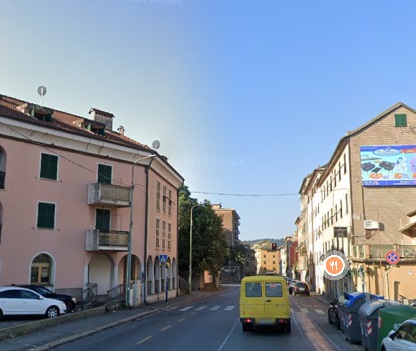
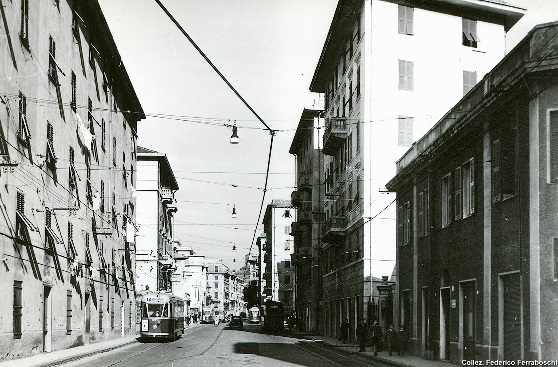
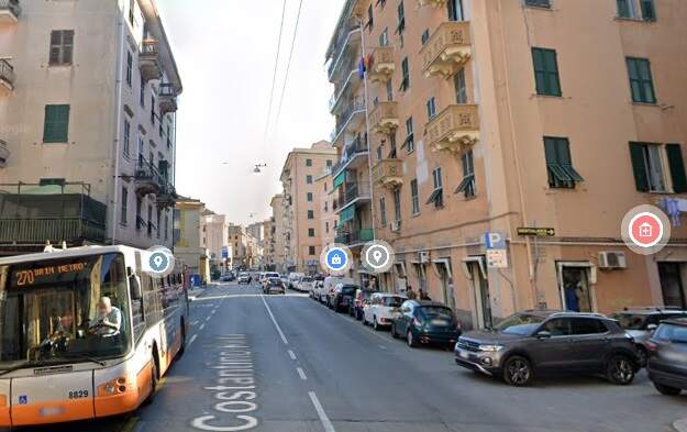
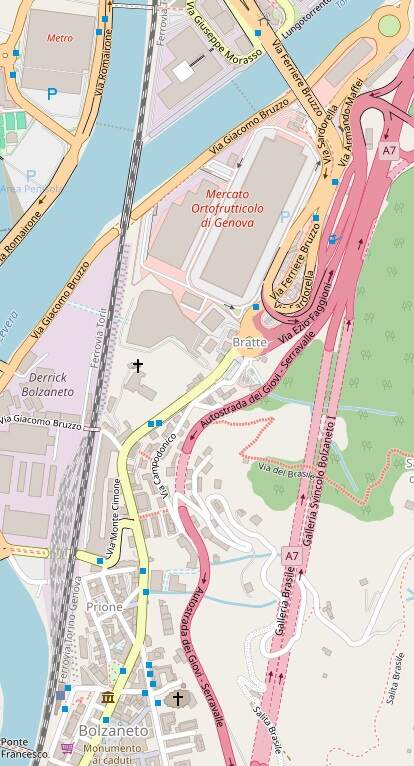
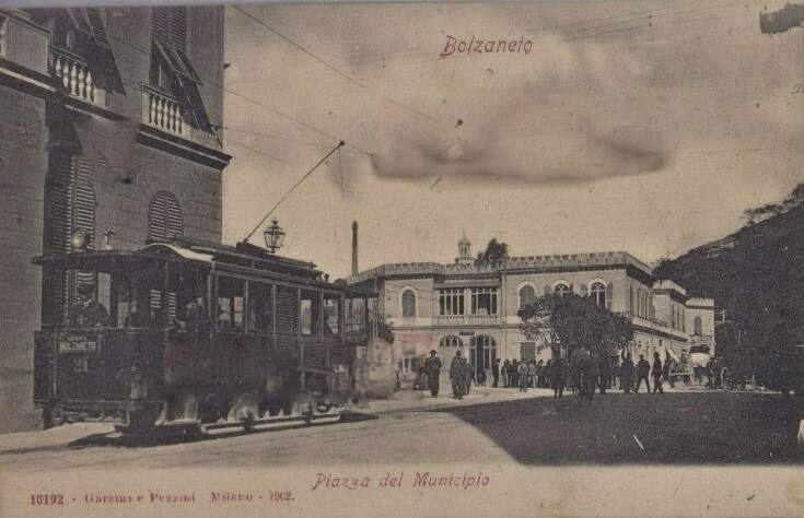
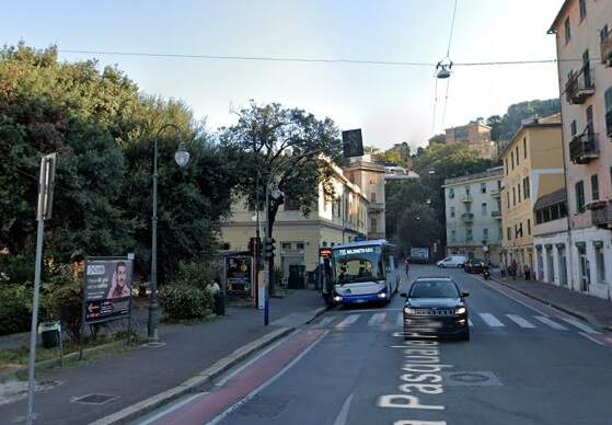
This postcard shows the junction at the North end of Via Celesia, circa. 1920s. Via Rivarolo is ahead. This image was shared on the C’era una volta Genova Facebook Group by Mario Vanni on 18th August 2019, (c) Public Domain. [82]The smae location in the 21st century. [Google Streeetview, August 2024]This next extract from openstreetmap.org shows Via Rivarolo entering bottom-left. Trams ran on into Teglia on Via Teglia and continued on to Bolzaneto (in the top-right of this extract) along Via Constantino Reta. [79]This postcard view looks South along what is now Via Teglia (then Via Regina Margherita. This image was shared on the C’era una volta Genova Facebook Group by Elio Berneri on 19th October 2020, (c) Public Domain. [83]A very similar view at the same location in the 21st century. [Google Streetview, August 2024]Car 906 in service on line 7 Caricamento – Pontedecimo, one of the longest of the UITE, is seen here running in Bolzaneto. The photograph was taken facing North. In the background you can see another Tramcar, as well as a third on the track in the opposite direction, (c) Public Domain. [84]A similar North facing view in Bolzaneto in the 21st century. [Google Streetview, August 2024]A tram waits at Piazza del Municipio in Bolzaneto. This image was shared by Mario Vanni on the C’era una volta Genova Facebook Group on 8th July 2021, (c) Public Domain. [85]A very similat view of the same location in the 21st century. The road on which the bus is standing is now known as Via Pasquale Pastorino. [Google Streetview, August 2024]A few hundred metres to the Northeast is the area known as ‘Bratte’. A tram waits in the mid-20th century to set off for Caricamento. This image was shared on the C’era una volta Genova Facebook Group by Roberto Della Rocca on 12th December 2020. [86]A similar view at the same location in the 21st century. [Google Streetview, August 2024]
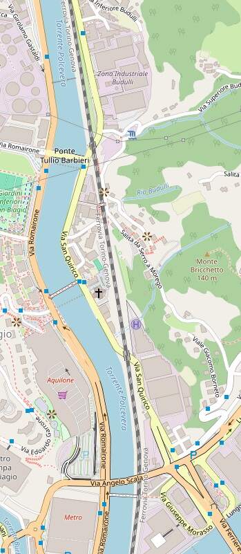
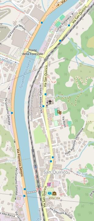
North of Bratte, Trams crossed the River Secca, a tributary of the Polcevera, following Via Ferriere Bruzzo and then continued North alongside the River Polcevera on Via San Quirico.
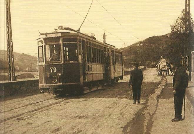
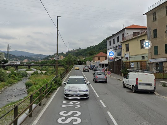
Tram No 79 leads a trailer car South on Via San Quirico in the first decades of the 20th century. It seems as though Ponte Tullio Barbieri can be seen behind the tram. This image was shared by Sergio De Nicolai on the C’era una volta Genova Facebook Group on 21st October 2018. [88]A similar location on Via San Quirico in the 21st century. [Google Streetview, July 2022]
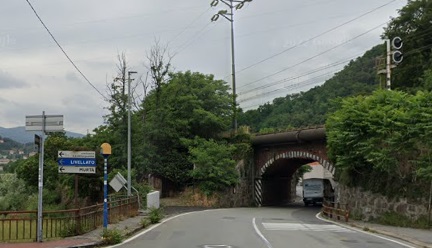
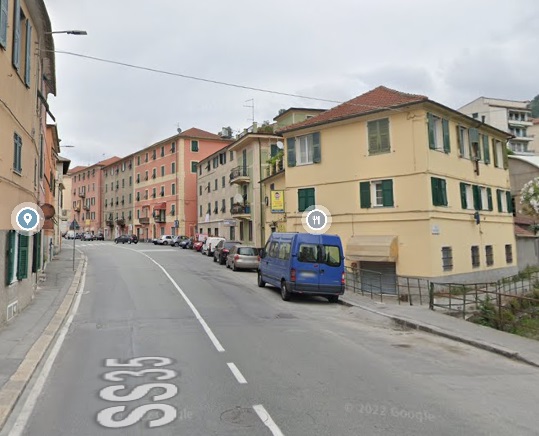
Trams passed under the FS Standard-gauge lines close to Ponte Tullio Barbieri. [Google Streetview, June 2022]Trams ran on through the centre on San Quirico on Via San Quirico.Before returning to the side of the river, passing under the railway again. [Google Streetview, July 2022]
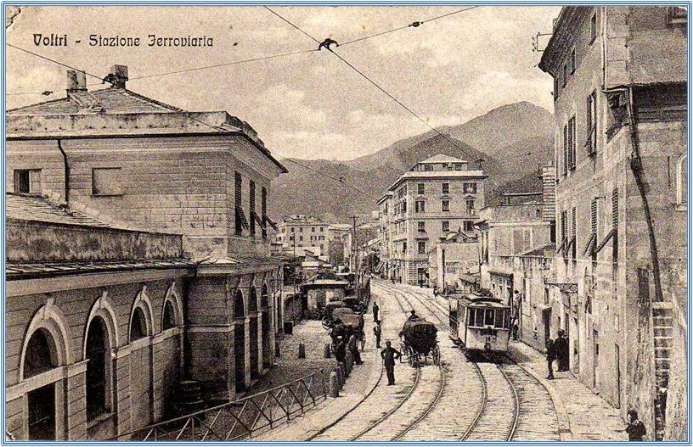
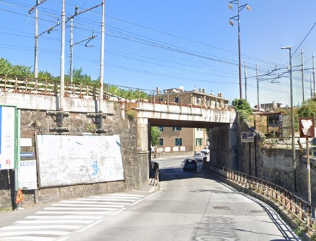
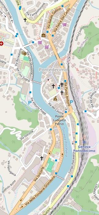
The next length of the journey is the last. Trams terminated at Pontedecimo. [79]
A tram and trailercar on Lungo Polcevera in Pontedecimo close to Pontedecimo Railway Station, This image was taken looking South along the river bank and was shared by Giorgio Gioli on the C’era una volta Genova Facebook Group on 4th November 2020. [89]This view looks South along the bank of the River Polcevera at a location similar to that in the image above. [Googler Streetview, January 2021]
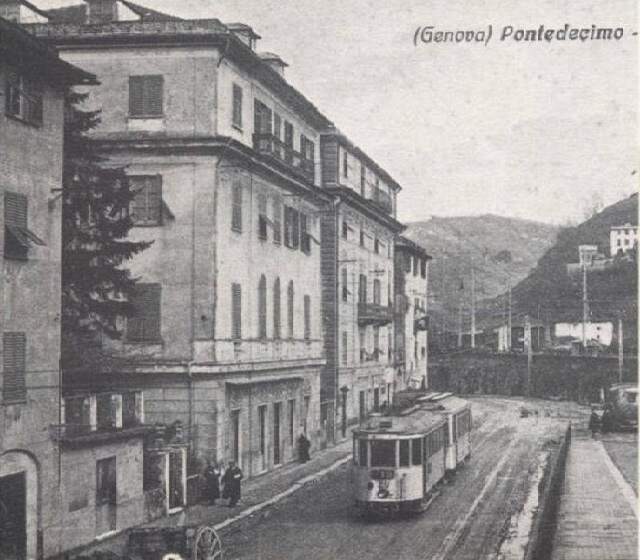
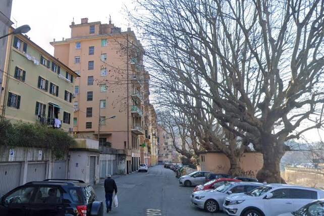
The central piazza in Pontedecimo. The terminus of the tram service. This image was shared on the C’era una volta Genova Facebook Group by Roberto Cito on 29th October 2023. [87]Trams terminated in Pontedecimo. [Google Streetview, July 2022]The tram depot at Pontedecimo. This image was shared on the C’era una volta Genova Facebook Group by Alessandro Lombardo on 30th October 2019. [90]


