P.W. Gentry wrote about Stockport’s trams in the July 1949 issue of Modern Tramway.
He says: “Besides possessing several interesting features of its own, the Stockport system today commands added attention as the last last surviving member of that once network of standard gauge undertakings encircling Manchester. It is an unusually pleasing system by virtue of its compact and simple arrangement, its focal point being Mersey Square .” [1: p123]
The article in Modern Tramway caught my attention because for about 9 years I worked in Stockport as a highway engineer.
This is a second article looking at Stockport Corporations Tramways. The first article which looked at the history of the network and followed one axis of that network can be found here . [2]
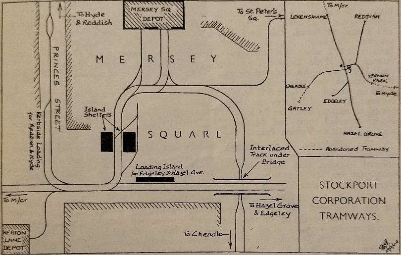
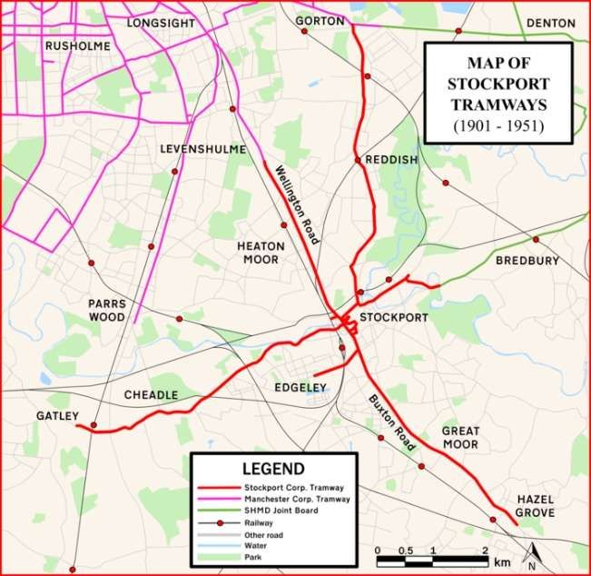
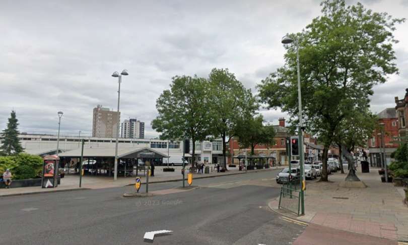
Mersey Square was the main hub of Stockport’s tramway network and appeared as a schematic plan in Gentry’s article in The Modern Tramway. …
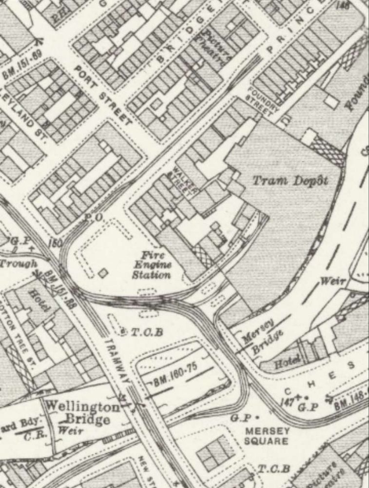
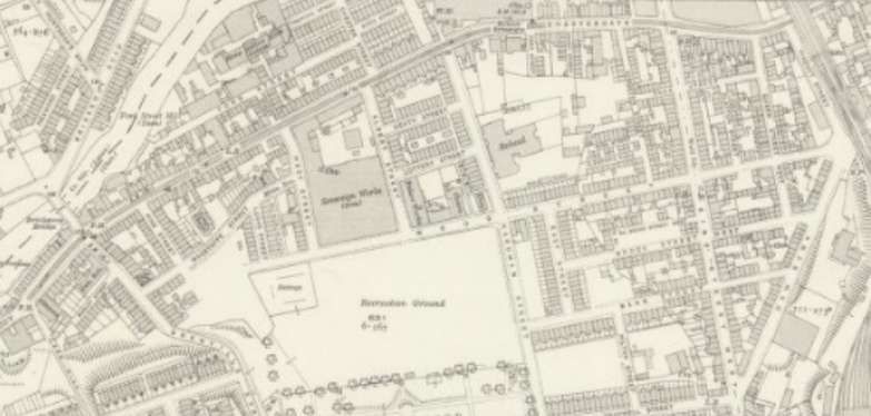
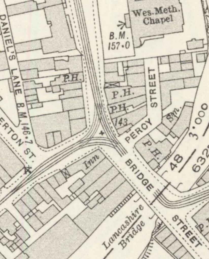
Mersey Square was the hub of the Stockport Corporation tramways. Mersey Square Depot and Heaton Lane Depot are shown clearly on this sketch plan drawn in 1949. The modern A6 runs left-right across the lower half of the plan. © P.W. Gentry, Public Domain. [1: p123] An extract from Map: Lancashire CXII.9; Ordnance Survey, 25 inch to 1 mile; revised: 1934; published: 1936, showing Mersey Square as it was in 1934. The tram depot had, by this time, been enlarged and the additional depot on Heaton Lane constructed. Heaton lane Depot is accessed via the branch West off Wellington Road. [8] Stockport Corporation’s Trams
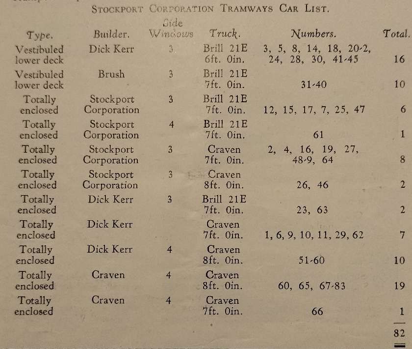
Before looking at the remaining tram routes operated by Stockport Corporation it is worth noting the trams which Stockport Corporation used to operate the network. P.W. Gentry listed these as follows:
This table is taken from Gentry’s article. [1: p126] Gentry provided basic details in his article, more details can be found here . [8] The same website provides a history of the network [9] and a Trolleybus/Bus Fleet List 1913-1969 . [10]
Stockport’s Tram Routes
The Stockport Corporation Tramway Network (1901-1951), © Rcsprinter123 and licenced for reuse under a Creative Commons Licence (CC BY 3.0) [3] Edgeley to Mersey Square and Mersey Square to Reddish and Gorton
This first axis of the network was covered in my first article about Stockport Corporation Trams, here . [2] Two further axes are worth our attention: the first, below, that between Gatley and Bredbury; the second that between Manchester and Hazel Grove.
Gatley to Mersey Square and Mersey Square towards Bredbury
We start with the tram terminus in Gatley.
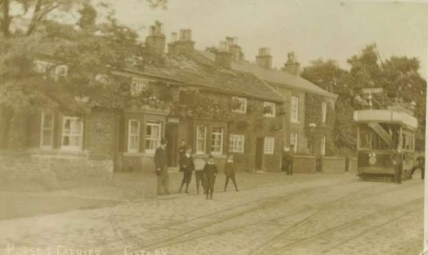
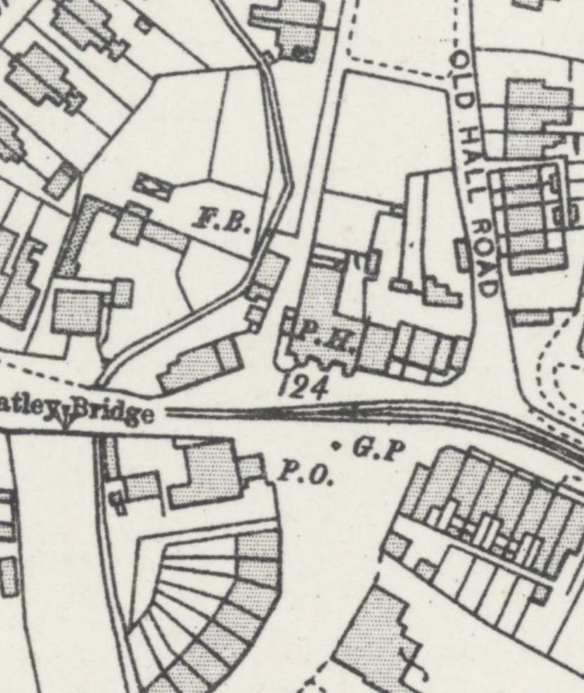
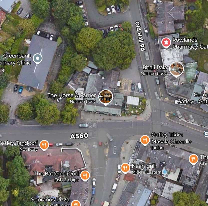
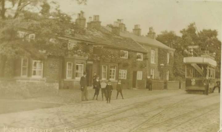
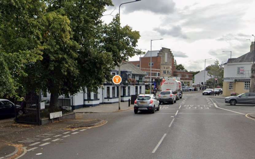
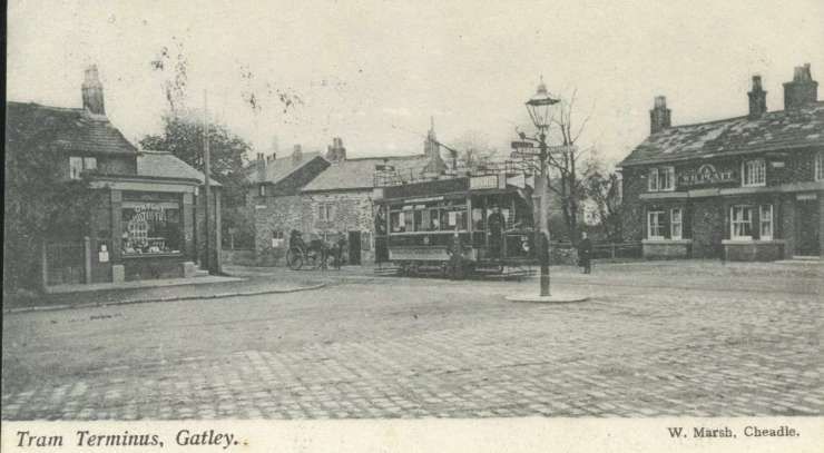
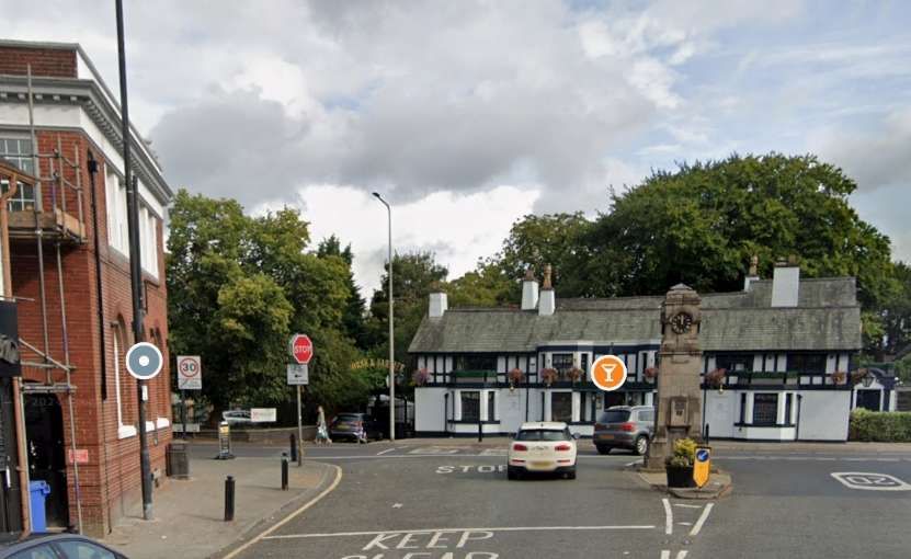
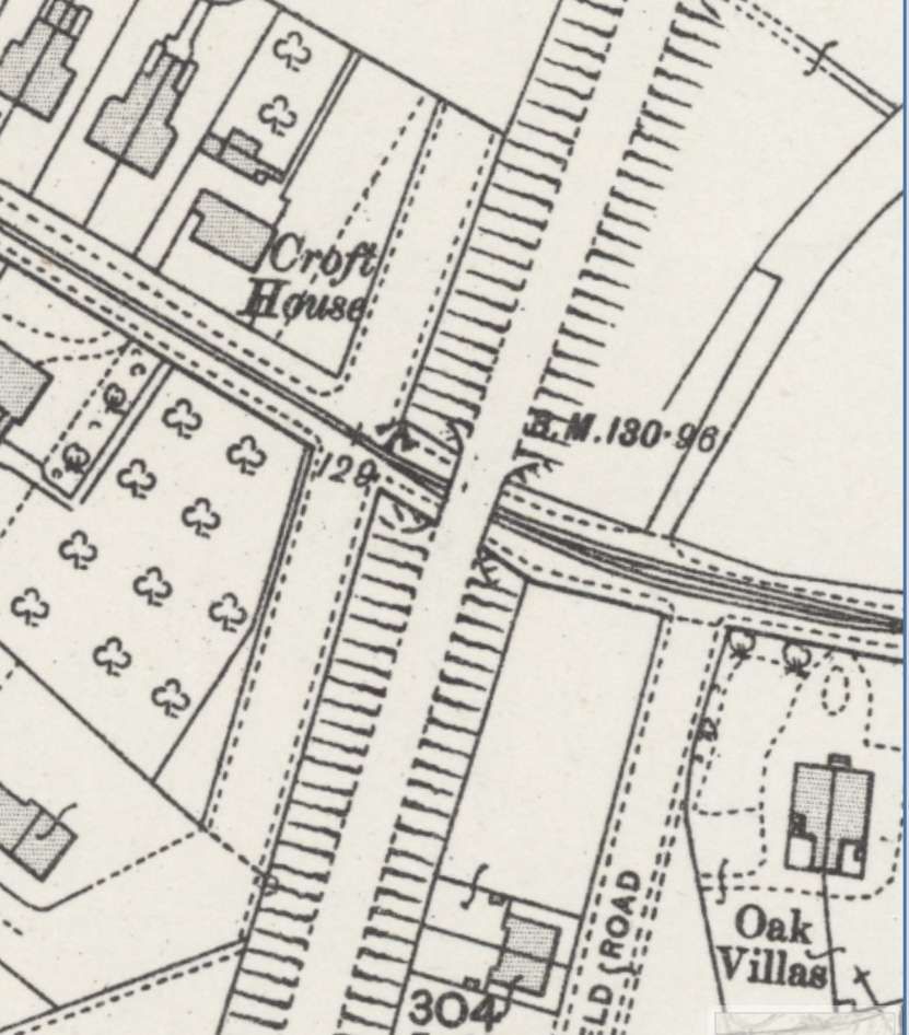
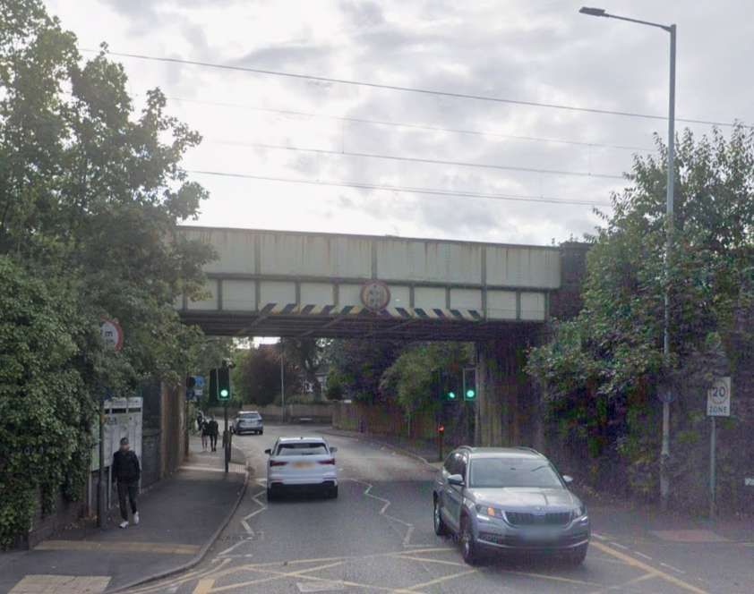
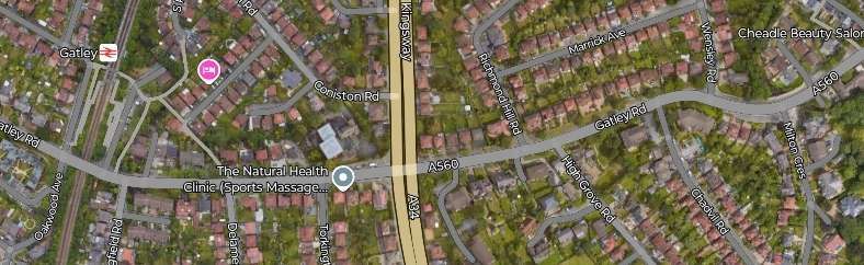
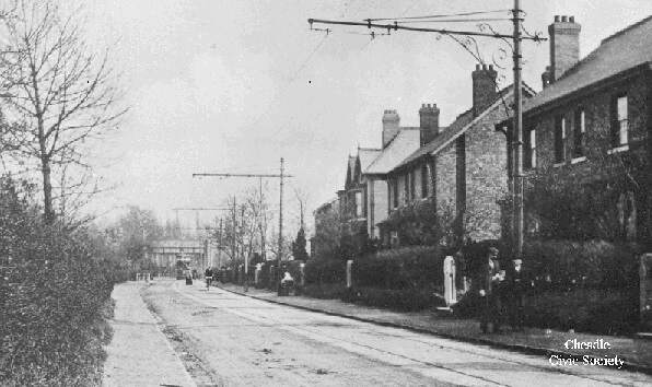
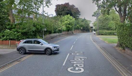
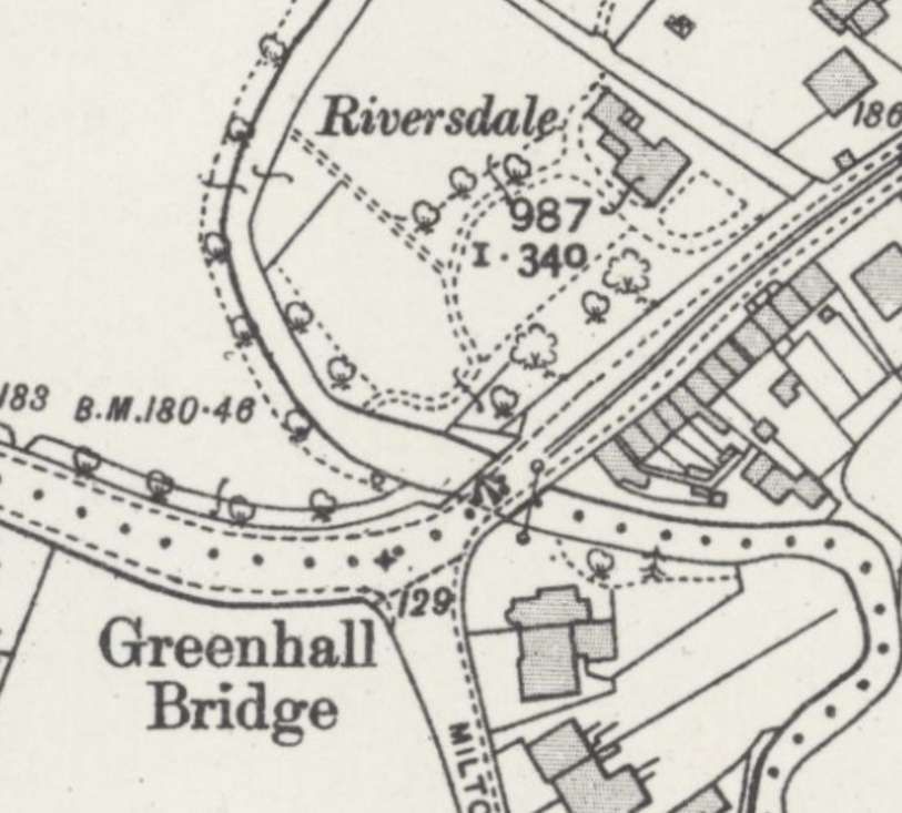
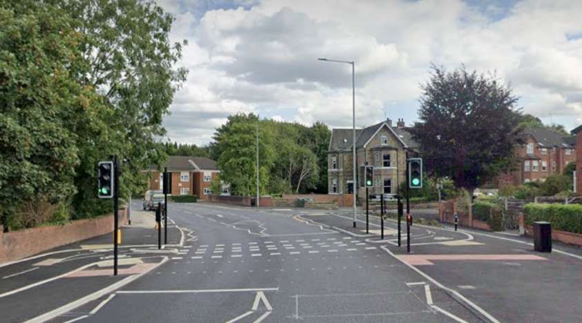
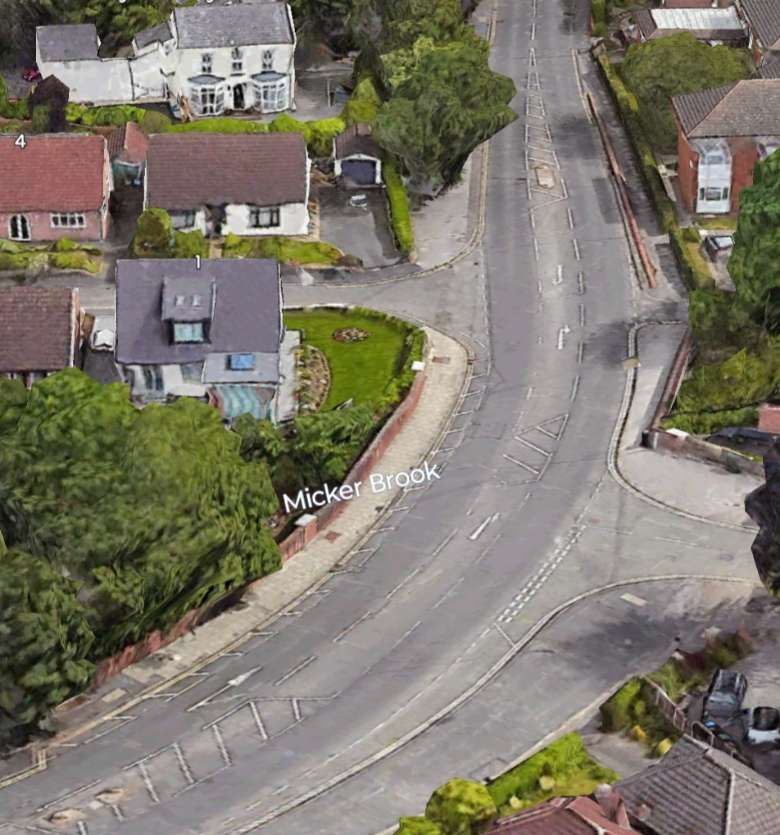
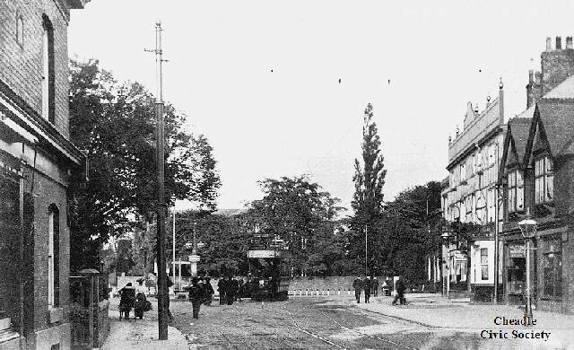
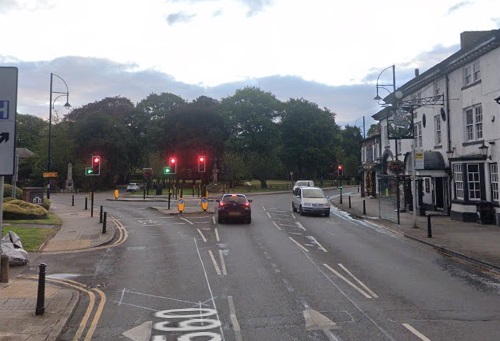
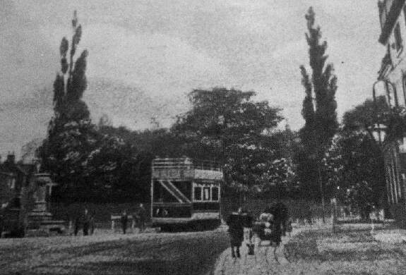
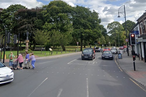
Gatley Green and the terminus of the Stockport Corporation Tramway as shown on the 25′ Ordnance Survey of 1907, published in 1935. [11] The same location in the 21st century. [Google Streetview, January 2025] The Gatley tram terminus was outside the Horse and Farrier Pub. This view looks East from Gatley Bridge, © Public Domain. [5] A similar view along the A560 in the 21st century, with the Horse and Farrier Pub on the left. [Google Streetview, August 2024] A tram at the same location viewed from another angle, this time from the South, © Public Domain. [6] A similar view from Church Road in the 21st century. [Google Streetview, August 2024] To the East, the tramway passed under Gatley Road Railway Bridge. 25′ Ordnance Survey of 1907, published in 1935 the railway as being under construction but with the bridge in place. [11] Gatley Road Railway Bridge seen from the West, looking East along the A560. [Google Streetview, August 2024] This satellite image shows the length of the A560 from just West of Gatley Railway Bridge to just East of Greenhall Bridge. The dominant feature at the centre of the image is the A34, Kingsway, one of the main arterial routes on the South side of Manchsterer. [Google Maps, January 2025] Looking West towards Gatley Road Railway bridge in the 1910s with a tram heading for Stockport, © Public Domain. [16] A similar location on Gatley Road in the 21st century. [Google Streetview, August 2024] This extract from the 25′ Ordnance Survey of 1907, published in 1935, shows a location further to the East – Greenhall Bridge carried the road and tramway over Micker Brook. On this map the political boundary has taken precedence over the tramway. The tramway ran along the road from left to right. [11] Looking East Long the A560 towards Cheadle. The bridge over Micker Brook was one which we needed to replace during the 1990s when I was responsible for the maintenance of highway bridges for Stockport MBC. [Google Streetview, August 2024] It is somewhat easier to appreciate the layout of the bridge with 3D image. This bridge was rebuilt during my time at Stockport Council in the 1990s. [Google Earth (3D), January 2025] Gatley Road ran through to the junction at the West end of the Cheadle High Street.
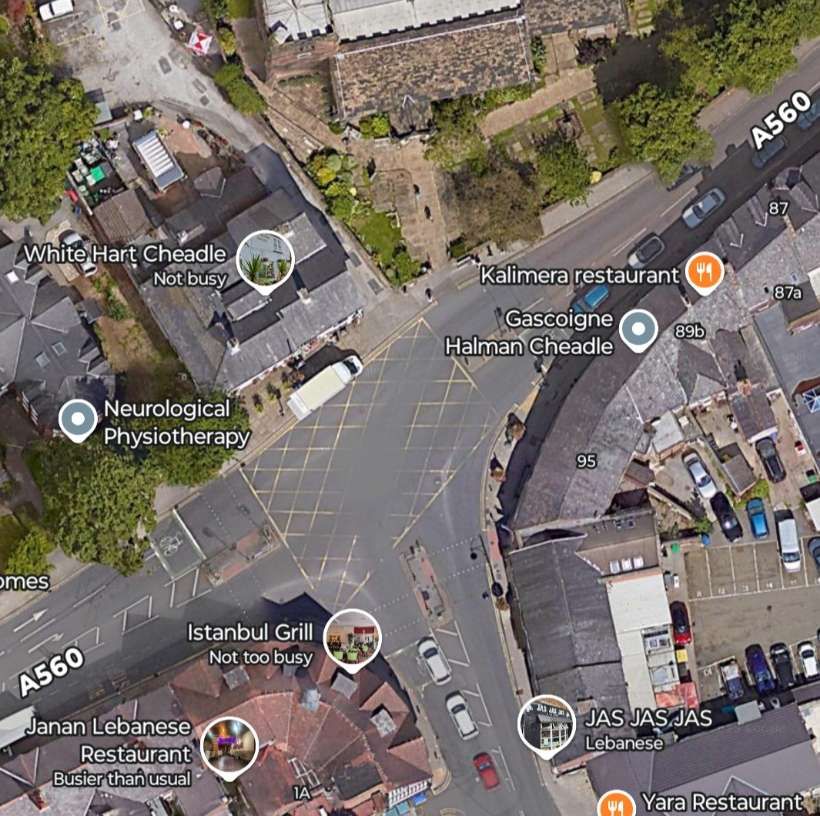
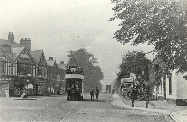
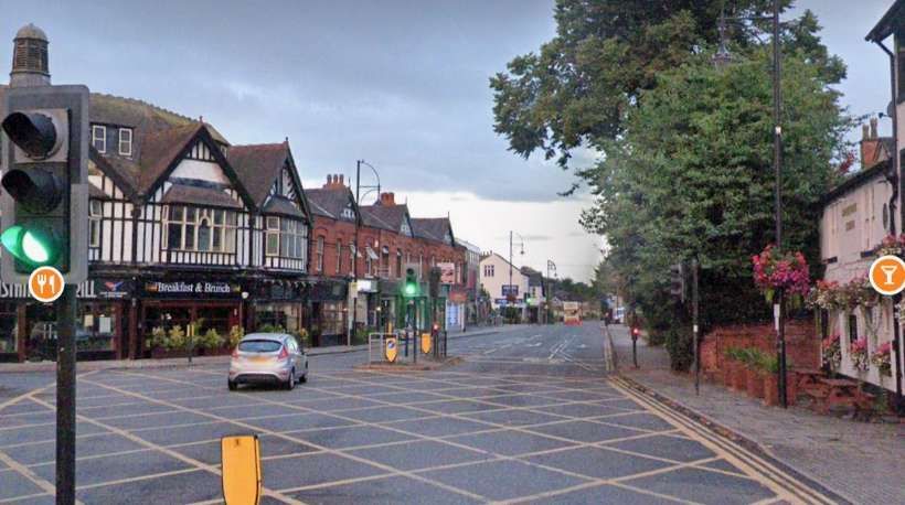
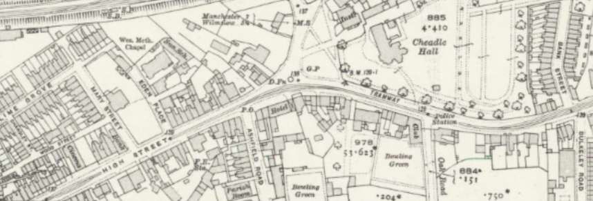
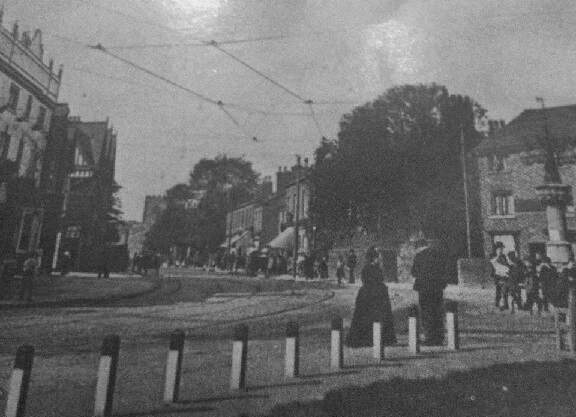
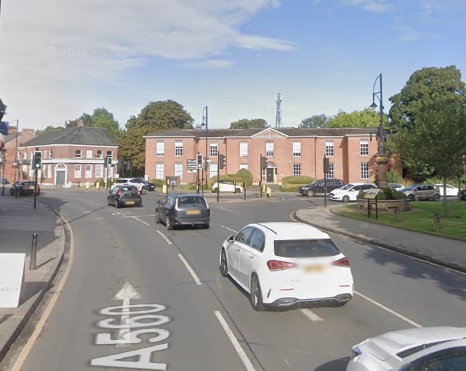
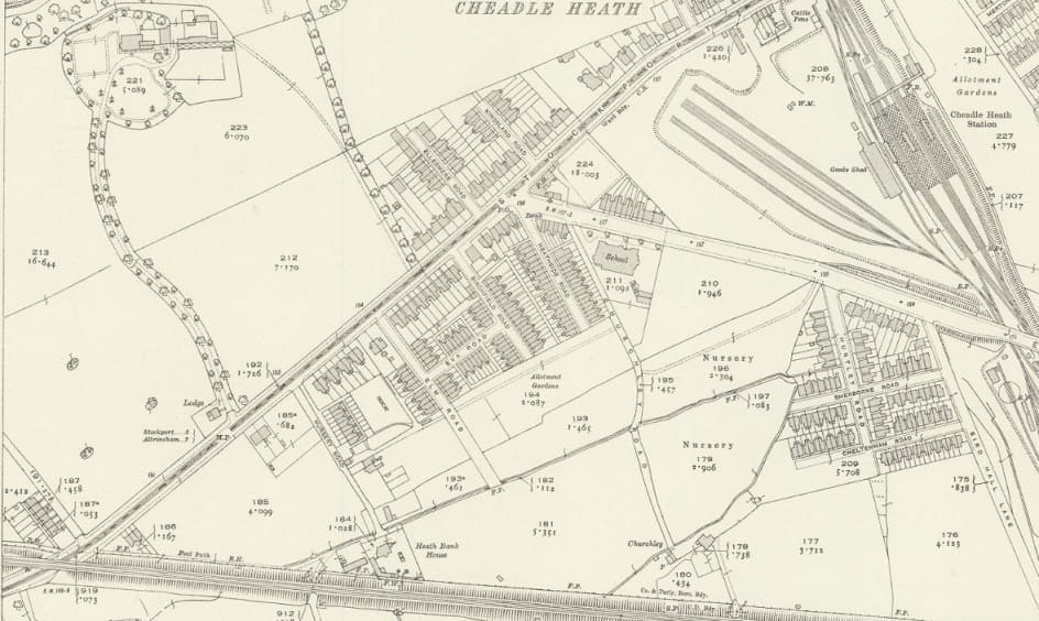
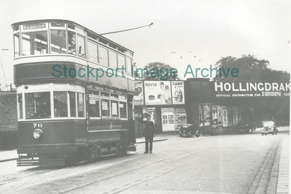
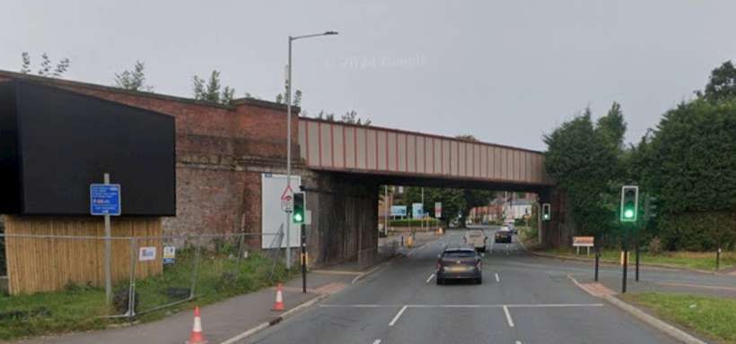
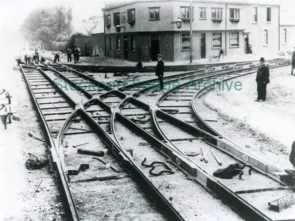
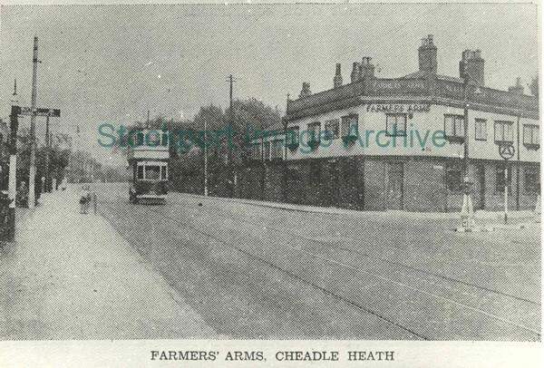
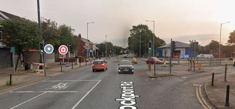
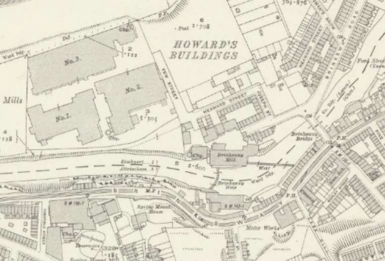
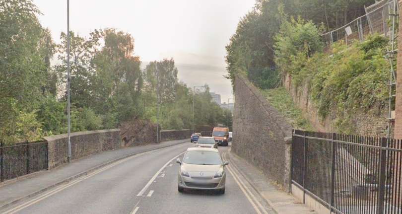
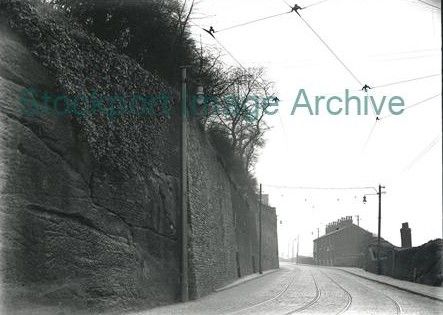
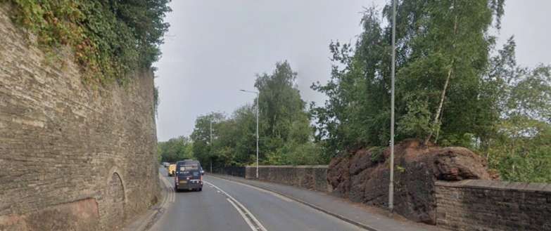
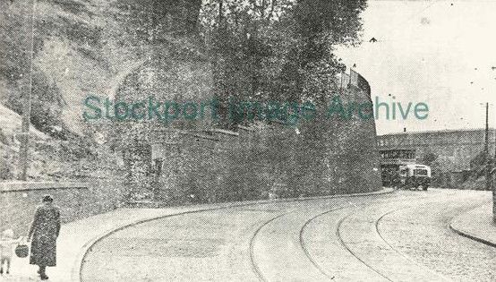
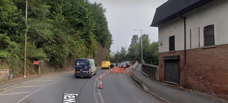
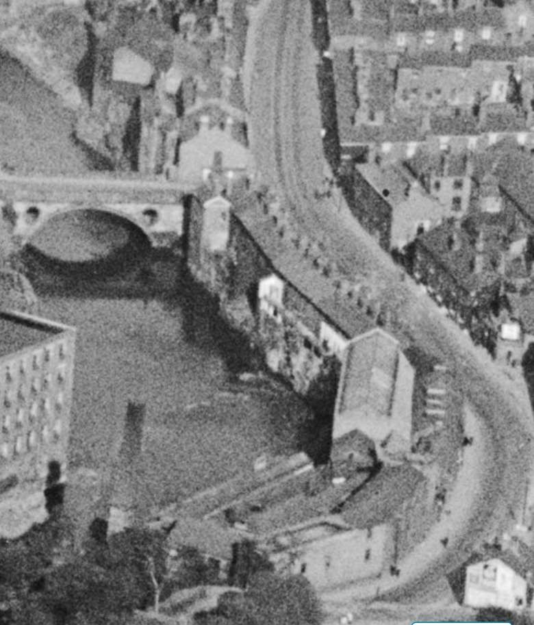
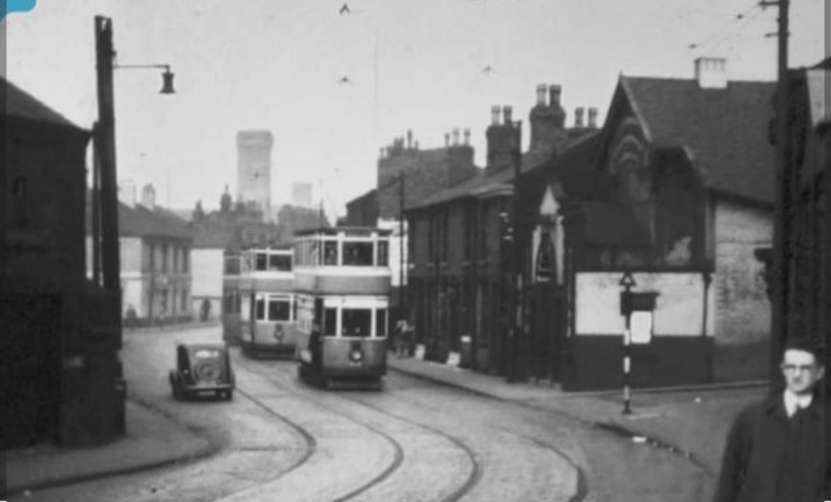
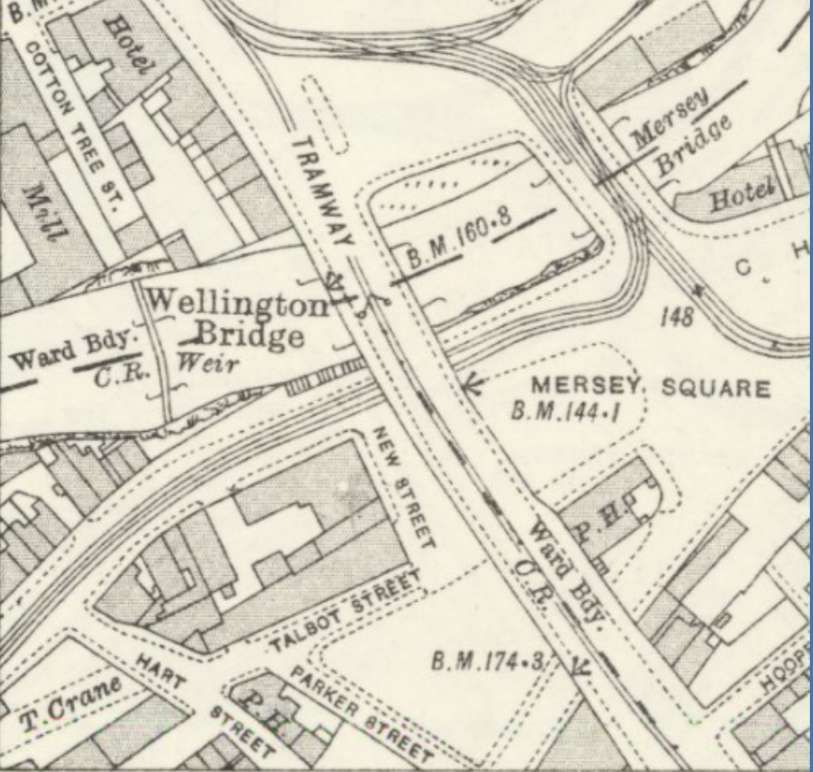
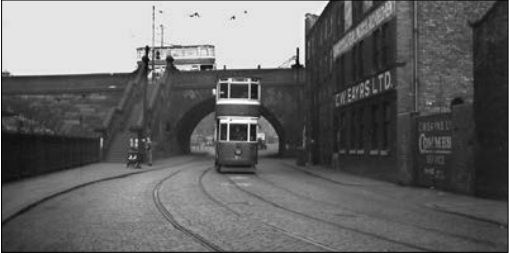
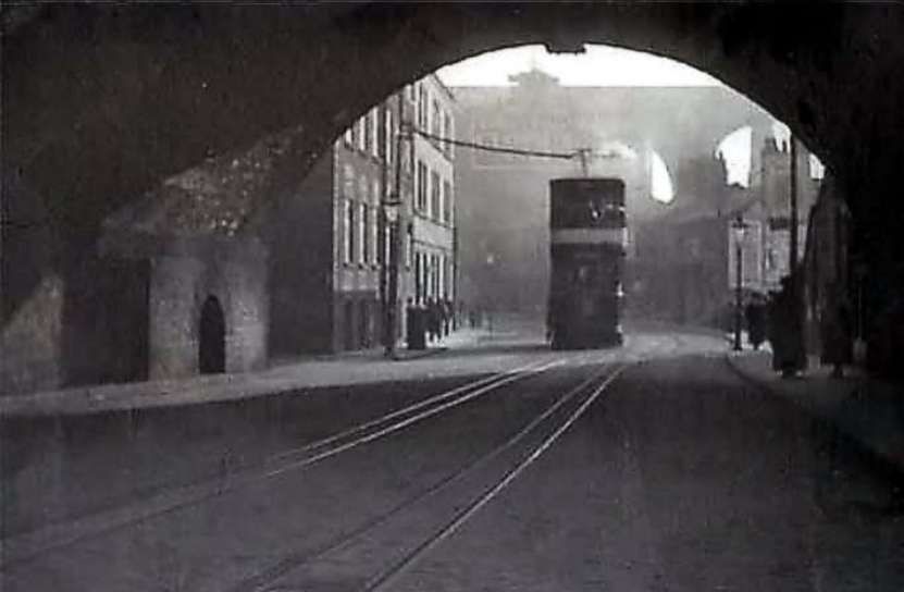
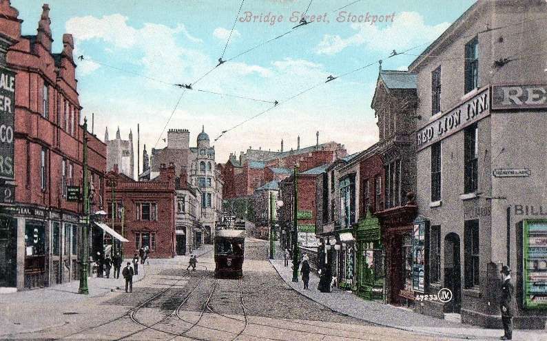
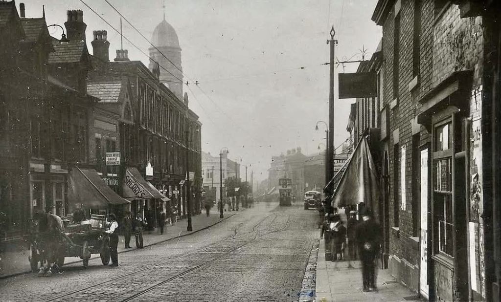
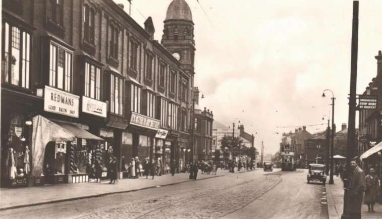
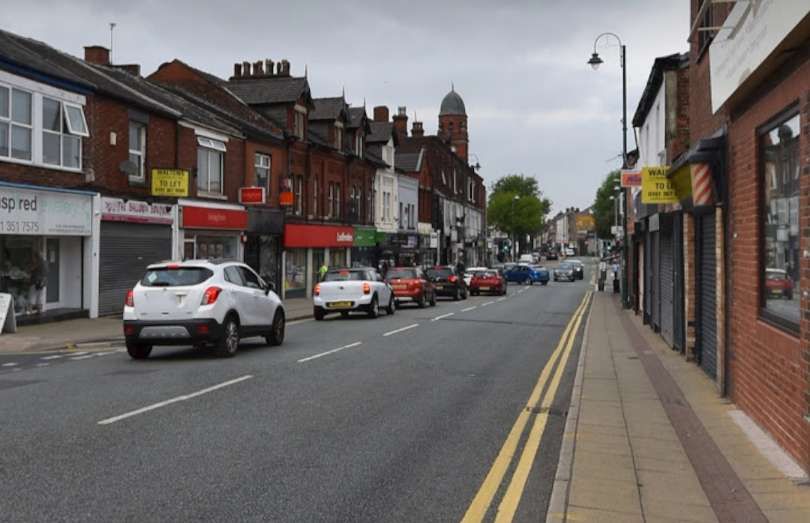
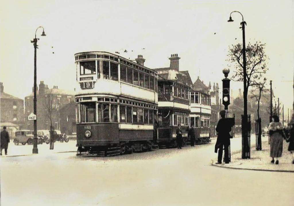
The tramway ran through from Gatley Road onto High Street, Cheadle as the 25′ Ordnance Survey of 1907, published in 1935, shows. [11] The same junction in the 21st century. [Google Maps, January 2025] Looking West along Gatley Road, Cheadle in 1908, from the West end of Cheadle High Street, © Public Domain. [7] A very similar view looking West from Cheadle High Street in the 21st century. [Google Streetview, August 2024] The tramway ran West to East along Cheadle High Street and on to Stockport Road. This extract is taken, again, from the 25″ Ordnance Survey, this sheet was surveyed in 1916 and published in 1922. [12] Looking West along Cheadle High Street, © Public Domain. [15] The same view in the 21st century. [Google Streetview, August 2024] The junction of Cheadle High Street with Stockport Road and Manchester Road, looking West. The passing loop at the junction can be seen in this image, © Public Domain. [13] A view of the same road junctionfrom Stockport Road in the 21st century. [Google Streetview, August 2024] an early image looking East from the junction. The tram is heading for Stock port on Stockport Road, Cheadle Green is behind the tram, © Public Domain. [14] A similar view in the 2020s. [Google Streetview, August 2024] Further East on the same OS map sheet, the tramway can be seen continuing East on Stockport Road. [12] The last section of Stockport Road on this particular OS map sheet shows the tramway and road running Northeast and approaching the railway bridge. [12] The next 25″ Ordnance Survey sheet ( surveyed in 1916 and published in 1922) shows Stockport Road and the tramway heading Northeast under the railway bridge into Cheadle Heath. Top-right in this map extract is Cheadle Heath Railway Station. The junction with Edgeley Road is just above the centre of the image. [17] Looking Southwest along Stockport Road Cheadle Heath with the railway bridge on the right side of the image. This image comes from Stockport Image Archive, © Public Domain. [20] A similar view in the 2020s looking across the motorway slop road roundabout and under the railway bridge, West towards Cheadle. [Google Streetview, August 2024] Laying the tram tracks at the junction of Stockport Road and Edgeley Road, Cheadle Heath in 1903. This image comes from the Stockport Image Archive and faces towards Stockport, © Public Domain. [21] The same location in the 1940s, again facing towards Stockport. This is another image from the Stockport Image Archive, © Public Domain. [22] The view along Stockport Road towards Stockport in the 2020s. [Google Streetview, August 2024] Continuing Northeast, the road and tramway began the descent into the River Mersey valley. The road took the name Brinksway. [17] The tramway followed Brinksway as it ran East on the South side of the River Mersey. One of Stockport’s road bridges over the river, Brinksway Bridge, can be seen towards the right of this map extract. [17] Looking down Brinksway towards Stockport town centre. This image is held in the Stockport Image Archive, © Public Domain. [23] A similar view in the 2020s. [Google Streetview, August 2024] Looking up Brinksway to the location of the photograph above. The houses on the distance in this view are those on the left of the last image. This image is held in the Stockport Image Archive, © Public Domain. [24] Approximately the same location on Brinksway, facing the same direction. [Google Streetview, August 2024] Further East down Brinksway this view shows one of the significant rock outcrops. This view is held in the Stockport Image Archive, © Public Domain. [25] A very similar location on Brinksway, facing in the same direction. [Google Streetview, August 2024] An extract from Britain from Above image EPW036823, Brinksway and Brinksway Bridge in 1931, © Historic England. [26] Trams on Brinksway.in 1931. This view looks towards Stockport town centre, © Public Domain. [26] A similar location in n Brinksway, looking towards the town centre. [Google Streetview, August 2024] Continuing East Brinksway became Chestergate as trams approached the centre of Stockport, passing under Stockport’s iconic viaduct which can be seen in the extreme top-right of the map extract. [17] Just a very short length of Chestergate (and the tramway) intrudes into the next map sheet to the North (25″ Ordnance Survey of 1916, published in 2922). [18] Trams then passed under the A6, Wellington Road South into Mersey Square (an extract from the 25″ Ordnance Survey of 1917, published in 1922). [19] Looking East towards Mersey Square, a tram heads West towards Gatley/Cheadle, Public Domain. [4: p94] Looking West-southwest under Wellington Road along Chestergate with the Beckwith Steps to the right. This image was shared on the Memories of Stockport Facebook Group by Dave Moran on 23rd April 2024 [28] A tram turns out of Mersey Square onto Chestergate, heading for Cheadle/Gatley, while another, older trams heads towards St. Peter’s Square, © Public Domain. [31] Tram services entered Mersey Square and crossed the Mersey. Services to the West of the town commenced here and ran along Princes Street to Bridge Street. That length of the network is covered in an earlier article which can be found here . [2]
We resume this article at the Northeast end of Princes Street and its junction with Bridge Street and then follow the route to Hyde.
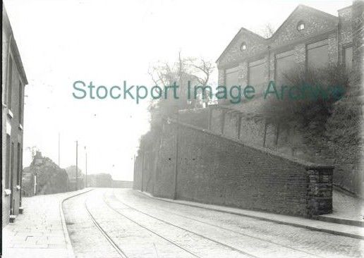
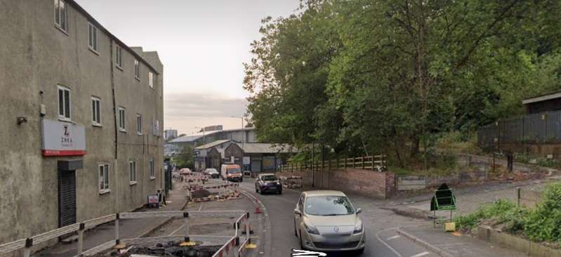
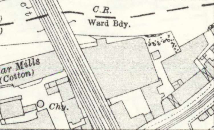
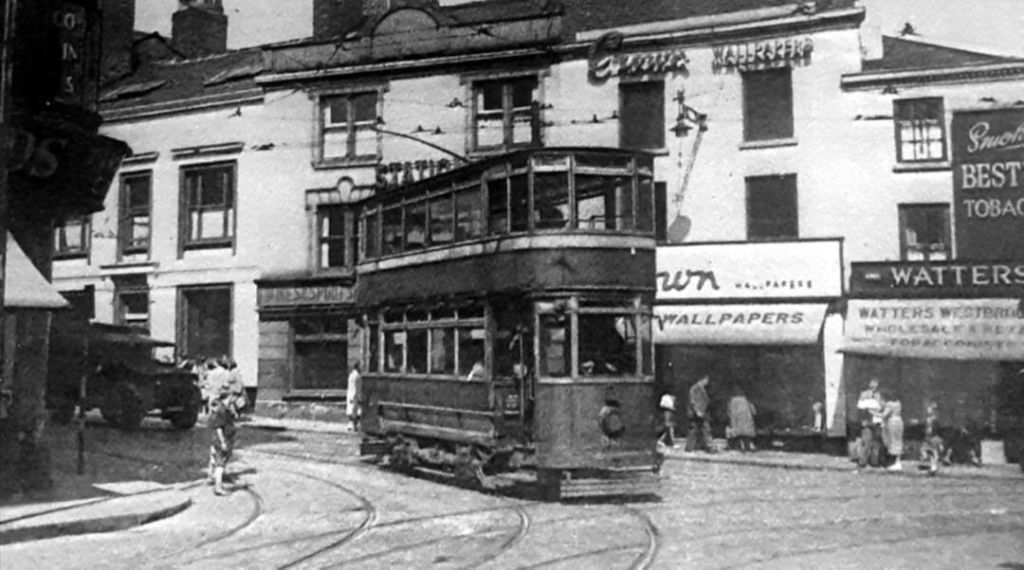
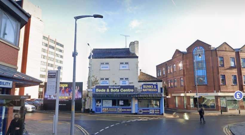
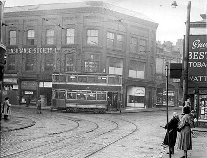
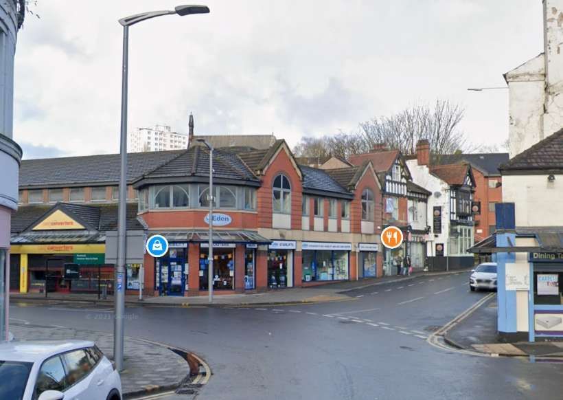
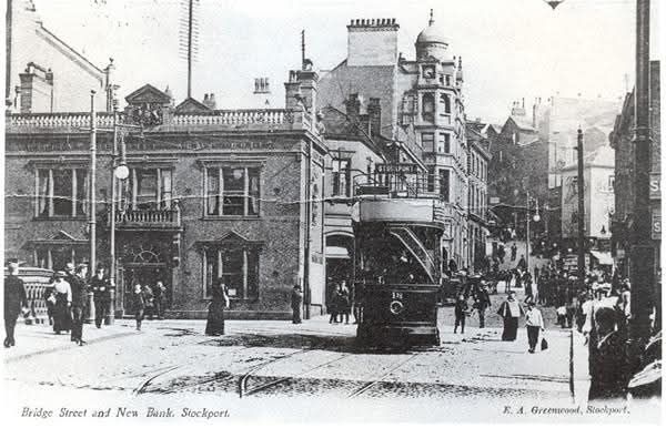
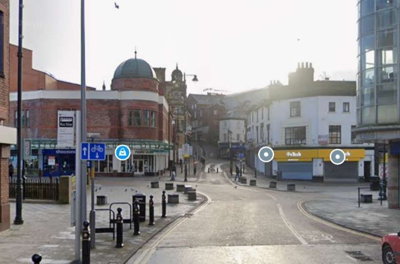
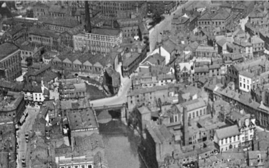
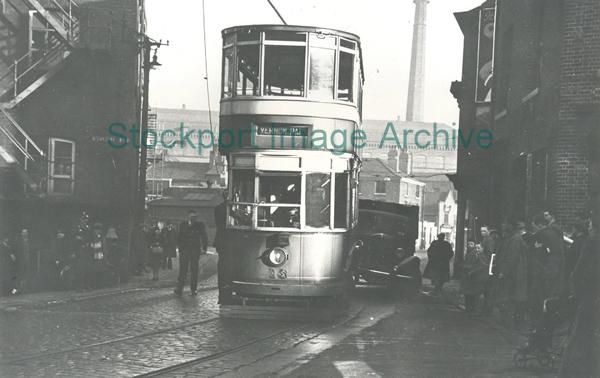
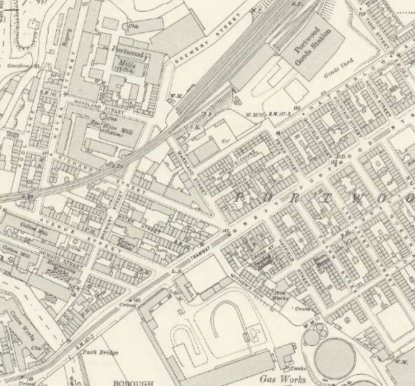
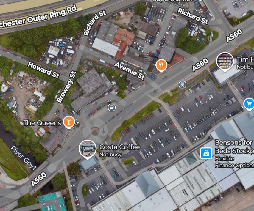
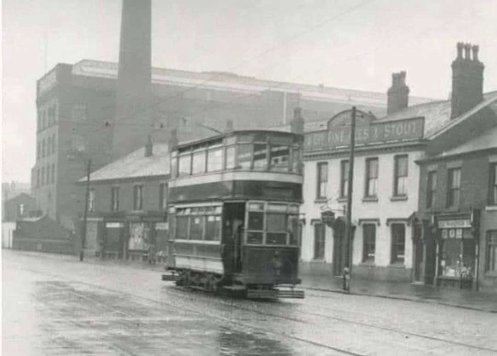
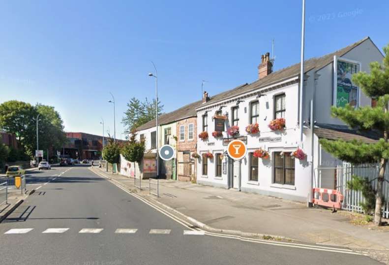
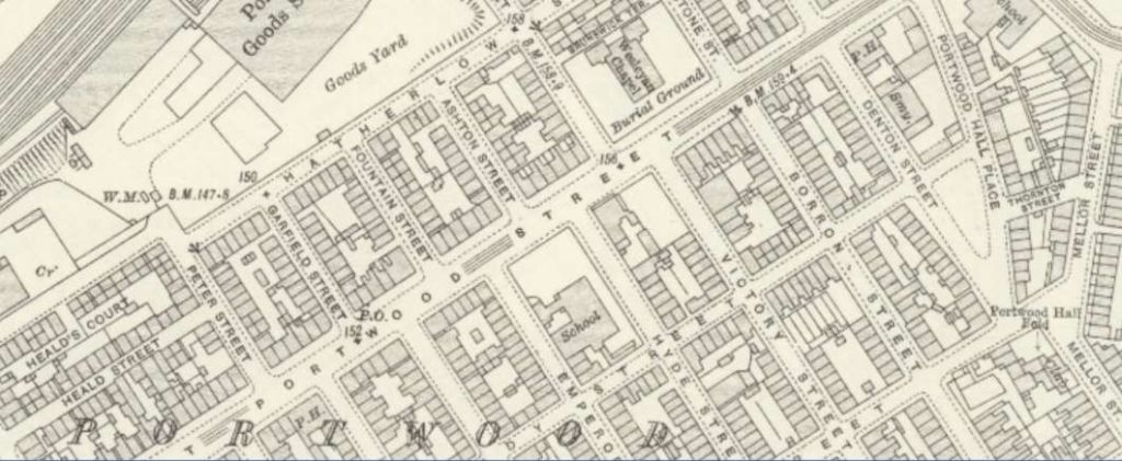
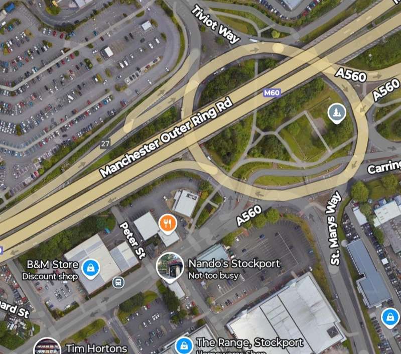
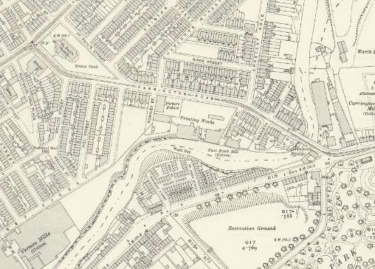
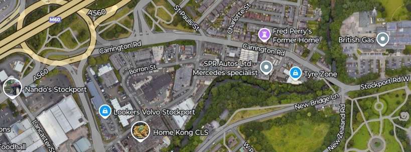
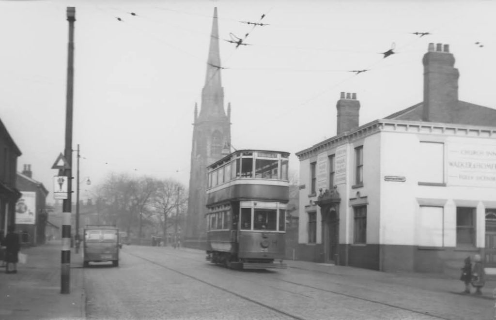
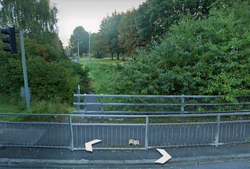
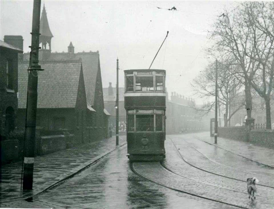
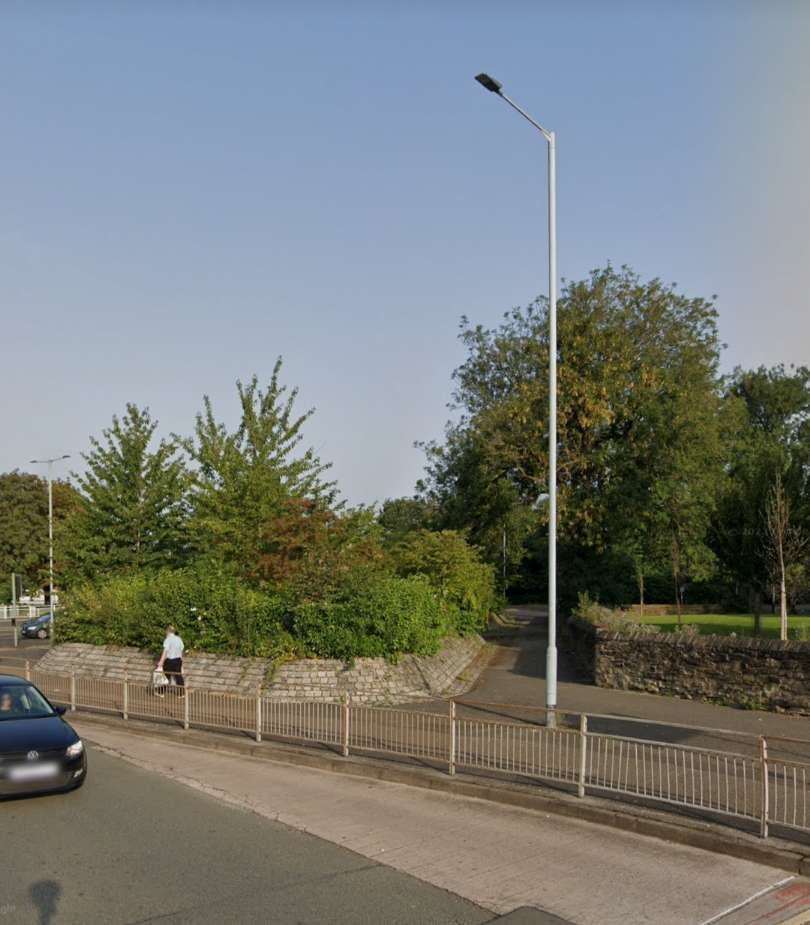
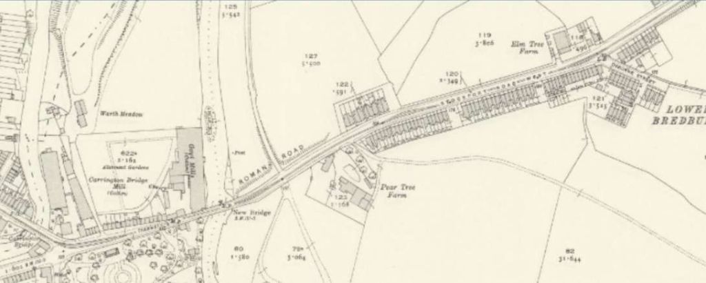
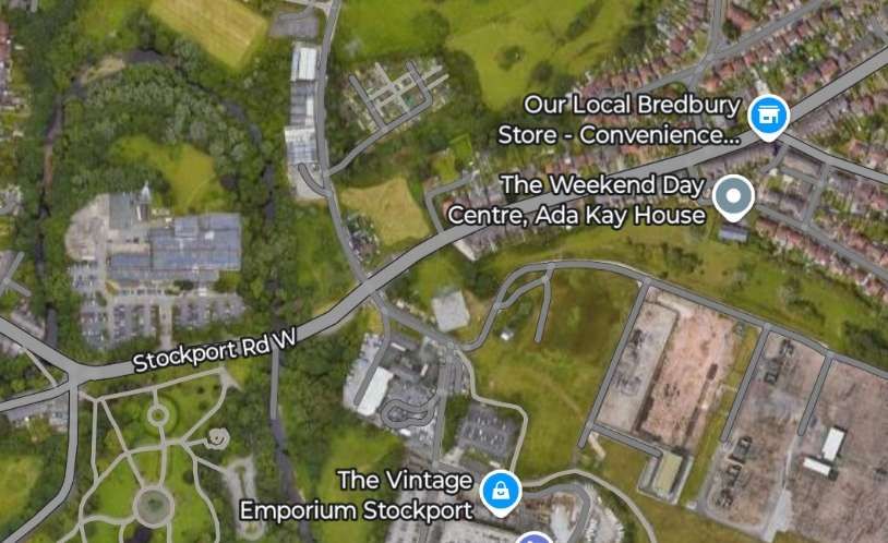
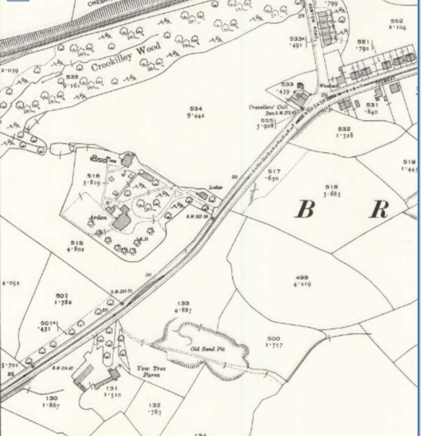
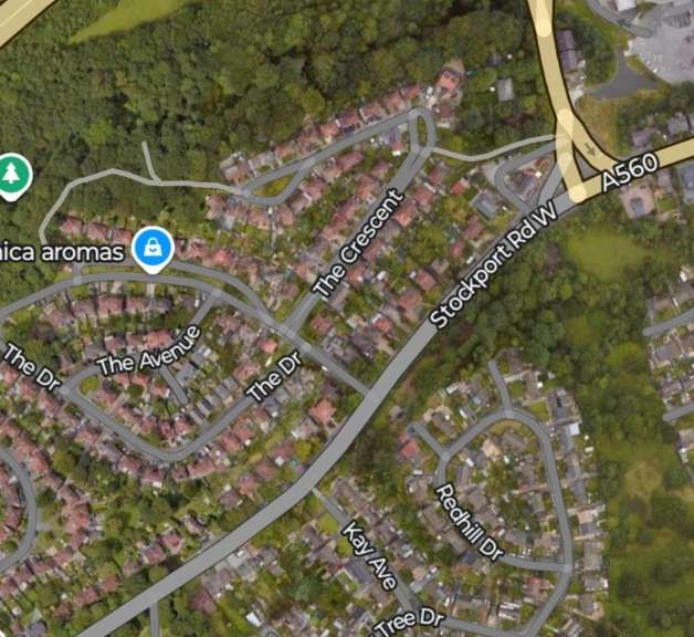
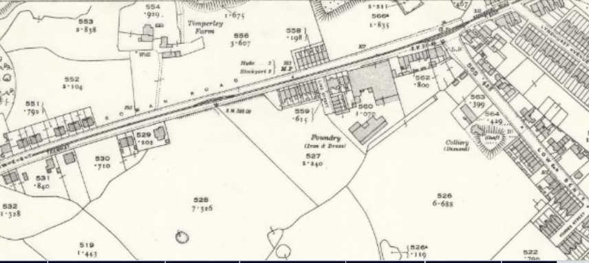
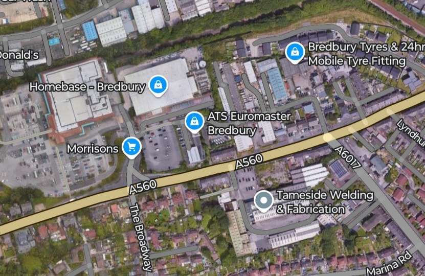
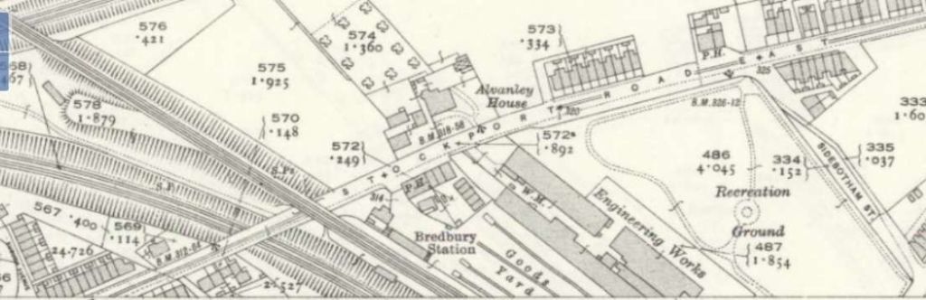
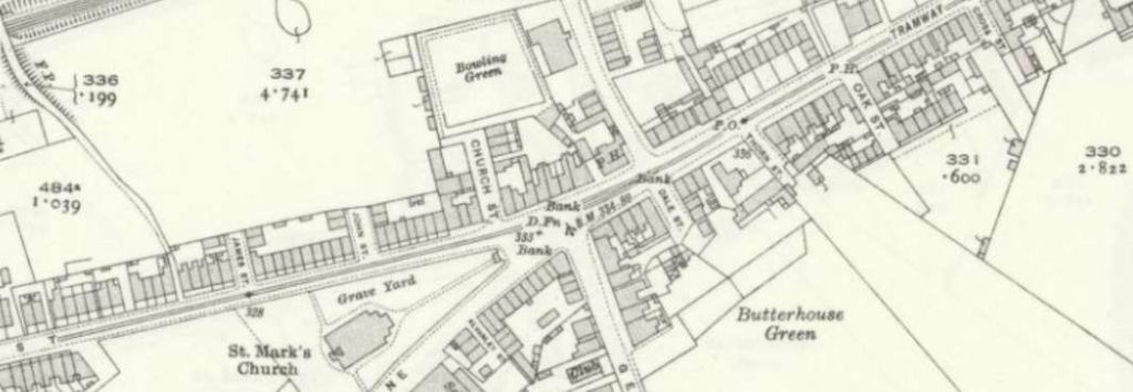
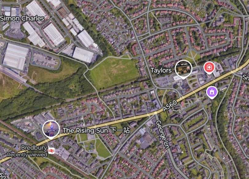
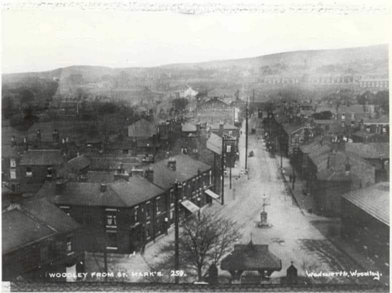
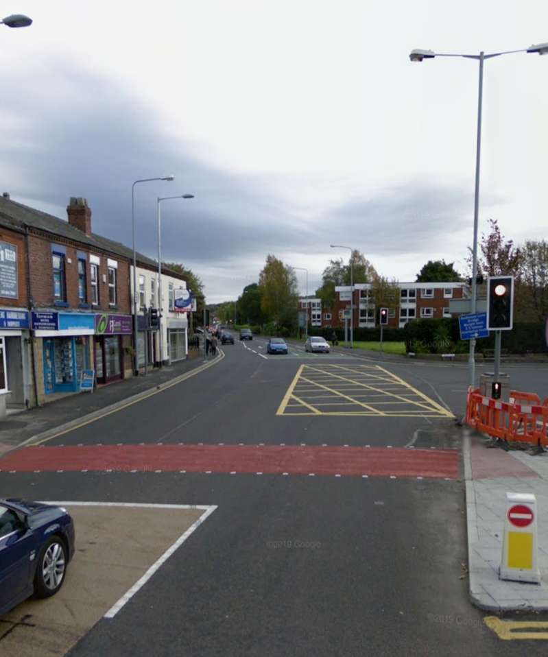
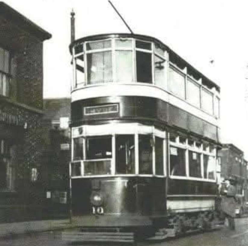
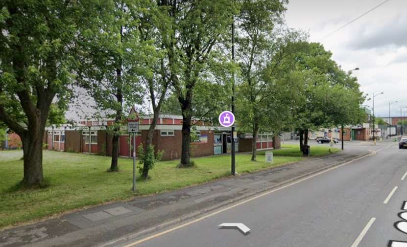
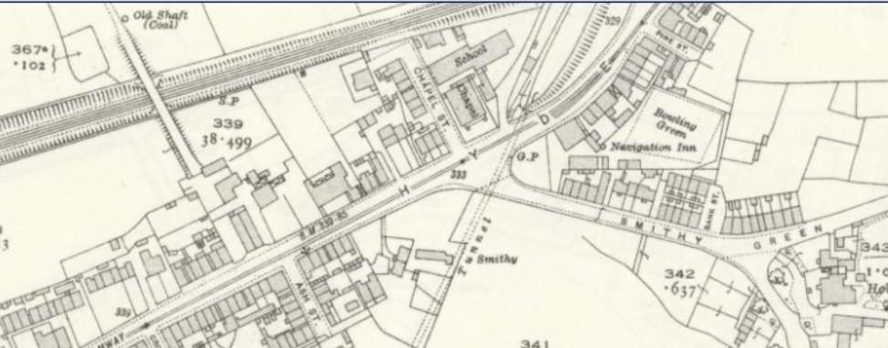
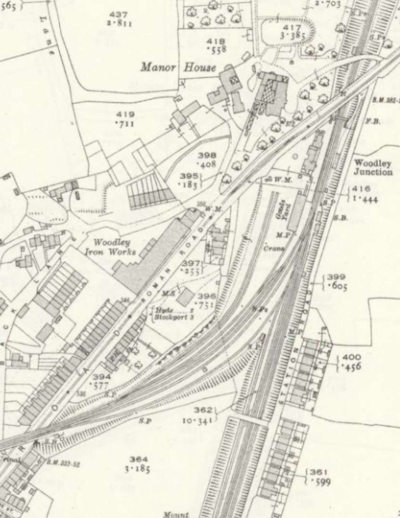
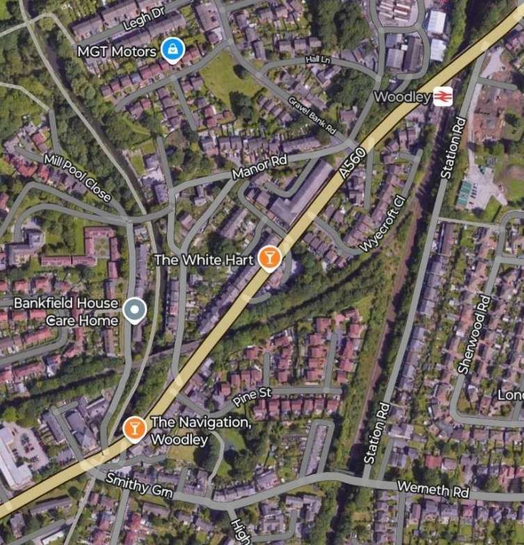
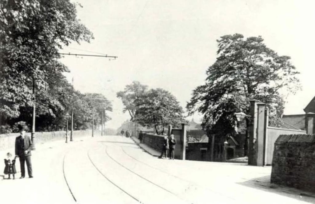
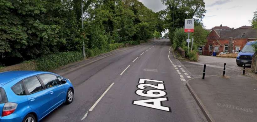
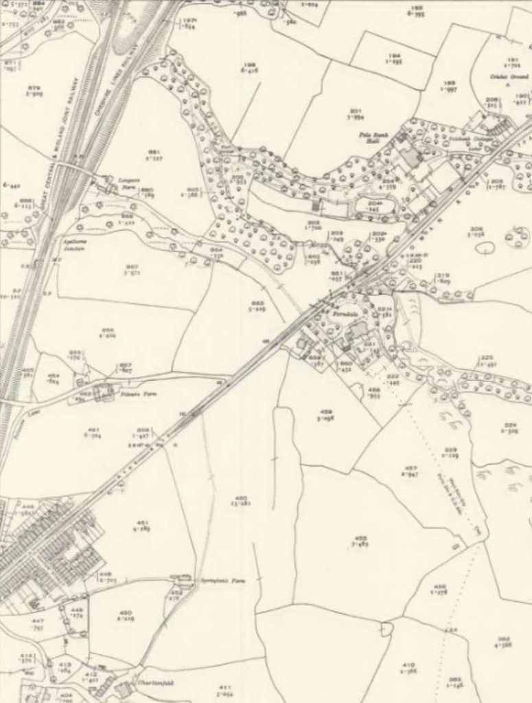
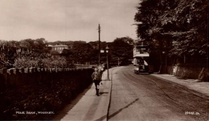
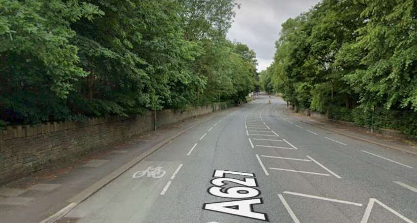
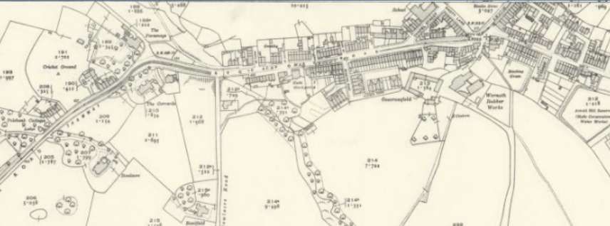
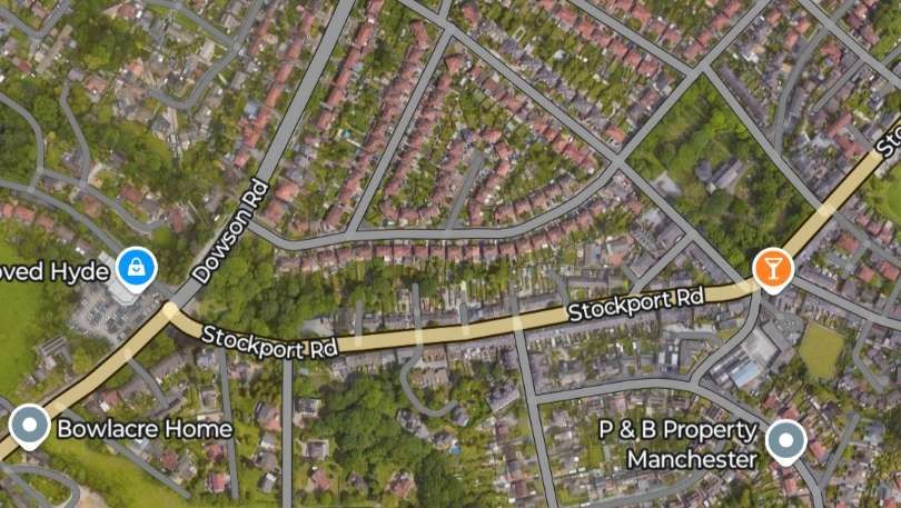
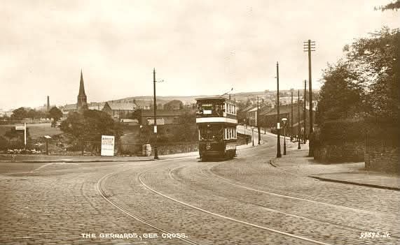
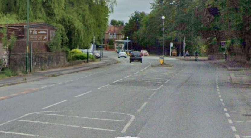
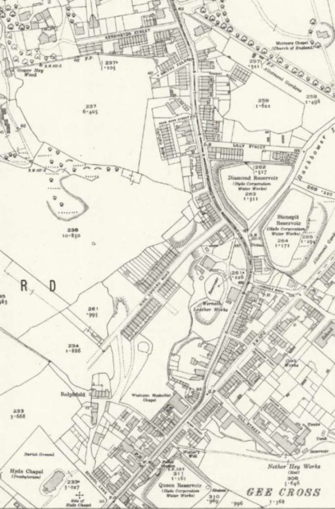
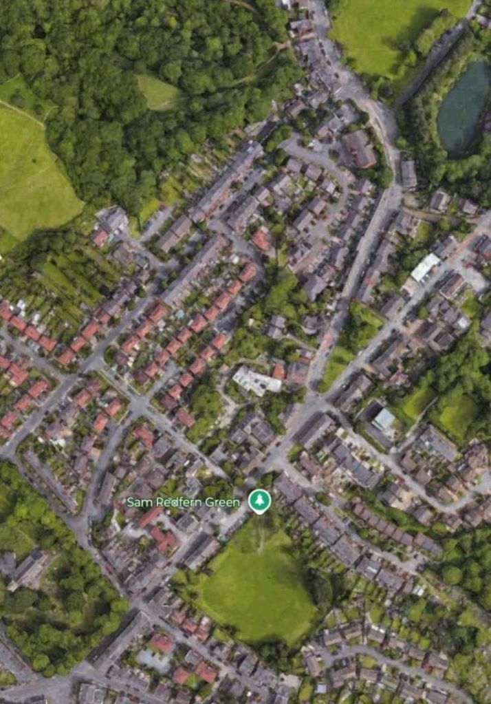
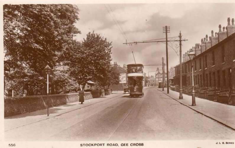
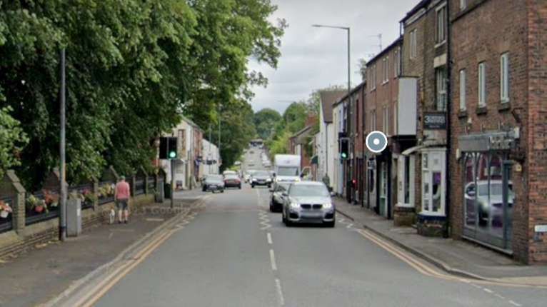
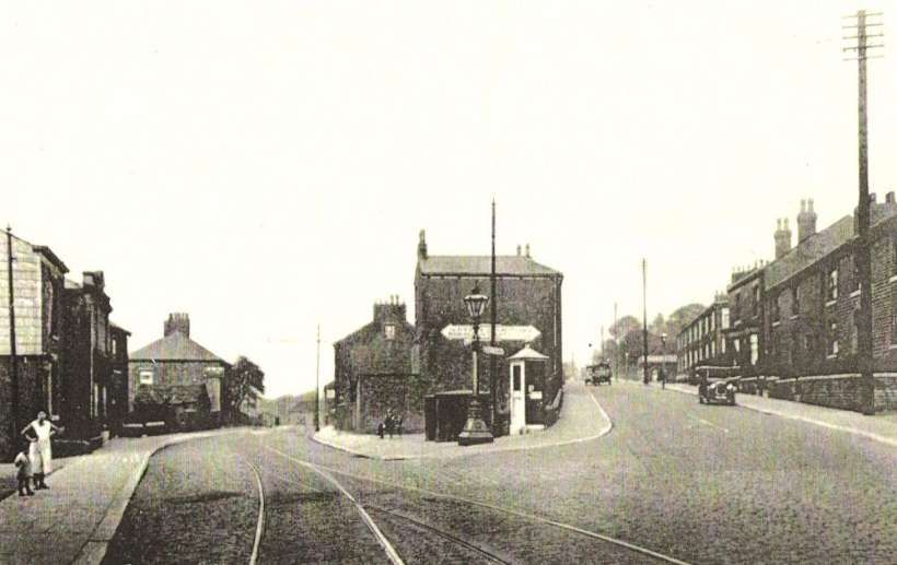
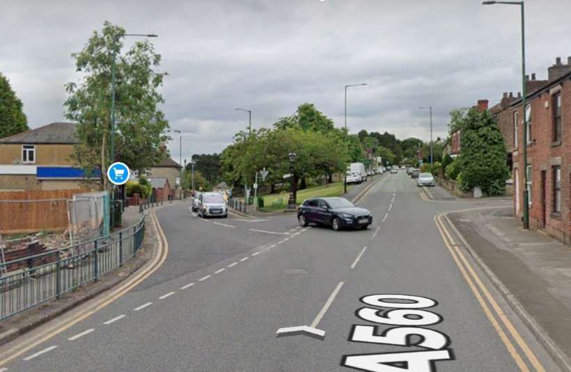
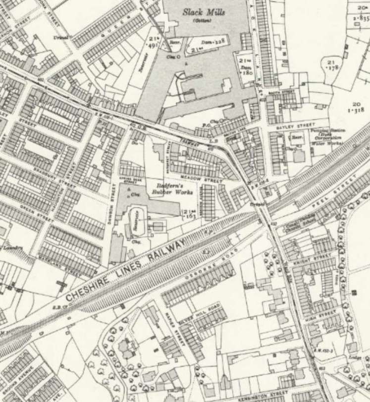
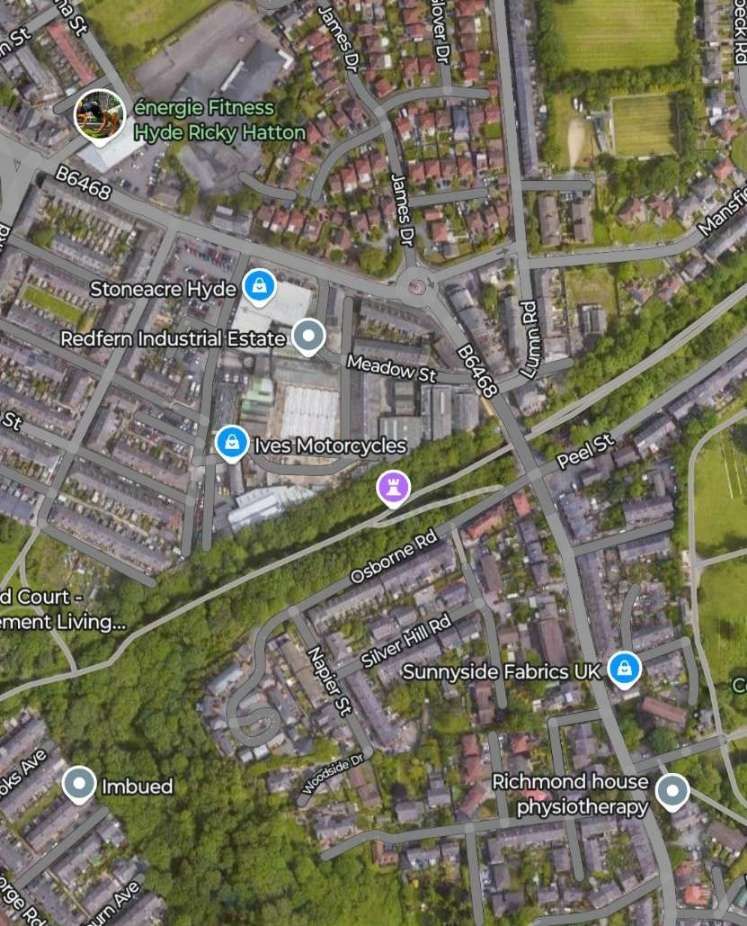
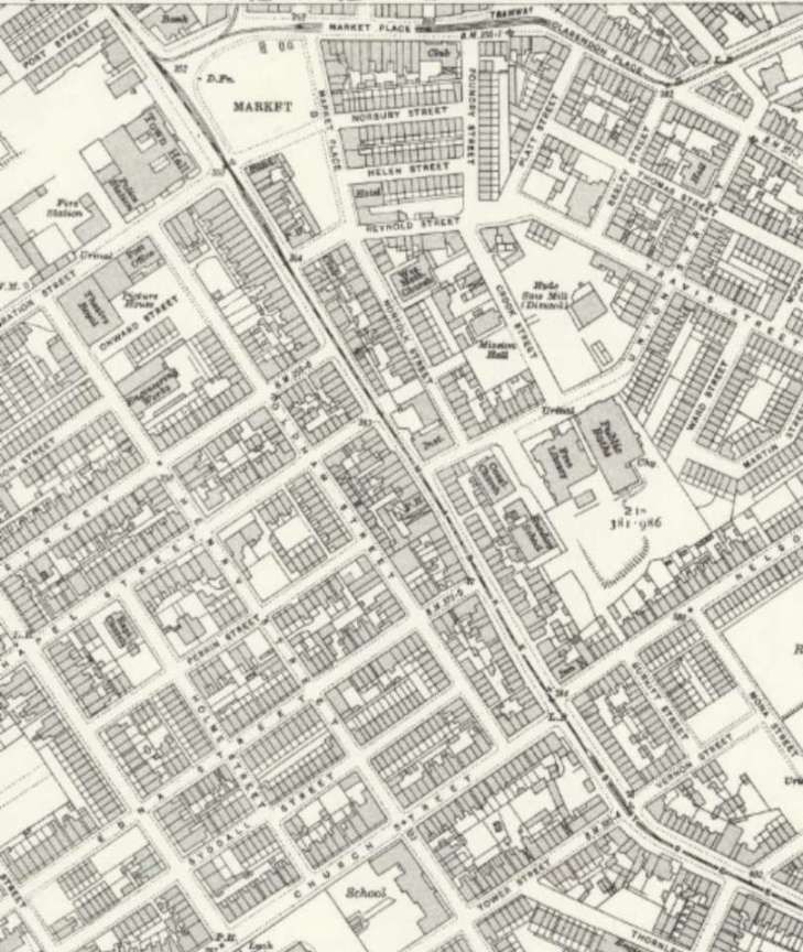
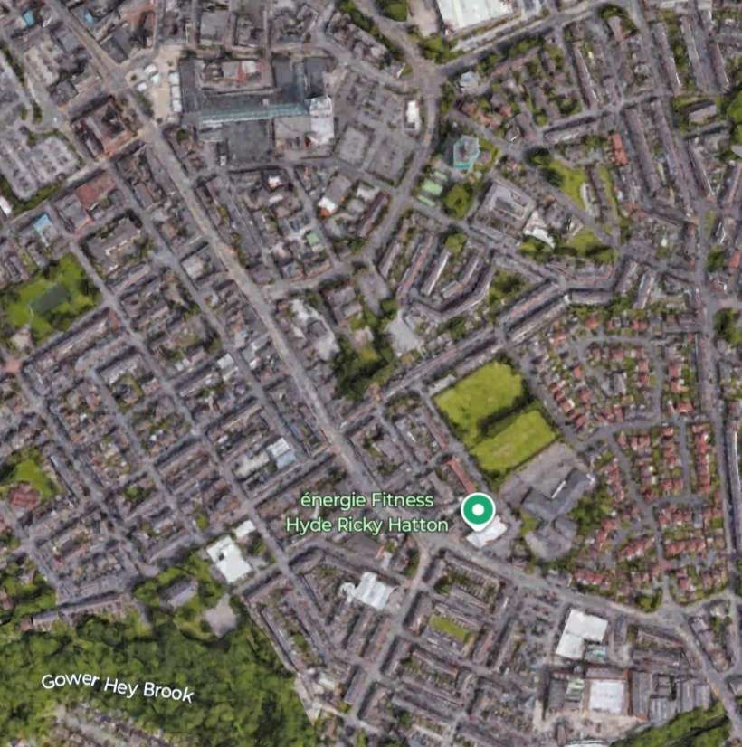
A tram at the junction of Tiviot Dale, Princes Street and Bridge Street. Bridge Street runs off the picture to the right. This image was shared on the Memories of Stockport Facebook Group by Dave Moran on 24th August 2023, © Public Domain. [27] A similar view from the end of Princes Street. [Google Streetview, August 2024] The views above look Northeast from Princes Street, the two immediately below face Northwest from Bridge Street and the two further below face Southeast along Bridge Street. [35] Looking back from Bridge Street to its junction with Princes Street ,(on the left) and Tiviot Dale (on the right). A tram is pictured on the corner of Tiviot Dale and Princes Street. Several shot fronts are pictured in the background including the Co-operative Insurance, Leonard Aaron, opthalmic opticians as well as shops selling musical instruments and a chemist. This image was shared by Dave Moran on the Memories of Stockport Facebook Group on 23rd April 2024, © Public Domain. [32] The same location in the 2020s. [Google Streetview, August 2024] Looking Southeast from the junction of Tiviot Dale, Princes Street and Bridge Street, a tram heads along Bridge Street towards the junction. The tram has just turned right onto Bridge Street from Warren Street. [33] An earlier monochrome image from Stockport Image Archive which shows Tram No. 28 turning from Warren Street onto Bridge Street before crossing Lancashire Bridge. This image was shared by Marilyn Ann Cronshaw on the Memories of Stockport Facebook Group on 14th August 2015, © Public Domain. [44] A similar view in the 21st century. [Google Streetview, August 2024] An overhead view looking East across Lancashire Bridge and Warren Street This is an extract from image No. EPW013110, © Historic England. [36] Warren Street cut across a peninsula of land between the River Goyt and the River Mersey with the confluence between the River Goyt and the River Tame to the North. [35] An accident in the 1930s on Warren Street between a tram and a lorry, © Public Domain. [34] Park Bridge is bottom left on this extract from the 25″ Ordnance Survey of 1917, published 1922. [35] A shorter stretch of Great Portwood Street in the 21st century. [Google Maps, January 2025] A tram passes the Queen’s Public House on Great Portwood Street on its way East. This image was shared on the Memories of Stockport Facebook Group by Julian Ryan on 20th November 2022, © Public Domain. [38] The same location in the 2020s. [Google Streetview, August 2024] Further Northeast along Great Portwood Street on the same OS Map sheet as the extract above. [35] A similar length of Great Portwood Street. It now has one of the major M60 junctions.on the North side. [Google Streetview, January 2025] The tramway turns Southeast onto Carrington Road and runs down to the River Goyt at Carrington Bridge before continuing West on Stockport Road West. [35] A similar length of the road/tramway as appears on the map extract above. St. Paul’s School and Church at the junction of Great Portwood Street and Carrington Road are long gone and Carrington Road has been diverted to meet the large motorway roundabout. [Google Maps, January 2025] St. Paul’s Church, Great Portwood Street, seen from the Southwest on Great Portwood Street. The junction with. Arrington Road is behind the tram. This image was shared on the Stockport Memories Facebook Group by Niall Dorsett on 24th November 2024, © Public Domain. [49] This view looking West from Portwood Roundabout is from approximately the same location. Everything in the monochrome image above has gone. [Google Streetview, September 2023] Carrington Road, Portwood, looking Northwest close to it junction with Great Portwood Street which is just at the far end of the St. Paul’s School site. The school is to the left of the tram. The churchyard is on the right with the church building just off the picture to the right, © Public Domain. [37] Looking Northwest along what was Carrington Road. The wall beyond the lamp post is what was the churchyard boundary wall. The line of the road ran through the planted beds with the location of the Scholl to the left of the planting. [Google Streetview, September 2023] This next extract from the 25″ Ordnance Survey takes the tramway to the West edge of the OS Sheet, over New Bridge, along Stockport Road West. [35] The same length of Stockport Road West on modern satellite imagery. Notice the shortening of the loop in the River Goyt which was required to allow construction of the M60. [Google Maps, January 2025] Stockport Road West as it appears on the 25″ Ordnance Survey of 1917, published in 1922. [39] A very similar length of Stockport Road West which, rather than running through a rural landscape, now runs through a residential area. [Google Maps, January 2025] Stockport Road East through Bredbury as it appeared on the 1917 Ordnance Survey. [39] A short molar length of Stockport Road East in the 21st century. [Google Maps, February 2025] An interesting arrangement of under and over bridges appears in the bottom-left of this next extract from the 25″ Ordnance Survey of 1917. Trams passed over the Cheshire Lines Committee (Great Central and Midland Joint Railway) from Bredbury Junction, and then under the same company’s lines through Bredbury Railway Station. Woodley village can be seen top-right and on the next map extract. [40] St. Mark’s Woodley appears bottom-left in between Stockport Road East and Redhouse Lane. [40] This image shows a similar length of the A560 as it appears towards the end of the first quarter of the 21st century. [Google Maps, February 2025] Hyde Road Woodley looking Northeast from St. Mark’s Church. This image was shared on the Stockport Memories Facebook Group by Ian Scottson on 8th October 2024, © Public Domain. [50] Looking Northeast along the A560 from adjacent to St. Mark’s Churchyard. Redhouse Lane joins the A560 from the right. [Google Streetview, April 2015] Stockport Tram No.10 outside the Lowes Arms in Woodley in 1947, heading for Hyde. This image was shared on the Stockport Memories Facebook Group by Dave Eccles on 10th June 2024, © Public Domain. [48] A similar view looking North from the A560 at the location of the Lowes Arms in Woodley. [Google Streetview, June 2023] Woodley village continues Northeast along Hyde Road. [40] Woodley Railway Station is in the upper-right quadrant of this extract from the 25″Ordnance Survey. Hyde Road runs bottom-left to top-right. [40] A similar length of the A560/A627 as in the map extracts immediately above. Woodley Railway Station is at the top-right of the image. [Google Maps, February 2025] An early 20th century photograph looking Northeast along Stockport Road, Woodley. The railway station is on the right with the railway passing under the road ahead. As can be seen here and on the map extract above, there was a passing loop which allowed trams to pass each other immediately outside Woodley Railway Station. This image was shared on the Stockport Memories Facebook Group by Ian Scottson on 5th October 2024, © Public Domain. [47] Now the A627, Hyde Road runs past Woodley Railway Station. This view is from a similar location to the monochrome image above. [Google Streetview, June 2023] Stockport Road/Hyde Road continues Northeast from Woodley towards Gee Cross. [41] The same length of Hyde Road/Stockport Road in the 21st century This view Southwest along Stockport Road shows a tram heading for Woodley along Pole Bank (Stockport Road, A560 in the 21st century), © Public Domain. [46] The same view in the 21st century. [Google Streetview, June 2025] The 25″ Ordnance Survey shows that trams turned East along Stockport Road towards Gee Cross. [41] Dowson Road runs North and Stockport Road heads East at the junction on the left side of this satellite image. Trams turned East along Stockport Road. [Google Maps, February 2025. Looking Northeast from the Gerrards, close to the left edge of the map extract and satellite image above, along Stockport Road towards Dawson Road in Gee Cross. In the middle distance trams heading for Hyde turned right on Stockport Road, © Public Domain. [30] A view Northeast from a camera location closed to the location of the tram in the monochrome image above. [Google Streetview, June 2023] In Gee Cross, the main road on which the trams were travelling (Stockport Road) gave way to Mottram Old Road – both now lengths of the A560. Trams branched off what is now the A560 along another length of Stockport Road. Today, this is the B6468. [42] A similar length of Stockport Road, Gee Cross. [Google Earth, February 2025] This image shows a tram travelling along Stockport Road, Gee Cross at the very bottom of the map extract above, © Public Domain. [29] A similar location in the 21st century looking Northeast. [Google Streetview, June 2023] Probably dating from the 1920s, This photograph shows the tramlines running along Stockport Road towards Hyde. Mottram Old Road is on the right side of the image. There was a passing loop at the junction. The old sign post remains at the junction but has lost an arm. The lamp on the top of the pole remains. The houses behind it have gone leaving a grassy embankment. © Public Domain. [45] A view Northeast from a similar location in the 2020s. The lamppost can easily be made out beyond the car turning onto the A560. [Google Streetview, June 2023] This next extract from the 25″ Ordnance Survey shows the tram tracks running North along Stockport Road (B6468), bridging the Cheshire Lines Committee railway and then Northwest into Hyde along Market Street. [42] A similar length of Stockport Road and Market Street in Hyde. The old railway in cutting is now a footpath/cycleway. A roundabout now marks the bend from Stockport Road into Market Street and a housing estate now sits on the site of the Slack Cotton Mills. [Google Maps, February 2025] Trams from Stockport continued Northwest along Market Street, Hyde. Terminating close to the Market ground, seen here in the top-left of the extract from the 25″ Ordnance Survey of 1917, published 1922. [42] The final length of the route covered by Stockport’s trams which reached as far as the Market ground which can be seen in the top-left of this satellite image [Google Earth, February 2025] Market Street, Hyde in around 1930. A tram on the Stockport Edgeley service waits at the Town Hall terminus as a bus departs for Romiley from the Market. This image was shared on the Hyde Past and Present Facebook Group by Lee E. Brown 8th November 2024. © Public Domain. [51] A tram on Market Street, Hyde, © Public Domain. [52] A view Northwest along Market Street in the 21st century. [Google Streetview, June 2023] A photograph from around 1930 of the tram terminus on Market Street outside the Town Hall. The leading tram is a Manchester Corporation car on the No 19 service to Manchester Exchange. In the centre is an SHMD car and at the far end is a Stockport car and going off the position of the poles, they are both on the Edgeley run. Across the market there is a rare glimpse of the Norfolk Hotel. The photographer was standing on the corner of Greenfield Street, looking across to the market ground. Market Street goes away behind the trams. The top of the Midland Bank is visible above the trams. This length of tramway may be unique in the UK being served by four different tram companies/services, SHMD, Ashton, Manchester and Stockport trams. This image was shared on the Hyde Past and Present Facebook Group by Lee E. Brown on 23rd November 2019. [53] A view from a similar location in the 21st century. [Google Streetview, June 2023] This completes the length of the tramway from Stockport to Hyde. The next article in this short series will cover the line from Manchester to Hazel Gri
References
P.W. Gentry; Stockport Corporation Tramway; Modern Tramway, Vol. 12 No. 138, June 1949, p123-126.
https://rogerfarnworth.com/2025/01/15/stockport-corporation-tramways-modern-tramway-vol-12-no-138-june-1949-part-1 https://en.m.wikipedia.org/wiki/Stockport_Corporation_Tramways , accessed on 3rd January 2025.Harry Postlethwaite, John Senior & Bob Rowe; Super Prestige No. 14, Stockport Corporation ; Venture Publications, Glossop, Derbyshire, 2008. This document is made freely available by MDS Books as a .pdf: https://www.mdsbooks.co.uk/media/wysiwyg/Stockport_Download_1.pdf , accessed on 14th January 2025.
https://www.ebay.co.uk/itm/361890923297?mkcid=16&mkevt=1&mkrid=711-127632-2357-0&ssspo=ibGa9k_VTo6&sssrc=4429486&ssuid=&var=&widget_ver=artemis&media=COPY , accessed on 15th January 2025.https://www.ebay.co.uk/itm/361906909095?mkcid=16&mkevt=1&mkrid=711-127632-2357-0&ssspo=ibGa9k_VTo6&sssrc=4429486&ssuid=&var=&widget_ver=artemis&media=COPY , accessed on 15th January 2025.https://fr.m.wikipedia.org/wiki/Fichier:Gatley_Road,_Cheadle_1908.png , accessed on 15th January 2025.https://localtransporthistory.co.uk/fleetlists/stockport2 , accessed on 16th January 2025.https://localtransporthistory.co.uk/fleetlists/stockport1 , accessed on 16th January 2025.https://localtransporthistory.co.uk/fleetlists/stockport3 , accessed on 16th January 2025.https://maps.nls.uk/view/114581923 , accessed on 16th January 2025.https://maps.nls.uk/view/126523838 , accessed on 19th January 2025.https://www.facebook.com/photo/?fbid=521382444623405&set=a.454578394637144&locale=eu_ES , accessed on 20th January 2025.https://www.facebook.com/photo/?fbid=521383347956648&set=a.454578394637144&locale=eu_ES , accessed on 20th January 2025.https://www.cheadlephotos.net/contents/en-uk/d2_1900s.html , accessed on 20th January 2025.https://www.cheadlephotos.net/contents/en-uk/d8_1910s.html , accessed on 20th January 2025.https://maps.nls.uk/view/126523844 , accessed on 20th January 2025.https://maps.nls.uk/view/126523814 , accessed on 20th January 2025.https://maps.nls.uk/view/126523904 , accessed on 20th January 2025.https://imagearchive.stockport.gov.uk/Home/Photograph?accessionno=34735&searchString=Tram&searchOption=Title&searchArea=All&first=False&last=False , accessed on 20th January 2025.https://imagearchive.stockport.gov.uk/Home/Photograph?accessionno=10854&searchString=Tram&searchOption=Title&searchArea=All&first=False&last=False , accessed on 20th January 2025.https://imagearchive.stockport.gov.uk/Home/Photograph?accessionno=25483&searchString=stockport%20road&searchOption=Title&searchArea=9&first=False&last=False , accessed on 20th January 2025.https://imagearchive.stockport.gov.uk/Home/Photograph?accessionno=35263&searchString=Brinksway&searchOption=Title&searchArea=All&first=False&last=False , accessed on 20th January 2025.https://imagearchive.stockport.gov.uk/Home/Photograph?accessionno=42132&searchString=Brinksway&searchOption=Title&searchArea=All&first=False&last=False , accessed on 20th January 2025.https://imagearchive.stockport.gov.uk/Home/Photograph?accessionno=2201&searchString=Brinksway&searchOption=Title&searchArea=All&first=False&last=False , accessed on 20th January 2025.https://www.britainfromabove.org.uk/en/image/epw036823 , accessed on 20th January 2025.https://www.facebook.com/share/p/14edX1aoxB , accessed on 20th January 2025.https://www.facebook.com/share/p/18R2xVHgGe , accessed on 20th January 2025.https://www.ebay.co.uk/itm/163654326560?mkcid=16&mkevt=1&mkrid=711-127632-2357-0&ssspo=7o9wvntyQeW&sssrc=4429486&ssuid=afQhrar7TGK&var=&widget_ver=artemis&media=COPY , accessed on 21st January 2025.https://images.app.goo.gl/PgmXAz92FPtaD7Qa9 , accessed on 21st January 2025.https://stockportheritagetrust.co.uk/gallery , accessed on 21st January 2025.https://www.facebook.com/share/p/1GiD3aC5Ku , accessed on 21st January 2025.https://www.reddit.com/r/stockport/comments/1896toe/bridge_st_1900s/#lightbo , accessed on 21st January 2025.https://imagearchive.stockport.gov.uk/Home/Photograph?accessionno=35206&searchString=Tram&searchOption=Title&searchArea=All&classSearch=False , accessed on 21st January 2025.https://maps.nls.uk/view/126523904 , accessed on 21st January 2025.https://www.britainfromabove.org.uk/image/EPW013110 , accessed on 21st January 2025https://www.facebook.com/share/p/158MXnGX2o , accessed on 21st January 2025.https://www.facebook.com/share/p/1YU8yCcRz2 , accessed on 21st January 2025.https://maps.nls.uk/view/114581242 , accessed on 22nd January 2025.https://maps.nls.uk/view/126523886 , accessed on 22nd January 2025.https://maps.nls.uk/view/126523892 , accessed on 22nd January 2025.https://maps.nls.uk/view/126523865 , accessed on 23rd January 2025.Not used.
https://www.facebook.com/share/p/15sGQpHa5e , accessed on 23rd January 2025.https://oldhyde.blogspot.com/2008/01/tramlines-at-gee-cross.html?m=1 , accessed on 31st January 2025.https://www.ebay.co.uk/itm/126400306855?mkcid=16&mkevt=1&mkrid=711-127632-2357-0&ssspo=IfOvO8v2Tu-&sssrc=4429486&ssuid=afQhrar7TGK&var=&widget_ver=artemis&media=COPY , accessed on 31st January 2025.https://www.facebook.com/share/p/19wVpLgfFs , accessed on 31st January 2025.https://www.facebook.com/share/p/15J8AoAWM5 , accessed on 1st February 2025.https://www.facebook.com/share/p/19NgP1hLD7 , accessed on 1st February 2025.https://www.facebook.com/share/p/18ABuv2goR , accessed on 2nd February 2025.https://www.facebook.com/share/p/19kyFJiqkS , accessed on 5th February 2025.https://www.ebay.co.uk/itm/394065476691?mkcid=16&mkevt=1&mkrid=711-127632-2357-0&ssspo=VG76xMQ6St6&sssrc=4429486&ssuid=afQhrar7TGK&var=&widget_ver=artemis&media=COPY , accessed on 5th February 2025.https://www.facebook.com/share/p/1E8S164umA , accessed on 5th February 2025.


