

Tanneron to Seillans

We continue our journey from Tanneron Station in the middle of the forest close to the Lac de St. Cassien but 11 kilometres from the town whose name it bears. In fact, much, much closer to Tournon. This station became the eastern terminus of the line after the closure of the length from here east to La Manda in 1944. Some bridges to the east of Tanneron were destroyed by a German commado unit at the time of the Liberation. Tanneron remained the eastern terminus of the line until full closure in 1950.

We head towards Montauroux. The line at first follows roughly the same route as the D562 Initially immediately next to the road and then the formation diverts away, first to around 20 metres to the South of the road and then increasingly further away in the forest.

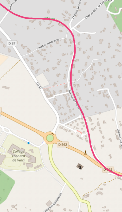
In time, the route of the line crossed the D562. The crossing keeper’s cottage is shown here. Once the road was crossed the line diverged from the D562 along the Avenue de Narbonne. Although some sources and maps show the route following the D562 along the south-side of Montauroux, this cannot be correct as the old Montauroux station building still stands and is acting as the main building of a campsite. The correct route is shown on the maps below. The red line on the maps shows the route followed by the line through what are now the suburbs of Montauroux, but which were farmland when the line was operational. The green area on the map is the campsite.
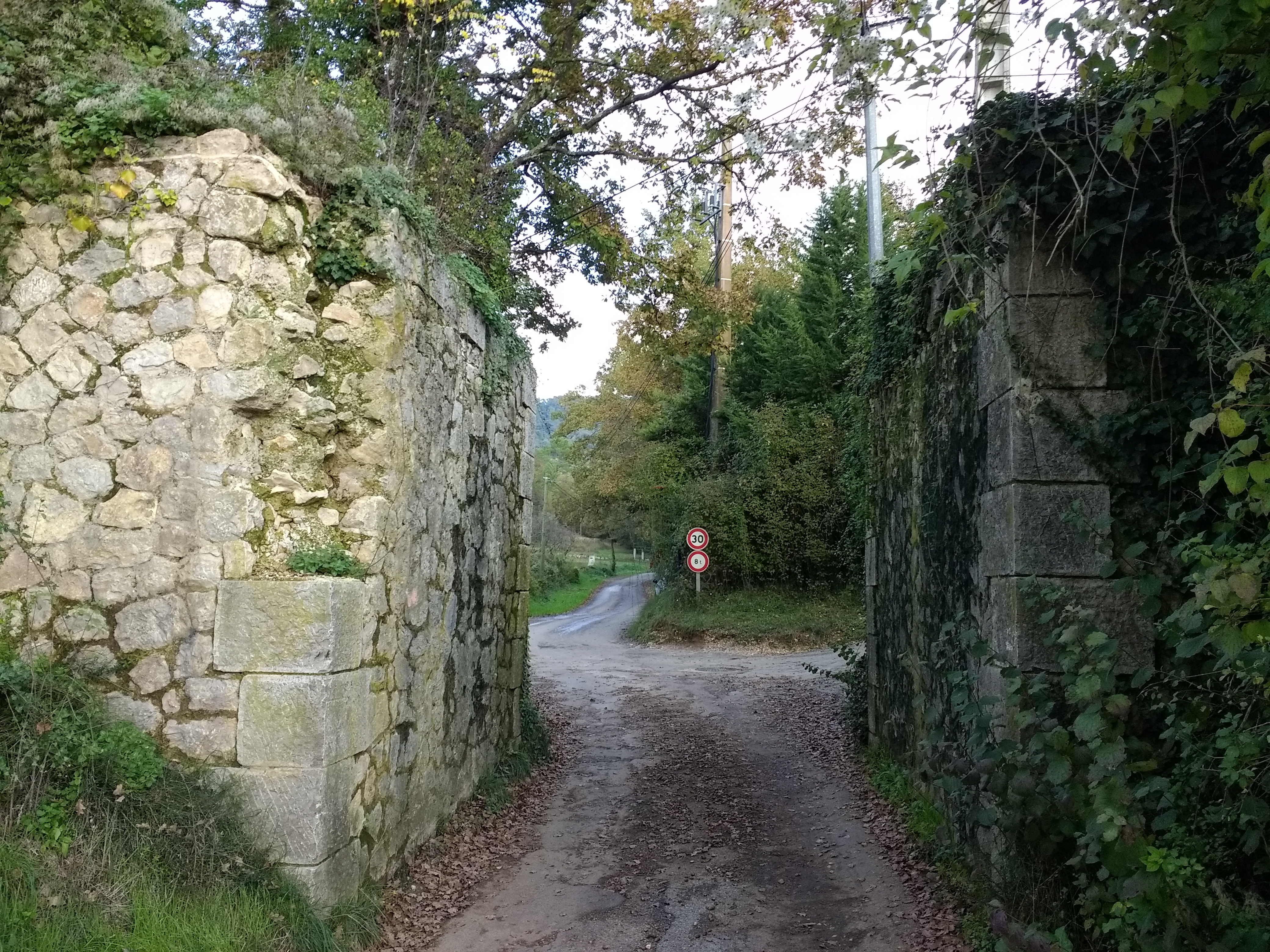
In November 2018, my wife and I had the opportunity to follow the line of the route along the D562 and the Avenue de Narbonne by car. In doing so we were able to establish beyond doubt that the railway line ran along the route of the Avenue de Narbonne. The photographs immediate below show the remnants of the abutments of a small accommodation bridge carrying the line over a small local road.
 We also enjoyed a visit to Montauroux and were able to appreciate just why the station was so far from the village. Montauroux sits many metres above the valley floor and is a delightful perched village.
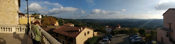 The view into the valley from Monauroux village square.

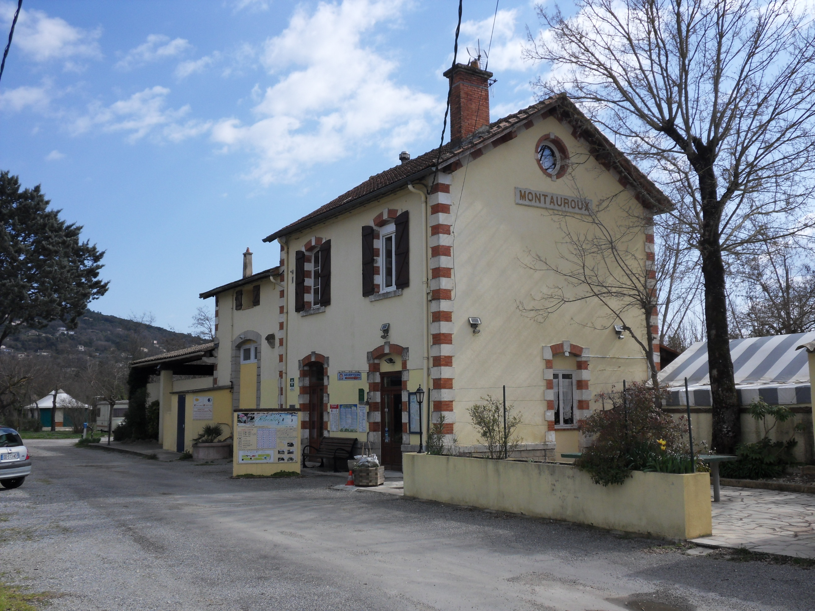
The station building is shown from a couple of different angles below the postcard .


Beyond the station, the line continued in a Westerly direction and has to be carefully picked out on maps. On the map below the identifiable route is again in red with the marker placed at the next station, that of Callian. Montauroux Station is on the red line in the bottom right of the map.. The route follows a series of roads and green lanes and crosses inaccessible private land as well. Roads which are on the alignment include the Impasse de La Gare in Montauroux and the Chemin de Gimbrette. The route then can be seen on the north side of the Chemin Crottons and Callian Station can be picked out in the top left corner of the second plan view of second satellite image below.


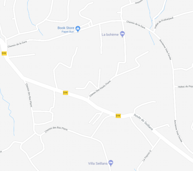
West of Callian Station the line ran just North of the present Chemin de la Fontaine and then alongbChemin de Beauregard (D256) to rejoin the D562 for a short distance and then the modern D19 (Rue Tassy, Tourrettes, Var, then Rue Guiandonne, then Route De l’Aerodrome, then Avenue Saint-Christophe). The route of the railway leaves the side of the D19 at a building which is called Le Bar de Gare to follow the Ancienne Voie Ferree alongside the old station building in Fayence.

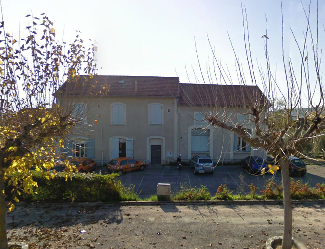


Beyond the station the line follows the modern road Le Pavillion which becomes Le Pont, then Le Serre, then Le Fraisse, then Cauvet, then Castellaras (Ancienne Voie Ferree) and Adrech du Peyron. After this the route rejoins the D19, running immediately alongside it to the North along the continuance of Adrech du Peyron, close to the hamlet of Le Peyron.


Ardech du Peyron becomes Hubac du Peyron as the route of the line turns gradually away to the north of the D19 and then curves round in a large arc from roughly north to approximately west southwest and approaching Seillans Station and the end of this section of our journey.


Pingback: Ligne de Central Var – Postcript – A short walk near Seillans (Chemins de Fer de Provence 28a) | Roger Farnworth
Thank you for creating this incredible resource! My family and I have recently been on a discovery of the Central Var Line. I really struggled finding the Callian train station, but you laid it out perfectly! Regards. ( I made a video about it which may amuse you! https://youtu.be/wImZ_q-7prk?si=Ecr5d0HbkQM_a029 )
You are welcome, gingoinc.