
This article covers the Western length of the Glenties Branch of the Co. Donegal Railways. The Eastern length of the branch is covered in the first article in this series about the Co. Donegal Railways which can be found at:
Co. Donegal Railways, Ireland – Part 1 – The Glenties Branch – Stranorlar to Ballinamore

An extract from a larger picture (Scanned slide) (c) G Sludge (Attribution-ShareAlike 2.0 Generic (CC BY-SA 2.0)). [2]
We return to Ballinamore station to catch the next train looking forward to visiting the next station on the line at Fintown!
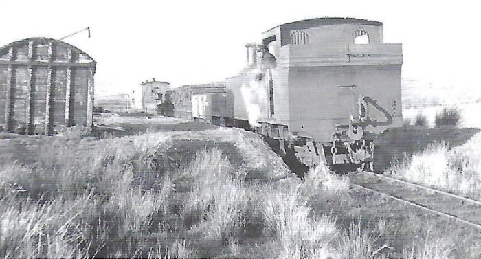
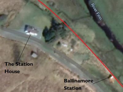
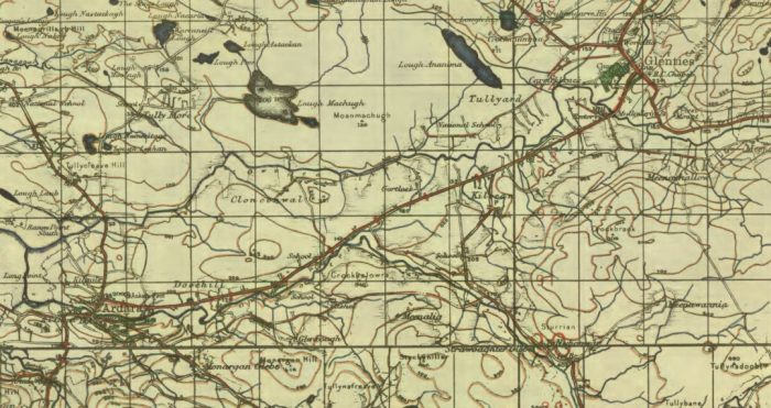
A photograph of the ‘lifting’ train at Ballinamore. After closure the line was ‘lifted’ and removed leaving in most places no more than the formation. [32]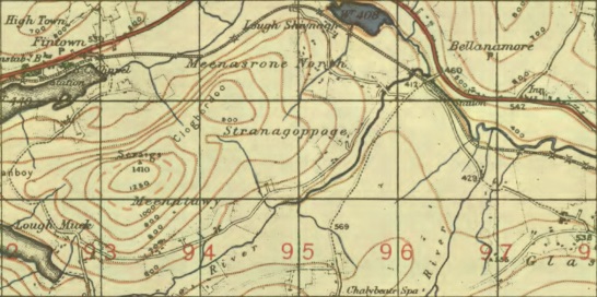 An extract from the GSGS Map from the early 1940s showing the route of the Glenties Branch from Ballinamore to Fintown. Ballinamore Station is in the second map sqaure form the right at the top of the image, to the southeast of the bridge over the River Finn. [1]
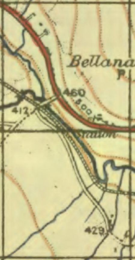
A larger scale view of the station location at Ballinamore. [1]
On the adjacent map extract the location of the station house can be picked out as a very slight bump on the side of the road just Northwest of the Station.
The Station House has survived and is now a holiday rental property which in 2020 has recently been refurbished.
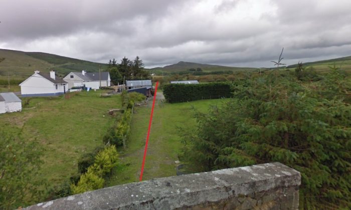
The first picture below shows the Station House in 2020 with the old railway formation marked in red behind it. The second image is the Google Earth satellite image of the site.
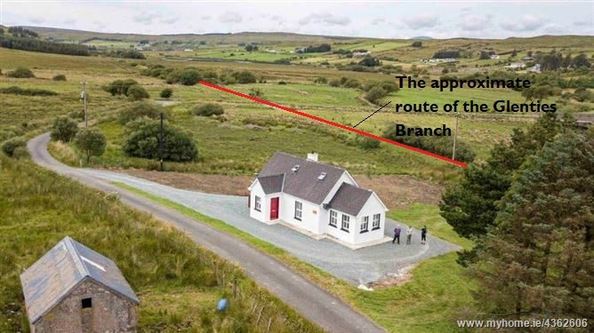
The Station House at Ballinamore. [4]
Ballinamore Station House ( Google Maps).
The line continued Northwest across the road from the station to the R252 and Bellanamore Village. The image below shows that the crossing was at grade. Traffic flows were so small that it is very likely that this was an un-gated crossing.
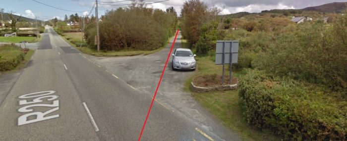
The next satellite image shows the line heading way towards Fintown. It is followed by a Google Streetview image of the line leaving the level-crossing behind. Earthworks were minimal and its embankment was no more than a couple of feet above the surrounding land!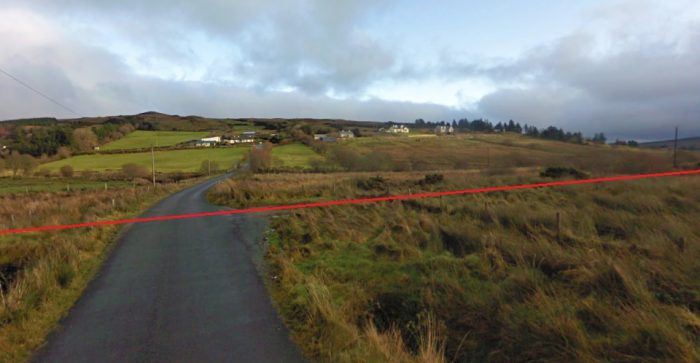 Bellanamore Village from the South West looking across the line of the Glenties Branch which is marked in red (Google Streetview).
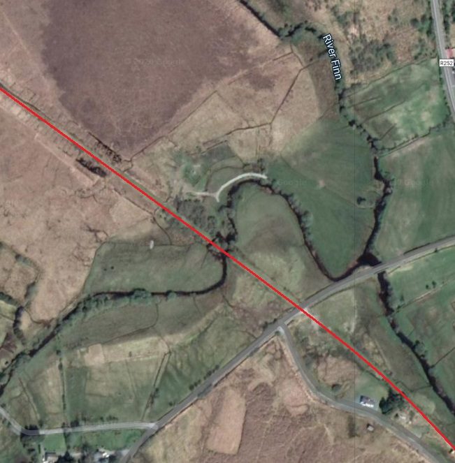 The Glenties Branch heading Northwest from Ballinamore Station Halt (Google Maps).
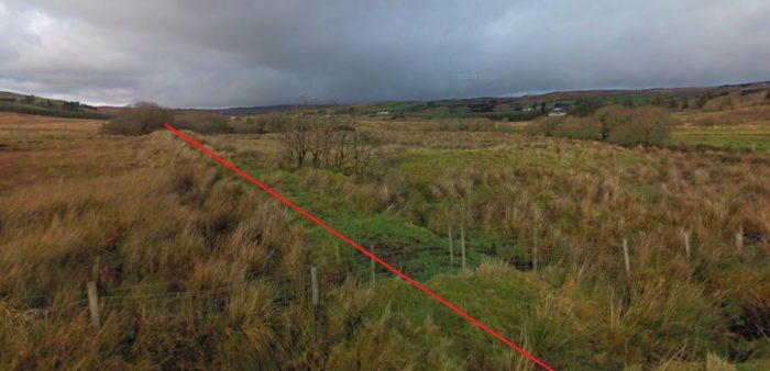 The line northwest of the level-crossing was on a very shallow embankment which lifted it above the boggy ground (Google Streetview). The trees in the distance mark the location of the Stranagoppoge River.
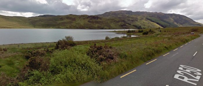
Road (R250), Rail (The Glenties Branch) and Lough Finn’s North shore rune roughly parallel (Google Streetview).
Just a short distance further along the line, trains crossed the Stranagoppoge River, a tributary of the River Finn is perhaps one of the lesser known of its tributaries and is part of the Cloghan Lodge Estate. I have been unable to ascertain what the structure of the bridge was like. The line then passed close to the South West shore of Lough Sluvnagh before beginning to turn towards the West, heading for Fintown.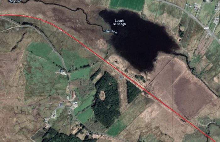 The Glenties Branch as it passed Lough Sluvnagh (Google Maps).
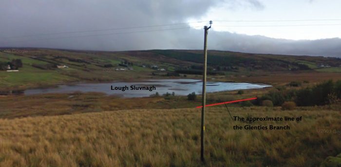 Lough Sluvnagh and the route of the old railway (Google Streetview). This photograph is taken from the road South of the line.
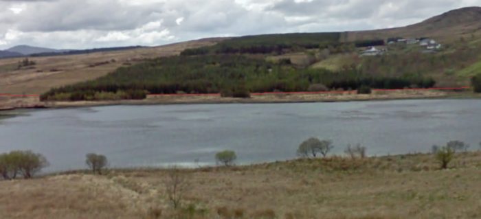 The view across Lough Sluvnagh from the R252 showing the line of the old railway (Google Streetview). I have shown the line of the railway using a very narrow red line.
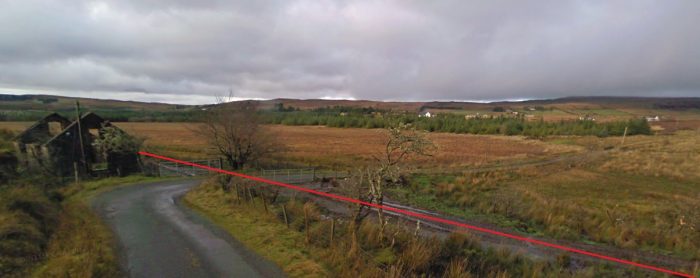 The location of the next road crossing to the West of Lough Sluvnagh (Google Streetview).
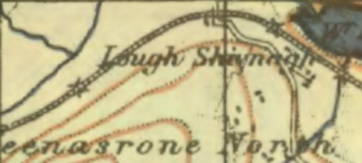 The Glenties Line to the West of Lough Sluvnagh shown on the GSGS Map of the early 1940s. The crossing in the image above is shown just to the left of the grid line on the map. [5]
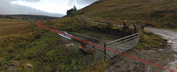 Looking back along the old Glenties Branch towards Lough Sluvnagh from the road crossing (Google Streetview).
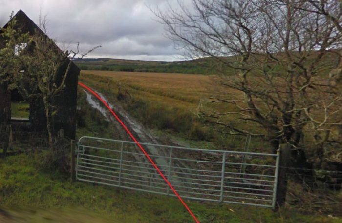 Looking West along the line of the Branch. The shell of a building which was probably the crossing-keepers cottage is in the left foreground (Google Streetview).
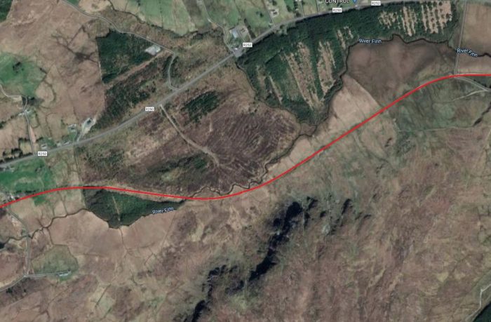 A satellite image of the approach to Fintown and its Lake (Google Maps).
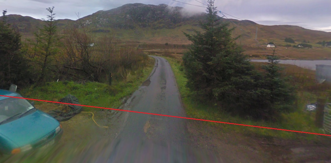 The road-crossing on the approach to Fintown. It appears at the extreme left of the satelite image above. This view is taken facing South across what was the old crossing (Google Streetview).
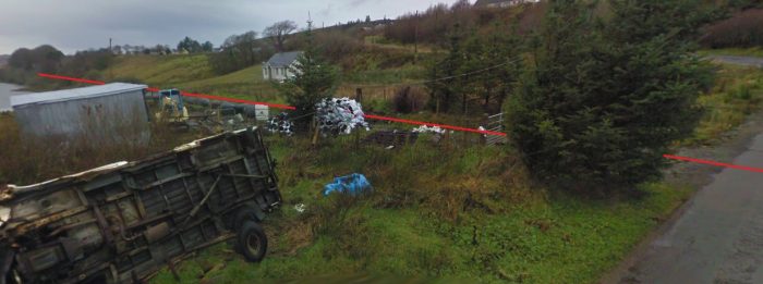 The line ahead towards Fintown. This view looks from the road to the south of the crossing in a westerly direction (Google Streetview).
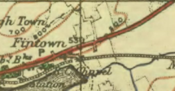 A short distance further West the line approached Fintown and its station. This extract from the GSGS Maps of the early 1940s shows both the Lake and the town with the station sitting alongside the lake. [6]
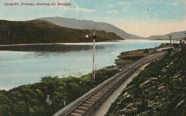 The Approach to Fintown Station. [25]
 The Fintown Railway. [7]
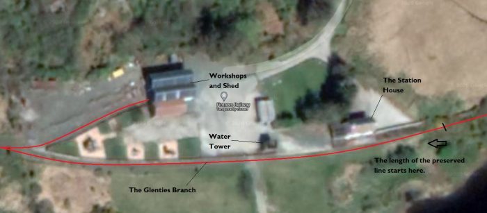 Fintown Station (Google Maps).
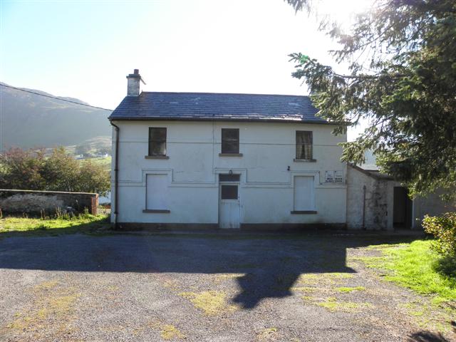 Fintown Railway Station House (c) Kenneth Allen (CC BY-SA 2.0). [13]
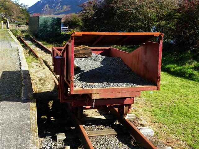 The Eastern end of the preserved Fintown Railway in 2010 (c) Kenneth Allen (CC BY-SA 2.0) [8]
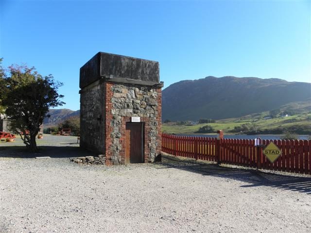 The Water Tower at Fintown Station in 2010, a reminder that once the station was served by steam locomotive power (c) Kenneth Allen (CC BY-SA 2.0). [9]
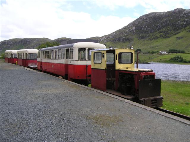 Fintown Station in 2007 (c) Kenneth Allen (CC BY-SA 2.0) [10]
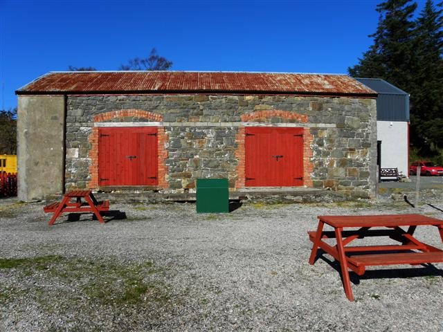 The old Goods shed and workshop at Fintown Station in 2010, viewed from the platform (c) Kenneth Allen (CC BY-SA 2.0). [11]
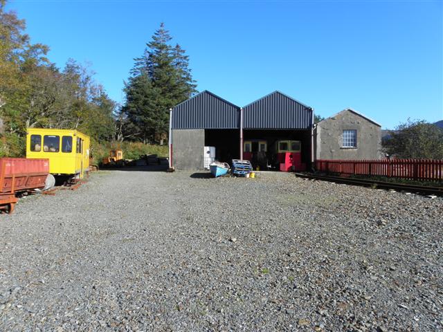 Another view of the workshops at Fintown Station (c) Kenneth Allen (CC BY-SA 2.0). [12]
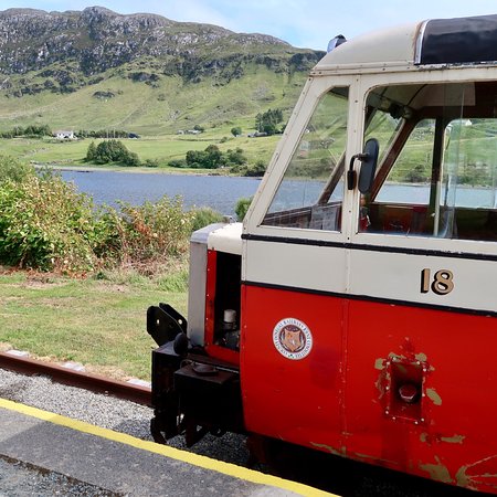 Railcar No. 18 at Fintown Station Platform. [14]
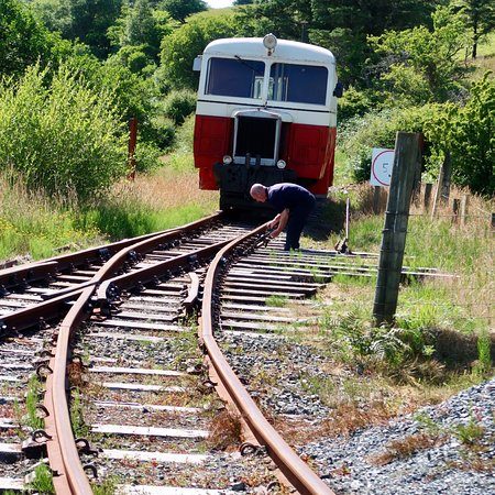 Fintown Railway’s Railcar approaches the station throat at Fintown Station, heading East into the station [14]
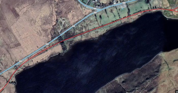 The old line followed the Northern shore of the Lough along its full length. The preserved line follows the same route (Google Maps)
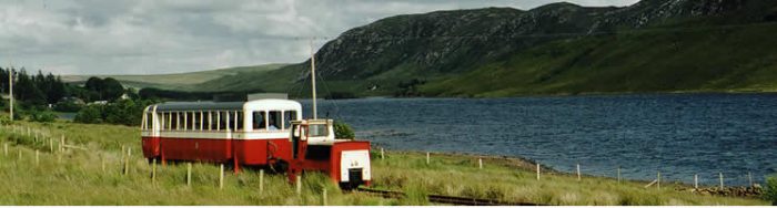 The journey along the lakeside begins. [15]
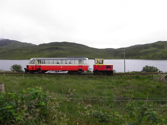 The ‘modern’ service runs between the road and Lough Finn along the full length of the Lough. This picture was taken in 2012 (c) Kenneth Allen (CC BY-SA 2.0). [16]A view of the line towards the Western end of Lough Finn taken from the R250. Just visible in this photograph is the style which appears in the following photograph (Google Streetview).
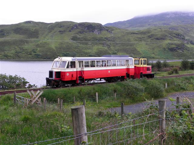 Railcar No. 18 again in 2012 (c) Kenneth Allen (CC BY-SA 2.0). [17]
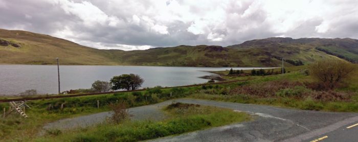 Another view of the line from the R250. The style is now in the left foreground (Google Streetview).
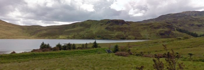 The R250 and the railway run parallel for quitea while alongside the Lough (Google Streetview).
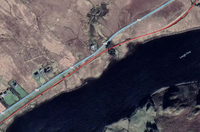 Road and Rail closely followed the Lough shore (Google Maps)
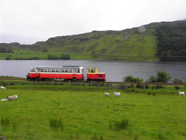 Over halfway along the Lough now, also in 2012 (c) Kenneth Allen (CC BY-SA 2.0). [18]
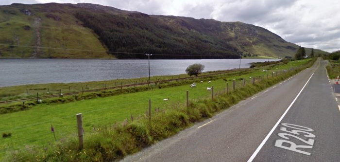 Another view of the line and the Lough from the R250 (Google Streetview).
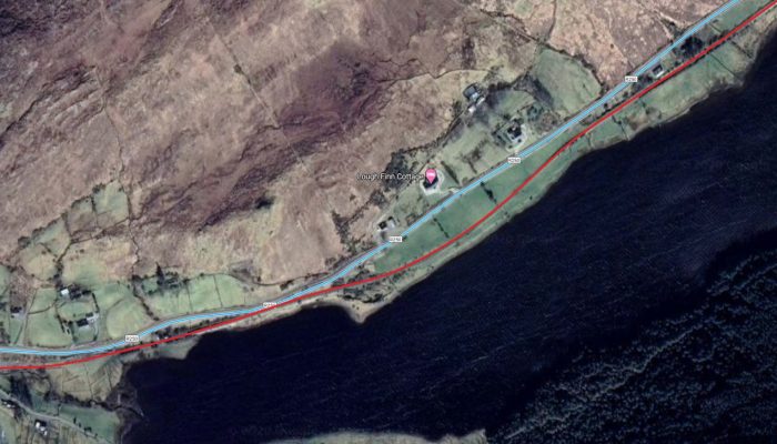 The end of the Lough approaches (Google Maps).
 With the West end of the Lough in view the R250, the railway and the Lough seem to get compressed together (Google Streetview).
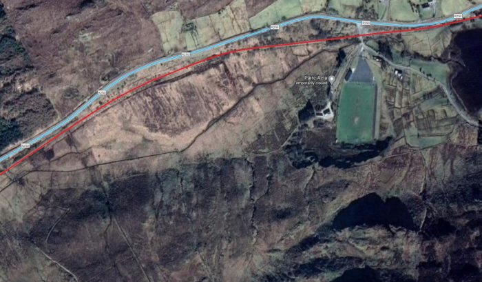 The Glenties Branch West-Southwest of Lough Finn (Google Maps).
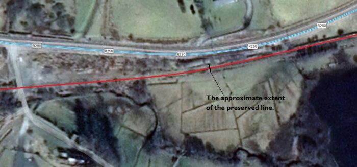 A larger scale extract from the above satellite image showing the end of the Lough and the approximate extent of the Fintown Railway in 2020 (Google Maps).
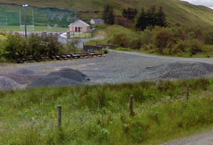 This view is taken a little to the West of the end of the Lough and the end of the Fintown Railway. The side road visible here is the road to the right-hand side of the satellite image aboveOne the satellite image above. It is taken looking South from the R250 across the route of the old line towards a modern Multi-Use Games Area. The route of the line was in cutting and the parapets of a bridge remain into the 21st century. A couple of track panels have been stored here. (Google Streetview).
West of Lough Finn, the Glenties Branch continued in a Southwesterly direction to wards Shallogan. The route of the old line is shown on the next extract from the GSGS Maps of the early 1940s which is reproduced below. The whole of the Fintown to Sahallogan length of the line is shown on the first image below. 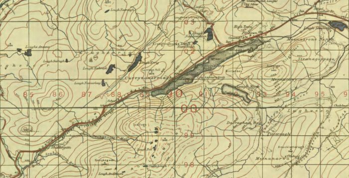 The Glenties Branch between Fintown and Shallogan. [19]
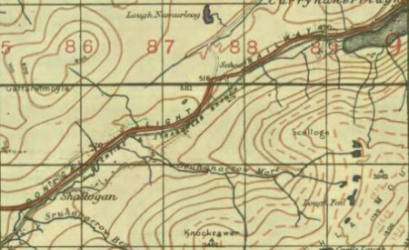 The second of the two map extracts above shows the length of the line from the West end of Lough Finn to Shallogan. [20] As can be seen the line remained on the South side of the R250 along this full length. Along the length from a point a few hundred metes West of Lough Finn to Shallogan the line was on a downward grade. As the next image shows, the line was raised on a very shallow embankment in places. At other places there were shallow cuttings. Both cutting and embankments were no more than a few feet in depth or height.. and ran close to the road for much of the distance.
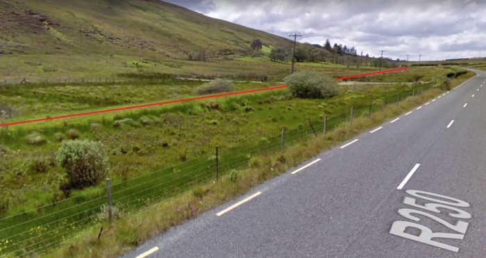 The Glenties Branch Southwest of Lough Finn (Google Streetview).
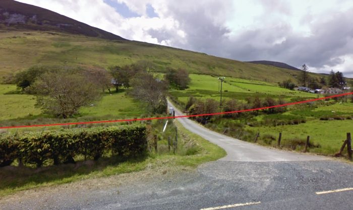 The Glenties Branch a little further Southwest (Google Streetview).
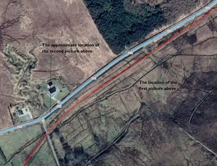 The length of the Glenties Branch covered in the pictures above (Google Maps).
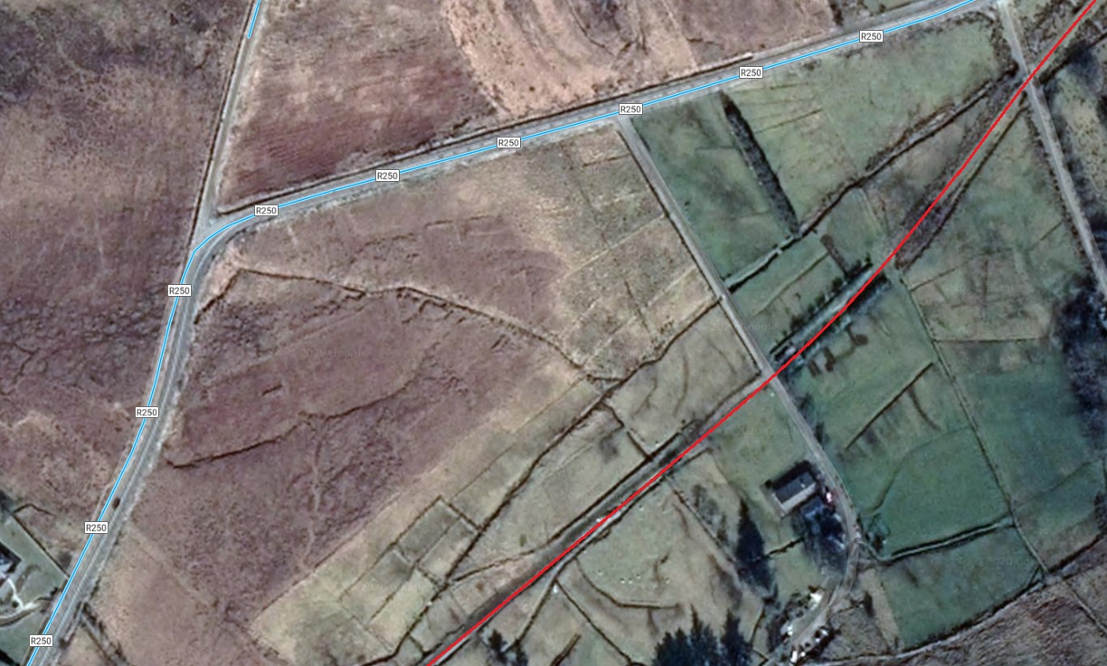 The Glenties Branch continues in a Southwesterly direction (Google Maps)
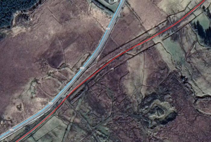 In a very short distance the R250 rejoins the route of the old railway, running just to the North (Google Maps).
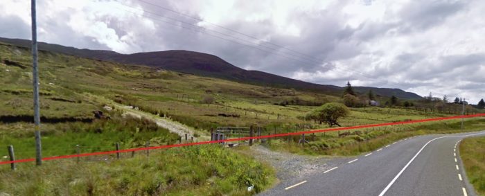 The Glenties Branch ran on a shallow embankment as indicated by the red line above (Google Streetview).
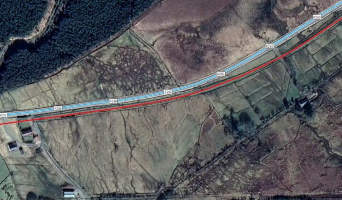 At times road and rail were immediately next to each other (Google Maps).
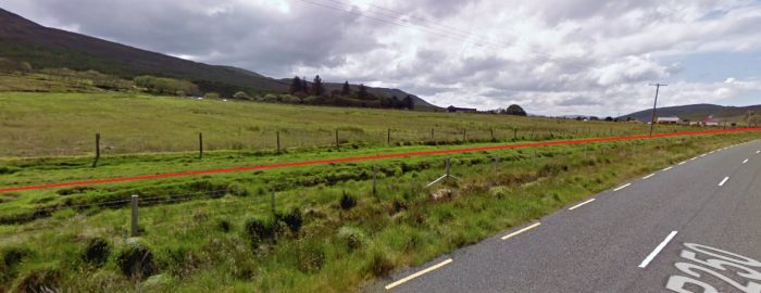 The fence-posts delineating the line of the railway still remain in places (Google Streetview).
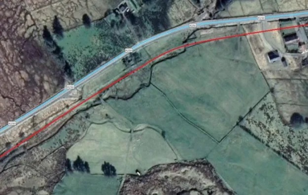 The final approaches to the hamlet of Shallogan (Google Maps).
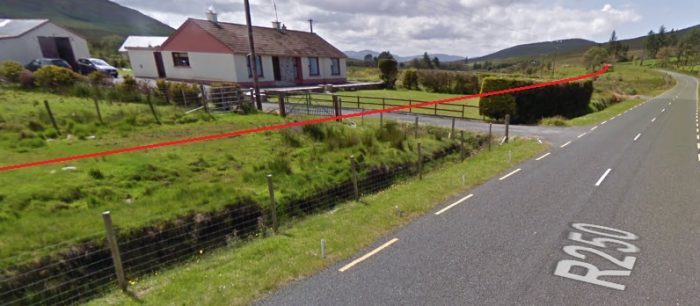 The first property in Shallogan viewed from the R250 (Google Streetview).
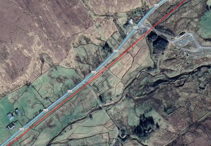 Shallogan: there was a halt here which was the last formal stop before Glenties. That did not mean that you could not wave down the railcar passing you and get one anywhere along the line (Google Maps).
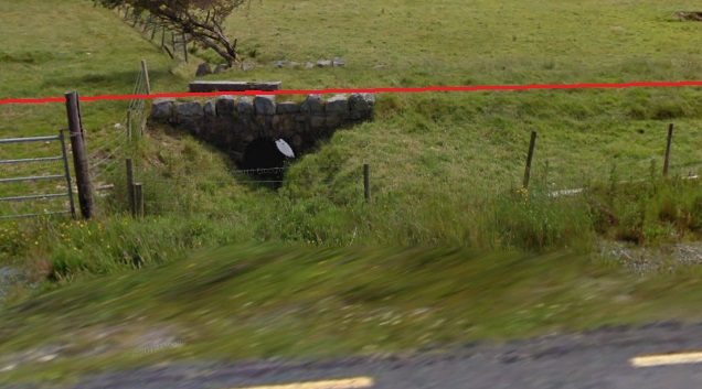 Railway Culvert at Shallogan (Googl;e Streetview).
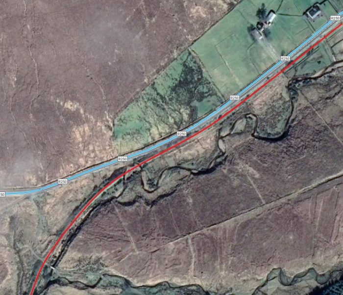 South West of Shallogan road and rail separated once again (Google Maps).
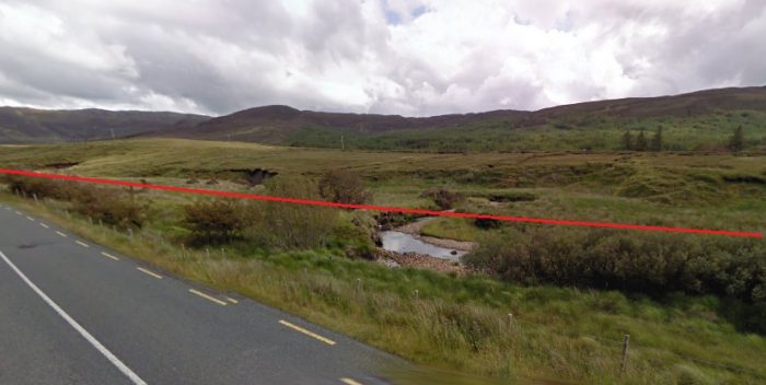 Looking East back along the line of the branch at the point where the line began to diverge from the route of the R250 and where the line crossed the River Shallogan twice in very short succession (Google Streetview).
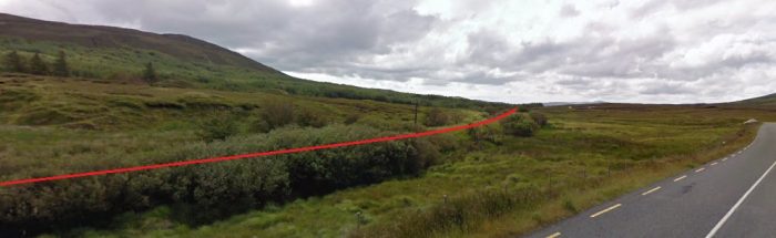 Looking Southwest from the same location. The old line can be seen curving away to the Southwest while the R250 urn further to the West (Google Streetview).
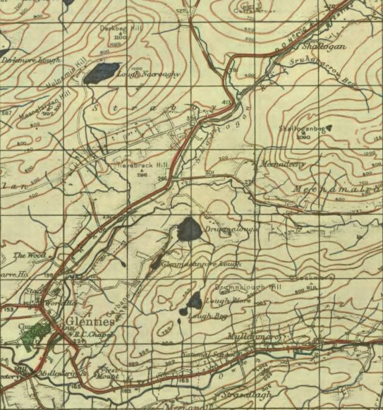 The GSGS Map of the length of the line between Shallogan and Glenties
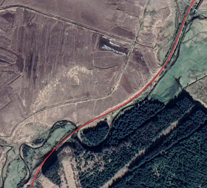 The route of the Glenties Branch continues Southwest and will soon be met once again by the R250 (Google Maps). Just above the wooded area the first of two remaining bridges over the River Shallogan can be seen on the satellite image.
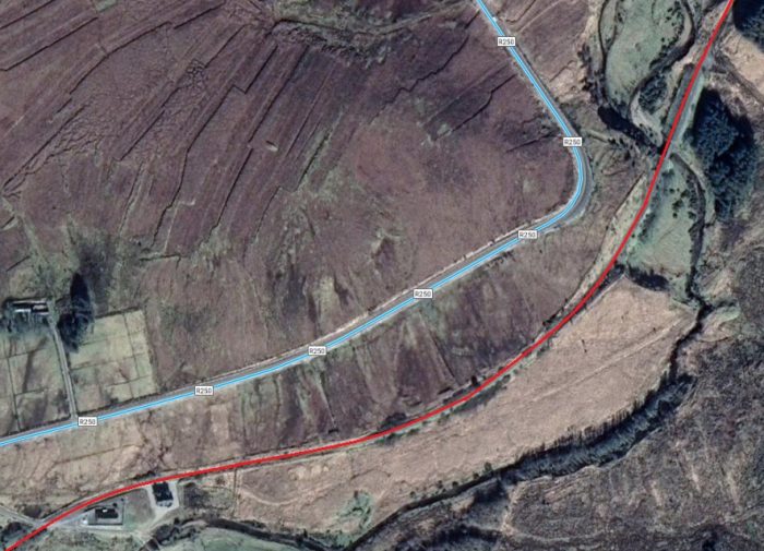 The second of these two bridges is visible in the top-right of this next satellite image (Google Maps).
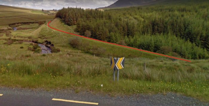 Looking back to the Northeast along the old railway line. At this locaTion the formation is most clearly visible with significant cutting and embankments (Google Streetview).
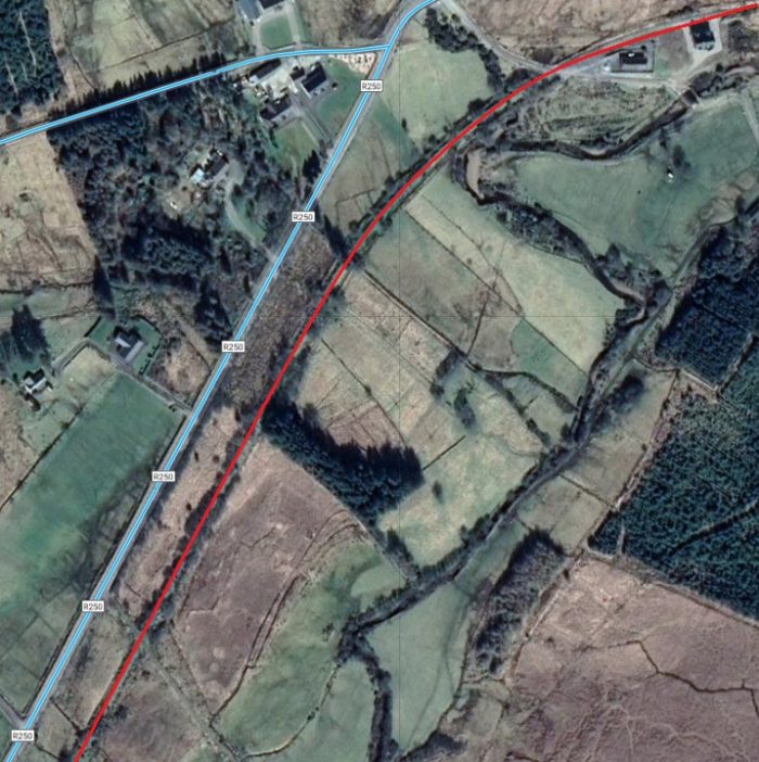 The line continues towards Glenties (Google Maps). Along this length the formation of the old railway is hidden from the road by bushes and scrubland.
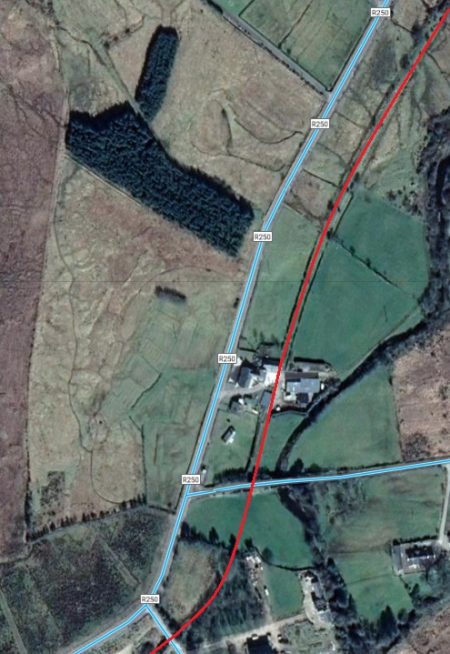
We are now on the final approach to Glenties and the old railway was travelling South-Southwest alongside the R250. The adjacent satellite image shows its course cut by a farmyard and then a road. The road crossed the line of the railway on a bridge. The first image below shows the view Northeast from the bridge looking through the farmyard back towards Fintown and Shallogan.
The second image looks forward towards Glenties. It is less easy to establish the route of the railway in this image, but it runs to the western edge of the copse of trees.
A view Northeast along the old railway formation from a road overbridge (Google Streetview).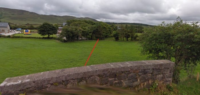 Looking towards Glenties (Google Streetview).
Flickr has two images of this bridge taken from the fields either side of the road. [28][29]
After this the old line began to curve round to the towards the Southwest again. It encountered another road which is crossed at ground level.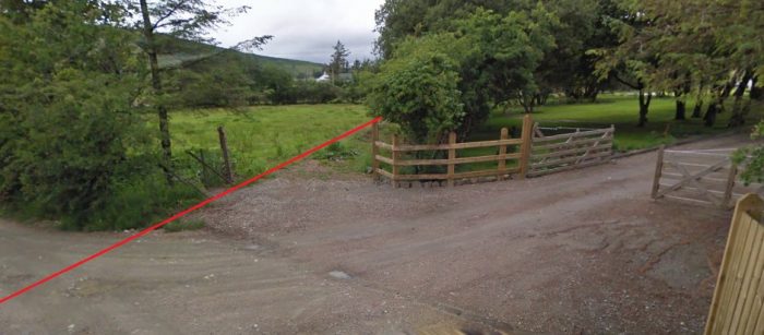 Looking North by Northeast along the old line towards Shallogan (Google Streetview).
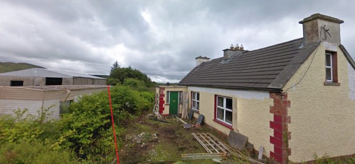 Looking towards Glenties at the road-crossing. The crossing-keepers house is still standing (Google Streetview).
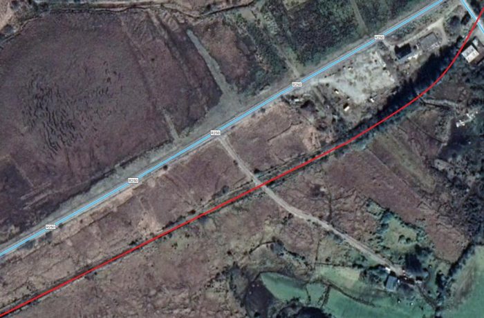 On towards Glenties (Google Maps). The formation of the old line is lost in scrub land to the South side of the R250 and cannot easily be picked out on Google Streetview.
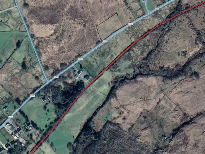 The outskirts of Glenties (Google Maps).
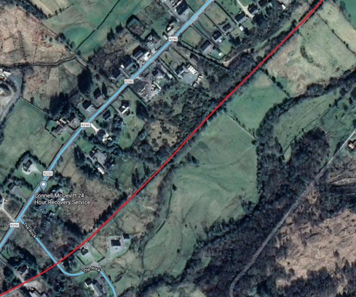 The final few hundred metres to the railway station are covered on this satellite image and the next (Google Maps).
Level crossing with the R250 on the approach to Glenties Station. This view looks Northeast along the line (Google Streetview). Glenties Station is just ahead beyond the tree-line. This view is taken at the level-crossing location on the R250.
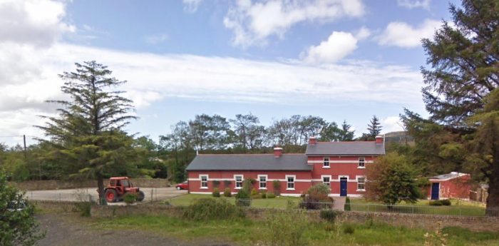 Glenties Railway Station Building viewed from the R250 (Google Streetview).
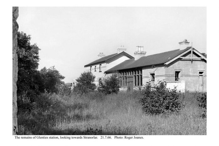
Glenties Railway Station in 1966, (c) Roger Joanes (CC BY-NC-ND 2.0). [26]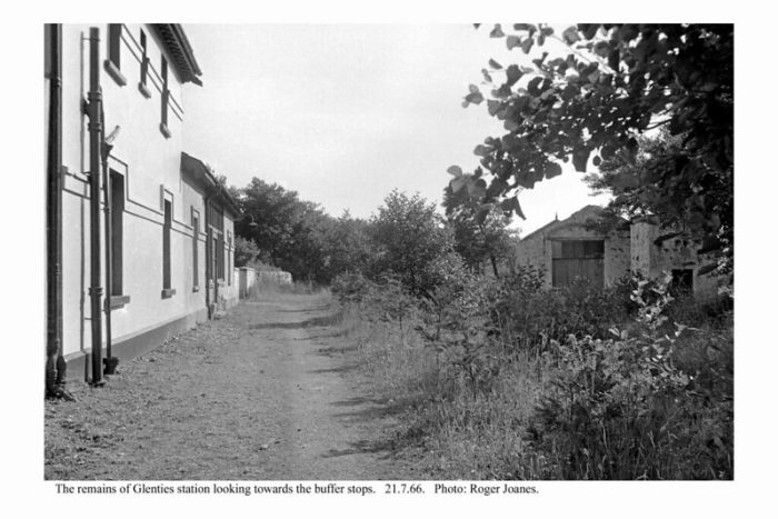 Glenties Railway Station looking towards the buffer-stops in 1966, (c) Roger Joanes (CC BY-NC-ND 2.0). [27]
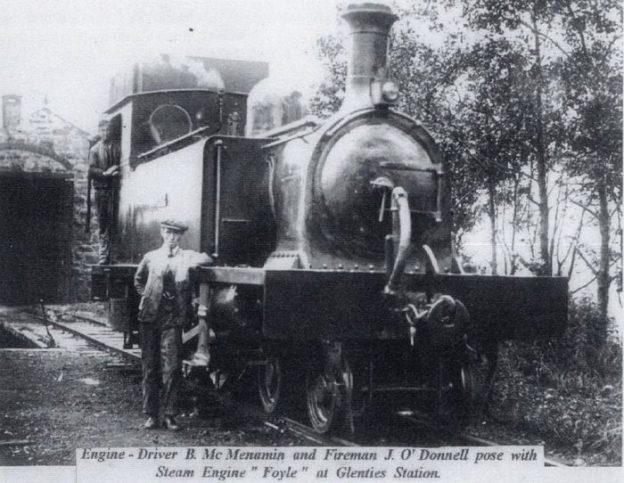
 Locomotive “Foyle” at Glenties Station with Engine Driver B. McMenamin and Fireman J. O’Donnell. Photograph “From the Wilds of Donegal”, used with permission from the Donegal Railway Heritage Centre and found on their Facebook page. [31]
 A very grainy image showing one of the Co. Donegal Railcars on shed at Glenties, with thanks to Kerry Doherty. [32]
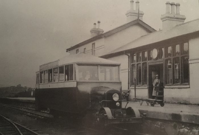 Co. Donegal Railways Railcar 6 at Glenties, with thanks to Kerry Doherty. [32]
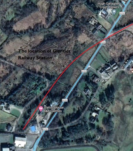
The location of Glenties railway Station. The station building is a B&B in the 21st century (Google Maps).
The adjacent satellite image brings our journey along the Glenties Branch to an end.
There are a few pictures of the station to follow below and a note too about an attempt to take the line on the Ardara.
The Fintown Railway has ambitions to bring its preservation line along the old trackbed to Glenties. I imagine that the events of 2020 may well have made that a more remote possibility than it was.
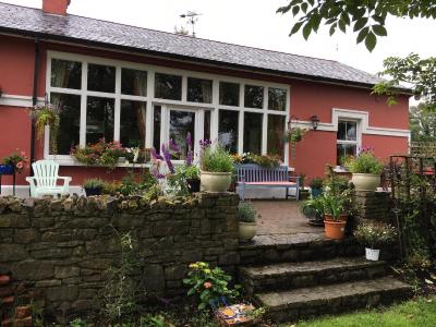
Glenties Railway Station Building in the 21st century. The property is now a B&B. This view is from the track-side of the station building. [21]
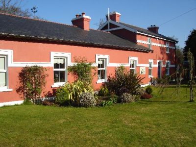
Glenties Station Building in the 21st century. [22]

A view along the line of the platform in 2020. [22]
There was once a plan to extend the line. It was a sensible plan as it would have taken the line close to the coast and to a basic harbour. It might have given the line a new lease of life. But it failed to get off the ground. [23: p38-41][24]
Ardara was 6 miles West of Glenties and had a small population of around 500 people. There had been government funding for a number of railway extensions around the turn of the 20th century. These included extensions to Burtonport and to Cardonagh. The people of Ardara felt encouraged to try to gain their own railway extension.
A vpetition was sent to the directors of the railway in 1903, which was acknowledge but then left on a shelf. After the 1906 takeover of the Company, Ardara renewed their pressure for their own extension. The reaction was lukewarm. The directors did say that if funding could be found through Parliament they would consent to run the line. After some vacillation and some minor successes in seeking funding. A grand total of £2,000 was raised!
Henry Forbes reviewed the possible extension and suggested that it might be built for around £5,000 per mile – around £30,000 overall. This meant that the promoters would need to raise around £28,000 which was far beyond their means.
Glenties to Ardara on the GSGS Map of the early 1940s. []
References
- https://maps.nls.uk/geo/explore/#zoom=14&lat=54.86691&lon=-8.06504&layers=14&b=1, accessed on 29th May 2020.
- https://www.flickr.com/photos/sludgeulper/3611611930, accessed on 29th May 2020.
- https://www.myhome.ie/holiday-homes/brochure/1840-station-cottage-ballinamore-co-donegal/4362606, accessed on 13th June 2020.
- https://www.myhome.ie/holiday-homes/brochure/1840-station-cottage-ballinamore-co-donegal/4362606, accessed on 12th June 2020.
- https://maps.nls.uk/geo/explore/#zoom=16&lat=54.87258&lon=-8.08333&layers=14&b=1, accessed on 29th May 2020.
- https://maps.nls.uk/geo/explore/#zoom=16&lat=54.87233&lon=-8.10876&layers=14&b=1, accessed on 29th May 2020.
- https://www.openstreetmap.org/#map=14/54.8556/-8.1584, accessed on 14th June 2020.
- https://www.geograph.ie/photo/2108929, accessed on 14th June 2020.
- https://www.geograph.ie/photo/2108924, accessed on 14th June 2020.
- https://www.geograph.ie/photo/500483, accessed on 14th June 2020.
- https://www.geograph.ie/photo/2108932, accessed on 14th June 2020.
- https://www.geograph.ie/photo/2108939, accessed on 14th June 2020.
- https://www.geograph.ie/photo/2108930, accessed on 14th June 2020.
- https://www.tripadvisor.co.za/LocationPhotoDirectLink-g315868-d2534086-i328548871-Fintown_Railway-Dungloe_County_Donegal.html, accessed on 14th June 2020.
- https://www.donegal.ie/venue-and-organization/fintown-railway-mhuc-dhubh, accessed on 14th June 2020.
- https://www.geograph.ie/photo/3024750, accessed on 14th June 2020.
- https://www.geograph.ie/photo/3024752, accessed on 14th June 2020.
- https://www.geograph.ie/photo/3025114, accessed on 14th June 2020.
- https://maps.nls.uk/geo/explore/#zoom=13&lat=54.85843&lon=-8.17073&layers=14&b=1, accessed on 29th May 2020.
- https://maps.nls.uk/geo/explore/#zoom=14&lat=54.84582&lon=-8.18676&layers=14&b=1, accessed on 15th June 2020.
- https://www.chambres-hotes.fr/chambres-hotes_station-house-glenties_glenties_h3551007_en.htm, accessed on 21st June 2020.
- https://www.tripadvisor.co.uk/Hotel_Review-g551498-d1123597-Reviews-Station_House_B_B-Glenties_County_Donegal.html, accessed on 22nd June 2020.
- Edward M Patterson (original author), Joe Begley & Steve Flanders (authors of additional material in the Revised Edition); The County Donegal Railways; Colourpoint Books, Newtownards, Co. Down 2014. As noted in my first article about the Co. Donegal Railways this was to have been my holiday reading while walking different parts of the network, but 2020 has been a strange year!
- https://www.cotyroneireland.com/misc/forbes.html, accessed on 22nd June 2020.
- https://picclick.co.uk/Ireland-Loughfin-Fintown-Glenties-CoDonegal-Postcard-392799311859.html, accessed on 22nd June 2020.
- https://www.flickr.com/photos/110691393@N07/14073602795/in/photolist-nrCTN4-nrmxoe-2fLCaHg-BreD5t-hP4yK, accessed on 22nd June 2020.
- https://www.flickr.com/photos/110691393@N07/14070412341/in/photolist-nrCTN4-nrmxoe-2fLCaHg-BreD5t-hP4yK, accessed on 22nd June 2020.
- https://www.flickr.com/photos/salmix_ie/45425127672/in/photolist-9vw2zP-98hSXt-BreD5t-fFRsP7-b5fzTX-b5fyxp-xAiiVm-b3Mn9e-fKj8Va-wW6FtZ-7PQzGV-aqbePh-hP4yK-2eAeb55-nrCTN4-7ACBjM-6v9spd-nrmxoe-98m2VS-oeABN1-ovSLNG-b5fxbB-b5fEZ4-b5fDBP-7yNQh2-n9rxTD-fFRsMm-2aTR4fT-NwqqjH-b5fCAV-xWUWxx-oxQDEe-2cd4DSq-9MQt9S-2aTR4tP-4A9shm-7ySAMW-oxQxyX-oxR58x-ow5Pvn-7ySB1U-dwfarN-dwfbef-oezMFE-U3xnLw-7ySBo5-7yNQw4-2iniuW4-ow5NZc-oeA2we, accessed on 22nd June 2020.
- https://www.flickr.com/photos/salmix_ie/44562616945/in/photolist-9vw2zP-98hSXt-BreD5t-fFRsP7-b5fzTX-b5fyxp-xAiiVm-b3Mn9e-fKj8Va-wW6FtZ-7PQzGV-aqbePh-hP4yK-2eAeb55-nrCTN4-7ACBjM-6v9spd-nrmxoe-98m2VS-oeABN1-ovSLNG-b5fxbB-b5fEZ4-b5fDBP-7yNQh2-n9rxTD-fFRsMm-2aTR4fT-NwqqjH-b5fCAV-xWUWxx-oxQDEe-2cd4DSq-9MQt9S-2aTR4tP-4A9shm-7ySAMW-oxQxyX-oxR58x-ow5Pvn-7ySB1U-dwfarN-dwfbef-oezMFE-U3xnLw-7ySBo5-7yNQw4-2iniuW4-ow5NZc-oeA2we, accessed on 22nd June 2020.
- https://maps.nls.uk/geo/explore/#zoom=12&lat=54.79727&lon=-8.33694&layers=14&b=1, accessed on 29th May 2020.
- https://www.facebook.com/DonegalRailwayHeritageCentre/photos/a.1230417866994452/2946661428703412/?type=3&theater, accessed on 24th June 2020.
- After completing the first version of this article I was offered three images by Kerry Doherty of Ballindrait, Co. Donegal.

Roger I am a member of the committee of the Donegal Railway Heritage Centre. Can we chat and we have spoke on Facebook? Jim
Hi Jim
I tried messaging you a few days ago. Yes, of course we can chat.
My email address is rogerfarnworth@aol.com.
Best wishes
Roger
Wonderful historical piece ,I actually grew up in the old station house in fintown ,I think we were the last occupants before it was closed up . They ( the railway committee) had great plans to use it as a coffee shop / heritage centre, but alas it it now lying in ruins
Pingback: The Donegal Railway Heritage Centre | Roger Farnworth
Very interesting I remember the people who lived in the gatehouse they were a lovely family we lived just up the road from them just above the dry arch as we called it
Thank you, Mary.