
The Line of the West Clare Railway from Corofin to Lahinch
We recommence our journey at Corofin Station with the three photos which concluded the last post about the line.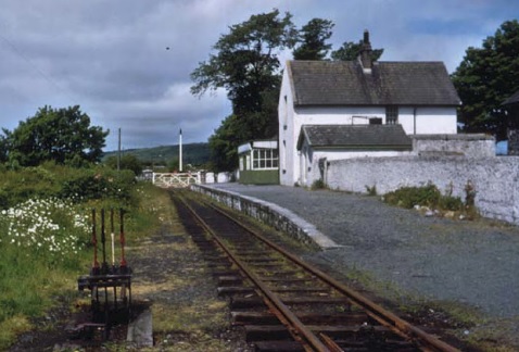
Corofin Station in June 1961, just after closure earlier inn the year, (c) IRRS. [3] Google Streetview image of Corofin Station buildings in 2009.
 Corofin Station in 2017. [2]
 Looking back from the R460 through Corofin Station towards Ennis in April 2009.
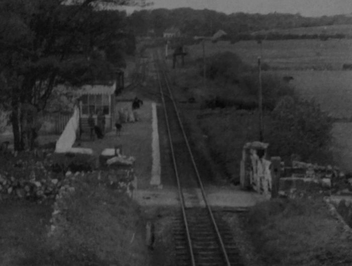 This image is taken in 1956 from a little further away form the station. Several passengers and some goods in sacks await the next train. The loop can be seen beyond the platform and careful inspection of the image shows that there is at least one wagon in the short siding beyond the station buildings. [6]
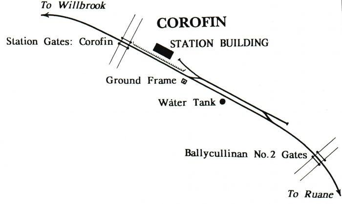 Corofin Station. [25]
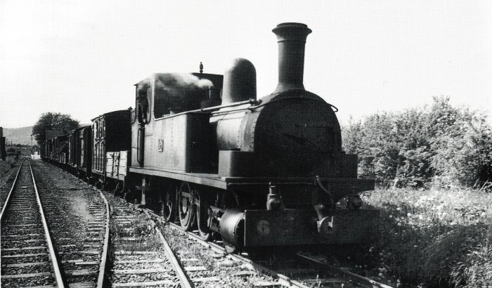 A view showing a well loaded down goods, hauled by locomotive No 6C, waiting in the loop at Corofin in 1950. Notice that because of the length of the train, being too long for the loop proper, it has had to draw forward into the head shunt. After the other train has passed, it will have to propel back, so as to gain access to the main line. The second vehicle in the train, is horse box No 28C. As none of the South Clare stations had two platform faces, all the loops on this railway were away from the platform, so that passing passenger trains could both use the single platform, (c) Kelland Collection. [20]
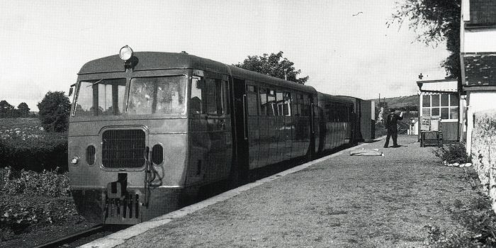 The Up morning service to Ennis unloading mail at Corofin on 20 August 1959. The train, consisting of one of the railcars, a railcar trailer and luggage van, waits to cross the 9:40 am down goods from Ennis. The loop at Corofin, dating from after the opening of the line, was at the Ennis end of the platform, (c) John Langford. [20]
Corofin Station was the first block post on the line and was 8.75 miles from from Ennis. It was provided with a platform and goods store, with a short siding and passing loop all on the up side. A water tank (145 gals.) was also situated here, and on the Willbrook side adjacent to the platform the railway crossed a public road and level crossing gates were provided. That road is now the R460 noted below. The line from Ennis was fairly level. After Corofin it rose continuously as the country became more hilly and there was a stiff ascent of 1 in 61 from the platform end, although it eased shortly to 1 in 169. [7] Looking ahead from the R460, West-Northwest along the West Clare towards Kilkee in April 2009.
 Loco. No. 6C approaches Corofin from the West with the afternoon Up goods bound for Ennis in May 1950, (c) P.B. Whitehouse. [6]
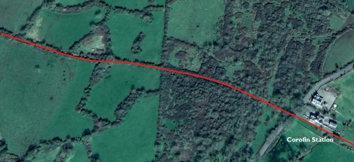 The line travelled over open country.
 Looking back East along the line from the next road-crossing.
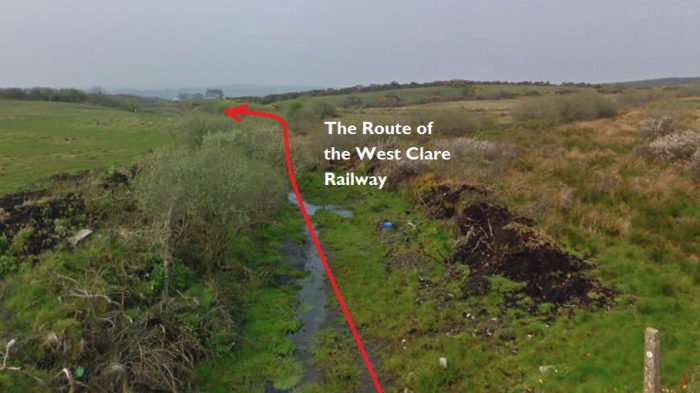
 Looking ahead towards the coast. In 2009, the crossing-keeper’s cottage was being renovated.
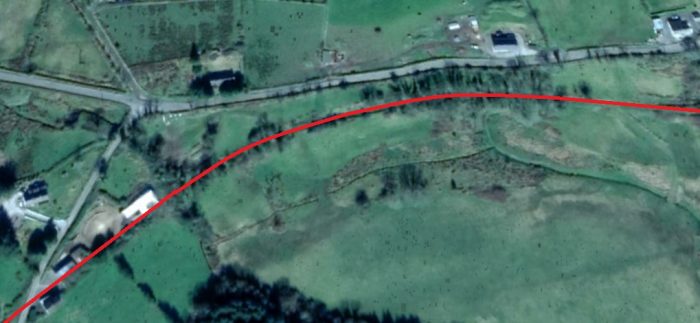
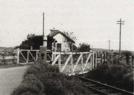
We are in the townland of Roxton now. Roxton level crossing was beyond the 9.75 mile point. A short platfrom existed on the up side but it was not used after the earlier years. Roxton bridge (No.19) was under the approach embankment to the crossing. The crossing cottage can be seen above, inhabited and, until recently, relatively unchanged from railway days, but a shed was built on the line of the old railway by the side of the cottage. Edmund Lenihan says: “Roxton crossing was once a place of more than passing interest, especially to train crews in steam days, because it marked the beginning of a 2-mile section of almost continuously rising ground. The gradient here is 1/61 and is even worse further on towards Willbrook, so it was a severe test for down trains fully laden. At least 100 pounds of steam was needed to get up here, and that this was not always forthcoming is well attested to by many stories of unscheduled stops.” [4]
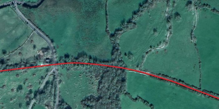
 The old line curved round to the Southwest following the valley of the River Fergus.
This view looks West along the line in 1953 and shows the approach to the Crossing at Willbrook, (c) IRRS. [4]
 Views from the at-grade crossing of the minor road in Willbrook at the bottom left of this satellite image are shown below.
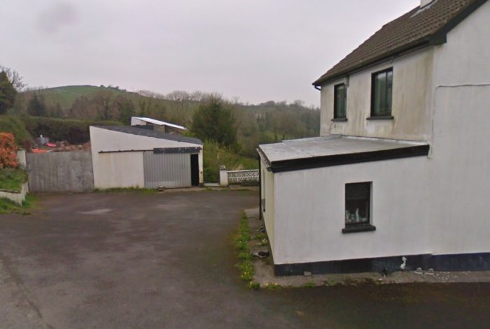 Willbrook Crossing, looking back towards Corofin.
 Willbrook Crossing, looking West towards the coast.
Near Willbrook House the Cragganbuoy River (marked as the Fergus River on Google Maps) was crossed twice (bridges No. 22 and 24). From Newton level crossing at the 10.75 mile point to Willbrook halt one mile further on, gradients at 1 in 50 to 1 in 71 had to be surmounted. An up platform was provided at Willbrook halt which opened for traffic in 1888, but was closed in 1898 It reopened in 1904 only to be closed again in 1921. It was finally reopened once again by the G.S.R. in 1929. Willbrook halt was built on a 1 in 59 gradient and it was a formidable start for heavy down trains in steam days, but the lighter diesel units had no difficulty. [7]
On the ascent from Willbrook the Craggounbuoy River was again crossed twice at Upper Willbrook (No.27) and Tullyloughan (No. 28) bridges and the sound of the waterfall here was welcome as it was just before the gradient eased at mile point 12.75. The “Square Bridge” (No. 29) carried a laneway over the line (the first over-bridge since Ennis) before Clouna Halt at mile point 14 was reached. 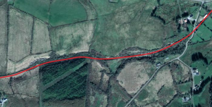 Beyond Willbrook, the railway closely followed the line of the now much reduced River Fergus. At least that is Google Earth’s name for it. Edmund Lenihan refers to it as the Cragganbuoy River. [5]
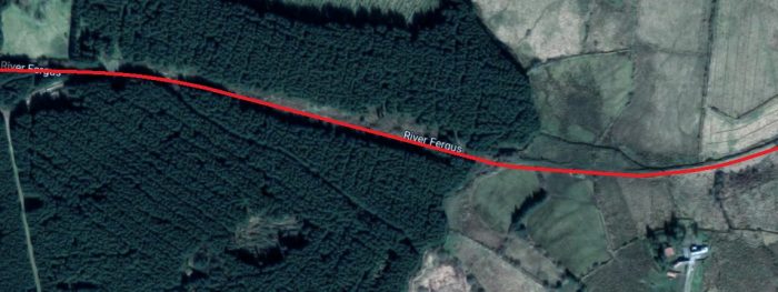
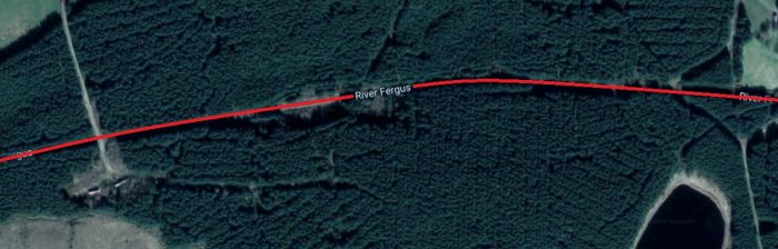
 The forested area above was only small trees at the time Edmund Lenihan walked the line in the 1980s. [5]
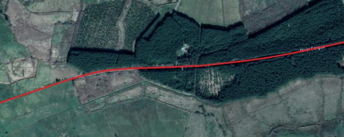
 Clouna Halt, one of two stops before Ennistymon was roughly at the centre of this satellite image. [5]
Clouna Halt was a railcar stop. It opened for traffic on 4th May 1954 and was a quarter of a mile before the summit level of 250 feet above sea-level was reached at mile point 14.5. The gradient facing a down train at this point, 1 in 58 was as severe as those facing an up train on the opposite side of the hill, 1 in 62/64/58, and, in the %miler years in particular, the 0-6-0T locomotives often stalled on this section when hauling heavy trains. [7]
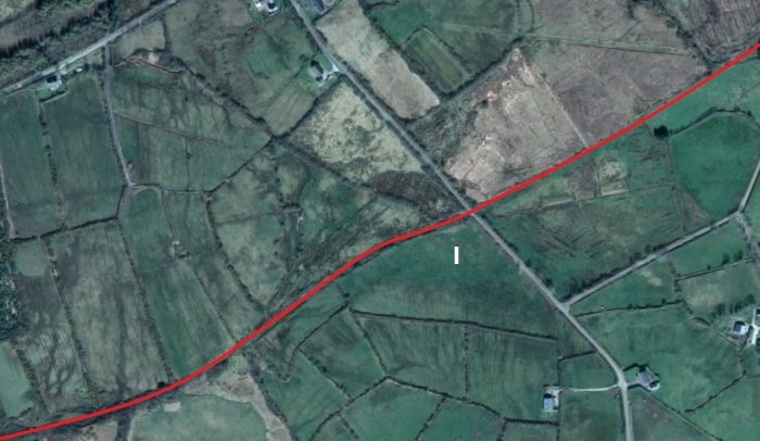 The two pictures below show the line from location ‘1’ in the satellite image above. The first looks back towards Corofin, the second forward towards Ennistymon. North of this point is Russa Cross which leads me to suspect that the Russa Bridge referred to by Edmund Lenihan must be close to this location.
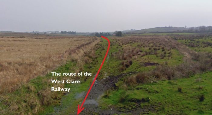
 It is difficult to believe that Russa Bridge was at this location (‘1’) as the road and the surrounding land suggest that there was an un-gated crossing at this location. There is certainly no sign of a bridge. However, on the OS Map from the 1940s a cutting can be seen either side of this road – see the image below. The location is to the South of Russa Lough at the right-hand side of the map.
 Lenihan says that the line passed through some boggy moorland with a gradual fall and under Russa Bridge (No. 31) before reaching Monreal Halt opened 14th December 1952 at the level crossing of the same name (15.75 m.p.). The most likely location for Monreal Halt is marked by the number ‘4’ below. At this point there is a track crossing the line at an oblique angle. Sadly I cannot get a photograph at this location as the track is not covered by Google Streetview.
 There is an excellent description of this length of the line from Russa Bridge through Monreal Halt and Crossing in Edmund Lenihan’s book. [8]
Lenihan talks of the fast flowing stream in the cutting at Russa Bridge of depths of over 12 inches in the winter months which could be seen easily from the bridge deck. Russa Bridge was once a a hump-backed stone arch bridge which he says that even a Morris Minor could not negotiate ‘without getting caught amidships.’ [9] The bridge had been replaced by the 1980s with what Lenihan describes as ‘not pretty, but at least it is functional’ [9]. It seems that it has now been completely removed and the cutting infilled.
Along the length of the line in the above satellite image Monreal Halt was encountered as noted above (‘4’). In the 1980s, Lenihan and his son were welcomed by the resident in the crossing cottage and treated to tea, bread and jam. She confirmed that the kitchen in which they were sitting was in the Crossing-keeper’s cottage. The location of the crossing was, she said, defined by the fact that it was at the meeting point of the townlands of Monreal and Cullenagh. [10] On the descent to Ennistymon the Corofin-Ennistymon road was crossed at Cullenagh Bridge (No. 33), which is location ‘2’ above. It is intriguing in the early 21st Century. The bridge over the road which used to carry the railway has been retained but the embankment to the West of the bridge has been removed to allow the construction of a large modern house and landscaped gardens. The two pictures below show this location and are taken from Google Streetview.
 The view from the Southwest.
 The view from the North East. The modern house can just be seen on the right of this picture. The bridge parapets and steel beams supporting the old railway decking remain in place as doe the track-bed itself over the bridge.
 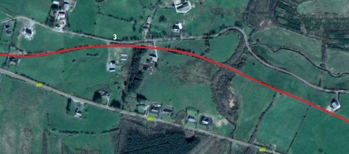 The line continues towards Ennistymon increasingly hemmed-in between roads. The picture below is taken from the single track lane at location ‘3’ and shows the route of the line close to the road.
 Two level crossings Knockdromagh No.1 and No.2 were only 100 yards apart close to the 17.5 mile post. Their location has been lost under the junction between the N85 and the Corofin to Ennistymon road.
 The old railway route crossed what is now the N85 road at a very shallow angle and followed the north bank of the meandering River Cullenagh into Ennistymon.
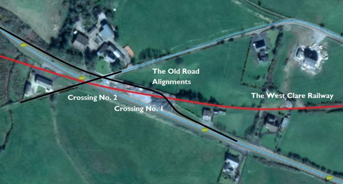 A closer view showing the old road alignments and the two rail crossings.
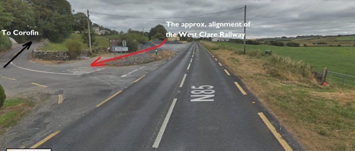 The line approaching the N85.
 Lenihan comments that by the 1980s a house had been built across the line of the railway close to the N85 and the location of Knockdrummagh No. 1 level-crossing. However, he does provide a picture of the line at the crossing. [10] The picture was taken by Mrs Collins of Knockdrummagh back in the 1950s. Lenihan comments that, in the 1980s, the crossing keeper’s cottage shown in the image above was still in existence, little altered from when it was used for its original purpose. As far as I can establish, the house still exists and in a much improved condition in the 2010s. The Google Streetview image below shows it in 2018.
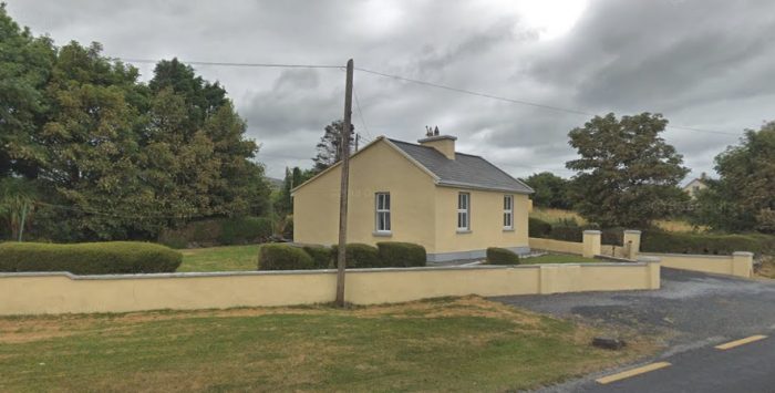 The old railway ran to the rear of the cottage in this image.
 The line continues towards Ennistymon. Just to the North of the line and South of the N85 are the remains of Glan Castle, just visible in the centre of the satellite image above.
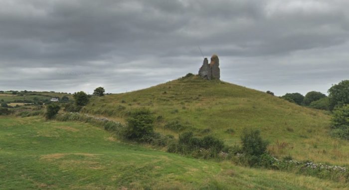 Glan Castle in 2018.
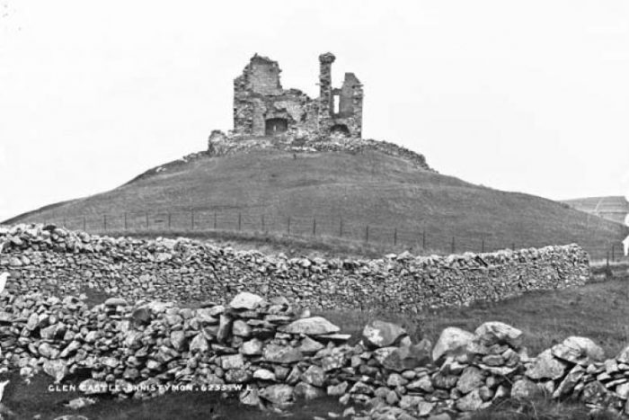 An old postcard of Glan Castle which was to the North of the railway line East of Ennistymon. [19]
After passing Glan Castle, the line curved round into Ennistymon staton. The location of the B&B below marks the old station building which has been much extended.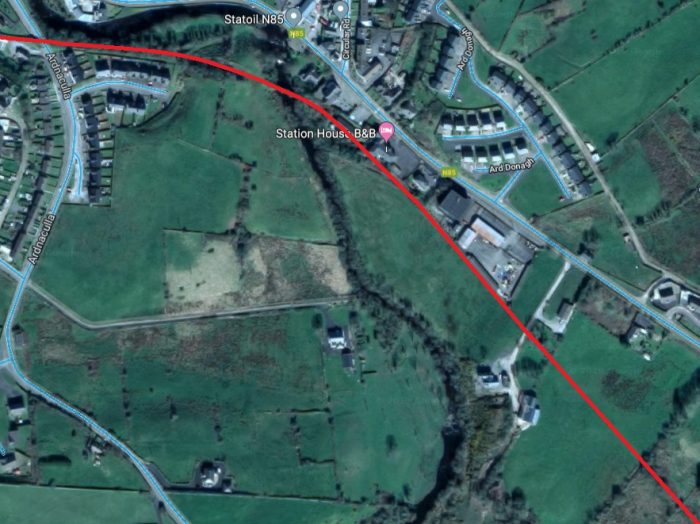 Ennistymon, just over 18 miles from Ennis a was one of the largest stations on the system and the second blockpost. It was noted for its livestock fairs and butter markets. The station building was on the up platform and the station had extensive accommodation including a large yard, loading bank, goods store and car park. It was the first two platform station on the journey from Ennis. Water was supplied to cranes on each platform from a 2860 gallon tank on the up platform. This was filled by a hydraulic ram from a reservoir on Bleakeys Hill, but at times it had to be augmented by hand pumping from the river Cullenagh. There was a pump-house beside the river behind the down platform at the west end of the Station site.
Entering from Ennis, on passing the down home signal the line veered to the left for the down platform and to the right for the goods siding, with the main line continuing on to the Lahinch side of the up platform. Three further sidings on the up side were provided, one for the front of the loading bank, the second for the rear, and the third connecting with the main siding and running parallel to the main line terminating close to the down home signal on the opposite side.
On the left hand side of the down line, the up starting signal and signal cabin were situated, and past the station on the Lahinch side were the water column and down starting signal. On the up road, again at the Lahinch end was the water tank, with another water column at the Corofin end of the platform. The up home signal was placed on the up side on the Lahinch end of the river bridge. A verandah protected the up platform which was separated from the goods store by a short wall. [24] Ennistymon Station. [25]
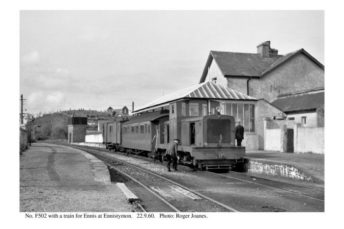 Diesel locomotive No F502, on an Ennis working at Ennistymon on 22 September 1960. Latterly, when the availability of the railcars declined, one passenger working each way was invariably formed of a locomotive and coaches, the coach here is ex Cavan & Leitrim No 1L, after rebuilding at Balinamore works, and transferred to the West Clare section in June 1959. An ex-Tralee brake van brings up the rear, and the driver, looking round his engine, is Jim Murphy., (c) Roger Joanes. [22]
 Two images above from 1960 taken at Ennistymon Station by Roger Joanes. [12]
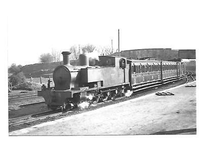
The adjacent image shows Loco. No. 3C at Ennistymon. [13] At Ennistymon on 28 July 1952, locomotive No 9C is on the 9:58 am goods from Kilrush, taking water. Driver Tom Reidy is on the engine, (c) C.L. Fry. [21]
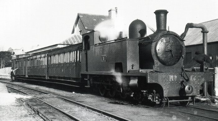 Loco. No. 1C, on an Ennis working taking water at Ennistymon in 1933. The train consists of an ex West Clare third, a composite, and full brake – the latter is either No 37C or 38C – note clerestory roof (c) Patrick Taylor. [21]
 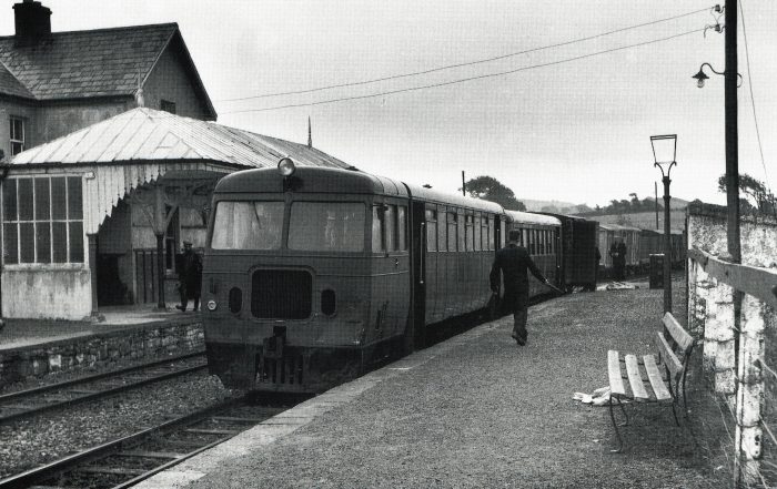 Railcar No. 3388, forming the 1:50pm Ennis to Kilrush, calling at Ennistymon on 17 July 1957. The up goods, which it passed here, can be seen leaving in the distance, (c) Colin Bobcock. [21]
 Ennistymon Station in 1953 with Glan Castle and Blackwell’s road bridge in the background. [18]
 The station building in the 21st Century. It has been much extended to provide a large B&B. [17]
Ennistymon has a certain notoriety as far as the history and popularity of the West Clare Railway is concerned as it is believed that the particular saga of the acrimonious relationship between Percy French and the West Clare started because river water was being used to fill the water tank at Ennistymon. The story is provided as an Appendix to this post – Appendix 1 below.
Immediately to the West of Ennistymon Station the West Clare crossed the Inagh (Cullenagh) River and the Mill Road in the townland of Ardnacullia North by a three span bridge (No. 37). Immediately beyond, the Bogbere Road crossed over the line on bridge 39. This is the “Town Bridge” and the West Clare continued through a cutting and around the flank of a hill before traversing some open country. Ennistynon Railway Bridge. [15]
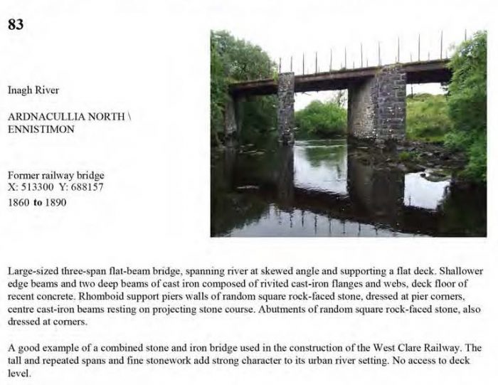 The North Clare Road Bridge Survey picks up a few railway bridges. This is a copy of the record relating to the railway bridge over the River Inagh at Ennistymon. [16]
The railway travelled West on the South side of the Cullenagh River and passed over Ardnaculla on a steel girder bridge. The image below in the North Clare Road Bridge Survey is taken from the South on Ardnaculla. [16]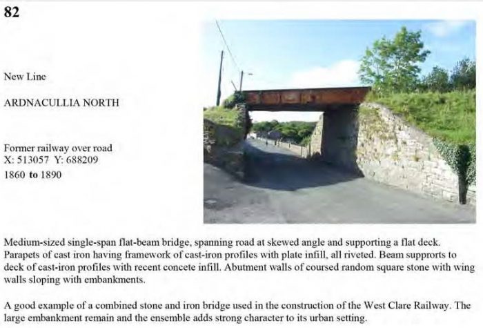
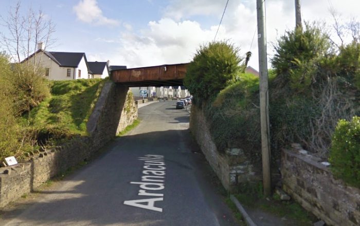 The same bridge taken from the North in 2009.
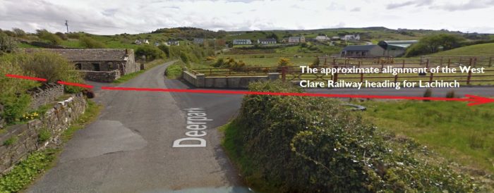 At the access road to Deerpark the alignment of the railway comes very close to the N67, Ennistymon to Lachinsh road.
Just over 19 miles from Ennis the line crossed a minor road at Madigans Bridge, or Graham’s Bridge and a quarter mile further Workhouse Halt was reached.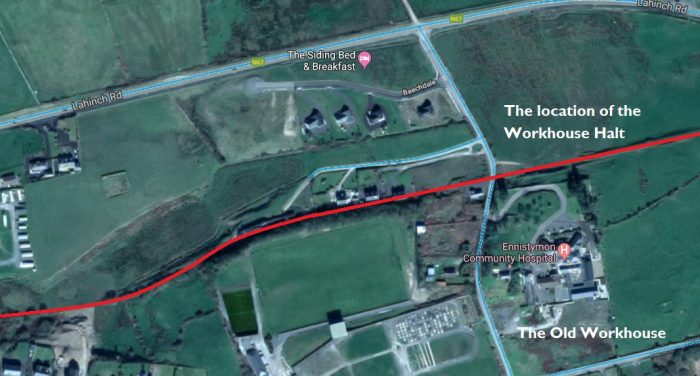 In the year 1887, a small platform was built close to the Workhouse on the down side to facilitate the guardians of Ennistymon hospital, and certain trains called here at that period. It was closed in 1925 but was reopened for diesel working on the 29th June 1953.
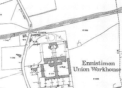 The Ennistymon Union Workhouse is now the Ennistymon Community Hospital. It can be seen on the satellite image above. It was rail-served in that there was a halt on the West Clare Railway next to the site. The adjacent plan shows the site in 1915 and includes the railway and level-crossing. [23]
Ennistymon Poor Law Union was formed in August 1839 and covered around 238 square miles of territory. It was overseen by an elected board of 21 guardians representing the 13 electoral divisions it served. The Workhouse was erected on a 6-acre site to the West of Ennistymon and was ready for use in July 1842. The site is shown in the image above. [23]
Edmund Lenihan write of the Workhouse: “To look at it today, a sleepy district infirmary, one could never imagine the suffering and death that were part of daily life in the years of the Famine. Originally intended to house 600 people, it quickly became grossly overcrowded, as did every other workhouse in thise years. For example, in late 1848 there were 1,150 inmates, between sick and able-bodied. Neglect and disease soon reaped their grim harvest in such conditions. Little wonder! In 1847 a mere 1/11d per week was the accepted cost of maintenance per inmate, and early in 1848 a report by the vice-guardians of the union found dirt, filth, squalor and vermin to be the norm.” [26] [27]
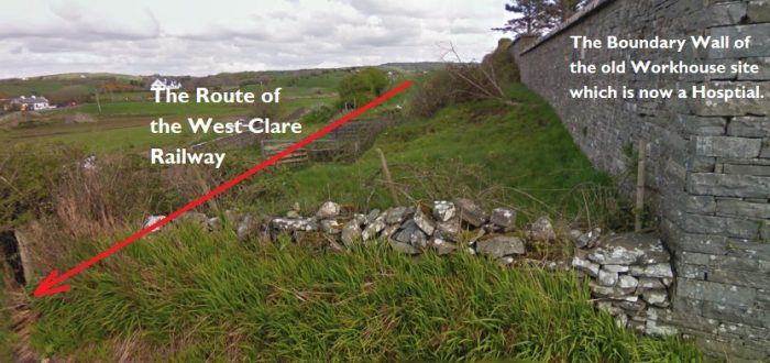 The alignment of the West Clare travelling West from Ennistymon is imposed on a modern image taken from the Hospital access road. There was a level-crossing just to the left of this image.
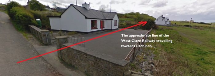 Looking forward from the location of the level-crossing towards the coast. The bungalow looks modern but is either a replacement for or an extended version of the station building at Workhouse Halt.
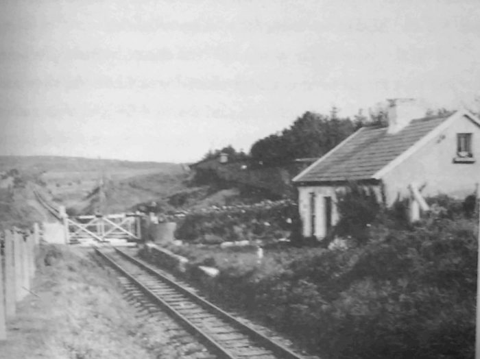 The railway ran through what is now the driveway of a modern bungalow. The high walls of the workhouse/hospital can be seen in the back ground of this view of Workhouse Halt in 1953, (c) IRRS. [26]
As we have already noted the crossing cottage or a successor is still a domestic dwelling. There is, however no sign of the little platform on the up side that was used in the early years when occasional trains stopped to facilitate the workhouse guardians. This sen ice was discontinued in 1925, and only reinstated in mid-1953, with the coming of the railcars. While it was in operation, it is doubtui whether the inmates were much facilitated by it. …. Workhouse Halt, 19.5 miles from Ennis, was the last crossing under the jurisdiction of Ennistymon block-station. [26]
The onward journey to Lahinch is shown on the OS Map from the 1940s below. The Workhouse is close to the centre of the map.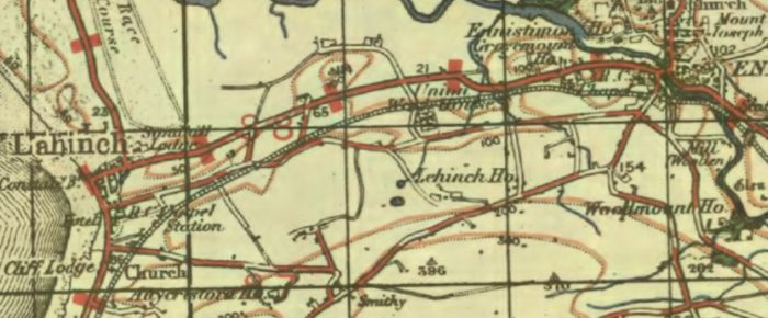
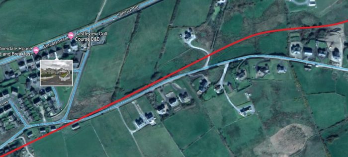 It is only a short distance to the modern outskirts of Lahinch from the Hospital. Lahinch Station site is just off this satellite image at the bottom left corner. After passing two further level crossings Lahinsey No.1 and No. 2 between mile post 20 and 20.5, the Station for the seaside resort of Lahinch was reached.
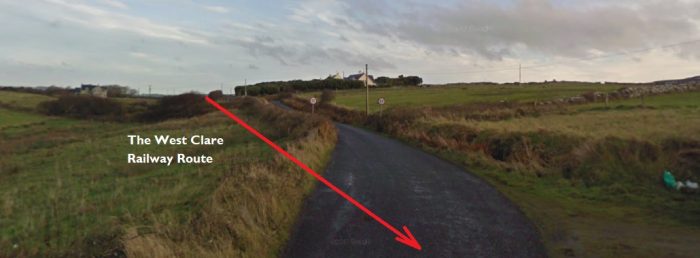 Looking back East towards Ennistymon.
 Looking ahead towards Lahinch Station.
 Between Lahinch and Ennistymon. facing towards Ennistymon. The switch-blade of the point at the East end of Lahinch Station just features at the bottom of this picture. [14]
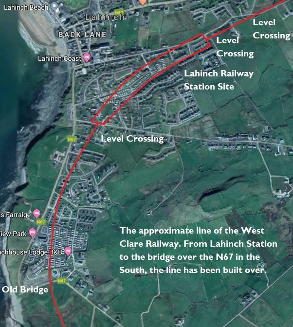 This satellite image is to a smaller scale which allows the whole of the Lahinch area to be included. The area in the curved red box in the station area and is represented below in a sketch plan.
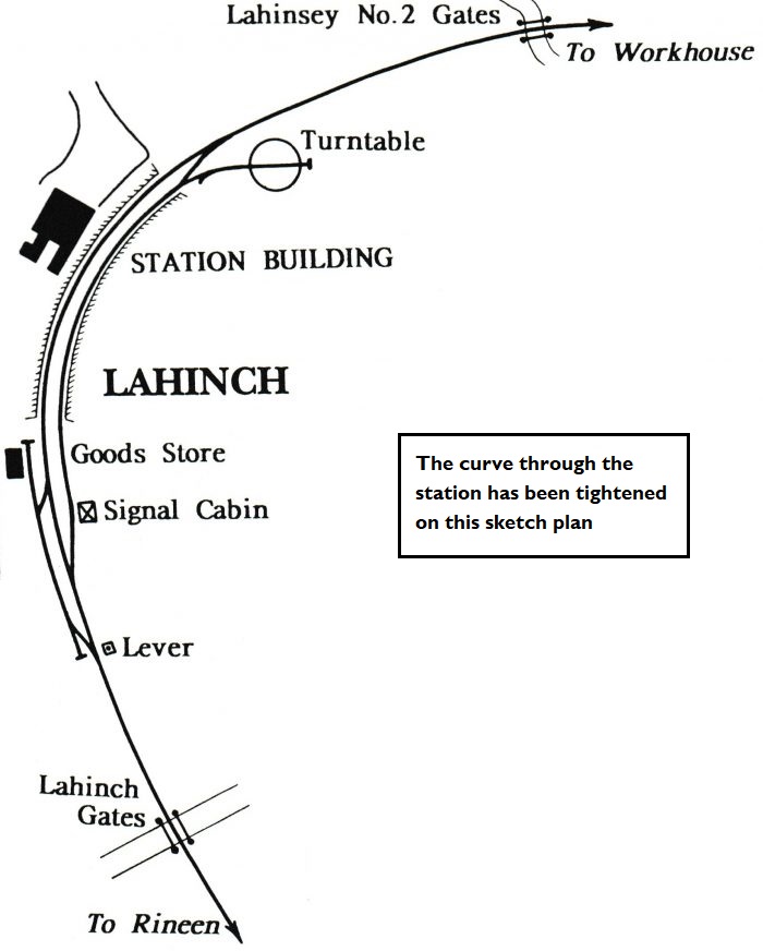 Lahinch Station. [25]
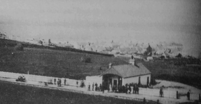 Lahinch Station around the turn of the 20th Century. [26]
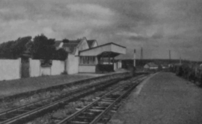 Lahinch Station in 1961. [26]
There is good coastal scenery on either side of Lahinch, and inland are some pretty glens among low hills, with the Glen of the Cullinagh river particularly attractive. Lahinch possesses a beautiful golf course, ideally situated behind the beach on the northern side. The Cliffs of Moher – one of the out standing features of the country, rising sheer above the sea to nearly 700 feet and extending for about five miles along the coast, form one of the grandest stretches of Cliffs in these islands and afford magnificent views along the Atlantic coast. [29]
Lahinch station building is on the up side and as originally built had only one platform and a short siding which was situated on the Miltown-Malbay side. This siding ran on to the goods store at the end of the platform. In August 1911 the layout at this station was rearranged. A second platform was built and a new line of rail laid down turning this station into a passing place. A verandah was built on the up platform, and a signal cabin similar to Ennistymon but with only five levers was also built at the Miltown-Malbay end of the down platform. Electric staff instruments were installed and it became a block post. In August 1953 a turntable was installed which came from Kilmessan on the Clonsilla-Kingscourt branch and which was suitably converted for the turnround of diesel railcars on excursion trains. During steam days, prior to this arrangement, the engines had to run six miles to Miltown-Malbay where a turntable was provided to enable them to turn. [29]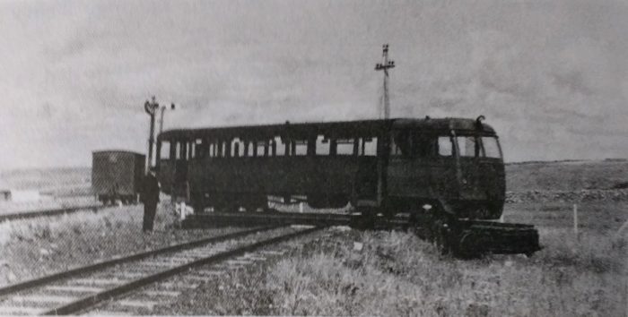 A railcar being turned at Lahinch. [26]
We end this part of our journey at Lahinch.
References
- P.B. Whitehouse; The West Clare Railway; in The Railway Magazine Volume No. 601, May 1951, p296-298, p320, p345.
- https://www.pandacoz.com/day-17—to-galway.html, accessed on 9th April 2019.
- Edmund Lenihan; In the Tracks if the West Clare Railway; Mercier Press, Dec. 2008, p80-85
- Ibid., p89-99.
- Ibid., p97-108.
- Patrick Taylor; The West Clare Railway; Plateway Press, 1994, p38.
- Ibid., p39.
- Edmund Lenihan; op.cit., p110ff.
- Ibid., p111.
- Ibid., p112.
- Ibid., p118.
- https://www.flickr.com/photos/tags/ennistymon, accessed on 13th April 2019.
- https://picclick.co.uk/Irish-Railway-Photograph-GSR-WCR-West-Clare-Railway-352251191994.html, accessede on 13th April 2019.
- https://www.activeme.ie/guides/dismantled-railway-ennis-to-lahinch, accessed on 13th April 2019.
- http://ie.geoview.info/abandoned_west_clare_railway_bridge_ennistymon_co_clare_ireland,10881484p, accessed on 13th April 2019.
- https://www.clarecoco.ie/services/arts-recreation/publications/north-clare-road-bridge-survey-2015-22291.pdf, accessed on 12th April 2019.
- https://book-a-bnb.com/station-house-bnb-ennistymon.html, accessed on 13th April 2019.
- Edmund Lenihan; op.cit., p123.
- https://www.irelandxo.com/ireland-xo/history-and-genealogy/buildings-database/glan-castle-ennistymon, accessed on 13th April 2019.
- Patrick Taylor; op.cit., p58.
- Ibid., p60.
- Ibid., p61.
- http://www.workhouses.org.uk/Ennistymon, accessed on 13th April 2019.
- Patrick Taylor; op.cit., p39.
- Ibid., p48.
- Edmund Lenihan; op.cit., p130-136.
- Michael Mac Manon; A History of the Parish of Rath; Clare Archaeological Society, 1979, p72.
- Seosamh Mac Mathuna; Kilfarboy: A History of a West Clare Parish, Milltown Mallbay; S. Mac Mathuna, 1976, p47.
- Patrick Taylor; op.cit., p40.
- Percy French; Are Ye Right There Michael. King Laoghaire: The Home of Irish Ballads and Tunes; https://www.kinglaoghaire.com/lyrics/947-are-ye-right-there-michael, accessed on 15th April 2019.
- http://www.clarelibrary.ie/eolas/coclare/people/percy.htm, accessed on 15th April 2019.
- Edmund Lenihan; op.cit., p122,124.
- From the evidence of Mr Hopkins, Locomotive Superintendent of the West Clare Railway, at the hearing of French -V- The West Clare Railway Company at Ennis on 15th January 1897, reported in the Irish Independent on 13th November 1975.
Appendix 1 – Percy French and the West Clare Railway
Are Ye Right There Michael? is a song by the 19th-century and early 20th-century Irish composer and musician Percy French, parodying the state of the West Clare Railway system in rural County Clare. It was inspired by an actual train journey in 1896. Because of a slow train and the decision of the driver to stop for no apparent reason, French, though having left Sligo in the early morning, arrived so late for an 8pm recital that the audience had left. The ballad caused considerable embarrassment for the rail company, which was mocked in music halls throughout Ireland and Britain because of the song. It led to an unsuccessful libel action against French. [30]
It is said that when French arrived late for the libel hearing, the judge chided him on his lateness. French reportedly responded “Your honour, I travelled by the West Clare Railway”, resulting in the case being thrown out. [31]
In 1898 Percy French sued the directors of the West Clare Railway Company for “loss of earnings” when he and his troupe of entertainers were late for a performance in Moores Hall, Kilkee. He had advertised a concert for 8 p.m. on the evening of 10th August 1896, in Kilkee. He left Dublin that morning and arrived in Ennis on time for the 12.30 train which was due to reach Kilkee at 3.30p.m. The train slowed up approaching Miltown Malbay and when it got to the station there did not go any further. Five hours elapsed before a replacement train arrived and as a result he did not get to the hall in Kilkee until 8.20 p.m. His magic lantern, which was with his luggage, did not arrive until 9.00.
When he reached the hall most of the audience had gone home and the receipts were only £3 instead of the usual £14. A railway company official explained that when the engine took on water at Ennistymon weeds got into the boiler. This became apparent after a few miles and by the time Miltown Malbay was reached the driver decided to put out the fire because of the possibility of an explosion. No further progress was possible and a replacement engine was requested.
French was awarded £10 expenses. The Railway Company appealed but the award stood. The incident led to the song “Are ye right there Michael?” which became one of the most popular numbers in his repertoire. [31] The song is produced below. [30]
Are Ye Right There Michael?
You may talk of Columbus’s sailing
Across the Atlantical Sea
But he never tried to go railing
From Ennis as far as Kilkee
You run for the train in the morning
The excursion train starting at eight
You’re there when the clock gives the warnin’
And there for an hour you’ll wait
And as you’re waiting in the train
You’ll hear the guard sing this refrain:
Are ye right there, Michael, are ye right?
Do you think that we’ll be there before the night?
Ye’ve been so long in startin’
That ye couldn’t say for certain’
Still ye might now, Michael
So ye might!
They find out where the engine’s been hiding
And it drags you to Sweet Corofin
Says the guard: Back her down on the siding
There’s a goods from Kilrush comin’ in
Perhaps it comes in two hours
Perhaps it breaks down on the way
If it does, says the guard, be the powers
We’re here for the rest of the day!
And while you sit and curse your luck
The train backs down into a truck
Are ye right there, Michael, are ye right?
Have ye got the parcel there for Mrs White?
Ye haven’t, oh begorra
Say it’s comin’ down tomorra
And well it might now, Michael
So it might
At Lahinch the sea shines like a jewel
With joy you are ready to shout
When the stoker cries out: There’s no fuel
And the fire’s tee-totally out
But hand up that bit of a log there
I’ll soon have ye out of the fix
There’s fine clamp of turf in the bog there
And the rest go a-gatherin’ sticks
And while you’re breakin’ bits of trees
You hear some wise remarks like these
Are ye right there, Michael? Are ye right?
Do ye think that you can get the fire to light?
Oh, an hour you’ll require
For the turf it might be drier
Well it might now, Michael
So it might
What are the underlying facts?
It is beyond dispute that there was a significant delay of around 5 hours in the journey undertaken by Percy French. The delay occurred when the driver of Locomotive No. ……….. realised that something was significantly awry with his charge and decided to stop the locomotive at Milltown Mallbay rather than risk a possible boiler explosion further along the route to Kilkee.
The problem seems to have been caused by a practice, which was common at Ennistymon in time of low water supply, of taking water from the River Cullenagh. The water tank at Enisstymon was usually supplied from a reservoir on Beakey’s Mountain by gravity flow. But in very dry weather this supply was often inadequate, and men would be detailed to a little pump house to hand-pump water from the river into the tank. [32]
One old hand recalled those days: “Well, the drier summer’d come the better we’d like it. We used to love being in there. An’ often we’d keep pumping when there was plenty of water int he tank.” Under cover int he pump house they could smoke and talk to their hearts’ content, and two small holes in the walls facing the station and the bridge allowed them to keep an eye out for the supervisor. [32]
On 10th August 1896, the 12.20pm train from Ennis to Kilkee, hauled by the new 2-6-2T Locomotive No. 8, ‘Lisdoonvarna‘ took water at Ennistymon. But weeds in the water choked the boiler, and by Lahinch the driver, Michael O’Loghlin, found that he was having troble proceeding. He managed to nusre the tain to Milltown Mallbay but no futher progress was possible. [32]
Another locomotive No. 4, Besborough, was procured to haul the train to Kilkee but there was an excessive delay and the train did not reach Kilkee until 8.25pm. [33]
