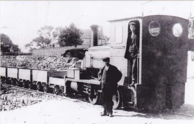
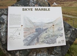
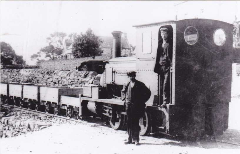
The featured image for this article is the only photograph I have been able to find of ‘Skylark’, the locomotive which for a matter of only a few years operated on the Skye Marble Railway. Further notes about the locomotive can be found in this article.This information board across the road from Kilchrist Church, features Skylark at the head of a train of wagons. [5]
Some sources say that in 1904, an aerial ropeway was constructed to transport marble to Broadford Pier from Kilchrist Quarries (alternatively known as Kilbride Quarries or Strath Suardal). The quarries were used to excavate marble. [1][2] Other sources talk of the line being worked first by horses. [14] There was an incline between the upper and lower Quarries at Kilchrist which appears to have been rope-worked. It is most likely, given the length of line from Kilchrist to the quay at Broadford and the relatively shallow gradients, that the line from the marble works down to Broadford was worked by horses, but it is entirely possible that an aerial ropeway was employed. Nothing remains of the line beyond the formation which now carries a footpath once South of Broadford, and, as will be seen below, some rails in the surface of the pier at Broadford.
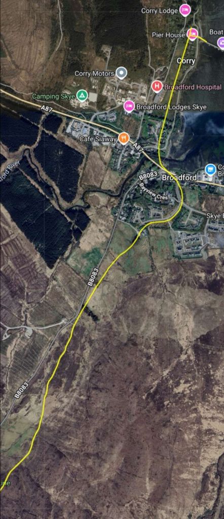
The main length of the line was converted to a tramway/railway in 1910. It was, in total, over 6 km in length. [4] Some sources quote 3.5km [viz. 2] and probably take that length from the length of the footpath which follows the route of the old railway. The Skye Marble Railway was a 3 ft (914 mm) narrow gauge [5] line which only operated from circa. 1910 to 1912/1913. [6][7]
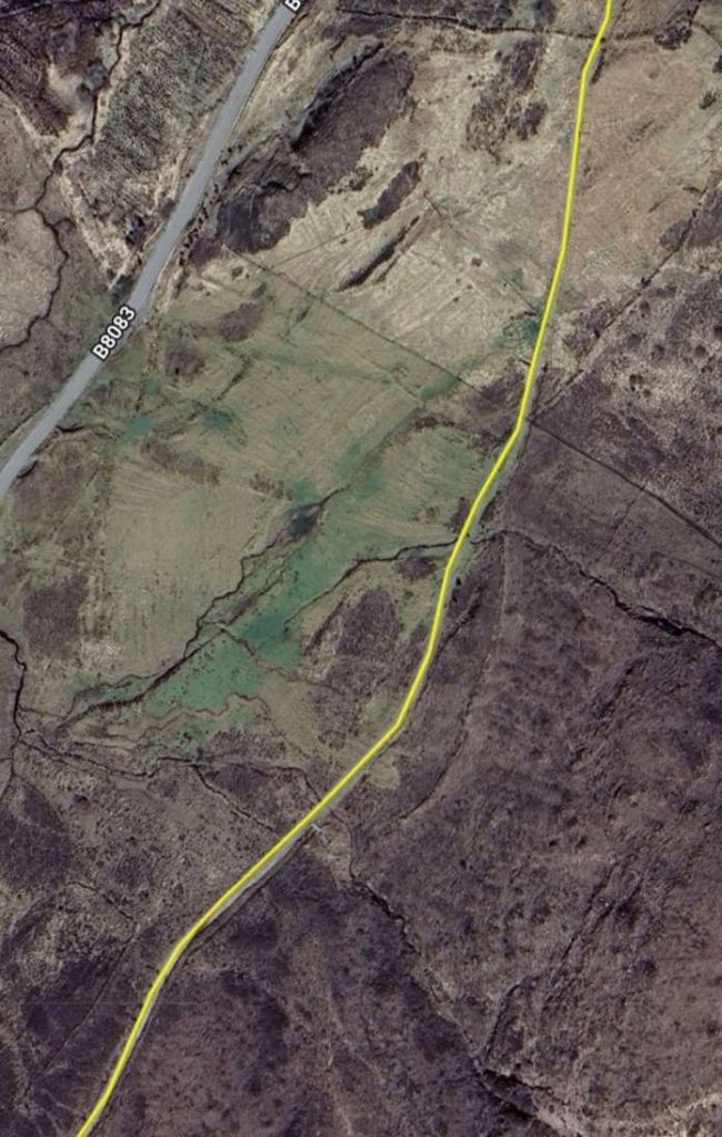
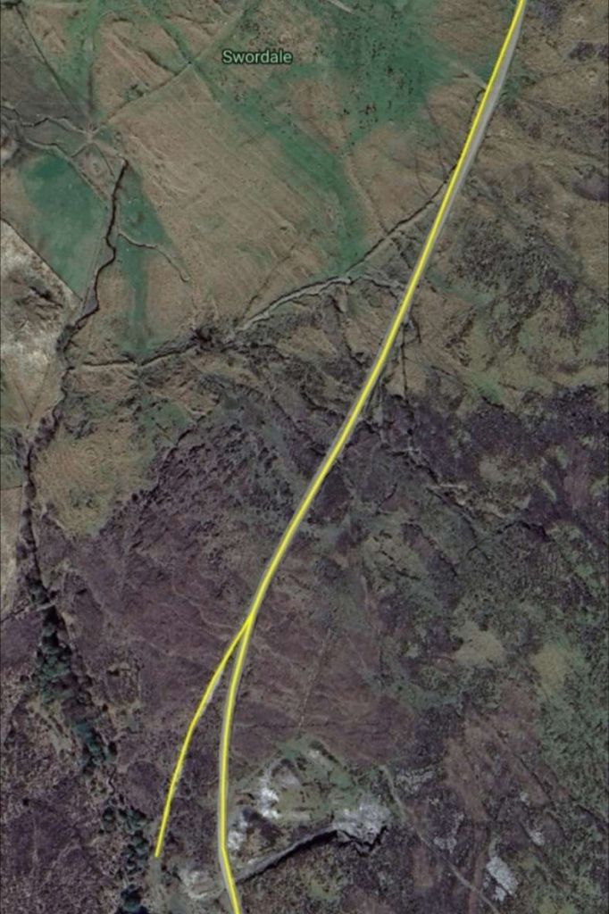
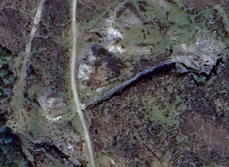
The Northern half of the Skye Marble Railway as shown on railmaponline.com’s satellite imagery. [8]The Southern half of the Skye Marble Railway as shown on railmaponline.com’s satellite imagery. [8]
It seems appropriate at this point to take a break from our journey along the line to find out as much as possible about the locomotive which was used on the Skye Marble Railway for a short time in the early 20th century. The website of the Industrial Railway Society (IRS) has some more information about this locomotive which the Skye Marble Company knew as ‘Skylark’. … The engine was first known as ‘Bruckless’, the notes which follow come from the IRS archives and were pulled together by D. Cole in 1965, in part from work undertaken by Dr. Iain D. O. Frew: “Delivered to T.S. Dixon in May 1892 through the agency of Josiah Buggins as ‘Bruckless’ for the Donegal-Killybegs contract of the County Donegal Railways, it was sold in 1894 after the completion of the contract and later worked for the Preston Corporation Waterworks Department on the construction of the Spade Mill No.1 Reservoir at Longridge. There it was named ‘Skylark’. Subsequently, in 1907, it went … to the Skye Marble Company and was used firstly by a contractor in building the Company’s railway from Torrin to Broadford, and then, from 1909, to work the railway itself. In 1913, following the failure of the quarries, the line was lifted and the locomotive sold to W.N. Jackson, a Glasgow metal merchant. He in turn sold it to J. Mackay, contractor for the Roundwood Reservoir in County Wicklow. This contract passed to H. & J. Martin Ltd. in 1915, and after its completion in 1925 the locomotive was scrapped.” [15]
D. Cole undertook further research into Hunslett’s records and was able to ascertain that “from July 1897 – the date from which the earliest detailed Hunslet spares records have survived – to March 1905 spares were sent to the Newcastle & Gateshead Waterworks. Delivery was sometimes to Otterburn, and the name of the locomotive was frequently quoted as ‘Bruckless’. No name was quoted by Preston Corporation when ordering spares between March 1907 and March 1910.” [15]
Cole was also able to confirm that:
from November 1910, spares were sent to W.R. Herring with the locomotives name quoted as ‘Dilworth’; [15]
in January 1911 and May 1911, spares were sent to Skye Marble Ltd. but no name was quoted; [15]
in August 1913, spares were ordered for the locomotive named ‘Skylark’ by W.H. Jackson, Glasgow, but sent to Mr. Easter, Skye Marble Cottages, Broadford, Isle of Skye; [15]
from May 1914 to May 1916, spares were sent to John Mackay, Dublin Waterworks, Roundwood, Co. Wicklow; [15] and
the last spares of all were sent out in January 1921 to H. & J. Martin Ltd., Roundwood Reservoir. – K.P.P. [15]
We now continue the journey along the old railway route. …
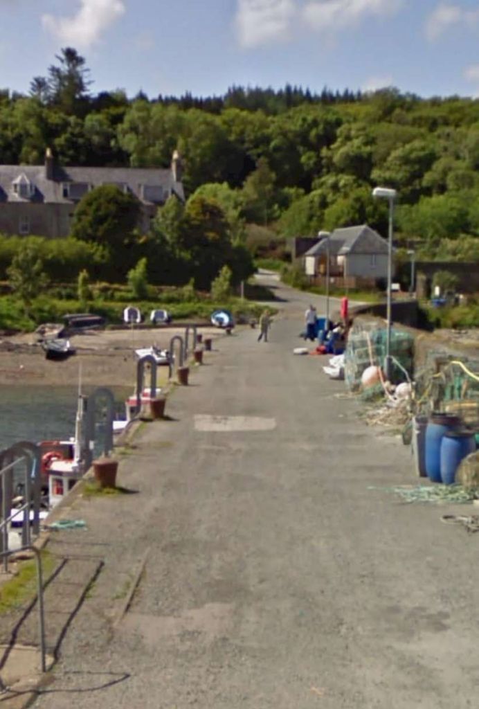
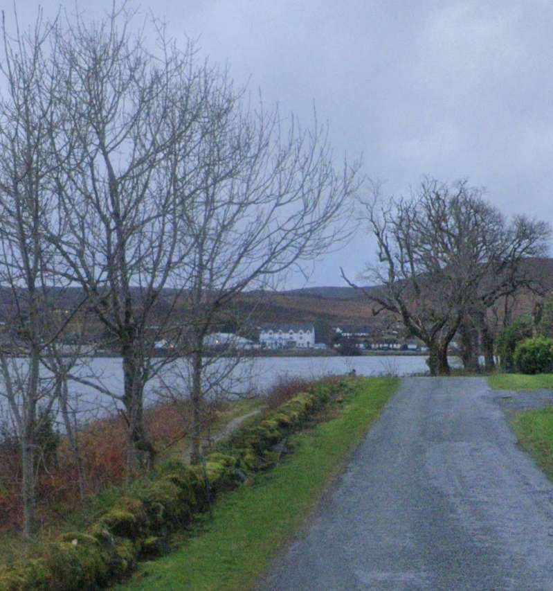
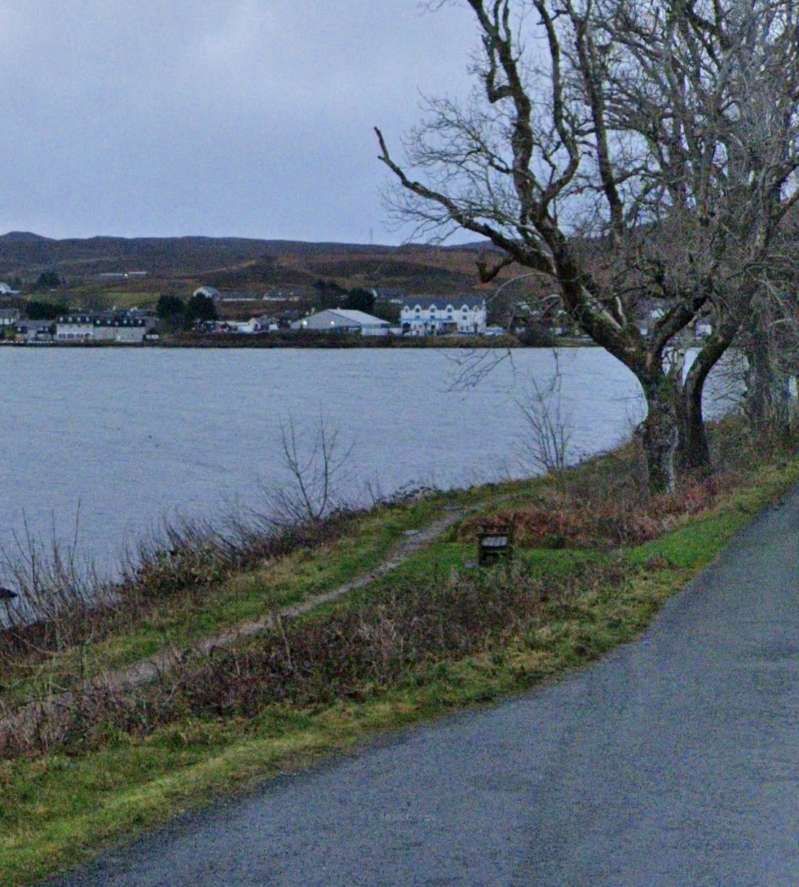
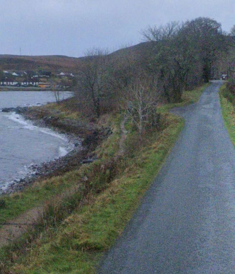
This view looking South towards the village of Broadford shows the footpath below the road (to the left beyond the dwarf wall) which probably follows the line of the old railway. [Google Streetview, December 2021]
The alignment of the railway which I have proposed here is supported by Railscot. On their page about the railway the alignment is shown adjacent to the shore rather on the higher ground to the West. [7]
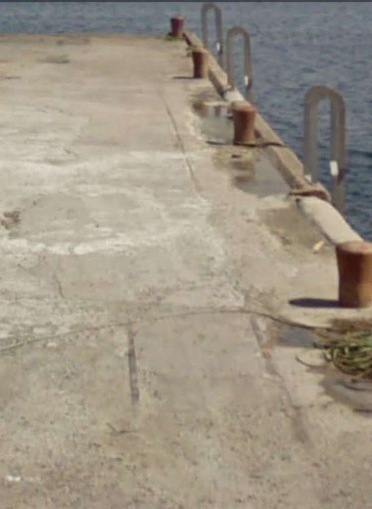
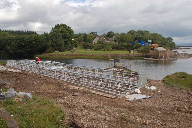
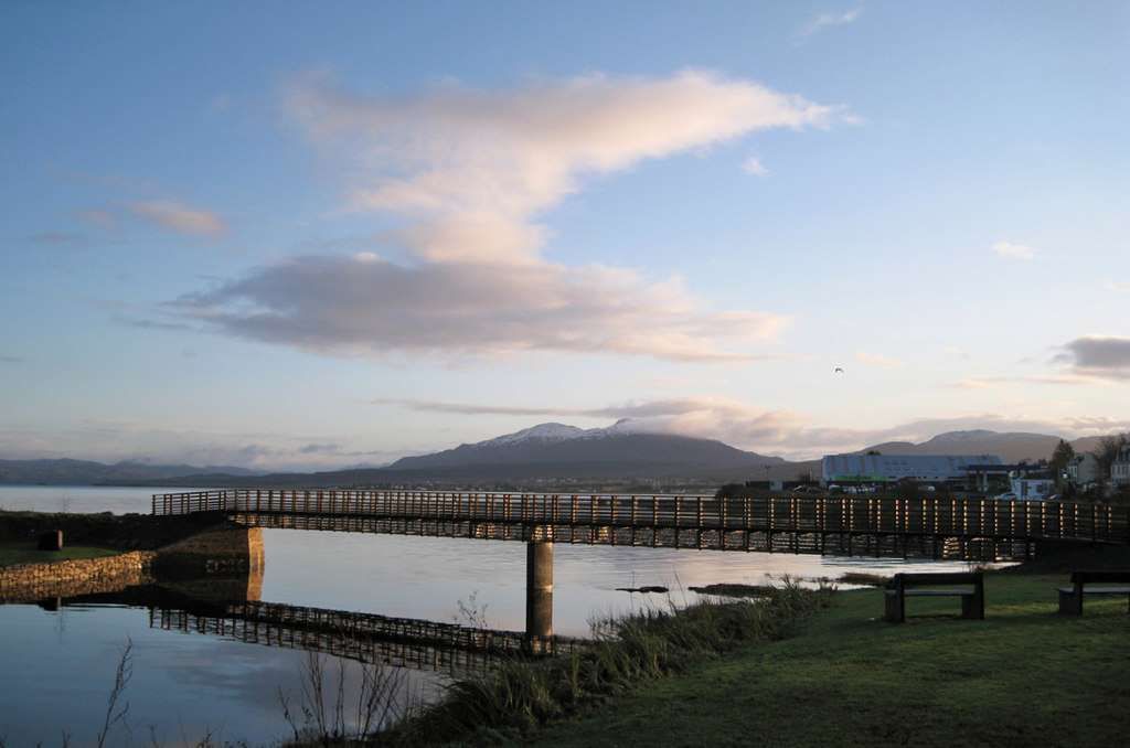
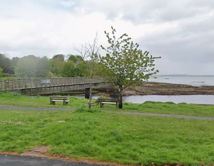
The yellow-brick abutment on the Northside of the river is original, the modern footbridge sits on that abutment but is on a different alignment to the old railway. There is no remaining abutment on the South side of the river, so a new smaller abutment was constructed to support the footbridge. A comparison is made and pictures are provided, on this site. [5] The photographs towards the bottom of that webpage give an idea of the alignment of the old railway bridge. Which crossed from the North abutment to a point on the South bank of the River Broadford marked by the young tree in the image below.
The modern footbridge sits on one of the abutments of the old railway bridge beyond the river in this picture. The old railway bridge spanned the river on a line between the North abutment and the young tree, in leaf, at the centre of this image which looks North from the A87. [Google Streetview, May 2022]
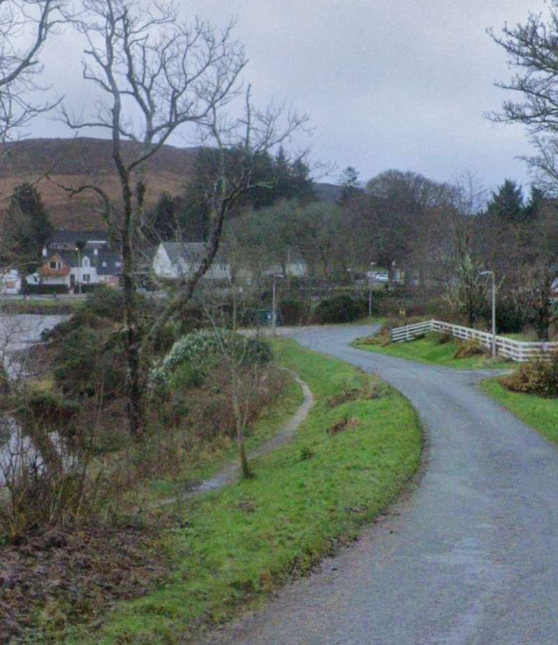
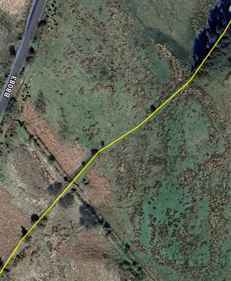
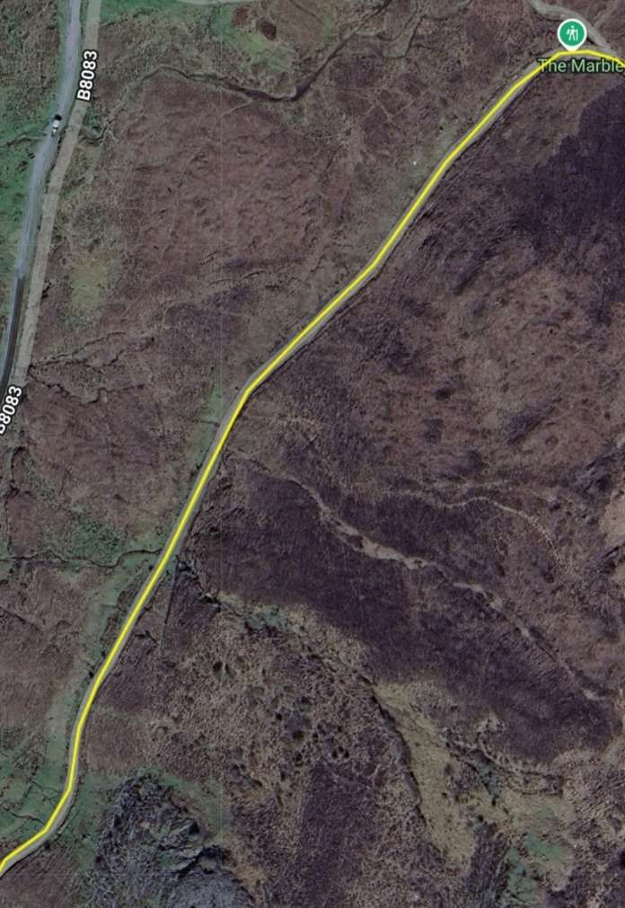
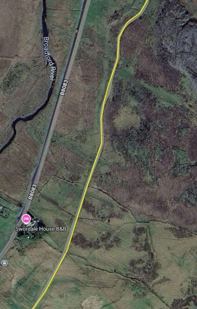
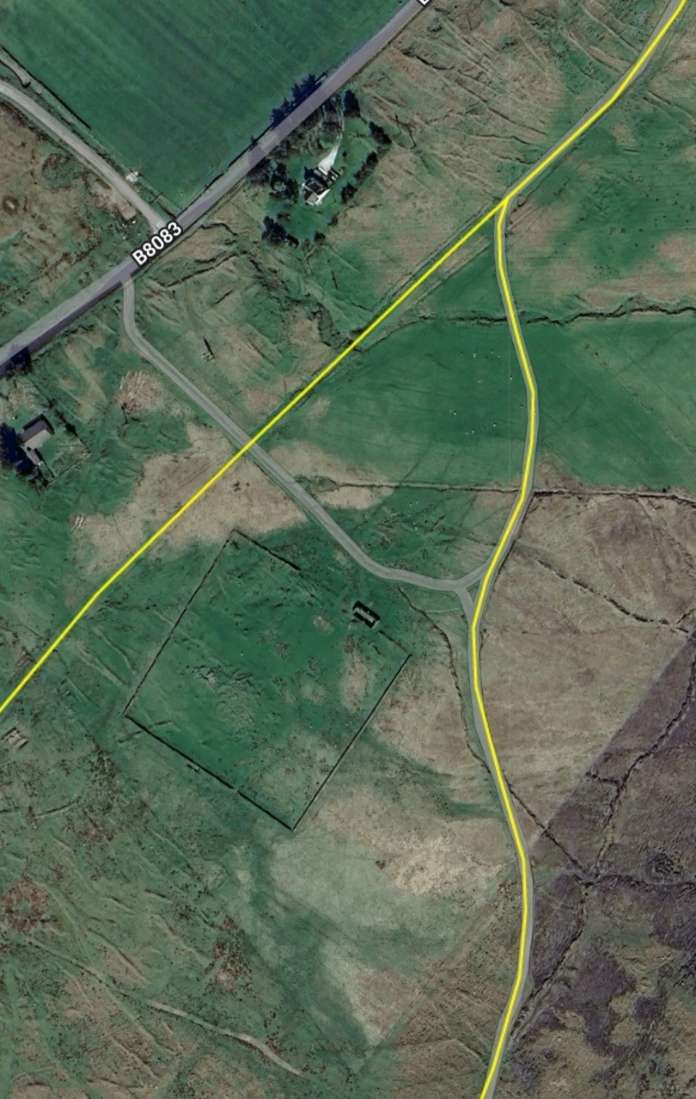
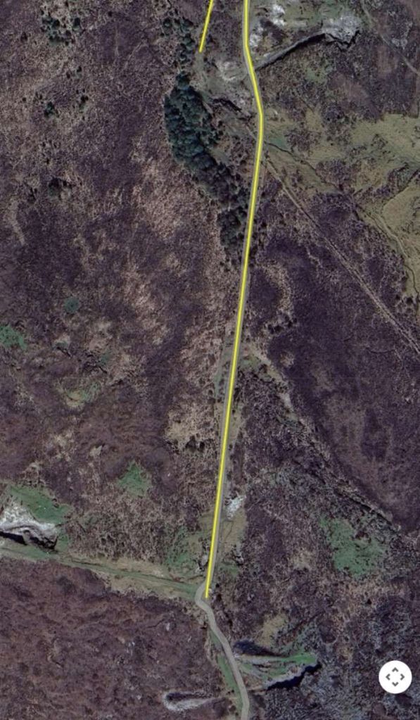
From the South bank of the river and running South the line shown on railmaponline.com’s satellite imagery seems to be realistic, following, as it does, a curved route to the East of the location pictured above. …
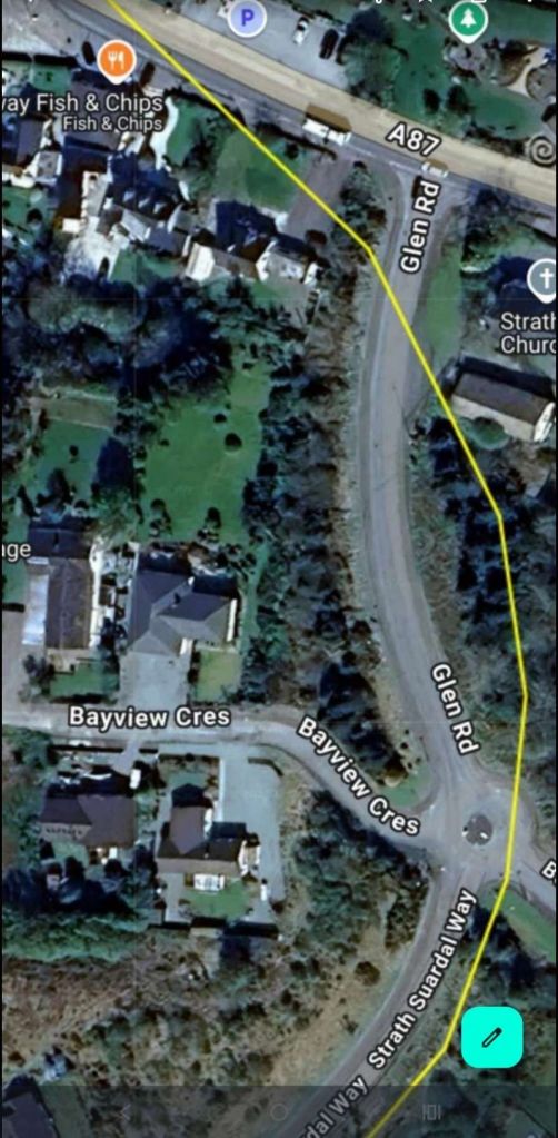
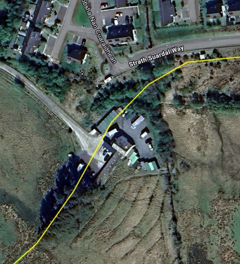
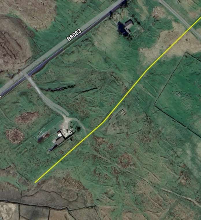
Crossing the modern A87, the old railway ran Southeast crossing the modern Glen Road (which did not exist at the time the railway was operating) close to Broadford (Church of Scotland) Church and then curved round to the East of Strath Suardal Way (which also did not exist when the railway was working). [8]
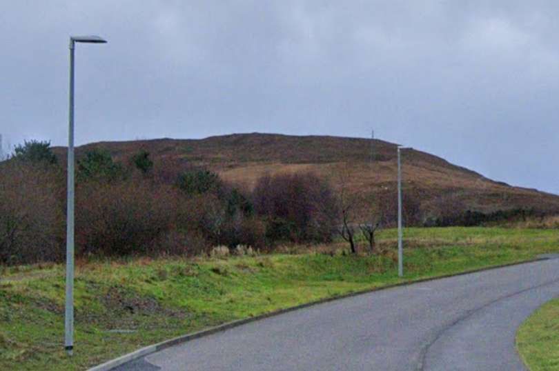
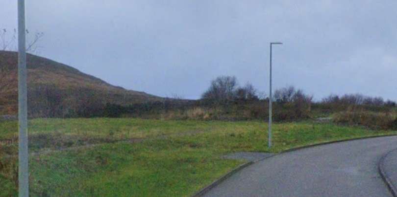
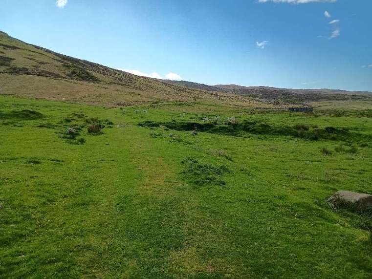
The next two images show the formation of the old railway on a low embankment on the East side of Strath Suardal Way.
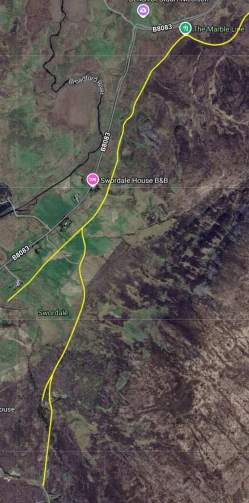
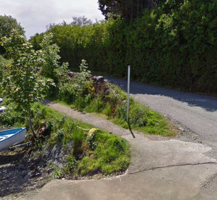
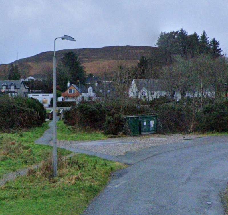
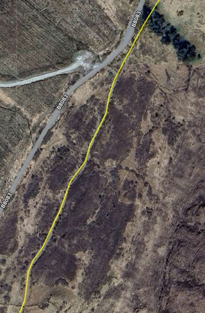
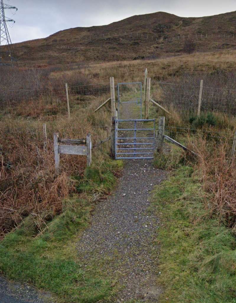
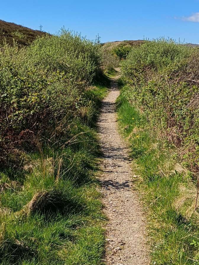
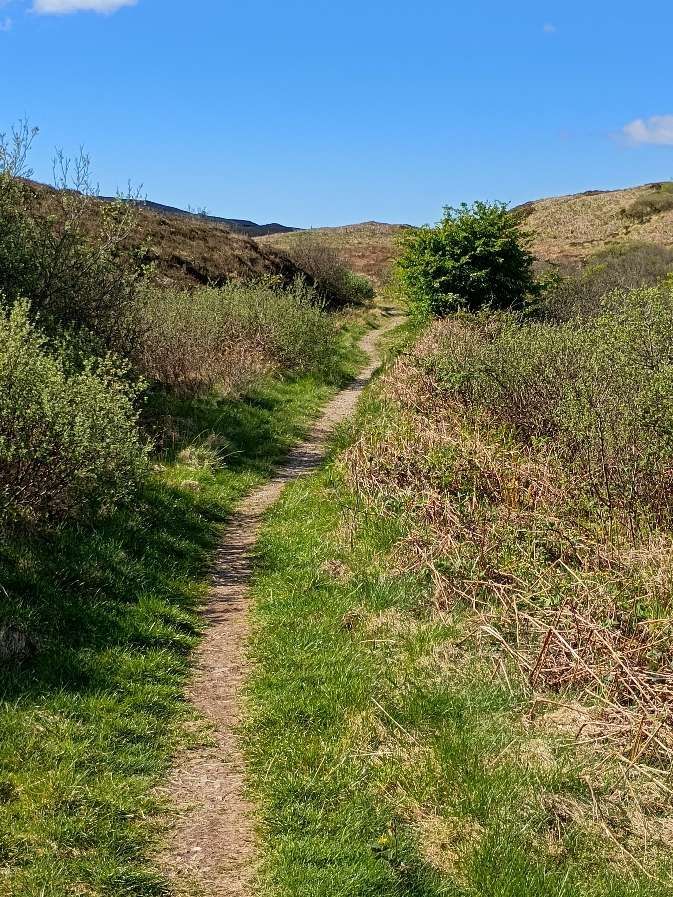
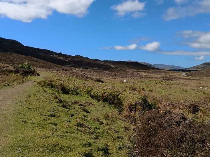
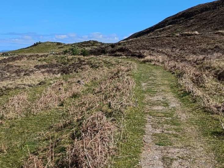
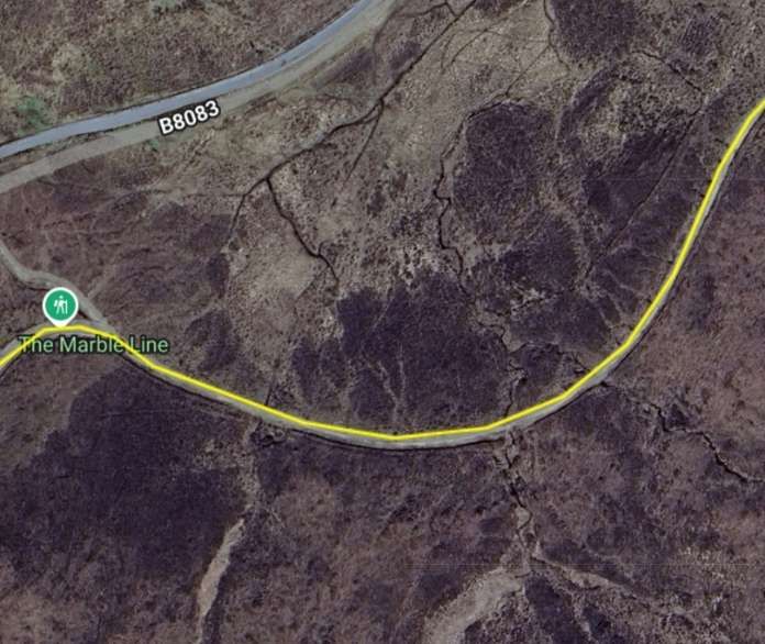
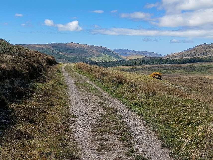
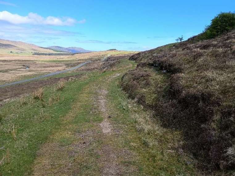
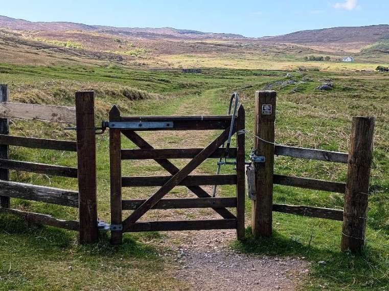
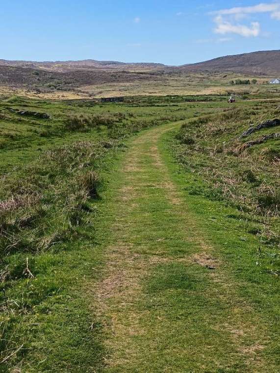
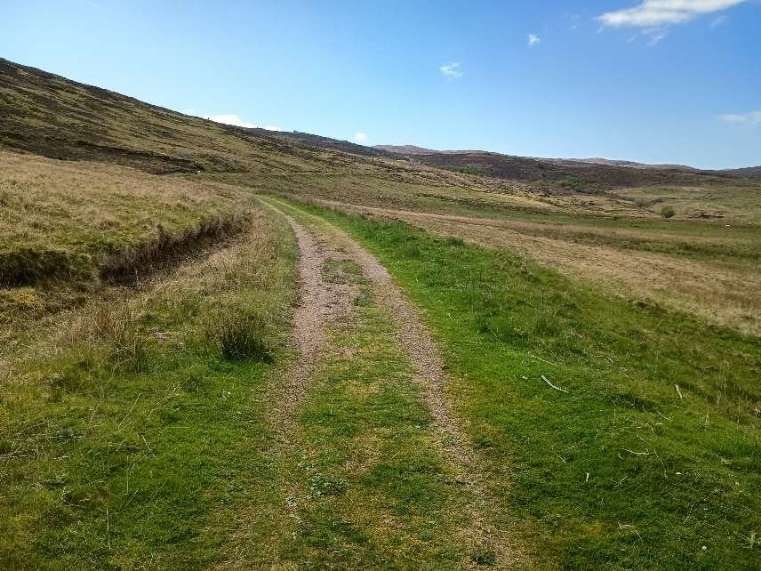
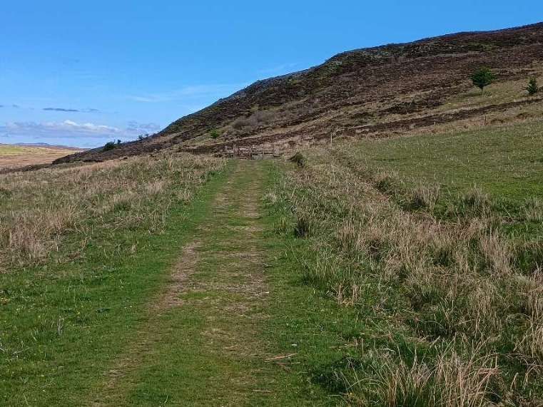
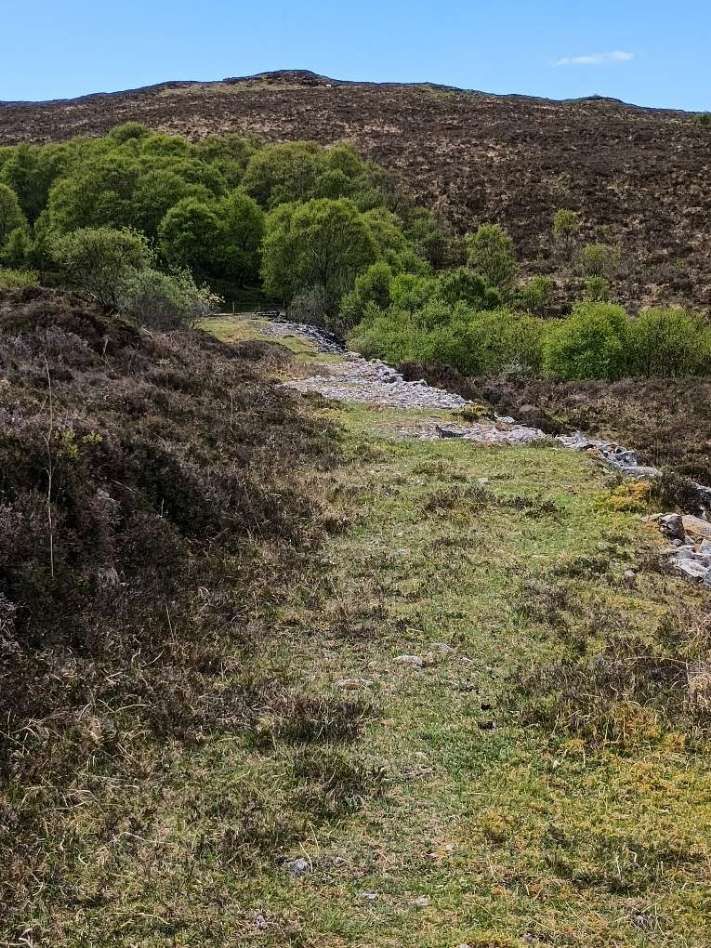
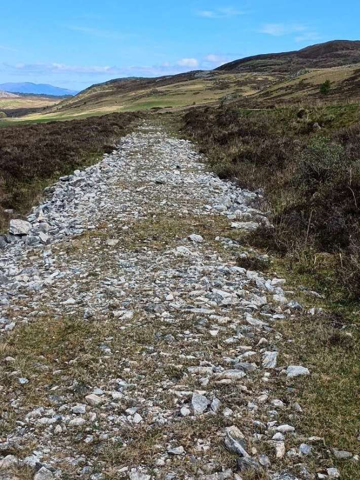
This photograph was taken at the roundabout looking South-southwest along Strath Suardal Way. The low embankment runs behind the street lighting. [Google Streetview, December 2021]Further along Strath Suardal Way and looking Southwest, the low embankment is again visible blue beyond the street lighting columns. [Google Streetview, December 2021]Towards the end of Strath Suardal Way the line of the old railway turned away to the Southwest. [8]The old Railway’s route runs through the evergreen trees on the left side of this West-southwest facing photograph. [Google Streetview, December 2021]The line then ran over open moorland to the East of the road to Elgol (the modern B8083). [8]Initially the route of the old railway and the modern B8083 converge as they head South-southwest. [8]The footpath access to the line of the old railway can be seen just as the old railway route and the B8083 begin to diverge. [8]The footpath access to the line of the old railway as seen from the B8083. Just beyond the second gate the footpath turns to the right and follows the old railway formation. The first length of the footpath runs through a protected plantation of young trees. [Google Streetview, December 2021]
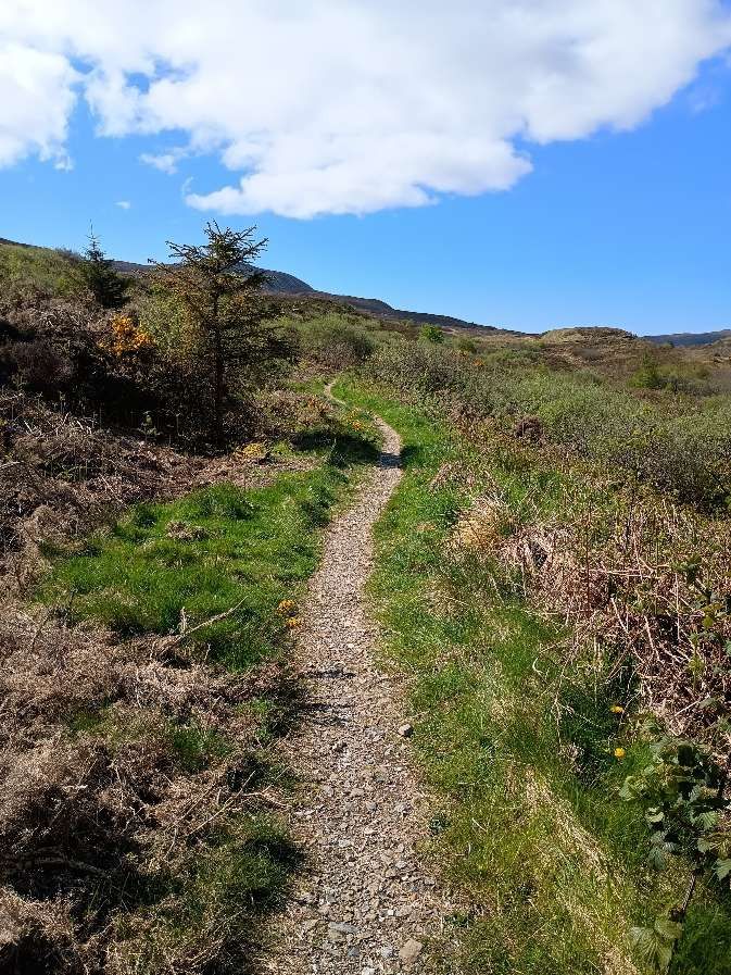
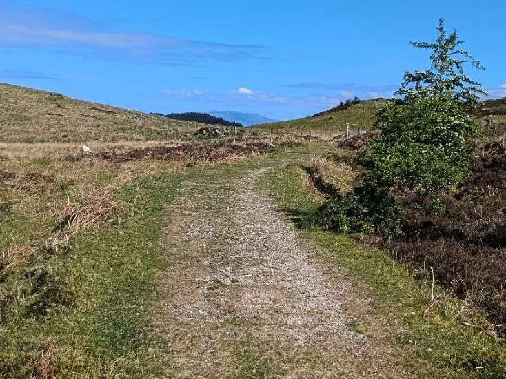
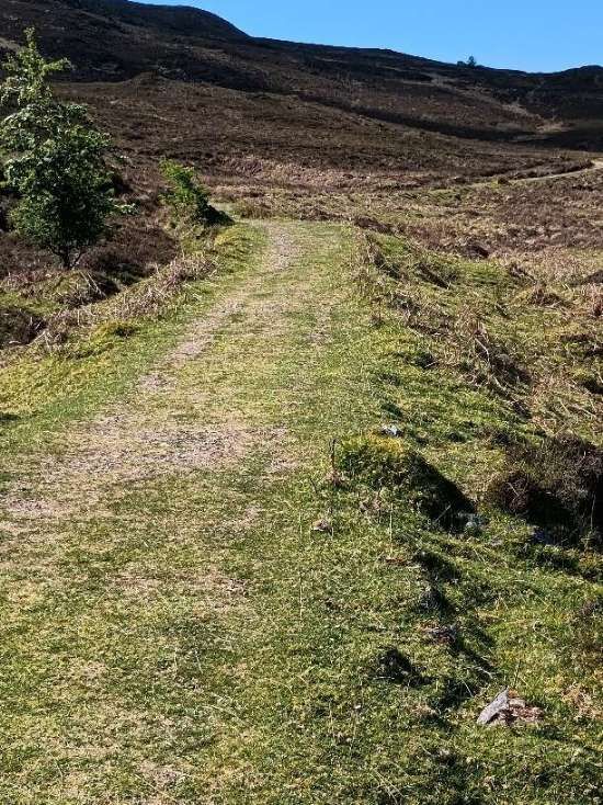
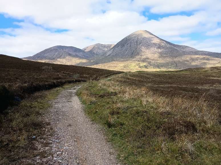
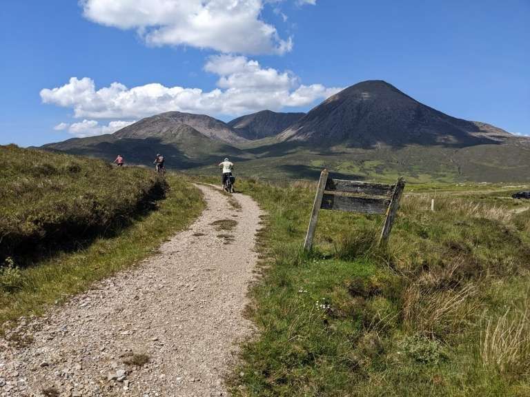
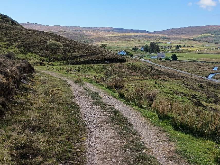
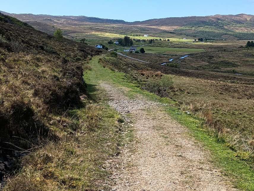
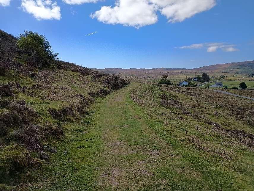
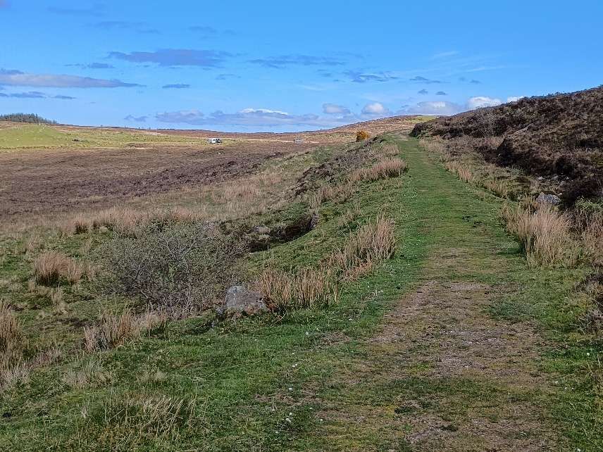
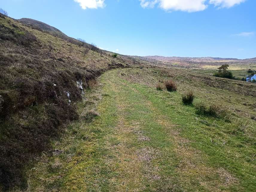
The four photographs immediately below show the first few hundred metres of the footpath along the old railway – as far as the plantation boundary fence which can be seen beyond the two low gateposts in the fourth photograph.
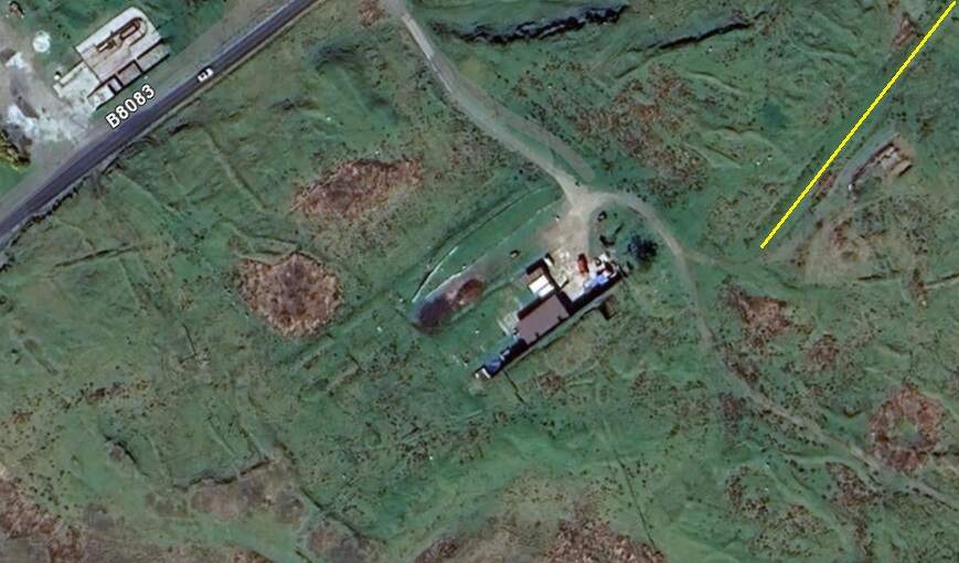
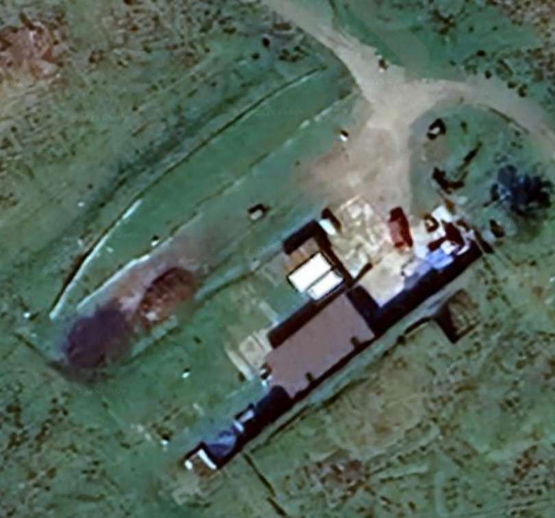
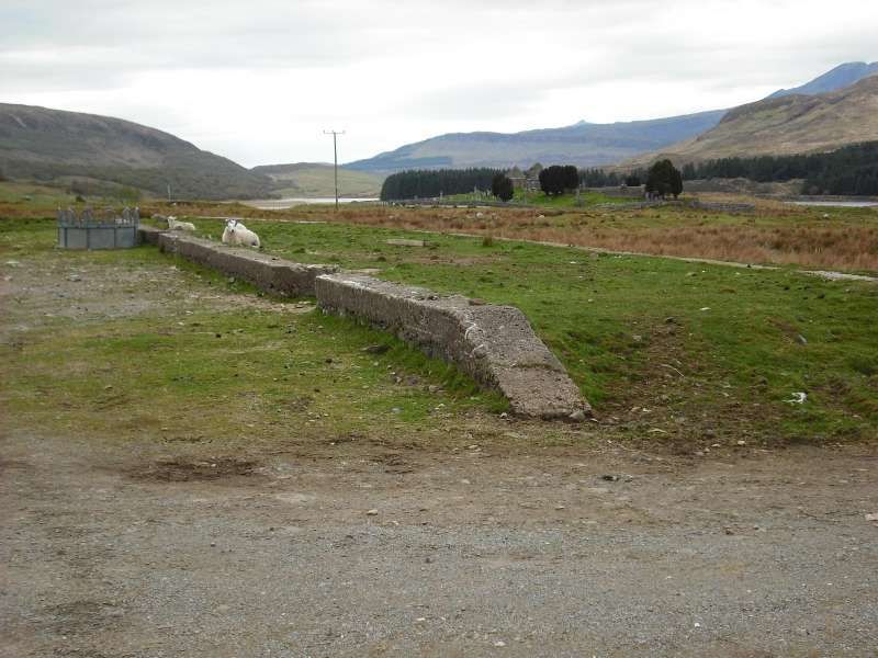
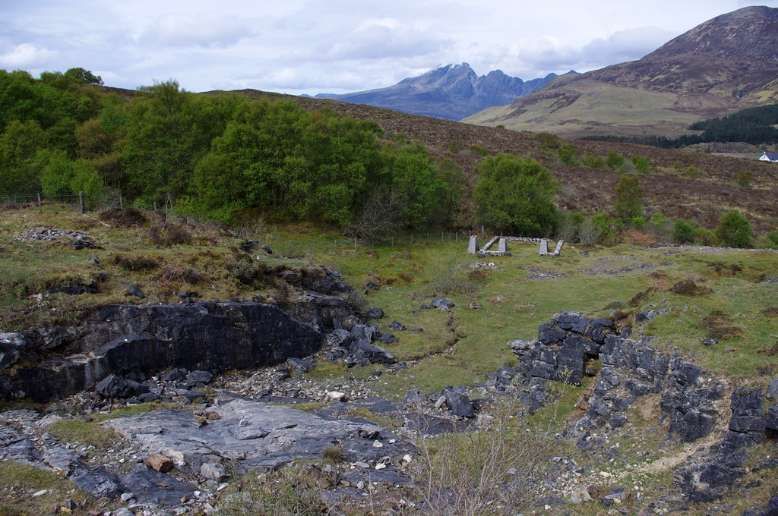
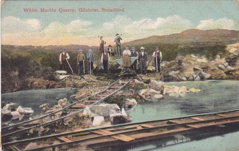
When marble was discovered near Kilchrist in Strath Suardal on the slopes of Ben Suardal about 3 miles (5 kilometres) Southwest of Broadford, a large factory was built near the quarry for cutting and polishing the quarried blocks. The Marble was formed by the heating of limestone by igneous intrusions in the Tertiary Era. It appears that small scale workings were active as early as the 18th century, developing throughout the 19th century. [14]
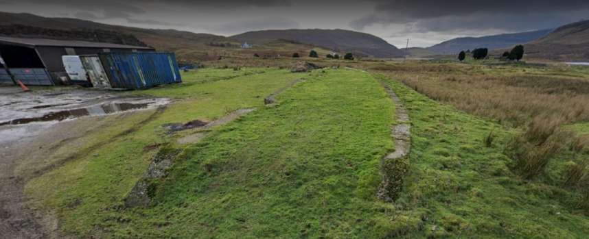
“On level ground by the South side of the Broadford to Torrin road are the remains of an industrial complex belonging to the old marble quarries. The remains consist of a ruinous concrete shed/warehouse 60m long, a railway platform, traces of the railway line and sidings, and four brick-built circular bases 2.4m in diameter.” [17]
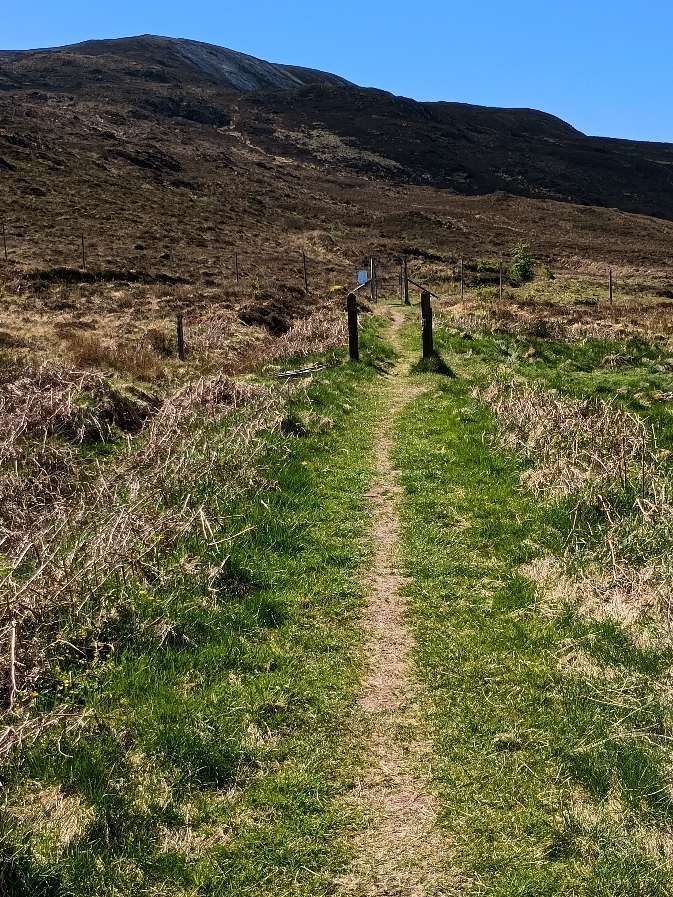
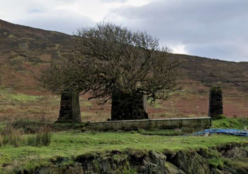
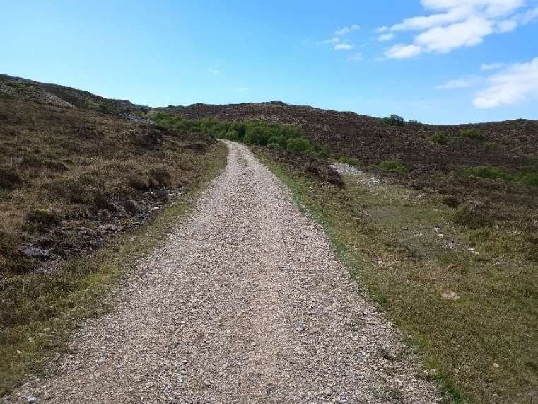
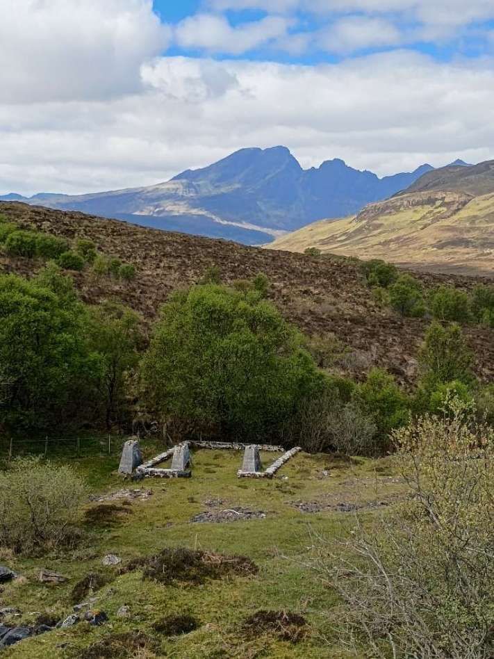
From adjacent to the lower quarry, with its own branch, spoil heaps and concrete bases, [22] the line continued South but as a rope-worked incline.
Looking South up the incline towards the upper quarry. [My photograph, 5th May 2025]
The view South up the incline to the upper quarry. This image is embedded from here. [19]. Clicking on the image takes you directly to the original image which is one of a series of photographs of the route of the old railway can be found here. [5]
In a rocky cleft immediately to the East of the track to Boreraig, are the remains of two former dynamite stores, one within the other. The older, larger building with walls of rubble construction, envelopes a smaller concrete blockhouse. Close to these are the remains of the ot for the winding wheel for the rope-worked incline.
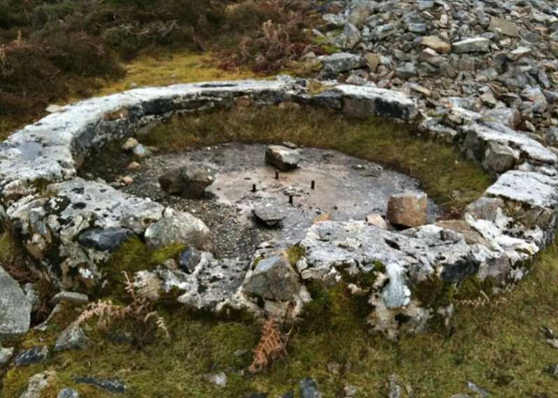
Also located at the upper quarry (but of which I did not get photographs) are two machinery stands:
2m square with 11 bolts protruding
6.5m by 5.2m with 4 stanchions protruding.
The Demise of the Line
The operation was not a commercial success. The railway line was abandoned by 1914 when the operating company became bankrupt. The line was offered for sale as part of the liquidation of the business. The sale comprised a 9½-in, 4-wheeled locomotive, 500 tons of 35 pounds (16 kg) and 56 pounds (25 kg) flat-bottomed rail and 9,000 6-foot creosoted sleepers. [4][20]
Extracting the marble proved difficult and expensive and quarrying finally ended here in 1939. [21]


