

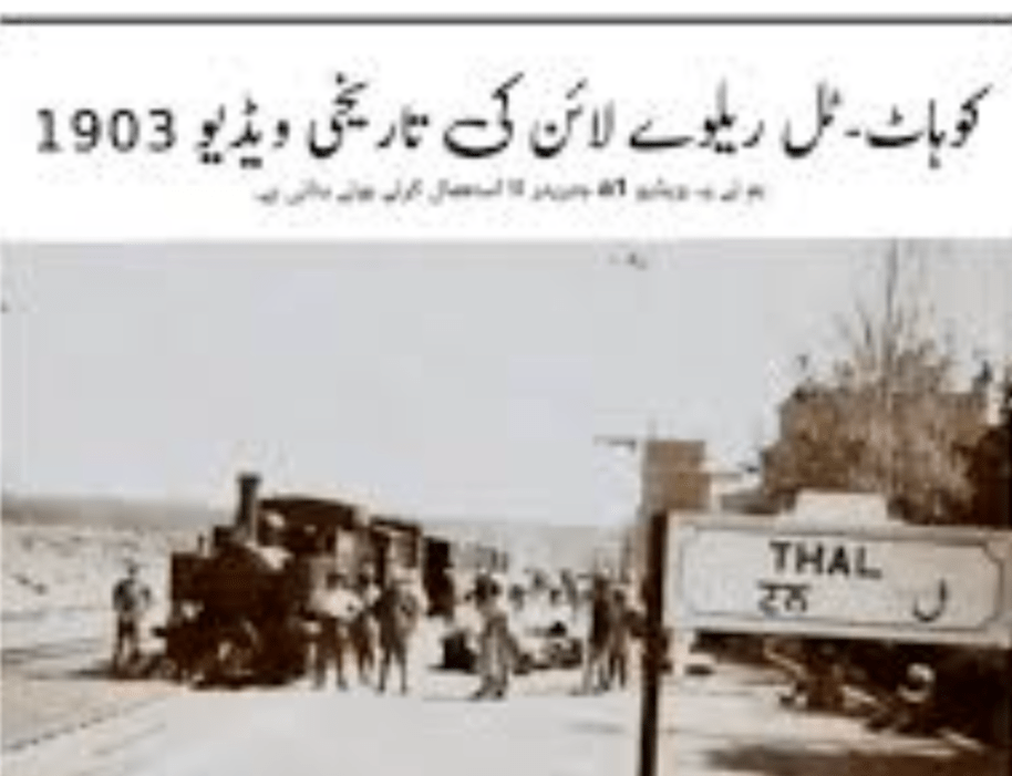
The featured image above is an early view of Thal Railway Station, possibly as early as 1903. [17]
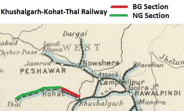
Khushalgarh-Kohat-Thal Railway was worked by North Western Railway. [11] It was a military railway which ran close to the border with Afghanistan, linking the border town of Thal with the wider network at Khushalgarh.
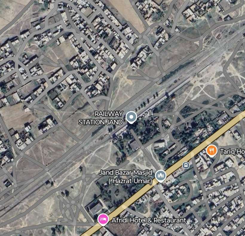
By 1881, Khushalgarh had been connected by a short 7 mile (11 kilometre) broad gauge spur to Jand the North Western Railway main line. [1]
A line from Khushalghar to Kohat was first surveyed in April 1899. In 1901, it was decided to that to bridge the Indus would be too expensive. Instead, a ropeway was built over the river and a 2ft 6in (762mm) narrow gauge line was constructed from the right bank of the Indus facing Khushalgarh to Kohat, a distance of about 30 miles (48 kilometres) and opened in May 1902. [1]
The 62 mile (100 kilometre) line from Kohat to Thal ran from Kohat through the Kohat Pass and up the Miranzai Valley to Thal near the Afghan border. It opened in stages from Mar 1901 reaching Thal in Apr 1903. [2]
An intriguing haulage experiment is recorded by Simon Darvill. It took place in March 1902 on the trackbed of the line to Thal. A section of John Fowler [6] portable tramway was laid and a passenger carriage and two wagons were hauled by both a mule and a pair of bullocks. [3] The purpose and outcome of these experiments is not known. [5]
An on-line search of the India Office Records records held at the British Library relating to this line gives several entries, the most relevant being L/MIL/7/14848; “Collection 335/15 Railway construction: Loi Shilman, Kohat-Thal, Thal-Parachinar lines.”; 1908. [5]
The line closed sometime in the 1990s. Steam was still in use in 1989 as photographs here bear witness. [
Locomotives
An excellent discussion about various Bagnall supplied locomotives used on this line can be found in Allan C. Baker’s article in The Narrow Gauge No. 293 of March 2025. [12] Baker’s article is about the deployment of a series of Bagnall 2-4-2T locomotives built between 1901 and 1906 at the Castle Engine Works in Stafford (UK).
The Route of the Railway – Jand to Thal
Google Earth/Google Maps allows us to view the line from above, but no Streetview images are available in this part of Pakistan as of September 2025. Ground-level photography is only available at a number of specific locations.
Jand
As we have noted the first stretch of the line was built in 1881, linking Jand to Khushalgarh.
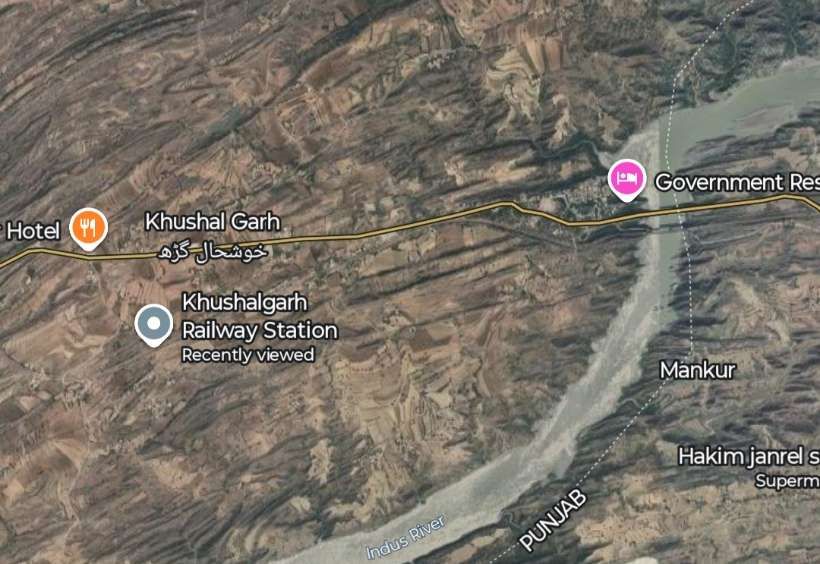
The line used to stop short of the River Indus. It did so from 1881 until the bridge opened in 1908. Khushalgarh could only be accessed by rope-worked boat across the Indus.
The Indus River Crossing
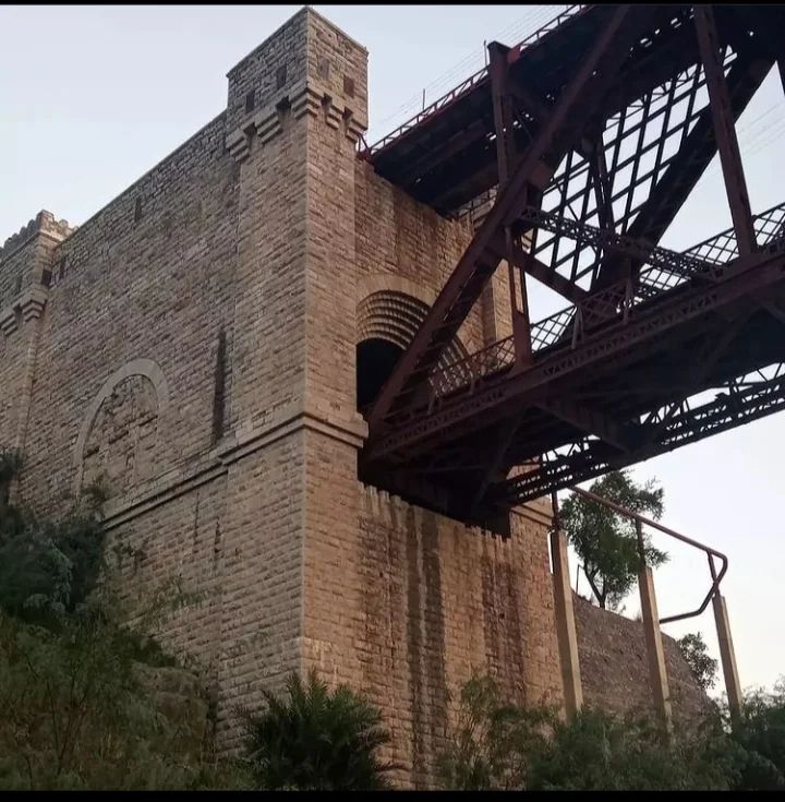
In 1903 an accident closed the ropeway over the Indus River and a boat bridge replaced it. Eventually the decision was made to construct the Khushal Garh Bridge [4] crossing the Indus river and, at the same time, to convert the line to Thal from narrow gauge to broad gauge. The length of the line to Kohat was converted by 1908 but conversion of the line to Thal was never completed.
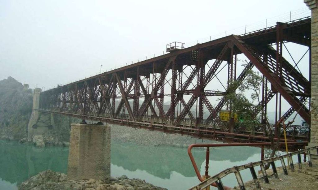
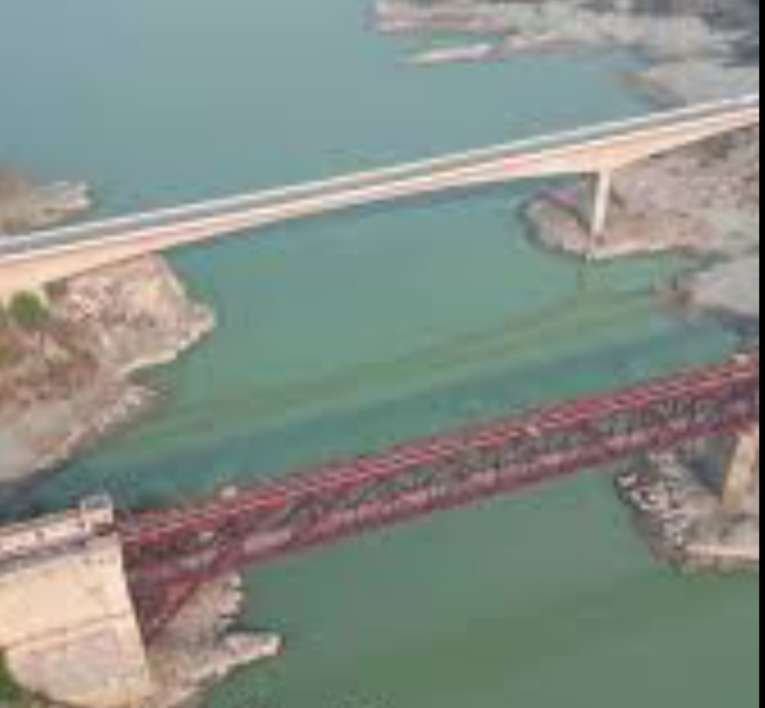
The bridge is reported to have been constructed by a Mr Robertson and is the shortest bridge over Indus River. [7]
On this bridge the train track and vehicles road for vehicles are constructed together. The upper side is used for trains and lower one for general traffic. [8]
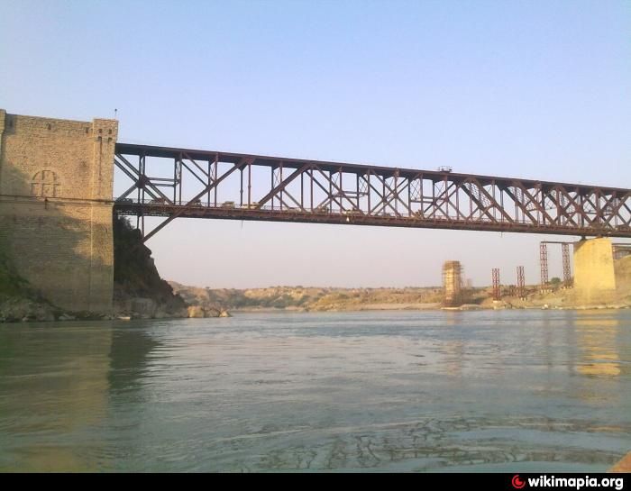
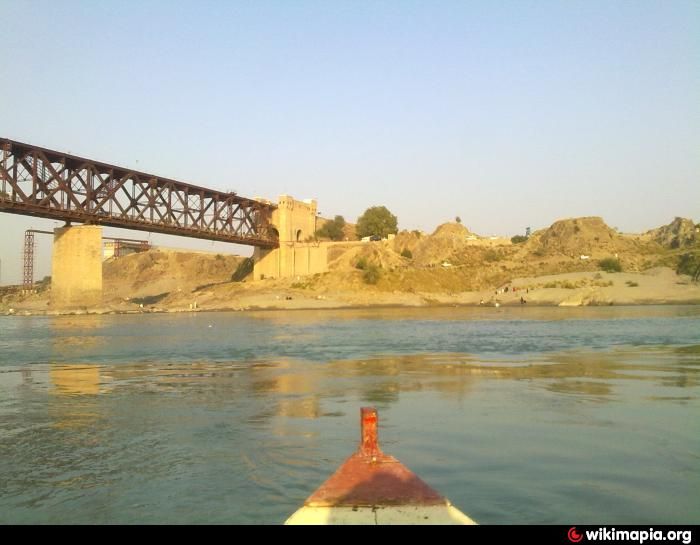
The two photographs above were taken from the same location on the banks of the Indus River and show the original Khushal Garh Bridge © Unknown. [8]. A new structure sits alongside this bridge and carries the road.
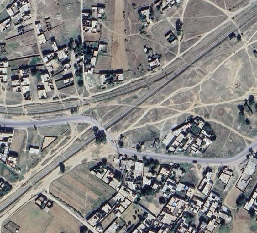
Khushalgarh
Khushalgarh on the West side of the River Indus. Originally passengers from Jand had to leave the broad-gauge train on the East side of the river and use the ferry to cross to Khushalgarh where onward travel was possible on the narrow-gauge line.
Wikipedia tells us that Kushalgarh is a village in the Kohat District of Khyber Pakhtunkhwa. [14] The modern railway station is some distance from the river.
The line West from Khushalgarh was initially 2ft 6in narrow-gauge. As noted above work commenced on its construction in 1901, opening as far as Kohat in 1902. The decision not to build a bridge over the river was shortsighted and by 1908 the bridge over the river had been built and the line West of the river was re-gauged, providing a broad-gauge service as far as Kohat.
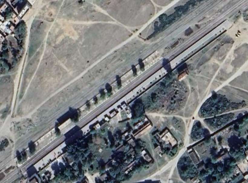
Kohat
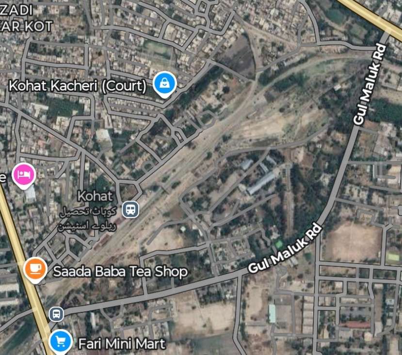
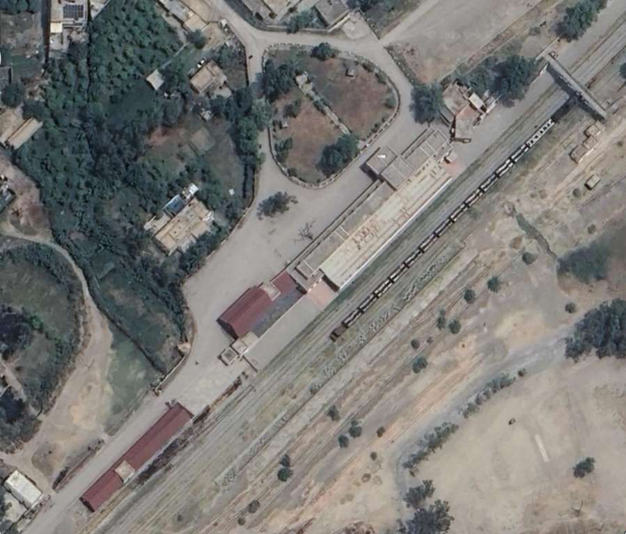
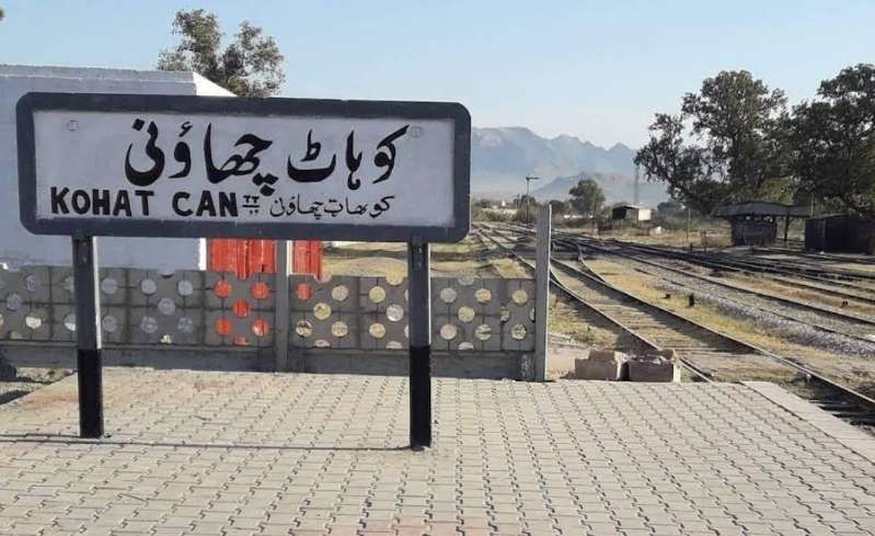
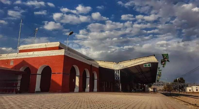
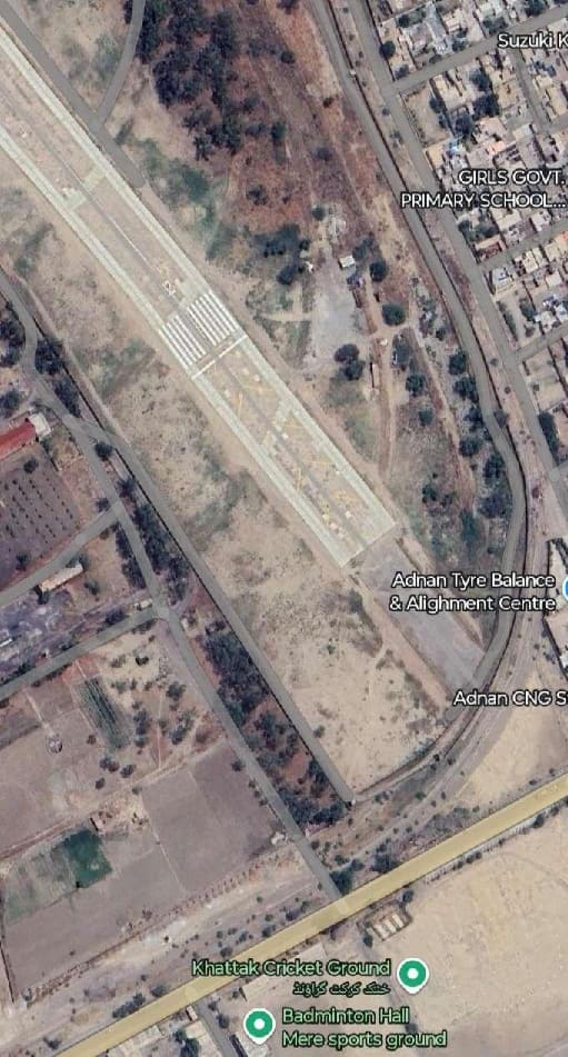
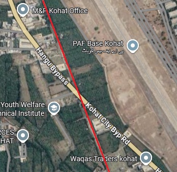
Kohat Railway Station is now the terminus for passenger services. To the Southwest, there are a number of what appear to be industrial sidings. The line of the 2ft 6in gauge railway to Thal is apparently crossed by the runway of a Pakistan Air Force Base. Following the line of the old railway back from Hangu, it appears that the line runs round the South end of the Airbase runway. Possibly it was diverted when the runway was built.
It is possible to follow the line of the old railway to the terminus at Thal. The following images do this, file sizes have been kept to a minimum which means that image resolution is not great, but the whole route can be followed on Google Maps if a higher resolution is important.
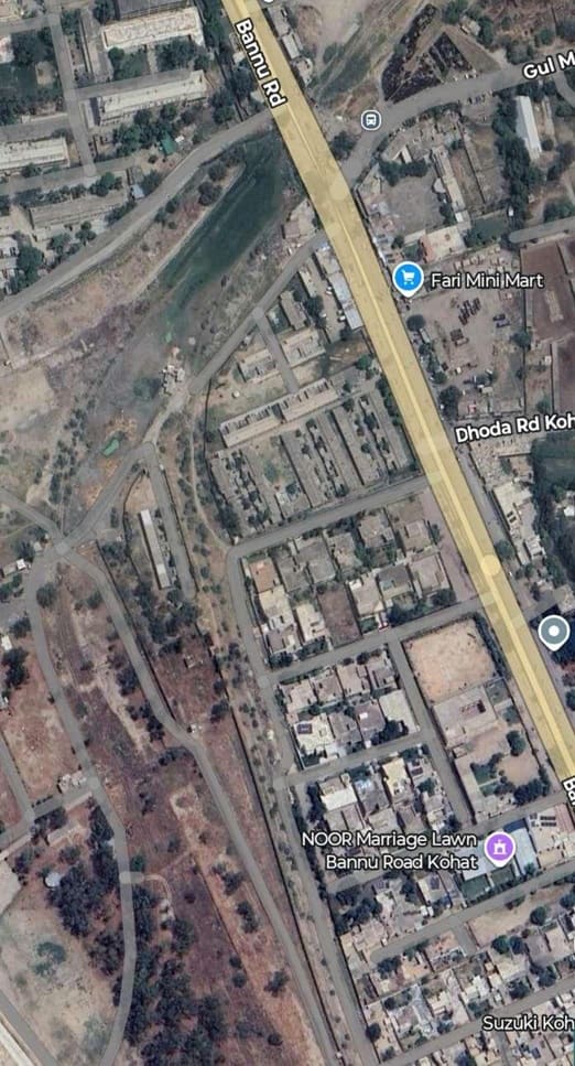
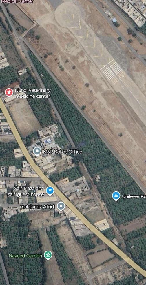
The old railway left Kohat Railway Station at its Southwest end. The route of the railway crosses Bannu Road and turns South to run parallel to Bannu Road and the runway to the West. [Google Maps, September 2025]
Continuing South-southeast the route of the old line reaches the South end of the runway and curves through South to Southwest. [Google Maps, September 2025]
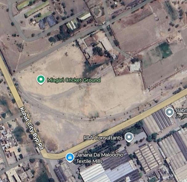
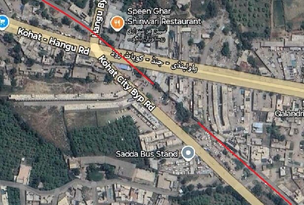
On this next extract from Google’s Satellite imagery the route of the old line can be seen curving round (South of the Green Flag marking Miagan Cricket Ground) towards the Northwest and crossing Kohat City Bypass Road. Google Maps, September 2025]
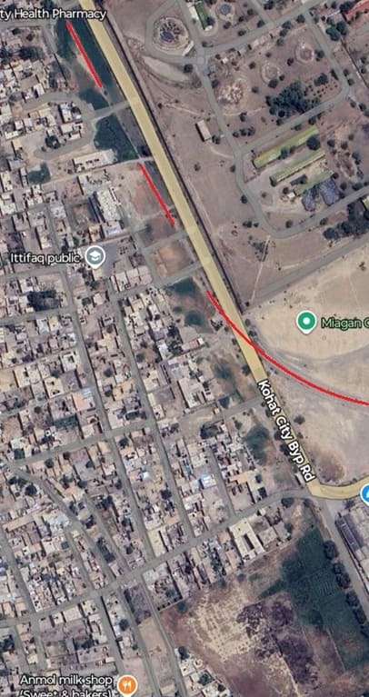
The route of the old line is visible to the point where it crosses Kohat City Bypass. To the West of the road the route of the old railway heads Northwest gradually separating from the line of the road. {Google Maps, September 2025]
The line of the old railway continues Northwest as the road turns to the North. The old railway formation is under a modern road at this point. [Google Maps, September 2025]
The old railway continued on the same bearing. The Kohat City Bypass crosses the route of the old line as shown here. [Google Maps, September 2025]
The North-northeast trajectory continues – the road following the route of the old line only appears in grey on this extract from Google’s satellite imagery. [Google Maps, September 2025]
The route of the old line continues to be followed by a modern road. [Google Maps, September 2025]
The route of the old line continues to be followed by a modern road. [Google Maps, September 2025]
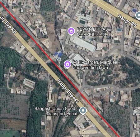
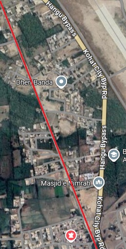
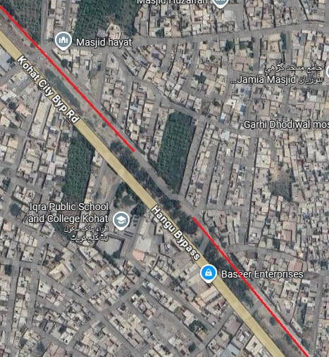
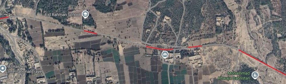
The route of the old line Appears to sit between Hangu Bypass and a local road. [Google Maps, September 2025]
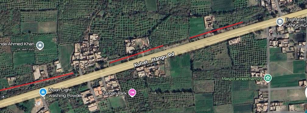
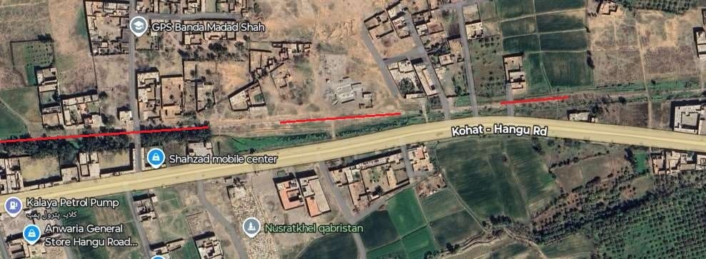
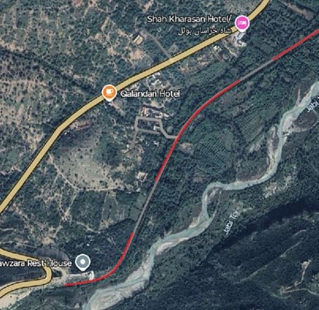
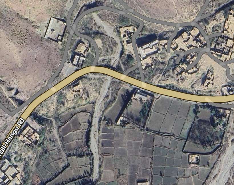
The route of the old line crosses the Kohat-Hangu Road and turns to shadow it. [Google Maps, September 2025]
The route of the old line follows a modern road. [Google Maps, September 2025]
The route of the old line continues to be followed by modern roads with occasional lengths more like footpaths. [Google Maps, September 2025]
The route of the old line continues to be followed by a modern road. [Google Maps, September 2025]
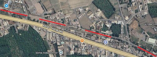
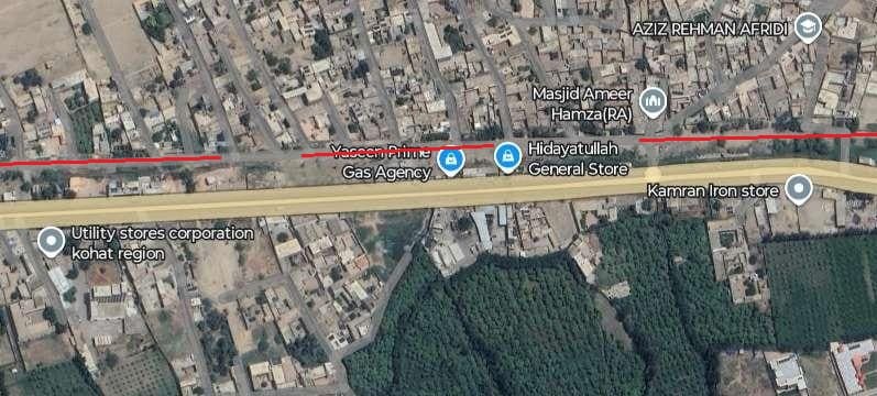
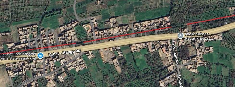
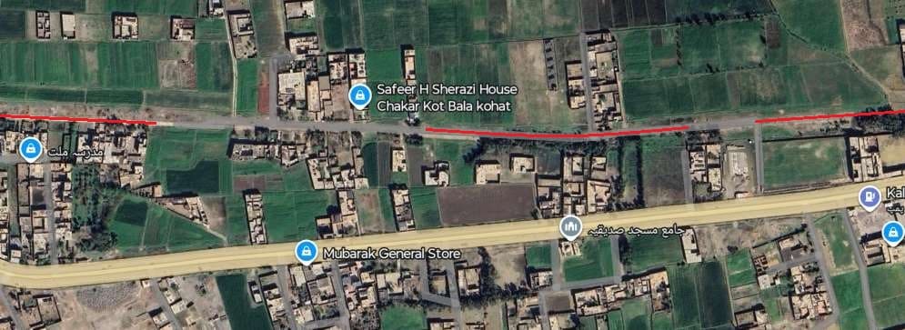
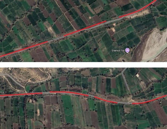
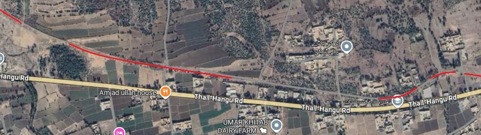
The route of the old line continues on the North side of the Kohat-Hangu Road. [Google Maps, September 2025]
The route of the old line continues on the North side of the Kohat-Hangu Road. [Google Maps, September 2025]
The route of the old line continues on the North side of the Kohat-Hangu Road on both of these extracts from Google’s satellite imagery. [Google Maps, September 2025]
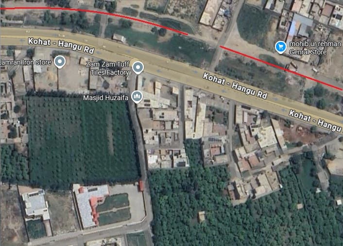
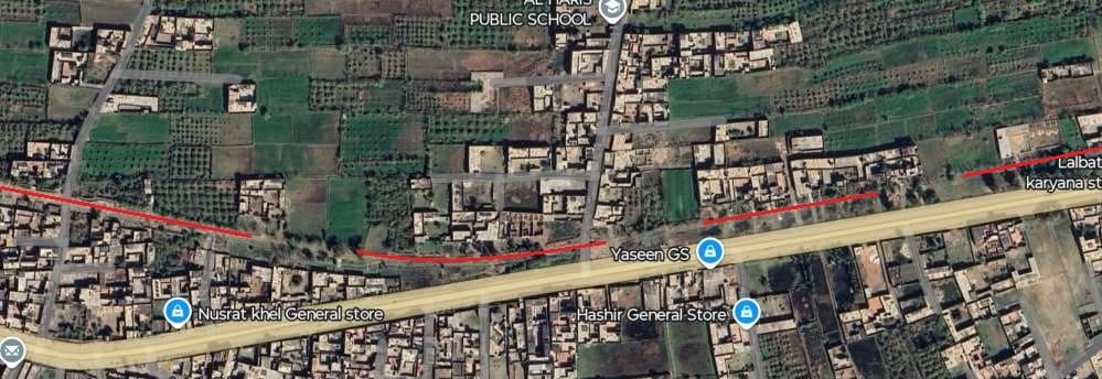
The route is still on the North side of the Kohat-Hangu Road. [Google Maps, September 2025]
The route remains on the North side of the Kohat-Hangu Road. [Google Maps, September 2025]
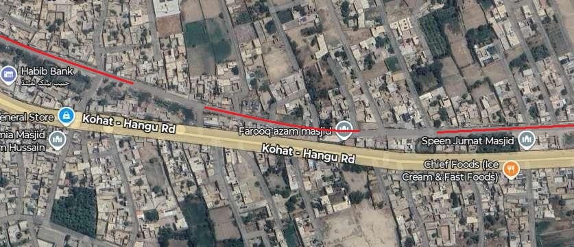
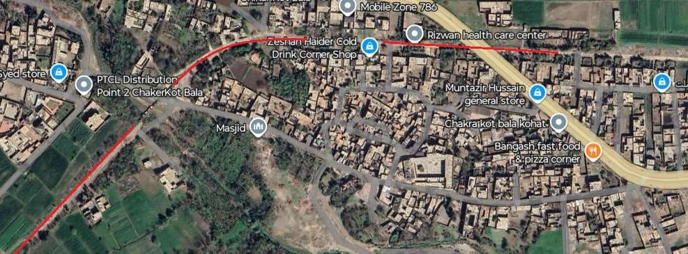
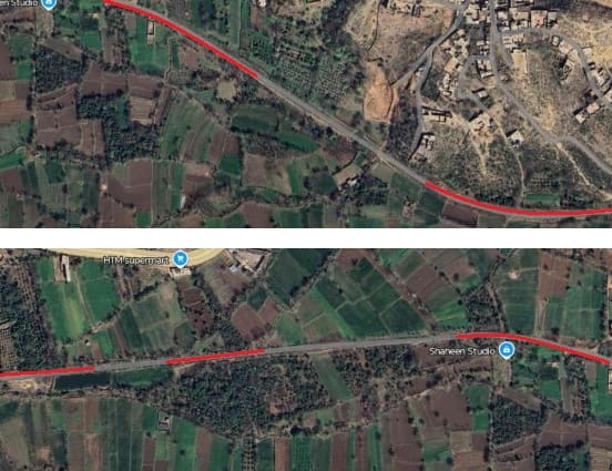
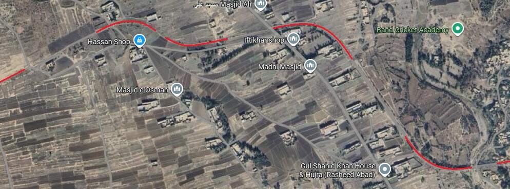
The route separates a little from the Kohat-Hangu Road. [Google Maps, September 2025]
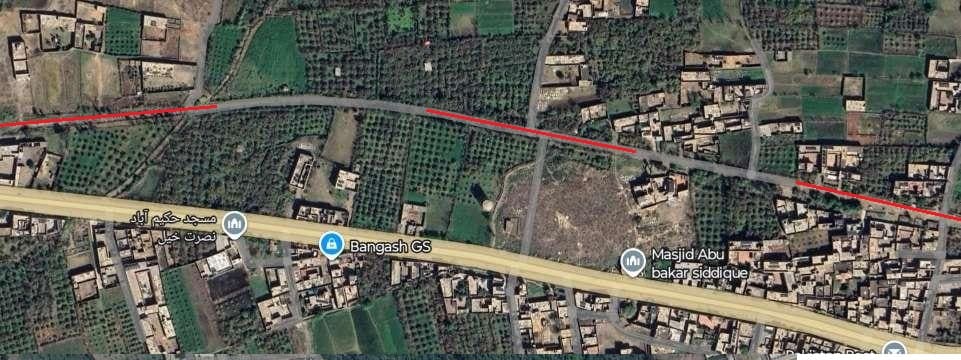
But returns relative soon to sit close to the road. [Google Maps, September 2025]
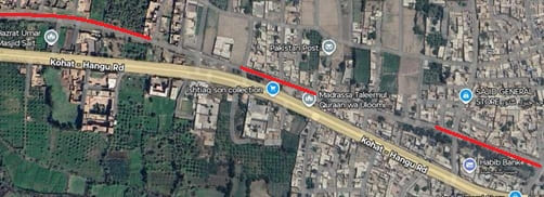
The route continues on the North side of the road. [Google Maps, September 2025]
The route continues on the North side of the road. [Google Maps, September 2025]
A significant change in direction of the road results in the route switching to the South of the road.
For a while the route of the old line runs a number of fields away from the Kohat-Hangu Road.
On both these extracts the route of the old line remains remote from the main road.
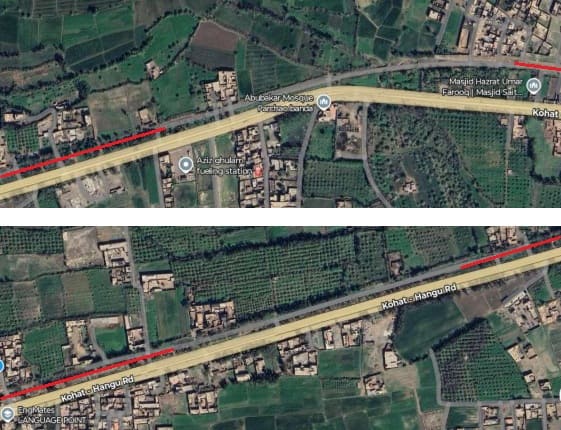
A modern access road follows the route of the old line.
The same applies for these next two extracts. [Google Maps, September 2025]
An enlarged view of the left side of the above image which shows the main road much closer to the line of the old railway. [Google Maps, September 2025]
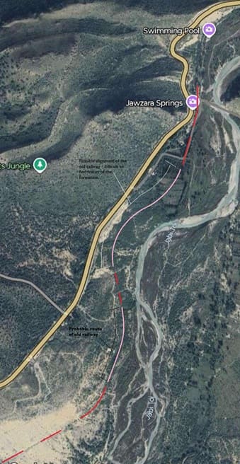
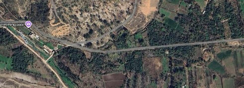
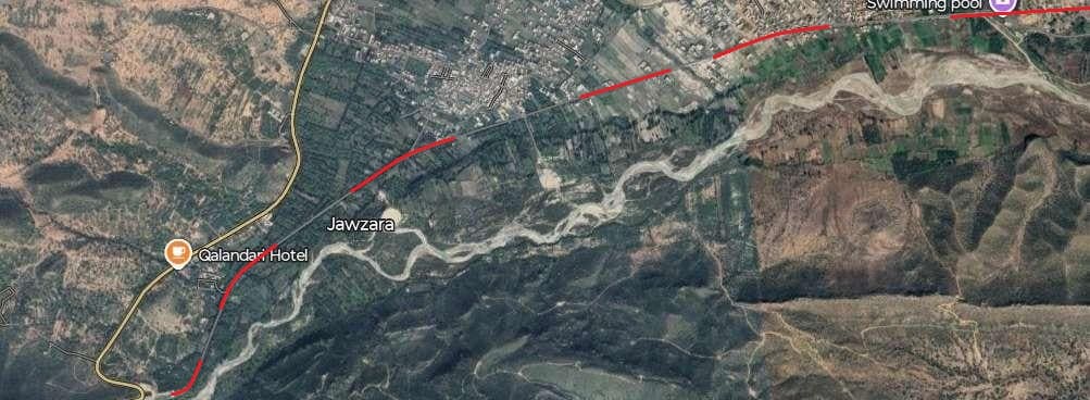
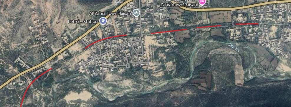
The alignment of the old railway over this next length i more difficult to determine. It appears to curve around the North side of the swimming pool flagged at the top-right of the image and runs close to the Jawzara Springs. The lengths shown pink are surmised rather than certain. The route of the line is clearer once again towards the bottom of the image where it approaches a bridge over the Kohat Toi River, a tributary of the Jabi Toi River. [Google Maps, September 2025]
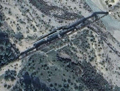
The redundant railway bridge over the Kohat Toi River remains standing. It is located just off the bottom-left of the satellite image above. [Google Maps, September 2025]
The bridge above is just off the right side of this satellite image. [Google Maps, September 2025]
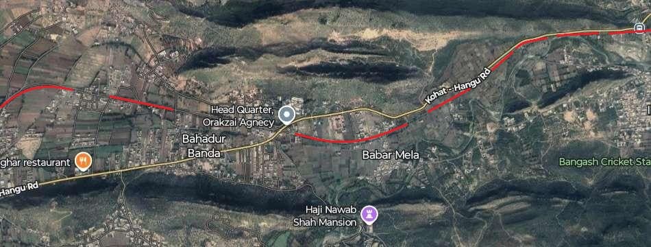
The route of the old line continues on the South side of the main road.
The line continues Southwest avoiding the high ground which the road crosses and curves round to meet the Kohat-Hangu Road at the bottom-left of this extract, adjacent to the bus-stop shown bottom-left on the satellite image
The route of the old line runs on The South side of the road before curving West-Northwest and crossing he road.
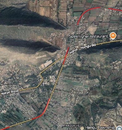
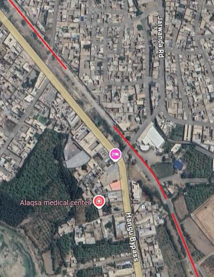
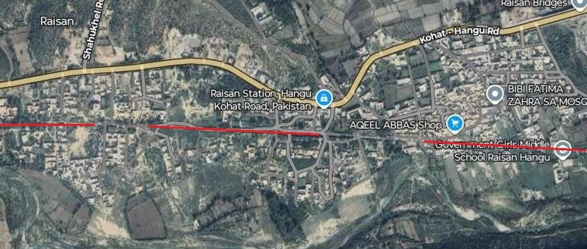
A relatively tight curve takes the route of the old line back across the modern road. At the centre of this image, Hangu Bypass now follows the route of the old railway.[Google Maps, September 2025]
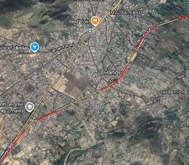
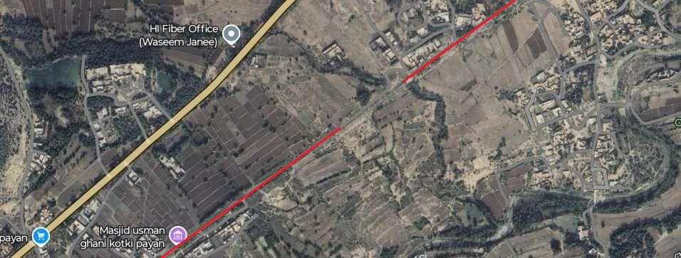
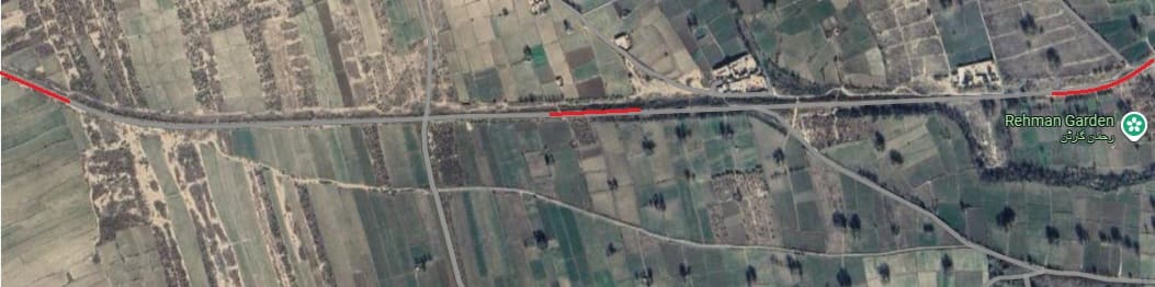
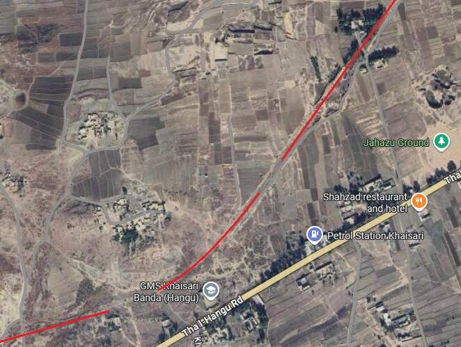
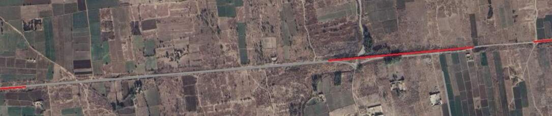
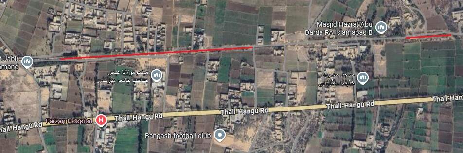
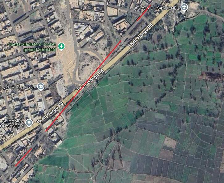
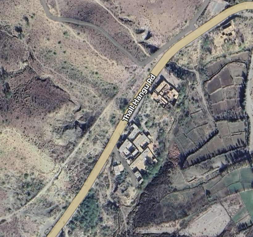
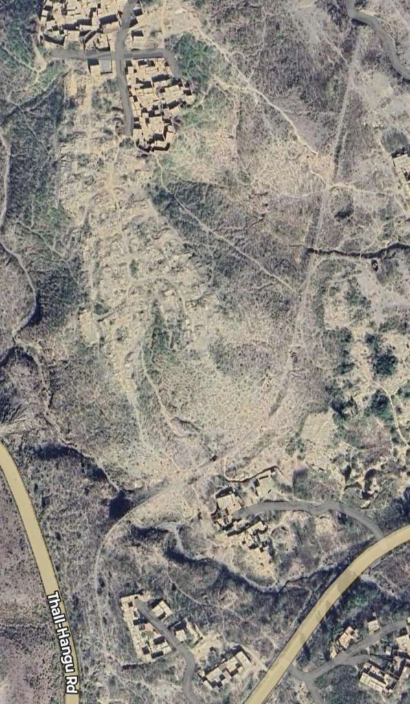
Hangu Bypass continues to follow the lie of the old railway on the Southeast side of the city and does so until the Bypass meets the Thall-Hangu Road. [Google Maps, September 2025]
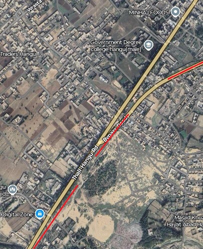
A closer view of the road junction shows the route of the old railway running immediately alongside the Thall-Hangu Road. [Google Maps, September 2025]
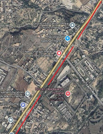
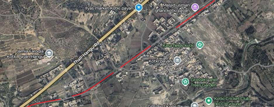
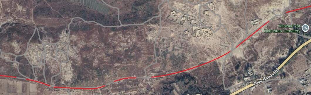
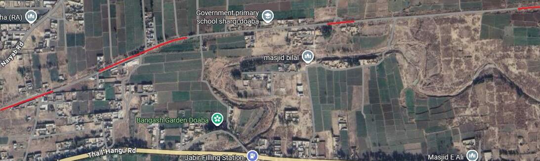
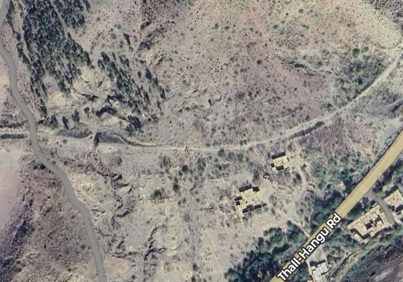
The route of the old line continues running parallel to the main road. [Google Maps, September 2025]
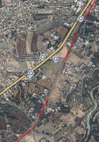
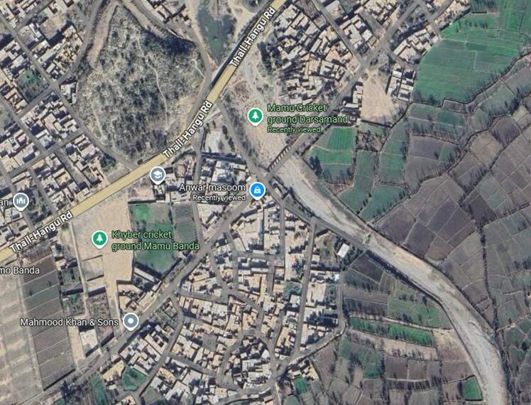
The two separate somewhat as the route of the old line continues South-southwest and then turns to the Southwest. [Google Maps, September 2025]
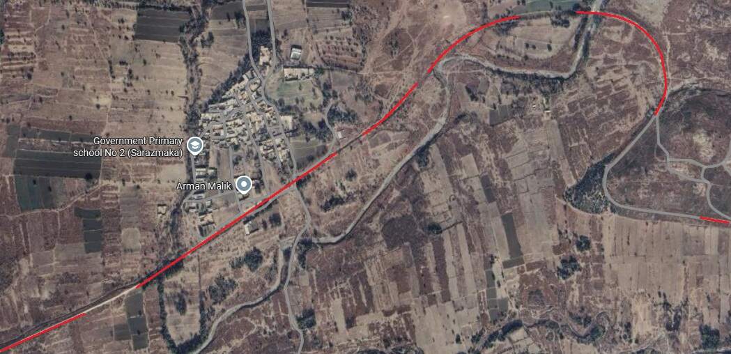
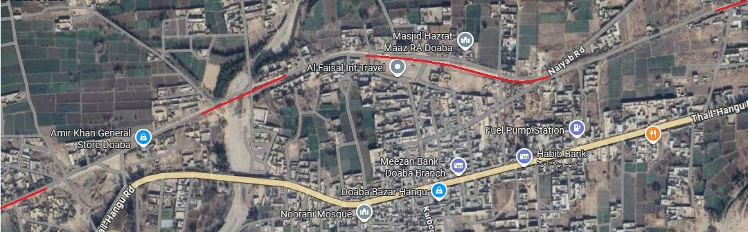
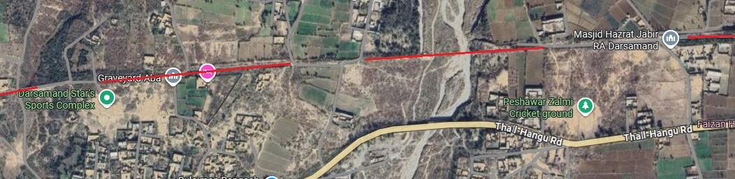
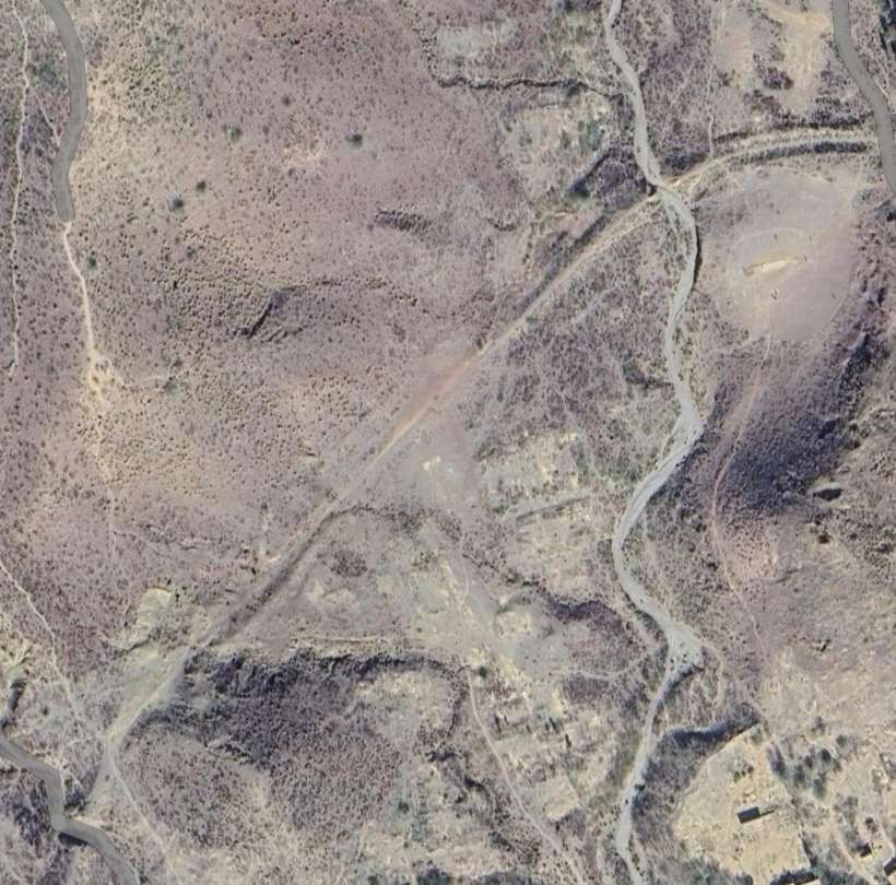
Further Southwest the route of the old line returns to the shoulder of the modern road.
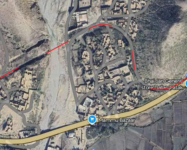
It runs immediately alongside the road for a short distance, before turning away to the South.
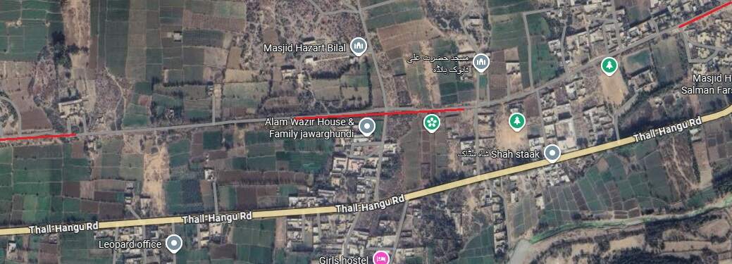
The change od direction can be seen at the bottom-left of the last image and appears more clearly on this extract. Its route is followed by a minor road.
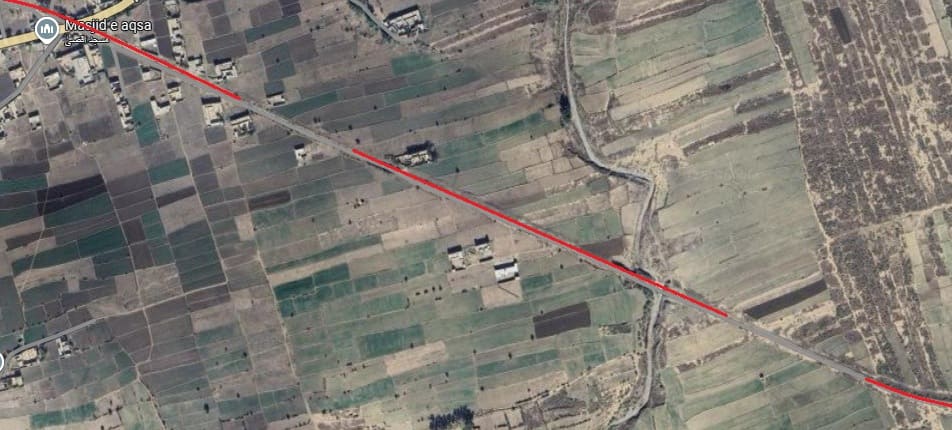
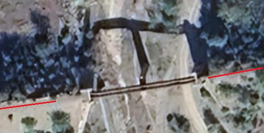
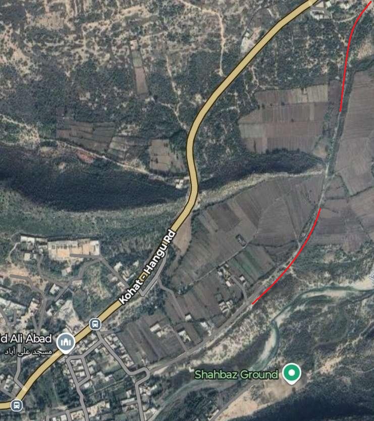
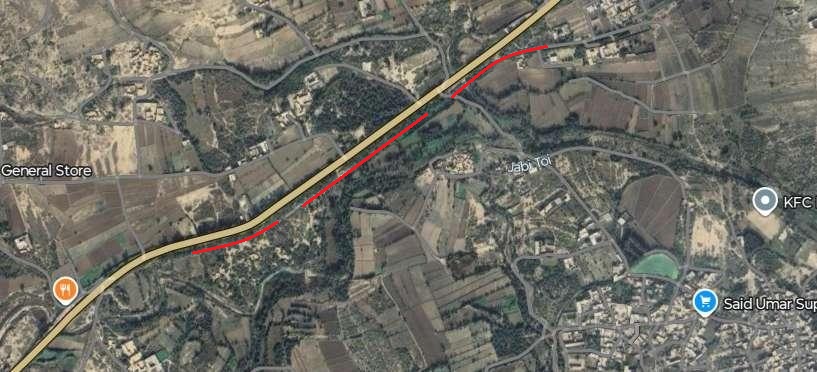
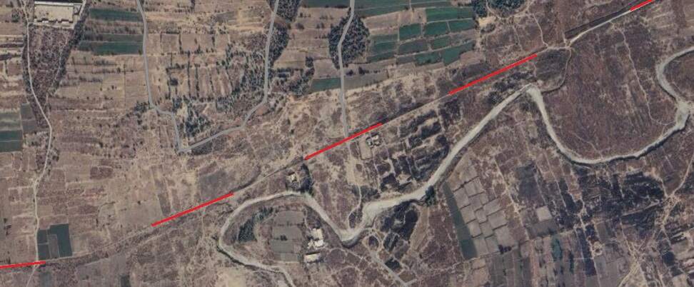
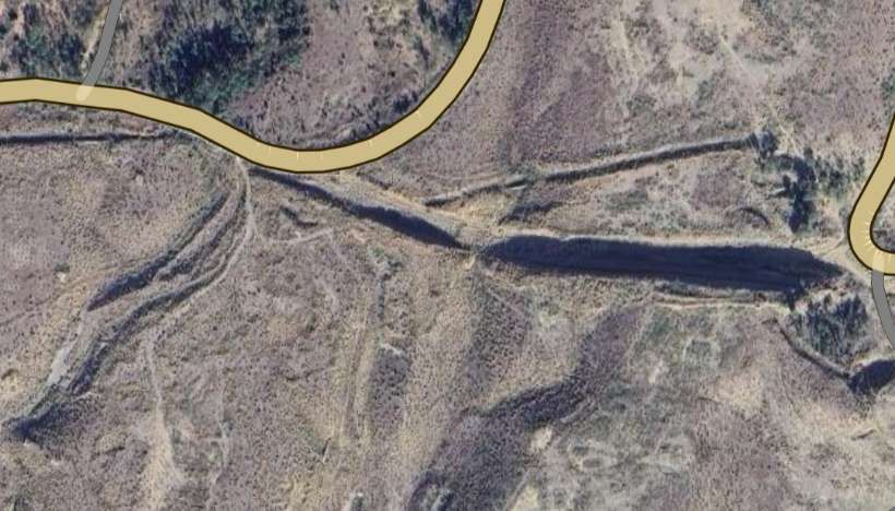
Bottom-right on the image above the old railway bridged a dry river bed on a two-span girder bridge which is still standing in the 21st century. [Google Maps, September 2025]
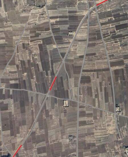
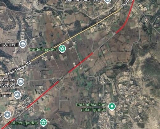
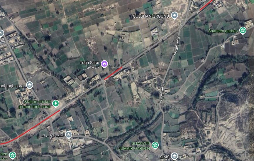
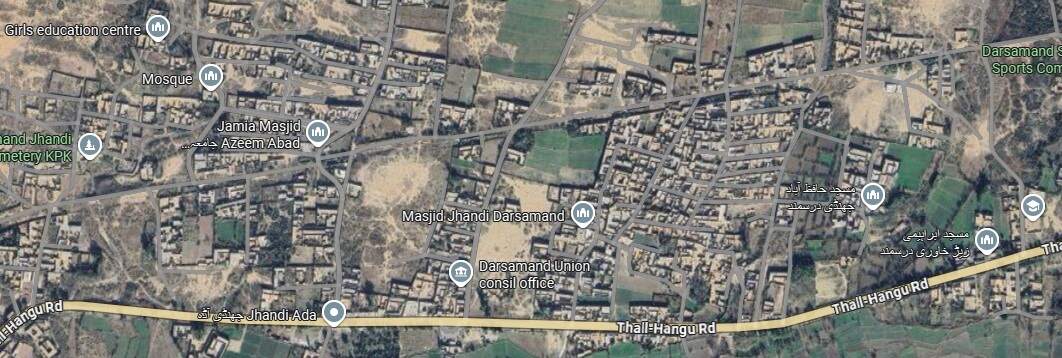
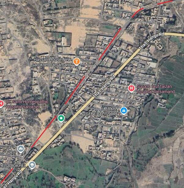
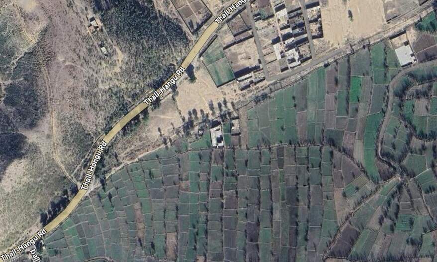
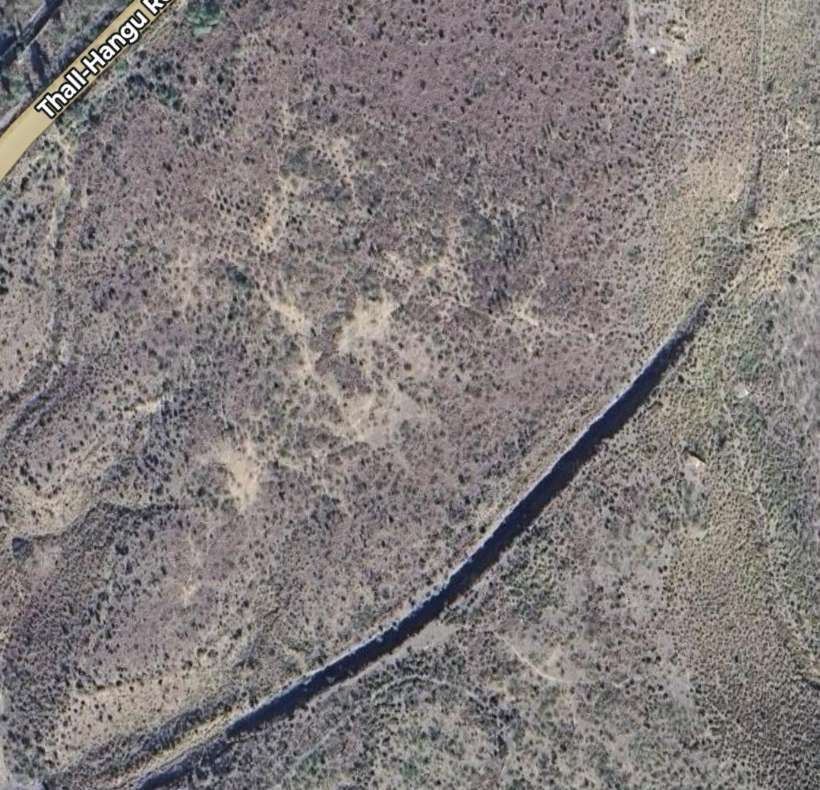
This next length of the line ran South-southwest before curving a little to the Southwest, and then, as can be seen on the next extract from Google’s satellite imagery, towards the West-southwest to run parallel to the Thall-Hangu Road. [Google Maps, September 2025]
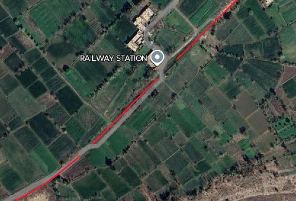
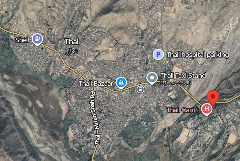
Thal
The erstwhile railway station at Thal sat on the opposite (East) side of a tributary to the Kurram River looking West across the town/city.
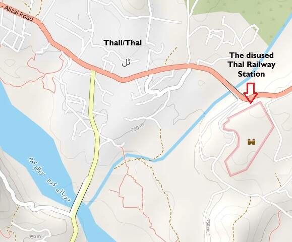
Thal sits on the banks of the Kurram River. The old railway Station sat to the East of a tributary to the River Kurram. [15]
References
- “Administration Report on the Railways in India – corrected up to 31st March 1918”; Superintendent of Government Printing, Calcutta; page 107; accessed on 20th September 2025.
- “Administration Report on the Railways in India – corrected up to 31st March 1918”; Superintendent of Government Printing, Calcutta; page 128; accessed on 29th September 2025.
- Simon Darvill; Industrial Railways and Locomotives of India and South Asia; The Industrial Railway Society, 2013. Available at http://irsshop.co.uk/India.
- https://wiki.fibis.org/w/Khushal_Garh_Bridge, accessed on 20th September 2025.
- https://wiki.fibis.org/w/Khushalgarh-Kohat-Thal_Railway, accessed on 20th September 2025.
- https://wiki.fibis.org/w/John_Fowler_%26_Company_Ltd, accessed on 20th September 2025.
- https://pakistanrail.tripod.com/bridges.html, accessed on 20th September 2025.
- https://wikimapia.org/13993700/Khushal-Garh-Bridge, accessed on 20th September 2025.
- https://lh3.googleusercontent.com/gps-cs-s/AC9h4nqhc1tS7hXAJfKdQVGbIeMYbf-RGjQgs5G2B48_6WolAPEhNPmJ_Bef27W_TfH68_mmzP0chuixfO3JpY0-Usvplpa6v2vr143xaVC_4WT_h474H1k49I_vZyVsoHP4p0HP2y9R=s2036-w1016-h2036-rw, accessed on 20th September 2025.
- https://www.google.com/search?client=ms-android-motorola-rvo3&sca_esv=45db0090f0b5312b&sxsrf=AE3TifPt4Si5jsOiubF6-_y2iveQLNC5ug:1758356645643&q=khushal+garh+bridge+photos&uds=AOm0WdHzyYX3jsGClkjewtzSeR2sJ-1g6txAY2oFEVHAjQRcwsDbdv-vgcQuFuhyd_0fugGlX58xlo7j-_-RezG3t16nAeZB_3bzptjBve0mCHa0uDmIYUpHlM8pgaYsrTBOTfU0FaWT_re64BdTOHCRo_S0s6T5vpbn6azUzguRWXhR2foPywZHYo6fNtJ-_7BRPEW6RHrccWpjS1QAiz8L_Ar6xFF5a5ZVr09woxtFIHTqE6lYbCP1lSsPeMGrHxSdZ0kRN40JoWSg3cMFel_uolTfzuZYJMURCNnd93XMF8j0_XLBafwsSrCzrDRJw_dndf4Vkzki2SQ2xqZPqaxQMOHWPxBk7g&si=AMgyJEtnXabvb9Bq8u4Xf1H4V_vNXLBtfJ_awnuzAD8AOp3CykDncve52uFxc0ac3nW9LpQBbJzR-Rxi7uR32z1Hk0DNjR8L3yHnvGq-QIsZOkRl6aCjpt4qpAHS5QLLPbw82IHW0f1OHaSmGm9oTMux9dCUlPG5_Q%3D%3D&sa=X&sqi=2&ved=2ahUKEwj27oH69OaPAxWp1gIHHW1uOUgQk8gLegQIIxAB&ictx=1#vhid=JppReWtb5p77JM&vssid=l&ebo=1&lpg=cid:CgIgAQ%3D%3D, accessed on 20th September 2025.
- The North Western Railway (NWR) was a major railway system in British India that served the North-West Frontier region. After the 1947 partition, it was split, with the majority of its lines becoming the foundation for Pakistan Railways and a smaller portion forming the Eastern Punjab Railway in India. The NWR was headquartered in Lahore and extended from Karachi to Delhi and into the frontier regions, a crucial infrastructure for both civilian transport and British strategic planning. See: https://en.m.wikipedia.org/wiki/North_Western_State_Railway, accessed on 20th September 2025.
- Allan C. Baker; Bagnall Locomotives for the Indian Strategic Military Railways; in The Narrow Gauge, journal of the Narrow Gauge Railway Society, No.293, March 2025.
- https://www.facebook.com/share/1ZVhtMfqW6, accessed on 20th September 2025.
- https://en.m.wikipedia.org/wiki/Kushalgarh,_Pakistan, accessed on 20th September 2025.
- https://www.openstreetmap.org/#map=14/33.36412/70.55922&layers=P, accessed on 21st September 2025.
- https://www.world-railways.co.uk/railway-photo-11412, accessed on 25th September 2025.
- https://www.facebook.com/share/r/1FAo8NVsVL, the link is to an AI generated series of short videos from pictures from the railway, accessed on 25th September 2025.
