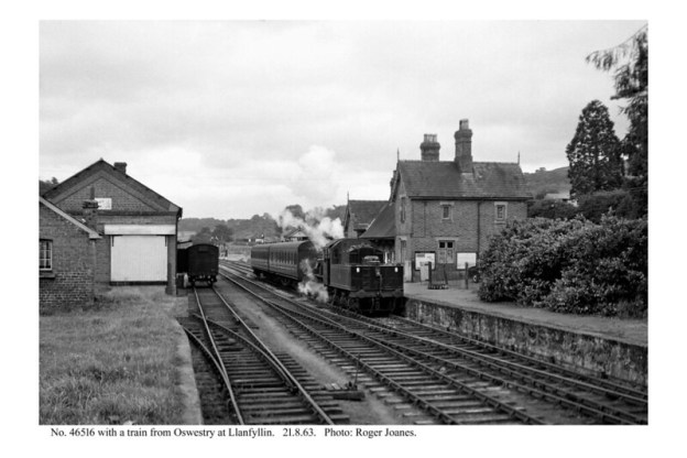
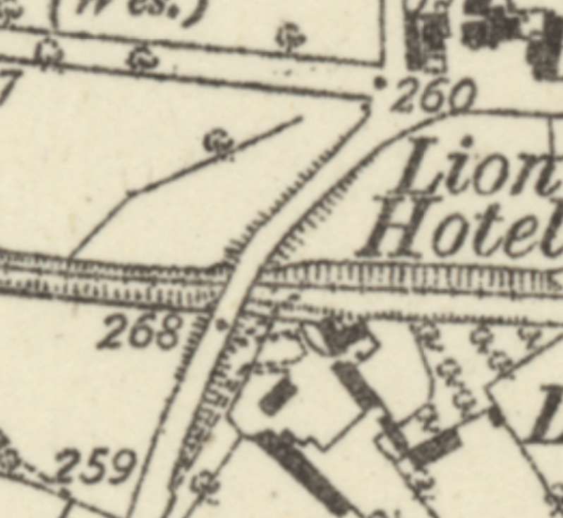
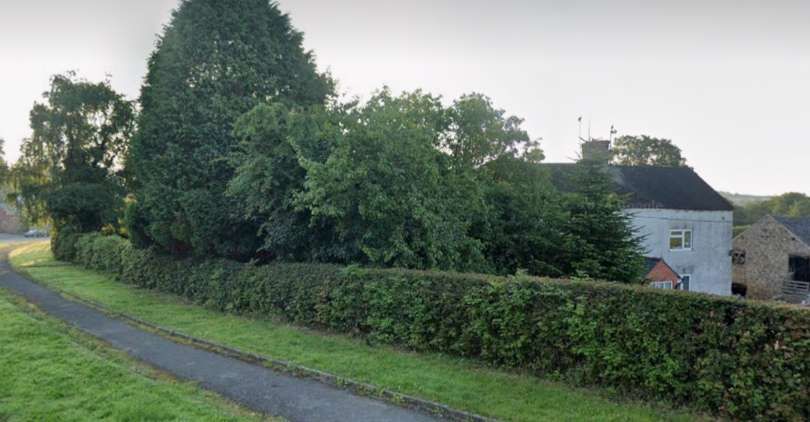
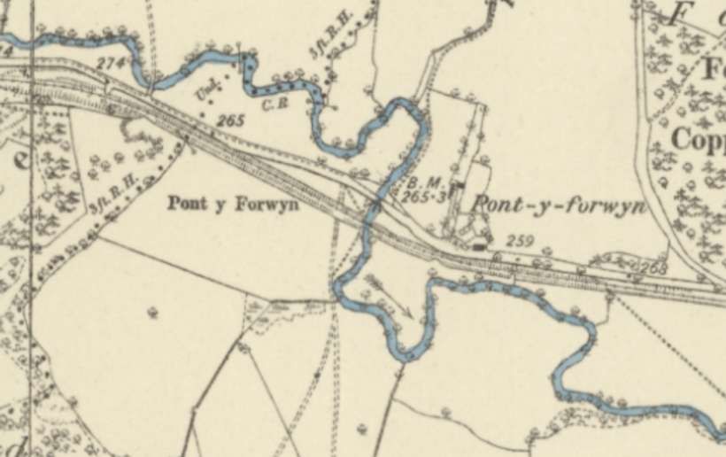
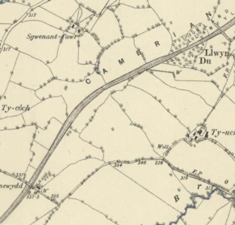
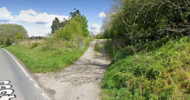
In the first article [4] in this short series, we finished the first part of our journey from Oswestry along the Llanfyllin Branch just after passing through Carreghofa Halt with its adjacent combined canal aqueduct and road bridge. Just beyond the bridge we noted the Nantmawr Branch heading away to the North while trains for Llanfyllin ran round a short chord to meet what was the original alignment of the Llanfyllin Branch.
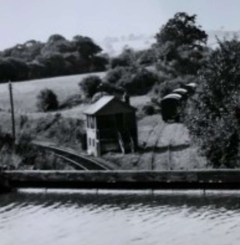
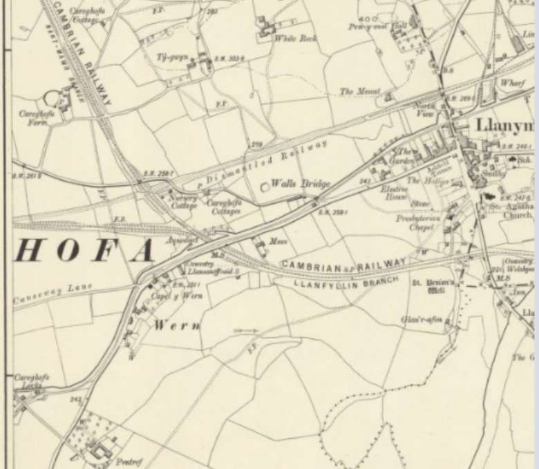
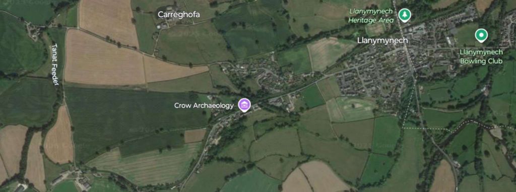
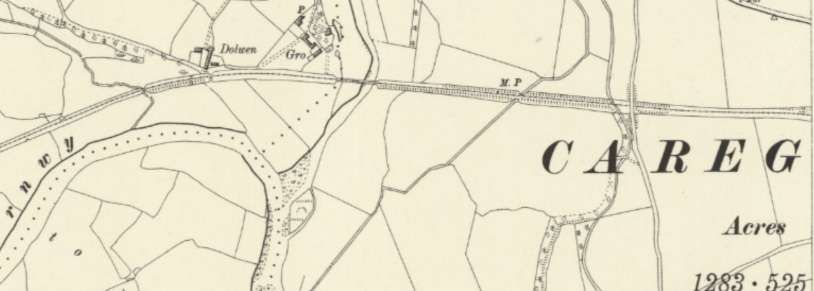
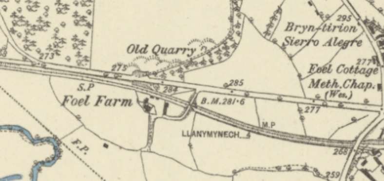
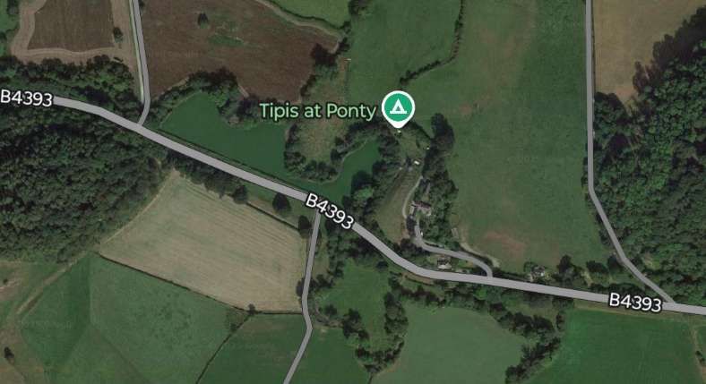
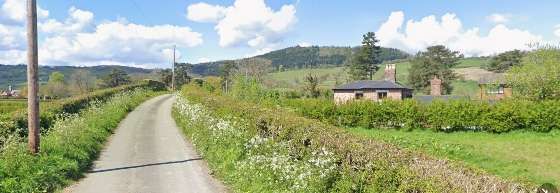
This photograph was taken from the road/canal bridge to the Northwest of Carreghofa Halt. Trains for Llanfyllin took the chord to the left. The Nantmawr Branch heads away to the North. [4]This extract from the 6″ Ordnance Survey of 1900, published in 1902, shows the relationship of the old and new routes taken by branch trains for and from Llanfyllin. The earlier alignment is shown as dismantled and runs to the North of the later alignment. The chord linking the two is on the left of this extract with the line to Llanfyllin leaving the left side of the extract. [5]This satellite image picks out the routes of the lines discussed as they appear in the 21st century. Just to the North of Llanymynech, the original line of the Llanfyllin Branch can be made out. A line of trees gives way travelling westwards to field boundaries that follow the route of the old line. To the South of Llanymynech, the more recent alignment is highlighted by field boundaries becoming tree lined as it approaches the location of Carreghofa Halt and then passes under the modern B4398 and the line of the canal. Immediately to the North of the Canal/Road Bridge the chord connecting the newer line to the older alignment of the Llanfyllin Branch is still described by a line of trees and then by field boundaries. [Google Earth, 28th February 2025]
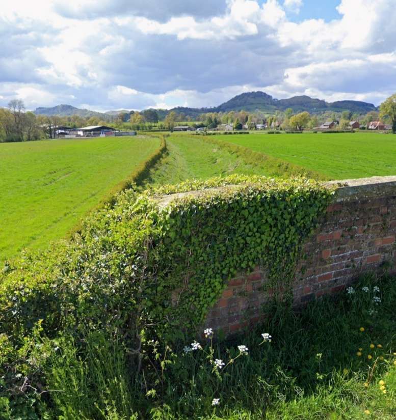
After leaving the 26-chain chord trains headed due West for Llansantffraid across “a tract of pleasant agricultural countryside.” [3: p635] Within a short distance the Grove Viaduct was reached. It was a 90-yard long viaduct which sat about 7.7 miles from Oswestry.
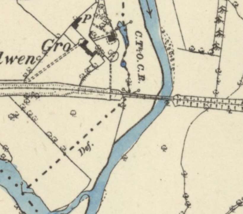
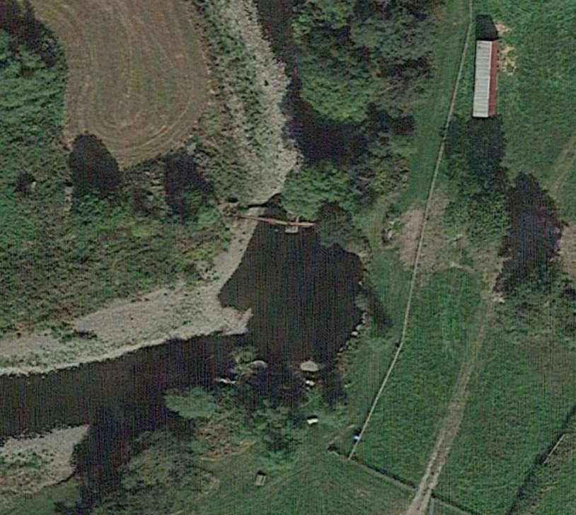
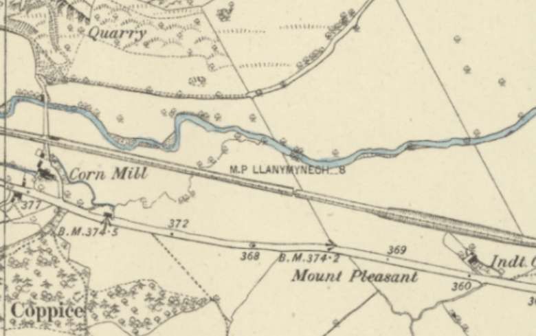
This extract from the 6″ Ordnance Survey of 1900, published in 1903, shows the Llanfyllin Branch heading West over Grove Viaduct which is close to the centre of the image. The Afon Vyrnwy can be seen on the left side of the extract. [6]This satellite image covers approximately the same length of the Llanfyllin Branch as does the 6″ OS map extract above. [Google Earth, March 2025]
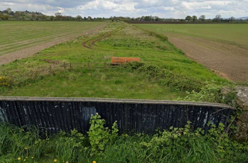
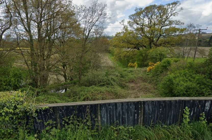
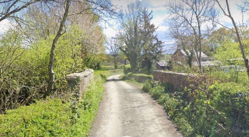
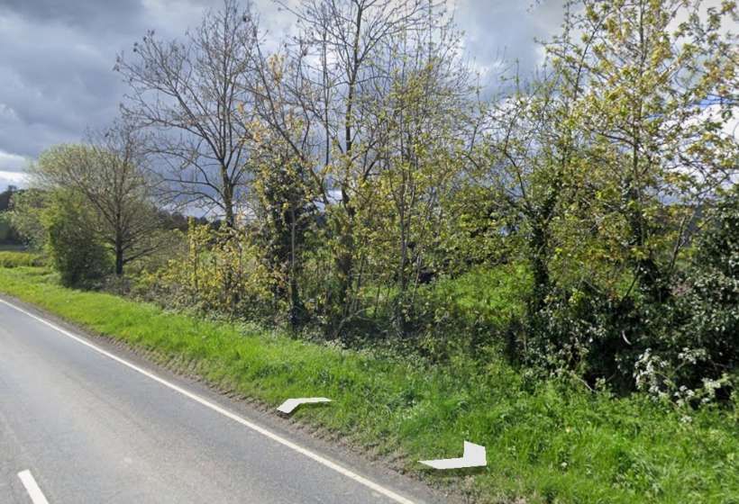
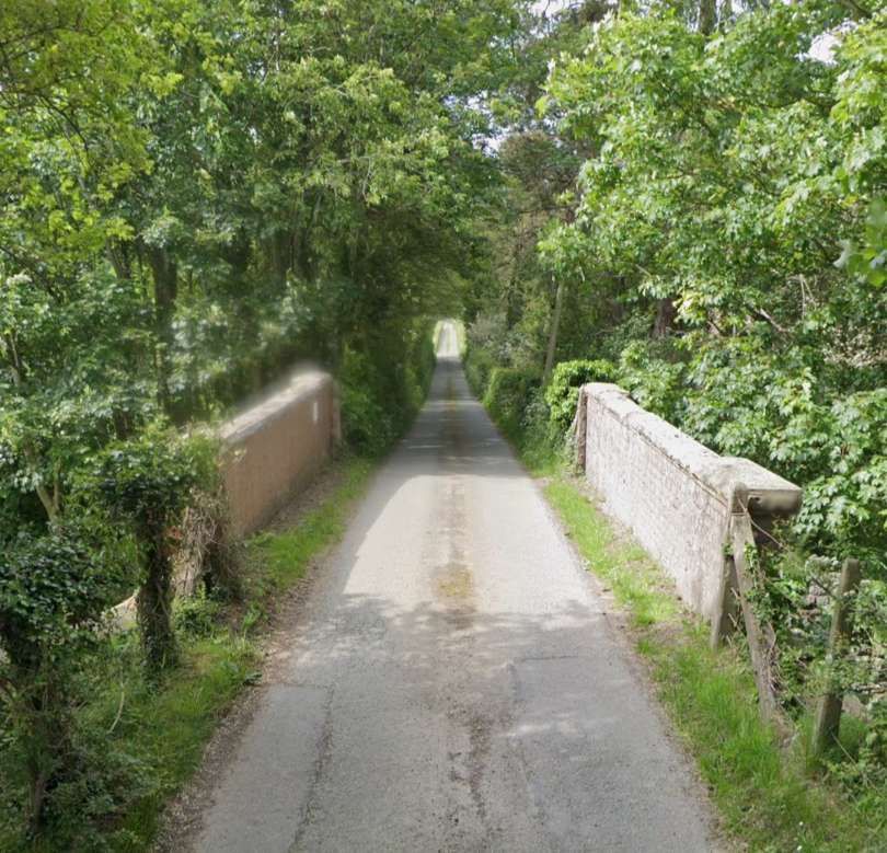
A minor road bridged the line to the East of Grove Viaduct. The railway cutting has been infilled but the bridge parapets and the deck under the road remain.
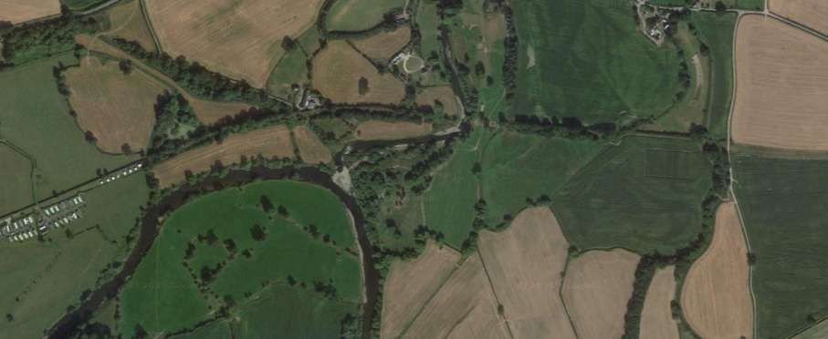
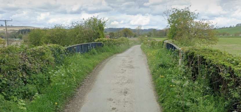
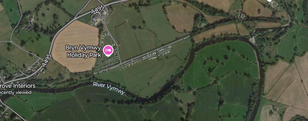
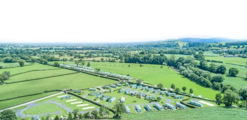
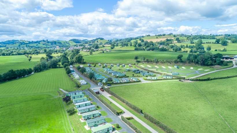
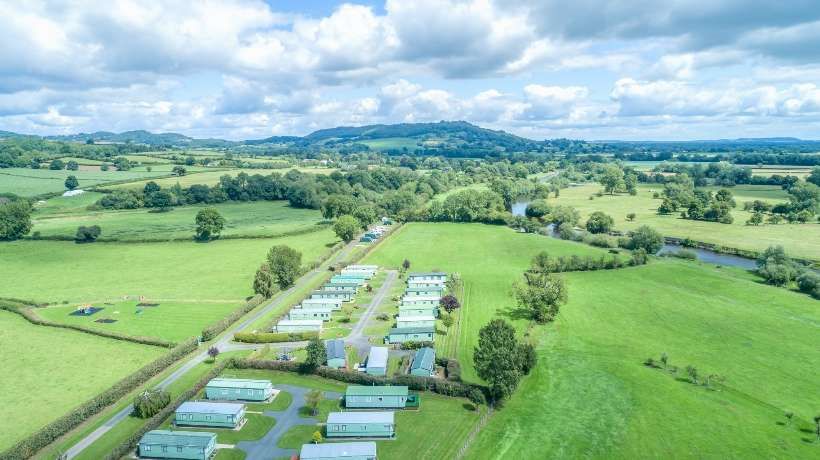
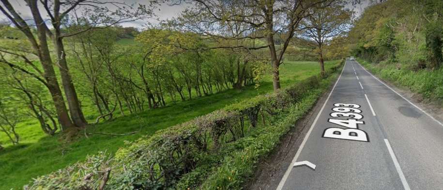
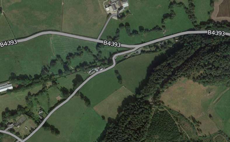
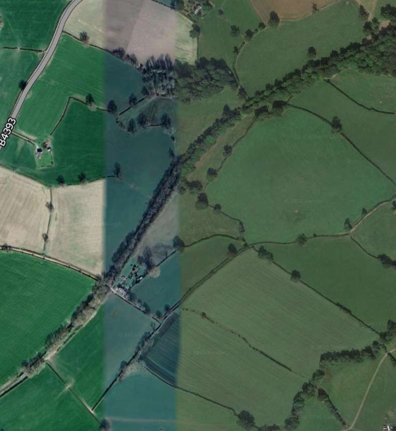
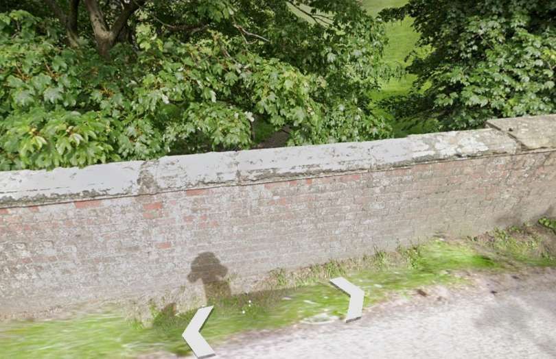
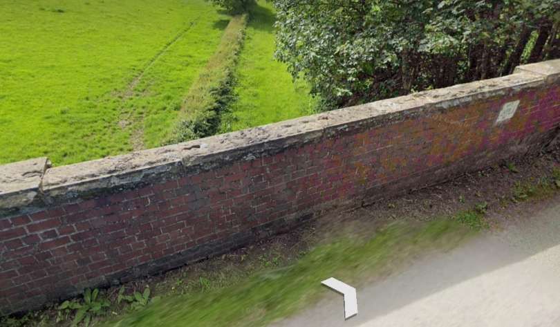
Looking North along the minor road in April 2024. [Google Streetview, April 2024]Looking East along the old railway from the bridge towards Llanymynech. [Google Streetview, April 2024]Looking West along the line of the old railway towards Grove Viaduct and Llansantffraid. [Google Streetview, April 2024]This is how the Grove Viaduct is shown on the 6″ OS map published in 1885 and surveyed during the years before that date. [9]The location of the Grove Viaduct over the Afon Tanat as it appears on modern satellite imagery. [Google Earth, March 2025]The line continues towards Llansantffraid. [6]A similar length of the line as it appears in Google Maps in March 2025. [Google Maps, March 2025]An aerial image looking Southeast showing Bryn Vyrnwy Holiday Park in the 21st Century. The access road running diagonally across the image follows the line of the old railway. [13]Looking West across Bryn Vyrnwy Holiday Park – the line of the old railway is paved, running between the two hedges. [13]Looking Southwest towards the hills the two hedge lines define the extent of the old railway land. [13]Llansantffraid-ym-Mechain Railway Station was the only passing place on the Branch. It is a large village about 7 miles (11 km) south-west of Oswestry (9.2 miles along the line) and 8 miles (13 km) north of Welshpool. It is at the confluence of the River Vyrnwy and the River Cain. The station can be seen just below the centre of this map extract. [6]
Llansantffraid-ym-Mechain
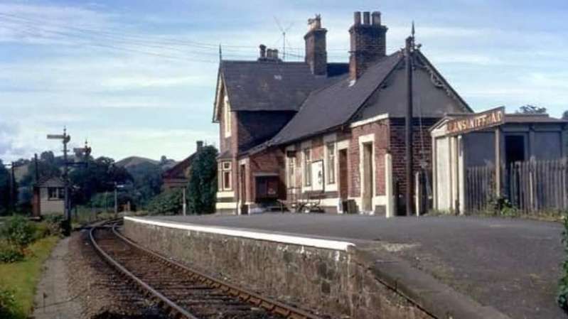
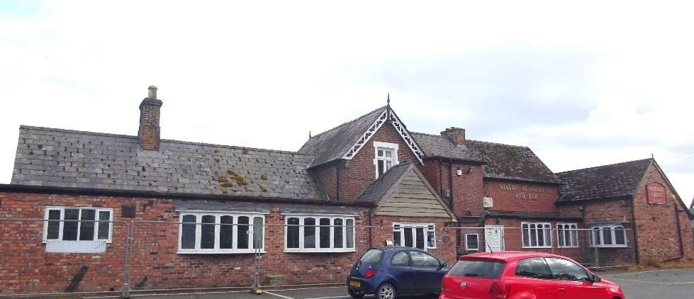
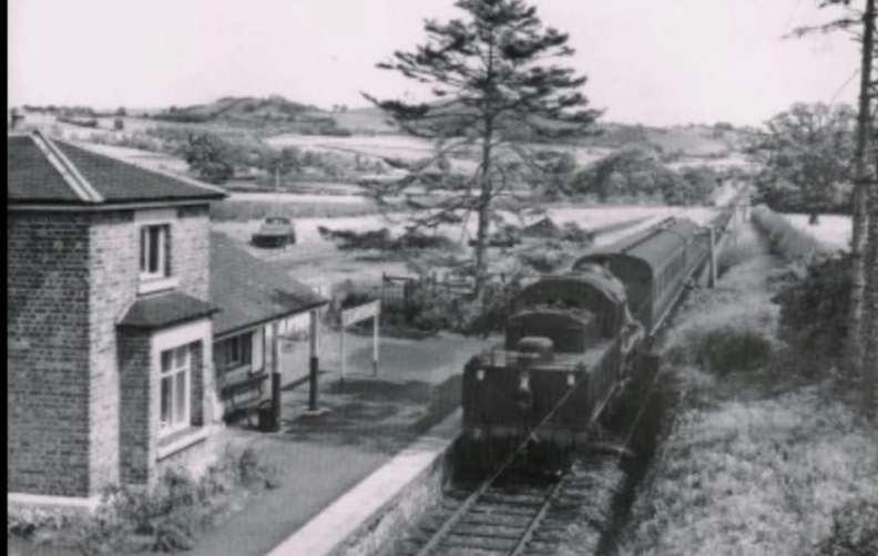
Jenkins tells us that Llansantffraid Railway Station was “the principal intermediate station on the branch. Its facilities included a single platform for passenger traffic on the up side of the line with a crossing loop immediately to the west, and a gated level-crossing to the east. The well-equipped goods yard included accommodation for coal, minerals, livestock, vehicles, and general merchandise traffic.” [4: p635]
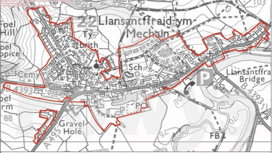
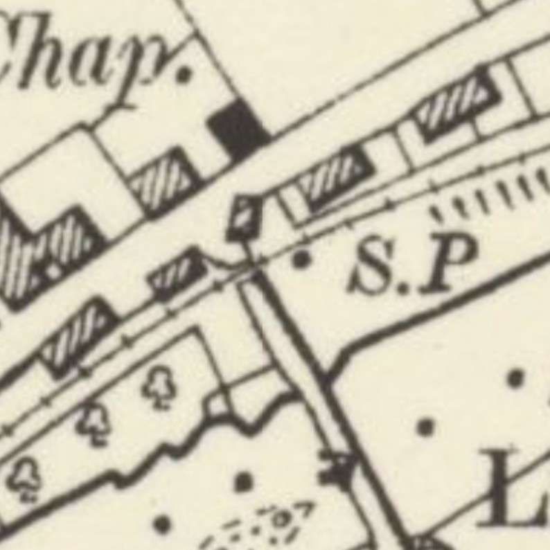
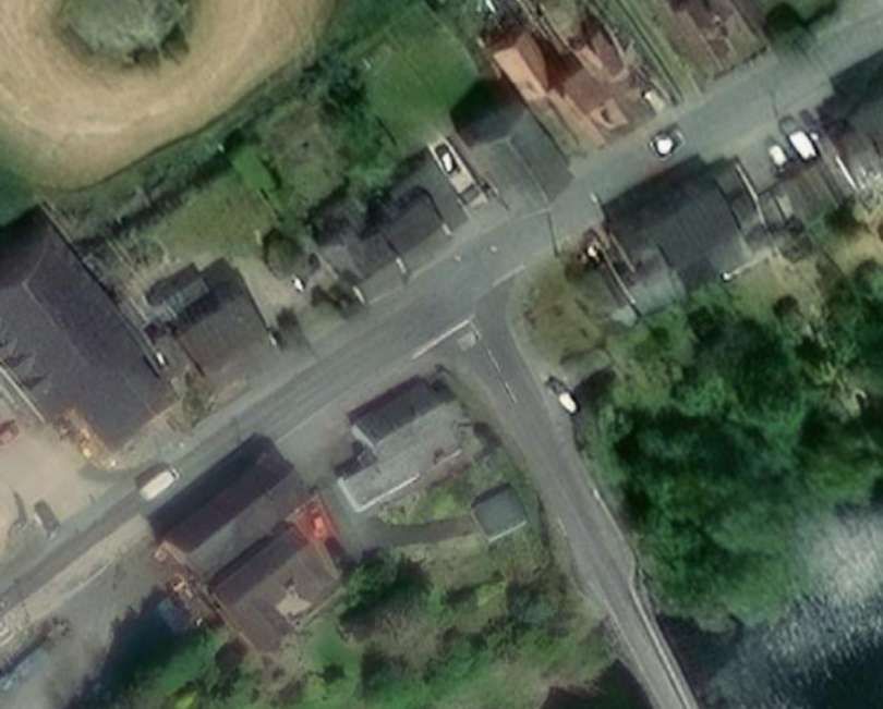
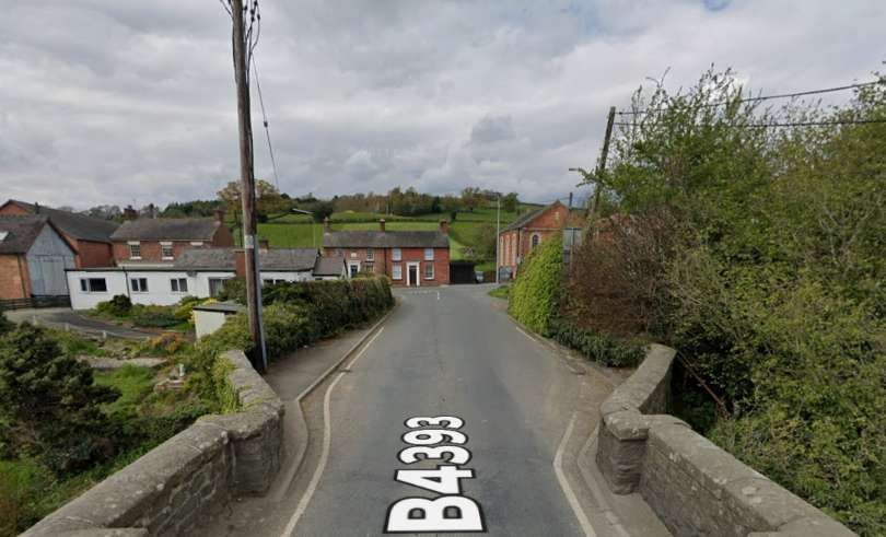
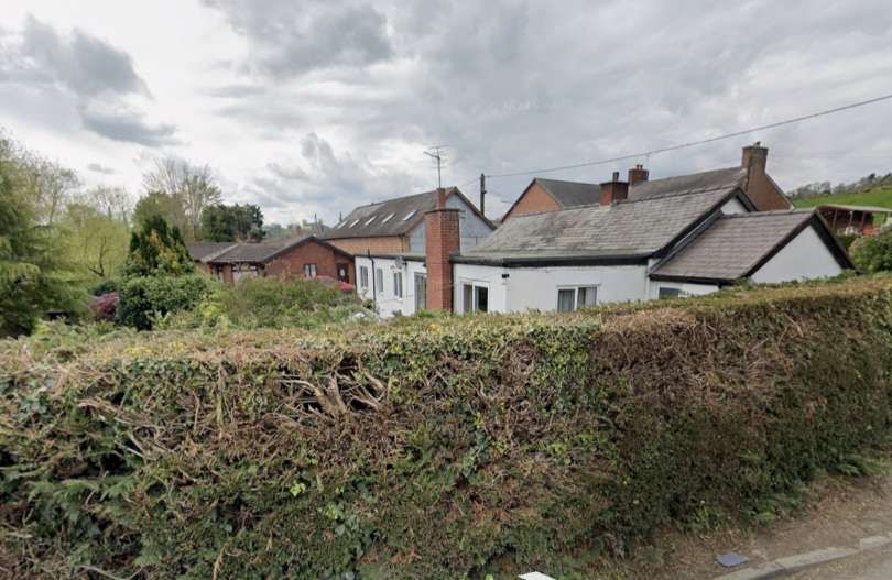
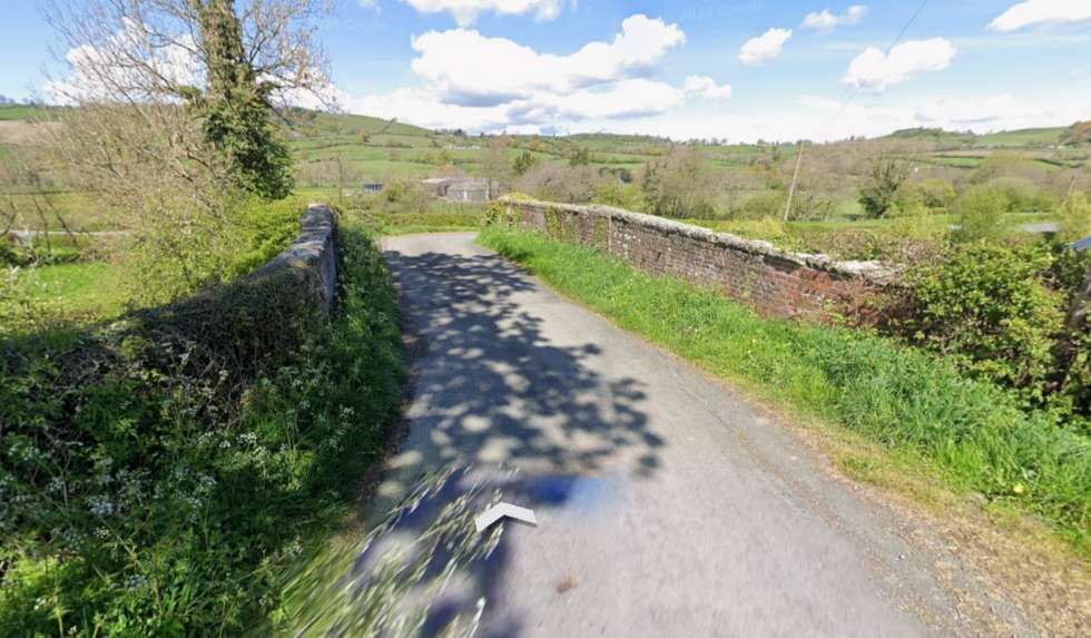
The village of Llansantffraid-ym-Mechain as it appears in Powys Council’s local development plan. [12]A closer view of the railway on the OS map of 1885 where it crossed what is now the B4393 to the North of the river bridge. [6]The same location as it appears on the NLS ESRI satellite imagery in the 21st century. [14]Looking North from the river bridge towards the A495. The old railway crossed the road at the near side of the white walled property on the left of this image. [Google Streetview, April 2024]Looking East, the line of the old railway is marked by the driveway protected by the green gates. [Google Streetview, April 2024]Looking West, the old railway ran to the left of the buildings. [Google Streetview, April 2024]
Llansanffraid (Llansantffraid) means “Church of Saint Bride” in the Welsh language; ym-Mechain refers to its location in the medieval cantref of Mechain and distinguishes it from other places with the same or similar names. [7]
“The name is based on the story of St Bhrid, who is said to have floated across the Irish Sea on a sod of turf, or to have been carried to Scotland by two oystercatchers. The followers of St Bhrid possibly set up new settlements known by the Welsh as Llan Santes Ffraid, Church of (Lady) Saint Bhrid. In recent years the spelling of the village name, with or without a ‘t’, has been a contentious issue (as it has been at Llansantffraid Glyn Ceiriog).” [7]
Approaching the railway station, the old line crossed Lletty Lane on the level.
Looking East from Lletty Lane away from the site of the station. The level crossing location is off to the left of this image. [Google Streetview June 2021]
Jenkins continues: “Llansantffraid was the only crossing place between Llanymynech and Llanfyllin, although it was not [ideal] for passing two passenger trains because the loop was sited beyond the platform. It was nevertheless possible for one passenger train and one freight train to pass here, although the timetable in force in later GWR days ensured that this was not normally necessary. In the 1930s this only took place on Wednesdays when the 9.05 am (WO) passenger service from Llanfyllin to Oswestry passed the 9.12am (WO) light engine from Oswestry to Llanfyllin at 9.27 am.” [3: p635]
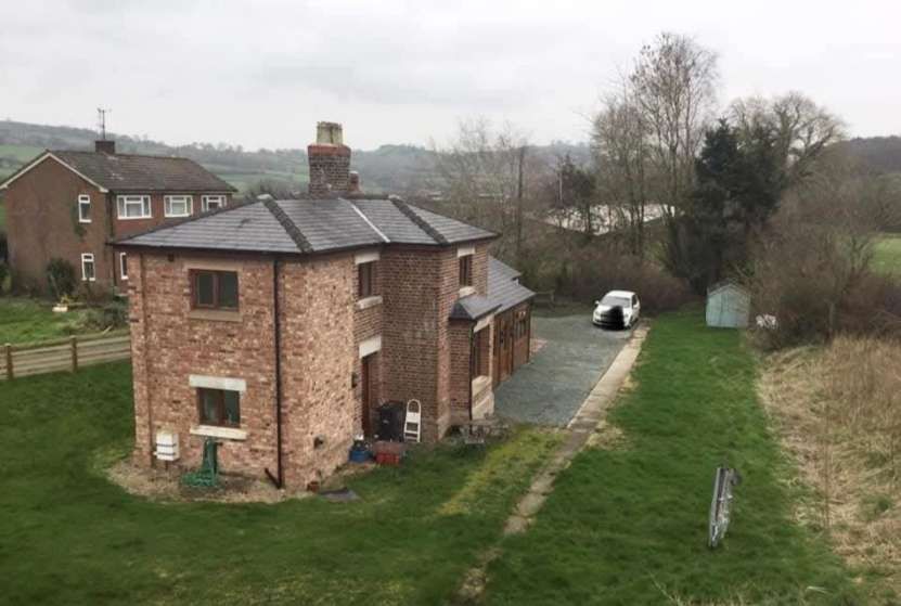
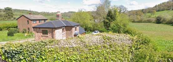
“The station building at Llansantffraid was a brick-built structure incorporating a two-storey residential portion for the stationmaster and his family. Although, like many Welsh stations, it was of comparatively plain appearance, the facade was enlivened by the provision of a bay window in the house portion, together with elaborate barge-boards and tall ‘ball & spear’ finials at the end of each gable. The stationmaster’s house was to the left (when viewed from the platform), while the booking office was to the right; the house was an L-plan structure with its gabled cross-wing facing the platform and a subsidiary wing that was parallel to the track.” [3: p636]
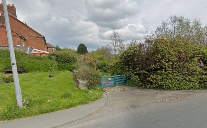
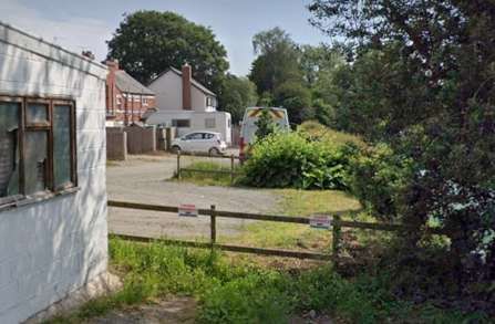
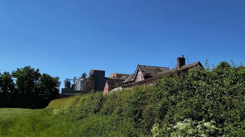
To the immediate West of the station building, a SPAR convenience store and a small industrial estate are built over the line of the old railway. A little further to the West, what is now the A495 turned South and bridged the line of the railway.
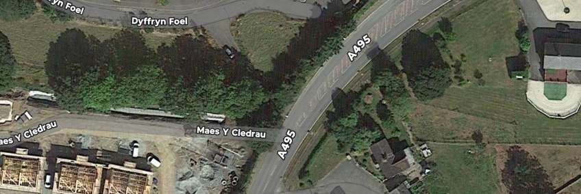
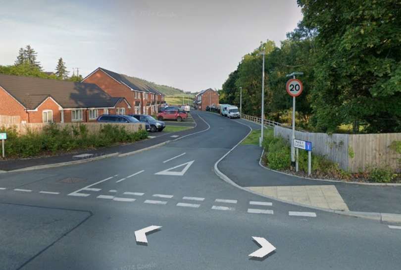
A closer view of the bridge at the West end of the village of Llansantffraid-ym-Mechain as shown on the 1885 6″ OS Map. [15]The same location in the early 21st century, as it appears on the NLS ESRI satellite imagery. The road (A495) has been widened, the bridge carrying the highway is long-gone. [15]This more recent satellite image shows a small new estate being built over the line of the old railway to the West of the A495. The route of the railway on the East side of the road is better defined in this image and the road Maes Y Cledrau sits on the line of the railway on the West side of the road. [Google Maps, March 2025]Looking East from the A495 along the line of the old railway. It passed to the left of the house visible on the right of the image. [Google Streetview, July 2024]Looking West from the A495 along Maes Y Cledrau. The old railway ran on the left side of the trees on the right of the image. In the distance, the newly built houses sit over the line of the railway. Closer to the camera it centre-line approximated to the kerb line of the road. [Google Streetview, July 2024]
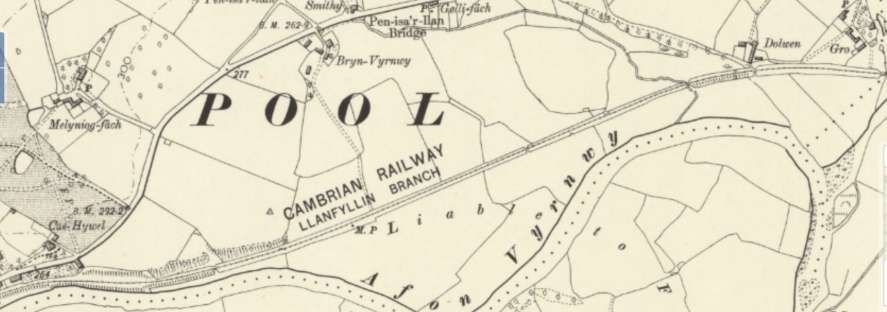
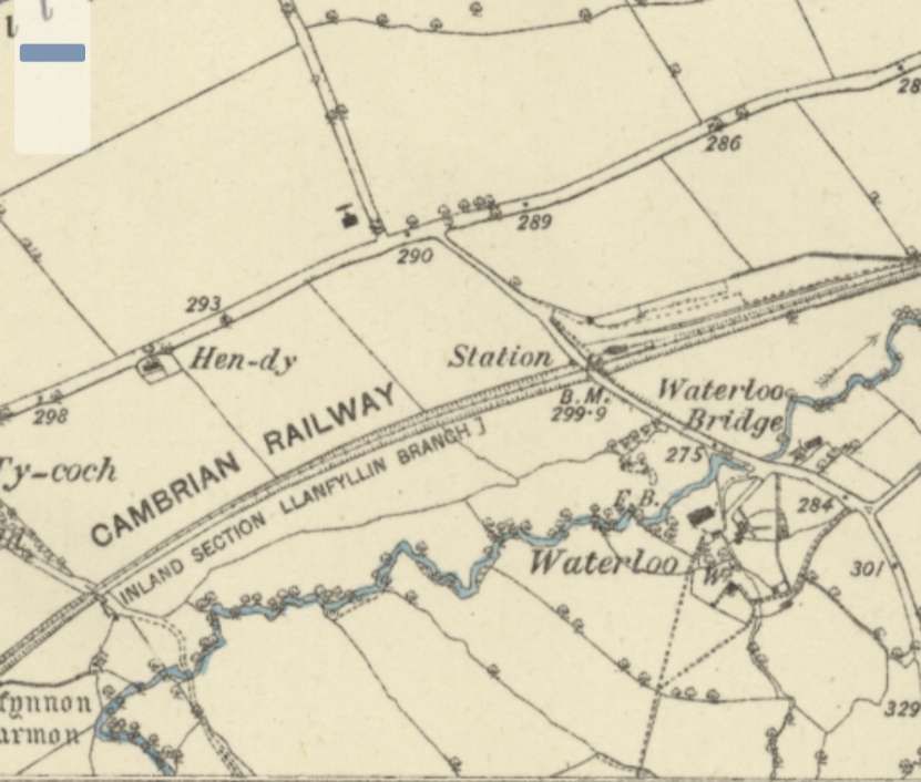
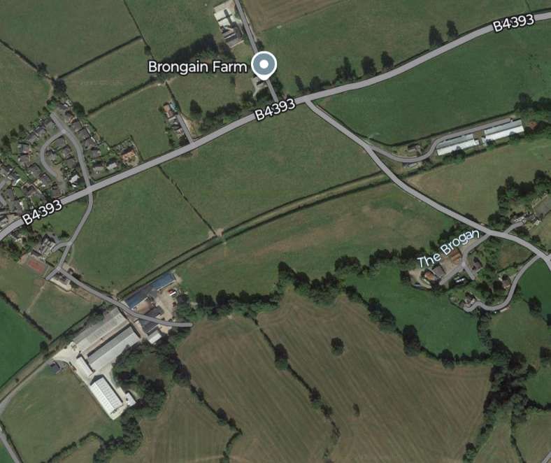
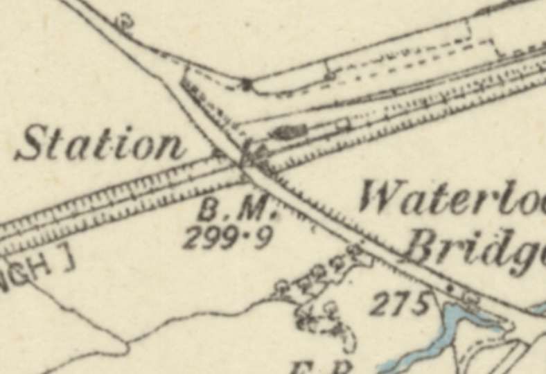
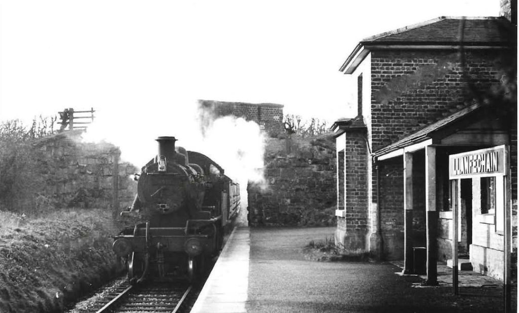
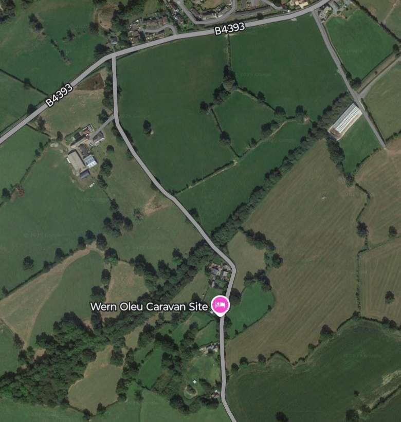
The B4393 ran parallel to the line to the North. The line climbed towards Llanfechain on a gradient of 1 in 75.
The old railway closely followed what became the B4393. The road ran on the North side of the railway. [16]The same area as it appears on Google Earth satellite imagery in the 21st century. [Google Maps, March 2025]Looking West along the B4393 the line of the old railway can be identified, delineated by the two hedge lines on the left of this photograph. [Google Streetview, April 2024]The road and railway continued West immediately adjacent to each other. [17]The same area on 21st century satellite imagery. [Google Maps, March 2025]Again the old railway formation continues West alongside the B4393. [Google Streetview, April 2024]On this next extract from the 6″ Ordnance Survey a side road to the B4393 crosses the line of the railway. [18]The same area in the 21st century. [Google Maps, March 2025]Looking North across the bridge noted above. [Google Streetview, April 2024]Looking East along the old railway alignment from the road bridge. [Google Streetview, April 2024]Looking West along the old railway formation from the road bridge. [Google Streetview, April 2024]This next map extract shows Llanfechain Railway Station. [19]The same area in the 21st century. Note the way that the old railway turns away to the Southwest after passing through the station. [Google Maps, March 2025]The station at Llanfechain was a good walk from the centre of the village and not at the closest road crossing to the village. [21] The facilities at the station were limited, although the main station house was as substantial as that at Llansantffraid-ym-Mechain. The station site was framed by a road bridge. [21]
Llanfechain
Llanfechain was near to 11 miles from Oswestry. Jenkins tells us that “The layout at Llanfechain echoed that at neighbouring Llansantffraid in that there was just one platform on the up side. A small goods yard was able to deal with coal, livestock, and other forms of traffic. … The station building was of ‘Victorian house’ design incorporating residential quarters for the local stationmaster. The presence of a two-storey house portion made these stations appear much bigger than they actually were, the booking office and waiting-rooms being only one portion of the main structure.” [3: p636]
Leaving Llanfechain Railway Station “heading south-westwards, the single line climbed steadily through pastoral countryside towards the penultimate stopping place at Bryngwyn” [3: p636] which was a little over 12.5 miles from Oswestry.
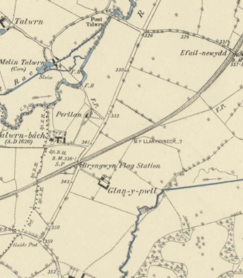
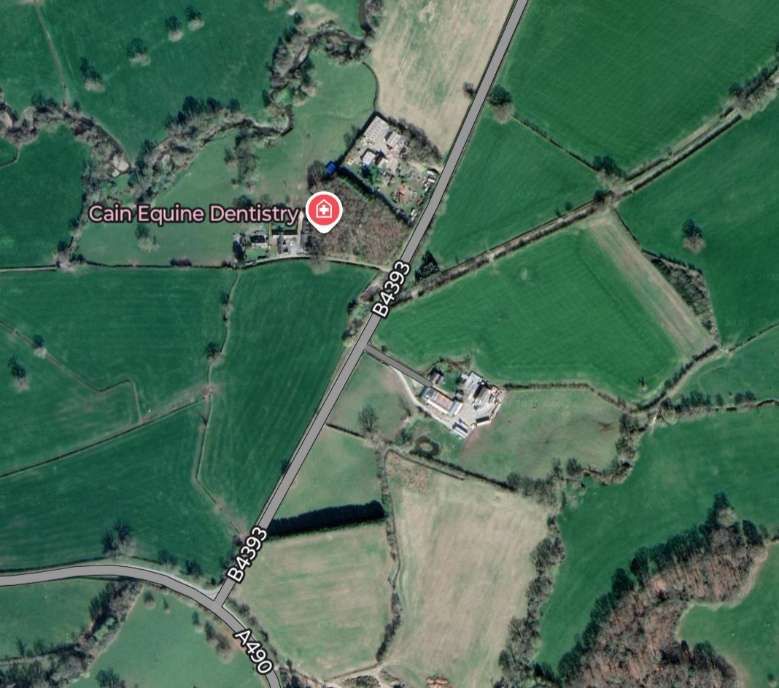
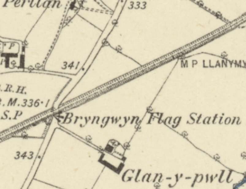
Looking West-southwest along the line of the old railway in 2024. [Google Streetview, April 2024]The line headed Southwest as it left Llanfechain. Note the footbridge in the top-right of this map extract, the road bridge just below and to the left of the centre of the image and the accommodation bridge in the bottom-left. [20]The same area in the 21st century. At the top-right of this image what was once a footbridge over the old railway has been converted into an access road. On both this image and the map extract above another minor road can be seen bridging the line of the old railway just below the centre of the image. The line was in a cutting at this point. [Google Maps, March 2025]The road bridge seen from the Northwest. [Google Streetview, April 2024]Looking Northeast along the line of the old railway towards Llanfechain Railway Station. [Google Streetview, April 2024]Looking Southwest along the line of the old railway. [Google Streetview, April 2024]In this next 6″ map extract the accommodation bridge noted before, appears top-right and a further bridge bottom-left. The line remained in cutting along this length. [25]This extract from Google’s satellite imagery covers a similar area to the map extract above..It also shows the bridge noted above which carried another local access road over the old railway. [Google Maps, March 2025]On this next extract from the 6″ Ordnance Survey of 1880s the line begins to turn towards the West, from a southwesterly heading. What becomes the B4393 crosses the line at Bryngwyn Flag Station (a halt at which passengers had to signal the train to stop to collect them). The road curving round the bottom-left corner of the extract was to become the A490. [26]Much the same length of the line appears on this 21st century satellite image. The A490 can be seen on the bottom-left of this image. [Google Maps, March 2025]A closer view of the location of Bryngwyn Halt. The old railway can be seen bridging the old road which had to dog-leg to pass under the line. [26]Looking Northeast along the line of the old railway from the B4393. The bridge at this location was removed and the road was realigned after the closure of the railway. The level difference between the two is still evident. [Google Streetview, April 2024]Turning through 180°, looking Southwest along the line of the old railway. The realignment of the road required the removal of the bridge abutment and a short length of embankment which once also supported the Bryngwyn Halt. [Google Streetview, April 2024]
Bryngwyn Halt
Bryngwyn did not open with the line. Jenkins tells us that “having been opened by the Cambrian Railways as an unstaffed halt in the mid-1860s. The single platform was sited on the down side of the line with access from a nearby road. Interestingly, Bryngwyn was an early example of a ‘request stop’, a semaphore stop-signal being worked by intending travellers. The platform was originally of timber trestle construction with a small open-fronted waiting shelter, although a concrete platform and corrugated-iron shelter were later provided.” [3: p636]
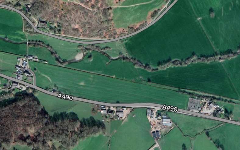
“From Bryngwyn the route continued westwards for the final two miles to Llanfyllin. With the A490 road running parallel to the left, the line passed beneath a minor road bridge and, slowing for the final approach to their terminus, branch trains passed an array of parallel sidings before finally coming to rest beside a single-platform station some 8 miles 41 chains from Llanymynech, and 14 miles 48 chains from the start of the through journey from Oswestry.” [3: p636-637]
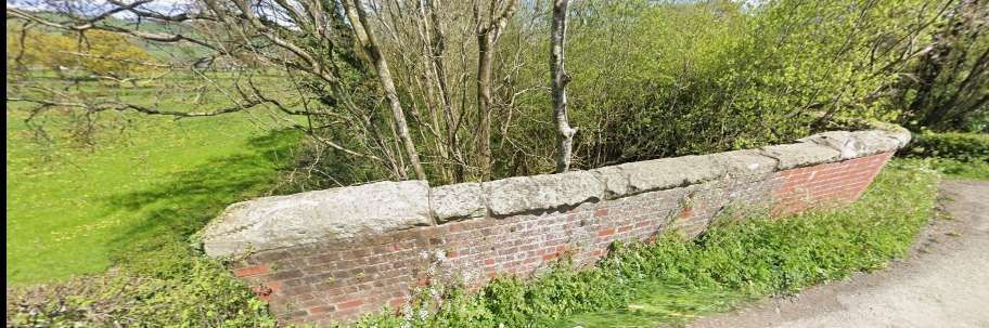
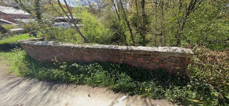
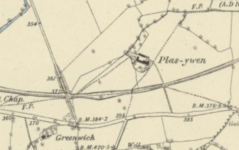
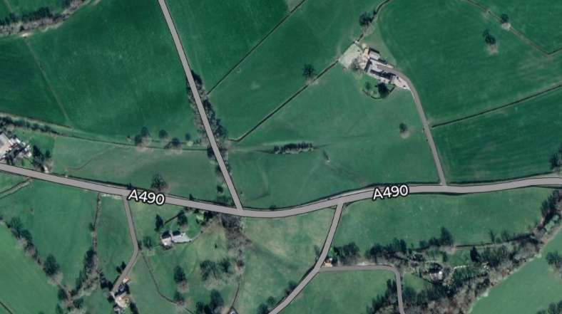
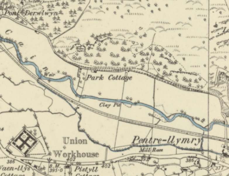
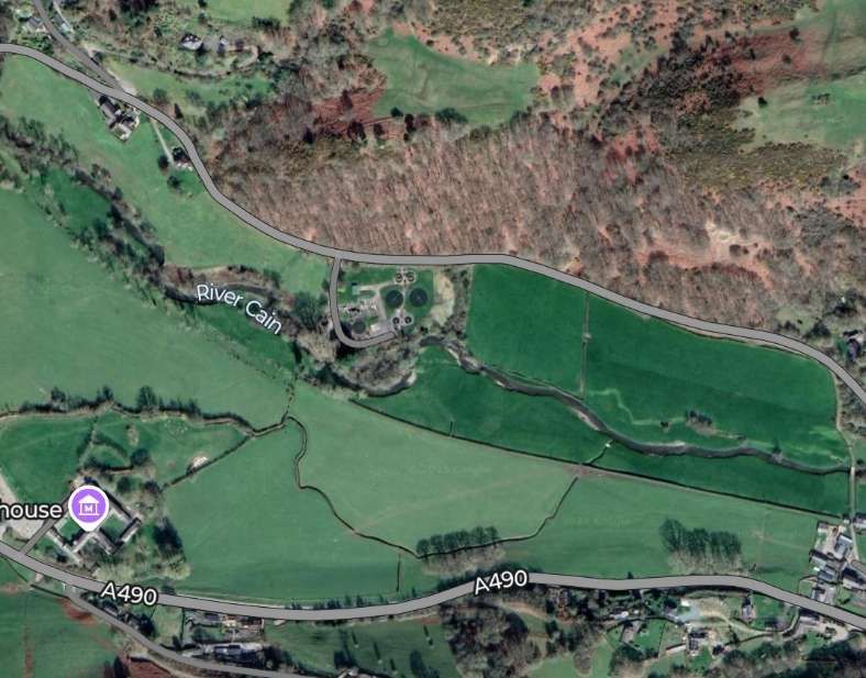
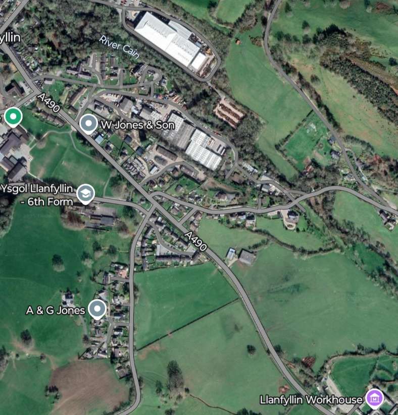
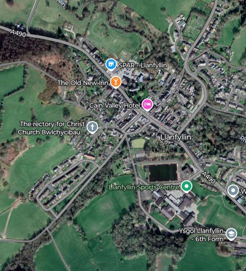
Over this next stretch of the old railway, the line continues to curve round towards the Northwest. The road that became the A490 runs parallel to the line but to its South. An access track Plas-ywen crossed the line at an un-manned crossing. A little further West the line was bridged by a lane running North from the main road. [27]Much the same area on modern satellite imagery. [Google Maps, March 2025]Looking North along the lane which crossed the old line. The railway was in cutting at this location so there are no significant gradients on the approaches to the bridge. The brick parapets of the bridge remain in place. [Google Streetview, Summer 2022]Looking East, the line of the old railway is camouflaged by tree growth. [Google Streetview, Summer 2022]Looking West, it is possible to see the old formation with the hedge following the old railway boundary. [Google Streetview, Summer 2022]The road and railway continued in parallel across this next extract from the 6″ Ordnance Survey. The River Cain runs just to the North. [28]The same area on modern satellite imagery. At the left of both these images a farm access track crosses the line of the old railway. [Google Maps, March 2025]The old line continued to curve towards the Northwest. [29]A very similar length of the old railway in the 21st century. The route of the railway can still be seen easily curving to the Northwest on the South side of the River Cain. [Google Maps, March 2025]The final length of the line which terminated to the Southeast of the centre of Llanfyllin. [30]The same area of Llanfyllin as it appears on satellite imagery in the 21st century. [Google Maps, March 2025]The centre of Llanfyllin in the 21st century. [Google Maps, March 2025]
Llanfyllin
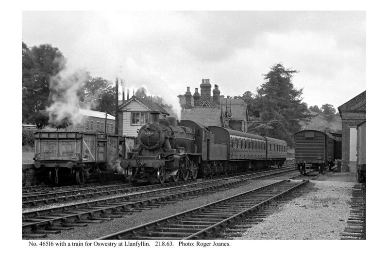
Jenkins says that “Llanfyllin was a surprisingly spacious station, and although its track-plan was relatively simple, the goods yard and other facilities were laid out on a generous scale, the distance from the turnout at the eastern end of the run-round loop to the terminal buffer stops being around 34 chains, or slightly less than half a mile. The passenger platform was situated on the down side, and it had a length of around 385ft. The platform was flanked by two long parallel lines, one of which functioned as an engine release road while the other formed a lengthy goods reception line. These two lines were linked by intermediate cross-overs which allowed greater flexibility during shunting operations.” [3: p637]
The goods yard contained two goods sheds, one of these being situated on a loop siding that was laid on a parallel alignment to the passenger station. A long siding for “coal and other forms of wagon-load traffic extended along the rear edge of the goods yard; this siding branched into two shorter sidings at its western end, the second goods shed being served by one of these short spurs. The main goods sidings ended at loading docks at the western extremity of the station, while a further siding to the east of the platform on the down side served a cattle-loading dock. The latter siding was entered by means of headshunt from the engine shed siding, a reverse shunt being necessary before vehicles could be propelled into the cattle dock.” [3: p638]
Nearby the “engine shed was single-road structure with a length of about 50ft, … this normally accommodated just one locomotive. Water was supplied from a stilted metal tank beside the engine shed, this structure being fitted with flexible hoses through which the water could be delivered.” [3: p638]
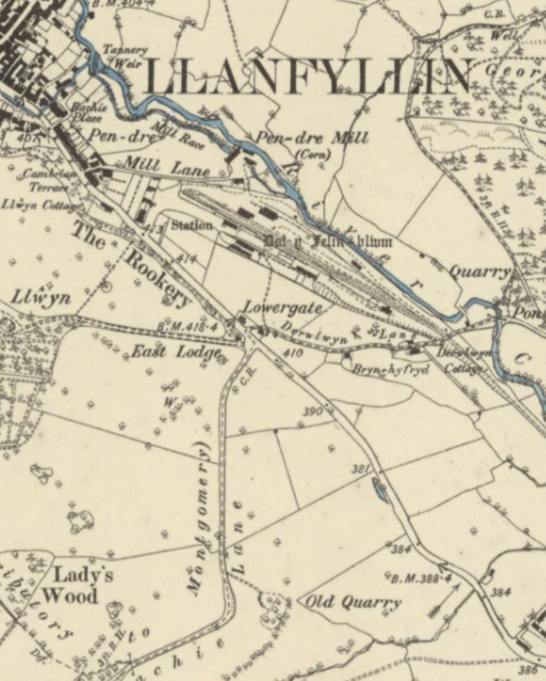
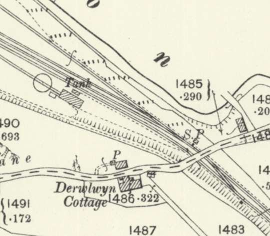
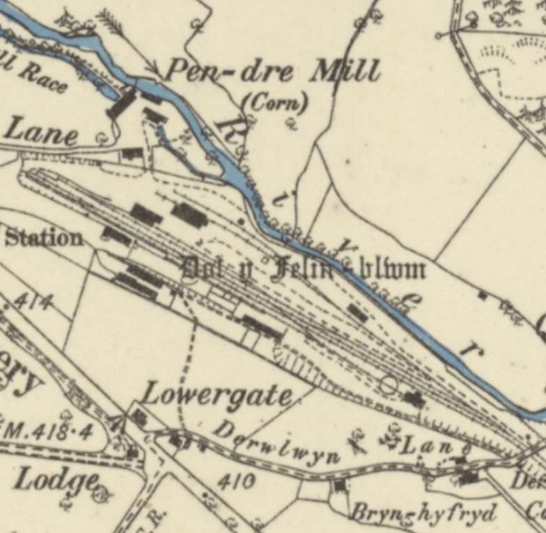
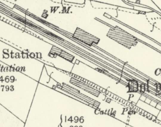
The station throat at Llanfyllin Railway Station is framed by the road bridge carrying Derwlwyn Lane. This map extract comes from the 25″ Ordnance Survey of 1900, published in 1901. [33]
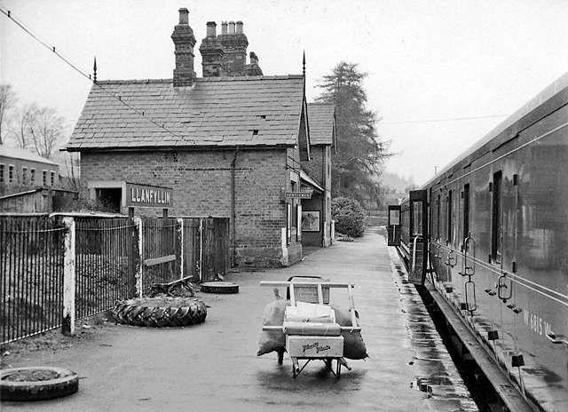
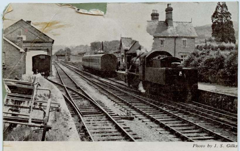
The image above is embedded from the Flickr site of Katerfelto, who comments: “Trains arriving at Llanfyllin passed a ground frame and then passed under a single-span iron bridge which carried Derwlwyn Lane over the line. From the south side could be seen the engine shed and water tower followed by some cattle pens and Llanfyllin signal box, before the single platform and its substantial station building announced the journey’s end.” [34]
Opposite the platform were the goods shed, a warehouse, several buildings and the run-round loop.
The terminal buffers were in a shallow cutting and short approach road led from the station building to the public road.
Jenkins continues: “Llanfyllin station building was similar to the other station buildings on the branch, being a typical ‘Victorian house’ design with a two-storey stationmaster’s house and attached single-storey booking-office wing. The window and door apertures were simple square-headed openings with large-paned window frames, but this otherwise plain brick building was enlivened by the provision of decorative barge-boards and elaborate pointed finials. The front of the booking office was slightly recessed to form a covered waiting area, and this feature contributed further visual interest to this former Oswestry & Newton Railway building.” [3: p638]
Llanfyllin had a population of around 2,000. Wikipedia tells us that “the community … population in 2021 was 1,586 and the town’s name means church or parish (Llan) of St Myllin (‘m’ frequently mutates to ‘f’ in Welsh).” [30]


