Following on from a couple of articles about the Tanat Valley Light Railway written some years back, I was reading some older rather tatty magazines and found an article entitled “Rails up the Tanat Valley” in an issue of the Ian Allan publication ‘Railway World‘ – the June 1990 edition. [1]
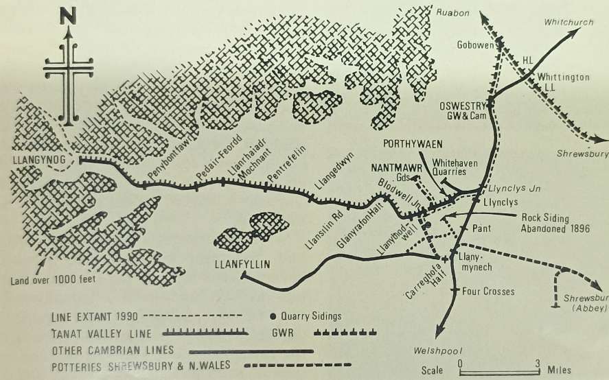
The Tanat Valley Railway and associated lines. [1: p365]
In his article, Colin Ganley recounted the rise and decline of the minor lines running west from Oswestry, the last remnant of which by 1990 had been ‘mothballed’.
Colin Ganley wrote: “In October 1988, the last train ran between Gobowen and Biodwell Quarry in Shropshire. For some years the line had carried only stone trains, bringing out ballast to the requirements of the Area Engineer. The trains, normally Class 31-hauled, traversed the remains of five different branch lines, which in their heyday provided Oswestry and the eastern end of the Tanat Valley with a fascinating and complicated array of lines to serve local industry. With the decision to cease using ballast from Blodwell, traffic on the line came to an end, marking the final cessation of all rail services connected with the delightful one-time Tanat Valley Light Railway.” [1: p364]
He continued: “For the present, this surviving section is in suspended animation. As there is a possibility that the stone traffic may restart in the future, the railway is being left in place. Traffic will resume if BR returns to this source of ballast. If not, eventually a decision will be made to lift the track and dispose of the land: unless the Cambrian Railways Society, based at Oswestry, is in a position to take an active interest in its future.” [1: p364]
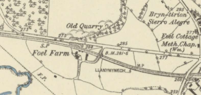
Parts of the derelict line at Nant Mawr which were once the western end of the Old Potts Railway are now owned by ‘The Tanat Valley Light Railway’ which is a modern charity that aims to preserve and restore this line.
“The original Tanat Valley Light Railway was the first cross border light railway crossing from England into Wales, meandering up the fantastic Tanat Valley from Llynclys Junction to Llangynog and providing links to Llanymynech and Llanfyllin via its other branches.” [2] It was opened in 1904, mainly as a direct result of the 1896 Light Railways Act, but, says Ganley, “before taking up its story it would be useful to look at its associated lines and also earlier schemes to provide the picturesque village of Llangynog with railway transport. At the height of railway mania in 1845, the Shrewsbury, Oswestry and Chester Junction Railway obtained powers to build a line from Shrewsbury to Chester with a branch from Gobowen to Llanymynech. All that was built of the branch was the 2.25 miles from Gobowen to Oswestry, which opened on 23rd December 1848. In 1854 this line became part of the Great Western Railway.” [1: p364]
He continues: “The second portion of line to be constructed was the Oswestry & Newtown Railway, which was incorporated in 1855. to link these two towns. The section between Oswestry and Pool Quay opened on 1st May 1860 with the remainder to Newtown opening on 14th August. … The company, which was to be the foundation of the later Cambrian Railways, opened a 1.25-mile freight-only branch from Llynclys Junction, some 3.5 miles south of Oswestry, to Porthywaen. This branch served important quarries, some of which are still operating today, and became the railhead for the industries of the Upper Tanat Valley, Shortly after the Porthywaen branch was opened, a mineral line was built from it to serve some collieries at Trefonen. These collieries however were not very successful and this line was abandoned as early as 1881.” [1: p364]
“In the meantime there had been several proposals to build a line up the Tanat Valley. One such proposal envisaged a great trunk line from Worcester to Porth Dinllaen, near Nefyn on the Caenarvonshire coast, with the object of providing an alternative route for Irish Mail traffic. In 1860, a similar proposal was put forward as the West Midlands, Shrewsbury & Coast of Wales Railway which planned a railway from Shrewsbury to Portmadoc via Llanymynech, Llangynog and Bala. This route would have included a 1.5-mile tunnel under the Berwyn Mountains between Llangynog and Bala.” [1: p364]
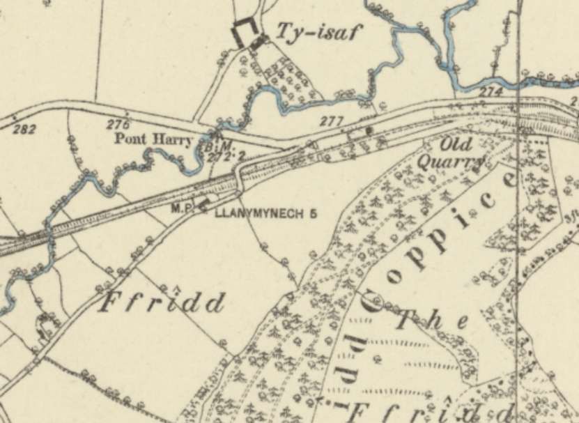
“However, the project had trouble raising support and money. … Proposals for a similar route were resurrected in 1862 as the Shrewsbury & North Wales Railway. Powers were obtained by 1865 to build a line from Abbey Foregate, Shrewsbury, to Llanymynech but before this section was completed the company had merged with another scheme to provide a railway from Stoke-on-Trent to Shrewsbury. The combined efforts brought forth the grand title of the Potteries, Shrewsbury & North Wales Railway (or POTTS for short) and extended the original plans to include an extension from Llanymynech to Nantmawr over which passenger trains were to run as far as Llanyblodwell (later renamed Blodwell Junction). The financial troubles of the POTTS and its rebirth as the renowned Shropshire & Montgomeryshire Light Railway [3] are outside the scope of this article, but the result was the working of the Llanymynech to Nant Mawr section by the Cambrian Railways from 1881. At this time goods traffic only was operated, the passenger service between and Llanymynech and Lianyblodwell having ceased in 1880.” [1: p364-365]
“The Light Railways Act of 1896 made possible the construction of railways to remote agricultural areas that hitherto had had difficulties in raising capital and several places along the Welsh border benefited from such schemes, one being the Tanat Valley. The Act saw the birth of two schemes to provide, at last, rail transport to the Upper Tanat Valley and the industries of Llangynog. The unsuccessful proposal was for a 2ft 6in gauge railway from the Llanfyllin terminus of the Cambrian branch from Llanymynech.” [1: p365]
“This plan, the Llanfyllin & Llangynog Light Railway, was to cross sparsely populated country between Llanfyllin and Penybontfawr and would not have benefited the lower part of the Tanat Valley. It nevertheless could have been a fascinating line had it been constructed, though the change of gauge at Llanfyllin would have proved a disadvantage.” [1: p365]
“The scheme that was selected by the Light Railway Commissioners was for a standard gauge line from the Cambrian’s Porthywaen mineral branch straight up the valley Liangynog. The plan also envisaged using a short section of the Nantmawr branch. The Tanat Valley Light Railway received its Light Railway Order in 1898 and was constructed by J. Strachan of Cardiff who employed about 125 men on the work. The total cost of the line proved to be about £92,000 which was around £20,000 more than the company had hoped for. This shortfall, not helped by a delay in construction, meant that the Tanat Valley Co was impoverished from the outset and had to approach the Treasury for more grant aid. During construction in 1903 some directors found that the contractor was giving a ‘free’ train service over the partially finished railway but as the contractor was allowed to finish the job it can be assumed that any quarrel was rectified.” [1: p365] For the earlier articles about this line, please follow these two links:
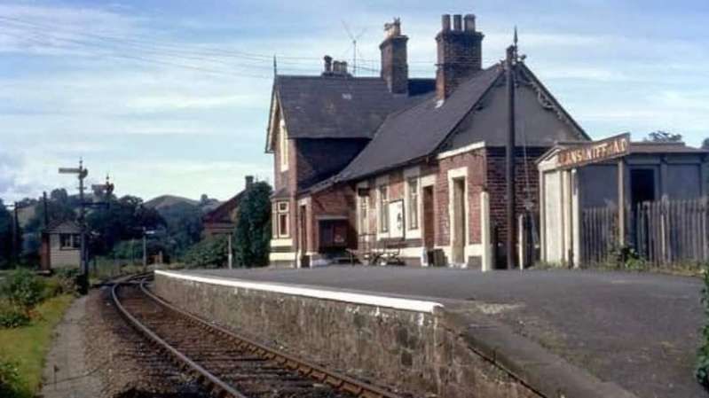
Colin Ganley continues: the Tanat Valley Light Railway “opened on 5th January 1904 to both passengers and freight and was worked by the Cambrian from the start. It became wholly part of the Cambrian in 1921, passing to the Great Western Railway and then to the Western Region of British Rail. The length of the linc from Llynclys Junction to Llangynog was some 15 miles 71 chains and included 11 stations or halts, one of which was former POTTS station of Llanyblodwell which was renamed Blodwell Junction. The stations were of typical light railway pattern with rather mean corrugated iron clad buildings and, except for Liangedwyn and Llanrhaiadr Mochnant, had only one platform. Original plans for some stations did consider refreshment rooms in effort to build up tourism but the company’s lack of capital put an end to such plans.” [1: p365-366]
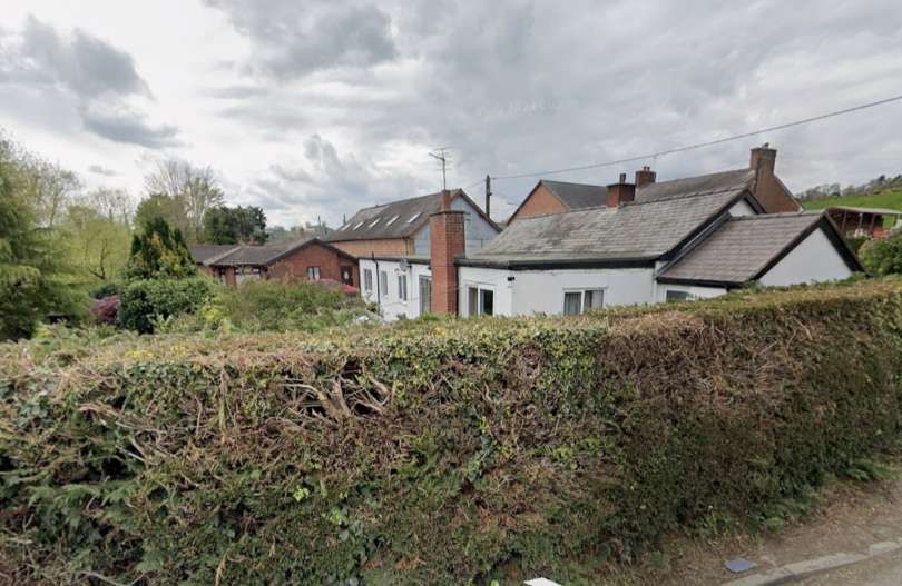
“With the opening of the Tanat Valley line, passenger services were restored between Llanymynech and Blodwel Junction as this had been a condition of securing support from potential opponents during the planning stages. The opening of the Tanat Valley line also restimulated the slate quarries at Llangynog which had all but closed by 1900. Slate quarrying continued intermittently until 1939 but lead mining, which had effectively ceased in 1877, was never to resume on any commercial scale. The railway also assured the development of granite quarrying at Llangynog, the Berwyn Granite Co. providing much traffic until World War 2. The quarry survived into the mid 1950s but at the end offered virtually no traffic to the railway.” [1: p366] Berwyn Granite Quarries Ltd. remains an active company with headquarters in Wellington, Shropshire. [4]
Colin Ganley continues: “Initially the passenger service consisted of four trains each weekday with an extra trip on Wednesdays. Many trains were mixed and the journey to Oswestry took no less than 75min on some trains. Two trains a day carried a through coach to Llanymynech, detached at Blodwell Junction, but this practice ceased in 1915 and was replaced by a connecting service. The Blodwell Junction to Llanymynech service ceased completely as from 1st January 1917, having been hardly ever used and only operated to fulfil an agreement. Freight traffic over this section ceased in 1925, the Nantmawr traffic then being worked via Porthywaen, and most of it was lifted between 1936 and 1938.” [1: p366]
By 1923, “the number of passengers being carried was half the level of 1913 and continued to decline during the GWR years. By 1925 services, which normally consisted of two four-wheeled carriages, were reduced to three trains each way, though certain extras ran on Wednesdays and Saturdays. In 1929, the GWR introduced a rival bus service which was taken over by Crosville in 1933. The bus served the centres of villages far better than the train as certain stations. Llanrhajadr Mochnant in particular, were badly situated. This, coupled with the elongated journey times caused by the adherence to light railway practices, reduced traffic even further.” [1: p366-367]
“During World War 2 the passenger service was reduced to two trains each way, by now composed of a single Cambrian brake third. After the war, despite petrol rationing, few people were making the delightful trip up the Tanat Valley by rail. Goods traffic was also on the wane and on 15th January 1951 passenger services ceased because of a grave coal shortage, never to return. Official closure took place on 1st July 1952 and at the same time freight traffic was also withdrawn between Llanrhaiadr Mochnant and Llangynog. The track on this section remained in situ for several years, not being lifted until 1958. Freight traffic to Llanrhaiadr Mochnant ceased abruptly on 5th December 1960 after the river bridge near Pentrefelin was badly damaged by flooding,” [1: p367]
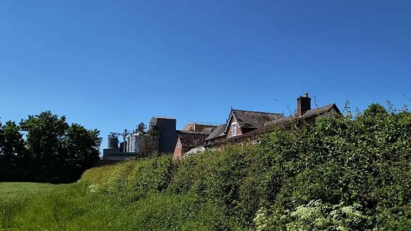
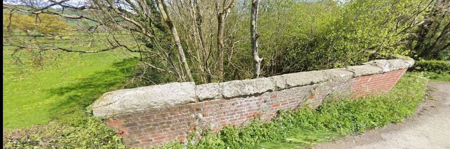
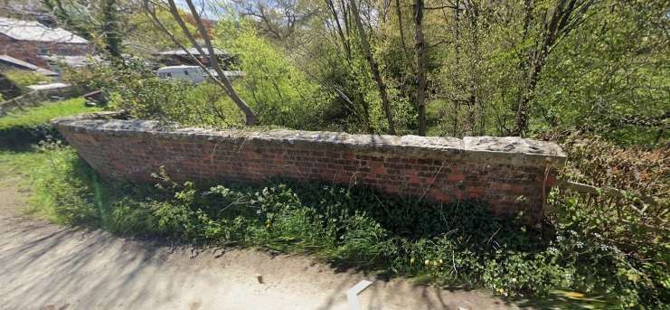
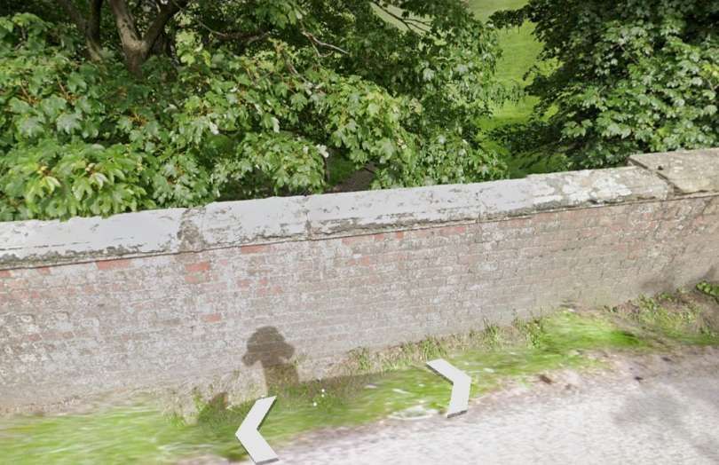
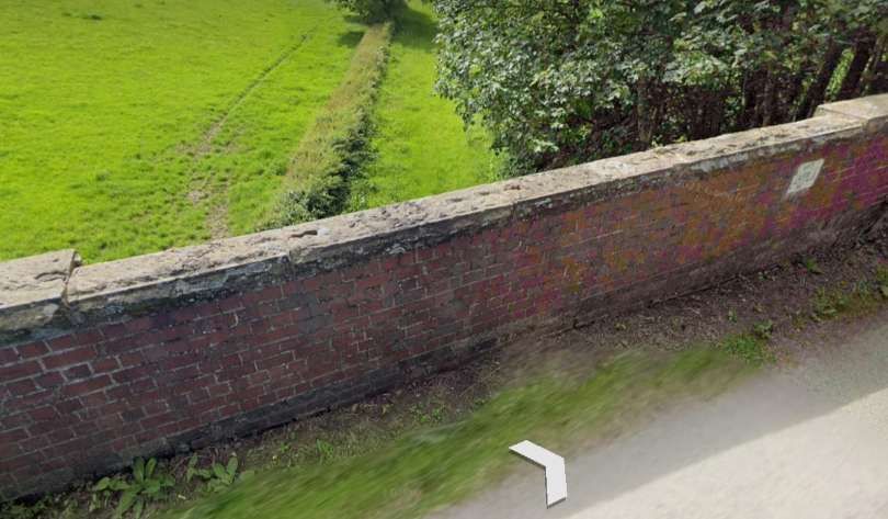
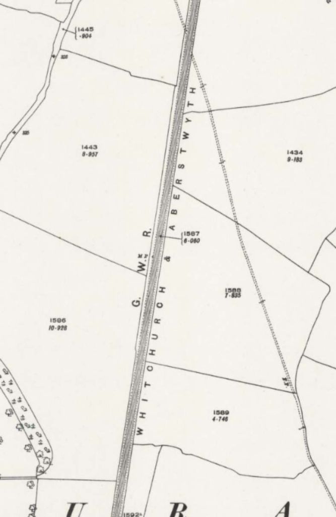
“Services on neighbouring lines were savaged in the mid-1960s. All passenger traffic between Welshpool and Whitchurch and also over the Llanfyllin branch were withdrawn on 18th January 1965, leaving Oswestry with the Gobowen diesel shuttle service, which ceased in November the following year. By 1967, just the single track South of Oswestry to Porthywaen and Nantmawr was left, along with the line from Gobowen. Reduction in traffic over the ensuing years left just the Blodwell Quarry service. All the sidings at Oswestry and Porthywaen disappeared. The section west of Blodwell Junction had been lifted by 1965 and though the Nantmawr branch has not seen a train for 20 years the track is still in-situ, although with sturdy trees growing between the sleepers.” [1: p367]
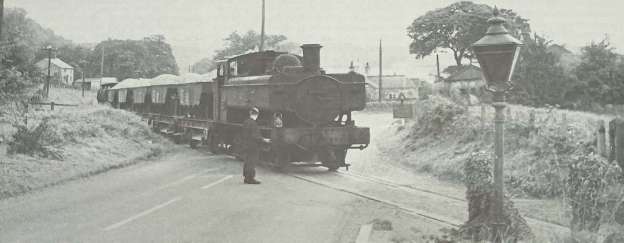
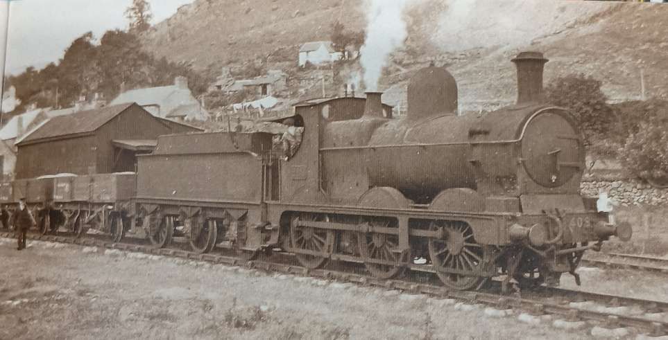
“No account of the Tanat Valley would be complete without a brief mention of its quaint motive power. From the outset, the Cambrian normally provided three Sharp Stewart 2-4-0Ts, Nos 57, 58 & 59 of 1866 vintage. They became GWR Nos. 1192, 1196 and 1197 respectively, and although No 1192 was withdrawn in 1929 after being sent to Devon, Nos 1196 & 1197, both in a rebuilt state, survived at Oswestry until 1948.” [1: p367]
Sharp, Stewart and Co. “was a steam locomotive manufacturer, originally based in Manchester, England. The company was established in 1843 following the dissolution of Sharp, Roberts & Co.. In 1888, it relocated to Glasgow, Scotland, where it later amalgamated with two other Glasgow-based locomotive manufacturers to form the North British Locomotive Company.” [5]
Ganley tells us that the two surviving Sharp Stewart locomotives were “assisted by No. 1308 Lady Margaret, an Andrew Barclay 2-4-0T built in 1902 for the Liskeard and Looe Railway and taken over by the GWR in 1909. This locomotive also did yeoman service in the Tanat Valley until it too was withdrawn in 1948.” [1: p367]
“Other locomotives were seen up the Tanat Valley at various times, including old Cambrian Sharp Stewart 0-6-0s dating from 1875 and the odd Dean Goods. In the latter years passenger traffic was the preserve of ‘5800’ class 0-4-2 tanks, numbers 5808 & 5812 being particular regulars. Goods traffic that remained was normally entrusted by the early 1950s to the Ivatt Class 2 2-6-0s.” [1: p367]
“Various types of diesels handled the surviving quarry services, including Classes 25, 31 and 37. A Class 31 had the privilege to be the last railway locomotive to operate a commercial train (so far) in this region of complex and fascinating railway history. It remains to be seen whether the Cambrian Railways Society will be able to continue the railway traditions of the area if they can successfully launch a private steam service from their Oswestry base.” [1: p367]
Ganley was writing in 1990, things have moved on over the past 36 years. Cambrian Heritage Railways, in the 2020s, operate a service on selected days from their Oswestry Station to Weston Wharf, featuring steam, vintage diesel and diesel multiple units. The 1.75-mile scenic route leads to Weston Wharf with its period station with a café, picnic area, and railway artifact displays. Cambrian Heritage Railways also operate the ‘Llynclys Railway Centre’ which is open on select dates – at Llynlcys South Station. [6][7]
References
Colin Ganley; Rails up the Tanat Valley; in Railway World; Ian Allan, June 1990, p364-367.
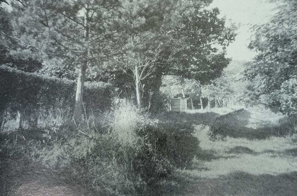
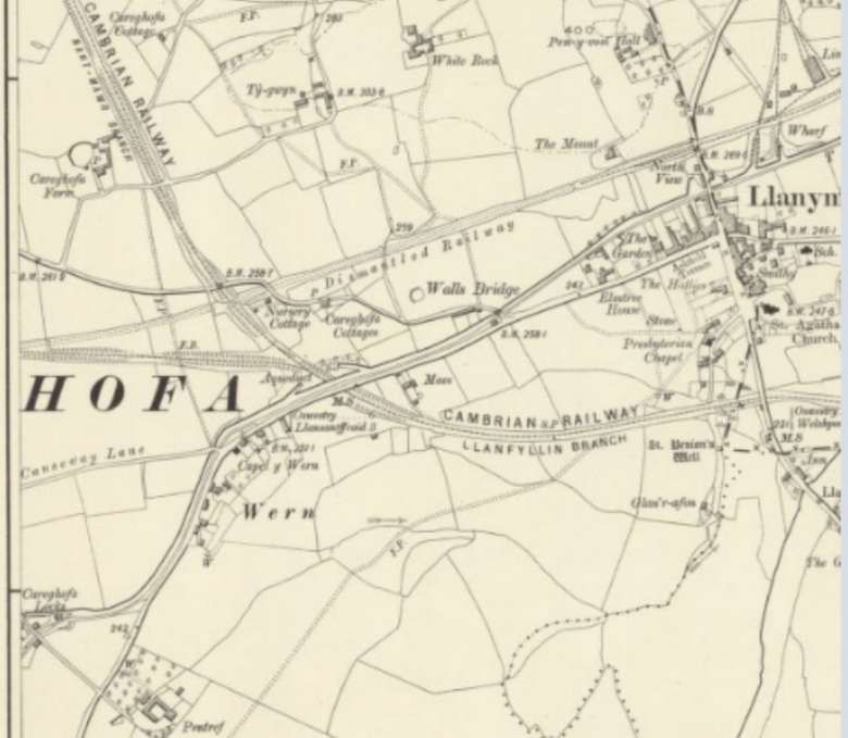
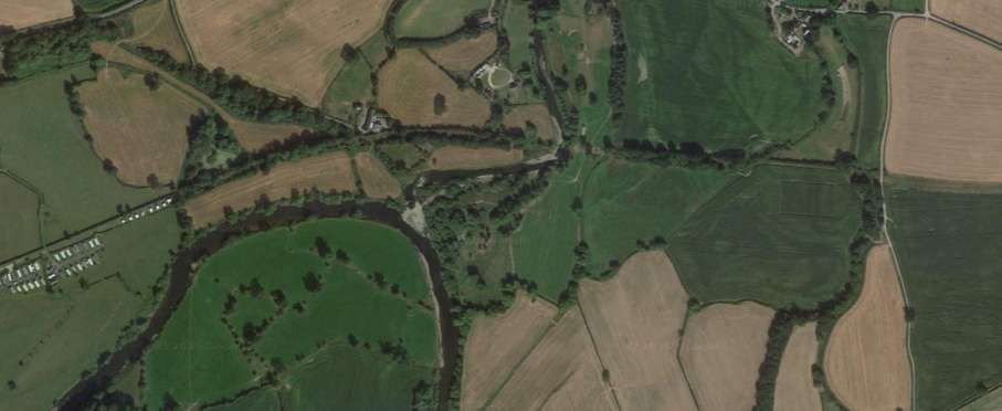
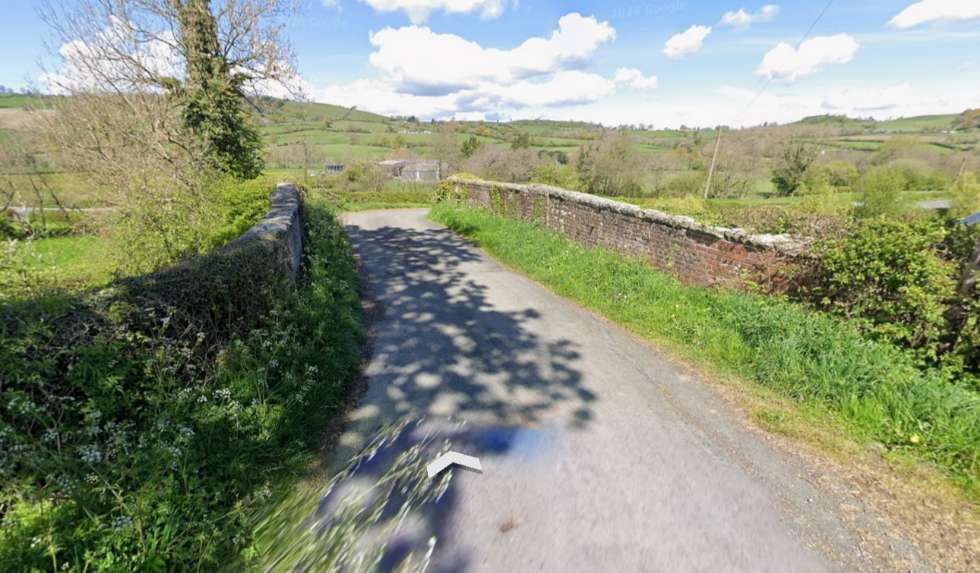
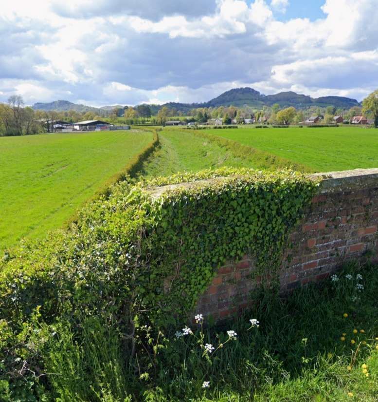
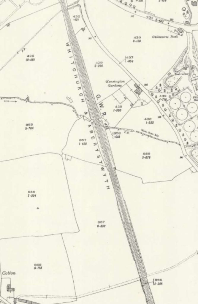
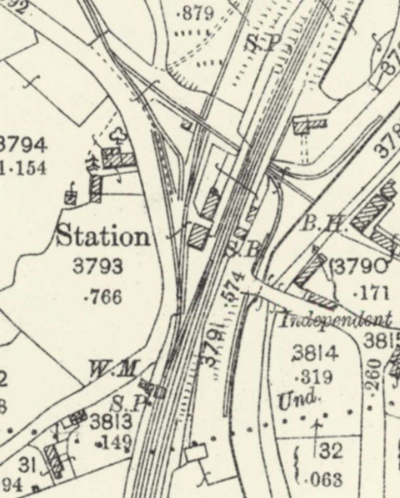
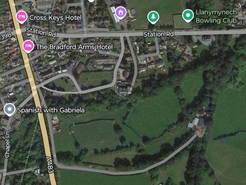
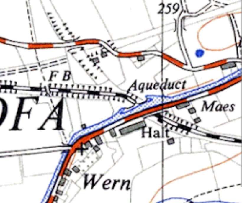
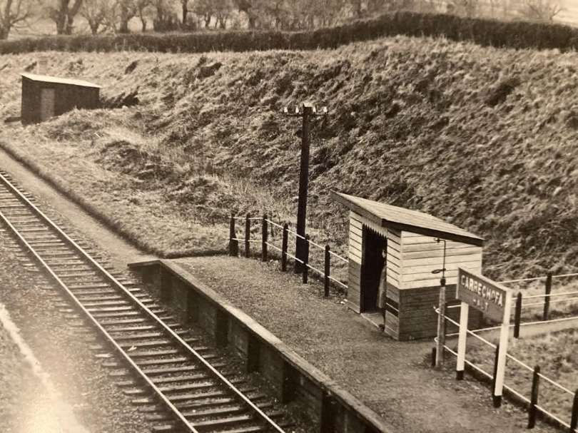
In the first article [4] in this short series, we finished the first part of our journey from Oswestry along the Llanfyllin Branch just after passing through Carreghofa Halt with its adjacent combined canal aqueduct and road bridge. Just beyond the bridge we noted the Nantmawr Branch heading away to the North while trains for Llanfyllin ran round a short chord to meet what was the original alignment of the Llanfyllin Branch.
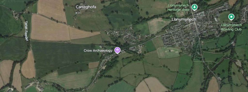
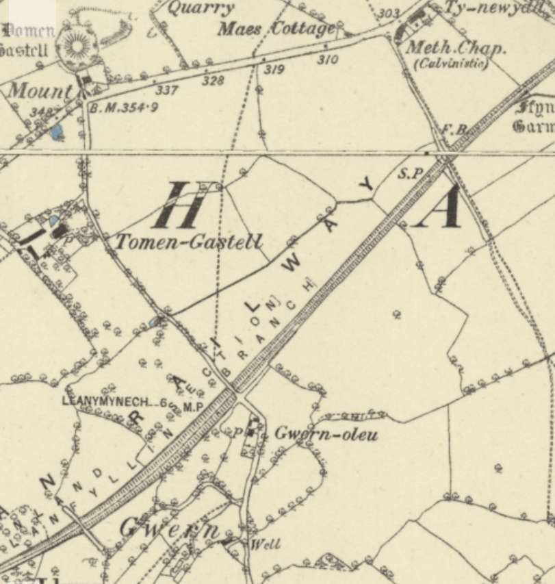
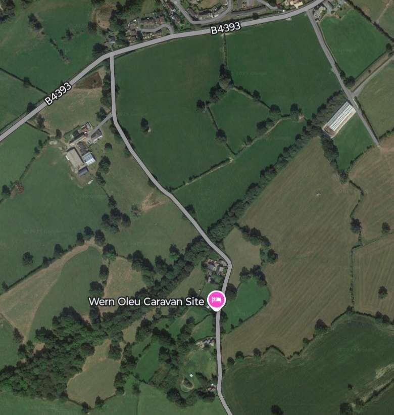
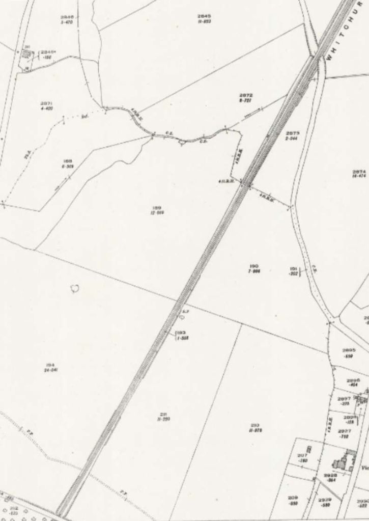
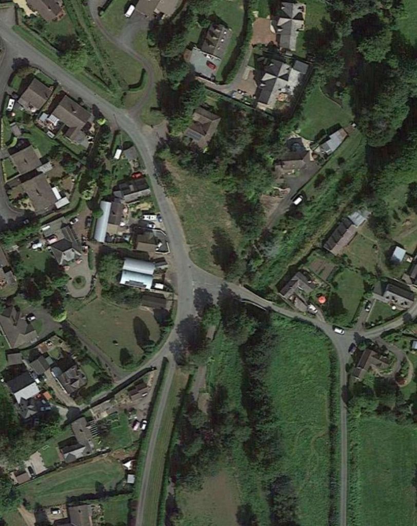
This photograph was taken from the road/canal bridge to the Northwest of Carreghofa Halt. Trains for Llanfyllin took the chord to the left. The Nantmawr Branch heads away to the North. [4]This extract from the 6″ Ordnance Survey of 1900, published in 1902, shows the relationship of the old and new routes taken by branch trains for and from Llanfyllin. The earlier alignment is shown as dismantled and runs to the North of the later alignment. The chord linking the two is on the left of this extract with the line to Llanfyllin leaving the left side of the extract. [5]This satellite image picks out the routes of the lines discussed as they appear in the 21st century. Just to the North of Llanymynech, the original line of the Llanfyllin Branch can be made out. A line of trees gives way travelling westwards to field boundaries that follow the route of the old line. To the South of Llanymynech, the more recent alignment is highlighted by field boundaries becoming tree lined as it approaches the location of Carreghofa Halt and then passes under the modern B4398 and the line of the canal. Immediately to the North of the Canal/Road Bridge the chord connecting the newer line to the older alignment of the Llanfyllin Branch is still described by a line of trees and then by field boundaries. [Google Earth, 28th February 2025]
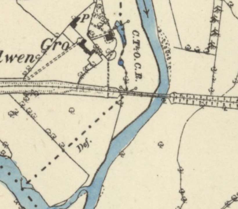
After leaving the 26-chain chord trains headed due West for Llansantffraid across “a tract of pleasant agricultural countryside.” [3: p635] Within a short distance the Grove Viaduct was reached. It was a 90-yard long viaduct which sat about 7.7 miles from Oswestry.
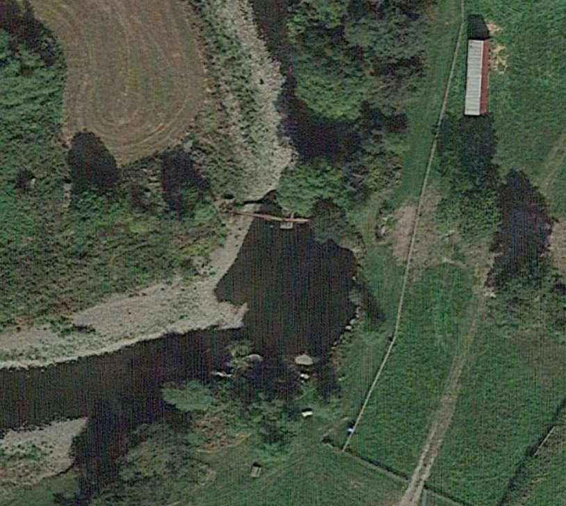
This extract from the 6″ Ordnance Survey of 1900, published in 1903, shows the Llanfyllin Branch heading West over Grove Viaduct which is close to the centre of the image. The Afon Vyrnwy can be seen on the left side of the extract. [6]This satellite image covers approximately the same length of the Llanfyllin Branch as does the 6″ OS map extract above. [Google Earth, March 2025]
A minor road bridged the line to the East of Grove Viaduct. The railway cutting has been infilled but the bridge parapets and the deck under the road remain.
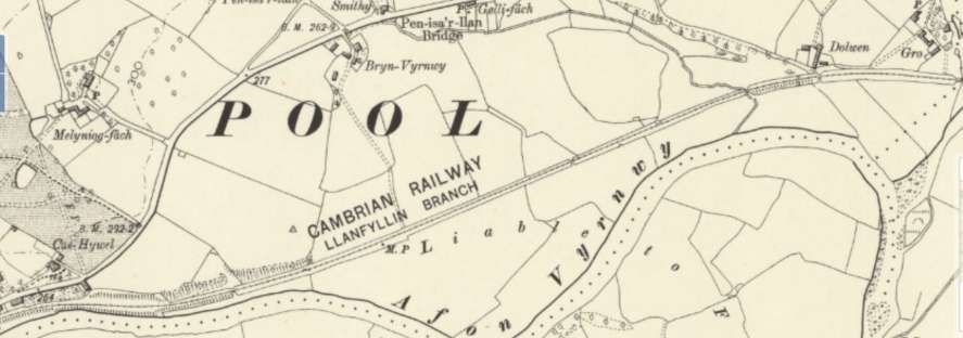
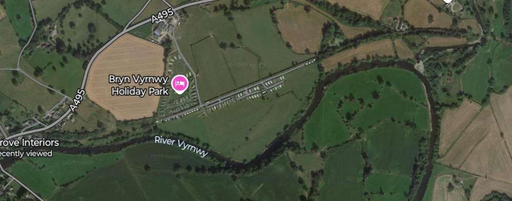
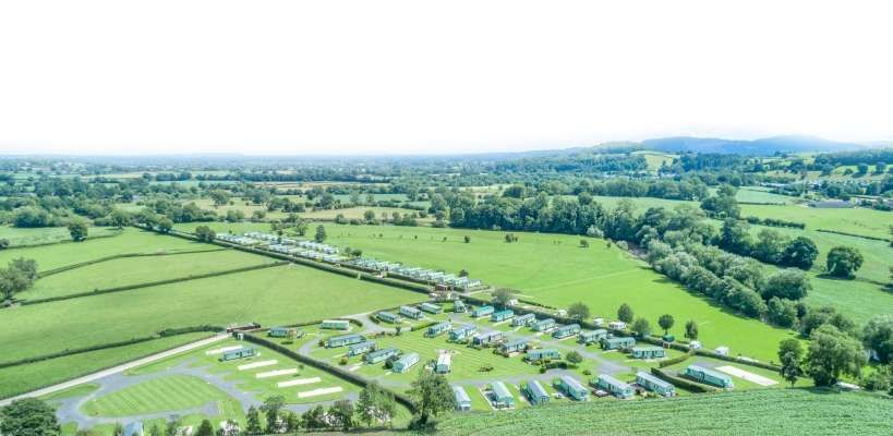
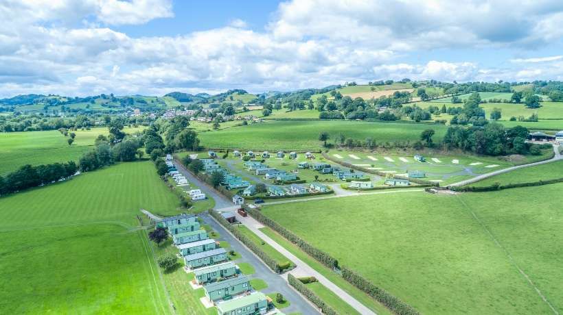
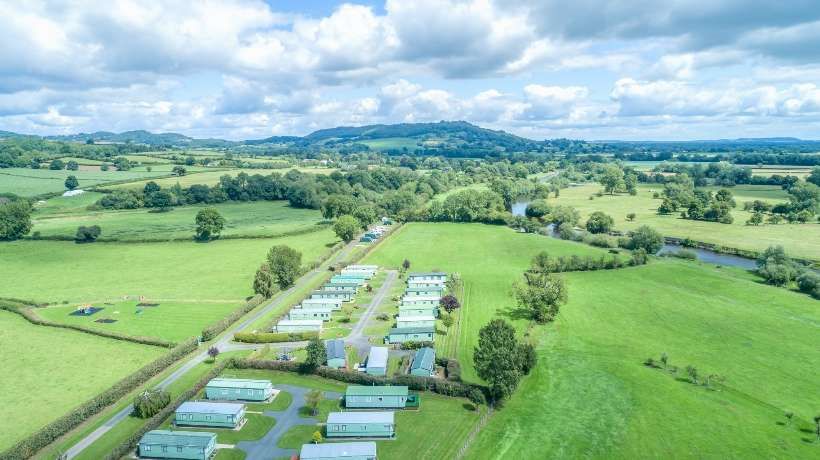
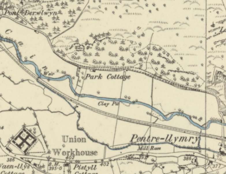
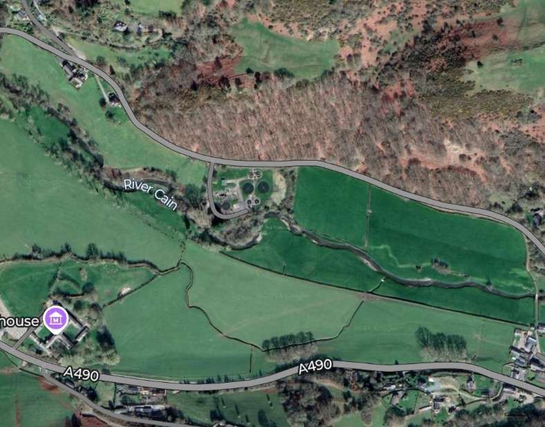
Looking North along the minor road in April 2024. [Google Streetview, April 2024]Looking East along the old railway from the bridge towards Llanymynech. [Google Streetview, April 2024]Looking West along the line of the old railway towards Grove Viaduct and Llansantffraid. [Google Streetview, April 2024]This is how the Grove Viaduct is shown on the 6″ OS map published in 1885 and surveyed during the years before that date. [9]The location of the Grove Viaduct over the Afon Tanat as it appears on modern satellite imagery. [Google Earth, March 2025]The line continues towards Llansantffraid. [6]A similar length of the line as it appears in Google Maps in March 2025. [Google Maps, March 2025]An aerial image looking Southeast showing Bryn Vyrnwy Holiday Park in the 21st Century. The access road running diagonally across the image follows the line of the old railway. [13]Looking West across Bryn Vyrnwy Holiday Park – the line of the old railway is paved, running between the two hedges. [13]Looking Southwest towards the hills the two hedge lines define the extent of the old railway land. [13]Llansantffraid-ym-Mechain Railway Station was the only passing place on the Branch. It is a large village about 7 miles (11 km) south-west of Oswestry (9.2 miles along the line) and 8 miles (13 km) north of Welshpool. It is at the confluence of the River Vyrnwy and the River Cain. The station can be seen just below the centre of this map extract. [6]
Llansantffraid-ym-Mechain
Jenkins tells us that Llansantffraid Railway Station was “the principal intermediate station on the branch. Its facilities included a single platform for passenger traffic on the up side of the line with a crossing loop immediately to the west, and a gated level-crossing to the east. The well-equipped goods yard included accommodation for coal, minerals, livestock, vehicles, and general merchandise traffic.” [4: p635]
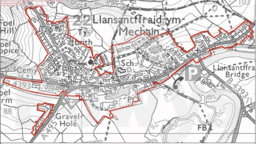
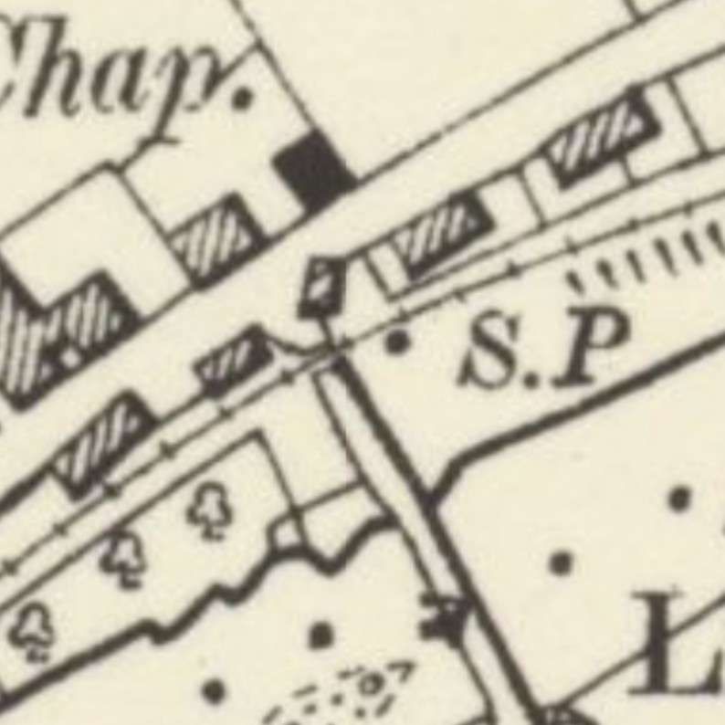
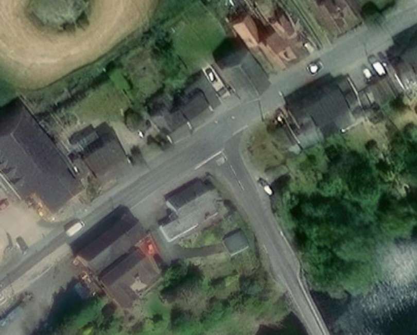
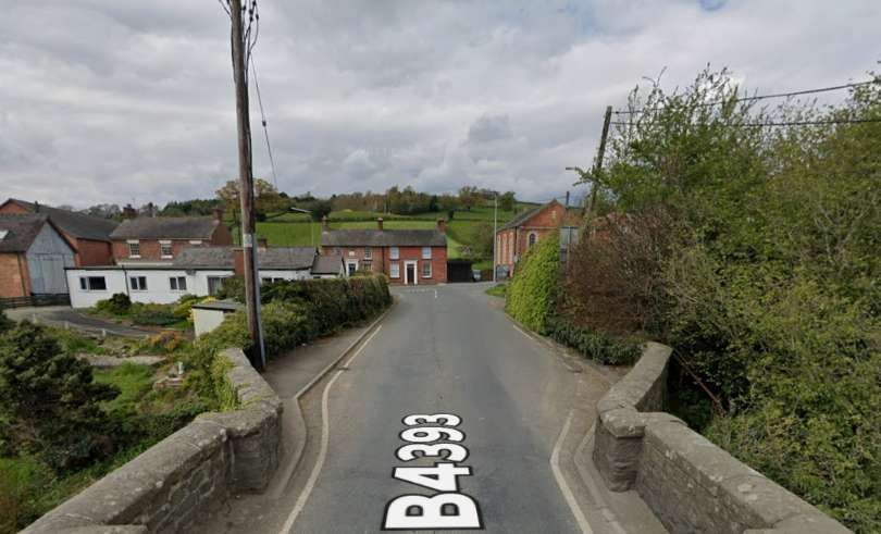
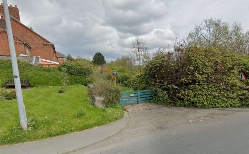
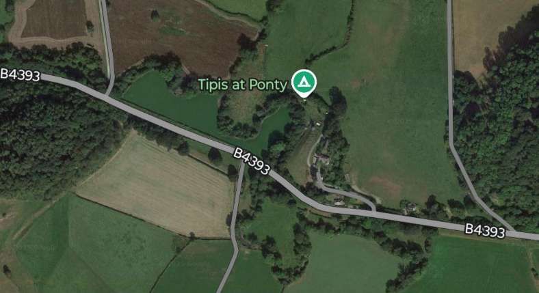
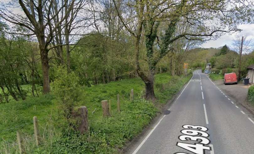
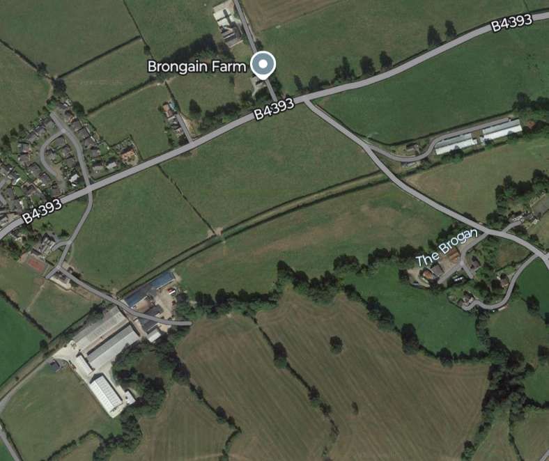
The village of Llansantffraid-ym-Mechain as it appears in Powys Council’s local development plan. [12]A closer view of the railway on the OS map of 1885 where it crossed what is now the B4393 to the North of the river bridge. [6]The same location as it appears on the NLS ESRI satellite imagery in the 21st century. [14]Looking North from the river bridge towards the A495. The old railway crossed the road at the near side of the white walled property on the left of this image. [Google Streetview, April 2024]Looking East, the line of the old railway is marked by the driveway protected by the green gates. [Google Streetview, April 2024]Looking West, the old railway ran to the left of the buildings. [Google Streetview, April 2024]
Llansanffraid (Llansantffraid) means “Church of Saint Bride” in the Welsh language; ym-Mechain refers to its location in the medieval cantref of Mechain and distinguishes it from other places with the same or similar names. [7]
“The name is based on the story of St Bhrid, who is said to have floated across the Irish Sea on a sod of turf, or to have been carried to Scotland by two oystercatchers. The followers of St Bhrid possibly set up new settlements known by the Welsh as Llan Santes Ffraid, Church of (Lady) Saint Bhrid. In recent years the spelling of the village name, with or without a ‘t’, has been a contentious issue (as it has been at Llansantffraid Glyn Ceiriog).” [7]
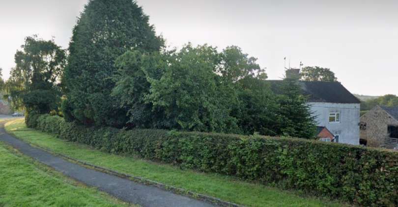
Approaching the railway station, the old line crossed Lletty Lane on the level.
Looking East from Lletty Lane away from the site of the station. The level crossing location is off to the left of this image. [Google Streetview June 2021]
Jenkins continues: “Llansantffraid was the only crossing place between Llanymynech and Llanfyllin, although it was not [ideal] for passing two passenger trains because the loop was sited beyond the platform. It was nevertheless possible for one passenger train and one freight train to pass here, although the timetable in force in later GWR days ensured that this was not normally necessary. In the 1930s this only took place on Wednesdays when the 9.05 am (WO) passenger service from Llanfyllin to Oswestry passed the 9.12am (WO) light engine from Oswestry to Llanfyllin at 9.27 am.” [3: p635]
“The station building at Llansantffraid was a brick-built structure incorporating a two-storey residential portion for the stationmaster and his family. Although, like many Welsh stations, it was of comparatively plain appearance, the facade was enlivened by the provision of a bay window in the house portion, together with elaborate barge-boards and tall ‘ball & spear’ finials at the end of each gable. The stationmaster’s house was to the left (when viewed from the platform), while the booking office was to the right; the house was an L-plan structure with its gabled cross-wing facing the platform and a subsidiary wing that was parallel to the track.” [3: p636]
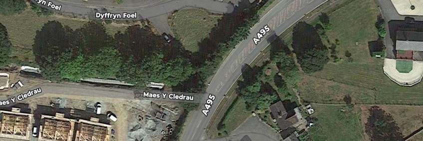
To the immediate West of the station building, a SPAR convenience store and a small industrial estate are built over the line of the old railway. A little further to the West, what is now the A495 turned South and bridged the line of the railway.
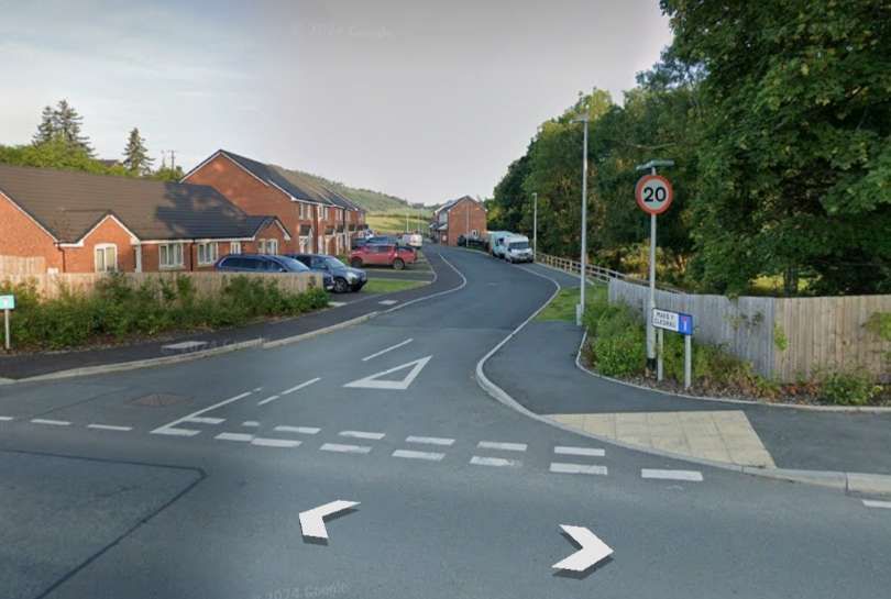
A closer view of the bridge at the West end of the village of Llansantffraid-ym-Mechain as shown on the 1885 6″ OS Map. [15]The same location in the early 21st century, as it appears on the NLS ESRI satellite imagery. The road (A495) has been widened, the bridge carrying the highway is long-gone. [15]This more recent satellite image shows a small new estate being built over the line of the old railway to the West of the A495. The route of the railway on the East side of the road is better defined in this image and the road Maes Y Cledrau sits on the line of the railway on the West side of the road. [Google Maps, March 2025]Looking East from the A495 along the line of the old railway. It passed to the left of the house visible on the right of the image. [Google Streetview, July 2024]Looking West from the A495 along Maes Y Cledrau. The old railway ran on the left side of the trees on the right of the image. In the distance, the newly built houses sit over the line of the railway. Closer to the camera it centre-line approximated to the kerb line of the road. [Google Streetview, July 2024]
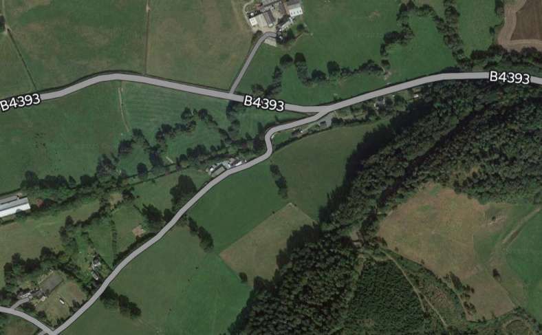
The B4393 ran parallel to the line to the North. The line climbed towards Llanfechain on a gradient of 1 in 75.
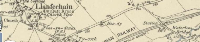
The old railway closely followed what became the B4393. The road ran on the North side of the railway. [16]The same area as it appears on Google Earth satellite imagery in the 21st century. [Google Maps, March 2025]Looking West along the B4393 the line of the old railway can be identified, delineated by the two hedge lines on the left of this photograph. [Google Streetview, April 2024]The road and railway continued West immediately adjacent to each other. [17]The same area on 21st century satellite imagery. [Google Maps, March 2025]Again the old railway formation continues West alongside the B4393. [Google Streetview, April 2024]On this next extract from the 6″ Ordnance Survey a side road to the B4393 crosses the line of the railway. [18]The same area in the 21st century. [Google Maps, March 2025]Looking North across the bridge noted above. [Google Streetview, April 2024]Looking East along the old railway alignment from the road bridge. [Google Streetview, April 2024]Looking West along the old railway formation from the road bridge. [Google Streetview, April 2024]This next map extract shows Llanfechain Railway Station. [19]The same area in the 21st century. Note the way that the old railway turns away to the Southwest after passing through the station. [Google Maps, March 2025]The station at Llanfechain was a good walk from the centre of the village and not at the closest road crossing to the village. [21] The facilities at the station were limited, although the main station house was as substantial as that at Llansantffraid-ym-Mechain. The station site was framed by a road bridge. [21]
Llanfechain
Llanfechain was near to 11 miles from Oswestry. Jenkins tells us that “The layout at Llanfechain echoed that at neighbouring Llansantffraid in that there was just one platform on the up side. A small goods yard was able to deal with coal, livestock, and other forms of traffic. … The station building was of ‘Victorian house’ design incorporating residential quarters for the local stationmaster. The presence of a two-storey house portion made these stations appear much bigger than they actually were, the booking office and waiting-rooms being only one portion of the main structure.” [3: p636]
Leaving Llanfechain Railway Station “heading south-westwards, the single line climbed steadily through pastoral countryside towards the penultimate stopping place at Bryngwyn” [3: p636] which was a little over 12.5 miles from Oswestry.
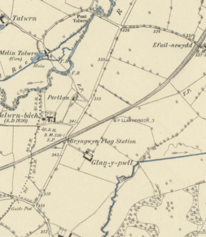
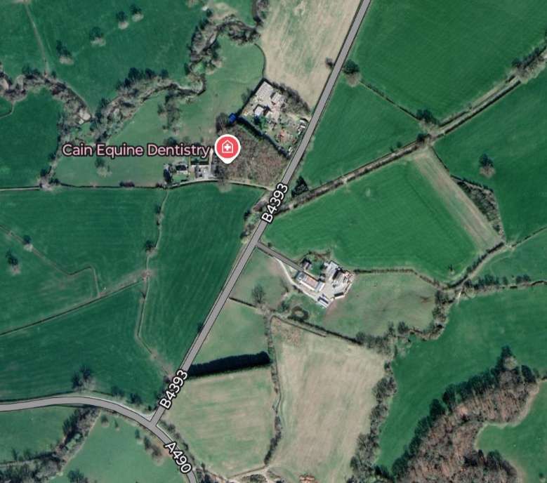
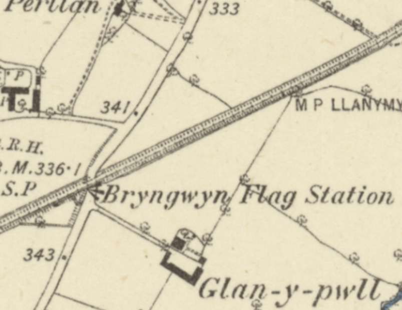
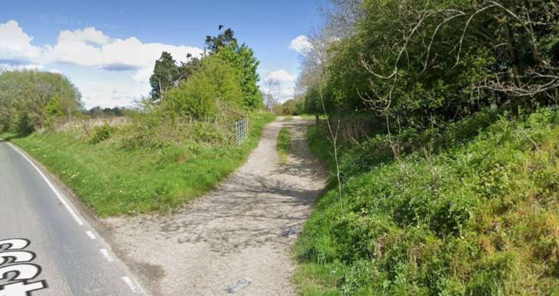
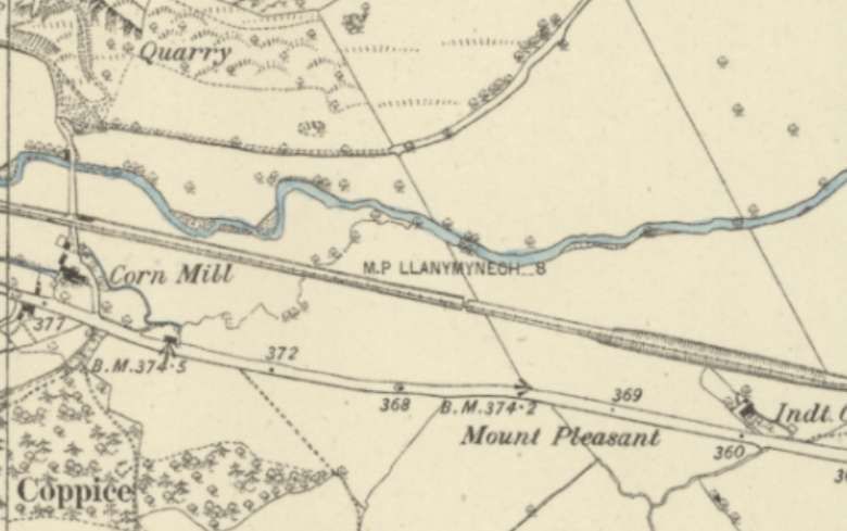
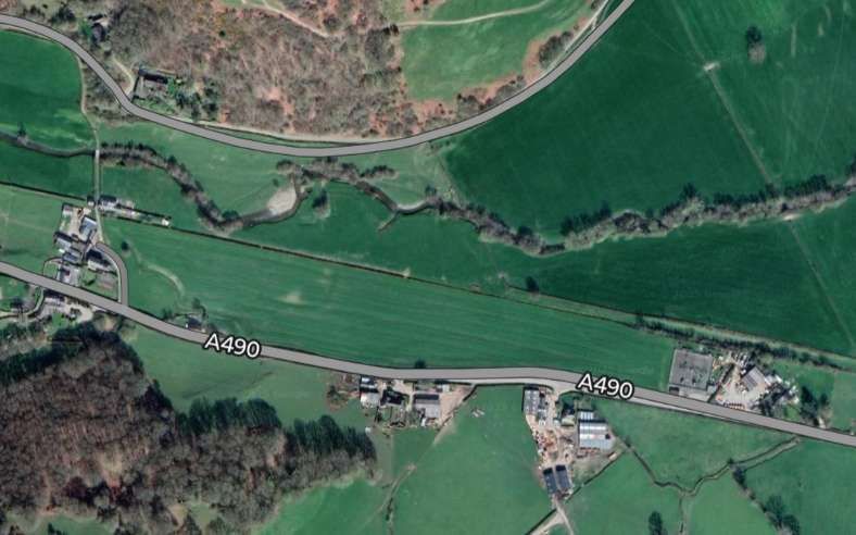
Looking West-southwest along the line of the old railway in 2024. [Google Streetview, April 2024]The line headed Southwest as it left Llanfechain. Note the footbridge in the top-right of this map extract, the road bridge just below and to the left of the centre of the image and the accommodation bridge in the bottom-left. [20]The same area in the 21st century. At the top-right of this image what was once a footbridge over the old railway has been converted into an access road. On both this image and the map extract above another minor road can be seen bridging the line of the old railway just below the centre of the image. The line was in a cutting at this point. [Google Maps, March 2025]The road bridge seen from the Northwest. [Google Streetview, April 2024]Looking Northeast along the line of the old railway towards Llanfechain Railway Station. [Google Streetview, April 2024]Looking Southwest along the line of the old railway. [Google Streetview, April 2024]In this next 6″ map extract the accommodation bridge noted before, appears top-right and a further bridge bottom-left. The line remained in cutting along this length. [25]This extract from Google’s satellite imagery covers a similar area to the map extract above..It also shows the bridge noted above which carried another local access road over the old railway. [Google Maps, March 2025]On this next extract from the 6″ Ordnance Survey of 1880s the line begins to turn towards the West, from a southwesterly heading. What becomes the B4393 crosses the line at Bryngwyn Flag Station (a halt at which passengers had to signal the train to stop to collect them). The road curving round the bottom-left corner of the extract was to become the A490. [26]Much the same length of the line appears on this 21st century satellite image. The A490 can be seen on the bottom-left of this image. [Google Maps, March 2025]A closer view of the location of Bryngwyn Halt. The old railway can be seen bridging the old road which had to dog-leg to pass under the line. [26]Looking Northeast along the line of the old railway from the B4393. The bridge at this location was removed and the road was realigned after the closure of the railway. The level difference between the two is still evident. [Google Streetview, April 2024]Turning through 180°, looking Southwest along the line of the old railway. The realignment of the road required the removal of the bridge abutment and a short length of embankment which once also supported the Bryngwyn Halt. [Google Streetview, April 2024]
Bryngwyn Halt
Bryngwyn did not open with the line. Jenkins tells us that “having been opened by the Cambrian Railways as an unstaffed halt in the mid-1860s. The single platform was sited on the down side of the line with access from a nearby road. Interestingly, Bryngwyn was an early example of a ‘request stop’, a semaphore stop-signal being worked by intending travellers. The platform was originally of timber trestle construction with a small open-fronted waiting shelter, although a concrete platform and corrugated-iron shelter were later provided.” [3: p636]
“From Bryngwyn the route continued westwards for the final two miles to Llanfyllin. With the A490 road running parallel to the left, the line passed beneath a minor road bridge and, slowing for the final approach to their terminus, branch trains passed an array of parallel sidings before finally coming to rest beside a single-platform station some 8 miles 41 chains from Llanymynech, and 14 miles 48 chains from the start of the through journey from Oswestry.” [3: p636-637]
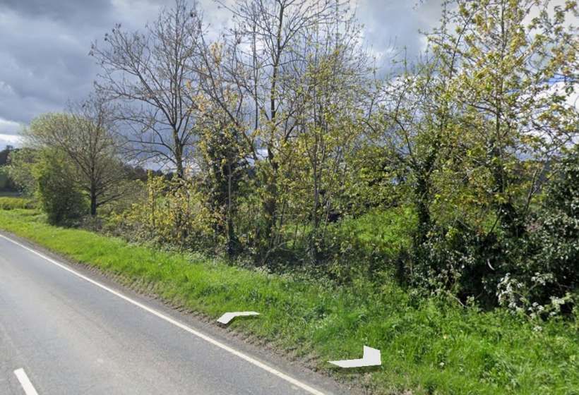
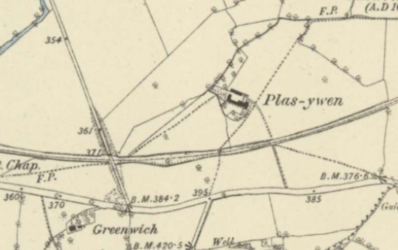
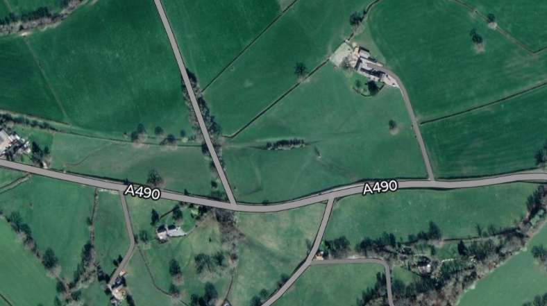
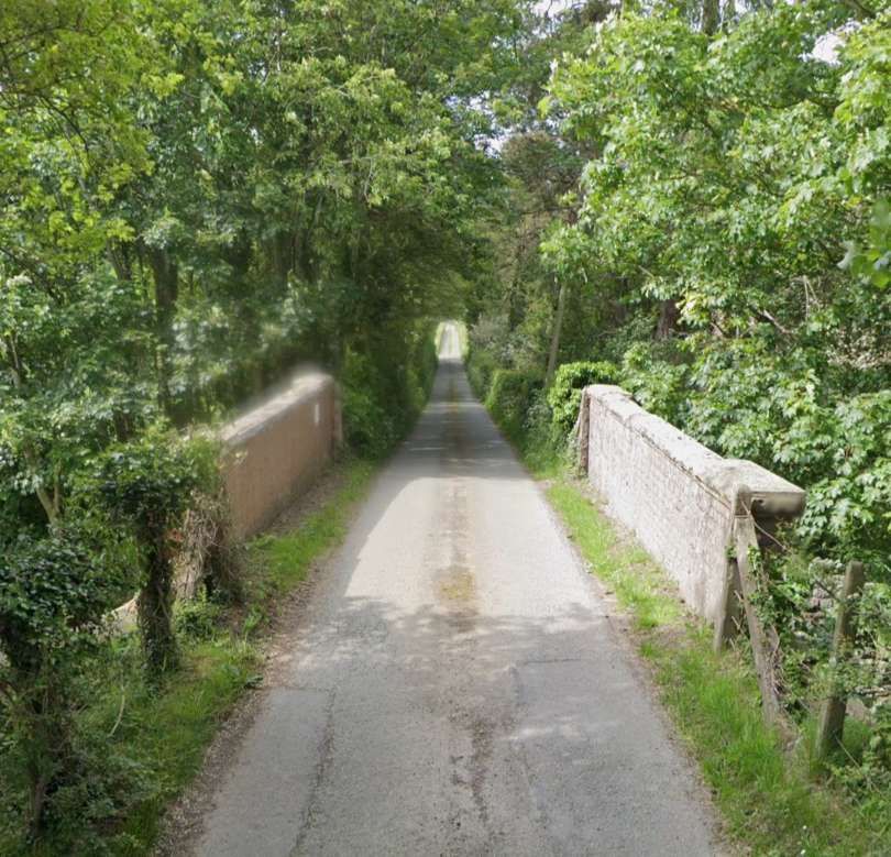
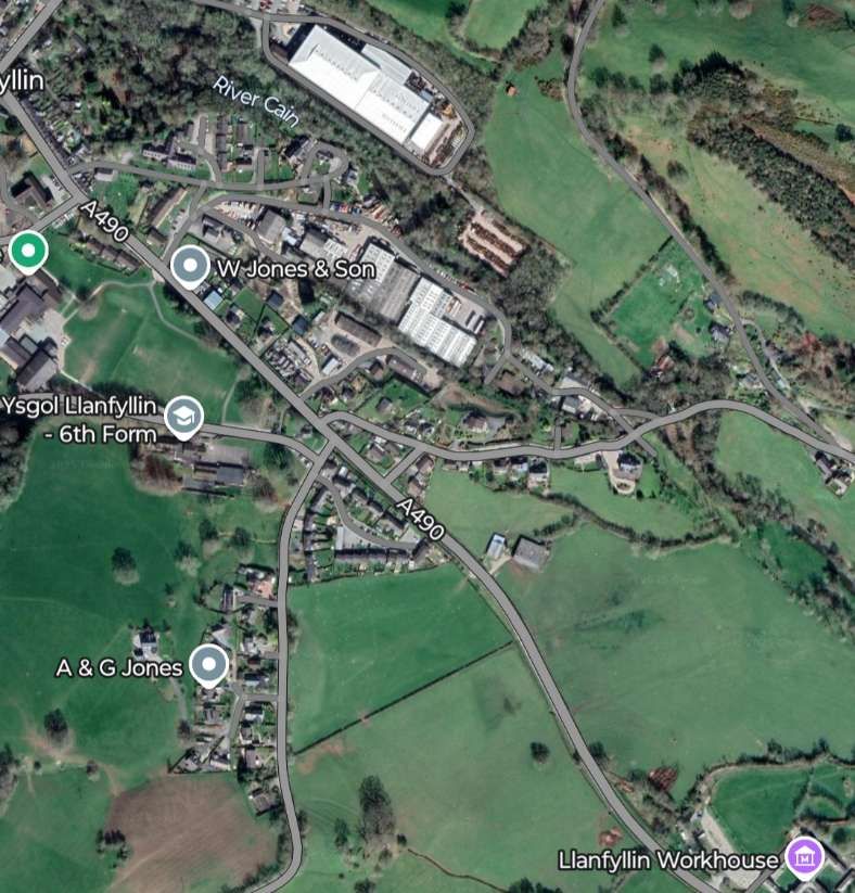
Over this next stretch of the old railway, the line continues to curve round towards the Northwest. The road that became the A490 runs parallel to the line but to its South. An access track Plas-ywen crossed the line at an un-manned crossing. A little further West the line was bridged by a lane running North from the main road. [27]Much the same area on modern satellite imagery. [Google Maps, March 2025]Looking North along the lane which crossed the old line. The railway was in cutting at this location so there are no significant gradients on the approaches to the bridge. The brick parapets of the bridge remain in place. [Google Streetview, Summer 2022]Looking East, the line of the old railway is camouflaged by tree growth. [Google Streetview, Summer 2022]Looking West, it is possible to see the old formation with the hedge following the old railway boundary. [Google Streetview, Summer 2022]The road and railway continued in parallel across this next extract from the 6″ Ordnance Survey. The River Cain runs just to the North. [28]The same area on modern satellite imagery. At the left of both these images a farm access track crosses the line of the old railway. [Google Maps, March 2025]The old line continued to curve towards the Northwest. [29]A very similar length of the old railway in the 21st century. The route of the railway can still be seen easily curving to the Northwest on the South side of the River Cain. [Google Maps, March 2025]The final length of the line which terminated to the Southeast of the centre of Llanfyllin. [30]The same area of Llanfyllin as it appears on satellite imagery in the 21st century. [Google Maps, March 2025]The centre of Llanfyllin in the 21st century. [Google Maps, March 2025]
Llanfyllin
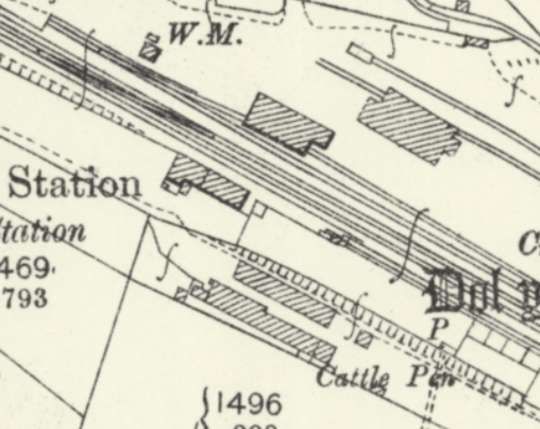
Jenkins says that “Llanfyllin was a surprisingly spacious station, and although its track-plan was relatively simple, the goods yard and other facilities were laid out on a generous scale, the distance from the turnout at the eastern end of the run-round loop to the terminal buffer stops being around 34 chains, or slightly less than half a mile. The passenger platform was situated on the down side, and it had a length of around 385ft. The platform was flanked by two long parallel lines, one of which functioned as an engine release road while the other formed a lengthy goods reception line. These two lines were linked by intermediate cross-overs which allowed greater flexibility during shunting operations.” [3: p637]
The goods yard contained two goods sheds, one of these being situated on a loop siding that was laid on a parallel alignment to the passenger station. A long siding for “coal and other forms of wagon-load traffic extended along the rear edge of the goods yard; this siding branched into two shorter sidings at its western end, the second goods shed being served by one of these short spurs. The main goods sidings ended at loading docks at the western extremity of the station, while a further siding to the east of the platform on the down side served a cattle-loading dock. The latter siding was entered by means of headshunt from the engine shed siding, a reverse shunt being necessary before vehicles could be propelled into the cattle dock.” [3: p638]
Nearby the “engine shed was single-road structure with a length of about 50ft, … this normally accommodated just one locomotive. Water was supplied from a stilted metal tank beside the engine shed, this structure being fitted with flexible hoses through which the water could be delivered.” [3: p638]
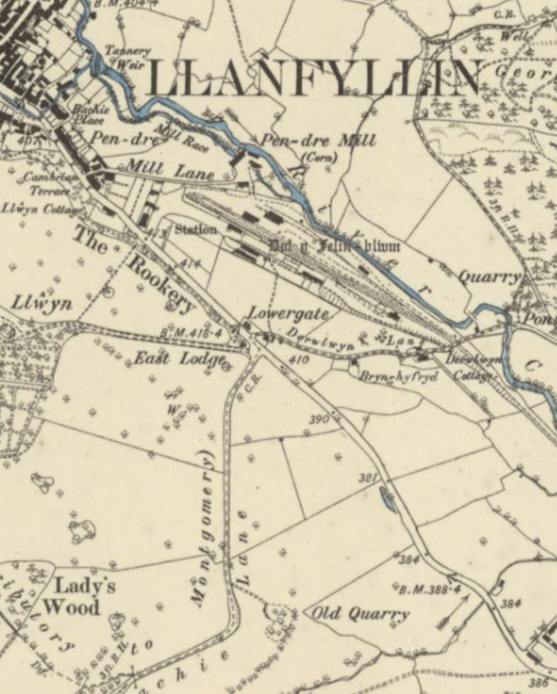
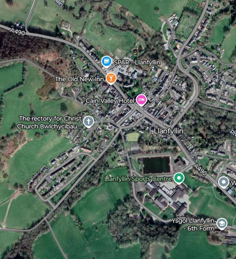
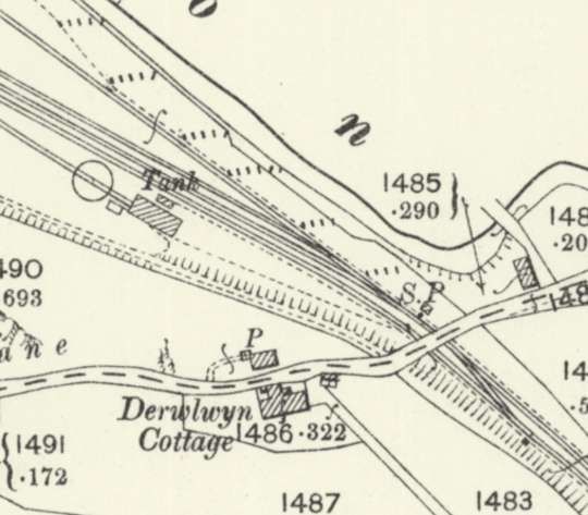
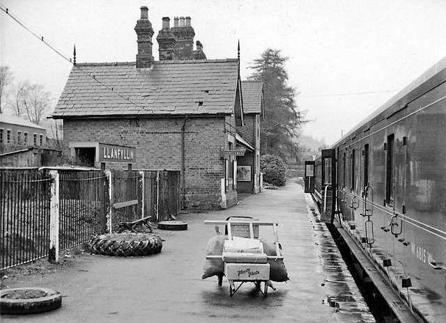
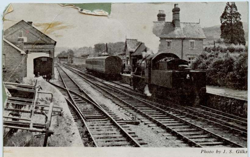
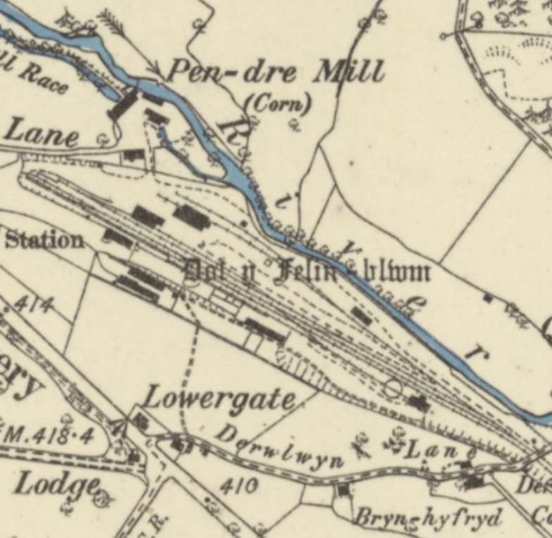
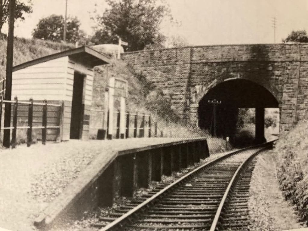
The station throat at Llanfyllin Railway Station is framed by the road bridge carrying Derwlwyn Lane. This map extract comes from the 25″ Ordnance Survey of 1900, published in 1901. [33]
The image above is embedded from the Flickr site of Katerfelto, who comments: “Trains arriving at Llanfyllin passed a ground frame and then passed under a single-span iron bridge which carried Derwlwyn Lane over the line. From the south side could be seen the engine shed and water tower followed by some cattle pens and Llanfyllin signal box, before the single platform and its substantial station building announced the journey’s end.” [34]
Opposite the platform were the goods shed, a warehouse, several buildings and the run-round loop.
The terminal buffers were in a shallow cutting and short approach road led from the station building to the public road.
Jenkins continues: “Llanfyllin station building was similar to the other station buildings on the branch, being a typical ‘Victorian house’ design with a two-storey stationmaster’s house and attached single-storey booking-office wing. The window and door apertures were simple square-headed openings with large-paned window frames, but this otherwise plain brick building was enlivened by the provision of decorative barge-boards and elaborate pointed finials. The front of the booking office was slightly recessed to form a covered waiting area, and this feature contributed further visual interest to this former Oswestry & Newton Railway building.” [3: p638]
Llanfyllin had a population of around 2,000. Wikipedia tells us that “the community … population in 2021 was 1,586 and the town’s name means church or parish (Llan) of St Myllin (‘m’ frequently mutates to ‘f’ in Welsh).” [30]
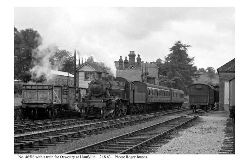
The Llanfyllin Branch was featured in an article by Stanley Jenkins in the October 2003 issue of Steam Days magazine. [3]
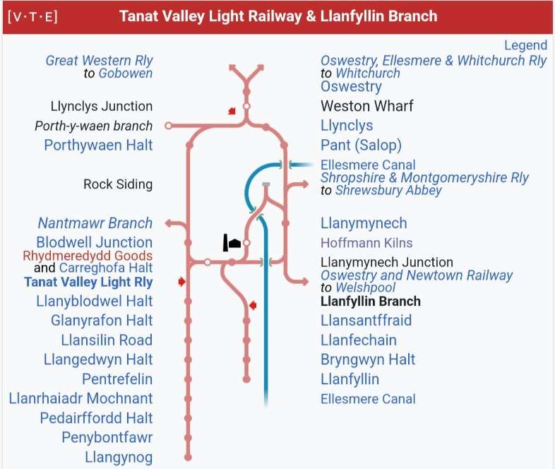
The immediately adjacent Tanat Valley Light Railway is covered elsewhere on this blog. The articles about that line can be found here [4] and here. [5]
The two lines ran into the hills to the Southwest of Oswestry. The local Cambrian network is shown diagrammatically in the image below.
Trains on the branch ran from the Welsh border town of Oswestry to Llanfyllin in the Berwyn Mountains. The branch left the Oswestry & Newtown Railway at Llanymynech, where the station nameboard called on passengers for Llanfyllin and Lake Vyrnwy to disembark and change trains. The lake is a nearby beauty spot where there is a reservoir supplying water to Liverpool.
In July 1864, the Oswestry & Newtown Railway joined with other local concerns to form the Cambrian Railways Company with its headquarters at Oswestry.
Llanfyllin’s townfolk formed a company to secure a rail link to the Cambrian network. The Cambrian began to show some interest when ideas of an East-West mainline came to the fore.
A 10-mile branch was agreed from Llanfyllin to Llanymynech which, in the view of the companies which would soon form the Cambrian, would hinder any rival’s attempt to construct a mainline between the Midlands and the Welsh coast.
The modest scheme received Royal Assent on 17th May 1861 and the Act empowered the Oswestry & Newton Railway to build branch lines to Llanfyllin and Kerry. The Llanfyllin Branch was soon pegged out in advance of construction. It presented few engineering challenges as “for much of its length the proposed branch line would follow a comparatively easy course along convenient river valleys, and with few physical obstacles to impede [the] work.” [3: p627]
“The line was substantially complete by the early months of 1863, a significant event being the arrival of the locomotive Nant Clwyd at Llanfyllin in March of that year. The railway was opened on 10th April 1863 and branch trains began running through to Oswestry on 17th July 1863.” [3: p627]
The railway “was single track throughout, with intermediate stations at Llansantffraid and also Llanfechain. At Llanymynech the junction was situated to the North of the station, and this necessitated an awkward reversal when trains entered or left the branch. There were no tunnels on the branch, although several overbridges or underbridges were required including a 90-yard viaduct between Llanymynech and Llansantffraid. An additional stopping place was opened at Bryngwyn in the first few months of operation, although this new station was merely a request stop with no provision for goods traffic. The trains travelling eastwards to Oswestry were regarded as up workings, while westbound trains were down services.” [3: p627-628]
The new railway was soon functioning as a typical country branch line with a modest service of around five trains each way. “Minor changes took place at Llanymynech in 1866 in connection with the opening of the Potteries, Shrewsbury & North Wales Railway, but in the event this undertaking was more or less a total failure. Much later, in 1896, the Llanfyllin branch junction was re-aligned using part of the PS&NW route.” [3: p628]
“The Llanfyllin branch found a welcome, unexpected source of heavy freight traffic in the 1880s when Liverpool Corporation obtained powers for the construction of a massive dam at Llanwddyn, about seven miles to the west of Llanfyllin. By this means the surrounding valley was turned into a reservoir known as Lake Vrynwy from which water was supplied to Liverpool via a 75mile-long aqueduct. Materials needed in connection with this gigantic feat of Victorian engineering were delivered by rail to Llanfyllin, which became an important railhead while the reservoir scheme was under construction.” [3: p628]
In 1922, the Cambrian became an integral part of an enlarged GWR as part of the grouping required by the Railways Act of 1921.
Road competition led the GWR to become “a large-scale user of motorised road transport, with railway-owned lorries being employed for local cartage work in urban areas and as ‘country lorries’ for collection and delivery work in rural areas. Certain stations were selected as ‘country lorry centres’, while others were down-graded in various ways so that, by the later 1930s, many smaller stations were handling very little carted freight traffic. Oswestry and Llansantffraid, for example, both became ‘country lorry centres’, and a large rural area was then served by road transport, with GWR vehicles running on regular routes. In this way the railway could fight back against the road-transport operators.” [3: p628]
The GWR was also a pioneer in the use of motorised road passenger services. “By the post-Grouping period the GWR had introduced road feeder services on a very large scale, rural Wales being regarded as an ideal area for the employment of such vehicles. Oswestry emerged as an important centre in the company’s motor-bus network, with services radiating to towns such as Llangollen, Welshpool, and to Llanfair Caereinion. These extensive road services needed a relatively-large allocation of motor vehicles, among the buses working from Oswestry during the 1920s being Burford 30cwt buses Nos. 801, 807, and 861, and Thornycroft 30cwt vehicles Nos. 911 and 936. The GWR buses … worked in close conjunction with the trains as useful feeders for the railway system.” [3: p628] This was an early example of an integrated transport network!
To regularise its practice, the GWR obtained new legal powers “under the provisions of the Great Western (Road Transport) Act of 1928. This new legislation enabled the GWR to own, work, and use motor vehicles in its own right, and to enter into arrangements with other parties for the operation of road transport services. By virtue of these powers the railway company at once entered into detailed negotiations with certain road transport companies, and by 1933 all of the GWR motor-bus services had been handed over to ‘associated’ bus companies such as Crosville Motor Services Ltd.” [3: p629]
“This arrangement was supposed to lead to greater co-ordination between road and rail transport, but there is no doubt that in many areas the buses began to compete with the railways for what little transport was available in rural areas. The situation in respect of the Oswestry area seems to have been particularly disadvantageous as far as the GWR was concerned in that many buses ran on a Llanymynech-Oswestry-Gobowen axis in open competition with the rail service.” [3: p629]
“In some instances Crosville (or the other railway-associated bus companies) assisted the GWR by collecting and delivering parcels traffic, while goods traffic was handled by GWR motor lorries, some of which had been converted from former railway buses. Oswestry-based road motors Nos. 891, 897 and 861 … were adapted for use as lorries between 1926 and 1929. …They retained their old GWR fleet numbers. … Buses were more flexible than the railways, … to mitigate this the GWR opened numerous unstaffed halts. … One of these … was established in 1938 at Carreghofa in the Llanfyllin Branch, near Llanymynech.” [3: p629]
Jenkins tells us that the train services on the branch were similar throughout the years of its operation with five up passenger services to Llanymynech from Llanfyllin each weekday and five down trains. Occasionally these services worked through to Oswestry but, with the exception of the 1.43pm service, such movements were not always timetabled. The reverse workings, often unadvertised, ran from Gobowen through Oswestry and Llanymynech to Llanfyllin. Wednesdays and Saturdays, market days in Oswestry, were different, with two morning trains running through to Oswestry and two early afternoon trains back to Llanfyllin. There was no Sunday service. A daily branch goods train “generally departed from Llanymynech at 12.25pm and arrived at the terminus at 1.35pm, having called intermediately at Llansantffraid where half an hour was allowed for shunting operations. The return working left Llanfyllin at 2.30pm and, after spending another half an hour at Llansantffraid, … arrived at Llanymynech at 3.42pm.” [3: p629]
Jenkins comments that “the line was worked by short-wheelbase coaching stock for many years, although in GWR days 2-coach ‘B-sets’ and other formations were employed.” [3: p629]
The Cambrian Railway had very few small tank engines which meant that tender engines worked many of their small branch lines. Usually these would be ‘Queen’ class 0-6-0 locomotives. Following the grouping, GWR locos began to appear on the branch lines around Oswestry, particularly Armstrong and Collett 0-4-2Ts. Jenkins tells us that “these newcomers included ‘517’ 0-4-2T No 848 which worked on the branch at various times until its withdrawal in 1945, being out-stationed in the branch sub-shed at various times. The familiar Collett 0-4-2Ts were introduced by the GWR in 1932 as replacements for the veteran ‘517’ class 0-4-2Ts on local passenger services.” [3: p630]
The first examples of the non-auto ’58XX’ locomotives appeared on the branch in the 1930s. Jenkins notes that No. 5816 was sent to Llanfyllin shed as early as August 1933, while by 1947, the resident branch engine was No. 5806. The auto-fitted ’48XX’ class also arrived at Oswestry in the mid-1930s. These locos could also be seen on the Llanfyllin Branch. [3: p630] Dean goods 0-6-0 locos were also seen at times on the branch. Jenkins notes appearances of Nos. 2482 and 2535. No doubt the branch was served by a number of pannier tank (0-6-0PT) locomotives of different classes that were stabled at Oswestry. After nationalisation, by the mid-1950s, a group of Ivatt ‘2MT’ 2-6-0s were allocated to Oswestry and were employed on the branch. “As there was no turntable at the terminus the Ivatt Moguls generally ran tender-first towards Llanfyllin and then returned to Oswestry facing in the right direction. Several Llanfyllin branch services were at this time through trips to Gobowen which continued northwards over the Great Western branch to connect with the Shrewsbury & Chester main line. … At Gobowen it was found that the clearance between the stop block at the end of the down bay platform was insufficient for an Ivatt 2-6-0 running tender-first, and drivers were therefore instructed to enter the bay running chimney-first; this instruction probably explains why the engines normally faced northwards when they were running on the Llanfyllin route!” [3: p631]
The Route
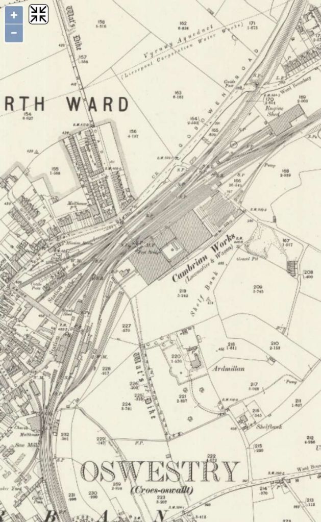
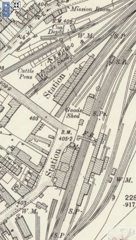
We commence our journey at Oswestry Railway Station. We noted first that from 1860 onwards there were two separate stations in Oswestry – a GWR station and a Cambrian station.
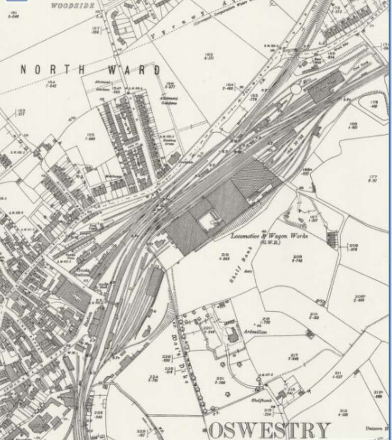
The first 25″ OS map extract below shows the general arrangement of railway facilities in the centre of Oswestry at the turn of the 20th century. The second focusses on the two railway stations.
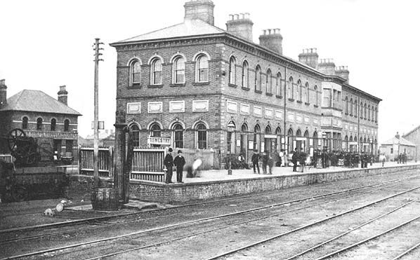
A series of photographs of the railway station can be found on the Disused Stations website. [32]
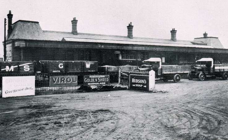
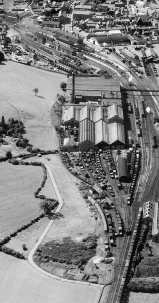
Oswestry Railway Station (at the top of this image) and the Cambrian’s Works (nearer the camera) seen in an aerial view looking from the Northeast across Oswestry (EAW056424, 1954). Historic England. [30]
After the grouping in 1922 the GWR set about rationalising their inheritance. The old Cambrian station became the town’s passenger facilities and the GWR station was converted into the hub of an enlarged goods yard. “The Cambrian platforms were extended by 300ft, and a new branch bay was created on the west side of the station on a site that had previously been occupied by a large goods shed. At the same time the main up and down platforms were equipped with new canopies, and electric lighting was installed in place of gas in the goods yard and engine sheds. … Goods facilities were provided on a lavish scale, with sidings at both the north and south ends of the station. The main goods yard, which incorporated the original Great Western terminus, was situated to the north of the passenger station; the former terminus remained largely intact after its conversion to a goods depot, although part of the platform canopy was boxed-in to form a goods loading area.” [3: p632]
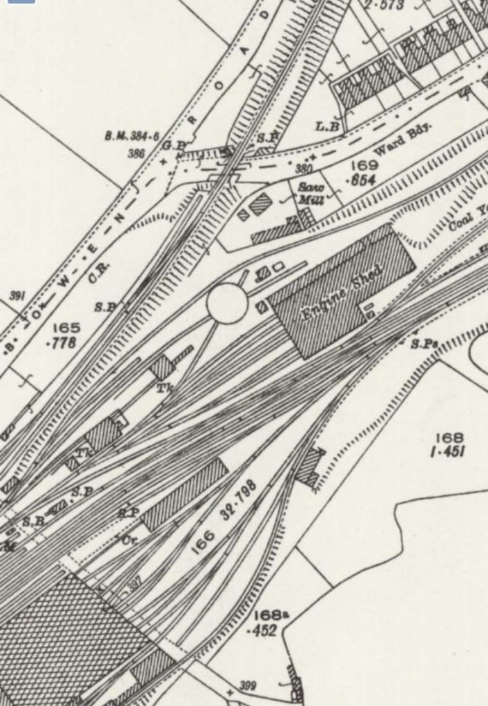
Goods facilities extended both to the North and South of the enlarged passenger station. Oswestry engine shed contained six terminal roads and sat to the North of the station complex, between the lines to Whitchurch and Gobowen. Jenkins tells us that a “standard GWR raised coaling plant was erected as part of the post-Grouping improvements, and this replaced an earlier Cambrian coaling stage. The Great Western coal stage was surmounted by a 45,000gallon water tank, while the old 45ft-diameter locomotive turntable was taken up and a new 65ft-diameter GWR one erected.” [3: p632]
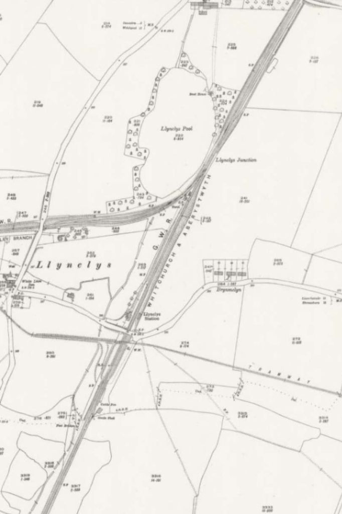
South of Oswestry, trains for Llanfyllin travelled along the GWR Whitchurch to Aberystwyth main line as far as Llanymynech, passing Llynclys junction where the Tanat Valley Light Railway diverged westwards on its way to Blodwell Junction and Llangynog. Llynclys Railway Station was situated a short distance beyond the junction. It “was a wayside station with a small but substantial station building on the up side and a waiting shelter on the down platform. In architectural terms the station building, with its two-storey stationmaster’s house and single-storey booking-office wing, was very typical of Oswestry & Newton practice. The nearby goods yard contained facilities for coal, livestock, and general merchandise traffic.” [3: p633]
The length of the line from Oswestry to Llanymynech is covered by the next sixteen extracts from the 25″ Ordnance Survey of 1900 and accompanying satellite images and photohgraphs.
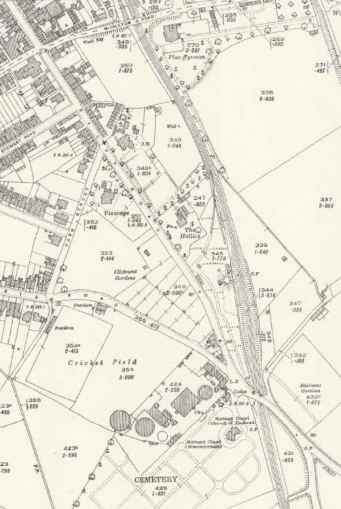
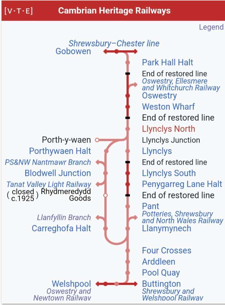
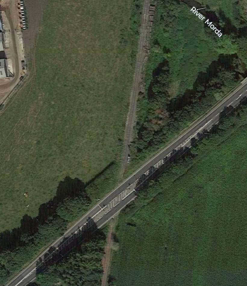
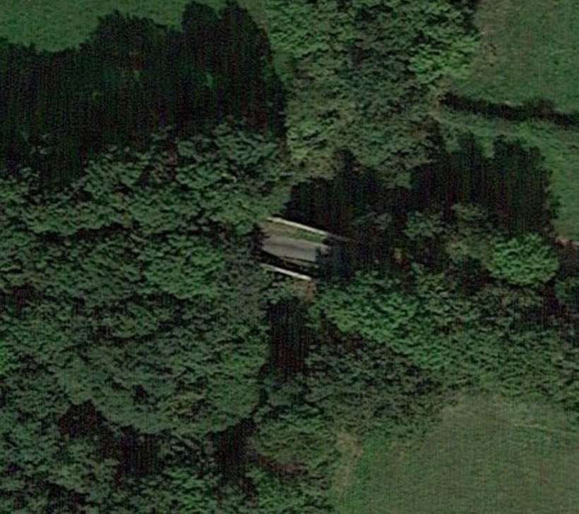
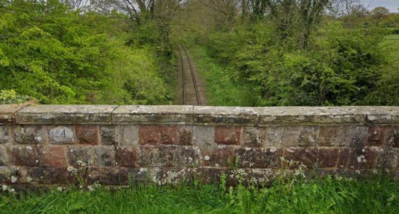
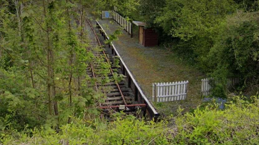
A short distance to the South of Oswestry town centre the line passed under Salop Road adjacent to the gates of the town cemetery. [9]The same location in the 21st century. [Google Earth, February 2025] The line South from Oswestry is single track, it is part of the Cambrian Heritage Railways based at both Llynclys and Oswestry in the restored Oswestry Railway Station. It was formed after the 2009 merger of the Cambrian Railways Society and the Cambrian Railways Trust, it aims to reinstate the infrastructure required to operate trains from Gobowen to Llynclys Junction (for Pant) and to Blodwel. Cambrian Heritage Railways also operates the Cambrian Railways Museum in the Oswestry railway station’s former goods depot. [17]This schematic map shows the lengths of the line between Gobowen and Welshpool that have been restored as of the end of 2024. [17]
The Cambrian Heritage Railway is extending and repairing track from Llynclys South northwards towards Oswestry to enable trains to run into the former Cambrian Railway headquarters at Oswestry. [17]
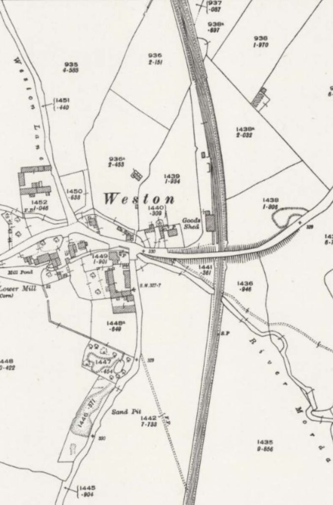
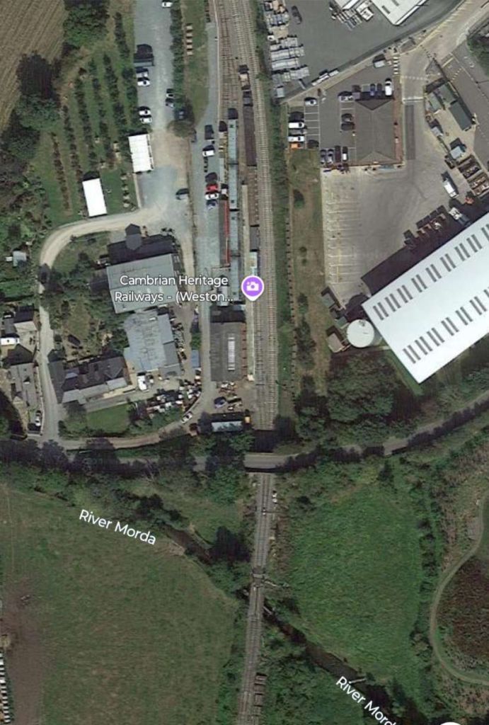
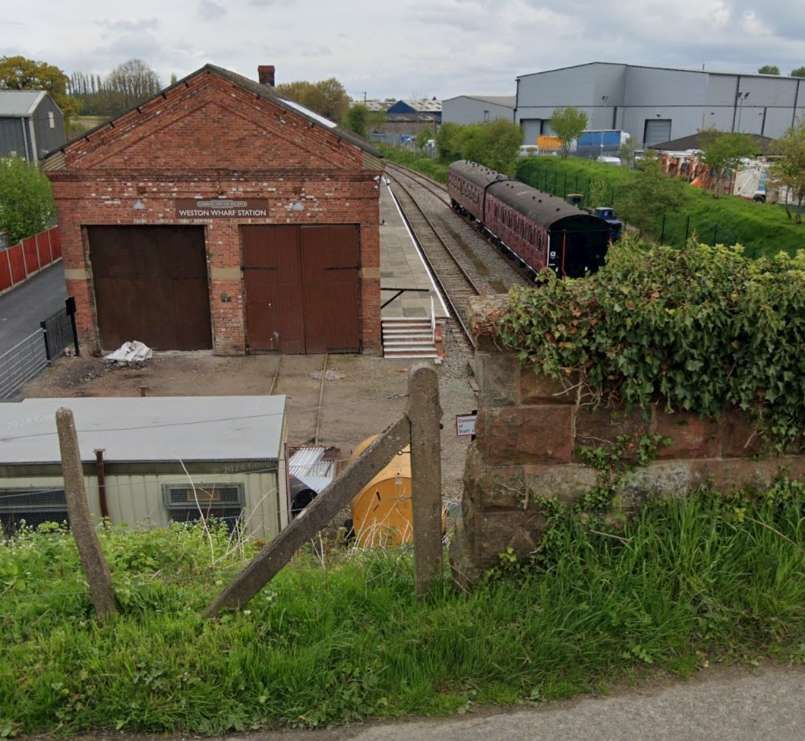
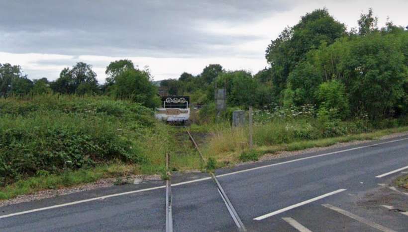
Looking North from Salop Road bridge in the first quarter of the 21st century. [Google Streetview, April 2024]Looking South from Salop Road bridge in the first quarter of the 21st century. [Google Streetview, April 2024]The line continued South from the Salop Road bridge. [9]Further South, the line continued to track South-southeast. [9]The line passed to the East of the small village of Weston. [10]The same location in the 21st century. This is Weston Wharf Station on the Cambrian Heritage Railway. [Google Earth, February 2025]Looking North from Weston Road in the 21st century. [Google Streetview, April 2024]
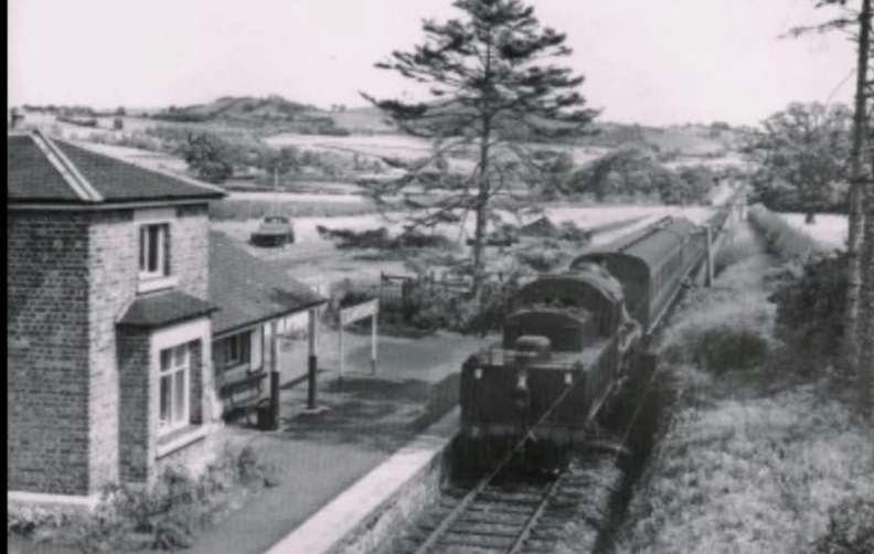
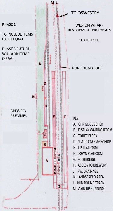
Weston Wharf Railway Station on the Cambrian Heritage Railways’ line to the South of Oswestry. “Plans to extend the line from Oswestry were reported in January 2016. The work was scheduled to proceed in three stages: phase one from Oswestry to Gasworks Bridge which carries the B4579 Shrewsbury Road over the line, phase two to make Gasworks Bridge passable and phase three to reach Weston Wharf. [24] At Gasworks Bridge, the track had to be lowered to allow trains to pass under the steel girder frame installed to strengthen the bridge. Funding was received from Shropshire Council and Oswestry Town Council.” [25][26][28]
“By April 2022 the 2 miles (3.2 km) of track from Oswestry to Western Wharf, which lay abandoned for more than 50 years, had been reinstated. The station was officially opened on 2 April 2022 by Helen Morgan MP and Vince Hunt, Chairman of Shropshire Council. It consists of a single platform, a run-around loop and a siding. Previously, there was no station here, only a goods depot.” [27][28]
Weston Wharf Railway Station development proposals as shown in the Cambrian Heritage Railway’s newsletter in 2019. [27]
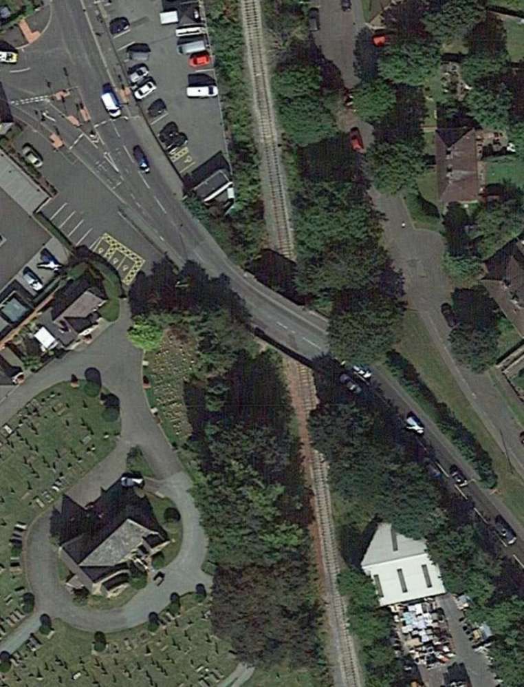
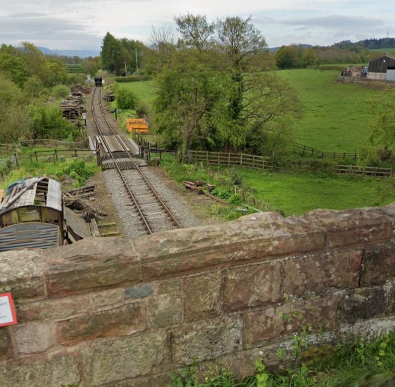
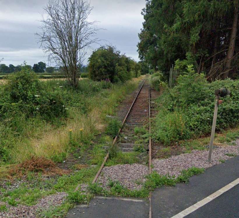
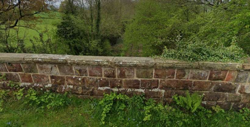
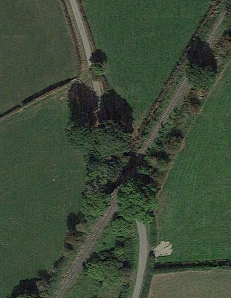
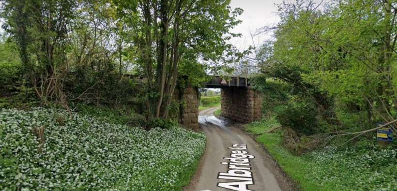
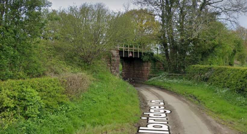
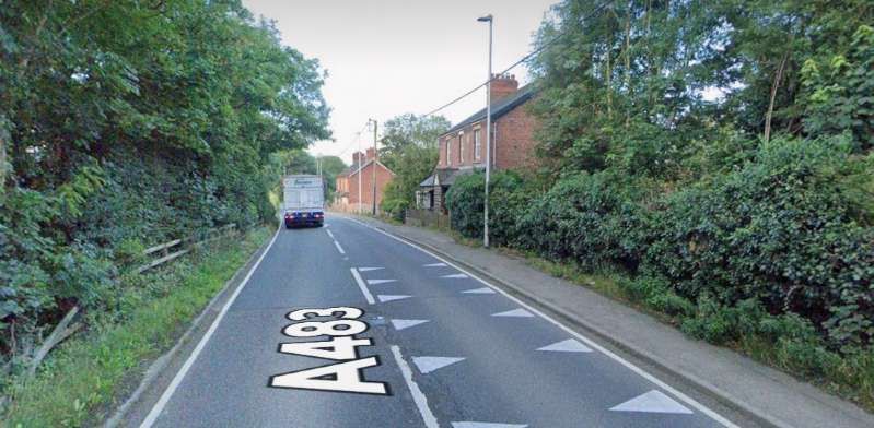
Looking South from Weston Road in the 21st century. [Google Streetview, April 2024]The line continues South-southwest [10]The modern day A483 crosses the line of the railway a little to the South of Weston Wharf. [Google Earth, February 2025]Looking North from the A483 in the first quarter of the 21st century. [Google Streetview, July 2024]Looking South from the A483 in the 21st century. [Google Streetview, July 2024]The line continued South-southwest. [10]And passed under one minor road and then over another (just at the bottom edge of this extract. [11]The first of the two bridges in the 21st century. [Google Earth, February 2025]Looking North from the minor road bridge in the 21st century. [Google Streetview, April 2024]Looking South from the same minor road bridge in the 21st century. [Google Streetview, April 2024]The second of the two bridges in the 21st century. [Google Earth, February 2025]Looking South through the bridge spanning Albridge Lane. [Google Streetview, April 2024]Looking North through the bridge spanning Albridge Lane. [Google Streetview, April 2024]Beyond Albridge Lane Bridge, the line continued Southwest passing under another minor road bridge which carried Church Lane and which can just be seen at the bottom of this extract from the 25″ Ordnance Survey of 1900. [11]Church Lane Bridge as it appears on satellite imagery in the 21st century. [Google Earth, February 2025]Looking North-northeast from Church Lane Bridge. [Google Streetview, April 2024]Looking South-southwest from Church Lane Bridge. [Google Streetview, April 2024]On this next extract, the minor bridge appears at the very top. South of that bridge the village of Llynclys was passed after the Tanat Valley branch left the main line heading West. [12]The same location as it appears on the ESRI [satellite imagery provided by the National Library of Scotland (NLS). [20]
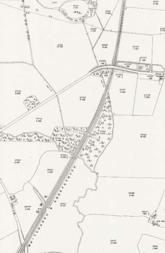
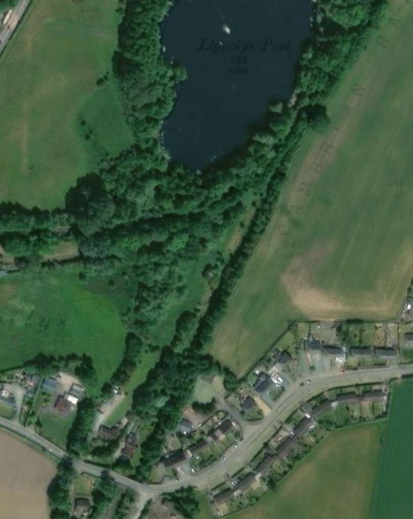
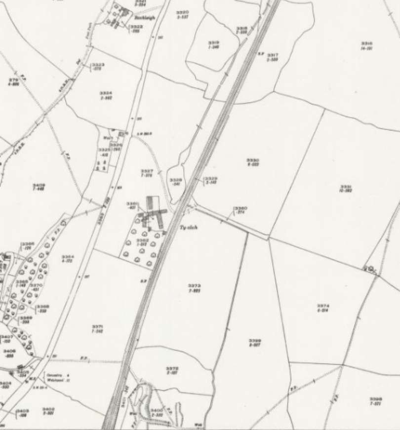
The Tanat Valley Light Railway is covered by two articles which can be found here [18] and here. [19] The route of the main line and that of the Tanat Valley Light Railway are defined by the lines of trees in the 21st century. The village has extended across the railway line.
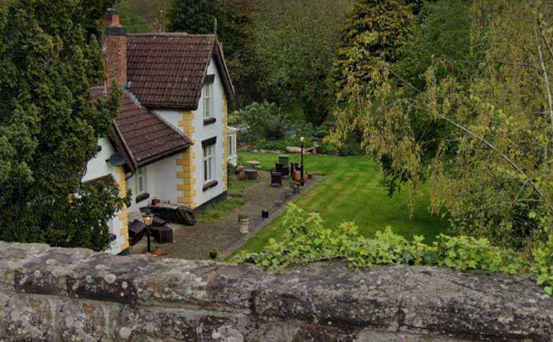
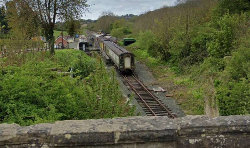
Looking North from the B4396 at Llynclys. The building is Llynclys Railway Stationmaster’s House and booking office which are now in private hands. Jenkins describes the station as a “wayside station with a small but substantial station building on the up side and a waiting shelter on the down platform. In architectural terms the station building, with its two-storey stationmaster’s house and single-storey booking-office wing, was very typical of Oswestry & Newton practice. The nearby goods yard contained facilities for coal, livestock, and general merchandise traffic.” [Google Streetview, April 2024]Looking South from the B4396 at Llynclys along the preservation line. … Llynclys South Railway Station was built by the preservation railway to replace the original Llynclys Railway Station. [Google Streetview, April 2024]
Llynclys South Railway Stationis located just South of the original located Llynclys station, “on the other side of the B4396 road bridge. During the original commercial operation of the line, the site was used for goods handling. … The station was built as an alternative to the original Llynclys station, which has become a private house. Work on the South station began in 2004 and opened to the public in 2005. CHR currently keeps the bulk of its rolling stock here, on a number of sidings, and a new carriage shed is set to be built after having gained planning permission in 2007.” [23]
More photographs and maps of Llynclys Railway Station can be found on the Disused Stations website. [33]
South of Llynclys trains ran on through Pant to Llanymynech which was nearly 6 miles South of Oswestry.
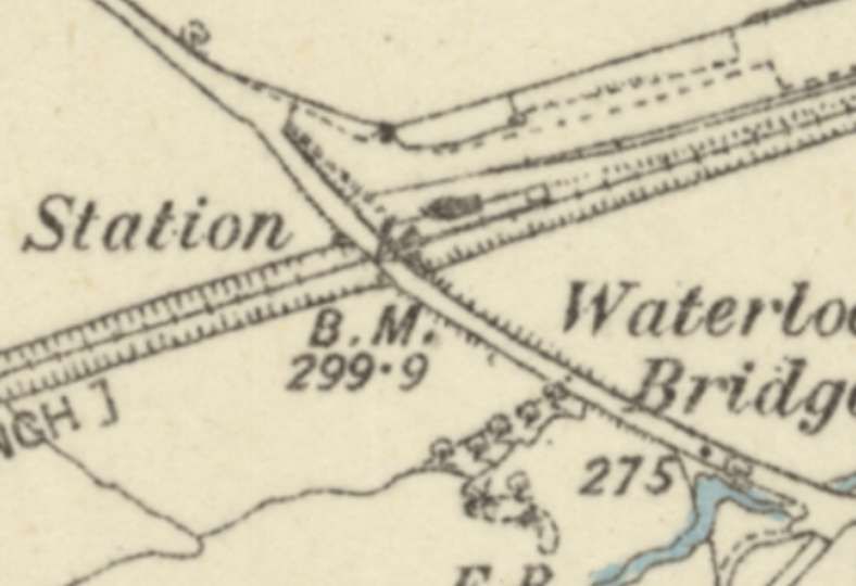
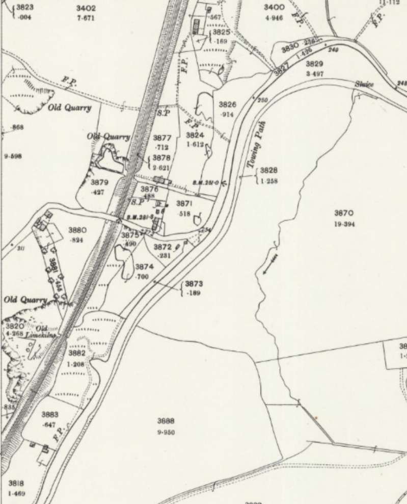
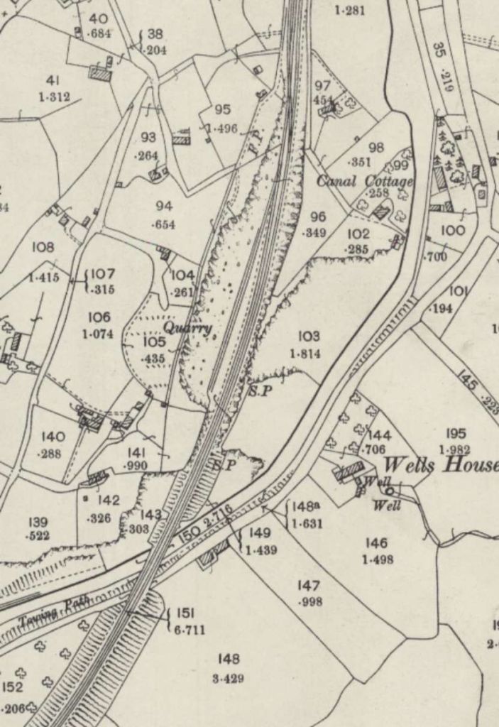
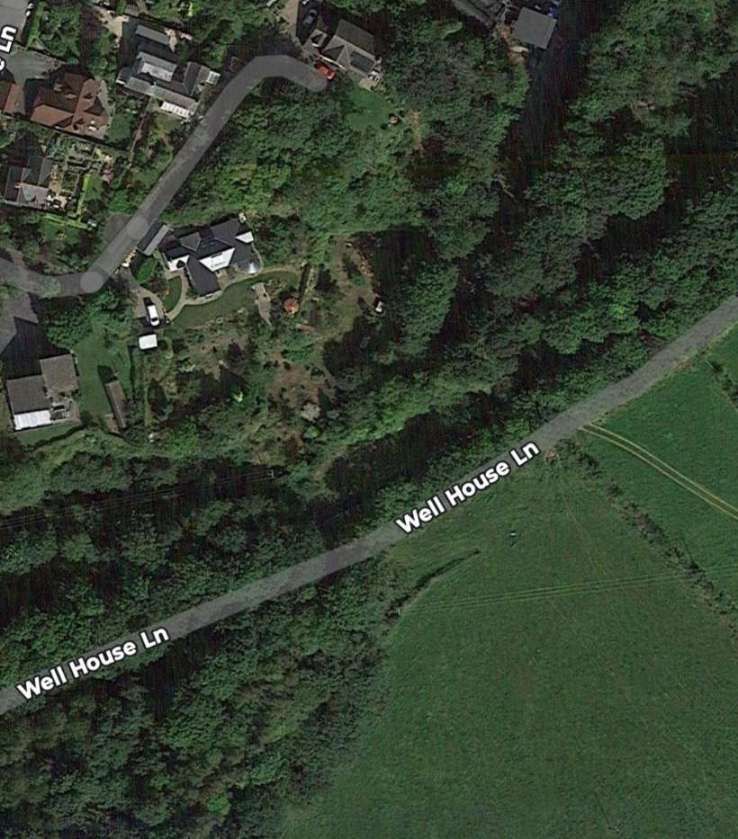
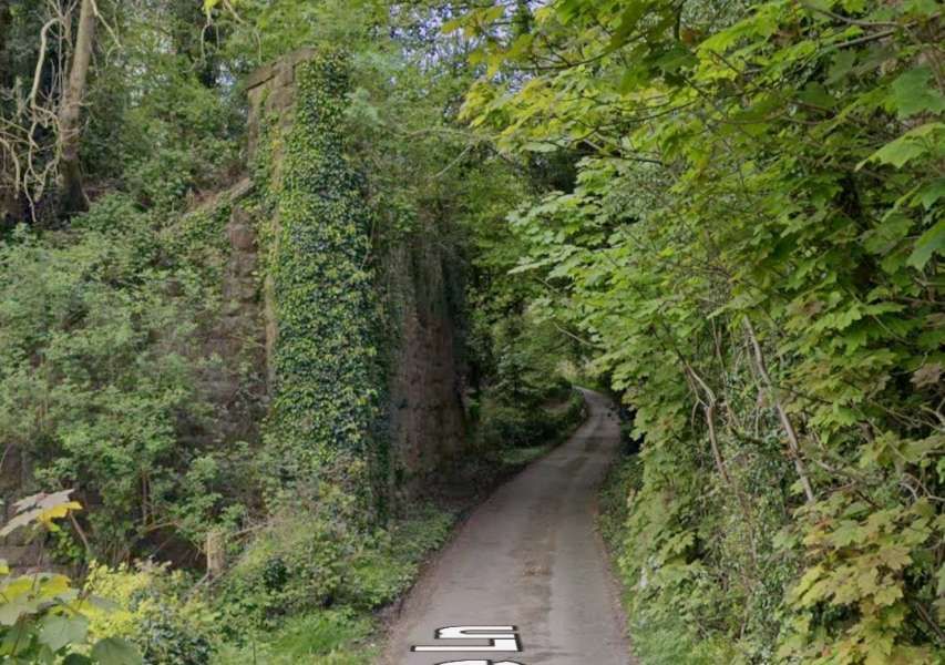
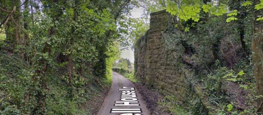
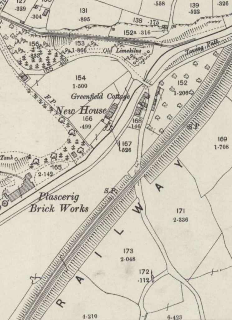
The old line continues South-southwest from Llynclys Railway Station. [12]And then ran parallel to and on the West side of the Shropshire Union Canal. Close to the mid-point on the West side of this image the line is bridged by Penygarreg Lane. [13]The same area in the 21st century as it appears in the NLS ESRI satellite imagery both highlighted by the lines of trees. Penygarreg Lane and bridge can be seen quite easily on this image. The length of the Montgomery Canal (Shropshire Union Canal) in the vicinity of the village of Pant is known as the Shropshire Gap. The Shropshire Union Canal Society is working to renovate the derelict length of the Canal. [21][22]The view North-northeast from Penygarreg Lane. The bridge forms the end of the heritage line. The view South from the lane is completely blocked by a high Leylandii hedge. This is the Southern limit (in 2025) of the preservation line. [Google Streetview, April 2025]A little to the South of Penygarreg Lane, Pant Railway Station is at the centre of this next extract from the 25″ Ordnance Survey of 1900. [14]A closer view of the immediate area around the station at Pant is worthwhile. It shows the wharf at the canal side and transshipment facilities for the standard-gauge line. The tramway served Crickheath Quarry. By the 21st century, much of this area has changed significantly. [14]The same location in the 21st century. A comparison of this satellite image with the map extract immediately above is illuminating. Access to the canal wharf from the West was a shared underbridge. Both the tramway and the road passed under the bridge. The road then turned sharply to the South running parallel to the canal before turning East to cross the bridge over the canal which is still in place in the 31st century. Removal of the railway had meant that a new alignment of the road on the West side of the canal has been possible. [Google Earth, February 2025]Looking North along the line of the railway towards Llynclys and Oswestry. [Google Streetview, April 2024]Looking South along the line of the railway towards Llanymynech. [Google Streetview, April 2024]The line continued South towards Llanymynech bridging the Montgomery Canal on a skew bridge. [14]The location of the bridge over the Montgomery Canal. Well house Lane runs on the South side of the old canal.The remains of the railway bridge over Wellhouse Lane seen from the Northeast. The northern abutment is hidden by vegetation. The Montgomery Canal, in its overgrown state, is off the right side of this image. [Google Streetview, April 2024]The remains of the railway bridge over Wellhouse Lane seen from the Southwest. The northern abutment is hidden by vegetation (on the left of the road). The Montgomery Canal, in its overgrown state, is further to the left. [Google Streetview, April 2024]After crossing the Canal and Wellhouse Lane, the line passed through a shallow reverse curve and bridged another lane. [14]
The location of the bridge in the map extract above is shrouded by the tree canopy. A modern satellite image would show very little as does the Streetview image below.
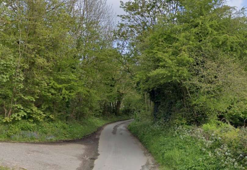
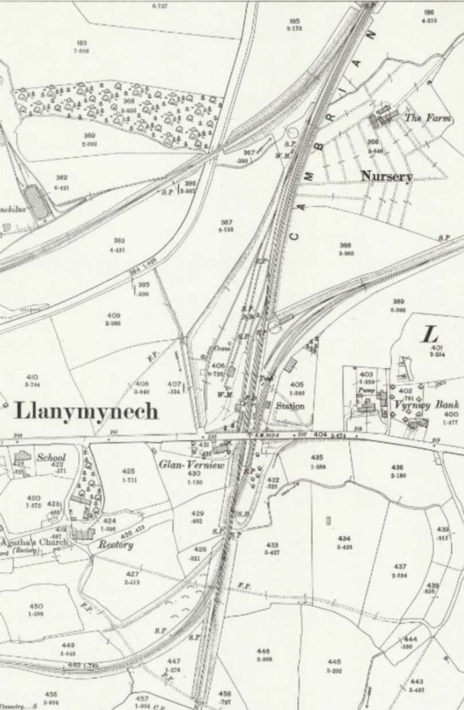
Looking Northwest through the location of the bridge at the centre of the map extract above. The bridge, including its abutments, is no longer present. The road leaving the lane to the left climbs onto the old railway embankment and follows the route of the line for a few hundred metres, giving access to a private dwelling and a sewerage farm. [Google Streetview, April 2024]The 25″ Ordnance Survey of 1900 shows the original junction between the Cambrian’s Whitchurch to Aberystwyth line and the Llanfyllin Branch to the North of Llanymynech Railway Station. With this junction facing North, trains from and to Llanfyllin were required to undertake and awkward reversal along the main line into Llanymynech Station. The replacement alignment can be seen towards the bottom of this extract. It followed the line of the old extension to the Potteries, Shrewsbury and North Wales Railway (PS&NWR) By the time of this survey the length of the original branch just to the West of this map extract had been abandoned. A short chord (also off the left of this extract) linked the branch to the PSNWR. [15]This extract from the 6″ Ordnance Survey from before the turn of the 29th century shows the alterations necessary close to the main line. The PS&NWR crossed the line to Newton from Oswestry on the level at a diamond crossing. A new chord was necessary to allow trains access to and from the main line. That chord was placed to the South of the original line (the earthworks of the original line can be seen to the North of the new chord). [35]The same area shown on Google Maps’ satellite imagery. Station Road crosses the site of the old station at the top-right of this image. The mainline runs South down the right side of the image. The route of the Llanfyllin Branch is marked by the track marked in grey running West from the location of the junction to the A483. [Google Maps, February 2025]Looking from the West along Station Road (B4398) on its approach to the bridge over the old railway. The railway station was under this bridge. [Google Streetview, April 2024]Looking West along Station Road from the location of the East abutment of the bridge over Llanymynech Railway Station. [Google Streetview, April 2024]This extract from the 6″ Ordnance Survey of 1900, published in 1902, shows the relationship of the old and new routes taken by branch trains for and from Llanfyllin. The earlier alignment is shown as dismantled and runs to the North of the later alignment. The chord linking the two is on the left of this extract. The bridge which carried the main road South from Llanymynech over the branch can be seen at the right of this map extract. [16]
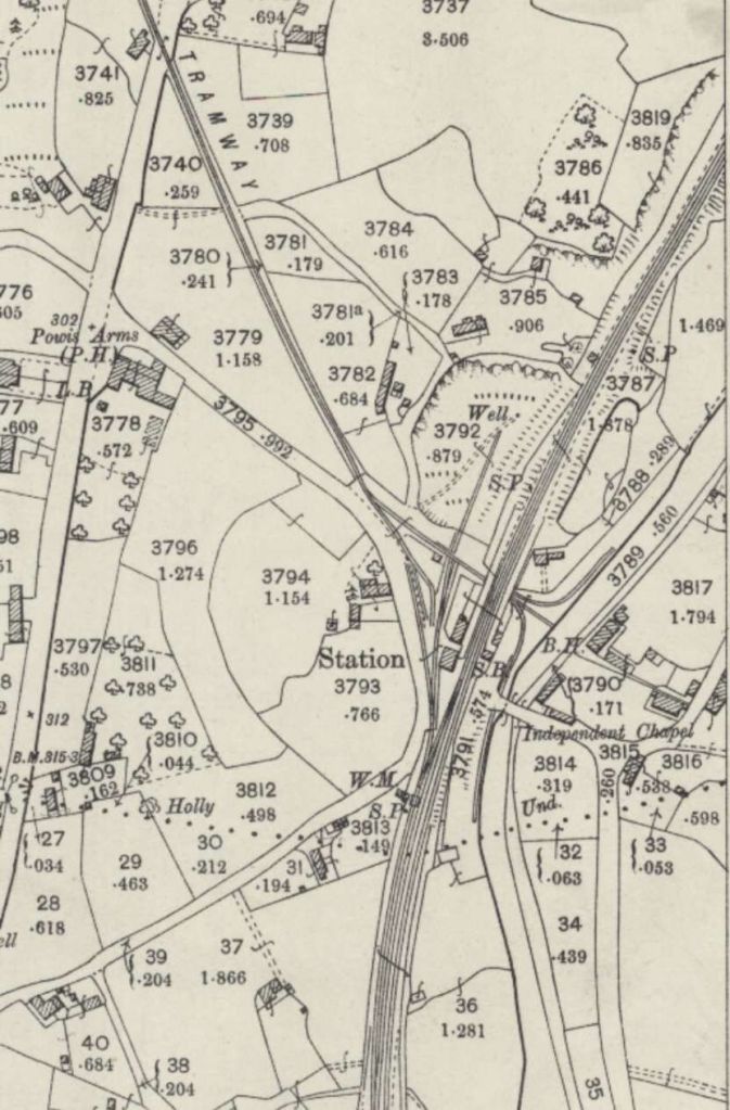
Llanymynech Railway Station was the point of departure for Llanfyllin Branch trains from the main line. In early year this required trains serving Llanymynech from Oswestry to undertake a reversal in order to travel along the branch. The same applied to trains from Llanfyllin needing to call at or terminate at Llanymynech.
This was addressed by providing a short chord line from the Llanfyllin Branch to what was once part of the Potteries, Shrewsbury and North Wales Railway (PS&NWR). “This remodelled layout enabled branch trains to serve Llanymynech station without reversing, although the new junction arrangements necessitated the abandonment of a small portion of the original Oswestry & Newton branch. … Further changes ensued in 1911 when a connection was established between the former PS&NW line and the Tanat Valley route at Blodwell Junction. This new line created a useful loop line between the Llanfyllin and Tanat Valley branches, although in the event the two-mile connecting line between Llanymynech and Blodwell Junction had a comparatively short life, and it was closed in the mid-1920s.” [3: p635]
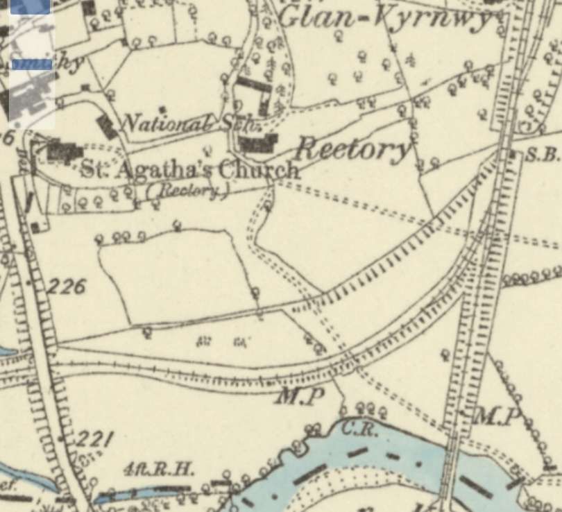
Llanymynech grew as a Victorian village after the opening of the Montgomeryshire Canal in 1797. This length of Canal became part of the Shropshire Union Railways and Canal Company and then part of the LNWR. The Canal was only abandoned after the LNWR became part of the LMS. The Canal was not abandoned until towards the end of the Second World War (1944). Although Llanymynech has a Welsh name it sits on the English side of the border with Offa’s Dyke running through the parish. [3: p635]
The Oswestry & Newton Railway “constructed a simple two-platform station southeast of Llanymynech, plus an adjacent goods yard, to enable shipping of locally quarried limestone, and created products of quick lime and lead. However, under its Act of Parliament, it had agreed not to disturb the operations of the existing local tramways or canals, and hence access across each would either be over (bridge) or under (aqueduct). … The Hoffmann kilns were located on the opposite side of the canal to the chosen station site, and if accessed on the level would have required an aqueduct to be built under the canal. Not having the money to achieve this, the O&NR agreed to junction with the local tramways north of its station at “Rock Siding”. It hence built a bay platform on the northwest side of the station, from which line extended to the “Rock Siding”. To access the Hoffmann kilns, trains would firstly enter the bay, then reverse up the slope to the “Rock Siding”, where they would then change direction again by pulling forward over a bridge to the Hoffmann kilns.” [34]
Details and more photographs of Llanymynech Railway Station can be found on the Disused Stations website. [36]
Once the chord linking the old Llanfyllin Branch and the PS&NWR had been built and the chord between the main line and the PS&NWR was complete, trains from Oswestry and Llanymynech diverged West off the main line just South of Llanymynech Railway Station.
The Llanfyllin Branch
After running off the main line, trains for Llanfyllin passed under what would become the A483. The bridge appears on both of the last OS Map extracts above.
Looking South along the A483. There is nothing to see, at road level, of the bridge over the old railway. The line ran on the near side of the terrace visible on the right. [Google Streetview, July 2024]
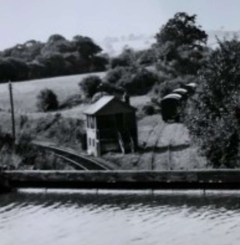
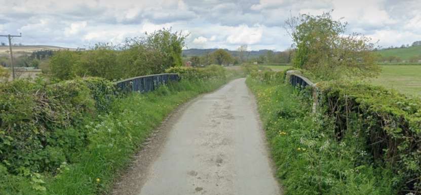
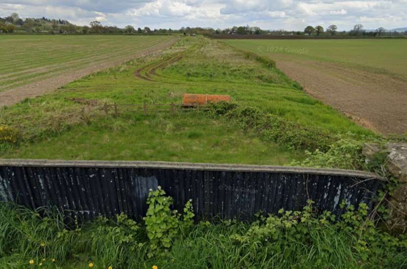
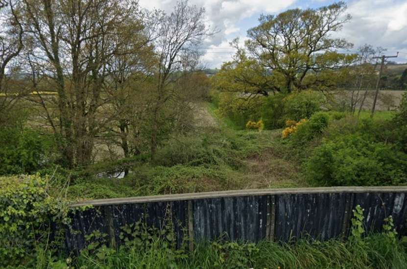
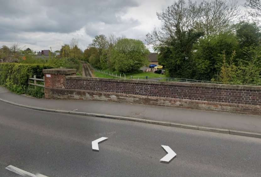
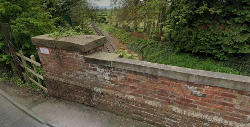
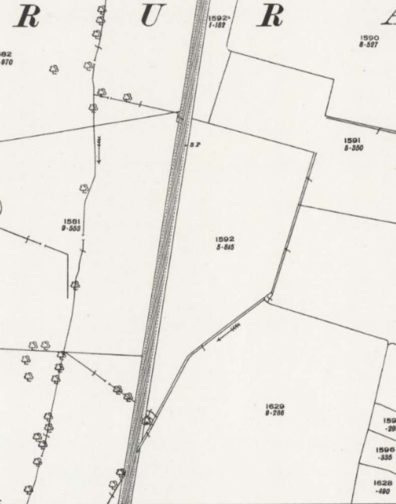
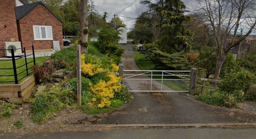
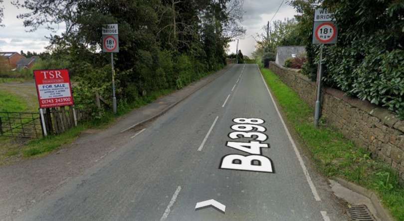
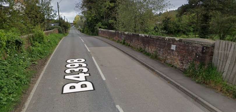
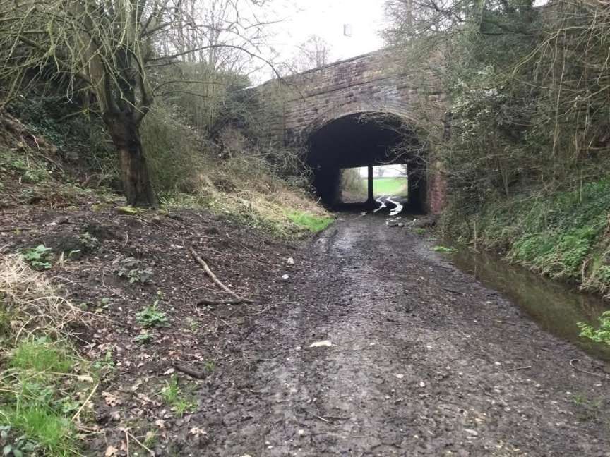
Carreghofa Halt was the first stop on the Branch, it was just a short distance from the mainline close to the chord which served to link the old branch and the PS&NWR line. It was an unstaffed stopping place, opened by the GWR on 11th April 1938, “its facilities comprised a short platform on the down side of the running line. The platform was of earth & cinder construction with revetting of old sleepers. A small wooden shelter was provided for the comfort of waiting travellers, while the simple platform was fenced with tubular metal railings. … Other features of minor interest at Carreghofa included a sleeper-built permanent-way hut to the east of the platform and an unusual overbridge immediately to the west of the halt. The bridge, which crossed the railway on a skewed alignment, was a single-span structure carrying the B4398 road and the Montgomeryshire Canal.” [3: p635]
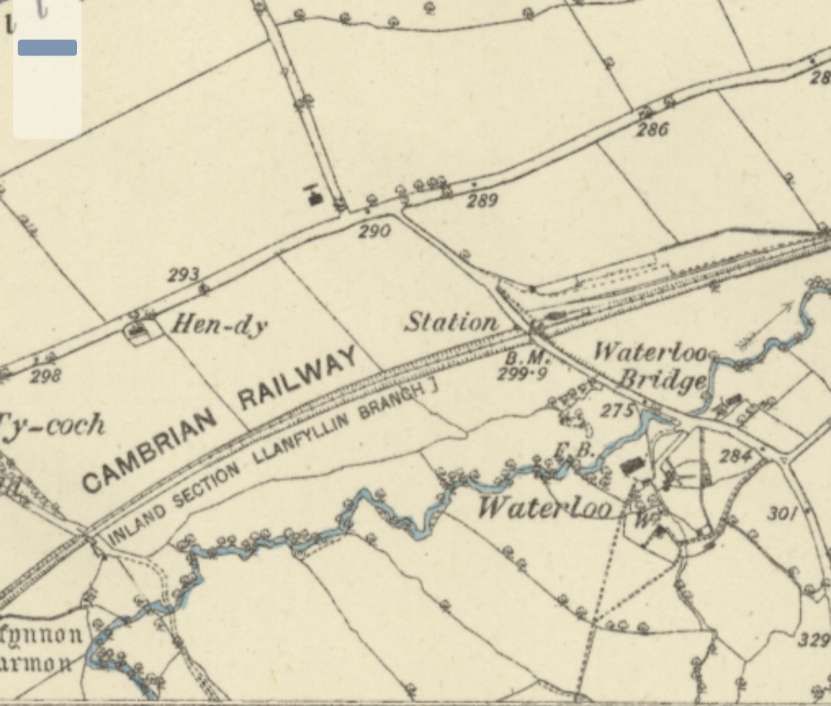
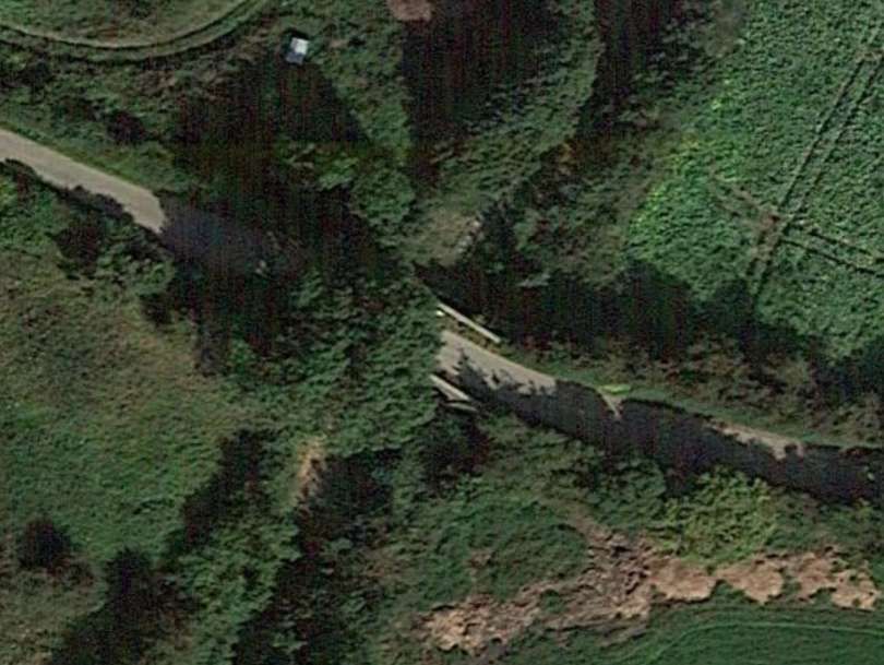
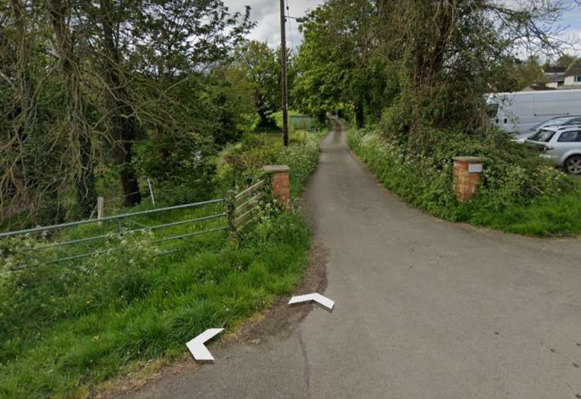
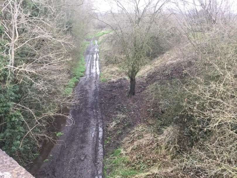
Having passed beneath the road/canal bridge, “trains reached the junction between the Potteries, Shrewsbury & North Wales branch to Nantmawr and the short connection which gave access to the original Llanfyllin route. This 26-chain curve was opened on 27th January 1896 as a means of linking the PS&NW route to the original 1863 branch.” [3: p365][4][5]
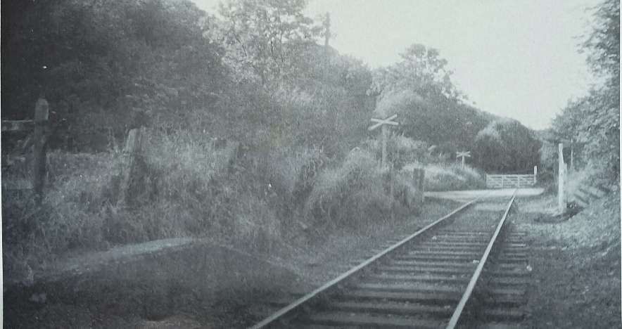
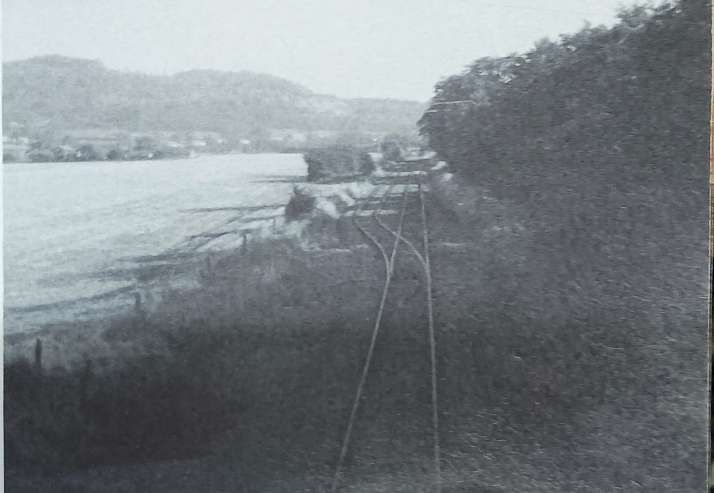
A relatively low quality view from the road bridge/canal aqueduct looking Northwest. The stored wagons on the right sit on the Nantmawr Branch. The chord to Llanfyllin heads off to the left. [40]
Now heading pretty much due West the branch sets off for Llansantffraid. We will pick up this next length of the route in the second article in this short series.


.JPG)