

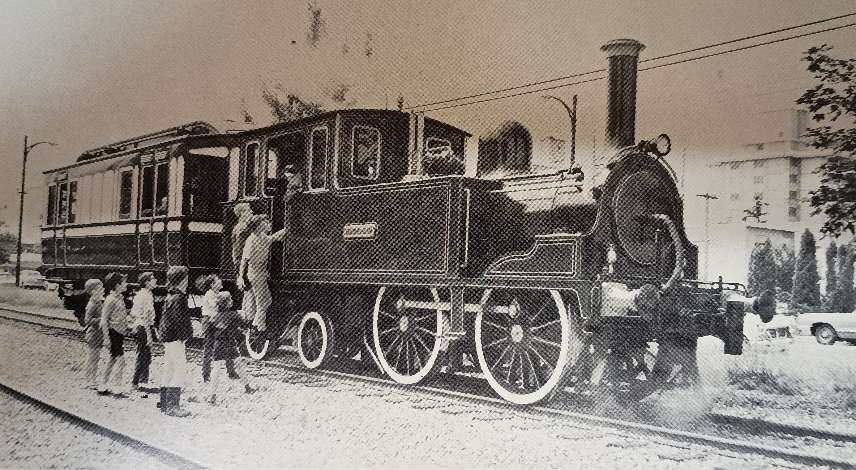
The featured image at the head of this article (above) is Highland Railway Jones 4-4-0 Locomotive No. 7, forerunner of the Skye Bogies; it was built by Hawthorne’s in 1858 as a 2-4-0 locomotive and named ‘Fife’ (later ‘Dingwall’) and was one of two of the class fitted with bogies in 1873-75 to work on the Dingwall & Skye Railway, © Public Domain (Ian Allan Library). [1: p4]
H.A.Vallance notes that in the years prior to the coming of the railways to the North of Scotland there was a series of different initiatives intended to improve transport links. The first were the roads built by General Wade (250 miles of military roads) which “were quite unsuited to the requirements of trade operating under peace-time conditions.” [17: p11] The biggest contribution to raid development was made by Thomas Telford. He “was appointed to survey for new roads and for the improvement of existing highways. In the course of … 17 years he constructed about 920 miles of road, and built some 1,200 bridges.” [17: p11] But it was the coming of the railways to the Highlands, that most effectively addressed the regions transport problems.
Earlier articles about the Highland Railway network can be found here, [3] and here. [4] These two articles cover the Strathpeffer Branch and the Fortrose Branch repectively.
Trains Illustrated No. 18 which was published in 1976 focussed on The Highland Railway. [1] The introductory article, ‘Highland Retrospect’, was written by Paul Drew. [1: p4-11]
Paul Drew commences his article with a short reflection on the excitement of waking on one of the sleeper services heading North into the Scottish highlands. Two routes provide an intensely enjoyable experience in the right weather: “The awakening on the West Highland line at Garelochhead, perhaps, or on Rannoch Moor … winding in a generally northward direction towards Fort William, Mallaig and Skye and the Hebrides; and daybreak on the Highland line proper, the Perth-Inverness main line of the old Highland Railway, somewhere between Blair Atholl and the outskirts of Inverness, following the old coach road up to Druimuachdar summit, at an altitude of 1484ft, or dropping down the hills between Spey and Findhorn and Findhorn and Moray Firth.” [1: p4]
Drew expresses his opinion that the Highland Railway (HR) route offers the greatest diversity of scenery but whether “you travel from Euston to the Highland or from Kings Cross to the West Highland line the contrast between the [suburbs of London] … and the glories seen on waking – even, for devotees, in a Scotch mist – is one of the attractions of the journey. Before World War II one could start an overnight journey to a Highland line station from Kings Cross as well as Euston, and up to 1914 from St Pancras also with, on a summer evening, a daylight exit from London.” [1: p4]
He seems to like the route taken by trains from St. Pancras best. Their route “was via Leeds, the magnificent MR route across the Pennines, Carlisle, the North British Railway’s Waverley route through the best parts of the Lowlands to Edinburgh, and so by the East Coast route over the Forth Bridge to Perth, the beginning of the HR main line – all far better traversed in daylight.” [1: p4]
He notes too that it was common practice not to disturb a passenger’s sleep which meant that sleeper services on the HR were normally made up of “HR vehicles and through coaches and sleeping cars from England (LNWR, West Coast Joint Stock, GNR, North Eastern, East Coast Joint Stock, Midland, and probably Midland & North British joint stock) and from Scotland (Caledonian and North British) but also of privately hired ‘family’ saloons, horseboxes, flat wagons conveying carriages and, from the turn of the century, motorcar vans, all supplied by a wide variety of English and Scottish railways.” [1: p4]
Occasionally, these trains would also include the “private saloon of the Duke of Sutherland, who owned not only one or two passenger vehicles but a 2-4-0 tank engine, Dunrobin, and its successor, an 0-4-4 tank of the same name, which he ran – often driving himself – on his private railway. It was in Sutherland, and ran from Golspie via his seat, Dunrobin Castle, to Helmsdale. The line was eventually taken over by the Highland and forms part of the Farther North line from Inverness to Wick and Thurso. Both Dunrobins were allowed to work (within limits) over HR tracks, even south of Inverness, but not, it seems on public passenger trains – at least not expresses.” [1: p4]
Drew notes that, “The marshalling of the heterogeneous caravans at Perth, where vehicles were made over by the CR and NBR, was a frequent cause of unpunctuality and indeed chaos. Besides, most of the trains tended to run late during the summer, especially on the HR main line, which even after the central portion south of Druimuachdar has been double-tracked in the 1890s, tended to be congested; a high-season shortage of HR motive power aggravated matters, and reliance on telegraphy for many years before introduction of the telephone did not make for flexibility in train operation. Disgruntled Sassenach passengers in Perth, Edinburgh Waverley and other big Scottish stations would mutter that they ordered this matter better in England.” 1: p4]
It would be easy to take the perspective of a southerner when considering the HR, seeing it “mainly as a means of moving tourists and sportsmen from England, and such consumer goods and other freight as the impoverished Highlands could afford to import.” [1: p4] But it would be quite wrong to do so. “The Highland Railway was conceived by Highlanders, in the Highlands, as an outlet for the fish and agricultural produce of the Highlands from northern Perthshire to John o’ Groats and from Inverness eastwards to the Aberdeenshire border and westwards to Wester Ross, a region that in the 1840s was still only slowly recovering from the oppression and impoverishment that had followed the Forty-Five insurrection a century before. The HR was the creation not of middle-class businessmen but of country landowners who ranged from the rich Duke of Sutherland to poor lairds who could afford little more than to encourage, rather than to oppose (like many landowners in the south) building the railway over their land, often asking for a station to serve their tenants.” [1: p4]
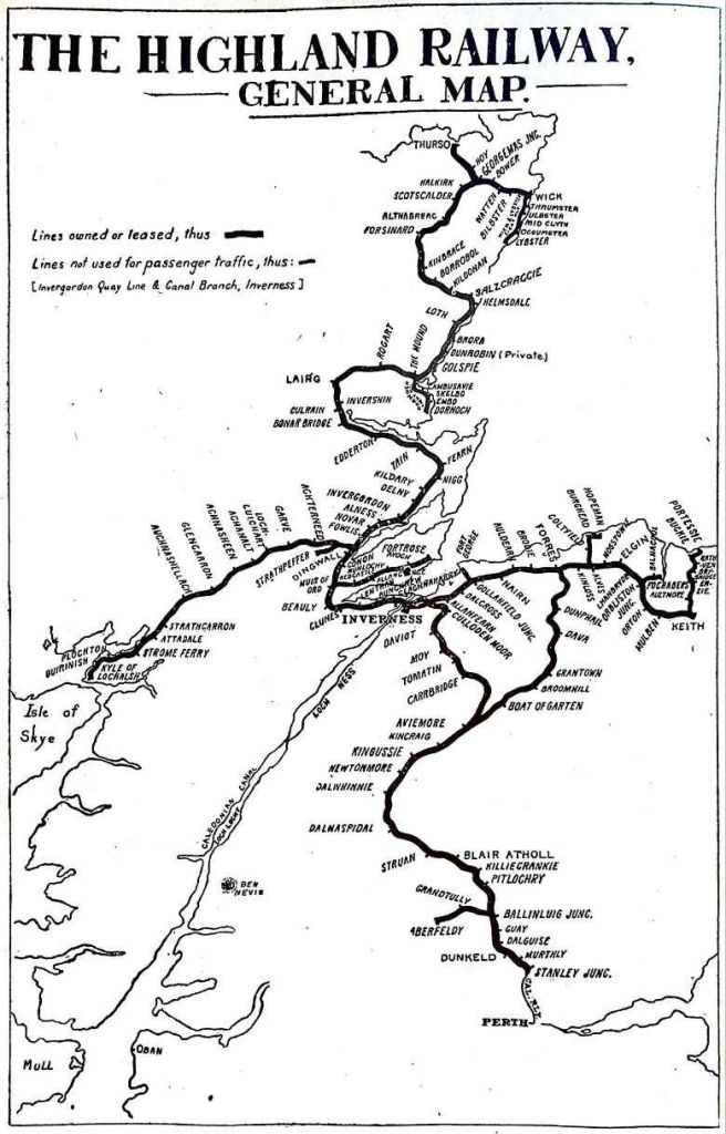
With a route mileage of more than five hundred miles, H. A. Vallance tells us, “the Highland occupied third place among the five fully-independent pre-1923 main line railways of Scotland. Its popularity with those who love railways arise from the scenic charm of its terrain, and also from the way in which the small company succeeded in working its traffic in the face of natural difficulties, and with limited financial resources, over routes that were largely single track.” [17: dust-jacket]
Prior to the 1850s, “there was already a trickle of summer tourists from the Lowlands and England, who used a surprisingly well-developed system of stagecoaches or drove in their own carriages; but it was not until the 1850s, after Queen Victoria and the Prince Consort had ‘invented’ Highland tourism by establishing Balmoral, that the trickle began to grow into a flood. Deerstalking, grouse-shooting and fishing, at least by rich people from south of Perth, developed slowly. For 20 years after the HR Inverness-Perth line, by the original route via Forres, was opened in 1863 the management adopted a take-it-or-leave-it attitude to passengers, though by the 1880s receipts from through passenger traffic from England, including much first class in the summer, were considerable. And for long afterwards the HR left the provision of really comfortable passenger vehicles to the English railways and the Caledonian.” [1: p4-5]
Drew continues: “To promoters seeking a route for a railway from Inverness to the south there were three options. The first was a relatively easy alignment along the flat coast via Forres to Elgin, thence through undulating but not mountainous country to near Inverurie and on through Lowland Buchan to Aberdeen. Second was the route of the old coach road via Kingussie, Druimuachdar and Blair Atholl to Perth, and the third was through [the] Great Glen to the area of Fort William, beyond which progress to Glasgow was through a region of mountains and lochs which had long been thought impassable for a railway – or at least to involve too many major civil engineering works – until it was traversed by the West Highland line towards the end of the century, some years after the threat of a Glasgow & North Western Railway over an even more difficult route than the West Highland.” [1: p5]
The disadvantages of the route via Aberdeen were it’s circuitous route and, at the time particularly, there being no bridges crossing the River Tay and the Firth of Forth and the failure of any such route to serve inland Invernessshire. Also significantly perhaps, was an innate suspicion (perhaps too strong a word) amongst highlander promoters of a railway that there was any need to serve the lowland city of Aberdeen.
“Nevertheless,” says Drew, “the first train to reach Inverness from the South, in 1858, was from Aberdeen, over the Great North of Scotland [Railway (GNSR)] as far as Keith and then over the Inverness & Aberdeen Junction line, which later became part of the HR.” [1: p5]
The Aberdeen to Inverness Railway Line, (GNSR – Aberdeen to Keith)
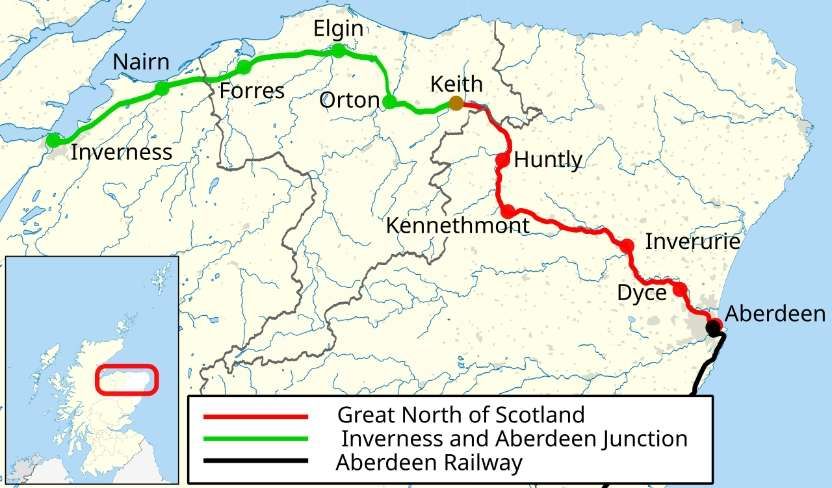
The GNSR was “floated to build a railway from Aberdeen to Inverness. … It obtained its Act on 26th June 1846. It is estimated that [this] cost £80,000 and the company was at once in financial straits, … accentuated by the crash which followed the ‘Railway Mania’s, then at its height. … [Eventually, work] started on 25th November 1852. … The railway was opened from Kittybrewster (1½ miles from Aberdeen) to Huntly, a distance of 39 miles, on 19th September 1854. Four years previously, the railway had been completed from Perth to Aberdeen. A through journey was then made possible between England and the south of Scotland, and Huntly. From this latter point coaches, running in connection with the trains, continued the journey to Inverness.” [17: p12-15]
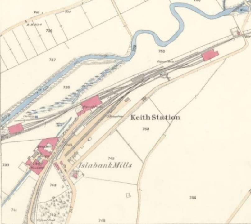
The line was extended into Aberdeen to Waterloo Quay in 1855, and in October 1856 it reached Keith around halfway between Aberdeen and Inverness. The GNSR had overstretched itself and could not fund the remaining 55 miles of line to Inverness.
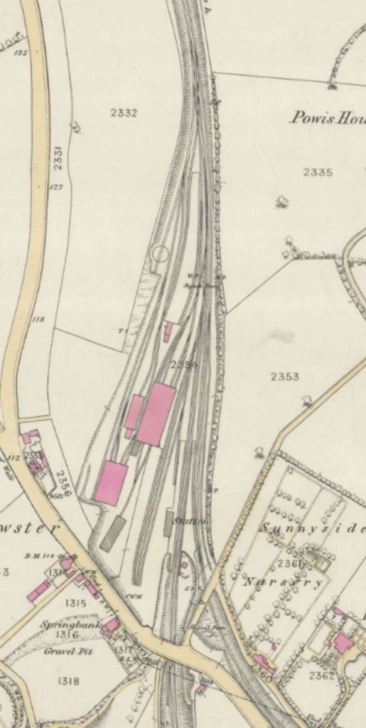
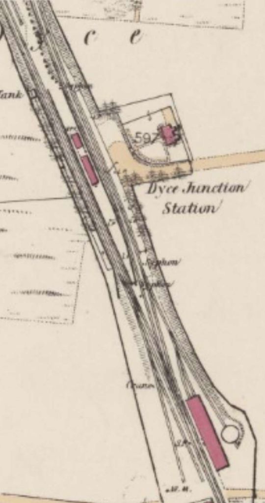
The GNSR left Dyce and followed the southern edge of the River Don’s floodplain, passing through Kintore before bridging both the Aberdeen Canal and the River Don just to the North of Port Elphinstone Railway Station.


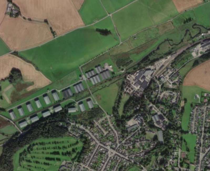
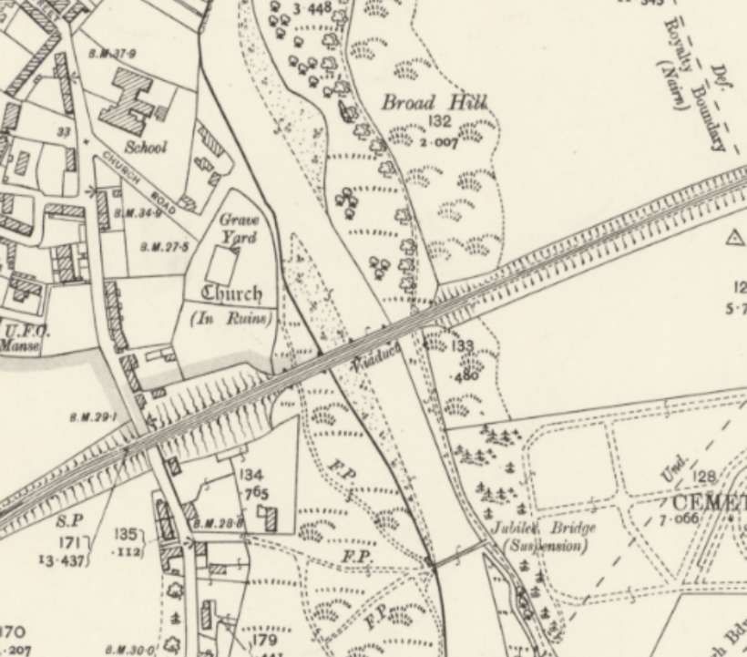
To the West of Keith, the Highland Railway held sway. The Inverness &Aberdeen Junction Railway was one of the constituent parties that formed the Highland Railway in 1865, as noted below.
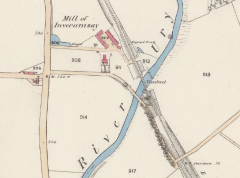
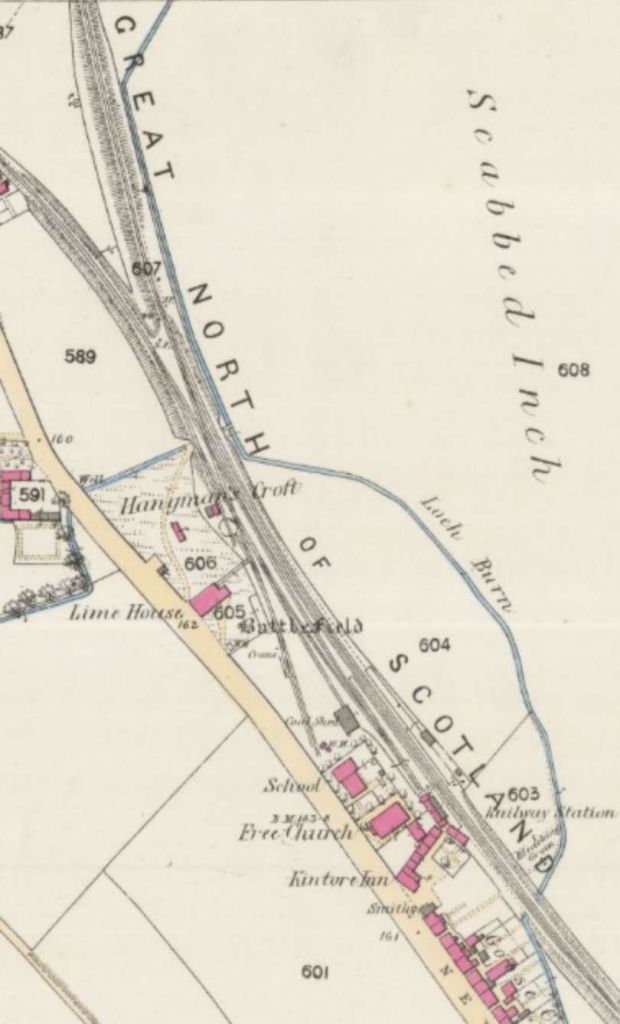
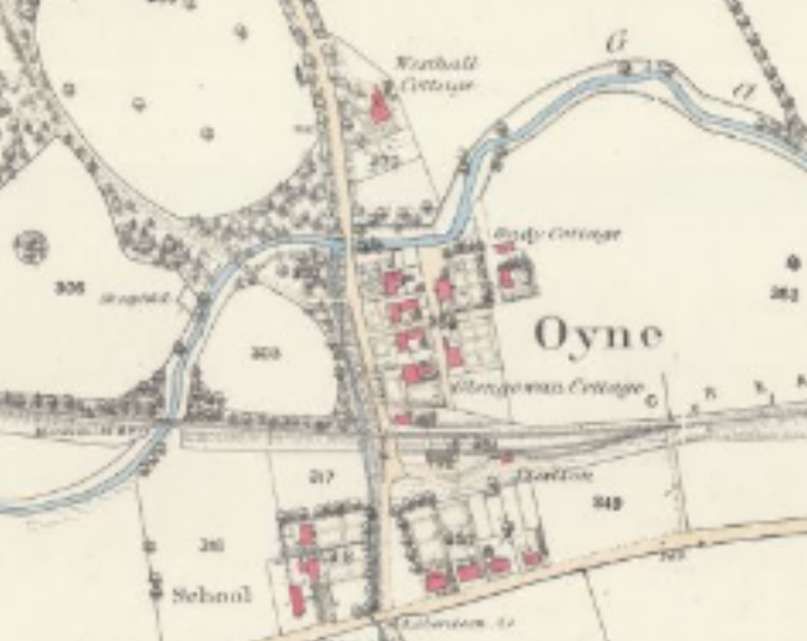
Beyond this viaduct the line ran along the South side of the River Ury and then to the South side of the Gadie Burn. It crossed the Burn just to the West of the village of Oyne and its railway station.
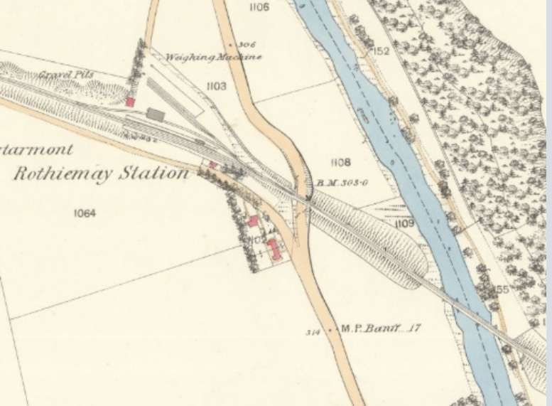
North of Huntly, on the extension to Keith the line. Missed the River Deveron and ran through Rothiemay Railway Station.
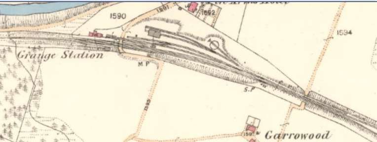
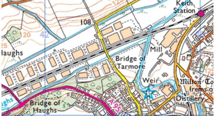
The Keith and Dufftown Railway ran Southwest from Keith to Dufftown. It can be seen curving away from the station at the left of the OS map extract above. At Dufftown, the line made an end-on connection with the Speyside Railway at Dufftown, and the Morayshire Railway connected to the Speyside Railway at Craigellachie, this ultimately gave the GNSR access to Elgin. [39]
The Aberdeen to Inverness Railway Line (HR – Keith to Inverness)
The GNSR’s protracted/torturous efforts to reach Inverness created space for others to act. Interests in Inverness sought to provide a different link to the South via Druimuachdar to Perth but were thwarted by its rejection by Parliament (in 1846), nonetheless they “obtained authority for a short line from Inverness to Nairn with a view both to blocking a GNSR approach to Inverness and also the Inverness route which eventually branched off from the Inverness-Aberdeen route at Forres, Nairn, and ran via Dava summit (1052ft), Grantown-on-Spey, Aviemore and on to Perth via Druimuachdar. (Only in the 1890s was the direct line built from Inverness via Slochd summit and Carr Bridge to Aviemore, affording the shortest route to the South.)” [1: p5-7]
Drew continues: “The Inverness & Nairn railway took only a year to build (1854-55). The eastward extension of the Inverness-Nairn line was the Inverness & Aberdeen Junction, which ran via Forres and Elgin to Keith, to which point it was opened in 1858, met the GNSR and provided the Inverness-Aberdeen through route. Two years later the Inverness & Perth Junction Company was formed. Construction of the Forres-Perth line made quick progress from both ends, despite the need to take the line for 100 miles through the central mountain tract of Scotland. The through route from Inverness via Forres to Perth was completed in 1863. The Inverness & Aberdeen Junction, which had absorbed the Inverness & Nairn, and the Inverness & Perth Junction, were amalgamated in 1865 to form the Highland Railway.” [1: p7]
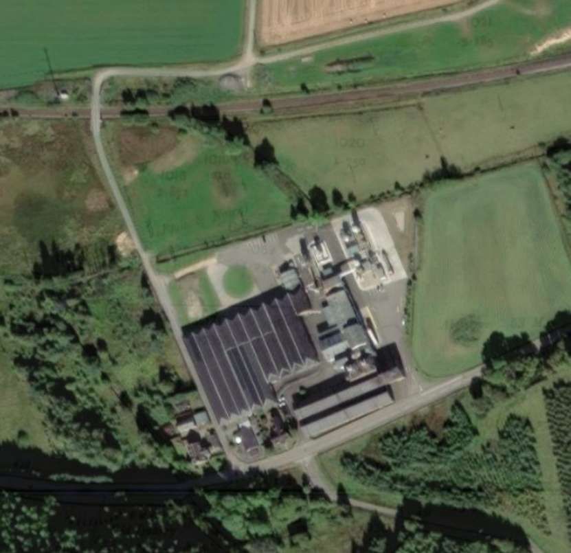
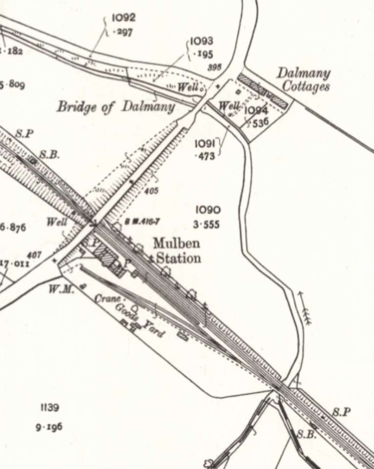
After a series of bridges over the Burn of Mulben, the line bridged the River Spey and turned North along the West bank of the Spey. …
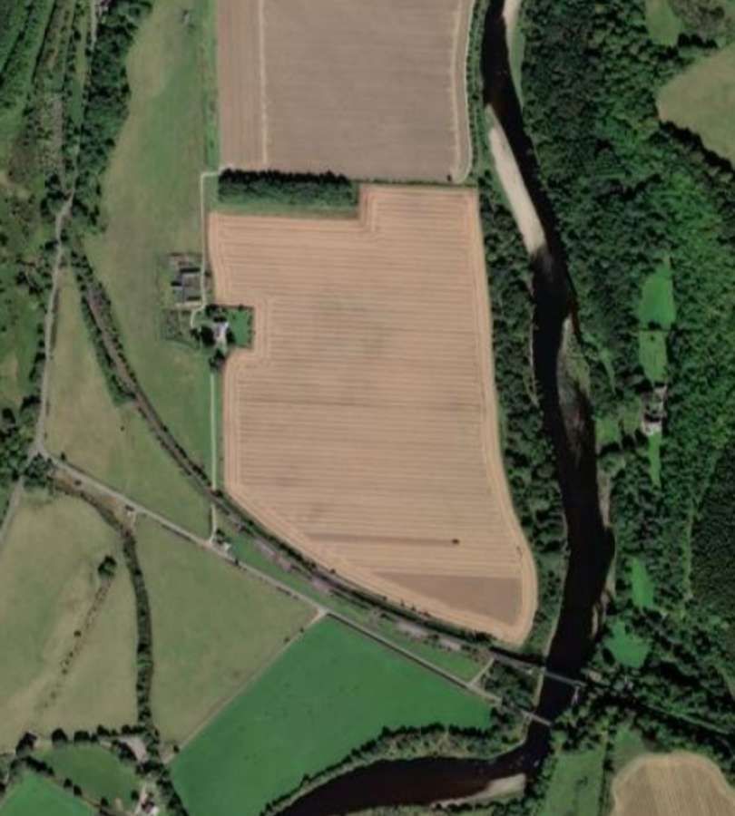
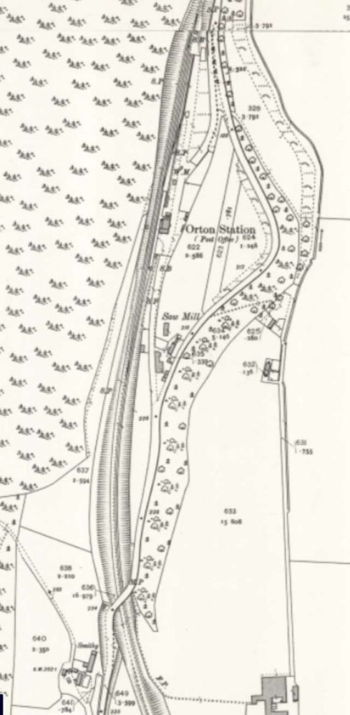
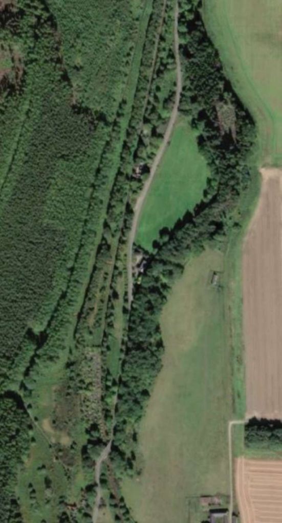
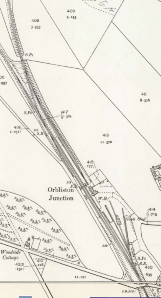
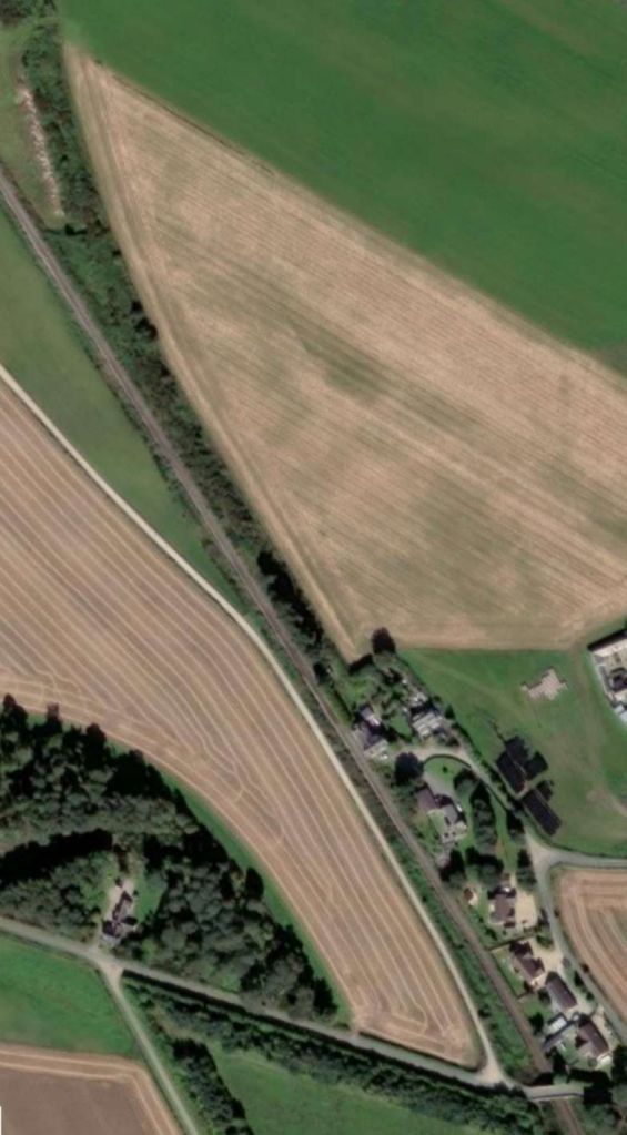
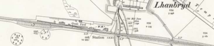
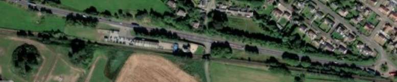
Heading West once again after Orbliston Railway Station the line continued on through Lhanbryd(e) Railway Station. …
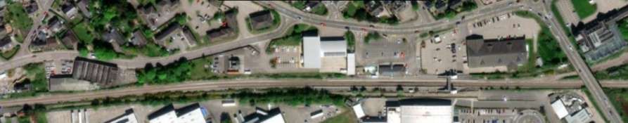
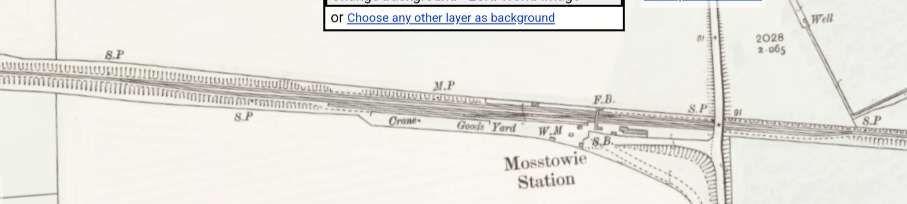
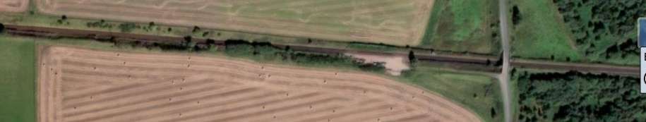
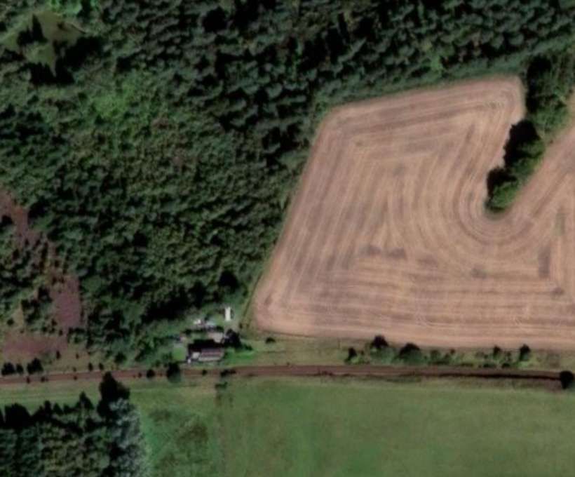
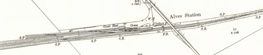
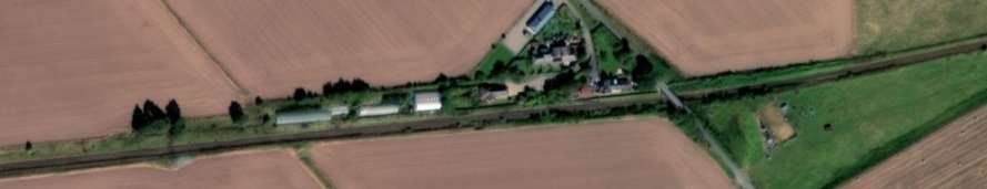
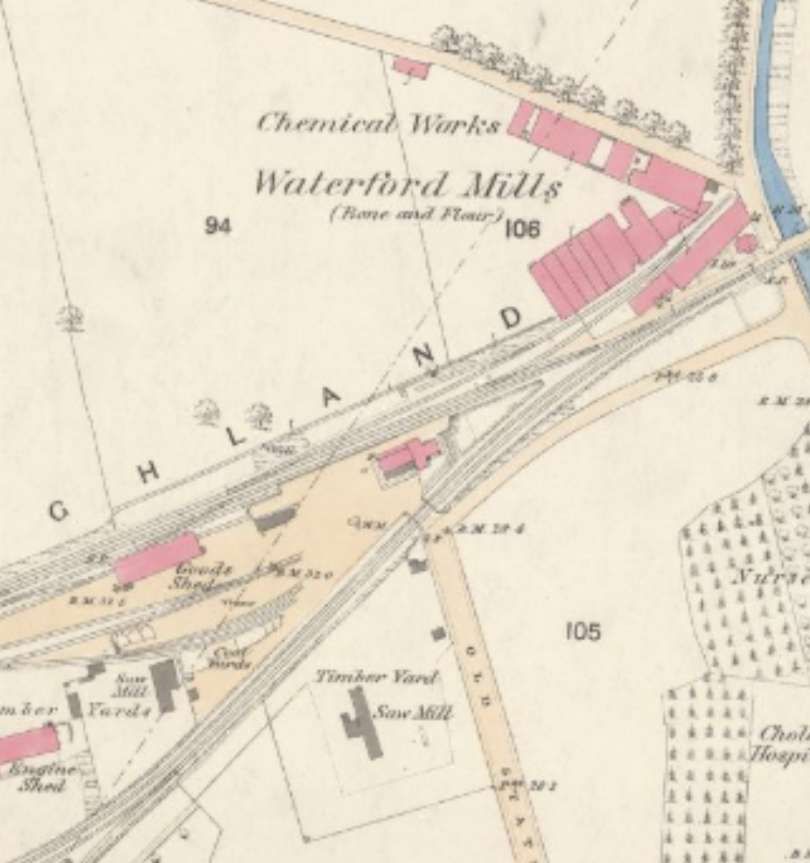
West of Elgin the line bridged the River Lossie before passing through Mosstowie Station, then passed a connection to a mineral railway serving Newton Quarries and on to Alves Station.
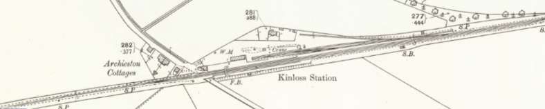
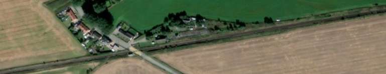
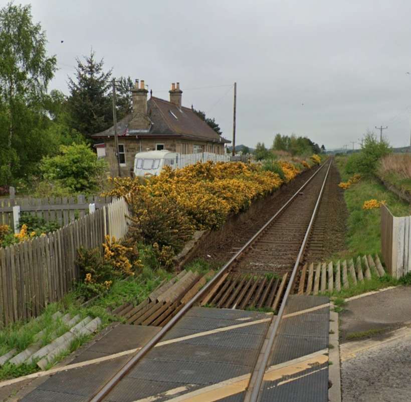
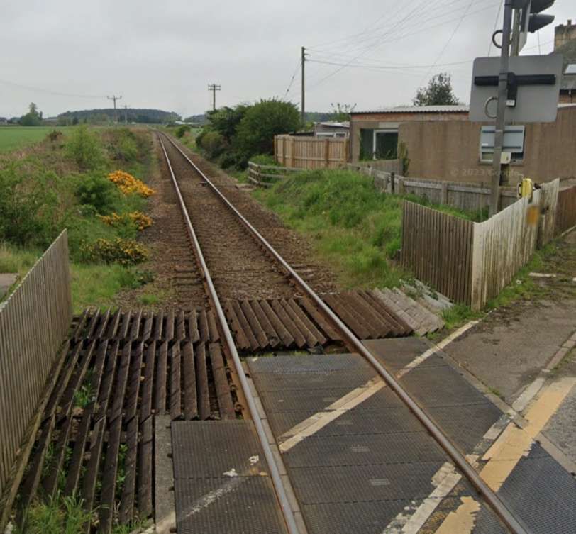
After Alves Station it was only a short distance to the junction for the Burghead & Hopeman Branch. The line then continued on to Kinloss.
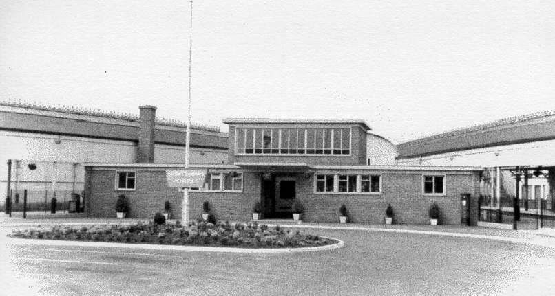
After leaving Kinloss trains for Inverness next ran into Forres Railway Station. Over the years the railway infrastructure at Forres has seen significant changes.
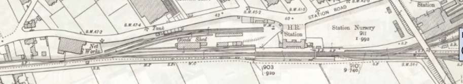
In 1858, the first railway station at Forres was located at the end of Market Street which became known as Old Station Road. The station building was demolished in the 1950s. It had been used as the stationmaster’s house since the junction opened.
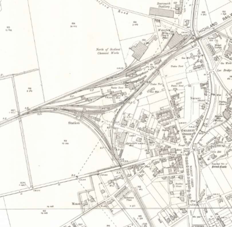
A route to the South from Inverness was finally completed in 1863. It met the line running between Elgin and Inverness at Forres. Forres was chosen as the junction for the new mainline south, since it was the half-way point on the Inverness & Aberdeen Junction Railway between Inverness and Keith. Keith was also an important railway junction and the point where the line joined the GNSR and branches to the coast and Strathspey. [62]
A new ‘triangular’ station wastl constructed to allow all trains entering Forres, from either the East or West, to access the new line directly on a curve. The three curved platforms, and three junctions, gave the new Forres station its distinctive layout. [62]
The location of the new station was south-west of the existing Inverness-Aberdeen line. The original line was retained as a goods loop, with trains now leaving and re-joining the line (east-west) on a curve. Services from Inverness to Perth curved to the south on a junction at the west of the station, to arrive at the southbound platforms. [62]
Three individual signal boxes controlled the junctions at each point of the triangle: Forres East, Forres West, and Forres South. [62]
The station building was replaced in the mid-1950s by a red brick building. [62]
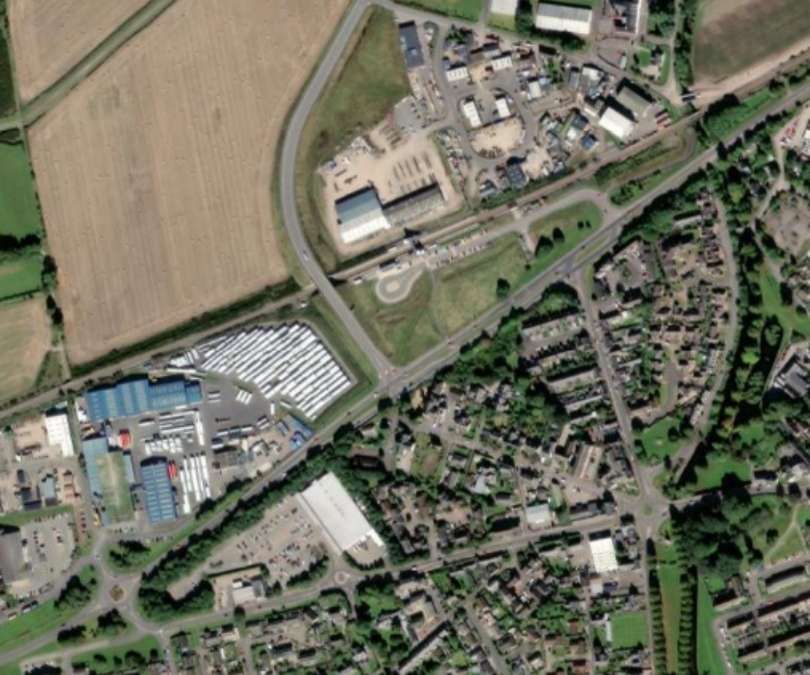
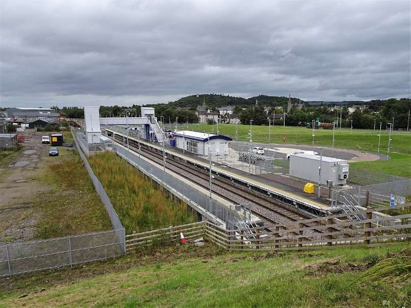
The closure of the link to the South from Forres occurred as part of the cuts following the Beeching Report in the 1960s. Further remodelling of the whole area took place in the 21st century. This saw much of the existing infrastructure removed and a new functional station built by 2017. [62]
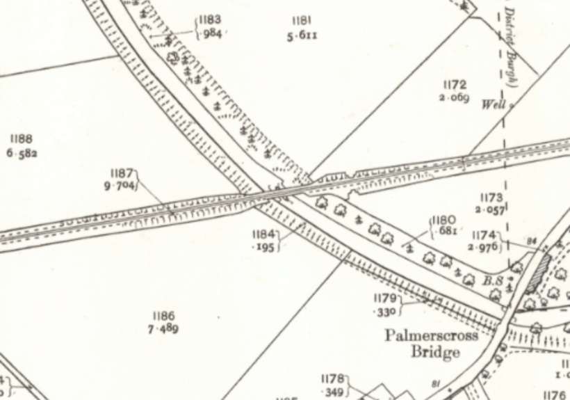
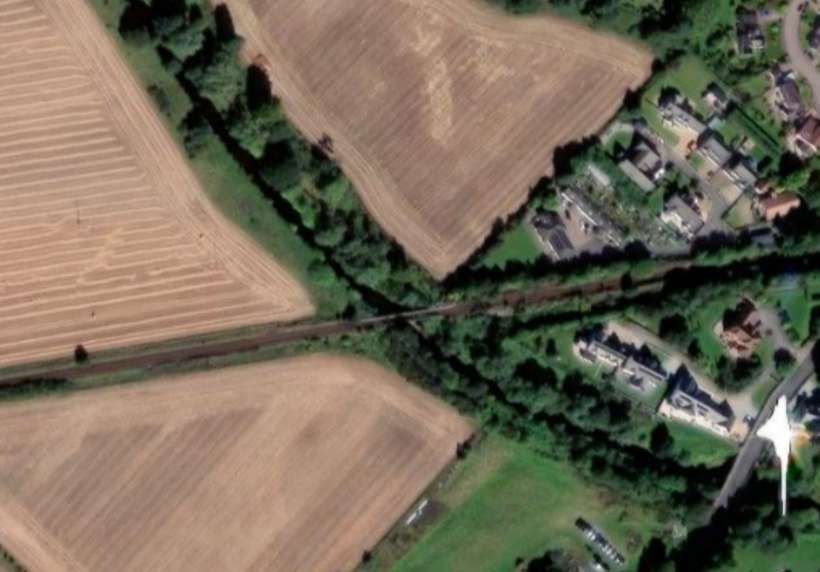
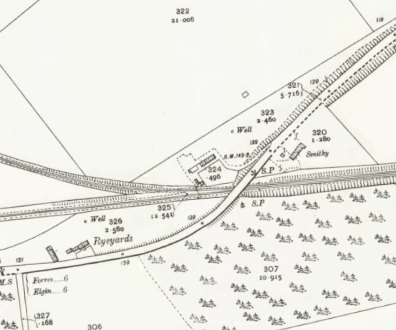
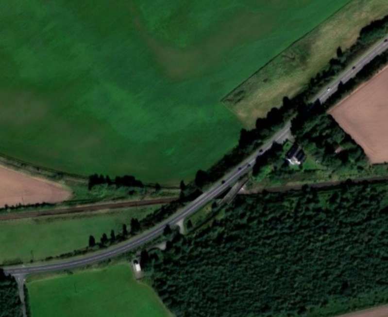
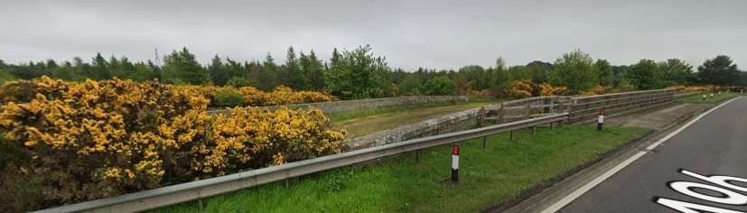
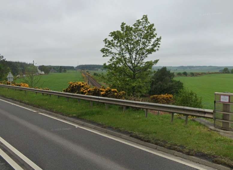
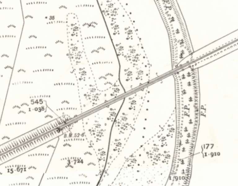
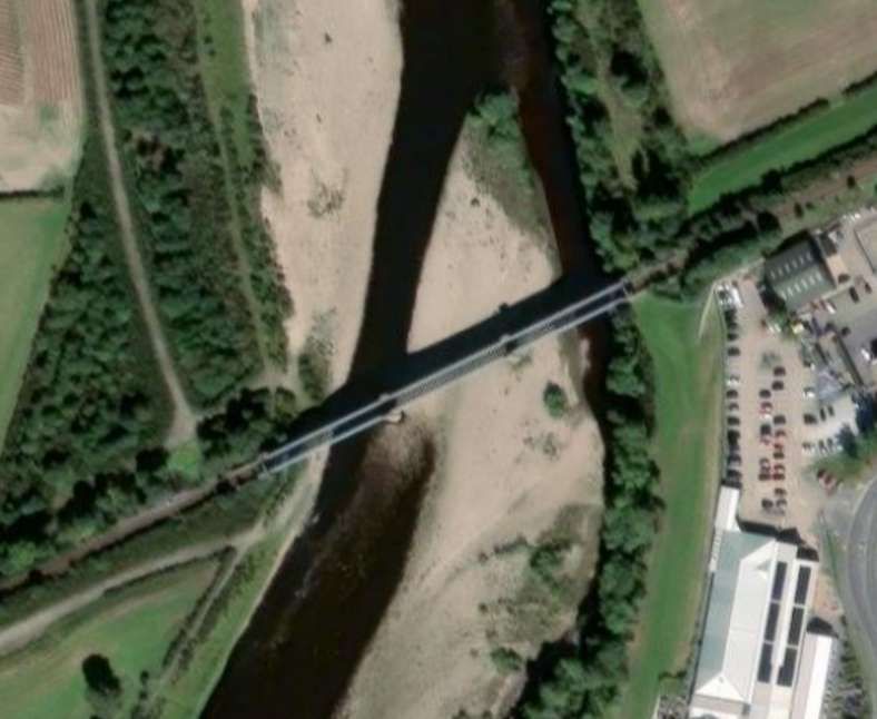
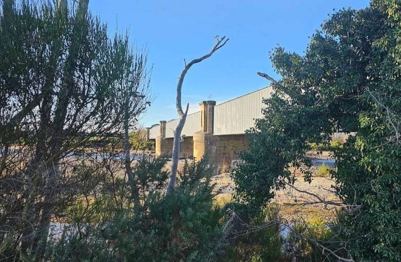
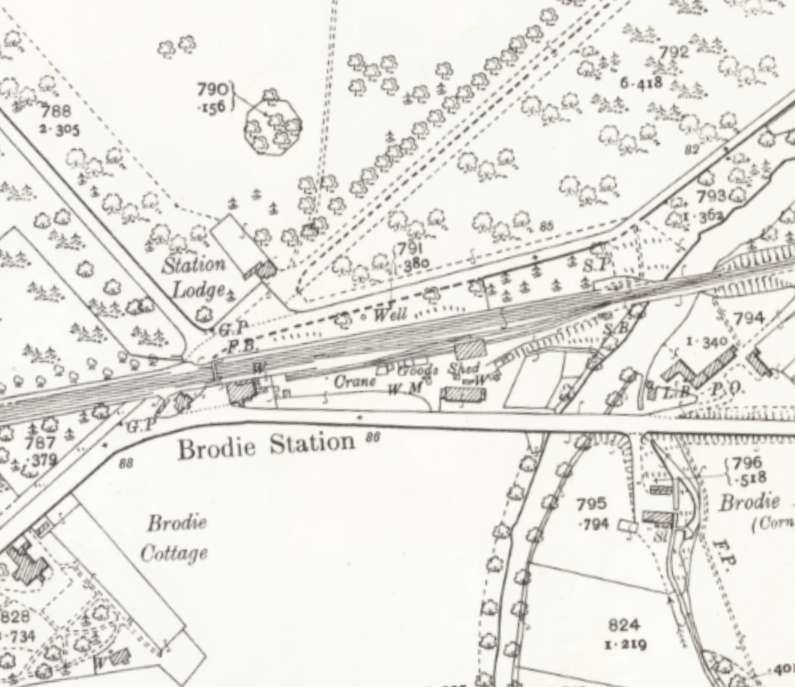
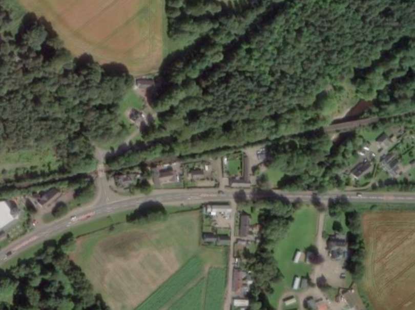
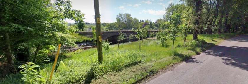
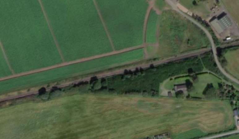
West of Forres, the line crossed the River Findhorn, and just prior to Bridie Station bridged the Muckle Burn.
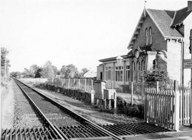
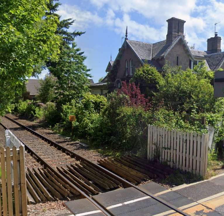
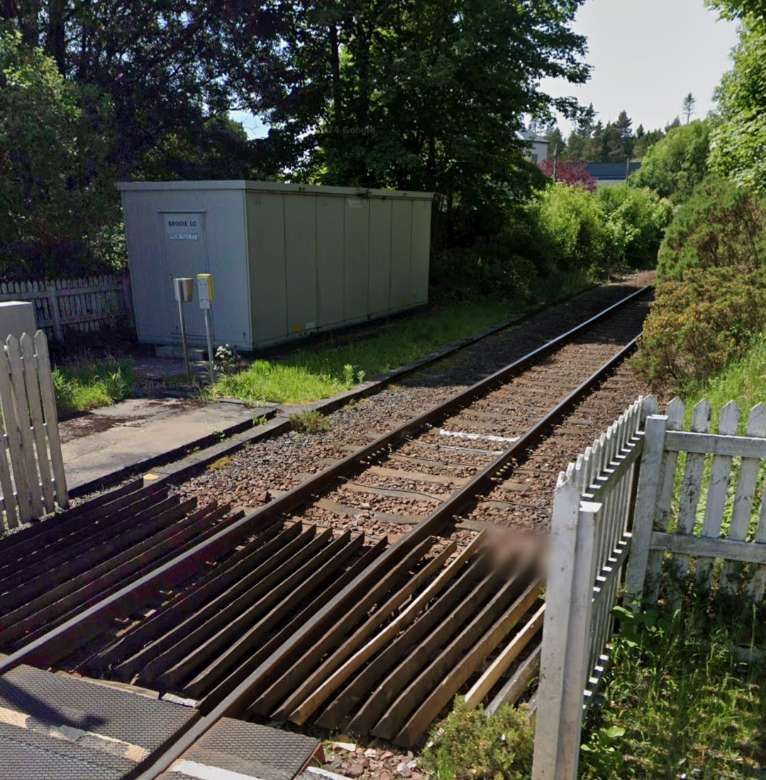
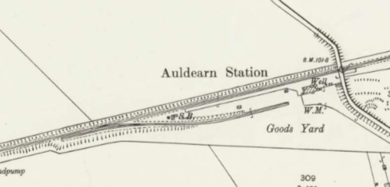
West of Bodies the line ran on through Auldearn Station, bridged the River Nairn and entered Nairn Railway Station.

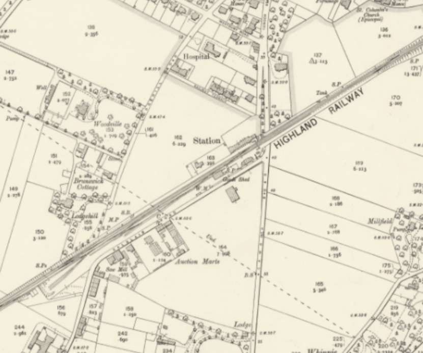
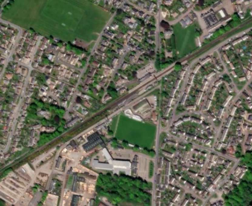
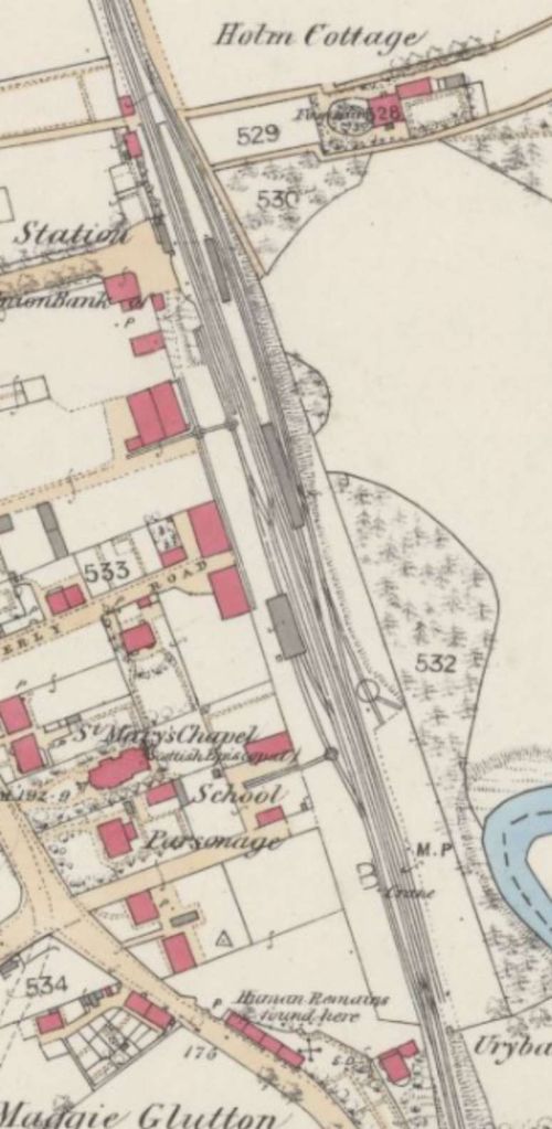
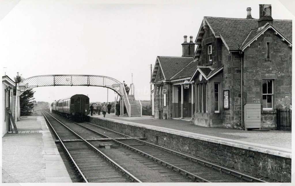
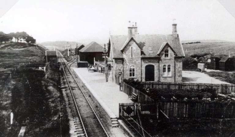
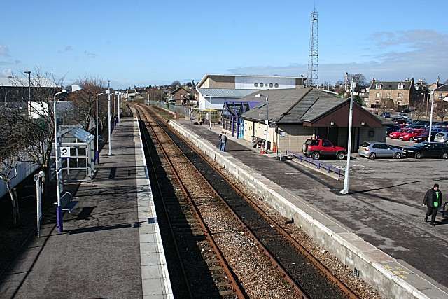
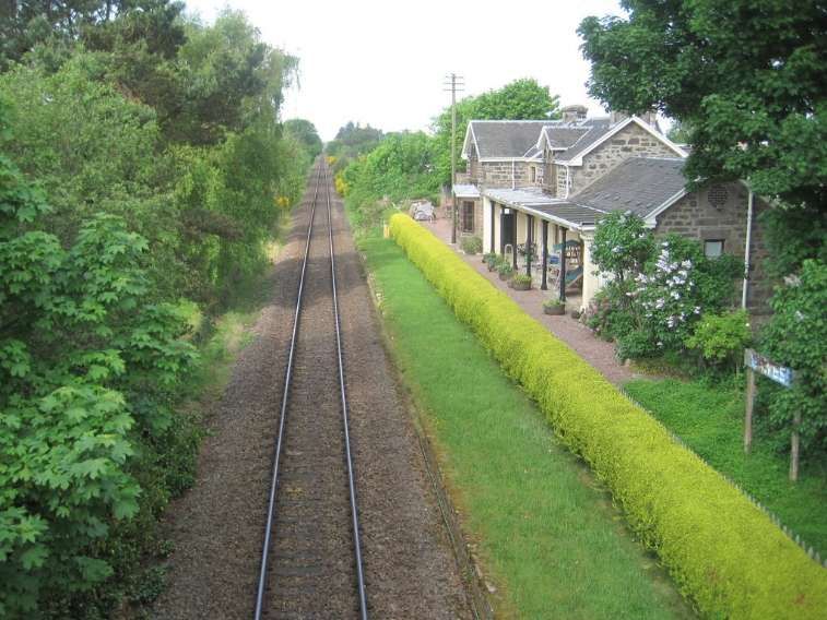
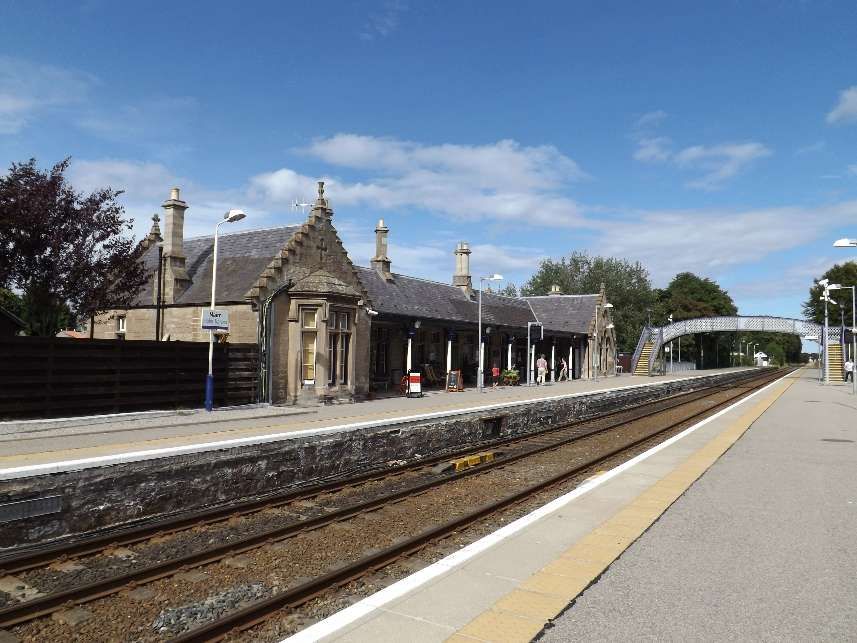
Nairn Railway Station opened on 7th November 1855. In 1885, the Highland Railway Company agreed to improve the facilities at Nairn. The station buildings were replaced with improved accommodation for passenger and staff. The gables of the cross wings were surmounted with the Scotch thistle, the Prince of Wales feather, and other designs sculpted in stone. The masonry work was completed by Mr. Squair of Nairn. At the same time a new station master’s house was erected. The platforms were extended to around 440 yards (400 m) and raised in height to the level of the carriages. A new iron foot bridge over the line connected the platforms, avoiding passengers using a foot crossing over the running lines. The bridge over Cawdor Road was also widened at the same time. The work was completed in 1886. [76]
Heading Southwest out of Nairn trains passed through Gollanfield Junction Station which served the short Fort George Branch.
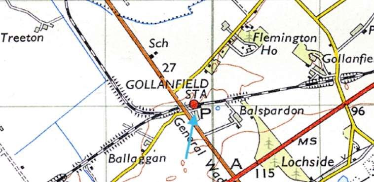
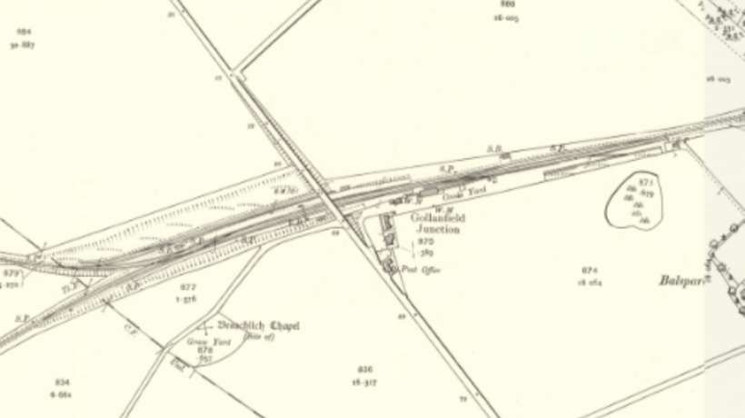
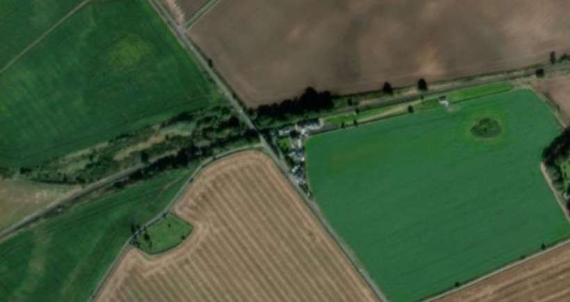
Further details of Gollanfield Railway Station and photographs can be found here. [79]
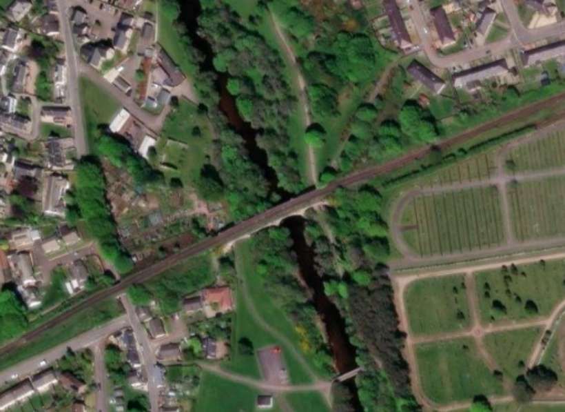
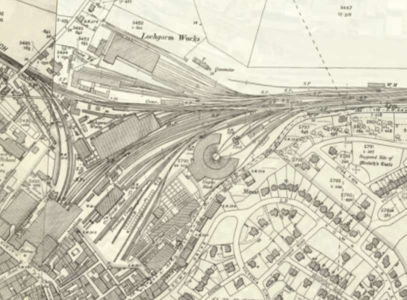
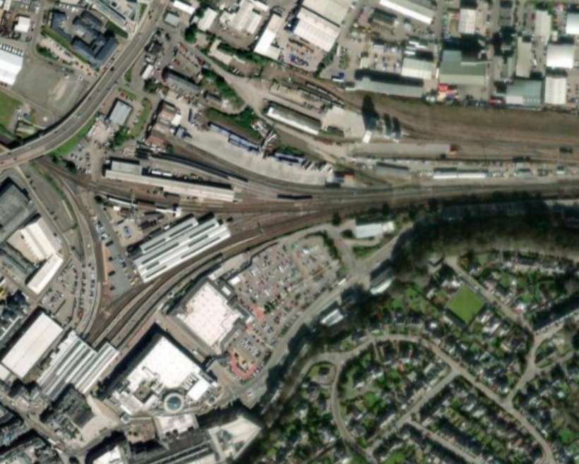
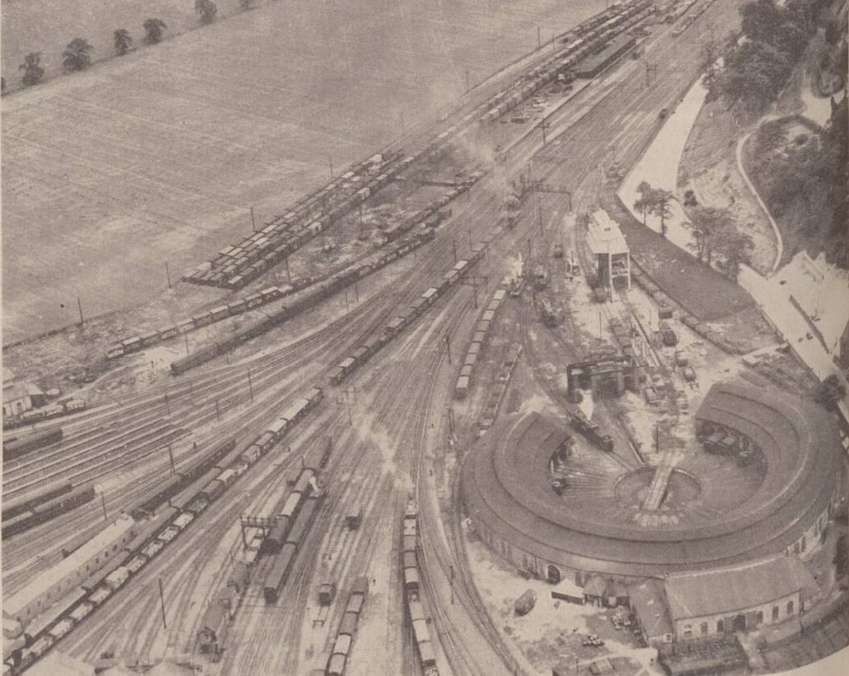
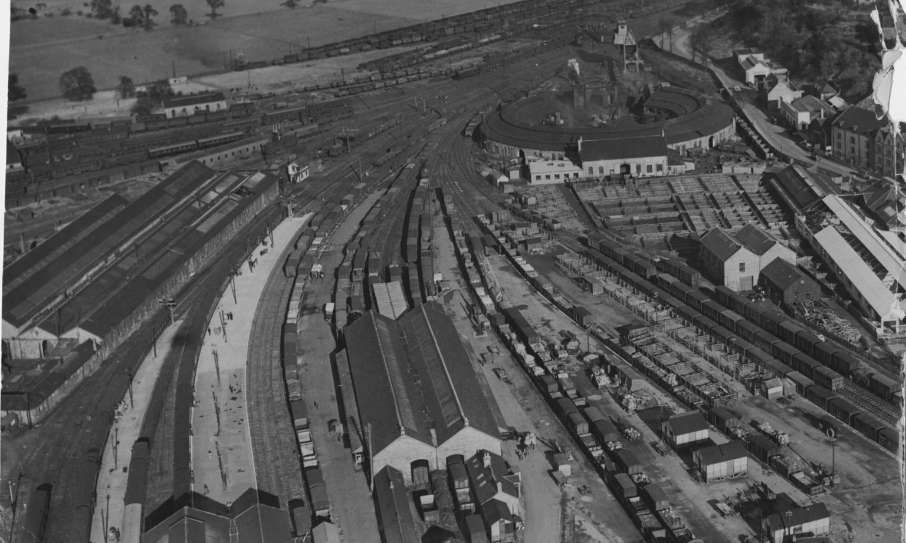
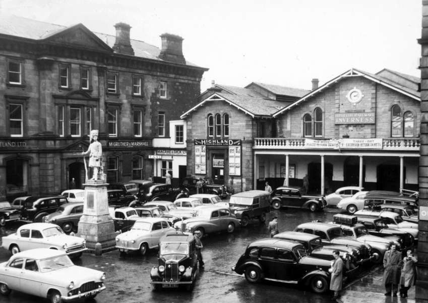
The next stop on the line was at its terminus at Inverness.
The second in this series about the Highland Railway’s main lines can be found here. [82]
References
- Brian Stephenson (ed.); The Highland Railway; Trains Illustrated No. 18, Ian Allan, Shepperton, London, 1976.
- https://maps.nls.uk/geo/explore/#zoom=14.6&lat=57.55094&lon=-2.96408&layers=168&b=ESRIWorld&o=100, accessed on 27th April 2025.
- https://rogerfarnworth.com/2025/03/23/the-highland-railways-strathpeffer-branch
- https://rogerfarnworth.com/2025/04/01/the-highland-railways-fortrose-or-black-isle-branch
- https://en.m.wikipedia.org/wiki/Buckie_and_Portessie_Branch, accessed on 27th April 2025.
- https://en.m.wikipedia.org/wiki/Highland_Railway, accessed on 18th April 2025.
- http://gnsra.org.uk/keith%20junction%20station.htm, accessed on 27th April 2025.
- https://commons.m.wikimedia.org/wiki/File:Map_of_Highland_Railway_1920.jpg, accessed on 18th April 2025.
- https://www.geograph.org.uk/photo/2546002, accessed on 27th April 2025.
- J. W. P. Rowledge; The 4-4-0 Locomotives of the Glasgow & South Western and Highland Railways; in Brian Stephenson (ed.) Locomotives Illustrated No 117, January-February 1998, Ian Allan, Berkhamsted, Herts, 1997.
- https://www.geograph.org.uk/showmap.php?gridref=NJ42935091, accessed on 27th April 2025.
- https://maps.nls.uk/geo/explore/#zoom=15.9&lat=57.54458&lon=-3.07713&layers=168&b=ESRIWorld&o=100, accessed
- https://maps.nls.uk/geo/explore/#zoom=17.0&lat=57.54387&lon=-3.07662&layers=168&b=ESRIWorld&o=95, accessed on 27th April
- https://commons.m.wikimedia.org/wiki/File:GNoSR_Aberdeen_to_Inverness.svg, accessed on 21st April 2025.
- G. D. Daniels, Leslie A. Dench; Passengers No More (2nd ed.). Shepperton: Ian Allan. p47. 1973.
- Chris Holme; Dyce first stop in new rail era; Evening Express, 15th September 1984, p19.
- H. A. Vallance; The Highland Railway (2nd. Ed.); David & Charles, Dawlish, and Macdonald, London, 1963, (First edition published in 1938).
- https://maps.nls.uk/view/74480516, accessed on 25th April 2025.
- https://maps.nls.uk/view/74480514, accessed on 25th April 2025.
- https://maps.nls.uk/view/248608948, accessed on 25th April 2025.
- https://maps.nls.uk/view/74480225, accessed on 25th April 2025.
- https://maps.nls.uk/view/190683282, accessed on 25th April 2025.
- https://maps.nls.uk/view/190683276, accessed on 25th April 2025.
- https://maps.nls.uk/view/74479805, accessed on 25th April 2025.
- https://maps.nls.uk/view/190683711, accessed on 25th April 2025.
- https://maps.nls.uk/view/190683768, accessed on 25th April 2025.
- https://maps.nls.uk/view/74480234, accessed on 26th April 2025.
- https://en.m.wikipedia.org/wiki/Alford_Valley_Railway, accessed on 26th April 2025.
- https://maps.nls.uk/view/74480097, accessed on 26th April 2025.
- https://maps.nls.uk/view/74480096, accessed on 26th April 2025.
- https://maps.nls.uk/view/74480033, accessed on 26th April 2025.
- https://maps.nls.uk/view/74477535, accessed on 26th April 2025.
- https://maps.nls.uk/view/74479846, accessed on 26th April 2025.
- https://maps.nls.uk/view/190683042, accessed on 26th April 2025.
- https://maps.nls.uk/view/75066751, accessed on 26th April 2025.
- https://en.m.wikipedia.org/wiki/Grange_railway_station_(Scotland), accessed on 26th April 2025.
- https://maps.nls.uk/view/190684458, accessed on 26th April 2025.
- https://en.m.wikipedia.org/wiki/Keith_railway_station, accessed on 26th April 2025.
- https://en.m.wikipedia.org/wiki/Keith_and_Dufftown_Railway_(GNoSR), accessed on 26th April 2025.
- https://maps.nls.uk/geo/explore/#zoom=15.2&lat=57.55620&lon=-3.14511&layers=168&b=ESRIWorld&o=100, accessed on 27th April 2025.
- https://maps.nls.uk/geo/explore/#zoom=16.2&lat=57.56045&lon=-3.15156&layers=168&b=ESRIWorld&o=6, accessed on 27th April 2025.
- https://maps.nls.uk/geo/explore/#zoom=16.7&lat=57.60987&lon=-3.16691&layers=168&b=ESRIWorld&o=0, accessed on 27th April 2025.
- https://en.m.wikipedia.org/wiki/Orbliston_Junction_railway_station, accessed on 27th April 2025.
- https://www.ambaile.org.uk/asset/27821, accessed on 27th April 2025.
- https://maps.nls.uk/geo/explore/#zoom=16.3&lat=57.63393&lon=-3.22157&layers=168&b=ESRIWorld&o=95, accessed on 27th April 2025.
- https://www.ambaile.org.uk/asset/27721, accessed on 27th April 2025.
- https://en.m.wikipedia.org/wiki/Lhanbryde_railway_station, accessed on n 27th April 2025.
- https://maps.nls.uk/geo/explore/#zoom=15.2&lat=57.64505&lon=-3.30449&layers=168&b=ESRIWorld&o=94, accessed on 28th April 2025.
- https://maps.nls.uk/geo/explore/#zoom=16.6&lat=57.64328&lon=-3.31224&layers=168&b=ESRIWorld&o=100, accessed on 28th April 2025.
- https://maps.nls.uk/geo/explore/#zoom=16.2&lat=57.64227&lon=-3.34152&layers=168&b=ESRIWorld&o=98, accessed on 27th April 2025.
- https://en.m.wikipedia.org/wiki/Elgin_railway_station, accessed on 28th April 2025.
- https://maps.nls.uk/geo/explore/#zoom=16.2&lat=57.64252&lon=-3.39367&layers=168&b=ESRIWorld&o=98, accessed on 28th April 2025.
- https://en.m.wikipedia.org/wiki/Mosstowie_railway_station, accessed on 28th April 2025.
- https://maps.nls.uk/geo/explore/#zoom=16.2&lat=57.64365&lon=-3.40333&layers=168&b=ESRIWorld&o=98, accessed on 28th April 2025.
- https://www.railscot.co.uk/locations/N/Newton_Quarry_Siding_Signal_Box, accessed on 28th April 2025.
- https://maps.nls.uk/geo/explore/#zoom=16.2&lat=57.63891&lon=-3.45161&layers=168&b=ESRIWorld&o=98, accessed on 28th April 2025.
- https://www.geograph.org.uk/photo/5406067, accessed on 28th April 2025.
- https://maps.nls.uk/geo/explore/#zoom=16.6&lat=57.63807&lon=-3.46346&layers=168&b=ESRIWorld&o=97, accessed on 28th April 2025.
- https://maps.nls.uk/geo/explore/#zoom=16.5&lat=57.63241&lon=-3.55645&layers=168&b=ESRIWorld&o=100, accessed on 28th April 2025
- https://en.m.wikipedia.org/wiki/Kinloss_railway_station, accessed on 29th April 2025.
- https://maps.nls.uk/geo/explore/#zoom=15.5&lat=57.61125&lon=-3.62434&layers=168&b=ESRIWorld&o=100, accessed on 29th April 2025.
- https://en.m.wikipedia.org/wiki/Forres_railway_station, accessed on 29th April 2025.
- https://maps.nls.uk/view/190684941, accessed on 29th April 2025.
- https://maps.nls.uk/geo/explore/#zoom=15.5&lat=57.61125&lon=-3.62434&layers=168&b=ESRIWorld&o=100, accessed on 29th April 2025.
- https://www.geograph.org.uk/photo/6260345, accessed on 29th April 2025.
- https://davaway.org.uk/railway-history, accessed on 29th April 2025.
- https://maps.nls.uk/geo/explore/#zoom=17.0&lat=57.60784&lon=-3.64132&layers=168&b=ESRIWorld&o=100, accessed on 29th April 2025.
- https://maps.app.goo.gl/L5VcbFREYZCi7p8JA?g_st=ac, accessed on 29th April 2025.
- https://maps.nls.uk/geo/explore/#zoom=16.7&lat=57.59398&lon=-3.70952&layers=168&b=ESRIWorld&o=98, accessed on 29th April 2025.
- https://www.geograph.org.uk/photo/1917711, accessed on 30th April 2025.
- https://en.m.wikipedia.org/wiki/Brodie_railway_station, accessed on 30th April 2025
- https://maps.nls.uk/geo/explore/#zoom=16.7&lat=57.59007&lon=-3.81077&layers=168&b=ESRIWorld&o=100, accessed on 30th April 2025.
- https://maps.nls.uk/geo/explore/#zoom=16.7&lat=57.58268&lon=-3.86462&layers=168&b=ESRIWorld&o=100, accessed on 30th April 2025.
- https://www.ice-imagelibrary.com/image/951/nairn-viaduct-highland-railway, accessed on 30th April 2025.
- https://maps.nls.uk/geo/explore/#zoom=15.9&lat=57.58052&lon=-3.87295&layers=168&b=ESRIWorld&o=100, accessed on 30th April 2025.
- https://en.m.wikipedia.org/wiki/Nairn_railway_station, accessed on 30th April 2025.
- https://maps.nls.uk/geo/explore/#zoom=15.7&lat=57.55161&lon=-4.01035&layers=168&b=ESRIWorld&o=0, accessed on 1st May 2025.
- https://en.m.wikipedia.org/wiki/Gollanfield_Junction_railway_station, accessed on 1st May 2025.
- http://www.disused-stations.org.uk/g/gollanfield/index.shtml, accessed on 1st May 2025.
- https://maps.nls.uk/geo/explore/#zoom=15.7&lat=57.48162&lon=-4.21859&layers=168&b=ESRIWorld&o=100, accessed on 1st May 2025.
- https://www.pressandjournal.co.uk/fp/past-times/6643614/archive-photos-of-inverness-station, accessed on 1st May 2025.
- https://rogerfarnworth.com/2025/06/28/the-highland-railway-part-2/
