Tag Archives: 1963

The Peak Forest Tramway – Part 1

Peter Clowes, in his article in the September 1963 edition of the Railway Magazine wrote: “Rolling down from the Derbyshire hills came the “gang” a train of perhaps 20 wagons, their rough iron bodies piled high with skilfully stacked lumps of grey limestone. They lurched and swayed on the flanged steel track and forced the brakeman in charge of the train to cling firmly to the leading wagon on which he perched. This is how the villagers of the High Peak remember the clattering, dusty Peak Forest Tramway, built by Benjamin Outram, that was part of the life of the district for 125 years.” [1]

He goes on to explain that the tramway was only ever used for goods, no passengers were carried except when company officials undertook tours of inspection. The line carried lime and limestone from Buxton’s quarries and kilns down to the Peak Forest Canal at Bugsworth for ongoing transport on barges to Lancashire and beyond.

Wikipedia provides a sketch map of the route of the tramway which is reproduced below.

Sketch Map of The Peak Forest Tramway. [2]
The Peak Forest Tramway. [18]

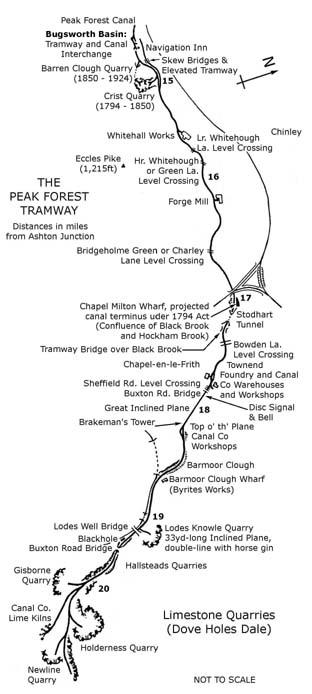
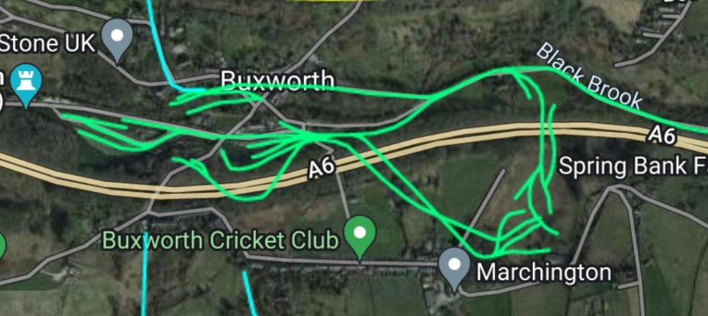
The next (adjacent) sketch map is more informative. It was included in a post about the line on the Peak and Northern Footpaths Society website. It shows the locations of a number of key features on the route of the tramway. [18]

Benjamin Outram’s original intentions  were to build a canal from Ashton-under-Lyne through to Chapel Milton, now a ‘suburb’ of Chapel-en-le-Frith. [4] He sought and received and Act of Parliament to this effect, dated  28th March 1794. That Act authorised the construction of the canal, which would have been 22 miles long, and the construction of a feeder tramway/plateway from the canal to Load’s Knowle (Dove Holes), near Buxton. Gradients between Chapel Milton and Buxton were severe and unsuited to canal construction.

However, Outram decided to reduce construction costs by terminating the Peak Forest Canal at Bugsworth and building his tramway for the whole of the remaining six miles to Dove Holes. Clowes tells us that, “The line was opened on August 31, 1796, and was an immediate success. Hundreds of tons of stone were brought down to Bugsworth every day. Sometimes there were as many as 20 barges – each with a capacity of 20 tons leaving the village for Lancashire.” [1]

Wikipedia tells us that “the tramway was initially single-track, on a 4 ft 2 in (1,270 mm) gauge, constructed of stone sleeper blocks and L-section cast-iron rails that were fastened directly onto the blocks, in the same manner as [Outram’s] Little Eaton Gangway built for the Derby Canal. The rails, known as gang rails or plates, were provided by Benjamin Outram and Company who also supplied the mineral wagons.” However, in 1803, the significant traffic volumes on the line required the single line to be “made double-track, with the exception of Stodart Tunnel and below Buxton Road Bridge, using the same method of fixing the rails.” [2]

When Outram’s Peak Forest Canal Company was building the Peak Forest Tramway, between 1794 and 1796, it cut into a bed of gritstone by the hamlet of Lower Crist, about 380 yards to the east of the terminus of the Peak Forest Canal at Bugsworth. The stone apparently “had good non-slip properties and was easy to cut because it had no grain. … This bed extended south of the main line of the tramway at Lower Crist and a branch line was made into it. The Company also discovered another deposit of the same stone adjoining the nearby hamlet of Barren Clough, which is situated between Lower Crist and the canal terminus. Consequently, they purchased land there as well but it was another 56 years before Barren Clough Quarry was opened.” [3]

Clowes comments that a considerable trade in this gritstone developed as it was located so close to the Tramway and Canal. “Thousands of 6 in. square setts for the cobbled streets of the country’s growing cities were carried … to the wharfs.” [1]

Bugsworth a sleepy little village, renamed Buxworth, … became a hive of industry.” [1] [5]

It was originally intended to extend the tramway to Buxton as and when demand for minerals grew. A further extension to Ashopton in the Hope Valley over the Rushup Moors by way of Sparrowpit , Mam Tor and Lose Hill was also planned. “These extensions never materialised and the plans were finally abandoned when the Cromford & High Peak Railway was built in 1830.” [1]

Clowes provided a vivid description of what travelling with the “gang” must have been like. A quite exhilarating experince! “Teams of horses pulled the loaded wagons from the Dove Holes quarries to the highest point of the line about a quarter of a mile away. Here the horses were unhitched. The brakeman gave the “gang” a push and then leaped onto the leading axle pin as the train of anything from 16 to 40 wagons gathered speed. At first the track curved gently through a long limestone cutting, then under the main Buxton to Chapel-en-le-Frith road by means of a stone arch bridge and down into the woods of Barmoor Clough between dry stone walls about 20ft. apart. This section of the line was closely followed by the London & North Western Railway when its spur was constructed from Stockport to Buxton, more than 50 years after the tramway was built. Until the tramway ceased operations in 1920, trains and “gangs” ran alongside each other separated only by a moss-covered wall.” [1]

As we will see in a future article about the line, “where the railway swings left into a tunnel, the tramway continued around the shoulder of a hill that shadows the birch and sycamore clad gorge which plunges down to Blackbrook. … The “gang” ran on down a steady 1-in-60 gradient to marshalling yards at the end of a 900-ft. ridge overlooking Chapel-en-le Frith. Here were workshops, stables, a permanent way store, and other buildings of the tramway company.” [1]

An inclined plane, 500 yd. long and worked by a wire rope that ran around an 18 ft.-wide wooden drum, controlled the descent of loaded wagons to the foot of the slope. The rope was 2 in. in diameter and weighed six tons. No more than eight wagons were allowed in a run on the incline. The loaded vehicles would be balanced with an appropriate number of empties whenever possible. The weight of the descending wagons pulled the empties up the slope. Sometimes horses were harnessed to the driving drum to provide additional power. If the weight of the wagons became too great and the train started to run away, a lever-operated brake would be applied in the wooden control cabin that stood on stilts just beyond the top of the 1-in-7 incline. Sometimes, however, this proved ineffective. With an ever-increasing roar the wagons would race downhill, then jump the rails and scatter their loads far and wide.” [1]

Clowes narrative continues from the small town of Chapel-en-le-Frith: “After negotiating the plane the “gangs” were reassembled in the Townend sidings and were started again on the journey to Bugsworth under their own momentum. Soon they were clattering across Bowden Lane and through a copse of oak and elm.” [1]

A mile west of Chapel was Stodhart Tunnel which the wagons entered through a steep sided cutting, the slopes of which were covered with ivy and rhododendron bushes. For 100 yards the “gangs” thundered in darkness. Then they were out into daylight and speeding along the fastest part of the track through Chapel Milton. There were sidings here across the road from the old Spread Eagle Inn-and two or three wagons of lime might be shunted off the main line to await the arrival of local farmers with horse and cart. The tramway continued through the pleasant fields of Bridgeholm, across the Whitehough road and along the banks of Black Brook to Bugsworth. The whole journey might take three hours, allowing for delays on the plane.” [1]

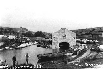
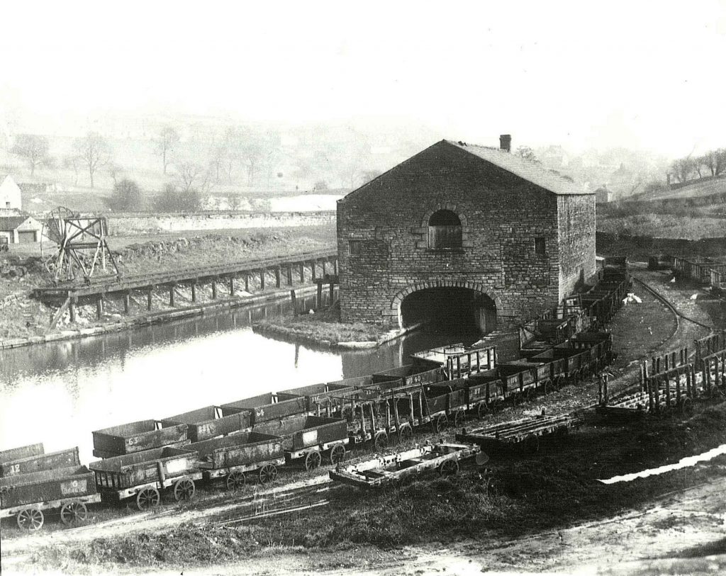
At Bugsworth, the tramway divided into extensive sidings and there were many loading berths. where limestone was tipped into large canal-side storage bays below the level of the track. Clowes tells us that “one of the most interesting features of this inland port was a simple yet ingenious tipping wheel which consisted of two vertical, spoked wheels about 16 ft. high attached to a frame which ran on a special rail track. The frame was pushed over a line of wagons which had been run on to a pier over the canal basin, and a hook was fastened to the end of each wagon in turn. A rope led from the hook over a drum which linked the two main wheels. A man would climb up the spokes of one of the vertical wheels, so making it turn like a human gin. This lifted one end of the wagon off the rails, its hinged end-plate swung open and the contents of the vehicle spilled into the hold of a barge below.” [1]

Bugsworth Basin was surrounded by merchants’ offices and warehouses. The offices housed a series of different merchants supplying limestone, lime, coal and general merchandise. Further buildings housed workshops for track and rolling-stock repair; and stables for a horses which were used to transport goods and wagons back up the line to Dove Holes.

Outram’s plateways used L-shaped flanged track on which the wagons ran. The rails were 4 ft. 2 in. apart and initially made of cast-iron. Each rail was 3 ft. long and weighed 56 lb. Clowes tells us that, “the inner flange was raised 2 in. above the 3 in. wide running surface on which the flat wheels of the wagons ground their way. The rails were secured at the joints by cast-iron chairs which sat on stone block sleepers, each one about 18 in. square. An iron spike with a tapering head was driven through the end of each rail into an oak plug seated inside the sleeper. The clatter of “gangs” passing over these primitive joints must have been fearful and, understandably enough, rail breakages were frequent.” [1]

It wasn’t until the five year period between 1865 and 1870 that the line was relaid with 9 ft. long steel rails. These were rolled at Gorton and fishplates, 1ft 6ins long were used to connect the rails.Between the stone sleeper blocks was laid a cobbled path which enabled the horses to get a firm grip. The cobbles were raised well above the level of the sleepers, in fact about an inch higher than the rail flange. This arrangement might have helped to guide wagon wheels back on to the track following derailments.” [1]

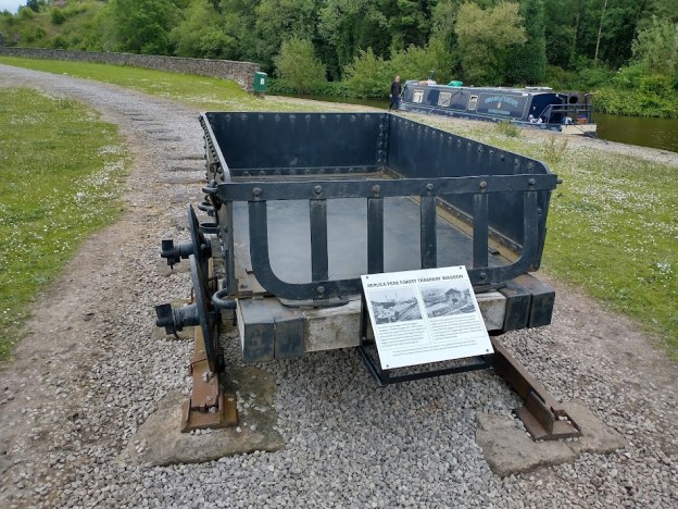
Clowes explains that wagons used on the tramway were very crudely constructed: “Each weighed between 16 and 20 cwt. when empty, and carried about 2 tons. Three sides of the body were sheets of cast iron held together by iron bands and two large wooden chocks. The fourth side was a hinged iron gate which swung open when the vehicle was tipped to unload its cargo. The body was bolted in farm-cart style to wooden axle beams. The wheels – some were cast iron, others were of wood with wrought-iron tyres – ran loose on iron pins projecting from the axle beams. They were secured by large washers and cotter pins. The “gangs” were coupled together by two short iron chains fastened at each end of the wagon beds. There was no proper braking system. Until the last days of working, the running wagons could be halted only by a perilous practice on the part of the brakeman. He would leap from his perch on the leading axle pin and thrust iron sprags into the spokes of the spinning wheels. This would lock the wheels and skid the “gang” to a stop.” [1]

The Route from Bugsworth to Dove Holes

Peter Clowes has given us a description of the journey from Dove Holes to Bugsworth. [1] As we have already noted, it would have been an exciting ride for the brakesman/ brakesmen in charge of the trams. The journey back up the gradient from Bugsworth to Dove Holes would have been much more of a toil and would have relied on horsepower. The route will be covered in greater detail, illustrated, where possible by contemporary plans and maps. In addition, as many modern photographs as is practical will be included and the journey will probably need to be divided into at least two articles.

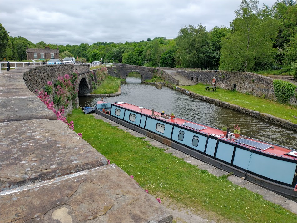
Bugsworth Basin is shown below on an extract from the 1898 25″ OS Map which was surveyed in 1896. The concentration of tramway sidings is remarkable and suggests that, in the years before the turn of the 20th century, this was a very dynamic, busy and noisy place!
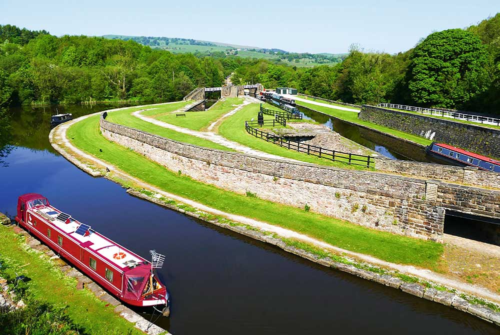
Bugsworth Basin, the terminus of the Peak Forest Canal, was surrounded by a myriad of tramway sidings. This extract from the 1898 25″ OS Map shows the main basin just to the South of the Navigation Inn. The tramway is shown exiting the extract at the third point down on the right side of the image. The tramway running South-east and leaving the extract in tunnel was the line providing access to the Barren Clough Quarry. That service the Lower Crist Quarry left the Tramway mainline a short distance to the East of the edge of this extract. [7]
Approximately the same area in the 21st century. The renovated canal basin is clearly visible. The dual-carriageway visible at the bottom of the satellite image is the A6 Whalley Bridge and Chapel-en-le-Frith by-pass. [8]

Starting in 1968, volunteers of the Inland Waterways Protection Society restored the canal and basins culminating in the re-opening to navigation in 2005. Now that restoration of navigation has been achieved, improvements and development continues” [9] under the auspices of the Bugsworth Basin Heritage Trust (BBHT). Their plan of the site is shown below.

The BBHT plan of the Bugsworth Basin site. Key: Ground Panel Locations are shown by green dots; Welcome Panels are shown by orange dots; Observation Panels are shown by mauve dots. [10]
A schematic model of the Bugsworth Basin at the East end of the Lower Basin. (My photograph, 11th June 2021.)
Bugsworth Basin from the East. [12]
Bugsworth Basin has been lovingly restored over a number of years. This image shows one of the information boards at the site and was taken in June 2021. The Lower Basin is a long thin canal arm on the North side of the Bugsworth site, to the West of the Navigation Inn. (My photograph, 11th June 2021.)
This ‘waggon’ was fabricated by the Bugsworth Basin Heritage Trust and sits on the island between the Lower Basin and The Wide. (My photograph, 11th June 2021)
The East end of the Wide in 2021. The bridge in the centre top of the image carries a public road over the access to the Upper Basin. The Navigation Inn can be seen in the top left of the image. (My photograph, 11th June 2021.)
Bugsworth Upper Basin from the West. Some of the trams are visible in the foreground of this image from around 1900. Also to the left of the goods warehouse on the left side of the canal arm a frame of one of the original tipplers can be made out. To the rear of the image there seem to be a very significant number of loaded trams sitting in the tramway sidings. [13]
Bugsworth Upper Basin again, some loaded trams on the right side of the picture and the mobile tippler is again visible on the left, standing on top of the loading wharf. [10]
The Upper Basin again, this time in 1920, a lot of empty trams appear in the foreground and the mobile tippler stands out well on the left of the picture. The view of the loading wharf structure that supported the tippler and carried it’s rails is much better in thus image than in the previous two, © J.R. Board. [16]
Bugsworth Basin at a later date. The mobile Tippler has now disappeared and there is no sign of the sidings beyond the end of the canal arm. [17]
Bugsworth Basin looking West. [14]
Bugsworth Basin also looking to the West and showing the Peninsula on the last picture. The stone blocks which secured the tramway plates are featured. [15]

Before heading east from Bugsworth Basin two particular things are worthy of note:

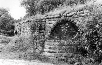
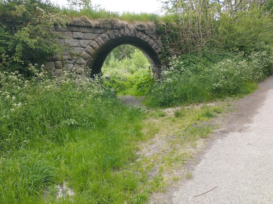
  • First, just beyond the Navigation Inn on the North side of the Upper Basin, there is a well-preserved example of a tramway wharf where goods were loaded and unloaded.
  • Second, the skew arch bridges which carry a branch tramway which served lime kilns.
The two skew-arch bridges which carrried the tramway branch to the lime kilns in 1976.  These bridges carried the tramway branch over the Black Brook and a medieval packhorse road. The road bridge is in the foreground the river bridge is beyond. [20]
The skew-arch bridge carrying the tramway branch to the limekilns over the old packhorse road. The skew-arch bridge over the Black brook is off to the left of the picture. The tramway mainline ran across the right foreground of the image. (My photograph, 11th June 2021.)
The relative locations of Barren Clough Quarry junction and the Skew-arch bridges. [21]

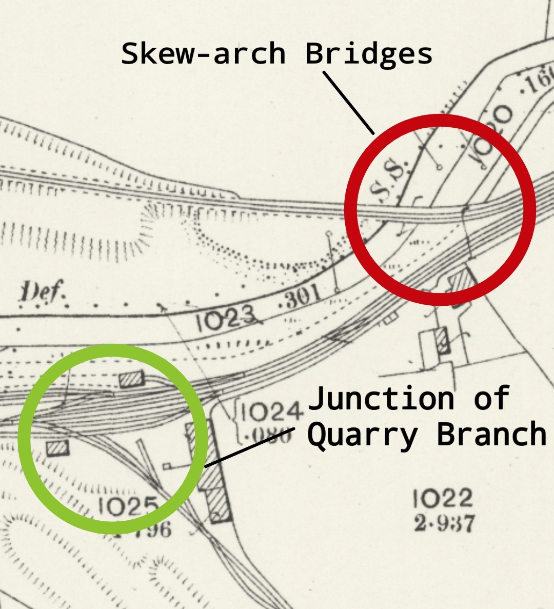
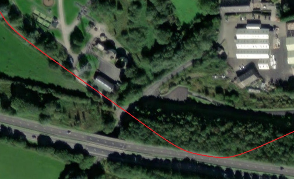
Leaving Bugworth Basin, the Tramway passed to the North of Lower Crist Quarry. Its branch tramway left the mainline to the East of the junction with the limekiln tramway branch as shown below.

25″ 1898 OS Map extract showning The Peak Forest Tramway to the East of Bugsworth Basin. Lower Crist Quarry and its tramways are shown on the South side of the Peak Forest Tramway.  Barron Clough Quarry was further to the South and was served by its own tramway which passed through a tunnel as it left Bugsworth Basin. Lower Crist Quarry is, in the 21st century bisected by the A6 dual-carriageway. Little of consequence now remains. [11]

Both the Barren Clough Quarry and the Crist Quarry (and the tunnel which gave access to the Barren Clough Quarry are covered in detail in an article by Peter J. Whitehead, “Crist and Barren Clough Quarries, High Peak, Derbyshire.” [19] It seems as though Barren Clough Quarry was not opened until the Company believed that Christ Quarry was close to exhaustion. Barren Clough was opened 56 years after Crust Quarry. It was served by a single-track tramway branch. The branch “commenced at a point 80 yards to the east of the terminus of the Peak Forest Canal. At a distance of 145 yards from the main line, it entered the tunnel before arriving on the quarry floor. Although the tunnel was relatively short, a vertical shaft was first sunk at a distance of 76 yards from the north portal (just under half way) to enable it to be excavated from four faces at once rather than at each end. When the tunnel was completed this shaft became an airshaft, although this feature was probably unnecessary for such a short tunnel.” [19]

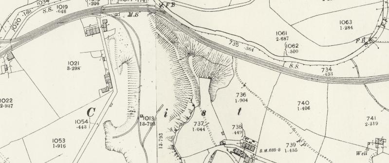
The two quarry branch tramways are shown on the map extract below.

Barren Clough and Crist Quarries and their tramway branches. [11]
Tramway routes to the East of Bugsworth Basin, imposed on a recent satellite image. (Google Maps)
The location of Barren Clough and Crist Quarries in the 21st century, showing the A6 dual carriageway built in the later years of the 20th century. [Google Maps Satellite Image.]
This is how RailMapOnline shows the Tramroad and its various connections over the length we have been looking at. [20]

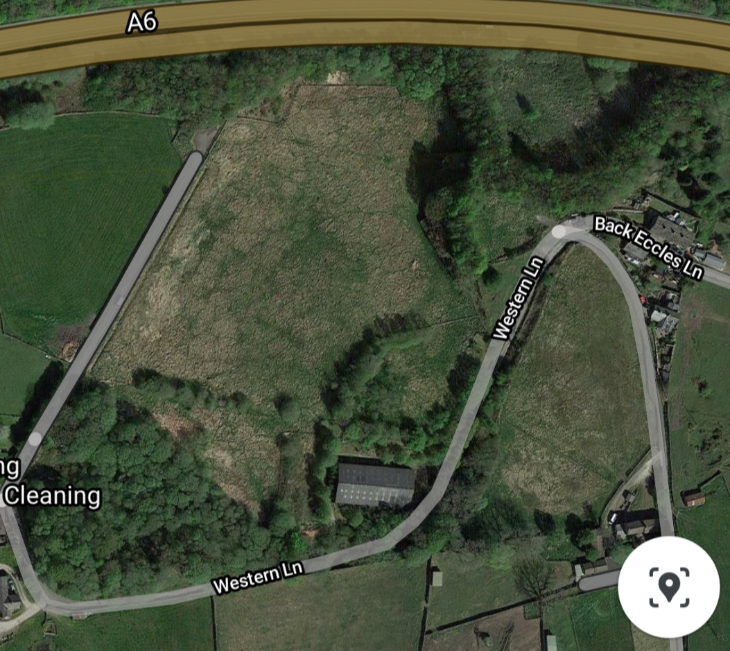
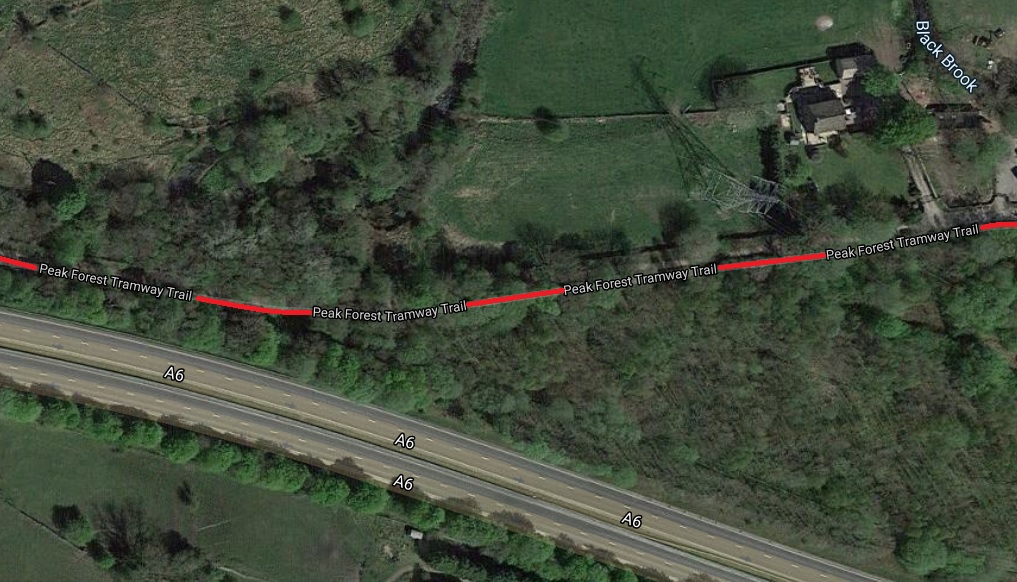
As the OS Map extract above shows, there was a group of cottages just to the West of the tramway access to Crist Quarry. Those cottages are still in use in 21st Century. The access route to them (shown on the OS Map) has been cut by the A6 Dual Carriageway. They can only now be accessed from Bugsworth Basin.

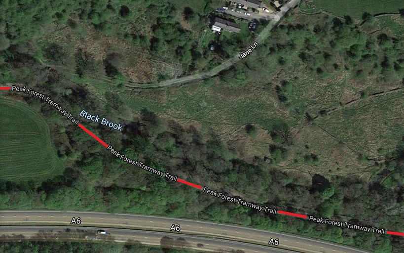
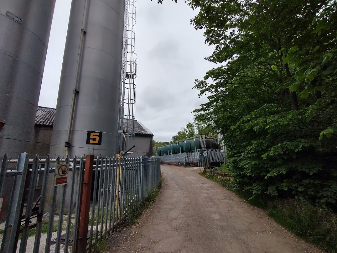
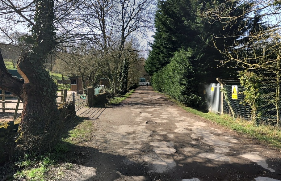
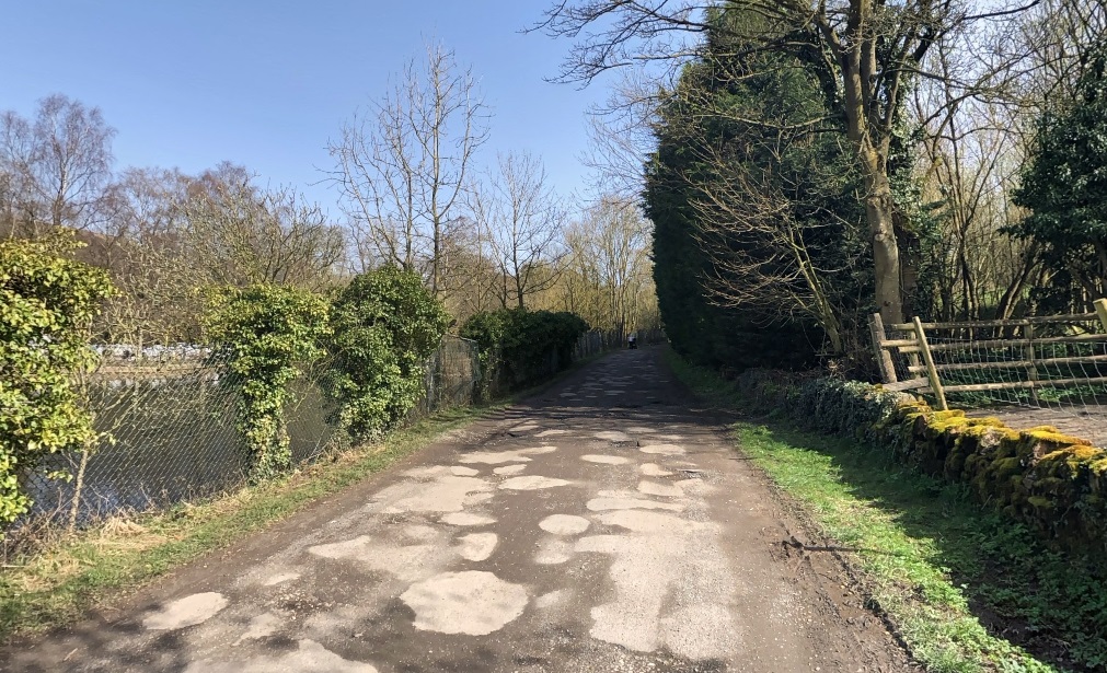
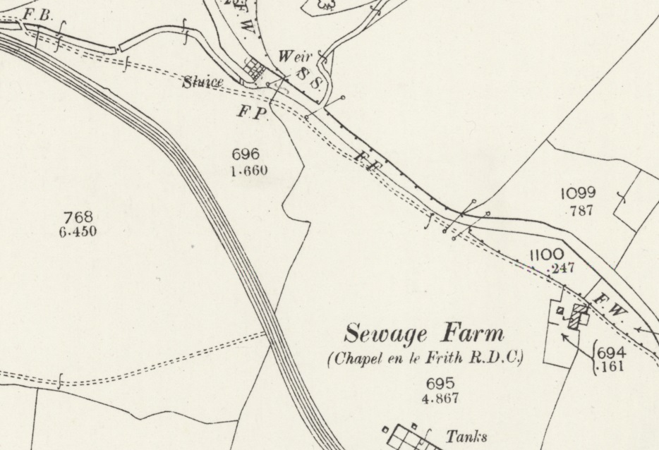
Further East, the Tramroad follows the South side of Black Brook….

The route is shown on the 6″ Ordnance Survey from the turn of the 20th century. [21]
The route of the old tramway is a well-paved/stoned footpath/bridleway for a distance to the East of Bugsworth Basin. [Google Maps]
The route continues on the 6″ Ordnance Survey. [22]
The route continued alongside Black Brook, although not following the meander around Harbour Cottage. [Google Maps]

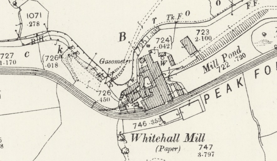
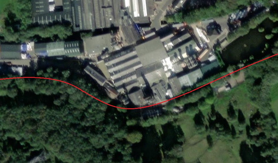
Further along the line, it deviated South away from Black Brook so as to pass to the South side of Whitehall Mill.

Whitehall Mill is shown on this extract from the 25″ OS Map of 1898. It had its own tramway connection, with two separate accesses to the tramway. [22]
The same area, shown on modern ESRI satellite imagery as provided by the National Library of Scotland (NLS), the Mill has expanded significantly in size and is still in use. It’s site crosses the brook. [22]
Approaching Whitehall Mill from the West and looking along the old tramway route. [My photograph, 11th June 2021]
Continuing to approach Whitehall Mill from the West along the old tramway route. [My photograph, 11th June 2021]
Walking alongside Whitehall Mill from the West along the old tramway route. [My photograph, 11th June 2021]
Continuing alongside Whitehall Mill from the West along the old tramway route with part of the site screened from the path by a very tall Leylandii hedge! [My photograph, 11th June 2021]
Looking West-southwest back along the old tramway route towards Buxworth with the Whitehall Mill buildings screened by the Leylandii on the right. The Millpond is just off the image to the right. [Google Streetview, March 2021]
Looking East-northeast along the line of the old tramway with the Millpond which served Whitehall Mill on the left. [Google Streetview, March 2021]
The 25″ Ordnance Survey of 1898 shows the double track tramway continuing on the South side of Black Brook and curing round the village of Whitehough. [23]
The same area as shown on the OS map above, as it appears on the ESRI satellite imagery provided by the NLS. [23]
Looking West towards Whitehall Mill along the line of the old tramway. [Google Streetview, June 2016]
Looking East along the line of the old tramway from the same point as shown in the image above. [Google Streetview, June 2016]
The old tramway curved towards the Northeast for a short distance after crossing the minor road leading to Whitehough. [My photograph, 11th June 2021]
The old tramway then curved round towards the Southeast before crossing another minor road leading to Whitehough (Whitehough Head Lane). [My photograph, 11th June 2021]
Looking Southwest along Whitehough Head Lane towards Whitehough and showing the point at which the old tramway crossed the road at level. [Google Streetview, June 2011]
Looking Northeast along Whitehough Head Lane at the point where the old tramway crossed the road. [Google Streetview, June 2016]
This next extract from the 25″ OS mapping of 1898, shows the old tramway curving away from its crossing of Whitehough Head Lane. [24]
The same area on the ESRI satellite imagery in the 21st century. [24]

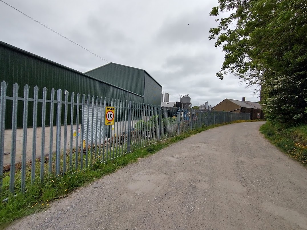
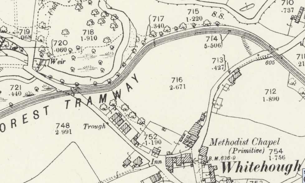
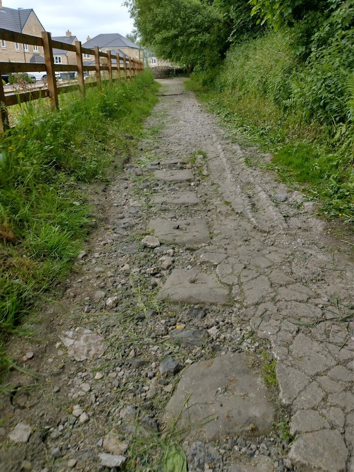
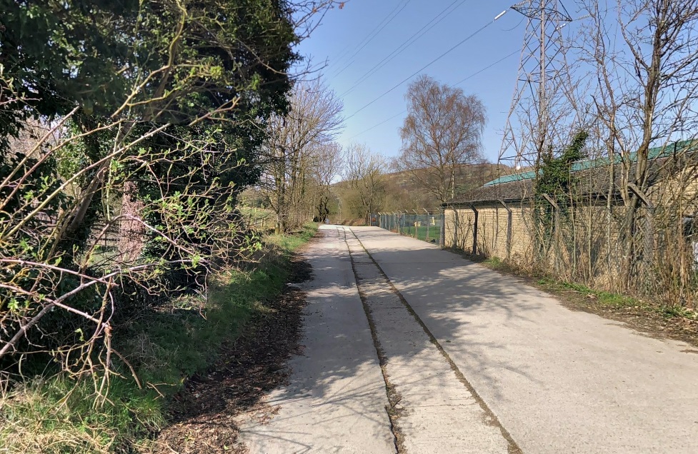
Along this length of the tramway the formation of the old tramway is exposed with some of the old stone blocks which secured the tramways rails in position visible. The next sequence of photographs show these blocks.

This sequence of photographs show exposed stone blocks which acted as sleepers for the tramway rails. The images are all taken facing along the tramroad towards Chapel-en-le-Frith. [My photographs, 11th June 2021]

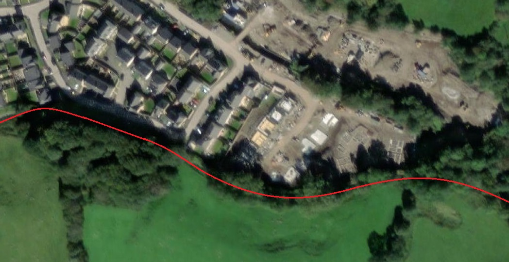
The estate of new housing visible in these pictures is built on the site of Forge Mill. An information board provides details, although the protective Perspex cover to the board has begun to fog over the years.

The information board tells us that the stone blocks were quarried at Crist Quarry, near Bugsworth Basin. Originally, the basic L-shaped rails were laid directly onto the blocks as specified by Benjamin Outram, the engineer of the tramway, but rail breakages were a problem and so, by 1837 the tramway rails were relaid on iron saddles. This is shown in the picture at the bottom-left of the information board. [My photograph, 11th June 2021]

The site of Forge Mill appears on this next extract from the 25″ OS mapping. [27]
The same area as shown on the ESRI satellite imagery. [27]

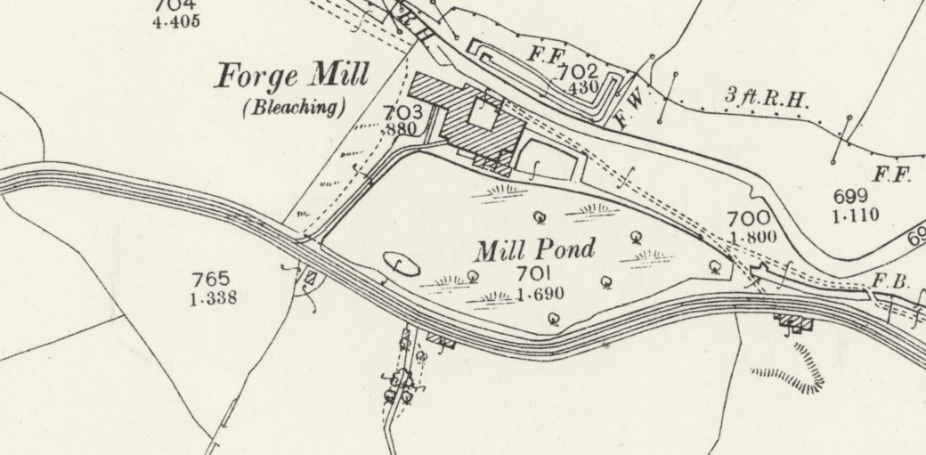
Forge Mill has seen a variety of different uses over the years. The Derbyshire Historic Environment Record list these as:

BLEACH WORKS (Post Medieval – 1540 AD to 1900 AD)
MILL POND (Post Medieval – 1540 AD to 1900 AD)
WEIR (Post Medieval – 1540 AD to 1900 AD)
PAPER MILL (Post Medieval – 1540 AD to 1900 AD)
RAILWAY SIDING (Georgian to Victorian – 1800 AD? to 1900 AD) [25]

Information about the site was provided as part of the planning application for the new housing estate on the site of the Works . The document is available on High Peak Council’s website. [26] It confirms that the Forge Mill site was, before redevelopment, known as the Dorma Works. “The site was first developed in the early 1800’s as
a paper mill. By the 1900’s the site changed to the production of textiles, a dye and bleach works. The site was sold in the early 20th century to Dorma who produced bed linen and cotton prints
.” [26] After the site was purchased in 2005 it remained unoccupied and was largely demolished in 2010.

A siding was provided to link the mill to the tramway. This can be seen on the OS map above.

The 25″ Ordnance Survey of 1898 again. Beyond Forge Mill the route of the old tramway deviates Southward still following Black Brook. By the turn of the 20th century a Sewerage Farm had been constructed between the tramway and the brook. [28]
The same area as shown on the 25″OS map extract above. The Sewage Farm is of a more significant size in the 21st century. [28]
The next extract from the 25″ Ordnance Survey shows the tramway crossing Charley Lane on the level before beginning to curve back to the Northeast. [29]
The modern ESRI satellite imagery shows the A6 dual carriageway embankments crossing the line of the old tramway. [29]
The view back along the old tramway route towards Forge Mill. [Google Streetview, March 2021]
Another view back along the old tramway route. The camera is sitting in Charley Lane. [Google Streetview, October 2022]
The route of the old tramway to the East of Charley Lane now lies under the embankment of the A6 dual carriageway. [Google Streetview, March 2021]

This is a convenient point to finish the first part of our journey along the Peak Forest Tramway. There is, of course, much more to come, but this will need to wait for a future article.

Just to round off details of the old tramway’s history, we return first to Peter Clowes’ article in the Railway Magazine and then to other sources ….

The Gradual Demise of the Tramway

Fifty years after the line was opened, the owners leased the Peak Forest and Macclesfield Canals – and, of course, the tramway – in perpetuity to the Sheffield, Ashton-under Lyne & Manchester Railway. A Parliamentary Act of 1846 provided for an annuity of £9,325 to be paid to the Peak Forest Canal Company. The railway later became part of the Manchester, Sheffield & Lincolnshire Railway, and in 1883 the canals and tramway were transferred completely to the new owners. The old canal company was dissolved. The Manchester, Sheffield & Lincolnshire Railway became the Great Central Railway in 1897 and was absorbed into the London & North Eastern Railway in 1923.” [1]

A 1925 Act of Parliament led to the closure of both the Peak Forest Tramway and the canal basin at Bugsworth. Clause 54 of Act 15 & 16 George V cap 52, 31st July 1925 was entitled ‘Abandonment of Peak Forest Tramway’. The Act was to empower the London and North Eastern Railway to construct new railways, widening others and to acquire land. It extended the time for the completion of certain works and it permitted the compulsory purchase of certain lands. Clause 54 stated: “The Company may abandon and discontinue their Peak Forest Tramway extending from Chinley to Dove Holes and may hold, sell or dispose of, or apply to the purposes of their undertaking the site and soil of any part of the said tramway so abandoned and discontinued.” [6]

After closure in the mid-1920s, records “made at the Marple Toll Office show that between 17th April 1928 and 12th February 1931 there were 30 deliveries of scrap iron from Bugsworth Basin to Prince’s Dock on the Ashton Canal at Guide Bridge. The total quantity of scrap was 523¼ tons, which averaged 17½ tons per boatload. …. At Prince’s Dock the scrap was transhipped onto the railway and from there it was taken to Sheffield for subsequent melting down. The scrap merchant who dismantled the tramway was T W Ward Ltd of Sheffield and it was melted down by Edgar Allen & Co Ltd, steel manufacturers of Sheffield.” [6]

As we have seen above, it was not until 1968 that work really began on recovering the industrial archaeology of the site and bringing the basin and canal back into navigable use. [9] The BBHT are proud of the replica wagon that they have relatively recently completed.  The chassis of which “has been produced by members using traditional techniques, utilising timber cut from redundant oak lock gate balance beams, courtesy of the Canal & River Trust. The body steelwork has been produced by modern laser cutting, again from drawings by one of our volunteers. We have assembled this “kit” and mounted it onto the chassis.” [9] The replica wagon is now on display on the peninsula on the South side of the lower basin arm.

Further Reading

There is some excellent coverage of the Tramway and Bugsworth Basin available both online and in print form. This material includes:

  • Grahame Boyes and Brian Lamb; ‘The Peak Forest Canal and Railway; an Engineering and Business History’; The Railway & Canal Historical Society, 2012, (ISBN 948 0 901461 59 9). £30.00
  • The Industrial Archaeology of the Peak Forest Tramway; http://archive.bugsworthbasin.org/pages/tram.htm

References

  1. Peter Clowes; The Peak Forest Limestone Tramway; in The Railway Magazine, Volume 109, September 1963, p611-617. This article can be accessed via a subscription to The Railway Magazine archives which is available as an add-on to a regular subscription to the magazine.
  2. https://en.wikipedia.org/wiki/Peak_Forest_Tramway, accessed on 3rd June 2021.
  3. http://www.pittdixon.go-plus.net/quarries-gritstone/quarries-gritstone.htm, accessed on 3rd June 2021.
  4. https://en.wikipedia.org/wiki/Chapel_Milton, accessed on 3rd June 2021.
  5. https://en.wikipedia.org/wiki/Bugsworth_Basin, accessed on 3rd June 2021.
  6. http://www.pittdixon.go-plus.net/pft/$pft.htm, accessed on 3rd June 2021.
  7. https://maps.nls.uk/geo/explore/#zoom=17&lat=53.33580&lon=-1.96833&layers=168&b=1, accessed on 3rd June 2021.
  8. https://maps.nls.uk/geo/explore/#zoom=17&lat=53.33580&lon=-1.96833&layers=170&b=1, accessed on 3rd June 2021. This is an extract from the ESRI satellite imagery which forms the base layer over which various NLS OS Maps are overlaid.
  9. https://bugsworthbasin.org, accessed on 3rd June 2021.
  10. https://bugsworthbasin.org/the-basin, accessed on 3rd June 2021.
  11. https://maps.nls.uk/geo/explore/#zoom=17&lat=53.33559&lon=-1.95887&layers=168&b=1, accessed on 3rd June 2021.
  12. https://youtu.be/g91uwioVV4o, accessed on 3rd June 2021.
  13. https://narrowboatworld.com/7254-memories-of-bugsworth-basin, accessed on 3rd June 2021.
  14. https://www.countryimagesmagazine.co.uk/featured/bugsworth-canal-basin, accessed on 3rd June 2021.
  15. https://commons.wikimedia.org/wiki/File:Bugsworth_Basin_4.jpg, 3rd June 2021.
  16. https://www.wondersofthepeak.org.uk/facts/wanders-through-the-industrial-peak-bugsworth-basin, accessed on 3rd June 2021.
  17. https://collections.canalrivertrust.org.uk/themes/the-history-of-bugsworth-basin, accessed on 3rd June 2021.
  18. Ian Salvage (Publicity Officer) & Ian Edgar MBE (Chair of Bugworth Basin Heritage Trust); http://www.peakandnorthern.org.uk/newsletter/1702/07-peak-forest-tramway.htm, accessed on 3rd June 2021. (NB: the same sketch map can be found in: Peter J Whitehead; The Peak Forest Tramway, High Peak, Derbyshire (including a Walking Guide to the Tramway Trail); http://archive.bugsworthbasin.org/pages/pft.htm)
  19. http://archive.bugsworthbasin.org/pages/quarries/quarries.htm
  20. https://www.railmaponline.com/UKIEMap.php, accessed on 16th January 2023.
  21. https://maps.nls.uk/geo/explore/#zoom=16.8&lat=53.33623&lon=-1.95773&layers=6&b=1, accessed on 16th January 2023.
  22. https://maps.nls.uk/geo/explore/#zoom=16.8&lat=53.33602&lon=-1.95500&layers=6&b=1, accessed on 16th January 2023.
  23. https://maps.nls.uk/geo/explore/#zoom=18.0&lat=53.33658&lon=-1.94378&layers=168&b=1, accessed on 28th February 2023.
  24. https://maps.nls.uk/geo/explore/#zoom=18.0&lat=53.33604&lon=-1.93857&layers=168&b=1, accessed on 18th February 2023.
  25. https://her.derbyshire.gov.uk/Monument/MDR485, accessed on 28th February 2023.
  26. http://planning.highpeak.gov.uk/portal/servlets/AttachmentShowServlet?ImageName=145422, accessed on 28th February 2023.
  27. https://maps.nls.uk/geo/explore/#zoom=18.0&lat=53.33561&lon=-1.93349&layers=168&b=1, accessed on 28th February 2023.
  28. https://maps.nls.uk/geo/explore/#zoom=18.0&lat=53.33449&lon=-1.92832&layers=168&b=1, accessed on 28th February 2023.
  29. https://maps.nls.uk/geo/explore/#zoom=18.0&lat=53.33267&lon=-1.92589&layers=168&b=1, accessed on 28th February 2023.

A Steam Tram at Heywood, Middleton, Manchester (UK)

The February 1963 edition of the Railway Magazine included a photograph of a Steam Tram which used to serve Heywood. [1] Until coming across the image above, I had no idea that steam trams served boroughs in the Manchester conurbation.

This postcard by an unknown publisher shows the final days of the Heywood Corporation steam tramway in 1905. Just behind is Rochdale Corporation electric car 29 at the borough boundary south-west of Rochdale at the Sudden terminus where Rochdale Road and Bolton Road meet.The postcard bears the title “For Auld Lang Syne”, thereby clearly indicating the imminent demise of the steam tram service. [2]

Heywood, sits about 8 miles north of Manchester, 3 miles east of Bury and 4 miles south-west of Rochdale, and only a couple of miles from where I served my curacy in Middleton.

John R. Prentice says that “the Manchester, Bury, Rochdale and Oldham Steam Tramways Co. Ltd. (MBRO, founded c.1883) became the second largest steam tramway operator in Britain with over 90 tram engines, 80 double-deck passenger trailers and 30 miles of routes. Of all these, two-thirds of stock and track were narrow gauge (3ft 6ins), including the section between Bury and Rochdale, through Heywood.

The MBRO system was split into three areas: “standard gauge southwards from Bury (to Whitefield, Prestwich and Kersal) and from Royton (to Oldham and Hathershaw), but everything else between these points (i.e, nearly all the lines in Bury, Rochdale and their environs) built to a gauge of 3ft 6ins.” [3]

By 1896, “it was clear that several of the local authorities intended to build municipal electric tramways, and that the company’s days were numbered.” [3]

Ashley Birch says that, “Oldham took control of its lines (which it had always owned) in June 1902, and a year later, in June 1903, initial agreement was reached between the remaining various local authorities and the company on a sale. … The parties eventually signed a binding agreement on the 24th February 1904, so that work on electrification could progress, with a price being set by an independent referee.” [3]

The last steam tram ran “in Royton … on the 30th May 1904, the last tram in Bury on the 10th July 1904, and the last tram in Rochdale, probably on the day before the company’s assets were sold … 12th October 1904.” [3]

After nearly 20 years of operation, the MBRO network was no more. The withdrawal of steam tram services generally coincided with the electrification of the lines and the inauguration of an electric tram service. This was true for the Bury Corporation service to Heap Bridge (west of Heywood) But when Rochdale Corporation replaced its steam trams with standard gauge electric cars, it only did so “as far as the district of Sudden, a three-quarters of a mile walk to and from the Heywood borough boundary and the steam tram terminus. In December 1904, Heywood Corporation decided to run its own steam tram service by buying 13 tram engines and 10 trailers (by then, 20 years old) from the former MBRO company when it closed down.” [2]

Peter Gould says that, “On the 20th December 1904 the main line across Heywood was re-opened to the steam trams. On the 22nd December the service on the Hopwood branch was re-instated. … The locos and trailers retained their former brown and cream livery and fleet numbers, although from 24th March 1905, the legend ‘Heywood Corporation Tramways’ began to appear on the sides of locos.” [4]

Gould continues: “The initiative was not a great success and began to flounder when Rochdale initially refused permission for the trams to use the stretch of line between the Heywood boundary and Sudden, where their electric trams currently terminated, leaving a gap of around 1 mile for weary passengers to trudge. … Although Rochdale later relented, the conditions they sought to impose were unacceptable to Heywood and the steam trams continued to terminate at the Heywood boundary.” [4]

However, by April 1905, “Rochdale extended its electric service at Sudden to the Heywood boundary in Bolton Road to establish a direct transfer to the Heywood steam trams. Later the same year, on September 20th 1905, the last steam tram ran and the through service was converted to standard gauge electric operation using Rochdale and Bury cars. Thus, as a tram operating municipality, Heywood Corporation Tramways was very short-lived and lasted less than a year; something of a record in British tramway history.” [2]

References

  1. Alan P. Voce; A Relic of the Steam Tram Era; Letter in The Railway Magazine, February 1963, p137
  2. John R. Prentice; Heywood Corporation Steam Tram Engine 63; https://www.tramwayinfo.com/Tramframe.htm?https://www.tramwayinfo.com/trampostcards/Postc188.htm, accessed on 29th May 2021.
  3. Ashley Birch; Manchester, Bury, Rochdale and Oldham Steam Tramways (from 1888, Bury, Rochdale and Oldham Steam Tramways); http://www.tramwaybadgesandbuttons.com/page148/styled-79/page312/page312.html, accessed on 29th May 2021.
  4. Peter Gould; Heywood Corporation Tramways 1904-1905; https://petergould.co.uk/fleetlists/tramways/heywood1, accessed on 29th May 2021.

Railways in Iran – Part 2 – 1910 to 1945

I have been reading old copies of the Railway Magazine from the 1950s and 1960s. The old small format magazines somehow seem more attractive than the glossy larger format modern magazines, perhaps that is a sign of ageing on my part!

In the January 1963 edition of the magazine there is a long article about the railways of Iran which is based on a visit in 1961 to Iran by M.H. Baker MA. [1] I have already posted an article, based on Baker’s visit, about the first railway in Iran – a short 5.5 mile long line from Tehran to Rey (https://rogerfarnworth.com/2020/03/23/railways-in-iran-part-1-tehran-to-rey-1888) [2]

Until the 1930s, Iran was relatively isolated, various attempts had been made to develop concessions for railways in the country but to little avail. The short railway from Tehran to Rey finished in the 1880s was only expanded early in 1890s to include two branch-lines reaching quarries to the Southeast of Tehran. [3: p625][4: p14]

No further railway construction took place until the eve of the First World War. The Tabriz – Jolfa line (146 km) was built in 1914, the Sufiyan – Sharaf Khaneh (53 km) in 1916, and the Mirjaveh – Zahedan (93 km) in 1920. [5]

Tabriz to Jolfa – Tabriz is the most populated city in northwestern Iran, one of the historical capitals of Iran and the present capital of East Azerbaijan province. It is the sixth most populous city in Iran with a population in excess of 2 million. It is in the Quru River valley, in Iran’s historic Azerbaijan region,[3] between long ridges of volcanic cones in the Sahand and Eynali mountains. [6] Tabriz is over 4,430ft above sea level. The valley opens up into a plain that gently slopes down to the eastern shores of Lake Urmia, 60 kilometres (37 miles) to the west. With cold winters and temperate summers, Tabriz is considered a summer resort.

Jolfa is on the border with present day Azerbaijan, which in the early 20th century was part of Russia. is located to the north of Tabriz, separated by the Aras River from its northern neighbor and namesake, the town of Julfa in the Republic of Azerbaijan. Jolfa is much smaller than Tabriz, with a population of the order of 10,000. Its importance was its location on the border of what was the Russian Federation. [7] The railway was built by Russians during the height of World War I. The first trains ran in the spring of 1916. [8]

Baker explains that this line was essentially “an extension to Russia’s railways. … The line was constructed to the Russian 5ft gauge.” [1: p21] As well as the 146 km (90 mile) mainline from Jolfa to Tabriz, there was a branch line which served Sharif Khaneh, a port on Lake Rezayeh. ….

Sufiyan – Sharif Khaneh – as we note immediately above. this was a branch line from the Tabziz – Jolfa line. It was 53km (33 miles) in length. Like the Tabriz – Jolfa line, this line also became part of the much longer route in later years, but more of that anon. Sufiyan is a city with a population less than 10,000 but valued for the junction station which permitted rail access to Lake Rezayeh. [9]

Sharif Khaneh was even smaller (about 5,000 population) on the shores of Lake Rezayah (or Lake Urmia). [10]

The building of these two lines in the North consolidated Russian influence and gave logistical support to its army resisting Ottoman attempts to wrest control of the country.

The Great War – “Despite a declaration of neutrality, during the war Iran became a field of operation for British and Russian forces on one side and German and Turkish on the other, and the ensuing years found her in a state of political disintegration and economic chaos which the Qajar dynasty seemed unable to arrest.” [1: p21]

“On the eve of the war, the global shift of industry, armies and naval units from using coal to oil fuels resulted in an exponential growth in demand for petroleum products. This had enormous implications for the strategic significance of west Asia, a region that contains the world’s largest oil deposits. Persian [(Iranian)] oil became not only an economic resource of fundamental importance to British interests worldwide, but also a strategic military asset. Its vast oil deposits and its geographic location at the gates of the Indian subcontinent turned Iran into one of the major theatres of war in west Asia.” [11]

The occupation of north and south Iran by Russian and British troops prompted the Ottomans to invade western and north-western Iran early in the war. The resulting  pressure on Iran  caused the long-lasting rifts in Iranian politics to widen as noted by Baker above.

Mirjaveh – Zahedan – Mirjaveh is the main road crossing point between Iran and Pakistan. Mirjaveh is also the point where the railway line from Pakistan crossed the border on the way from Quetta to Zahedan. [12] Zahedan is the capital of Sistan and Baluchestan Province, Iran. At the 2016 census, its population was 587,730. [13] The line between these two cities was an extension of the Pakistan Railways line from Quetta to the border. The total length of this  line in Pakistan is 523 kilometres (325 miles). There are 23 railway stations from Queta to Koh-e-Taftan on the border. The line is one of the 4 main routes within Pakistan. [14] The extension into Iran was built by the early 1920s and was 93km (58 miles) in length. [5] It was built to 5ft 6in gauge to match the line in Pakistan. [15]

The next 12 to 24 months we’re to be a significant period in the history of Iran and also of the development of its railways. 1921 saw a coup d’etat led by Satip Reza Khan. Within a year or two, he had sufficiently consolidated his power to assume the throne as Reza Shah. He subdued dissident tribes and provinces and set about modernising the country. He saw the construction of railways as the means of maintaining political unity and promoting economic development. [1: p22]

The Trans-Iranian Railway – When completed, the Trans-Iranian Railway was an immense achievement. It ran for 850 miles and linked the South and North of the country. For the first time the northern agricultural lands and the Caspian Sea ports would be linked to ports and oilfields in the south. [16] It linked the capital Tehran with the Persian Gulf and Caspian Sea. The railway connected Bandar Shah (now: Bandar Torkaman) in the north and Bandar Shahpur (now: Bandar-e Emam Khomeyni) in the south via Ahvaz, Ghom and Tehran. [18: p371] The featured image at the head of this article shows an American Locomotive in service on the line. [17]

Construction work started in 1927 and was completed in 1938. Impressively, external loans were not countenanced. Reza Shah was determined to fund the project with indigenous capital – taxes on sugar and tea helped subsidize the project. [16][17] The Trans-Iranian Railway was completed just before the advent of the Second World War. One source suggests that the total length of railways in Iran at the start of the Second World war was little more than 700km. [19] Given the length of the Trans-Iranian Railway, this is a significant underestimate, but nonetheless Iran did not have an extensive railway system.

Construction of the railway was an overwhelming task. “It required the building of 4,100 bridges and 224 bored tunnels (64 miles in total).” [16]  C.L. Champion, in the Journal of the Institution of Civil Engineers, stated in 1947 that, “no other standard-gauge railway has been driven through such great lengths of very difficult country. The remote and inaccessible nature of important sections of the route added considerably to the difficulty of construction.” [21: p160]

Initially, an international syndicate called “Syndicat du Chemin du Fer en Perse” which included the American Ulen and Company and a German “Konsortium für Bauausführungen in Persien” formed by three German companies undertook the construction of the initial test lines. [17][20]

The Americans started from Bandar Shahpur and built the line through Ahvaz as far as Dezful. The German group started with a new harbour at Bandar Shah on the Caspian sea and reached the foothills of the Alborz mountains at Shahi. Ascending the Alborz terrain to build the Trans-Iranian railway was an amazing engineering feat. [31]

In April 1933, Iran drew up a new contract with the Danish firm Kampsax which was already active in railway construction in Turkey. “The contract required Kampsax to complete the line by May 1939. Kampsax completed the project under-budget and ahead of schedule, with it being formally opened throughout on 26 August 1938.” [17][25]A contractor’s temporary suspension bridge used during the construction of the Trans-Iranian Railway. [32]

Examples of the different work undertaken follow below. …

The first comes from the period when the USA was working in the South of the country. The second is an example of a company working on five of the different lots in the 1930s. The third is an early example of work by a modern day European construction giant. …

First, American  engineer, Edward Miles Crawford was responsible for some 20 million dollars worth of infrastructure and work on the railway. He supervised the design and purchasing of some 250 kilometres of the railway and the development of the port at Bandar Shahpur located on the Persian Gulf. He served as Acting Assistant Chief Engineer and Office Engineer for the Imperial Railways of Persia, a position he held from Feb. 1930 to June 1932. [22] As part of his work, he took a number of pictures, just a few are reproduced below.The Roundhouse at Salehabad [22]Small Baldwin Locomotive on contractors operations crosses a newly constructed concrete bridge in Ahwaz. [22]Balarud Steel Bridge. Steelwork from Germany. [22]Bandershapour Engine Shed under construction. [22]Kalla Kassum Cutting. [22]The first tunnel north of Salehabad, looking North. [22]The turntable at Ahwaz close to completion. [22]Ahwaz again. [22]

Second, as we have already noted, a number of different contractors were used on different sections (‘lots’) of the line. One example is the Italian contractor “Impresit.” It acquired five of the more challenging lots. Four of the lots were in the north where Impresit had to build a steep incline to a tunnel under Gaduk Pass in the Alborz mountain range. The railway formation climbed 1,200 metres in less than 50 kilometres a signiicant grade at the best of times! Winters during construction were merciless, sometimes dumping two metres of snow. [23]Viaduct Construction on the Trans-Iranian Railway. [23]

Impresit’s fifth lot was in the south, where the train was to wind its way through the mountainous province of Khuzestan. The remoteness of the location made it difficult to maintain supply lines. In summer, temperatures meant that work was conducted at night. In the end, in its 5 lots, Impresit built about 50 kilometres of railway, including 73 tunnels and 2,000 metres of bridges and viaducts. [23]Viaduct Construction on the Trans-Iranian Railway. [23]

The result of the construction of the railway and improved general transportation was dramatic reductions in transport costs and times. The British Central Office of Information noted that: “…the Persian people had every reason to be proud of [the Iranian railway], for they themselves had supplied most of the labour for its construction and they, with a small population living in every circumstance in hardship, had found every Rial of the thirty million Pounds which it had cost.” [16][24]

Thirdly, Danish engineers Olaf Kier and Jorgen Lotz formed J Lotz and Kier in 1928 and became early pioneers of reinforced concrete design and construction. They participated in the construction of the Trans-Iranian Railway, building the concrete structure pictured below.A graceful structure on the Trans-Iranian Railway built by Lots and Kier, the forerunners of the Kier Group of construction companies. [30]

The Trans-Iranian Railway passed through only a few towns and cities along its route. From Bandar Shahpur (now Bandar Imam Khomeini) in the South, the next major location was Ahwaz (Ahvaz) (where a branch line from Khorramshahr joined what was the original main line in the middle of the Second World War). Andimek (Adnimeshk) was reached before the line crossed the Zagros Mountains, then Fawzieh (Arak) and Qum before reaching Tehran. There are very few pictures of the line in use in the years before the Second World War and there are no Google Street view images available in Iran. Satellite images give us an idea of what is on the ground in the 21st century.Bandar Shahpur (now Bandar Imam Khomeini) Railway Station (Google Earth).A Wartime image of Khorramshahr Railway Station. The Persian Gulf port of Khorramshahr was one of the railheads of the ” Persian Corridor” for supplies to Russia. [43]Khorramshahr Railway Station (Google Earth).Ahwaz (Ahvaz) Railway Station (Google Earth).Andimeshk Railway Station. [33]Andimeshk Railway Station. [34]Andimeshk Railway Station (Google Earth).Arak (Fawzieh) Railway Station (Google Earth).Image result for Qum railway station iranQum (Qom) Railway Station (Google Earth).Tehran Railway Station in the mid-20th century. [35]

Kaveh Farrokh comments: “By 1933, the Iranian railway and road network system had reduced the cost of transportation to a third of what it had been in 1920. The time needed for transport in 1933 was now reduced to just one-tenth of what it had been in comparison to 1920. The efficiency of the Iranian railway and road networks was one of the primary factors that encouraged the Anglo-invasion of Iran in August 1941. The primary objective of that invasion was to use the Iranian network to supply the Red Army of the Soviet Union. This is because Nazi Germany had been engaged in a massive invasion of the Soviet Union since 22nd June 1941.” [16]

World War II – Iran became a very significant theatre in the Second World War. Not only was it a prized asset because of its massive reserves of oil, it also provided a possible and significant supply route to resource the resistance of the Soviet Union which was under attack from the German Armies in Operation Barbarossa.

Edwin M. Wright, writing in 1942 [18] said: “The alleged reason for the Russian and British invasion of Iran last August was the refusal of the Iranian Government to expel an unknown number of Germans who, it was feared, were paving the way for a German coup d’etat. A second purpose, stressed in the press and alluded to by Winston Churchill in his speech of 9th September 1941, was to open a road for the transport of war supplies to Soviet Russia.” [18: p367] In addition, the British may have wanted to strengthen the defenses of India against possible German invasion.

Wright continues: “A strong hope was expressed at the time of the invasion that Iran might provide another “Burma Road” by which supplies could be shipped to Russia to compensate for the heavy Soviet losses incurred in the retreat from the Ukraine. Actually, there are three routes which might possibly be used for this purpose. One is the road leading north from Zahidan, through eastern Iran, near the Afghanistan border, to Meshed, and thence into Russian Turkestan. Zahidan … is the terminus of the Baluchistan railway running north and west via Quetta from Karachi, a first-class port on the Indian Ocean. The second route is the Trans-Iranian Railway, from Bandar Shahpur, on the Persian Gulf, to Bandar Shah, on the Caspian Sea. The third route is the narrow-gauge railway from Basra, on the Persian Gulf, to Baghdad, [now in Iraq] and the standard-gauge line thence to Khanikin, Kirkuk and Erbil. From near the latter place a road leads over the Rowanduz Pass into western Iran, and thence northward to strike the Russian wide-gauge railway at Tabriz. Each of these three routes has great limitations and presents enormous difficulties for through transport.” [18: p367] The map provided by Wright as part of his article in 1942. [18]

Writing for an American audience, Wright goes on to explore the practicality of each of the three routes that he mentions above. He dismisses the route via Zahidan as it would be exposed to heavy enemy bombing. “All in all,” he says, “it would take six months of hard work to arrange for even a meager 500 tons per day to be delivered to Russia by this route, and it could never become a major artery.” [18: p369]

He next considers the Trans-Iranian Railway, completed in 1939. He says that it, “is a marvel of engineering skill. On its 870-mile course it passes through terrain as rough as our Rocky Mountains — or even rougher. …. At both ends the grades are very steep. After leaving Bandar Shahpur, the southern terminus, the line crosses a coastal plain and then reaches the Kotals — a series of rising ranges, rank upon rank. It tunnels through the solid rock of these and is suspended by precarious-looking bridges across the deep intervening chasms. Two engines have to be used to a point near Khurramabad, when the plateau level is reached. Only 27 percent of the line is on a plain; 6 percent is in tunnels. The same thing happens at the other end of the line, north of Teheran. After crossing the backbone of the Elburz range at a height of almost 9,500 feet, trains begin a long and rapid descent, plunging through more than 90 tunnels and traversing many bridges before they finally reach the Caspian at Bandar Shah. Here everything has to be put on shipboard for transport to Baku or Astrakahn. Harbor facilities are meager and the ships which would be used here are the same which would have to handle goods arriving by the road from Zahidan. A real bottle-neck therefore exists on the Caspian.” [18: p369] 

What is really interesting, is his assessment of the locomotive capacity of the Trans-Iranian Railway, which in 1942 only a few years after its opening seems to have a locomotive complement of 80 available for regular work. Given the need for double-heading a certain part of the route, he assesses that 40 trains could operate with the then current provision. In addition, the freight capacity f the line amounted to around 3,000 wagons. This was all still, in Wright’s view, marginally less that needed to supply Iran’s needs, let alone provide for an increased logistical effort.

Wright continues: “For some time the [Iranian] Railway Commission was trying to buy equipment from the United States. Now an attempt is being made under British supervision to double the track in many places, and an appeal has been made to the United States to allocate 200 locomotives and additional rolling stock, as well as rails, in the hope that by April 1942 the railway’s capacity may be doubled or trebled. A motor trail roughly parallels the railway; but it has bad stretches and is hard on transport vehicles, which so far are practically non-existent. Whether we speak of traffic by rail or road, the United States and some part of the British Empire (such as Australia) will first have to ship all the transport equipment to Iran before any appreciable flow of materials can be attained by the various Iranian routes to Russia. The port facilities on the Persian Gulf will also have to be improved. Basra, a good port, is only 70 miles distant from Bandar Shahpur; but the intervening terrain is swampy and passable only with difficulty. Bandar Mashur, on the Persian Gulf, is only 20 miles from the railway terminus; but it is inaccessible to ocean-going vessels. Much dredging, dock-building and road-making will have to be done before heavy overseas traffic can reach the Trans-Iranian Railway.” [18: p369]

Wright notes that a spur of the Trans-Iranian Railway was started in the direction of Tabriz In 1939, incidentally, a spur of the Trans-Iranian Railway was started to-ward Tabriz, some 400 miles distant, but it reaches only half way, to Zenjan. He says: “Tabriz is linked by rail via Julfa with Baku. If this spur were completed, then, the Trans-Iranian Railway would have a direct connection with the Russian railway system, and the strain upon the Caspian Sea fleet would be greatly relieved. [But the extension to Tabriz] includes a steep mountain pass at Shibley, where extensive tunneling must be done; so this part of the break must be serviced by motor trucks in any event.” [18: p369-370]

Wright dismisses the third route from Basra because supplies “would need three transshipments and would have to cover a total distance of over 1,600 miles.” [18: p370]

Wright’s assessment is that in 1942 it was unlikely that all three routes combined would provided a supply route capable of providing more than 1,000 tons a day of supplies to Russia. If all of his recommended improvements were to be completed, including doubling of much of the Trans-Iranian Railway, Wright suggests that the supply route might be enough to support a defence of the Caucasus by Russia against an anticipated German advance in the Spring of 1943, but not to enable them to defend a long line on the open plains of Russia. [18: p371]

The Trans-Iranian Railway was used to supply Russia. Wikipedia tells us that, “In December 1942 the US Army Transportation Corps (USATC) replaced the British and Empire force operating the Southern Division.” [26: p5][28] The use of steam on the southern sections of the Railway meant harsh working conditions for their crews. [27]  “The USATC therefore considered diesel-electric locomotives more suitable and requisitioned the 13 ALCO RS-1s built and had them converted to ALCO RSD-1 1,000 horsepower Co-Co locomotives. [26: p5] An additional 44 RSD-1s were built for use in Iran. These totalled only 57 locomotives so initially they were used to operate only the southern part of the Southern Division between Bandar Shahpur and Andimeshk.” [17][27: p86]

On the shallower grades further North between Andimeshk and Tehran, steam was still considered viable and the “USATC brought 91 S200 Class steam locomotives, designated class 42.400 in the Iranian State Railways numbering system. The USATC also introduced another 3,000 freight cars.” [27: p86]

Later a further 18 ALCO RSD-1’s entered service, [29: p107] “enabling the USATC to return some LMS 2-8-0s to the British Middle East Command [26: p4] and extend diesel operation northwards, reaching Qom by September 1943 and regularly serving Tehran by May 1944. [27: p87] The USATC further increased freight traffic so that in 1944 it averaged 6,489 tons per day.”[17][29: p105]

Russia’s ability to supply and equip an army estimated at 3,000,000 men for the mightiest Soviet offensive of the war on the broad front from East Prussia to Slovakia continues to amaze commentators. From 1942 “an ever-increasing flood of Lend-Lease fighting equipment from the United States went to Russia via the Allied supply corridor in Iran.” [28]

It is not clear to what degree this assistance contributed to the Russian success. However, had not the tremendous quantities of American supplies rolling across Iran been forthcoming, the Russian offensive would not have been possible. [28]

Wikipedia tells us that “‘Aid to Russia’ traffic ceased by May 1945 and in June the USATC withdrew its RSD-1’s [27: p87] and returned control to the British authorities. Shortly afterwards the British restored the line to Iranian State Railways, [26: p31] the predecessor to the Islamic Republic of Iran Railways.” [17]

Two videos give an impression of what life was like on the railways and docks of Iran during the War years:

Supplies For Russia (1941). [36]

This video shows the ALCO RSD-1 Locomotives being unloaded at the docks in Iran prior to be prepared for service by the 762nd battalion. [37]

During the War, The American forces running the Trans-Iranian Railway supplied 13 ALCO diesel locomotives. [38] There was a battalion of American soldiers who primary function was the assembling of “modified 1,000-horsepower ALCO RSD-1 diesel-electric locomotives and thousands of freight cars. The locomotives, made in Schenectady, New York, by the American Locomotive Company, had arrived before the [battalion] and without the requisite tools, so the diesel shop boys forged their own implements and set to work. Within days of landing in Iran the 762nd [battalion] was sending an RSD-1 out the shop door.” [39]

These ALCO (RSD-1) locomotives was intended originally as what the Americans call a road switcher, designed to both haul freight in mainline service and shunt them in railroad yards, they were rated at 1,000 horsepower (750kW) and rode on two three-axle bogies. [40]

Following the war, these locomotives were shipped back to the US where they continued to work either hauling freight on military installations, used for training, or were sold to railroad companies. [41]

8008 was an ALCO (RSD-1) locomotive that was requisitioned by the War Department for the Trans-Iranian Railroad. The series of 13 locomotives were numbered 8000 to 8012. This engine returned from Iran in 1945. (c) ALCO Historic Photos. [42]

Given that we started this article with a reference to The Railway Magazine and particularly to an article by M.H. Baker [1] it seems appropriate to me to complete the article with what Baker has to say about the war effort and the part played by the Trans-Iranian Railway.

Baker [1] had the following to say:

“An Anglo-Soviet-Iranian Treaty of Alliance was … signed in Tehran, in January, 1942, under Article 3 of which the Allies received “the right to maintain, guard and, in certain circumstances, control all means of communication.” With regard to the railway, an agreement was reached whereby additional employees whom the State Railway might have to engage would be paid by the Allies, who would also pay for the movement of goods and supplies so that the railway could earn sufficient revenue to enable it to replace, subsequently, any equipment worn out during wartime operation. The Allies were also to replace any motive power, rolling stock or shop equipment that might be seriously damaged.

The tempo of activity on the railway increased beyond recognition. The Times on 12th July 1942, described how villages like Andimek, which before the war had been a few mud huts, had become mushroom towns within a few months: ‘Greek traders have established ‘Churchill’ cafes and ‘Victory’ bars, and of an evening British railwaymen from Crewe and Swindon, American titters from Detroit, bearded Sikhs and hefty Russians, Armenian and Persian truck drivers, rub shoulders in a ‘boom town’ atmosphere worthy of a Hollywood film in a temperature which seldom drops below 100 degrees.” British and American engineers effected improvements which the capacity of the line, new signalboxes being constructed and locomotives and rolling stock imported. The facilities of Bandar Shahpur could not cope with the volume of shipping, and as early as November 1941, the construction was begun of a branch from to the port of Khorramshahr Abadan. The flat country presented and the 75-mile branch was by June 1942. Subsequently, it superseded the Bandar Shahpur route as the main line.

A Transportation Directorate, under a former manager of the East African Railway was set up in Tehran to organise the despatch of the. supplies needed by the Russians. … Lorries were also used extensively to carry the war materials, but over half the more than 5 million tons delivered to Russia across Iran during the war was carried by the Trans-Iranian, which by mid-1944 was handling over 10,000 tons per day.”

While researching these articles about the Railways of Iran, I came across a number of photographs taken by an non-commissioned officer in the British Army during World War II. I was, at first intending to include them with this article, but after correspondence with the King’s Own Museum in Lancaster, I decided that those images should have their own short article. The source of these photographs is the King’s Own Royal Regiment Museum. [44] The twelfth article in this series of posts is about these photographs. [45]

References

  1. M.H. Baker; The Iranian State Railways; in The Railway Magazine, January 1963.
  2. https://rogerfarnworth.com/2020/03/23/railways-in-iran-part-1-tehran-to-rey-1888, published 23rd March 2020.
  3. Albert Houtum-Schindler, “Persia,” Encyclopaedia Britannica, XXXI, 1902 (10th ed.), pp. 617-627.
  4. Baron E. Beyens, Commerce et industrie de la Perse, Brussels, 1898.
  5. https://en.wikipedia.org/wiki/Islamic_Republic_of_Iran_Railways, accessed on 23rd March 2020.
  6. https://en.wikipedia.org/wiki/Tabriz, accessed on 23rd March 2020.
  7. https://en.wikipedia.org/wiki/Jolfa,_Iran_(city), accessed on 23rd March 2020.
  8. https://en.wikipedia.org/wiki/Tabriz_railway_station, accessed on 23rd March 2020.
  9. https://en.wikipedia.org/wiki/Sufian, accessed on 23rd March 2020.
  10. https://en.wikipedia.org/wiki/Sharafkhaneh, accessed on 23rd March 2020.
  11. https://encyclopedia.1914-1918-online.net/article/persiairan, accessed on 23rd March 2020.
  12. https://en.wikipedia.org/wiki/Mirjaveh, accessed on 23rd March 2020.
  13. https://en.wikipedia.org/wiki/Zahedan, accessed on 23rd March 2020.
  14. https://en.wikipedia.org/wiki/Quetta–Taftan_Line, accessed on 23rd March 2020.
  15. https://dlca.logcluster.org/plugins/servlet/mobile?contentId=3801847#content/view/3801847, accessed on 23rd March 2020.
  16. https://kavehfarrokh.com/uncategorized/a-short-history-of-the-iranian-railway-system, accessed on 22nd March 2020.
  17. https://en.wikipedia.org/wiki/Trans-Iranian_Railway, accessed on 23rd March 2020.
  18. Edwin M. Wright; Iran as a Gateway to Russia; Foreign Affairs Journal, Council of Foreign Relations, New York; Volume 20 No.2, 1942, p367-371.
  19. https://www.sinfin.net/railways/world/iran.html, accessed on 23rd March 2020.
  20. Manfred Pohl; Philipp Holzmann, Geschichte eines Bauunternehmens 1849–1999. Verlag C.H. Beck, Munich, 1999, p 189 ff.
  21. Cuthbert Llewellyn Champion; The Construction of the Trans-Iranian Railway; The Journal of the Institution of Civil Engineers, Volume 29, Issue No. 2, London 1947, p160-167.
  22. https://www.jamesarsenault.com/pages/books/5094/edward-miles-crawford-photographer-and-compiler/construction-of-the-trans-iranian-railway/?soldItem=true, accessed on 23rd March 2020.
  23. https://www.webuildvalue.com/en/stories-behind-projects/the-railway-that-united-iran.html, accessed on 23rd March 2020.
  24. PAIFORCE; The Official Story of the Persia and Iraq Command 1941-1946; British Central Office of Information, HMSO, London, 1948, p92.
  25. Jonas Kauffeldt; Danes, Orientalism and the Modern Middle East: Perspectives from the Nordic Periphery (Ph.D.). Florida State University. Docket Electronic Theses, Treatises and Dissertations. Paper 3293, May 2006; Archived from the original (PDF) on 15 December 2014.  Accessed via https://web.archive.org/web/20141215063326/http://diginole.lib.fsu.edu/etd/3293 on 24th March 2020.
  26. R. Tourret; War Department Locomotives; Tourret Publishing  Abingdon, USA, 1976.
  27. R. Tourret; United States Army Transportation Corps Locomotives; Tourret Publishing  Abingdon, USA, 1977.
  28. Paul Rugile; They helped Russia to Victory ; The Port Macquarie News and Hastings River Advocate (NSW : 1882 – 1950). NSW: National Library of Australia. 28 April 1945. p. 4, and The Christian Science Monitor,  via  https://trove.nla.gov.au/newspaper/article/106044674 on 24th March 2020.
  29. Hugh Hughes; Middle East Railways; Continental Railway Circle, Harrow, 1981, p101–113.
  30. https://www.kier.co.uk/who/our-story, accessed on 24th March 2020.
  31. https://erenow.net/modern/iran-a-modern-history/9.php, accessed on 24th March 2020pp.
  32. https://rayanworld.com/20170809141027005/The-Trans-Persian-Railway-Opening?subarticle=13, accessed on 24th March 2020.
  33. https://www.google.co.uk/maps/uv?hl=en&pb=!1s0x3fe9bc31cd8ed029:0xe5fb6a321f5b8e11!3m1!7e115!4shttps://lh5.googleusercontent.com/p/AF1QipMapPnDYj48YkIcB8Xdrz8Vfpn5PlkiBrOPcEfE%3Dw221-h160-k-no!5sAndimeshk+railway+station+-+Google+Search&imagekey=!1e10!2sAF1QipMapPnDYj48YkIcB8Xdrz8Vfpn5PlkiBrOPcEfE&sa=X&ved=2ahUKEwj42oH8zLPoAhUzQUEAHWWeD3YQoiowE3oECBYQBg, accessed on 24th March 2020.
  34. https://www.google.co.uk/maps/uv?hl=en&pb=!1s0x3fe9bc31cd8ed029%3A0xe5fb6a321f5b8e11!3m1!7e115!4shttps%3A%2F%2Flh5.googleusercontent.com%2Fp%2FAF1QipMapPnDYj48YkIcB8Xdrz8Vfpn5PlkiBrOPcEfE%3Dw221-h160-k-no!5sAndimeshk%20railway%20station%20-%20Google%20Search&imagekey=!1e10!2sAF1QipNJxc1n99dk0LRFwVM6A_OMLraTkfgX2hWpK_q6&sa=X&ved=2ahUKEwj42oH8zLPoAhUzQUEAHWWeD3YQoiowE3oECBYQBg, accessed on 24th March 2020.
  35. https://bia2safa.net/24440/نادیده-های-ایستگاه-راه-آهن-تهران, accessed on 24th March 2020.
  36. https://youtu.be/dAWGse0bc1g, accessed on 26th March 2020.
  37. https://youtu.be/7xMhN3kPjp4, accessed on 26th March 2020.
  38. https://en.wikipedia.org/wiki/Persian_Corridor, accessed on 26th March 2020.
  39. https://www.historynet.com/the-battle-before-the-battle.htm, accessed on 26th March 2020.
  40. https://en.wikipedia.org/wiki/ALCO_RSD-1, accessed on 26th March 2020.
  41. https://transportation.army.mil/museum/AOTM/aotm-august-2018.html, accessed on 26th March 2020.
  42. https://salutetofreedom.org/ny.html, accessed on 26th March 2020.
  43. British Work on Persian Railways, 1942 – Parts 1 and 2; The Railway Gazette, 2nd and 16th February 1945, p111-114 and p159-162.
  44. http://www.kingsownmuseum.com, accessed on 8th April 2020.
  45. https://rogerfarnworth.com/2020/04/13/railways-in-iran-part-12-photographs-from-the-second-world-war, completed and published on 13th April 2020.

Railways in Iran – Part 1 – Tehran to Rey 1888

I have been reading old copies of the Railway Magazine from the 1950s and 1960s. The old small format magazines somehow seem more attractive than the glossy larger format modern magazines, perhaps that is a sign of ageing!

In the January 1963 edition of the magazine there is a long article about the railways of Iran which is based on a visit in 1961 to Iran by M.H. Baker MA.

Until the 1930s, Iran was relatively isolated, but from around 1865 various European Countries had sought concessions to construct railways but the Imperial government continued to value isolation above integration.

Baker says that, “Shah Naser-ed-Din … was so delighted with railways that he determined to have one built in Iran.” [1: p21] Shah Naser-ed-Din reigned from 1831 to 1896. He was the first modern Iranian monarch to formally visit Europe. He wrote travelogues about his trips, that also were translated in foreign languages. [2][3]

Shah Naser-ed-Din called on a French engineer and concession hunter, Fabius Boital, to build a line from Tehran to the shrine of Abdul Aziz at Rey, 6 miles south of the city. He also received a concession to build tramways in Tehran. [4] It seems that he was probably short of money and sold “both of these concessions to a Belgian company named “La Société Anonyme des Chemins de Fer et Tramways en Perse,” founded in Brussels on 17 May 1887. The company had a capital of 2 million francs.” [5][6: p865]

The rail concession allowed the Belgian company to construct and operate a railway line from Qazvin to Qom through Tehran and Rey for 99 years. [7: p45]  The principal draw was the number of pilgrims who visited the shrine of Abdul Aziz. However, although “the large number of pilgrims (over 300,000 per annum) who visited the shrine … promised handsome returns for the company, its executives wanted much more: a railway line connecting the Caspian Sea and the south, and passing through Tehran. [8] This did not materialize because speedy means of communications connecting the north and south of Persia ran contrary to both British and Russian interests.” [5]

Glyn Williams says that the line, as built, had a track gauge of 800mm it was approximately 5.5 miles in length and had two branch lines of 2.5 miles in length. [16] The branch lines connected the main line to some limestone quarries southeast of Tehran. The mainline was opened in 1888, the branch lines in 1893. [9: p625][10: p14] The gauge quoted by Williams above appears not to be correct. Further investigation of the locomotives built for the line by Tubize of Belgium indicates that they were built to metre-gauge. [17]

Tableau des locomotives Tubize livrées pour la Perse (Iran)
n°     Année   Voie     Essieux             Destinataire
662   1887     1000   Cn2t / 0-6-0T     CF et Tramways en Perse, Téhéran-Rey No. 1
663   1887     1000   Cn2t / 0-6-0T     CF et Tramways en Perse, Téhéran-Rey No. 2
664   1887     1000   Cn2t / 0-6-0T     CF et Tramways en Perse, Téhéran-Rey No. 3
665   1887     1000   Cn2t / 0-6-0T     CF et Tramways en Perse, Téhéran-Rey No. 4
1436 1905     1000   Cn2t / 0-6-0T     CF et Tramways en Perse, Téhéran-Rey No. 5
Source : liste établie par Sébastien Jarne
Cn2t = 3 essieux moteurs, vapeur saturée, 2 cylindres, tender (tank in UK terminology)

Construction of the line was difficult as all equipment had to be transferred from Antwerp to Batum on the Black Sea by sea, “then by land through the Transcaucasian Railway to Baku, then by sea again to Anzali on the Caspian Sea, and from there once more by land and on the back of animals, through difficult terrain, to Tehran through Qazvin. … In order to minimize the difficulties involved in the cumbersome process of shipping from Belgium to Persia, [the  company] established a workshop in Baku for packing the material from Belgium, bought animals from Tbilisi for transportation, purchased part of the rails from Russia, built boats for river transport, and employed local workers for maintaining the roads.” [5] These measures proved very costly. [11: p5-6]

“The Tehran terminal, a building in the European style, was situated in the southeast of the capital, near the Darvāza-ye Khorasan Street, some 150 metres from the main bazaar. There were two waiting rooms, one on each end, one for men and the other for women, while in the middle of the building there was a hall for the Shah. Separate wagons were allocated for men and women. The latter formed a considerable part of the line’s clientele. The line itself passed over a 26 metre-long bridge and a plain covered by trees. It was operated by a staff of five Europeans and sixty Persians. [5][12]

There was initially a real reluctance among the local population to use what they saw as a fire-breathing monster. “The Belgian company, which did not anticipate such a financially disastrous outcome, complained to the Shah. In order to allay public fears, the shah ordered high-ranking individuals and the commanders of the army to travel with him by train. …  Following their example, local passengers, including clerics, began to use the train. But a number of factors caused a decline in the number of passengers: First, the growing number of fatal accidents involved in operating the line; second, the train was labeled ‘Satan’s work’ by clerics, after one of them was run over by it; third, the short distance that it covered meant that many people continued to prefer the leisurely pace of walking or riding on donkeys; and fourth, the relatively expensive price of the tickets was an inhibiting factor.” [5] 

There were five 0-6-0T locos, numbered 1 to 5 (Tubize No. 662-665/1887 & 1436/1905), locally called “Mashin Doodi”, meaning smoke machines. [13]There are very few pictures of the locos serving this short line. This is one. [14]

Thomas Kautzor wrote in 2011: “One loco was plinthed at the PARS Wagon factory in Arak (290 km southwest of Tehran). … A second loco was photographed by … Arsam Behkish in Mellat Park, north Tehran, in July of 2005, together with an open coach. It still carried a No. 3 and works plate No. 664/1887 on one side and was in very poor condition.”  A picture of that locomotive appears at the head of this article and another below. [5][13]Locomotive No. 3. [12]

The line continued to operate sporadically until the middle of the 20th century, public use of it gradually declined. By 1901 it was making only a limited number of journeys. This deteriorated even further with the growing use of road transportation. [5][15] Its route was parallel to what is now Tehran’s Metro Line No. 1 but it is very difficult to make out any remaining features on Google Earth.

When M.H. Baker visited Iran in the very early 1960s a sporadic service was still operating. He was able to take a few photographs which were reproduced in the article in The Railway Magazine. I have reproduced these images here as they give a good idea of the state of the line at that time. Interestingly, the locomotive shown was in relatively good condition. [1] ……The front of the station building in Rey (Ray) in 1961. [1]Rey railway 0-6-0T locomotive No. 4 was built in Belgium in 1887 by La Metalurgique S.A. de Construction de Tubize for the opening of the Tehran to Rey line. Baker remarks on its relatively good condition in his article. [1]Ramshackle open-sided four-wheel coaches in the carriage sidings at Tehran in 1961. [1]

Baker commented that Steam was still active on the line from Tehran to Rey. He goes on to say: “Even the Fridays-only service of recent years was said to have been suspended, and a visit to the once rather grand station in Tehran showed it to be closed up and apparently derelict. In the year behind, however, one locomotive, No. 4, was in steam and another, No. 5, was under repair, so the line has not been finally abandoned. Both engines looked spick and span in their green livery with broad yellow lining. Numbers 2 and 3 were in the shed, with the wheels and frames of what had presumably been number 1. Numbers 2, 3 and 4 are all outside-cylinder 0-6-0 tanks built in 1887 by La Metallurgique Societe Anonyme de Construction at Tubize, Belgium, for the opening of thy line, and bear consecutive works numbers, 663 to 665. No. 5 was constructed by the same firm in 1904 (works number 1436), and appeared identical to her elder sisters.

Also to be seen were a number of decrepit four-wheel coaches. There were some closed saloons with upholstered seats, but. many of the coaches were open-sided and with their hard seats must have been, hot and. dusty in summer, cold and wet in winter, and very uncomfortable at all seasons. At the opposite extreme was the opulent Victorian comfort of the royal coaches built for the train-loving Shah Naser-ed-Din, lying long disused in the back of the carriage shed.”  [1]

Future articles will focus on the lines built in Iran in subsequent years, first from the perspective of the early 1960s and then looking forward to more recent times.

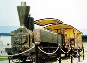
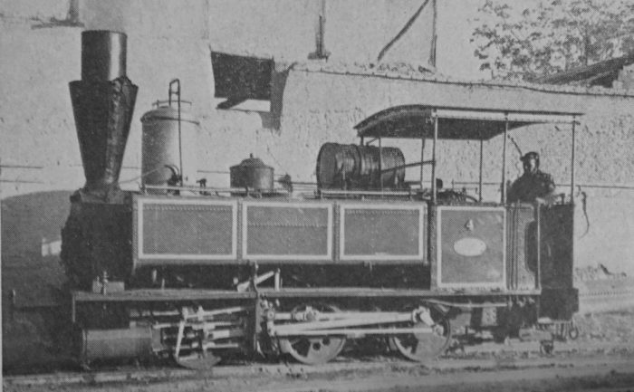
To finish this article here are three further pictures. The first is adjacent to this text and shows another of the locomotives used on the line and displayed on a plinth in Rey, (c) Alireza Javaheri, used under a Creative Commons Licence. [18]

The second and third pictures (below) show the station building which was the terminus of the old line in Rey. These two pictures are still-frame pictures from a German-produced Video which was made in the early 21st century. [19]

References

  1. M.H. Baker; The Iranian State Railways; in The Railway Magazine, January 1963.
  2. https://www.worldheritagesite.org/connection/Naser+ed-Din+Shah, accessed on 22nd March 2020.
  3. https://en.wikipedia.org/wiki/Diary_of_H.M._the_Shah_of_Persia_during_his_tour_through_Europe_in_A.D._1873, accessed on 22nd March 2020.
  4. Sidney J. A. Churchill, Memo, at the Shah’s Camp, 27 August 1888, enclosure in no. 13, Sir Henry Drummond Wolff to the Marquis of Salisbury, Gulahek [Golhak], 10 September 1888, FO 539/40 (Confidential 5755). Memo entitled: “Memorandum on Persian Railways”, p16 and quoted in reference 5. below.
  5. http://www.iranicaonline.org/articles/railroads-i, accessed on 22nd March 2020.
  6. “Acte”: “L’acte de constitution de la société du 17 mai 1887”, Recueil spécial des actes, extraits d’actes, procès-verbaux et documents relatifs aux Sociétés, Brussels, 1887, XV, pp. 865-69, quoted in reference 5. above.
  7. “Concession”, enclosure in no. 58, Sir Henry Drummond Wolff to the Marquis of Salisbury, Tehran, 8 October 1888, FO539/40 (Confidential 5755), quoted in reference 5. above.
  8. Otlet à Barbanson, 3 Juin 1887 (copie), Archives Générales du Royaume, Brussels, Fonds Otlet, liasse 4, quoted in reference 5. above.
  9. Albert Houtum-Schindler, “Persia,” Encyclopaedia Britannica, XXXI, 1902 (10th ed.), pp. 617-627.
  10. Baron E. Beyens, Commerce et industrie de la Perse, Brussels, 1898.
  11. Rapport”: “Société Anonyme des Chemins de Fer et Tramways en Perse, Assemblée générale du 4 juin 1888: Rapport,” Archives du Ministère des Affaires étrangères de BelgiqueBrusselsdossier 2889 II (1887-1908), quoted in reference 5. above.
  12. Ḥamida Amāni, “Farār az čarḵ-a-ye nābudi: Eḥyā-ye baqāyā-ye māšin dudi-e ḵ-aṭṭ-e āhan-e Tehrān Šāh ʿAbd-al-ʿAẓim,” Hamšahri, 25 Bahman 1383 Š./13 February 2005, available online, accessed on 22nd March 2020.
  13. https://www.internationalsteam.co.uk/trains/iran01.htm, accessed on 22nd March 2020.
  14. http://www.farsinet.com/tehran, acccessed on 22nd March 2020.
  15. https://en.wikipedia.org/wiki/History_of_rail_transport_in_Iran, accessed on 22nd March 2020.
  16. https://www.sinfin.net/railways/world/iran.html, accessed on 19th March 2020.
  17. http://www.museedelaporte.be/patrimoine/?p=1655&pdf=1655, accessed on 25th March 2020.
  18. https://commons.wikimedia.org/wiki/File:Old_steam_locomotive_in_Rey.jpg; https://web.archive.org/web/20161104221645/http://www.panoramio.com/user/1317158, accessed on 26th March 2020.
  19. DW Documentary; https://youtu.be/lqSoLVkYYu0, accessed on 25th March 2020.