Category Archives: Rack Railways

Genoa Rack Railway – Ferrovia Principe Granarolo Genova

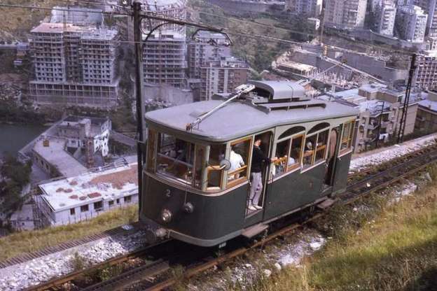
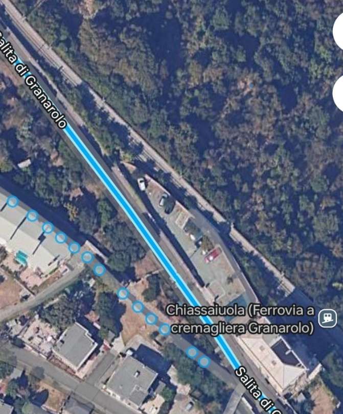
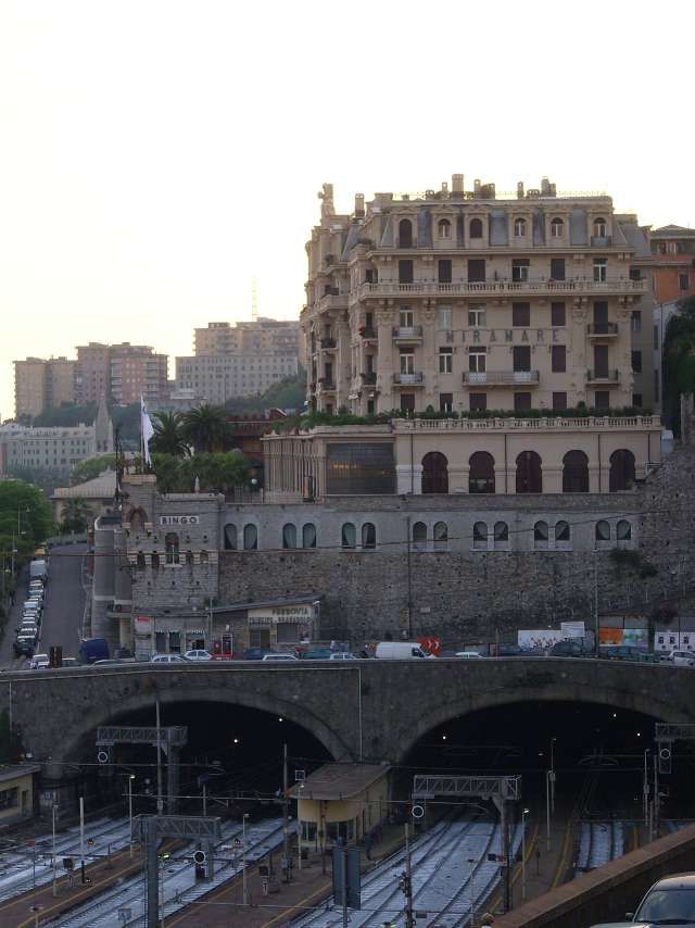
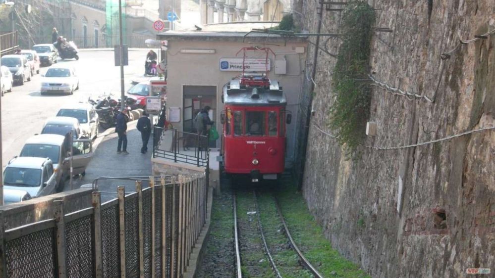
The Principe–Granarolo rack railway (Ferrovia Principe-Granarolo) is a rack railway that connects Via del Lagaccio, near the Genoa Piazza Principe railway station, to the Granarolo hills. The line is sometimes erroneously described as a funicular.  The line is managed by AMT Genova, which manages the city’s public transport. [1]

The route of the Ferrovia Principe Granarolo, © Arbalete and authorised for reuse under a Creative Commons Licence (CC BY-SA 2.0). [1]

Work on the Principe–Granarolo rack railway started in 1898, and operation commenced in 1901. The line’s unusual track gauge and passing loop arrangement, both common in funiculars but rare elsewhere, have suggested to some that the line may have started life as a funicular and been converted to rack operation; however the line’s owners have dismissed this theory. [1][2][3]

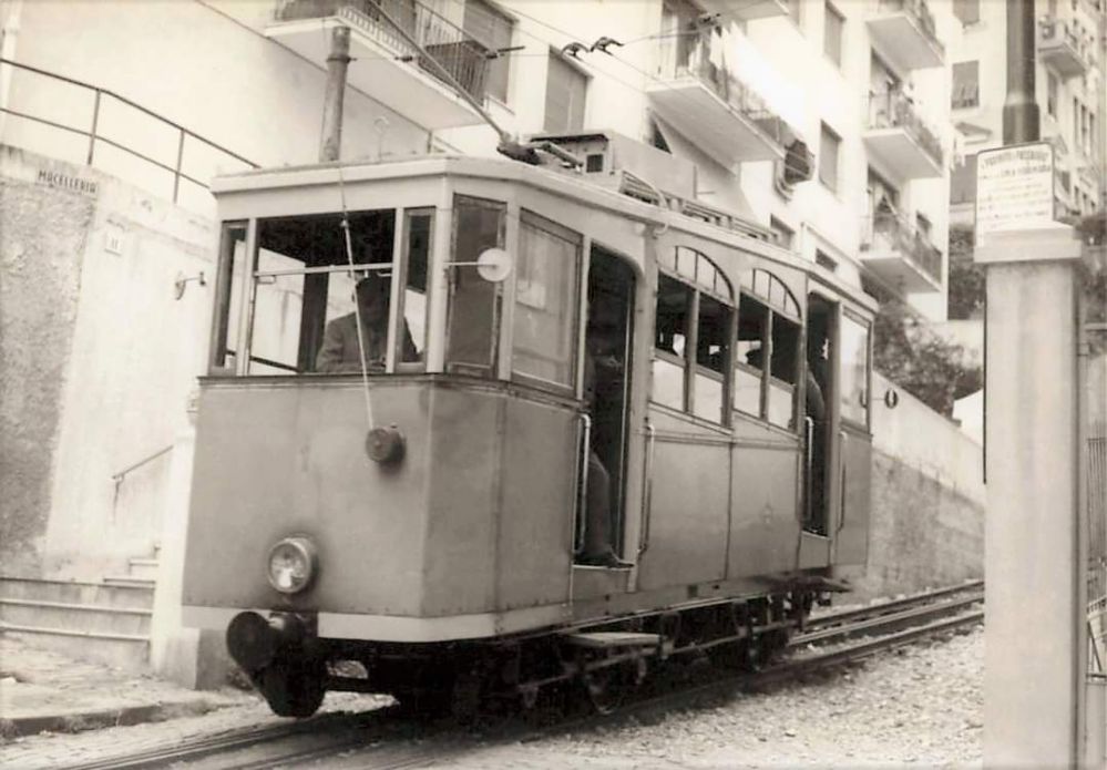
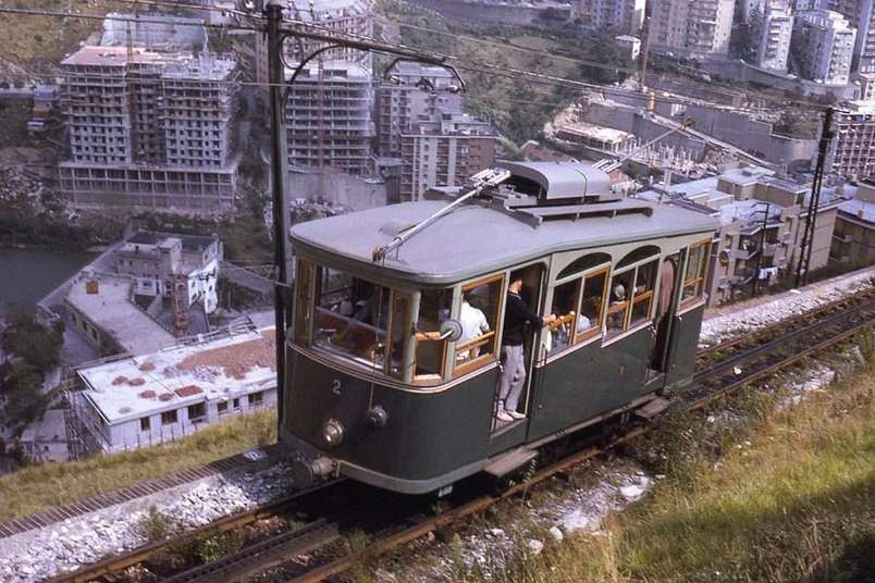
The line’s cars were totally rebuilt in 1929, with new body and mechanical equipment, and the line was rebuilt in 1976. [1][3]

Car No. 1 (circa 1950) in a relatively dilapidated condition, © Public Domain. This image was shared on the Ferrovia Principe Granarolo Genova Facebook Page on 22nd June 2022. [7]
Car No. 2 close to the top of the line, possibly in the 1940s, © Public Domain. This image was shared on the Ferrovia Principe Granarolo Genova Facebook Page on 22nd May 2022. [8]

In 2002, Car 2 was sent away for an overhaul, but the bankruptcy of the original contractor and the involvement of a replacement in an alleged bribery scandal meant that the overhaul was not completed and the car returned to the line until March 2019. The overhaul included the replacement of the car floor, lighting, safety systems, electric drive, air conditioning and a new driver’s seat. Between 2002 and 2019, service was provided by Car 1 operating alone. AMT now plans to use the rebuilt car to double the service frequency to every 15 minutes. [1][4]

In November 2024, AMT Genova were undertaking significant maintenance work and the line was closed. On 8th November, they explained that the rack railway was “temporarily down due to an electrical problem with the motor of the upstream traction axle. The restoration activities have already started. Updates on the resumption of service will follow. … During rack downtime, the G1 replacement bus is active.” [5]

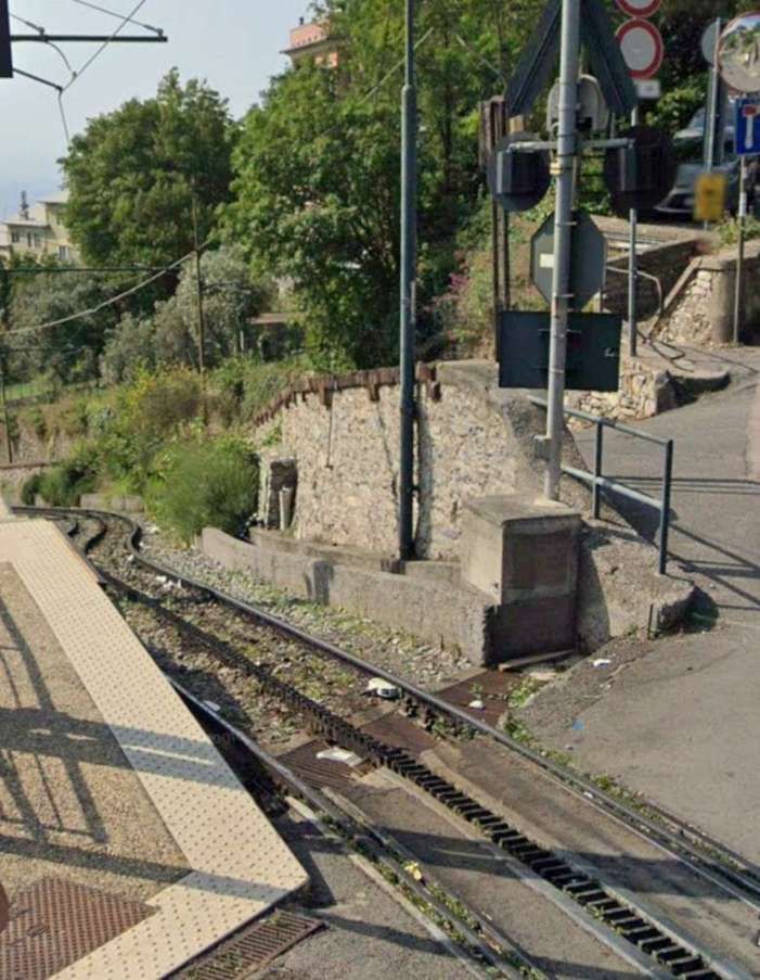
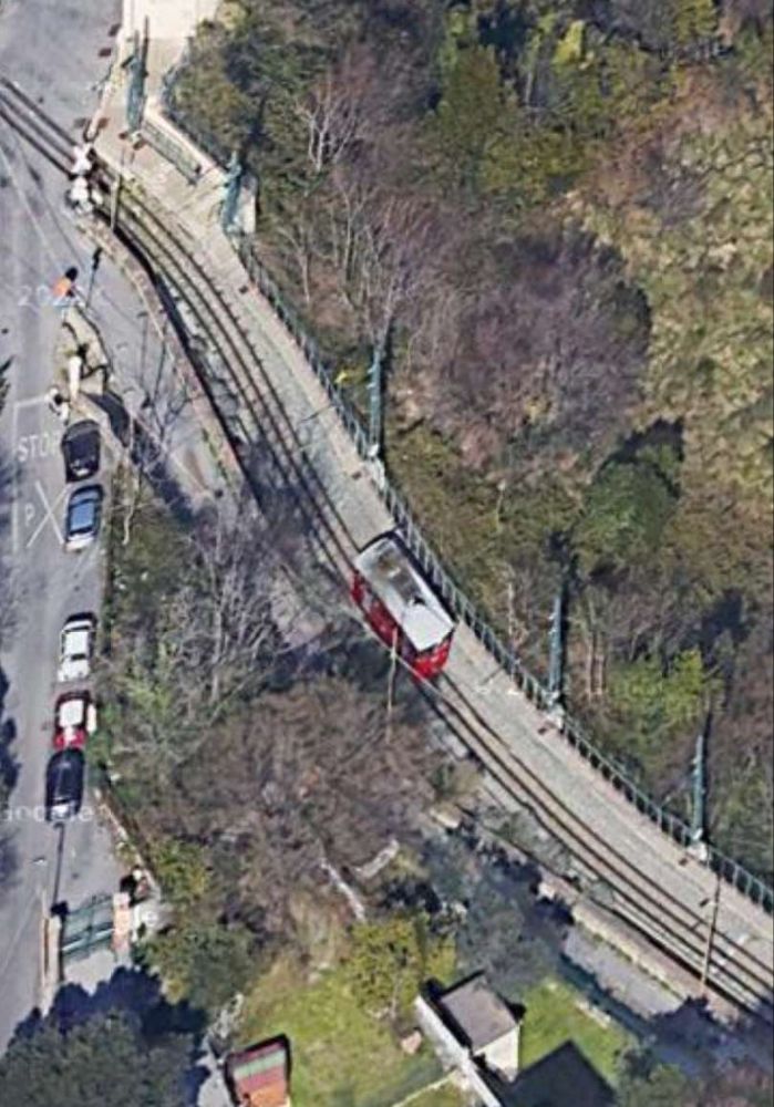
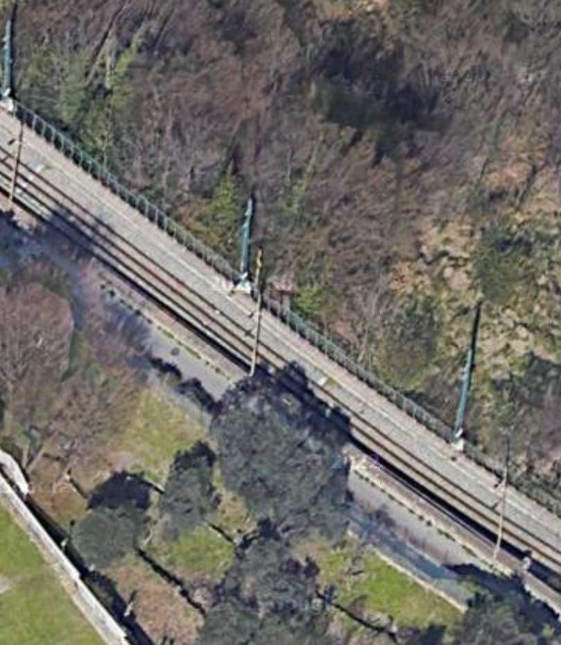
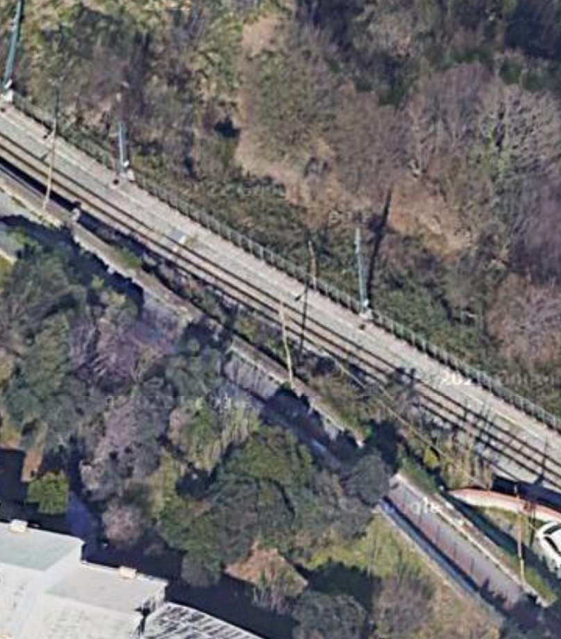
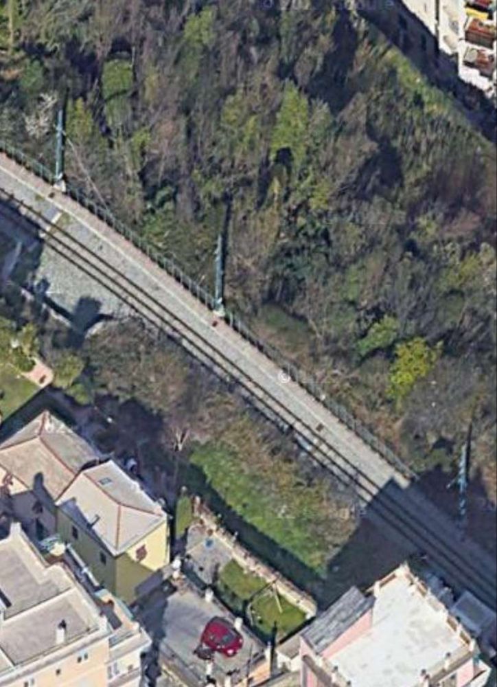
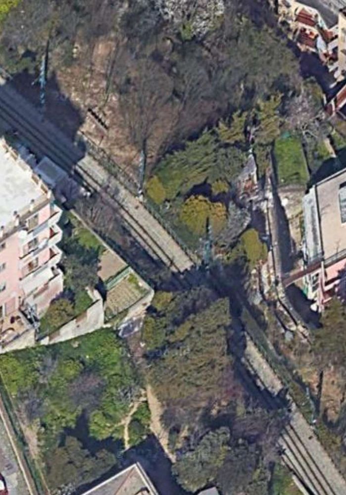
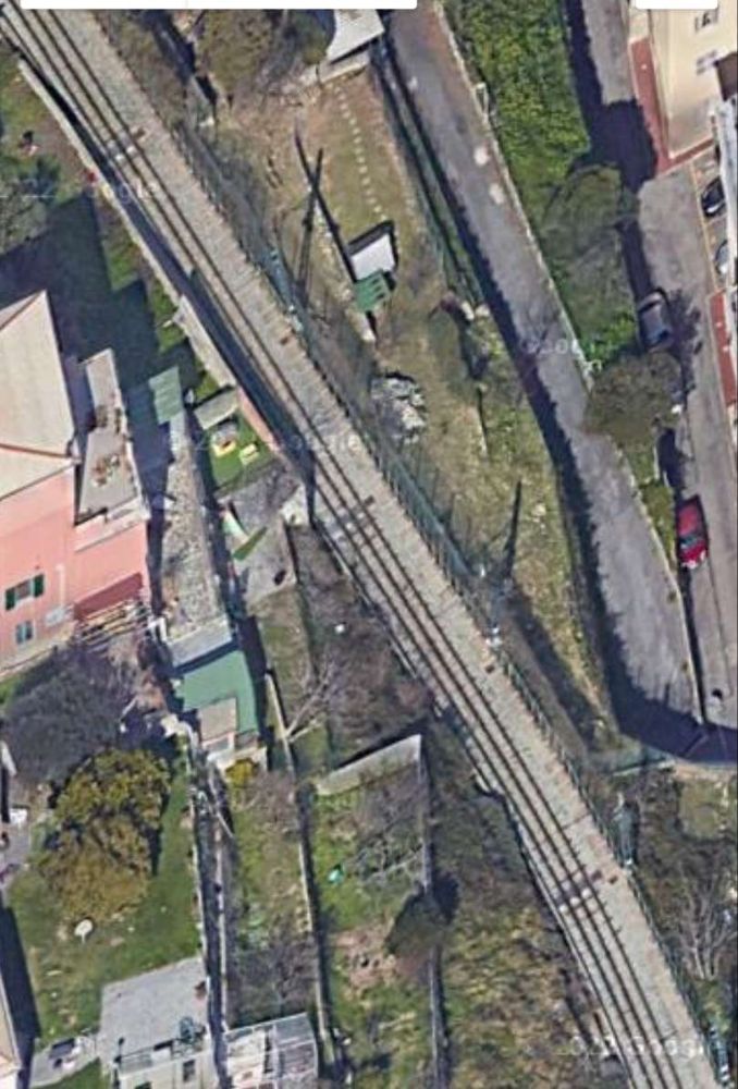
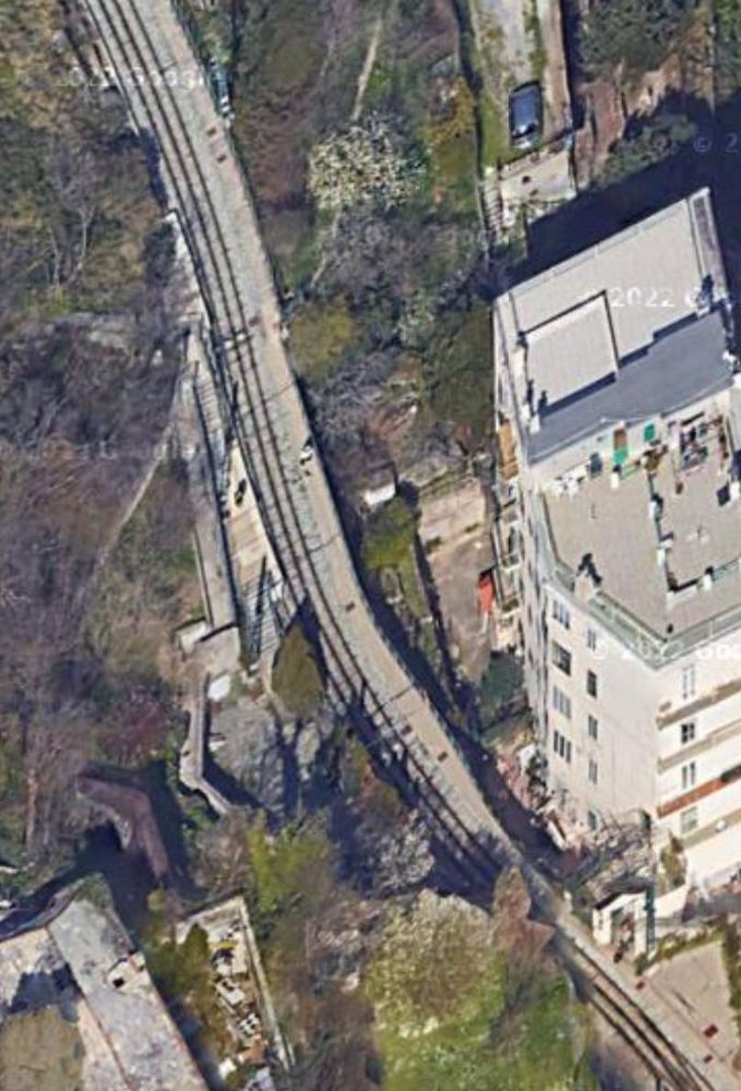
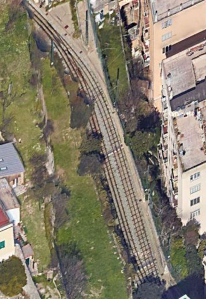
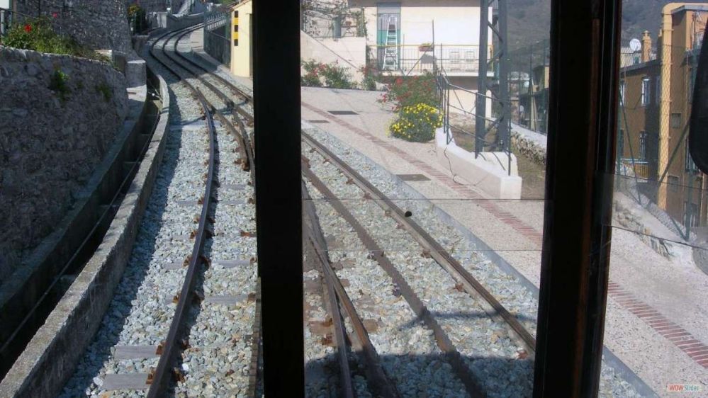
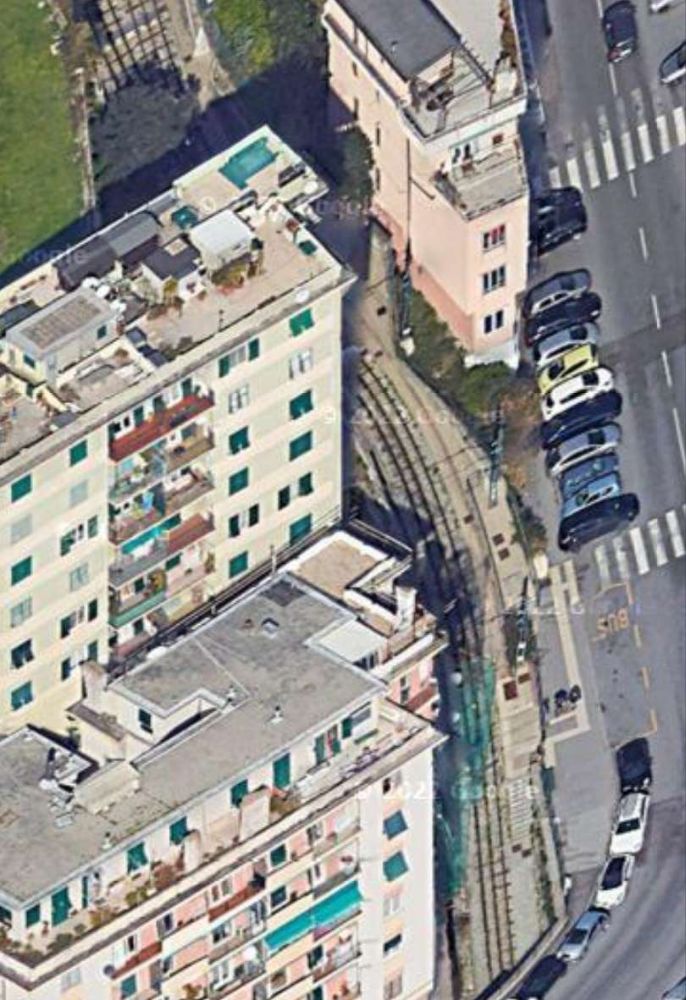
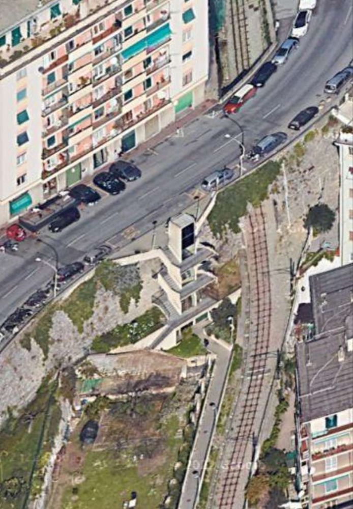
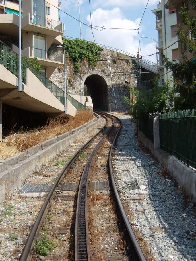
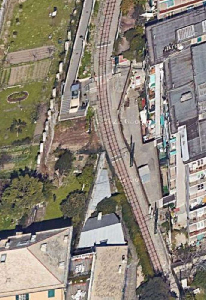
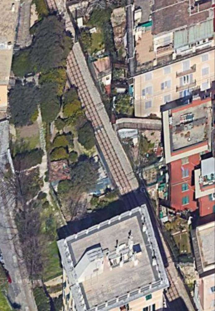
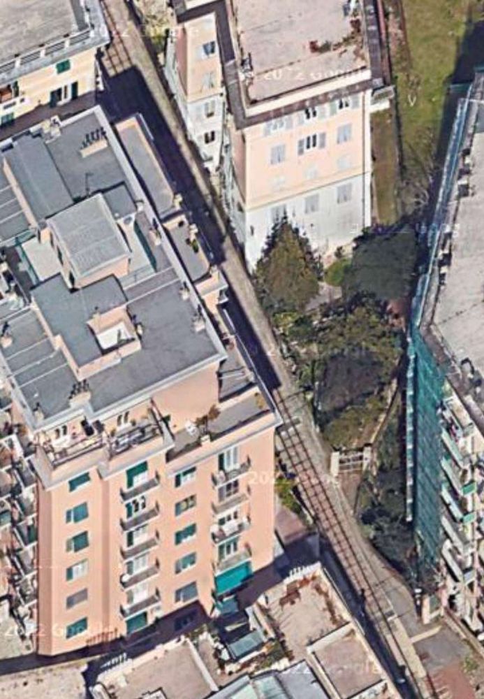
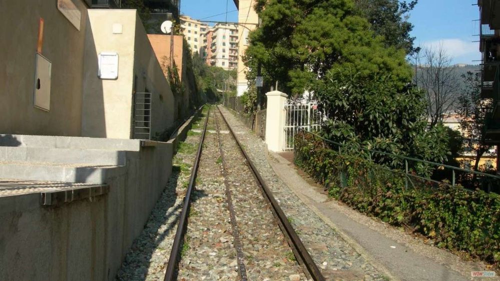
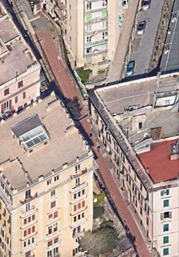
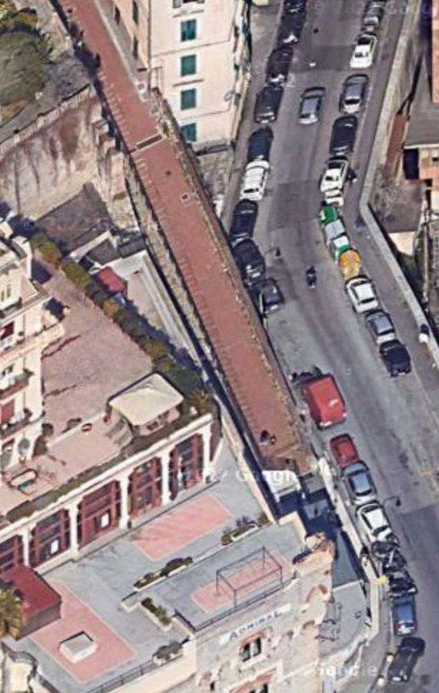
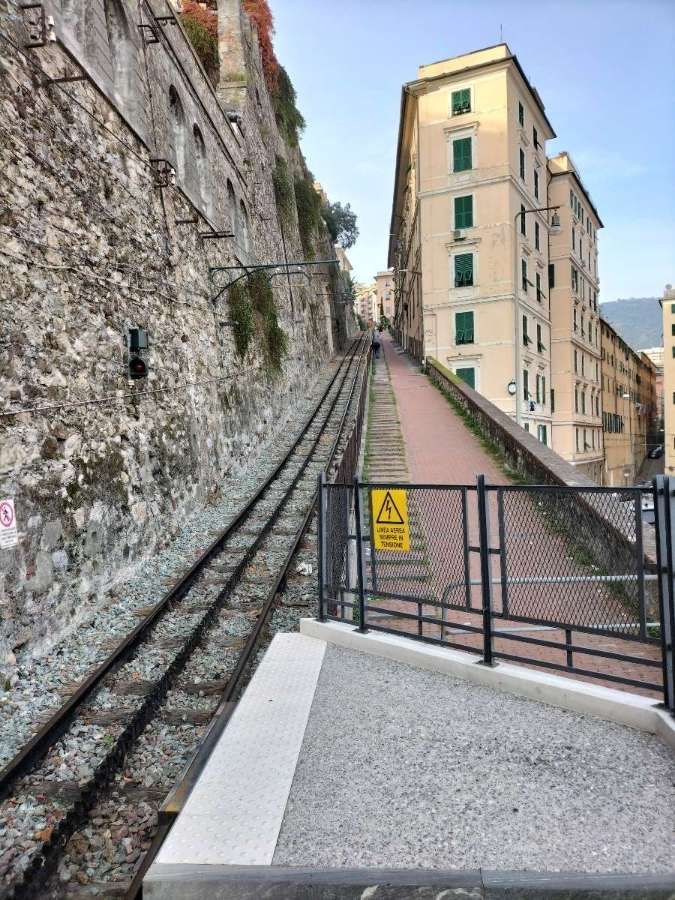
Built to 1.2 metre-gauge, the rack railway is 1,130 metres (3,710 ft) in length, and rises 194 metres (636 ft) with a maximum gradient of 21.4%. It uses the Riggenbach rack system and is electrified at 550 V DC. The single central passing loop uses fixed points, and the two cars have double-flanged wheels on one side and unflanged wheels on the other side, thus ensuring that each car keeps to its own side in the loop. [1][2]

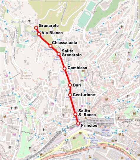
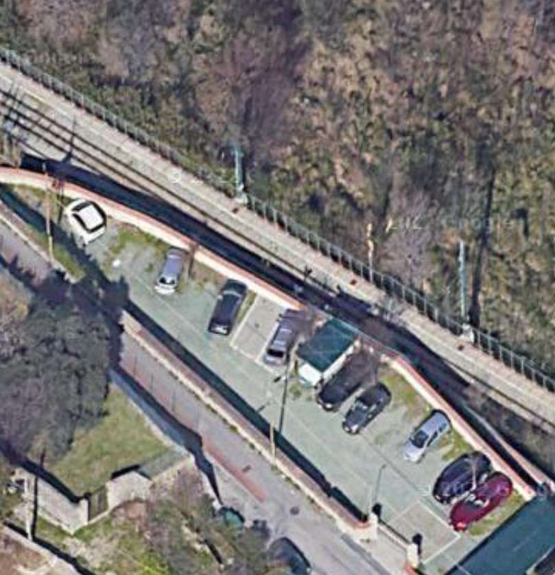
The line serves 9 stops, including the two terminals, and, until the closure in early November 2024 for maintenance work, it operated an irregular timetable, with cars departing each terminus between every 30 and 40 minutes. [6]

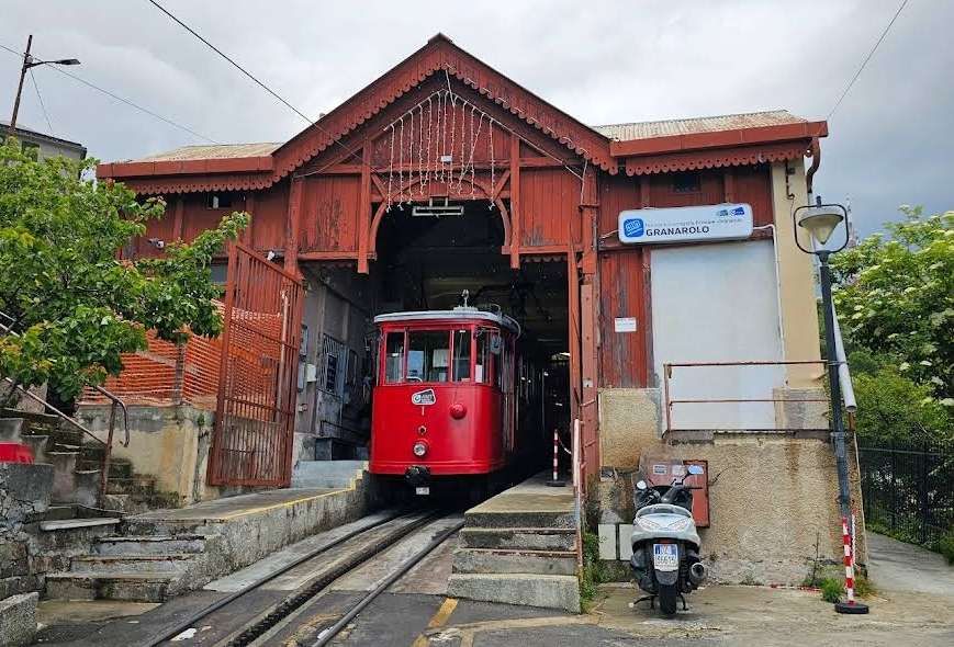
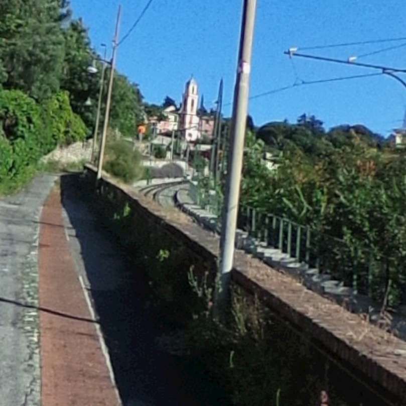
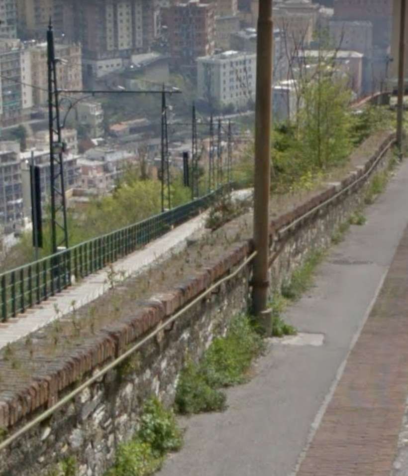
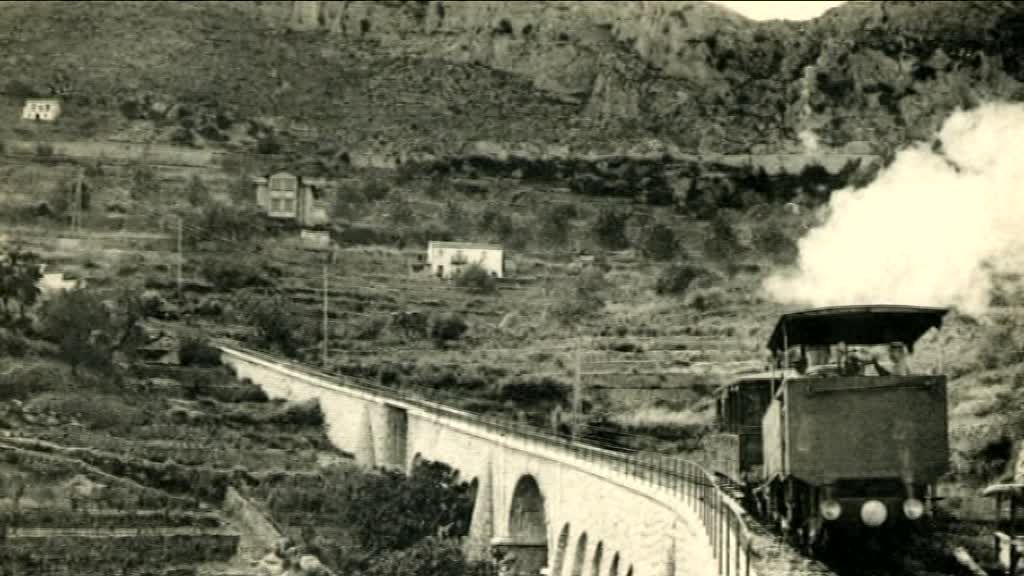
A Journey Down the Line

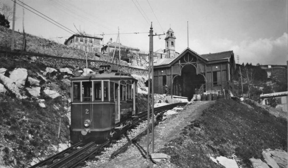
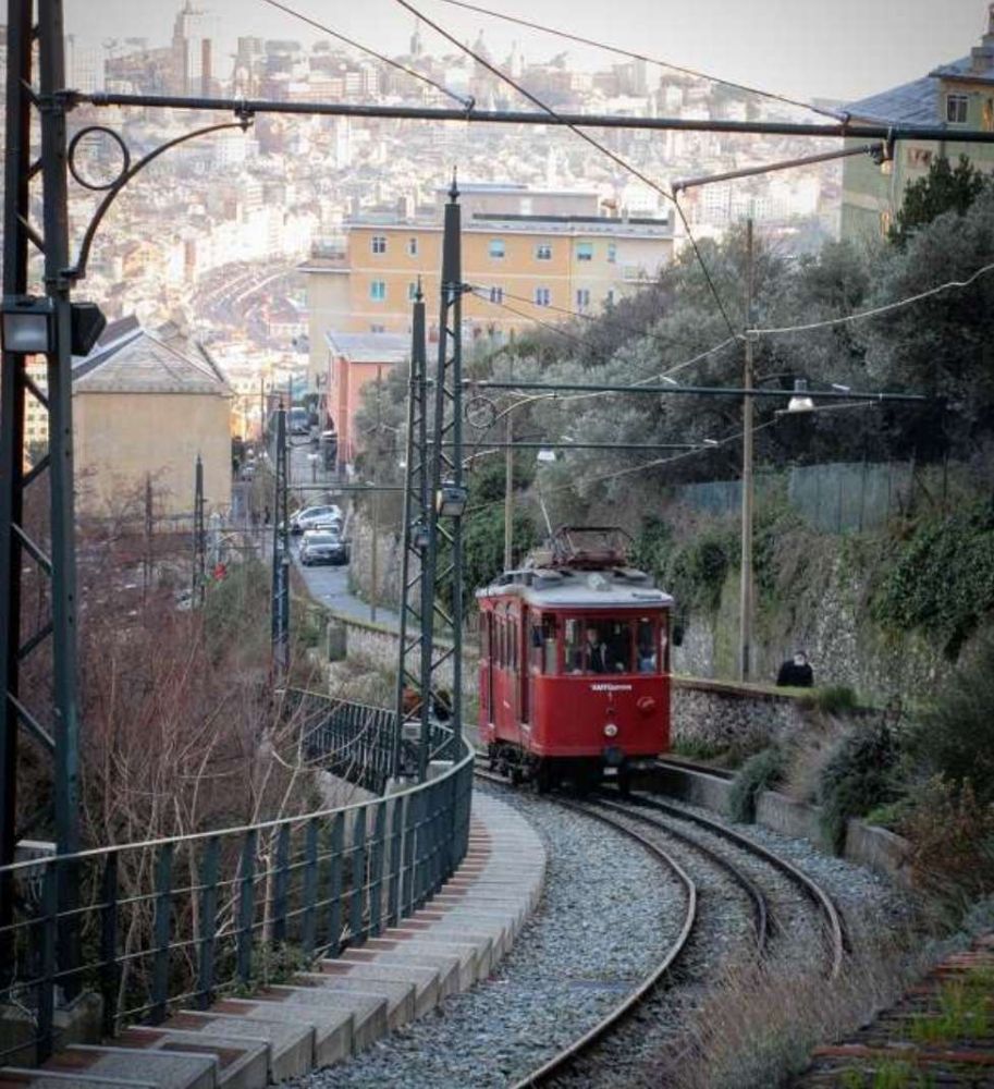
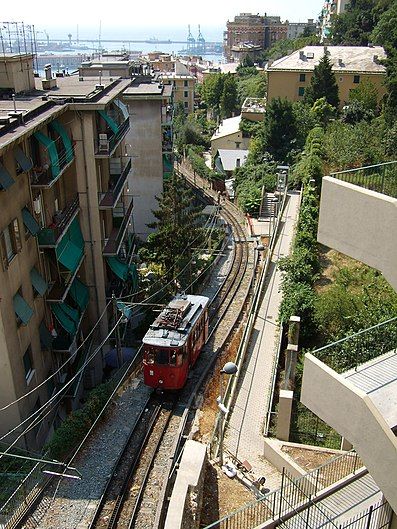
We start at the head of the line at Granarolo. The first photograph shows Car No. 1 resting at Granarolo before its next journey South.

Car No.1 at Granarolo Station, © Jens Stundel (2023). [Google Maps, November 2024]
Google Earth 3D satellite image showing the Granarolo terminus of the railway and the crossing at Via Bartolomeo Bianco. [Google Earth, November 2024]
The view North along the line to Granarolo Station from Via Bartolomeo Bianco. [Google Streetview, May 2023]
The view South along the line from Via Bartolomeo Bianco. [Google Streetview, May 2023]
The line South of the crossing at Via Bartolomeo Bianco. Although downloaded from Google Earth in November 2824, the satellite image must be from before October when trams were running on the northern half of the railway.  [Google Earth, November 2024]
Just a hundred metres or so down the line Car No. 1 runs beside Salita di Granarolo. [10]
The view North from Salita di Granarolo which runs alongside the railway for some distance. [Google Streetview, July 2018]
The view South from the same location. The overhead mast indicates the presence of the railway beyond the low wall which runs diagonally across the photograph. [Google Streetview, April 2019]
The line continues Southeast alongside Salita di Granarolo. [Google Earth, November 2024]
The route of Salita di Granarolo and the railway begin to diverge. [Google Earth, November 2024]
The Salita di Granarolo and the railway are separated by the parking area for the building which sits between the railway and the road on the next satellite image. [Google Earth, November 2024]
A footpath links Salita di Granarolo to the railway at the location of Chiassaiuola Halt which was at the rear of the building which dominates this next satellite image. [Google Earth, November 2024]
The Salita di Granarolo (in blue) drops away to the South as the line runs Southeast through Chiassaiuola Halt seen on the right of this satellite image. [Google Maps, November 2024]
The line continues Southeast of Chiassaiuola Halt. [Google Earth, November 2024]
It then begins to turn to a more southerly direction. [Google Earth, November 2024]
The drift round towards the South continues as the line drops down the hillside. [Google Earth, November 2024]
A slight S-bend brings the line to the crossing point. The points at the North end of the loop can be seen bottom-right of this satellite image. [Google Earth, November 2024]
Car No. 2 close to Cambiaso Halt in 1969, © Public Domain. [12]
The passing loop/crossing point. [Google Earth, November 2024]
The driver’s view North from the crossing point. [10]
The line South of the crossing point runs almost due South alongside Via Bari. [Google Earth, November 2024]
The line is bridged by Via Bari and continues southward towards the Southern terminus at Principe. [Google Earth, November 2024]
The Ferrovia Principe Granarolo seen from Via Bari, with car 1 descending towards Principe, © Arbalete and authorised for reuse under a Creative Commons Licence (CC BY-SA 3.0). [1]
The bridge that carries Via Bari over the railway. This image also gives a good view of the original Riggenbach rack system used on the line, © Arbalete and authorised for reuse under a Creative Commons Licence (CC BY-SA 3.0). [12]
A short distance to the South of Via Bari the line drifts towards the South-southeast. [Google Earth, November 2024]
Google Maps shows the majority of the remaining length of the railway as contiguous with Salita San Rocco the annotation does not appear on Google Earth. [Google Earth, November 2024]
The approach to the Halt (Salita San Rocco) the pedestrian gateway which is in the bottom right of this image appears prominently adjacent to Car No. 1 in the photograph of the Halt below. The image immediately below features the wider gateway which sits to the North of the pedestrian gateway.[Google Earth, November 2024]
The view North from a point just to the North of the Salita San Rocco Halt. [10]
Car No. 1 at the Salita San Rocco Halt which was only a short distance from the terminus at Principe, © Walter and authorised for reuse under a Creative Commons Licence (CC BY-SA 2.0) [11]
The Salita San Rocco Halt is at the top of this satellite image. [Google Earth, November 2024]
The terminus of the line directly above the tunnel portal which opens onto Genoa Railway Station. The road alongside the terminus of the line is Via del Lagaccio. [Google Earth, November 2024]
The southern terminus at Principe sits over the tunnels at the West end of Genoa Railway Station, © Alessio Sbarbaro and authorised for reuse under a Creative Commons Licence (CC BY-SA 2.5). [12]
Car No 1  at the southern terminus of the line at Principe. [9]
Looking North from the southern terminus at Principe above the western end of Genoa Railway Station. [My photograph, 12th November 2024]

References

  1. https://en.m.wikipedia.org/wiki/Principe%E2%80%93Granarolo_rack_railway, accessed on 10th November 2024.
  2. Funicolare Principe – Granarolo (1); in Funimag. Archived from the original on 2nd June 2019; via https://www.funimag.com/funimag07/GENOVA04.HTM, accessed on 19th November 2024
  3. Funicolare Principe – Granarolo (5); in Funimag. Archived from the original on 2nd June 2019; via https://www.funimag.com/funimag07/GENOVA08.HTM, accessed on 10th November 2024.
  4. Marco Carroza; (June 2019). Car No.2 returns to Genova; in Today’s Railways. No. 282; Platform 5 Publishing Ltd., June 2019, p17.
  5. https://www.amt.genova.it/amt/cremagliera-principe-granarolo-18, (English translation of the AMT website), accessed on 11th November 2024.
  6. Partenze dal capolinea della linea FGR, [Departures from the terminus of the FGR line] (in Italian). AMT Genova. Archived from the original on 2nd June 2019, https://web.archive.org/web/20190602201756/https://www.amt.genova.it/amt/trasporto-multimodale/partenze/?linea=FGR&datagiorno=03%2F06%2F2019&orari=Orari, accessed on 11th November 2024.
  7. https://www.facebook.com/share/p/j1WLKA1gcFyZr3te, accessed on 11th November 2024.
  8. https://www.facebook.com/share/p/YnJLcUzeZ9GzyNkc, accessed on 11th November 2024.
  9. http://www.metrogenova.com/granarolo.asp, accessed on 13th November 2024.
  10. https://www.infogenova.info/da-non-perdere/57-ferrovia-principe-granarolo, accessed on 13th November 2024
  11. https://it.m.wikipedia.org/wiki/Ferrovia_Principe-Granarolo#/media/File%3ATra_le_case_(San_Francisco_a_Zena)_P2060637.jpg, accessed on 13th November 2024.
  12. https://it.m.wikipedia.org/wiki/Ferrovia_Principe-Granarolo, accessed on 13th November 2024.

Monaco to La Turbie Rack Railway (Chemins de Fer de Provence 15)

The first railway in Monaco was completed in 1869 by the French PLM railway company as part of an international route between France and Italy. There were two stations, Monaco and Monte Carlo. The PLM company became part of SNCF in 1938.

In 1893, a metre-gauge rack railway was constructed to connect Monaco with La Turbie, a medieval village perched on the hills above Monaco. There were a number of different schemes considered before the final version was agreed. These can be seen on the sketch plan which has been provided on http://cremallierturbie.canalblog.com%5B1%5D.

The first scheme was proposed in 1882. The line was promoted by Amédée Brousseau with financial backing from a Parisian banker, Eugene Hubert. The planned line left Moneghetti district on the northern border of the principality and travelled straight up the valley of Sainte-Dévote, with a stop at Le Cros. It would have been 1,860 metres long with one tunnel of 100 metres in length and a viaduct of 60 metres in length (with 5, ten-metre arches), crossing the valley at a height of 8 to 10 m . The costs were estimated at 950,000/1,000,000 francs.[1]

The mayor loved the scheme and it was accepted at the end of 1882 by the local authorities. On 11th April 1883, a public inquiry was ordered.On 16th July 1883 the municipality of La Turbie granted a concession to the Compagnie du Chemin de Fer à crémaillère d’intérêt local de Moneghetti-Monte Carlo à la Haute-Turbie. However, the military authorities opposed the rout and suggested an alternative on the left bank of the River Sainte-Dévote which was 500 metres longer.

The project was reviewed, and in 1884 a second project was proposed, leaving Monegasque and running along the Carnier plateau, along the side of the Mont des Mules, with a halt at Bordina to end 250 metres east of La Turbie. Teh costs were considerably higher: 1,600,000 francs. This route was agreed on 30th July 1884 and the concession was granted on 31st May 1885.  Before work commenced, the banker, Eugene Hubert went bankrupt.

His partner, Brosseau, contacted a new banker, Abel Neveu and the new company (Compagnie du chemin de fer d’intérêt local à crémaillère de La Turbie ou le Righi d’hiver) was formed with statutes being deposited on 22nd December 1886. The company was based in Basel. The board was made up of Swiss and Alsatian financiers and industrialists including the locomotive manufacturer Koechlin, and the Swiss engineer Nicolas Riggenbach who invented the rack railway traction system.

The new company was beset with problems, not the least of these being a series of disputes between Brosseau and the other directors. In 1889, before any work commenced, Brosseau withdrew from the company. On 21st June 1889, the company was dissolved and stripped of its concession.[1]

The saga continued. On 13th February 1891 the engineer, Charles Lornier requested a concession, but the Municipality of La Turbie favoured the earlier applicants and on 9th March 1891 a new company was formed by former shareholders, Compagnie du chemin de fer d’intérêt local à crémaillère de La Turbie (Righi d’hiver). Its head office was in La Turbie and it succeeded in getting a public inquiry started on 20th November 1891.

In 1892, a Swiss engineer, Mr. Stockalper plotted a new route for a metre- gauge Riggenbach rack-rail line. The specification, including all rails, gradients, locomotives, coaches and wagons was drawn up.The project cost was estimated at 1,400,000 francs – 200,000 francs less than the 1884 project.

Finally, in 1893, the local authorities approved the project and the line was declared of public utility. The engineer for the works was Chatelanat and the contractors were Mombelli, Thus and Crovetto. In December 1893, the first two locomotives, manufactured in the workshops of the Société Alsacienne de Constructions Mécaniques in Belfort, were delivered.[1]

The final route is shown on the map below [2]. The line did not enter the Principality , it terminated on French soil in the suburb of Beausoleil.

At 7.00am on 10th February 1894, the line was opened to its first travellers.[3] Traffic grew steadily until 1920. [4, 5, 6, 7] Electrification projects were envisaged in 1926 and 1929 but they did not come to fruition.[8, 9] The line closed in 1932.

The Company had the following equipment:[10]

  • four 020T steam locomotives , the main feature of which was their design that countered the slope;
  • five passenger cars with 60 seats to 2 classes;
  • two goods wagons.

All items were manufactured in Belfort by Société Alsacienne de Constructions Mécaniques (SACM) [11] and delivered in December 1893.

This blog has a series of pictures of the line at the end of the text, below the poster.

We note for completeness that electric trams came to Monaco in 1898 with a line from the Place d’Armes to Saint Roman. Several other lines followed within the Principality. In 1900, the tram system was connected to that of Nice and in 1903 extended to Menton. It has also been pointed out to me (19th March 2018 by BG1000 on the Passions Metrique et Etroite Forum) that there was a short-lived tramway which used the route of the Funicular.

At the beginning of the 20th century an electric tram service connected the Rue des Iris in Monte-Carlo to the Riviera-Palace Hotel. The lifespan of the service was short – just 10 years from 1903 to 1913. The service became redundant as auto-bus and car usage rose in the period before the Great War. The Riviera-Palace Hotel and the tramway that served it are the subject of a book by Jean-Paul Bacscoul and Jean-Claude Volpi entitled: “Le Riviera Palace: 1897-1904, La Turbie, 1904-1936, Monte-Carlo Superieur- Beausoleil.”[12]

The last trams ran in Monte Carlo and the principality in 1931.

There was a main line station on coast but pressure of land use in the Principality has always been a problem, and in the 1950s a new tunnel was built from the original Monaco station, through the hills behind Monte Carlo, bypassing Monte Carlo station. The latter station was closed and the land occupied by it and the railway released for other uses. In the 1990s, a similar exercise was performed replacing the remaining line through the original Monaco station with a new line and station entirely underground.

There are some great postcard images of the Monte-Carlo to La-Turbie Railway below, after a poster for the La Turbie Line.

As a late addendum: Yves of the Passions Metrique and Etroite! Forum[13] provided this link:

https://photos.google.com/share/AF1QipN1FvO322HUemoyzNSRc5UVwfyKyiRpAzo7Q3Z3XhW3SFg_bYu1sdzVlUznOgns1Q?key=M2RPeFh3SV9WRl9KMTQ3WXlCSDVZV29jVjh1UDRB

There are a lot more images and text relating to the Monaco-La Trurbie line.

References

  1. Un Train de Legende: La Cremaillere de La Turbie; http://cremallierturbie.canalblog.com, accessed 18th March 2018.
  2.  Chemin de fer à crémaillère de La Turbie à Monte-Carlo; Wikipedia; https://fr.wikipedia.org/wiki/Chemin_de_fer_%C3%A0_cr%C3%A9maill%C3%A8re_de_La_Turbie_%C3%A0_Monte-Carlo, accessed 19th March 2018.
  3. Journal des Mines No. 7, 25th February 1894, p6.
  4. Rapports et délibérations : Conseil général des Alpes-Maritimes, Nice, Conseil général des Alpes-Maritimes; September 1914 2nd Ed. p132.
  5. Rapports et délibérations : Conseil général des Alpes-Maritimes, Nice, Conseil général des Alpes-Maritimes, 1916, 2nd Ed. p73.
  6. Rapports et délibérations : Conseil général des Alpes-Maritimes, Nice, Conseil général des Alpes-Maritimes, 1917, 2nd Ed. p74.
  7. Rapports et délibérations : Conseil général des Alpes-Maritimes, Nice, Conseil général des Alpes-Maritimes, 1918, 2nd Ed. p59.
  8. Le Temps Financier; Le Temps, no 259,‎ 2nd May 1932, p2.
  9. Rapports et délibérations : Conseil général des Alpes-Maritimes, Nice, Conseil général des Alpes-Maritimes, 1920, 1st Ed. p149, p211.
  10. Annuaire des Chemins de fer et des Tramways (ancien Marchal) : Édition des réseaux français, Paris, 1928, 43rd Ed. p1334.
  11. Bulletin des lois de la République française, t. 31, Paris, Imprimerie nationale, 1885 “Chemins de fer” p657, p1073-1080, p1980.
  12. Jean-Paul Bacscoul & Jean-Claude Volpi; Le Riviera Palace: 1897-1904, La Turbie, 1904-1936, Monte-Carlo Superieur- Beausoleil.
  13.  See: http://www.passion-metrique.net/forums/viewtopic.php?p=414373#p414373, accessed 22nd March 2018.