
This article follows on from seven other articles which covered the Wellington to Severn Junction Railway and this line from Buildwas to Harton Road Station. The first three articles can be found by clicking on these links:
Wellington to Horsehay [8]
Horsehay to Lightmoor Junction [9]
Lightmoor Junction to Buildwas [10]
The most recent articles cover this line between Buildwas and Harton Road Station and can be found on these links:
Much Wenlock to Presthope [12]
Presthope to Longville-in-the-Dale [13]
Longville Railway Station to Harton Road Railway Station [14]
We noted in the last three articles that from the commencement of the building of the line between Buildwas and Much Wenlock, the directors hoped that the line could be extended to Craven Arms via Presthope on Wenlock Edge (linking with the limestone quarries/works at that location).
The directors of the Wellington & Severn Junction Railway were, however, fully occupied with the line from Wellington to Buildwas. Another company was set up to build the ‘Wenlock & Craven Arms and Coalbrookdale Extension Railway‘. The bill went through the parliamentary process unopposed and authorised the ‘Wenlock Railway Company‘ to construct the line. Work started on 23rd October 1861.
By 5th December 1864, the line was open from Much Wenlock to Presthope. (That length is covered in the last but one online article listed above.) At this time, because it was a freight-only line, the Board of Trade saw no need for an inspection of the line. It had already been agreed at a meeting held on 4th December 1863 not to proceed with the line from Presthope to Craven Arms for the time being. It was to be three years after the line reached Presthope before the connection to the Shrewsbury & Hereford Railway close to Craven Arms was completed. It was finally opened on 16th December 1867.
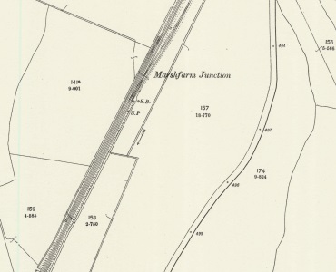
Harton Road Station to Craven Arms
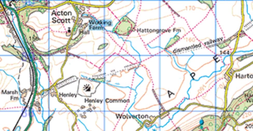
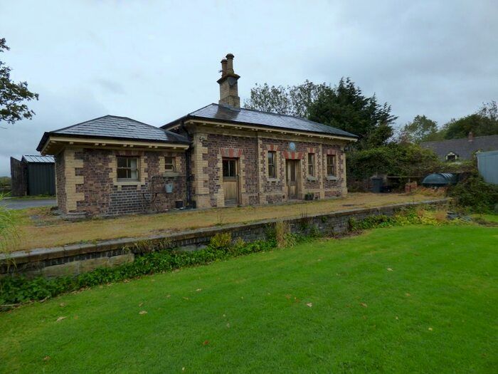
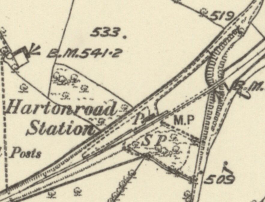
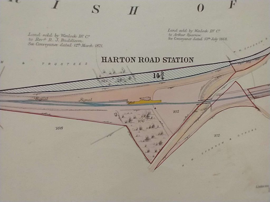
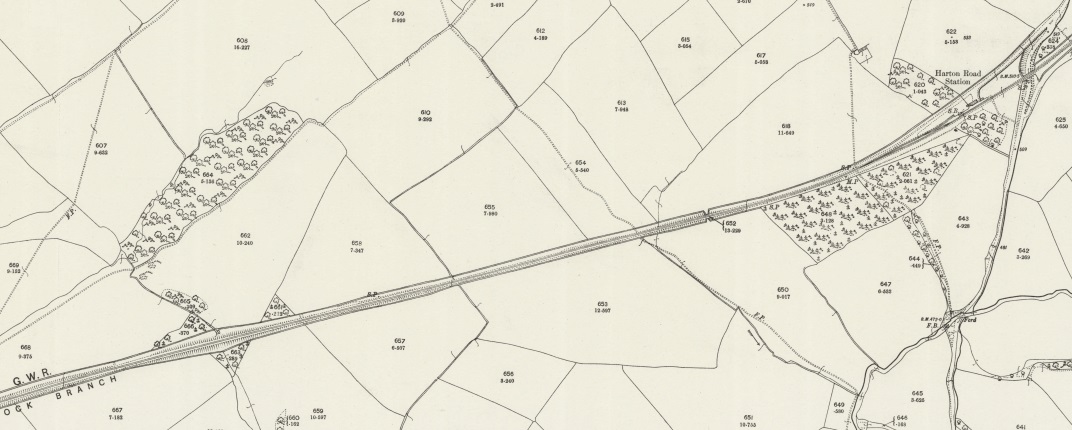
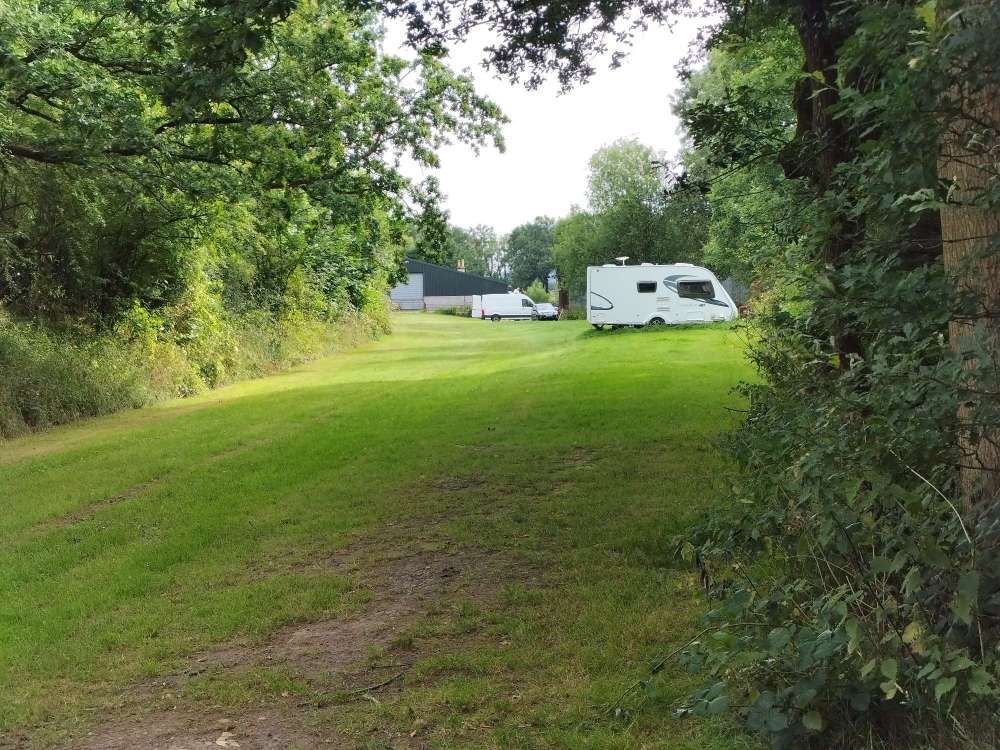
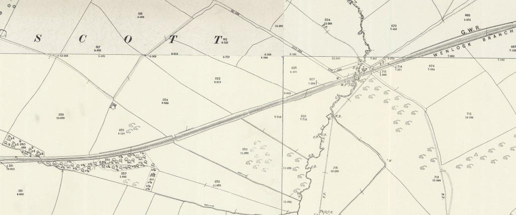
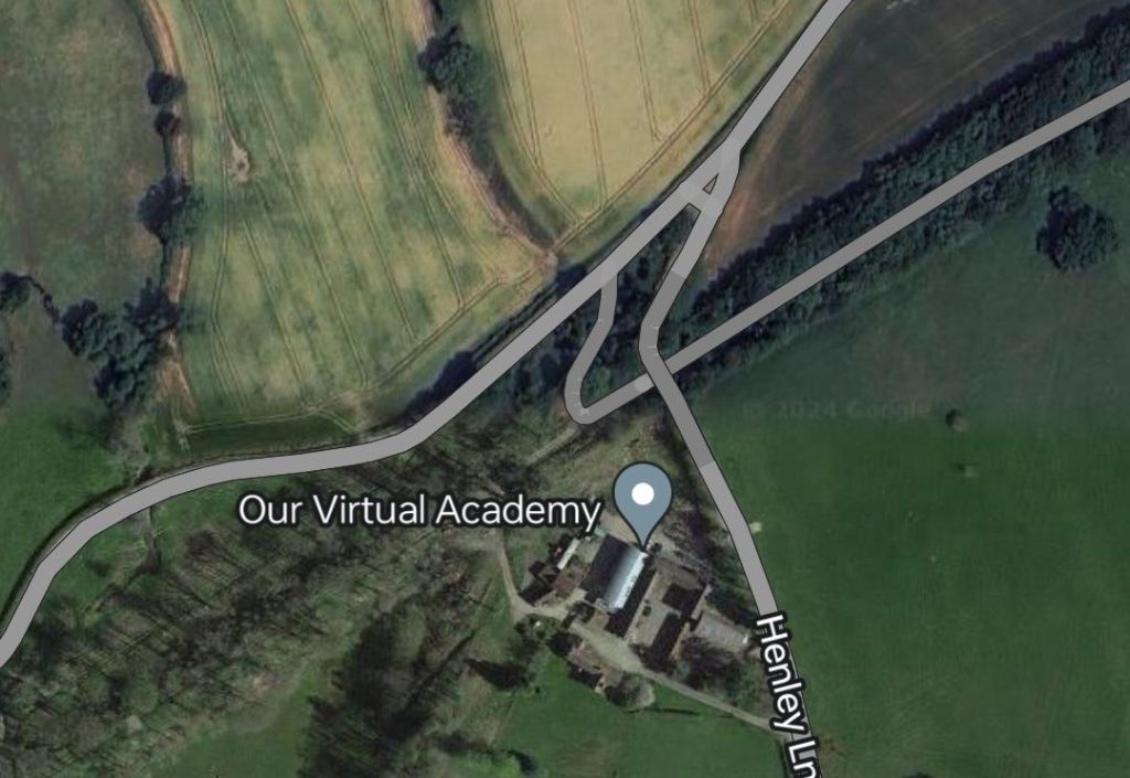
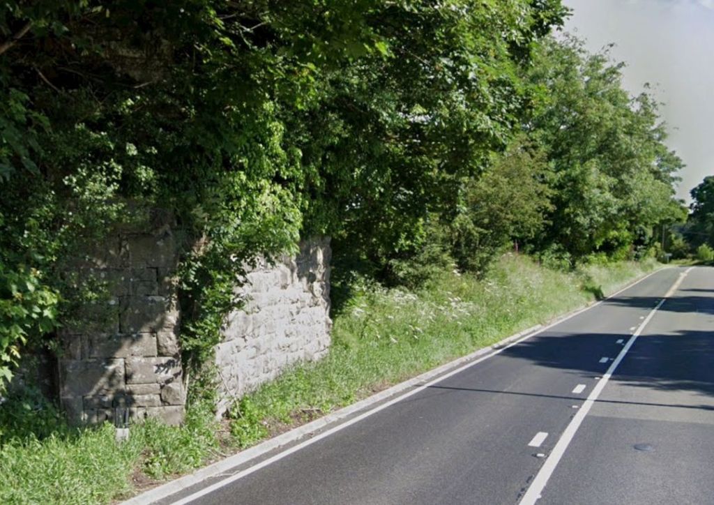
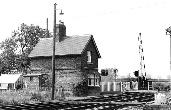
We start our onward journey at Harton Road Station which is now a private dwelling. The station building and platform were on the North side of the line. There was a loop to the West of the passenger facilities which could act as an unloading/loading point for goods or even, possibly, as a passing loop if required.
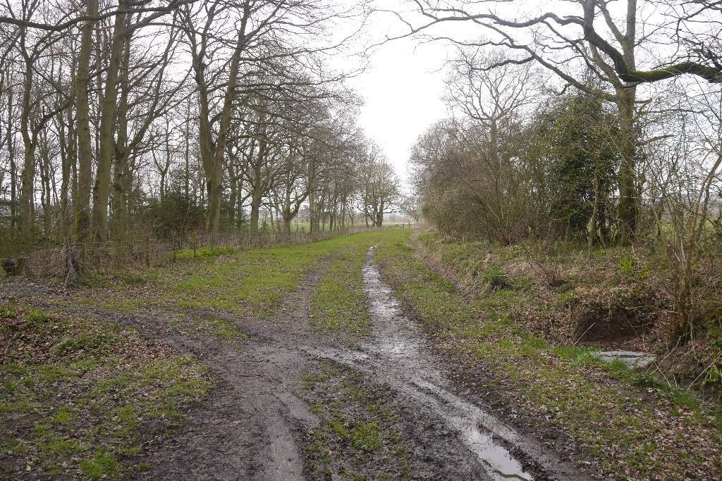
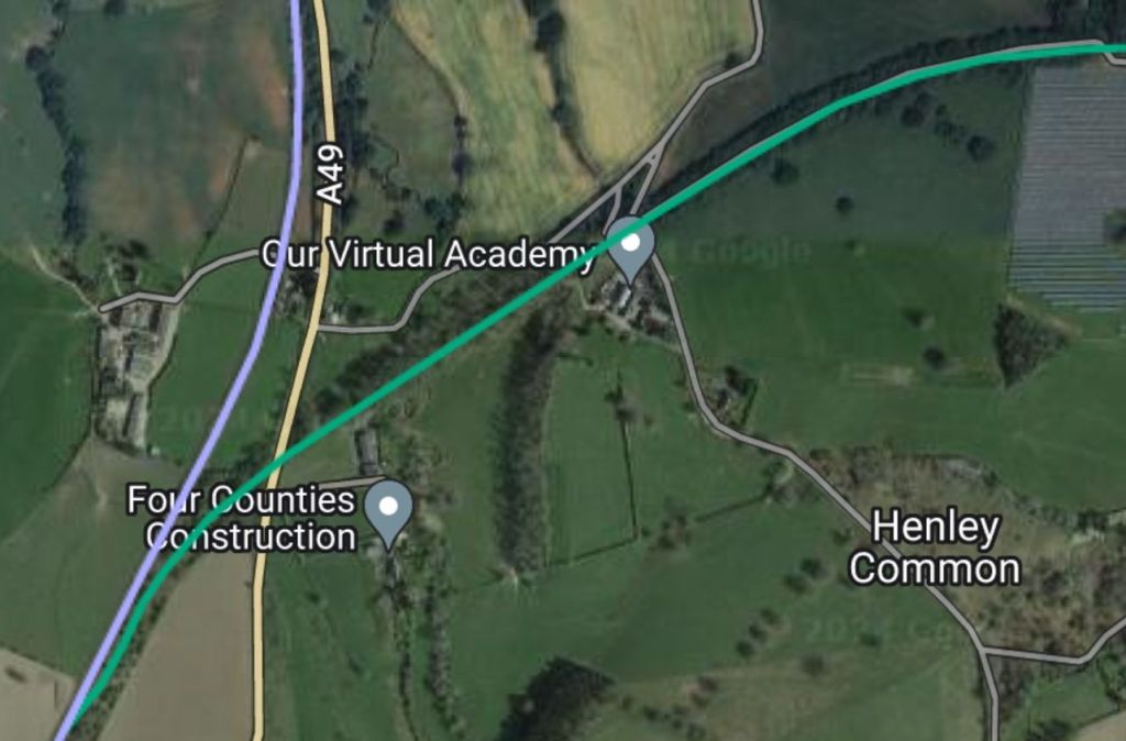
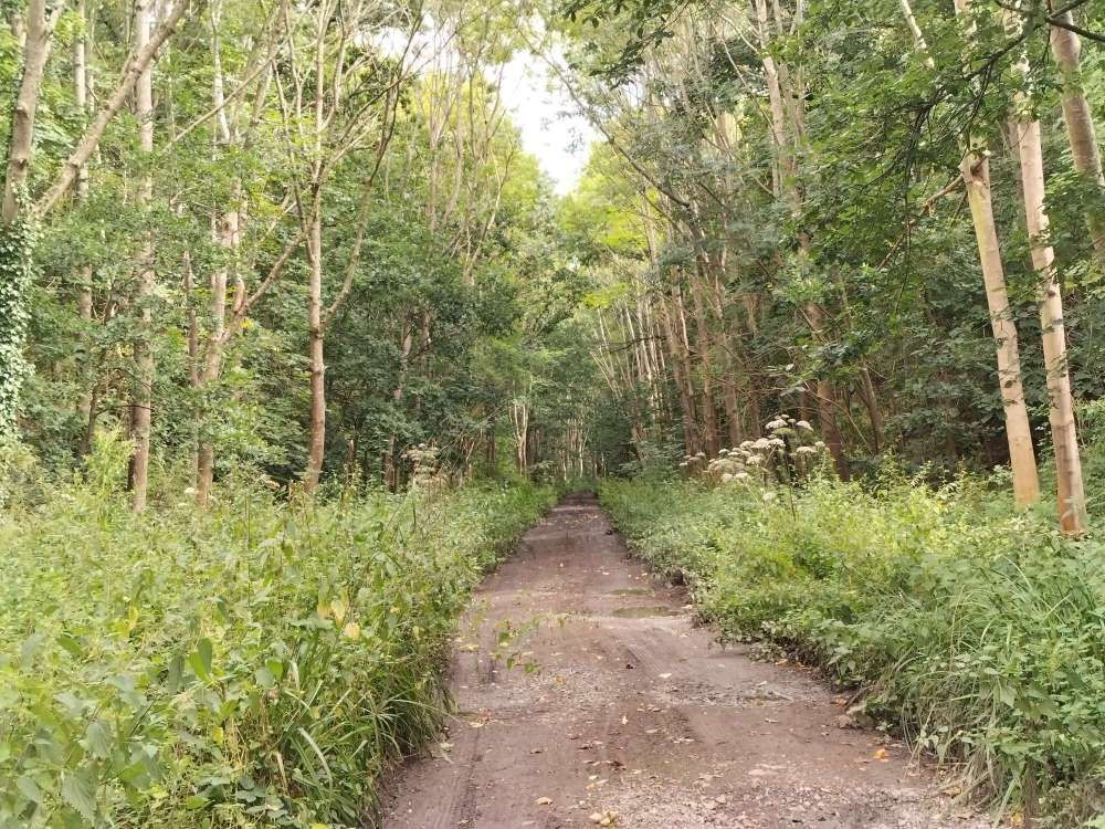
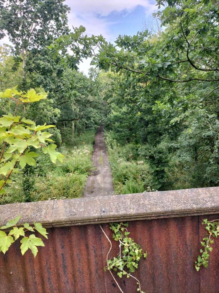
Ken Jones deals with much of the length towards Marsh Farm Junction by telling us that, “Shortly after leaving Harton Road there [was] a long straight stretch across Henley Common, this was once part of the common field system attached to the small hamlet of Henley. Across the common and into a tree-lined deep cutting; as the train weaves in and out of the trees and cuttings between Harton Road and Marsh Farm Junction brief glimpses can be seen of a tower rising well above the trees to the left of the line; this is the well known Shropshire landmark Flounders Folly, a mid-19th century folly. After negotiating its stone staircase tourists would be rewarded with commanding views of the surrounding Shropshire and Border countryside.” [1: p109]
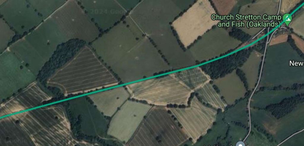
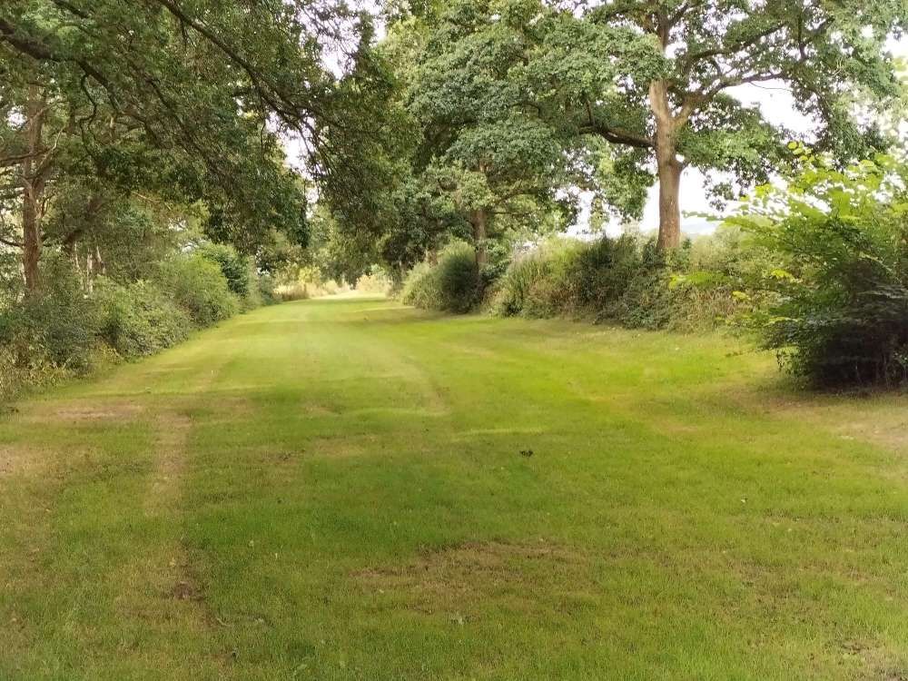
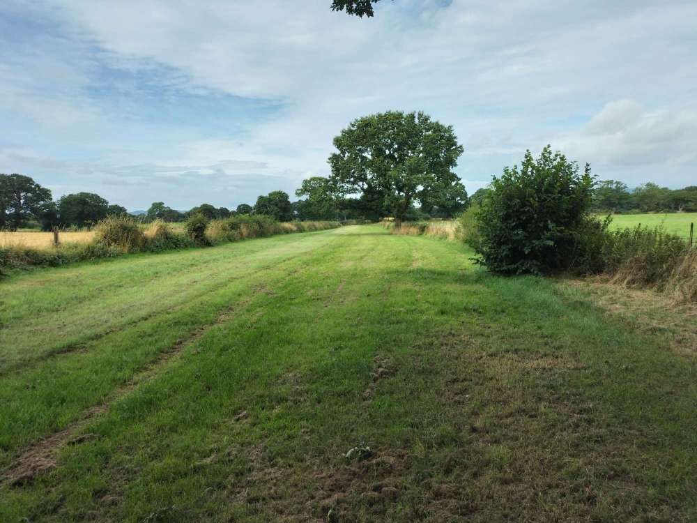
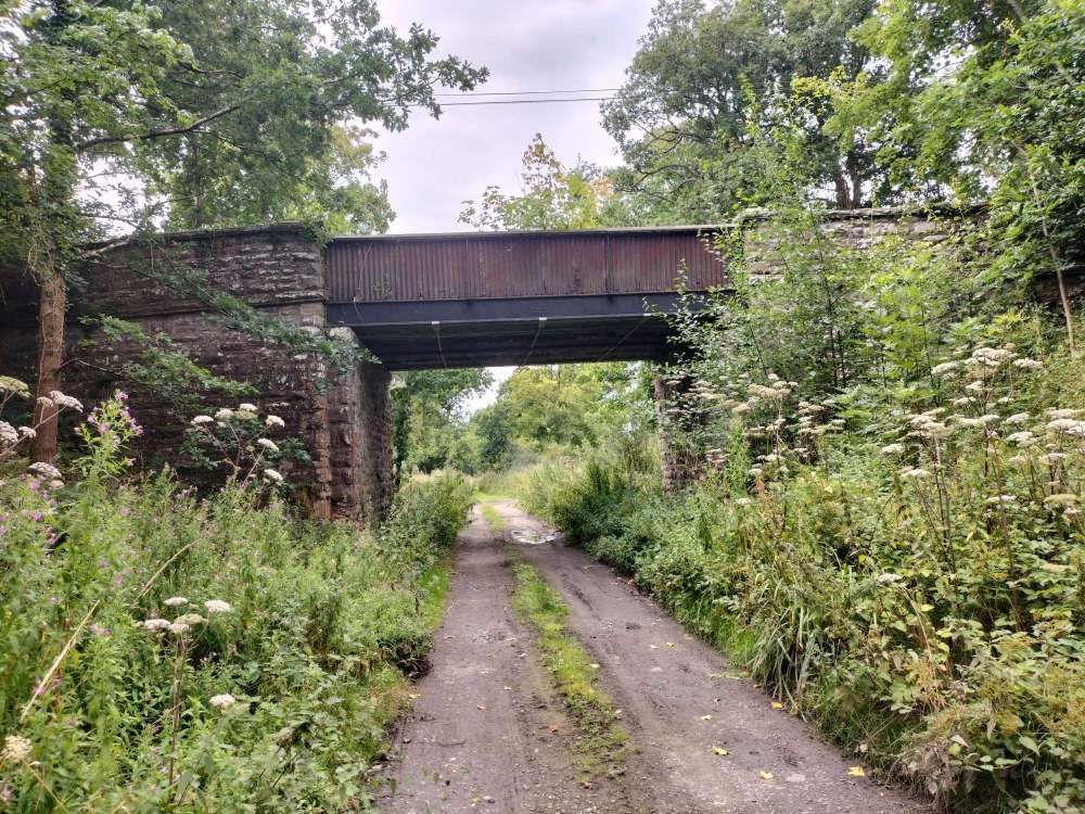
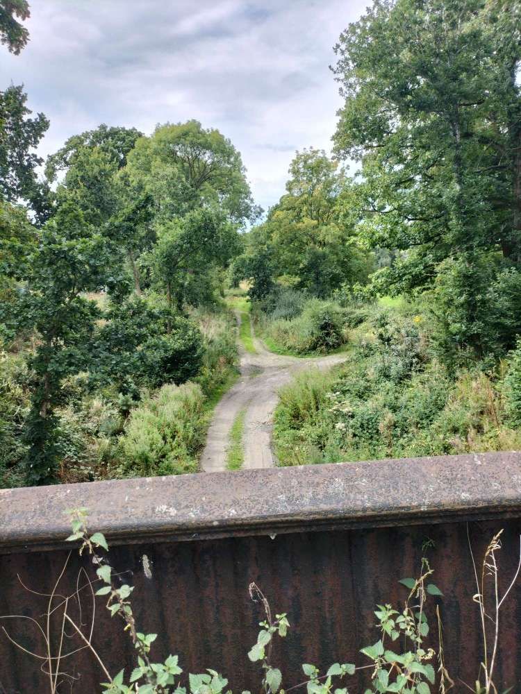
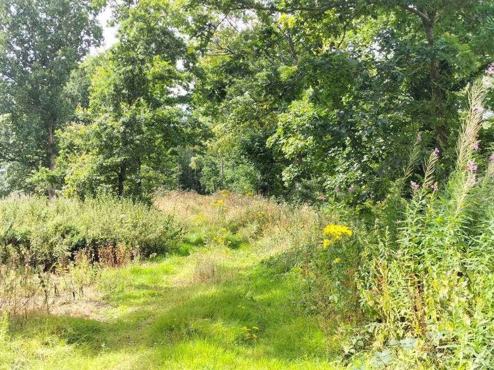
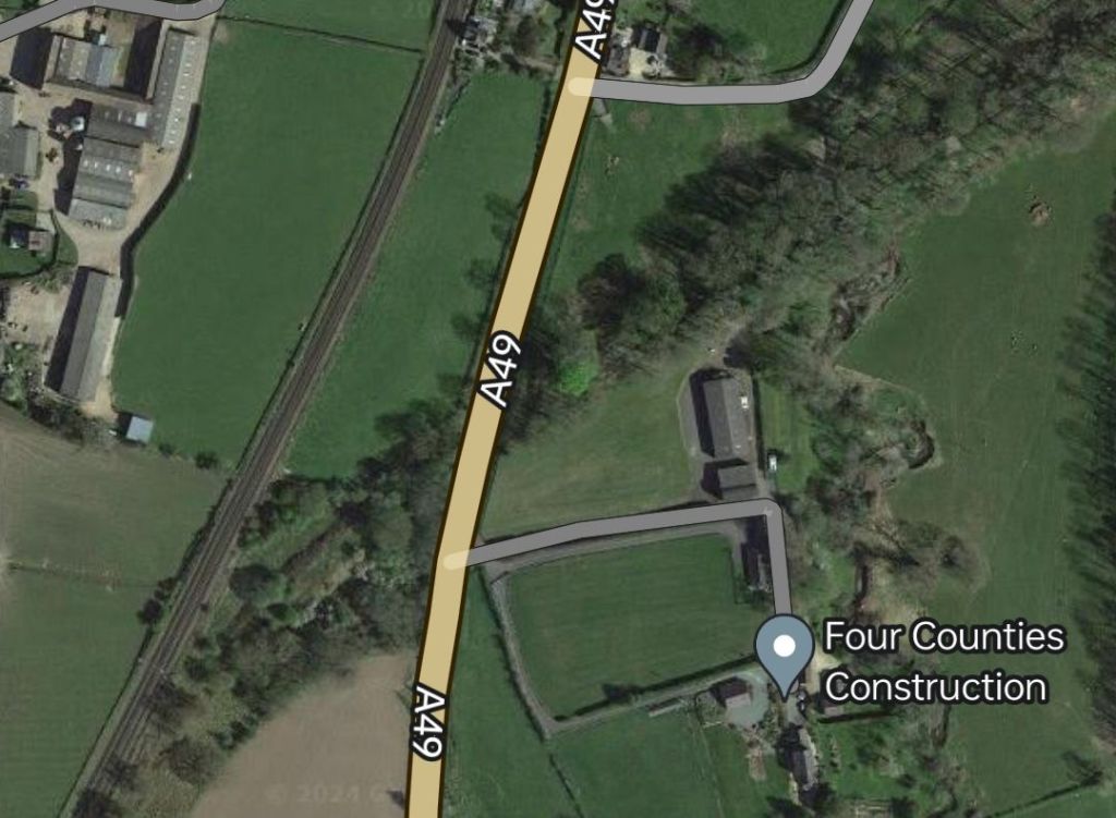
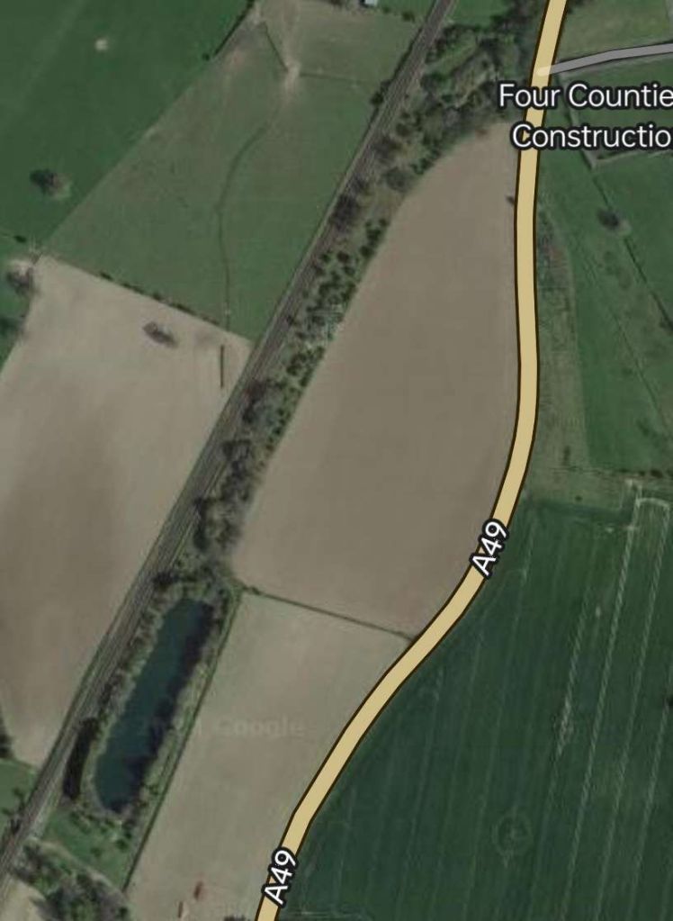
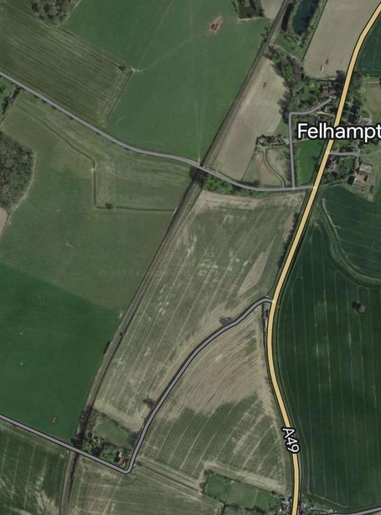
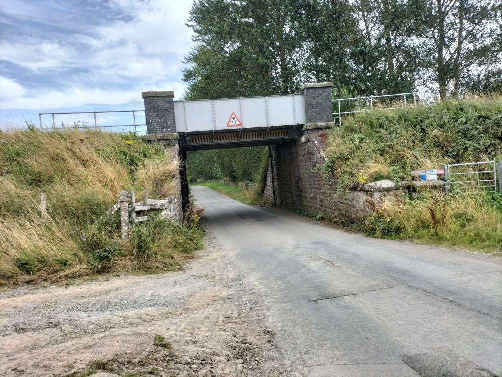
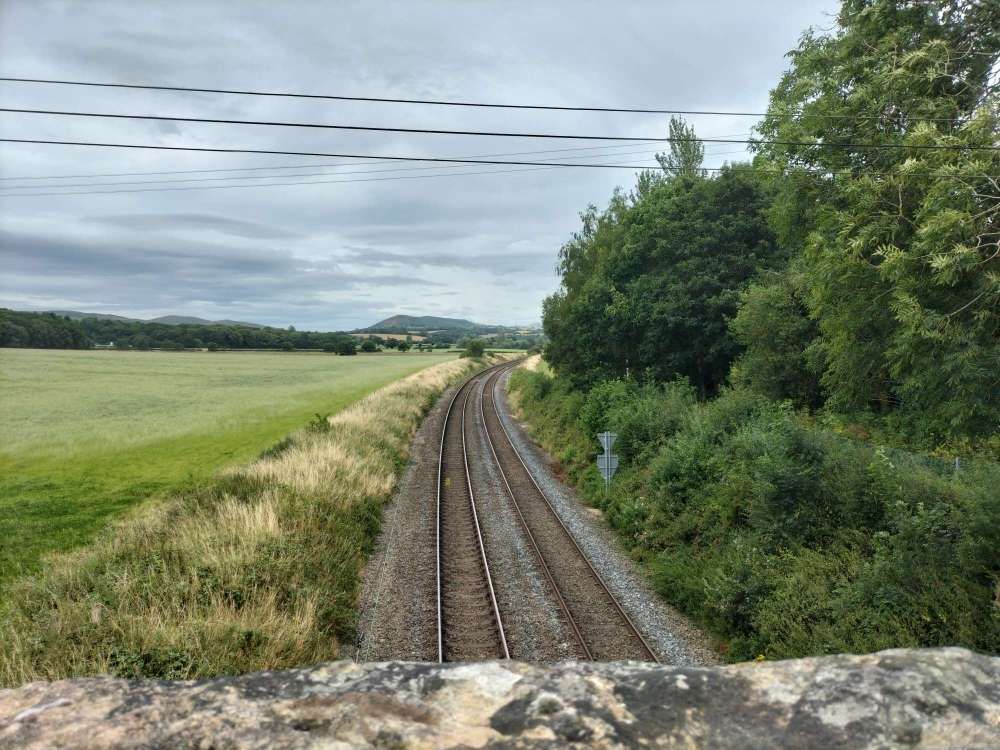
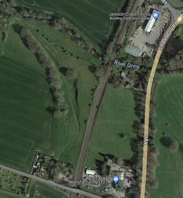
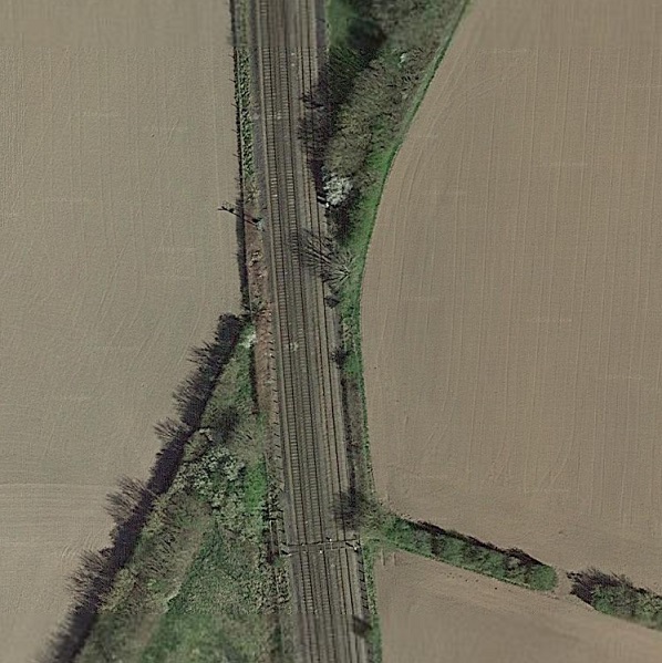
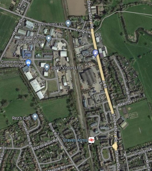
From this point on, the line crosses private land and for some distance the formation has been ploughed into the fields. After some distance, to the South side of the line there is a large Solar Farm. The access track to the solar farm runs West from the farm towards the A49.
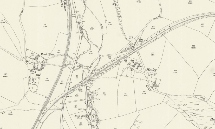
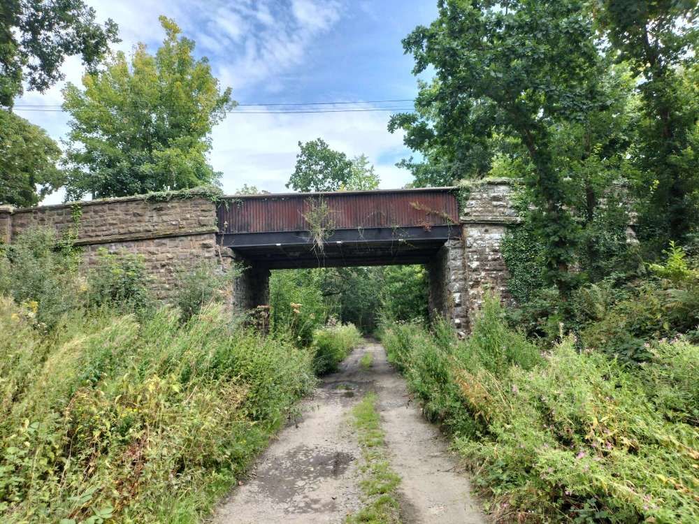
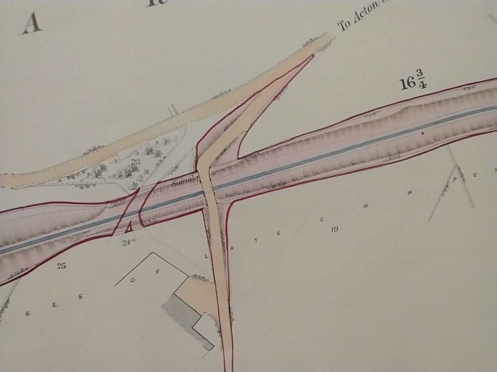

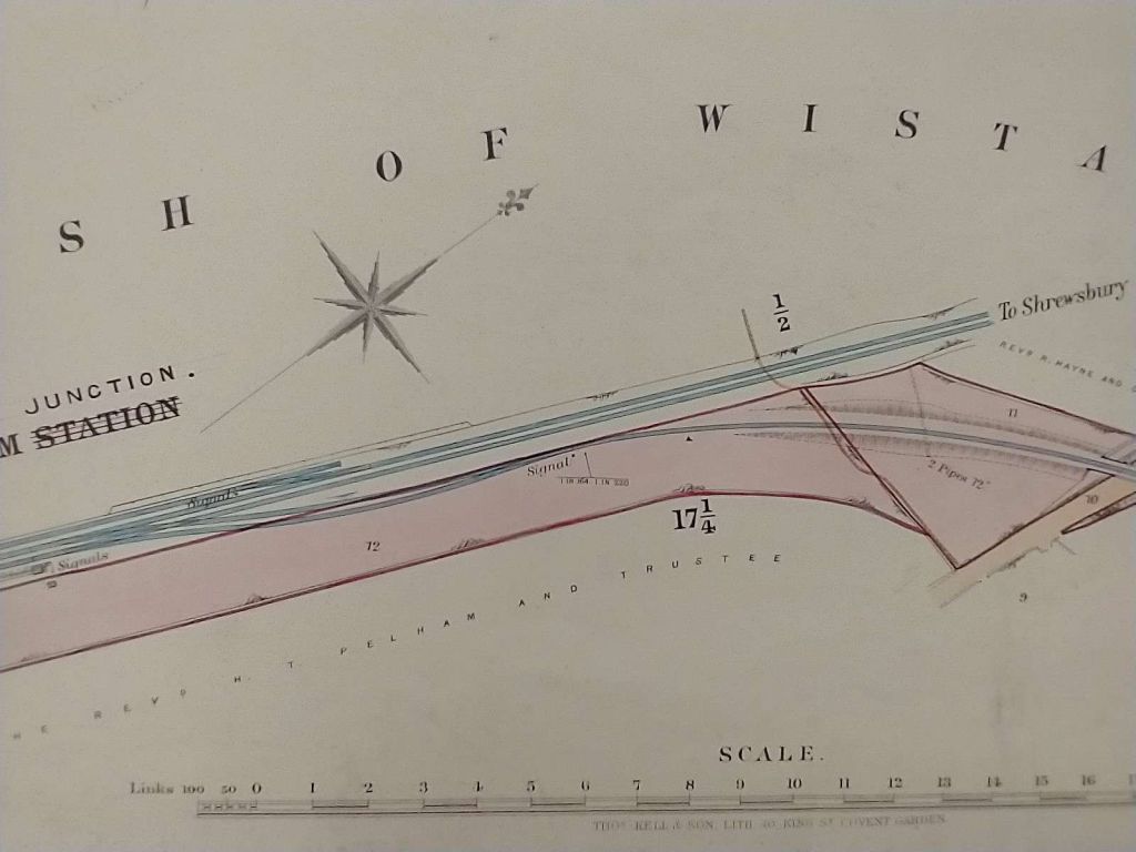
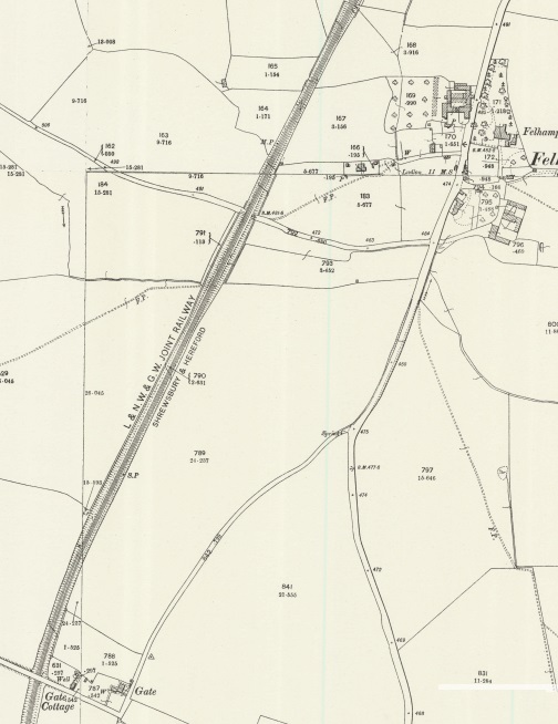
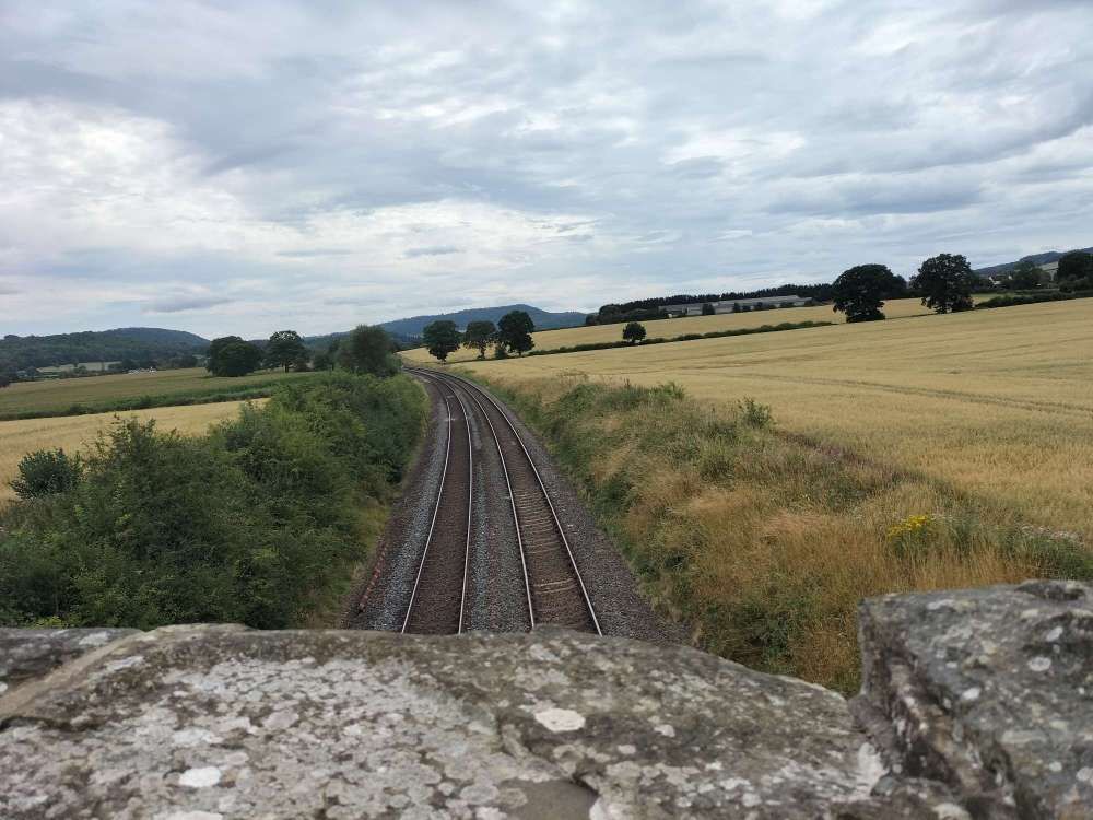
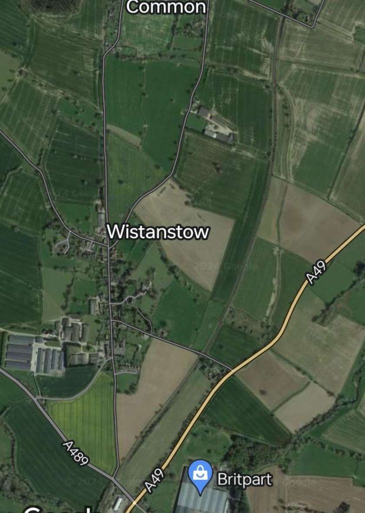
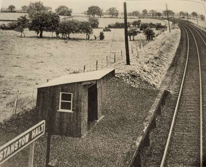
Not long after joining the main line branch trains stopped at Wistanstow Halt, the village being to the West of the Halt.

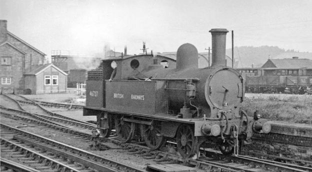
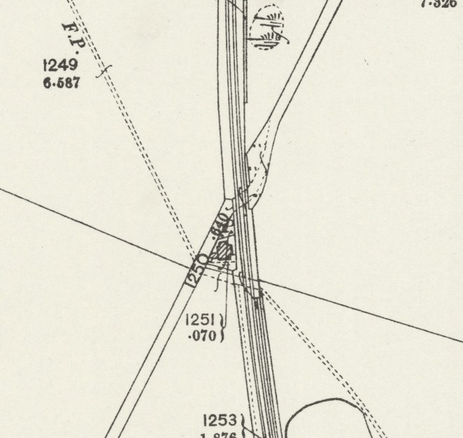
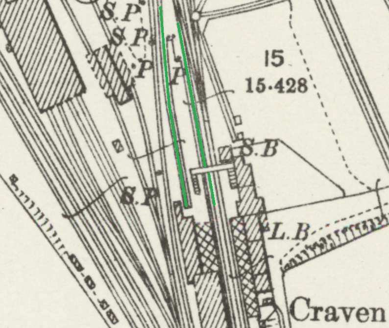
Before entering Craven Arms station, on the right was Stretford Bridge Junction, for the Bishop’s Castle Railway. In the early 1930s the Wenlock branch train could be brought to a stand here, whilst a Bishop’s Castle Railway mixed train was allowed to pass, with its former GWR ‘517’ class engine and its chain-braked ex-LNWR four-wheeled coaching stock, an open-planked wagon, a cattle truck and a Bishop’s Castle brake van.
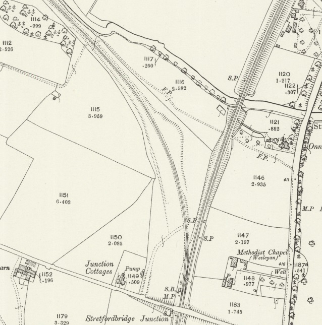
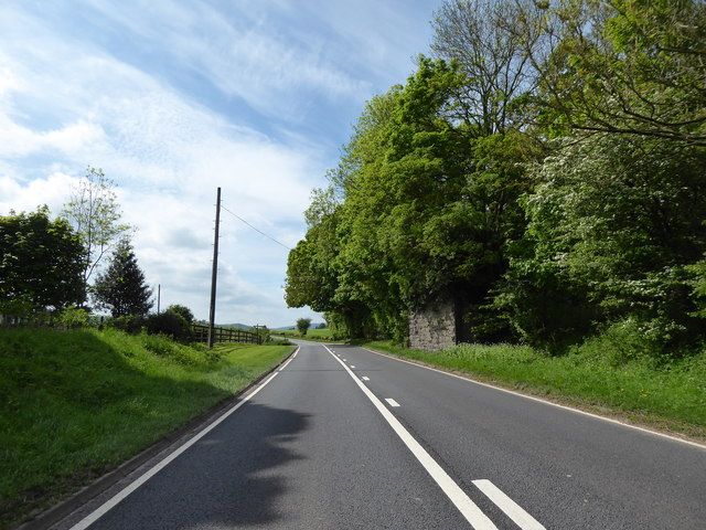
After passing Stretford Junction, the line crossed Watling Street, the old roman road at an oblique angle.
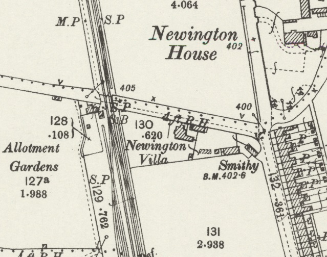
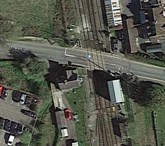
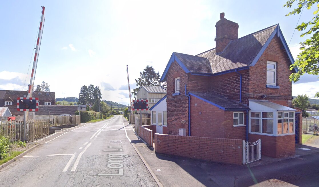
After passing Stretford Junction, Watling Street and Long Lane Crossing, to the right was the carriage and engine shed, and to the left the goods shed and yard.
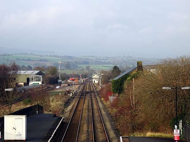
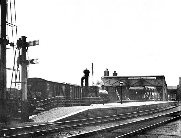
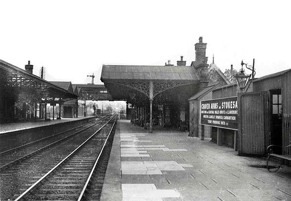
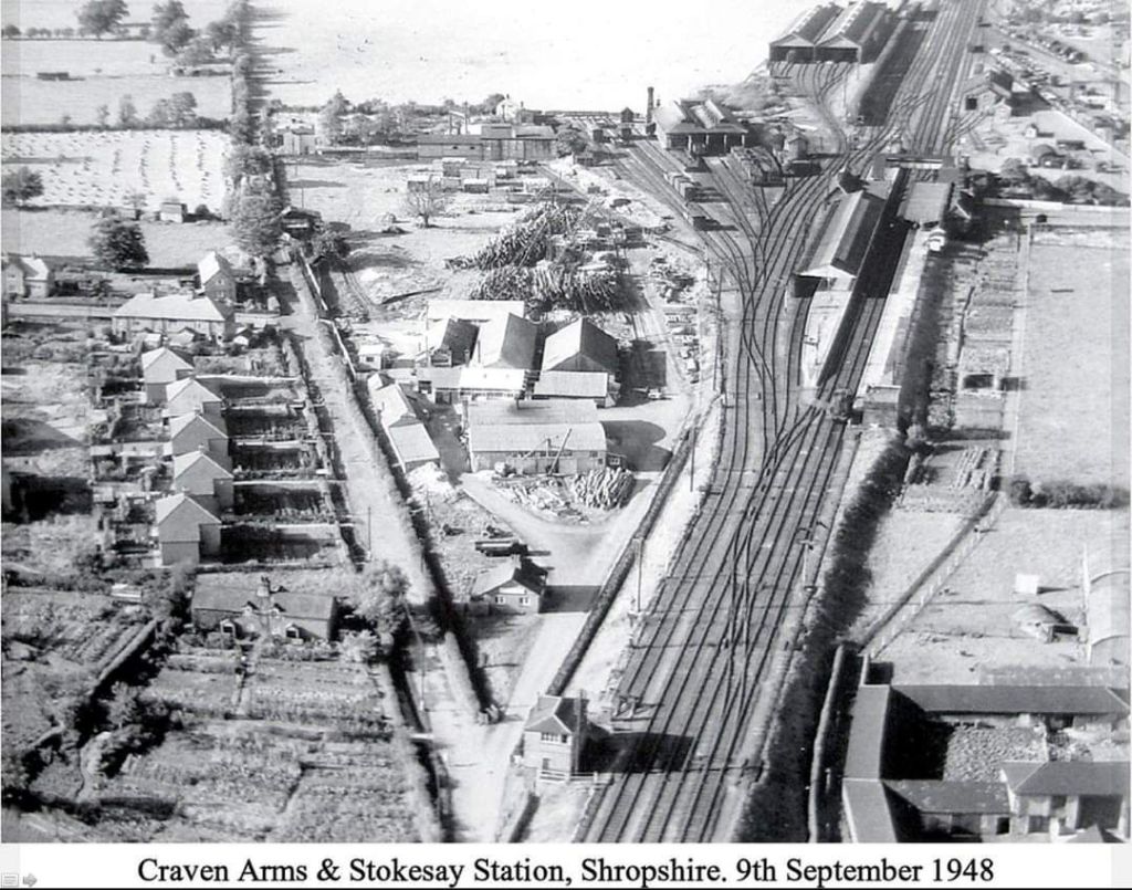
The train pulled in on the down platform at Craven Arms, and after taking water the engine ran round the two coaches, and backed into the bay at the north end of the platform, this also being used by the Bishop’s Castle trains.
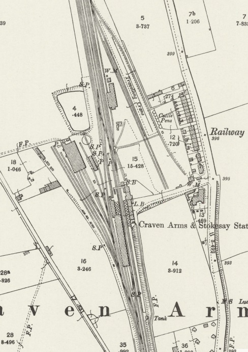
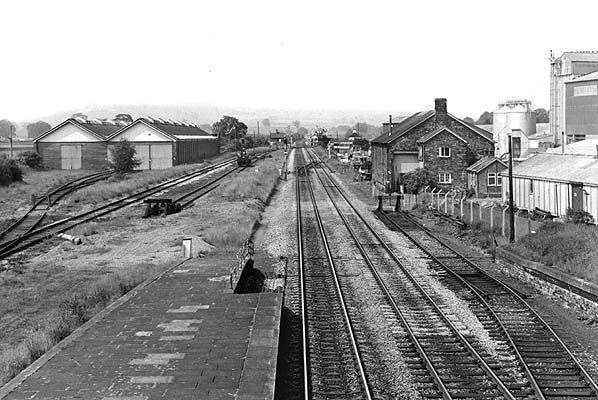

Craven Arms owes its existence to the coming of the Shrewsbury and Hereford Railway in 1852. It is truly a railway town created out of the hamlet of Newton. The S&H line passed through the Onny Valley, its route taking it past Shropshire’s famous beauty spot Stokesay Castle, and past a coaching inn named after the Lord of Manor the Earl of Craven, prompting the S&H to give the station the name of Craven Arms. The station was opened for traffic on 20th April, 1852. The parish name of Stokesay was added to the station’s name a little later.
The importance of Craven Arms as a railway centre was given added impetus by the opening of the Knighton Railway in 1861. Although only a branch it was in reality to be the embryo of the LNWR’s march upon Swansea. Various small companies were involved in the construction of the line between Craven Arms and Swansea, these later being absorbed into the LNWR or operated jointly by the LNWR and GWR.
On 1st July, 1862 Craven Arms station came under the joint ownership of the LNWR, GWR and West Midland Railway. The station consisted of up and down main line platforms, with booking office, general and ladies waiting room, together with refreshment rooms on the down side. Also on the downside was the station master’s house. The up side consisted of general and ladies’ waiting rooms only. The north and south end bays were on the down side. The North [1: p109] end bay was utilised by the Bishop’s Castle and Wenlock branch trains. [1: p114]
This brings us to the end of our journey from Wellington to Craven Arms along the Wenlock Branch.
References
- Ken Jones; The Wenlock Branch; The Oakwood Press, Usk, Monmouthshire, 1998.
- The photographs of the pre-contract drawings for the line were taken by myself and show extracts from the construction plans held in the Shropshire Archive. There is a standard charge of £10 per visit for taking photographs of their records.
- https://railmaponline.com/UKIEMap.php, 2nd July 2024
- Adrian Knowles; The Wellington, Much Wenlock & Craven Arms Railway; Lightmoor Press, Lydney, Gloucestershire, 2022.
- The photographs of the pre-contract drawings for the line were taken by myself and show extracts from the construction plans held in the Shropshire Archive. There is a standard charge of £10 per visit for taking photographs of their records.
- https://housesforsaletorent.co.uk/houses/to-rent/shropshire/harton.html, accessed on 17th July 2024.
- https://www.geograph.org.uk/photo/5209903, accessed on 17th July 2024.
- https://rogerfarnworth.com/2022/07/07/the-railways-of-telford-the-wellington-to-severn-junction-railway-wsjr-part-1-wellington-to-horsehay
- https://rogerfarnworth.com/2022/07/12/the-railways-of-telford-the-wellington-to-severn-junction-railway-wsjr-part-2-horsehay-to-lightmoor-junction
- https://rogerfarnworth.com/2022/07/18/the-railways-of-telford-the-wellington-to-severn-junction-railway-wsjr-part-3-lightmoor-junction-to-buildwas
- https://rogerfarnworth.com/2023/10/19/the-railways-of-east-shropshire-and-telford-the-much-wenlock-and-severn-junction-railway-buildwas-to-much-wenlock
- https://rogerfarnworth.com/2024/01/13/the-wenlock-branch-from-much-wenlock-to-presthope/
- https://rogerfarnworth.com/2024/06/27/the-wenlock-branch-from-presthope-to-craven-arms/
- https://rogerfarnworth.com/2024/07/25/the-wenlock-branch-from-longville-in-the-dale-to-marsh-farm-junction-and-craven-arms/
- https://maps.nls.uk/geo/explore/#zoom=16.0&lat=52.49958&lon=-2.76636&layers=257&b=1&o=100, accessed on 25th July 2024.
- https://maps.nls.uk/geo/explore/#zoom=16.0&lat=52.49768&lon=-2.77032&layers=168&b=1&o=100, accessed on 25th July 2024.
- https://maps.nls.uk/geo/explore/#zoom=16.0&lat=52.49402&lon=-2.79190&layers=168&b=1&o=100, accessed on 25th July 2024.
- https://maps.nls.uk/geo/explore/#zoom=16.0&lat=52.49025&lon=-2.81301&layers=168&b=1&o=100, accessed on 26th July 2024.
- https://maps.nls.uk/geo/explore/#zoom=16.0&lat=52.48445&lon=-2.81728&layers=168&b=1&o=100, accessed on 14th August 2024.
- https://www.geograph.org.uk/showmap.php?gridref=SO4386, accessed on 12th August 2024.
- https://maps.nls.uk/geo/explore/#zoom=16.0&lat=52.47950&lon=-2.82157&layers=168&b=1&o=100, accessed on 14th August 2024.
- https://maps.nls.uk/geo/explore/#zoom=15.0&lat=52.47054&lon=-2.82915&layers=168&b=1&o=100, accessed on 12th August 2024.
- https://www.geograph.org.uk/photo/6466763, accessed of 12th August 2024.
- https://www.geograph.org.uk/photo/4787720, accessed on 12th August 2024.
- https://www.ebay.co.uk/itm/195647213680?mkcid=16&mkevt=1&mkrid=711-127632-2357-0&ssspo=xRk1_MAMSum&sssrc=4429486&ssuid=afQhrar7TGK&var=&widget_ver=artemis&media=COPY, accessed on 12th August 2024.
- https://maps.nls.uk/geo/explore/#zoom=16.0&lat=52.46474&lon=-2.83404&layers=168&b=1&o=100, accessed on 14th August 2024.
- John Hodge; The North and West Route, Volume 2 – Shrewsbury and Hereford; Wild Swan Publications, Didcot, 2008.
- https://maps.nls.uk/geo/explore/#zoom=18.0&lat=52.45831&lon=-2.83692&layers=168&b=1&o=100, accessed on 14th August 2024.
- https://maps.nls.uk/geo/explore/#zoom=17.0&lat=52.45628&lon=-2.83934&layers=168&b=1&o=100, accessed on 14th August 2024.
- https://maps.nls.uk/geo/explore/#zoom=18.0&lat=52.45053&lon=-2.84005&layers=168&b=1&o=100, accessed on 14th August 2024.
- https://maps.nls.uk/geo/explore/#zoom=17.0&lat=52.44778&lon=-2.83949&layers=168&b=1&o=100, accessed on 14th August 2024.
- https://maps.nls.uk/geo/explore/#zoom=17.0&lat=52.44313&lon=-2.83870&layers=168&b=1&o=100, accessed on 14th August 2024.
- http://www.disused-stations.org.uk/c/craven_arms, accessed on 14th August 2024.
- https://railways-of-britain.fandom.com/wiki/Craven_Arms_railway_station?file=Craven_Arms.jpg, accessed on 15th August 2024.
- https://www.geograph.org.uk/photo/2211737, accessed on 29th September 2024.

I worked the Marsh Farm box after the Wenlock junction had closed. We used to put freight trains up the Wenlock Junction. One year the Queen’s train stayed overnight on the way to open the Dams at Rhayader. Before my time. We used to close the box at 6am on the Sunday morning. Open again at 6am Monday morning. We had a loop on the up line towards Shrewsbury. A freight train coming up to the box from Craven Arms with an Express at Leominster had to go in the loop. A 53 minute time difference. Loved all the pictures. Brought back a lot of memories.
Thank you, Derek. You are welcome! 🙂