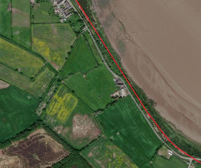
The Carlisle to Port Carlisle Canal opened in 1823. It was approximately 11 miles long. It linked the city of Carlisle to the Solway Firth. [1]
Prior to the 16th century, coal from mines at Ellen Foot (now Maryport) was brought up river to Carlisle and other locations by boat. However, in 1720, duties began to be levied on all goods carried around the coast by sea.As a result, the local coal trade switched to land-based transport.
It took the actions of a small group of local traders to secure an Act of Parliament in 1721, which allowed coastal duties to be waived. While the Act enabled them to build wharves and warehouses and erect cranes, even allowing the dredging of the river and the charging of tolls (for 31 years), it did not permit them to improve the river in any way. [2]
The Canal was a long time in coming … a public meeting which sought its construction did not take place until 21st May 1807. “The principal aim was to provide the city with a better and cheaper supply of coal, and a committee was appointed to push the plan forwards. They asked the engineer William Chapman to advise them, and he proposed a route from Carlisle to Maryport, which he had also promoted in 1795 as part of a coast to coast route. He estimated that it would cost between £90,000 and £100,000 to build, but conceded that a terminus near Bowness on the Solway Firth would be cheaper. £40,000 would pay for a canal suitable for 45-ton boats, but a larger canal, suitable for 90-ton boats that could cross the Irish Sea or reach the Forth and Clyde Canal, would cost between £55,000 and £60,000. The larger canal could still be part of a coast to coast route. The options as to the size and destination of the canal were put to subscribers by the committee. In August 1807 Chapman suggested that a ship canal for the Irish, Scottish and Liverpool trade, and a 50-ton canal to Maryport for the coal trade could both be built, with both finding support in the newspapers.”[2][3: p337–339, 456]
With a range of options on the table, the Committee sought a second opinion from Thomas Telford. He produced a report on 6th February 1808.
Telford “described a Cumberland Canal, which would allow sea-going vessels to reach Carlisle, but would also be part of a grander plan to link Carlisle to other parts of the country, and could be incorporated into the coast to coast waterway. He suggested that locks should be at least as big as those on the Forth and Clyde Canal, with a width of 20 feet (6.1 m) and a depth of water of 8 feet (2.4 m) over the lock cills. His canal would leave the Solway Firth about 1 mile (1.6 km) upstream of Bowness-on-Solway to reach Carlisle, and would cost £109,393. In order to provide a water supply, a navigable feeder would continue onwards to Wigton, which would be suitable for 7-foot (2.1 m) wide narrow boats, and would cost an additional £38,139. He also quoted two other prices for narrower canals, but noted that these would require goods to be transferred to smaller boats, with the inherent costs and inconvenience.” [3: p339]
Sadly, no further progress was made at that time.
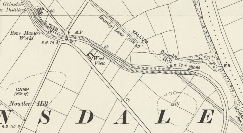
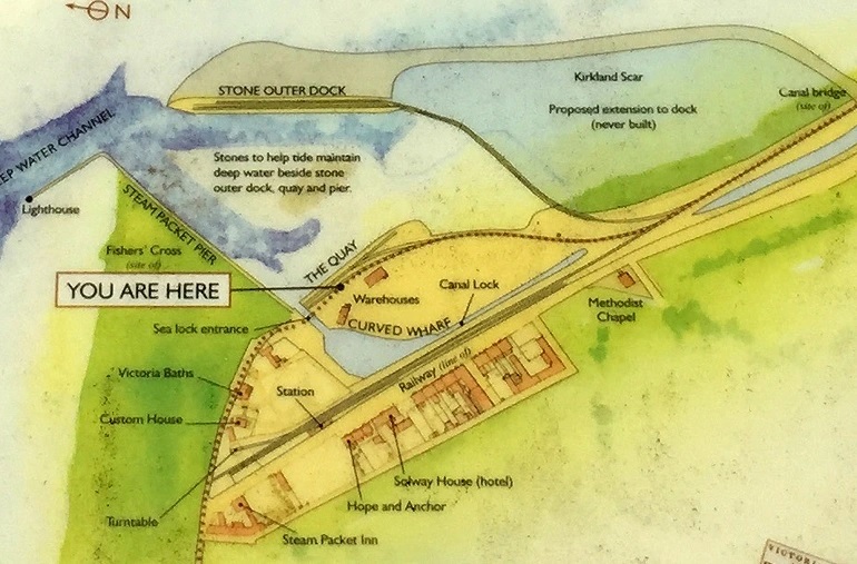
After a further eight and a half years, another meeting was held at Carlisle. The result of that meeting on 7th October 1817 was that Chapman was asked “to produce a survey for a canal suitable for vessels of at least 70 tons. He was to ensure that it could become part of the coast to coast link. His canal started at Fisher’s Cross, subsequently named Port Carlisle, … It would feature locks 74 by 17 feet (22.6 by 5.2 m), while the channel would be 50 feet (15 m) wide by 8 feet (2.4 m) deep, and would cost £75,392. A link to Newcastle-upon-Tyne could be built on a smaller scale, and another link could be built along the valley of the Eden to serve slate quarries near Ullswater. His plan was accepted, money was raised locally, and an Act of Parliament was obtained in 1819, which authorised the Carlisle Canal to raise £80,000 in capital, and an extra £40,000 if required. The chairman of the committee, Dr John Heysham, suggested they look at other canals before starting work, and visits were made to the Lancaster Canal and the Forth and Clyde Canal. [2][3: p339-340]
Contracts to build the entire canal were awarded by early 1820. The Canal opened in March 1823. It was “11.25 miles (18.11 km) long, had a surface width of 54 feet (16 m) and was 8 feet (2.4 m) deep. At Fisher’s Cross, a basin 250 by 80 feet (76 by 24 m) had been built, which was connected to the Solway Firth by a sea lock with a long timber jetty. Seven more locks raised the level of the canal by 46 feet (14 m), and at Carlisle there was a second basin, 450 by 100 feet (137 by 30 m), complete with wharves and a warehouse. The locks were 78 feet (24 m) long and 18.5 feet (5.6 m) wide, and water supply was provided by a reservoir on Mill Beck near Grindale.” [2][4: p128]
The cost of construction was just over the estimated £80,000. [2][3: p341]
In 1825 the Carlisle & Liverpool Steam Navigation Company paid for the construction of an exclusive berth at Port Carlisle. The Canal Cpany purchased their own packet boat to transport passenger from Port Carlisle to Carlisle. Both passenger services commenced in 1826. Goods carried from Liverpool to Port Carlisle were carried along the canal by lighters. The Solway Hotel opened in Port Carlisle soon afterwards. [2][3: p341-342]
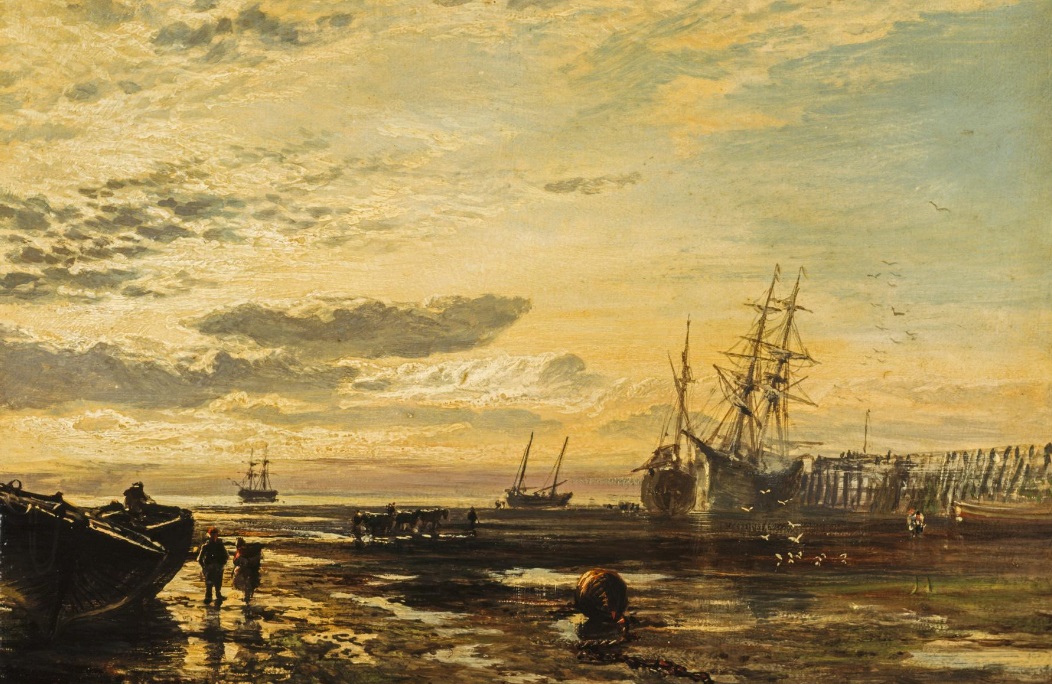
“The Solway at Port Carlisle” (1859) by Samuel Bough (1822 – 1878), National Galleries Scotland. Use permitted under a Creative Commons Licence. [34]
Times were beginning to change. … In “August 1824, there were public meetings in Newcastle, to consider again the idea of a canal to Carlisle, or possibly a railway. William Chapman, who had surveyed a route for a canal in 1796, suggested that the route was also suitable for a railway, and was asked to cost both options. He quoted £888,000 for a canal and £252,488 for a railway. A company was created to build a railway, although they did not obtain an Act of Parliament until 1829. There was support in Carlisle, and an agreement was reached that the railway would terminate at the canal basin.” [2][3: p342-343]
The opening of the railway to Newcastle in the 1830s brought a significant upturn in profits on the canal. Its imminent arrival resulted in another shipowner starting a service between Carlisle, Annan and Liverpool.
“However, the boom did not last long, and the company found that it was in competition with the railways. The Lancaster and Carlisle Railway was authorised in 1844, and was a direct threat to the steamer service and canal. The Maryport and Carlisle Railway had been authorised in 1837, but opening was delayed until 1845 by financial difficulties. It was extended to Whitehaven in early 1847 by the opening of the Whitehaven Junction Railway, and at the end of the year the Lancaster and Carlisle Railway opened. The Caledonian Railway opened in February 1848, running northwards from Carlisle to Scotland.” [2][3: p345-346]
“In March 1852, the company decided that the best option was to convert the canal into a railway, raised some money from shareholders and loan holders, and sought an Act of Parliament. Work began in June 1853, although the Act was not obtained until 3 August. An omnibus service was used to ferry passengers between Carlisle and the steamers at Port Carlisle, and the canal closed on 1 August 1853.” [2][3: p347-348].
The Act both wound up the canal company and created the Port Carlisle Dock and Railway Company. Further details about the history of the Canal can be found here [35]
Construction was completed within a year and opened to goods traffic on 12 May 1854 and passengers on 22 June. [2]
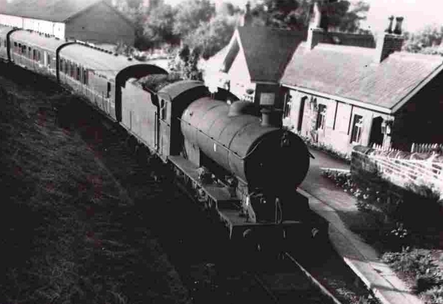
The Port Carlisle Railway Company had filled in the canal basin at Carlisle and built sidings and a passenger terminal there. Passenger services between Port Carlisle and Carlisle were short-lived. Two years later the line from Carlisle to Silloth opened. The through passenger service to Port Carlisle was replaced by a horse-worked service between Drumburgh and Port Carlisle. This horse-drawn service lasted until 1914 when it was replaced by steam-power. In due course a steam railmotor service was introduced which lasted until the branch closed in 1932. [2][5]
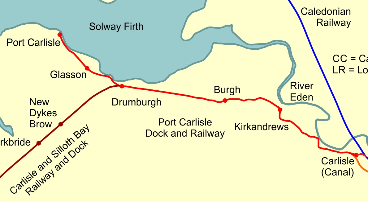
The Route of the Line
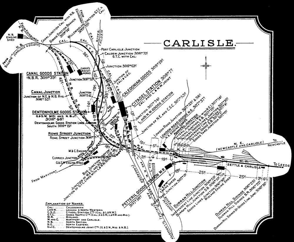
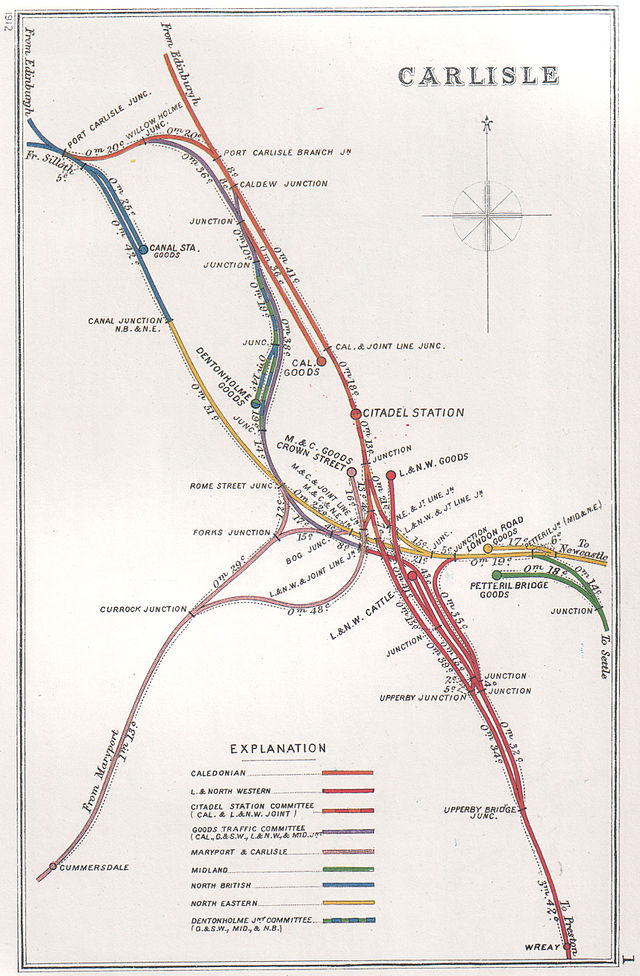
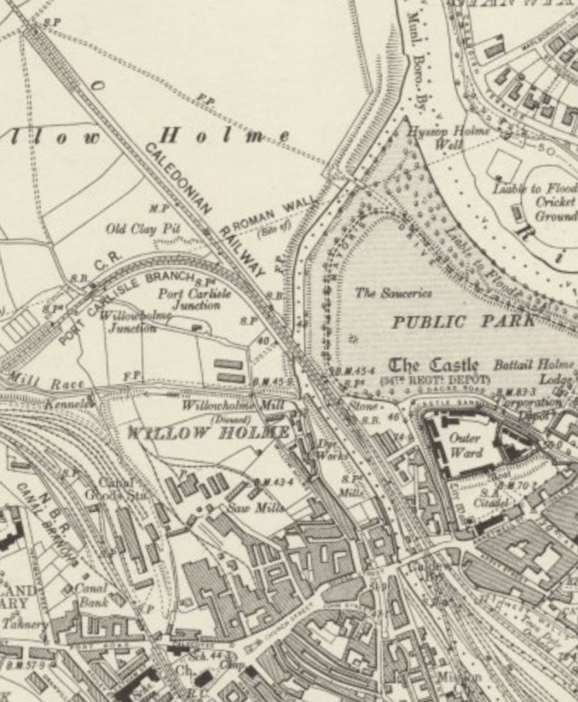
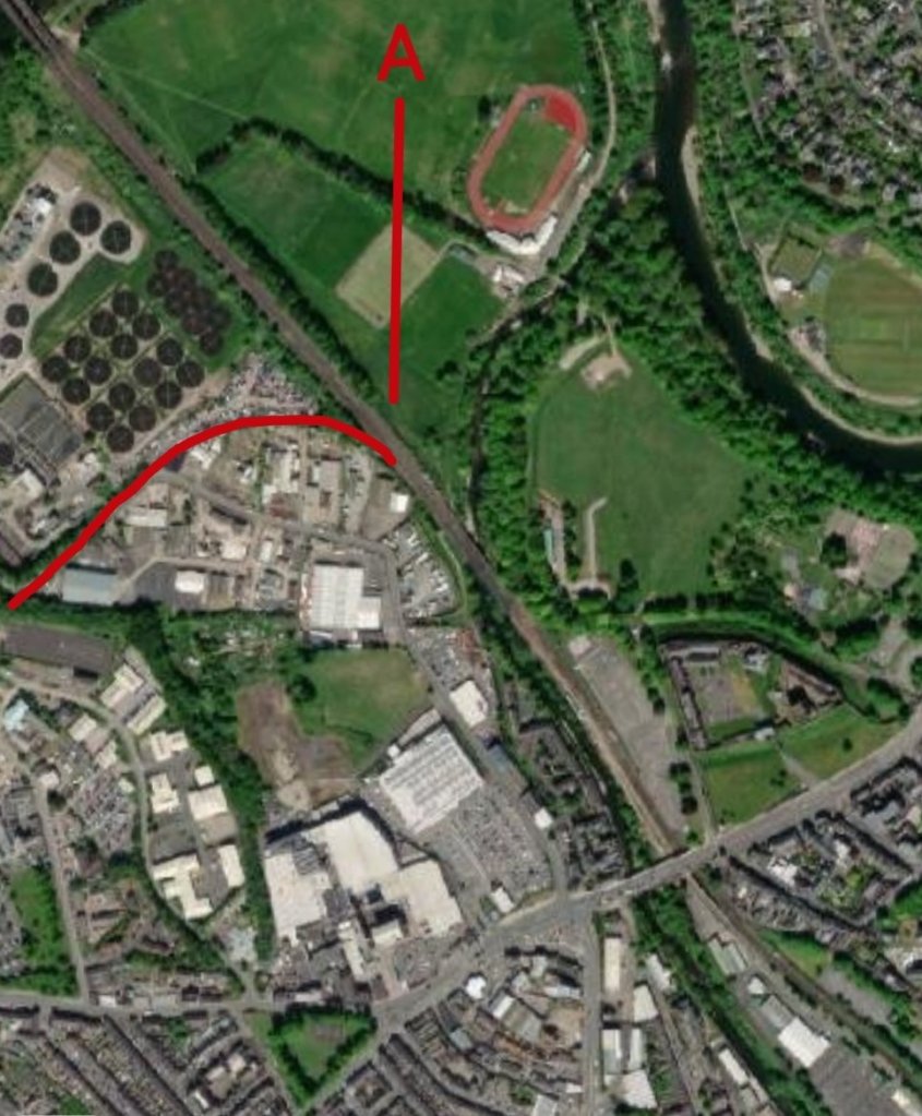
The rail network in Carlisle in 1914 as drawn by the Midland Railway. The Port Carlisle line left the Caledonian main line at Port Carlisle Junction (top left of this drawing), passed through Canal Junction and then set off West just South of the North British Railway Engine Shed shown in the far top left of the drawing. [36]Wikiwand comments: “Port Carlisle Junction was a railway junction between the lines of the former Caledonian Railway and North British Railway companies lines to the north of Carlisle Citadel station in, what is now, Cumbria, England. It opened in July 1863. Port Carlisle Junction railway station was a very short lived station that first came into use in July 1863 and there was some untimetabled use until 29 October 1863, but the station closed as early as 1 July 1864. After closure, the up (northbound) platform was retained for use by those crews requiring change and also for passing messages on to crews.” [37][38: p78][39: p80][40: p16]The route of the Port Carlisle Railway. [44]
The Port Carlisle Branch left the main Caledonian Railway line at Port Carlisle Junction, which was just to the North of the River Caldew, and curved way to the Southwest.
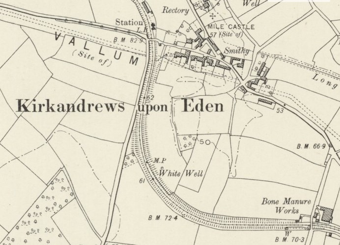
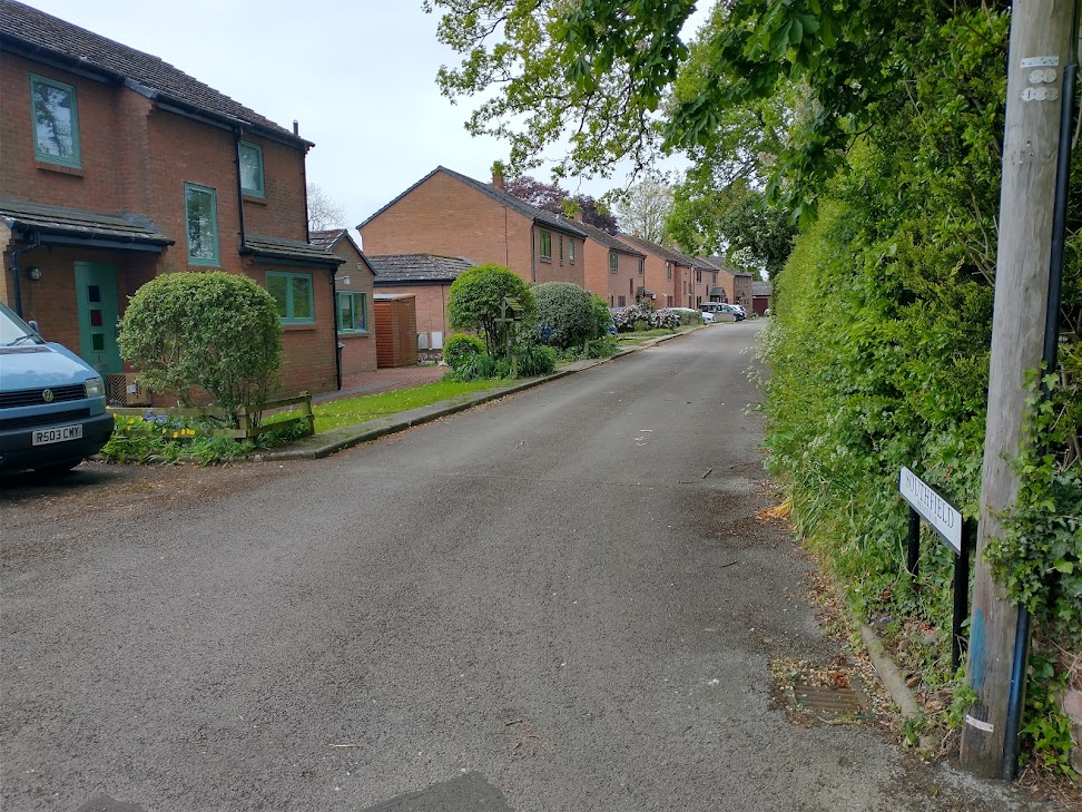
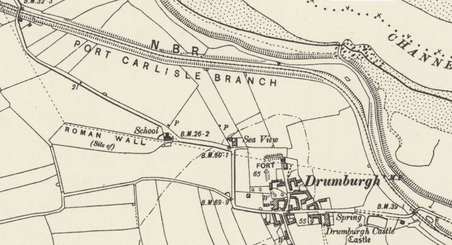
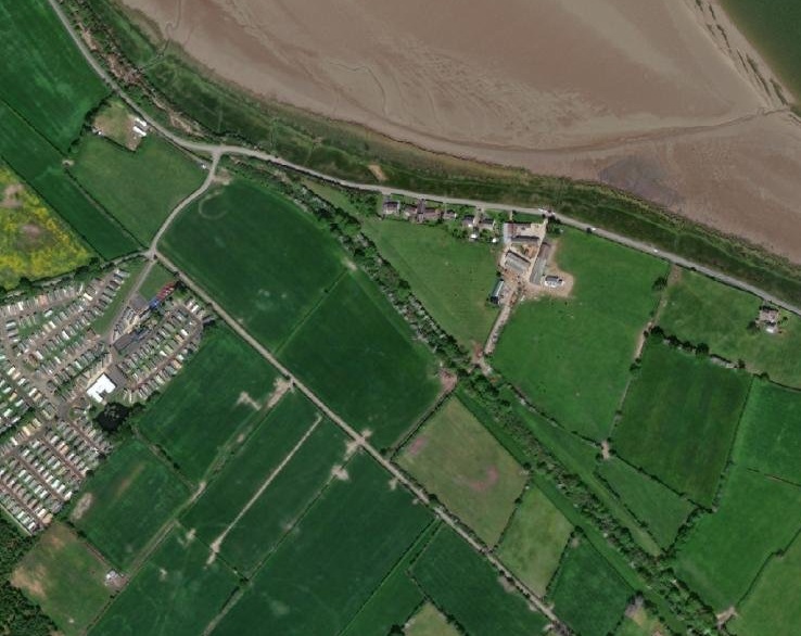
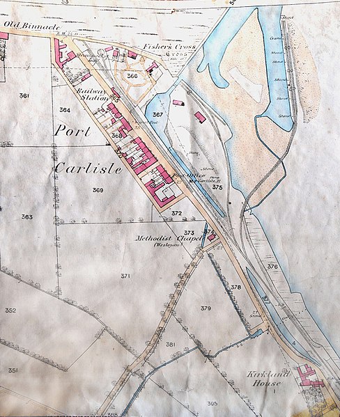
Wikipedia tells us that Kirkandrews-upon-Eden railway station “sat close to the village in the cut of the old canal; it had a single platform, and a shelter. … A substantial station building was present. A large seed warehouse was located at the station. In common with other stations on the line, it had its name picked out in sea shells on a raised area opposite the station building.” [14][15]
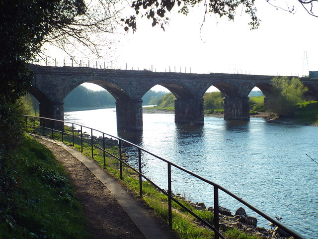
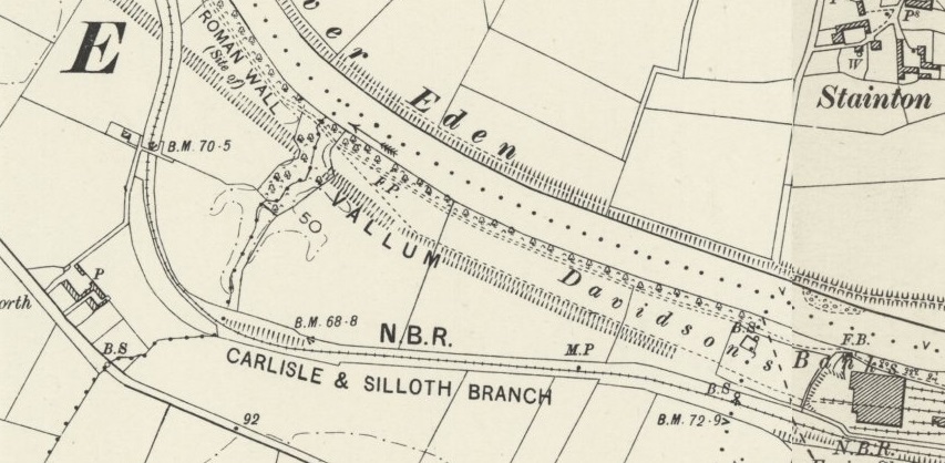
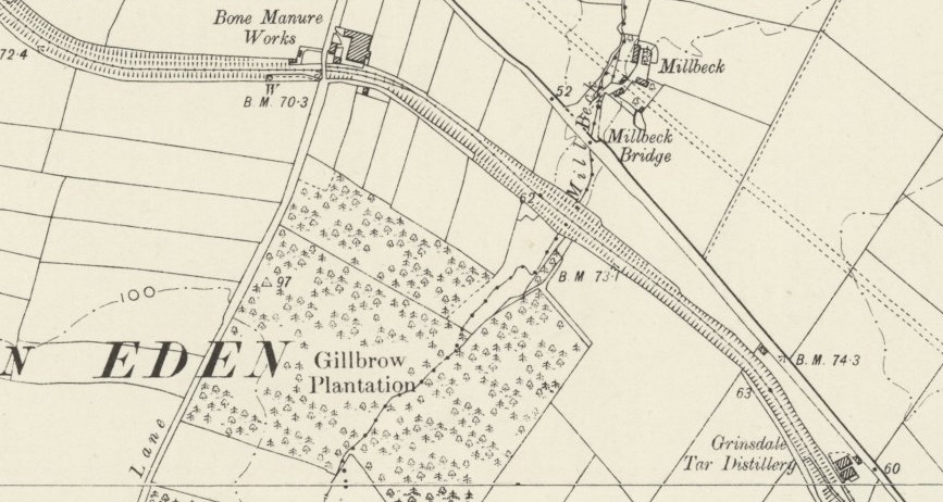
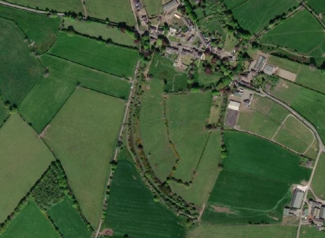
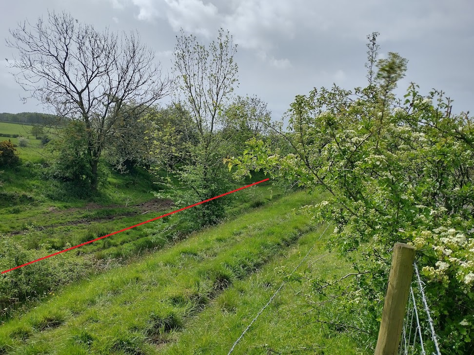
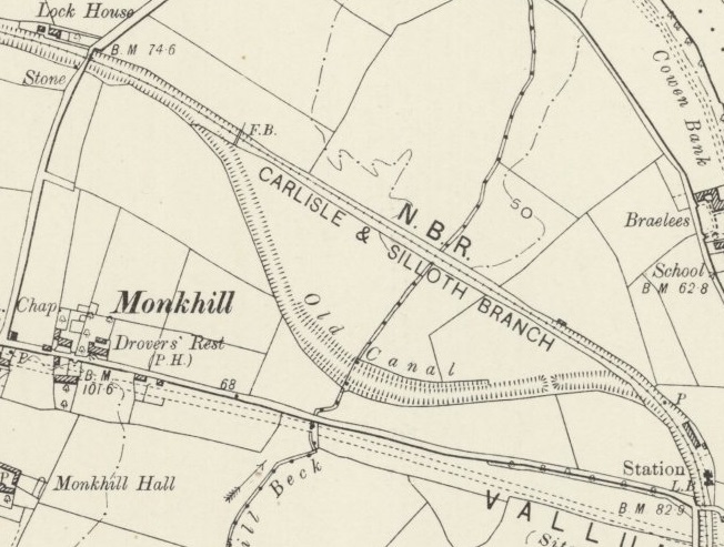
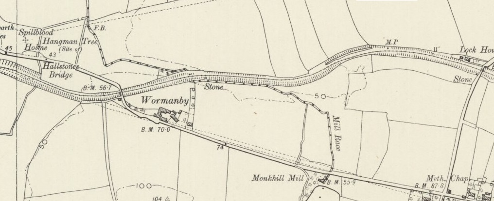
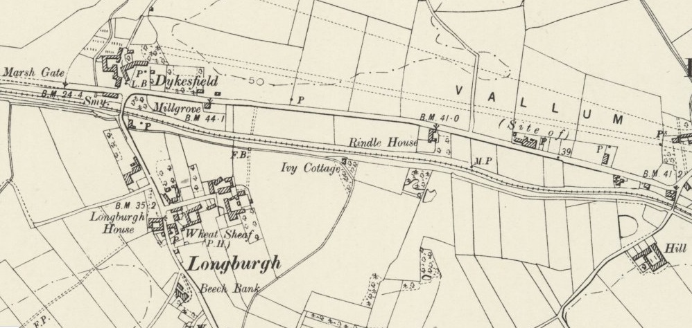
Continuing on from Kirkandrews the old line curved round to the Northwest. As can be seen on the next extract from the 6″ OS Maps of 1901, there are a couple of things which show that the old railway line followed the Carlisle Canal along most of its length.
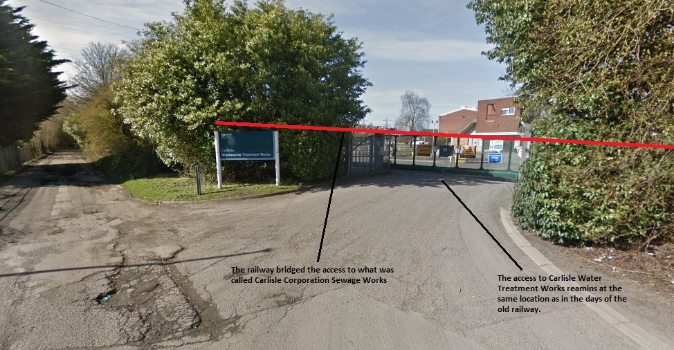
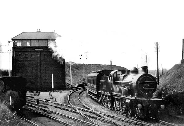
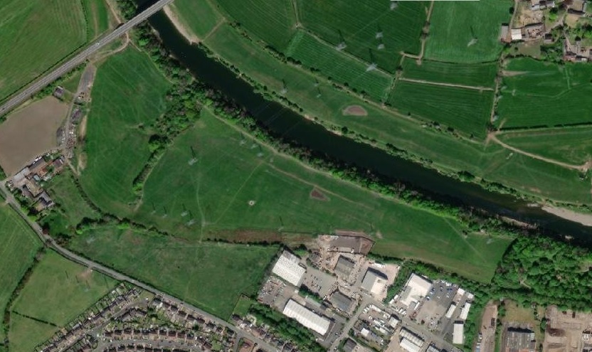
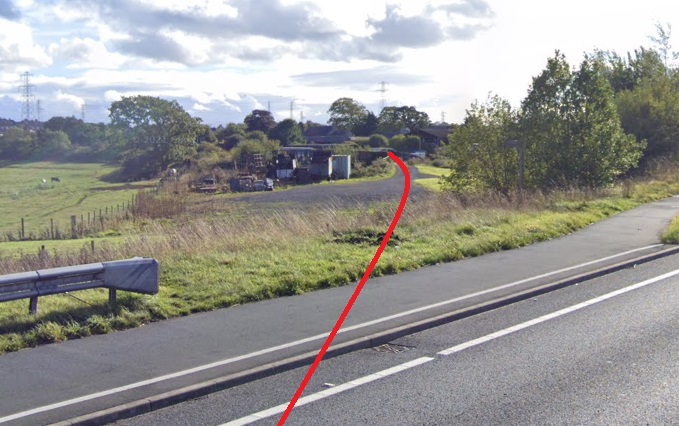
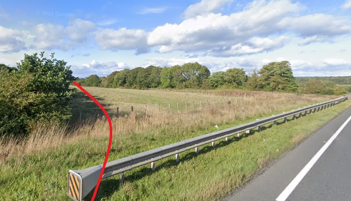
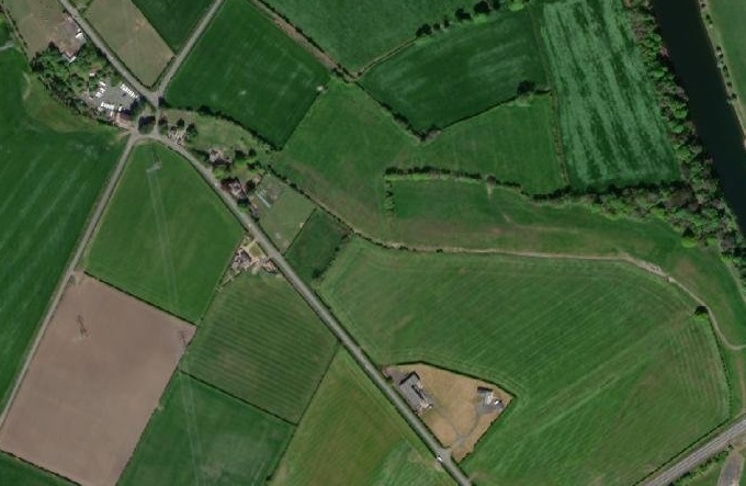
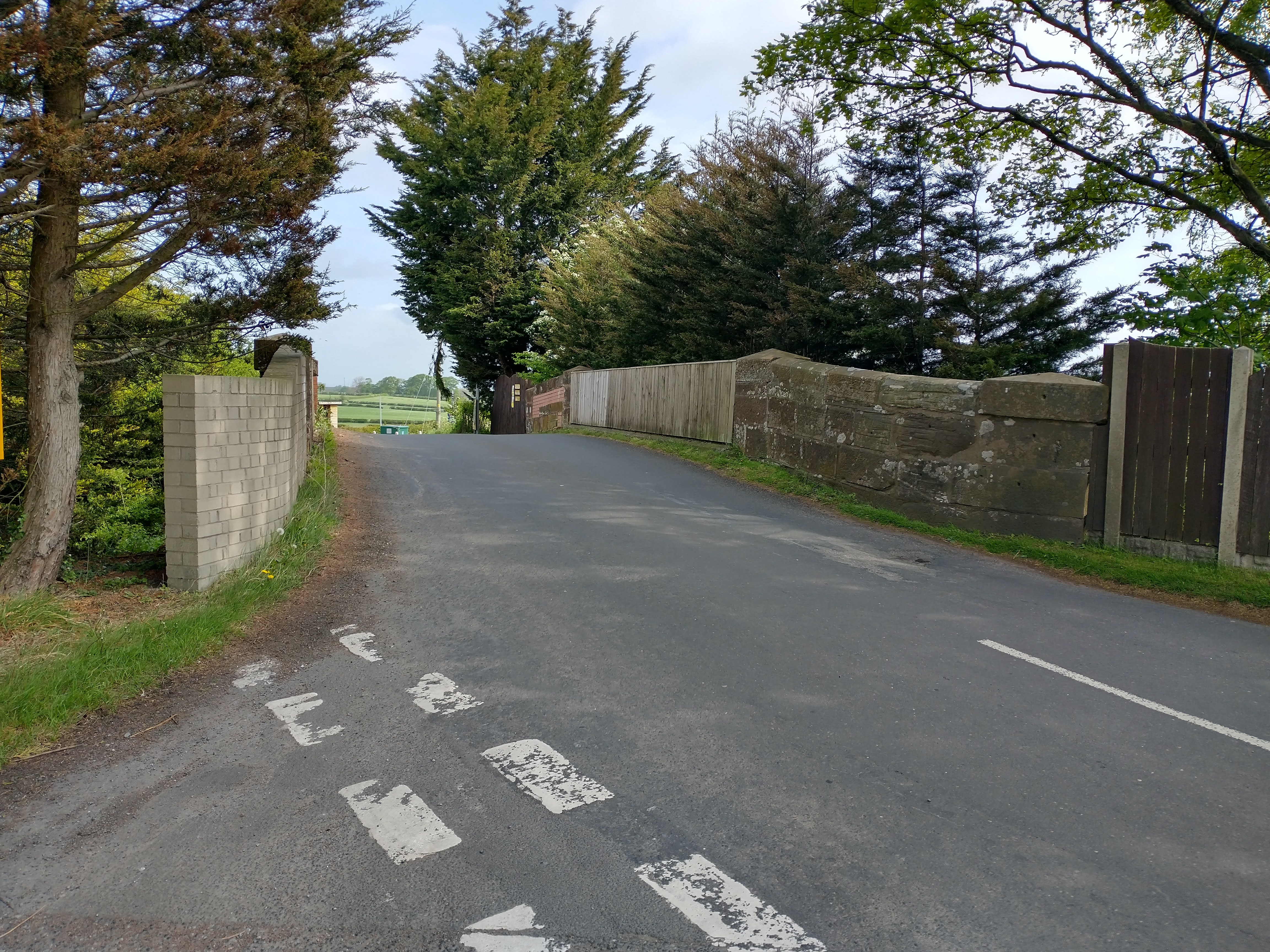
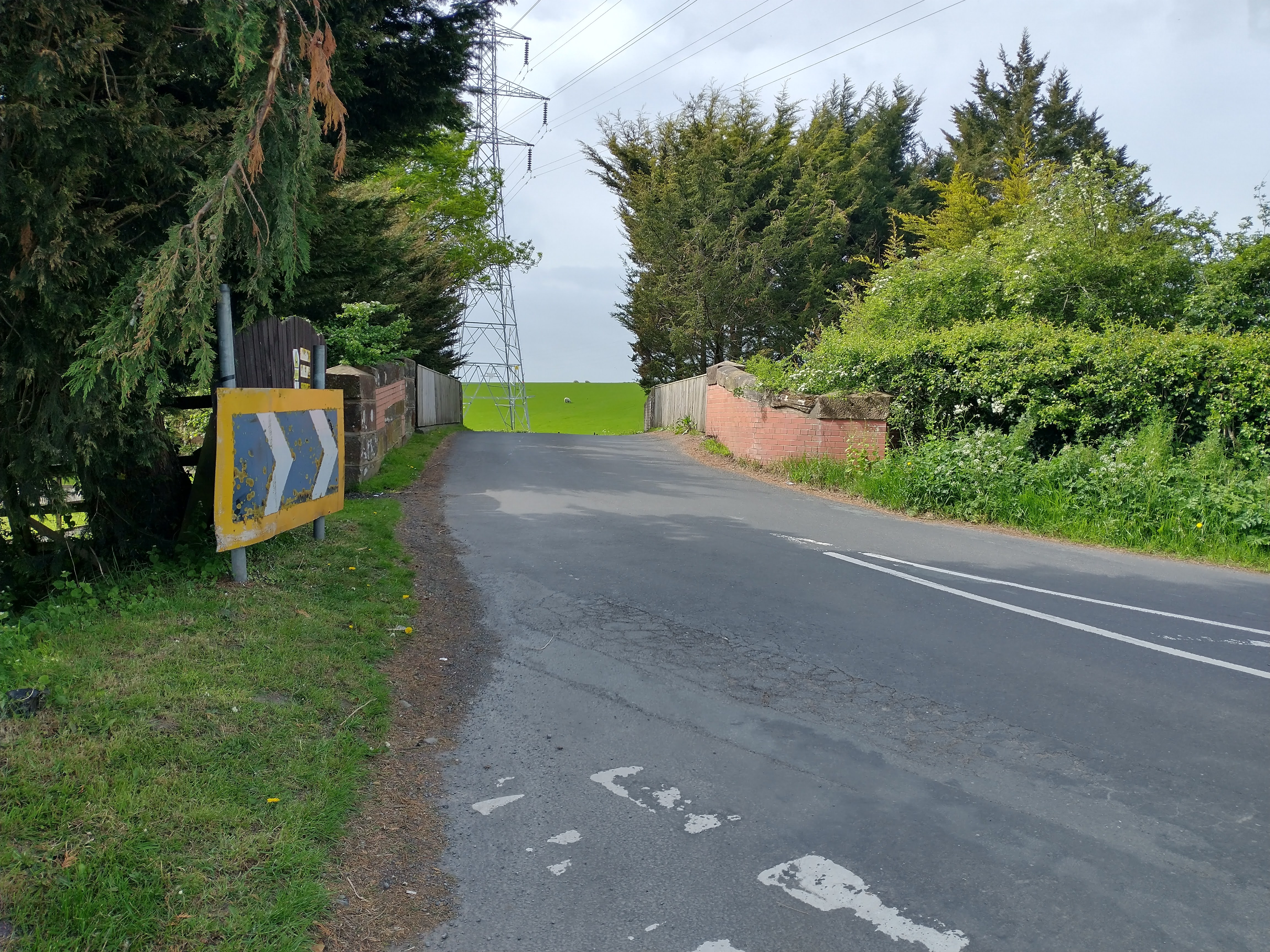
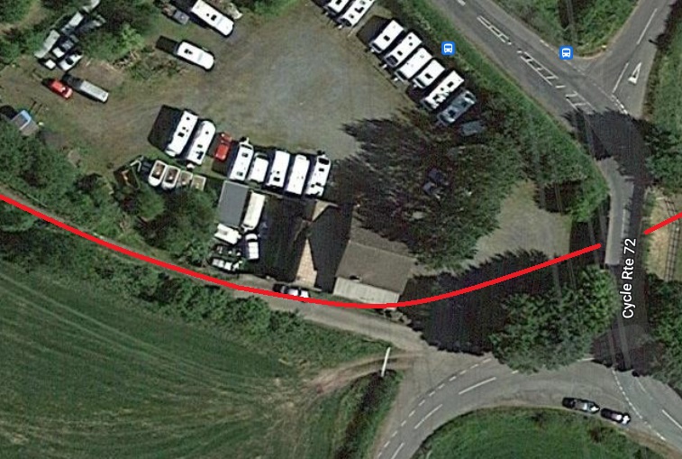
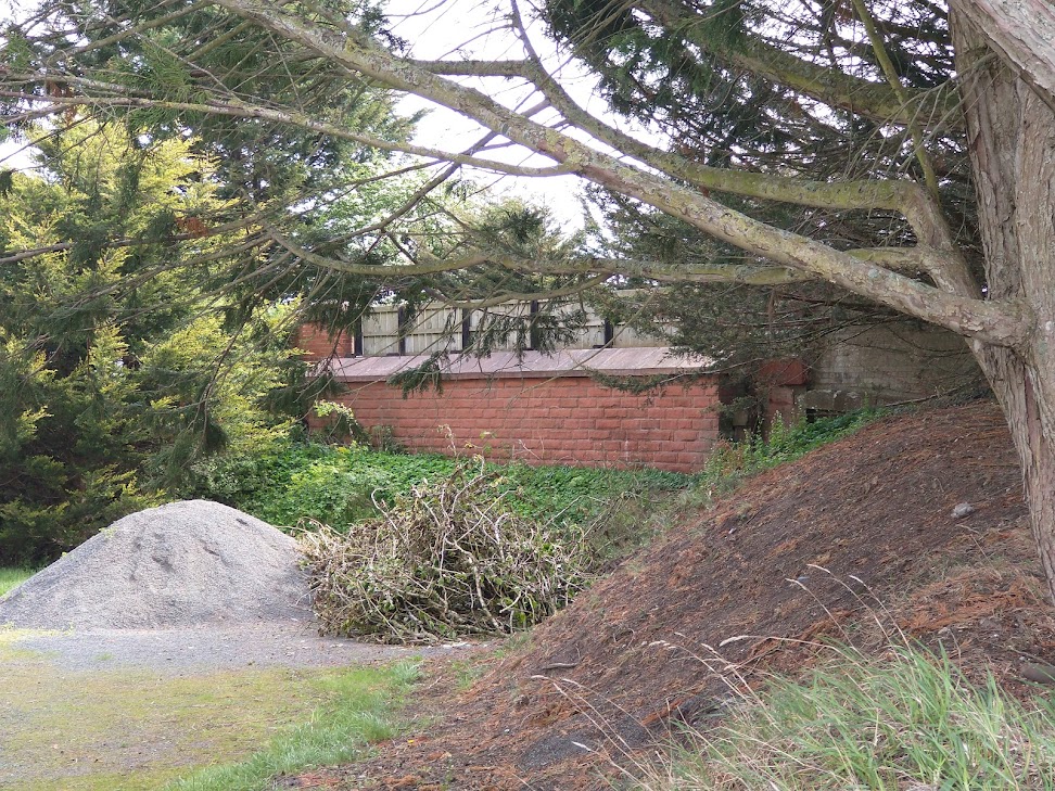
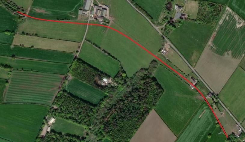
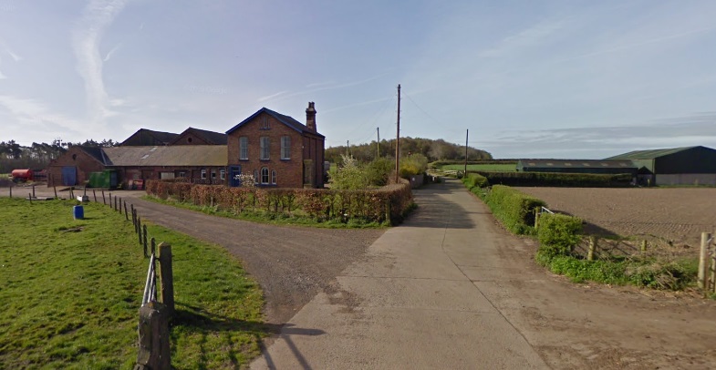
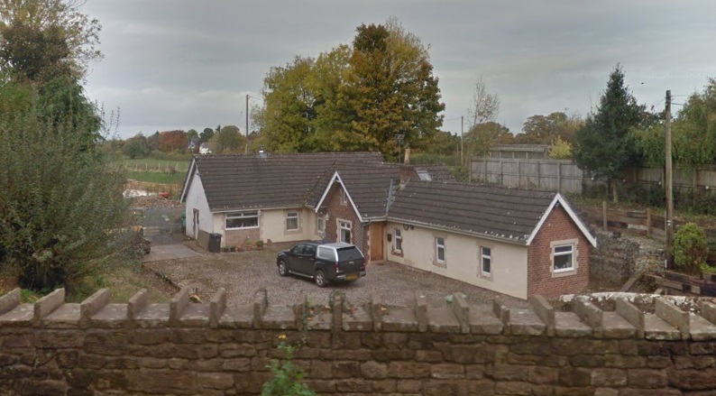
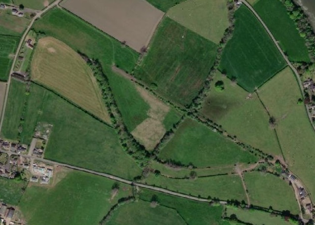
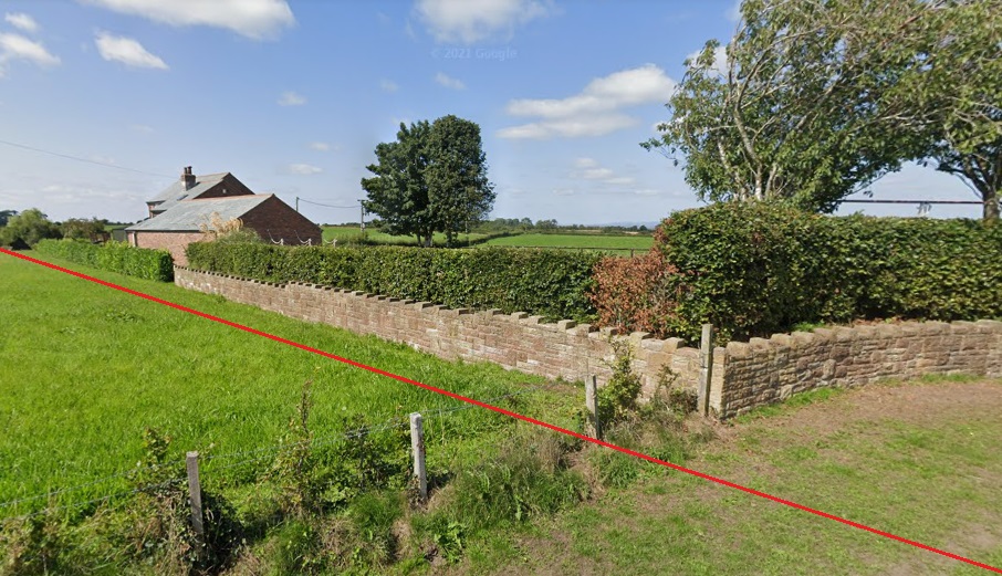
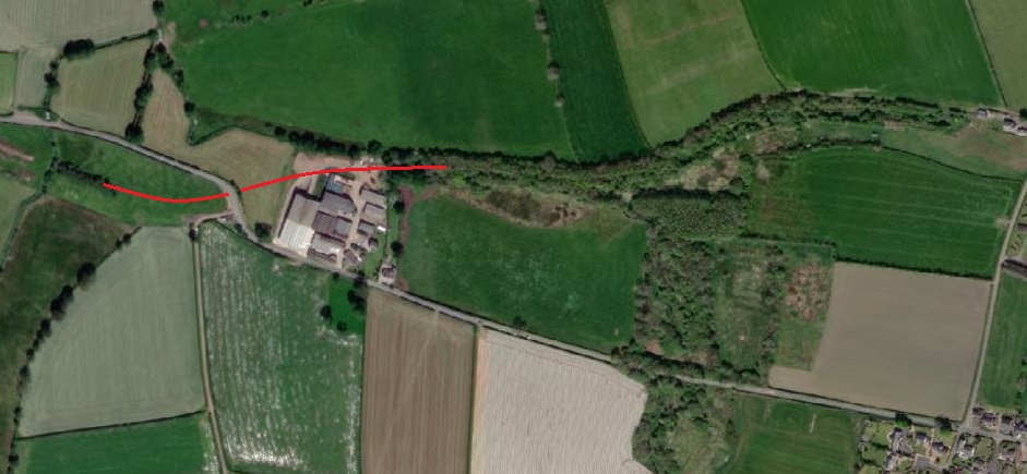
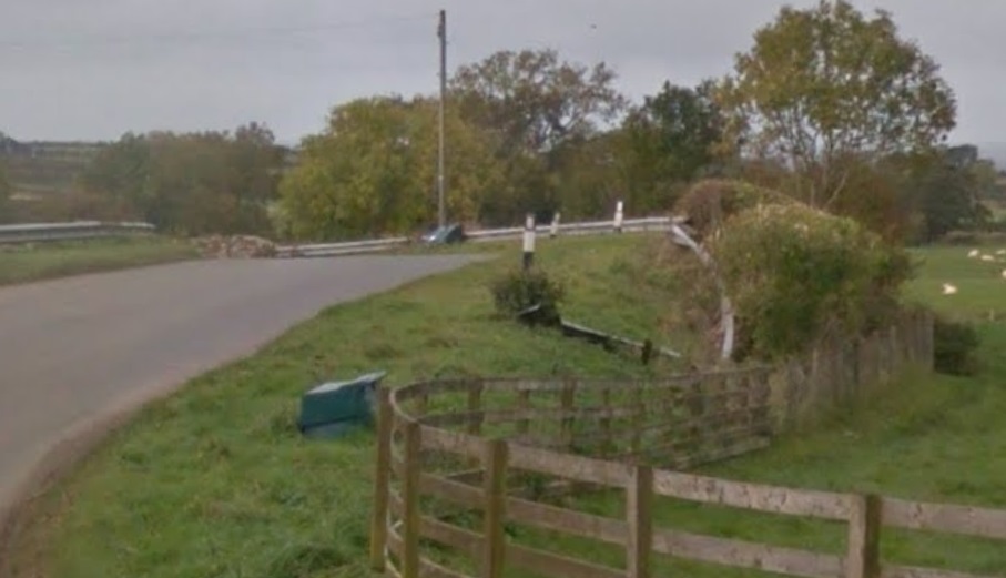
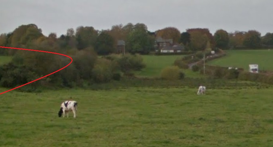
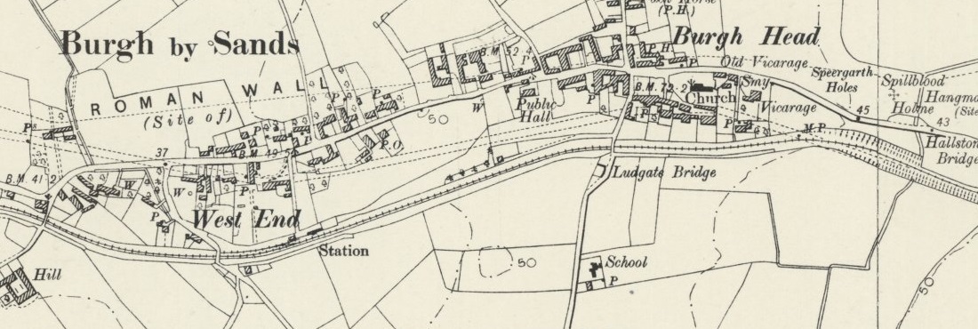
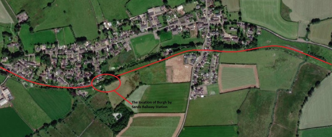
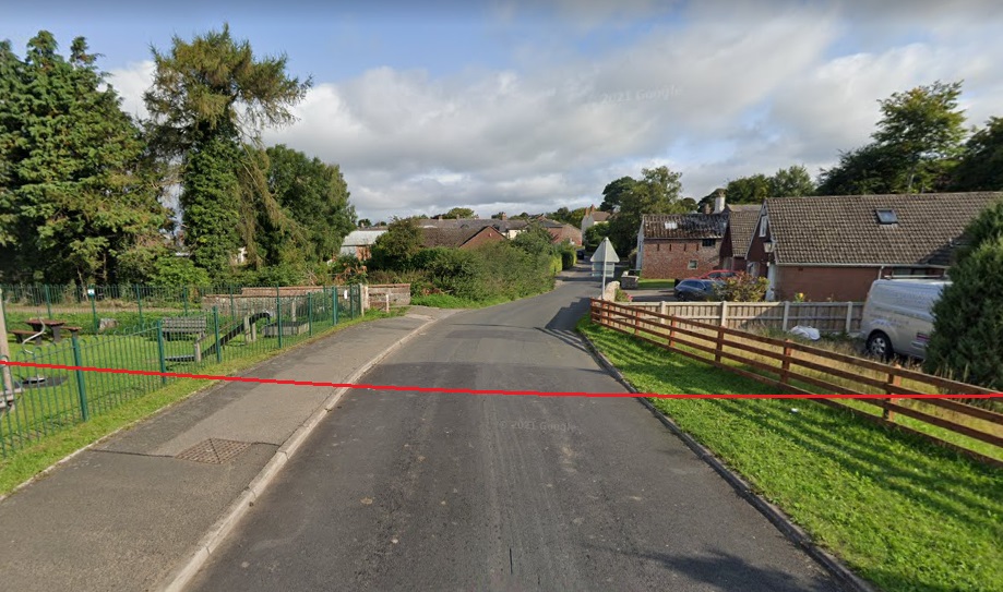
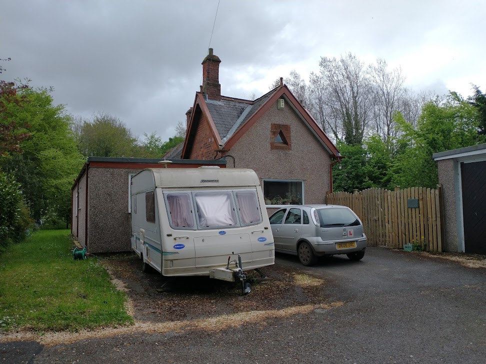
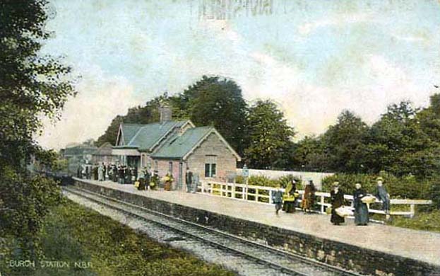
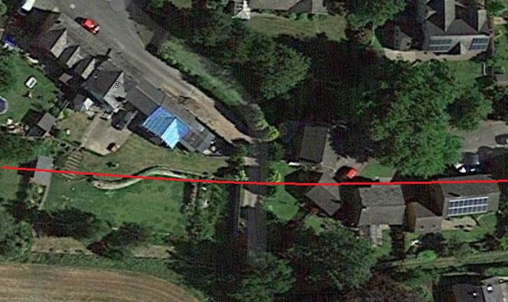
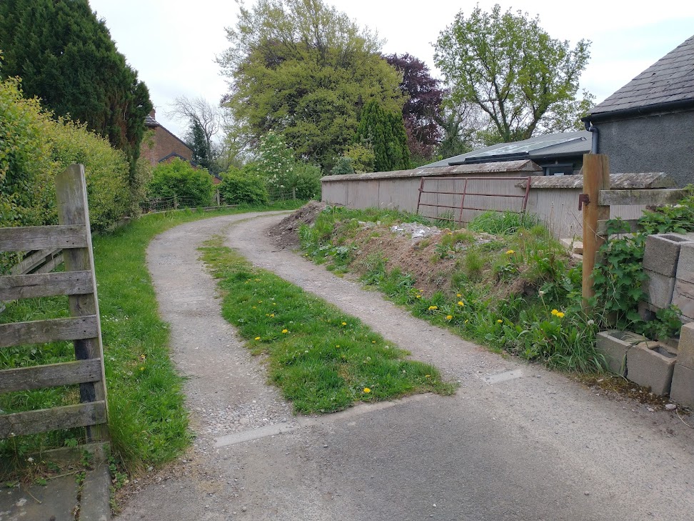
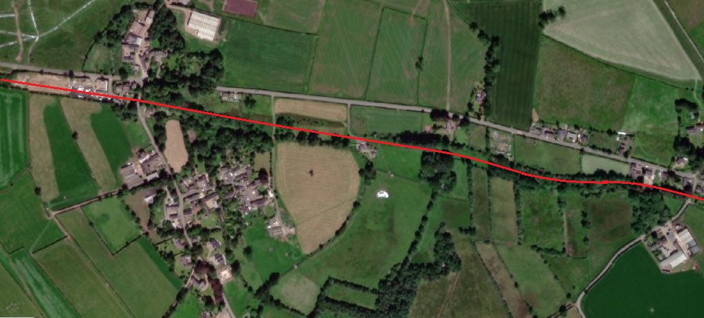
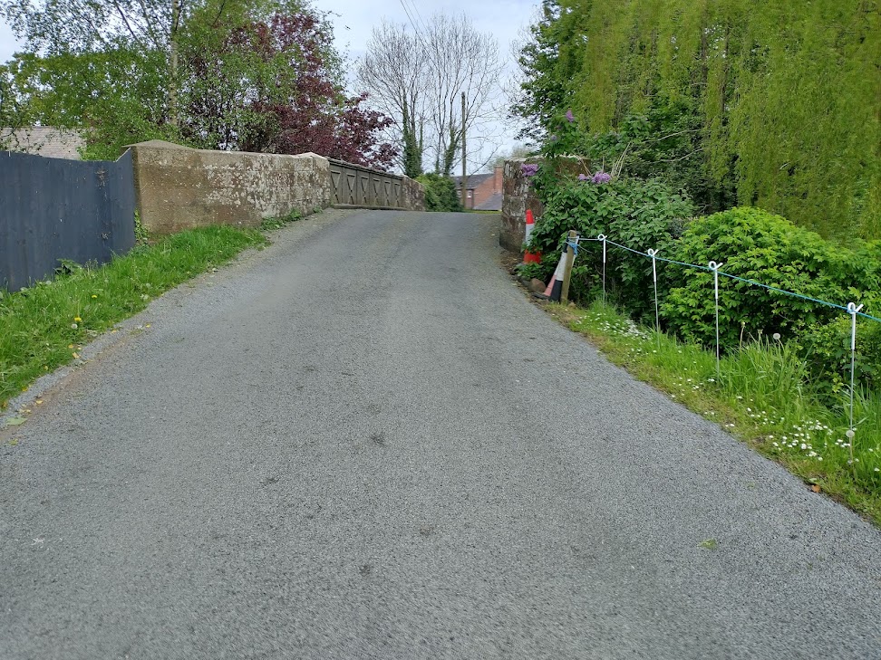
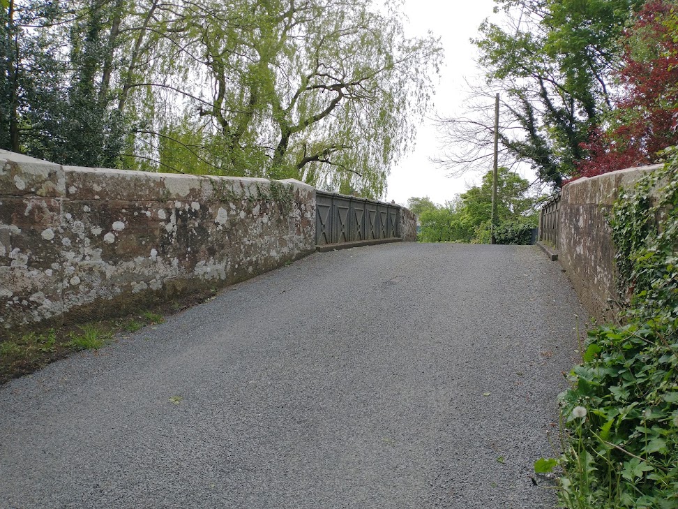
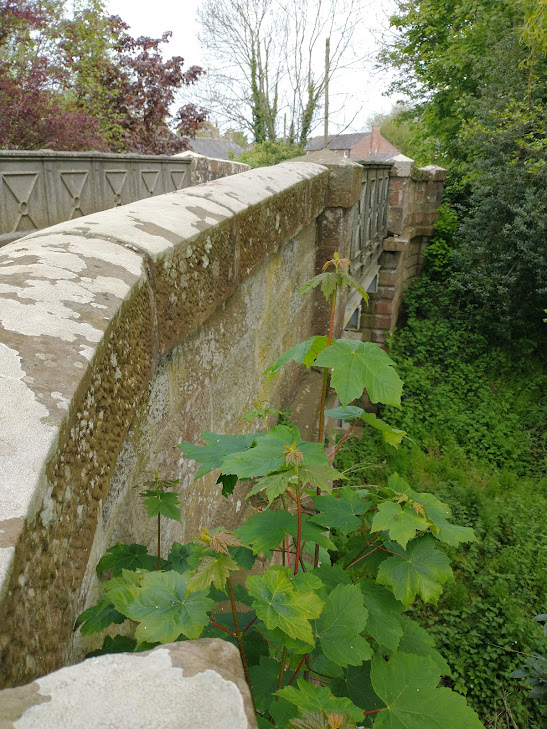
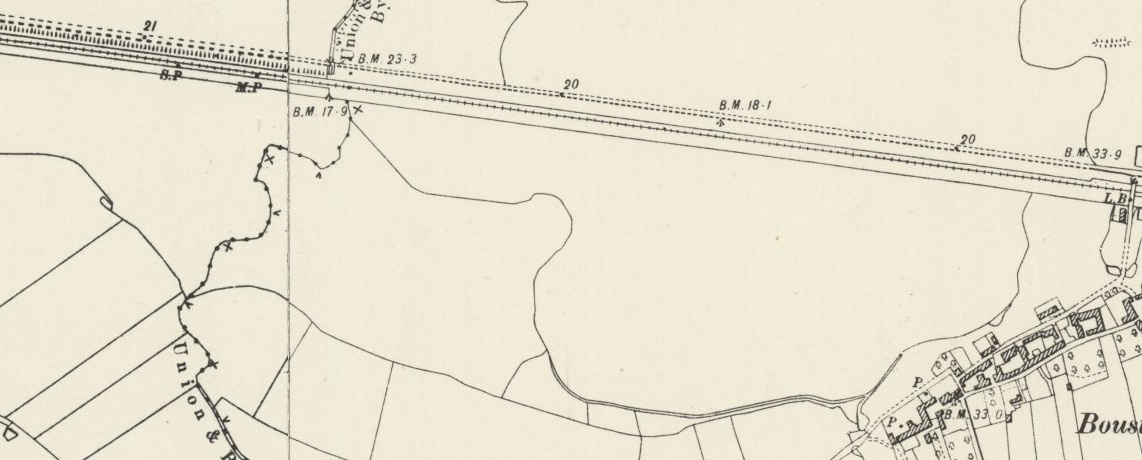
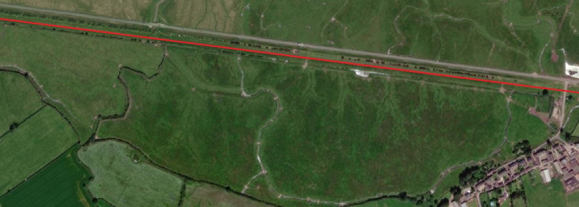
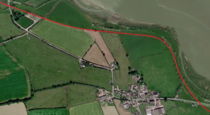
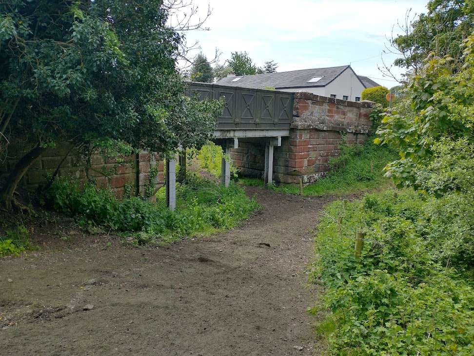
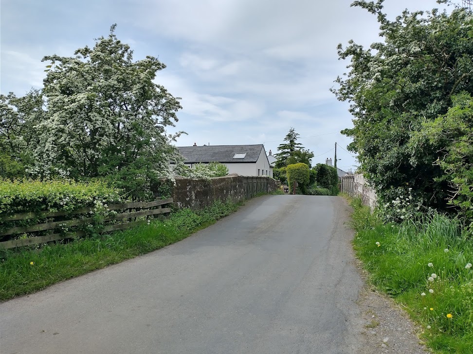
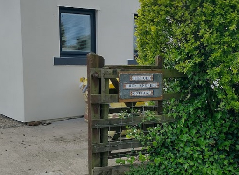
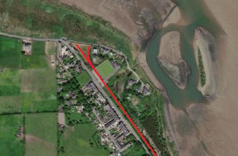
Northwest of Kirkandrews Station the railway and the older canal diverge for a short distance. This is one of a few locations along the line to Port Carlisle where the historic route of the canal was in evidence on the ground after the construction of the railway. North of Monkhill was further evidence of the old canal – a lock keeper’s cottage remained alongside the railway where it passed under the lane between Monkhill and Beaumont. [16]On the modern satellite imagery, the routes of the old railway and the earlier canal are still very much in evidence. [16]The site of the old lock-keeper’s cottage seen from the Monkhill to Beaumont road. The alignment of both the railway and the canal are represented by the red line. The lock house remains in private hands, extended and refurbished. [Google Streetview – August 2021]The generally East-West direction of the line continues towards Burgh Head, both canal and railway following the same alignment. At Wormanby the road to Port Carlisle crossed the line again by means of an overbridge – Hallstones Bridge. [17]On modern satellite imagery the majority of the old line’s route is clear from the alignment of field boundaries and the presence of trees. At Hallstone’s Bridge the road alignment remains as it was when the railway was active, the bridge has gone and the land either side of the road has been regraded. [17]The location of Hallstone’s Bridge at Wormanby. Remais of the retaining walls supporting the road embankment approaching the bridge can still be seen on the right of this picture. [Google Streetview, October 2016]The view West from just to the North of Hallstone’s Bridge with the line of the old railway indicated by the red line. The trees on the line sit on a low embankment which has not yet been regraded as of May 2022. [Google Streetview, October 2016]The railway ran along the South side of Burgh Head and Burgh by Sands, passing under Ludgate Bridge and then through Burgh by Sands Railway Station and then under another two bridges at the West end of Burgh by Sands. [18] The route of the line is again picked out in red on this modern satellite image. [18]The location of Ludgate Bridge with the approximate line of the old railway shown in red. [Google Streetview]Burgh by Sands Station Building in 2022. The picture is taken looking East from Station Road which is an un-adopted highway. The station platform and tracks were to the right of the building. [My photograph, 14th May 2022]Burgh by Sands Railway Station in 1903. The postcard view looks from the Southeast. [18]
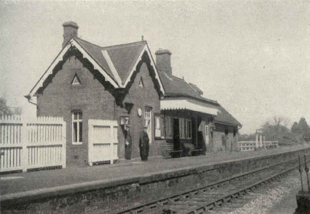
Burgh-by-Sands Railway Station looking West along the platform. [48]This monochrome image looks from the Southwest and shows the Station Buildings to good effect. [18]
Wikipedia tells us that Burgh-by-Sands station “sat close the village, reached by Station Road that branched off the mainstreet; it had a single platform, a shelter and a signal box. … A substantial station building was present, together with a station master’s house.” [19]
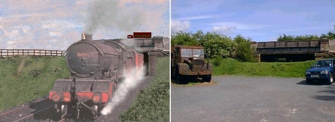
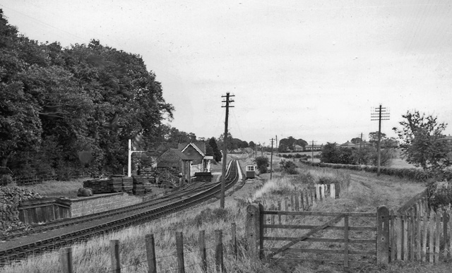
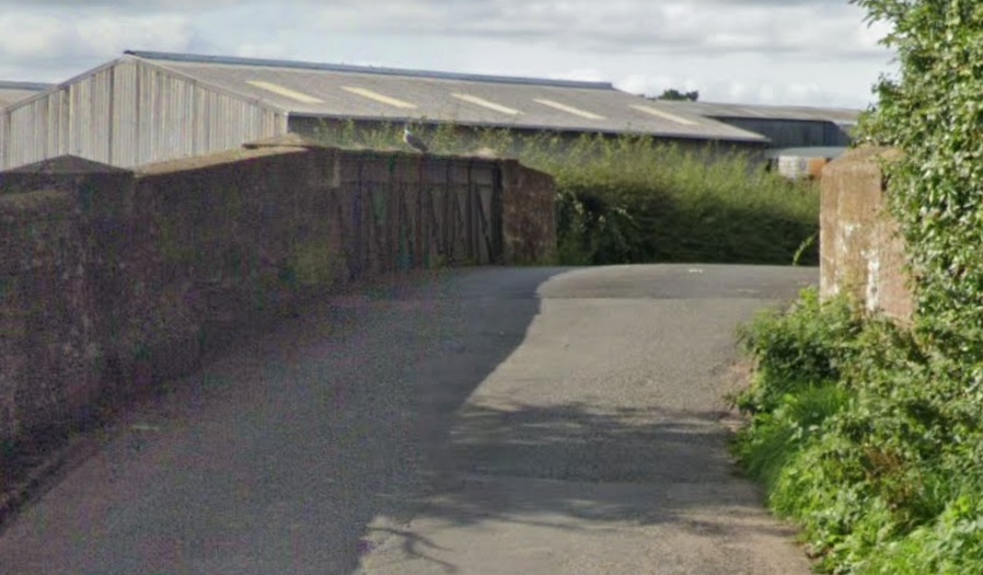
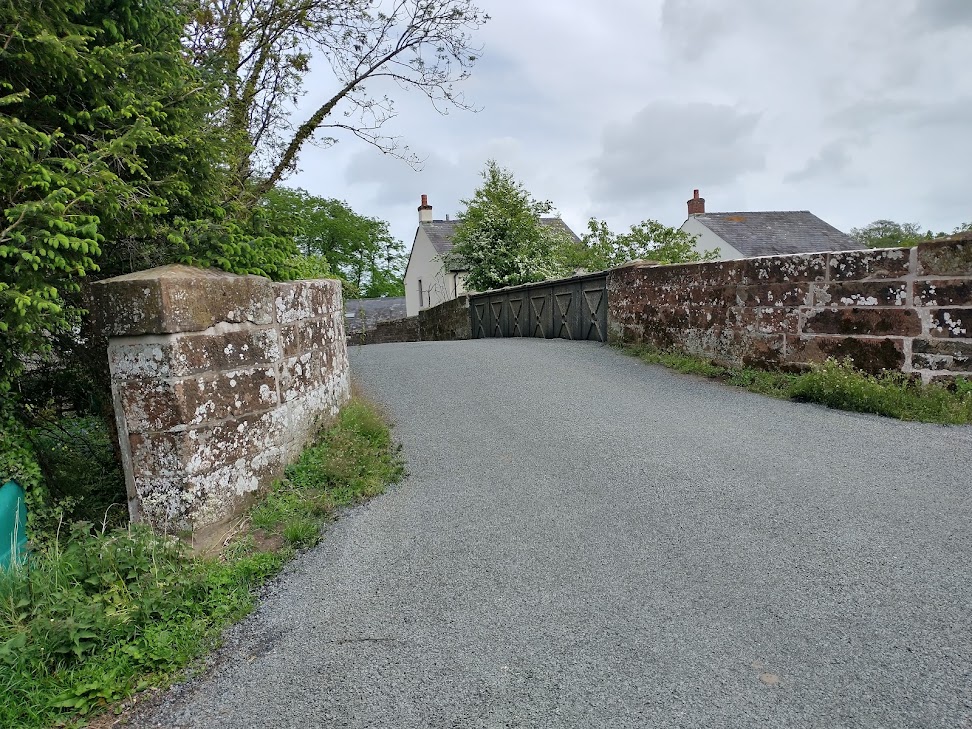
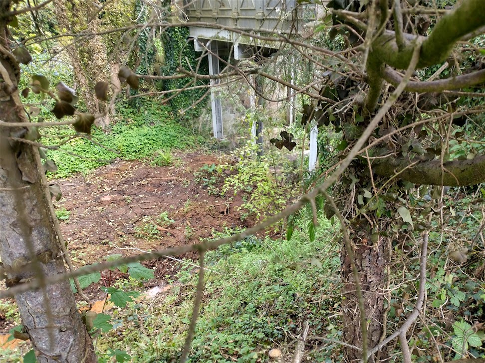
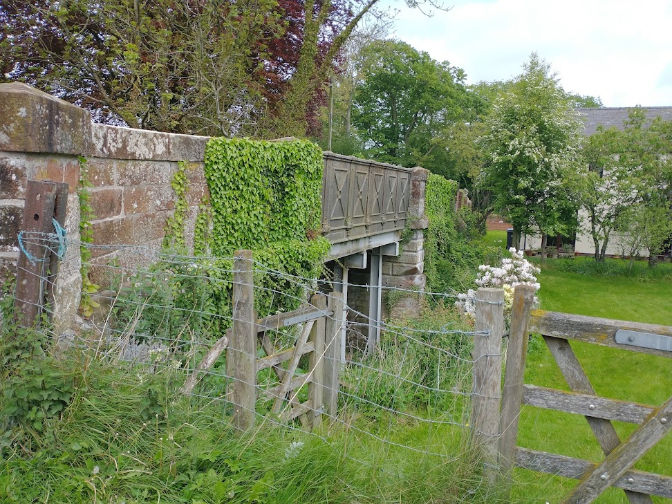
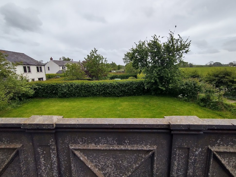
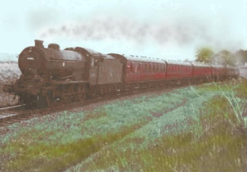
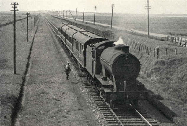
Burgh-by-Sands Station. Viewed from beyond the station looking eastward, towards Carlisle. The line and station closed completely on 7/9/64, Note that in this image a short siding is shown at the near end of the station platform, on the North side of the line, serving a loading bay. (c) Ben Brooksbank. Creative Commons Attribution Share-alike license 2.0 (CC BY-SA 2.0) [19]These houses on Southfield stand on the line of the old railway to the West of the station building which is behind the camera. [My photograph, 14th May 2022]The line of the railway where it passed under Lawrence Lane. Just to the north of the line Lawrence Lane now becomes a private driveway. [Google Maps]Lawrence Lane looking towards the old line which would have been just round the corner ahead. [My photograph]The final bridge in Burgh-by-Sands can be seen looking South along the Thurstonfield, Great Orton Road from the Main road through the village. [Google Streetview]This view is taken from the Southern end of the bridge. The bridge is typical of a number on the route with decorative metal parapets and stone abutments. [My photograph, 14th May 2022]This picture was taken through vegetation from an unmetalled lane on the Southwest side of the old railway line. The bridge has been strengthened by steel column supports at the third-points of the span and longitudinal steel joists. [My photograph, 14th May 2022]A similar view from the Southeast. [My photograph, 14th May 2022]Looking east over the decorative bridge parapet towards Burgh-by-Sands Station. [My photograph, 14th May 2022]Looking West along the old line from the same location. [My photograph, 14th May 2022]The train from Carlisle to Silloth leaves Burgh-by-Sands behind J39 64895 in June 1960. (c) Brian Irwin. [13]This next length of the line takes us from Burgh-by-Sands to Dykesfield and just out onto the Marsh. [20]The approximate line of the old railway is again marked on the modern satellite image with a red line. Over this length the canal and railway followed the same alignment. The bridge at Dykesfield still remains. [20]The bridge at Dykesfield (West Green Bridge) from the South. [My photograph, 14th May 2022]The bridge at Dykesfield (West Green Bridge) from the North. [My photograph, 14th May 2022]The bridge remains acting as a bridge by strengthened in the same way as the bridge at the West end of Burgh. [My photograph, 14th May 2022]
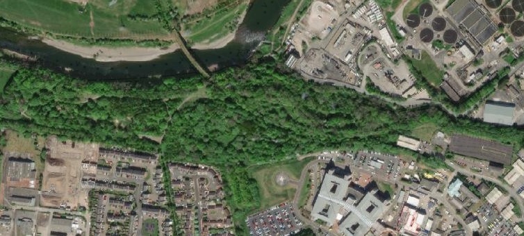
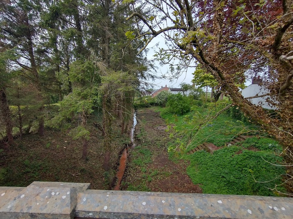
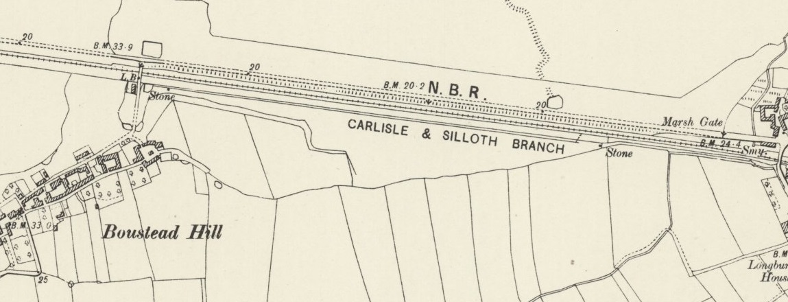
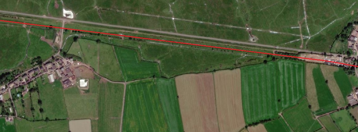
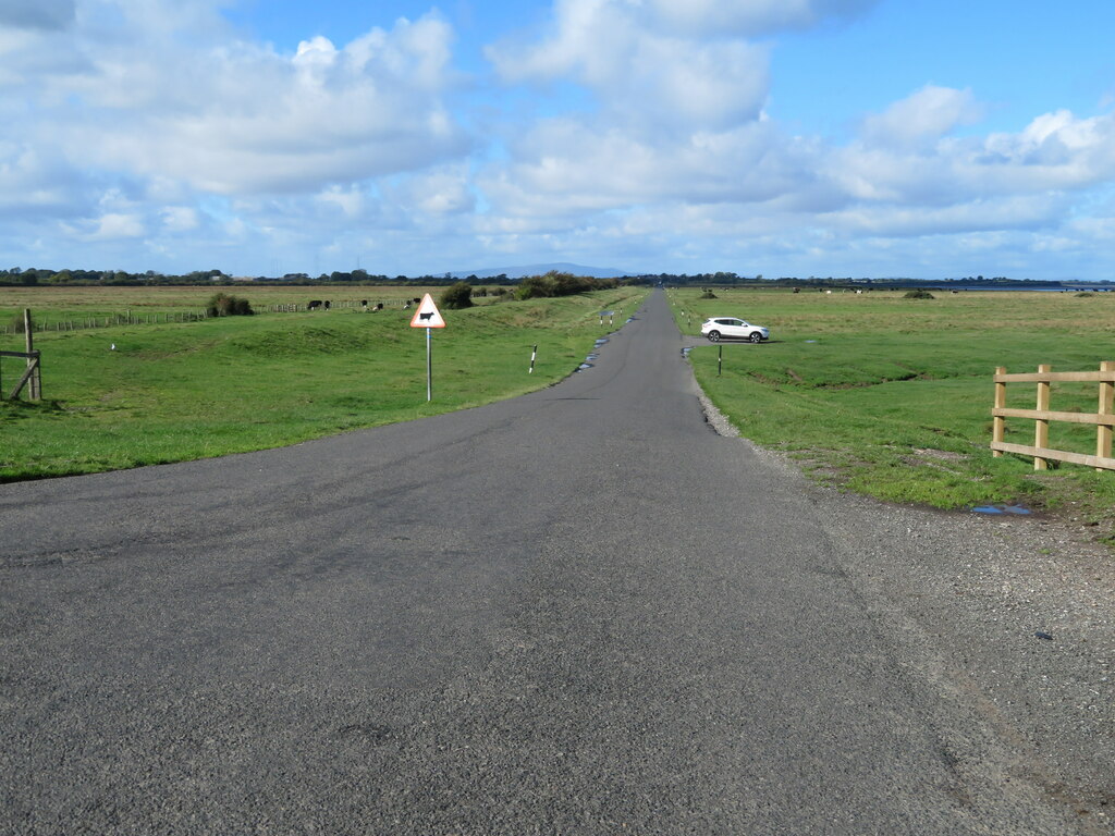
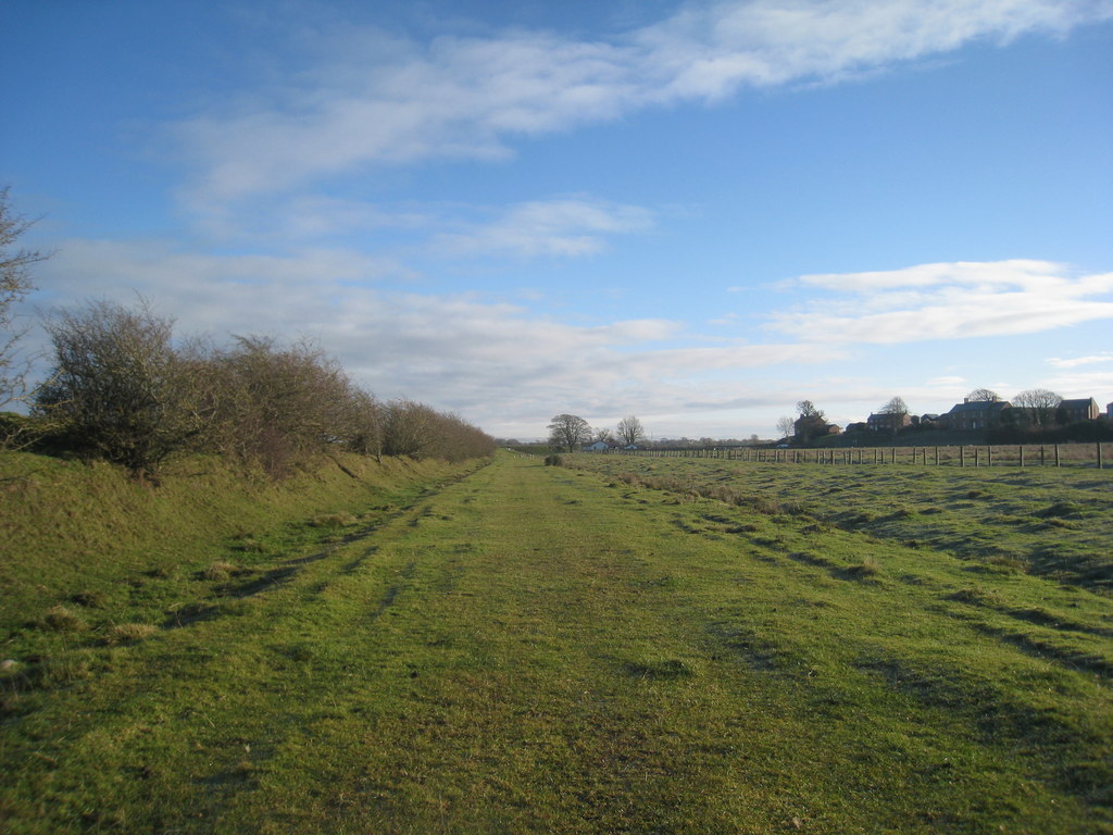
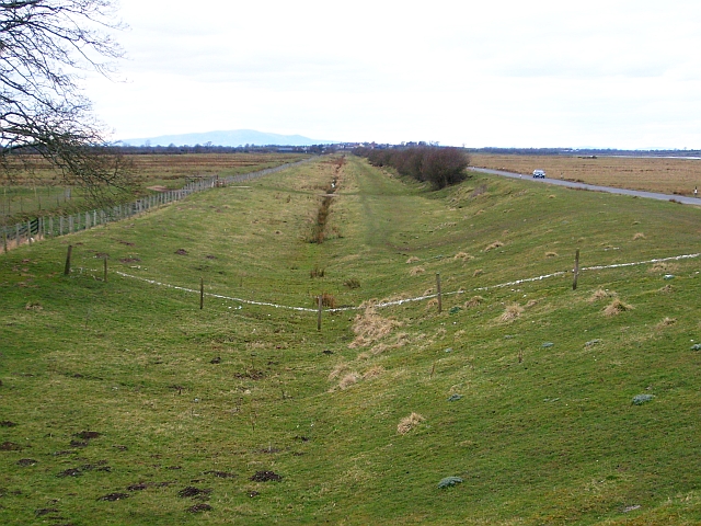
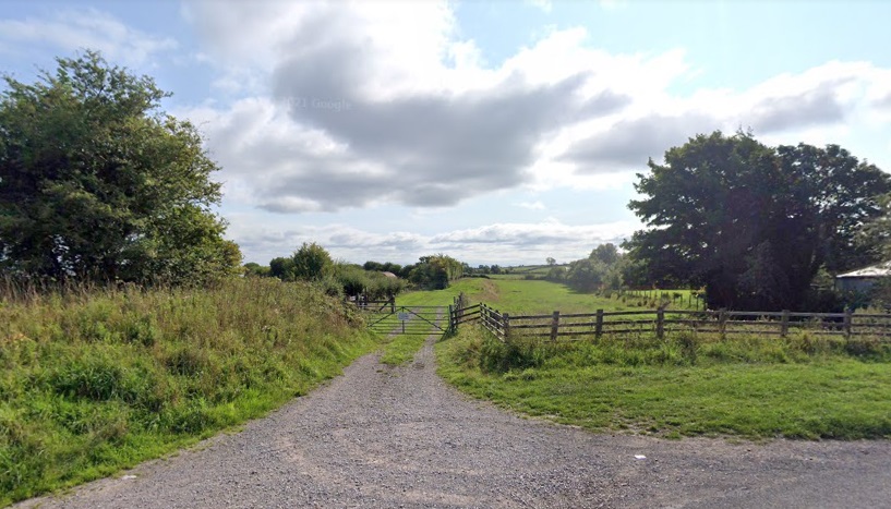
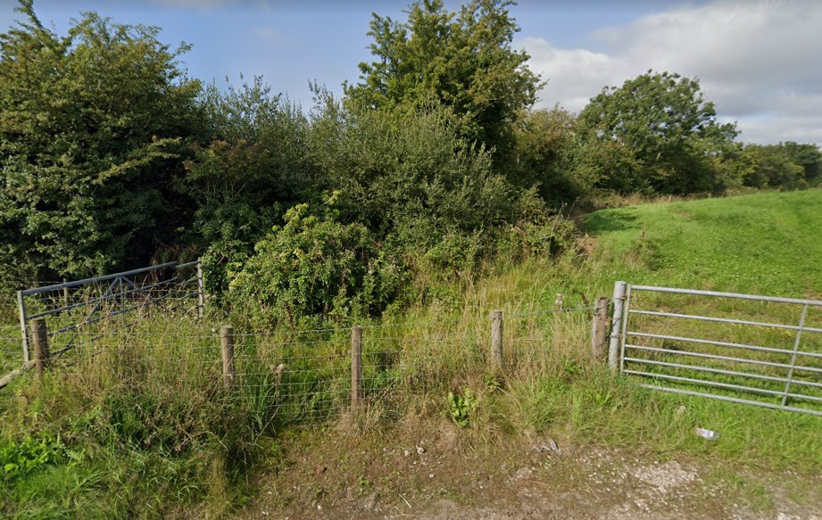
After passing through Dykesfield the railway broke out onto the marshes on the South side of the Solway Firth. A long straight stretch of line carried trains on to Drumburgh. The picture immediately below gives an impression of the lay of the land and shows that the railway was indeed built within the old canal.
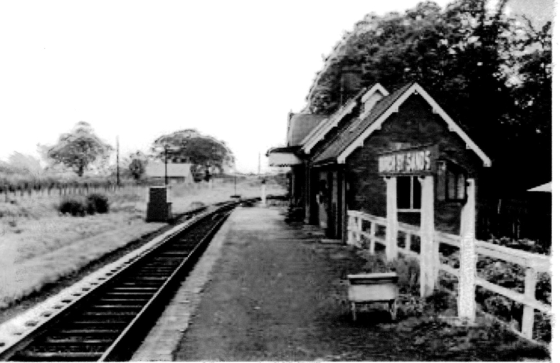
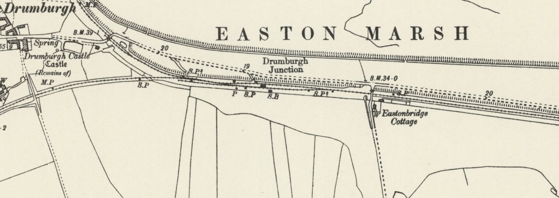
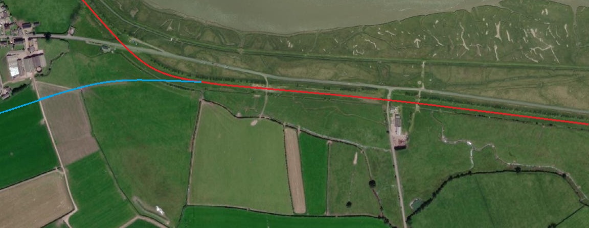
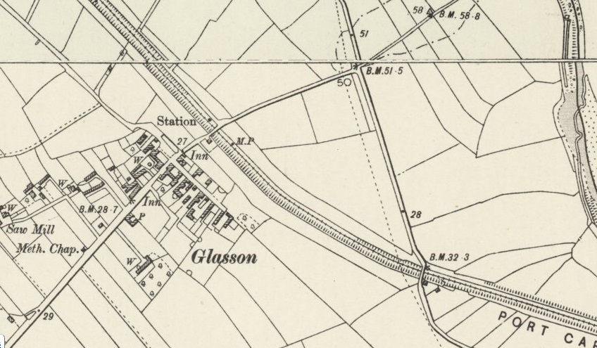
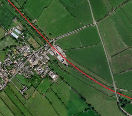
Wikipedia informs us that Drumburgh Railway Station “was the junction station for the Port Carlisle Railway branch and the Silloth branch, serving both as a junction and transfer station and also serving the small village of Drumburgh. The station closed on 4 July 1955; nothing now remains of the station. The line to Silloth closed on 7 September 1964 as part of the Beeching cuts. Port Carlisle was two and a half miles away by train and Glasson was one and a quarter miles away. The journey time was nine minutes, although Glasson was a request stop.” [27][28] The service to Port Carlisle was horse-powered.
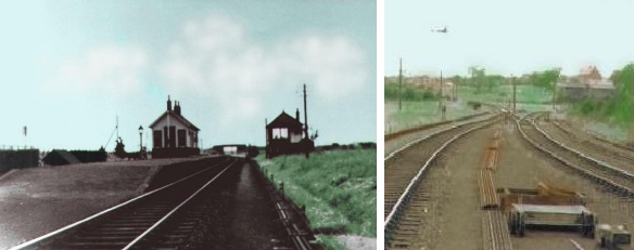
Griffiths and Hooper tell us that Port Carlisle had two locomotive sheds: “Firstly, a 32ft x 14ft one-road dead-end building, in brick with a tiled, pitched roof and having a central smoke vent, was erected to the east of Port Carlisle station. It stood at right angles to the station and could only be entered via 24ft turntable accessed by an approach spur; a water tank stood near the depot but it is not known what facilities were available for coal.” [45]
Once the steam-hauled service was replaced by the horde-drawn Dandy it seems as though “the engine shed remained in situ – assumedly it was utilised for stabling the horses and possibly also to shelter the small tramcars, but that needs confirmation.” [45]
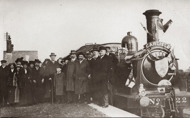
A steam hauled service was reinstated on “6th April 1914 when an inaugural passenger train was run from Port Carlisle to the city of Carlisle … behind a North British Railway Drummond ‘165’ class 0-6-0T, No. 22, that engine having been taken off its previous regular duty on the Langholm branch to run the passenger service from Port Carlisle. However, less than three years after the upgrade of Port Carlisle passenger services World War I brought an economy measure whereby the branch closed to all traffic from 1 January 1917 and until reopened from 1 February 1919.” [45]
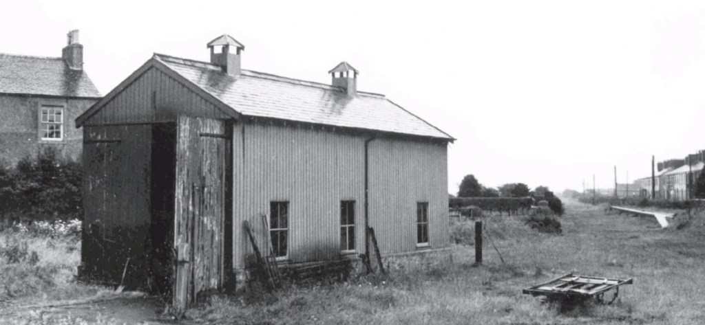
Griffiths and Hooper believe that the second engine shed we built not long after 1914, when a locomotive-hauled service was reinstated “or it may have appeared with the post-war reopening. It was a single road through building in wood on dwarf brick walls and with a pitched tiled roof, scaling 34ft x 16ft. It was positioned over the approach spur south of the turntable, which then, or earlier, had been reduced in size to 16ft diameter. Being of such modest dimensions it was realistically of little use anyway so it probably did not matter that engines had to pass through the shed to access the ‘table.” [45]
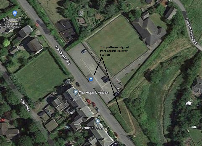
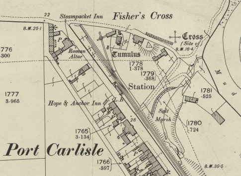
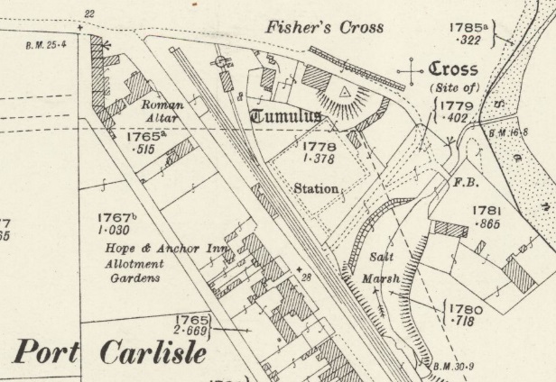
The 25″ OS Map series from the turn of the 20th century shows the first engine shed on a spur off to the side of the mainlines and accessed only via a small turntable. [46]The 1925 edition of the 25″ OS Maps show the replacement engine shed. [47]Port Carlisle’s second engine shed. This view looks back down the branch towards Carlisle and was taken after the closure of the line. The platform face of the station is visible on the right of this image. [45]
Charles Hadfield, Gordon Biddle; The Canals of North West England, Vol 2 (pp.241-496); David and Charles, Devon, 1970.
Sir Alec Skempton, et al.; A Biographical Dictionary of Civil Engineers in Great Britain and Ireland: Vol 1: 1500 to 1830; Thomas Telford, London, 2002.


